An investigation on plant species diversity in Colchic Province (Turkey)
An investigation on plant species diversity in Colchic Province (Turkey) An investigation on plant species diversity in Colchic Province (Turkey)
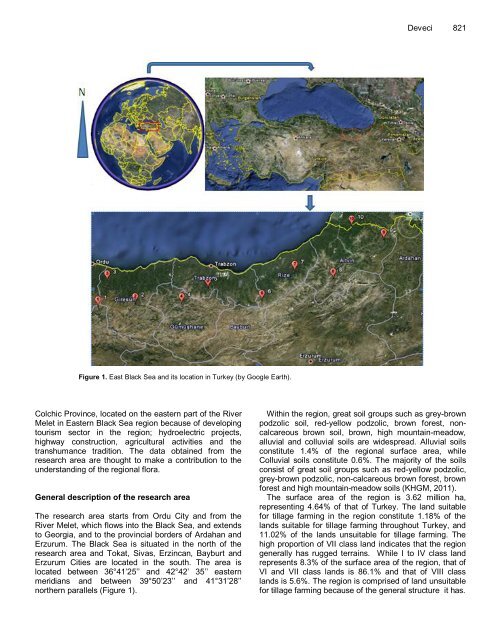
Figure 1. East Black Sea and its location in Turkey (by Google Earth). Colchic Province, located on the eastern part of the River Melet in Eastern Black Sea region because of developing tourism sector in the region; hydroelectric projects, highway construction, agricultural activities and the transhumance tradition. The data obtained from the research area are thought to make a contribution to the understanding of the regional flora. General description of the research area The research area starts from Ordu City and from the River Melet, which flows into the Black Sea, and extends to Georgia, and to the provincial borders of Ardahan and Erzurum. The Black Sea is situated in the north of the research area and Tokat, Sivas, Erzincan, Bayburt and Erzurum Cities are located in the south. The area is located between 36°41’25’’ and 42°42’ 35’’ eastern meridians and between 39°50’23’’ and 41°31’28’’ northern parallels (Figure 1). Deveci 821 Within the region, great soil groups such as grey-brown podzolic soil, red-yellow podzolic, brown forest, noncalcareous brown soil, brown, high mountain-meadow, alluvial and colluvial soils are widespread. Alluvial soils constitute 1.4% of the regional surface area, while Colluvial soils constitute 0.6%. The majority of the soils consist of great soil groups such as red-yellow podzolic, grey-brown podzolic, non-calcareous brown forest, brown forest and high mountain-meadow soils (KHGM, 2011). The surface area of the region is 3.62 million ha, representing 4.64% of that of Turkey. The land suitable for tillage farming in the region constitute 1.18% of the lands suitable for tillage farming throughout Turkey, and 11.02% of the lands unsuitable for tillage farming. The high proportion of VII class land indicates that the region generally has rugged terrains. While I to IV class land represents 8.3% of the surface area of the region, that of VI and VII class lands is 86.1% and that of VIII class lands is 5.6%. The region is comprised of land unsuitable for tillage farming because of the general structure it has.
822 Afr. J. Agric. Res. Figure 2. Climatic diagram of province in Eastern Black sea. Gumushane has the highest proportion of land suitable for tillage farming (37.78%), and Rize has the lowest (3.02%). Although the total area of the lands in the region suitable for tillage farming is 469,987 ha, tillage farming is practiced on an area of 946,737 ha, meaning that 50.4% of tillage farming within the region is practiced on unsuitable land (Askın and Tarakcıoglu, 2005).
- Page 1: African Journal of Agricultural Res
- Page 5 and 6: 824 Afr. J. Agric. Res. L., Scutell
- Page 7 and 8: 826 Afr. J. Agric. Res. Table 3. Nu
- Page 9 and 10: 828 Afr. J. Agric. Res. Table 5. Co
- Page 11 and 12: 830 Afr. J. Agric. Res. Table 5. Co
- Page 13 and 14: 832 Afr. J. Agric. Res. Table 5. Co
- Page 15 and 16: 834 Afr. J. Agric. Res. Table 5. Co
- Page 17 and 18: 836 Afr. J. Agric. Res. Table 5. Co
- Page 19 and 20: 838 Afr. J. Agric. Res. Table 5. Co
- Page 21 and 22: 840 Afr. J. Agric. Res. Table 5. Co
- Page 23 and 24: 842 Afr. J. Agric. Res. Table 5. Co
Figure 1. East Black Sea and its locati<strong>on</strong> <strong>in</strong> <strong>Turkey</strong> (by Google Earth).<br />
<strong>Colchic</strong> Prov<strong>in</strong>ce, located <strong>on</strong> the eastern part of the River<br />
Melet <strong>in</strong> Eastern Black Sea regi<strong>on</strong> because of develop<strong>in</strong>g<br />
tourism sector <strong>in</strong> the regi<strong>on</strong>; hydroelectric projects,<br />
highway c<strong>on</strong>structi<strong>on</strong>, agricultural activities and the<br />
transhumance traditi<strong>on</strong>. The data obta<strong>in</strong>ed from the<br />
research area are thought to make a c<strong>on</strong>tributi<strong>on</strong> to the<br />
understand<strong>in</strong>g of the regi<strong>on</strong>al flora.<br />
General descripti<strong>on</strong> of the research area<br />
The research area starts from Ordu City and from the<br />
River Melet, which flows <strong>in</strong>to the Black Sea, and extends<br />
to Georgia, and to the prov<strong>in</strong>cial borders of Ardahan and<br />
Erzurum. The Black Sea is situated <strong>in</strong> the north of the<br />
research area and Tokat, Sivas, Erz<strong>in</strong>can, Bayburt and<br />
Erzurum Cities are located <strong>in</strong> the south. The area is<br />
located between 36°41’25’’ and 42°42’ 35’’ eastern<br />
meridians and between 39°50’23’’ and 41°31’28’’<br />
northern parallels (Figure 1).<br />
Deveci 821<br />
With<strong>in</strong> the regi<strong>on</strong>, great soil groups such as grey-brown<br />
podzolic soil, red-yellow podzolic, brown forest, n<strong>on</strong>calcareous<br />
brown soil, brown, high mounta<strong>in</strong>-meadow,<br />
alluvial and colluvial soils are widespread. Alluvial soils<br />
c<strong>on</strong>stitute 1.4% of the regi<strong>on</strong>al surface area, while<br />
Colluvial soils c<strong>on</strong>stitute 0.6%. The majority of the soils<br />
c<strong>on</strong>sist of great soil groups such as red-yellow podzolic,<br />
grey-brown podzolic, n<strong>on</strong>-calcareous brown forest, brown<br />
forest and high mounta<strong>in</strong>-meadow soils (KHGM, 2011).<br />
The surface area of the regi<strong>on</strong> is 3.62 milli<strong>on</strong> ha,<br />
represent<strong>in</strong>g 4.64% of that of <strong>Turkey</strong>. The land suitable<br />
for tillage farm<strong>in</strong>g <strong>in</strong> the regi<strong>on</strong> c<strong>on</strong>stitute 1.18% of the<br />
lands suitable for tillage farm<strong>in</strong>g throughout <strong>Turkey</strong>, and<br />
11.02% of the lands unsuitable for tillage farm<strong>in</strong>g. The<br />
high proporti<strong>on</strong> of VII class land <strong>in</strong>dicates that the regi<strong>on</strong><br />
generally has rugged terra<strong>in</strong>s. While I to IV class land<br />
represents 8.3% of the surface area of the regi<strong>on</strong>, that of<br />
VI and VII class lands is 86.1% and that of VIII class<br />
lands is 5.6%. The regi<strong>on</strong> is comprised of land unsuitable<br />
for tillage farm<strong>in</strong>g because of the general structure it has.


