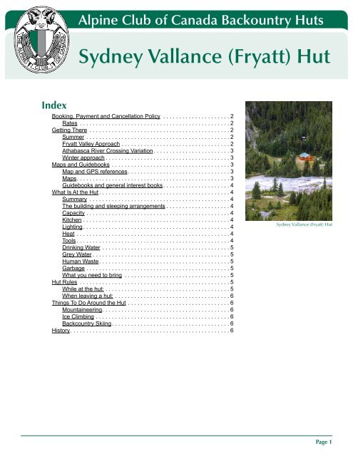
Sydney Vallance (Fryatt) Hut - The Alpine Club of Canada
Sydney Vallance (Fryatt) Hut - The Alpine Club of Canada
Sydney Vallance (Fryatt) Hut - The Alpine Club of Canada

Create successful ePaper yourself
Turn your PDF publications into a flip-book with our unique Google optimized e-Paper software.
Index<br />
<strong>Alpine</strong> <strong>Club</strong> <strong>of</strong> <strong>Canada</strong> Backountry <strong>Hut</strong>s<br />
<strong>Sydney</strong> <strong>Vallance</strong> (<strong>Fryatt</strong>) <strong>Hut</strong><br />
Booking, Payment and Cancellation Policy . . . . . . . . . . . . . . . . . . . . .2<br />
Rates . . . . . . . . . . . . . . . . . . . . . . . . . . . . . . . . . . . . . . . . . . . . . . .2<br />
Getting <strong>The</strong>re . . . . . . . . . . . . . . . . . . . . . . . . . . . . . . . . . . . . . . . . . . . .2<br />
Summer . . . . . . . . . . . . . . . . . . . . . . . . . . . . . . . . . . . . . . . . . . . . .2<br />
<strong>Fryatt</strong> Valley Approach . . . . . . . . . . . . . . . . . . . . . . . . . . . . . . . . . .2<br />
Athabasca River Crossing Variation . . . . . . . . . . . . . . . . . . . . . . . .3<br />
Winter approach . . . . . . . . . . . . . . . . . . . . . . . . . . . . . . . . . . . . . . .3<br />
Maps and Guidebooks . . . . . . . . . . . . . . . . . . . . . . . . . . . . . . . . . . . . .3<br />
Map and GPS references . . . . . . . . . . . . . . . . . . . . . . . . . . . . . . . .3<br />
Maps . . . . . . . . . . . . . . . . . . . . . . . . . . . . . . . . . . . . . . . . . . . . . . . .3<br />
Guidebooks and general interest books . . . . . . . . . . . . . . . . . . . . .4<br />
What Is At the <strong>Hut</strong> . . . . . . . . . . . . . . . . . . . . . . . . . . . . . . . . . . . . . . . . .4<br />
Summary . . . . . . . . . . . . . . . . . . . . . . . . . . . . . . . . . . . . . . . . . . . .4<br />
<strong>The</strong> building and sleeping arrangements . . . . . . . . . . . . . . . . . . . .4<br />
Capacity . . . . . . . . . . . . . . . . . . . . . . . . . . . . . . . . . . . . . . . . . . . . .4<br />
Kitchen . . . . . . . . . . . . . . . . . . . . . . . . . . . . . . . . . . . . . . . . . . . . . .4<br />
Lighting . . . . . . . . . . . . . . . . . . . . . . . . . . . . . . . . . . . . . . . . . . . . . .4<br />
Heat . . . . . . . . . . . . . . . . . . . . . . . . . . . . . . . . . . . . . . . . . . . . . . . .4<br />
Tools . . . . . . . . . . . . . . . . . . . . . . . . . . . . . . . . . . . . . . . . . . . . . . . .4<br />
Drinking Water . . . . . . . . . . . . . . . . . . . . . . . . . . . . . . . . . . . . . . . .5<br />
Grey Water . . . . . . . . . . . . . . . . . . . . . . . . . . . . . . . . . . . . . . . . . . .5<br />
Human Waste . . . . . . . . . . . . . . . . . . . . . . . . . . . . . . . . . . . . . . . . .5<br />
Garbage . . . . . . . . . . . . . . . . . . . . . . . . . . . . . . . . . . . . . . . . . . . . .5<br />
What you need to bring . . . . . . . . . . . . . . . . . . . . . . . . . . . . . . . . .5<br />
<strong>Hut</strong> Rules . . . . . . . . . . . . . . . . . . . . . . . . . . . . . . . . . . . . . . . . . . . . . . .5<br />
While at the hut: . . . . . . . . . . . . . . . . . . . . . . . . . . . . . . . . . . . . . . .5<br />
When leaving a hut: . . . . . . . . . . . . . . . . . . . . . . . . . . . . . . . . . . . .6<br />
Things To Do Around the <strong>Hut</strong> . . . . . . . . . . . . . . . . . . . . . . . . . . . . . . . .6<br />
Mountaineering . . . . . . . . . . . . . . . . . . . . . . . . . . . . . . . . . . . . . . . .6<br />
Ice Climbing . . . . . . . . . . . . . . . . . . . . . . . . . . . . . . . . . . . . . . . . . .6<br />
Backcountry Skiing . . . . . . . . . . . . . . . . . . . . . . . . . . . . . . . . . . . . .6<br />
History . . . . . . . . . . . . . . . . . . . . . . . . . . . . . . . . . . . . . . . . . . . . . . . . . .6<br />
<strong>Sydney</strong> <strong>Vallance</strong> (<strong>Fryatt</strong>) <strong>Hut</strong><br />
Page 1
<strong>Sydney</strong> <strong>Vallance</strong> <strong>Alpine</strong> <strong>Club</strong> (<strong>Fryatt</strong>) <strong>of</strong> <strong>Hut</strong> <strong>Canada</strong> Backountry <strong>Hut</strong>s<br />
Back to Index<br />
Name <strong>of</strong> <strong>Hut</strong><br />
View the Booking, Payment and Cancellation Policies at www .alpineclub<strong>of</strong>canada .ca/facility/reservations .html<br />
Booking, Payment and Cancellation Policy<br />
Rates<br />
Visit www .alpineclub<strong>of</strong>canada .ca/facility/rates .html for current hut and wilderness pass prices .<br />
Getting <strong>The</strong>re<br />
<strong>The</strong> <strong>Fryatt</strong> <strong>Hut</strong> sits in a small meadow by <strong>Fryatt</strong> Creek at the top <strong>of</strong> a headwall in the upper <strong>Fryatt</strong> Valley, Jasper<br />
National Park . <strong>The</strong> following information should be used in conjunction with the correct topographic map (maps<br />
are listed below) .<br />
Summer<br />
Trailhead location: 3 .2 km <strong>of</strong>f Hwy 93 A, 32 km south <strong>of</strong> Jasper Townsite<br />
Hiking distance: 23 km<br />
Elevation gain: 765 metres (2,510 feet)<br />
Approximate time: 5-8 Hours<br />
<strong>The</strong> only access route to the hut is up the <strong>Fryatt</strong> Valley. On the first part <strong>of</strong> the approach, however, there are two<br />
options. From the trailhead there is 11.5km <strong>of</strong> trail, which follows an old fire road parallel to the Athabasca River<br />
and the 93 Highway . It is possible to either hike this portion, or (recommended) ride it on a mountain bike . <strong>The</strong><br />
mountain biking will cut a couple <strong>of</strong> hours <strong>of</strong>f the trip in each direction, and makes for a fun ride coming back down<br />
from the campground . A third option is to cross the Athabasca where the trail and the highway are closest, thereby<br />
cutting about 7km <strong>of</strong>f the trek .<br />
<strong>Fryatt</strong> Valley Approach<br />
Trailhead: 32 km south <strong>of</strong> the Jasper Townsite is Athabasca Falls and the junction for highway 93A . Drive the 93A<br />
for 1 km to a gravel road on the left signed Geraldine Lakes Road . Take this gravel road for 2 .2km to a small pull-<strong>of</strong>f<br />
on the left signed as the trailhead for the <strong>Fryatt</strong> Creek Valley. Hike or bike the fire road trail for 11.5km to the Lower<br />
<strong>Fryatt</strong> Campground . This is as far as you are permitted to ride a mountain bike, and it is also as far as you would<br />
want to take one, as the trail from here begins to gain elevation more rapidly. <strong>The</strong>re are sufficient trees and foodhanging<br />
poles to lock your bike to, providing you have a chain, a small kryptonite lock won’t fit around the trees.<br />
Approach: From the campground, cross the bridge onto the east side <strong>of</strong> the creek and continue uphill for about<br />
four or five km to a point where the trail crosses back to the west side <strong>of</strong> the creek on another bridge. Back on<br />
the west side <strong>of</strong> the creek, the trail becomes less distinct and harder to follow on moraine and creek beds, but it<br />
well marked with cairns . <strong>The</strong> trail passes the Brussels Campground and <strong>Fryatt</strong> Lake via the west shore before<br />
reaching the Headwall Campground and the final grunt to the hut. <strong>The</strong> headwall itself is no fun. <strong>The</strong> route now<br />
rises very abruptly, and climbs pretty much straight up a trail ranging from very good to very loose for 200 vertical<br />
metres (650 feet) . <strong>The</strong> good news is that as soon as you are done the grunt up the headwall, you can take <strong>of</strong>f<br />
your pack and make a cup <strong>of</strong> tea: you have arrived. <strong>The</strong> hut is located in the first flat spot in the meadow only<br />
100m from the top <strong>of</strong> the slope .<br />
Time, Distance & Elevation: From the trailhead on the Geraldine Lakes Road to the hut, you will gain 2,510 feet<br />
(765 metres) . Time for this approach will depend on your choice <strong>of</strong> transportation . From the trailhead to the Lower<br />
<strong>Fryatt</strong> Campground on mountain bike will take between one and one and a half hours . Hiking this section will be<br />
more in the neighborhood <strong>of</strong> two and a half to three hours . Hiking from the campground to the hut will be in the<br />
three and a half to five hour range. Total time could be as fast as four and a half hours if you take a bike, or five<br />
and a half hours if you hike the whole trail . Parties not trying to break records should probably expect to take most<br />
<strong>of</strong> a day, as the total mileage is approximately 23 km to the hut .<br />
Page 2
<strong>Sydney</strong> <strong>Vallance</strong> <strong>Alpine</strong> <strong>Club</strong> (<strong>Fryatt</strong>) <strong>of</strong> <strong>Hut</strong> <strong>Canada</strong> Backountry <strong>Hut</strong>s<br />
Name <strong>of</strong> <strong>Hut</strong><br />
Athabasca River Crossing Variation<br />
Back to Index<br />
Trailhead: <strong>The</strong> <strong>Fryatt</strong> Valley hiking trail from the Geraldine Lakes Road parallels the highway but on the opposite<br />
side <strong>of</strong> the Athabasca for 8 or 9 km before heading north . At about the 7 km point, the road and the trail are within<br />
shouting distance across the river . If you have better access to a canoe than a mountain bike, a quick voyage<br />
across the Athabasca will save you the annoyance <strong>of</strong> seeing traffic beside you after an hour or two <strong>of</strong> travel.<br />
Approach: <strong>The</strong> best spot to put your boat into the water is at a turnout on Highway 93, 7 .5km east <strong>of</strong> the<br />
Athabasca Falls junction . Head as straight across the river as the current allows, stash your boat in the bushes for<br />
the return trip and hike southwest until you come across the trail . From here follow the description above . It may<br />
occur to you here that it may be possible, say, early in the morning when the water is not so high, to wade the<br />
Athabasca thereby cutting <strong>of</strong>f 7 or 8 km or hiking without using a canoe . This is not a wise idea, and if you gave<br />
it a serious try you would probably end up sitting naked in the trees on the far side <strong>of</strong> the river after a desperate<br />
swim to escape the deep icy waters while your pack floats <strong>of</strong>f down the river. This would likely ruin your whole<br />
day .<br />
Time, Distance & Elevation: This variation saves some time, but it doesn’t make a bit <strong>of</strong> difference as far as<br />
elevation gain . You still have to gain the same 2,510 feet elevation . From the point where you land across the river<br />
to the hut is approximately 13km and will take in the neighborhood <strong>of</strong> five to six hours.<br />
Winter approach<br />
<strong>The</strong> approach is similar to the one in the summer, but you can usually cut time <strong>of</strong>f by crossing the Athabasca<br />
River on skis if it’s frozen . Use your judgment, with the knowledge that a dip in the water under the ice would have<br />
totally different consequences than in the summer . Refer to Chic Scott’s guidebook Ski Trails in the Canadian<br />
Rockies for a more detailed route description .<br />
Maps and Guidebooks<br />
All <strong>of</strong> the following books and maps can be purchased through the ACC <strong>of</strong>fice or online through the ACC online<br />
store at: www .alpineclub<strong>of</strong>canada .ca/store/index .html<br />
Map and GPS references<br />
Map reference: 83C/12 (Athabasca Falls)<br />
Grid reference: 403174<br />
GPS coordinates: 52°30’ 18”-117°52’ 48” 11U 440270 5817572<br />
<strong>Hut</strong> elevation: 6,495 feet (1,980 metres)<br />
Maps<br />
● Gem Trek Publishing 1:100 000 topographic map entitled “Jasper and Maligne Lake” . This excellent map shows<br />
the trails and highlights <strong>of</strong> the area .<br />
● Canadian Government issued standard 1:50,000 topographic map 83C/12 (Athabasca Falls) . This map is a metric<br />
map, with 20-metre contour intervals below 2000 metres and 40-metre contour intervals above 2000 metres<br />
elevation . Note that the cabin marked on the map at the south end <strong>of</strong> <strong>Fryatt</strong> Lake (grid reference 402188) is not<br />
the <strong>Fryatt</strong> <strong>Hut</strong> .<br />
● Canadian Government issued standard 1:50,000 topographic map 83C/5 may be useful for those hiking further up<br />
the valley from the hut .<br />
Page 3
<strong>Sydney</strong> <strong>Vallance</strong> <strong>Alpine</strong> <strong>Club</strong> (<strong>Fryatt</strong>) <strong>of</strong> <strong>Hut</strong> <strong>Canada</strong> Backountry <strong>Hut</strong>s<br />
Name <strong>of</strong> <strong>Hut</strong><br />
Guidebooks and general interest books<br />
● Backcountry <strong>Hut</strong>s and Lodges <strong>of</strong> the Rockies and Columbias, by Jim Scott<br />
● Canadian Rockies Trail Guide, by Patton and Robinson<br />
● Don’t Waste Your Time in the Canadian Rockies, by Kathy & Craig Copeland<br />
● Ski Trails in the Canadian Rockies, by Chic Scott<br />
● Selected <strong>Alpine</strong> Climbs in the Canadian Rockies, by Sean Dougherty<br />
● Handbook <strong>of</strong> the Canadian Rockies, by Ben Gadd<br />
● Waterfall Ice Climbs in the Canadian Rockies, by Joe Josephson<br />
What Is At the <strong>Hut</strong><br />
Summary<br />
Back to Index<br />
Heating: Wood stove<br />
Lighting: Propane<br />
Cooking: Propane stoves, cookware, dishes & utensils provided<br />
Sleeping: Dormitory style on thick foam mattresses<br />
Capacity: 12 in the summer and in the winter<br />
Drinking water: <strong>Fryatt</strong> Creek 50m east <strong>of</strong> hut or snowmelt (boil or filter both)<br />
Human Waste: Outhouse<br />
Dishwater: Ground sump<br />
Garbage: Pack it out!<br />
<strong>The</strong> building and sleeping arrangements<br />
<strong>The</strong> <strong>Fryatt</strong> hut has been renovated several times . <strong>The</strong>re are two bunk rooms, and a separate kitchen/living room<br />
area with a large table, two benches and a couple <strong>of</strong> kitchen counters .<br />
Capacity<br />
<strong>The</strong> hut sleeps 12 people in the summer and in the winter months, comfortably in two bunk rooms .<br />
Kitchen<br />
<strong>The</strong> kitchen is well supplied with dishes, cutlery, utensils, pots and pans . <strong>The</strong>re are several two-burner propane<br />
stoves for cooking .<br />
Lighting<br />
<strong>The</strong> hut is lit by several propane lights . Propane is supplied by the ACC via a large outdoor tank .<br />
Heat<br />
<strong>The</strong> hut has a wood-burning stove. Please replace all firewood you use in the hut with cut and split wood from the<br />
pile .<br />
Tools<br />
<strong>The</strong> hut has a good supply <strong>of</strong> tools including water buckets, axes, saws, shovels, etc .<br />
Page 4
<strong>Sydney</strong> <strong>Vallance</strong> <strong>Alpine</strong> <strong>Club</strong> (<strong>Fryatt</strong>) <strong>of</strong> <strong>Hut</strong> <strong>Canada</strong> Backountry <strong>Hut</strong>s<br />
Name <strong>of</strong> <strong>Hut</strong><br />
Drinking Water<br />
Back to Index<br />
<strong>The</strong> <strong>Fryatt</strong> Creek, 50 metres to the east <strong>of</strong> the hut, supplies the water; in the winter it may be necessary to melt<br />
snow .<br />
Grey Water<br />
<strong>The</strong>re is a ground sump for grey water disposal 12m northwest <strong>of</strong> the front door, on the trail to the outhouse . In<br />
the winter it may be necessary to excavate the sump .<br />
Human Waste<br />
<strong>The</strong> outhouse is located 30 metres north <strong>of</strong> the hut . Do not dispose <strong>of</strong> any unnecessary waste into the outhouse<br />
barrels .<br />
Garbage<br />
Burn all paper garbage and food scraps, and pack<br />
out all other garbage and unused food . Don’t leave<br />
anything behind!<br />
What you need to bring<br />
● combination lock number for the hut door (call the ACC<br />
<strong>of</strong>fice to confirm before you go to the hut)<br />
● sleeping bag<br />
● food for the duration <strong>of</strong> your stay<br />
● toilet paper<br />
● newspaper for lighting the fire<br />
● matches<br />
● first aid kit<br />
● 3 x AA batteries for the smoke detector<br />
● reservation form from the ACC (to show the custodian)<br />
● Parks <strong>Canada</strong> overnight or annual wilderness pass (the former will be on your reservation form if you purchase it<br />
through the ACC) .<br />
<strong>Hut</strong> Rules<br />
<strong>Sydney</strong> <strong>Vallance</strong> (<strong>Fryatt</strong>) <strong>Hut</strong><br />
Here is a list <strong>of</strong> simple rules we ask that you follow in order to maximize everyone’s enjoyment <strong>of</strong> the “hut<br />
experience” .<br />
While at the hut:<br />
● No smoking .<br />
● Dogs are not permitted in any ACC facility (with the exception <strong>of</strong> seeing eye dogs) .<br />
● Some Parks also outlaw dogs entirely; leashed or not . Check before you go!<br />
● If you arrive at the hut before 2:00pm, put your belongings where they will not disturb the previous nights’<br />
occupants .<br />
● Please be considerate <strong>of</strong> others; the hut should be quiet by 10 pm .<br />
● Carry out all <strong>of</strong> your garbage .<br />
● Do not do personal washing in cooking pots or nearby streams - use wash basins and slop pits .<br />
● Fill stoves and lanterns outside the hut and leave extra fuel outside .<br />
● Clean the stoves after using them .<br />
● Clean up after yourself .<br />
● Follow posted instructions for care and maintenance <strong>of</strong> toilet systems so that they function properly with minimum<br />
odor and environmental impact .<br />
Page 5
<strong>Sydney</strong> <strong>Vallance</strong> <strong>Alpine</strong> <strong>Club</strong> (<strong>Fryatt</strong>) <strong>of</strong> <strong>Hut</strong> <strong>Canada</strong> Backountry <strong>Hut</strong>s<br />
Name <strong>of</strong> <strong>Hut</strong><br />
When leaving a hut:<br />
● If your belongings will be in the hut after 2:00pm, and you are not staying that night, be sure to pack everything up<br />
and leave it out <strong>of</strong> the way in a corner so the new guests can move in .<br />
● Leave all tools inside the hut when not being used .<br />
● Empty all water containers and slop buckets before leaving the hut .<br />
● Take out all leftover food as food left in the hut encourages rodents . (Other people generally won’t use it as they<br />
don’t know how old it is .)<br />
● Bring out damaged axes, lanterns or stoves and discharged fire extinguishers - advise the national <strong>of</strong>fice.<br />
● Close & latch the outhouse door when leaving to keep out rodents & snow .<br />
● Close/lock hut, replace shutters (if applicable), before leaving the hut .<br />
● A nearly full outhouse, damage to hut & similar matters should be reported to the national <strong>of</strong>fice (you may call<br />
collect)<br />
Back to Index<br />
Please leave the hut in better condition than you found it. Thank you for your consideration in following these<br />
rules, and have a great time!<br />
Things To Do Around the <strong>Hut</strong><br />
Mountaineering<br />
One <strong>of</strong> the big attractions in the area is Mt . <strong>Fryatt</strong> itself . Two popular routes provide challenge at different levels on<br />
this 11,000 foot peak . Other common routes from the hut include Mt . Lowel, Mt . Olympus and the North Face <strong>of</strong><br />
Belanger .<br />
<strong>The</strong> historic and very difficult Mt. Brussels and Mt. Christie, are further from the hut. <strong>The</strong>y are typically accessed<br />
from closer to the highway, but can be done in a day from the hut . Information on these climbs can be found in<br />
Selected <strong>Alpine</strong> Climbs in the Canadian Rockies by Sean Dougherty .<br />
Ice Climbing<br />
<strong>The</strong>re is not a lot <strong>of</strong> ice in the area, but the climbs which are recorded – the Ice palace climbs, grade 2 and 3<br />
on the headwall waterfall below the hut – are reported to be <strong>of</strong> high quality . This seems like an excellent winter<br />
adventure . Information on these routes can be found in Waterfall Ice Climbs in the Canadian Rockies, by Joe<br />
Josephson .<br />
Backcountry Skiing<br />
<strong>The</strong> trip into the hut is an excellent winter ski tour . <strong>The</strong> terrain beyond the hut may have good ski slopes as well .<br />
Refer to Ski Trails in the Canadian Rockies by Chic Scott .<br />
History<br />
<strong>The</strong> idea for this hut was born in 1968 when the <strong>Vallance</strong> family made donation to the <strong>Alpine</strong> <strong>Club</strong> <strong>of</strong> <strong>Canada</strong> for<br />
a backcountry hut . <strong>Fryatt</strong> Valley was quickly chosen, the location <strong>of</strong> the <strong>Club</strong>’s General Mountaineering Camp<br />
eight years earlier, and a site with excellent mountaineering but a very long approach . <strong>The</strong> hut was constructed<br />
in 1970 and turned over to Jasper National Park for operation . <strong>The</strong> hut was initially abused, to the extent that<br />
Parks eventually removed the interior facilities . In 1991 this hut, along with Mt . Colin and the Mt . Alberta (Lloyd<br />
MacKay) <strong>Hut</strong>s, was turned over to the ACC to operate. <strong>The</strong> <strong>Club</strong> has upgraded the outhouse from pit to fly-out<br />
barrel system and installed an efficient wood-burning stove to replace one which was removed in 1991. <strong>The</strong> hut is<br />
named for <strong>Sydney</strong> R . <strong>Vallance</strong>, Q .C ., ACC president from 1947 to 1950, who died in 1979 .<br />
Page 6