Admiralty ECDIS Service - United Kingdom Hydrographic Office
Admiralty ECDIS Service - United Kingdom Hydrographic Office
Admiralty ECDIS Service - United Kingdom Hydrographic Office
Create successful ePaper yourself
Turn your PDF publications into a flip-book with our unique Google optimized e-Paper software.
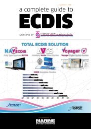
100% OfficialThe <strong>Admiralty</strong> <strong>ECDIS</strong> service is the first digital chart service in the worldto supply a combination of electronic charts for <strong>ECDIS</strong> that can fullymeet the IMO <strong>ECDIS</strong> performance standards. In areas where ENCs arenot yet available ARCS charts may, with flag state approval, be used in<strong>ECDIS</strong> for primary navigation rather than just a secondary aid to thepaper chart.Global Electronic Chart CoverageENC coverage already includes the Arabian Sea, Atlantic Ocean, Bahamas,Bay of Bengal, Belgium, Caribbean Sea, Cyprus, Egypt including Suez,Falkland Islands, Germany, Gibraltar, Greece, Gulf of Aden, India, IndianOcean, Jamaica, Malta, Netherlands, Pacific Ocean, Portugal, Red Sea,Socotra, Somalia, South Africa, Southern Ocean, Sri Lanka, Spain,Canaries and Balearics, UK and Western Africa.In early 2005, ENC coverage will be extended further to includeAustralia, Denmark, Estonia, Finland, France, Hong Kong, Latvia, Norway,Poland, Russia, Singapore and Sweden.Unrivalled Chart AccuracyThe <strong>Admiralty</strong> <strong>ECDIS</strong> <strong>Service</strong> only includes official charts sourced directlyfrom national hydrographic offices and compiled using the highestquality and most accurate data available allowing you to navigate safelyand with confidence.Fixed Annual CostThis is absolutely unique; no other chart provider is prepared to do thisat no extra cost to the mariner and no other digital chart service makesENC cost management so straight-forward.2


