West Kalimantan Pres.. - GCF
West Kalimantan Pres.. - GCF
West Kalimantan Pres.. - GCF

Create successful ePaper yourself
Turn your PDF publications into a flip-book with our unique Google optimized e-Paper software.
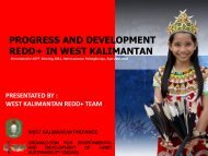
OVERVIEW OF REDDIN WEST KALIMANTAN PROVINCEPRESENTATED BY :WEST KALIMANTAN REDD TEAMWEST KALIMANTAN PROVINCEORGANIZATION FOR ENVIRONMENTALAND DEVELOPMENT OF ASSET SUSTAINABILITY
PRESENTATION CONTENT1. PROVINCE OVERVIEW2. REDD POLICIES REGULATIONS DISCUSSIONAND WEST KALIMANTAN POTENTIALFACTORS3. WEST KALIMANTAN IMPACT AND DESIGNFOR REDD PROJECTS4. WEST KALIMANTAN REDD STRATEGY ANDSUPPORT SUMMARY
1PROVINCE OVERVIEW
PROVINCE GEOGRAPHICAL• <strong>West</strong> <strong>Kalimantan</strong> province is located in west part of <strong>Kalimantan</strong> Island orlines between 2⁰08' NL - 3⁰05' South Longitude and 108⁰30' – 114⁰10‘ <strong>West</strong>Longitude of earth map.• <strong>West</strong> <strong>Kalimantan</strong> with 146.807 km² land area is the fourth largest provincearea in Indonesia, after Papua (421,891 km²), East <strong>Kalimantan</strong> (202,440km²) and Central <strong>Kalimantan</strong> (152,600 km²).• The following are complete boundaries of <strong>West</strong> <strong>Kalimantan</strong> province :- North : Sarawak ( Malaysia)- South : Java Sea & Central <strong>Kalimantan</strong>- East : East <strong>Kalimantan</strong>- <strong>West</strong> : Natuna Sea and Karimata Strait
SOIL AND LAND ELEVATION• The main land of <strong>Kalimantan</strong> Barat is mostly the plateau whichhave hundreds of peace full river when sailed, a little hilly alongKapuas Stream from the west to the east part of the region. Theland extends from the south part to the north part of the regionalong Natuna Sea. Some part of the land are swampy mixedpeat and mangrove forest.• The type of the soil is mostly red-yellow podsolete (RYP) whichspread over 10.5 million hectares area or 71. 28 percent of thesize of <strong>Kalimantan</strong> Barat. The soil of <strong>Kalimantan</strong> Barat alsocontain with OGH soil (organosol, gley and humus) and Alluvialbeing 2.0 million hectares or 10.29 percent of the region area.OGH and alluvial are mostly in the coast region.
<strong>West</strong> <strong>Kalimantan</strong> Land Elevation Maps and AnalysisE (> 40%)very slope;4.189.370,12D (25 - 40%)Slope;945.571,68C (15 - 25%)sloping;1.399.438,73B (8 - 15%)slightly;102.333,93A (0 - 8%)Flat;8.078.781,16
SOCIAL DAN CULTUE• Estimated Population projection (2009) = 4,25 millions peoplewithin 28 soul per kilometer square density and populationgrowth = 1,63 percents/year• Majority tribe =Dayaknese (41%), Malayans (20%), Chinese(16%), Javanese (8%) and other tribe (15%)• Major language use was Indonesia language and local language(Dayak, Malay, Chinese , etc)• Majority religions Moslem (57%), Catholic (24,1%), Protestant(10%) Buddha (6,4%), Hindu (0,2%), and others (1,7%)
LAND AREA FUNCTION• From total <strong>West</strong> <strong>Kalimantan</strong> land area = 14.715.495,63 hectare,had 10.326.906,46 ha (70,34 %) for forest area, it device to : Forest (dry land and wet land area) = ± 6.016.610,985hectare (58,26 %) Other function = ± 4.310.295,15 hectare (41,74 %)• <strong>West</strong> <strong>Kalimantan</strong> had 27 water catchment location and 64%from that covering by Kapuas water catchment
<strong>West</strong> <strong>Kalimantan</strong> Land UseMaps and AnalysisLand Use FunctionForest and Non Forest Function Wide Area (Ha) Percentage (%)APL 5.633.661,60 38,28CA 150.021,22 1,02HL 2.304.661,27 15,66HP 2.271.807,75 15,44HPK 507.542,18 3,45HPT 2.407.804,21 16,36SA 21.095,06 0,14Water fractions /river 130.529,36 0,89TN 1.258.139,57 8,55TWA 30.233,42 0,21Total 14.715.495,63 100,00
<strong>West</strong> <strong>Kalimantan</strong> Land UseMaps and AnalysisForest Area <strong>West</strong> <strong>Kalimantan</strong>
<strong>West</strong> <strong>Kalimantan</strong> Forest Area FunctionMaps and AnalysisForest Area FunctionLandCoveringForestClassification Land CoveringWide Area Percentage(Ha)(%)Primary dry land Forest 2.352.206,10 39,10Secondary dry land Forest 2.504.112,64 41,62Primary mangrove Forest 3,50 0,00Secondary mangrove Forest 105.501,46 1,75Primary Swamp Forest 5.843,87 0,10Secondary Swamp Forest 1.040.412,08 17,29Forest Plantations 8.531,34 0,14Total 6.016.610,99 100,00
<strong>West</strong> <strong>Kalimantan</strong> Water Catchment AreaMaps and Analysis
2REDD POLICIES REGULATIONS DISCUSSIONAND WEST KALIMANTAN POTENTIALFACTORS
REDD Mechanism From 2007 to 20122007Jan Feb Mar Apr May Jun Jul Aug Sep Oct Nov Dec2008 2009 2010 2011 2012Post2012Preparation Phase* Analysis (Architectureand Strategies)* Communication/Coordination/ConsultationsCOP 13- Design Fine Tuning- SystemEstablishment- Pilot DesignWorkshop, SBSTA, UNFCCC, G8, Etc.- Pilot Implementation- Testing- Knowledge ManagementCarbon-Finance (Pilots)FullImplementationof REDDCOP13COP14COP15
INDONESIA LAWS AND REGULATIONS RELEVANT TO REDD1. Ministry of Forestry Regulations number: P. 68/Menhut-II/2008 about Implementationdemonstration Activities REDDExplanations procedure and how to haveprocess permissions of REDD demonstrationactivities?How to construct REDD plot demonstration activities to become more relevant for implementation programs at thefuture
INDONESIA LAWS AND REGULATIONS RELEVANT TO REDD2. Ministry of Forestry Regulations number P. 30/Menhut-II/2009 (1 Mei 2009) aboutProcedures for REDDStill had more discussion about Standard and criteriaemission level and comparative standard to calculate it?3. Ministry of Forestry Regulations number 36/2009 about REDD permissions procedure forProduction Forest and Protected ForestHow to create REDD procedure activitieson other area conversion like Palmplantations, rubber plantations, etc?
<strong>West</strong> <strong>Kalimantan</strong>Potential FactorsWetland Area+ 2.322.780,80<strong>West</strong> <strong>Kalimantan</strong> Total Land Area= 14.715.495,63 HaForest dry land+4.864.850,08HaBIODIVERSITYPopulation +4,250millionpeople
3WEST KALIMANTAN IMPACT AND DESIGNFOR REDD PROJECTS
<strong>West</strong> <strong>Kalimantan</strong> REDD Technical Project Plan Estimated Carbon ReleasePERMASALAHAN<strong>West</strong> <strong>Kalimantan</strong> Deforestations Cause<strong>West</strong> <strong>Kalimantan</strong> Land Covering(Base on Land Satellite view, 2009)No. Area Functions and Status Area Approximated (Ha)1Protected Forest 2.304.661,272 Conversion Production Forest 507.542,183 Limited Production Forest 2.407.804,21Land4 Production Forest 2.271.807,755 Conservation area 1.459.489,277 Other use area (KBNK) 5.633.661,608Waterfractions River 130.529,36TOTAL AREA (Hectare) 14.715.495,63ESTIMATIONDEFORESTRATION± 130.398ha/yearEstimated Carbon Release cause Deforestations in <strong>West</strong> <strong>Kalimantan</strong> = 18.386.188 TON KARBON
Stock_Carbonluas_hutanPredictions Forest Covering for 50 years (2010-2060) in <strong>West</strong> <strong>Kalimantan</strong>2e9 6.016.6112e9 6.016.6102e96.016.6092e96.016.6082e92e9 6.016.6072e9 6.016.606carbon stock decrease withindeforestation2.010 2.010 2.020 2.020 2.030 2.030 2.040 2.040 2.050Time Time
<strong>West</strong> <strong>Kalimantan</strong> Impact and design REDD Project Plan Weakness and Solutions ApproachWeakness?• Lack of clearly forest land right• Needed to clearly responsible and task stakeholder on REDD mechanism• Who had right to become carbon trader(local community, private sector,forest management unit, local government, or national government)Solutions Approach• Development effective management in protected and conservation area• Development effective management on Production forest area• Optional forest harvesting and forest management within sustainable approach forindustry• Optional support to build palm plantation needed• Strategic and Restoration models for wetland and dry land forest• Capacity building for local community, including indigenous community structureand forest management through REDD activities
4WEST KALIMANTAN REDD STRATEGY ANDSUPPORT SUMMARY
<strong>West</strong> <strong>Kalimantan</strong> REDD Technical Project PlanProject Strategic• Increasing land potential capacity on Forest and non-forest area;• Support sustainability protected conservation area within ecosystemsupport functions• Development land rehabilitation activities, mostly on degradatedland• Support and development forest land area within ecosystem supportfunctions• Support equalize economic-ecology-social on forest areamanagement in <strong>West</strong> <strong>Kalimantan</strong>
<strong>West</strong> <strong>Kalimantan</strong> REDD Technical Project Plan Project Goal• Development environmental services ;• Development environmental services for alternative Non-Tax CountryIncome;• Calculate capacity of forest and non-forest area for supportimplementation REDD and carbon stock;• Development alternative income for community ;• Support restoration of land hydrology;• Keeping forest area for carbon stock capacity supply andenvironmental services;• Support of land rehabilitation and reforestation;• Development and campaigned practical of Sustainable ForestManagement (SFM) system;• Development Non Timber Forest Product (NTFP)
<strong>West</strong> <strong>Kalimantan</strong> REDD Technical Project Plan Project Target• Development working groups and partnerships between Community and localinstitution ;• Increase knowledge about sustainability management of mitigations and climatechange adaptations ;• Empowerment stakeholder capacity about mitigations and climate changeadaptations;• Preparing REDD socializations and Champaign ;• Development community empowerment programs surround forest forenvironmental services;• Support National and Local for pro poor, pro job and pro growth policies
<strong>West</strong> <strong>Kalimantan</strong> REDD Technical Project PlanProject InterventionWEST KALIMANTAN GOVERNMENT INTERVENTIONS REDD PROJECT• Development province baseline carbon reference within REDD comprehensive anduseful method• Public consultative about implementation REDD within stakeholder• Development incentive carbon fund which came from local entity or internationalbase on international integrated agreement , national policies and regulations, andlocal wisdom• Development integrated REDD project within province spatial planning• Development fire prevention, patrol and participatory law enforcement• Development distribution carbon fund mechanism for increase local communityincome alternative (village fund development, education and health, etc)
<strong>West</strong> <strong>Kalimantan</strong> REDD Technical Project PlanProjection Methodological Used• Use IPCC Default Value• Use Brown method calculation (1997)• Use Murdiyarso et.al method calculation(2004)
<strong>West</strong> <strong>Kalimantan</strong> REDD Technical Project PlanESTIMATED CARBON YIELDUsing IPCC guidelines Steps Tier 1 --------C-total = A.B.CFC-total = Carbon StockA = Forest AreaB = Default value for Biomass at Tropical Rain Forest = 280 – 520ton/haCF =Carbon Fractions default for land conversion to agriculture =0.47ton C
<strong>West</strong> <strong>Kalimantan</strong> REDD Technical Project Plan Estimated Carbon Stockstock_Carbon_Kalbar•Dry land Forest carbon = 4.864.850,08 Ha x 300 ton/ha x 0.47= 685.943.861,56 ton•Wetland Forest carbon = 1.151.760,90 Ha x 600 x 0,47= 324.796.574,65 ton<strong>West</strong> <strong>Kalimantan</strong> wetland total area = 2.367.977,82 Ha x 600 x 0,47= 667.769.745,24 ton<strong>West</strong> <strong>Kalimantan</strong> wetland carbon total == 324.796.574,65 ton + 667.769.745,24 ton= 992.556.319,89 ton<strong>West</strong> <strong>Kalimantan</strong> C-Carbon = 685.943.861,56 ton + 992.556.319,89 ton= 1.678.510.181,45 ton= 1.678 X 10 6 gigaton Carbon1.010.740.436,21 tonor (1.01 x 10 6 gigatoncarbon)1.678.510.181,45 tonor (1.678 X 10 6gigaton Carbon)4e103e102e101e102.010 2.020 2.030 2.040 2.050Time
<strong>West</strong> <strong>Kalimantan</strong> REDD Technical Project Plan Carbon Stock Increase PossibilitiesNoAreabiomass CFTotal EmissionsHectare %FunctionTon/Ha ton C/Ha Ton CGt C1 Forest area 620.646,25 27,75 300,00 0,47 87.511.121,25 87.511,122 Other use 1.615.517,04 72,25 300,00 0,47 227.787.902,53 227.787,90Grand Total 2.236.163,29 100,00 315.299.023,78 315.299,02
Out put andOutcomeNaturalResourcesPotentialReduction Global Warming/Climate ChangeBiodiversityCarbon StockNature reserve, Orang Utan,bekantan, Owa, crocodile,etcDry landPeat SwampWildlife corridorsWater supplyForest resourcesEcosystemResourcesSustainability impact for CommunityBuffer Zone National parkWatersheds catchmentarea
ThreatNatural ResourcesAA CHOICES ON OUR HANDSBIncreasing poverty, un-sustainable exploitation, social friction, lack of health =environmental destruction with very high cost level
THANK YOUWEST KALIMANTAN PROVINCEORGANIZATION FOR ENVIRONMENTALAND DEVELOPMENT OF ASSET SUSTAINABILITY