Exam Answer Key - Earth Science Regents Review
Exam Answer Key - Earth Science Regents Review
Exam Answer Key - Earth Science Regents Review

You also want an ePaper? Increase the reach of your titles
YUMPU automatically turns print PDFs into web optimized ePapers that Google loves.
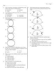
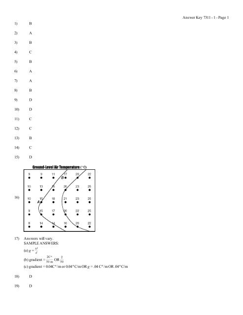
1) B<strong>Answer</strong> <strong>Key</strong> 7311 - 1 - Page 12) A3) B4) C5) B6) A7) A8) B9) D10) D11) C12) C13) B14) C15) D16)17) <strong>Answer</strong>s will vary.SAMPLE ANSWERS:(a) g =18) D19) D(b) gradient =OR(c) gradient = 0.04CD/m or 0.04DC/m OR g = .04 CD/m OR .04DC/m
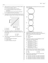
<strong>Answer</strong> <strong>Key</strong> 7311 - 1 - Page 220)21) 66DF22)23) 25 ft/mi (+1)24) B25) <strong>Answer</strong>s may vary.SAMPLE ANSWERS: Contour lines are closer together on the southern section of the hill. OR The south side has the greatestchange in elevation per mile.26)27) <strong>Answer</strong>s may vary.SAMPLE ANSWERS: south southwest OR SSW OR south or S OR southwest or SW28) 6 OR 6.0 (+0.3) and feet/mile OR ft/mi
<strong>Answer</strong> <strong>Key</strong> 7311 - 1 - Page 329)30) (a) gradient = ;(b) gradient = OR g = ;(c) 100 (+5) ft/mile31) <strong>Answer</strong>s will vary.SAMPLE ANSWERS: Contour lines bend upstream when they cross a stream. They bend east along Jones Creek. OR Waterflows from higher to lower elevations, and Jones Creek is higher in elevation on the east side of the map.32) <strong>Answer</strong>s may vary.SAMPLE ANSWERS: Contour lines bend upstream when crossing the creek. OR The stream flows from higher elevations towardlower elevations.33) <strong>Answer</strong>s may vary.SAMPLE ANSWERS: (a,b) g = , g = ; (c) gradient = 20 m/km OR g = 20 m/km34) C35) D36) B37) A38)39) <strong>Answer</strong>s may vary.
<strong>Answer</strong> <strong>Key</strong> 7311 - 1 - Page 4SAMPLE ANSWERS: (a) north OR northeast OR north northeast; (b) Contour lines bend upstream. OR Streams flow from highercontours to lower contours. Streams flow opposite the apex of the contour lines.40) (a-b)41) <strong>Answer</strong>s may vary.SAMPLE ANSWERS: Lack of contour lines indicates a relatively flat area. OR The stream shows meanders. OR The contour linesare spaced far apart.