overland to the geodetic center of south america mato grosso, brazil ...
overland to the geodetic center of south america mato grosso, brazil ...
overland to the geodetic center of south america mato grosso, brazil ...
You also want an ePaper? Increase the reach of your titles
YUMPU automatically turns print PDFs into web optimized ePapers that Google loves.
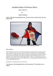
OVERLAND TO THE GEODETIC CENTEROF SOUTH AMERICAMATO GROSSO, BRAZILEXPLORERS CLUB FLAG NO. 99 EXPEDITION REPORTEXPEDITION DATES: NOVEMBER 11 - 21, 2011LEADER - THOMAS N. AMBROSE MN ‘10ASSISTANT– NATALIE AMBROSECONTENTSPageno.Introduction2Itinerary 3Planning & Logistics 4Source <strong>of</strong> Roosevelt River 4Physical Geography 5Geology 6Geodetic Centers 7Conclusions & Accomplishments 9References & Author’s Bio 10Map IndexPho<strong>to</strong> Index1
INTRODUCTIONFlag application was submitted in August 2011 with <strong>the</strong> approvalgranted <strong>the</strong> end <strong>of</strong> Oc<strong>to</strong>ber. The original expedition route was <strong>to</strong> start at<strong>the</strong> Peru-Brazil border in Acre state <strong>of</strong> far western Brazil, continuingeast for ten days on <strong>the</strong> Interoceanic Highway (Pacific coast <strong>of</strong> Peru <strong>to</strong>Sao Paulo, Brazil) some 1,500 miles <strong>to</strong> <strong>the</strong> Geodetic Center in Ma<strong>to</strong>Grosso state <strong>of</strong> Brazil with Flag No. 99. A pause had been planned at <strong>the</strong><strong>to</strong>wn <strong>of</strong> Vilhena in Rondonia state <strong>to</strong> seek and pho<strong>to</strong>graph <strong>the</strong> source <strong>of</strong><strong>the</strong> Roosevelt River as a second expedition objective.Inasmuch as <strong>the</strong> expedition was unable <strong>to</strong> depart <strong>the</strong> USA untilapproved and ano<strong>the</strong>r two weeks was needed <strong>to</strong> outfit, obtain requiredBrazil land entry yellow fever inoculations, air tickets, etc., <strong>the</strong> originalroute had <strong>to</strong> be revised, especially considering <strong>the</strong> late Oc<strong>to</strong>bercommencement <strong>of</strong> <strong>the</strong> wet season in western Brazil. The new route was<strong>to</strong> start near <strong>the</strong> Bolivia/Brazil border with <strong>the</strong> <strong>of</strong>ficial termination uponreaching Paraguay and cover a road distance <strong>of</strong> almost 900 milesbetween November 11- 21. Interestingly enough, after delivering <strong>the</strong>flag <strong>to</strong> <strong>the</strong> Geodetic Center, <strong>the</strong> rainy season finally over<strong>to</strong>ok <strong>the</strong>expedition which resulted in flooded roads in <strong>the</strong> Chaco <strong>of</strong> Paraguay enroute <strong>to</strong> Asuncion.Transport was by public bus, hired truck, taxi and <strong>of</strong>f <strong>the</strong> road foottraverses. While <strong>the</strong> primary expedition objective was completed, <strong>the</strong>secondary proved more difficult. As a result <strong>of</strong> research findingsobtained just before and during <strong>the</strong> expedition it is believed that <strong>the</strong>true source <strong>of</strong> <strong>the</strong> Roosevelt River might be impossible <strong>to</strong> locate asdiscussed below.2
ITINERARYThe expedition commenced at 8:00 am November 11 in Miami when aTAM (Brazil ) plane was boarded for a magnificent cloudless fligh<strong>to</strong>ver <strong>the</strong> Caribbean, <strong>the</strong> jungle interior <strong>of</strong> Venezuela/Guianas, <strong>the</strong> lowerAmazon river and finally in<strong>to</strong> Brasilia at sunset. After making an 11:00pm connection a perfect landing was made at Marechal Rondon Airportin Varezia Grande, Ma<strong>to</strong> Grosso at 1:00 am November 12, <strong>the</strong> end <strong>of</strong> along and safe journey <strong>to</strong> <strong>the</strong> interior <strong>of</strong> South America.When daylight arrived, <strong>the</strong> expedition continued by pickup truck in<strong>to</strong><strong>the</strong> <strong>center</strong> <strong>of</strong> <strong>the</strong> Pantanal a few miles from <strong>the</strong> Bolivian border, where abrief survey <strong>of</strong> <strong>the</strong> indigenous flora and fauna was conducted. Thisserved as <strong>the</strong> starting point for <strong>the</strong> <strong>overland</strong> expedition, <strong>the</strong> route <strong>of</strong>which is indicated in green on Map No. 3.The second <strong>overland</strong> leg was by bus from <strong>the</strong> <strong>to</strong>wn <strong>of</strong> Pocone <strong>to</strong> <strong>the</strong> city<strong>of</strong> Cuiaba following <strong>the</strong> route <strong>of</strong> <strong>the</strong> Rondon 1912 telegraph line asshown on Maps No. 6 and 7. Upon arrival ano<strong>the</strong>r bus was ticketed for<strong>the</strong> climb in<strong>to</strong> <strong>the</strong> Cerrado highlands locally known as <strong>the</strong> Chapada DosGuimeraes where two days were spent in preparation for <strong>the</strong> final tripby taxi and foot traverse <strong>to</strong> <strong>the</strong> Geodetic Center.The next leg called for a return <strong>to</strong> Cuiaba by bus <strong>to</strong> locate <strong>the</strong> obeliskwhich marks <strong>the</strong> Rondon Geodetic Center. After locating a his<strong>to</strong>ricRondon map collection, a full day was spent doing research relating <strong>to</strong><strong>the</strong> Roosevelt River source.From Cuiaba a comfortable, air-conditioned long distance bus wasboarded for a 12 hour, 460 mile journey along <strong>the</strong> eastern side <strong>of</strong> <strong>the</strong>Pantanal <strong>to</strong> Campo Grande. This route passed through extensive soyabean fields without a single tree in sight, making it hard <strong>to</strong> believe tha<strong>to</strong>nce this was thick Cerrado type forest, locally known as “Ma<strong>to</strong>Grosso”. Today this area is deforested and verging on an environmentaldisaster as a result <strong>of</strong> clear cutting. The final leg by bus covered over200 miles <strong>to</strong> <strong>the</strong> border with Paraguay, where <strong>the</strong> expeditionterminated.3
PLANNING AND LOGISTICSAll road travel and lodging was arranged on a day <strong>to</strong> day basis whichallowed flexibility in <strong>the</strong> itinerary. Since travel was along roads withprovision vendors, no subsistence arrangements were necessary. Alloutfitting, including tropical clothing, money belts, luggage, medical kit,note book and geological pick was completed in <strong>the</strong> USA. NatalieAmbrose, expedition assistant, was invaluable as a Portuguese <strong>to</strong>English interpreter as little English is spoken in <strong>the</strong> interior <strong>of</strong> Brazil.Participants were fortunate that no passports were lost as this wouldhave required a 500 mile or longer trip <strong>to</strong> <strong>the</strong> US Embassy in Brasilia,since Cuiaba has no consular representative. While coastal Brazil has areputation for crime, <strong>the</strong> interior proved perfectly safe for <strong>the</strong>expedition and <strong>the</strong> population was helpful and friendly.SOURCE OF ROOSEVELT RIVERThe original plan was <strong>to</strong> visit Vilhena, Rondonia, on Highway BR-364enroute <strong>to</strong> <strong>the</strong> Geodetic Center in order <strong>to</strong> locate and pho<strong>to</strong>graph <strong>the</strong>source <strong>of</strong> <strong>the</strong> Roosevelt River, which Rondon termed <strong>the</strong> Duvida or <strong>the</strong>River <strong>of</strong> Doubt.Colonel, later Marchal, Candido Rondon (1865–1958), a Brazilian army<strong>of</strong>ficer, Amazon explorer and builder <strong>of</strong> <strong>the</strong> first telegraph line from <strong>the</strong>Atlantic coast <strong>to</strong> P<strong>to</strong>. Velho in <strong>the</strong> Amazon, discovered <strong>the</strong> river in 1909during a telegraph survey. By 1912 <strong>the</strong> line was completed with stationsas indicated on Maps No. 6 and 7. He built a simple 65 ft wooden bridgeacross <strong>the</strong> Rio Duvida where his line crossed, near <strong>the</strong> Jose Bonificiostation. At this bridge two years later US President Theodore Rooseveltand Rondon launched <strong>the</strong>ir seven dugout canoes <strong>to</strong> explore <strong>the</strong>unmapped downstream extent <strong>of</strong> this river as shown in orange color onMaps No. 2 and 4.The Roosevelt expedition commenced in 1913 from Asuncion, Paraguaycruising up <strong>the</strong> Paraguay and Cuiaba rivers <strong>to</strong> Caceres, Brazil, latercrossing over <strong>the</strong> Cerrado highlands by mule train <strong>to</strong> <strong>the</strong> telegraph lineat Utiarity station. Here he was joined by Rondon and <strong>to</strong>ge<strong>the</strong>r <strong>the</strong>y4
travelled along <strong>the</strong> telegraph line past Vilhena <strong>to</strong> <strong>the</strong> Rio Duvida canoelaunch point. The Roosevelt land route is shown in red color andfollows <strong>the</strong> western side <strong>of</strong> <strong>the</strong> Pantanal, while Flag No. 99 Expeditionfollows a similar longitudinal path along <strong>the</strong> eastern side some 98 yearslater.A review <strong>of</strong> published data by <strong>the</strong> author confirms that two post-Roosevelt expeditions (Dyott 1926, and later Haskell 1992 – anExplorers Club flag expedition - using rubber rafts) presumably alsolaunched boats approximately 40 miles downstream from <strong>the</strong> possiblesource. In an attempt <strong>to</strong> locate <strong>the</strong> source <strong>of</strong> <strong>the</strong> river, <strong>the</strong> author usedcurrent satellite imagery and data. Streams were difficult <strong>to</strong> trace evenfor an experienced surface geologist/<strong>to</strong>pographer, since <strong>the</strong> flat terrainresults in meandering channels mostly hidden by tropical forest. In arecent conversation with Elizabeth Haskell, co-leader <strong>of</strong> <strong>the</strong> 1992expedition, she explained that her expedition made a preliminaryairplane reconnaissance and because <strong>of</strong> <strong>the</strong> heavy forest canopy, couldnot identify any possible river source. Only one reference could befound, an online pho<strong>to</strong> (Pho<strong>to</strong> No. 2) <strong>of</strong> <strong>the</strong> so-called source, just north<strong>of</strong> Vilhena <strong>to</strong>wn. The reddish water <strong>of</strong> this unconfirmed locationsuggests run<strong>of</strong>f from nearby agri-fields with red soil.Later, during <strong>the</strong> expeditions visit <strong>to</strong> Cuiaba a his<strong>to</strong>ric 1952 geographicmap by Rondon (Pho<strong>to</strong> No. 1) was located and studied. Since thishighly detailed map indicated “multiple” sources similar <strong>to</strong> fingers on ahand, it was concluded that a main source might be impossible <strong>to</strong> locate,especially considering that Vilhena population has increased <strong>to</strong> 80,000.Urban sprawl and associated probable ground surface alterations couldobliterate <strong>the</strong> true river source. In consideration <strong>of</strong> <strong>the</strong> above thissecondary expedition objective was cancelled.PHYSICAL GEOGRAPHYThe Geodetic Center lies in a unique east-west geographic “transitionzone” (between <strong>the</strong> Amazon and Parana basins) covering a north-<strong>south</strong>distance <strong>of</strong> as little as 80 miles as indicated on <strong>the</strong> attachedphysiographic map (Map No. 5) prepared by <strong>the</strong> expedition. The keyfeature is <strong>the</strong> Cerrado (usually open land) and here a <strong>to</strong>pographicplateau area which is developed in<strong>to</strong> tableland and mesa type landforms5
(Chapada) as a result <strong>of</strong> uplift and later erosion. This highland has anelevation <strong>of</strong> 2,000–3,000 ft and forms a drainage divide between <strong>the</strong>Amazon basin in <strong>the</strong> north and <strong>the</strong> Rio Plata drainage basin <strong>to</strong> <strong>the</strong><strong>south</strong>. The latter empties in<strong>to</strong> <strong>the</strong> Atlantic some 1,400 miles away nearBuenos Aires, Argentina.Superimposed on <strong>the</strong> Rio Plata basin is a huge swampy seasonalwetland, known as <strong>the</strong> Pantanal. This floodplain is delineated on <strong>the</strong>north and east by increased ground elevation, while <strong>the</strong> difficult <strong>to</strong>define western limit in low lying Bolivia and Paraguay varies dependingon seasonal rainfall. The Pantanal - which is almost <strong>the</strong> size <strong>of</strong> <strong>the</strong>United Kingdom - is under populated with only one <strong>to</strong>wn <strong>of</strong> significantsize known as Corumba, Brazil, on <strong>the</strong> Paraguay River. This is <strong>the</strong>largest contiguous inland swamp on earth, covering some 89,000 sq.mi.,mostly in Brazil.Each <strong>of</strong> <strong>the</strong> three geographical areas has somewhat distinct geology andecology. Each area exhibits different climates - <strong>the</strong> Amazon <strong>the</strong> mosttropical, <strong>the</strong> Cerrado highlands <strong>the</strong> coolest, and <strong>the</strong> Pantanal withvariations in response <strong>to</strong> wet and dry seasons. Fauna and flora alsovaries in each area and is especially prolific in <strong>the</strong> Pantanal withthousands <strong>of</strong> species.GEOLOGYThe Geodetic Center <strong>of</strong> South America lies at <strong>the</strong> extreme nor<strong>the</strong>rn end<strong>of</strong> <strong>the</strong> Parana geological basin which exhibits an elongated shape fromnorth <strong>to</strong> <strong>south</strong> and continues in<strong>to</strong> Uruguay and nor<strong>the</strong>astern Argentina.Since <strong>the</strong> basin lies within <strong>the</strong> limits <strong>of</strong> <strong>the</strong> South American cra<strong>to</strong>n(defined as <strong>the</strong> stable interior <strong>of</strong> a continent) <strong>the</strong> Parana is classified asan intra-cra<strong>to</strong>nic basin as compared <strong>to</strong> <strong>the</strong> mobile geosynclinal basinspresent along <strong>the</strong> eastern side <strong>of</strong> <strong>the</strong> Andes. These basins were formedby down warping as <strong>the</strong> adjacent Andes were uplifted.The Parana basin developed during Paleozoic-Mesozoic geologic erasand is filled with sediments from Ordovician period up <strong>to</strong> Cretaceous.Many <strong>of</strong> <strong>the</strong> central and sou<strong>the</strong>rn areas are covered by Triassic lavaflows <strong>of</strong> basalt such as those that form <strong>the</strong> Iguazu Falls on <strong>the</strong> IguazuRiver. Paleozoic sediments alone can reach 6,500 ft in thickness. The6
Flag No. 99 Expedition road route was <strong>to</strong>tally in <strong>the</strong> confines <strong>of</strong> <strong>the</strong>Parana basin.Outcrops <strong>of</strong> sedimentary rocks near <strong>the</strong> Geodetic Center in Chapadados Guimaraes (Chapada means tableland in Portuguese) are wellexposed along <strong>the</strong> escarpment which parallels <strong>the</strong> structurally upliftedand later eroded sou<strong>the</strong>rn edge <strong>of</strong> <strong>the</strong> Ma<strong>to</strong> Grosso plateau. Wellbedded and massive, very hard sands<strong>to</strong>nes are common and provide <strong>the</strong>resistant rock layers over which numerous waterfalls develop (see Pho<strong>to</strong>No. 5). Rock types found in <strong>the</strong> Chapada appear <strong>to</strong> be typical <strong>of</strong> those<strong>of</strong> <strong>the</strong> Parana Basin and ranging from basal coarse conglomeratespassing upward in<strong>to</strong> finer grained sediments <strong>of</strong>ten comprised <strong>of</strong>interbedded quartzitic sands<strong>to</strong>nes <strong>to</strong> very hard indurated clay <strong>to</strong> siltysands<strong>to</strong>nes and hematites (iron ore). Most rocks are typically red incolor except for thin beds <strong>of</strong> s<strong>of</strong>t multi-colored clays. Several rocksamples were collected and pho<strong>to</strong>graphed in <strong>the</strong> field.In <strong>the</strong> Pantanal wetlands which lie directly <strong>south</strong> <strong>of</strong> <strong>the</strong> Chapada,alluvial sediments cover <strong>the</strong> underlying bedrock. Since rivers are <strong>to</strong>oshallow <strong>to</strong> erode through this cover, no exposures <strong>of</strong> <strong>the</strong> older rockswere seen along <strong>the</strong> expedition route.GEODETIC CENTERSThe expedition was aware that two locations, some 28 air miles apartclaim <strong>the</strong> title <strong>of</strong> “Center <strong>of</strong> South America” – sometimes termed“<strong>geodetic</strong>”, sometimes “geographic.” According <strong>to</strong> Webster’s Dictionary<strong>the</strong>se are one in <strong>the</strong> same – both relate <strong>to</strong> “geodesy” which is defined as“that branch <strong>of</strong> applied ma<strong>the</strong>matics which determines exact positions<strong>of</strong> points and <strong>the</strong> figures and areas <strong>of</strong> large portions <strong>of</strong> <strong>the</strong> Earth’ssurface, or <strong>the</strong> shape and size <strong>of</strong> <strong>the</strong> Earth, and <strong>the</strong> variations <strong>of</strong>terrestrial gravity”.The first location lies at 600 feet elevation in <strong>the</strong> <strong>center</strong> <strong>of</strong> Cuiaba, <strong>the</strong>capital <strong>of</strong> Ma<strong>to</strong> Grosso founded in 1797 as a gold camp and now abooming city <strong>of</strong> 600,000. According <strong>to</strong> his<strong>to</strong>rical records, in 1909Marshal Rondon determined that <strong>the</strong> continental <strong>center</strong> <strong>of</strong> SouthAmerica was here. While <strong>the</strong> survey method used by Rondon isunknown, it may relate <strong>to</strong> his laying out <strong>the</strong> trans-Ma<strong>to</strong> Grosso7
telegraph line <strong>the</strong> same year. According <strong>to</strong> Encyclopedia Britanica, inthose Rondon years all geodesic work was based on land surveys madeby triangulation methods employing a geodesic coordinate system.Rondon erected a small brick monument here with a metal plaqueshowing coordinates as Latitude 15° 35’ 36” S and Longitude 56° 06’05” W. In 1975 <strong>the</strong> survey <strong>of</strong>fice <strong>of</strong> <strong>the</strong> Brazilian Army confirmed thislocation as <strong>the</strong> <strong>center</strong> and later a tall obelisk was erected at <strong>the</strong> site (seePho<strong>to</strong> No. 9).The second location lies at 2,560 feet elevation in <strong>the</strong> Chapada dosGuimaraes highlands nor<strong>the</strong>ast <strong>of</strong> <strong>the</strong> city <strong>of</strong> Cuiaba. The site isindicated by a small simple cement marker at Latitude 15° 28’ 48” Sand Longitude 55° 41’ 17” W. The marker may have been set in <strong>the</strong>1970’s when roads made this area more accessible, although it may havebeen marked earlier. This location termed <strong>the</strong> “Mirante” (or“Lookout”) has great natural beauty with a panoramic view <strong>of</strong> <strong>the</strong>Pantanal lowlands <strong>to</strong> <strong>the</strong> <strong>south</strong> as shown on Pho<strong>to</strong> No. 7.To determine <strong>the</strong> <strong>center</strong> <strong>of</strong> any large continent apparently is no easytask. Even <strong>the</strong> experienced and highly regarded U.S. Geological Survey(USGS) states that “<strong>the</strong>re is no generally accepted definition <strong>of</strong> ageographic <strong>center</strong> and no uniform or reliable method for determiningit.” The USGS defines a <strong>center</strong> as “<strong>the</strong> <strong>center</strong> <strong>of</strong> gravity <strong>of</strong> <strong>the</strong> surface,or that point on which <strong>the</strong> surface <strong>of</strong> an area would balance if it were aplane <strong>of</strong> uniform thickness – this point <strong>of</strong> balance is <strong>the</strong> areas <strong>center</strong> <strong>of</strong>gravity”.It is noteworthy that <strong>the</strong> Geographical Center <strong>of</strong> North America wasestablished in North Dakota in 1931, by <strong>the</strong> USGS although it does notrecognize it as an exact location. Apparently, <strong>the</strong> reason is that anyattempt <strong>to</strong> determine <strong>the</strong> <strong>center</strong> <strong>of</strong> a landmass <strong>the</strong> size <strong>of</strong> <strong>the</strong> NorthAmerican continent (this should apply as well <strong>to</strong> South America), withits variable and complex <strong>to</strong>pography can only be an approximation andis complicated by o<strong>the</strong>r fac<strong>to</strong>rs including <strong>the</strong> curvature <strong>of</strong> <strong>the</strong> earth. In2005 a field check by an independent party <strong>of</strong> this 1931 USGS Centerresulted in a 16 mile discrepancy.8
CONCLUSIONS AND ACCOMPLISHMENTSOn <strong>the</strong> basis <strong>of</strong> <strong>the</strong> above data, <strong>the</strong> exact determination <strong>of</strong> anycontinental Center is somewhat vague and leaves room for error.Accordingly, <strong>the</strong> 28 mile discrepancy between <strong>the</strong> Cuiaba and ChapadaCenters is relatively minor considering <strong>the</strong> size <strong>of</strong> South America wheredistances are measured in thousands <strong>of</strong> miles. To help resolve thismatter, <strong>the</strong> expedition contacted <strong>the</strong> Institu<strong>to</strong> Brasileiro do Geografia eEstatistica (IBGE) in Rio de Janeiro. Their lengthy reply in Portuguesemirrors <strong>the</strong> USGS comments on <strong>the</strong> determination <strong>of</strong> a <strong>center</strong>, andwhile some data may have been lost in translation, in short <strong>the</strong> IBGEconcludes that “a <strong>geodetic</strong> <strong>center</strong> can vary depending on <strong>the</strong> parametersused” and <strong>the</strong>refore failed <strong>to</strong> specify which <strong>of</strong> <strong>the</strong> two <strong>center</strong>s is correct.In any event, Flag No.99 Expedition accomplished <strong>the</strong> primary objective<strong>of</strong> reaching both <strong>center</strong>s <strong>of</strong> South America and it must be concludedthat <strong>the</strong> true <strong>center</strong> remains an enigma as does <strong>the</strong> one in NorthAmerica. Along <strong>the</strong> way new information was gained and recordedrelating <strong>to</strong> <strong>the</strong> physical geography and geology <strong>of</strong> <strong>the</strong> area. Maps from1912 showing <strong>the</strong> Rondon telegraph system were obtained and are nowavailable for future his<strong>to</strong>rical reference. The land route <strong>to</strong> <strong>the</strong> River <strong>of</strong>Doubt (Rio Duvida) followed by <strong>the</strong> 1913 Roosevelt/Rondon Expeditionhas been indicated on a modern base map for <strong>the</strong> first time.While <strong>the</strong> source <strong>of</strong> <strong>the</strong> Roosevelt River eluded us, this famous riverstands as a tribute <strong>to</strong> <strong>the</strong> brave and adventurous explorers, still active in<strong>the</strong> waning age <strong>of</strong> ground exploration, which soon was replaced by airreconnaissance exploration in <strong>the</strong> early 1900s. Today, while satelliteimagery leaves few if any surface locations on earth truly unknown,some on-ground geographic exploration is still <strong>of</strong> value for details andverification. This is where <strong>the</strong> Explorers Club expeditions cancontribute <strong>to</strong> our knowledge.9
REFERENCESInstitu<strong>to</strong> Brasileiro do Geografia e Estatistica (IBGE) in Rio de Janeiro.Millard, Candice. The River <strong>of</strong> Doubt: Roosevelt’s Darkest Journey.New York: Doubleday 2005.SEDTUR ( Secretaria de Desenvolvimen<strong>to</strong> do Turismo do Estado deMa<strong>to</strong> Grosso), Cuiaba.State <strong>of</strong> Ma<strong>to</strong> Grosso. Prefeitura Municipal de Chapada dosGuimaraes. Geological Data, 2000.The World Almanac and Book <strong>of</strong> Facts. New York: World AlmanacBooks.AUTHOR’S BIOThomas Ambrose holds BS and MS degrees in Geology and has workedas an international exploration and natural resource geologist for manyyears. His on <strong>the</strong> ground experience has included Cuba, Colombia,Ecuador, Trinidad and Tobago, Puer<strong>to</strong> Rico, Singapore, and Indonesia.As an example <strong>of</strong> his South American exploration, in <strong>the</strong> 1970’s,Ambrose and his helicopter pilot were <strong>the</strong> first people <strong>to</strong> ever land andconduct surface geological sampling on several <strong>of</strong> <strong>the</strong> mountain<strong>to</strong>ps in<strong>the</strong> remote Sierra de Chribiquete in <strong>the</strong> equa<strong>to</strong>rial Colombian Amazon,since <strong>the</strong>se steep vertical-sided chimney rocks are not accessible by foot.Today <strong>the</strong>se mountains are controlled by <strong>the</strong> FARC (Fuerzas ArmadasRevolucionarias de Colombia) rebels which discourage settlement and<strong>to</strong>urism, resulting in a pristine and under-explored area. Ambrose is amember <strong>of</strong> <strong>the</strong> Sou<strong>the</strong>rn Florida Chapter <strong>of</strong> The Explorers Club,resides in Ocean Ridge, Florida, and can be reached atrealthora@yahoo.com.10
MAP INDEX FOR FLAG REPORT NO. 99MATO GROSSO, BRAZILNO. 1NO. 2NO. 3SOUTH AMERICA INDEX MAP SHOWING LOCATION OF REPORTDETAIL MAPSSCALE – GRAPHIC AS SHOWNREGIONAL MAP SHOWING TOWNS, RIVERS ANDMOUNTAINS (SERRA)SCALE 1: 800,000AREA MAP SHOWING SOUTH AMERICA GEODETIC CENTER,OVERLAND ROUTES OF 1913-14 ROOSEVELT-RONDON AND2011 EXPLORERS CLUB FLAG NO. 99 EXPEDITIONSSCALE: 1: 4,000,000NO. 4 AREA MAP SHOWING RIVER ROUTE OF 1913-14ROOSEVELT- RONDON EXPEDITION DOWN RIVER (NORTH)FROM NEAR VILHENA, RONDONIA. ROOSEVELT RIVERSOURCE AREA ALSO INDICATEDSCALE 1: 2,000,000NO. 5NO. 6NO. 7AREA MAP SHOWING THE PHYSIOGRAPHIC FEATURES OFTHE 2011 FLAG NO. 99 EXPEDITION AREA IN MATO GROSSO,BRAZILSCALE 1: 4,000,000HISTORIC 1912 MAP BY RONDON COMMISSION SHOWINGLOCATIONS OF TELEGRAPH LINES BETWEEN CUYABA(CUIABA) AND PTO VELHO.SCALE UNKNOWNDETAIL MAP SHOWING TELEGRAPH LINES AND STATIONSIN REPORT AREASCALE UNKNOWN
PHOTO INDEX FOR FLAG REPORT NO. 99MATO GROSSO, BRAZILNO. 1NO. 2NO. 3NO. 4NO. 5NO. 6NO. 7NO. 8TITLE BLOCK OF HISTORIC 1952 STATE OF MATTO GROSSOGEOGRAPHIC MAP PUBLISHED UNDER DIRECTION OFRONDONUNCONFIRMED SOURCE OF ROOSEVELT RIVER NEARVILHENA, RONDONIASTART OF 2011 OVERLAND FLAG NO. 99 EXPEDITION INTHE FLAT BRAZILIAN PANTANAL, NEAR THE BORDERWITH BOLIVIAESCARPMENT ALONG SOUTH EDGE OF ELEVATED MATOGROSSO PLATEAU, MARKING NORH LIMIT OF PANTANALLOWLANDS. NOTE MASSIVE, HORIZONTAL BEDS OFTYPICAL REDDISH SANDSTONES AND CERRADO DRY-FOREST-TYPE VEGETATION200 FOOT WATERFALL OVER EDGE OF CERRADOTABLELAND IN CHAPADA DOS GUIMARAES AREA NORTHOF CUIABAVIEW SOUTH TO EXTENSIVE PANTANAL LOWLANDS,SHOWING CERRADO SAVANNAH-TYPE VEGETATION, NEARGEODETIC CENTEREXPLORER CLUB MEMBER T. N. AMBROSE AND NATALIEAMBROSE WITH FLAG NO. 99 AT A GEODETIC CENTER OFSOUTH AMERICASURFACE OUTCROP OF BEDDED VERY HARD (INDURATED),RED CLAYEY SANDSTONE AT GEODETIC CENTERNO. 9 OBELISK IN CUIABA, BRAZIL MARKING RONDON 1912,GEODETIC CENTERNO.10EXPEDITION FLAG RETURN PRESENTATION AT SOUTHERNFLORIDA CHAPTER MEETING, MIAMI, DECEMBER 2011.T. N. AMBROSE 2 ND FROM LEFT


