Rocky Brushy Creek Watershed Mgmt. Plan (2007) -- Part 6
Rocky Brushy Creek Watershed Mgmt. Plan (2007) -- Part 6
Rocky Brushy Creek Watershed Mgmt. Plan (2007) -- Part 6

You also want an ePaper? Increase the reach of your titles
YUMPU automatically turns print PDFs into web optimized ePapers that Google loves.
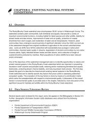
Poydras LnWellington DrBalfour RdMc Millian LnBerkshire LnMoran LnBrys DrBlairmoor RdHigbie PlFountain Club BlvdMeadow Pkwy LnWater Lily WayBayou DrEdgewood BlvdNautilis CirGrosse Pointe CirSunningvale RdDeeplands RdWaterway DrDelta Ln Ripple CtGrosse Pointe BlvdNautilus DrBarnside PlRed Run DrMajestic LnAuburn WayBoulder CtFeatherhall PlAbby Hill PlPennywell PlBal Fern CtWoodlake BlvdRedbraes Dr!.Waters AveRailford CtPost Oak CtHatfield CtBaymeadow Ct0 500 1,000 2,000 FeetRosebank CtPotential Project Site 6: Waters 2Sheldon RdRiver Oaks DrRiverwood BlvdFigure14-11Foxcroft DrCollen CtPinewood DrCatalina DrWestridge DrWoodlake Dr
SITE ANALYSIS FOR POTENTIAL STRUCTURAL ALTERNATIVES14.3 Field Inspection of Potential Sites14.3.1 Potential Project Site 1: LandingsField inspection of the Landings site has confirmed that it is a home to Lake Park, located alongDale Mabry Highway. The small open parcel identified on the aerial photography is located in thesoutheastern corner of the park and is surrounded by upland areas. It is a large, grassy area nextto the archery range. Its size, proximity to stream network, and governmental ownership makesthis location an ideal candidate for a potential water retention facility.This location will be recommended as a structural BMP for this project. Refer to Chapter 15 fordetailed information and cost analysis for this site.14-16<strong>Rocky</strong>/<strong>Brushy</strong> <strong>Creek</strong> <strong>Watershed</strong> Management <strong>Plan</strong>
CHAPTER 1414.3.2 Potential Project Site 2: WebbField inspection of the Webb site confirmed that it is located next to the Town’N’Country Greenway.This location is where <strong>Rocky</strong> <strong>Creek</strong> and Channel “G” meet, and is a small, narrow area overgrownwith grass and other vegetation. A control structure is visible downstream of the junction.While the area at the junction of the streams would be unsuitable for placement of a treatmentfacility, the area to the east (along the Town’N’Country Greenway) may provide some room forretention. Although the size of the area is limited, this site will be further analyzed for a potentialBMP placement.14-17<strong>Rocky</strong>/<strong>Brushy</strong> <strong>Creek</strong> <strong>Watershed</strong> Management <strong>Plan</strong>
SITE ANALYSIS FOR POTENTIAL STRUCTURAL ALTERNATIVES14.3.3 Potential Project Site 3: ApplewoodField inspection of the Applewood site confirmed that it is located next to the Town’N’CountryGreenway (to the east of the Webb site location, upstream of Channel “G”). This location is arelatively small, grassy area located along Channel “G”. While this site is open and governmentallyowned, its small size and close proximity to the Webb Road and Greenway intersection make it anunsuitable candidate for a potential BMP and will not be considered further.14-18<strong>Rocky</strong>/<strong>Brushy</strong> <strong>Creek</strong> <strong>Watershed</strong> Management <strong>Plan</strong>
CHAPTER 1414.3.4 Potential Project Site 4: HamiltonField inspection of this site confirmed that it is located within Hamilton Park, located along HamiltonAvenue. The center of the park contains a small playground area and the western half of the parkis designated as an open field use for soccer practice and other activities. The eastern half of thepark is covered by a heavily forested upland area (pines, palmetto, underbrush, etc.). There areno visible signs of a wetland feature; however, the size and ownership of the parcel make it asuitable candidate for a potential water treatment system.This location will be recommended as a structural alternative during the final recommendationphase of the project. This location may not provide an opportunity for a wetlandimprovement/expansion project, but it may provide a possibility for water retention.14-19<strong>Rocky</strong>/<strong>Brushy</strong> <strong>Creek</strong> <strong>Watershed</strong> Management <strong>Plan</strong>
SITE ANALYSIS FOR POTENTIAL STRUCTURAL ALTERNATIVES14.3.5 Potential Project Sites 5 and 6: WatersField inspection of these two adjacent sites confirmed that they are currently under development.This location will become a future home of the HARTLine bus terminal. As pictures below indicate,a stormwater facility is already under development.14-20<strong>Rocky</strong>/<strong>Brushy</strong> <strong>Creek</strong> <strong>Watershed</strong> Management <strong>Plan</strong>