physical setting earth science
physical setting earth science
physical setting earth science

Create successful ePaper yourself
Turn your PDF publications into a flip-book with our unique Google optimized e-Paper software.
PS/EARTH SCIENCEThe University of the State of New YorkREGENTS HIGH SCHOOL EXAMINATIONPHYSICAL SETTINGEARTH SCIENCEWednesday, January 25, 2006 — 9:15 a.m. to 12:15 p.m., onlyThis is a test of your knowledge of Earth <strong>science</strong>. Use that knowledge to answerall questions in this examination. Some questions may require the use of the EarthScience Reference Tables. The Earth Science Reference Tables are supplied separately.Be certain you have a copy of the 2001 edition of these reference tables before youbegin the examination.Your answer sheet for Part A and Part B–1 is the last page of this examinationbooklet. Turn to the last page and fold it along the perforations. Then, slowly andcarefully, tear off your answer sheet and fill in the heading.The answers to the questions in Part B–2 and Part C are to be written in yourseparate answer booklet. Be sure to fill in the heading on the front of your answerbooklet.You are to answer all questions in all parts of this examination according to thedirections provided in the examination booklet. Record your answers to the Part Aand Part B–1 multiple-choice questions on your separate answer sheet. Write youranswers to the Part B–2 and Part C questions in your answer booklet. All work shouldbe written in pen, except for graphs and drawings, which should be done in pencil.You may use scrap paper to work out the answers to the questions, but be sure torecord all your answers on your separate answer sheet and in your answer booklet.When you have completed the examination, you must sign the statement printedat the end of your separate answer sheet, indicating that you had no unlawfulknowledge of the questions or answers prior to the examination and that you haveneither given nor received assistance in answering any of the questions during theexamination. Your answer sheet and answer booklet cannot be accepted if you fail tosign this declaration.Notice. . .A four-function or scientific calculator and a copy of the 2001 Earth Science Reference Tablesmust be available for you to use while taking this examination.The use of any communications device is strictly prohibited when taking thisexamination. If you use any communications device, no matter how briefly, yourexamination will be invalidated and no score will be calculated for you.DO NOT OPEN THIS EXAMINATION BOOKLET UNTIL THE SIGNAL IS GIVEN.PS/EARTH SCIENCE
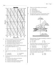
Part AAnswer all questions in this part.Directions (1–35): For each statement or question, write on your separate answer sheet the number of theword or expression that, of those given, best completes the statement or answers the question. Some questionsmay require the use of the Earth Science Reference Tables.1 Which event takes the most time?(1) one revolution of Earth around the Sun(2) one revolution of Venus around the Sun(3) one rotation of the Moon on its axis(4) one rotation of Venus on its axis5 The diagram below shows a satellite in fourdifferent positions as it revolves around a planet.C2 Compared to the Jovian planets in our solarsystem, Earth is(1) less dense and closer to the Sun(2) less dense and farther from the Sun(3) more dense and closer to the Sun(4) more dense and farther from the SunDSatellitePlanetB3 A Foucault pendulum appears to change itsdirection of swing due to the(1) tilt of Earth’s axis(2) spin of Earth on its axis(3) deflection of Earth’s planetary winds(4) movement of Earth in its orbit around theSunA(Not drawn to scale)Which graph best represents the changes in thissatellite’s orbital velocity as it revolves around theplanet?4 The lines on which set of views best representEarth’s latitude system?Orbital VelocityOrbital VelocityEquatorialviewPolarviewEquatorialview( 1 ) ( 3 )PolarviewA B C DSatellite Position( 1 )A B C DSatellite Position( 3 )EquatorialviewPolarviewEquatorialview( 2 ) ( 4 )PolarviewOrbital VelocityA B C DSatellite Position( 2 )Orbital VelocityA B C DSatellite Position( 4 )P.S./E. Sci.–Jan. ’06 [2]
6 At which New York State location will an observermost likely measure the altitude of Polaris asapproximately 42°?(1) Jamestown (3) Oswego(2) Plattsburgh (4) New York City7 Which statement provides evidence that Earthrevolves around the Sun?(1) Winds at different latitudes are curved differentamounts by the Coriolis effect.(2) Different star constellations are visible fromEarth at different seasons of the year.(3) The Sun follows an apparent arc across thesky during the day.(4) The stars appear to circle Earth during thenight.8 Compared to the surface temperature and luminosityof massive stars in the Main Sequence, thesmaller stars in the Main Sequence are(1) hotter and less luminous(2) hotter and more luminous(3) cooler and less luminous(4) cooler and more luminous9 Which factor most likely causes two cities at thesame elevation and latitude to have differentyearly average temperature ranges?(1) rotation of Earth(2) duration of insolation(3) distance from a large body of water(4) direction of prevailing winds10 Which set of surface soil conditions on a hillsidewould result in the most infiltration of rainfall?(1) gentle slope, saturated soil, no vegetation(2) gentle slope, unsaturated soil, vegetation(3) steep slope, saturated soil, vegetation(4) steep slope, unsaturated soil, no vegetation11 Scientists have inferred that Earth’s originalatmosphere was formed by the(1) outgassing from Earth’s interior(2) erosion of Earth’s surface(3) decay of microorganisms in Earth’s oceans(4) radioactive decay of elements in Earth’s core12 Most New York State sandstone bedrock wasformed(1) in Earth’s interior where temperaturesexceeded the melting point of quartz(2) on Earth’s surface from the cooling of moltenlava(3) in a delta from sand grains deposited, buried,and cemented together by minerals(4) in a desert when heat and metamorphic pressurecaused quartz crystals to fuse together13 Which statement best explains why no Permianagebedrock is found in New York State?(1) The extinction of many life-forms occurred atthe end of the Permian Period.(2) Only rocks of igneous origin formed in NewYork State during the Permian Period.(3) Permian-age rocks have been metamorphosedand cannot be identified.(4) Permian-age rocks were either eroded awayor never formed in New York State.14 A fossil shell contains 25% of the original amountof its carbon-14. Approximately how many yearsago was this shell part of a living organism?(1) 5,700 years ago (3) 17,100 years ago(2) 11,400 years ago (4) 22,800 years ago15 Which sequence shows the correct order ofEarth’s geologic time intervals from oldest toyoungest?(1) Archean → Mesozoic → Cenozoic →Paleozoic → Proterozoic(2) Archean → Proterozoic → Paleozoic →Mesozoic → Cenozoic(3) Cenozoic → Mesozoic → Paleozoic →Proterozoic → Archean(4) Cenozoic → Paleozoic → Archean →Mesozoic → Proterozoic16 In which direction do the surface winds blowaround a high-pressure system in the NorthernHemisphere?(1) clockwise and inward(2) clockwise and outward(3) counterclockwise and inward(4) counterclockwise and outwardP.S./E. Sci.–Jan. ’06 [3] [OVER]
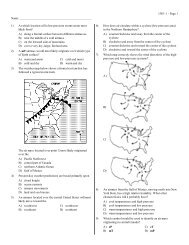
17 The cross section below shows the flow of windsover a mountain ridge.WindOceanWindwardsideThe heaviest rainfall would most likely occur onwhich side of this mountain and in which type ofair mass?(1) on the leeward side, in a mP air mass(2) on the leeward side, in a cT air mass(3) on the windward side, in a mT air mass(4) on the windward side, in a cP air mass18 Various weather conditions at LaGuardia Airportin New York City are shown on the station modelbelow.433440Mountain146.06LeewardsideWhat were the barometric pressure and weatherconditions at the airport at the time of the observation?(1) 914.6 mb of pressure and smog(2) 914.6 mb of pressure and a clear sky(3) 1014.6 mb of pressure and smog(4) 1014.6 mb of pressure and a clear sky19 The properties of an air mass are mostly determinedby the(1) rate of Earth’s rotation(2) direction of Earth’s surface winds(3) source region where the air mass formed(4) path the air mass follows along a land surface20 Which list correctly matches each instrumentwith the weather variable it measures?(1) wind vane—wind speedthermometer—temperatureprecipitation gauge—relative humidity(2) wind vane—wind directionthermometer—dewpointpsychrometer—air pressure(3) barometer—relative humidityanemometer—cloud coverprecipitation gauge—probability ofprecipitation(4) barometer—air pressureanemometer—wind speedpsychrometer—relative humidity21 What is the difference between the dry-bulbtemperature and the wet-bulb temperature whenthe relative humidity is 28% and the dry-bulbtemperature is 0°C?(1) 11°C (3) 28°C(2) 2°C (4) 4°C22 Based on the theory of plate tectonics, it isinferred that over the past 250 million yearsNorth America has moved toward the(1) northwest (3) southeast(2) southwest (4) northeast23 According to tectonic plate maps, New York Stateis presently located(1) at a convergent plate boundary(2) above a mantle hot spot(3) above a mid-ocean ridge(4) near the center of a large plateP.S./E. Sci.–Jan. ’06 [4]
Base your answers to questions 24 and 25 on the cross-sectional view of Earth below, which shows seismicwaves traveling from the focus of an <strong>earth</strong>quake. Points A and B are locations on Earth’s surface.Earthquake focusP- and S-wavesreceived hereAP- and S-wavesreceived hereOuter coreInnerCoreShadow zoneNo waves receivedShadow zoneNo waves receivedBOnly one type ofwave received here24 Which statement best explains why only one typeof seismic wave was recorded at location B?(1) S-waves cannot travel through the liquidouter core.(2) S-waves cannot travel through the liquidinner core.(3) P-waves cannot travel through the solid outercore.(4) P-waves cannot travel through the solid innercore.25 A seismic station located at point A is 5400 kilometersaway from the epicenter of the <strong>earth</strong>quake.If the arrival time for the P-wave atpoint A was 2:00 p.m., the arrival time for theS-wave at point A was approximately(1) 1:53 p.m. (3) 2:09 p.m.(2) 2:07 p.m. (4) 2:16 p.m.P.S./E. Sci.–Jan. ’06 [5] [OVER]
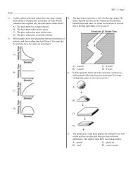
26 The cross section below shows a drill rig used tocollect rock samples from below Earth’s surface.30 The cross section below shows the rock structureof a deeply eroded, domed mountain region.Earth’ssurfaceDrill rigIgneousintrusion2 kilometers(Not drawn to scale)(Not drawn to scale)The rock samples collected from the bottom ofthe drill hole came from which Earth layer?(1) lithosphere (3) asthenosphere(2) hydrosphere (4) stiffer mantleWhich map shows the stream drainage patternthat will most likely develop as the bedrock isweathered and eroded from this igneous dome?27 Which sequence shows the order in which landscaperegions are crossed as an airplane flies in astraight course from Albany, New York, toMassena, New York?(1) plateau → plain → mountain(2) plateau → mountain → plain(3) plain → mountain → plain(4) mountain → plain → plateau( 1 ) ( 3 )28 Why are Precambrian gneiss cobbles and boulderscommonly found on top of the surface bedrock inthe Catskills?(1) The surface bedrock of the Catskills is composedof Precambrian gneiss.(2) The surface bedrock of the Catskills has beenoverturned.(3) Many meteorites composed of gneiss havelanded in the Catskills.(4) Glaciers transported these rocks from theAdirondacks to the Catskills.( 2 ) ( 4 )29 Which component of Earth’s atmosphere isclassified as a greenhouse gas?(1) oxygen (3) helium(2) carbon dioxide (4) hydrogenP.S./E. Sci.–Jan. ’06 [6]
31 The cross section below shows layers of soil.Dark brown to black soilwith a high organic contentTan to orange soil witha high clay content,some rock fragmentsLight gray to black soil,coarse rock fragmentsWhich two processes produced the layer of dark brown to black soil?(1) melting and solidification of magma (3) weathering and biologic activity(2) erosion and uplifting (4) compaction and cementation32 Equal volumes of the four samples shown below were placed outside and heated by energy from the Sun’srays for 30 minutes.WaterCopper penniesBasaltic sandIron fragmentsThe surface temperature of which sample increased at the slowest rate?(1) water (3) basaltic sand(2) copper pennies (4) iron fragmentsP.S./E. Sci.–Jan. ’06 [7] [OVER]
33 Which graph best represents the relative wavelengths of the different forms of electromagnetic energy?WavelengthWavelengthX raysInfraredwaves( 1 )RadiowavesForm of Electromagnetic EnergyX raysInfraredwaves( 3 )MicrowavesMicrowavesRadiowavesForm of Electromagnetic EnergyWavelengthWavelengthX raysInfraredwavesMicrowavesMicrowavesRadiowavesX raysInfraredwavesRadiowavesForm of Electromagnetic Energy( 2 )Form of Electromagnetic Energy( 4 )P.S./E. Sci.–Jan. ’06 [8]
34 The three statements below are observations ofthe same rock sample:• The rock has intergrown crystals from 2 to 3millimeters in diameter.• The minerals in the rock are gray feldspar,green olivine, green pyroxene, and blackamphibole.• There are no visible gas pockets in the rock.35 Most rock gypsum is formed by the(1) heating of previously existing foliatedbedrock(2) cooling and solidification of lava(3) compaction and cementation of shells andskeletal remains(4) chemical precipitation of minerals from seawaterThis rock sample is most likely(1) sandstone (3) granite(2) gabbro (4) phylliteP.S./E. Sci.–Jan. ’06 [9] [OVER]
Part B–1Answer all questions in this part.Directions (36–50): For each statement or question, write on your separate answer sheet the number of theword or expression that, of those given, best completes the statement or answers the question. Some questionsmay require the use of the Earth Science Reference Tables.Base your answers to questions 36 through 38 on the weather map below and on your knowledge of Earth<strong>science</strong>. The weather map shows a typical low-pressure system and associated weather fronts labeled A and B.The L indicates the center of the low-pressure system. A few New York State cities are shown. Symbols cP andmT represent different air masses. The wind direction at Utica and Rochester is shown on the station models.PlattsburghcPRochesterBuffaloJamestownALOswegomTIthacaUticaBcPN36 Which front symbols are drawn correctly, based on the air masses shown?LLLLA( 1 )BA( 2 )BA( 3 )BA( 4 )B37 If this weather system is following a normal storm track, the center of this low is mostlikely moving toward which city?(1) Buffalo (3) Utica(2) Ithaca (4) PlattsburghP.S./E. Sci.–Jan. ’06 [10]
38 Which map shows the regions that are most likely experiencing the precipitationassociated with this weather system?KeyPrecipitationPlattsburghPlattsburghcPRochesterBuffaloJamestownALOswegomTIthacacPUticaBNcPRochesterBuffaloJamestownALOswegoUticamTIthacacPBN( 1 ) ( 3 )PlattsburghPlattsburghcPRochesterBuffaloJamestownALOswegomTIthacacPUticaBNcPRochesterBuffaloJamestownALOswegomTIthacacPUticaBN( 2 ) ( 4 )P.S./E. Sci.–Jan. ’06 [11] [OVER]
Base your answers to questions 39 through 41 on the diagram below and on your knowledge of Earth<strong>science</strong>. The diagram shows a pin perpendicular to a card. The card was placed outdoors in the sunlight on ahorizontal surface. The positions of the pin’s shadow on the card were recorded several times on March 21 byan observer in New York State.Pin8 a.m.Noon10 a.m.Pin shadows(Drawn to scale)39 Which diagram best represents the length of the pin’s shadow at 2 p.m. on March 21?Pin8 a.m.Pin8 a.m.2 p.m.10 a.m.NoonPin shadows2 p.m.10 a.m.Noon Pin shadows( 1 )( 3 )2 p.m.Pin10 a.m.Noon Pin shadows8 a.m.2 p.m.Pin10 a.m.NoonPin shadows8 a.m.( 2 )( 4 )P.S./E. Sci.–Jan. ’06 [12]
40 The changing location of the pin’s shadow on March 21 is caused by(1) the Sun’s rotation (3) Earth’s rotation(2) the Sun’s revolution (4) Earth’s revolution41 On June 21, the card and pin were placed in the same position as they were onMarch 21. The diagram below shows the positions of the pin’s shadow.Pin8 a.m.Noon10 a.m.Pin shadows(Drawn to scale)Which statement best explains the decreased length of each shadow on June 21?(1) The Sun’s apparent path varies with the seasons.(2) The Sun’s distance from Earth varies with the seasons.(3) The intensity of insolation is lower on June 21.(4) The duration of insolation is shorter on June 21.P.S./E. Sci.–Jan. ’06 [13] [OVER]
Base your answers to questions 42 through 46 on the two tables below and on your knowledge of Earth<strong>science</strong>. Table 1 shows the composition, hardness, and average density of four minerals often used as gemstones.Table 2 lists the minerals in Moh’s Scale of Hardness from 1 (softest) to 10 (hardest).Table 1Gemstone Mineral Composition HardnessAverage Density(g/cm 3 )emerald Be 3 Al 2 (Si 6 O 18 ) 7.5– 8 2.7sapphire Al 2 O 3 9 4.0spinel MgAl 2 O 4 8 3.8zircon ZrSiO 4 7.5 4.7KEYAl = aluminum O = oxygenBe = beryllium Si = siliconMg = magnesium Zr = zirconiumTable 2Moh’s Scaleof Hardness1 talc2 gypsum3 calcite4 fluorite5 apatite6 feldspar7 quartz8 topaz9 corundum10 diamond42 Part of a gemstone’s value is based on the way the gemstone shines in reflected light.The way a mineral reflects light is described as the mineral’s(1) fracture (3) luster(2) hardness (4) streakP.S./E. Sci.–Jan. ’06 [14]
43 Sapphire is a gemstone variety of which mineral on Moh’s scale of hardness?(1) corundum (3) fluorite(2) diamond (4) topaz44 If the mass of a spinel crystal is 9.5 grams, what is the volume of this spinel crystal?(1) 0.4 cm 3 (3) 5.7 cm 3(2) 2.5 cm 3 (4) 36.1 cm 345 The hardness and density of each gemstone is based primarily on the gemstone’s(1) internal arrangement of atoms (3) oxygen content(2) geologic time of formation (4) natural abundance46 Which gemstone minerals contain the two most abundant elements by mass inEarth’s crust?(1) emerald and spinel (3) sapphire and spinel(2) emerald and zircon (4) sapphire and zirconP.S./E.Sci.–Jan. ’06 [15] [OVER]
Base your answers to questions 47 through 50 on the cross section below and on your knowledge of Earth<strong>science</strong>. The cross section shows the general movement of air within a portion of Earth’s atmosphere locatedbetween 30° N and 30° S latitude. Numbers 1 and 2 represent different locations in the atmosphere.1 110 km230° N 0°Latitude230° SEarth’ssurface(Not drawn to scale)47 Which temperature zone layer of Earth’s atmosphere is shown in the cross section?(1) troposphere (3) mesosphere(2) stratosphere (4) thermosphere48 The air movement shown in the cross section is due to the process of(1) condensation (3) evaporation(2) conduction (4) convection49 What is the approximate percentage by volume of oxygen present in Earth’s atmosphereat location 2?(1) 10% (3) 33%(2) 21% (4) 46%P.S./E. Sci.–Jan. ’06 [16]
50 Which map best shows the surface movement of winds between 30° N and 30° Slatitude?30° N30° N0°0°30° S( 1 )30° S( 3 )30° N30° N0°0°30° S( 2 )30° S( 4 )P.S./E.Sci.–Jan. ’06 [17] [OVER]
Part B–2Answer all questions in this part.Directions (51–65): Record your answers in the spaces provided in your answer booklet. Some questionsmay require the use of the Earth Science Reference Tables.Base your answers to questions 51 and 52 on the calendar model shown below of the inferred history of theuniverse and on your knowledge of Earth <strong>science</strong>. The 12-month time line begins with the Big Bang onJanuary 1 and continues to the present time, which is represented by midnight on December 31. Severalinferred events and the relative times of their occurrence have been placed in the appropriate locations on thetime line.January 1The Big BangSeptember 10The formation ofEarth and our solarsystemDecember 19The first vertebrates(animals with abackbone)December 26Earliest dinosaursSeptember 25The formation ofthe oldest microfossilDecember 30The extinctionof dinosaursDecember 31late eveningThe first humans51 State one piece of evidence used by scientists to support the theory that the Big Bangevent occurred. [1]52 How many million years of Earth’s geologic history elapsed between the event thatoccurred on September 10 and the event that occurred on September 25 in thismodel? [1]P.S./E.Sci.–Jan. ’06 [18]
Base your answers to questions 53 through 56 on the world map in your answer booklet and on yourknowledge of Earth <strong>science</strong>. The map shows major <strong>earth</strong>quakes and volcanic activity occurring from 1996through 2000. Letter A represents a volcano on a crustal plate boundary.53 In your answer booklet, place an X on the map to show the location of the NazcaPlate. [1]54 Explain why most major <strong>earth</strong>quakes are found in specific zones instead of beingrandomly scattered across Earth’s surface. [1]55 Identify the source of the magma for the volcanic activity in Hawaii. [1]56 Identify the type of plate movement responsible for the presence of the volcano atlocation A. [1]Base your answers to questions 57 through 59 on the diagram below, which shows the Moon’s orbit aroundEarth. Four positions of the Moon are represented by letters A, B, C, and D. Earth’s North Pole is labeled. Theshaded areas on Earth and the Moon represent night.DMoon’s orbitSun’sraysANorthPoleEarthCB(Not drawn to scale)57 What motion of the Moon results in the Moon phases as viewed from Earth? [1]58 A total solar eclipse sometimes occurs when the Moon is at position A. Explain whya total solar eclipse does not occur every time the Moon is at position A. [1]59 State one season that begins when the line separating day and night passes throughEarth’s North Pole, as shown in this diagram. [1]P.S./E. Sci.–Jan. ’06 [19] [OVER]
Base your answers to questions 60 through 62 on the table of index fossils shown below and on yourknowledge of Earth <strong>science</strong>.Table of Index FossilsEospirifer Manticoceras Phacops60 During what geologic time period did the oldest index fossil shown in this tableexist? [1]61 State one characteristic of a good index fossil. [1]62 Complete the classification table in your answer booklet by filling in the generalfossil group name for each index fossil. [1]Base your answers to questions 63 through 65 on the cross section below, which shows an area nearWatertown, New York. The top layer of soil contains broken rock fragments. A representative sample of thislayer has been magnified.Soil with brokenrock fragmentsCross SectionMagnified ViewGraniteGneissUnweatheredlimestonebedrockSandstone63 Identify one mineral that could be found in all three rock fragments shown in themagnified view. [1]64 State one observable characteristic, other than mineral composition, that could helpidentify the gneiss fragment. [1]65 Rocks and minerals are natural resources that are mined in New York State. Stateone negative impact that should be considered before mining these naturalresources. [1]P.S./E. Sci.–Jan. ’06 [20]
Part CAnswer all questions in this part.Directions (66–83): Record your answers in the spaces provided in your answer booklet. Some questionsmay require the use of the Earth Science Reference Tables.Base your answers to questions 66 through 68 on the information below, which describes the past andpresent climate of Antarctica, and on your knowledge of Earth <strong>science</strong>.Antarctica’s ice sheet has an average thickness of 6600 feet and holds approximately70% of Earth’s freshwater. Ice layers in Antarctica preserve information aboutEarth’s history. Fossil evidence found in the bedrock of this continent shows thatAntarctica was once tropical and is a potential source of untapped natural resources.Antarctica is now a frozen desert with very little snowfall.66 Explain why Antarctica’s cold climate is responsible for its very low amount ofyearly precipitation. [1]67 What evidence is preserved in Antarctica that provides information about Earth’spast climates? [1]68 Scientists are concerned that the Antarctic ice may melt as the result of globalwarming. State one effect that this melting would most likely have on Long Island,New York. [1]P.S./E. Sci.–Jan. ’06 [21] [OVER]
Base your answers to questions 69 through 73 on the map below, which shows a meandering stream as itenters a lake. Points A through D represent locations in the stream.ALakeDCB69 In the box in your answer booklet, draw a cross-sectional view of the general shapeof the stream bottom between points A and B. The water surface line has alreadybeen drawn. [1]70 State the relationship between stream velocity and the size of the sediment thestream can carry. [1]71 Describe how the size and shape of most pebbles change when the pebbles aretransported in a stream over a great distance. [1]72 The stream velocity at point C is 100 centimeters per second and the streamvelocity at point D is 40 centimeters per second. Identify one sediment particle mostlikely being deposited between points C and D. [1]73 Deposition is affected by particle density. On the grid in your answer booklet, drawa line to show the relationship between particle density and settling rate. [1]P.S./E. Sci.–Jan. ’06 [22]
Base your answers to questions 74 through 77 on the passage below, the map in your answer booklet, andyour knowledge of Earth <strong>science</strong>. The map shows ocean depths, measured in meters, off the coast ofMassachusetts. Points A, B, and C represent locations on the ocean floor. The Stellwagen Bank discussed in thepassage is lightly shaded and labeled on the map.The Stellwagen BankOne of the most exciting adventures for a visitor to Cape Cod, Massachusetts, isgoing on a whale watch. Large boats leave port two to three times each day carryingpassengers to a specific location in the Atlantic Ocean to see the whales. How do thecaptains of the boats know where to find the whales?The answer is simple. They look for the whales over an area known as theStellwagen Bank, which is a large undersea deposit of unsorted sand and gravel. TheStellwagen Bank is inferred by scientists to have formed during the Pleistocene Epochfrom the slow retreat of massive Ice Age glaciers across this area. Today, cool oceancurrents come from the north and flow up and over the Stellwagen Bank. Thesecurrents bring nutrients to the surface from deep in the ocean, providing food foroceanic phytoplankton (small plants). Small ocean creatures and fish feed on thephytoplankton. Whales can be found in abundance at the Stellwagen Bank feeding onthe many ocean life-forms.74 Most whale watching takes place at 42° 25′ N and 70° 25′ W. On the map in youranswer booklet, place an X at this location. [1]75 Identify the most probable cold ocean current causing the upwelling of nutrientsover the Stellwagen Bank. [1]76 What evidence indicates that the ocean floor has a steep slope at point C? [1]77 Calculate the average ocean-floor gradient between point A and point B. Label youranswer with the correct units. [2]P.S./E. Sci.–Jan. ’06 [23] [OVER]
Base your answers to questions 78 through 80 on the data table below and on your knowledge of Earth<strong>science</strong>. Iridium is an element rarely found in Earth’s lithosphere but commonly found in asteroids. The datatable shows the abundance of iridium, in parts per billion (ppb), found in a rock core sample taken in Carlsbad,New Mexico.Iridium Abundance in a Rock Core SampleDepth BelowEarth’s Surface(m)IridiumAbundance(ppb)0 050 0100 0.5105 0.5113 0.5115 13.5119 0.51201281350.250.25078 On the grid in your answer booklet, construct a line graph of iridium abundance atvarious depths. Place an X to show the iridium abundance at each depth shown onthe data table. Connect the Xs with a line. [2]79 The high concentration of iridium in this rock core sample has been matched to rocklayers that have been dated to the geologic time when dinosaur extinction from anasteroid impact may have occurred. Between which two geologic time periods didthis inferred extinction occur? [1]80 Other than iridium in the rock layers, what surface feature was most likely createdwhen this asteroid impacted Earth’s crust? [1]P.S./E. Sci.–Jan. ’06 [24]
Base your answers to questions 81 through 83 on the cross sections below, which show widely separatedoutcrops at locations W, X, Y, and Z. The rock layers have not been overturned. Line AB in the cross section atlocation W represents an unconformity. Fossils are shown in some of the layers.Location WLocation X Location YIgneous intrusionKeyContactmetamorphismLocation ZSedimentary rock typesFossil typesAB(Not drawn to scale)81 Determine the relative geologic age of the four fossils by correlating the rock layersbetween these outcrops. In your answer booklet, number the fossils from 1 to 4 inorder of relative age, with 1 as the oldest and 4 as the youngest. [1]82 What evidence shown in the outcrop at location W suggests that the igneous intrusionoccurred after both fossils were deposited at location W? [1]83 Identify two of the processes involved in the formation of the unconformity representedby line AB in the cross section at location W. [1]P.S./E. Sci.–Jan. ’06 [25]
The University of the State of New YorkREGENTS HIGH SCHOOL EXAMINATIONTear Here Tear HerePHYSICAL SETTINGEARTH SCIENCEWednesday, January 25, 2006 — 9:15 a.m. to 12:15 p.m., onlyANSWER SHEETStudent . . . . . . . . . . . . . . . . . . . . . . . . . . . . . . . . . . . . . . . . . . . . . Sex: ■ Male ■ Female Grade . . . . . . . . . . . .Teacher . . . . . . . . . . . . . . . . . . . . . . . . . . . . . . . . . . . . . . . . . . . . . School . . . . . . . . . . . . . . . . . . . . . . . . . . . . . . . . . .Record your answers to Part A and Part B–1 on this answer sheet.Part A1 . . . . . . . . . . . 13 . . . . . . . . . . . 25 . . . . . . . . . . .2 . . . . . . . . . . . 14 . . . . . . . . . . . 26 . . . . . . . . . . .3 . . . . . . . . . . . 15 . . . . . . . . . . . 27 . . . . . . . . . . .4 . . . . . . . . . . . 16 . . . . . . . . . . . 28 . . . . . . . . . . .5 . . . . . . . . . . . 17 . . . . . . . . . . . 29 . . . . . . . . . . .6 . . . . . . . . . . . 18 . . . . . . . . . . . 30 . . . . . . . . . . .7 . . . . . . . . . . . 19 . . . . . . . . . . . 31 . . . . . . . . . . .8 . . . . . . . . . . . 20 . . . . . . . . . . . 32 . . . . . . . . . . .9 . . . . . . . . . . . 21 . . . . . . . . . . . 33 . . . . . . . . . . .10 . . . . . . . . . . . 22 . . . . . . . . . . . 34 . . . . . . . . . . .11 . . . . . . . . . . . 23 . . . . . . . . . . . 35 . . . . . . . . . . .12 . . . . . . . . . . . 24 . . . . . . . . . . .Part A ScorePart B–136 . . . . . . . . . . . 44 . . . . . . . . . . .37 . . . . . . . . . . . 45 . . . . . . . . . . .38 . . . . . . . . . . . 46 . . . . . . . . . . .39 . . . . . . . . . . . 47 . . . . . . . . . . .40 . . . . . . . . . . . 48 . . . . . . . . . . .41 . . . . . . . . . . . 49 . . . . . . . . . . .42 . . . . . . . . . . . 50 . . . . . . . . . . .Part B–1 Score43 . . . . . . . . . . .Write your answers to Part B–2 and Part C in your answer booklet.The declaration below should be signed when you have completed the examination.I do hereby affirm, at the close of this examination, that I had no unlawful knowledge of the questions or answers prior tothe examination and that I have neither given nor received assistance in answering any of the questions during the examination.Signature
PS/EARTH SCIENCETear HereTear HerePS/EARTH SCIENCE