Conservation Area Assessments - Ruabon - PDF format 4.8Mb
Conservation Area Assessments - Ruabon - PDF format 4.8Mb
Conservation Area Assessments - Ruabon - PDF format 4.8Mb

Create successful ePaper yourself
Turn your PDF publications into a flip-book with our unique Google optimized e-Paper software.
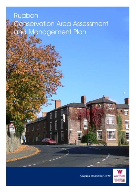
<strong>Ruabon</strong><strong>Conservation</strong> <strong>Area</strong> Assessmentand Management PlanAdopted December 2010
ContactFor more in<strong>format</strong>ion or advice contact:Head of Community Wellbeing and DevelopmentPlanning ServiceWrexham County Borough CouncilLambpit StreetWrexhamLL11 1ARTelephone: 01978 292019email: planning@wrexham.gov.ukwww.wrexham.gov.uk/planningThis document is available in welsh and in alternative <strong>format</strong>s onrequest. It is also available on the Council’s website
contentsPart I - Character Assessment1.0 Introduction2.0 History and Development3.0 Summary of Special Character4.0 Character in Detail5.0 Summary of Negative Features136820Part II - Management Plan6.0 Enhancement Plan7.0 Design Guidance8.0 <strong>Conservation</strong> <strong>Area</strong> Controls9.0 Sources of FundingAppendix 1Listed BuildingsAppendix 2<strong>Conservation</strong> Policy GuidanceAppendix 3Glossary of Terms22242628293031FiguresFigure 1 - <strong>Ruabon</strong> 1874Figure 2 - <strong>Ruabon</strong> <strong>Conservation</strong> <strong>Area</strong> Character <strong>Area</strong> BoundariesFigure 3 - High StreetFigure 4 - Church Of St Marys and Church StreetFigure 5 - Park StreetFigure 6 - Tan y Lan and Paddock RowFigure 7 - <strong>Ruabon</strong> Station and Railway TerraceFigure 8 - Pont Adam and Mount PleasantFigure 9 - Grenville Terrace368101314161719
Ariel View <strong>Ruabon</strong> <strong>Conservation</strong> <strong>Area</strong>
Part 1Character Assessment
<strong>Ruabon</strong> <strong>Conservation</strong> <strong>Area</strong>Ordnance Survey (mapping) © Crown copyright. All rights reserved. 100023429. 2010
introduction<strong>Conservation</strong> <strong>Area</strong> Designation1.1 Section 69 of the Planning (Listed Buildings and<strong>Conservation</strong> <strong>Area</strong>s) Act 1990 requires LocalAuthorities to identify "areas of special architectural orhistoric interest the character or appearance of which itis desirable to preserve or enhance" for designation as<strong>Conservation</strong> <strong>Area</strong>s.Purpose1.2 The purpose of the <strong>Conservation</strong> <strong>Area</strong> Assessmentand Management Plan is:●●●●●To provide a clear definition of an area's specialarchitectural or historic interestTo identify ways in which their uniquecharacteristics can be preserved and enhancedthrough the Enhancement PlanTo strengthen the justification for designationTo create a clear context for future development inaccordance with conservation area policies in thedevelopment planTo provide a vehicle for engagement and awarenessraising<strong>Ruabon</strong> <strong>Conservation</strong> <strong>Area</strong>1.3 This Assessment and Management Plan aims topromote and support developments that are in keepingwith, or enhance, the character of the <strong>Ruabon</strong><strong>Conservation</strong> <strong>Area</strong>. It is not an attempt to stifle change.The aim is to strike a balance so that the interests ofconservation are given their full weight against theneeds for change and development. <strong>Ruabon</strong><strong>Conservation</strong> <strong>Area</strong> was first designated in August 19751 Introductionand its boundary amended in February 1998 andDecember 2010. Enhancement proposals werepublished in 1988. This document is concerned withthe reasons for designation, defining the qualities thatmake up its special architectural and historic interest,character and appearance. The omission of anyreference to a particular building, feature or spaceshould not be taken to imply that it is of no interest.Planning Context1.4 This statement should be read in conjunction withthe adopted Wrexham Unitary Development Plan 2005,and national planning policy guidance, in particularWelsh Office Circular 61/96 Planning and the HistoricEnvironment: Historic Buildings and <strong>Conservation</strong><strong>Area</strong>s.Location1.5 <strong>Ruabon</strong> <strong>Conservation</strong> <strong>Area</strong> encompasses the heartof the village, which is located approximately 6 milessouth of Wrexham. <strong>Ruabon</strong> Mountain rises up to thewest and the Afon Eitha runs directly through thevillage. The <strong>Conservation</strong> <strong>Area</strong> centres on the Grade Ilisted Church of St Mary's. The influences of theprominent Wynnstay Estate as well as local industriesare displayed in the various architectural styles evidentin the villages' development.Geology1.6 The principal building stone of the area is a finegrainedcarboniferous sandstone, quarried from themiddle coal measures. This Cefn stone has a tendencyto blacken easily. The local brick and terracotta hasbeen produced from fireclay and red terracotta marls1
introductionobtained from the upper coal measures, whilst ironore is prevalent at deeper levels. The diversity ofavailable local building materials has created a richand varied townscape.Consultation1.7 Community Councils, County BoroughCouncil members and a range of organizations andgroups with an interest in the historic environmentand the local area were consulted on thisdocument. Statutory bodies such as Cadw werealso consulted. Public consultation was undertakenduring April, May, September and October 2010.The <strong>Ruabon</strong> <strong>Conservation</strong> <strong>Area</strong> CharacterAssessment and Management Plan were adoptedby the Councils Executive Board on 14thDecember 2010.2
history and developmentFigure 1: <strong>Ruabon</strong> 1874Ordnance Survey (mapping) © Crown copyright. All rights reserved. 100023429. 20102 History and DevelopmentBronze Age2.1 The earliest evidence of settlers in the area datesback as early as 1400BC. Significant Bronze Agediscoveries include a stone urn or 'cist' containingcremated remains found in Cleveland Street and a'round barrow' or 'cairn' found in the grounds of<strong>Ruabon</strong> Grammar School. A Cairn is a separate gravefor important members of the tribe, normally thechieftain or priest. When discovered the cairncontained human bones, an arrowhead and a bronzeaxe.Iron Age2.2 Situated on alow summit to theNorth of the presentday village centre isY Gardden Hillfort,which dates back toapproximately400BC. Comprising an inner stone built rampart, a 2ndearthen rampart and a more sporadic 3rd bank to thesouth and east of the mound, these remnants enclose anarea of some 4 acres. It is believed the settlement wasoccupied until the Roman invasion in approximately55AD.5th-8th Century AD2.3 The remains of the ancient earthworks of theWat's and Offa's Dyke run parallel and on a north-southalignment alongside the village and define its earlyboundaries. Wat's Dyke is believed to have beenconstructed by the Anglo-Saxons in the 5th Century ADas a frontier between their conquered territory and theland to the west under Welsh control. King Offa ofMercia constructed Offa's Dyke in 8th Century AD.The purpose of the Dyke is still disputed. It may havebeen constructed for defensive means or to serve as aboundary between Saxon and Welsh Kingdoms.St Mary'sChurch2.4 Situatedcentrally between theDykes and within theheart of the presentday village is theChurch of St. Mary's.Taxation records of 1254 indicate a Church in <strong>Ruabon</strong>dedicated to St. Collen, the foundation of which maypossibly date back to 7th Century. The almost circularchurchyard suggests the presence of an early medievalllan. By the end of the 13thCentury the Church waspossessed by the CistercianAbbey of Valle Crucis and rededicatedto the BlessedVirgin Mary. Prior to this theChurch was dedicated to St.Mabon, a local saint. Thename '<strong>Ruabon</strong>' derives fromthe Welsh translation'Rhiwabon' meaning 'Mabon'sHill.'2.5 The west tower of the Grade I Listed Churchdates from the 14th Century. Internally to the southwall is a wall painting dating to the early 15th Century3
history and development4and is over 15 feet in length.The south east and north eastchapels date to the late 18thcentury, whilst the nave arcade,clerestory, aisles and most ofthe windows were the result ofremodelling works in 1870-2 bythe architect Benjamin Ferrey.The Church sits upon anelevated site and dominatesviews into the village fromevery direction.Middle Ages2.6 After the Norman invasion of 1066, the Welsh hadto defend themselves against English attack, drivingEnglish occupants back across the River Dee. <strong>Ruabon</strong>was part of the kingdom of Powys in Bromfield. Atthis time ecclesiastical parishes were established whichwere defined by a group of townships. The townshipswere run on the basis of the communal farming system,comprising of a number of homesteads and communalpasture and meadowlands. The year 1282 saw theconquest of Wales with part of the Kingdom of PowysFadog becoming a Marcher Lordship. Welsh andEnglish law co-existed relatively peacefully in <strong>Ruabon</strong>.2.7 Under the Act of Union 1536, Henry VIII tookcontrol over the whole of Wales due to his concernsover the loyalty of the Marcher Lords following hisbreak with the Catholic Church. Under the terms of thenew laws Wales was granted permission to berepresented in Parliament and the Welsh gentry wereable to acquire landed estates.2.8 Of particular notewere the mansion housesof Watstay (now replacedby the Grade II* listedWynnstay Hall) and PlasNewydd, a Grade II*listed building located atPont Adam. Built in theearly-mid 16th Century, Plas Newydd is a large timberframedhouse consisting of a hall and passage betweenstoreyed wings. The hall consists of 4 bays and housesunusually rare spere trusses. The Eyton family builtboth properties. The tomb of John ap Elis Eyton andhis wife Elizabeth Calverley can be found in the chapelof <strong>Ruabon</strong> church. John ap Elis Eyton earned favourwith Henry VII when he fought on his side at Bosworthfield.Pre-IndustrialPeriod2.9 Situated to thesouth of the village,the gateway to ParkStreet marks theformer entrance tothe long tree-lined avenue that once lead to the Hall butis now severed by the A483. The Grade II* listedWynnstay Hall and several other interesting estatebuildings and structures remain within the expansiveparkland that once served as the principal seat of themost prominent, wealthy, influential and hospitablefamily in north Wales during the 18th and 19thCenturies, the Williams-Wynns.2.10 Originally named the Rhiwabon Estate, thenWatstay (due to the Dyke running through the estate), itwas renamed Wynnstay by SirJohn Wynn in the mid 17thCentury. The Hall was of theJacobean style, extended in1736-8 in the neo-classical stylebut was destroyed by fire in1858. Of this building only theJewel Tower (c.1706) remains.The present - day structure wasbuilt in the French Renaissancestyle to designs by BenjaminFerrey.2.11 The Williams-Wynns made significantcontributions to the local community and wereresponsible for many of the key structures evident inthe <strong>Conservation</strong> <strong>Area</strong> today, in particular the WynnstayArms Hotel and the estate workers cottages along ParkStreet. Each successive generation of the Williams-Wynns are also remembered in some way within StMary's Church by way of monuments or furnishings.2.12 During the First World War, the estate was used asa munitions factory and during the Second World Warby the army. It was the sudden death of the 8th Baronetin 1949 that brought an end to the family's 230 yearhistory at Wynnstay. The Hall was sold to LindisfarneCollege and in recent years has been sub-divided intoprivate dwellings.The Age of Industry2.13 There are records of industrial activity within theParish of <strong>Ruabon</strong> dating back to the Middle Ages, inparticular the iron industry based in Gyfelia. Within thevillage itself, early industrial activity was based in theareas of Tan-y-Llan and adjacent Plas Newydd wherethe Afon Eitha was used to power both woollen andgrain mills. Historical maps record a concentration ofbuildings in both these areas suggesting the earlydevelopment of the village was centred around theseindustries. The villagecontinued to grow inthe immediate environsof the church and to thesouth east with theconstruction of theWynnstay Arms (orThe Eagles) in 1740and the estates workers cottages on Park Street.2.14 The 18th and 19th centuries saw the proliferationof heavy industry in the surrounding area. Within theParish of <strong>Ruabon</strong>, the iron industry thrived particularlyat Plas Madoc, Plas Benion and Acrefair. Numerouscollieries were sunk including The Green to the southwest of the village, Plas Bennion, Plas Madoc andGardden. When these, and many others, were floodedin 1846, the Wynnstay, Vauxhall and Hafod collieries
history and developmentwere opened up. Hafod (<strong>Ruabon</strong> New Colliery) canals and tramways and then the railway. <strong>Ruabon</strong>was the last to be closed in 1968.Station was designed by Thomas Penson ofShrewsbury and opened in 1846 (replaced 1860).2.15 <strong>Ruabon</strong> was world-renowned for theThe <strong>Ruabon</strong>-Wrexham coalfield was the first inmanufacture of brick and terracotta in evidenceWales to be provided with a railway network whichthroughout the village and surrounding areasalso provided a passenger and goods service tothrough both brick- work and decorative featuresnorth-west England, the Midlands and Shrewsbury.such as string courses, finials, consoles and friezesThis resulted in the further growth of the villageand achieved through the exploitation of the richalthough major expansion did not occur until 1888deposits of <strong>Ruabon</strong> red marl clay. The most prolificwhen the Yorke's of Erddig constructed Tai Clawddbrickworks in the area included <strong>Ruabon</strong> Brick andand expansion continued to the north east with theTerracotta, J.C Edwards and the Hafod Brickworksfurther development of the High Street effectivelycompanies.doubling the size of the original village centre.2.16 The success of these industries depended on Today good rail links and accessibility to the A483good transport links and relied primarily on the make <strong>Ruabon</strong> a popular commuter village.5
character in detailFigure 3: High StreetHigh Street Character<strong>Area</strong> BoundaryBuildings of Visual Interest orstrong Townscape GroupImportant ApproachImportant BoundaryImportant <strong>Area</strong> of OpenSpace/Green SpaceLandmark BuildingOrdnance Survey (mapping) © Crown copyright. All rights reserved. 100023429. 20104 Character in Detail84.1 The <strong>Conservation</strong> <strong>Area</strong> can be divided into 6distinct character areas as now described below:High Street4.2 This area ischaracterised by acombination of 2 and 3storey buildings formingdistinctive townscapegroups within the streetscene.A variety of building styles and periods areevident, the west-side of the street being dominated by3 storey Georgian building's whilst the east largelyconsists of Victorian properties interspersed with early19th century sandstone cottages. A number of buildingsare set back from the road behind their own boundariesgiving a certain status to the properties on this street.4.3 High Street is dominated by a series of steeplypitched gables andfinials, formingthe distinctiveroof-scape of theterrace of TaiClawdd. Built in1888 by the Yorkefamily of Erddig,this was one of theearliest developments undertaken in the expansion ofthe village in the 19th century. The terrace provides astrong street frontage, the regularity of the elevationsattributed by the gables giving rhythm to the streetscene.There are a total of 10 red brick-built propertiesin the row, comprising symmetrically coupled timberframedporches and, at roof level, central gabletsadjoined on either side by further smaller gablets.Some of the porches have been infilled. However, theoriginal intention of thedesign can still be seen,in particular to numbers2, 7 and 10 where all theoriginal joinery,including windows anddoors have beenretained.4.4 Whilst most of the original doors and windowshave been removed, the buildings still display a certainquality in materials and details, in particular, the stonewindow heads and cills, tall corbelled brick chimneystacks, bargeboards and finials, terracotta stringcourseand boundary details. Tai Clawdd is fronted by smallgardens enclosed behindsmooth red brick dwarfwalls which have stonecopings surmounted byheavy iron railings withball finials. Theproperties are accessedthrough substantialcarved sandstone gateposts and simple metalgates which lead ontored and black tiledpathways and stonesteps. Despite someminor alteration, theoriginal design of theterrace is clearly evident and adds character and qualityto the entrance of the <strong>Conservation</strong> <strong>Area</strong>.
character in detail4.5 Tai Clawdd overlooks the site of the former<strong>Ruabon</strong> AccidentHospital, built in1886 but laterdemolished, andnow the site of late20th CenturyCouncil offices,<strong>Ruabon</strong> Clinic and<strong>Ruabon</strong> Library.Whilst there are some mature trees and areas of greenspace, the extensive parking on the site and the locationof the toilet block immediately adjacent to the roadsidegreatly detract from thehistoric appearance ofthe area. To the westof the site can be seenthe remains of aboundary stone wall.4.6 Continuing intothe centre of thevillage, after Tai Clawdd are numbers 12 and 13 HighStreet, a pair of stone built cottages which sit directlyonto the footpath and believed to have been the formertollhouses. The former North and South Wales Bank(now the HSBC Bank) stands on the left side of thestreet. It is abuilding ofconsiderable qualityand status that wasbuilt around asimilar time to TaiClawdd. It is setback from the roadbehind a low stoneplinth inset with fine iron railings. The building isconstructed of smooth red brick with a hipped slateroof, central brick stack and sandstone dressings. Itconsists of 5 bays, the central bay comprising of agrand, rusticated stone porch with open segmentalpediment, canted bay at first floor and coped pedimentto the second floor. The building largely retains itsoriginal joinery, with tall casement and sash windows tothe ground and first floors.4.7 On the opposite side of the road is an impressivepair of former dwellings of the Georgian period, BrynEnd. A small enclosed area to the front set behind fineiron railings and separating the building from the roadgives a clear indication of the greater importance andstatus held by the properties during earlier times. Thebuilding is constructed of redbrick and is 3 storeys inheight with finial adorneddormers set within the eaves.These appear to have been alater addition, built in smoothred brick. To the ground andfirst floors, windows have flatarched heads and stone sillsand doorways with semicircularheads. Windows areall traditional 12 panedsliding sashes and the left-handproperty retains its originalporch. The height of thebuilding and regularity of thedormers and fenestrationcontinue to add to the rhythmand strong vertical emphasis ofthe streetscape and creates astriking and imposing groupwithin the street-scene. Theage and authenticity of thefaçade make this a landmark building within thevillage.4.8 The adjacent building has been much altered;originally it was gable fronted and half-timbered with ajettied bay to the first floor, providing a significantfrontage within the street. The bay has now beenreplaced with a wide single window which displays ahorizontal emphasis and unbalances the proportions andupsets the rhythm of the streetscene. Adjacent is amuch lower 2-storey building, the contrasting heightsmaking for an interesting street-scape. This propertyretains its sliding sash windows to its upper floors butthe original shop front has been replaced. The façadeof the neighbouring building is of a design completelyout of character with others in the <strong>Conservation</strong> <strong>Area</strong>.Ironically, this replaced the former Head OfficeBuilding of Dennis <strong>Ruabon</strong>, an ornate building whichdisplayed finedecorative terracottadetail serving as anadvertisement for theproducts available fromthe nearby clayworks.The replacementstructure regrettably isrendered at ground floor level with small irregularwindow openings throughout. The relationship of solidwall to void fails to respect the quality of design,proportions and rhythm so characteristic of this part ofHigh Street. The adjacent 2 - storey properties displaysimilar undesirable characteristics.4.9 The final group of buildings on this side of thestreet are again of the Georgian period, and of similarproportions to BrynEnd. They are of 3storeys in height withsegmental arched brickheads and mostlymulti-paned casementwindows with shopfronts at ground floorlevel. The right handproperty has a 20th century bay window to the firstfloor and remnants of an original shop front below.The height and mass of these properties together withthe Grade II Listed Haven Flat and Grade 1 BarbersShop (formerly Mary's Salon) form a strong cornergroup balanced on the opposite side of the street by theWynnstay Arms Hotel, and create an impressiveentrance into the heart of the <strong>Conservation</strong> <strong>Area</strong>,centred around the Church of St Mary's.9
character in detail4.13 The Wynnstay Arms is a substantial and highlyprominent buildingwith elevations facingonto both High Streetand Park Street. It is agrade II listed buildingand was built as acoaching inn in the late18th Century, laterenlarged in 1841. It comprises a 2-storey element onHigh Street but is predominantly of 3-storeys. Itsheight, together with the deep octagonal bay to the ParkStreet elevation make this an imposing building. It isbrick built with sandstone dressings and sliding sashwindows. Approachingfrom Bridge Street, theCarriage entrance to isa landmark buildingenclosing the viewfrom this approachuntil the imposing bayof the Hotel comes intoview as the road risesand curves. Thecarriage entrance toPark street is insandstone rubble withdressed quoins with pediment above the opening. Onthe corner of the building with High Street and ParkStreet is an ornate 18th-early19th Century wrought ironbracket, a distinctive and impressive feature at this keyjunction within the village.4.14 Facing theWynnstay Arms, on theopposite side of ParkStreet, is WynnstayMews, anotherprominent landmarkwithin the<strong>Conservation</strong> <strong>Area</strong>which encloses the view from High Street. The buildingis constructed of smooth red brick with hipped slateroof and largely retains its traditional style of joinery.It comprises 2 units facing onto Bridge Street and oneonto Park Street. Behind is a terrace of one and a halfstorey rendered cottages. The red brick of the mewscontrasts strongly with the more predominantsandstone, contributing to the variety and interest of thestreetscene.4.15 The narrowChurch Street boundedby the Churchyard andcottages which sitdirectly onto the road,creating a strong senseof intimacy andenclosure. Buildingsare of a smaller scale than those on High Street andcomprise some of the earliest structures within thevillage. At the entrance of the area beyond Mary'sSalon are some rendered cottages and the former CrossFoxes Public House, now a dwelling set back from theroad. Adjacent is Bowen Court perhaps the mostincongruous and modern development on High Street.Whilst the propertiesare positioned directlyonto the road andmaintain the buildingline, the buildingdesign and materialsare inconsistent withthose that characterisethe area.4.16 Adjoining the churchyard wall is the OldGrammar School and Hearse shed, both Grade II ListedBuildings. The school was built in 1618 and was laterconverted to a shop inthe mid 19th Centurybefore being convertedto a house at the end ofthe 20th Century. It isbuilt of uncoursedsandstone rubble andhas a substantial offcentrelateral chimney stack onto Church Street andmulti-paned cast iron casement windows. The hearseshed is attached to the east gable and has an arched cartdoor opening. At right angles to the grammar schooladjacent Ysgoldy Hill,is the formerSchoolhouse, fromwhich the hill takes itsname, built in similarconstruction to theGrammar School andalso Grade II Listed.4.17 Adjacent is a single-storey shop built of smoothred brick with a hipped roof. Its orientation, facingtowards High Street, makes it a fairly prominentbuilding and its unique design contributes to thediversity of styles evident in Church Street. Beyondthis Stonehurst is one of two grade II listed townhouseson the street, the other being Spring Lodge locatedopposite. Both make a significant contribution to thestreetscene.4.18 Both Stonehurstand Spring Lodge werebuilt in the early 19thCentury of sandstone,2-storeys in height and3 bays widewithsymmetricalfacades andsliding sashwindows toboth floors.Stonehurst isset behind a low brick wall with stone copings and talliron railings with cobbles adjacent the road.Interestingly, its rear elevation has been designedalmost identically to the front, presumably so that it can11
character in detailbe viewed from Bridge Street. Spring Lodge is setbehind unusually large stone gatepiers and railings.4.19 Next to SpringLodge are CambrianCottage and CambrianHouse a pair of 18thCentury dwellings.Predominantly built ofbrick, with a timberframed and renderedcanted entrance,Cambrian Houseslightly leans into the street, further emphasising thesense of enclosure. Both cottages retain some of theirmulti-paned iron casement windows. From this pointthe sense of enclosureeases as the Garden ofRest opens up beyond astone wall. Headstoneshave been placedaround the boundary ofthe site, providing apleasant and peacefularea of open space.4.20 Adjoining Stonehurst is a terrace of cottages,numbers 1-5 Church Street, now greatly altered.Original openings have been adjusted or blocked andthe facades rendered orpebble-dashed andjoinery replaced inuPVC substitutes.However, numbers 1and 2 of the terrace stillretain much of theiroriginal character withthe brickwork still exposed (despite some rebuilding)revealing the stone window and door heads andretaining multi-paned casement windows.4.21 The final house on thewest of the street before therailway bridge is thesubstantial stone frontedMount House with stonehoodmoulds, copings andkneelers. It has a gablefacing onto the road whichmakes it a prominentstructure within thestreetscene. It has beenunoccupied for many years.4.22 The final group of buildings on Church Streetbefore the road windsdown into Pont Adamare the Grade II listedAlmshouses. Believedto date from 1711, theyoriginally formed partof a courtyardarrangement, 3 sides of which have now beendemolished. The terrace comprises 5 single storeydwellings of painted brick. Each has 2 12-pane castiron casement windows on either side of the entrancedoor.4.23 The steep and narrow Ysgoldy Hill, linkingChurch Street with Bridge Street, affords a strong senseof enclosure by the tall stone and brick walls lining thepathway. On Bridge Street, the Bridge End PublicHouse, a 2 storey, rendered building, sits snugly belowroad level. Stepping back up towards the Church isnumber 3a Bridge Street and the Vaults Public Housebeyond which the Church rises up behind. Thiscomposition of eclectic building styles, heights andmaterials creates an interesting and varied townscapegroup, furtherenhanced by theappearance of theRound House, nestledbelow the substantialChurchyard walls. TheRound House, a gradeII listed building is adistinctive landmarkwithin the village. Itwas built in the late18th century as a parishlock-up and isconstructed ofsandstone blocks with adomed roof and smallopenings with iron bars. From this point the road risesand curves back up into the centre of the village, thegreat churchyard wall on the left, framing the view ofthe Wynnstay Armsimmediately ahead.12
character in detailFigure 5: Park StreetPark Street Character <strong>Area</strong> BoundaryBuildings of Visual Interest or strong Townscape GroupImportant ApproachImportant <strong>Area</strong> of Open Space/Green SpaceListed BuildingOrdnance Survey (mapping) © Crown copyright. All rights reserved. 100023429. 2010Park Street4.24 Once the original route from the village to theWynnstay Estate, theoverly wide street hasan almost ceremonialquality to it. Thearchitectural influenceof the Wynnstay Estateis evident in thedistinctive estatesworkers cottages thatline the route. The street comprises four identical andsymmetrical blocks of four cottages and a gate lodge,which provide a strong building line to frame theWynnstay Estate Entrance Archway which encloses theview to the south east. The cottages, gate lodge andgateway are all grade II listed buildings. Theconstruction of the A483 severed the Park Streetentranceway, driveway and land immediately behindfrom the remainder of the estate leaving an area ofunderused but important open space.4.25 The architect John Jonesdesigned the gateway in 1783,replacing earlier lodges. The greattree-lined avenue beyond has nowbeen dissected by the slip road to theA483, making the gatewayredundant. The archway is built oflocal Cefn sandstone with wroughtiron gates and railings erected in1912 to mark the coming of age of the 8th Baronet, SirWatkins Williams-Wynn.4.26 The cottages and gate lodge are 2 storey buildingswith hipped slate roofs and overhanging eaves. Theyare constructed from squared sandstone rubble anddressed quoins and have squat octagonal chimneystacks. The cottages have paired central entrance doorsto the front with a further entrance to each gable understone canopies. Many of the windows have beenrenewed with traditional multi-paned casements understone hoodmoulds. Atthe north west end ofthe street is the stonebuiltConstitutionalClub, formerly theVillage Room,adjacent which wasonce The Goat Inn andan area of open spaceknown as the Goat Bank where fairs and markets wereheld.4.27 The street wassubject to aTownscape PartnershipScheme from 1996until 2006 that hasseen the stoneworkrepaired andtraditionally styledjoinery reinstated tomany of the properties. A number of public realmimprovements were also undertaken including therenewal of surfaces, and replacement of street lightingand bollards in a more traditional and sympathetic style.Together these works have greatly improved the qualityand appearance of the street on this important approachinto the <strong>Conservation</strong> <strong>Area</strong>.4.28 The view into the <strong>Conservation</strong> <strong>Area</strong> from thesouth east along Park Street is also significant with thedominant octagonal bay of the Wynnstay Arms Hotelcoming into view on the right and the tower of theChurch of St Mary's closing the view immediatelyahead.13
character in detailFigure 6: Tan y Llan and Padock Row14Tan y Llan and Paddock RowCharacter <strong>Area</strong> BoundaryBuildings of Visual Interest orstrong Townscape GroupImportant BoundarySignificant ViewStrong Enclosure by TreesOrdnance Survey (mapping) © Crown copyright. All rights reserved. 100023429. 2010Tan-y-Llan and Paddock Rowbuilt of random sandstone with a hipped roof and a4.29 Tan-y-Llan is approached by a steep lane frompedimented gable to one side and tall windows withBridge Street. Stonesemi-circular heads. Unfortunately, the site behind theboundary walls tightlychapel has becomeline the route down toovergrown and thethe bridge crossing theboundary wall hasriver and curve backbeen lost.up to Paddock Row4.31 At the bottom ofwhere buildings sitthe hill just beforeimmediately againstreaching the bridge isthe road, fronted onthe Rhuddallt Mill,the opposite side bymeaning 'red cliff'.long, narrow gardens.Built as a mill on the banks of the river, it has beenThe area has asensitively converted to a dwelling in recent years. It isdistinctive ruralconstructed of random sandstone with a slate roof. Thequality which, coupledjoinery details have been renewed in a traditional style.with the topography ofTo its frontage is a low stone wall which continuesthe landscape creates aaround a sharp bendsense of separationand connects with thefrom the village core.bridge. The stone boundaries, tight narrow lanes and gardens,4.32 Opposite the millthe proximity to the river and strong enclosure by treesis a moderntogether create a pleasing sense of intimacy. Localdevelopment of housesCefn sandstone is a dominant feature of the area, usedarranged about afreely in the construction of buildings, walls and thecentral garden andbridge.parking area. This4.30 The Rhagluniaeth or Providence Chapel, which arrangement fails to maintain the tight building linesopened in 1834, wasthat are characteristic of this area and the use of brickbuilt on land whichand the mass of the buildings are not reflective of theirbelonged to Sir Watkinsurroundings. A significant row of trees, demarcatingWilliams-Wynn andthe <strong>Conservation</strong> <strong>Area</strong> boundary form a backdrop tothe architect Sirthese properties.Benjamin Gummow4.33 The view towards the centre of the village fromprovided his servicesthe bridge focuses on Rhuddallt Mill in the foregroundfor the Chapel withoutwith its garden forming the banks of the river and thecharge. It is astone pediment of the Providence Chapel stepping upprominent building at the entrance to the Tan y Llanbehind. Significant tree cover completes the scene.
character in detail4.34 As the roaddog-legs into thenarrow Paddock Rowboth the length anduniformity of thisterrace create a strongtownscape group.The terrace comprises13 cottages originallyowned by Sir Watkin Williams-Wynn. Their originalpurpose is not clear but it has been suggested they wereoriginally used for stabling which may explain theextreme length of the terrace and the plots of ground or'paddocks' opposite from which the street name isprobably derived. There are also clues within the fabricof the buildings themselves. The properties areconstructed of random stone with slate roofs andregular and equally spaced openings to the groundfloor, each with substantial block lintels over. It isevident that a number of window openings wereoriginally doors, compatible with use as stables, by thestraight joints visible in the stonework.4.35 At the corner ofPaddock Row withDuke Street is theDuke of WellingtonPublic House. Themain body of thebuilding is of 3 storeysin height and 3 bayswide. It has a pebbledashedfinish with details such as architrave's andquoins picked out in smooth render. The upper floorsretain sliding sash windows. Opposite is a terrace ofsmall 2 storey cottages, these have been rendered andtheir original openingsaltered. To the right ofthe public house isWynnstay Court amodern developmentof apartments within 23-storey buildingsbuilt in brick withhipped slate roofs.From this point, the road rises up steeply over the riverand back onto Bridge Street.4.36 The junction of Paddock Row with Bridge Streetfacing Station Road is marked by the distinctive OldBakery and Apple Bank on the east and the Park RoadMethodist Chapel to the west. Apple Bank and the OldBakery are a pair of dwellings built of random stonewith dressed stone quoins which formerly served asshops and have beensensitively converted.The Old Bakery has ahipped roof, acommon featurewithin the<strong>Conservation</strong> <strong>Area</strong>.4.37 The MethodistChapel dates from1895 and is built ofsmooth <strong>Ruabon</strong> redbrick with sandstonedressings.15
character in detailFigure 7: <strong>Ruabon</strong> Station and Railway Terrace<strong>Ruabon</strong> Station and Railway TerraceCharacter <strong>Area</strong> BoundaryBuildings of Visual Interest orstrong Townscape GroupImportant ApproachImportant BoundarySignificant ViewStrong Enclosure by Trees16Ordnance Survey (mapping) © Crown copyright.All rights reserved. 100023429. 2010<strong>Ruabon</strong> Station and Railway Terrace4.38 The principalcharacteristics of thisarea are the Afon Eithaand trees andhedgerows whichprovide a rural settingto the buildings in thearea and in particularto the Grade II listed<strong>Ruabon</strong> Station. Railway Terrace is the mostsignificant townscape group which combines with theriver and the station approach to give a strong linearcharacter.4.39 <strong>Ruabon</strong> Station is framed by trees and hedges andenclosed by abackdrop of treesbeyond the stationplatforms. Thepresent building wasconstructed in the1860's to the design ofHenry Robertson,replacing the originalstation designed by T.M. Penson. It is built in theTudor Gothic Revival style of sandstone ashlar withrusticated quoins, stone chimney stacks and mullionedand transomed windows. Each end of the building hasa projecting gabled wing, the right hand wingterminating the view from Station Road. The buildinghas been used for offices in recent years but is presentlyvacant. Running parallel with Station Road from itsjunction with Bridge Street are four detached late 20thCentury red brick dwellings designed in an appropriatescale and materials for their surroundings.4.40 Set below the station and on the opposite side ofthe river is Railway Terrace, comprising two blocks ofListed Buildingfour cottages dating from the mid 19th Century. Builtof brick with hipped, slate roofs with brick chimneystacks, each elevation consists of two windows to eachfloor with an offset door under a flat stone canopy.Most of the properties have now been altered withrender or paintworkapplied to thebrickwork face andoriginal doors andwindows replaced inmodern alternatives.However, numbers 2and 6 of the Terracestill display theiroriginal characteristics and retain multi-paned ironcasement windows. The properties of Railway Terraceare positioned directly onto the road which is lined by acombination of stone walls with flat stone copings andhedgerows running adjacent the Afon Eitha and itswooded banks which together provide a strong sense ofenclosure and rural character similar to that of Tan-y-Llan.4.41 Between Railway Terrace and the Bridge EndPublic House are a group of properties of various agesknown as The Walks comprising a mixture of smoothred brick and renderedfrontages of varyingheight and theirorientation at rightangles to theneighbouringproperties making foran interestingtownscape feature.From here views can be obtained towards the rear ofChurch Street and the particularly grand rear elevationof Stonehurst, designed to reflect that of its frontage.
character in detailFigure 8: Pont Adam and Mount PleasantPont Adam and Mount PleasantCharacter area BoundaryBuildings of Visual Interest or Strong Townscape GroupLandmark BuildingDImportant ApproachImportant BoundaryD Significant TreeSignificant ViewStrong Enclosure by TreesListed BuildingOrdnance Survey (mapping) © Crown copyright. All rights reserved. 100023429. 2010Pont Adam and Mount Pleasant4.42 This area is dominated by stone-built terracedproperties, stone boundary walls and bridges,interspersed withGothic Revival stylebuildings of theCongregationalChurch and theCemetery lodge. Onceagain the river is animportant feature.4.43 Positioned on anelevated site abovePont Adam is MountPleasant which datesfrom the mid 19thcentury. The terracecomprises of 10random stone builtcottages with hippedslate roofs and brick chimney stacks, some withdecorative chimney pots. Most of the original door andwindow details have been lost, although multi-panediron casement windows remain to the ground floor ofNumber 1. The gardens stretch out to the front of eachproperty mostly sub-divided by hedgerows which createa softer appearance in contrastto heavy stone façade of theterrace. The garden ofNumber 1 Mount Pleasant isenclosed by a stone wall withpyramidal copings.4.44 Behind the terrace arethe cemetery and its entrancelodge designed in GothicRevival style and constructedof sandstone. It has a steeplypitched gabled entrance way with a chapel on each sideand a 2 storey gablefronted cottageattached to that on theleft hand side.Unfortunately, theeastern approach to thelodge is lined with anunsightly palisadefence.4.45 Far-reaching views along Church Street, beyondthe Church to the Wynnstay Estate and the WynnstayColumn above the treetops, are available from MountPleasant.4.46 The Hill StreetCongregationalChurch sits on anelevated positionabove Pont Adam, itschurchyard enclosedby a high stone wallrunning alongside theroad. This grade IIlisted church was built in 1857-8 to the design of W.IMason of Liverpool. It is built in Gothic Revival styleof roughly coursed and squared sandstone rubble withashlar dressings and has a schoolroom attached to therear. Its steeply pitched gabled frontage is a prominentfeature on the approach towards Pont Adam.4.47 The Churchyardwall tightly bounds theroad steeplydescending until itmeets with the stonecottages of 1-3 PontAdam to givecontinuity and a strong17
character in detailstreet frontage. The cottages have hipped slate roofsand 2 windows to each floor symmetrically placedabout a central doorway behind more recentlyconstructed porchesfinished in a lined-outrender. Centrallypositioned to the firstfloor of the centralcottage is a plaqueengraved with'WWW', the initials ofSir Watkin Wiliams-Wynn.4.48 Immediately opposite the cottages, a narrow laneleads down to Brookside, an unusual but visuallyattractive structure built on the site of the formergasworks. It consists of two stonework end wingspositioned about a semi-circular central brick bay witha decorative conical roof. The stone element to theright of the brick bay is the older part of the buildingthe remainder dates from the late 20th century. Thenearby footpath which leads to the footbridge across therailway line runsalongside a waterfall,upstream amidwoodland.4.49 1 and 2 Nant-y-Gwalia cottages sitbehind a brick wall tothe left side of thePont Adam. These dwellings date from the late 19thcentury and are built of smooth red brick with slateroofs, corbelled brick chimney stacks and 12 panedsash windows to each floor, those to the first floorunder gablets. The front doors are paired togetherunder a shared canopy. Both cottages retain theiroriginal character. Adjacent lies the former Nant PublicHouse, a substantial rendered property painted whitewith detail such as architraves picked out in black, insimilar style to that of number 4 Pont Adamimmediately opposite The impressive doorway isperhaps the onlyremaining clue to theNant's former use as aPublic House: it has aflat stone hood withscrollwork abovecarried on stoneconsoles upon pillars.Within this area, thevariety of materials, and diversity of building styles socompactly sitedcreates a most variedand interestingstreetscape.4.50 Downstreamfrom the bridge theAfon Eitha is tightlybounded on both sidesby the properties ofWest End Terrace andthe former Nant. WestEnd Terrace consistsof 5 cottages set belowroad level. Number 1is orientated towardsthe road and isaccessed at first floorlevel. The terrace isconstructed of random sandstone rubble with stonequoins and slate roof. Openings have stone lintels andsills but unfortunately all the original joinery detailshave been replaced. Gardens are located opposite andenclosed by hedgerow and a remaining stone wall withcock and hen coping.18
character in detailFigure 9: Grenville TerraceOrdnance Survey (mapping) © Crown copyright. All rights reserved. 100023429. 2010Grenville Terrace4.51 Sandstoneboundary walls markthe entrance into the<strong>Conservation</strong> <strong>Area</strong>from the south westalong the B5605.Evident on both sidesof the road, the wallslead the eye towardsthe village centre, the view terminated by the churchtower rising above thevillage with maturetrees in its foreground.The walls to the southside of the roadoriginally served as aboundary wall to theWynnstay Estate andare further evidence ofthe importance of the estate in the development of thesettlement. Set beyond the walls, trees and denseGrenville TerraceCharacter <strong>Area</strong> BoundaryBuildings of Visual Interest orStrong Townscape GroupImportant BoundaryImportant ApproachStrong Enclosure by Treesfoliage provide a pleasant approach into the village andcreate a distinction between the more denselydeveloped housing estates on the periphery of thevillage and the more historic core.4.52 Built in the late 19th Century, Grenville Terracecomprises 4 dwellings set back from the road behindlong front gardens bounded by a low sandstone wallwith plain sandstone copings and simple iron gates.The properties are constructedof un-coursed sandstone to thefront and side elevations butbrick to the rear with steeplypitched slate roofs and buffbrick chimney stacks.Number 1 Grenville Terracehas a coped stone gable. Thewindows to the property havemostly been renewed, set backwithin painted surrounds. Theterraced style of developmentand local materials are characteristic of the morehistoric development within the village.19
summary of negative features5 Summary of Negative Features205.1 A number of factors have been identified ascausing detriment to the visual quality and character ofthe area. These include:Inappropriate Materials andAlterations5.2 It is evident throughout the <strong>Conservation</strong> <strong>Area</strong>that alterations or repairs have been carried out whichultimately are damaging to the character andappearance of the buildings. Poor examples of modernwindows, particularly those with uPVC frames fail toachieve the quality of design and appearance met byoriginal features. Certain extraneous features such asporches and flat roof extensions can in some instancesappear incongruous with the style and period of theexisting building. Whilst many original stone boundarytreatments remain there are some instances where theyhave been altered or replaced or new boundarieserected with close boarded timber fencing.Neglected Buildings and Sites5.3 There are several unused buildings within the<strong>Conservation</strong> area, all of whichhave special architecturalqualities or make an importantcontribution to the street-scene.Presently, however, they detractfrom the appearance of the area.These include The ProvidenceChapel, Tan-y-Llan, <strong>Ruabon</strong>Station, numbers 1-4 GrenvilleTerrace and Mount House,Church Street. The site adjacent the Providence Chapelis neglected and becoming overgrown and it's partiallylost stone boundary wall affects the continuous buildingline characteristic of Tan-y-Llan. The land adjacent toMount House has also become overgrown and has beenused for the disposal of rubbish. The former builder'syard accessed from Railway Terrace is an incongruoususe within this setting. The former Wynnstay Estateland off Park Street has become overgrown and detractsfrom the setting of the listed entranceway and lodge.The site has been previously landscaped and pathwaysand benches incorporated to provide public open space.However, regular maintenance and improved lighting isneeded to increase the use and enjoyment of the area.Listed Buildings at Risk5.4 There are presently no listed buildings within the<strong>Conservation</strong> <strong>Area</strong> that areconsidered to be Buildingsat Risk, but there are 7buildings that requireregular maintenance andrepair to prevent themfalling into this category.These include Mary'sSalon, Church Street;<strong>Ruabon</strong> Railway Station;<strong>Ruabon</strong> Gates, Park Street;Gate piers, walls andrailings, CongregationalChurch, Pont Adam;Churchyard walls, Churchof St Mary; Walls andrailings to Spring Lodge,Church Street; HearseShed, Church Street.
management planPart 2Management Plan21
management plan6.1GENERAL PROPOSALS FOR PRESERVATION AND ENHANCEMENTPROPOSALS FOR PRESERVATION AND ENHANCEMENTReinstatement of Lost FeaturesHighway ImprovementsStreet ClutterMaintenanceShop Fronts/SignageNew DevelopmentTreesArchaeologyImportant ViewsTraditional architectural details and local materials are important andshould be retained, repaired or reinstated where lost. Grant aid may beavailable for these works (See section 9.0 of this document). The Article4(2) Direction will ensure that existing original and traditional details areprotected and where necessary sensitively replaced. The implications ofthe Article 4(2) Direction are further explained in section 8.0 of thisdocument.Highway work should be designed in accordance with guidelines as set outin Section 7.0 of this document.An audit of road signage, markings and street furniture will be undertakenduring 2010/11 to assess the number of unnecessary elements as well asthose detrimental to the setting of important buildings and the street scenein general.Sensitive repair and regular maintenance will be encouraged through thedistribution of historic buildings maintenance notes and general advicethrough the Development Control process. It is of the utmost importancethat traditional techniques and materials are used to retain the specialhistoric character and appearance of the area.Specific guidance for shop fronts within the <strong>Conservation</strong> <strong>Area</strong> will beproduced 2010/11 to ensure the preservation of remaining, original shopfronts and to ensure new or replacement shop fronts and signage isdesigned to compliment the overall design of the building and to reflect thecharacter of the area.Development must respect the scale, design, proportions and materials ofsurrounding architecture to strengthen the cohesion of the street. It iscrucial that the scale and diversity of the surrounding architecture isrespected and that an imaginative and high- quality design is employed.Detailed Design Guidance is provided in Section 7.0 of this document.Trees which are considered to make a significant contribution to thecharacter and appearance of the area have been identified on Figures 3 to 8of this document. Tree works that may be considered detrimental to localcharacter will be resisted. Where removal is essential then an appropriatereplanting scheme will be encouraged.Archaeological mitigation may be required in response to developmentproposals within the historic core. Early consultation with the Clwyd-Powys Archaeological Trust in relation to any proposed new dwelling orextension is encouraged to prevent delay at the application submissionstage.Views into, out of and within the <strong>Conservation</strong> <strong>Area</strong>, in particular those ofthe Church are essential to the special quality of place. Their protectionand enhancement will be an important consideration in the determinationof any proposed development.22
management plan6.2GENERAL PROPOSALS FOR PRESERVATION AND ENHANCEMENTThe following have been identified as opportunities for the enhancement of the <strong>Conservation</strong> <strong>Area</strong>. Theundertaking of these works is dependent upon the availability of funding or grant assistance:ENHANCEMENT PROPOSALSHigh Street Public Toilets - Should the opportunity arisein the future the public toilets should be relocated to amore discreet location.Vulnerable or vacant buildings - Mount House, Mary's Salon,<strong>Ruabon</strong> Station, numbers 1-4 Grenville Terrace and ProvidenceChapel are buildings that could become buildings at risk if theircondition is allowed to deteriorate. Contact will be made withowners of these properties to establish a way forward andinvestigations made into potential for grant assistance.Repair and reinstatement of Building facades to Park Street -There will be continued investigation into possible sources of grantaid in order to further assist in the restoration of the street-scene.Stone Walls form an important boundary treatment that addsignificantly to the character of the <strong>Conservation</strong> <strong>Area</strong> and wouldbenefit from a comprehensive scheme of repair.Highway Improvements to Paddock Row and Tan-y-Llan.These areas would benefit from additional streetlighting and improved highway surface treatments.Tree-planting to Park Street - Planting of small to medium sizedtrees would soften the streetscape, creating interest and enhancingthe setting of the listed buildings.Improved management of open space off Park Street - This is animportant area of open space that is not being used effectively dueto poor management. Control of plant growth, upkeep ofpathways and improved lighting would create a more attractiveenvironment.Neglected Sites - Re-development of sites adjacent theProvidence Chapel, Mount House and the builder's yard accessedfrom Railway Terrace is needed to enhance the appearance ofthe <strong>Conservation</strong> <strong>Area</strong>. New development must be designed inaccordance with guidance as set out in section7.0 of this document.RESPONSIBLE BODYWCBC - Environment DepartmentPrivate Land-ownerPrivate Land-ownerPrivate Land-ownerWCBC - Transportation and AssetDepartmentWCBC - Environment DepartmentWCBC - Environment DepartmentPrivate Land-owner23
design guidance247 Design Guidance7.1 The character of the individual buildings andstreet elevations, which together form the <strong>Conservation</strong><strong>Area</strong>, derives from a number of factors, to which thefollowing design guidance relates. Within theseparameters there is scope for high quality architecturalinvention, provided that this is sympathetic to theexisting character in terms of the following:Scale7.2 Restoration and redevelopmentmustrespect traditional plotwidths and avoidmassive repetitive andunrelieved facades whichtypify so many moderndesigns.Proportion7.3 Older buildingstyles followed traditionalsystems of proportion. Inmost of the buildingswithin the <strong>Conservation</strong><strong>Area</strong> the relationshipbetween windows, doors,floor heights and the relationship of solid to void (theextent of wall area in relation to the number and size ofwindow or door openings) in the design of elevations iscrucial. Traditional proportions should be emulated innew development.Building Line7.4 Frontage development must conform to thehistoric street pattern.Roofs7.5 The roof line isnearly always a dominantfeature of a building andretention of the originalshape, pitch, verge andeaves detail andornamentation is essential. Heights and shapes of roofsare important; flat roofs are alien to local tradition andgenerally unacceptable. Hipped roofs are the mostcommon style within the <strong>Ruabon</strong> <strong>Conservation</strong> <strong>Area</strong>.Chimney-stacks are important features of the roof-scapeand should be retained even if no longer required.Where roofing materials are to be replaced they shouldmatch the colour, size and texture of the original.Roofs should be roofed or re-roofed in traditionalmaterials on a like for like basis where historicallyappropriate. If ventilation is required, this should beachieved by inconspicuous means; under eavesventilation would be acceptable, but visible roof ventswould not.External Walls7.6 Any alteration orrepair to external wallsmust respect the existingbuilding materials andmatch them in texture,quality and colour. Everyeffort should be made to retain or re-use facingbrickwork or stonework, which must not be rendered,pebble-dashed or painted. Re-pointing must be carriedout with a mortar to match the existing in colour, typeand texture and historically would have consisted of
design guidancelime and sand. Hard, modern cement mortars preventthe evaporation of moisture through the joints, which isinstead drawn through the next softest material, themasonry itself thus damaging both the appearance andthe structure of the building. Original render must notbe stripped off to expose rubble stone, brick or timberframedwalls, which were not intended to be exposed.Traditionally, render finishes were lime-based. Moremodern, hard cement renders prevent the evaporation ofmoisture, which can accumulate between the wall andthe render causing damp internally. When appropriate,hard cement renders should be replaced with a limealternative.Rainwater Goods7.7 Cast iron rainwater goodsshould be repaired or replaced asrequired on a like for like basis.Plastic guttering is notappropriate to Listed Buildingsand buildings in <strong>Conservation</strong><strong>Area</strong>s. It is not historicallycorrect and it does not enhance abuilding's character. Cast iron guttering can last for alifetime if properly maintained, repaired and installed.Windows7.8 These are important features and must becorrectly proportioned, well related to each other andadjoining buildings and should respect the existingopenings. Any repair or replacement must alwaysmatch the original, however, retention must always bethe first consideration. Thisincludes not only structuralelements of the window but alsohistoric glass and original windowfurniture. Particularly important isthe method of opening, the setback within the reveal and thesections of glazing bars. Thethickness and moulding of glazingbars, the size and arrangement ofpanes are vital elements in determining appropriatereplacement windows, which respect the age of abuilding. Replacement of timber or iron windows in auPVC alternative, no matter what the pattern, isunacceptable. All windows must have a traditionalpainted finish rather than a modern stained alternative.Doors7.9 Original door-cases, doorsand door furniture should beretained wherever possible.Replacements must match theoriginal in proportion, style andmaterials and must have a paintedfinish. Details such as panellingand fanlights are vital elements indetermining appropriate replacement door types, whichrespect the age of a building. Porches should bedesigned within the overall context and architecturalstyle of the building and in reference to any appropriatenearby styles. They should not dominate the frontelevation.Ornamental Features7.10 Features such as terracottamouldings, figures, inscriptions,railings, entablature features anddecorative ironwork etc. must beretained wherever possible ascharacter features of the buildingand the <strong>Conservation</strong> <strong>Area</strong> ingeneral.Boundary Treatment7.11The removal or alteration ofboundary walls will not beviewed favourably. Repairshould be carried out usingidentical materials and in thesame style or bond and missingcopings replaced to match theexisting. The use of a hardcement mortar to re-point jointsis unacceptable, as it increases the rate of deteriorationof sandstone in particular.Surfaces7.12 The overuse of insensitivemacadam finishes should beavoided and the opportunitytaken to lay traditional, naturalmaterials preferably local inorigin and their colour, textureand pattern in sympathy withthe character of the area andsensitive to adjacent buildings.Highway Works7.13 Redundant or unnecessary street furniture such assigns, bins or poles should be removed to reduce theeffects of street clutter.Any historic featuressuch as street signs mustbe retained and any newitems such as bollardsand sign-posts, etc mustbe carefully integratedwithin the streetscaperelating well to adjacent buildings and the area as awhole. The number and size of road signs must be keptto a minimum and only illuminated where essential.Backing plates should be grey or black, luminousyellow must be avoided. Where road lines are essentialthey must be of a restricted width within the<strong>Conservation</strong> <strong>Area</strong>.Micro Energy Generation7.14 Whilst the use of micro energy generationsystems is to be encouraged they will not be acceptedwhere equipment is fixed to building frontages or mainor visible elevations where they would have a negativevisual impact upon the <strong>Conservation</strong> <strong>Area</strong> or where thefabric or setting of a Listed Building is detrimentallyaffected.25
conservation area controls8 <strong>Conservation</strong> <strong>Area</strong> ControlsSpecial Controls8.1 In order to protect the special environment,stricter controls exist within the <strong>Conservation</strong> <strong>Area</strong>.These are not intended as a hindrance to change, but aspositive management to safeguard the character of thearea as a whole. These include:●●●Additional powers of control to dwelling housesfor extensions, roof extensions and alterations,cladding, garages and satellite dish location.Most works involving total demolition require<strong>Conservation</strong> <strong>Area</strong> Consent. Consent fordemolition will not normally be granted until itis known what form redevelopment will take.Work to trees requires six weeks notice to begiven to the Council.With all proposals for development and the display ofadvertisements in a <strong>Conservation</strong> <strong>Area</strong>, greater care isnecessary to ensure that schemes enhance and preservethe area's special character. Design and choice ofmaterials are of particular importance in this respect.Listed Buildings8.2 A Listed Building is a building that is consideredto be of 'special architectural or historic interest' and assuch requires special protection. Once listed, a buildingis protected under the Planning (Listed Buildings and<strong>Conservation</strong> <strong>Area</strong>s) Act 1990. The Listing protects theentire building both externally and internallyirrespective of the reason for listing as well as anyobject or structure fixed to the building or any object orstructure within the 'curtilage' of the building, whichhas existed since before 1st July 1948. This is toensure that the special character of both the buildingand its setting are protected.8.3 Where works are proposed to a Listed Building, itis always advisable to check with the Council'sPlanning Authority whether Listed Building Consent isrequired. In any works proposed, special regard mustbe given to the desirability of preserving the building,its setting and special features of interest.8.4 In considering any works to a Listed Building theprinciple objective must be to retain all original featuresand fabric of the building wherever possible. ListedBuilding Consent is required for the demolition of alisted building or for alteration, which would affect thebuilding's character, integrity or special interest. Thiscould include changing windows and doors, changingroofing materials, painting brickwork, moving orremoving internal walls or plasterwork, fireplaces,floorboards or staircases. Like for like repairs may notneed consent but it is always advisable to check prior toundertaking any works as the carrying out of workswithout the necessary consent is a criminal offence withsignificant penalties for those involved following asuccessful prosecution.Commercial Buildings8.5 Properties in commercial use do not havePermitted Development Rights under the Town andCountry Planning (General Permitted Development)Order 1995. Therefore the only works that may becarried out without Planning Permission are works ofrepair and maintenance and internal alterations,provided the building is not a Listed Building.26
conservation area controlsArticle 4(2) Direction8.6 Small-scale and piecemeal change can cause thesignificant damage to the character and appearance of aconservation area. The replacement of traditionalmaterials with inappropriate alternatives or the removalof original features may seem to have insignificanteffect but it is the cumulative effect of these smallalterations that gradually erodes the special character ofan area. Such changes are normally not controlled asthey are considered 'Permitted Development' under thePlanning (General Permitted Development) Order 1995.As a result of the Article 4(2) Direction, additionalcontrols apply, as such planning permission is alsorequired for the following alterations:●●●●●●The enlargement of dwelling houses includingthe erection of structures or laying of hardsurfaces within their curtilagesChange of materials to external walls ofdwelling houses including external doors,windows, window frames, rainwater goods andother external items and painting of those items(other than re-painting in the same colour)Any other alterations to the fenestration andexternal doors of dwelling housesAny other alterations to the roofs includingchimneys of dwelling houses (includingprovision of rooflights)Installation of satellite antennae on dwellinghouses or within their curtilagesAlterations to, or the demolition of, boundarywalls or other means of enclosure, insofar asthe development would front onto a highway,waterway or open space.Making an Application for WorksControlled under an Article 4(2)Direction8.7 It is always advisable to discuss your proposalswith the Council's Planning Department prior tosubmitting an application. In planning alterations toyour dwelling every effort should be made to retainoriginal features and materials. Where possible featuressuch as original windows should be repaired and onlywhere this is no longer possible should they be replacedand then on a like for like basis only. The reinstatementof lost features is to be encouraged basedon accurate historical evidence. The replacement oftraditional materials with modern is unlikely to beacceptable, in particular the replacement of traditionaltimber windows with a PVCu alternative.8.8 There is no fee for applications required solely asa result of the Article 4(2) Direction.27
sources of funding9 Sources of FundingA fundamental principle of all grant schemes is thatgrant cannot be offered after the work has been started.All grants are discretionary and rates may vary. Earlyconsultation with possible providers is essential.Cadw: Welsh Historic MonumentsCadw is the principal public agency offering grant aidfor historic buildings in Wales. The key grant schemessummarise as:Historic Buildings GrantFor the repair and restoration of historic fabric ofbuilding's of 'outstanding' architectural or historicinterest. Grants are normally paid in instalments or oncompletion of the work. The percentage of the totaleligible cost of repair payable through grant aid isdependent on the building type, for example:Religious 50%Trusts and Charities 40%Domestic/Private 30%Commercial/Industrial 30%Public 30%Conditions of the grant may require a specialist todesign, specify and oversee the works and to allow adegree of public access to the property once works arecompleted. The owner must also ensure that theproperty is kept in good condition and take out andmaintain adequate insurance cover for the property.<strong>Conservation</strong> <strong>Area</strong>s GrantFor works to the external structure or appearance ofhistoric buildings, which significantly enhance a<strong>Conservation</strong> <strong>Area</strong>. Grants are again paid byinstalments or on completion of the work based on thefollowing rates:Religious 40%Trusts and Charities 30%Domestic/Private 25%Commercial/Industrial 25%Public 25%Similar to the Historic Building Grant, conditions mayrequire a specialist to design, specify and oversee theworks. The owner must also ensure that the property iskept in good condition and take out and maintainadequate insurance cover for the property.28
appendix 1 listed buildingsAppendix 1Listed BuildingsBuildingGradeChurch of St MaryIRound HouseIISundial at Church of St MaryIIThe Old Grammar SchoolIIHearse ShedIIFormer School House to Grammar SchoolIIStonehurstII1 Almshouse II2 Almshouse II3 Almshouse II4 Almshouse II5 Almshouse IISpring LodgeIIMary's SalonIIWynnstay Arms Public HouseII2 Park Street II3 Park Street II4 Park Street II5 Park Street II7 Park Street II9 Park Street II10 Park Street II12 Park Street II<strong>Ruabon</strong> GatesIIPark LodgeII13 Park Street II14 Park Street II15 Park Street II16 Park Street II17 Park Street II18 Park Street II19 Park Street II21 Park Street II22 Park Street II23 Park Street IICongregational Church, Pont AdamII<strong>Ruabon</strong> Railway StationII29
appendix 2 conservation policy guidanceAppendix 2<strong>Conservation</strong> Policy GuidanceMain Legislation National Policy Guidance Local PolicyTown and Country Planning Planning Policy WalesWrexham Unitary DevelopmentPlan Act 1990(LDP in preparation 2009)Planning (Listed Buildings and<strong>Conservation</strong> <strong>Area</strong>s) Act 1990Ancient Monuments andArchaeological <strong>Area</strong>s Act 1979Town & Country Planning(General PermittedDevelopment) Order 1995Welsh Office Circular 61/96: Planning andthe Historic Environment:Historic Buildings and <strong>Conservation</strong> <strong>Area</strong>sWelsh Office Circular 1/98: Planning andthe Historic Environment: Directions by theSecretary of State for WalesTechnical Advice Note 12: DesignWelsh Office Circular 60/96: Planning andthe Historic Environment: ArchaeologyLocal Planning Guidance Note4:<strong>Conservation</strong> <strong>Area</strong>sLocal Planning Guidance Note30:Design: A Guide for Developersand Architects when DesigningResidential DevelopmentsLocal Planning GuidanceNote 12: Shopfronts30
AlmshouseAshlarCanted BayCasementCillClerestoryCock and HenConsoleCopingCorbelCorniceDormerEavesFaçadeFanlightsFenestrationFinialFriezeGableGabletGothicHipped RoofHoodmouldappendix 3 glossary of architectural termsAppendix 3Glossary of Architectural TermsA house appropriated for the use of the poor; a poorhouseCut stone worked to even faced, used on the front of a buildingA projecting semi-octagonal windowA window where the opening lights are hung on hingesStructural member consisting of a continuous horizontal timber forming thelowest member of a framework or supporting structurepart of an interior wall rising above the adjacent roof with windows admittinglightToothed style of copingOrnamented bracket displaying a curved outlineThe top course of a wall, parapet or chimneyProjecting piece of timber, stone or brick supporting an overhangingstructure, such as an arch or balconyMoulded ledge, projecting along the top of a building. Also a decorativemoulding in the angle between a wall and ceilingA window projecting from a roofThe lower, overhanging section of a pitched roofThe front of a buildingA glazed opening over a doorThe arrangement of windows in a buildingA decorative piece to finish off a building element, commonly used onrailings and roofsAn ornamental band<strong>Area</strong> of wall, often triangular, at the end of a pitched roofA small gablePeriod of medieval architecture characterised by the use of the pointed archRoof with sloped instead of vertical endsProjecting moulding shown above an arch or lintel to throw off waterJacobean Dating from or typical of the period 1603-89JettyLintelLychgateMullionNavePedimentPerpendicularQuoinRenderRusticationSashStringcourseTeracottaTraceryTransomThe projection of an upper storey beyond the storey belowHorizontal beam used as a finishing piece over a door or windowA roofed wooden gateway at the entrance to a churchyard for the receptionof a coffinA vertical bar dividing a windowThe main body of a churchA triangular gable between a horizontal entablature and a sloping roofHistorical division of English Gothic of the period 1335-50. The name isderived from the upright tracery panelsDressed stone which are bonded to the corners of buildingsThe plastering of a surface with plaster, stucco or another finishExaggerated treatment of masonry to give the impression of strengthA window which moves on vertical grooves, either with one frame fixed(single hung) or both moving (double hung)Horizontal stone course or moulding projecting from the surface of the wallUnglazed brownish red fired clayDelicately carved stonework usually seen gothic style windowsA horizontal bar dividing a windowTudor Period in English history from 1485 to 160331
ReferencesWynnstay & The Wynns: A Volume of Varieties, Askew Roberts, 1998 Reprinted from 2nd ed. Of 1885.Remembering <strong>Ruabon</strong>, T.W. Pritchard, 2000Wrexham Maelor Historic Settlements, RJ Silvester, M. Walters D.Wayne, Nov 1992, CPAT Report No. 42A History of the Parish of <strong>Ruabon</strong>, A.N. Palmer, republished 1992 by Bridge BooksThe Old Parish of <strong>Ruabon</strong> in Old Picture Postcards, Ivor Edwards and T.W. Pritchard,1990, European LibraryLife in the Victorian Brickyards of Flintshire and Denbighshire, Andrew Connolly, 2003, Gwasg CarregGwalchUseful ContactsThe Institute of Historic Building <strong>Conservation</strong> - www.ihbc.org.ukCadw: Welsh Historic Monuments - www.cadw.wales.gov.ukThe Royal Institute of British Architects - www.riba.orgThe Society for the Protection of Ancient Buildings - www.spab.org.ukThe Royal Institution of Chartered Surveyors - www.rics.org.ukThe Georgian Group - www.georgiangroup.org.ukThe Victorian Society - www.victorian-society.org.ukClwyd Powys Archaeological Trust - www.cpat.org.ukThe Royal Town Planning Institute - www.rtpi.org.uk32