Brooklyn-Queens Greenway Guide - New York City Department of ...
Brooklyn-Queens Greenway Guide - New York City Department of ... Brooklyn-Queens Greenway Guide - New York City Department of ...
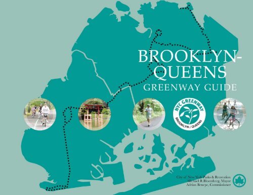
- Page 2 and 3: TABLE OF CONTENTS The Brooklyn-Quee
- Page 4 and 5: 1 Length: Estimated travel time: At
- Page 6 and 7: Subways The D, F, N, and Q lines al
- Page 8 and 9: straight to the Boardwalk, which ha
- Page 10 and 11: alternative bike route). The Coney
- Page 12 and 13: 2 Length: Estimated travel time: At
- Page 14 and 15: Ocean Parkway on a summer day Area
- Page 16 and 17: settlers lead by Lady Deborah Moody
- Page 18 and 19: Subways To get to Park Circle, take
- Page 20 and 21: entrance sign where there are maps
- Page 22 and 23: Beautiful sunset at Prospect Park Y
- Page 24 and 25: Subways Take the 2 or 3 to Grand Ar
- Page 26 and 27: Lubavitcher Jewish. Let’s start a
- Page 28 and 29: The Brooklyn/Queens Greenway System
- Page 30 and 31: 5 Length: Estimated travel time: At
- Page 32 and 33: The Brooklyn-Queens Greenway trail
- Page 34 and 35: the vibrant neighborhoods of Browns
- Page 36 and 37: Attached houses line a hillside as
- Page 38 and 39: The Brooklyn/Queens Greenway System
- Page 40 and 41: experience a refreshing variety of
- Page 42 and 43: Side Trip: Forest Hills Gardens Thi
- Page 44 and 45: The Brooklyn/Queens Greenway System
- Page 46 and 47: The Brooklyn/Queens Greenway System
- Page 48 and 49: in the former New York City Buildin
- Page 50 and 51: This side trip takes you into the o
TABLE OF CONTENTS<br />
The <strong>Brooklyn</strong>-<strong>Queens</strong><br />
<strong>Greenway</strong> <strong>Guide</strong><br />
INTRODUCTION . . . . . . . . . . . . . . . . . . . . . . . . . . .2<br />
1 CONEY ISLAND . . . . . . . . . . . . . . . . . . . . . . . . . .3<br />
2 OCEAN PARKWAY . . . . . . . . . . . . . . . . . . . . . . . . . .11<br />
3 PROSPECT PARK . . . . . . . . . . . . . . . . . . . . . . . . . . .16<br />
4 EASTERN PARKWAY . . . . . . . . . . . . . . . . . . . . . . .22<br />
5 HIGHLAND PARK/RIDGEWOOD RESERVOIR . . .29<br />
6 FOREST PARK . . . . . . . . . . . . . . . . . . . . . . . . . . . . .36<br />
7 FLUSHING MEADOWS CORONA PARK . . . . . . . .42<br />
8 KISSENA-CUNNINGHAM CORRIDOR . . . . . . . . .54<br />
9 ALLEY POND PARK TO FORT TOTTEN . . . . . . . .61<br />
CONCLUSION . . . . . . . . . . . . . . . . . . . . . . . . . . . .70<br />
GREENWAY SIGNAGE . . . . . . . . . . . . . . . . . . . . .71<br />
BIKE SHOPS . . . . . . . . . . . . . . . . . . . . . . . . . . . . .73
IThe 2<br />
<strong>Brooklyn</strong>-<strong>Queens</strong> <strong>Greenway</strong> System<br />
ntroduction<br />
The <strong>Brooklyn</strong>-<strong>Queens</strong><br />
<strong>Greenway</strong> (BQG) is a 40mile,<br />
continuous pedestrian<br />
and cyclist route from<br />
Coney Island in <strong>Brooklyn</strong> to<br />
Fort Totten, on the Long<br />
Island Sound, in <strong>Queens</strong>.<br />
The <strong>Brooklyn</strong>-<strong>Queens</strong> <strong>Greenway</strong> provides<br />
an active and engaging way <strong>of</strong><br />
exploring these two lively and diverse<br />
boroughs. The BQG presents the<br />
cyclist or pedestrian with a wide<br />
range <strong>of</strong> amenities, cultural <strong>of</strong>ferings,<br />
and urban experiences—linking 13<br />
parks, two botanical gardens, the <strong>New</strong><br />
<strong>York</strong> Aquarium, the <strong>Brooklyn</strong><br />
Museum, the <strong>New</strong> <strong>York</strong> Hall <strong>of</strong><br />
Science, two environmental education<br />
centers, four lakes, and numerous<br />
ethnic and historic neighborhoods.<br />
The guidebook also provides information<br />
about nearby public transportation,<br />
restrooms, places to eat, and bike<br />
shops.<br />
The <strong>Brooklyn</strong>-<strong>Queens</strong> <strong>Greenway</strong> is<br />
part <strong>of</strong> the larger <strong>New</strong> <strong>York</strong> <strong>City</strong><br />
<strong>Greenway</strong> System, an interconnected<br />
network <strong>of</strong> bicycle and pedestrian<br />
pathways linking parks and communities<br />
throughout the five boroughs.<br />
The <strong>Department</strong> <strong>of</strong> <strong>City</strong> Planning’s<br />
1993, A <strong>Greenway</strong> Master Plan for <strong>New</strong><br />
<strong>York</strong> <strong>City</strong>, which outlined 350 miles <strong>of</strong><br />
potential trails, noted that greenways<br />
are “…at once the parks for the 21st<br />
century and a part <strong>of</strong> the transportation<br />
infrastructure, providing for<br />
pleasant, efficient, healthful, and environmentally<br />
sound travel by foot,<br />
bicycle or skates.”<br />
<strong>New</strong> <strong>York</strong> <strong>City</strong> <strong>Department</strong> <strong>of</strong> Parks &<br />
Recreation (Parks) works closely with<br />
the <strong>Department</strong>s <strong>of</strong> Transportation<br />
and <strong>City</strong> Planning on the planning<br />
and implementation <strong>of</strong> the <strong>City</strong>’s<br />
<strong>Greenway</strong> Network. Parks has jurisdiction<br />
and maintains over 100 miles<br />
<strong>of</strong> greenways for commuting and<br />
recreational use, and continues to<br />
plan, design, and construct additional<br />
greenway segments in each borough,<br />
utilizing <strong>City</strong> capital funds and a<br />
number <strong>of</strong> federal transportation<br />
grants.<br />
In 1987, the Neighborhood Open<br />
Space Coalition spearheaded the<br />
concept <strong>of</strong> the <strong>Brooklyn</strong>-<strong>Queens</strong><br />
<strong>Greenway</strong>, building on the work <strong>of</strong><br />
Frederick Law Olmsted, Calvert Vaux,<br />
and Robert Moses in their creations <strong>of</strong><br />
the great parkways and parks <strong>of</strong><br />
<strong>Brooklyn</strong> and <strong>Queens</strong>. Feasibility and<br />
design studies were completed in 1988<br />
with the help <strong>of</strong> many <strong>City</strong> agencies<br />
and civic and community groups.<br />
Recent <strong>City</strong> administrations have seen<br />
fit to further this vision <strong>of</strong> a chain <strong>of</strong><br />
green from shore to shore, and today,<br />
the <strong>Brooklyn</strong>-<strong>Queens</strong> <strong>Greenway</strong> forms<br />
a critical component <strong>of</strong> the <strong>City</strong>’s<br />
<strong>Greenway</strong> system.<br />
This publication was made possible<br />
through funds from the Intermodal<br />
Surface Transportation Efficiency Act<br />
(ISTEA) under the Transportation<br />
Enhancement (TEP) Program, administered<br />
by the <strong>New</strong> <strong>York</strong> State<br />
<strong>Department</strong> <strong>of</strong> Transportation<br />
(NYS DOT).
1<br />
Length:<br />
Estimated travel time:<br />
Attractions:<br />
Character:<br />
Directions at a Glance<br />
Starting at the end <strong>of</strong> Ocean Parkway<br />
Coney Island Alternate Bike Route<br />
When the boardwalk is closed to cyclists,<br />
follow this route. Instead <strong>of</strong> turning left onto<br />
West 37th Street, turn right onto West 37th<br />
Street and ride to Neptune Avenue. Turn right<br />
onto Neptune Avenue and ride to Ocean<br />
Parkway. Turn left onto Ocean Parkway to<br />
pick up the next segment <strong>of</strong> the <strong>Greenway</strong>.<br />
The <strong>Brooklyn</strong>-<strong>Queens</strong> <strong>Greenway</strong> System 3<br />
Coney<br />
Island<br />
5.5 miles (loop)<br />
Biking—45 minutes; Walking—3 hours<br />
Coney Island Beach and Boardwalk,<br />
Keyspan Park, Nathan’s Famous, Asser<br />
Levy/Seaside Park, Astroland<br />
Amusement Park (slated to close at the<br />
end <strong>of</strong> 2007 or 2008 summer season),<br />
Abe Stark Skating Rink, Parachute<br />
Jump, Deno’s Wonder Wheel<br />
Amusement Park, The Cyclone<br />
Rollercoaster, Brighton Beach, The <strong>New</strong><br />
<strong>York</strong> Aquarium, Coney Island Museum<br />
& Sideshow<br />
Surf Avenue is a busy commercial street<br />
with no marked bike lane and plenty <strong>of</strong><br />
distracted drivers. The boardwalk is a<br />
well-used, auto-free pedestrian route.<br />
Bikes are allowed on the boardwalk<br />
between 6 a.m. and 10 a.m.<br />
0.0<br />
1.9<br />
1.95<br />
4.6<br />
5.4<br />
5.5<br />
Mile<br />
Travel towards the right, west, on Surf<br />
Avenue.<br />
Turn left on 37th Street.<br />
Turn left onto Riegelmann Boardwalk<br />
(Between 10:00 a.m. and 6:00 a.m.,<br />
cyclists must dismount and walk<br />
their bikes on boardwalk. For<br />
alternate bike route see below.)<br />
At the end <strong>of</strong> the boardwalk, turn<br />
around and backtrack.<br />
Veer right onto Seabreeze Walk.<br />
End at Ocean Parkway at<br />
Seabreeze Avenue.<br />
CONEY ISLAND
4<br />
The <strong>Brooklyn</strong>-<strong>Queens</strong> <strong>Greenway</strong> System<br />
CONEY ISLAND
Subways<br />
The D, F, N, and Q lines all stop at<br />
Coney Island. (For the latest transit<br />
information, visit the MTA website at<br />
www.mta.info or call 718-330-1234).<br />
Where to Eat<br />
Go past the Wonder Wheel for takeaway<br />
hotdogs, corn on the cob, fried<br />
clams and other classic American fast<br />
food. In Brighton Beach, you can pay<br />
a little bit more and get a sit-down<br />
meal at several boardwalk cafés.<br />
Public Restrooms<br />
There is a restroom near West 27 th<br />
Street and Surf Avenue. The boardwalk<br />
has public restrooms at West 30 th<br />
Street, Stillwell Avenue, West 8 th Street,<br />
and Brighton 2 nd Street. They are open<br />
Memorial Day to Labor Day from 9<br />
a.m. to 6 p.m.<br />
Area History<br />
Coney Island is no longer a true<br />
island. When European settlers first<br />
arrived, it was a narrow sliver <strong>of</strong> land,<br />
separated from the rest <strong>of</strong> Long Island<br />
by a salty creek that was crossable at<br />
low tide. Coney Island's name comes<br />
from the Dutch name “Konign<br />
Eisland” or Rabbit Island. The reasons<br />
for the name are lost in the murk <strong>of</strong><br />
time. It could be that the original<br />
grasslands and scrub here supported a<br />
hopping colony <strong>of</strong> long ears.<br />
Development began in 1829, upon<br />
completion <strong>of</strong> the Coney Island Hotel<br />
The <strong>Brooklyn</strong>/<strong>Queens</strong> <strong>Greenway</strong> System 5<br />
Wonder Wheel: The ferris wheel with the roller<br />
coaster on the inside. When the inside car swings<br />
out, many a stomach has been left behind.<br />
in the area now known as Sea Gate.<br />
This was a respectable establishment,<br />
but by the turn <strong>of</strong> the nineteenth century,<br />
Coney Island had become <strong>New</strong><br />
<strong>York</strong>'s wild west, an area notorious for<br />
its rowdy drinking and gambling<br />
halls, prize fights, and rampant<br />
prostitution. Respectable society had<br />
moved east. The era's most wealthy<br />
and celebrated flocked to Manhattan<br />
Beach, where majestic hotels lined the<br />
beach. The prosperous middle class<br />
summered at Brighton Beach, where<br />
the architecture was impressive, but<br />
less grand.<br />
West Brighton was the buffer zone<br />
between the high and low-life. This<br />
was the destination for day-tripping,<br />
working class folks who came by<br />
steamship, ferry, or trolley to sing in<br />
the beer halls, eat in the enormous<br />
restaurants, shake a leg in the dance<br />
halls, and try their luck in the penny<br />
arcade. This is the section <strong>of</strong> the beach<br />
that became the Coney Island <strong>of</strong><br />
popular imagination, especially with<br />
the advent <strong>of</strong> pioneering amusement<br />
parks: Steeplechase in 1897, Luna Park<br />
in 1903, and Dreamland in 1904. These<br />
were ambitious creations,<br />
forerunners to today's Disneyland and<br />
CONEY ISLAND
6<br />
The <strong>Brooklyn</strong>/<strong>Queens</strong> <strong>Greenway</strong> System<br />
Six Flags parks. For a dime, you were<br />
admitted to fanciful exotic villages,<br />
crowded as any Lower East Side<br />
street, where every twist in the way<br />
brought another enticement to spend<br />
some fun money on a ride, a show, a<br />
game, or a dance.<br />
As the twentieth century wore on,<br />
these amusement parks lost much <strong>of</strong><br />
their novelty. They disappeared in<br />
reverse order <strong>of</strong> their completion.<br />
Dreamland burnt to the ground in<br />
1911; it took a series <strong>of</strong> fires in the<br />
1940s to close down Luna Park.<br />
Steeplechase Park didn't close until<br />
1964. But the three decades from 1920<br />
to 1950 were arguably Coney Island's<br />
heyday. On a hot summer weekend<br />
afternoon, thousands <strong>of</strong> <strong>New</strong> <strong>York</strong>ers<br />
would take the subway to partake <strong>of</strong><br />
Coney Island at its most elemental:<br />
sand, surf, and Nathan's hot dogs.<br />
With the rise <strong>of</strong> the automobile, Coney<br />
Island's primacy waned, with<br />
Thrills: Coney Island art tends toward the brightly colored Macabre.<br />
CONEY ISLAND<br />
thousands making the trek to Long<br />
Island and <strong>New</strong> Jersey beaches<br />
instead. Some would say that this was<br />
a relief. The well-known photographer,<br />
Weegee, published three famous<br />
pictures−one each in 1940, 1945, and<br />
1952 showing thousands <strong>of</strong> beachgoers<br />
packed shoulder to shoulder.<br />
Today, however, Surf Avenue and the<br />
Coney Island boardwalk remain a<br />
lively scene, a favorite trip for many<br />
<strong>New</strong> <strong>York</strong>ers. Significant changes<br />
within Coney Island are anticipated<br />
with the area’s planned redevelopment,<br />
guided by a strategic plan that<br />
was unveiled for the area in 2005. The<br />
plan focuses on creating new housing<br />
and strengthening the area as a yearround<br />
entertainment destination with<br />
seaside attractions.<br />
Trip Description<br />
The trip starts at the corner <strong>of</strong> Surf<br />
Avenue and Ocean Parkway. Most<br />
people will be tempted to head
straight to the Boardwalk, which has<br />
many entrances beckoning from Surf<br />
Avenue. But Surf Avenue is also well<br />
worth exploring in its own right, with<br />
many star attractions and a lively<br />
pedestrian scene. For bike riders, Surf<br />
Avenue <strong>of</strong>fers an opportunity to stay<br />
mounted and rolling when the boardwalk<br />
is closed to bike riding.<br />
Heading west on Surf Avenue, you’ll<br />
quickly notice Asser Levy/Seaside<br />
Park. The centerpiece <strong>of</strong> this park is<br />
its amphitheater, whose stage is<br />
crowned by a high-tech white tent.<br />
Information on amphitheater events<br />
can be found on the Parks &<br />
Recreation website,<br />
www.nyc.gov/parks. The park provides<br />
a nice refuge from the hurlyburly<br />
<strong>of</strong> the surrounding streets and<br />
the boardwalk, for those just seeking<br />
some good old-fashioned green grass<br />
and shade.<br />
The <strong>Brooklyn</strong>/<strong>Queens</strong> <strong>Greenway</strong> System 7<br />
Nathan’s: A table for four without the table<br />
The world-famous Cyclone rollercoaster<br />
stands proud at West 10 th<br />
Street. Don’t let the wood and the<br />
antique looks fool you—the ride is as<br />
much fun as any <strong>of</strong> the high-tech<br />
theme park extravaganzas in the<br />
suburbs.<br />
The zone between West 12 th and West<br />
16 th Streets is the haunt <strong>of</strong> the outrageous.<br />
The happening corner here is<br />
West 12 th Street and Surf Avenue,<br />
where you’ll find the Coney Island<br />
Sideshow. This modest showhouse is<br />
dedicated to keeping alive the<br />
thrilling underbelly <strong>of</strong> Americana—<br />
besides the sideshow, the venue hosts<br />
regular burlesque and rock-and-roll<br />
shows. Hours <strong>of</strong> operation can be<br />
found at www.coneyisland.com for<br />
both the Sideshow and Museum.<br />
Look no further than the Coney<br />
Island Museum at 1208 Surf Avenue<br />
CONEY ISLAND
8<br />
The <strong>Brooklyn</strong>/<strong>Queens</strong> <strong>Greenway</strong> System<br />
for photographs and artifacts from the<br />
resort area’s yesteryears. Up for a<br />
game <strong>of</strong> chance and/or skill? You can<br />
try your hand in the amusement<br />
arcades along this stretch <strong>of</strong> avenue.<br />
Moving along, you’ll go from honkytonk<br />
to spiffy family fun. The old site<br />
<strong>of</strong> Steeplechase Park is occupied by<br />
Keyspan Park, a minor league<br />
baseball stadium that is home to the<br />
<strong>Brooklyn</strong> Cyclones. Visit<br />
www.brooklyncyclones.com for<br />
game and event schedules.<br />
The Abe Stark Skating Rink stands at<br />
the corner <strong>of</strong> West 19 th Street and Surf<br />
Avenue. If you want to take a spin on<br />
the ice, this pro-quality facility is open<br />
Sunset at Coney Island Beach<br />
CONEY ISLAND<br />
to the public on weekends and school<br />
holidays from the Beginning <strong>of</strong><br />
October to the beginnig <strong>of</strong> April.<br />
Other times it’s used by ice hockey<br />
leagues. Don’t have a pair <strong>of</strong> skates?<br />
No problem—you can rent them here.<br />
After Keyspan Park, Surf Avenue<br />
becomes a residential area, a zone <strong>of</strong><br />
housing developments and assistedliving<br />
facilities. One worthy detour is<br />
the Santos White Community Garden<br />
at 2110 Mermaid Avenue. Turn right at<br />
West 21 st Street, and go up one block.<br />
This garden looks great anytime <strong>of</strong><br />
year.<br />
Turn left on West 37 th Street to reach<br />
the boardwalk (or right for the
alternative bike route).<br />
The Coney Island boardwalk is true<br />
<strong>New</strong> <strong>York</strong>, not just for its legend, but<br />
for its here-and-now, quick-change<br />
transformations. On a summer<br />
weekend, the entire two-and-a-half<br />
mile stretch is a crowded blur <strong>of</strong><br />
good-natured pleasure seekers. The<br />
boardwalk’s varied qualities shine<br />
forth best midweek or in the <strong>of</strong>fseason,<br />
when the crowds have<br />
thinned. The boardwalk’s one true<br />
and constant companion is the beach,<br />
a well-kept stretch <strong>of</strong> sand punctuated<br />
by several stone jetties and a fishing<br />
pier. In fact, some pedestrians might<br />
be tempted to skip the boardwalk and<br />
walk the entire length <strong>of</strong> the beach.<br />
The boardwalk is quietest near its<br />
western terminus at West 37 th Street.<br />
For beach and ocean lovers, this is the<br />
place to come if you’re seeking a little<br />
more solitude, especially early in the<br />
morning or on a nippy winter day.<br />
Coney Island’s iconic Parachute<br />
The <strong>Brooklyn</strong>/<strong>Queens</strong> <strong>Greenway</strong> System 9<br />
Coney Island skyline<br />
Jump, rises near West 19 th Street. At<br />
262 feet, the Parachute Jump is Coney<br />
Island’s most distinctive landmark. It<br />
was first installed at the <strong>New</strong> <strong>York</strong><br />
World’s Fair <strong>of</strong> 1939-40 at Flushing<br />
Meadows in <strong>Queens</strong>, then moved in<br />
1941 to its present location. When it<br />
was operating, riders were lifted by a<br />
cable to the top then dropped, to float<br />
gently down to the ground. The<br />
Parachute Jump ceased operating in<br />
1964, and fell into disrepair. It recently<br />
underwent a $5 million refurbishment.<br />
While it no longer functions as a ride,<br />
it remains an icon <strong>of</strong> Coney Island<br />
history.<br />
Steeplechase Pier juts out into the<br />
ocean across from the West 16 th Street<br />
walkway. This is a popular spot for<br />
anglers and those who just want to get<br />
out over the water. You’ll probably<br />
find the beach starting to become a bit<br />
more crowded here.<br />
Moving past the back end <strong>of</strong> Keyspan<br />
Park, you will arrive at the Coney<br />
Island <strong>of</strong> popular legend, a zone <strong>of</strong><br />
CONEY ISLAND
10 The <strong>Brooklyn</strong>-<strong>Queens</strong> <strong>Greenway</strong> System<br />
rambunctious amusements. Astroland<br />
is the heart <strong>of</strong> the scene here.<br />
Astroland was opened in 1962 and, as<br />
its name implies, many <strong>of</strong> the park’s<br />
original rides took their cue from the<br />
era’s space program. These days<br />
you’re more likely to hear hip-hop<br />
rather than doo-wop, but you can still<br />
ride smiling satellites and rockets to<br />
the moon. Astroland was recently purchased<br />
by a private developer and is<br />
anticipated to close at the end <strong>of</strong> the<br />
2007 or 2008 summer season. Want to<br />
get up higher than anybody? Buy a<br />
ticket to Deno’s Wonder Wheel, an<br />
immense Ferris wheel at the foot <strong>of</strong><br />
West 12 th Street.<br />
The <strong>New</strong> <strong>York</strong> Aquarium at Coney<br />
Island is the next stop along the<br />
boardwalk. This is not a sideshow<br />
attraction, but a world-class zoological<br />
facility. The Aquarium covers 14 acres,<br />
is home to 350 species <strong>of</strong> aquatic<br />
wildlife, including penguins, sharks,<br />
and seals, and is a terrific place for<br />
Brighton Beach fruit stand<br />
CONEY ISLAND<br />
families. For information, visit<br />
www.nyaquarium.com.<br />
Brighton Beach fronts the boardwalk<br />
between Asser Levy/Seaside Park and<br />
Corbin Place. Today, Brighton Beach is<br />
a neighborhood <strong>of</strong> Russian émigrés;<br />
some have called it Little Odessa, after<br />
a town in the Ukraine on the Black<br />
Sea. On a warm day, the boardwalk<br />
here sports plenty <strong>of</strong> folks wearing<br />
bathing suits and sunglasses. But the<br />
boardwalk is also a European-style<br />
promenade, the route <strong>of</strong> dressed up<br />
folks walking arm in arm with shined<br />
shoes and perfect hairdos. If you<br />
appreciate the beauty <strong>of</strong> the ocean, but<br />
can do without gritty beach culture,<br />
this is the perfect destination.<br />
Boardwalk cafés invite you to sit<br />
down and watch this parade go by<br />
while you enjoy a selection from the<br />
Russian/English menu.<br />
Backtrack on the boardwalk to a stairway<br />
known as Seabreeze Walk, which
2<br />
Length:<br />
Estimated travel time:<br />
Attractions:<br />
Character:<br />
Directions at a Glance<br />
Starting at corner <strong>of</strong><br />
Ocean Parkway and Surf Avenue<br />
The <strong>Brooklyn</strong>/<strong>Queens</strong> <strong>Greenway</strong> System 11<br />
Ocean<br />
Parkway<br />
5.9 miles (one way)<br />
Biking—45 minutes; Walking—2 hours<br />
Gravesend Cemetery, residential<br />
neighborhoods <strong>of</strong> Manhattan Terrace,<br />
Ocean Parkway, Borough Park, and<br />
Ditmas Park<br />
Sheltered historic parkway with cross<br />
traffic at intersections.<br />
Mile<br />
0.0<br />
5.1<br />
5.3<br />
5.7<br />
5.75<br />
5.8<br />
5.9<br />
Start on Ocean Parkway where it meets<br />
Seabreeze Avenue. Head north on<br />
Ocean Parkway staying on the left,<br />
(western) side, <strong>of</strong> the parkway.<br />
Follow Ocean Parkway to Church<br />
Avenue. Bicyclists must keep to the<br />
bike lane.<br />
At southwest corner <strong>of</strong> Church Avenue,<br />
cross Ocean Parkway to<br />
eastern side. Cross Church Avenue<br />
to northeast corner, then cross<br />
service road to bike/pedestrian path.<br />
Follow path as it curves towards<br />
the east.<br />
Path ends. Cross East 8 th Street.<br />
Turn left.<br />
Turn right at Park Circle. Follow circle<br />
counter-clockwise to entrance <strong>of</strong><br />
Prospect Park.<br />
End at the park entrance.<br />
Hand in Hand: Some moments<br />
are too good for cycling.<br />
OCEAN PARKWAY
12<br />
The <strong>Brooklyn</strong>/<strong>Queens</strong> <strong>Greenway</strong> System<br />
Subways<br />
The F, Q and B (the B train does not<br />
operate on weekends) trains each<br />
make several stops on streets parallel<br />
to Ocean Parkway. (For the latest<br />
transit information, visit the MTA<br />
website at www.mta.info or<br />
call 718-330-1234).<br />
Where to Eat<br />
Ocean Parkway is almost completely<br />
residential, however, you can find<br />
businesses, including neighborhood<br />
restaurants and grocery stores, on<br />
many <strong>of</strong> the intersecting streets.<br />
Neptune Avenue, and Avenues U, P,<br />
N, I, J, Kings Highway, Ditmas<br />
Avenue, and Church Avenue are<br />
especially bustling. The Assyrian-<br />
Jewish shopping center at the corner<br />
<strong>of</strong> East 3 rd Street and Kings Highway<br />
is a great place to shop for middleeastern<br />
specialties. Avenue J is the<br />
spot for kosher restaurants and bakeries.<br />
One <strong>of</strong> the best pizzerias in the<br />
city, DiFara’s Pizza, is located on<br />
Avenue J and East 15 th Street.<br />
Public Restrooms<br />
Public restrooms can be found: in<br />
Grady Playground near Brighton 4 th<br />
Road and Brighton 4 th Street; in the<br />
Colonel David Marcus Memorial<br />
Playground near East 5 th Street and<br />
Avenue P; in Friends Field Park near<br />
East 4 th Street and Avenue L; in<br />
Di Glio Playground near McDonald<br />
Avenue and Avenue F and at the<br />
Parade Grounds near Prospect Park.<br />
OCEAN PARKWAY
Ocean Parkway on a summer day<br />
Area History<br />
Conceived by Frederick Law Olmsted<br />
and Calvert Vaux in 1866, Ocean<br />
Parkway was to be one <strong>of</strong> the four<br />
legs <strong>of</strong> a parkway system radiating<br />
out from Prospect Park. Only two <strong>of</strong><br />
the legs were built: Eastern Parkway<br />
and Ocean Parkway, finished in 1880.<br />
The parkways were inspired by the<br />
boulevards <strong>of</strong> Paris and Berlin, but<br />
leave it to Americans to make them<br />
wider and longer.<br />
The Olmsted/Vaux parkways were<br />
designed to be both scenic and<br />
practical. The main thoroughfare, the<br />
carriage drive, was originally conceived<br />
as a "shaded pleasure drive,"<br />
but now functions as a busy roadway.<br />
Shaded, grassy malls buffer both sides<br />
<strong>of</strong> the drive. Here’s where you’ll find<br />
the bike and pedestrian paths and<br />
long rows <strong>of</strong> benches. Service roads<br />
line the outer edge <strong>of</strong> the parkway,<br />
providing safe access and parking.<br />
The <strong>Brooklyn</strong>/<strong>Queens</strong> <strong>Greenway</strong> System 13<br />
In 1894, a strip <strong>of</strong> Ocean Parkway’s<br />
pedestrian lane became the country’s<br />
first bicycle path. Reportedly, so many<br />
bicyclists crowded the path on<br />
opening day, the city was forced to<br />
widen it. In 1983, the National Park<br />
Service declared Ocean Parkway a<br />
National Scenic Landmark. Traveling<br />
along Ocean Parkway is more about<br />
the pleasure <strong>of</strong> the whole route, rather<br />
than any particular "sights" along the<br />
way. It is about the trees and the grass<br />
that provide a green counterpoint to a<br />
hodge-podge <strong>of</strong> twentieth-century<br />
<strong>New</strong> <strong>York</strong> buildings, from luxury<br />
apartments to substantial singlefamily<br />
houses, plus a few synagogues,<br />
schools, and other institutions. The<br />
architecture ranges from solid brick<br />
pre-war cooperative housing to contemporary<br />
single-family residences.<br />
Along the way are some surprising<br />
details, including the entrance arch to<br />
270 Ocean Parkway, which is pure<br />
1960s Miami Beach.<br />
OCEAN PARKWAY
14<br />
The <strong>Brooklyn</strong>/<strong>Queens</strong> <strong>Greenway</strong> System<br />
It’s the people who make Ocean<br />
Parkway interesting. On a busy<br />
weekend day, you’ll encounter<br />
hundreds. Typical users include<br />
Orthodox Jewish families walking on<br />
the Sabbath, Russian retirees reading<br />
Cyrillic-printed newspapers, and<br />
many, many other walkers, bikers,<br />
bladers, and sit-on-a-bench-andwatch-the-world-go-byers.<br />
Trip Description<br />
Ocean Parkway starts a block away<br />
from the Coney Island boardwalk. The<br />
bike path runs along the western mall<br />
<strong>of</strong> the parkway. Don’t let the trees and<br />
the grass lull you into complacency at<br />
intersections, however. Cars making<br />
right-hand turns <strong>of</strong>f <strong>of</strong> Ocean<br />
Parkway can be unaware that bicyclists<br />
and<br />
pedestrians are crossing the street<br />
alongside <strong>of</strong> them. So look twice, then<br />
look again.<br />
The Boardwalk near Ocean Parkway where this greenway segment begins.<br />
OCEAN PARKWAY<br />
After a couple <strong>of</strong> blocks, the on- and<br />
<strong>of</strong>f-ramps <strong>of</strong> the Belt Parkway<br />
interrupt the flow <strong>of</strong> Ocean Parkway.<br />
Fortunately for bicyclists, the<br />
authorized route is fairly well-signed.<br />
Just remember to stay on the western<br />
side <strong>of</strong> the parkway, and you’ll be<br />
fine. The eastern side is reserved for<br />
pedestrians only.<br />
After the Belt Parkway, it’s a straight<br />
shot through middle-class <strong>Brooklyn</strong> to<br />
Church Avenue, where the parkway<br />
ends. A couple <strong>of</strong> worthwhile<br />
meanders will reveal both the contemporary<br />
life in the neighborhoods<br />
surrounding Ocean Parkway, as well<br />
as the deep historical roots <strong>of</strong><br />
<strong>Brooklyn</strong>.<br />
Just north <strong>of</strong> Coney Island is a small<br />
area whose grid system <strong>of</strong> streets is at<br />
odd angles to the neighborhood<br />
around it. This is what remains <strong>of</strong> the<br />
old town <strong>of</strong> Gravesend, a village<br />
founded in 1643 by a group <strong>of</strong> English
settlers lead by Lady Deborah Moody.<br />
By all accounts, Lady Moody was<br />
both cultured and fiercely independent.<br />
She became the first female<br />
grantee for land ownership in the<br />
<strong>New</strong> World. Gravesend was the only<br />
permanent settlement in early colonial<br />
America planned and directed by a<br />
woman. The outlines <strong>of</strong> the original<br />
village design are still easily discernible<br />
on the map: look for a large<br />
square set at a counter-angle to the<br />
surrounding grid. The square is<br />
bisected on each side, forming four<br />
smaller squares. The village graveyard,<br />
perhaps the most visible remnant<br />
<strong>of</strong> old Gravesend, sits at the outside<br />
corner <strong>of</strong> one <strong>of</strong> the smaller<br />
squares, at the intersection <strong>of</strong> Van<br />
Sicklen Street and Village Road South.<br />
The graveyard is closed to the public,<br />
but you can peek in through the fence.<br />
To explore Gravesend, take a left on<br />
Avenue V.<br />
Kings Highway crosses Ocean<br />
Parkway a block past Avenue R.<br />
Kings Highway is another exception<br />
to <strong>Brooklyn</strong>’s grid system, running<br />
roughly south to northeast. This was<br />
an old Native American path, then<br />
later a farm road. During the<br />
American Revolution, British troops<br />
marched up Kings Highway, to<br />
present day East <strong>New</strong> <strong>York</strong>, to attack<br />
American forces.<br />
Olmsted and Vaux designed Ocean<br />
Parkway to extend all the way to the<br />
entrance to Prospect Park but with the<br />
construction <strong>of</strong> the Prospect<br />
Expressway, a brain child <strong>of</strong> Robert<br />
Moses, Ocean Parkway (as a park-<br />
The <strong>Brooklyn</strong>/<strong>Queens</strong> <strong>Greenway</strong> System<br />
way) ends abruptly at Church<br />
Avenue.<br />
15<br />
When you come to Church Avenue,<br />
cross Ocean Parkway to the right, and<br />
make a left across Church Avenue.<br />
The path continues on Ocean<br />
Parkway, which becomes a service<br />
road at this point, running alongside<br />
the Prospect Expressway. The bike<br />
path ends near the pedestrian bridge<br />
at East 8 th Street, but the service road<br />
continues to Park Circle. Follow Park<br />
Circle counter-clockwise to the<br />
Prospect Park entrance (between the<br />
two horse statues, called the Horse<br />
Tamers).<br />
OCEAN PARKWAY
16<br />
3<br />
The <strong>Brooklyn</strong>/<strong>Queens</strong> <strong>Greenway</strong> System<br />
PROSPECT PARK<br />
Length:<br />
Estimated travel time:<br />
Attractions:<br />
Character:<br />
Directions at a Glance<br />
Starting at Park Circle<br />
entrance to Prospect Park<br />
Prospect<br />
Park<br />
1.6 miles for half loop, 3.2 miles for the<br />
entire park loop<br />
Biking—15 minutes; Walking—1 hour,<br />
suggest 2-3 hours to explore.<br />
Parade Ground, Prospect Lake, Wollman<br />
Rink, Audubon Center at the Boathouse,<br />
Prospect Park Zoo, Lefferts Homestead,<br />
Carousel, Bandshell, Third Street<br />
Playground, Battle Pass, Harmony<br />
Playground, Vale <strong>of</strong> Cashmere, Tennis<br />
House, Concert Grove<br />
Asphalt road throughout the park that is<br />
auto-free on weekends and non-rush<br />
hours.<br />
Mile<br />
0.0<br />
0.1<br />
1.6<br />
Follow Park Circle into Prospect Park,<br />
passing Parade Ground on your right.<br />
Turn right onto South Lake Drive.<br />
Follow South Lake Drive towards<br />
Grand Army Plaza. Veer right to<br />
park exit road.<br />
End at Grand Army Plaza.<br />
If you are traveling the <strong>Greenway</strong> from<br />
North to South, enter the Park at<br />
Grand Army Plaza, turn onto West<br />
Drive. Follow West Drive to the Park<br />
Circle exit.<br />
Grand Army Plaza
Subways<br />
To get to Park Circle, take the F train<br />
to Ft. Hamilton Parkway or the Q to<br />
Parkside Avenue. To get to Grand<br />
Army Plaza take the 2 or 3. (For the<br />
latest information, visit the MTA website<br />
at www.mta.info or call<br />
718-330-1234).<br />
The <strong>Brooklyn</strong>/<strong>Queens</strong> <strong>Greenway</strong> System 17<br />
Where to Eat<br />
There are several food kiosks within<br />
the park as well as Song Bird Cafe in<br />
the Boathouse. Outside the park, Park<br />
Slope’s Seventh Avenue, Windsor<br />
Terrace’s Prospect Park West and<br />
Flatbush Avenue have a wide variety<br />
<strong>of</strong> restaurants and several grocery<br />
stores.<br />
PROSPECT PARK
18<br />
The <strong>Brooklyn</strong>/<strong>Queens</strong> <strong>Greenway</strong> System<br />
Public Restrooms<br />
Prospect Park has several public<br />
restrooms which are open daily from<br />
8 a.m. to 7 p.m. Restrooms can also be<br />
found within the <strong>Brooklyn</strong> Public<br />
Library’s Central Library.<br />
Area History<br />
Frederick Law Olmsted’s and Calvert<br />
Vaux’s first foray into <strong>New</strong> <strong>York</strong> <strong>City</strong><br />
was designing Manhattan’s Central<br />
Park in 1858. Then they took what<br />
they had learned and designed<br />
<strong>Brooklyn</strong>’s Prospect Park.<br />
Prospect Park takes its name from<br />
Mount Prospect, which lies on the<br />
other side <strong>of</strong> Flatbush Avenue from<br />
the park. The borough fathers had<br />
originally intended Mount Prospect to<br />
be part <strong>of</strong> Prospect Park. But Calvert<br />
Vaux convinced them that Flatbush<br />
Avenue would be a marring<br />
disruption. Luckily, tracts <strong>of</strong> land to<br />
PROSPECT PARK<br />
Prospect Park Boathouse<br />
the south <strong>of</strong> their allocated parcels<br />
were available for purchase, and the<br />
526-acre diamond outline <strong>of</strong> Prospect<br />
Park was born. The park was laid out<br />
in 1866 and 1867.<br />
The land had a significant<br />
Revolutionary War history. Look for<br />
Battle Pass on the East Drive just north<br />
<strong>of</strong> the zoo (look for the plaque). This is<br />
the site <strong>of</strong> one <strong>of</strong> the major actions in<br />
the Battle <strong>of</strong> <strong>Brooklyn</strong>, which was the<br />
first battle between the United<br />
Colonies and the British, following the<br />
issuance <strong>of</strong> the Declaration <strong>of</strong><br />
Independence. At this spot on August<br />
27, 1776, British forces overwhelmed<br />
some 900 Americans under the command<br />
<strong>of</strong> Major-General John Sullivan.<br />
After the Americans surrendered, some<br />
500 were killed by Scot Highlanders,<br />
German Hessians and English infantry<br />
and cavalry.<br />
For information on upcoming events<br />
within Prospect Park, stop at any
entrance sign where there are maps<br />
and up-to-date program information,<br />
visit the Prospect Park website at<br />
www.prospectpark.org, or contact the<br />
Prospect Park Alliance at<br />
718-965-8999.<br />
On weekends and outside <strong>of</strong> rush<br />
hour, Prospect Park is auto-free. Most<br />
<strong>of</strong> your company will be huffing,<br />
puffing joggers and serious racing<br />
bicyclists. Don’t use them as an<br />
example. Instead, experience the Park<br />
at a leisurely pace, much as you<br />
would inside a horse-driven carriage<br />
on a no-rush Sunday afternoon.<br />
Open up your senses, and see the<br />
unfolding views as a series <strong>of</strong><br />
panoramic pictures.<br />
Trip Description<br />
The following trip description starts at<br />
Park Circle.<br />
The <strong>Brooklyn</strong>/<strong>Queens</strong> <strong>Greenway</strong> System 19<br />
You will see the Parade Ground at<br />
this location which has bathrooms, a<br />
snackbar, tennis, basketball and volleyball<br />
courts and soccer and baseball<br />
fields.<br />
After you pass Park Circle, you can’t<br />
miss the Peristyle, also known as the<br />
Grecian Shelter, on your right.<br />
Designed by McKim, Mead & White<br />
in the neoclassical style with columns,<br />
the structure both shelters and<br />
punctuates the landscape.<br />
Rounding another bend, you’ll be on<br />
East Lake Drive which climbs steadily<br />
past Wollman Rink into the<br />
Midwood section <strong>of</strong> the park. But<br />
don’t miss the Prospect Park<br />
Audubon Center, (www.prospectparkaudubon.org)<br />
housed in the<br />
Boathouse, which lies behind some<br />
trees just past Concert Grove. The<br />
center has nature exhibits and an<br />
idyllic esplanade along the tiny<br />
In the shade <strong>of</strong> giants: A young tree near Prospect Lake survives and waits for an opening to the sky.<br />
PROSPECT PARK
20<br />
The <strong>Brooklyn</strong>-<strong>Queens</strong> <strong>Greenway</strong> System<br />
Lullwater Lake—well worth a stop.<br />
The Prospect Park Zoo is another<br />
worthwhile stop for nature-lovers. Its<br />
presence in the park is muted, but<br />
you’ll notice its back boundary nestled<br />
into the outer edge <strong>of</strong> the<br />
Midwood. The Prospect Park Zoo is<br />
open all summer and spring weekends<br />
and has lots <strong>of</strong> great activities as<br />
well as a bathroom and snackbar. For<br />
more information go to<br />
www.prospectparkzoo.com.<br />
You’ll find the entrance to the zoo on<br />
Flatbush Avenue if you take the park<br />
road exit by the Boathouse and then<br />
turn left. If you do this, you’ll pass<br />
Lefferts Homestead, a restored Dutch<br />
Farmhouse built in 1777, and the<br />
festive Carousel.<br />
Back on the drive in the park, you’ll<br />
really start to climb as you venture<br />
further into the Midwood, the shady<br />
PROSPECT PARK<br />
A family enjoys a day in the sun at Prospect Park’s Long Meadow.<br />
heart <strong>of</strong> the park’s wild forest. Take it<br />
slow and let the world pass you by.<br />
You’ll be having a much better time.<br />
To your left will be a steep wooded<br />
slope, the backside <strong>of</strong> the terminal<br />
moraine that forms the backbone <strong>of</strong><br />
the park.<br />
Relief will be in sight as you reach the<br />
northern end <strong>of</strong> the Long Meadow.<br />
You’ll still be climbing, but for not<br />
much longer. The Vale <strong>of</strong> Cashmere<br />
will be to your right. This is an especially<br />
pretty and tranquil spot with its<br />
lush flowering vegetation and flowing<br />
water fountains. It gets its name from<br />
an epic poem in 1817 by Sir Thomas<br />
Moore. If you wish, follow the path<br />
down to an intricate series <strong>of</strong> formal<br />
ponds.<br />
The drive exits at Grand Army Plaza.<br />
After you get yourself to Grand Army<br />
Plaza, look around a bit. This is one <strong>of</strong><br />
the grandest urban spaces in <strong>New</strong>
Beautiful sunset at Prospect Park<br />
<strong>York</strong>. The plaza is an oval. Its centerpiece<br />
is an 80-foot arch, designed by<br />
John H. Duncan, designer <strong>of</strong> Grant’s<br />
Tomb in Manhattan. Completed in<br />
1892, the arch honors the Union forces<br />
in the Civil War with sculptures by<br />
Frederick McMonnies, who also<br />
designed the Horse Tamers. The<br />
fountain in the center, Bailey<br />
Fountain, recently restored, was completed<br />
in 1932. The fountain features<br />
allegorical figures <strong>of</strong>ten interpreted as<br />
Wisdom and Fertility. On Saturdays,<br />
this is the site <strong>of</strong> a lively farmers market,<br />
where you can pick up a snack.<br />
If you are entering the park from<br />
Grand Army Plaza, turn right onto<br />
West Drive. The West Drive starts <strong>of</strong>f<br />
nice and easy with the Long Meadow<br />
on your left. This segment is almost a<br />
mile long. Past the Tennis House,<br />
you’ll see the Pools, which mark the<br />
beginning <strong>of</strong> the park’s Ravine, which<br />
was restored between 1998 and 2000.<br />
The <strong>Brooklyn</strong>/<strong>Queens</strong> <strong>Greenway</strong> System 21<br />
The first building you’ll encounter to<br />
your left is the Picnic House, and then<br />
the Tennis House. A little further on to<br />
your left you’ll see the Bandshell at<br />
9 th Street. This is the venue for<br />
Celebrate <strong>Brooklyn</strong>, a fabulous series<br />
<strong>of</strong> free performances held each<br />
summer. Call 718-768-0855 or go to<br />
www.celebratebrooklyn.org.<br />
Rounding the bend past a complex <strong>of</strong><br />
ballfields, you’ll be going downhill to<br />
Prospect Lake. Olmsted and Vaux<br />
took advantage <strong>of</strong> the original flat<br />
farmland to hollow out this sparkling<br />
waterbody.<br />
Fall colors are reflected in the waters <strong>of</strong> Prospect Lake.<br />
PROSPECT PARK
22<br />
4<br />
The <strong>Brooklyn</strong>/<strong>Queens</strong> <strong>Greenway</strong> System<br />
EASTERN PARKWAY<br />
Length:<br />
Estimated travel time:<br />
Attractions:<br />
Character:<br />
Directions at a Glance<br />
Starting at northern corner <strong>of</strong><br />
Prospect Park, at intersection <strong>of</strong><br />
Grand Army Plaza and<br />
Flatbush Avenue in front <strong>of</strong><br />
the <strong>Brooklyn</strong> Public Library<br />
Eastern<br />
Parkway<br />
2.5 miles<br />
Biking—30 minutes; Walking—1.5 hours<br />
<strong>Brooklyn</strong> Public Library’s Central Library,<br />
<strong>Brooklyn</strong> Botanic Garden, <strong>Brooklyn</strong><br />
Museum, Weeksville Historical Society,<br />
<strong>Brooklyn</strong> Children’s Museum, Mount<br />
Prospect Park, McNair Park, Franklin<br />
Avenue Shuttle Community Garden,<br />
historic neighborhoods <strong>of</strong> Prospect<br />
Heights, Crown Heights, Wingate<br />
Sheltered historic parkway with crosstraffic<br />
at intersections.<br />
Mile<br />
0.0<br />
0.1<br />
0.2<br />
0.6<br />
2.5<br />
Begin in front <strong>of</strong> Prospect Park at Grand<br />
Army Plaza. Cross Flatbush Avenue<br />
to plaza in front <strong>of</strong> the <strong>Brooklyn</strong><br />
Public Library’s Central Library.<br />
Walk across plaza to Eastern Parkway.<br />
Cross Eastern Parkway at Underhill,<br />
traveling around circle counterclockwise<br />
Turn right on service road.<br />
Multi-use path begins on median strip<br />
between service road and main drive <strong>of</strong><br />
parkway.<br />
Cross Eastern Parkway at Washington<br />
Avenue. Cross Washington Avenue to<br />
pedestrian/bike path through<br />
parkway mall.<br />
End at Buffalo Avenue.<br />
Tropical Paradise: The space-age conservatory at the<br />
<strong>Brooklyn</strong> Botanic Garden provides relief from<br />
winter without the high airfares.
Subways<br />
Take the 2 or 3 to Grand Army Plaza.<br />
Other subway lines are nearby. (For<br />
the latest information, visit the MTA<br />
website at www.mta.info or call<br />
718-330-1234).<br />
Where to Eat<br />
You can find restaurants and grocery<br />
stores along Nostrand, Kingston, and<br />
Utica Avenues. The <strong>Brooklyn</strong> Museum<br />
and the <strong>Brooklyn</strong> Botanic Garden also<br />
contain eateries.<br />
Public Restrooms<br />
Public restrooms can be found in the<br />
<strong>Brooklyn</strong> Public Library, Mount<br />
Prospect Park, Brower Park, and<br />
Lincoln Terrace Park.<br />
Area History<br />
Any way you cut it, Eastern Parkway<br />
is an only-in-<strong>Brooklyn</strong> experience. It<br />
combines the nineteenth century<br />
grandeur <strong>of</strong> an Olmsted design with<br />
dizzying cultural diversity.<br />
The <strong>Brooklyn</strong>/<strong>Queens</strong> <strong>Greenway</strong> System 23<br />
Eastern Parkway follows the course <strong>of</strong><br />
Jamaica Pass, a low area between two<br />
terminal moraines. A moraine is an<br />
accumulation <strong>of</strong> boulders, stones, or<br />
other debris carried and deposited by a<br />
glacier. The Parkway is a natural land<br />
route, the site <strong>of</strong> an historic Native<br />
American path. The British took this<br />
route in the summer <strong>of</strong> 1776 on their<br />
way to confront rebellious Americans<br />
in what is now Prospect Park.<br />
Built between 1870 and 1874, it is the<br />
world’s first parkway, the testing<br />
ground for an idea that Olmsted and<br />
Vaux adopted from similar grand<br />
boulevards in Paris and Berlin.<br />
Eastern Parkway, however, is much<br />
longer than these and, instead <strong>of</strong><br />
cutting through an already dense city,<br />
was built through what was then a<br />
largely undeveloped countryside.<br />
Olmsted and Vaux envisioned a<br />
pleasant carriage drive between two<br />
tree-lined pedestrian malls. Two service<br />
roads formed the outer edges <strong>of</strong><br />
the route, facilitating delivery to the<br />
luxurious residences that Olmsted<br />
anticipated would line the route <strong>of</strong> the<br />
parkway.<br />
EASTERN PARKWAY
24<br />
The <strong>Brooklyn</strong>/<strong>Queens</strong> <strong>Greenway</strong> System<br />
With the turn <strong>of</strong> the century boom in<br />
<strong>Brooklyn</strong>’s population, the parkway’s<br />
character changed from a pleasant<br />
country drive to a major thoroughfare.<br />
Trip Description<br />
The marked bikeway begins at<br />
Washington Avenue, just past the<br />
<strong>Brooklyn</strong> Museum. If you’re on a bike,<br />
walk it up until that point. Don’t<br />
worry—there’s enough to see and do<br />
along this stretch that slowing down<br />
is well worth it. If you’re in a hurry,<br />
however, the best bike route to<br />
Washington Avenue is the center<br />
island along the north side <strong>of</strong> Eastern<br />
Parkway, which begins just past<br />
Underhill Avenue. Avoid biking on<br />
the central vehicular lane. Traffic within<br />
the roadway <strong>of</strong> the Parkway is<br />
crowded and speedy. Cars will be<br />
This Saturday Greenmarket at Grand Army Plaza<br />
attracts shoppers from all over <strong>Brooklyn</strong>.<br />
EASTERN PARKWAY<br />
<strong>Brooklyn</strong> stoops: These Crown Heights row houses boast a variety <strong>of</strong> window<br />
shapes and the omnipresent <strong>New</strong> <strong>York</strong> high steps to the parlor floor.<br />
zinging past you less than two feet<br />
away. The Parkway starts at the central<br />
branch <strong>of</strong> the <strong>Brooklyn</strong> Public<br />
Library. Then it continues through<br />
Crown Heights, a neighborhood<br />
shared by two highly contrasting cultures:<br />
African/Caribbean and
Lubavitcher Jewish.<br />
Let’s start at Grand Army Plaza. First<br />
stop: the Central Library <strong>of</strong> the<br />
<strong>Brooklyn</strong> Public Library<br />
(www.brooklynpubliclibrary.org)<br />
system, whose modernist façade faces<br />
the arch. You really owe it to yourself<br />
to step inside and admire the stone<br />
carvings over the entry. Once inside,<br />
you’ll pass through a wide hallway to<br />
enter a light-filled atrium that, with<br />
the removal <strong>of</strong> the paper card catalog,<br />
now functions as a lively exhibition<br />
space. The library has bike racks out<br />
front.<br />
As you begin traveling up Eastern<br />
Parkway, you will see Mount Prospect<br />
Park on the south side, and, on the<br />
north side a row <strong>of</strong> large apartment<br />
buildings, at one time among the most<br />
prestigious addresses in <strong>Brooklyn</strong>.<br />
Traveling along the southern, park-<br />
<strong>Brooklyn</strong> Botanic Garden in bloom<br />
The <strong>Brooklyn</strong>/<strong>Queens</strong> <strong>Greenway</strong> System 25<br />
side <strong>of</strong> the route by foot is<br />
recommended.<br />
Mount Prospect Park is a pleasant<br />
little park that contains the second<br />
highest point in <strong>Brooklyn</strong>. The park<br />
features a brand new playground,<br />
bathrooms and one <strong>of</strong> the lushest<br />
lawns in <strong>New</strong> <strong>York</strong> <strong>City</strong>.<br />
Right next door you’ll find the north<br />
entrance to the world-famous<br />
<strong>Brooklyn</strong> Botanic Garden<br />
(www.bbg.org). Gardens are creatures<br />
<strong>of</strong> the seasons, and the <strong>Brooklyn</strong><br />
Botanic Garden takes advantage <strong>of</strong> all<br />
four <strong>of</strong> them. This 52-acre facility is<br />
jam-packed with amazing features<br />
including the Cranford Rose Garden<br />
in early summer and the always lovely<br />
Japanese garden. Even in the<br />
depths <strong>of</strong> winter you might find a<br />
blooming witchhazel outdoors, or you<br />
can visit the indoor Conservatory,<br />
EASTERN PARKWAY
26<br />
The <strong>Brooklyn</strong>/<strong>Queens</strong> <strong>Greenway</strong> System<br />
Sukkah: Jewish custom requires dining in an open to the sky “desert hut” for eight days in autumn.<br />
which replicates desert, rainforest, and<br />
temperate habitats. The <strong>Brooklyn</strong><br />
Botanic Garden also has bathrooms<br />
and a café.<br />
The adjacent <strong>Brooklyn</strong> Museum <strong>of</strong><br />
Art is housed in a formidable Beaux<br />
Arts building. It is the second largest<br />
art museum in <strong>New</strong> <strong>York</strong> <strong>City</strong>, which<br />
in a city <strong>of</strong> art museums, says a lot. Its<br />
Egyptian collection is top notch and<br />
terrifically displayed. The museum<br />
also contains bathrooms and a café as<br />
well as a beautiful plaza for anyone to<br />
rest and enjoy. For current exhibits<br />
and events, visit their website at<br />
www.brooklynart.org. If you aren’t<br />
careful, you can spend the entire day<br />
here. But you won’t want to miss the<br />
rest <strong>of</strong> the parkway.<br />
The bike lane begins at Washington<br />
Avenue on the south side <strong>of</strong> the<br />
Parkway. Dr. Ronald E. McNair Park<br />
EASTERN PARKWAY<br />
anchors the corner here. This is a very<br />
formal and dignified—yet leafy—<br />
park, a befitting memorial for the second<br />
African American to venture into<br />
space. The park is located within<br />
Crown Heights where the West Indian<br />
Carnival parade takes place each year<br />
on Labor Day. Hundreds <strong>of</strong> thousands<br />
line the route to cheer on a colorful<br />
procession <strong>of</strong> floats, steel drum bands<br />
and dancers. And the Caribbean food<br />
and craft stalls that line the service<br />
roads on that day would be a great<br />
reason to come even if the parade was<br />
not happening.<br />
From here on, the buildings along the<br />
Parkway become a mixture <strong>of</strong> middleclass<br />
family row houses and small<br />
apartment buildings. You’ll soon pass<br />
the Franklin Avenue Shuttle<br />
Community Garden. In its modest<br />
way, this garden is an expression <strong>of</strong><br />
the culture <strong>of</strong> the local community. A
The <strong>Brooklyn</strong>/<strong>Queens</strong> <strong>Greenway</strong> System 27<br />
Weeksville: A nineteenth century free black agricultural colony becomes a venue for the celebration <strong>of</strong><br />
afro centric cultural life as the stilt-man “spirit” dances to a traditional drum band.<br />
team <strong>of</strong> expert gardeners concentrate<br />
on growing the food that they grew<br />
up farming and eating.<br />
The Parkway bends at Bedford<br />
Avenue. Just a little past this<br />
intersection, stop and look behind you<br />
for a pleasant view <strong>of</strong> stately trees,<br />
solid buildings, and active people.<br />
<strong>New</strong> <strong>York</strong> at her best.<br />
The <strong>Brooklyn</strong> Children’s Museum<br />
(www.bchildmus.org) is a wonderful<br />
side trip, especially if you’re traveling<br />
with children. You’ll find it at the<br />
corner <strong>of</strong> St. Marks and <strong>Brooklyn</strong><br />
Avenues, six blocks to the north <strong>of</strong> the<br />
Parkway. The museum complex incorporates<br />
bits <strong>of</strong> recycled architecture,<br />
including a trolley kiosk from the<br />
<strong>Queens</strong>boro Bridge and an immense<br />
sewer pipe. But the creative exhibitions<br />
are the real reason for going.<br />
Just a little bit before <strong>Brooklyn</strong><br />
Avenue, pedestrian traffic includes<br />
more and more bearded men dressed<br />
in black suits, sporting fedoras. This is<br />
a sign that you’re entering the<br />
Lubavitcher Hasidic area <strong>of</strong> Crown<br />
Heights. The Lubavitcher community<br />
is a branch <strong>of</strong> Orthodox Judaism with<br />
historical roots in eastern Europe.<br />
Because they are restricted from<br />
riding in automobiles or even<br />
elevators on the Sabbath, the<br />
Lubavitcher Hasidim live in close-knit<br />
neighborhoods where they can walk<br />
to temple, a practice that also creates a<br />
strong sense <strong>of</strong> local community. Their<br />
world headquarters is at the busy<br />
corner <strong>of</strong> Kingston Avenue.<br />
The Parkway moves along to Lincoln<br />
Terrace Park. Eastern Parkway’s ups<br />
and downs are gradual, so you may<br />
find surprising the park’s initial steep<br />
slope—but remember, you are climb-<br />
EASTERN PARKWAY
28<br />
The <strong>Brooklyn</strong>/<strong>Queens</strong> <strong>Greenway</strong> System<br />
ing a moraine. Many <strong>of</strong> the trees in<br />
the park are magnificent. The highlight<br />
is a grand European-style allée<br />
lined with large Sycamores. The tennis<br />
courts on Buffalo Avenue are popular,<br />
a good place to witness some<br />
excellent back and forth.<br />
You are now <strong>of</strong>ficially in the historic<br />
community <strong>of</strong> Weeksville. This area<br />
was settled by free blacks in the late<br />
1830s. It was one <strong>of</strong> the few places in<br />
<strong>New</strong> <strong>York</strong> in which black people<br />
could own property. The Parkway<br />
actually destroyed the character <strong>of</strong> the<br />
community by barging through the<br />
old streets and imposing a grid upon<br />
what had been a rambling village<br />
streetscape. The remnants <strong>of</strong> this<br />
community can be seen at 1698-1708<br />
Bergen Street, between Buffalo and<br />
Rochester Avenues, where the Society<br />
for the Preservation <strong>of</strong> Weeksville<br />
(www.weeksvillesociety.org) is<br />
EASTERN PARKWAY<br />
Lubavitcher Headquarters at the corner <strong>of</strong> Eastern Parkway and Kingston Avenue.<br />
headquartered.<br />
Eastern Parkway ends two blocks<br />
past Rochester Avenue, near the<br />
intersection <strong>of</strong> Ralph Avenue. Eastern<br />
Parkway Extension, which does not<br />
have sheltered malls, continues on<br />
from Ralph Avenue. Turn <strong>of</strong>f Eastern<br />
Parkway at Buffalo Avenue to start the<br />
next segment <strong>of</strong> the <strong>Greenway</strong>.
5<br />
Length:<br />
Estimated travel time:<br />
Attractions:<br />
Character:<br />
Directions at a Glance<br />
Start at Eastern Parkway and Buffalo<br />
Avenue, at the northeast corner <strong>of</strong><br />
Lincoln Terrace Park<br />
The garden cemetery movement <strong>of</strong> the nineteenth<br />
century led to the development <strong>of</strong> sculpture parks on<br />
the hills <strong>of</strong> <strong>Brooklyn</strong> and <strong>Queens</strong>.<br />
The <strong>Brooklyn</strong>-<strong>Queens</strong> <strong>Greenway</strong> System 29<br />
Highland<br />
Park/<br />
Ridgewood<br />
Reservoir<br />
6.6 miles<br />
Biking—1 hour; Walking—3 hours<br />
Highland Park, Ridgewood Reservoir,<br />
several historic cemeteries,<br />
neighborhoods <strong>of</strong> Brownsville, Ocean<br />
Hill, and Highland Park<br />
This leg starts out on fairly busy streets<br />
and includes a hefty climb. Lush<br />
Highland Park and a skirt around the<br />
edge <strong>of</strong> Ridgewood Reservoir are ample<br />
rewards to the perseverant.<br />
Mile<br />
0.0<br />
0.2<br />
0.6<br />
0.7<br />
1.3<br />
1.4<br />
2.2<br />
2.8<br />
2.9<br />
3.0<br />
3.1<br />
3.7<br />
4.3<br />
4.4<br />
5.2<br />
6.0<br />
6.3<br />
6.5<br />
6.6<br />
Travel south on Buffalo Avenue along<br />
eastern edge <strong>of</strong> park.<br />
Turn left on East <strong>New</strong> <strong>York</strong> Avenue.<br />
Continue forward on Pitkin Avenue.<br />
Turn left on Legion Street, then right at<br />
East <strong>New</strong> <strong>York</strong> Avenue.<br />
Right on Mother Gaston Boulevard.<br />
Left on Liberty Avenue.<br />
Left on Vermont Street.<br />
Right on Sunnyside Avenue.<br />
Left on Miller Street (very steep).<br />
Right on Highland Boulevard.<br />
Left on Heath Place into Highland<br />
Park. Follow <strong>Greenway</strong> signs<br />
through park.<br />
Cross Vermont Avenue to stairs leading<br />
up to trail around Ridgewood<br />
Reservoir. Turn right at trail.<br />
Right at ramp to Cypress Avenue. Turn<br />
right on Cypress Avenue.<br />
Left at Cypress Hills Street (careful—<br />
heavy traffic and no traffic lights for<br />
pedestrians and bicyclists).<br />
Turn right on Cooper Avenue.<br />
Ease forward to 78th Avenue.<br />
Turn right on 79th Street.<br />
Turn left on Myrtle Avenue.<br />
End at Myrtle Avenue opposite<br />
79th Street.<br />
HIGHLAND PARK AND RIDGEWOOD RESERVOIR
30<br />
The <strong>Brooklyn</strong>-<strong>Queens</strong> <strong>Greenway</strong> System<br />
HIGHLAND PARK AND RIDGEWOOD RESERVOIR
The <strong>Brooklyn</strong>-<strong>Queens</strong> <strong>Greenway</strong> trail adjacent to Ridgewood Reservoir<br />
Subways<br />
Take the 3 train to Sutter Avenue-<br />
Rutland Road or the 3 or 4 to Crown<br />
Heights-Utica Avenue. (For the latest<br />
information, visit the MTA website at<br />
www.mta.info or call 718-330-1234.)<br />
Where to Eat<br />
You’ll find restaurants and grocery<br />
stores on Fulton Street and along<br />
Myrtle Avenue.<br />
Public Restrooms<br />
Public restrooms can be found in<br />
Highland Park.<br />
The <strong>Brooklyn</strong>/<strong>Queens</strong> <strong>Greenway</strong> System<br />
Area History<br />
This stretch is the longest so far <strong>of</strong><br />
unshielded, on-street walking and biking.<br />
It also has the most sustained<br />
climbing, as you travel over the crest<br />
<strong>of</strong> the terminal moraine. Highland<br />
Park is the reward. Straddling<br />
<strong>Brooklyn</strong> and <strong>Queens</strong>, Highland Park<br />
is situated on a high plateau that commands<br />
dramatic views <strong>of</strong> nearby<br />
cemeteries, East <strong>New</strong> <strong>York</strong>,<br />
Woodhaven, the Rockaways, and the<br />
Atlantic Ocean. The history <strong>of</strong><br />
Highland Park cannot be separated<br />
from the history <strong>of</strong> Ridgewood<br />
Reservoir, which operated from the<br />
1860s until 1989.<br />
Most <strong>New</strong> <strong>York</strong>ers are aware <strong>of</strong> the<br />
HIGHLAND PARK AND RIDGEWOOD RESERVOIR<br />
31
32<br />
The <strong>Brooklyn</strong>/<strong>Queens</strong> <strong>Greenway</strong> System<br />
extensive system <strong>of</strong> reservoirs in the<br />
Catskill Mountains that supply<br />
modern <strong>New</strong> <strong>York</strong> <strong>City</strong>. Less known is<br />
the fact that in the mid-1800s, the <strong>City</strong><br />
<strong>of</strong> <strong>Brooklyn</strong> received its drinking<br />
water from an extensive system <strong>of</strong><br />
reservoirs, lakes, conduits, and<br />
pumping stations in Long Island that<br />
eventually stretched as far as<br />
Massapequa. Ridgewood functioned<br />
as the main reservoir for <strong>Brooklyn</strong>,<br />
working in tandem with the smaller<br />
Mount Prospect Reservoir, which was<br />
located in what is now Mount<br />
Prospect Park, near the beginning <strong>of</strong><br />
the Eastern Parkway leg <strong>of</strong> the<br />
<strong>Brooklyn</strong>-<strong>Queens</strong> <strong>Greenway</strong>.<br />
Ridgewood Reservoir has not been<br />
used since 1989; the last <strong>of</strong> its three<br />
sections was drained in that year.<br />
Trees, shrubs, and other plants have<br />
taken root in the three basins, creating<br />
a thriving young forest on the site <strong>of</strong><br />
the former reservoir. The reservoir<br />
property was recently transferred to<br />
Cypress Hills National Cemetery—Walkers pass an orderly Civil War grave<br />
field where Union and Confederate soldiers are buried side by side.<br />
HIGHLAND PARK AND RIDGEWOOD RESERVOIR<br />
the <strong>Department</strong> <strong>of</strong> Parks & Recreation<br />
for development as public parkland.<br />
In 1891, the <strong>City</strong> <strong>of</strong> <strong>Brooklyn</strong><br />
purchased the land surrounding the<br />
reservoir for park purposes under the<br />
jurisdiction <strong>of</strong> the Highland Park<br />
Society. The park might have been<br />
named Ridgewood Park. However, a<br />
sprivate park operated at the time by<br />
that name in <strong>Brooklyn</strong>, and the Parks<br />
<strong>Department</strong> feared that people would<br />
get confused. Then in 1905, Parks<br />
extended the property to the south by<br />
purchasing the Schenck estate, which<br />
included a Dutch-style farmhouse that<br />
was removed in 1940. Highland Park<br />
took its present shape in 1906-08,<br />
when Parks acquired a third parcel to<br />
the west from the <strong>Department</strong> <strong>of</strong><br />
Water Supply, Gas and Electricity.<br />
Trip Description<br />
The beginning <strong>of</strong> this leg <strong>of</strong> the<br />
<strong>Greenway</strong> takes the traveler through
the vibrant neighborhoods <strong>of</strong><br />
Brownsville and East <strong>New</strong> <strong>York</strong>, before<br />
climbing the moraine into Highland<br />
Park. Traffic in spots can be heavy.<br />
Bicyclists new to city streets are<br />
encouraged to dismount and walk<br />
their bikes on the sidewalks if they’re<br />
feeling overwhelmed. The point <strong>of</strong> the<br />
<strong>Greenway</strong> is to slow down and have<br />
fun, taking in the life <strong>of</strong> a perhaps<br />
unfamiliar neighborhood, not to get<br />
from point A to point B in the<br />
quickest time.<br />
Travelling down the edge <strong>of</strong> Lincoln<br />
Terrace Park, enjoy the line <strong>of</strong> stately<br />
sycamores along the park’s edge. Turn<br />
left on East <strong>New</strong> <strong>York</strong> Avenue, and<br />
follow it to where it merges with<br />
Pitkin Avenue. Continue on Pitkin and<br />
travel one block to Legion Street,<br />
which forms the long end <strong>of</strong> a pleasant<br />
triangle park. Notice the fine old<br />
Highland Park<br />
The <strong>Brooklyn</strong>/<strong>Queens</strong> <strong>Greenway</strong> System 33<br />
movie palace that stands at<br />
Legion and Pitkin, which is no longer<br />
in use as a cinema.<br />
Turn left on Legion Street, and then go<br />
a short block to pick up East <strong>New</strong><br />
<strong>York</strong> Avenue again, where you will<br />
turn right. Continue on East <strong>New</strong><br />
<strong>York</strong> Avenue to Mother Gaston<br />
Boulevard, where you’ll turn right.<br />
Turn left on Liberty Avenue, which<br />
travels through an industrial area.<br />
Turn left on Vermont Street, which<br />
will bring you back into a residential<br />
area. Vermont Streets starts to climb to<br />
Sunnyside Avenue, where you’ll turn<br />
right. Turn left on Miller Street, where<br />
you’ll really be asked to climb. Most<br />
bicyclists may find it easier and safer<br />
to just walk up this block to Highland<br />
Boulevard. Turn right, and be on the<br />
lookout on your left for Heath Place,<br />
which will lead you into Highland<br />
HIGHLAND PARK AND RIDGEWOOD RESERVOIR
34 The <strong>Brooklyn</strong>-<strong>Queens</strong> <strong>Greenway</strong> System<br />
Park, where the <strong>Greenway</strong> again<br />
becomes green.<br />
The <strong>Greenway</strong> through the park is<br />
exceptionally well marked. Highland<br />
Park is a beautiful expanse <strong>of</strong> treefilled<br />
green, well-used by the<br />
community. It is short on architectural<br />
pretensions, and long on trees, grass,<br />
and recreational amenities such as<br />
baseball fields and basketball courts. It<br />
even has a community garden for<br />
children, tucked in the park’s southwest<br />
corner along Jamaica Avenue.<br />
The <strong>Greenway</strong> winds pleasantly<br />
through the park until it reaches busy<br />
Vermont Avenue. Cross Vermont<br />
Avenue (take your time!) and walk up<br />
the steps to the trail around<br />
Ridgewood Reservoir. By the way,<br />
you have left <strong>Brooklyn</strong> and are now in<br />
<strong>Queens</strong>.<br />
Turn right on the trail around the<br />
reservoir, and get ready for some<br />
Ridgewood Reservoir<br />
HIGHLAND PARK AND RIDGEWOOD RESERVOIR<br />
spectacular views over the Brookyn<br />
flatlands. After a bit over half a mile,<br />
you’ll spot Cypress Hill Avenue and<br />
the ramp that will take you down<br />
to it.<br />
The trail around Ridgewood Reservoir<br />
can feel somewhat isolated. Although<br />
the trail makes a complete loop<br />
around the reservoir, turn left to<br />
remain closer to street traffic. At the<br />
far corner <strong>of</strong> the reservoir you’ll pass<br />
some abandoned buildings and then,<br />
in quick succession, a stairway and<br />
then a ramp to Cypress Hills Street—<br />
take one, you pick.<br />
Turn right on Cypress Hills Avenue,<br />
and then left when you come to<br />
Cypress Hills Street. Frankly, this is<br />
one <strong>of</strong> the most confusing turns on the<br />
<strong>Greenway</strong>—there is no elegant way to<br />
do it. You may want to backtrack up<br />
Cypress Hills Street to the pedestrian<br />
lights if traffic is too heavy. But even<br />
these crossings aren’t complete.
Attached houses line a hillside as the <strong>Greenway</strong> heads to Highland Park.<br />
Ultimately, you want to be heading<br />
downhill, towards the blue-green<br />
copper dome <strong>of</strong> what is the<br />
Hungarian Benevolent Society<br />
Building. Once you’re on your way<br />
though, the downhill run is a fitting<br />
reward for whatever frustration you<br />
may have experienced coming uphill.<br />
On your left you will pass the Beth El<br />
Cemetery, where Harry Houdini is<br />
buried.<br />
Turn right on Cooper Avenue. Just<br />
before Cooper Avenue jogs left you’ll<br />
The <strong>Brooklyn</strong>/<strong>Queens</strong> <strong>Greenway</strong> System 35<br />
be nicking a corner <strong>of</strong> Cypress Hills<br />
Cemetery (718-277-2900), where Jackie<br />
Robinson and Mae West are buried. At<br />
the intersection <strong>of</strong> 78 th Avenue, Cooper<br />
Avenue turns abruptly left, towards<br />
the north. Do not follow Cooper<br />
Avenue. Continue straight ahead<br />
along 78 th Avenue. Follow 78 th Avenue<br />
to 79 th Street and turn right. Go a couple<br />
<strong>of</strong> short blocks to 79 th Lane, opposite<br />
the end <strong>of</strong> which you’ll see the<br />
entrance to Forest Park, which is the<br />
next leg <strong>of</strong> our journey.<br />
HIGHLAND PARK AND RIDGEWOOD RESERVOIR
36<br />
6<br />
The <strong>Brooklyn</strong>/<strong>Queens</strong> <strong>Greenway</strong> System<br />
FOREST PARK<br />
Length:<br />
Estimated travel time:<br />
Attractions:<br />
Character:<br />
Directions at a Glance<br />
Starting at Myrtle Avenue entrance<br />
to the park, across from 79th Lane<br />
Forest Park<br />
3.5 miles<br />
Biking—45 minutes; walking—2 hours<br />
Forest Park, which includes Seuffert<br />
Bandshell, Strack Pond, hiking trails, the<br />
Pine Grove, and Forest Park Carousel,<br />
Forest Hills Gardens (side trip)<br />
Protected park trails and low-traffic park<br />
roads. Forest Park Drive is auto-free<br />
between Woodhaven Boulevard and<br />
Metropolitan Avenue.<br />
Mile<br />
0.0<br />
0.6<br />
0.7<br />
1.6<br />
2.0<br />
3.2<br />
3.5<br />
Follow marked trail around basketball<br />
court, bocce court and playground,<br />
then through a tunnel. The trail skirts<br />
the edge <strong>of</strong> the Forest Park Golf<br />
Course.<br />
Trail runs into roadway to Jackie<br />
Robinson Parkway. Do not try to cross<br />
this road—it is a blind curve and cars<br />
are going very fast and not looking for<br />
pedestrians. Instead, turn left on<br />
walkway and continue on to<br />
intersection <strong>of</strong> Forest Park Drive.<br />
Turn left, following signs for Seuffert<br />
Bandshell and Forest Park Golf<br />
Course.<br />
Cross Woodhaven Boulevard.<br />
Cross Myrtle Avenue.<br />
Cross Metropolitan Avenue.<br />
End at Forest Park Drive and<br />
Park Lane.<br />
A tranquil Forest Park walk
The <strong>Brooklyn</strong>/<strong>Queens</strong> <strong>Greenway</strong> System 37<br />
FOREST PARK
38<br />
The <strong>Brooklyn</strong>-<strong>Queens</strong> <strong>Greenway</strong> System<br />
Subways<br />
The J and Z (Z line rush hours only,<br />
no weekends) lines roughly parallel<br />
Forest Park through the <strong>Queens</strong><br />
neighborhood <strong>of</strong> Woodhaven. The<br />
Woodhaven Boulevard stop <strong>of</strong>fers<br />
an uncomplicated route to Forest<br />
Park and our starting point. (For the<br />
latest information, visit the MTA<br />
website at www.mta.info or call<br />
718-330-1234).<br />
Where to Eat<br />
There are a number <strong>of</strong> eateries on<br />
Metropolitan Avenue.<br />
Public Restrooms<br />
There are restrooms in Forest Park<br />
at the Myrtle Avenue entrance, the<br />
visitor center on Woodhaven<br />
Boulevard and Forest Park Drive,<br />
Victory Field on Woodhaven<br />
Boulevard and near the Overlook.<br />
Area History<br />
Forest Park is one <strong>of</strong> the most<br />
pristine parks in <strong>New</strong> <strong>York</strong> <strong>City</strong>.<br />
Forest Park Drive was designed by<br />
the firm <strong>of</strong> Frederick Law Olmsted<br />
in the 1890’s. Of the park’s 543<br />
acres, 411 are woodland. The rest <strong>of</strong><br />
the park includes a golf course,<br />
ballfields, tennis courts, a bandshell,<br />
and even a carousel. This is a park<br />
that you could spend the day<br />
exploring.<br />
The history <strong>of</strong> this park is an<br />
interesting example <strong>of</strong> inter-borough<br />
FOREST PARK<br />
jostling. It was originally purchased<br />
by <strong>Brooklyn</strong>, parcel by parcel,<br />
between the years 1895 and 1898, in<br />
the days when it was a forwardthinking<br />
metropolis and <strong>Queens</strong><br />
was still a loose amalgam <strong>of</strong> farming<br />
villages. The land, part <strong>of</strong> the terminal<br />
moraine ridge line, is sloping.<br />
Not useful for farming, it was seen<br />
as a recreational resource for outdoors-starved<br />
<strong>Brooklyn</strong>ites. After<br />
the incorporation <strong>of</strong> <strong>Queens</strong> into<br />
greater <strong>New</strong> <strong>York</strong> <strong>City</strong> in 1898, the<br />
land was designated and preserved<br />
as part <strong>of</strong> the <strong>Queens</strong> park system.<br />
While you’re here, take a good look<br />
at the park’s topography and<br />
vegetation. It preserves distinctive<br />
glacial features: kettle hole ponds,<br />
knobby hilltops (kettles and knobs),<br />
and “erratic” boulders. The forest is<br />
still largely native red oak and black<br />
oak. Many <strong>of</strong> the trees are over 150<br />
years old.<br />
The neighborhoods surrounding the<br />
park—Woodhaven, Richmond Hill,<br />
Kew Gardens, and Forest Hills—<br />
make wonderful sidetrips. The<br />
grand Victorian houses <strong>of</strong> north<br />
Richmond Hill are especially worth<br />
seeking out.<br />
Trip Description<br />
The <strong>Greenway</strong> through Forest Park<br />
is well-marked. You’ll follow the<br />
bike route as it curves around the<br />
buildings and playing fields,<br />
through a tunnel, and then out near<br />
the Forest Park Golf Course. The<br />
forest is well managed; you’ll
experience a refreshing variety <strong>of</strong><br />
indigenous plants, including<br />
viburnums, ferns, and even—in<br />
season—ephemeral forest floor<br />
wildflowers.<br />
You enter the park near a bocce<br />
court, which is just past the basketball<br />
court. Bocce is an Italian game<br />
that resembles a kind <strong>of</strong> leisurely<br />
lawn bowling mixed with shuffleboard.<br />
If a game is in progress, you<br />
owe it to yourself to stop and watch<br />
a European tradition still being<br />
passed on through a cohesive Italian<br />
community. You’ll find a restroom in<br />
the park building next to the bocce<br />
courts.<br />
After a leisurely tour around the<br />
golf course, you’ll bump up against<br />
some concrete barriers. The curving<br />
road on the other side leads up to<br />
the Jackie Robinson Parkway. The<br />
automobiles are traveling fast and<br />
The <strong>Brooklyn</strong>-<strong>Queens</strong> <strong>Greenway</strong> System<br />
Shingle ro<strong>of</strong>ed pre-war homes along a tree lined boulevard at the edge <strong>of</strong> Forest Park<br />
can’t see you until it’s too late to<br />
stop. Do not try to cross this road.<br />
Instead, turn left on the walkway<br />
and follow it a short distance until<br />
the roadway forks with Forest Park<br />
Drive. Take the left fork, following<br />
the signs indicating Forest Park Golf<br />
Course and Seuffert Bandshell.<br />
Traffic is light through here, and<br />
there is a designated bike lane. So<br />
take it slow and enjoy the forest.<br />
You’ll soon spot Seuffert Bandshell<br />
near Woodhaven Boulevard. Seuffert<br />
is a true <strong>Queens</strong> institution. The<br />
facilities have gone through several<br />
incarnations, the most recent<br />
upgrade being completed in 2000.<br />
During the warmer months, it’s a<br />
venue for a wide variety <strong>of</strong> music.<br />
The Forest Park Carousel presides<br />
just up the hill from the bandshell.<br />
The carousel’s fancifully and<br />
intricately carved animals, created<br />
in 1903, are the work <strong>of</strong> Daniel<br />
39<br />
FOREST PARK
40<br />
The <strong>Brooklyn</strong>/<strong>Queens</strong> <strong>Greenway</strong> System<br />
Muller, who created twelve<br />
carousels in his lifetime. This is one<br />
<strong>of</strong> the only two that have survived.<br />
At some point you might want to<br />
dismount and follow one <strong>of</strong> the side<br />
paths (no bike riding allowed) for<br />
an even more intimate experience <strong>of</strong><br />
the forest. Forest Park is known as a<br />
hiker’s park for good reason. Just<br />
before you cross Woodhaven<br />
Boulevard, you may want to stop<br />
and experience the PFC Laurence<br />
Strack Pond on foot. Strack Pond is<br />
a beautiful kettle pond teeming with<br />
life including plants, salamanders,<br />
frogs and other wetland species.<br />
This pond provides nature lovers<br />
with a great spot to see butterflies,<br />
red-tailed hawks, and great blue<br />
herons. Visitors can enjoy the<br />
pond’s trail and viewing area while<br />
listening to the calls <strong>of</strong> the Tufted<br />
Titmouse, the Baltimore Oriole, and<br />
the Kingbird.<br />
After you cross Woodhaven, the<br />
hiking opportunities multiply. East<br />
Main Drive, closed to traffic, is a<br />
special stretch <strong>of</strong> the <strong>Greenway</strong>.<br />
Keep your eye out for the Pine<br />
Grove. This is an expanse <strong>of</strong> evergreen<br />
pine trees which was planted<br />
in 1914 after a tree blight devastated<br />
thousands od chestnut trees. The<br />
ground is s<strong>of</strong>t and fragrant drom all<br />
the fallen pine needles. The canopy<br />
is evergreen and s<strong>of</strong>tly rustling. In<br />
1923, an additional 70 pine trees<br />
were planted on either side <strong>of</strong> the<br />
drive, one for each Richmond Hill<br />
or Woodhaven casualty <strong>of</strong> World<br />
War I.<br />
FOREST PARK<br />
Strack Pond is home to a three-acre freshwater wetland<br />
habitat. It’s a great spot for bird and nature<br />
lovers to enjoy the kettle pond’s tranquility.<br />
For more extensive hiking through<br />
this 165-acre oak forest, take one <strong>of</strong><br />
the three marked trails that all begin<br />
along the East Main Drive. The Blue<br />
Trail starts next to the LIRR overpass<br />
and is a 1.7-mile loop. The 2.4mile<br />
Orange Trail can be picked up<br />
opposite the Pine Grove and takes<br />
you along the forest’s perimeter. The<br />
Yellow Trail, designated a<br />
Millennium Trail in 2000, is located<br />
near Metropolitan Avenue, and is<br />
one mile. Both the Blue and Yellow<br />
Trails have interpretive signs and<br />
maps.<br />
Shortly after crossing Metropolitan<br />
Avenue you’ll spot the Overlook.<br />
This is the <strong>Queens</strong> Park<br />
Headquarters. While the view here<br />
is now blocked by trees and<br />
buildings, it’s still a good spot to<br />
stop and loll on the grass to collect<br />
your energy before heading <strong>of</strong>f into<br />
a more trafficked part <strong>of</strong> the<br />
<strong>Greenway</strong>.
Side Trip:<br />
Forest Hills Gardens<br />
This sidetrip takes you though<br />
Forest Hills Gardens, a landmark in<br />
urban planning.<br />
Forest Hills Gardens is a 175-acre<br />
planned community designed by<br />
Frederick Law Olmsted, Jr. (landscape<br />
architect) and Grosvenor Atterbury<br />
(architect). Inspired by Ebenezer<br />
Howard’s Garden <strong>City</strong> Movement, the<br />
development was supposed to have<br />
been a model for middle-income<br />
communities, providing a taste <strong>of</strong><br />
pre-industrial building and<br />
countryside for people toiling away in<br />
the city. Halfway through the<br />
development, however, a residents’<br />
organization took over and installed a<br />
series <strong>of</strong> restrictive covenants, turning<br />
the development into an upperincome<br />
community. Ironically, these<br />
same restrictive covenants may have<br />
preserved the character <strong>of</strong> the area.<br />
Today, this is a neighborhood <strong>of</strong><br />
magnificent Tudor-style homes, lush<br />
greenery and stately trees.<br />
To get there, take this route:<br />
On leaving Forest Park, turn left on<br />
Forest Hills Gardens was designed as an<br />
idealized tudor village with green spaces.<br />
The <strong>Brooklyn</strong>-<strong>Queens</strong> <strong>Greenway</strong> System<br />
Park Lane. Cross the highway on<br />
Markwood Place into Forest Hills<br />
Gardens. Note: At this point, please<br />
walk your bike. This is a one-way<br />
route into a private residential community.<br />
The streets here are not public. If<br />
you want to preserve access for the<br />
future, please be on your best behavior.<br />
Follow Markwood Place to <strong>Greenway</strong><br />
North, which is the road that circles<br />
Forest Hill Gardens. <strong>Greenway</strong> North<br />
turns into <strong>Greenway</strong> South at<br />
<strong>Greenway</strong> Terrace. Stop and take it all<br />
in. <strong>Greenway</strong> Terrace is a brick-paved<br />
evocation <strong>of</strong> a European town square.<br />
The Long Island Railroad station is a<br />
particularly fine example <strong>of</strong> Tudorstyle<br />
building.<br />
Cross the square and exit under the<br />
LIRR tracks, turning right onto<br />
Continental Avenue.<br />
Cross <strong>Queens</strong> Boulevard. Here<br />
Continental Avenue ends, and you are<br />
at the corner <strong>of</strong> 70 th Road. Continue<br />
down 70 th Road to 112 th Street. Turn<br />
right on Jewel Avenue. Jewel Avenue<br />
is one <strong>of</strong> the more challenging blocks<br />
<strong>of</strong> the <strong>Greenway</strong>, with heavy traffic<br />
and a highway entrance speeding cars<br />
up even more. Ride carefully here.<br />
Jewel Avenue turns into 69 th Road.<br />
After it crosses the Grand Central<br />
Parkway (where you have a good<br />
view <strong>of</strong> Flushing Meadows-Corona<br />
Park), cross 69 th Road at the traffic<br />
light on the corner, then backtrack<br />
slightly on foot to the marked paved<br />
path into Flushing Meadows Corona<br />
Park.<br />
41<br />
FOREST PARK
42<br />
7<br />
The <strong>Brooklyn</strong>/<strong>Queens</strong> <strong>Greenway</strong> System<br />
Length:<br />
Estimated travel time:<br />
Attractions:<br />
Character:<br />
Directions at a Glance<br />
Start at Park Lane and Forest Park Drive<br />
Mile See also inset map.<br />
0.0<br />
0.1<br />
0.5<br />
0.6<br />
0.8<br />
1.3<br />
1.8<br />
2.0<br />
2.1<br />
2.3<br />
Turn right onto Park Lane.<br />
Left on Onslow Place, then short right<br />
on Grenfell Street, then immediately<br />
turn left onto 82nd Avenue.<br />
Right on Kew Gardens Road.<br />
Left onto 83rd Avenue.<br />
At 134th Street, travel straight ahead<br />
on Hoover Avenue. Pass Maple<br />
Grove Cemetery on your right.<br />
Left on Main Street.<br />
Left on 77th Road.<br />
Right on 141st Street.<br />
Left on 77th Avenue.<br />
Right on Park Drive East.<br />
FLUSHING MEADOWS-CORONA PARK<br />
Flushing<br />
Meadows-<br />
Corona Park<br />
5.2 miles<br />
Biking—1 hour; walking—3 hours<br />
Flushing Meadows Corona Park,<br />
Unisphere, <strong>New</strong> <strong>York</strong> State Pavilion,<br />
Ederle Terrace, <strong>Queens</strong> Zoo, <strong>Queens</strong><br />
Museum <strong>of</strong> Art, Hall <strong>of</strong> Science,<br />
neighborhoods <strong>of</strong> Kew Gardens, Forest<br />
Hills, and Briarwood<br />
Historic Flushing (side trip)<br />
A combination <strong>of</strong> on-street traveling and<br />
sheltered park route.<br />
Mile<br />
3.0<br />
3.2<br />
4.2<br />
4.3<br />
5.1<br />
Cross left on Jewel Avenue as it crosses<br />
Flushing Meadows Corona Park.<br />
Turn right onto trail alongside<br />
Meadow Lake. Follow trail around<br />
southern edge <strong>of</strong> lake (right side).<br />
Exit trail before it curves to the left<br />
around north end <strong>of</strong> Meadow Lake.<br />
Cross parking lot heading towards<br />
small, slightly arched bridge that<br />
crosses tiny Flushing River. Follow<br />
on marked trail that roughly follows<br />
the river.<br />
After crossing under the Long Island<br />
Expressway, turn right at Meridian<br />
Road. Follow Meridian Road to<br />
Fowler Path. Turn right onto Fowler<br />
Path, past Lawrence Playground to<br />
the Park exit on College Point<br />
Boulevard.
The <strong>Brooklyn</strong>/<strong>Queens</strong> <strong>Greenway</strong> System 43<br />
FLUSHING MEADOWS-CORONA PARK
44<br />
The <strong>Brooklyn</strong>/<strong>Queens</strong> <strong>Greenway</strong> System<br />
Subways<br />
The E, F, G and R get<br />
you close to the<br />
southern and middle<br />
part <strong>of</strong> Flushing<br />
Meadows-Corona<br />
Park. Take the E or F<br />
train to Union<br />
Turnpike/Kew<br />
Gardens and travel<br />
south to pick up the<br />
route at Kew Gardens<br />
Road and 83rd<br />
Avenue.<br />
The 7 train runs<br />
along the northern<br />
end <strong>of</strong> the Park, with stops at 111th<br />
Street, Shea Stadium, and in downtown<br />
Flushing. (For the latest<br />
information, visit the MTA website at<br />
www.mta.info or call 718-330-1234).<br />
Where to Eat<br />
Ederle Terrace is home to a <strong>New</strong> <strong>York</strong><br />
<strong>City</strong> institution, Knish Nosh, or save<br />
your appetite for the many ethnic<br />
stores and restaurants in Flushing,<br />
which is 10 minutes away from the<br />
end <strong>of</strong> the route. You can also find<br />
restaurants and food stores along<br />
<strong>Queens</strong> Boulevard and Austin Street.<br />
Public Restrooms<br />
Public restrooms can be found in<br />
Flushing Meadows Corona Park near<br />
Ederle Terrace, the Paserelle Plaza,<br />
the <strong>Queens</strong> Zoo and several other<br />
locations.<br />
FLUSHING MEADOWS-CORONA PARK<br />
Area History<br />
<strong>Greenway</strong> alongside Meadow Lake<br />
This segment <strong>of</strong> the <strong>Greenway</strong><br />
explores Flushing Meadows-Corona<br />
Park, one <strong>of</strong> the great examples <strong>of</strong><br />
urban land reclamation. The area<br />
started out as a vast salt marsh. A salt<br />
marsh is a low coastal grassland that<br />
is covered periodically by the rising<br />
tide. Salt marshes are found on the<br />
edges <strong>of</strong> estuaries, places where a<br />
river flows into the ocean. The<br />
predominant plant species is Spartina,<br />
a tough grass that excretes salt, and<br />
thus is adapted to the edge between<br />
the land and the sea. While eaten by<br />
very few creatures, Spartina shelters a<br />
rich array <strong>of</strong> life. Before urbanization,<br />
Flushing and the other salt marshes<br />
that rimmed the estuary served <strong>New</strong><br />
<strong>York</strong> <strong>City</strong> well. Salt hay was harvested<br />
for the market gardens, where it was<br />
used as a winter mulch.
The <strong>Brooklyn</strong>/<strong>Queens</strong> <strong>Greenway</strong> System 45<br />
FLUSHING MEADOWS-CORONA PARK<br />
Inset map
46<br />
The <strong>Brooklyn</strong>/<strong>Queens</strong> <strong>Greenway</strong> System<br />
But by the end <strong>of</strong> the nineteenth<br />
century, the biological richness <strong>of</strong><br />
Flushing Meadows was eschewed for<br />
the convenience <strong>of</strong> having a nearby<br />
dump. By the 1920s, trainloads <strong>of</strong><br />
garbage arrived daily from <strong>Brooklyn</strong>,<br />
including carloads <strong>of</strong> still smoldering<br />
furnace ashes. The surreal, smoking<br />
landscaped earned the area the name<br />
“the Valley <strong>of</strong> the Ashes” in F. Scott<br />
Fitzgerald's novel, The Great Gatsby.<br />
In an early case <strong>of</strong> environmental<br />
restoration, the land was painstakingly<br />
reclaimed. In the 1930s, Robert<br />
Moses, who was the Parks<br />
Commissioner at the time, directed<br />
the relocation <strong>of</strong> over 50 million cubic<br />
tons <strong>of</strong> garbage. The dump was<br />
transformed into a showpiece site for<br />
both the 1939 and 1964 World’s Fairs.<br />
Today, the park is the cultural and<br />
sporting heart <strong>of</strong> <strong>Queens</strong>.<br />
This park is used every day by people<br />
from the entire region. People come to<br />
play, stroll along the Flushing Bay<br />
The Unisphere stands behind a walking tour in Flushing Meadows-Corona Park.<br />
FLUSHING MEADOWS-CORONA PARK<br />
promenade, to enjoy the sounds <strong>of</strong> a<br />
summer concert, to visit one <strong>of</strong> the<br />
park’s outstanding cultural institutions,<br />
or simply to relax in a beautiful<br />
garden. The many recreational playing<br />
fields and playgrounds in the park are<br />
used for activities that reflect the vast<br />
ethnic mix <strong>of</strong> <strong>Queens</strong>; soccer and<br />
cricket are especially popular.<br />
Presiding at the center <strong>of</strong> the fair site,<br />
the Unisphere is awe-inspiring. This<br />
twelve-story iconic monument <strong>of</strong> the<br />
globe represents <strong>Queens</strong> like nothing<br />
else. Even though you've probably<br />
seen hundreds <strong>of</strong> images <strong>of</strong> this work,<br />
nothing prepares you for the sheer<br />
enormity <strong>of</strong> it. The Unisphere was<br />
built in 1963 out <strong>of</strong> 350 tons <strong>of</strong> steel<br />
for the 1964 fair. Not surprisingly, the<br />
U.S. Steel Corporation was the<br />
Unisphere's sponsor.<br />
The park houses four other leading<br />
cultural and educational institutions.<br />
The active <strong>Queens</strong> Museum <strong>of</strong> Art<br />
(www.queensmuseum.org) is housed
in the former <strong>New</strong> <strong>York</strong> <strong>City</strong> Building,<br />
built for the 1939 World’s Fair. The<br />
museum features both forward-looking<br />
art and a fascinating panoramic<br />
model <strong>of</strong> <strong>New</strong> <strong>York</strong> <strong>City</strong>, showing all<br />
<strong>of</strong> our rivers, parks and bridges and<br />
more than 800,000 teeny-tiny buildings.<br />
The <strong>Queens</strong> Theatre in the Park<br />
(www.queenstheatre.org), dedicated<br />
to the performing arts, is due south <strong>of</strong><br />
the museum. You'll find the <strong>Queens</strong><br />
Zoo and the <strong>New</strong> <strong>York</strong> Hall <strong>of</strong><br />
Science on 111th street, on the other<br />
side <strong>of</strong> the Grand Central Parkway.<br />
The <strong>Queens</strong> Zoo<br />
(www.queenszoo.com) is managed by<br />
the Wildlife Conservation Society and<br />
devoted to the critters and habitats <strong>of</strong><br />
North America. Architecture and 60's<br />
buffs take note <strong>of</strong> the geodesic dome,<br />
now used as an aviary, which was<br />
designed by Buckminster Fuller. The<br />
<strong>New</strong> <strong>York</strong> Hall <strong>of</strong> Science<br />
(www.nyhallsci.org) is <strong>New</strong> <strong>York</strong><br />
The <strong>Brooklyn</strong>/<strong>Queens</strong> <strong>Greenway</strong> System 47<br />
The Science Playground at the <strong>New</strong> <strong>York</strong> Hall <strong>of</strong> Science<br />
<strong>City</strong>’s only museum dedicated to<br />
hands-on, interactive science and technology<br />
exhibitions and education. The<br />
permanent exhibitions include the The<br />
Search for Life Beyond Earth and The<br />
Sports Challenge.<br />
The northern end <strong>of</strong> the park is a<br />
center <strong>of</strong> world-class sports facilities,<br />
including both the USTA Billie Jean<br />
King National Tennis Center, home<br />
to the U.S. Open Tennis Tournament,<br />
and Shea Stadium (soon to be redeveloped<br />
as Citi Field stadium), home<br />
to the <strong>New</strong> <strong>York</strong> Mets, as well as the<br />
new state-<strong>of</strong>-the-art pool and ice rink,<br />
which is scheduled to open in 2007 as<br />
the largest recreational facility in a<br />
<strong>City</strong> park. Shea Stadium has gone<br />
down in rock and roll legend as the<br />
venue for the Beatles concert in<br />
August 1965 that was the first stadium<br />
rock show in history.<br />
FLUSHING MEADOWS-CORONA PARK
48<br />
The <strong>Brooklyn</strong>/<strong>Queens</strong> <strong>Greenway</strong> System<br />
Trip Description<br />
You have a short but complex hop to<br />
the beginning <strong>of</strong> Flushing Meadows-<br />
Corona Park (see inset map, page 45).<br />
The route takes you past the <strong>Queens</strong><br />
County Courthouse and through<br />
some lovely, leafy areas, including the<br />
pleasant, middle-class neighborhoods<br />
<strong>of</strong> Kew Gardens and Kew Garden<br />
Hills. The stretch <strong>of</strong> 83 rd Avenue to<br />
Hoover Avenue borders Maple Grove<br />
Cemetery. Maple Grove was established<br />
in 1875. It is still in use and is<br />
well tended. While you're on 83 rd<br />
Avenue, as you cross <strong>Queens</strong><br />
Boulevard you see <strong>Queens</strong> Borough<br />
Hall and the <strong>Queens</strong> Court Building,<br />
two pleasant modernist buildings.<br />
Once you're in Flushing Meadows-<br />
Corona Park, you’ll be making your<br />
way northwards towards the site <strong>of</strong><br />
both the 1939 and 1964 World’s fairs.<br />
It may be preferable to stay on the<br />
path bordering the lake, but beware, it<br />
can get muddy after heavy rain. This<br />
is a great park for both bird and people<br />
watching. The lake is a popular<br />
spot for all kinds <strong>of</strong> aquatic fowl,<br />
especially during the spring and<br />
autumn migration seasons. The<br />
terrain here is large grassy fields<br />
around substantial Meadow Lake.<br />
The action picks up at the end <strong>of</strong><br />
Meadow Lake. Follow the <strong>Greenway</strong><br />
signs that direct you underneath the<br />
Long Island Expressway into the<br />
World’s Fair site. Spend some time<br />
exploring this fascinating corner <strong>of</strong> the<br />
city, taking in the Unisphere, a varied<br />
assortment <strong>of</strong> statues and pocket<br />
FLUSHING MEADOWS-CORONA PARK<br />
gardens, and perhaps the <strong>Queens</strong><br />
Museum <strong>of</strong> Art, the <strong>Queens</strong> Zoo, or<br />
the Hall <strong>of</strong> Science.<br />
After you’ve had your fill <strong>of</strong><br />
exploring, get back on the <strong>Greenway</strong><br />
by finding the road that parallels the<br />
Flushing River along Meridian Road<br />
(the Park service road). Watch for a<br />
Park sign for Fowler Path. Turn right<br />
onto Fowler Path, past Lawrence<br />
Playground, which will take you out<br />
<strong>of</strong> the Park to College Point<br />
Boulevard.<br />
Side Trip -<br />
Historic Flushing<br />
Directions at a Glance:<br />
Mile<br />
0.0 Starting at College Point Boulevard<br />
outside Flushing Meadows-Corona<br />
Park. Turn left onto College Point<br />
Boulevard.<br />
0.2 Turn right on 41st Road.<br />
0.4 Turn left on Main Street.<br />
0.5 Turn right on 41st Avenue.<br />
0.8 Turn left on Bowne Street.<br />
0.9 Just past Bowne House at 37 st Street,<br />
turn right into Margaret Carman Green<br />
Continue through Margaret Carman<br />
Green onto 37th Street (to see<br />
Kingsland Homestead and Weeping<br />
Beech Park).<br />
1.0 Backtrack through Margaret Carman<br />
Green and turn right onto Bowne Street.<br />
1.1 Turn left on Northern Boulevard.<br />
1.2 Turn right on Leavitt Street to<br />
137th Street.<br />
1.3 Backtrack on Leavitt one short block and<br />
right onto 35th Place.<br />
1.4 Left on Linden Place.<br />
1.5 Cross Northern Boulevard and go right<br />
past Main Street.<br />
1.7 Turn left on Prince Street.<br />
1.9 Turn left on 38th Avenue.<br />
2.0 Turn right on Main Street.<br />
2.2 End at Roosevelt Avenue and<br />
Main Street, at subway stop for #7 line.
This side trip takes you into the old<br />
town <strong>of</strong> Flushing, providing a glimpse<br />
both into its long and important<br />
history and its rich cultural present.<br />
The route traces some <strong>of</strong> this history.<br />
Once you’re there, you’ll find a compelling<br />
array <strong>of</strong> other historical buildings,<br />
houses <strong>of</strong> worship, stores and<br />
restaurants, and bustling sidestreets.<br />
A new historical trail system with<br />
signs highlighting historically significant<br />
sights within downtoen Flushing,<br />
including the Bowne House, The<br />
Lewis H. Latimer House, Kingsland<br />
Homestead, The Weeping Beech<br />
Tree, and Margaret Carman Green<br />
was completed in 2007.<br />
Flushing held a reputation for<br />
religious freedom almost from its<br />
founding. In 1657 Governor Petrus<br />
Stuyvesant declared the Dutch<br />
Reformed Church the <strong>of</strong>ficial<br />
religion <strong>of</strong> the colony. A group <strong>of</strong><br />
seventeenth century Quakers, the<br />
common name for members <strong>of</strong> the<br />
Religious Society <strong>of</strong> Friends, replied<br />
to Stuyvesant with a document<br />
entitled the Flushing Remonstrance,<br />
which is considered the first declaration<br />
<strong>of</strong> religious freedom in<br />
American history. Stuyvesant jailed<br />
the leading signers, and in 1662<br />
exiled John Bowne, whose house<br />
was used for Quaker meetings. The<br />
Dutch West India company allowed<br />
Bowne to return, carrying orders to<br />
Stuyvesant to cease his persecution,<br />
thus codifying a certain level <strong>of</strong> religious<br />
freedom, at least in <strong>New</strong> <strong>York</strong>.<br />
The Quakers became an important<br />
The <strong>Brooklyn</strong>/<strong>Queens</strong> <strong>Greenway</strong> System 49<br />
commercial and political force.<br />
Francis Lewis, a Quaker and<br />
Flushing landowner, was a signer <strong>of</strong><br />
the Declaration <strong>of</strong> Independence.<br />
Trip Description<br />
Starting at College Point Boulevard<br />
outside <strong>of</strong> Flushing Meadows-Corona<br />
Park, travel north to 41 st Road, making<br />
a right turn to Main Street. Foot and<br />
vehicular traffic are quite heavy in the<br />
area; cyclists may want to walk bikes<br />
and enjoy the hustle, bustle, and<br />
history.<br />
Turn right onto 41st Avenue and left<br />
onto Bowne Street. The John Bowne<br />
House is at 37-01 Bowne Street. The<br />
kitchen wing, built in 1661, was the<br />
controversial meeting spot. This is<br />
also the oldest surviving structure in<br />
<strong>Queens</strong>. The Bowne House is owned<br />
and operated by the Bowne House<br />
Historical Society (www.bownehouse.org)<br />
and is a member <strong>of</strong> the<br />
Historic House Trust <strong>of</strong> <strong>New</strong> <strong>York</strong><br />
<strong>City</strong> (www.historichousetrust.org).<br />
Just past Bowne House, turn right into<br />
Margaret Carman Green. Situated in<br />
Weeping Beech Park, this plot was<br />
named after Margaret I. Carman, a<br />
Flushing native who devoted many<br />
years to preserving Flushing’s history.<br />
Her efforts resulted in the opening <strong>of</strong><br />
the Flushing Freedom Trail; the 1.3mile<br />
trail stops along historical sites,<br />
many <strong>of</strong> which are associated with the<br />
underground railroad that lead southern<br />
slaves to freedom. After her death<br />
in 1976 this tree-lined square <strong>of</strong><br />
Weeping Beech Park was named in<br />
FLUSHING MEADOWS-CORONA PARK
50<br />
The <strong>Brooklyn</strong>/<strong>Queens</strong> <strong>Greenway</strong> System<br />
Fountain <strong>of</strong> the Fairs<br />
Historic Flushing<br />
FLUSHING MEADOWS-CORONA PARK
her memory. The green is landscaped<br />
with willow oaks.<br />
Continuing through the Green to 37 th<br />
Avenue, Kingsland Homestead is on<br />
the left. This Dutch-style house was<br />
built by Charles Doughty, a Quaker<br />
farmer, in 1774. It reflects the relatively<br />
greater prosperity <strong>of</strong> the colony<br />
after a century <strong>of</strong> development.<br />
Kingsland Homestead is owned and<br />
operated by the <strong>Queens</strong> Historical<br />
Society (www.queenshistoricalsociety.org)<br />
and is a member <strong>of</strong> the<br />
Historic House Trust <strong>of</strong> <strong>New</strong> <strong>York</strong> <strong>City</strong>.<br />
Just past Kingsland Homestead is the<br />
site <strong>of</strong> the Weeping Beech Tree, one <strong>of</strong><br />
two living NYC landmarks until its<br />
death in 1998. The Weeping Beech<br />
Tree was planted in 1847 by Samuel<br />
Bowne Parsons, owner <strong>of</strong> one <strong>of</strong><br />
Flushing’s large plant nurseries. The<br />
shoot was acquired in Belgium. All<br />
weeping beech trees in the United<br />
States are descended from this one.<br />
Though it died and was cut down in<br />
1998, its daughters are still found<br />
fronting its remains here in Weeping<br />
Beech Park.<br />
Backtracking through Margaret<br />
Carman Green, turn right onto Bowne<br />
Street where you will find George Fox<br />
Stone just before Northern Boulevard.<br />
This boulder was named after George<br />
Fox, the founder <strong>of</strong> the Society <strong>of</strong><br />
Friends, who came to North America<br />
in 1672 and preached here under a<br />
stand <strong>of</strong> oak trees.<br />
Turn left on Northern Boulevard. Turn<br />
right onto Leavitt Street to visit the<br />
Lewis H. Latimer House, which is at<br />
The <strong>Brooklyn</strong>/<strong>Queens</strong> <strong>Greenway</strong> System 51<br />
the corner <strong>of</strong> Leavitt and 137 th Street.<br />
Born the son <strong>of</strong> runaway slaves from<br />
Virginia, Latimer educated himself in<br />
the craft <strong>of</strong> drafting. Besides being the<br />
chief draftsman on Thomas Edison’s<br />
team, he was a brilliant inventor himself,<br />
coming up with the carbon filament<br />
for the electrical light bulb. He<br />
also drew up the original drawings for<br />
Alexander Graham Bell’s telephone.<br />
This was his house, but not at its original<br />
location—it used to be on Holly<br />
Avenue in Flushing. The house is<br />
owned by the <strong>City</strong> <strong>of</strong> <strong>New</strong> <strong>York</strong>, operated<br />
by the Lewis H. Latimer Fund<br />
and is a member <strong>of</strong> the Historic House<br />
Trust <strong>of</strong> <strong>New</strong> <strong>York</strong> <strong>City</strong>.<br />
Backtracking on Leavitt Street one<br />
short block to 35 th Avenue, turn right<br />
to Linden Place and left to Northern<br />
Boulevard. On the corner is Flushing<br />
Town Hall<br />
(www.flushingtownhall.org), erected<br />
in 1864, the Romanesque Revival style<br />
building is run by the non-pr<strong>of</strong>it<br />
Flushing Council on Culture and the<br />
Arts. It is home to exhibits, special<br />
events, opera, jazz and theater. It has<br />
long been a center <strong>of</strong> community life;<br />
entry to the building is free during<br />
normal business hours.<br />
Cross Northern Boulevard to the<br />
Friends Meeting House. Liberated<br />
from having to meet in secret in their<br />
homes, the Quakers were finally able<br />
to build a place for open congregation.<br />
A portion <strong>of</strong> this austere structure was<br />
built in 1694, making it the oldest<br />
building in continuous use for religious<br />
purposes in <strong>New</strong> <strong>York</strong> <strong>City</strong>.<br />
FLUSHING MEADOWS-CORONA PARK
52<br />
The <strong>Brooklyn</strong>/<strong>Queens</strong> <strong>Greenway</strong> System<br />
Flushing Town Hall reminds passersby that the plaza has a deep history.<br />
FLUSHING MEADOWS-CORONA PARK
Continuing along Northern Boulevard<br />
to Main Street is Daniel Carter Beard<br />
Square. An 1841 map <strong>of</strong> the town <strong>of</strong><br />
Flushing shows the site <strong>of</strong> Daniel<br />
Carter Beard Memorial Square<br />
(known as Flushing Park until 1942)<br />
as a public park, which makes the<br />
square one <strong>of</strong> the oldest parks in<br />
<strong>Queens</strong>. Daniel Carter Beard was a<br />
resident <strong>of</strong> Flushing, a civil engineer<br />
and an internationally known artist.<br />
He illustrated Mark Twain’s<br />
Connecticut Yankee in King Arthur’s<br />
Court. Beard is probably best remembered<br />
in Flushing as a founder and<br />
The <strong>Brooklyn</strong>/<strong>Queens</strong> <strong>Greenway</strong> System 53<br />
first national Commissioner <strong>of</strong> the Boy<br />
Scouts <strong>of</strong> America. The square was<br />
dedicated in his honor in 1942. After<br />
the Square, turn left onto Prince Street,<br />
the site <strong>of</strong> William Prince Nurseries,<br />
established in Flushing in 1737, one <strong>of</strong><br />
the first commercial nurseries in<br />
America.<br />
Turn left on 38 th Avenue, passing the<br />
grand old St. George’s Episcopal<br />
Church just before you reach Main<br />
Street. Turn right to find the 7 train<br />
subway stop at Roosevelt Avenue.<br />
A collage <strong>of</strong> color and texture is created by the retail signage in Flushing’s tightly packed business district.<br />
FLUSHING MEADOWS-CORONA PARK
54<br />
8<br />
Mile<br />
0.0<br />
The <strong>Brooklyn</strong>/<strong>Queens</strong> <strong>Greenway</strong> System<br />
Length:<br />
Estimated Travel time:<br />
Attractions:<br />
Character:<br />
Turn right on College Point Boulevard.<br />
and left on Booth Memorial Avenue<br />
using the crosswalks for safety at this<br />
busy intersection.<br />
Turn left on 137th Street.<br />
Turn right on 56th Avenue. Cross Main<br />
Street and continue to end.<br />
Right on 142nd Street.<br />
Turn left on 56th Road.<br />
Turn left at 150th Street. Trail enters<br />
Kissena Corridor near end <strong>of</strong><br />
150th Street.<br />
Follow trail around ball courts to Peck<br />
Avenue and 151st Street.<br />
Continue forward on Peck Avenue.<br />
Just before Kissena Boulevard, trail<br />
veers left kitty-corner from the 153rd<br />
Street sign. Cross Kissena Boulevard<br />
to corner <strong>of</strong> Rose Avenue and Kissena<br />
Boulevard. Follow marked trail into<br />
Kissena Park.<br />
Cross 164th Street to Underhill<br />
Avenue. Continue forward on<br />
Underhill Avenue.<br />
KISSENA-CUNNINGHAM CORRIDOR<br />
Kissena-<br />
Cunningham<br />
Corridor<br />
5 miles<br />
Biking—45 minutes; walking—2 hours<br />
Kissena Corridor Park, <strong>Queens</strong><br />
Botanical Garden, Kissena Park,<br />
Kissena Park Historic Grove, Kissena<br />
Park Velodrome<br />
Mixed residential streets and sheltered<br />
park trails.<br />
Directions at a Glance<br />
Starting at College Point Boulevard and Fowler Path (next to Lawrence Playground)<br />
0.4<br />
0.5<br />
0.7<br />
0.9<br />
1.3<br />
1.2<br />
1.4<br />
1.6<br />
2.3<br />
Mile<br />
2.7<br />
2.8<br />
2.9<br />
3.2<br />
3.6<br />
3.7<br />
4.0<br />
4.2<br />
4.5<br />
4.8<br />
5.0<br />
Trail veers right and leaves street at<br />
170th Street, skirting edge <strong>of</strong> Kissena<br />
Park Golf Course.<br />
Cross Fresh Meadow Lane.<br />
At Utopia Parkway, dismount. On<br />
sidewalk, turn left, walk about 50<br />
yards to Underhill, then turn right to<br />
cross Utopia. Remount, then<br />
continue forward on Underhill.<br />
Cross 188th Street.<br />
Cross 58th Avenue.<br />
At 196th Street, trail veers right to<br />
bridge over Long Island Expressway.<br />
At end <strong>of</strong> bridge, trail enters<br />
Cunningham Park, passing through<br />
Saint Francis Preparatory School and<br />
Public School 179 facilities.<br />
Just before Francis Lewis Boulevard,<br />
trail hooks right back towards<br />
199th Street.<br />
Trail enters wooded corridor<br />
following 199th Street.<br />
Bridge over 73rd Avenue.<br />
Bridge over Francis Lewis Boulevard<br />
Trail ends at ballfields.
Subways<br />
Subway coverage is sparse in this area<br />
<strong>of</strong> <strong>Queens</strong>. The Flushing-Main Street<br />
stop on the 7 line is near the beginning<br />
<strong>of</strong> this segment. For your return<br />
trip, you can either back-track, or continue<br />
on to the next leg <strong>of</strong> the greenway<br />
to Alley Pond Park, and return<br />
via the Long Island Railroad. Be forewarned:<br />
You will need a permit to<br />
bring your bike on the LIRR. The<br />
MTA's website has permit applications<br />
that you can mail in, or you can<br />
acquire a permit at Grand Central or<br />
Penn Stations. (For the latest information,<br />
visit the MTA website at<br />
www.mta.info or call 718-330-1234).<br />
Where to Eat<br />
There are restaurants along the Long<br />
Island Expressway service road near<br />
188 th Street in Fresh Meadows and<br />
Francis Lewis Boulevard.<br />
Public Restrooms<br />
Public restrooms can be found in the<br />
<strong>Queens</strong> Botanical Garden and Kissena<br />
Park (in the Kissena Boathouse near<br />
Oak Avenue and West 164 th Street and<br />
at the tennis courts near Rose Avenue<br />
and Bowne Street).<br />
Area History<br />
This segment <strong>of</strong> the greenway<br />
explores the historic township <strong>of</strong><br />
Flushing, providing a broad perspective<br />
<strong>of</strong> the history <strong>of</strong> <strong>Queens</strong>. It<br />
includes some <strong>of</strong> the oldest and most<br />
significant historic buildings in <strong>New</strong><br />
The <strong>Brooklyn</strong>/<strong>Queens</strong> <strong>Greenway</strong> System 55<br />
<strong>York</strong> <strong>City</strong>, evidence <strong>of</strong> the agricultural<br />
history <strong>of</strong> <strong>Queens</strong>, and vivid<br />
encounters with the diverse<br />
immigrant communities that make up<br />
<strong>Queens</strong>.<br />
Towards the end <strong>of</strong> the Flushing<br />
Meadows segment, the greenway<br />
KISSENA-CUNNINGHAM CORRIDOR
56<br />
The <strong>Brooklyn</strong>/<strong>Queens</strong> <strong>Greenway</strong> System<br />
roughly follows the channelized remnant<br />
<strong>of</strong> the Flushing River. By seventeenth<br />
century standards, the<br />
Flushing River was navigable, making<br />
the colonial town <strong>of</strong> Flushing a minor<br />
port serving the farmsteads <strong>of</strong> the surrounding<br />
region. The town was<br />
founded in 1642 by a colony from the<br />
Dutch city <strong>of</strong> Vlissingen—in Dutch,<br />
‘v’ is pronounced similarly to ‘f’ in<br />
English. The town was <strong>of</strong>ficially chartered<br />
in 1645.<br />
Almost from the beginning, specialty<br />
farming was an important part <strong>of</strong> the<br />
economy <strong>of</strong> Flushing. Possibly the<br />
first commercial nursery in the United<br />
States was established in 1735 by the<br />
Prince family. Leave it to the British—<br />
during the Revolutionary War, the<br />
British chopped down 3,000 cherry<br />
trees to make supports for hop vines,<br />
used in brewing beer. George<br />
Washington visited the nursery in<br />
1789, as part <strong>of</strong> a presidential tour <strong>of</strong><br />
Long Island. The site <strong>of</strong> the nursery is<br />
located just south <strong>of</strong> Northern<br />
Boulevard, between Prince Street and<br />
Flushing Creek. The site is completely<br />
built over and no trace <strong>of</strong> the nursery<br />
remains.<br />
You can still find traces <strong>of</strong> the large<br />
nineteenth century nursery<br />
founded by the brothers Samuel<br />
Bowne Parsons and Robert Brown<br />
Parsons, descendants <strong>of</strong> one <strong>of</strong> the<br />
oldest and most socially prominent<br />
families in Flushing. Their nursery<br />
provided many <strong>of</strong> the trees used by<br />
Olmsted and Vaux in Central Park<br />
and Prospect Park. In the mid-1870s,<br />
Samuel Parsons opened a new<br />
KISSENA-CUNNINGHAM CORRIDOR<br />
nursery near Kissena Lake. He even<br />
built a road, now known as Parsons<br />
Boulevard, to lead customers to his<br />
establishment. Samuel satisfied the<br />
eclectic and exotic horticultural tastes<br />
<strong>of</strong> the Victorian era and introduced<br />
many new plants into the trade,<br />
including the still popular Japanese<br />
maples. When he died in 1906, the<br />
city purchased the land <strong>of</strong> his nursery<br />
and combined it with several other<br />
parcels to form Kissena Park. In 1981,<br />
a group <strong>of</strong> summer interns happened<br />
upon an unusually diverse collection<br />
<strong>of</strong> trees near Rose Avenue and<br />
Parsons Boulevard. A survey <strong>of</strong> the<br />
species found nearly 100 separate<br />
species <strong>of</strong> trees, including many rarities.<br />
This 14-acre plot is now known<br />
as the Historic Grove.<br />
Two other recent renovations have<br />
spiffed up Kissena Park. Historically,<br />
Kissena Lake was a natural pond. In<br />
the 1930s, it was drained and lined<br />
with concrete, making it a “bathtub<br />
lake.” Over the years, it became<br />
choked with algae and phragmites, an<br />
invasive weed. A recently completed<br />
renovation has left the lake sparkling,<br />
with a new aeration system, a natural<br />
edge leading to the lake, and a protected<br />
island for turtles and water<br />
fowl.<br />
Just south <strong>of</strong> the lake you'll find the<br />
Kissena Park Velodrome, or bicycle<br />
track. This 400-meter, banked asphalt<br />
track was originally built in 1962 for<br />
the Olympic trials. It fell into<br />
disrepair, but a major renovation<br />
completed in 2004 reaffirmed its status<br />
as the robust hub <strong>of</strong> <strong>New</strong> <strong>York</strong>
<strong>City</strong>'s bicycle-racing community.<br />
As you travel through any part <strong>of</strong><br />
<strong>Queens</strong>, but especially the Flushing<br />
area, you cannot help but be struck<br />
by the borough's rich ethnic diversity.<br />
Approximately 140 different<br />
languages are spoken in <strong>Queens</strong>.<br />
Flushing, perhaps the oldest part <strong>of</strong><br />
<strong>Queens</strong>, is home to some <strong>of</strong> its newest<br />
immigrant groups. In 1965,<br />
immigration laws changed to allow<br />
more immigration from non-European<br />
countries. According to the 2000<br />
Census, the overall population in<br />
<strong>Queens</strong> increased since 1990 from 1.95<br />
million to 2.22 million people, with 46<br />
percent <strong>of</strong> those people foreign-born.<br />
The number <strong>of</strong> Asians increased from<br />
229,830 to 390,164—an almost 70%<br />
increase. Today, more than one out <strong>of</strong><br />
four residents <strong>of</strong> Flushing is <strong>of</strong> Asian<br />
descent, from countries such as China,<br />
Korea, Indonesia, the Philippines,<br />
The <strong>Brooklyn</strong>/<strong>Queens</strong> <strong>Greenway</strong> System 57<br />
Shaded playgrounds and ball fields are an Underhill Playground feature.<br />
Bangladesh, India, and Pakistan. Of<br />
course, all <strong>of</strong> these countries have<br />
very different cultures. Flushing is a<br />
vital residential, cultural, and commercial<br />
center for all these groups.<br />
Trip Description:<br />
Most <strong>of</strong> this stretch <strong>of</strong> the <strong>Greenway</strong> is<br />
everything that a greenway should<br />
be: an extended corridor for<br />
pedestrians and bicyclists shielded by<br />
green and lively parks. At one end is<br />
the superb <strong>Queens</strong> Botanical Garden;<br />
at the other, the start <strong>of</strong> the Vanderbilt<br />
Motor Parkway, which is now a<br />
protected trail traveling through a<br />
wooded corridor.<br />
You come out <strong>of</strong> Flushing Meadows<br />
Corona Park on College Point<br />
Boulevard. When you reach College<br />
Point Boulevard, you'll be facing the<br />
<strong>Queens</strong> Botanical Garden. If you<br />
KISSENA-CUNNINGHAM CORRIDOR
58<br />
The <strong>Brooklyn</strong>/<strong>Queens</strong> <strong>Greenway</strong> System<br />
want to visit, cross College Point<br />
Boulevard to Blossom Avenue, then<br />
follow the perimeter <strong>of</strong> the garden to<br />
the main entrance on Main Street near<br />
Dahlia Avenue. The <strong>Queens</strong> Botanical<br />
Garden is a gem, a botanical garden<br />
that takes seriously its relationship to<br />
the diverse cultures and needs <strong>of</strong><br />
<strong>Queens</strong> residents. For more information<br />
on hours <strong>of</strong> operation and<br />
upcoming events go to<br />
www.queensbotanical.org or call<br />
718-886-3800.<br />
Backtracking to College Point<br />
Boulevard, turn right, then make a left<br />
on Booth Memorial Avenue. You’ll be<br />
climbing steeply. Walkers may want to<br />
follow the perimeter <strong>of</strong> the botanical<br />
garden along 133 rd Street, then Elder<br />
and Peck Avenues, then right to<br />
56 th Avenue.<br />
Bicyclists—keep with the flow <strong>of</strong> traf-<br />
KISSENA-CUNNINGHAM CORRIDOR<br />
fic by staying on Booth Memorial<br />
Avenue, turning left at 137 th Street. At<br />
56 th Avenue, turn right; after you cross<br />
Main Street, you’ll be on the edge <strong>of</strong><br />
Kissena Corridor Park. Follow 56 th<br />
Avenue to 142 nd Street. Turn right onto<br />
142 nd Street and left onto 56 th Road to<br />
150 th Street.<br />
Gardeners and appreciators <strong>of</strong> Asian<br />
vegetables will want to make a short<br />
sidetrip to visit a vast community<br />
garden mostly worked by people <strong>of</strong><br />
Korean descent. The garden is<br />
noteworthy not only for its scale, but<br />
also for the interesting techniques and<br />
vegetables employed by the gardeners.<br />
To find it, turn left at 146 th Street,<br />
then left again at Colden Street, which<br />
follows the northeastern edge <strong>of</strong> the<br />
Kissena Corridor Park. You’ll find the<br />
gardens between Laburum and<br />
Juniper Avenues, appropriately, across<br />
from Rachel L. Carson Intermediate<br />
Beautiful stone work can be found in Kissena Park.
School. Backtrack to Booth Memorial<br />
Avenue to get back on the <strong>Greenway</strong>.<br />
At 150 th Street, the <strong>Greenway</strong> turns<br />
left, into Kissena Corridor Park—look<br />
for the tell-tale greenway markers as<br />
well as large wooden posts painted<br />
brown. The trail wraps around the far<br />
end <strong>of</strong> the ball courts to meet up with<br />
Peck Avenue. Follow Peck Avenue<br />
until just before it stops at Kissena<br />
Boulevard. You’ll notice the trail veers<br />
slightly to the left, providing a safe<br />
crossing to the corner <strong>of</strong> Rose Avenue.<br />
Cross Kissena Boulevard into Kissena<br />
Park, passing through gates decorated<br />
with steel pr<strong>of</strong>iles <strong>of</strong> an old-fashioned<br />
railroad locomotive. A marker in the<br />
pavement designates the spot through<br />
which a rail line ran. Follow the signs,<br />
which designate a clear route through<br />
the park. To learn more about the<br />
natural and social history <strong>of</strong> the park,<br />
look for the staircase leading up to the<br />
The <strong>Brooklyn</strong>/<strong>Queens</strong> <strong>Greenway</strong> System 59<br />
The sonic playground in Underhill Playground<br />
Kissena Park Environmental Center<br />
and the Historic Grove.<br />
The route exits the park at 164 th Street<br />
and Underhill Avenue. Follow<br />
Underhill Avenue until it ends at 170 th<br />
Street. Bear right onto a trail that<br />
travels alongside the Kissena Park<br />
Golf Course.<br />
The protected section <strong>of</strong> the trail ends<br />
at Utopia Parkway. If you’re on a bike,<br />
dismount and, staying on the sidewalk,<br />
turn left and walk a few yards<br />
over to Underhill Avenue. Cross<br />
Utopia Parkway, hop back on your<br />
bike, and proceed on Underhill<br />
Avenue. You’ll be crossing 188 th Street<br />
and 58 th Avenue. At 196 th Street, the<br />
trail veers to the right to travel on the<br />
pedestrian bridge over the Long<br />
Island Expressway. At the end <strong>of</strong> the<br />
bridge you are now in Cunningham<br />
Park. Follow the trail as it passes<br />
between two schools, Public School<br />
KISSENA-CUNNINGHAM CORRIDOR
60<br />
The <strong>Brooklyn</strong>/<strong>Queens</strong> <strong>Greenway</strong> System<br />
179 on your right, and Saint Francis<br />
Preparatory School on your left. Just<br />
before Francis Lewis Boulevard, the<br />
trail hooks right, back towards 199 th<br />
Street. This hook can be a little tricky<br />
to find: if you find yourself on the<br />
sidewalk along the Francis Lewis<br />
Boulevard, you’ve gone too far.<br />
Near 199 th Street, the trail begins to<br />
follow a wooded corridor, which is<br />
the route <strong>of</strong> the old Vanderbilt Motor<br />
Parkway. This segment <strong>of</strong> the<br />
<strong>Greenway</strong>, somewhat arbitrarily, ends<br />
along 199 th Street near 75 th Avenue.<br />
The <strong>Greenway</strong> bypasses one <strong>of</strong> the<br />
most interesting parts <strong>of</strong> Cunningham<br />
Park: the southern forest with its<br />
mature trees and kettle ponds. Unlike<br />
many forests in <strong>New</strong> <strong>York</strong> <strong>City</strong>, the<br />
understory here is largely intact,<br />
allowing many different ferns and<br />
wildflowers to flourish—a wonderful<br />
side trip before the next leg <strong>of</strong> our<br />
KISSENA-CUNNINGHAM CORRIDOR<br />
journey. To get there, continue<br />
traveling forward on 199 th Street, then<br />
cross Union Turnpike to enter the<br />
park. Bicyclists, please respect the<br />
delicate character <strong>of</strong> this forest by<br />
either locking up your bike or walking<br />
it as you explore this rare, nearly<br />
pristine area.<br />
To get back to a subway, retrace the<br />
route back to Main Street, turn right to<br />
Roosevelt Avenue where you'll find<br />
the last stop on the 7 line, or go on to<br />
the last segment <strong>of</strong> the <strong>Greenway</strong>.<br />
Community gardeners taking a break from the midday sun
9<br />
Length:<br />
Estimated travel time:<br />
Attractions:<br />
Character:<br />
The <strong>Brooklyn</strong>-<strong>Queens</strong> <strong>Greenway</strong> System<br />
Directions at a Glance<br />
Starting at 75th Avenue and 199th Street in Cunningham Park<br />
Mile<br />
0.0<br />
2.5<br />
3.1<br />
3.2<br />
3.7<br />
3.8<br />
Follow the well-marked trail, which is<br />
the remnant <strong>of</strong> the Vanderbilt Motor<br />
Parkway, over the bridge crossing at<br />
Francis Lewis Boulevard, then, near<br />
ballfields, tunnel under the<br />
Clearview Expressway.<br />
Trail ends at Winchester Boulevard.<br />
Turn around and backtrack.<br />
Trail exits park corridor at Cloverdale<br />
Boulevard. You will turn right, then<br />
travel forward on Cloverdale.<br />
Near 76th Avenue, trail turns right,<br />
enters park again. Follow marked<br />
trail to exit at Cloverdale and<br />
73rd Avenue.<br />
Forward on Cloverdale Boulevard.<br />
Turn right on 69th Avenue.<br />
Alley Pond<br />
Park to<br />
Fort Totten<br />
9.6 miles<br />
Biking—1.5 hours; walking—3 hours<br />
Vanderbilt Motor Parkway, Alley Pond<br />
Park, Alley Pond Environmental Center,<br />
Joe Michaels Mile, Little Bay Park, Fort<br />
Totten Park, Throgs Neck Bridge,<br />
neighborhood <strong>of</strong> Bayside.<br />
Mostly sheltered park corridors with<br />
some on-street sections. The only heavy<br />
traffic is briefly encountered at Northern<br />
Boulevard.<br />
Mile<br />
4.0<br />
4.1<br />
4.2<br />
4.5<br />
5.2<br />
5.3<br />
5.5<br />
5.8<br />
6.0<br />
9.6<br />
61<br />
Turn left on 230th Street.<br />
Turn right on 67th Avenue.<br />
Turn left on 233rd Street.<br />
Cross West Alley Road, then straight<br />
ahead on East Hampton Boulevard,<br />
to end.<br />
S<strong>of</strong>t left onto 232nd Street.<br />
Left on 50th Avenue, then right on<br />
Horatio Parkway.<br />
Right on Cloverdale Boulevard.<br />
Right on Northern Boulevard.<br />
Cross Northern Boulevard to beginning<br />
<strong>of</strong> Joe Michaels Mile. Follow marked<br />
route past Fort Totten to the base <strong>of</strong><br />
the Throgs Neck Bridge.<br />
End near Utopia Parkway.<br />
ALLEY POND PARK TO FORT TOTTEN
62<br />
The <strong>Brooklyn</strong>-<strong>Queens</strong> <strong>Greenway</strong> System<br />
ALLEY POND PARK TO FORT TOTTEN
Subways<br />
There are no subways close to this<br />
segment <strong>of</strong> the <strong>Greenway</strong>. At the end<br />
<strong>of</strong> the segment you can backtrack to<br />
the Flushing-Main Street stop on the<br />
7 line (see inset map p. 70). The Long<br />
Island Railroad provides the closest<br />
public transportation. The<br />
Auburndale, Bayside, and Douglaston<br />
stops are relatively near sections <strong>of</strong> the<br />
<strong>Greenway</strong>. You need a permit to bring<br />
your bike on the train. The MTA’s<br />
website has permits applications that<br />
you can mail in, or you can acquire a<br />
permit at Grand Central or Penn<br />
Station. (For the latest information,<br />
visit the MTA website at<br />
www.mta.info or call 718-330-1234).<br />
Where to Eat<br />
There are numerous restaurants on<br />
Northern Boulevard and a snack bar<br />
on Joe Michaels Mile that is open from<br />
April to October.<br />
Public Restrooms<br />
Public restrooms can be found at<br />
Telephone Playground at 75 th Avenue<br />
and Bell Boulevard, Alley Pond Park:<br />
67 th Avenue and 230 th Street; Alley<br />
Pond Environmental Center;<br />
Crocheron Park: Little Neck Parkway<br />
and 33-35 Avenues; John Golden Park:<br />
215 th Place and 32 nd Avenue.<br />
Area History<br />
This is one <strong>of</strong> the most historically<br />
rich segments <strong>of</strong> the <strong>Greenway</strong>. It<br />
travels through the outer reaches <strong>of</strong><br />
The <strong>Brooklyn</strong>-<strong>Queens</strong> <strong>Greenway</strong> System<br />
63<br />
the old Flushing township to Little<br />
Neck Bay, encountering Fort Totten<br />
and the Throgs Neck Bridge. The segment<br />
begins by running through the<br />
corridor <strong>of</strong> the historic Long Island<br />
Motor Parkway, known as the<br />
Vanderbilt Motor Parkway. The idea<br />
for the Parkway was prompted in<br />
1906 by William K. Vanderbilt Jr., a<br />
descendant <strong>of</strong> the family that presided<br />
over the <strong>New</strong> <strong>York</strong> Central Railroad<br />
and Western Union. Vanderbilt conceived<br />
<strong>of</strong> the route as a raceway, but it<br />
also served as a fast track for the<br />
wealthy to their estates on Long<br />
Island. Later, during the 1920s and<br />
prohibition, the route became known<br />
as Rum-Runners Road, since as a private<br />
road it was so frequently used by<br />
bootleggers outrunning the police. It<br />
was featured in the 1937 movie Topper,<br />
starring Cary Grant. The movie is<br />
worth renting to get a sense <strong>of</strong> the<br />
pastoral landscape <strong>of</strong> the area 60 years<br />
ago. You’ll find the area is now built<br />
over with neat-as-a-pin middle-class<br />
houses. In the 1930s, Robert Moses<br />
undercut the Vanderbilt by constructing<br />
the free-<strong>of</strong>-toll Northern State<br />
Parkway. With its revenue severely<br />
reduced, the Vanderbilt shut down in<br />
1938, to be shortly resurrected by<br />
Moses as a recreational path.<br />
Alley Pond Park is at the other end <strong>of</strong><br />
the Vanderbilt Motor Parkway. Alley<br />
Pond Park is a vast, rambling park<br />
featuring some <strong>of</strong> the most dramatic<br />
kettle ponds and satisfying forest and<br />
marsh experiences in <strong>New</strong> <strong>York</strong> <strong>City</strong>.<br />
Kettle ponds were formed during the<br />
retreat <strong>of</strong> the big glaciers 20,000 years<br />
ago. Huge blocks <strong>of</strong> dense glacial ice<br />
became mixed with the rest <strong>of</strong> the rubbly<br />
glacial till. When the ice melted, it<br />
left a big hole in the ground. Twenty<br />
ALLEY POND PARK TO FORT TOTTEN
64<br />
The <strong>Brooklyn</strong>-<strong>Queens</strong> <strong>Greenway</strong> System<br />
The Joe Michaels Mile section <strong>of</strong> the <strong>Greenway</strong> as it approaches its terminus near Fort Totten<br />
thousand years later, these big holes<br />
remain as isolated ponds, largely fed<br />
by precipitation instead <strong>of</strong> streams or<br />
springs.<br />
Lovers <strong>of</strong> big old trees will find<br />
plenty to adore throughout the park’s<br />
woodlands. Be on the lookout for<br />
huge old tulip trees, as well as beech<br />
and red oak. The bottom <strong>of</strong> the kettles<br />
support red maple swamps. Bird<br />
watching is popular, thanks to the<br />
park’s varied habitats. And the park is<br />
able to support the most varied<br />
amphibian population in <strong>New</strong> <strong>York</strong><br />
<strong>City</strong> outside <strong>of</strong> Staten Island.<br />
The area has a long human history.<br />
The Matinecock were the first nation<br />
to inhabit the area. In 1637, a man <strong>of</strong><br />
European descent named Thomas<br />
Foster acquired 600 acres surrounding<br />
Alley Pond and, in 1663, built a permanent<br />
home. Forays by the<br />
Matinecock were still occurring, and<br />
ALLEY POND PARK TO FORT TOTTEN<br />
the house was fortified with stone<br />
walls. Around 1750, Alley Creek was<br />
dammed and its energy harnessed for<br />
a grist mill. The area became a commercial<br />
center, with commercial vessels<br />
traveling up Alley Creek. In 1821,<br />
the north shore’s first post <strong>of</strong>fice was<br />
installed near the grist mill. A stagecoach<br />
ran between Douglaston, at the<br />
mouth <strong>of</strong> the creek, and <strong>Brooklyn</strong>. The<br />
area even had its own notoriously<br />
rowdy bar, named the Bumble Bee’s<br />
Nest.<br />
Unfortunately, during the 1950s the<br />
park fell victim to habitat fragmentation<br />
in connection with the building <strong>of</strong><br />
the Long Island Expressway/Cross<br />
Island Parkway Interchange and<br />
cloverleaf. Even Alley Pond, after<br />
which the park is named, was partly<br />
filled in to create a bridge base for the<br />
Expressway. (The Pond has recently<br />
been restored in a different location).<br />
By the late 60s, the remnants <strong>of</strong> the
park were critically degraded. Its gullies<br />
were favorite dumping grounds,<br />
especially for cars. In the face <strong>of</strong> that<br />
and <strong>of</strong> plans for more highway construction<br />
through the park, filling in <strong>of</strong><br />
Pea Pond, and elimination <strong>of</strong> many <strong>of</strong><br />
the park trails, a vibrant citizens<br />
movement emerged to save and reinvigorate<br />
the park and its habitats. In<br />
1969, an umbrella group called the<br />
Alley Restoration Committee hosted a<br />
“Walk in the Alley.”<br />
The Alley Pond Environmental<br />
Center provides education on the<br />
environments, creatures, and issues <strong>of</strong><br />
the park, and preserving the<br />
environment in an urban setting.<br />
You’ll find their <strong>of</strong>fices at 228-06<br />
Northern Boulevard, just east <strong>of</strong> the<br />
Cross Island Parkway. Visit their website<br />
for information on current programs<br />
and events:<br />
www.alleypond.com or call<br />
718-229-4000.<br />
The <strong>Brooklyn</strong>-<strong>Queens</strong> <strong>Greenway</strong> System<br />
You’ll notice that this is a hilly area.<br />
Alley Pond Park follows the slope <strong>of</strong><br />
the glacial moraine down to Little<br />
Neck Bay, and the <strong>Greenway</strong> goes<br />
right along with it, weaving in and<br />
out <strong>of</strong> the park and local sideroads.<br />
Little Neck Bay is a glorious natural<br />
setting, and indeed the <strong>Queens</strong><br />
neighborhood <strong>of</strong> Bayside was the<br />
preserve <strong>of</strong> the rich and famous,<br />
including many <strong>of</strong> the early film stars<br />
<strong>of</strong> the 1910s and early 20s. The film<br />
industry was new and <strong>Queens</strong> was a<br />
major production center. Perhaps<br />
comedian W.C. Fields is its best<br />
remembered resident. It is also the<br />
location <strong>of</strong> silent film star Rudolph<br />
Valentino’s summer home, which is<br />
now a restaurant called Caffé on the<br />
Green. Escaping the rampages <strong>of</strong><br />
highway construction, Little Neck<br />
Bay’s opposite shore in Nassau<br />
County still preserves its posh suburban<br />
character.<br />
The <strong>Greenway</strong> curves past Fort<br />
65<br />
Alley Pond<br />
ALLEY POND PARK TO FORT TOTTEN
66<br />
The <strong>Brooklyn</strong>-<strong>Queens</strong> <strong>Greenway</strong> System<br />
Totten, a historic Army base, a large<br />
portion <strong>of</strong> which was transferred to<br />
the Parks <strong>Department</strong> and opened to<br />
the public in 2005. A bucolic military<br />
campus featuring open space areas,<br />
military fortifications dating back to<br />
the Civil War, and turn-<strong>of</strong>-the-century<br />
historic buildings, Fort Totten represents<br />
an exciting new addition to the<br />
<strong>City</strong>’s park system. The fort, originally<br />
called the Fort at Willets Point, was<br />
established in 1857 as a major component<br />
in the defense system <strong>of</strong> <strong>New</strong><br />
<strong>York</strong> Harbor. Its sister fort, Fort<br />
Schuyler, can be spotted across the<br />
bay on the Bronx side <strong>of</strong> the Throgs<br />
Neck Bridge. Together, both forts<br />
formed a pinch point, or narrows to<br />
prevent enemy ships from entering<br />
the East River from the Long Island<br />
Sound.<br />
Located on the northern end <strong>of</strong> Fort<br />
Totten, the Historic Battery is the site<br />
<strong>of</strong> fortifications dating from the Civil<br />
War, the late ninteenth century, and<br />
the early twentieth century. Fort<br />
Totten is also home to the Officers’<br />
Club which is designated a local<br />
historic landmark and listed on the<br />
National Register <strong>of</strong> Historic Places.<br />
Located adjacent to the fort is Little<br />
Bay Park, a waterfront park which,<br />
like Fort Totten, <strong>of</strong>fers sweeping views<br />
<strong>of</strong> Long Island Sound, Little Bay, and<br />
the Throg’s Neck Bridge.<br />
Trip Description<br />
The <strong>Greenway</strong> proceeds easterly on<br />
Vanderbilt Motor Parkway. Built for<br />
motorcars, today this part <strong>of</strong> the<br />
ALLEY POND PARK TO FORT TOTTEN<br />
The fortifications <strong>of</strong> Fort Totten, now<br />
<strong>New</strong> <strong>York</strong> <strong>City</strong> parkland<br />
<strong>Greenway</strong> is popular with all manner<br />
<strong>of</strong> human-powered recreationists. On<br />
a typical excursion, you will<br />
encounter folks out for a heavy-duty<br />
work-out or just an afternoon stroll<br />
with the family. Bicyclists, follow the<br />
well-marked trail to its end on<br />
Winchester Boulevard. Pedestrians<br />
may want to turn into the main part<br />
<strong>of</strong> the park a little bit sooner.<br />
To avoid erosion and conflicts with<br />
pedestrians, most <strong>of</strong> the park’s natural<br />
paths are <strong>of</strong>f-limits to bicycle riders. In<br />
order to explore some <strong>of</strong> the more<br />
interesting areas <strong>of</strong> the park, you will<br />
need to dismount. One such attraction<br />
is Little Alley Pond. To find it after<br />
backtracking from Winchester<br />
Boulevard, you will stop short <strong>of</strong> the<br />
Cloverdale exit. Instead, after crossing<br />
the bridge over the Grand Central<br />
Parkway, you will turn right at the<br />
second path. You’ll soon encounter<br />
Little Alley Pond, a classic glacial<br />
kettle pond. The stairs a little further<br />
on, have a convenient asphalt ramp<br />
for walking your bike if you have one.<br />
Poke around the pond a bit, and then<br />
return to the trail.
Continuing on, you should find a<br />
<strong>Greenway</strong> sign directing you to the<br />
trail exit at Cloverdale Boulevard <strong>of</strong>f<br />
to your right. In any event, you can<br />
see Cloverdale from the trail. Move<br />
forward on Cloverdale and very<br />
shortly, near 76 th Avenue, a <strong>Greenway</strong><br />
sign will indicate a right turn back<br />
into the park. Follow the signed route<br />
to the trail exit at Cloverdale and 73 rd<br />
Avenue. You will find yourself in a<br />
quiet residential neighborhood,<br />
although the traffic on 73 rd Avenue can<br />
be a bit speedy.<br />
Carefully cross 73 rd Avenue to move<br />
forward on Cloverdale, then turn right<br />
The <strong>Brooklyn</strong>-<strong>Queens</strong> <strong>Greenway</strong> System<br />
67<br />
on 69 th Avenue. You will turn left<br />
again on 230 th Street, right on 67 th<br />
Street, then left on 233 rd Street. What<br />
you are doing is following the contour<br />
<strong>of</strong> the park in a zig-zag manner.<br />
Continue on to West Alley Road,<br />
which you will cross (carefully) to the<br />
beginning <strong>of</strong> East Hampton<br />
Boulevard. There is a glorious trail<br />
called the Tulip Tree Trail that begins<br />
near here. At one time, the Tulip Tree<br />
Trail was part <strong>of</strong> a series <strong>of</strong> bike paths<br />
that Robert Moses designed next to<br />
many <strong>of</strong> his expressways. Access to<br />
this trail for bicycle transportation has<br />
been blocked. The compensation to<br />
ALLEY POND PARK TO FORT TOTTEN
68<br />
The <strong>Brooklyn</strong>/<strong>Queens</strong> <strong>Greenway</strong> System<br />
the loss <strong>of</strong> this trail is the fact that the<br />
route down to Little Neck Bay is all<br />
downhill. Follow East Hampton<br />
Boulevard to 50 th Avenue. Keeping the<br />
park on your right, follow 50 th Avenue<br />
to Horatio Parkway where you’ll veer<br />
right, then turn right again onto<br />
Cloverdale. The now “cherrystemmed”<br />
Tulip Tree Trail begins very<br />
shortly on, opposite the end <strong>of</strong><br />
Birmington Parkway. This is a highly<br />
recommended side trip.<br />
Continuing down Cloverdale, you’ll<br />
soon pass pleasant Oakland Lake,<br />
which is a good place to stop and sit<br />
on a bench while watching the<br />
passing ducks and people.<br />
Turn right on Northern Boulevard.<br />
Kitty-corner from the Alley Pond<br />
Environmental Center, cross<br />
Northern Boulevard to the beginning<br />
<strong>of</strong> Joe Michaels Mile, a spectacularand<br />
very popular— pedestrian/bicycling<br />
route along Little Neck Bay. Take<br />
it slow and be careful here; you’ll<br />
want to appreciate the pleasant homes<br />
with private docks across the bay, the<br />
boats, the fishermen, the birds, and<br />
the refreshing break from vehicular<br />
traffic.<br />
At 212 th Street right before Little Bay<br />
Park is Fort Totten Park. Take a side<br />
trip through this bucolic park by<br />
entering through Totten Avenue. Bear<br />
left at the triangle onto Bayside Street.<br />
Go up a slight hill and make a right<br />
onto Abbott Road. Past the ballfield,<br />
make the first left onto North Loop<br />
and then a right onto Ordnance Road.<br />
Go to the end and make a right onto<br />
ALLEY POND PARK TO FORT TOTTEN<br />
Shore Road. Make a right onto Weaver<br />
Road (in front <strong>of</strong> gazebo) and pass the<br />
historic parade grounds and the<br />
Commanding Officer’s house. At the<br />
end <strong>of</strong> the road make a right back<br />
onto Totten Avenue, view the Officer’s<br />
Club, and exit the park.<br />
As you leave Fort Totten Park, you<br />
will be entering Little Bay Park. The<br />
<strong>Greenway</strong> ends just past the Throgs<br />
Neck Bridge. There is no convenient<br />
subway stop nearby.<br />
To get to the Long Island Railroad, follow<br />
Utopia Parkway to Station Road<br />
(about 0.8 miles) and turn left to reach<br />
the Auburndale stop.<br />
Little Bay Park jetty and Throgs Neck Bridge
To get back to the 7 subway station<br />
in Flushing, follow these directions:<br />
(See map).<br />
• Left on Utopia Parkway.<br />
• Right on 26 th Avenue, crossing<br />
Francis Lewis Boulevard.<br />
• Left on Bayside Lane.<br />
• Left on 155 th Street (far corner <strong>of</strong><br />
The <strong>Brooklyn</strong>/<strong>Queens</strong> <strong>Greenway</strong> System 69<br />
Bowne Park—a welcome relief).<br />
• Right on 32 nd Avenue.<br />
• Left on Miller Street, rounding the<br />
square to Prince Street.<br />
• Right on Prince Street.<br />
• Left on Northern Boulevard, go<br />
one block.<br />
• Right on Main Street to subway stop.<br />
ALLEY POND PARK TO FORT TOTTEN
70 CThe <strong>Brooklyn</strong>-<strong>Queens</strong> <strong>Greenway</strong> System<br />
onclusion<br />
We hope you find this<br />
guidebook useful and<br />
that you will take advantage<br />
<strong>of</strong> the <strong>Brooklyn</strong>-<strong>Queens</strong><br />
<strong>Greenway</strong>, and that you will take<br />
advantage <strong>of</strong> connections to the 13mile<br />
Shore Parkway <strong>Greenway</strong> along<br />
<strong>Brooklyn</strong>’s waterfront and the<br />
Rockaway Gateway <strong>Greenway</strong>.<br />
Thanks to a significant commitment to<br />
expanding waterfront access, the<br />
importance <strong>of</strong> greenways has increasingly<br />
been recognized, as demonstrated<br />
by the recent completion <strong>of</strong> the 32mile<br />
Manhattan Waterfront <strong>Greenway</strong>.<br />
Future greenway projects will connect<br />
with the <strong>Brooklyn</strong>-<strong>Queens</strong> <strong>Greenway</strong><br />
and extend the greenway system in<br />
both boroughs.<br />
Among the projects in development<br />
are the Laurelton Southern <strong>Greenway</strong>,<br />
a 32-mile greenway, which will run<br />
along the southern and eastern shores<br />
Credits<br />
Design ................................ Edward Faherty<br />
Research & Writing ........... NOSC Staff<br />
Photography ...................... Dave Lutz<br />
Acknowledgements<br />
<strong>New</strong> <strong>York</strong> <strong>City</strong> <strong>Department</strong> <strong>of</strong> Parks<br />
& Recreation<br />
<strong>New</strong> <strong>York</strong> State <strong>Department</strong><br />
<strong>of</strong> Transportation<br />
Furthermore, A Program <strong>of</strong> the<br />
J. M. Kaplan Fund<br />
Neighborhood Open Space Coalition (NOSC)<br />
<strong>of</strong> <strong>Queens</strong> and eastern <strong>Brooklyn</strong>, connecting<br />
Highland Park to Fort Totten<br />
and Little Bay Park. The <strong>Queens</strong> East<br />
River and North Shore <strong>Greenway</strong> is a<br />
10.6 mile greenway which will run<br />
from the Pulaski Bridge in <strong>Queens</strong> to<br />
the Flushing Bay Promenade along<br />
the East River and North Shore shorelines<br />
in <strong>Queens</strong>. Finally, the <strong>Brooklyn</strong><br />
Waterfront <strong>Greenway</strong> will run along<br />
<strong>Brooklyn</strong>’s East River waterfront from<br />
the Pulaski Bridge to Erie Basin and<br />
beyond to Pier 69 in Bay Ridge.<br />
<strong>Greenway</strong>s provide both recreational<br />
and public health benefits while<br />
helping to promote tourism,<br />
providing an alternative mode <strong>of</strong><br />
transportation for both recreation and<br />
commuting. We hope you will take<br />
advantage <strong>of</strong> this and other greenways<br />
to get to your destinations. For<br />
further information on citywide<br />
greenways or greenway-related<br />
events, please visit our website at<br />
www.nyc.gov/parks.<br />
Special thanks to:<br />
Dorothy Lewandowski, <strong>Queens</strong> Borough<br />
Commissioner<br />
Julius Spiegel, <strong>Brooklyn</strong> Borough<br />
Commissioner<br />
Joshua Laird, Assistant Commissioner<br />
for Planning & Natural Resources<br />
Jennifer Hoppa, Deputy Director, Planning<br />
Martin Maher, <strong>Brooklyn</strong> Chief <strong>of</strong> Staff<br />
Tupper Thomas, Prospect Park Administrator<br />
Debby Kuha, Forest Park Administrator<br />
Estelle Cooper, Flushing Meadows<br />
Corona Park Administrator<br />
Janice Melnick, Northeast <strong>Queens</strong> Park<br />
Administrator<br />
Eric Goetz, <strong>Queens</strong> Park Manager<br />
Jennifer Kao, Project Manager, Planing<br />
Tweeps Phillips, Project Manager, Planning<br />
John Mattera, Parks Librarian
<strong>Greenway</strong> Signage<br />
The route is marked by the <strong>Greenway</strong><br />
logo, a round green medallion<br />
On-street Signage<br />
Regulatory Sign<br />
Pavement Marking<br />
The <strong>Brooklyn</strong>-<strong>Queens</strong> <strong>Greenway</strong> System 71<br />
<strong>Greenway</strong> Safety Tips<br />
Signal to Others. Establish eye<br />
contact with motorists to ensure that<br />
they know you are on the road.<br />
Cyclists and skaters should signal all<br />
turns and stops; sound your bell or<br />
call out a warning when approaching<br />
others, then pass safely on the left.<br />
Beware <strong>of</strong> Car Doors. Motorists can<br />
unexpectedly open doors <strong>of</strong> parked<br />
cars. Ride in a straight line at least<br />
three feet away from parked cars.<br />
Be Careful at Intersections. Avoid<br />
being in a turn-only lane if you want<br />
to go straight through an intersection.
72<br />
The <strong>Brooklyn</strong>/<strong>Queens</strong> <strong>Greenway</strong> System<br />
Signal to Others. Sound your bell<br />
or call out a warning when<br />
approaching others.<br />
Stay on the Path. Ride only on<br />
designated paths to protect parks,<br />
natural areas and yourself. Riding <strong>of</strong>f<br />
a designated pathway is dangerous<br />
and prohibited in NYC Parks.<br />
Right-<strong>of</strong>-Way. Cyclists and in-line<br />
skaters must yield to pedestrians.<br />
Obey Traffic Signs and Signals.<br />
Cyclists must obey all NYC<br />
Traffic Rules.<br />
Never Ride Against Traffic. Motorists<br />
and pedestrians are not looking for<br />
bicyclists riding against traffic. It is<br />
illegal and dangerous. Ride with<br />
traffic to avoid accidents.<br />
Advisory: Cycling is fun, but it can be<br />
dangerous and could result in serous<br />
injury. We have provided safety tips in<br />
this guide, but you are responsible for<br />
your safety and the safety <strong>of</strong> others.<br />
There are many hazards along the path,<br />
from cars and trucks to uneven surfaces<br />
to pedestrians and other cyclists. Take<br />
your time; wear your helmet; and look<br />
twice and then look again when entering<br />
traffic. Dismount when you have<br />
any concern for your safety or the safety<br />
<strong>of</strong> others. Safety is your responsibility.<br />
Moreover, all users <strong>of</strong> the <strong>Greenway</strong><br />
must obey all applicable vehicular and<br />
traffic laws and regulations and all<br />
applicable <strong>New</strong> <strong>York</strong> <strong>City</strong> <strong>Department</strong><br />
<strong>of</strong> Parks & Recreation rules and<br />
regulations.
Bike Shops<br />
1. Roy’s Sheepshead Cycle<br />
2679 Coney Island Ave.<br />
(Ave. X and Ave. Y)<br />
718-646-9430<br />
2. <strong>Brooklyn</strong> Bicycle Center<br />
673 Coney Island Ave.<br />
(Ave. C and Cortelyou Rd.)<br />
718-941-9095<br />
3. On the Move<br />
400 7th Ave.<br />
(12th and 13th Sts.)<br />
718-768-4998<br />
4. Dixon’s Bicycle Shop<br />
792 Union St.<br />
(6th and 7th Aves.)<br />
718-636-0067<br />
The <strong>Brooklyn</strong>-<strong>Queens</strong> <strong>Greenway</strong> System 73<br />
See individual maps for bike shop locations. The numbers on this page correspond to<br />
the numbers on the maps.<br />
5. Hardware <strong>City</strong> Ltd.<br />
79-06 Jamaica Ave.<br />
(78th and 80th Sts.)<br />
718-296-2000<br />
6. Gray’s Bicycle<br />
82-34 Leffert’s Blvd.<br />
(Metropolitan and<br />
Abingdon Aves.)<br />
718-441-9767<br />
7. Spin <strong>City</strong> Cycle<br />
110-50 <strong>Queens</strong> Blvd.<br />
(Ascan Ave. and 73rd St.)<br />
718-793-8850<br />
8. Flushing Bicycle Center<br />
45-70 Kissena Blvd.<br />
(45th Ave. and Holly Ave.)<br />
718-358-0986<br />
9. Peak Mountain Bike Pro Shop<br />
42-42 235th St.<br />
(LIRR station and Northern Blvd)<br />
718-225-5119<br />
The NYC Cycling Map is available free at bike shops throughout the five boroughs, or<br />
by calling 311. The map can also be accessed online at the NYC <strong>Department</strong> <strong>of</strong> <strong>City</strong><br />
Planning’s website and the Parks <strong>Department</strong>’s website, www.nyc.gov/parks.<br />
For greeway-related problems or information on events within parks along the greenway,<br />
dial 311. Information on park events can also be found on our website,<br />
www.nyc.gov/parks.
NOTES:
NOTES:
NOTES:


