Big Sur (.pdf file) - Cal Poly Pomona
Big Sur (.pdf file) - Cal Poly Pomona
Big Sur (.pdf file) - Cal Poly Pomona

You also want an ePaper? Increase the reach of your titles
YUMPU automatically turns print PDFs into web optimized ePapers that Google loves.
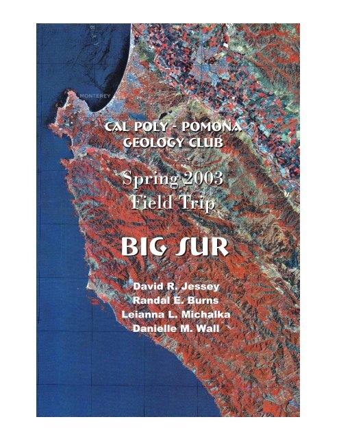
<strong>Cal</strong> <strong>Poly</strong> - <strong>Pomona</strong>Geology ClubSpring 2003Field Trip<strong>Big</strong> <strong>Sur</strong>David R. JesseyRandal E. BurnsLeianna L. MichalkaDanielle M. Wall
ACKNOWLEDGEMENTThe authors of this field guide would like to express their appreciation and sincere thanksto the Peninsula Geologic Society, the <strong>Cal</strong>ifornia Geological <strong>Sur</strong>vey and <strong>Cal</strong>trans.Without their excellent publications this guide would not have been possible. Weapologize for any errors made through exclusion or addition of trip field stops. For moredetailed descriptions please see the following:Zatkin, Robert (ed.), 2000, Salinia/Nacimiento Amalgamated Terrane <strong>Big</strong> <strong>Sur</strong>Coast, Central <strong>Cal</strong>ifornia, Peninsula Geological Society Spring Field Trip2000 Guidebook, 214 p.Wills, C.J., Manson, M.W., Brown, K.D., Davenport, C.W. and Domrose, C.J.,2001, LANDSLIDES IN THE HIGHWAY 1 CORRIDOR: GEOLOGY ANDSLOPE STABILITY ALONG THE BIG SUR COAST, <strong>Cal</strong>ifornia Departmentof Conservation Division of Mines & Geology, 43 p.
0122 00'0122 45'0121 30Peninsula Geological SocietyField Trip to Salina/Nacimento<strong>Big</strong> <strong>Sur</strong> Coast, Central <strong>Cal</strong>ifornia1QalSALINAS RIVERQtSalinasQalQtGabilan Rangeqd036 30'EXPLANATIONUNCONSOLIDATEDSEDIMENTSQalQsQtQcQpAlluviumDune SandQmQuaternary non-marineterrace depositsPleistocene non-marineQsCarmelQsPointLobosPlio-Pleistocene non-marineQtpgm1MontereyQtTmCARMEL RIVERTmpgmqdQalSeasideTmQsQppgmQcQppgmQpCARMELVALLEYTmQalTmpgmQtpgmqdsurTmTularcitos FaultQalqdSalinas Valley101ChualarsurSierra de SalinasQalQt036 30'QmCOVER ROCKSPleistocene marine TerracedepositsqdpgmsurTmsur036 15'036 00'TmFRANCISCAN SUBDUCTIONCOMPLEX J-Kfs Graywacke, deep-sea trenchdepositsfcspFOREARC SEDIMENTS J-KK Great Valley forearc turbiditesedimentsNEVADAN ISLAND ARCINTRUSIVE ARC ROCK(78 -150 Ma age of arc)qmpgmpgqdqdpMonterey Formation, mostlymarine biogenic andclastic sediments middle tolate Miocene in age.Porphyritic grandiorite of MontereyQuartz monzonitePorphyritic grandioriteQuartz dioriteQsPoint <strong>Sur</strong>Deep-ocean bedded radiolarian chertsSheared serpentine derived fromoceanic depleted harzburgite.Quartz -poor quartz diorite(some are recrystallized tonalitescontaining granulite faciesgarnet + opx , Compton's charnockite)0122 00'TmfsspTmspqdpQmspfcPacific Ocean00fsKKspfcqmqmqmISLAND ARC BASEMENTsursurKKsur28sursurpgmqdqdqdpqmqmqm<strong>Sur</strong> Thrustpgmqm<strong>Sur</strong> Series or <strong>Sur</strong> Complexquartzofeldspathic schist, marblegranofels, and gneiss. Protolithage is Precambrian 1.7 Ga and themetamorphic age is 78 to 100 Ma.0122 45'sursursursur10 20 km5 10 milesSCALEKqmqmqdpqdqmKsursurqdpfsLuciasurqmqmfsKTmpgmqmqdpsursurqdp1036 15'036 00'
Cross Section Locationin <strong>Cal</strong>iforniaCROSS SECTION OF THE SOUTHERN COAST RANGES AND SAN JOAQUIN VALLEYFROM OFFSHORE OF POINT SUR TO MADERA, CALIFORNIASan Andreas FaultG R E A T V A L L E YSan Gregorio-Hosgri FaultMaceraBDiablo RangeMontereyGabilan RangeSanta LuciaRangeSan Andreas FaultA<strong>Sur</strong>-Nacimiento FaultGarlock FaultPacfic Ocean0 200 kmScaleKM4Sea Level 0-4-8-12-16-20-24-28-32A2.0Western edge of formerJurassic-Cretaceous subduction zonefor Point <strong>Sur</strong> areaPACIFIC OCEANPoint <strong>Sur</strong>Franciscan Subduction ComplexJkfMORB stalled underplateMantle<strong>Sur</strong>-NacimientoFault ZoneSanta LuciaRangeSierra deSalinas-36-40110 100 90 80 70 60 50 40 30 20 10 0 10 20 30 40 50 60 70 80 90 100 110 120 130 140 150 160 170 180KMJkfSalinasValleySan AndreasFault ZoneGabilanRange?Coast RangeThrustDiablo Range Panoche Hills San Joaquin ValleyFranciscan Subduction ComplexJkfMORB stalled underplateMiddle to Late Jurassicmagmatic underplating of west facing“infant arc” Sierra NevadaMaderaSierra Nevada BasementB4 KM0-4-8-12-16-20-24-28-32-36-40EXPLANATIONQuaternary & PleistoceneTertiary sedimentsTonaliteNevadan Island ArcIntrusive granites 78 - 100 Ma<strong>Sur</strong> Series continental basement 1.7 GaSlow spreading initiates partialmelting in the mantle ~ 165 MaFore Arc Great ValleyCretaceous-Jurassic sedimentsCoast Range ophiolite generated abovesuprasuduction zone Cretaceous-JurassicDikesGreat Valley Ophiolite slow spreadingunderplating of Sierran BasementMid ocean ridge basalt MORBSierra Nevada BasementFranciscan subduction complex,Cretaceous-JurassicMantle, depleted harzburgite
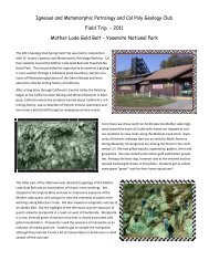
<strong>Big</strong> <strong>Sur</strong> Field Trip Road log and Field GuideMileageD. Jessey, R. Burns, L. Michalka and D. WallDescription0.0 San Simeon Creek Campground – Turn right (north on Highway 1).3.0 Turnoff to Hearst Castle.8.7 Piedras Blancas Lighthouse Road – STOP 1.At this stop marine terraces, uplifted by motion along the San Simeon fault, are a commonfeature of the landscape. The San Simeon fault, which may be an onshore segment of theHosgri fault, is a multistrand break; it cuts and displaces late Pleistocene marine terracesand Holocene dune sands near San Simeon Point. Although faulted shoreline-anglegeometry and the correlation of wave-cut platforms across this fault are subject to someuncertainty, Weber (1983) suggested a horizontal right-slip component of about 0.5 cm/yr.Earthquake focal mechanisms along the San Simeon fault indicate a dip of 55° E andnearly equal components of reverse and strike slip. Right-oblique slip at a rate of about 0.5cm/yr on the Hosgri fault is indicated by earthquake focal mechanisms, sea-floor scarps,the distribution of late Quaternary wave-cut platforms, and faulted seismic-reflectionhorizons of late Cenozoic age.16.3 Northern extent of San Simeon terraces. We have now crossed the San Simeon fault andentered the more rugged terrain characteristic of the central <strong>Cal</strong>ifornia coast. The rocksunderlying this portion of the coastline are part of the <strong>Sur</strong>-Obispo terrain; more commonlytermed the Franciscan after the type section north of San Francisco. Most likely we arestopped at the traffic light so you may have the opportunity to quickly examine the rocks.The Franciscan is a “classic” mélange sequence (see our discussion elsewhere in this fieldguide) with tectonically dismembered slices of ophiolite. However, the exposures north ofCambria are limited and not as striking as the Coast Range Ophiolite (CRO) at Point Salto the south (Vandenberg AFB) or along the Smith River to the north (JosephineOphiolite). Remember from GSC 111 that ophiolite consist of three components; layeredultramafics and gabbro, pillow basalt and deep water sediments. The latter are the mostcommon along this portion of the central <strong>Cal</strong>ifornia coast. Where present, the igneouscomponents tend to be so heavily serpentinized that it is difficult to recognize theprotolith.The reason for the signal light is to enable <strong>Cal</strong>trans to control traffic flow while they repairthis portion of the road from a winter landslide. You will realize by the end of this fieldtrip that those portions of the highway traversing Franciscan rocks are far more landslideprone than other parts of the highway.17.6 Town of Ragged Point.18.0 Striking beds of interlayered black shale and white chert typical of the deep watersediments associated with ophiolite sequences.19.1 Monterey County line.19.7 Leianna’s lunch: note the undigested salami.21.3 Salmon Creek.
24.5 Nathaniel Owens Memorial Redwood - the fortunes of this protected area took a dramaticturn for the worse after Leianna claimed to be attacked by a giant flying insect andproceeded to decimate the local wildlife population with a rock hammer.26.6 More bedded chert.28.8 The metropolis of Gorda.32.1 Jade Cove – STOP 2.Park as close as possible to the Jade Cove Beach sign, cross over the fence and follow thewell-worn trail to the beach. Jade Cove is a portion of the ophiolite sequence that wassubjected to high pressure/low temperature (blueschist facies) metamorphism, often withplate subduction and accretion along a convergent margin. Slickensides are present on therocks along the trail below the marine terrace. On the beach, there are blue and greenschists, fibrous to asbestiform serpentine, graywackes, and nephrite jade from which thename of the cove is derived. Pure nephrite is usually white, but the presence of impuritiesresults in a variety of shades of green, from lightly tinted, nearly transparent, to a rich,dark green. Underwater, jade is fairly easy to distinguish from other rocks by itscharacteristic, almost luminescent color. Jade is hard and cannot be scratched by a rockhammer, while the softer, and more common, serpentine is easily scratched.Small pebbles of jade may be found in the gravel beds, particularly near Cave Rock andthe north point of the cove. Jade hunters don’t need to be divers as many small jadepebbles can be found in tide pools between the boulders, and in areas of coarser gravel.Fan the gravel while looking for the characteristic jade color, or dig out a gravel bed witha small shovel. Larger pieces can be anywhere. Search under large rocks and overhangs.View of Jade Cove looking to the north.Fibrous serpentinite at Jade Cove.34.1 Town of Pacific Valley.37.7 Junction of Nacimiento/Fergusson Road – Turn Right.40.4 <strong>Sur</strong>-Nacimiento fault – STOP 3Follow the narrow winding Nacimiento/Fergusson road for a distance of about 2.7 miles.The pulloff is on the right side of the road. At this stop, the trace of the <strong>Sur</strong>-NacimientoFault can be seen. It has a northwest strike and dips approximately 50° to the east. The
difference in vegetation on each side of the fault is quite striking. The vegetation is sparsewith mostly grass on the upper plate carbonate roof pendants and granitic rocks of theSalinian block east of the fault. On the serpentenized <strong>Sur</strong>-Obispo block to the west of thefault, there are redwoods, pine, oak, and low chaparral. The wealth of vegetation in <strong>Sur</strong>-Obispo rocks is probably due to ferrous-iron bearing minerals, common in Franciscanassemblage rocks. The presence of ferrous iron also results in a marked difference incolor upon weathering. Franciscan rocks vary in color from tan to brown to red, whilethose of the Salinian block are usually light to medium gray.The <strong>Sur</strong>-Nacimiento fault was recognized as far back as the 1950s, but its significancewasn’t understood until the evolution of modern plate tectonic theory in the early 1970s.The east dipping fault juxtaposes two terrains of vastly different character. To the west ofthe fault, the <strong>Sur</strong>-Obispo rocks are mélange of Mesozoic (Cretaceous?) seafloor sedimentsand oceanic crust. Metamorphism is weak, generally lower greenschist facies. To the westof the fault the Salinian block is comprised of late Proterozoic (?) <strong>Sur</strong> Seriesmetasedimentary rocks intruded by Cretaceous granitoids. The metasedimentary rocksbear a striking resemblance to the roof pendants of the central Sierra Nevada while theintrusive are clearly Sierra Nevada contemporary. The structural relationship of olderrocks (<strong>Sur</strong> Series) over younger (Franciscan) is indicative of a thrust fault. Furthermore,the juxtaposition of oceanic crust to the west and Sierran volcanic arc rocks to the eastsuggests this fault may have marked the Cretaceous convergent boundary betweencontinental North American and the Pacific/Farallon plate.Return to vehicles, turn around and proceed back to Highway 1.View looking north of the <strong>Sur</strong>-Nacimiento fault.The chaparral covered slopes to the right areFranciscan block while the grass covered slopesto the left are Salinian block.The <strong>Sur</strong>-Nacimiento fault is generally poorlyexposed. So poorly, that we looked for an hour andnever found this outcrop along the FergussonRoad. The black labeled fault is the thrust.43.1 Intersection with Highway 1. Turn right (north).45.1 Entrance to Limekiln State Park – The manufacture of lime at this locality dates back tothe 1880s when Rockland Lime and Lumber Company began operations. Four stone andsteel furnaces were built at the base of a natural limestone landslide. The kilns wereloaded with limestone (marble?) then stoked with redwood cut from nearby slopes. Theresult was slaked lime that was packed into barrels, made on site, and hauled by wagon toRockland Landing. From there it was loaded on barges by a steam-powered crane andshipped to San Francisco for use in the manufacture of cement.
50.0 Vincent Creek Bridge50.1 Small, indistinct outcrop of serpentinite.50.6 Outcrop of red jasperoidal chert east of highway.52.3 <strong>Big</strong> Creek Bridge.52.9 Franciscan greenstone (be careful crossing traffic!) – STOP 4Really large Franciscan greenstone lenses, approximately 2 km long.Subhorizontal flow layering is well displayed. Abundant calcite + epidote veins andhydrothermal alteration. Note the abundance of well developed vertical fractures andimagine how these might have formed as a during plate divergence. The beautifulpreservation of this piece of seafloor suggests the processes of subduction and accretiondid little to overprint this tectonic block.Outcrop of serpentinite. Note the vertical fractures in the center of thephoto and large calcite-epidote vein to the right. Randal for scale.
54.0 Franciscan deep-water sedimentary units – STOP 5Very well indurated, disrupted Franciscan graywacke, siltstone, and dark shale. Typicaltectonic mélange according to Ernst. We (your authors) didn’t find this stop all thatinstructive, but it is worth a brief look!56.8 Esalen Institute (Home of Primal Scream Therapy) - The word itself summons uptantalizing visions of adventure, of human possibilities yet to be realized. There is thewonder of the place itself, 120 acres of fertile land carved out between mountain andocean, blessed by a cascading stream and hot mineral springs gushing from a seaside cliff.There is the delicate and subtle <strong>Big</strong> <strong>Sur</strong> air of an afternoon in May, the midnight mist ofJuly, the drenching February rain as well as the ticks that get in your pants (rightLeianna?).57.1 Approximate location of crossover from <strong>Sur</strong>-Obispo block into Salinian block.58.0 Great Valley Sequence – STOP 6Fantastic exposure of coarse conglomerate of the Great Valley Series (see photo below).Such exposures are rare in the Salinian block, but much more common to the east of theSan Andreas fault. Locally, the conglomerate appears to be transected by medium-grained,cm-thick alaskite stringers. Really???The Great Valley Sequence ranges in age from Late Jurassic to Cretaceous. It crops out asthick, monotonously bedded sections of strata that generally are markedly less deformedand more coherent than sedimentary sections of the Franciscan and also have greaterlateral continuity. Where most fully developed, such as along the west side of the northernGreat Valley, the aggregate stratigraphic thickness of Great Valley sequence is at least 12km. The strata normally lie depositionally on Coast Range ophiolite except wheredisrupted by faults, but along the east side of the Great Valley they onlap the Nevadanterranes of the Sierra Nevada. This enormous thickness of clastic detrital materialprobably represents submarine fans and turbidite deposits that formed as a result of rapiderosion of the ancestral Sierra Nevada and, hence, is thought to represent “classic” oceantrench sediment.60.0 Entrance to Julia Pfeiffer Burns State Park. A good place for a rest stop and the hike toMcWay Falls (see photo below) is well worth the trip. If you make the hike be sure tolook for the outcrop of Miocene Monterey Formation porcellanite.Cretaceous Great Valley Conglomerate. Clastsappear to be largely granite derived from theSierran arc (?).McWay Falls at Julia Pfeiffer Burns State Park.
60.1 Traveling through brown, weathered charnockitic tonalite. Hornblendic charnockitecontains felsic layers and stringers. <strong>Sur</strong> Series marble float suggests that the intrusivecontact is nearby.63.9 Torre Creek Bridge64.7 Salinian Charnockite (watch oncoming traffic at your pulloff) – STOP 7At this stop coarse, dark gray charnockite with stringers of white alaskite can be found(look uphill to see the latter). Charnockitic tonalite contains a large, fine-grained, platelikemafic granulite body consisting chiefly of biotite + hornblende + plagioclase,representing a wall rock xenolith or an early, mafic igneous border phase or relict maficdike. It is clearly intruded by dark tonalite and by even later alaskite.We have been traveling through outcrops of Salinian intrusives for the past several miles.This outcrop is typical. Do you remember what a charnockite is? Charnockites arerelatively rare in the Sierra Nevada so I am going to guess that the more anhydrous natureof this assemblage suggests a higher T/P metamorphic overprint (deeper burial orproximity to the point of plate convergence?).65.9 <strong>Sur</strong> Series – STOP 8Flat-lying 1.7 Ga <strong>Sur</strong> Series marble, quartzite and feldspathic gneiss. Mineralogy includesuralite after clinopyroxene, garnet, graphite and rare unaltered clinopyroxene.The <strong>Sur</strong> Series represents the basement rock of the Salinian terrane. Researchers noted thelithologic similarity to roof pendants of the Sierra Nevada and originally assigned aPaleozoic age. The Proterozoic age is unusual and enigmatic. (We were actually unableto determine the source of this age although it appears in the Peninsula Geological SocietyGuidebook (2000).69.3 Sheared serpentinite on the west with numerous redwoods, dark Franciscan shale acrossthe road to the east.70.7 Entrance to Julia Pfeiffer State Park Lodge and Campgrounds – End of Day 1MileageDescriptionDAY 20.0 Entrance to Julia Pfeiffer State Park, turn right (north) on Highway 1.3.1 Andrew Molera State Park.10.2 Hurricane Point (aptly named) – STOP 1Light-colored graphitic marbles of the <strong>Sur</strong> Series, striking NS, dipping about 60°E.Associated metasedimentary rocks (pelitic schists, slates?) can be seen down the cliffalong beach. In places, looks like massive, saccroidal granite, but contains subangular tomoderately rounded grains, and lacks phenocrysts.11.3 The “famous” Bixby Canyon Bridge.11.9 Dark gray, coarse-grained, biotite-rich charnockitic tonalite; original pyroxene is nowcompletely pseudomorphed by uralitic amphibole. The tonalite contains even darker,
medium-grained inclusions or metadikes (chiefly biotite + quartz + plagioclase). Floatblocks of very coarse, white marble suggest proximity to the <strong>Sur</strong> Series. Presumably, thetonalite intruded the carbonate strata, and then both were metamorphosed.12.0 Rocky Creek Bridge.13.6 Rocky Point Restaurant – STOP 2NE-dipping Upper Cretaceous, brown weathering Great Valley coarse sandstone, shale,and siltstone. Well-bedded clastic sedimentary strata derived from the Sierran plutonicvolcanicarc.14.7 Garrapata Creek.19.6 Malpaso Creek.22.1 Turn Off to Point Lobos - TURN LEFT pay your $5.00 at the entrance station, then turnright on the road to Whaler’s Cove and proceed to the parking area – STOP 3The Monterey Mass of the Salinian block is well exposed at Whalers Cove. There arelarge twinned k-feldspar phenocrysts within the rip-rap boulders along the shoreline. Thegently to steeply dipping beds of the Paleocene/Eocene Carmelo Formation overlie theMonterey mass granites, with the bedding contact seen on the opposite side of the cove atCoal Chute Point. For the best view of the contact we will make a short hike from theparking area to Moss Cove. At this locality we can see spectacular exposures of thenonconformity between the Cretaceous Monterey Mass Granite and the Cenozoic CarmeloFormation. It is up to you to find the nonconformity.The Carmelo Formation represents the fill of the upper portion of a submarine canyonincised into the Salinian basement. There are three main lithologies; coarse pebble andcobble conglomerates, thick-bedded, coarse-grained sandstone, and thin-beddedmudstone. Outcrops vary in attitude from flat-lying to steeply tilted, generally dipping tothe east or northeast. Total thickness has been estimated at 250 meters.That’s the end of our road log. See below for optional stops to view the MioceneMonterey Formation and Pinnacle Volcanics.Large feldspar phenocryts within the MontereyMass Granite.Nonconformity between the Monterey MassGranite and Paleocene Carmelo Formation.
OPTIONAL STOPS – MONTEREYFORMATIONFrom Highway 1, take the Monterey/Aguajito Rd. exit and turn left on Agaujito Rd, then left on MarkThomas Drive. Just before you reach the bridge crossing Highway 68 turn right on the frontage roadlocated there. There is a road cut on the right hand side of the road next to the Santa Catalina School. Aturn-out is located on the left side of the road, across from the road cut. Stop 1Monterey Formation at the Santa Catalina School.This is a thinly bedded, laminated siliceous mudstone that is approximately 13 Ma. The beds dip slightly tothe west. Note the tiny holes left by dissolved forams. There are two other distinct interbedded lithologiesfound here. One layer contains round violet-gray phosphate pellets approximately 1-5 mm in diameter. Thephosphate pellets are residual nodular deposits indicative of a highly productive, upwelling typeenvironment. In addition, there are two dark bentonite layers correlated with 12.5 Ma volcanism.Head back the way you came and turn left on Mark Thomas Drive. Next, turn left on Josselyn Canyon Rd.then turn right (east) on Highway 68. Turn right on Olmsted Rd. to Jack’s Peak road. Go southapproximately .75 miles and pullover across from the large road cut on the left. Watch for cars! Stop 2This road cut shows some excellent examples of folds and shearing and dragging due to thrusting. Thethinly bedded, internally thinly laminated diatomite is softer, more amorphous and formed in more anoxicenvironment than the previous outcrop. It contains diatoms, fish scales, and forams of a larger species thanfound at Stop 1. There is also an orange layer believed to be a highly weathered bentonitic volcanic ashlayer.Folded layers within the Monterey Formation at Stop 2.
Pinnacles National MonumentWe will be returning to southern <strong>Cal</strong>ifornia via Highway 101. An interesting side trip to PinnaclesNational Monument is available to those who have the time. From the town of Soledad (you can visitCharlie Manson at the Soledad Prison if you want to) take Highway 146 east about ten miles to themonument. Pay your fee and drive to the parking area. From there you can take a variety of hikes.The rocks here at Pinnacles N.M. are a series of welded volcanic tuff flows of early Miocene age 23.5 Ma(see photo below). The igneous rocks consist of calc-alkaline andesite, dacites, and rhyolite flows. Most ofthe Pinnacles ignimbites are a red to pink-orange rhyolite to andesite ash-lapilli tuff. The matrix-supportedvitric ash is massively bedded. The flow direction of the tuffs can be inferred from the layered beddingplanes and flow banding. Close inspection of the lapilli reveals very angular clasts of biotite-hornblendequartz feldspars, up to 10 cm in diameter. There are also pumice clasts and shards of quenched glass.The rocks at the Pinnacles N.M. have been correlated to the Neenach Volcanics, on the east side of the SanAndreas fault, 20 km southeast of the intersection with the Garlock fault. The two units have similarcompositions, lithologic sequences, and are dated at the same age. In addition, they both rest on graniticbasement that is petrographically and chemically identical. This represents a displacement of 315 km alongthe San Andreas fault since the volcanics were erupted 23.5 million years ago.The Pinnacle Volcanics.
This field guide could not have been complied without the assistance of various authors andpublications. We cite a list of our references below and apologize for any inadvertent exclusion.REFERENCESDibblee, Thomas W., 2001, Geology of the Los Padres National Forest, U.S. Forest ServicePacific Southwest Region.Lowe, Donald R., 2002, The Carmelo Formation, Field Guide for the AAPG Hedberg FieldResearch Conference, Submarine Canyon to Basin Plain. Western <strong>Cal</strong>ifornia.Moss Landing Research Laboratories, 1999, Geology of the Monterey Bay Region, MLML MS274, Examination of the <strong>Big</strong> <strong>Sur</strong> Coastline and Indians Ranch.Moss Landing Research Laboratories, 1999, Geology of the Monterey Bay Region, MLML MS274, Monterey and Santa Margarita Formations, the Navy and Chupines Faults.Moss Landing Research Laboratories, 1999, Geology of the Monterey Bay Region, MLML MS274, Point Lobos State Reserve.Wills, C.J., et al., 2001, Landslides in the Highway 1 Corridor: Geology and Slope StabilityAlong the <strong>Big</strong> <strong>Sur</strong> Coast, <strong>Cal</strong>ifornia Department of Transportation Project F99TL34.Zatkin, Robert (ed.), 2000 Salinia/Nacimiento Amalgamated Terrane <strong>Big</strong> <strong>Sur</strong> Coast, Central<strong>Cal</strong>ifornia, Guidebook for the Spring Field Trip, May 19-21, 2000 Peninsula Geologic Society.
Geology of the Central <strong>Cal</strong>ifornia Coast<strong>Cal</strong> <strong>Poly</strong> Geology ClubSpring 2003 – Field TripDavid JesseyRandal BurnsLeianna MichalkaDanielle Wall
Introduction – the simple viewThe central <strong>Cal</strong>ifornia Coast ranges contain a series of lithotectonic blocks representing stages in thegeologic evolution of the Mesozoic margin of <strong>Cal</strong>ifornia. Important maps and cross-sections havebeen published by Ross (1976) and Hall (1991). Physiographic provinces and rock assemblagesinclude: (1) the landward Andean (Sierra Nevada) calc-alkaline plutonic-volcanic arc + Foothillsupper Paleozoic-lower Mesozoic metamorphic belt; (2) the Upper Jurassic-Cretaceous Central Valley(Great Valley forearc basin strata); and (3), the contemporaneous deep-water trench deposits(Franciscan Complex). Neogene dextral slip along the San Andreas system moved the presentcontinental margin from a position near the Gulf of <strong>Cal</strong>ifornia, northward to near Cape Mendocino,reflecting the fact that the North American continental plate progressively overran the outboard EastPacific Rise spreading center during late Oligocene time. Right-lateral motion along the San Andreasthus has duplicated the Mesozoic continental margin along the <strong>Big</strong> <strong>Sur</strong> coast—(1) Salinian silicic,calcalkaline granitoids + Proterozoic (?) <strong>Sur</strong> Series metamorphics, (2) Great Valley detrital sedimentsdepositionally resting on the Salinian basement, and tectonically thrust over the outboard FranciscanComplex, and (3), <strong>Sur</strong>-Obispo graywackes, greenstones, and cherts of the Franciscan mélange. Thenature of the Neogene strike slip is quite apparent, but the previous history of rock sections along the<strong>Sur</strong>-Nacimiento fault is not.What is clear is that the Salinian granitic rocks share petrochemical and geochronologiccharacteristics with granitoids of the western Mojave Desert and the Tehachapi Mountains. The <strong>Sur</strong>Series remains more enigmatic. Recent age dates suggest a Proterozoic age somewhat inconsistentwith the “typical” Paleozoic roof pendants of the Sierras. The Franciscan is a jumbled mélange ofoceanic affinity (oceanic crust + chert) overlain by voluminous masses of arc-derived clasticsediments, all intensely tectonized within the North American-Pacific plate subduction zone. Thefacts that Salinan tonalites have been recrystallized to pyroxene + garnet assemblages (i. e.,charnockites) and associated aluminous metapelites contain sillimanite suggest high temperatures andconsiderable depths of origin. Similar garnetiferous tonalites have been described in the easternTransverse Ranges; therefore, a palinspastic restoration (approximately 310 km) of the <strong>Big</strong> <strong>Sur</strong> regionagainst the Tehachapis + western Mojave is plausible. The more oceanic, deep-sea Franciscanassemblages along the <strong>Big</strong> <strong>Sur</strong> coast have been exhumed from much shallower subduction depthscompared with along-strike metagraywacke terranes cropping out farther south in the San LuisObispo area, but comparable rocks crop out from the Oregon border at least as far south as centralBaja.Various scenarios for the plate-tectonic assembly of the Salinia/Nacimiento terrane have beenproposed. Interpretations for the origin and evolution of the Coast Range ophiolite are summarizedby Dickinson et al. (1996).
The More Complex ViewNumerous studies led to the formulation of a generalmodel for the <strong>Cal</strong>ifornia Borderland, in which a forearcbasin (the Great Valley Group) and its basement rodepassively and undeformed on the upper plate of the arctrenchsystem, while the Franciscan Complex wascomplexly deformed structurally beneath thesubduction complex (Figure 1). The tectonic contact ofthe comparatively unmetamorphosed Great ValleyGroup and Coast Range ophiolite with the structurallyunderlying Franciscan Complex was initially called theCoast Range thrust. This nomenclature reflected therecognition of the tectonic contact as a subduction zone.However, it was noted that the contrast of metamorphicassemblages (low-P rocks on high-P rocks) across thiscontact was sometimes more consistent with normalrather than reverse slip. Neogene normal faultmovement between the Great Valley Group andFranciscan was then proposed.MetamorphismFigure 1. Schematic block diagram looking northeast,showing north end of forearc basin during EarlyCretaceous. Black trough represents Franciscan trench,where oceanic lithosphere is being subducted beneath theCoast Range ophiolite underlying Great Valley Group(GVG). Sierra Nevada magmatic arc is east of forearcbasin. (from Short and Ingersoll, 1990).Franciscan metamorphic rocks occur as tectonic blocks in melange and as intact units or thrustsheets. The coherent blocks are comprised of a variety of litholgies including greywacke, radiolarianchert, serpentinite, pillow basalt and rare ultramafics. The ultramafic-pillow basalt-deep watersediment association is now generally recognized as an ophiolite (Figure 2); a remnant of accretedoceanic crust. Intact Franciscan units range from blueschist-greenschist transition assemblages tozeolite facies. Tectonic blocks in melanges range from amphibolite to zeolite grade. Althoughthere have been many studies of Franciscan metamorphism since 1970, estimates for pressure (P)and temperature (T) of metamorphism for Franciscan rocks have not changed significantly. Forblueschist and blueschist-greenschist transition facies rocks, these estimates range from 100 to 380°C and 4 to 9 kbar. Coherent rocks are part of an inverted metamorphic gradient from zeolite toblueschist-greenschist. Thrust faults apparently separate rocks of different metamorphic grade, butthe metamorphic gradient may record changing thermal conditions within the subduction zone, andthe structurally higher parts of the metamorphic gradient reflect the thermal influence and proximityof the hanging wall of the subduction zone and plutons of the Sierran arc.MelangesDespite numerous studies that have clarified the details of mélanges, much remains problematic.Cloos (1982, 1985) modeled a return-flow material path in melanges and used this flow pattern toexplain the mixture of different blocks, the progressive accretion of melange terranes, and the largescalethermal patterns noted in the Franciscan Complex. Cowan (1985) examined strain patterns inmelanges and concluded that Franciscan melanges formed in several different tectonic settings. Page(1978) proposed that melanges resulted from a combination of tectonic shearing and earlier mélangedevelopment. There is abundant evidence for Franciscan or ophiolitic material that has beenexhumed and resedimented,.Coast Range OphioliteDuring our drive along Highway 1 we will remain to the west of the San Andreas fault and as suchnever see the “classic” subduction terrane of Ernst (1970) (See Figure 3). Franciscan rocks,Nevadan intrusives and sporadic outcrops of Great Valley Group are present, but the Coast Rangeophiolite (CRO) outcrops west of the San Andreas fault only at Point Sal near Vanderberg Air ForceBase. Unfortunately, no discussion of Mesozoic subduction would be complete without mention of
the Coast Range ophiolite. This is because it poses a vexing problem. As you can see in crosssection 4a, east of the San Andreas fault the Coast Range ophiolite lies between the Franciscan andthe Great Valley Group. The first question that needs to be addressed is what exactly is the CoastRange ophiolite? The best exposure of the rocks units occur in northern <strong>Cal</strong>ifornia along the SmithRiver. There the sequence displays the “classic” ophiolite units from the basal ultramafics throughgabbros, sheeted dikes and upward into pillow basalts and minor chert (Figure 2). In many respectsthe lithologies are identical to those of the Franciscan with some important differences. First, thereis limited tectonic dismemberment, in other words the CRO is NOT a mélange. Second geochronologysuggests the CRO is mid-Jurassic in age and paleomagnetic studies indicate transportationof 2000 kilometers to its present location. Third, metamorphic grade is only zeolite tolower greenschist suggesting shallow burial. Finally the Great Valley Group (GVG) appears to lie indepositional contact with the CRO, not in fault contact as with the Franciscan. This has presentedsomething of a dilemma and numerous models have been proposed to explain the observed fieldrelationships (Figure 4).Major structure: Cross-sectional and along-strike variationFollowing the recognition of melanges, units were mapped as chaotic melanges or coherent blocks.Mapping of fault-bounded units developed into the formalized terrane concept. The terrane conceptadded new levels of detail to Franciscan mapping and interpretation but did not separate discretemelanges; all melanges were considered to be one terrane. Imbricate low-angle faults involvingcoherent units and intervening melanges were recognized in the eastern part of the Franciscan in thenorthern Coast and the Diablo Range in 1978. Blake et al. (1984) characterized the coherent unitsand melanges as a set of gently folded thrust nappes, with discrete melange zones separating thecoherent sheets.The Franciscan Complex exhibits considerable along-strike variation, even if dextral faultingassociated with the San Andreas transform system is removed. This variation may be expected insubduction complexes, because scraped off packets of trench and pelagic sediment would not beexpected to extend the full length of the trench. Along-strike variation makes the “Coastal Belt,Central Belt, Eastern Belt” subdivision of the Franciscan Complex, difficult to apply south of thenorthern Coast Ranges.GeochronologyAnalysis of tectonics relies heavily on geochronologic data. Initial data from sparse macrofossils inclastic sedimentary rocks have been supplemented by microfossil data from cherts and limestones.Detailed biostratigraphy from cherts demonstrated that what were once thought to be chert interbedswith basalt or graywacke were instead a consequence of structural imbrication. Although clasticrocks of the Franciscan Complex are coeval with the forearc basin strata of the Great Valley Group(ca. 150 Ma and younger); some oceanic rocks are older. Numerous isotopic dating studies havebeen conducted in the Franciscan Complex. Only metamorphic rocks of blueschist grade or higher,and rare intrusive rocks, have yielded dates. The oldest metamorphic ages, 159–163Ma, have beeninterpreted to date approximately the inception of subduction. The youngest metamorphic agesobtained are 80–90 Ma. Fission-track data indicate that the structurally higher parts of theFranciscan Complex cooled from ~300 to ~100 °C, coinciding with the major exhumation of thesehigh P-T rocks from depths of ~30 to ~10 km, from 100 to 70 Ma. Many Franciscan rocks cooledbelow 90 °C, at 20 to 40 Ma.CONTROVERSIES AND UNSOLVED PROBLEMSSome issues fundamental to the history of the Franciscan Complex, and to convergent plate margintectonics in general, have not been resolved. Two major issues are discussed below.
To strike slip or not to strike slipPlate tectonics theory predicts that deep ocean sediments and volcanic rocks are transported longdistances on the oceanic plate as it moves toward the subduction zone. Paleomagnetic studies ofbasalts and limestones from the Franciscan Complex have indicated southerly latitudes ofdeposition, and oblique plate convergence during much of Franciscan history. However, thepresence or absence of large-scale (thousands of kilometers of displacement) strike-slip faultspassing through the Franciscan Complex is a subject of debate. Data from conglomerates have beenalternatively interpreted to indicate negligible or large synsubduction strike-slip displacementbetween rocks of the Franciscan Complex and Great Valley. Some researchers have interpreted up tothousands of kilometers of strike-slip faulting within the Franciscan, only a few hundred kilometersof which are attributed to the San Andreas transform fault system.What went down came up: Exhumation of blueschists and other high P-T rocksAs the type subduction complex, the Franciscan Complex has become a testing ground for models ofthe exhumation of high P-T rocks. Many mechanisms can account for the exhumation of high-gradeblocks in melanges, including melange return flow and shale diapirism, or serpentinite diapirism.Coherent high P-T metamorphic rocks present a more difficult problem because they are not thoughtto be as mobile as blocks in melanges. The critical part of the is the rise of the high P-T rocks fromdepth (25 km or more) to the same crustal level as the Great Valley Group rocks that are now incontact with them, a difference in burial depth of 15 km or more. Ernst (1970) proposed that high P-T rocks were less dense than the mantle they were subducted into and had to rise buoyantly back tothe Earth’s surface. Platt (1986) dismissed this model, noting that the high P-T rocks are more densethan the rocks that are currently found in contact with them. Platt, noting that nearly unmetamorphosedophiolite tectonically overlies deeply buried Franciscan Complex rocks, concluded thatthe high P-T rocks were exhumed by normal faulting associated with synsubduction extension. Thepresence of high P-T rocks structurally above lower P metamorphic rocks may not be well explainedby the Platt model. Certain structures suggest that the high P-T rocks rose relative to their hangingwall and footwall, an extrusion-like process. If the faults bounding the high P-T rocks are coeval, theexhumation may have been driven by large-scale underplating of oceanic terranes from 100 to 70Ma. However, the timing of movement on the faults bounding the high P-T rocks has not beenconstrained with sufficient precision to determine whether movement on them was indeed coeval.Further detailed structural, geophysical, and geochronologic studies in the Franciscan Complex mayhelp refine and test exhumation models for high P-T rocks.REFERENCES CITEDBlake, M. C., Jr., Howell, D. G., and Jayko, A. S., 1984, Tectonostratigraphic terranes of the SanFrancisco Bay region, in Blake, M. C., Jr., ed., Franciscan geology of northern <strong>Cal</strong>ifornia:Society of Economic Paleontologists and Mineralogists, v. 43, p. 5–22.Cloos, M., 1983, Comparative study of melange matrix and metashales from thenFranciscansubduction complex with the basal Great Valley sequence, <strong>Cal</strong>ifornia: Journal of Geology,v. 91, p. 291–306.Cloos, M., 1985, Thermal evolution of convergent plate-margins: thermal modeling and reevaluationof isotopic Ar-ages for blueschists in the Franciscan Complex of <strong>Cal</strong>ifornia:Tectonics, v. 4, p. 421–433.Cowan, D. S., 1985, Structural styles in Mesozoic and Cenozoic melanges in the Western Cordilleraof North America: Geological Society of America Bulletin, v. 96, p. 451–462.Dickinson, W. R, Hopson, C. A., and Saleeby, J. B., 1996, Alternate origins of the Coast RangeOphiolite (<strong>Cal</strong>ifornia): Introduction and implications: Geology Today, v. 6, no. 2, p. 1-10.Ernst, W. G., 1970, Tectonic contact between the Franciscan melange and the Great ValleySequence, crustal expression of a late Mesozoic Benioff Zone: Journal of GeophysicalResearch, v. 75, p. 886–902.
Hall, C. A., Jr., 1991, Geology of the Point <strong>Sur</strong>-Lopez point region, Coast Ranges, <strong>Cal</strong>ifornia A partof the Southern <strong>Cal</strong>ifornia allochthon: Geol. Soc. Amer. Special Paper 266, 4Op.Page, B. M., 1978, Franciscan melanges compared with olistostromes of Taiwan and Italy:Tectonophysics, v. 47, p. 223–246.Platt, J. P., 1986, Dynamics of orogenic wedges and the uplift of high-pressure metamorphic rocks:Geological Society of America Bulletin, v. 97, p. 1037–1053.Ross, D. C., 1976, Reconnaissance geologic map of the pre-Cenozoic basement rocks, northernSanta Lucia Range, Monterey County, <strong>Cal</strong>ifornia: U. S. Geol. <strong>Sur</strong>v. Misc. Field StudiesMap MF-750.
Sedimentsred radiolarian chert& greywackePillow lavastholeitic to alkaliolivine basaltSheeted dikesbasaltic dike swarmsinjected below pillowbasaltsLayered gabbrocrystallized on wallsof magma chamberDunite/peridotitecumulus texturedfractionation residueFigure 2. The Ophiolite Suite.
*HRORJ\²
*HRORJ\²
*HRORJ\²
The Southern Coast Rangesby Ben PageDepartment of GeologyStanford UniversityIn The Geotectonic Development of<strong>Cal</strong>iforniaRubey Volume I, 1981*HRORJ\²
*HRORJ\²
AN EXCERPT FROM:LANDSLIDES IN THEHIGHWAY 1 CORRIDOR:GEOLOGY AND SLOPE STABILITY ALONG THE BIG SUR COASTHighway 1 along the <strong>Big</strong> <strong>Sur</strong> CoastBetween Point Lobos in Monterey Countyand San Carpoforo Creek in San Luis Obispo CountySLO-1-71.4/74.3MON-1-0.0/72.3Prepared for: <strong>Cal</strong>trans District 5Prepared by: <strong>Cal</strong>ifornia Department of ConservationDivision of Mines & GeologyNovember 2001
POTENTIAL FOR LANDSLIDES ALONG HIGHWAY 1Landslides can and do cause damage and close roads, resulting in major repair and maintenancecosts. Economic losses can be significant to an entire region of the state if a main route is closedfor an extended period. Besides the costs associated with landslide damage, some types oflandslides pose a risk to the safety of the traveling public. None of these risks can be eliminated.If roads are to pass through regions like the <strong>Big</strong> <strong>Sur</strong> coast where landslides are common, thehighway will be exposed to the risk of slide damage.The consequences of landslide movement are related to the size and location of a landslide, andthe amount and velocity of movement. Larger slides may displace more of a roadway, resulting ingreater repair costs. Larger displacements also translate to greater repair costs. If large movementsaccumulate slowly, over years or decades, they may be a continuing maintenance problemwhere cracks are filled and the pavement re-leveled frequently. Large, rapid displacements ofeven small volumes of material may undermine the road or deposit material on the road sufficientto close or partially close the roadway. These smaller volume, but rapidly moving, slides are themost likely to pose a safety risk to the traveling public. Large, deep landslides are less likely tomove rapidly or have significant displacement in any one episode of movement, but the rarerapid, large displacement of large landslides can have particularly severe consequences.Significant displacements of large, deep landslides may result in the roadway being closed forrepair or, in the worst case, closed for long periods for reconstruction or rerouting.The following paragraphs discuss the <strong>Big</strong> <strong>Sur</strong> Coast area as 12 sections that are distinguished bydifferences in geology, geography and landslides. Discussion of some of the notable landslidesand the potential for various types of landslides is included with each section. The description ofeach section of the highway corridor includes a general description of the potential for landslides.We have characterized the potential for landslides in each section as high, moderate or low, anddescribe the typical type and size of landslides. This description is an attempt to qualitativelysummarize the characteristics of an area, and so does not reflect the hazard posed by anyindividual landslide in the corridor. The description is intended to reflect the overall numbers oflandslides that we mapped in the area as well as records of historic slides and the characteristicsof geologic units.San Carpoforo Creek to Ragged Point Resort P.M. SLO 71.4 to 73.0North from San Carpoforo Creek the highway climbs onto a marine terrace that is about 300 feetabove sea level. In climbing the steep slopes onto the terrace the highway crosses a canyon thatmay be prone to rockfall and other small landslides. On the marine terrace the highway may beaffected by landslides in a few places where it is close to the sea cliffs below the roadway, butgenerally there is only a moderate potential of the highway being affected by landslides.Ragged Point Resort to Salmon Cone P.M. SLO 73.1 to MON 2.8Immediately north of the end of the terrace at the Ragged Point Resort, the highway passes intoan area of very steep slopes. Small landslides have been common, both above and below thehighway, and some moderate-size slides have resulted in road closures (the Forest Boundaryslide at P.M. 1.5, for example). Several very large prehistoric slides are evident from thegeomorphology of this area. The steep slopes suggest this area is underlain by relativelycompetent rocks of the Franciscan mélange, but overall this highway segment has a moderate tohigh potential for landslides due to the steep topography.Salmon Cone to Willow Creek P.M. MON 2.8 to 12.1The highway from Salmon Cone to Willow Creek is characterized by gentler slopes withprominent scarps and benches, indicating many large landslides. Large landslides known as"Gray Slip" at P.M. 6.7 and "Duck Ponds" at P.M. 8.2 have moved extensively in the past ten
years and damaged the highway. A large landslide at Redwood Gulch (P.M. 5.9) reportedly failedrapidly in 1986. Other large landslides north of Salmon Cone (P.M. 2.9) and at Spruce Creek(P.M. 9.6) may have also had historic movement, based on offsets in the highway. In addition tothose that have had historic movement, several very large landslides have extremely freshappearing geomorphology, including one large slide above and south of the Willow SpringsMaintenance Station (P.M. 10.4) and the “Tree Bones” slide just north of Willow Springs (P.M.11.0). Smaller historic slides have displaced parts of the larger, prehistoric slides, notably atGorda in 1997 (P.M. 10.2).The abundance of very large slides and active slides suggest that this part of the mélangebedrock is notably weaker than the same unit immediately to the south. Overall this area has ahigh landslide potential, largely related to very large, slow moving slides, but also could beaffected by parts of existing slides that move rapidly.One element of the bedrock geology that is common in this area, but not to the north or south, isserpentinite. Bands of serpentinite along shear zones are prominent in this segment of the coastand rare to the north and south. This correspondence between the area of most abundant serpentiniteand most abundant large landslides is probably not a coincidence. The serpentinite, withnumerous planes of weakness, corresponds to large areas of mélange bedrock that may slidealong weaknesses in that run through the more competent rock.Pacific Valley area P.M. MON 12.1 to 16.6North of the Willow Creek landslide, the highway passes into an area of gently sloping marineterrace and debris fan deposits. Landslides are mapped on the slopes east of the road, but do notappear to be notably numerous or active. The uplifted terraces prevent wave erosion at the baseof the steep slopes that adjoin the landward side of the terraces.As a result, large active slides were not identified on these slopes. Overall the landslide potentialof this segment is low, and the expected hazard is mainly small to moderate slides from theslopes above the highway.Figure 1. Cut slopes south of Limekiln State Parksubject to small shallow landslides in 1988. Theseslides included debris slides and flows.Pacific Valley to Limekiln State Park P.M.MON16.6 to 21.0The terrain between Pacific Valley andLimekiln State Park is similar to the terrainsouth of Salmon Cone, with very steepslopes rising almost directly from the beach,but relatively few large or active landslides.The one significant landslide that we foundrecords for is the Wild Cattle Creek slide of1997. Moderate-size landslides have clearlybeen repaired using extensive grading southof Limekiln State Park, but we were not ableto find records of these slides or the repairs.The cut slopes adjacent to the landsliderepairs were the source of small landslidesin 1998 (Figure 1). This segment of thehighway appears to have a moderatelandslide hazard, mainly due to small tomedium size slides.
Rain Rocks to Cow Cliffs P.M. MON 21.0 to 28.5The Lopez Point-Gamboa Point area shows great variation in the types of rocks and types oflandslides. Bounding the area are two large blocks of greenstone within the Franciscan Complex.Both the southern block, known as Rain Rocks, and the northern one, known as Cow Cliffs,originally formed very steep sea cliffs that rose hundreds of feet above sea level. Construction ofthe highway across these cliffs resulted in hundreds of feet of very steep slopes above thehighway. At Rain Rocks these slopes are nearly vertical and composed of hard rocks that areprone to rockfalls. At Cow Cliffs the rocks are more fractured and the slopes somewhat lesssteep, but rock falls and debris slides have been common.Between these two blocks of very resistant rock, the Franciscan mélange contains the greatestdensity of landslides on the <strong>Big</strong> <strong>Sur</strong> Coast. This segment definitely has the highest level oflandslide activity in the highway corridor. The landslides are mainly very large and relatively slowmovingbut with significant potential for debris slides and rockfalls. Major slide blocks extend fromsea level to over 2000 feet elevation and large parts of those slides have been active historically.Significant historic slides include those known as <strong>Big</strong> Slide (possibly also referred to as Blue Slip)at P.M. 22.0, Dani Creek at P.M. 22.8 and Granpa's Elbow at P.M. 23.2. Other slightly smaller,but still significant historic landslides have damaged the highway at Pitkin's Curve (P.M. 21.5),North Vicente Creek (P.M. 26.2)and south of <strong>Big</strong> Creek (P.M. 28.0). These slides are part ofmuch larger slides that have moved less dramatically or not at all since the highway was built.The very large slide blocks north of Lopez Point appear to be somewhat older and more erodedin appearance than those to the east of Lopez Point. The current Dani Creek slide is part of amuch larger mass that apparently moved in 1906 in response to the San Francisco earthquake.That slide reportedly extended upslope to about the 1000 feet elevation, where it diverted DaniCreek from its previous course. <strong>Sur</strong>rounding this slide, a large area appears to be underlain byfurther landslide masses that are nearly as young, based on the fresh appearance of theirlandforms.Cow Cliffs to McWay Canyon P.M. MON 28.5 to 35.7The highway north of Cow Cliffs and south of McWay Canyon traverses an area that is somewhatsteeper than the area immediately to the south, but apparently composed of more competentrocks. The bedrock in this area is composed of Franciscan mélange and Cretaceous sandstoneand conglomerate in long, narrow, fault-bounded blocks parallel to the coast. Remnants of marineterraces, with coverings of debris fans, are also common along this part of the coast, indicating arelatively slow rate of wave erosion and landslide movement. Based on the presence of marineterraces and the low numbers of large and active landslides, the Cretaceous sedimentary rocksappear to be relatively resistant to landsliding, compared to the Franciscan in the areaimmediately to the south.Overall, the area appears to have a moderate potential for landslides, specifically small- tomoderate-size slides. Two significant, moderate-sized slides in this segment are the Wing Gulchslide at P.M. 29.5 and the Rancho Barranca slide at P.M. 30.25.The Wing Gulch area is reportedly a very early instance of human contribution to the instability ofthe <strong>Big</strong> <strong>Sur</strong> coast. A "wing" fence built by a 19th century rancher diverted the rancher's cattlethrough a steep area, causing severe erosion. The resulting gully has been a source of shallowlandsliding and damage to the road since the road was built. A moderate-sized graded area, theresult of landslide repair efforts, is currently evident on the slopes above the highway. Adjacentcut slopes and steep natural slopes have also been sources of small, shallow landslides. TheRancho Barranca slide is typical of slides that can be found on any of the steep sea cliffs alongthe <strong>Big</strong> <strong>Sur</strong> coast. Wave erosion at the base of the sea cliffs can destabilize a small bedrockslide, and adjacent areas of debris fan deposits and road fill. The damage to the road may onlyextend into the southbound lane initially, but further movement and enlarging of the slide is anatural consequence of further wave erosion.
McWay Canyon to Castro Canyon P.M. MON 35.7 to 43.0A geologically distinct body of rock occupies a central part of the <strong>Big</strong> <strong>Sur</strong> coast, and gives thatpart of the coast a distinct geographic character. The geologic unit is the Charnockitic tonalite,which is a very hard, massive, coarse-grained igneous rock with relatively few fractures. Incontrast to the slopes to the north or south, which in many places alternate between steep slopesand benches, sea cliffs and terraces above the highway, this segment of the coast has almostuniformly steep slopes of 50 % to 65 % from sea level to elevations of 2000 feet or more.Although the slopes are very steep, they are apparently relatively stable; we mapped fewerlandslides in this area than elsewhere.Overall, this segment has amoderate potential for landslides,largely related to small rockfalls anddebris slides, but there are zones ofweakness in the tonalite, and majorlandslides have occurred in exceptionalcircumstances. The heavyrainfall in the winter of 1983 wasone such circumstance, because ittriggered not only the largest slideon this segment, the McWay (orJ.P. Burns) slide at P.M. 36.25(Figure 2), but also a similar slide atSycamore Draw.Castro Canyon to Old CoastRoad, P.M. MON 43.0 to 51.2In the central part of the study area,near <strong>Big</strong> <strong>Sur</strong>, the <strong>Sur</strong> fault is onland, rather than offshore, andseparates a block of land underlainby Franciscan bedrock, to the west,from a block underlain by <strong>Sur</strong>Figure 2. Aerial view of the McWay slide of 1983.complex, to the east. In this area,the highway follows the relativelygentle topography along the fault, rather than following the coast. This segment has a moderatepotential for landslides, specifically debris flows and debris slides, with some potential formovement of older, large landslides.From Castro Canyon to Posts at P.M. 44.5, the highway crosses Graves and Mule Canyons, bothof which run directly southwest to the ocean. The steep sides of these canyons, in combinationwith the weak rocks along the fault zone lead to moderate-sized landslides. North of Posts, thehighway follows Post Creek and the <strong>Big</strong> <strong>Sur</strong> River, both of which have eroded their canyons inthe weaker rocks along the fault zone. Large landslides are shown by this study along thehighway in most of this area, but most do not appear to have moved in historic time. Debris flowshave been reported several times in this area, including several slides in 1908, 1909, 1910 and1972, all following fires in the watersheds above the highway, and at least one additional debrisflow in 1986. These debris flows, or mudflows as they are commonly called, originate fromshallow slides of loose weathered rock and soil high above the road. They flow down the canyonsof the small creeks that drain into the <strong>Big</strong> <strong>Sur</strong> River, where they are deposited as a debris fan.The Pheneger, Juan Higuera and Pfeiffer-Redwood Creek drainages all have young debris fansat the point they enter the <strong>Big</strong> <strong>Sur</strong> River, and the highway crosses each of these fans. Anotherdebris fan is located at P.M. 50.5 on an unnamed creek crossed by the highway. The culvert inletwas plugged by debris that was later removed by <strong>Cal</strong>trans maintenance workers. (We were notable to find records of this probable debris flow.) In each of these locations, the highway is
subject to inundation by debris during heavy rain, especially in winters following wild fires in thesewatersheds.Old Coast Road to Little <strong>Sur</strong> River P.M. MON 51.2 to 56.1The highway crosses the landward side of a large marine terrace opposite Point <strong>Sur</strong>. Thissegment of the study area has a low to moderate potential for landslides compared to the rest ofthe highway corridor. Currently, there are no large landslides that affect the highway in this area,but the hills east of the highway are highly prone to landslides. The larger slides in the hills arethe deeper, slower moving rock slides and earthflows, but there are also many small debris flowscars on the slopes. Debris flows have formed the debris fans that much of the highway is built onand several have the appearance of very young features. The highway crosses a short area ofsteep sea cliffs south of the Little <strong>Sur</strong> River from P.M. 54.9 to 55.4, which has been the location oferosion and small landslides below the highway. A sheet pile retaining structure, was constructedto prevent further erosion of the older dune sand, is located at P.M. 55.2.Little <strong>Sur</strong> River to Rocky Creek: P.M. MON 56.1 to 60.0The most rugged topography and greatest landslide potential in the northern part of the <strong>Big</strong> <strong>Sur</strong>coast is concentrated in this short area. Northward from the Little <strong>Sur</strong> River, the highway rampsupward across the steep southwest flank of Sierra Hill. This side of the hill is underlain by veryweak rocks of the Tertiary Pismo Formation at the base, in fault contact with older Cretaceousrocks, which are in turn faulted against older <strong>Sur</strong> complex metamorphic rocks. Wave erosion ofthe weak rocks at the base tends to undermine the stronger rocks above. Shearing associatedwith the fault zones also weakens the rocks in this area. As a result, large landslides make upmuch of the southwest flank of Sierra Hill. We have not found records of historical movement ofthe larger slides, but slides known as "Straight Down" at P.M. 57, "South 40" (a culvert pluggedby) and "Hurricane Point" at P.M. 58 have disrupted the highway. In addition, debris flow scarsare evident on the upper slopes of the hill, though we have no record of debris flows reaching thehighway.North of Hurricane Point the highway crosses an area underlain by marine terrace and debris fandeposits, then crosses Bixby Creek and goes around the seaward side of Division Knoll. Theslopes of Division Knoll, both above and below the highway, are prone to rock falls and debrisslides.Rocky Creek to Point Lobos P.M. MON 60.0 to 70.4The northern part of the <strong>Big</strong> <strong>Sur</strong> coast is underlain by granitic rocks that are not found to thesouth, and consequently has very different types of landslides. Within these bedrock units thepotential for debris flows and debris slides is high, but the potential for these debris flows or slidesreaching the highway appears to be low. The source areas for debris slide and flows are thesteeper slopes that are relatively far away from the highway. We mapped very few large or deepslides, and found no records that any of those had moved historically. We did, however, findabundant evidence of small, shallow debris flows on the higher slopes east of the highway.Debris flows are largely responsible for depositing the debris fans that underlie the highway, butthose fans do not appear to be recently active. A plausible scenario is that with continuing uplift ofthe coast, the marine terraces are first buried in debris, then streams incise canyons through theterrace/debris fan deposits. Subsequent debris flows are channeled down the major streams tothe ocean. In modern times, some debris flows from adjacent slopes have been deposited on theolder debris fans where they may reach the highway, but most would pass under highway bridgesto the ocean. Severe storms and debris flows in 1998 appear to have followed this pattern. Thereare numerous fresh debris flow scars evident in aerial photos taken in 1998, and several debrisflows did reach the highway. The majority of the debris flow scars, however, appear to be onupper slopes that drain into major channels, where the debris flows are incorporated in floodflows that reach the ocean after passing beneath one of the highway bridges.
CONCLUSIONHighway 1 traverses an area of diverse geologic materials between San Carpoforo Creek andPoint Lobos. Rock units of the Salinian block and of the Franciscan Complex are juxtaposedalong major faults and overlain by younger geologic units. Each rock unit has its characteristicweaknesses to weathering and erosion, ranging from chemical breakdown of some minerals ingranitic rocks to weak shear zones that lead to instability of mountain-scale masses of rock. Thetypes and abundance of landslides can be related to these characteristic weaknesses in thegeologic units.