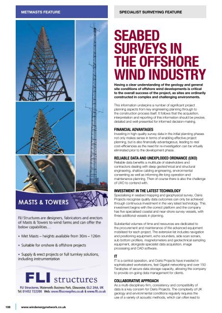
metmasts featurespecialist surveying featureSeabedsurveys inthe offshorewind industryHaving a clear understanding of the geology and generalsite conditions of offshore wind developments is criticalto the overall success of the project, as sites are ordinarilyconstructed in complex and challenging environments.This information underpins a number of significant projectplanning aspects from key engineering planning through tothe construction process itself. It follows that the acquisition,interpretation and reporting of this information should be precise,detailed and well-presented for informed decision-making.Financial advantagesInvesting in high quality survey data in the initial planning phasesnot only makes sense in terms of enabling effective projectplanning, but is also financially advantageous, leading to realcost-efficiencies as the need for re-investigation can be virtuallyeliminated prior to the development phase.Reliable data and unexploded ordnance (UXO)Reliable data benefits a multitude of stakeholders andcontractors dealing with deep geotechnical and structuralengineering, shallow cabling engineering, environmentalconsenting as well as informing life-long operation andmaintenance planning. Then of course there is also the challengeof UXO to contend with.Investment in the latest technologySpecialising in seabed mapping and geophysical survey, OsirisProjects recognise quality data outcomes can only be achievedthrough continuous investment in the very latest technology. Thisinvestment begins with the correct platform and the companyhas five specialised coastal and near-shore survey vessels, withthree additional vessels in planning.Substantial volumes of time and resources are dedicated tothe procurement and maintenance of the advanced equipmentmobilised for each project. The extensive list includes navigationand positioning equipment, echo sounders, side scan sonars,sub bottom profilers, magnetometers and geotechnical samplingequipment, alongside specialist data acquisition, imageprocessing and CAD software.ITIT is a central operation, and Osiris Projects have invested insophisticated workstations, fast Gigabit networking and over 150Terabytes of secure data storage capacity, allowing the companyto provide on-going data management for clients.Collaborative approachAs a multi-disciplinary firm, consistency and compatibility ofdata is a key concern for Osiris Projects. The complexity of UKgeology and environmental conditions regularly requires theuse of a variety of acoustic methods, which can often lead to106www.windenergynetwork.co.uk
specialist surveying featureCablingCabling is also a major consideration. While clearly, distanceto shore becomes an issue, the cable also needs to cross anincreasingly dynamic range of offshore environments; seabedtypes, deep channels, man-made obstructions and so on. Theseenvironments are often inhospitable for cable burial ploughs,sleds and tracked burial ROVs and similarly the deploymentof heavily armoured cables can be difficult. Cabling can be leftsusceptible to damage and requiring additional monitoring,protection and inspection.Export cable route surveys form a large element of our work in thesector, and are often complex and time consuming. Numerousroute options are evaluated, and the overall objective is to identifythe most economic, safe and operationally sound route toshore. Generally, developers are fully prepared to award sizeablecontracts to survey contractors to receive the detailed seabedinformation necessary to make these decisions, as cabling errorsare typically incredibly costly to resolve.The additional technical demand at challenging locations hasresulted in Osiris Projects focusing their methodologies towardsultra-high resolution survey packages.As the offshore wind market has evolved the developershave embraced the benefits of the detail now available whilstmonitoring their assets, both WTG foundations and cables.interpretation challenges. One way the company addressesthis issue is to adopt a collaborative approach to site and officebased work, whereby commonly a project is followed throughthe acquisition, processing, interpretation and reporting phasesby the same team.Osiris Projectswww.osirisprojects.co.ukMany challengesIt is difficult to identify the most significant challenge in anindustry that faces so many, but in Osiris Projects’ experience itis operating within the environmentally problematic areas whichare so suited to offshore wind that generate the majority ofissues. Offshore contractors await weather windows to performmyriad tasks. The risk of poor weather – the kind of conditionswhich would be best case scenario for an existing wind farm –during the summer months scheduled for installation can have asignificant impact on a project.While clearly there is no solution to bad weather, the risk canbe mitigated through effective planning, personnel training, andvessel and equipment development.Often the challenge is less about the physical weather conditionsand more about the “fast-tracked” time schedules set out fordevelopers and governments throughout Europe.Round 3 developmentsRound 3 presents a number of challenges. Being furtheroffshore and in deeper water naturally increases resourcerequirements, and clearly the extraordinary scale createsnumerous concerns. The traditional monopile design has awater depth limit of approximately 30m, and with Round 3developments being constructed in water depths between 18-60m the next generation of foundations such as tripod, jacketand gravity based designs will dominate. A few have also shownthe potential for floating wind turbines. These designs typicallydemand a greater seabed footprint, which for us at OsirisProjects means increased surveying requirements.+44 (0)3333 441113A new ApproAchto AviAtion impAct Assessments...• pre-planning site assessments• Field surveys (accurate quantification of impact)• Full aviation impact assessments• impartial, expert advice from professionalswith 20+ years’ experience in communicationsengineering & Air traffic managementBecause measurement isbetter than prediction.Aerostat surveys Ltd. +44 (0)3333 441113www.aerostat.co.uk enquiries@aerostat.co.ukwww.windenergynetwork.co.uk107