Atypical Situations
Atypical Situations
Atypical Situations

Create successful ePaper yourself
Turn your PDF publications into a flip-book with our unique Google optimized e-Paper software.
<strong>Atypical</strong> <strong>Situations</strong>
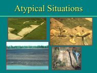
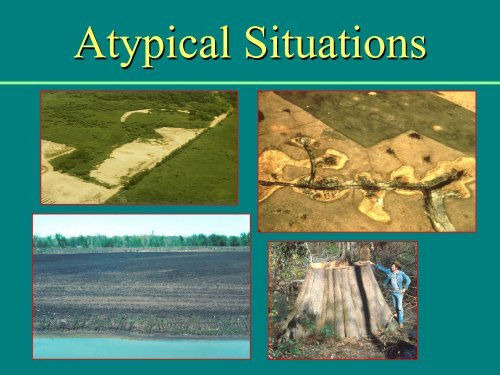
Examples of Disturbances• Human Activities– Removal of vegetation– Removal of soil– Placement of fill– Construction of damsand levees– Conversion toagriculture– Channelization–Drainage• Natural Events– Change in river course–Beaver dams– Avalanches andmudslides–Fires– Volcanic deposition
<strong>Atypical</strong> <strong>Situations</strong>Were wetlands presentbefore disturbance?(e.g., enforcement cases)Are wetlands now presenton a disturbed site? (e.g.,agricultural lands andman-induced wetlands)
<strong>Atypical</strong> <strong>Situations</strong>: EnforcementFSA Annual Crop SlideNew Tile Lines
Determine the Dateof the AlterationDetermine the date of the disturbance inrelation to current enforcement policy:• Direct questioning• Aerial photographs• Building permits
<strong>Atypical</strong> <strong>Situations</strong>Procedures given in the Corps Manualdepend on which parameter was disturbed:• Vegetation• Soils• Hydrology
<strong>Atypical</strong> <strong>Situations</strong> -- VegetationStep 1.Step 2.Describe the alteration.Describe effects on vegetation.- Cleared or partially cleared- Certain layers removed- Selected species removed- Burned, mowed, or heavily grazed- Covered by fill- Mortality due to excess water
<strong>Atypical</strong> <strong>Situations</strong> -- Vegetation
<strong>Atypical</strong> <strong>Situations</strong> -- VegetationStep 3. Characterize the original vegetation.- Aerial photography - NRCS records- On-site inspection - Permit applicant- Previous site inspections - Public interviews- Adjacent vegetation - NWI maps- Nearby reference siteStep 4. Determine whether the vegetation washydrophytic.
<strong>Atypical</strong> <strong>Situations</strong> -- SoilsStep 1. Describe the alteration.• Dredged or fill material covers original soil– Color or texture differences– Decomposing vegetation between layers– Non-woody debris at surface• Subsurface plowing• Removal of surface layers– Exposed plant roots or scrape scars• Presence of man-made structures
<strong>Atypical</strong> <strong>Situations</strong> -- SoilStep 2. Describe effects on soils.– Record depth of fill over buried soil– Record depth of plow zone– Describe effects of soil compaction
<strong>Atypical</strong> <strong>Situations</strong> -- Soils
<strong>Atypical</strong> <strong>Situations</strong> -- SoilStep 3. Characterize the original soils.–Soil surveys– Excavate and characterize buried soils– Characterize plowed soils below the plowzone– Examine adjacent areas or the B-horizon ifsurface layers were removedStep 4. Determine whether the soils werehydric.
<strong>Atypical</strong> <strong>Situations</strong> -- HydrologyStep 1. Describe the alteration.- Dams (man-made or natural)- Levees or dikes- Ditches or subsurface tiles- Filling channels or depressions- Water diversion- Ground-water extraction- Channelization
<strong>Atypical</strong> <strong>Situations</strong> -- HydrologyStep 2. Describe the effects on hydrology.- Changes in frequency and duration ofinundation and soil saturation
<strong>Atypical</strong> <strong>Situations</strong> -- HydrologyStep 3. Characterize previous hydrology.- Stream or tide gage data- Hydrology field indicators- Aerial imagery- Historical records- Floodplain management maps- Public or local officialsStep 4. Determine whether wetland hydrologywas present.
Subsidence of organic soils due todrainageOriginal Soil LineSteve D. Eggers Photo
<strong>Atypical</strong> <strong>Situations</strong>Agricultural LandsAre wetlandscurrentlypresent?
Normal Circumstances on AgLands:• Lack of hydrophytes due to plowing,herbicide and/or presence of ag crops is notrelevant• If site has hydric soils and wetlandhydrology it would support dominance byhydrophytes under “normal circumstances”
Farmed Wetlands…Hydrophytic vegetationSoftstem bulrush (OBL)Drown outCrop stressSteve D. Eggers Photo
Agricultural Lands -- VegetationDetermine what vegetation would be presentunder normal circumstances.– Volunteer vegetation between cultivations– Adjacent vegetation at the same elevation– Nearby undisturbed reference area with similarsoils and hydrology– Aerial photography taken before the conversion– NWI maps made before the conversion– NRCS records of typical vegetation on soil mapunits
Use reference area for vegetation…Prairie cord-grass (FACW+)Tussock sedge (OBL)Steve D. Eggers Photo
Use remnant vegetation…River Bulrush (OBL)Steve D. Eggers Photo
Agricultural Lands -- Soils• Usually possible to do a routine hydric soildetermination.• If significantly disturbed:– Examine NRCS soil survey maps– Identify soil series based on deep horizons– Examine an undisturbed reference area– Test for chemical reduction or redox status– Monitor hydrology
Agricultural Lands -- Hydrology• Use NFSAM off-site procedures• Check for current field indicators of wetlandhydrology• Directly monitor site hydrology• Use methods for estimating or modelinghydrology (“Hydrology Tools for WetlandDetermination”)– Effects of ditches and drains– Run-off models– DRAINMOD model
Agricultural Lands -- HydrologyEffects of ditches and drainage tiles:
<strong>Atypical</strong> <strong>Situations</strong>Man-induced WetlandsUpland Excavationfor Mitigation Site
Man-Induced WetlandsAreas that have developed at leastsome characteristics of naturallyoccurring wetlands due to intentionalor incidental human activities.
Examples of Man-Induced Wetlands• Irrigated wetlands• Impoundment wetlands• Filled deepwater habitats• Dredged material sites• Mitigation sites
Man-Induced Wetlands• Hydric soil indicators may be absent inwetlands created by recent humanactivities.• If indicators of hydrophytic vegetationand wetland hydrology are present,soils can be assumed to be hydric.
Cranberry Beds – Wetlands??Vaccinium macrocarpon is OBLSoils = Typically are hydricHydrology -- ???Steve D. Eggers Photo
Information Sources on the Web• Evaluating the effects of ditches and drains– http://www.sedlab.olemiss.edu/java/tools_java.html