IMU-HG Datasheet - Canal Geomatics
IMU-HG Datasheet - Canal Geomatics
IMU-HG Datasheet - Canal Geomatics

You also want an ePaper? Increase the reach of your titles
YUMPU automatically turns print PDFs into web optimized ePapers that Google loves.
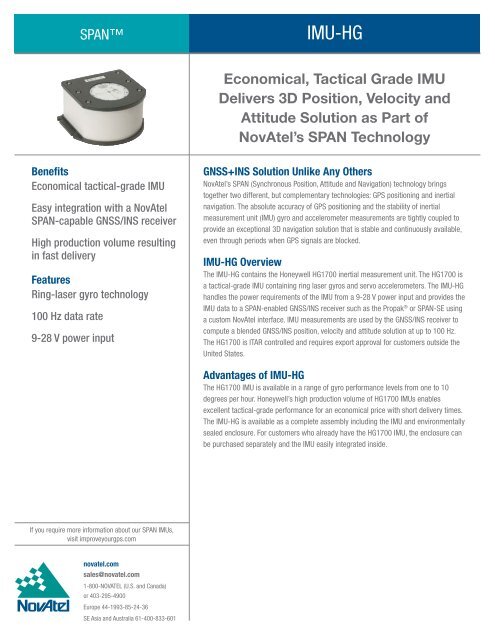
SPAN<strong>IMU</strong>-<strong>HG</strong>Economical, Tactical Grade <strong>IMU</strong>Delivers 3D Position, Velocity andAttitude Solution as Part ofNovAtel’s SPAN TechnologyBenefitsEconomical tactical-grade <strong>IMU</strong>Easy integration with a NovAtelSPAN-capable GNSS/INS receiverHigh production volume resultingin fast deliveryFeaturesRing-laser gyro technology100 Hz data rate9-28 V power inputGNSS+INS Solution Unlike Any OthersNovAtel’s SPAN (Synchronous Position, Attitude and Navigation) technology bringstogether two different, but complementary technologies: GPS positioning and inertialnavigation. The absolute accuracy of GPS positioning and the stability of inertialmeasurement unit (<strong>IMU</strong>) gyro and accelerometer measurements are tightly coupled toprovide an exceptional 3D navigation solution that is stable and continuously available,even through periods when GPS signals are blocked.<strong>IMU</strong>-<strong>HG</strong> OverviewThe <strong>IMU</strong>-<strong>HG</strong> contains the Honeywell <strong>HG</strong>1700 inertial measurement unit. The <strong>HG</strong>1700 isa tactical-grade <strong>IMU</strong> containing ring laser gyros and servo accelerometers. The <strong>IMU</strong>-<strong>HG</strong>handles the power requirements of the <strong>IMU</strong> from a 9-28 V power input and provides the<strong>IMU</strong> data to a SPAN-enabled GNSS/INS receiver such as the Propak ® or SPAN-SE usinga custom NovAtel interface. <strong>IMU</strong> measurements are used by the GNSS/INS receiver tocompute a blended GNSS/INS position, velocity and attitude solution at up to 100 Hz.The <strong>HG</strong>1700 is ITAR controlled and requires export approval for customers outside theUnited States.Advantages of <strong>IMU</strong>-<strong>HG</strong>The <strong>HG</strong>1700 <strong>IMU</strong> is available in a range of gyro performance levels from one to 10degrees per hour. Honeywell’s high production volume of <strong>HG</strong>1700 <strong>IMU</strong>s enablesexcellent tactical-grade performance for an economical price with short delivery times.The <strong>IMU</strong>-<strong>HG</strong> is available as a complete assembly including the <strong>IMU</strong> and environmentallysealed enclosure. For customers who already have the <strong>HG</strong>1700 <strong>IMU</strong>, the enclosure canbe purchased separately and the <strong>IMU</strong> easily integrated inside.If you require more information about our SPAN <strong>IMU</strong>s,visit improveyourgps.comnovatel.comsales@novatel.com1-800-NOVATEL (U.S. and Canada)or 403-295-4900Europe 44-1993-85-24-36SE Asia and Australia 61-400-833-601
SPAN<strong>IMU</strong>-<strong>HG</strong>SPAN System Performance 1Position Accuracy (RMS)Single Point L11.8 mSingle Point L1/L21.5 mSBAS0.6 mDGPS0.45 mOmniSTARVBS0.7 mXP0.15 mHP0.1 mRT-20 20.2 mRT-21 cm+1 ppmVelocity Accuracy 0.02 m/s RMS(nominal)Attitude Accuracy 3 (RMS)<strong>IMU</strong>-<strong>HG</strong>62 <strong>IMU</strong>-<strong>HG</strong>58Pitch 0.018° 0.013°Roll 0.018° 0.013°Azimuth 0.053° 0.031°Max Velocity 4Data Rate 5<strong>IMU</strong> MeasurementsINS PositionINS VelocityINS Attitude515 m/s100 Hz100 Hz100 Hz100 Hz<strong>IMU</strong> Performance<strong>IMU</strong>-H62Gyro Input Range ±1000 deg/secGyro Rate Bias5.0 deg/hrGyro Rate Scale Factor 150 ppmAngular Random Walk 0.5 deg/√hrAccelerometer Range 6 ±50 gAccelerometer Linearity 500 ppmAccelerometer Scale Factor 300 ppmAccelerometer Bias2.0 mg<strong>IMU</strong>-H58Gyro Input Range ±1000 deg/secGyro Rate Bias1.0 deg/hrGyro Rate Scale Factor 150 ppmAngular Random Walk 0.125 deg/√hrAccelerometer Range 6 ±50 gAccelerometer Linearity 500 ppmAccelerometer Scale Factor 300 ppmAccelerometer Bias1.0 mg<strong>IMU</strong> Physical and ElectricalDimensions 193 x 167 x 100 mmWeight3.4 kgPowerPower Consumption 8 W (typical)Input Voltage+12 to 28 VInput/Output ConnectorsPower MIL-C-38999-III, 3 pinCommunication MIL-C-38999-III, 13 pinEnvironmentalTemperatureOperatingStorageHumidityMTBF-30°C to +60°C-45°C to +80°C95% non-condensing2,000 hrsAcceleration Accuracy0.03 m/s 2 RMSPerformance During GNSS Outages (<strong>IMU</strong>-H58) 7Outage DurationPositioning ModePosition Error (m) Velocity Error (m/s) Attitude Error (degrees)Horizontal Vertical Horizontal Vertical Roll Pitch Yaw10 s RTK 0.09 0.02 0.012 0.002 0.004 0.004 0.006DGPS 0.31 0.25 0.020 0.006 0.005 0.006 0.016SP 1.24 1.48 0.022 0.006 0.006 0.006 0.01830 s RTK 0.61 0.10 0.040 0.005 0.005 0.006 0.012DGPS 0.85 0.32 0.047 0.007 0.007 0.008 0.019SP 1.51 1.50 0.050 0.008 0.008 0.008 0.02060 s RTK 2.45 0.28 0.094 0.008 0.009 0.010 0.017DGPS 2.87 0.49 0.100 0.009 0.009 0.010 0.022SP 3.28 1.57 0.103 0.010 0.009 0.011 0.023For <strong>IMU</strong>-H62 Performance During GNSS Outages Table, please visit novatel.com/Documents/Papers/<strong>IMU</strong>-<strong>HG</strong>G2table.pdfVersion 3 -Specifications subject to change without notice.© 2009 NovAtel Inc. All rights reserved.NovAtel and ProPak are registered trademark of NovAtel Inc.SPAN, RT-2, and RT-20 are trademark of NovAtel Inc.Printed in Canada. D10152<strong>IMU</strong>-<strong>HG</strong> May 2009For the most recent details of this product:novatel.com/Documents/Papers/<strong>IMU</strong>-<strong>HG</strong>.pdf1234567Typical values. Performance specifications subject to GPS system characteristics, US DOD operational degradation, ionospheric and tropospheric conditions,satellite geometry, baseline length, multipath effects and the presence of intentional or unintentional interference sources.Expected accuracy after static convergence.When SPAN is in RTK mode.Export licensing restricts operation to a maximum of 515 metres per second.If raw <strong>IMU</strong> measurements are logged (100 Hz), the maximum rate position, velocity, attitude logs that can be requested is 50 Hz.GNSS receiver sustains tracking up to 4 g.These are RMS values, computed with respect to a full GPS RTK trajectory.