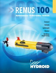
Manufacturing Spec Sheet - AUVAC
Manufacturing Spec Sheet - AUVAC
Manufacturing Spec Sheet - AUVAC

Create successful ePaper yourself
Turn your PDF publications into a flip-book with our unique Google optimized e-Paper software.
Remote Identification of Seafloor Properties in Denied AreasLarry Mayer, Luciano Fonseca, and Thomas Weber Center for Coastal and Ocean Mapping University of New Hampshire Durham, NH 03824 Phone: (603) 862-2615 fax: (603) 862-0839 email: lmayer@cisunix.unh.eduCo-P.I.: Art Trembanis, Coastal Sediments Hydrodynamics and Engineering Lab, Department of Geological Sciences University of Delaware 109 Penny Hall Newark, DE 19711 Phone: (302) 831-2498 email: art@udel.eduAward Number N00014-07-1-0666 http://www.ccom.unh.eduLONG-TERM GOALThe long-term goal of this project is to develop techniques to collect and use remotely sensed acousticdata to make robust predictions of seafloor physical, acoustic and geotechnical properties in deniedareas at spatial and temporal scales appropriate for tactical applications. The work described is acollaboration of research groups at the University of New Hampshire (CCOM) and the University ofDelaware (CSHEL). The project aims to take advantage of the recent results of theoretical andempirical studies in concert with new developments in sonar and Autonomous Underwater Vehicles(AUVs), to address the fundamental goal of remote characterization of seafloor properties in deniedareas.OBJECTIVES1- Continue the development of a physics-based model (ARA) for the prediction of seafloor properties from remotely collected acoustic backscatter data2- Test, validate, and update the model through the collection of carefully controlled ground-truthsamples. In doing this we will also be adding to a growing database of physical and acousticproperty measurements and inter-relationships.3- Evaluate the feasibility of applying remote characterization algorithms to data collected with asmall, low-powered phase measuring bathymetry sonar (PMBS) deployed from an autonomousunderwater vehicle.APPROACHOur initial approach involves four inter-related tasks: model development; ground-truth studies; swathbathymetry evaluation, and; AUV integration. Some of these tasks have been pursued independently and1
the results of these independent efforts are now being brought together. This past year our efforts havefocused on model development and the use of a new swath mapping system and AUV.Remote seafloor characterization using the ARA model:With the development of multibeam echo-sounders the ability to look at the angular dependence of theacoustic response of the seafloor has opened up many new possibilities with respect to seafloorcharacterization. The angular response of the echo holds important information about seafloorroughness and volume reverberation, as well as acoustic impedance. Over the past few years,researchers at the University of New Hampshire have been developing a sophisticated sonarbackscatter mosaicking tool (Geocoder – Fonseca and Calder, 2005) which includes a physics-basedmodel known as ARA (Angular Response Analysis) that uses the angular dependence of backscatterfor the remote prediction of seafloor properties. The ARA technique corrects multibeam sonarbackscatter for radiometric and geometric factors, parameterizes the corrected angular response curve,and then applies a constrained (based on known physical property relationships) inversion (either amodified Jackson/Williams model or a Biot model) to solve for seafloor type including acousticimpedance, roughness and grain size (Fonseca et al., 2005; Fonseca and Mayer, 2007). The model hasbeen packaged in an interactive software tool that allows the rapid determination of the seafloorproperties (Fig 1.).Figure 1. ARA tool with angular response curve and inverted solution for sediment typeARA-Analysis of Acoustic Themes, Over-segmentation and Thematic Coagulation:ARA-analysis is normally applied to seafloor patches that are typically half a full-swath width wide inthe across-track direction, and 30 pings in the along-track direction (Fonseca and Mayer 2007).However, the low spatial resolution of these seafloor patches is an issue in areas of high spatialvariability. To address this issue we have developed an approach that uses the high spatial resolution2
of the backscatter mosaic to visually define areas of the seafloor with similar angular responses -“acoustic themes” - and then calculate an average angular response per acoustic theme, rather thanacross the sonar swath. This approach has already provided robust estimates of seafloor properties inareas of high spatial variability (Luis Ruis, 2007; Fonseca et al., 2008).While the initial “acoustic theme” generation was done by hand, we are now working on methods forautomatically segmenting the image simultaneously in both the textural space and in the angularresponse space. This new approach is based on the use of spatial segments of intermediate size(between the pixel and the full swath), which we assume to be homogenous. The assumption ofsegment homogeneity relies on the information extracted from the backscatter mosaic. Backscattermosaics depict many boundaries, some related to actual changes in seafloor facies and others that areartifacts of the acquisition or the mosaicking process. From the mosaic alone, the artifacts cannot bedistinguished from the real boundaries. To automatically segment the mosaic we apply an oversegmentationtechnique which generates a comprehensive set of the smallest possible segments whichpreserve spatial similarity, honoring all the boundaries in the mosaic (Fonseca and Rzhanov 2008).These small segments have a more complete angular coverage than pixels described above, but still donot have the full angular response required for accurate seafloor characterization. Hence, segmentsneed to be coalesced with similar and/or adjacent segments in order to generate areas on the seafloorwith sufficient angular coverage to allow for application of the ARA method and seafloorcharacterization.Interferometric Swath Bathymetry Sonar and AUV:In order to provide a seafloor characterization system in denied areas, we must strive to deliver ourremote seafloor characterization capability on an autonomous vehicle that can operate covertly. Ourefforts this year have thus also focused on the evaluation of a newly introduced, small-footprint, lowpowerphase measuring bathymetry sonar system (GeoAcoustics GeoSwath-Plus) and the integrationof this system into an autonomous underwater vehicle (The University of Deleware’s DORA vehicle –a Gavia class AUV). Our approach was to test the capability of the GeoSwath PMBS to determine if itis feasible to apply the ARA technique to the data collected from it while at the same time evaluatingthe capabilities of the DORA AUV so as to evaluate its appropriateness as a platform for the remotecharacterization objectives of this project.WORK COMPLETEDGeocoder/ARA Modeling:The Geocoder/ARA backscatter analysis package continues to evolve. Support has been added for anumber of new sonar systems including Reson 7K series, Seabeam 2100 series, Simrad EA600sidescan sonars, and the new Benthos C3D system and a graphical tool has been added to edit andinterpret the selection of response curve parameter in the slope/intercept plane. Additionally, theability to incorporate backscatter from multiple frequencies over the same piece of seafloor has beenadded to the ARA. As seafloor mapping sonars become broader band, the ability to handle multiplefrequencies may hold great potential for additional seafloor characterization information. Mostimportantly, a fundamental constraint of the ARA approach (the need to average over a swath-widthin both the across-track and the along-track direction – which limits the spatial resolution) has beenaddressed through the development of “thematic analysis”. The thematic analysis examines the3
angular response of small areas on the seafloor and then segments the entire region into areas ofcommon angular response. This past year we have successfully demonstrated automated approaches tothematic segmentation (Fonseca and Rzhanov, 2008).GeoSwath PMBS:The GeoSwath-Plus is a wide swath bathymetric sonar designed as a payload sonar on survey classremotely operated vehicles (ROVs) and autonomous underwater vehicles (AUVs). The GeoSwathROV/AUV unit is based on the same sonar technology as that used in the boat-mounted GeoSwathsystem. The GeoSwath PMBS sonar has been designed specifically for AUV deployment, with designmodifications to make the unit more modular, smaller, and to reduce power consumption. TheGeoSwath-Plus, as incorporated in the UD AUV (DORA), operates at 500 kHz and can obtainbathymetric soundings along with co-registered digital side-scan sonar to depths of 200 m with swathcoverage of up to 12 times water depth. Additional inputs to the system include sound velocity (micro-SVS sensor), vehicle position and attitude (a DVL-aided INS/GPS system).DORA (Gavia Class) AUV Evaluations:A close collaboration has been established between the UNH and UDel teams including manyexchanges of equipment and personnel over the last 3+ years. The GeoSwath PMBS has previouslybeen fully integrated into the Gavia AUV and was tested and acquired by UDel in 2008 (Fig. 2) and,most importantly to the project objectives, the CCOM-UNH Geocoder software has been developed toaccept data from the GeoSwath unit for ARA processing. Our emphasis has been on acquiring actualfield survey data from diverse sedimentary settings to allow a broad assessment of both the GeoSwathPMBS and of the Geocoder ARA algorithm development. To that end, field surveys with theGeoSwath equipped Gavia AUV have been conducted in 2008 in settings including shallow and deepcarbonate platforms (Bonaire, Netherlands Antilles- Trembanis, 2008 -- Fig 2); energetic estuariessuch as Great Bay, New Hampshire, and Delaware Bay.4
Figure 2. DORA AUV with GeoSwath Phase Measuring Bathy Sonar module undergoing trialsData Formats and Preliminary Backscatter ProcessingThe GeoSwath is a phase comparison swath sonar whose data formats are very different from standardmultibeam sonars. Thus, in the past year we have had to develop special software to convert the nativeGeoSwath RDF files into standard Generic Sensor Format (GSF), so that Geocoder and the ARAanalysis tools could be run on the GeoSwath data. We also needed to modify the analytical approach.Initially, the individual sidescan samples produced by the GeoSwath system, with the accompanyingangle of arrival solutions, were treated as “multibeam” beams, so that an approach similar to that usedto analyze standard multibeam sonar backscatter could be applied. However, the number of samplesproduced by the Gavia system is very high and the angle solutions are very noisy, so that not all thebeams could be used for the geometric correction. In order to overcome this limitation, the approachhad to be modified to follow the paradigm of a sidescan sonar, treating the set of samples as a timeseries, and not beams, with a subset of beams used as tie points for the geometric corrections.The result of this processing is the adjusted mosaic and the corrected backscatter angular response ofthe system (Figure 3). This angular response will be can then me compared to a mathematical modelof seafloor acoustic response, and the ARA inversion of the model used to predict seafloor properties.There are no models currently available in the literature that are have proven to reliably simulate thebackscatter response at very high frequencies (in our case 500 kHz). We are thus expanding ourresearch effort to include the modeling of acoustic response at these very high frequencies.5
Figure 6 – Gavia GeoSwath mosaic from the Bonaire area with corrected angular responseIMPACT/APPLICATIONSResults from validation of ARA approach imply that within limits it may offer a robust prediction ofseafloor properties. If this continues to be proven true, the development of an AUV-deployed systemwill offer an approach for estimating seafloor physical, acoustic and geotechnical properties in deniedareas at spatial and temporal scales appropriate for tactical applications.TRANSITIONSGeocoder/ARA have been transferred and are now being implemented by numerous industrial partnersincluding CARIS, IVS, Fugro, Kongsberg/Simrad, Reson, Triton, HYPACK, and ChesapeakeTechnologies as well as several NOAA labs. It is also in use by numerous university labs.RELATED PROJECTSFluid-Mud Interaction MURINOAA-OE Bonaire 2008 Remote habitat mapping in a tropical shelf settingNOAA-SG Baymouth Circulation- Badiey, Wong, and Trembanis: 3 cruises aboard the R/V Sharpafforded at sea trials and testing of the AUV/multibeam system. The SG project benefited from thesituational visualization system that was made available during the cruisesNSF-DE-EPSCoR- Pepper Creek: Trembanis, Targett, diToro: 4 field surveys at Pepper Creek DEafforded on the water testing of the AUV/multibeam system. The EPSCoR project benefited from thesituational visualization system that was made available during the field work8
REFERENCES (not listed in Publications):Fonseca, L. and Calder B. (2005), "Geocoder: and Efficient Backscatter Map Constructor ",Proceedings of the U.S. Hydrographic 2005, San Diego, CA.Fonseca L., Mayer L.A., Kraft B., 2005, Seafloor characterization through the application of AVOanalysis to multibeam sonar data. In: Pace NG, Blondel P (Eds) Boundary Influences In HighFrequency, Shallow Water Acoustics. Institute of Acoustics, Bath University Press, pp 241-250.Hamilton, E. (1974), “Prediction of deep-sea sediment properties: state-of-the-art”, In, Deep-SeaSediments, Physical and Mechanical Properties, Plenum Press, pp. 1-43Soares Rosa, Luis, 2007, Seafloor Characterization at the Historic Area Remediation Site usingAngular Response Analysis, M Sc. Thesis, University of New Hampshire, 102 pp.PUBLICATIONSFonseca, L., Brown, C., Calder, B., Mayer, L. and Rzhanov, Y. (2008), “Angular Range Analysis ofthe Seafloor Themes from Stanton Banks Ireland: A Link between Visual Interpretation andAcoustic Signatures”, Journal of Applied Acoustic, <strong>Spec</strong>ial Issue, Accepted for Publication(Refereed publication).Fonseca, L. and Rzhanov, Y. (2008), “Automatic Construction of Acoustic Themes from MultibeamBackscatter Data”, Shallow Survey 2008, Portsmouth NH.Fonseca, L. and Calder, B. (2007), “Clustering Acoustic Backscatter in the Angular Response Space”,Proceedings Hydro 2007, Norfolk, VAFonseca, L., Calder, B.R., and Wetzler, M., 2006, Experiments for Multibeam BackscatterAdjustments on the NOAA Ship Fairweather, Oceans 2006: Boston, MA.Fonseca, L., and Mayer, L.A., 2007, Remote estimation of surficial seafloor properties through theapplication Angular Range Analysis to multibeam sonar data: Marine Geophysical Researches, p.119-126. (Refereed Publication)Fonseca, L., Mayer, L.A., and Brown, G., 2007, Angular Range Analysis of the acoustic Backscatterfrom Stanton Banks, Ireland, Femme 2007 EM Multibeam Experience: Amsterdam, Netherlands.Forrest, A.L., B.E. Laval, D. Lim, A. Trembanis, E. Magnusson, R. Yeo and C.P. McKay, in review.Autonomous Underwater Vehicles: Robotic analogues for space exploration. Journal ofPlanetary and Space Science.Griffiths, G. and Trembanis, A., 2007. Eliciting expert judgement for the probability of AUV loss incontrasting operational environments. Published proceedings of the UUST, New Hampshire,August 2007.Griffiths, G. and Trembanis, A.C., 2007. Towards a risk management process for AutonomousUnderwater Vehicles. Pp. 103-118 in: Griffiths, G. and Collins, K., Proceedings of a9
Masterclass on AUV Technology for Polar Science. Society for Underwater Technology,London.PRESENTATIONSFonseca, L. “Backscatter Mosaics and Acoustic Seafloor Characterization”, Invited Talk, 2008 HypackTraining Seminar, Savanna, Georgia 7 January 2008Fonseca, L, “Geocoder: Acoustic themes and ARA seafloor Characterization”, NOAA ShipFAIRWEATHER, August 24 th , 2008.Fonseca, L, “Geocoder: Acoustic themes and ARA seafloor Characterization”, NOAA Ship RANIER,August 25 th , 2008.Mayer, L.A., “Seafloor Characterization”, Invited lecture Gescience Australia, Cairns Australia, 30April 2008Trembanis, A. “Using Autonomous Underwater Vehicles in Coastal Science”. Invited seminar IndianaUniversity of Pennsylvania. Dept of Geosciences. September 15 th , 2008Trembanis, A., “Mapping Bonaire’s Reef Using High Tech Robots and Mixed Gas Diving”. Dept. ofGeological Sciences Spring SeminarPatterson, M., and A.C. Trembanis, “Mapping Bonaire's Reefs Using High Tech Robots and MixedGas Diving”. CIEE/STINAPA sponsored public lecture Bonaire, Netherlands Antilles. Jan.28 th , 2008.10

![Sonardyne Wideband Sub-Mini 6 [8270, 8271].pdf - AUVAC](https://img.yumpu.com/44408971/1/190x245/sonardyne-wideband-sub-mini-6-8270-8271pdf-auvac.jpg?quality=85)