Download - Delhi Heritage City
Download - Delhi Heritage City
Download - Delhi Heritage City

Create successful ePaper yourself
Turn your PDF publications into a flip-book with our unique Google optimized e-Paper software.
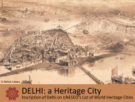
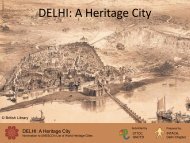
Medieval And Colonial Capital Cities Of <strong>Delhi</strong>DESCRIPTION2 a Description of PropertyThe area proposed for nomination comprises of Shahjahanabad, and New <strong>Delhi</strong>. The former was founded as thecapital of the Mughal Empire, by the Emperor Shahjahan in the mid 17th century ( between 1639‐ 1648). New<strong>Delhi</strong> was the British colonial capital, designed by a Town Planning Committee headed by Edwin Lutyens and builtbetween 1912‐31, adjacent to the Mughal city. Both are outstanding examples of town planning of their times;and continue to function as iconic precincts of the capital of republican India and are symbolic of the city’sextraordinary historic antecedents.Shahjahanabad, although a medieval city, is today very much a living vibrant city. The size and shape of the city,its main streets and major landmarks, which were the product of Imperial planning, are still largely intact and stilldefine the character of the city. The city’s original urban morphology, along with the key buildings is still surviving,making it a supreme example of Mughal city planning. The city has a perimeter of 8 kilometers and encloses anarea of about 590 ha.Shahjahanabad’s townscape is characterised by a few key features. Within the imperial city, the focus is the Qilai‐Mubarak(or Red Fort as it is called today)—the imperial palace complex. It is the largest and grandest structurein the city, laid out in the north east corner of the city fronting the River Yamuna. Red Fort, with its elegantpalaces, symbolises a legacy of political power, which is why the Prime Minister’s address to the nation onIndependence Day is from the Red Fort.What was once the principal bazaar street along the east‐west axis, Chandni Chowk which starts at the LahoreGate of Red Fort and continues west till the chowk of Fatehpuri Masjid, is still the heart of the city. Chandnichowk is a fascinating melange of buildings from different eras of the city’s history, but with a throbbing pulse inthe present. It is a lively commercial hub, with many places of worship—mosques, Hindu and Jain temples,gurudwaras, churches. The northern section of Bahadur Shah Zafar Marg, which runs through Darya Ganj (it wasoriginally called Faiz Bazaar), is the north‐south axis of the city, starting from the <strong>Delhi</strong> Gate of the city till the<strong>Delhi</strong> Gate of the fort. This street then continues northwards as Netaji Subhash Marg till Kashmiri Gate. Thesewere the two principal axes of the city and continue to be major commercial spines.Besides the fort, the other important building in the city today is the Friday congregational mosque, the JamaMasjid, which was placed on a natural rise in the ground. Four roads radiate from Jama Masjid in four directions,towards Hauz Qazi Chowk, Daryagang, Red Fort and Chandni Chowk.A network of streets link different parts of the city like the fort, public squares, places of worship, city gates andthe residential areas. The hierarchy in the size and character of the streets: viz the bazaar streets, kuchas, galishas provided the city with a circulation network. Within this framework of streets, settlements have developed,giving the city its unique form. There is a distinct pattern that is still legible, the thanas(wards)and mohallas( areasor residential pockets). The original residential stock of intricately carved facades and doorways of havelis stillexist as do the green courtyards of traditionally laid out homes.Red Fort (Qila‐i‐Mubarak)The Red Fort was originally built along the banks of River Yamuna and the city was planned keeping the fort as thefocal point of development. Located in the centre of the eastern face of the city, the fort wall has 21 bastions, amoat and four gates‐Lahori gate, Akbarabadi gate, Salimgarh gate and Khizr gate. The Fort is an irregularoctagon in plan measuring 3100 ft X 1650 ft with a perimeter of 2.41 km, enclosing an area of 125 acres. The31‐07‐2012 INTACH, <strong>Delhi</strong> Chapter 2