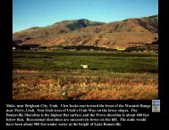
Belt Supergroup Rocks in Northern Idaho
Belt Supergroup Rocks in Northern Idaho
Belt Supergroup Rocks in Northern Idaho

Create successful ePaper yourself
Turn your PDF publications into a flip-book with our unique Google optimized e-Paper software.
Close-up of quartzite conta<strong>in</strong><strong>in</strong>g foreset bedd<strong>in</strong>g.Palouse River, Highway 2, Bonner County.
Close-up of ripple marks <strong>in</strong> quartzite from outcrop with foresetbedd<strong>in</strong>g, Palouse River, Highway 2, Bonner County.
Outcrop of Wallace Formation crosscut by felsic dikes, Highway 12,<strong>Idaho</strong> County, milepost 164.
Outcrop of gneiss near Coolwater Creek, Highway 12, <strong>Idaho</strong> County.This rock has been considered metamorphosed <strong>Belt</strong> <strong>Supergroup</strong>, butmay <strong>in</strong>stead be a w<strong>in</strong>dow <strong>in</strong>to underthrust Mesozoic accreted terranestrata (K. Lund, U.S.G.S)
Syr<strong>in</strong>ga metamorphic sequence along Highway 12, milepost 94
Outcrop of Hoodoo-like structures-Shoshone Range along North ForkCouer d’Alene River, Shoshone County.
Close-up of salt/barite casts <strong>in</strong> mudstone <strong>in</strong> quarry near Plummer
Folded <strong>Belt</strong> <strong>Supergroup</strong> along western edge of Kootenay Valley
Flattened <strong>Belt</strong>/pre<strong>Belt</strong> rocks Highway 2, Sandpo<strong>in</strong>t quadrangle
Outcrop of augengneiss, Highway 2,Bonner County
Metamorphosed <strong>Belt</strong> <strong>Supergroup</strong>, augen gneiss, Highway 2, Bonner County
Metamorphoseed <strong>Belt</strong> <strong>Supergroup</strong> augen gneiss show<strong>in</strong>g <strong>in</strong>cludedrotated brittle blocks, Highway 2, Bonner County.