Thematic Maps of the Danube River Basin - ICPDR
Thematic Maps of the Danube River Basin - ICPDR
Thematic Maps of the Danube River Basin - ICPDR

You also want an ePaper? Increase the reach of your titles
YUMPU automatically turns print PDFs into web optimized ePapers that Google loves.
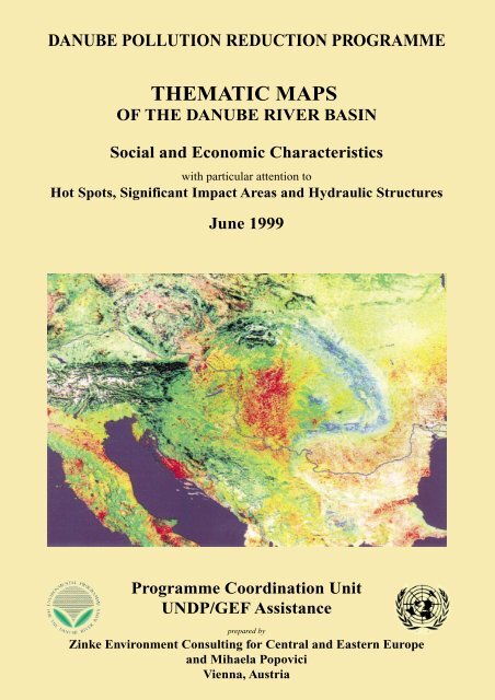
DANUBE POLLUTION REDUCTION PROGRAMME<br />
THEMATIC MAPS<br />
OF THE DANUBE RIVER BASIN<br />
Social and Economic Characteristics<br />
with particular attention to<br />
Hot Spots, Significant Impact Areas and Hydraulic Structures<br />
June 1999<br />
Programme Coordination Unit<br />
UNDP/GEF Assistance<br />
prepared by<br />
Zinke Environment Consulting for Central and Eastern Europe<br />
and Mihaela Popovici<br />
Vienna, Austria
DANUBE POLLUTION REDUCTION PROGRAMME<br />
THEMATIC MAPS<br />
OF THE DANUBE RIVER BASIN<br />
Social and Economic Characteristics<br />
with particular attention to<br />
Hot Spots, Significant Impact Areas and Hydraulic<br />
Structures<br />
June 1999<br />
Programme Coordination Unit<br />
UNDP/GEF Assistance<br />
prepared by<br />
Zinke Environment Consulting for Central and Eastern Europe<br />
and Mihaela Popovici<br />
Vienna, Austria
Preface<br />
The report on “<strong>Thematic</strong> <strong>Maps</strong> <strong>of</strong> <strong>the</strong> <strong>Danube</strong> <strong>River</strong> <strong>Basin</strong>” gives an overview <strong>of</strong> social and<br />
economic characteristics <strong>of</strong> this region, with particular attention to Hot Spots, Significant Impact<br />
Areas and Hydraulic Structures which were addressed during <strong>the</strong> preparation <strong>of</strong> <strong>the</strong> Pollution<br />
Reduction Programme. This includes <strong>the</strong> results <strong>of</strong> two workshops in Hernstein / Austria (24-30<br />
January and 11-16 May 1999) where “Sub-<strong>River</strong> <strong>Basin</strong>s” have been identified as new planning<br />
units for transboundary cooperation. The production <strong>of</strong> <strong>the</strong>matic maps and overlays did not only<br />
use existing national data but is equally based on new information ga<strong>the</strong>red at <strong>the</strong> national level.<br />
The present report was first drafted as a background information for <strong>the</strong> “Transboundary Analysis<br />
Workshop”, and <strong>the</strong>n revised as a contribution to <strong>the</strong> Pollution Reduction Programme. In a final<br />
step, a structural analysis <strong>of</strong> <strong>the</strong> rivers <strong>of</strong> <strong>the</strong> <strong>Danube</strong> <strong>Basin</strong> with focus on hydraulic structures was<br />
added.<br />
The conceptual preparation and <strong>the</strong> organisation <strong>of</strong> activities were carried out by Joachim Bendow,<br />
UNDP/GEF Project manager.<br />
The report was prepared by ZINKE ENVIRONMENT CONSULTING FOR CENTRAL AND EASTERN EUROPE<br />
(maps by Ulrich Schwarz), with <strong>the</strong> support <strong>of</strong> Mihaela Popovici, Bucharest. The report was edited<br />
by Michael Sokolnikov.
Table <strong>of</strong> Contents<br />
1. Introduction.................................................................................................... 1<br />
2. Climate, Morphology and Hydrological Network ...................................... 3<br />
2.1. Geomorphological Regions........................................................................3<br />
2.2. Hydrological Network................................................................................9<br />
3. <strong>Danube</strong> Sub-river <strong>Basin</strong> Areas (National Workshop Information)........ 13<br />
3.1. Germany....................................................................................................29<br />
3.2. Austria.......................................................................................................30<br />
3.3. Czech Republic.........................................................................................31<br />
3.4. Slovakia .....................................................................................................32<br />
3.5. Hungary ....................................................................................................34<br />
3.6. Slovenia .....................................................................................................35<br />
3.7. Croatia.......................................................................................................37<br />
3.8. Bosnia & Herzegovina .............................................................................38<br />
3.9. Federal Republic <strong>of</strong> Yugoslavia ..............................................................39<br />
3.10. Bulgaria.....................................................................................................41<br />
3.11. Romania ....................................................................................................42<br />
3.12. Moldova.....................................................................................................44<br />
3.13. Ukraine......................................................................................................46<br />
4. Sub-<strong>River</strong> <strong>Basin</strong>s (Transboundary Workshops)....................................... 49<br />
4.1. Upper <strong>Danube</strong> (D,A) ................................................................................49<br />
4.2. Inn (D,A) ...................................................................................................50<br />
4.3. Austrian <strong>Danube</strong> ......................................................................................50<br />
4.4. Morava (CZ, A, SK).................................................................................51<br />
4.5. Váh - Hron (SK,CZ,H).............................................................................52<br />
4.6. Pannonian Central <strong>Danube</strong> Region (A, SK, H, HR, YU) .....................52<br />
4.7. Drava-Mura (A, SLO, HR, H) ................................................................53<br />
4.8. Sava (SLO, HR, BIH,YU)........................................................................53<br />
4.9. Tisa (SK, UA, RO, H, YU).......................................................................54<br />
4.10. Banat – Eastern Serbia (YU, RO)...........................................................55<br />
4.11. Velika Morava (YU, BG).........................................................................55<br />
v
4.12. Mizia - Dobrudzha ( BG) .........................................................................55<br />
4.13. Muntenia (RO)..........................................................................................56<br />
4.14. Prut - Siret (UA, MD, RO).......................................................................56<br />
4.15. Delta – Liman (MD, UA, RO) .................................................................57<br />
5. Description <strong>of</strong> <strong>the</strong> Significant Impact Areas .............................................61<br />
5.1. Middle Morava .........................................................................................67<br />
5.2. Lower Morava ..........................................................................................68<br />
5.3. Szigetköz....................................................................................................69<br />
5.4. <strong>Danube</strong> Bend ............................................................................................69<br />
5.5. Gemenc - Kopacki Rit..............................................................................70<br />
5.6. Middle Drava ............................................................................................71<br />
5.7. Lower Mura – Drava ...............................................................................71<br />
5.8. <strong>Danube</strong> at Novi Sad..................................................................................73<br />
5.9. Upper Tisa.................................................................................................73<br />
5.10. Somes .........................................................................................................74<br />
5.11. Latorita......................................................................................................75<br />
5.12. Uzh..............................................................................................................75<br />
5.13. Bodrog – Tisa............................................................................................75<br />
5.14. Hornad – Sajo ...........................................................................................76<br />
5.15. Körös .........................................................................................................77<br />
5.16. Upper Mures.............................................................................................77<br />
5.17. Middle Mures............................................................................................78<br />
5.18. Lower Mures – Szeged.............................................................................78<br />
5.19. Palic & Ludos Lakes ................................................................................79<br />
5.20. Upper Banat..............................................................................................79<br />
5.21. Vrbas - DTD Canal...................................................................................79<br />
5.22. Middle Banat - Bega & Birzava ..............................................................80<br />
5.23. Upper Sava................................................................................................81<br />
5.24. Sulta ...........................................................................................................81<br />
5.25. Kupa ..........................................................................................................82<br />
5.26. Middle Sava – Kupa.................................................................................82<br />
5.27. Middle Sava - Una & Vrbas ....................................................................82<br />
5.28. Lower Sava – Bosna .................................................................................83<br />
vi
5.29. Tara Canyon.............................................................................................84<br />
5.30. Lower Sava – Drina .................................................................................84<br />
5.31. Sava at Beograd........................................................................................85<br />
5.32. Western & Sou<strong>the</strong>rn Morava..................................................................85<br />
5.33. <strong>Danube</strong> at Iron Gate ................................................................................86<br />
5.34. Lower Timok ............................................................................................86<br />
5.35. Ogosta at Vratza.......................................................................................86<br />
5.36. Iskar at S<strong>of</strong>ija ...........................................................................................87<br />
5.37. Ossam at Troyan ......................................................................................87<br />
5.38. Ossam at Lovetch .....................................................................................88<br />
5.39. Rositza at Sevlievo....................................................................................88<br />
5.40. Middle Yantra ..........................................................................................88<br />
5.41. Lom <strong>River</strong>s................................................................................................89<br />
5.42. Arges at Bucharest ...................................................................................90<br />
5.43. Ialomita near Ploiesti ...............................................................................90<br />
5.44. Upper Siret................................................................................................91<br />
5.45. Middle Siret – Bistrita & Trotus.............................................................91<br />
5.46. Upper Prut ................................................................................................91<br />
5.47. Middle Prut...............................................................................................92<br />
5.48. Lower Prut................................................................................................92<br />
5.49. Yalpugh......................................................................................................93<br />
5.50. Lower <strong>Danube</strong> – Siret & Prut .................................................................93<br />
5.51. Ukrainian Delta & Liman Lakes ............................................................94<br />
6. Major Hydraulic Structures and Description <strong>of</strong> <strong>River</strong>s in <strong>the</strong><br />
<strong>Danube</strong> <strong>Basin</strong>................................................................................................ 95<br />
vii
Annexes<br />
Annex 1 <strong>Danube</strong> Sub-river <strong>Basin</strong> Areas – National Tables<br />
Annex 2 Sequence <strong>of</strong> Significant Impact Areas (PRP Workshop in Hernstein/A)<br />
Annex 3 Hot Spots in <strong>the</strong> <strong>Danube</strong> Sub-river <strong>Basin</strong>s (see also <strong>Maps</strong> 8 and 9)<br />
Annex 4 Major Hydraulic Structures and Description <strong>of</strong> <strong>River</strong>s in <strong>the</strong> <strong>Danube</strong><br />
viii
1. Introduction<br />
The following “<strong>Thematic</strong> <strong>Maps</strong> <strong>of</strong> <strong>the</strong> <strong>Danube</strong> <strong>River</strong> <strong>Basin</strong>” Report tries to give an overview <strong>of</strong> a<br />
proposed new sub-division developed for <strong>the</strong> PRP-Transboundary Analysis. This Report uses<br />
information from <strong>the</strong> National Reviews, adding socio-economic and ecological information, results<br />
from Water Quality Data and National Planning Reports (1998) and from questionnaires (landuse,<br />
agriculture, population, river characteristics), circulated in February and June 1999.<br />
In a new planning approach, <strong>the</strong> entire <strong>Danube</strong> <strong>Basin</strong> was nationally sub-divided into so-called<br />
“Sub-river <strong>Basin</strong> Areas”, i.e. aggregated, geographical units <strong>of</strong> several similar hydrographic parts<br />
(basins <strong>of</strong> mostly <strong>the</strong> <strong>Danube</strong>’s first-order tributaries); <strong>the</strong>se were discussed and agreed at <strong>the</strong><br />
National Planning Workshops. There are one to four <strong>of</strong> such Areas per country and 32 Sub-river<br />
<strong>Basin</strong> Areas altoge<strong>the</strong>r in <strong>the</strong> <strong>Danube</strong> basin, as shown on Map 3. This allows an easier approach for<br />
<strong>the</strong> national assessment <strong>of</strong> environmental problems and <strong>the</strong>ir solutions. A summary text briefly<br />
describes <strong>the</strong> character <strong>of</strong> each Sub-river <strong>Basin</strong> Area (national view), <strong>the</strong> Annex fur<strong>the</strong>r gives<br />
comparative charts for each <strong>Danube</strong> basin country and its Sub-river <strong>Basin</strong> Areas, regarding <strong>the</strong><br />
following socio-economic issues:<br />
� Population Density (excluding <strong>the</strong> main cities): Map 4<br />
� Land Use: Map 5<br />
� Agriculture (lifestock, fertiliser consumption and production <strong>of</strong> three main crops):<br />
<strong>Maps</strong> 6 and 7.<br />
� Hot Spots: <strong>Maps</strong> 8 and 9<br />
In a second step, <strong>the</strong>se areas were looked at from a transboundary perspective and fur<strong>the</strong>r<br />
aggregated, resulting in 15 – mostly transboundary - “Sub-<strong>River</strong> <strong>Basin</strong>s” which were discussed<br />
and agreed at <strong>the</strong> Transboundary Workshop in Hernstein (Map 2). Objective was to better address<br />
local and national river basin management needs at <strong>the</strong> <strong>Danube</strong> basin level; as stipulated i.a. by <strong>the</strong><br />
new EU Water Policy Directive (asking for transboundary “river basin districts”). This was<br />
achieved by reducing <strong>the</strong>ir number and by connecting transboundary hydrographic regions (e.g.<br />
catchment areas). The text chapter „Sub-<strong>River</strong> <strong>Basin</strong>s“ briefly describes <strong>the</strong> new aggregated regions<br />
(basic geographical and typical landscape characteristics, climate, most important economic data<br />
and environmental problems).<br />
The third step was <strong>the</strong> identification <strong>of</strong> “Significant Impact Areas” which are most intensively<br />
affected by pollution and which are valuable from an environmental and/or conservation point <strong>of</strong><br />
view. This report lists and describes all 51 SIAs. The overlay <strong>of</strong> Hot Spots, SIAs and Wetlands<br />
(<strong>Maps</strong> 10 and 11) facilitated <strong>the</strong> needed selection and ranking <strong>of</strong> pollution reduction projects within<br />
<strong>the</strong> PRP.<br />
In a fourth step, Geomorphological Regions (Map 1) and Major Hydraulic Structures <strong>of</strong> <strong>Danube</strong><br />
<strong>Basin</strong> <strong>River</strong>s (Map 12) were identified.<br />
There are some differences in <strong>the</strong> information given which should be briefly addressed before:<br />
Especially for <strong>the</strong> <strong>the</strong>me “Land Use” (Map 5), <strong>the</strong> provided data proved to be insufficient to cover<br />
<strong>the</strong> needed level <strong>of</strong> Sub-river <strong>Basin</strong> Areas. Therefore, <strong>the</strong> data given in this report are based on <strong>the</strong><br />
CORINE geographical information system and may vary in a small degree from <strong>the</strong> national data<br />
given in some <strong>of</strong> <strong>the</strong> National Reports or <strong>the</strong> questionaires.<br />
For Agriculture (see maps 6 and 7), it was agreed with <strong>the</strong> <strong>Danube</strong> PCU to concentrate on few<br />
indicators (absolute and relative values for lifestocks and fertiliser consumption, <strong>the</strong> three main<br />
agricultural products). Due to <strong>the</strong> difference in detail information, only national data were<br />
compared.
2 <strong>Danube</strong> Pollution Reduction Programme<br />
The national data reports from Germany, Austria and Hungary did not follow <strong>the</strong> same methods to<br />
define geographical Sub-river <strong>Basin</strong> Areas (Germany and Hungary referred to <strong>the</strong>ir administrative<br />
structure, and Austria did not present any Sub-river <strong>Basin</strong> Area), so <strong>the</strong>y related <strong>the</strong>ir data<br />
differently. In addition, <strong>the</strong> German and Austrian reports do not contain <strong>the</strong> same volume <strong>of</strong><br />
information as <strong>the</strong> o<strong>the</strong>r national reports (e.g. much less detailed data; no Hot Spots - later “sources<br />
<strong>of</strong> pollution” were indicated).<br />
The text on “Significant Impact Areas” gives a more specific information on each <strong>of</strong> <strong>the</strong> SIAs, i.e.<br />
on <strong>the</strong> local character <strong>of</strong> <strong>the</strong> area, <strong>the</strong> pollution sources (Hot Spots) and effects. Many SIAs are<br />
linked or even overlap with Priority Wetlands for Restoration (see Map 10). The latter are<br />
described in a separate report produced by WWF. Tables presenting <strong>the</strong> results from working<br />
groups <strong>of</strong> <strong>the</strong> Transboundary Workshop are given in <strong>the</strong> annex. So far, 51 SIAs were identified,<br />
some <strong>of</strong> <strong>the</strong>m were reviewed after Hernstein in <strong>the</strong>ir name and size (regrouping <strong>of</strong> adjacent SIAs).<br />
The overlay <strong>of</strong> Hot Spots, SIAs and Wetlands is given on Map 11 and allows from a basin-wide<br />
perspective <strong>the</strong> better identification <strong>of</strong> <strong>Danube</strong> regions <strong>of</strong> future concern.<br />
In Map 1, “Geographical Indicators: Geomorphical Regions and Annual Precipition”, <strong>the</strong> <strong>Danube</strong><br />
basin was subdivided into 45 different geographical areas. Their outline is based on various<br />
geographical and national PRP information, including <strong>the</strong> “Atlas <strong>of</strong> <strong>Danube</strong> Countries”.<br />
Map 12 on “Major Hydraulic Structures and Description <strong>of</strong> <strong>River</strong>s in <strong>the</strong> <strong>Danube</strong> <strong>Basin</strong>” is based<br />
on ano<strong>the</strong>r questionnaire and fur<strong>the</strong>r research. As <strong>the</strong> time for replying was very short and <strong>the</strong><br />
availability <strong>of</strong> data on national level differs in <strong>the</strong> region, <strong>the</strong> data sets and comparability <strong>of</strong><br />
information is limited. It should be emphasized that such an overview did not exist so far for <strong>the</strong><br />
<strong>Danube</strong> <strong>Basin</strong>.
2. Climate, Morphology and Hydrological Network<br />
Both <strong>the</strong> geography and <strong>the</strong> management <strong>of</strong> <strong>the</strong> <strong>Danube</strong> <strong>River</strong> <strong>Basin</strong> are dominated by <strong>the</strong> natural<br />
hierarchy <strong>of</strong> <strong>the</strong> <strong>Danube</strong>‘s hydrological network. Map 1 showing <strong>the</strong> Geomorphological Regions<br />
and Map 2 presenting, as a result <strong>of</strong> <strong>the</strong> PRP Transboundary Workshops, <strong>the</strong> Sub-river <strong>Basin</strong>s<br />
reflect and respect this natural order. A detail description <strong>of</strong> each <strong>of</strong> <strong>the</strong> 15 Sub-river basins is given<br />
in chapter 4.<br />
2.1. Geomorphological Regions<br />
The geography <strong>of</strong> <strong>the</strong> <strong>Danube</strong> river basin is very diverse. It includes high mountain chains, large<br />
plains, sand dunes, large forested or marshy wetlands and, very specifically, <strong>the</strong> karst and <strong>the</strong> delta.<br />
Similarly, climate and precipitation vary significantly; and <strong>the</strong>y continuously form <strong>the</strong> basin’s<br />
landscapes.<br />
Generally, <strong>the</strong> <strong>Danube</strong> basin is dominated by a continental climate (central and eastern regions).<br />
Only <strong>the</strong> western parts <strong>of</strong> <strong>the</strong> upper basin in Germany are influenced by <strong>the</strong> Atlantic climate and<br />
<strong>the</strong> south-west <strong>of</strong> <strong>the</strong> basin (ex-Yugoslavian countries) by mediterranean climate. The Alps in <strong>the</strong><br />
west, <strong>the</strong> Dinaric-Balkan mountain chains in <strong>the</strong> south and <strong>the</strong> Carpathian mountain bow in <strong>the</strong><br />
eastern center are distinctive morphological and climatic regions and barriers.<br />
These mountain chains receive <strong>the</strong> highest annual precipitation (1,000-3,200 mm per year) while<br />
<strong>the</strong> inner and outer basins (Vienna basin, Pannonian basin, Romanian and Prut low plains), <strong>the</strong><br />
uplands <strong>of</strong> <strong>the</strong> Czech Morava and <strong>the</strong> delta region are very dry (350-600 mm per year). The rivers<br />
with <strong>the</strong>ir water and moisture from <strong>the</strong> wet mountains help to balance evapotranspiration deficits,<br />
typical for <strong>the</strong> Pannonian plain and <strong>the</strong> delta, in <strong>the</strong> dry lowlands. 50 to 70 days <strong>of</strong> annual snowfall<br />
are recorded at high elevations in <strong>the</strong> Alps and in <strong>the</strong> Carpathians, while <strong>the</strong> plains have just 1-3<br />
days/year <strong>of</strong> snowfall.<br />
In terms <strong>of</strong> geomorphology and annual precipitation, 45 regions in <strong>the</strong> <strong>Danube</strong> basin can be<br />
distinguished, as presented in map 1 (“Geographical Indicators”).<br />
After <strong>the</strong> source <strong>of</strong> <strong>the</strong> <strong>Danube</strong> in <strong>the</strong> wet Black Forest, rainfall gradually increases from <strong>the</strong> west<br />
to <strong>the</strong> east, along <strong>the</strong> Swabian & Frankonian Middle Mountains (average precipitation 600 – 700<br />
mm/year), <strong>the</strong> Bavarian Forest & Austrian Mühlviertel (over 1,000 mm). There are each 4 prealpine<br />
and alpine regions, with top rainfalls reaching more than 2,000 mm/year at <strong>the</strong> Arlberg and<br />
<strong>the</strong> Kitzbühel and Julian Alps. Downstream <strong>the</strong> Wachau canyon (Bohemian mountains), <strong>the</strong><br />
<strong>Danube</strong> enters <strong>the</strong> Vienna basin which is, toge<strong>the</strong>r with <strong>the</strong> Moravian hills and lowlands, <strong>the</strong> driest<br />
area (below 600 mm/yr) <strong>of</strong> <strong>the</strong> Upper <strong>Danube</strong>.<br />
The middle part or ”heart” <strong>of</strong> <strong>the</strong> <strong>Danube</strong> <strong>Basin</strong> is a circle <strong>of</strong> mountain chains around <strong>the</strong> huge<br />
Pannonian plain in <strong>the</strong> center. It is composed <strong>of</strong> six regions including parts <strong>of</strong> Austria, Slovakia,<br />
Hungary, Romania, Croatia and Yugoslavia. This inner basin is filled with Miocene marine<br />
sediments, tertiary clays and sands as well as with pleistocene fluvio-glacial and loess deposits.<br />
This results in little variation in <strong>the</strong> orography (hilly lands and <strong>the</strong> <strong>Danube</strong> and Tisza low plains)<br />
and in precipitation (500-750 mm/year).<br />
The Carpathian mountains in <strong>the</strong> nor<strong>the</strong>rn and <strong>the</strong> central-eastern parts <strong>of</strong> <strong>the</strong> <strong>Danube</strong> basin receive<br />
varying rainfall from 750 mm in <strong>the</strong> foothills to over 1,500 mm in <strong>the</strong> ridges, and have quite cold<br />
winters (average temperature in January –8 to –10° C). The ridges <strong>of</strong> <strong>the</strong> Tatra, <strong>the</strong> Wood<br />
Carpathians and <strong>the</strong> Sou<strong>the</strong>rn Carpathians receive highest precipitation (over 2,000 mm/year<br />
around <strong>the</strong> highest peaks at over 2,500 m). The Transilvanian tableland is a dry upland (500-700<br />
mm) in between <strong>the</strong> moist Apuseni mountains (over 1,000 mm) in <strong>the</strong> west and <strong>the</strong> Eastern and <strong>the</strong><br />
Sou<strong>the</strong>rn Carpathians (upper reaches <strong>of</strong> Mures and Olt rivers).
4 <strong>Danube</strong> Pollution Reduction Programme<br />
Table 1 Geomorphological Regions<br />
Geomorphological Region<br />
Annual<br />
Precipitation<br />
(mm/year)<br />
Example Station<br />
(average data for <strong>the</strong> period<br />
1965 –1970)<br />
Countries<br />
touching <strong>the</strong><br />
region<br />
1. Black Forest 1,000 - 1,500 D<br />
2. Swabian & Frankonian Middle<br />
Mountains<br />
500 - 600 D<br />
3. Bavarian Forest & Mühlviertel 1,000 - 1,500 D A<br />
4. Foothills <strong>of</strong> <strong>the</strong> Alps 750 – 1,000 D A<br />
5. Eastern Alps 1,000 – 1,500 A D<br />
6. Central Eastern Alps 1,500 - 2,000 A D<br />
7. Alpine Ridges over 2,000 A<br />
8. South-Eastern Alps 1,000 - 1,500 Zagreb (163m): 870<br />
mm<br />
A SLO HR<br />
9. Julian & Carnian Alps over 2000 SLO A<br />
10. Central South-Eastern Alps &<br />
Kapela Mountains<br />
1,500 - 2,000 SLO A<br />
11. Pre-Alpine Hills 750 - 1,000 A SLO HR H<br />
12. Morava - Dyje Hills &<br />
Lowlands<br />
500 – 600 CZ SK A<br />
13. Sudete Mountains 750 – 1000 CZ<br />
14. Beskide Mountains & Lower<br />
Tatra<br />
750 – 1,000 CZ SK<br />
15. High Tatra 1,500 – 2,000 SK<br />
16. Slovak - Hungarian Hills 600 – 750 SK H<br />
17. Small Hungarian Plain 500 – 600 H SK<br />
18. Inner Pannonian Hills 600 – 750 Vienna (202m): 670<br />
mm<br />
H A<br />
19. Great Hungarian Plain 500 – 600 Budapest(130m): 650<br />
mm<br />
H RO YU<br />
20. Drava - Sava Hills 750 – 1,000 HR H BIH YU<br />
21. Bosnian - Serbian Mountains 750 – 1,000 Sarajevo (637m): 880<br />
mm<br />
BIH YU HR<br />
22. Bosnian Ridge 1,000 – 1,500 BIH HR YU<br />
23. Albanian Alps 1,500 – 2,000 YU<br />
24. <strong>Danube</strong> - Drava - Sava<br />
500 – 600 Belgrade (138m): 690 YU HR BIH<br />
Lowlands<br />
mm<br />
25. Velika Morava & Kosovo 600 – 750 YU<br />
26. Banat Lowlands 600 – 750 YU RO<br />
27. Crisana & Mures Hills 600 – 750 RO<br />
28. Zakarpate Hills 750 – 1,000 RO UA SK<br />
29. Wood Carpathians 1,000 – 1,500 UA<br />
30. Wood Carpathian Ridge 1,500 – 2,000 UA<br />
31. Eastern Carpathians 1,000 – 1,500 RO
<strong>Thematic</strong> <strong>Maps</strong> <strong>of</strong> <strong>the</strong> <strong>Danube</strong> <strong>River</strong> <strong>Basin</strong> – June 1999 5<br />
Table 1 continued<br />
32. Eastern Pre-Carpathians 750 – 1,000 UA RO<br />
33. Maramures Mountains 750 – 1,000 RO<br />
34. Transilvania 600 – 750 RO<br />
35. South Carpathians 1,000 – 1,500 RO<br />
36. South Carpathian Ridges 1,500 – 2,000 RO<br />
37. Sou<strong>the</strong>rn Pre-Carpathians 750 – 1,000 RO<br />
38. Apuseni Mountains 1,000 – 1,500 RO<br />
39. Banat & Western Balkan<br />
Mountains<br />
750 – 1,000 S<strong>of</strong>ia (588m): 650 mm RO YU BG<br />
40. Balkan Ridges 1,000 – 1,500 BG<br />
41. Bulgarian <strong>Danube</strong> Hills 600 – 750 BG<br />
42. Great Romanian Plain 500 – 600 Bucarest (82m): 650<br />
mm<br />
RO<br />
43. Moldova Hills 500 – 600 RO MD<br />
44. Balta <strong>Danube</strong> Below 500 RO<br />
45. Delta - Liman Below 500 Sulina (9m): 505 mm RO UA MD<br />
The Dinaric Mountains form <strong>the</strong> borderline <strong>of</strong> <strong>the</strong> south-eastern <strong>Danube</strong> basin which is under<br />
mediterranean (sou<strong>the</strong>rn Sava tributaries) and continental influence (Drava-Mura lowlands).<br />
Precipitation is over 1,000 mm along <strong>the</strong> Slovene-Croatian border, along <strong>the</strong> Bosnian mountain<br />
ridges and <strong>the</strong> Albanian Alps, and goes down below 700 mm in <strong>the</strong> <strong>Danube</strong>/Pannonian plains. The<br />
Sou<strong>the</strong>rn Morava valley (Serbia/Kosovo) is a relatively dry, north-south directed barrier (average<br />
rainfall at 700 mm, evapo-transpiration at 550 mm) between <strong>the</strong> Bosnian mountains and <strong>the</strong><br />
Banat/Western Balkan mountains.<br />
The moist Balkan mountain ridges form <strong>the</strong> sou<strong>the</strong>rn borderline <strong>of</strong> <strong>the</strong> lower <strong>Danube</strong> and supply<br />
water for <strong>the</strong> relatively hot and dry Bulgarian hills and lowlands. East <strong>of</strong> <strong>the</strong> Carpathians, <strong>the</strong> huge<br />
plain <strong>of</strong> <strong>the</strong> Romanian Lowlands and <strong>the</strong> Moldova hills are subject to a temperate-continental dry<br />
climate along <strong>the</strong> lower <strong>Danube</strong> resp. <strong>the</strong> Siret and Prut rivers.<br />
The lowlands around <strong>the</strong> Balta <strong>Danube</strong>, <strong>the</strong> liman lakes and <strong>the</strong> <strong>Danube</strong> delta receive an annual<br />
precipitation <strong>of</strong> partly less than 400mm/year. Frequent droughts and a very high evapotranspiration<br />
are balanced by riverine moisture (high groundwater, network <strong>of</strong> islands and lakes, floodplains).
<strong>Thematic</strong> <strong>Maps</strong> <strong>of</strong> <strong>the</strong> <strong>Danube</strong> <strong>River</strong> <strong>Basin</strong> – June 1999 9<br />
2.2. Hydrological Network<br />
The <strong>Danube</strong> river basin can be divided into four parts: <strong>the</strong> Upper <strong>Danube</strong>, from its source to <strong>the</strong><br />
confluence with <strong>the</strong> river Morava at Bratislava; <strong>the</strong> Middle <strong>Danube</strong>, ranging from Bratislava to <strong>the</strong><br />
Iron Gate dams (Romania-Yugoslavia); <strong>the</strong> Lower <strong>Danube</strong> is formed by <strong>the</strong> Romanian-Bulgarian<br />
lowlands, and finally, <strong>the</strong> fourth part, <strong>the</strong> <strong>Danube</strong> Delta.<br />
The main tributaries <strong>of</strong> <strong>the</strong> <strong>Danube</strong> are listed in Table 3.1.2. The most important Sub-<strong>River</strong> <strong>Basin</strong>s<br />
<strong>of</strong> <strong>the</strong> <strong>Danube</strong> are:<br />
The Inn is only <strong>the</strong> sixth largest and seventh longest <strong>Danube</strong> tributary. At its mouth in Passau, it<br />
brings more water into <strong>the</strong> <strong>Danube</strong> than <strong>the</strong> latter itself. However, its catchment area <strong>of</strong> 26,130 km²<br />
is only nearly half as big than <strong>the</strong> <strong>Danube</strong> at this point. Main Inn tributary is <strong>the</strong> Salzach.<br />
The Drava is <strong>the</strong> third largest and fourth longest <strong>Danube</strong> tributary. It rises in <strong>the</strong> sou<strong>the</strong>rn Alps in<br />
Italy but is <strong>the</strong> dominant river <strong>of</strong> sou<strong>the</strong>rn Austria, eastern Slovenia and Croatia. Main Austrian<br />
sub-tributaries are Isel, Möll, Lieser and Gurk, and <strong>the</strong> Mura with its mouth at <strong>the</strong> Croatian-<br />
Hungarian border.<br />
The Sava river is <strong>the</strong> largest <strong>Danube</strong> tributary (av. 1,513 m³/sec) and <strong>the</strong> second by catchment area.<br />
It rises in <strong>the</strong> western Slovenian mountains and passes through Croatian lowland before forming<br />
<strong>the</strong> border between Croatia and Bosnia Herzegovina. Its main sub-tributaries are Ljubljanica, Kupa,<br />
Una, Vrbas, Bosna and Drina.<br />
The Tisza river is <strong>the</strong> longest (966 km) and by catchment (157.200 km 2 ) <strong>the</strong> biggest tributary <strong>of</strong> <strong>the</strong><br />
<strong>Danube</strong> river. Its flow volume is second after <strong>the</strong> Sava river. Its main sub-tributaries are Hornad,<br />
Bodrog, Slana and Bodva in Slovakia; Rica, Teresva, Tereblia, Borjava, Latoritsa and Uz in<br />
Ukraine; Somes, Crisul Repede, Crisul Alb, Mures, Timis, Bega in Romania; Tarna, Koros,<br />
Krasna, Szamos, and Maros in Hungary.<br />
The Siret river basin is situated in <strong>the</strong> eastern part <strong>of</strong> <strong>the</strong> basin and <strong>of</strong> <strong>the</strong> Carpathians. It has <strong>the</strong><br />
third-largest catchment area. Main sub-tributaries are Suceava, Moldova, Bistrita, Trotus and<br />
Buzaul.<br />
The Prut river is <strong>the</strong> last tributary <strong>of</strong> <strong>the</strong> <strong>Danube</strong> and its second longest (950 km), with its mouth<br />
just upstream <strong>the</strong> delta. Its source is in <strong>the</strong> Ukrainian Wood Carpathians. Main sub-tributaries are<br />
Ceremus, Volovat, Baseu, Corogea, Jijia, Chinej, Cigur and Lapusna.<br />
The <strong>Danube</strong> Delta is largely situated in Romania and partly in Ukraine. The entire protected area<br />
covers 679,000 ha including floodplains and marine areas. The core <strong>of</strong> <strong>the</strong> reserve (312,400 ha) has<br />
been established as a "World Nature Heritage" in 1991. The Delta has a channel network <strong>of</strong> 3,463<br />
km, with a density <strong>of</strong> 1.03 km/km². The highest density <strong>of</strong> channels is between <strong>the</strong> arms Chilia and<br />
Sulina, 1,17 km/km², while between Sulina and Sf. Gheorghe <strong>the</strong>ir density is only 0.71 km/km².<br />
There are 668 natural lakes larger than one hectare and with 9,28 % <strong>of</strong> <strong>the</strong> Delta’s surface. The<br />
Delta is an environmental buffer between <strong>the</strong> <strong>Danube</strong> <strong>River</strong> and <strong>the</strong> Black Sea, filtering out<br />
pollutants and permitting both water quality conditions and natural habitats for fish in <strong>the</strong> Delta and<br />
in <strong>the</strong> environmentally vulnerable shallow waters <strong>of</strong> <strong>the</strong> north-western Black Sea. Moreover, it is<br />
Europe’s largest remaining natural wetland, with unique ecosystems with extensive reed beds,<br />
forests, sand dunes and grasslands. It is home to several rare bird species, an important resting<br />
point for migrating birds, rich in fish and in an unusual flora.
10 <strong>Danube</strong> Pollution Reduction Programme<br />
Table 2 The main <strong>Danube</strong> tributaries, <strong>the</strong>ir length, catchment area and flows<br />
<strong>River</strong><br />
Mouth at<br />
<strong>Danube</strong> km<br />
Length<br />
in km<br />
Size <strong>of</strong> Sub-basin<br />
in km² (larger than<br />
4,000 km²)<br />
Flow – m³/sec<br />
Min Max Average<br />
Lech 2,496 254 4,125 114<br />
Naab 2,384 191 5,508 54<br />
Isar 2,282 283 8,964 173<br />
Inn 2,225 515 26,130 727<br />
Traun 2,125 146 4,277 118<br />
Enns 2,112 349 6,080 190<br />
Morava (CZ) 1,880 340 26,642 45 229 110<br />
Raba 1,794 240 14,830 80<br />
Vah 1,766 398 19,131 152<br />
Hron 1,716 260 5,439 54<br />
Ipel 1,708 140 5,145 17<br />
Sio 1,498 124 14,800 30<br />
Drava 1,382 893 40,076 670<br />
Tisza 1,214 966 157,186 380 1,785 813<br />
Sava 1,170 861 100,590 1,022 2,560 1,513<br />
Morava (YU) 1,103 430 37,597 236<br />
Timok 846 180 4,600 15<br />
Jiul 692 240 9,200 80<br />
Iskar 636 400 8,437 28<br />
Olt 604 542 23,282 160<br />
Yantra 537 271 7,850 24<br />
Arges 432 270 9,200 80<br />
Ialomita 244 270 9,900 70<br />
Siret 159 520 44,000 300<br />
Prut 134 950 27,447 150<br />
The river’s run<strong>of</strong>f highly depends on <strong>the</strong> altitude zones and varies in a broad range: average yearly<br />
run<strong>of</strong>f compared to dry years varies from 1:8-1:16.<br />
The river network <strong>of</strong> <strong>the</strong> <strong>Danube</strong> <strong>Basin</strong> and <strong>of</strong> <strong>the</strong> Sub-river <strong>Basin</strong>s are shown on Map 2.
Map 2: Sub-river <strong>Basin</strong>s<br />
Based on Transboundary Analysis Workshop 1999<br />
CH<br />
LEGEND<br />
D<br />
#S<br />
Border<br />
<strong>Danube</strong> <strong>River</strong> <strong>Basin</strong><br />
Sub-river <strong>Basin</strong>s<br />
Metropolis ( > 1 Million Inhabitants)<br />
Cities (250 000 - 1 Million Inhabitants)<br />
Towns (100 000 - 250 000 Inhabitants)<br />
Sub-river <strong>Basin</strong>s<br />
1: Upper <strong>Danube</strong> (D,A)<br />
2: Inn (A,D)<br />
3: Austrian <strong>Danube</strong> (A)<br />
4: Morava (CZ,A,SK)<br />
5: Váh - Hron (SK,CZ,H)<br />
6. Pannonian Central <strong>Danube</strong> (A,SK,H,HR,YU)<br />
7: Drava - Mura (A,SLO,HR,H)<br />
8: Sava (SLO,HR,BIH,YU)<br />
9: Tisa (SK,UA,RO,H,YU)<br />
10: Banat - Eastern Serbia (YU,RO)<br />
11: Velika Morava (YU,BG)<br />
12: Mizia - Dobrudzha (BG)<br />
13: Muntenia (R0)<br />
14: Prut - Siret (UA,MD,RO)<br />
15: Delta - Liman (MD,UA,RO)<br />
50 0 50 100 150 Kilometers<br />
Scale: 1: 4 500 000<br />
1<br />
#Y<br />
#S<br />
#S<br />
I<br />
#S<br />
2<br />
München<br />
N<br />
#S<br />
3<br />
#S<br />
7<br />
SLO<br />
CZ<br />
#Y<br />
Ljubljana<br />
#Y<br />
Wien<br />
A<br />
#S<br />
HR<br />
4<br />
#S<br />
#Y Brno<br />
Zagreb<br />
#Y<br />
#Y Bratislava<br />
#S<br />
8<br />
6<br />
#S<br />
SK<br />
#S<br />
5<br />
#S<br />
#S<br />
#S<br />
BIH<br />
#S<br />
#S<br />
#S<br />
Budapest<br />
H<br />
PL<br />
#Y<br />
Sarajevo<br />
#S<br />
#S<br />
#S<br />
#S<br />
#S<br />
9<br />
#S<br />
#S<br />
#S<br />
#Y<br />
#S<br />
Beograd<br />
YU<br />
#S<br />
#S<br />
10<br />
#S<br />
#S<br />
11<br />
#S<br />
#S<br />
#S<br />
#S<br />
#Y<br />
S<strong>of</strong>ija<br />
#S<br />
#Y<br />
#S<br />
#S<br />
UA<br />
#S<br />
RO<br />
#S<br />
13<br />
#S<br />
#S<br />
#Y<br />
12<br />
#S<br />
#S<br />
BG<br />
14<br />
#Y<br />
#S<br />
#S<br />
#S<br />
#Y<br />
Bucuresti<br />
MD<br />
#S<br />
#Y<br />
Chisinau<br />
<strong>Danube</strong> Pollution Reduction Programme<br />
United Nations Development Programme<br />
Global Environmental Facility<br />
<strong>ICPDR</strong> - Programme Coordination Unit<br />
1400 Vienna, P.O. Box 500, Austria<br />
#S<br />
#Y<br />
#S<br />
15<br />
Produced by ZINKE ENVIRONMENT CONSULTING<br />
for Central and Eastern Europe, Vienna, 1999<br />
(Cartography by U.SCHWARZ)<br />
#S
3. <strong>Danube</strong> Sub-river <strong>Basin</strong> Areas<br />
(National Workshop Information)<br />
The list and description <strong>of</strong> <strong>Danube</strong> Sub-river <strong>Basin</strong> Areas is based on <strong>the</strong> results <strong>of</strong> National<br />
Planning Workshop Reports which were produced after respective national workshops in 11<br />
countries in 1998. Additional natopnal information was provided by Germany and Austria.<br />
The following national summary texts briefly describe <strong>the</strong> character <strong>of</strong> each <strong>of</strong> <strong>the</strong> 32 Sub-river<br />
<strong>Basin</strong> Areas, shown on Map 3. In <strong>the</strong> following <strong>Maps</strong> 3 to 8 and in <strong>the</strong> Annex, fur<strong>the</strong>r detail<br />
national information is given in comparative charts for each <strong>Danube</strong> basin country and for its Subriver<br />
<strong>Basin</strong> Areas, regarding <strong>the</strong> following socio-economic issues:<br />
� Population Density (excluding <strong>the</strong> main cities): Map 4<br />
� Land Use: Map 5<br />
� Agriculture: <strong>Maps</strong> 6 and 7<br />
� Hot Spots: <strong>Maps</strong> 8.<br />
Table 3 National Sub-river <strong>Basin</strong>s<br />
1. Baden-Württemberg Sub-river <strong>Basin</strong> Area (D)<br />
2. Bavaria Sub-river <strong>Basin</strong> Area (D)<br />
3. Austria Sub-river <strong>Basin</strong> Area (A)<br />
3.1. Inn Sub-basin Area<br />
3.2. Austrian <strong>Danube</strong> Sub-basin Area<br />
3.3. Pannonian Central <strong>Danube</strong> Sub-basin Area<br />
3.4. Drava-Mura-Sub-basin Area<br />
4. Morava Sub-river <strong>Basin</strong> Area (CZ)<br />
5. Morava – <strong>Danube</strong> Sub-river <strong>Basin</strong> Area (SK)<br />
6. Váh Sub-river <strong>Basin</strong> Area (SK)<br />
7. Hron Sub-river <strong>Basin</strong> Area (SK)<br />
8. Bodrog – Hornad Sub-river <strong>Basin</strong> Area (SK)<br />
9. <strong>Danube</strong>-Drava Sub-river <strong>Basin</strong> Area (H)<br />
10. Tisza Sub-river <strong>Basin</strong> Area (H)<br />
11. Mura Sub-river <strong>Basin</strong> Area (SLO)<br />
12. <strong>Danube</strong> – Drava Sub-river <strong>Basin</strong> Area (HR)<br />
13. Sava Sub-river <strong>Basin</strong> Area (HR)<br />
14. Sava Sub-river <strong>Basin</strong> Area (B-H)<br />
15. <strong>Danube</strong> Corridor Sub-river <strong>Basin</strong> Area (YU)<br />
16. Tisa Sub-river <strong>Basin</strong> Area (YU)<br />
17. Sava Sub-river <strong>Basin</strong> Area (YU)<br />
18. Velika Morava Sub-river <strong>Basin</strong> Area (YU)<br />
19. Western Region Sub-river <strong>Basin</strong> Area (BG)<br />
20. Central Region Sub-river <strong>Basin</strong> Area (BG)<br />
21. Eastern Region Sub-river <strong>Basin</strong> Area (BG)<br />
22. Transilvania Sub-river <strong>Basin</strong> Area (RO)<br />
23. Muntenia Sub-river <strong>Basin</strong> Area (RO)<br />
24. Moldova Sub-river <strong>Basin</strong> Area (RO)
14 <strong>Danube</strong> Pollution Reduction Programme<br />
Table 3 continued<br />
25. Upper Prut Sub-river <strong>Basin</strong> Area (MD)<br />
26. Lower Prut Sub-river <strong>Basin</strong> Area (MD)<br />
27. Yalpugh and Cahul Sub-river <strong>Basin</strong> Area (MD)<br />
28. Transcarpathian Sub-river <strong>Basin</strong> Area (UA)<br />
29. Prut Sub-river <strong>Basin</strong> Area (UA)<br />
30. Lower <strong>Danube</strong> Sub-river <strong>Basin</strong> Area (UA)<br />
Table 4 Cities with a Population over 100,000 Inhabitants within <strong>the</strong> <strong>Danube</strong><br />
<strong>River</strong> <strong>Basin</strong><br />
Country City Number <strong>of</strong> Inhabitants<br />
Germany München 1,225,809<br />
Augsburg 258,000<br />
Regensburg 125,000<br />
Ulm 115,000<br />
Ingolstadt 113,000<br />
Austria Wien 1,600.000<br />
Graz 240,000<br />
Linz 190,000<br />
Salzburg 145,000<br />
Czech Republic Brno 387,642<br />
Olomouc 105,000<br />
Slovakia Bratislava 451,581<br />
Kosice 240,390<br />
Hungary Budapest 1,886,215<br />
Debrecen 208,449<br />
Miskolc 177,495<br />
Szeged 166,156<br />
Pecs 161,156<br />
Györ 127,429<br />
Nyiregyhaza 113,489<br />
Szekesfehervar 106,772<br />
Slovenia Ljubljana 263,033<br />
Maribor 98,811 (1992: 103,961)<br />
Croatia Zagreb 706,770 (1991)<br />
Osijek 104,761 (1991)<br />
Bosnia & Herzegovina Sarajevo 437,038<br />
Banja Luka 240,000 (expected)<br />
Zenica 145,517<br />
Tuzla 131,513<br />
Prijedor 120,000 (expected)<br />
Doboj 110,000 (expected)
<strong>Thematic</strong> <strong>Maps</strong> <strong>of</strong> <strong>the</strong> <strong>Danube</strong> <strong>River</strong> <strong>Basin</strong> – June 1999 15<br />
Table 4 continued<br />
Federal Republic <strong>of</strong> Yugoslavia<br />
(1991 data)<br />
Beograd 1,602,226<br />
Novi Sad 265,464<br />
Nis 248,086<br />
Pristina 199,645<br />
Kragujevac 180,084<br />
Leskovac 161,986<br />
Subotica 150,534<br />
Krusevac 138,111<br />
Zrenjanin 136,778<br />
Sabac 133,633<br />
Pancevo 125,261<br />
Kraljevo 125,772<br />
Cacak 116,808<br />
Smederevo 115,617<br />
Kosovska Mitrovica 104,885<br />
Gnjilane 103,000<br />
Bulgaria S<strong>of</strong>ia 1,112,847<br />
Rousse 167,352<br />
Pleven 123,550<br />
Dobrich 101,760<br />
Romania Bucuresti 2,054,079<br />
Iasi 343,330<br />
Timisoara 333,049<br />
Cluj-Napoca 330,943<br />
Galati 328,058<br />
Brasov 322,977<br />
Craiova 308,031<br />
Ploiesti 254,386<br />
Braila 236,197<br />
Oradea 222,994<br />
Bacau 208,519<br />
Arad 187,286<br />
Pitesti 185,636<br />
Sibiu 170,139<br />
Targu Mures 166,972<br />
Baia Mare 150,201<br />
Buzau 149,524<br />
Satu Mare 131,077<br />
Botosani 129,099<br />
Piatra Neamt 126,569<br />
Ramnicu Valcea 118,877<br />
Dobreta Turnu Severin 118,816<br />
Ukraine Chernivtsi 261,200<br />
Uzhgorod 124,900<br />
Sources: Questionnaires <strong>of</strong> <strong>Danube</strong>-basin countries: all data are for 1996, except for figures given in brackets.
Map 3: Sub-river <strong>Basin</strong> Areas<br />
Based on National Planning Workshop Reports 1998<br />
CH<br />
D<br />
LEGEND<br />
1<br />
#S<br />
Border<br />
<strong>Danube</strong> <strong>River</strong> <strong>Basin</strong><br />
Sub-ri ver <strong>Basin</strong> Areas<br />
Sub-river <strong>Basin</strong> Areas<br />
1: Baden-Württemberg (D)<br />
2: Bayern (D)<br />
3: Austria (A)<br />
4: Morava (CZ)<br />
5: Morava/<strong>Danube</strong> (SK)<br />
6: Váh/Nitra (SK)<br />
7: Hron/Ipel/Slaná (SK)<br />
8: Hornád/Bodrog/Bodva (SK)<br />
9: <strong>Danube</strong>/Drava (H)*<br />
10: Tisa (H)*<br />
11: Sava (SLO)<br />
12: Drava (SLO)<br />
13: Mura (SLO)<br />
14: Drava/<strong>Danube</strong> (HR)<br />
15: Sava (HR)<br />
16: Sava (BIH)<br />
#Y<br />
#S<br />
#S<br />
13<br />
#S<br />
17: <strong>Danube</strong> (YU)<br />
18: Tis a (YU)<br />
19: Sava (YU)<br />
20: Velica Morava (YU)<br />
21: Western Region (BG)<br />
22: Central Region (BG)<br />
23: Eastern Region (BG)<br />
24: Transsilvania RO)<br />
25: Muntenia (RO)<br />
26: Moldova (RO)<br />
27: Upper Prut (MD)<br />
28: Lower Prut (MD)<br />
29: Yalpogh/Cahul (MD)<br />
30: Transcarpathia (Tisa) (UA)<br />
31: Upper Prut (UA)<br />
32: <strong>Danube</strong> (UA)<br />
* not matching with <strong>the</strong> natural catchment areas <strong>of</strong> <strong>Danube</strong>/ Tisa rivers<br />
50 0 50 100 150 Kilometers N<br />
Scale: 1: 4 500 000<br />
I<br />
2<br />
München<br />
Metropolis ( > 1 Million Inhabitants)<br />
Cities (250 000 - 1 Million Inhabitants)<br />
Towns (100 000 - 250 000 Inhabitants)<br />
#S<br />
3<br />
#S<br />
SLO<br />
CZ<br />
A<br />
#Y<br />
Wien<br />
#S<br />
12<br />
Ljubljana<br />
#Y<br />
Zagreb<br />
11 #Y<br />
HR<br />
#S<br />
#Y Brno<br />
13<br />
4<br />
#S<br />
5<br />
Bratislava<br />
#Y<br />
15<br />
16<br />
#S<br />
#S<br />
SK<br />
9<br />
#S<br />
#S<br />
14<br />
#S<br />
#S<br />
BIH<br />
6<br />
#S<br />
#S<br />
7<br />
#S<br />
#Y<br />
Sarajevo<br />
#S<br />
#S<br />
#S<br />
8<br />
#S<br />
Budapest<br />
10<br />
H<br />
PL<br />
18<br />
19<br />
#S<br />
#S<br />
#S<br />
#Y<br />
17<br />
#S<br />
Beograd<br />
YU<br />
#S<br />
20<br />
#S<br />
#S<br />
#S<br />
30<br />
#S<br />
#S<br />
#S<br />
24<br />
#Y<br />
#S<br />
21<br />
S<strong>of</strong>ija<br />
31<br />
#S<br />
#Y<br />
#S<br />
25<br />
#S<br />
UA<br />
#S<br />
RO<br />
#S<br />
#S<br />
#S<br />
#Y<br />
22<br />
#S<br />
#S<br />
BG<br />
26<br />
#Y<br />
#S<br />
#S<br />
27<br />
#S<br />
#Y<br />
Bucuresti<br />
MD<br />
23<br />
#S<br />
#S<br />
#Y<br />
Chisinau<br />
<strong>Danube</strong> Pollution Reduction Programme<br />
28<br />
United Nations Development Programme<br />
Global Environmental Facility<br />
<strong>ICPDR</strong> - Programme Coordination Unit<br />
1400 Vienna, P.O. Box 500, Austria<br />
Produced by ZINKE ENVIRONMENT CONSULTING<br />
for Central and Eastern Europe, Vienna, 1999<br />
(Cartography by U.SCHWARZ)<br />
#Y<br />
29<br />
#S<br />
#S<br />
32
Map 4: Population Density in <strong>the</strong> <strong>Danube</strong> Sub-river <strong>Basin</strong> Areas<br />
Based on N ational P lanning W o rkshop Reports 1998<br />
CH<br />
LEGEN D<br />
Border<br />
D<br />
#S<br />
#Y<br />
<strong>Danube</strong> <strong>River</strong> <strong>Basin</strong> Metropols (> 1 Cities Mio Inhabi (250 tant 000 s) - 1 Million Inhabitants)<br />
Cit ys (250 000- 1 Mio I nhabi tant s)<br />
Sub-river <strong>Basin</strong> Areas Towns (100 000 - 250 000 Inhabitants)<br />
Towns (100 000- 250 000 I nhabitant s)<br />
Population Density (rural population wthout<br />
cities over 1 00 000 inhabitants!)<br />
20 - 4 0 In h abitan ts/k m²<br />
41 - 6 0 In h /km ²<br />
61 - 8 0 In h /km ²<br />
81 -1 0 0 In h/km ²<br />
101 -1 2 0 In h/km ²<br />
121 -1 4 0 In h/km ²<br />
50 0 50 100 150 Kilome ters<br />
Scale: 1: 4 500 000<br />
I<br />
#S<br />
#S<br />
#S<br />
Mün chen<br />
Metropolis ( > 1 Million Inhabitants)<br />
N<br />
#S<br />
A<br />
#S<br />
SLO<br />
CZ<br />
#Y<br />
Ljubljana<br />
#Y<br />
Wien<br />
HR<br />
#S<br />
#S<br />
#Y Brno<br />
Zagreb<br />
#Y<br />
Bratislava<br />
#Y<br />
#S<br />
#S<br />
#S<br />
S K<br />
#S<br />
#S<br />
#S<br />
BIH<br />
#S<br />
#S<br />
#S<br />
P L<br />
Budapest<br />
H<br />
#Y<br />
Sarajevo<br />
#S<br />
#S<br />
#S<br />
#S<br />
#S<br />
#S<br />
#S<br />
#Y<br />
#S<br />
Beograd<br />
YU<br />
#S<br />
#S<br />
#S<br />
#S<br />
#S<br />
#S<br />
#S<br />
#Y<br />
#S #S<br />
#S<br />
S<strong>of</strong>ija<br />
#Y<br />
#S<br />
RO<br />
#S<br />
U A<br />
#S<br />
#S<br />
#S<br />
#S<br />
#Y<br />
#S<br />
B G<br />
#S<br />
#Y<br />
#S<br />
#S<br />
#S<br />
#Y<br />
MD<br />
Bu curesti<br />
#S<br />
#S<br />
#Y<br />
#Y<br />
Chisinau<br />
<strong>Danube</strong> Pollution Reduction Programme<br />
United Nations D evelopme nt Programme<br />
Global Environme ntal Fa cilit y<br />
IC PDR - Programme Coordina tion U nit<br />
1400 Vienn a, P.O. Box 50 0, Austria<br />
Produced by ZINKE ENVIRONMENT CONSULTING<br />
for Central and Eastern Europe, Vienna, 1999<br />
(Cartography by U.SCHWARZ)<br />
#S<br />
#S
Map 5: Land Use in <strong>the</strong> <strong>Danube</strong> Sub-river <strong>Basin</strong> Areas<br />
Based on CORINE Land Use Data, National Planning Workshop Reports 1998 and Updates May 1999<br />
CH<br />
LEGEND<br />
D<br />
#S<br />
#Y<br />
Border<br />
<strong>Danube</strong> <strong>River</strong> <strong>Basin</strong> and Sub-river <strong>Basin</strong> Areas<br />
Metropolis ( > 1 Million Inhabitants)<br />
Cities (250 000 - 1 Million Inhabitants)<br />
Towns (100 000 - 250 000 Inhabitants)<br />
14<br />
Vineyards/<br />
Orchards<br />
40%<br />
47%<br />
Land Use:<br />
Waters/<br />
Wetlands<br />
Not classified<br />
Settlements<br />
Meadows/<br />
Pastures<br />
10%<br />
Scale: 1: 4 500 000<br />
#<br />
12%<br />
I<br />
#S<br />
#S<br />
Forest<br />
30%<br />
(example<br />
figures)<br />
28%<br />
Arable Land<br />
Onl y national data are shown from: A, SLO, YU, UA.<br />
No data were received from MD, HR.<br />
For some countries, 2 or 3 Sub-ri ver <strong>Basin</strong> Areas<br />
were identi fied in <strong>the</strong> National Planning Workshops.<br />
50 0 50 100 Kilometers<br />
31%<br />
N<br />
#S<br />
35%<br />
#S<br />
A<br />
SLO<br />
24%<br />
CZ<br />
25%<br />
#S<br />
#Y<br />
15%<br />
18%<br />
52%<br />
#Y<br />
40%<br />
#S<br />
HR<br />
39%<br />
Wien<br />
48%<br />
#Y<br />
#Y<br />
#S<br />
#Y<br />
64%<br />
46%<br />
#S<br />
#S<br />
6% #S<br />
26%<br />
23%<br />
10%<br />
49%<br />
SK<br />
21%<br />
#S<br />
46%<br />
51%<br />
#S<br />
#S<br />
48%<br />
Budapest<br />
#S<br />
#Y<br />
45%<br />
BIH<br />
23%<br />
#S<br />
#S<br />
47%<br />
PL<br />
#S<br />
#S<br />
19%<br />
14%<br />
#S<br />
#S<br />
18%<br />
#S<br />
#S<br />
H<br />
65%<br />
44%<br />
45%<br />
13% #S<br />
#S<br />
#S<br />
#Y<br />
YU<br />
#S<br />
#S<br />
#S<br />
#S<br />
30%<br />
#S<br />
40%<br />
#S<br />
19%<br />
22%<br />
#S<br />
#S<br />
#Y<br />
S<strong>of</strong>ija<br />
49%<br />
#S<br />
#Y<br />
53%<br />
51%<br />
50%<br />
#S<br />
#S<br />
31%<br />
UA<br />
#S<br />
4%<br />
#S<br />
#S<br />
#S<br />
#Y<br />
31%<br />
#S<br />
#S<br />
46%<br />
BG<br />
#Y<br />
6%<br />
32%<br />
42%<br />
#S<br />
#S<br />
#S<br />
MD<br />
#Y<br />
40% Chisinau<br />
#Y<br />
RO<br />
63%<br />
<strong>Danube</strong> Pollution Reduction Programme<br />
#S<br />
19%<br />
#S<br />
#Y<br />
United Nations Development Programme<br />
Global Environmental Facility<br />
<strong>ICPDR</strong> - Programme Coordination Unit<br />
1400 Vienna, P.O. Box 500, Austria<br />
Produced by ZINKE ENVIRONMENT CONSULTING<br />
for Central and Eastern Europe, Vienna, 1999<br />
(Cartography by U.SCHWARZ)<br />
#S<br />
#S
Map 6: Agricultural Indicators I (Lifestock/Fertiliser) in <strong>the</strong> <strong>Danube</strong> <strong>Basin</strong> Countries<br />
Based on National Planning Workshop Reports 1998<br />
91<br />
140<br />
Cattle<br />
Pigs<br />
CH<br />
LEGEND<br />
Border<br />
<strong>Danube</strong> <strong>River</strong> <strong>Basin</strong><br />
#S<br />
D<br />
#Y<br />
N78<br />
#S<br />
P25<br />
Border<br />
<strong>Danube</strong> <strong>River</strong> <strong>Basin</strong><br />
Metropolis ( > 1 Million Inhabitants)<br />
Cities (250 000 - 1 Million Inhabitants)<br />
Towns (100 000 - 250 000 Inhabitants)<br />
#S<br />
#S<br />
München<br />
Total Lifestock/km² agricult. land<br />
25 37<br />
Cattle<br />
Pigs<br />
Fertiliser in: kg/ha agricult. land/y<br />
N33<br />
P10<br />
50 0 50 100 Kilometers<br />
Scale: 1: 4 500 000<br />
N: Nitrogen<br />
P: Phosphate<br />
N<br />
I<br />
#S<br />
A<br />
N36<br />
N61<br />
P 12<br />
#S<br />
62 104<br />
Cattle<br />
Pigs<br />
CZ<br />
39 119<br />
Bratislava<br />
#Y<br />
Wien<br />
SK<br />
N 32<br />
P15<br />
#Y<br />
P21<br />
SLO<br />
#Y<br />
#Y N41<br />
61 78<br />
P17<br />
Cattle<br />
Pigs<br />
#S<br />
HR<br />
Cattle<br />
#Y<br />
#S<br />
Pigs<br />
#S<br />
N5<br />
P2<br />
#S<br />
#S<br />
H<br />
13 3<br />
Cattle<br />
Pigs<br />
37 83<br />
Cattle<br />
Pigs<br />
#S<br />
#S<br />
#S<br />
#S<br />
#S<br />
22 108<br />
Cattle<br />
Pigs<br />
BIH<br />
#S<br />
PL<br />
Budapest<br />
N14<br />
P3<br />
#Y<br />
Sarajevo<br />
#S<br />
#S<br />
#S<br />
N33<br />
#S<br />
P 9<br />
#S<br />
Beograd<br />
#S<br />
15 85<br />
Cattle<br />
Pigs<br />
#S<br />
30 70<br />
Cattle<br />
Pigs<br />
#S<br />
#S<br />
#Y<br />
YU<br />
#S<br />
#S<br />
#S<br />
#S<br />
#S<br />
N52<br />
13 5<br />
Cattle<br />
Pigs<br />
#S<br />
P25<br />
#S<br />
N18<br />
P10<br />
#S<br />
#Y<br />
N16<br />
P3<br />
#S<br />
#Y<br />
#S<br />
#S<br />
#S<br />
24 63<br />
#Y<br />
Cattle<br />
Pigs<br />
#S<br />
#S<br />
UA<br />
#S<br />
N25<br />
#S<br />
#S<br />
RO<br />
P2<br />
S<strong>of</strong>ija BG<br />
#Y<br />
#S<br />
#S<br />
#S<br />
#Y<br />
Bucuresti<br />
11 33<br />
Cattle<br />
Pigs<br />
25 37<br />
Cattle<br />
Pigs<br />
#S<br />
#Y<br />
N19 MD<br />
#Y<br />
#S<br />
P16<br />
<strong>Danube</strong> Pollution Reduction Programme<br />
United Nations Development Programme<br />
Global Environmental Facility<br />
<strong>ICPDR</strong> - Programme Coordination Unit<br />
1400 Vienna, P.O. Box 500, Austria<br />
Produced by ZINKE ENVIRONMENT CONSULTING<br />
for Central and Eastern Europe, Vienna, 1999<br />
(Cartography by U.SCHWARZ)<br />
#S<br />
#S
Map 7: Agricultural Indicators II (Total Lifestock, Total Fertiliser per Country)<br />
Based on National Planning Workshop Reports 1998<br />
395<br />
280<br />
Cattle<br />
Pigs<br />
CH<br />
LEGEND<br />
#S<br />
Border<br />
<strong>Danube</strong> <strong>River</strong> <strong>Basin</strong><br />
D<br />
#Y<br />
N* 219<br />
#S<br />
P* 70<br />
Metropolis ( > 1 Million Inhabitants)<br />
Cities (250 000 - 1 Million Inhabitants)<br />
Towns (100 000 - 250 000 Inhabitants)<br />
#S<br />
#S<br />
München<br />
Total Lifestock in 10,000 per Country<br />
89 199<br />
Cattle<br />
Pigs<br />
Fertiliser in 1,000 t N(P)/y/Country<br />
N* 56<br />
P* 15<br />
I<br />
N: Nitrogen<br />
P: Phosphate<br />
(N*,P*: inorganic<br />
N**,P**: organic)<br />
50 0 50 100 Kilometers<br />
Scale: 1: 4 500 000<br />
N<br />
#S<br />
A<br />
N* 29<br />
N** 28<br />
P*10<br />
P** 9<br />
#S<br />
220 365<br />
Cattle<br />
Pigs<br />
SLO<br />
CZ<br />
N*56<br />
P* 15<br />
N* 113<br />
P* #Y 25<br />
61 44 56 78<br />
#Y<br />
Cattle<br />
Pigs<br />
Wien<br />
HR<br />
#S<br />
#Y<br />
#S<br />
#Y<br />
29 22 108 141<br />
Cattle<br />
Pigs<br />
41 119 125<br />
Cattle<br />
Pigs<br />
Bratislava<br />
#Y<br />
SK<br />
#S N* 2<br />
#S<br />
#S<br />
N* 203<br />
N** 30<br />
P* 15<br />
P** 7<br />
14 14<br />
Cattle<br />
Pigs<br />
89 199<br />
Cattle<br />
Pigs<br />
#S<br />
#S<br />
#S<br />
BIH<br />
#S<br />
#S<br />
#S<br />
PL<br />
#S<br />
#Y<br />
Sarajevo<br />
N* 74<br />
#S<br />
P* 20<br />
Budapest<br />
H<br />
#S<br />
#S<br />
#S<br />
Beograd<br />
#S<br />
#S<br />
#S<br />
#S<br />
95 552<br />
Cattle<br />
Pigs<br />
#Y<br />
190 170400<br />
70<br />
Cattle<br />
Pigs<br />
YU<br />
#S<br />
#S<br />
#S<br />
#S<br />
#S<br />
N* 115<br />
N**100<br />
#S<br />
P* 5<br />
P**26<br />
26 10<br />
Cattle<br />
Pigs<br />
#S<br />
#S<br />
#Y<br />
N*208<br />
N** 45<br />
P*89<br />
P** 2<br />
S<strong>of</strong>ija<br />
#S<br />
#Y<br />
#S<br />
#S<br />
#S<br />
350 796 #S<br />
Cattle<br />
Pigs<br />
#S<br />
UA<br />
#S<br />
#Y<br />
N* 165<br />
P*9<br />
#S<br />
#S<br />
BG<br />
RO<br />
#Y<br />
#S<br />
#S<br />
#S<br />
#Y<br />
Bucuresti<br />
26 96<br />
Cattle<br />
Pigs<br />
MD<br />
#S<br />
#Y<br />
#S<br />
#Y<br />
Chisinau<br />
<strong>Danube</strong> Pollution Reduction Programme<br />
United Nations Development Programme<br />
Global Environmental Facility<br />
<strong>ICPDR</strong> - Programme Coordination Unit<br />
1400 Vienna, P.O. Box 500, Austria<br />
Produced by ZINKE ENVIRONMENT CONSULTING<br />
for Central and Eastern Europe, Vienna, 1999<br />
(Cartography by U.SCHWARZ)<br />
#S<br />
#S
Map 8: Hot Spots in <strong>the</strong> <strong>Danube</strong> <strong>Basin</strong> Countries<br />
Based on National Planning Workshop Reports 1998, Updates March 1999<br />
LEGEND<br />
4 3 3<br />
Mun<br />
CH<br />
D<br />
# #S<br />
Type:<br />
Municipal (Mun)<br />
Industrial (Ind)<br />
Agricultural (Agr)<br />
2 2 1<br />
Ind<br />
# #S # #S<br />
8 2<br />
# #S # #S<br />
Mun Ind<br />
#Y<br />
#S #<br />
50 0 50 100 150 Kilometers<br />
I<br />
Border<br />
<strong>Danube</strong> <strong>River</strong> <strong>Basin</strong><br />
Hot Spots in <strong>the</strong> Countries<br />
Scale: 1: 4 500 000<br />
2 2 1<br />
Agr<br />
(Count)<br />
München<br />
# #S # #S<br />
9 6 6<br />
Mun<br />
Hot Spot Ranking:<br />
High Priority (HP)<br />
Medium Priority (MP)<br />
Low Priority (LP)<br />
N<br />
4 2 3<br />
Mun<br />
Metropolis ( > 1 Million Inhabitants)<br />
Cities (250 000 - 1 Million Inhabitants)<br />
Towns (100 000 - 250 000 Inhabitants)<br />
CZ<br />
# #S # #S<br />
4 2<br />
Mun Ind<br />
1 1 1<br />
Ind<br />
4 2 3 4<br />
#Y<br />
Ind Agr<br />
2 2 1<br />
Agr<br />
#Y<br />
SLO<br />
Wien<br />
# #S # #S<br />
HR<br />
A<br />
# #S<br />
#Y Brno<br />
#Y<br />
4 5 3<br />
Mun<br />
3 2 2<br />
Mun<br />
2 6 2<br />
Mun<br />
#Y Bratislava<br />
#S #<br />
# #S # #S<br />
# #S<br />
5 18415 Mun<br />
4 4 2<br />
Ind<br />
5 2 2<br />
Ind<br />
# #S<br />
# #S<br />
# #S<br />
Budapest<br />
1 1 1<br />
Agr<br />
1 2 2<br />
Agr<br />
PL<br />
2 3 4<br />
Ind<br />
3 11<br />
Ind<br />
12<br />
# #S # #S<br />
# #S # #S<br />
# #S Sarajevo<br />
#Y<br />
BIH<br />
# #S<br />
9<br />
Agr<br />
# #S # #S<br />
# #S<br />
# #S # #S<br />
# #S<br />
SK<br />
# #S<br />
H<br />
304 17 6<br />
Mun<br />
# #S<br />
# #S<br />
# #S<br />
#Y<br />
# #S<br />
# #S<br />
Beograd<br />
YU<br />
9 6<br />
Ind<br />
# #S<br />
# #S # #S<br />
3 2<br />
Mun<br />
# #S<br />
14 2<br />
Mun<br />
40<br />
8 10# #S # #S 1<br />
Agr<br />
# #S<br />
#S #<br />
1 2<br />
Ind<br />
#Y<br />
26<br />
S<strong>of</strong>ija<br />
2<br />
Agr<br />
26<br />
# #S<br />
#Y<br />
# #S<br />
#S #<br />
Ind<br />
70<br />
# #S<br />
# #S<br />
# #S<br />
UA<br />
#S #<br />
#Y<br />
# #S<br />
#S #<br />
#Y<br />
4 6 7<br />
Agr<br />
7 3 6<br />
Mun<br />
BG<br />
# #S<br />
# #S<br />
# #S<br />
3 1 1<br />
Ind<br />
#Y<br />
RO<br />
2 5 5<br />
Mun<br />
Bucuresti<br />
# #S<br />
#Y<br />
#S #<br />
1 4 1<br />
Ind Agr<br />
#Y<br />
Chisinau<br />
MD<br />
<strong>Danube</strong> Pollution Reduction Programme<br />
# #S<br />
# #S<br />
United Nations Development Programme<br />
Global Environmental Facility<br />
<strong>ICPDR</strong> - Programme Coordination Unit<br />
1400 Vienna, P.O. Box 500, Austria<br />
Produced by ZINKE ENVIRONMENT CONSULTING<br />
for Central and Eastern Europe, Vienna, 1999<br />
(Cartography by U.SCHWARZ)
<strong>Thematic</strong> <strong>Maps</strong> <strong>of</strong> <strong>the</strong> <strong>Danube</strong> <strong>River</strong> <strong>Basin</strong> – June 1999 29<br />
3.1. Germany<br />
The <strong>Danube</strong> rises at <strong>the</strong> confluence <strong>of</strong> <strong>the</strong> two source-rivers Brigach and Breg near<br />
Donaueschingen in <strong>the</strong> Black Forest in <strong>the</strong> German province <strong>of</strong> “Baden-Württemberg”, and<br />
continues through Bavaria towards <strong>the</strong> Austrian border. The length <strong>of</strong> <strong>the</strong> <strong>Danube</strong> in Germany is<br />
some 580 kilometres. The flow regime is both <strong>of</strong> mountaineous (upper section and nor<strong>the</strong>rn<br />
tributaries) and alpine character (lowest section and sou<strong>the</strong>rn tributaries).<br />
Precipitation data in <strong>the</strong> German <strong>Danube</strong>-basin Area are between 600 and 1,500 mm/year –<br />
growing steadily with <strong>the</strong> altitude <strong>of</strong> <strong>the</strong> Alps (average value at 1,000 mm per year).<br />
Along <strong>the</strong> river, <strong>the</strong> are more than 20 small nature reserves; <strong>the</strong> Upper <strong>Danube</strong> Valley is a nature<br />
park (857 km²), <strong>the</strong> mouth <strong>of</strong> <strong>the</strong> Isar river is a floodplain reserve <strong>of</strong> national importance. Two<br />
national parks exist in upper parts <strong>of</strong> <strong>the</strong> Regen and <strong>of</strong> <strong>the</strong> Salzach rivers (Bavarian Forest resp.<br />
Berchtesgaden).<br />
The German part <strong>of</strong> <strong>the</strong> <strong>Danube</strong> <strong>Basin</strong> was nationally divided into two Sub-river <strong>Basin</strong> Areas,<br />
corresponding to <strong>the</strong> administrative borders <strong>of</strong> <strong>the</strong> two provinces <strong>of</strong> Baden-Württemberg and<br />
Bavaria.<br />
It represents 56,240 km² <strong>of</strong> <strong>the</strong> state territory <strong>of</strong> Germany. With a population <strong>of</strong> 9.1 million and an<br />
average density <strong>of</strong> 131 people/km² (without cities with a population over 100,000), <strong>the</strong> region is<br />
ra<strong>the</strong>r intensively developed and densely populated. <strong>River</strong> regulation in form <strong>of</strong> hydrodams and<br />
diffuse pollution, mainly due to intensive agriculture, resulting in a loss <strong>of</strong> natural buffer zones are<br />
<strong>the</strong> main water-related problems.<br />
For <strong>the</strong> Bavarian State Ministry for Environment it is important to establish, that <strong>the</strong>re are no Hot<br />
Spots – under <strong>the</strong> given UNDP/GEF criteria – but “sources <strong>of</strong> pollution”. Ten such sources were<br />
identified (eight municipalities and two industrial).<br />
The German part <strong>of</strong> <strong>the</strong> river basin has borders with Austria and <strong>the</strong> Czech Republic.<br />
1. Baden-Württemberg Sub-river <strong>Basin</strong> Area (D)<br />
With its 8,034 km² this area is much smaller than <strong>the</strong> Bavarian Sub-river <strong>Basin</strong> Area. The character<br />
<strong>of</strong> <strong>the</strong> <strong>Danube</strong> in this region is only partly near-natural (some wetlands and protected floodplain<br />
meadows) as almost <strong>of</strong> <strong>the</strong> entire stretch is impounded by small hydrodams.<br />
52% <strong>of</strong> <strong>the</strong> area are under agricultural production. There are, except for Ulm, no major cities.<br />
This Area has no borders with o<strong>the</strong>r countries.<br />
2. Bavaria Sub-river <strong>Basin</strong> Area (D)<br />
The Bavarian Sub-river <strong>Basin</strong> Area has a size <strong>of</strong> 48,206 km². Except for short sections, most <strong>of</strong> <strong>the</strong><br />
<strong>Danube</strong> and its sou<strong>the</strong>rn tributaries are impounded by chains <strong>of</strong> hydrodams. The Inn as <strong>the</strong> largest<br />
tributary <strong>of</strong> <strong>the</strong> Upper <strong>Danube</strong> has its mouth near <strong>the</strong> border with Austria. The Rhine-Main-<strong>Danube</strong><br />
Canal as a major European navigation route ends ustream <strong>of</strong> Regensburg.<br />
Several big urban agglomerations like <strong>the</strong> cities <strong>of</strong> Munich (capital <strong>of</strong> Bavaria with a population far<br />
over 1 million people), Regensburg, Augsburg and Ingolstadt (each with more than 100,000<br />
inhabitants) are located within <strong>the</strong> area.<br />
Total agricultural land is 24,000 km² (50%), composed <strong>of</strong> 14,000 km² <strong>of</strong> arable land and <strong>of</strong> 10,000<br />
km² <strong>of</strong> meadows and pastures.<br />
The area has borders with Austria and Czech Republic.
30 <strong>Danube</strong> Pollution Reduction Programme<br />
3.2. Austria<br />
3. Austria Sub-river <strong>Basin</strong> Area<br />
Nearly <strong>the</strong> entire country area <strong>of</strong> Austria (80,853 km² = 96%) is part <strong>of</strong> <strong>the</strong> <strong>Danube</strong> <strong>River</strong> <strong>Basin</strong>.<br />
The Austrian National Reports do not indicate a sub-division <strong>of</strong> Sub-river <strong>Basin</strong> Areas within <strong>the</strong><br />
national territory. A sub-division <strong>of</strong> 14 Austrian river sub-basins is given in <strong>the</strong> following table. In<br />
addition, at <strong>the</strong> TDA “Workshop for a Transboundary Analysis” (24-30 January in Hernstein), four<br />
Sub-river <strong>Basin</strong> Areas were identified for Austria: Inn, Austrian <strong>Danube</strong> (incl. Vienna), Drava -<br />
Mura and Pannonian - Central <strong>Danube</strong>.<br />
The state territory varies a lot: <strong>the</strong> western und central parts are a high alpine mountain region with<br />
1,500 to over 2,500 mm <strong>of</strong> annual precipitation, while <strong>the</strong> eastern basins and plains east and north<br />
<strong>of</strong> Vienna receive only 500 to 600 mm.<br />
Forests and grasslands (cattle breeding and dairy production) dominate over arable lands.<br />
Governmental subsidy programmes for traditional, ecological farming have put Austria in <strong>the</strong><br />
1990s into <strong>the</strong> world’s top position for eco-farming.<br />
While Austria has a share <strong>of</strong> some 10% <strong>of</strong> <strong>the</strong> entire <strong>Danube</strong> catchment area, it supplies about 25%<br />
<strong>of</strong> all <strong>Danube</strong> waters entering <strong>the</strong> Black Sea. Four <strong>of</strong> <strong>the</strong> main <strong>Danube</strong> tributaries (Traun, Enns,<br />
Ybbs and March/Morava) have <strong>the</strong>ir confluence in Austria, three (Inn, Drau/Drava and Mur/Mura)<br />
are transboundary rivers.<br />
The <strong>Danube</strong> (10 dams) as much as most tributaries are impounded by chains <strong>of</strong> hydrodams in <strong>the</strong>ir<br />
lower and middle sections; only small parts especially in <strong>the</strong> upstream reaches still show natural<br />
flow conditions. Most valuable floodplain areas are limited to <strong>the</strong> eastern and sou<strong>the</strong>rn borders: <strong>the</strong><br />
<strong>Danube</strong> downstream <strong>of</strong> Vienna (since 1996 national park area), <strong>the</strong> Lower March/Morava -<br />
Thaya/Dyje along <strong>the</strong> Czech and Slovak borders and <strong>the</strong> Mur/Mura along <strong>the</strong> Slovenian border.<br />
After subtracting <strong>the</strong> cities over 100,000 inhabitants (Vienna, Linz, Graz, Salzburg and Innsbruck),<br />
<strong>the</strong> population density in this Area is 64 inhabitants/km². As <strong>the</strong> Austrian water resources dilution<br />
capacity is very large and as <strong>the</strong> legal requirements for water protection and use are very stringent<br />
(partly beyond EU standards), Austria has listed only 4 medium municipal and two medium<br />
industrial “Sources <strong>of</strong> Pollution”. The potential to reduce overall pollution loads is more limited<br />
than in o<strong>the</strong>r parts <strong>of</strong> <strong>the</strong> <strong>Danube</strong> basin.<br />
The table in <strong>the</strong> Annex indicates <strong>the</strong> 14 hydrological sub-basins, as given by Austrian water<br />
authorities in <strong>the</strong>ir national data report, but allocated here to <strong>the</strong> four Sub-<strong>River</strong> <strong>Basin</strong>s, as agreed<br />
for <strong>the</strong> Austrian territory at <strong>the</strong> Hernstein workshop.
<strong>Thematic</strong> <strong>Maps</strong> <strong>of</strong> <strong>the</strong> <strong>Danube</strong> <strong>River</strong> <strong>Basin</strong> – June 1999 31<br />
3.3. Czech Republic<br />
The Czech Republic’s part <strong>of</strong> <strong>the</strong> <strong>Danube</strong> <strong>Basin</strong> has only one Sub-river <strong>Basin</strong> Area, corresponding<br />
to <strong>the</strong> sub-basin <strong>of</strong> <strong>the</strong> Morava river. This represents 27% (21,145 km²) <strong>of</strong> <strong>the</strong> state territory.<br />
4. Morava Sub-river <strong>Basin</strong> Area (CZ)<br />
The length <strong>of</strong> <strong>the</strong> Morava in <strong>the</strong> country is 353 km. The altitude <strong>of</strong> <strong>the</strong> territory fluctuates between<br />
148 and 1,491 metres above sea level. Average precipitation is 635 mm and fluctuates between 450<br />
mm (Breclav) and 1,150 mm (Beskydy Mountains). Some 54% <strong>of</strong> <strong>the</strong> area are made up by<br />
agricultural land, forests cover 34%, 12% include urban areas and water-covered regions (many<br />
reservoirs). The area is affected by relatively high erosion, mainly caused by intensive agriculture.<br />
With a population over 2,78 Million people, <strong>the</strong> average population density in <strong>the</strong> Morava river<br />
sub-basin is 108 persons/km². 14% (390,000) <strong>of</strong> <strong>the</strong> population are concentrated in <strong>the</strong> largest city,<br />
Brno. The only o<strong>the</strong>r city over 100.000 inhabitants is Olomouc (105,000). Industry is <strong>the</strong> main<br />
human activity impacting <strong>the</strong> environment.<br />
Mechanical Engineering and Chemical Production complemented by <strong>the</strong> processing <strong>of</strong> local<br />
resources in <strong>the</strong> food, lea<strong>the</strong>r and wood working industry and in <strong>the</strong> manufacturing <strong>of</strong> building<br />
materials are typical for <strong>the</strong> Morava river sub-basin.<br />
About 14% <strong>of</strong> <strong>the</strong> area is protected – <strong>the</strong>se areas are <strong>the</strong> most important part <strong>of</strong> regional and supraregional<br />
systems <strong>of</strong> ecological stability. There are three Ramsar Wetlands in <strong>the</strong> territory, including<br />
very valuable floodplain forests. All would be affected by <strong>the</strong> newly planned “<strong>Danube</strong>-Oder-Elbe<br />
Canal”, designed to provide a new major navigation route across <strong>the</strong> Morava valley. More than<br />
50% <strong>of</strong> <strong>the</strong> Czech hydro-power capacity is concentrated in <strong>the</strong> Morava river sub-basin.<br />
The <strong>Danube</strong>-basin Area <strong>of</strong> <strong>the</strong> Czech Republic is a quite dry region. Within most <strong>of</strong> <strong>the</strong> region,<br />
yearly average precipitation lies between 500-600mm.<br />
In <strong>the</strong> lowlands - <strong>the</strong> most fertile part <strong>of</strong> <strong>the</strong> Czech Republic - five Agricultural Hot Spots were<br />
identified. Industrial wastewaters and solid wastes contribute an important part <strong>of</strong> wastewaters in<br />
<strong>the</strong> Sub-basin. All toge<strong>the</strong>r three industrial and nine municipal Hot Spots were identified.<br />
The Sub-river <strong>Basin</strong> Areas has borders with Austria, Poland and Slovakia.
32 <strong>Danube</strong> Pollution Reduction Programme<br />
3.4. Slovakia<br />
The Slovak part <strong>of</strong> <strong>the</strong> <strong>Danube</strong> <strong>Basin</strong> is divided into four Sub-river <strong>Basin</strong> Areas with ten Sub-<br />
<strong>Basin</strong>s, representing nearly 96% (49,014 km²) <strong>of</strong> <strong>the</strong> total area <strong>of</strong> <strong>the</strong> Slovak Republic.<br />
The Slovak part <strong>of</strong> <strong>the</strong> <strong>River</strong> <strong>Basin</strong> has borders with Austria, Czechia, Poland, Ukraine and<br />
Hungary.<br />
5. Morava - <strong>Danube</strong> Sub-river <strong>Basin</strong> Area (SK)<br />
This Sub-river <strong>Basin</strong> Area consists <strong>of</strong> <strong>the</strong> Morava, <strong>Danube</strong> and <strong>the</strong> Small <strong>Danube</strong> <strong>River</strong> sub-basins.<br />
With its 3,395 km², this is <strong>the</strong> smallest Sub-river <strong>Basin</strong> Area <strong>of</strong> <strong>the</strong> Slovak Republic.<br />
The two main rivers are <strong>the</strong> <strong>Danube</strong> and <strong>the</strong> Morava. The relief <strong>of</strong> <strong>the</strong> Morava mainly consists <strong>of</strong><br />
lowlands and valleys; it includes some <strong>of</strong> <strong>the</strong> largest floodplain meadws in Central Europe.<br />
The region around <strong>the</strong> Small <strong>Danube</strong> (former side-arm) is most fertile, agricultural land. The<br />
<strong>Danube</strong> part includes large floodplain forests which, since 1992, are affected by <strong>the</strong> Gabcikovo<br />
hydropower complex.<br />
Without counting <strong>the</strong> capital Bratislava (451,000inhabitants), <strong>the</strong> density <strong>of</strong> 125 inhabitants/km² is<br />
still <strong>the</strong> highest in <strong>the</strong> country. With one medium and one „low priority“ industrial hot spots, <strong>the</strong><br />
region lies in <strong>the</strong> average <strong>of</strong> <strong>the</strong> Slovak Republic.<br />
The area has borders with <strong>the</strong> Czech Republic, Poland and Austria.<br />
6. Váh Sub-river <strong>Basin</strong> Area (SK)<br />
The Váh Sub-river <strong>Basin</strong> Area is created by <strong>the</strong> two sub-basins <strong>of</strong> <strong>the</strong> Váh and Nitra rivers and is<br />
situated in <strong>the</strong> nor<strong>the</strong>ast <strong>of</strong> <strong>the</strong> country.<br />
The Váh <strong>River</strong> is situated in a mountainous area, characterised by a very low population density.<br />
The sub-basin represents one quarter <strong>of</strong> <strong>the</strong> total territory <strong>of</strong> Slovakia (biggest Sub-river <strong>Basin</strong> Area<br />
<strong>of</strong> Slovakia) and with its discharge <strong>of</strong> 152 m³/sec it is Slovakia’s biggest river. Although <strong>the</strong><br />
population rate is quite low in this region we find five municipal and two industrial hot spots.<br />
Industrial activities are represented with chemical, heavy and food-processing industries. This area<br />
has <strong>the</strong> highest rate <strong>of</strong> employment in <strong>the</strong> industrial sector.<br />
The Nitra <strong>River</strong> rises on <strong>the</strong> Sou<strong>the</strong>rn slopes <strong>of</strong> Malá Fatra mountains (Small Carpathians) and<br />
confluences with <strong>the</strong> Vah <strong>River</strong> just before running into <strong>the</strong> <strong>Danube</strong>.<br />
The area has borders with <strong>the</strong> Czech Republic and Poland.<br />
7. Hron Sub-river <strong>Basin</strong> Area (SK)<br />
This area is in <strong>the</strong> Sou<strong>the</strong>rn part <strong>of</strong> central Slovakia and includes <strong>the</strong> Hron, Ipel and Slaná subbasins.<br />
The Hron <strong>River</strong> itself rises in <strong>the</strong> Slovenské Rudohorie mountains at an elevation <strong>of</strong> 934 meters and<br />
flows into <strong>the</strong> <strong>Danube</strong> <strong>River</strong> at 102 metres. The Hron Sub-river <strong>Basin</strong> Area is much more<br />
industrialised (mainly heavy industries) than <strong>the</strong> rivers Ipel and Slaná (32% urbanised) where<br />
agricultural production prevails.<br />
The Ipel river is affected by food industries. Three industrial Hot Spots („low priority“) can be<br />
found along <strong>the</strong> Hron. The area has only borders with Hungary.
<strong>Thematic</strong> <strong>Maps</strong> <strong>of</strong> <strong>the</strong> <strong>Danube</strong> <strong>River</strong> <strong>Basin</strong> – June 1999 33<br />
8. Bodrog - Hornad Sub-river <strong>Basin</strong> Area (SK)<br />
This part <strong>of</strong> Slovakia lies in <strong>the</strong> East and has borders with Poland and <strong>the</strong> Ukraine. The Sub-river<br />
<strong>Basin</strong> Area contains <strong>the</strong> Bodrog, Hornad and Bodva rivers.<br />
This part <strong>of</strong> Slovakia includes <strong>the</strong> second-largest city, Kosice (240,000 inh.). The high population<br />
density – especially in <strong>the</strong> Hronad sub-basin – is connected with one „high priority“ and three<br />
“medium priority” municipal hot spots. Agriculture is one <strong>of</strong> important pollution sources, mainly<br />
influencing <strong>the</strong> groundwater quality. The main industrial sectors are mining activities and oreprocessing.<br />
The Sub-basin has borders with Hungary.
34 <strong>Danube</strong> Pollution Reduction Programme<br />
3.5. Hungary<br />
Hungary, located in <strong>the</strong> center <strong>of</strong> <strong>the</strong> Carpathian basin, belongs to a single watershed, <strong>the</strong> <strong>Danube</strong>,<br />
<strong>the</strong>refore representing 100% or 93,030 km² <strong>of</strong> <strong>the</strong> total area <strong>of</strong> <strong>the</strong> country.<br />
Different to o<strong>the</strong>r countries, <strong>the</strong> available Hungarian data are not based on a hydrographic subdivision<br />
but on an administrative structure <strong>of</strong> <strong>the</strong> country’s 12 regional water directorates.<br />
For pragmatic reasons <strong>of</strong> this comparative report and to avoid a mixing with non-comparable data,<br />
<strong>the</strong> sub-division <strong>of</strong> <strong>the</strong> UNDP/GEF Report Part A for Hungary (Social and Economic Analysis in<br />
relation to Water Pollution) was used to get two Sub-river <strong>Basin</strong> Areas, with each six sub-<strong>Basin</strong>s<br />
(in this separation <strong>of</strong> <strong>the</strong> Tisza and <strong>the</strong> <strong>Danube</strong>-Drava areas, <strong>the</strong> hydrographic and administrative<br />
borders almost match).<br />
Hungary is <strong>the</strong> country <strong>of</strong> <strong>the</strong> whole <strong>Danube</strong> <strong>Basin</strong> with <strong>the</strong> lowest average precipitation: Within<br />
most parts <strong>of</strong> <strong>the</strong> country rainfall will not climb above 600mm per year.<br />
9. <strong>Danube</strong>-Drava Sub-river <strong>Basin</strong> Area (H)<br />
The Sub-river <strong>Basin</strong> Area consists <strong>of</strong> <strong>the</strong> Drava and <strong>the</strong> <strong>Danube</strong> <strong>River</strong>s, covering 50,547km²<br />
(54,3%) <strong>of</strong> <strong>the</strong> country. It consists largely <strong>of</strong> <strong>the</strong> small Hungarian plain and <strong>the</strong> Hungarian low<br />
mountains.<br />
Internationally important wetlands are located along both <strong>the</strong> <strong>Danube</strong> (in <strong>the</strong> Szigetköz/NW<br />
Hungary – affected by <strong>the</strong> Gabcikovo power plant - and in <strong>the</strong> Gemenc-Béda area in <strong>the</strong> South) and<br />
<strong>the</strong> Drava rivers (almost <strong>the</strong> entire borderline with Croatia).<br />
Without counting <strong>the</strong> cities over 100,000 inhabitants, still more than 4 million people live in this<br />
area, which corresponds to more than 81 people per km². Apart from <strong>the</strong> capital Budapest with a<br />
population <strong>of</strong> 2 million, <strong>the</strong>re are ano<strong>the</strong>r three cities in <strong>the</strong> category over 100,000 inhabitants.<br />
25 municipal Hot Spots were identified in this area, four in <strong>the</strong> highest category. 15 Hot Spots were<br />
calculated for <strong>the</strong> industrial sector, two rated as “High priority”.<br />
Around <strong>the</strong> district capital Székesfehérvár, large chemical and aluminium industries are operating.<br />
In <strong>the</strong> lake Balaton region, tourism became <strong>the</strong> most important economical factor.<br />
The Sub-river <strong>Basin</strong> Area has borders with Austria, Slovakia, Croatia and Yugoslavia.<br />
10. Tisza Sub-river <strong>Basin</strong> Area (H)<br />
The Sub-river <strong>Basin</strong> Area consists <strong>of</strong> <strong>the</strong> Tisza and covers 42,483 km² (45,7%) <strong>of</strong> <strong>the</strong> country. The<br />
area consists largely <strong>of</strong> <strong>the</strong> big Hungarian plain and a part <strong>of</strong> <strong>the</strong> Hungarian low mountains. The<br />
Tisza river with many largely intact floodplain habitats and <strong>the</strong> famous “puszta” pastures are partly<br />
affected by agricultural use.<br />
More than 2,9 million people (without <strong>the</strong> five cities with a population over 100,000) live in this<br />
area, which corresponds to more than 70 people per km².<br />
All toge<strong>the</strong>r 12 Municipal and 11 Industrial Hot Spots were identified, “Industrial” with <strong>the</strong><br />
majority ranked as “Low priority”.<br />
The north is considered as a socio-economic crisis area: The unemployment rate is above <strong>the</strong><br />
national average, emigration is significant and existing manpower is poorly qualified. Also some<br />
large units <strong>of</strong> chemical industries are situated in this area.<br />
The Sub-river <strong>Basin</strong> Area has borders with Slovakia, Ukraine, Romania and Yugoslavia.
<strong>Thematic</strong> <strong>Maps</strong> <strong>of</strong> <strong>the</strong> <strong>Danube</strong> <strong>River</strong> <strong>Basin</strong> – June 1999 35<br />
3.6. Slovenia<br />
The Slovenian part (2%) <strong>of</strong> <strong>the</strong> <strong>Danube</strong> <strong>Basin</strong> is divided into three sub-basins and Sub-river <strong>Basin</strong><br />
Areas, representing 81% (16,363 km²) <strong>of</strong> <strong>the</strong> total area <strong>of</strong> <strong>the</strong> country and hosting 80% <strong>of</strong> its<br />
population. The upper part <strong>of</strong> <strong>the</strong> watershed is on carbonaceous rocks, which makes 1/3 karstic<br />
underground watershed and 2/3 fluvial relief on gravel. Almost <strong>the</strong> entire part <strong>of</strong> <strong>the</strong> <strong>Danube</strong> river<br />
basin belongs to forest ecosystems (entire country: 53% and still increasing). Bio-climatically, <strong>the</strong><br />
<strong>Danube</strong> river sub-basin is characterised by a transition from a humid climate (alpine and dynamic<br />
part <strong>of</strong> <strong>the</strong> river sub-basin plus <strong>the</strong> central part <strong>of</strong> <strong>the</strong> Sava river sub-basin) to a semi-humid and<br />
partially semi-arid climate <strong>of</strong> <strong>the</strong> Drava and Mura rivers.<br />
The Slovenian part <strong>of</strong> <strong>the</strong> <strong>Danube</strong> <strong>River</strong> <strong>Basin</strong> has borders with Italy, Austria, Hungary and<br />
Croatia.<br />
11. Sava Sub-river <strong>Basin</strong> Area (SLO)<br />
Among <strong>the</strong> countries major rivers, only <strong>the</strong> Sava has its source in Slovenia. With 11,734 km², it is<br />
<strong>the</strong> biggest Sub-river <strong>Basin</strong> Area. It embraces <strong>the</strong> following landscape units: a high mountainous<br />
region (mainly karstic alpine area), an extensive, mainly karstic subalpine region with <strong>the</strong> basins <strong>of</strong><br />
Ljubljana and Celje, and a minor part <strong>of</strong> <strong>the</strong> sub-pannonian world. The major wetland “Ljubljanske<br />
Barje” is near <strong>the</strong> capital, Cerknica lake (intermittent karstic) is protected.<br />
The population is over 1.2 million inhabitants (60% <strong>of</strong> <strong>the</strong> country, including <strong>the</strong> capital <strong>of</strong><br />
Ljubljana) and <strong>the</strong> population density is at 77 people/km² (without <strong>the</strong> capital). Along <strong>the</strong> Sava<br />
<strong>River</strong>, 15 municipal and 6 industrial Hot Spots were identified.<br />
The Sub-basin has borders with Italy, Austria and Croatia.<br />
12. Drava Sub-river <strong>Basin</strong> Area (SLO)<br />
The surface <strong>of</strong> <strong>the</strong> Drava river sub-basin, with <strong>the</strong> river originating in Austria, covers 3,253 km² or<br />
16% <strong>of</strong> Slovenia. According to ecosystematic characteristics, <strong>the</strong> Slovenian part <strong>of</strong> <strong>the</strong> Drava river<br />
can be divided into <strong>the</strong> following parts: alpine and karst river basin, subalpine and non-karstic area<br />
<strong>of</strong> <strong>the</strong> smaller basins <strong>of</strong> Pohorje and Kozjak, subalpine and sub-pannonic river basins <strong>of</strong><br />
Dravinjske, some smaller water stream river basins and <strong>the</strong> gravelled Drava-Ptuj field<br />
(groundwater area). The latter is a still very valuable river stretch and floodplain, even though it is<br />
affected by a river diversion.<br />
With 415,000 inhabitants (21% <strong>of</strong> <strong>the</strong> state) and a population density <strong>of</strong> over 74 people/km²<br />
(without Maribor), <strong>the</strong> area is under <strong>the</strong> Slovenian average. The most polluting industries are old<br />
lead mines and storage <strong>of</strong> used batteries, aluminium producing industries and pesticide factories.<br />
The Sub-river <strong>Basin</strong> Area has borders with Austria and Croatia.<br />
13. Mura Sub-river <strong>Basin</strong> Area (SLO)<br />
With only 7% (1,376 km²) <strong>of</strong> <strong>the</strong> Slovenian territory, this Sub-river <strong>Basin</strong> Area is <strong>the</strong> smallest <strong>of</strong><br />
this country. The river again rises in Austria. It comprises mainly agricultural sub-pannonian<br />
landscape ecosystems <strong>of</strong> plains and hills. Large stretches <strong>of</strong> <strong>the</strong> Mura are still very intact floodplain<br />
areas (border lines with Austria and Croatia) but endangered due to river bed erosion (Austrian<br />
dams).<br />
The population density in this part <strong>of</strong> Slovenia is above <strong>the</strong> average (87 people/km²), some human<br />
activities resulted in 3 municipal, 3 agricultural and one industrial Hot Spots – all listed under<br />
"High priority". Growing tourism in this region has become a very important social-economical
36 <strong>Danube</strong> Pollution Reduction Programme<br />
factor but also an expanding risk for <strong>the</strong> intact nature. Illegal industrial dump sites, inappropriate<br />
locations <strong>of</strong> dumpfills, insufficient water treatment on WWTPs and many o<strong>the</strong>r human activities<br />
(huge pig farm near <strong>the</strong> Austrian border) are pressures for <strong>the</strong> environment in <strong>the</strong> Mura Sub-basin.<br />
The area has borders with Austria, Hungary and Croatia.
<strong>Thematic</strong> <strong>Maps</strong> <strong>of</strong> <strong>the</strong> <strong>Danube</strong> <strong>River</strong> <strong>Basin</strong> – June 1999 37<br />
3.7. Croatia<br />
The Croatian part <strong>of</strong> <strong>the</strong> <strong>Danube</strong> <strong>Basin</strong> is divided into two Sub-river <strong>Basin</strong> Areas with three subbasins.<br />
It represents 61% (34,511 km²) <strong>of</strong> <strong>the</strong> total area <strong>of</strong> Croatia (56,540 km²). Most major rivers<br />
(except for <strong>the</strong> Kupa) rise and end outside <strong>of</strong> <strong>the</strong> country borders. Croatia is sub-divided into four<br />
geographical areas: Pannonia in <strong>the</strong> East (11,100 km²; 600-700 mm <strong>of</strong> precipitation), Central<br />
Croatia (19,700 km²; 700-900 mm, Mediterranean-continental), Mediterranean part (14,000 km²,<br />
mainly mountainous, 1,000 mm) and Middle and Sou<strong>the</strong>rn Dalmatia (11,740 km², more than 1,000<br />
mm).<br />
The Croatian part <strong>of</strong> <strong>the</strong> <strong>Danube</strong> <strong>River</strong> <strong>Basin</strong> has borders with Hungary, Yugoslavia, Bosnia &<br />
Herzegovina and Slovenia.<br />
14. <strong>Danube</strong> – Drava Sub-river <strong>Basin</strong> Area (HR)<br />
The Sub-river <strong>Basin</strong> Area consists <strong>of</strong> <strong>the</strong> Drava (323 km in Croatia) and <strong>the</strong> <strong>Danube</strong> (188 km in<br />
HR) rivers, covering 9,304 km² (16%) <strong>of</strong> <strong>the</strong> country. The relief consists mostly <strong>of</strong> lowlands and<br />
valleys; <strong>the</strong> western part <strong>of</strong> <strong>the</strong> Sub-basin, <strong>the</strong> mountain ridge <strong>of</strong> Bilogora, has <strong>the</strong> highest peak at<br />
307 metres. The climate is mild-continental with an average annual temperature <strong>of</strong> 10,9° and an<br />
average rainfall <strong>of</strong> 600-700 mm/year.<br />
These two typical lowland rivers influence <strong>the</strong> area, formed by large agricultural lands and <strong>the</strong><br />
internationally important nature reserves <strong>of</strong> "Kopacki rit" (mouth <strong>of</strong> <strong>the</strong> Drava into <strong>the</strong> <strong>Danube</strong><br />
with very rich floodplain forests) and <strong>of</strong> <strong>the</strong> floodplain forests and meadows along <strong>the</strong> Lower<br />
Drava river.<br />
909,000 people live in <strong>the</strong> area (50% urban); Osijek as <strong>the</strong> centre is <strong>the</strong> only city over 100,000<br />
inhabitants. The region is still under consequences <strong>of</strong> <strong>the</strong> war and <strong>the</strong> industries still work much<br />
below <strong>the</strong>ir capacity. Seven municipal and three industrial hot spots were listed in <strong>the</strong> reports.<br />
The area has borders with Slovenia, Hungary and Yugoslavia.<br />
15. Sava Sub-river <strong>Basin</strong> Area (HR)<br />
The length <strong>of</strong> <strong>the</strong> Sava <strong>River</strong> in <strong>the</strong> country is 518 km, with a catchment area <strong>of</strong> 25,100 km². The<br />
landscape relief consists mostly <strong>of</strong> lowlands and valleys, especially downstream <strong>the</strong> city <strong>of</strong> Sisak.<br />
The climate is mild-continental with an average temperature <strong>of</strong> 19° in summer time. Rainfall is<br />
about 1,000 mm per annum. Certain river sections are still intact: The Lohjsko Polje/Mokro Polje<br />
nature reserve is <strong>the</strong> most valuable floodplain area <strong>of</strong> international importance; a wetland<br />
restoration potential exists also for o<strong>the</strong>r old riverine lowland forests.<br />
This area includes large urban centres, on <strong>the</strong> top Zagreb with more than 900,000 inhabitants,<br />
which results in a number <strong>of</strong> municipal, agricultural and industrial Hot Spots.<br />
Industrial activities contribute to pollution through discharges <strong>of</strong> insufficiently treated industrial<br />
wastewaters from industry. The region also hosts <strong>the</strong> largest producers and exporters <strong>of</strong> fertilisers.<br />
The area has borders with Slovenia, Bosnia & Herzegovina and Yugoslavia.
38 <strong>Danube</strong> Pollution Reduction Programme<br />
3.8. Bosnia & Herzegovina<br />
The Bosnian & Herzegovinian part <strong>of</strong> <strong>the</strong> <strong>Danube</strong> <strong>Basin</strong> is divided into one Sub-river <strong>Basin</strong> Area<br />
with five sub-basins. It represents 75,7% (38,719 km²) <strong>of</strong> <strong>the</strong> total area <strong>of</strong> Bosnia & Herzegovina.<br />
16. Sava Sub-river <strong>Basin</strong> Area (B-H)<br />
The main tributaries <strong>of</strong> <strong>the</strong> Sava, which is 355 km long in this country, are <strong>the</strong> Una (9,130 km² or<br />
23,6 % <strong>of</strong> <strong>the</strong> whole Sava catchment area), Vrbas (6,380 km² or 16,5 %), Bosna (10,457 km² or<br />
27%) and Drina (7,240 km² or 18,7%) rivers. The terrain ranges from mountain region in <strong>the</strong> south<br />
<strong>of</strong> <strong>the</strong> sub-basin (some 700 metres above sea level) to a hilly part in <strong>the</strong> middle and to lowlands in<br />
<strong>the</strong> north along <strong>the</strong> Sava river.<br />
Regarding <strong>the</strong> climate <strong>the</strong> Sava river sub-basin has continental climate. Annual average<br />
precipitation is at 950 mm/year - increasing from <strong>the</strong> North with some 770 mm towards <strong>the</strong> South<br />
(about 1,100-mm). Average temperature varies from +12°C in lowlands to 9°C in mountainous<br />
regions.<br />
A common characteristics <strong>of</strong> all Sava tributaries is a big altitude difference between <strong>the</strong>ir sources in<br />
mountainous regions and <strong>the</strong> mouths in lowlands. Large water quantities make it important for<br />
hydropower production.<br />
2,95 million people (74%) live in <strong>the</strong> Sub-river <strong>Basin</strong> Area <strong>of</strong> <strong>the</strong> Sava <strong>River</strong>. With 129 people/<br />
km², <strong>the</strong> population density <strong>of</strong> <strong>the</strong> Sava Sub-basin in <strong>the</strong> lowlands is much above <strong>the</strong> country’s<br />
average <strong>of</strong> 57 people per km² (without <strong>the</strong> big cities Tuzla, Zenica, Doboj, Prijedor Banja Luka,<br />
and <strong>the</strong> capital Sarajevo - all with more than 100,000 inhabitants). Agricultural Hot Spots are<br />
mainly located in <strong>the</strong> north along <strong>the</strong> border with Croatia. Industrial and municipal Hot Spots <strong>of</strong> all<br />
categories are distributed along <strong>the</strong> whole Sub-river <strong>Basin</strong> Area. Various kind <strong>of</strong> industries can be<br />
found in <strong>the</strong> Sub-basin – food, textile, lea<strong>the</strong>r, chemical, wood, metal processing, mining and many<br />
more.<br />
The Bosnian & Herzegovinian part <strong>of</strong> <strong>the</strong> <strong>Danube</strong> <strong>River</strong> <strong>Basin</strong> has borders with Croatia and <strong>the</strong><br />
Federal Republic <strong>of</strong> Yugoslavia.
<strong>Thematic</strong> <strong>Maps</strong> <strong>of</strong> <strong>the</strong> <strong>Danube</strong> <strong>River</strong> <strong>Basin</strong> – June 1999 39<br />
3.9. Federal Republic <strong>of</strong> Yugoslavia<br />
The Yugoslavian part <strong>of</strong> <strong>the</strong> <strong>Danube</strong> <strong>Basin</strong> is divided into four Sub-river <strong>Basin</strong> Areas with four<br />
sub-basins. It represents 87% (88,919 km²) <strong>of</strong> <strong>the</strong> state territory <strong>of</strong> 102,173 km².<br />
A wide range <strong>of</strong> terrestrial habitats (running and stagnant freshwaters, pit bogs and marshes, bushy,<br />
grassy and forest habitats, rocky, scree, sandy and glacier habitats) can be found in this region. The<br />
nor<strong>the</strong>rn parts <strong>of</strong> <strong>the</strong> countries are still under continental influence and very dry.<br />
The Yugoslavian part <strong>of</strong> <strong>the</strong> <strong>River</strong> <strong>Basin</strong> has borders with Hungary, Romania, Bulgaria, Albania,<br />
Bosnia & Herzegovina and Croatia.<br />
17. <strong>Danube</strong> Corridor Sub-river <strong>Basin</strong> Area (YU)<br />
This Sub-river <strong>Basin</strong> Area consists <strong>of</strong> <strong>the</strong> <strong>Danube</strong> <strong>River</strong> and covers 11,610 km² (12,5%) <strong>of</strong> <strong>the</strong><br />
<strong>Danube</strong> <strong>Basin</strong> <strong>of</strong> <strong>the</strong> country. The total length <strong>of</strong> <strong>the</strong> <strong>Danube</strong> in <strong>the</strong> state is 583 km. It receives<br />
water from several large tributaries: Drava, Sava, Velika Morava, Mlava, Pek and Timok as right<br />
tributaries, as well as Tisa, Timis and Nera as left tributaries. It comprises lowlands, hilly and<br />
mountainous terrains as well as te famous Djerdap gorge (Iron Gate) where in <strong>the</strong> impounded river<br />
marshy and swampy ecosystems can still be found (“Djerdap” national park). Upstream <strong>of</strong> <strong>the</strong><br />
mouth <strong>of</strong> <strong>the</strong> Tisa are still intact <strong>Danube</strong> floodplains.<br />
The population density <strong>of</strong> 137 people/km² (without cities with a population over 100,000) is high<br />
above <strong>the</strong> state’s average <strong>of</strong> 82 people/km². The capital Belgrade and <strong>the</strong> regional centre Novi Sad<br />
are located in this area, toge<strong>the</strong>r with many municipal and industrial Hot Spots.<br />
It has borders with Croatia and Romania.<br />
18. Tisa Sub-river <strong>Basin</strong> Area (YU)<br />
The Tisa Area covers 8,994 km² <strong>of</strong> <strong>the</strong> <strong>Danube</strong> <strong>Basin</strong> <strong>of</strong> <strong>the</strong> country. It is predominately lowland:<br />
<strong>the</strong> Tisa drains <strong>the</strong> Pannonian <strong>Basin</strong> which is <strong>the</strong> largest <strong>of</strong> <strong>the</strong> sediment-filled post-orogenic basins<br />
<strong>of</strong> <strong>the</strong> entire alpine region. Largely intact floodplain meadows exist along <strong>the</strong> Tisa’s left banks.<br />
Some 800,000 people live in this area which corresponds to a population density <strong>of</strong> 90 people/km²<br />
(without Subotica). Many municipal and some agricultural Hot Spots were identified in this area.<br />
One “high priority” industrial Hot Spot was identified, due to different kinds <strong>of</strong> industries (metal,<br />
paper, textile and chemical).<br />
The area has borders with Croatia, Hungary and Romania.<br />
19. Sava Sub-river <strong>Basin</strong> Area (YU)<br />
The Sava Sub-river <strong>Basin</strong> Area’s surface <strong>of</strong> 31,046 km² in Yugoslavia includes a part <strong>of</strong> <strong>the</strong><br />
Vojvodina region, a part <strong>of</strong> Montenegro and <strong>the</strong> western part <strong>of</strong> central Serbia. In this section, <strong>the</strong><br />
Sava is typical lowland river which flows through large, partly intact alluvial valleys with large<br />
meanders.<br />
Although no big cities (with a population over 100,000) are in this area, fifteen municipal Hot<br />
Spots were identified. The population density is with 43% very low. The main branches <strong>of</strong> industry<br />
are paper, chemical and food processing industries which endanger <strong>the</strong> rivers a lot.<br />
The Sava Area has borders with Bosnia Herzegovina and Croatia.
40 <strong>Danube</strong> Pollution Reduction Programme<br />
20. Velika Morava Sub-river <strong>Basin</strong> Area (YU)<br />
The surface <strong>of</strong> 37,269 km² within FRY represents nearly <strong>the</strong> whole basin area <strong>of</strong> <strong>the</strong> Morava and<br />
hosts over 4 million people. A diverse relief causes different types or streams, with intensive<br />
seasonal variations <strong>of</strong> river flows.<br />
Various municipal Hot Spots were distinguished in this area. Again <strong>the</strong> following important<br />
branches <strong>of</strong> industry endanger <strong>the</strong> rivers in this area: metal, chemical, wood, pulp and paper.<br />
This Sub-basin <strong>the</strong> area has borders with Bulgaria and Romania.
<strong>Thematic</strong> <strong>Maps</strong> <strong>of</strong> <strong>the</strong> <strong>Danube</strong> <strong>River</strong> <strong>Basin</strong> – June 1999 41<br />
3.10. Bulgaria<br />
The <strong>Danube</strong> constitutes <strong>the</strong> Bulgarian – Romanian border from <strong>the</strong> confluence <strong>of</strong> <strong>the</strong> Timok <strong>River</strong><br />
to <strong>the</strong> town <strong>of</strong> Silistra. The river receives waters from 46,930 km² (= 42,3%) <strong>of</strong> <strong>the</strong> territory <strong>of</strong><br />
Bulgaria (110,911 km²). The catchment belongs to <strong>the</strong> Carpathian – Balkan geomorphological<br />
region. With regard to <strong>the</strong> geological structure and morphology, <strong>the</strong> Stara Planina mountains<br />
(<strong>Danube</strong> catchment area in Bulgaria) were divided into three Sub-river <strong>Basin</strong> Areas – a western,<br />
central and eastern region.<br />
The fourth region, <strong>the</strong> „<strong>Danube</strong> <strong>River</strong> Course Sub-river <strong>Basin</strong> Area“, is a very narrow strip <strong>of</strong><br />
land directly located along <strong>the</strong> <strong>Danube</strong> banks (average width 940 m). It covers <strong>the</strong> <strong>Danube</strong> bed,<br />
including <strong>the</strong> chain <strong>of</strong> <strong>Danube</strong> islands with partly important floodplain habitats and biodiversity,<br />
and <strong>the</strong> terrace up to <strong>the</strong> dikes. It has a size <strong>of</strong> 10,606 km² in <strong>the</strong> Bulgarian part <strong>of</strong> <strong>the</strong> <strong>Danube</strong><br />
<strong>River</strong> <strong>Basin</strong>. Some 750,000 people live in this region, which fulfils an average <strong>of</strong> 70 people/km².<br />
Two cities over 100,000 inhabitants and five “Low priority” Municipal Hot Spots demonstrate<br />
mans’ influence in this area. The river banks are subject to erosion processes. As <strong>the</strong> area is very<br />
narrow and cannot be shown on basin-wide maps, it was not included as a distinctive fourth<br />
Bulgarian Sub-river <strong>Basin</strong> Area.<br />
The Bulgarian part <strong>of</strong> <strong>the</strong> <strong>Danube</strong> <strong>River</strong> Sub-basin has borders with Yugoslavia and Romania.<br />
21. Western Region Sub-river <strong>Basin</strong> Area (BG)<br />
This area covering <strong>the</strong> sub-basins <strong>of</strong> <strong>the</strong> Ogosta, Skat and Iskar rivers and <strong>of</strong> seven smaller rivers<br />
west <strong>of</strong> Ogosta has a total size <strong>of</strong> 16,712 km² in <strong>the</strong> Bulgarian part <strong>of</strong> <strong>the</strong> <strong>Danube</strong> <strong>River</strong> <strong>Basin</strong>, i.e.<br />
North-Western Bulgaria. The predominat relief is mountaineous and semi-mountaineous.<br />
The Bulgarian capital <strong>of</strong> S<strong>of</strong>ia is situated in <strong>the</strong> sub-basin <strong>of</strong> <strong>the</strong> Iskar where <strong>the</strong> population density<br />
is quite low (44 people/km²) after substracting <strong>the</strong> capital. The Ogosta area is at 60 people/km².<br />
Altoge<strong>the</strong>r four municipal (two are „High priority“), three agricultural and three industrial Hot<br />
Spots were identified.<br />
The Western region has borders with Yugoslavia and Romania.<br />
22. Central Region Sub-river <strong>Basin</strong> Area (BG)<br />
This area covers <strong>the</strong> sub-basins <strong>of</strong> <strong>the</strong> Vit, Osam and Yantra rivers and has a size <strong>of</strong> 15,236 km² in<br />
<strong>the</strong> Bulgarian part <strong>of</strong> <strong>the</strong> <strong>Danube</strong> <strong>River</strong> <strong>Basin</strong>. Again <strong>the</strong> predominating relief is mountainous and<br />
semi-mountainous. Some arable land lies in narrow river valleys along <strong>the</strong> lower riches <strong>of</strong> <strong>the</strong><br />
rivers and along <strong>the</strong> <strong>Danube</strong>. The population density is quite low in this part <strong>of</strong> Bulgaria (55<br />
people/km² – without <strong>the</strong> city <strong>of</strong> Pleven). Under <strong>the</strong> category „High priority“ five municipal, two<br />
agricultural and one industrial Hot Spots were identified. There are enterprises <strong>of</strong> all branches <strong>of</strong><br />
industry. Some oil processing enterprises and chemical works were built in <strong>the</strong> towns <strong>of</strong> Pleven and<br />
Svishtov. Machine-building and light industries are developed in <strong>the</strong> sub-basin <strong>of</strong> <strong>the</strong> Yantra river.<br />
The central Region has just a border with Romania.<br />
23. Eastern Region Sub-river <strong>Basin</strong> Area (BG)<br />
This area <strong>of</strong> 3,978 km² in <strong>the</strong> Bulgaria covers <strong>the</strong> sub-basins <strong>of</strong> <strong>the</strong> Roussenski Lom river (national<br />
park) and <strong>of</strong> <strong>the</strong> smaller rivers <strong>of</strong> <strong>the</strong> east. Plains are <strong>the</strong> prevalent terrains. Again, <strong>the</strong> population<br />
density is quite low (48 persons/km²) – just one Hot Spot in <strong>the</strong> categories municipal and industrial<br />
(„High priority“) were identified.<br />
The region has just one border with <strong>the</strong> country <strong>of</strong> Romania.
42 <strong>Danube</strong> Pollution Reduction Programme<br />
3.11. Romania<br />
The Romanian part <strong>of</strong> <strong>the</strong> <strong>Danube</strong> <strong>Basin</strong> is divided into three Sub-river <strong>Basin</strong> Areas including<br />
eleven sub-basins. It represents 98% (237,500 km²) <strong>of</strong> <strong>the</strong> total area <strong>of</strong> Romania, out <strong>of</strong> which more<br />
than 60% are agricultural land. The remaining 2% are represented by direct discharge <strong>of</strong> a few<br />
smaller rivers into <strong>the</strong> Black Sea. The Romanian parts <strong>of</strong> <strong>the</strong> Delta belong to <strong>the</strong> driest regions <strong>of</strong><br />
<strong>the</strong> entire <strong>Danube</strong> <strong>Basin</strong>.<br />
The Romanian part <strong>of</strong> <strong>the</strong> <strong>Danube</strong> <strong>River</strong> <strong>Basin</strong> has borders with Hungary, Yugoslavia, Ukraine,<br />
Moldavia and Bulgaria.<br />
24. Transilvania Sub-river <strong>Basin</strong> Area (RO)<br />
This area represents 34,71% (82,000 km²) <strong>of</strong> <strong>the</strong> country and is composed by <strong>the</strong> sub-basins<br />
Somes-Tisa, Crisuri, Mures-Aranca-Ier and Bega-Timis-Caras-Nera. The varied relief includes<br />
mountains, tablelands, hills and very low floodplains - such as <strong>the</strong> Somes, Ier, Crisuri and Timis<br />
Plains. The climate varies according to <strong>the</strong> altitude and relief, but generally is tempered with<br />
oceanic and sub-Mediterranean influences.<br />
The rivers Somes and Mures are two <strong>of</strong> <strong>the</strong> largest rivers <strong>of</strong> Romania. Altoge<strong>the</strong>r five cities over<br />
100,000 and two over 250,000 inhabitants can be found within <strong>the</strong> area. The population density<br />
varies from 48/km² to 83/km² while <strong>the</strong> average <strong>of</strong> 65/km² lies under <strong>the</strong> Romanian figure <strong>of</strong><br />
70/km² (all density numbers without cities over 100,000 inhabitants). No less than 96 Hot Spots<br />
were identified in this region, including thirteen industrial and eight municipal "high priority" Hot<br />
Spots.<br />
The area has borders with Hungary, Ukraine andYugoslavia.<br />
25. Muntenia Sub-river <strong>Basin</strong> Area (RO)<br />
This area represents 42,6 % (101,190 km²) <strong>of</strong> <strong>the</strong> total country area and is composed <strong>of</strong> <strong>the</strong> Subbasins<br />
<strong>of</strong> <strong>the</strong> Jiu-Cerna, Olt, Vedea-Arges, Jalomita-Buzau and <strong>Danube</strong> rivers including <strong>the</strong><br />
<strong>Danube</strong> delta. The relief again is very varied, descending from very high mountains (<strong>the</strong> Sou<strong>the</strong>rn<br />
Carpathians are <strong>the</strong> highest in Romania), to high hills (Sub-Carpathians), tablelands, high and low<br />
plains, descending from <strong>the</strong> North to <strong>the</strong> South with <strong>the</strong> <strong>Danube</strong> <strong>River</strong> and <strong>the</strong> Black Sea. This<br />
hydrographic area includes <strong>the</strong> largest, very fertile plain <strong>of</strong> <strong>the</strong> country, <strong>the</strong> "Romanian Plain”. Still<br />
intact <strong>Danube</strong> floodplains exist near <strong>the</strong> city <strong>of</strong> Calarasi and at <strong>the</strong> Big Braila island. Huge areas <strong>of</strong><br />
former <strong>Danube</strong> floodplains have a big restoration potential, especially <strong>the</strong> area downstream <strong>of</strong><br />
Calarasi.<br />
The afforestation degree is high in <strong>the</strong> long river sub-basins (e.g. <strong>the</strong> Olt), or in rivers coming from<br />
high mountains (Jiu, Arges). The Jiu and <strong>the</strong> Olt are two very large rivers <strong>of</strong> Romania. The capital<br />
Bucharest lies in this area toge<strong>the</strong>r with ano<strong>the</strong>r six cities with more than 150,000 inhabitants,<br />
resulting in a population density <strong>of</strong> 74 people/km² (without cities above 100,000 inh.). The main<br />
Hot Spots ("high priority") can be found in <strong>the</strong> municipal category (four) and in <strong>the</strong> industrial<br />
category (eight). A very special sub-area is <strong>the</strong> <strong>Danube</strong> delta (5,800 km²) which in 1993, became a<br />
Biosphere Reserve and which has with its habitat and bio-diversity global importance. It is<br />
particularly important for <strong>the</strong> Black Sea coastal waters due to its filtering and cleaning function.<br />
The delta consist s <strong>of</strong> six parts: <strong>the</strong> delta itself (4,178 km², 82% on Romanian side) with <strong>the</strong> three<br />
<strong>Danube</strong> branches, <strong>the</strong> Razim-Sinoie lagoon complex (1,105 km²), <strong>the</strong> Black Sea coast, <strong>the</strong> river<br />
<strong>Danube</strong> east <strong>of</strong> Cotul Pisicii (<strong>the</strong> undivided stretch <strong>of</strong> 55 km), <strong>the</strong> Isaccea-Tulcea floodplain 892<br />
km²) and <strong>the</strong> Murighiol-Plopul saline plains (including lake Saraturi).<br />
The area has borders with Bulgaria and Ukraine.
<strong>Thematic</strong> <strong>Maps</strong> <strong>of</strong> <strong>the</strong> <strong>Danube</strong> <strong>River</strong> <strong>Basin</strong> – June 1999 43<br />
26. Moldova Sub-river <strong>Basin</strong> Area (RO)<br />
The area represents 22.7% (53,880 km²) <strong>of</strong> <strong>the</strong> total country area and includes just two sub-basins:<br />
Siret and Prut.<br />
The relief descends from mountains to high hills and tablelands, and <strong>the</strong>n decreasing from <strong>the</strong> NW<br />
to <strong>the</strong> SE with <strong>the</strong> very low Siret plain. Parts <strong>of</strong> <strong>the</strong> lower reaches <strong>of</strong> both rivers host still intact<br />
wetlands. Except for <strong>the</strong> high mountains, <strong>the</strong> average rainfall is quite low (450 - 600 mm/year), <strong>the</strong><br />
climate <strong>the</strong>refore can be characterised as "temperate-continental dry".<br />
The Siret is - with a catchment area <strong>of</strong> 42,890 km² and an average discharge <strong>of</strong> 210 m³/s - <strong>the</strong><br />
largest inland river.<br />
In this hydrographic area, <strong>the</strong> rural population dominates over <strong>the</strong> urban (61% to 39%); out <strong>of</strong> 4,32<br />
million people, <strong>the</strong>re are only four cities over 100,000 people. Hot Spots can be found under each<br />
category, especially to mention are under <strong>the</strong> "high priority" category <strong>the</strong> city <strong>of</strong> Iasi and five<br />
industrial problem zones.<br />
The area has borders with <strong>the</strong> state <strong>of</strong> Moldova and Ukraine.
44 <strong>Danube</strong> Pollution Reduction Programme<br />
3.12. Moldova<br />
The Moldovian part <strong>of</strong> <strong>the</strong> <strong>Danube</strong> <strong>Basin</strong> is divided into three Sub-basins Areas with three subbasins.<br />
It represents 35% (12,025 km²) <strong>of</strong> <strong>the</strong> state territory <strong>of</strong> Moldova. The relief is characterised by a<br />
vertical and valley-gully breakdown and active development <strong>of</strong> destructive geomorphologic<br />
processes. The average surface inclination follows from North-West to South-East.<br />
The Moldovian part <strong>of</strong> <strong>the</strong> <strong>River</strong> <strong>Basin</strong> has borders with Romania and <strong>the</strong> Ukraine.<br />
27. Upper Prut Sub-river <strong>Basin</strong> Area (MD)<br />
The Upper part <strong>of</strong> <strong>the</strong> Prut sub-basin, which goes up to <strong>the</strong> confluence <strong>of</strong> <strong>the</strong> Jiji river, covers a<br />
territory <strong>of</strong> about 4.400 km² and includes <strong>the</strong> following districts: Briceni, Ocnita, Edineti, Rascani,<br />
Glodeni, Falesti and Nisporeni. Plains are <strong>the</strong> prevalent terrains in this area. The climate is <strong>of</strong><br />
continental type, with moderate winters and warm summers.<br />
Some 420,000 people live in this region which results in a population density <strong>of</strong> 95 people/km². In<br />
sum seven municipal and one agricultural Hot Spots were identified in this region.<br />
Economic activities are predominantely agricultural and include large-scale crop production,<br />
especially sugar beet and tobacoo, some orchards and partly vineyards. Among industrial activities,<br />
<strong>the</strong> food processing industry (canneries, dairies, sugar and wine production) is especially widely<br />
spread, partly <strong>the</strong>re is also manufacturing and production <strong>of</strong> construction materials.<br />
The area has borders with Romania and Ukraine.<br />
28. Lower Prut Sub-river <strong>Basin</strong> Area<br />
This area, starting with <strong>the</strong> confluence <strong>of</strong> <strong>the</strong> Jijia <strong>River</strong>, covers a territory <strong>of</strong> 3,900 km² and<br />
includes <strong>the</strong> districts Hancesti, Leova, Cantemir, Cahul and partly Vulcanesti. 85% <strong>of</strong> this area are<br />
plains and approximately 15% are mountainous region. The average winter temperature is -3 to -5°<br />
C, <strong>the</strong> average summer temperature 23-24°C. The lowest river stretch hosts still intact floodplains.<br />
The population density in this part <strong>of</strong> <strong>the</strong> Moldovian Sub-river <strong>Basin</strong> Area is with 100 people/km²<br />
<strong>the</strong> highest in <strong>the</strong> Moldovian part <strong>of</strong> <strong>the</strong> <strong>Danube</strong> basin. Three municipal and two industrial Hot<br />
Spots were described in <strong>the</strong> Moldovian reports. The main sector <strong>of</strong> human activity is – as in <strong>the</strong><br />
upper part <strong>of</strong> <strong>the</strong> Prut – agriculture with mainly large-scale crop productions (vegetable, tobacco,<br />
orchards and wine).<br />
The most significant industrial activities are food processing, manufacturing, lea<strong>the</strong>r production,<br />
mining and oil and gas exploration.<br />
The area has borders only with Romania.<br />
29. Yalpugh and Cahul Sub-river <strong>Basin</strong> Area (MD)<br />
This area covers 3,785 km² and includes <strong>the</strong> districts Chimilia, Basarabeasca, Comrat, Chiadar-<br />
Lunga, Tarasclia and partly Vulcanesti. It is <strong>the</strong> catchment area <strong>of</strong> two large Danubian lakes, Cahul<br />
and Yalpugh. Again plains are <strong>the</strong> prevalent terrains.<br />
This region has a population <strong>of</strong> 250,000 people, <strong>of</strong> which <strong>the</strong> share <strong>of</strong> urban population is 25%, that<br />
<strong>of</strong> rural population 75%. The population density <strong>the</strong>refore is 66 people/km², which is <strong>the</strong> lowest <strong>of</strong><br />
<strong>the</strong> Moldovian Sub-basins.
<strong>Thematic</strong> <strong>Maps</strong> <strong>of</strong> <strong>the</strong> <strong>Danube</strong> <strong>River</strong> <strong>Basin</strong> – June 1999 45<br />
Underground and shallow waters were not been studied over <strong>the</strong> last 15 years – taking into account<br />
amounts, types <strong>of</strong> <strong>the</strong> deposited material, ways <strong>of</strong> deposition and lack <strong>of</strong> information this region<br />
can be ranked as an industrial „high priority“ Hot Spot.<br />
Again, similar human activities as in <strong>the</strong> o<strong>the</strong>r two Moldovian Sub-river <strong>Basin</strong> Areas are found and<br />
again lack appropriate wastewater treatment. Especially developed industries in this region are<br />
food-processing (dairies and canneries), wine and lea<strong>the</strong>r production and partly manufacturing.<br />
The area has just a border with <strong>the</strong> Ukraine.
46 <strong>Danube</strong> Pollution Reduction Programme<br />
3.13. Ukraine<br />
The Ukrainian part <strong>of</strong> <strong>the</strong> <strong>Danube</strong> <strong>Basin</strong> is divided into three Sub-river <strong>Basin</strong> Areas with three subbasins.<br />
It represents only 5,4% (32,350 km²) <strong>of</strong> <strong>the</strong> total area <strong>of</strong> Ukraine.<br />
Climate, landscape and geological structure <strong>of</strong> <strong>the</strong> Tisa, Prut and Siret sub-basins result in a rich<br />
and diverse vegetation. Forest covers 37% <strong>of</strong> <strong>the</strong> territory. Vegetation is represented mostly in<br />
diverse meadows, floodplains and highland meadows. There are also marshes in <strong>the</strong> sub-basins.<br />
The climate <strong>of</strong> Ukraine is temperate, mainly continental with average temperatures <strong>of</strong> –7,5° C in<br />
January and <strong>of</strong> 18,5° C in June.<br />
The Ukrainian part <strong>of</strong> <strong>the</strong> <strong>River</strong> Sub-basin has borders to Poland, Hungary, Slovakia, Romania and<br />
Moldova.<br />
30. Transcarpathian Sub-river <strong>Basin</strong> Area (UA)<br />
This Sub-river <strong>Basin</strong> Area include <strong>the</strong> Uzh and Latoritsa rivers which flow through Slovakia, and<br />
<strong>the</strong> Tisa river which flows through Hungary. The area covers 12,800 km² or 2 % <strong>of</strong> <strong>the</strong> country’s<br />
area. The mountainous landscape is <strong>the</strong> source for more than 9,000 rivers. Nearly all <strong>of</strong> <strong>the</strong>m start<br />
in <strong>the</strong> mountains and flow mainly from <strong>the</strong> East to <strong>the</strong> South-West. Climate-soil conditions in <strong>the</strong><br />
Transcarpathian Lowland favour <strong>the</strong> development <strong>of</strong> agriculture. The forests <strong>of</strong> <strong>the</strong> region have<br />
high water -regulating and -protecting function. The territory <strong>of</strong> this area is criss-crossed by 9,429<br />
rivers. They are all characterised by floods. There are 137 lakes in <strong>the</strong> territory.<br />
Some 1,2 million people live in this area which corresponds to a population density <strong>of</strong> 89<br />
people/km² (without <strong>the</strong> city <strong>of</strong> Uzhgorod). The centre <strong>of</strong> <strong>the</strong> region is Uzhgorod (near <strong>the</strong> border<br />
<strong>of</strong> Slovakia) which is <strong>the</strong> only city over 100,000 inhabitants. From economic view, <strong>the</strong><br />
Transcarpathian Region is <strong>of</strong> industrial-agrarian type (leading branch in industry: machine<br />
construction, metal processing), with Hot Spots mainly in <strong>the</strong> industry and municipal category.<br />
The area has borders with Slovakia, Romania and Moldova.<br />
31. Prut Sub-river <strong>Basin</strong> Area (UA)<br />
This region covers <strong>the</strong> Upper Prut river which continues to Moldova and Romania, as well as <strong>the</strong><br />
Upper Siret river, flowing into Romania. The area covers 11,600 km² or 1,8% <strong>of</strong> <strong>the</strong> country.<br />
The Prut takes its rise in <strong>the</strong> North-Eastern slope <strong>of</strong> <strong>the</strong> Carpathians at an altitude <strong>of</strong> 1,600 metres<br />
and flows across <strong>the</strong> Ukrainian territory over about 230 km. With 1,3 million inhabitants and a<br />
density <strong>of</strong> 112 people/km², <strong>the</strong> Upper Prut Sub-river <strong>Basin</strong> Area is higher than <strong>the</strong> average <strong>of</strong> <strong>the</strong><br />
Ukrainian <strong>Danube</strong> <strong>River</strong> <strong>Basin</strong>. The national economy in <strong>the</strong> considered river sub-basins is<br />
characterised by <strong>the</strong> development <strong>of</strong> industry branches based on local mineral and wood resources<br />
and on agriculture.<br />
The area has borders with Romania and Moldova.<br />
32. Lower <strong>Danube</strong> Sub-river <strong>Basin</strong> Area (UA)<br />
This area belongs to <strong>the</strong> Odessa region and includes two sub-basins, <strong>the</strong> <strong>Danube</strong> river (Kilia arm <strong>of</strong><br />
<strong>the</strong> <strong>Danube</strong> delta) and <strong>the</strong> <strong>Danube</strong> lakes (“limans” with freshwater) with some water intake from<br />
<strong>the</strong> territory <strong>of</strong> Moldova. The length <strong>of</strong> <strong>the</strong> <strong>Danube</strong> in this stretch is 174 km and <strong>the</strong> Sub-river<br />
<strong>Basin</strong> Area occupies an area <strong>of</strong> 6,300 km². The region is located within <strong>the</strong> South-Western part <strong>of</strong><br />
<strong>the</strong> Black Sea lowlands. Common are steppe, sea-side and floodplain landscapes which are almost<br />
completely occupied by agricultural crops, orchards and vineyards. The <strong>Danube</strong> delta (Kilia arm),<br />
however, is still ecologically most valuable respectively has a big restoration potential.
<strong>Thematic</strong> <strong>Maps</strong> <strong>of</strong> <strong>the</strong> <strong>Danube</strong> <strong>River</strong> <strong>Basin</strong> – June 1999 47<br />
The lakes’ fish productivity has strongly declined in recent years. There are several big sea and<br />
river ports. Urban and industrial waste sites pose a severe pollution problem. With 490,000<br />
thousand inhabitants and a population density <strong>of</strong> 78 persons/km² <strong>the</strong> landscape is quite sparsely<br />
populated.<br />
The area has only a border to Romania.
4. Sub-river <strong>Basin</strong>s (Transboundary Workshops)<br />
One <strong>of</strong> <strong>the</strong> objectives <strong>of</strong> <strong>the</strong> “Transboundary Analysis” and <strong>the</strong> respective TDA Workshop in<br />
Hernstein/A in January 1999 was <strong>the</strong> aggregation <strong>of</strong> <strong>the</strong> already nationally defined Sub-river basin<br />
Areas on regional level. Purpose <strong>of</strong> this is <strong>the</strong> promotion and improvement <strong>of</strong> transboundary river<br />
management and <strong>the</strong> connected pollution reduction. The result, a list <strong>of</strong> 15 <strong>Danube</strong> Sub-river<br />
<strong>Basin</strong>s, is given below and on Map 2 (see page 11). A description <strong>of</strong> each <strong>of</strong> <strong>the</strong> Sub-river <strong>Basin</strong>s<br />
is given in <strong>the</strong> following pages. A special question was <strong>the</strong> relation between Hot Spots and Subriver<br />
<strong>Basin</strong>s. The “Distribution <strong>of</strong> Hot Spots in <strong>the</strong> <strong>Danube</strong> Sub-river <strong>Basin</strong>s” is shown on Map 9<br />
and also in <strong>the</strong> Annex 3 by <strong>the</strong> list <strong>of</strong> Hot Spots in <strong>the</strong> <strong>Danube</strong> Sub-river <strong>Basin</strong>s.<br />
Table 5 <strong>Danube</strong> Sub-river <strong>Basin</strong>s<br />
<strong>Danube</strong> Sub-river <strong>Basin</strong>s Countries Size (km²)<br />
1. Upper <strong>Danube</strong> D - A 52,710<br />
2. Inn A - D -CH 26,130<br />
3. Austrian <strong>Danube</strong> A 24,170<br />
4. Morava CZ - A - SK - PL 26,660<br />
5. Váh - Hron SK - CZ - H - PL 28,060<br />
6. Pannonian Central <strong>Danube</strong> A - SK - H - HR - YU 57,250<br />
7. Drava - Mura A - SLO - H - HR 41,230<br />
8. Sava SLO - HR - BIH - YU 95,020<br />
9. Tisa UA - RO - SK - H - YU 157,220<br />
10. Banat - Eastern Serbia YU - RO 29,690<br />
11. Velika Morava YU - BG 36,710<br />
12. Mizia - Dobrudzha BG 43,180<br />
13. Muntenia RO 95,650<br />
14. Prut - Siret UA - MD - RO 76,060<br />
15. Delta - Liman MD - UA - RO 9,330<br />
Sub-Total 799,070<br />
O<strong>the</strong>r Small Areas in CH,I,PL 8,360<br />
Total <strong>Danube</strong> Catchment 807,430<br />
4.1. Upper <strong>Danube</strong> (D,A)<br />
Nearly <strong>the</strong> entire Sub-river <strong>Basin</strong> (estimated size: 52,710 km²) is located in Germany, only <strong>the</strong><br />
sources <strong>of</strong> <strong>the</strong> two big tributaries (Lech and Isar) are in Austria. Munich (<strong>the</strong> capital <strong>of</strong> Bavaria<br />
with a population far over 1 million people) and Augsburg are <strong>the</strong> regional centres, followed by <strong>the</strong><br />
cities <strong>of</strong> Ulm and Regensburg. The population density in this area is around 130 inhabitants/ km²<br />
which is one <strong>of</strong> <strong>the</strong> highest in <strong>the</strong> whole <strong>Danube</strong> basin area. Average precipitation is at 1,000 mm<br />
per year.<br />
The <strong>Danube</strong> itself rises at <strong>the</strong> confluence <strong>of</strong> <strong>the</strong> two source rivers Brigach and Breg in <strong>the</strong> city <strong>of</strong><br />
Donaueschingen. The character <strong>of</strong> <strong>the</strong> <strong>Danube</strong> in this region is only partly near-natural (with some<br />
wetlands and protected floodplain meadows), as almost <strong>the</strong> entire river stretch is impounded by<br />
small hydrodams. The character <strong>of</strong> <strong>the</strong> area is largely that <strong>of</strong> an inclined plain (with a mosaic <strong>of</strong><br />
pastures, small spruce forests, arable land, numerous villages and small cities and some old glacial<br />
lakes), gently dropping towards <strong>the</strong> <strong>Danube</strong> in <strong>the</strong> North. The nor<strong>the</strong>rn side <strong>of</strong> <strong>the</strong> German <strong>Danube</strong><br />
is a hilly limestone landscape and has with <strong>the</strong> Bavarian Forest in <strong>the</strong> north-east a densely forested<br />
middle-mountain sub-area.
50 <strong>Danube</strong> Pollution Reduction Programme<br />
The Upper <strong>Danube</strong> economy is dominated by manufacturing industry, intensive agriculture<br />
(lifestock breeding) and many companies <strong>of</strong> <strong>the</strong> service sector. The sub-areas north <strong>of</strong> <strong>the</strong> <strong>Danube</strong><br />
are dominated by forestry and extensive agriculture. Through <strong>the</strong> once natural Altmühl valley, <strong>the</strong><br />
Rhine-Main-<strong>Danube</strong> canal provides a new navigation route towards <strong>the</strong> North-Sea. Special hop<br />
cultures are concentrated near Regensburg (Hallertau).<br />
Seven municipal (WWTP) and one industrial (oil) sources <strong>of</strong> pollution were reported from this<br />
region. They are mostly located at small tributaries. Two priority wetlands for restoration were<br />
selected for this area: The “Ingolstadt Floodplain”, which is located near <strong>the</strong> city on <strong>the</strong> <strong>Danube</strong>, as<br />
well as <strong>the</strong> mouth <strong>of</strong> <strong>the</strong> Isar tributary into <strong>the</strong> <strong>Danube</strong>. There are no SIA’s nominated in this Subriver<br />
<strong>Basin</strong> Area.<br />
4.2. Inn (D,A)<br />
The Inn Sub-<strong>River</strong> <strong>Basin</strong> (estimated size: 26,130 km²) is mainly located in Austria – a smaller part<br />
(about one quarter) reaches into <strong>the</strong> German province (“free state”) <strong>of</strong> Bavaria and <strong>the</strong> source<br />
section <strong>of</strong> <strong>the</strong> Inn into Switzerland. Especially <strong>the</strong> Austrian part is a high mountain alpine<br />
landscape within <strong>the</strong> Nor<strong>the</strong>rn Alps, with some mountains reaching over 3,000 metres (Tauern<br />
region). The rivers Inn and Salzach are <strong>the</strong> main direct tributaries into <strong>the</strong> <strong>Danube</strong>.<br />
The Inn drains in a large valley most <strong>of</strong> <strong>the</strong> nor<strong>the</strong>rn Alps (Austrian province <strong>of</strong> Tirol; capital<br />
Innsbruck) and leaves <strong>the</strong> Alps at <strong>the</strong> Bavarian border at Kufstein. From <strong>the</strong>re, it flows through<br />
south-eastern Bavaria (pre-alpine ground moraine landscape) until it receives <strong>the</strong> Salzach which<br />
forms <strong>the</strong> Austrian – German border downstream <strong>of</strong> Salzburg (over 100,000 inhabitants).<br />
The Salzach as <strong>the</strong> second biggest <strong>Danube</strong> tributary <strong>of</strong> this region comes from <strong>the</strong> Central Alps<br />
(High Tauern). Before it reaches Salzburg, it is impacted by two pollution sources (paper and<br />
chemical industry).<br />
In <strong>the</strong> upper and middle river reaches, only <strong>the</strong> valley bottoms are more densely populated while<br />
<strong>the</strong> <strong>of</strong>ten steep mountain slopes are dominated by protective forests and alpine pastures with very<br />
sparse population. Apart from agriculture and forestry (including attached manufacturing<br />
industries), <strong>the</strong> service sector with intensive winter and summer tourism and recreation is <strong>the</strong> main<br />
economy. The Inn valley serves also as a very important transalpine transit route.<br />
There are two major sources <strong>of</strong> pollution (a municipal WWTP and chemical industry) needing<br />
upgrading <strong>of</strong> WWTP performance at <strong>the</strong> middle Inn. No SIAs or priority wetlands were nominated<br />
for this area.<br />
4.3. Austrian <strong>Danube</strong><br />
The “Austrian <strong>Danube</strong>” Sub-<strong>River</strong> <strong>Basin</strong> (estimated size: 24,170 km²) is one <strong>of</strong> two nontransboundary<br />
areas. It includes three provinces (Salzburg, Upper and Lower Austria) and receives<br />
water both from <strong>the</strong> central and Eastern Alps (sou<strong>the</strong>rn tributaries Traun and Enns) and from <strong>the</strong><br />
old “Bohemian massifs” (tributaries from <strong>the</strong> north).<br />
All tributaries are characterised by a big altitude difference between <strong>the</strong>ir sources and <strong>the</strong> mouths at<br />
<strong>the</strong> <strong>Danube</strong>. The alpine areas are sparsely populated (important winter and summer tourism), with<br />
mountain forests and alpine pastures allowing primary industries. The low mountains in <strong>the</strong> north<br />
are sparsely populated with short, near-natural tributaries in a mainly continental climate) and <strong>the</strong><br />
“Vienna forests” in <strong>the</strong> south-east is densely forested.<br />
In <strong>the</strong> lower lands along <strong>the</strong> <strong>Danube</strong>, narrow river valleys (impounded by chains <strong>of</strong> hydrodams)<br />
change with high plains and small basins. Especially <strong>the</strong> greater Linz region is one <strong>of</strong> Austria’s<br />
biggest primary and secondary industry areas (iron, steel and chemical factories since World War<br />
I). The Linz-Asten WWTP and <strong>the</strong> Vienna WWTP are considered major sources <strong>of</strong> pollution<br />
needing fur<strong>the</strong>r upgrading <strong>of</strong> WWTP performance.
<strong>Thematic</strong> <strong>Maps</strong> <strong>of</strong> <strong>the</strong> <strong>Danube</strong> <strong>River</strong> <strong>Basin</strong> – June 1999 51<br />
Intensive and extensive agriculture change with <strong>the</strong> landscape, <strong>the</strong> Eastern <strong>Danube</strong> section is<br />
dominated by wine cultures (Wachau, Weinviertel) and orchards (Mostviertel). <strong>Danube</strong> floodplain<br />
areas in <strong>the</strong> east are impounded up to Vienna, allowing intensive agriculture.<br />
There are nei<strong>the</strong>r SIAs nor priority wetlands nominated for this area.<br />
4.4. Morava (CZ, A, SK)<br />
The Morava Catchment Area (estimated size: 26,660 km²) is mainly located in Eastern Czechia;<br />
only small parts belong to Austria (3,670 km²), Slovakia (2,283 km²) and even Poland. The relief <strong>of</strong><br />
<strong>the</strong> Morava mainly consists <strong>of</strong> lowlands, (Bohemian) high lands, limestone hills and extended<br />
valleys; hosting in <strong>the</strong> middle and lower Morava and Dyje river reaches some <strong>of</strong> <strong>the</strong> largest<br />
floodplain meadows and best floodplain forests in Central Europe. The rivers Thaya/Dyje (origin in<br />
Austria), Becva (from eastern Moravia) and Jihlava (origin in middle Moravia/Czech Republic) are<br />
<strong>the</strong> most important tributaries. The length <strong>of</strong> <strong>the</strong> Morava in Czechia is 353 km. The altitude <strong>of</strong> <strong>the</strong><br />
territory fluctuates between 140 and 1,491 metres above sea level. Average precipitation is 635<br />
mm, fluctuating between 450 mm (Breclav/CZ) and 1,150 mm (Beskydy Mountains).<br />
The flow amounts to 109 m 3 /s (downstream <strong>the</strong> Czech border). Spring floods which are increased<br />
by weak water retention capacities <strong>of</strong> <strong>the</strong> mountain slopes can have transboundary impact to<br />
Slovakia and Austria. Some 54% <strong>of</strong> <strong>the</strong> Czech area are made up by agricultural land (half <strong>of</strong> it<br />
arable soils), forests cover 34%, 12% include urban areas and water-covered regions (many<br />
reservoirs in <strong>the</strong> Dyje sub-catchment). The area is affected by relatively high erosion, mainly<br />
caused by intensive agriculture which is also <strong>the</strong> typical land use for <strong>the</strong> fertile Austrian and Slovak<br />
territories <strong>of</strong> this area. Most streams are regulated (only 4% natural); more than 50% <strong>of</strong> <strong>the</strong> Czech<br />
hydro-power capacity is concentrated in <strong>the</strong> Morava river sub-basin. Important old and recent<br />
central-European transport routes lead through this region.<br />
With a population over 2,78 million people (Czechia), <strong>the</strong> average population density in <strong>the</strong><br />
Morava river area is 108 persons/km² (without big cities!). 14% (390,000) <strong>of</strong> <strong>the</strong> population are<br />
concentrated in <strong>the</strong> largest city, Brno. 14 towns are below 55,000 people but dominating are rural<br />
settlements. The only o<strong>the</strong>r large city is Olomouc (105,000 inhabitants) at <strong>the</strong> middle Morava<br />
where most <strong>of</strong> <strong>the</strong> Czech Hot spots can be found. The insufficient WWTPs <strong>of</strong> most cities are<br />
important pollution sources.<br />
Mechanical engineering and chemical industries, complemented by <strong>the</strong> processing <strong>of</strong> local<br />
resources (food, lea<strong>the</strong>r and wood), by <strong>the</strong> manufacturing <strong>of</strong> building materials and by mining<br />
(coal, uranium, lignite, oil etc.) are typical for <strong>the</strong> Morava river sub-basin.<br />
About 14% <strong>of</strong> <strong>the</strong> Czech area is protected – as <strong>the</strong> most important parts <strong>of</strong> <strong>the</strong> regional and supraregional<br />
systems <strong>of</strong> ecological stability (one national park, two biosphere reserves and three major<br />
Ramsar Wetlands in <strong>the</strong> territory, including very valuable floodplain forests). The same applies for<br />
<strong>the</strong> Austrian and Slovak border wetlands (Ramsar areas and partly strictly protected). The newly<br />
discussed project <strong>of</strong> a “<strong>Danube</strong>-Oder-Elbe navigation canal” would go through <strong>the</strong> Morava valley,<br />
dissecting and seriously altering many <strong>of</strong> <strong>the</strong>se reserves.<br />
The Austrian and Slovak parts <strong>of</strong> <strong>the</strong> area are <strong>the</strong> lowest reaches <strong>of</strong> <strong>the</strong> Morava, dominated by<br />
farmland, floodplains, old terraces and foot-hills <strong>of</strong> <strong>the</strong> Small Carpathians. Slovak river side is<br />
characterised by large floodplain meadows (partly damaged by improper agrotechnical methods),<br />
<strong>the</strong> Austrian by a mixture <strong>of</strong> arable land, floodplain meadows and forests. Slovak pollution sources<br />
are <strong>the</strong> small cities Senica, Myjava, Malacky and Devinska Nova ves as well as some industry<br />
plants (cement, fiber, food production). Austria contributes through a sugar factory with biological<br />
WWT.
52 <strong>Danube</strong> Pollution Reduction Programme<br />
Within <strong>the</strong> UNDP/GEF PRP, <strong>the</strong> Drösing Forest in Lower Austria and <strong>the</strong> Hodonin Floodplains in<br />
<strong>the</strong> South-Western Czech Republic were identified as priority wetlands for restoration. They are<br />
located in <strong>the</strong> SIA (Significant Impact Areas) “Middle Morava” and “Lower Morava”.<br />
4.5. Váh - Hron (SK,CZ,H)<br />
The biggest part <strong>of</strong> <strong>the</strong> Sub-<strong>River</strong> <strong>Basin</strong> (estimated size: 28,060 km²) is located in Slovakia, small<br />
parts <strong>of</strong> Hungary (Ipel river) and even <strong>the</strong> Czech Republic and Poland complement <strong>the</strong> this Sub-<br />
<strong>River</strong> <strong>Basin</strong> which is characterised by <strong>the</strong> Váh and Hron rivers.<br />
Most <strong>of</strong> <strong>the</strong> region is under high mountain influence (High Tatra) and sparsely inhabited.<br />
Precipitation varies from 2,200 to 540 mm. The upper river stretches are characterised by largely<br />
forested mountains with intensive uses (different industries, civilised, etc.) in <strong>the</strong> valleys.<br />
The Váh as Slovakia’s biggest river (403 km) is situated in a mountainous area (source in 2,494 m),<br />
but ends in <strong>the</strong> Pannonian low plain (mouth at 107 m) with a discharge <strong>of</strong> 152 m³/sec. Many water<br />
reservoirs serve electricity production. The area is characterised by a very low population density.<br />
This area has <strong>the</strong> highest employment rate in <strong>the</strong> industrial sector (chemical, heavy and foodprocessing).<br />
Vah and <strong>the</strong> main tributary Nitra are heavily polluted from industrial, municipal and<br />
agricultural waste waters.<br />
Approaching <strong>the</strong> <strong>Danube</strong>, both rivers flow through a hilly landscape which is much higher<br />
populated and also characterised by intensive agriculture. The Nitra <strong>River</strong> rises on <strong>the</strong> Sou<strong>the</strong>rn<br />
slopes <strong>of</strong> Malá Fatra mountains (Small Carpathians) and confluences with <strong>the</strong> Vah <strong>River</strong> just<br />
before running into <strong>the</strong> <strong>Danube</strong>.<br />
The Hron <strong>River</strong> rises in <strong>the</strong> Slovenské Rudohorie mountains (Inner Carpathians) at an altitude <strong>of</strong><br />
934 meters and reaches after 284 km <strong>the</strong> <strong>Danube</strong> at 103 metres. The Hron sub-basin is much more<br />
industrialised (mainly heavy industries: aluminium, iron and chemical) than <strong>the</strong> Ipel river sub-basin<br />
which, for most <strong>of</strong> its length, forms <strong>the</strong> border with Hungary. On <strong>the</strong> Ipel, agricultural production<br />
and food industry prevails.<br />
4.6. Pannonian Central <strong>Danube</strong> Region (A, SK, H, HR, YU)<br />
The biggest part <strong>of</strong> this Sub-<strong>River</strong> <strong>Basin</strong> (estimated size: 57,250 km²) is located in western and<br />
central Hungary, consisting largely <strong>of</strong> <strong>the</strong> small Hungarian plain and <strong>the</strong> Hungarian low mountains.<br />
Westwards, <strong>the</strong> area also contains eastern parts <strong>of</strong> lower Austria including its capital Vienna. The<br />
plain reaches also <strong>the</strong> south-eastern region <strong>of</strong> Slovakia with <strong>the</strong> capital Bratislava. In <strong>the</strong> south, <strong>the</strong><br />
Pannonian Central <strong>Danube</strong> Region includes along <strong>the</strong> <strong>Danube</strong> small parts <strong>of</strong> Croatia and<br />
Yugoslavia. Nearly <strong>the</strong> whole region stands under Pannonian climatic influence with very cold<br />
winters and hot summers. Only <strong>the</strong> sou<strong>the</strong>rn parts <strong>of</strong> this area are partly already under<br />
Mediterranean influence.<br />
The region is characterised by <strong>the</strong> shortage <strong>of</strong> water and <strong>of</strong> forest covers (e.g. in <strong>the</strong> Hungarian part<br />
<strong>of</strong> <strong>the</strong> region only 23%) while agrarian land use dominate (e.g. in Hungary 61 % arable land).<br />
The <strong>Danube</strong> flows as <strong>the</strong> main river through this region, <strong>the</strong> Raab (origin in Austria) is <strong>the</strong> only<br />
bigger tributary. While <strong>the</strong> area is quite sparsely populated, it includes few big cities (Györ and<br />
Székesfehérvár) but three capitals: Vienna (1.7 million people), Bratislava (400,000 people) and<br />
Budapest (2 million people).<br />
Characteristic economic activities include industry (chemical, machinery, oil, paper) at <strong>the</strong> big<br />
cities and agriculture (irrigation, fruit production) in rurual regions. This includes special cultures<br />
<strong>of</strong> wine (lakes Neusiedl and Balaton, <strong>the</strong> south <strong>of</strong> Vienna) as well as fisheries (lower Hungarian<br />
<strong>Danube</strong>).
<strong>Thematic</strong> <strong>Maps</strong> <strong>of</strong> <strong>the</strong> <strong>Danube</strong> <strong>River</strong> <strong>Basin</strong> – June 1999 53<br />
A big list <strong>of</strong> municipal and industrial Hot Spots was identified around Györ, Budapest and lake<br />
Balaton.<br />
Several internationally important wetlands are located along <strong>the</strong> <strong>Danube</strong> e.g. downstream <strong>of</strong><br />
Vienna (since 1996 national park area), in <strong>the</strong> Szigetköz/NW Hungary (affected since 1992 by <strong>the</strong><br />
operation <strong>of</strong> <strong>the</strong> Gabcikovo power plant) and in <strong>the</strong> Gemenc-Béda-Karapancsa – Kopacki Rit area<br />
(nature park in Croatia and, also since 1992, national park area in Hungary).<br />
Two steppe-lakes (Neusiedlersee in Austria/Hungary as transboundary national park and Lake<br />
“Balaton” in Hungary) are characteristic for <strong>the</strong> region. Both are very shallow and expected to<br />
develop into marshes (pollution from agriculture, food industry and tourism). Both are known as<br />
intensive tourism and recreation area. Especially lake Neusiedl is a very important for water birds.<br />
The UNDP/GEF PRP includes a proposal for <strong>the</strong> restoration <strong>of</strong> <strong>the</strong> wetlands around <strong>the</strong> Gemenc-<br />
Kopacki Rit area which is also recognised as a SIA (Significant Impact Area). Ano<strong>the</strong>r three SIAs<br />
were identified in <strong>the</strong> Szigetköz, at <strong>the</strong> <strong>Danube</strong> Bend before Budapest (drinking water supply) and<br />
in Novi Sad.<br />
4.7. Drava-Mura (A, SLO, HR, H)<br />
This Sub-<strong>River</strong> <strong>Basin</strong> has an estimated size <strong>of</strong> 41,230 km². While <strong>the</strong> Mura rises in <strong>the</strong> central parts<br />
<strong>of</strong> <strong>the</strong> Alps in Austria, <strong>the</strong> Drava has its origin in <strong>the</strong> sou<strong>the</strong>rn Alps in Italy (South Tirol), right on<br />
<strong>the</strong> border with Austria. Both rivers are at <strong>the</strong>ir source and in <strong>the</strong> upper reaches under alpine<br />
influence but <strong>the</strong>y flow in <strong>the</strong>ir lower reaches through <strong>the</strong> Pannonian region (continental climate).<br />
Mean flows <strong>of</strong> Austrian origin are at 425-450 m³/sec into this basin. The Austrian river stretches<br />
are dominated by high mountains with forests and alpine pastures. The Drava flows in a ra<strong>the</strong>r<br />
wide valley along large post-glacial lakes (city <strong>of</strong> Klagenfurt: 90,000 inhabitants), <strong>the</strong> Mura<br />
touches inner-alpine industrial zones (around Leoben) and leaves <strong>the</strong> Alps near Graz (240,000<br />
inhabitants; WWTP is a major source <strong>of</strong> pollution needing upgrading <strong>of</strong> <strong>the</strong> WWTP performance).<br />
The Slovenian part <strong>of</strong> <strong>the</strong> Drava river changes from alpine and karst to subalpine, non-karstic and<br />
sub-pannonian landscapes The latter is a still very valuable river stretch and floodplain, even<br />
though it is affected by a river diversion. The Mura just crosses Slovenia at <strong>the</strong> three countries<br />
border (SLO, A, H) before following <strong>the</strong> border line Croatia – Hungary, where it flows into <strong>the</strong><br />
Drava. Large stretches <strong>of</strong> <strong>the</strong> Mura are still very intact floodplain areas (border lines with Austria<br />
and Croatia) but showing bed erosion (Austrian dams) and <strong>the</strong> impact <strong>of</strong> many industrial and<br />
agricultural pollution sources.<br />
The relief <strong>of</strong> <strong>the</strong> Lower Drava consists mostly <strong>of</strong> lowlands and valleys. The climate is mildcontinental<br />
with an average annual temperature <strong>of</strong> 10,9° and an average rainfall <strong>of</strong> 600-700<br />
mm/year.<br />
The lowland river is quite untouched due to its long-years function as strict border line (today H-<br />
HR) which, today, is subject <strong>of</strong> contradicting hydro dam and nature conservation plans. The mouth<br />
<strong>of</strong> <strong>the</strong> Drava into <strong>the</strong> <strong>Danube</strong> is a huge wetland triangle with <strong>the</strong> internationally important nature<br />
reserve <strong>of</strong> "Kopacki rit" (very rich floodplain forests). Just upstream few hot spots create pollution<br />
problems which led to its identification as both a Significant Impact Area and a priority wetland for<br />
restoration.<br />
4.8. Sava (SLO, HR, BIH,YU)<br />
Within <strong>the</strong> whole <strong>Danube</strong> catchment, <strong>the</strong> Sava river is <strong>the</strong> biggest tributary by volume and one <strong>of</strong><br />
<strong>the</strong> biggest by pollution loads thanks to a big chain <strong>of</strong> hot spots along its entire stretch. The<br />
catchment area is 95,020 km² which is some 12 % <strong>of</strong> <strong>the</strong> <strong>Danube</strong> basin.
54 <strong>Danube</strong> Pollution Reduction Programme<br />
A common characteristics <strong>of</strong> all Sava tributaries is a big altitude difference between <strong>the</strong>ir sources in<br />
mountainous regions and <strong>the</strong>ir mouths in lowlands. Large water quantities make it important for<br />
hydropower production – especially in <strong>the</strong> upper parts, where also cities with high population<br />
accumulations (Ljubljana, Zagreb, Banja Luka and Sarajevo) and very weak sewage treatment are<br />
located.<br />
The Sava river itself is mainly characterised by a continental climate (sou<strong>the</strong>rn end <strong>of</strong> <strong>the</strong><br />
Pannonian basin), while tributary rivers from <strong>the</strong> south (like Kupa, Una, Vrbas and Bosna) stand<br />
already under <strong>the</strong> influence <strong>of</strong> Mediterranean climate. The valleys along <strong>the</strong>se rivers are high<br />
populated – centres <strong>of</strong> population are <strong>of</strong>ten located along <strong>the</strong>se valleys or even small tributaries.<br />
The Croatian and Yugoslavian parts <strong>of</strong> <strong>the</strong> Sava river are lowland plain with large meanders, some<br />
protected wetlands and old forests (e.g. old oak forests). Just before flowing into <strong>the</strong> <strong>Danube</strong> <strong>the</strong><br />
Sava passes Belgrade.<br />
A number <strong>of</strong> Significant Impact Areas were identified: at <strong>the</strong> Upper and Lower Sava as well as<br />
along almost its entire middle stretch at <strong>the</strong> confluences with <strong>the</strong> tributaries Sotla, Kolpa, Una,<br />
Vrbas, Bosna and Drina in <strong>the</strong> Sava as well as Tara Canyon were identified as SIA’s. Five priority<br />
wetlands suitable for restoration are mostly found at <strong>the</strong> confluences with tribuatries where <strong>the</strong>y<br />
overlap with SIAs.<br />
4.9. Tisa (SK, UA, RO, H, YU)<br />
The Sub-<strong>River</strong> <strong>Basin</strong> (estimated size: 157,220 km²) <strong>of</strong> <strong>the</strong> Tisza encompasses <strong>the</strong> largest river subbasin<br />
(148,973 km² = some 18.5%) within <strong>the</strong> <strong>Danube</strong> catchment, including parts <strong>of</strong> Slovakia,<br />
Ukraine, Romania, Hungary and Yugoslavia. The area is <strong>the</strong> second largest tributary area for <strong>the</strong><br />
<strong>Danube</strong> with an average water quantity <strong>of</strong> 794 m³/s.<br />
More than 2,9 million people (without <strong>the</strong> five cities with a population over 100,000) live alone in<br />
<strong>the</strong> Hungarian area, which corresponds to more than 70 people per km². The upper Tisza region<br />
and its Romanian (especially Somes and Mures) and Slovak (Sajo, Hornad, Bodrog) tributaries are<br />
mainly under industrial use, agricultural hot spots were listed in <strong>the</strong> Banat area (FR YU). This<br />
pollution load is reflected by a big number <strong>of</strong> SIAs in <strong>the</strong> entire region. The area contains a<br />
concentration <strong>of</strong> heavy industry, especially mining, iron and steel makers and petrochemical and<br />
fertilisers manufactures.<br />
The abundant precipitation in <strong>the</strong> mountain stretches secures high discharges even in <strong>the</strong> summer<br />
when <strong>the</strong> dry plainland (low rainfall, high evapotranspiration) depends with its water balance from<br />
<strong>the</strong> river. The aquifer located at <strong>the</strong> Sajo-Hornad confluence is one <strong>of</strong> <strong>the</strong> most productive in<br />
Hungary and it represents one <strong>of</strong> <strong>the</strong> primary water supply sources. Still, water scarcity is typical<br />
for <strong>the</strong> lowlands and poses supply problems.<br />
The upper parts <strong>of</strong> <strong>the</strong> tributaries and <strong>of</strong> <strong>the</strong> Tisa itself are with a high percentage forested and less<br />
impounded by hydro power stations than o<strong>the</strong>r mountain tributaries. After some way through lower<br />
mountains regions, <strong>the</strong> Tisa flows, as a regulated river, through <strong>the</strong> big Hungarian and Yugoslavian<br />
which is characterised by its intensive agricultural land use (especially in Hungary 75% but only<br />
13% forests).<br />
The following areas were chosen as priority wetlands for restoration: apart from <strong>the</strong> lower Bodrog<br />
(nor<strong>the</strong>rn Hungary), only three more wetlands are recommended at <strong>the</strong> Lower Tisza.
<strong>Thematic</strong> <strong>Maps</strong> <strong>of</strong> <strong>the</strong> <strong>Danube</strong> <strong>River</strong> <strong>Basin</strong> – June 1999 55<br />
4.10. Banat – Eastern Serbia (YU, RO)<br />
The Sub-<strong>River</strong> <strong>Basin</strong> (estimated size: 29,690 km²) <strong>of</strong> Eastern Serbia encompasses <strong>the</strong> countries<br />
Yugoslavia and Romania. It is located at <strong>the</strong> sou<strong>the</strong>rn part <strong>of</strong> <strong>the</strong> mountain massif <strong>of</strong> <strong>the</strong><br />
Carpathians. The biggest <strong>Danube</strong> tributary in this area is <strong>the</strong> Timis which has its origin in <strong>the</strong><br />
foothills. The whole area comprises mostly hilly and mountainous terrains as well as <strong>the</strong> famous<br />
Djerdap gorge (Iron Gate) where, along <strong>the</strong> impounded <strong>Danube</strong>, marshy and swampy ecosystems<br />
can still be found (“Djerdap” national park). The Lower Banat is under intensive agricultural use in<br />
Yugoslavia. Forests have a low percentage, only <strong>the</strong> sou<strong>the</strong>rn slopes <strong>of</strong> <strong>the</strong> foot hills <strong>of</strong> <strong>the</strong><br />
Carpathians and <strong>the</strong> region around <strong>the</strong> <strong>Danube</strong> at <strong>the</strong> Iron Gate is covered with mainly coniferous<br />
forests.<br />
The Yugoslavian plain and <strong>the</strong> Timis valley with its tributaries are highly populated (population<br />
density at 130 inhabitants/km²). With <strong>the</strong> capital <strong>of</strong> Belgrade (1.1 million inhabitants), half <strong>of</strong> <strong>the</strong><br />
city is located in this Sub-river <strong>Basin</strong>, a very big centre can be found in <strong>the</strong> region.<br />
Significant Impact Areas are <strong>the</strong> so-called Middle Banat – Bega & Birzava (located mainly along<br />
<strong>the</strong> river Birzava and its mouth into <strong>the</strong> Timis), <strong>the</strong> Area along <strong>the</strong> Iron Gates and, third, <strong>the</strong> SIA<br />
region around <strong>the</strong> Lower Timok.<br />
4.11. Velika Morava (YU, BG)<br />
Nearly <strong>the</strong> entire area <strong>of</strong> this Sub-river <strong>Basin</strong> (estimated size: 36,710 km²) is part <strong>of</strong> <strong>the</strong><br />
Yugoslavian territory, only a very small corner in <strong>the</strong> south-east belongs to eastern Bulgaria.<br />
The Morava is <strong>the</strong> only direct <strong>Danube</strong> tributary in this area. A diverse Balkan mountain relief<br />
causes different types <strong>of</strong> streams, with intensive seasonal variations <strong>of</strong> flows. A big number <strong>of</strong><br />
various municipal and industrial Hot Spots were distinguished in this area. Especially along <strong>the</strong><br />
“Western” and <strong>the</strong> “Sou<strong>the</strong>rn” Morava <strong>the</strong> important branches <strong>of</strong> metal, chemical, wood and pulp<br />
& paper industry endanger <strong>the</strong> water quality in this area. Therefore, <strong>the</strong> significant impact area<br />
“Western and Sou<strong>the</strong>rn Morava” is one <strong>of</strong> <strong>the</strong> biggest in <strong>the</strong> entire basin. The population density in<br />
<strong>the</strong> Morava region is with 100 inhabitants/km² high, also <strong>the</strong> economic and administrative centres<br />
Nis, Pristina and Kragujevac with <strong>the</strong>ir population <strong>of</strong> each over 100,000 have to be mentioned.<br />
Along <strong>the</strong> Morava and <strong>the</strong> middle and lower parts <strong>of</strong> its tributaries, agriculture is <strong>the</strong> most<br />
important land-use form. Forests can only still be found in <strong>the</strong> higher mountainous regions in <strong>the</strong><br />
south west and south east <strong>of</strong> Yugoslavia.<br />
No priority wetlands for restoration were identified.<br />
4.12. Mizia - Dobrudzha ( BG)<br />
This Sub-river <strong>Basin</strong> (estimated size: 43,180 km²) covers <strong>the</strong> entire area <strong>of</strong> <strong>the</strong> <strong>Danube</strong>’s Bulgarian<br />
territory (catchment <strong>of</strong> 46,930 km² = 5.7% <strong>of</strong> <strong>the</strong> <strong>Danube</strong> basin). It is characterised by a low<br />
mountainous (up to 2,376 m) or hilly pr<strong>of</strong>ile and by many quite small rivers. The climate is<br />
continental and particularly dry in <strong>the</strong> lowlands. Due to <strong>the</strong> limited availability <strong>of</strong> water, over 800<br />
reservoirs were built to secure water supply. The average annual stream flow <strong>of</strong> 47 m3/sec varies<br />
seasonally, with consistently low flows from August through November. Some arable land is found<br />
in <strong>the</strong> narrow river valleys along <strong>the</strong> lower reaches <strong>of</strong> <strong>the</strong> rivers and along <strong>the</strong> <strong>Danube</strong> In <strong>the</strong> east <strong>of</strong><br />
<strong>the</strong> area, plains are <strong>the</strong> prevalent terrains.<br />
The most important <strong>Danube</strong> tributaries in this area are Iskam, Ossam and Yantra. After substracting<br />
<strong>the</strong> capital S<strong>of</strong>ia and o<strong>the</strong>r big cities with more than 100.000 inhabitants Rousse, Pleven and<br />
Dobritsch), <strong>the</strong> population density is at only around 50 inhabitants/km². The land use is<br />
characterised by a high percentage <strong>of</strong> agriculture (over 50% arable land – main cultures are wheat,
56 <strong>Danube</strong> Pollution Reduction Programme<br />
maize, sunflowers and wine) and some forests in <strong>the</strong> south <strong>of</strong> <strong>the</strong> Bulgarian <strong>Danube</strong> river basin<br />
area. Industries in this sub-basin include electroplating, metal finishing, food processing, sugar<br />
refining, alcohol production, textiles and lea<strong>the</strong>r tanning.<br />
Many small Significant Impact Areas due to municipal pollution hot spots were identified in <strong>the</strong><br />
Bulgarian region (from west to east): A small region at <strong>the</strong> Ogosta at Vratza, secondly an area north<br />
<strong>of</strong> S<strong>of</strong>ia along <strong>the</strong> Iskar, ano<strong>the</strong>r three are located directly a <strong>the</strong> Ossam (at Troyan, at Lovetch) or<br />
nearby (Rositza at Sevlievo). Ano<strong>the</strong>r two SIA’s cover <strong>the</strong> Middle Yantra and <strong>the</strong> Lom <strong>River</strong>s.<br />
Along <strong>the</strong> <strong>Danube</strong> identified priority wetlands for restoration can be assigned to both Bulgaria and<br />
Romania: The “Balta Potelu” – mainly on Romanian side between <strong>the</strong> Jiu (RO) and Isker (BG)<br />
rivers. Also, <strong>the</strong> <strong>Danube</strong> islands at Svitstov and Balta Greaca – impacted by Bucharest - were<br />
chosen.<br />
4.13. Muntenia (RO)<br />
This Sub-<strong>River</strong> <strong>Basin</strong> (estimated size: 95,650 km²) represents nearly half <strong>of</strong> <strong>the</strong> total country area<br />
<strong>of</strong> Romania which includes six river sub-basins (Jiu: 10,080 km², Olt: 24,050 km², Vedea: 5,430<br />
km², Arges: 12,550 km² Ialomita: 10,350 km² and Buzau: 5,264 km²) <strong>of</strong> <strong>the</strong> <strong>Danube</strong> but none is <strong>of</strong><br />
transboundary character. A common characteristics <strong>of</strong> most <strong>of</strong> <strong>the</strong> Romanian tributaries is a big<br />
altitude difference between <strong>the</strong>ir mountain sources and <strong>the</strong> mouths in lowlands: The relief varies<br />
from very high mountains (<strong>the</strong> Sou<strong>the</strong>rn Carpathians are with over 2,500 m <strong>the</strong> highest in<br />
Romania) in <strong>the</strong> north to high hills (Sub-Carpathians), tablelands, high and low plains in <strong>the</strong> south<br />
with <strong>the</strong> <strong>Danube</strong> <strong>River</strong> and <strong>the</strong> Black Sea. The Romanian plain includes <strong>the</strong> largest, very fertile<br />
area <strong>of</strong> <strong>the</strong> country. Average yearly precipitation is 1,000-1,400 mm for mountain areas, 600-800<br />
mm for hilly lands and 350-450 mm for <strong>the</strong> plain.<br />
Industry dominates economic activity in <strong>the</strong> municipalities, placing a notable burden on <strong>the</strong> surface<br />
water quality by discharging organics and nutrients into <strong>the</strong> municipal systems and directly into <strong>the</strong><br />
rivers. Still intact <strong>Danube</strong> floodplains exist near <strong>the</strong> city <strong>of</strong> Calarasi and on <strong>the</strong> Big Braila island.<br />
Huge areas <strong>of</strong> former <strong>Danube</strong> floodplains have a big restoration potential, especially <strong>the</strong> area<br />
downstream <strong>of</strong> Calarasi.<br />
The afforestation degree is high in <strong>the</strong> long river sub-basins (e.g. at <strong>the</strong> Olt), or in rivers coming<br />
from high mountains (Jiu, Arges). The Jiu and <strong>the</strong> Olt are two very large rivers <strong>of</strong> Romania. The<br />
capital Bucharest lies near <strong>the</strong> Arges area which, toge<strong>the</strong>r with o<strong>the</strong>r six cities with more than<br />
150,000 inhabitants, results in a population density <strong>of</strong> 74 people/km² (without cities above 100,000<br />
inh.). It is one <strong>of</strong> <strong>the</strong> largest source <strong>of</strong> pollution in <strong>the</strong> sub-basin due to untreated sewage.<br />
Three Significant Impact Areas were identified in Muntenia: The river Ialomita near Ploiesti, <strong>the</strong><br />
Arges (and its tributaries in and around Bucarest) and parts <strong>of</strong> <strong>the</strong> Lower <strong>Danube</strong> region with its<br />
tributaries Siret and Prut. Three <strong>of</strong> identified priority wetlands in Muntenia (Balta Potelu, Bulgarian<br />
islands and Balta Greaca) were already addressed – as <strong>the</strong>y are transboundary with Bulgaria (Mizia<br />
– Dobrudzha). In addition comes <strong>the</strong> restoration area near Calarasi.<br />
4.14. Prut - Siret (UA, MD, RO)<br />
The Sub-<strong>River</strong> <strong>Basin</strong> (estimated size: 76,060 km²) encompasses <strong>the</strong> north-eastern part <strong>of</strong> Romania,<br />
western Moldavia and south-western Ukraine where <strong>the</strong> rivers Prut and Siret dominate. The relief<br />
descends from mountains (up to 2,000 metres in <strong>the</strong> East-Carpathians) to high hills and tablelands,<br />
and decreases from <strong>the</strong> NW to <strong>the</strong> SE with <strong>the</strong> very low Siret plain. Parts <strong>of</strong> <strong>the</strong> lower reaches <strong>of</strong><br />
both rivers host still intact wetlands. Except for <strong>the</strong> high mountains, <strong>the</strong> average rainfall is very low<br />
(450 - 600 mm/year), <strong>the</strong> climate is temperate-continental dry.
<strong>Thematic</strong> <strong>Maps</strong> <strong>of</strong> <strong>the</strong> <strong>Danube</strong> <strong>River</strong> <strong>Basin</strong> – June 1999 57<br />
Plains are <strong>the</strong> prevalent terrains in <strong>the</strong> Prut area. Economic activities are predominantly agricultural<br />
and include large-scale crop production, especially sugar beet and tobacco, some orchards and<br />
partly vineyards. Among industrial activities, <strong>the</strong> food processing industry (canneries, dairies, sugar<br />
and wine production) is especially widely spread, partly <strong>the</strong>re is also manufacturing and production<br />
<strong>of</strong> construction materials. The Prut valley is densely populated both on Romanian and on<br />
Moldavian side.<br />
The mouth <strong>of</strong> <strong>the</strong> two rivers into <strong>the</strong> <strong>Danube</strong> includes two big cities (Braila and Galati) which are<br />
important pollution centers and upper end <strong>of</strong> <strong>the</strong> Lower <strong>Danube</strong> SIA.<br />
The following regions were identified as fur<strong>the</strong>r Significant Impact Areas: A long stretch along <strong>the</strong><br />
Upper Siret in Ukraine, a big area at <strong>the</strong> middle Siret at <strong>the</strong> cities Bacau and Onesti (industry hot<br />
spots), ano<strong>the</strong>r three at <strong>the</strong> Prut under impact <strong>of</strong> mainly municipal hot spots (Upper Prut near<br />
Cernivci, Middle Prut at Iasi and Lower Prut) and one more area at <strong>the</strong> Yalpugh-Cahul lakes.<br />
4.15. Delta – Liman (MD, UA, RO)<br />
This very special Sub-river <strong>Basin</strong> (estimated size: 9,330 km²) is composed by <strong>the</strong> <strong>Danube</strong> delta<br />
(5,800 km²) and <strong>the</strong> Liman lakes, located at <strong>the</strong> trilateral border. This south-western part <strong>of</strong> <strong>the</strong><br />
Black Sea lowlands includes <strong>the</strong> <strong>Danube</strong> river forking with three arms into <strong>the</strong> <strong>Danube</strong> Delta, and<br />
<strong>the</strong> <strong>Danube</strong> lakes (“limans” with freshwater), with some water intake also from <strong>the</strong> territory <strong>of</strong><br />
Moldova. The delta is particularly important for <strong>the</strong> Black Sea coastal waters due to its filtering and<br />
cleaning function. The climate is continental dry with very little rainfall.<br />
The delta (since 1993 biosphere reserve) has with its habitat and biodiversity global importance. It<br />
consists <strong>of</strong> six parts: <strong>the</strong> delta itself (4,178 km², 82% on Romanian side) with <strong>the</strong> three <strong>Danube</strong><br />
branches, <strong>the</strong> Razim-Sinoie lagoon complex (1,105 km²), <strong>the</strong> Black Sea coast, <strong>the</strong> river <strong>Danube</strong><br />
east <strong>of</strong> Cotul Pisicii (an undivided stretch <strong>of</strong> 55 km), <strong>the</strong> Isaccea-Tulcea floodplain 892 km²) and<br />
<strong>the</strong> Murighiol-Plopul saline plains (including lake Saraturi).<br />
Typical delta habitats are reed beds, inner lakes (between 500 and 2,200 ha large), forests and sand<br />
dunes, steppe, sea-side and floodplain landscapes which are partly occupied by agricultural areas.<br />
Large parts <strong>of</strong> <strong>the</strong> delta were turned into agricultural land (mostly unsuccessful) which damaged<br />
both its biodiversiyt and its filtering function. Pollution from nitrogen and phosphorous is delta<br />
problem due to <strong>the</strong> uncontrolled use <strong>of</strong> fertilisers by farms<br />
In recent years, <strong>the</strong> liman lakes’ fish productivity has strongly declined. Also, <strong>the</strong> recreational<br />
value, human health and <strong>the</strong> biological productivity decreased.<br />
The SIA includes several big sea and river ports (urban and industrial waste waters).<br />
Chilia arm, however, is still ecologically most valuable and has a big restoration potential (first<br />
projects already succeeded). Therefore, <strong>the</strong> polder Pardina (RO) and <strong>the</strong> Ukrainian delta banks are<br />
on <strong>the</strong> UNDP/GEF wetland priority list.
Border<br />
Map 9: Distribution <strong>of</strong> Hot Spots in <strong>the</strong> <strong>Danube</strong> Sub-river <strong>Basin</strong>s<br />
Based on Natio nal Pla nnin g W orkshop Rep orts 19 98, Upd ates Ma rch 1999<br />
LE GE ND<br />
Border<br />
<strong>Danube</strong> Ri ver <strong>Basin</strong><br />
#S<br />
$T<br />
%U<br />
CH<br />
D<br />
#S 1<br />
#S<br />
<strong>Danube</strong> <strong>River</strong> <strong>Basin</strong><br />
#Y<br />
Metropolis ( > 1 Million Inhabitants)<br />
Cities (250 000 - 1 Million Inhabitants)<br />
#S<br />
1<br />
Towns (100 000 - 250 000 Inhabitants)<br />
Sub-river <strong>Basin</strong>s<br />
Hot Spot Type:<br />
Municipal (Mun)<br />
Industrial (Ind)<br />
Agricultural (Agr)<br />
Hot Spot Priorities w ith Numbers:<br />
50 0 50 100 Kilomete rs<br />
Scale: 1: 4 500 000<br />
#S 2<br />
#S 3<br />
#S 4<br />
see Lis t f or H ot Sp o ts i n Su b- riv e r Bas in s<br />
#S $T<br />
9 7<br />
12<br />
%U<br />
1<br />
#S 1 $T %U 4<br />
High P riority (HP)<br />
München<br />
Medium Priorit y (M P)<br />
(I n Ge r m a ny an d Au st ria : " So ur ce s o f Po llut io n" )<br />
#S<br />
$T<br />
#S 6<br />
#S 5<br />
#S 7<br />
I<br />
N<br />
#S<br />
$T<br />
$T<br />
3<br />
#S 1<br />
1<br />
#S<br />
$T 2<br />
#S<br />
#Y<br />
$T<br />
$T<br />
#Y<br />
#S 18<br />
#S<br />
#S<br />
%U 7<br />
$T<br />
2 0<br />
#S<br />
#Y<br />
#S 2 2<br />
#S<br />
2 4<br />
#S 7 %U 9<br />
#S<br />
%U #S #S<br />
$T<br />
#S<br />
#Y #S<br />
#Y #S<br />
#S %U<br />
#S 5<br />
SLO #S<br />
#S 6<br />
#S 29<br />
28 4<br />
%U<br />
$T #S #S<br />
%U<br />
$T $T #S<br />
%U<br />
%U<br />
$T<br />
$T $T<br />
#S $T<br />
#S#S<br />
$T<br />
$T<br />
#S 2<br />
SK<br />
Bratislava<br />
Wien<br />
$T<br />
#S 2 Budapest<br />
A<br />
%U<br />
%U 3 #S 3$T<br />
$T 7<br />
$T 8<br />
9 $T$T #S 4 $T $T 10<br />
%U<br />
H %U 6<br />
#S<br />
#S<br />
#S<br />
#S<br />
1 8 #S<br />
#S 3 #S #S 1 1<br />
1 7<br />
#S 1 2<br />
4<br />
1 1 12<br />
2<br />
1 9<br />
23<br />
1<br />
11<br />
2<br />
20<br />
$T<br />
5 13<br />
4 3 #S 13 #S 7$T<br />
2 1 22<br />
3<br />
4<br />
24<br />
6<br />
16<br />
#S $T<br />
#S<br />
#S 5<br />
Brno<br />
#S<br />
$T #S<br />
$T<br />
1 1<br />
2<br />
2<br />
%U #S#S<br />
%U 3<br />
$T %U 1 3<br />
4<br />
2 %U 2 4 #S 4<br />
#S 6<br />
1$T<br />
#S<br />
#S 1<br />
$T 3<br />
#S<br />
$T$T<br />
1<br />
4<br />
#S 8<br />
#S<br />
#S 9<br />
#S<br />
#S<br />
#S<br />
#S 13<br />
1 2<br />
1 0<br />
2 #S 11<br />
$T #S #S #S<br />
%U 4<br />
3 #S 14<br />
4 10<br />
5<br />
1 #S 2<br />
1<br />
6<br />
3<br />
5<br />
1<br />
6<br />
%U 2 15<br />
16 2<br />
11<br />
1<br />
5<br />
%U3<br />
%U<br />
%U1<br />
2<br />
CZ<br />
#S 1 #S 7<br />
#S 9<br />
$T<br />
#S 8<br />
HR<br />
1 4 1 5<br />
$T #S<br />
4<br />
2<br />
$T<br />
#S 7<br />
5<br />
#S<br />
#S 26<br />
#S $T $T $T<br />
#S<br />
#S<br />
%U<br />
3<br />
2 5<br />
9<br />
8 7<br />
$T %U 6<br />
6<br />
7<br />
1 8<br />
$T 8<br />
17<br />
27<br />
BIH<br />
P L<br />
#S<br />
#S #Y 9<br />
Sarajevo<br />
#S<br />
#S #S<br />
#S<br />
#S<br />
#S<br />
MD<br />
#S<br />
#Y<br />
#S<br />
#S<br />
#S<br />
%U #Y<br />
#S<br />
$T #S<br />
#S<br />
#S<br />
$T<br />
$T<br />
$T #S$T<br />
#S<br />
#Y $T RO<br />
#S<br />
%U<br />
$T<br />
#S<br />
$T<br />
$T #Y #S<br />
#Y<br />
#S<br />
#S #S<br />
$T #S<br />
#S<br />
#Y<br />
#S<br />
#Y $T<br />
#S<br />
$T #S<br />
$T $T %U $T<br />
Bu curesti<br />
#S $T $T<br />
%U #S<br />
#S $T<br />
#S #Y<br />
$T<br />
#S<br />
#S<br />
$T<br />
#S<br />
#S $T<br />
#S<br />
#S<br />
#S<br />
#S<br />
#S<br />
#S S<strong>of</strong>ija #S<br />
#S<br />
BG<br />
#S<br />
YU<br />
$T<br />
$T $T<br />
$T<br />
$T<br />
$T<br />
$T<br />
$T<br />
$T<br />
$T<br />
$T<br />
$T<br />
$T<br />
%U<br />
#S 6<br />
1<br />
2 #S%U 7<br />
#S<br />
3<br />
#S 3<br />
1<br />
4<br />
4<br />
6<br />
4<br />
1<br />
7 #S #S 8<br />
2<br />
5<br />
3<br />
8$T<br />
10<br />
#S 9<br />
2 4<br />
$T<br />
8<br />
10 #S<br />
9<br />
10<br />
6<br />
2 5<br />
$T<br />
2<br />
5<br />
1<br />
2 6<br />
5<br />
1 1 $T<br />
11<br />
5<br />
4<br />
13<br />
%U 4<br />
1<br />
1 2<br />
8<br />
2<br />
1 4 6 16<br />
#S<br />
#S 7<br />
2 0<br />
6 $T<br />
1 5 %U 3<br />
21<br />
2<br />
1<br />
1 0<br />
#S 3<br />
4<br />
7<br />
3<br />
19<br />
2<br />
1<br />
1<br />
18<br />
1 7 $T 3<br />
#S 1 0<br />
#S 3<br />
7<br />
2<br />
5<br />
#S 9<br />
6<br />
#S$T 2 1<br />
4<br />
#S 8<br />
$T 4<br />
#S #S<br />
1<br />
#S $T 8 $T 1<br />
#S 1 6<br />
2<br />
#S #S 9<br />
13<br />
#S 12<br />
#S #S<br />
#S<br />
#S<br />
#S<br />
#S<br />
#S<br />
#S<br />
#S<br />
#S 5 6<br />
#S<br />
%U %U $T<br />
#S<br />
#S<br />
$T $T<br />
$T<br />
$T<br />
$T #S $T<br />
$T<br />
#S#S %U<br />
%U<br />
%U<br />
$T<br />
#S<br />
%U<br />
%U<br />
#S %U #S<br />
#S %U<br />
#S #S %U #S<br />
#S<br />
%U<br />
$T<br />
#S $T #S<br />
#S<br />
#S<br />
#S<br />
Beograd<br />
#S<br />
$T #S $T $T<br />
$T<br />
%U<br />
#S<br />
$T<br />
$T<br />
#S<br />
#S<br />
$T #S<br />
#S<br />
#S<br />
$T<br />
%U<br />
12<br />
10<br />
5<br />
1 0 #S %U 30<br />
1 1<br />
#S<br />
#S<br />
#S<br />
1 3 #S 3 1 #S<br />
14 #S 32<br />
#S 11 #S<br />
15<br />
3 3<br />
8<br />
1 4<br />
1<br />
1 5<br />
1 7<br />
2<br />
1 1 6<br />
1 7<br />
21<br />
2<br />
Chisinau<br />
1 9 20<br />
5<br />
18<br />
4<br />
1 9<br />
3<br />
2 1<br />
4<br />
$T 5<br />
22<br />
7<br />
#S $T<br />
5<br />
3 6 2 3<br />
9<br />
2 3 $T$T<br />
1 4<br />
15<br />
#S 1<br />
8<br />
1 5<br />
$T<br />
6<br />
1 3<br />
$T 13 1 2<br />
1 4<br />
8<br />
9<br />
14<br />
3<br />
4<br />
9<br />
#S 4 #S1 2#S<br />
3<br />
9<br />
20 1<br />
1<br />
3<br />
3<br />
7<br />
2 8<br />
1 9<br />
2<br />
16<br />
2<br />
1<br />
2<br />
17<br />
3<br />
10<br />
4<br />
4<br />
5<br />
6 1 8<br />
1<br />
7<br />
3<br />
15<br />
14<br />
10<br />
#S<br />
%U %U<br />
#S %U %U<br />
%U<br />
1 0<br />
10 11<br />
16<br />
11<br />
1 1 2<br />
3<br />
1 2<br />
15 %U 13<br />
13<br />
2<br />
UA<br />
<strong>Danube</strong> Pollution Reduction Programme<br />
United Nations D evelopme nt Programme<br />
Global Environme ntal Fa cilit y<br />
IC PDR - Programme Coordina tion U nit<br />
1400 Vienn a, P.O. Box 50 0, Austria<br />
Produced by ZINKE ENVIRONMENT CONSULTING<br />
for Central and Eastern Europe, Vienna, 1999<br />
(Cartography by U.SCHWARZ)
5. Description <strong>of</strong> <strong>the</strong> Significant Impact Areas in <strong>the</strong> <strong>Danube</strong><br />
<strong>River</strong> <strong>Basin</strong><br />
One <strong>of</strong> <strong>the</strong> results produced at <strong>the</strong> Hernstein Workshop in January 1999 was <strong>the</strong> identification <strong>of</strong><br />
“Significant Impact Areas” (SIAs) which are both most intensively affected by water pollution and<br />
valuable from an environmental and/or conservation point <strong>of</strong> view.<br />
Altoge<strong>the</strong>r, 51 SIAs were determined. They are described in <strong>the</strong> table and text below as well as in<br />
Map 10 and in Annex 2. The “Overlay <strong>of</strong> Hot Spots, SIAs and Wetlands” (<strong>Maps</strong> 10 and 11)<br />
facilitated <strong>the</strong> needed selection and ranking <strong>of</strong> pollution reduction projects within <strong>the</strong> PRP.<br />
Table 6 Significant Impact Areas in <strong>the</strong> <strong>Danube</strong> <strong>River</strong> <strong>Basin</strong><br />
Significant Impact Area Size (km²) Countries<br />
1. Middle Morava 1,370 CZ<br />
2. Lower Morava 380 CZ-SK-A<br />
3. Szigetköz 750 H-SK<br />
4. <strong>Danube</strong> Bend 350 H<br />
5. Gemenc – Kopacki Rit 1,980 H-HR-YU<br />
6. Middle Drava 450 SLO-HR<br />
7. Lower Mura - Drava 1,410 SLO-H-HR<br />
8. <strong>Danube</strong> At Novi Sad 160 YU<br />
9. Upper Tisa 1,230 UA-RO-H<br />
10. Somes 4,980 RO-H<br />
11. Latorita 410 UA-SK<br />
12. Uzh 380 UA-SK<br />
13. Bodrog - Tisza 610 SK-H<br />
14. Sajo - Hornad 2,210 SK-H<br />
15. Körös 3,160 H-RO<br />
16. Upper Mures 1,560 RO<br />
17. Middle Mures 410 RO<br />
18. Lower Mures - Szeged 2,860 RO-H<br />
19. Palic - Ludos Lakes 330 YU<br />
20. Upper Banat 3,290 YU<br />
21. Vrbas - DTD Canal 290 YU<br />
22. Middle Banat – Bega & Birzava 3,680 RO-YU<br />
23. Upper Sava 670 SLO-HR<br />
24. Sutla 230 SLO-HR<br />
25. Kupa 500 SLO-HR<br />
26. Middle Sava - Kupa 2,820 HR<br />
27. Middle Sava - Una & Vrbas 1,770 HR-BIH<br />
28. Lower Sava - Bosna 1,320 HR-BIH<br />
29. Tara Canyon 660 YU<br />
30. Lower Sava – Drina 960 BIH-YU<br />
31. Sava at Beograde 260 YU<br />
32. Western & Sou<strong>the</strong>rn Morava 5,029 YU<br />
33. <strong>Danube</strong> at Iron Gate 1,500 YU<br />
34. Lower Timok 780 YU-BG
62 <strong>Danube</strong> Pollution Reduction Programme<br />
Table 6 continued<br />
35. Ogosta at Vratza 300 BG<br />
36. Iskar at S<strong>of</strong>ija 330 BG<br />
37. Ossam at Troyan 300 BG<br />
38. Ossam At Lovetch 100 BG<br />
39. Rossitza at Sevlievo 20 BG<br />
40. Middle Yantra 120 BG<br />
41. Lom <strong>River</strong>s 620 BG<br />
42. Arges at Bucuresti 3,180 RO<br />
43. Ialomita near Ploiesti 2,350 RO<br />
44. Upper Siret 380 UA<br />
45. Middle Siret – Bistrita & Trotus 1,360 RO<br />
46. Upper Prut 1,000 UA<br />
47. Middle Prut 370 RO<br />
48. Lower Prut 520 RO-MD<br />
49. Yalpugh 259 MD<br />
50. Lower <strong>Danube</strong> - Siret & Prut 1,590 RO-MD-UA<br />
51. Ukrainian Delta & Liman Lakes 2,470 UA<br />
Total area <strong>of</strong> all SIAs 64,018 59
Map 10: Significant Impact Areas and Priority Wetlands for Restoration<br />
Based on Transboundary Analysis Workshop 1999<br />
and Wetland Study 1999<br />
CH<br />
LEGEND<br />
D<br />
#S<br />
Border<br />
<strong>Danube</strong> <strong>River</strong> <strong>Basin</strong><br />
�������<br />
Significant Impact Areas (SIA's)<br />
1. Middle Morava (CZ)<br />
27. Middle Sava - Una & Vrbas (HR,BIH)<br />
2. Lower Morava (CZ,A)<br />
28. Lower Sava - Bosna (HR,BIH)<br />
3. Szigetköz (H,SK)<br />
29. Tara Canyon (YU)<br />
4. <strong>Danube</strong> Bend (H)<br />
30. Lower Sava - Drina (BIH,YU)<br />
5. Gemenc - Kopacki Rit (H,HR,YU) 31. Sava at Beograd (YU)<br />
6. Middle Drava (SLO,HR)<br />
32. Western and Sou<strong>the</strong>rn Morava (YU)<br />
7. Lower Mura - Drava (SLO,H,HR) 33. <strong>Danube</strong> at Iron Gate (YU,RO)<br />
8. <strong>Danube</strong> at Novi Sad (YU) 34. Lower Timok (YU,BG)<br />
9. Upper Tisa (UA,RO)<br />
35. Ogosta at Vratza (BG)<br />
10. Somes (RO,H)<br />
36. Iskar at S<strong>of</strong>ija (BG)<br />
11. Latorita (UA,SK)<br />
37. Ossam at Troyan (BG)<br />
12. Uzh (UA,SK)<br />
38. Ossam at Lovetch (BG)<br />
13. Bodrog - Tisa (SK,H)<br />
39. Rositza at Sevlievo (BG)<br />
14. Sajo - Hornad (SK,H)<br />
40. Middle Yantra (BG)<br />
15. Körös (H,RO)<br />
41. Lom Ri vers (BG)<br />
16. Upper Mures (RO)<br />
42. Arges at Bucuresti (RO)<br />
17. Middle Mures (RO)<br />
43. Ialomita near Ploiesti (RO)<br />
18. Lower Mures - Szeged (RO,H) 44. Upper Siret (UA)<br />
19. Palic & Ludos Lakes (YU) 45. Middle Siret - Bistrita & Trotus (RO)<br />
20. Upper Banat (YU)<br />
46. Upper Prut (UA)<br />
21. Vrbas - DTD Canal (YU) 47. Middle Prut at Iasi (RO)<br />
22. Middle Banat - Bega<br />
48. Lower Prut (RO,MD)<br />
& Birzava (RO,YU)<br />
49. Yalpugh (MD)<br />
23. Upper Sava (SLO,HR)<br />
50. Lower <strong>Danube</strong> - Siret<br />
24. Sutla (SLO,HR)<br />
& Prut (RO,MD,UA)<br />
25. Kupa (SLO,HR)<br />
51. Ukrai nian Delta<br />
26. Middle Sava - Kupa (HR)<br />
& Liman Lakes (UA)<br />
50 0 50 100 150 Kilometers<br />
Scale: 1: 4 500 000<br />
#Y<br />
#S<br />
#S<br />
1<br />
I<br />
#S<br />
München<br />
Metropolis ( > 1 Million Inhabitants)<br />
Cities (250 000 - 1 Million Inhabitants)<br />
Towns (100 000 - 250 000 Inhabitants)<br />
2<br />
#S<br />
N<br />
#S<br />
A<br />
SLO<br />
CZ<br />
#Y<br />
Ljubljana<br />
#Y<br />
23<br />
#S<br />
��������������<br />
��������������<br />
��������������<br />
��������������<br />
�������<br />
��������������<br />
�������<br />
������������<br />
������������<br />
�����������������������������<br />
�����������������������������<br />
������������<br />
�����������������������������<br />
����������������������������<br />
������<br />
�<br />
����������������������������<br />
������<br />
����������������������������<br />
25<br />
Wien<br />
#S<br />
������������� ����������������������������<br />
�������������<br />
�����������������������<br />
����������������������������<br />
����������������<br />
�������������<br />
HR<br />
7<br />
6<br />
#Y Brno<br />
* added on Transboundary Analysis W orkshop<br />
3<br />
Bratislava<br />
#Y<br />
Priority Wetlands for Restoration<br />
1: Ingolstadt Floodplain (D)<br />
2. Mouth <strong>of</strong> <strong>the</strong> Isar (D)<br />
3: Drösing Forest (A)<br />
4. Hodonin Floodplain (CZ)<br />
5. Gemenc - Béda - Karapancsa (H),<br />
Kopacki Rit (HR,YU) & Ormánság (H)<br />
6. Mouth <strong>of</strong> <strong>the</strong> Dri na <strong>River</strong> (BIH,YU)<br />
& Bosut Forest (YU)<br />
7. Floodplain next to Mokro Polje (HR)<br />
8. Lower Bodrog (H,SK)<br />
9. Lower Tisa (YU)<br />
10. Balta Potelu (RO,BG)<br />
4<br />
2<br />
1<br />
3<br />
#S<br />
SK<br />
#S<br />
#S<br />
��������������������������<br />
�������������<br />
�������������<br />
�����������������<br />
������������������<br />
���������������������������������<br />
������������������<br />
�������������<br />
��������������������������<br />
������������� ���������������������������������<br />
������������������<br />
��������������������������<br />
������������������<br />
���������������������������������<br />
�������������<br />
����<br />
���������������������������������<br />
���������������������������������<br />
����������������������<br />
����<br />
#S<br />
#S<br />
#S<br />
#Y<br />
Sarajevo<br />
11. <strong>Danube</strong> Islands (RO,BG)<br />
12. Balta Greaca/Tutrakan (RO,BG)<br />
13. Calarasi Floodplain (RO)<br />
14. Lower Prut (MD,RO)<br />
15. Lim an Lakes (UK,MD )<br />
16. Polder Pardina (RO)<br />
17. Ukrainian <strong>Danube</strong> Delta (UA)<br />
18. Kupa Floodplain (HR)*<br />
19. Mouth <strong>of</strong> <strong>the</strong> Vrbas <strong>River</strong> (BIH)*<br />
20. Obedska Bara (YU)*<br />
21. Palic and Ludos Lakes (YU)*<br />
����������������������<br />
����������������<br />
���������������������������������<br />
����������������������<br />
������������������<br />
���������������������<br />
���������������������<br />
������������������������������<br />
������������������<br />
����������<br />
������������������������������<br />
������������������<br />
�����������<br />
������������������<br />
������������������������������<br />
������������������������������<br />
�������<br />
�������������<br />
�������������<br />
�������������<br />
#S<br />
#S<br />
���������������������<br />
#S<br />
18<br />
������������<br />
������������<br />
����������������<br />
�������������<br />
�����������������������<br />
����������������<br />
����������������������� �������������<br />
24<br />
Zagreb<br />
#Y<br />
26<br />
18* 7<br />
#S<br />
5<br />
5<br />
#S<br />
19<br />
21<br />
#S<br />
6 8<br />
9<br />
20<br />
22<br />
#S 27 19*<br />
#S 28 30<br />
#S<br />
20*<br />
31<br />
Beograd<br />
BIH<br />
4<br />
PL<br />
Budapest<br />
H<br />
21*<br />
�������������<br />
12<br />
13<br />
#S<br />
#S<br />
#S<br />
����<br />
������������������������������<br />
����������������������<br />
�������������<br />
����������������������<br />
����<br />
29<br />
14<br />
8<br />
15<br />
�������������<br />
�������������������������������������<br />
�������������<br />
�������������������������������������<br />
�������������������������������������<br />
�������������������������������������<br />
�������������������������������������<br />
#S<br />
�������������������������������������<br />
YU<br />
#S<br />
#S<br />
#S<br />
#S<br />
#S<br />
����������������<br />
������������������������������<br />
����������������<br />
����������������<br />
����������������<br />
#S #S<br />
#Y<br />
32<br />
11<br />
33<br />
10<br />
17<br />
9<br />
������� ����������������<br />
�������<br />
34<br />
#S<br />
#Y<br />
16<br />
35<br />
�����<br />
�����<br />
S<strong>of</strong>ija<br />
#Y<br />
#S<br />
36<br />
�������<br />
�������<br />
#S<br />
#S<br />
44<br />
10<br />
UA<br />
#S<br />
46<br />
RO<br />
#S<br />
#S<br />
#S<br />
#S<br />
����������������������<br />
����������������������<br />
����������������������<br />
����������������������<br />
#Y<br />
#S<br />
�������������������<br />
�������������������<br />
�������������������<br />
����������<br />
�������<br />
���������������<br />
�������<br />
������<br />
����������<br />
������<br />
������<br />
#Y<br />
42<br />
11<br />
37<br />
39<br />
38<br />
BG<br />
#S<br />
45<br />
�����������<br />
�����������<br />
�������������������<br />
�������������������<br />
#S<br />
43<br />
#Y<br />
41<br />
���������������<br />
�������������������<br />
�������������������<br />
���������������<br />
40<br />
12<br />
47<br />
MD<br />
48<br />
Bucuresti<br />
����� �����<br />
�����<br />
14<br />
#S<br />
�����<br />
�����<br />
��������������������������<br />
�����<br />
#S<br />
#Y<br />
Chisinau<br />
#Y<br />
�������������������<br />
��������������������������<br />
�������������������<br />
50<br />
13<br />
49<br />
#S<br />
51<br />
17<br />
15<br />
#S 16<br />
<strong>Danube</strong> Pollution Reduction Programme<br />
United Nations Development Programme<br />
Global Environmental Facility<br />
<strong>ICPDR</strong> - Programme Coordination Unit<br />
1400 Vienna, P.O. Box 500, Austria<br />
Produced by ZINKE ENVIRONMENT CONSULTING<br />
for Central and Eastern Europe, Vienna, 1999<br />
(Cartography by U.SCHWARZ)
Map 11: Overlay <strong>of</strong> Hot Spots, SIAs and Wetlands in <strong>the</strong> <strong>Danube</strong> Sub-river <strong>Basin</strong>s<br />
Base d o n National P lanning W orkshop Re ports 1998, W etlan d S tu dy 1 998 and Transbou nda ry An alysis W orkshop 1999<br />
LE GE ND<br />
#S<br />
#Y<br />
#S<br />
1<br />
Significa nt Impact Area s (SIAs)<br />
Pri ori ty Wetlands for Restoration<br />
Hot Spot Type:<br />
#S<br />
$T<br />
%U<br />
#S $T<br />
1 2<br />
CH<br />
Border<br />
Municipal (Mun)<br />
In dustrial (Ind )<br />
Ag ricu ltural (Ag r)<br />
Hot Spot Priorities with Numbers:<br />
9 7<br />
<strong>Danube</strong> <strong>River</strong> <strong>Basin</strong><br />
Metropolis ( > 1 Million Inhabitants)<br />
Cities (250 000 - 1 Million Inhabitants)<br />
Towns (100 000 - 250 000 Inhabitants)<br />
Sub-river <strong>Basin</strong>s<br />
se e Lis t f or H ot Sp o ts in Su b- ri ve r Bas in s<br />
%U<br />
#S 1 $T 1 %U 4<br />
D<br />
#S 1<br />
Scale: 1: 4 500 000<br />
#S 2<br />
#S 3<br />
#S 4<br />
High P riority (HP)<br />
München<br />
Medium Priorit y (M P)<br />
( In G e rm a ny an d Aust ri a: " So ur ce s o f Po llu tio n" )<br />
50 0 50 10 0 Kilo met ers<br />
#S<br />
$T<br />
#S 6<br />
#S 5<br />
#S 7<br />
N<br />
#S<br />
$T<br />
$T<br />
#S 1<br />
1<br />
3<br />
I<br />
#S<br />
$T 2<br />
#S<br />
#Y<br />
#Y<br />
#S<br />
#S<br />
#S<br />
#Y<br />
#S<br />
#S<br />
#S<br />
#Y<br />
#Y #S<br />
#S<br />
SLO #S<br />
%U<br />
$T #S #S<br />
%U<br />
$T $T #S<br />
%U<br />
%U<br />
$T<br />
$T $T<br />
#S $T<br />
#S#S<br />
$T<br />
$T<br />
#S 2<br />
SK<br />
#S 2<br />
%U 3 #S 3$T<br />
$T 7<br />
$T 8<br />
9<br />
#S 4 $T $T 10<br />
H %U 6<br />
#S<br />
#S<br />
#S<br />
#S<br />
1 8 #S<br />
#S 3 #S #S 1 1<br />
1 7<br />
#S 1 2<br />
4<br />
1<br />
1 12<br />
2<br />
1 9<br />
23<br />
1<br />
11<br />
2<br />
20<br />
$T<br />
5 13<br />
4 3 #S 13 #S 7$T<br />
2 1 22 3<br />
4<br />
6<br />
2 4<br />
16<br />
#S $T<br />
#S $T<br />
2<br />
#S 5<br />
Brno<br />
#S<br />
$T<br />
1 1 #S 2<br />
%U #S#S<br />
%U 3<br />
%U 1 3<br />
4<br />
%U 2 4<br />
#S 6<br />
$T 2<br />
#S 4<br />
1$T<br />
#S<br />
#S 1<br />
$T Bratislava<br />
3<br />
Wien<br />
A<br />
#S $T %U<br />
$T$T<br />
1<br />
4 #S 8<br />
#S<br />
#S 9<br />
#S<br />
$T$T<br />
#S<br />
#S<br />
#S 1 3<br />
1 2<br />
1 0<br />
#S 11 %U<br />
2<br />
$T #S 5#S<br />
#S<br />
1 #S %U<br />
%U %U 4<br />
3<br />
#S 14<br />
4 10<br />
2<br />
1<br />
#S8<br />
1<br />
6<br />
3<br />
CZ<br />
#S1 #S 7<br />
5<br />
1<br />
6<br />
%U 2 15<br />
16 2<br />
11<br />
#S 9<br />
1<br />
5<br />
$T %U3<br />
2<br />
HR<br />
1 4 15<br />
$T #S<br />
4<br />
2<br />
$T<br />
#S 7<br />
5<br />
#S<br />
#S 26<br />
#S $T $T $T<br />
#S<br />
#S<br />
%U<br />
3<br />
2 5<br />
9<br />
8 7<br />
$T %U 6<br />
6<br />
7<br />
1 8<br />
$T 8<br />
17<br />
27<br />
BIH<br />
#S<br />
#S 9<br />
P L<br />
#Y<br />
Sarajevo<br />
#S<br />
#S #S<br />
#S<br />
#S<br />
#S<br />
MD<br />
#S<br />
#Y<br />
#S<br />
#S<br />
#S<br />
%U #Y<br />
#S<br />
$T #S<br />
#S<br />
#S<br />
$T<br />
$T<br />
$T #S$T<br />
#S<br />
#Y $T RO<br />
#S<br />
#S<br />
%U<br />
$T<br />
#S<br />
$T<br />
$T #Y #S<br />
#Y<br />
#S<br />
#S<br />
#S #S<br />
$T #S<br />
#S<br />
#S<br />
#S<br />
#Y<br />
$T #Y<br />
#S<br />
$T #S<br />
$T $T %U $T<br />
Bu curesti<br />
#S<br />
#S $T $T<br />
%U #S<br />
#S $T<br />
#S #Y<br />
$T<br />
#S<br />
#S<br />
$T<br />
#S<br />
#S $T<br />
#S<br />
#S<br />
#S<br />
#S<br />
#S<br />
#S S<strong>of</strong>ija #S<br />
#S<br />
BG<br />
#S<br />
YU<br />
$T<br />
$T $T<br />
$T<br />
$T<br />
$T<br />
$T<br />
$T<br />
$T<br />
$T<br />
$T<br />
$T<br />
$T<br />
%U<br />
#S 6<br />
1<br />
2 #S%U 7<br />
#S<br />
3<br />
#S 3<br />
1<br />
4<br />
4<br />
6<br />
4<br />
1<br />
7 #S #S 8<br />
2<br />
5<br />
3<br />
8$T<br />
10<br />
#S 9<br />
2 4<br />
$T<br />
8 #S 10<br />
9<br />
10<br />
6<br />
2 5<br />
$T<br />
2<br />
5<br />
1<br />
2 6<br />
5<br />
1 1 $T<br />
11<br />
5<br />
4<br />
13<br />
%U 4<br />
#S<br />
1<br />
1 2<br />
8<br />
2<br />
1 4 6 16<br />
#S<br />
#S 7<br />
2 0<br />
1 5 %U 3<br />
6 $T<br />
21<br />
2<br />
1<br />
1 0<br />
#S 3<br />
4<br />
3<br />
19 7<br />
2<br />
1<br />
1<br />
18<br />
1 7 $T 3<br />
#S 1 0<br />
#S 3<br />
7<br />
2<br />
5<br />
#S 9<br />
6<br />
#S$T 2<br />
1<br />
4<br />
#S 8<br />
$T 4<br />
#S #S<br />
1<br />
#S $T 8 $T 1<br />
2 #S 1 6 #S #S 9<br />
13<br />
#S 12<br />
#S<br />
#S<br />
#S<br />
#S<br />
#S<br />
#S<br />
#S<br />
#S<br />
#S<br />
#S<br />
#S<br />
#S<br />
%U %U $T<br />
#S<br />
#S<br />
$T $T<br />
$T<br />
$T<br />
$T #S $T<br />
$T<br />
%U #S<br />
#S#S<br />
%U %U<br />
#S<br />
6<br />
5<br />
%U %U<br />
%U<br />
$T<br />
#S<br />
%U<br />
%U<br />
#S %U #S<br />
#S %U<br />
#S #S %U #S<br />
#S<br />
%U<br />
$T<br />
$T<br />
$T #S #S<br />
#S $T<br />
#S<br />
$T<br />
#S #S<br />
#S<br />
$T<br />
Beograd<br />
#S<br />
$T #S $T $T<br />
$T<br />
%U<br />
#S<br />
$T<br />
$T<br />
#S<br />
#S<br />
$T #S<br />
#S<br />
#S<br />
$T<br />
%U %U %U<br />
#S<br />
#S<br />
#S<br />
#S<br />
#S<br />
#S<br />
#S #S<br />
#S<br />
#S<br />
#S<br />
%U<br />
%U<br />
%U<br />
%U<br />
%U<br />
5<br />
6<br />
2 9 #S<br />
28 4 #S 3<br />
1 0<br />
12<br />
5<br />
20<br />
1 0 %U8 3 0<br />
3<br />
1 1<br />
1 9<br />
16<br />
2<br />
2<br />
1<br />
17<br />
3<br />
4<br />
1 3<br />
4<br />
5<br />
3 1<br />
6 1 8<br />
1<br />
7<br />
14 32<br />
3<br />
1 5<br />
1 5<br />
33 1 1<br />
14<br />
10<br />
4<br />
1 4<br />
1<br />
15<br />
2<br />
1 1 7<br />
16<br />
17<br />
21<br />
2<br />
Chisinau<br />
19 20<br />
5<br />
18<br />
4<br />
18<br />
1 9<br />
3<br />
2 1<br />
4<br />
$T 5<br />
22<br />
7<br />
7<br />
#S $T<br />
5<br />
3 6 2 3<br />
2 0<br />
9<br />
22<br />
2 3 $T$T<br />
1 4<br />
15<br />
#S 1<br />
8<br />
24<br />
1 5<br />
$T<br />
7<br />
9<br />
6<br />
1 3<br />
$T 13<br />
1 2<br />
1 0<br />
10 11<br />
16<br />
8<br />
1 4<br />
11<br />
9<br />
14<br />
1 1 2<br />
3<br />
15<br />
1 2 13<br />
13<br />
2<br />
3<br />
4<br />
9<br />
#S1 2<br />
9<br />
1<br />
1<br />
3<br />
7<br />
2 8<br />
2<br />
10<br />
Budapest<br />
UA<br />
<strong>Danube</strong> Pollution Reduction Programme<br />
United Nations Development Programme<br />
Glo bal Environmenta l Facility<br />
ICPD R - Programme Coordination Unit<br />
140 0 Vienna, P.O. Box 500, Austria<br />
Produced by ZINKE ENVIRONMENT CONSULTING<br />
for Central and Eastern Europe, Vienna, 1999<br />
(Cartography by U.SCHWARZ)
<strong>Thematic</strong> <strong>Maps</strong> <strong>of</strong> <strong>the</strong> <strong>Danube</strong> <strong>River</strong> <strong>Basin</strong> – June 1999 67<br />
5.1. Middle Morava<br />
The Morava river basin, located mainly within <strong>the</strong> territory <strong>of</strong> <strong>the</strong> Czech Republic, is a physical<br />
unit at <strong>the</strong> crossing point <strong>of</strong> <strong>the</strong> Bohemian Highlands, <strong>the</strong> Carpathians and <strong>the</strong> Pannonian Province,<br />
and it includes important transport communications, connecting north-eastern, central and sou<strong>the</strong>astern<br />
Europe. The Morava river basin represents 27% area (21,145 km 2) <strong>of</strong> <strong>the</strong> Czech Republic,<br />
with a population <strong>of</strong> 2,78 million (27% <strong>of</strong> total population <strong>of</strong> <strong>the</strong> country).<br />
The Significant Impact Area (SIA) has an estimated size <strong>of</strong> 1,370 km² which includes <strong>the</strong> river<br />
stretch between Olomouc and Hodonin as well as <strong>the</strong> Lower Dyje downstream <strong>of</strong> <strong>the</strong> Nove Mlyny<br />
reservoirs.<br />
The major tributaries <strong>of</strong> <strong>the</strong> Morava river, a left-hand tributary <strong>of</strong> <strong>Danube</strong>, are <strong>the</strong> Dyje and Becva<br />
rivers. The length <strong>of</strong> <strong>the</strong> Morava river is 353 km (284 km on Czech territory). The flow amounts to<br />
109 m 3 /s (downstream <strong>the</strong> Czech border). The altitude <strong>of</strong> <strong>the</strong> territory oscillates between 148 and<br />
1,491 m above sea level. Average precipitation is 635 mm, fluctuating from 450 mm (Breclav) to<br />
1,150 mm (Beskydy Mts.). About 54% area is made up by agricultural land (45% <strong>of</strong> it being arable<br />
land), forests cover 34%, 1.5% are urbanised areas and 1.4% is covered by water.<br />
This basin’s part is ecologically partly very valuable, with a high diversity <strong>of</strong> species and landscape<br />
types <strong>of</strong> <strong>the</strong> western Hercynian, eastern Carpathian and <strong>of</strong> <strong>the</strong> Pannonian (sub-)provinces.<br />
Reservoirs for floods retention have been constructed in <strong>the</strong> Dyje part <strong>of</strong> <strong>the</strong> basin, while in <strong>the</strong> rest<br />
<strong>of</strong> <strong>the</strong> area, <strong>the</strong> rate <strong>of</strong> water storage is still low. Groundwater is limited and concentrated in <strong>the</strong><br />
floodplains.<br />
There are new efforts to build across this area (as well as through <strong>the</strong> Lower Morava SIA) a major<br />
transeuropean waterway, <strong>the</strong> “<strong>Danube</strong>-Oder-Elbe Canal”, designed to provide a navigable link<br />
between <strong>the</strong> Black Sea and <strong>the</strong> North and Baltic Seas. Its route would go from Vienna/Austria<br />
through Slovakia, <strong>the</strong> Czech Republic (Morava valley, upper Elbe and Oder valleys) to Germany<br />
(Elbe) and Poland (Oder). The canal would need some 20 dams and ship lifts within this SIA,<br />
affecting <strong>the</strong> hydro-regime and biodiversity <strong>of</strong> many protected wetlands along <strong>the</strong> Morava.<br />
During <strong>the</strong> transition period, <strong>the</strong> industrial production in many enterprises has decreased while high<br />
development <strong>of</strong> small industrial plants, middle business services and also transportation has caused<br />
uncontrolled local pollution. The typical industries in <strong>the</strong> region (machinery, foodstuff, tanneries,<br />
wood processing and building) are mostly located in towns. The industrial enterprises are<br />
frequently connected to <strong>the</strong> small municipal sewerage system and wastewater treatment plants.<br />
Water courses are polluted by receiving untreated wastewater from four key municipal hot spots in<br />
<strong>the</strong> middle Morava: Brno (via Svratka and Lower Dyje tributaries), Zlin, Uhereske Hradiste and<br />
Hodonin. The pollutants from <strong>the</strong> municipalities <strong>of</strong> Brno (390,000). Olomouc (105,000) and Zlin<br />
(83,000), <strong>the</strong> rural settlements and from industries include BOD5 (about 4,000 tonnes per year),<br />
insoluble substances, NO2, NH4, phosphorus, zinc, mercury and organic substances. About 80% <strong>of</strong><br />
population are supplied from <strong>the</strong> public water supply system and 71% <strong>of</strong> inhabitants are connected<br />
to sewerage systems but <strong>the</strong> waste water treatment plants are usually not equipped by efficient<br />
technologies for removal <strong>of</strong> nitrogen and phosphorus.<br />
The area is affected by relatively high erosion caused mainly by intensive agriculture.<br />
About 14% <strong>of</strong> <strong>the</strong> area are protected within <strong>the</strong> regional and supra-regional system <strong>of</strong> ecological<br />
stability: transfrontier national park Podyji/Thayatal (upper Dyje), seven protected landscape areas<br />
(<strong>the</strong> Palava and <strong>the</strong> White Carpathian Mts. PLA are also biosphere reserves), and 530 o<strong>the</strong>r<br />
protected areas and three Ramsar wetlands. Water recreation is concentrated on impounded<br />
reservoirs (Vranov, Brno and Nove Mlyny are most important). The wetland upstream <strong>of</strong> Hodonin<br />
was selected as for priority wetland restoration within <strong>the</strong> UNDP/GEF PRP. The wetlands <strong>of</strong> <strong>the</strong><br />
Lower Dyje were already subject to GEF and EU-Phare restoration programmes.
68 <strong>Danube</strong> Pollution Reduction Programme<br />
5.2. Lower Morava<br />
The lowlands <strong>of</strong> lower Morava SIA (380 km² between <strong>the</strong> mouth <strong>of</strong> <strong>the</strong> Dyje and <strong>the</strong> mouth into<br />
<strong>the</strong> <strong>Danube</strong>) represent <strong>the</strong> most fertile part <strong>of</strong> Slovakia. Untreated effluents <strong>of</strong> wastewater from <strong>the</strong><br />
cities Senica, Myjava and from <strong>the</strong> upstream part <strong>of</strong> <strong>the</strong> Morava <strong>River</strong> <strong>Basin</strong> affect <strong>the</strong> quality <strong>of</strong><br />
<strong>the</strong> lower Morava.<br />
Significant municipal pollution sources are <strong>the</strong> waste water treatment plants <strong>of</strong> Malacky and <strong>of</strong><br />
Devínska Nová Ves. Water pollution from industrial activities are <strong>the</strong> cement works in ���������<br />
Slovhodváb Senica (fibre production: a high priority hot spot), <strong>the</strong> canneries in Stupava, Záhorská<br />
Ves and Moravský Ján, heavy industry (ZVL Skalica), oil extraction, building <strong>of</strong> new oil pipelines<br />
(Ropovod ������� ��� ���������� �� ������ ��� �����<br />
Intensive agriculture has significant impacts on <strong>the</strong> landscape and on <strong>the</strong> water management<br />
(pollution <strong>of</strong> soil and water or extreme soil erosion), due to excessive use <strong>of</strong> chemical substances,<br />
concentrated livestock farming, inappropriate use <strong>of</strong> land, and extensive forestry.<br />
Improper agricultural, forestry and land management practices led to a lowering <strong>of</strong> <strong>the</strong> land<br />
retention capacity, to a high rate <strong>of</strong> land exposed to erosion, and to a reducing and straightening <strong>of</strong><br />
<strong>the</strong> once meandering river bed. Considerable industrial consumption <strong>of</strong> water (including cooling<br />
water) which is not returned into water streams as well as landscape changes provoked by mining<br />
and quarrying fur<strong>the</strong>r changed <strong>the</strong> complex water regime. That has a very negative impact on <strong>the</strong><br />
quantity <strong>of</strong> groundwater and influences also <strong>the</strong> local climate (dry atmosphere, losing <strong>of</strong> fertility).<br />
The predominant problem for surface waters in <strong>the</strong> Morava <strong>River</strong> <strong>Basin</strong> is <strong>the</strong> presence <strong>of</strong> nutrients<br />
(e.g. nitrogen and phosphorous compounds) that are transportable over long distances and cause<br />
eutrophication in stagnant surface waters. Only few lakes and short sections <strong>of</strong> upper water streams<br />
are suitable for bathing during <strong>the</strong> summer period, from o<strong>the</strong>rs allergic reactions from bathing are<br />
known.<br />
Biodiversity is also negatively affected because <strong>of</strong> <strong>the</strong> content <strong>of</strong> oxygen depletion due to<br />
eutrophication.<br />
High concentration <strong>of</strong> nitrates in groundwaters made many wells and springs unsuitable for<br />
drinking. Though <strong>the</strong> quantities <strong>of</strong> applied fertilisers decreased over <strong>the</strong> last years due to <strong>the</strong>ir high<br />
costs, <strong>the</strong> concentration <strong>of</strong> nitrates at some groundwater resources for drinking water supply<br />
stagnated, locally it even increased. Organic pollutants - both biodegradable and chemically<br />
degradable - are also abundant. Some streams are polluted by heavy metals (zinc and mercury).<br />
Due to ecologically unsound agriculture, harmful substances like PCBs, nitrates, heavy metals etc.<br />
accumulate in <strong>the</strong> agricultural products and human food. Concentration <strong>of</strong> some <strong>of</strong> <strong>the</strong>se substances<br />
locally exceeds national limits for concentration in food. Groundwater is affected by old industrial<br />
risks (toxic organic substances, oil, etc) that make some ground water resources unsuitable even for<br />
treatment.<br />
The Morava river at Karlova Ves has also a significant impact (0,05%) on <strong>the</strong> salinity <strong>of</strong> <strong>the</strong><br />
<strong>Danube</strong>. One major source <strong>of</strong> soluble substances is <strong>the</strong> viscose and polyethylene fibre production in<br />
<strong>the</strong> Slovak town <strong>of</strong> Senica (Slovhodvab company), affecting <strong>the</strong> water quality <strong>of</strong> Myjava river and<br />
its downstream reaches and users. Although <strong>the</strong> Myjava is a tributary to <strong>the</strong> lower Morava<br />
catchment area, an already polluted area, <strong>the</strong> loads coming from Slovhodvab company significantly<br />
increase <strong>the</strong> soluble solids concentration <strong>of</strong> <strong>the</strong> Morava. This hot spot brings also pollution due to<br />
<strong>the</strong> sludge disposal which causes transboundary effects (drainage water is recycled in <strong>the</strong> treatment<br />
plant) and because <strong>of</strong> highly corrosive features <strong>of</strong> <strong>the</strong> wastewater, through leakage <strong>of</strong> sewer pipes.<br />
Large parts <strong>of</strong> <strong>the</strong> Morava floodplains belong to <strong>the</strong> Zahorie protected landscape area and Ramsar<br />
site. They were recently subject <strong>of</strong> GEF and EU-Phare restoration programmes. Similar activities<br />
are undertaken on Austrian side for nature protection (including <strong>the</strong> WWF floodplain forest nature
<strong>Thematic</strong> <strong>Maps</strong> <strong>of</strong> <strong>the</strong> <strong>Danube</strong> <strong>River</strong> <strong>Basin</strong> – June 1999 69<br />
reserve at Marchegg with a big stork colony) and through a EU-Life wetland restoration<br />
programme. The Drösing forest was suggested for priority wetland restoration within <strong>the</strong><br />
UNDP/GEF PRP.<br />
5.3. Szigetköz<br />
The Hungarian “Szigetköz” (toge<strong>the</strong>r with <strong>the</strong> neighboring Slovakian “Zitny ostrov/Csalloköz”)<br />
represents an area <strong>of</strong> about 29,000 ha, which comprises an exceptional, former <strong>Danube</strong> meandering<br />
zone around <strong>the</strong> low water bed. Until today, it is an internationally important wetland located along<br />
both banks <strong>of</strong> <strong>the</strong> regulated <strong>Danube</strong>, located in <strong>the</strong> very northwest <strong>of</strong> Hungary and only a few km<br />
south-east <strong>of</strong> Bratislava. The SIA is highly affected by <strong>the</strong> Gabcikovo power plant system with its<br />
diversion <strong>of</strong> more than 80% <strong>of</strong> <strong>Danube</strong> waters into <strong>the</strong> sealed Gabcikovo power canal since<br />
October 1992. This project is subject to a long-years bilateral conflict which is also being argued at<br />
<strong>the</strong> International Court <strong>of</strong> Justice in The Hague (no final decision taken yet; new bilateral<br />
negotiations are going on).<br />
The SIA (total estimated size is 750 km²) is also subject to polluted waters stemming from<br />
upstream hot spots (Morava basin; Vienna and Bratislava municipalities and industry zones). The<br />
filtering capacity <strong>of</strong> <strong>the</strong> <strong>Danube</strong> riverbed and adjacent floodplain determines <strong>the</strong> quantity and<br />
quality <strong>of</strong> <strong>the</strong> water held in <strong>the</strong> huge alluvial cone <strong>of</strong> <strong>the</strong> Szigetköz/Zitny Ostrov, a floodplain area<br />
<strong>of</strong> some 30 km length and several km width, with a big layer <strong>of</strong> gravel and sand sediments several<br />
hundred metres thick. It represents one <strong>of</strong> <strong>the</strong> largest natural drinking water reservoirs in Europe<br />
and <strong>the</strong> supply area <strong>of</strong> cities and villages along both sides <strong>of</strong> <strong>the</strong> <strong>Danube</strong>. In order to preserve <strong>the</strong><br />
role <strong>of</strong> <strong>the</strong> riverbed/floodplain in filtering and decomposing organic matter and toxics, it would be<br />
necessary to restore former river dynamics. Today, <strong>the</strong> main bed only receives 20% <strong>of</strong> <strong>the</strong> <strong>Danube</strong><br />
discharge which is too little to enter into <strong>the</strong> side-arm system to allow large-scale infiltration and<br />
natural purification (only fluctuating waters ensure <strong>the</strong> required oxygen supply, <strong>the</strong> physical and<br />
biological self-purifying processes and <strong>the</strong> uptake <strong>of</strong> nutrients into biomass production).<br />
The Impact Area includes small private drinking water wells and <strong>the</strong> agricultural production even<br />
several km away from <strong>the</strong> river which cannot benefit anymore from natural river and groundwater<br />
fluctuations but need public supply from deep wells and more irrigation. Under <strong>the</strong> hydrogeological<br />
conditions specific to <strong>the</strong> SIA, some scientists fur<strong>the</strong>r predict large contamination to<br />
take place in <strong>the</strong> area around <strong>the</strong> Gabcikovo reservoir after <strong>the</strong> ongoing deposition <strong>of</strong> polluted silt<br />
with its anaerobic dynamics, <strong>the</strong> activation <strong>of</strong> iron and manganese, and <strong>the</strong> seeping in <strong>of</strong> toxic<br />
organic compounds.<br />
The forests <strong>of</strong> <strong>the</strong> Szigetköz are an important source <strong>of</strong> timber. As a result <strong>of</strong> <strong>the</strong> Gabcikovo<br />
operation and river diversion, <strong>the</strong> belt <strong>of</strong> forest on <strong>the</strong> river banks is decaying and its productivity<br />
has decreased. The Szigetköz is also very rich in wetland species; including 60 protected species <strong>of</strong><br />
plants and 80 % <strong>of</strong> Hungarian fish species, making it a traditional recreation and a new touristic<br />
area. Over <strong>the</strong> past years since <strong>the</strong> diversion <strong>of</strong> <strong>the</strong> <strong>Danube</strong>, signs <strong>of</strong> serious ecological degradation<br />
were reported both from <strong>the</strong> Szigetköz and <strong>the</strong> Zitny Ostrov. Since 1995, <strong>the</strong> artificial water input<br />
into <strong>the</strong> wetlands, which became fully disconnected from <strong>the</strong> river, could reduce <strong>the</strong> progress <strong>of</strong><br />
damages, as bilateral monitoring showed. However, alien weeds and species favouring a distinctly<br />
drier climate are spreading and a number <strong>of</strong> animal wetland species (crustaceans, dragonflies) have<br />
already disappeared.<br />
5.4. <strong>Danube</strong> Bend<br />
The SIA (total estimated size is 350 km²) covers <strong>the</strong> direct catchment area along <strong>the</strong> river between<br />
Budapest and Nagymaros where <strong>the</strong> river turns from its eastern into a sou<strong>the</strong>rn direction (<strong>Danube</strong><br />
bend) and where <strong>the</strong> main bed is divided into two arms by <strong>the</strong> 30 km long, narrow Szentendre
70 <strong>Danube</strong> Pollution Reduction Programme<br />
island. The area is densely populated and partly urbanised region, ending in Budapest with 38% <strong>of</strong><br />
population <strong>of</strong> Hungary. The <strong>Danube</strong> river has a medium flow in this stretch <strong>of</strong> approximately 2,300<br />
m 3 /s. The <strong>Danube</strong> gravel terrace serves as an important drinking water resource (series <strong>of</strong> bankfiltered<br />
wells). Already for over a century, water for drinking and industry in Budapest has been<br />
obtained in this way.<br />
The upper end <strong>of</strong> <strong>the</strong> SIA was selected repeated times as site for <strong>the</strong> second dam <strong>of</strong> <strong>the</strong> Gabcikovo-<br />
Nagymaros Barrage System. Its construction would very much affect <strong>the</strong> downstream wells along<br />
<strong>the</strong> <strong>Danube</strong> banks. However, in December 1997, <strong>the</strong> area around Nagymaros became part <strong>of</strong> <strong>the</strong><br />
new <strong>Danube</strong>-Ipel national park.<br />
Main problems for <strong>the</strong> SIA stem from <strong>the</strong> upstream domestic (Györ, Komarom) and foreign<br />
pollution sources (Bratislava, tributaries Morava, Vah, Nitra and Hron) and contributes to <strong>the</strong><br />
supply problems <strong>of</strong> <strong>the</strong> drinking water in Budapest<br />
5.5. Gemenc - Kopacki Rit<br />
This SIA (total estimated size is 1980 km²) forms, apart from <strong>the</strong> delta, probably <strong>the</strong> internationally<br />
most important, interconnected wetland along <strong>the</strong> entire <strong>Danube</strong>. It is subdivided into <strong>the</strong> Gemenc-<br />
Béda-Karapancsa area in <strong>the</strong> north and <strong>the</strong> Kopacki Rit which forms <strong>the</strong> confluence between <strong>the</strong><br />
Drava and <strong>the</strong> <strong>Danube</strong> rivers. This area was selected under <strong>the</strong> UNDP/GEF PRP as priority wetland<br />
for restoration and it is <strong>of</strong> transboundary character, as being located between sou<strong>the</strong>rn Hungary,<br />
eastern Croatia and north-western Serbia (Federal Republic <strong>of</strong> Yugoslavia).<br />
The 24,000 ha area in Hungary is already a focal point for an initial wetland project involving<br />
restoration, management and conservation for <strong>the</strong> largest remaining floodplain forest along <strong>the</strong><br />
<strong>Danube</strong>. White-tailed Eagles, Black Storks and numerous fish depend on this important area for<br />
survival. A WWF campaign in <strong>the</strong> 1990s helped to gain designation <strong>of</strong> <strong>the</strong> area as a national park,<br />
to start necessary rehabilitation <strong>of</strong> original river dynamics (reconnection <strong>of</strong> former meanders), and<br />
to improve habitat and species diversity. In 1996, WWF started to reintroduce <strong>the</strong> beaver into <strong>the</strong><br />
sie-arms and oxbow-lakes.<br />
The Gemenc floodplain forest is located near <strong>the</strong> Hungarian city <strong>of</strong> Baja and forms an area larger<br />
than <strong>the</strong> size <strong>of</strong> Liechtenstein. After river regulation and subsequent bed erosion, Gemenc is<br />
suffering from a lack <strong>of</strong> water. A proposal for national park management plan for <strong>the</strong> 18,000 ha<br />
Gemenc area was tabled by WWF in 1995. The Béda-Karapancsa area (6,000 ha) near <strong>the</strong> city <strong>of</strong><br />
Mohacs forms <strong>the</strong> link between Gemenc and <strong>the</strong> Kopacki Rit.<br />
The <strong>Danube</strong>-connected part <strong>of</strong> <strong>the</strong> SIA is impacted by various Hungarian hot spots: The biggest is<br />
Budapest where <strong>the</strong> existing two biological treatment plants can cope only with 16% <strong>of</strong> <strong>the</strong> total<br />
dry wea<strong>the</strong>r wastewater flow, i.e. 84% <strong>of</strong> <strong>the</strong> waste-waters collected by <strong>the</strong> sewer system go into<br />
<strong>the</strong> <strong>Danube</strong>, 40% <strong>of</strong> this sewage comes from industry (mainly chemical, machinery, lea<strong>the</strong>r, paper<br />
and food industry, as well as power generation plants). An additional river pollution effect happens<br />
when <strong>the</strong> storm-water overflows <strong>the</strong> sewer system. The <strong>Danube</strong> water downstream <strong>of</strong> Budapest is<br />
not suitable for recreational purposes because <strong>of</strong> IV class microbiological quality.<br />
O<strong>the</strong>r big pollution sources are <strong>the</strong> cities <strong>of</strong> Dunaújvaros (40,000 inhabitants; paper industry and<br />
iron works), Százhalombatta (oil industry plant), Paks and Mohács as well as - via Sio and Kapos<br />
rivers and Sárviz canal - by Vesprem, Székesfehévár, Siófok (Balaton tourism and recreation<br />
industry), Szekszárd and Kaposvár.<br />
The Kopacki Rit is <strong>the</strong> adjacent and next, internationally important nature reserve (mouth <strong>of</strong> <strong>the</strong><br />
Drava into <strong>the</strong> <strong>Danube</strong>). It is also a very rich floodplain forest with various vauable water bodies<br />
which fur<strong>the</strong>r upstream includes precious floodplain meadows along <strong>the</strong> Lower Drava.
<strong>Thematic</strong> <strong>Maps</strong> <strong>of</strong> <strong>the</strong> <strong>Danube</strong> <strong>River</strong> <strong>Basin</strong> – June 1999 71<br />
The Drava is impacted by hot spots (lack <strong>of</strong> sewage treatment) in <strong>the</strong> cities <strong>of</strong> Pécs (Hungary) and<br />
<strong>of</strong> Osijek, Belisce and Bilje (Croatia). 909,000 people live in this area (50% urban); Osijek as <strong>the</strong><br />
centre is <strong>the</strong> only city over 100,000 inhabitants. The region is still affected by <strong>the</strong> war; typical<br />
traditional industries (mostly based on local mineral and wood resources) still work much below<br />
<strong>the</strong>ir capacity.<br />
5.6. Middle Drava<br />
The Slovenian part <strong>of</strong> <strong>the</strong> Drava river can be divided into <strong>the</strong> following parts: alpine and karst river<br />
basin, subalpine and non-karstic area <strong>of</strong> <strong>the</strong> smaller basins <strong>of</strong> Pohorje and Kozjak, subalpine and<br />
sub-pannonic river basins <strong>of</strong> Dravinjske, some smaller water stream river basin and <strong>the</strong> gravelled<br />
Drava-Ptuj field (groundwater area). The latter is a still very valuable river stretch and floodplain,<br />
even though it is affected by a river diversion.<br />
The Sub-river <strong>Basin</strong> Area consists <strong>of</strong> <strong>the</strong> Drava (323 km in Croatia) and <strong>the</strong> <strong>Danube</strong> (188 km in<br />
Croatia) rivers, covering 9,304 km 2 (16%) <strong>of</strong> <strong>the</strong> country. The relief consists mostly <strong>of</strong> lowlands<br />
and valleys; <strong>the</strong> western part <strong>of</strong> <strong>the</strong> sub-basin, <strong>the</strong> mountain ridge <strong>of</strong> Bilogora, has <strong>the</strong> highest peak<br />
at 307 metres. The climate is mild-continental with an average annual temperature <strong>of</strong> 10.9 o C and an<br />
average rainfall <strong>of</strong> 600-700 mm/year.<br />
The SIA (total estimated size is 450 km²) stretches from Maribor down beyond <strong>the</strong> border with<br />
Croatia.<br />
With 415,000 inhabitants (21% <strong>of</strong> <strong>the</strong> state) and a population density <strong>of</strong> over 74 people/km 2<br />
(without Maribor), <strong>the</strong> area is below <strong>the</strong> Slovenian average (with Maribor it is with 121/km² above<br />
average). The most polluting industries are old lead mines and storage <strong>of</strong> used batteries, aluminium<br />
producing industries and pesticide factories. Intensive agriculture (mineral fertilisers and mis-use <strong>of</strong><br />
pesticides, waste water from fish farms and regular farms etc.) lead to water pollution.<br />
Maribor is <strong>the</strong> second largest city in Slovenia with a population <strong>of</strong> 160,000. It was one <strong>of</strong> <strong>the</strong><br />
largest industrial centres <strong>of</strong> former Yugoslavia, having major environmental problems in <strong>the</strong> 1980s<br />
and 1990s. As <strong>the</strong> city has yet not built a waste water treatment plant, all wastewater is drained into<br />
<strong>the</strong> Drava. The city sewage system is in a very poor state, and refuse is drained into <strong>the</strong> Drava<br />
<strong>River</strong> at 20 major sites. Both in Maribor and Ptuj, near <strong>the</strong> Croatian border, less than half <strong>of</strong> <strong>the</strong><br />
inhabitants are connected to a sewage system. Pollution originating from Slovenia may have effect<br />
on water supply in Croatia (from underground sources).<br />
On Croatian side, Varazdin is a municipal pollution high priority hot spot.<br />
The Drava is extensively used in Croatia for hydropower (accumulation <strong>of</strong> heavy metals in<br />
reservoir sediments), commercial fisheries and for urban and industrial water supply. The river also<br />
has important amenity and conservation value with <strong>the</strong> Kopacki Rit wetland at its confluence with<br />
<strong>the</strong> <strong>Danube</strong>.<br />
5.7. Lower Mura - Drava<br />
The Mura and Drava both rise in Austrian Alps and pass through Slovenia into Croatia. With only<br />
7% (1,376 km 2 ) <strong>of</strong> <strong>the</strong> Slovenian territory is <strong>the</strong> Mura sub-basin <strong>the</strong> smallest <strong>of</strong> this country. It<br />
comprises mainly agricultural sub-pannonian landscape ecosystems <strong>of</strong> plains and hills. Large<br />
stretches <strong>of</strong> <strong>the</strong> Mura are still very intact floodplain areas (along <strong>the</strong> borderlines with Austria and<br />
Hungary).<br />
The Mura in Slovenia, Croatia and Hungary, and <strong>the</strong> Drava in Croatia and Hungary face<br />
interrupted sediment transport and erosion <strong>of</strong> <strong>the</strong> river bed as a result <strong>of</strong> hydropower dam operation<br />
in Austria, Slovenia and Croatia, and <strong>of</strong> canalisation <strong>of</strong> <strong>the</strong> rivers. The water level went down by 1-
72 <strong>Danube</strong> Pollution Reduction Programme<br />
2 m, gradually reducing <strong>the</strong> amount <strong>of</strong> water flowing in old and disconnected river branches. This<br />
reduced <strong>the</strong> neighbouring groundwater levels and increased <strong>the</strong> risk <strong>of</strong> eutrophication in <strong>the</strong>se<br />
branches, it also reduced <strong>the</strong>ir capacity to provide irrigation water and for natural purification and<br />
dilution <strong>of</strong> waste waters.<br />
Diffuse sources <strong>of</strong> pollution are major problems in <strong>the</strong> Mura and Drava catchments. In Austria,<br />
Slovenia and Croatia, <strong>the</strong> main contaminants are nitrate and pesticides (atrazine) from agriculture,<br />
and heavy metals from old solid waste disposals. Limits on <strong>the</strong> application <strong>of</strong> fertilisers and<br />
pesticides are only partly effective. In Croatia, some aquifers as sources <strong>of</strong> public supply were even<br />
lost. Here, diffuse sources contribute 37% <strong>of</strong> <strong>the</strong> N load, 14% <strong>of</strong> phosphate, 46% <strong>of</strong> oil and 25% <strong>of</strong><br />
BOD.<br />
The SIA has a total estimated size is 1410 km² and goes from <strong>the</strong> Austrian border downstream <strong>of</strong><br />
<strong>the</strong> confluence with <strong>the</strong> Drava.<br />
The main uses <strong>of</strong> <strong>the</strong> Drava and Mura in Austria are power generation and recreation. Water for<br />
public supply and irrigation are obtained from o<strong>the</strong>r surface and groundwater resources. Peak<br />
power generation on <strong>the</strong> middle Drava (SLO, HR) results in surges which can have a damaging<br />
effect on river habitats. Water quality considerably improved after construction <strong>of</strong> WWTP.<br />
The population density along <strong>the</strong> Slovenian Mura is with 97 inhabitants/km 2 below <strong>the</strong> average,<br />
some human activities resulted in 3 municipal, 3 agricultural (farms Podgrad, Nemscak and Jezera)<br />
and 2 industrial high priority Hot Spots (Paloma pulp & paper plant; Pomurka food industry).<br />
Rapidly growing (spa) tourism in this region has become a very important social-economic factor<br />
but also an expanding risk for <strong>the</strong> intact nature (e.g. disposal <strong>of</strong> <strong>the</strong>rmal waters). Illegal industrial<br />
dump sites, inappropriate locations <strong>of</strong> dump fills, insufficient water treatment in <strong>the</strong> waste water<br />
treatment plants (only 23% <strong>of</strong> people are connected; Murska Sobota, Lendava, Ljutomer) and many<br />
o<strong>the</strong>r human activities (e.g. pig farm Podgrad near <strong>the</strong> Austrian border; inappropriate slurry<br />
disposal; food processing industry) are pressures for <strong>the</strong> environment along <strong>the</strong> Slovenian Mura<br />
and its shallow groundwater. The Mura <strong>the</strong>n briefly follows <strong>the</strong> border between Slovenia and<br />
Croatia and <strong>the</strong>n <strong>the</strong> Croatian-Hungarian border up to its confluence with <strong>the</strong> Drava. The Drava<br />
follows <strong>the</strong> border with Hungary for some 150 km before leaving it and joining <strong>the</strong> <strong>Danube</strong> some<br />
50 km fur<strong>the</strong>r downstream at rkm 1383. The Drava is categorised as a high-mountain catchment.<br />
There was an interest in exploiting <strong>the</strong> Mura for hydropower but at present <strong>the</strong>re is only one plan to<br />
exploit <strong>the</strong> Drava border river (project “Novo Virje”, to be located on Croatian territiory) in this<br />
way, which is disputed from Hungary and by environmentalists.<br />
The Slovenian Drava is used for hydropower, water supply via bankside infiltration and for<br />
recreation and amenity. At certain places, <strong>the</strong> river cannot safely be used for bathing due to<br />
microbiological contamination from urban wastewater discharges.<br />
The Hungarian Drava is used for urban and industrial water supply, control <strong>of</strong> groundwater level,<br />
for nature protection and nature development (i.a. “Duna-Drava national park”). Nitrate and<br />
ammonia from arable farming and animal farms in Hungary heavily contaminate <strong>the</strong> groundwater<br />
and <strong>the</strong> Drava tributaries; in some cases, waste leachate is seeping into <strong>the</strong> groundwater. Hungary<br />
considers <strong>the</strong> Drava a very important future source <strong>of</strong> water (through bankside filtration) which it<br />
does not use at present.<br />
The Croatian Drava is near <strong>the</strong> confluence with <strong>the</strong> <strong>Danube</strong> subject to municipal (Osijek) and<br />
industrial (Belisce paper industry; Osijek sugar factory) high priority hot spots.<br />
For along time, <strong>the</strong> entire border line between Hungary and former Yugoslavia was protected as a<br />
restricted area. It has <strong>the</strong>refore remained relatively unspoiled by development. Today, land (re-<br />
)privatisation means that some important wetlands will fall into private hands but <strong>the</strong>re is as yet no<br />
law to oblige private owners to take <strong>the</strong> necessary steps to protect conservation areas.
<strong>Thematic</strong> <strong>Maps</strong> <strong>of</strong> <strong>the</strong> <strong>Danube</strong> <strong>River</strong> <strong>Basin</strong> – June 1999 73<br />
All <strong>the</strong> Mura and Drava wetlands face threats that include river regulation, planned hydro-electric<br />
power plant schemes, drainage, pollution and reduced rainfall leading to lower water levels in<br />
recent years but growing public concern has helped to preserve many wetlands.<br />
The major transboundary issue on <strong>the</strong> Drava is hydropower generation and its effect on flow<br />
dynamcis, ex- and infultration <strong>of</strong> waters and sediment transport. O<strong>the</strong>r power plants demonstrate<br />
negative impacts like <strong>the</strong> deepening <strong>of</strong> <strong>the</strong> riverbed, damages from surges and low flows and <strong>the</strong><br />
consequences particularly on wetlands, groundwater and river corridor ecology. Trans-boundary<br />
pollution is not perceived as a serious problem. Under <strong>the</strong> initiative <strong>of</strong> “Euronatur”, a<br />
transboundary working group prepared alternative plans to establish a big “Mura-Drava biosphere<br />
reserve” between Austria and <strong>the</strong> Kopacki Rit which wants to promote and establish sustainable<br />
economic activities (ecotourism, biological farming).<br />
In Slovenia, <strong>the</strong> Verzej-Gibina wetland and <strong>the</strong> Crni log wetlands are threatened by rising water<br />
levels following <strong>the</strong> construction <strong>of</strong> a reservoir nearby.<br />
5.8. <strong>Danube</strong> at Novi Sad<br />
The total watercourse <strong>of</strong> <strong>the</strong> <strong>Danube</strong> in <strong>the</strong> Federal Republic <strong>of</strong> Yugoslavia is 583 km. On this<br />
territory it receives water from several large tributaries: Drava, Sava, Velike Morava, Mlava, Pek<br />
and Timok as right tributaries, as well as Tisza, Timis and Nera as left tributaries. The <strong>Danube</strong><br />
Corridor <strong>River</strong> <strong>Basin</strong> Area extents on 11,610 km 2 in Yugoslavia. It comprise lowlands (Voijvodina<br />
region), hilly and mountain terrain (watersheds <strong>of</strong> rivers Timok, Pek and Mlava) as well as Djerdap<br />
gorge (Iron Gates). <strong>Danube</strong> enters Yugoslavia with average <strong>of</strong> 2,263 m 3 /s and leaves it with an<br />
average discharge <strong>of</strong> 5,500 m 3 /s (main contributors are Sava and Tisza).<br />
The left bank <strong>of</strong> <strong>the</strong> <strong>Danube</strong> is fully embanked, in addition to a part <strong>of</strong> <strong>the</strong> right bank, since <strong>the</strong>se<br />
regions were <strong>of</strong>ten flooded in <strong>the</strong> past (total length <strong>of</strong> embankments is 1,328 km). Regulation <strong>of</strong> <strong>the</strong><br />
river has also cut <strong>the</strong> main stream from <strong>the</strong> former branches, stagnant, swampy and marshy areas<br />
which had an adverse effect on <strong>the</strong> biodiversity.<br />
The Novi Sad SIA (total estimated size is 160 km²) is <strong>the</strong> city’s water resource zone which is<br />
affected by pollution loads from <strong>the</strong> <strong>Danube</strong>’s upstream reaches. In addition, <strong>the</strong> municipality lacks<br />
sufficient waste water treatment (high priority hot spot). Thus, <strong>the</strong> water supply and recreational<br />
use are limited.<br />
5.9. Upper Tisa<br />
The upstream part <strong>of</strong> <strong>the</strong> Tisa/Tysa/Tisza river basin, located on <strong>the</strong> territory <strong>of</strong> <strong>the</strong> Rakhiv<br />
district/Zakarpatsky region <strong>of</strong> Ukraine, covers an area <strong>of</strong> about 200 km 2 and it is characterised by a<br />
ramified hydrographic net, a mild climate with large precipitation (1,000-1,600 mm/year) and a<br />
considerable steepness <strong>of</strong> <strong>the</strong> mountain slopes. Ecosystems <strong>of</strong> <strong>the</strong> riverheads are very vulnerable to<br />
erosion; <strong>the</strong> change <strong>of</strong> <strong>the</strong> ecological balance here leads to a destabilisation <strong>of</strong> <strong>the</strong> whole river<br />
system.<br />
The SIA (total estimated size is 1230 km²) is marked by intensive forest fellings, a transformation<br />
<strong>of</strong> forests into agricultural lands, a lowering <strong>of</strong> <strong>the</strong> upper forest line and a degradation <strong>of</strong> mountain<br />
meadows. During <strong>the</strong> last decades, <strong>the</strong> wooded portion <strong>of</strong> <strong>the</strong> mountain slopes in <strong>the</strong> Upper Tysa<br />
basin went down to 55%, changing <strong>the</strong> centuries-old forest structure. Today, 40% <strong>of</strong> <strong>the</strong> forested<br />
area is covered with saplings (young growth), 33% with mid-aged plantations and 14% with mature<br />
and very old trees.
74 <strong>Danube</strong> Pollution Reduction Programme<br />
The sou<strong>the</strong>rn slope <strong>of</strong> <strong>the</strong> Ukrainian Carpathians is characterised by strong erosion. All rivers <strong>of</strong> <strong>the</strong><br />
Transcarpathian water management region are subject to many floods (8-10 per year), including<br />
catastrophic floods, mud flows and considerable erosion. This lead to great losses in many areas in<br />
Zakarpattya (about 98% <strong>of</strong> <strong>the</strong> agricultural lands <strong>of</strong> Rakhiv district erode), nor<strong>the</strong>rn Romania and<br />
Hungary.<br />
Biggest cities are Beregovo (31,000 inhabitants) and Vinogradov (26,000 inhab.) with multi-branch<br />
industries in <strong>the</strong> lowlands. Hot spots are <strong>the</strong> timber processing industries in Rakhiv, Velyky<br />
Bychkiv and Teresva in <strong>the</strong> mountain river stretch (source area) where <strong>the</strong> Tisa forms over some 60<br />
km <strong>the</strong> border with Romania (affected city is Sighetu Marmatiei with 45,000 inhabitants). They<br />
emit phenolic and chlorinated compounds and nutrients, affecting both human health (drinking<br />
water supply) and biodiversity.<br />
5.10. Somes<br />
The SIA (total estimated size is 4,980 km²) is very large, starting at <strong>the</strong> upper Somes at <strong>the</strong> city <strong>of</strong><br />
Cluj-Napoca in <strong>the</strong> central Eastern Carpathians and ending in nor<strong>the</strong>rn Hungary at <strong>the</strong> confluence<br />
with <strong>the</strong> Tisza. The SIA also includes <strong>the</strong> lower Crasna tributary downstream from Zalau.<br />
The Somes (Hungarian name: Szamos) <strong>River</strong> is an important tributary for <strong>the</strong> Tisza and one <strong>of</strong> <strong>the</strong><br />
largest rivers in Romania (376 km; average annual discharge: 121 m 3 /s). The catchment area is<br />
15,740 km 2 which starts in <strong>the</strong> Eastern Carpathians (city <strong>of</strong> Cluj-Napoca with 330,000 inhabitants;<br />
industrial hot spots are Terepia and Clujana) and crosses hilly lowlands which is an important<br />
mining area, including <strong>the</strong> two large cities Baia Mare and Satu Mare with each over 125,000<br />
inhabitants. Baia Mare is <strong>the</strong> largest processing centre for non-ferrous minerals (producing<br />
electrolytic copper, lead, sulphurous acid and inorganic compounds) and has an important chemical<br />
( sulphuric acid) and mining industry(Phoenix). All three cities mix industrial and municipal waste<br />
waters.<br />
On <strong>the</strong> Crasna tributary, <strong>the</strong> biggest municipal hot spot is Zalau (71,000 inhabitants) where <strong>the</strong><br />
river water quality varies from I to III. Food industry on <strong>the</strong> river adds organic pollution.<br />
The water quality <strong>of</strong> <strong>the</strong> Tisza suffers drastic changes due to <strong>the</strong> tributaries Tur (heavy metals in<br />
untreated mine waters), Somes and Crasna, endangering <strong>the</strong> drinking water supply and intensive<br />
fruit production in Hungary. Domestic Hungarian pollution includes intensive agriculture (manure),<br />
municipal and chemical waste waters (Borsodchem; high priority hot spot Somes Dej).<br />
The Romanian stretch <strong>of</strong> <strong>the</strong> Somes river carries heavy metals and salts from industrial and mining<br />
activities. Urban waste and agricultural run<strong>of</strong>f discharge (pig farms) straight into <strong>the</strong> river. The<br />
water quality <strong>of</strong> <strong>the</strong> Somes river is influenced by organic contents, i.e. various forms <strong>of</strong> nitrogen<br />
and phosphorus, and by dissolved iron and sodium. Fur<strong>the</strong>r, <strong>the</strong> area is frequently subjected to<br />
accidental pollution incidents, mainly caused by mineral oil and its products. The level <strong>of</strong> pollution<br />
and <strong>the</strong> seasonal discharge variation play a major role for <strong>the</strong> water quality downstream <strong>of</strong> <strong>the</strong><br />
confluence. Major emissions: SO2, SO3 aerosols with a high concentration <strong>of</strong> lead, arsenic,<br />
cadmium are dissipated in <strong>the</strong> air and affect <strong>the</strong> ambient air (<strong>the</strong> national standards are exceeded in<br />
50% <strong>of</strong> <strong>the</strong> samples). The water quality is affected by suspensions, which contain heavy metals and<br />
inorganic compounds.<br />
Aerosols, acid rains and heavy metals in an area <strong>of</strong> 70 km² affect <strong>the</strong> soil and forest. <strong>River</strong><br />
biodiversity (especially fish stocks) is also heavily impacted. The flood regime is also greatly<br />
influenced by large reservoirs built in <strong>the</strong> upper area <strong>of</strong> Tisa basin (Ukraine, Slovakia, Romania).<br />
The Firiza non-ferrous metallurgical factory (at a tertiary tributary <strong>of</strong> Somes) is specialised in<br />
producing <strong>the</strong> lead concentrates manganese and grey iron foundry, and <strong>the</strong> Zlatna non-ferrous<br />
metallurgical factory in foundered copper, sulphurous acid and inorganic compounds.
<strong>Thematic</strong> <strong>Maps</strong> <strong>of</strong> <strong>the</strong> <strong>Danube</strong> <strong>River</strong> <strong>Basin</strong> – June 1999 75<br />
5.11. Latorita<br />
The Transcarpathian Sub-river <strong>Basin</strong> Area in Ukraine (Zakarpatsky region) is formed by <strong>the</strong> Uzh<br />
and Latorycja rivers which fur<strong>the</strong>r flow into Slovakia and via Bodrog river eventually into <strong>the</strong> Tisa<br />
river in Hungary. Climate-soil conditions in <strong>the</strong> transcarpathian lowland favour <strong>the</strong> development <strong>of</strong><br />
agriculture. The forests <strong>of</strong> <strong>the</strong> region have high water regulating and protecting functions. All rivers<br />
are characterised by heavy floods. 1.2 million people live in this Sub-river <strong>Basin</strong> Area which<br />
corresponds to a population density <strong>of</strong> 89 people/km 2 (without considering <strong>the</strong> city <strong>of</strong> Uchgorod).<br />
From economic viewpoint, <strong>the</strong> Transcarpathian Region is <strong>of</strong> industrial-agrarian type (leading<br />
branches are machine construction and metal processing), with Hot Spots mainly in <strong>the</strong> industry<br />
and municipal category.<br />
Main problem <strong>of</strong> <strong>the</strong> SIA (total estimated size is 410 km²) is <strong>the</strong> WWTP <strong>of</strong> <strong>the</strong> city <strong>of</strong> Mukachevo<br />
(90,000 inhabitants). The causes for <strong>the</strong> weakness in waste water treatment are <strong>the</strong> poor operation<br />
<strong>of</strong> <strong>the</strong> existing plant and <strong>the</strong> difficulties in funding an extension <strong>of</strong> its insufficient treatment<br />
capacity. Waste waters with hazardous substances and chemicals from frequent accidental oil spills<br />
are discharged into <strong>the</strong> Latorita and affect its water quality and biodiversity. The existing lack <strong>of</strong><br />
rural waste treatment largely contributes to <strong>the</strong> deterioration <strong>of</strong> <strong>the</strong> ecosystem and to increased<br />
health risks. Moreover, inappropriate forestry practices, including artificial deforestation, cause<br />
problems to <strong>the</strong> water balance and produce severe economic losses.<br />
5.12. Uzh<br />
The SIA (total estimated size is 380 km²) stretches from <strong>the</strong> greater Uzhgorod area downstream <strong>the</strong><br />
Uzh river into eastern Slovakia (confluence with <strong>the</strong> Latorita). The Uzh river belongs to <strong>the</strong><br />
Transcarpatian Water Management Region (Tisa river basin) with floods mainly in winter. The<br />
area is an industrial-agrarian region with a high developing level <strong>of</strong> <strong>the</strong> recreation industry.<br />
The largest town is Uzhgorod (125,000 inhabitants). The capacity <strong>of</strong> its municipal wastewater<br />
treatment plant cannot ensure <strong>the</strong> treatment <strong>of</strong> <strong>the</strong> wastewater amounts and <strong>the</strong>refore discharges<br />
millions <strong>of</strong> m 3 <strong>of</strong> untreated wastewaters annually via Uzh river into Tisa and Latorytsya. The sewer<br />
system is in poor condition but collects discharges <strong>of</strong> e.g. chemical, machine construction, food and<br />
metal processing plants which are connected to <strong>the</strong> municipal waste waters treatment plants, which<br />
leads to uncontrolled discharges <strong>of</strong> waste waters with severe environmental and transboundary<br />
effects, including nutrient and bacteriological pollution.<br />
The already operational oil pipelines poses a direct threat <strong>of</strong> oil pollution to <strong>the</strong> Uzh <strong>River</strong>, with<br />
repeated severe transboundary water contamination. Moreover, <strong>the</strong> air pollution represents ano<strong>the</strong>r<br />
concern. These effects are quantified in relation to <strong>the</strong> ecosystem deterioration, aquatic life<br />
damaged and recreation and sport fishing affected.<br />
5.13. Bodrog - Tisa<br />
The Bodrog-Tisa SIA (total estimated size is 610 km²) is located in <strong>the</strong> nor<strong>the</strong>rn part <strong>of</strong> <strong>the</strong> Tisa<br />
river basin, on <strong>the</strong> Slovak and Hungarian territory extending from <strong>the</strong> confluence with <strong>the</strong> Latoriza<br />
down <strong>the</strong> beyond <strong>the</strong> confluence with <strong>the</strong> Tisza (= Hungarian name). Bodrog river has a catchment<br />
<strong>of</strong> 11,356 km² (40% in Slovakia) in <strong>the</strong> Carpathian mountains which is dominated by highlands and<br />
lowlands and which is subject to spring and summer floods. Bodrog is formed by <strong>the</strong> confluence <strong>of</strong><br />
<strong>the</strong> Latorica and Ondava rivers which makes its actual length on Slovak territory very small (16<br />
km). It is a homogeneous unit largely affected by anthropological activities, including intensive<br />
agricultural activities (fertilisers or pesticides), and subsequent pollution <strong>of</strong> groundwater and<br />
surface drinking waters.
76 <strong>Danube</strong> Pollution Reduction Programme<br />
Bodrog belongs to <strong>the</strong> most polluted rivers, as a result <strong>of</strong> municipal and industrial waste waters.<br />
The waste water treatment plant Bukocel-Hencovce wood industry and <strong>the</strong> chemical plant Chemko<br />
Strazske are hot spots discharging into <strong>the</strong> Ondava stream. Several WWTP are still under<br />
construction (e.g. Bardejov, Svidnik and Humenné). Untreated waste waters cause severe<br />
transboundary impacts on downstream users on Hungary.<br />
Railway reloading places in Slovakia (Cierna and Tisou), Hungary (Zahony) and Ukraine (Cop<br />
Mukacevo) pollute surface waters and groundwater with oil products. Main industry are mining<br />
activities and ore processing. The chemical industry and <strong>the</strong>rmal power plants also cause<br />
contamination. The whole area (90%) needs ample interventions for ecological restoration and<br />
revitalisation.<br />
The environmental problems include high health hazards, soil degradation, reduced biodiversity,<br />
affected forest ecosystem and wetlands and decreased water level. Some parts <strong>of</strong> this significant<br />
impact area are seismically active.<br />
The lower Bodrog and its confluence with <strong>the</strong> Tisza is suggested as a priority area for wetland<br />
restoration.<br />
5.14. Hornad – Sajo<br />
The border region in eastern Slovakia and nor<strong>the</strong>rn Hungary is characterised by medium high<br />
mountains (Inner Carpathians) and plains with summer rainfall and upper river discharge maxima<br />
in spring. Hornad is <strong>the</strong> biggest tributary (catchment area <strong>of</strong> 5,436 km²) <strong>of</strong> <strong>the</strong> Slana/Sajo river<br />
(catchment area <strong>of</strong> 11,900 km²).<br />
Municipal infrastructure in Slovakia is much less developed than in o<strong>the</strong>r countries <strong>of</strong> middle<br />
<strong>Danube</strong> region. Economic condition in this part has resulted in <strong>the</strong> closure <strong>of</strong> factories and a<br />
reduction in <strong>the</strong> use <strong>of</strong> fertilisers with measurable improvements in water quality. One example is<br />
given by <strong>the</strong> closure <strong>of</strong> paper mill Gomorhorka, Slovakia, near <strong>the</strong> state border at <strong>the</strong> Sajo river, a<br />
Tisza tributary, where water quality improved. However, a significant portion <strong>of</strong> Hornad and Sajo<br />
(Slana) rivers are in class III or IV quality.<br />
The SIA (total estimated size is 2,210 km²) includes <strong>the</strong> river stretches <strong>of</strong> <strong>the</strong> Hornad downstream<br />
from Kosice and <strong>of</strong> <strong>the</strong> Slana downstream from Roznava, and ends at <strong>the</strong> mouth into <strong>the</strong> Tisza<br />
(Tiszújváros).<br />
Most <strong>of</strong> <strong>the</strong> pollution on Hornad river is coming from urban and industrial wastewater discharges,<br />
waste dumps, agriculture, erosion and accidents. The part on Slovakian territory includes <strong>the</strong><br />
second largest city, Kosice (250,000 inhabitants). Main source <strong>of</strong> pollution <strong>of</strong> <strong>the</strong> Kosice area is<br />
unsatisfactorily treated waste water, discharged into Hornad river from <strong>the</strong> WWTP, due to<br />
overloading <strong>of</strong> biological treatment, insufficient sludge disposal capacities, an inefficient sewerage<br />
system and simultaneous treatment <strong>of</strong> phenol waste water from VSZ Kosice. Two WWTPs in<br />
Kosice and Krompachy are still under copnstruction due to lack <strong>of</strong> financial means.<br />
O<strong>the</strong>r municipal discharges are <strong>the</strong> WWTP <strong>of</strong> Spisska Nova Ves and Presov. O<strong>the</strong>r industrial<br />
pollution comes from mine and ore processing activities (Krompachy and Kosice stellf plant) as<br />
well as from food processing (Sabinov and Presov). Fur<strong>the</strong>rmore, agriculture is an important<br />
pollution source for <strong>the</strong> Hornad waters.<br />
Over <strong>the</strong> last years Sajo river carried considerably less pollution than in <strong>the</strong> past, apart from some<br />
peak concentrations <strong>of</strong> ammonium, nitrit and phosphate ion and hydrocarbon concentration. Water<br />
quality is affected by Slovak ore mining and processing and by sugar and paper plants. At <strong>the</strong><br />
entrance in Slovakia, Sajo river has class III for oxygen and <strong>of</strong> class IV for nutrient parameters.<br />
Major direct sources <strong>of</strong> pollution in <strong>the</strong> Sajo valley are towns Kazincbarcika (31,500 m 3 /d,<br />
including Borsodchem industry) and Miskolc (66,600 m 3 /d). Large chemical industry is at
<strong>Thematic</strong> <strong>Maps</strong> <strong>of</strong> <strong>the</strong> <strong>Danube</strong> <strong>River</strong> <strong>Basin</strong> – June 1999 77<br />
Sajóbábony and at Tiszaujváros (at confluence). Untreated waste waters are discharged from food<br />
industry. Below <strong>the</strong> town <strong>of</strong> Miskolc <strong>the</strong> communal effluents cause drastic drops in <strong>the</strong> DO and O<br />
saturation levels. The water classifies as class V in terms <strong>of</strong> oxygen parameters and nutrients.<br />
The natural run<strong>of</strong>f regime <strong>of</strong> <strong>the</strong> Slana in Slovakia is affected by <strong>the</strong> Hnilec power plant.<br />
5.15. Körös<br />
The Körös <strong>River</strong> <strong>Basin</strong> covers an area <strong>of</strong> 27,537 km 2 with about half in western Romania<br />
(Romanian name: Cris) and one half in eastern Hungary. The catchment and <strong>the</strong> SIA (total<br />
estimated size is 3,160 km²) has a fan shaped outline with <strong>the</strong> rivers Barcau, Rapid Cris, Black Cris<br />
and White Cris in Romania merging after <strong>the</strong> border into a triple Körös in Hungary. Although <strong>the</strong><br />
head waters are in <strong>the</strong> Carpathian mountains, rising to an elevation <strong>of</strong> 1,849 m, half <strong>of</strong> <strong>the</strong><br />
catchment in Romania (crossing mining areas) and all <strong>of</strong> <strong>the</strong> Hungarian part are low agricultural<br />
plains, including a part <strong>of</strong> what used to be <strong>the</strong> Hungarian Puszta.<br />
The Romanian part <strong>of</strong> <strong>the</strong> basin faces severe pollution problems in four areas: <strong>the</strong> city <strong>of</strong> Oradea<br />
(221,000 inhabitants), with fifteen industrial enterprises (e.g. high priority hot spot Sinteza)<br />
connected to <strong>the</strong> municipal treatment plant; Suplacu on <strong>the</strong> upper Barcau river (one refinery and<br />
one petroleum extraction plant), Brad on <strong>the</strong> upper reach <strong>of</strong> <strong>the</strong> White Cris (non-ferrous mining)<br />
and <strong>the</strong> high priority hot spot „Beius-Stei” uranium mines on <strong>the</strong> Rapid Cris rivers. The Romanian<br />
arms <strong>of</strong> <strong>the</strong> Cris river carry heavy metals and salts from industrial and mining activities. Urban<br />
waste and agricultural run<strong>of</strong>f discharge straight into river.<br />
The area is frequently subjected to accidental water pollution incidents mainly caused by mineral<br />
oil and its products (Barcau plant).<br />
On <strong>the</strong> Hungarian part <strong>of</strong> <strong>the</strong> basin, three principal pollution sources have been identified. These<br />
are: <strong>the</strong> municipalities <strong>of</strong> Debrecen, and, on <strong>the</strong> Körös river, Bekescaba and Gyula, all with<br />
substantial industrial discharges into <strong>the</strong> municipal network. In <strong>the</strong> whole-defined SIA <strong>the</strong><br />
biodiversity is seriously being affected.<br />
5.16. Upper Mures<br />
Mures is with 761 km <strong>the</strong> longest river in Romania (except for <strong>the</strong> <strong>Danube</strong>) and <strong>the</strong> third biggest in<br />
annual discharge (157 m³/s). The catchment <strong>of</strong> 27,890 km² (2 nd after Siret river) stretches from <strong>the</strong><br />
springs in <strong>the</strong> Eastern Carpathians and, after crossing <strong>the</strong> Transilvanian Tableland and bypassing<br />
<strong>the</strong> South Carpathians, ends in <strong>the</strong> Tisa plain. The river connects four big cities (Targu Mures,<br />
Arad, Alba Iulia and Deva) with significant industrial activities and important agricultural lands.<br />
The Mures is also a very important water resource for many uses alongside its course up to <strong>the</strong><br />
Tisza.<br />
The Upper Mures SIA (total estimated size is 1,560 km²) goes from Tg. Mures downstream to Alba<br />
Iulia-Sebes.<br />
Targu Mures is an important city (165,000 inhabitants) located in <strong>the</strong> upper Mures river. An<br />
important source <strong>of</strong> pollution in <strong>the</strong> Tg. Mures area is <strong>the</strong> AZOMURES SA chemical company<br />
(High Priority Hot Spot; also Manpel lea<strong>the</strong>r industry). Major emissions are ammonia, NOx, and<br />
chemical fertiliser powder which, toge<strong>the</strong>r with urea, chlorides, sulphates and arsenic affect <strong>the</strong><br />
downstream water quality.<br />
The same situation exists near <strong>the</strong> settlement <strong>of</strong> Ocna Mures where similar chemical activities are<br />
developed.
78 <strong>Danube</strong> Pollution Reduction Programme<br />
SC Sometra SA, located in <strong>the</strong> city <strong>of</strong> Copsa Mica at <strong>the</strong> Tarnava tributary, is a High Priority Hot<br />
Spot. This enterprise produces zinc and lead obtained from mining concentrates, with revaluation<br />
<strong>of</strong> accompanying metals (cadmium, bismuth, antimony, copper, gold and silver) and production <strong>of</strong><br />
derivatives (copper powder, zinc sulphate, sodium antinomies etc.), and also Waltz oxide and<br />
sulphuric acid. The enterprise was set up in 1939 for zinc production; between 1948-1960 a<br />
development process was undertaken, increasing <strong>the</strong> productivity.<br />
These pollution sources, toge<strong>the</strong>r with animal farms, affect human health and biological<br />
productivity <strong>of</strong> <strong>the</strong> area.<br />
5.17. Middle Mures<br />
The SIA (total estimated size is 410 km²) identified includes several hot spots around <strong>the</strong> city <strong>of</strong><br />
Hunedoara (81,000 inhabitants) and <strong>the</strong> confluence with <strong>the</strong> Siret tributary. The population density<br />
varies from 48/km 2 to 83/km 2. The water quality <strong>of</strong> <strong>the</strong> Mures river is influenced by <strong>the</strong> various<br />
pollution sources: Untreated or partly treated waste waters (partly high priority hot spots!) coming<br />
from industry (Siderurgica-Hunedoara; Abroad and Diva mining exploitation industry; Favior<br />
Orastie lea<strong>the</strong>r industry) toge<strong>the</strong>r with <strong>the</strong> low performance <strong>of</strong> <strong>the</strong> waste waters treatment plants <strong>of</strong><br />
municipalities (Abrud, Deva, Hunedoara, Calan, etc) pose a significant and constant risk to<br />
Romania and Hungary.<br />
In small localities within this area, contamination <strong>of</strong> surface and groundwaters used for abstraction<br />
was mainly due to <strong>the</strong> lack <strong>of</strong> appropriate methods for disposal <strong>of</strong> liquid and solid industrial wastes.<br />
The link between population and health hazards comes from inadequate water treatment and supply<br />
processes, including improper and ineffective operation <strong>of</strong> <strong>the</strong> waste water treatment plants,. This<br />
was worsened by <strong>the</strong> lack <strong>of</strong> pre-treatment facilities at industrial units, with increased loads <strong>of</strong><br />
nutrients and toxic pollutants for <strong>the</strong> river. The environmental effects include losses <strong>of</strong> biodiversity;<br />
depreciation <strong>of</strong> water quality and economic losses.<br />
5.18. Lower Mures - Szeged<br />
This SIA (total estimated size is 2,860 km²) marks <strong>the</strong> last stretch <strong>of</strong> <strong>the</strong> Mures when passing<br />
through <strong>the</strong> big city <strong>of</strong> Arad (190,000 inhabitants) at <strong>the</strong> border into <strong>the</strong> Tisza plain and to <strong>the</strong> city<br />
<strong>of</strong> Szeged (180,000 inhabitants) at <strong>the</strong> confluence with <strong>the</strong> Tisza in sou<strong>the</strong>rn Hungary. This is <strong>the</strong><br />
warmest region in Hungary with <strong>the</strong> highest number <strong>of</strong> sunny hours and little rainfall (500-700<br />
mm). Only 20% <strong>of</strong> <strong>the</strong> watershed <strong>of</strong> <strong>the</strong> Mures <strong>River</strong> are in Hungary, 80% is in Romania and <strong>the</strong><br />
river has extremely variable discharges. The rivers have lower basin characteristics in this region.<br />
Subsurface waters are <strong>of</strong> good quality.<br />
The polluted conditions <strong>of</strong> <strong>the</strong> Mures <strong>River</strong> also determine <strong>the</strong> water quality <strong>of</strong> <strong>the</strong> Tisza in this<br />
region. The pollutants <strong>of</strong> Mures are ammonia, nitrite-nitrate, high heavy metal loads and high<br />
salinity. Arad has fertiliser and food industry (high priority hot spot “Indagrara”), leading to high<br />
nutrient loads and oxygen depletion.<br />
Characteristic for <strong>the</strong> agricultural production in this region are fruit production (with chemicals)<br />
and livestock farming (liquid manure). Significant units <strong>of</strong> food industry are located in this region,<br />
i.e. canning factories (untreated wastewater) as well as light industry (textile, rope). Petrol industry<br />
is also important. Large municipal wastewater discharges from <strong>the</strong> town <strong>of</strong> Szeged are mixed with<br />
industrial wastewater (after a simple mechanical treatment). At present, no wastewater treatment<br />
plant is operating in Szeged but it is under construction.<br />
The Szeged effluent (34,700 m 3 /day) from <strong>the</strong> public sewer system represents high emission loads<br />
for <strong>the</strong> lower Tisza (5,130 t/a CODcr, 469-t/a oil compounds and 307 t/a NH4-N).
<strong>Thematic</strong> <strong>Maps</strong> <strong>of</strong> <strong>the</strong> <strong>Danube</strong> <strong>River</strong> <strong>Basin</strong> – June 1999 79<br />
The special local condition with <strong>the</strong> confluence <strong>of</strong> <strong>the</strong> highly polluted Maros/Mures river from<br />
Romania into Tisza just upstream <strong>of</strong> <strong>the</strong> town increases <strong>the</strong> unfavourable situation. The quality <strong>of</strong><br />
<strong>the</strong> Tisza river deteriorates to <strong>the</strong> worst V quality class (microbiological parameters) and IV class<br />
(nutrient compounds) downstream from Szeged. This emission represents in Hungary <strong>the</strong> only<br />
direct and permanent transboundary pollution impact towards a downstream riparian country.<br />
5.19. Palic & Ludos Lakes<br />
The absence <strong>of</strong> an appropriate legal framework, <strong>the</strong> collapse <strong>of</strong> historical market and lack <strong>of</strong><br />
environmental knowledge and awareness led to serious environmental consequences in areas <strong>of</strong><br />
industrial concentrations, including Subotica and Keres creek. Now, as <strong>the</strong> country is in a process<br />
<strong>of</strong> economic transition, and <strong>the</strong> industry is under restructuring and rehabilitation, it can be expected<br />
that many industrial sectors will be privatised. This process has to be undertaken in such manner to<br />
allow smooth transition to environmentally friendly industrial, mining and energy production<br />
activities. The value <strong>of</strong> wetlands in reducing pollution inputs from agricultural sector and<br />
municipality <strong>of</strong> Subotica was underestimated so far. As a consequence, <strong>the</strong> nutrient level increased,<br />
<strong>the</strong> ecosystem was damaged (birds reserve), and <strong>the</strong> river water quality was affected.<br />
The SIA (total estimated size is 330 km²) <strong>of</strong> <strong>the</strong> Palic and Ludos lakes is a Ramsar-protected<br />
wetland downstream <strong>of</strong> <strong>the</strong> city <strong>of</strong> Subotica. The municipal sewage and sludge is deposited in<br />
<strong>the</strong>ses lakes, leading to extreme nutrient levels and anoxia (anaerobic conditions in sediments).<br />
This also limits <strong>the</strong> recreational availability and damages <strong>the</strong> bird sanctuary. The outlet <strong>of</strong> <strong>the</strong> lakes<br />
is connected by <strong>the</strong> Keres creek with <strong>the</strong> Tisza.<br />
5.20. Upper Banat<br />
This SIA (total estimated size is 3,290 km²) including Banat and ����� �������� ���������� �� ���<br />
Hungarian border is predominantly a lowland with low precipitation (
80 <strong>Danube</strong> Pollution Reduction Programme<br />
channels is over 600 Km. DTD provides an east-west flow <strong>of</strong> irrigation waters in this area which<br />
naturally has a north-south drainage direction. Thus, <strong>the</strong> DTD canal dissects <strong>the</strong> hydrological<br />
system and even provides near <strong>the</strong> city <strong>of</strong> Zrenjanin a link with <strong>the</strong> Romanian city <strong>of</strong> Timisoara<br />
(via Bega canal). At Novi Becej, <strong>the</strong> Tisza is dammed to allow <strong>the</strong> passing <strong>of</strong> <strong>the</strong> DTD canal and its<br />
irrigation system. This dam slowed down <strong>the</strong> Tisa flow and changed <strong>the</strong> physical, chemical and<br />
biological characteristics <strong>of</strong> <strong>the</strong> region. Transport infrastructure is also well developed over <strong>the</strong> 168<br />
km <strong>of</strong> waterways on <strong>the</strong> Tisa.<br />
The Banat is dominated by large pig and cattle farms, intensive agriculture and carp ponds. Major<br />
non-point sources <strong>of</strong> wastes include urban and agricultural run<strong>of</strong>f. The absence <strong>of</strong> wastewater<br />
treatment facilities at <strong>the</strong> six large capacity farms (over 20,000 fatlings per cycle), <strong>the</strong> biggest at <strong>the</strong><br />
community <strong>of</strong> Vrbas (DP "Carnex Farmakop"), brings a high risk for water quality in this<br />
significant impact area. Effects <strong>of</strong> surface water quality on sensitive ecosystems are influenced by<br />
cumulative contribution <strong>of</strong> various municipal and industrial waste waters.<br />
Modifications in water flow regime and quality have <strong>the</strong> greatest effect on wetlands which are<br />
sensitive ecosystems and who depend on water. The wastewater discharges have dramatic effects<br />
on <strong>the</strong> population <strong>of</strong> fish and o<strong>the</strong>r aquatic species, and plants. Nutrients form <strong>the</strong> municipalities<br />
and agricultural run<strong>of</strong>f accelerate <strong>the</strong> pollution process, making significant demands for dissolved<br />
oxygen. Salting <strong>of</strong> soils is ano<strong>the</strong>r negative effect <strong>of</strong> intensive land uses. Finally, <strong>the</strong> oxygen<br />
depletion create anoxic conditions in <strong>the</strong> deeper part <strong>of</strong> <strong>the</strong> water bodies in <strong>the</strong> area, affecting many<br />
types <strong>of</strong> fish.<br />
5.22. Middle Banat - Bega & Birzava<br />
The Middle Banat SIA (total estimated size is 3,680 km²) in north-western Yugoslavia is mainly<br />
impacted by two Romanian zones, one around Timisoara and <strong>the</strong> o<strong>the</strong>r fur<strong>the</strong>r south at Resita.<br />
Frequent accidental and regular pollutions with organic substances affect <strong>the</strong> water supply.<br />
The town <strong>of</strong> Timisoara (340,000 inhabitants) is located in <strong>the</strong> western part <strong>of</strong> Romania in <strong>the</strong> area<br />
called Banat.. The Timis, Bega, and Poganis rivers as well as Bega canal (coming from <strong>the</strong> city<br />
area) drain south-westward towards Serbia. Timisoara has machinery, textile, chemical, food and<br />
lea<strong>the</strong>r industry. Deta and Manastur are timber centres, and o<strong>the</strong>r building materials are<br />
manufactured in Carpinis and Jimbolia. Textiles and foodstuffs are produced in Lugoj, Sînnicolau<br />
Mare and Buzias. Lignite mines operate in Sinersig. Agricultural activities consist <strong>of</strong> livestock<br />
raising and cereal and vineyard cultivation.<br />
While <strong>the</strong> Timis <strong>River</strong> is springing from Sou<strong>the</strong>rn Carpathians and flows directly into <strong>the</strong> <strong>Danube</strong>,<br />
downstream Belgrade, <strong>the</strong> Bega canal goes into <strong>the</strong> middle Banat into <strong>the</strong> Yugoslav Tisa river just<br />
few km upstream <strong>of</strong> ist mouth into <strong>the</strong> <strong>Danube</strong>. Timisoara is affecting <strong>the</strong> Bega and Timis rivers<br />
mainly by diffuse pollution from pig farms and agricultural activities; COMSUIN Birda,<br />
COMTIM-Timisoara, SUINPROD-Berzevoia, SUINPROD Gataia representing <strong>the</strong> main sources<br />
<strong>of</strong> pollution.<br />
The city <strong>of</strong> Resita (95,000 inhabitants) in south-western Romania is connected by <strong>the</strong> Birzava river<br />
with Yugoslavia and <strong>the</strong> Middle Banat where it flows into <strong>the</strong> Timis river. The Resita county's<br />
agricultural activities include livestock raising, cereal and fruit cultivation. Also, iron, manganese,<br />
feldspat, pyrite, coal and anthracite mines operate in <strong>the</strong> county, and marble is quarried near<br />
Ruschita. Resita has also metal-products and machinery industries. The ironworks and steelworks<br />
<strong>of</strong> Resita were modernised, and <strong>the</strong>re are several associated heavy-engineering works and a factory<br />
producing diesel engines for railway locomotives. The city is close to <strong>the</strong> coal field centred on<br />
Anina and uses local iron ore from Dognecea and Ocna de Fier. Manganese mined in <strong>the</strong> area<br />
produces a small margin for export.
<strong>Thematic</strong> <strong>Maps</strong> <strong>of</strong> <strong>the</strong> <strong>Danube</strong> <strong>River</strong> <strong>Basin</strong> – June 1999 81<br />
Water quality <strong>of</strong> <strong>the</strong> Birzava river decreased from I river class to II due to industrial pollution and<br />
from <strong>the</strong> municipalities (bacteriological, COD and heavy metal loads), with impact down to <strong>the</strong><br />
Yugoslav Banat area.<br />
5.23. Upper Sava<br />
With a length <strong>of</strong> 861 km and a catchment <strong>of</strong> 87,996 km 2 , <strong>the</strong> Sava river is <strong>the</strong> only important river<br />
having its sources in <strong>the</strong> mountains <strong>of</strong> Slovenia. It passes through Croatia before forming <strong>the</strong><br />
border between Croatia and Bosnia Herzegovina, and <strong>the</strong>n shortly between BIH and FR-YU before<br />
it joins <strong>the</strong> <strong>Danube</strong> at Beograd.<br />
The Upper Sava SIA (total estimated size is 670 km²) includes <strong>the</strong> Slovenian river stretch between<br />
Ljubljana and <strong>the</strong> Croatian border. All Slovenian Sava landscapes units include high mountains<br />
(mainly karstic alpine area), an extensive, mainly karstic sub-alpine region with <strong>the</strong> basins <strong>of</strong><br />
Ljubljana and Celje (Savinja tributary), and <strong>the</strong> a small part <strong>of</strong> <strong>the</strong> sub-pannonian region. The<br />
catchment area is 11,734 km² (58% <strong>of</strong> Slovenia) hosts 1.2 million people, <strong>the</strong> average run<strong>of</strong>f is 290<br />
m³7s with spring/autumn maxima and winter minima. The major wetland “Ljubljanske Barje” is<br />
close to <strong>the</strong> capital Ljubljana. The population is over 1.2 million inhabitants (60% <strong>of</strong> <strong>the</strong> country<br />
including <strong>the</strong> capital: 103 people/km²) and <strong>the</strong> population density is at 77 people/km 2 (without <strong>the</strong><br />
over 300,000 people <strong>of</strong> Ljubljana). 84% <strong>of</strong> <strong>the</strong> inhabitants are connected to public water supply but<br />
only 19% are connected to – mostly combined - waste water treatment.<br />
The Sava is a vital resource for Slovenia, but <strong>the</strong> water quality is affected by several hot spots.<br />
Surface and groundwater are <strong>the</strong> final recipient <strong>of</strong> <strong>the</strong> pollution transported by municipalities<br />
(Ljubljana, Domzale, Novo Mesto, Celje and Vedenje) located in this Significant Impact Area,<br />
with inadequate treatment <strong>of</strong> wastewater. The lack <strong>of</strong> nutrient removal and disinfecting capacities<br />
in <strong>the</strong> waste water treatment cause transboundary effects <strong>of</strong> eutrophication up to <strong>the</strong> hydropower<br />
impoundments near Croatia, or <strong>the</strong> absence <strong>of</strong> treatment facilities in <strong>the</strong> municipality <strong>of</strong> Celje<br />
(50,000 inhabitants) which affects <strong>the</strong> water users <strong>of</strong> Savinja and Sava rivers (including <strong>the</strong> water<br />
supply <strong>of</strong> Zagreb) represent main causes <strong>of</strong> pollution in this area. Industrial activities with little or<br />
no treatment <strong>of</strong> waste and production waters are Vrhnika (lea<strong>the</strong>r industry), ICEC Krsko (paper<br />
factory) and <strong>the</strong> breweries in Ljubljana and Lasko.<br />
The planned construction <strong>of</strong> new Sava hydropower plants will increase <strong>the</strong> water temperature<br />
(cooling waters from Krsko nuclear power plant) and catch contaminated sediments. Adverse<br />
effects will fur<strong>the</strong>r include a more damaged river ecosystem, especially for fisheries and recreation.<br />
5.24. Sulta<br />
The Sutla SIA (total estimated size is 230 km²) refers to <strong>the</strong> middle Sava’s border tributary between<br />
Slovenia and Croatia, entering just upstream <strong>the</strong> city <strong>of</strong> Zagreb.<br />
The Suta (Slovene name: Sotla) river basin belongs to <strong>the</strong> pannonic world. Its average run<strong>of</strong>f is 20<br />
m 3 /s. 10% <strong>of</strong> <strong>the</strong> dynamic stores <strong>of</strong> groundwater in <strong>the</strong> Sava river basin are also located in Sutla<br />
river basin.<br />
The lack <strong>of</strong> waste water treatment plant in Rogaska Slatina (SLO), <strong>the</strong> absence <strong>of</strong> any nutrient<br />
removal and <strong>of</strong> disinfecting facilities cause sanitary pollution, increased levels <strong>of</strong> BOD and COD in<br />
<strong>the</strong> receiving waters Sutla, Sava and in <strong>the</strong> lake Vonarska. Increased concentrations <strong>of</strong> phosphorus<br />
and nitrogen result in latent eutrophication <strong>of</strong> <strong>the</strong> Sotla <strong>River</strong>, Vonarska Lake and Sava river. The<br />
water supply <strong>of</strong> Zagreb is also affected by <strong>the</strong> water quality <strong>of</strong> Sutla river. Agricultural pollution is<br />
slightly less important in this area, but <strong>the</strong> influence <strong>of</strong> Dubravica farm (HR) should be taken into<br />
consideration – also with respect to a proposed protected area on Slovenian side.
82 <strong>Danube</strong> Pollution Reduction Programme<br />
5.25. Kupa<br />
The Kupa (Slovene name: Kolpa) SIA (total estimated size is 500 km²) extends over protected<br />
areas along <strong>the</strong> Slovenian-Croatian border <strong>of</strong> this middle Sava tributary. Dinaric-karstical land can<br />
be found in <strong>the</strong> Kupa river basin on <strong>the</strong> territory <strong>of</strong> Slovenia. Kupa has <strong>the</strong> characteristics <strong>of</strong> a<br />
mediterranean variant <strong>of</strong> <strong>the</strong> pluvial-nival regime with more emphasised autumn maxima and<br />
distinctive summer minima. Increased concentrations <strong>of</strong> phosphorus and nitrogen result in a latent<br />
eutrophication <strong>of</strong> <strong>the</strong> Kupa.<br />
The pollution <strong>of</strong> water affects <strong>the</strong> protected ecosystems and <strong>the</strong> soils which will also be polluted<br />
after floods, leading to pollution <strong>of</strong> groundwater and a wider impact downstream in <strong>the</strong> valleys <strong>of</strong><br />
Kupa and Sava.<br />
5.26. Middle Sava – Kupa<br />
The SIA (total estimated size is 2,820 km²) extends from <strong>the</strong> lower Kupa downstream <strong>of</strong> Karlovac<br />
and from <strong>the</strong> middle Sava downstream <strong>of</strong> Zagreb up to <strong>the</strong> Lonjsko Polje wetlands (Sava). The<br />
relief consists mostly <strong>of</strong> lowlands and large valleys. The climate is mild continental with high<br />
rainfalls (1,000 mm/year). The Sava is <strong>the</strong>refore subject <strong>of</strong> controlled handling <strong>of</strong> floods, using<br />
existing natural retention areas. The Sava is <strong>the</strong> largest Croatian river with wide economic and<br />
environmental importance. It includes <strong>the</strong> cities <strong>of</strong> Zagreb, Karlovac, Sisak and Slavonski Brod but<br />
also large agricultural areas and one third <strong>of</strong> <strong>the</strong> Croatian industrial output. In Croatia, <strong>the</strong> Kolpa<br />
river becomes Kupa river, strongly influenced by pollution from <strong>the</strong> cities <strong>of</strong> Karlovac (60,000<br />
inhabitants: high priority hot spot) and Petrinja (industry hot spot Gavrilovic), where no wastewater<br />
treatment is provided for and which have respective water supply constraints.<br />
The o<strong>the</strong>r, nearby main polluters responsible for <strong>the</strong> deterioration <strong>of</strong> surface and groundwater are<br />
<strong>the</strong> municipalities <strong>of</strong> Zagreb (710,000 inhabitants) and Sisak (oil refinery with accidental<br />
pollution), with inadequate treatment facilities for waste water, and <strong>the</strong> industry in Kutina and<br />
Vrbovec, with unsatisfactory disposal <strong>of</strong> contaminated solid waste and no treatment for industrial<br />
waste water.<br />
Agricultural pollution is an important pollution source only in Karlovac. Fur<strong>the</strong>r pollution hot spots<br />
are <strong>the</strong> industries like Sisak Foundry (metal industry), chemical industry INA in Kutina (fertiliser),<br />
which degrade <strong>the</strong> water quality before it enters Bosnia Herzegovina.<br />
The important Sava wetlands <strong>of</strong> Lonjsko Polje are threatened by changes in water regulation, by<br />
pollution and proposals to build new hydropower stations. The major effects caused by <strong>the</strong> natural<br />
and man-made pollution in this Significant Impact Area include limited water use, reduced<br />
biodiversity and wildlife habitats (Crna Mlaka ornithological reserve) as well as affected water<br />
quality.<br />
5.27. Middle Sava - Una & Vrbas<br />
The main tributaries <strong>of</strong> <strong>the</strong> Sava, with a length <strong>of</strong> 355 km long in Bosnia-Herzegovina, are Una<br />
(9,130 km² catchment), Vrbas (6,386 km² catchment), Bosna and Drina rivers. The terrain ranges<br />
from a mountain region in <strong>the</strong> south <strong>of</strong> <strong>the</strong> sub-basin (some 700 metres above sea level) to a hilly<br />
part in <strong>the</strong> middle and to fertile lowlands in <strong>the</strong> north along <strong>the</strong> Sava river, with big altitude<br />
differences between <strong>the</strong> sources and <strong>the</strong> mouths which equals to a bid hydropower potential. The<br />
Sava river has continental climate, with annual average precipitation at 950 mm/year - increasing<br />
from <strong>the</strong> north with some 770 mm towards <strong>the</strong> south (about 1,100-mm). After <strong>the</strong> war, about 80%<br />
<strong>of</strong> people in <strong>the</strong> Bosnia-Hercegovinian Sava region live in urban settlements, about 50% are<br />
connected to public water supply (with 30-70% losses) and 35% are connected to sewerage<br />
systems. 90% <strong>of</strong> urban sewage is directly discharged into <strong>the</strong> water courses.
<strong>Thematic</strong> <strong>Maps</strong> <strong>of</strong> <strong>the</strong> <strong>Danube</strong> <strong>River</strong> <strong>Basin</strong> – June 1999 83<br />
The SIA has a total estimated size is 1,770 km² which starts at <strong>the</strong> lower Una river and Prijedor<br />
(Sana tributary), and includes <strong>the</strong> lower Vrbas downstream <strong>of</strong> Banja Luka as well as <strong>the</strong> Sava<br />
between <strong>the</strong> confluence with both tributaries. The key cause <strong>of</strong> pollution in <strong>the</strong> area is heavy<br />
pollution <strong>of</strong> surface and groundwater from sewage and untreated wastewater <strong>of</strong> <strong>the</strong> municipalities<br />
Banja Luka (140,000 inhabitants), Bugojino, Jace, Prijedor and Bihac (200,000 people), <strong>of</strong> two<br />
pulp factories (Incel in Banja Luka and Celpak in Prijedor) and <strong>of</strong> <strong>the</strong> huge Nova Topola pig farm<br />
(90,000 animals!).<br />
The area is highly industrialised (food, textile, lea<strong>the</strong>r, chemical, wood, metal processing and<br />
mining) but only 15-20% <strong>of</strong> factories restarted production; most factories have no treatment plant.<br />
Organic substances and ligno-sulphonates from wood pulp production processes bring adverse<br />
impacts. Wood pulp and paper factories as well as viscose plants produce significant quantities <strong>of</strong><br />
very polluted waste waters. On Vrbas river in Banja Luka <strong>the</strong>re are wood pulp, paper and viscose<br />
factories with certain wastewater pre-treatment but not always with satisfactory results.<br />
Agricultural Hot Spots are mainly located in <strong>the</strong> north along <strong>the</strong> border with Croatia. The use <strong>of</strong><br />
pesticides at <strong>the</strong> locations <strong>of</strong> Una-Sana valley (Nova Topola farm) and in <strong>the</strong> Vrbas valley brings<br />
adverse effects.<br />
For flood prevention, several hydraulic control structures were built along both Una and Vrbas<br />
rivers, and draining and road network systems on Vrbas river. Finally, <strong>the</strong> reduction <strong>of</strong> water<br />
pollution as a result <strong>of</strong> reduced industrial activities during <strong>the</strong> war has improved <strong>the</strong> quality <strong>of</strong> <strong>the</strong><br />
living world in water and, consequently, <strong>of</strong> biodiversity. The relaunching <strong>of</strong> industry would again<br />
make <strong>the</strong> situation worse and affect <strong>the</strong> biodiversity <strong>of</strong> waters <strong>of</strong> <strong>the</strong> Sava basin.<br />
5.28. Lower Sava – Bosna<br />
Bosna river, one <strong>of</strong> <strong>the</strong> four main tributaries <strong>of</strong> <strong>the</strong> Sava river basin (besides Una, Vrbas and Drina<br />
in <strong>the</strong> lower course), catches 10,457 km² <strong>of</strong> <strong>the</strong> territory <strong>of</strong> Bosnia-Herzegovina. The SIA has a<br />
total estimated size <strong>of</strong> 1,320 km².<br />
The lowlands in <strong>the</strong> north represent <strong>the</strong> most fertile part <strong>of</strong> Bosnia-Herzegovina. Excessive use <strong>of</strong><br />
fertilisers and pesticides caused pollution <strong>of</strong> soil and water. Inappropriate land use, toge<strong>the</strong>r with<br />
extensive wood cutting, led to soil erosion. The stockbreeding farms usually do not have waste<br />
water treatment facilities and discharge <strong>the</strong>ir waste directly to watercourses. Pollution <strong>of</strong> water is<br />
caused by <strong>the</strong> use <strong>of</strong> pre-treated liquid waste from farms in <strong>the</strong> Bosna valley<br />
The human activity with <strong>the</strong> biggest negative impact on environment is industry. All kinds <strong>of</strong><br />
industry can be found in this area – food, textile, lea<strong>the</strong>r, chemical, wood, metal processing, mining<br />
etc. In <strong>the</strong> post-war period, only 15-20% <strong>of</strong> factories have restarted <strong>the</strong>ir production. Most <strong>of</strong> <strong>the</strong>m<br />
do not have wastewater treatment plants (even before <strong>the</strong> war only 27, out <strong>of</strong> a total <strong>of</strong> 122<br />
industrial wastewater treatment facilities, operated with satisfactory results). The major industrial<br />
pollution sources in this SIA include HAK in Tuzla and <strong>the</strong> pulp & paper factory Natron in Maglaj<br />
(has a wastewater treatment plant but with unsatisfactory results), and various industries in<br />
Koksara, Zenica and Teslic. Waste waters and solid waste from urban areas present a constant<br />
threat to <strong>the</strong> environment, as <strong>the</strong> minority <strong>of</strong> households is connected to central sewerage systems.<br />
There are no waste water treatment plants or sanitary landfills, all <strong>of</strong> which cause fur<strong>the</strong>r pollution<br />
<strong>of</strong> water and soil and present health risk for <strong>the</strong> population. The list <strong>of</strong> municipalities includes<br />
Sarajevo (400,000 inhabitants), Travnik and Zenica (145,000 inhabitants) on upper Bosna river,<br />
Tuzla (230,000 inhabitnts) on Spreca tributary, and Doboj and Brod on <strong>the</strong> lower Bosna.<br />
Flood protection is achieved on a length <strong>of</strong> 55.7 km in <strong>the</strong> Bosna valley. Large quantities <strong>of</strong> silted<br />
mud at <strong>the</strong> unrestrained parts <strong>of</strong> <strong>the</strong> catchment areas <strong>of</strong> Sava and Bosna contribute to <strong>the</strong> clogging<br />
<strong>of</strong> water reservoirs.
84 <strong>Danube</strong> Pollution Reduction Programme<br />
5.29. Tara Canyon<br />
This area in <strong>the</strong> upper reaches <strong>of</strong> <strong>the</strong> Drina catchment (Yugoslav tributary at <strong>the</strong> Bosnia-<br />
Herzegovinian border) is a unique gorge, characterized by high biodiversity and highly protected<br />
ecosystems (World Heritage Site). A number <strong>of</strong> relict and endemic species are concentrated on <strong>the</strong><br />
territory <strong>of</strong> national parks „Durmitor“ (with glacial Crno Jezero lake, river Tara watershed and<br />
river Tara Canyon), „Biogradska gora“ (with glacial Biogradsko lake), and „Tara“ (with river<br />
Drina Canyon) with several strictly protected bioreserves.<br />
Main pollution sources located in this SIA (total estimated size is 660 km²) incorporate <strong>the</strong> cities <strong>of</strong><br />
Mujkovac and Kolasin and a mining dump. The environmental effects include microbiological<br />
pollution and excess nutrients and a loss <strong>of</strong> biodiversity <strong>of</strong> <strong>the</strong> Tara canyon.<br />
5.30. Lower Sava - Drina<br />
This Significant Impact Area (total estimated size is 960 km²) is located at <strong>the</strong> mouth <strong>of</strong> <strong>the</strong> Drina<br />
into <strong>the</strong> Sava. It has a catchment <strong>of</strong> very different relief: from lowlands (Srem and Macva,<br />
alongside <strong>the</strong> Sava watercourse) to hilly and mountainous terrains (river Drina watershed).<br />
In this section, <strong>the</strong> Sava is a typical lowland river which flows throughout a large alluvial valley,<br />
forming large meanders at <strong>the</strong> sou<strong>the</strong>rn edge <strong>of</strong> Pannonian basin. Its discharge pattern is strongly<br />
influenced by <strong>the</strong> tributaries which cover 86.7% <strong>of</strong> <strong>the</strong> total watershed.<br />
The Drina forms for most <strong>of</strong> its course <strong>the</strong> border between Bosnia & Herzegowina and <strong>the</strong> FR<br />
Yugsolavia. As <strong>the</strong> largest Sava tributary it brings more than 20% <strong>of</strong> <strong>the</strong> total discharge. The<br />
average discharge (Qav) <strong>of</strong> Sava river toge<strong>the</strong>r with Drina is 1,570 m 3 /s at <strong>the</strong> border with<br />
Yugoslavia, <strong>the</strong> minimum (Qmin 95%) is only 278 m 3 /s. In <strong>the</strong> upper part <strong>of</strong> <strong>the</strong> Drina watershed, <strong>the</strong><br />
river has a torrential characteristic (very high run<strong>of</strong>f), with high risk <strong>of</strong> floods for <strong>the</strong> downstream<br />
regions. Therefore, embankments <strong>of</strong> total length <strong>of</strong> 771 km protect <strong>the</strong> river banks.<br />
The Drina river watershed is characterised by a high biodiversity and surface waters <strong>of</strong> highest<br />
quality in <strong>the</strong> whole <strong>Danube</strong> watershed in Yugoslavia. A number <strong>of</strong> relict and endemic species are<br />
concentrated in <strong>the</strong> national parks ‘Durmitor’ (with glacial Crno Jezero lake, Tara river watershed<br />
and Tara river canyon), ‘Biogradska gora’ (with glacial Biogradsko lake), and ‘Tara’ (with Drina<br />
river Canyon) with several strictly protected reserves. O<strong>the</strong>r important characteristics <strong>of</strong> this region<br />
are pronounced erosion in upstream parts <strong>of</strong> <strong>the</strong> watershed, numerous dams for hydropower and<br />
significant groundwater resources along <strong>the</strong> Sava river.<br />
The population density is low (64.6 inhabitants/km 2) , due to very scarcely inhabited regions in <strong>the</strong><br />
upper parts <strong>of</strong> <strong>the</strong> Drina watershed.<br />
The SIA is particularly impacted by <strong>the</strong> following hot spots: Most polluting municipalities are<br />
Brcko (Sava), Gorazde (upper Drina) and Bijeljina (lower Drina), main industry problem is a<br />
drywood sheet factory at Foca (upper Drina) and agricultural point sources are farms at Brcko<br />
(Sava) and Bijeljina (lower Drina). Several transboundary effects are recorded, including decrease<br />
<strong>of</strong> flow rate due to water use in upstream parts, floods due to inappropriate upstream reservoir<br />
operation, accidental pollution from petrochemical and metallurgy industry coming from upstream.<br />
Intensive agriculture in downstream parts <strong>of</strong> <strong>the</strong> watershed (Srem and Macva), large pig and cattle<br />
farms, and, mainly in <strong>the</strong> Drina watershed, trout ponds and intensive forestry bring adverse<br />
impacts. In <strong>the</strong> upper parts <strong>of</strong> <strong>the</strong> watershed, land is also used as pastures and grazing area.<br />
The industrial activities include pulp and paper, chemical, food processing, mining and <strong>the</strong>rmal<br />
power plants. Open coal mines, gravel abstraction, tourism and recreation were also well<br />
developed. The most significant impacts <strong>of</strong> pollution in this SIA refer to <strong>the</strong> loss <strong>of</strong> biodiversity<br />
and degradation <strong>of</strong> water quality.
<strong>Thematic</strong> <strong>Maps</strong> <strong>of</strong> <strong>the</strong> <strong>Danube</strong> <strong>River</strong> <strong>Basin</strong> – June 1999 85<br />
5.31. Sava at Beograd<br />
The Sava shows a big diversity <strong>of</strong> river streams typical for lowlands, hilly and mountainous<br />
regions. There is a significant difference between upstream, poorly developed area and territory<br />
that surrounds <strong>the</strong> main streams <strong>of</strong> Sava watershed. The average discharge (Qav) <strong>of</strong> Sava river<br />
toge<strong>the</strong>r with Drina is 1,570 m 3 /s at <strong>the</strong> entrance into <strong>the</strong> Federal Republic <strong>of</strong> Yugoslavia, while<br />
minimal discharge (Qmin 95%) is only fifth part - 278 m 3 /s.<br />
The SIA (total estimated size is 260 km²) is located upstream Belgrade (mouth <strong>of</strong> <strong>the</strong> Sava into <strong>the</strong><br />
<strong>Danube</strong>) and consists <strong>of</strong> a former floodplain which is used as <strong>the</strong> city’s drinking water resource<br />
zone. It receives <strong>the</strong> cumulative effects <strong>of</strong> <strong>the</strong> Sava’s upstream hot spots, this limiting ist use for<br />
water supply and recreation. In addition, <strong>the</strong> backwaters <strong>of</strong> <strong>the</strong> reservoir Djerdap I on <strong>the</strong> <strong>Danube</strong><br />
slowed down <strong>the</strong> lower course <strong>of</strong> <strong>the</strong> Sava river.<br />
More than 80% <strong>of</strong> <strong>the</strong> urban population is connected to public water supply systems. Municipal<br />
wastewater discharge <strong>of</strong> Belgrade was estimated at 114 million m 3 /year for 1997. About 60% <strong>of</strong><br />
urban population are connected to public sewer systems. Unfortunately, open dumps for municipal<br />
and industrial solid waste are general characteristics <strong>of</strong> this area. The water quality is mostly <strong>of</strong><br />
class IV or worse. There are also several industrial hot spots (Pancevo, Baric-Belgrade, Sabac,<br />
Prahovo, etc.) with possible transboundary effects in downstream section <strong>of</strong> <strong>Danube</strong> watercourse.<br />
Activities on rehabilitation <strong>of</strong> areas endangered by mining activities are especially important at<br />
open coal pits from <strong>the</strong> vicinity <strong>of</strong> Belgrade. Inadequate treatment <strong>of</strong> wastewater coming from <strong>the</strong><br />
large capacity farm (over 20,000 fatlings per cycle) in Belgrade (DP "�������� ��������� �������<br />
cause <strong>of</strong> pollution in <strong>the</strong> area.<br />
5.32. Western & Sou<strong>the</strong>rn Morava<br />
The Velika Morava <strong>River</strong> <strong>Basin</strong> has a surface <strong>of</strong> 37,269 km 2 within <strong>the</strong> Federal Republic <strong>of</strong><br />
Yugoslavia and a diverse relief with hilly and mountain areas as well as with wide river valleys.<br />
Diverse types <strong>of</strong> streams with intensive seasonal flow variations are found. The average discharge<br />
(Qav) reaches 232 m 3 /s, while <strong>the</strong> minimum is almost seven times lower (Qmin 95% = 35 m 3 /s).<br />
Therefore, river banks are protected by embankments on a total length <strong>of</strong> 1,182 km. O<strong>the</strong>r river<br />
characteristics include numerous reservoirs for water supply and hydropower, important groundwater<br />
resources along <strong>the</strong> Velika Morava and numerous <strong>the</strong>rmal springs. Erosion is pronounced in <strong>the</strong><br />
upstream parts <strong>of</strong> <strong>the</strong> watershed. Some 4 million people live in <strong>the</strong> basin area, 56% is rural (mainly<br />
low intensity farming; 40% <strong>of</strong> arable land properties are smaller than 2 ha). More than 80% <strong>of</strong> urban<br />
population is connected to public water supply systems and 60% to sewer systems. Typical are<br />
various processing industries; energy production, transport infrastructure (roads and railroad<br />
corridors), gravel abstraction, tourism and recreation are o<strong>the</strong>r important activities. Industrial and<br />
mining wastewater discharge was estimated at 190 million m 3 /year in 1997.<br />
The SIA (total estimated size is 5,030 km²) includes starts at <strong>the</strong> confluence <strong>of</strong> western and<br />
sou<strong>the</strong>rn Morava and reaches up <strong>the</strong>se river stretches to <strong>the</strong> main municipal polluters, i.e. <strong>the</strong> cities<br />
<strong>of</strong> Leskovac and Nis (165,000 people) at <strong>the</strong> Juzna (sou<strong>the</strong>rn) Morava; Krusevac (Zapadna =<br />
western Morava) as well as Cacak and Pristina (110,000 inhabitants) at tributaries <strong>of</strong> <strong>the</strong> upper<br />
Zapadna Morava catchment. Polluted rivers which enter <strong>the</strong> Yugoslavia from Bulgaria (rivers:<br />
Nisava, Jerma, and Visocica) represent a ano<strong>the</strong>r perceived transboundary effect.<br />
Due to great inequality in spatial distribution <strong>of</strong> water resources and water users in settlements,<br />
large regional systems <strong>of</strong> water supply are necessary. About 60% <strong>of</strong> <strong>the</strong> urban population are<br />
connected to public sewer systems. Pronounced problem is <strong>the</strong> conversion <strong>of</strong> a number <strong>of</strong> wells in<br />
rural settlements into septic tanks after <strong>the</strong> construction <strong>of</strong> a central water supply. This significantly<br />
increased <strong>the</strong> degree <strong>of</strong> ground water contamination. Only 6% <strong>of</strong> <strong>the</strong> population are connected to<br />
wastewater treatment. Open dumps for solid waste are also typical for this area.
86 <strong>Danube</strong> Pollution Reduction Programme<br />
The untreated waste water <strong>of</strong> municipalities result in a deterioration <strong>of</strong> <strong>the</strong> water quality (surplus <strong>of</strong><br />
nutrients, disturbed oxygen balance, pollution by microbes and heavy metals) and in a limitation <strong>of</strong><br />
any use and an endangering <strong>of</strong> <strong>the</strong> river ecosystem.<br />
5.33. <strong>Danube</strong> at Iron Gate<br />
Along <strong>the</strong> border between Romania and <strong>the</strong> Federal Republic <strong>of</strong> Yugoslavia, <strong>the</strong> <strong>Danube</strong> winds its<br />
way through <strong>the</strong> 107 km long canyon (Djerdap gorge) <strong>of</strong> Iron Gates. Along this distance, <strong>the</strong> river<br />
acquires an exceptionally high hydropower potential as a result <strong>of</strong> <strong>the</strong> rich flows (average 5,500<br />
m³/sec) and an overall drop <strong>of</strong> 34 m out <strong>of</strong> which 7 m are concentrated within <strong>the</strong> Gura Vaii-Sip<br />
area. The dams centre-lines were chosen at km 942 and 950. The river’s overall width in <strong>the</strong> dam<br />
section is at 1,100 m. The dam creates a reservoir which flooded land, <strong>the</strong> towns <strong>of</strong> Orsova and<br />
Doni-Milanovac, <strong>the</strong> Ada-Kaleh isle, roads, railways, bridges, telecommunications, industrial<br />
enterprises, historical monuments, etc. The new places were built near <strong>the</strong> old ones, immersed by<br />
water. The new roads and railways were traced parallel to <strong>the</strong> old ones with improved technical and<br />
functional features. The gorge also includes <strong>the</strong> “Djerdap” national park with 142,376 ha and prehistoric<br />
sites.<br />
The Iron Gate system has transboundary effect; <strong>the</strong> SIA has a total estimated size is 1,500 km². The<br />
sediment load carried fur<strong>the</strong>r down by <strong>Danube</strong> decreased after 1970 when <strong>the</strong> hydraulic structures<br />
and hydropower plants <strong>of</strong> Iron Gate started to operate. Huge masses <strong>of</strong> sediments (inert particles on<br />
which organic matters are absorbed) are trapped in <strong>the</strong> upper reservoir (Iron Gate I) which serves<br />
both as an important nutrient sink and a deposit <strong>of</strong> hazardous and toxic matter for many pollution<br />
sources from <strong>the</strong> upstream <strong>Danube</strong> catchment area. Therefore, <strong>the</strong> water quality <strong>of</strong> exit water is<br />
better compared with <strong>the</strong> upstream water.<br />
Erosion problems identified by Bulgarian experts on <strong>the</strong> downstream <strong>Danube</strong> riverbank are<br />
attributed to <strong>the</strong> operation effects <strong>of</strong> <strong>the</strong> Iron Gate I and II dams.<br />
5.34. Lower Timok<br />
The total watercourse <strong>of</strong> <strong>the</strong> <strong>Danube</strong> in <strong>the</strong> FR Yugoslavia is 583 km. On this territory it receives<br />
water from several large tributaries, including <strong>the</strong> Timok as a right tributary, coming from a hilly<br />
and mountain terrain.<br />
The perceived transboundary effects in this SIA (total estimated size is 780 km²) is caused by<br />
pollution manly from CS2 and heavy metals from <strong>the</strong> copper ore processing center in Bor with <strong>the</strong><br />
mining and smelter complex “RTB Bor”. Ano<strong>the</strong>r pollution source is <strong>the</strong> town <strong>of</strong> Zajecar.<br />
Fast development without <strong>the</strong> appropriate legal framework, under-priced resources, lack <strong>of</strong><br />
environmental knowledge and awareness led to serious environmental consequences in this SIA.<br />
The consequences <strong>of</strong> eroded soils in <strong>the</strong> Timok river basin imposed several urgent measures to<br />
reduce erosion in <strong>the</strong> area.<br />
5.35. Ogosta at Vratza<br />
Located in <strong>the</strong> western region <strong>of</strong> Bulgaria, <strong>the</strong> basin <strong>of</strong> Ogosta river has an average <strong>of</strong> 1,390<br />
m 3 /inhabitant annually. The predominant relief is mountainous and semi-mountainous.<br />
The SIA (total estimated size is 300 km²) is strongly urbanised but has a negative population<br />
growth rate. Crop cultivation is <strong>the</strong> major agricultural activity in <strong>the</strong> region but fertiliser and<br />
pesticide treatment have diminished substantially. Moreover, <strong>the</strong> water resources used for irrigation<br />
have also greatly decreased: only 20% <strong>of</strong> <strong>the</strong> equipped irrigable land is irrigated.
<strong>Thematic</strong> <strong>Maps</strong> <strong>of</strong> <strong>the</strong> <strong>Danube</strong> <strong>River</strong> <strong>Basin</strong> – June 1999 87<br />
Due to <strong>the</strong> untreated wastewater discharges <strong>of</strong> Vratza town (77,000 people) and <strong>the</strong> significant<br />
adverse impacts <strong>of</strong> <strong>the</strong> Himco fertiliser plant, <strong>the</strong> whole aquatic ecosystem is disturbed. The<br />
stockbreeding farms are not sufficiently equipped with treatment plants and most <strong>of</strong> <strong>the</strong>m discharge<br />
<strong>the</strong>ir effluents directly into <strong>the</strong> natural receivers.<br />
The pollution is shown by increased levels <strong>of</strong> BOD5 and <strong>of</strong> suspended solids that make <strong>the</strong> water<br />
unsuitable for use. Strong ammonia odour is observed in <strong>the</strong> summer months. The presence <strong>of</strong><br />
ammonia in <strong>the</strong> surface water can be toxic for fish. The discharge <strong>of</strong> polluted water into <strong>the</strong> river<br />
causes severe eutrophication <strong>of</strong> <strong>the</strong> river ecosystem. It also affects <strong>the</strong> shallow groundwater<br />
resources and resulted already in a shortage <strong>of</strong> fresh water. The health risk for <strong>the</strong> population is<br />
considered to be high.<br />
5.36. Iskar at S<strong>of</strong>ija<br />
Iskar river, located in <strong>the</strong> western part <strong>of</strong> Bulgaria, is <strong>the</strong> longest and largest <strong>of</strong> <strong>the</strong> <strong>Danube</strong><br />
tributaries with a river basin area <strong>of</strong> 8,600 km 2 , and a population <strong>of</strong> 1.6 million people, including<br />
<strong>the</strong> city <strong>of</strong> S<strong>of</strong>ia (1,2 million inhabitants). Compared to most o<strong>the</strong>r <strong>Danube</strong> tributaries, it is one <strong>of</strong><br />
<strong>the</strong> smallest and most densely populated and urbanised regions <strong>of</strong> <strong>the</strong> country.<br />
The SIA has a total estimated size <strong>of</strong> 330 km². Water is used for both domestic and industrial<br />
supply and for irrigation. In recent years <strong>the</strong> demand for water, for <strong>the</strong> city <strong>of</strong> S<strong>of</strong>ia in particular,<br />
has risen; dry periods resulted in a supply shortage and very reduced river flows.<br />
Pollution in <strong>the</strong> Iskar catchment is dominated by two major sources: wastewater from <strong>the</strong> city <strong>of</strong><br />
S<strong>of</strong>ia and effluents from <strong>the</strong> Kremikovsti steel plant. O<strong>the</strong>r significant sources include a copper<br />
mine, a copper smelter and a number <strong>of</strong> small towns. Indicators reflecting <strong>the</strong> pollution level<br />
include BOD5, N-NO2, N-NH4, and oil products.<br />
During dry periods, <strong>the</strong> river right downstream <strong>of</strong> S<strong>of</strong>ia is severely polluted, <strong>the</strong> river consists<br />
almost totally <strong>of</strong> effluents. The high diversion <strong>of</strong> river waters have to satisfy <strong>the</strong> high demand for<br />
<strong>the</strong> city (recording huge losses within <strong>the</strong> distribution network). The water losses raise <strong>the</strong> already<br />
high groundwater levels and increase <strong>the</strong> infiltration into <strong>the</strong> old and damaged sewer system. This<br />
in turn results in a dilute effluent, which is difficult to be treated effectively, and a hydraulically<br />
overloaded treatment plant. The water resources are in a great proportion unsuitable for <strong>the</strong> supply<br />
purposes, including irrigation, animal breeding and recreation.<br />
5.37. Ossam at Troyan<br />
Osam <strong>River</strong> flows from <strong>the</strong> middle part <strong>of</strong> <strong>the</strong> Balkan Mountains in nor<strong>the</strong>rn direction towards <strong>the</strong><br />
<strong>Danube</strong>, with a total length <strong>of</strong> 314 km. The average discharge at <strong>the</strong> confluence with <strong>the</strong> <strong>Danube</strong> is<br />
15 m 3 /s. The total population in this basin is 185,000 inhabitants; major settlements along <strong>the</strong> river<br />
are Troyan (26,000 inhabitants) in <strong>the</strong> upper reach, Lovetch (49,000 inhab.) in <strong>the</strong> middle and<br />
Levsky (14,000 inhab.) in <strong>the</strong> lower reach. None <strong>of</strong> <strong>the</strong> towns has a wastewater treatment plant, so<br />
presently all untreated effluent is discharged into <strong>the</strong> river, with a total BOD-load <strong>of</strong> 21,053 kg/day.<br />
The SIA has a total estimated size <strong>of</strong> 300 km². In Troyan, <strong>the</strong> industrial effluent greatly exceeds <strong>the</strong><br />
municipal one. Municipal solid waste is collected on disposal sites; little is known about quantities<br />
and quality <strong>of</strong> <strong>the</strong>se wastes. At <strong>the</strong> Plama oil refinery, 100,000 tons <strong>of</strong> oil sludge is currently stored<br />
in open reservoirs, constituting a potential environment danger. Also, insufficient information is<br />
available about <strong>the</strong> - possibly poisonous - effluents <strong>of</strong> <strong>the</strong> pharmaceutical industry in Troyan,.<br />
Drinking water is mostly obtained from groundwater sources. Troyan has a combined sewerage system<br />
where <strong>the</strong> existing industrial plants are discharging high BOD pollution load (food industrial plants with<br />
large emissions <strong>of</strong> organic and suspended solids, especially during low flow months).
88 <strong>Danube</strong> Pollution Reduction Programme<br />
The absence <strong>of</strong> treatment facilities contribute to a periodical coloration <strong>of</strong> <strong>the</strong> receiving waters and<br />
to a high health risk to 30,000 people who use <strong>the</strong> terrace waters for irrigation and as drinking<br />
water.<br />
5.38. Ossam at Lovetch<br />
Ossam <strong>River</strong> belongs to <strong>the</strong> central region <strong>of</strong> Bulgaria where plains are <strong>the</strong> prevalent terrain. The<br />
water resources are insufficiently distributed and hardly can provide 475 m 3 /cap. per year. There is<br />
a negative demographic trend, especially in <strong>the</strong> area <strong>of</strong> <strong>the</strong> city <strong>of</strong> Lovetch (49,000 inhabitants).<br />
The SIA has a total estimated size <strong>of</strong> only 100 km². The river and terrace waters are used for water<br />
supply, irrigation and animal breeding. Only 25 km below <strong>the</strong> discharging point <strong>of</strong> <strong>the</strong> untreated,<br />
combined industrial and municipal waste waters (near Omarevtzi village), 80-100l/s are extracted<br />
for <strong>the</strong> water supply <strong>of</strong> Lovetch. The vicinity <strong>of</strong> Troyan town and its industrial plants, toge<strong>the</strong>r with<br />
<strong>the</strong> absence <strong>of</strong> treatment facilities contribute to <strong>the</strong> selection as a Significant Impact Area. There is<br />
no significant dilution by <strong>the</strong> water receivers during low run<strong>of</strong>f seasons. Moreover, in <strong>the</strong> same<br />
periods, <strong>the</strong> industrial plants (lea<strong>the</strong>r, foodstuff industry, canning industry, milk and meat<br />
processing) discharge large quantities <strong>of</strong> organic and suspended solids. This results in a big health<br />
risk for more than 60,000 people and even for animal breeding.<br />
5.39. Rositza at Sevlievo<br />
This SIA has a total estimated size <strong>of</strong> 100 km². Sevlievo is situated on a relatively flat, somewhat<br />
hilly terrain in <strong>the</strong> upper part <strong>of</strong> <strong>the</strong> Rositza <strong>River</strong>, <strong>the</strong> largest tributary to <strong>the</strong> Yantra <strong>River</strong>.<br />
Urbanisation and real estate development are typical mainly for <strong>the</strong> left bank.<br />
The town <strong>of</strong> about 26,000 inhabitants hosts fifteen large industrial enterprises. Evidence <strong>of</strong> studies<br />
shows that <strong>the</strong> untreated waste waters from households and industry discharged into <strong>the</strong> Rositza<br />
<strong>River</strong> are <strong>the</strong> largest point sources <strong>of</strong> pollution. The concerned industries are those currently<br />
connected to <strong>the</strong> municipal system as well as a tannery and a meat processing facility which<br />
currently discharge directly into <strong>the</strong> river at three different points after insufficient or missing<br />
treatment. The Sevko tannery is <strong>the</strong> largest contributor through organic and o<strong>the</strong>r tannery-specific<br />
pollutants, such as heavy metals.<br />
Reservoirs on <strong>the</strong> upper reaches <strong>of</strong> <strong>the</strong> Yantra mountains supply a large portion <strong>of</strong> <strong>the</strong> population<br />
with safe water, while <strong>the</strong> Alexander Stambolijski Reservoir (222 million m 3 , located about 10 km<br />
downstream <strong>of</strong> Sevlievo on <strong>the</strong> Rositza <strong>River</strong>) was built to provide irrigation for <strong>the</strong> lower basin<br />
and for electricity production (very small proportion). Due to <strong>the</strong> polluted state <strong>of</strong> its waters, <strong>the</strong>ir<br />
direct use as drinking water supply is impractical at present without very costly treatment.<br />
The high organic loads and o<strong>the</strong>r specific polluters have a negative affect on <strong>the</strong> environment in <strong>the</strong><br />
region, including eutrophication <strong>of</strong> <strong>the</strong> reservoir waters. The proposed intervention in Sevlievo area<br />
would reduce industrial and domestic contamination to make <strong>the</strong> Stambolijski reservoir useable for<br />
drinking water supply. The project includes extension <strong>of</strong> <strong>the</strong> existing sewer system and tertiary<br />
treatment <strong>of</strong> municipal wastewater. Also, Sevlievo needs industrial waste reduction and improved<br />
pre-treatment <strong>of</strong> industrial wastes but <strong>the</strong> primary financial concern is if domestic users can afford<br />
to pay for <strong>the</strong> improved wastewater system<br />
5.40. Middle Yantra<br />
The Yantra <strong>River</strong> <strong>Basin</strong> is situated in <strong>the</strong> centre <strong>of</strong> nor<strong>the</strong>rn Bulgaria, covering 7% <strong>of</strong> <strong>the</strong> country’s<br />
territory (7,865 km 2 ) with a population <strong>of</strong> about 540,000 inhabitants. The river Yantra (Bulgaria’s<br />
second-largest <strong>Danube</strong> tributary) originates from a spring at 1,340 m in <strong>the</strong> Balkan mountains and
<strong>Thematic</strong> <strong>Maps</strong> <strong>of</strong> <strong>the</strong> <strong>Danube</strong> <strong>River</strong> <strong>Basin</strong> – June 1999 89<br />
flows for 285 km through major residential and industrial centres. The main towns are Gabrovo<br />
(80,000 inhabitants), Veliko Tarnovo (74,000 inhab.), Gorna Oriahovitza (45,000 inhab.), Sevlievo<br />
(28,000 inhab.) and Pavlikeni (15,300 inhab.). The river’s average water flow is 47 m 3 /s. Forests<br />
cover 28% <strong>of</strong> <strong>the</strong> basin, primarily in <strong>the</strong> foothills and mountain areas upstream <strong>of</strong> <strong>the</strong> mouth <strong>of</strong><br />
Lefedga <strong>River</strong>. The arable land lies in narrow valleys along <strong>the</strong> lower reaches <strong>of</strong> <strong>the</strong> rivers and<br />
along <strong>the</strong> <strong>Danube</strong>. Most <strong>of</strong> <strong>the</strong> groundwater lies beneath <strong>the</strong> river terraces, directly connected with<br />
<strong>the</strong> surface water, while irrigation water is tapped from <strong>the</strong> river throughout its length.<br />
Both <strong>the</strong> Yantra <strong>River</strong> and its tributaries are strongly affected by human activities through <strong>the</strong>ir use<br />
as a multi-purpose water source and as recipients <strong>of</strong> various waste waters - domestic, industrial,<br />
animal farm and rain. Industrial waste water varies greatly in quantity and quality. Most significant<br />
are machinery and textile manufactures, electrical appliance industries, tanneries, dairies, meat<br />
processing and canning industries, wineries and sugar refineries. Some small villages rely on<br />
groundwater wells, which have high concentrations <strong>of</strong> nitrates due to fertilisers and river pollution.<br />
The national team <strong>of</strong> experts identified Gorna Oriahovitza as a Significant Impact Area (total<br />
estimated size is 120 km²), with pollution originating from population and industry. The adverse<br />
influence <strong>of</strong> untreated waste waters <strong>of</strong> both towns Gorna Oriahovitza and Liaskovetz with a total<br />
population 49,800 inh., and <strong>the</strong> pollution coming from sugar refineries and from <strong>the</strong> alcohol factory<br />
in Gorna Oriahovitza contribute to <strong>the</strong> increase <strong>of</strong> health hazards in <strong>the</strong> area. Only 68% <strong>of</strong> <strong>the</strong><br />
population <strong>of</strong> Liaskovetz are connected to <strong>the</strong> sewerage system. The contribution from <strong>the</strong> industry<br />
(sugar and alcohol factories) to <strong>the</strong> BOD pollution load is 85-91%, making <strong>the</strong> Yantra water<br />
unsuitable for irrigation purposes. The river and its terrace water are used for <strong>the</strong> water supply <strong>of</strong><br />
<strong>the</strong> villages which poses a high risk in <strong>the</strong> region.<br />
The proposed intervention in Gorna Oriahovitza would decrease organic and nutrient loading to <strong>the</strong><br />
lower Yantra. That project includes extension <strong>of</strong> <strong>the</strong> existing sewer system and tertiary treatment <strong>of</strong><br />
municipal wastewaters. Moreover, Gorna Oriahovitza needs reduction and improved pre-treatment<br />
<strong>of</strong> industrial wastes but <strong>the</strong> primary financial concern is if domestic users can afford to pay for <strong>the</strong><br />
improved wastewater system.<br />
5.41. Lom <strong>River</strong>s<br />
The two source rivers <strong>of</strong> <strong>the</strong> Lom cover a catchment area <strong>of</strong> 3,978 km 2 in eastern Bulgaria, ending<br />
in <strong>the</strong> meandering Roussenski Lom <strong>River</strong> which is a national park near <strong>the</strong> <strong>Danube</strong>. The population<br />
density in <strong>the</strong> hilly landscape is quite low (48 persons/km 2 ); moreover <strong>the</strong>re is a negative<br />
demographic trend. Industry is less developed with a prevalence <strong>of</strong> light industry.<br />
The SIA (total estimated size is 620 km²) is located downstream <strong>of</strong> <strong>the</strong> city <strong>of</strong> Razgrad where<br />
inadequate waste water treatment from <strong>the</strong> city and from <strong>the</strong> “Antibiotic” Co.- Pharmaceutics Plant<br />
pose <strong>the</strong> main problems, toge<strong>the</strong>r with some food industry plants with high emissions <strong>of</strong> organic,<br />
suspended solids and nutrients, especially during low flow months.<br />
The water is unsuitable for irrigation purposes (high organic load) and for <strong>the</strong> drinking water<br />
supply <strong>of</strong> <strong>the</strong> cities Razgrad, Gecovo and Drjanovec: river bank filtration poses a health risk.<br />
The proposed intervention (adopting sustainable industrial practices) will lead, by <strong>the</strong> end <strong>of</strong> 2010,<br />
to a reduction to 0.03% <strong>of</strong> <strong>the</strong> organic-2-chlorine-containing solvent in <strong>the</strong> waste waters <strong>of</strong> <strong>the</strong><br />
pharmaceutical factory.
90 <strong>Danube</strong> Pollution Reduction Programme<br />
5.42. Arges at Bucharest<br />
This SIA (total estimated size is 3,180 km²) includes a complex <strong>of</strong> three adjacent impact areas: one<br />
in <strong>the</strong> Arges basin including <strong>the</strong> capital <strong>of</strong> Bucharest, <strong>the</strong> second at <strong>the</strong> industry center Giurgiu and<br />
<strong>the</strong> third near <strong>the</strong> city <strong>of</strong> Calarasi.<br />
The Arges <strong>River</strong>, flowing in <strong>the</strong> sou<strong>the</strong>rn and central part <strong>of</strong> Romania, is highly regulated for<br />
hydropower, water supply, irrigation and flood control purposes, and it is seriously polluted from<br />
industrial and municipal wastewaters <strong>of</strong> <strong>the</strong> cities Pitesti, Curtea de Arges and Cimpulung. These<br />
impacts adversely affect <strong>the</strong> rivers biodiversity as well as <strong>the</strong> quality <strong>of</strong> <strong>the</strong> drinking water supply<br />
for Bucharest, <strong>the</strong> Romanian capital. The Arges <strong>Basin</strong> contains 4 million inhabitants; an estimated<br />
90 - 95 % <strong>of</strong> <strong>the</strong> urban population (2.5 million) is served by public water supply systems (mostly<br />
treated surface water), but approximately 1 million people in rural areas are served by shallow<br />
wells.<br />
The largest source <strong>of</strong> pollution in <strong>the</strong> basin is <strong>the</strong> untreated sewage <strong>of</strong> Bucharest, followed by<br />
industrial wastewater from <strong>the</strong> Arpechim petrochemical complex. O<strong>the</strong>r polluters are <strong>the</strong> treated<br />
wastewaters from Pitesti, Cimpulung, and Curtea de Arges which cause eutrophication to <strong>the</strong><br />
Bucharest water supply intake. Industries place a significant burden on <strong>the</strong> surface water quality in<br />
<strong>the</strong> basin by discharging organic compounds and nutrients into <strong>the</strong> municipal systems as well as<br />
directly into <strong>the</strong> rivers. In <strong>the</strong> lower basin (fertile plain), shallow wells are highly contaminated<br />
with nitrates, primarily from agricultural sources.<br />
The <strong>Danube</strong> area <strong>of</strong> Giurgiu (Romania) - Ruse (Bulgaria) is comprised between <strong>the</strong> two towns on<br />
<strong>the</strong> river banks. VERACHIM SA, which is one <strong>of</strong> <strong>the</strong> concern spots in Giurgiu, produces<br />
epichlorhydrine and vulcacites . The plant is situated approximately 5 km from <strong>the</strong> <strong>Danube</strong> in<br />
South Romania.<br />
The metallurgical SIDERCA SA plant is situated approximately 13 km’s from <strong>the</strong> <strong>Danube</strong> in South<br />
Romania, near <strong>the</strong> city <strong>of</strong> Calarasi. It causes high priority hot spot with transboundary pollution<br />
(including phenols and H2S in <strong>the</strong> ambient air) to <strong>the</strong> town <strong>of</strong> Silistra (Bulgaria.) at <strong>the</strong> opposite<br />
shore <strong>of</strong> <strong>the</strong> <strong>Danube</strong>.<br />
The biggest source for dust emissions (2,000-4,000 tons annually) is <strong>the</strong> Electrical Arc Shop. These<br />
emissions are easily observed on great distances, also in Calarasi. The city is near some <strong>of</strong> <strong>the</strong> most<br />
important wetland restoration areas <strong>of</strong> <strong>the</strong> entire river basin.<br />
5.43. Ialomita near Ploiesti<br />
The Ploiesti region is located in <strong>the</strong> Prahova <strong>River</strong> Sub-basin which drains an area <strong>of</strong> 3,738 km 2 at<br />
<strong>the</strong> confluence with <strong>the</strong> Ialomita <strong>River</strong>, a main tributary <strong>of</strong> <strong>the</strong> <strong>Danube</strong>. The Prahova river,<br />
originating in <strong>the</strong> Carpathians mountains range at <strong>the</strong> town <strong>of</strong> Predeal, runs down to <strong>the</strong> south-east<br />
into <strong>the</strong> Prahova flood plain which includes at ist edge <strong>the</strong> city <strong>of</strong> Ploiesti (260,000 inhabitants).<br />
After <strong>the</strong> Teleajen and Cricovul Sarat rivers join to <strong>the</strong> left bank, it finally enters <strong>the</strong> Ialomita <strong>River</strong><br />
(a) at Patru Frati. The SIA (total estimated size is 2,350 km²) is mainly caused by <strong>the</strong> petroleumrefining<br />
factories (High Priority Hot Spot SC PETROBRAZI SA, SC PETROTEL SA, SC ASTRA<br />
ROMANA SA, SC STEAUA ROMANA SA, SC VEGA SA). Major emissions are oil substances<br />
(pollution from extraction and processing), residual gases containing phenols SO2, CO, sulphate<br />
hydrogen, etc.<br />
These emissions pollute <strong>the</strong> soil and water in an area <strong>of</strong> 8-10 km 2 around <strong>the</strong>se industrial sites,<br />
including five small localities and <strong>the</strong> Prahova <strong>River</strong>. National standards <strong>of</strong> above-mentioned<br />
pollutants are frequently overpassed. The water quality (Prahova and Teleajen rivers) is fur<strong>the</strong>r<br />
affected by wastewater with high concentrations <strong>of</strong> organic substances, oil products, suspended<br />
matters, and fluorides.
<strong>Thematic</strong> <strong>Maps</strong> <strong>of</strong> <strong>the</strong> <strong>Danube</strong> <strong>River</strong> <strong>Basin</strong> – June 1999 91<br />
5.44. Upper Siret<br />
The Siret <strong>River</strong> <strong>Basin</strong> covers an area <strong>of</strong> some 45,000 km 2 <strong>of</strong> which 94 percent lies in Romania and<br />
2,200 km² in Ukraine. It is one <strong>of</strong> <strong>the</strong> largest tributary basins in <strong>the</strong> <strong>Danube</strong> watershed, covering<br />
around 5% <strong>of</strong> <strong>the</strong> total. The Siret <strong>River</strong> rises in <strong>the</strong> Ukrainian Carpathians and flows for over 700<br />
km to join <strong>the</strong> <strong>Danube</strong> at Galati, not far upstream <strong>of</strong> <strong>the</strong> <strong>Danube</strong> Delta. The population <strong>of</strong> <strong>the</strong> basin<br />
is around 4.3 million <strong>of</strong> which more than 2.5 million live in communities <strong>of</strong> less than 10,000<br />
inhabitants.<br />
This <strong>Basin</strong> is one <strong>of</strong> <strong>the</strong> most seriously polluted major sub-basin <strong>of</strong> <strong>the</strong> <strong>Danube</strong> and wide range <strong>of</strong><br />
problems exist, related to water, soil, solid waste and air. With exception <strong>of</strong> <strong>the</strong> Ukrainian town <strong>of</strong><br />
Storozhinets, <strong>the</strong> major sources <strong>of</strong> pollution are all located in Romania. The changes in flow regime<br />
as a result <strong>of</strong> various activities (such as deforestation) contribute to frequent floods, erosion, life<br />
and economic losses.<br />
This SIA (total estimated size is 380 km²) is located in <strong>the</strong> upper reaches <strong>of</strong> <strong>the</strong> Siret around <strong>the</strong><br />
Ukrainian town <strong>of</strong> Storozynec/Storozhinets which lacks a waste water treatment plant (resulting in<br />
water diseases and damaged recreation). Industry is based on local mineral and wood resources as<br />
well as on multi-branch agriculture (diffuse pollution!). The majority <strong>of</strong> people live in rural areas.<br />
The Siret plain has temperate-continental climate with summer rains. They may result in frequent<br />
floods which are connected to deforestation and erosion.<br />
5.45. Middle Siret – Bistrita & Trotus<br />
This Significant Impact Area (total estimated size is 1,360 km²) includes <strong>the</strong> Siret river under <strong>the</strong><br />
impact <strong>of</strong> two tributaries: The Bistrita river with <strong>the</strong> city <strong>of</strong> Bacau (several industrial units:<br />
SOFERT SA Bacau specialised in fertilisers such as ammonia, urea, sulphuric acid; 3 high priority<br />
hot spots Letea Bacau and Pergodur: both pulp & paper industry; Fibrex Savinesti chemicals).<br />
The Trotus river including <strong>the</strong> city <strong>of</strong> Onesti and <strong>the</strong> industry <strong>of</strong> CELOHART SA Zarnesti,<br />
produces chemical pulp for viscose and nitration, paper, fodder yeast and lignosulfonic products.<br />
Major emissions are SO2, NH3, ammonia, and chlorine.<br />
The water quality is affected by ammonia, phosphorus urea, suspended and organic matters. As a<br />
result, <strong>the</strong> Galbeni reservoir (on Siret downstream <strong>of</strong> Bacau) and Bistrita <strong>River</strong> cannot be used for<br />
industrial water supply.<br />
The forest and <strong>the</strong> agricultural land are affected on an area <strong>of</strong> 90 km 2 . Effects on <strong>the</strong> ground- and<br />
surface water are shown by a frequent exceeding <strong>of</strong> national standards for some <strong>of</strong> <strong>the</strong> abovementioned<br />
pollutants, including emissions from animal farms and agricultural activities. Industrial<br />
activities have also effects on <strong>the</strong> ambient air (<strong>the</strong> national standards for SO2, ammonia and<br />
chlorine are exceeded).<br />
5.46. Upper Prut<br />
The Prut’s sources are in <strong>the</strong> high Carpathian mountains on <strong>the</strong> Ukraine-Romanian border. From<br />
<strong>the</strong>re it runs northwards into Ukraine (Bukovina) before it turns south-east and forms a natural<br />
border, first between Ukraine and Romania and <strong>the</strong>n between Romania and Moldova. It enters <strong>the</strong><br />
<strong>Danube</strong> downstream <strong>of</strong> <strong>the</strong> city <strong>of</strong> Galati, as <strong>the</strong> last major tributary river before <strong>the</strong> <strong>Danube</strong><br />
empties into <strong>the</strong> Black Sea. The Prut is 967 km long, out <strong>of</strong> which 251 km are on Ukraine territory,<br />
21 km form <strong>the</strong> border between Romania and Ukraine and 695 km <strong>the</strong> border between Romania<br />
and Moldova. The total catchment area is 27,540 km 2 .
92 <strong>Danube</strong> Pollution Reduction Programme<br />
Several heavily industrialised cities are located in <strong>the</strong> upper Ukrainian portion <strong>of</strong> <strong>the</strong> Prut tributary.<br />
The total population is 1.3 million people and <strong>the</strong> density is 112/km². The most important hot spot<br />
in this SIA (total estimated size is 1,000 km²) is <strong>the</strong> town <strong>of</strong> Chernivtsy/Cernovsk, which, among<br />
o<strong>the</strong>r polluters, has several large chemical industry complexes. The insufficient capacity <strong>of</strong><br />
wastewater facilities and poor conditions <strong>of</strong> <strong>the</strong> sewer system in <strong>the</strong> cities <strong>of</strong> Kolomya and<br />
Cernovsk contributed to <strong>the</strong> selection as a significant impact area. Little information is available on<br />
<strong>the</strong> pollution load from this region, but Romanian monitoring results from <strong>the</strong> station at <strong>the</strong><br />
Ukrainian border show very high figures for phosphate and phenol. Fur<strong>the</strong>r downstream, water<br />
quality improves until <strong>the</strong> river reaches <strong>the</strong> discharge point <strong>of</strong> wastewater from <strong>the</strong> city <strong>of</strong> Iasi on<br />
<strong>the</strong> Romanian side and Ungheni on <strong>the</strong> Moldovian bank. Water quality in <strong>the</strong> Prut <strong>River</strong> in Ukraine<br />
is reported as satisfactory for all uses.<br />
5.47. Middle Prut<br />
The SIA (total estimated size is 370 km²) around Iasi has an important impact on <strong>the</strong> Prut <strong>River</strong>’s<br />
water quality. It is one <strong>of</strong> <strong>the</strong> biggest cities in Romania (about 400,000 inhabitants) with important<br />
industry, in particular chemical (pharmaceutical) factories (high priority hot spot “Antibiotice”),<br />
heavy industry and power generation. A significant concern is related to <strong>the</strong> municipal wastewater<br />
treatment plant which is now under <strong>the</strong> renovation. The treated wastewater is discharged into <strong>the</strong><br />
nearby Jijia <strong>River</strong> which affects <strong>the</strong> downstream quality <strong>of</strong> <strong>the</strong> Prut <strong>River</strong> on an important part <strong>of</strong><br />
its lower course.<br />
The pollution effect is amplified by <strong>the</strong> fact that <strong>the</strong> Jijia river collects also <strong>the</strong> waste water from<br />
Botosani city (on Sitna tributary) and, especially, from <strong>the</strong> big pig farm COMTOM Tomesti (high<br />
priority hot spot). The effects <strong>of</strong> environmental pollution in this area include disturbances on <strong>the</strong><br />
biodiversity, as well as on <strong>the</strong> overall functioning <strong>of</strong> <strong>the</strong> ecosystems. Also, it creates health risk for<br />
<strong>the</strong> population living in this area.<br />
5.48. Lower Prut<br />
This border area between Moldova and Romania starts (total estimated size is 520 km²) at <strong>the</strong><br />
confluence <strong>of</strong> <strong>the</strong> Jijia <strong>River</strong> and covers a catchment territory <strong>of</strong> 3,900 km 2 , including <strong>the</strong> districts<br />
<strong>of</strong> Hancesti, Leova, Cantemir and partly Vulcanesti. 85% <strong>of</strong> this area are plains and ca. 15% are<br />
mountainous. The average winter temperature is -3 to -5 o C , <strong>the</strong> average summer temperature 23-<br />
24 o C. The lowest rivers stretch has some still intact floodplains. The population density in this part<br />
<strong>of</strong> <strong>the</strong> Moldavian Sub-basin is at 100 people/km 2 , <strong>the</strong> highest in <strong>the</strong> Moldavian part <strong>of</strong> <strong>the</strong> <strong>Danube</strong><br />
basin. Three municipal and two industrial Hot Spots were listed in <strong>the</strong> Moldavian reports. The main<br />
sector <strong>of</strong> human activity is - as in <strong>the</strong> upper part <strong>of</strong> <strong>the</strong> Prut river- agriculture with mainly largescale<br />
crop productions (vegetable, tobacco, orchards and wine).<br />
The most significant industrial activities are food processing, manufacturing, lea<strong>the</strong>r production,<br />
mining, oil and gas exploration.<br />
The water quality <strong>of</strong> Prut river upstream <strong>the</strong> confluence with <strong>the</strong> Jijia is generally quite good. This<br />
tributary drains <strong>the</strong> north-western part <strong>of</strong> <strong>the</strong> catchment area within Romania and collects<br />
industrial, agricultural and municipal effluents, including those coming from <strong>the</strong> municipalities <strong>of</strong><br />
Iasi (450,000 inhabitants) and Botosani (130,000 inhabitants). The cumulative effect <strong>of</strong> <strong>the</strong> Jijia<br />
pollution contributes to <strong>the</strong> worsening <strong>of</strong> <strong>the</strong> water quality <strong>of</strong> <strong>the</strong> Lower Prut river. The permitted<br />
limits are exceeded for several indicators: BOD, ammonium, nitrite and orthophosphate. The level<br />
<strong>of</strong> bacterial pollution is also very rich which affects <strong>the</strong> drinking water quality for several localities<br />
in Moldova, including Leova, Cantemir and Cahul, which entirely rely on <strong>the</strong> water supply from<br />
<strong>the</strong> Prut river. Moreover, <strong>the</strong> biodiversity is reduced to a large scale.
<strong>Thematic</strong> <strong>Maps</strong> <strong>of</strong> <strong>the</strong> <strong>Danube</strong> <strong>River</strong> <strong>Basin</strong> – June 1999 93<br />
5.49. Yalpugh<br />
This SIA’s (total estimated size is 259 km²) Sub-river <strong>Basin</strong> Area covers 3,785 km 2, i.e. <strong>the</strong><br />
catchment area <strong>of</strong> two large Danubian lakes (Cahul and Yalpugh) and includes <strong>the</strong> Moldovian<br />
districts <strong>of</strong> Chimilia, Basarabeasca, Comrat, Chiadar-Lunga, Tarasclia and partly Vulcanesti. It<br />
represents. The prevalent terrains are plains.<br />
This region has a population <strong>of</strong> 250,000 people, 25% <strong>of</strong> which are urban population and 75% rural.<br />
The population density <strong>the</strong>refore is at 66 people/km 2 which is <strong>the</strong> lowest <strong>of</strong> <strong>the</strong> Moldovian subbasins.<br />
The annual average flow <strong>of</strong> <strong>the</strong> Yalpugh <strong>River</strong> is 0.9 km 3 /year, while <strong>the</strong> annual average<br />
flow <strong>of</strong> <strong>the</strong> Cahul <strong>River</strong> is 0.09 km 3 /year.<br />
With respect to <strong>the</strong> amount, types <strong>of</strong> <strong>the</strong> deposited material, <strong>the</strong> ways <strong>of</strong> deposition and lack <strong>of</strong><br />
information, this region can be ranked as an industrial “high priority” Hot Spot.<br />
Intense human activities and lack <strong>of</strong> appropriate waste water treatment for <strong>the</strong> municipal effluents<br />
<strong>of</strong> Comrat and Taraclia contributed to <strong>the</strong> depreciation <strong>of</strong> water quality <strong>of</strong> Yalpugh <strong>River</strong>. The<br />
water quality in <strong>the</strong> three reservoirs located on <strong>the</strong> river is also affected, making it unsuitable for<br />
irrigation and recreation purposes. Especially developed industries in this region are food<br />
processing (dairies and canneries), wine and lea<strong>the</strong>r production and partly manufacturing. The<br />
Significant Impact Area has a border with <strong>the</strong> Ukraine.<br />
5.50. Lower <strong>Danube</strong> – Siret & Prut<br />
The SIA (total estimated size is 1,590 km²) includes <strong>the</strong> mouth <strong>of</strong> two big tributaries, <strong>the</strong> Siret and<br />
Prut, as well as three polluting urban areas along <strong>the</strong> Romanian <strong>Danube</strong>: Braila, Galati and Tulcea.<br />
Their impact is reflected in reduced fish stocks and biodiversity and increased water diseases in <strong>the</strong><br />
<strong>Danube</strong> before and in <strong>the</strong> delta.<br />
Non-point sources <strong>of</strong> pollution occur mainly from agriculture but with <strong>the</strong> strongly varying rainfall<br />
pattern <strong>the</strong> severity <strong>of</strong> groundwater pollution also varies widely. Never<strong>the</strong>less <strong>the</strong> large aquifers<br />
which underlie much <strong>of</strong> <strong>the</strong> lower part <strong>of</strong> <strong>the</strong> basin are already being threatened from pollution<br />
from both non-point sources (mainly nitrates and pesticide derivatives) and from infiltration from<br />
rivers and streams.<br />
The city <strong>of</strong> Braila (248,000 people) is located at <strong>the</strong> <strong>Danube</strong> quite upstream <strong>the</strong> Delta and houses<br />
several major polluting industries. The town has no treatment plant and all waste waters are directly<br />
discharged into <strong>the</strong> <strong>Danube</strong>. Braila has two industrial zones - one <strong>of</strong> <strong>the</strong>m discharging directly into<br />
<strong>the</strong> town’s sewer system. The main non-urban pollution sources are pig farms, a power plant, two<br />
pulp & paper and cellulose fibre plants (high priority hot spot Celohart Donanis), and metallurgy<br />
industries. The industry area fur<strong>the</strong>r includes as o<strong>the</strong>r, significant sources a furniture factory with<br />
small pre-treatment units, a brewery and a refractory materials plant that is also a big source <strong>of</strong> air<br />
pollution.<br />
Galati (328,000 people) is located only 20 km downstream <strong>the</strong> <strong>Danube</strong> at <strong>the</strong> <strong>Danube</strong> bend and in<br />
between <strong>the</strong> mouths <strong>of</strong> <strong>the</strong> Siret and <strong>the</strong> Prut rivers. There is no municipal treatment plant and <strong>the</strong><br />
sewer system is combined. An upstream and downstream comparison <strong>of</strong> BOD levels shows an<br />
average increase <strong>of</strong> 5 percents. The city hosts <strong>the</strong> priority hot spot “Sidex steel mill” which, in <strong>the</strong><br />
past, employed 50,000 workers. Wastewater from <strong>the</strong> plant’s chemical section goes through<br />
treatment and is <strong>the</strong>n combined with wastewater from <strong>the</strong> metallurgical section before being<br />
discharged into lagoons from where <strong>the</strong> effluent is discharged into two tributaries. The mill is<br />
highly integrated and one <strong>of</strong> <strong>the</strong> ten largest in <strong>the</strong> world (capacity <strong>of</strong> 4 to 4.5 million t/year). Major<br />
pollution sources are <strong>the</strong> coke plant followed by <strong>the</strong> cast iron plant, <strong>the</strong> steel plant and <strong>the</strong> finalproducts<br />
plant. Each <strong>of</strong> <strong>the</strong>se and o<strong>the</strong>r plants comprising <strong>the</strong> steel mill is designed to have its own<br />
treatment plant.
94 <strong>Danube</strong> Pollution Reduction Programme<br />
The municipality <strong>of</strong> Tulcea (97,000 people) is located in <strong>the</strong> same significant impact area but right<br />
at <strong>the</strong> head <strong>of</strong> <strong>the</strong> delta (upstream <strong>the</strong> Sulina and Sf. Gheorghe arms). The main polluter is<br />
considered to be ALUM SA which produces roast alumina and alumina hydrate. Major emissions<br />
are aluminium powder, alkaline aerosols, sulphuric acid (aerosol) and ammonia. The <strong>Danube</strong> water<br />
is polluted mainly by alumina, magnesium, sulphates (dissolved solids) and suspended matter.<br />
Effects: <strong>the</strong> health local authority reports frequent respiratory diseases.<br />
5.51. Ukrainian Delta & Liman Lakes<br />
This south-western part <strong>of</strong> <strong>the</strong> Black Sea lowlands in <strong>the</strong> Odessa region (Ukraine) includes two<br />
sub-basins, <strong>the</strong> <strong>Danube</strong> river (Chilia arm <strong>of</strong> <strong>the</strong> <strong>Danube</strong> Delta) and <strong>the</strong> <strong>Danube</strong> lakes (“limans” with<br />
freshwater), with some water intake also from <strong>the</strong> territory <strong>of</strong> Moldova. The length <strong>of</strong> <strong>the</strong> <strong>Danube</strong><br />
in this stretch is 174 km and <strong>the</strong> Sub-river <strong>Basin</strong> Area occupies an area <strong>of</strong> 6,300 km 2 . Typical<br />
habitats are steppe, sea-side and floodplain landscapes which are almost completely occupied by<br />
agricultural crops, orchards and vineyards. The <strong>Danube</strong> Delta (Chilia arm), however, is still<br />
ecologically most valuable and has a big restoration potential.<br />
In recent years, <strong>the</strong> lakes’ fish productivity has strongly declined. Also, <strong>the</strong> recreational value,<br />
human health and <strong>the</strong> biological productivity decreased.<br />
The SIA (total estimated size is 2,470 km²) includes several big sea and river ports; urban and<br />
industrial waste waters pose <strong>the</strong> o<strong>the</strong>r severe pollution problem. In general, nearly all <strong>the</strong> industry<br />
on <strong>the</strong> Ukrainian <strong>Danube</strong> dispose <strong>the</strong>ir waste without adequate treatment. “Hottest Spot” is a<br />
cellulose-paper factory in Izmail, which, in 1995, discharged 12.3 m 3 (99 %) <strong>of</strong> its wastewater with<br />
insufficient treatment into <strong>the</strong> river.<br />
The biggest threat to <strong>the</strong> Ukrainian stretch <strong>of</strong> <strong>the</strong> <strong>Danube</strong> delta is pollution from oil products and<br />
heavy metals. This type <strong>of</strong> pollution is particularly dangerous in <strong>the</strong> Ukrainian section, where <strong>the</strong><br />
water flow slows down, <strong>the</strong>reby contributing to an accumulation <strong>of</strong> heavy metal particles on <strong>the</strong><br />
river bottom. According to <strong>of</strong>ficial measurements, <strong>the</strong> concentration <strong>of</strong> <strong>the</strong>se elements in <strong>the</strong> river<br />
sediments is between 100 and 10,000 times higher than in <strong>the</strong> water itself. Apart from <strong>the</strong> Ukraine<br />
itself, o<strong>the</strong>r <strong>Danube</strong> countries also contribute to this high concentration: <strong>the</strong> faster flow <strong>of</strong> <strong>the</strong><br />
upstream <strong>Danube</strong> prevents local settling <strong>of</strong> particles with heavy metals and o<strong>the</strong>r dangerous<br />
substances.<br />
Similarly, <strong>the</strong> concentration <strong>of</strong> oil products is in <strong>the</strong> Ukrainian part <strong>of</strong> <strong>the</strong> river among <strong>the</strong> highest<br />
along <strong>the</strong> entire river: <strong>the</strong>y were carried down from upstream reaches. Oil concentration near <strong>the</strong><br />
Ukrainian port <strong>of</strong> Izmail, for example, is three times higher than <strong>the</strong> level found near Belgrade and<br />
twice <strong>the</strong> level than at Budapest. Ukraine’s own contamination <strong>of</strong> <strong>the</strong> river may soon go up as <strong>the</strong><br />
port <strong>of</strong> Reni is gradually turning into a large transit point for shipments <strong>of</strong> Kazakh oil.<br />
Pollution from nitrogen and phosphorous is ano<strong>the</strong>r Ukrainian problem in this part <strong>of</strong> <strong>the</strong> <strong>Danube</strong><br />
as well as in o<strong>the</strong>r Ukrainian rivers due to <strong>the</strong> uncontrolled use <strong>of</strong> fertilisers by farms. About 55 %<br />
<strong>of</strong> <strong>the</strong> over 500 m 3 <strong>of</strong> fresh <strong>Danube</strong> water consumed in Ukraine in 1995 were used for agricultural<br />
purposes, compared to 13 % by industry on <strong>the</strong> <strong>Danube</strong>.
6. Major Hydraulic Structures and Description <strong>of</strong> <strong>River</strong>s in<br />
<strong>the</strong> <strong>Danube</strong> <strong>Basin</strong><br />
Most rivers in <strong>the</strong> <strong>Danube</strong> <strong>River</strong> <strong>Basin</strong> are impacted by <strong>the</strong> installation <strong>of</strong> dams, dyke and irrigation<br />
systems which improve <strong>the</strong>ir economic useability for flood protection, transport, power production,<br />
water supply and recreation. Free-flowing sections where river dynamics like natural water level<br />
fluctuations, side erosion (e.g. meandering) and open migration for fish are not controlled by man,<br />
are restricted to usually short stretches and two and small tributaries. Only very few rivers in <strong>the</strong><br />
<strong>Danube</strong> <strong>Basin</strong> are still pristine from <strong>the</strong>ir source to <strong>the</strong> mouth. The following table and Map 12<br />
illustrate <strong>the</strong> status <strong>of</strong> „Major Hydraulic Structures and Description <strong>of</strong> <strong>River</strong>s in <strong>the</strong> <strong>Danube</strong> <strong>Basin</strong>“.<br />
In addition, Annex 4 gives <strong>the</strong> National Tables with detail information on <strong>the</strong> lengths <strong>of</strong> freeflowing,<br />
regulated, impounded and navigable sections, as well as on <strong>the</strong> name, size and use <strong>of</strong><br />
dams.<br />
Hydraulic works in form <strong>of</strong> dams and reservoirs are found in all mountainous areas <strong>of</strong> <strong>the</strong> <strong>Danube</strong><br />
basin, while most navigation channels, dyke and irrigation networks concentrate on <strong>the</strong> lowlands<br />
along <strong>the</strong> central and lower <strong>Danube</strong>.<br />
The building <strong>of</strong> large dike systems for flood protection started in <strong>the</strong> 16 th century in Hungary. Old<br />
networks <strong>of</strong> drainage/irrigation systems exist all basins, for instance in <strong>the</strong> Banat (nor<strong>the</strong>rn YU)<br />
and in sou<strong>the</strong>rn Romania. The first major <strong>Danube</strong> regulation works started in 1830 in Upper<br />
Austria; <strong>the</strong> first <strong>Danube</strong> hydro dam was built in 1927 at Vilsh<strong>of</strong>en (lower Bavaria). Today, hydropower<br />
utilisation and energy production varies substantially from country to country.<br />
The biggest hydropower dam and reservoir system along <strong>the</strong> entire <strong>Danube</strong> is located at <strong>the</strong><br />
Djerdap (Iron Gate) gorge (117 km long). It is a peak operation system with two dams, jointly<br />
operated by Romania and <strong>the</strong> Federal Republic <strong>of</strong> Yugoslavia (average <strong>Danube</strong> flow: 5,500 m³/sec,<br />
overall drop: 34 m; installed capacity: 1,266 MW, annual production: 6,490 GWh.<br />
Main environmental impacts and effects <strong>of</strong> hydraulic works in <strong>the</strong> <strong>Danube</strong> basin are:<br />
Environmental Impact <strong>of</strong> a Dam Lasting Effect for <strong>the</strong> <strong>River</strong> Environment<br />
Alteration <strong>of</strong> <strong>the</strong> hydrological regime<br />
<strong>of</strong> surface and groundwaters<br />
Change <strong>of</strong> <strong>the</strong> sediment regime (natural<br />
balance <strong>of</strong> erosion and sedimentation<br />
processes)<br />
Impoundment (“from a river to a chain <strong>of</strong> ponds”)<br />
Loss <strong>of</strong> regular soil ventilation and moistening, <strong>of</strong> soil fertility<br />
Need for artificial wetland and back-country irrigation and<br />
drainage<br />
Filling-up <strong>of</strong> <strong>the</strong> upstream reservoir with silt and toxic substances<br />
Bed erosion <strong>of</strong> downstream river sections and subsequent drying<br />
up <strong>of</strong> surrounding landscapes (need for irrigation)<br />
Reduced economic productivity (no free nutrient input) for<br />
forestry, agriculture and fisheries<br />
Loss <strong>of</strong> pioneer habitats (gravel / sand banks, islands); ageing <strong>of</strong><br />
ecosystems<br />
Reduced flood retention capacity Increased flood hazard and damages downstream <strong>of</strong> <strong>the</strong> dam<br />
Reduced self-purification capacity Reduced water quality<br />
Increased need for technical water purification<br />
Dissection <strong>of</strong> <strong>the</strong> river continuum<br />
(longitudinal and lateral)<br />
Barrier for migrating plants and animals<br />
Loss <strong>of</strong> shelter, feeding and reproduction habitats<br />
Loss <strong>of</strong> typical, rare riverine habitat and species diversity Isolation<br />
<strong>of</strong> populations; spreading <strong>of</strong> monotonous landscapes, invasion <strong>of</strong><br />
“ordinary” and alien species<br />
Reduced recreational value
96 <strong>Danube</strong> Pollution Reduction Programme<br />
The Questionnaire which was sent out in June 1999 to all <strong>Danube</strong> <strong>Basin</strong> countries provided more<br />
detail information about <strong>the</strong> most important rivers in <strong>the</strong> region. As <strong>the</strong> information collected is <strong>the</strong><br />
result <strong>of</strong> a very short-term international assessment, <strong>the</strong> desired details were not always available at<br />
national level and <strong>the</strong> figures provided are not always perfectly compatible with each o<strong>the</strong>r on<br />
regional level. The following main results can be found:<br />
� The Western and <strong>the</strong> Eastern parts <strong>of</strong> <strong>the</strong> <strong>Danube</strong> basin (Alpine and Carpathian mountains<br />
with <strong>the</strong>ir pre-mountain zones) are dominated by chains <strong>of</strong> dams and hydropower stations<br />
both along <strong>the</strong> tributaries <strong>of</strong> <strong>the</strong> Upper and <strong>the</strong> Lower <strong>Danube</strong> (Iller, Lech, Isar, Inn,<br />
Enns, Mur, Drau; Somes, Crisuri, Jiu, Olt, Arges, Ialomita or Siret/Bistrita); <strong>the</strong><br />
same applies for <strong>the</strong> Upper <strong>Danube</strong> itself. Natural, free flowing sections are hard to be<br />
find.<br />
� The hydropower dams Iron Gate I and II represent <strong>the</strong> largest single impounded stretch in<br />
<strong>the</strong> entire basin.<br />
� The largest polder and dyke systems are concentrated along <strong>the</strong> central <strong>Danube</strong> between<br />
Budapest and Belgrade and downstream <strong>of</strong> <strong>the</strong> Iron Gates as well as on <strong>the</strong> middle and<br />
lower Tisza.<br />
� The navigation routes are restricted to <strong>the</strong> <strong>Danube</strong> between <strong>the</strong> Rhine-Main-<strong>Danube</strong> canal<br />
near Regensburg and <strong>the</strong> Black Sea (including <strong>the</strong> <strong>Danube</strong>-Blak Sea canal), to <strong>the</strong> lower<br />
and middle Tisza and to <strong>the</strong> lower sections <strong>of</strong> Sava, Drava and Vah. Smaller navigation<br />
routes exist in nor<strong>the</strong>rn Yugoslavia (DTD Canal), at <strong>the</strong> lower Körös and between lake<br />
Balaton and <strong>the</strong> <strong>Danube</strong> (Sio river).<br />
� New river regulation projects are presently being planned for <strong>the</strong> upper <strong>Danube</strong> between<br />
Straubing and Vilsh<strong>of</strong>en, at <strong>the</strong> middle Sava near Zagreb, at <strong>the</strong> middle Drava and in<br />
some Romanian rivers.
Map 12: Major Hydraulic Structures and Description <strong>of</strong> <strong>River</strong>s in <strong>the</strong> <strong>Danube</strong> <strong>Basin</strong><br />
Based on Information from National Level and Additional Research 1999<br />
$ $$$$$$$$<br />
$<br />
$<br />
$<br />
$<br />
$<br />
$<br />
$ $<br />
$<br />
$<br />
$ $ $ $<br />
$<br />
$<br />
$$$$$$$$$$$$$$$$$$$$$$$$<br />
$<br />
$ $<br />
$<br />
$<br />
$<br />
$<br />
$<br />
$<br />
$<br />
$$ $ $<br />
$<br />
$<br />
$ $$$<br />
$ $<br />
$<br />
$ $<br />
$$<br />
$<br />
$<br />
$$ $<br />
$<br />
$ $<br />
$ $ $<br />
$ $<br />
$$<br />
$<br />
$<br />
$$$$$$<br />
$<br />
$<br />
$<br />
$<br />
$<br />
$<br />
$<br />
$<br />
$<br />
$$<br />
$ $<br />
$<br />
$<br />
$<br />
$<br />
$<br />
$<br />
$<br />
$<br />
$$<br />
$<br />
$$$$$$$$$<br />
$<br />
$<br />
$<br />
$ $<br />
$$<br />
$$<br />
$$ $<br />
$<br />
$<br />
$$<br />
$<br />
LEGEND<br />
$<br />
������<br />
CH<br />
#S<br />
Border<br />
<strong>Danube</strong> <strong>River</strong> <strong>Basin</strong><br />
#Y<br />
Metropolis ( > 1 Million Inhabitants)<br />
Cities (250 000 - 1 Million Inhabitants)<br />
Towns (100 000 - 250 000 Inhabitants)<br />
Dams<br />
Reservoirs<br />
<strong>River</strong> Stretches:<br />
Impounded Stretches<br />
Strongly Regulated Stretches<br />
Free flowing Stretches<br />
Canals<br />
D<br />
Navigation Routes<br />
Polder Areas<br />
50 0 50 100 Kilometers<br />
Scale: 1: 4 500 000<br />
Rhine<br />
#S<br />
#S<br />
$<br />
$<br />
$$<br />
Not classified<br />
$<br />
$<br />
#S<br />
München<br />
I<br />
N<br />
$<br />
$ $<br />
$<br />
#S<br />
$<br />
$<br />
$<br />
$ $<br />
$<br />
A<br />
$<br />
#S<br />
$<br />
$<br />
SLO<br />
������<br />
$<br />
$$<br />
����������<br />
#Y<br />
$<br />
$ $ $ $<br />
$<br />
$$$$$<br />
Ljubljana<br />
#Y<br />
$<br />
$<br />
CZ<br />
$<br />
$<br />
$<br />
$<br />
$<br />
HR<br />
#S<br />
$<br />
$<br />
$<br />
Wien<br />
$<br />
#S<br />
#Y Brno<br />
$<br />
$<br />
$<br />
$<br />
$ $ $ $<br />
Zagreb<br />
#Y<br />
$ $<br />
Bratislava<br />
#Y<br />
$<br />
$<br />
��������<br />
��������<br />
����<br />
����<br />
�����<br />
��� ����<br />
�������<br />
�����<br />
����<br />
���� �������<br />
�������<br />
���<br />
���������� ���������� ��������������� ������������<br />
�������<br />
#S<br />
$<br />
$<br />
$<br />
$<br />
$<br />
#S<br />
$<br />
$<br />
#S<br />
$<br />
$<br />
$<br />
$<br />
$<br />
SK<br />
$<br />
#S<br />
#S<br />
#S<br />
�������<br />
�������<br />
����<br />
�����<br />
�������<br />
������� ����<br />
������� ������<br />
���� ���������<br />
���������<br />
������<br />
������������������<br />
���������������<br />
#S<br />
#S<br />
BIH<br />
$<br />
$<br />
$<br />
$<br />
#S<br />
$<br />
$<br />
PL<br />
Budapest<br />
H<br />
#Y<br />
Sarajevo<br />
$<br />
#S<br />
$<br />
#S<br />
�������<br />
������ �������<br />
������<br />
������ ��<br />
������<br />
$<br />
#S<br />
$<br />
$<br />
#S<br />
$<br />
$<br />
$<br />
$<br />
#S<br />
$<br />
$<br />
#S<br />
$<br />
$<br />
$<br />
$<br />
�������<br />
�� �������<br />
$<br />
#S<br />
$<br />
#S<br />
#S<br />
$<br />
#Y<br />
$<br />
$<br />
Beograd<br />
YU<br />
$<br />
#S<br />
$<br />
#S<br />
#S<br />
$<br />
#S<br />
$<br />
$<br />
#S<br />
$<br />
$<br />
#S<br />
$<br />
$<br />
#S<br />
$<br />
$<br />
#S<br />
$<br />
#Y<br />
$ $ $ $<br />
$<br />
$<br />
$<br />
$<br />
$<br />
$<br />
$<br />
$<br />
$<br />
#S<br />
#Y<br />
#S<br />
$<br />
$<br />
$<br />
$<br />
$<br />
$<br />
������������� �����������������<br />
�����������������<br />
�������������<br />
S<strong>of</strong>ija<br />
RO<br />
$<br />
$<br />
#S<br />
$<br />
$<br />
$<br />
$<br />
$<br />
$<br />
$<br />
$<br />
$ $<br />
$<br />
UA<br />
$<br />
$<br />
#S<br />
#S<br />
$<br />
$<br />
$<br />
$<br />
$<br />
$<br />
$<br />
$<br />
#S<br />
$<br />
$<br />
$<br />
$<br />
$<br />
#S<br />
$<br />
#Y<br />
$<br />
$<br />
$<br />
#S<br />
#S<br />
$ $<br />
$<br />
$<br />
$<br />
$ $ $<br />
$<br />
#Y<br />
$<br />
�������<br />
BG<br />
$<br />
$<br />
$<br />
$<br />
$$<br />
$<br />
$<br />
#S<br />
$<br />
$<br />
$<br />
$ $<br />
#S<br />
$<br />
$<br />
������<br />
����������<br />
������<br />
������<br />
����������<br />
����������<br />
��������<br />
��������<br />
������������<br />
������������<br />
��������<br />
$ $<br />
��������<br />
#S<br />
#Y<br />
$<br />
Bucuresti<br />
$ $<br />
MD<br />
#S<br />
����� ����<br />
�����<br />
#Y<br />
#S<br />
#Y<br />
Chisinau<br />
<strong>Danube</strong> Pollution Reduction Programme<br />
United Nations Development Programme<br />
Global Environmental Facility<br />
<strong>ICPDR</strong> - Programme Coordination Unit<br />
1400 Vienna, P.O. Box 500, Austria<br />
Produced by ZINKE ENVIRONMENT CONSULTING<br />
for Central and Eastern Europe, Vienna, 1999<br />
(Cartography by U.SCHWARZ)<br />
$<br />
$<br />
#S<br />
$<br />
#S<br />
$<br />
$<br />
Black Sea
Table 7 Major Hydraulic Structures and Description <strong>of</strong> <strong>River</strong>s in <strong>the</strong> <strong>Danube</strong> <strong>Basin</strong> – OVERVIEW TABLE<br />
Number <strong>of</strong><br />
Hydropower<br />
dams<br />
Number<br />
<strong>of</strong> dams/<br />
reservoirs<br />
> 15 m<br />
Number <strong>of</strong> dams/<br />
reservoirs<br />
Total<br />
Navigable<br />
Total<br />
impounded<br />
sections<br />
rkm-rkm<br />
Total<br />
regulated<br />
sections<br />
rkm-rkm<br />
Total<br />
Free-flowing<br />
sections<br />
rkm-rkm<br />
Total lenght <strong>of</strong><br />
<strong>the</strong> river<br />
rkm-rkm<br />
(from source<br />
to mouth)<br />
<strong>River</strong>/<br />
Country<br />
sections<br />
rkm-rkm<br />
<strong>Danube</strong> D 2,780 – 2,200 183 139 332 2,411-2,200 49 27<br />
<strong>Danube</strong> A 2,200 – 1,873 2,200-1,880 9<br />
<strong>Danube</strong> SK 1,880 – 1,700 1,880 – 1,700 2 1 2<br />
<strong>Danube</strong> H 1,850 - 1,433 417 383 8 1,850 - 1,433 1<br />
<strong>Danube</strong> HR 1,433 – 1,300<br />
<strong>Danube</strong> YU 1,433 - 845 1,433-1,215 414 1,433-845 2 1 2<br />
<strong>Danube</strong> BG 845 – 375 0 845- 374 0 0 0<br />
<strong>Danube</strong> RO 1,075 – 0 863 212 1,075 - 0 2/2 2/2 2<br />
<strong>Danube</strong> MD 145 – 144 1 145-144<br />
<strong>Danube</strong> UA 144 – 0 144 25 km None 144-0 6 lakes/ reservoirs<br />
along <strong>the</strong> main river<br />
bed<br />
Iller (D) 147 58 44 (diverted) 15<br />
Lech (A) 82 67 12 km 3 km 2<br />
Lech (D) 167.5 15 153,5 / 32 3 29<br />
Naab (D) 98 98<br />
Isar (D) 263.3 59 86 (+55 63 10 1 10<br />
diverted)<br />
Inn (A) *<br />
277 70 133 km 74 km 4<br />
Inn (D) 217.6 22 195,6 / 15 15<br />
Salzach (A) 11<br />
Traun (A) 120 km 40 40 km 40 km / 4<br />
Enns (A) 250 km 123 30 km 97 km 14<br />
March (A) 66 km 66 0 0<br />
Morava (CZ) 354-271.6 100 183 28 27 0 8<br />
* including Austrian-Bavarian border stretch
Dyje (CZ) 207 136.5 71 57 0 31 2 3<br />
Svratka (CZ) 171 130 41 21 0 30 2 3<br />
Raba (A, H) 211-0 200 81 11<br />
Vah (SK) 71-0<br />
Bodrog (SK, H) 65-50<br />
Hron (SK)<br />
Ipel (SK, H) 172-75; 43-0 140 77<br />
Sio (H) 121-0 121 92 Balaton-<br />
<strong>Danube</strong><br />
Mura (A)<br />
13<br />
Mura (SLO) 44 51<br />
Mura (HR)<br />
46<br />
Mures (H) 50-0 50 25 25-0<br />
Drava (A) 264 104<br />
20<br />
140<br />
12<br />
Drava (SLO)<br />
0<br />
142<br />
0-150<br />
Drava (HR)<br />
95<br />
Drava (H) 237-228, 199- 138 104 128<br />
70<br />
Sava (SLO)<br />
126 92<br />
Sava (HR) 207- 725<br />
0-593<br />
Tisa (RO) 79-140 19 42 - - -<br />
Tisa (H) 745-160 472 450 57 685-160<br />
Somes (H) 50-0 50 42<br />
Somes (RO) 0-376 248.5 127.5 - - -<br />
Körös (H) 138-0 37 126 101 115-0<br />
Crisul (RO) 0-234 147.5 82 0 - - -<br />
Mures (RO) 0-761 682 79 - - 4<br />
Hernád (SK, H) 118-0 104 65 14<br />
Sava (B & H) 563 – 207 92 264 km 356 (rkm 563-<br />
207)<br />
Drina (B & H) 346 – 0 214 km (346-290 18 km 114 km<br />
/ 3 3 3<br />
rkm,<br />
(rkm 18 – 0) (rkm 290 – 200<br />
200-116 rkm,<br />
rkm 116 – 92)<br />
92 – 18 rkm)<br />
Vrbas (B & H) 240 – 0 197 km (rkm 240 – 20 km 23 km (rkm 136- / 2 2 2<br />
136,<br />
(rkm ~20 – 0) 131,<br />
131 - 128, 110 – 20)<br />
rkm 128 - 110)<br />
Bosna (B & H) 271 – 0 264.5 (rkm 271-6.5) 6,5 (rkm 6,5 –<br />
/<br />
0)
Una (B & H) 214 – 0 194 km (rkm 214 – 20 km(rkm 20-<br />
20)<br />
0)<br />
Morava (YU)<br />
Tarnava (RO) 0-246 157 80 9 4/2<br />
Timis (RO) 0-244<br />
110,5 131 2.5 1<br />
(YU) 0-118<br />
2 in YU<br />
Timok (YU, BG) Total / / 0 0 0 0<br />
Jiul (RO) 0-339 105 211 23 7/3 3/3<br />
Iskar (BG) 0-368 0 80 8 6<br />
Lom (BG)<br />
Ogosta (BG) 0-144 0 55 4 7<br />
Ossam (BG) 0-314 0 92 3 1<br />
Vit (BG) 0-188.6 0 67 3 3<br />
Olt (RO) 0-615 152 152 463 26/26 26/26 25<br />
Yantra (BG) 0-285.5 0 178 7 2<br />
Arges (RO) 0-350 280 7.5 62.5 13/13 13/13 13<br />
Vedea (RO= 0-224 191 33 - - - - -<br />
Ialomita (RO) 0-417 212.5 192 12.5 3/3 3/3 3<br />
Buzau (RO) 0-302 162.5 128 11.5 2/2 1/1 2<br />
Siret (UA) 122.5 122.5 76<br />
Siret (RO) 167-726 230 267 62.5 7/6 5/5 6<br />
Moldova (RO) 0-213 164 49<br />
Bistrita (RO) 0-283 212 13 58 10/10 8/8 8<br />
Trotus (RO) 0-162 147 15<br />
Barlad (RO) 0-207 33 174<br />
Jijia (RO) 10-285 222 51 4 1/1<br />
Prut (UA) 0-289 289 5<br />
Prut (RO) 241-983 384 288 70 - 1/1 - -
Annexes<br />
Annex 1 <strong>Danube</strong> Sub-river <strong>Basin</strong> Areas – National Tables<br />
(Population, Hot Spots, Land Use and Agriculture)<br />
Germany<br />
Austria<br />
Czech Republic<br />
Slovakia<br />
Hungary<br />
Slovenia<br />
Croatia<br />
Bosnia & Herzegovina<br />
Yugoslavia<br />
Bulgaria<br />
Romania<br />
Moldova<br />
Ukraine<br />
Annex 2 Sequence <strong>of</strong> Significant Impact Areas (PRP<br />
Workshop in Hernstein/A)<br />
(Revised results <strong>of</strong> <strong>the</strong> working groups, <strong>Danube</strong>, January 1999)<br />
Annex 3 Hot Spots in <strong>the</strong> <strong>Danube</strong> Sub-river <strong>Basin</strong>s<br />
(see also <strong>Maps</strong> 8 and 9)<br />
Annex 4 Major Hydraulic Structures and Description <strong>of</strong><br />
<strong>River</strong>s in <strong>the</strong> <strong>Danube</strong><br />
Germany<br />
Austria<br />
Czech Republic<br />
Slovakia<br />
Hungary<br />
Slovenia<br />
Croatia<br />
Bosnia & Herzegovina<br />
Yugoslavia<br />
Bulgaria<br />
Romania<br />
Moldova<br />
Ukraine
Annex 1<br />
<strong>Danube</strong> Sub-river <strong>Basin</strong> Areas – National<br />
Tables
Germany<br />
Sub-river <strong>Basin</strong>s & and Sub-river <strong>Basin</strong> Areas Population Sources <strong>of</strong> Pollution*** Land Use in km² ****<br />
km² Population Density* No. <strong>of</strong> cities in category** Municipal Agricultural Industrial<br />
Agricultural Land<br />
Forest Water Urban<br />
XL L M HP MP LP HP MP LP HP MP LP Total Arable L. Mea-Pa O<strong>the</strong>r<br />
1. Upper <strong>Danube</strong><br />
48.190 7 1<br />
Sub-river <strong>Basin</strong><br />
1 1 3<br />
2. Inn Sub-basin Area<br />
8.050 1 1<br />
56.240 9.135.000 130 1 1 3 8 2 28.200 16.300 11.900 18.408 1.202 5.389<br />
����� ������� ��������� ������<br />
* Density: The values given indicate inhabitants/km² without cities over 100,000 inhabitants, i.e. without München, Regensburg, Augsburg, Ingolstadt and Ulm.<br />
** city categories: XL= over 1,000,000 inhabitants, L = 250,000 - 1,000,000 inh., M = 100,000 - 250,000 inh.<br />
*** Instead <strong>of</strong> "hot spots", <strong>the</strong> German Ministry for Environment indicated ten "Sources <strong>of</strong> Pollution" in Germany.<br />
Mea-Pa = meadows and pastures; O<strong>the</strong>r = special cultures (vineyards, orchards etc.)
Germany<br />
Sub-river <strong>Basin</strong>s & and Sub-river <strong>Basin</strong> Areas Agriculture 28.200 km²<br />
Lifestock<br />
Fertiliser<br />
Pesticides<br />
Main Cultures<br />
cattle pigs poultry sheep Nitrogen Phosphate K2O Maize Wheat Barley<br />
1. Upper <strong>Danube</strong><br />
Sub-river <strong>Basin</strong><br />
2. Inn Sub-river <strong>Basin</strong><br />
3.733 3.665 3.176<br />
Total Production in t/y<br />
Total number <strong>of</strong> Lifestock<br />
3.948.000 2.804.000 10.044.000 292.800<br />
Total number <strong>of</strong> Lifestock/km²<br />
91 140 356 10<br />
Total Fertiliser in kg/ha (1997)<br />
78 25 36 3<br />
Total Fertiliser in kg/ha (1988)<br />
107 49 57<br />
Total Application Fertilizer/country in t/y<br />
These data indicate only <strong>the</strong> use <strong>of</strong> mineral fertilizer! (no data available on manure fertilizer) 219.163 70.244
Austria<br />
Sub-river <strong>Basin</strong>s & Sub-river <strong>Basin</strong> Areas Population<br />
Sources <strong>of</strong> Pollution*** Land Use in km²****<br />
3. Austrian Sub-river <strong>Basin</strong>s km² Inhabitants Density* No. <strong>of</strong> cities in category** Municipal Agricultural Industrial<br />
Agricultural Land Forest O<strong>the</strong>r<br />
XL L M HP MP LP HP MP HP HP MP LP Total Arable L. Mea-Pa O<strong>the</strong>r<br />
3.1 Inn Sub-river <strong>Basin</strong><br />
3.1.1 Lech 2.419 49.448 20<br />
5.255<br />
6.484<br />
6.522 161 6.351 10<br />
3.1.2 Inn (upper part) 8.366 534.305 50 1<br />
3.1.3 Salzach 5.510 459.366 57 1 1<br />
3.1.4 Inn (Lower Part) 1.966 198.569 101 1<br />
4.981<br />
15.247 9.192 5.567 488 11.423<br />
3.2 A. <strong>Danube</strong> Sub-river <strong>Basin</strong><br />
3.2.1 <strong>Danube</strong> (Inn - Traun) 2.502 225.059 90 1<br />
3.2.2 Traun 4.268 631.060 148<br />
3.2.3 Enns 6.185 169.736 27<br />
3.2.4 <strong>Danube</strong> (Traun - Kamp) 7.442 583.128 51 1<br />
3.2.5 <strong>Danube</strong> (Kamp - March) 7.527 2.289.726 100 1 1<br />
3.2.6 March 3.727 183.551 49<br />
1.546<br />
2.963<br />
4.233 3.051 897 285<br />
7.039 1.540 5.446 53 11.225 3.905<br />
3.3 Pan. Centr. <strong>Danube</strong> Sub-river <strong>Basin</strong><br />
3.3.1 Leitha 1.998 159.800 80<br />
3.3.2 Rabnitz and Raab 6.744 483.174 72<br />
3.4 Drava-Mura Sub-river <strong>Basin</strong><br />
3.4.1 Mur 10.333 876.165 62 1 1<br />
3.4.2 Drau 11.866 592.679 50 1<br />
15.687<br />
����� �������� ��������� ������ 80.853 7.435.766 92 1 0 4 4 2 33.041 13.944 18.261 836 32.095<br />
* Density: The values given indicate inhabitants/km² without cities over 100,000 inhabitants, i.e. without Wien, Linz, Graz, Innsbruck and Salzburg.<br />
** city categories: XL= over 1,000,000 inhabitants, L = 250,000 - 1,000,000 inh., M = 100,000 - 250,000 inh.<br />
*** Instead <strong>of</strong> "hot spots", <strong>the</strong> Austrian Ministry for Agriculture and Forestry indicated six major "Sources <strong>of</strong> Pollution"<br />
in need <strong>of</strong> upgrading <strong>the</strong> WWTP performance (nutrient removal).<br />
**** Data from <strong>the</strong> Austrian Statistical Yearbook 1998 and <strong>the</strong> "Grüner Bericht"!<br />
Mea-Pa = meadows and pastures; O<strong>the</strong>r = special cultures (vineyards, orchards etc.)
Austria<br />
Sub-river <strong>Basin</strong>s & Sub-river <strong>Basin</strong> Areas Agriculture 33.936km²<br />
3. Austrian Sub-river <strong>Basin</strong>s Lifestock Fertiliser Pesticides<br />
Main Cultures<br />
Cattle Pigs Poultry Nitrogen Phosphate<br />
3.1 Inn Sub-river <strong>Basin</strong><br />
3.1.1 Lech<br />
3.1.2 Inn (Upstream)<br />
3.1.3 Salzach<br />
3.1.4 Inn (Downstream)<br />
3.2 Aust. <strong>Danube</strong> Sub-river <strong>Basin</strong><br />
3.2.1 <strong>Danube</strong> (Inn - Traun)<br />
3.2.2 Traun<br />
3.2.3 Enns<br />
3.2.4 <strong>Danube</strong> (Traun - Kamp)<br />
3.2.5 <strong>Danube</strong> (Kamp - March)<br />
3.2.6 March<br />
3.3 Pan. Centr. <strong>Danube</strong> Sub-river <strong>Basin</strong><br />
3.3.1 Leitha<br />
3.3.2 Rabnitz und Raab<br />
3.4 Drava-Mura Sub-river<strong>Basin</strong><br />
3.4.1 Mur<br />
3.4.2 Drau<br />
Total Production in t/y 3.011.921 1.840.955 1.351.891<br />
Total number <strong>of</strong> Lifestock * 2.208.700 3.646.400 12.054.100<br />
Total number <strong>of</strong> Lifestock/km² * 62 104 355<br />
Total Fertiliser in kg/ha (1997) * 32 15 2,3<br />
Total Application Fertilizer/country in t/y 113.000 25.080<br />
These data indicate only <strong>the</strong> use <strong>of</strong> mineral fertilizer! (no data available on manure fertilizer)<br />
* The data given here were taken from <strong>the</strong> FAO Internet Database, 1996 Data (from Austrian Contribution GEF-<strong>Danube</strong> PRP Part B)
Czech Republic<br />
Sub-river <strong>Basin</strong>s & Sub-river <strong>Basin</strong> Areas Population<br />
Hot Spots***<br />
Land Use in km²****<br />
km² Population Density* No. <strong>of</strong> cities in category** Municipal Agricultural Industrial Agricultural Land<br />
Forest WatersUrban<br />
XL L M HP MP LP HP MP LP HP MP LP Total Arable L. Mea-Pa O<strong>the</strong>r<br />
4. Morava Sub-river <strong>Basin</strong><br />
<strong>Basin</strong> Area<br />
4.1 Morava<br />
21.145 2.780.000 131 1 1 4 2 3 2 2 1 1 1 1 10.524 9.515 571 438 7.189 296 317<br />
21.145 2.780.000 131 1 1 4 2 3 2 2 1 1 1 1 10.524 9.515 571 438 7.189 296 322<br />
Total Czech Sub-river <strong>Basin</strong><br />
* Density: The values given indicate inhabitants/km² without cities over 100,000 inhabitants, i.e. without Brno, Olomouc<br />
** city categories: XL= over 1,000,000 inhabitants, L = 250,000 - 1,000,000 inh., M = 100,000 - 250,000 inh.<br />
*** Hot Spots: number <strong>of</strong> Hot Spots in 3 categories: HP = high priority; MP = medium priority; LP = low priority<br />
****Mea-Pa = meadows and pastures; O<strong>the</strong>r = special cultures (vineyards, orchards etc.)
Czech Republic<br />
Sub-river <strong>Basin</strong>s & Sub-river <strong>Basin</strong> Areas Agriculture 10524 km²<br />
Lifestock<br />
Fertilisers<br />
Pesticides Main Cultures<br />
cattle pigs poultry sheeps Nitrogens Phosphates K2O Wheat Barley<br />
4. Morava <strong>River</strong> Sub-river <strong>Basin</strong><br />
4.1 Morava<br />
5 4<br />
Total Production in t/y/ha<br />
Total number <strong>of</strong> Lifestock<br />
414.867 1.253.165 8.468.617 13.321<br />
Total number <strong>of</strong> Lifestock/km²<br />
39 119<br />
Total Fertiliser in kg/ha (1997)<br />
61 12<br />
Total Fertiliser in kg/ha (1988)<br />
Total Application Fertilizer/country in t/y 56.045 15.129<br />
These data indicate only <strong>the</strong> use <strong>of</strong> mineral fertilizer! (no data available on manure fertilizer)
Slovakia<br />
Sub-river <strong>Basin</strong>s & Sub-river <strong>Basin</strong> Areas Population<br />
Hot Spots***<br />
Land Use in km²****<br />
km² Population Density* No. <strong>of</strong> cities in category** Municipal Agricultural Industrial Agricultural Land<br />
Forest Water Urban<br />
5. Morava - <strong>Danube</strong> Sub-river <strong>Basin</strong><br />
XL L M XL L M XL L M XL L M Total Arable L. Mea-Pa O<strong>the</strong>r<br />
5.1 Morava<br />
2.257<br />
5.2 <strong>Danube</strong><br />
1.138 1 1<br />
Sub-Total<br />
3.395 872.865 125 1 1 1 2.380 2.176 136 68 782 34 204<br />
4.380 0 1 1 1 1 1<br />
11.625 0 1 1<br />
16.005 2.182.249 50 1 2 2 1 1 8.320 7.680 480 160 7.200 160 320<br />
6. Vah Sub-river <strong>Basin</strong><br />
6.1 Nitra<br />
6.2 Váh<br />
Sub-Total<br />
7. Hron sub-river <strong>Basin</strong><br />
7.1 Hron<br />
5.465 476.809 87 1 3<br />
7.2 Ipel<br />
3.647 210.732 58<br />
7.3 Slaná 3.191 182.485 57<br />
Sub-Total<br />
12.303 870.026 71 1 3 6.027 5.658 246 123 5.904 123 246<br />
8. Bodrog - Hornád Sub-river <strong>Basin</strong><br />
8.1 Hornád<br />
4.427 655.000 148 1<br />
8.2 Bodrog<br />
7.329 536.224 41 1 3 1 1<br />
8.3 Bodva<br />
893 50.700 57<br />
Sub-Total 12.649 1.241.924 98 1 1 3 1 1 6.432 5.040 1.265 127 5.670 123 246<br />
44.352 5.167.064 101 0 1 1 2 6 2 0 0 0 2 3 4 23.159 20.554 2.127 478 19.556 440 1.016<br />
����� �������� ��������� ������<br />
* Density: The values given indicate inhabitants/km² without cities over 100,000 inhabitants, i.e. without Bratislava, Kosice.<br />
** city categories: XL= over 1,000,000 inhabitants, L = 250,000 - 1,000,000 inh., M = 100,000 - 250,000 inh.<br />
*** Hot Spots: number <strong>of</strong> Hot Spots in 3 categories: HP = high priority; MP = medium priority; LP = low priority<br />
*** No Information about Agricultural Hot Spots!<br />
****Mea-Pa = meadows and pastures; O<strong>the</strong>r = special cultures (vineyards, orchards etc.)
Slovakia<br />
Sub-river <strong>Basin</strong>s & Sub-river <strong>Basin</strong> Areas Agriculture 23.159km²<br />
5. Morava - <strong>Danube</strong> Lifestock<br />
Fertiliser<br />
Pesticides<br />
Main Cultures<br />
Sub-river <strong>Basin</strong> Cattle Pigs Poultry Sheep Nitrogen Phosphate K2O Sugar Beet Potatoes Grain Maize<br />
5.1 Morava<br />
5.2 <strong>Danube</strong><br />
Sub-Total<br />
6. Vah Sub-river <strong>Basin</strong><br />
6.1 Nitra<br />
6.2 Váh<br />
Sub-Total<br />
7. Hron Sub-river <strong>Basin</strong><br />
7.1 Hron<br />
7.2 Ipel<br />
7.3 Slaná<br />
Sub-Total<br />
8. Bodrog - Hornád Sub-river Ba<br />
1.695.000 777.000 750.000<br />
8.1 Hornád<br />
8.2 Bodrog<br />
8.3 Bodva<br />
Sub-Total<br />
Total Production in t/y<br />
Total number <strong>of</strong> Lifestock<br />
891.991 1.985.223 14.147.000 419.000<br />
Total number <strong>of</strong> Lifestock/km²<br />
37 83 611 18<br />
Total Fertiliser in kg/ha (1997)<br />
33 9 7<br />
Total Fertiliser in kg/ha (1988)<br />
63 31 30<br />
Total Application Fertilizer/country in t/y 74.456 20.030<br />
These data indicate only <strong>the</strong> use <strong>of</strong> mineral fertilizer! (no data available on manure fertilizer)
Hungary<br />
Population<br />
Hot Spots****<br />
Land Use in km² *****<br />
km² Inhabitants Density** No. <strong>of</strong> cities in category**<br />
Municipal Agricultural Industrial<br />
Agricultural Land Forest Water Urban<br />
XL L M HP MP LP HP MP LP HP MP LP Total Arable L. Mea-Pa O<strong>the</strong>r<br />
�������������� ��������� ����� �����<br />
9.1 Györ 6.358 734.533 95 1 1 2 2 2 3 1<br />
9.2 Budapest 8.385 3.004.364 133 1 2 4 1 2<br />
9.3 Baja 5.584 292.653 52 1 1 1<br />
9.4 Székesfehérvár 12.703 1.065.668 75 1 1 2 4 3 1<br />
9.6 Pécs 9.874 699.115 54 1 2 2<br />
9.7 Szomba<strong>the</strong>ly 7.643 583.366 76 5 2<br />
Sub-Total 50.546 6.379.699 81 1 3 4 11 11 6 2 8 5 30.353 23.916 5.427 1.010 11.615 361 2.025<br />
10. Tisza Sub-river <strong>Basin</strong> Area*<br />
5.498 538.114 77 1 1<br />
10.218 992.615 80 1 2 3<br />
7.029 591.449 54 1 1 2<br />
10.1 Nyíregyháza<br />
10.2 Mskolc<br />
10.3 Debrecen<br />
7.110 552.155 63 1 1 1 4<br />
8.608 757.202 69 1 2 2 1<br />
4.019 294.547 73 1<br />
42.483 3.726.082 70 5 1 7 4 3 1 3 7 30.539 23.211 6.056 1.272 6.036 322 1.272<br />
10.4 Szolnok<br />
10.5 Szeged<br />
10.6 Gyula<br />
Sub-Total<br />
93.029 10.105.781 76 1 0 8 5 18 15 0 9 0 3 11 12 60.892 47.127 11.483 2.282 17.651 683 3.297<br />
����� ��������� ��������� ������ �����<br />
* Named according to <strong>the</strong> relevant water administration district<br />
** Density: The values given indicate inhabitants/km² without cities over 100,000 inhabitants, i.e. without Budapest, Debrecen, Miskolc, Szeged, Pécs, Györ,<br />
Nyíregyháza, Székesfehérvár and Kecskemét.<br />
*** city categories: XL= over 1,000,000 inhabitants, L = 250,000 - 1,000,000 inh., M = 100,000 - 250,000 inh.<br />
**** Hot Spots: number <strong>of</strong> Hot Spots in 3 categories: HP = high priority; MP = medium priority; LP = low priority<br />
*****Mea-Pa = meadows and pastures; O<strong>the</strong>r = special cultures (vineyards, orchards etc.)
Hungary<br />
Sub-river <strong>Basin</strong>s & Sub-river <strong>Basin</strong> Areas Agriculture 70.037 km²<br />
Lifestock<br />
Fertiliser Pesticides Main Cultures<br />
Catlle Pigs Poultry Nitrogen Phosphate sugar beet wheat maize<br />
�������������� ��������� ����� ����<br />
9.1 Györ<br />
9.2 Budapest<br />
9.3 Bajar<br />
9.4 Székesfehérvár<br />
9.6 Pécs<br />
9.7 Szomba<strong>the</strong>ly<br />
Sub-Total 530.000 2.850.000 21.894.000<br />
10. Tisza Sub-river <strong>Basin</strong> Area<br />
422.000 2.673.000 10.541.000<br />
10.1 Nyíregyháza<br />
10.2 Mskolc<br />
10.3 Debrecen<br />
10.4 Szolnok<br />
10.5 Szeged<br />
10.6 Gyula<br />
Sub-Total<br />
4.677.117 3.910.186 5.989.220<br />
952.000 5.523.000 32.435.000<br />
Total number <strong>of</strong> Lifestock<br />
Total Production/t/y<br />
Total number <strong>of</strong> Lifestock/km²<br />
14 79 463<br />
Total Fertiliser in kg/ha (1997)<br />
14 3<br />
Total Fertiliser in kg/ha (1988)<br />
20 3<br />
Total Application Fertilizer/country in t/y 233.000 21.600<br />
These data indicate <strong>the</strong> use <strong>of</strong> mineral fertilizer (N:203000 t/y, P: 15000 t/y) and <strong>of</strong> organic fertilizer (N: 30000 t/y, P: 6600 t/y)!
Slovenia<br />
Sub-river<strong>Basin</strong>s & Sub-river <strong>Basin</strong> Area Population Hot Spots***<br />
Land Use in km² ****<br />
km² Inhabitants Density* No. <strong>of</strong> cities in category** Municipal Agricultural Industrial<br />
Agricultural L.<br />
Forest Water Urban<br />
XL L M HP MP LP HP MP LP HP MP LP Total Arable L. Mea-Pa O<strong>the</strong>r<br />
11. Sava Sub-river <strong>Basin</strong> Area<br />
11.1 Sava 11.734 1.083.712 77 1 4 6 6 1 2 2 2 4.846 1.504<br />
Sub-Total 11.734 1.083.712 77 1 4 6 6 1 2 2 2 4.846 1.504<br />
12.Drava Sub-river <strong>Basin</strong> Area<br />
3.430 415.000 74 1 2 1 1 1.428 561<br />
3.430 415.000 74 1 2 1 1 1.428 561<br />
12.1 Drava<br />
Sub-Total<br />
13. Mura Sub-river <strong>Basin</strong> Area<br />
1.376 120.000 87 3 3 1 912 546<br />
1.376 120.000 87 3 3 1 912 546<br />
13.1 Mura<br />
Sub-Total<br />
16.540 1.618.712 98 0 1 1 9 6 6 4 0 0 4 2 3 7.186 2.611 3.965 8.790 36 1.143<br />
Total Slovenia Sub-river <strong>Basin</strong>s<br />
* Density: The values given indicate inhabitants/km² without cities over 100,000 inhabitants, i.e. without Maribor and Ljubljana<br />
*** city categories: XL= over 1,000,000 inhabitants, L = 250,000 - 1,000,000 inh., M = 100,000 - 250,000 inh.<br />
*** Hot Spots: number <strong>of</strong> Hot Spots in 3 categories: HP = high priority; MP = medium priority; LP = low priority<br />
**** Mea-Pa = meadows and pastures; O<strong>the</strong>r = special cultures (vineyards, orchards etc.)
Slovenia<br />
Sub-river<strong>Basin</strong>s & Sub-river <strong>Basin</strong> Area Agriculture 7185,74 km²<br />
Lifestock<br />
Fertiliser<br />
Pesticides Main Cultures<br />
cattle pigs poultry sheep Nitrogen Phosphate K2O wheat maize potatoes fruits<br />
11. Sava Sub-river <strong>Basin</strong> Area<br />
11.1 Sava<br />
Sub-Total<br />
12.Drava Sub-river <strong>Basin</strong> Area<br />
12.1 Drava<br />
Sub-Total<br />
13. Mura Sub-river <strong>Basin</strong> Area<br />
13.1 Mura<br />
Sub-Total<br />
144.672 299.849 399.348 149.253<br />
Total Production in t/y<br />
Total number <strong>of</strong> Lifestock<br />
435.870 557.186 8.975.700 25.380<br />
Total number <strong>of</strong> Lifestock/km²<br />
61 78 1249 4<br />
Total Fertiliser in kg/ha (1997)<br />
35,6 20,9 23,3 1,1<br />
Total Fertiliser in kg/ha (1988)<br />
Total Application Fertilizer/country in t/y 56.873 18.910<br />
These data indicate <strong>the</strong> use <strong>of</strong> mineral fertilizer (N:28800 t/y, P: 10233 t/y) and <strong>of</strong> organic fertilizer (N: 28073 t/y, P: 8677 t/y)!
Croatia<br />
Sub-river <strong>Basin</strong>s & Sub-river <strong>Basin</strong> Areas Population<br />
Hot Spots****<br />
Land Use in km² *****<br />
km²* Inhabitants Density** No. <strong>of</strong> cities in category*** Municipal Agricultural Industrial Agricultural L.<br />
Forest Water Urban<br />
XL L M HP MP LP HP MP LP HP MP LP Total Arable L Mea-Pa O<strong>the</strong>r<br />
14. <strong>Danube</strong> & Drava Sub-river <strong>Basin</strong> Are<br />
14.1 <strong>Danube</strong> 2.523 203.480 81 1<br />
14.2 Drava 6.888 705.721 102 1 2 2 2 1 2 1<br />
9.411 909.201 97 1 2 2 3 1 2 1<br />
Sub-Total<br />
15. Sava Sub-river <strong>Basin</strong> Area<br />
25.100 2.339.341 93 1 2 3 1 1 2 4 1 12.052 9.158<br />
25.100 2.339.341 93 1 2 3 1 1 2 4 1<br />
15.1 Sava<br />
Sub-Total<br />
34.511 3.248.542 94 0 1 1 4 5 3 1 1 1 4 4 2 16.247 2.906<br />
����� �������� ��������� ������<br />
*km²: National Report Data are given, New Data (01.04.99): Drava & <strong>Danube</strong> Sub-basin: 9,304 km² "Irrigation area", 5,709 km² agricultural area!<br />
** Density: The values given indicate inhabitants/km² without cities over 100,000 inhabitants, i.e. without Osijek and Zagreb<br />
*** city categories: XL= over 1,000,000 inhabitants, L = 250,000 - 1,000,000 inh., M = 100,000 - 250,000 inh.<br />
**** Hot Spots: number <strong>of</strong> Hot Spots in 3 categories: HP = high priority; MP = medium priority; LP = low priority<br />
***** Mea-Pa = meadows and pastures; O<strong>the</strong>r = special cultures (vineyards, orchards etc.)<br />
estimated value!
Croatia<br />
Sub-river <strong>Basin</strong>s & Sub-river <strong>Basin</strong> Areas Agricultural Land 16,247 km²<br />
Lifestock Fertiliser<br />
Pesticides Main Cultures<br />
Cattle Pigs Poultry Sheep Nitrogen Phosphate K2O Corn Sugar Beet Wheat<br />
14. <strong>Danube</strong> & Drava Sub-river <strong>Basin</strong> A.<br />
14.1 <strong>Danube</strong><br />
14.2 Drava<br />
Sub-Total<br />
15. Sava Sub-river <strong>Basin</strong> Area<br />
15.1 Sava<br />
Sub-Total<br />
288.283 1.408.439 5.567.203 91.387<br />
Total number <strong>of</strong> Lifestock<br />
22 108 1.916 30<br />
41 17 3,25<br />
2.044.847 962.882 863.163<br />
Total number <strong>of</strong> Lifestock/km²<br />
Total Fertiliser in kg/ha (1997)<br />
Total Fertiliser in kg/ha (1988)<br />
Total Application Fertilizer/country in t/y<br />
Total Production in t/y
Bosnia & Herzegovina<br />
Sub-river <strong>Basin</strong>s & Sub-river <strong>Basin</strong> Areas Population<br />
Hot Spots***<br />
Land Use in km² ****<br />
km² Inhabitants Density* No. <strong>of</strong> cities in category** Municipal<br />
Agricultural Industrial<br />
Agricultural L.<br />
Forest Water Urban<br />
XL L M HP MP LP HP MP LP HP MP LP Total Arable L. Mea-Pa O<strong>the</strong>r<br />
16. Sava Sub-river <strong>Basin</strong> Area<br />
16.1 Una with Sana 8.554 563.326 38 1<br />
16.2 Vrbas 5.806 230.492 40 1<br />
16.3 Bosna 14.641 1.906.853 74 1 3<br />
16.4 Drina 5.215 246.292 47<br />
16.5 Sava 3.100 399.418 129<br />
37.316 3.346.381 90 1 5 3 2 2 1 2 2 5 2 2 18.285 8.935 4.014 17.574 31<br />
����� �� � �� ��������� �����<br />
* Density:The values given indicate inhabitants/km² without cities over 100,000 inhabitants, i.e. without Banja Luka, Tuzla, Zenica, Doboj, Prijedor and Sarajevo<br />
** city categories: XL= over 1,000,000 inhabitants, L = 250,000 - 1,000,000 inh., M = 100,000 - 250,000 inh.<br />
*** Hot Spots: number <strong>of</strong> Hot Spots in 3 categories: HP = high priority; MP = medium priority; LP = low priority<br />
**** Mea-Pa = meadows and pastures; O<strong>the</strong>r = special cultures (vineyards, orchards etc.): estimated values!
Bosnia & Herzegovina<br />
Sub-river <strong>Basin</strong>s & Sub-river <strong>Basin</strong> Areas Agriculture 18.285 km²<br />
Lifestock<br />
Fertiliser Pesticides Main Cultures<br />
Cattle Pigs Poultry Nitrogen Phosphate K2O fruits cattle food maize<br />
16. Sava Sub-river <strong>Basin</strong> Area<br />
16.1 Una with Sana<br />
16.2 Vrbas<br />
16.3 Bosna<br />
16.4 Drina<br />
16.5 Sava<br />
846.850 618.200 582.907<br />
Total Production in t/y<br />
Total number <strong>of</strong> Lifestock<br />
142.174 144.765 3.681.903<br />
Total number <strong>of</strong> Lifestock/km²<br />
8 8 201<br />
Total Fertiliser in kg/ha (1997)<br />
5 1,5 2,5 (5-6)*<br />
Total Fertiliser in kg/ha (1988)<br />
Total Application Fertilizer/country in t/y 1.715 no data!<br />
These data indicate only <strong>the</strong> use <strong>of</strong> mineral fertilizer! (no data available on manure fertilizer)<br />
* 2,5 kg/ha on private farms, 5-6 kg/ha on socially-owned farms<br />
* The data given here were taken from <strong>the</strong> FAO Internet Database, 1996 Data (from Austrian Contribution GEF-<strong>Danube</strong> PRP Part B)
Yugoslavia<br />
Sub-river <strong>Basin</strong>s & Sub-river <strong>Basin</strong> Areas Population Hot Spots***<br />
Land Use in km² ****<br />
km² Inhabitants Density* No. <strong>of</strong> cities in category** Municipal Agricultural Industrial Agricultural Land<br />
Forest Water Urban<br />
XL L M HP MP LP HP MP LP HP MP LP Total Arable L. Mea-Pa O<strong>the</strong>r<br />
17.<strong>Danube</strong> Corridor<br />
Sub-river <strong>Basin</strong> Area<br />
17.1 <strong>Danube</strong> 11.610 2.833.954 137 1 1 8 2 3 1 3 1 3<br />
Sub-Total 11.610 2.833.954 137 1 1 8 2 3 1 3 1 3<br />
18. Tisa Sub-river <strong>Basin</strong> Area<br />
8.994 809.755 79 1 4 3 5 1<br />
8.994 809.755 79 1 4 3 5 1<br />
Sub-Total<br />
18.1 Tisa<br />
19. Sava Sub-river <strong>Basin</strong> Area<br />
19.1 Sava<br />
31.046 1.354.592 44 5 6 2 1 1 1<br />
Sub-Total 31.046 1.354.592 44 5 6 2 1 1 1<br />
20. Velika Morava<br />
Sub-river <strong>Basin</strong> Area<br />
20.1 Velika Morava<br />
37.269 4.081.046 96 3 13 9 1 3 1 4<br />
Sub-Total 37.269 4.081.046 96 3 13 9 1 3 1 4<br />
88.919 9.079.347 56 1 0 5 30 17 6 8 10 1 9 0 6 56.871 37.560 17.280 2.840 25.210 367 4.445<br />
����� ���������� ��������� ������<br />
* Density: The values given indicate inhabitants/km² without cities over 100,000 inhabitants, i.e. without Novi Sad, Belgrade, Nis, Pristina, Subotica, Kragujevac<br />
** city categories: XL= over 1,000,000 inhabitants, L = 250,000 - 1,000,000 inh., M = 100,000 - 250,000 inh.<br />
*** Hot Spots: number <strong>of</strong> Hot Spots in 3 categories: HP = high priority; MP = medium priority; LP = low priority<br />
**** Mea-Pa = meadows and pastures; O<strong>the</strong>r = special cultures (vineyards, orchards etc.): data were estimated out <strong>of</strong> <strong>the</strong> total country area
Yugoslavia<br />
Sub-river <strong>Basin</strong>s & Sub-river <strong>Basin</strong> Areas Agriculture<br />
Lifestock<br />
Fertiliser<br />
Pesticides<br />
Main Cultures<br />
cattle pigs poultry sheep Nitrogen Phosphate K2O (Fodder-) Crops Industr.Plants Vegetable Plants<br />
17.<strong>Danube</strong> Corridor<br />
Sub-river <strong>Basin</strong> Area<br />
17.1 <strong>Danube</strong><br />
Sub-Total<br />
18. Tisa Sub-river <strong>Basin</strong> Area<br />
18.1 Tisa<br />
Sub-Total<br />
19. Sava Sub-river <strong>Basin</strong> Area<br />
19.1 Sava<br />
Sub-Total<br />
20. Velika Morava<br />
Sub-river <strong>Basin</strong> Area<br />
12400 000 5.450.000 1.550.000<br />
1.700.000 4.000.000 25.000.000 2.000.000<br />
20.1 Velika Morava<br />
Sub-Total<br />
Total Production in t/y<br />
Total number <strong>of</strong> Lifestock<br />
Total number <strong>of</strong> Lifestock/km²<br />
30 70<br />
Total Fertiliser in kg/ha (1997)<br />
52 25 22 1<br />
Total Fertiliser in kg/ha (1988)<br />
147 62 57 3<br />
Total Application Fertilizer/country in t/y 215.000 30.500<br />
These data indicate <strong>the</strong> use <strong>of</strong> mineral fertilizer (N:115000 t/y, P: 4500 t/y) and <strong>of</strong> organic fertilizer (N: 100000 t/y, P: 26000 t/y)!
Bulgaria<br />
Population<br />
Hot Spots***<br />
Land Use in km² ****<br />
km² Inhabitants Density* No. <strong>of</strong> cities in category** Municipal Agricultural Industrial<br />
Agricultural Land Forest Water Urban<br />
XL L M HP MP LP not classifie HP MP LP Total Arable L. Mea-Pa O<strong>the</strong>r<br />
6.641 402.130 61 1 1 1<br />
10.071 1.555.254 44 1 1 1 1 1<br />
2.480 135.688 55 1<br />
Sub-Total 19.192 2.093.072 51 1 2 2 1 1 1 1 12.096 10.944 768 384 5.952 192 960<br />
21. Western Region<br />
Sub-river <strong>Basin</strong> Area<br />
21.1 Ogosta (Zone B)<br />
21.2 Skat and Iskar (Zone C)<br />
21.3 Vidin Region (Zone A)<br />
6.577 412.659 44 1 1<br />
8.659 550.040 64 1 1<br />
15.236 962.699 55 1 5 2 1 8.360 7.600 456 304 6.080 152 608<br />
22. Central Region<br />
Sub-river <strong>Basin</strong> Area<br />
22.1 Vit and Ossam (Zone D)<br />
22.2 Yantra (Zone E)<br />
Sub-Total<br />
3.978 236.775 60 1 2 1<br />
8.126 614.866 42 2 1<br />
12.104 851.641 48 2 1 3 1 9.196 8.470 484 242 2.299 121 484<br />
23. Eastern Region<br />
Sub-river <strong>Basin</strong> Area<br />
23.1 Roussenski Lom (Zone F)<br />
23.2 Silistra & Dobritch Regions Z.G+A13<br />
Sub-Total<br />
46.532 3.907.412 84 1 0 3 7 3 6 3 1 1 29.652 27.014 1.708 930 14.331 465 2.052<br />
Total Bulgaria Sub-river Basi<br />
* Density: The values given indicate inhabitants/km² without cities over 100,000 inhabitants, i.e Rousse, Pleven, S<strong>of</strong>ia, Dobritsch<br />
** city categories: XL= over 1,000,000 inhabitants, L = 250,000 - 1,000,000 inh., M = 100,000 - 250,000 inh.<br />
*** Hot Spots: number <strong>of</strong> Hot Spots in 3 categories: HP = high priority; MP = medium priority; LP = low priority<br />
Agricultural Hot Spots were not classified!<br />
**** Land Use information is based on CORINE Datas Mea-Pa = meadows and pastures; O<strong>the</strong>r = special cultures (vineyards, orchards etc.)<br />
Bulgarian data: Utilised Agricultural Land: 30,344 km², Arable Land: 19,803 km² and forests 10,787 km²!
Bulgaria<br />
Sub-river <strong>Basin</strong>s & Sub-river <strong>Basin</strong> Areas Agriculture 29.652 km²<br />
Lifestock<br />
Fertiliser<br />
Pesticides<br />
Main Cultures<br />
21. Western Region<br />
cattle pigs poultry sheeps Nitrogens PhosphatesK2O Wheat, Barley Maize Barley<br />
Sub-river <strong>Basin</strong> Area<br />
21.1 Ogosta (Zone B)<br />
21.2 Skat and Iskar (Zone C)<br />
21.3 Vidin Region (Zone A)<br />
Sub-Total<br />
22. Central Region<br />
Sub-river <strong>Basin</strong> Area<br />
22.1 Vit and Ossam (Zone D)<br />
22.2 Yantra (Zone E)<br />
Sub-Total<br />
23. Eastern Region<br />
Sub-river <strong>Basin</strong> Area<br />
23.1 Russenski Lom (Zone F)<br />
23.2 Silistra and Dobritch Regions Z.G+A1<br />
Sub-Total<br />
1.366.000 938.000 271.000<br />
35 2 0,7<br />
48 8 1,08<br />
165.258 9.108<br />
Total Production/t/y<br />
Total number <strong>of</strong> Lifestock<br />
263.555 964.922 10.546.640 1.532.939<br />
Total number <strong>of</strong> Lifestock/km²<br />
11 33 346 55<br />
Total Fertiliser in kg/ha (1997)<br />
Total Fertiliser in kg/ha (1988)<br />
Total Application Fertilizer/country in t/y<br />
These data indicate only <strong>the</strong> use <strong>of</strong> mineral fertilizer! (no data were available on manure fertilizer)
Romania<br />
Population<br />
Hot Spots****<br />
Land Use in km² *****<br />
km²* Population Density** No. <strong>of</strong> cities in category** Municipal AgriculturaIndustrial<br />
Agricultural Land<br />
Forest Water Urban<br />
XL L M HP MP LP HPMP LP HP MP LP Total Arable L. Mea-Pa O<strong>the</strong>r<br />
22.300 2.129.000 83 2 2 6 3 2 1 7<br />
14.860 1.269.000 48 1 1 1 1 1 5<br />
29.390 2.275.000 65 2 1 7 2 6 18<br />
14.440 1.103.100 53 1 4 1 1 1 7<br />
80.990 6.776.100 65 2 5 8 15 4 5 13 8 37 37.253 32.396 3.239 1.618 39.685 810 3.240<br />
24. Transilvania<br />
Sub-river <strong>Basin</strong> Area<br />
24.1 Somes-Tisa<br />
24.2 Crisuri<br />
24.3 Mures-Arcana-Ier<br />
24.4 Bega-Timis-Caras-Nera<br />
Sub-Total<br />
11.440 1.655.031 118 1 1 2 1 4<br />
24.010 2.734.854 88 1 2 1 4 3 3 4<br />
17.980 4.283.386 100 1 1 1 2 3 1 1 2<br />
15.654 1.520.000 97 1 3 1 1 5 7<br />
36.696 1.703.013 28 1 2 2 4 1 1 1 2 5 4<br />
105.780 11.896.284 74 1 4 5 5 2 16 2 2 1 8 14 21 63.420 56021 4228 3171 33824 4228 4228<br />
25. Muntenia<br />
Sub-river <strong>Basin</strong> Area<br />
25.1 Jiu-Cerna<br />
25.2 Olt<br />
25.3 Vedea-Arges<br />
25.4 Ialomita-Buzau<br />
25.5 <strong>Danube</strong><strong>Basin</strong>/ Black Sea shore<br />
Sub-Total<br />
30.406 2.152.009 47 1 5 8 1 0 4 4 10<br />
18.210 2.363.330 111 1 1 1 1 1 1 2<br />
48.616 4.515.339 71 2 5 1 9 2 1 5 4 12 25.758 22.356 1.944 1.458 19.440 486 2.916<br />
26. Moldova<br />
Sub-river <strong>Basin</strong> Area<br />
26.1 Siret<br />
26.2 Prut-Birlad<br />
Sub-Total<br />
Total Romania S.-river<strong>Basin</strong>s 235.386 23.187.723 70 1 8 15 14 2 40 4 6 7 26 26 70 126.431 110.773 9.411 6.247 92.949 5.524 10.384<br />
* <strong>the</strong> km² are partly only estimated by national experts<br />
** Density: The values given indicate inhabitants/km² without cities over 100,000 inhabitants, i.e. without Baia Mare, Satu Mare, Oradea, Tangu Mures, Arad, Crajova,<br />
Pitesti, Constanta, Galati, Iasi, Bacau, Buzau, Bukarest, Timisoara, Cluj Napoca, Brasov, Braila, Sibiu, Bozosani, Dobreta, Piatra Neamt, Ploiesti, Suceava, R. Valcea.<br />
*** city categories: XL= over 1,000,000 inhabitants, L = 250,000 - 1,000,000 inh., M = 100,000 - 250,000 inh.<br />
**** Hot Spots: number <strong>of</strong> Hot Spots in 3 categories: HP = high priority; MP = medium priority; LP = low priority<br />
***** Land Use information is based on CORINE Datas; Mea-Pa = meadows and pastures; O<strong>the</strong>r = special cultures (vineyards, orchards etc.)<br />
Romanian data: Arable L.: 93,371 km², Past./ Mead.: 48,901, Forest: 62,447 km², Viney./Orcha.: 2,924/2776 km², Water/Wetlands: 7,452/2,953 km², Settlements: 2,949 km²
Romania<br />
Sub-river <strong>Basin</strong>s & Sub-river <strong>Basin</strong> Areas Agriculture 126.431 km²<br />
24. Transsilvania<br />
Lifestock Fertiliser Pesticides Main Cultures<br />
Sub-river <strong>Basin</strong> Area<br />
cattle pigs poultry sheep Nitrogen Phosphate K2O Cereal Grains Fodder Crops Annuals<br />
24.1 Somes-Tisa<br />
24.2 Crisuri<br />
24.3 Mures-Arcana-Ier<br />
24.4 Bega-Timis-Caras-Nera<br />
Sub-Total<br />
25. Muntenia<br />
Sub-river <strong>Basin</strong> Area<br />
25.1 Jiu-Cerna<br />
25.2 Olt<br />
25.3 Vedea-Arges<br />
25.4 Lalomita-Buzau<br />
25.5 <strong>Danube</strong><strong>Basin</strong>/ Black Sea shore<br />
Sub-Total<br />
26. Moldova<br />
Sub-river <strong>Basin</strong> Area<br />
26.1 Siret<br />
26.2 Prut-Birlad<br />
Sub-Total<br />
19.882.800 12.209.900 4.127.400<br />
Total Production in t/y<br />
Total number <strong>of</strong> Lifestock<br />
3.496.000 7.960.000 80.524.000 11.086.000<br />
Total number <strong>of</strong> Lifestock/km²<br />
28 63 636 87<br />
Total Fertiliser in kg/ha (1997)<br />
18 10 16 1<br />
Total Fertiliser in kg/ha (1988)<br />
23 11 2<br />
Total Application Fertilizer/country in t/y 252.500 90.630<br />
These data indicate <strong>the</strong> use <strong>of</strong> mineral fertilizer (N:208,000 t/y, P: 89,000 t/y) and <strong>of</strong> organic fertilizer (N: 44,500 t/y, P: 1,630 t/y)!
Moldova<br />
Sub-river <strong>Basin</strong>s & Sub-river <strong>Basin</strong> Areas Population<br />
Hot Spots**<br />
Land Use in km² ****<br />
km² Population Density No. <strong>of</strong> cities in category** Municipal Agricultural Industrial<br />
Agricultural L.<br />
Forest Waters Urban<br />
27.Upper Prut XL L M XL L M XL L M XL L M Total Arable L. Mea-Pa O<strong>the</strong>r<br />
Sub-river <strong>Basin</strong> Area<br />
27.1 Upper Prut <strong>River</strong><br />
4.442 422.000 95 1 2 4 1<br />
Sub-Total<br />
4.442 422.000 95 1 2 4 1<br />
28. Lower Prut<br />
Sub-river <strong>Basin</strong> Area<br />
3.900 390.000 100 1 1 1<br />
3.900 390.000 100 1 1 1<br />
28.1 Lower Prut <strong>River</strong><br />
Sub-Total<br />
29. Danubian Lakes<br />
Sub-river <strong>Basin</strong> Area<br />
3.785 250.000 66 2 1***<br />
3.785 250.000 66 2 1<br />
29.1 Yalpugh and Cahul <strong>River</strong> <strong>Basin</strong><br />
Sub-Total<br />
12.127 1.062.000 88 0 0 0 2 5 5 0 1 0 1 0 0<br />
Total Moldavia Sub-river <strong>Basin</strong><br />
* city categories: XL= over 1,000,000 inhabitants, L = 250,000 - 1,000,000 inh., M = 100,000 - 250,000 inh.<br />
** Hot Spots: number <strong>of</strong> Hot Spots in 3 categories: HP = high priority; MP = medium priority; LP = low priority<br />
*** This industrial Hot Spot was mentioned as " some deposited material and way <strong>of</strong> deposition in this part <strong>of</strong> <strong>the</strong> <strong>Danube</strong>".<br />
**** Mea-Pa = meadows and pastures; O<strong>the</strong>r = special cultures (vineyards, orchards etc.)
Moldova<br />
Pesticides Main Cultures<br />
Sub-river <strong>Basin</strong>s & Sub-river <strong>Basin</strong> Areas Agriculture<br />
Lifestock Fertiliser<br />
cattle pigs poultry sheeps Nitrogen Phosphate K2O<br />
27.Upper Prut Sub-river <strong>Basin</strong> Area<br />
27.1 Upper Prut <strong>River</strong><br />
Sub-Total<br />
28. Lower Prut Sub-river <strong>Basin</strong> Area<br />
28.1 Lower Prut <strong>River</strong><br />
Sub-Total<br />
29. Danubian Lakes Sub-river <strong>Basin</strong> Area<br />
29.1 Yalpugh and Cahul <strong>River</strong> <strong>Basin</strong><br />
Sub-Total<br />
25 37<br />
10 1 3,5<br />
200 20 11<br />
Total number <strong>of</strong> Lifestock<br />
Total number <strong>of</strong> Lifestock/km²<br />
Total Fertiliser in kg/ha (1997)<br />
Total Fertiliser in kg/ha (1988)<br />
Total Application Fertilizer/country in t/y<br />
Total Production in t/y<br />
* The data given here were taken from <strong>the</strong> FAO Internet Database, 1996 Data (from Austrian Contribution to <strong>the</strong> GEF-<strong>Danube</strong> PRP, Part B).
UKRAINE<br />
Sub-river <strong>Basin</strong>s & Sub-river <strong>Basin</strong> Areas Population<br />
Hot Spots***<br />
Land Use in km²*****<br />
km² Population Density* No. <strong>of</strong> cities in category** Municipal Agricultural Industrial Agricultural Land<br />
Forest Water Urban<br />
XL L M HP MP LP HP*** MP*** LP**** HP*** MP LP Total Arable L. Mea-Pa O<strong>the</strong>r<br />
30. Transcarpathian<br />
Sub-river <strong>Basin</strong> Area<br />
30.1 Tisa 12.800 1.133.340 89 1 1 1 1 2<br />
Sub-Total 12.800 1.133.340 89 1 1 1 1 2<br />
31. Prut Sub-river <strong>Basin</strong> Area<br />
11.600 1.300.000 90 1 2<br />
11.600 1.300.000 90 1 2<br />
31.1 Upper Prut<br />
Sub-Total<br />
6.300 490.000 78 1<br />
6.300 490.000 78 1<br />
32. Lower <strong>Danube</strong><br />
Sub-river <strong>Basin</strong> Area<br />
32.1 Lower <strong>Danube</strong><br />
Sub-Total<br />
30.700 2.923.340 83 1 1 3 2 0 0 0 2 0 1 2 19.051 5.105 5.053 11.753 432 149<br />
Total Ukraine Sub-river Basi<br />
* Density: The values given indicate inhabitants/km² without cities over 100,000 inhabitants i.e. Cernivci, Uzhgorod<br />
** city categories: XL= over 1,000,000 inhabitants, L = 250,000 - 1,000,000 inh., M = 100,000 - 250,000 inh.<br />
*** Hot Spots: number <strong>of</strong> Hot Spots in 3 categories: HP = high priority; MP = medium priority; LP = low priority<br />
These Medium and High Priority Hot Spots were not yet assessed in <strong>the</strong> Ukraine!<br />
**** Low Priority Agricultural Hot Spots: "Kylia Hot Spot and Liski Hot Spot do not have any direct discharge into <strong>the</strong> <strong>Danube</strong> <strong>River</strong>" (Part B chapter 2.2.3)<br />
***** Mea-Pa = meadows and pastures; O<strong>the</strong>r = special cultures (vineyards, orchards etc.)
UKRAINE<br />
Sub-river <strong>Basin</strong>s & Sub-river <strong>Basin</strong> Areas Agriculture19050,5 km²<br />
Lifestock<br />
Fertiliser Pesticides Main Cultures<br />
cattle pigs poultry sheeps Nitrogen Phosphate K2O Grain Sugar Beets Potatoes<br />
30. Transcarpathian<br />
Sub-river <strong>Basin</strong> Area<br />
30.1 Tisa<br />
Sub-Total<br />
31. Prut Sub-river <strong>Basin</strong> Area<br />
31.1 Upper Prut<br />
Sub-Total<br />
4.326.100 2.164.500 1.797.500<br />
15 3<br />
18 4<br />
32. Lower <strong>Danube</strong><br />
Sub-river <strong>Basin</strong> Area<br />
32.1 Lower <strong>Danube</strong><br />
Sub-Total<br />
Total Production in t/y<br />
Total number <strong>of</strong> Lifestock<br />
264.200 99.000 4.485.780 93.600<br />
Total number <strong>of</strong> Lifestock/km² 13 5 235 5<br />
Total Fertiliser in kg/ha (1997)<br />
Total Fertiliser in kg/ha (1988)<br />
Total Application Fertilizer/country in t/y
Annex 2<br />
Sequence <strong>of</strong> Significant Impact Areas<br />
(PRP Workshop in Hernstein/A)
Results <strong>of</strong> <strong>the</strong> Transboundary Analysis Workshop in Hernstein/Austria (working groups; revised tables).<br />
DESCRIPTION<br />
EFFECTS WATER QUALITY<br />
INDICATORS<br />
IMPACT AREA<br />
RELATION TO CAUSES (HOT<br />
SPOTS AND DIFFUSE SOURCES)<br />
⇒ MAP<br />
M: Brno, Zlin, Hodonin, Uh.Hradiste,<br />
Otrokovice, Milotice, Dubnany<br />
- COD<br />
- nitrogen, phosphorous,<br />
- microbiological pollution,<br />
- groundwater sources<br />
- nature conservation<br />
- see restoration area no.4<br />
1. MIDDLE MORAVA<br />
(CZ)<br />
M: Senica nad Myjavov<br />
- mercury<br />
- nitrogen – ammonium<br />
- ∀ = 9 protected areas<br />
- nature conservation<br />
- water ecosystems<br />
- floodplains<br />
- wetlands<br />
2. LOWER MORAVA<br />
- sulphate<br />
- zinc<br />
- DIS<br />
(CZ)<br />
upstream hot spots in <strong>the</strong> Czech Morava basin,<br />
Austria<br />
+ Bratislava<br />
upstream domestic<br />
and transboundary sources<br />
- chloride<br />
- organic regime<br />
- nutrients<br />
- toxics<br />
- oxygen regime parameters<br />
- toxics<br />
3. SZIGETKÖZ<br />
- drinking water sources<br />
(H / SK) - biodiversity<br />
- irrigation<br />
4. DANUBE BEND (H) - drinking water<br />
- nature protection<br />
- lack <strong>of</strong> <strong>the</strong> treatment <strong>of</strong> wastewater <strong>of</strong><br />
<strong>the</strong> cities <strong>of</strong> Osijek, ������� ��� Bilje (HR) and<br />
- Veszprém, Székesfehérvár, Kaposvár,<br />
Pécs, Pétfürdô, Siófok, Szekszárd, Paks,<br />
Mohács and Simontornya (H)<br />
M: Maribor, Ptuj, ��������<br />
+ import from Austria<br />
I: Dairy Maribor, Sugar Factory �����<br />
(already tackled but present in EMIS)<br />
+ import from Austria<br />
- load approx. 1,200,000 P.E. (HR)<br />
- deteriorated water quality<br />
- increased level <strong>of</strong> nutrients<br />
- H: 800,000 PE<br />
- degradation <strong>of</strong> <strong>the</strong> ������� Rit and<br />
Gemenc nature parks<br />
- limited water supply (Osijek)<br />
5. GEMENC – KOPACKI RIT<br />
(H / HR /YU)<br />
- nutrients N, P<br />
- BOD and COD<br />
- SS<br />
- microbiological parameters<br />
- decrease <strong>of</strong>:water quality and<br />
biodiversity<br />
- microbiological pollution<br />
6. MIDDLE DRAVA<br />
(SLO / HR)<br />
A: dispersed pollution<br />
+ import form Austria<br />
M: M. Sobota, Lendava, Ljutomer<br />
+ import from Austria<br />
I: Pomurka M.S., Paloma<br />
+ import from Austria<br />
A: Farms Podgrad, �������� �������<br />
- decreased water life and<br />
groundwater levels<br />
- reduced biodiversity<br />
- nutrients, BOD...<br />
- eutrophication<br />
- fast erosion <strong>of</strong> riverbed<br />
- because <strong>of</strong> hydropowerplant in Austria<br />
7. LOWER MURA-DRAVA<br />
(SLO / HR / H)
polluters within <strong>the</strong> upper part <strong>of</strong> <strong>the</strong> DRB<br />
- microbiological pollution<br />
- TOC conc. increasing<br />
- resistant organics<br />
- limited water supply<br />
- limited availability for recreation<br />
8. DANUBE AT NOVI SAD<br />
(YU)<br />
- timber processing industries <strong>of</strong><br />
Teresva, Velyky Bychkiv and<br />
Rakhiv<br />
- Mukachevo WWTP<br />
- threat <strong>of</strong> floods<br />
- toxic substances<br />
- en<strong>the</strong>ro viruses<br />
- phenolic and chlorinated - compounds<br />
- BOD<br />
- nutrients<br />
- erosion<br />
- human health affected<br />
- biodiversity affected<br />
- economic losses<br />
- drinking water affected<br />
9. UPPER TISA<br />
(UA / RO)<br />
M:- Zalau (HP-HS) affecting Crasna river<br />
(water quality up/down is I-III)<br />
- Baia Mare, Cluj and Satu Mare with<br />
mixed industrial and municipal<br />
wastewaters<br />
I:- Phoenix Baia Mare<br />
- Terepia Cluj<br />
- Uranium mine, Stei Bihor<br />
- SOMES Dej<br />
- CLUJANA Cluj<br />
A:- Agrocomsuin Bontida<br />
- Comsuin M<strong>of</strong>tin<br />
- Aricola Satu Mare<br />
- Mukachevo WWTP - insufficient<br />
capacity<br />
- lack <strong>of</strong> rural treatment<br />
- old crude oil pipelines - frequent<br />
oil spills<br />
- deforestation due to inappropriate<br />
forestry practices<br />
- Uzhgorod municipal WWTP, oil pollution<br />
(from pipelines),<br />
- air pollution from heavy traffic<br />
- threat <strong>of</strong> floods<br />
- organic regime<br />
- nutrients<br />
- toxic substances<br />
- water supply is affected/ decreased<br />
- frequent accidental pollution with heavy<br />
metals.<br />
- biodiversity is affected<br />
- reduction <strong>of</strong> <strong>the</strong> fish stock<br />
- eutrophication<br />
10. SOMES<br />
(RO / H)<br />
- pathogenic bacteria,<br />
- oil pollution,<br />
- nutrients<br />
- water quality<br />
- water diseases<br />
- biodiversity<br />
- economic losses<br />
11. Latorita<br />
(UA / SK)<br />
- en<strong>the</strong>ro viruses<br />
- oil pollution<br />
- heavy metals<br />
- BOD<br />
- human health<br />
- economic losses<br />
- erosion<br />
- drinking water<br />
12. UZH<br />
(UA / SK)
- Bukocel Hencovce wood industry<br />
- Strazske chemical factory<br />
- Ukraine hot spots ⇒ oil hazard<br />
- organic regime<br />
- nutrients<br />
- toxic substances<br />
- drinking water<br />
- nature protection are Bodrog wetlands (<br />
see<br />
restoration area no.6)<br />
13. BODROG-TISZA<br />
(SK / UA / H)<br />
Municipal, industrial hot spots in Slovakia and<br />
Ukraine<br />
WWTP Kosice<br />
- oxygen regime parameters<br />
- nutrients (nitrogen, phosphorous)<br />
- heavy metals<br />
- sulphate, chloride, total iron<br />
- organic pollutants<br />
- limited supply <strong>of</strong> drinking water<br />
- limited availability for irrigation<br />
14. HORNAD-SAJÓ<br />
(SK / H)<br />
I.- Petrom Suplac de Barcau<br />
- Sinteza Oradea<br />
- EM Borod<br />
- Non-ferrous mines, Stei<br />
- Oradea Metal Works<br />
M:- Oradea<br />
- oil hazard<br />
- organic regime<br />
- nutrients<br />
- toxics<br />
I: industries from this area,<br />
mainly chemicals, mines,<br />
nutrients (on HS list)<br />
A: animal farms (on HS list)<br />
- high levels <strong>of</strong> pollutants such as<br />
nutrients, heavy metals, toxic<br />
pollutants dissolved and<br />
associated to <strong>the</strong> bottom<br />
sediment<br />
15. KÖRÖS<br />
- frequent accidental pollution with oil<br />
- water supply is affected<br />
- water quality in <strong>the</strong> receiver is<br />
decreased<br />
(according to RO STAS for river<br />
(H / RO) classification):<br />
‘94 up/down: I/II; ‘95 up/down:<br />
I/III;<br />
‘96 up/down: I/I<br />
- decreasing biodiversity<br />
- eutrophication<br />
16. UPPER MURES (RO) - drinking water<br />
- human health<br />
- biological productivity<br />
- economic losses<br />
M: Deva<br />
I: industries (on HS list)<br />
- nutrients<br />
- toxic pollutants<br />
- heavy metals<br />
- microbial pollution<br />
- high nutrients level<br />
- chlorinated organic comp.<br />
- oxygen depletion<br />
17. MIDDLE MURES (RO) - losses <strong>of</strong> biodiversity<br />
- drinking water<br />
low level <strong>of</strong> WW treatment at Szeged and in<br />
Romanian (Mures river basin) hot spots<br />
- economic losses<br />
- deterioration <strong>of</strong> water quality<br />
- enrichment with nutrients<br />
- limitations in water supply<br />
- damage to ecosystems<br />
18. LOWER MURES - SZEGED<br />
(H / YU)
Subotica town (YU)<br />
(Kereš creek, hot spots)<br />
- high nutrients level<br />
- anoxia<br />
- sludge deposits<br />
- increased level <strong>of</strong> nutrients<br />
- damage to ecosystem (bird reserve)<br />
- deterioration <strong>of</strong> water quality<br />
- build-up <strong>of</strong> sediments (anaerobic<br />
conditions<br />
frequently appear)<br />
19. PALIC & LUDOS LAKES<br />
(YU / H)<br />
polluters in <strong>the</strong> watershed <strong>of</strong> <strong>the</strong> upper Tisza river<br />
- high nutrients<br />
- anoxia<br />
- microbiological pollution<br />
- hazardous substances<br />
- oxygen depletion<br />
- limited availability for recreation<br />
- deterioration <strong>of</strong> water quality<br />
- limited water supply<br />
- limited socio-economics<br />
- damage <strong>of</strong> ecosystem<br />
20. UPPER BANAT<br />
(YU / H)<br />
Vrbas city and industry, and pig farm<br />
"Farmacoop"<br />
- algal blooms, fish kills<br />
- nutrient enrichment<br />
- organic load (BOD)<br />
- microbiological pollution<br />
- oxygen depletion<br />
- fish killing<br />
- high nutrients<br />
- anoxia<br />
- microbiological pollution<br />
- hazardous substances<br />
- deterioration <strong>of</strong> water quakity<br />
- limitation <strong>of</strong> water supply<br />
- build-up <strong>of</strong> sediments (anaerobic)<br />
21. VRBAS - DTD CANAL<br />
(YU)<br />
M:- Resita (affects Birzava river; water quality<br />
decreased up/down: I/II; COD: 3.8 / 6.5,<br />
NH4: 0.31 / 1.53, P: 0.039 / 0.2<br />
- Timisoara (affects Bega & Timis rivers;<br />
WQ is decreased up/down: I/III; BOD: 2.7<br />
/ 9.5, NH4: 0.28 / 4.31<br />
A:- Comsuin Beregsaru<br />
I:- Iron industries, mines (on HS list: low pr)<br />
- frequent accidental pollution with<br />
organic substances soil and vegetation<br />
- deterioration <strong>of</strong> water quality (Tisa)<br />
- limited water supply, even for<br />
irrigation<br />
- destroying ecosystem<br />
22. MIDDLE BANAT – BEGA<br />
& BIRZAVA<br />
(RO / YU)<br />
M: Ljubljana, Domzale, Novo Mesto, Celje<br />
and Vedenje<br />
I: Vrhnika, ICEC Krško, Breweries<br />
(Ljubjana. Lasko)<br />
A: Ihan<br />
- COD and BOD<br />
- nutrients<br />
- after construction <strong>of</strong> HEPP<br />
-> increase <strong>of</strong> temperature<br />
-> contaminated sediments<br />
eutrophication and reduced availability for:<br />
- water supply<br />
- fisheries<br />
- recreation<br />
- cooling <strong>of</strong> NPP Krško<br />
23. UPPER SAVA<br />
(SLO / HR)<br />
- Rogaska Slatina (city + industry) (SLO)<br />
- Dubravica (agricultural) (HR)<br />
- high pollution load regarding recipient - nutrients<br />
- BOD load<br />
- DO depletion<br />
24. SUTLA<br />
(SLO / HR)
Urban, agricultural and industrial<br />
- aquatic and terrestrial wildlife<br />
- nutrients<br />
- Water supply (HR): Karlovac and<br />
Petrinja<br />
- BOD, COD,<br />
- N, P,<br />
- limitation <strong>of</strong> water supply<br />
- degradation <strong>of</strong> biodiversity<br />
25. KUPA<br />
(SLO / HR)<br />
- 1,500,000 ES discharged (Zagreb, Karlovac,<br />
Sisak) = ¼ <strong>of</strong> <strong>the</strong> total Croatian population<br />
- highly industrialised area (Kutina, Vrbovec)<br />
- limited water use<br />
- biodiversity<br />
- water quality<br />
- Lonjsko Polje (HR) nature park<br />
- impact on water supply: Petrinja,<br />
Karlovac<br />
- Crna Mlaka - ornithology reservation<br />
26. MIDDLE SAVA-KUPA<br />
(HR)<br />
- heavy metals<br />
- sulphides, mineral oils<br />
M: Banja Luka, Bugojno, Jajce, Prijedor, Bihac<br />
I: INCEL, CELPAK<br />
A: Nova Topola<br />
- BOD<br />
- nutrients<br />
- SS<br />
- impact on BiH - Kupa river<br />
- decreased availability <strong>of</strong> water (water<br />
supply,<br />
irrigation, fishery)<br />
27. MIDDLE SAVA - UNA &<br />
VRBAS<br />
(BiH / HR)<br />
M: Sarajevo, Tuzla, Zenica, Travnik,<br />
Doboj, Brod<br />
I: NATRON HAK., Koksara, Zenica, Teslic<br />
- organic compounds<br />
- toxicity<br />
- nutrients<br />
- decreased possibility for water use (water<br />
supply, irrigation, fishery)<br />
- degradation <strong>of</strong> biodiversity<br />
28. LOWER SAVA - BOSNA<br />
(BiH)<br />
A: Tuzla, Sarajevo<br />
Mojkovac town<br />
Kolašin town<br />
mining dump site<br />
M: �������� ������ Bijeljina (Sava river)<br />
�� ���� �Drina river)<br />
A: ������ Bijeljina (Sava river)<br />
cumulative effects <strong>of</strong> upstream hot spots<br />
- microbiological pollution<br />
- nutrient enrichment<br />
- organic load (BOD)<br />
- organic load<br />
- adverse effects on Tara river canyon<br />
- disturbed biodiversity (rare species)<br />
29. TARA CANYON<br />
(YU)<br />
- nutrient<br />
- degradation <strong>of</strong> water quality<br />
- degradation <strong>of</strong> biodiversity<br />
30. LOWER SAVA - DRINA<br />
(BiH / YU)<br />
- resistant organics<br />
- mineral oils, organic carbon<br />
- high nutrient level<br />
- high Chl-a<br />
- microbial pollution<br />
- limited water supply<br />
- limited recreation<br />
31. SAVA AT BEOGRAD<br />
(YU)
- Nis City<br />
- towns <strong>of</strong> Leskovac, Kruševac, ����� ���<br />
Priština<br />
polluters in <strong>the</strong> V. Morava basin<br />
- nutrients enrichment<br />
- organic load (BOD)<br />
- oxygen balance disturbed<br />
- presence <strong>of</strong> heavy metals<br />
- microbial pollution<br />
- deterioration <strong>of</strong> water quality<br />
- limited water supply<br />
- limitations on any use <strong>of</strong> water<br />
- endangered ecosystem<br />
32. WESTERN & SOUTHERN<br />
MORAVA<br />
(YU)<br />
- cumulative effects <strong>of</strong> all upstream hot spots<br />
- inorganic & organic particles<br />
- nutrients (algal blooms)<br />
- various toxic and hazardous<br />
substances from entire upstream<br />
watershed<br />
- build-up <strong>of</strong> sediments with pollutants<br />
(chemical "time bomb" effect)<br />
- damage <strong>of</strong> ecosystem<br />
- deterioration <strong>of</strong> water quality<br />
- reduced biodiversity<br />
33. DANUBE AT IRON GATE<br />
I: Romeg Tr. Severin<br />
(YU / RO)<br />
- Bor (town + mining industry)<br />
- ������� ����<br />
- heavy metals<br />
- organic load<br />
- microbiological pollution<br />
- damage <strong>of</strong> river ecosystem<br />
- damage <strong>of</strong> arable land<br />
- deterioration <strong>of</strong> water quality for any use<br />
34. LOWER TIMOK<br />
(YU / BG)<br />
- Town Vratza<br />
- Himco fertilizer plant<br />
- BOD5<br />
- TN<br />
- TP<br />
- SS<br />
- adverse effect on <strong>the</strong> aquatic<br />
ecosystem<br />
- effect on shallow underground water<br />
- shortage <strong>of</strong> fresh water<br />
- limiting irrigation and animal<br />
breeding<br />
- high health risk<br />
- adverse effect on aquatic ecosystem<br />
- unsuitable for irrigation, animal<br />
breeding<br />
and recreation<br />
35. OGOSTA AT VRATZA<br />
(BG)<br />
- insufficient operating <strong>of</strong> <strong>the</strong> S<strong>of</strong>ia<br />
WWTP<br />
- discharge <strong>of</strong> untreated wastewaters<br />
from rest <strong>of</strong> S<strong>of</strong>ia agglomeration<br />
- Kremikovitzi metallurgical plant<br />
- BOD5<br />
- N-NO2<br />
- N-NH4<br />
- Oil products<br />
36. ISKAR AT SOFIJA<br />
(BG)
- absence <strong>of</strong> WWTP<br />
- combined sewerage system<br />
- discharge <strong>of</strong> untreated industrial<br />
wastewater<br />
- "Lesoplast" factory<br />
- BOD5<br />
- N-NH4 (during <strong>the</strong> low flow)<br />
- SS<br />
- N-NO3<br />
- river bank filtration water used for<br />
water<br />
supply, irrigation and animal<br />
breeding<br />
is unsuitable<br />
- health risk for more than 30,000<br />
people<br />
in <strong>the</strong> area <strong>of</strong> Troyan<br />
- river bank filtration water used for<br />
water<br />
supply, irrigation and animal<br />
breeding<br />
is unsuitable<br />
- health risk for more than 60,000<br />
people<br />
in <strong>the</strong> area <strong>of</strong> Lovetch<br />
- unsuitable for irrigation<br />
- unsuitable for recreation<br />
- health risk<br />
-eutrophication <strong>of</strong> <strong>the</strong> reservoir Al.<br />
Stamboliiski<br />
37. OSSAM AT TROYAN<br />
(BG)<br />
- absence <strong>of</strong> WWTP<br />
- wastewater from industry<br />
discharges into <strong>the</strong> municipal<br />
sewerage system<br />
- "Velur" lea<strong>the</strong>r factory<br />
- winery, canning industry,<br />
- milk and meat processing<br />
- BOD5<br />
- TN<br />
- TP<br />
- COD<br />
38. OSSAM AT LOVETCH<br />
(BG)<br />
- Town <strong>of</strong> Sevlievo + industry<br />
- "Sevko" tannery<br />
- BOD<br />
- COD<br />
- heavy metals<br />
- toxic substances<br />
- N and P<br />
39. ROSITZA AT SEVLIEVO<br />
(BG)<br />
-Towns Gorna Oriahovitza and<br />
Liaskovetz<br />
- Sugar and alcohol factories<br />
BOD<br />
COD<br />
N<br />
P<br />
- unsuitable waters for irrigation<br />
- adverse effect on <strong>the</strong> Yantra<br />
ecosystem<br />
for more than 40 km<br />
- high health risk<br />
- affects groundwater<br />
- river bank filtration water is<br />
unsuitable for water<br />
supply (villages <strong>of</strong> Getzovo and<br />
Drianovetz +<br />
town <strong>of</strong> Razgrad)<br />
- increased health risk.<br />
40. MIDDLE YANTRA<br />
(BG)<br />
insufficient waste water treatment from:<br />
- town <strong>of</strong> Razgrad<br />
- “Antibiotic” Co. Pharmaceutics Plant<br />
BOD5<br />
N-NO3<br />
N-NO2<br />
P-PO4<br />
41. LOM RIVERS<br />
(BG)
I:- Siderca Calarasi<br />
- Comcem Calarasi<br />
- Bucharest ind. area<br />
- Verachim Giurgiu<br />
A: Comsuin Ulmeni<br />
M: Bucharest<br />
- BOD5<br />
- NH4<br />
- water quality in <strong>the</strong> Arges is decreased<br />
to <strong>the</strong> lowest<br />
category (BOD5 up/down: 6.1 / 45.9<br />
mg/l; NH4<br />
up/down: 1.6 / 11.5 mg/l)<br />
- <strong>Danube</strong> water quality affected: up<br />
(L0240) / down L0280; 94: II/II; 95:<br />
I/II; 96: I/II (river class)<br />
- water diseases<br />
- fish stocks affected<br />
- drinking water supply and irrigation<br />
are affected<br />
- surface waters and groundwaters are<br />
affected by oil<br />
pollution form extraction and oil<br />
processing<br />
42. ARGES AT BUCURESTI<br />
(RO)<br />
M: Ploiesti, Baicoi, Valea<br />
Calugareasca<br />
I: in this area mainly oil processing<br />
and petrochemistry<br />
(listed on HS list)<br />
oil pollution is in <strong>the</strong> surface and<br />
groundwater in large quantities<br />
43. IALOMITA NEAR<br />
PLOIESTI (RO)<br />
- frequent floods,<br />
- deforestation,<br />
- erosion<br />
- pathogenic bacteria,<br />
- nutrients<br />
- biodiversity<br />
- recreational resource<br />
- water diseases<br />
- diffuse pollution<br />
- economic losses<br />
- drinking water<br />
- human health<br />
- economic losses<br />
44. UPPER SIRET<br />
(UA / RO)<br />
I: industries, mainly<br />
chemicals (on HS list)<br />
A: animal farms (on HS list)<br />
- toxic pollutants or chemicals<br />
- organic substances<br />
45. MIDDLE SIRET-<br />
BISTRITA & TROTUS<br />
- Kolomya, Chernivtsy municipal<br />
WWTP, including industrial<br />
discharges into municipal system;<br />
- threat <strong>of</strong> floods<br />
- en<strong>the</strong>ro viruses<br />
- content <strong>of</strong> nutrient<br />
- phenolic and chlorinated<br />
compounds<br />
-economic losses<br />
- human health<br />
- erosion<br />
- drinking water<br />
- biodiversity<br />
(RO / MD)<br />
46. UPPER PRUT AREA<br />
(UA / RO)
Qef<br />
Qrec<br />
on BAHLUI river<br />
BOD upstream: 40.6<br />
down: 46.6<br />
NH4 up: 2.55<br />
down: 5.87<br />
- water quality in <strong>the</strong> receiver is<br />
degraded<br />
47. MIDDLE PRUT AT IASI<br />
(RO / MD)<br />
Municipal wastewater discharges<br />
- BOD<br />
- N<br />
- P<br />
- biodiversity is affected / reduction <strong>of</strong><br />
<strong>the</strong><br />
fish stocks<br />
- drinking water supply affected<br />
- reduction <strong>of</strong> biodiversity<br />
48. LOWER PRUT<br />
(RO / MD)<br />
- 3 dams with reservoirs on Yalpugh<br />
- Municipal wastewater discharges<br />
(Comrat, Taraclia),<br />
- irrigation<br />
- BOD<br />
- N, P<br />
- TDS<br />
- deterioration <strong>of</strong> water quality in both<br />
Yalpugh river and lake<br />
- water cannot be used for irrigation<br />
(Yalpugh)<br />
- reduction <strong>of</strong> recreation capacities <strong>of</strong><br />
artificial lakes<br />
- water quality in <strong>the</strong> receiver is<br />
decreased<br />
to <strong>the</strong> II category (BOD5 up/down:<br />
2.8 /<br />
4.3; NH4 up/down: 0.25 / 0.35<br />
- water supply is affected<br />
- biodiversity is affected<br />
- reduction <strong>of</strong> <strong>the</strong> fish stock and species<br />
- water diseases in <strong>Danube</strong> Delta area<br />
- losses <strong>of</strong> recreation value<br />
- losses <strong>of</strong> biodiversity<br />
- human health<br />
- biological productivity decreased<br />
- drinking water<br />
49. YALPUGH<br />
(MD / RO)<br />
I: Alum Tulcea<br />
Celohart Braila<br />
Sidex Galati<br />
M: Braila<br />
Galati<br />
A: Braigal Braila<br />
- BOD<br />
- NH4<br />
- bacteriological purification<br />
- heavy metals<br />
50. LOWER DANUBE – SIRET<br />
& PRUT<br />
(RO / MD / UA<br />
- Izmail: cardboard factory, municipal<br />
WWTP,<br />
- agricultural pollution from farms in<br />
Kylia region and irrigation<br />
- chlorinated compounds<br />
- phenolic compounds<br />
- fishes & biodiversity<br />
- diseases<br />
- en<strong>the</strong>ro and o<strong>the</strong>r viruses<br />
51. UKRAINIAN DELTA &<br />
LIMAN LAKES<br />
(UA / RO)
Significant Impact Area Size (km²) Countries<br />
1. Middle Morava 1.370 CZ<br />
2. Lower Morava 380 CZ-SK-A<br />
3. Szigetköz 750 H-SK<br />
4. <strong>Danube</strong> Bend 350 H<br />
5. Gemenc – Kopacki Rit 1.980 H-HR-YU<br />
6. Middle Drava 450 SLO-HR<br />
7. Lower Mura - Drava 1.410 SLO-H-HR<br />
8. <strong>Danube</strong> At Novi Sad 160 YU<br />
9. Upper Tisa 1.230 UA-RO-H<br />
10. Somes 4.980 RO-H<br />
11. Latorita 410 UA-SK<br />
12. Uzh 380 UA-SK<br />
13. Bodrog - Tisza 610 SK-H<br />
14. Sajo - Hornad 2.210 SK-H<br />
15. Körös 3.160 H-RO<br />
16. Upper Mures 1.560 RO<br />
17. Middle Mures 410 RO<br />
18. Lower Mures - Szeged 2.860 RO-H<br />
19. Palic - Ludos Lakes 330 YU<br />
20. Upper Banat 3.290 YU<br />
21. Vrbas - DTD Canal 290 YU<br />
22. Middle Banat – Bega & Birzava 3.680 RO-YU<br />
23. Upper Sava 670 SLO-HR<br />
24. Sutla 230 SLO-HR<br />
25. Kupa 500 SLO-HR<br />
26. Middle Sava - Kupa 2.820 HR<br />
27. Middle Sava - Una & Vrbas 1.770 HR-BIH<br />
28. Lower Sava - Bosna 1.320 HR-BIH<br />
29. Tara Canyon 660 YU<br />
30. Lower Sava – Drina 960 BIH-YU<br />
31. Sava at Beograde 260 YU<br />
32. Western & Sou<strong>the</strong>rn Morava 5.029 YU<br />
33. <strong>Danube</strong> at Iron Gate 1.500 YU<br />
34. Lower Timok 780 YU-BG<br />
35. Ogosta at Vratza 300 BG<br />
36. Iskar at S<strong>of</strong>ija 330 BG<br />
37. Ossam at Troyan 300 BG<br />
38. Ossam At Lovetch 100 BG<br />
39. Rossitza at Sevlievo 20 BG<br />
40. Middle Yantra 120 BG<br />
41. Lom <strong>River</strong>s 620 BG<br />
42. Arges at Bucuresti 3.180 RO<br />
43. Ialomita near Ploiesti 2.350 RO<br />
44. Upper Siret 380 UA<br />
45. Middle Siret – Bistrita & Trotus 1.360 RO<br />
46. Upper Prut 1.000 UA<br />
47. Middle Prut 370 RO<br />
48. Lower Prut 520 RO-MD<br />
49. Yalpugh 259 MD<br />
50. Lower <strong>Danube</strong> - Siret & Prut 1.590 RO-MD-UA<br />
51. Ukrainian Delta & Liman Lakes 2.470 UA<br />
Total area <strong>of</strong> all SIAs 64.018 59
<strong>Danube</strong> Sub-river <strong>Basin</strong>s Countries Size (km²)<br />
1. Upper <strong>Danube</strong> D - A 52.710<br />
2. Inn A - D -CH 26.130<br />
3. Austrian <strong>Danube</strong> A 24.170<br />
4. Morava CZ - A - SK - PL 26.660<br />
5. Váh - Hron SK - CZ - H - PL 28.060<br />
6. Pannonian Central <strong>Danube</strong> A - SK - H - HR - YU 57.250<br />
7. Drava - Mura A - SLO - H - HR 41.230<br />
8. Sava SLO - HR - BIH - YU 95.020<br />
9. Tisa UA - RO - SK - H - YU 157.220<br />
10. Banat - Eastern Serbia YU - RO 29.690<br />
11. Velika Morava YU - BG 36.710<br />
12. Mizia - Dobrudzha BG 43.180<br />
13. Muntenia RO 95.650<br />
14. Prut - Siret UA - MD - RO 76.060<br />
15. Delta - Liman MD - UA - RO 9.330<br />
Sub-Total 799.070<br />
O<strong>the</strong>r Small Areas in CH,I,PL 8.360<br />
Total <strong>Danube</strong> Catchment 807.430<br />
60
Annex 3<br />
Hot Spots in <strong>the</strong> <strong>Danube</strong> Sub-river <strong>Basin</strong>s
Hot Spots in <strong>the</strong> <strong>Danube</strong> Sub-river <strong>Basin</strong>s (see also <strong>Maps</strong> 8 & 9) Annex 3<br />
Sub-river <strong>Basin</strong> Sector Priority No Hot Spot Name Country<br />
1. Upper <strong>Danube</strong> (D) Municipal Medium 1 Upper Laucherttal D<br />
2 Mergelstetten D<br />
3 Leutkirch D<br />
4 Upper Iller D<br />
5 München I D<br />
6 MünchenII D<br />
7 Lake Starnberg D<br />
Industrial Medium 1 ESSO Ingolstadt D<br />
2. Inn (D,A) Municipal Medium 1 Chiemsee D<br />
Industrial Medium 1 Biochemie Kundl A<br />
2 Hallein PCA Fine Paper A<br />
3 WNC-Nitrochemie Aschau D<br />
3. Austrian <strong>Danube</strong> (A) Municipal Medium 1 Linz-Asten A<br />
4. Morava (CZ,SK,A) Municipal High 1 Brno - Svratka CZ<br />
2 Zlin - Little Drevnice CZ<br />
3 Uherske Hradiste - Morava CZ<br />
4 Hodonin - Morava CZ<br />
Medium 5 Prerov - Becva CZ<br />
6 Breclav - Dyje CZ<br />
Industrial High 1 Otrokovice - Morava CZ<br />
Medium 2 Tanex Vladislav - Jihlava CZ
Agriculture High 1 Milotice (pig farm) - Kyjovka CZ<br />
2 Gigan Dubnany - Kyjovka CZ<br />
Medium 3 Kunovice - Morava CZ<br />
4 Vel. Nemcice - Svratka CZ<br />
5. Váh - Hron (SK,CZ,H) Municipal High 1 Nitra - Nitra SK<br />
Medium 2 Banska Bystrica SK<br />
3 Topolcany SK<br />
4 Severage Trencin SK<br />
Industrial High 1 Novaky Chemical Plants - Nitra SK<br />
Medium 2 Povazske Chemical Plants Zilina SK<br />
6. Pann. Central <strong>Danube</strong> (A,SK,H,HR,YU Municipal High 1 Györ H<br />
2 Budapest North H<br />
3 Budapest South H<br />
4 Dunaujvaros H<br />
5 Novi Sad YU<br />
6 Indjija - Pazova YU<br />
Medium 7 Wien HKA A<br />
8 Sopron H<br />
9 Szomba<strong>the</strong>ly H<br />
10 Zalaegerszeg H<br />
11 Kesz<strong>the</strong>ly H<br />
12 Balaton Region H<br />
13 Veszprem H<br />
14 Kaposvar H<br />
15 Tatabanya H<br />
16 Szekesfehervar H<br />
Industrial High 2 Szazhalombatta (oil refinery) H<br />
1 Balatonfuzfo (chemical Industry) H<br />
Medium 3 Istrochem Bratislava SK
4 Szeszip Györ H<br />
5 Labatlan Piszke Paper RT H<br />
6 Nyergesujfalu Viscosa H<br />
7 Budapest Buszesz H<br />
8 Budapest Csepel H<br />
9 Dunaujvaros Dunaferr H<br />
10 Dunaujvaros Dunapack H<br />
11 Petfurdo Nitrogen Works H<br />
Agricultural Medium 1 Agr. Co-op.Mocsa H<br />
2 Agroindustry Környe H<br />
3 Dunakekt Budapest Csepel H<br />
4 Balaton Fishery Hévitz H<br />
5 Dalma Transdanubia H<br />
6 Hildpuszta - Hajosvin H<br />
7. Drava - Mura (A,SLO,HR,H) Municipal High 1 Maribor SLO<br />
2 Ptuj SLO<br />
3 Murska Sobota SLO<br />
4 Lendava SLO<br />
5 Ljutomer SLO<br />
6 Varazdin HR<br />
7 Osijek HR<br />
Medium 8 Klagenfurt A<br />
9 Graz A<br />
10 Nagykanizsa H<br />
11 Koprivnica HR<br />
12 Pécs H<br />
13 Belisce HR<br />
Industrial High 1 Paloma pulp & paper plant SLO<br />
2 Pomurka Murska Sobota food industry SLO<br />
3 Belisce paper industry HR
4 IPK Osijek sugar factory HR<br />
Agriculture High 1 Farm Jezera - Rakican SLO<br />
2 Farm Podgrad SLO<br />
3 Farm Nemscak - Isakovci SLO<br />
Medium 4 Farm Senkovac (pig farm) HR<br />
8. Sava (SLO,HR,BIH,YU) Municipal High 1 Domzale SLO<br />
2 Ljubljana SLO<br />
3 Celje SLO<br />
4 Rogaska Slatina SLO<br />
5 Zagreb HR<br />
6 Karlovac HR<br />
7 Banja Luka BIH<br />
8 Tuzla BIH<br />
9 Sarajevo BIH<br />
10 Sabac YU<br />
11 Valjevo- Kolubara YU<br />
12 Ostruzmiciki sewer system YU<br />
13 Pljevlja - Cehotina YU<br />
14 Mojkovac - Tara YU<br />
15 Kolasin - Tara YU<br />
16 Gusinje - Plavsko Lake YU<br />
Medium 17 Kranj SLO<br />
18 Sk<strong>of</strong>ja Loka SLO<br />
19 Krsko SLO<br />
20 Brezice SLO<br />
21 Crnomelj SLO<br />
22 Metlika SLO<br />
23 Bjelovar - Cesma HR<br />
24 Sisak HR<br />
25 Slavonski Brod HR
26 Gornji Vakuf - Vrbas BIH<br />
27 Sarajevo Visoko regional system BIH<br />
28 Sremska Mitrovica YU<br />
29 Ruma YU<br />
30 Lazarevac - Kolubara YU<br />
31 Sjenica - Vapa YU<br />
32 Bijelo Polje - Lim YU<br />
33 Berane - Lim YU<br />
Industrial High 1 Vrhnika lea<strong>the</strong>r industry SLO<br />
2 ICEC Krsko paper factory SLO<br />
3 Pliva Savski Mar<strong>of</strong> HR<br />
4 Celpak Prijedor - Una/ Sava BIH<br />
5 Incel Banja Luka - Vrbas BIH<br />
6 Natron Maglaj BIH<br />
7 Koksara Lukavac BIH<br />
8 HAK Tuzla BIH<br />
9 Sugar factory Zupanja HR<br />
10 HI Zarka - Sabac YU<br />
Medium 11 Pivovarna Lasko/ Brewery SLO<br />
12 Radece papir SLO<br />
13 Pik Vrbovec HR<br />
14 Gavrilovic Petrinja - Kupa HR<br />
15 Ina - Oil Refinery Sisak HR<br />
16 Petrokemija Kutina HR<br />
17 Zenica - Bosna BIH<br />
18 Sodium factory Lukavac BIH<br />
Agricultural High 1 Farm Ihan SLO<br />
2 Nova Topola (pigs) BIH<br />
3 Luzani (pig farm) HR<br />
4 Surcin pig farm YU<br />
5 Dragan Markovic (pigs) Obrenovac YU
Medium 6 Farm Spreca - Tuzla BIH<br />
7 Farm Brcko BIH<br />
8 Padinska Skela YU<br />
9. Tisa (UA,SK,RO,H,YU) Municipal High 1 Kosice - Hornad SK<br />
2 Uzhgorod UA<br />
3 Oradea RO<br />
4 Zalau - Crasna I RO<br />
5 Zalau - Crasna II RO<br />
6 Deva - Mures RO<br />
7 Szeged H<br />
8 Timisoara - Bega/ Timis I RO<br />
9 Timisoara - Bega/ Timis II RO<br />
10 Subotica - Palic & Ludos lakes YU<br />
11 Senta - Tisa YU<br />
12 Vrbas/ Kula/ Crvenaka - DTD Canal YU<br />
13 Zrenjanin - Begej YU<br />
Medium 14 Svidnik SK<br />
15 Humenne SK<br />
16 Michalovce SK<br />
17 Mukachevo - Latorita UA<br />
18 Eger H<br />
19 Miskolc H<br />
20 Nyiregyhaza H<br />
21 Debrecen H<br />
22 Kecskemet H<br />
23 Bekescsaba H<br />
24 Hodmezovasarh H<br />
Industrial High 1 Bukocel Hencovce - Ondava SK<br />
2 Kazicbarcika Borsodchem - Sajo H<br />
3 Phoenix Baia Mare (mine) RO
4 Somes Dej (chemicals) RO<br />
5 Sinteza SA Oradea - Crisul Repede RO<br />
6 Metal Works Oradea RO<br />
7 Petrom Suplac de Barcau (oil) RO<br />
8 Manpel - Tg. Mures RO<br />
9 Clujana SA Cluj RO<br />
10 Azomures Tg. Mures RO<br />
11 Sometra Copsa Mica (non-ferrous metal) RO<br />
12 Favior Orastie RO<br />
13 Indagrara Arad (food) RO<br />
14 Uranium Mining Stei Bihor RO<br />
15 Non ferrous Metals Mining RO<br />
16 N. Knezevac YU<br />
Medium 17 Chemko Strazske SK<br />
18 Sajobabony (Waste Management) H<br />
19 Tiszaujvaros H<br />
20 Szolnok H<br />
21 Velyky Bychkiv (Timber Processing Plant) UA<br />
22 Terapia Cluj RO<br />
23 E.M. Borod-Borod RO<br />
24 Sarmei Campia Turzil RO<br />
25 Nutrimur Iernut - Mures RO<br />
26 Stratus Mob - Blaj RO<br />
27 Certej RO<br />
28 Siderurgica Huneduvara RO<br />
29 Abrud RO<br />
Agricultural High 1 DD Carnex-Farmakop Vrbas YU<br />
2 DD IM Neoplanta (pig farm) Sirig YU<br />
3 PDP Galad (pig farm) Kikinda YU<br />
Medium 4 Comsuin M<strong>of</strong>tin RO<br />
5 Avicola Satu Mare RO
6 Agrocomsuin Bontida RO<br />
7 Zagyvaréka - Conavis H<br />
8 Folddéak Agr. Co-op. H<br />
9 Orosháza Agr. Co-op. H<br />
10 Pobeda Gunaros - Subotica YU<br />
11 PD Halas Jozef - Ada YU<br />
12 PIK Becej YU<br />
13 DP Elan - Srbobran YU<br />
14 Comsuin Beregsau - Bega/ Timis RO<br />
15 PK Coka YU<br />
10. Banat - Eastern Serbia (RO,YU) Municipal High 1 Banatski sewer systems Beograd YU<br />
2 Central sewer systems Beograd YU<br />
3 Batajnicki sewer systems Beograd YU<br />
4 Pancevo YU<br />
5 Resita - Barzava Bega- Timis I RO<br />
6 Resita - Barzava Bega- Timis II RO<br />
7 Bor - Borska YU<br />
8 Zajecar - V. Timok YU<br />
Medium 9 Smederevo YU<br />
10 Knjazevac - B. Timok YU<br />
Industrial High 1 RTB Bor - Majdanpek YU<br />
2 RTB Bor YU<br />
3 IHP Prahovo YU<br />
Agricultural High 1 DP Petrovac YU<br />
Medium 2 Zajecar YU<br />
3 PP Panonija - Secanj YU<br />
4 DD Stari tamis - Pancevo YU<br />
11. Velika Morava (YU,BG) Municipal High 1 Uzice YU<br />
2 Cacak - Z. Morava YU
3 Krusevac - Z. Morava YU<br />
4 Nis - Nisava YU<br />
5 Priot - Nisava YU<br />
6 Blace - Blatasnica YU<br />
7 Novi Pazar YU<br />
8 Pristina - Sitnica YU<br />
9 Vranje YU<br />
10 Leskovac YU<br />
11 Rozaje - Ibar YU<br />
Medium 12 Gnjilane - Bin. Morava YU<br />
13 Lipljan - Sitnica YU<br />
14 K. Mitrovica - Ibar YU<br />
15 Vladicin Han YU<br />
16 Pozega YU<br />
17 Kraljevo YU<br />
18 Prokuplje YU<br />
19 Cuprija YU<br />
20 Pozarevac YU<br />
Industrial High 1 Vladicin Han, paper mill YU<br />
2 TE Obilic YU<br />
3 Trepca - Flotacija YU<br />
4 Trepca - Topionica YU<br />
Agricultural High 1 DP 1. Decembar - pig farm Zitoradja YU<br />
2 DP Pik Varvarinsko Polje Varvarin YU<br />
Medium 3 DP. IM Farma Svinja - Velika Plana YU<br />
12. Mizia - Dobrudzha (BG) Municipal High 1 S<strong>of</strong>ija - Iskar BG<br />
2 Vratza - Dabnika Leva BG<br />
3 Landfill Pleven BG<br />
4 Troyan -Ossam BG<br />
5 Lovec - Ossam BG
6 Sevlievo - Rossitza BG<br />
7 Gorna Oriahovitza & Liaskovets BG<br />
Medium 8 Kostinbrod & Bojurishte BG<br />
9 Montana - Ogosta BG<br />
10 Popovo Russenski Lom <strong>River</strong> BG<br />
Industrial High 1 Chimco Vratza fertilizer plant BG<br />
2 Gorna Oriahovitza sugar and alcohol factory BG<br />
3 Antibiotic Razgrad pharmaceutics plant - Beli Lom BG<br />
Medium 4 Kremikovtzi (metallurgical plant) BG<br />
13. Muntenia (RO) Municipal High 1 Craiova - Jiu RO<br />
2 Campolung Muscei - Targului/ Arges RO<br />
3 Bucharest-Dambovita/ Arges RO<br />
4 Braila RO<br />
5 Galati RO<br />
Medium 6 Rm. Valcea - Olt RO<br />
7 Targoviste-Lalomita RO<br />
Industrial High 1 Doljchim Craiova (chemicals) - Jiu RO<br />
2 Oltchim RM. Valcea RO<br />
3 UPS Govora (chemicals) RO<br />
4 Arpechim Pitesti (petrochamicals) RO<br />
5 Colorom Codlea - Vulcanita RO<br />
6 Petrobrazi Ploiesti RO<br />
7 Sidercaa Calarasi RO<br />
8 Celohart Donanis Braila RO<br />
Medium 9 Tr. Severin Romag RO<br />
10 Dacia Pitesti RO<br />
11 Nitramonia Fagaras RO<br />
12 Celohart Zarnesti RO<br />
13 Romacril Rasnov - Ghimbasel RO<br />
14 Romfosfochim Valea RO
15 Petrotel Teleajen RO<br />
16 Astra Romana Ploiesti RO<br />
17 Tr. Magurele CICH RO<br />
18 Giurgiu Verachim RO<br />
19 Comcem SA Calarasi RO<br />
20 Ukom Slubotzic RO<br />
21 Beta Tandarei RO<br />
22 Tulcea Alum RO<br />
Agricultural High 1 Romsuin test Peris - Vlasia/ Lalomita RO<br />
2 Comsuin Ulmeni RO<br />
Medium 3 Combil Gh. Doja - Lalomita RO<br />
4 Braigal Braila RO<br />
14. Prut - Siret (UA,RO,MD) Municipal High 1 Kolomyia - Prut UA<br />
2 Chernivtsy - Prut UA<br />
3 Ungeni MD<br />
4 Iasi - Prut RO<br />
5 Cantemir MD<br />
Medium 6 Briceni (sugar plant) MD<br />
7 Edinet MD<br />
8 Comrat MD<br />
9 Cahul MD<br />
10 Taraclia MD<br />
Industrial High 1 Pergodur P Neamt (pulp & paper) - Bistrita RO<br />
2 Fibrex Savinesti (chemicals) - Bistrita RO<br />
3 Letea Bacau RO<br />
4 Antibiotice Iasi (chemical) Prut RO<br />
5 Sidex Galati RO<br />
6 Vulcanesti dump MD<br />
Medium 7 S<strong>of</strong>ert Bacau - Bistrita/ Siret RO<br />
8 Carom Onesti - Trotus/ Siret RO
9 Chimcomplex Borzesti RO<br />
10 Spirt Ghidiceni - Barlad RO<br />
Agricultural High 1 Comtom Tomesti - Bahluet/ Prut RO<br />
2 Suiprod Independenta - Birladet/ Siret RO<br />
Medium 3 Edinet pig farm MD<br />
15. Delta - Liman Region (UA,RO,MD) Municipal Medium 1 Izmail UA<br />
Industrial Medium 1 Tulcea RO
Annex 4<br />
Major Hydraulic Structures and<br />
Description <strong>of</strong> <strong>River</strong>s in <strong>the</strong> <strong>Danube</strong>
Major Hydraulic Structures and Description <strong>of</strong> <strong>River</strong>s in <strong>the</strong> <strong>Danube</strong> <strong>Basin</strong>: GERMANY<br />
Operation<br />
Mode<br />
river diversion<br />
(RD), peak<br />
operation<br />
(PO), running<br />
mode (RM)<br />
Economic<br />
Use<br />
MWh<br />
electricity<br />
m³/day<br />
drink. or<br />
irrigat.water<br />
Flood Navigable Impounded Name Purpose/use Economic<br />
protection section river section<br />
Capacity<br />
Dry polder,<br />
Storage volume<br />
Hydropower HP, in MW<br />
wet polder<br />
rkm – rkm<br />
drinking water DW, electricity<br />
open arms<br />
<strong>of</strong> dam, polder or reservoir navigation NA,<br />
Size in km²,<br />
at rkm<br />
flood protection FP, m³ water<br />
Min. 50 km²!! rkm-rkm<br />
erosion control ER supply/d<br />
Series <strong>of</strong> 27 weirs between Donau- HP, partly NA, ER<br />
eschingen (rkm 2,780) and Ulm<br />
(rkm 2,588)<br />
Then, <strong>the</strong> following 22 dams:<br />
1,66 hm³ Ulm/Böfinger Halde 2,581<br />
2,17 hm³ Oberelchingen 2,575<br />
2,21 hm³ Leipheim 2,568<br />
1,75 hm³ Günzburg 2,562<br />
1,92 hm³ Offingen 2,556<br />
130 hm³ Gundelfingen 2,551.95<br />
4,02 hm³ Faimingen 2,545,6<br />
2,06 hm³ Dillingen 2,538<br />
2,93 hm³ Höchstädt2,530<br />
Sum:<br />
2,25 hm³ Schwenningen 2,522<br />
400 MW<br />
4,36 hm³ Donauwörth 2,511<br />
5,56 hm³ Bertoldsheim 2,490<br />
4,04 hm³ Bittenbrunn 2,480<br />
4,82 hm³ Bergheim 2,469<br />
6,49 hm³ Ingolstadt 2,459<br />
9,70 hm³ Vohburg 2,444<br />
2,411-2,200 5,30 hm³ Bad Abbach 2,401<br />
15.68 hm³ Regensburg at 2,381.33<br />
36.20 hm³ Geisling at 2,353.00<br />
23.00 hm³ Straubing at 2,318.00<br />
27.08 hm³ Kachlet at 2,230.50<br />
44.57 hm³ Jochenstein 2,203,33<br />
166 - 0 16 dams, NA<br />
Regulated/<br />
canalised<br />
artificial bank,<br />
dyke line<br />
along main<br />
river bed etc.)<br />
rkm-rkm<br />
Name Free-flowing<br />
section<br />
<strong>River</strong> section<br />
rkm-rkm rkm-rkm<br />
DANUBE<br />
2,780 – 2,581<br />
Sum:<br />
2,460<br />
GWh/a<br />
2,581 – 2,200<br />
(580 km)<br />
183 km 139 km<br />
RHINE-MAIN<br />
DANUBE Canal<br />
58 km free 44 km diverted 13 dams, HP, FP<br />
flowing There are altoge<strong>the</strong>r 15 dams on <strong>the</strong> Iller – at <strong>the</strong> deadline <strong>of</strong> this paper, only this information was available (see Map 12): Au, Untereichen<br />
Lautrach, Steinbach, Legau, Flohmühle, Illusried, Kemplen, Drohlzug, Felsenwebe, Hegge, Steigbachwerk, and Schwarzenbergwerk.<br />
ILLER<br />
147 km
Cont. Germany<br />
Operation<br />
Mode<br />
Economic<br />
Use<br />
Name Purpose/use Economic<br />
Capacity<br />
Impounded<br />
river section<br />
Navigable<br />
section<br />
Flood<br />
protection<br />
Regulated/<br />
canalized<br />
Free-flowing<br />
section<br />
Name<br />
<strong>River</strong> section<br />
artificial bank, Dry polder,<br />
Storage volume<br />
Hydropower HP, in MW MWh river diversion<br />
dyke line wet polder<br />
rkm – rkm<br />
drinking water DW, electricity electricity/yr (RD), peak<br />
along main open arms<br />
navigation NA,<br />
m³/day operation<br />
river bed etc.) Size in km²,<br />
<strong>of</strong> dam, polder or reservoir flood protection FP, m³ water drink. or (PO), running<br />
rkm-rkm rkm-rkm rkm-rkm Min. 50 km²!! rkm-rkm at rkm<br />
erosion control ER supply/d irrigat.water mode (RM)<br />
Except for 15 167.5 Not navigable 153.5 26 hydrodams mainly HP, partly ER Sum : Sum : RM and several<br />
LECH<br />
km German<br />
300 MW 1,390 GWh/yr RD<br />
section is<br />
There are altoge<strong>the</strong>r 32 dams on <strong>the</strong> Lech (out <strong>of</strong> it 3 with running mode – e.g. Gersth<strong>of</strong>en and Meitingen and 29 with pik mode) – at <strong>the</strong> deadline <strong>of</strong><br />
167.5km almost<br />
this paper only this information was available (see Map 12): Feldheim, Rain, Ober-peiching, Ellgau, Heiligen, Langweid, Gersth<strong>of</strong>en, Wollzahnau,<br />
completely<br />
Herching, Unterbergen, Prillrithing, Scheiring, Schwabstadt, Kaulering, Landsberg, Pitzling, Dornstettten, Lechmühlen, Lerchblick, Eplach,<br />
impounded<br />
Apfeldorf, Sperber, Finsterau, Dornau, Dessau, Urspring, Lechbruck, Rsem.,Füssen Horn, Hanfwerke, Forggensee<br />
NAAB<br />
Mainly free-<br />
Not navigable /<br />
98.3 km flowing<br />
ISAR<br />
59 km Dyke system: 86 km,<br />
Not navigable 63 km 10 hydrodams Sum: Sum:<br />
diversion system 55 km<br />
mainly HP, partly ER 114 MW 632 GWh/yr<br />
263.3 km<br />
There are altoge<strong>the</strong>r 17 dams on <strong>the</strong> Isar – at <strong>the</strong> deadline <strong>of</strong> this paper only this information was available (see Map 12): Pielweichs, Elling,<br />
Landau, Gollfrieding, Dingolfing, Gummering, Niederaschbach, Allheim, Uppernbornwerk I u. II., Pirombach, Eilling, Aufkirchen, Finsing,<br />
Südwerke, Puilach, Höllriegelskreuth, Mühltal, (Bad Tölz), (Sylvensteinwerk)<br />
INN<br />
Practically Regulated, 38<br />
Not navigable 200 Mainly HP, partly Sum: Sum: RM plus one<br />
none in D (22 km diverted<br />
ER<br />
546 MW 3,038 GWh/a RD<br />
217.6 km km)<br />
There are altoge<strong>the</strong>r 15 dams on <strong>the</strong> Inn – at <strong>the</strong> deadline <strong>of</strong> this paper only this information was available (see Map 12): Passau-Ingling, Schärding<br />
Neuhaus, Eggling, Ering,, Braunau-Simbach, Stammham, Perach, Lögling, Gors, Teufelsbruck, Soyenserwerk, Wasserburg, Feldkirchen, Rosenheim,<br />
Rüfldorf; Nußdorf and Oberaudorf-Eps (toge<strong>the</strong>r with Austria)
Major Hydraulic Structures and Description <strong>of</strong> <strong>River</strong>s in <strong>the</strong> <strong>Danube</strong> <strong>Basin</strong>: AUSTRIA<br />
Economic Use Operation<br />
Mode<br />
Name Purpose/use Economic<br />
Capacity<br />
Impounded<br />
river section<br />
Navigable<br />
section<br />
Flood<br />
protection<br />
Regulated/<br />
canalized<br />
Free-flowing<br />
section<br />
Name<br />
river diversion,<br />
peak operation,<br />
running mode<br />
MWh<br />
electricity/yr,<br />
m³/day drink. or<br />
irrigat.water<br />
in MW;<br />
Hydropower HP,<br />
drinking water DW,<br />
navigation NA,<br />
flood protection FP,<br />
erosion control ER<br />
<strong>of</strong> dam,<br />
polder or<br />
reservoir<br />
Dry polder,<br />
wet polder<br />
open arms<br />
Size in km²,<br />
Min. 50 km²!!<br />
artificial bank,<br />
dyke line along<br />
main river bed<br />
etc.)<br />
rkm-rkm<br />
<strong>River</strong> section<br />
Storage volume<br />
(mil. m³)<br />
m³ water<br />
supply/d<br />
at rkm<br />
rkm – rkm<br />
rkm-rkm<br />
rkm-rkm rkm-rkm<br />
DANUBE<br />
NA, HP 130 850,000 running<br />
Jochenstein<br />
rkm 2,203<br />
Aschach<br />
rkm 2,162<br />
Ottensheim<br />
rkm 2,147<br />
Abwinden<br />
rkm 2,119,5<br />
Wallsee<br />
rkm 2,095<br />
Ybbs-<br />
Persenbeug<br />
rkm 2,060<br />
Melk<br />
rkm 2,038<br />
Rkm 2,203-2,214<br />
NA, HP 267 1,648,000 Running<br />
2,186-2,203<br />
Rkm 2,162-2,187<br />
NA, HP 183 1,143,000 running<br />
2,156-2,162<br />
Rkm 2,146-2,156<br />
NA, HP 196 1,028,000 Running<br />
Eferdinger B.<br />
2,145-2,156<br />
48km²<br />
2,130-2,146<br />
Rkm 2,119-2,130<br />
NA, HP 213 1,320,000 Running<br />
2,106-2,119<br />
Rkm 2,096-2,107<br />
NA, HP 244 1,358,000 Running<br />
Marchland<br />
2,107-2,084<br />
73,5 km²<br />
2,072-2,095<br />
Rkm 2,060-2,072<br />
Except for<br />
short periods<br />
(e.g. icy<br />
winters,<br />
extreme low<br />
water) <strong>the</strong><br />
entire Austrian<br />
<strong>Danube</strong> is<br />
navigable!<br />
327 km<br />
rkm 2,200<br />
– 1,873<br />
NA, HP 201 1,180,000 Running<br />
2,049-2,060<br />
Rkm 2,038-2,049<br />
Rkm 2,038-<br />
2,010<br />
(“Wachau”)<br />
NA, HP 350 1,950,000 Running<br />
Altenwörth<br />
rkm 1,980<br />
Greifenstein<br />
rkm 1,949<br />
Freudenau<br />
rkm 1,921<br />
1,998-2,038<br />
Rkm 1,980-1,998<br />
NA, HP 313 1,720,000 Running<br />
Tullnerfeld<br />
Nord<br />
1,998-1,941<br />
1,963-1,979<br />
180 km² Rkm 1,949-1,963<br />
NA, HP 182 1,037,000 running<br />
1,929-1,949<br />
Rkm 1,921-1,929<br />
Rkm 1,921-1,873 East <strong>of</strong> Vienna<br />
1,920-1,873<br />
96 km²
Cont. Austria<br />
Economic Use Operation<br />
Mode<br />
Name Purpose/use Economic<br />
Capacity<br />
Impounded<br />
river section<br />
Navigable<br />
section<br />
Flood<br />
protection<br />
Regulated/<br />
canalized<br />
Free-flowing<br />
section<br />
Name<br />
river diversion,<br />
peak operation,<br />
running mode<br />
Dry polder,<br />
<strong>of</strong> dam, Hydropower HP, in MW; MWh<br />
wet polder<br />
Storage volume polder or drinking water DW,<br />
electricity/yr,<br />
open arms<br />
(mil. m³) reservoir navigation NA, m³ water m³/day drink. or<br />
Size in km²,<br />
rkm-rkm<br />
flood protection FP,<br />
supply/d<br />
irrigat.water<br />
Min. 50 km²!!<br />
rkm – rkm at rkm erosion control ER<br />
There are altoge<strong>the</strong>r 4 dams on <strong>the</strong> Inn– at <strong>the</strong> deadline <strong>of</strong> this paper only <strong>the</strong> following information was found (see Map 12):<br />
artificial bank,<br />
dyke line along<br />
main river bed<br />
etc.)<br />
rkm-rkm<br />
<strong>River</strong> section<br />
rkm-rkm rkm-rkm<br />
INN<br />
Nußdorf, 11 MW 58 GWh<br />
(Austrian share)<br />
Oberaudorf-Eps 30 MW 138 GWh (A<br />
share)<br />
Kirchbichl 23 MW 134 GWh<br />
Imst 81.5 MW 500 GWh<br />
277 km<br />
70 km 133 km<br />
74 km<br />
There are altoge<strong>the</strong>r 11 dams on <strong>the</strong> Salzach– at <strong>the</strong> deadline <strong>of</strong> this paper only <strong>the</strong> following information was found(seeMap 12)<br />
SALZACH<br />
Urstein 26 MW 110 GWh<br />
Hallein 12 MW 66 GWh<br />
Kruzbergm<br />
Bisch<strong>of</strong>sh<strong>of</strong>en 16 MW 73 GWh<br />
Urreiting 17 MW 80 GWh<br />
St. Veit 17 MW 71 GWh<br />
St. Johann 16.5 MW 75 GWh<br />
Wagrain-St.<br />
Johann<br />
Plankenau 11 MW 57 GWh<br />
Wallnerau 17 MW 63 GWh<br />
Schwarzach<br />
TRAUN<br />
There are altoge<strong>the</strong>r 4 dams on <strong>the</strong> Traun– at <strong>the</strong> deadline <strong>of</strong> this paper only <strong>the</strong> following information was found(see Map 12):<br />
Gmunden 12 MW 45 GWh<br />
Kleinmünchen, 11 MW 65 GWh,<br />
120 km 40 km 40 km 40 km Traun-Pucking, 46 MW, 215 GWh<br />
Marchtrenk 43 MW 45 GWh
Cont. Austria<br />
Flood Navigable Impounded Name Purpose/use Economic Economic Use Operation<br />
protection section river section<br />
Capacity<br />
Mode<br />
Dry polder,<br />
<strong>of</strong> dam, Hydropower HP, in MW; MWh<br />
river diversion,<br />
wet polder<br />
Storage volume polder or drinking water DW,<br />
electricity/yr, peak operation,<br />
open arms<br />
(mil. m³) reservoir navigation NA, m³ water m³/day drink. or running mode<br />
Size in km²,<br />
rkm-rkm<br />
flood protection FP,<br />
supply/d<br />
irrigat.water<br />
Min. 50 km²!!<br />
rkm – rkm at rkm erosion control ER<br />
There are altoge<strong>the</strong>r 14 dams on <strong>the</strong> Enns– at <strong>the</strong> deadline <strong>of</strong> this paper only <strong>the</strong> following information was found (see Map 12):<br />
Regulated/<br />
canalized<br />
artificial bank,<br />
dyke line along<br />
main river bed<br />
etc.)<br />
rkm-rkm<br />
Name Free-flowing<br />
section<br />
<strong>River</strong> section<br />
rkm-rkm rkm-rkm<br />
ENNS<br />
Mühlrading 24 MW 112 GWh<br />
Staning 42 MW 195 GWh<br />
Garsten 32 MW 143 GWh<br />
St. Ulrich<br />
123 km 30 km 97 km Rosenau, 28 MW 134 GWh<br />
Ternberg<br />
Losenstein, 40 MW 170 GWh<br />
Großraming 66 MW 245 GWh<br />
Weyer, 18.5 MW 81 GWh,,<br />
Schönau 26 MW 121 GWh,<br />
Altenmarkt 21 MW 140 GWh<br />
Krippau, 24 MW 159 GWh<br />
Landl 23 MW 129 GWh,<br />
Hieflau 63 MW 284 GWh<br />
There are altoge<strong>the</strong>r 13 dams on <strong>the</strong> Mur– at <strong>the</strong> deadline <strong>of</strong> this paper only <strong>the</strong> following information was found (see Map 12):<br />
Spielfeld 13 MW 67 GWh<br />
Oberogau 13 MW 60 GWh<br />
Gaberstdorf 15 MW 68 GWh<br />
Gralla 14.5 MW 71 GWh<br />
Lebring 20 MW 84 GWh<br />
Mellach 16 MW 74 GWh<br />
Weinzödl 15 MW 63 GWh<br />
Peggau 13 MW 84 GWh<br />
Rabenstein 14 MW 65 GWh<br />
Laufnitzdorf 17 MW 108 GWh<br />
Pernegg 18 MW 105 GWh<br />
Dionysen 12 MW 70 GWh<br />
Fisching<br />
250 km<br />
MUR
Cont. AUSTRIA<br />
Economic Use Operation<br />
Mode<br />
Name Purpose/use Economic<br />
Capacity<br />
Impounded<br />
river section<br />
Navigable<br />
section<br />
Flood<br />
protection<br />
Regulated/<br />
canalized<br />
Free-flowing<br />
section<br />
Name<br />
river diversion,<br />
peak operation,<br />
running mode<br />
MWh<br />
electricity/yr,<br />
m³/day drink. or<br />
irrigat.water<br />
in MW;<br />
Hydropower HP,<br />
drinking water DW,<br />
navigation NA,<br />
flood protection FP,<br />
<strong>of</strong> dam,<br />
polder or<br />
reservoir<br />
Dry polder,<br />
wet polder<br />
open arms<br />
Size in km²,<br />
artificial bank,<br />
dyke line along<br />
main river bed<br />
etc.)<br />
rkm-rkm<br />
<strong>River</strong> section<br />
Storage volume<br />
(mil. m³)<br />
rkm-rkm rkm-rkm<br />
rkm-rkm<br />
Min. 50 km²!!<br />
rkm – rkm at rkm erosion control ER<br />
DRAU<br />
There are all toge<strong>the</strong>r 12 dams on <strong>the</strong> DRAU– at <strong>the</strong> deadline <strong>of</strong> this paper only <strong>the</strong> following information was found (see Map<br />
12):<br />
Lavamünd, 28 MW 163 GWh<br />
264 km<br />
Schwabeck 60 MW 360 GWh<br />
Etling 75 MW 405 GWh<br />
Freibach<br />
104 km 20 km 140 km Ferlach – Maria<br />
75 MW 330 GWh<br />
Rain<br />
Annabrücke 45 MW 203 GWh<br />
Rosegg 80 MW 255 GWh,-<br />
St. Jakob,<br />
25 MW 104 GWh<br />
Villach<br />
Kellerberg 25 MW 101 GWh<br />
Paternion 24 MW 98 GWh<br />
Malta<br />
41 MW 120 GWh,<br />
(Unterstufe)<br />
Amlach 60 MW 225 GWh<br />
m³ water<br />
supply/d
Major Hydraulic Structures and Description <strong>of</strong> <strong>River</strong>s in <strong>the</strong> <strong>Danube</strong> <strong>Basin</strong>: CZECH REPUBLIC<br />
Economic Use Operation<br />
Mode<br />
Name Purpose/use Economic<br />
Capacity<br />
Impounded<br />
river section<br />
Navigable<br />
section<br />
Flood<br />
protection<br />
Regulated/<br />
canalized<br />
Free-flowing<br />
section<br />
Name<br />
river<br />
diversion,<br />
peak<br />
operation,<br />
running mode<br />
MWh<br />
electricity/yr,<br />
in MW;<br />
Hydropower HP,<br />
drinking water DW,<br />
navigation NA,<br />
flood protection FP,<br />
erosion control ER<br />
Releases R<br />
<strong>of</strong> dam,<br />
polder or<br />
reservoir<br />
Storage<br />
volume<br />
(mil. m³)<br />
rkm – rkm<br />
storage Vol.<br />
Dry polder,<br />
wet polder<br />
open arms<br />
Size in km²,<br />
Min. 50 km²!! rkm-rkm<br />
artificial bank,<br />
dyke line<br />
along main<br />
river bed etc.)<br />
rkm-rkm<br />
<strong>River</strong> section<br />
m³/day drink.<br />
or irrigat.water<br />
m³ water<br />
supply/d<br />
at rkm<br />
rkm-rkm rkm-rkm<br />
MORAVA 70 – 108<br />
Czech territory 109 – 121 129 - 148 HODONIN HP 5,688 Constant Load p p.<br />
121 – 221 157 – 166 VESELI HP 1,906 -“-<br />
221 – 223 SPYTHNEV HP 8,702 -“-<br />
223 – 226 KROMERIZ HP 6,497 -“-<br />
226 – 230 BOLELOUC HP 1,727 -“-<br />
230 – 243 OLOMOUC HP 360 -“-<br />
243 – 260 LITOVEL HP 723 -“-<br />
260 – 265<br />
265-275<br />
275 – 277<br />
277 - 297<br />
297 – 299<br />
299 - 302<br />
302 – 306<br />
306 - 310<br />
310 – 312<br />
312 - 328<br />
328 – 336<br />
336 – 347<br />
347 – 353<br />
353 - 354<br />
DYJE 0 - 4<br />
Czech territory 4 – 5<br />
5 –10<br />
10 – 13<br />
13 - 16<br />
16 – 18
Cont. Czech Republic<br />
18 - 22<br />
22 – 29<br />
29 – 31<br />
31 – 41<br />
41 – 44<br />
Constant load<br />
44 – 46 46 – 53 Nove Mlyny HP, FP, Irr, R 2,3 MW 8,5 m³/s<br />
1<br />
919<br />
53 – 58 N. Mlyny II FP, Irr.<br />
58 – 67 N.Mlyny III FP, Irr<br />
64 – 97<br />
Total 134 Mio. m³<br />
97 - 99<br />
99-109<br />
109 - 131<br />
132 – 138 Znojmo HP, DW, Irr.,R 1.46 MW Constant Load<br />
138 - 174<br />
Vranov FP, HP, DW, Irr., R 3x5.4 MW Peak Operation<br />
174 –204<br />
Total 137 Mio. m³<br />
0 - 3<br />
Svratka<br />
3 – 10<br />
10 - 15<br />
15 – 18<br />
18 – 26<br />
26 - 27<br />
27 - 28<br />
28 – 42<br />
42 – 54<br />
54 – 56<br />
Brno R, DW, HP, FP 2.88 MW 3.4m³ Peak operation<br />
56 – 66<br />
21 Mio. m³<br />
67 - 80<br />
80 – 82<br />
82 – 112<br />
VIR II Flow compensation 0.730 MW Running Mode<br />
VIR I DW, FP, HP, R 2x6.0 MW 2.3 m³/s Peak Operation<br />
112 – 113<br />
0.29 Mio. m³<br />
112 – 125<br />
56 Mio. m³<br />
125 - 165<br />
165 – 167<br />
167 - 171
Major Hydraulic Structures and Description <strong>of</strong> <strong>River</strong>s in <strong>the</strong> <strong>Danube</strong> <strong>Basin</strong>: SLOVAKIA<br />
Economic Use Operation<br />
Mode<br />
Name* Purpose/use Economic<br />
Capacity<br />
Impounded<br />
river section<br />
Navigable<br />
section<br />
Flood<br />
protection<br />
Regulated/<br />
canalised<br />
Free-flowing<br />
section<br />
Name<br />
river<br />
diversion,<br />
peak<br />
operation,<br />
running mode<br />
MWh<br />
electricity<br />
in MW;<br />
Hydropower HP,<br />
drinking water DW,<br />
navigation NA,<br />
flood protection FP,<br />
erosion control ER<br />
recreation RE,<br />
<strong>of</strong> dam,<br />
polder or<br />
reservoir<br />
Dry polder,<br />
wet polder<br />
open arms<br />
Size in km²,<br />
Min. 50 km²!! rkm-rkm<br />
artificial bank,<br />
dyke line<br />
along main<br />
river bed etc.)<br />
rkm-rkm<br />
<strong>River</strong> section<br />
m³ water<br />
supply/d<br />
Storage volume<br />
(mil. m³)<br />
m³/day drink.<br />
or irrigat.water<br />
RD, RM<br />
RM<br />
Rkm-rkm rkm-rkm<br />
rkm – rkm at rkm<br />
Irrigation IR<br />
DANUBE<br />
Dyke lines along <strong>the</strong> left river bank 1,880 – 1,700 196 mil. m³ Cunovo Rkm 1851: HP, RE 52 MW 170/yr<br />
1,880 – 1.700<br />
41 km<br />
Gabcikovo Rkm 1819: HP, NA 720 MW 2.,100/yr<br />
MORAVA<br />
Regulated, dyke lines locally along<br />
/ /<br />
or near <strong>the</strong> whole river<br />
VAH<br />
Liptovska HP<br />
Mara<br />
Rkm 0 – 75 (PK 8,5 Mil. (2,53km² Hricov HP<br />
Sered),(75 – 100 flooded area)<br />
planned) rkm 100<br />
36 Mil. (5,7km² Nosice HP, RE<br />
Dyke Lines<br />
– 250 (14 locks)<br />
flooded area)<br />
along <strong>the</strong> whole<br />
2,1 Mil. (0,5 km² Dolne HP<br />
river<br />
flooded area) Kockovce<br />
1-10 mill. m³ Cierny Vah<br />
3,3 Mil. (0.9km²) Trencianske HP<br />
Biskupice<br />
12,3 Mil. (4,3 m²) Slinava HP, IR, RE<br />
51,8 Mil. (11,7 km²) Kralova IR, RE, HP, FP<br />
Selice reservoir<br />
HRON 4,7 Mil. (1,48 km² Vel’ké IR, RE<br />
Kozmalovce<br />
HORNAD Dyke Lines at<br />
50-100 mil. m³ Ruzín<br />
Kosice city 1-10 mil. m³ Mala Lodina<br />
BODROG Dyke Lines<br />
Over100 mil.m³ Besa<br />
along Bodrog<br />
Over 100 mil.m³ Velka<br />
and Ondava<br />
Domasa<br />
Rkm 65-50 1-10 mil.m³ Mala<br />
Domasa<br />
10 –50 mil.m³ Starina<br />
IPEL<br />
24,9 Mil. (1,38 km²) Malinec DW, FP<br />
rkm 172-75, 43-0<br />
NITRA Dyke Lines along <strong>the</strong> whole river PLANNED<br />
* also: Bukovec (10-50 mil.m³), Pod Bukovcom (1-10 m³), Hrhov (1-10 mill m³), Palcmanská Masa (10-50 mill.m³), Teply Vrch (1-10 mill m³), Klenovec (1-10 mill m³), Luborec (1-10 mill m³)
Major Hydraulic Structures and Description <strong>of</strong> <strong>River</strong>s in <strong>the</strong> <strong>Danube</strong> <strong>Basin</strong>: HUNGARY<br />
Economic Use Operation<br />
Mode<br />
Name Purpose/use Economic<br />
Capacity<br />
Impounded<br />
river section<br />
Navigable<br />
section<br />
Flood<br />
protection<br />
Regulated/<br />
canalised<br />
Free-flowing<br />
section<br />
Name<br />
river<br />
diversion,<br />
peak<br />
operation,<br />
running mode<br />
MWh<br />
electricity<br />
in MW;<br />
Hydropower HP,<br />
drinking water DW,<br />
navigation NA,<br />
flood protection FP,<br />
erosion control ER,<br />
irrigation IR<br />
<strong>of</strong> dam,<br />
polder or<br />
reservoir<br />
Storage<br />
volume<br />
(mil. m³)<br />
Dry polder,<br />
wet polder<br />
open arms<br />
Size in km²,<br />
Min. 50 km²!! rkm-rkm<br />
artificial bank,<br />
dyke line<br />
along main<br />
river bed etc.)<br />
rkm-rkm<br />
<strong>River</strong> section<br />
m³/day drink.<br />
or irrigat.water<br />
m³ water<br />
supply/d<br />
at rkm<br />
rkm – rkm<br />
rkm-rkm rkm-rkm<br />
IR RD for<br />
wetlands<br />
8 km Dunakiliti<br />
1,842<br />
DANUBE 1656-1633 entire <strong>Danube</strong><br />
1.850– ca. 1,450<br />
Running<br />
NA, HP, IR 11.5 MW 54,000 (HP)<br />
5,184,000 (IR)<br />
NA, HP, IR 28.0 MW 103,000 (HP)<br />
12,232,000 (IR)<br />
1,850-1,795<br />
292<br />
1,642-1,480 417 km 383 km 1,864<br />
1,475-1,433<br />
250<br />
TISZA<br />
10 mil m³ Tiszalök<br />
612-518<br />
721-643 798<br />
rkm 518.2<br />
545-524rkm<br />
621-543<br />
784<br />
105 mil. m³ Kisköre<br />
746-725<br />
696-159 99<br />
696-159 440-404 rkm 403.8<br />
521-432 1,578 245-160 YU<br />
415-335 1,898<br />
282-247<br />
126<br />
245-160<br />
1,187<br />
RABA 86-61 94<br />
29-0 104-100 Ikervar HP 1.2 MW<br />
61-0 652<br />
rkm 100<br />
205 205-203 Szentgothard<br />
73-69 Nick IR 691,200<br />
rkm 68.5<br />
KÖRÖS 2,355 Rkm 138-135 Gyula IR, ER<br />
Rkm 135-117 Békés IR, ER<br />
117-85<br />
Rkm 85-47 Békésszent- NA, IR<br />
andras<br />
Rkm 47-5 Bökeny NA, IR<br />
138<br />
115<br />
0-5
Cont. Hungary<br />
Economic Use Operation<br />
Mode<br />
Name Purpose/use Economic<br />
Capacity<br />
Impounded<br />
river section<br />
Navigable<br />
section<br />
Flood<br />
protection<br />
Regulated/<br />
canalised<br />
Free-flowing<br />
section<br />
Name<br />
Hydropower HP, in MW; MWh river<br />
drinking water DW,<br />
electricity diversion,<br />
navigation NA, m³ water<br />
peak<br />
flood protection FP, supply/d m³/day drink. operation,<br />
erosion control ER,<br />
or irrigat.water running mode<br />
irrigation IR<br />
HP 4,4 MW 23,500 R. Diversion<br />
<strong>of</strong> dam,<br />
polder or<br />
reservoir<br />
Dry polder,<br />
wet polder<br />
open arms<br />
Size in km²,<br />
Min. 50 km²!! rkm-rkm<br />
artificial bank,<br />
dyke line<br />
along main<br />
river bed etc.)<br />
rkm-rkm<br />
<strong>River</strong> section<br />
at rkm<br />
Storage<br />
volume<br />
(mil. m³)<br />
rkm – rkm<br />
rkm-rkm rkm-rkm<br />
HP 0,2 MW 2,000 R. diversion<br />
HP 0,5 MW 2,800 R. Diversion<br />
IR, ER<br />
HERNAD Rkm 18-14 Kesznyeten<br />
13.56 rkm<br />
Rkm 58-54 Felsödobsza<br />
54.35 rkm<br />
Rkm 71-76 Gibart<br />
58.0 rkm<br />
Rkm 104-103 Hernádszurdo<br />
k<br />
SIÒ<br />
Balaton-<strong>Danube</strong><br />
121-0<br />
SOMES<br />
50-0<br />
423<br />
Mures<br />
50-0<br />
704<br />
DRAVA 141-60 194
Major Hydraulic Structures and Description <strong>of</strong> <strong>River</strong>s in <strong>the</strong> <strong>Danube</strong> <strong>Basin</strong>: SLOVENIA<br />
Economic Use Operation<br />
Mode<br />
Name Purpose/use Economic<br />
Capacity<br />
Impounded<br />
river section<br />
Navigable<br />
section<br />
Flood<br />
protection<br />
Regulated/<br />
canalized<br />
Free-flowing<br />
section<br />
Name<br />
river<br />
diversion,<br />
peak<br />
operation,<br />
running mode<br />
<strong>River</strong> section<br />
artificial bank, Dry polder,<br />
<strong>of</strong> dam, Hydropower HP, in MW; MWh<br />
dyke line wet polder<br />
Storage polder or drinking water DW,<br />
electricity<br />
along main open arms<br />
volume reservoir navigation NA, m³ water<br />
river bed etc.) Size in km²,<br />
(mil. m³)<br />
flood protection FP, supply/d m³/day drink.<br />
rkm-rkm rkm-rkm rkm-rkm Min. 50 km²!! rkm-rkm rkm – rkm at rkm erosion control ER<br />
or irrigat.water<br />
SAVA 126 92 3,366 MWh<br />
0,008 Moste HP 21<br />
Medvode HP 20<br />
Mavcice HP 38<br />
Vrhovo HP<br />
Trziska 22 5<br />
Bistrica<br />
Kokra 29 5<br />
Kamniska 7 26<br />
Bistrica<br />
Ljubljanicas 13 27<br />
Pivko<br />
Savinja 66 36<br />
Sotla 55 35 Sotelsko, DW<br />
Jezero<br />
Kolpa 101 10<br />
Krka 94 0 Mokro FP<br />
Polje<br />
Drava 0 142 25,176Wh<br />
0,007 Dravograd<br />
0,014 Vucenica<br />
0,019 Vuhred<br />
0,013 Ozbolt
Cont. Slovenia<br />
Economic Use Operation<br />
Mode<br />
Name Purpose/use Economic<br />
Capacity<br />
Impounded<br />
river section<br />
Navigable<br />
section<br />
Flood<br />
protection<br />
Regulated/<br />
canalized<br />
Free-flowing<br />
section<br />
Name<br />
river<br />
diversion,<br />
peak<br />
operation,<br />
running mode<br />
MWh<br />
electricity<br />
in MW;<br />
Hydropower HP,<br />
drinking water DW,<br />
navigation NA,<br />
flood protection FP,<br />
erosion control ER<br />
<strong>of</strong> dam,<br />
polder or<br />
reservoir<br />
Dry polder,<br />
wet polder<br />
open arms<br />
Size in km²,<br />
Min. 50 km²!! rkm-rkm<br />
artificial bank,<br />
dyke line<br />
along main<br />
river bed etc.)<br />
rkm-rkm<br />
<strong>River</strong> section<br />
m³/day drink.<br />
or irrigat.water<br />
m³ water<br />
supply/d<br />
Storage<br />
volume<br />
(mil. m³)<br />
rkm – rkm at rkm<br />
0.003 Fala<br />
rkm-rkm rkm-rkm<br />
Drava<br />
(cont.)<br />
0.019 Mariborski<br />
Otok<br />
0.005 Ormosko<br />
Jezero<br />
Ptujsko<br />
Jezero<br />
Meza 12 29<br />
Dravinja 51 22<br />
Statenberg<br />
Stepihovec<br />
Polskava 15 25<br />
Pesnica 5 60<br />
Mura 44 51<br />
Scavnica 22 34<br />
Ledava 13 55
Major Hydraulic Structures and Description <strong>of</strong> <strong>River</strong>s in <strong>the</strong> <strong>Danube</strong> <strong>Basin</strong>: CROATIA<br />
Economic Use Operation<br />
Mode<br />
Name Purpose/use Economic<br />
Capacity<br />
Impounded<br />
river section<br />
Navigable<br />
section<br />
Flood<br />
protection<br />
Regulated/<br />
canalized<br />
Free-flowing<br />
section<br />
Name<br />
river<br />
diversion,<br />
peak<br />
operation,<br />
running mode<br />
MWh<br />
electricity<br />
in MW;<br />
Hydropower HP,<br />
drinking water DW,<br />
navigation NA,<br />
flood protection FP,<br />
erosion control ER<br />
water supply WS<br />
Irrigation IR<br />
<strong>of</strong> dam,<br />
polder or<br />
reservoir<br />
Dry polder,<br />
wet polder<br />
open arms<br />
artificial bank,<br />
dyke line<br />
along main<br />
river bed etc.)<br />
rkm-rkm<br />
<strong>River</strong> section<br />
m³/day drink.<br />
or irrigat.water<br />
m³ water<br />
supply/d<br />
Storage<br />
volume<br />
(mil. m³)<br />
at rkm<br />
rkm-rkm<br />
Size in km²,<br />
Min. 50 km²!!<br />
rkm-rkm Rkm-rkm<br />
rkm – rkm<br />
Recreation RE<br />
42.7 km dykes Entire <strong>Danube</strong> 9.2 mil m³ Borovik FP, IR, RE<br />
is navigable<br />
DANUBE<br />
1,433 – 1,300<br />
SAVA Sava is 12 mil. m³ Pakra WS, FP<br />
207-725<br />
navigable from 11.4 mil. m³ Vonarje WS, FP, RE<br />
rkm 0 – 593<br />
10 mil. m³ Varazdin HP<br />
Drava is<br />
navigable from<br />
DRAVA 95.4 dykes<br />
(left bank)<br />
rkm 150 – 0 51 mil. m³ Cakovec HP<br />
93.5 mil. m³ Dubrava HP<br />
46.3 dykes<br />
(right bank)<br />
MURA
Major Hydraulic Structures and Description <strong>of</strong> <strong>River</strong>s in <strong>the</strong> <strong>Danube</strong> <strong>Basin</strong>: BOSNIA & HERZEGOVINA<br />
Economic Use Operation<br />
Mode<br />
Name Purpose/use Economic<br />
Capacity<br />
Impounded<br />
river section<br />
Navigable<br />
section<br />
Flood<br />
protection<br />
Regulated/<br />
canalized<br />
Free-flowing<br />
section<br />
Name<br />
river<br />
diversion,<br />
peak<br />
operation,<br />
running mode<br />
MWh<br />
electricity<br />
in MW;<br />
Hydropower HP,<br />
drinking water DW,<br />
navigation NA,<br />
flood protection FP,<br />
erosion control ER<br />
<strong>of</strong> dam,<br />
polder or<br />
reservoir<br />
Storage<br />
volume<br />
(mil. m³)<br />
artificial bank,<br />
dyke line<br />
along main<br />
river bed etc.)<br />
<strong>River</strong> section<br />
m³/day drink.<br />
or irrigat.water<br />
m³ water<br />
supply/d<br />
at rkm<br />
rkm – rkm<br />
Dry polder,<br />
wet polder<br />
open arms<br />
Size in km²,<br />
Min. 50 km²!! Rkm-rkm<br />
Protected area Rkm 563 –<br />
on <strong>the</strong> right 207<br />
bank is 636 km²<br />
rkm-rkm<br />
Total length <strong>of</strong><br />
dykes on <strong>the</strong> right<br />
bank is 264 km<br />
rkm-rkm rkm-rkm<br />
SAVA 92 km free<br />
(563-207) flowing<br />
214 – 20 rkm Artificial bank<br />
1;dykes(rkm 20)<br />
UNA<br />
(214 – 0)<br />
240 – 136<br />
HP 27 170<br />
Jajcell<br />
(rkm 131)<br />
3,5 mil. m³<br />
(rkm 136-131)<br />
VRBAS<br />
Not navigable<br />
131 – 128 Artificial bank –<br />
3 km<br />
(240-0)<br />
HP 110 307<br />
Bocac<br />
(rkm 110)<br />
52,7 mil. m³<br />
(rkm 128 – 110)<br />
110 – 20 rkm<br />
Dykes rkm 20-0<br />
HP, FP 315 1120<br />
BOSNA 271 – 6,5 rkm<br />
(271 – 0) Artificial bank – 6<br />
Dykes (rkm 6.5-0)<br />
346 – 290<br />
DRINA<br />
HP 241.2 1221.4<br />
Vinegrad<br />
(rkm 254)<br />
Banja Basta<br />
(rkm 200)<br />
161 (rkm 290<br />
– 254)<br />
335 (rkm 254 –<br />
200)<br />
Not navigable<br />
(346-0)<br />
200 – 116<br />
HP, ER 47.8 262.4<br />
Zvornik<br />
(rkm 92)<br />
89 (rkm 116 –<br />
92)<br />
92 – 18 rkm<br />
Dykes rkm 18-0
Major Hydraulic Structures and Description <strong>of</strong> <strong>River</strong>s in <strong>the</strong> <strong>Danube</strong> <strong>Basin</strong>: FR <strong>of</strong> YUGOSLAVIA<br />
Operation<br />
Mode<br />
river<br />
diversion,<br />
peak<br />
operation,<br />
running mode<br />
Name Free-flowing Regulated/ Flood Navigable Impounded Name Purpose/use Economic Economic<br />
section canalized protection section river section<br />
Capacity Use<br />
<strong>River</strong> section<br />
artificial bank, Dry polder,<br />
Storage <strong>of</strong> dam, polder or Hydropower HP, in MW; MWh<br />
dyke line wet polder<br />
volume reservoir<br />
drinking waterDW,<br />
electricity<br />
along main open arms<br />
(mil. m³)<br />
navigation NA, m³ water m³/day<br />
river bed etc.)<br />
Size in km², Min.<br />
at rkm<br />
flood protection FP<br />
supply/d drink. or<br />
50 km²!!<br />
erosion control<br />
rkm-rkm rkm-rkm rkm-rkm<br />
rkm-rkm rkm – rkm<br />
irrigat.water<br />
<strong>Danube</strong> YU 1,215-1,433 414 km<br />
1,433 - 845 2.55 (rkm 943- Iron Gate I HP, NA,FP 2100<br />
1,433 - 845<br />
embankments<br />
1215)<br />
Rkm 943<br />
868<br />
Iron Gate II HP, NA,FP 432 6,490 GWh<br />
(rkm 863-943) Rkm 863<br />
Bezdan rkm 1425<br />
Impounded<br />
Bogojevo rkm 1364<br />
DTD CANAL None fully Fully, 250 km NA, IR<br />
Start at Dan. Rkm<br />
1,425 – Mouth at<br />
rkm 1,076<br />
SAVA (207-0) 100-207 650 km<br />
0-207 No None<br />
embankments<br />
TISA (163-0) None fully:<br />
0-163 160<br />
Podej at rkm 105<br />
269 km<br />
N. Becej Gate, 63.5 NA, IR, FP<br />
embankments<br />
(rkm 63.5-163)<br />
None 1,180 km<br />
None none<br />
embankments<br />
Velika<br />
Morava<br />
(Main Course plus<br />
South & West<br />
Morava)<br />
Drina<br />
0-107 None 340 Bajina Basta HP, FP, ER<br />
(size:17,500 km2) 86 Zvornik HP, FP, ER<br />
900 Mratinje (Piva Riv.) HP, FP, ER<br />
None fully 0-68 Four weirs (2 in RO,<br />
See info<br />
two in FR YU)<br />
Bega enclosed<br />
(size-4,717 km2)<br />
None fully 0-7 fully Two weirs in FR YU<br />
YU part rkm 0-68<br />
Timis (size:<br />
9,717 km2), YU<br />
part rkm 0-118)<br />
fully None None none No<br />
Timok<br />
(size-4,200 km2)
Major Hydraulic Structures and Description <strong>of</strong> <strong>River</strong>s in <strong>the</strong> <strong>Danube</strong> <strong>Basin</strong>: BULGARIA<br />
Economic Use Operation<br />
Mode<br />
Name Purpose/use Economic<br />
Capacity<br />
Impounded<br />
river section<br />
Navigable<br />
section<br />
Flood<br />
protection<br />
Regulated/<br />
canalized<br />
Free-flowing<br />
section<br />
Name<br />
river<br />
diversion,<br />
peak<br />
operation,<br />
running mode<br />
Hydropower HP, in MW; MWh<br />
drinking water DW,<br />
electricity<br />
navigation NA, m³ water<br />
flood protection FP, supply/d m³/day drink.<br />
erosion control ER<br />
or irrigat.water<br />
HP 402 2,193<br />
<strong>of</strong> dam,<br />
polder or<br />
reservoir<br />
Storage<br />
volume<br />
(mil. m³)<br />
rkm – rkm<br />
at rkm<br />
Nikopol-<br />
Turnu<br />
Magurele<br />
<strong>River</strong> section<br />
artificial bank, Dry polder,<br />
dyke line wet polder<br />
along main open arms<br />
river bed etc.) Size in km²,<br />
rkm-rkm rkm-rkm rkm-rkm Min. 50 km²!! rkm-rkm<br />
DANUBE The “Iron Gate” I at km 942.95 and “Iron Gate” II at The entire<br />
rkm 850-ca km 863.00 upstream <strong>the</strong> BG reach (845 - 375) have a Bulgarian<br />
big influence on <strong>the</strong> entire hydraulic and sediment<br />
375<br />
<strong>Danube</strong> is<br />
regime as well as on <strong>the</strong> biodiversity <strong>of</strong> <strong>the</strong> aquatic<br />
navigable<br />
ecosystem. Unsteady flow as a result <strong>of</strong> specific dam<br />
operation for power production causes severe bottom<br />
and bank erosion. The natural river flow is strongly<br />
disturbed 1<br />
HP 43.560 242.4<br />
Cascade<br />
“Sreden<br />
Iskar”<br />
ISKAR<br />
0-368<br />
LOM 3 Small HP HP 990 3.67<br />
OGOSTA<br />
7 Small HP HP 3.885 13.3<br />
Rkm 0-144<br />
ISKAR<br />
6 Small HP HP 3.410 9.82<br />
Tributaries<br />
VIT<br />
3 Small HP HP 4.047 9.05<br />
rkm 0-189<br />
OSAM<br />
1 Small HP HP 0.924 2.11<br />
Rkm 0-314<br />
YANTRA<br />
2 Small HP HP 1.519 2.35<br />
Rkm 0-286<br />
1<br />
*regulated BG banks (longer than 1 km!): at km 810 - 808.5, at km 804 - 802, at km 791 - 790, at km 776.8 - 775.3, at km 742.4 - 744, at km 742 – 140 km, at km 678 – 320 + 5,900 m,<br />
at km 607.5 - 550 + 6,600 m, at km 597.5 - 100 + 3,000 m, at km 558.6 - 200 + 1,500 m ,at km 554.65 - 553.7 - 950 m, at km 520 - 516 - 4,000 m; at km 497 - 496 – 1,900 m, at km 99 -<br />
498 – 1,000 m, at km 497.6 - 494, at km 490 - 489 – 1 km, at km 485 - 484 - 1 km, at km 486 - 482, at km 389.6 - 399.4 – 1,200 m, at km 382 - 380 – 2,000 m, at km 379 - 375.5 - 250 +<br />
3,250 m. All lowlands on <strong>the</strong> <strong>Danube</strong> Bulgarian terrace are protected by dikes and levees. !!
Cont. Bulgaria<br />
Economic Use Operation<br />
Mode<br />
Name Purpose/use Economic<br />
Capacity<br />
Impounded<br />
river section<br />
Navigable<br />
section<br />
Flood<br />
protection<br />
Regulated/<br />
canalized<br />
Free-flowing<br />
section<br />
Name<br />
river<br />
diversion,<br />
peak<br />
operation,<br />
running mode<br />
MWh<br />
electricity<br />
m³/day drink.<br />
or irrigat.water<br />
1,201 m 3 /s<br />
0,339 m 3 /s<br />
<strong>of</strong> dam, Hydropower HP, in MW;<br />
polder or drinking water DW,<br />
reservoir navigation NA, m³ water<br />
flood protection FP, supply/d<br />
at rkm erosion control ER<br />
Drenovetz irrigation -1963 9,388 10<br />
H=27.5 m<br />
C=176 m<br />
6<br />
m 3 /yr<br />
Kula<br />
irrigation -1967<br />
H=32.5 m industrial water<br />
C=204.5 m supply - 1967<br />
Poletkovtzi 2 irrigation - 1971<br />
irrigation - 1963<br />
Rabisha<br />
H=13 m<br />
industrial water<br />
supply - 1963<br />
C=297 m<br />
Dabnika<br />
H=18.6 m<br />
C=341.6 m<br />
drinking water<br />
supply - 1985<br />
Srechenska<br />
bara<br />
Irrigation - 1969 0,4996 m 3 /s 155,52. 10 6<br />
m 3 /yr<br />
H=51 m<br />
Enitza<br />
H=34 m<br />
C=286.2 m<br />
Ognianovo<br />
H=29 m<br />
<strong>River</strong> section<br />
artificial bank, Dry polder,<br />
dyke line wet polder<br />
Storage<br />
along main open arms<br />
volume<br />
river bed etc.) Size in km²,<br />
(mil. m³)<br />
rkm-rkm rkm-rkm rkm-rkm Min. 50 km²!! rkm-rkm rkm – rkm<br />
Lom<br />
- F - 12<br />
Medovnitza<br />
D - 0.52<br />
U - 11.48<br />
Topolovetz - F - 20.25<br />
D - 0.75<br />
U - 19.5<br />
Voinishka<br />
F - 17.5<br />
Selska bara<br />
D - 1.30<br />
U - 16.2<br />
Archar<br />
F - 45<br />
Rabisha<br />
D - 2.4<br />
U - 42.6<br />
Ogosta<br />
F - 9.34<br />
Dabnika<br />
D - 0.24<br />
U - 9.10<br />
Ogosta<br />
F - 15.5<br />
Srechenska<br />
D - 1<br />
bara<br />
U - 14.5<br />
Iskar<br />
F - 37.6<br />
Dere<br />
D - 0.2<br />
U - 37.4<br />
Iskar<br />
F - 36<br />
Lesnovska<br />
D - 4<br />
U - 32<br />
Iskar<br />
F - 15<br />
Bebresh<br />
D -1.09<br />
U - 13.91<br />
Iskar<br />
F - 11.22<br />
Suho dere<br />
D -0.17<br />
U - 11.05<br />
Iskar F - 15.10<br />
D - 0.40<br />
U - 14.70<br />
Iskar F - 663<br />
D -90<br />
U -573<br />
irrigation;<br />
industrial water<br />
supply<br />
industrial water.<br />
irrigation.<br />
sport.recreation:1987<br />
irrigation<br />
Bebresh*<br />
H=48.6 m<br />
Devetz*<br />
H=37.4 m<br />
C=216.9 m<br />
Beli Iskar drinking water<br />
supply - 1946<br />
Drinking water<br />
1960;<br />
irrigation – 1955;<br />
industrial water,<br />
power<br />
Iskar<br />
H=67.7 m<br />
C=817.7 m
Industrial water-<br />
1957 ;<br />
Pancharevo<br />
H=22 m<br />
Iskar F - 6.7<br />
D -0.3<br />
irrigation – 1957<br />
Irrigation – 1969 0.51 m 3 /s 3.825. 10 6<br />
m 3 /yr<br />
C=602 m<br />
Hristo<br />
Smirnenski<br />
H=33.62 m<br />
C=155 m<br />
Kovachitza<br />
H=22.55 m<br />
C=117.7 m<br />
Ogosta<br />
H=58.5 m<br />
C=201 m<br />
U - 6.4<br />
F - 9.5<br />
D -0.6<br />
U - 8.9<br />
Lom<br />
Nechinska<br />
bara<br />
Irrigation – 1972<br />
F - 7.86<br />
D -0.12<br />
Tzibritza<br />
Dere<br />
U - 7.74<br />
Irrigation. Sport.<br />
Recreation.Retenti<br />
Ogosta F - 505<br />
D -67<br />
o: 1987; power<br />
Irrigation – 1966<br />
U - 438<br />
Asparuhov<br />
val<br />
H=23 m<br />
C=203 m<br />
Gorni Dabnik<br />
H=40.4 m<br />
C=174.5 m<br />
Sopot<br />
H=24.3 m<br />
C=366.6 m<br />
Ogosta F - 15<br />
D -1<br />
U - 14<br />
Irrigation<br />
F - 130<br />
D -0.8<br />
Vit<br />
Dere<br />
irrigation – 1962<br />
water<br />
U - 129.2<br />
F - 61.3<br />
D -1.3<br />
U - 60<br />
F - 16<br />
D -0.2<br />
U - 15.8<br />
F - 8.30<br />
D - 0.40<br />
U - 7.90<br />
F - 10.75<br />
D -0.08<br />
U - 10.67<br />
F - 10.02<br />
D - 1.11<br />
U - 11.13<br />
F - 222<br />
D - 20<br />
U - 202<br />
Vit<br />
Kalnik<br />
irrigation - 1969<br />
power<br />
Telish<br />
H=31.5 m<br />
C=221 m<br />
Vit<br />
Dere<br />
Aleksandrovo Irrigation - 1963 0.939 m 3 /s 6.245.10 6<br />
m 3 /yr<br />
Osam<br />
Dere<br />
Irrigation - 1960 1.245 m 3 /s 10.239.10 6<br />
m 3 /yr<br />
Kamenetz 4<br />
H=16.4 m<br />
Osam<br />
Pelishatska<br />
bara - dere<br />
Industrial water<br />
1970;<br />
Malchika<br />
H=24.1 m<br />
Osam<br />
Dere<br />
Retention<br />
Retention – 1953;<br />
Irrigationpower<br />
water supply<br />
C=108 m<br />
Aleksander<br />
Stamboliiski<br />
H=66 m<br />
C=190.75 m<br />
Hristo<br />
Smirnenski<br />
H=56 m<br />
Krapetz<br />
H=27.27 m<br />
Yantra<br />
Rositza<br />
drinking water<br />
industrial water 1966<br />
Yantra F -18.7<br />
D - 4.20<br />
irrigation – 1969 0.28 m 3 /s 3. 10 6 m 3 /yr<br />
U - 14.5<br />
F - 17.8<br />
D - 1.5<br />
U - 16.3<br />
Yantra<br />
Rositza
irrigation – 1961<br />
Kazaldere<br />
H=24 m<br />
Yantra<br />
Dere<br />
Water<br />
Irrigation<br />
C=128 m<br />
Karaisen<br />
H=19.2 m<br />
C=106.2 m<br />
Yovkovtzi<br />
H=66.2 m<br />
F - 8.5<br />
D - 0.1<br />
U - 8.4<br />
F -10.3<br />
D - 0.81<br />
U - 9.49<br />
F -92.2<br />
D - 9<br />
U - 83.2<br />
F -62.8<br />
D - 3.9<br />
U - 58.9<br />
F - 5.145<br />
D -0.15<br />
U - 4.995<br />
F - 9.5<br />
D -0.25<br />
U - 9.25<br />
F - 25.5<br />
D -3.2<br />
U - 22.3<br />
Yantra<br />
Dere<br />
Drinking water 1979<br />
Yantra<br />
Veselina<br />
9.91 . 10 6 m 3 /yr<br />
Irrigation – 1967<br />
Water<br />
Yastrebino<br />
H=40.67 m<br />
Yantra<br />
Goliama reka<br />
Irrigation – 1966 0.149 m 3 /s 1.5. 10 6 m 3 /yr<br />
C=341.47 m<br />
Boyka*<br />
H=15.9 m<br />
C=256.4 m<br />
Baniska*<br />
H=19.88 m<br />
Rusenski Lom<br />
Kayadzik<br />
Rusenski<br />
Lom<br />
1.004 m 3 /s 11.217. 10 6<br />
m 3 /yr<br />
Irrigation - 1961<br />
Water<br />
Beli Lom<br />
H=21.24 m<br />
C=281.9 m<br />
Baniski Lom<br />
Rusenski Lom<br />
Beli Lom<br />
F - total storage in m 3. 10 6<br />
D - dead sorage in m 3. 10 6.<br />
U - useful storage in m 3. 10 6<br />
* These dams are not shown on <strong>the</strong> map.
Major Hydraulic Structures and Description <strong>of</strong> <strong>River</strong>s in <strong>the</strong> <strong>Danube</strong> <strong>Basin</strong>: MOLDOVA AND UKRAINE<br />
Economic Use Operation<br />
Mode<br />
MWh river<br />
electricity diversion.<br />
peak<br />
m³/day drink. operation.<br />
or irrigat.water running mode<br />
Name Purpose/use Economic<br />
Capacity<br />
<strong>of</strong> dam. Hydropower HP. in MW;<br />
polder or drinking water DW.<br />
reservoir navigation NA. m³ water<br />
flood protection FP. supply/d<br />
at rkm erosion control ER<br />
Impounded<br />
river section<br />
Storage<br />
volume<br />
(mil. m³)<br />
Regulated/ Flood Navigable<br />
channalised protection section<br />
artificial bank. Dry polder.<br />
dyke line wet polder<br />
along main open arms<br />
river bed etc.) Size in km².<br />
rkm-rkm Min. 50 km²!! Rkm-rkm<br />
2 2<br />
Name Free-flowing<br />
section<br />
<strong>River</strong> section<br />
rkm – rkm<br />
rkm-rkm rkm-rkm<br />
<strong>Danube</strong><br />
MD<br />
145-144<br />
170.2 25 km 25.8 170.2<br />
<strong>Danube</strong><br />
UA<br />
8 km in <strong>the</strong><br />
8<br />
Kilia arm<br />
0-289 41 5 None<br />
0-144<br />
UA Delta<br />
canal 8 km<br />
Prut<br />
0-289<br />
Siret 0-100 0-100 10.5 None<br />
Tisa 0-201 0-201 201.3 3.7 None<br />
Fisheries. recreation.<br />
biodiversity. flood<br />
protection. (low)<br />
irrigation<br />
Yalpug.<br />
Kytaj.<br />
Katabukh.<br />
Kahul.<br />
Kartal. Sasyk<br />
<strong>Danube</strong> Lakes<br />
(along <strong>the</strong> river<br />
bed, connected<br />
with <strong>the</strong> main<br />
river by locks)<br />
Hydropower.<br />
flood protection<br />
Latorytia. 0-144 109.2 45.7<br />
0-144<br />
Borjava. 0-106 45.2 2.7<br />
0-106<br />
Uzh. 0-107 32.2<br />
Teresva. 0-56 26.0 14.0<br />
0-56<br />
Tereblia 0-91 12.0 24.0 Tereblia<br />
0-91<br />
Riksqke<br />
Rine 0-92 0-92 22.8
Major Hydraulic Structures and Description <strong>of</strong> <strong>River</strong>s in <strong>the</strong> <strong>Danube</strong> <strong>Basin</strong>: ROMANIA (Overview)<br />
No.<br />
Hydropower<br />
dams<br />
No. dams<br />
/reservoirs<br />
> 15 m<br />
No. dams<br />
/reservoirs<br />
Total<br />
Navigable<br />
section<br />
rkm -rkm<br />
Total<br />
impounded<br />
sections<br />
rkm - rkm 1<br />
Total<br />
regulated<br />
sections<br />
rkm - rkm 1<br />
Total free<br />
flowing<br />
sections<br />
rkm - rkm 1<br />
Total length <strong>of</strong> <strong>the</strong><br />
river<br />
rkm - rkm<br />
(source to mouth)<br />
<strong>River</strong>s in<br />
ROMANIA<br />
Dunãre (RO) 1740 - 2815 - 863 212 0 - 1075** 2/2 2/2 2<br />
Tisa (RO) 79 - 140 19 42 - - - - -<br />
Somes (RO) 0 - 376 248.5 127.5 - - - - -<br />
Crisul Alb (RO) 0 - 234 147.5 82 - - - - -<br />
Mures (RO) 0 - 761 682 79 - - 4 - -<br />
- Tarnava* 0 - 246 157.1 80 9 - 4/2 2/2 -<br />
Timis (RO) 0 - 244 110.5 131 2.5 - 1 - -<br />
Jiu 0 - 339 105 211 23 - 7/3 3/3 -<br />
Olt 0 - 615 152 463 *** - 26/26 26/26 25<br />
Arges 0 - 350 280 7.5 62.5 - 13/13 13/13 13<br />
- Vedea* 0 - 224 191 33 - - - - -<br />
Ialomita 0 - 417 212.5 192 12.5 - 3/3 3/3 3<br />
- Buzau* 0 - 302 162.5 128 11.5 - 2/2 1/1 2<br />
Siret (RO) 167 -726 230 267 62 - 7/6 5/5 6<br />
- Moldova* 0 - 213 164 49 - - - - -<br />
- Bistrita* 0 - 283 212 13 58 - 10/10 8/8 8<br />
- Trotus* 0 - 162 147 15 - - - - -<br />
Prut (RO) 241- 983 384 288 70 - 1/1 1/1 1-<br />
- Jijia (RO)* 10 - 285 222 51 4 - 1/1 - -<br />
- Barlad* 0 - 207 33 174 - - - - -<br />
RO - designates <strong>the</strong> length <strong>of</strong> rivers on <strong>the</strong> Romanian territory<br />
* - Second Class Tributaries with a catchment area <strong>of</strong> over 4,000 km 2<br />
** - The navigable section <strong>of</strong> <strong>Danube</strong> is measured from mouth towards source<br />
*** - Impounded sections are included in <strong>the</strong> regulated sections <strong>of</strong> <strong>the</strong> Olt river<br />
1<br />
- The total free flowing sections and total regulated sections are made <strong>of</strong> several sections, whose beginning and ending points will be<br />
noted in <strong>the</strong> second table.
Major Hydraulic Structures and Description <strong>of</strong> <strong>River</strong>s in <strong>the</strong> <strong>Danube</strong> <strong>Basin</strong>: ROMANIA<br />
Operatio<br />
n Mode<br />
Economic<br />
use<br />
Name Purpose /use Economic<br />
Capacity<br />
Impounded<br />
river<br />
Navigable<br />
section<br />
Flood<br />
protection<br />
Regulated/<br />
canalized<br />
Free flowing<br />
<strong>Danube</strong><br />
section<br />
river<br />
diversion,<br />
peak<br />
operation,<br />
running<br />
mode<br />
MWh<br />
electricity/y<br />
r<br />
m 3 /day<br />
drinking or<br />
irrigation<br />
In MW;<br />
m 3 water<br />
supply/day<br />
Hydropower<br />
HP, drinking<br />
water DW,<br />
navigation NA,<br />
flood protection<br />
FP, erosion<br />
<strong>of</strong> dam<br />
polder or<br />
reservoir<br />
at km<br />
section<br />
rkm - rkm Storage<br />
Volume<br />
(mil. m 3 )<br />
rkm - rkm<br />
Dry polder,<br />
wet polder,<br />
open arms<br />
Size in km 2<br />
Min. 50 km 2<br />
rkm - rkm Artificial bank,<br />
dyke line along<br />
main river bed,<br />
etc.)<br />
rkm - rkm<br />
<strong>River</strong><br />
section<br />
Rkm - rkm<br />
control ER<br />
1,740-1,872 - - - 943 –1,075 2,400 mil m 3<br />
Iron Gate I HP, NA 1,050<br />
5,518,800 running<br />
1,740-1,872 1872 km<br />
-<br />
-<br />
mode<br />
1,872-1,952 - - - 863 -943 830 mil m 3<br />
Iron Gate II HP, NA 216<br />
662,256 running<br />
1,872-1,952 1952<br />
-<br />
-<br />
mode<br />
1,952-2,815 - 1,952 – 2,815 - 0 - 863 - - - - - -<br />
- - - total total NA<br />
<strong>Danube</strong>-<br />
Black Sea<br />
Canal<br />
Operation<br />
Mode<br />
Economic<br />
use<br />
Name Purpose /use Economic<br />
Capacity<br />
Free flowing Regulated/ Flood Navigable Impounded<br />
Tisa section canalized protection Section river section<br />
79 - 82 - 79 - 82 - - -<br />
82 - 84 82 - 84 - - - -<br />
84 - 88 - 84 - 88 - - -<br />
88 - 95 88 - 95 -- - - -<br />
95 - 99 - 95 - 99 - - -<br />
99 -101 99 -101 - - - -<br />
101 - 114 - 101 - 114 - - -<br />
114 - 117 114- 117 - - - -<br />
117 - 126 - 116.8- 126<br />
126 -127 126 -127 - - - -<br />
127 -134 - 127 - 134 - - -<br />
134 -136 134 -139 - - - -<br />
139 - 140 - 139 - 140 - - -
Operation<br />
Mode<br />
river<br />
diversion,<br />
peak<br />
operation<br />
running mode<br />
Economic<br />
use<br />
MWh<br />
electricity/Yr<br />
m 3 /d water<br />
Name Purpose /use Economic<br />
Capacity<br />
HydroPower, Drink. In MW;<br />
Water , NAvigation ,<br />
at km<br />
m<br />
Flood Protect,<br />
ERosion<br />
3 water<br />
supply/day<br />
Impounded<br />
river section<br />
Storage Vol.<br />
(mil. m 3 )<br />
rkm - rkm<br />
Navigable<br />
Section<br />
Flood<br />
protection<br />
Regulated/<br />
canalized<br />
Free flowing<br />
section<br />
Somes<br />
rkm - rkm<br />
rkm - rkm rkm - rkm Size in km 2<br />
<strong>River</strong><br />
section<br />
Rkm - rkm<br />
0 - 13 0 - 15 - - - -<br />
15 -17 - 15 -17 - - -<br />
17 - 20 17 - 20 - - - -<br />
20 - 24 - 20 - 24 - - -<br />
24 - 25 24 - 25 - - - -<br />
25 - 27 - 25 - 27 - - -<br />
27 - 30 27 - 30 - - - -<br />
30 - 39 - 30 - 39 - - -<br />
39 - 41 39 – 41 - - - -<br />
41 - 45 - 41 - 45 - - -<br />
45 - 54 45 - 54 - - - -<br />
54 - 56 - 54 - 56 - - -<br />
56 -61 56 -61 - - - -<br />
61 - 63 - 61 – 63 - - -<br />
63 - 74 63 – 74 - - - -<br />
74 - 75 - 74 – 75 - - -<br />
75 - 77 75 - 77 - - - -<br />
77 - 78 - 77 – 78 - - -<br />
78 - 94 78- 94 - - - -<br />
94 - 101 - 94 – 101 - - -<br />
101 - 123 101 - 123 - - - -<br />
123 - 127 - 123 – 127 - - -<br />
127 - 133 127 - 133 - - - -<br />
133 - 135 - 133 – 135 - - -<br />
135 – 222 135 - 222 - - - -<br />
222 – 228 - 222 – 228 - - -<br />
228 - 295 228 - 295 - - - -<br />
295 – 376 - 295 - 376
Operation<br />
Mode<br />
Economic<br />
use<br />
Name Purpose /use Economic<br />
Capacity<br />
Impounded<br />
river section<br />
Navigable<br />
section<br />
Flood<br />
protection<br />
Regulated/<br />
canalized<br />
Free flowing<br />
section<br />
Crisul<br />
Alb<br />
river<br />
diversion,<br />
peak<br />
operation,<br />
running<br />
mode<br />
MWh<br />
electricity/<br />
Yr<br />
m 3 /day<br />
drinking or<br />
irrigation<br />
In MW;<br />
m 3 water<br />
supply/day<br />
Hydropower HP,<br />
drinking water DW,<br />
navigation NA,<br />
flood protection FP,<br />
erosion control ER<br />
<strong>of</strong> dam<br />
polder or<br />
reservoir<br />
at km<br />
rkm - rkm Storage<br />
Volume<br />
(mil. m 3 )<br />
rkm - rkm<br />
Dry polder,<br />
wet polder,<br />
open arms<br />
Size in km 2<br />
Min. 50 km 2<br />
Artificial bank,<br />
dyke line along<br />
main river bed,<br />
etc.)<br />
rkm - rkm<br />
rkm - rkm<br />
<strong>River</strong><br />
section<br />
Rkm - rkm<br />
HP, DW, FP, ER 2<br />
70,000<br />
Mihaileni*<br />
28<br />
0 - 28 0 - 28 - - - -<br />
28 - 30 - - - - -<br />
28 - 33<br />
30 - 35 33 - 35 - - - -<br />
35 - 38 - 35 - 38 - - -<br />
38 - 40 38 - 40 - - - -<br />
40 - 41 - 40 - 41 - - -<br />
41 - 42 41 - 42 - - - -<br />
42 - 44 - 42 - 44 - - -<br />
44 - 95 44 - 95 - - - -<br />
95 - 98 - 95 - 98 - - -<br />
98 - 128 98 - 128 - - - -<br />
128 - 131 - 128 - 131 - - -<br />
131 - 144 130 - 144 - - - -<br />
144 - 212 - 144 - 212 - - -<br />
212 - 234 212 - 234 - - - -<br />
* - dam under construction
Operation<br />
Mode<br />
river<br />
diversion,<br />
peak<br />
operation,<br />
running<br />
mode<br />
Economic<br />
use<br />
MWh<br />
electricity/Y<br />
r<br />
m 3 /day<br />
drinking water<br />
or irrigation<br />
Name Purpose /use Economic<br />
Capacity<br />
<strong>of</strong> dam, Hydropower In MW;<br />
polder or HP, drinking m<br />
reservoir water DW,<br />
at km<br />
navigation NA,<br />
flood protection<br />
FP erosion<br />
control ER<br />
3 water<br />
supply/day<br />
Navigable Impounded<br />
section river section<br />
rkm - rkm Storage<br />
Volume<br />
(mil. m 3 )<br />
rkm - rkm<br />
Flood<br />
protection<br />
Dry polder,<br />
wet polder,<br />
open arms<br />
Size in km 2<br />
Min. 50 km 2<br />
Free flowing Regulated/<br />
section canalized<br />
rkm - rkm Artificial bank,<br />
dyke line along<br />
main river bed,<br />
etc.)<br />
rkm - rkm<br />
Mures<br />
<strong>River</strong> section<br />
Rkm - rkm<br />
Running<br />
mode<br />
Running<br />
mode<br />
91,498<br />
247,104<br />
DW<br />
519,26<br />
317,952<br />
DW<br />
DW 2,393,280 860,268 Running<br />
mode<br />
0 - 25 0 - 25<br />
25 - 50 25 - 50<br />
50 - 150 50 - 150<br />
150 - 161 150 - 161<br />
161 - 193 161 - 193 Tg. Mures1<br />
Intake dam<br />
Tg. Mures2<br />
Intake dam<br />
193 - 212 193 - 212<br />
212-276 212-276 Iernut<br />
Intake dam<br />
276 - 283 276 - 283<br />
283 - 315 283 - 315<br />
315 - 318 315 - 318<br />
318 - 394 318 - 394<br />
394 - 400.6 394 - 400.6<br />
400.6 - 479 400.6 - 479<br />
479 – 483.4 479 - 483.4<br />
DW 5,184,000 790,733 Running<br />
mode<br />
483.4- 628 483.4- 628 Mintia<br />
Intake dam<br />
628 – 631 628 - 631<br />
631 – 761 631 - 761
Economic use Operation<br />
Mode<br />
Name Purpose /use Economic<br />
Capacity<br />
Impounded<br />
river<br />
section<br />
Navigable<br />
section<br />
Flood<br />
protection<br />
Regulated/<br />
canalized<br />
Free<br />
flowing<br />
section<br />
Tarnava<br />
Mare<br />
river<br />
diversion,<br />
peak operation,runnin<br />
g mode<br />
MWh electricity/<br />
Year m 3 /day<br />
drinkg water or<br />
irrigation<br />
In MW;<br />
m 3 water<br />
supply/day<br />
Hydropower HP,<br />
drinking water<br />
DW, navigation<br />
NA,<br />
flood protection<br />
FP, erosion<br />
control ER<br />
<strong>of</strong> dam<br />
polder or<br />
reservoir<br />
at km<br />
rkm - rkm Storage<br />
Volume<br />
(mil. m 3 )<br />
rkm - rkm<br />
Dry polder,<br />
wet polder,<br />
open arms<br />
Size in km 2<br />
Min. 50 km 2<br />
Artificial bank,<br />
dyke line along<br />
main river bed,<br />
etc.)<br />
rkm - rkm<br />
rkm -<br />
rkm<br />
<strong>River</strong> section<br />
Rkm - rkm<br />
FP, DW - - Peak<br />
Operation<br />
Zetea<br />
24<br />
0 - 20.5 0 - 20.5 - - - -<br />
20.5 - 24 - - - - 44<br />
20.5 - 24<br />
0 - 20.5 0 - 20.5 - - - -<br />
44 - 64 - 44 - 64 - - -<br />
64 - 97.5 64 - 97.5 - - - -<br />
FP - - Peak<br />
operation<br />
DW 31,104 14,211 Running<br />
mode<br />
DW 77,760 4,589 Running<br />
Mode<br />
97 - 103 - - - - 25, 97 - 103 Vanatori<br />
103<br />
103 -105 103 -105 - - - - Albesti 105<br />
Intake dam<br />
105 –121 - 105 –121 - - -<br />
121 - 128 121 - 128 - - - -<br />
128 – 136 - 128 – 136 - -<br />
136 - 165 136 - 165 - - - -<br />
165 - 175 - 165 – 175 - - -<br />
175 - 178 175 - 178 - - - -<br />
178 –192 - 178 –192 - - - Copsa Mica<br />
Intake<br />
dam/187<br />
193 - 205 193 - 205 - - - -<br />
205 - 208 - 205 – 208 - - -<br />
207 - 217 208 - 217 - - - -<br />
217 - 223 - 217 – 223 - - -<br />
223 - 227 223 – - - - -<br />
227<br />
227 – 230 - 227 – 230 - - -<br />
230 -246 230 –246 - - - -
Economic use Operation<br />
Mode<br />
Name Purpose /use Economic<br />
Capacity<br />
Impounded<br />
river<br />
Navigable<br />
section<br />
Flood<br />
protection<br />
Regulated/<br />
canalized<br />
Free Timis flowing<br />
section<br />
rkm - rkm Storage<br />
Volume<br />
(mil. m 3 )<br />
rkm - rkm<br />
Artificial<br />
bank, dyke<br />
line along<br />
main river<br />
bed, etc.)<br />
rkm - rkm<br />
section<br />
rkm - rkm<br />
river<br />
diversion,<br />
peak<br />
operation,<br />
running mode<br />
MWh<br />
electricity/<br />
Year m 3 /day<br />
drinking water<br />
or irrigation<br />
In MW;<br />
m 3 water<br />
supply/day<br />
Hydropower HP,<br />
drinking water DW,<br />
navigation NA,<br />
flood protection FP,<br />
erosion control ER<br />
<strong>of</strong> dam<br />
polder or<br />
reservoir<br />
at km<br />
Dry polder,<br />
wet polder,<br />
open arms<br />
Size in km 2<br />
Min. 50 km 2<br />
<strong>River</strong><br />
section<br />
Rkm -<br />
rkm<br />
0 - 4 0 – 4 - - - -<br />
DW 51,840 - Running<br />
mode<br />
4 -7 - - - - 4.5 -7 Timis<br />
Trei<br />
Ape/7<br />
7 -113 7 -113 - - - - Costei - - - Diversion dam<br />
113 - 244 - 113 - 244 - - -<br />
Operation<br />
Mode<br />
Economic<br />
use<br />
Name Purpose /use Economic<br />
Capacity<br />
Running<br />
mode<br />
-<br />
-<br />
Paroseni DW -<br />
-<br />
Under<br />
construction<br />
Valea<br />
Sadului*<br />
Vadeni HP 11.8 27,000 . Running<br />
mode<br />
Targu Jiu HP 11.8 23,000 Running<br />
mode<br />
Rovinari FP - - Running<br />
mode<br />
Rovinari<br />
-<br />
Running<br />
intake<br />
5,529,000<br />
mode<br />
Free flowing Regulated/ Flood Navigable Impounded<br />
JIU section canalized protection section river section<br />
0 - 46 0 - 46 - - -<br />
46 -47 - - - - 0.230<br />
46 -47<br />
47 – 81 47 – 81 - - - -<br />
81 - 86 - - - - 306<br />
81.5 - 86<br />
86 – 94 - 86 - 94.5 - - -<br />
94- 98 - - - - 4.5<br />
94.5 - 98<br />
98 – 102 - 98 – 102 - - -<br />
102 -105 - - - - 1<br />
102.3 -105<br />
120 -124 - - - - 100<br />
120 -124<br />
124 -128 - 124 -128 - - 0.569<br />
-
- 128 -145.8 - - -<br />
- - - - 7.4<br />
145.8 - 153<br />
128 -<br />
145.8<br />
145.8 -<br />
153<br />
33,000 Running<br />
mode<br />
Running<br />
mode<br />
Running<br />
mode<br />
Turceni HP, DW 10<br />
-<br />
Turceni DW -<br />
intake<br />
8,294,000<br />
Isalnita DW -<br />
intake<br />
3,369,,600<br />
153 -172 153 -172 - - - 0.569<br />
-<br />
172 - 238 - 172 - 238 - - 1.5<br />
-<br />
238 – 243 238 - 243 - - - -<br />
243 - 339 - 243 - 339 - - -<br />
* - dam under construction<br />
Operation<br />
Mode<br />
<strong>River</strong><br />
diversion,<br />
peak<br />
Economic<br />
use<br />
MWh<br />
electricity/Yr<br />
m 3 /day<br />
drinking water<br />
or irrigation<br />
Name Purpose /use Economic<br />
Capacity<br />
<strong>of</strong> dam Hydropower HP, In MW;<br />
polder drinking water DW, m<br />
or reservoir navigation NA,<br />
at km<br />
flood protection FP,<br />
erosion control ER<br />
3 water<br />
supply/day<br />
Navigable Impounded<br />
section river section<br />
rkm - rkm Storage<br />
Volume<br />
(mil. m 3 )<br />
rkm - rkm *<br />
Flood<br />
protection<br />
Dry polder,<br />
wet polder,<br />
open arms<br />
Size in km 2<br />
Min. 50 km 2<br />
Free flowing Regulated/<br />
section canalized<br />
rkm - rkm Artificial bank,<br />
dyke line along<br />
main river bed,<br />
etc.)<br />
rkm - rkm<br />
Olt<br />
<strong>River</strong><br />
section<br />
Rkm - rkm<br />
operation,<br />
running<br />
mode<br />
0 - 5.8 0 - 5.8<br />
5.8 -7 0.435; 5.8 -7 Mesteacan DW 10368 10,368 running<br />
mode<br />
7.0 – 27 7.0 - 26.8<br />
27 – 48 26.8 - 48.1<br />
48 – 60 48.1 - 60.0<br />
60 – 87 60.0 - 87.4<br />
88- 89 0.11; 88 - 89.5 Bixad-89. 5 HP 1.89 6,600 peak<br />
operatio<br />
89 - 103 89 – 103<br />
105-115 105-115<br />
115 - 125 115 – 125<br />
125 - 137 125-137<br />
137 – 257 137 - 257<br />
257 - 277 257 - 277
277 - 284 277-284<br />
284 - 295 284 - 295 12.30 Voila - 295 HP 14.2 29,100 peak op.<br />
295 - 298 295 – 298 4.30 Vistea - 298 HP 14.2 33,300 peak op.<br />
298 - 308 298 - 308 7.30 Arpasu- 308 HP 14.2 36,460 peak op.<br />
308 – 312 308 - 312 5.20 Scorei 312.8 HP 14.2 37,060 peak op.<br />
312 - 323 312 - 323 10. 80 Avrig 323.8 HP 14.2 38,760 peak op.<br />
323 - 399 323-399<br />
399 - 407 399.- 407 3.29 G.Lotrului<br />
HP 27 58,000 peak op.<br />
407<br />
407 - 418 407 - 418 79 Turnu 418 HP 70 194,000 peak op.<br />
418 - 422 418 - 422 3.21 Calimanesti<br />
HP 38 196,000 peak op.<br />
422<br />
422 - 429 422 - 429 7.32 Daesti 429 HP 37 107,000 peak op.<br />
429 - 437 429 - 437 194 Rm.Valcea<br />
HP 46 134,000 peak op.<br />
437<br />
437 - 446 437 - 446 70 Raureni 446 HP 48 141,000 peak op.<br />
446 – 453 446 - 453 130 Govora 453 HP 45 135,000 peak op.<br />
453 – 461 453 - 461 51.8 Babeni 461 HP 37 120,000 peak op.<br />
461 – 468 461 - 468 24.94 Ionesti 468 HP 38 125,000 peak op.<br />
468 – 477 468 - 477 456 Zavideni477 HP 38 120,000 peak op.<br />
477 – 488 477 – 488 480 Dragasani 488 HP 45 140,000 peak op.<br />
488 - 505 488 - 505 202.70 Strejesti 504.8 HP 52 173,000 peak op.<br />
505 - 515 505 - 515 434 Arcesti 515 HP 38 122,000 peak op.<br />
515 - 521 515 - 521 15.61 Slatina 521 HP 26 80,000 peak op.<br />
515 - 521 521 -537 1100 Ipotesti 537 HP 53 92,000 peak op.<br />
537 - 550 537 - 550 76.70 Draganesti<br />
HP 53 98,000 peak op.<br />
550<br />
550 - 565 550 - 565 962 Frunzaru 565 HP 53 104,000 peak op.<br />
565 - 580 565 - 580 782 Rusanesti 580 HP 53 106,000 peak op.<br />
580 - 595 580 - 595 74.65 Izbiceni 595 HP 53 110,000 peak op.<br />
595 - 608 595-608<br />
608 - 615 608 - 615<br />
* - impounded sections are included in <strong>the</strong> regulated sections <strong>of</strong> <strong>the</strong> Olt river
Free flowing<br />
Name Purpose /use Economic Economic Operation<br />
section<br />
Capacity use<br />
Mode<br />
section<br />
<strong>River</strong> rkm - rkm Artificial bank, Dry polder,<br />
section<br />
dyke line along wet polder,<br />
Rkm - rkm<br />
main river bed, open arms<br />
etc.)<br />
Size in km<br />
rkm - rkm<br />
2<br />
Min. 50 km 2<br />
rkm - rkm Storage<br />
Volume<br />
(mil. m 3 <strong>of</strong> dam polder Hydropower HP, In MW;<br />
or reservoir drinking water m<br />
) at km<br />
DW, navigaþion<br />
rkm - rkm<br />
NA, flood<br />
protection FP,<br />
erosion control<br />
ER<br />
3 MWh<br />
water electricity/Yea<br />
supply/day r<br />
m 3 <strong>River</strong><br />
diversion,<br />
peak<br />
/day operation,<br />
drinking or running<br />
irrigation mode<br />
water<br />
0 – 20 0 - 20 - - - - - - - - -<br />
20 - 31 - - - - 450.62 Vidraru HP,FP,DW,ER 220/ 400,000/ Running<br />
20-31 31<br />
1,416,960 1,416,960 mode<br />
31 - 47 31 - 47 - - - - - - - - -<br />
47 - 49 - - - - 1.5; 47 - 49 Oiesti; 49 HP, FP,ER 15/- 28,160 Running<br />
49 - 51 49 - 51 - - - - - - - - -<br />
51 –53,5 - - - - 06<br />
Cerbureni HP/FP,DW, ER 15/ 103,680 290,00/ Running<br />
51 –53 53<br />
103,680 mode<br />
53 – 59 53 – 59 - - - - - - - - -<br />
59 – 59 - - - - 05<br />
Curtea de HP,FP,DW, 7,7/ 164,160 15/ 164,160 Running<br />
59 – 59,6 Arges 59,6 ER<br />
mode<br />
60 – 65 60 – 65 - - - - - - - - -<br />
65 - 68 - - - - 10<br />
Zigoneni HP/FP,DW, 15/ 34,560 20,500/ Running<br />
64,9 - 68 68<br />
ER<br />
34,560 mode<br />
68 – 77 68 – 77 - - - - - - - - -<br />
77 - 84 - - - - 41,6<br />
Valcele DW / FP, HP, ER 15 / 194,400 29,600 / Running<br />
77 - 84 84<br />
194,400 mode<br />
84 - 85 - 84 - 85 - - - - - - - -<br />
85 -93 85 - 93 - - - - - - - - -<br />
93 - 99 - - - - 27,8<br />
Budeasa DW / FP, HP, 11/<br />
23,000/ Running<br />
93 - 99 99<br />
ER<br />
345,600 345,600 mode<br />
99 - 101 - - - - 1<br />
Bascov 101 DW / FP, HP, 7,7 / 14300 / Running<br />
99 - 101<br />
ER<br />
216,000 216000 mode<br />
101-107 - 101-107 - - - - - - - -<br />
107 - 110 - - - - 1<br />
Prundu 110 DW / FP, HP, 7,7 / 19,600 / Running<br />
107 - 110<br />
ER<br />
518,400 518,400 mode<br />
110 - 117 - - - - 55<br />
Golesti DW / FP, HP, 8 / 518,400 33,000 / Running<br />
110 - 117 117<br />
ER<br />
518,400 mode<br />
Impounded<br />
river<br />
Navigable<br />
section<br />
Flood<br />
protection<br />
Regulated/<br />
canalized<br />
Arges
117 - 159 117 - 159 - - - - - - - - -<br />
159 - 164 - - - - 0,840 Zavoiu Orbului DW/ FP, ER -<br />
-<br />
Running<br />
159 - 164 164<br />
3,801,600 3,801,600 mode<br />
164 – 216 164 – 216 - - - - - - - - -<br />
216 - 220 - - - - -; 216 - 220 Ogrezeni* 220 DW / FP, ER - - -<br />
220 - 236 220 - 236 - - - - - - - - -<br />
236 - 247 - - - - 25,8;<br />
Mihailesti 247 FP / HP, ER 11 13,600 Running<br />
236 - 247<br />
mode<br />
* - under construction<br />
Free flowing Regulated/ Flood Navigable Impounded Name Purpose /use Economic Economic Operation<br />
Vedea section canalized protection section river<br />
Capacity use Mode<br />
section<br />
<strong>River</strong> rkm - rkm Artificial bank, Dry polder,<br />
section<br />
dyke line along wet polder,<br />
Rkm - rkm<br />
main river bed, open arms<br />
etc.)<br />
Size in km<br />
rkm - rkm<br />
2<br />
Min. 50 km 2<br />
rkm - rkm Storage<br />
Volume<br />
(mil. m 3 <strong>of</strong> dam polder Hydropower In MW;<br />
or reservoir HP, drinking m<br />
) at km<br />
water DW,<br />
rkm - rkm<br />
navigation NA,<br />
flood protect.<br />
FP, erosion<br />
control ER<br />
3 MWh<br />
water electricity/Y<br />
supply/day r<br />
m 3 <strong>River</strong><br />
diversion,<br />
peak<br />
/day operation<br />
drinking running<br />
water or mode<br />
irrigation<br />
0 -192 0 -192 - - - - - - - - -<br />
192 - 224 - 192 - 224 - - - - - - - -<br />
Economic use Operation<br />
Mode<br />
Name Purpose /use Economic<br />
Capacity<br />
Running<br />
mode<br />
Bolboci, 15 HP, DW, FP 12/ 103,680 22,000/<br />
34,700<br />
Running<br />
mode<br />
Pucioasa4 HP, DW 2/ 194,400 7,700/<br />
75,273<br />
Running<br />
mode<br />
Dridu25 HP, FP 2/,129,600 4,700/<br />
36,500<br />
Free flowing<br />
Ialomita Regulated/ Flood Navigable Impounded<br />
section canalized protection section river section<br />
0-13 0-13 - - - -<br />
13-15 - - - - 19<br />
13-15<br />
15-52 15-52 - - - -<br />
52-54 - - - - 6<br />
52-54<br />
54-217 54-217 - - - -<br />
217-225 - - - - 45<br />
217-225<br />
225-417 - 225-417 - - -
Operation<br />
Mode<br />
<strong>River</strong><br />
diversion,<br />
peak<br />
operation,<br />
running<br />
mode<br />
Economic<br />
use<br />
MWh<br />
electricity/<br />
Year<br />
m 3 /day<br />
drinking water<br />
or irrigation<br />
Name Purpose /use Economic<br />
Capacity<br />
<strong>of</strong> dam Hydropower In MW;<br />
polder or HP, drinking m<br />
reservoir water DW,<br />
At km<br />
navigaþion NA,<br />
flood protection<br />
FP, erosion<br />
control ER<br />
3 water<br />
supply/day<br />
Running<br />
mode<br />
Siriu, 60 HP, DW, FP 42/216000 750,00/<br />
14,030<br />
Free flowing<br />
Buzau Regulated/ Flood Navigable Impounded<br />
section canalized protection section river section<br />
<strong>River</strong> rkm - rkm Artificial Dry polder,<br />
section<br />
bank, dyke wet polder,<br />
Rkm -<br />
line along open arms<br />
rkm<br />
main river Size in km<br />
bed, etc.)<br />
rkm - rkm<br />
2<br />
Min. 50 km 2<br />
rkm - rkm Storage<br />
Volume<br />
(mil. m 3 )<br />
rkm - rkm<br />
0-53 0-53 - - -<br />
53-60 - - - - 125<br />
52,8-60<br />
60-122 60-122 - - - -<br />
122-126 4; 122-126 Candesti26 HP 11 21,000 Running<br />
126-174 126-174 - - - -<br />
174-302 - 174-302 - - -<br />
Operation<br />
Mode<br />
Economic<br />
use<br />
Name Purpose /use Economic<br />
Capacity<br />
Impounded<br />
river<br />
Navigable<br />
section<br />
Flood<br />
protection<br />
Regulated/<br />
canalized<br />
Free flowing<br />
section<br />
Siret<br />
section<br />
167 - 179 167 - 179 - - - -<br />
179 -189 56; 179 -189 Rogojesti; 189 HP 3.6 9,000 running<br />
189 - 208 189 - 208 - - -<br />
208 -217 25,0 Bucecea DW 820,800 - running mode<br />
208 -217 217<br />
217 – 326 217 – 326 - - - - - - - - -<br />
326 -341 326 -341 - - - - Priza Pascani DW 345,600 - running mode<br />
341 - 397 341 - 397<br />
397 – 436 397 – 436 - - - - - - - - -<br />
436 - 453 - 436 - 453 - - - - - - - -<br />
453 – 508 453 – 508 - - - - - - - - -<br />
508 - 515 70.6 Galbeni HP 29 79,000 running mode<br />
508 - 515 515<br />
515 – 528 - - - - 148.6 Racaciuni HP 44.6 115,000 running mode<br />
515 – 528 528<br />
528 - 554 - 528 - 554 - - - - - - - -
Operation<br />
Mode<br />
Economic<br />
use<br />
Name Purpose /use Economic<br />
Capacity<br />
Impounded<br />
river<br />
section<br />
Navigable<br />
section<br />
Flood<br />
protection<br />
Regulated/<br />
canalized<br />
Free flowing<br />
section<br />
Siret<br />
554 - 570 160 Beresti HP 43 110,000 running mode<br />
554 - 570 570<br />
570 - 590 - 570 - 590 - - - - - - - -<br />
590 - 598 52<br />
Calimanesti HP 40 79,000 running mode<br />
590 - 598 598<br />
598 – 726 - 598 – 726 - - - - - - - -<br />
Economic use Operation<br />
Mode<br />
MWh<br />
electricity/Yr<br />
m 3 <strong>River</strong><br />
diversion<br />
/day<br />
peak<br />
drinking water operation<br />
or irrigation running<br />
mode<br />
Name Purpose /use Economic<br />
Capacity<br />
<strong>of</strong> dam Hydropower HP, In MW;<br />
polder or drinking water m<br />
reservoir DW, navigaþion<br />
at km<br />
NA, flood<br />
protection FP,<br />
erosion control<br />
ER<br />
3 water<br />
supply/day<br />
Navigable Impounded<br />
section river section<br />
rkm - rkm Storage<br />
Volume<br />
(mil. m 3 )<br />
rkm - rkm<br />
Flood<br />
protection<br />
Dry polder,<br />
wet polder,<br />
open arms<br />
Size in km 2<br />
Min. 50 km 2<br />
Moldova Free--flowing Regulated/<br />
section canalized<br />
<strong>River</strong> rkm - rkm Artificial<br />
section<br />
bank, dyke<br />
rkm - rkm<br />
line along<br />
main river<br />
bed, rkm - rkm<br />
0-71 0-71 - - - -<br />
71-97 - 71-97 - - -<br />
97-190 97-190 - - -<br />
190 - 213 - 190 - 213 - - -<br />
Economic use Operation<br />
Mode<br />
Name Purpose /use Economic<br />
Capacity<br />
Impounded<br />
river<br />
section<br />
Navigable<br />
section<br />
Flood<br />
protection<br />
Regulated/<br />
canalized<br />
Free flowing<br />
Bistrita section<br />
0 – 148 0 – 148 - - - - - - - - -<br />
148 – 178 - - - - 1,230 Izvorul HP 210 435,000 running<br />
148 – 178 Muntelui/178<br />
mode<br />
178 - 194 178 - 194 - - - - - - - - -<br />
194 - 197 - - - - 7.6<br />
Pingarati HP 23 570,00 running<br />
194 - 197 197<br />
mode<br />
197- 201 - - - - 5.9<br />
Vaduri<br />
HP 44 90,000 running<br />
197- 201 201<br />
mode<br />
201 - 208 201 - 208 - - - - - - - - -<br />
208 - 212 - - - - 9<br />
Bitca Doamnei HP 11 52,000 MWh running<br />
208 - 210 210<br />
mode
Economic use Operation<br />
Mode<br />
Name Purpose /use Economic<br />
Capacity<br />
Impounded<br />
river<br />
section<br />
Navigable<br />
section<br />
Flood<br />
protection<br />
Regulated/<br />
canalized<br />
Free flowing<br />
Bistrita section<br />
210 - 212 Reconstruc- DW 535680 535,680<br />
tia/212<br />
212 - 249 212 - 249 - - - - - - - - -<br />
249 - 252 - 249-252 - - 11<br />
Racova HP 23 MW 60,000 MWh running<br />
249 - 252 252<br />
mode<br />
252 - 258 - 252-258 - - - - - - - -<br />
258 - 262 - - - - 5<br />
Girleni<br />
HP 23 61,000 MWh running<br />
258 - 262 262<br />
mode<br />
262 - 266 - - - - 10<br />
Lilieci<br />
HP 23 56,000 running<br />
262 - 266 266<br />
mode<br />
266 - 272 - - - - -<br />
272 - 277 - - - - 6<br />
Bacau 2 HP 30 74,000 running<br />
272 - 277<br />
mode<br />
277 - 279 - - - - 2.6<br />
Redresare DW 86400 86,400 running<br />
277 - 279 UHE Bacau<br />
mode<br />
279 –283 - 279 -283 - - -<br />
Operation<br />
Mode<br />
Economic<br />
use<br />
Name Purpose /use Economic<br />
Capacity<br />
Impounded<br />
river<br />
Navigable<br />
section<br />
Flood<br />
protection<br />
Regulated/<br />
canalized<br />
Free flowing<br />
section<br />
Trotus<br />
section<br />
0-26 0-26 - - - -<br />
26 -28 - 26 -28 - - -<br />
28 - 33 28 - 33 - - - -<br />
33 - 40 33 - 40 - - -<br />
40 - 93 40 - 93 - - - -<br />
93 - 95 93 - 95 - - -<br />
95 - 158 95 – 158 - - - -<br />
158 - 162 - 158 - 162 - - -
Free flowing<br />
Name Purpose /use Economic Economic Operation<br />
section<br />
Capacity use<br />
Mode<br />
section<br />
<strong>River</strong> rkm - rkm Artificial Dry polder,<br />
section<br />
bank, dyke wet polder,<br />
rkm - rkm<br />
line along open arms<br />
main river bed<br />
Size in km<br />
rkm - rkm<br />
2<br />
Min. 50 km 2<br />
rkm - rkm Storage<br />
Volume<br />
(mil. m 3 <strong>of</strong> dam polder Hydropower HP, In MW;<br />
or reservoir drinking water m<br />
) at km<br />
DW, navigaþion<br />
rkm - rkm<br />
NA, flood<br />
protection FP,<br />
erosion control<br />
ER<br />
3 MWh<br />
water electricity/Yr<br />
supply/day m 3 <strong>River</strong><br />
diversion<br />
/day peak<br />
drinking water<br />
operation<br />
or irrigation<br />
running<br />
241 -337 241 -337 - - - -<br />
337 -407 - - - - 735; 337 -407 Stanca 407 HP, DW, FP 16.6;28,000 66,000;28,000 Running<br />
407 -567 407 -567 - - - -<br />
567 -673 - 567 -673 - - -<br />
673 - 686 673 - 686 - - - -<br />
686 - 689 - 686 - 689 - - -<br />
689 -698 689 -698 - - - -<br />
698 - 792 - 698 - 792 - - -<br />
792 - 843 792 - 843 - - - -<br />
843 - 853 - 843 - 853 - - -<br />
853 - 909 853 - 909 - - - -<br />
909 - 983 - 909 - 983<br />
Impounded<br />
river<br />
Navigable<br />
section<br />
Flood<br />
protection<br />
Regulated/<br />
canalized<br />
Prut<br />
Operation<br />
Mode<br />
Economic<br />
use<br />
Name Purpose /use Economic<br />
Capacity<br />
Impounded<br />
river<br />
section<br />
Navigable<br />
section<br />
Flood<br />
protection<br />
Regulated/<br />
canalized<br />
Free flowing<br />
section<br />
Jijia<br />
10 - 12 10 - 12 - - - -<br />
12 -16 - - - - 3.6; 12 -16 Iezer 16 FP, ER - - running<br />
16 -181 16 -181 - - - -<br />
181 -232 - 181 -232 - - -<br />
232 - 285 232 - 285 - - - -
Operation<br />
Mode<br />
Economic<br />
use<br />
Name Purpose /use Economic<br />
Capacity<br />
Impounded<br />
river<br />
Navigable<br />
section<br />
Flood<br />
protection<br />
Regulated/<br />
canalized<br />
Free flowing<br />
section<br />
Barlad<br />
section<br />
0 - 17 0 -17 - - - -<br />
17 - 24 - 17 - 24 - - -<br />
24 - 40 24 - 40 - - - -<br />
40 - 207 - 40 -207 - - -