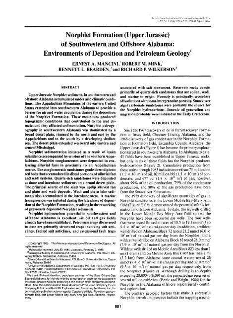
Norphlet Formation (Upper Jurassic) - Berg - Hughes Center
Norphlet Formation (Upper Jurassic) - Berg - Hughes Center
Norphlet Formation (Upper Jurassic) - Berg - Hughes Center

Create successful ePaper yourself
Turn your PDF publications into a flip-book with our unique Google optimized e-Paper software.
Tho .American Association of Peiroleuin CcDlogisli BulletinV, 6'-). No.fi(.lune lyK.S), I'K81-89S, 16 Figs., I Table<strong>Norphlet</strong> <strong>Formation</strong> (<strong>Upper</strong> <strong>Jurassic</strong>)of Southwestern and Offshore Alabama:Environments of Deposition and Petroleum Geology'ERNEST A. MANCINI/ ROBERT M. MINK/BENNETT L. BEARDEN,' and RICHARD R WILKERSON'ABSTRACT<strong>Upper</strong> <strong>Jurassic</strong> <strong>Norphlet</strong> sediments in southwestern andoffshore Alabama accumulated under arid climatic conditions.The Appalachian Mountains of the eastern UnitedStates extended into southwestern Alabama to provide abarrier for air and water circulation during the depositionof the <strong>Norphlet</strong> <strong>Formation</strong>. These mountains producedtopographic conditions that contributed to the arid climate,and they affected sedimentation. <strong>Norphlet</strong> paleogeographyin southwestern Alabama was dominated by abroad desert plain, rimmed to the north and east by theAppalachians and to the south by a developing shallowsea. The desert plain extended westward into eastern andcentral Mississippi.<strong>Norphlet</strong> sedimentation initiated as a result of basinsubsidence accompanied by erosion of the southern Appalachians.<strong>Norphlet</strong> conglomerates were deposited in coalescingalluvial fans in proximity to an Appalachiansource. The conglomeratic sandstones grade downdip intored beds that accumulated in distal portions of alluvial fanand wadi systems. Quartz-rich sandstones were depositedas dune and interdune sediments on a broad desert plain.The principal source of the sand was updip alluvial fanand plain and wadi deposits. Wadi and playa lake sedimentsalso accumulated in the interdune areas. A marinetransgression was initiated during the late phase of depositionof the <strong>Norphlet</strong> <strong>Formation</strong>, resulting in the reworkingof previously deposited <strong>Norphlet</strong> sediments.<strong>Norphlet</strong> hydrocarbon potential in southwestern andoffshore Alabama is excellent; six oil and gas fieldsalready have been established. Petroleum traps discoveredto date are primarily structural traps involving salt anticlines,faulted salt anticlines, and extensional fault traps©Copyright 1985. The American Association of Petroleum Geologists. Allrights reserved.^Manuscript received, July 30,1984; accepted, February 7,1985.^GeologicalSurveyof Alabama and University of Alabama, P.O. BoxO, UniversityStation, Tuscaloosa, Alabama 35486.•'state Oil and Gas Board of Alabama, P.O. Box 0, University Station, Tuscaloosa,Alabama 35486.^University of Alabama, Department of Geology, PO. Box 1945, UniversityAlabama35486. Present address: Cities Service Oil and Gas Corporation, PO.Box 27570, Houston, Texas 77227.We thank Ricfiard Hamilton, petroleum engineer of the State Oil and GasBoard of Alabama, for his help with the compilation of engineering data used inthis paper, and Ian Walls for preparing a thin section of the conglomeratic sandstone.Also, the authors extend thanks to Amoco Production Company ExxonCompany, U.S.A., and Mobil Oil Exploration and Producing Southeast, Inc., forpermission to publish structure maps for Copeland oil field, Flomaton gas-condensatefield, and Lower Mobile Bay-Mary Ann gas field, Alabama, respectively881associated with salt movement. Reservoir rocks consistprimarily of quartz-rich sandstones that are eolian, wadi,and marine in origin. Porosity is principally secondary(dissolution) with some intergranular porosity. Smackoveralgal carbonate mudstones were probably the source forthe <strong>Norphlet</strong> hydrocarbons. <strong>Jurassic</strong> oil generation andmigration probably were initiated in the Early Cretaceous.INTRODUCTIONSince the 1967 discovery of oil in the Smackover <strong>Formation</strong>at Toxey field, Choctaw County, Alabama, and the1968 discovery of gas condensate in the <strong>Norphlet</strong> <strong>Formation</strong>at Flomaton field, Escambia County, Alabama, the<strong>Upper</strong> J urassic (Figure 1) has become the primary explorationtarget in southwestern Alabama. In Alabama to date,45 fields have been established in <strong>Upper</strong> <strong>Jurassic</strong> rocks,but only in six of these fields has the <strong>Norphlet</strong> producedhydrocarbons (Figure 2). Cumulative production fromthese units through 1983 includes more than 75 million bbl(1.2 X 10'm^)ofoil, 82 million bbl (1.3 X 10'm^)of condensate,and 677 bcf (1.9 x lO'" m') of gas; however,about 99% of the oil production, 75% of the condensateproduction, and 80% of the gas production have beenfrom the Smackover <strong>Formation</strong>.The 1979 discovery of significant quantities of gas in<strong>Norphlet</strong> sandstones at the Lower Mobile Bay-Mary Annfield (Figure 2) first demonstrated the potential of this formationin offshore Alabama. To date, the six wells drilledin the Lower Mobile Bay-Mary Ann field to test the<strong>Norphlet</strong> have been successful gas wells. The four wellsthat were tested flowed at rates of 10.5 to 19.4 mmcf (3 to5.5 X 10^m^)of natural gas per day. In addition, a wildcatwell drilled on Alabama Block 72 tested 21.2 mmcf (6.0 x10^ m^) of natural gas per day from the <strong>Norphlet</strong>, and awildcat well drilled on Alabama Block 63 tested 28.0 mmcf(7.9 X 10' m^) of natural gas per day from the <strong>Norphlet</strong>.Wildcat wells drilled on Mobile Area Block 823 less than 1mi (1.6 km) and on Mobile Area Block 867 less than 2 mi(3.2 km) from Alabama state coastal waters tested 26mmcf (7.4 x 10'm')of natural gas per dayand32.9mmcf(9.3 x 10^ m') of natural gas per day, respectively, fromthe <strong>Norphlet</strong> (Figure 2). Although drilling is to depthsexceeding 20,000 ft (6,096 m), the projected gas reserves ofseveral trillion cubic feet (Petrie and Wright, 1984) for the<strong>Norphlet</strong> in the Alabama offshore region justify continuedexploration.The primary geologic factors that make a successful<strong>Norphlet</strong> petroleum prospect include the trapping mecha-
882 <strong>Norphlet</strong> <strong>Formation</strong> (<strong>Upper</strong> <strong>Jurassic</strong>), AlabamaSeries00ocLUaa.DO(/)
Ernest A. Mancini et al 883EXPLANATIONGas Discovery<strong>Norphlet</strong> Updip LimitMISS.20 miles10 0 10 20 kilometers^'Lowei Mobile Bay-Mary Ann Field (gasiMobile Block 823-Well NoMobile Block 867-Well NoFigure 2—Major structural features and <strong>Norphlet</strong> petroleum fields in southwestern and offshore Alabama (modified from Wilson,1975; Minii, 1984).predominately quartz-rich sandstone, which is referred toas the Denkman Sandstone Member (Murray, 1961; Tyrrell,1972), consistschiefly of agray to brown, moderatelywell-sorted to well-sorted, very fine to medium-grainedsubarkose, according to the classification scheme of Folk(1974), containing subrounded to rounded quartz grains(Figure 4A, B, C, D). The average composition of theDenkman is 72.5% quartz, 15.0% feldspar (plagioclase,microcUne, and orthoclase), 4.4% rock fragments (chert,shale, phyllite, schist, and quartzite), 3.8% cement (carbonate,quartz, and anhydrite), 3.2% authigenic clay(illite), and 1.1% accessory minerals (Wilkerson, 1981).The Denkman typically consists of an upper massive toindistinctly horizontal, wavy, laminated sandstone (Figure5A, D) and a lower cross-bedded sandstone having highangle(up to 30°) foreset laminae (Figures 5B, C, and 6A).The lower cross-bedded sandstone that comprises most ofthe Denkman Sandstone Member also is characterized byhorizontal to low-angle laminae (Figure 5E) and by ripplelaminae (Figure 5F). Figure 7 illustrates a typical verticalsequence of paleoenvironments in the Denkman SandstoneMember as observed in the Getty Peter Klein 3-14
884 <strong>Norphlet</strong> <strong>Formation</strong> (<strong>Upper</strong> <strong>Jurassic</strong>), AlabamaTOP OFPERMIT NO. 25430S-3MOBItOILCO.EPSIALABAMA STATC L£AS£ 34/SOUTH TRACT 76 MOBILE BAYCOTTON VALLEY GROUP ^ ? TrcT> } -16.500) I -^ 7,000I J -17,500i i -18,000< < -18,500TCP OF / 5HAYNESVILLE FORMATION \ \> \ -19,000METERS-5029.2-5181 6-5334.0-5486.4-5638.8-5791.2the Mosbacher Powell Gas Unit 19-4 core, EscambiaCounty, Alabama.The Denkman and red beds are replaced farther updipin Choctaw, Marengo, Clarke, Wilcox, Dallas, Monroe,Conecuh, Escambia, and Covington Counties by<strong>Norphlet</strong> conglomeratic sandstone. The sandstone is grayor red, poorly sorted, very fine to coarse-grained, and containsangular to subangular quartz grains (Figure 9A).Typically, the sandstone contains granule to cobble-sizeclasts of chert, shale, quartzite, granite, and rhyolite (FigurelOA).Shale occurs at the base of the <strong>Norphlet</strong> sequence inparts of Escambia and Choctaw Counties, and most likelyis present elsewhere in Alabama, particularly in the offshorearea. The shale is typically black, structureless towavy laminated, and illitic (Figure lOD). It is essentiallybarren of any organic remains, and it may be intertidal<strong>Norphlet</strong> or Louann lithofacies.ENVIRONMENTS OF DEPOSITION1 " ^ -19,500TOP OF 1 _~^SMACKOVER FORMATION r~ ~CI ^ -20,000TOP OF L 7_.20 500NORPHLET FORMATION r" ^~JTOPOF PINE HILL ANHYDRITE > ) -21.000MEMBER OF THE LOUANN SALT -»-SP RESISTIVITY-5943.6-6096.0-6248.4-6400.8Figure 3—Type log for southwestern and offshore Alabamaillustrating characteristic log curves for <strong>Jurassic</strong> strata.core. Hatter's Pond field, Mobile County, Alabama. TheDenkman becomes reddish-brown near its base and gradesinto underlying red beds.These red beds, which include sandstones, siltstones,and shales, become the dominant <strong>Norphlet</strong> lithologyupdip in parts of Choctaw, Clarke, Monroe, and EscambiaCounties. The sandstones consist chiefly of gray tored, poorly to moderately sorted, very fine to coarsegrainedsubarkoses, according to the classification schemeof Folk (1974), containing angular to subangular quartzgrains (Figure 4E). The average composition is 59.7%quartz, 11.8% feldspar (plagioclase, microcUne, andorthoclase), 9.2% rock fragments (chert, phyllite, quartzite,schist, gneiss, and basic and felsic igneous), 10.7%matrix (clay), 6.0% cement (anhydrite, quartz, and carbonate),2.2% accessory minerals, and 0.4% mica(Wilkerson, 1981). The sandstones generally have horizontalto inclined, discontinuous laminae (Figure 6B).Figure 8 illustrates a typical vertical sequence of paleoenvironmentsin the <strong>Norphlet</strong> <strong>Formation</strong> as observed inThe accumulation of thick <strong>Jurassic</strong> salt deposits, anhydrite,and red beds in association with <strong>Norphlet</strong> sandstonessuggests that arid climatic conditions wereprevalent during <strong>Norphlet</strong> deposition. Generally, an associationof salt, anhydrite, and red beds indicates arid climaticconditions, and eolian sands commonly accumulateunder such depositional conditions (Walker, 1967).The Appalachian Mountain system of the easternUnited States, which extended into southwestern Alabamain the <strong>Jurassic</strong>, provided a barrier for air and watercirculation during the deposition of the <strong>Norphlet</strong> <strong>Formation</strong>.This mountain system produced topographic conditionsthat contributed to the arid climate of southwesternAlabama during the <strong>Jurassic</strong>; these mountains alsoaffected sediment accumulation. Paleogeography insouthwestern Alabama during the <strong>Jurassic</strong> was dominatedby a broad desert plain rimmed to the north and east by theAppalachian Mountains and to the south by a developingshallow sea. The Wiggins arch, located in the southwesternportion of the desert plain, was a positive feature during<strong>Norphlet</strong> deposition, as evidenced by the observationthat the <strong>Norphlet</strong> has not been penetrated by wells drilledon this structure. The desert plain extended westward intoeastern and central Mississippi. Ancient analogs are thePliocene and Pleistocene Sonoran desert sediments ofnortheastern Baja California, Mexico (Walker, 1967), thelate Paleozoic and Triassic-<strong>Jurassic</strong> deposits of the westerninterior of the United States (McKee, 1979b), and thePermian sandstones of northwestern Europe (Glennie,1972), of the North Sea (Gage, 1980; Glennie and BuUer,1983), and of Scotland (Clemmensen and Abrahamsen,1983).The initiation of <strong>Norphlet</strong> sedimentation was the resultof basin subsidence accompanied by erosion of the southernAppalachian Mountain chain. <strong>Norphlet</strong> conglomeraticsandstones were deposited in proximity to theirAppalachian source (Figure 11). This <strong>Norphlet</strong> lithofaciesis most prevalent in Choctaw, Marengo, Clarke, Wilcox,Dallas, Monroe, Conecuh, Escambia, and CovingtonCounties, Alabama, or in areas that would be considered
Ernest A. Mancini et al 885L0.10 mmFigure 4—Photomicrographs illustrating sandstone composition and textural characteristics of <strong>Norphlet</strong> <strong>Formation</strong> in southwesternand offshore Alabama. (A) Eolian dune sandstone depicting composition, Getty Peter Klein 3-141 well, Mobile County, depth 18,403ft (5,609.2 m). (Note feldspar grain at F.) (B) Eolian dune sandstone depicting texture, Exxon State Block 621 well, Mobile Bay, depth20,514 ft (6,252.7 m). (C) Marine shoreface sandstone depicting composition, Louisiana Land & Exploration T. R. Miller Mill Company32-31 well, Escambia County, depth 15,497 ft (4,723.5 m). (D) Marine shoreface sandstone depicting composition and texture,Exxon State Block 621 well. Mobile Bay, depth 20,464 ft (6,237.4 m). (Note carbonate cement at C.) (E) Red-bed sandstone depictingcomposition and texture, Exxon L&N Railroad 30-31 well, Escambia County, depth 15,603 ft (4,755.8 m). (F) Wadi sandstone depictingcomposition and texture, Louisiana Land & Exploration T. R. Miller Mill Company 32-31 well, Escambia County, depth 15,561 ft(4,743.0 m).
886 <strong>Norphlet</strong> <strong>Formation</strong> (<strong>Upper</strong> <strong>Jurassic</strong>), AlabamaO .•••'i-.'". •-:.J4.--:-*.,S* j'1oH^-^1.0 IN.2.5 CMFigure 5—Photographs of core slabs illustrating sedimentary structures of <strong>Norphlet</strong> <strong>Formation</strong> in southwestern and offshore Alabama.(A) Marine shoreface sandstone depicting massive nature, Getty Creola Minerals 33-101 well, Mobile County, depth 18,440 ft(5,620.5 m). (B) Eolian dune sandstone depicting bimodal high-angle foreset laminae, Getty Peter Klein 3-141 well, Mobile County,depth 18,400 ft (5,608.3 m). (C) Eolian dune sandstone depicting planar and high-angle, bimodal foreset laminae, Mosbacher PowellGas Unit 19-41 well, Escambia County, depth 15,488 ft (4,720.7 m). (D) Marine shoreface sandstone depicting wavy horizontal laminations,Mosbacher Powell Gas Unit 19-41 well, Escambia County, depth 15,430 ft (4,703.1 m). (E) Eolian sandstone depicting horizontalto low-angle laminae, Getty Peter Klein 3-14 1, Mobile County, depth 18,307 ft (5,580.0 m). (F) Eolian sandstone depictingripple laminae, Getty Creola Minerals 35-112 well Mobile County, depth 18,448 ft (5,623.0 m).updip with respect to <strong>Norphlet</strong> sediment deposition. Thepaleogeographic setting and arid climate for <strong>Norphlet</strong> sedimentaccumulation, in addition to the sedimentary characteristicsof the conglomeratic sandstones, suggest thatthis lithofacies was deposited as coalescing alluvial fanssimilar to the bajada sediments accumulating today at thebase ofthe Oman Mountains, Persian Gulf along the TrucialCoast (Glennie, 1972), and at the base of the crystallinehighlands of the peninsular ranges, Baja California,Mexico (Walker, 1967).The restricted updip distribution of these deposits inassociation with apparent pre-<strong>Jurassic</strong> paleohighs and<strong>Jurassic</strong> highs, the presence of granule to cobble-size clastsof chert, shale, quartzite, granite, and rhyolite (Figure
Ernest A, Mancini et a! 887%^W^-•••0 1 0 INJ2.5 CM1011 I rj—V2 ; CMFigure 6—Photographs of core slabs illustrating paleoenvironments of <strong>Norphlet</strong> <strong>Formation</strong> in southwestern and offshore Alabama.(A) Eolian dune sandstone overlying wadi sandstone, Mosbacher Powell Gas Unit 19-4 1 well, Escambia County, depth 15,473 ft(4,716.2 m). (B) Red-bed sandstone depicting discontinuous laminae, Exxon L&N Railroad 30-3 1 well, Escambia County, depth15,614 ft (4,759.1 m). (C) Playa lake deposits overlying wadi sandstone, Mosbacher Powell Gas Unit 19-4 1 well, Escambia County,depth 15,487 ft (4,720.4 m). (D) Eolian sandstone filling a wadi channel, Louisiana Land & Exploration T. R. Miller 32-3 1 well,Escambia County, depth 15,606 ft (4,756.7 m). (E) Wadi sandstone in Interdune area, Getty Peter Klein 3-14 1 well, Mobile County,depth 18,214 ft (5,551.6 m). (F) Playa lake deposits in interdune area, Getty Peter Klein 3-14 1 well, Mobile County, depth 18,422-18,423 ft (5,615.0-5,615.3 m).lOA), the immature texture (Figure 9A) of the sandstones(poorly sorted and having angular to subangular quartzgrains and high clay-matrix content), the apparent lack ofstratification (Figure lOA), and the deposits being in partmatrix-supported (Figure 9A) suggest debris flow as theprimary transporting mechanism. Modern proximal alluvialfan sediments typically consist of oxidized, texturallyand compositionally immature, matrix-supporteddeposits (Rust, 1979; Nilsen, 1982).Downdip and into Choctaw, Clarke, Monroe, andEscambia Counties, the conglomeratic sandstones of the<strong>Norphlet</strong> grade to red beds (Figure 12). The red beds probablyrepresent distal portions of alluvial fan systems andof wadi complexes. Braided streams (wadis) intermittently
888 <strong>Norphlet</strong> <strong>Formation</strong> (<strong>Upper</strong> <strong>Jurassic</strong>), AlabamaVerticalSedimentarySequencefeet18,124metersPaleoenvironment5,524,2 ^MarineAlternatingEolianDune andnterduneVerticalSedimentarySequence15,435 •:•:•:•:•:•:•:•:•-4,704.615,445-.:15,46515,475-.15,485 •4,701,5^ 2zz: T^ry- 4,707,64,710,74,713,7t^^i^4,716,8S3S4,719.8^M ^Paleoenvironment> Marine>WadiAlternatingWadi withEolainDune andInterdune18,43615,495'15,425-15,455-•4,722.9-IntertidalYTA SMACKOVER CARBONATESY-ri\SMACKOVER CARBONATESNORPHLET MARINE SANDSTONENORPHLET EOLIAN DUNE SANDSTONEWITH MINOR WADI DEPOSITSyy.y^ NORPHLET INTERDUNE SANDSTONEp3;3n NORPHLET INTERDUNE/'——-J PLAYA LAKE DEPOSITSi:::::::::| NORPHLET MARINE SANDSTONEp>;."••] NORPHLET WADI DEPOSITSY///\ NORPHLET EOLIAN DUNE SANDSTONEr^^ NORPHLET INTERDUNE/'——^ PLAYA LAKE DEPOSITS|:-i-»j INTERTIDAL SHALECXI NO RECOVERYFigure 7—Typical vertical sequence of paleoenvironments asobserved in Denkman Sandstone Member of <strong>Norphlet</strong> <strong>Formation</strong>,Getty Peter Klein 3-141 well, Mobile County.Figure 8—Typical vertical sequence of paleoenvironments asobserved in <strong>Norphlet</strong> <strong>Formation</strong>, Mosbacher Powell Gas Unit19-41 well, Escambia County.
Ernest A. Mancini et al 889©' 111" * SiU*' •! ff * '. ^ ,,' -^ ' ..,',i:.,,,v .if'**' jii' " .'li^r ,:; «ii|''''• :=" '" -i:. ' i „ W&^.S^^'^%\ j ** •\*.I I0.10 mmFigure 9—Photomicrographs illustrating sandstone compositional and textural characteristics and porosity types of <strong>Norphlet</strong> <strong>Formation</strong>in southwestern and offshore Alabama. (A) Conglomeratic sandstone, Jack Stack McMillan 20-61 well, Conecuh County, depth12,748 ft (3,885.6 m). (Note matrix at M.) (B) Playa lake deposits, Getty Peter Klein 3-14 1 well, Mobile County, depth 18,359 ft(5,595.8 m). (Note matrix at M.) (C) Wadi sandstone secondary dissolution porosity at P, Mosbacher Powell Gas Unit 19-4, EscambiaCounty, depth 15,456 ft (4,711.0 m). (D) Eolian dune sandstone secondary dissolution porosity at P, Louisiana Land & Exploration T.R. Miller Mill Company 32-31 well, Escambia County, depth 15,550 ft (4,739.6 m). (E) Eolian dune sandstone secondary dissolutionporosity at P, Getty Peter Klein 3-14 1 well. Mobile County, depth 18,403 ft (5,609.2 m). (F) Eolian sandstone secondary dissolutionporosity at P, Exxon State Block 621 well, Mobile Bay, depth 20,514 ft (6,252.7 m).
890 <strong>Norphlet</strong> <strong>Formation</strong> (<strong>Upper</strong> <strong>Jurassic</strong>), Alabamao©• ' ^ ^ • \^•:s- -i;••• ::^V^fe2^•'SfciSf^if^se/K.:L^»r'*..St'•*-''*-;Figure 10—Photographs of core slabs illustrating <strong>Norphlet</strong> and associated lithofacies and soft-sediment deformation structures insouthwestern and offshore Alabama. (A) Conglomeratic sandstone lithofacies. Jack Stack McMillan 20-6 1 well, Conecuh County,depth 12,765 ft (3,890.8 m). (B) Contorted bedding, Louisiana Land & Exploration T. R. Miller Mill Company 32-3 1 well, EscambiaCounty, depth 15,588 ft (4,751.2 m). (C) Red-bed lithofacies depicting vertical grain-size change, Exxon L&N Railroad 30-3 1 well,Escambia County, depth 15,576 ft (4,747.6 m). (D) Shale lithofacies, Mosbacher Powell Gas Unit 19-4 1 well, Escambia County,depth 15,497 ft (4,723.5 m). (E) Small-scale fault, Getty Creola Minerals 33-10 1 well. Mobile County, depth 18,468 ft (5,629.0 m). (F)Red-bed lithofacies depicting fluvial sedimentary structure sequence, Exxon L&N Railroad 30-3 1 well, Escambia County, depth15,600 ft (4,754.9 m).flowed across the fan systems, dissecting the alluvial plain(Figure 11). The immature to submature texture (Figure4F) of the sandstones (poorly to moderately sorted containingangular to subangular quartz grains and high claymatrixcontent), the composition (Figure 4F) of thesandstones (rich in feldspar and rock fragments and low inquartz), the sandstones being grain-supported (Figure 4F),the vertical grain-size change in the sandstones of finingupward (Figure IOC), and the fluvial sedimentary structuresequence (Figure lOF) indicate a streamflow-dominatedtransport mechanism having sporadic high flowvolumes. The red siltstones and shales associated withthese sandstones represent alluvial plain sediments. Moderndistal alluvial fan sediments typically consist of oxidized,streamflow-dominated deposits (Rust, 1979;Nilsen, 1982). However, these immature <strong>Norphlet</strong> sedi-
Ernest A. Mancini et al 891^ ^EXPLANATIONSource AreaAlluvial Fan'•^-^ Alluvial Plainn ^Wadi- Desert Plain/I DuneUpdip Limit of the<strong>Norphlet</strong> <strong>Formation</strong>Figure 11—Generalized <strong>Norphlet</strong> paleogeography for southwesternand offshore Alabama.ments are interbedded with moderately well-sorted towell-sorted sandstones having low to high-angle bimodalforeset laminae (Figures 5C, 6A). These texturally maturecross-bedded sandstones are probably eolian in origin.Deposition in this area of southwestern Alabama,although dominated by fluvial processes (Figure 12), wascharacterized by having a combination of fluvial andeolian sediments similar to the mode of accumulation forthe Permian sediments of Scotland as described by Clemmensenand Abrahamsen (1983).In modern-day deserts, wind-laid sands are commonlyinterbedded with water-deposited sediments of a wadi(Glennie, 1970; Reineck and Singh, 1975). The wadis typicallyoccur adjacent to highlands and are characterized bysporadic and abrupt fluvial activity and by a low water tosediment ratio resulting in relatively poor sorting. Wadiflow pattern is similar to a braided stream, and the verticalchange in grain size and flow regime decreases upwardanalogous to a fluvial system (Glennie, 1970; Reineck andSingh, 1975). During dry periods, wadi channels canbecome filled with eolian sand.The Denkman Sandstone Member, which is principallya quartz-rich lithofacies of the <strong>Norphlet</strong>, accumulated asdesert plain sediments in dune, interdune, wadi, and playalake deposits. The <strong>Norphlet</strong> in southwestern Alabama hasbeen interpreted as eolian by Wilkerson (1981), Hondaand McBride (1981), and Pepper (1982). The <strong>Norphlet</strong>desert plain of southwestern Alabama was rather broad,extending westward into eastern and central Mississippiwhere the upper <strong>Norphlet</strong> has been determined as eolianby Hartman (1968), Badon (1975), and McBride (1981).The desert plain was bordered on the north and east by theAppalachians and to the south by a developing shallow sea(Figures 11, 12). The principal source of the sand was theupdip alluvial fan and plain and wadi deposits. Also, awadi system probably was associated with the Wigginsarch as evidenced by the <strong>Norphlet</strong> being characterized byhaving granule-size clasts in northern Mobile County Forthe most part, the sand was transported by the wind intothe desert plain area. Water-deposited sediments accumulatedin wadis and playa lakes in interdune areas. Depositionin this area of Alabama was dominated by eolianprocesses (Figure 12). Dunes were better developed than inthe previously described updip areas. In fact, this area wasprobably the region of maximum dune development.The most distinguishing features of the Denkman arethick sets of moderately well-sorted to well-sorted, highangle(up to 30°), bimodal foreset laminae (Figure 5B) andseveral types of penecontemporaneous, soft-sedimentdeformation structures, including contorted bedding (FigurelOB) and small-scale faults (Figure lOE). The dune andinterdune environments of the Denkman are dominatedby quartz-rich sandstones that are texturally mature, beingwell-sorted and having rounded quartz grains (Figure 4B),and that have a composition of a significant percentage offeldspar (Figure 4A). The presence of a significant percentageof feldspar in the Denkman is attributed to theproximity and nature of the eroding source terrain and tothe arid climate during <strong>Norphlet</strong> deposition.These sedimentary characteristics of the Denkman indicateit accumulated in an eolian environment. Moderndesert dune sediments are typified by thick deposits ofrather uniform lithology containing planar cross-bedshaving low to high-angle, well-sorted individual foresetlaminae (McKee, 1966, 1979a; Glennie, 1970, 1972Bigarella, 1972; Wilson, 1972; Reineck and Singh, 1975Hunter, 1977, 1981; Walker and Middleton, 1979Kocurek and Dott, 1981; Ahlbrandt and Fryberger, 1982).Soft-sediment features—such as slump features, contortedbedding, and small-scale faults—are common inmodern dune sands (Glennie, 1970; Bigarella, 1972,1979;Reineck and Singh, 1975; McKee, 1979a; Kocurek andDott, 1981; Ahlbrandt and Fryberger, 1982).The <strong>Norphlet</strong> high-angle cross-bedded sandstones areprobably dune deposits (Figure 5B, C), which accumulatedas a result of oversteepening of a dune lee slope andsubsequent avalanching down a slipface (sandflow orgrainflow), whereas the horizontally to low-angle laminatedsandstones (Figure 5E, F) accumulated as a result offlow separation on the lee side of the dune (grainfall).Modern sand dunes are typically composed of two typesof deposits, including accretion deposits characterized by
892 <strong>Norphlet</strong> <strong>Formation</strong> (<strong>Upper</strong> <strong>Jurassic</strong>), AlabamaMOBILE BAYIVIOBILECOUNTY1BALDWINCOUNTYESCAMBIACOUNTY-rCONECUHCOUNTY1Coalescingalluvialfans(bajada)Appalachian structural frontEXPLANATIONS3Igneous/metamorphic rocks Red-bed sediments Eolian sandsAlluvial fan/wadi sediments Playa lake sediments Marine sandsFigure 12—Block diagram illustrating <strong>Norphlet</strong> depositional systems and lateral lithofacies associations in southwestern and offshoreAlabama.horizontal or gently dipping laminae found on windwardslopes of dunes, and encroachment or avalanche depositscharacterized by high-angle foreset laminae found on theleeward slipface of a dune in the direction of dune migration(Bagnold, 1954; Reineck and Singh, 1975).Commonly, the quartz in the <strong>Norphlet</strong> cross-bedded,medium-grained dune sandstones is subrounded torounded, whereas the quartz in the very fine to finegrainedsandstones is subangular to subrounded. Accordingto Glennie (1970,1972), the coarser grains are typicallysubrounded to rounded, and the finer grains are angularto subangular in an eolian environment. The sand grainsfound on dune crests are finer grained than those at thefoot of the avalanche slope or along dune flanks (Glennie,1972).The <strong>Norphlet</strong> cross-bedded sandstones are interbeddedwith deposits having wavy discontinuous laminae (Figure6C, F). These water-deposited sandstones (Figure 9B) areusually not as well sorted as the <strong>Norphlet</strong> dune and interdunesandstones. In modern desert sediments, the interduneareas can act as depression areas where a temporarywadi (Figure 6E) or playa lake (Figure 6F) can develop(Glennie, 1970; Reineck and Singh, 1975; Ahlbrandt andFryberger, 1981; Fryberger et al, 1983). Usually, thesewater-deposited sediments are characterized by irregularwavy bedded (adhesion ripples) deposits formed whenwater is pulled to the sediment-water interface by capillaryaction due to evaporation, and windblown sand thenadheres to the damp surface (Glennie, 1970). The wadichannels during dry periods can become filled with eolian
Ernest A. Mancini et al 893sand that can result in pebbles near the tops of the foresets(Glennie, 1970). Figure 6D illustrates <strong>Norphlet</strong> eoliaiisandstone filling a wadi channel. Glennie (1970) states thatthe occurrence of pebbles near the tops of the foresets isdiagnostic of wind-laid deposits.The upper part of the Denkman is generally massivelybedded (Figure 5A); however, wavy, horizontal laminations(Figure 5D) may be present. The upper <strong>Norphlet</strong> hasbeen interpreted as marine (Figure 4C, D) by Sigsby(1976), Wilkerson (1981), and Pepper (1982). The uppermost<strong>Norphlet</strong> sandstone is finer grained than the underlyingsandstones and generally contains a high percentage ofcarbonate and/or quart/ cement, particularly in the offshoreAlabama area (Figure 4D). The massive Denkman isinferred to be shoreface in origin and probably reflectsreworking of the underlying sediments by a rise in sealevel, which was initiated near the end of <strong>Norphlet</strong> depositionand continued during the early phase of Smackoverdeposition. Because many deserts border coastlines,marine sediments commonly are found in close associationwith desert deposits (Glennie, 1970). The TrucialCoast of the Persian Gulf is a modern example of this relationship(Fryberger et al, 1983). The Permian Rotliegendesdune and wadi deposits of the North Sea are alsooverlain by a gray, reworked marine sandstone (Gage,1980). The transgression was probably rapid in that fossilsand bioturbation are rare (Glennie and Buller, 1983).Interestingly, Glennie (1970) reports that, for the PersianGulf area of today, these marine sands are more susceptibleto early diagenetic alteration, including calcite cementation.In summary, the sequence of deposition of the <strong>Norphlet</strong>and associated lithofacies first included accumulation ofintertidal shale in isolated lagoons or bays along an emergingshoreline (Figure 13). <strong>Norphlet</strong> sandstone accumulationwas then initiated with the erosion of the AppalachianMountains. Conglomeratic sandstones were deposited inproximal alluvial fans, and red beds accumulated in distalalluvial fan and plain and wadi environments. Sand fromthese environments was transported toward the coastacross a desert plain. This sand was reworked into duneand interdune deposits. A marine transgression was initiatedduring the late phase of <strong>Norphlet</strong> deposition, resultingin the reworking of the underlying sediments. Themarine transgression continued during the early phase ofSmackover deposition. The rapid nature of the <strong>Norphlet</strong>-Smackover marine transgression, the deposition ofSmackover low-energy, intertidal and subtidal carbonatemuds, and the potential for early cementation in the upper<strong>Norphlet</strong> sandstone contribute to the preservation of<strong>Norphlet</strong> dune and interdune paleoenvironments.PETROLEUM GEOLOGYPetroleum traps in southwestern and offshore Alabamaare principally structural traps involving salt anticlines,faulted salt anticlines, and extensional fault traps associatedwith salt movement (Figure 2). Stratigraphy plays anintegral part in the formation of <strong>Norphlet</strong> petroleumtraps, as is evidenced by the existing fields and recent<strong>Norphlet</strong> discoveries.DOWNDIPDOWNDIPCARBONATESGNEOUS/METAMORPHIC IBASEMENT ROCKSALLUVIAL FAN/WADICONGLOMERATES ANDCONGLOMERATIC SAMDS IALLUVIAL/WADiRED BEDSMARINE SANDSFigure 13—Generalized sequence of deposition of Norplilet andassociated litliofacies in soutliwestern and offsliore Alabama(modified from Badon, 1975; WUkerson, 1981).The Flomaton gas-condensate field (Figure 14) inEscambia County, Alabama, discovered in 1968 with theHumble Oil and Refining Company Bernice S. Wessner 1well, consists of a low-relief, faulted sah anticline associatedwith the PoUard-Foshee fault system. The primarytrapping mechanism is the large down-to-the-north faultthat truncates an anticlinal nosing trend. Structural closureis evident in the northwestern and southeastern portionsof the field. Currently, 16 wells are producing inFlomaton with cumulative production through 1983exceeding 8.5 million bbl (1.4 x 10^ m') of condensate and122 bcf (3.5 X 10' m^) of natural gas. The <strong>Norphlet</strong> reservoirin the field includes wadi, dune, and marine sandstones.Porosity is principally secondary and is a result ofdecementation and grain dissolution (Figure 9C, D), generallyin the wadi and dune sandstones. Minor intergranularporosity is also found in these sandstones. Porosityaverages 13.5%, and permeability averages 10 md.The Chavers Creek and Sizemore Creek oil fields (Figure2) in Escambia County, discovered in 1984 with theInexco Cogle 1-8 1 and the <strong>Hughes</strong> Eastern ATIC 33-1 1wells, respectively, consist of elongate salt anticlines associatedwith the PoUard-Foshee fault system. The apparenttrapping mechanism is a down-to-the-south fault similarto the <strong>Norphlet</strong> petroleum trap at Mount Carmel oil field
094:>31T. 2 N.-R. 9 E.IT. 1 N.- R.6 E35'•o•DEXPLANATIONSCALE(A(n—•15400-STRUCTURE CONTOUR (CONTOUR INTERVAL 50')^i—NORMAL FAULT, BLOCK ON DOWNTHROWN SIDE" ' " " " F I E L D BOUNDARYWELL LOCATIONGAS-WATER CONTACT% 1 2 miJBS0 y, 1 2 kilometersa)0)0)y CONCCUN 1^Index MapFigure 14—Top of <strong>Norphlet</strong> structure map forFlomaton gas-condensate field, Escambia County, Alabama. (Published with permission of Exxon Company, U.S.A.)
Ernest A. Mancini et al 895^JS,800\EXPLANATIONSTRUCTURE CONTOUfi(CONTOUR INTERVAL 60 FT]I FIELD BOUNDARYNOPPHLETOiL WELLSMACKOVER GAS-CONDENSATE WELLDRV HOLESCALEFigure 15—Top of <strong>Norphlet</strong> structure map for Copeland oilfield, Washington County, Alabama. (Published with permissionof Amoco Production Company.)in the Florida panhandle (Figure 2). The <strong>Norphlet</strong> reservoirin Chavers Creek and Sizemore Creek fields is primarilywadi and dune sandstones. Average porosity isestimated at 22.1 %, and average permeability is estimatedat 47.4 md in Chavers Creek field (Inexco Oil Company,1984, personal communication). These new oil-field discoveriesby Inexco and <strong>Hughes</strong> Eastern indicate that additional<strong>Norphlet</strong> oil fields are probably present along thePoUard-Foshee and Gilbertown-West Bend fault systems.The <strong>Norphlet</strong> petroleum trap in Copeland oil field (Figure15), Washington County, is a salt anticline. The fieldwas discovered in 1974 with the Amoco Production CompanyW. M. Curlee 1 well. The Curlee well produced over95,0(X) bbl (1.5 X lO" m') of oil and 59mmcf (1.7 x 10**m') of natural gas between 1974 and 1979. Presently, no oilis being produced from the <strong>Norphlet</strong> at Copeland. The<strong>Norphlet</strong> reservoir in this field is probably dune and interdunesandstones of the Denkman. The reservoir has anaverage porosity of 18% and an average permeability of197 md.The Hatter's Pond field (Figure 2), Mobile County,which was discovered in 1974 with the Getty Oil CompanyPeter Klein 3-14 1 well, produces from both the Smackoverand the <strong>Norphlet</strong> <strong>Formation</strong>s. The petroleum trapinvolves salt movement along the west side of the Mobiletault system that has resulted in a faulted salt anticline.Through 1983, over 16.7 million bbl (2.7 x 10* m')of condensateand 65 bcf( 1.8 X lO'm') of natural gas have beenproduced with 13 wells currently producing from thisfield. The <strong>Norphlet</strong> reservoir in Hatter's Pond field is theDenkman. The porosity of the dune and marine sandstonesat Hatter's Pond field has been interpreted as secondary(Figure 9E) by Honda and McBride (1981). Theybelieve that this secondary porosity is a result of decementationof anhydrite or calcite and by grain dissolution.Porosity averages 10.4%, and permeability averages 0.5md in the Hatter's Pond field.The <strong>Norphlet</strong> petroleum trap in the Lower Mobile Bay-Mary Ann gas field (Figure 16), Mobile Bay, Alabama, is alow-relief, faulted salt anticline. Mobil Oil Explorationand Producing Southeast, Inc. (MOEPSI), discovered thisnatural gas field in 1979 with the State Lease 347 1 well. Todate, the sbc wells drilled to test the <strong>Norphlet</strong> in the fieldhave been successful gas wells. The four wells that weretested flowed at rates of 10.5 to 19.4 mmcf (3 to 5.5 x lO'm') of natural gas per day. The primary reservoir in theMobile Bay area is the Denkman dune sandstones. Porosityaverages 10.9% in this field and is principally developedas secondary as a result of decementation and graindissolution in the Mobile Bay area (Figure 9F). Permeabilityof these eolian sandstones averages 1.1 md. Reservesfor this field are estimated to be as much as 600 bcf (1.7 x10'" m^) of natural gas (Sumpter, 1981). The discoveries(Figure 2) by MOEPSI in open waters of the Gulf of Mexico(Mobile Area Block 823) and in the Mississippi Sound(Alabama Block 72), 4.5 mi (7.2 km) southwest and 11 mi(17.7 km) west of the Lower Mobile Bay-Mary Ann field,respectively, and by Exxon in open waters of the Gulf ofMexico (Mobile Area Block 867) and in Lower Mobile Bay(Alabama Block 63), 5.5 mi (8.8 km) southwest and lessthan 1 mi (1.6 km) north of the Lower Mobile Bay-MaryAnn field, respectively, indicate that the natural gasreserves for the offshore Alabama area may be several trillioncubic feet of natural gas (Petrie and Wright, 1984).The <strong>Norphlet</strong> marine sandstones in the Mobile Bay areahave minimal porosity because of the presence of a highpercentage of carbonate and/or quartz cement (Figure4D).An analog for the large offshore natural gas fields beingdiscovered in offshore Alabama would be the Viking gasfield of the North Sea, which has estimated in-placereserves of 3.6 tcf (1.0 x lO" m') of natural gas (Gage,1980). The Viking field produces natural gas from theLeman Sandstone <strong>Formation</strong> in the Lower Permian RotliegendesGroup. The petroleum trap involves normalfaults. The reservoir consists of dune and wadi sandstoneswith the wadi sandstones accounting for poor reservoirperformance in certain areas of the field. The petroleumsource rocks are probably the underlying Carboniferoussediments (Gage, 1980).Smackover algal carbonate mudstones were probablythe source for the <strong>Norphlet</strong> hydrocarbons. These mudstonesare locally rich in algal and amorphous kerogen(Mancini and Benson, 1980). Analyses of samples fromthe black shales associated with the <strong>Norphlet</strong> in EscambiaCounty have indicated these shales are essentially barren
896 <strong>Norphlet</strong> <strong>Formation</strong> (<strong>Upper</strong> <strong>Jurassic</strong>), Alabama~~^ ESCAMBIAMOBILE 1(^BALDWINFigure 16—Top of <strong>Norphlet</strong> gas-pool structure map for Lower Mobile Bay-Mary Ann field. Mobile Bay. (Published with permissionof Mobil Oil Exploration and Producing Southeast, Inc.)of any significant organic matter. The thermal alterationindices for Smackover carbonates indicate that the thermalhistory for much of southwestern and offshore Alabamawas highly favorable for hydrocarbon generation(Table 1). Assuming an average geothermal gradient of1.3°F (0.72°C) for southwestern and offshore Alabama,<strong>Jurassic</strong> oil generation and migration probably were initiatedwith the deposition of 5,000 to 6,000 ft (1,524 to 1,829m) of overburden. Such a depth of burial for the <strong>Norphlet</strong>-Smackover probably was achieved in the Early Cretaceousfor much of southwestern and offshore Alabama.CONCLUSIONS<strong>Upper</strong> <strong>Jurassic</strong> <strong>Norphlet</strong> paleogeography in southwesternand offshore Alabama was dominated by a broad desertplain, rimmed to the north and east by theAppalachians and to the southwest by a developing shallowsea. The desert plain extended westward into easternand central Mississippi.<strong>Norphlet</strong> conglomerates were deposited in coalescingalluvial fans in proximity to an Appalachian source, andred beds accumulated in distal portions of alluvial fan andwadi systems. Quartz-rich sandstones were deposited asdune and interdune sediments on a broad desert plain. Amarine transgression was initiated during the late phase of<strong>Norphlet</strong> deposition, resulting in the reworking of previouslydeposited <strong>Norphlet</strong> sediments.<strong>Norphlet</strong> hydrocarbon potential in southwestern andoffshore Alabama is excellent, with petroleum traps beingprimarily structural traps involving salt anticlines, faultedsalt anticlines, and extensional fault traps associated withsalt movement. Reservoir rocks consist primarily ofquartz-rich eolian, wadi, and marine sandstones havingprincipally secondary (dissolution) porosity with someintergranular porosity. Smackover algal carbonate mudstoneswere most likely the source for the <strong>Norphlet</strong> hydrocarbons.<strong>Jurassic</strong> oil generation and migration probablywere initiated in the Early Cretaceous, assuming an averagegeothermal gradient of 1.3°F (0.72°C) and an overburdenof 5,000 to 6,000 ft (1,524 to 1,829 m).REFERENCES CITEDAhlbrandt, T. S., and S. G. Fryberger, 1981, Sedimentary features andsignificance of interdune deposits, in Recent and ancient nonmarinedepositional environments: models for exploration: SEPM SpecialPublication 31, p. 293-314.1982, Introduction to eolian deposits, in Sandstone depositionalenvironments: AAPG Memoir 31, p. 11-47.Badon,C. L., 1975, Stratigraphy and petrology of <strong>Jurassic</strong> <strong>Norphlet</strong> <strong>Formation</strong>,Clarke County, Mississippi: AAPG Bulletin, v. 59, p. 377-392.
Ernest A. Mancini etal 897Table 1. Organic Carbon and Kerogen Analyses'PercentDominantThermal alteraWellSample '. deptti(feet) (meters)organiccarbonkerogentypetion index(1-5 scale)Amos No. 2, Sec 32,T7S, R4E, Baldwin Co.19,8606,053.30.36Amorphous(Algal)3 to 3"^Bryars No. 1, Sec 47,16,6525,075.50.19Amorphous2 to 2"^TIN, R2E, Baldwin Co.Container Corporation No. 1,16,2254,945.40.42Amorphous2'Sec 28, T2N, R4E,Baldwin Co.Jackson No. 1, Sec 31,T12N, R3W, Choctaw Co.10,5323,210.20.34Amorphous(Algal)1"^to2'Harrigan No. 1, Sec 16,10,9803,346.70.19Amorphous1"^to2"T10N, R1E, Clarke Co.(Algal)L&N Railroad No. 1, Sec 30,TIN, R9E, Escambia Co.15,3264,671.40.20Amorphous(Algal)2+Jacintoport Corporation No. 1,Sec11,T3S, R1W, Mobile Co.18,3095,580.60.89Amorphous3'Ideal Basic Industries-Creola No. 1,Sec8, T1S, R1E, Mobile Co.17,3065,274.90.18Amorphous3"Travis No. 1, Sec 20, T2S. R2W,18,5845,664.40.20Amorphous2^ to 3'Mobile Co.Sullivan No. 1, Sec 9, TIN, R1E,17,3085,275.50.81Amorphous2 to 2"^Mobile Co.(Algal)Peter Klein No. 1,Sec3,18,0415,498.90.25Amorphous3" to 3T2S, R1W, Mobile Co.(Algal)Newman No. 1, Sec 9,18,5035,639.70.22Amorphous3" to 3T1S,R1W, Mobile Co.Smith No. 1,Sec 15,18,4905,635.80.21Amorphous3" to 3T1S,R2W, Mobile Co.(Algal)Blacksher Company No. 1,14,2454,341.90.25Amorphous2 to 2"^Sec 7, T4N, R6E, Monroe Co.Britton No. 1, Sec 21,T8N, R4W, Washington Co.16,0454,890.50.21Amorphous(Algal)3" to 3Foster No. 1, Sec 10, T2N, R3W,19,3595,900.60.35Amorphous3'to 3Washington Co.^ Analyses were done by Geochem Laboratories, Houston, Texas.Bagnold, R. A., 1954, The physics of blown sand and desert dunes: London,Methuen, 265 p.Bigarella, J. J., 1972, Eolian environments: their characteristics, recognition,and importance, in Recognition of ancient sedimentary environments:SEPM Special Publication 15, p. 12-62.1979, Structural features at Lagoa Dune field, Brazil, in E. D.McKee, ed., A study of global sand seas: USGS Professional Paper1052,p. 114-134.Clemmensen, L. B., and K. Abrahamsen, 1983, Aeolian stratificationand facies association in desert sediments, Arran basin (Permian),Scotland: Sedimentology, v. 30, p. 311-339.Folk, R. L., 1974, Petrology of sedimentary rocks: Austin, Texas, Hemphill'sBook Store, 170 p.Fryberger, S. G., A. M. Al-Sari, and 1 J. Clisham, 1983, Eolian dune,interdune, sand sheet, and siliciclastic sabkha sediments of an offshoreprograding sand sea, Dhahran area, Saudi Arabia: AAPG Bulletin,v. 67, p. 280-312.Gage, M., 1980, A review of the Viking gas field, in Giant oil and gasfields of the decade: 1968-1978: AAPG Memoir 30, p. 39-57.Glennie, K. W., 1970, Desert sedimentary environments: Amsterdam,Elsevier, Developments in Sedimentology, v. 14,222 p.1972, Permian Rotliegendes of northwest Europe interpreted inlight of modern desert sedimentation studies: AAPG Bulletin, v. 56,p. 1048-1071.and A. T. Buller, 1983, The Permian Weissleigend of NWEurope: the partial deformation of aeolian dune sands caused by theZechstein transgression: Sedimentary Geology, v. 35, p. 43-81.Hartman, J. A., 1968, The <strong>Norphlet</strong> sandstone, Pelahatchie field,Rankin County, Mississippi: Gulf Coast Association of GeologicalSocieties Transactions, v. 18, p. 2-11.
898 <strong>Norphlet</strong> <strong>Formation</strong> (<strong>Upper</strong> <strong>Jurassic</strong>), AlabamaHonda, H., and E. F. McBride, 1981, Diagenesis and pores types ot the<strong>Norphlet</strong> sandstone (<strong>Upper</strong> <strong>Jurassic</strong>), Hatter's Pond area, Mi)bileCounty, Alabama: Gulf Coast Association of Geological SocietiesTransactions, v. 31, p. 315-322.Hunter, R. E., 1977, Basic types of stratification in small aeolian dunes:Sedimentology, v. 24, p. 361-387.1981, Stratification styles in eolian sandstones: some Pennsylvanianto <strong>Jurassic</strong> examples from the western interior U.S. A., in Recentand ancient nonmarine depositional environments: models for exploration:SEPM Special Publication 31, p. 315-329.Imlay, R. W., 1980, <strong>Jurassic</strong> paleobiogeography of the conterminousUnited States in its continental setting: USGS Professional Paper1062,125 p.Kocurek, G., andR. H. Dott, Jr., 1981, Distinctions and uses of stratificationtypes in the interpretation of eolian sand: Journal of SedimentaryPetrology, V. 51, p. 579-595.Mancini, E. A., and D. J. Benson, 1980, Regional stratigraphy of <strong>Upper</strong><strong>Jurassic</strong> Smackover carbonates of southwest Alabama: Gulf CoastAssociation of Geological Societies Transactions, V. 30, p. 151-165.Martin, R. G., 1978, Northern and eastern Gulf of Mexico continentalmargin: stratigraphic and structural framework, in Framework,facies, and oil-trapping characteristics of the upper continental margin:AAPG Studies in Geology 7, p. 21-42.McBride, E. E, 1981, Diagenetic history of <strong>Norphlet</strong> <strong>Formation</strong> (<strong>Upper</strong><strong>Jurassic</strong>), Rankin County, Mississippi: Gulf Coast Association ofGeological Societies Transactions, v. 31, p. 347-351.McKee, E. D., 1966, Structures of dunes at White Sands National Monument,New Mexico (and a comparison with structures of dunes fromother selected areas): Sedimentology, v. 7, p. 1-70.1979a, Sedimentary structures in dunes, in E. D. McKee, ed., Astudy of global sand seas: USGS Professional Paper 1052, p. 83-134.1979b, Ancient sandstones considered to be eolian, in E. D.McKee, ed., A study of global sand seas: USGS Professional Paper1052, p. 187-238.Mink, R. M., 1984, Oil and gas leasing and drilling in Alabama statecoastal waters and adjacent federal OCS waters, 1951-1983: AlabamaOil and Gas Board Report 7B, 39 p.Murray, G. E., 1961, Geology of the Atlantic and Gulf Coastal Provinceof North America: New York, Harper and Brothers, 692 p.Nilsen, T. H., 1982, Alluvial fan deposits, in Sandstone depositional environments:AAPG Memoir 31, p. 49-86.Pepper, C. F, 1982, Depositional environments of the <strong>Norphlet</strong> <strong>Formation</strong>(<strong>Jurassic</strong>) for southwestern Alabama: Gulf Coast Association ofGeological Societies Transactions, v. 32, p. 17-22.Petrie, T. A., and S. W. Wright, 1984, The Mobile Bay gas play: Denver,Colorado, First Boston Corporation, 12 p.Pilger, R. H., Jr, 1978, A closed Gulf of Mexico, pre-Adantic Oceanplate reconstruction and the early rift history of the Gulf of NorthAtlantic: Gulf Coast Association of Geological Societies Transactions,v. 28, p. 385-393.1981, The opening of the Gulf of Mexico: implications for thetectonic evolution of the northern Gulf Coast: Gulf Coast Associationof Geological Societies Transactions, v. 31, p. 377-381.Reineck, H. E., and 1. B. Singh, 1975, Depositional sedimentary environments,with reference to terrigenous elastics: New York, Springer-Verlag,439 p.Rust, B. R., 1979, Coarse alluvial deposits, in R. G. Walker, ed., Faciesmodels: Geoscience Canada Reprint Series 1, p. 9-21.Sigsby, R. J., 1976, Paleoenvironmental analysis of the Big EscambiaCreek-Jay-Blackjack Creek field area: Gulf Coast Association ofGeological Societies Transactions, v. 26, p. 258-278.Sumpter, R,, 1981, Mobil strike helps spark Alabama tract bidding: Oil &Gas Journal, v. 79 (April 13), p. 36-37.Tolson, J. S., C. W. Copeland, and B. L. Bearden, 1983, Stratigraphicprofiles of <strong>Jurassic</strong> strata in the western part of the Alabama coastalplain: Alabama Geological Survey Bulletin 122,425 p.Tyrrell, W. W, Jr., 1972, Denkman Sandstone Member—an important<strong>Jurassic</strong> reservoir in Mississippi, Alabama, and Florida (abs.): GulfCoast Association of Geological Societies Transactions, v. 22, p. 32.Walker, R. G., and G. V. Middleton, 1979, Eolian sands, in R. G. Walker,ed., Facies models: Geoscience Canada Reprint Series 1, p. 33-41.Walker, T. R., 1967, <strong>Formation</strong> of red beds in modern and ancient deserts:GSA Bulletin, v. 78, p, 353-368.Wilkerson, R. P., 1981, Environments of deposition of the <strong>Norphlet</strong> <strong>Formation</strong>(<strong>Jurassic</strong>) in south Alabama: Master's thesis. University ofAlabama, Tuscaloosa, Alabama, 141 p.Wilson, G. v., 1975, Early differential subsidence and configuration ofthe northern Gulf Coast basin in southwest Alabama and northwestFlorida: Gulf Coast Association of Geological Societies Transactions,V. 25, p. 196-206.Wilson, I. G., 1972, Aeolian bedforms—their development and origins:Sedimentology, v. 19, p. 173-210.