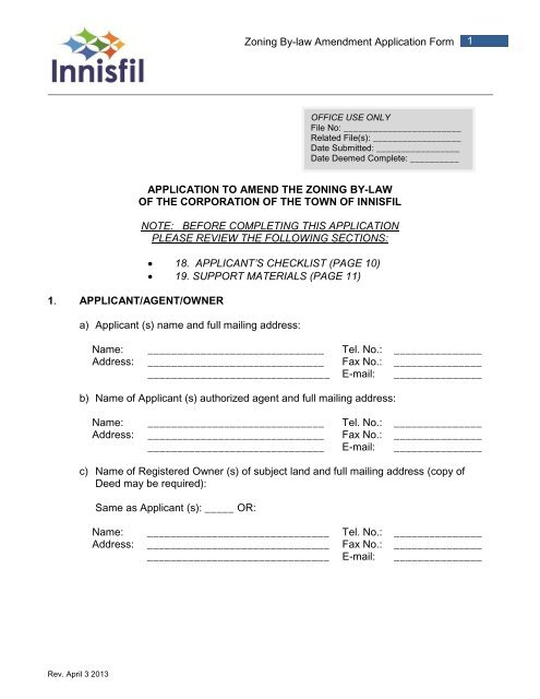
Zoning By-Law Amendment Application Form - Town of Innisfil
Zoning By-Law Amendment Application Form - Town of Innisfil
Zoning By-Law Amendment Application Form - Town of Innisfil
You also want an ePaper? Increase the reach of your titles
YUMPU automatically turns print PDFs into web optimized ePapers that Google loves.
<strong>Zoning</strong> <strong>By</strong>-law <strong>Amendment</strong> <strong>Application</strong> <strong>Form</strong>36. PROVINCIAL PLANNINGa) Provide an explanation <strong>of</strong> how this <strong>Application</strong> is consistent with the Provincial PolicyStatement (PPS).______________________________________________________________________________________________________________________________________b) Provide an explanation <strong>of</strong> how this <strong>Application</strong> conforms or does not conflict withProvincial Plans (e.g. Places to Grow).______________________________________________________________________________________________________________________________________7. CONCURRENT OR PREVIOUS APPLICATIONSOn the following charts, provide information on concurrent or previous applications:SUBJECT LANDSFile #OPAApprovalAuthorityLandsAffectedPurpose Status Effect on<strong>Amendment</strong>ZBAPlan <strong>of</strong>SubdivisionSite PlanConsentMinorVarianceWITHIN 120 METRES OF SUBJECT LANDSFile # ApprovalAuthorityLandsAffectedOPAPurpose Status Effect on<strong>Amendment</strong>ZBAPlan <strong>of</strong>SubdivisionSite PlanConsentMinorVarianceRev. April 3 2013
<strong>Zoning</strong> <strong>By</strong>-law <strong>Amendment</strong> <strong>Application</strong> <strong>Form</strong>513. Describe the type <strong>of</strong> storm drainage:□ storm sewers □ ditches□ swales □ natural drainage14. HISTORY OF THE SUBJECT LANDa) Date <strong>of</strong> acquisition <strong>of</strong> the subject land:___________________________________________________________________b) Date <strong>of</strong> construction <strong>of</strong> existing buildings and structures on the subject lands:______________________________________________________________________________________________________________________________________c) For any existing building(s) describe:i. the type <strong>of</strong> building or structure; and________________________________________________________________________________________________________________________________ii.in metric units, the setback from the front lot line, rear lot line and side lot lines,and its dimensions or floor area.________________________________________________________________________________________________________________________________d) Are any building(s) or structure(s) proposed to be built on the subject land?___________________________________________________________________e) For any proposed building(s) describe:i) the type <strong>of</strong> building or structure; and________________________________________________________________________________________________________________________________ii)in metric units, the setback from the front lot line, rear lot line and side lot lines,and its dimensions or floor area.________________________________________________________________________________________________________________________________f) Length <strong>of</strong> time the existing uses on the subject property have continued:___________________________________________________________________g) Are there any easements, rights-<strong>of</strong>-way or restrictive covenants affecting the subjectland?Yes _____ No______Rev. April 3 2013
<strong>Zoning</strong> <strong>By</strong>-law <strong>Amendment</strong> <strong>Application</strong> <strong>Form</strong>6a) If yes, describe the easement, right-<strong>of</strong>-way or restrictive covenant and its effect.________________________________________________________________________________________________________________________________Where farm viability or size is an issue or where livestock barns are in proximity to thesubject land, a Minimum Distance Separation (MDS) calculation is required to besubmitted.A certificate from the local Conservation Authority will facilitate the review <strong>of</strong> this<strong>Application</strong>.A Sketch Plan is to be provided as per the requirements under Section A <strong>of</strong> the SupportMaterials, which is attached to this <strong>Application</strong>.Are any <strong>of</strong> the following uses or features on the subject land or within 500 metres <strong>of</strong> thesubject land, unless otherwise specified? Please check the appropriate boxes if anyapply.Use or Featurean agricultural operation, includinglivestock facility or stockyarda landfilla sewage treatment plant or wastestabilization planta provincially significant wetland(class 1, 2, or 3 wetland)a flood plaina rehabilitated mine/pit siteAn active mine/pit sitea non-operating mine/pit site withinone km <strong>of</strong> the subject landan industrial or commercial use,and specify the useAn active railway lineOn thesubjectlandWithin 500 metres <strong>of</strong> the subjectland, unless otherwise specified(indicate approximate distance)Rev. April 3 2013
<strong>Zoning</strong> <strong>By</strong>-law <strong>Amendment</strong> <strong>Application</strong> <strong>Form</strong>816. AFFIDAVIT OR SWORN DECLARATIONMust be completed by the Applicant/AgentI,_____________________________________<strong>of</strong> the__________________________________(home <strong>Town</strong> or City)in the_____________________________________make oath and say that all the statements(County or Region)contained in this <strong>Application</strong> are true and conscientiously believe to be true, all the informationcontained in the documents that accompany this application. Furthermore, I authorize andconsent to the use by or the disclosure to any person or public body <strong>of</strong> any information collectedunder the Planning Act for the purposes <strong>of</strong> processing this <strong>Application</strong>.I further understand and agree that should approval <strong>of</strong> this application result in a hearing beforethe Ontario Municipal Board, the <strong>Town</strong> will require my undertaking to provide all necessaryexpertise (including legal, planning and engineering) to appear at such hearing in support <strong>of</strong> the<strong>Application</strong>, and the <strong>Town</strong> may require that I enter into an agreement with the <strong>Town</strong> to providesame. I declare that I have read the <strong>Town</strong>’s Fees <strong>By</strong>-law and that I agree to the terms andconditions <strong>of</strong> the <strong>Town</strong>’s Fees <strong>By</strong>-law. I also understand that the <strong>Application</strong> is not completeuntil all required information, reports, fees and deposits are provided to the <strong>Town</strong>. I furtheracknowledge that in default <strong>of</strong> any payment <strong>of</strong> fees or costs owing by me by virtue <strong>of</strong> thisapplication or any Ontario Municipal Board Hearing held therefore, the <strong>Town</strong> may collect saidfees in such manner as set out in Section 391 <strong>of</strong> the Municipal Act.Sworn before me at the _____________________________in the________________________________________this _____day <strong>of</strong> ______________________, 20___._________________________Commissioner <strong>of</strong> Oaths________________________Signature <strong>of</strong> Applicant________________________Print Name HereRev. April 3 2013
<strong>Zoning</strong> <strong>By</strong>-law <strong>Amendment</strong> <strong>Application</strong> <strong>Form</strong>917. AUTHORIZATIONIf the Applicant is not the Owner <strong>of</strong> the land that is the subject <strong>of</strong> this <strong>Application</strong>, thewritten authorization <strong>of</strong> the Owner that the Applicant is authorized to make the<strong>Application</strong> must be included with this form or the authorization set out below must becompleted.Authorization <strong>of</strong> Owner for Agentto Make the <strong>Application</strong>I,__________________________________am the Owner <strong>of</strong> the land that is the subject<strong>of</strong> this <strong>Application</strong> and I authorize ________________________________________ tomake this <strong>Application</strong> on my behalf. Furthermore, for the purposes <strong>of</strong> the Freedom <strong>of</strong>Information Act, I authorize and consent to the use by disclosure to any person or publicbody <strong>of</strong> any information collected under the Planning Act for the purposes <strong>of</strong> processingthis <strong>Application</strong>.___________________Date___________________________________Signature <strong>of</strong> OwnerRev. April 3 2013
<strong>Zoning</strong> <strong>By</strong>-law <strong>Amendment</strong> <strong>Application</strong> <strong>Form</strong>1119. SUPPORT MATERIALSA. Sketch Plan Requirements – All <strong>Application</strong>sA minimum 24” x 36” and 8½” x 14” (legal size) sketch showing, in metric units,(a)(b)(c)(d)(e)(f)(g)the boundaries and dimensions <strong>of</strong> the subject lands;the location, size and type <strong>of</strong> all existing and proposed buildings andstructures on the subject lands, indicating their distance from the front lotline, rear lot line and side lot lines;the approximate location <strong>of</strong> all natural and artificial features (for example,buildings, railways, roads, watercourses, drainage ditches, banks <strong>of</strong> riversor streams, wetlands, wooded areas, wells and septic tanks) that,i. are located on the subject lands and on land that is adjacent to it;the current uses <strong>of</strong> the subject lands and the uses on the adjacent lands;the location, width and name <strong>of</strong> any roads within or abutting the subjectland, indicating whether it is an unopened road allowance, a publictraveled road, a private road or a right <strong>of</strong> way;if access to the subject lands will be by water only, the location <strong>of</strong> theparking and docking facilities to be used; andthe location and nature <strong>of</strong> any easement affecting the subject lands.B. Drawing Requirements for Commercial, Industrial, New <strong>Form</strong>s <strong>of</strong> HousingNot Recognized in Existing <strong>Zoning</strong> <strong>By</strong>-laws and any Land Designated as aSite Plan Control AreaSite Plan(A)Existing ConditionsDimensions:Length <strong>of</strong> each boundary showing also, future street, property and divisionlines; area <strong>of</strong> property, in both square metres and hectares; proposed orplanned division <strong>of</strong> property; exact location and use <strong>of</strong> existing building(s)and existing structure(s) on abutting properties indicating dimensions <strong>of</strong> allyards.Building(s) and Structure(s):Each existing building to be identified by use, numbered floors, full outsidedimensions as well as existing setback from property lines.Right-<strong>of</strong>-Way:All streets with both sides and center line shown; street widenings withproposed curbing (existing and proposed); 0.3 metre reserves; type andRev. April 3 2013
<strong>Zoning</strong> <strong>By</strong>-law <strong>Amendment</strong> <strong>Application</strong> <strong>Form</strong>12extent <strong>of</strong> all easements, etc., both on and adjacent to the property, withtheir dimensions.Utilities:Utilities such as overhead power and telephone lines, all fire hydrants,either on or adjacent to the property.Natural Features:Natural features such as preservable trees, springs, water courses androck outcropping with their exact locations.Grades:Grades over the entire property by contour lines at 1.52 metre intervals onsteep sites, less on relatively flat areas.(B)Proposed DevelopmentBuildings and StructuresEach building is to be identified by use, number <strong>of</strong> floors, full outsidedimensions as well as all dimensions for all yards.Parking AreasParking related to garages, carport or open parking; with capacity(breakdown and totals) and dimensions <strong>of</strong> accessways and all parkingspaces, truck loading bays, etc.Driveways and RampsWith dimensions, including ramps, vehicular circulation and one way trafficand curbs.Other FeaturesWith dimensions, garden and retaining walls, protective railings, walks,areas for recreation, play lots or landscaping; service and delivery access;extent <strong>of</strong> underground garage and location <strong>of</strong> ramps; outside storagefacilities.Finished Ground GradesFirst floor grades <strong>of</strong> all building(s); proposed finished ground gradessufficient to show steepness, drainage and direction <strong>of</strong> all slopes andextent <strong>of</strong> deviation from original (natural) grades.Site Statistics in Chart <strong>Form</strong>Showing areas, the following expressed in square metres and as apercentage <strong>of</strong> the total lot area:Rev. April 3 2013
<strong>Zoning</strong> <strong>By</strong>-law <strong>Amendment</strong> <strong>Application</strong> <strong>Form</strong>13main building(s);accessory buildings (if any);parking;other areas for vehicular use (drives, bays, loading areas, etc.);landscaped areas;road widening (where applicable); and,in the case <strong>of</strong> multi-family developments, the number <strong>of</strong> units proposedbroken down by the number <strong>of</strong> bedrooms per unit.Architectural DrawingsRequired for each commercial and industrial building and for eachresidential building having twenty-five (25) units or more. It is not requiredthat such drawings be submitted with the <strong>Application</strong> but may be required.ElevationsOf all sides (or full representative selection) <strong>of</strong> all main and accessorybuildings, showing also all ro<strong>of</strong> structures (penthouses, chimneys, vents,etc.), in full, and their measurements indicated.Other Supporting MaterialsThe type <strong>of</strong> supporting materials will depend on the nature and extent <strong>of</strong>the <strong>Application</strong> submitted.C. FOR LARGE SCALE OFFICIAL PLAN AMENDMENTSNo site plans will be required. However a detailed proposal will berequired outlining the following:a Survey Plan indicating the boundaries <strong>of</strong> the proposal.a Concept Plan <strong>of</strong> the proposal showing:o the general configuration <strong>of</strong> land use;o the proposed densities <strong>of</strong> residential areas;o the major road network;o the location and amount <strong>of</strong> public and private open space; and,o the general servicing structure.A set <strong>of</strong> relevant site statistics such as total population expected, number<strong>of</strong> school children, hectares <strong>of</strong> open space per 1000 population, and thebreakdown <strong>of</strong> the housing mix in units; and,An analysis <strong>of</strong> the ecological considerations <strong>of</strong> the site, (e.g. soils,drainage, water courses, wetlands, forests, floodplains, wooded areas,etc.), and how these factors will be handled within the context <strong>of</strong> theOfficial Plan <strong>Amendment</strong>.Rev. April 3 2013
<strong>Zoning</strong> <strong>By</strong>-law <strong>Amendment</strong> <strong>Application</strong> <strong>Form</strong>14D. SPECIAL NOTESAll DrawingsAll drawings should state the project, Applicant’s name and address andcontents. All should include the north arrow (which should point to the top <strong>of</strong> thepage), date, scale, and also the nature and date <strong>of</strong> all revisions and, as much <strong>of</strong> this information as possible should be included in the titleblock in the lower right hand corner <strong>of</strong> the drawing. presentation size drawings require a bar scale not less than 1:1,250.Rev. April 3 2013


