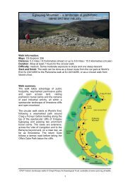
16 <strong>Datganiad</strong> <strong>Cadwraeth</strong> <strong>Clawdd</strong> <strong>Offa</strong><strong>Offa</strong>'s <strong>Dyke</strong> <strong>Conservation</strong> Statement 162.16 Cyd-destun y Dirwedd Mae’r clawdd yn myndtrwy dirwedd amrywiol, gan gynnwys aneddiadaugwasgaredig cefn gwlad Treflach a Threfonen gyda’urhwydweithiau o lonydd, tyddynnod a chaeau, coetiroedd âchymysgedd o gonwydd a choed collddail yn NyffrynCandy, a chlytwaith y porfeydd wedi’u gwella sy’nnodweddiadol o’r ucheldiroedd calchfaen bryniog gerCraignant. Mae’r clawdd yn ffurfio’r ffin cenedlaethol i’r de iFronygarth, ac er nad yw’r dirwedd yma mor drawiadol ar ycyfan â thirwedd Clun neu Sir Faesyfed, mae’r clawdd yn dali fod yn elfen sylfaenol o’r amgylchoedd. Mae’n hawdddeall bod y rhan hon o’r clawdd yn boblogaidd â cherddwyr<strong>Clawdd</strong> <strong>Offa</strong>, er bod y llwybr yn symud i ffwrdd o’rgwrthglawdd o bryd i’w gilydd, yn enwedig ym Mryn Baker.2.16 Landscape Context The dyke passes through a variedlandscape, including the distinctive and dispersed ruralsettlements of Treflach and Trefonen with their networks oflanes and associated smallholdings and fields, the mixedconiferous and deciduous woodlands of the Candy Valley, andthe patchwork of improved pasture characterising the rollinglimestone uplands around Craignant. The dyke forms thenational border south of Bronygarth, and if its landscapesituation is generally less commanding than in Radnorshire orthe Clun area, it is still a fundamental element in thesurrounding environment. This stretch of the dyke isunderstandably popular with <strong>Offa</strong>’s <strong>Dyke</strong> walkers, althoughthe path does sometimes deviate from the earthwork, notablyat Baker’s Hill.Castell y Waun i DreuddynPowys, Wrecsam a Sir Y Fflint2.17 Mae 11.4 km o’r llwybr wedi goroesi. Mae’r clawdd wedigoroesi’n dda drwy dir Castell y Waun, ond yna mae’n dod ynfwy tameidiog wrth iddo ddilyn hynt drwy ardal sydd bellachllawn datblygiadau trefol a diwydiannol yn Rhiwabon,Coedpoeth a Brymbo. Er hynny, mae rhai rhannau trawiadol o’rgwrthglawdd wedi goroesi, yn enwedig ger Plas <strong>Offa</strong> ar bwysCamlas y Shropshire Union ger Afon Dyfrdwy, a’r darn gwych oarglawdd a ffos ar hyd Ffordd Tatham, Rhiwabon. Daw’r clawddi ben i’r gogledd o Lanfynydd, lle mae’n goroesi fel ffos ddofn arfin y dyffryn, gyda’r llethr naturiol yn ffurfio’r clawdd uwchben.2.18 Cyd-destun y Dirwedd Daw pen gogleddol <strong>Clawdd</strong><strong>Offa</strong> drwy dirwedd ar ymylon ardal drefol, gyda chymeriad tragwahanol i’r ardaloedd gwledig eraill y mae’r henebyn ynmynd trwyddynt. Er bod y clawdd sy’n goroesi yn yr ardal honhefyd i’w weld mewn pocedi o dir amaethyddol a choetiroedd(megis tir Castell y Waun y mae Cadw wedi ei gofrestru yn Barca Gardd o Ddiddordeb Hanesyddol Eithriadol), fe’i gwelir hefydar dir ysgolion, ar ymylon ardaloedd fu unwaith ynddiwydiannol, yn rhedeg yn agos at stadau tai, neu, fel ygwelir yn Llanfynydd, dan y ffordd. Mae Llwybr <strong>Clawdd</strong> <strong>Offa</strong>yn gadael y gwrthglawdd ger Plas <strong>Offa</strong>, ond mae’r clawdd ynparhau i fod yn goridor adnabyddadwy mewn tirwedd gyfoes.Mae’n bosibl ei fod yn bwysicach yn y fan hon oherwydd eifod mor agos i ardal lle mae llawer o bobl yn byw.Chirk Castle to TreuddynPowys, Wrexham and Flintshire2.17 11.4 km extant. Well-preserved through the grounds ofChirk Castle, the dyke then becomes more fragmentary as itfollows an alignment through an area now colonised by theurban and industrial expansion of Ruabon, Coedpoeth andBrymbo. Nonetheless, impressive stretches of earthwork doremain, notably at Plas <strong>Offa</strong> adjacent to the Shropshire UnionCanal near the River Dee and the fine length of bank and ditchalong Tatham Road, Ruabon. The dyke terminates north ofLlanfyndd, where it survives as a deep ditch on the valleyedge, with the bank above modified from the natural slope.2.18 Landscape Context The northern end of <strong>Offa</strong>’s <strong>Dyke</strong>mostly occupies an urban fringe landscape rather different incharacter to the rural areas the monument passes throughelsewhere. Although the surviving dyke is even here oftenassociated with pockets of agricultural land and woodland(such as the Cadw registered Chirk Castle Park and Garden ofSpecial Historic Interest) it is also found in school grounds, onthe margins of former industrial areas, running close tohousing estates, or, as at Llanfyndd, under a road. The <strong>Offa</strong>’s<strong>Dyke</strong> Path departs from the earthwork at Plas <strong>Offa</strong>, but thedyke is still a recognisable corridor in the modern landscape,perhaps all the more important exactly because of its proximityto an area where many people live.
17 <strong>Datganiad</strong> <strong>Cadwraeth</strong> <strong>Clawdd</strong> <strong>Offa</strong><strong>Offa</strong>'s <strong>Dyke</strong> <strong>Conservation</strong> Statement 17Hanes <strong>Clawdd</strong> <strong>Offa</strong>3 The history of <strong>Offa</strong>’s <strong>Dyke</strong><strong>Offa</strong> a’r Mers3.1 Prin iawn yw’r deunydd hanesyddol rydym wedi eietifeddu sy’n ymwneud â Mers yr henfyd, ac mae’nnodweddiadol ynddo mai dim ond un cyfeiriad hanesyddolEingl-Sacsonaidd at Glawdd <strong>Offa</strong> sy’n hysbys. Mae’rysgolhaig Cymreig Asser yn crybwyll yn ei ‘Fuchedd Arthur’,ar ddiwedd y 9fed ganrif, ‘There was in Mersia in fairly recenttimes a certain vigorous King called <strong>Offa</strong> who terrified all theneighbouring Kings and provinces around him, and who had agreat dyke built between Britain [h.y. Cymru] and Mercia fromsea to sea’ (Stephenson 1959). Mae’n debygol bod hendraddodiad enw ‘<strong>Clawdd</strong> <strong>Offa</strong>’ ynddo’i hyn yn cadarnhau’rcysylltiad hwn rhwng <strong>Offa</strong> a’r clawdd. Gellir dod o hyd igyfeiriadau at hwn mewn dogfennau — ar ffurf ‘Offerdiche’ —mor bell yn ôl â’r 12fed ganrif (Noble 1983).3.2 Roedd y Mers, sef Canolbarth Lloegr heddiw, yn un onifer o deyrnasoedd ddaeth i’r amlwg yng nghanol / diwedd ymilflwyddiant cyntaf OC, pan roedd rheolaeth wleidyddol yrEingl-Sacson yn raddol ledaenu dros lawer o Brydain fu danreolaeth y Rhufeinwyr cyn hynny. Etifeddodd <strong>Offa</strong> dalaith yMers, oedd eisoes yn bwerus, oddi wrth ei ragflaenydd, yBrenin Aethelbald (716–57). Yn ystod ei deyrnasiad ei hun(757–96) fe sefydlodd <strong>Offa</strong> reolaeth y Mers ar lawer o’r hynsy’n Lloegr heddiw, trwy gyrchoedd milwrol a chynghreiriaugwleidyddol. Mae perthynas <strong>Offa</strong> ag arweinydd FfrancaiddSiarlymaen yn cadarnhau statws <strong>Offa</strong>; Siarlymaen oedd ffigiwrgwleidyddol pwysicaf Gorllewin Ewrop ar ddiwedd yr 8fedganrif. Mewn gohebiaeth sydd wedi goroesi, mae Siarlymaenyn trin <strong>Offa</strong> fel rhywun cydradd, a lluniodd y ddaulywodraethwr gytundebau masnachu nodedig.3.3 Tra bo’r ffynonellau hanesyddol yn anghyflawn, ar ygorau, mae’n glir bod Mers ymledol ac uchelgeisiol <strong>Offa</strong> ynrhyfela’n frwd â’i chymdogion i’r gorllewin (Hill 2000). Roedd ygwrthdaro hwnnw yn cynnwys cyrchoedd milwroluniongyrchol <strong>Offa</strong> yn 778 a 784 i’r hyn sy’n Gymru heddiw, acmae’n debygol bod y Prydeinwyr hefyd yn ymosod i’r unraddfa ar y Mers. Mae arysgrif ar groes ‘Piler Eliseg’ yngNglyn y Groes ger Llangollen yn brolio yn ddisgrifiadol sut ytrosodd Eliseg, rheolwr diweddarach yr 8fed ganrif ar deyrnasPowys, aneddiadau cyfagos Seisnig yn dir cleddyf trwy dân.3.4 Nid datblygiad newydd mo patrwm o’r fath. Mae’nymddangos y bu cymunedau lleol yn adeiladu ac yn defnyddiollawer o systemau cloddiau byr yn y Mers dros ganrifoeddlawer i amddiffyn eu hunain rhag ymosodiadau. Ystyriwyd<strong>Clawdd</strong> Wat, 61 km o hyd yng ngogledd y Mers, yn glawdd aadeiladwyd cyn <strong>Clawdd</strong> <strong>Offa</strong> yn yr 8fed ganrif. Ond ynddiweddar mae profion dyddio radio-carbon yn awgrymudyddiad llawer h~n o’r 5ed/6ed ganrif. O’r herwydd, mae’ndangos hanes hir dramatig y sefyllfa oedd yn wynebu <strong>Offa</strong><strong>Offa</strong> and Mercia3.1 It is symptomatic of the dearth of historical materialwhich has come down to us relating to ancient Mercia thatonly one Anglo-Saxon historical reference to <strong>Offa</strong>’s <strong>Dyke</strong> isknown. The Welsh scholar Asser mentions in his late 9thcentury‘Life of Alfred’ that ‘There was in Mercia in fairlyrecent times a certain vigorous King called <strong>Offa</strong> whoterrified all the neighbouring Kings and provinces aroundhim, and who had a great dyke built between Britain[i.e.Wales] and Mercia from sea to sea’ (Stephenson 1959).The association of the dyke with <strong>Offa</strong> seems to becorroborated by the long-standing tradition of the ‘<strong>Offa</strong>’s<strong>Dyke</strong>’ name itself, which can be documented — in the formof ‘Offediche’ — at least as far back as the 12th century(Noble 1983).3.2 Mercia, centred on what is today the EnglishMidlands, was one of a number of kingdoms which emergedin the mid/later first millennium AD from the gradualextension of Anglo-Saxon political control over much offormer Roman Britain. <strong>Offa</strong> inherited an already powerfulMercian state from his predecessor, King Aethelbald (716–57). In the course of his own reign <strong>Offa</strong> (757–96)established, through military campaigns and politicalalliance, Mercian control over much of what we now callEngland. <strong>Offa</strong>’s status is confirmed by his relationship tothe Frankish leader Charlemagne, who was the mostimportant political figure in late 8th-century WesternEurope; in surviving correspondence, Charlemagne treats<strong>Offa</strong> as an equal, and the two rulers concluded notabletrade agreements.3.3 While the historical sources are at best incomplete, it isclear that <strong>Offa</strong>’s expansionist and ambitious Mercia wasinvolved in significant warfare with its western neighbours(Hill 2000). That conflict included direct military campaigns by<strong>Offa</strong> into what is now Wales in 778 and 784, and it is likely thatthe British also mounted similar large scale attacks againstMercia. An inscription on the ‘Pillar of Eliseg’ cross at ValleCrucis near Llangollen graphically boasts how Eliseg, a later8th-century ruler of the kingdom of Powys, turned areas ofadjacent English settlement ‘into a sword-land by fire’.3.4 Such a pattern was evidently not a new development.The many short dyke systems in the Marches seem to havebeen built and used over many centuries by local communitieslooking to protect themselves against raiding activity. The 61km long Wat’s <strong>Dyke</strong>, located in the northern Marches andlong considered an early 8th-century predecessor to <strong>Offa</strong>’s<strong>Dyke</strong> in that area, has recently produced a much older 5th/6thcenturyradiocarbon date, and as such seems to give adramatic indication of the long history of the situation faced