- Page 1 and 2: International Training Course on
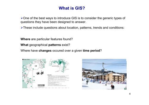
- Page 3: What is GIS?A widely accepted defin
- Page 8 and 9: It is one of the most important ele
- Page 10 and 11: Geographic PositionThe Nature of Ge
- Page 12 and 13: The Nature of Geographic DataSpatia
- Page 14 and 15: Organizing Geographic Data ForAnaly
- Page 16 and 17: The Components of GIS‣All of thes
- Page 18 and 19: The Components of GISMethods includ
- Page 20 and 21: The Components of GISSoftwareAll pa
- Page 22 and 23: Data InputData QualityErrors in the
- Page 24 and 25: Positional AccuracyData Qualityexpe
- Page 26 and 27: SPATIALDATAMODELS26
- Page 28 and 29: GIS Spatial Data ModelsRepresentati
- Page 30 and 31: Raster Data ModelIn the raster data
- Page 32 and 33: Raster Data ModelRaster file can be
- Page 34 and 35: 1. Traditional Raster Encoding34
- Page 36 and 37: 3. Quadtree raster encoding‣provi
- Page 38 and 39: Vector Data ModelIn the vector data
- Page 40 and 41: Vector Data Model‣The data model
- Page 42 and 43: Topological ModelTopological relati
- Page 44 and 45: Topological ModelOther names for No
- Page 46 and 47: Some Basic Topological Relationship
- Page 48 and 49: Triangulated Irregular Network (TIN
- Page 50 and 51: GIS ANALYSIS FUNCTIONS50
- Page 52 and 53: A Classification of GIS Analysis Fu
- Page 54 and 55:
1. Maintenance and analysis of the
- Page 56 and 57:
Edge-matching :Maintenance and anal
- Page 58 and 59:
Maintenance and analysis of the spa
- Page 60 and 61:
Attribute query functions2. Mainten
- Page 62 and 63:
3. Integrated analysis of spatial a
- Page 64 and 65:
3. Integrated analysis of spatial a
- Page 66 and 67:
3. Integrated analysis of spatial a
- Page 68 and 69:
3. Integrated analysis of spatial a
- Page 70 and 71:
3. Integrated analysis of spatial a
- Page 72 and 73:
Logical Operations on Raster: LOGIC
- Page 74 and 75:
Overlay Analysis‣One of the major
- Page 76 and 77:
Vector overlayThe process of subdiv
- Page 78 and 79:
Comparison of Vector and Raster Ove
- Page 80 and 81:
Connectivity (Network) Operations:
- Page 82 and 83:
Connectivity (Network) Operations:P
- Page 84 and 85:
Connectivity (Network) Operations:P
- Page 86 and 87:
Network FunctionsConnectivity (Netw
- Page 88 and 89:
Connectivity (Network) Operations:N
- Page 90 and 91:
The principles of geostatistical an
- Page 92 and 93:
Geostatistical Analyst‣A major ch
- Page 94 and 95:
Calculate the empirical semivariogr
- Page 96 and 97:
Modeling a semivariogram‣spatial
- Page 98 and 99:
Calculate the empirical semivariogr
- Page 100 and 101:
Binning the empirical semivariogram
- Page 102 and 103:
Calculating the empirical semivario
- Page 104 and 105:
Fitting a model‣Now you can plot
- Page 106 and 107:
Different types of semivariogram mo
- Page 108 and 109:
108
- Page 110 and 111:
Creation of g vector for the unmeas
- Page 112 and 113:
Make a prediction‣the weights dec
- Page 114 and 115:
‣The kriging standard error value
- Page 116 and 117:
THANK YOU116
- Page 118 and 119:
118
- Page 120 and 121:
120