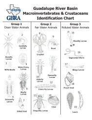
- Page 1 and 2: CALDWELL COUNTY REGIONAL WATERAND W
- Page 4 and 5: C O N S U L T I N G E N G I N E E R
- Page 6 and 7: C O N S U L T I N G E N G I N E E R
- Page 8 and 9: C O N S U L T I N G E N G I N E E R
- Page 10 and 11: C O N S U L T I N G E N G I N E E R
- Page 12 and 13: C O N S U L T I N G E N G I N E E R
- Page 14 and 15: C O N S U L T I N G E N G I N E E R
- Page 16 and 17: flows without impacting environment
- Page 18 and 19: viable for Caldwell County are wate
- Page 20 and 21: parameters and needs. For purposes
- Page 22 and 23: SECTION 1INTRODUCTION1.1 Background
- Page 24 and 25: A Grant Application for a Regional
- Page 26 and 27: 1.4 Participants and SponsorsThe Ca
- Page 28 and 29: SECTION 2CALDWELLL COUNTY CHARACTER
- Page 30 and 31: Construction for segments 5 and 6 o
- Page 32 and 33: Watershed and Peach Creek Watershed
- Page 34 and 35: 2.4 Certificates of Convenience and
- Page 36 and 37: Klotz Associates Project No. 0972.0
- Page 38 and 39: GRAPH 2-1Lockhart, Texas Monthly Av
- Page 40 and 41: Klotz Associates Project No. 0972.0
- Page 42 and 43: Klotz Associates Project No. 0972.0
- Page 44 and 45: water quality in the county. Finall
- Page 46 and 47: SECTION 4GROUNDWATER4.1 Groundwater
- Page 50 and 51: loose sand. The sand tends to be fr
- Page 52 and 53: 4.3 Groundwater Conservation Distri
- Page 54 and 55: Klotz Associates Project No. 0972.0
- Page 56 and 57: support the efforts of PCCD. The di
- Page 58 and 59: SECTION 5SURFACE WATER5.1 GeneralSu
- Page 60 and 61: GRAPH 5-1Caldwell County Total Surf
- Page 62 and 63: GRAPH 5-2TWDB- Caldwell County Hist
- Page 64 and 65: SECTION 6POPULATION6.1 Population P
- Page 66 and 67: GRAPH 6-1TWDB Population Projection
- Page 68 and 69: GRAPH 6-3Texas State Data Center Po
- Page 70 and 71: TABLE 6-2Planning Study Population
- Page 72 and 73: Klotz Associates Project No. 0972.0
- Page 74 and 75: 7.1.2 City of LockhartThe City of L
- Page 76 and 77: Neiderwald. The service area in Cal
- Page 78 and 79: purchase capacity of 6.0 MGD. The a
- Page 80 and 81: Lockhart. The plant is capable of d
- Page 82 and 83: In 1994 GBRA began operating the Ci
- Page 84 and 85: 7.3.5 Sweetwater Utility, LLCSweetw
- Page 86 and 87: TABLE 8-1Caldwell County - TWDB His
- Page 88 and 89: Municipal water demand projections
- Page 90 and 91: applicable. A “P” in the Region
- Page 92 and 93: the modified TSDC Scenario 1.0, sho
- Page 94 and 95: GRAPH 8-3Caldwell County Survey Res
- Page 96 and 97: GRAPH 8-4Caldwell County Yearly Wat
- Page 98 and 99:
espectively from the information pr
- Page 100 and 101:
TABLE 9-6Caldwell County Projected
- Page 102 and 103:
10.3 United States Environmental Pr
- Page 104 and 105:
10.4.3 Source Water ProtectionSourc
- Page 106 and 107:
10.6.1 E.coli PotentialIt is estima
- Page 108 and 109:
TABLE 10-4Estimated Loadings from U
- Page 110 and 111:
Klotz Associates Project No. 0972.0
- Page 112 and 113:
The proposed GBRA Mid-Basin Project
- Page 114 and 115:
11.1.3 Lower Guadalupe Water Supply
- Page 116 and 117:
the maximum available groundwater f
- Page 118 and 119:
An ASR is a viable solution. Ground
- Page 120 and 121:
The water conservation strategy is
- Page 122 and 123:
SECTION 12REGIONAL WATER PLANNING12
- Page 124 and 125:
TABLE 12-2Caldwell County Water Sup
- Page 126 and 127:
Klotz Associates Project No. 0972.0
- Page 128 and 129:
12.3.2 DistributionThe water will b
- Page 130 and 131:
12.4 Water System Cost EstimatesVar
- Page 132 and 133:
300272GRAPH 13-1Caldwell County OSS
- Page 134 and 135:
Klotz Associates Project No. 0972.0
- Page 136 and 137:
2. The Martindale Regional Facility
- Page 138 and 139:
decentralized system providing sewe
- Page 140 and 141:
Unfortunately, the simplicity of O&
- Page 142 and 143:
associated costs. Efficient and fun
- Page 144 and 145:
Klotz Associates Project No. 0972.0
- Page 146 and 147:
14.3 Water Quality Concerns and Sou
- Page 148 and 149:
wastewater plant return flows. The
- Page 150 and 151:
14.6 Recommended Load ReductionsLoa
- Page 152 and 153:
14.7.2 Water Quality Development Or
- Page 154 and 155:
14.8.3 Vegetative Filter StripsVege
- Page 156 and 157:
Use constructed wetlands to capture
- Page 158 and 159:
14.12 Implementation Recommendation
- Page 160 and 161:
Type II reclaimed water is defined
- Page 162 and 163:
Pollutant loading to streams from e
- Page 164 and 165:
Future growth in Caldwell County wi
- Page 166 and 167:
14.12.4 OSSF Annual Inspection and
- Page 168 and 169:
Water Quality Monitoring Program -
- Page 170 and 171:
execute strategies. Local, state, a
- Page 172 and 173:
the environment. Funding for the pr
- Page 174 and 175:
the watershed organizations should
- Page 176 and 177:
water or groundwater to meet future
- Page 178 and 179:
Mid-Basin Project and associated fa
- Page 180:
C O N S U L T I N G E N G I N E E R
- Page 191 and 192:
APPENDIX B
- Page 193 and 194:
APPENDIX B0 / ?% '(0 ;6 ) , 6
- Page 195 and 196:
APPENDIX B ) ) ) B C * (
- Page 197 and 198:
APPENDIX B &# ! % 44' # (0 5#
- Page 199 and 200:
APPENDIX B # %# '(=. )1. )@. )
- Page 201 and 202:
C O N S U L T I N G E N G I N E E R
- Page 203 and 204:
C O N S U L T I N G E N G I N E E R
- Page 205 and 206:
State WellNumber6702902670290567029
- Page 207 and 208:
State WellNumber6703804670380567038
- Page 209 and 210:
State WellNumber6705702670570367058
- Page 211 and 212:
State WellNumber6711701671170267117
- Page 213 and 214:
State WellNumber6712414671241567124
- Page 215 and 216:
State WellNumber6713603671360567136
- Page 217 and 218:
State WellNumber6719606671960767196
- Page 219 and 220:
State WellNumber6720802672110467212
- Page 221 and 222:
APPENDIX EThe tables presented in t
- Page 223 and 224:
APPENDIX EWaterUserGroupTABLE 7PROJ
- Page 225 and 226:
APPENDIX ERules of the Gonzales Cou
- Page 227 and 228:
APPENDIX EAVERAGE QUEEN CITY OR SPA
- Page 229 and 230:
Historical Water Use Summary by Cou
- Page 231 and 232:
Historical Water Use Summary by Gro
- Page 233 and 234:
C O N S U L T I N G E N G I N E E R
- Page 235 and 236:
UseCodePriority DatePriority Month,
- Page 237 and 238:
CountyName1 = Anderson 52 = Crane 1
- Page 239 and 240:
WRNoWRTypeWRSeqAPPENDIX GTCEQ SURFA
- Page 241 and 242:
APPENDIX HWATER CONSERVATION MEASUR
- Page 243 and 244:
APPENDIX HWater Rate StructureAn in
- Page 245 and 246:
APPENDIX HLeak Detection and Repair
- Page 247 and 248:
C O N S U L T I N G E N G I N E E R
- Page 249 and 250:
APPENDIX I• The cities of Kyle, L
- Page 251 and 252:
C O N S U L T I N G E N G I N E E R
- Page 253 and 254:
Management MeasureSeptic System Ins
- Page 255 and 256:
Outreach ActivityAgricultural Progr
- Page 257 and 258:
APPENDIX KWhereas the parties to th
- Page 259:
C O N S U L T I N G E N G I N E E R
- Page 265 and 266:
RESPONSE TO WRITTEN COMMENT BY JOHN
- Page 267 and 268:
APPENDIX MCaldwell County Regional
- Page 269 and 270:
APPENDIX MCaldwell County Regional
- Page 271 and 272:
APPENDIX MCaldwell County Regional
- Page 273 and 274:
APPENDIX MCaldwell County Regional
- Page 275 and 276:
APPENDIX MCaldwell County Regional
- Page 277:
APPENDIX NTEXAS WATER DEVELOPMENT B
- Page 282 and 283:
APPENDIX NKlotz Associates, Inc.Res
- Page 284 and 285:
APPENDIX NKlotz Associates Response
- Page 286:
C O N S U L T I N G E N G I N E E R


