ASAP Weltraumprogramm - Projekte der 5. und 6. Ausschreibung
ASAP Weltraumprogramm - Projekte der 5. und 6. Ausschreibung
ASAP Weltraumprogramm - Projekte der 5. und 6. Ausschreibung

You also want an ePaper? Increase the reach of your titles
YUMPU automatically turns print PDFs into web optimized ePapers that Google loves.
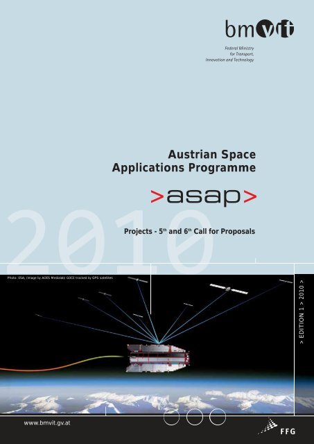
www.bmvit.gv.at<br />
Austrian Space<br />
Applications Programme<br />
010<br />
Projects - 5th and 6th Call for Proposals<br />
Photo: ESA; (Image by AOES Medialab) GOCE tracked by GPS satellites<br />
> EDITION 1 > 2010 >
Photo: ESA; (Image by AOES Medialab) Herschel<br />
2 AUSTRIAN SPACE APPLICATIONS PROGRAMME
Preface<br />
Space technology is regarded as an area of strategic importance<br />
for all industrialised nations. It not only is an important sector of<br />
industry, it also makes major contributions to the promotion of<br />
scientific research and facilitates the accomplishment of the<br />
government’s infrastructure responsibilities in a dynamic knowledge-based<br />
society. Space activities are important for the fields<br />
of mobility and transport, telecommunications, environmental<br />
and climate research, astronomy and Earth sciences.<br />
Space technologies are a worldwide market with dynamic<br />
growth. In or<strong>der</strong> to support Austrian science and industry to<br />
increase their importance in this market the Fe<strong>der</strong>al Ministry for<br />
Transport, Innovation and Technology (bmvit) initiated a national<br />
Space Programme, the Austrian Space Applications Programme<br />
<strong>ASAP</strong>, a bottom-up programme targeted at space science,<br />
technology and applications.<br />
The main objectives of the Austrian space policy are to strengthen<br />
the position of the Austrian Space Cluster on the commercial<br />
market and to support international and bilateral cooperation on<br />
the one hand and, on the other hand, to promote optimal use of<br />
space technologies for commercial products and services and<br />
for space applications and space research.<br />
<strong>ASAP</strong> prepares, supports and complements our participation in<br />
bilateral and international programmes, in particular of ESA and<br />
EU. The national programme enables us to support scientific<br />
participation, build interesting technology niches for Austria and<br />
use the potential of space based applications. These applications<br />
concern the fields of remote sensing, telecommunications and<br />
navigation with increasing importance of the combination of<br />
these service domains. As a general strategy, focus is laid on<br />
applications of space technologies in particular on the promising<br />
fields of Earth observation and satellite navigation.<br />
This 3 rd edition of the publication of successful projects supported<br />
and f<strong>und</strong>ed by the national space programme in 2007 and 2008<br />
shows that the Austrian space community is well prepared for<br />
important coordinating roles within international programmes.<br />
The national projects lead to applied scientific missions or to<br />
technologically interesting components and equipments for<br />
Austria.<br />
To prepare the implementation of GMES in Austria, an “actionline<br />
GMES in Austria” was designed in 2007 and 2008, that<br />
provided additional f<strong>und</strong>s. The new possibility for the community<br />
was presented via a roadshow. It informed the community in the<br />
Austrian space regions. Many new users took advantage of the<br />
special opportunity, which could be shown by the overwhelming<br />
participation in this field and the excellent projects. As one of<br />
the biggest outcomes, a space-SME created a concept for a<br />
nationwide data model for land-use and land-cover (LISA). While<br />
building the concept, the team could find new co-operators and<br />
at the end of the first phase the team, amongst others, included<br />
all nine Austrian fe<strong>der</strong>al states.<br />
Having a look on the results and impact of the programme we<br />
see an increase in the number of participating organisations and<br />
cooperation and also in the variety of new topics which could be<br />
explored. Since 2002 the programme has provided spaceinterested<br />
and creative people and organisations with the<br />
opportunity to let their ideas become great projects. The national<br />
space programme supported a group of young students to<br />
develop, assemble and test the first Austrian nanosatellite<br />
“BRITE/TUGSAT” to train young experts for an entire space<br />
mission.<br />
There is a long list of excellent projects: In this brochure you will<br />
find 72 projects of the national programme f<strong>und</strong>ed in 2007 and<br />
2008. This all is a vivid sign of the broad expertise and the<br />
success of the Austrian space community and of the national<br />
f<strong>und</strong>ing sustainability.<br />
Doris Bures<br />
Fe<strong>der</strong>al Minister<br />
Austrian Fe<strong>der</strong>al Ministry for Transport,<br />
Innovation and Technology<br />
AUSTRIAN SPACE APPLICATIONS PROGRAMME 3
Content<br />
Programme Description . . . . . . . . . . . . . . . . . . . . . . . . . . . .5<br />
Earth Observation . . . . . . . . . . . . . . . . . . . . . . . . . . . . . . . . .6<br />
ACCU-Clouds . . . . . . . . . . . . . . . . . . . . . . . . . . . . . . . . . . . . . .7<br />
AT-X . . . . . . . . . . . . . . . . . . . . . . . . . . . . . . . . . . . . . . . . . . . . .8<br />
e_SPIDER . . . . . . . . . . . . . . . . . . . . . . . . . . . . . . . . . . . . . . . .9<br />
ENVICHANGE . . . . . . . . . . . . . . . . . . . . . . . . . . . . . . . . . . . .10<br />
GEOID+ . . . . . . . . . . . . . . . . . . . . . . . . . . . . . . . . . . . . . . . . .11<br />
GOCOnAUT . . . . . . . . . . . . . . . . . . . . . . . . . . . . . . . . . . . . . .12<br />
ICEAGE . . . . . . . . . . . . . . . . . . . . . . . . . . . . . . . . . . . . . . . . .13<br />
NAVLAS . . . . . . . . . . . . . . . . . . . . . . . . . . . . . . . . . . . . . . . . .14<br />
PAT+3 . . . . . . . . . . . . . . . . . . . . . . . . . . . . . . . . . . . . . . . . . .15<br />
TripleM . . . . . . . . . . . . . . . . . . . . . . . . . . . . . . . . . . . . . . . . . .16<br />
GMES in Austria . . . . . . . . . . . . . . . . . . . . . . . . . . . . . . . . .17<br />
ASaG . . . . . . . . . . . . . . . . . . . . . . . . . . . . . . . . . . . . . . . . . . .18<br />
EO-KDZ . . . . . . . . . . . . . . . . . . . . . . . . . . . . . . . . . . . . . . . . .19<br />
G2real . . . . . . . . . . . . . . . . . . . . . . . . . . . . . . . . . . . . . . . . . .20<br />
GMES and VIENNA . . . . . . . . . . . . . . . . . . . . . . . . . . . . . . . .21<br />
GMSM . . . . . . . . . . . . . . . . . . . . . . . . . . . . . . . . . . . . . . . . . .22<br />
LISA . . . . . . . . . . . . . . . . . . . . . . . . . . . . . . . . . . . . . . . . . . . .24<br />
SAR-X Environ . . . . . . . . . . . . . . . . . . . . . . . . . . . . . . . . . . . .26<br />
Navigation . . . . . . . . . . . . . . . . . . . . . . . . . . . . . . . . . . . . . .27<br />
GNSSMET-AUSTRIA . . . . . . . . . . . . . . . . . . . . . . . . . . . . . . .28<br />
I-Game 2 . . . . . . . . . . . . . . . . . . . . . . . . . . . . . . . . . . . . . . . .29<br />
IMUVar – GRAVIS . . . . . . . . . . . . . . . . . . . . . . . . . . . . . . . . .30<br />
IMUVar – VarIoNav . . . . . . . . . . . . . . . . . . . . . . . . . . . . . . . .31<br />
INSIDE . . . . . . . . . . . . . . . . . . . . . . . . . . . . . . . . . . . . . . . . . .32<br />
MGM - Mobile Geo Memory (Feasibility Study) . . . . . . . . . .33<br />
NAV-CAR Feasibility Study . . . . . . . . . . . . . . . . . . . . . . . . . .34<br />
NAV-CAR 2 . . . . . . . . . . . . . . . . . . . . . . . . . . . . . . . . . . . . . .35<br />
NAVWAT . . . . . . . . . . . . . . . . . . . . . . . . . . . . . . . . . . . . . . . .36<br />
OEGNOS . . . . . . . . . . . . . . . . . . . . . . . . . . . . . . . . . . . . . . . .37<br />
OEGNOS 2 . . . . . . . . . . . . . . . . . . . . . . . . . . . . . . . . . . . . . .38<br />
RA-PPP . . . . . . . . . . . . . . . . . . . . . . . . . . . . . . . . . . . . . . . . .39<br />
SoftGNSS 2 . . . . . . . . . . . . . . . . . . . . . . . . . . . . . . . . . . . . . .40<br />
Outreach . . . . . . . . . . . . . . . . . . . . . . . . . . . . . . . . . . . . . . . .41<br />
Pre-DOMIQASOL . . . . . . . . . . . . . . . . . . . . . . . . . . . . . . . . .42<br />
xgravler . . . . . . . . . . . . . . . . . . . . . . . . . . . . . . . . . . . . . . . . .43<br />
Space Science . . . . . . . . . . . . . . . . . . . . . . . . . . . . . . . . . . .44<br />
BRITE-Austria . . . . . . . . . . . . . . . . . . . . . . . . . . . . . . . . . . . .45<br />
CDSM-FS . . . . . . . . . . . . . . . . . . . . . . . . . . . . . . . . . . . . . . . .46<br />
4 AUSTRIAN SPACE APPLICATIONS PROGRAMME<br />
DFG-MFA . . . . . . . . . . . . . . . . . . . . . . . . . . . . . . . . . . . . . . . .47<br />
DOSIS . . . . . . . . . . . . . . . . . . . . . . . . . . . . . . . . . . . . . . . . . .48<br />
EMA . . . . . . . . . . . . . . . . . . . . . . . . . . . . . . . . . . . . . . . . . . .49<br />
ENZYME-CHIP . . . . . . . . . . . . . . . . . . . . . . . . . . . . . . . . . . . .50<br />
HP3-PP . . . . . . . . . . . . . . . . . . . . . . . . . . . . . . . . . . . . . . . . .51<br />
MATSIM Phase-B . . . . . . . . . . . . . . . . . . . . . . . . . . . . . . . . .52<br />
MDS . . . . . . . . . . . . . . . . . . . . . . . . . . . . . . . . . . . . . . . . . . .53<br />
MERMAG 3 . . . . . . . . . . . . . . . . . . . . . . . . . . . . . . . . . . . . . .54<br />
Metallic Melts 2 . . . . . . . . . . . . . . . . . . . . . . . . . . . . . . . . . . .55<br />
MicroColumbus . . . . . . . . . . . . . . . . . . . . . . . . . . . . . . . . . . .56<br />
ORTHOCAP . . . . . . . . . . . . . . . . . . . . . . . . . . . . . . . . . . . . . .57<br />
PICAM . . . . . . . . . . . . . . . . . . . . . . . . . . . . . . . . . . . . . . . . . .58<br />
SOLDYN . . . . . . . . . . . . . . . . . . . . . . . . . . . . . . . . . . . . . . . .59<br />
TMIS_morph . . . . . . . . . . . . . . . . . . . . . . . . . . . . . . . . . . . . .60<br />
Space Technology . . . . . . . . . . . . . . . . . . . . . . . . . . . . . . . .61<br />
µPPT . . . . . . . . . . . . . . . . . . . . . . . . . . . . . . . . . . . . . . . . . . .62<br />
ACOSTA . . . . . . . . . . . . . . . . . . . . . . . . . . . . . . . . . . . . . . . .63<br />
CAFS . . . . . . . . . . . . . . . . . . . . . . . . . . . . . . . . . . . . . . . . . . .64<br />
COMP-DAMAGE . . . . . . . . . . . . . . . . . . . . . . . . . . . . . . . . . .65<br />
Contamination Traps . . . . . . . . . . . . . . . . . . . . . . . . . . . . . . .66<br />
CORD . . . . . . . . . . . . . . . . . . . . . . . . . . . . . . . . . . . . . . . . . .67<br />
DeGe . . . . . . . . . . . . . . . . . . . . . . . . . . . . . . . . . . . . . . . . . .68<br />
ECCS . . . . . . . . . . . . . . . . . . . . . . . . . . . . . . . . . . . . . . . . . . .69<br />
E-FLEX . . . . . . . . . . . . . . . . . . . . . . . . . . . . . . . . . . . . . . . . . .70<br />
ENART . . . . . . . . . . . . . . . . . . . . . . . . . . . . . . . . . . . . . . . . . .71<br />
FALK . . . . . . . . . . . . . . . . . . . . . . . . . . . . . . . . . . . . . . . . . . .72<br />
KeraSchub . . . . . . . . . . . . . . . . . . . . . . . . . . . . . . . . . . . . . . .73<br />
LaserIgnition . . . . . . . . . . . . . . . . . . . . . . . . . . . . . . . . . . . . .74<br />
MICO . . . . . . . . . . . . . . . . . . . . . . . . . . . . . . . . . . . . . . . . . . .75<br />
NanoMatSpace . . . . . . . . . . . . . . . . . . . . . . . . . . . . . . . . . . .76<br />
ProUST . . . . . . . . . . . . . . . . . . . . . . . . . . . . . . . . . . . . . . . . .77<br />
RF-Suitcase . . . . . . . . . . . . . . . . . . . . . . . . . . . . . . . . . . . . . .78<br />
RPOD . . . . . . . . . . . . . . . . . . . . . . . . . . . . . . . . . . . . . . . . . .79<br />
SMDE . . . . . . . . . . . . . . . . . . . . . . . . . . . . . . . . . . . . . . . . . .80<br />
SVEQ-2 . . . . . . . . . . . . . . . . . . . . . . . . . . . . . . . . . . . . . . . . .81<br />
USI – Phase 2 . . . . . . . . . . . . . . . . . . . . . . . . . . . . . . . . . . . .82<br />
Telecommunications . . . . . . . . . . . . . . . . . . . . . . . . . . . . . .83<br />
QCS . . . . . . . . . . . . . . . . . . . . . . . . . . . . . . . . . . . . . . . . . . . .84<br />
TelcoPTS . . . . . . . . . . . . . . . . . . . . . . . . . . . . . . . . . . . . . . . .85<br />
VSAT . . . . . . . . . . . . . . . . . . . . . . . . . . . . . . . . . . . . . . . . . . .86
Austrian Space Applications Programme<br />
Programme Description<br />
The Austrian Space Applications Programme <strong>ASAP</strong> was initiated<br />
by the Fe<strong>der</strong>al Ministry for Transport, Innovation and Technology<br />
(bmvit) in 2002. It is a bottom-up research f<strong>und</strong>ing programme<br />
targeted at space science, technology and applications. The<br />
programme should enable bilateral cooperation, support scientific<br />
participation in ESA and bilateral projects and complement<br />
development in the application domain. It also aims at promoting<br />
interesting technology niches in Austria. The Austrian Space<br />
Applications Programme addresses Austrian and international<br />
scientists, scientific institutions, industrial enterprises and other<br />
companies, including SMEs located in Austria.<br />
Through <strong>ASAP</strong> Austrian research institutions as well as<br />
commercial enterprises have been supported in their efforts in<br />
conducting space science and exploration projects, and in<br />
developing space technologies, products and services.<br />
The programme elements “Scientific Excellence”, “Economic<br />
Benefits” and “Benefits for Society” are affected by the main<br />
objectives of the Austrian Space Applications Programme:<br />
> Development of scientific instruments for European <strong>und</strong><br />
international space missions<br />
> Building new scientific skills within the scope of space<br />
missions<br />
> Development of innovative technologies, products and<br />
processes<br />
> Diffusion of space technologies in other sectors<br />
> Utilisation of space technology for further applications like<br />
navigation, telecommunication, Earth observation and<br />
integrated applications<br />
> Use the potential of space based applications to contribute<br />
solutions to the great challenges of our future<br />
Furthermore, <strong>ASAP</strong>, Austrian Space Applications Programme, on<br />
the one hand aims at building national and international networks<br />
through multi- and bilateral projects and on the other hand at<br />
increasing user communities of space technology.<br />
AUSTRIAN SPACE APPLICATIONS PROGRAMME 5
Earth Observation<br />
ACCU-Clouds<br />
AT-X<br />
e_SPIDER<br />
ENVICHANGE<br />
GEOID+<br />
GOCOnAUT<br />
ICEAGE<br />
NAVLAS<br />
PAT+3<br />
TripleM<br />
6 AUSTRIAN SPACE APPLICATIONS PROGRAMME
ACCU-Clouds<br />
Preparing a Key Dimension of ACCURATE Climate Utility:<br />
Cloud sensing and Greenhouse Gas Profiling in Cloudy Air<br />
The ACCURATE (Atmospheric Climate and Chemistry in the<br />
UTLS Region and Climate Trends Explorer) satellite mission<br />
enables joint atmospheric profiling of greenhouse gases,<br />
thermodynamic variables, and wind in the upper troposphere<br />
and lower stratosphere (UTLS) and beyond. It achieves this<br />
unprecedented scope by employing inter-satellite signal links<br />
between Low Earth Orbit (LEO) satellites, combining LEO-to-<br />
LEO microwave occultation with LEO-to-LEO infrared-laser<br />
occultation (LIO). This novel concept was conceived at the<br />
WegCenter and proposed by an international team of more than<br />
20 scientific partners from more than 12 countries to an ESA<br />
selection process for future Earth Explorer Missions. While not<br />
selected for formal pre-phase A study in 2006, because it was<br />
partly immature at that time, it received very positive evaluations<br />
and was recommended for further study and development.<br />
On this basis FFG-ALR has f<strong>und</strong>ed pioneering initial projects<br />
un<strong>der</strong> previous <strong>ASAP</strong> calls (ACCURAID, EOPSCLIM) and ESA<br />
supports studies as well. ACCU-Clouds builds on these activities<br />
as an innovative project complementing the ESA studies in the<br />
key dimension of providing cloud sensing and cloudy-air<br />
greenhouse gas profiling capabilities.<br />
Related to this pivotal potential for climate change monitoring<br />
and research, ACCU-Clouds prepares novel scientific algorithms<br />
for retrieving cloud extinction, cloud layering, and cloudy-air<br />
greenhouse gas profiles from LIO data. These algorithms are<br />
seamlessly embedded into WegCenter’s occultation software<br />
system (EGOPS), also used to integrate all ESA study<br />
developments. Furthermore, in or<strong>der</strong> to test the advanced<br />
system, an end-to-end performance analysis is un<strong>der</strong>taken,<br />
which uses the new cloudy-air greenhouse gas profiling capability<br />
to assess its uniqueness for climate science. Results show that<br />
the detection of clouds works in a highly reliable way and<br />
greenhouse gas concentrations are accurately <strong>der</strong>ived in all<br />
conditions not blocked by clouds. Overall ACCU-Clouds<br />
represents a crucial milestone on the way towards realizing an<br />
ACCURATE mission for the benefit of monitoring the changing<br />
atmospheric composition and climate in the 21 st century.<br />
Measurement channels for IR-laser signals in the 2–2.5 micrometer wavelength region.<br />
© WegCenter/UniGraz 2009<br />
Infobox<br />
Project duration:<br />
1 July 2009 – 28 February 2011<br />
Coordinator:<br />
University of Graz<br />
Wegener Center for Climate and Global Change<br />
Prof. Gottfried Kirchengast<br />
Leechgasse 25, 8010 Graz, Austria<br />
gottfried.kirchengast@uni-graz.at<br />
www.wegcenter.at<br />
Partners:<br />
University of Munich<br />
Meteorological Institute<br />
Claudia Emde<br />
Munich, Germany<br />
www.meteo.physik.uni-muenchen.de<br />
University of York (UK)<br />
Department of Chemistry<br />
Prof. Peter Bernath<br />
www.york.ac.uk<br />
University of Arizona<br />
Institute of Atmospheric Physics<br />
Prof. Robert Kursinski<br />
Tucson, AZ, USA<br />
www.atmo.arizona.edu<br />
Conceptual artistic depiction of the ACCURATE occultation measurement concept.<br />
© UniGraz 2002<br />
AUSTRIAN SPACE APPLICATIONS PROGRAMME 7
AT-X<br />
Advanced Tools for TerraSAR-X Applications in GMES<br />
TerraSAR-X data and <strong>der</strong>ived forest products: (a) backscatter; (b) InSAR coherence; (c) canopy height; (d) forest mask (green)<br />
The project AT-X was concerned with the development of<br />
methods for the operational and scientific utilization of data<br />
from TerraSAR-X and other very high resolution spaceborne Xband<br />
SAR sensors. It addresses the applications snow and glacier<br />
monitoring for water management and climate monitoring and<br />
the retrieval of forest parameters. The project work is also<br />
relevant for the exploitation of X-band SAR data of the Italian<br />
COSMO-SkyMed mission and contributes to preparatory<br />
activities for the CoReH2O Ku- and X-band SAR mission presently<br />
in Phase-A study at ESA.<br />
The work at ENVEO deals with the development and testing<br />
of tools of robust and automated procedures for spatially detailed<br />
mapping of the surface motion and deformation of glaciers<br />
using TerraSAR-X data. Concepts and software for SAR image<br />
correlation and SAR interferometry were developed for<br />
generating ice motion maps. The new procedures were validated<br />
with in-situ ice motion measurements by means of GPS at the<br />
Vatnajökull Icecap in Iceland. Ice motion maps retrieved from<br />
TerraSAR-X data stacks were applied to calculate and estimate<br />
the ice export and the mass balance of outlet glaciers at the<br />
Antarctic Peninsula that are presently subject to rapid<br />
downwasting due to global warming.<br />
JR-DIG developed methods for the retrieval of forest parameters<br />
(3D canopy height models, forest segmentation and forest bor<strong>der</strong><br />
line extraction) from TerraSAR-X data by means of multi-image<br />
radargrammetry and segmentation using backscatter, texture<br />
descriptors, canopy height model and interferometric coherence<br />
information. The achieved accuracies observed in two test<br />
sites in Styria outperform state-of-the-art algorithms, while<br />
simultaneously providing improved accuracy of forest bor<strong>der</strong><br />
delineation.<br />
The project results provide an important basis for strengthening<br />
the position of ENVEO and JR-DIG as service provi<strong>der</strong>s and<br />
consultants for utilization of high resolution SAR satellite data.<br />
ENVEO will exploit the developed tools in the Climate Change<br />
Initiative Program of ESA and in the downstream service<br />
”CryoLand - GMES Service Snow and Land Ice”. The CryoLand<br />
project un<strong>der</strong> the lead of ENVEO is presently un<strong>der</strong> negotiation.<br />
8 AUSTRIAN SPACE APPLICATIONS PROGRAMME<br />
Ice velocity field of Sjögren and Boydell glacier, Antarctic Peninsula, <strong>der</strong>ived from TerraSAR-X data<br />
of 2008/10/25 to 2008/11/0<strong>5.</strong> Green lines indicate the ice flux gates of the glaciers.<br />
Infobox<br />
Project duration:<br />
1 June 2008 – 31 March 2010<br />
Coordinator:<br />
ENVEO Environmental Earth Observation IT GmbH<br />
Technikerstraße 21a, 6020 Innsbruck, Austria<br />
T +43 (0)512 507 4830<br />
F +43 (0)512 507 4839<br />
office@enveo.at<br />
www.enveo.at<br />
Partner:<br />
JOANNEUM RESEARCH Forschungsgesellschaft mbH<br />
DIGITAL - Institute for Information and Communication<br />
Technologies (JR-DIG)<br />
Wastiangasse 6, 8010 Graz, Austria<br />
T +43 (0)316 876 1754<br />
F +43 (0)316 876 9 1720<br />
DIGITAL-FER@joanneum.at<br />
www.joanneum.at<br />
JR-DIG will exploit the results within EUROLAND, a subproject<br />
of the GMES GeoLand-2 project, the <strong>ASAP</strong> 6 project TripleM and<br />
various projects dealing with REDD.<br />
This project was carried out in co-operation with the following<br />
international partners:<br />
> INFOTERRA GmbH, Friedrichshafen, Germany<br />
> Microwaves and Radar Institute, DLR, Oberpfaffenhofen,<br />
Germany<br />
> Alfred Wegener Institute for Polar and Marine Research,<br />
Bremerhaven, Germany
e_SPIDER<br />
Conceptualization of a Global Virtual Academy for Space-based Information<br />
for Disaster Management and Emergency Response<br />
e_SPIDER directly supports the initialization of an e-learning<br />
environment for UN-SPIDER by providing a conceptual framework<br />
for a Global Virtual Academy for Space-based Information<br />
for Disaster Management and Emergency Response. It<br />
contributes to the development of an appropriate curriculum in<br />
collaboration with the Regional Centres for Space Science and<br />
Technology Education, affiliated to the United Nations, and other<br />
national and regional centres of excellence to train end-users<br />
and strengthen national institutions. The distant learning initiative<br />
provides an ideal opportunity to link Austrian expertise to<br />
UN-SPIDER and, by this, to a global community.<br />
While the project contributes to the achievement of UN-SPIDER’s<br />
overall objectives, it is specifically advancing the promotion of<br />
e-learning linked to Earth Observation for Disaster Management<br />
and Emergency Response. This should help to (i) extend, support<br />
and strengthen the educational, scientific & technological<br />
backgro<strong>und</strong> of Disaster Management practitioners and their<br />
institutions (ii) initiate inter-regional, multilateral and intercontinental<br />
networks among practitioners, and stimulate flows<br />
of synergies (iii) through above processes, construct, widen and<br />
branch out the paths for mutual exposure to Disaster<br />
Management educational systems.<br />
e_SPIDER provides the following results:<br />
(a) Existing e-learning offers for Earth observation (EO)<br />
applications in disaster risk reduction, and emergency<br />
response are assessed on a global level.<br />
(b) An e-learning concept for UN-SPIDER is developed consi<strong>der</strong>ing<br />
the requirements for an international platform (in terms<br />
of technical performance and content management); the<br />
curriculum responds to the needs of DM practitioners for<br />
continuing education and pays particular attention to the<br />
provision of near-real-time exercises.<br />
(c) A monitoring and evaluation concept is established to<br />
ascertain the quality of learning modules and exchange of<br />
feedback between tutors and participants.<br />
Infobox<br />
Project duration:<br />
1 April 2009 – 28 February 2010<br />
eLearning for practitioners in emergency response and disaster risk reduction e_SPIDER Body of knowledge<br />
Coordinator:<br />
University of Salzburg<br />
Z_GIS Centre for Geoinformatics<br />
Peter Zeil<br />
Schillerstraße 30, 5020 Salzburg, Austria<br />
T +43 (0)662 8044 5210<br />
peter.zeil@sbg.ac.at<br />
http://www.uni-salzburg.at/zgis<br />
Partners:<br />
Paris Lodron Universität Salzburg<br />
Zentrum für Geoinformatik / UNIGIS<br />
Hellbrunnerstraße 34, 5020 Salzburg, Austria<br />
T +43 (0)662 8044 5222<br />
office@unigis.ac.at<br />
www.unigis.ac.at<br />
Zentrale Servicestelle für Flexibles Lernen<br />
<strong>und</strong> Neue Medien<br />
Kapitelgasse 4-6, 5020 Salzburg, Austria<br />
T +43 (0)662 8044<br />
elearn@sbg.ac.at<br />
www.uni-salzburg.at/zfl<br />
AUSTRIAN SPACE APPLICATIONS PROGRAMME 9
ENVICHANGE<br />
4D Information Products for the Monitoring of Environmental Changes<br />
Based on LiDAR- and Satellitedata<br />
The project ENVICHANGE as proposed here intends i) to identify<br />
the possibilities of analysing spatial features for monitoring land<br />
cover and essential infrastructure facilities based on highresolution<br />
satellite and LiDAR data and ii) to implement methods<br />
for its operational generation. The possibility of fully or partially<br />
automated information extraction is evaluated based on user<br />
requirements of corresponding fe<strong>der</strong>al authorities and<br />
infrastructure operators. The essential benefit is consi<strong>der</strong>ed to<br />
be the inclusion of LiDAR <strong>der</strong>ived elevation data, which is a further<br />
and inherent information layer besides conventional analysis<br />
products, which have been mainly evolved from traditional<br />
remote sensing data so far.<br />
The pivotal advantage of the integral, combined interpretation<br />
proposed here is that LiDAR as active remote sensing technology<br />
precludes drawbacks from shadowing and thus, complements<br />
optical satellite data in case of ambiguity. Land cover or<br />
infrastructure which could not be interpreted realiably from<br />
optical satellite data due to topographical shadows can now<br />
clearly be identified and interpreted. The three-dimensional<br />
mapping of rock slopes including <strong>der</strong>ived products like rock fall<br />
endangered zones or exact location of protective structures are<br />
examples for the utilization of data of that kind. The delimitation<br />
of forestal areas (protective forests or forest cultivation) or rock<br />
slopes as well as the correct positioning of protective structures<br />
are in the field of responsibility of the project’s user group (Fe<strong>der</strong>al<br />
State of Vorarlberg, ÖBB Group).<br />
Beneath non recurring analyses the focus is on the multi-temporal<br />
evaluation of data of two kinds, satellite and LiDAR data. The<br />
recurring combination of the data facilitates the recognition of<br />
qualitative as well as quantitative changes. In collaboration with<br />
the project user ‘Land Vorarlberg’ a comprehensively recurring<br />
LiDAR dataset is available, which is consi<strong>der</strong>ed to reveal<br />
qualitative and quantitative testimony on changes in river<br />
sections, which were affected by the 2005 flooding. Further<br />
recurring coverage is to be expected for most parts of Austria<br />
in the near future.<br />
The objective of the project is the evaluation of available satellite<br />
and LiDAR data with respect to the joined interpretation as well<br />
as the development of methods, which ren<strong>der</strong> efficient non<br />
recurring and recurring analysis products.<br />
10 AUSTRIAN SPACE APPLICATIONS PROGRAMME<br />
Infobox<br />
Project duration:<br />
1 March 2009 – 30 November 2010<br />
Coordinator:<br />
University of Innsbruck<br />
Institute of Geography<br />
Innrain 52, 6020 Innsbruck, Austria<br />
T +43 (0)512 507 5401<br />
geographie@uibk.ac.at<br />
www.uibk.ac.at/geographie<br />
Partners:<br />
Laserdata GmbH<br />
www.laserdata.at<br />
GRID-IT GmbH<br />
www.grid-it.at<br />
Innsbruck Tivoli quarter 2006,<br />
ALS altitudes – airplane<br />
Innsbruck Tivoli quarter 2009,<br />
ALS altitudes – helicopter<br />
Innsbruck Tivoli quarter –<br />
urban development<br />
between 2006 and 2009
GEOID+<br />
Improved Austrian Geoid Solution Combining Terrestrial<br />
and Satellite Gravity Data<br />
The main objective of the project GEOID+ is the computation<br />
of an improved geoid model for the Austrian territory, as a<br />
combined solution from terrestrial gravity field data (gravity<br />
anomalies, deflections of the vertical, direct “geoid” observations<br />
being the difference between geometrical heights obtained by<br />
high-precision GPS observations and orthometric heights by<br />
spirit levelling), and satellite-related data from the dedicated<br />
gravity field missions GRACE and GOCE, which shall stabilize<br />
the solution in the long to medium wavelength domain.<br />
Compared to the currently available Austrian geoid model, which<br />
was computed in the frame of the <strong>ASAP</strong> Phase 3 project<br />
“The Austrian Geoid 2007 (GEOnAUT)”, several enhancements<br />
provided new, validated and more accurate terrestrial input data,<br />
the incorporation of a global gravity field model based on GOCE<br />
data, methodological improvements in the computation process,<br />
as well as the opportunity of an independent validation on the<br />
basis of the European geoid model.<br />
The precise knowledge of the geoid, representing a physical<br />
reference surface and reference level for height systems, is<br />
required and applied in civil engineering projects, telecommunication<br />
and telematics applications, as well as numerous<br />
geoscientific applications. The height determination by the<br />
combination of GPS observations and geoid information can<br />
replace the elaborate and expensive work of spirit levelling. Also<br />
the unification and validation of the national levelling network<br />
takes benefit from a high-precision geoid.<br />
Nowadays, the availability of high-accuracy global satellite gravity<br />
models enables to make the local geoid model consistent, also<br />
concerning the absolute level, with a global reference frame.<br />
The availability of high accuracy global gravity data from satellite<br />
missions produced the need to upgrade the formerly used<br />
standard processing strategies. Correspondingly, in the frame<br />
of this project sophisticated and innovative methods of numerical<br />
and computational mathematics shall be investigated and applied<br />
to attain this goal.<br />
Approximation of the<br />
disturbing potential<br />
Austrian geoid<br />
Gravity data input<br />
Infobox<br />
Project duration:<br />
1 May 2009 – 31 October 2010<br />
Coordinator:<br />
Graz University of Technology<br />
Institute of Navigation and Satellite Geodesy<br />
Prof. Norbert Kühtreiber<br />
Steyrergasse 30, 8010 Graz, Austria<br />
T +43 (0)316 873 6352<br />
norbert.kuehtreiber@tugraz.at<br />
Partners:<br />
Graz University of Technology<br />
Institute of Computational Mathematics<br />
Prof. Olaf Steinbach<br />
www.numerik.math.tu-graz.ac.at<br />
Fe<strong>der</strong>al Office of Metrology and Surveying<br />
Norbert Höggerl<br />
www.bev.gv.at<br />
AUSTRIAN SPACE APPLICATIONS PROGRAMME 11
GOCOnAUT<br />
Combined High-resolution Global Gravity Field Model from Satellite Gravity<br />
Missions GOCE, GRACE and CHAMP, Complemented by Terrestrial Gravity,<br />
Altimetry and SLR Data<br />
GOCE in orbit. © ESA – AOES Medialab<br />
The main objective of the project GOCOnAUT is the generation<br />
of high-resolution global gravity field models by combining data<br />
from the satellite gravity missions GOCE, GRACE and CHAMP<br />
with complementary gravity field information represented by<br />
terrestrial and air-borne data, satellite altimetry, and satellite laser<br />
ranging.<br />
These different data types are complementary with respect to<br />
their measurement principle, accuracy, spatial distribution and<br />
resolution, and spectral (error) characteristics. By means of data<br />
combination, benefit can be taken from their individual strengths<br />
and favourable features, and at the same time specific<br />
deficiencies can be reduced, leading finally to global models of<br />
the Earth’s gravity field with high spatial resolution and accuracy.<br />
The models are parameterized in terms of coefficients of a<br />
spherical harmonic expansion including a proper error description<br />
in terms of a variance/covariance matrix. The data combination<br />
of the individual contributions is done on the basis of normal<br />
equations. In the frame of a synthetic test environment different<br />
challenges and issues of data combination are studied by several<br />
numerical simulations. These simulations are to consi<strong>der</strong><br />
theoretical and methodological aspects and to evaluate, e.g., the<br />
effect of potential systematic errors, different reference frames<br />
and standards, optimum weighting techniques, full or block<br />
diagonal normal equation matrices, and regularization issues.<br />
12 AUSTRIAN SPACE APPLICATIONS PROGRAMME<br />
Infobox<br />
Project duration:<br />
1 November 2009 – 31 March 2011<br />
Coordinator:<br />
Graz University of Technology<br />
Institute of Navigation and Satellite Geodesy<br />
Helmut Goiginger<br />
Steyrergasse 30, 8010 Graz, Austria<br />
T +43 (0)316 873 6831<br />
h.goiginger@tugraz.at<br />
www.inas.tugraz.at<br />
Partner:<br />
Austrian Academy of Sciences<br />
Space Research Institute<br />
Department of Satellite Geodesy<br />
Walter Hausleitner<br />
www.iwf.oeaw.ac.at<br />
A high-accuracy and detailed global map of the Earth’s gravity<br />
field is an important product in many branches of Earth system<br />
sciences. In geophysics it is applied to improve the modelling<br />
of the Earth’s interior and geodynamic processes. In combination<br />
with satellite radar altimetry, it improves the accuracy of the<br />
models of global ocean circulation, which is responsible for a<br />
large part of the global heat and energy transport, and thus plays<br />
a crucial role in climate regulation. It also contributes to observing<br />
and un<strong>der</strong>standing sea-level change as a result of melting of ice<br />
sheets associated with a changing climate. Finally, also geodesy<br />
benefits from a unified definition of physical height systems.<br />
Global gravity anomaly map
ICEAGE<br />
Modelling Snow-ice Cover Evolution and Associated Gravitational Effects<br />
with GOCE Constraints<br />
In the frame of global warming, various methods for the<br />
monitoring of glaciers and ice caps are applied. In this context,<br />
the main objective of the project “Modelling snow-ice cover<br />
evolution and associated gravitational effects with GOCE<br />
constraints (ICEAGE)” was to set-up a processing environment<br />
serving to produce a suite of combined cryogravic models of the<br />
Eurasian Arctic Sector. Its snow and ice resources (SIR) were<br />
determined and mapped with respect to their present state on<br />
the one hand and to their fluctuations on the other hand.<br />
This investigation of SIR was performed using terrestrial, spaceborne<br />
interferometric, altimetric, and gravity field data. Special<br />
emphasis was given to estimate the impact and scientific<br />
contribution of ESA’s satellite gravity gradiometry mission GOCE<br />
to regional inland cryospheric studies. By comparing consecutive<br />
geometrical models, changes in the cryosphere and its masses<br />
are detectable. These variations in ice masses can also be seen<br />
in changes of the Earth’s gravity field. Thus, a detailed knowledge<br />
of the gravity field can deliver valuable information of temporal<br />
mass variations in the cryosphere.<br />
In consequence, the Institute of Navigation and Satellite<br />
Geodesy, TU Graz, and the Institute of Digital Image Processing,<br />
Remote Sensing Group, JOANNEUM RESEARCH Forschungsgesellschaft<br />
mbH, investigated cryospheric changes within the<br />
non-homogenous gravity field. To obtain the most accurate<br />
regional gravity field information, gravity gradients observed by<br />
GOCE were used as input data for a least squares collocation<br />
process, resulting in gravity anomalies and geoid heights for the<br />
test region. These computations were compared to local results<br />
of numerical forward modelling, based on a digital terrain model<br />
enhanced by vertical density distribution simulations.<br />
As study areas several large European ice caps situated aro<strong>und</strong><br />
the Barents Sea, namely the main ice sheet in north Novaya<br />
Zemlya, ice domes in north-eastern Svalbard, and ice caps in the<br />
central part of Franz Josef Land have been selected.<br />
In the light of climate research the investigation of the cryosphere<br />
contributes to a better un<strong>der</strong>standing and forecasting of recent<br />
and potential changes of the largest European glaciers, while<br />
the improved knowledge of the geoid provides a solid datum for<br />
glacier remote sensing and mapping in the study regions.<br />
Infobox<br />
Project duration:<br />
1 July 2008 – 30 June 2010<br />
Coordinator:<br />
Graz University of Technology<br />
Institute of Navigation and Satellite Geodesy<br />
2008 – 2009: Prof. Roland Pail<br />
since 2010: Florian Heuberger<br />
Steyrergasse 30, 8010 Graz, Austria<br />
florian.heuberger@tugraz.at<br />
www.inas.tugraz.at/iceage<br />
Partners:<br />
JOANNEUM RESEARCH Forschungsgesellschaft mbH<br />
Institute of Digital Image Processing<br />
Aleksey Sharov<br />
www.joanneum.at/digital<br />
Overview of the study region (source: Marble)<br />
Geoid heights (a) and standard deviations (b)<br />
for the Novaya Zemlya area, <strong>der</strong>ived from<br />
least squares collocation of gravity<br />
anomalies combined with GOCE gradients<br />
(simulated from EGM2008 D/O 50 to 2190,<br />
resp. 250).<br />
AUSTRIAN SPACE APPLICATIONS PROGRAMME 13
NAVLAS<br />
Improved GNSS Positioning Solution via Integration of Information Products<br />
from Laserscanning Data<br />
Sample point with terrestrial surveyed trees 3D point cloud from terrestrial LiDAR data Voxel model from LiDAR data to <strong>der</strong>ive<br />
tree height levels and crown density<br />
The project NAVLAS – Improved GNSS positioning solution via<br />
integration of information products from laserscanning data<br />
aimed to develop digital information layers and software concepts<br />
for signal receivers based on the integrating analysis of GNSSmeasurements<br />
and laserscanning-data. Based on the combined<br />
processing of the datasets in the domain of the raw data and<br />
<strong>der</strong>ived information products correlation parameters will be<br />
extracted. They show the interdependence between vegetation<br />
induced shading effects and positioning signal quality.<br />
Related to LiDAR data specific algorithms were developed to<br />
<strong>der</strong>ive relevant forest parameters for signal blockage. They aimed<br />
at the <strong>der</strong>ivation of information products on the vertical<br />
distribution of intercepted forest surfaces, the vertical canopy<br />
length and other parameters up to a single tree level and to build<br />
the basis for the calculation of a differential forest volume model.<br />
Innovative aspects of the project comprised the adaptation of a<br />
LiDAR processing software to airborne and terrestrial LiDAR data.<br />
Therefore algorithms were developed, which allow the extraction<br />
of forest density and the <strong>der</strong>ivation of further signal blockage<br />
and forestry relevant parameters in a test site close to Feldkirch<br />
in the province of Vorarlberg.<br />
They comprise:<br />
• Vertical distribution of intercepted forest surfaces<br />
• Crown length<br />
• Topography of the forest gro<strong>und</strong><br />
• Forest density<br />
• Tree height<br />
These information layers were used to calculate a differential<br />
forest volume model based on cuboids of a defined size<br />
representing the vegetation density from the gro<strong>und</strong> to the top<br />
of the forest.<br />
14 AUSTRIAN SPACE APPLICATIONS PROGRAMME<br />
The combination of the information products based on LiDAR<br />
data and GNSS measurements lead to a new knowledge base<br />
for the development of GNSS receivers. In particular this<br />
comprised:<br />
• A strategy of precise tuned signal acquisition and signal tracking<br />
ability for GNSS receivers to improve signal maintenance<br />
• An improved relation between position accuracy and signal<br />
availability<br />
With the project NAVLAS a structure and a code independent<br />
model of a receiver software was established. Based on the<br />
integrated usage of information layers from laserscanning data<br />
and GNSS signals this structure can build a programming basis.<br />
Receiver developers can use the model for a software<br />
implementation of a new generation of GNSS receivers.<br />
Infobox<br />
Project duration:<br />
1 July 2008 – 31 March 2009<br />
Coordinator:<br />
Laserdata GmbH<br />
Fre<strong>der</strong>ic Petrini-Monteferri<br />
Technikerstraße 21a, 6020 Innsbruck, Austria<br />
T +43 (0)512 507 4866<br />
office@laserdata.at<br />
www.laserdata.at<br />
Partner:<br />
Geomatica OG<br />
www.geomatica.at
PAT+3<br />
Product Access Technology for Pléiades User Services – Phase 3<br />
Pléiades is a French Earth observation satellite program carried<br />
out in cooperation with Austria, Belgium, Italy, Spain and Sweden.<br />
Pléiades has also the status of a “GMES Contributing Mission”.<br />
Two Pléiades satellites will be launched in 2011 and 2012 and<br />
will offer a spatial resolution at nadir of 0.7 m and a coverage<br />
capacity necessary for fine cartography needs, notably in urban<br />
regions. The Pléiades product list includes Ortho Images and<br />
Ortho Mosaics, which due to their geographic map projections,<br />
can be integrated into Geographic Information Systems (GIS).<br />
PAT+ is an innovative software technology for online data access<br />
to the Pléiades Ortho Products covering large geographical areas<br />
and will be supplied by EOX. A requirements analysis and design<br />
study was carried out in previous project phases jointly with the<br />
designated Pléiades data distributor, the French company Spot<br />
Image. The current status of this development (spring 2010) is<br />
that EOX have completed the detailed design and performed<br />
the operational readiness review jointly with Spot Image. The<br />
available implementation has proven the technical feasibility of<br />
PAT+ and the envisaged online data access functions. EOX plans<br />
to use the PAT+ system for pre-launch operations starting in 3 rd<br />
quarter 2011.<br />
PAT+ is uniquely designed in that it combines features for:<br />
• Ingestion of TerraByte-volume ortho products<br />
• Storage in a so-called Coverage Repository (i.e. generation<br />
and management of PAT products as aggregated geocoded<br />
grid coverages in multi-resolution image pyramids)<br />
• Viewing on the Internet via Web browser providing optimum<br />
user experience<br />
• Direct access delivery of PAT products to dedicated client or<br />
user application software systems; this includes functionality<br />
for back-tracing of product generation history based on meta<br />
data<br />
• Identity-centric user access management for implementation<br />
of data policy<br />
The PAT+ development enables EOX to continue a long-term<br />
international cooperation strategy with the developers of satellite<br />
Earth observation interoperability infrastructure and user service<br />
systems. The perspective of PAT+ fits into the European initiative<br />
for Heterogenous Mission Access and related space<br />
standardization efforts, which will be essential for the success<br />
of GMES.<br />
Infobox<br />
Project duration:<br />
PAT+ Phase 3: 1 July 2008 – 31 December 2009<br />
Coordinator:<br />
EOX IT Services GmbH<br />
Thurngasse 8/4, 1090 Wien, Austria<br />
T: +43 664 6207655<br />
gerhard.triebnig@eox.at<br />
www.eox.at<br />
Partner:<br />
Spot Image, S.A., France<br />
www.spotimage.com<br />
Pléiades Ortho Image product example for GIS<br />
Copyright 2006 - © CNES<br />
Pléiades Ortho Mosaic product example<br />
Copyright 2006 - © CNES<br />
AUSTRIAN SPACE APPLICATIONS PROGRAMME 15
TripleM<br />
Development of Methods for the Retrieval of Hydrology and Agricultural<br />
Parameters from Multi-temporal, Multi-sensoral and Multi-resolution Satellite<br />
Remote Sensing Data<br />
Within this project multi-seasonal, multi-sensor and multiresolution<br />
(TripleM) image data sets are investigated with respect<br />
to their operational and scientific utilization for agricultural and<br />
hydrological applications. The project work is carried out in a joint<br />
cooperation between the Institute for Information and<br />
Communication Technologies of JOANNEUM RESEARCH<br />
Forschungsgesellschaft mbH (JR-DIG) and ENVEO Environmental<br />
Earth Observation IT GmbH. Emphasis of the work of<br />
JR-DIG is devoted to the retrieval of agricultural parameters such<br />
as field bo<strong>und</strong>aries and crop types, while the contribution of<br />
ENVEO refers to snow hydrological parameters.<br />
Information extraction is envisaged by simultaneous utilization<br />
of a broad variety of satellite image data as indicated above. This<br />
is a rather ambitious intention, implying the development of new<br />
and innovative approaches to process and utilize TripleM image<br />
data sets. Thus, the developments take into consi<strong>der</strong>ation the<br />
full range of data acquisition capacities of SAR and optical image<br />
data and their combination with GIS data. In this context the<br />
main emphasis is put onto present and future European SAR<br />
systems as well as optical missions, like the German missions<br />
TerraSAR-X and RapidEye.<br />
The project results cover improved and validated algorithms and<br />
processing lines for:<br />
• Pre-processing of multi-sensor image data, such as matchingbased<br />
co-registration of satellite data from different sensors<br />
• The retrieval of agricultural parameters, like typical field<br />
bo<strong>und</strong>aries and temporal changes of field bo<strong>und</strong>aries<br />
• The retrieval of improved snow extent products for snow<br />
hydrology<br />
• Development of concepts for assimilation of spatially detailed<br />
snow extent products from satellite data and meteorological<br />
data in snow process modelling<br />
• Validating satellite-<strong>der</strong>ived products and testing their<br />
applicability, e.g. for updating existing GIS data<br />
The illustration shows first results of matching-based co-registration of a TripleM data set consisting<br />
of a radar TerraSAR-X Stripmap MGD image (left) and of an optical RapidEye image (right). The given<br />
subscenes have a footprint of 13 x 8 km2 at 5 meters gro<strong>und</strong> sampling distance. The cross-modal<br />
image matching technique developed within the TripleM project works on a regular grid of points<br />
and results in the disparity vectors superimposed on the RapidEye imagery. Using these relative shifts<br />
the RapidEye image can be co-registered to the TerraSAR-X image.<br />
16 AUSTRIAN SPACE APPLICATIONS PROGRAMME<br />
Map of snow extent (red) of Western Austria, <strong>der</strong>ived from ENVISAT ASAR Wide Swath Mode data,<br />
acquired on 9 July 2006, overlaid on SAR amplitude image. Areas with image layover and<br />
foreshortening are shown in yellow.<br />
The achievements of the project will strengthen the activities of<br />
the project partners in GMES, in international programmes (ESA)<br />
and for value adding services and consultancies in remote<br />
sensing. In this respect an advisory/user board is installed for<br />
the project, being constituted by industrial as well as scientific<br />
partners including Infoterra GmbH, RapidEye AG, Verb<strong>und</strong> AHP,<br />
or the Finish Meteorological Institute.<br />
Infobox<br />
Project duration:<br />
1 September 2009 – 28 February 2011<br />
Coordinator:<br />
JOANNEUM RESEARCH Forschungsgesellschaft mbH<br />
DIGITAL - Institute for Information and Communication<br />
Technologies (JR-DIG)<br />
Wastiangasse 6, 8010 Graz, Austria<br />
T +43 (0)316 876 1754<br />
F +43 (0)316 876 9 1720<br />
DIGITAL-FER@joanneum.at<br />
www.joanneum.at<br />
Partners:<br />
ENVEO Environmental Earth Observation IT GmbH<br />
Technikerstraße 21a, 6020 Innsbruck, Austria<br />
T +43 (0)512 507 4830<br />
F +43 (0)512 507 4839<br />
office@enveo.at<br />
www.enveo.at
GMES in Austria<br />
ASaG<br />
EO-KDZ<br />
G2real<br />
GMES and VIENNA<br />
GMSM<br />
LISA<br />
SAR-X Environ<br />
AUSTRIAN SPACE APPLICATIONS PROGRAMME 17
ASaG<br />
Preparation for a GMES Downstream Service for Snow and<br />
Glacier Monitoring in Alpine Regions<br />
The ASaG project is aimed at the implementation of a satellitebased<br />
service for spatially detailed monitoring of snow cover<br />
and glaciers over extended areas. Snow cover and glaciers,<br />
storing large amounts of fresh water, respond sensitively to<br />
climate change. Accurate inventories and monitoring of these<br />
resources is important for water resources management,<br />
hydrology, and climate impact assessment. The service to be<br />
developed in ASaG aims to provide timely and reliable information<br />
on the extent and physical properties of snow cover and glaciers,<br />
as required for operational use, and shall be exploited in the<br />
context of GMES.<br />
The details of the service and products are defined according to<br />
identified user requirements. In the initial phase of the project<br />
software and processing lines for retrieval of snow covered area<br />
from optical and SAR satellite imagery are upgraded in or<strong>der</strong> to<br />
optimally match the user needs. In addition, tools for integrating<br />
these products in hydrological and meteorological models are<br />
being developed. For mountain glaciers a processing line is<br />
implemented for satellite-based products on area, vector outlines<br />
and glacier zones to be used for updating glacier inventories.<br />
The service development builds upon technical know how and<br />
processing tools available at ENVEO, developed in previous<br />
national (<strong>ASAP</strong>) and international (ESA and EC FP6) projects. The<br />
products comply with the European rules for geospatial<br />
information according to the INSPIRE directive in or<strong>der</strong> to ensure<br />
interoperability of the data sets. The project and services utilize<br />
existing space infrastructure, and shall also enable easy transition<br />
to future use of Sentinel satellite data.<br />
In the second project phase snow cover products will be<br />
generated in near real time, to be used for initialization and<br />
validation of hydrological and meteorological models in preoperational<br />
mode. The glacier products will be generated for<br />
major Austrian glacier regions based on new high resolution<br />
optical satellite data, in or<strong>der</strong> to update maps of glacier extent.<br />
The application demonstration is carried out for several public<br />
and private organisations in Austria and Germany.<br />
The project will be exploited by ENVEO within the downstream<br />
service “CryoLand – GMES Service Snow and Land Ice”. The<br />
project un<strong>der</strong> the lead of ENVEO is presently un<strong>der</strong> negotiation<br />
in FP7.<br />
This project was carried out in co-operation with the following<br />
international partners:<br />
• Norwegian Computing Center, Section for Earth Observation,<br />
Oslo, Norway<br />
• Finnish Environment Institute SYKE, Helsinki, Finland<br />
18 AUSTRIAN SPACE APPLICATIONS PROGRAMME<br />
Infobox<br />
Project duration:<br />
1 April 2009 – 31 March 2012<br />
Coordinator:<br />
ENVEO Environmental Earth Observation IT GmbH<br />
Technikerstraße 21a, 6020 Innsbruck, Austria<br />
T +43 (0)512 50748 30<br />
office@enveo.at<br />
www.enveo.at<br />
Map of fractional snow extent (aggregated into 4 classes) <strong>der</strong>ived from Terra MODIS data.<br />
Extent of glaciated areas in Stubaier Alps <strong>der</strong>ived from satellite data: red line - glacier<br />
outline 1985; cyan line - glacier outline 2009; white line - late summer snow line 2009.
EO-KDZ<br />
Implementation of an Earth-Observation Based Regional Crisis Data Center<br />
The dramatic increase of crises caused by natural hazards has<br />
created a strong demand for actual and specific geoinformation<br />
to enable a co-ordinated management of such events.<br />
In the frame of the project “EO-KDZ” (Earth Observation Krisendatenzentrum)<br />
it was intended to conceptually design and<br />
technically implement a regional and Earth observation based<br />
centre for crisis data. This mobile centre is characterised by<br />
several components of geoinformation, which are collected,<br />
analysed and value added near or in the affected areas. The<br />
components comprise Earth observation data from instantly<br />
submitted programming tasks for rapid analysis, mobile mapping<br />
data which are collected in the field for damage assessment as<br />
well as available GIS-data (infrastructure, traffic network, ...).<br />
Concerning the Earth observation and mobile mapping<br />
components a comprehensive analysis regarding their timely<br />
availability and suitability for crisis management, risk assessment<br />
and natural hazard monitoring was performed. The technical<br />
implementation of the centre for crisis data was conducted via<br />
a demonstrator. From the hardware side the centre consists of<br />
several computers and mobile units in form of Personal Digital<br />
Assistants (PDAs), which are made available in case of activation.<br />
The mobile units calculate their position and time by means of<br />
satellite navigation in combination with autonomous sensors.<br />
They are equipped with the relevant and specific image<br />
processing, data management and GIS software. The fieldcollected<br />
data is transmitted to ERDAS TITAN, which serves as<br />
a system for data exchange and communication. Finally, ERDAS<br />
APOLLO, an OGC compliant data management system, is used<br />
to organize the huge amount of data. For demonstration<br />
purposes, data of the flooding in August 2005 in Austria and of<br />
the earthquake in May 2006 in Yogyakarta, Java/Indonesia, was<br />
implemented and analysed. The <strong>der</strong>ived information products<br />
were validated in collaboration with the end user regarding their<br />
effectiveness and accuracy. Further on, compatibility of the<br />
products with international centres for crisis information (e.g. of<br />
the German Remote Sensing Data Centre) was ensured to make<br />
use of data acquired in the frame of the International Charter<br />
“Space and Major Disasters” as well.<br />
Infobox<br />
Project duration:<br />
1 March 2007 – 31 May 2009 (2 phases)<br />
Coordinator:<br />
GRID-IT Gesellschaft für angewandte Geoinformatik mbH<br />
Technikerstraße 21a, 6020 Innsbruck, Austria<br />
T +43 (0)512 5074860<br />
office@grid-it.at<br />
www.grid-it.at<br />
Partners:<br />
alpS – Centre for Natural Hazard and Risk Management<br />
(www.alps-gmbh.com)<br />
Universitätszentrum Rottenmann (www.uzr.at)<br />
University of Innsbruck, Institute of Geography<br />
(www.uibk.ac.at/geographie)<br />
Users:<br />
TIWAG - Tiroler Wasserkraft AG<br />
Tyrolean Regional Hazard Warning Centre<br />
(Landeswarnzentrale Tirol)<br />
Surveying Agency of the State of Vorarlberg<br />
(Landesvermessungsamt Feldkirch)<br />
State Warning, Disaster and Relief Management Centre<br />
Vorarlberg (Landeswarnzentrale Vorarlberg)<br />
United Nations Platform for Space-based Information for<br />
Disaster Management and Emergency Response (UN-<br />
SPIDER)<br />
Water depth at the test location “Kramsach”,<br />
<strong>der</strong>ived via RADAR classification and LIDAR digital<br />
elevation model.<br />
AUSTRIAN SPACE APPLICATIONS PROGRAMME 19
G2real<br />
Galileo-based GMES Real-time Emergency Support Testbed,<br />
Real-time Exercise and Development of Services<br />
The overall aim of G2real is to develop and test new<br />
preoperational GMES services in the field of emergency and<br />
disaster management and rescue operations by integrating<br />
software and hardware solutions developed by 11 partners in<br />
three countries (AUT, GER, ES) and by testing and utilising the<br />
possibilities of Galileo navigation.<br />
Real-time emergency-response support<br />
Key requirements for real-time decision support in disaster<br />
management are high quality, accuracy and especially topicality<br />
of the un<strong>der</strong>lying information layers. While the accuracy and<br />
completeness of base data have been quality criteria in traditional<br />
GIS applications for many years, the topicality parameter has<br />
only very recently received attention through the rapid<br />
emergences of a variety of real-time data sources (e.g. sensor<br />
networks, georeferenced cameras, RFID-based systems etc.)<br />
enabling situational awareness in real-time.<br />
However, heterogeneity in sensor network systems and<br />
proprietary system design mostly limit interoperability and<br />
flexibility, and thus hardly support the creation of transnational<br />
Common Operational Picture (COP) involving multiple data<br />
sources provided by a variety of authorities from different<br />
organizations and countries.<br />
G2real focuses on the integration of real-time Earth observation<br />
data and in-situ (terrestrial) sensor measurements leveraging<br />
existing and emerging Open-Geospatial-Consortium (OGC)<br />
standards to support first respon<strong>der</strong>s in the disaster mitigation<br />
and response phase. At present most technical emergency<br />
solutions lack integration capabilities due to the broad usage of<br />
proprietary and closed system solutions. Thus the project<br />
consortium is chaining existing software components and<br />
technologies (developed in various projects like RTGA, GENESIS,<br />
LIMES etc.) creating a real-time emergency-response thematic<br />
service bus interconnecting EO and location enabled real-time<br />
in-situ sensor measurements utilizing OGC and ISO standards<br />
for supporting first respon<strong>der</strong>s.<br />
Galileo field exercises<br />
Additionally, the challenges and advantages using new Galileo<br />
positioning technology have been assessed in a Galileo field test<br />
in the Berchtesgaden GATE-test bed region. The integration of<br />
standardized real-time radiation measurements (based on OGC<br />
Sensor Web Enablement) have been performed in a field test in<br />
Seibersdorf, Lower Austria. The results of these field tests are<br />
now combined, validated and reviewed concerning market and<br />
application potential and provide base information for the G2real<br />
simulation components.<br />
20 AUSTRIAN SPACE APPLICATIONS PROGRAMME<br />
Infobox<br />
Project duration:<br />
1 November 2009 – 1 January 2011<br />
Coordinator:<br />
Research Studios Austria<br />
Forschungsgesellschaft mbH<br />
Manfred Mittlboeck<br />
Leopoldskronstraße 30, 5020 Salzburg, Austria<br />
T +43 (0)662 834602 - 222<br />
manfred.mittlboeck@researchstudio.at<br />
ispace.researchstudio.at<br />
Partners:<br />
Z_GIS, University of Salzburg, Prof. Josef Strobl<br />
www.zgis.at<br />
Creative BITS group, Markus Roth<br />
www.creativebits.com<br />
Ziehesberger Elektronik, Peter Ziehesberger<br />
www.ziehesberger.at<br />
Seibersdorf Labor GmbH, Thales Schroettner<br />
www.seibersdorf-laboratories.at<br />
eoVision GmbH, Markus Eisl<br />
www.eovision.at<br />
G2real concept<br />
G2real workflow
GMES and VIENNA<br />
City of VIENNA – a “GMES-USER” and/or “GMES-PROVIDER”?<br />
Recreation and mo<strong>der</strong>n city development. © TINA VIENNA<br />
The project analysed to what degree individual municipal<br />
departments could take the role of a “GMES-USER” or a “GMES-<br />
PROVIDER” and how such a role could efficiently support them<br />
in fulfilling their tasks. This was an explorative un<strong>der</strong>taking,<br />
focussing on the GMES Domain Land. It included information<br />
gathering, joint learning, technical analyses and a systematic<br />
screening of municipal tasks.<br />
The City of Vienna fosters innovation by following<br />
a systematic approach<br />
In or<strong>der</strong> to foster innovation it is important to identify the potential<br />
of new technologies as early as possible and to follow a<br />
systematic approach. Therefore a systematic check of possible<br />
uses of GMES products and also of costs and efforts of such<br />
applications has to be consi<strong>der</strong>ed.<br />
The objective of the project “GMES and Vienna” was to identify<br />
potential applications of GMES in all areas of the city<br />
administration.<br />
The objectives of the project were:<br />
• To raise the level of awareness for potential applications of<br />
GMES<br />
• To identify tasks where GMES products could possibly be of<br />
use and to deliver a differentiated evaluation concerning<br />
potential applications of GMES<br />
• To specify which steps should be taken next<br />
More than 10 different departments out of the following areas<br />
were integrated into this project:<br />
• Emergency / Security<br />
• Statistics (“socioeconomic data”)<br />
• Information technology (Geographic Information System)<br />
• City planning<br />
• Environment (protected areas, waste deposit monitoring,<br />
green areas)<br />
• Climate and energy (emissions, renewable energy, energy<br />
efficiency)<br />
• EU-Strategy (EU-Commission: strategy for the Danube Region)<br />
Infobox<br />
Project duration:<br />
1 February 2009 – 31 May 2010<br />
Coordinator:<br />
Department for EU-Strategy and Economic Development<br />
Christian Wurm<br />
Schlesingerplatz 2, 1082 Vienna, Austria<br />
T +43 (0)1 4000 27021<br />
F +43 (0)1 4000 99 27021<br />
Christian.Wurm@wien.gv.at<br />
www.wien.gv.at/wirtschaft/eu-strategie<br />
Partner:<br />
Wienstrom GmbH<br />
Mariannengasse 4-6, 1095 Vienna, Austria<br />
www.wienenergie.at<br />
Subcontracts with:<br />
EOX IT Services GbmH<br />
Thurngasse 8/4, 1190 Vienna, Austria<br />
www.eox.at<br />
Technopolis Forschungs- <strong>und</strong> BeratungsgesmbH<br />
Rudolfsplatz 12/11, 1010 Vienna, Austria<br />
www.technopolis-group.com<br />
• Infrastructure (power plants, grid infrastructure, energy<br />
provision)<br />
• Surveying and Mapping<br />
Results<br />
Results of the project “GMES and Vienna” are the following:<br />
• The expectation was fulfilled that GMES products can be<br />
applied in a number of areas.<br />
• At the same time the use of applications has still to be defined<br />
more explicitly and clearly. Once the use of an application is<br />
transparent, the necessary f<strong>und</strong>ings have to be calculated.<br />
• All departments involved are now well aware of the content<br />
and scope of GMES.<br />
Further activities cover a broad range from “observing<br />
developments in the GMES world” up to “preparations of<br />
potential pilot projects” for example in the area of forestry or air<br />
quality forecast.<br />
AUSTRIAN SPACE APPLICATIONS PROGRAMME 21
GMSM<br />
Global Monitoring of Soil Moisture for Water Hazards Assessment<br />
Soil moisture – the water stored in soil within reach of the plants<br />
– is a crucial parameter for a large number of applications. Nearreal-time<br />
soil moisture information is, amongst others, important<br />
for weather forecasting, flood and drought monitoring, and civil<br />
protection. Long-term soil moisture time series are important<br />
for improving our un<strong>der</strong>standing of impacts of global warming<br />
on water resources, carbon balance, ecology and epidemiology.<br />
The overall goal of the GMSM project is to advance the use of<br />
soil moisture services based on METOP ASCAT and<br />
complementary satellite systems, most importantly SMOS and<br />
ENVISAT ASAR, by extending existing products developed at<br />
I.P.F. TU Vienna to Africa and Australia, for which extensive<br />
calibration and validation activities will be carried out and novel<br />
water hazards applications will be developed by the project<br />
consortium.<br />
Browser based soil moisture product visualizer available at http://www.ipf.tuwien.ac.at/radar/dv/ascat.<br />
Water hazards, as un<strong>der</strong>stood here, arise due to the excess or<br />
lack of water and harm society in multiple ways. Excessive<br />
rainfall and/or rapid snowmelt may quickly saturate the soil in a<br />
catchment area, leading to water logging, surface runoff and<br />
flooding. If sustained for longer periods, water excess may affect<br />
plant growth and lead to the proliferation of water-borne diseases.<br />
A prolonged lack of rainfall depletes the soil water reservoir<br />
leading to drought conditions which may affect the productivity<br />
of agricultural areas and natural ecosystems, limit the availability<br />
of fresh water for humans and industry, and increase the risk of<br />
fires. Multi-year droughts may lead to land degradation and<br />
desertification.<br />
To promote the use of the remotely sensed soil moisture products and to gain attention among potential users, a data visualizer run in an internet browser was<br />
implemented. This data viewer gives the possibility to map different soil moisture products, namely surface soil moisture (SSM), or soil water index (SWI), as<br />
an indicator of the profile soil moisture and their anomalies, at different zoom levels. The basis for this visualizer is based upon the freely available web service<br />
"Google Maps". This provides the possibility to explore spatial patterns and compare them to map data and optical satellite data.<br />
22 AUSTRIAN SPACE APPLICATIONS PROGRAMME
Within the GMSM project the following application-oriented<br />
topics will be addressed:<br />
• Assimilation of ASCAT soil moisture data in a regional<br />
numerical weather prediction (NWP) model<br />
• Improve regional scale crop growth and yield monitoring<br />
methods<br />
• Improve hydrologic model predictions<br />
• Modelling the dynamics of mosquito-borne infectious diseases<br />
• Validate the land surface module of regional climate models<br />
• Improve methods for desertification monitoring<br />
• Integration with population data for improved determination<br />
of societal risks<br />
The project complements existing European GMES-related<br />
programmes, most importantly EUMETSAT’s Product Processing<br />
Facility, the Hydrology SAF, the GMES project GEOLAND II, and<br />
ESA TIGER Activities.<br />
Soil moisture will be integrated with population data for societal risk assessment<br />
Water hazard assessment consists of the determination and monitoring of certain environmental<br />
conditions and is also strongly related to impacts on population, infrastructure and activities. Human<br />
exposure to hazards is a key factor for turning mere natural events to natural disasters.<br />
Various population data sets based on different distribution modelling concepts are hence used to<br />
determine vulnerable areas and are spatially correlated with physical parameters such as land cover<br />
and particularly soil moisture information (i.e. hazard probability analysis) for general risk assessment.<br />
Investigations will be carried out to evaluate potential implementations of early warning concepts<br />
driven by soil moisture information.<br />
Infobox<br />
Project duration:<br />
1 April 2009 – 31 December 2010 (Phase 1)<br />
Coordinator:<br />
Vienna University of Technology<br />
Institute of Photogrammetry and Remote Sensing<br />
Prof. Wolfgang Wagner<br />
Gusshausstraße 27-29, 1040 Vienna, Austria<br />
T +43 (0)1 58801 12225<br />
F +43 (0)1 58801 12299<br />
ww@ipf.tuwien.ac.at, www.ipf.tuwien.ac.at<br />
Partners:<br />
Vienna University of Technology<br />
Institute of Hydraulic and Water Resources Engineering<br />
(I.W.I.), Prof. Günter Blöschl<br />
www.hydro.tuwien.ac.at<br />
Central Institute for Meteorology and Geodynamics (ZAMG)<br />
Department of Remote Sensing, Numerical Weather<br />
Prediction Department, Alexan<strong>der</strong> Jann<br />
www.zamg.ac.at<br />
University of Natural Resources and Applied Life Sciences<br />
Institute of Meteorology, Prof. Joseph Eitzinger<br />
www.wau.boku.ac.at/met.html<br />
University of Veterinary Medicine<br />
Biometeorology and Mathematical Epidemiology Group<br />
Prof. Franz Rubel<br />
www.vu-wien.ac.at/oeffentliches-veterinaerwesen<br />
AIT Austrian Institute of Technology GmbH<br />
Division of Systems Research, Klaus Steinnocher<br />
www.ait.ac.at<br />
GeoVille Information Systems Group GmbH<br />
Christian Hoffmann<br />
www.geoville.com<br />
Paris Lodron University Salzburg<br />
Centre for Geoinformatics, Peter Zeil<br />
www.zgis.at<br />
AUSTRIAN SPACE APPLICATIONS PROGRAMME 23
LISA<br />
Land Information System Austria<br />
LISA – Land Information System Austria. © GeoVille<br />
Europe in general and Austria in particular can rely on a long<br />
experience of successful activities on land cover and land use<br />
monitoring. However, these datasets were produced with<br />
different standards, lack comparability and are in most cases<br />
outdated. The new European directives and national legislation<br />
demand up-to-date, more detailed, harmonised information on<br />
regional and local level, in or<strong>der</strong> to fulfil the required reporting<br />
obligations.<br />
Therefore, the availability of a homogenous land cover and land<br />
use (LC/LU) dataset is an indispensable public necessity, needed<br />
for political decisions, effective administration, successful<br />
corporate governance and personal usage of the citizens. In<br />
particular such geo-information is required by departments of<br />
public administration at state and fe<strong>der</strong>al level for the interests<br />
of regional planning, forestry and agriculture, water management,<br />
natural hazard management, environmental and nature<br />
conservation for the periodic monitoring of changes. Detailed<br />
data on land cover are also required in the private sector such<br />
as site planning and geomarketing to name but a few. The land<br />
cover data currently available do no longer meet these<br />
requirements either because of their low resolution or because<br />
of their heterogeneous topicality.<br />
In or<strong>der</strong> to overcome the shortcomings of the existing LC/ LU<br />
data sets for regional, national as well as European management<br />
and reporting requirements, the project Land Information System<br />
Austria (LISA) was initiated.<br />
The objective of LISA is to achieve a consensus on a new Austrian<br />
land cover data base and demonstrate its benefits offering<br />
improved spatial and thematic content. A first prototype, which<br />
was specified by the users consisting of relevant experts from<br />
all regional governments as well as from fe<strong>der</strong>al authorities and<br />
institutions, was already put into effect for a large number of<br />
testsites in Austria. Based on the scientifically validated results<br />
of the prototype the users adapted the specifications to achieve<br />
a technologically and economically feasible datamodel for<br />
national rollout.<br />
24 AUSTRIAN SPACE APPLICATIONS PROGRAMME<br />
LISA is designed to serve common land monitoring needs<br />
providing information on the status quo and the changes<br />
occurring in Austria’s landscape. Thereby LISA will enable a wide<br />
range of downstream sectoral applications for various user<br />
groups (LISA = multi-purpose/multi-usage).<br />
The goal of LISA is to apply cutting edge science, innovative<br />
technology and provide cost efficiency by combining satellite<br />
with high resolution in-situ data, to achieve economics of scale<br />
and sustainability of f<strong>und</strong>ing through a shared effort across<br />
different administration units.<br />
LISA is conceived to build upon the preferred access of Austria<br />
to Pleiades satellite data as well as existing data in user<br />
organisations, such as orthophotos and airborne laser scanner<br />
data. A successor project un<strong>der</strong> <strong>ASAP</strong> 7, namely LISA II, will<br />
complete the monitoring aspect and develop specialized<br />
downstream applications.<br />
For more information on the status of the Land Information<br />
System Austria please refer to www.landinformationsystem.at.<br />
LISA datamodel. © GeoVille
LISA land cover (top) and landuse (bottom) prototype. © GeoVille<br />
LISA Geoportal. © GeoVille<br />
Orthophotos<br />
(Geometry)<br />
Satellite Data<br />
(Thematics)<br />
Production of LISA land cover (right) from earth observation data<br />
LISA<br />
Land Cover<br />
Infobox<br />
1 May 2009 – 31 October 2010 for Phase 1<br />
Coordinator:<br />
GeoVille Information Systems Group GmbH<br />
Andreas Walli, Jürgen Weichselbaum<br />
Sparkassenplatz 2, 6020 Innsbruck, Austria<br />
T +43 (0)512 562021 - 0<br />
F +43 (0)512 562021 - 22<br />
walli@geoville.com<br />
www.geoville.com<br />
Partners:<br />
AIT Austrian Institute of Technology GmbH<br />
Klaus Steinnocher<br />
www.ait.ac.at<br />
Vienna University of Technology<br />
Institute of Photogrammetry and Remote Sensing<br />
Prof. Wolfgang Wagner, Markus Hollaus<br />
www.ipf.tuwien.ac.at/welcome.html<br />
JOANNEUM RESEARCH Forschungsgesellschaft mbH<br />
Prof. Matthias Schardt, Heinz Gallaun<br />
www.joanneum.at<br />
Graz University of Technology<br />
Institute of Remote Sensing and Photogrammetry<br />
Johannes Scholz<br />
www.geoimaging.tugraz.at<br />
BOKU -University of Natural Resources and Applied Life<br />
Sciences of Vienna<br />
Prof. Reinfried Mansberger<br />
www.boku.ac.at<br />
Umweltb<strong>und</strong>esamt – Environment Agency Austria<br />
Gebhard Banko<br />
www.umweltb<strong>und</strong>esamt.at<br />
EOX GmbH<br />
Gerhard Triebnig<br />
www.eox.at<br />
AUSTRIAN SPACE APPLICATIONS PROGRAMME 25
SAR-X Environ<br />
Environmental Mapping Applications Using TerraSAR-X<br />
Aerial imagery (left), TerraSAR-X Spotlight data (second left), Digital surface model (second right)<br />
and automatically generated SAR-X Environ forest species map layer (right).<br />
© TU Vienna, GeoVille<br />
Remote sensing has become an operational tool in many areas<br />
for environmental mapping applications. Main focus so far has<br />
been on the use of optical sensors having a strong drawback<br />
due to their dependency on cloud coverage. With upcoming<br />
commercial radar sensors, research activities revealed a strong<br />
potential of radar data for environmental mapping activities.<br />
Nevertheless, their use has been restricted due to low resolution.<br />
With the launch of TerraSAR-X in 2007, new SAR data have<br />
become available, offering high resolution (up to 1 m) and fully<br />
polarimetric data for sophisticated mapping applications.<br />
Nevertheless, little is yet known about the information content<br />
and application potential in environmental land applications.<br />
Therefore, the goals of this project were<br />
• The improvement of existing X-band scattering models and<br />
• The development of environmental mapping applications for<br />
TerraSAR X data in Austria and in potential export markets<br />
Development was performed in co-operation with stakehol<strong>der</strong>s<br />
on the user side, comprising the Fe<strong>der</strong>al Research and Training<br />
Centre for Forests, Natural Hazards and Landscape (BFW) in<br />
Austria and the Central American Commission for Environment<br />
and Development (CCAD) in El Salvador. Experience in research<br />
and space science, applied research as well as commercial<br />
implementation and application development are the<br />
complementary SAR-X Environ project partner assets.<br />
The results of SAR-X Environ comprised assessments of the<br />
functional interdependence between surface parameters like<br />
surface/terrain roughness and volume scattering of different<br />
vegetation types and TerraSAR-X backscattering information.<br />
The project aimed to develop new forest classification<br />
approaches with respect to extent, tree species and structural<br />
forest parameters using a combination of TerraSAR-X data<br />
together with optical EO data (satellite data and orthophotos)<br />
and ALS <strong>der</strong>ived surface and terrain roughness layers. In addition,<br />
a land cover change mapping (1999-2008) in Honduras with<br />
specific focus on deforestation/afforestation and forest degradation<br />
was performed. In the course of this work a state-of-the-art forest<br />
module allowing interoperability with several GI processing<br />
environments, was developed for increasing processing efficiency.<br />
26 AUSTRIAN SPACE APPLICATIONS PROGRAMME<br />
Infobox<br />
Project duration:<br />
1 January 2008 – 1 June 2009<br />
Coordinator:<br />
GeoVille Information Systems Group GmbH<br />
Jürgen Weichselbaum<br />
Sparkassenplatz 2, 6020 Innsbruck, Austria<br />
T +43 (0)512 562021 – 0<br />
F +43 (0)512 562021 - 22<br />
hoffmann@geoville.com<br />
www.geoville.com<br />
Partners:<br />
AIT Austrian Institute of Technology GmbH<br />
Klaus Steinnocher<br />
www.ait.ac.at<br />
Vienna University of Technology<br />
Institute of Photogrammetry and Remote Sensing<br />
Prof. Wolfgang Wagner, Markus Hollaus<br />
www.ipf.tuwien.ac.at/welcome.html<br />
Second, a methodology for the <strong>der</strong>ivation of a terrain roughness<br />
map was developed and tested within the specified test areas<br />
in Austria. Results of the roughness classification were<br />
crossvalidated with the Fe<strong>der</strong>al Research and Training Centre<br />
for Forests, Natural Hazards and Landscape (BFW). A high level<br />
of thematic accuracy and a high service level prospect for use<br />
in different application domains were achieved.<br />
Finally, the methodologies for the <strong>der</strong>ivation of forest extent,<br />
forest type and forest parameter maps generated with SAR and<br />
optical data and applied in test areas in Austria and Middle<br />
America proved to be highly automated and transferrable to<br />
other areas. In the test site Yoro/Honduras it revealed that forest<br />
cover change rates exhibit a significant dependence on the<br />
management type and this could subsequently be demonstrated<br />
in a large area roll-out financed by the World Bank.<br />
Automatically generated SAR-X Environ forest species map layer for “Bucklige Welt”, Lower Austria.<br />
© TU Vienna, GeoVille
Navigation<br />
GNSSMET-AUSTRIA<br />
I-Game 2<br />
IMUVar – GRAVIS<br />
IMUVar – VarIoNav<br />
INSIDE<br />
MGM – Mobile Geo Memory (Feasibility Study)<br />
NAV-CAR Feasibility Study<br />
NAV-CAR2<br />
NAVWAT<br />
OEGNOS<br />
OEGNOS 2<br />
RA-PPP<br />
SoftGNSS 2<br />
AUSTRIAN SPACE APPLICATIONS PROGRAMME 27
GNSSMET-AUSTRIA<br />
GNSS based determination of atmospheric humidity changes and their<br />
assimilation into operational weather forecast systems<br />
The distribution of Water Vapour within the lower atmosphere<br />
is a determining factor of the weather conditions and therefore<br />
plays an essential role within short-term forecast models but<br />
also for long term climate studies. Unfortunately, this distribution<br />
is usually not very well known or un<strong>der</strong>stood with acceptable<br />
high temporal and spatial resolution.<br />
The microwave signals of the GNSS satellites (GPS, GLONASS<br />
and in future GALILEO) are time delayed when passing the<br />
atmosphere. Therefore the tropospheric delay (as part of the<br />
atmospheric delay) and subsequently the humidity distribution<br />
within the troposphere can be estimated from the microwave<br />
observations. The tropospheric delay is usually comprised of a<br />
well un<strong>der</strong>stood hydrostatic component and of the rapidly time<br />
varying wet component. The remaining wet component can be<br />
assimilated in numerical weather models. It has been proved<br />
that e.g. passing weather fronts can better be analysed by<br />
introduced GNSS <strong>der</strong>ived tropospheric wet delays because this<br />
data is influenced by changes in humidity in the free atmosphere,<br />
whereas the data at the meteorological gro<strong>und</strong> stations reacts<br />
to these changes only with a time delay. This allows to forecast<br />
heavy rainfall causing potentially local floodings more reliably and<br />
to narrow down the affected region. To contribute efficiently to<br />
weather forecast the water vapour content has to be known<br />
within a delay of less than one hour. This demand is hard to fulfil<br />
because of data transfer delays and consi<strong>der</strong>able processing<br />
times due to the huge amount of GNSS observation data.<br />
In the framework of project GNSSMET AUSTRIA the wet part<br />
of the tropospheric delay is estimated with a temporal resolution<br />
of one hour and an accuracy of better than +/- 1mm PW based<br />
on observations of a GNSS reference network covering more<br />
than 30 stations distributed over the whole Austrian territory.<br />
These values are assimilated within the ALADIN-Austria model<br />
operated at the Central Institute for Meteorology and<br />
Geodynamics (ZAMG). New modelling schemes to <strong>der</strong>ive the<br />
signal delay are examined. This concerns the <strong>der</strong>ivation of wet<br />
delays by means of a mixed network and PPP (Precise Point<br />
Positioning) approach as well as the implementation of new<br />
mapping functions like the GMF. Last but not least the direct<br />
signal delay along the ray path shall be used to establish a 3Dmodel<br />
of refractivity (GNSS tomography).<br />
3DVAR/Aladin assimilation cycle<br />
28 AUSTRIAN SPACE APPLICATIONS PROGRAMME<br />
Infobox<br />
Project duration:<br />
1 June 2009 – 31 October 2010<br />
Coordinator:<br />
Vienna University of Technology<br />
Institute of Geodesy and Geophysics<br />
Prof. Robert Weber<br />
T +43 (0)1 58801 12865<br />
Robert.weber@tuwien.ac.at<br />
mars.hg.tuwien.ac.at<br />
Partners:<br />
Central Institute for Meteorology and Geodynamics<br />
Yong Wang<br />
www.zamg.ac.at<br />
Wienstrom GmbH<br />
Christian Klug<br />
www.wienstrom.at<br />
KELAG-Kärntner Elektrizitäts-Aktiengesellschaft<br />
Harald Felsberger<br />
www.kelag.at<br />
GNSS stations network
I-Game 2<br />
Development of an Integrated Telemetry System for Game Management in<br />
Matters of Traffic Security, Protection Forest and Private Forest Based on<br />
Navigation, Communication, Remote Sensing and GIS Methods – Phase 2<br />
Current wildlife telemetry systems by means of bearing<br />
transmitters have the disadvantage to disturb the animal’s<br />
behaviour and to be time-consuming. Newly developed systems<br />
based on GPS and GSM technology actually have a relatively<br />
low data rate due to a restricted energy supply. Therefore, a<br />
telemetry system based on GPS and GSM technology has been<br />
developed which allows a generally higher data rate due to<br />
additional energy generation on the animal. Furthermore, it<br />
enables the flexible adjustment of the data rate to external<br />
conditions such as weather and actual whereabouts of the<br />
animal. A camera mounted on the telemetry collar provides<br />
additional significant information on the animal’s behaviour.<br />
An initial feasibility study has shown that in principle the proposed<br />
long-term wildlife monitoring system is practicable. The second<br />
phase of the project was dedicated to the detailed specification<br />
and configuration of the telemetry system up to a beta-test.<br />
User requirements concerning the features of the telemetry collar<br />
as well as the GIS analysis of the acquired data were transformed<br />
to technical user specifications in or<strong>der</strong> to integrate appropriate<br />
hardware and software components.<br />
Extensive testing comprised the energy consumption of each<br />
single hardware component, as it is a crucial factor of the<br />
telemetry system. Especially the necessary settings for the GPS<br />
device were investigated in detail with a series of start-up tests.<br />
Energy application of flexible solar panels mounted on the<br />
telemetry collar has been determined in a fence test. Based on<br />
the outcome of these analyses the final system layout was<br />
established. Three telemetry collars were manufactured and<br />
mounted on red deer for a long-term beta test.<br />
Concurrently, a GIS system was designed in or<strong>der</strong> to analyse<br />
the data acquired as well as to visualise the results achieved. It<br />
is realised in a web GIS application which may be operated in<br />
any internet browser with appropriate access information.<br />
Innovative aspects, like power supply by solar panels and fuzzy<br />
or interactive adjusting of the system present a major<br />
improvement to common telemetry systems and thus meet the<br />
requirements of the users.<br />
Infobox<br />
Project duration:<br />
1 June 2008 – 31 December 2010<br />
Coordinator:<br />
JOANNEUM RESEARCH Forschungsgesellschaft mbH<br />
DIGITAL - Institute for Information and Communication<br />
Technologies<br />
Remote Sensing and Geoinformation<br />
Wastiangasse 6, 8010 Graz, Austria<br />
Prof. Mathias Schardt<br />
T +43 (0)316 876 1754<br />
F +43 (0)316 876 1720<br />
mathias.schardt@joanneum.at<br />
www.joanneum.at<br />
Partners:<br />
Wildökologische Waldwirtschaftliche Naturräumliche<br />
Planung & Beratung<br />
Martin Forstner<br />
Telemetry test collar with solar panel and GPS antenna Location of game anesthetisation and one game GPS position<br />
AUSTRIAN SPACE APPLICATIONS PROGRAMME 29
IMUVar – GRAVIS<br />
Terrestrial Moving-Base Gravimetry Using a GNSS/SINS Platform<br />
Platform<br />
One method for the determination of the regional gravity field<br />
is the use of airborne gravity mapping systems. Today receivers<br />
based on Global Navigation Satellite Systems (GNSS) and<br />
strapdown inertial systems (SINS), mounted on a multi-sensor<br />
platform are used.<br />
The GNSS/SINS combination may be adapted for terrestrial use<br />
where the platform will be mounted on a car. The gravity<br />
measurement by a moving car is a possible alternative to airborne<br />
and terrestrial gravimetry. This method can especially be applied<br />
for the densification of gravity measurements in complicated<br />
regions with sparse gravity distribution. Within the project<br />
GRAVIS a demonstrator for determining the Earths gravity field<br />
by using a car will be built.<br />
One task of the project is the stable determination of<br />
accelerations from GNSS measurements, which can be<br />
influenced by the difficult surro<strong>und</strong>ing in the case of terrestrial<br />
applications like cycle slips, multipath and shadowing effects.<br />
Another critical task is the error analysis of the terrestrial<br />
application which will need a more complex discussion of the<br />
error terms compared to the airborne case. In principle, the error<br />
of the gravity vector for the strapdown inertial gravimetry is mainly<br />
a function of the attitude errors due to the initial misalignment<br />
and gyro measurement noise, the accelerometer noise, errors<br />
of the determination of the vehicle acceleration by GNSS and a<br />
synchronization error between the SINS and GNSS system. The<br />
SINS uses ringlaser gyros and servo accelerometers.<br />
30 AUSTRIAN SPACE APPLICATIONS PROGRAMME<br />
Infobox<br />
Project duration:<br />
1 January 2009 – 30 September 2010<br />
Coordinator:<br />
Graz University of Technology<br />
Institute of Navigation and Satellite Geodesy<br />
Prof. Norbert Kühtreiber<br />
Steyrergasse 30, 8010 Graz, Austria<br />
norbert.kuehtreiber@tugraz.at<br />
www.inas.tugraz.at<br />
An innovative approach is the concept of using an antenna array<br />
to support the gyro measurements in or<strong>der</strong> to compensate the<br />
gyro readings for the drift behavior. The concept of the<br />
GNSS/SINS combination is based on the f<strong>und</strong>amental equation.<br />
There the specific force measured by the accelerometers of the<br />
SINS is the difference between the inertial acceleration of the<br />
vehicle and the gravitational acceleration. That means if the<br />
inertial acceleration of the vehicle can be determined with GNSS,<br />
the gravity can be directly obtained. The task of GNSS is the<br />
determination of the vehicle’s acceleration as well as the vehicle’s<br />
velocity and position. In principle, a double differentiation of the<br />
position is needed. Errors of the vehicle acceleration are directly<br />
proportional to the gravity error.<br />
Gravity determination
IMUVar – VarIoNav<br />
Analysis of Various Integration Methods of GNSS and Inertial Measurement<br />
Systems with Respect to Different Scenarios of Georeferencing<br />
The main objective of the project VarIoNav is a scientifically based<br />
and comprehensive investigation of the integration of Global<br />
Navigation Satellite Systems (GNSS) and inertial measurement<br />
systems (IMS). Regarding the high value of GNSS/IMS fusion<br />
within integrated navigation, the integration analysis is performed<br />
against the backgro<strong>und</strong> of the challenging trajectory<br />
determination for a mobile exploration system (e.g., imaging<br />
sensors) and the subsequent direct georeferencing of the sensor<br />
and its output.<br />
In the field of navigation, integrated navigation is an upcoming<br />
technique. This means that trajectory determination of a moving<br />
object is performed via sensor fusion. Sensors with different<br />
operation principles and characteristics complement each other<br />
in such a way that disadvantages of the one sensor are<br />
compensated by advantages of the other and vice versa.<br />
In the case of mobile platforms (terrestrial or airborne), the<br />
integration of satellite-based positioning and inertial measurement<br />
systems is gaining in importance today. GNSS, such as<br />
GPS or the future Galileo, represent absolute positioning<br />
(absolute coordinates of long-term accuracy), but in the sense<br />
of radio navigation, they are non-autonomous systems. In<br />
contrast, inertial navigation (use of gyroscopes and accelerometers)<br />
is self-contained, but is indicative of relative positioning<br />
(small coordinate differences of short-term accuracy). Therefore,<br />
the importance of such a sensor integration is obvious: an inertial<br />
measurement system overcomes shadowing effects of GNSS,<br />
while GNSS compensates the IMS-typical drift behaviour.<br />
Within the scope of the project VarIoNav, a science-based and<br />
comprehensive investigation of diverse types of GNSS/IMS<br />
integration is performed. For this purpose, GNSS receivers and<br />
inertial measurement units (IMU) of three different quality and<br />
price classes (low, middle, and high) are to be compared in a lot<br />
of possible combinations. The type of integration not only<br />
depends on the quality of the involved sensors but also on the<br />
coupling method within signal processing. Due to the used<br />
filtering technique, an uncoupled, loosely coupled, and tightly<br />
coupled integration of GNSS receivers and IMUs can be<br />
performed.<br />
As a primary result of the investigations, a classification of the<br />
integration types with respect to usability, accuracy, and reliability<br />
is expected. The two latter quality measures are related to<br />
positioning and attitude determination. For the purpose of direct<br />
georeferencing, the methods of GNSS/IMS integration are based<br />
both on simulations and experimental tests for measurement<br />
and imaging platforms.<br />
Infobox<br />
Project duration:<br />
1 March 2009 – 30 September 2010<br />
Coordinator:<br />
Graz University of Technology<br />
Institute of Navigation and Satellite Geodesy<br />
Prof. Manfred Wieser<br />
Steyrergasse 30, 8010 Graz, Austria<br />
wieser@geomatics.tu-graz.ac.at<br />
www.inas.tugraz.at<br />
Partner:<br />
JOANNEUM RESEARCH Forschungsgesellschaft mbH<br />
DIGITAL - Institute for Information and Communication<br />
Technologies, Remote Sensing and Geoinformation<br />
Karlheinz Gutjahr<br />
karlheinz.gutjahr@joanneum.at<br />
www.joanneum.at<br />
Digital Image Processing<br />
AUSTRIAN SPACE APPLICATIONS PROGRAMME 31
INSIDE<br />
Integrated Safety Critical DGNSS Service<br />
The Austrian Alps are famous for hiking in summer and skiing<br />
in winter. In the tight competition of ski resorts, prefect ski<br />
slopes are a key factor for economic success.<br />
The preparation process is done mainly during the night time for<br />
safety reason. If the weather is snowy, foggy and windy,<br />
orientation in the difficult area is very hard due to poor visibility.<br />
Consequently, on the one hand, outages in the preparation<br />
decrease the quality of the ski slopes and therefore the<br />
acceptance by skiers. On the other hand, overlapping increases<br />
costs for fuel, time and equipment. Beside these monetary<br />
effects, drivers of snow groomers cannot see topographically<br />
dangerous areas, such as steep gradients, in bad weather<br />
situations.<br />
The aim of INSIDE is the development of a first demonstrator<br />
of a GNSS based information system to support drivers of snow<br />
groomers. The snow groomers will be equipped with a GNSS<br />
receiver and an automotive computer as central processing<br />
device. The touch screen displays the actual position and the<br />
infrastructure and dangerous areas on a digital map as<br />
backgro<strong>und</strong>. Furthermore, tracks of already prepared slopes will<br />
be highlighted to avoid multiple preparation work. During the<br />
preparation process, the trajectories and vehicle date of snow<br />
groomers are recorded. After work, the data is transferred by a<br />
WLAN connection to a central server. This documentation of<br />
driving can finally be used for employee payment and optimization<br />
of trajectories and preparation work.<br />
Touchscreen snow groomer<br />
32 AUSTRIAN SPACE APPLICATIONS PROGRAMME<br />
Infobox<br />
Project duration:<br />
1 March 2009 – 31 December 2009<br />
Coordinator:<br />
GeoMatica OG<br />
Krangl 1, 9863 Rennweg, Austria<br />
T +43 (0)4734 44738<br />
F +43 (0)4734 44738<br />
office@geomatica.at<br />
www.geomatica.at<br />
Beside this complete vehicle management, the GNSS positioning<br />
of snow groomers is monitored by a sophisticated software<br />
module. The software generates status information from EGNOS<br />
and EDAS data as well as from actual measurements from GNSS<br />
receivers in the application area. Based on these integrated data,<br />
augmentation data are calculated and broadcasted to the snow<br />
groomers in action. In case of system discrepancies or positioning<br />
problems, the driver immediately gets a message on the screen<br />
in the vehicle telling him that the system must not be used for<br />
safe navigation.<br />
By the use of the INSIDE demonstrator, the comfort and safety<br />
of slope preparation can be increased. Further developments<br />
and enhancements are in progress and will support ski resorts<br />
by an innovative system to be competitive in winter sport tourism.
MGM – Mobile Geo Memory (Feasibility Study)<br />
Searchable Mobile Memory for Geo-Referenced Personal<br />
Information Retrieval<br />
Geo-memory example<br />
Due to the integration of telecommunication and satellite based<br />
positioning a trend towards mobile information systems with<br />
spatially linked data can be observed. While mobile applications<br />
normally offer access to ‘basic’ geo-information, there is evidence<br />
that people prefer to select subjective information sources for<br />
decision making, such as experience gained by friends and<br />
family. The success story of online content communities confirms<br />
the wide acceptance of innovative information systems that<br />
offer the potential to consume and to produce personalised data.<br />
The Mobile Geo-Memory (MGM) would, for the first time, create<br />
an integrated, interactive system for mobile users that will not<br />
only deliver to basic geo-referenced information, but will also<br />
offer the opportunity for everybody to become a provi<strong>der</strong> of georeferenced<br />
data – for personal use and to share within a content<br />
community: memories captured with different media, hints and<br />
personal experience will be geo-referenced, time-stamped and<br />
annotated with text and keyword information. To facilitate the<br />
information access, the Mobile Geo-Memory system will provide<br />
highly innovative geo-services which will enable image and text<br />
based searches in the domain of both space and time. The<br />
f<strong>und</strong>amental basis for these services is user positioning using<br />
GPS/GALILEO.<br />
Flat fees for online traffic and the new generation of mobile<br />
phones like the iPhone have created the basis for the tremendous<br />
growth and demand of online platforms over the mobile internet.<br />
The market for such services has great potential, but there are<br />
still some hurdles to overcome. “Made for Mobile” is the key<br />
phrase that describes these hurdles best. Especially the<br />
adaptation of services and content to the specific situation of<br />
mobile users plays a major role.<br />
Infobox<br />
Project duration:<br />
1 August 2008 – 28 February 2009<br />
Coordinator:<br />
AIT Austrian Institute of Technology<br />
Österreichisches Forschungs- <strong>und</strong> Prüfzentrum Arsenal Ges.m.b.H.<br />
Mobility Department<br />
Business Unit Dynamic Transportation Systems<br />
Helmut Schrom-Feiertag<br />
Giefinggasse 2, 1210 Vienna, Austria<br />
T +43 (0)50550 - 6659<br />
helmut.schrom-feiertag@ait.ac.at<br />
www.ait.ac.at<br />
In this feasibility study we investigated online communities,<br />
state of the art and enabling technologies to provide a service<br />
like mobile geo-memory. Based on this comprehensive<br />
investigation the key factors like mobile devices, transfer rates,<br />
tariffs for online traffic and the usability provided by mobile<br />
phones and online services for mobile users were identified.<br />
Finally, based on interviews with possible service provi<strong>der</strong>s and<br />
user groups, strategies to commercialize intellectual property<br />
rights to protect the intensive research and business models for<br />
service provi<strong>der</strong>s were developed.<br />
Mobile geo-memory system overview<br />
AUSTRIAN SPACE APPLICATIONS PROGRAMME 33
NAV-CAR Feasibility Study<br />
Feasibility Study: Improved Navigation in Challenging Areas by Robust Positioning<br />
The feasibility study for NAV-CAR focussed on the potential<br />
benefits for the services to be facilitated by the availability of<br />
high-quality, high precision positioning data allowing lane-specific<br />
services. NAV-CAR is based on results of the EU Integrated<br />
Project COOPERS (FP6-2004-IST-4, grant agreement 026814)<br />
and leads beyond COOPERS with respect to high accuracy and<br />
lane-specific positioning and navigation.<br />
Motivation for the project<br />
Robust, lane sensitive car navigation will be an important<br />
contribution to road safety and traffic management. Currently<br />
there is no system that can provide the necessary lane specific<br />
information since positioning by navigational satellite is not<br />
accurate enough and the necessary map data for map-referencing<br />
are not available either. For this reason NAV-CAR addresses the<br />
• Improvement of positional information as well as<br />
• Development of a lane specific map prepared for high precision<br />
geo referencing<br />
By combining existing technologies of in-car navigation and incar<br />
sensors with new algorithms for data fusion, NAV-CAR makes<br />
an important contribution to the development of robust, high<br />
precision positioning. With the experience gained in this project,<br />
Austria can start to play a major role in this field, bringing benefit<br />
both to research and industry.<br />
Examples of benefits of lane-specific high accuracy<br />
positioning (beyond COOPERS):<br />
• In mountain areas and in tunnels with high traffic density where<br />
satellite based navigation is not guaranteed, being a safety<br />
risk for road users and maintenance staff, safety and service<br />
availability will be improved.<br />
• Improved traffic management by precise local speed profiles:<br />
Locating events on the road on a specific lane and hereby<br />
reducing the disturbing effects of that event for the other road<br />
users, facilitates e.g. to keep an unaffected lane open to<br />
vehicles to pass at a reduced speed.<br />
• In case of heavy traffic or critical situations, the road operator<br />
can re-direct lane traffic to emergency lanes or exits/entries<br />
via the onboard unit.<br />
In the feasibility study, the NAV-CAR value chain was developed<br />
describing the stakehol<strong>der</strong>s involved and the benefits gained<br />
from NAV-CAR services (see figure). The study resulted in a<br />
consi<strong>der</strong>ably improved proposal for NAV-CAR development,<br />
which was finally accepted by the <strong>ASAP</strong> Program (NAV-CAR2<br />
project).<br />
34 AUSTRIAN SPACE APPLICATIONS PROGRAMME<br />
Infobox<br />
Project duration:<br />
1 August 2008 – 31 December 2008<br />
Coordinator:<br />
AIT Austrian Institute of Technology GmbH<br />
Erwin Schoitsch<br />
Donau-City-Straße 1, 1220 Vienna, Austria<br />
T +43 (0)50550 4117<br />
erwin.schoitsch.fl@ait.ac.at<br />
www.ait.ac.at<br />
Partners:<br />
AIT Austrian Institute of Technology<br />
Österreichisches Forschungs- <strong>und</strong> Prüfzentrum Arsenal Ges.m.b.H.<br />
Martin Reinthaler<br />
www.ait.ac.at<br />
BRIMATECH Services GmbH<br />
Susanne Fuchs<br />
www.brimatech.at<br />
Value chain for safety critical services on the highway
NAV-CAR 2<br />
Improved Navigation in Challenging Areas by Robust Positioning<br />
NAV-CAR 2 is a national research project, co-financed by the<br />
Austrian Fe<strong>der</strong>al Ministry for Transport, Innovation and<br />
Technology within the 6 th call of <strong>ASAP</strong> (Austrian Space<br />
Applications Programme).<br />
NAV-CAR 2 aims at making car navigation more robust while at<br />
the same time providing more accurate and precise information<br />
compared to existing navigation solutions.<br />
The focus lies on more accurate robust positioning and map<br />
referencing in or<strong>der</strong> to be able to provide lane specific positioning<br />
information for traffic and navigation information services.<br />
Challenges<br />
Current satellite based vehicle information, navigation and tolling<br />
systems rely on a minimum number of satellites that are both<br />
visible and well distributed to compute geo-reference data at<br />
the accuracy promised by the operators. Nevertheless, specific<br />
environments such as urban canyons, woodlands and<br />
mountainous regions very often do not fulfill the requirements<br />
for a continuous and reliable satellite connection of the navigation<br />
system leading either to wrong positional data or no data at all.<br />
Solution<br />
Positional information from navigational satellites is augmented<br />
by data collected using an in-car sensor network and combined<br />
with high precision map data. This in-vehicle process will not<br />
only allow the correction of the signal provided by the navigation<br />
satellites but also to substitute missing signals, which may occur<br />
in tunnels, urban canyons and mountainous areas.<br />
NAV-CAR 2<br />
builds on experiences made in the European IST-project<br />
COOPERS (www.coopers-ip.eu) and the know-how of pwpsystems<br />
in the field of high-precision car navigation and<br />
simulation. Within NAV-CAR 2 this know-how is used and<br />
enlarged especially in the realm of sensor data fusion and map<br />
referencing.<br />
Innovation<br />
The innovative part of NAV-CAR 2 is the data fusion of navigational<br />
and in-car-sensor data to provide robust, accurate and precise<br />
positioning information. In combination with precise map data,<br />
which will be generated in the course of NAV-CAR 2 for the<br />
proposed test sites (urban motorway Vienna, Brenner motorway),<br />
lane sensitive navigation and information will be demonstrated.<br />
In-car data (e.g. from CAN-bus) are used to calculate a delta<br />
position from the last measured satellite positioning signal. The<br />
main problem to be resolved is to find suitable interfaces for data<br />
fusion and to utilize all available sources of information in an<br />
innovative manner.<br />
Infobox<br />
Project duration:<br />
1 July 2009 – 30 April 2011<br />
Coordinator:<br />
AIT Austrian Institute of Technology GmbH<br />
Erwin Schoitsch<br />
Donau-City-Straße 1, 1220 Vienna, Austria<br />
T +43 (0)50550 4117<br />
erwin.schoitsch.fl@ait.ac.at<br />
www.ait.ac.at<br />
Partners:<br />
AIT Austrian Institute of Technology<br />
Österreichisches Forschungs- <strong>und</strong> Prüfzentrum Arsenal Ges.m.b.H.<br />
Roland Spielhofer<br />
www.ait.ac.at<br />
BRIMATECH Services GmbH<br />
Susanne Fuchs<br />
www.brimatech.at<br />
EFKON AG<br />
Hannes Stratil<br />
www.efkon.com<br />
NAV-CAR overview: urban and Alpine scenarios for improved high accuracy positioning.<br />
AUSTRIAN SPACE APPLICATIONS PROGRAMME 35
NAVWAT<br />
Future High Precision Navigation System for Inland Waterways<br />
In NAVWAT, a system concept was developed which aims at<br />
supporting the ship crew of inland water vessels when navigating<br />
through narrow surro<strong>und</strong>ings (in the vicinity of locks, bridges,<br />
harbours). The proposed concept utilizes mo<strong>der</strong>n GNSS and<br />
augmentation infrastructure to provide accurate position and<br />
velocity information as well as integrity information to the ship<br />
crew. This precise position information should be related to the<br />
information contained in the onboard Inland ENC (Electronic<br />
Navigational Chart).<br />
The goal of the application is to provide accurate distance<br />
information between vessel hull and close riverside infrastructure<br />
in real-time. Based on this concept, the expected GNSS<br />
performance requirements have been determined, taking into<br />
account the identified user requirements.<br />
The identification of user requirements and based on that the<br />
identifications of suitable application scenarios were the first<br />
steps carried out within this project. The aim was to identify<br />
applications that require high accurate positioning services and<br />
provide operational benefit (in terms of an improvement of safety<br />
and/or efficiency) to users on inland waterways.<br />
As a result, three application scenarios have been identified that<br />
have a special need for highly accurate positioning information<br />
from satellites and aim at improving the safety and efficiency on<br />
inland waterways. The information shall support the ship crew<br />
in assessing the actual navigation situation correctly and hence<br />
36 AUSTRIAN SPACE APPLICATIONS PROGRAMME<br />
Infobox<br />
Project duration:<br />
1 April 2009 – 31 March 2010<br />
Coordinator:<br />
via donau – Österreichische<br />
Wasserstraßen-Gesellschaft mbH<br />
Christoph Amlacher<br />
Donau-City-Straße 1, 1220 Vienna, Austria<br />
T +43 (0)504321 1608<br />
christoph.amlacher@via-donau.org<br />
www.via-donau.org<br />
Partners:<br />
TeleConsult Austria GmbH<br />
Klaus Aichhorn<br />
www.teleconsult-austria.at<br />
reducing the risk of collisions with infrastructure. In addition,<br />
these applications shall increase efficiency as the provided<br />
information assists the vessel master to make decisions more<br />
quickly and at a higher level of quality.<br />
The information has to be provided to the ship crew in real-time<br />
in a suitable (graphical) way in or<strong>der</strong> to maximise the benefit of<br />
such a system. An additional feature is the innovative approach<br />
to a semi-automated accurate modelling of the vessel/convoy<br />
shape. The system shall be integrated into existing inland<br />
navigation technologies such as Inland AIS and Inland ECDIS.<br />
NAVWAT Application Scenarios
OEGNOS<br />
Austrian EGNOS Data Server – Business Plan<br />
The driving force for a research project aiming at developing an<br />
Austrian EGNOS data server is the requirement for continuous<br />
GPS correction data stream with high integrity and continuous<br />
availability that facilitates national coverage. The topography of<br />
Austria obstructs the direct line of sight signals of the European<br />
Geostationary Navigation Overlay Service (EGNOS), therefore<br />
alternative transmission methods are consi<strong>der</strong>ed. Furthermore,<br />
GPS/EGNOS signals do not provide the position accuracy<br />
required by various applications.<br />
Consequently the Austrian EGNOS data server (OEGNOS) shall<br />
provide an EGNOS data stream using authenticated terrestrial<br />
communication means and integrate additional local and regional<br />
meteorological information (ionospheric and tropospheric<br />
information) to provide higher position accuracy and continuous<br />
service availability. Specialised hardware or software shall be<br />
avoided, instead, standardized protocols shall be used in or<strong>der</strong><br />
to favour market penetration.<br />
Potential applications are agrarian area determination, precision<br />
farming, inland waterway navigation or driver assistance systems<br />
(e.g. lane keeping). In case that GPS/EGNOS becomes an agreed<br />
or even required method for area determination on European<br />
level the OEGNOS system provides services within Austria,<br />
where EGNOS signals are not available any more.<br />
Before the technical feasibility was shown, a business plan had<br />
been elaborated to prove the commercial viability of the OEGNOS<br />
idea. Therefore, the OEGNOS services were listed, and a patent<br />
research was accomplished. The market analysis of primary and<br />
secondary markets shows the addressable markets within<br />
Austria, Germany, or Switzerland. The market development was<br />
critically elaborated. In the frame of a profit and loss analysis<br />
development, marketing, operation, and maintenance costs were<br />
opposed to the revenues and the break-even point was<br />
determined. Finally the risks of the development, of market<br />
introduction and of market development have been critically<br />
questioned.<br />
The conclusion of the business plan of OEGNOS indicated that<br />
the service idea is viable, if the technical feasibility can be shown.<br />
This was the motivation for the <strong>ASAP</strong> 6 project OEGNOS 2.<br />
The OEGNOS idea was awarded at the European Satellite<br />
Navigation Competition 2008 in the category of GSA special topic<br />
prize.<br />
Infobox<br />
Project duration:<br />
1 May 2008 – 30 November 2008<br />
Coordinator:<br />
TeleConsult Austria GmbH<br />
Klaus Aichhorn<br />
Schwarzbauerweg 3, 8043 Graz, Austria<br />
T +43 (0)316 890971 - 12<br />
kaichhorn@teleconsult-austria.at<br />
www.teleconsult-austria.at<br />
Due to topography EGNOS signal is not available in some areas.<br />
Map © BEV; photo © TeleConsult Austria<br />
AUSTRIAN SPACE APPLICATIONS PROGRAMME 37
OEGNOS 2<br />
Austrian EGNOS Data Server<br />
The accuracy of satellite based<br />
position determination and<br />
navigation can be improved<br />
significantly using miscellaneous<br />
correction processes, like<br />
terrestrial differential services<br />
(DGNSS) or Satellite Based<br />
Augmentation Systems (SBAS).<br />
The European contribution to<br />
SBAS, the European Geostationary<br />
Navigation Overlay Service<br />
(EGNOS), became operational in<br />
October 2009, when the<br />
European Commission launched<br />
EGNOS open service that offers<br />
free access service to citizens<br />
and business. The potential of<br />
the EGNOS service, however,<br />
can not be fully exploited within<br />
the Alps, since the satellite signal<br />
is shaded in many cases by topography.<br />
Furthermore, EGNOS<br />
accounts for ionospheric effects<br />
on a European scale, but cannot<br />
reflect local ionospheric<br />
conditions and does not take<br />
tropospheric conditions into<br />
account.<br />
The Austrian EGNOS data server<br />
(OEGNOS) provides an EGNOS<br />
correction data service especially<br />
tailored to these requirements.<br />
Local weather station used for atmospheric To improve deficiencies due to<br />
correction<br />
the local atmospheric conditions,<br />
local meteorological parameters,<br />
<strong>der</strong>ived from real measurements, are integrated into the EGNOS<br />
corrections. Therefore, the EGNOS correction data-stream is<br />
decoded, supplemented by the computed local ionospheric and<br />
tropospheric corrections, encoded into a RTCM format and<br />
provided to users via an authenticated terrestrial communication<br />
connection. Consequently, the service availability increases due<br />
to the application of terrestrial communication while at the same<br />
time off-the-shelf receivers can be used without the need for<br />
special software updates. Local tropospheric corrections are<br />
based on the measurements of the local weather station at the<br />
University Centre of Rottenmann. Alternatively data of a national<br />
meteorological data centre could be used.<br />
38 AUSTRIAN SPACE APPLICATIONS PROGRAMME<br />
Due to the improved absolute accuracy of the single point<br />
positioning new application areas arise (e.g., agrarian area<br />
determination, special inland waterway navigation applications),<br />
which cannot be covered by conventional GPS/EGNOS<br />
positioning in Austria. Furthermore, the OEGNOS service will<br />
provide a service level (e.g., integrity), which is generally not<br />
provided by DGNSS.<br />
The first version of this service for test and demonstration<br />
purposes covers a local area in the surro<strong>und</strong>ings of Rottenmann<br />
(Styria). Rottenmann was chosen because of an existing GNSS<br />
reference station, which is used for testing purposes, and a<br />
polymorphic area (valley, mountain, rural, urban).<br />
GPS reference station at the University Centre of Rottenmann<br />
Infobox<br />
Project duration:<br />
1 April 2009 – 15 September 2010<br />
Coordinator:<br />
TeleConsult Austria GmbH<br />
Elmar Wasle<br />
Schwarzbauerweg 3, 8043 Graz, Austria<br />
T +43 (0)316 890971 - 13<br />
ewasle@teleconsult-austria.at<br />
www.teleconsult-austria.at<br />
Partners:<br />
University Centre of Rottenmann, Klaus Aichhorn<br />
www.uzr.at<br />
Austrian Academy of Sciences<br />
Space Research Institute, Walter Hausleitner<br />
www.iwf.oeaw.ac.at<br />
Vienna University of Technology<br />
Institute of Geodesy and Geophysics, Prof. Robert Weber<br />
www.hg.tuwien.ac.at
RA-PPP<br />
Innovative Algorithms for Rapid Precise Point Positioning<br />
Is there a chance to achieve dm accuracy in positioning, just by<br />
means of an isolated single-frequency GNSS receiver? Which<br />
further external data has this isolated receiver to be provided<br />
with and within what time frame does the position determination<br />
converge to the requested accuracy? These are the crucial<br />
questions of Precise Point Positioning (PPP). In the project RA-<br />
PPP we show that there are several limiting factors to existing<br />
PPP algorithms and services, which rely on highly precise orbit<br />
and clock parameters.<br />
Using these external data sources, inaccuracies in the orbit and<br />
clock information as well as atmospheric uncertainties can be<br />
circumvented. Furthermore, with a dual frequency receiver –<br />
eliminating ionospheric effects – centimeter to decimeter<br />
accuracy can be achieved. Compared to DGPS and RTK systems,<br />
PPP reduces the user’s costs – neither a base station nor<br />
simultaneous observations are necessary – and local limitations,<br />
thanks to at least regionally or even globally valid corrections.<br />
Based on a preliminary analysis of existing PPP services,<br />
algorithms and products the scientific members of the RA-PPP<br />
consortium (Graz University of Technology and Vienna University<br />
of Technology) develop improved and innovative algorithms for<br />
rapid PPP.<br />
Particular attention is paid to the attribute “rapid”, since<br />
nowadays PPP systems can provide accuracies up to centimeter<br />
level by long observation periods. Even decimeter accuracy is<br />
achievable only after almost half an hour, which makes PPP<br />
unusable for a wide range of applications.<br />
Based on their contribution to a PPP error budget and the current<br />
deficiencies in data modeling, the following approaches are<br />
pursued to achieve improved accuracies and faster convergence<br />
of the PPP solution:<br />
• the <strong>der</strong>ivation of improved atmospheric models for single<br />
frequency users<br />
• the use of “regional clocks”<br />
• the use of new ionospheric free linear combinations with<br />
reduced phase noise<br />
• a simulation to solve for ambiguities by introducing apriori<br />
receiver and satellite dependent bias tables<br />
The newly developed algorithms are implemented into a PPP<br />
user module for static and kinematic observations by TeleConsult<br />
Austria GmbH. This module is further used to evaluate the<br />
performance of the algorithms in terms of convergence time,<br />
accuracy and availability, whereby all necessary data is provided<br />
by Wienstrom GmbH.<br />
Infobox<br />
Project duration:<br />
1 May 2009 – 31 August 2010<br />
Coordinator:<br />
Graz University of Technology<br />
Institute of Navigation and Satellite Geodesy<br />
Christoph Abart<br />
Steyrergasse 30, 8010 Graz, Austria<br />
christoph.abart@tugraz.at<br />
www.inas.tugraz.at<br />
Partners:<br />
Vienna University of Technology<br />
Institute of Geodesy and Geophysics, Prof. Robert Weber<br />
mars.hg.tuwien.ac.at<br />
TeleConsult Austria GmbH, Philipp Berglez<br />
www.teleconsult-austria.at<br />
WIENSTROM GmbH, Christian Klug<br />
www.eposa.at<br />
Project objectives<br />
AUSTRIAN SPACE APPLICATIONS PROGRAMME 39
SoftGNSS 2<br />
SoftGNSS 2 – A Dual Frequency Software-based GNSS Receiver<br />
Within the last decade, a significant trend towards the<br />
development of software-based Global Navigation Satellite<br />
System (GNSS) receivers has evolved, because since that time,<br />
the necessary computation power has been available. Softwarebased<br />
GNSS receivers are highly flexible concerning the<br />
adaptation to several applications. They serve as a development<br />
platform investigating new algorithms and techniques and have<br />
the advantage of only few necessary hardware parts. Thus, a<br />
small overall size is achievable and hence makes it easy to<br />
implement those receivers into mobile devices, e.g. cell phones.<br />
Due to the flexible architecture they can be easily integrated into<br />
those devices with other sensors for the purpose of position<br />
determination and are therefore excellently applicable to a wide<br />
range of applications.<br />
The main focus of current developments is the single frequency<br />
approach, aiming at mass market applications. However, the<br />
resulting position accuracy is not sufficient for many applications.<br />
Nowadays the automotive domain or security relevant<br />
applications for example strongly demand a higher position<br />
accuracy (≤ 1m).<br />
Beside the errors introduced by the satellites (orbit, clock, etc.),<br />
the troposphere and the receiver clock, the ionosphere is one<br />
of the biggest error sources. Adding a second measurement,<br />
using a different carrier frequency, the error due to the ionosphere<br />
can be eliminated. Furthermore, integrity can be increased,<br />
which is inevitable for a wide range of applications as well.<br />
To fulfil the mentioned accuracy requirements within the project<br />
SoftGNSS 2, a software-based dual frequency GNSS receiver<br />
has been developed.<br />
The main goal of this software-based receiver development is<br />
to implement the signal processing as far as possible in software,<br />
and thus the required hardware can be reduced to a minimum.<br />
This decreases the costs for future mass market products and<br />
Infobox<br />
Project duration:<br />
1 June 2009 – 31 October 2010<br />
SoftGNSS acquisition result using a digital IF input signal SoftGNSS system architecture<br />
40 AUSTRIAN SPACE APPLICATIONS PROGRAMME<br />
Coordinator:<br />
TeleConsult Austria GmbH<br />
Philipp Berglez<br />
Schwarzbauerweg 3, 8043 Graz, Austria<br />
T +43 (0)316 890971 - 14<br />
pberglez@teleconsult-austria.at<br />
www.teleconsult-austria.at<br />
Partners:<br />
Graz University of Technology<br />
Signal Processing and Speech Communication<br />
Laboratory<br />
Christian Vogel<br />
www.spsc.tugraz.at<br />
Graz University of Technology<br />
Institute of Navigation and Satellite Geodesy<br />
Christoph Abart<br />
www.inas.tugraz.at<br />
increases the flexibility of the system. In a first step the receiver<br />
is only capable of processing GPS code measurements but<br />
makes use of both currently available civilian signals. The second<br />
civilian signal L2C, available on the second carrier frequency L2,<br />
is un<strong>der</strong> construction at the moment, but eight satellites already<br />
transmit this signal. For the future, the adaptation to other GNSS,<br />
especially Galileo, has been planned and thus availability and<br />
position accuracy can be further increased.
Outreach<br />
Pre-DOMIQASOL<br />
xgravler<br />
AUSTRIAN SPACE APPLICATIONS PROGRAMME 41
Pre-DOMIQASOL<br />
Feasibility Study for a Distributed Orbital Measurement Instrument<br />
for Quality Assurance of Scientific Operation Space Links<br />
Artwork of the projected measurement satellite<br />
Satellite link quality analysis is a continuously emerging field for<br />
the optimization of the data link return from (academic) satellite<br />
missions, in particular within global gro<strong>und</strong> station networks. It<br />
can provide detailed information about a satellite’s and gro<strong>und</strong><br />
station’s status and can be correlated with environmental<br />
influences in or<strong>der</strong> to <strong>der</strong>ive a link quality prediction model.<br />
Furthermore, it is of significance for satellite orbit determination,<br />
noise level determination, and further topics.<br />
Recent scientific investigations proved that link quality can be<br />
used for the optimization of satellite missions, but they have also<br />
discovered that the current, passive methods for measuring link<br />
quality using gro<strong>und</strong> station hardware are exhausted. Although<br />
the achievable precision leads to reliable prediction models, their<br />
granularity and consequently the precision of the models is<br />
limited.<br />
In or<strong>der</strong> to be able to open up new research domains and to<br />
optimize the current results, a more precise measurement<br />
process and instrument are required. The proposed approach is<br />
the development or usage of a custom radio on a CubeSat<br />
platform for performing measurements in both up- and downlink<br />
direction.<br />
The performed feasibility study validates the possibility of<br />
performing active, high-precise measurements using a satellite<br />
based on the CubeSat platform standard being equipped with a<br />
custom UHF radio module. A possible set-up has been presented<br />
for performing active measurements with the application of<br />
global gro<strong>und</strong> station networks. Furthermore, a detailed<br />
requirement and risk analysis has been performed. Several<br />
scientific and business applications for the proposed<br />
measurement instrument have been identified and described in<br />
detail.<br />
42 AUSTRIAN SPACE APPLICATIONS PROGRAMME<br />
Infobox<br />
Project duration:<br />
1 April 2009 – 16 October 2009<br />
Coordinator:<br />
University of Applied Sciences<br />
Technikum Wien<br />
Lars Mehnen<br />
Höchstädtplatz 5, 1200 Vienna, Austria<br />
T +43 (0)1 3334077 - 373<br />
F +43 (0)1 3334077 - 269<br />
mehnen@technikum-wien.at<br />
www.technikum-wien.at<br />
The presented study is a precursor for a follow-up <strong>ASAP</strong> project<br />
aiming at the construction, test, and deployment of the designed<br />
instrument in the first phase and the collection and scientific<br />
evaluation of a large number of quality measurement in the<br />
second phase. The projected measurement instrument can be<br />
carried whether as primary or secondary payload on a CubeSat<br />
satellite. Possible European academic and industry partners have<br />
been identified for both scenarios. Together with professional<br />
satellite industry, detailed cost and time schedules have been<br />
developed, aiming at the orbit deployment of the instrument in<br />
2011–2012.<br />
The proposed link quality measurement set-up
xgravler<br />
Experimental Gravity Research with LEGO-based Robotics<br />
Onboard a Stratospheric Research Balloon<br />
The REEL-E payload, the final implementation of the xgravler<br />
project, measures the g-forces un<strong>der</strong> changing conditions in high<br />
altitude environments. For this, the payload was put into a<br />
stratospheric research balloon during a mission named H.A.L.E,<br />
organized by the University of Reno, Nevada, and sponsored by<br />
the NASA Space Grant, Energizer, LEGO and National<br />
Instruments. The balloon was launched on 29 July 2008 from<br />
the Nevada desert, close to Reno, USA, and reached an altitude<br />
of just over 99,500 ft (~30km).<br />
This project was realized using a LEGO Mindstorms NXT<br />
processor in combination with a three-axis accelerometer (very<br />
similar to the one used at a Nintendo Wii Remote), and some<br />
additional electronic hardware to execute experiments on microgravity<br />
(µg) generation in high-altitudes. The main purpose of the<br />
mission was to check the feasibility of our idea.<br />
The implementation used two payloads, dubbed REEL and E,<br />
connected by a tether and a Bluetooth communication-link. The<br />
REEL payload drops E, during which it would experience a few<br />
moments of free-fall, and reels it back in. During the free fall the<br />
acceleration is measured and then sent back via wireless link.<br />
This experiment was repeated 24 times over the course of the<br />
balloon flight.<br />
µg is useful for a variety of scientific research areas ranging from<br />
crystal formation, biotechnology, medical/drugs research, fluid<br />
physics research to the emerging field of nanotechnology. A<br />
follow-up mission named reel.SMRT was selected and f<strong>und</strong>ed<br />
by the European Space Agency (ESA) and the German Aerospace<br />
Center (DLR). In 2009 payloads flew on one of the BEXUS<br />
balloons.<br />
Infobox<br />
Project duration:<br />
1 May 2008 – 31 October 2008 (<strong>ASAP</strong> start: 07 July)<br />
Coordinator:<br />
Jürgen Leitner<br />
SpaceMaster Robotics Team<br />
Auhofstraße 18, 3184 Türnitz, Austria<br />
http://smrt.name/<br />
Partner:<br />
David Leal Martínez<br />
SpaceMaster Robotics Team<br />
Helsinki 5209, Las Torres, 64930 Monterrey, Mexico<br />
Picture taken at the highest altitude during the ascent (at aro<strong>und</strong> 30km) just before the burst of the The payload attached to the balloon and ready for lift-off.<br />
balloon. (Courtesy of the HALE team)<br />
AUSTRIAN SPACE APPLICATIONS PROGRAMME 43
Space Science<br />
BRITE-Austria<br />
CDSM-FS<br />
DFG-MFA<br />
DOSIS<br />
EMA<br />
ENZYME-CHIP<br />
HP3-PP<br />
MATSIM Phase-B<br />
MDS<br />
MERMAG 3<br />
Metallic Melts 2<br />
MicroColumbus<br />
ORTHOCAP<br />
PICAM<br />
SOLDYN<br />
TMIS_morph<br />
44 AUSTRIAN SPACE APPLICATIONS PROGRAMME
BRITE-AUSTRIA<br />
BRITE-Austria Operations Phase IIb & III<br />
The BRITE (BRIght Target Explorer) mission aims at the longterm<br />
investigation of the brightness variation of massive,<br />
luminous stars by differential photometry.<br />
F<strong>und</strong>ed by the Austrian Space Applications Programme the first<br />
Austrian satellite BRITE-Austria/TUGSAT-1 has been designed<br />
and built. It is currently un<strong>der</strong>going unit-level and qualification<br />
tests at Graz University of Technology. The nanosatellite utilises<br />
recent improvements in three-axis stability control by pioneering<br />
Canadian space technology to the level of 1 arc-minute. This is<br />
achieved by miniature momentum wheels and a combination of<br />
star tracker, sun sensors and a magnetometer as attitude<br />
sensors, opening up a totally new domain of miniature, low-cost<br />
spacecraft for astronomy and other high-precision space<br />
missions. The nanosatellite carries a small astronomical camera<br />
with a large field-of view as payload.<br />
The spacecraft will be launched on a Polar Services Launch<br />
Vehicle (PSLV) of ISRO/ANTRIX from Southern India scheduled<br />
for the begin of Q3 in 2011. The parameters of an 800 km sunsynchronous<br />
orbit with 0600 LTAN are ideal for the scientific goal.<br />
Phase IIb (<strong>ASAP</strong> 5) of the project was mainly concerned with<br />
the development of the first part of the science and gro<strong>und</strong><br />
segment control software. In addition, a mission analysis was<br />
performed, including science goals and targets, payload and<br />
spacecraft design, mission design and launcher, and gro<strong>und</strong><br />
segment and operations.<br />
Phase III (<strong>ASAP</strong> 6) deals with the launch integration and the<br />
command software development. The activities concerning the<br />
launch include the acceptance testing, the transport of the<br />
satellite to the launch site, the prelaunch testing and final<br />
integration on the rocket. Furthermore, software modules for<br />
converting the observation parameters into satellite commands<br />
(including attitude and camera settings) are developed.<br />
The project involves master and PhD students to a significant<br />
extent. This enables students to get hands-on experience in<br />
design, manufacturing, testing and operations of a spacecraft<br />
as well as management of space projects. The project<br />
management and key developments are carried out by faculty<br />
staff of the universities to ensure timeliness and sustainability<br />
after the project for future missions.<br />
Infobox<br />
Project duration:<br />
Phase IIb:<br />
1 January 2009 – 30 September 2009 (<strong>ASAP</strong> 5)<br />
Phase III:<br />
1 September 2009 – 31 December 2010 (<strong>ASAP</strong> 6)<br />
Coordinator:<br />
Graz University of Technology<br />
Institute of Communication Networks and Satellite<br />
Communications<br />
Prof. Otto Koudelka<br />
Inffeldgasse 12, 8010 Graz, Austria<br />
T +43 (0)316 873 - 7441<br />
F +43 (0)316 873 - 7941<br />
tugsat@tugraz.at<br />
www.tugsat.tugraz.at, www.iks.tugraz.at<br />
Partners:<br />
University of Vienna<br />
Institute of Astronomy<br />
Prof. Werner W. Weiss<br />
www.brite-constellation.at<br />
Antenna tower at the gro<strong>und</strong>station in Graz.<br />
AUSTRIAN SPACE APPLICATIONS PROGRAMME 45
CDSM-FS<br />
Feasibility Study of a Coupled Dark State Magnetometer (CDSM)<br />
An absolute scalar magnetometer offers superior stability and<br />
offset-free measurements of the magnetic field magnitude. In<br />
space, it is used for improving the absolute accuracy of vector<br />
magnetometers, which also measure the direction of the<br />
magnetic field. In several cases, full science return can only be<br />
achieved by a combination of vector and scalar magnetometers.<br />
Existing scalar magnetometers are based on complex instrument<br />
designs, which have significant mass and power consumption.<br />
A miniaturized scalar magnetometer is therefore a key technology<br />
for a number of future space missions (e.g. ESA's Europa Jupiter<br />
System Mission to Jupiter's moon Ganymede).<br />
In the frame of this project a feasibility study of a new type of<br />
scalar magnetometer called Coupled Dark State Magnetometer<br />
(CDSM) was carried out. It included the investigation of its<br />
technical readiness and scientific merit for space applications,<br />
the concept for a TRL 5 (component and/or breadboard validation<br />
in relevant environment) compliant design, a detailed<br />
investigation of key components as well as the identification of<br />
possible challenges for a reliable operation in space.<br />
The CDSM is a kind of optically pumped magnetometer. This<br />
means that the energy from a light source (e.g. laser diode) is<br />
used for exciting electrons in an atom in or<strong>der</strong> to gain information<br />
about the magnitude of the surro<strong>und</strong>ing magnetic field. In case<br />
of the CDSM the optical source is a specially modulated laser<br />
light, which excites Rubidium atoms stored in a glass cell. The<br />
measurement of the magnetic field is based on the Zeeman<br />
Effect in free atoms. Here, the energy shift of the atomic levels<br />
is described by the so called Breit-Rabi formula, which only<br />
contains f<strong>und</strong>amental natural constants (such as Landé factors,<br />
Bohr’s magneton and Planck’s constant). Therefore, the<br />
determination of magnetic fields is reduced to a frequency<br />
measurement, which can be done with highest accuracy.<br />
During the feasibility study improvements have been made to<br />
a TRL 3 (characteristic proof of concept) compliant test set-up<br />
for a better resource estimation of the most relevant instrument<br />
parts. The current best estimates for mass and power are<br />
700 g and 1.0 W, respectively. All technology and every<br />
component are available so that there is nothing that could<br />
prevent a further TRL uplift of the CDSM to level 5 and higher.<br />
46 AUSTRIAN SPACE APPLICATIONS PROGRAMME<br />
Infobox<br />
Project duration:<br />
1 June 2009 – 31 March 2010<br />
Coordinator:<br />
Austrian Academy of Sciences<br />
Space Research Institute (IWF)<br />
Dr. Werner Magnes<br />
Schmiedlstraße 6, 8042 Graz, Austria<br />
werner.magnes@oeaw.ac.at<br />
www.iwf.oeaw.ac.at<br />
Partner:<br />
Graz University of Technology<br />
Institute of Experimental Physics<br />
Dr. Roland Lammegger<br />
Rubidium-filled glass cell<br />
Current CDSM sensor unit (TRL 3 standard)
DFG-MFA<br />
Design, Manufacturing and Qualification of the Magnetometer Front-end ASIC<br />
for the Digital FluxGate Magnetometer Onboard of the NASA Mission MMS<br />
Engineering model of DFG electronics with space qualified Magnetometer Front-end ASIC in the<br />
middle (golden lid).<br />
Scientific instruments for space applications are required to<br />
reduce resource requirements, such as volume, mass and power,<br />
while at the same time achievement of at least the same<br />
performance as conventional instruments is essential. So it is<br />
important that especially the instrument front-ends and read-out<br />
units un<strong>der</strong>go miniaturization.<br />
That is why a prototype of an instrument front-end ASIC<br />
(Application Specific Integrated Circuit) for magnetic field sensors<br />
based on the fluxgate principle has been developed un<strong>der</strong> the<br />
lead of the Space Research Institute (IWF) of the Austrian<br />
Academy of Sciences financially supported by the European<br />
Space Agency (ESA). It is called Magnetometer Front-end ASIC<br />
(MFA). With this mixed-signal (analog and digital) MFA in a 100pin<br />
wide space qualified package, it is possible to reduce the<br />
required power for the read-out electronics by a factor of 10 and<br />
more as well as the area needed on a printed circuit board by a<br />
factor of 3-4 compared to magnetic field instruments, e.g., aboard<br />
Venus Express (ESA) and Themis (NASA).<br />
Due to the successful prototyping, IWF was invited to participate<br />
in the development of the dual fluxgate magnetometer for<br />
NASA’s Magnetospheric MultiScale (MMS) mission by supplying<br />
MFA based electronics for the Digital FluxGate (DFG)<br />
magnetometer.<br />
The NASA mission Magnetospheric MultiScale (MMS) will<br />
explore the dynamics of the Earth's magnetosphere and its<br />
un<strong>der</strong>lying energy transfer processes. Four identically equipped<br />
spacecraft are to carry out three-dimensional measurements in<br />
the Earth's magnetosphere. The launch of the four spacecraft<br />
is scheduled for August 2014.<br />
Infobox<br />
Project duration:<br />
1 January 2008 – 31 July 2010<br />
Coordinators:<br />
Austrian Academy of Sciences<br />
Space Research Institute (IWF)<br />
Prof. Wolfgang Baumjohann<br />
Dr. Werner Magnes<br />
Schmiedlstraße 6, 8042 Graz, Austria<br />
werner.magnes@oeaw.ac.at<br />
www.iwf.oeaw.ac.at<br />
Partners:<br />
University of New Hampshire, USA<br />
Space Science Center<br />
Prof. Roy Torbert<br />
University of California at Los Angeles, USA<br />
Institute of Geophysics and Planetary Physics (IGPP)<br />
Prof. Chris Russell<br />
Packaging and bonding of the Magnetometer Front-end ASIC.<br />
The manufacturing and space qualification of the MFA as well<br />
as the development of an Interface Verification Model and an<br />
Engineering Model of the DFG electronics were financially<br />
supported by an <strong>ASAP</strong> 5 project from January 2008 to December<br />
2009. The last milestone, completion of the MFA qualification,<br />
was achieved in early March 2010.<br />
AUSTRIAN SPACE APPLICATIONS PROGRAMME 47
DOSIS<br />
Radiation Dose Mapping Onboard Columbus<br />
Although astronaut exposure<br />
to cosmic radiation may be<br />
reduced by careful mission<br />
design and constructive<br />
measures, it still seems to<br />
be the most essential<br />
constraint for long-term<br />
human missions of<br />
exploration. The radiation<br />
environment in space is<br />
characterized by a high<br />
degree of complexity and<br />
dynamics. When the incident<br />
radiation penetrates the<br />
spacecraft structure, it<br />
DOSIS badge installed in the Human Research un<strong>der</strong>goes a number of<br />
Facility rack<br />
nuclear interactions, by<br />
which a complex secondary<br />
radiation field of charged and uncharged particles arises. The<br />
constituents obviously produce distinct biological damage, which<br />
– compared to radiation on gro<strong>und</strong> – leads to large uncertainties<br />
in the projection of cancer and other health risks, and obscures<br />
evaluation of the effectiveness of possible countermeasures.<br />
Accurate risk evaluation depends on the degree of knowledge<br />
of the physical characteristics of the radiation field inside the<br />
space vehicle.<br />
Realized in the frame of the ELIPS programme of the European<br />
Space Agency, the DOSIS experiment is a multi-lateral research<br />
effort to determine absorbed dose, particle flux density and<br />
energy spectra at eleven differently shielded locations inside the<br />
European Columbus module of the International Space Station.<br />
Fully autonomous radiation sensors are also implemented in the<br />
EXPOSE exobiology experiment on the extravehicular European<br />
Technology Exposure Facility (EuTEF). Application of a broad<br />
variety of instrumentation, e.g., alternating layers of<br />
thermoluminescence (TL) and plastic nuclear track detectors,<br />
allows for covering the entire charge and energy spectrum and<br />
cross-calibrating the measurements. The Institute of Atomic and<br />
Subatomic Physics of the Vienna University of Technology<br />
contributes one fifth of the employed TL dosimeters. The energy<br />
absorbed from ionizing radiation is stored at controlled lattice<br />
defects or impurities in alkali halide crystals and re-emitted as<br />
luminescence light upon heating in the laboratory. The light<br />
intensity is a measure of absorbed dose and radiation quality.<br />
The gained know-how will support the improvement of particle<br />
transport algorithms and constitute essential information to the<br />
refinement of radiation protection standards for human<br />
spaceflight. The developed prototype area dosimeter could later<br />
be implemented into Columbus operational dosimetry and would<br />
hence indirectly lead to an improvement of the economic impact.<br />
48 AUSTRIAN SPACE APPLICATIONS PROGRAMME<br />
Infobox<br />
Project Duration:<br />
1 July 2008 – 30 June 2011<br />
Coordinator:<br />
Vienna University of Technology<br />
Institute of Atomic and Subatomic Physics<br />
Ass.Prof. Michael Hajek<br />
Stadionallee 2, 1020 Vienna, Austria<br />
T +43 (0)1 58801 - 14193<br />
mhajek@ati.ac.at<br />
www.ati.ac.at<br />
Partners:<br />
German Aerospace Center, www.dlr.de<br />
Christian-Albrechts-Universität zu Kiel, www.uni-kiel.de<br />
Dublin Institute for Advanced Studies, www.dias.ie<br />
Health Protection Agency, UK, www.hpa.org.uk<br />
Polish Academy of Sciences, Institute of Nuclear Physics,<br />
www.ifj.edu.pl<br />
Università degli Studi di Roma La Sapienza,<br />
www.roma1.infn.it<br />
Lawrence Berkeley National Laboratory, USA, www.lbl.gov<br />
Hungarian Academy of Sciences, Atomic Energy Research<br />
Institute www.kfki.hu<br />
NASA Johnson Space Center, www.nasa.gov<br />
Oklahoma State University, USA, http://osu.okstate.edu/<br />
Physikalisch-Technische B<strong>und</strong>esanstalt, D, www.ptb.de<br />
Russian Academy of Sciences, Institute for Biomedical<br />
Problems, www.imbp.ru<br />
Japan Aerospace Exploration Agency, www.jaxa.jp<br />
National Institute of Radiological Sciences, JP,<br />
www.nirs.go.jp<br />
European Columbus module on orbit
EMA<br />
Engineering Marangoni Flows by Heat-Transfer Management<br />
Axial view of a particle accumulation<br />
structure with period m=3 in an<br />
experiment of Schwabe et al. (2007)<br />
(mirror image).<br />
Axial view of a particle<br />
accumulation structure with<br />
period m=3 in a numerical<br />
computation (full line).<br />
The handling and manipulation of liquids is a key requirement<br />
for manned and unmanned space flights. Some examples are<br />
the liquid propellant of rocket engines and the drinking water for<br />
astronauts.<br />
If a liquid gets in contact with a gas, capillary forces act on the<br />
interface. An important effect driving a significant liquid motion<br />
is the Marangoni effect. It arises when the liquid-gas interface<br />
is locally heated or cooled. An example is the migration of oil to<br />
the col<strong>der</strong> rim of a heated pan. As the effect is independent of<br />
gravity, it is a prime driving force for fluid motion un<strong>der</strong><br />
weightlessness. The Marangoni effect is also important in crystalgrowth<br />
technology for semiconductor manufacturing, since the<br />
flow induced in molten silicon has a crucial effect on the quality<br />
of the single crystal grown.<br />
A paradigm for Marangoni flows is the liquid bridge problem in<br />
which a liquid droplet is confined between two solid cylindrical<br />
rods that are kept at different temperatures. In the EMA project<br />
scientists aim at controlling the Marangoni flow in the liquid phase<br />
by eliminating the effect of buoyant convection which eclipses<br />
the Marangoni flow on the gro<strong>und</strong>. An international team<br />
consisting of scientists from Austria, Belgium, Spain and Japan<br />
is working together in the JEREMI project to manipulate and<br />
shape the Marangoni flow in the liquid by exposing the liquid<br />
bridge to an external gas stream whose strength, temperature,<br />
and chemical composition are well controlled.<br />
Apart from gathering important information required to keep the<br />
flow laminar as long as possible, the scientists also want to<br />
unravel the reasons for a unique effect which leads to a demixing<br />
of small solid particles suspended in the liquid: after a short<br />
transient time all particles in the liquid<br />
bridge align along a wavy ribbon, which<br />
rotates about the cylindrical axis of the<br />
liquid zone.<br />
Infobox<br />
Project Duration:<br />
1 July 2009 – 31 December 2010 (an extention is planned)<br />
Coordinator:<br />
Vienna University of Technology<br />
Prof. Hendrik Kuhlmann<br />
Resselgasse 3/1/2, 1040 Vienna, Austria<br />
hendrik.kuhlmann@tuwien.ac.at<br />
www.fluid.tuwien.ac.at<br />
(Coordinator of the Austrian part of the project)<br />
Partners:<br />
Free University of Brussels, Belgium<br />
University of Extremadura, Spain<br />
Tokyo University of Science, Japan<br />
Yokohama National University, Japan<br />
Japan Aerospace Exploration Agency, Japan<br />
The research within the JEREMI project will be carried out as a<br />
joint ESA/JAXA experiment on the Japanese Module KIBO<br />
utilizing the Fluid Physics Experiment Facility (FPEF) and the<br />
Image Processing Unit (IPU) onboard the International Space<br />
Station (ISS). The ESA activity is performed within the ELIPS<br />
programme. The Austrian part (EMA) of the JEREMI project is<br />
the numerical simulation of the phenomena to predict suitable<br />
parameters for the space experiment and to analyze the<br />
phenomena theoretically. A detailed un<strong>der</strong>standing of the fluid<br />
mechanics of this flow will also serve to improve industrial<br />
processes on the gro<strong>und</strong>.<br />
Steady streamlines and temperature field (colour) in a liquid bridge and in the exterior gas phase for a closed gas compartment (Fig. left)<br />
and for an open gas phase with imposed axial through flow (Fig. right). The cylindrical axis of symmetry is at the bottom of the figures.<br />
AUSTRIAN SPACE APPLICATIONS PROGRAMME 49
ENZYME-CHIP<br />
Preparation for Life Marker Chip Experiments with the<br />
Universal Enzyme ATP-Synthase<br />
The revised ExoMars mission will<br />
be carried out as a joint project by<br />
NASA and ESA. Newly released<br />
plans call for an orbiter, to be<br />
launched in 2016, and for a tworover<br />
mission – one rover provided<br />
by NASA and the other by ESA –<br />
to be launched in 2018. ESA’s<br />
ExoMars rover will carry analytical<br />
instruments dedicated to exobiology<br />
and geochemistry research;<br />
it will collect samples from outcrops<br />
and from the subsurface<br />
with a drill down to a depth of two<br />
meters (Fig. left, top).<br />
ExoMars rover with drilling device (photo<br />
credit ESA)<br />
Samples will be analysed for<br />
biomolecules in or<strong>der</strong> to look for<br />
extant or extinct life. The Life<br />
Marker Chip (LMC) instrument<br />
proposes to use receptors such as<br />
labeled antibodies for the<br />
detection of biomarkers. Universal<br />
enzymes, which are present in<br />
highly conserved forms in all<br />
organisms, are the ATP synthases<br />
or ATPases (Fig. left, bottom);<br />
Model of the universal enzyme F therefore they should be ideally<br />
1F0 ATP<br />
synthase<br />
suitable candidates for the LMC.<br />
Since salt has been detected on<br />
Mars, it appeared feasible to carry out studies with enzymes from<br />
extremely halophilic archaea. Novel procedures for the use of<br />
antibodies against subunits of the ATPase enzymes were<br />
developed in this project. Antisera against the two major subunits<br />
of the ATPase from the halophilic archaeon Halorubrum<br />
saccharovorum were examined concerning their applicability in<br />
highly sensitive immuno assays. In addition, an antibody from<br />
rabbits against a peptide from the related V-ATPase from humans<br />
was purchased from a company. Immunological cross reactions<br />
of the antisera against the ATPase subunits from Hrr.<br />
saccharovorum and the human V-ATPase with ATPase-enriched<br />
membranes and whole cells, respectively, of a related archaeon<br />
(Halobacterium salinarum) and two bacteria (Escherichia coli;<br />
Bacillus megaterium) as well as bacterial endospores (Geobacillus<br />
stearothermophilus) were obtained (Fig. right).<br />
These data confirmed the deep evolutionary relatedness of the<br />
enzyme ATPase/ATPsynthase to different organisms. Therefore,<br />
the enzyme can be consi<strong>der</strong>ed a useful candidate for<br />
extraterrestrial life detection experiments.<br />
50 AUSTRIAN SPACE APPLICATIONS PROGRAMME<br />
Infobox<br />
Project duration:<br />
1 August 2009 – 31 January 2011<br />
Coordinator:<br />
University of Salzburg<br />
Division of Molecular Biology<br />
Department of Microbiology<br />
Prof. Helga Stan-Lotter<br />
Billrothstraße 11, 5020 Salzburg, Austria<br />
T +43 (0)662 8044 7233<br />
helga.stan-lotter@sbg.ac.at<br />
www.uni-salzburg.at<br />
Partners:<br />
University of Leicester, UK<br />
Space Research Center<br />
Department of Physics and Astronomy<br />
Prof. Mark Sims<br />
mrs@star.le.ac.uk<br />
www2.le.ac.uk/departments/physics<br />
Centro de Astrobiología (CSIC-INTA)<br />
Víctor Parro García<br />
Madrid, Spain<br />
parrogv@inta.es<br />
http://cab.inta.es/solid<br />
Immuno reactions, indicated by dark bands, between antibodies against the ATPase enzymes from<br />
humans, bacteria, spores and halobacteria. Lanes A5 and B4 contain coloured markers.
HP3-PP<br />
Development of the HP3 Permittivity Probe Onboard the ESA ExoMars Mission<br />
The investigation of the surface of other celestial objects, mostly<br />
of the planet Mars, currently is the major driver of robotic<br />
exploration. For this purpose instruments must be developed,<br />
which can autonomously perform field measurements and which<br />
fit in the tight resource envelope of a space mission.<br />
Together with the DLR Institute of Planetary Research the HP3<br />
(Heat flow and Physical Properties Probe) instrument was<br />
developed to investigate the thermal, mechanical and electrical<br />
properties of soil. The whole instrument is embedded in a mole<br />
penetrator, i.e. a mechanical instrument carrier resembling a nail<br />
with integrated hammering mechanism, which will deliver the<br />
sensors up to a depth of five meters into the Martian soil. This<br />
suite of geophysical sensors was initially designed to be a part<br />
of the Geophysical Package (GEP) of the ExoMars mission. After<br />
the cancelation of the GEP and the postponement of the ExoMars<br />
mission it was decided to continue with the instrument<br />
development to a high TRL level as a laboratory model and to<br />
propose it to upcoming missions to Mars and the Moon.<br />
The Space Research Institute (IWF) is in charge of the permittivity<br />
probe (PP) within the HP3 instrument. The probe shall determine<br />
the electrical permittivity and conductivity of the soil adjacent to<br />
the sensor. The basis of the sensor implementation is <strong>der</strong>ived<br />
from classical geoelectric methods. However, driven by the need<br />
to accommodate the whole sensor to a down-the-hole<br />
instrument, a new front-end electronics has to be developed.<br />
Constrained by the geometric envelope of the HP3 payload<br />
compartment, a small sized two channel vector analyser was<br />
designed spanning the frequency range of 4 – 20 000 Hz in a<br />
step size of 1 Hz. The whole design is already sized for the larger<br />
flight qualified electrical components and once fully tested and<br />
calibrated should be ready to be used on a flight design campaign<br />
on short notice.<br />
The knowledge of the permittivity of a soil can be used not only<br />
to characterise the adjacent material in terms of electrical<br />
properties, but can also help to detect inhomogenities like layers<br />
or inclusions and of course is quite sensitive to even small<br />
amounts of water within the soil. As additional information, it<br />
can help to provide “gro<strong>und</strong> truth” for gro<strong>und</strong> penetrating radars<br />
in orbit such as the Marsis radar on the MarsExpress mission.<br />
Infobox<br />
Project duration:<br />
1 January 2009 – 31 December 2010<br />
Coordinator:<br />
Austrian Academy of Sciences<br />
Space Research Institute (IWF)<br />
Günter Kargl<br />
Schmiedlstraße 6, 8042 Graz, Austria<br />
T: +43 (0)316 4120 652<br />
guenter.kargl@oeaw.ac.at<br />
www.iwf.oeaw.ac.at<br />
The PP instrument during an integration test for the HP3 ESA preliminary design review (PDR). The<br />
HP3 instrument was rated by ESA as TRL 5 during that review.<br />
Accommodation test of the HP3 instrument. All four front-end electronics boards were mechanically<br />
integrated into a to scale mock-up of the HP3 payload compartment.<br />
Front-end electronics of the HP3 permittivity probe. On a PCB size of 20 x 200 mm a two channel vector analyser and waveform generator is implemented.<br />
AUSTRIAN SPACE APPLICATIONS PROGRAMME 51
MATSIM Phase-B<br />
Verification of the Numerical MATROSHKA Model and Monte Carlo Simulations in<br />
the ISS Radiation Environment<br />
The aim of MATSIM Phase-B is the validation of the numerical<br />
simulation model of MATROSHKA for photon and neutron<br />
reference radiation fields, which are available in Austria. The<br />
project MATSIM is a co-investigation of the ESA ELIPS-project<br />
MATROSHKA, a world wide collaboration that comprises 21<br />
research institutes. MATROSHKA is a facility designed to<br />
determine the radiation exposure of an astronaut during an intraand<br />
extravehicular activity at the International Space Station (ISS).<br />
The reference irradiations of the MATROSHKA phantom were<br />
carried out at the radiation standard laboratory in Seibersdorf and<br />
the nuclear research reactor at the Institute of Atomic and<br />
Subatomic Physics of the Vienna University of Technology. The<br />
measurements inside the phantom were accomplished with<br />
thermoluminescence dosimeters (TLDs) and an ionisation<br />
chamber for frontal and multidirectional incidence. During the<br />
previous project phase A a numerical model of the MATROSHKA<br />
phantom called MATSIM1.0 was developed using the Monte<br />
Carlo code FLUKA (see Figure 1). FLUKA simulates the interaction<br />
and propagation of different particles, such as photons, electrons,<br />
hadrons, neutrons and heavy ions, in a wide energy range. In<br />
addition to the established torso model of MATROSHKA, a high<br />
resolution voxel-based numerical model of the MATROSHKA<br />
head was developed in MATSIM-B. Both models are used to<br />
simulate the response of dosimeters within the MATROSHKA<br />
phantom (see Figure 2). The congruence between the measured<br />
and simulated data is used to verify the numerical model. While<br />
in MATSIM-B the validation concerning neutrons and photons is<br />
carried out, further reference measurements have already been<br />
planned for proton and heavy ion radiation fields at a next project<br />
phase. Protons are the most important contribution to the space<br />
radiation environment. Heavy ions show the largest radiobiological<br />
effectiveness to tissue.<br />
The MATSIM project will provide a validated and high resolution<br />
numerical voxel model of MATROSHKA. The model MATSIM1.0<br />
will be used for space dosimetry to calculate the depth dose<br />
distribution within the phantom due to the complex radiation<br />
fields present at ISS, on Mars or for further space missions. The<br />
gained expertise is also important for cancer therapy and medical<br />
applications in proton and heavy ion dosimetry, which will be<br />
carried out at MedAustron in Austria.<br />
52 AUSTRIAN SPACE APPLICATIONS PROGRAMME<br />
Figure 1: From left to right: The<br />
MATROSHKA phantom, a<br />
computer tomography of<br />
MATROSHKA, the phantom’s<br />
geometry, simulation results of<br />
energy imparted in the phantom<br />
due to isotropic photons (front<br />
and side view).<br />
Infobox<br />
Project duration:<br />
1 April 2009 – 30 September 2010<br />
Coordinator:<br />
AIT Austrian Institute of Technology GmbH<br />
Health & Environment Department<br />
Nano Systems Unit<br />
Peter Beck, Sofia Rollet<br />
Donau-City-Straße 1, 1220 Vienna, Austria<br />
T +43 (0)50550 4305<br />
peter.beck@ait.ac.at<br />
www.ait.ac.at<br />
Partners:<br />
Vienna University of Technology<br />
Institute of Atomic and Subatomic Physics (ATI)<br />
Ass.Prof. Michael Hajek<br />
Stadionallee 2, 1020 Vienna, Austria<br />
www.ati.ac.at<br />
German Aerospace Center (DLR)<br />
Institute of Aerospace Medicine<br />
Department for Radiation Biology<br />
Günther Reitz, Thomas Berger<br />
51147 Cologne, Germany<br />
www.dlr.de/me<br />
NASA – Johnson Space Center<br />
Edward Semones<br />
Houston, TX 77058, USA<br />
www.nasa.gov<br />
Figure 2: Experimental TLD<br />
results of the depth dose<br />
distribution due to frontal<br />
photon exposure of the<br />
MATROSHKA phantom (left<br />
and right top) and<br />
comparison with simulation<br />
results (right bottom).
MDS<br />
Multifunctional Dynamometer for Application in Space<br />
In the project MDS – Multifunctional Dynamometer for<br />
Application in Space – the Institute for Engineering Design and<br />
Logistics Engineering (IKL) of the Vienna University of<br />
Technology, the Centre for Sports Sciences and University Sports<br />
(ZSU) of the University of Vienna and the Institute of Biomedical<br />
Problems (IBMP) of the Russian Academy of Sciences develop<br />
a training and diagnostic device for an application in space.<br />
This project was motivated by the excellent results of the<br />
cooperation during the “Motomir” project, which started in 1991<br />
and also based on the knowledge collected in these experiments.<br />
The new concept is orientated on a variety of different resistance<br />
exercises in combination with the rowing exercise as a training<br />
option for the cardiovascular system. The training-force is<br />
produced by an electric motor and is linked to a training-bar with<br />
two ropes. This kind of concept facilitates to implement various<br />
training-exercises, which activate many different and large<br />
muscle chains. Thus, a time-saving and intensive training for the<br />
whole body can be achieved. In addition to the free movement<br />
exercises a linear and rotational guiding system is included to<br />
offer the opportunity for exact and repeatable diagnostics<br />
conditions to gather exact information about the physical<br />
condition of the user. This concept was presented to the Institute<br />
of Biomedical Problems of the Russian Academy of Sciences<br />
and refined for an application in the isolation project “MARS 500”<br />
at IBMP in Moscow and on the ISS. During the period of <strong>ASAP</strong><br />
5 (2007–2009), two prototypes of the multifunctional training<br />
device were designed and built. One of the prototypes has<br />
already been used in a 105-day-test of the isolation project “Mars<br />
500”.<br />
The intended participation of the MDS in the 520-day-isolation<br />
of “MARS 500” project offers a unique possibility to test the<br />
long-term feasibility gathering valuable information on the topic.<br />
Our partners from the IBMP have once more expressed their<br />
interest in the use of the MDS on the ISS. Furthermore, an<br />
application of the MDS in the field of rehabilitation is planned.<br />
Infobox<br />
Project Duration:<br />
1 November 2007 – 30 June 2009<br />
Coordinator:<br />
Vienna University of Technology<br />
Institute for Engineering Design and Logistics Engineering<br />
Machine Design and Rehabilitation Engineering Division<br />
Prof. Thomas Angeli<br />
Getreidemarkt 9 / 307-3, 1060 Vienna, Austria<br />
T +43 (0)1 58801 30620<br />
thomas.angeli@tuwien.ac.at<br />
www.ikl.tuwien.ac.at/mel<br />
Partners:<br />
University of Vienna<br />
Centre for Sports Sciences and University Sports<br />
Prof. Norbert Bachl<br />
http://zsu-schmelz.univie.ac.at/<br />
Russian Academy of Sciences<br />
Institute of Biomedical Problems<br />
Prof. Inessa B. Kozlovskaya<br />
http://mars500.imbp.ru/<br />
Back extension on MDS Mars 500 crew and a crew member performing squat on MDS<br />
AUSTRIAN SPACE APPLICATIONS PROGRAMME 53
MERMAG 3<br />
BepiColombo/Mercury Magnetometers<br />
Mercury Magnetospheric Orbiter.<br />
The satellite mission BepiColombo to Mercury, the planet<br />
closest to the Sun, will have two spacecraft, the Japanese<br />
Magnetospheric (MMO) and the European Planetary Orbiter<br />
(MPO), synchronously orbit aro<strong>und</strong> the innermost planet of our<br />
solar system. The BepiColombo composite spacecraft is setting<br />
off in August 2014 and will arrive at Mercury in 2020.<br />
A European-Japanese consortium of scientific institutions has<br />
been formed to carry out the magnetic field investigations aboard<br />
both spacecraft. The coordinated studies will focus on the<br />
planetary magnetic field as well as its dynamic interaction with<br />
the young and strong solar wind in this region. The teams<br />
contributing to the magnetometer hardware are from ISAS Japan,<br />
TU Braunschweig, Imperial College London, and IWF Graz. IWF<br />
is the lead institution for the magnetometer aboard the Japanese<br />
MMO (MGF), while for the MPO magnetometer (MAG), IWF is<br />
responsible for the overall technical management. Apart from<br />
the management activities, IWF is in charge of the instrument<br />
controller and onboard software development, instrument<br />
integration and calibration as well as the procurement of spacequalified<br />
integrated circuits. Both instrument designs are based<br />
on a digital fluxgate magnetometer, which has been developed<br />
for magnetometers aboard the Rosetta/Lan<strong>der</strong>, Venus Express<br />
and Themis spacecraft. For the BepiColombo mission it is being<br />
modified so that it can cope with the harsh thermal environment<br />
aro<strong>und</strong> Mercury where sensor temperatures up to 180°C are<br />
expected.<br />
The <strong>ASAP</strong> 5 f<strong>und</strong>ing covers the development of the qualification,<br />
flight and spare models of the Instrument Controller Unit (ICU),<br />
the completion of the ICU software, the procurement of all high-<br />
54 AUSTRIAN SPACE APPLICATIONS PROGRAMME<br />
Infobox<br />
Project duration:<br />
1 February 2009 – 31 December 2014<br />
Coordinators:<br />
Austrian Academy of Sciences<br />
Space Research Institute (IWF)<br />
Prof. Wolfgang Baumjohann<br />
Dr. Werner Magnes<br />
Schmiedlstraße 6, 8042 Graz, Austria<br />
baumjohann@oeaw.ac.at<br />
www.iwf.oeaw.ac.at<br />
Partners:<br />
Japan Aerospace Exploration Agency<br />
Institute of Space and Astronautical Science (ISAS)<br />
Prof. Ayako Matsuoka<br />
Technical University Braunschweig, D<br />
Institute for Geophysics and Extraterrestrial Physics (IGEP)<br />
Prof. Karl-Heinz Glassmeier<br />
Space and Atmospheric Physics Group (SAPG)<br />
Imperial College, London<br />
Chris Carr<br />
Vibration test of the MMO common instrument electronics box.<br />
reliability components for the instrument controller as well as<br />
instrument testing on instrument and spacecraft level including<br />
near Earth commissioning at the end of 2014.<br />
The leading role of IWF in key instruments (MERMAG and<br />
PICAM) of the ESA/JAXA BepiColombo cornerstone mission<br />
ensures the continued visibility of Austria at the forefront of<br />
planetary space research.
Metallic Melts 2<br />
Electrical Resistivity Measurement of High Temperature Metallic Melts – 2<br />
Temper colours<br />
Red heat during manufacturing of CuNi alloys<br />
This project has directly continued the research done in the frame<br />
of its preceding project “Electrical Resistivity Measurement of<br />
High Temperature Metallic Melts”. Again, it is a collaboration of<br />
the German DLR and the TU Graz. Unlike its predecessor, it<br />
focuses on the measurements of alloys. The pulse heating setup<br />
at TU Graz serves as a benchmark for the results obtained from<br />
the levitation setup of DLR. The latter is designed to be carried<br />
out in microgravity environment. At this stage, parabolic flights<br />
with prototypes prepare for a future mission aboard the ISS.<br />
Our pulse heating method is especially suitable to measure the<br />
liquid phase. It can be operated without any crucible or levitation<br />
device. High heating rates of approx. 10 8 K/s and the short<br />
experimental duration (generally 50 µs) simply prevent a<br />
divergence or drop down of the liquid sample. The liquid state<br />
is of great interest for the metal-working industry. In comparison<br />
to highly alloyed steels, binary alloys are more suitable for a<br />
research project like ours. Properties of the alloy can be traced<br />
back to the properties of the pure ingredients. Nevertheless,<br />
Infobox<br />
Project duration:<br />
1 September 2008 – 30 September 2010<br />
Coordinator:<br />
Graz University of Technology<br />
Institute of Experimental Physics<br />
Prof. Gernot Pottlacher<br />
Petersgasse 16, 8010 Graz, Austria<br />
T: +43 (0)316 873 8149<br />
pottlacher@tugraz.at<br />
www.tugraz.at<br />
Partners:<br />
German Aerospace Center (DLR)<br />
Institute of Materials Physics in Space, Cologne<br />
Georg Lohöfer<br />
www.dlr.de<br />
alloys of industrial relevance were chosen for investigation. For<br />
example, the so-called ‘resistance alloy’ constantan consists of<br />
copper and nickel (Cu55Ni45 mass %). This system was<br />
investigated at five different compositions. Results were<br />
compared to pure copper and pure nickel. The roughly ‘constant’<br />
resistivity throughout the liquid phase makes this material a<br />
candidate for calibration measurements with the levitation setup<br />
aboard ISS. There is a good congruence between the results for<br />
electrical resistivity in the liquid phase at 1750 K and the results<br />
from the levitation setup measured on Earth. Two models,<br />
calculated from pure copper and pure nickel, were also taken<br />
into consi<strong>der</strong>ation. This work is a nice demonstration for the<br />
interaction of basic research, applied physics, and theory, driven<br />
by the challenge of space exploration.<br />
CuNi samples were cast at the Austrian Fo<strong>und</strong>ry Research<br />
Institute (ÖGI) in Leoben. The pictures show some impressions<br />
of casting and the correlated phenomena.<br />
AUSTRIAN SPACE APPLICATIONS PROGRAMME 55
MicroColumbus<br />
Effects of the Space Environment and Microgravity on Cells<br />
of Halophilic Archaebacteria<br />
Sample hol<strong>der</strong>s of the ISS<br />
experiments ADAPT (left) and<br />
PROTECT (right) following<br />
dismantling in a work bench.<br />
Crystals of halite on quartz discs<br />
attached with red glue are visible<br />
in the left tray.<br />
Following the successful installation of the Columbus laboratory<br />
on the International Space Station (ISS) in February 2008, the<br />
ESA facility EXPOSE-E was used to compare the adaptation and<br />
survival strategies of microorganisms from different terrestrial<br />
habitats. Several extremophilic microorganisms were tested,<br />
including the halophilic archaeon Halococcus dombrowskii, which<br />
was isolated from a 250-million-year-old Alpine salt deposit in<br />
Austria. Samples were returned after 18 months of exposure to<br />
the space environment (Fig. above).<br />
The experiments were coordinated by the ADAPT project team.<br />
The preparation of samples for the part of the experiment<br />
involving Hcc. dombrowskii was carried out at the University of<br />
Salzburg. The effects of space conditions on the cells were<br />
analysed for viability by staining with fluorescent dyes and by<br />
determination of surviving cells by means of growth experiments.<br />
Most of the returned Halococcus cells stained green, which<br />
indicated viability, whereas red cells were consi<strong>der</strong>ed non-viable<br />
(Fig. right, top). A novel immuno assay for the detection of<br />
thymine dimers, which form un<strong>der</strong> intense UV irradiation, was<br />
developed and used for the estimation of DNA damage.<br />
Haloarchaeal cells, which were embedded in artificial halite for<br />
the exposure experiments, accumulated preferentially within<br />
fluid inclusions, as was shown with fluorescent cells (Fig. right,<br />
bottom). Thus, the cells experience a liquid environment on the<br />
ISS. Therefore, the possibility of unknown effects due to<br />
microgravity on the cells was explored in this project. A rotary<br />
cell culture system from Synthecon (Houston, TX, USA), which<br />
is capable of simulating microgravity on a laboratory scale, was<br />
used. Preliminary results indicated an increase in resistance to<br />
antibiotics as well as alterations in the overall protein composition<br />
of those cultures which had been grown in reduced gravity.<br />
Similar responses have been reported to occur in Salmonella<br />
bacteria, which are pathogens. This stresses the importance of<br />
investigating the effects of reduced gravity on microorganisms<br />
and any possible impacts on space station crews. While halophilic<br />
archaea are non-pathogenic, they are good model systems for<br />
testing responses to microgravity.<br />
56 AUSTRIAN SPACE APPLICATIONS PROGRAMME<br />
Infobox<br />
Project duration:<br />
1 March 2009 – 30 June 2010<br />
Coordinator:<br />
University of Salzburg<br />
Division of Molecular Biology<br />
Department of Microbiology<br />
Prof. Helga Stan-Lotter<br />
Billrothstraße 11, 5020 Salzburg, Austria<br />
T +43 (0)662 8044 7233<br />
helga.stan-lotter@sbg.ac.at<br />
www.uni-salzburg.at<br />
Partners:<br />
German Aerospace Center (DLR)<br />
Petra Rettberg, Principal Investigator for the ADAPT<br />
project<br />
Elke Rabbow, team member<br />
Cologne, Germany<br />
www.dlr.de/strahlenbiologie<br />
Cells of Halococcus<br />
dombrowskii following<br />
exposure to 100 % of space<br />
radiation on the ISS and<br />
subsequent staining with the<br />
LIVE/DEAD kit. Green: viable<br />
cells, red: non-viable cells.<br />
Pre-stained haloarchaeal cells, which were embedded in artificial halite, accumulate mainly in fluid<br />
inclusions. Two different microscopic magnifications are shown.
ORTHOCAP<br />
Use of Plasma Galanin and Adrenomedullin Responses to<br />
Quantify Orthostatic Capacity<br />
The Insitute’s Automated Multi-Stimulation Test Device for freely adjustable, automated, combined<br />
change of pitch (+70° head-up to -70° head-down tilt) and yaw (+30° to -30° sidewards slant). An<br />
additional lower body pressure system allows for POSUP experiment runs.<br />
Astronauts experience grave problems with blood pressure<br />
stability when upright (orthostasis) after space flight. This is<br />
because of cardiovascular ‘deconditioning’ due to the absence<br />
of gravitational effects on the blood circulation. The project deals<br />
with limits of orthostatic stability in humans and deconditioning<br />
effects due to bed rest immobilisation (simulated<br />
weightlessness).<br />
The aim of the project is to test the hypothesis that the release<br />
of hormones during orthostatic stress follows patterns that<br />
indicate particular cardiovascular regulatory states. This is based<br />
on recent observations published by the project team: They<br />
showed that plasma adrenomedullin concentration rises<br />
proportionally with the degree of orthostatic stimulation, whereas<br />
plasma galanin does not change until a presyncopal situation is<br />
reached, upon which its plasma level increases.<br />
A progressive orthostatic stress until presyncope (POSUP)<br />
stimulation paradigm is used (Fig. top). It consists of 4 minutes<br />
head-up tilt (HUT), plus additional 4 minutes 15-mmHg lower<br />
body negative pressure increments to provoke a presyncopal<br />
situation, that is the state preceding imminent loss of<br />
consciousness, which is avoided by bringing the test subject<br />
back to supine when presyncope is reached. This way, maximum<br />
orthostatic competence can be quantified as standing time until<br />
reaching presyncope, before and after simulated weightlessness.<br />
In addition to measuring hormone concentration changes<br />
(including catecholamines, the renin-aldosterone system, and<br />
vasopressin), we monitor heart rate, arterial blood pressure,<br />
Infobox<br />
Project duration:<br />
1 January 2008 – 30 June 2011<br />
Coordinator:<br />
Institute of Adaptive and Spaceflight Physiology<br />
Wormgasse 9, 8010 Graz, Austria<br />
T +43 316 380 4490<br />
F +43 316 380 9632<br />
helmut.hinghofer@medunigraz.at<br />
autonomic nervous indices, baroreflex sensitivity and<br />
effectiveness, and markers of blood volume change (plasma<br />
mass density, hematocrit) before, during, and after application<br />
of POSUP. By these data, orthostatic competence can be<br />
explained in depth.<br />
Preliminary results are the following: Among 24 healthy test<br />
persons, typical hemodynamic POSUP patterns emerged as<br />
expected (Fig. bottom). Parameters of autonomic nervous activity<br />
changed according to the degree of cardiovascular challenge.<br />
There were big, well reproducible interindividual differences in<br />
terms of orthostatic resilience. We fo<strong>und</strong> a significant effect of<br />
time on plasma vasopressin, renin activity, aldosterone, but not<br />
galanin. Other hormones are still to be determined. The bed rest<br />
campaign that we will participate in is designed for 2011.<br />
Time course of cardiovascular variables as influenced by the study protocol.<br />
Note the presyncopal decrease in heart rate and blood pressure.<br />
AUSTRIAN SPACE APPLICATIONS PROGRAMME 57
PICAM<br />
Planetary Ion Camera for the BepiColombo Mercury Planetary Orbiter<br />
Structural-thermal model of the instrument PICAM.<br />
The mission BepiColombo to Mercury constitutes a milestone<br />
of space exploration, as this planet is very close to the Sun, which<br />
makes it a unique place in the solar system. At the same time<br />
the hot environment poses great technological challenges. An<br />
international consortium lead by the Space Research Institute<br />
of the Austrian Academy of Sciences has been selected by the<br />
European Space Agency ESA to provide a “Planetary Ion<br />
Camera” (PICAM) for the payload of the Mercury Planetary<br />
Orbiter to be launched in August 2014. The instrument PICAM<br />
combines the features of an ion mass spectrometer with imaging<br />
capabilities for charged particles that will allow to study the chain<br />
of processes by which neutrals are ejected from the soil,<br />
eventually ionised and transported through the environment of<br />
Mercury. As a result one will better un<strong>der</strong>stand the formation of<br />
Mercury's tenuous atmosphere and the plasma within the cavity<br />
encompassed by its magnetic field.<br />
The instrument PICAM facilitates high spatial resolution,<br />
simultaneous measurements in a hemispheric field of view, a<br />
mass range extending up to ~132 atomic mass units (Xenon),<br />
and a mass resolution better than 1:50. The instrument consists<br />
of a sensor carrying the ion optics, the detector; and an<br />
electronics box. A special feature of the processing electronics<br />
is the on-board calculation of the ion mass spectra which is based<br />
on raw data obtained by random sampling of the incoming ions.<br />
Narrow budgets for mass, electrical power, and data rate have<br />
to be taken into account. The adverse thermal environment<br />
demands a highly reflective outer surface. The PICAM team is<br />
a consortium with major contributions from Austria, France,<br />
Germany, Belgium, Hungary, Russia, Ireland, and Greece. The<br />
Space Research Institute of the Austrian Academy of Sciences<br />
leads this investigation and provides the controller and data<br />
processing electronics as well as the onboard software: It is also<br />
responsible for integration and testing of the instrument amidst<br />
the adverse environmental conditions at Mercury and participates<br />
in the calibration of the ion sensor, which is crucial for the success<br />
of the mission. The present project has been preceded by the<br />
instrument design and prototype development and covers the<br />
manufacture and testing of the units for qualification and flight<br />
as well as the commissioning after launch.<br />
58 AUSTRIAN SPACE APPLICATIONS PROGRAMME<br />
Infobox<br />
Project duration:<br />
1 January 2009 – 31 December 2013<br />
Coordinator:<br />
Austrian Academy of Sciences<br />
Space Research Institute (IWF)<br />
Prof. Wolfgang Baumjohann<br />
Schmiedlstraße 6, 8042 Graz, Austria<br />
baumjohann@oeaw.ac.at<br />
www.iwf.oeaw.ac.at<br />
Partners:<br />
Laboratoire Atmosphères, Milieux, Observations Spatiales<br />
(LATMOS), F<br />
Service d'Aéronomie<br />
Jean-Jacques Berthelier<br />
Max Planck Institute for Solar System Research (MPS), D<br />
Joachim Woch<br />
Russian Academy of Sciences<br />
Space Research Institute (IKI)<br />
Oleg Vaisberg<br />
Hungarian Academy of Sciences<br />
Research Institute for Particle and Nuclear Physics (KFKI)<br />
Prof. Karoly Szegö<br />
Space Technology Ireland, Ltd. (STIL)<br />
Prof. Susan McKenna-Lawlor<br />
European Space and Technology Centre (ESTEC), NL<br />
Philippe C. Escoubet<br />
National Observatory of Athens<br />
Institute for Space Applications and Remote Sensing (ISARS)<br />
Ioannis A. Daglis
SOLDYN<br />
Dynamics of Solar Flares and Coronal Mass Ejections<br />
Solar flares and coronal mass ejections erupting from the Sun<br />
are the most violent phenomena in our solar system. Flares<br />
represent an explosive release of energy previously stored in<br />
strong magnetic fields associated with sunspots, which leads<br />
to localized heating of the solar plasma, acceleration of highenergetic<br />
particles and enhanced radiation virtually across the<br />
entire electromagnetic spectrum from radio to hard X-rays.<br />
Coronal mass ejections (CMEs) are huge structures of<br />
magnetized plasma expelled into interplanetary space at<br />
velocities of h<strong>und</strong>reds to a few thousand kilometers per second,<br />
occasionally heading towards Earth. Flares and CMEs are closely<br />
related phenomena and can cause severe perturbations of our<br />
“space weather”, i. e. the conditions in our near-Earth space<br />
environment that can influence the performance and reliability<br />
of space-borne as well as gro<strong>und</strong>-based technological systems.<br />
Many aspects of the basic physics of solar flares and CMEs,<br />
how they relate to each other, and how they affect our Earth<br />
system are still not fully un<strong>der</strong>stood. In the project SOLDYN we<br />
use the unprecedented observational capabilities of the recent<br />
NASA Solar Terrestrial Relations Observatory (STEREO) and<br />
Reuven Ramaty High Energy Solar Spectroscopic Imager<br />
(RHESSI) missions to investigate the physical processes in solar<br />
flares and CMEs. The STEREO mission consists of two<br />
spacecraft with identical instrumentation for observations of the<br />
faint outermost layer of our Sun, the corona. STEREO-A is moving<br />
ahead, STEREO-B behind Earth in its orbit aro<strong>und</strong> the Sun, thus<br />
facilitating the first three-dimensional view of CMEs. The<br />
Extreme Ultraviolet Imager (EUVI) and COR instruments onboard<br />
STEREO provide high cadence imaging of the inner solar corona.<br />
This is a highly important region for CME dynamics since it is<br />
located at the place where the impulsive CME acceleration takes<br />
place due to the expelling magnetic forces. The energy release<br />
in the associated flares is best studied in hard X-rays, as currently<br />
observed with high spatial, spectral and temporal resolution by<br />
NASA’s RHESSI mission.<br />
In SOLDYN we investigate three main topics: (1) the impulsive<br />
acceleration phase of CMEs, (2) the CME’s relation to the<br />
associated flare’s energy release, and (3) the CME source region<br />
characteristics and how they relate to the CME dynamics. These<br />
aspects provide essential ingredients for better un<strong>der</strong>standing<br />
and modelling the physics of solar flares and CMEs.<br />
Composit of STEREO EUVI (orange) and COR1 (green)<br />
images of a coronal mass ejection erupting from the Sun.<br />
Infobox<br />
Project duration:<br />
1 April 2009 – 30 September 2010<br />
Coordinator:<br />
University of Graz<br />
Institute of Physics/ IGAM<br />
Astrid Veronig<br />
Universitätsplatz 5, 8010 Graz, Austria<br />
T +43 (0)316 380 8609<br />
astrid.veronig@uni-graz.at<br />
www.uni-graz.at/igam<br />
Partners:<br />
NASA Goddard Space Flight Center<br />
Brian Dennis<br />
www.nasa.gov/goddard<br />
University of Zagreb<br />
Hvar Observatory/ Faculty of Geodesy<br />
Bojan Vršnak<br />
www.geof.hr/oh<br />
Artistic representation of NASA’s STEREO mission showing the twin STEREO spacecraft<br />
observing a coronal mass ejection from different vantage points. Image credit: NASA<br />
AUSTRIAN SPACE APPLICATIONS PROGRAMME 59
TMIS.morph<br />
Areomorphological Analysis of Data from HRSC on Mars Express<br />
Shaded relief of the test area Nanedi Valles<br />
(6°24'N, 47°57'W). This picture has been<br />
provided by ESA, DLR and the PI Prof.<br />
Neukum, FU Berlin.<br />
Result of an unsupervised classification<br />
showing the most probable talus pixels in<br />
red. The actual valley bottom is between the<br />
two <strong>und</strong>ulating ribbon-like zones.<br />
One of the most exciting targets in space research nowadays<br />
is the planet Mars. Its environmental conditions, morphology (in<br />
case of Mars this science is called areomorphology – <strong>der</strong>ived<br />
from the Greek word Ares – instead of its terrestrial counterpart<br />
geomorphology) and its evolution history are very fascinating and<br />
the research almost daily brings new results and new concepts.<br />
The preparation, launch and operation of the probe Mars Express<br />
(MEX), a mission of the European Space Agency, is a real success<br />
story, since it has exceeded all expected time frames.<br />
TMIS.morph, a project in the sequence of TMIS (Topographic<br />
Mars Information System) projects, was the Austrian contribution<br />
to the international collaboration of “HRSC (High Resolution<br />
Stereo Camera) on MEX”, lead by Professor Gerhard Neukum<br />
(FU Berlin). The TMIS projects, beside providing a solid data<br />
management backgro<strong>und</strong> of the huge datasets of the HRSC<br />
imagery and the <strong>der</strong>ivative digital terrain models (DTMs) for the<br />
scientific research team, aimed at unconventional visualization,<br />
evaluation and automated extraction of selected Martian<br />
topographic features.<br />
From HRSC images DTMs are created routinely at resolutions<br />
up to 50 m x 50 m per pixel. This resolution allows an automated<br />
recognition of the talus areas on Mars. Due to the difference in<br />
the surface evolution of Mars compared to Earth, the dominance<br />
of eolian and mass-wasting processes over fluvial erosion, the<br />
talus-like features are more frequent on Mars. The mapping of<br />
talus properties is therefore an interesting research goal.<br />
Our contribution to the international collaboration intends to<br />
automatically recognize those pixels that most probably belong<br />
to the talus category. The developed method (first tested on Earth<br />
employing LiDAR topographic data) has been applied to the wellknown<br />
mean<strong>der</strong>ing valleys of Nanedi Valles and the spectacular<br />
60 AUSTRIAN SPACE APPLICATIONS PROGRAMME<br />
Infobox<br />
Project duration:<br />
1 April 2007 – 30 September 2009<br />
Coordinator:<br />
Vienna University of Technology<br />
Institute of Photogrammetry and Remote Sensing (I.P.F.)<br />
Prof. Josef Jansa<br />
Gusshausstraße 27-29/122, 1040 Vienna, Austria<br />
T +43 (0)1 58801 12201<br />
josef.jansa@tuwien.ac.at<br />
www.ipf.tuwien.ac.at<br />
Partners:<br />
Freie Universität Berlin<br />
Principal Investigator Prof. Gerhard Neukum<br />
www.geoinf.fu-berlin.de/projekte/mars/index.php<br />
German Aerospace Center (DLR)<br />
Data Processing Group<br />
Berlin-Adlershof<br />
www.dlr.de/mars<br />
area of West Candor Chasma, a northern extension of the famous<br />
Martian topographic mega-structure of Valles Marineris. The<br />
results show a good correlation to the visually recognizable talus<br />
features, and it facilitates a further analysis of these important<br />
surface elements.<br />
Some unconventional visualizations of the HRSC DTM representing steps of the automated procedure<br />
for the recognition of talus surfaces.
Space Technology<br />
µPPT<br />
ACOSTA<br />
CAFS<br />
COMP-DAMAGE<br />
Contamination Traps<br />
CORD<br />
DeGe<br />
ECCS<br />
E-FLEX<br />
ENART<br />
FALK<br />
KeraSchub<br />
LaserIgnition<br />
MICO<br />
NanoMatSpace<br />
ProUST<br />
RF-Suitcase<br />
RPOD<br />
SMDE<br />
SVEQ-2<br />
USI – Phase 2<br />
AUSTRIAN SPACE APPLICATIONS PROGRAMME 61
µPPT<br />
Development of an Ignition Unit and Electronic Interface of a µPPT Flight Unit<br />
AIT µPPT in operation.<br />
The trend to microsatellites (wet mass ≤ 100 kg) and even<br />
nanosatellites (wet mass ≤ 1 kg) necessitates the development<br />
of miniaturized spacecraft components such as the propulsion<br />
system. Due to the small satellite mass and volume the general<br />
notion is that Electric Propulsion systems (EP) are the first choice<br />
for such satellites.<br />
However, due to the very restricted available volume, mass, and<br />
power in particular for nanosatellites, the implementation of a<br />
propulsion system is very demanding and up to now there has<br />
been no propulsion system available for this task. Naturally, the<br />
difficulties increase with decreasing satellite size.<br />
AIT initiated the investigation of the possibility to develop a<br />
propulsion system for small satellites in 2007. An initial<br />
assessment of existing (TRL ≥ 3) and proposed (TRL < 3)<br />
propulsion systems showed that a miniaturized pulsed plasma<br />
thruster (µPPT) is most beneficial and at the same time provides<br />
the highest probability to obtain a TRL of > 5 within a relatively<br />
short time.<br />
62 AUSTRIAN SPACE APPLICATIONS PROGRAMME<br />
Infobox<br />
Project duration:<br />
1 January 2010 – 30 June 2011<br />
Coordinator:<br />
AIT Austrian Institute of technology GmbH<br />
Carsten Scharlemann<br />
2444 Seibersdorf<br />
T +43 (0)50550 - 3143<br />
carsten.scharlemann@ait.ac.at<br />
Research at AIT has identified two major challenges, the limited<br />
lifetime of the ignition system and the size and volume of the<br />
electronic interface. Past projects proved that the ignition system<br />
lifetime is limited to a maximum of 15,000 cycles. Goal of the<br />
present project is to increase this to at least 250,000. The<br />
electronic components shall be implemented on a printed circuit<br />
board (PCB), which also contains up to four µPPT.<br />
Presently, AIT has succeeded to design and test a battleship<br />
PCB and µPPT with a new and advanced ignition system. With<br />
this system the system lifetime has been increased to more than<br />
100,000 cycles within the first 6 months of the project, an<br />
enhancement of more than 500 %. The picture above shows<br />
the AIT µPPT in operation. Further improvements of the lifetime<br />
are expected to be implemented until the end of the project.<br />
CubeSat of the University of Graz, Austria.<br />
Source: http://www.tugsat.tugraz.at
ACOSTA<br />
Advanced Concepts for Structure Analysis of Large Lightweight Structures<br />
The ACOSTA project intended to develop new tools for the<br />
numerical analysis and reliability analysis of large launcher<br />
structures. Its main work packages comprised:<br />
• Domain decomposition/branching analysis<br />
• Reliability and sensitivity<br />
• New shell elements<br />
While the tools were developed and tested on the basis of finite<br />
element models of the ARIANE 5 Front Skirt, it may be safe to<br />
assume that the results will be applicable for a wide range of<br />
problems in aerospace engineering. The company INTALES<br />
together with the participating institutes of the University of<br />
Innsbruck has acquired expert knowledge in these tasks and is<br />
on the way to the scientific leading position in aerospace<br />
engineering in this area.<br />
Domain decomposition/branching analysis: Due to the splitting<br />
of numerical tasks in computing the behavior of the ARIANE 5<br />
launcher among European participants, un<strong>der</strong>standing domain<br />
decomposition is a must. Domain decomposition was successfully<br />
used as a pre-conditioner in iterative solvers. In the project,<br />
both domain decomposition and branching analysis were<br />
implemented into software codes, parallelized and tested in the<br />
branching analysis of buckling behavior.<br />
Reliability and sensitivity: The approach of the project was that<br />
un<strong>der</strong>standing reliability (e.g. to avoid buckling failure) can only<br />
be achieved on the basis of sensitivity analysis. For this purpose,<br />
a toolbox of sampling based methods was developed and<br />
successfully applied in the launcher as well as the engine nozzle<br />
in associated GSTP and FLPP projects. Sensitivity analysis tools<br />
range from Monte Carlo estimates of correlation measures<br />
input/output, resampling schemes for assessing their<br />
significance, ranking the input variables according to influence,<br />
tolerance intervals, random field models of material parameters,<br />
to acceleration of convergence of sampling based methods in<br />
iterative solvers. All these numerical tools have been<br />
implemented into independent software solutions.<br />
Shell elements: Based on the need for modeling shells,<br />
intersections and stringers, improving the available shell<br />
elements has become a necessity. This also applies to the case<br />
of an improved branching analysis that requires the exact<br />
determination of bifurcation points. For this purpose, new solid<br />
shell elements were developed and successfully tested by<br />
means of standard and extended benchmark studies as well as<br />
the front skirt models.<br />
Infobox<br />
Project duration:<br />
1 July 2008 – 30 April 2010<br />
Coordinator:<br />
INTALES GmbH Engineering Solutions<br />
Hermann-Josef Starmans<br />
Innsbrucker Straße 1, 6161 Natters, Austria<br />
T +43 (0)512 546 111<br />
starmans@intales.com<br />
www.intales.com<br />
Partners:<br />
University of Innsbruck<br />
Department of Mathematics<br />
Prof. Alexan<strong>der</strong> Ostermann<br />
www.uibk.ac.at/mathematik/<br />
University of Innsbruck<br />
Unit for Engineering Mathematics<br />
Prof. Michael Oberguggenberger<br />
www.uibk.ac.at/fakultaeten/bauingenieurwissenschaften/<br />
Front Skirt model: spatial distribution<br />
of stress influences.<br />
Sensitivity study: correlation coefficients of 129<br />
load parameters vs. typical stress indicator.<br />
Proportion of contribution of three important input parameters<br />
on a typical stress indicator measured in a linear metamodel.<br />
Sensitivity study: confidence intervals for the<br />
11 inputs which were detected as significant.<br />
AUSTRIAN SPACE APPLICATIONS PROGRAMME 63
CAFS<br />
Commercial ASIC Fo<strong>und</strong>ries for Space Applications<br />
In contrast to the digital ASIC domain, no space qualified analog<br />
ASIC processes and fo<strong>und</strong>ries are available in Europe. Thus, in<br />
or<strong>der</strong> to achieve ITAR-free products, the use of commercial ASIC<br />
technologies and processes for space applications represents a<br />
highly innovative and attractive approach. However, the use of<br />
commercial non-space ASICs requires special design measures<br />
to achieve the required radiation tolerance on the one side and<br />
on the other side special measures need to be taken and<br />
application of rules are to be followed for the manufacturing<br />
and testing of the components. While RUAG Space GmbH (RSA)<br />
has already gained experience in the design area, the<br />
‘qualification’ of the ASIC part is the substance of subject activity.<br />
The challenging requirements for the qualification of an ASIC<br />
produced in a commercial ASIC fo<strong>und</strong>ry have been investigated<br />
selecting the qualification of the G3RF ASIC of our subcontractor<br />
Saphyrion (CH) as the test case of this study. The results are<br />
compiled in a handbook and templates, which summarize the<br />
know-how built up in this activity and shall facilitate development<br />
of own ASIC designs at a commercial fo<strong>und</strong>ry. Specific expertise<br />
has been acquired in the areas of fo<strong>und</strong>ry process, packaging,<br />
testing and radiation performance. Besides a survey of possible<br />
test and packaging houses, the handbook includes a chapter on<br />
lessons learned and precautions to be taken in future applications.<br />
The main goal is to optimise the cost function of such a<br />
commercial ASIC component qualification for space use by<br />
un<strong>der</strong>standing all technological constraints. The results enable<br />
us to guide and support a subcontractor, which is inexperienced<br />
in space technologies, due to its backgro<strong>und</strong> in the terrestrial<br />
market.<br />
View after destructive die-shear analysis. Visual inspection of chip interior.<br />
64 AUSTRIAN SPACE APPLICATIONS PROGRAMME<br />
Infobox<br />
Project duration:<br />
1 January 2008 – 31 May 2010<br />
Coordinator:<br />
RUAG Space GmbH<br />
Gerhard Osterseher<br />
Stachegasse 16, 1120 Vienna, Austria<br />
T +43 (0)1 80199 2290<br />
Gerhard.Osterseher@ruag.com<br />
www.ruag.com<br />
Partners:<br />
Graz University of Technology<br />
Institute of Electronics (IFE)<br />
Univ. Prof. Wolfgang Pribyl<br />
www.ife.tugraz.at<br />
Our partner in this study, the Institute of Electronics of TU Graz,<br />
contributed its vast know-how of analog ASIC design, related<br />
ASIC fo<strong>und</strong>ries and applicable commercial quality standards. We<br />
compared quality standards applicable in the automotive and<br />
medical industry with the ESA quality standard in or<strong>der</strong> to point<br />
out where the real differences are, which are to be consi<strong>der</strong>ed.<br />
Electron microscope image for check of bonding wire<br />
clearance.<br />
Electron microscope image of bonding detail.
COMP-DAMAGE<br />
Damage Assessment of Fibre Reinforced Composite Materials Exposed<br />
to Cryogenic Environments<br />
Material A – microscopic picture after 50x thermal Material B – microscopic picture after 5x thermal<br />
cycling at LN2 temperature 50x magnitude no cycling at LN2 temperature 50x magnitude cracks<br />
cracks visible. visible, laminate failed at permeability testing<br />
(see the arrows).<br />
Cryogenic media storage and transportation systems for<br />
cryogenic fluids as used for the Ariane 5 upper/lower stage are<br />
made of stainless steel and aluminum components respectively.<br />
Composite components bear a potential for mass and weight<br />
savings among other advantages especially when exposed to<br />
extreme environmental conditions. They are used for tank<br />
vessels/systems, lines, ducts, and mechanical interfaces.<br />
On material level for cryogenic storage vessels design drivers are<br />
• Pressure of the cryogenic fluid<br />
• Vacuum between the inner and the outer vessel (thermal<br />
insulation)<br />
• Temperature load due to the cryogenic liquid and the<br />
surro<strong>und</strong>ing thermal environment (LHe)<br />
• External mechanical loads<br />
The residual stresses due to manufacturing and the<br />
superimposed thermal stresses in the matrix have to be<br />
consi<strong>der</strong>ed, as they can result in micro-cracking of the matrix.<br />
These micro-cracks can lead to a deterioration of the vacuum by<br />
diffusion of the evaporated cryogenic gases and subsequently<br />
a deterioration of the thermal insulation.<br />
The assessment performed in the frame of this work put focus on:<br />
• Selection of proper materials/lay-up for the intended use<br />
• Failure characterisation for temperatures down to LHe (4,2K/-<br />
269°C)<br />
– Shear<br />
– Tension/compression<br />
– Thermo-mechanical properties (thermal conductivity)<br />
• Provision of a so<strong>und</strong> material database for assessing stress<br />
analysis as part of the development process<br />
• Preparing the fo<strong>und</strong>ation for quality assurance related<br />
processes<br />
Infobox<br />
Project duration:<br />
1 January 2009 – 31 December 2010<br />
Coordinator:<br />
Magna Steyr Fahrzeugtechnik AG & Co KG<br />
Division: Space Technology<br />
Kurt Irnberger<br />
Liebenauer Hauptstraße 317, 8041 Graz, Austria<br />
kurt.irnberger@magnasteyr.com<br />
www.magnasteyr.com<br />
Partners:<br />
Austrian Institute of Technology GmbH<br />
(formerly: Austrian Research Centre Seibersdorf)<br />
Michael Scheerer<br />
Donau-City-Straße 1, 1220 Vienna, Austria<br />
michael.scheerer@ait.ac.at<br />
www.advanced-materials.at<br />
X-ray tomographic<br />
picture of a<br />
composite tank.<br />
Debonding in the 54 mm thick CFRP prepreg<br />
wall.<br />
For this purpose, several samples were tested un<strong>der</strong> cryogenic<br />
conditions until damage of the specimen was observed. These<br />
values were used to assess the results of a finite element (FE)<br />
or analytical analysis in terms of the actual margin of safety<br />
(MOS). Furthermore, non-destructive inspection techniques<br />
were assessed, highlighting their basic feasibility for the<br />
applications defined.<br />
The following tasks were performed by our partner, the Austrian<br />
Institute of Technology:<br />
• Manufacturing of the samples<br />
• Material characterisation by means of several tests at room<br />
temperature and cryogenic temperatures concerning tension,<br />
compression, in-plane shear, coefficient of thermal expansion,<br />
thermal conductivity<br />
AUSTRIAN SPACE APPLICATIONS PROGRAMME 65
Contamination Traps<br />
In-orbit Contamination Traps Based on Sol-Gel Coatings<br />
Control of molecular contamination for spacecraft is currently<br />
only pursued on gro<strong>und</strong>. This is sufficient when the contamination<br />
levels at launch are significantly kept below end-of-life<br />
requirements. Due to increasingly sensitive optical payloads,<br />
even on-gro<strong>und</strong> requirements become difficult to maintain<br />
leaving very little margin for nominal performance in orbit. Active<br />
control of contamination in orbit has already been demonstrated<br />
(e.g. at the Hubble Space Telescope) where zeolite-based<br />
cartridges have been placed near critical hardware. The drawback<br />
of this solution is a relatively small volume/surface ratio; the<br />
application of such a concept as coating would be most efficient.<br />
In the project the feasibility of coatings as molecular<br />
contamination traps to protect optically sensitive or<br />
contamination critical payloads was investigated. The coatings<br />
were prepared by sol-gel processing. This is a wet-chemical<br />
technique, by which molecular precursors are converted to solid<br />
gels via colloidal dispersions, the sols. The precursors can be<br />
substituted by functional or non-functional organic groups, and<br />
inorganic-organic hybrid materials are thus obtained. Apart from<br />
the possibility to easily adjust the materials composition to the<br />
requirements of the anticipated application and to use simple<br />
deposition techniques, sol-gel processing also allows<br />
concomitant tailoring of other properties, such as porosity or<br />
optical performance.<br />
Micrometer-thick, nanostructured hybrid films with very good<br />
adhesion to the housing materials were developed, which<br />
combined three levels of porosity (micro-, meso- and<br />
macropores), different metal centres (providing adsorption sites<br />
of different basicity and acidity) and multiple (functional) organic<br />
groups in one material. Macro-porosity was created by using selfassembled<br />
polystyrene spheres as templates or by the breath<br />
figure approach. Meso- and micropores were obtained by<br />
removing surfactant templates after film deposition. Different<br />
metal centres were introduced by using metal alkoxide mixtures.<br />
Organic groups with different polarity were incorporated either<br />
through organically modified precursors or by post-synthetic<br />
modification of the films.<br />
Mesoporosity of the sol-gel films. The<br />
arrows point at solid particles, the spheres<br />
indicate the pores.<br />
Macroporosity of the sol-gel films (from<br />
breath figure templating).<br />
66 AUSTRIAN SPACE APPLICATIONS PROGRAMME<br />
Infobox<br />
Project duration:<br />
1 April 2008 – 30 September 2009<br />
Coordinator:<br />
Vienna University of Technology<br />
Institute of Materials Chemistry<br />
Prof. Dr. Ulrich Schubert<br />
Getreidemarkt 9, 1060 Vienna, Austria<br />
T +43(0)158801 – 15320<br />
Ulrich.Schubert@tuwien.ac.at<br />
www.imc.tuwien.ac.at<br />
Partner:<br />
European Space Agency (ESA)<br />
ESTEC<br />
Thomas Rohr<br />
www.esa.int<br />
Macroporosity of the sol-gel films (from templating with polystyrene spheres).
CORD<br />
Commodity GPS Receiver Development<br />
The CORD activity aims at preserving the competitiveness of<br />
RUAG Space in the context of GPS receivers for future missions<br />
by performing the delta developments necessary to obtain a<br />
commodity GPS receiver, compliant with most of the future<br />
precise orbit determination (POD) receivers’ requirements. An<br />
analysis of the available information on future missions indicates<br />
that the SWARM GPS receiver developed by RSA has several<br />
peculiarities compared to more standard requirements of typical<br />
GPS POD receivers. The main changes that have been identified<br />
are required for the telecommand/telemetry interface and for<br />
the satellite power bus interface.<br />
The need for MIL-STD-1553B was anticipated by RSA. As a<br />
consequence RSA has developed hardware and software<br />
required for establishing a MIL-STD-1553B interface within the<br />
frame of the <strong>ASAP</strong> 5 study Embedded Command & Control<br />
Subsystem (ECCS). However, the remaining delta developments<br />
indispensable for converting the SWARM GPS receiver into a<br />
receiver suitable for upcoming missions are still significant. The<br />
present activity allows RSA to take this important step on the<br />
way to a commodity receiver, which can be adapted to the<br />
requirements of future missions more easily.<br />
In particular, generic GPS POD requirements have been<br />
determined. A DC/DC converter compatible with the standard<br />
power bus of low earth orbit satellites has been designed and<br />
successfully bread-boarded taking into account small differences<br />
in switch on/off commanding and ability to deliver increased<br />
power levels for future applications demanding somewhat higher<br />
power. Last but not least the processor hardware and software<br />
has been adapted to accommodate the typical MIL-STD-1553B<br />
command and control interface with<br />
emphasis on specification and<br />
implementation of the protocol of a general<br />
purpose packet utilisation standard.<br />
The present activity is carried out in the frame<br />
of an international co-operation with RUAG<br />
Space AB (Sweden), an independent<br />
equipment supplier with focus on electronics<br />
products particularly experienced in the area<br />
of GPS receiver and antenna development.<br />
RSE, our valuable partner in almost all GNSS-<br />
related activities, contributes its antenna<br />
experience to the study and has optimised<br />
the antenna for multipath reduction. This<br />
antenna optimisation allows accommodating<br />
the antenna on different satellite platforms.<br />
Dual-frequency GPS antenna optimized for multipath<br />
reduction<br />
Infobox<br />
Project duration:<br />
1 November 2008 – 31 October 2010<br />
Coordinator:<br />
RUAG Space GmbH<br />
Georg Grabmayr<br />
Stachegasse 16, 1120 Vienna, Austria<br />
T +43 (0)1 80199 5784<br />
georg.grabmayr@ruag.com<br />
www.ruag.com<br />
Partners:<br />
RUAG Space AB<br />
Göteborg, Sweden<br />
www.ruag.com<br />
Commodity GPS receiver<br />
Commodity GPS receiver – processor board<br />
AUSTRIAN SPACE APPLICATIONS PROGRAMME 67
DeGe – Deployable Getaway for the International<br />
Space Station (ISS)<br />
Deployable Crew-Quarter-Cabin and Sleep-/Work-Equipment for Temporary Use<br />
on ISS and for Future Applications in 0-Gravity Environments<br />
The research project “Deployable Getaway for the International<br />
Space Station” was conducted in the frame of <strong>ASAP</strong> 5 – concept<br />
initiative.<br />
The Deployable Getaway (DeGe) is a deployable crew quarter,<br />
which can be unfolded into an astronaut’s crew cabin using a<br />
‘folding box principle’. In folded configuration two of them can<br />
be stored in one International Standard Payload Rack on ISS.<br />
The size of the unfolded cabin corresponds to those of the crewquarter<br />
cabins actually in use. In contrast to the integrated<br />
existing cabins the DeGe can be positioned at any suitable<br />
location on ISS.<br />
Complementary to the crew cabin, an enhanced sleeping bag<br />
(Visitor Kit) was developed, which comprises features for “a<br />
sleeping mode” and “a working mode”. All these features can<br />
be applied on an individual base due to an add-on principle in<br />
or<strong>der</strong> to allow for a personalized configuration of the equipment.<br />
The additional features for the sleeping mode comprise optional<br />
neck and cheek cushions, sleeping mask and noise-reducing<br />
headsets. For the working mode a lightweight mini desk can be<br />
attached in variable ways to create an individual workstation.<br />
The Visitor Kit can be adjusted in size and outfitted with bags for<br />
personal belongings. It can be used inside the Deployable<br />
Getaway or as an independent unit.<br />
The main objectives are to improve habitability for crew exchange<br />
periods or short-duration missions and to provide flexible setups<br />
for long-duration missions.<br />
For crew exchange periods or short-duration missions the Visitor<br />
Kit works independently as a temporary, lightweight equipment<br />
to ensure a minimum of privacy for crew members without<br />
Working in the DeGe crew cabin. © Photo: Bruno Stubenrauch<br />
68 AUSTRIAN SPACE APPLICATIONS PROGRAMME<br />
Infobox<br />
Project duration:<br />
1 April 2008 – 17 July 2009<br />
Coordinator:<br />
LIQUIFER Systems Group<br />
Barbara Imhof<br />
Obere Donaustraße 97-99/1/62, 1020 Vienna, Austria<br />
T +43 (0)1 2188505<br />
F +43 (0)1 2188505 - 6<br />
bimhof@liquifer.at<br />
Deployable Getaway depicted on ISS in the Kibo Module. © Collage: LIQUIFER Systems<br />
Group/ren<strong>der</strong>ing: A. Stürzenbecher, backgro<strong>und</strong> photo: courtesy of NASA<br />
personal cabins. For long-duration missions the goal was to<br />
facilitate the individual selection and location of private space<br />
for leisure time and breaks on ISS.<br />
The concept can also be tested and adjusted on ISS for future<br />
long-duration stays in space and transfers to other planetary<br />
bodies such as Mars or for possible applications in space hotels.<br />
The design development is based on personal interviews with<br />
astronauts, cosmonauts, and the team’s occupational health<br />
specialist.<br />
1:1 functional mock-ups were built and tested in a 1-g<br />
environment. Further development and project enhancements<br />
have been planned. Currently, the team develops a corresponding<br />
furniture design to facilitate an individual work-break-rhythm in<br />
open plan offices on Earth.
ECCS<br />
Embedded Command and Control System<br />
The subject of this project was to design an embedded command<br />
and control subsystem (ECCS) as part of a satellite onboard<br />
electronics module based on the MIL-STD-1553B interface<br />
standard. In the present context “embedded” means that the<br />
subsystem is not implemented as a separate system formed by<br />
dedicated hard- and software, but that it is fully integrated into<br />
the extended hard- and software of an existing state-of-the-art<br />
spaceborne payload processor module.<br />
As individual modules had to be modified, the design followed<br />
an innovative approach, which applied the so called qualification<br />
driven design (QDD) technique to achieve mutual isolation of<br />
the different entities of the modular design in or<strong>der</strong> to accomplish<br />
true system component modularity and to avoid expensive requalification.<br />
This approach consi<strong>der</strong>s hardware, software and<br />
verification simultaneously for the purpose of arriving at a decomposition<br />
of encapsulated modules, ideally free of mutual<br />
interference.<br />
Another important objective was to keep this development free<br />
of ITAR (International Traffic in Arms Regulations) limitations by<br />
careful choice of used components.<br />
As final results of the proposed activity the following items are<br />
available for further usage:<br />
• Embedded system design, implementing the MIL-Std-1553B<br />
interface standard for remote terminal operations<br />
• MIL-Std-1553B conformance tester design<br />
• Functional test facility<br />
• Demonstrator, i.e. an operational payload processor<br />
breadboard with application software, tested for conformance<br />
Both conformance tester and functional test facility are directly<br />
re-useable as part of flight-model production test equipment.<br />
RUAG Space Austria performed this work in close cooperation<br />
with RUAG Space Sweden, who was responsible for the<br />
establishment of the facility for MIL-Std-1553 conformance<br />
testing, which is required for each produced flight item equipped<br />
with this interface.<br />
The upper Picture shows the implementation of the ECCS in an<br />
avionics module for the Sentinel 2 satellite.<br />
Infobox<br />
Project duration:<br />
7 January 2008 – 31 May 2010<br />
Coordinator:<br />
RUAG Space GmbH<br />
Gerhard Osterseher<br />
Stachegasse 16, 1120 Vienna, Austria<br />
T +43 (0)1 80199 2290<br />
Gerhard.Osterseher@ruag.com<br />
www.ruag.com<br />
Partner:<br />
RUAG Space AB, Sweden<br />
Lars-Göran Green<br />
www.ruag.com<br />
Sentinel 2 Earth observation Satellite. © ESA<br />
ECCS Flight implementation. © RSA<br />
AUSTRIAN SPACE APPLICATIONS PROGRAMME 69
E-FLEX<br />
ENGINE FLEXIBLES<br />
For launchers different engine concepts exist (Fig. top, left).<br />
Depending on these engine concepts, requirements for engine<br />
flexible elements are different. The various engine concepts will<br />
be analyzed regarding their impact on lines/expansion joints<br />
requirements. The most severe requirements will be selected.<br />
In a first step elementary studies will be performed. These<br />
studies deal with material, coating, life time and vibration<br />
problems. Based on these studies, a draft design of a high<br />
temperature expansion joint will be elaborated.<br />
The basic studies for engine flexible elements to be performed are:<br />
• Materials suitable for high and low temperature expansion<br />
joints<br />
Different types of materials, such as Fe- Co-, Ni-, Ti-based<br />
materials as well as others, will be investigated regarding their<br />
ability to use them as structural material and as material for<br />
bellows.<br />
• Lifetime of high temperature expansion joints<br />
Different methods exist to calculate the lifetime of bellows.<br />
The two most popular are the expansion joints manufacturers<br />
guideline EJMA Ed. 9 and DIN 14917. The two are analyzed<br />
and compared to finite element calculation of bellows as well<br />
as to test results known from other programs.<br />
• Surface coating of movable elements<br />
Surface coating shall reduce the friction of the movable<br />
elements. Especially for high temperature use the number of<br />
possible coatings is very limited. Wolfram disulfide, boron<br />
nitride, dicronite as well as Balinit Hardlube seem to be the<br />
most promising ones and show good high temperature<br />
resistance.<br />
• Necessity of “flow liners” for high flow velocities<br />
High flow velocities occur behind the preburners of gas<br />
generators or staged combustion engines. These high<br />
velocities can induce vibration into the movable elements<br />
(bellows) and consi<strong>der</strong>ably reduce their lifetime. Subject of<br />
this work is to analyze where the critical regions are and if<br />
methods exist to predict the vibration (eigenfrequency) with<br />
acceptable reliability (Fig. bottom).<br />
Based on the elementary studies, a draft design of a light weight,<br />
high temperature expansion joint will be established. The design<br />
will be done for 100mm internal diameter expansion joint working<br />
at a temperature of 710K and facing a flow velocity of 280m/s.<br />
A very preliminary design of this expansion joint is given in Fig.<br />
top, right.<br />
70 AUSTRIAN SPACE APPLICATIONS PROGRAMME<br />
Infobox<br />
Project duration:<br />
1 January 2009 – 30 August 2010<br />
Coordinator:<br />
Magna Steyr Fahrzeugtechnik AG & Co KG<br />
Division: Space Technology<br />
Kurt Irnberger<br />
Liebenauer Hauptstraße 317, 8041 Graz, Austria<br />
kurt.irnberger@magnasteyr.com<br />
www.magnasteyr.com<br />
Vulcain II – gas generator engine.<br />
(Source: SNECMA)<br />
Axial and lateral eigenfrequencies of bellows<br />
Preliminary design of engine cardan (Magna)
ENART<br />
Exploration of New Approaches to Real-Time Archiving of Satellite Data<br />
Mission control room (example)<br />
Scientific and Earth observation missions produce more and more<br />
data during their lifetime, supported by constantly increasing<br />
downlink capabilities. While this trend is highly desired from the<br />
mission perspective, it permanently creates a demand for even<br />
larger systems with even better performance in the gro<strong>und</strong><br />
segment.<br />
The gro<strong>und</strong> segment systems of space agencies, satellite<br />
manufacturers and satellite operators often cannot keep up with<br />
this steadily increasing amount of data and the required realtime<br />
performance for storage and retrieval (which again is<br />
influenced by a number of factors such as the choice of the<br />
hardware and database, the reading and writing mechanisms,<br />
the real-time capability of the operating system, back-up<br />
strategies and system distribution).<br />
The experience from various space projects shows that the<br />
needs of satellite operations frequently exceed the capabilities<br />
of currently used tools and technologies. The main problems<br />
are: insufficient write performance (restricting the real-time<br />
capabilities in archiving of telemetry parameters), unsatisfying<br />
retrieval performance (restricting usability and availability of data),<br />
and huge disk space consumption (restricting operability and<br />
maintainability).<br />
Infobox<br />
Project duration:<br />
30 May 2008 – 30 June 2010<br />
Coordinator:<br />
Siemens Communication, Media and Technology, Space<br />
Gerfried Krames<br />
Siemensstraße 90, 1210 Vienna, Austria<br />
T +43 (0)51707 - 42628<br />
gerfried.krames@siemens.com<br />
www.siemens.at/space<br />
The goal of the ENART activity is to investigate and show in a<br />
prototype how fulfilment of the high-level requirements on data<br />
archiving, such as:<br />
• (Near) Real-time write performance, without degradation of<br />
retrieval performance even if the archive is huge (several<br />
TByte or more)<br />
• Powerful retrieval functions for analysis and evaluation of<br />
historical data<br />
• Efficient support of low-level data types as for example raw<br />
octets or bit strings<br />
• Application of data reduction / compression to optimise disk<br />
space<br />
• Support for parallel writing and retrieving<br />
• Non-functional requirements such as reliability, availability,<br />
safety and security<br />
as imposed by space data systems (such as mission control<br />
systems, carrier monitoring systems, check-out systems), can<br />
be improved by alternate approaches to structuring, indexing,<br />
storage and retrieval algorithms (e.g. optimisation of data<br />
structures and algorithms due to specific properties of the data,<br />
use of structural approaches such as Patricia Tries / Radix Trees).<br />
Benchmarking against existing (COTS) solutions and an analysis<br />
of integratability into existing systems and interfaces complete<br />
the work in the ENART project.<br />
AUSTRIAN SPACE APPLICATIONS PROGRAMME 71
FALK<br />
Fault Aware Light Weight Micro Kernel<br />
The control of electronic platform equipment or of instruments<br />
on satellites usually requires the use of microprocessors. If the<br />
applied control algorithms are more complex, the use of a realtime<br />
operating system facilitates the concurrent execution of<br />
the different tasks and thus the coding of the necessary software.<br />
The need to qualify any software used in space missions asks<br />
for the source code of the used operating system. Existing nonspace<br />
operating systems rarely follow strict coding standards<br />
(which is state of the art for space applications). Furthermore,<br />
the un<strong>der</strong>lying program codes are usually very large, which<br />
requires a tremendous qualification effort.<br />
For these reasons RUAG Space GmbH (RSA) decided to design<br />
its own small operating system, called ARTOS, a kernel, that<br />
covers all basic functions of an operating system and that can<br />
be easily qualified. The features of the operating system are that<br />
test coverage of 100 % is made possible and that defensive<br />
programming is heavily used in or<strong>der</strong> to meet the requirements<br />
for mission critical software. On top of that the design should<br />
be such that data races cannot occur in the operating system<br />
code (see picture 1 race conditions test setup).<br />
The market potential for the kernel consists in its use in RSA onboard<br />
electronic equipment, which facilitates the programming<br />
of microprocessors (see picture 2, target processor) for RSA,<br />
and in the promotion of the kernel to other space companies.<br />
The code will be made available to the space community free<br />
of charge as open source, support for the programming of the<br />
board support package and the qualification of the software will<br />
be offered by RSA.<br />
Race conditions test setup<br />
72 AUSTRIAN SPACE APPLICATIONS PROGRAMME<br />
Infobox<br />
Project duration:<br />
1 February 2008 – 31 May 2009<br />
Coordinator:<br />
RUAG Space GmbH<br />
Stephan Grünfel<strong>der</strong><br />
Stachegasse 16, 1120 Vienna, Austria<br />
T +43 (0)1 80199 5530<br />
Stephan.gruenfel<strong>der</strong>@ruag.com<br />
www.ruag.com<br />
Partner:<br />
Gaisler Research AB, Göteborg, Sweden<br />
Jiri Gaisler<br />
www.gaisler.com<br />
ARTOS test board<br />
Target processor ATMEL LEON 2.<br />
© ATMEL
KeraSchub<br />
Feasibility Study of Regeneratively Cooled Thrust Chambers<br />
Made of C/SiC Ceramic Composites<br />
Metallic rocket engine chamber wall cracks<br />
The thermo-mechanical loads in the combustion chamber wall<br />
of high performance liquid propellant rocket engines are beyond<br />
the elasticity limit of the best metals available today. Even those<br />
rocket motors with the longest service life, the Russian RD-<br />
170/180/190, are limited to only 20 flight cycles. Generally, more<br />
than 50 % of all launch failures are caused by the propulsion<br />
system (Fig. right, top).<br />
Metallic materials appear to have reached their technological<br />
limit. For several decades now, little or no improvements have<br />
been achieved with respect to service life, flight cycles, reliability<br />
and safety. However, steady progress has been made in the field<br />
of ceramic matrix composite (CMC) materials and in particular<br />
carbon-fiber reinforced silicon carbide (C/SiC). Although C/SiC<br />
CMC's are in operational use today, very high production costs<br />
remain a key constraint for space applications and even more<br />
so for any other potential mass markets. For this reason, nonspace<br />
related material research has been focused on developing<br />
methods, which allow a significant reduction in production costs,<br />
in recent years. As a result, a first mass market introduction is<br />
starting in the field of C/SiC car disk brakes.<br />
The KeraSchub study has analyzed whether such cost-efficient<br />
C/SiC materials could also be used for the design of rocket thrust<br />
chambers. The main question being: Can a rocket thrust chamber<br />
be designed with such cost-efficient materials? The KeraSchub<br />
study has performed a material survey and investigated<br />
conceptual thrust chamber designs based on these materials. It<br />
was determined that deficiencies of cost-efficient materials can<br />
be overcome by clever thrust chamber designs. As well as a<br />
reduction in cost and an increase in lifetime, a significant increase<br />
in reliability and safety can possibly be achieved.<br />
Infobox<br />
Project duration:<br />
1 May 2008 – 31 October 2008<br />
Coordinator:<br />
Orbspace Engineering<br />
Aron Lentsch<br />
Frauenkirchnerstraße 1, 7141 Po<strong>der</strong>sdorf, Austria<br />
T +43 (0)2177 21710<br />
www.orbspace.com<br />
KeraSchub is an example of simultaneous technology spin-in and<br />
spin-off. Rather than consi<strong>der</strong>ing space R&D as an isolated<br />
discipline, existing non-space technologies are used for space<br />
applications and the resulting advanced know-how can be spunoff<br />
to non-space applications. In the case of KeraSchub for<br />
instance, these are industrial high temperature heat exchangers.<br />
For the next step, representative ceramic samples tests are<br />
proposed in <strong>ASAP</strong> 7, in or<strong>der</strong> to confirm the very encouraging<br />
theoretical results of KeraSchub.<br />
Launch vehicle failure causes. [Source: Chang]<br />
Specific strength over temperature for various materials<br />
AUSTRIAN SPACE APPLICATIONS PROGRAMME 73
LaserIgnition<br />
Feasibility Study of Flight Weight Laser Ignition Systems for Liquid Propellant<br />
Rocket Engines<br />
Conceptual view of a test chamber for laser ignition<br />
Laser ignition systems are un<strong>der</strong>going a dynamic development<br />
in the fields of automobile and large combustion engines and<br />
have reached the stage of advanced prototypes. Creating an<br />
ignition spark in a desired location in space rather than close to<br />
the cold walls results in cleaner combustion, higher engine<br />
efficiency and lower emissions.<br />
Laser ignition is very attractive for rocket engines and has in fact<br />
already been applied on test stands for its precise and perfectly<br />
reproducible ignition characteristics.<br />
Laser ignition could be the key to simpler and more reliable rocket<br />
engines. The complex and heavy torch ignition systems would<br />
become altogether unnecessary in large booster engines. For<br />
smaller rocket engines, laser ignition could enable the use of<br />
non-toxic propellants in or<strong>der</strong> to replace the highly toxic and<br />
carcinogen hydrazine-based propellants commonly used in<br />
launch vehicle upper stages and satellites.<br />
With a heritage of more than ten years in laser ignition<br />
development, the Photonics Institute can be counted to the world<br />
lea<strong>der</strong>s in this field. In or<strong>der</strong> to capitalize on this strength in the<br />
field of spaceflight, the project LaserIgnition assessed whether<br />
laser ignition systems for liquid propellant rocket engines would<br />
be technically viable in the coming years. The key question is,<br />
whether the design of laser ignition systems of compact size,<br />
low mass and low power consumption is feasible.<br />
To this end, rocket ignition system requirements have been<br />
defined and key laser components identified and analyzed.<br />
System concepts based on different ignition methods, such as<br />
ablative (LAI) and plasma ignition (LPI) and others, have been<br />
determined, compared and evaluated, in or<strong>der</strong> to identify which<br />
74 AUSTRIAN SPACE APPLICATIONS PROGRAMME<br />
Infobox<br />
Project duration:<br />
1 December 2008 – 30 September 2009<br />
Coordinator:<br />
Orbspace Engineering<br />
Aron Lentsch<br />
Frauenkirchnerstraße 1, 7141 Po<strong>der</strong>sdorf, Austria<br />
T +43 (0)2177 21710<br />
www.orbspace.com<br />
Partners:<br />
Vienna University of Technology<br />
Photonics Institute<br />
Prof. Ernst Wintner<br />
T +43 (0)1 58801 38712<br />
http://info.tuwien.ac.at/photonik/<br />
components and ignition system concepts would be the best<br />
candidates. Two very promising system candidates have been<br />
identified and in view of the rapid progress in laser development,<br />
in particular laser power density, the result of the study is<br />
extremely positive.<br />
For the next step, practical tests are consi<strong>der</strong>ed indispensable,<br />
especially to obtain practical values for the minimum laser pulse<br />
energy required for reliable ignition.<br />
Laser spark plug developed at the Photonics Institute
MICO<br />
Mission Critical Controller<br />
Up-link of software<br />
In many space applications the mission critical controller (MICO)<br />
is a key element of the satellite control system. Among other<br />
functions, such a MICO offers the possibility to load and update<br />
software to the satellite (Fig. top) without SW support onboard.<br />
RUAG Space GmbH (RSA) has developed a controller board for<br />
space applications, intended to be used as “standard controller”<br />
in future projects. This board is based on the Atmel AT697<br />
LEON2 fault tolerant processor and is equipped with a MIL-STD-<br />
1553B remote terminal control interface. However, in its present<br />
form the board does not allow for direct SW update (without<br />
software intervention) via the control interface, hence it cannot<br />
be used for mission critical applications.<br />
The aim of the project is to theoretically <strong>der</strong>ive and design an<br />
innovative fault tolerant controller function for mission critical<br />
applications to be introduced into the already existing processor<br />
module. The implementation is entirely accomplished by<br />
modifications/augmentation of the processor module printed<br />
circuit board (PCB) and/or the (existing) processor module fieldprogrammable<br />
gate array (FPGA), referred to as ECOM FPGA.<br />
Physical dimensions of the board as well as FPGA size and<br />
footprint are foreseen to remain unchanged.<br />
The present study focuses on an assessment of the needs of<br />
possible users such as the European Space Operations Centre<br />
in Darmstadt and the choice of the adequate concept to be<br />
implemented. Prof. Andreas Steininger of the Institute of<br />
Computer Engineering of the Vienna University of Technology<br />
was strongly involved in this latter task.<br />
In a next step the mission critical controller is planned to be<br />
incorporated into the existing RSA controller PCB-design as well<br />
as into the design of the ECOM FPGA. The results of this study<br />
will be the baseline for later use and success in operational<br />
programs, allowing to provide embedded onboard systems at<br />
lower cost, within a shorter time frame and with better<br />
performance than competitors.<br />
Infobox<br />
Project duration:<br />
1 January 2010 – 31 October 2010<br />
Coordinator:<br />
RUAG Space GmbH<br />
Gerhard Osterseher<br />
Stachegasse 16, 1120 Vienna, Austria<br />
T +43 (0)1 80199 2290<br />
Gerhard.Osterseher@ruag.com<br />
www.ruag.com<br />
Partner:<br />
Vienna University of Technology<br />
Institute of Computer Engineering<br />
Prof. Andreas Steininger<br />
steininger@ecs.tuwien.ac.at<br />
European Space Operation Centre. © ESA<br />
AUSTRIAN SPACE APPLICATIONS PROGRAMME 75
NanoMatSpace<br />
Nano-Composites and High-Performance Materials for Space<br />
The concept study of “Nano-composites and high-performance<br />
materials for space”, NanoMatSpace, was worked out in or<strong>der</strong><br />
to evaluate the possibilities and potentials in Austria in the area<br />
of high-performance materials for future application in space.<br />
Special attention was put on the technology maturity level of<br />
new materials and of high-performance materials, particularly<br />
that of nano-composites.<br />
Why do space projects require new materials? On the one side,<br />
there is a continuous need for further improvement of structural<br />
composite materials. Extreme lightweight construction is<br />
mandatory. Furthermore, such structures have to be designed<br />
in accordance to outmost dimensional stability and thermoelastic<br />
stability requirements for many applications. On the other side,<br />
advanced functional materials are also needed. In particular,<br />
designers of space mechanisms look for new materials showing<br />
enhanced properties – for example, for the construction of highgrade<br />
long-life bearings that are exposed to the harsh<br />
environment of space dominated by large temperature variations<br />
and high radiation densities.<br />
One main part of the study NanoMatSpace presents typical<br />
applications for space transportation, satellites, platforms and<br />
instruments, which require enhanced materials with improved<br />
properties to meet requirement specifications. The other main<br />
part of the study concentrates on evaluating and assessing the<br />
actual status of material technology in Austria in close cooperation<br />
with national institutes and industry.<br />
As the result of a comprehensive investigation, a number of<br />
promising material technologies were identified as already being<br />
established in Austria, which imply a strong potential for further<br />
development of “space materials” for application in future space<br />
programmes. The essential outcome of the study NanoMatSpace<br />
was that amongst the prospering material technologies<br />
established in Austria, one of them, namely the polymer<br />
composite technology, has reached a high level of know-how<br />
and infrastructure and would therefore provide an excellent basis<br />
for further development of advanced (nano-modified) polymer<br />
composites.<br />
Fabrication of advanced (nano-) composite structures by application of modified fiber<br />
placement technique<br />
76 AUSTRIAN SPACE APPLICATIONS PROGRAMME<br />
Infobox<br />
Project duration:<br />
1 October 2007 – 31 August 2008<br />
Coordinator:<br />
Space Technology Consultancy Vienna<br />
Hans Georg Wulz<br />
Kroissberggasse 27, 1230 Vienna, Austria<br />
T +43 (0)1 89 00 625<br />
Mob.: +43 (0)699 171 44 987<br />
info@rtbv.at<br />
www.rtbv.at<br />
The following evaluation criteria were applied for the selection of<br />
the most favourable material technologies for space application:<br />
• Specific experience and know-how in the special technology<br />
area looked at<br />
• Opportunity of application in near-term European space<br />
projects<br />
• Existence of technological infrastructure including quality<br />
control measures to establish process modifications, avoiding<br />
large economical investments for installation of new process<br />
routes<br />
• Easy access to raw materials, avoiding import limitations and<br />
single sources of delivery<br />
• Diversification potential of Austrian material technology to<br />
other non-space industrial applications and its significance to<br />
national economy and its expansion<br />
The results of the study “NanoMatSpace” were also presented<br />
to ESA in the frame of an invited presentation on technological<br />
capabilities in Austria in the autumn of 2008.<br />
Recently, a selected consortium of industry and research has<br />
been joined to bid for a follow-up project in the frame of the<br />
Austrian <strong>ASAP</strong> 7 programme. Objectives of the project entitled<br />
“Advanced Composite Technologies for Extreme Light-Weight<br />
Space Structures, ACTRESS”, which has been accepted for<br />
f<strong>und</strong>ing, are to demonstrate Austrian capabilities for the whole<br />
process chain for advanced composite technologies at a high<br />
technology maturity level.
ProUST – a “Guardian Angel” for Satellites<br />
Protection Unit for Satellite Testing<br />
A nightmare scenario during assembling and testing a satellite<br />
is that it could be damaged due to malfunction or operational<br />
error and lead to mission delay and exploding costs. This risk<br />
especially occurs at the power subsystem such as solar array<br />
interfaces or onboard battery.<br />
Siemens’ Power Special Check-Out Equipment (SCOE) product<br />
line contains a proven dedicated safety system, which reacts<br />
within microseconds to any anomaly and shuts off power.<br />
Due to rising power demand in spacecraft and related test<br />
equipment the protection unit was designated for an upgrade.<br />
It had to address several severe requirements at the same time:<br />
higher voltages, higher currents, more channels, more flexibility,<br />
smaller size (factor 10), and, of course, lower cost.<br />
New features were added such as smart diagnostic capabilities<br />
for documentation and quick analysis of events (effectively a 60channel<br />
scope).<br />
The essential challenge to the engineers was stretching<br />
electronics to the limit without taking a risk in reliability and<br />
trustworthiness.<br />
The investigative approach explored multiple technology trends:<br />
• State-of-the-art platform FPGAs for complex custom digital<br />
logic, including a powerful microprocessor for embedded<br />
software:<br />
• Isolated sigma-delta modulators for miniaturisation of analogue<br />
measurement<br />
• Leading-edge Power-MOSFETs allow fast reaction and dense<br />
packing<br />
Boulevard of electronics *)<br />
Infobox<br />
Project duration:<br />
1 April 2009 – 30 June 2009<br />
Coordinator:<br />
Siemens Communication, Media and Technology, Space<br />
Alfred Fuchs<br />
Siemensstraße 90, 1210 Vienna, Austria<br />
T +43 (0)51707 - 34113<br />
alfred.fuchs@siemens.com<br />
www.siemens.at/space<br />
Pizza box front view *)<br />
• The technology mix comprises the best available reed and<br />
safety relays<br />
• All devices get connected by sophisticated PCB technology<br />
capable to combine high currents with fine-pitch ICs<br />
Efficient manufacturing and thorough testability can not be<br />
traded-off and were a focus of research.<br />
Even the mechanical side needed innovative solutions.<br />
*) The ProUST concept has been realized in the follow-up GSTP project "Generic Power SCOE" (GPSCOE) as Multi-Channel Protection Module MCPM.<br />
Fit into a flat 19” “pizzabox” format, the power dissipation must<br />
correspond to a tailored thermal management. An additional<br />
constraint are the extreme vibrations during operation at the<br />
launchpad, which require a robust construction.<br />
A milled aluminium base plate acting both as housing and heat<br />
sink, a steel cover with red<strong>und</strong>ant radial fans mounted to it and<br />
a transparent front panel compose the rugged box, which is made<br />
of only a handful of ingeniously shaped parts.<br />
One subtle detail tells the expert how extraordinary the result<br />
is: 138 independent voltage domains on a single PCB set a new<br />
record – far above any consumer electronics you can buy. A key<br />
customer initially assessed the product concept as a “dream”.<br />
In the follow-up project GPSCOE (Generic Power SCOE) in the<br />
frame of the ESA GSTP programme, this dream has become true.<br />
AUSTRIAN SPACE APPLICATIONS PROGRAMME 77
RF-Suitcase<br />
Generic RF-Suitcase Core<br />
So called Radio Frequency Suitcases (RF-suitcases) are required<br />
for every spacecraft, in or<strong>der</strong> to assure compatibility of the<br />
spacecraft and every gro<strong>und</strong>station delivering support to the<br />
mission. An RF-suitcase contains a simplified, yet representative<br />
configuration of the satellite flight hardware in or<strong>der</strong> to make<br />
these tests representative.<br />
The Generic RF-Suitcase core aims at procuring a generic<br />
platform that facilitates integration of hardware modules of<br />
different missions in a cost- and time-efficient way. By that, the<br />
proposed activity shall strengthen the position of the Siemens<br />
Space Business Unit in its major core business and shall help<br />
extending our Electrical Gro<strong>und</strong> Support Equipment (EGSE) and<br />
satellite test system product portfolio with a new product<br />
element: Just like all our other portfolio elements, such as EGSE<br />
systems (RF & Telemetry, Telecommand and Control (TT&C),<br />
Specific Check-Out Equipment (SCOE), Power & Launch base<br />
SCOE, Core EGSE, and Payload EGSE), the Generic RF-Suitcase<br />
will constitute the baseline for our future mission specific RFsuitcase<br />
turn-key solutions.<br />
Offering a generic product as the baseline for the mission specific<br />
turn-key solution is essential both for winning the contract for a<br />
mission specific solution, and for implementing the project within<br />
time and budget and at the requested technical quality level.<br />
This approach significantly reduces the technical risk, schedule<br />
risk, and the overall cost.<br />
RF-suitcase – interconnection<br />
78 AUSTRIAN SPACE APPLICATIONS PROGRAMME<br />
Infobox<br />
Project duration:<br />
1 September 2009 – 30 June 2011<br />
Coordinator:<br />
Siemens Communication, Media and Technology, Space<br />
Robert Messaros<br />
Siemensstraße 90, 1210 Vienna, Austria<br />
T +43 (0)51707 - 42631<br />
robert.messaros@siemens.com<br />
www.siemens.at/space<br />
Partner:<br />
Alexan<strong>der</strong> Kerl Service – Ing. Alexan<strong>der</strong> Kerl<br />
Altmannsdorfer Straße 28, 1120 Vienna, Austria<br />
T +43 (0)1 8038900<br />
kerl.service@aon.at<br />
Ordinary RF-suitcase designs tend to be completely missionoriented<br />
and therefore strictly mission specific, while the<br />
<strong>ASAP</strong> 6 activity focused on:<br />
• Re-use as many hardware and software parts as possible<br />
• Provide a high degree of flexibility between missions through<br />
synergies with our <strong>ASAP</strong> 6 project ProUST (deploying an Field<br />
Programmable Gate Array (FPGA)-based approach for all digital<br />
interfaces required within the Generic RF-Suitcase core)<br />
• Provide generic support for analogue interfaces<br />
• Support adaptation through configuration<br />
• Provide a software framework for configuration and execution<br />
(supporting all required configuration, control and monitoring<br />
activities) by massively exploiting our heritage of TT&C/<br />
RF-SCOE systems (test procedures, database and graphical<br />
user interface)<br />
This <strong>ASAP</strong> 6 activity is executed in cooperation with an SME,<br />
namely with Alexan<strong>der</strong> Kerl Service (one-person company). This<br />
company is in charge of the elaboration of the generic analogue<br />
interfaces concept, as well as for cabling harness design and<br />
construction.<br />
We expect that the proposed <strong>ASAP</strong> 6 activity Generic RF-Suitcase<br />
core infrastructure will put Siemens in a position to submit<br />
competitively priced offers for RF-suitcases without sacrificing<br />
quality or credibility, allowing Siemens to provide RF-suitcases<br />
for the European Space Agency (ESA), the German Aerospace<br />
Center (DLR) and commercial telecoms missions.
RPOD<br />
Real-Time Precise Orbit Determination<br />
One key component of any GNSS receiver is the navigation<br />
solution, i.e. the determination of position, velocity and time. It<br />
can be observed that for the GPS receiver applications, which<br />
are in the focus of the RUAG Space product development, the<br />
real-time navigation solution has evolved from a basic feature,<br />
which allows for autonomous operation of a stand-alone<br />
instrument, to an element being crucial for the complete mission.<br />
The evolution of the respective performance requirements<br />
became so stringent that they go beyond classical navigation<br />
and require precise orbit determination (POD) in real-time, already<br />
onboard the satellite.<br />
RSA defined and implemented a real-time navigation solution in<br />
the MetOP GRAS project, where the position requirement was<br />
100 m, and refined it in successor projects, where the<br />
requirement was tightened to 20 m in the three dimensions.<br />
Although, this advanced navigation solution already shows a very<br />
good performance, the required position, velocity and time (PVT)<br />
accuracy of missions currently being developed, and planned,<br />
respectively, exceeds the performance capabilities of the first<br />
RSA implementation.<br />
The present activity supports RSA’s on-going GNSS receiver<br />
product development and aims at establishing real-time<br />
navigation algorithms, which enable the RSA receiver to reach<br />
a navigation performance in the range of one meter.<br />
A very fruitful cooperation with the Institute of Navigation and<br />
Satellite Geodesy of the Graz University of Technology, which<br />
disposes of an internationally acknowledged know-how on<br />
precise orbit determination and satellite navigation, has been<br />
established.<br />
In or<strong>der</strong> to meet this overall target several prerequisites and<br />
accompanying measures had to be accomplished. An<br />
assessment of the main error sources and their actual magnitude<br />
was performed. For high-end receivers the GPS system errors<br />
are the dominant errors, which, however, have decreased over<br />
the last years. In or<strong>der</strong> to determine the actual navigation<br />
performance of a selected algorithm, it was necessary to have<br />
justified assumptions on the GPS error. Furthermore, a validation<br />
environment has been established, which provides the possibility<br />
to quantify the actual performance. An enhanced navigation<br />
algorithm was then identified and tested, which can be<br />
implemented in real-time receivers with the next generation of<br />
space qualified processors.<br />
Infobox<br />
Project duration:<br />
1 February 2008 – 30 June 2010<br />
Coordinator:<br />
RUAG Space GmbH<br />
Georg Grabmayr<br />
Stachegasse 16, 1120 Vienna, Austria<br />
T +43 (0)1 80199 5784<br />
georg.grabmayr@ruag.com<br />
www.ruag.com<br />
Partner:<br />
Graz University of Technology<br />
Institute of Navigation and Satellite Geodesy (TUG-INAS)<br />
Prof. Bernhard Hofmann-Wellenhof<br />
www.inas.tugraz.at<br />
GPS simulation environment<br />
Solar radiation pressure related forces on an Earth<br />
orbiting satellite<br />
Residual forces comparing algorithm force<br />
model and GSS simulation<br />
AUSTRIAN SPACE APPLICATIONS PROGRAMME 79
SMDE<br />
Spaceborne Motor Drive Electronics<br />
Onboard of satellites many subsystems comprise mechanisms<br />
that serve either to secure the functioning of the platform, such<br />
as solar array drive mechanisms and thruster pointing<br />
mechanisms (example see picture) or to support the operation<br />
of the payload, such as deployment systems, antenna position<br />
systems, high-speed pumps etc.<br />
The objective of this study was to assess the requirements of<br />
past and near future space missions and to conduct a technology<br />
and topology survey. The results of this survey allowed selecting<br />
concepts for power electronics building blocks, with the help of<br />
which spaceborne motors, that drive different kinds of<br />
mechanisms, can be controlled.<br />
Moreover, the electrical subsystem comprising motor and<br />
electronics was studied in detail by choosing a specific motor<br />
and analyzing the drive electronics in view of avoiding oscillations<br />
and shocks in the system. The generation of smooth control<br />
signals for motor movement is of high importance in or<strong>der</strong> to<br />
increase the performance of the unit.<br />
For this purpose, the Institute of Electrical Drives and Machines<br />
of the Vienna University of Technology supported RUAG Space<br />
by building a simulation model based on measurements of a real<br />
two phase permanent magnet stepper motor.<br />
The model is used to simulate the motor dynamics as accurately<br />
as possible, in or<strong>der</strong> to optimize the design of the drive<br />
electronics. It is further used to test different drive design<br />
concepts and to find the most promising approach for future<br />
projects.<br />
Motor driven thruster pointing mechanism. © RSA<br />
80 AUSTRIAN SPACE APPLICATIONS PROGRAMME<br />
Infobox<br />
Project duration:<br />
1 January 2010 – 30 December 2010<br />
Coordinator:<br />
RUAG Space GmbH<br />
Wolfgang Mayer<br />
Stachegasse 16, 1120 Vienna, Austria<br />
T +43 (0)1 80199 2790<br />
Wolfgang.Mayer@ruag.com<br />
www.ruag.com<br />
Partner:<br />
Vienna University of Technology<br />
Institute of Electrical Drives and Machines<br />
Prof. Johann Ertl<br />
j.ertl@tuwien.ac.at
SVEQ-2<br />
GNSS Receiver SW Verification & Qualification Framework – Phase 2<br />
GPS constellation<br />
The present activity is the follow-up of a study already performed<br />
within <strong>ASAP</strong> 4. The first part, concentrating on the simulation<br />
based software qualification platform, was successfully finished.<br />
The second part comprises the remaining activities, mainly the<br />
target based software qualification platform, i.e. hardware in the<br />
loop testing and qualification.<br />
Both phases together aim at supporting inevitable product<br />
evolution by providing a framework for software verification and<br />
qualification, implementing it into our GNSS-receiver software.<br />
The need for such tools has been emphasized in the mean time<br />
by the differing software requirements of the various Sentinel<br />
missions even for a so-called ‘recurring’ GPS receiver.<br />
This activity is part of our product development program, aiming<br />
at the establishment of a product line of spaceborne GNSS<br />
receivers. Our strategy is to apply a synoptic view to all<br />
applications and to develop receiver components such and at<br />
such level that they can be applied to all space applications and<br />
that they allow for continuous, but gradual receiver evolution in<br />
line with technological progress and with the evolution of satellite<br />
navigation services. Apportioning component non-recurring costs<br />
to all applications is the only way to arrive at competitive products.<br />
All elements of a GNSS receiver are ultimately united by the<br />
receiver software. Almost each and every hardware and/or<br />
system change will have software modifications, which<br />
comprises design, implementation and test, as a consequence.<br />
The effort to test and qualify spaceborne software systems with<br />
these stringent requirements in terms of functionality, reliability<br />
and maintainability typically make up about 50 % of the complete<br />
software development life-cycle.<br />
Infobox<br />
Project duration:<br />
1 November 2008 – 30 September 2009<br />
Coordinator:<br />
RUAG Space GmbH<br />
Georg Grabmayr<br />
Stachegasse 16, 1120 Vienna, Austria<br />
T +43 (0)1 80199 5784<br />
georg.grabmayr@ruag.com<br />
www.ruag.com<br />
The overall development activity of the GPS product line is an<br />
international cooperation between RUAG Space AB of Sweden<br />
and RUAG Space GmbH (Austria) being responsible for the<br />
precise orbit determination line. This cooperation builds on the<br />
respective technical expertise of the two companies in the radio<br />
frequency and digital processing area, respectively.<br />
Hardware in the loop testing<br />
Architecture of the science data evaluation tool (SDET)<br />
AUSTRIAN SPACE APPLICATIONS PROGRAMME 81
USI – Phase 2<br />
Non-flammable Super-Insulation (USI) – Phase 2<br />
Based on the multi-layer insulation technology for spacecraft,<br />
this technology transfer project about non-flammable superinsulation<br />
focuses on the development of a novel, inert multilayer<br />
thermal insulation, which satisfies the applicable<br />
requirements and standards for cryogenic vessels used for<br />
storage and transport of liquefied technical gases such as He,<br />
Ar, N2 and O2, with respect to oxygen compatibility.<br />
The cornerstones for the project were prepared in phase 1.<br />
Using the now well defined requirement specifications for<br />
different applications and consi<strong>der</strong>ing the necessary adaptations<br />
to the needs of major cryogenic device suppliers, USI Phase 2<br />
featured an ambitious test program.<br />
The scientific partners, the Austrian Research Institute for<br />
Chemistry and Technology (ofi) and the Institute of Applied<br />
Physics of the Vienna University of Technology, contributed their<br />
strength in the fields of chemistry, physics and the theory of<br />
combustion, extinction and fire dynamics.<br />
New ultra-light spacer materials were employed to reduce the<br />
influence of absorption between reflective foil layers in the<br />
spacer material and thus increase the insulation efficiency.<br />
Specialized glass fiber materials without organic content were<br />
identified and used. All new materials were tested with<br />
calorimeter measurements for insulation efficiency and with<br />
drop tests in liquid oxygen for oxygen compatibility and nonflammability<br />
according to international standards.<br />
Gas flows through narrow gaps filled with novel spacer material<br />
were measured and the possible impact of residual gas in superinsulation<br />
packages was determined.<br />
Alternatives to non-flammable super-insulation were investigated:<br />
For surfaces at very low temperatures (e.g. 4 Kelvin at helium<br />
cryostat surfaces), a new and more robust laminate material was<br />
successfully developed and tested.<br />
Simulations using generic algorithms for optimization of the<br />
mechanical spring elements employed in whole-metal-insulation<br />
concepts improved the theoretical performance consi<strong>der</strong>ably.<br />
82 AUSTRIAN SPACE APPLICATIONS PROGRAMME<br />
Infobox<br />
Project duration:<br />
1 February 2008 – 31 January 2010<br />
Coordinator:<br />
RUAG Space GmbH<br />
Helga Lichtenegger<br />
Stachegasse 16, 1120 Vienna, Austria<br />
helga.lichtenegger@ruag.com<br />
www.ruag.com<br />
Partners:<br />
Vienna University of Technology<br />
Institute of Applied Physics<br />
Herbert Störi<br />
www.iap.tuwien.ac.at<br />
Austrian Research Institute for Chemistry<br />
and Technology (ofi)<br />
Martin Englisch<br />
www.ofi.at<br />
Super-insulation mounted on vibration<br />
test facility. © RSA<br />
Satellite mounted on trolley.<br />
© ESA
Telecommunications<br />
QCS<br />
TelcoPTS<br />
VSAT<br />
AUSTRIAN SPACE APPLICATIONS PROGRAMME 83
QCS<br />
Quantum Correlation in Space<br />
Proposed quantum<br />
communication<br />
experiment in space.<br />
Quantum mechanics makes a number of predictions, that are in<br />
stark contrast to our intuition of the world aro<strong>und</strong> us. The most<br />
essential ingredient of these counterintuitive predictions is<br />
entanglement (correlations between particles), a property of<br />
groups of particles that exists independent of their spatial and<br />
temporal separation. Entanglement can be used to show that<br />
any 'intuitive' theory (where the properties of particles are well<br />
defined and interacting particles exchange some force) is not<br />
consistent with the world. Up to now no one has conclusively<br />
shown this. Entanglement must also be tested over length scales<br />
far beyond current laboratory experiments to check the universal<br />
validity of quantum mechanics. The work presented here is an<br />
important stepping stone to a proposed Space-QUEST mission,<br />
which would utilise satellites to make such experiments possible.<br />
In this experiment entangled photon pairs were created on La<br />
Palma, Spain. Then, one of these photons was sent to Tenerife,<br />
144 km away. Additionally, random numbers were generated on<br />
both islands so that the way the correlations of the entangled<br />
photons were measured was independent of the photons. The<br />
spatial separation and timing of these actions was precisely<br />
arranged to show the counterintuitive nature of our world.<br />
Although this work does not completely rule out any 'intuitive'<br />
theory it is the single most conclusive experiment of its type at<br />
the present time.<br />
The counterintuitive features of quantum mechanics are not only<br />
of theoretical interest, they can be used to for tasks, that would<br />
otherwise not be possible, most notably quantum cryptography<br />
(the sending of information in an absolutely secure way) and<br />
quantum computation (solving problems using quantum<br />
84 AUSTRIAN SPACE APPLICATIONS PROGRAMME<br />
Infobox<br />
Project duration:<br />
1 January 2008 – 31 December 2009<br />
Coordinator:<br />
Austrian Academy of Sciences<br />
IQOQI – Institute for Quantum Optics and Quantum<br />
Information<br />
Rupert Ursin<br />
rupert.ursin@univie.ac.at<br />
www.quantum.at<br />
Here the receiver telescope used in this <strong>ASAP</strong> project is shown, located on the Canary Island of<br />
Tenerife.<br />
systems). The technology created to complete this work can be<br />
used to directly aid research in these fields and also serves as<br />
a proof of principle for future experiments in space. Such<br />
experiments would both allow quantum tasks to be distributed<br />
throughout the world and also open the door for a new generation<br />
of experiments on a scale far beyond the capabilities of any earthbo<strong>und</strong><br />
experiments.<br />
The work presented here was possible due to a number of<br />
national and international collaborations and support, most<br />
notably with the help of the Austrian Research Promotion Agency<br />
(FFG).
TelcoPTS<br />
Generic Telecom Payload Test System<br />
Astrium UK in Portsmouth has a long-term experience in building<br />
telecommunication payloads. The current Astrium telecom<br />
payload test system (TelcoPTS) is project-specific and therefore<br />
requires the re-procurement of the PTS for each payload.<br />
Furthermore, the existing Astrium TelcoPTS lacks a generic and<br />
automatic test sequence execution system. Hence, for each<br />
payload Astrium has to re-implement the payload test procedures<br />
by itself. This makes the current TelcoPTS solution very expensive<br />
and, what is even more important, extremely time critical, as<br />
the test system provisioning may even delay the AIT/AIV of the<br />
satellite’s payload. This is an unacceptable situation in the time<br />
critical commercial Telecom payload business, where late<br />
delivery is subjected to high penalty payments!<br />
Moreover, Astrium and other telecom payload manufactures<br />
expect new and more business opportunities with respect to<br />
more complex telecom payloads. These new complex systems<br />
will cause new AIT needs and therefore will pose new challenges<br />
for the TelcoPTS.<br />
As a consequence, Astrium plans to refurbish the existing<br />
telecom payload test system with a new generic TelcoPTS<br />
capable of meeting the new AIT needs for mobile telecom<br />
satellite and spot beam payload projects (multi-spot-beam and<br />
mobile telecom satellite). This new generic <strong>ASAP</strong> 5 TelcoPTS<br />
will be the baseline for most of the future telecom payload test<br />
systems. Since Astrium manufactures at least 4–5 telecom<br />
payloads each year, the contract for the generic Astrium TelcoPTS<br />
is of high strategic and long-term commercial importance for<br />
Siemens.<br />
Generating of multicarrier signals required for testing mobile<br />
payloads on Alphasat and TerreStar is crucial for testing un<strong>der</strong><br />
realistic conditions. Nevertheless, several aspects of such<br />
stimulus signals demand specific attention. In particular the<br />
following key requirements on the multi-carrier signal generation<br />
drive the process of selecting the right combination of<br />
measurement hardware and preparation software:<br />
• The wide required maximum bandwidth<br />
• The maximum number of individual carriers to be simulated<br />
(e.g. 75000 for each source for Alphasat)<br />
• The flexibility with respect to the carrier frequency ranges for<br />
the mobile and fee<strong>der</strong> uplink (in L-band and C-Band for<br />
Alphasat)<br />
The solution for the generic TelecoPTS was implemented<br />
together with TU Graz and is in use at the Alphasat RMS Test<br />
system delivered to Astrium UK in April 2010.<br />
Infobox<br />
Project duration:<br />
1 July 2008 – 30 April 2010<br />
Coordinator:<br />
Siemens Communication, Media and Technology, Space<br />
Hannes Kubr<br />
Siemensstraße 90, 1210 Vienna, Austria<br />
T +43 (0)51707 - 42696<br />
hannes.kubr@siemens.com<br />
www.siemens.at/space<br />
Alphasat RMS block diagram<br />
Alphasat RMS rack<br />
AUSTRIAN SPACE APPLICATIONS PROGRAMME 85
VSAT<br />
VSAT Monitoring System<br />
VSAT commissioning<br />
The physical RF link of VSAT stations, especially the quality of<br />
the MF-TDMA return link, is crucial for ensuring high quality<br />
satellite communication. An accurate aligned antenna minimizes<br />
interference and secures the best physical way of maximizing<br />
the Bit/Hz/Year ratio.<br />
The SIECAMS VSAT monitoring system allows terminal per<br />
terminal measurement of RF quality parameters dedicated to<br />
MF-TDMA traffic transmitted from VSAT satellite networks<br />
without service interruption.<br />
Benefits of VSAT monitoring:<br />
• Automatic measurement of cross-polar isolation on terminal<br />
level<br />
• Alarm generation in case RF quality parameters are beyond<br />
requirements<br />
• Minimizing interference risk by detection and identification of<br />
cross-polar leakage on terminal level<br />
• Minimizing OPEX in an ACM network showing bad aligned<br />
antennas not utilizing the potential maximum physical<br />
transmission link rate (Bit/Hz/Year)<br />
• Permanent or on demand check of RF-link quality on terminal<br />
level without service interruption<br />
• Identification of “quick and dirty” installations<br />
RF-check only at installation<br />
Usually, the correct alignment of the antenna is only verified<br />
during the pre-transmission line-up phase when accessing the<br />
satellite for the very first time. The standard alignment method<br />
requires the installer to transmit a test signal (usually a CW signal),<br />
which is measured in terms of power and polarization<br />
discrimination by the satellite control centre.<br />
Once the VSAT is in operational service, several occurrences<br />
(weather conditions, soil erosion, vandalism, construction work,<br />
86 AUSTRIAN SPACE APPLICATIONS PROGRAMME<br />
Infobox<br />
Project duration:<br />
1 July 2008 – 30 June 2010<br />
Coordinator:<br />
Siemens Communication, Media and Technology, Space<br />
Erwin Greilinger<br />
Siemensstraße 90, 1210 Vienna, Austria<br />
Erwin.greilinger@siemens.com<br />
www.siemens.at/space<br />
Partners:<br />
JOANNEUM RESEARCH Forschungsgesellschaft mbH<br />
Michael Schmidt<br />
www.joanneum.at<br />
University of Salzburg<br />
Bernhard Collini-Nocker<br />
www.uni-salzburg.at<br />
hardware failure, etc.) may lead to antenna misalignment<br />
situations causing performance degradation and, even more<br />
important, potential interference due to cross-polarization leakage<br />
to services transmitting in the opposite polarization.<br />
The challenge<br />
Due to the nature of MF-TDMA traffic, it is a challenge for the<br />
service provi<strong>der</strong> to identify misaligned terminal(s) in the network.<br />
One possibility is the “clearing the uplink” approach, which<br />
means to switch all terminals into CW mode and repeat the<br />
polarization discrimination and RF parameter measurement in a<br />
similar way as it is done during the line-up phase. But this is a<br />
time-consuming task and requires the interruption of operational<br />
services.<br />
The Solution<br />
The SIECAMS VSAT monitoring system overcomes these<br />
problems by permanently measuring the RF parameters such<br />
as polarization discrimination, uplink EIRP, C/N, Eb/N0,<br />
modulation type, symbol rate, BER, etc. of all operational<br />
terminals belonging to the network.<br />
This approach allows detecting and solving problems in a very<br />
early phase, even before it will become transparent to the<br />
customer and before it will cause significant interference to<br />
other services.
Contacts<br />
Programme responsibility<br />
bmvit – Fe<strong>der</strong>al Ministry for Transport,<br />
Innovation and Technology<br />
Andrea KLEINSASSER<br />
A-1010 Vienna, Renngasse 5<br />
Phone: + 43 1 711 62 65 2904<br />
Fax: +43 1 711 62 65 2013<br />
E-mail: andrea.kleinsasser@bmvit.gv.at<br />
Programme management<br />
Austrian Research Promotion Agency<br />
Aeronautics and Space Agency<br />
Harald POSCH<br />
A-1090 Vienna, Sensengasse 1<br />
Phone: +43 (0)5 7755 3001<br />
Fax: +43 (0)5 7755 93001<br />
E-mail: harald.posch@ffg.at<br />
More information and relevant documents:<br />
www.ffg.at<br />
Published by<br />
Fe<strong>der</strong>al Ministry for Transport, Innovation and Technology<br />
A-1010 Vienna, Renngasse 5 www.bmvit.gv.at<br />
Design & Produktion:<br />
Projektfabrik Waldhör KG, www.projektfabrik.at<br />
Photos: Project partners of bmvit, ESA, Projektfabrik<br />
AUSTRIAN SPACE APPLICATIONS PROGRAMME 87
Photo: ESA; (Image by AOES Medialab) GMES Sentinel 2<br />
88 TAKE OFF