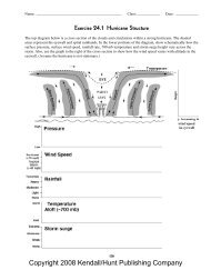
Copyright 2008 Kendall/Hunt Publishing Company - CAMP
Copyright 2008 Kendall/Hunt Publishing Company - CAMP
Copyright 2008 Kendall/Hunt Publishing Company - CAMP

Create successful ePaper yourself
Turn your PDF publications into a flip-book with our unique Google optimized e-Paper software.
Name: _____________________________________________ Class: ____________ Date: ____________<br />
Exercise 4.1 Resolution of Numerical Model Grids<br />
How well a weather phenomenon is resolved is determined by the number of gridpoints across its shortest dimension.<br />
Using the guide below, determine the resolution of each weather phenomenon by (a) drawing a box that<br />
estimates the size in the location indicated, (b) listing the number of gridpoints across the shortest dimension,<br />
and (c) writing the letter representing the resolution. Grid points are 50 km apart.<br />
8 or more gridpoints → well-resolved (W)<br />
5 to 7 gridpoints → resolved (R)<br />
2 to 4 gridpoints → poorly resolved (P)<br />
less than 2<br />
→ unresolved (U)<br />
Phenomenon Size # grid points Resolvable?<br />
1. Tornado (OK) 200m × 200m _______ _______<br />
2. Sea breeze (FL) 20km × 200km _______ _______<br />
3. Thunderstorm (OK) 20km × 20km _______ _______<br />
4. Hurricane (TX Gulf Coast) 300km × 300km _______ _______<br />
5. Extratropical Cyclone (N Plains) 1500km × 1500km _______ _______<br />
6. Freezing rain band (TN) 50km × 300km _______ _______<br />
7. Cold front cloud band (PA to SC) 200km × 1000km _______ _______<br />
8. Lake-effect snow band (Lake MI) 20km × 200km _______ _______<br />
<strong>Copyright</strong> <strong>2008</strong> <strong>Kendall</strong>/<strong>Hunt</strong> <strong>Publishing</strong> <strong>Company</strong><br />
27
<strong>Copyright</strong> <strong>2008</strong> <strong>Kendall</strong>/<strong>Hunt</strong> <strong>Publishing</strong> <strong>Company</strong>
Name: _____________________________________________ Class: ____________ Date: ____________<br />
Exercise 4.2 Accuracy of a Numerical Model Forecast<br />
The top map is the analysis of sea level pressure (solid dark lines) and winds for the GFS model for 0000 UTC<br />
29 November 2007. The bottom map is a forecast of sea level pressure and winds made 72 hours earlier. Evaluate<br />
the forecast by examining errors in the location and intensity (central pressure) of the following features:<br />
Analysis valid 000 ITC Thu Nov 2007<br />
GFS (00z 29 Nov)<br />
Pressure error (P analysis – P forecast )<br />
72-hour forecast valid 000 UTC Thu 29 Nov 2007<br />
GFS (00z 26 Nov)<br />
Correct location? Pressure error (P analysis – P forecast )<br />
High-pressure system off West Coast: Yes No _____________________ mb<br />
High-pressure system over Intermountain West: Yes No _____________________ mb<br />
Low-pressure system over western Hudson Bay: Yes No _____________________ mb<br />
<strong>Copyright</strong> <strong>2008</strong> <strong>Kendall</strong>/<strong>Hunt</strong> <strong>Publishing</strong> <strong>Company</strong><br />
29
<strong>Copyright</strong> <strong>2008</strong> <strong>Kendall</strong>/<strong>Hunt</strong> <strong>Publishing</strong> <strong>Company</strong>
Name: _____________________________________________ Class: ____________ Date: ____________<br />
Exercise 4.3 Model Resolution and Topography<br />
The diagrams below show the same mountain range with horizontal grids superimposed. The top grid has three<br />
times the horizontal resolution of the bottom grid.<br />
1. Draw horizontal lines to show the “average” mountain height in each grid column. The first columns are done<br />
for you (see dashed lines).<br />
2. If air flows from left to right, on which grid would air have to rise the most to transit across the mountains?<br />
(Circle one)<br />
Top grid (with higher resolution)<br />
Bottom grid (with lower resolution)<br />
The amount of snowfall that falls in mountainous areas during winter storms is closely related to the distance that<br />
air must be lifted to cross the mountains. Discuss briefly the effects “gridding” topography might have on errors in<br />
precipitation forecasts.<br />
<strong>Copyright</strong> <strong>2008</strong> <strong>Kendall</strong>/<strong>Hunt</strong> <strong>Publishing</strong> <strong>Company</strong><br />
31
<strong>Copyright</strong> <strong>2008</strong> <strong>Kendall</strong>/<strong>Hunt</strong> <strong>Publishing</strong> <strong>Company</strong>