OKLAHOMA CLIMATE - Oklahoma Climatological Survey
OKLAHOMA CLIMATE - Oklahoma Climatological Survey
OKLAHOMA CLIMATE - Oklahoma Climatological Survey

Create successful ePaper yourself
Turn your PDF publications into a flip-book with our unique Google optimized e-Paper software.
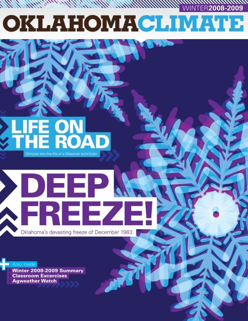
WINTER2008-2009<br />
<strong>OKLAHOMA</strong><strong>CLIMATE</strong><br />
LIFE ON<br />
THE ROAD<br />
Glimpse into the life of a Mesonet technician.<br />
DEEP<br />
FREEZE!<br />
<strong>Oklahoma</strong>’s devasting freeze of December 1983.<br />
Also Inside<br />
Winter 2008-2009 Summary<br />
Classroom Excercises<br />
Agweather Watch
MESSAGE FROM THE EDITOR<br />
Gary McManus<br />
I hate cold weather, and so do a lot of folks I know. There’s a reason so many people flock to southern California, and<br />
the chance to ride a massive earthquake isn’t one of them. It’s not that I dislike winter, just the weather that goes with<br />
it! The strange thing is I used to love the season when I was growing up in Buffalo (<strong>Oklahoma</strong>, not New York...I didn’t<br />
love winter THAT much). I suppose that’s part of growing up, though. Sledding would just make my back ache now. The<br />
winters of my youth seem much colder than those of today, and since climate data show our winters have warmed over<br />
the last 20 years or so, it’s probably not just something I imagined. Our historical perspective for this issue revisits one of<br />
the coldest months on record in <strong>Oklahoma</strong> – the second coldest of any month since 1940, to be exact – December 1983.<br />
Despite my fondness for winter at that stage of my life, I can’t recall too many fond memories from that event. Read our<br />
take and see if you can remember anything good about the <strong>Oklahoma</strong> Deep Freeze of December 1983.<br />
<strong>Oklahoma</strong> Climate<br />
Winter 2008-2009<br />
Cover Illustration: by Ada Shih.<br />
If you have a photo or illustration that<br />
you would like to be considered for<br />
the cover of <strong>Oklahoma</strong> Climate,<br />
please contact:<br />
Gary McManus<br />
gmcmanus@mesonet.org<br />
The <strong>Oklahoma</strong> <strong>Climatological</strong><br />
<strong>Survey</strong> is the State Climate<br />
Office for <strong>Oklahoma</strong><br />
Dr. Ken Crawford,<br />
State Climatologist<br />
Editor<br />
Gary McManus,<br />
Associate State Climatologist<br />
Speaking of our changing winters, remember when snow used to fall from the sky instead of sleet or freezing rain? Well,<br />
our first feature article looks at a climatology of heavy snows in <strong>Oklahoma</strong> by Mike Branick of the National Weather<br />
Service office in Norman. Did you think March was the prime month to get big snows? Well, you’re right...sort of. Did you<br />
think most of those big snows occurred in southern <strong>Oklahoma</strong>? Sorry, now you’re one for two. Our second feature article<br />
looks at one of the best programs the <strong>Oklahoma</strong> Mesonet has to offer; OK-Fire. The program’s director, Dr. J.D. Carlson<br />
of <strong>Oklahoma</strong> State University, has written a great piece about OK-FIRE and how it performed during a large fire around<br />
Crescent, <strong>Oklahoma</strong>, in late January. Finally, in our third feature article, we learn about the life of a Mesonet Technician<br />
from our retiring Senior Electronics Technician, Ken Meyers. Reading his story has made me think I’m in the wrong line<br />
of work here at the Climate <strong>Survey</strong>! The Mesonet electronics technicians are the lifeblood of the <strong>Oklahoma</strong> Mesonet, so<br />
we are lessened as an organization when they leave us. We’ve been detailing the lives of distinguished scientists for the<br />
magazine’s interview section, so we decided to switch gears for this issue and talk to some of our users instead. They all<br />
have such amazing stories about the Mesonet and how it has helped save lives and educate our state’s children.<br />
Snow...how do those fragile and unique flakes form? Our classroom exercise teaches students about these wondrous<br />
fractals of nature. In addition, be sure to read our regular features, including: an agricultural weather summary, the Urban<br />
Farmer, a weather safety article, and a climate summary of the fall months<br />
I sincerely hope you enjoy this issue of “<strong>Oklahoma</strong> Climate.” If you have any questions or comments, please feel free to<br />
contact me at gmcmanus@mesonet.org.<br />
Contributors<br />
Stdrovia Blackburn<br />
Phil Browder<br />
Dr. J.D. Carlson<br />
Nicole Giuliano<br />
Gary McManus<br />
Ken Meyers<br />
Ada Shih<br />
Albert Sutherland<br />
Design<br />
Stdrovia Blackburn<br />
Ryan Davis<br />
Ada Shih<br />
Editorial Board<br />
Stdrovia Blackburn (advisor)<br />
Phil Browder<br />
Alex Gartside<br />
Nicole Giuliano<br />
Robert Heck<br />
Brad Illston<br />
James Kilby<br />
Gary McManus<br />
Dr. Renee McPherson<br />
Andrea Melvin<br />
Cindy Morgan<br />
Ada Shih<br />
Al Sutherland<br />
HISTORICAL<br />
3 Deep Freeze of December 1983<br />
FEATURE I<br />
6 There’s Snow Place Like Home<br />
INTERVIEW<br />
9 David Barnes, Lori Painter, Tom Merrill<br />
FEATURE II<br />
12 Wildfire Weekend<br />
SEASONAL SUMMARY<br />
16 Fall 2008<br />
9 12 27<br />
AGWATCH<br />
21 Winter 2008-2009<br />
URBAN FARMER<br />
22 Spring 2009<br />
CLASSROOM ACTIVITY<br />
23 How Snow Grows<br />
FEATURE III<br />
27 The Road Less Traveled<br />
SAFETY<br />
30 Winter Safety Tips<br />
© Copyright 2009 Board of Regents of the University of <strong>Oklahoma</strong>. All Rights Reserved.
Gary McManus – Associate State Climatologist<br />
Think back, dear reader, to times of yore, when telephones<br />
had cords and video games consisted of two vertical lines<br />
and a dot. It was during these ancient times, the 1970s and<br />
1980s, in which <strong>Oklahoma</strong>ns were able to experience actual<br />
winters, complete with snow and lengthy cold spells. It<br />
can certainly get cold from time-to-time during our current<br />
winters, of course. The warming that has taken place over<br />
the last 20-30 years, however, has left a generation of young<br />
<strong>Oklahoma</strong>ns with no inkling of what a truly cold winter can<br />
be like. There was a time when snow fell instead of freezing<br />
rain, and farmers spent their mornings busting ice from<br />
stock tanks before their first cup of hot java at the local<br />
cafe. So I ask you again, dear reader, to travel 25 years into<br />
<strong>Oklahoma</strong>’s past, and relive the <strong>Oklahoma</strong> Deep Freeze of<br />
December 1983.<br />
<strong>OKLAHOMA</strong> <strong>CLIMATE</strong> | WINTER 2008-2009 3
[OCS FEATURE ARTICLE]<br />
Figure 1: Statewide average December temperatures<br />
since 1895 for <strong>Oklahoma</strong>.<br />
New Year’s Eve marked the end of the<br />
arctic transformation with temperatures<br />
rising above freezing for the first time<br />
since the first frigid blast on the 17 th .<br />
Within days, temperatures were in the<br />
60s across much of the state, putting<br />
the final nail in the coffin of the event.<br />
The month ended as the coldest<br />
December on record statewide with an<br />
average temperature of 25.8 degrees,<br />
13.2 degrees below normal. Only four<br />
months have been colder in <strong>Oklahoma</strong><br />
than December 1983, and all occurred<br />
in January: 1918, 1930, 1940, and<br />
1979. The temperature in <strong>Oklahoma</strong><br />
City was below freezing from 3 p.m.<br />
on the 18 th to 10:45 a.m. on the 31 st ,<br />
the longest such stretch ever recorded.<br />
Nine daily records were also set in<br />
<strong>Oklahoma</strong> City – five for coldest high<br />
temperature and four for coldest low<br />
temperature.<br />
The first three weeks of December<br />
1983 were actually quite pleasant<br />
as far as Decembers in <strong>Oklahoma</strong><br />
go. High temperatures were near of<br />
above normal for most of that time<br />
with just a few intrusions of cold air<br />
to speak of. The state’s first snowfall<br />
of any significance fell on the 13 th but<br />
temperatures were too warm for the<br />
snow to last. Temperatures the next day<br />
rose into the 40s, obliterating the last<br />
traces of the frozen precipitation. A cold<br />
front late on the 15 th combined with an<br />
upper-level low traveling from the west<br />
across <strong>Oklahoma</strong> to produce snowfall<br />
amounts of up to 8 inches along the<br />
Red River. Little did <strong>Oklahoma</strong>ns know<br />
that the cold front and snow were just<br />
the beginning of their wintery trouble.<br />
Yet another cold front on the 17 th<br />
brought a reinforcing blast of cold air<br />
to <strong>Oklahoma</strong> with more snow. The<br />
temperature at Guymon had dropped<br />
to 7 degrees by 5 p.m. and winds of<br />
up to 40 mph produced wind chills<br />
down to 20 degrees below zero. The<br />
18 th saw the cold air spread statewide<br />
with high temperatures struggling<br />
into double digits across most of the<br />
state. Strong winds dropped the wind<br />
chills down to 35 degrees below zero<br />
in some areas. As if the cold was not<br />
enough of a hardship for <strong>Oklahoma</strong>ns,<br />
Mother Nature gave them a good<br />
dose of freezing rain on the 20 th as an<br />
exclamation point. The southern half<br />
of the state became a skating rink and<br />
travel was treacherous, resulting in<br />
many accidents.<br />
Yet another surge of arctic air arrived<br />
on the 21 st that sent temperatures<br />
plunging once again. <strong>Oklahoma</strong> City<br />
broke its record low temperature with<br />
a mark of 2 degrees below zero, and<br />
wind chills in some parts of the state<br />
were as low as 40 degrees below<br />
zero. The high temperature at the<br />
Great Salt Plains reservoir on the 22 nd<br />
was 4 degrees below zero after a low<br />
temperature of 5 degrees below zero.<br />
Christmas Eve and Christmas Day saw<br />
Santa bring <strong>Oklahoma</strong> another blast of<br />
cold air and wind chills of 50 degrees<br />
below zero. Low temperatures across<br />
most of northern <strong>Oklahoma</strong> were below<br />
zero and high temperatures were in the<br />
low single digits. A warm up into the<br />
balmy 20s occurred for several days<br />
before a final-yet-brutal blast of cold air<br />
late on the 27 th provided the state with<br />
its coldest temperature of the event;<br />
17 degrees below zero was reported<br />
from the far western Panhandle town<br />
of Kenton on the 29 th . A reading of<br />
16 degrees below zero was recorded<br />
at Hulah Dam in Osage County the<br />
following day. Travel was discouraged<br />
on the 27 th and 28 th after nearly every<br />
road in the state was left covered with<br />
snow and ice.<br />
The event left more than just a populace<br />
chilled to its bones, however. More<br />
than 20 deaths were blamed directly<br />
on the cold weather, mostly from traffic<br />
accidents, carbon monoxide poisoning,<br />
and exposure. Infrastructure also took a<br />
hit due to the arctic chill. Frozen water<br />
pipes left thousands without water<br />
for days, and when those pipes did<br />
thaw, hefty plumber bills ensued. Fire<br />
departments in <strong>Oklahoma</strong> City became<br />
emergency water distribution points<br />
for those with frozen pipes. And the<br />
misery was not confined to <strong>Oklahoma</strong>,<br />
of course. Most of the eastern half of<br />
the nation was gripped in the wintry<br />
weather’s hold for a similar duration.<br />
Nationally, more than 500 deaths were<br />
attributed to the cold weather, as well<br />
as the destruction of infrastructure and<br />
crops. The Red River in Shreveport<br />
was reportedly clogged with the most<br />
ice since 1895, and damages in Texas<br />
alone were estimated at over $100<br />
million.<br />
4 WINTER 2008-2009 |<strong>OKLAHOMA</strong> <strong>CLIMATE</strong>
[OCS FEATURE ARTICLE]<br />
Figure 2: High temperatures on December 19, 1983.<br />
Figure 3: Low temperatures on December 29, 1983.<br />
<strong>OKLAHOMA</strong> <strong>CLIMATE</strong> | WINTER 2008-2009 5<br />
<strong>OKLAHOMA</strong> <strong>CLIMATE</strong> | WINTER 2008-2009 5
Gary McManus | Associate State Climatologist<br />
How many times have you heard this?<br />
“<strong>Oklahoma</strong>’s heaviest snows usually come in March.”<br />
How about this one?<br />
“Southern <strong>Oklahoma</strong> gets more heavy snows because it’s closer to<br />
the Gulf of Mexico.”<br />
Well, as with all weather lore, some are based on a little bit of<br />
truth while others are just faulty memories. Snow is certainly<br />
not a topic <strong>Oklahoma</strong>ns deal with as much as other types of<br />
inclement weather. Most of us can recite the Fujita chart by<br />
memory now, but snow is a bit more fleeting in our memory<br />
banks. This has become even more true since most of the<br />
snowstorms of our past appear to have morphed into sleet<br />
and ice storms. But let’s take a look at what National Weather<br />
Service forecaster Mike Branick found buried under an<br />
avalanche of <strong>Oklahoma</strong> snowfall data. He looked at snowfall<br />
data from 1951-2001 and found 225 “heavy” snowfall events<br />
for the state, with “heavy” defined as 6 inches in 24 hours or<br />
two 24-hour reports of 4 inches or more.<br />
Looking at his results, we can easily dispel one myth right off<br />
the bat; sleds are normally not a hot commodity in southern<br />
<strong>Oklahoma</strong>. Logic wins out on this one – southern <strong>Oklahoma</strong><br />
does not receive the greatest number of heavy snows in<br />
<strong>Oklahoma</strong>. In fact, it receives snowfalls of 4 inches or greater<br />
once every 2-3 years or so, while northwestern <strong>Oklahoma</strong><br />
can receive these types of snows several times a year. For<br />
heavier events, 8 inches or greater, the disparity grows<br />
even larger. Southern <strong>Oklahoma</strong> will receive a snowfall of 8<br />
inches or greater once every 10-20 years while northwestern<br />
<strong>Oklahoma</strong> might get one every couple of years. As it turns<br />
out, the colder air in the northern parts of the state trumps<br />
the extra moisture available in the south. The combination of<br />
the two occurs more often up north.<br />
If <strong>Oklahoma</strong> were to receive a heavy snow, when would it<br />
most likely occur? That one is a bit trickier. Despite their rarity,<br />
southern <strong>Oklahoma</strong> receives more of its heavy snowfalls in<br />
January, the coldest month of the year. As you head north,<br />
however, the peak for heavy snows spreads out. This is<br />
possibly due to the extended periods with sufficiently cold<br />
air available for snow formation. Along the I-44 corridor, the<br />
heavy snow frequency is greatest in January and February.<br />
For 8-inch or greater events only, however, the peak for the<br />
northeast is most definitely in March. As you look farther to<br />
the west and north, the frequency for heavy snows shifts to<br />
February then March. If you want to see a snow of 4 inches<br />
or greater in the western Panhandle, March is the month. If<br />
you want to see a snow of at least 8 inches, January or March<br />
will both prime bets.<br />
6 WINTER 2008-2009 |<strong>OKLAHOMA</strong> <strong>CLIMATE</strong>
Heaviest snowfall events in <strong>Oklahoma</strong>, 1951-2001<br />
Rank Date(s) Max Location<br />
1 21-22 February 1971 36 Buffalo<br />
2 24-25 November 1992 22 Laverne<br />
3 16 March, 1970 20 Bartlesville<br />
16-17 January 2001 20 Kenton<br />
5 8-9 March 1994 19 Stillwater<br />
12-14 March 1999 19 Medford<br />
7 4-5 March 1989 18 Kansas<br />
18-19 January 1990 18 Goodwell<br />
22-24 December 1997 18 Laverne<br />
18-19 March 1999 18 Kenton<br />
Figure 1. Total number of heavy snowfall events<br />
in <strong>Oklahoma</strong> by month.<br />
Table 1. Heaviest snowfall events in <strong>Oklahoma</strong>, 1951-<br />
2001. Rankings are based on maximum storm totals (Max,<br />
inches). Location of the maximum reported storm total for<br />
each event is given.<br />
Figure 2. Number of four-inch or greater snow<br />
events by county, 1951-2001. Contours are<br />
frequencies, given as average turnaround times<br />
for a single event.<br />
<strong>OKLAHOMA</strong> <strong>CLIMATE</strong> | WINTER 2008-2009 7
[OCS FEATURE ARTICLE]<br />
Figure 3. As in Fig. 3, except for eight-inch or greater events.<br />
Figure 4. Monthly distribution of four-inch (light) and eight-inch (dark) snow<br />
events by region.<br />
There are many factors needed to produce heavy snowfall.<br />
The chance meeting of adequate moisture and cold air<br />
vitally important to producing snow is often fleeting. But the<br />
climatology of heavy snows across <strong>Oklahoma</strong> has given us<br />
a clue of where to search for these types of events. While<br />
the state can see a heavy snow from October through early<br />
May, the place to be if you want to see a good pounding by<br />
the white stuff is the <strong>Oklahoma</strong> Panhandle, and you should<br />
be there in March. An interesting side-note is that the largest<br />
snow events, 16 inches or more, are clearly more frequent<br />
during March than any other month.<br />
The information in this story is largely attributable to Mike<br />
Branick, Senior Forecaster for the National Weather Service<br />
forecast office in Norman, <strong>Oklahoma</strong>. His study on the<br />
subject is titled “Monthly and Geographic Distribution of<br />
Heavy Snow Events in <strong>Oklahoma</strong>, 1951-2001”. The full report<br />
can be found at http://www.srh.noaa.gov/oun/climate/<br />
heavysnow/study.php.<br />
8 WINTER 2008-2009 |<strong>OKLAHOMA</strong> <strong>CLIMATE</strong>
[INTERVIEW]<br />
“Using the Mesonet,<br />
using OK-FIRST, has<br />
corporately improved<br />
our education and our<br />
professionalism”<br />
IN THEIR OWN WORDS<br />
THE VARIOUS PRODUCT USERS OF THE <strong>OKLAHOMA</strong> MESONET<br />
By Phil Browder, Field Technician<br />
<strong>Oklahoma</strong> Mesonet<br />
For the last 15 years, the <strong>Oklahoma</strong><br />
<strong>Climatological</strong> <strong>Survey</strong> (OCS) has<br />
joined forces with the <strong>Oklahoma</strong><br />
Mesonet to provide the citizens of<br />
<strong>Oklahoma</strong> with the best surface<br />
observing network in the world. That<br />
in and of itself would be enough,<br />
but by taking a commitment to<br />
excellence a step further, OCS also<br />
provides several products using<br />
Mesonet data that serve to enrich<br />
and protect the lives of residents<br />
across our state. Here are four of the<br />
most popular products, each with a<br />
rich history of serving the state of<br />
<strong>Oklahoma</strong>. However, you don’t have<br />
to take my word for it….<br />
OK-FIRST: “It’s astronomical.”<br />
That’s how David Barnes, Director of Emergency Management for <strong>Oklahoma</strong> County,<br />
describes the impact OK-FIRST has had in the realm of public safety in <strong>Oklahoma</strong>:<br />
“[OK-FIRST] not only gives us good information and helps us give good info to the<br />
public, but it also adds a great deal of credibility to our programs”.<br />
Since 1996, OK-FIRST has been using training, data services and decision support<br />
as the backbone of a system designed to help save lives, resources, and money. The<br />
mission of OK-FIRST is simply to help <strong>Oklahoma</strong>’s public safety officials make better<br />
decisions during weather-impacted situations.<br />
Before becoming Emergency Manager of <strong>Oklahoma</strong> County, David spent 8 ½ years<br />
as an Emergency Manager in Edmond. It was there he was introduced to OK-FIRST<br />
training and quickly realized just how useful it could be. “Using the Mesonet, using<br />
OK-FIRST, has corporately improved our education and our professionalism”, David<br />
says. “We now have greater tools available for use because of the re-certifications and<br />
the refreshers that we participate in, as well as the workshops where presentations<br />
are made. We are able to maintain those skills and fine-tune them on an ongoing<br />
basis, as opposed to getting a class one time and waiting four or five years”. From<br />
improved storm spotting to aiding in the prosecution of criminal cases, David raves<br />
about OK-FIRST and the Mesonet, asserting the program “helps us [Emergency<br />
Managers] make better decisions” by strengthening relationships between public<br />
safety offices, meteorologists, and the academic community.<br />
<strong>OKLAHOMA</strong> <strong>CLIMATE</strong> | WINTER 2008-2009 9
[INTERVIEW]<br />
EARTHSTORM: “It’s so cool to teach with weather!”<br />
You need not talk with Lori Painter for very long<br />
before the subject turns to her kids. In this case,<br />
her “kids” are the 6 th grade class at Monroe<br />
Elementary in Enid, and she accompanied a<br />
few of them to the National Weather Center<br />
in Norman this past February 21 st to compete<br />
in the annual Mesonet Science Fair. Inside,<br />
a whole host of exhibits were on display, with<br />
exhibitors ranging in grade from kindergarten<br />
through high school senior. Despite the different<br />
ages, shapes and sizes, the competitors all<br />
shared an interest in the weather. That interest,<br />
according to Lori, wouldn’t have been possible<br />
without EARTHSTORM—a series of workshops<br />
put on by OCS designed to help teachers use<br />
the Mesonet to bring the wonder of weather into<br />
their classrooms. “I can just hit a button and see<br />
the same thing in a half a second what used to<br />
take me 10 or 20 minutes to see”, says Lori. “It is<br />
so powerful and so easy for my kids to use”.<br />
While the students flexed their knowledge on that clear, cool <strong>Oklahoma</strong><br />
afternoon, teachers like Lori and Roberta sat back with proud smiles and<br />
watched as the seeds they had planted took root and blossomed. While<br />
both teachers knew few, if any, of their students would make a career out<br />
of the weather, Lori says the children who pass through their classes take<br />
with them an ability to think for themselves, and those are skills they will use<br />
for the rest of their lives. “No matter what they go into, they will be better<br />
doctors, lawyers, or anything”, reasons Lori, “because they now have the<br />
skills to problem solve, and it was because of EARTHSTORM”.<br />
I can just hit a button and<br />
see the same thing in a half<br />
a second what used to<br />
take me 10 or 20 minutes<br />
to see<br />
For Lori, who was one of the first teachers to<br />
attend the program when it began 16 years<br />
ago, EARTHSTORM represents more than just<br />
learning about the weather. In fact, she says<br />
the program “has absolutely changed the way I<br />
teach”. Another teacher in attendance, Roberta<br />
Chance, echoes Lori’s enthusiasm for the<br />
program: “It has given my kids in northwestern<br />
<strong>Oklahoma</strong> in a small school access to the very<br />
same technology that metro kids have”. Roberta,<br />
who teaches 7 th and 8 th grades at Gage Public<br />
Schools in Gage, says EARTHSTORM has<br />
received a “wonderful” reception, and makes<br />
the weather “more and more accessible to our<br />
kids”.<br />
10 WINTER 2008-2009 |<strong>OKLAHOMA</strong> <strong>CLIMATE</strong>
[OCS FEATURE<br />
[INTERVIEW]<br />
ARTICLE]<br />
OK-FIRST/OK-FIRE:<br />
“Three-quarters of my citizens know<br />
what OK-FIRST is.”<br />
Ask Tom Merrill, Fire Chief and Emergency<br />
Manager for the city of Cordell, why he began<br />
using OCS products and he will respond not with<br />
a reason, but with a date: October 9, 2001. That’s<br />
the day an F-3 tornado tore through the east<br />
central side of Cordell, destroying 134 homes<br />
and damaging more than 300, along with more<br />
than 40 businesses. Despite giving residents<br />
of Cordell nearly 12 minutes of warning time,<br />
Tom says it quickly “became apparent to us our<br />
warning system was lacking”. While surveying<br />
the damage afterwards, Tom was approached by<br />
Mike Foster, a representative from the National<br />
Weather Service. When Mike asked Tom if he<br />
had heard of OK-FIRST, Tom remembers he had<br />
“no clue”. Shortly after his talk with Mike, Tom<br />
enrolled in his first OK-FIRST class, and has<br />
been “going strong ever since”.<br />
But OK-FIRST isn’t the only product Tom puts<br />
to good use. He’ll tell you being a fire chief of<br />
a small town in western <strong>Oklahoma</strong> demands all<br />
the help you can get your hands on, none being<br />
more important than OK-FIRE—an extension of<br />
OK-FIRST dedicated to providing fire fighters the<br />
training and tools they need to combat wildfires<br />
most effectively. “It has allowed us to pre-plan<br />
and pre-position fire units in anticipation of what<br />
we knew was coming”, says Tom. “We watch<br />
OK-FIRE constantly throughout the day, keeping<br />
track of burning indices”.<br />
AGWEATHER:<br />
“Very dynamic.”<br />
Tom’s other passion, farming, leads him straight<br />
to the AgWeather website, a tool he calls, “one<br />
of the most underrated products [OCS] has”.<br />
AgWeather, a cooperative project between<br />
<strong>Oklahoma</strong> State University, the University of<br />
<strong>Oklahoma</strong>, and OCS, brings together expertise<br />
in the areas of meteorology, climatology,<br />
agricultural production, and natural resource<br />
management. The goal is to provide <strong>Oklahoma</strong><br />
farmers with the tools they need to grow the<br />
best crops they can, but Tom says AgWeather’s<br />
impact is more far-reaching than that: “It’s got<br />
a lot of economic value”, Tom says, “not just to<br />
citizens, but also to businesses. They keep it<br />
interesting, and give us the products we want<br />
and not just the products they want to give us”.<br />
“We watch OK-FIRE<br />
constantly throught<br />
the day, keeping<br />
track of burning<br />
indecies”<br />
<strong>OKLAHOMA</strong> <strong>OKLAHOMA</strong> <strong>CLIMATE</strong> <strong>CLIMATE</strong> | | WINTER | 2008-2009 FALL 11
[OCS FEATURE ARTICLE]<br />
12 FALL WINTER 2008 2008-2009 |<strong>OKLAHOMA</strong> |<strong>OKLAHOMA</strong> <strong>CLIMATE</strong><br />
<strong>CLIMATE</strong>
[OCS FEATURE ARTICLE]<br />
Figure 1. Burning index (BI) values at Marshall during the wildfire period<br />
of January 31 and February 1, 2009.<br />
Dr. J. D. Carlson, Fire<br />
Meteorologist<br />
<strong>Oklahoma</strong> State<br />
University<br />
During the late afternoon of January 31,<br />
while driving around town in Stillwater, I<br />
noticed a huge smoke plume to the westsouthwest,<br />
a plume which extended<br />
many miles to a position northeast of<br />
Perry. It turns out the smoke was the<br />
result of a large wildfire (grassy/brushy<br />
fuels) near Crescent, north of Guthrie.<br />
The fire erupted Saturday afternoon<br />
and burned at least 600 acres. A total<br />
of 26 fire crews helped combat the<br />
blaze. At one point that day the fire was<br />
estimated to be four miles long and four<br />
miles wide. The fire was extinguished<br />
Saturday evening, but flared up early<br />
Sunday afternoon with the high fire<br />
danger conditions. That fire burned<br />
even more acres and the total estimated<br />
area burned was 2000 acres.<br />
Simultaneous to the Crescent fire on<br />
January 31 were even larger wildfires<br />
in northwest <strong>Oklahoma</strong>. One blaze near<br />
Selman in Harper County burned 10,000<br />
acres, while another near Mooreland in<br />
Woodward County consumed another<br />
5,000 acres. The smoke plumes from<br />
these fires were easily visible on radar<br />
that afternoon. These fires also reignited<br />
on Sunday afternoon.<br />
What were the fire weather conditions<br />
like over this weekend that led to the<br />
outbreak of these wildfires? We’ll<br />
concentrate on the Crescent fires in this<br />
analysis. However, before we delve into<br />
the weather conditions themselves, let’s<br />
look at some output from the <strong>Oklahoma</strong><br />
Fire Danger Model, whose output is<br />
available on our OK-FIRE wildland fire<br />
management web site (http://okfire.<br />
mesonet.org).<br />
The “Burning Index” (BI) is one index<br />
calculated by the National Fire Danger<br />
Rating System (NFDRS) on which<br />
our <strong>Oklahoma</strong> model is based. It is<br />
proportional to the intensity of the<br />
fire (i.e., fire danger) – the greater the<br />
BI value, the greater the difficulty of<br />
suppressing the wildfire. Burning Index<br />
is a function of the weather conditions<br />
as well as the fuel type and amount.<br />
A BI of 40 is considered a moderate<br />
threshold for fire danger and a BI of 80,<br />
a high threshold. Figure 1 shows the BI<br />
values at Marshall (a nearby <strong>Oklahoma</strong><br />
Mesonet site) from 6 a.m. January 31<br />
to 6 p.m. February 1. Note that during<br />
both afternoons, BI values were well in<br />
excess of 80 – on Saturday they reached<br />
up to 120 and on Sunday, up to 106.<br />
Also impressive is the rapid rise in BI<br />
<strong>OKLAHOMA</strong> <strong>CLIMATE</strong> | | WINTER 2008-2009 13
[OCS FEATURE ARTICLE]<br />
Figure 2. 1-hour (orange) and 10-<br />
hour (brown) dead fuel moisture at<br />
Marshall during the wildfire period<br />
of January 31 and February 1, 2009<br />
from zero at 7 a.m. Saturday to 120 at 2<br />
p.m. Corresponding to the BI peaks on<br />
Saturday and Sunday were high spread<br />
rates as calculated by the “Spread<br />
Component” (SC). Values as high as<br />
180 feet/minute (60 yards/minute) were<br />
calculated on Saturday and as high as<br />
140 feet/minute (47 yards/minute) on<br />
Sunday. Think of a football field and<br />
you’ll get an idea of how fast these fires<br />
were moving. The high BI values (fire<br />
intensity) combined with the high SC<br />
rates (rate of spread) made these fires<br />
extremely difficult to control.<br />
Another important indicator of fire<br />
danger (especially during this time of<br />
year) is dead fuel moisture (DFM). In<br />
particular, 1-hour and 10-hour dead<br />
fuels are of supreme interest. One-hour<br />
dead fuels represent the dead grasses<br />
and leaves which are prevalent during<br />
the winter season, while 10-hour fuels<br />
represent dead fuels with diameters<br />
on the order of one-half inch. Wildfires<br />
usually start with the ignition of 1-hour<br />
fuels, and 1-hour dead fuel moisture<br />
(the % water content in such fuels) is<br />
therefore of extreme importance. Both<br />
for 1- and 10-hour fuels, fuel moisture<br />
contents of less than 5% lead to<br />
extremely dangerous fire danger and<br />
behavior, and even in the 5-7% range,<br />
there are serious problems. Figure 2<br />
shows the calculated 1- and 10-hour<br />
DFM at the Marshall site. Note that<br />
1-h DFM (orange line) dropped as low<br />
as 4% during Saturday and almost<br />
reached 4% on Sunday.<br />
Figure 3. Meteogram of temperature, wind speeds and gusts, and relative<br />
humidity at Marshall during the wildfire episode period of January 31 and<br />
February 1, 2009.<br />
Let’s now look at the weather conditions<br />
responsible for these low fuel moisture<br />
contents and the high burning index<br />
and spread component values. Figure<br />
3 presents a meteogram for Marshall<br />
consisting of three charts. The first<br />
chart shows temperature (F) in red;<br />
the second one shows sustained wind<br />
speeds (mph) at the 10-m level in blue<br />
and gusts in purple; and the third one<br />
shows relative humidity (%) in green.<br />
What happened “weather-wise” to<br />
go from virtually no fire danger in the<br />
morning to extreme fire danger in the<br />
early afternoon that Saturday?<br />
Temperature (and solar radiation),<br />
relative humidity, and wind speed all<br />
play important roles in fire danger<br />
and behavior. Let’s first look at the<br />
temperature. Note how the temperatures<br />
rise from the mid-20s around 7 a.m. to<br />
near 70 degrees around 2 p.m. That’s a<br />
quick rise in temperature, which results<br />
in the 1-hour fuels quickly rising in<br />
temperature as well (the clear skies that<br />
afternoon amplified this as the fuels<br />
absorbed solar radiation and grew even<br />
warmer). With respect to wind speed,<br />
note how speeds are 5 mph or less in<br />
the early morning and quickly increase<br />
14 WINTER 2008-2009 |<strong>OKLAHOMA</strong> <strong>CLIMATE</strong>
[OCS FEATURE ARTICLE]<br />
to 30 mph in the early afternoon with<br />
wind gusts up to 40 mph. This is<br />
typical of a sunny convective afternoon<br />
where strong upper-level winds are<br />
mixed down to the surface. Finally,<br />
with respect to relative humidity (the<br />
most important fire weather variable),<br />
note how the high values in the early<br />
morning (around 90%) quickly fall to<br />
values of 15% for most of the afternoon.<br />
Lower values of relative humidity result<br />
in more evaporation of water from the<br />
dead fuels and thus lower dead fuel<br />
moisture. On the following afternoon<br />
(Sunday) relative humidity dropped to<br />
even lower values (11%) near 3 and 4<br />
p.m.<br />
We’ll conclude by looking at some<br />
smoke plume pictures from the<br />
Crescent fire which I took that Saturday<br />
afternoon. The first photo (Figure 4)<br />
shows the boundary layer and, at this<br />
time, the turbulence that was present<br />
within it. The boundary is that layer<br />
above the surface (typically 3000 to<br />
5000 feet during the afternoon) in<br />
which surface friction and other surface<br />
processes (e.g., surface heating) play<br />
a role. On Saturday there was both<br />
convective (temperature-based) and<br />
mechanical (wind-based) turbulence<br />
within this layer, with upward and<br />
downward motions. By the time the<br />
smoke plume had reached the position<br />
shown in Figure 4, most of the plume<br />
had risen to the top of the boundary<br />
layer. Note, however, how portions of<br />
the plume are being brought back down<br />
to the surface due to the convective<br />
and mechanical turbulence.<br />
Figure 4. Convective and mechanical turbulence within the boundary layer<br />
as shown by the smoke patterns.<br />
Figure 5. Existence of gravity waves as shown by the smoke plume patterns.<br />
The final photo (Figure 5) shows us<br />
something else about the atmosphere.<br />
During days with clear skies (as this<br />
was), the region just above the boundary<br />
layer typically features either an<br />
inversion (temperature increasing with<br />
height) or more “stable” air than the air<br />
within the boundary layer. Such a layer<br />
features dramatically less turbulence<br />
and, in some cases, “gravity waves”<br />
can form. In Figure 5, which shows<br />
the furthermost extent of the Crescent<br />
smoke plume northeast of Perry, the<br />
bulk of the plume is now in the layer<br />
above the boundary layer. Notice how<br />
the turbulence is not only less, but how<br />
the smoke shows wavelike motions.<br />
These are tell-tale signs of gravity<br />
waves, waves like surface ocean waves<br />
but in this case in the atmosphere. They<br />
only occur under “stable” conditions as<br />
such was the case in this layer.<br />
In summary, the wildfires during the<br />
weekend of January 31 and February 1<br />
were made possible by the low relative<br />
humidity, relatively high temperatures,<br />
and strong winds during Saturday and<br />
Sunday afternoons. These conditions,<br />
along with the prevalent dead fuels<br />
(as evidenced in Figure 5), led to low<br />
1-hour dead fuel moisture and high<br />
Burning Index and Spread Component<br />
values. During this fire season, to keep<br />
track of existing and future fire danger<br />
(using the 84-hour NAM forecast) within<br />
<strong>Oklahoma</strong>, go to the OK-FIRE web site<br />
(http://okfire.mesonet.org).<br />
<strong>OKLAHOMA</strong> <strong>CLIMATE</strong> | | WINTER 2008-2009 15
[OCS SEASONAL SUMMARY]<br />
FALL 2008 Summary<br />
by Gary McManus<br />
The season was dominated by cooler weather and, depending<br />
on your location, either abundantly wet or exceedingly<br />
dry conditions. The remnants of several tropical systems<br />
provided the moisture for a few select regions of the state.<br />
Hurricane Gustav struck first in early September in east central<br />
<strong>Oklahoma</strong>. Hurricane Ike and Tropical Storm Lowell visited<br />
the state soon thereafter, while Hurricane Norbert struck in<br />
October. The tropical well ran dry in November, however, and<br />
most of the state was 20-60 percent of normal precipitation<br />
for the month. The result was a soggy fall for the northwest<br />
one-third and a parched season for the remainder of the state.<br />
Averaged statewide, the precipitation total ranked as the 49th<br />
driest on record with a deficit of more than 2 inches. The influx<br />
of tropical moisture helped cool the statewide temperatures<br />
enough to rank as the 30th coolest autumn on record at about<br />
a degree less than normal.<br />
September Daily Highlights<br />
September 1-4: September’s first day was pleasant, if a<br />
bit hot, with just a smattering of clouds across the state.<br />
Some of those clouds were associated with the remnants<br />
of Hurricane Gustav which had come ashore near New<br />
Orleans before moving towards eastern <strong>Oklahoma</strong>. At<br />
the same time, a cold front was approaching the state<br />
from the northwest. The cold front and Gustav both<br />
arrived on the second. Temperatures dropped into the<br />
60s and 70s behind the front, and rain began to fall in<br />
eastern <strong>Oklahoma</strong> from Gustav. Light showers formed<br />
near the front in the west. What remained of Gustav<br />
continued to move along the <strong>Oklahoma</strong>-Arkansas<br />
border over the next couple of days. The front stalled in<br />
eastern <strong>Oklahoma</strong> on the third. Temperatures only rose<br />
into the 60s and 70s on that day, and <strong>Oklahoma</strong> City<br />
set a record for coolest maximum temperature with a<br />
high of 68 degrees. Rain continued overnight as Gustav<br />
pulled away to the northeast before skies cleared later<br />
in the afternoon. Rainfall totals from Gustav approached<br />
5 inches in east central <strong>Oklahoma</strong> but tapered off rather<br />
quickly to the west. Rain totals from the frontal passage<br />
in the western two-thirds were generally between a<br />
tenth of an inch and an inch.<br />
September 5-10: Heavy rains fell during these six<br />
days, largely in north central <strong>Oklahoma</strong>. A meandering<br />
frontal system in northern <strong>Oklahoma</strong> provided the focus<br />
for several rounds of storms, mostly overnight, which<br />
inundated that area with up to 9 inches of rainfall. Other<br />
areas of the state had scattered rainfall amounts of an<br />
inch or a bit more, but nothing as organized as in the<br />
north. The frontal system kept northern <strong>Oklahoma</strong> in the<br />
60s and 70s while southern parts of the state were in<br />
the 80s and 90s. The storms were severe on the fifth;<br />
large hail was common with the storms in northwestern<br />
<strong>Oklahoma</strong>, including hail up to the size of tennis balls<br />
near Sayre and Reydon in Beckham County.<br />
September 11-13: Remnants of Hurricane Ike from the<br />
Atlantic Ocean drenched eastern <strong>Oklahoma</strong> with tropical<br />
rainfall amounts, while remnants of pacific tropical storm<br />
Lowell did the same to western <strong>Oklahoma</strong>. Northwestern<br />
areas definitely got the wet end of the stick, however, due<br />
to Lowell’s interaction with a frontal boundary. Ike’s remnants<br />
dropped 2-3 inches of rain across the eastern one-third of the<br />
state while parts of the northwest received nearly 12 inches.<br />
Fairview suffered severe flooding as 11.8 inches of rainfall was<br />
recorded by the Mesonet site there. Temperatures remained in<br />
the 70s and 80s, both lows and highs throughout this period.<br />
The remnants of both tropical cyclones moved away from the<br />
state on the 13th and left tranquil weather in their wake.<br />
September 14-21: As the tropical systems exited, high<br />
pressure at the surface moved in and brought the state a slow<br />
warm-up to near normal temperatures over the next eight<br />
days. There was no significant precipitation to speak of other<br />
than a few amounts around a half of an inch in far eastern<br />
<strong>Oklahoma</strong>. Lows were mostly in the 40s and 50s and highs in<br />
the 70s and 80s.<br />
September 22-30: High pressure remained and the weather<br />
warmed over the next seven days to near-normal to abovenormal<br />
territory. Highs were mainly in the 80s with a few 90s<br />
after lows in the 50s.<br />
September 29-30: A cold front finally found the state and<br />
passed through on the 29th. Highs were in the 70s for the<br />
most part after the cold front with lows in the 40s and 50s.<br />
October Daily Highlights<br />
October 1-3: The month’s first three days were pleasant with<br />
cool mornings and seasonable afternoons. There was little<br />
rain to speak of as lows dropped into the 40s and 50s each<br />
morning and highs rose into the 70s and 80s.<br />
October 4-6: A warm front lifted north on the fourth as an upperlevel<br />
storm system approached from the west. That provided<br />
enough moisture to fire off showers and storms that dropped<br />
up to two inches of rainfall in southeastern <strong>Oklahoma</strong>. The<br />
storm system caused winds to gust over 40 mph in western<br />
<strong>Oklahoma</strong>. Highs were above normal in the 80s and 90s. The<br />
month’s high temperature reading of 93 degrees occurred at<br />
Tipton and Grandfield on the fourth. The days continued mild<br />
as the storm system approached. Showers and storms hit<br />
the state on the fifth and sixth, with the storms on the sixth<br />
exceeding severe limits at times. The severe reports were<br />
mostly of large hail in western <strong>Oklahoma</strong>. Hail to the size<br />
of half dollars was reported in Comanche County. Most of<br />
the state saw rain over this three-day period, with heaviest<br />
amounts reported in southern sections of <strong>Oklahoma</strong>.<br />
October 7-10: A mostly dry four days followed the previous<br />
bouts of rainfall. Each successive day was warmer than the<br />
last with the aid of strong southerly winds that kicked up in<br />
lieu of an approaching upper-level storm. By the tenth, highs<br />
had risen into the mid-80s.<br />
October 11-15: Moisture from the remnants of pacific<br />
hurricane Norbert streamed into western <strong>Oklahoma</strong> in the<br />
form of clouds on the 11th. A surface low in the <strong>Oklahoma</strong><br />
Panhandle kept winds gusting from the south at over 30<br />
mph. Highs were in the 70s and 80s. Rain developed in the<br />
16 WINTER 2008-2009 |<strong>OKLAHOMA</strong> <strong>CLIMATE</strong>
[OCS SEASONAL SUMMARY]<br />
<strong>Oklahoma</strong> Panhandle as the remnants of Norbert interacted<br />
with a cold front. That front and associated storm system<br />
provided the focus for several rounds of showers through the<br />
15th. In all, areas of the Panhandle received from 3-4 inches<br />
of rain while other parts of northwestern <strong>Oklahoma</strong> totaled 1-3<br />
inches. The rest of the state had up to an inch. The cold front<br />
separated high temperatures in the 70s and 80s to the south<br />
and 50s in the north. The rainfall ended the afternoon of the<br />
15th and cooler air settled in from the north.<br />
October 16-21: The weather turned cold following the cold<br />
front’s passage on the 15th. High pressure settled over the<br />
area and the weather became pleasant if not a bit windy.<br />
Winds gusted up to 40 mph on the 19th as a strong upperlevel<br />
storm approached from the west. Highs were in the 70s<br />
and 80s for the most part, 5-10 degrees warmer than average<br />
for late October.<br />
October 22-23: A cold front swept into the state and set<br />
off showers and storms, some of which exceeded severe<br />
limits. That cold front also gave the state its first freezing<br />
temperatures of the season. Areas in the Panhandle and<br />
southeastern <strong>Oklahoma</strong> dropped below freezing with Kenton<br />
coming in with the lowest reading of 24 degrees. A 75 mph<br />
wind gust was reported by the Camargo Mesonet site early<br />
on the 22nd and half dollar size hail fell near Laverne. Low<br />
temperatures dropped close to freezing on the 23rd. Rainfall<br />
totals were generally 1-2 inches in northeastern sections but<br />
less than an inch elsewhere.<br />
October 24-31: Other than some chilly temperatures each<br />
morning, the month’s final eight days were quite pleasant right<br />
through Halloween. High temperatures were mostly in the 70s<br />
throughout this period. The month’s coldest reading of 21<br />
degrees occurred at Antlers and Oilton on the 28th.<br />
November Daily Highlights<br />
November 1-4: November’s first four days were unusually<br />
warm and mild with highs 10-20 degrees above normal in<br />
the 70s and 80s and lows in the 40s and 50s. Virtually no<br />
rain fell across the state. <strong>Oklahoma</strong> City tied a record with a<br />
high temperature of 83 degrees on November 2. The month’s<br />
highest temperature of 86 degrees occurred at Beaver and<br />
Slapout on the second.<br />
November 5-6: An approaching storm system dragged a<br />
cold front across <strong>Oklahoma</strong> on the fifth which provided the<br />
focus for a rare November severe weather outbreak. Storms<br />
formed in central <strong>Oklahoma</strong> and moved towards the northeast.<br />
Severe winds, large hail and heavy rains were common with<br />
the thunderstorms. A brief tornado dropped down in Osage<br />
County, rolling a mobile home and injuring two occupants.<br />
Baseball size hail fell near Piedmont and 70 mph winds were<br />
reported near Kaw City and Inola. One-to-two inches of<br />
rain fell in the I-44 corridor between <strong>Oklahoma</strong> City and the<br />
northeast corner of the state. More than 4 inches of rain was<br />
recorded in Perkins. The cold front made for a cool day on the<br />
sixth. Low temperatures that morning fell into the 30s and 40s<br />
to go along with winds which gusted to nearly 30 mph. Highs<br />
that day rebounded into the 60s and 70s.<br />
November 7-9: Low temperatures were generally in the 30s<br />
and highs rose into the 50s and 60s during this three-day<br />
period.<br />
November 10-11: A fast-moving storm system brought rain<br />
and storms to <strong>Oklahoma</strong> on the 10th. Showers formed in the<br />
morning before dissipating. Stronger storms struck later that<br />
afternoon and provided southeastern <strong>Oklahoma</strong> a good 1-3<br />
inch soaking. Some large hail accompanied these storms.<br />
Skies cleared on the 11th and temperatures rose into the 50s<br />
and 60s.<br />
November 12-19: This eight-day period generally had very<br />
pleasant afternoons which followed chilly mornings. Cold<br />
fronts moved through the state on the 14th and the 17th<br />
which cooled the state down temporarily, but the afternoons<br />
bounced back nicely. High temperatures by the end of the<br />
period were in the 70s, 15-20 degrees above normal.<br />
November 20-23: A cold front on the 20th kept high<br />
temperatures below the 22nd’s marks by about 25 degrees<br />
in the 40s and 50s. Winds gusted from the north about 45<br />
mph behind the front. A gradual warm up through the 23rd<br />
eventually saw high temperatures back in the 60s and 70s.<br />
The month’s coolest temperature of 13 degrees occurred at<br />
Buffalo on the 21st.<br />
November 24-30: A series of cold fronts kept the weather<br />
during this seven-day stretch seasonable with cool, windy<br />
mornings and pleasant afternoons for the most part. Fronts<br />
moved through on the 24th, 26th and 29th. Light rain fell on<br />
the 27th and 28th with a front, and a bit of snow was mixed<br />
with rain on the 30th.<br />
Fall 2008 Statewide Extremes<br />
Description Extreme Station Date<br />
High Temperature 98ºF Tipton Sept. 7th<br />
Low Temperature 13ºF Buffalo Nov. 21st<br />
High Precipitation 16.85 in. Fairview<br />
Low Precipitation 2.10 in. Kenton<br />
Fall 2008 Statewide Statistics<br />
Average Depart. Rank (1895-2008)<br />
Temperature 59.8ºF -0.8ºF 30th Coolest<br />
Total Depart. Rank (1895-2008)<br />
Precipitation 7.59 in. -2.42 in. 49th Driest<br />
<strong>OKLAHOMA</strong> <strong>CLIMATE</strong> SUMMER 2006 17<br />
<strong>OKLAHOMA</strong> <strong>CLIMATE</strong> | | WINTER 2008-2009 17
[OCS SEASONAL SUMMARY]<br />
Observed Rainfall<br />
Rainfall Departure from Normal<br />
18 WINTER 2008-2009 |<strong>OKLAHOMA</strong> <strong>CLIMATE</strong>
[OCS SEASONAL SUMMARY]<br />
Average Temperature<br />
Temperature Departure from Normal<br />
<strong>OKLAHOMA</strong> <strong>CLIMATE</strong> | | WINTER 2008-2009 19
[OCS SEASONAL SUMMARY]<br />
FALL 2008 MesoNet Precipitation Comparison<br />
Climate Division<br />
Precipitation<br />
(inches)<br />
Departure from<br />
Normal (inches) Rank since 1895<br />
Wettest on Record<br />
(Year)<br />
Driest on Record<br />
(Year) 2007<br />
Panhandle 5.66 1.23 18th Wettest 10.34 (1941) 0.70 (1956) 1.50<br />
North Central 11.30 3.43 10th Wettest 17.19 (1986) 0.97 (1910) 6.24<br />
Northeast 9.47 -2.56 54th Driest 27.94 (1941) 2.60 (1948) 10.75<br />
West Central 10.05 2.73 13th Wettest 20.71 (1986) 1.01 (1954) 5.38<br />
Central 5.32 -5.26 24th Driest 20.42 (1923) 2.11 (1910) 7.49<br />
East Central 7.92 -5.61 32nd Driest 22.86 (1923) 2.40 (1948) 11.32<br />
Southwest 5.34 -2.76 37th Driest 18.40 (1986) 0.95 (1910) 4.36<br />
South Central 4.38 -7.31 10th Driest 24.03 (1923) 2.18 (1948) 4.70<br />
Southeast 10.37 -4.23 47th Driest 25.15 (1984) 3.11 (1963) 9.75<br />
Statewide 7.59 -2.42 49th Driest 18.15 (1923) 2.44 (1910) 6.82<br />
FALL 2008 Mesonet Temperature Comparison<br />
Climate Division<br />
Average Temp (F)<br />
Departure from<br />
Normal (F) Rank since 1895<br />
Hottest on Record<br />
(Year)<br />
Coldest on Record<br />
(Year) 2007<br />
Panhandle 56.9 -0.2 45th Coolest 62.7 (1963) 53.6 (1976) 59.7<br />
North Central 58.8 -0.8 33rd Coolest 65.8 (1931) 56.0 (1976) 61.2<br />
Northeast 58.8 -1.3 26th Coolest 66.6 (1931) 55.3 (1976) 62.2<br />
West Central 59.7 0.0 50th Coolest 65.7 (1931) 55.9 (1976) 62.0<br />
Central 60.3 -0.9 32nd Coolest 67.3 (1931) 56.9 (1976) 63.2<br />
East Central 60.0 -1.5 21st Coolest 67.6 (1931) 56.7 (1976) 64.3<br />
Southwest 61.6 -0.3 47th Coolest 66.9 (1931) 57.1 (1976) 64.2<br />
South Central 62.1 -0.8 31st Coolest 68.3 (1931) 57.8 (1976) 64.9<br />
Southeast 60.5 -1.5 12th Coolest 68.3 (1931) 56.8 (1976) 62.9<br />
Statewide 59.8 -0.8 30th Coolest 66.3 (1931) 56.2 (1976) 62.7<br />
FALL 2008 Mesonet Extremes<br />
Climate<br />
Division<br />
High<br />
Temp Day Station<br />
Low<br />
Temp Day Station<br />
High<br />
Monthly<br />
Rainfall<br />
Station<br />
High<br />
Daily<br />
Rainfall Day Station<br />
Panhandle 92 Sep 1st Buffalo 13 Nov 21st Buffalo 8.90 Buffalo 2.71 Oct 14th Buffalo<br />
North Central 94 Sep 1st Fairview 14 Nov 21st Woodward 16.85 Fairview 9.13 Sep 12th Fairview<br />
Northeast 92 Sep 1st Burbank 16 Nov 21st Miami 12.58 Jay 3.29 Sep 13th Vinita<br />
West Central 92 Sep 7th Weatherford 16 Nov 21st Camargo 13.79 Putnam 6.71 Sep 11th Putnam<br />
Central 94 Sep 2nd Marshall 15 Nov 21st Oilton 9.65 Perkins 4.04 Nov 5th Perkins<br />
East Central 93 Sep 12th Webbers Falls 18 Nov 21st Westville 10.85 Westville 3.51 Sep 3rd Cookson<br />
Southwest 98 Sep 7th Tipton 16 Nov 21st Mangum 10.26 Hollis 4.01 Sep 11th Hollis<br />
South Central 94 Sep 7th Newport 21 Nov 21st Centrahoma 5.50 Ada 2.47 Sep 13th Ada<br />
Southeast 93 Sep 1st Antlers 20 Nov 22nd Wister 16.27 Wister 3.31 Sep 9th Wister<br />
Statewide 98 Sep 7th Tipton 13 Nov 21st Buffalo 16.85 Fairview 9.13 Sep 12th Fairview<br />
20 WINTER 2008-2009 |<strong>OKLAHOMA</strong> <strong>CLIMATE</strong>
AgWatch<br />
//////////<br />
by Albert Sutherland, CPA, CCA<br />
Mesonet Assistant Extension Specialist<br />
<strong>Oklahoma</strong> State University<br />
Over the winter of 2008-2009 we saw a mild La Nina form<br />
in the Pacific. As commonly occurs with a La Nina, <strong>Oklahoma</strong><br />
has experienced a warmer, dryer winter and is likely to see a<br />
continuation of this trend as spring develops in 2009.<br />
All of <strong>Oklahoma</strong> has seen less rainfall than normal for the<br />
period of December 3, 2008, to March 2, 2009 (Figure 1). The<br />
significance of this dryer winter is emphasized in Table 1. Six<br />
of the nine <strong>Oklahoma</strong> climate regions have dropped into the<br />
driest ten percent of years from 1921. For the West Central<br />
<strong>Oklahoma</strong> climate region, this has been the 2nd driest winter<br />
in the last 89 years.<br />
With the dryer winter, especially in western <strong>Oklahoma</strong>, 42%<br />
of the wheat crop was rated as poor or very poor, while only<br />
23% was rated as good or excellent in the March 2, 2009,<br />
<strong>Oklahoma</strong> Crop Weather report. In this same report, 40% of<br />
pasture and range was rated as poor or very poor, while a<br />
mere 20% was rated as good or excellent.<br />
While this has been a dry winter, some areas have been<br />
blessed with heavier bands of rain or sleet that fell in January<br />
2009. Driving on sleet-covered roads can be a real hazard, yet<br />
for agriculture it is an excellent form of winter precipitation.<br />
Sleet packs a lot of water content, especially compared to<br />
snow. As sleet melts it acts like a drip irrigation system. The<br />
water is slowly released, allowing the soil to soak up every<br />
drop. This can really pump up soil moisture.<br />
The soil moisture map in Figure 2 shows how the January<br />
2009 sleet added a good amount of water to some areas of<br />
<strong>Oklahoma</strong>. Mesonet site locations with Fractional Water Index<br />
values of 0.70 or above are sites with good soil moisture.<br />
These locations are the darker green areas on the map of<br />
10-inch soil moisture in Figure 2. This map shows how the<br />
eastern soils are wetter than those in the western <strong>Oklahoma</strong>,<br />
designated by the yellow and light green areas.<br />
As we look deeper in the soil, the soil moisture map in Figure<br />
3 shows those areas that are dry at 24 inches. Note the<br />
brown and tan areas with Fractional Water Index values in<br />
the teens or lower. These are areas of very dry, deeper soil.<br />
Going into the spring and summer with deep dry soil is like<br />
writing checks without money in the bank. When crop water<br />
demand increases, this deeper moisture is needed to keep<br />
plants going between rain events. If there is enough rainfall<br />
to meet crop demand, then all is well. The problem develops<br />
when the rains are too light or too far apart to meet the water<br />
needs of the crop. So starting off the season with no deep<br />
soil moisture is a real concern for farmers and ranchers in<br />
these dryer soil areas.<br />
Figure 1:<br />
Percentage of Normal<br />
Rainfall from Dec 3,<br />
2008 to Mar 2, 2009.<br />
Figure 2:<br />
Soil moisture for 10-<br />
inch depth reported as<br />
Fractional Water Index<br />
as of Mar 2, 2009.<br />
Figure 3:<br />
Soil moisture for 24-<br />
inch depth reported as<br />
Fractional Water Index<br />
as of Mar 2, 2009.<br />
Table 1:<br />
Rainfall by <strong>Oklahoma</strong> Climate Region from Dec 3, 2008 to Mar 2, 2009.<br />
Climate<br />
Division<br />
< 20 40 60 80 100 120 140 160 180 ><br />
Total<br />
Rainfall<br />
Departure<br />
from<br />
Normal<br />
Pct of<br />
Normal<br />
Driest<br />
since<br />
Panhandle 0.41” -1.51” 22% 2005-06<br />
(0.39”)<br />
N. Central 1.30” -2.24” 37% 2005-06<br />
(0.56”)<br />
Northeast 4.55” -1.37” 77% 2005-06<br />
(1.65”)<br />
W. Central 0.69” -2.55” 21% 2005-06<br />
(0.58”)<br />
Central 2.82” -2.50” 53% 2005-06<br />
(0.95”)<br />
E. Central 5.67” -1.94” 74% 2005-06<br />
(2.29”)<br />
Southwest 1.21” -2.62” 32% 2005-06<br />
(0.38”)<br />
S. Central 2.88” -3.83” 43% 2005-06<br />
(2.42”)<br />
Southeast 5.54” -4.50” 55% 2005-06<br />
(4.92”)<br />
Statewide 2.78” -2.52” 52% 2005-06<br />
(1.52”)<br />
1.0<br />
0.8<br />
0.6<br />
0.4<br />
0.2<br />
0.0<br />
1.0<br />
0.8<br />
0.6<br />
0.4<br />
0.2<br />
0.0<br />
Wettest<br />
since<br />
2007-08<br />
(3.13”)<br />
2007-08<br />
(5.42”)<br />
2007-08<br />
(8.29”)<br />
2007-08<br />
(4.59”)<br />
2007-08<br />
(6.12”)<br />
2007-08<br />
(7.13”)<br />
2007-08<br />
(3.98”)<br />
2007-08<br />
(4.72”)<br />
2007-08<br />
(9.54”)<br />
2007-08<br />
(5.86”)<br />
Rank since<br />
1921 (88<br />
periods)<br />
4th driest<br />
8th driest<br />
34th driest<br />
2nd driest<br />
16th driest<br />
30th driest<br />
6th driest<br />
6th driest<br />
7th driest<br />
8th driest<br />
To access the products mentioned in AgWatch go to <strong>Oklahoma</strong> AgWeather at http://agweather.mesonet.org. Data on the <strong>Oklahoma</strong> Agweather Web site is from the<br />
<strong>Oklahoma</strong> Mesonet, managed in partnership by the University of <strong>Oklahoma</strong> and <strong>Oklahoma</strong> State University and operated by the <strong>Oklahoma</strong> <strong>Climatological</strong> <strong>Survey</strong>.<br />
<strong>OKLAHOMA</strong> <strong>CLIMATE</strong> | WINTER 2008-2009 21
Urban<br />
Farmer<br />
by Albert Sutherland, CPA, CCA<br />
Mesonet Assistant Extension Specialist<br />
<strong>Oklahoma</strong> State University<br />
❋<br />
March<br />
March is an excellent month to plant trees and<br />
deciduous shrubs. This can help you tame the<br />
“planting bug.” You’ll have something to plant<br />
that can handle late March freezes.<br />
❋<br />
❋<br />
February<br />
Test lawn and garden soils. Contact your local<br />
County OSU Extension office for soil testing<br />
bags, pricing, and sampling information.<br />
Prune fruit trees.<br />
❋<br />
❋<br />
❋<br />
Fill in shady lawn areas by over-seeding with a<br />
blend of tall fescue and Kentucky bluegrass.<br />
Divide and replant summer-flowering perennials.<br />
Trim liriope, commonly referred to as monkey<br />
grass, in early March by hand clipping or with a<br />
mower on its highest cut setting.<br />
❋<br />
Spray peach trees with lime-sulfur soon after<br />
pruning and before bud swell to control peach<br />
leaf curl.<br />
❋<br />
❋<br />
Control weeds in flower beds.<br />
Spread compost or aged manure.<br />
❋<br />
❋<br />
❋<br />
Fertilize pecan and fruit trees based on a soil test.<br />
Without a soil test, the general recommendation<br />
is to apply one tenth of a pound of actual nitrogen<br />
per year of tree age per tree, up to a maximum of<br />
3 pounds of actual nitrogen per tree for pecan, 1<br />
pound of actual nitrogen per tree for apple and<br />
plum, and 0.5 pound of actual nitrogen per tree<br />
for peach, pear, and cherry.<br />
Fertilize ornamental trees and shrubs. Use a<br />
quick release fertilizer at a rate of 1 pound of<br />
actual nitrogen per 1,000 square feet of root area.<br />
Tree and shrub roots extend out 2-3 times the<br />
distance from the trunk to the branch ends (tree<br />
dripline). Apply before a rain or water in.<br />
Trim over-wintering stems and grass blades from<br />
ornamental grasses.<br />
❋<br />
❋<br />
❋<br />
❋<br />
Plant frost tolerant vegetables, such as beet,<br />
broccoli, cabbage, carrot, Swiss chard, kohlrabi,<br />
lettuce, onion, green peas, potato, radish,<br />
spinach, and turnip.<br />
Make plans for perennial and annual flowerbeds.<br />
April<br />
After mid-April, there is little danger of frost for<br />
most of <strong>Oklahoma</strong>. This is an excellent time to<br />
make a trip to your favorite nursery for annual<br />
and perennial plants.<br />
April is the month for planting evergreen shrubs.<br />
Planting evergreens in April avoids March freezes<br />
that can damage young, tender foliage.<br />
❋<br />
❋<br />
❋<br />
❋<br />
Fertilize fescue after mid-February. Use a quick<br />
release fertilizer at a rate of 0.5 to 1 pound of<br />
actual nitrogen per 1,000 square feet.<br />
Plant seeds for tomatoes and peppers for<br />
transplanting in early April and for flowers, such<br />
as wax begonia, seed geraniums, impatiens,<br />
lobelia, salvia, verbena, and vinca, to be<br />
transplanted in late April.<br />
Shear evergreen shrubs and prune summerflowering<br />
shrubs. Do NOT prune spring-flowering<br />
shrubs in February. Prune spring-flowering, just<br />
after they bloom.<br />
In late February, apply a pre-emergent herbicide<br />
for crabgrass control. Water in if less than ½ inch<br />
of rain falls within a week to 10 days of application.<br />
❋<br />
❋<br />
❋<br />
Apply a labeled fungicide to pine trees to control<br />
the devastating disease, Diplodia Tip Blight.<br />
Make the first application when pine tip candles<br />
have expanded to half their full size. When the<br />
disease is severe, make three applications at 10-<br />
14 day intervals.<br />
In the garden, set out tomato, pepper, and<br />
eggplant transplants. Plant sweet corn during<br />
the last week of March or in early April. Lima<br />
bean, green bean, cucumber, and squash do<br />
better once warmer temperatures arrive, typically<br />
after April 10.<br />
In the later part of April, fertilize bermudagrass<br />
turf areas with one pound of actual nitrogen per<br />
1,000 square feet of lawn area. For zoysiagrass,<br />
cut this rate in half.<br />
22 WINTER 2008-2009 |<strong>OKLAHOMA</strong> <strong>CLIMATE</strong>
[INTERPRETATION ARTICLE]<br />
Nicole Giuliano<br />
How Snow Grows<br />
In the winter, as the days grow<br />
shorter and cold winds blow,<br />
children across the nation hope for<br />
snow—preferably enough to cancel<br />
school for a day or two. But how<br />
does snow grow enough to create a<br />
snow day?<br />
There are several processes that a tiny<br />
ice crystal in a cloud can experience:<br />
the Bergeron process, aggregation,<br />
and accretion. Depending on the<br />
processes involved, the result can<br />
be snowflakes, graupel (small, round<br />
pellets of snow or ice), or something<br />
in between. As shown in Figure 1,<br />
the Bergeron process involves a<br />
small ice crystal and a liquid droplet<br />
that is supercooled (the temperature<br />
is below freezing, but the droplet<br />
remains in liquid form). There are<br />
more water vapor molecules (the<br />
gas state of water) surrounding the<br />
liquid droplets than there are around<br />
the ice crystals (Figure 1a). Since<br />
the atmosphere tries to even out<br />
the number of molecules, the water<br />
vapor moves toward the ice crystal.<br />
This gas immediately freezes on the<br />
ice crystal (deposition—the change<br />
in state from gas to solid), which<br />
makes the crystal grow (Figure 1b).<br />
The droplet slowly evaporates to<br />
replace the water vapor molecules<br />
that it has lost, which continue to<br />
move toward the ice crystal (Figure<br />
1c). The fastest ice crystal growth<br />
during this process typically occurs<br />
around 5ºF (-15ºC).<br />
After an ice crystal has grown<br />
through the Bergeron process, it<br />
may become heavy enough to fall<br />
and then continue to grow through<br />
accretion and aggregation. Accretion<br />
(or riming) is a process in which ice<br />
crystals collide with supercooled<br />
droplets that freeze on contact with<br />
the crystals, as seen in Figure 2.<br />
Graupel (or snow pellets) can often<br />
result from growth by accretion.<br />
<strong>OKLAHOMA</strong> <strong>CLIMATE</strong> | WINTER 2008-2009 23
[INTERPRETATION ARTICLE]<br />
The ice crystals grow by these collisions with supercooled<br />
droplets and continue to fall, sometimes colliding with one<br />
another and breaking into many tiny ice particles. These ice<br />
particles create even more ice crystals (ice splintering), which<br />
may collide and stick together—a process called aggregation<br />
(Figure 3). The ice crystals stick more to one another<br />
(aggregate) in areas with slightly warmer temperatures (near<br />
freezing), since liquid water can act as a bond between crystals.<br />
Snowflakes are generally created by growth by aggregation.<br />
In fact, the stickier the ice crystals, the bigger the snowflake<br />
that can potentially form. The maximum aggregation occurs<br />
around 32ºF (0ºC), the melting point.<br />
These processes in the cloud can result in very complex ice<br />
structures, as an ice crystal may experience any combination<br />
of aggregation and accretion. For example, one ice crystal<br />
might grow by aggregation and then pass through an area of<br />
supercooled droplets, where accretion occurs. As it continues<br />
to fall, the ice crystal might once more bump into other ice<br />
crystals, continuing to grow by aggregation. Figure 4 shows<br />
a few of the more common ice habits (shapes of ice crystals),<br />
as well as the temperatures at which many of the types form.<br />
Every ice crystal is unique—no two go through the exact same<br />
process for the same amount of time, in the exact same area.<br />
So, the saying “No two snowflakes are alike” is true indeed.<br />
24 WINTER 2008-2009 |<strong>OKLAHOMA</strong> <strong>CLIMATE</strong>
[CLASSROOM ACTIVITY]<br />
CLASSROOM ACTIVITY<br />
Questions<br />
Nicole Giuliano<br />
Part I<br />
Use the previous article to answer the following questions:<br />
1. Why are the largest snowflakes usually seen when the temperature is just below freezing (colder than 32ºF)?<br />
2. Which ice crystal habit(s) would you expect to find in the following clouds:<br />
a. A cloud that has a temperature of 23ºF?<br />
b. A cloud with a temperature of 8ºF?<br />
c. A cloud that has a temperature of -8ºF?<br />
3. Bonus: Which process (Bergeron, accretion, or aggregation) most likely produces hail? (HINT: Hail is made of<br />
layers of ice, much like a jawbreaker candy)<br />
Part II<br />
Using the following websites, answer the next three questions<br />
(HINT: You may need to explore the sites to find the answers):<br />
http://snowcrystals.com<br />
http://snowflakebentley.com<br />
www.popularfront.com/snowdays<br />
1. (a) How many sides does a snowflake have?<br />
(b) Do triangular snowflakes exist?<br />
(c) Is it ever too cold to snow?<br />
2. Who was “Snowflake” Bentley?<br />
3. Create your own snowflake at www.popularfront.com/snowdays by clicking on “Create Your Own Snowflake”<br />
in the central bottom part of the site. “Clip” parts out of the virtual paper by drawing lines with the left button of<br />
the mouse. As you make cuts, the program shows the result of each cut. How does each slice affect the final<br />
snowflake? Write your observations here.<br />
<strong>OKLAHOMA</strong> <strong>CLIMATE</strong> | WINTER 2008-2009 25
[CLASSROOM ACTIVITY]<br />
Answers<br />
Part I<br />
1. The largest snowflakes are usually found near freezing because the greatest amount of aggregation<br />
occurs near 32ºF. The snowflakes are at their “stickiest” near this temperature, so it is easier for flakes to<br />
clump together and make large snowflakes.<br />
2. a. Needles<br />
b. Mix of Dendrites and Plates<br />
c. Mix of Plates and Hollow Columns<br />
3. Accretion is the main process by which hail grows. The hailstone is lifted into the air by a strong updraft<br />
in a thunderstorm, accumulating supercooled droplets that freeze onto its surface. The hailstone stays<br />
in the air due to the updraft, until the hailstone has grown so much that the updraft can no longer keep it<br />
from falling.<br />
Part II<br />
1. (a) 6 sides, (b) Yes, but they are rare, (c) No, technically it can snow as long as the temperature is below<br />
freezing. Snow becomes rarer at temperatures below about -4ºF in areas that tend to be warmer than the<br />
South Pole.<br />
2. A farmer who was the first person to photograph a single ice crystal. He came to the conclusion that<br />
no two snowflakes were alike after photographing more than 5000 snowflakes, none of which were<br />
identical.<br />
3. Answer varies. Example: When I cut the bottom of the triangle, it changes the appearance of the outside<br />
of the snowflake.<br />
26 WINTER 2008-2009 |<strong>OKLAHOMA</strong> <strong>CLIMATE</strong>
[OCS FEATURE ARTICLE]<br />
Reflections of a Mesonet Technician:<br />
The Road<br />
Less Traveled<br />
By Ken Meyers Senior Electronics Technician<br />
In the movie Blade Runner, the replicant soldier, played by<br />
Rutger Hauer, in his final moments says,<br />
”I’ve seen things you people wouldn’t believe. Attack ships<br />
on fire off the shoulder of Orion. I’ve watched sea beams<br />
glitter in the darkness ten hours a day. All those moments will<br />
be lost in time like tears in rain.”<br />
I’ve also seen things you people wouldn’t believe, mostly<br />
driving by at 65 mph. You could reduce my day to the<br />
following,<br />
Drive 3 hours- Work 10 minutes<br />
Drive 2 hours- Work 30 minutes<br />
Drive 2 hours- Work 20 minutes<br />
Drive 2 hours home.<br />
But the detail in this day makes this time far more interesting,<br />
many times fascinating. On daily trips to my sites, I have<br />
become a student of nature, culture, and history. Over the<br />
years, watching the seasons change, small towns grow while<br />
others die, and small country roads turn into crowded four<br />
lane highways has turned the windshield in my truck to a<br />
panoramic story.<br />
I describe Norman as being an island that in no way<br />
represents what happens out in, what I refer to as, the ‘real<br />
world’. Living in Norman you can get a false sense of the<br />
diversity of <strong>Oklahoma</strong>. I will try to give you a hint of this ‘real<br />
world’ by describing a typical day.<br />
I leave my house in Ardmore headed to Grandfield. Early in<br />
the morning I have a good chance of seeing deer, turkey, and<br />
the herd of llamas near the big lake covered with ducks and<br />
Canadian geese. At the Grandfield site I may find a family<br />
of mice living in the cables going into the enclosure box. I<br />
carry them outside the fence, their one chance for freedom.<br />
After cleaning out the nest, I put a packet of poison in the<br />
wires – no second chance! I also make sure that the grass<br />
around the tower is short so that the owl that perches on the<br />
lightning rod at night and deposits her pellets full of bones<br />
has a better chance to ensure that no more wires are chewed<br />
when the mice try to restore their nesting area.<br />
On the way out of Grandfield, I like to see what stage the<br />
cotton or wheat is in, depending on the season, and what<br />
new project is taking place at the Grandfield airport that I<br />
drive through to get to the site. I then head for the Altus area.<br />
I detour at Hackberry Flats to see what migratory birds are<br />
presently in <strong>Oklahoma</strong>. I drive on dirt roads through flooded<br />
fields and see thousands of ducks, geese, and shore birds<br />
on my way to Tipton. I try to remember any new bird that I see<br />
so that I can look it up when I get home.<br />
The Tipton and Altus sites are located at OSU Agriculture<br />
Experiment Stations. In that part of the State, cotton is king<br />
and these Ag stati ons reflect this by growing the best cotton<br />
in the area. On the trip between Tipton and Altus, I get to see<br />
the big military transport planes lumbering overhead on their<br />
training flights. I used to dislike the Altus site because of all<br />
the goatheads. The bottom of my shoes and the floor of my<br />
work truck would always be covered with them. I realized one<br />
day that the function of the spikes on the seeds is to allow<br />
them to stick to the hooves of ancient buffalo herds and be<br />
transported and planted in a new and maybe better location.<br />
Realizing that I have replaced the ancient buffalo has given<br />
me an appreciation for the plant. After I leave the Altus site, I<br />
drive through Altus on my way to Mangum.<br />
next >><br />
<strong>OKLAHOMA</strong> <strong>CLIMATE</strong> | WINTER 2008-2009 27
[OCS FEATURE ARTICLE]<br />
Altus, a military town, brings back memories of my four years<br />
in the service. You can tell that this is no ordinary <strong>Oklahoma</strong><br />
town because it has more bars than churches and the average<br />
age appears to be below forty. Also, it is one of the few towns<br />
in Southwest <strong>Oklahoma</strong> that doesn’t have half the stores on<br />
Main Street boarded up. This is usually the time of day that I<br />
eat my lunch. Because I always eat lunch while I am driving,<br />
what I eat is determined by whether or not it will explode<br />
when I bite into it. Over the years I have trashed many a shirt<br />
during lunch.<br />
The Quartz Mountains grow larger on my trip from Altus<br />
to Mangum. The years have reduced them from mighty<br />
mountains to pink granite hills. This is wild rattlesnake<br />
country that had all the resources to keep the early Plains<br />
Indians alive and thriving. Today it takes a caravan of trucks<br />
and Federal military dollars to support the present level of<br />
civilization in this area.<br />
Arriving at Mangum, I must walk through a deep ravine from<br />
the road to the site. This is to make sure that it is dry enough<br />
to cross by truck. Upon arrival, I pull the tumbleweeds off<br />
the fence and take them out of the site to send them on their<br />
merry way. The Mangum site is almost pure sand which allows<br />
sunflowers to thrive and not much else. After I complete what<br />
I need to do at the Mangum site, I look to see where the sun<br />
is in the sky to let me know if I have time for ‘one more’ site.<br />
I determine that this is enough for one day and start the long<br />
trek home. I tune my satellite radio to the ‘Chill’ station and<br />
watch the sun set in my rear view mirror while planning what<br />
I will do tomorrow.<br />
As you can tell, so much happens on just one day in the field.<br />
Realize that there are three more days of field work during the<br />
week. Each day is as different and as interesting as the last.<br />
Each day and each site has its own amazing story. I am<br />
feeding a red ant colony at Byars to see how big I can get<br />
it. When my area was the Northeast part of the State, I fed a<br />
colony at Redrock for ten years. I collect lady trusses orchids<br />
at Tishomingo and Pauls Valley for the Noble Foundation.<br />
They are studying the fungus on the roots to possibly be<br />
used in their switchgrass research. At Madill there is a battle<br />
between the fireants and the gophers. If I kill the fireants,<br />
the gophers return to the site and chew on the underground<br />
cables. If I leave the fireants, I get stung when I cut the grass.<br />
The site at Acme has swans living on the nearby lake in the<br />
winter. The ARS and FORCARS Micronets have been sagas<br />
of change since I first installed them. Each site and area has<br />
its own unique history.<br />
When we hire a new technician, I tell them that they need to<br />
find something interesting to do on the road. I explain that if<br />
they don’t have something to look forward to each day, after a<br />
28 WINTER 2008-2009 |<strong>OKLAHOMA</strong> <strong>CLIMATE</strong>
[OCS FEATURE ARTICLE]<br />
while, they will just be driving around in circles. Photography,<br />
site seeing, <strong>Oklahoma</strong> history, and nature watching are<br />
some of the recommendations I suggest for them to try out.<br />
In the same breath, I warn them not to get into ‘road food’.<br />
Knowing what town has the best barbecue will only expand<br />
the waistline. I have chosen fishing as my dessert and the<br />
end of the day. Occasionally, I plan my day to stop at a local<br />
fishin’ hole to fly fish for an hour or two. One of my hobbies is<br />
designing fishing flies. I like to ponder what I learn from these<br />
stops to develop new flies that work for different situations<br />
and locations. I met two ARM technicians years ago at the<br />
Foraker site. One of their sites is just north of our Mesonet<br />
site. They were trying to play 9 holes on every local golf<br />
course in Northern <strong>Oklahoma</strong> and Southern Kansas along<br />
their route. They found a novel way to keep from driving<br />
around in circles.<br />
“Each day and each<br />
site has its own<br />
amazing story.”<br />
As you can guess, I find it hard to leave an occupation that I<br />
have enjoyed so much. But, I am getting older and it seems<br />
that the summers are hotter and the Winters colder. I am<br />
looking forward to what the next twenty plus years brings.<br />
I hope that they are as interesting as the last. If I was asked,<br />
“What are the most important things that I learned over<br />
the years?” I would reply, without hesitation, “Coppertone<br />
makes the best sunscreen, McDonalds has the best coffee,<br />
and county courthouses have the cleanest restrooms!” I<br />
guess the question that should have been asked is, “What<br />
is the most important thing that you have gained over<br />
years?” I would say that, “Being part of something that is as<br />
‘important’ as the <strong>Oklahoma</strong> Mesonet is a privilege and not<br />
a job.” Knowing that you contribute to something that saves<br />
lives, helps farmers grow their crops, and everyone, like me,<br />
plan their week makes me realize that I have gained more<br />
than my share of ‘life points’. It will be very sad to leave the<br />
project and I hope that all my moments with the <strong>Oklahoma</strong><br />
Mesonet won’t be lost like tears in rain-gauges.<br />
<strong>OKLAHOMA</strong> <strong>CLIMATE</strong> | WINTER 2008-2009 29
FALLING FOR A SLICK TRIP:<br />
HOW NOT TO BREAK YOUR BUM<br />
By Phil Browder, Field Technician<br />
We’ve all done it—you’re on your way to the car, or walking up the steps to work, or just peeking out your front door<br />
to greet the morning chill of a winter day….and WHOOPS! There goes your feet over your head thanks to the ice<br />
right under your nose you may, or may not, have noticed. In the second or so you have to think before your elbow or<br />
shoulder or bum hits the ground, there’s only one thing that comes to mind: “This is going to hurt”.<br />
The National Safety Council estimates that occupational falls cause more than 300,000 injuries per year, along with<br />
approximately 1,500 deaths. In fact, injuries sustained from falls are the leading cause of death among Americans<br />
over the age of 65. In order to help prevent those unfortunate wintertime quick trips to the pavement, here are a few<br />
tips that can keep you upright.<br />
Wear proper foot gear for good traction<br />
• Think rubber and neoprene composite soles, not plastic or leather.<br />
• Try buying a pair of “ice buddies” that strap onto your shoes and act as little snowshoes.<br />
Watch your comings and goings<br />
• Entrances and exits are prime locations for slick ice.<br />
• Nearly half of all falls occur on stairs, so always use the handrail. If there isn’t one, you’re proceeding at<br />
your own risk.<br />
• Step, don’t jump, into and out of vehicles.<br />
Walk softly, and avoid carrying any big sticks<br />
• Take small steps or shuffle to keep your center of gravity under you.<br />
• Walk slowly with bent knees, keeping your feet pointed slightly outward (Yeah, you will look a little<br />
silly…but imagine how silly you will look sprawled out across that ice rink of a parking lot).<br />
• Keep your hands free, not in you pockets, for better balance.<br />
Despite your best efforts, you’re bound to slip and slide sooner or later. If you find yourself on the way down, you can<br />
reduce your chance of injury with the following tips.<br />
Roll, not rock<br />
• Roll with the fall. Try to twist and roll backwards, rather than falling forwards.<br />
Think of a happy place<br />
• I know it sounds far fetched, but try to relax your body as much as possible on the way down. This<br />
way, you’re totally at peace when you slam into the ground.<br />
Toss your cookies<br />
• Or anything else you’re carrying. Protect yourself instead of the objects being carried.<br />
Assume the position<br />
• Avoid using your arms to break your fall, or they might get broken themselves.<br />
• Try landing on multiple body parts in order from the ground up. For instance, let your thigh hit the<br />
ground first, followed by your hip, and then your shoulder. This will divide the impact force among the<br />
three, and not concentrate it on just one area, like your hip.<br />
• If you fall backward, make a conscious effort to tuck your chin so your head doesn’t strike the ground<br />
with full force, which could lead to a concussion or worse.<br />
30 WINTER 2008-2009 |<strong>OKLAHOMA</strong> <strong>CLIMATE</strong><br />
120 David L. Boren Blvd., Suite 2900<br />
Norman, OK 73072-7305<br />
phone: 405.325.2541 | fax: 405.325.2550<br />
http://climate.ok.gov | email: ocs@ou.edu