rur_turizam
rur_turizam rur_turizam
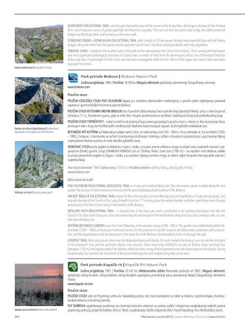
Kanjon rijeke Krupe | Krupa River Canyon KUDIN MOST EDUCATIONAL TRAIL runs through the loveliest part of the course of the Krupa River, the longest tributary of the Zrmanja River, which features a series of gentle waterfalls and travertine cascades. The trail runs over the Kudin most bridge, the oldest preserved bridge over the Krupa River, built entirely as a dry stone wall. STARIGRAD SENJSKI – DONJA KLADA EDUCATIONAL TRAIL, with a length of 10 km passes through many beautiful bays with old fishing villages. Along the entire trail, the typical coastal vegetation can be seen: macchia, coastal grasslands and rocky vegetation. CEROVAC CAVES – situated in the southern part of the park on the road towards Knin (4 km from Gračac). This is among the best known and most significant speleological structures in Croatia, with a number of finds from the ancient past, and as one of the largest find sites of the cave bear. A total length of 4 km of the cave has been investigated, while the first 700 m of the Upper and Lower Caves have been equipped for visitors. Park prirode Biokovo | Biokovo Nature Park Godina proglašenja: 1960. | Površina: 19.330 ha | Moguće aktivnosti: pješačenje, planinarenje, fotografiranje, snimanje www.biokovo.com Ponikve na vršnom dijelu Biokova | Ponikve karst depressions in the peak area of Mt. Biokovo Poučne staze POUČNA GEOLOŠKA STAZA POD VILOVIKOM lagana je i označena planinarskim markacijama, a poučne ploče objašnjavaju postanak vapnenca i geomorfoloških fenomena planine Biokovo. POUČNA STAZA PUTOVIMA DREVNE BERULIJE kroz 9 poučnih tabli prikazuje život stare Berulije (današnjih Brela) i priču o crkvi Gospe od Zdravlja iz 17. st., Tomaševom guvnu, gdje se vršilo žito i drugim posebnostima iz prošlosti i sadašnjosti života ljudi podbiokovskog kraja. POUČNA STAZA TOPNIČKI PUT – nalazi se istočno od prijevoja Staza i povezuje postojeću poučnu stazu s crkvom sv. Ilije na prijevoju Staza, povezujući tako i drugi dio fortifikacijskih utvrđenja duž lokaliteta Staza stvarajući siguran, kružni pješačko-edukativan put. BOTANIČKI VRT KOTIŠINA od Makarske je udaljen samo 3 km, na nadmorskoj visini 350 – 500 m. Vrt je utemeljio dr. fra Jure Radić (1920. – 1990.), franjevac i znanstvenik, sa svrhom znanstvenog istraživanja i motrenja, zaštite i očuvanja te popularizacije i upoznavanja biljnog svijeta planine Biokovo pa kroz vrt vodi nekoliko pješačkih staza. VIDIKOVAC STAZA pruža pogled na Makarsku rivijeru i otoke, a na putu prema vidikovcu mogu se vidjeti ostaci pastirskih stanova i prapovijesne (Ilirske) gomile. Drugi ZANIMLJIVI VIDIKOVCI još su i Štrbina, Vošac i Sveti Jure (1762 m) – na najvišem vrhu Biokova, odakle se pruža panoramski pogled na Zagoru i otoke, a za posebno lijepog vremena mogu se dobro vidjeti bosansko-hercegovačke planine i susjedna Italija. Year of proclamation: 1960 | Surface area: 19,330 ha | Possible activities: walking, hiking, photography, filming www.biokovo.com Vidikovac na more | Seaside viewing point Educational trails POD VILOVIKOM EDUCATIONAL GEOLOGICAL TRAIL is an easy and marked hiking trail. The information panels installed along the trail explain the process of how limestone is formed and the geomorphological phenomena of Mt. Biokovo. ANCIENT BERULIJE EDUCATIONAL TRAIL shows the life of the people of ancient Berulije (present day Brela) on 9 educational panels, and also tells the tale of the Church of Our Lady of Health from the 17 th century, about the wheat thresher and other specificities from the past and present of the life of those living in the foothills of Mt. Biokovo. ARTILLERY PATH EDUCATIONAL TRAIL – is situated east of the Staza pass and is connected to the existing educational trail with the Church of St. Elias at the Staza pass, thus also connecting the second part of the fortifications along the Staza site, creating a safe, circular, educational hiking trail. KOTIŠINA BOTANICAL GARDEN is just 3 km from Makarska, in the elevation range of 350 – 500 m. The garden was established by Father Dr. Jure Radić (1920 – 1990), a Franciscan monk and scientist, for the purpose of scientific research and observation, protection and conservation, and the popularisation and familiarisation of the plant life of Mt. Biokovo. Several walking trails run through the park. LOOKOUT TRAIL offers spectacular views over the Makarska Riviera and islands. On route towards the lookout, you can see the remnants of the shepherd’s huts and the prehistoric Illyrian rock mounds. Other interesting LOOKOUTS are also at Štrbina, Vošac and Sveti Jure (elevation 1762 m), the highest peak of Mt. Biokovo, which provides a magnificent panorama over the inland area and the islands. During exceptionally nice weather, the mountains of Bosnia and Herzegovina, and neighbouring Italy can be seen. Park prirode Kopački rit | Kopački Rit Nature Park Godina proglašenja: 1967. | Površina: 23.142 ha | Međunarodna zaštita: Ramsarsko područje od 1993. | Moguće aktivnosti: pješačenje, vožnja brodom, vožnja biciklom, vožnja konjskim zapregama, promatranje ptica, promatranje divljači, fotografiranje, rekreativni ribolov www.kopacki-rit.com Zalazak sunca na ritom | Sunset in the wetland Poučne staze POUČNA STAZA vodi od Prijamnog centra do Sakadaškog jezera, duž staze postavljene su table sa slikama i opisima biljaka, životinja i karakteristikama močvarnog staništa. PUT DABROVA razgledavanje posebnog zoo-rezervata čamcem ustanove uz pratnju vodiča i mogućnost razgledavanja vodenih putova poplavnog područja, posjet Kompleksu dvorca Tikveš, razgledavanje izložbe eksponata flore i faune Kopačkog rita u Bioekološkoj stanici. 34 | Ministarstvo turizma RH | Croatian Ministry of Tourism | www.mint.hr
Nacionalni katalog »Ruralni turizam Hrvatske« | National Catalogue Rural Tourism in Croatia Year of proclamation: 1967 | Surface area: 23,142 ha | International protection: Ramsar area since 1993 | Possible activities: walking, boat rides, cycling, horse carriage rides, bird watching, wild game watching, photography, recreational fishing www.kopacki-rit.com Educational trails The EDUCATIONAL TRAIL leads from the Reception centre to the Sakadaški Lake. The trail is lined by a number of information panels with photographs and descriptions of plants, animals and the characteristics of the wetland habitat. The BEAVER’S TRAIL allows for sightseeing of the special zoological reserve by guided boat tour, and the possibility of visiting the water routes of the floodplain areas, visiting the Tikveš palace, viewing the flora and fauna exhibit of Kopački Rit at the Bio-ecological station. Jeste li znali? | Did you know? Kopački rit fenomen je prirode. Unutrašnja je Delta Dunava i Drave u Europi jedinstvena pojava i najveće fluvialno močvarno područje srednjeg Podunavlja (Bognar, 1990). Danas je najveće rastilište i mrijestilište ribe čitavog Podunavlja, nakon područja njegove delte, kao i najvažniji ornitološki rezervat u Hrvatskoj, a ujedno jedan od važnijih u svijetu u kojem se svake godine gnijezdi oko 140 vrsta ptica, većinom gnjezdarica. Kopački je rit i poznato sastajalište orlova štekavaca. Kada ima dovoljno hrane, nerijetko možemo na jednom mjestu vidjeti od deset do dvadeset primjeraka. S prvim danima rujna u Kopačkom ritu započinje ritska ljubavna rapsodija. Počinje sezona parenja, “rika jelena”. Posjetitelji Parka riku jelena mogu čuti u rane jutarnje sate ili u predvečerje. Za ljubitelje prirode koji žele izbliza čuti i doživjeti riku jelena, Park organizira izlete uz pratnju vodiča. Kopački Rit is a natural phenomenon. It lies between the Drava and the Danube Rivers, and is a unique occurrence in Europe, as the largest fluvial wetland area in the middle Podunavlje region (Bognar, 1990). Today, this is the largest spawning ground and nursery area for fish in the Podunavlje region, and the largest ornithological reserve in Croatia and one of the most significant in the world, with some 140 bird species nesting here each year. Kopački rit is a famous meeting place for white-tailed eagles. When there is enough food, one can often see in one place ten to twenty specimens. The deer mating season, also called the rut, begins in Kopački Rit in early September. Park visitors are able to hear the rutting of the deer in the early morning hours or in the early evening. For nature lovers wanting to get out and hear the rut up close, the park also organises guided tours. Rika jelena doživljaj koji se pamti | The rut, an unforgettable experience Siva čaplja | Grey heron Park prirode Lonjsko polje | Lonjsko Polje Nature Park Godina proglašenja: 1990. | Površina: 51.126 ha | Međunarodna zaštita: Ramsarsko područje od 1993. | Moguće aktivnosti: pješačenje, vožnja biciklom, vožnja čamcem i skelom na rijeci Savi, promatranje ptica, fotografiranje, rekreativni ribolov www.pp-lonjsko-polje.hr Poučne staze PJEŠAČKA “STAZA GRANIČARA” kreće iz Krapja – sela graditeljske baštine u pravcu pašnjaka Orlinci na kojem se na otvorenoj ispaši nalazi matično stado, danas kritično ugroženog slavonsko-srijemsko-podolskog goveda. Uz stazu su izgrađene dvije replike drvenih povijesnih stražarnica (Čardaka) koji podsjećaju na burnu povijest Vojne krajine i život graničara. PJEŠAČKA“TENINA STAZA” svojim imenom simbolično podsjeća na šumara i hrvatskog pisca Josipa Kozaraca i istoimenu pripovjetku. Na stazi je postavljeno 16 poučnih panoa koji govore o temama vezanim za tipičnu nizinsku šumu hrasta lužnjaka i običnog graba. Year of proclamation: 1990 | Surface area: 51,126 ha | International protection: Ramsar area since 1993 | Possible activities: walking, cycling, canoe rides, raft ride on the Sava River, bird watching, photography, recreational fishing www.pp-lonjsko-polje.hr Savski rukavac u selu Mužilovčica | Sava River backwater in the village Mužilovčica Educational trails The FRONTIER TRAIL begins in Krapje – the village of architectural heritage village near the Orlinci pasture, where the main herd of the critically endangered breed Slavonian-Syrmian-Podolian Cattle is let out to graze. Along the trail, two replicas of the historical, wooden guardposts (Čardak) have been built, as a reminder of the tumultuous history of the Military Frontier and the life of the border guards. TENA’S TRAIL is a symbolic reminder of the forester and Croatian writer Josip Kozarac and his story of the same name. The trail includes 16 educational panels that point out the typical features of the lowland pedunculate oak and common hornbeam forests. Jeste li znali? | Did you know? Posebnost i značaj Lonjskog polja temelji se na tri ključna elementa: poplavama, prostranosti i životu stanovništa u skladu s prirodom. Lonjsko polje predstavlja jedan od najvećih i najbolje očuvanih vlažnih, močvarnih i poplavnih biotopa Europe. Duž čitavog toka rijeke Save i njenih lijevih pritoka rijeka Pakre, Lonje te Veli i Mali Strug prisutan je blagi pad korita što uzrokuje sporo otjecanje vode, česte poplave i dugo zadržavanje vode na staništu. Čardak, stražarnica iz doba Vojne krajine | Čardak, a defensive post from the period of the Military Frontier Hrvatska gospodarska komora | Croatian Chamber of Economy | www.hgk.hr | 35
- Page 1: REPUBLIKA HRVATSKA Ministarstvo tur
- Page 4 and 5: sadržaj | content 3 Uvodna riječ
- Page 6 and 7: Špilja Šupljara, Plitvička jezer
- Page 8 and 9: Pogled na Podevčevo sa vrha Čevo,
- Page 10 and 11: Osnovne karakteristike tradicijske
- Page 12 and 13: 3 Istra i Hrvatsko primorje | Istri
- Page 14 and 15: Nematerijalna kulturna baština u R
- Page 16 and 17: Popis nematerijalnih kulturnih doba
- Page 18 and 19: 3 Istra i Hrvatsko primorje | Istri
- Page 20 and 21: Izvorne pasmine u Hrvatskoj - oruđ
- Page 22 and 23: Rapska ovca | Rab sheep Creska ovca
- Page 24 and 25: Psi | Dogs Hrvatski ovčar | Croati
- Page 26 and 27: Prirodna baština Hrvatske - nacion
- Page 28 and 29: Nacionalni park Krka | Krka Nationa
- Page 30 and 31: POUČNA STAZA LJUBOTIĆ dužine 5 k
- Page 32 and 33: Pogled sa vrha Montokuc | View from
- Page 34 and 35: Posjetitelji u rudniku Zrinski | Vi
- Page 38 and 39: “Drveno selo” Krapje - europski
- Page 40 and 41: Podjela na turističke regije Nacio
- Page 42 and 43: Legenda Pregled simbola korištenih
- Page 44 and 45: Slavonija 05 Slavonia 01 O regiji i
- Page 46 and 47: Brodsko - posavska županija | Slav
- Page 48 and 49: Osječko - baranjska županija | Os
- Page 50 and 51: Osječko - baranjska županija | Os
- Page 52 and 53: Osječko - baranjska županija | Os
- Page 54 and 55: 25 Seljačko domaćinstvo Novačić
- Page 56 and 57: Osječko - baranjska županija | Os
- Page 58 and 59: Požeško - slavonska županija | P
- Page 60 and 61: Vukovarsko - srijemska županija |
- Page 62 and 63: Vukovarsko - srijemska županija |
- Page 64 and 65: 55 Čokot - čarda Osječko - baran
- Page 66 and 67: 61 Vinarija Gerštmajer Osječko -
- Page 68 and 69: Požeško - slavonska županija | P
- Page 70 and 71: 73 Antin Stan Vukovarsko - srijemsk
- Page 72 and 73: 79 Poljoprivredni obrt “Galović
- Page 74 and 75: Središnja Hrvatska i Grad Zagreb 0
- Page 76 and 77: Tradicijska drvena kuća u Širincu
- Page 78 and 79: 83 Izletište i vinotočje Vinia sa
- Page 80 and 81: Bjelovarsko - bilogorska županija
- Page 82 and 83: 154 95 Gospodarstvo Šumak Krapinsk
- Page 84 and 85: 101 154 Seoski turizam Masnec Krapi
Kanjon rijeke Krupe | Krupa River Canyon<br />
KUDIN MOST EDUCATIONAL TRAIL runs through the loveliest part of the course of the Krupa River, the longest tributary of the Zrmanja<br />
River, which features a series of gentle waterfalls and travertine cascades. The trail runs over the Kudin most bridge, the oldest preserved<br />
bridge over the Krupa River, built entirely as a dry stone wall.<br />
STARIGRAD SENJSKI – DONJA KLADA EDUCATIONAL TRAIL, with a length of 10 km passes through many beautiful bays with old fishing<br />
villages. Along the entire trail, the typical coastal vegetation can be seen: macchia, coastal grasslands and rocky vegetation.<br />
CEROVAC CAVES – situated in the southern part of the park on the road towards Knin (4 km from Gračac). This is among the best known<br />
and most significant speleological structures in Croatia, with a number of finds from the ancient past, and as one of the largest find sites<br />
of the cave bear. A total length of 4 km of the cave has been investigated, while the first 700 m of the Upper and Lower Caves have been<br />
equipped for visitors.<br />
Park prirode Biokovo | Biokovo Nature Park<br />
Godina proglašenja: 1960. | Površina: 19.330 ha | Moguće aktivnosti: pješačenje, planinarenje, fotografiranje, snimanje<br />
www.biokovo.com<br />
Ponikve na vršnom dijelu Biokova | Ponikve karst<br />
depressions in the peak area of Mt. Biokovo<br />
Poučne staze<br />
POUČNA GEOLOŠKA STAZA POD VILOVIKOM lagana je i označena planinarskim markacijama, a poučne ploče objašnjavaju postanak<br />
vapnenca i geomorfoloških fenomena planine Biokovo.<br />
POUČNA STAZA PUTOVIMA DREVNE BERULIJE kroz 9 poučnih tabli prikazuje život stare Berulije (današnjih Brela) i priču o crkvi Gospe od<br />
Zdravlja iz 17. st., Tomaševom guvnu, gdje se vršilo žito i drugim posebnostima iz prošlosti i sadašnjosti života ljudi podbiokovskog kraja.<br />
POUČNA STAZA TOPNIČKI PUT – nalazi se istočno od prijevoja Staza i povezuje postojeću poučnu stazu s crkvom sv. Ilije na prijevoju Staza,<br />
povezujući tako i drugi dio fortifikacijskih utvrđenja duž lokaliteta Staza stvarajući siguran, kružni pješačko-edukativan put.<br />
BOTANIČKI VRT KOTIŠINA od Makarske je udaljen samo 3 km, na nadmorskoj visini 350 – 500 m. Vrt je utemeljio dr. fra Jure Radić (1920.<br />
– 1990.), franjevac i znanstvenik, sa svrhom znanstvenog istraživanja i motrenja, zaštite i očuvanja te popularizacije i upoznavanja biljnog<br />
svijeta planine Biokovo pa kroz vrt vodi nekoliko pješačkih staza.<br />
VIDIKOVAC STAZA pruža pogled na Makarsku rivijeru i otoke, a na putu prema vidikovcu mogu se vidjeti ostaci pastirskih stanova i prapovijesne<br />
(Ilirske) gomile. Drugi ZANIMLJIVI VIDIKOVCI još su i Štrbina, Vošac i Sveti Jure (1762 m) – na najvišem vrhu Biokova, odakle<br />
se pruža panoramski pogled na Zagoru i otoke, a za posebno lijepog vremena mogu se dobro vidjeti bosansko-hercegovačke planine i<br />
susjedna Italija.<br />
Year of proclamation: 1960 | Surface area: 19,330 ha | Possible activities: walking, hiking, photography, filming<br />
www.biokovo.com<br />
Vidikovac na more | Seaside viewing point<br />
Educational trails<br />
POD VILOVIKOM EDUCATIONAL GEOLOGICAL TRAIL is an easy and marked hiking trail. The information panels installed along the trail<br />
explain the process of how limestone is formed and the geomorphological phenomena of Mt. Biokovo.<br />
ANCIENT BERULIJE EDUCATIONAL TRAIL shows the life of the people of ancient Berulije (present day Brela) on 9 educational panels, and<br />
also tells the tale of the Church of Our Lady of Health from the 17 th century, about the wheat thresher and other specificities from the past<br />
and present of the life of those living in the foothills of Mt. Biokovo.<br />
ARTILLERY PATH EDUCATIONAL TRAIL – is situated east of the Staza pass and is connected to the existing educational trail with the<br />
Church of St. Elias at the Staza pass, thus also connecting the second part of the fortifications along the Staza site, creating a safe, circular,<br />
educational hiking trail.<br />
KOTIŠINA BOTANICAL GARDEN is just 3 km from Makarska, in the elevation range of 350 – 500 m. The garden was established by Father Dr.<br />
Jure Radić (1920 – 1990), a Franciscan monk and scientist, for the purpose of scientific research and observation, protection and conservation,<br />
and the popularisation and familiarisation of the plant life of Mt. Biokovo. Several walking trails run through the park.<br />
LOOKOUT TRAIL offers spectacular views over the Makarska Riviera and islands. On route towards the lookout, you can see the remnants<br />
of the shepherd’s huts and the prehistoric Illyrian rock mounds. Other interesting LOOKOUTS are also at Štrbina, Vošac and Sveti Jure<br />
(elevation 1762 m), the highest peak of Mt. Biokovo, which provides a magnificent panorama over the inland area and the islands. During<br />
exceptionally nice weather, the mountains of Bosnia and Herzegovina, and neighbouring Italy can be seen.<br />
Park prirode Kopački rit | Kopački Rit Nature Park<br />
Godina proglašenja: 1967. | Površina: 23.142 ha | Međunarodna zaštita: Ramsarsko područje od 1993. | Moguće aktivnosti:<br />
pješačenje, vožnja brodom, vožnja biciklom, vožnja konjskim zapregama, promatranje ptica, promatranje divljači, fotografiranje, rekreativni<br />
ribolov<br />
www.kopacki-rit.com<br />
Zalazak sunca na ritom | Sunset in the wetland<br />
Poučne staze<br />
POUČNA STAZA vodi od Prijamnog centra do Sakadaškog jezera, duž staze postavljene su table sa slikama i opisima biljaka, životinja i<br />
karakteristikama močvarnog staništa.<br />
PUT DABROVA razgledavanje posebnog zoo-rezervata čamcem ustanove uz pratnju vodiča i mogućnost razgledavanja vodenih putova<br />
poplavnog područja, posjet Kompleksu dvorca Tikveš, razgledavanje izložbe eksponata flore i faune Kopačkog rita u Bioekološkoj stanici.<br />
34 | Ministarstvo turizma RH | Croatian Ministry of Tourism | www.mint.hr


