

KOROR STATE GOVERNMENT MARINE TOUR GUIDE ... - C3
KOROR STATE GOVERNMENT MARINE TOUR GUIDE ... - C3
KOROR STATE GOVERNMENT MARINE TOUR GUIDE ... - C3

You also want an ePaper? Increase the reach of your titles
YUMPU automatically turns print PDFs into web optimized ePapers that Google loves.
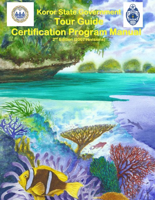
Koror State Government<br />
Tour Guide<br />
Certification Program Manual<br />
2 nd Edition (2007 revisions)
CONTENTS<br />
Chapter 1: PALAU TODAY<br />
1.1 Geography of Palau<br />
1.2 Modern Palau<br />
1.3 Tourism Network and Activities<br />
Chapter 2: THE <strong>TOUR</strong> <strong>GUIDE</strong><br />
2.1 Tour Guide Roles and Responsibilities<br />
2.2 Diving Briefing<br />
2.3 Responsible Diving Etiquette<br />
2.4 Coral Friendly Snorkeling Guidelines<br />
2.5 Best Practice Guidelines for Natural Sites<br />
2.6 Communication and Public Speaking<br />
2.7 Developing Your Own Style<br />
2.8 Customer Management and Service<br />
2.9 Interesting Natural History Facts<br />
2.10 Dive Site Descriptions<br />
Chapter 3: THE <strong>MARINE</strong> ENVIRONMENT<br />
3.1 Conservation Areas of Palau<br />
3.2 Watersheds<br />
3.3 Mangroves<br />
3.4 Sea Grass<br />
3.5 Coral Reefs<br />
3.6 Threats to Coral Reefs<br />
3.7 Marine Lakes and Jellyfish<br />
3.8 Important Marine Life<br />
3.8.1 Marine Algae<br />
3.8.2 Sponges<br />
3.8.3 Sharks<br />
3.8.4 Manta Rays<br />
3.8.5 Sea snakes and Sea Kraits<br />
3.8.6 Fish<br />
3.8.7 Turtles<br />
3.8.8 Dugongs<br />
3.8.9 Palau Conservation Society’s incidental<br />
sighting program<br />
2
Chapter 4: TRADITIONAL & CONTEMPORARY CULTURE<br />
4.1 Traditional Society<br />
4.2 Palauan Money<br />
4.3 Canoes<br />
4.4 Food<br />
4.5 Rock Island Art and Historical Importance<br />
4.6 Stone Monoliths<br />
4.7 Religion and Magic<br />
4.8 Bai<br />
4.9 Yapese Stone Money<br />
Chapter 5: PALAUAN HISTORY<br />
5.1 Historical Periods<br />
5.2 Historical and Cultural Sites in the Rock Islands<br />
5.3 Best Practice Guidelines for Sites of Cultural and<br />
Historical Significance<br />
Chapter 6: HUMAN SAFETY<br />
6.1 An Overview<br />
6.2 Diving Ailments<br />
6.3 First Aid and CPR<br />
6.4 Dive Equipment<br />
Chapter 7: WATER SAFETY<br />
7.1 National Government Water Safety<br />
Regulations<br />
7.2 National Boat Requirements that Each Guide needs<br />
to Check<br />
7.3 Safety Equipment<br />
7.4 Palau Marine Advisory System<br />
7.5 Koror State Water Safety Regulations<br />
7.6 Koror State Personal Watercraft Regulations<br />
Chapter 8: ENVIRONMENTAL REGULATIONS<br />
8.1 Koror State Rock Islands Management<br />
8.2 Koror State Environmental Laws<br />
8.3 National Government Environmental Laws<br />
8.4 Environmental Quality Protection Board<br />
8.5 Managing Boat Wastes<br />
REFERENCES<br />
3
Acknowledgments<br />
We would like to thank Koror State Government for giving us the opportunity to<br />
compile this manual and for their support throughout the project. In particular,<br />
thanks to Adalbert Eledui, the Director, and Ilebrang Olkeriil, Rock Islands<br />
Coordinator as well as Dr. Kathy Chaston, Coastal Management Officer.<br />
Special thanks to Michael Gilinski for providing the beautiful watercolor<br />
illustrations featured on the front cover and on the section dividers. Thanks to all<br />
the marine tour operators who participated in the consultation phase of this<br />
project and provided valuable suggestions regarding the content of both the<br />
manual and the certification course. We appreciate your contributions and hope<br />
that you will be satisfied with the final product.<br />
Many thanks to Palau Visitors Authority, Dr. Patrick Colin, Kevin Davidson and<br />
Palau Conservation Society for allowing us permission to use their photographs.<br />
Materials for the manual were kindly donated by Mrs. Ann Kitalong, The<br />
Environment Inc., Division of Arts & Culture, Division of Marine Law<br />
Enforcement, Palau Community College, Palau Visitors Authority, Environmental<br />
Quality Protection Board, David Idip Jr., Palau International Coral Reef Center,<br />
Palau Conservation Society, Kelly Raleigh of Palau Land and Resource Imaging<br />
System (PALARIS), The Nature Conservancy, the Palau Red Cross Society,<br />
the National Emergency Management Office, the Division of Transportation,<br />
amongst others. We thank Dr. Laura E. Martin, Dr. Michael N. Dawson, and Lori<br />
J. Bell of the Coral Reef Research Foundation for providing the section on the<br />
marine lakes. Thanks to Belau Tourism Association (BTA) and the Japanese<br />
BTA for their cooperation and support of this project.<br />
Patricia Davis and Colby Kearns<br />
Community Centered Conservation (<strong>C3</strong>)<br />
P.O.Box 1206<br />
Koror<br />
Palau<br />
cthree@palaunet.com<br />
Reference:<br />
Please cite this manual as:<br />
Davis, P.Z.R and C.M.Kearns (2005) Koror State Government Marine Tour<br />
Guide Certification Manual. Final Edits by The Environment, Inc., The Nature<br />
Conservancy, Palau Conservation Society and Koror State Department of<br />
Conservation and Law Enforcement and the Coral Reef Research Foundation.<br />
4
Permission to utilize information<br />
Please contact Koror State Department of Conservation and Law Enforcement<br />
(680-488-4001) or rorrangers@palaunet.com / rica@kororstate.org ) regarding<br />
copying any sections of this manual, whether for educational purposes or for<br />
personal use. This manual may not be sold.<br />
The watercolor illustrations and/ or photographs contained herein may not be<br />
reproduced without prior permission from the artist and/ or donating individual or<br />
agency.<br />
Further Acknowledgments:<br />
On behalf of the Koror State Government we would like to thank the following<br />
partners for their support and assistance in making this tour guide certification<br />
program possible:<br />
Palau Visitors Authority – for providing monetary contribution and assistance in<br />
the translation of the tour guide training materials.<br />
Palau Community College – specifically the Tourism and Hospitality Department<br />
and Continuing Education for assisting in developing this program.<br />
5
Chapter 1: Palau Today<br />
6
1.1 Geography of Palau<br />
1.1.1 Location and Population of Palau<br />
Palau is part of a longer chain of islands within the group of islands known as Micronesia<br />
(meaning “tiny” islands).<br />
Palau sits approximately 500<br />
statute miles (800 kilometers)<br />
north of New Guinea,<br />
southeast of the Philippines<br />
and southwest of Guam in<br />
the Mariana archipelago. Its<br />
closest neighbor within the<br />
group of Micronesian islands<br />
is Yap, which is a member of<br />
the Federated State of<br />
Micronesia. Palau has a<br />
total land area of 190.655<br />
square miles (460 square<br />
kilometers, Source: PALARIS<br />
2006) surrounded by a 70-<br />
mile-long (112 kilometers,<br />
source, PALAU - REA) barrier reef that forms a lagoon approximately 560 square miles<br />
in size.<br />
http://www.cia.gov/publications/factbook/maps/ps-map.gif<br />
Palau also owns an exclusive fishery zone<br />
of twelve nautical miles beyond its<br />
baseline. Palau is an archipelago<br />
stretching between 7 degrees and 20<br />
minutes north latitude and 134 degrees<br />
and 28 minutes east longitude (between 2<br />
and 8 degrees latitude from north to south<br />
and 131 to 134 longitude from east to<br />
west). There are 300 high and low<br />
islands (Palau archipelago consists of 586<br />
islands, spread over an area of 1,940<br />
sq.km, Source: Palau Nature Facts, TNC)<br />
with the low islands mostly situated near<br />
the extreme ends of the archipelago. The<br />
total area of all the islands of Palau is 188<br />
square miles (source: Palau Nature Facts,<br />
TNC). At the northern end are the islands<br />
of Ngeruangel, Ngcheangel (Kayangel),<br />
and Babeldaob. At the southern end are<br />
Oreor (Koror), Ngerekebesang,<br />
Ngemelachel, Chelebacheb (Rock<br />
Islands), Ngerechong, Ngemelis Islands, Ngebed. Beliliou and Ngeaur are in the<br />
southern portion.<br />
Farther south, at least 350 statue miles (about 575 to 600 kilometers from main islands<br />
of Palau, source: Palau Nature Facts, TNC,) from Koror, are the Southwest islands of<br />
8
Sungesol (Sunsorol) and Fana, Bul (Pulo Anna) and Merir, Hatohobei (Tobi) and Helen<br />
Reef. The largest island, Babeldaob, is about 25 miles (40 kilometers) at its widest area<br />
and consists predominantly of rolling hills. The highest point is Mt. Ngerchelchuus at<br />
about 719 feet (219.15 meters), on the island of Babeldaob. Rivers and Lakes can be<br />
seen throughout the various states of Babeldaob including the longest river, the<br />
Ngermeskang River, about 9.8 miles long, along the west coast that flows into the<br />
Ngeremeduu Bay, the largest coastal estuary, watershed area, and conservation area in<br />
Micronesia. Along the east coast is the second longest river, the Ngerdorch River with<br />
the Ngerdorch Watershed that includes Lake Ngardok, the largest freshwater lake in<br />
Micronesia. (Natural History of Palau)<br />
(2007 revision Sources: 2004 Palau Nature Facts, The Nature Conservancy (TNC), the<br />
Palau Rapid Ecological Assessment (REA) 1994 Summary, and Communication with<br />
the (PALARIS) Palau Automated Land And Resources Information Systems Office)<br />
According to statistics from the 2000 census survey conducted by the Ministry of<br />
Finance, Office of Statistics, Palau’s total population is 19,129 people.<br />
Ethnicity<br />
Number of Residents<br />
Palauan 13,364<br />
Non Palauan 5,765<br />
Total 19,129<br />
1.1.2 Climate<br />
Palau has a maritime tropical climate with a<br />
high amount of rainfall. The average daily<br />
temperature throughout the year is 81<br />
degrees Fahrenheit while the relative humidity<br />
is about 82%. An average of rain feeds into<br />
the rivers and streams of Palau, contributing<br />
to the humidity levels. Wind direction shifts<br />
occur with the trade winds blowing from the<br />
northeast and east during November to May.<br />
From June to September, winds come from<br />
the southwest. These wind directions,<br />
rainfall, and temperatures contribute toward<br />
the conditions of survival for the flora (plants)<br />
and fauna (animals) of Palau. In addition, the<br />
changing physical characteristics of the<br />
islands have been affected throughout<br />
millions of years by the natural forces wind,<br />
rain, and movement of the Earth’s crust.<br />
Photo: Patricia Davis<br />
Presently, man and technology have played<br />
major role in changing Palau’s physical characteristics including its rich and diverse<br />
marine resources.<br />
9
1.1.3 Geology and Formation<br />
The volcanic islands of the Pacific were formed as floating plates (moveable sections of<br />
the earth’s crust) on top of the mantle (part of earth between the center and the plates)<br />
deep within the earth pushed against each other. Palau is part of a mountain range that<br />
formed as a result of the Philippine plate pushing down on the Pacific plate<br />
approximately 40 to 70 million years ago. The movement resulted in volcanic activity<br />
that created large islands in the Pacific. The main islands of Palau are volcanic in origin<br />
and include the islands of Koror, Malakal, Arkabesang, and Babeldaob. Originally these<br />
islands were much higher, but over time have been worn down by wind and rain to their<br />
present stature. The reefs that bordered these islands continued to grow and expand<br />
close to the surface of the ocean where there was abundant sunlight. This reef growth<br />
resulted in the formation of atolls and low coral islands where ancient volcanoes sunk or<br />
subsided. The formation of raised limestone islands occurred where the underlying<br />
plate uplifted. These limestone islands are composed of ancient reef structures formed<br />
by corals, calcareous algae, and many marine invertebrates. The jagged harsh surface<br />
of the limestone is caused by years of erosion from rain and wind. The mushroom shape<br />
of the Rock Islands is the result of its famous natural undercut. This undercut was<br />
formed by three processes of erosion: biological, chemical and physical. Bioerosion is<br />
caused by countless grazing and boring by invertebrates like chitons, sea urchins and<br />
worms. Chemical dissolution is caused by carbonic acid that is formed from water and<br />
carbon dioxide from the plants on the islands. Physical erosion is caused by the<br />
constant tidal fluctuations and wave action.<br />
Information Source: History of Palau. 1997. Heritage of an Emerging Nation. Elizabeth<br />
D. Rechebei and Samuel F. McPhetres. Ministry of Education. Republic of Palau.<br />
Ann Kitalong, 2002. A Personal Tour of Palau.<br />
1.2 Modern Palau<br />
1.2.1 Government Structure in Palau<br />
The Palauan Government has three interdependent authorities – national, state, and<br />
traditional. The constitution effective in 1981 is the supreme law of the land.<br />
The national government has an executive branch, led by the President, a two-house<br />
legislature, and a judiciary. The country is divided into 16 states, most of which were<br />
municipalities under the Trust Territory Government. Each state has its own executive<br />
and legislative branches. The state governments are subsidiaries of the national<br />
government and derive their power from the national government. The Palau constitution<br />
provides that the states have only those powers specifically<br />
given by the national government or denied to the national<br />
government.<br />
Palau’s traditional system still exists and operates both<br />
within and outside the constitutional government.<br />
Participation by titled leaders in the national government is<br />
limited. The government has a Council of Chiefs that has<br />
the authority to advise the President on customary matters.<br />
10<br />
High Chief Ibedul Gibbons
There is no participation of traditional leaders in the national legislature (OEK).<br />
In contrast to the national government, the state governments are constitutionally<br />
mandated to follow both “democratic principles” and “traditions of Palau,” and chiefly<br />
power is consequently much greater at the state level. Nearly all the state governments<br />
integrate titled leaders into their executive and/or legislative branches.<br />
The amount of real authority granted to such leaders, however, varies widely among the<br />
states. In the executive branches, for example, three states give complete decisionmaking<br />
power to their chiefs or high chief. At the other extreme, six states include no<br />
participation of traditional leaders in their executive branches. The remaining seven<br />
states have opted for an intermediate participation level by their chiefs, giving them<br />
limited decision making power or merely advisory functions. This range of power is<br />
similar in the states’ legislative branches. The legislature of two states contains only<br />
titled leaders. Seven have a mix of elected and titled members. One has two houses –<br />
one elected and one titled. The remaining six states have legislatures that are entirely<br />
elected.<br />
1.2.2 Governance in Koror<br />
Koror State is the center for economy and commercial infrastructure for the nation and is<br />
the host of about ninety percent of Palau’s tourism related activities that is concentrated<br />
around the Rock Islands – Southern Lagoon Area. It is important to understand the<br />
governance that constructs the laws and government of Koror.<br />
The primary responsibility for the administration of Koror State is vested in the Governor,<br />
who is voted in office every four years. The Governor’s duties include enforcing the laws<br />
of Koror State. The legislative branch of government consists of representatives elected<br />
by each of Koror’s twelve hamlets and five members elected at large. The legislature<br />
enacts laws and has the power to levy and collect taxes. The House of Traditional<br />
Leaders (HOTL), consisting of Ngarameketii (absolute chiefs representing the four main<br />
hamlets of Koror) and Rubekul kledeu (chiefs representing the other seven hamlets of<br />
Koror) is the supreme authority of Koror State for all matters relating to traditional law.<br />
The HOTL advises the Governor on matters relating to traditional law and may propose<br />
bills to the Legislature.<br />
The Koror State seal features three bai, representing the House of Traditional Leaders,<br />
the Governor and the Legislature. The Rock Islands Southern Lagoon Area is a<br />
successful example of a state resource that has been governed and actively managed<br />
under both traditional and constitutional law.<br />
The Rock Islands – Southern Lagoon Area is owned by Koror State and regulated by the<br />
Koror State Government, who have appointed the Koror State Public Lands Authority<br />
and the Koror State Planning and Zoning Commission to oversee all land and designate<br />
land use and zoning, respectively. The Koror State Department of Conservation and<br />
Law Enforcement is responsible for day-to-day management and coordination of<br />
activities within the Rock Islands Southern Lagoon Management Area (referred as<br />
Management Area) as well as enforcing all State laws. (please see Environmental<br />
Regulations for details).<br />
The Traditional Leaders had always taken responsibility for the Management Area, but<br />
they have recognized in recent years that the increasingly intensive and varied use of<br />
the area has resulted in greater and more complex challenges for management.<br />
11
As a result the Traditional Leaders requested the Koror State executive and legislative<br />
branches to work with them to gain the support and cooperation of interested parties and<br />
improve management of the area. The Sixth Koror State Legislature, recognizing the<br />
local, national and international significance of the Management Area, passed a<br />
resolution calling for an integrated management plan for the conservation of its<br />
resources. The governor then appointed an executive committee to oversee the<br />
development of a comprehensive management plan. The Koror State Department of<br />
Conservation and Law Enforcement developed the management plan with assistance<br />
from The Nature Conservancy and Palau Conservation Society.<br />
The department was founded in 1994 and consists of trained, ranked and uniformed<br />
rangers that maintain law and order, as well as preserve the unique natural resources of<br />
the state. It also has a “Rock Islands Facelift Program”, which is responsible for<br />
maintaining the tourist activity areas in the Management Area and a Coastal Resources<br />
Management Office, whose primary focus has been the development of a<br />
comprehensive Management Plan for the Rock Islands Southern Lagoon Area and will<br />
lead its implementation. The Tour Guide Certification Training Program is the<br />
responsibility of this department and is part of the department’s education and capacity<br />
building program, supplementing the Rock Islands Southern Lagoon Area Management<br />
Plan.<br />
1.2.3 Land and Sea Tenure<br />
Traditionally, Palauan land was divided into political units called beluu, or villages.<br />
Boundaries were in flux, determined by warfare and other factors, and generally<br />
extended as far out to the sea as one could travel by canoe and still see the islands.<br />
The territory of each beluu was divided into clan lands, chetemel a blai, and public<br />
domain land, chutem buai. Public domain land, which comprised the bulk of the land in<br />
Palau, was land not claimed by any clan, lineage, or individual. This land was managed<br />
by the village council. Land owned by clans and lineages comprised less then half of<br />
Palau’s land. Alienation of clan land could be done via trade, sale, mortgage, service<br />
reward, marriage exchange, or punitive fine, and with the exception of the last option,<br />
could not be alienated without the approval of the strong members of the clan.<br />
Palau was governed by a series of occupying powers during most of this century, and<br />
these governments took large portions of Palauan land under their control. Land not<br />
being used at the time, regardless of ownership, was taken as public land. What was<br />
not declared public was registered as private in the official land registry under the names<br />
of individuals. This was done regardless of whether the land had belonged to an<br />
individual or to his or her clan or lineage.<br />
Today land in Palau is owned either privately – by individuals, clans, or lineages, or<br />
publicly – by the national or state governments. With Palau’s recent independence,<br />
there has been a move to return wrongfully taken land to its original owners.<br />
The Palauan Land Court, created in the Land Claims Reorganization Act of 1996, is<br />
responsible for determining ownership of all land within the Republic. The goal is that by<br />
the end of the century, all land once owned by individuals, clans, or lineages will have<br />
been returned to those persons or groups and the remaining land will be public domain.<br />
Public land is managed by the Palau Public Land Authority and eventually will be<br />
transferred to each of the state public land authorities.<br />
12
The Palau constitution grants the states “ownership” of all living and non-living resources<br />
from the land to 12 miles (1.85 kilometers) seaward from the “traditional baselines,”<br />
provided that traditional fishing rights and practices are not affected. The national<br />
government retains control over the resources that Palau claims beyond 12 nautical<br />
miles.<br />
1.2.4 Traditional authority and the management of natural resources<br />
In the past, Palau’s traditional leaders were the caretakers of the resources of the land<br />
and sea. Palauans established a society closely tied to reciprocity and respect for both<br />
members in the community and the natural environment. The Palauan word ‘omengull’<br />
literally translates into ‘respect’, and this respect plays a vital role in how the<br />
consciousness of Palauan culture proliferates in these modern times.<br />
Today, much of that responsibility has been taken over by the national and state<br />
governments. But as described above, the constitution grants chiefs considerable<br />
authority to continue in their traditional roles. They may exert their authority both<br />
through purely customary processes and through the state governments.<br />
In fact, both the states and the chiefs appear to be taking more control over how Palau’s<br />
natural resources are used. There have been more and more examples of chiefs<br />
declaring bul (taboo or closure) over certain areas or resources.<br />
The state governments, with their mixed titles and elected leadership, are also becoming<br />
increasingly active with regard to the management of community resources. Several<br />
states have established permit systems for fishing and tourism. These systems control<br />
access to community resources and ensure that the community receives at least some<br />
of the benefits from those activities.<br />
(Information Source: Palau Conservation Society Government Fact Sheet)<br />
1.2.5 The Economy of Palau<br />
Palau’s economy consists primarily of tourism, fishing, and agriculture. The government<br />
is the majority employer of the work force, with consistent long-term financial aid from<br />
the USA and Japan. More recently other Asian, Pacific, and European Nations have<br />
aided Palau financially. Business and tourist arrivals numbered 50,000 in FY00/01. The<br />
population enjoys a per capita income twice that of the Philippines and much of<br />
Micronesia. Long-run prospects for the key tourist sector have been greatly bolstered by<br />
the expansion of air travel in the Pacific, the rising prosperity of leading East Asian<br />
countries, and the willingness of foreigners to finance infrastructure development.<br />
Tourism Industry<br />
One of the unique and irreplaceable attractions of Palau is its marine environment. The<br />
unequaled beauty of the Rock Islands has become the worldwide symbol of Palau. In<br />
1989 Palau’s reefs and waters were declared one of the seven wonders of the<br />
underwater world by CEDAM (Conservation, Education, Diving, Awareness, and Marine<br />
Research) International. The result of this exposure has been a unique blend of<br />
international tourism. Tourism has been a major economic boost for Palau, says Mary<br />
Ann Delemel of Palau Visitors Authority. The industry has generated other economic<br />
activities such as arts and crafts production, agriculture, retail shops, and marine related<br />
13
sports activities. Tourism has also increased the amount of employment opportunities<br />
within a broad range of skills. Land based activities focusing on cultural sites, mainly in<br />
Babeldaob, have recently begun to rise as well. Foreign visitors are now interested in<br />
the marine and terrestrial resources that Palau has to offer within its unique island<br />
environment.<br />
Information Source: History of Palau. 1997. Heritage of an Emerging Nation. Elizabeth<br />
D. Rechebei and Samuel F. McPhetres. Ministry of Education. Republic of Palau.<br />
PVA<br />
1.3. Tourism Network and Activities<br />
1.3.1 Palau Visitors Authority<br />
The mission of the Palau Visitors Authority is to promote and encourage the<br />
development and marketing of tourism as one of the main revenue earning sectors of<br />
the Republic along with fishery and agriculture.<br />
To achieve this PVA undertakes the role of the country’s tourism authority whose<br />
position is to be visionary and present a strong image of Palau as a special destination<br />
appealing to the high end and environmentally conscientious clientele. To this end it<br />
invests 60% of its annual budget on marketing and promotion activities. At the local<br />
level, PVA is responsible for generating awareness and an understanding of tourism<br />
within the community to ensure that the Palauan people understands what tourism is<br />
about, what it does, and how it affects our island nation.<br />
The PVA is composed of seven members of the Board of Directors who are appointed<br />
by the President, with advice and consent of the Senate, to serve a term of two years. Its<br />
primary duties are to develop policies, guidelines, and work plan activities that are<br />
implemented through the managing director who oversees the day to day activities of<br />
the organization.<br />
14
The Board has another key responsibility in that it recommends to the President and the<br />
Congress passages of legislation pertaining to tourism. The PVA acts as a liaison<br />
between the tourism industry and the community, particularly the states, by accessing<br />
and encouraging development of potential tourist sites and land-based activities for the<br />
purpose of spreading tourist traffic throughout Palau and diversifying tourism attractions.<br />
The PVA is organized into four departments: 1) Marketing and Research, 2) Support<br />
Services which combines operational functions and community services of the authority,<br />
3) Finance, and 4) Human Resources.<br />
The customers of the PVA are visitors to the Republic, internal staff, tourism industry<br />
operators, state and national government and the public.<br />
PVA’s Goals and Objectives<br />
The PVA Board has adopted the following key operational objectives:<br />
- To continue to strengthen Palau’s presence in the traditional markets of Japan,<br />
North America, and Taiwan<br />
- To intensify public awareness campaigns in the newly developed markets in<br />
Europe, Asia (Philippines, Taiwan and Hong Kong.), and in particular, in<br />
response to the SARS negative publicity<br />
- To look into new markets, particularly in areas like Australia, Thailand, and Korea<br />
- To play a proactive role in the development of diversified tourism activities and<br />
develop a marketing strategy that supports it<br />
- To work closely with the industry, both public and private to achieve improvement<br />
in the quality of services and products offered to visitors as well as the quality of<br />
visitors to the Republic<br />
- To continuously develop staff professionalism for the purpose of providing<br />
excellent customer services within and outside of PVA<br />
- To establish and maintain clear corporate governance including personnel and<br />
financial policies<br />
- To improve recording and accountability of budgetary and financial transactions,<br />
to ensure full compliance with laws and regulations and generally accepted<br />
accounting standards<br />
- To maintain budgetary and internal controls for the purpose of getting more for<br />
the limited budget<br />
Priority Areas<br />
In concert with the responsibilities tasked to the PVA in the Management Action Plan<br />
(MAP), the PVA Board of Directors has adopted the following as priorities for PVA to<br />
achieve in the immediate and medium terms; (some are long term strategies).<br />
1. Establishment of the national tourism policy for the Republic: in view of the<br />
progressive infrastructure development that is expanding rapidly in Palau, it is<br />
critical that a sound policy on tourism is established to address appropriate<br />
guidelines and standards with which to sustain the long term viability of tourism<br />
in the Republic. The first step in the process, which is to identify issues of<br />
priorities and lay out the action plan for each issue, is completed. Awaiting official<br />
15
approval of the OEK is the creation of the National Tourism Unit or similar body<br />
that will spearhead the implementation process.<br />
2. Maintain diving as Palau’s foremost attraction while developing the marketing<br />
image of Palau as a special destination in the world with unique natural and<br />
cultural attractions other than diving. There is considerable potential for Palau to<br />
diversify its attractions and therefore expand its image from just being a dive<br />
destination to nature, adventure, culture, and eco- tourism.<br />
3. With the terrorist attacks in 2001 (NYC) and 2002 (Bali bombings) and most<br />
recently with the outbreak of the SARS virus, Palau is likely to experience<br />
substantial decrease in visitor arrivals. An aggressive marketing strategy needs<br />
to be in place to respond to these external factors and solidify Palau’s position as<br />
a safe and pristine tourist destination in the immediate term. In particular, an<br />
aggressive promotions plan is to be in place for Japan, one of Palau’s most<br />
important markets. Timing is opportune for an active campaign to attract visitors<br />
from Japan to Palau where visitors from SARS infected countries temporarily<br />
stopped.<br />
4. Work with the industry, state, and national governments to establish a<br />
hotel/motel rating system and dive management plan to ensure the long term<br />
sustainability of the industry.<br />
5. Administration: While not specifically identified in the MAP, internal controls and<br />
exercise of prudent management of resources will be improved and consistently<br />
followed to ensure accountability as well as “getting the most out of each dollar<br />
spent”. Improvement to financial reporting and accounting procedures consistent<br />
with acceptable accounting standards will be ensured.<br />
6. The Human Resource department will conduct a comprehensive analysis of<br />
employee job descriptions to ensure that functions do not overlap and if so,<br />
revisions will be made to make full utilization of manpower capability within the<br />
organization. The human resource department will look into capacity building,<br />
reliable evaluation, and merit systems.<br />
7. Awareness as to the importance of tourism in the Republic: continuous dialogue<br />
between and among state and national government entities, operators and<br />
private sector as stakeholders of this important industry will continue to improve.<br />
Information Source: Palau Visitors Authority<br />
1.3.2 Visitors to Palau<br />
Visitors are the key to tourism, keeping the entire tourism network working. Their<br />
attitudes, actions, and experiences play a critical role in sustainability for Palau in terms<br />
of both economy and ecological health of the natural resources on which tourism<br />
depends.<br />
16
It is important to have a general knowledge of the tourists who visit Palau, and the<br />
activities that they participate in during their stay in Palau. Palau Visitor’s Authority is<br />
the primary source of information on this subject:<br />
Palau has seen an 8% increase in the total number of visitors from 2001 to 2002.<br />
The following table gives the breakdown of visitor percentages according to ethnic<br />
background. About half of Palau’s tourists visit with the primary purpose of scuba diving.<br />
Country<br />
Number of<br />
tourists per year<br />
(2003)<br />
Percentage by<br />
country of origin<br />
USA 3,495 6% 77%<br />
Japan 20,952 35% 91%<br />
Europe 1,123 2% 89%<br />
Taiwan 27,710 46% 22%<br />
Others 6,571 11% 57%<br />
Total 59,851 100% 55%<br />
Percentage<br />
divers among<br />
tourists<br />
Most of the remainder is “general interest” tourists, but virtually all of them engage in<br />
marine recreational activities, including snorkeling, motorboat touring, kayaking, and<br />
fishing (PCS, 2001). A recent survey conducted by Community Centered Conservation<br />
(<strong>C3</strong>) identified seven major marine-based activities, which are offered and utilized within<br />
the tourism industry. These include scuba diving, snorkeling, kayaking, boating or jet ski<br />
rental, sea walk, parasailing, and banana boating. All of these activities take place<br />
within the southern part of Palau’s main archipelago known as the “Rock Islands<br />
Southern Lagoon Area” (2003).<br />
1.3.3 Marine Tourism Activities and Sites<br />
Scuba Diving<br />
Scuba diving is one of Palau’s main tourism activities. Palau provides excellent<br />
opportunities for all levels of diving, from novice through advanced. There are currently<br />
75 dive sites in Palau and 75 percent of those are located within the Rock Islands<br />
Southern Lagoon Area (PCS, 2001). There are 22 identified tour operators in Koror who<br />
offer scuba diving tours (<strong>C3</strong>, 2003).<br />
Snorkeling<br />
Snorkeling is also a popular tourist activity in Palau, particularly since is requires much<br />
less training and equipment. There are 25 identified tour operators in Koror who offer<br />
snorkeling tours (<strong>C3</strong>, 2003).<br />
Other Marine Activities<br />
Kayaking, fishing, boating, watercraft/ski<br />
rental, sea walking, parasailing, banana<br />
boating, and other activities are also<br />
available.<br />
17
Chapter 2: The Tour Guide<br />
20
2.1 Tour Guide Roles & Responsibilities<br />
2.1.1 The importance of the tour guide<br />
Tour guides are important to Palau and Koror State in many ways. They are an<br />
irreplaceable part of the tourism industry, because they interact directly with tourists who<br />
generate a large part of Palau’s economy and play a direct role in determining how<br />
interesting, educational, safe and fun the tourist’s experience in Palau will be. While you<br />
are guiding in Palau remember to show respect to other guides working along side you,<br />
regardless of race or gender. Show respect to the weather and the ocean, but most of all<br />
respect our unique natural environment for future generations.<br />
Tour guides have an impact on the behavior of tourists in Palau because of the intimate<br />
role they play. Tourists take their cues on acceptable behavior from their guides. If a<br />
tour guide behaves poorly, such as taking organisms from the reef or damaging the reef<br />
through improper dive etiquette, the tourist will likewise behave poorly and leave behind<br />
scars that mark their vacation in Palau. Tour guides that promote good dive etiquette<br />
and properly brief their clients before each dive will help preserve the beautiful marine<br />
life that tourists come to see. Tour guides are critically important to the conservation of<br />
the Rock Islands and Southern Lagoon Area. Apart from helping moderate the<br />
destructive behaviors of tourists, guides are present more than almost anyone else in<br />
the conservation areas. Guides can report on illegal activities in the area and monitor<br />
the status of the marine resources that they see nearly every day. By participating in the<br />
preservation of those resources, the tour guides help ensure that Palau retains the<br />
healthy marine environment which draws tourists here year after year.<br />
2.1.2 Roles of the tour guide<br />
The tour guide has a few major roles to fulfill while he or she is getting paid to showcase<br />
the natural attractions the tourists are here to see. The Guide has to provide an<br />
interesting, educational, safe and fun experience for the tourists. On top of that, the tour<br />
guide needs to ensure that the tour doesn’t cause damage to the environment the tourist<br />
are here to see. In order to do this, the tour guide is responsible to do the following:<br />
• Research and collect data and information about Palau’s natural, cultural and<br />
human resources, history, popular destinations, anticipate questions and be<br />
prepared to accurately answer any questions asked by guests.<br />
• Know local, common, and scientific names of common marine and terrestrial<br />
organisms.<br />
• Be familiar with Koror State regulations, and be able to brief tourist on restrictions.<br />
• Be able to give appropriate instructions on the use of the reef hook.<br />
• Demonstrate appropriate dive etiquette and be able to explain what not to do while<br />
diving or snorkeling in Palau.<br />
21
2.1.3 Roles of the tour guide<br />
Apart from playing a huge role in ensuring a pleasurable experience for tourists in Palau,<br />
the tour guide also has a responsibility to make sure the experience is safe as well. If<br />
something goes wrong in the course of a tour, it is usually the guide who will be held<br />
responsible. In order for this not to happen, the guide needs to do the following:<br />
• Prepare all gear and equipment for the tour, and make sure it’s functioning<br />
properly.<br />
• Ensure there is a properly functioning boat and safe boat operator for the tour.<br />
• Check weather conditions, tides and water craft warnings before the tour, and be<br />
prepared for alternate plans.<br />
• Give proper and thorough dive briefings to tourists, including safety tips, what not to<br />
do, and what to do in case of separation from the group.<br />
• Be certified in First Aid and CPR.<br />
2.2 Diving Briefings<br />
The dive briefing is an integral part of safe and enjoyable dives. The tour guide should<br />
be sure to do a proper dive briefing before every dive to ensure that the tourists know<br />
what to expect and how to behave while on the dives. A good diver briefing includes:<br />
1. Dive Site Name – partly for fun but also for the divers information, often the diver<br />
will insert it into their log – if the name is unusual it is useful to tell them the story<br />
behind the name<br />
2. Site Description – this includes a description of the site layout, points of interest,<br />
depth, bottom composition, currents or water movement, temperature, hazards,<br />
and other information<br />
3. Your Role – tell the diver where you will be and what you will be doing<br />
4. Entry and Exit Points – divers appreciate recommendations, descriptions, and<br />
reminders of techniques – it makes the dive easier and more relaxed<br />
5. Dive Procedures – this includes course to follow or direction to head, ways to<br />
avoid common problems, reminders to make safety stops, air reserve methods,<br />
maximum depths, and maximum bottom times<br />
6. Emergency Procedures – includes problems that may occur unique to the dive<br />
site and how to handle these situations, low on or out of air procedures, and<br />
diver recall practices<br />
7. Signal Review – remind buddy teams to review their signals between them as<br />
well as inform them on the signals you will use regarding both the technical<br />
aspects and the observations they should make<br />
8. Roster/Buddy Check – be sure to establish and review buddy teams<br />
9. Environmental Interaction Suggestions<br />
• Identify organisms to respect and be cautious of<br />
• Remind them not to damage environment by controlling buoyancy, not<br />
kicking or grasping the reef<br />
• Discourage fish feeding<br />
• Take only pictures; leave only bubbles!<br />
10. Pre-dive Safety Check – remind divers and be the extra set of eyes; check air<br />
level, weight, proper set-up of gear, etc.<br />
Information Source: PADI Dive Master Manual<br />
22
2.3 Responsible Diving Etiquette<br />
The tour guide should be an excellent example of responsible diving etiquette, and<br />
should be prepared to explain good diving etiquette. The responsible and caring tour<br />
guide does the following:<br />
• Does not touch, handle, or provoke any marine organism.<br />
• Does not stand, rest fins, or hold onto corals. If you must touch the reef to steady<br />
yourself in currents, use a reef hook or only your fingertips on dead part of the<br />
reef or coral covered in algae.<br />
• Does not alter or deface anything on the reef.<br />
• Does not collect or remove any corals, sea grass, algae, or any other marine<br />
organisms.<br />
• Secures equipment such as gauges and alternate air sources so that they do not<br />
drag over the reef.<br />
• Avoids kicking up sand because stirred up sediment can settle on coral and<br />
smother it.<br />
• Does not harass marine life, a good guide observes marine inhabitants from a<br />
distance.<br />
• Does not dispose of his/her or tourists’ garbage in the ocean.<br />
• Does not throw anchors indiscriminately, because it causes irreparable damage<br />
to the reefs.<br />
• Uses recyclable containers whenever possible to reduce waste.<br />
• Does not spearfish with scuba gear.<br />
Information Source: 1994. The Environment, Inc. Tour Guide Handbook<br />
2.4 CORAL-FRIENDLY SNORKELING <strong>GUIDE</strong>LINES<br />
Coral reefs are one of the world’s most spectacular marine habitats and snorkeling is an<br />
excellent way of exploring them. As coral reefs face an increasingly uncertain future,<br />
snorkelers and other coral reef visitors can play an important role in helping to protect<br />
these fragile habitats by following a few simple guidelines.<br />
Before Setting Out To Explore the Reefs:<br />
• Make sure tourists have the best possible instruction you can give.<br />
• Be sure to practice snorkeling skills in a swimming pool or sandy area until you are<br />
completely comfortable in the water.<br />
• Make sure your equipment fits properly before you snorkel near corals, because it<br />
can be very difficult to adjust in the water.<br />
• If tourists are feeling unsure, have them wear a snorkel vest – many operations<br />
insist on them.<br />
• Learn all you can about coral reefs – they are fascinating and fragile environments.<br />
23
2.4.1 Snorkel in the Comfort Zone<br />
To get the most out of snorkeling, “stay within your comfort zone.” You will see much<br />
more and be able to enjoy the beauty of the reef more by hanging back. Depending on<br />
snorkeling skills, experience, fitness and age, each snorkeler will have their own<br />
personal safe distance from the reef from which to comfortably enjoy it without causing<br />
harm.<br />
2.4.2 Snorkeling out on the Reef<br />
Be sure to avoid all contact with corals and other marine life. Not only could you be hurt<br />
but corals are fragile animals – as much as a gentle touch can harm them. Even sand<br />
kicked up by fins can smother and kill them.<br />
• Be careful where you get into and out of the water to avoid walking on corals.<br />
• Be sure tourists snorkel in their “comfort zone” – don’t get too close to the reef.<br />
• Make sure tourists lie flat in the water, and avoid coming upright so they don’t stand<br />
on corals.<br />
• Tell tourists to avoid swimming with their arms to avoid accidental touching of the<br />
reef.<br />
• Tell tourists to make sure they know where their fins are so they don’t kick<br />
anything.<br />
• Tell tourists to move slowly and deliberately in the water, relax, and take their time<br />
• Remind tourists to look but not touch.<br />
Snorkeling pros know the real way to enjoy the beauty of the reef is to slow down, relax<br />
and watch as reef creatures go about their daily lives undisturbed.<br />
2.4.3 Going on a Snorkeling Holiday<br />
• Opt for conservation conscious accommodation and facilities, such as those saying<br />
they recycle and treat sewage and solid waste in an environmentally friendly way.<br />
• Look out for and support coral parks and other marine conservation areas.<br />
2.4.4 As a Responsible Snorkeler<br />
• Do not touch anything in the water.<br />
• Never chase, harass or try to ride marine life.<br />
• Take nothing living or dead out of the water except recent garbage.<br />
• Do not touch, handle or feed marine life except under expert guidance and<br />
following established guidelines.<br />
• Do not use gloves in coral environments – it will make you much more careful<br />
about what you touch.<br />
2.4.5 On Boats<br />
• Choose operations who make use of moorings when available – anchors destroy<br />
fragile corals when set directly on the reef.<br />
• Make sure garbage is well stowed, especially light plastic items such as cups and<br />
bags that can easily be blown overboard.<br />
24
• Be sure to take away everything that was brought on board and dispose of garbage<br />
safely and responsibly.<br />
2.4.6 Shore Side<br />
• Support coral parks and other conservation projects<br />
o Pay user fees in recognized coral parks and reserves which are actively<br />
supporting coral reef conservation.<br />
o Encourage and support the use of boat moorings.<br />
o Participate in local initiatives to monitor the marine environment (e.g.<br />
sighting forms.)<br />
o Participate in cleanups.<br />
o Volunteer your skills to help coral parks with reef surveys, outreach and<br />
awareness.<br />
o Consider donating used equipment such as cameras, dive gear or Reef<br />
ID books.<br />
• Take your garbage home with you especially items such as batteries which are<br />
toxic and difficult to dispose of safely in countries without special waste handling<br />
systems.<br />
• Refuse to buy souvenirs made from coral, turtle and other marine life – often this is<br />
illegal as many endangered species are protected under CITES (Convention on<br />
International Trade in Endangered Species of Wild Fauna and Flora) and by<br />
national laws.<br />
• Speak up: make sure snorkeling buddies understand about these simple<br />
conservation practices – we need to work together to protect and conserve coral<br />
reefs for all time.<br />
Being a coral friendly snorkeler not only helps to protect coral reefs directly, it also helps<br />
to raise awareness for coral reef. Be sure to find out local laws and regulations as they<br />
may differ from these general guidelines.<br />
Information Source: These guidelines were developed by the Coral Parks Program of<br />
the Coral Reef Alliance and co-endorsed by the Project AWARE<br />
Foundation. © CORAL. Suggestions for improving these<br />
guidelines should be sent to info@coral.org.<br />
2.5 BEST PRACTICE <strong>GUIDE</strong>LINES FOR NATURAL SITES<br />
Even if you are aware of the following guidelines, please read them and make sure your<br />
visitors follow them in order to minimize their impacts on our natural treasures, so that<br />
they will be kept in good condition for future generations of Palauans and tourists to<br />
admire and enjoy. When taking tours to natural sites, guides need to do the following:<br />
Always store your trash in plastic bags and take it back with you to Koror on the<br />
boat. It looks ugly left on the beaches and can pollute the sea and suffocate<br />
marine life.<br />
Never stand on, kick or hold coral or other sessile (stationary) marine life. Coral<br />
is a living organism and can be damaged easily. Explain this to tourists; and<br />
25
when diving, make sure their buoyancy is adjusted so that they minimize their<br />
risk of touching the reef during your dive.<br />
Photographers are often seen to cause damage on the reefs as they lean against<br />
and/or hold onto living animals in order to get the perfect shot. Discourage<br />
photographers from holding onto corals, (especially lying on it!) before they enter<br />
the water and ask them to only hold onto rock.<br />
Never allow fish feeding from your boat or the beach. It changes fish behavior<br />
and upsets the nutrient balance in the water, especially at sheltered beaches,<br />
where it can promote algal? growth. Let’s keep our beaches white, not green!<br />
Do not allow divers to wear gloves – this will prevent them from holding onto<br />
living animals such as corals, sponges and sea fans.<br />
Use less packaging, e.g. take lunches out in reusable Tupperware boxes rather<br />
than Styrofoam boxes. Palau already has a problem with landfill issues, so<br />
create less waste wherever possible.<br />
Use four-stroke engines if possible. They use less fuel and do not leak oil into the<br />
water.<br />
In Jellyfish Lake, keep tourists away from the edges of the lake where they may<br />
disturb animals by stirring up sediments. Ask them not to remove jellyfish from<br />
the water as they break easily. Also keep your group as quiet as possible.<br />
Encourage them to enjoy the tranquility of the lake and listen to the birds that live<br />
in the surrounding jungle. Other tourists’ experiences can be ruined by loud<br />
screaming and shouting in such a peaceful environment.<br />
If there are already several boats moored at a beach, move to another beach so<br />
tourists don’t feel crowded together.<br />
Cigarette butts are an ugly site on many Rock Islands and pollute our<br />
environment. If your guests want to smoke, carry a disposal box for cigarette<br />
butts on your boat and ask them to use it. Never allow them to throw this trash in<br />
the ocean or on the beach. (Empty camera film canisters are good to give guests<br />
who smoke)<br />
2.6 Communication and Public Speaking<br />
Not all guides are experienced public speakers. It takes practice and time to<br />
Become a good guide. Here are a few tips from the Dale Carnegie course that<br />
may help you become a better speaker:<br />
Every speaker must consider four points:<br />
1. Subject<br />
3 types of subjects:<br />
1. Inform – how to get somewhere.<br />
2. Persuade – safety precautions are critical.<br />
3. Entertain – make your visitors smile.<br />
2. Audience<br />
Know what your audience wants.<br />
Know what your audience already knows.<br />
Know attitudes and opinions.<br />
3. Him/Herself<br />
Personality is the most important single factor in influencing an audience<br />
4. Occasion<br />
26
Think carefully about the time and place of your speech and the appropriateness<br />
of the subject.<br />
Communication – sharing information; exchanging of information or message between<br />
two or more people which involves attitudes, emotions, and intentions<br />
4 types of communication:<br />
1. Gestures<br />
2. Signals<br />
3. Symbols and Pictures<br />
4. Language and Writing<br />
Problems with Communication<br />
1. Delivering the message<br />
2. Ensuring message gets attention<br />
3. Ensuring message is interpreted<br />
4. Ensuring message is accepted and acted upon<br />
How to improve communication:<br />
1. Smile and follow a plan<br />
2. Be familiar with the group<br />
3. Don’t assume anything – provide all necessary information<br />
4. Know your limits as a guide and refer questions to the right people<br />
2.6.1. Tour Guide Skills and Techniques<br />
Basics:<br />
Outline Preparation<br />
1. Tour Objective – what information should the group know after the tour is over<br />
2. Content – what concepts, stories, ideas, and facts can be included that explains,<br />
emphasizes, or provides an example for what you want the group to know<br />
3. Summary – review of the information given to the group<br />
Tour Outline<br />
1. Warm-up<br />
a. Welcome<br />
b. Personal Introduction<br />
c. Smile and Eye Contact with Group<br />
d. Brief Personal Information<br />
e. Ask introductory questions from the group<br />
f. Directions<br />
2. Content<br />
Conduct the tour – give the group the information by asking questions and<br />
provide summaries of the information you wish them to know – do not overwhelm<br />
them with to many facts<br />
3. Summary – Review, Thank You, and Smile<br />
Other:<br />
27
• When leading a group you must willingly accept the responsibility as a leader.<br />
Much of the anxiety among tour guides is due to self doubt and insecurity about<br />
what the visitors will think of them. Rehearsal is the best method in overcoming<br />
these fears.<br />
• Good guides should always ask themselves the following questions:<br />
1. What are the characteristics of the listeners?<br />
2. Am I gauging the audiences’ knowledge?<br />
3. Can they understand me?<br />
4. Should I utilize different vocabulary?<br />
5. Can my audience hear me?<br />
6. Am I speaking clearly and slowly?<br />
2.7 Developing Your Own Tour Style<br />
Personal style can be improved consciously through rehearsal of various types of<br />
communication, both verbal and visual. Style can be improved by watching performers<br />
in action on TV or by watching the style of other successful tour guides. Guides, like<br />
good teachers, interact with the audience. They are actors. Their performance is<br />
intended to inspire, enthuse, and inform the audience about the subject. Stimulating<br />
visitor enthusiasm and interest is the goal of the presentation.<br />
2.8 Customer Management and Service<br />
Remembering Names - can be easy if you consciously think about it as a process or<br />
procedure to do each time!<br />
3 Methods:<br />
1. Impression<br />
a. The Name - listen, ask for spelling, and write it<br />
b. The Person – face, size, and voice<br />
c. Want to remember<br />
4. Repetition<br />
a. Use name immediately<br />
b. Use it often<br />
c. Repeat it silently<br />
d. Review it silently<br />
e. Talk about the name<br />
f. Use it when leaving<br />
g. Refresh you memory<br />
5. Association<br />
a. Business<br />
b. Rhyme<br />
c. Appearance<br />
d. Meaning<br />
e. Mind Picture<br />
f. Similar Name<br />
Enthusiasm – to really want to do something!<br />
28
6 steps to follow:<br />
1. Learn everything you can about your job and its relation to the company<br />
2. Have a goal and stick to it<br />
3. Give yourself a pep talk everyday<br />
4. Train yourself to think in terms of service<br />
5. Associate with enthusiastic people<br />
6. Force yourself and you will become enthusiastic<br />
7 Principles to Great Customer Service<br />
1. Smile – it is universal, requires simple effort, and communicates friendliness and<br />
messages of love<br />
2. Speed -quick service<br />
3. Say Hello<br />
4. Satisfaction – ensuring memorable and happy experiences<br />
5. Safety/Security<br />
6. Sincerity of Service – serve from the heart and love what your are doing<br />
7. Spirit – be enthusiastic and love what you do<br />
Information Source: The Environment, Inc. 1994 Tour Guide Handbook<br />
29
2.9 Interesting Natural History Facts For Guides In Palau<br />
Listed below are some facts your visitors may be interested in hearing about during their<br />
trip to Palau. See how many you can remember and use in your briefing:<br />
Palau has all the major island types found in the Pacific<br />
‣ High volcanic islands (Babeldaob, Koror)<br />
‣ Raised limestone islands (Rock Islands, Angaur, Peleliu)<br />
‣ Atolls (Kayangel, Ngeruangel, Helen’s Reef)<br />
Babeldaob is the 2 nd largest island in Micronesia, after Guam, but Guam has no<br />
mangroves!<br />
Ngaremeduu estuary is the largest estuary in Micronesia.<br />
Lake Ngardok is the largest freshwater natural lake in Micronesia.<br />
Babeldaob has the largest undisturbed forest in Micronesia.<br />
Palau has the most diverse selection and greatest number of marine lakes out of<br />
any country in the world.<br />
Palau has >400 species of hard corals and >300 species of soft corals, the most<br />
in Micronesia.<br />
Palau has >1,300 species of marine fish and 63 species of freshwater fish, the<br />
most in Micronesia.<br />
Palau has 7 of the world’s 9 species of Giant Clams.<br />
Palau has 8 endemic species of bird (found nowhere else in the world), the most<br />
in Micronesia<br />
Palau has an endangered population of dugong (mesekiu) or sea cow, the only<br />
group in Micronesia.<br />
The Hawksbill turtle (endangered species) has it is most important nesting sites<br />
in Palau.<br />
Palau has a sub-species of Fruit Bat found nowhere else in the world.<br />
The Micronesian Megapode is only found in Palau and the Marianas.<br />
Information Source: Palau Conservation Society Interesting Facts About Palau Fact<br />
Sheet<br />
PVA<br />
30
2.10 Dive Sites Descriptions<br />
In a study conducted by Palau Conservation Society (2001), dive guides were asked to<br />
identify the dive sites within the Rock Islands that they considered to be the most<br />
commonly used and requested in the dive industry. The following section attempts to<br />
outline the top dive sites that were identified by tour guides. There is no fishing, no take,<br />
and no harvesting year round for all dive sites in the Ngemelis complex (Blue Corner<br />
and Holes, New Drop Off, and Big Drop Off), German Channel, and Ngerumekaol.<br />
Ngerumekaol (Ulong Channel)<br />
Ulong is a false channel eroded into the barrier reef west of<br />
Ulong Island. The dive is usually done on an incoming tide<br />
wherein the wall is on the left, as divers approach the mouth<br />
of the channel where gray reef and white tip sharks<br />
congregate in the current. Along the wall, between 15m/50ft<br />
to 18m/60ft a marvelous drop-off showcases schooling<br />
spadefish, gold spotted trevally chasing bigeye scad,<br />
dogtooth tuna as well as the shark species previously<br />
mentioned. Along the channel one usually encounters<br />
sharks that seem to be constantly on the lookout for food.<br />
Looking up to the left divers will notice larger schools of<br />
black snapper, big eye trevally, and black spot barracuda.<br />
Upon reaching the mouth of the channel, divers usually hook<br />
in at either side of the channel at a depth between 15 and 18<br />
meters to watch some real shark action. Along with the sharks, tunas and a vast variety<br />
of other pelagic fish are frequently seen hunting in the blue. A stop is usually done a few<br />
minutes before drifting into the channel. The ride through the channel at an average<br />
depth of 15 meters is like a high-speed amusement park ride with lots of small reef fish,<br />
occasional sharks, threadfin pompano, various species of grouper, and Barramundi cod<br />
found along the way. There are also soft corals, sea fans, and rarely seen lettuce coral.<br />
The dive nears its end as the channel widens and deepens making an ideal spot for a<br />
safety stop while still having plenty to observe. Divers may still see garden eels,<br />
sleeping sharks on the bottom, and schools of barracuda with an occasional gray reef<br />
shark cruising within them. There is a multitude of additional sea life, which may be<br />
seen at any given time while diving the channel. The channel is closed each year<br />
between the months of May-July due to the grouper aggregations. During this time<br />
thousands of grouper move to this site to spawn around the new moon peaking during<br />
June, July, and August. Overall visibility for this dive site is excellent ranging between<br />
15m to 25m.<br />
Yikrel a Ikulaol (Blue Corner)<br />
Blue Corner is the most famous dive site in Palau due to consistent shark and other<br />
pelagic fish action. The corner is a shallow plateau pointing westward within the<br />
Philippine Sea. High currents running across the plateau generate an amazing food<br />
web. Sharks aggregate at Blue Corner due to the high currents. Gray reef and Whitetip<br />
sharks surf the currents allowing extremely close views for divers and photographers as<br />
they are hooked into the reef. Sharks are generally found on the edge of the plateau,<br />
along with king mackerel, dogtooth tuna, and giant and bluefin trevally, where the<br />
currents are stronger. These species will often be spread out over the plateau during<br />
31
weak or non-existent currents. Inside the plateau Napoleon wrasse, schooling big eyed<br />
trevally, barracuda, anemones, anemonefish, leaf fish, lion fish, turtles, a resident<br />
spotted eagle ray, and others can found on a regular basis. Usually the dive ends by<br />
drifting off the plateau into blue water for a safety stop. Sometimes a large school of<br />
blackfin barracuda, along with other pelagic species can be found out in blue water. The<br />
dive is very popular so the ideal time to dive this site is either early or late in the day in<br />
order to have the site to yourself. It is recommended that diver’s do this site at least<br />
twice while in Palau, once on the incoming tide and once on the outgoing tide. Visibility<br />
usually ranges from 18m to 50m.<br />
Bkul Chotuut (Big Drop Off)<br />
Done on either incoming our outgoing tide, this is one of the more famous wall dives in<br />
Palau. Usually a mellow drift dive along a vertical wall covered in many soft corals and<br />
sea fans, sponges, anemones, and small reef fishes. Quite often turtles are seen<br />
feeding along the wall. Purple headed filefish, longnose hawkfish, schools of squarespot<br />
fairy basslets are seen here. Schools of surgeonfish, parrotfish, angelfish, and<br />
butterflyfish are common. Even safety stops are exciting here, for the reef is teeming<br />
with sea fans, anemones, spotfin and clearfin lionfish, and moray eels. On top of the<br />
plateau, in rather shallow water, many new corals are growing and this may be one of<br />
the healthiest looking shallow reefs on the barrier reef. Visibility usually ranges from<br />
18m to 50m.<br />
Mesikm (German Channel)<br />
German Channel is a manmade channel cut out of an inner reef within an inner lagoon.<br />
The best time to dive at the channel is during an incoming slack tide when manta rays<br />
may be feeding or being cleaned at a couple of cleaning stations. Divers descend to<br />
about 20m/65ft and swim crosscurrent along sandy bottom. Feathertail stingrays and<br />
thorny rays may be seen. Whitetip and gray reef sharks may be either cruising or being<br />
cleaned at cleaning stations. Microscopic organism called plankton funnel into the<br />
channel, and are a food source that manta rays regularly feed upon - especially late in<br />
the day on an incoming tide. After watching mantas or sharks or exploring coral heads<br />
divers drift into shallow part of channel where leopard sharks sleep and turtles feed.<br />
There are certain times of the year when the rays are more common but resident rays<br />
are seen year round.<br />
32
Yikrel a Bub (Blue Holes)<br />
This site has a large cavern with four holes on top of the reef allowing natural light to<br />
filter in. The cavern and holes were formed years ago when water levels were much<br />
lower than today. When the sea is calm, divers usually enter the cavern through one of<br />
the holes on top of the reef flat and descend slowly through a wide tube that has many<br />
lace hydroids growing on the walls. Soldierfish and fairy basslets are found inside the<br />
tube. Once divers descend to about 18m inside the cave they will notice thick beams of<br />
natural light entering from the four skylights above. The bottom of the cavern consists<br />
mainly of sand and rubble. No current is present inside the cavern. Two exits are<br />
readily apparent. The larger one is between 20m and 60m and the other exit is around<br />
15m. Divers usually spend 10-15 minutes inside the cavern, and then begin drifting with<br />
the wall on the left towards Blue Corner (only possible during outgoing tides). There is<br />
almost always an eddy of water just outside the holes. Divers will have slight current<br />
against them for 10 minutes before being pulled towards the Corner. Going slowly<br />
divers will notice lots of large marbled groupers, purple queen anthias, nudibranchs, one<br />
spot and humpback snapper along the wall. Whitetips may often be found sleeping in<br />
crevices along the wall. If the tide is incoming then divers may spend more time inside<br />
blue holes and drift with the wall on their right once exiting. Towards the back of the<br />
cavern there is a small entrance to a cave (called the Temple of Doom). The cave goes<br />
back almost 100m into the reef and no natural light can be seen once entering. Two<br />
lines have been set inside the cave. The silty bottom drops to 40m and the top goes up<br />
at least 18m. There are two complete turtle skeletons inside the cave that are the only<br />
attraction. Proper cave diving training is recommended for all divers.<br />
Yikrel a Cheleu (New Drop Off)<br />
There is a shallow plateau south of blue corner along the barrier reef. Drop in with the<br />
wall on your left. There are Dendronepthya soft corals, sea fans, and large anemones<br />
along wall. Gray reef sharks and white tip sharks cruise with the current along the edge<br />
of the drop-off. Schools of redtooth triggerfish, pyramid butterfly fish, and fusiliers are<br />
out in the current along the wall. After several minutes of drifting, divers come upon<br />
several cuts in the reef where circular currents called eddies occur. Divers feel the<br />
current for a minute or two, and possibly a down draft inside these cuts. Divers may<br />
hook in on the edge of the plateau, from 15m to 18m to watch shark aggregations.<br />
Large Spanish mackerel are commonly found with the sharks. On top of plateau, that is<br />
about 10m, there are schools of blue-lined and long-spot snapper, clown triggerfish,<br />
peach fairy basslets, Napolean wrasse, and blackspot barracuda. Leaf fish can be<br />
found in sand/rubble cuts and flame angelfish are uncommon. Divers must be<br />
especially careful of nesting triggerfish around full moon, as they get aggressive and are<br />
known to nip at fins.<br />
Bkul a Chomruchel (Peleliu Corner)<br />
The southern reef in Peleliu extends far outward from the island, and eventually slopes<br />
to a sharp corner. On the western side of the plateau, there is reef cut at a depth of<br />
15m. At this site, high currents hit the wall and go up and over the edge onto the<br />
plateau. Sharks aggregate at the cut surfing the currents along with king mackerel,<br />
yellow-fin surgeonfish, and redtooth triggerfish. It is the rather strong current that brings<br />
all these predators to this area. At the start of the dive, divers generally drift along<br />
Peleliu wall for a short distance, and then use the reef hook at the cut to watch the<br />
action. After unhooking, divers usually drift into the shallower part of the plateau, also<br />
known as the Peleliu Aquarium. When the current is right, divers may begin their dive at<br />
33
the cut and drift along the edge of the plateau down to the corner, which is at about 25m.<br />
Peleliu cut and corner are actually two different dive sites, but can be done as one dive.<br />
The variation or combination of these dives is usually done with more experienced<br />
divers who want to see some big action and who do not mind diving while swimming<br />
against and fighting the rather fierce currents that are present here. Visibility is usually<br />
excellent, ranging from 20m to 40m.<br />
Bkul a Ngerngas (Turtle Cove)<br />
This dive begins by dropping into small blue hole on top of the shallow reef flat. Walls of<br />
hole have small soft corals, hydroids, and sponges. Drifting with the wall on your right<br />
towards the corner, usually takes 20 minutes. There are large schools of fairy basslets<br />
and small reef fish. Close to the corner there are schools of Thompson’s surgeon<br />
fishes, pyramid butterflyfish, and redtooth triggerfish. Along the wall a large school of<br />
black snapper may congregate with close view of the divers. A handful of gray reef and<br />
whitetip reef sharks around the corner, with schools of big eye trevally. Giant trevally<br />
cruise up in shallow water. Near the end of the dive, divers ascend to a plateau, which<br />
is like a giant aquarium. Divers can expect to see beautiful anemones, small reef fish,<br />
turtles, and sometimes a blacktip reef shark. Visibility is usually good, ranging from 10m<br />
to 30m.<br />
Siaes (SiaesTunnel)<br />
Just east of Siaes Corner, is a straight swim down a vertical wall to the entrance of a<br />
large tunnel. The tunnel is like a giant worm hole with three holes. Usually little current<br />
is present inside the tunnel though it may pick up once the diver exits. Plenty of natural<br />
light filters inside the tunnel though a flashlight is recommended to see soft corals, cup<br />
corals, small fish, and inverts on walls and ceiling. There are many sea fans and black<br />
coral in the window and exit of the tunnel where they can filter plankton out of the<br />
current. The tunnel is rather wide, about 15m across, with a sandy/rubble bottom<br />
sloping up from the entrance to exit. On the bottom, one can find various species of<br />
dartfish, gobies, frogfish, and nudibranchs. The top of the tunnel has lionfish, Colin’s<br />
angelfish, and burgess butterflyfish; many of which can be seen at no other dive sites.<br />
The Wrecks of Palau<br />
Most frequently visited wrecks are listed below with a brief description of each. ALL<br />
wrecks are fragile, non-renewable heritage resources. Once damaged or disturbed they<br />
cannot be replaced. Visit plane/ship wreck sites safely. Do not interfere with the site<br />
and avoid accidental or deliberate damage to the wreck. Palau offers many World War<br />
II sites to explore, never touch or take away any artifacts from these areas. Not only can<br />
it be dangerous, it is illegal to remove or take anything from WWII or historical wrecks.<br />
Strict penalties will be enforced. WWII wrecks are protected by national law under the<br />
19 PNC Section 301, “Lagoon Monument Act”. For more information you can contact<br />
the Bureau of Arts & Culture.<br />
Bichu Maru<br />
A 110m/367ft long army cargo ship that lies at 10m/30ft to starboard rail amidships.<br />
Iro<br />
A 140m/470ft long Japanese navy fleet oiler that is positioned as follows: bow in<br />
20m/65ft, stern in 25m/85ft, forward mast up to 10m/35ft, and bottom at 40m/130ft.<br />
34
Teshio Maru<br />
A 100m/321ft long Japanese army cargo ship that lies at 25m (75ft).<br />
Helmet Wreck<br />
A 58m/189ft long cargo ship that is positioned as follows: stern in 15m/50ft, bow dips to<br />
35m/110ft.<br />
Zero Fighter<br />
A small single-seat fighter that lies at 20m/65ft.<br />
Jake Seaplane<br />
A seaplane that is 11m/37ft long and lies at 15m/50ft.<br />
The USS Perry<br />
This 115m/380ft long war ship that was the first U.S. War ship hit by a land mine while<br />
mine sweeping, and lies at 72m/240ft to 78m/260ft.<br />
Some Others Wrecks in Palau:<br />
Amatsu Maru<br />
A standard fleet tanker that lies at 41m/135ft.<br />
Buoy 6 Wreck<br />
An identified 100ft long Japanese fishing boat that sank upright and lies at 20m/65ft to<br />
23m/75ft.<br />
Chuyo Maru<br />
A 272ft long army cargo ship that lies upright on a 35m/120ft bottom just west of Malakal<br />
Island.<br />
George Bush Wreck<br />
A 150ft Japanese Armed Trawler was sunk by former US Pres. George Bush and lies at<br />
12m/40ft.<br />
35
Gozan Maru<br />
A 305ft long naval cargo/transport vessel, almost completely salvaged with a debris field<br />
on the bottom that is at a depth of 20m/60ft.<br />
LST Type I<br />
A 292ft long Japanese landing ship, designed to carry landing crafts, tanks, midget<br />
submarines, cargo, and troops that lies at 20m/70ft to 30m/85ft.<br />
Samidare<br />
An Imperial Japanese Navy Destroyer that lies at 5m/15ft to 10m/30ft.<br />
Sata<br />
Sister ship to the Iro and lies completely capsized on a 36m/120ft bottom. No salvaging<br />
was done on this wreck which sank on March 31, 1944. The ship is 470ft long like the<br />
Iro.<br />
Kamikaze Maru<br />
This motor torpedo boat tender is sunk about a mile south of the Iro on a 35m/115ft<br />
bottom. The stern of the ship is in very bad shape having had a large explosion destroy<br />
most of it.<br />
Ryuko Maru<br />
A 321ft long Japanese Navy cargo steamer that sunk during air raids lies upright on a<br />
36m/120ft bottom, bow pointed to the northeast.<br />
Zero Fighter<br />
Found upright in a few feet of water a few kilometers south of the single-seat fighter<br />
located southeast of Koror. It is a popular snorkel site but only accessible during high<br />
tide.<br />
Information Source: Palau: Dive Sites, History, and Culture<br />
36
There are several great sources of information about Palau’s dive sites to refer to<br />
Including the following:<br />
Bailey, Dan E. 1991. World War II Wrecks of Palau.<br />
Barbour, Nancy. 1996. Palau<br />
Lindermann, 1988. Desecrate I. The Shipwrecks of Palau.<br />
Navot Bornovski, Shlomo Cohen and Yoram Tatzyat. 2002. D-Log Palau Interactive<br />
CD-ROM.<br />
Tim Rock and Francis Toribiong. 1994. Diving and snorkeling guide to Palau.<br />
Mandy Thijssen- Etpison. 2004. Palau-Natural History<br />
37
Chapter 3: Marine Environment<br />
38
3.1 Conservation Areas of Palau<br />
Palau is blessed with abundant and beautiful natural resources, which are coming under<br />
increasing pressure from human use and exploitation. Tourism, erosion, over-fishing,<br />
pollution, invasive species and other environmentally-destructive practices currently<br />
threaten the natural resources on which we base our livelihoods. The completion of the<br />
Babeldaob road is expected to bring new business development, population shifts and<br />
other changes that will affect all of Palau.<br />
Koror State - Rock Islands Southern Lagoon<br />
Management Area (8)<br />
Recognizing the value and vulnerability of our natural resources, communities<br />
throughout Palau have designated certain areas of land and water to be specially<br />
managed as ‘conservation areas’.<br />
Local communities and traditional leaders have always played an important role in<br />
resource conservation in Palau. Traditional prohibitions, or bul, against certain<br />
harvesting practices are still being used to protect important natural resources. The<br />
merging of traditional and modern laws has been adopted by several states to<br />
strengthen their conservation efforts. Since 1994, 12 new formal conservation areas<br />
have been created by state law.<br />
39
Though most conservation areas are for the protection of marine resources, Melekeok<br />
has set aside the inland Ngardok Lake for protection. Ngardmau was designated a<br />
mountain and a waterfall for protection, ensuring one of our tallest peaks and largest<br />
waterfall are protected.<br />
Newly designated in 2003 were a fringing reef and seagrasses in Ngchesar and an area<br />
encompassing reef, seagrass and mangrove in Ngardmau.<br />
Information Source: Palau Conservation Society Conservation Areas Fact sheet<br />
3.2 Watersheds<br />
Although watersheds are not strictly marine habitats, they directly influence our coastal<br />
environment. The impacts of any activity in our watersheds affect our reefs in some way.<br />
3.2.1 What is a watershed?<br />
A watershed is an area that water travels through, from where it fell as rain to where it<br />
enters a watercourse and then the ocean. No matter where you live in Palau, whether it<br />
is up in the hills, next to the mangroves, or by the sea, we all live in a watershed. Each<br />
watershed is separated by the hills or ridges that direct the flow of water into a river or<br />
stream.<br />
3.2.2 Why are watersheds important?<br />
Water is the source of all life. Protection of<br />
watersheds is thus important for people as well<br />
as plants and animals. Water running from<br />
watersheds has many uses. One of the most<br />
important uses for people is for drinking water.<br />
For example, the Ngerikiil watershed supplies<br />
water to Koror and Airai, so keeping the water<br />
from this watershed clean is essential for human<br />
health. Over 70% of the rain that falls on the<br />
ground in Babeldaob will end up in the ocean.<br />
The quality of this water can have a major effect<br />
on the health of our reefs and fisheries. Pollution<br />
of the water from sewerage, soil, chemicals or<br />
other sources can seriously damage the reefs.<br />
PVA<br />
• Local residents of Ochelochel, Airai,<br />
have reported that the mangrove areas<br />
that used to supply them with fresh fish<br />
are now too silty and the marine life that<br />
used to thrive is now mostly gone.<br />
• Fish species such as the udech<br />
(emperor) and klsebuul (rabbitfish) are<br />
now rarely found.<br />
40
• A study done by Palau’s Environmental Protection & Quality Board (EQPB) in<br />
1999-2000 found that the Ngerikiil River contained bacteria (fecal coliform) that<br />
exceeded the acceptable limits for its use as public water. Fecal coliform bacteria<br />
are found in the intestines of warm-blooded animals such as pigs, dogs, cows<br />
and humans and can cause serious sickness in humans.<br />
3.2.3 How can we keep our watershed healthy?<br />
1. Remember what you do in a watershed will almost always affect someone<br />
else as well as yourself. Water runs downhill, so any pollution caused by<br />
someone on the slopes or upper watershed will always move downstream and<br />
affect other people drinking water or using fisheries.<br />
41
2. Reduce unnecessary burning. Burning results in nutrient loss from the soils,<br />
erosion, and pollution of streams. Use alternative methods wherever possible for<br />
clearing land for crops or removing weeds around your house. Avoid burning<br />
savannah or forest areas.<br />
3. Maintain buffer zones (vegetation barriers) along streams and rivers.<br />
Keeping vegetation along streams helps filter out sediment and pollution before it<br />
reaches the water. Avoid cultivating, clearing vegetation, and animal grazing<br />
within 50ft of small streams and 150ft of larger rivers.<br />
4. Minimize pollution from your house or farm. Prevent contamination of<br />
drinking water by locating piggeries and septic tanks away from streams and<br />
keeping farm animals out of streams. Keep pesticides and fertilizers away from<br />
streams. Store all chemicals in a secure area.<br />
5. Minimize soil erosion. Adopt farming practices that conserve soil and prevent<br />
erosion.<br />
6. Encourage careful development. Promote careful land-use practices in your<br />
local community. Ensure that farm workers are properly trained. Seek advice on<br />
minimizing negative impacts and get appropriate approvals for all developments.<br />
7. Protect all mangroves. Avoid clearing or filling mangrove areas.<br />
8. Monitor water quality in streams. Let EQPB know if you notice any changes.<br />
Information Source: Palau Conservation Society Watersheds Fact Sheet<br />
3.3 Mangroves<br />
3.3.1 What are mangroves?<br />
Mangrove forests play a critical role in the ecology and economics of tropical coastline<br />
communities, yet they are grossly undervalued and overexploited in most regions where<br />
they are found. About half of the world’s mangrove forests have already been destroyed<br />
or severely degraded by human activities such as logging, road construction, drainage<br />
operations, hydroelectric development, or conversion to agriculture or aquaculture. While<br />
the importance of forested wetlands to terrestrial and marine ecosystems is widely<br />
recognized in several industrialized countries with policies to mitigate mangrove<br />
destruction; mangroves continue to be destroyed in many developing countries,<br />
including Palau.<br />
3.3.2 Biology of Mangroves<br />
Mangroves are trees or shrubs that<br />
are adapted to estuarine or saline<br />
environments. Mangroves have<br />
characteristic features that allow<br />
them to live in harsh environments<br />
with soft substrate (bottom type) and<br />
where they are often flooded with<br />
brackish water. Some of these<br />
unique characteristics include<br />
shallow roots that spread widely<br />
across the substrate and project<br />
42
from the mud (snorkel roots) to allow absorption of oxygen in an otherwise anoxic (no<br />
oxygen) substrate. Roots extend from the branches and trunks providing better<br />
anchorage for plants on a muddy, soft substrate. Tough and moist leaves with internal<br />
water storage tissue, and in some species, slat-excreting organs maintain salt and water<br />
balance.<br />
3.3.3 Mangroves in Palau<br />
Mangrove forests are among the many unique ecosystems in Palau. They are found<br />
along coastlines, river banks, low coral islands, and surrounding marine lakes. Palau has<br />
eighteen species of mangrove plants including the palm tree called Nypa palm<br />
(touechel), tall Rhizophora trees (bngaol and tebechel) and ferns. Many animals make<br />
their homes in Palau’s mangrove forest, including the saltwater crocodile, (ius),<br />
mangrove crab (chemang), mangrove clam (ngduul), mudskipper (temaitolok), and the<br />
banded archerfish (uloi).<br />
Mangroves in Palau, like those throughout the tropics, provide a wide range of ecological<br />
services that benefit local communities directly and indirectly. Mangroves are very<br />
productive coastal resources that are useful in many ways. The leaves of the mangrove<br />
trees fall into the water and provide food for animals like crabs and fish. Much of this<br />
food is also carried out to the coral reefs and lagoon where it becomes a source of<br />
nutrients for the fish.<br />
Roots of the mangrove trees provide shelter for many animals. Open water and reef fish<br />
come to reproduce in the forests and many juvenile fish remain there taking shelter<br />
before going to live on the reef when they are larger. Mangroves serve as nursery areas<br />
for valuable reef species including snappers (kedesau), rabbitfish (meas), mullet (kelat),<br />
emperor fish (udech) and goatfish (bang). Other animals that make their home in the<br />
mangrove forest include some endemic and threatened species such as the owl<br />
(chesuch) and fruit bat (olik). The mangrove forests are a critical habitat upon which<br />
these species depend for survival and if they are destroyed, the future of these species<br />
will be at risk.<br />
Mangroves act as a buffer between the clear waters of the fringing reef and the silt-laden<br />
run-off from Palau’s urban towns and red mountain peaks. When debris from the land<br />
gets washed into the mangroves, the swamp traps the pollution and sediments, leaving<br />
clean water to go out onto the nearby reefs. Their roots form a giant sieve, trapping silt<br />
that might otherwise smother the delicate corals. As long as there are limited amounts of<br />
sediment entering the mangroves, and no poisonous waste from industries or farms, the<br />
mangroves act as an excellent filter system.<br />
Information Source: PICRC Publication 02-021 Mangrove Fact Sheet<br />
43
3.4 Seagrass Beds<br />
Palau has extensive seagrass beds that grow in the shallow waters around the coast.<br />
They are vital areas for baby fish and many animals such rabbit fish, sea cucumbers,<br />
shellfish, crabs, urchins and turtles and dugongs. Seagrasses are just like plants that<br />
grow on land, they produce flowers, fruits, and seeds, and have roots. Palau has 10<br />
species of sea grasses. Often people don’t realize how important these underwater<br />
‘fields’ are for supporting our commercial and subsistence fish species and endangered<br />
turtles and dugongs as well as keeping our waters clear. Around Palau today, many<br />
States have started coastal development projects, including dredging, which smothers<br />
the seagrasses and makes the water cloudy, so that they eventually become sick and<br />
die. We don’t see the effects until several years later, when people start wondering<br />
where the sea cucumbers have gone and why the fish stocks are declining.<br />
Pat Colin<br />
Information Source: CRC Reef Research Centre: Tropical Topics<br />
3.5 Coral Reefs<br />
3.5.1 What are coral reefs?<br />
Reefs are the result of a fine balance between the formation and consolidation of<br />
limestone (produced by coral and marine algae) and destruction by mechanical and<br />
biological activities.<br />
Found only in the shallow warm waters of the world, coral reefs require:<br />
‣ Annual mean temperature of 22-29’C for reef growth<br />
‣ Clear water to allow adequate light for photosynthesis<br />
‣ Firm substrate for attachment<br />
‣ Stable salinity or salt content (This is why reefs don’t occur near river<br />
outfalls.)<br />
‣ Low sedimentation (Sediments reduce the amount of light and can<br />
smother corals.)<br />
‣ Low nutrients (increased nutrients allow algae to grow over corals)<br />
44
3.5.2 Coral<br />
Characteristics of coral:<br />
Colonies consist of many individual coral polyps<br />
Coral polyps have only a single opening for both food<br />
and wastes<br />
The opening is surrounded by tentacles<br />
Hard corals secrete limestone skeletons<br />
Coral reefs are made up of colonies of individual<br />
animals called polyps. A coral polyp is a simple<br />
jellyfish-like animal living in a cup of limestone<br />
.<br />
Role on the Reef<br />
Coral reef structures are composed mainly of the dead limestone skeletons of previous<br />
generations of corals. Only the thin outermost layer of the reef is alive with colorful coral<br />
polyps. The structures built by corals provide a framework to the coral reef community,<br />
supplying a home for creatures like shellfish, lobsters, crabs, sea stars, and fish.<br />
Feeding<br />
Coral colonies are sessile or stationary. Therefore, they have to catch food that is drifting<br />
by. The stinging cells that cover the tentacles of the corals capture plankton. However,<br />
the main source of food for corals doesn’t come from this prey, but rather from the sun.<br />
Coral polyps live in a symbiotic relationship (benefit from one another) with single-celled<br />
algae called zooxanthellae (pronounced zoo-zan-thel-ee). Zooxanthellae live in the<br />
tissue of coral polyps, and like all plants, they produce food using the sun’s energy,<br />
including sugars and starches. Polyps utilize these products as food. In return polyps<br />
give zooxanthellae a place to live and their wastes to use as nutrients.<br />
Defense<br />
Space is a limited resource on the reef, and corals must constantly fight each other to<br />
survive. There are a number of ways by which corals try to out-compete their neighbors.<br />
Growing over neighboring corals cuts out the precious light needed for their<br />
zooxanthellae. Some species simply digest their neighbors or use long tentacles called<br />
sweeper tentacles to kill others around them.<br />
Reproduction<br />
Colonies of coral start with just one coral polyp. This ‘founder’ polyp reproduces<br />
asexually (on its own) through a process known as budding. The new polyp is<br />
genetically identical to the original polyp. This process is repeated over and over<br />
throughout the coral colony’s life as it increases in size. As hard coral colonies grow,<br />
layers of limestone are laid down and the polyps ‘move’ up to the new layer. The exact<br />
rate at which the coral colonies grow varies amongst species.<br />
Staghorn (Acropora) corals can grow 3-10cm each year with the massive Porites<br />
corals growing an average of 1-3cm per year.<br />
Many corals reproduce sexually just once a year during<br />
a mass spawning. In Palau, it appears from research<br />
conducted by the Palau International Coral Reef<br />
Center that the peak spawning times for most species<br />
of corals are between March and May or September.<br />
45<br />
Photo by Kathy Chaston
Usually, spawning occurs 3-5 days after the full moon. The process actually begins six<br />
months before as the eggs and sperm start to develop within the polyps. Mass spawning<br />
usually lasts about a week, with different species of corals spawning at different times<br />
during the night and on different nights. Eggs and sperm float on the water’s surface,<br />
where they combine and develop into a planula, the free-swimming planktonic larval<br />
stage of a coral.<br />
Depending on the coral species, the planula may stay as part of the plankton from<br />
weeks to months. When it is time to settle, the planula attaches itself to a vacant patch of<br />
reef and starts to grow into the ‘founder’ polyp for a new coral colony.<br />
Human Impacts and Use<br />
Coral reefs are under threat world wide. Increased nutrient levels in the sea, caused by<br />
agriculture, industry and urbanization supports algal growth. Algae may eventually out –<br />
compete and smother corals. Increased sediment loads from rivers and run-off not only<br />
decreases water clarity, but also physically smothers coral. On a localized scale,<br />
anchors and divers, particularly in high-use areas can cause high levels of damage.<br />
Coral Color<br />
Many visitors are surprised that corals do not appear as colorful as they do in pictures in<br />
magazines. This is because these photos were taken using a flash.<br />
White light is made up of all the<br />
colors of the rainbow, but water<br />
filters out these colors at<br />
different depths with red and<br />
yellow disappearing first, leaving<br />
green and blue. This gives the<br />
reef a predominantly blue-green<br />
appearance at depths over 10m.<br />
The bright colors of corals can<br />
be seen in the shallows, but in<br />
deeper water, an underwater<br />
flashlight or flash on a camera is<br />
needed.<br />
PCS<br />
Coral Identification<br />
The easiest way to classify hard corals is by their appearance as follows:<br />
• Branching<br />
• Table<br />
• Plate<br />
• Boulder<br />
• Vase<br />
• Bushy<br />
• Solitary<br />
• Mushroom<br />
46
Trying to identify corals to a species level is very difficult. What makes coral identification<br />
difficult is that a single species may appear in a branching form in calm water and as a<br />
plate coral in another area. Local environmental conditions, such as wave action, light<br />
levels, and the amount of sediment in the water affect the shape of the coral – it grows to<br />
suit local conditions.<br />
Soft Corals and Sea Fans<br />
Soft corals lack the hard external limestone skeleton therefore their soft body is<br />
defended by chemicals called terpenes which make the corals toxic and bad-tasting to<br />
predators. Some species also have sharp needle-like sclerites inside their tissue that<br />
help discourage predators. In addition to their swaying bodies, soft corals can be<br />
distinguished from hard corals in that they have eight tentacles per polyp, with each<br />
tentacle having side branches giving it a feathery appearance. Hard corals have<br />
tentacles usually in multiples of six.<br />
Sea fans, also called gorgonians, like soft corals, have only eight branched tentacles per<br />
polyp. Their colony is supported by a flexible skeleton made of a substance similar to<br />
fingernails called gorgonin.<br />
Coral Eaters<br />
Probably the most famous of all coral eaters is the crown-of thorns starfish (COT). This<br />
type of starfish pushes its stomach through its mouth to digest coral polyps from the<br />
coral skeleton. Other predators include the drupella snail, which feeds by scraping polyp<br />
tissue from the skeleton, and a number of species of fish such as butterfly fish and the<br />
beaked leatherjacket which pick at individual polyps.<br />
Human Uses of Corals<br />
Researchers from the Australian Institute of Marine Science have discovered that<br />
corals produce sunscreen with an equivalent sun protection factor (SPF) of 50 to<br />
protect them during exposure to the sun at low tide.<br />
Some corals are being used to replace bone in humans where the bone has been<br />
damaged through accident or disease. The coral has the same porosity as human<br />
bone, allowing blood vessels and nerves to grow into the implant, increasing repair<br />
strength and rate of recovery.<br />
Information Source: Great Barrier Reef Marine Park Authority REEF MANUAL:<br />
Understanding Essentials Communications 1999)<br />
47
3.6 Threats to Coral Reefs<br />
3.6.1 Predators on Corals<br />
The COT is an unusually large starfish and can grow to more than 80cm in diameter. It<br />
has up to 21 arms, covered in long venomous spines.<br />
Breeding<br />
Recent research by David Idip Jr., a Researcher at the PICRC, has revealed two<br />
spawning times for COTs, March-June and September, which seem to be associated<br />
with a decrease in water temperature.<br />
They release eggs and sperm into the water. When the eggs are fertilized, they become<br />
larvae which spend 2-3 months drifting in the ocean currents. The juveniles settle onto<br />
the reef when they are about 1-2mm across. They live among rocks and rubble on the<br />
reef and are almost invisible until they are about 6 months old.<br />
A COT can breed for 5-7 years and each female can produce up to 250 million eggs in a<br />
single spawning season. The starfish gather in the shallow water to spawn which<br />
increases the chance of fertilizing the eggs. So a small population of COTS could<br />
potentially produce a very large number of offspring.<br />
Feeding<br />
Young COTS eat encrusting (coralline) algae which is common among rocks and rubble<br />
on the reef. At about 6 months of age, they start to eat coral and begin to grow more<br />
rapidly. Over the next two<br />
years, the starfish can<br />
grow from 1cm to 25cm in<br />
diameter. When there are<br />
few COTS, they tend to be<br />
hidden under corals during<br />
the day and move into the<br />
open to feed at night. They<br />
feed mainly on coral<br />
species that they prefer,<br />
and may not eat the entire<br />
coral colony.<br />
Pat Colin<br />
As a result, the reef can recover quite rapidly from low levels of coral feeding. Some<br />
reefs seem to support small populations of crown-of thorns starfish for many years, with<br />
only a small reduction in coral cover.<br />
However, when starfish occur in large numbers, there is intense competition for food and<br />
most corals will be eaten, including the less-favored species. The starfish aggregate and<br />
stay in the open, feeding night and day. During a severe outbreak, there can be several<br />
COTs per square meter and they can kill most of the living coral in an area of reef,<br />
reducing coral cover from the usual 25-40% to less than 1%.<br />
48
What causes COTS outbreaks?<br />
While there have been many theories on the causes of outbreaks of COTs, there are<br />
three theories that are supported by the scientific community. Presently these theories<br />
have neither been proven nor disproved. They are:<br />
1. Fluctuations in the COTs are a natural phenomenon.<br />
2. Removal of the predators (triton shells) of the COTs has allowed populations to<br />
expand.<br />
3. Human use of the coastal zone has increased the nutrient flowing into the sea<br />
and resulted in an increase in planktonic food for larvae of the COTs. The<br />
improved survival of larvae has led to an increase in the number of adult starfish<br />
which results in outbreak<br />
Outbreaks documented in Palau, include (numbers of starfish removed from reefs in<br />
brackets):<br />
1969 – (14,591) – 4 locations<br />
1971 – (1191) – 15 locations<br />
1979 – (100,000) – 5 locations >50,000 in 12 days from Malakal Harbor<br />
2001-2002 – (4000) from Lighthouse Reef alone<br />
Controlling COTs outbreaks<br />
Natural Methods: Natural controls on starfish populations include high mortality of the<br />
larvae, predation of small starfish and diseases. Adult starfish have few predators<br />
because of their tough and toxic ‘skin’ and long spines. There is little evidence of major<br />
diseases in COTs.<br />
Other control methods: It is not possible to eliminate COTs from reefs where they are<br />
in outbreak densities but with sufficient effort, local areas can be protected. The method<br />
currently used in Palau involves spearing the COTS using a wooden stake and removing<br />
them from the water. In Australia, the recommended control method involves trained<br />
divers injecting otherwise harmless chemical (sodium bisulfate solution) into the starfish,<br />
which kills them within a few days. However, other starfish can quickly move into the<br />
control areas from other parts of the reef. In an area with a large population of COTs,<br />
control is usually required on a daily basis.<br />
Information Source: Crown-of-Thorns Starfish on the Great Barrier Reef: Current Status<br />
of Knowledge, April 2001, CRC Reef Research Centre, Townsville,<br />
Australia<br />
49
3.6.2 Climate Change<br />
What is coral bleaching?<br />
Coral bleaching is the loss of zoothanthellae from corals under stressful environmental<br />
conditions. Microscopic algae called zoothanthellae live within corals and a vital source<br />
of food in the form of sugars through photosynthesis. Zoothanthellae also contain<br />
pigments that give coral their color. While any stress can cause corals to bleach, high<br />
water temperature has been the major cause of coral bleaching events worldwide in<br />
recent decades. Zoothanthellae are ejected under stressful circumstances and without<br />
them, corals dependent upon zoothanthellae will eventually die. In addition to hard<br />
corals, soft corals, giant clams and jellyfish area also dependent on zoothanthellae and<br />
experience declines during bleaching. In 1997-1998, a major bleaching event in Palau’s<br />
waters and elsewhere in the world, raised concerns about the health of the reef. With<br />
predictions that temperatures will continue to rise as a result of global warming, the<br />
future of tropical coral reefs is causing worldwide concern.<br />
Causes of global climate change<br />
Global climate change is the result of many complex environmental factors, but a<br />
principal cause is the increasing amount of greenhouse gases in the atmosphere as a<br />
result of human activity. The most significant greenhouse gas is carbon dioxide, which<br />
has increased in concentration by more than a third in the last 200 years due to burning<br />
of fossil fuels, and deforestation. The concentration of other gases, such as methane<br />
and nitrous oxide, and the ozone-depleting halocarbon gases have also greatly<br />
increased over the same period. Greenhouse gases in the atmosphere warm the air by<br />
trapping heat from the Sun that would otherwise radiate from Earth back towards space.<br />
The warming that results is similar to that which occurs inside a greenhouse.<br />
Pat Colin<br />
Over the 20 th century, the average temperature of the Earth’s surface rose by 0.6<br />
degrees Celsius. According to a recent international study, it is projected to rise by<br />
another 1.4-5.8 0 C over the next 100 years. At the same time, average sea surface<br />
temperatures have also increased, although at a slower rate. Even small changes in sea<br />
surface temperature can have a dramatic effect on global climate change. These include<br />
ocean circulation patterns, increased frequency of storm events, and rising sea levels<br />
due to expansion of warmed oceanic water and loss of ice.<br />
50
The temperature tolerance limits of corals<br />
Maximum summer sea temperatures that are just 2-3’C above normal values can kill<br />
corals. The upper temperature limit of corals depends on where they are found. The<br />
extent of bleaching also depends on the length of time that the water temperature is<br />
raised. A coral which normally grows in summer temperatures of 29’C may have little<br />
reaction if exposed to temperatures of 32’C for a few hours, but could bleach if<br />
temperatures reach 31’C for a week. It is a combination of the length of time, and the<br />
amount by which water temperatures exceed normal maximum values, that is critical in<br />
predicting the extent of bleaching.<br />
Can reefs recover from bleaching?<br />
When a reef is only slightly stressed, a few scattered corals will die and the effect will be<br />
barely noticeable. When a reef has been exposed to prolonged and extreme heating,<br />
most corals will die and it can take many years for the area to recover; particularly if<br />
large, old corals have been killed, for example, the huge table corals at Ngerchong<br />
Island.<br />
Pat Colin<br />
Corals recover as a result of growth of surviving corals, and from the settlement and<br />
growth of new coral recruits. The rate at which a reef recovers from coral bleaching<br />
depends on many factors. Recent research has shown that some reefs are more likely<br />
than others to receive large numbers of coral larvae carried to them by ocean currents.<br />
The reefs that receive large numbers of larvae can have many young corals growing on<br />
them within a few years. As a result, coral communities can recover within about 10<br />
years. Other reefs that do not receive a plentiful supply of coral larvae will take<br />
considerably longer to recover, perhaps decades.<br />
While a reef is recovering, if it is subjected to high levels of dissolved or organic nutrients<br />
or has few grazing animals, the reef can become dominated by algae, which inhibits the<br />
recovery of corals.<br />
51
Coral Bleaching Event in Palau<br />
The first signs of bleaching in Palau were noticed in late June of 1998 and by September<br />
bleaching was obvious and extensive. A study by Bruno et al., in November 1998 found<br />
slightly more than 50% of surface cover of hard corals to be bleached. Only 37% of hard<br />
corals were not at all bleached and most soft corals were completely bleached. A<br />
detailed study by PCS in 1999 estimated that about one-third of all hard corals and a<br />
higher percentage of soft corals had died as a result of the bleaching. The damage was<br />
found to vary greatly by area, habitat and type of coral. Some species appear to have<br />
lost more than 99% of their cover. The outer barrier reefs, where most of the scubadiving<br />
takes place, appeared to have been hit harder than the lagoon area, where most<br />
snorkeling takes place. PCS found that about 60% of 30 surveyed sites had lost more<br />
than half of their live hard coral cover.<br />
What can be done about climate change?<br />
The ultimate solution to protect coral reefs would be to target the source of global<br />
climate change, i.e. a reduction of greenhouse gases emissions through reduced fossil<br />
fuel burning and increased reforestation. The extent and rate of such changes are<br />
governed by complex political and socio-economic drivers and are unpredictable.<br />
Continued research into the causes and consequences of global climate change is<br />
important. Accurate predictions of the geographic patterns and rates of change, and the<br />
ways to respond to them must be available to governments and communities.<br />
Information Sources:<br />
Coral Bleaching and global climate change. Current State of Knowledge, January 2002.<br />
CRC Reef Research Centre, Australia.<br />
Dive Tourism in Palau: Resource Use, Value and Management. Tom Graham, PCS,<br />
June 2001.<br />
3.6.3 Other Threats<br />
An estimated 30% of the coral reefs worldwide are already severely damaged, and close<br />
to 60% may be lost by 2030. There are no pristine reefs left. Until recently, the direct and<br />
indirect effects of over-fishing and pollution from agriculture and land development have<br />
been the major drivers of massive and accelerating decreases in abundance of coral<br />
reef species, causing widespread changes in reef ecosystems over the past two<br />
centuries. With increased human populations and improved storage and transport<br />
systems, the scale of human impacts on reefs has grown exponentially. For example,<br />
markets for fishes and other natural resources have become global, supplying demand<br />
for reef resources far removed from their tropical sources. On many reefs, reduced<br />
stocks of herbivorous (vegetarian) fishes and added nutrients from land-based activities<br />
have caused ecological shifts, from the original dominance by corals to an abundance of<br />
fleshy seaweed. These changes to reefs, which can often be managed successfully at a<br />
local scale, are compounded by the more recent, superimposed impacts of global<br />
climate change. Future changes in ocean chemistry due to higher atmospheric carbon<br />
dioxide may cause weakening of coral skeletons and reduce the accretion of reefs,<br />
especially at higher latitudes.<br />
Information Source: Climate Change, Human Impacts, and the Resilience of Coral<br />
Reefs T. P. Hughes et al. SCIENCE VOL 301 15 AUGUST 2003<br />
52
3.7 Marine Lakes & Jellyfish<br />
Marine Lakes: Tour Guide Training Manual<br />
By Laura E. Martin, Michael N Dawson, Lori J. Bell<br />
Coral Reef Research Foundation<br />
What is a marine lake?<br />
The limestone ‘Rock Islands’ of Koror and Airai States are dotted with a little known but<br />
unique type of marine ecosystem called a marine lake. Simply defined a marine lake is a<br />
body of seawater surrounded by land. Although generally unrecognized as such, marine<br />
lakes, like coral reefs and mangrove forests, are a widespread type of marine<br />
ecosystem.<br />
Marine lakes form where seawater flows through channel, tunnel and fissure ridden<br />
landmasses to fill depressions in the landscape that are lower than sea level. Imagine a<br />
colander sitting in a sink partly filled with water. The colander is the tunnel-riddled island,<br />
its center the lake, and the water outside the colander the ocean. Marine lakes cannot<br />
form where there are no depressions lower than sea level and the land is relatively<br />
impermeable to the ocean. This is why Babeldaob lacks them.<br />
All marine lakes retain connections to the ocean via tunnels or channels through the<br />
encircling rock and thus, experience tides. The number, size and length of the channels<br />
through which water must flow determine the degree to which water and organisms are<br />
exchanged with the ocean. Broad, short tunnels facilitate high exchange and are<br />
characteristic of marine lakes with coral reef like communities. Longer, less direct<br />
connections isolate the lake and its organisms from the sea. These lakes typically<br />
support mangrove communities and organisms able to tolerate lower salinity waters that<br />
result from dilution by rain.<br />
In 1999, Koror State legally defined a marine lake as “any body of water that is<br />
separated from the ocean by rocks, island, land barrier or which is cut off from the ocean<br />
at low tide even if there is a tunnel or cave which links another part of the marine lake to<br />
the ocean waters” (KSPL NO. K6-95-99). Under this definition, Koror State recognizes<br />
about 50 marine lakes in its waters. Another commonly offered number is about 70. In<br />
practice, the tally will depend upon the specific definition used.<br />
How did the marine lakes form?<br />
All of Palau’s marine lakes can be thought of as young lakes in comparatively old rock<br />
islands. Palau’s remarkable rock islands formed many millions of years ago as tectonic<br />
forces slowly pushed coral reef out of the ocean, creating land with the topographical<br />
characteristics of reefs: a complex network of high ridges and steep faces interspersed<br />
with depressions, all formed of limestone perforated by channels and fissures.<br />
The marine lakes are the product of the porous nature of the islands in relation to height<br />
of the surrounding ocean (sea level) which, over the last 20,000 years, has changed<br />
profoundly in response to changes in the earth’s climate. During the earth’s most recent<br />
53
glacial period, approximately 20,000 years ago, vast amounts of water formed massive<br />
glaciers. Consequently, sea level was over 100 meters lower than today. During this<br />
period, Palau’s lagoon was dry and Palau was a single giant, jungle covered island from<br />
the tip of Babeldaob to Peleliu!<br />
As climate subsequently warmed, the glaciers gradually melted returning water to the<br />
sea. Approximately 10,000 to 12,000 years ago, marine lakes began to form as sea<br />
level reached a height sufficient to begin flowing through the channels and fissures of<br />
the rock islands to flood depressions within. (Imagine placing the colander in an empty<br />
sink and then filling the sink with water.) The deepest lakes formed first, shallow lakes<br />
followed as sea level continued to rise. Thus, the age of a lake is directly related to its<br />
depth.<br />
ONGEIM’L TKETAU (JELLYFISH LAKE)<br />
Ongeim’l Tketau (translates as Fifth Lake) also commonly known as Jellyfish Lake, is the<br />
most well known of Palau’s marine lakes. Visitors from around the world visit the lake to<br />
see its spectacular population of golden jellyfish (Mastigias papua eptisoni)<br />
Jellyfish Lake is typical of the more isolated type of marine lake. Mangrove communities<br />
dominate the intertidal and its surface waters are diluted by rainfall to a salinity<br />
approximately 75% the strength of full seawater.<br />
The lake reaches 100 feet at its deepest point, however, plant and animal life are<br />
restricted to the top 45 feet of the lake. Below this depth, the water lacks oxygen and,<br />
instead, contains high concentrations of the toxic compound hydrogen sulfide, which<br />
precludes all organisms that require oxygen to live, including humans. Bacteria inhabit<br />
this dark, poisonous layer. The hazards presented by this compound are responsible in<br />
part for the ban on SCUBA diving in the lake.<br />
How did the jellyfish get into the lake?<br />
Jellyfish Lake is approximately 10,000 to 12,000 years old. With the exception of the<br />
recently and likely anthropogenically introduced sea anemone (see below), the jellyfish,<br />
like the lake’s other current inhabitants, are all descendents of tiny, likely larval,<br />
colonizers that were washed through tunnels and channels into the lake as it formed.<br />
54
Typical lagoon golden jellyfish (left) from Risong, a close relative of Ongeim’l Tketau’s<br />
golden jellyfish (right). The rounded end of the jellyfish is commonly called the ‘bell’ and<br />
the frilly looking structures trailing the bell are called ‘oral arms’. This name reflects their<br />
function. They are covered with stinging cells and thousands of small mouths (hence the<br />
term oral). As the medusa swims forward by contracting its bell, water flows across the<br />
oral arms and small organisms (plankton) are captured by stinging cells and ingested by<br />
the mouths. The structures trailing from the ends of the oral arms are called ‘clubs’ and<br />
are generally much shorter in lake medusae. Their function is unknown.<br />
Interestingly, the ancestors of the golden jellyfish that live in the lake can be seen today<br />
inhabiting coves around the archipelago. Lagoon and lake golden jellyfish share many<br />
features including their source of energy. Like corals, both lake and lagoon jellyfish get<br />
most of their energy from microscopic algae living in their tissues. Like land plants, the<br />
algae use the energy of sunlight to produce the sugars (energy) necessary to grow and<br />
reproduce. They share some of the sugars they generate with their jellyfish hosts. These<br />
algae also confer both types of jellyfish with their color, which is reflected in their<br />
common name, the golden jellyfish.<br />
The fact that both lagoon and lake golden jellies have algae also indicates that the<br />
commonly repeated story - that the lake jellyfish’s relationship with algae originated in<br />
the lake in response to a lack of food (i.e. the original founding jellyfish lacked algae) - is<br />
a myth. The original colonizing jellyfish already depended upon algae for energy.<br />
Similarly, the jellyfish in the lake did not lose their sting as their dependence upon algae<br />
for energy evolved. Both lake and lagoon golden jellyfish have a mild sting. These<br />
stinging structures are used to capture tiny (planktonic) prey, which constitute a part of<br />
their diet.<br />
So what makes the lake jellyfish different from their ocean ancestors?<br />
The golden jellyfish’s reliance on algae and, thus, sunlight for energy has influenced<br />
their behavior. For example, both lake and lagoon jellyfish rotate in a counter-clockwise<br />
direction as they swim which ensures algae in all tissues are exposed to the sun.<br />
55
Lake and lagoon golden jellyfish also migrate on a daily basis, a behavior that serves to<br />
keep their algae in the sun. Relative to their lagoon ancestors, lake jellyfish exhibit a<br />
more complex version of this ancestral trait. This amazing behavior, the product of the<br />
jellyfish’s adaptation to life in the lake, is a key feature distinguishing lake from lagoon<br />
jellies. Indeed, it also is one of the attributes that distinguishes Jellyfish Lake golden<br />
jellyfish from golden jellyfish in other lakes. No other population exhibits such a<br />
spectacular migration to produce unbelievably dense jellyfish aggregations on sunny<br />
days.<br />
How do the jellyfish migrate?<br />
Aerial photograph of Ongeim’l Tketau. The arrow indicates north.<br />
If you were to snorkel in the lake just before dawn, you would find millions of golden<br />
jellyfish milling around the western half of the lake, swimming in all directions with no<br />
particular destination. All this changes at dawn (around 6 am, never much less and<br />
never much more) when, with the sky brightening in the east, the jellyfish turn and swim<br />
diligently toward the rising sun. For about two hours they swim eastward, never faltering,<br />
rarely turning, with incessant contractions of their bell, until they approach the eastern<br />
end of the lake. Here, although still stimulated to swim eastward by the rising sun, they<br />
are stopped, not by the edge of the lake, but by the shadows cast by overhanging trees,<br />
which they meticulously avoid. These jellies become trapped between swimming<br />
eastward toward the sun and swimming westward away from the shade. The millions of<br />
jellyfish that were once in the west are now packed densely around the illuminated<br />
eastern rim of the lake, with nowhere else to go.<br />
As the day progresses, the sun passes directly overhead and then gradually begins to<br />
descend in the west, releasing the medusae from their bind. As the sun starts to track<br />
westward, the jellyfish accumulated in the east begin to follow the sun back across the<br />
lake, returning to where they started in the morning. The jellyfish swim westward until<br />
they encounter the shadow lines cast along the western edge of the lake by the sun as it<br />
descends in the west. Here they accumulate, as they did in the east, swimming around,<br />
continually avoiding the shadows, trying to stay in the sunlight and avoiding the shore.<br />
56
By 3 or 4 p.m., the eastern basin which became densely packed with jellyfish between 9<br />
a.m. and noon is again almost devoid of jellyfish as they have all returned to the western<br />
end of the lake. As the sun sets (very rapidly in the tropics), the shadows quickly move<br />
across the lake and the jellyfish can no longer swim fast enough to remain in the<br />
sunlight. Now in the shadows, and lacking any directional light by which to orient their<br />
swimming in a horizontal direction, the animals begin to swim vertically, up and down in<br />
the water column, remaining more or less in the same position with respect to the shore.<br />
This behavior keeps them away from the shore during the night.<br />
At this time, they may swim downward and encounter the nutrient rich boundary<br />
between the lake’s oxygen-less depths and oxygenated upper layer. Here their algal<br />
symbionts absorb much needed nutrients as the jellyfish continue to swim. When the<br />
sun rises the next day (but before it actually illuminates the lake's surface), the jellyfish<br />
accumulate at the surface in response to the increasing light. Once again, they mill<br />
around until the first rays of sun entice them to the east.<br />
In summary, the jellyfish complete one round-trip migration from west to east and then<br />
back to the west every day between sunrise and sunset. At no point do they ever stop<br />
swimming - during the day or night. During the day, their swimming is either strongly<br />
directional as they migrate—eastward (in the morning) or westward (in the afternoon)—<br />
or haphazard as they mill about waiting for the sun or avoiding shadows. At night, they<br />
also swim continually, but vertically rather than horizontally as during the day. The<br />
migration is the summed result of each individual animal responding to the light cues in<br />
the same way.<br />
Why do the jellyfish migrate?<br />
Because the jellyfish get most of their energy from their mutualistic algae, it would make<br />
sense for the jellyfish to migrate in a manner that maximizes the time they spend in the<br />
sun and, therefore, the energy they get from their algae. However, the direction the<br />
golden jellyfish migrate in Jellyfish Lake does not maximize the time they spend in the<br />
sun. To achieve this, they should migrate from west to east (as lagoon populations do),<br />
rather than from west to east and back to west.<br />
So, why do the jellyfish migrate the way they do? Jellyfish Lake, unlike the other lakes, is<br />
inhabited by a large population of an important predator of the jellyfish – the medusa<br />
eating sea anemone, Entacmaea medusivora. In Jellyfish Lake, the direction in which<br />
the jellyfish migrate ensures that the edge of the lake, where the anemones lie in wait,<br />
will always be in shadow when the jellyfish arrive. The presence of this false edge, and<br />
the jellyfishes' avoidance of it, minimizes their contact with the real edge inhabited by<br />
their predators. Those jellies that do not respond to the shadowline, get eaten and do not<br />
reproduce. Thus, in Jellyfish Lake, the golden jellyfish’s unique migration has been<br />
shaped by conflicting selection pressures - the need to sun algae versus the need to<br />
avoid predators. In the end, it turns out that the medusae can miss a bit of dinner, but<br />
not be dinner, and survive.<br />
Is Ongeim’l Tketau’s golden jellyfish population considered a different species from its<br />
ancestors living in the surrounding ocean?<br />
57
Jellyfish Lake’s golden jellyfish are considered a distinct subspecies of Mastigias papua,<br />
the common lagoon golden jellyfish. This designation reflects the population’s unique<br />
migratory pattern and its distinct appearance i.e. its unique adaptations to life in Jellyfish<br />
Lake. These heritable differences must be underpinned by genetic differences.<br />
How fast does a golden jellyfish grow?<br />
Best estimates suggest that the bell diameter of a golden jellyfish increases at about 1<br />
cm per week on average. (The bell is the top part of the animal that looks like an<br />
umbrella.) At this rate, it takes the average medusa around 2 to 3 months to reach<br />
sexually maturity, which corresponds to a bell diameter of about 7 cm. However, some<br />
evidence suggests individual may grow more slowly when the population gets quite<br />
large, taking many months to reach sexually maturity.<br />
How long does an individual golden jellyfish live?<br />
It is difficult to reliably estimate the life span of the average jellyfish in Jellyfish Lake. It<br />
seems likely that a given individual lives about 6 months to a year before dying but it<br />
could be longer.<br />
Do the golden jellyfish sting? How about the moon jellyfish (Aurelia sp. 4)?<br />
Yes, both the golden and moon jellyfish sting although very mildly. Stinging structures<br />
are used to capture small prey. Unlike golden jellies, moon jellies rely completely on their<br />
stinging cells, which dot most of their surfaces, to capture sufficient prey to meet their<br />
energy needs.<br />
How do the jellyfish reproduce?<br />
The familiar, swimming animal we identify as a jellyfish (properly called a medusa) is<br />
actually one of two very different, relatively long-lived life stages that characterize the life<br />
cycle of most jellyfish species. The second life stage is the polyp, a minute (only several<br />
millimeters in size), free-living animal that looks somewhat like a very small sea<br />
anemone - complete with a mouth surrounded by a ring of tentacles situated on the end<br />
of a stalk that attaches the animal permanently to its habitat. The medusa and polyp life<br />
stages are related to each other in the following way: medusae give rise to polyps and<br />
polyps produce new medusae. The transition between one life stage and another<br />
occurs cyclically in the following manner.<br />
58
Like humans, a given medusa is either female or male. Female medusae produce eggs<br />
and male medusae sperm. The fertilization of an egg by a sperm produces a small,<br />
round, swimming organism called a larva. Upon maturation, which takes several days,<br />
the larva locates a suitable habitat on the side of the lake, usually a rock, dead leaf or<br />
piece of wood, stops swimming and settles down on it. The larva then undergoes a<br />
radical physical change, transforming itself from a round, swimming ball of cells into a<br />
sedentary polyp with tentacle-surrounded mouth and supportive stalk. The polyp then<br />
lives its entire life attached to that object, using its tentacles to capture small animals<br />
from the environment around it.<br />
Polyps are reproductively more flexible than medusae (which can only give rise to polyps<br />
via sperm and eggs and the motile larval stage) in that they can produce both new<br />
polyps and new medusae. Individual polyps give rise to new polyps by producing a small<br />
outgrowth from their body that detaches, swims away, settles on the bottom and quickly<br />
grows into a replicate of its parent polyp, complete with all the reproductive abilities of its<br />
parent.<br />
Alternatively, under certain conditions, a polyp will produce a new medusa by physically<br />
transforming its mouth and tentacle end into a very small medusa (about 2-3mm<br />
diameter), which pops off, swims away, and grows into a mature sexually reproductive<br />
medusa. The remaining polyp then regrows a mouth and tentacles and lives on with the<br />
potential to produce additional medusae and polyps.<br />
Golden jellyfish polyps, note golden color due to mutualistic algae. Lower right hand<br />
corner: Polyp producing a new medusa.<br />
59
How many golden jellyfish inhabit the lake?<br />
The number of medusae varies considerably through time. When the lake was very<br />
warm during the La Nina event of 1998-1999, the medusa stage of the golden jellyfish<br />
was completely absent. The polyp stage, however, survived this warm period<br />
replenishing the lake with medusae when the lake cooled in January 2000. Gradually<br />
over the course of about two years, the population recovered to millions of individuals.<br />
In general, the size of the population appears influenced by lake temperature. During<br />
cooler periods, such as those observed during El Nino events, the population is<br />
generally larger, averaging between 15 and 25 million individuals. During warmer<br />
periods, jellyfish abundance can reach lows of 5 to 10 million and during extreme<br />
warming events, like that accompanying the 1998-1999 La Nina, can disappear entirely.<br />
Monthly updates on the population’s size can be found at the Coral Reef Research<br />
Foundation’s<br />
website<br />
www.CoralReefResearchFoundation.org/TheLab/Research/Lake/OTMonthly.html as<br />
long as they continue to collect these data.<br />
Why are there so many jellyfish in the lake?<br />
Very simply, the lake is fantastic jellyfish habitat with very few factors to limit the<br />
production and survival of jellyfish (e.g. few species of predators, abundant habitat for<br />
both polyps and medusae, and abundant energy sources in form of sunlight and minute<br />
prey). In the absence of negative influences, the life cycle of the jellyfish (see above) is<br />
such that millions of reproductively mature medusae produce millions of larva over the<br />
course of their lives giving rise to millions of polyps. In turn, these polyps can produce<br />
untold numbers of new polyps each with the ability to produce new medusae. Indeed,<br />
given the presence of only a single predator the jellyfish-eating sea anemone,<br />
Entacmaea medusivora, such profligate reproduction is virtually guaranteed.<br />
Do other jellyfish lakes occur in Palau? How about beyond Palau?<br />
Yes, populations of golden jellyfish occur in at least four other lakes in Palau. Each<br />
constitutes a unique subspecies. Beyond Palau, golden jellyfish populations are known<br />
from marine lakes in the Berau district of Indonesia off East Kalimantan (Borneo) and<br />
marine lakes of Ha Long Bay, northern Vietnam. Although genetically very different from<br />
those in Palau, individuals in Berau look remarkably similar to those in Palau’s jellyfish<br />
lakes.<br />
Why does Ongeim’l Tketau lack oxygen and instead contain hydrogen sulfide<br />
below 45 feet (15 m)? Does anything live there?<br />
Over thousands of years, the bacteria that break down the dead organisms that sink to<br />
the bottom of the lake have consumed all the oxygen and released hydrogen sulfide into<br />
the water. In most lakes, oxygen is replenished and hydrogen sulfide removed as<br />
oxygen-rich surface waters are mixed down to the bottom by both wind blowing across<br />
the surface and tidal action. However, the high ridges around Ongeim’l Tketau greatly<br />
reduce the strength of the wind that blows across the surface of the lake and tidal<br />
60
exchange is limited by the tunnels. This, combined with the relatively deep nature of the<br />
lake prevents refreshing surface waters from ever reaching its depths. Now, the only<br />
organisms that inhabit the waters below approximately 45 feet (15m) are bacteria that<br />
can live without oxygen and both produce and are able to tolerate high concentrations of<br />
hydrogen sulfide.<br />
Why is hydrogen sulfide poisonous to humans?<br />
Hydrogen sulfide is poisonous to humans because it prevents the delivery of oxygen to<br />
our tissues, which, ultimately, can kill us. Like oxygen, hydrogen sulfide is a gas that is<br />
soluble in water. Unlike oxygen, however, hydrogen sulfide can enter our bloodstream<br />
directly across our skin. Once in the blood, hydrogen sulfide binds to our hemoglobin<br />
(the molecule that binds oxygen and delivers it to tissues throughout our body), which<br />
prevents oxygen from doing the same and leads to death by oxygen deprivation<br />
(asphyxiation).<br />
Where can I find more information or references on marine lakes?<br />
The Coral Reef Research Foundation website is a good source of information about<br />
marine lakes and includes a list of publications.<br />
www.CoralReefResearchFoundation.org.<br />
GOOD PRACTICES: HOW CAN WE ENSURE THE LONG-TERM EXISTENCE OF THE JELLYFISH AND<br />
THEIR HOME WHILE ENSURING A PLEASURABLE EXPERIENCE FOR ALL VISITORS?<br />
1. ALWAYS REMIND YOUR GUESTS NOT TO TAKE ANYTHING BUT CLEAN SNORKEL GEAR INTO<br />
THE LAKE AND DO NOT TAKE ANYTHING FROM THE LAKE INTO THE OCEAN. This includes<br />
things that appear dead, like seashells or rocks, which can be home to unnoticed, but<br />
potentially invasive, organisms.<br />
The unintentional introduction of non-native species is probably the biggest threat to the<br />
long-term survival of the jellyfish population and, more generally, the ecological health of<br />
the lake.<br />
Because Jellyfish Lake is isolated from the surrounding ocean (there is no direct<br />
exchange of water), any living organism found in Palau’s waters outside of the lake is<br />
considered non-native to the lake (even if native to Palau more generally). This includes<br />
organisms from other lakes. Thus, all organisms potentially pose a risk to the lake<br />
should they be introduced.<br />
The reverse is also true; lake organisms are non-native to Palau’s ocean environment.<br />
Please do not move anything from the lake to the ocean, or vice versa. Help preserve<br />
the separation of Jellyfish Lake and Palau’s ocean flora and fauna that originated 10,000<br />
to 12,000 years ago!<br />
Unfortunately, the threat of an exotic species introduction to the lake has already been<br />
realized. A non-native sea anemone, tentatively identified as a species of Aiptasia, was<br />
introduced to the lake sometime in 2003. Since its discovery in late 2003, the sea<br />
61
anemone population has quickly expanded due to its impressive reproductive abilities.<br />
New anemones grow from small bits of tissue broken off of the ‘parent’. The ability to<br />
reproduce asexually in this fashion highlights the fact that a devastating infestation can<br />
result from the unintentional introduction of just a single individual.<br />
Ongeim’l Tketau’s native sea anemone, Entacmaea medusivora, (left) and the<br />
introduced sea anemone, tentatively identified as Aiptasia sp. (right).<br />
Please help avoid additional and possibly irrevocably harmful introductions by ensuring<br />
that your guests do not bring anything but clean snorkel gear into the lake.<br />
2. PLEASE PROTECT THE FRAGILE JELLYFISH OF BOTH SPECIES FROM MECHANICAL DAMAGE<br />
BY HELPING GUESTS PRACTICE CAREFUL SWIMMING TECHNIQUES. Lay prone (horizontal) at<br />
the surface and propel yourself with slow, gentle motions. Avoid quick actions with both<br />
your hands and feet as you can easily snag an animal in your hands, or on your fins or<br />
feet, unintentionally tearing or slicing them. If you need to talk to some one lift your head<br />
without righting yourself in the water, i.e. don’t let your feet project down into the jellyfish.<br />
Remain at the surface. Do not free-dive through aggregations of animals.<br />
Jellyfish are very delicate animals whose bodies are comprised primarily of water (~ 96%<br />
of their weight is water) infused throughout a network of tissue. Thus, water provides<br />
virtually all of their structural support (it is the equivalent of bones), allowing them to<br />
grow large, and appear robust, without any rigid structures. The aqueous nature of<br />
these animals leaves them exceedingly vulnerable to damage. Please ensure that<br />
animals are not removed from the water, as gravity, pulling on the mass of their<br />
waterlogged tissues, will stretch and tear them. This is particularly true of the<br />
exceedingly fragile moon jelly. When lifted from the water by hand, these animals literally<br />
come apart by dripping through your fingers!<br />
SCUBA diving is forbidden for similar reasons. Exhaled bubbles become trapped inside<br />
jellyfish tissue floating the animals to the surface, pinning them there. Unless a human<br />
gently tips the animal to release the air, the animals will remain stuck to the surface until<br />
the air bubble erodes its way through the tissues. This process results in a hole in the<br />
animal leaving it vulnerable to infection and death.<br />
62
3. PLEASE DO NOT DISTURB THE BOTTOM OR SIDES OF THE LAKE OR THE ORGANISMS<br />
GROWING THERE.<br />
The absence of strong water currents means the vast majority of organisms in the lake<br />
are very loosely attached to the roots, rock, algae, etc. on which they live and can easily<br />
be dislodged by even the most careful swimmer. In the case of the introduced sea<br />
anemone, dislodgement will assist its spread to unaffected areas of the lake.<br />
Similarly, limited water flow results in the accumulation of large amounts of very light<br />
sediment on the bottom. Again, even the most careful swimmer can easily kick up large<br />
amounts of sediment, which can resettle to smother organisms.<br />
4. PLEASE DO NOT APPLY SUNSCREEN DIRECTLY BEFORE ENTERING THE LAKE. If possible<br />
encourage the use of sun-proof clothing.<br />
It is possible that sunscreen could accumulate in the lake through time. The ultimate<br />
effects of this are unknown. Please advise guests to apply sunscreen at least a half-hour<br />
before they enter the lake, providing time for excess material to come off. Encourage<br />
them to use waterproof sunscreen. An even better alternative is to encourage them to<br />
wear sun-proof clothing instead of sunscreen.<br />
5. PLEASE HELP YOUR GUESTS ENRICH THEIR EXPERIENCE AND THAT OF OTHERS BY<br />
ENCOURAGING THEM TO KEEP THEIR VOICES DOWN ALONG THE TRAIL AND IN THE WATER.<br />
Quiet visitors are likely to see much more than just jellyfish during their visit to the lake.<br />
A variety of birds, including bush warblers, the Nicobar pigeon, biib, fruit dove, fan tails,<br />
and the endemic megapode, can be seen along the trail as well as some of the island’s<br />
tiny reptiles – the delicate blue tailed skink, the larger green tree skink, and the long<br />
skinny racer and Palau boa snakes. On rainy days the tiny (6cm long) native frog may<br />
be spotted crossing the trail. Even if you don’t see it, you will hear it. Often mistaken for<br />
calling crickets, this tiny amphibian is the true source of the ubiquitous background<br />
chorus of the jungle.<br />
Avian life over and in the lake is also diverse and animated. Spectacular blue collared<br />
kingfishers sit stately and still upon mangrove branches extending over the lake,<br />
occasionally breaking their trance to call and trace trademark chord-like paths between<br />
branches along the shore. Pied cormorants sit silent and motionless on mangrove<br />
branches along the edge of the lake, periodically taking to the water to dive for small<br />
prey living on the bottom. At times white tailed tropicbirds and fairy terns monopolize the<br />
sky over the lake and jungle socializing and intermittently plunging from the sky after the<br />
loosely schooled silverside fish that dart among the jellies. Occasionally a large, solitary<br />
fruit bat takes to sky above the jungle moving among roosts in the canopy.<br />
6. PLEASE USE THE FACILITIES LOCATED AT THE TRAIL HEAD.<br />
7. PLEASE DO NOT SMOKE ON THE TRAIL OR DOCKS.<br />
8. PLEASE MAKE SURE TO TAKE ALL LITTER WITH YOU WHEN YOU LEAVE.<br />
63
3.8 Important Marine Life<br />
3.8.1 Marine Algae<br />
The plants of the reef are often not very obvious as they lack roots, stems, leaves and<br />
even the green color of terrestrial plants. They can be brown, red or green.<br />
Role of the Reef<br />
As in most ecosystems, plants form the basis of the reef’s food chain. Many species of<br />
marine algae contribute greatly to the overall structure of the reef. Coralline algae act as<br />
the reef’s mortar; by secreting limestone, like corals and by growing between coral<br />
fragments and rubble, algae helps bind the reef together. Limestone-producing algae<br />
also make up a major component of the sand.<br />
3.8.2 Sponges<br />
Halimeda – is a green algae that produces calcium carbonate or<br />
limestone. The remains of the disc-shaped ‘leaves’ are responsible for<br />
over 50% of the coral sand found in many parts of the reef! Halimeda<br />
can produce limestone very quickly, doubling its weight in as little as<br />
two weeks. It has been estimated that Halimeda flakes are capable of<br />
producing 13cm of reef in less than 1000 years. The brown surface<br />
on the reef flat is actually a thin layer of rapidly growing algal turf. This<br />
is a primary food source for many of the reefs herbivores like<br />
parrotfish, surgeonfish and damselfish, which can be seen feeding in<br />
the shallows. If it wasn’t for their constant grazing; this algae would<br />
quickly grow to form a fuzzy algal layer.<br />
Pat Colin<br />
What are sponges?<br />
Sponges are animals that filter water volumes equivalent its own body volume every 4-<br />
20 seconds. From giant vase-like structures to obscure creeping forms covering rocks,<br />
sponges are important for more than just washing the car!<br />
Their characteristics include:<br />
Body covered with tiny openings called pores<br />
Food particles are filtered from water<br />
Skeletal structure consists of limestone or silica spines called spicules<br />
Great range of colors and shapes<br />
Attached to the sea floor<br />
64
Pat Colin<br />
Role on the reef<br />
Most sponges stand out from the reef community with their bright colors and range of<br />
shapes. Some of the most important sponges on the reef are those that you cannot see.<br />
Boring sponges break down the limestone skeletons of corals and the use the space<br />
created as a home. This is one of the major ways that coral is broken down into sand<br />
and rubble.<br />
Feeding<br />
If you inspect a sponge closely, you will find its surface is covered in small and large<br />
pores. Water is drawn in through the small pores and through a series of canals until it<br />
enters feeding chambers where food particles as small as bacteria are digested. Water<br />
is expelled from the sponge through the large volcano-like pores. Many sponges contain,<br />
like corals, algae that can produce food for them by using light from the sun.<br />
A sponge the size of a cup could filter 5000 liters of water a day!!<br />
Reproduction<br />
Sponges can reproduce asexually by budding and breaking off segments. Most sponges<br />
also have both male and female sex organs. During sexual reproduction, eggs are<br />
retained by the sponge. Sperm are released into the water and are taken up by other<br />
sponges to fertilize their eggs.<br />
Human Use and Impacts<br />
Sponges are being explored for their biomedical properties. Many contain toxins for selfdefense<br />
and these are being explored for their potential use as drugs for the treatment of<br />
various diseases, including cancer. Being filter feeders, sponges can easily become<br />
clogged by sand kicked up by divers and snorkelers.<br />
65
3.8.3 Sharks<br />
A lot of bad publicity (and movies!) have made many people fear sharks. Although some<br />
of the sharks encountered on the reef have the potential to be dangerous, most sharks<br />
are shy and will not bother divers if they are not fed and are left alone.<br />
Characteristics<br />
Skeleton made of cartilage<br />
5-7 gills (usually 5)<br />
no swim bladder<br />
renewable teeth<br />
skin covered with small teeth called denticles<br />
have an electrical sense to detect prey<br />
Role on the Reef<br />
Like the lions of the African savanna, sharks play a vital role in the reef system, being<br />
top predator. They remove the sick, injured and old and help control animals whose<br />
populations are booming. By removing sick or injured animals from the fish populations,<br />
mostly the healthiest fish are left to breed; therefore sharks play an important role in<br />
maintaining healthy fish population that we depend on for food.<br />
For millions of years, sharks have been top of the food chain, but now this has changed.<br />
The removal of millions of sharks each year is upsetting the balance in the oceans.<br />
Types of sharks<br />
Sharks can be divided into two categories:<br />
1. Bottom-dwellers – usually found resting on the sea floor. Easily recognized by an<br />
opening behind their eye known as a ‘spiracle’. Water is pumped in through this<br />
opening and out through the gills. (i.e. Leopard shark, Epaulette shark, and the<br />
Wobbegong.<br />
2. Mid-water sharks – do not possess a spiracle and most rely on a constant flow of<br />
water through their mouth and across their gills as they swim. However, some<br />
species, such as the white tip reef shark, are able to lie motionless and pump<br />
water by opening and closing their mouths.<br />
Senses<br />
Sharks sense of smell is of great importance in sensing prey. Blacktip reef sharks have<br />
been found to be able to sense one part grouper in 10 billion parts of water. Sharks also<br />
possess a sixth sense. (i.e. the ability to sense minute electric fields generated by all<br />
living organisms. This is detected through the small black pores located on the snout of<br />
sharks. Sharks can detect voltages as low as a hundred millionth of a volt!<br />
Reproduction<br />
Males can be easily identified by the presence of two-finger like reproductive organs<br />
called claspers, located in the pelvic region, on their underside. Females often have<br />
mating scars on their backs, from when males grip them with their teeth. The male<br />
inserts one of his claspers into the female in order to fertilize her eggs. Most reef sharks<br />
give birth to live young, which quickly swim away from the mother when born.<br />
66
For each person killed by a shark, over 23 million kg of sharks and rays are killed by<br />
people!<br />
Human Use and Impacts<br />
Sharks have been exploited by humans for food and recreation since the earliest days of<br />
fishing. As sharks only produce a few young, they are susceptible to over-fishing.<br />
Because of this, shark stocks have to be carefully monitored and managed. Evidence of<br />
over-fishing is already apparent with the collapses of several shark fisheries and the<br />
reduction in numbers all around the world.<br />
Diving with Sharks<br />
Reef sharks are generally very timid animals and tend to stay clear of divers. Three<br />
simple rules to remember when diving with sharks are:<br />
1. Don’t corner them<br />
2. Don’t feed them<br />
3. Don’t hang onto them<br />
Whaler sharks, like the gray reef shark, show characteristic behaviors if they feel<br />
threatened. They start to swim in an exaggerated, jerky manner, with their back arched<br />
and pectoral fins lowered. If provoked, they will turn quickly and chase the intruder.<br />
Attacks on divers and snorkelers are extremely rare and in most cases can be attributed<br />
to the person spear fishing or feeding sharks.<br />
3.8.4 Manta Rays<br />
The manta ray is the largest of all rays, growing to over seven meters across and<br />
weighing over three tons. Like a whale shark, manta rays feed on small fish and<br />
plankton. The large flaps on either side of the head are used to direct planktonic food<br />
into the mouth where it is filtered out by projections from the gills. These flaps can be<br />
rolled up and tucked back when not in use. Manta rays have no barbs on their tails.<br />
When diving with manta rays, allow THEM to approach you. Never chase them as they<br />
will swim away and may not return to the same spot next time.<br />
PCS<br />
67
3.8.5 Sea Snakes and Sea Kraits<br />
Although similar to land snakes, sea snakes are well adapted to the marine environment.<br />
They have a paddle-shaped tail that propels them through the water, and their belly<br />
scales are formed into a keel that helps stabilize them when they are swimming.<br />
The species most commonly encountered here is the banded sea krait, Laticauda<br />
colubrina.<br />
Feeding<br />
Sea kraits like sea snakes are among the most venomous snakes in the world<br />
possessing some of the most potent toxins known. Most feed on a variety of fish, with<br />
one species, the turtle-headed sea snake, being specialized in feeding on fish eggs.<br />
Defense<br />
Sea snakes are not aggressive, except during the mating season, when they are<br />
territorial. Fortunately, the fangs of the sea snakes are quite short, with only the large<br />
animals able to penetrate a wetsuit. In addition, sea snakes also have the ability to<br />
withhold venom during a strike. The Palauan sea krait is not aggressive. There are no<br />
reports of injury from a sea krait.<br />
Reproduction<br />
Externally, the female Palauan sea kraits are larger than males. Sea snakes may<br />
produce between two and ten live young, which are born at sea.<br />
Diving<br />
Sea snakes are great divers, being able to dive for over an hour. They only have one<br />
lung which is over two-thirds of their body length. In addition to breathing air, sea snakes<br />
are able to take in about 30% of their oxygen requirement from the water through their<br />
anus and skin. By taking in the extra oxygen they are able to displace the amount of<br />
nitrogen in their blood, which prevents suffering from the bends.<br />
Information Source:<br />
Great Barrier Reef Marine Park Authority REEF MANUAL:<br />
Understanding Essentials of Communication 1999.<br />
Mandy T. Etpison, 2004. Palau-Natural History.<br />
68
3.8.6 Fish<br />
Nearly 1300 species of reef fish are found in Palau. Large schools of reef fish aggregate<br />
on the reefs for protection, feeding, and breeding. Schooling protects fish from larger<br />
predatory species as it is difficult to target one fish when there are many. Reef fish feed<br />
in schools at specific areas rich in benthic, pelagic, and planktonic food, such as<br />
dropoffs, channels, seagrass beds, and even corals serve as food for some fish like<br />
parrotfish and butterfly fish. Reef fish are herbivores, carnivores, and omnivores with<br />
specific food requirements in specific habitats. Reef fish aggregate at certain times and<br />
locations to breed. This could be due to the physical characteristics of an area such as<br />
the presence of offshore currents that enable fertilized eggs to disperse away from areas<br />
with many predators. It is very important not to harass or feed fish that are in schools as<br />
it disrupts their natural life cycles of feeding and breeding and threatens their very<br />
survival. Fed fish are easy targets because they become conditioned to being fed and<br />
do not seek shelter when approached by fishermen.<br />
3.8.7 Turtles<br />
Two species of turtles are commonly encountered in Palau and use the beaches here for<br />
nesting, the Green turtle and the Hawksbill turtle. However, Olive Ridleys, Leatherbacks<br />
and Loggerhead turtles occasionally pass through Palau’s waters.<br />
Green turtle<br />
The green turtle is the most commonly encountered species. Adults have a smooth,<br />
high-domed carapace (shell) that is green in color with brown, reddish-brown or black<br />
highlights and a white underside. Green turtles feed mainly upon seagrasses and algae<br />
and can grow as large as 47 inches long and weigh 400 pounds. They can live to be as<br />
old as humans but have to wait 20-35 years to lay their first eggs. Nesting occurs in low<br />
numbers throughout Palau but more nests are mainly in the South West Islands with<br />
some nesting in Kayangel and other areas of Palau.<br />
Hawksbill Turtle<br />
The hawksbill turtle nest mainly within the Rock Islands. They grow to about 37 inches<br />
and weigh 145 pounds, surviving on a diet of mainly upon sponges as well as jellyfish,<br />
shrimp, etc. The Hawksbill is valued for its thick shell, used in Palau for toluk, women’s<br />
money and for jewelry, such as earrings and necklaces.<br />
69
Pat Colin<br />
Human Impacts<br />
Turtle populations have declined dramatically throughout the world and all turtles are<br />
listed as ‘Endangered’ by the World Conservation Union. In Palau, it has been<br />
estimated that there are only about 125 Green female turtles nesting on beaches and<br />
only about 20 Hawksbill turtles! Turtles are still killed for food and without a moratorium<br />
(a ban) on turtle meat in coming years; it is likely that they will become extinct.<br />
Turtles are valued by the dive industry. If you see a turtle underwater, keep your<br />
distance and do not chase it.<br />
Information Source: Palau Conservation Society Turtle Fact Sheet<br />
70
3.8.8 Dugongs<br />
Palau is the only country in Micronesia and one of the few archipelagoes in the world<br />
that still has a population of dugongs. Dugongs, or sea cows, are marine mammals<br />
similar to manatees and are herbivores, feeding on sea grasses that grow in the waters<br />
around the islands. The population here is endangered, having experienced many years<br />
of poaching. If you see a dugong out on the water, you are extremely lucky as they are<br />
shy animals that only come up to the surface to breathe and usually move away from<br />
boats. Female dugongs give birth to calves every 5-7 years and the calf will stay with the<br />
mother, suckling her milk, for up to 1.5 years.<br />
Be careful when driving boats in shallow waters as you could hit one of these slowmoving<br />
animals and endanger its life. If you are lucky enough to see a dugong, turn off<br />
your boat engine and wait –they have to surface to breathe every couple of minutes, so<br />
you may have a chance to watch its behavior for a while. Call Palau Conservation<br />
Society and provide them with details of your encounter.<br />
Daryl Doming<br />
3.8.9 Palau Conservation Society’s Incidental Sighting Program<br />
Palau Conservation Society is collecting information about dugongs, turtles and<br />
crocodiles. You could help collect valuable information that will enable us to conserve<br />
these beautiful animals for the future generations to enjoy. Please call or visit Palau<br />
Conservation Society (488-3993) and collect some Incidental Reporting Cards, which<br />
you can keep on your boat or at your shop and fill them out when you encounter these<br />
animals.<br />
71
Sources for Additional Reading:<br />
There are a number of marine life identification guides available from most dive shops<br />
and the Etpison Museum. Other books describing the marine life of Palau include:<br />
Pat Colin and C.Arneson. 1995. Tropical Pacific Invertebrates.<br />
Gunther Deichmann, K. Davidson, E. Daniels, and G. Taus. 2001. Palau.<br />
Mandy T. Etpison. 2004. Palau - Natural History.<br />
Ann Kitalong. 2002. A Personal Tour of Palau.<br />
Bill Perryclear. The Rock Islands of Palau.<br />
72
Internet Resources regarding coral reefs and other marine environment<br />
related information:<br />
Organization and focus<br />
Reef Check Up=plan for preserving and<br />
restoring coral reefs<br />
Climate Change=filling reports to help<br />
scientists understand coral bleaching<br />
Blue Ocean Institute=focuses on<br />
deepening connection between humanity<br />
and living seas.<br />
Blue Voice=documents transgressions<br />
against marine life on film.<br />
Conservation International=applies<br />
science, economics, policy and community<br />
participation to protect ecosystems.<br />
Coral Reef Alliance=works with global<br />
communities around the world, helping to<br />
solve coral reef conservation challenges.<br />
The Cousteau Society=dedicated to<br />
preservation of nature for future generations.<br />
Earth Island Institute=serves as an<br />
incubator and support network for more than<br />
30 conservation and restoration projects.<br />
Environmental Defense=links science,<br />
economics, and law in environmental<br />
advocacy.<br />
Greenpeace=uses nonviolent confrontation<br />
to expose environmental problems and to<br />
force solutions.<br />
Marine Conservation Biology<br />
Institute=works to protect and restore<br />
marine life.<br />
Marine Fish Conservation<br />
Network=lobbies government officials in<br />
support of marine conservation legislation.<br />
Monterey Bay Aquarium=coordinates<br />
marine conservation and research programs.<br />
National Coalition For Marine<br />
Conservation=works to conserve the<br />
world’s ocean fish.<br />
National Environment Trust’s Conserve<br />
Our Ocean Legacy Campaign=is a broad<br />
national effort to build support for ocean and<br />
fish protection.<br />
Natural Resources Defense Council=uses<br />
law, science and activism to protect the<br />
planet’s wildlife and wild places.<br />
The Nature Conservancy=works to protect<br />
more than 117 million acres around the<br />
world.<br />
New England Aquarium=provides<br />
leadership for the preservation and<br />
sustainable use of aquatic resources.<br />
Mooring Buoy Installation & Maintenance<br />
Guide<br />
Websites<br />
www.reefcheck.org<br />
www.reefbase.org/input/bleachingreport<br />
blueoceaninstitute.org<br />
www.bluevoice.org<br />
www.conservation.org<br />
www.coral.org<br />
www.cousteau.org<br />
www.earthisland.org<br />
www.environmentaldefense.org<br />
www.greenpeace.org<br />
www.mcbi.org<br />
www.conservefish.org<br />
www.mbayaq.org<br />
www.savethefish.org<br />
www.oceanlegacy.org<br />
www.nrdc.org<br />
www.nature.org<br />
www.neaq.org<br />
www.coralreefalliance.org/divein/eventideas/mooringbuoys.html<br />
73
Organization and focus<br />
Oceana=works to restore and protect the<br />
world’s oceans through policy advocacy,<br />
science, law and public education.<br />
The Ocean Conservancy=seeks to inform,<br />
inspire and empower through science-based<br />
advocacy, research and public education.<br />
The Ocean Project=works to promote ocean<br />
conservation through zoos, aquariums and<br />
museums.<br />
Reef Environmental Education<br />
Foundation=seeks to educate and enlist<br />
divers in the conservation of marine habitats.<br />
Reef Guardian International=works to<br />
protect coral reefs and their marine life<br />
Reef Relief=works to preserve and protect<br />
living coral reef ecosystems.<br />
Seacology=works to preserve the<br />
environments and cultures of islands.<br />
Seaweb=works to link the media to marine<br />
conservation groups.<br />
World Wildlife Fund=works to save<br />
endangered species and wild places.<br />
Websites<br />
www.oceana.org<br />
www.oceanconservancy.org<br />
www.oceanproject.org<br />
www.reef.org<br />
www.reefguardian.org<br />
www.reefrelief.org<br />
www.seacology.org<br />
www.seaweb.org<br />
www.wwf.org<br />
74
Chapter 4: Traditional and<br />
Contemporary Culture<br />
76
This section covers a few aspects of Palauan culture, including an outline of cultural<br />
sites in Koror.<br />
4.1 Traditional Society<br />
According to archaeological evidence, by AD1200, most of the people had left their<br />
homes in the Rock Islands and moved to the bigger islands of Babeldaob, Oreor and<br />
Ngemelachel. They had a well-established Palauan society with emphasis on a<br />
matrilineal clan system, closely tied to reciprocity and competition. In the early days,<br />
each village had its political structure consisting of a council of chiefs and the various<br />
dual clan organizations. Prior to contact with foreigners, different villages started<br />
increasing their influence and power by forming alliances and through warfare. Two<br />
villages that eventually became powerful were Melekeok in Babeldaob (high waters) and<br />
Oreor in Iouldaob (low waters). Alliances under these two villages headed by the Reklai<br />
of Melekeok and the Ibedul of Oreor consisted of loose, fluctuating federations.<br />
The female chiefs were; and still are, responsible for the selection of the male chiefs<br />
from a group of potential candidates. The women were responsible for awarding titles<br />
and the titles bore the authorities and responsibilities of the position. When a title holder<br />
died, the title reverted back to the women who would then pass it on to a qualified<br />
member of a chiefly line. The recipients were normally from the matrilineal line.<br />
The male chiefs determined issues such as warfare, fishing and construction of the bai.<br />
The ranking women had authoritative roles in agriculture, marriage, birth, death and<br />
funerals, and food preparation. This is in addition to the role of the high-ranking women<br />
in conferring chiefly titles on the men.<br />
In general, there were 7-10 clans which were ranked from the highest to the lowest in<br />
each village. When the chiefs met, they sat in order with the highest-title holder of the<br />
highest clan acting as the leader of the village council.<br />
A village might have more than one club; one for young men, one for middle-aged men<br />
and one for old men. These clubs would compete with each other in carrying out the<br />
PVA<br />
77
tasks assigned by the village council. Tasks included cleaning the village, thatching the<br />
roofs and fishing.<br />
.<br />
PVA<br />
For women, one very important ceremony was for the celebration of a successful<br />
childbirth. Delivering the first child was a risky experience; many young women died in<br />
childbirth. These special celebrations were for the new mother if she lived through this<br />
important natural process. This ceremony, the ngasech, is still held today, although the<br />
chances for survival by mothers have greatly improved due to modern health practices.<br />
Information Source: Natural History of Palau<br />
PVA<br />
78
4.2 Palauan Money<br />
Udoud<br />
According to legends, some form of Palauan money (udoud) may have been in<br />
existence in Palauan culture since ancient times. Some researchers believe that<br />
Palauan money came from Yap, while others think it is more likely to have come from<br />
South East Asia or China. Ornamental beads brought in as recently as the nineteenth<br />
century have since been included in the Palauan money system. Nowadays, imitation as<br />
well as authentic Palauan money is observed being worn around the neck by some<br />
women and children. In the past, only high-ranking women wore Palauan money<br />
necklaces, since Palauan money was owned mostly by high-ranking families.<br />
Toluk<br />
There is another type of money made of hawksbill turtle shell that is used only by<br />
women. This particular valuable is called toluk and is used mainly as an exchange for<br />
service. It may be accompanied by udoud if a particular circumstance requires both. In<br />
ancient times, a certain type of seashell (chesiuch) was used as money. The toluk<br />
eventually replaced this money.<br />
Some of the important events in a person’s life or in village functions in which Palauan<br />
money was and is still used are in ceremonies or transactions pertaining to birth,<br />
marriage, house-building, divorce, adultery, mur (elaborate feasts), dance presentations,<br />
women’s services, penalties, magic, death, inheritance, war and head-hunting and<br />
installation of chiefs. Pictures depicting Palauan money and the legends surrounding it<br />
are frequently painted on the rafters of the bai.<br />
PVA<br />
4.3 Canoes<br />
Canoes were a very important part of the culture in Palau. There were four types of<br />
regular vessels: sailing canoes, war canoes, cargo canoes, and ocean-going canoes.<br />
These canoes were very well built and even heavily decorated, such as the paddling war<br />
canoes, which could sometimes reach up to 40ft and could carry up to 30 people.<br />
Canoes can be viewed in several states including Koror, Melekeok, and Ngchesar.<br />
79
4.4 Food<br />
The food of early Palau were basic and nutritious. They consisted mainly of taro and<br />
certain types of fruits and vegetables. For protein, there was an abundance of fish and<br />
other seafood, pigeons and another bird resembling a small chicken (its eggs were<br />
eaten, but not the bird). Breadfruit was rare and seldom eaten. Dishes prepared with<br />
coconut juice, milk and coconut meat were common.<br />
Food was not only used for nutrition but also a source of pride. Customarily, when a<br />
clan sponsors a feast; there is more food than can be consumed by the guests. At the<br />
end of the feast, the host plans to give food baskets to those who traveled far as<br />
sustenance for their journey home. This practice continues today as a good host<br />
respects the guests’ participation in the celebration.<br />
Food has always been and still is, one of the most significant elements in Palauan<br />
community events such as marriages, funerals, paying for a house, and every other<br />
occasion of importance when people congregate. This is a tradition that goes back to the<br />
earliest days of Palauan history.<br />
PVA<br />
80
4.5 Rock Island Art and Historical Importance<br />
The southern Rock Islands are considered to be the location of the earliest settlements<br />
in Palau. The expanding population later moved north, where agriculture was easier on<br />
the flatter more fertile lands of Babeldaob.<br />
On top of the Rock Islands, remains of ancient stone pathways and village sites can be<br />
found overgrown with dense jungle. Pathways can be seen about 40ft above the<br />
waterline on many of the island cliffs. Some believe these are the eroded remains of<br />
previous wave undercuts before the sea level dropped to present levels. Several of the<br />
pathways are flat, over 6ft wide and give the impression of being man-made. Most are<br />
overgrown and difficult to see, but some can be seen from boats.<br />
Caves are often hidden along these paths, with pottery shards or human remains<br />
evident. These areas were obviously inhabited by people centuries ago, and cannot be<br />
confused with caves where Japanese soldiers fought during WWII. The Japanese caves<br />
are along the waterline, some with metal gun shells or pieces of guns evident. Also,<br />
almost all Japanese pottery was glazed, while the old Palauan pottery shards are<br />
unglazed and primitive.<br />
Hundreds of pictographs can be found on the cave walls and along the pathways of the<br />
Rock Islands. The same yellow and red paints are used although stylistically, every site<br />
is different.<br />
On Ulong Island, one of the largest collections of pictographs can be found. The<br />
drawings here are of a symbolic design, more impressionistic than others found so far.<br />
The designs almost seem to be stenciled onto the rocks.<br />
Another site, called White Cliff, is close to the Lighthouse Channel in Koror. One can<br />
easily see the red paintings on the pathway from a boat. The pictographs here clearly<br />
show human figures, hand prints and canoes, and are of a very different style. At both<br />
sites, caves can be found behind the pathways, containing pottery shards and some<br />
human bones. One of the caves at Ulong has a cooking pit inside it with shell tools and<br />
pictographs evident deep inside the cave. The pictures inside are badly eroded due to<br />
moisture.<br />
Pictographs have been found on 8 different islands and many more may exist hidden<br />
behind vegetation. This rock art shows no resemblance to any known rock art in<br />
Micronesia and has not been dated. Palauans were only familiar with the rock art at<br />
Ulong and explained it as being the work of the god called Orachel. Orachel was<br />
practicing his painting on these rocks before going up north to show the Palauans how to<br />
decorate their meeting houses with paint.<br />
81
4.5.1 Ulong Island<br />
Palau’s history is marked by the arrival of the English ship<br />
Antelope, because for the first time a detailed account of its<br />
people’s way of life was documented. Captain Henry<br />
Wilson wrecked on August 10, 1783, when the Antelope ran<br />
aground on the reef west of Ulong. Captain Wilson and his<br />
crew came to the island of Ulong and set up camp. The<br />
Chief of Koror, Ibedul, and its people aided the Captain in<br />
rebuilding his damaged ship. In exchange, Captain Wilson<br />
provided Chief Ibedul with modern firearms that were used<br />
in battles between Koror and enemies in Babeldaob The<br />
military and technology support given by Captain Wilson to<br />
the Ibedul helped strengthen Koror’s power over its rivals in<br />
the north.<br />
After the completion of his ship, Captain Wilson agreed to<br />
Captain Henry Wilson<br />
take the Chief Ibedul’s son, Lebuu, to England. He believed<br />
that if this young man could be educated in England, he would someday return to his<br />
people and be able to educate them. Unfortunately, six months after his arrival in<br />
England, Lebuu became ill from small pox and died. He was buried in England in<br />
Captain Wilson’s family graveyard. Captain Wilson returned several years later to<br />
Palau, bringing gifts such as sheep, goats and pigs to the High Chief Ibedul.<br />
This remarkable story was recorded by George Keate, who was a member of the<br />
Antelope crew. Keate’s “Account of the Pelew Islands” recorded an amazing number of<br />
details on life in Palau including what people ate, how they obtained their food, social<br />
relations, status, and political relations. The wreck of the Antelope at the reefs of Ulong<br />
Island marked the beginning of European intervention in Palauan affairs, initiated the<br />
beginning of two centuries of colonial domination of the islands, and lead to the first<br />
Palauan to seek a Western education abroad.<br />
Prince Lebuu<br />
Ulong (today)<br />
82
4.6 Stone Monoliths<br />
Stone carvings are found all over Palau, mostly on Babeldaob and Koror. Some were<br />
used in religious rituals, while the purpose of others is unexplained. Stone pathways,<br />
sitting stones and platforms of houses and villages can still be found almost intact<br />
around the islands. Stone monoliths and free standing carvings can be seen along the<br />
road of Melekeok State. Some of these carvings are 10ft tall.<br />
These stone faces called Klidm by locals are found in many different styles. However,<br />
know that stone faces are all each different and may be called differently from State to<br />
State. Some have fearsome, aggressive faces with large sunken eyes and fanged<br />
mouths. Others are more realistic, with fully formed features and an outline of a head,<br />
like the one found in Ngerbodel village, Koror.<br />
None of the stone faces have been dated and it is unclear who made them or for what<br />
purpose. Local legends tell of gods or spirits who made them, or that they were people<br />
who were turned to stone by gods. The stone type they are made from is not long-lasting<br />
and algae growth makes the features disappear over the years<br />
Another well-known stone carving is located in Ngermid, Koror, known as Bad er a<br />
Ngermelei. Local legends say that it represents a mother and child turned to stone,<br />
others say it shows a stone face with fanged teeth and sunken eyes, and a smaller face<br />
carved on its head. These particular stone carvings in Koror, mentioned above are not<br />
established visitor/tourist sites, please be mindful and respectful as they are located in<br />
residential areas.<br />
PVA<br />
83
4.7 Religion and Magic<br />
Since pre-contact times, the Palauan faith was based on ancestral worship and nature<br />
Spirits. The ancestral Spirits were called Bladek, the nature spirits Chelid. After death<br />
and burial it was believed that the spirit moved to a resting place. One such resting place<br />
was a flat topped Rock Island called Ongetekatel. Another is Ngedelock, on the southern<br />
tip of Angaur Island. There spirits were often heard singing and priests went there to<br />
communicate with the spirits.<br />
Priests were called ‘Kerong’. They were not appointed but became priests after the<br />
spirits ‘called’ them. They would then announce their priesthood. They were usually from<br />
low-ranking clans and rich clan members would come to them with offerings and money<br />
for the spirits. The priests answered their questions and requests on behalf of the spirits,<br />
and were said to be able to conjure up illness, death or spells. Priests often became rich<br />
from these offerings and received money beads that would otherwise have stayed in rich<br />
clans only.<br />
Special houses were built for the priests and spirits, called Ulengang. These small<br />
houses were often as well decorated as the most important village meeting house.<br />
Spirits could have representatives in the forms of animals or village Chiefs. Some chiefs<br />
were considered to be half-man half-god.<br />
Besides priests, there were also magicians in Palau, called Rekerong. They were not as<br />
powerful as the priests but could conjure up spells. Not protected by the spirits,<br />
magicians were often killed if suspected of putting a curse on someone. Magicians<br />
worked with leaves, betelnut, and other objects and made leaves dance, kids disappear<br />
temporarily and made love potions.<br />
Although the Spanish, Germans and early traders tried to convert the Palauans to<br />
Christianity, many only followed out of fear. Even when converted, they often stuck with<br />
the local faith. In 1915, the Modekngei movement was founded on Babeldaob. The<br />
movement was based on the original faith in offerings and spirits and still exists today,<br />
although now it has mixed with Christianity in many ways.<br />
Missionaries have been successful though and most Palauans are Catholic, Protestant<br />
or Seventh Day Adventist. Bahai, Mormon and other religions are also present. The spirit<br />
houses have all but disappeared. Most were damaged during storms and families who<br />
converted to Christianity never bothered to have them rebuilt. The Modekngei people<br />
have started using modern buildings for their meetings.<br />
84
4.8 Bai<br />
A traditional Palauan meeting house is called a bai. Every village used to have several,<br />
and these wooden structures were unique masterpieces of architecture considering the<br />
builders used primitive tools. Similar buildings have been found in Malaysia and<br />
Indonesia, but the Palauan bai differs in that no metal was used at all: no nails, screws<br />
or pegs. Even their main tool, the adze (Chebakl) had a blade made from shell, while the<br />
Malaysian and Indonesian areas had metal available centuries earlier.<br />
The decorations on the Palauan bai were much more elaborate. The Palauan bai<br />
structures were probably at their best during European contacts. The quality and<br />
craftsmanship diminished in later years and many were destroyed during storms and<br />
local wars. Around 1900, many villages and bai were not rebuilt due to the dramatic drop<br />
in population at that time. The bai decorations told stories from all the districts of Palau,<br />
thus preserving historical events and legends since there was no other written history. It<br />
is not known when the first bai was built in Palau. It probably started with the first<br />
inhabitants of the islands. The wooden structures lasted around 50 years, until<br />
weakened by storms and termites, when they were rebuilt again.<br />
A bai is a large structure around 80 feet long,<br />
20 feet wide and 40 feet high. It was built on<br />
a stone platform, constructed of round<br />
andesite stones. Sometimes there were two<br />
or three bai next to each other. The inside of<br />
a bai basically consists of a large rectangular<br />
room with two fireplaces in the hardwood<br />
floor.<br />
There were two types of bai, the bai ra<br />
Rubak and the bai ra Cheldebechel (the bai<br />
for Chiefs and the Clubhouse bai). The bai ra<br />
Rubak were more elaborately decorated<br />
than the others and women were not allowed<br />
in these bai. The clubhouse bai were like<br />
schools where youngsters were taught about<br />
fishing, hunting and carpentry. Often the first<br />
sexual experience for a young man was in<br />
this bai. Young girls from other villages were<br />
brought in for these services and Palauan<br />
money beads were exchanged in return.<br />
PVA<br />
The village that wanted a bai would purchase a prefabricated one from the men’s club of<br />
a nearby village. After the bai was moved to the site, the purchasing village would<br />
complete the roof and floor.<br />
The master builder of a bai was called the Dach el bai. He was usually an older man with<br />
much building experience. The ability to please spirits made him a sort of religious figure<br />
85
also. The decorations on the bai determined the quality and value of the building and<br />
how much the village was going to pay the master and his crew.<br />
Three different types of wood are used for the construction. The floor was made of dort<br />
(Intsia bijuga), a hardwood from the limestone islands, while the beams were made from<br />
ukall (Serianthes grandiflora); a large and easily worked tree found on Babeldaob.<br />
Mekekad (Lumnitzera littorea) is found in the mangroves and used for parts of the bai.<br />
Both the insides and outsides of a bai were decorated with stories and motifs from all<br />
over Palau, telling of wars, natural phenomena, spirits and family relations between<br />
clans and villages. The stone platform on which the bai was built had four upright stones<br />
which served as back rests for the highest ranking Chiefs, who called the meetings. The<br />
four corner posts of the Bai usually represented the leading clans of a village, whose<br />
chiefs governed the village.<br />
4.8.1 Museum Bai of Koror<br />
In 1969, the Belau National Museum tried to revive this unique part of Palauan history by<br />
rebuilding a bai in the traditional way. It was built in about eight months’ time using<br />
traditional tools and materials. Master builder Ngiracheliong Ngirasibong was helped by<br />
two men’s clubs from Ngaremlengui and a club from Ngarchelong. The project was<br />
sponsored by the Palau Legislature and the Trust Territory Government. The newly-built<br />
Bai was first damaged by a typhoon, and then burned down by unknown persons in<br />
October 1979.<br />
For decades after World War II, Koror did not have a bai since all of them had been<br />
destroyed. Koror used to have one of the famous bai located in Ngermid village.<br />
Throughout the years, most important foreigners who visited Palau stayed at this bai,<br />
including Kubary, McCluer, Wilson and Cheyne, who all had important roles in Palau’s<br />
history.<br />
In 1990, another bai was rebuilt at the same site and can be seen there today. The<br />
quality of the decorations and paints used does not seem as good as those used for the<br />
traditional bai (which often lasted for decades), and repainting has had to be done<br />
already since its construction.<br />
4.9 Yapese Stone Money<br />
The Yapese people had been coming to Palau for centuries to carve their unique stone<br />
discs out of limestone cliffs before the traders started visiting Micronesia. Exchanging<br />
favors with the Palauan chiefs, they were allowed to quarry certain cliffs around Koror<br />
and Airai State. Not having any metal tools, the discs were carved with clamshells and<br />
stone tools and adzes. Discs were up to four feet in diameter, the maximum size they<br />
were able to carry and load on their canoes to bring back to Yap. The size and hardship<br />
in carving and bringing it back to Yap determined the value of the piece.<br />
After the trader O’Keefe shipwrecked on Yap in 1871, he decided to stay and bought a<br />
Chinese junk, starting operation in 1875. He got the Yapese to work for him and collect<br />
copra as payment for transporting their stone money discs from Palau to Yap. He also<br />
86
traded metal tools with them, and the Yapese were then able to make larger stone discs<br />
than ever before.<br />
Carving and transporting the discs by sea was no longer a problem, but hauling the<br />
stones from the quarries to the boat was still<br />
difficult and lots of pieces broke on the way or<br />
rolled into the sea.<br />
Apparently the Yapese used to stop in<br />
Ngkeklau on their way back to Yap when they<br />
were still bringing the stones by canoe before<br />
1875. In 1994, a Palauan family who were<br />
building a house near the beach found<br />
fourteen intact pieces of stone money on their<br />
property, ranging from 8 inches to two feet in<br />
diameter, which may have been a storage<br />
place for the Yapese. Other stone discs have<br />
been dug up in other areas in Palau and a few<br />
large, unfinished pieces are still near the<br />
original quarry sites.<br />
PVA<br />
Like the Palauan money beads, the Yapese<br />
discs were exchanged between families<br />
during traditional customs and used to<br />
purchase land on Yap. Yap has limited<br />
limestone ridges, which is why they traveled to<br />
Palau to get these discs. The holes in the<br />
middle made it easier to carry them down to<br />
the canoes.<br />
You can see a huge piece of Yapese stone money on small Rock Island adjacent<br />
to Airai State. It was discovered along with unfinished pieces, metal tools and a<br />
living and burial site by Americans who were recently in Palau searching for WWII<br />
artifacts.<br />
Information Source: Palau- Cultural History 2004. Mandy T. Etpison.<br />
Sources & Additional Reading<br />
The Bureau of Arts & Culture has produced a series of booklets describing different<br />
aspects of traditional Palauan culture. These are available for a small price (around $3)<br />
from the Belau National Museum. Books are also available on most subjects described<br />
as well as many more, from the Belau National Museum and the Etpison Museum.<br />
87
Chapter 5: Palauan History<br />
88
5.1 Historical Periods<br />
The history of Palau can be divided into four main sections:<br />
1. Time of Gods<br />
2. Pre-contact ( before 1783)<br />
3. Contact (1783-1888)<br />
4. Modern (1888- present)<br />
Time of the Gods<br />
• Beluu ra Imeungs – one of the most well-preserved and important<br />
archaeological sites in Palau. Imeungs was the eldest son of Milad, the<br />
god who recreated Palau following the great flood. Imeungs represents<br />
one of the four corner posts of traditional Palauan society.<br />
• Medechii Belau – originated in Ngatpang and came to Airai<br />
• Odalmelech – stone faces of Melekeok. Odalmelech was the god of<br />
Ngermeled.<br />
Pre-Contact Times<br />
Contact Times<br />
Modern Times<br />
• Ancient Rock Island villages, caves, pictographs, traditional village sites<br />
and remains of traditional culture.<br />
• Badrulchau – one of the most impressive archaeological sites in Palau. It<br />
covers an area of five acres (4 hectares). Pre-historic terraces exist<br />
between Ollei and Mengellang villages in Ngarchelong. There are 37<br />
monoliths (large upright stones) set into two major rows. The monoliths<br />
were dated back to 90-1165AD. There are many stories about how the<br />
monoliths came to be there. One example is the story about the gods who<br />
constructed the pillars or the Portuguese built the structure.<br />
• Ulong Island – an old village where you can find pieces of ceramic<br />
pottery, shell middens and burial sites as well as pictographs in the<br />
caves.<br />
• Ulong Island is also the site where Captain Wilson was shipwrecked in<br />
1783 and where the people of Koror assisted him in building a new ship.<br />
• Consists mainly of remnants of intense battles between the Japanese and<br />
Americans during World War II. The southern islands of Peleliu and<br />
Angaur are the areas where most artifacts remain. Shipwrecks are<br />
concentrated around Malakal Harbor, but found throughout Palau.<br />
• The Zero fighter plane can also be seen adjacent to Ngeremdiu beach.<br />
Information Source: The Environment, Inc. 1994 Tour Guide Handbook<br />
89
5.1.1 Pre-Contact Times<br />
Caroline Islanders are thought to have originated in Southeast Asia, and Malaysia,<br />
probably inhabiting the area in about 1000BC. In Palau, there was ongoing political<br />
rivalry between two main village groupings, (now Koror and Melekeok), and<br />
archaeological evidence confirms the existence of highly specialized shell and stone<br />
technology and extensive agricultural terracing. See Culture section for information on<br />
traditional society in these times.<br />
5.1.2 Contact Times<br />
The first European visitors were Spanish, in 1710 and 1712 and they called the islands<br />
Los Palos. In 1783, the wreck of the British ship, Antelope, led to the introduction of the<br />
chief of Koror’s son, Lebuu, to London society.<br />
European ships made a number of later contacts and some mapping of the islands was<br />
conducted by the French explorer, Duperrey in 1824 and a Russian expedition in 1828.<br />
Spain attempted to retain its sovereignty over the region, but it was challenged by the<br />
Germans and the British. Finally, the Germans purchased the Carolines from Spain in<br />
1898 and although its commercial interests in Palau lay in the possibilities of plantations<br />
and phosphate, the German colonial administration was responsible for introducing<br />
health regulations to control epidemics that had hugely ravaged the populations since<br />
first European contact.<br />
PVA<br />
90
5.1.3 Modern Times<br />
At the start of the First World War, Japan took over the Carolines in 1914. As a<br />
Japanese colony until World War II, Palau attained a modern infrastructure including<br />
harbors, roads, bridges, sewage systems, and electricity – along with expansion of the<br />
copra industry and phosphate production. Japanese military authority was replaced in<br />
1922 by the civilian South Seas Bureau, and the administrative center of Koror had a<br />
population of 25,000 Japanese (four times the local population) in 1935. Then Japan<br />
began to build up its military forces in the Pacific, setting up fortifications in the Carolines<br />
and making them a closed military area in 1938.<br />
After Japan entered the war, Palau became a base from which to enter the Philippines.<br />
Micronesia remained under US military control for two years after the war ended. Palau<br />
became part of the US-administered UN Trust Territory of the Pacific Islands (TTPI) in<br />
1947 and was the last of four political entities that emerged from the now defunct TTPI.<br />
A nuclear-free constitution was adopted on January 1, 1981, but this long delayed a<br />
mutually acceptable Compact of Free Association because it was seen as incompatible<br />
with the US perceptions of its defense interests. The compact agreement between Palau<br />
and the United States in 1986 gave the islands independence subject to defense being<br />
the responsibility of the United States for 50 years. Successive referenda in Palau,<br />
however, failed to produce a 75% majority. In 1987, Palau voted to amend the<br />
Constitution to allow approval of the compact by a simple majority. In a subsequent<br />
plebiscite, 73% of the votes were cast for the compact, but the Palau Supreme Court<br />
ruled this invalid in August 1988. The courts also ruled there were inconsistencies<br />
between the compact and Palau’s nuclear-free constitution, which was incompatible with<br />
the US defense policy, an impasse which was broken when Palau revised its<br />
constitution. Agreements with the Bush Administration in 1989 provided assistance in<br />
paying off foreign debt and funds for new development. The Belau people remained<br />
citizens of TTPI. On November 9, 1993, a 68% majority voted in favor of the compact.<br />
After this vote, Palau achieved self-government on 1 October 1994.<br />
PVA<br />
91
President Haruo Remeliik, who had strong anti-nuclear convictions, was assassinated in<br />
July 1985. His successor, President Lazarus Salii, died from gunshot wounds in<br />
mysterious circumstances, although it is widely accepted that he committed suicide.<br />
Salii was followed in office by Ngiratkel Etpison. Following him, Kuniwo Nakamura, a<br />
former teacher elected in October 1992, managed the country’s change of status,<br />
achieving an agreement by the United States to pay Palau compensation over 15 years<br />
for military control and for over 50 years for political control rights. Palau received $450<br />
million for the first year. The following president was Tommy Remengesau Sr., who was<br />
followed in office by his son, the current president, Tommy Remengesau Jr.<br />
Information Source: Political History (from The Pacific Islands: An Encyclopedia)<br />
92
Site Name<br />
Ngerengchol<br />
5.2 Historical and Cultural Sites in the Rock Islands<br />
Island<br />
Location<br />
Ulebsechel<br />
Island<br />
Other<br />
WWII,<br />
German,<br />
Japan,<br />
U.S<br />
Settle<br />
ment<br />
Burial<br />
Site<br />
Rock<br />
Art<br />
Comments<br />
• Settlement estimated between A.D 1300-1400.<br />
Large population/settlement remains found there<br />
suggests the overuse of resources that may have<br />
caused the abandonment of the settlement along<br />
with constant warfare. (Source: Masse, 1984).<br />
Ngermid Ichum Ngermid dock • • • The only rock painting located at a site that still has<br />
people residing in the area, near Mechang at<br />
Ngermid.<br />
Taberrakl<br />
Cliffs adjacent. to<br />
Ngederrak Reef.<br />
Ngeruktabel • Located on southeastern coast of the island.<br />
Contains the most number of pictographs. Many are<br />
handprints. Pictographs resemble some found on<br />
Olechukl lars, at Ulong. Pictographs are located on<br />
the wall and ceiling of a Cliff Ledge<br />
(Source: McKnight 1964;11-21)<br />
Metukeruikull Ngeruktabel • Remains of a heavily damaged stone platform can<br />
be found on the beach. Remains of pottery sherds<br />
and 8 stone platforms were found there. A small<br />
area but evidence suggests that a large population<br />
resided there (Source: Masse and Synder, 1982)<br />
Ngeremdiu<br />
(Ancient village<br />
called<br />
Oimaderuul)<br />
Skogi<br />
Japanese Zero<br />
Ngeruktabel • • Inhabitants of this settlement were believed to have<br />
moved to Melekeok (Source: Osborne).<br />
Secharuleong who controlled Melekeok before<br />
Reklai, supposedly came from this village.<br />
Old Japanese Lighthouse foundations and limestone<br />
dock remains. The Germans used this same area<br />
previously as radio/light house. The trail and dock<br />
are still in relative good shape, but is covered with<br />
dense limestone vegetation.<br />
Uchul a Chei • A Japanese fighter plane shot down in WWII. Most<br />
of the plane remains in tact. Located on the reef<br />
area of Uchul a Chei closest to towards the island<br />
(Kisakes beach).<br />
Ngchus Ngeruktabel • • The Japanese used to raise Pearl Oysters<br />
(Chesiuech). Old building foundations and remains<br />
of dock are still there.<br />
Site Name<br />
Island<br />
Location<br />
Other<br />
WWII,<br />
German,<br />
Japan,<br />
U.S<br />
Settle<br />
ment<br />
Burial<br />
Site<br />
Rock<br />
Art<br />
Comments<br />
Burial cave Chomedokl • Ancient burial site. Unfortunately, it is very difficult to<br />
find any remains. At one time many bones and<br />
skeletons could be found in this cave.<br />
Olechukl Iars Ulong • • 2 nd greatest number of pictographs<br />
Ulong island is associated with legend of Osilek (first<br />
rubak of Ulong) and Oreng.<br />
The pictographs are placed over the back wall and<br />
roof of a cave on a limestone cliff that is located at<br />
the northwestern end of the island. In a room in the<br />
back of the cave, a bowl-like depression lined with<br />
93
ight red earth which, like a similar depression<br />
found at Taberrakl, is believed to have been used for<br />
mixing paint. (Osborne 1966)<br />
Ngerechong Ngerechong • • Inhabitants helped Koror’s noblemen to avenge<br />
Ibedul’s death.<br />
Building remains are found there possible from the<br />
Japanese time.<br />
Most of the sites mentioned above are known sites of historical and cultural importance.<br />
Not to mention, several others sites in the main islands (Oreor, Ngarekebesang, and<br />
Malakal) of Koror. However many of the sites are not easily accessible and are not<br />
areas open for visitors. Sites that are well-known attractions utilized by tourist and locals<br />
are the Japanese Zero and Ngeremdiu beach area & Lighthouse/Todai Trail.<br />
Also it should be noted that with many cultural/historical sites, there is the dilemma of<br />
having a vast amount of cultural information about some sites while others have very<br />
little information. Another difficult circumstance is the substance of the cultural<br />
information. Despite the fact that studies on ancient settlements in the Rock Islands<br />
have been documented, the local traditional importance of sites are only available for a<br />
few sites while the others are unknown. The essentials about culture and history are on<br />
hand for areas such as Ulong and Ngeremdiu. The other sites however still need to be<br />
further assessed and established by Koror State and the Bureau of Cultural Affairs as<br />
registered cultural sites and if the sites are suitable visitor attractions. For more<br />
information on cultural and historical sites please contact the Koror State Community &<br />
Cultural Affairs or the national government Bureau of Arts & Culture.<br />
Information Source: Koror State Department of Conservation and Law Enforcement<br />
94
5.3 Best Practice Guidelines for Sites of Cultural & Historical<br />
Significance<br />
Given the importance of these sites to Palauans in terms of their history and culture and<br />
concerns that exist in regard to its future, those visiting cultural sites should not engage<br />
in any type of behavior or activity that disturbs the integrity of this site or diminishes the<br />
respect that should be accorded to it.<br />
Remember to take everything you bring to the site with you when you leave.<br />
Do not remove anything from the site. Although you may not think something is<br />
significant to the site, all pieces make up the whole; if most tourists remove<br />
pottery sherds from a site, there will soon be none left.<br />
Remember that many sites include culturally sensitive areas and therefore<br />
behavior should always be respectful.<br />
Do not allow divers to touch any objects found in or around shipwrecks. In the<br />
past, divers have removed artifacts from wrecks, reducing their value as dive<br />
sites and diminishing their historical integrity. It is also dangerous to touch<br />
anything found in wrecks as there is often live ordinance present which could<br />
endanger people’s lives.<br />
When visiting WWII sites, please ask tourists not to touch or climb on airplane<br />
remains. Remind them that in most cases a person or several people died at the<br />
site and it should be accorded the necessary respect.<br />
When visiting bai and other cultural sites, be sure to inquire about fees prior to<br />
arrival. Many States charge entrance fees or charge for photographs to be taken<br />
of their cultural and/or historical sites as in some cases, they cover the costs of<br />
maintaining the sites. Explain this to your tour group and ensure that they pay the<br />
necessary charge.<br />
Sources and Additional Reading:<br />
Ballendorf, D. A and King, P. (eds.) 1980. Towards New Directions and Political Self-<br />
Actualization. Micronesian Area research Center.<br />
Hezel, F.X, 1983. The First Taint of Civilization : a history of the Caroline and Marshall<br />
Islands in the pre-colonial days, 1521-1885. University of Hawai’i Press.<br />
An Account of the Pelew Islands (1877?) George Keate.<br />
95
Chapter 6: Human Safety<br />
96
6.1 An Overview<br />
Traditional Knowledge<br />
Traditional knowledge to all tour guides. Each site has specific types of currents and<br />
tides shifts throughout the day and season. A smart guide will check all the proper<br />
charts and written information. A smarter guide will also find out local knowledge about<br />
tides and currents from fisherfolk who have fished in particular areas for generations.<br />
Human Safety<br />
Prevention is the first rule for safety, avoid or prevent a problem in the first place and this<br />
begins with you!<br />
Self serving – an individual must be properly trained mentally and physically in order to<br />
understand the dangers and safety precautions necessary for safe trips. A licensed<br />
diver is educated about human physiology in relation to the chemistry and physics of<br />
water and gases. A tour guide in Palau should also be trained on environmental<br />
conditions, the tides and currents.<br />
Know your limits – How far can you swim? – In normal conditions, with the current,<br />
against the current, and in a storm? How deep can you free dive? What weight can you<br />
lift? EVALUATE YOURSELF!<br />
Serving Others – in order to serve others, you must first serve yourself and then the<br />
additional responsibility required for other people. You must be able to evaluate their<br />
ability and limitations through questioning, observing and their actions. When is the last<br />
time they went diving? Are they assembling their equipment properly? How is their<br />
buoyancy in the water? Are they listening to your instructions?<br />
Currents and tidal changes – there are several very strong and not always predictable<br />
currents (Peleliu express). Strong tidal changes can also produce additional changes in<br />
water movements.<br />
Drug Use – 50% of all dive accidents are alcohol related and 4% are related to<br />
recreational drugs. Drug use results in poor judgment and slow reaction.<br />
Shark and Triggerfish – there has been no reported shark attacks on divers. There<br />
have been several attacks on spear fishermen, because sharks target the fish caught.<br />
Triggerfish have been reported to attack diver’s fins and even their face.<br />
Tip: Don’t panic. An arched back, slow movement, and a low tail are indications of an<br />
aggressive shark.<br />
Depth perception – often in very clear water, like a vertical drop-off, it doesn’t seem as<br />
deep as it is.<br />
New Environments – unfamiliar reefs and animals may cause stress and fear in novice<br />
divers, orient divers as best you can on what to expect<br />
97
Unfamiliar, Misuse of and lack of equipment – 15% of all dive accidents are caused<br />
because the diver had no watch! If you have equipment that you do not know how to<br />
use it can be a hazard.<br />
Over-equipped – If your hands are not free and you have heavy equipment, it is difficult<br />
to hold on and move around.<br />
Tip: Advise divers against the use of heavy camera equipment when conditions are not<br />
optimal<br />
Information Source: The Environment, Inc. 1994 Tour Guide Handbook.<br />
6.2 Diving Ailments<br />
This section is designed to act as a source of reference for common problems<br />
and injuries that may occur on a typical dive. ALL DIVE MASTERS AND <strong>TOUR</strong><br />
<strong>GUIDE</strong>S SHOULD BE CERTIFIED IN FIRST AID AND CPR EACH YEAR!<br />
Training is available at the Palau Red Cross Society. You need to be certified<br />
by a qualified instructor in order to practice and administer first aid and CPR<br />
properly.<br />
Decompression Illness<br />
Decompression Illness (DCI) is a term, which encompasses decompression sickness<br />
and arterial gas embolism. This term is often used because the manifestations and<br />
management of the two disorders are often identical and because of the difficulty in<br />
distinguishing between them.<br />
Decompression illness is caused by the presence of gas bubbles in our bodies. The<br />
bubbles may have entered the bloodstream as a result of breath holding or inadequate<br />
exhalation on ascent; or trapping of air in the lungs due to asthma, mucus, water<br />
inhalation, laryngospasm, cough, or cold. On the other hand, the bubbles could be<br />
excess nitrogen (or another inert gas), formed in the blood or body tissues as a result of<br />
inadequate decompression after a dive. DCI can and does occur on dives that are well<br />
within the no-stop limits of various dive tables, and on dives conducted in accordance<br />
with various dive computers.<br />
The following factors may increase a diver’s likelihood of getting decompression illness<br />
even if the tables/computers are followed correctly:<br />
• Repetitive diving (especially multiday repetitive diving)<br />
• Deeper diving (deeper than 80ft/24m)<br />
• Rapid or multiple ascents<br />
• Exercise before, during or after the dive<br />
• Flying after diving<br />
• Dehydration (seasickness, alcohol, diving in the tropics)<br />
• Obesity<br />
• Fatigue, lack of fitness, illness, stress, previous injury, heart defects<br />
• Being cold<br />
• Age – risk may increase with age<br />
98
• Carbon dioxide excess<br />
• Decompression stop diving<br />
• Breath-holding during ascent<br />
• Lung disease (due to increased risk of pulmonary barotraumas)<br />
NOTE: If symptoms similar to those of decompression illness are present after diving,<br />
never exclude decompression illness because of what may appear to be a safe dive<br />
according to the tables or computer.<br />
Signs and Symptoms<br />
Although these usually occur within six hours of diving, they may develop 24 to 48 hours<br />
after the dive, or even later if there is altitude exposure after prolonged diving.<br />
Decompression illness is frequently accompanied by general malaise (feeling unwell)<br />
and extreme fatigue.<br />
Although the symptoms of DCI sometimes disappear spontaneously, particularly if<br />
oxygen is breathed, medical evaluation and recompression are required to minimize<br />
tissue damage and later recurrence of symptoms.<br />
Common Signs and Symptoms of DCI<br />
Chest, torso, or back pain<br />
Dizziness<br />
Extreme fatigue<br />
Headaches<br />
Malaise<br />
Other Signs and Symptoms of DCI<br />
Blood in stools<br />
Blotchy skin<br />
Confusion<br />
Convulsions<br />
Coughing<br />
Death<br />
Difficulty breathing<br />
Difficulty passing urine<br />
Hearing loss<br />
Lack of coordination<br />
Nausea<br />
Numbness/tingling sensations<br />
Pain/discomfort at or near a joint<br />
Weakness<br />
Itchy<br />
Loss of balance<br />
Loss of bladder/bowel control<br />
Paralysis<br />
Personality change<br />
Rash<br />
Ringing in ears<br />
Impaired consciousness<br />
Speech disturbances<br />
Visual disturbances<br />
99
6.3 First Aid and CPR<br />
The Palau Red Cross Society provides a course for community first aid and<br />
safety. The Course description and outline is shown below:<br />
Palau Red Cross Society<br />
P.O. Box 6043 Koror, Republic of Palau 96940<br />
(680) 488-5780/5781<br />
Fax: (680) 488-4540<br />
E-mail: Palredcross@Palaunet.com<br />
Course Outline: Community First Aid and Safety<br />
Course Description: The main purpose of this course is to help lay responders<br />
recognize an emergency and feel more confident in their abilities to act aptly in<br />
the event of any emergency situation. Additionally, this course is designed to<br />
promote a safe and healthy lifestyle. Upon the completion of this course through<br />
a series of demonstrations and tests, one will be able to provide basic care that is<br />
necessary for injuries or sudden illnesses in infants, children, and adults.<br />
This course certifies individuals for CPR and First Aid and Safety. It is a 10 to<br />
12 hours course.<br />
This course is divided into three components.<br />
Component I: Adult CPR<br />
Component II: Infant and Child CPR<br />
Component III: First Aid Basics<br />
Component I: Adult CPR<br />
Participants in this course will be able to respond to an emergency. They will<br />
also be able to recognize an emergency, devise an emergency plan, provide<br />
appropriate information, and even demonstrate needed medical skills regarding<br />
conscious or unconscious victims.<br />
§I Adult CPR<br />
1. Responding to an Emergency/Emergency Plan<br />
a. Deciding to act/taking action<br />
b. Obtaining consent<br />
2. Preventing Disease Transmission<br />
3. Moving an Adult<br />
4. Caring for Shock<br />
5. Life-Threatening Emergencies: Checking an unconscious adult/child/infant<br />
100
6. Life-Threatening Emergencies: Checking a conscious adult/child<br />
§II Adult CPR<br />
1. Adult CPR<br />
a. Breathing Emergencies: Helping a conscious choking victim<br />
b. Breathing Emergencies: Helping an unconscious choking adult<br />
2. Breathing Devices<br />
3. Rescue Breathing for an adult<br />
4. Recognizing a heart attack<br />
5. Cardiac Chain of survival<br />
6. CPR: demonstration<br />
7. Preventing Cardiovascular Disease<br />
►Examination for § Adult CPR<br />
Component II: Infant and Child CPR<br />
Participants in this course will be able to respond to a breathing or cardiac<br />
emergency in infants and children.<br />
§II Infant and Child CPR<br />
1. Life-Threatening Emergency in Infants and Children<br />
a. Moving an infant or child<br />
b. Caring for shock<br />
c. Checking an unconscious child or infant<br />
d. Checking a conscious adult/child<br />
2. Breathing Devices<br />
3. Breathing Emergencies<br />
a. Helping a conscious choking infant<br />
b. Helping a conscious choking child<br />
c. Helping an unconscious choking infant<br />
d. Helping an unconscious choking child<br />
4. Rescue Breathing<br />
a. Infant<br />
b. Child<br />
5. CPR: Demonstration<br />
a. Infant and its purpose<br />
b. Child and its purpose<br />
6. Preventing Emergencies in Infants and Children<br />
101
►Examination for § Infant and Child CPR<br />
Component III: First Aid Basics<br />
Participants in this course will be able to recognize and care for victims of sudden<br />
illness and injuries.<br />
§ I First Aid Basics<br />
1. Injuries<br />
a. Wounds<br />
i. Controlling bleeding<br />
b. Burns<br />
2. Injuries to muscles, bones, and joints<br />
a. Immobilizing muscle, bone, and joint injuries<br />
3. Injuries to the head, neck, and body<br />
4. Sudden Illness<br />
►Examination for § First Aid Basics<br />
Information Source: Miriam Chin, Executive Director for Palau Red Cross<br />
Society.<br />
102
6.3.1 Hazardous marine animal injuries generally fall into four categories:<br />
1. Envenomations<br />
Spine Punctures<br />
Warning Signs<br />
Purple or black skin coloration<br />
Nausea<br />
Shock<br />
Respiratory arrest<br />
Puncture or laceration<br />
Immediate pain<br />
Vomiting<br />
Swelling<br />
Cardiac arrest<br />
6.3.2 Sea sickness<br />
Although the subject of avoiding sea sickness may not be vital to proper supervisory<br />
technique, it is a common concern among boat divers. It is thought that sea sickness<br />
involves the vestibular apparatus of the inner ear and that visual / perceptual<br />
disorientation is a significant factor in causing the disorder. Based partially on fact and<br />
common experience, the following advice may be helpful in avoiding sea sickness:<br />
1. Divers should avoid eating greasy foods prior to boarding and while aboard the<br />
boat.<br />
2. If sea sickness medication is to be taken, advise divers to always know its effects<br />
before using it prior to diving. Be aware that due to significant side effects, transdermal<br />
medications (usually applied via a patch behind the ear) are not<br />
recommended prior to diving.<br />
3. If the decision is made to take a known, acceptable medication for sea sickness,<br />
divers should be advised to always do so well in advance to departure (often the<br />
night before diving). Most medication is ineffective if taken when sea sick.<br />
4. While underway, divers prone to sea sickness should be advised to remain on<br />
deck and not to go below unless necessary.<br />
5. As visual orientation is thought to be very important in avoiding sea sickness,<br />
divers should be advised to maintain eye contact with the horizon or other<br />
stationary, land based object.<br />
6. All divers should be advised to stay away form areas near to exhaust fumes.<br />
7. Sea sickness- prone divers should be advised to try to stay busy while underway<br />
but should not read<br />
8. Finally, advise sea sick-prone divers to always be prepared to enter the water as<br />
soon as possible. Most individuals become sea sick not while underway but after<br />
the vessel is at anchor. The less time spent on board, the less likely sea sickness<br />
will occur. Finally, if it should become necessary to vomit, have him do so over<br />
the leeward rail. Should the vomiting become persistent, have the diver rest in a<br />
cool, shaded area and drink fluids to avoid dehydration.<br />
Information Source: PADI Dive Master Manual.<br />
103
6.3.3 Accident Details Form<br />
Name of Diver (s):<br />
Diver Experience Level:<br />
Details of dive:<br />
Maximum depth<br />
Dive time<br />
Ascent rate<br />
Safety Stop<br />
Gas Used<br />
Dives in Previous 48 hours<br />
Accident Descriptions:<br />
Location<br />
Details<br />
First Aid Administered<br />
Further Treatment Advised<br />
Information Source: Diver Alert Network<br />
104
6.4 Dive Equipment<br />
6.4.1 Dive Equipment: Proper Care and Storage<br />
Taking proper care of your equipment and maintaining it regularly will help prevent<br />
serious malfunctions as well as increase the life span of your equipment.<br />
All Gear including snorkel, mask, fins, wet suit, SCUBA gear and underwater equipment<br />
needs to be rinsed thoroughly with fresh water at the end of each diving day. The gear<br />
then should be stored in a clean, dry area where it can drain and dry properly.<br />
6.4.2 Regulator Care<br />
• store where it can drain and dry<br />
• rinse gear thoroughly each day of diving<br />
• wash with anti-bacterial solution (Nonoxunal 9) to kill bacteria<br />
• Watch for roaches – they will eat the white silicon<br />
• Coil hose – wears out faster if hung<br />
• Spray regulator lightly with silicon every 3-6 months<br />
• Check warranty for replacement parts<br />
Tools<br />
• adjustable crescent wrench, small Phillips screwdriver, O-ring remover, baggie with<br />
12 extra O-rings and one extra exhaust diaphragm, zip strips, O-ring grease, “jack<br />
knife” tool kit<br />
Common Problems<br />
• O-ring is missing, loose, or broken<br />
• Hole in mouth piece of regulator<br />
• Flipped diaphragm<br />
• Auto inflator is sticking<br />
Three types of Corrosion<br />
1. saltwater – green color<br />
2. rust – reddish-brown<br />
3. aluminum oxide – white<br />
Recommended Overhaul = once per year<br />
Information Source: 1994 Tour Guide Handbook<br />
105
Cylinder Care:<br />
Your scuba cylinder has been inspected against the standards of professional Scuba<br />
Inspectors (PSI) and the Compressed Gas Association by a Visual Cylinder Inspector.<br />
To keep your cylinder in the best possible condition, follow these recommendations.<br />
1. Keep Moisture Out – retain 100-300psi within cylinder to assure valve is not<br />
inadvertently opened allowing water to be forced though the regulator into the cylinder.<br />
Release a mall amount of air from the valve and filter attachment prior to charging the<br />
cylinder.<br />
2. Storage – cylinders should be securely stored vertically in a cool, dry place. The<br />
cylinder should be clean for storage. Rinse the exterior with freshwater after saltwater<br />
exposure. Fully filled cylinders should not be stored for long periods because corrosion<br />
is accelerated by the additional oxygen.<br />
3. Handling – scuba cylinders, while resistant to rough handling, can be damaged.<br />
Cylinders can be dented if dropped. Cylinder boots are often poor shock absorbers.<br />
Valves sometimes open slightly when in transport. Be alert to the sound of escaping air.<br />
4. Valve Care – Keep it clean. Tape commonly placed over the valve aperture after the<br />
cylinder is filled with air should be removed during long term cylinder storage because<br />
the adhesive may become dry and difficult to remove.<br />
5. Cylinder boot and backpack – remove boot, cover, backpack or other dissimilar metal<br />
accessories occasionally to clean away salt deposits and inspect for any corrosion.<br />
6. Your next Inspection – depends on a variety of factors – it is recommended that a PSI<br />
Cylinder Inspector is consulted.<br />
106
107
Chapter 7: Water Safety<br />
108
7.1 NATIONAL <strong>GOVERNMENT</strong> WATER SAFETY<br />
REGULATIONS<br />
(Ministry of Justice Marine Law Enforcement)<br />
All boats must apply for operating license. The following is a list of the requirements and<br />
regulations pertaining to the application for licensing procedure.<br />
1. Requirement that all boats covered by this license shall have on board at all<br />
times a tool kit for basic engine repair and first aid kit.<br />
• It is required that the tool kit contain the following: one spark plug<br />
wrench, one pair of pliers, two sizes of flat head screwdriver and two<br />
sizes of Phillips screwdriver, one adjustable wrench, one full set of<br />
replacement spark plugs for one of the engines and at least one<br />
replacement fuel filter cartridge for any installed fuel filtration.<br />
• It is recommended that the first aid kit contain the following: sterile gauze<br />
compresses, adhesive tape, band-aids, hydrogen peroxide, burn<br />
ointment, sterile eye wash solution, cotton, and “sting stop,” meat<br />
tenderizer or an equivalent marine sting relief formula.<br />
2. Requirement that all boats covered by this license shall have on board at all<br />
times properly functioning radio equipment capable of communicating with onshore<br />
radio equipment and facilities, such as a fully functional VHF marine radio.<br />
3. Requirement that all boats covered by this license shall have on board at all<br />
times a sufficient number of personal floatation devices for all persons being<br />
transported. Buoyancy compensators used for SCUBA diving may be counted<br />
as a personal floatation device, but children’s inflatable toys and buoys shall not<br />
be counted as personal floatation devices for the purpose of meeting this<br />
requirement. It is recommended that personal floatation devices be of Type I for<br />
commercial passenger carrying boats.<br />
4. Requirement that all licenses shall allow a sticker or other form of identification<br />
and /or certification to be affixed or carried on board all boats by this license<br />
when required by the Board.<br />
5. Requirement that all boat operator(s) of all boats covered by this license shall,<br />
before transporting passengers for hire, obtain an up-to-date weather forecast so<br />
that they can be forewarned of major weather disturbances, including, but no<br />
limited to, typhoons, tropical storms, etc.<br />
6. Requirement that all boats covered by this license operating at night must be<br />
equipped with, and use, boat navigation lights.<br />
7. Recommendation that all boats covered by this license shall have on board at all<br />
times a minimum of three aerial and three hand held safety flares all of which are<br />
within their imprinted service expiration date.<br />
8. Restriction that all boats covered by this license shall not transport passengers in<br />
numbers exceeding the maximum carrying capacity of the boat as determined by<br />
109
the boat manufacturer and/or the Water Safety Board and whose maximum<br />
carrying capacity is listed on the license.<br />
9. Restriction that all boat operator(s) for all boats covered by this license shall not<br />
consume or be under the influence of intoxicating liquor or narcotic drugs<br />
immediately proceeding, or while, operating the boat. For purposed of this<br />
restriction, the standards for being under the influence of intoxicating liquor or<br />
narcotic drugs shall be the same as those used for 42 PNC 514 (for driving a<br />
motor vehicle).<br />
10. Restriction that the boat operator(s) for all boats covered by this license shall be<br />
over the age of 18 years old, not mentally or physically impaired in any way that<br />
might impede or hinder safe operation of a boat, and have over one year of<br />
experience operating a boat. Boat operators for boats covered by this license<br />
shall be listed on the license application form for approval by the Board. Boat<br />
operator(s) approved by the Board shall be listed on the license. Before any boat<br />
operator(s) that are not listed on the license may operate a boat covered by this<br />
license while transporting passengers, the license shall notify the Board of the<br />
additional boat operator(s) and obtain the Board’s approval of them.<br />
Additional Requirements and Restrictions for Boats for Hire Carrying SCUBA Divers<br />
1. Requirement that all boats covered by this license that are engaged in<br />
transporting, guiding, and supervising SCUBA divers shall carry at least one<br />
Supervising Diver who is a dive master (or who holds more advanced<br />
certification such as assistant instructor or instructor) with certification from a<br />
recognized diving organization. Diving certifications recognized by the Board<br />
shall be listed and kept on file pursuant to 34 PNC 5203 (e). The maximum in<br />
water Supervising Diver/SCUBA diver customer ratio is 1 to 10.<br />
2. Each group of SCUBA divers engaged in diving shall be led and guided by a<br />
Supervising Diver. Use of safety divers to assist divers need not have dive<br />
master certification, but must hold a current diving card from a recognized diving<br />
organization and have done at least forty scuba dives. All SCUBA divers must<br />
present a diving card from a recognized diving organization or other positive<br />
proof of such certification to the licensee or Supervising Diver before diving;<br />
provided, however, that this is not required for student divers who are being<br />
taught by an instructor certified by a recognized diving organization.<br />
3. Requirement that, before each SCUBA dive, the Supervising Diver on any boat<br />
covered by this license shall evaluate all dive conditions and make preliminary<br />
determination that the dive site is currently safe and suitable for diving. The<br />
Supervising Diver shall also determine, before diving, that the dive is suitable for<br />
the SCUBA divers in the group that is being guided and supervised, based upon<br />
the divers’ skill level, training, experience, and other factors. The Supervising<br />
Diver shall complete a dive site briefing prior to every dive. The briefing shall<br />
include dive site description, maximum depth, bottom time, current direction and<br />
speed, safety considerations, pick-up point, and any special considerations.<br />
4. Requirement that the Supervising Diver(s) on any boat covered by this license<br />
shall, before diving, insure that each SCUBA diver that is being guided and<br />
supervised inspects his/her own SCUBA gear to insure that such gear is in<br />
110
proper working order. Each Supervising Diver shall be equipped with the<br />
following gear (in working order) on each dive in addition to his/her basic SCUBA<br />
gear: signal float (sausage), signal mirror, octopus regulator, wetsuit or dive skin,<br />
watch, dive tables (need not be carried on dive), dive computer or timing device.<br />
On any night dive the Supervising Diver must also be equipped with a waterproof<br />
strobe light and the boat should be equipped with a boat marker light.<br />
5. Requirement that all boats covered by this license must fly the recognized<br />
red/white dive flag (signifying “diver down”) when engaging in diving activities.<br />
When not engaged in diving activities the flag must be furled. All boats covered<br />
by this license shall also be equipped with safety or current lines (floating<br />
polypropylene or similar line) of at least one-hundred feet in length connected to<br />
a float(s) in sufficient quantities to be utilized, when deemed necessary, by each<br />
diving group on board.<br />
6. Requirement that all boats covered by this license shall require all SCUBA divers<br />
to dive with an inflatable diving safety sausage. If a SCUBA diver does not<br />
possess one, then one shall be made available for rental or purchase from the<br />
licensee for the dives with the licensee and every diver shall be instructed in its<br />
use before diving.<br />
7. Restriction that all Supervising Divers and safety divers for all boats covered by<br />
this license shall not consume or be under the influence of intoxicating liquor or<br />
narcotic drugs immediately preceding, or while, carrying out their duties and<br />
responsibilities of supervising, guiding, and/or watching over divers.<br />
8. Review of License Application<br />
Upon receipt of the Application for a license and fee, the Board shall instruct a Water<br />
Safety Inspector and/or a Board member to inspect the applicant’s boat(s) and/or<br />
operations in accordance with 34 PNC 5271. After inspection, the Board shall issue the<br />
license upon receipt of a satisfactory inspection report.<br />
111
7.2 Boat Requirements by National Law that each Guide needs<br />
to check<br />
This is a basic outline of what a guide can check before using a commercial boat for the<br />
first time.<br />
The Division of Transportation, Ministry of Commerce and Trade provides training,<br />
testing and licensing for all commercial boats in Palau. Every boat that carries tourists<br />
or is a boat-to-hire, must have the following according to National and Koror State Law:<br />
1) An up-to-date registration number available upon request.<br />
2) An up-to-date license for each boat captain available upon request.<br />
3) Have required, well maintained safety equipment on board at all times<br />
including the following: VHF radio, tool kit, first aid kit, oxygen for SCUBA operations,<br />
personal flotation devices for all passengers, lights and a fire extinguisher.<br />
For updated information or specific information questions on national requirements<br />
contact the Division of Transportation, Ministry of Commerce and Trade. For updated<br />
information or specific questions on State requirements contact the Koror State.<br />
**Each tour guide needs to ensure that the skipper and boat meet national standards at<br />
all times for their own safety and the safety of their customers.<br />
7.2.1. Boat Registration<br />
The boat must be registered with the Ministry of Commerce and Trade and Koror State.<br />
An up-to-date registration number should be displayed on the boat.<br />
7.2.2 Boater License<br />
All skippers of boats-for-hire or commercial use need to have an up-to-date boaters<br />
license.<br />
7.2.3 VHF (Very High Frequency) Marine Radio<br />
Every tour or commercial boat should be equipped with a VHF Radio. All boaters should<br />
regularly monitor Channel 16 – the international Emergency Channel and the local<br />
emergency channels. Local Channels are as follows: Channel 3 or 5 are for Peleliu and<br />
Angaur, Channel 7 is for Koror and Channel 18 is for Northern Babeldaob. Do not use<br />
these channels unless there is an emergency.<br />
7.3 Safety Equipment<br />
7.3.1 Lights<br />
Lights must be on from sunset to sunrise and during times of restricted visibility (eg.<br />
heavy rain) by all boats. Such lights include but are not limited to masthead lights,<br />
sidelights, range lights and stern lights. A maximum of five lights and a minimum of 3<br />
must be running at the required times listed above.<br />
112
7.3.2 Personal Flotation Device<br />
Every person on board a boat must have one Personal Flotation Device (P.F.D.)<br />
There are 4 types of PFD’s for based upon the location, activities and likely time of<br />
rescue shown in the box below:<br />
Personal Floatation Devices<br />
Type I – for off shore cruising, racing and fishing, where rescue may be slow to arrive<br />
Type II – inland cruising, dinghy sailing and dinghy racing, where rescue is likely in a<br />
relatively short period of time.<br />
Type III – protected, inland water near shore, where there is a high chance of<br />
immediate rescue<br />
Type IV –a throwable devise for an overboard victim or to supplement the buoyancy of<br />
a person overboard.<br />
These P.F.D.s must be:<br />
1) readily available,<br />
2) in good condition,<br />
3) properly sized for the passengers.<br />
4) used by each passenger during rough weather<br />
7.3.3 Fire Extinguisher<br />
There are four types of fire extinguishers as shown below:<br />
Type of fire extinguisher<br />
Type A<br />
Type B<br />
Type C<br />
Type D<br />
Type of Fire<br />
Ordinary combustible material<br />
Gasoline, oil and grease fire<br />
Electrical fire<br />
Combustible Metal<br />
There are two sizes of fire extinguishers as shown below:<br />
Size Foam (gal) CO 2 (lbs) Dry chemicals (lbs) Halon (lbs)<br />
B-I 1-1/4 4 2 2-1/2<br />
B-II 2-1/2 15 10 ---<br />
113
Summary Table of Safety Equipment required by National Law for Each Class Size<br />
for boats.<br />
Class Boat PFD PFD Fire Extinguisher Whistle Bells* Lights<br />
Size (ft) Types I, II<br />
or III<br />
Type IV Type B-II<br />
*<br />
A 16 26, 40,
7.4 Palau Marine Advisory System<br />
The Palau Marine Advisory System is critical for all guides to understand and<br />
follow regarding local weather advisories. Below is the new brochure kindly provided<br />
by the National Emergency Management Office that contains all the necessary<br />
information as of 2005. Please call the NEMO office for updates.<br />
115
116
117
Information provided by the National Emergency Management Office.<br />
118
7.5 <strong>KOROR</strong> <strong>STATE</strong> WATER SAFETY REGULATIONS<br />
(Koror State Department of Conservation and Law Enforcement)<br />
effective as of October 1, 1995<br />
7.5.1 Diving<br />
1. Assure the safety of all participants<br />
2. Maintain a level of professional competence equal to the standard established by<br />
Koror State Government.<br />
3. Any boat taking customers out for scuba-diving or snorkeling and deep sea<br />
fishing must be equipped with : a first aid kit, a VHF 2-way radio, dive flag/float<br />
line and flotation devices (one piece per person aboard). Although not required<br />
by law, the DAN Emergency Handbook and an oxygen kit should also be brought<br />
on every tour.<br />
4. The red/white or blue/white dive flags must be flown when in-water activities are<br />
in progress, and all white flags when fishing activities are in progress. At all other<br />
times, flags must be rolled or taken down.<br />
5. Boats involved in night diving/ fishing activities must have adequate boat marker<br />
lights above water and an in-water working strobe marker.<br />
6. Maximum depth for sports divers is 100ft.<br />
7. Required in-water Dive Master: Customer ratio is 1:10<br />
8. No spear guns or spear fishing activities shall be allowed when scuba divers are<br />
aboard.<br />
9. In addition, taking any type of marine life, dead or alive, is strictly prohibited when<br />
engaged in scuba diving activities.<br />
10. Working as a Dive Master, you must have required training and current<br />
certification.<br />
11. Boat handlers/safety personnel must have current certification in CPR, training in<br />
First Aid and Rescue procedures.<br />
12. Divers must present a certification card or positive proof of such certification<br />
before they are allowed to dive.<br />
13. Extreme caution is required when approaching a dive site with divers in the<br />
water.<br />
14. All shore divers are required to have a dive float/flag in the water. Shore divers<br />
should be informed of the Koror State Conservation laws and regulations.<br />
7.5.2 Dockside Preparation Prior to Departure<br />
Good communication with your passengers with respect to the safety of the dive or<br />
snorkel trip and a feeling of trust in the boat operation must be given to the guests prior<br />
to departing to the dive site.<br />
1. Greet guests – help passengers aboard and ensure everyone is given<br />
instructions and space for their personal equipment.<br />
2. Roll Call – require all dive operators to maintain records of passenger<br />
information and dive profiles.<br />
3. Welcome aboard introduction – boat captain should provide comprehensive<br />
instructions for the safety and comfort of the passengers.<br />
4. Explain features of the boat – where everything is located and the proper<br />
disposal of waste products.<br />
119
5. Explain procedures in setting up dive equipment and preparation of dive<br />
activities – explain how you expect divers to handle their gear and their storage.<br />
6. Safety of the voyage<br />
7. Review of Marine Conservation laws – in order to dive/fish, all foreigners must<br />
have a proper permit.<br />
7.5.3 Management/Evaluation procedures<br />
Management is required to insure that boat crews are properly trained in these<br />
procedures and a quarterly review is held. All boat operators are required to have<br />
current certification in CPR, life saving procedures, First Aid and any certification held<br />
and required at the time of employment.<br />
Injury Assessment and Priority of Evacuations:<br />
The captain has the ultimate responsibility for injury and priority of evaluation<br />
determination.<br />
• CLASS I : Boat will get underway immediately. This requires assessment of<br />
the total situation with consideration for the safety of divers remaining in the<br />
water. The captain has the ultimate authority to get underway but must<br />
consider the determents of the action. Following are considered as a Class I<br />
evacuation case – air embolism, deep laceration with arterial bleeding,<br />
respiratory/cardiac arrest, or any life-threatening situation requiring immediate<br />
care and requires treatment by shore-based facilities.<br />
• CLASS II: Boat will get underway immediately upon diver recall. Captain may<br />
elect to use the main engines sounding to alert divers. Following are<br />
considered Class II evacuation cases – victim is complaining of chest pain,<br />
shortness of breath, paralysis or limb pains. A deep cut or wound without<br />
arterial bleeding or any injury requiring treatment at shore-based facilities but<br />
not life-threatening.<br />
• CLASS III: Boat may or may not get underway according to the availability of<br />
shore-based rescue vehicles/personnel. The determining factor of<br />
speediness of this evacuation depends on the victim’s state of mind and<br />
condition. Examples of Class III cases are – small cuts or abrasions, any<br />
illness of undetermined origin, and injury that would not necessarily require<br />
shore-based treatment. The boat operators are required to complete a full<br />
report of any accident and submit it to Koror State Department of<br />
Conservation & Law Enforcement as soon as possible or within 24 hours.<br />
7.5.4 Moorings and Anchoring Instructions<br />
1. Mooring - Each time a boat uses a mooring buoy, the boat operator is<br />
responsible for ensuring a proper hook up and inspection. It may be<br />
necessary to attach an additional piece of line or pick up line for a vessel<br />
that has higher bars. Always report discrepancies of mooring equipment<br />
to Koror State Dept. Conservation & Law Enforcement on the day of such<br />
finding.<br />
2. Anchoring – Anchoring in the Rock Islands or anywhere within the State<br />
of Koror and/or causing damage to the local environment is illegal. When<br />
anchoring is required, please follow these guidelines:<br />
120
7.5.5 Emergency Information<br />
a) Be familiar with white sandy holes in the area.<br />
b) Using a donforth anchor type only. Lower the anchor into the sand<br />
by watching the anchor all the way down to the bottom. Boat<br />
captain should keep vessel positioned directly over the sand hole<br />
until his anchor reaches the bottom.<br />
c) Once the anchor reaches the bottom, the captain/boat operator<br />
may back his boat slowly in order to set out line.<br />
d) If diving, Dive Master should descend down on the anchor line<br />
and check position and security before continuing on the dive.<br />
Rough weather at sea / crossing the reef<br />
a) Close all watertight and weather tight doors, hatches and air ports to prevent<br />
taking water aboard.<br />
b) Keep bilges dry to prevent loss of stability due to water in bilges.<br />
c) Keep passengers seated and evenly distributed. Have passengers put on life<br />
preservers.<br />
d) If assistance is needed, call over radio or telephone to your respective main<br />
office, the local authority (Koror State Rangers ph # 488-2150 or VHF Channel 5<br />
International). If you have a serious emergency call the National Emergency<br />
Office (NEMO) and the Bureau of Public Safety.<br />
e) Give instructions to passengers concerning leaving the boat, staying together,<br />
and listening for instruction.<br />
Man overboard<br />
a) Post a lookout person to keep the people overboard in sight at all times.<br />
b) Throw a ring buoy/float overboard as close to the person as possible.<br />
c) Maneuver the boat to pick up the person in the water.<br />
d) If a person is not immediately located notify Local Authority (Koror State Rangers<br />
and National Police) and other boat/vessels in vicinity by radio.<br />
e) Continue the search until released by Authority.<br />
Fire at Sea<br />
a) Cut off air supply to the fire, close hatches, ports, doors, ventilation etc.<br />
b) Immediately use portable fire extinguisher at the base of flames for inflammable<br />
liquid or grease fires or water for fire of ordinary combustible materials.<br />
c) If fire is in the machinery space, shut off fuel supply and ventilations.<br />
d) Maneuver boat/vessel to minimize effect of wind and fire.<br />
e) If unable to control fire, immediately notify the Fire Department and Koror State<br />
Rangers and other boats in the vicinity by radio (VHF Channel 5 International).<br />
f) Move passengers away from fire, have them put on life preservers and if<br />
necessary, be prepared to abandon boat/ship.<br />
121
7.5.6 Boat Handling<br />
Collision Rules<br />
a) Between Power Boats: When two boats are coming at each other head on, each<br />
boat driver should steer right (starboard) so that they pass each other on the left.<br />
When two boats are heading generally in the same direction, but on a collision<br />
course, the boat on the left yields to the boat on the right.<br />
b) Between Power Boats and Sail Boats: Generally, it is the duty of the power boat<br />
to keep out of the way of sailboats. However, this does not give the sailing<br />
boat/vessel the right to hamper the safe passage of a power boat/vessel.<br />
7.5.7 Port Regulations<br />
Power Boats<br />
a) It is the duty of any person having control of a power boat to navigate so as to<br />
avoid collision or injury to any person or vessel in the same area or disturbed by<br />
its wake. The boat must be managed with due care and consideration with<br />
regard to the prevailing conditions and the likelihood of other person being<br />
present or coming into the area occupied by the boat or its wake. You are<br />
responsible for the effects of your wake as you are for the effects of the boat<br />
itself.<br />
b) No boats or vessels may exceed a speed of five (5) knots when in Malakal<br />
Harbor area in Koror State.<br />
c) Sixteen (16) is the minimum age required to operate a power boat. A boat<br />
operator under this age may do so only if under the supervision of an adult.<br />
d) Boat operator must obey orders from Koror State Marine Law Enforcement<br />
personnel.<br />
e) Every person in a power boat is considered to be in control of the vessel for the<br />
purposes of assigning fault or liability for violations of these rules. In the case of a<br />
dive boat, all staff would be held responsible for a violation.<br />
7.5.8 Diving Rules<br />
a) No power boat may come within 100 yards of a diver’s down flag or light. You<br />
must not display the divers down flag unless you have divers in the water. The<br />
only exception is in a rescue operation.<br />
b) Diving is restricted to an area within 100 yards of the divers down flag or light.<br />
c) No person may swim or dive in a navigational channel and Malakal Harbor,<br />
except a rescue or an authorized operation.<br />
7.5.9 Ski Boats<br />
a) There must be two people operating a ski boat. One at the wheel and the other<br />
acting as a lookout person and all must wear a life preserver.<br />
b) No skiing is allowed within any navigational channel, Malakal harbor, Dive Site or<br />
Rock Islands.<br />
122
7.5.10 Personal Watercraft (See Koror State Personal Watercraft<br />
Regulations)<br />
a) Personal watercraft (PWC) operators are required to wear a life preserver to<br />
include passengers.<br />
b) Personal watercrafts are not allowed to be operated within any navigational<br />
channel, Malakal Harbor and all Rock Islands.<br />
c) Personal watercrafts are only allowed in the designated areas. Please check with<br />
Koror State Rangers for detailed information.<br />
7.5.11 Fishing Boats<br />
a) Stay clear of all fishing boats.<br />
b) Look out for the boats which are tailing off beyond the drop off. They often have<br />
very long anchor/mooring lines which are often marked with a small buoy.<br />
c) Watch for your wake. Many people fish in a very small boat. Not only may your<br />
wake disturb them, it may create a danger of capsizing a small boat.<br />
d) Trolling fishing boats often use very long lines. If you see a boat trolling, stay very<br />
wide from it to avoid getting tangled up with the trolling lines.<br />
Have fun but remember, the life you save may be your own!<br />
7.6 <strong>KOROR</strong> <strong>STATE</strong> PERSONAL WATERCRAFT REGULATIONS<br />
(K7-139-2003) effective as of May 2003<br />
7.6.1 Section I<br />
AUTHORITY<br />
These regulations are promulgated and enforced by the Governor of Koror. They will be<br />
effective sixty (60) calendar days after becoming law, and shall have the force and effect<br />
of law and bind every person within the state’s jurisdiction, except as to personal<br />
watercraft being used for governmental purposes, including emergency rescue and<br />
environmental and/or scientific research or study (provided such personal watercraft is<br />
clearly marked and identifiable as being primarily used for governmental purposes), and<br />
to personal watercraft being operated by participants in a professional exhibition or a<br />
regatta, race, marine parade, tournament, exhibition or water safety demonstration<br />
(provided such event occurs with the Governor’s prior, express written permission and<br />
pursuant to event rules and regulations also approved by the Governor and enforced by<br />
the event’s sanctioning body and/or officials). Each ticketed violation hereunder shall<br />
carry a One Hundred Dollar ($100) fine and/or ninety (90) days of incarceration.<br />
These regulations are based upon the best available information – a body of knowledge<br />
that continues to evolve as more jurisdictions around the world adopt and promulgate<br />
similar regulations. Therefore, the Governor reserves the right to modify these<br />
regulations when and as he deems wise in light of then-current scientific and/or<br />
regulatory findings.<br />
123
7.6.2 Section II<br />
BACKGROUND<br />
Personal watercrafts are typically propelled by an inboard, internal combustion engine<br />
that drives a water jet. Engines are largely two-stroke; although the four-stroke engine is<br />
growing in popularity and use. They generally use a gas-oil mixture that, as with<br />
outboard motorboat two-stroke engines, can deposit significant amounts of harmful and<br />
long-lasting pollutants into state waters. They can disrupt our delicate underwater<br />
ecosystem and their high-pitched whine can disturb wildlife and individuals nearby. This<br />
may ultimately result in fewer tourists pursuing more traditional activities like boating,<br />
diving, snorkeling, hiking, camping, bird watching, canoeing and kayaking. It should also<br />
be noted that accidents often occur when inexperienced users operate personal<br />
watercraft without proper instruction and when experienced users attempt acrobatic<br />
maneuvers, sharp turns and/or wave jumping.<br />
Inspired by our concern over the foregoing, our state has chosen to promulgate a<br />
system of “water surface use management” to balance the community’s safe enjoyment<br />
of state waters with the preservation of our delicate underwater ecosystems.<br />
7.6.3 Section III<br />
DEFINITIONS<br />
As used in these regulations, unless the context otherwise requires, the following terms<br />
and those defined throughout shall have the meanings ascribed to them.<br />
a) “Channel” means the deepest part of any waterway (through which the main<br />
current flows) or the part of a body of water deep enough for navigation through<br />
an area not otherwise suitable for navigation.<br />
b) “Idle speed” means the PWC’s slowest possible speed (which can in no event<br />
cause a noticeable wake or be greater than five (5) knots).<br />
c) “Operate(d)” means to be in charge of a PWC while it is under way and not<br />
secured.<br />
d) “Operator” means the person who is in charge of a PWC being operated.<br />
e) “Owner” means a person who claims (or is entitled to) the lawful possession of a<br />
PWC by virtue of that person’s legal title to (or equitable interest in) a particular<br />
PWC.<br />
f) “Person” means an individual, corporation, limited liability company, partnership,<br />
association, governmental entity or other legal, business or organizational entity.<br />
g) “Personal watercraft” and “PWC” means a powered, on-water vessel that is<br />
designed to be operated from a sitting, standing or kneeling position on – rather<br />
than within – the hull, and is equipped with an internal combustion engine that<br />
powers a water jet pump that cannot be disengaged to prevent the vessel from<br />
124
making headway, as typified by, but not limited to, Jet Skis, Sea Doos,<br />
Wavejammers, Waverunners, Wetjets, Wet Bikes and Surf Jets.<br />
h) “State” means Koror state in the Republic of Palau.<br />
i) “State waters” means the twelve (12) nautical miles (1.85 kilometers) of water<br />
defined in and determined by Article 1, Section 1 of the state Constitution.<br />
j) “Type I Personal Flotation Device” means a non-inflatable device designed to<br />
turn an unconscious person in the water from a face down position to a vertical or<br />
slightly backward position and to have more than twenty (20) pounds or 9<br />
kilograms of buoyancy.<br />
k) “Type II Personal Flotation Device” means a non-inflatable device designed to<br />
turn an unconscious person in the water from a face down position to a vertical or<br />
slightly backward position and to have at least fifteen point five (15.5) pounds or<br />
7 kilograms of buoyancy.<br />
l) “Type III Personal Floatation Device” means a non-inflatable device designed<br />
to keep a conscious person in a vertical or slightly backward position and to have<br />
at least fifteen point five (15.5) pounds or 7 kilograms of buoyancy.<br />
m) “Use(d)” means to operate, navigate or employ.<br />
n) “Vessel” means each and every craft capable of being used as a means of<br />
transportation on water.<br />
7.6.4 Section IV<br />
GENERAL RESTRICTIONS<br />
Every PWC must at all times be operated in a reasonable and prudent manner and shall<br />
never be operated to chase or harass wildlife or at greater than idle speed within one<br />
hundred (100) feet of any shoreline, dock, swimmer, diver, snorkeler or a non-PWC<br />
vessel.<br />
No PWC may be modified after-market to increase its speed, thrust or noise emissions.<br />
Every PWC must have:<br />
(i) a properly operational self-circling or lanyard-type engine cutoff switch that, at all<br />
times during the PWC’s use, is attached to the PWC operator (or the operator’s clothing<br />
or life preserver);<br />
(ii) a spring-loaded throttle mechanism that, when tripped, automatically and<br />
immediately returns the PWC to idle speed; and<br />
(iii) a line and anchor capable of securing a non-operational PWC.<br />
No PWC may be used to tow any individual unless the respective PWC manufacturer’s<br />
user manual expressly permits same and the PWC has, in addition to the operator, a<br />
rear-facing individual passenger to continuously monitor the progress of the person(s)<br />
being towed.<br />
125
7.6.5 Section V<br />
AGE RESTRICTIONS<br />
Except for in an emergency, no individual under the age of thirteen (13) shall operate a<br />
PWC. Nor shall any individual under the age of seven (7) be a passenger on a PWC<br />
unless said PWC is, at that time, being operated by that individual’s parent or legal<br />
guardian. An owner shall not authorize or knowingly permit the owner’s PWC to be<br />
operated in violation of this section.<br />
7.6.6 Section VI<br />
TIME RESTRICTIONS<br />
Except for in an emergency, no person shall operate a PWC after seven (7) p.m. or<br />
before six (6) a.m.<br />
7.6.7 Section VII<br />
LOCALE RESTRICTIONS<br />
The Governor shall designate buoyed areas in which PWC use is permitted. These<br />
areas shall be known as “Water Sport Zones”. A PWC shall not be operated outside of a<br />
designated Water Sport Zone unless it is being operated at an idle speed or is headed<br />
toward the nearest Water Sport Zone or from one Water Sport Zone to another. When<br />
heading from shore to the nearest Water Sport Zone or from one Water Sport Zone to<br />
another, an operator must proceed thereto via the best available channel.<br />
Notwithstanding anything herein to the contrary, PWC operation, even at idle speed, is<br />
prohibited among and within one hundred (100) meters of the Rock Islands, and within<br />
any Rock Island bay and the state’s commercial port area.<br />
There will initially be four (4) Water Sport Zones. The Governor may designate<br />
additional areas as he determines necessary.<br />
Water Sport Zones<br />
The four (4) initial Water Sport Zones will be located at:<br />
a) the Koror side of the Renrak waiting house<br />
b) the Meyuns old Skozyo sea plane ramp,<br />
c) the deep-water lagoon at the northern end of the Llebuchel Channel (between<br />
Echang and Uchulangas).<br />
d) the T-dock west ramp at Arkemais, and at Station Harbor,<br />
The Water Sport Zones’ water surface size and perimeter will be determined by the<br />
Governor. The placement of these initial Water Sport Zones has been approved by the<br />
Koror State Department of Conservation and Law Enforcement because the locations<br />
are, in the Department’s estimation, unlikely to be degraded by noise and water pollution<br />
(as they are already impacted by human activity), are not in ecologically sensitive areas,<br />
have good water circulation (which enables the flushing of any discharged oil and fuel),<br />
and are largely open (thus dissipating PWC noise). Further, these areas have<br />
established land entry points (i.e., docks), provide deepwater access and have the<br />
generally calm waters suitable for PWC operation.<br />
126
7.6.8 Section VIII<br />
DEPTH RESTRICTIONS<br />
No person shall operate a PWC where the water is less than five (5) feet deep, as<br />
determined by an absolutely vertical measurement from the water level downward to the<br />
sea floor, unless the PWC is located within a Water Sport Zone or the PWC is<br />
proceeding at idle speed to be imminently docked, launched or otherwise secured.<br />
7.6.9 Section IX<br />
CAPACITY RESTRICTIONS<br />
No more than one operator and one individual passenger are permitted on a PWC<br />
simultaneously, unless expressly authorized by the PWC manufacturer’s user manual.<br />
No more than one individual may be towed by a PWC unless expressly authorized by<br />
the PWC manufacturer’s user manual.<br />
7.6.10 Section X<br />
SAFETY EQUIPMENT REQUIREMENTS<br />
Every PWC operator, passenger and person being towed by a PWC shall wear a Type I,<br />
II or III personal floatation device while on a PWC or in or on the water. Every PWC<br />
shall at all times contain a signaling device, paddle, tow strap, and a functioning,<br />
waterproof, battery-operated flashlight. In addition, a radio or cellular communication<br />
device is strongly recommended.<br />
7.6.11 Section XI<br />
DEALER RESTRICTIONS<br />
Any person offering a PWC for sale within the state shall procure and maintain a valid<br />
business license from the state and shall provide every PWC buyer with a summary of<br />
all laws and regulations governing PWC operation in state waters and shall, on request,<br />
provide instruction free-of-charge regarding safe PWC operation. Every such dealer<br />
shall require each PWC purchaser to acknowledge in writing that the purchaser has<br />
been provided with a summary of all laws and regulations governing PWC operation in<br />
state waters and that the purchaser has read and understood them. The dealer must<br />
retain each signed form for no less than six (6) months from the respective sale’s date.<br />
This Section XI shall not apply to private individuals offering for sale no more than one<br />
(1) at any given time.<br />
7.6.12 Section XII<br />
RENTAL RESTRICTIONS<br />
Every person offering a PWC for rent within the state shall procure and maintain a valid<br />
business license from the state and shall provide every renter with:<br />
a) a summary of all laws and regulations governing PWC operation in state waters;<br />
b) a Type I, II or III personal flotation device, and all other equipment required<br />
herein; and<br />
127
c) instruction free-of-charge regarding the safe operation of PWC (which shall<br />
include basic PWC operation and control skills, and distress and emergency<br />
protocol).<br />
Every person offering a PWC for rent within the state shall also: (a) procure and maintain<br />
no less than Two Hundred and Fifty Thousand Dollars ($250,000) of liability insurance to<br />
cover all damage caused by such person and/or any of such person’s PWC renter(s) to<br />
the environment and/or any third party or personal or real property; (b) require each of<br />
such person’s PWC renters to acknowledge in writing that such renter has been<br />
provided with a summary of all laws and regulations governing PWC operation in state<br />
waters and that the renter has read and understood them (and shall retain each signed<br />
form for no less than six (6) months from the respective rental date); and not rent – or<br />
offer to rent – any PWC to any individual less than eighteen (18) years of age or anyone<br />
who is, in the reasonable determination of the individual offering the PWC for rent, under<br />
the influence of any drug or alcohol.<br />
7.6.13 Section XIII<br />
OWNER LIABILITY<br />
A PWC owner is liable for all injuries caused by the negligent operation of said owner’s<br />
PWC (excepting persons offering a PWC for commercial rental). It shall be refutably<br />
presumed that a PWC is being operated with the owner’s knowledge and consent if the<br />
PWC is being operated by the owner’s son, daughter, spouse, father, mother, brother,<br />
sister or other immediate member of the owner’s family.<br />
7.6.14 Section XIV<br />
PROSPECTIVE, 2-STROKE ENGINE BAN<br />
Commencing on January 1, 2006, 2-stroke engine PWC will be prohibited.<br />
7.6.15 Section XV<br />
OPERATOR DRUG AND/OR ALCOHOL USE PROHIBITION<br />
In addition to any other Koror State Public Law or Republic of Palau dictate, no PWC<br />
operator may be under the influence of any drug or alcohol.<br />
128
129
Chapter 8: Environmental<br />
Regulations<br />
130
8.1 <strong>KOROR</strong> <strong>STATE</strong> ROCKS ISLANDS MANAGEMENT<br />
The Traditional Leaders of Koror and the Koror State Government own and have<br />
jurisdiction over the entire Rock Islands Southern Lagoon Area. They have appointed<br />
the Koror State Public Lands Authority (KSPLA) and the Koror State Planning and<br />
Zoning Commission to oversee all land and designate land use and zoning, respectively.<br />
Both departments receive guidance from steering committees and a board consisting of<br />
both traditional leaders and legislators, to ensure balanced representation of all issues.<br />
The State’s Department of Conservation<br />
and Law Enforcement is responsible for<br />
running the Management Area and<br />
enforcing State laws. The Koror State<br />
Rangers was first established in 1989 to<br />
enforce State curfew laws, and later<br />
became the Department of Conservation<br />
and Law Enforcement in 1994. In the 10<br />
years that the department has been<br />
established, it has, and continues to work<br />
closely with a range of locally based<br />
agencies and organizations on<br />
management and research activities within<br />
the Management Area. This has resulted in<br />
The staff of the Koror State Department of<br />
Conservation and Law Enforcement.<br />
the development of State regulations on resource use and activities and designation of<br />
protected areas within the Management Area.<br />
National domestic fishing laws also apply to the Management Area and are enforced by<br />
national enforcement officers at the Division of Fish and Wildlife. The State cannot<br />
currently enforce national laws but is working to remedy this. Additional national<br />
regulations that control access to specific areas in the Management Area have been<br />
reinforced by State Law, and are thus enforced by the Rangers. This includes Palau’s<br />
first protected area, the Ngerukuid Islands Wildlife Preserve, which was established by<br />
the Trust Territory Government in 1956 and the State in 1999; and restrictions on fishing<br />
in Ngerumekaol Spawning Area that were established by National Law in 1976 and<br />
strengthened by State Law in 1999.<br />
Long before modern conservation laws were developed, Palau’s resources were<br />
managed by Traditional controls, such as bul (harvest restriction) and marine tenure.<br />
Traditional authority is still equally authoritative within the Management Area, traditional<br />
controls have been maintained and are the basis of many modern day conservation<br />
initiatives. A Traditional Decree declared by the Ngarameketti Chiefs Council of Koror in<br />
1973, still restricts harvesting of marine and terrestrial resources in the Rock Islands and<br />
the surrounding waters in the Management Area.<br />
Modern day conservation initiatives are supported by a range of State laws that regulate:<br />
general resource use, recreational activities and designate protected areas within the<br />
Management Area (see Table 1). The Year 2000 Rock Islands Management and<br />
Conservation Act, which regulates recreational activities, provides much of the basis for<br />
current management activities in the Management Area.<br />
131
For the past two years (2002 – 2004), the Department was focused on developing a<br />
comprehensive management plan for the Rock Islands Southern Lagoon. This 5-year<br />
Management Plan is the product of that collaborative effort with The Nature<br />
Conservancy and Palau Conservation Society.<br />
Our vision is to maintain the spectacular beauty and the abundant and diverse natural<br />
and cultural resources of the Rock Islands Southern Lagoon Management Area so that it<br />
can continue to be used and enjoyed by current and future generations of the people of<br />
Koror and Palau, and remain a central part of our culture and lifestyle.<br />
The overall goal is to provide for the sustainable use of the natural resources of the<br />
Management Area. This will be achieved through the implementation of four broad<br />
management objectives focusing on:<br />
• maintaining biodiversity;<br />
• preserving traditional, cultural and recreational uses;<br />
• providing for sustainable subsistence and commercial fishing;<br />
• and providing for high-quality tourism and recreational activities that do not<br />
degrade the environment.<br />
All use of the area must be environmentally sustainable, culturally compatible and<br />
provide benefits to the people of Koror and Palau.<br />
The Management Plan is divided into 10 priority management issues and actions:<br />
harvest of fish, harvest of invertebrates, declining turtle populations, endangered<br />
dugongs, forest/terrestrial issues, climate change, tourism and other recreational<br />
activities, infrastructure construction and development activities, boating and invasive<br />
species.<br />
Following approval of this plan, a Comprehensive Management Act for the Rock Islands-<br />
Southern Lagoon Area will be developed. This will be accompanied by regulations,<br />
which can be updated as necessary, to enable implementation of regulatory aspects of<br />
this plan not already governed.<br />
The new Act will replace Koror State Public Law No. K6-113-00, which is the Year 2000<br />
Rock Islands Management and Conservation Act. The State Government allocates not<br />
less than 50% of the revenue generated from the sale of Rock Island Use Permits (as<br />
established by K6-113-2000) to fund the department’s programs and activities within the<br />
Management Area.<br />
This year, 2007, the Rock Island Use Act was amended to establish a separate permit<br />
for the Jellyfish Lake ($35) and increased the Rock Island Use Permit ($25). The<br />
duration of these permits is 10 days from the date of purchase. All the revenue derived<br />
from the sales of these permits will be used to fund the the management of the Rock<br />
Islands Southern Lagoon Area and specific management for the Ongeim’l Tketau,<br />
Jellyfish Lake.<br />
In addition the department also collaborates with a number of national and international<br />
agencies and organizations to build its capacity, attain additional funding sources, and<br />
strengthen community outreach, conservation and research initiatives in the<br />
Management Area.<br />
132
8.2 <strong>KOROR</strong> <strong>STATE</strong> ENVIRONMENTAL AND CONSERVATION<br />
LAWS<br />
Table 1: Koror State Acts & Regulations relevant to the Management Area<br />
Regulation Purpose Reference Effective<br />
General Resource Use<br />
Permit for Shell Collection<br />
Regulates collection of shells, except for MO 46- 1969<br />
scientific purposes or for food.<br />
69<br />
Photo Permit (commercial use) Regulates commercial photography (still & MO 50- 1969<br />
movies) by non-residents of the State.<br />
69<br />
Harvesting restrictions in the Rock Prohibits harvest of any marine of terrestrial<br />
1973<br />
Islands, Decree by Ngarameketii,<br />
Chief Council of Koror<br />
life by non-residents of the State, & the<br />
taking of domestic animals to the Rock<br />
Islands.<br />
Littering and Trash Disposal Prohibits littering and any disposal of trash K2-34- 1989<br />
Fishing License (commercial)<br />
Harvesting & cutting of vegetation<br />
in mangroves.<br />
Sardine harvesting restrictions<br />
Rock Islands Management &<br />
Conservation Act<br />
Economic & non-economic values<br />
of coral reef ecosystems<br />
Rock Islands Management &<br />
Conservation Act Amendment<br />
Rock Islands Management &<br />
Conservation Act Amendment<br />
State Parks-Koror Side Japan<br />
Friendship Bridge & Long Island<br />
Fishing License Amendment (Non-<br />
Commercial use)<br />
Land Crab Act (rekung el daob,<br />
rekung el beab, kesuar)<br />
in the Rock Islands<br />
Regulates commercial harvest of marine<br />
resources, & prohibits use of damaging<br />
fishing techniques.<br />
Prohibits harvest of vegetation in mangrove<br />
& wetlands below high tide.<br />
Prohibits sale of sardines (mekebud) &<br />
restricts fishing or capture of sardines<br />
(mekebud, mearu, & teber) for 4 days<br />
before & during full moon.<br />
Designates tourist activity areas, & requires<br />
that all tourists hold a valid Rock Island<br />
User Permit.<br />
Recognizes the economic & non-economic<br />
values present in coral reef ecosystems in<br />
Koror State waters, & authorizes the<br />
Governor to put in effect rules & regulations<br />
to enforce this Act.<br />
Exempts children 5 years old or less, &<br />
visitors to Dolphin Pacific (only) from<br />
requiring a Rock Island User Permit.<br />
To require a separate permit and payment<br />
of a $35.00 fee for persons to enter Jellyfish<br />
Lake, and increase Rock Island Use fee to<br />
$25.00. Duration of the permits to be 10<br />
days. Also establishes the use of fee<br />
collected, to regulate activities in Jellyfish<br />
Lake, and prohibit entry to other Jellyfish<br />
Lakes.<br />
Designates Koror State Parks in these two<br />
areas.<br />
Prohibits non-Palauan citizens from fishing<br />
from land on Koror Island. Fishing license<br />
permits fishing from a boat or registered<br />
watercraft only.<br />
Prohibits the taking, possession, & sale of<br />
live or dead land crabs during certain times,<br />
& undersized or berried crabs at any time.<br />
89<br />
K4-68-<br />
95<br />
K6-110-<br />
2000<br />
K6-95-<br />
99<br />
K6-113-<br />
2000<br />
K6-121-<br />
2001<br />
K6-126-<br />
2001<br />
K8-180-<br />
2007<br />
K7-132-<br />
2002<br />
K7-138-<br />
2003<br />
K7-140-<br />
2003<br />
1995<br />
2000<br />
1999<br />
2000<br />
2001<br />
2001<br />
2007<br />
2002<br />
2003<br />
2003<br />
133
Boating<br />
Boat Registration Act<br />
Requires motorboat owners that reside in<br />
Koror to register boats to operate within<br />
State waters.<br />
K6-99-<br />
99<br />
1999<br />
Table 1 continued: Koror State Acts & Regulations relevant to the Management<br />
Area<br />
Regulation Purpose Reference Effective<br />
General Resource Use<br />
Requires yacht owners to have permits K6-107- 2000<br />
Cruising Yacht Permit (noncommercial)<br />
when anchoring, mooring or docking within<br />
Koror State waters, except Malakal Port.<br />
2000<br />
Live aboard Vessels<br />
Limits the number of live-aboard vessels K6-124- 2001<br />
operating in KS, bans operation of new<br />
vessels, & established permit fees.<br />
2001<br />
Prohibit motorboat operation at Prohibits motorboat operation.<br />
K7-130- 2002<br />
Kerker ra Kosiil<br />
Personal watercraft (Jet ski) &<br />
similar motorized personal<br />
watercraft<br />
Protected Areas<br />
Ngemelis Island Complex- no<br />
fishing within one mile<br />
Ngkisaol Sardines Sanctuary<br />
(mekebud, merau, & teber)<br />
Ngemelis Island Complex-no<br />
motorboat operation<br />
Ngerukuid Islands Wildlife<br />
Preserve<br />
Ngerumekaol Spawning Area<br />
Soft coral arch, cemetery reef, & all<br />
marine lakes<br />
Ngederrak Reef Area moratorium<br />
Establishes safety & operational regulations<br />
for personal watercraft & designates 4 water<br />
sport zones.<br />
Prohibits fishing within 1 mile of the island<br />
complex.<br />
Prohibits fishing or taking of sardines within<br />
100 yards.<br />
No operation of motorboat between island<br />
complex.<br />
Prohibits transport of firearms or other<br />
weapons capable of killing or capturing<br />
birds, animals or marine life, bans transport<br />
of domestic animals, burning, cutting,<br />
destroying or removing plants.<br />
Prohibits fishing, killing, trapping or<br />
possession of fish at any time.<br />
Prohibits fishing, hunting or taking of any<br />
marine flora & fauna.<br />
Prohibits fishing, hunting or taking of any<br />
marine flora & fauna.<br />
2002<br />
K7-139-<br />
2003<br />
K6-68-<br />
95<br />
K6-95-<br />
99<br />
K6-97-<br />
99<br />
K6-101-<br />
99<br />
K6-101-<br />
99<br />
K6-95-<br />
99<br />
K6-119-<br />
2001<br />
2003<br />
1995<br />
1999<br />
1999<br />
1999<br />
1999<br />
1999<br />
2001<br />
Extension of moratorium –<br />
Ngederrak Reef<br />
Permanent Conservation<br />
Moratorium – Ngederrak Reef<br />
Ngerkebesang Conservation Zone<br />
Extends moratorium until Jan 9, 2005.<br />
Repeals K7-133-2002, to establish<br />
Ngederrak Reef a permanent conservation<br />
moratorium.<br />
Prohibits fishing, hunting, taking or<br />
disturbance of any marine flora & fauna.<br />
K7-133-<br />
2002<br />
K7-156-<br />
2005<br />
K7-136-<br />
2002<br />
2002<br />
2005<br />
2002<br />
134
Table 2 Designated Tourist Areas and Regulations<br />
Jellyfish lake (Ongeim’l Tketau) on Mecherechar Island* Requires a Jellyfish Lake permit to<br />
enter.<br />
Tourist Activity Areas. To go these areas you must have a Rock Island Use Permit or a Jellyfish<br />
Lake Permit.<br />
• Bablomekang Island<br />
• Ioulomekang Island<br />
• Beach Areas (Ngermeaus, Ngeanges, Ngchus, Ngchelobel, Ngeroblobang, and Bkul<br />
chotuut)<br />
• Ngeremdiu Todai Trail (German Lighthouse)<br />
• Ulong Islands<br />
All other land is reserved for Palau residents. Tourists may access all water areas except<br />
Ngkisaol Sardines Sanctuary, Ngerukuid Islands Wildlife Preserve, Ngederrak Reef and<br />
all other marine lakes.<br />
Regulations<br />
• Beginning on May 1, 2007, Any visitor entering Palau on a tourist visa must have a valid<br />
Jellyfish Lake permit or a Rock Island Use Permit to use the area. For a visiting tourist<br />
to experience the Jellyfish Lake, they must purchase a Jellyfish Lake Permit at $35.00 and<br />
is valid for 10 days. It allows entry to Ongeim’l Tketau, Jellyfish Lake on Mecherechar<br />
Island and scuba diving at all areas outside the Jellyfish Lake, snorkeling, kayaking, boat<br />
touring and land activities on designated tourist activity areas.<br />
• The Rock Islands Use Permit will no longer include the Jellyfish Lake. This permit costs<br />
$25.00 and is valid for 10 days. This allows a tourist to snorkel, kayak, boat tour, scuba<br />
diving and go on land tour activities on the designated tourist activity areas mentioned<br />
above, except Jellyfish Lake.<br />
• The Jellyfish Lake Permit includes all areas covered by the Rock Island Use Permit, plus<br />
Jellyfish Lake. Permits are valid for ten days from the date of purchase and are not<br />
transferable. No permit is necessary for children under the age of six. Palauans and<br />
resident aliens may continue to enjoy the Rock Islands and Jellyfish Lake just as they do<br />
now.<br />
• Non-Palauan citizens and visitors must have a valid fishing license to take part in any fishing<br />
activities. License fee is $20 per month, or $200 per year. It is illegal for non-Palauan<br />
citizens to fish from land areas on Koror Island (includes all fringing reefs joined to land<br />
areas).<br />
• The appropriate permit must be in the possession of the tourist at all times while in the Rock<br />
Islands and must be presented upon demand to Koror State law enforcement personnel.<br />
Koror State will post a person at or near Jellyfish Lake to inspect the Jellyfish Lake permit<br />
and to ensure compliance with this law. The boat or tour operator may hold the permits<br />
while the tourists are visiting Jellyfish Lake.<br />
135
Table 3: State Fishing Regulations<br />
• No fishing, hunting or disturbance or possession or transport of any firearms of any<br />
description, or other weapons, nets, traps, snares or objects or materials capable of killing,<br />
or otherwise taking birds, animals, or marine life in Ngerukuid Islands Wildlife preserve. Also<br />
no entry.<br />
• No fishing all year round, no hunting, disturbance or possession of any fish in Ngerumekaol<br />
Spawning Area (Ulong Channel).<br />
• No fishing within one mile of the Ngemelis Island Complex.<br />
• No fishing, hunting or disturbance of sardines within 100 yards of Ngkisaol (Inlet) Sardines<br />
sanctuary.<br />
• No selling of sardines (mekebud, merau, teber) at any time in Koror State.<br />
• No fishing of sardines (mekebud, merau, teber) 4 days before and during the full moon.<br />
• No fishing, hunting, taking or disturbance of any marine flora and fauna at Soft Coral Arch,<br />
Cemetery Reef, and any marine lake, and Ngerkebesang Conservation Zone.<br />
• No hunting or fishing, no taking, removal, or disturbance of any marine flora and fauna and<br />
no entry of motorized watercraft at Ngederrak Reef Area (a permanent conservation<br />
moratorium).<br />
• All non-Palauan citizens and tourists must attain a fishing license to partake in recreational<br />
fishing activities. Non-Palauan citizens are prohibited from fishing on any kind of land or<br />
improvements to land on the Island of Koror, and may only engage in fishing activities from<br />
a boat or registered watercraft.<br />
• Licenses are required for all commercial fishing in Koror State Waters.<br />
• In addition to no-take areas, the following fishing methods are prohibited:<br />
Spearfishing using a spear or projectile powered by gas or any explosive mechanism;<br />
Fishing with the assistance of any explosive substance or any harmful substance or poison;<br />
Fishing using any net with mesh smaller than 3 inches on any side of the hole;<br />
Commercial fishing within the reef by foreign licensee or any company with foreign<br />
partnership or joint venture;<br />
Drag and drift net fishing both inside and outside the reef except for the purpose of bait<br />
collection;<br />
Fishing using any net that is moved by any vessel;<br />
Fishing using any form of mechanically compressed air or other breathing apparatus;<br />
Receiving, buying, transporting, storing, using, eating, or selling any fish obtained in<br />
violation of this law;<br />
Fishing for trochus at any time except during the trochus season as mandated by the ROP,<br />
unless further restricted by Koror State.<br />
Table 4: Koror State Land Crab Regulations<br />
The harvesting restrictions listed in Table 7 also include invertebrates. In addition, the Koror<br />
State Land Crab Act prohibits the taking, possession, and sale of live or dead land crabs<br />
(rekung el daob, rekung el beab, and kesuar) from midnight on the second day before the day<br />
and night of the full moon, and on the day and night of the full moon for a total period of 3 days<br />
around the time of each full moon. The act also prohibits the taking of undersized land crabs,<br />
smaller than 3 inches (largest carapace width) and the taking, possession, sale, or exchange of<br />
land crabs with eggs (berried) at any time.<br />
136
SUMMARY OF <strong>KOROR</strong> <strong>STATE</strong> ENVIORNMENTAL LAWS<br />
(as of August 2004)<br />
TROCHUS MPAS<br />
• Koror Municipal Ordinance No. 48-69 (Amending in its entirety Koror<br />
Municipal Ordinance No. 4-57, which covered various other reefs than as<br />
named in the 1969 law) This municipal ordinance, effective as of June 16, 1969,<br />
set aside the following Koror State reefs as trochus breeding sanctuaries: 1)<br />
Uchelbeluu; 2) Ngederrak; 3) Lukes; 4) Udel; 5) Ngermongind; 6) Rebotel. The<br />
ordinance provides that unless expressly permitted by the “Mayor of Koror<br />
Municipality with the concurrence of the Trust Territory Marine Biologist” the<br />
harvesting of trochus in the referenced areas at any time shall be illegal and<br />
constitute a misdemeanor offense and provides a monetary penalty for those taking<br />
trochus from the sanctuaries or entering the sanctuaries with the intent of removing<br />
trochus there from equal to not more than $25.00 or imprisonment for not more than<br />
thirty (30) days, or both.<br />
SHELL-COLLECTING<br />
• Koror Municipal Ordinance No. 49-69 This municipal ordinance, effective as of<br />
December 3, 1969, makes it unlawful for any person to take or collect shells within<br />
the waters of Koror State without first obtaining a written permit from the Mayor or his<br />
designated representative. The ordinance does not apply to the taking of shells for<br />
scientific purposes or for food. The ordinance also deems any violation of the law a<br />
misdemeanor and provides a penalty for violators of the law of a fine of not more<br />
than $25.00 or imprisonment for not more than thirty (30) days, or both.<br />
PHOTOGRAPHY & FILMING<br />
• Koror Municipal Ordinance No. 50-69 This municipal ordinance, effective as of<br />
December 3, 1969, prohibits any professional photographer who is not a permanent<br />
resident of Koror State from taking photographs or movies in Koror State for<br />
commercial purposes unless the person first obtains a $50.00 permit to do so from<br />
the Mayor or his designated representative. The ordinance also deems any violation<br />
of the law a misdemeanor and provides a penalty for violators of the law of a fine of<br />
not more than $25.00 or imprisonment for not more than one month, or both.<br />
FISHING BY RESIDENTS ONLY<br />
• Decree by Ngarameketii Chiefs Council of Koror dated December 19, 1973 This<br />
decree, by the Ngarameketii Chiefs Council of Koror, states that the following<br />
restrictions are to be observed from January 1, 1974, until such time as rescinded by<br />
additional tribal decree: 1) No person who is not a resident of Koror Municipality may<br />
fish, or cut, take away, or hunt any terrestrial or marine life in the rock islands or<br />
there surrounding waters, or take away any article of value from within the Koror<br />
Municipality; 2) No pets such as cats, dogs or monkeys may be taken to the rock<br />
islands nor disposed of there at any time; and 3) All residents of Koror, fishing or<br />
picnicking in the Rock Islands shall carefully observe Koror traditional and cultural<br />
methods and regulations pertaining to the use of the rock islands and surrounding<br />
waters. Any persons violating the decree shall be “punished by the Ngarameketii<br />
Chiefs Council of Koror in accordance with traditional and cultural manners.” This law<br />
has not been officially rescinded in writing by additional tribal decree.<br />
137
LITTERING<br />
• Koror State Public Law No. K2-34-89 This Koror State Public Law, effective as of<br />
May 11, 1989, prohibits littering or deposit of waste material by any person on any<br />
land or in any waters or atmosphere owned, controlled by, under the jurisdiction of,<br />
or maintained by the State of Koror except in a public dumping ground. This includes<br />
a ban on all trucks and other vehicles from allowing soil, sand, coral, rocks,<br />
vegetation or other materials to be blown from the vehicle while either moving or<br />
stationary. Persons violating the littering prohibition are liable for civil penalties in the<br />
amount of $200 per violation and forfeiture of the vehicle (and all related equipment)<br />
used in the act. Additionally, the violator shall be guilty of a misdemeanor and<br />
punished by incarceration of at least thirty (30) but not to exceed ninety (90) days<br />
and a fine of at least fifty dollars ($50.00), but not to exceed one hundred dollars<br />
($100.00), and shall also be liable for reasonable costs and fees (including clean-up<br />
and attorney costs) incurred by Koror State in enforcing the law.<br />
SHIPWRECKS<br />
• Koror State Public Law No. K3-54-92 This Koror State Public Law, effective as of<br />
October 20, 1992, provides practices for the proper care, removal, and disposal of<br />
wrecked, stranded, or abandoned ocean going vessels and their contents and places<br />
the burden of such practices upon the persons responsible for the wreckage,<br />
stranding or abandonment of the vessel or upon the operator or owner thereof.<br />
Under the provisions of this Act the Koror State Marine Rangers are to remove<br />
salvageable materials from the wreck, secure the wreck with anchors, oversee the<br />
removal of all hazardous substances and the removal or disposal of the wreck if not<br />
moved by the owner within one (1) month of its grounding. Notwithstanding the<br />
duties of the Rangers set forth, the owners are required to remove the vessels<br />
themselves, according to strict requirements set forth in the Act. All costs incurred by<br />
the Rangers or the State of Koror in accomplishing the obligations of ship owners<br />
shall be jointly and severally paid by the operator, and/or owner of the vessel<br />
including (without limitation): (a) costs for fuel, oil and other transportation costs; (b)<br />
employee costs; (c) costs of all equipment required for removal; (d) costs of hiring<br />
experts and special equipment; and (e) costs of all materials used for storage and<br />
clean-up. Violators of the Act are liable to pay a fine of no less than $1,000 and no<br />
more than $10,000 for each separate offense. Each day of a violation constitutes a<br />
separate offense. The House of Traditional Leaders of the State of Koror may waive<br />
any provision of the Act.<br />
PORT COMMISSION<br />
• Koror State Public Law No. K4-64-94 This Koror State Law, effective as of<br />
October 12, 1994, establishes a Port Commission consisting of five (5) members that<br />
are charged with conducting an annual study and review of the facilities and<br />
operation of the Port of Koror, which will evaluate (a) proposals for improvements to,<br />
or expansion of, the facilities and operations thereof, and (b) whether or not the<br />
Legislature should establish tariffs, maximum rates or charges on tenants of the Port.<br />
The Commission is also charged with submitting comments upon any lease or<br />
renewal thereof with respect to land leased in the Port area.<br />
138
FISHING LICENSES<br />
• Koror State Public Law No. K4-68-95 (which amends in its entirety Koror State<br />
Public Law No. K3-42-90, effective as of January 10, 1990, requiring that<br />
licenses be required for all commercial fishing in Koror State waters) This<br />
Koror State Public Law, effective as of approximately June 13, 1995, requires that<br />
licenses be required for all commercial fishing in Koror State waters and that different<br />
licenses be obtained for each classification of fishing (i.e. clamming, shelling,<br />
lobstering, netting, spearing, trolling, bottom line fishing, or long line fishing).<br />
Licenses are required to fill out detailed applications and then the Governor (or<br />
designee) is to review and evaluate the application and issue a license only when it<br />
is determined that the issuance will not unduly deplete, endanger or harm the<br />
resources of Koror State. The law also provides the following monthly fees for<br />
respective fishing licenses: (a) for spear gun, line or hook (including long line, bottom<br />
line, reel casting or trolling, but excluding fishing for lobster, crab or other<br />
crustaceans), $25.00; (b) for lobster, land crab or other crustaceans or shellfish,<br />
$10.00; (c) for sea cucumber, kelp, seaweed and clams, $10.00; and for reef fishing<br />
with nets, $10.00. For non-commercial fishing by non-Palauan citizens, the annual<br />
fee is $100.00, or $10.00 per month, excluding net fishing, which costs $50.00 per<br />
month. With respect to fish sales, this law prohibits all persons or entities from<br />
purchasing fish unless the seller exhibits to the buyers his/her license, and all buyers<br />
are required to provide written numbered receipts to sellers. Both sellers and buyers<br />
are required to maintain records of each transaction for official inspection. The<br />
following activities, among others, are also prohibited under this law: (1) spear fishing<br />
with a spear or projectile powered by compressed gas or by any other explosive<br />
mechanism; (2) fishing with the assistance of any explosive substance or any<br />
harmful substance or poison; (3) fishing using any net with mesh “smaller than three<br />
inches on any side of the hole”; (4) commercial fishing “within the reef by foreign<br />
licensee or any company with foreign partnership or joint venture”; (5) drag and drift<br />
net fishing both inside and outside the reef except for the purpose of bait collection;<br />
(6) fishing using any net that is moved by any vessel; (7) fishing using any form of<br />
mechanically compressed air or other breathing apparatus; (8) receiving, buying,<br />
transporting, storing, using, eating, or selling any fish obtained in violation of this law;<br />
(9) fishing of any nature within one mile of the shore line of either Ngemelis or<br />
Dmasch Island; (10) fishing for trochus at any time except during the trochus season<br />
mandated by the Republic of Palau, unless further restricted by Koror State; and (11)<br />
processing trochus in any area except the western pier of T-Dock from the gas<br />
station to the tip of the pier, the area of Ice-Box Park between the sewage treatment<br />
plant and the end of the road at BMDC, the filled land on the opposite side of the<br />
causeway from Ngetmeduch Island, or any other area identified by the Governor.<br />
Additionally, any violator shall be guilty of a misdemeanor and may be punished by<br />
incarceration not to exceed ninety (90) days and a fine of at least fifty dollars<br />
($50.00), but not to exceed one hundred dollars ($100.00), and/or also be liable for<br />
civil penalties in the form of $500.00 for the first violation and $1,000 for each<br />
subsequent violation, and the forfeiture to Koror of all fish (or the fair market value<br />
thereof) obtained in violation of the Act, and all vehicles, boats, engines, scales,<br />
spears, nets, lines, tackle, and other equipment used to engage in fishing or<br />
receiving, selling, buying, transporting, storing, preparing or using of the fish obtained<br />
in violation of the Act. Violators shall also be liable for costs (including reasonable<br />
attorney costs) incurred by Koror State in enforcing the law.<br />
139
LIVEABOARDS<br />
• Koror State Public Law No. K6-87-98 (as amended by Koror State Public Law<br />
No. K6-124-2001, effective as of approximately November 7, 2001, which,<br />
among other things, repealed Koror State Public Law No. K6-111-2000) This<br />
Koror State Public Law, effective as of April 2, 1998, placed a ban on the erection,<br />
operation or maintenance of a floating hotel in any body of water of the State of<br />
Koror. There was also originally established a moratorium upon the operation of new<br />
live-aboard dive vessels within Koror State waters which was revised by the 2001<br />
amendment to allow the operation of up to seven (7) live aboard dive vessels in<br />
Koror State waters while banning the operation of any new live aboard vessels not<br />
operating at the time of the 2001 amendment, calling for the promulgation of live<br />
aboard dive boat regulations by the Governor and providing for an annual<br />
environmental impact fee to be paid by all operators of such vessels. All live aboard<br />
vessels not “grand fathered” by the 2001 amendment are allowed to transit through<br />
Koror State waters for navigation or interstate or foreign commerce, but are only<br />
allowed to anchor at Malakal Harbor except during emergency situations or if<br />
specifically permitted to anchor elsewhere for scientific or educational research.<br />
Annual environmental impact fees to be paid to Koror State for legal live aboards are<br />
set at one thousand dollars ($1,000.00) for vessels with five (5) to ten (10) cabins<br />
and two thousand dollars ($2,000.00) for vessels with eleven (11) to thirty (30)<br />
cabins. All such fees are to be used by Koror State to maintain mooring buoys,<br />
conservation marker buoys and channel markers, to construct or otherwise create a<br />
system at the sea terminal to allow live-aboards to pump sewage and waste water<br />
directly into the sewer system or to construct a holding tank system, or to maintain<br />
any such system. The Bill also provided the following penalties for violations<br />
(including attempt and conspiracy) of its terms: (a) a fine in the amount of $50.00 and<br />
a jail term of up to five (5) days, or both, for the first offense; (b) a fine in the amount<br />
of $100.00 and a jail term of five (5) days for the second offense; and (c) a fine in the<br />
amount of $100.00 and a jail term of ninety (90) days for the third and subsequent<br />
offenses. The law also states that any government employee who violates the law by<br />
processing an application or issuing a permit in violation of its terms will be charged.<br />
Also, the law provides for civil damages against violators and mandates that any<br />
citizen of Koror may bring a suit for damages against a violating party and be entitled<br />
to fifty percent (50%) of the total damages obtained against a violator at trial.<br />
Temporary regulations for legal live-aboards regarding anchorage, mooring,<br />
wastewater, oil and petroleum waste and solid waste disposal are also contained in<br />
the law. They have since been superseded and replaced by regulations promulgated<br />
by the Koror State Governor.<br />
SARDINE PROTECTION<br />
• Koror State Public Law No. K6-95-99 This Koror State Public Law, effective as of<br />
April 28, 1999, prohibits the capture of mekebud (Gold Spotted Herring or<br />
Kerklotsichthys quadrimaculatus), merau (Blue Sprat or Spratelloides delicatulus),<br />
and teber (Hardthead Silverside or Atherinomorus lacunosus) in certain areas and<br />
during certain times of the year, to prohibit the taking or disturbance of marine flora<br />
and fauna in popular tourist sites and to prohibit the sale of mekebud. The law bans<br />
the taking, capturing, netting, catching, containment or removal (or any attempt or<br />
conspiracy to do the same) of the three species from within one hundred (100) yards<br />
140
of the entrance to the Ngkisaol islands, including the shallow water area within the<br />
inlet. The law also bans the taking, capturing, netting, catching, containment or<br />
removal (or any attempt or conspiracy to do the same) of the three named fish<br />
species during the four days immediately preceding the full moon and on the day and<br />
night of the full moon in all the territorial waters of Koror State. Also contained in this<br />
law is a total ban on the capture, netting, containment, etc. of any species of flora or<br />
fauna, alive or dead, from: Soft Coral Arch, including any area within 100 yards<br />
thereof; Cemetery Reef, including any area within 100 yards of any upper edge<br />
thereof; any marine lake in Koror, meaning any body of water that is separated from<br />
the ocean by rocks, island, land barrier, or which is cut off from the ocean at low tide<br />
even if there is a tunnel or cave which links another part of the marine lake to ocean<br />
waters; and Ngkisaol Islet. Additionally, the law prohibits the sale of mekebud at all<br />
times in Koror. Any violator or person who attempts or conspires to violate the law<br />
shall be punished by incarceration of three (3) days or a fine of at least one hundred<br />
dollars ($100.00) or both for the first offense, incarceration of five (5) days and a fine<br />
of one hundred dollars ($100.00) for the second offense, and incarceration of up to<br />
ninety (90) days and a fine of at least one hundred dollars ($100.00) for the third and<br />
subsequent offenses<br />
NO BOATS IN NGEMEILS COMPLEX<br />
• Koror State Public Law No. K6-97-99 This Koror State Public Law, effective as of<br />
April 28, 1999, provides management procedures for the islands of Ngemelis - the<br />
four islands known as Dmasech, Iilblau, Cheleu and Bailechesengel - by diverting<br />
motorized boats from the area in an effort to decrease erosion of the islands, protect<br />
fragile coral reefs from damage and maintain water clarity and quality. The law<br />
renders it unlawful for any person to operate any motor vessel between or through<br />
the referenced islands except for emergency purposes, for purposes of research and<br />
monitoring by written permit, for law enforcement or as otherwise permitted by law or<br />
permit. Additionally, any violator or person who attempts or conspires to violate the<br />
law shall be punished by incarceration of three (3) days or a fine of at least one<br />
hundred dollars ($100.00) or both for the first offense, incarceration of five (5) days<br />
or a fine of at least one hundred dollars ($100.00) or both for the second offense,<br />
and incarceration of up to ninety (90) days or a fine of at least one hundred dollars<br />
($100.00) or both for the third and subsequent offenses.<br />
REGISTERING BOATS<br />
• Koror State Public Law No. K6-99-99 (which amends and supercedes in its<br />
entirety Koror State Public Law No. K2-33-89, effective as of May 11, 1989,<br />
regarding boat inspection, registration and licensure in Koror State waters;<br />
and as amended by Koror State Public Law No. K6-105-99, which revised the<br />
size of the registration number to be displayed on motorboats) This Koror<br />
State Public Law, effective as of July 14, 1999, and with a sunset date of ten (10)<br />
years thereafter, requires the owners of any class of motorboat to register by<br />
January 1 of each year and obtain a registration number for each boat after providing<br />
proof of a safety inspection certificate indicating compliance with national<br />
governmental regulations. The only owners regulated are those persons who have<br />
Koror as a principal place of residence. Motorboats covered are those with outboard<br />
engines and those not having outboard engines that are 25 feet or less in length.<br />
Owners, after filing the application described in the law and obtaining a registration<br />
number are required to affix the number on the forward part of the starboard and port<br />
141
sides of the boat, located as high as possible on such part of the boat as to be easily<br />
visible to observers. Prorated annual fees are as follows: $2.50 per year for all boats<br />
that have a length less than 25 feet and an engine under 15 horsepower; $5.00 per<br />
year for all boats that have a length less than 25 feet and an engine between 15 and<br />
55 horsepower; $7.50 per year for all boats that have a length less than 25 feet and<br />
an engine between 56 and 115 horsepower engines; $10.00 per year for all boats<br />
that have a length less than 25 feet and an engine between 116 and 175<br />
horsepower; $12.50 per year for all boats that have a length less than 25 feet and an<br />
engine between 176 and 235 horsepower; $15.00 per year for all boats that have a<br />
length less than 25 feet and an engine between 236 and 305 horsepower; $17.50<br />
per year for all boats that have a length less than 25 feet and an engine between 306<br />
and 399 horsepower; $20.00 per year for all boats that have a length less than 25<br />
feet and an engine between 400 and 599 horsepower; and $22.50 per year for all<br />
boats that have a length less than 25 feet and an engine over 600 horsepower, with<br />
an additional $2.50 fee for each additional increment of 50 horsepower. Additionally:<br />
for boats longer than 25 feet utilizing at least one outboard engine one fee each shall<br />
be paid as follows for both the length and horsepower of the engine: (1) fee based<br />
on the size of boat, $10.00 per year for boats that are 25-39 (sic) feet in length,<br />
$15.00 per year for boats that are 30-39 feet in length, $20.00 per year for boats that<br />
are 40-49 (sic) feet in length, $25.00 per year for boats that are 50 feet in length or<br />
more, with an additional $2.50 fee for each additional foot exceeding 50 feet. The<br />
law contains a presumption that any motorboat being anchored, docked or moored in<br />
Koror for a period of ten (10) days is owned by a resident of Koror and must be<br />
registered. Additionally, any violator shall be punished by a fine of fifty (50) dollars<br />
($50.00) for the first offense, incarceration of three (3) days and/or a fine of at<br />
seventy-five dollars ($75.00) for the second offense, and incarceration of ten (10)<br />
days and/or a fine of one hundred dollars ($100.00) for the third offense, each<br />
violation to be deemed a separate offense. Fees collected are to pay for monitoring<br />
and enforcement of the law, including the purchase of boats, fuel and oil and<br />
maintenance and other expenses.<br />
NGERUKEWID MPA<br />
• Koror State Public Law No. K6-101-99 (as amended by Koror State Public Law<br />
No. K6-118-2001, which redesignates the boundaries of the Conservation Area)<br />
This Koror State Public Law, effective as of September 20, 1999, creates a<br />
sanctuary for the protection and preservation of the Ngerumekaol spawning area and<br />
to conserve the Ngerukewid Islands Wildlife Preserve. The act specifically describes<br />
the Ngerumekaol Conservation Area and renders it illegal to kill, trap, capture wound,<br />
possess, transport, retain or otherwise have under control any fish or part thereof in<br />
the defined area. Violators shall be guilty of a misdemeanor an imprisoned for a<br />
period not exceeding ninety (90) days or fined not more than fifty dollars ($50.00) or<br />
both. The law also specifically describes the Ngerukewid Islands Wildlife<br />
Preserve, states that the area must be retained in its "present primitive condition<br />
where the natural plant an animal life shall be permitted to develop undisturbed,” and<br />
prohibits all persons from transporting any firearms of any description or other<br />
weapons, nets, traps, snares or objects or materials capable of killing, or otherwise<br />
taking birds, animals or marine life or eggs or possessing the same in the Preserve.<br />
It also bans persons from transporting domestic birds or animals or allowing such<br />
animals under his control to enter the Preserve, lighting or using fire in the Preserve<br />
or cutting or destroying plant life in the Preserve or removing plant life therefrom.<br />
142
Additionally, any violator shall be guilty of a misdemeanor punished by a fine of fifty<br />
(50) dollars ($50.00) or incarceration up to ninety (90) days or both.<br />
NGERUR ISLAND<br />
• Koror State Public Law No. K6-102-99 This Koror State Public Law, effective as of<br />
September 20, 1999, rezoned the area commonly known as Ngerur Island from CD<br />
(Conservation Zone) to RV (Resort Center Zone). Pursuant to the Koror Zoning law<br />
at 31 PNC § 3001 et seq., the only allowed uses under a CD Zone are parks,<br />
wilderness or shoreline preserves, flood and erosion prevention activities, and other<br />
conservation activities and accessory uses customarily incident to the above uses.<br />
The RV Zone allows for hotels, restaurants, nightclubs, bars and similar uses and<br />
accessory buildings and uses customarily incident thereto. This zone change<br />
occurred to accommodate a proposed luxury hotel resort to be situated on Ngerur.<br />
DOCKING FEES<br />
• Koror State Public Law No. K6-107-00 This Koror State Public Law, effective as of<br />
approximately January 3, 2000, requires that owners or operators of cruising yachts<br />
(defined as non-commercial pleasure boats that are not required to register under<br />
any boat registration act of the Republic of Palau or its states) obtain permits when<br />
such yachts anchor, moor or dock within the territorial waters of Koror State,<br />
excluding Malakal Harbor. The law sets forth the following monthly permit fees:<br />
$10.00 for yachts with an overall length equal to or exceeding 16 feet but less than<br />
23 feet; $20.00 for yachts with an overall length equal to or exceeding 23 feet but<br />
less than 40 feet; $40.00 for yachts with an overall length equal to or exceeding 40<br />
feet but less than 65 feet; and $80.00 for yachts with an overall length equal to or<br />
exceeding 65 feet. Permits are required to be available for inspection at all times.<br />
Additionally, any violator shall be guilty of a misdemeanor punished by a fine of not<br />
more than one hundred dollars ($100.00) or incarceration up to ninety (90) days or<br />
both.<br />
MANGROVE PROTECTION<br />
• Koror State Public Law No. K6-110-00 This Koror State Public Law, effective as of<br />
approximately March 29, 2000, prohibits the cutting and/or harvesting of trees and<br />
vegetation below the high tide line, in mangroves and within wetlands areas, except<br />
those instances in which such measures are taken to maintain or expand existing<br />
mesei (taro patches) or to create new mesei or when the state or national<br />
government performs such measures to benefit the public (i.e. for public roads or<br />
existing docks, power and sewer lines or sewage treatment centers). Additionally,<br />
any violator shall be punished by a fine of one-hundred dollars ($100.00) and/or<br />
incarceration of up to three (3) days for the first offense, a fine of one-hundred dollars<br />
($100.00) and/or incarceration of up to ten (10) days for the second offense, and a<br />
fine of one-hundred dollars ($100.00) and/or incarceration of up to thirty (30) days for<br />
the third offense, each violation to be deemed a separate offense.<br />
ROCK ISLAND MANAGEMENT & CONSERVATION ACT, 2000<br />
• Koror State Public Law No. K8-180-2007 amends sections of K6-113-00 as<br />
amended by K6-126-2001 (which amends and supersedes in their entirety:<br />
Koror State Public Law No. K4-65-94 regarding dive permit legislation; Koror<br />
State Public Law No. K5-74-97 , the “Rock Island Use Act” (“RIUA”); Koror<br />
State Public Law No. K5-84-97, which established a sunset date for the RIUA;<br />
143
and Koror State Public Law No. K5-89-98, which renamed the RIUA the "Koror<br />
Rock Islands Management and Preservation Act")<br />
• This amendment establishes a higher Rock Islands Use Fee in the amount of<br />
$25.00, to remove the Ongeim'l Tketau Jellyfish Lake on Mecherechar Island<br />
(hereafter referred to as "Jellyfish Lake") from the Tourist Activity Areas and create a<br />
separate Jellyfish Lake Permit in the amount of $35.00 which would include all the<br />
areas covered by the Rock Island Use Permit, to establish restrictions on the use of<br />
Jellyfish Lake and prohibitions on the use of other Rock Islands lakes that contain<br />
jellyfish, and to establish penalties for violations.<br />
• Beginning April 1, 2007, the fee for a "Rock Island Use Permit" increased to $25.00.<br />
Jellyfish Lake will no longer be included in the areas open to tourists covered by this<br />
permit. If tourists wish to visit Jellyfish Lake they must purchase a "Jellyfish Lake<br />
Permit" for $35.00. The Jellyfish Lake Permit includes all areas covered by the Rock<br />
Island Use Permit, plus Jellyfish Lake. Permits are valid for ten days from the date of<br />
purchase and are not transferable. No permit is necessary for children under the<br />
age of six. Palauans and resident aliens may continue to enjoy the Rock Islands and<br />
Jellyfish Lake just as they do now. Tour operators and their employees (as well as<br />
Palauan citizens and resident aliens) are prohibited from accompanying or<br />
transporting any tourist to a non-Tourist Activity Area and from accompanying or<br />
transporting any tourist, without the appropriate permit, to a Tourist Activity Area or<br />
Jellyfish Lake. It is unlawful to forge or alter a permit. Any person found violating<br />
this Act will be charged with a misdemeanor and may be sentenced, upon conviction,<br />
to a fine of up to $100.00 and/or ninety days in jail. Each person without a valid<br />
permit will be considered a separate offense. The Governor may refuse to sell<br />
permits to any person or tour operator who has violated the provisions of this Act.<br />
Tour Operators are required to post a notice at their operating site that contains the<br />
following language:"NOTICE: ALL <strong>TOUR</strong>ISTS ARE REQUIRED TO PURCHASE A<br />
PERMIT AND PAY A USER FEE OF $25.00 BEFORE THEY WILL BE PERMITTED<br />
TO ENJOY THE WATERS AND ISLANDS OF <strong>KOROR</strong>. A SEPARATE PERMIT<br />
AND THE PAYMENT OF A $35.00 FEE IS REQUIRED TO ENTER JELLYFISH<br />
LAKE. IT IS YOUR RESPONSIBILITY TO MAKE SURE YOU HAVE BEEN ISSUED<br />
A VALID PERMIT FROM YOUR <strong>TOUR</strong> OPERATOR. THE PERMIT MUST BE IN<br />
YOUR POSSESSION OR CONTROL AT ALL TIMES." The new permits and fee<br />
requirements take effect April 1, 2007. The following prohibitions are in effect now:<br />
Jellyfish Lake Prohibitions:It is unlawful to remove, capture, or possess any marine<br />
life, to wear gloves, or to bring in any living or non-living organisms. Prohibition<br />
Against Entry to Other Marine Lakes that Contain Jellyfish: It is unlawful to come<br />
within 200 feet of any other marine lake that contains jellyfish. This applies to all<br />
persons, including Palauans. This amendment also establishes that only the<br />
Governor has the authority to waive permits for diplomatic, educational, and other<br />
officials, and guests.<br />
• Koror State Public Law K6-113-2000 effective as of approximately August 31, 2000,<br />
and titled the “Year 2000 Rock Islands Management and Conservation Act,”<br />
consolidates prior laws pertaining to the recreational use of the Rock Islands (defined<br />
as all islands, including land and beaches, within the territorial jurisdiction of the<br />
State of Koror, but excluding Malakal, Arakebesang, Ngerur Island, Koror mainland<br />
and any other small islets or islands joined to Malakal, Arakebesang or Koror<br />
mainland by causeway or bridge) in an attempt to manage the Rock Islands and<br />
surrounding water resources. The law establishes the following “Tourist Activity<br />
Areas”: the jellyfish lake on Macharchar Island, including the designated pathway<br />
thereupon; the island of Babelomekang; the island of Youlomekang; the beach area<br />
144
of Ngchelobel; the island of Ngeanges; the island of Ngermeaus; the island of<br />
Ngchus; Ngeremdiu and the Ngeremdiu Todai Trail (German Lighthouse); the<br />
islands of Ulong; the beach area of Ngeroblobang; and Bkulotuut. All portions of the<br />
Rock Islands except the Tourist Activity Areas are for the exclusive use of Palauan<br />
citizens and resident aliens (defined as any person who is not a Palauan citizen but<br />
resides in Palau). Tourists may not enter, visit, stay or remain on any Rock Island or<br />
portion thereof if it is not part of the Tourist Activity Area, and all citizens and resident<br />
aliens are prohibited from accompanying or transporting any tourist into any non-<br />
Tourist Activity Area. Tourist may use the waters of the State of Koror for diving,<br />
snorkeling, fishing and other recreational uses. However, tourists using the waters of<br />
Koror or visiting the designated tourist areas in the Rock Islands must purchase a<br />
Rock Island use permit and must have it in their possession while in the Rock<br />
Islands. The Rock Island use permit costs $15.00, is valid for seven (7) days, is<br />
nontransferable and must be kept on the person of the tourist at all times. Tourists<br />
must also acquire a fishing permit, as required by law. It is unlawful for any boat<br />
operator to transport tourists using the waters of Koror for recreational purposes who<br />
are not in possession of a Rock Island use permit, however tourists, while in direct,<br />
non-stop transit through the waters of Koror State to a destination outside Koror<br />
State boundaries and who do not engage in the referenced activities are exempt. It<br />
is also unlawful for any boat operator to transport tourists without a Rock Island use<br />
permit to the designated tourist areas in the Rock Islands. Tour operators may be<br />
authorized by the Governor to sell permits to their customers after submitted a<br />
detailed application to the Governor for such right and privilege. Tour operators must<br />
maintain a detailed accounting with respect to permits sold, including the tourist’s<br />
name and address, the serial number of the permit, the date of issuance and Koror<br />
State receipt number. Tour operators shall submit their accounts to the Koror State<br />
Finance Office within fifteen days after the end of each quarter, by April 15, July 15,<br />
October 15, and January 15. Tour operators are required to inform tourists of the<br />
restrictions of this act and must post a notice as specifically set forth in the act. Any<br />
attempt by a tour operator to prohibit, refuse or cause delay in allowing the Koror<br />
State Finance Office to audit the operator’s records shall be a violation under the<br />
law; the right and privilege to sell permits may be revoked. The Paramount Chief<br />
Ibedul or his designee in the Koror State House of Traditional Leaders may exempt<br />
official guests from the requirements of this act in writing, upon application. Upon<br />
conviction, violators shall be guilty of a misdemeanor and pay a fine in the amount of<br />
$50.00 for the first offense. For the second offense, violators shall pay a fine of<br />
$75.00 and may be imprisoned for not more than three (3) days, and for a third or<br />
subsequent offense, violators shall pay a fine of $100.00 and shall be imprisoned for<br />
not less than three (3) days and not more than ninety (90) days. The law also lists<br />
the purposes of the permit fees, and states that not less than fifty percent (50%) of<br />
the fees will be applied to the costs of various items, including (among other things)<br />
maintenance and protection of dive sites, acquisition and installation of mooring<br />
buoys, monitoring purposes and other expenses associated with the protection and<br />
preservation of the Rock Islands. The law automatically terminates upon the passage<br />
of a Comprehensive Management Act for the Rock Islands.<br />
NGEDERRAK REEF MPA<br />
• Koror State Public Law No. K6-119-2001 This Koror State Public Law, effective as<br />
of approximately January 10, 2001, enacts a moratorium upon fishing and taking of<br />
any marine flora or fauna on or in the reef area commonly known as “Ngederrak” and<br />
prohibits motorized watercraft from traveling over the referenced reef area for a<br />
145
period of two years from and after the effective date. Any person violating the law<br />
can, upon conviction, be fined no less than fifty dollars ($50.00) but no more than<br />
one hundred dollars ($100.00) for a first offense and shall also be sentenced for a<br />
period of up to ninety (90) days for each offense. Each subsequent offense after the<br />
first offense shall be punished with “a greater monetary fine, and/or increased jail<br />
offense (sic). No offense shall be deemed a continuing offense and each individual<br />
item of flora or fauna taken or disturbed shall be deemed a separate offense that<br />
may be punished separately.<br />
DAMAGING CORAL REEFS<br />
• . Koror State Public Law No. K6-121-2001 This Koror State Public Law,<br />
effective as of approximately July 8, 2001, mandates that any party, including all<br />
courts of competent jurisdiction, must recognize and include in any consideration,<br />
estimation or deliberation by any party regarding the monetary value of any and all<br />
unlawful damage to any portion of the coral reef ecosystem located in the waters of<br />
the State of Koror, direct use values, indirect use values and non-use values of the<br />
portion of the coral reef ecosystem damaged.<br />
NGEDERRAK REEF MPA<br />
• Koror State Public Law No. K6-133-2002 This Koror State Public Law, effective as<br />
of approximately July 2002, amends section 2(D) of K6-119-2001 by extending the<br />
conservation moratorium for Ngederrak Reef from two to four years.<br />
NGERKEBESANG CONSERVATION ZONE<br />
• Koror State Public Law No. K6-136-2002 This Koror State Public Law, effective as<br />
of approximately November 2002. Located to the west of Ngerkebesang Island and<br />
the Palau Pacific Resort. The boundaries include all areas below the highest high<br />
tide watermark, within the boundary from the breakwater at Ngereksong 100 meters<br />
west, and south to Ngerdis point, to the shore at the Palau Pacific Resort.<br />
Demarcation markers have defined this area. There will be: No Fishing, capture,<br />
remove, touching, or otherwise disturb any form of marine flora or fauna. Marine<br />
flora and fauna means all forms of corals, invertebrates, fish, and other living<br />
organisms of any kind. The Governor of State of Koror may provide written<br />
authorization to any person to undertake conservation measures consistent with the<br />
provisions of this Act or to remove or deal with any flora or fauna for the purpose of<br />
conducting scientific studies or research. The Palau Pacific Resort management<br />
shall take all steps reasonable and necessary to inform the guests and visitors of the<br />
boundaries and restrictions of the Conservation Zone. It shall be unlawful for any<br />
person to fish for, capture, net, take, molest, destroy, alter, move, remove, touch, or<br />
otherwise disturb any form of marine flora or fauna in the Ngerkebesang<br />
Conservation Zone. The prohibitions do not include the removal of litter, trash,<br />
debris, or other inorganic objects that may have organisms growing on or in such<br />
foreign objects.<br />
FISHING LAW (AMENDMENT)<br />
Koror State Public Law No. K6-138-2003 This Koror State Public Law, effective as of<br />
approximately May 2003, amends and repeals certain portions of KSPL K4-68-95.<br />
Specifically, the new law: Prohibits non-Palauans from fishing in Koror (unless from a<br />
boat) and Increases to $200 per year or $20 per month the fee charged to non-Palauans<br />
146
for a non-commercial fishing license. A non-Palauan’s net fishing license will be $50 per<br />
month.<br />
PERSONAL WATERCRAFT/JET SKI REGULATIONS<br />
Koror State Public Law No. K6-139-2003 This Koror State Public Law, effective as of<br />
approximately May 2003, regulates the operation of “jet skis” and similar motorized<br />
watercraft, and authorizes the Governor to promulgate regulations for use and operation<br />
of jet skis and other jet boats. It shall be unlawful to operate a jet ski or jet boat on, in, or<br />
over any water that is less than ten (10’) feet deep. It shall be unlawful to operate any jet<br />
ski or jet boat on or in any water over any fringing reef, barrier reef, or patch reef unless<br />
there is at least ten feet (10’) of water over such fringing reef, barrier reef, or patch reef.<br />
It shall be unlawful for any person operating a jet ski or jet boat to flee from any Koror<br />
State law enforcement officer who is enforcing this Act. It shall be unlawful for any<br />
person while operating a jet ski or boat to fail to stop or fail to obey the lawful directives<br />
of any Koror State law enforcement officer relating to the use or operation of such jet ski<br />
or jet boat.<br />
147
8.3 NATIONAL <strong>GOVERNMENT</strong> ENVIRONMENTAL LAWS<br />
Restrictions Applicable to Forest and Terrestrial Areas<br />
• No hunting, killing or taking eggs from any birds except Malk-Red Jungle Fowl<br />
(Gallus gallus),Uek-Purple Swamphen (Porphyrio porphyrio), Aiako-Greater<br />
Sulphur-crested Cockatoo (Cactua galerita), and Tengadidik-Collared Kingfisher<br />
(Halcyon chloris).<br />
• No dumping of trash, litter must be removed from land and marine areas.<br />
Table 5:<br />
Calendar of Closed Seasons<br />
Jan Feb Mar Apr May Jun Jul Aug Sep Oct Nov Dec<br />
Groupers (Tiau,<br />
X X X X<br />
Katuu’tiau, mokas’,<br />
Ksau’temekai,<br />
meteungeril’temekai)<br />
Rabbitfish (Meas) X X X<br />
Blacklip Pearl Oyster X X X X X<br />
Sea Turtles (Melob, X X X X X<br />
Ngasech)<br />
PNCA Title 24<br />
• Environmental Quality Protection Act (§§ 101-103) Seeks to provide Palau with<br />
a healthy environment and natural resources in order to fulfill social, economic and other<br />
requirements of present and future generations.<br />
- The Environmental Quality Protection Board (§§ 121-130) is entrusted to<br />
regulate earthmoving, marine and freshwater quality, toilet facilities, solid waste<br />
management, pesticides, public water supply systems and air pollution control.<br />
- Environmental Impact Statements (§§ 141-143)<br />
- Implementation, Enforcement and Court Action (§§ 161-172)<br />
• Endangered Species Act of 1975 (§§ 1001-1012) seeks to prohibit harvest<br />
(possession) and commercial activity (including export) involving those species that are<br />
listed as Threatened or Endangered by the Minister of Resources and Development.<br />
This law has never been applied since the Ministry of Resources and Development has<br />
never adopted the regulations set forth in the Act (i.e. never announced a list of<br />
Threatened or Endangered Species for the Republic of Palau).<br />
148
• Protected Sea Life sets regulations relating to the harvest (possession)<br />
and commercial activity (including export) of<br />
the following species:<br />
- Turtles (§ 1201)<br />
- Sponges (§ 1211)<br />
- Mother-of-Pearl (§ 1221)<br />
- Dugong (§ 1231)<br />
- Trochus (§§ 1241-1246)<br />
• Illegal Methods of Capture outlaws the following methods of harvest for marine<br />
species:<br />
- Fishing with Explosives, Poisons or Chemicals (§§ 1301-1305)<br />
- Other Prohibitions (§§ 1321-1326)<br />
• Protected Land Life Prohibits the hunting or killing of any bird and taking of eggs in<br />
Palau, except for 4 species.*<br />
- All Birds (§ 1401) except for Gallus gallus, Porphyrio porphyrio, Cacatua galerita,<br />
and Halcyon chloris<br />
-<br />
• Preserves and Protected Areas created the following conservation areas:<br />
- Ngerukewid Islands Wildlife Preserve (§§ 3001-3004)<br />
- Ngerumekaol Spawning Area (§§ 3101-3103)<br />
• National Heritage Reserve System (NHRS) Act (§§ 3201-3207) establishes a<br />
mechanism for designing, recording, and managing conservation areas based on<br />
nominations from the Ministry of Resources and Development. The following categories<br />
were created:<br />
- National Heritage Area<br />
- National Heritage Preserve<br />
- National Heritage Reserve<br />
- National Management Area<br />
• Palau International Coral Reef Center Act of 1998 (§§ 3301-3328) establishes<br />
a self-sustaining, non-profit coral reef center and marine park that will provide a forum<br />
for coral reef studies, research, and education. The Center is designed to assist in<br />
improving the management, use, and conservation of Palau’s and the world’s marine<br />
environment, in addition to serving as a tourist attraction.<br />
PNCA Title 27<br />
• Foreign Fishing (§§ 101-102) enacts its own fishery zone legislation to manage,<br />
conserve, and regulate the harvesting of fish throughout their habitat, both within the reef<br />
areas of islands and atolls, and in other areas within the jurisdictional competence of the<br />
Republic.<br />
- Ministry of Resources and Development (§§ 121-125)<br />
- Fishery Zones (§§ 141-147)<br />
- Regulation of Foreign Fishing (§§ 161-173)<br />
- Enforcement and Penalties (§§ 181-190)<br />
- Monitoring of Foreign Vessels in Exclusive Economic Zone (§§ 201-207)<br />
149
• Marine Protection Act of 1994 (§§ 1201-1211) protects certain marine species<br />
and natural resources in order to promote sustainability of the marine commons while<br />
preserving the livelihood of the commercial fisherman of Palau.<br />
This Act regulates:<br />
- Groupers<br />
- Humphead Parrotfish<br />
- Napoleon Wrasse<br />
- Rabbitfish<br />
- Rock Lobsters<br />
- Sea Cucumbers<br />
- Mangrove Crabs<br />
- Coconut Crabs<br />
- Giant Clams<br />
- Aquarium Fish<br />
- Marine rock, hard corals, and sponges<br />
- Gear Restrictions (SCUBA, gill and kesokes nets)<br />
150
Table 6: Invertebrate Species Regulated by National Law<br />
Palauan name<br />
Cheraprukl; Raikilius;<br />
Bleyached; Melech<br />
Emang<br />
Ketat<br />
Oktang Ribkungal<br />
Kism<br />
Melibes<br />
Oruer Duadeb<br />
Duaedeb<br />
Common<br />
name<br />
Rock<br />
Lobsters<br />
Mangrove<br />
crab<br />
Coconut<br />
crab<br />
Giant<br />
clams<br />
Scientific name Minimum size Harvesti<br />
ng<br />
season<br />
Panulirus versicolor<br />
Panulirus penicillatus<br />
Panulirus longipes<br />
femorstriga<br />
Scylla serrata<br />
Birgus latro<br />
Tridacna gigas<br />
Tridacna squamosa<br />
Tridacna derasa<br />
Tridacna maxima<br />
Tridacna crocea<br />
Hippopus hippopus<br />
Hippopus porcellanus<br />
6 inches total<br />
length of the<br />
carapace<br />
6 inches<br />
greatest<br />
distance across<br />
the carapace<br />
4 inches<br />
greatest<br />
distance across<br />
width of<br />
carapace<br />
Semum Trochus Trochus niloticus 3 inches basal<br />
diameter<br />
Chesiuch<br />
Bakelungal chedelkelek<br />
Bakelungal cherou<br />
Molech<br />
Badelchelid<br />
Cheremrum<br />
Temetamel<br />
Blacklip<br />
pearl<br />
oyster<br />
Sea<br />
cucumber<br />
s<br />
Sponges,<br />
hard<br />
corals,<br />
marine<br />
rock<br />
Pinctada<br />
margaritifera<br />
Holithuria nobilis<br />
Hothothuria<br />
fuscogilva<br />
Holothuria scabra<br />
Actinopyga<br />
mauritiana<br />
Actinopyga miliaris<br />
Thelenota ananas<br />
Porifera sp.<br />
Scleratinia,<br />
Hydrocorallina,<br />
Coenothecailia,<br />
Stolnifera<br />
Open<br />
Open<br />
Open<br />
Other<br />
restrictions<br />
No export; no<br />
taking of eggbearing<br />
females<br />
whatever the<br />
length<br />
No export; no<br />
taking of eggbearing<br />
females<br />
whatever the<br />
length<br />
No export; no<br />
taking of eggbearing<br />
females<br />
whatever the<br />
length<br />
No Open No export (except<br />
cultured<br />
specimens)<br />
4 inches<br />
diamater<br />
across the shell<br />
Designat<br />
ed from<br />
year to<br />
year by<br />
OEK<br />
Closed<br />
August<br />
thru<br />
Decemb<br />
er<br />
State<br />
Government can<br />
designate closed<br />
areas during<br />
open seasons<br />
No Open No export<br />
No Open No export<br />
151
Table 7: Fish Species Regulated by National Law<br />
Palauan<br />
name<br />
Meteunger<br />
el’ temekai<br />
Ksau’<br />
temekai<br />
Tiau<br />
Mokas<br />
Katuu’tiau<br />
Tiau<br />
FAO<br />
common<br />
name<br />
Brown<br />
marbled<br />
grouper<br />
Camouflage<br />
grouper<br />
Squaretail<br />
coral grouper<br />
Blacksaddled<br />
coral grouper<br />
Blacksaddled<br />
coral grouper<br />
Leopard coral<br />
Scientific<br />
name<br />
Epinephelus<br />
fuscoguttatus<br />
Epinephelus<br />
polyphekadion<br />
Plectropomus<br />
areolatus<br />
Plectropomus<br />
laevis<br />
Plectropomus<br />
laevis<br />
Plectropomus<br />
leopardus<br />
grouper<br />
Meyas Rabbitfish Siganus<br />
canaliculatus<br />
Berdebed,<br />
kemedukl<br />
Ngimer;<br />
maml<br />
Aquarium<br />
Species<br />
(various<br />
fish,<br />
anemones<br />
, jellyfish,<br />
sponges,<br />
crustacea<br />
ns, and<br />
mollusks)<br />
Humphead<br />
parrotfish<br />
Humphead<br />
wrasse (also<br />
known as<br />
Napoleon<br />
Wrasse)<br />
Bolbometopon<br />
muricatum<br />
Chelinus<br />
undulatus<br />
Minimum<br />
Size<br />
Harvesting<br />
Season<br />
No Closed April 1<br />
thru July 31<br />
No<br />
25 inches<br />
from beak<br />
to centre<br />
end of tail.<br />
No<br />
harvesting<br />
at all<br />
Closed March<br />
1 thru May 31<br />
Open<br />
Closed<br />
Other restrictions<br />
Illegal to buy or sell<br />
during closed<br />
season.<br />
Illegal to buy or sell<br />
during closed<br />
season<br />
No export whatever<br />
the size.<br />
No export whatever<br />
the size.<br />
No Open Fishing & export<br />
restricted to people<br />
in possession of an<br />
Aquarium Collecting<br />
Permit.<br />
Table 8: National Regulations for Turtle Harvest<br />
Green<br />
(Melob)<br />
Hawksbill<br />
(Ngasech)<br />
Turtle<br />
turtle<br />
34 in (81cm)<br />
carapace length<br />
27 in (69 cm)<br />
carapace<br />
length.<br />
Closed June thru<br />
August & Dec<br />
thru Jan.<br />
Closed June thru<br />
August & Dec<br />
thru Jan.<br />
No taking of eggs, no taking of<br />
female while she is on shore.<br />
No taking of eggs, no taking of<br />
female while she is on shore.<br />
152
8.4 Environmental Quality & Protection Board<br />
What is EQPB?<br />
The EQPB is responsible for protecting and preserving the environment for all its<br />
citizens. Any major environmental changes must be reported to their office. The types<br />
of environmental changes that EQPB handles affect the tourist industry. EQPB is<br />
funded by the EPA. Public participation in all areas of this task including compliance,<br />
monitoring, and enforcement is essential.<br />
Major areas of concern:<br />
1. Water Quality – EQPB regularly tests marine and drinking water quality in all states.<br />
Public announcements issued over the radio if drinking water in Koror and/or Airai is not<br />
safe. Advise all tourists not to drink water straight from the tap – unless boiled first!<br />
2. Earthmoving Activity – any construction or other activity which disturbs or alters the<br />
surface of the land, a coral reef or bottom of a lagoon, (including but not limited to,<br />
excavation, dredging, embankments, and reclamation on a lagoon, land development,<br />
subdivision development, mineral excavation including sand, ocean disposal, and<br />
moving, and depositing or storing soil, rock or earth.)<br />
a. any activity of this kind requires a permit from EQPB<br />
b. Mooring buoys need a permit<br />
c. Civil penalties can be up to $10,000/day<br />
d. Earthmoving activities can have devastating impacts, short and long term, on<br />
water quality as well as ecosystems<br />
3. Solid Waste – Solid waste must disposed of in an approved facility<br />
a. Civil penalties for littering/illegal disposal of solid waste – up to $10,000/day<br />
b. If it is your vessel and clients throw trash overboard, you as well as the<br />
tourists are responsible for violating Palau Solid Waste Regulations<br />
4. Pesticides and Hazardous Materials<br />
a. Oil and Batteries are extremely damaging to marine environments and should<br />
never be disposed of in any of our waters.<br />
1. dispose of batteries in solid waste disposal facility<br />
2. Penalties – can be up to $10,000/violation<br />
b. Pesticides and Common Household Cleaning Products can also be<br />
damaging.<br />
1. phosphates encourage growth of algae<br />
2. surfactants bind to fish gills<br />
3. bleach, in high concentrations, kills everything including corals<br />
4. Use eco-friendly alternatives which can also be less expensive!<br />
5. Sewage discharge – All point source discharge requires a permit from EQPB.<br />
a. All marine vessels with toilet facilities are required to have a Marine Sanitation<br />
Device. Enforceable by US Coast Guard.<br />
b. Port a Potties can also be used if used appropriately<br />
c. Raw sewage is potentially dangerous because of high bacteria doses and<br />
disease-causing organisms<br />
d. Penalties – up to $10,000/violation<br />
153
Other Important Environmental Regulations<br />
A. It is illegal to “harass, harm, kill, pursue, collect, or possess any plant/animal that is<br />
endangered/threatened. Penalties = $10,000 and/or 1 yr. in prison<br />
B. It is illegal to take turtles under the following circumstances:<br />
1. a turtle is on shore<br />
2. the shell is less than 27 inches (69cm) for Hawksbill turtles or<br />
less than 34 inches (86cm) for green turtles<br />
3. during the months of December, January, June, July, and August<br />
4. no turtle eggs are to be taken at any time!<br />
Penalties = 6 months in jail /$100 fine<br />
C. It is illegal to take sponges. Penalties = 6 months/$100<br />
D. It is illegal to take Black Lip Mother of Pearl Oyster shells which are less than 4”<br />
across and any time during August 1 – December 31. Penalties = 6mo/$100<br />
E. Trochus: Only Palauan citizens can take! Must be more than 3” across base. Clam<br />
meat – export is prohibited<br />
F. Ngerukewid Islands Preserve. Do not go there at any time without permission from<br />
the Chief of Conservation and Entomology! Penalties = 6months in jail/$50 fine and<br />
All Equipment<br />
Will Be Confiscated (including boat).<br />
G. Fishing<br />
• Illegal commercial fishing including, but not limited to: temekai, maml, meas,<br />
cheraprukl<br />
• Illegal fishing while using underwater breathing apparatus other than a snorkel<br />
• Illegal commercial exportation of including, but not limited too: ketat, chemang,<br />
cheraprukl, maml, cheremrum.<br />
• Illegal use of gill net with mesh size less than 3” diagonally, use and possession of<br />
kesokes net with mesh size less than 3” diagonally.<br />
• Illegal taking of fish for aquarium use without proper permit<br />
EQPB Recommendations<br />
1. Advise tourists not to drink water straight from the tap at any time<br />
2. Advise tourists not to take, manipulate, or interfere with any part of Palau’s natural<br />
environment. They are here as guests and therefore should treat every element of<br />
our environment respectfully, as they would entering a friend or neighbor’s home.<br />
3. BE A GOOD EXAMPLE AS A LAW ABIDING CITIZEN COMMITTED TO<br />
PRESERVING THE QUALITY OF OUR ENVIRONMENT. Set a strict behavioral<br />
standard for clients. Out of this will come respect and admiration. Tourists<br />
will appreciate and be aware of Palau’s uniqueness.<br />
4. Share your knowledge of environmental regulations in Palau, why they are important,<br />
and your personal commitment.<br />
5. Report any noticeable changes in the environment immediately.<br />
6. Report any violations immediately.<br />
7. Public participation in “preserving and protecting the quality of Palau’s natural<br />
154
environment” will become especially crucial following implementation of the<br />
Compact, due to loss of much U.S. Federal oversight. It will become completely up to<br />
the people of Palau to protect the rich, unique, natural beauty, and quality of our<br />
home.<br />
<strong>MARINE</strong> AND FRESH WATER QUALITY REGULATIONS<br />
GENERAL PROVISIONS<br />
2401-11-01 Authority<br />
These regulations are promulgated by the Republic of Palau Environmental Quality<br />
Protection Board pursuant to the authority granted it by Title 24 of the Palau National<br />
Code. These regulations shall have the force and effect of law and shall be binding on all<br />
persons and other entities subject to the jurisdiction of the Republic of Palau. The Board<br />
shall apply these regulations to all marine and fresh water bodies in the Republic of<br />
Palau. (Effective May 26, 1996)<br />
2401-11-02 Purpose<br />
It is the purpose of these regulations to:<br />
(A) Identify the uses for which the various waters of the Republic of Palau shall be<br />
maintained and protected.<br />
(B) Specify the water quality standards required to maintain the designated uses.<br />
(C) Prescribe regulations necessary for implementing, achieving, and maintaining the<br />
specified water quality, and to protect health, welfare and property, and to assure that no<br />
pollutants are discharged into these waters without being given the degree of treatment<br />
or control necessary to prevent pollution. (Effective May 26, 1996)<br />
2401-11-03 Policy<br />
It is the policy of the Republic of Palau that:<br />
(A) The maintenance of water quality that will provide for the propagation of aquatic life<br />
and for recreation in and on the water is an historical and legitimate right of the people of<br />
the Republic of Palau.<br />
(B) The achievement of the water quality goals of the Republic of Palau is in the public<br />
interest and should not represent an unreasonable barrier to economic or social<br />
development.<br />
(C) Existing water uses and the level of water quality necessary to protect existing uses<br />
shall be maintained and protected. No further water quality degradation, which would<br />
interfere with or become injurious to these existing uses is allowable. Existing uses are<br />
those actually attained in the water body on or after November 28, 1975, whether or not<br />
they are included in the water quality standards.<br />
(D) Waters whose existing quality is less than the quality specified by these standards<br />
shall be improved to comply with these standards.<br />
(E) Waters whose existing quality exceeds levels necessary to support propagation of<br />
fish, shellfish, and wildlife and recreation in and on the water shall be maintained and<br />
protected unless and until the Board finds, after full opportunity for public participation<br />
and intergovernmental coordination, that allowing lower water quality is necessary to<br />
accommodate an important economic or social development in the area in which the<br />
waters are located. In no event, however, may degradation of water quality interfere with<br />
or become injurious to existing uses. Implementation of this policy shall be in<br />
accordance with Title 24 of the Palau National Code and the rules and regulations<br />
promulgated there under. [See also: Sections 2401-11-09(B)(6) and 2401-11-20(C)]<br />
155
(F) Before any new point source of pollution is allowed to lower the quality of water, the<br />
source shall be required to meet and maintain the highest statutory and regulatory<br />
requirements. Before a non-point source is allowed to lower the water quality, the source<br />
shall establish and use the best, most cost-effective, and reasonable management<br />
practices.<br />
(G) To the extent practicable, all new point sources of pollution shall not discharge into<br />
near-shore or fresh surface waters.<br />
(H) There shall be no direct or indirect discharge of sewage or other waste into any<br />
planned or intended ground or surface source of drinking water.<br />
(I) All sewage and waste shall receive the degree of treatment necessary to protect the<br />
beneficial uses of waters of the Republic of Palau before discharge.<br />
(J) In no event shall there be a degradation of water quality which shall cause the water<br />
quality to fall below that necessary to protect the uses of the water for the propagation of<br />
aquatic life and for recreation in and on the water.<br />
(K) Outstanding national resource waters shall be protected in a pristine state.<br />
(Effective May 26, 1996)<br />
2401-11-04 Definitions<br />
(A) "Board" or "EQPB" means the Republic of Palau Environmental Quality Protection<br />
Board or its authorized representative.<br />
(B) “Buffer Zone” shall mean a strip of land in permanent vegetation adjacent to State<br />
waters or waters of Palau, designed to intercept pollutants, control erosion and manage<br />
other environmental concerns.*<br />
(C) "Chairman" means the Chairman of the Republic of Palau Environmental Quality<br />
Protection Board personally or his authorized representative.<br />
(D) "Coastal Waters" means "near-shore waters", "off-shore waters" and those brackish,<br />
fresh, and salt waters that are subject to ebb and flow of the tide.<br />
(E) "Dilution Ratio" as used in Section 2401-11-32(A)(6) is the ratio of entrained water to<br />
quantity of discharged water at the plume centerline after initial dilution.<br />
(F) “Freshwater Lake” shall mean any body of fresh water that has permanent open<br />
water with a surface area that is more than an quarter of an acre, excluding man-made<br />
ornamental lakes or ponds and all types of pollution treatment lagoons.*<br />
(G) "Groundwater" means any and all water found beneath the earth whether in confined<br />
or unconfined areas.<br />
H) “High Tide Line” shall mean the line delineating the maximum height reached by the<br />
rising tide on a periodic basis, excluding unexpected variations in the high tide line<br />
resulting from storm surges. In the absence of actual data, the high tide line shall be<br />
determined by the deposit of debris on the shore, other physical markings or<br />
characteristics, vegetation lines, tidal gauges or other suitable means.*<br />
(I) "Initial Dilution" means the dilution that the wastewater has achieved with the<br />
receiving water at the centerline of the mixing zone as defined in Division I below where<br />
the mixture surfaces or the density of the mixture becomes equal to the density of the<br />
surrounding receiving water. The "initial dilution" may be calculated by using the<br />
procedure in Users Guide and Documentation for Outfall Plume Model D.J.<br />
Baumgartner. D.S. Trent and K.V. Byram, Working Paper #80, EPA, Pacific Northwest<br />
Water Laboratory May 1971. (Available by writing National Technical Information Service<br />
5285 Port Royal Road, Springfield, Virginia 22151, Order Number NTISPB 204-557)<br />
(J) "License" or "Permit" means any license or permit granted by an agency of the<br />
National Government to conduct any activity which may result in any discharge into the<br />
waters of the Republic of Palau.<br />
156
(K) "Licensing or Permitting Agency" means any agency of the National Government to<br />
which application is made for a license or permit and which has the authority to issue a<br />
license or permit.<br />
(L) “Mangroves” shall mean forested areas where the soils are tidally flooded with<br />
seawater or a mixture of fresh water and seawater.*<br />
(M) "Mixing Zone" means a defined area around a point source in which specific water<br />
quality criteria may be revised in accordance with Sections 2401-11-30 through 2401-11-<br />
36, inclusive of these regulations. A zone of mixing is the volume of water near the point<br />
of discharge within which the waste immediately mixes with ocean water due to the<br />
momentum of the waste discharge and the difference in density between the waste and<br />
the receiving<br />
(N) "Natural" means free of substances or conditions or a combination of both<br />
attributable to human activities.<br />
(O) "Natural Condition" or "Naturally Occurring" means that state of water quality that<br />
would exist at a specified time and place in the absence of human activities.<br />
(P) "Near-Shore Waters" means those salt waters lying within a defined reef area, or<br />
those salt waters up to 1,000 feet off-shore where there is no defined reef area.<br />
(Q) "Non-Point Source" means any origin from which pollutants emanate in an<br />
unconfined and un-channeled manner including but not limited to surface runoff and<br />
leachate seeps.<br />
(R) "Off-Shore Waters" means all coastal waters beyond the limit defined for "nearshore"<br />
waters.<br />
(S) “Ordinary High Water Mark” shall mean that line upon the shore or bank established<br />
by fluctuations of water and indicated by physical characteristics, such as a clear natural<br />
line impressed on the bank, destruction of terrestrial vegetation, the presence of litter or<br />
debris, or other appropriate means.*<br />
(T) "Outstanding National Resource Waters" means the waters of national spawning<br />
grounds, preserves, and waters of exceptional recreational or ecological significance.<br />
(U) "Person" means the Republic of Palau, a state, a political subdivision, a public or<br />
private institution, corporation, partnership, joint venture, association, firm or company<br />
organized or existing under the Laws of Palau or of any state or country, a lessee or<br />
other occupant of property, or any individual, acting singly or as a group.<br />
(V) "Point Source" means any discernible, confined and discrete conveyance, including<br />
but not limited to any pipe, ditch, channel, tunnel, conduit, well, discrete fissure,<br />
container, vessel or other floating craft from which pollutants are or may be discharged.<br />
(W) "Pollutant" means but is not limited to dredged spoil, solid waste, incinerator residue,<br />
sewage garbage, sewage sludge, munitions, chemical waste, biological material,<br />
radioactive materials, heat, wrecked or discarded equipment, rock, sand, and industrial,<br />
municipal and agricultural waste.<br />
(X) "Pollutant Discharge" means either a point source or non-point source of pollutant<br />
discharge.<br />
(Y) "Pollutant Discharge Permit" means any Republic of Palau Environmental Quality<br />
Protection Board Pollutant Discharge Permit issued pursuant to Sections 2401-11-21<br />
through 2401-11-36, inclusive, of the Republic of Palau Environmental Quality Protection<br />
Board Marine and Fresh Water Quality Regulations.<br />
(Z) “Stream” shall mean a flowing body of fresh water that persists throughout most of<br />
the year, except under conditions of drought, and has a visually-defined bed and bank or<br />
“ordinary high water mark.”*<br />
(AA) "Surface Water" means any water as found on the surface of the earth or under the<br />
influence of run off or other water.<br />
157
(BB) “Swamp Forest” shall mean a forest that occurs where soils are flooded most of the<br />
year with fresh or slightly brackish water.*<br />
(CC) “Undue Hardship” shall mean that the owner of the land has been denied all<br />
beneficial uses of the property that includes the buffer zone.*<br />
(DD) "Water Quality Certification" means a statement which asserts that a proposed<br />
discharge activity will not violate applicable water quality standards.<br />
(EE) "Water Quality Standards" means standards established for any and all waters<br />
located within the Republic of Palau.<br />
(FF) "Wetlands" means those areas that are inundated or saturated with surface or<br />
groundwater at a frequency and duration sufficient to support a prevalence of vegetation<br />
typically adapted for life in saturated soil conditions. Wetlands generally include<br />
saltwater swamps, freshwater/marshes, and cultivated wetlands. These waters shall be<br />
classified as surface water.<br />
(Effective May 26, 1996) *(Amendment Effective September 15, 1999)<br />
WATER USE CLASSIFICATION<br />
2401-11-05 Classification of Coastal Water Uses<br />
Coastal waters are classified in accordance with uses to be protected in each class as<br />
follows:<br />
(A) Class AA Waters.<br />
(1) The uses to be protected in this class of water are oceanographic research, the<br />
support and propagation of shellfish and other marine life, conservation of coral reefs<br />
and wilderness areas, compatible recreation and other aesthetic enjoyment.<br />
(2) It is the objective that this class of waters remain as near to their natural state as<br />
possible with an absolute minimum of pollution from any source.<br />
(3) To the extent possible, the wilderness character of such areas shall be protected. No<br />
point source discharge will be permitted in these waters, nor will destruction of reefs,<br />
aquatic habitants or other resources be permitted.<br />
(4) The classification of any water areas as Class AA shall not prelude other uses of<br />
such waters compatible with these objectives and in conformance with the standards<br />
applicable to them.<br />
(B) Class A Waters.<br />
(1) The uses to be protected in this class of waters are recreational (including fishing,<br />
swimming, bathing, and other water contact sports), aesthetic enjoyment, and the<br />
support and propagation of aquatic life.<br />
(2) It is the objective that in this class of waters, use for recreational purposes and<br />
aesthetic enjoyment shall not be limited in any way.<br />
(3) Class A waters shall be kept clean of any trash, solid materials and oil, and shall not<br />
act as receiving waters for any effluent which has not received the highest degree of<br />
treatment or control practicable under existing technological and economic conditions<br />
and shall be compatible with the standards established for this class.<br />
(C) Class B Waters.<br />
(1) The uses to be protected in this class of waters are small boat harbors, commercial<br />
and industrial shipping, bait fishing, compatible recreation, over-water commercial or<br />
residential structures for recreational or domestic use*, the support and propagation of<br />
aquatic life, and aesthetic enjoyment.<br />
(2) It is the objective for this class of waters that discharge of any pollutant be controlled<br />
to the maximum extent possible and that sewage and industrial effluent receive the<br />
highest degree of treatment practicable under existing technological and economic<br />
conditions, and shall be compatible with the standards established for this class.<br />
158
(3) The Class B designation should apply only to a limited area next to boat docking<br />
facilities. No coastal areas with a coastal mangrove fringe greater than 50 feet in width<br />
shall be classified as Class B waters after the effective date of this amendment.*<br />
(4) The rest of the water area in such bay or harbor not falling within the area identified<br />
in the previous paragraph shall be Class A unless given some other specific designation.<br />
(Effective May 26, 1996) *(Amendment Effective May 18, 1998)<br />
2401-11-19 Toxic Substances<br />
Marine and fresh water standards for toxic substances are set forth in Appendix A to the<br />
Marine and Fresh Water Quality Regulations. The Board may amend Appendix A from<br />
time to time to add additional substances or modify the standards for particular<br />
substances as the Board deems appropriate. (Effective May 26, 1996)<br />
2401-11-20 General Conditions<br />
(A) All methods of sample collection, preservation, and analysis used to determine<br />
compliance with these standards shall be in accordance with those specified in the latest<br />
edition of Standard Methods for the Examination of Water and Wastewater, by the<br />
American Public Health Association or methods specified by the United States<br />
Environmental Protection Agency in 40 CFR Section 136 et. seq., as appropriate.<br />
Samples should be collected at approximately equal intervals and under those<br />
conditions of tide, rainfall, and time of day when pollution is most likely to be the greatest<br />
or at a maximum level.<br />
(B) Whenever water quality standards are exceeded, samples shall be taken at frequent<br />
intervals to be determined by the Board according to the severity of the violation.<br />
(C) Whenever natural conditions are of a better quality than an assigned water quality<br />
criteria, the natural conditions shall constitute the water quality criteria. [See also:<br />
Sections 2401-11-03(E) and 2401-11-09(B) (6)].<br />
(D) Whenever two numeric criteria are in conflict, the more stringent criteria shall<br />
constitute the water quality criteria.<br />
(E) Pollutant discharge to either surface or ground waters shall be controlled so as to<br />
protect not only the receiving water but also those waters into which the receiving waters<br />
may flow. (Effective May 26, 1996)<br />
IMPLEMENTATION MEASURES<br />
2401-11-21 Approval Required for New or Increased Pollutants<br />
(A) It shall be a violation of these regulations for any person to initiate any project which<br />
may represent a new or increased source of pollution, either point source or non-point<br />
source, without first obtaining written approval of the EQPB.<br />
(B) It is incumbent upon the person initiating the project to demonstrate to the EQPB that<br />
the project will not directly or indirectly impair any beneficial uses of the affected waters.<br />
(C) The EQPB may place conditions of the construction and/or operation of the project<br />
as necessary to mitigate or eliminate any adverse water quality impacts associated with<br />
the project.<br />
(D) The EQPB may withhold approval for any project until the project has received all<br />
necessary permits and clearances or has demonstrated that such clearances will be<br />
obtained at the appropriate time.<br />
(Effective May 26, 1996)<br />
159
2401-11-22 Discharge Permit Required<br />
Any point source of discharge shall be in violation of these regulations unless the<br />
discharge operator has received a Pollutant Discharge Permit from the EQPB.<br />
(Effective May 26, 1996)<br />
2401-11-23 Written Approval for Hazardous Substances<br />
It shall be in violation of these regulations for any person to store, dispose of or allow<br />
accumulation of any hazardous substance in such a manner that the substance may<br />
enter the surface or ground waters of the Republic of Palau without first obtaining written<br />
approval of the EQPB. Such substances include, but are not limited to petroleum<br />
products, pesticides, radioactive substances, and toxic chemicals. The EQPB may<br />
require persons handling hazardous substances to implement measures to reduce the<br />
possibility of contaminating the surface or ground waters of the Republic of Palau.<br />
(Effective May 26, 1996)<br />
2401-11-24 Response to Spills<br />
(A) In the event of an accidental spill or discharge of hazardous substances, the<br />
responsible person shall immediately notify the EQPB and take all reasonable measures<br />
to contain the material so that it will not contaminate the surface or ground waters of the<br />
Republic of Palau.<br />
(B) Failure to notify the EQPB within 24 hours and take reasonable mitigation measures<br />
shall also constitute a violation of these regulations.<br />
(Effective May 26, 1996)<br />
TRANSITION UNDER COMPACT<br />
2401-11-25 Definitions<br />
Unless specifically indicated otherwise, or unless the context clearly requires a different<br />
meaning, for the purposes of Sections 2401-11-25 through 2401-11-29, inclusive:<br />
(A) "NPDES Permit" means any USEPA National Pollutant Discharge Elimination<br />
System Permit issued by the USEPA under the authority of the U.S. Federal Water<br />
Pollution Control Act Amendments of 1972, 82 Stat. 886, 33 U.S.C. 1251, et seq., as<br />
amended by the Clean Water Act of 1977, 91 Stat. 1566, 33 U.S.C. 1251, et seq., and<br />
the Water Quality Act of 1987, 101 Stat. 7, 33 U.S.C. 1251, et seq.<br />
(B) "USEPA" means the United States Environmental Protection Agency.<br />
(Effective May 26, 1996)<br />
2401-11-26 Continuation of NPDES Permits<br />
(A) All NPDES Permits, and the terms and conditions thereof, in effect on September 29,<br />
1994 for discharges within the territory of the Republic of Palau shall continue in effect<br />
after the implementation of the Compact of Free Association between the Republic of<br />
Palau and the United States of America and are hereby adopted as EQPB Pollutant<br />
Discharge Permits.<br />
(B) All holders of NPDES Permits and those that discharge pollutants, whether directly<br />
or indirectly, whether from point-sources or non-point-sources must continue to abide by<br />
the terms and conditions of the NPDES permits (as adopted as EQPB Pollutant<br />
Discharge Permits) until they are replaced by a subsequent EQPB Pollutant Discharge<br />
Permit.<br />
(Effective May 26, 1996)<br />
160
2401-11-27 Palau Discharge Permit Application Required<br />
All holders of NPDES Permits and those that discharge pollutants, whether directly or<br />
indirectly, whether from point-sources or non-point-sources shall, within 90 days of the<br />
implementation of the Compact of Free Association, apply to the EQPB for a new or<br />
revised Pollutant Discharge Permit. (Effective May 26, 1996)<br />
2401-11-28 Continuation of Permitted Conduct<br />
During the time period when such a permit application is pending before the EQPB, the<br />
discharges authorized by the NPDES Permit (as adopted as an EQPB Pollutant<br />
Discharge Permit) may continue, notwithstanding any expiration date on the permit.<br />
Once, however, the EQPB issues a new Pollutant Discharge Permit as a result of the<br />
application required by Section 2401-11-27, all authorizations to discharge pollutants<br />
under the NPDES Permit (as adopted as an EQPB Pollutant Discharge Permit) shall<br />
cease. (Effective May 26, 1996)<br />
2401-11-29 Compliance with Law Required<br />
Nothing in these regulations shall be construed to allow any person to avoid the<br />
requirements of the Environmental Quality Protection Act, and the Regulations<br />
promulgated thereunder, including but not limited to the Sections 2401-11-21 and 2401-<br />
11-22 of the Marine and Fresh Water Quality Regulations requirement that prior written<br />
authorization and appropriate permits be obtained from the EQPB prior to the initiation of<br />
any project that may represent a new or increased source of either point-source or nonpoint<br />
source pollution. (Effective May 26, 1996)<br />
MIXING ZONES<br />
2401-11-30 Applicability and Limits<br />
(A) The water quality standards and criteria set forth in Sections 2401-11-9 through<br />
2401-11-19 may apply within a mixing zone unless specific alternative criteria have been<br />
approved by the Board.<br />
(B) Mixing zones will not be granted in lieu of reasonable control measures to reduce<br />
point source pollutant discharges but will be granted to compliment the applicable<br />
controls. (Effective May 26, 1996)<br />
2401-11-31 Permit Required<br />
(A) All new point source discharges beginning after December 1, 1990 shall apply for an<br />
EQPB Pollutant Discharge Permit. This permit shall be required even if it can be<br />
demonstrated that the discharge will meet the applicable water quality standards at the<br />
point of discharge.<br />
(B) It shall be a violation of these regulations for any person to commence discharging<br />
from a new point or non-point source without first obtaining all required permits.<br />
(Effective May 26, 1996)<br />
(C) All point and non-point discharges subject to the provisions of this Chapter shall<br />
comply with the terms, conditions, provisions and management plans for any National,<br />
State or traditional conservation area, preserve or other protected area as established by<br />
law. (Effective March 12, 1999)<br />
2401-11-32 Mixing Zone Application<br />
(A) Any application for a zone of mixing must contain the following:<br />
(1) Evidence that the EQPB Pollutant Discharge Permit has been applied for and will be<br />
obtained;<br />
161
(2) A description of the waste to be discharged including flow rate and pollutant types<br />
and quantities;<br />
(3) The location of the discharge and a description of the disposal methods (e.g. outfall<br />
size, number and type of diffusers, etc.);<br />
(4) Evidence that the concentration of toxic substances present in the discharge will not<br />
violate water quality standards for toxic substances;<br />
(5) Identification of those substances for which the mixing zone is required;<br />
(6) A certification for each substance identified in these regulations that after initial<br />
mixing the concentration of the substance will not exceed the applicable water quality<br />
standard. The following equation shall be used to calculate concentration after initial<br />
dilution:<br />
Cf = C c + C b (D x)<br />
(Dx + 1)<br />
C = Concentration after mixing<br />
fCc = Effluent concentration (instantaneous maximum)<br />
Cb = Background concentration<br />
Dx = Dilution ration<br />
(7) Evidence that the basic water quality standards (Section 2401-11-9 through 2401-11-<br />
19, inclusive) will not be violated within the mixing zone;<br />
(8) A proposed schedule of effluent and receiving water monitoring to determine<br />
compliance with the proposed mixing zone;<br />
(9) A technical justification why a mixing zone should be permitted; and,<br />
(10) Any other information required by the Board.<br />
(B) The mixing zone shall be defined under those conditions of tide, wind, runoff, density<br />
stratification and discharge that would result in the minimum dilution.<br />
(Effective May 26, 1996)<br />
2401-11-33 Existing Discharges<br />
All existing point source discharges must apply to the Board for a mixing zone or<br />
demonstrate that one is not required no later than June 1, 1992. The application<br />
procedure is identical to the one for new sources.<br />
(Effective May 26, 1996)<br />
2401-11-34 False or Misleading Information Prohibited<br />
It shall be in violation of these standards for any person to knowingly present false or<br />
misleading information to the Board in an application for a mixing zone.<br />
(Effective May 26, 1996)<br />
2401-11-35 Mixing Zone Application Review<br />
(A) In reviewing a mixing zone application the Board will consider:<br />
(1) Present and anticipated uses of the water body.<br />
(2) Whether an adequate zone of passage will exist for the movement of aquatic life.<br />
(3) The proximity of other mixing zones.<br />
(4) Whether the granting of a mixing zone is in the public interest.<br />
(B) The Board may request additional information from the applicant that is deemed<br />
relevant to the Board's determination.<br />
(Effective May 26, 1996)<br />
2401-11-36 Mixing Zone Certification Determination<br />
162
(A) The Board may either approve, conditionally approve, or disapprove a mixing zone<br />
application after conducting a public hearing on the application. The Board will notify the<br />
applicant in writing of its determination. The notification will include, but is not limited to:<br />
(1) The duration of the mixing zone; and,<br />
(2) Any conditions placed upon the Board's approval of the application. Conditions may<br />
include, but are not limited to:<br />
(a) Effluent and receiving water monitoring and reporting requirements;<br />
(b) A timetable for the reduction or elimination of the discharge; and,<br />
(c) The parameters for which the mixing zone is being granted and the alternative<br />
criteria that will apply within the mixing zone.<br />
(B) If the Board disapproves a mixing zone application, it will notify the applicant, in<br />
writing, of the reasons for the disapproval. (Effective May 26, 1996)<br />
<strong>MARINE</strong> SANITATION DEVICES<br />
2401-11-37 Definitions<br />
Unless specifically indicated otherwise, or unless the context clearly requires a different<br />
meaning, for the purposes of Sections 2401-11-37 and 2401-11-38:<br />
(A) "Discharge" includes, but is not limited to, any spilling, leaking, pumping, pouring,<br />
emitting, emptying, or dumping.<br />
(B) "Federal Water Pollution Control Act" means the U.S. Federal Water Pollution<br />
Control Act Amendments of 1972, 82 Stat. 886, 33 U.S.C. 1251, et seq., as amended by<br />
the Clean Water Act of 1977, 91 Stat. 1566, 33 U.S.C. 1251, et seq., and the Water<br />
Quality Act of 1987, 101 Stat. 7, 33 U.S.C. 1251, et seq.<br />
(C) "Marine Sanitation Device" includes any equipment for installation on board a vessel<br />
and which is designed to receive, retain, treat, or discharge sewage and any process to<br />
treat such sewage.<br />
(D) "Sewage" means human body wastes and the wastes from toilets and other<br />
receptacles intended to receive or retain body wastes.<br />
(E) "Vessel" includes every description of watercraft or other artificial contrivance used,<br />
or capable of being used, as a means of transportation on any waters of or within the<br />
Republic of Palau.<br />
(F) Other terms shall have the Definitions set forth in 40 CFR Section 140.1 and 33 CFR<br />
Section 159.3 (Effective May 26, 1996)<br />
2401-11-38 Marine Sanitation Device Requirements<br />
All Marine Sanitation Device requirements in effect within the Republic of Palau on<br />
September 29, 1994, as set forth in 33 CFR Part 159 and 40 CFR Part 140 shall<br />
continue to be in effect after the implementation of the Compact of Free Association<br />
between the Republic of Palau and the United States of America and are hereby<br />
adopted by reference and no discharge of sewage pertaining to vessels shall occur<br />
within the Republic of Palau in violation of said Marine Sanitation Device Requirements.<br />
(Effective May 26, 1996)<br />
SPILL PREVENTION CONTROL AND<br />
COUNTERMEASURES (SPCC)<br />
2401-11-39 Applicability<br />
163
Sections 2401-11-39 through 2401-11-41 apply but are not limited to all facilities that, on<br />
September 29, 1994, were subject to the SPCC requirements of USEPA. This includes,<br />
but is not limited to all bulk petroleum product storage facilities within the Republic of<br />
Palau. (Effective May 26, 1996)<br />
2401-11-40 Definitions<br />
Unless specifically indicated otherwise, or unless the context clearly requires a different<br />
meaning, for the purposes of this Section,<br />
(A) "Owner or Operator" means any person owning or operating an on-shore facility or<br />
an off-shore facility, and, in the case of an abandoned facility, any person that owned or<br />
operated the facility immediately prior to abandonment.<br />
(B) "SPCC Plan" means the Spill Prevention Control and Countermeasure Plan required<br />
pursuant to 40 CFR Part 112. (Effective May 26, 1996)<br />
2401-11-41 SPCC Requirements<br />
(A) The SPCC Plan and oil spill requirements of 40 CFR Parts 110, 111 and 112 are<br />
hereby adopted by reference, except that the Board shall have the authority to take any<br />
action or impose any requirement that said Parts of the CFR authorize the Administrator<br />
to take or impose.<br />
(B) Any person that owns or operates any facility, whether off-shore or on-shore, shall<br />
complete, maintain, and, as either necessary or as required by the EQPB, revise the<br />
SPCC plan for that facility to the same extent required by 40 CFR Parts 110, 111 and<br />
112. (Effective May 26, 1996)<br />
164
WATER USE AREAS: CLASSIFICATION AND ESTABLISHMENT<br />
2401-11-42 Surface Waters<br />
The following classification of water uses shall apply to the following areas:<br />
(A) Babeldaob<br />
(1) Class AA: All areas not otherwise classified and those coastal waters not having a<br />
specific water use classification are considered Class AA Waters.<br />
(2) Class B: Village Docks<br />
(B) Koror<br />
(1) Class AA: All areas (not otherwise classified)<br />
(2) Class A:<br />
(a) Meyuns<br />
(b) Echang<br />
(c) Cholebdechal (Oleblechol)<br />
(d) Ngiritang<br />
(e) M-Dock (Singhatoba) Point<br />
(f) Ngetmeduch<br />
(g) Mechang<br />
(3) Class B:<br />
(a) Malakal (Ngemelachel) Harbor<br />
(b) M-Dock (Singhatoba) including S.E. of Ngerbeched Shore<br />
(c) Kemangel Toachel, excluding T-Dock (Ngerkemais)<br />
(d) Metukerademul to E. side of old Japanese Dock (Derromel)<br />
(e) Ngereksong<br />
(f) Nikko (Iwayama) Bay from the Nikko pier to a shoreline boundary approximately 1200<br />
feet (365 meters) N.W. of the Nikko pier and an additional 300 feet (91 meters) of<br />
offshore reef flat to the N.W. of the shoreline boundary.*<br />
(g) Waters extending 200 meters from the shoreline of Ngerur Island.**<br />
(C) Peleliu<br />
(1) Class AA: All areas (not otherwise classified)<br />
(2) Class A:<br />
(a) Ngebad to Ngarekeiukel point<br />
(b) Southern side of island<br />
(3) Class B: Akalakul (Elochel) Dock<br />
(D) Angaur<br />
(1) Class AA: All areas (not otherwise classified)<br />
(2) Class A:<br />
(a) Pkulamekaep (Bkulamekaeb) point to Medorm<br />
(b) Beach south of Pkulagelul (Bkulengeluul) point<br />
(c) Beach between Ngedeloch point and Medorm<br />
(3) Class B: Angaur (Ngeaur) Harbor<br />
(E) Sonsorol<br />
Class AA: All areas (not otherwise classified)<br />
(F) Tobi<br />
Class AA: All areas (not otherwise classified)<br />
(G) Merir<br />
Class AA: All areas (not otherwise classified)<br />
(H) Pulo Anna<br />
Class AA: All areas (not otherwise classified)<br />
(Effective May 26, 1996)<br />
*(Amendment Effective May 18, 1998) **(Amendment Effective October 6, 2000)<br />
165
WATER QUALITY CERTIFICATION<br />
2401-11-44 Permits/Licenses Subject to Certification<br />
(A) Water quality certification must be provided by the Board prior to the issuance of any<br />
EQPB Permits or any permits required by Sections 402 and 404 of the United States<br />
Clean Water Act (33 U.S.C. Sections 1342 and 1344) and section 10 of the United<br />
States Rivers and Harbors Act, approved March 3, 1899, (33 U.S.C. 403).<br />
(B) A Republic of Palau Foreign Investment Board license may also be required in order<br />
to receive water quality certification. (Effective May 26, 1996)<br />
2401-11-45 Scope of Work<br />
The scope of review of applications for certification shall be sufficient to determine that<br />
no permit would violate water quality standards or become a source of pollution in the<br />
future. Such review shall include an examination of but not limited to the following:<br />
(A) Impact on water quality at the proposed project site;<br />
(B) Impacts on water quality of any or all waters influenced by the project, including<br />
groundwater, downstream and upstream waters, tidal influenced water or other fresh,<br />
marine, or brackish water influenced by the project as a result of topography,<br />
percolation, recharge, currents or other hydrologic and geologic conditions;<br />
(C) Impacts of operation of the project on water quality at site and influenced waters as<br />
described in Division B; and<br />
(D) All criteria and standards included in these regulations shall be considered.<br />
(Effective May 26, 1996)<br />
2401-11-46 Approval Criteria<br />
(A) No certification shall be issued in violation of the national policy set forth in Section<br />
2401-11-03 of these regulations.<br />
(B) Certification of projects which are not water dependent shall be denied.<br />
(C) Certification of non-water dependent projects for which there is a viable alternative<br />
shall be denied.<br />
(D) Certification is denied if the project will prevent or interfere in the maintenance of<br />
applicable water quality standards.<br />
(E) Certification is denied if impacts to water quality can not be made acceptable through<br />
conditioning of the certification and/or permit for which certification is sought. (Effective<br />
May 26, 1996)<br />
2401-11-47 Conditioning of the Certification<br />
(A) The Board shall place any conditions on a water quality certification that are<br />
necessary to assure the applicant will comply with water quality standards, effluent<br />
limitations, and with any applicable Republic of Palau or its State's Laws or Regulations.<br />
(B) Conditions shall include, but are not limited to: (1) structural and nonstructural<br />
mitigation measures; (2) appropriate effluent treatment systems; (3) appropriate<br />
operations and maintenance plans; (4) compensation to the fullest extent possible for<br />
functional losses to the local ecosystem by the unavoidably lost wetlands; and, (5)<br />
compensation for the loss of certain areas with the permanent preservation of other<br />
similar ecosystems. (Effective May 26, 1996)<br />
166
2401-11-48 Contents of Certification A certification made by the Board shall<br />
include the following: (A) The name and address of the applicant; (B) A statement that<br />
the Chairman has either: (1) Examined the application made by the applicant to the<br />
licensing or permitting agency (specifically identifying the number or code affixed to such<br />
application) and bases the certification upon an evaluation of the information contained<br />
in such application which is relevant to water quality considerations; or, (2) Examined<br />
other information furnished by the applicant sufficient to permit the Chairman to make<br />
the statement described in Subdivision 1 above; (C) A statement that there is a<br />
reasonable assurance that the activity will be conducted in a manner which will not<br />
violate applicable water quality standards; (D) A statement of any conditions which the<br />
Chairman deems necessary or desirable with respect to the discharge of the activity;<br />
and, (E) Such other information as the Chairman may determine to be appropriate.<br />
(Effective May 26, 1996)<br />
2401-11-49 Standard For Certification If, after considering the complete<br />
application, comments received during the public comment period, the record of any<br />
public hearing held pursuant to 24 PNC Section 162 and other information and data as<br />
the Chairman deems relevant, should the Chairman determine that there is a reasonable<br />
assurance that applicable water quality standards will not be violated and the best<br />
practicable methods of control will be applied to a discharge which is the result of any<br />
activity including, but not limited to, the construction and operation of facilities, then the<br />
Chairman shall so certify.<br />
(Effective May 26, 1996)<br />
2401-11-50 Certification Modification<br />
The Chairman may modify the certification prior to the issuance of any applicable license<br />
or permit, after consideration of information presented by the applicant, licensing or<br />
permitting agency or other government agencies or interested parties.<br />
(Effective May 26, 1996)<br />
2401-11-51 Contents of Application<br />
(A) An applicant for certification shall submit a complete description of the discharge<br />
involved in the activity for which certification is sought, with a request for certification<br />
signed by the applicant. Such description shall include the following:<br />
(1) The name and address of the applicant;<br />
(2) A description of the facility or activity, and of any discharge into the Republic of Palau<br />
waters which may result from the conduct of any activity including, but not limited to the<br />
construction or operation of the facility, including characteristics of the discharge, and<br />
the location or locations at which such discharge may enter waters of the Republic;<br />
(3) If applicable, a description of the function and operation of equipment or facilities to<br />
control discharges, including specification of the methods of control to be used;<br />
(4) The estimated date or dates on which the activity will begin and end the date or dates<br />
on which the discharge(s) will take place;<br />
(5) If applicable, a description of the methods and means being used or proposed to<br />
monitor the quality and characteristics of the discharge and the operation of equipment<br />
or facilities employed in the control of the proposed discharges;<br />
(B) The Chairman may require the submission of additional information after a<br />
certification application has been filed, and shall insure that, if the certification application<br />
is incomplete or otherwise deficient, processing of the application shall not be completed<br />
until such time as the applicant has supplied the missing information or otherwise<br />
corrected the deficiency. The Chairman shall notify the applicant, in writing, within thirty<br />
167
(30) days of the submission of an application, if an application is incomplete or otherwise<br />
deficient. A description of the type of additional information necessary to complete the<br />
application or correct the deficiency will be included with such a written notice. Failure to<br />
provide additional information or to correct a deficiency shall be sufficient grounds for<br />
denial of certification.<br />
(C) The applicant will be informed, in writing, by the Chairman, when a certification<br />
application is considered to be complete. The Chairman shall act on a request for<br />
certification within a period which shall not exceed three (3) months;<br />
(D) The applicant is required to notify the Board immediately, in writing, of changes<br />
which may affect the application and certification process:<br />
(E) Fees shall be made payable to the National Treasury. The Republic and its State<br />
governments and agencies are exempt from paying filing fees.<br />
(Effective May 26, 1996)<br />
2401-11-52 Notice and Hearing<br />
(A) The Chairman may, upon request, provide the opportunity for a public hearing(s) to<br />
consider the issuance of a water quality certification. A notice shall be published in<br />
accordance with 24 PNC Section 162.<br />
(B) The Chairman shall inform the applicant, in writing, that such action has been taken.<br />
(C) All publication costs related to public hearing(s) notification(s) shall be paid by the<br />
applicant to the necessary and appropriate newspaper agency(ies) prior to publication<br />
date. Failure to do so may result in a delay in the certification process beyond three (3)<br />
months.<br />
(Effective May 26, 1996)<br />
2401-11-53 Waiver<br />
If the discharge in question is the result of activities which receive a nationwide permit<br />
for the discharge of dredge and fill materials, thereby fulfilling specific conditions of that<br />
permit pursuant to 24 PNC Section 162, then the Chairman will determine, on a case-bycase<br />
basis, which projects are considered to be minor, with a negligible impact and noncontroversial.<br />
Certification requirements of this section shall be waived for minor projects<br />
which have a negligible impact, and are non-controversial activities within three (3)<br />
months of the receipt of a completed application.<br />
(Effective May 26, 1996)<br />
2401-11-54 Effect of New Standards on Permitted Activity<br />
The Board shall review any project or activity wherever:<br />
(A) A license or permit was issued without certification due to the absence of applicable<br />
water quality standards;<br />
(B) Water quality standards applicable to the waters into which the licensed or permitted<br />
activity may discharge are subsequently established before the activity is completed;<br />
and,<br />
(C) The Board determines that such uncertified activity is violating water quality<br />
standards. (Effective May 26, 1996)<br />
ENFORCEMENT<br />
2401-11-55 Enforcement<br />
Any person in violation of any of the provisions of these regulations shall be subject to<br />
enforcement and court action under 24 PNC Sections 161 through 172, inclusive.<br />
(Effective May 26, 1996)<br />
168
MISCELLANEOUS PROVISIONS<br />
2401-11-56 Severability Clause<br />
If any provisions of these regulations or the application of any provision of these<br />
regulations to any person or circumstances is held invalid, the application of such<br />
provision to other persons or circumstances and the remainder of these regulations shall<br />
not be effected thereby.<br />
(Effective May 26, 1996)<br />
2401-11-57 Repealer<br />
The regulations contained herein shall replace the Republic of Palau EQPB Marine and<br />
Fresh Water Quality Standards Regulations in effect upon the effective date of these<br />
regulations. (Effective May 26, 1996)<br />
2401-11-58 Protected Areas<br />
All activities subject to the provisions of this Chapter shall comply with the terms,<br />
conditions, provisions and management plans for any National, State or traditional<br />
conservation area, preserve or other protected area as established by law.*<br />
*(Amendment Effective March 12, 1999)<br />
Permit Guide<br />
Marine and Freshwater Discharge Permit<br />
The purpose of this permit is to ensure that no pollutants are discharged into the waters<br />
of Palau without being given the degree of treatment or control necessary to prevent<br />
pollution or any reduction of water quality. Pollutants covered include dredged spoils<br />
(this does not refer to filling of wetlands with dredged materials, which is covered by<br />
earth moving regulations and permit and U.S. Army Corps of Engineer permit), solid<br />
waste, incinerator residue, sewage, garbage, sewage sludge, munitions, chemical<br />
wastes, biological materials, radioactive materials, heat, wrecked or discarded<br />
equipment, rock, sand, and industrial, municipal, and agricultural waste. Any project<br />
which may represent a new or increased course of pollution is required to obtain a<br />
permit. Examples of discharging facilities are municipal sewage treatment plants,<br />
industrial facilities, and commercial facilities. The EQPB office will require conditions on<br />
the construction and/or operation of the project to mitigate or eliminate any adverse<br />
water quality impacts associated with the project.<br />
ROP water quality rules and regulations establish specific criteria and policy for clean<br />
water standards. This includes maximum allowable concentrations of specific pollutants,<br />
and where each criteria applies in the waters of Palau.<br />
Information required on the application includes location, method, and flow chart of<br />
discharge, a list of pollutants and estimated quantities to be discharged, methods of<br />
waste treatment to be employed and waste treatment by product disposal, and evidence<br />
that the concentration of toxic substances present in the discharge will not violate water<br />
quality standards for toxic substances.<br />
169
8.5 Managing Boat Wastes<br />
This section outlines some basic do and don’t practice guidelines for managing boat<br />
wastes.<br />
Bilge Water<br />
Once in the marine environment, oil and fuels can collect in the bottom sediments and<br />
concentrate in marine organisms. These substances often enter the marine<br />
environment through bilge pumping, fueling, and improper response to spills.<br />
DO:<br />
Fix small leaks that allow oil to drip into the bilge<br />
Take extra care when you change your oil<br />
Use oil-absorbent pads to capture surface oil. Make sure oil is completely<br />
absorbed.<br />
Dispose of used pads in trash.<br />
Raise the bilge pump automatic float switch enough to keep any oil contaminated<br />
bilge water aboard until it can be pumped to a clean container.<br />
DON’T:<br />
o Drain engine oil into the bilge<br />
o Put off repairs to engine and fuel tank leaks<br />
o Disable automatic bilge pumps while doing engine repairs<br />
o Turn on bilge pumps before ensuring that the bilge is clean<br />
o Dispose of used oil except at an approved waste reception facility<br />
o Use dispersants such as dish soaps – they do not remove oil form the water,<br />
they only break it down into small, hard to see drops<br />
o Discharge bilge water if there is a sheen to it<br />
Boat and Deck Washing<br />
Every time we wash our decks with soap, we contribute to water pollution. Many soaps<br />
contain phosphates which promote the growth of algae which extract oxygen from the<br />
water which is essential to fish populations.<br />
DO:<br />
Rinse and scrub your boat with a brush after each use; safest cleaning product is<br />
good old fashioned “elbow grease”<br />
Try to buy alternative products that do not contain phosphates<br />
Use non-toxic biodegradable cleaners<br />
Use hose nozzles that shut off when released and conserve water and reduce<br />
the runoff from boat washing<br />
DON”T:<br />
o Use cleaners that contain ammonia, sodium, chlorinated solvents, petroleum<br />
distillates, or lye<br />
o Clean the bottom of your vessel by scrapping or scrubbing it while it is still in the<br />
water<br />
Marine Debris<br />
The ocean is not a dump! Marine debris – plastic, nets, fishing lines, six pack rings,<br />
styrofoam, etc. – can kill marine life.<br />
170
DO:<br />
Keep all waste on board in proper receptacles. Separate plastics, cans, and<br />
glass for recycling. Properly manage your debris so that it will not be blown or<br />
washed overboard<br />
Avoid expensive boat engine repairs – keep your trash out of the water! Boat<br />
engines can be damaged when propellers or cooling water intakes become<br />
entangled with nets and other marine debris<br />
Choose reusable items rather than disposables<br />
DON’T:<br />
o Discard any garbage overboard<br />
o Discard any plastic over the side<br />
Paints, Varnishes, and Epoxies, etc.<br />
Water-soluble paints are less dangerous. The growth of marine organisms on hulls is a<br />
common problem faced by boaters. Many boat paints are designed to slough off and<br />
carry away unwanted growth. These same paints can often contain anti-growth toxins,<br />
which when leached into the water, can accumulate back to us in the fish that we eat.<br />
DO:<br />
Buy only what you need. Mix only what you need. Prepare paints over a drop<br />
cloth on land, not on the dock.<br />
Use the most environmentally friendly bottom paints available.<br />
Scrape and paint your boat away from the water. Plug the scuppers and wipe up<br />
any spills or residues.<br />
Use drop cloths, pans, contaminated trays, etc. to catch paint scrapings and<br />
drippings. Dispose of wastes in the trash. Allow empty paint cans to dry out<br />
before throwing them away.<br />
Scrub the hull periodically to extend the useful life of the paint.<br />
DON”T:<br />
o Scrub the hull periodically to try to extend the useful life of the paint while in the<br />
water.<br />
Used Oil<br />
If improperly managed, used oil is a dangerous pollutant. Just one quart of oil can<br />
contaminate 250,000 gallons of water and can injure fish, birds, and other aquatic life.<br />
DO:<br />
Store your oil in a clean, air tight container<br />
Use oil absorbent products to contain any accidental spills or when you change<br />
your oil<br />
Bring your uncontaminated used oil to a collection facility or recycling center.<br />
DON”T:<br />
o Mix used oil with solvents, thinner, paint, anti-freeze, fuel or other hazardous<br />
substances.<br />
Information Source: Environmental Quality Protection Board (EQPB), Office.<br />
171
References:<br />
Climate Change, Human Impacts, and the Resilience of Coral Reefs T. P. Hughes et al.<br />
SCIENCE VOL 301 15 AUGUST 2003<br />
Constitution of the State of Koror (1997) Koror, Palau.<br />
Coral Bleaching and global climate change. Current State of Knowledge, January 2002.<br />
CRC Reef Research Centre, Australia.<br />
Crown-of-Thorns Starfish on the Great Barrier Reef: Current Status of Knowledge, April<br />
2001, CRC Reef Research Centre, Townsville, Australia.<br />
Deichmann. G., Davidson, K., Daniels, E. and G. Taus. Palau. 152pp<br />
Dive Tourism in Palau: Resource Use, Value and Management. Tom Graham, PCS,<br />
June 2001.<br />
Etpison, M. T. Palau: Portrait of Paradise. 250pp.<br />
Etpison, M. T. 2004. Palau Natural History. 275pp.<br />
Etpison, M. T. 2004. Palau Cultural History. 255 pp.<br />
Great Barrier Reef Marine Park Authority (1999) GBRMP Reef Manual:Understanding<br />
Essentials Communications.<br />
Hamner, W.M and P.P. Hamner (1998) Stratified Marine Lakes of Palau (Western<br />
Caroline Islands). Physical Geography 1998, 19, v.3, pp.175-220.<br />
History of Palau: Heritage of an Emerging Nation, 1997 Rechebei, E.D and McPhetres,<br />
S,F, Ministry of Education, Palau.<br />
International PADI, Inc. PADI Dive Master Manual. Rancho Santa Margarita, Ca. 1999.<br />
Kitalong, Ann. Tour Guide Handbook. 1994. Palau.<br />
Lal, B.V and K. Fortune (2000) The Pacific Islands: An Encyclopedia. University of<br />
Hawaii Press.<br />
Nero, K. Making the Balance: The Founding of Koror. Dissertation, Ch.3, p.118.<br />
Palau Conservation Society Palau Fact Sheet Collection<br />
172


