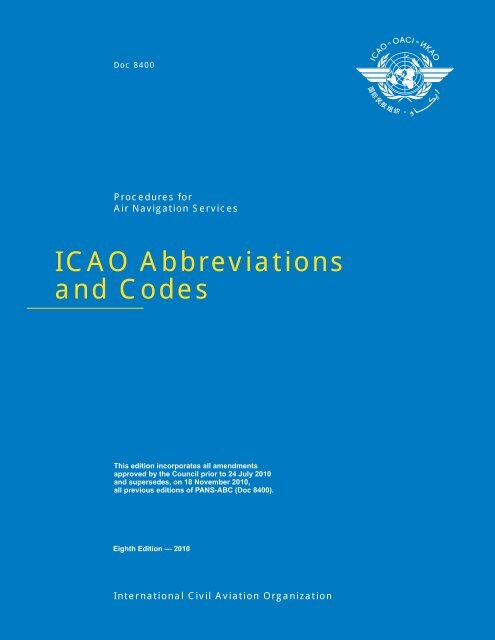
ICAO Abbreviations and Codes
ICAO Abbreviations and Codes
ICAO Abbreviations and Codes

You also want an ePaper? Increase the reach of your titles
YUMPU automatically turns print PDFs into web optimized ePapers that Google loves.
Doc 8400<br />
Procedures for<br />
Air Navigation Services<br />
<strong>ICAO</strong> <strong>Abbreviations</strong><br />
<strong>and</strong> <strong>Codes</strong><br />
This edition incorporates all amendments<br />
approved by the Council prior to 24 July 2010<br />
<strong>and</strong> supersedes, on 18 November 2010,<br />
all previous editions of PANS-ABC (Doc 8400).<br />
Eighth Edition — 2010<br />
International Civil Aviation Organization
Doc 8400<br />
Procedures for<br />
Air Navigation Services<br />
<strong>ICAO</strong> <strong>Abbreviations</strong><br />
<strong>and</strong> <strong>Codes</strong><br />
________________________________<br />
This edition incorporates all amendments<br />
approved by the Council prior to 24 July 2010<br />
<strong>and</strong> supersedes, on 18 November 2010,<br />
all previous editions of PANS-ABC (Doc 8400).<br />
Eighth Edition — 2010<br />
International Civil Aviation Organization
Published in separate English, French, Russian <strong>and</strong> Spanish editions by the<br />
INTERNATIONAL CIVIL AVIATION ORGANIZATION<br />
999 University Street, Montréal, Quebec, Canada H3C 5H7<br />
For ordering information <strong>and</strong> for a complete listing of sales agents<br />
<strong>and</strong> booksellers, please go to the <strong>ICAO</strong> website at www.icao.int<br />
First edition,1964.<br />
Seventh edition, 2007.<br />
Eighth edition, 2010.<br />
Doc 8400, Procedures for Air Navigation Services —<br />
<strong>ICAO</strong> <strong>Abbreviations</strong> <strong>and</strong> <strong>Codes</strong><br />
Order Number: 8400<br />
ISBN 978-92-9231-626-6<br />
© <strong>ICAO</strong> 2010<br />
All rights reserved. No part of this publication may be reproduced, stored in a<br />
retrieval system or transmitted in any form or by any means, without prior<br />
permission in writing from the International Civil Aviation Organization.
AMENDMENTS<br />
Amendments are announced in the supplements to the Catalogue of <strong>ICAO</strong><br />
Publications; the Catalogue <strong>and</strong> its supplements are available on the <strong>ICAO</strong> website<br />
at www.icao.int. The space below is provided to keep a record of such amendments.<br />
RECORD OF AMENDMENTS AND CORRIGENDA<br />
AMENDMENTS<br />
CORRIGENDA<br />
No.<br />
Date<br />
applicable<br />
Date<br />
entered<br />
Entered<br />
by<br />
No.<br />
Date<br />
of issue<br />
Date<br />
entered<br />
Entered<br />
by<br />
1-30 Incorporated in this Edition.<br />
(iii)
TABLE OF CONTENTS<br />
Page<br />
Foreword ..............................................................................................................................................................................<br />
(v)<br />
<strong>Abbreviations</strong><br />
Decode ......................................................................................................................................................................... 1-1<br />
Encode .......................................................................................................................................................................... 1-17<br />
<strong>Abbreviations</strong> for identifying Aeronautical Fixed Service (AFS) Messages<br />
Encode .......................................................................................................................................................................... 2-1<br />
<strong>Abbreviations</strong> <strong>and</strong> Terms to be transmitted as spoken words when used in Radiotelephony<br />
Decode ......................................................................................................................................................................... 3-1<br />
Encode .......................................................................................................................................................................... 3-3<br />
<strong>Abbreviations</strong> <strong>and</strong> Terms to be transmitted using the individual letters in non-phonetic form when<br />
used in Radiotelephony<br />
Decode ......................................................................................................................................................................... 4-1<br />
Encode .......................................................................................................................................................................... 4-3<br />
Designation of typical Radiocommunication Emissions...................................................................................................... 5-1<br />
Signal Reporting <strong>Codes</strong> ....................................................................................................................................................... 6-1<br />
The NOTAM Code<br />
Preface .......................................................................................................................................................................... 7-1<br />
Decode<br />
Second <strong>and</strong> Third Letters ......................................................................................................................................... 7-7<br />
Fourth <strong>and</strong> Fifth Letters ............................................................................................................................................ 7-12<br />
Encode<br />
Second <strong>and</strong> Third Letters ......................................................................................................................................... 7-15<br />
Fourth <strong>and</strong> Fifth Letters ............................................................................................................................................ 7-18<br />
___________________<br />
(v) 18/11/10
FOREWORD<br />
1. Introduction<br />
This document contains abbreviations <strong>and</strong> codes approved by the Council of <strong>ICAO</strong> for worldwide use in the international<br />
aeronautical telecommunication service <strong>and</strong> in aeronautical information documents, as appropriate, uniform abbreviated<br />
phraseology for use in pre-flight information bulletins <strong>and</strong> ATS data link communications, with the status of Procedures for Air<br />
Navigation Services (in abbreviated form the PANS-ABC).<br />
This document is the outgrowth of study by the Air Navigation Commission in consultation with States in the matter of<br />
controlling <strong>and</strong> coordinating abbreviations <strong>and</strong> codes. It brings together all abbreviations <strong>and</strong> codes for use in aircraft<br />
operations with the following exceptions:<br />
a) Designators for Aircraft Operating Agencies, Aeronautical Authorities <strong>and</strong> Services promulgated in Doc 8585.<br />
b) Data designators <strong>and</strong> geographical designators for meteorological bulletins given in the Manual of Aeronautical<br />
Meteorological Practice (Doc 8896).<br />
c) Aeronautical meteorological codes given in the Manual of Aeronautical Meteorological Practice.<br />
d) Additional abbreviations for restricted use in aeronautical information services (AIS) documents given in the<br />
Aeronautical Information Services Manual (Doc 8126).<br />
e) Location Indicators given in Doc 7910.<br />
f) Aircraft Type Designators given in Doc 8643.<br />
Table A shows the origin of each edition of the PANS-ABC issued since 1964 <strong>and</strong> subsequent amendments thereto,<br />
together with a list of the principal subjects involved, the dates on which the amendments were approved by the Council <strong>and</strong><br />
the dates on which they became applicable.<br />
2. Principles for formulation of abbreviations<br />
The principles applied in the formulation of <strong>ICAO</strong> abbreviations are:<br />
a) that allocation of more than one signification to a single abbreviation should be avoided except where it can be<br />
reasonably determined that no instances of misinterpretation would arise;<br />
b) that allocation of more than one abbreviation to the same signification should be avoided even though a different use<br />
is prescribed;<br />
c) that abbreviations should make use of the root word or words <strong>and</strong> should be derived from words common to the<br />
working languages except that where it is impracticable to apply this principle to best advantage, the abbreviation<br />
should follow the English text;<br />
d) that the use of a singular or plural form for the signification of an abbreviation should be selected on the basis of the<br />
more common use;<br />
(vii) 18/11/10
(viii)<br />
<strong>ICAO</strong> <strong>Abbreviations</strong> <strong>and</strong> <strong>Codes</strong> (PANS-ABC)<br />
e) that an abbreviation may represent grammatical variants of the basic signification where such application can be<br />
made without risk of confusion <strong>and</strong> the desired grammatical form can be determined from the context of the<br />
message.<br />
With respect to the latter principle, several variants are given for a number of abbreviations where it might not be<br />
obvious that the variant is appropriate or acceptable.<br />
3. Specifications governing the use of abbreviations<br />
Specifications governing the use of abbreviations <strong>and</strong> codes are contained in the following <strong>ICAO</strong> Annexes <strong>and</strong> PANS:<br />
a) use of abbreviations in the aeronautical information service: 3.6.4 of Annex 15;<br />
b) use of the NOTAM Code: 5.2 of Annex 15;<br />
c) use of abbreviations <strong>and</strong> codes in the international aeronautical telecommunications service: 3.7 of Annex 10,<br />
Volume II;<br />
d) use of abbreviations on aeronautical charts: 2.3.3 <strong>and</strong> 2.9 of Annex 4;<br />
e) use of abbreviations in plain language meteorological messages: Chapters 3, 4, 6 <strong>and</strong> 7, Appendices 1, 2 <strong>and</strong> 5 <strong>and</strong><br />
Attachment A of Annex 3;<br />
f) use of abbreviations in air-reports: 4.12 of Chapter 4 <strong>and</strong> Appendix 1 of PANS-ATM (Doc 4444);<br />
g) use of abbreviations <strong>and</strong> designators in flight plans <strong>and</strong> other air traffic services messages: Chapters 11 <strong>and</strong> 16 <strong>and</strong><br />
Appendices 2, 3, 5 <strong>and</strong> 6 of PANS-ATM (Doc 4444).<br />
4. Status<br />
The Procedures for Air Navigation Services (PANS) do not have the same status as the St<strong>and</strong>ards <strong>and</strong> Recommended<br />
Practices. While the latter are adopted by Council in pursuance of Article 37 of the Convention on International Civil<br />
Aviation, subject to the full procedure of Article 90, the PANS are approved by the President of the Council on behalf of the<br />
Council <strong>and</strong> recommended to Contracting States for worldwide application.<br />
5. Implementation<br />
The implementation of <strong>ICAO</strong> St<strong>and</strong>ards, Recommended Practices <strong>and</strong> Procedures is the responsibility of Contracting States;<br />
they are applied in actual operations only after, <strong>and</strong> in so far as States have enforced them. However, with a view to<br />
facilitating their processing towards implementation by States, this document has been prepared in a manner which will<br />
permit direct use by operational personnel.<br />
6. Notification of Differences<br />
The PANS do not carry the status afforded to St<strong>and</strong>ards adopted by the Council as Annexes to the Convention <strong>and</strong>, therefore,<br />
do not come within the obligation imposed by Article 38 of the Convention to notify differences in the event of nonimplementation.<br />
18/11/10
Foreword<br />
(ix)<br />
The attention of States is, however, drawn to the provision in Annex 15 related to the publication in Aeronautical<br />
Information Publications of a list of abbreviations <strong>and</strong> their respective significations used by the State in its Aeronautical<br />
Information Publications <strong>and</strong> in the dissemination of aeronautical information. Differences from <strong>ICAO</strong> abbreviations or their<br />
significations should be identified.<br />
7. Editorial presentation<br />
For encoding purposes the abbreviations given in this document are divided among a “general” <strong>and</strong> several specialized<br />
categories. For the convenience of the user, there is some duplication among these categories. Nevertheless, it may be<br />
necessary to draw on the “general” category of abbreviations when composing messages using one of the specialized<br />
categories.<br />
Certain Q Code signals which through constant use have attained plain language status have been placed with their plain<br />
language significations in the portion of this document which contains the “general” category abbreviations.<br />
Throughout the document, decode material is printed on white paper, encode material on green paper.<br />
Any errors, omissions or discrepancies should be brought to the attention of the Secretary General of <strong>ICAO</strong>,<br />
999 University Street, Montréal, Quebec, Canada H3C 5H7.<br />
Table A.<br />
Amendments to the PANS-ABC<br />
Amendment Source(s) Subject(s)<br />
Approved<br />
Applicable<br />
1st Edition (1964)<br />
Air Navigation<br />
Commission<br />
Study on the control <strong>and</strong> coordination of abbreviations <strong>and</strong> codes. 18 March 1964<br />
1 November 1964<br />
Amendment 1<br />
MET/OPS Meeting<br />
(1964); Fifth Meeting<br />
of the Panel of<br />
Teletypewriter<br />
Specialists (1963)<br />
Editorial <strong>and</strong> consequential amendments emanating from Amendment 44 to<br />
Annex 10, Amendment 9 to PANS-MET <strong>and</strong> Amendment 7 to PANS-RAC;<br />
addition <strong>and</strong> modification of meteorological abbreviations; amendment of<br />
abbreviations used on the AFTN.<br />
7 June 1965<br />
10 March 1966<br />
Amendment 2 <strong>ICAO</strong> Secretariat Consequential <strong>and</strong> editorial changes to the Foreword emanating from Air<br />
Navigation Commission <strong>and</strong> Council action on various regulatory <strong>and</strong> service<br />
documents.<br />
25 August 1966<br />
2nd Edition<br />
(1967)<br />
(includes<br />
Amendment 3)<br />
AIS/MAP<br />
Divisional Meeting<br />
(1966)<br />
Various changes to abbreviations <strong>and</strong> codes to reflect current operational<br />
requirements <strong>and</strong> practices.<br />
13 June 1967<br />
8 February 1968<br />
Amendment 4<br />
Air Navigation<br />
Commission<br />
Consequential changes to abbreviations used for air traffic purposes<br />
emanating from Amendment 2 to the Eighth Edition of Doc 4444<br />
(PANS-RAC).<br />
4 April 1968<br />
4 April 1968<br />
Amendment 5<br />
Air Navigation<br />
Commission<br />
Consequential changes to abbreviations used for plain language meteorology<br />
messages, emanating from Amendment 14 to Doc 7605 (PANS-MET).<br />
28 June 1968<br />
9 January 1969<br />
Amendment 6<br />
Air Navigation<br />
Commission<br />
Changes arising from Assembly Resolution A16-19 <strong>and</strong> Amendment 54 to<br />
Annex 3.<br />
23 January 1969<br />
18 September 1969<br />
18/11/10
(x)<br />
<strong>ICAO</strong> <strong>Abbreviations</strong> <strong>and</strong> <strong>Codes</strong> (PANS-ABC)<br />
Amendment Source(s) Subject(s)<br />
Approved<br />
Applicable<br />
3rd Edition<br />
(1971)<br />
(includes<br />
Amendments 7<br />
<strong>and</strong> 8)<br />
Air Navigation<br />
Commission<br />
Study of NOTAM composition resulting in exp<strong>and</strong>ed use of abbreviations <strong>and</strong><br />
codes in NOTAM Class I; changes in abbreviations emanating from revised<br />
aeronautical meteorological figure codes introduced by WMO; changes<br />
introduced as a result of clarification of air traffic control terms contained in<br />
<strong>ICAO</strong> regulatory documents.<br />
19 March 1971<br />
6 January 1972<br />
Amendment 9<br />
Air Navigation<br />
Commission<br />
Consequential changes emanating from Amendment 1 to the Tenth Edition of<br />
Doc 4444 (PANS-RAC).<br />
24 March 1972<br />
7 December 1972<br />
Amendment 10<br />
Air Navigation<br />
Commission;<br />
Third Meeting<br />
of the Obstacle<br />
Clearance Panel (1971)<br />
Consequential amendments to abbreviations <strong>and</strong> their significations (QFE <strong>and</strong><br />
QNH); changes to meteorological abbreviations introduced by WMO.<br />
21 March 1973<br />
16 August 1973<br />
Amendment 11<br />
Amendment 12<br />
Air Navigation<br />
Commission;<br />
Seventh Air<br />
Navigation<br />
Conference<br />
(1972)<br />
Air Navigation<br />
Commission<br />
Addition of abbreviations RNAV <strong>and</strong> STAR; deletion of abbreviation SIA. 29 May 1973<br />
23 May 1974<br />
Inclusion of additional abbreviations for use in the NOTAM Code. 11 December 1974<br />
9 October 1975<br />
Amendment 13<br />
Air Navigation<br />
Commission;<br />
Eighth Air<br />
Navigation<br />
Conference (1974)<br />
Additions, deletions <strong>and</strong> changes in significations of abbreviations mainly<br />
emanating from amendments to Annex 3.<br />
8 December 1975<br />
12 August 1976<br />
Amendment 14<br />
Air Navigation<br />
Commission;<br />
Ninth Air<br />
Navigation Conference<br />
(1976)<br />
Addition of abbreviations COP, INOP, MRP, RPS <strong>and</strong> WPT; change in<br />
signification of abbreviation ACP as a consequence of Amendment 30 to<br />
Annex 14.<br />
9 December 1977<br />
10 August 1978<br />
Amendment 15<br />
Air Navigation<br />
Commission<br />
Additions <strong>and</strong> changes in signification of abbreviations. 26 February 1979<br />
29 November 1979<br />
Amendment 16<br />
Air Navigation<br />
Commission<br />
Additions, deletions <strong>and</strong> changes in signification of abbreviations emanating<br />
from a study of abbreviations in common use in States’ aeronautical<br />
information publications.<br />
11 March 1981<br />
26 November 1981<br />
Amendment 17<br />
Air Navigation<br />
Commission<br />
Extensive amendment of abbreviations <strong>and</strong> codes emanating from a proposal<br />
submitted by the United Kingdom.<br />
14 December 1981<br />
9 June 1983<br />
Amendment 18<br />
Air Navigation<br />
Commission<br />
Extensive addition of abbreviations <strong>and</strong> codes consequential to a study of the<br />
revision of the NOTAM Code; addition of abbreviations used in<br />
Doc 8168 (PANS-OPS).<br />
11 June 1982<br />
9 June 1983<br />
Amendment 19<br />
Air Navigation<br />
Commission; Third<br />
Meeting of the ATS<br />
Data Acquisition,<br />
Processing <strong>and</strong> Transfer<br />
(ADAPT) Panel (1981)<br />
Consequential changes emanating from Amendments 64 <strong>and</strong> 65 to<br />
Annex 3, Amendment 14 to Annex 5, Recommendations 1/5 <strong>and</strong> 3/1 of<br />
ADAPT/3, <strong>and</strong> a new ITU method of designating radio emissions.<br />
15 March 1985<br />
21 November 1985<br />
18/11/10
Foreword<br />
(xi)<br />
Amendment Source(s) Subject(s)<br />
Approved<br />
Applicable<br />
4th Edition<br />
(1989) (includes<br />
Amendment 20)<br />
Air Navigation<br />
Commission<br />
Additions, changes <strong>and</strong> deletions of abbreviations <strong>and</strong> codes to reflect the<br />
current operational requirements <strong>and</strong> practices; introduction of new sections<br />
for abbreviations used in radiotelephony in a spoken form (Decode, Encode)<br />
<strong>and</strong> for the Procedure signals used in aeronautical telecommunication service<br />
(Decode); consequential <strong>and</strong> editorial amendments.<br />
24 February 1989<br />
16 November 1989<br />
Amendment 21<br />
Air Navigation<br />
Commission;<br />
Communications/<br />
Meteorology/<br />
Operations<br />
(COM/MET/OPS)<br />
Divisional Meeting<br />
(1990)<br />
Additions, changes <strong>and</strong> deletions of abbreviations <strong>and</strong> codes to reflect the<br />
current operational requirements <strong>and</strong> practices; consequential amendments<br />
arising from Amendment 69 to Annex 3, Amendment 13 to Annex 5,<br />
Amendment 39 to Annex 14, Amendment 27 to Annex 15 <strong>and</strong> Amendment 13<br />
to PANS-OPS.<br />
2 December 1992<br />
1 July 1993<br />
Amendment 22<br />
Air Navigation<br />
Commission<br />
Consequential changes emanating from:<br />
Amendment 70 to Annex 3<br />
Amendment 69 to Annex 10<br />
Amendment 15 to Annex 12<br />
Amendment 28 to Annex 15<br />
Amendment 7 to PANS-OPS, Volume I.<br />
30 November 1995<br />
7 November 1996<br />
5th Edition (1999)<br />
(includes<br />
Amendment 23)<br />
AIS/MAP Divisional<br />
Meeting (1998);<br />
Air Navigation<br />
Commission<br />
Extensive amendments emanating from the AIS/MAP Divisional Meeting<br />
(1998) <strong>and</strong> the Air Navigation Commission, including additions, changes <strong>and</strong><br />
deletions of abbreviations; addition <strong>and</strong> deletion of abbreviations <strong>and</strong> terms<br />
transmitted as spoken words; addition of abbreviations <strong>and</strong> terms transmitted<br />
using the individual letters in non-phonetic form; addition of a NOTAM Code<br />
for controller-pilot data link communications <strong>and</strong> automatic dependent<br />
surveillance; deletion of Procedure Signals for use in the International<br />
Aeronautical Telecommunication Service (Decode <strong>and</strong> Encode); deletion of<br />
the Q-Code (Preface, Decode <strong>and</strong> Encode).<br />
26 February 1999<br />
4 November 1999<br />
Amendment 24<br />
Amendment 25<br />
Air Navigation<br />
Commission<br />
Air Navigation<br />
Commission<br />
Consequential changes emanating from Amendment 71 to Annex 3. 9 June 2000<br />
2 November 2000<br />
Consequential changes emanating from Amendment 72 to Annex 3. 10 July 2002<br />
28 November 2002<br />
Amendment 26<br />
Conclusion 40/51 b) of<br />
the European Air<br />
Navigation Planning<br />
Group (EANPG) <strong>and</strong><br />
the Secretariat<br />
Consequential changes emanating from Amendment 32 to Annex 15. 23 July 2003<br />
27 November 2003<br />
Sixth Edition (2004)<br />
(includes<br />
Amendment 27)<br />
Global Navigation<br />
Satellite System Panel<br />
(GNSSP/4); MET<br />
Divisional Meeting<br />
(2002); Air Navigation<br />
Commission<br />
New abbreviations <strong>and</strong> updated specifications for the NOTAM Code related<br />
to GNSS; <strong>and</strong> consequential changes emanating from Amendment 73 to<br />
Annex 3, Amendment 53 to Annex 4 <strong>and</strong> Amendments 13 <strong>and</strong> 12 to the<br />
PANS-OPS, Volumes I <strong>and</strong> II, respectively.<br />
6 May 2004<br />
25 November 2004<br />
Seventh Edition<br />
(2007) (includes<br />
Amendment 28)<br />
Fourteenth Meeting of<br />
the Obstacle Clearance<br />
Panel (OCP/14); Air<br />
Navigation<br />
Commission; <strong>and</strong> the<br />
Secretariat<br />
New abbreviations related to updated provisions in the PANS-OPS; the use of<br />
ADS-B, ADS-C <strong>and</strong> RCP in the provision of air traffic services; consequential<br />
changes emanating from Amendment 74 to Annex 3 <strong>and</strong> Amendment 34 to<br />
Annex 15; <strong>and</strong> editorial amendments.<br />
3 August 2007<br />
22 November 2007<br />
18/11/10
(xii)<br />
<strong>ICAO</strong> <strong>Abbreviations</strong> <strong>and</strong> <strong>Codes</strong> (PANS-ABC)<br />
Amendment Source(s) Subject(s)<br />
Approved<br />
Applicable<br />
Amendment 29<br />
First working group of<br />
the whole meeting of<br />
the Instrument Flight<br />
Procedures Panel<br />
(IFPP/WG/WHL/1);<br />
Secretariat, with the<br />
assistance of the<br />
Required Navigation<br />
Performance <strong>and</strong><br />
Special Operational<br />
Requirements Study<br />
Group (RNPSORSG),<br />
concerning PBN<br />
terminology<br />
New abbreviations related to updated provisions in the PANS-OPS with<br />
regard to the performance-based navigation (PBN) concept <strong>and</strong> ground-based<br />
augmentation system (GBAS) l<strong>and</strong>ing system.<br />
7 October 2008<br />
20 November 2008<br />
Eighth Edition<br />
(2010) (includes<br />
Amendment 30)<br />
Ninth meeting of the<br />
Operations Panel<br />
Working Group of the<br />
Whole (OPSP/WG-<br />
WHL/9); sixth meeting<br />
of the Operations Panel<br />
(OPSP/6); <strong>and</strong> the<br />
Secretariat with the<br />
assistance of the<br />
Aeronautical<br />
Information<br />
Management Study<br />
Group (AIS-AIMSG/1),<br />
International Airways<br />
Volcano Watch<br />
Operations Group<br />
(IAVWOPSG/4),<br />
Meteorological<br />
Warnings Study Group<br />
(METWSG/2), <strong>and</strong><br />
Aerodrome<br />
Meteorological<br />
Observation <strong>and</strong><br />
Forecast Study Group<br />
(AMOFSG/7).<br />
New abbreviations related to cockpit displays, unmanned aircraft, volcanic<br />
ash information provided by volcanic ash advisory centres (VAAC), the<br />
elimination of routine voice reports, completion of tropical cyclone advisories<br />
in graphical format <strong>and</strong> the use of data link for meteorological information,<br />
aerodrome observations <strong>and</strong> forecasts. Update of the NOTAM code.<br />
23 July 2010<br />
18 November 2010<br />
______________________<br />
18/11/10
ABBREVIATIONS<br />
DECODE<br />
A<br />
A<br />
AAA<br />
A/A<br />
AAD<br />
AAIM<br />
AAL<br />
ABI<br />
ABM<br />
ABN<br />
ABT<br />
ABV<br />
AC<br />
ACARS†<br />
ACAS†<br />
ACC‡<br />
ACCID<br />
ACFT<br />
ACK<br />
ACL<br />
ACN<br />
ACP<br />
ACPT<br />
ACT<br />
AD<br />
ADA<br />
ADC<br />
ADDN<br />
ADF‡<br />
ADIZ†<br />
ADJ<br />
ADO<br />
Amber<br />
(or AAB, AAC . . . etc., in sequence)<br />
Amended meteorological message<br />
(message type designator)<br />
Air-to-air<br />
Assigned altitude deviation<br />
Aircraft autonomous integrity<br />
monitoring<br />
Above aerodrome level<br />
Advance boundary information<br />
Abeam<br />
Aerodrome beacon<br />
About<br />
Above<br />
Altocumulus<br />
(to be pronounced “AY-CARS”)<br />
Aircraft communication<br />
addressing <strong>and</strong> reporting system<br />
Airborne collision avoidance system<br />
Area control centre or area control<br />
Notification of an aircraft accident<br />
Aircraft<br />
Acknowledge<br />
Altimeter check location<br />
Aircraft classification number<br />
Acceptance (message type designator)<br />
Accept or accepted<br />
Active or activated or activity<br />
Aerodrome<br />
Advisory area<br />
Aerodrome chart<br />
Addition or additional<br />
Automatic direction-finding<br />
equipment<br />
(to be pronounced “AY-DIZ”) Air<br />
defence identification zone<br />
Adjacent<br />
Aerodrome office (specify service)<br />
ADR<br />
ADS*<br />
ADS-B‡<br />
ADS-C‡<br />
ADSU<br />
ADVS<br />
ADZ<br />
AES<br />
AFIL<br />
AFIS<br />
AFM<br />
AFS<br />
AFT . . .<br />
AFTN‡<br />
A/G<br />
AGA<br />
AGL<br />
AGN<br />
AIC<br />
AIDC<br />
AIP<br />
AIRAC<br />
AIREP†<br />
AIRMET†<br />
AIS<br />
ALA<br />
Advisory route<br />
The address (when this abbreviation is<br />
used to request a repetition, the<br />
question mark (IMI) precedes the<br />
abbreviation, e.g. IMI ADS) (to be<br />
used in AFS as a procedure signal)<br />
Automatic dependent surveillance<br />
— broadcast<br />
Automatic dependent surveillance<br />
— contract<br />
Automatic dependent surveillance unit<br />
Advisory service<br />
Advise<br />
Aircraft earth station<br />
Flight plan filed in the air<br />
Aerodrome flight information service<br />
Yes or affirm or affirmative or that is<br />
correct<br />
Aeronautical fixed service<br />
After . . . (time or place)<br />
Aeronautical fixed telecommunication<br />
network<br />
Air-to-ground<br />
Aerodromes, air routes <strong>and</strong> ground<br />
aids<br />
Above ground level<br />
Again<br />
Aeronautical information circular<br />
Air traffic services interfacility data<br />
communications<br />
Aeronautical information publication<br />
Aeronautical information regulation<br />
<strong>and</strong> control<br />
Air-report<br />
Information concerning en-route<br />
weather phenomena which may<br />
affect the safety of low-level<br />
aircraft operations<br />
Aeronautical information services<br />
Alighting area<br />
___________________<br />
† When radiotelephony is used, the abbreviations <strong>and</strong> terms are transmitted as spoken words.<br />
‡ When radiotelephony is used, the abbreviations <strong>and</strong> terms are transmitted using the individual letters in non-phonetic form.<br />
* Signal is also available for use in communicating with stations of the maritime mobile service.<br />
# Signal for use in the teletypewriter service only.<br />
1-1 18/11/10
1-2 <strong>ICAO</strong> <strong>Abbreviations</strong> <strong>and</strong> <strong>Codes</strong> (PANS-ABC)<br />
ALERFA† Alert phase<br />
ALR<br />
Alerting (message type designator)<br />
ALRS<br />
Alerting service<br />
ALS<br />
Approach lighting system<br />
ALT<br />
Altitude<br />
ALTN<br />
Alternate or alternating (light<br />
alternates in colour)<br />
ALTN<br />
Alternate (aerodrome)<br />
AMA<br />
Area minimum altitude<br />
AMD<br />
Amend or amended (used to indicate<br />
amended meteorological message;<br />
message type designator)<br />
AMDT<br />
Amendment (AIP Amendment)<br />
AMS<br />
Aeronautical mobile service<br />
AMSL<br />
Above mean sea level<br />
AMSS<br />
Aeronautical mobile satellite service<br />
ANC . . . Aeronautical chart — 1:500 000<br />
(followed by name/title)<br />
ANCS . . . Aeronautical navigation chart — small<br />
scale (followed by name/title <strong>and</strong><br />
scale)<br />
ANS<br />
Answer<br />
AOC . . . Aerodrome obstacle chart (followed by<br />
type <strong>and</strong> name/title)<br />
AP<br />
Airport<br />
APAPI† (to be pronounced “AY-PAPI”)<br />
Abbreviated precision approach<br />
path indicator<br />
APCH<br />
Approach<br />
APDC . . . Aircraft parking/docking chart<br />
(followed by name/title)<br />
APN<br />
Apron<br />
APP<br />
Approach control office or approach<br />
control or approach control service<br />
APR<br />
April<br />
APRX<br />
Approximate or approximately<br />
APSG<br />
After passing<br />
APV<br />
Approve or approved or approval<br />
ARC<br />
Area chart<br />
ARNG<br />
Arrange<br />
ARO<br />
Air traffic services reporting office<br />
ARP<br />
Aerodrome reference point<br />
ARP<br />
Air-report (message type designator)<br />
ARQ<br />
Automatic error correction<br />
ARR<br />
Arrival (message type designator)<br />
ARR<br />
Arrive or arrival<br />
ARS<br />
ARST<br />
AS<br />
ASC<br />
ASDA<br />
ASE<br />
ASHTAM<br />
ASPH<br />
AT . . .<br />
ATA‡<br />
ATC‡<br />
ATCSMAC. . .<br />
ATD‡<br />
ATFM<br />
ATIS†<br />
ATM<br />
ATN<br />
ATP . . .<br />
ATS<br />
ATTN<br />
AT-VASIS†<br />
ATZ<br />
AUG<br />
AUTH<br />
AUW<br />
AUX<br />
AVBL<br />
AVG<br />
AVGAS†<br />
AWTA<br />
AWY<br />
AZM<br />
Special air-report (message type<br />
designator)<br />
Arresting (specify (part of) aircraft<br />
arresting equipment)<br />
Altostratus<br />
Ascend to or ascending to<br />
Accelerate-stop distance available<br />
Altimetry system error<br />
Special series NOTAM notifying, by<br />
means of a specific format, change<br />
in activity of a volcano, a volcanic<br />
eruption <strong>and</strong>/or volcanic ash cloud<br />
that is of significance to aircraft<br />
operations<br />
Asphalt<br />
At (followed by time at which weather<br />
change is forecast to occur)<br />
Actual time of arrival<br />
Air traffic control (in general)<br />
Air traffic control surveillance<br />
minimum altitude chart (followed<br />
by name/title)<br />
Actual time of departure<br />
Air traffic flow management<br />
Automatic terminal information<br />
service<br />
Air traffic management<br />
Aeronautical telecommunication<br />
network<br />
At . . . (time or place)<br />
Air traffic services<br />
Attention<br />
(to be pronounced “AY-TEE-VASIS”)<br />
Abbreviated T visual approach<br />
slope indicator system<br />
Aerodrome traffic zone<br />
August<br />
Authorized or authorization<br />
All up weight<br />
Auxiliary<br />
Available or availability<br />
Average<br />
Aviation gasoline<br />
Advise at what time able<br />
Airway<br />
Azimuth<br />
___________________<br />
† When radiotelephony is used, the abbreviations <strong>and</strong> terms are transmitted as spoken words.<br />
‡ When radiotelephony is used, the abbreviations <strong>and</strong> terms are transmitted using the individual letters in non-phonetic form.<br />
* Signal is also available for use in communicating with stations of the maritime mobile service.<br />
# Signal for use in the teletypewriter service only.<br />
18/11/10
<strong>Abbreviations</strong> — Decode 1-3<br />
B<br />
B<br />
Blue<br />
BA<br />
Braking action<br />
BARO-VNAV† (to be pronounced “BAA-RO-VEE-<br />
NAV”) Barometric vertical<br />
navigation<br />
BASE†<br />
Cloud base<br />
BCFG<br />
Fog patches<br />
BCN<br />
Beacon (aeronautical ground light)<br />
BCST<br />
Broadcast<br />
BDRY<br />
Boundary<br />
BECMG Becoming<br />
BFR<br />
Before<br />
BKN<br />
Broken<br />
BL . . .<br />
Blowing (followed by DU = dust, SA<br />
= s<strong>and</strong> or SN = snow)<br />
BLDG<br />
Building<br />
BLO<br />
Below clouds<br />
BLW . . . Below . . .<br />
BOMB<br />
Bombing<br />
BR<br />
Mist<br />
BRF<br />
Short (used to indicate the type of<br />
approach desired or required)<br />
BRG<br />
Bearing<br />
BRKG<br />
Braking<br />
BS<br />
Commercial broadcasting station<br />
BTL<br />
Between layers<br />
BTN<br />
Between<br />
BUFR<br />
Binary universal form for the<br />
representation of meteorological<br />
data<br />
C<br />
. . . C Centre (preceded by runway<br />
designation number to identify a<br />
parallel runway)<br />
C<br />
Degrees Celsius (Centigrade)<br />
CA<br />
Course to an altitude<br />
CAT<br />
Category<br />
CAT<br />
Clear air turbulence<br />
CAVOK† (to be pronounced “KAV-OH-KAY”)<br />
Visibility, cloud <strong>and</strong> present<br />
weather better than prescribed<br />
values or conditions<br />
CB‡<br />
(to be pronounced “CEE BEE”)<br />
Cumulonimbus<br />
CC<br />
Cirrocumulus<br />
CCA<br />
(or CCB, CCC . . . etc., in sequence)<br />
Corrected meteorological message<br />
(message type designator)<br />
CD<br />
C<strong>and</strong>ela<br />
CDN<br />
Coordination (message type<br />
designator)<br />
CF Change frequency to . . .<br />
CF<br />
Course to a fix<br />
CFM*<br />
Confirm or I confirm (to be used in<br />
AFS as a procedure signal)<br />
CGL<br />
Circling guidance light(s)<br />
CH<br />
CH#<br />
CHEM<br />
CHG<br />
CI<br />
CIDIN†<br />
CIT<br />
CIV<br />
CK<br />
CL<br />
CLA<br />
CLBR<br />
CLD<br />
CLG<br />
CLIMB-OUT<br />
CLR<br />
CLRD<br />
CLSD<br />
CM<br />
CMB<br />
Channel<br />
This is a channel-continuity-check of<br />
transmission to permit comparison<br />
of your record of channelsequence<br />
numbers of messages<br />
received on the channel (to be used<br />
in AFS as a procedure signal)<br />
Chemical<br />
Modification (message type<br />
designator)<br />
Cirrus<br />
Common <strong>ICAO</strong> data interchange<br />
network<br />
Near or over large towns<br />
Civil<br />
Check<br />
Centre line<br />
Clear type of ice formation<br />
Calibration<br />
Cloud<br />
Calling<br />
Climb-out area<br />
Clear(s) or cleared to . . . or clearance<br />
Runway(s) cleared (used in<br />
METAR/SPECI)<br />
Close or closed or closing<br />
Centimetre<br />
Climb to or climbing to<br />
___________________<br />
† When radiotelephony is used, the abbreviations <strong>and</strong> terms are transmitted as spoken words.<br />
‡ When radiotelephony is used, the abbreviations <strong>and</strong> terms are transmitted using the individual letters in non-phonetic form.<br />
* Signal is also available for use in communicating with stations of the maritime mobile service.<br />
# Signal for use in the teletypewriter service only.<br />
18/11/10
1-4 <strong>ICAO</strong> <strong>Abbreviations</strong> <strong>and</strong> <strong>Codes</strong> (PANS-ABC)<br />
CMPL<br />
CNL<br />
CNL<br />
CNS<br />
COM<br />
CONC<br />
COND<br />
CONS<br />
CONST<br />
CONT<br />
COOR<br />
COORD<br />
COP<br />
COR<br />
COT<br />
COV<br />
CPDLC‡<br />
CPL<br />
CRC<br />
CRM<br />
CRZ<br />
CS<br />
CS<br />
CTA<br />
CTAM<br />
CTC<br />
CTL<br />
CTN<br />
CTR<br />
CU<br />
CUF<br />
CUST<br />
CVR<br />
CW<br />
CWY<br />
Completion or completed or complete<br />
Cancel or cancelled<br />
Flight plan cancellation (message type<br />
designator)<br />
Communications, navigation <strong>and</strong><br />
surveillance<br />
Communications<br />
Concrete<br />
Condition<br />
Continuous<br />
Construction or constructed<br />
Continue(s) or continued<br />
Coordinate or coordination<br />
Coordinates<br />
Change-over point<br />
Correct or correction or corrected<br />
(used to indicate corrected<br />
meteorological message; message<br />
type designator)<br />
At the coast<br />
Cover or covered or covering<br />
Controller-pilot data link<br />
communications<br />
Current flight plan (message type<br />
designator)<br />
Cyclic redundancy check<br />
Collision risk model<br />
Cruise<br />
Call sign<br />
Cirrostratus<br />
Control area<br />
Climb to <strong>and</strong> maintain<br />
Contact<br />
Control<br />
Caution<br />
Control zone<br />
Cumulus<br />
Cumuliform<br />
Customs<br />
Cockpit voice recorder<br />
Continuous wave<br />
Clearway<br />
D<br />
D<br />
D . . .<br />
DA<br />
D-ATIS†<br />
DCD<br />
DCKG<br />
DCP<br />
DCPC<br />
DCS<br />
DCT<br />
DE*<br />
DEC<br />
DEG<br />
DEP<br />
DEP<br />
DEPO<br />
DER<br />
DES<br />
DEST<br />
DETRESFA†<br />
DEV<br />
DF<br />
DFDR<br />
DFTI<br />
DH<br />
DIF<br />
DIST<br />
DIV<br />
DLA<br />
DLA<br />
DLIC<br />
DLY<br />
DME‡<br />
DNG<br />
DOM<br />
DP<br />
Downward (tendency in RVR during<br />
previous 10 minutes)<br />
Danger area (followed by<br />
identification)<br />
Decision altitude<br />
(to be pronounced “DEE-ATIS”) Data<br />
link automatic terminal<br />
information service<br />
Double channel duplex<br />
Docking<br />
Datum crossing point<br />
Direct controller-pilot<br />
communications<br />
Double channel simplex<br />
Direct (in relation to flight plan<br />
clearances <strong>and</strong> type of approach)<br />
From (used to precede the call sign of<br />
the calling station) (to be used in<br />
AFS as a procedure signal)<br />
December<br />
Degrees<br />
Depart or departure<br />
Departure (message type designator)<br />
Deposition<br />
Departure end of the runway<br />
Descend to or descending to<br />
Destination<br />
Distress phase<br />
Deviation or deviating<br />
Direction finding<br />
Digital flight data recorder<br />
Distance from touchdown indicator<br />
Decision height<br />
Diffuse<br />
Distance<br />
Divert or diverting<br />
Delay or delayed<br />
Delay (message type designator)<br />
Data link initiation capability<br />
Daily<br />
Distance measuring equipment<br />
Danger or dangerous<br />
Domestic<br />
Dew point temperature<br />
___________________<br />
† When radiotelephony is used, the abbreviations <strong>and</strong> terms are transmitted as spoken words.<br />
‡ When radiotelephony is used, the abbreviations <strong>and</strong> terms are transmitted using the individual letters in non-phonetic form.<br />
* Signal is also available for use in communicating with stations of the maritime mobile service.<br />
# Signal for use in the teletypewriter service only.<br />
18/11/10
<strong>Abbreviations</strong> — Decode 1-5<br />
DPT<br />
DR<br />
DR . . .<br />
DRG<br />
DS<br />
DSB<br />
DTAM<br />
DTG<br />
DTHR<br />
DTRT<br />
DTW<br />
DU<br />
DUC<br />
DUPE#<br />
DUR<br />
D-VOLMET<br />
DVOR<br />
DW<br />
DZ<br />
E<br />
E<br />
EAT<br />
EB<br />
EDA<br />
EEE#<br />
EET<br />
EFC<br />
EFIS†<br />
EGNOS†<br />
EHF<br />
ELBA†<br />
ELEV<br />
ELR<br />
ELT<br />
EM<br />
Depth<br />
Dead reckoning<br />
Low drifting (followed by DU = dust,<br />
SA = s<strong>and</strong> or SN = snow)<br />
During<br />
Duststorm<br />
Double sideb<strong>and</strong><br />
Descend to <strong>and</strong> maintain<br />
Date-time group<br />
Displaced runway threshold<br />
Deteriorate or deteriorating<br />
Dual t<strong>and</strong>em wheels<br />
Dust<br />
Dense upper cloud<br />
This is a duplicate message (to be used<br />
in AFS as a procedure signal)<br />
Duration<br />
Data link VOLMET<br />
Doppler VOR<br />
Dual wheels<br />
Drizzle<br />
East or eastern longitude<br />
Expected approach time<br />
Eastbound<br />
Elevation differential area<br />
Error (to be used in AFS as a<br />
procedure signal)<br />
Estimated elapsed time<br />
Expect further clearance<br />
(to be pronounced “EE-FIS”)<br />
Electronic flight instrument system<br />
(to be pronounced “EGG-NOS”)<br />
European geostationary navigation<br />
overlay service<br />
Extremely high frequency [30 000 to<br />
300 000 MHz]<br />
Emergency location beacon — aircraft<br />
Elevation<br />
Extra long range<br />
Emergency locator transmitter<br />
Emission<br />
EMBD<br />
EMERG<br />
END<br />
ENE<br />
ENG<br />
ENR<br />
ENRC . . .<br />
EOBT<br />
EQPT<br />
ER*<br />
ESE<br />
EST<br />
ETA*‡<br />
ETD‡<br />
ETO<br />
EUR RODEX<br />
EV<br />
EVS<br />
EXC<br />
EXER<br />
EXP<br />
EXTD<br />
F<br />
F<br />
FA<br />
FAC<br />
FAF<br />
FAL<br />
FAP<br />
FAS<br />
FATO<br />
FAX<br />
FBL<br />
Embedded in a layer (to indicate<br />
cumulonimbus embedded in layers<br />
of other clouds)<br />
Emergency<br />
Stop-end (related to RVR)<br />
East-north-east<br />
Engine<br />
En route<br />
Enroute chart (followed by name/title)<br />
Estimated off-block time<br />
Equipment<br />
Here . . . or herewith<br />
East-south-east<br />
Estimate or estimated or estimation<br />
(message type designator)<br />
Estimated time of arrival or estimating<br />
arrival<br />
Estimated time of departure or<br />
estimating departure<br />
Estimated time over significant point<br />
European regional OPMET data<br />
exchange<br />
Every<br />
Enhanced vision system<br />
Except<br />
Exercises or exercising or to exercise<br />
Expect or expected or expecting<br />
Extend or extending<br />
Fixed<br />
Course from a fix to an altitude<br />
Facilities<br />
Final approach fix<br />
Facilitation of international air<br />
transport<br />
Final approach point<br />
Final approach segment<br />
Final approach <strong>and</strong> take-off area<br />
Facsimile transmission<br />
Light (used to indicate the intensity of<br />
weather phenomena, interference<br />
or static reports, e.g. FBL RA =<br />
light rain)<br />
___________________<br />
† When radiotelephony is used, the abbreviations <strong>and</strong> terms are transmitted as spoken words.<br />
‡ When radiotelephony is used, the abbreviations <strong>and</strong> terms are transmitted using the individual letters in non-phonetic form.<br />
* Signal is also available for use in communicating with stations of the maritime mobile service.<br />
# Signal for use in the teletypewriter service only.<br />
18/11/10
1-6 <strong>ICAO</strong> <strong>Abbreviations</strong> <strong>and</strong> <strong>Codes</strong> (PANS-ABC)<br />
FC<br />
FCST<br />
FCT<br />
FDPS<br />
FEB<br />
FEW<br />
FG<br />
FIC<br />
FIR‡<br />
FIS<br />
FISA<br />
FL<br />
FLD<br />
FLG<br />
FLR<br />
FLT<br />
FLTCK<br />
FLUC<br />
FLW<br />
FLY<br />
FM<br />
FM<br />
FM . . .<br />
FMC<br />
FMS‡<br />
FMU<br />
FNA<br />
FPAP<br />
FPL<br />
FPM<br />
FPR<br />
FR<br />
FREQ<br />
FRI<br />
FRNG<br />
FRONT†<br />
FROST†<br />
FRQ<br />
FSL<br />
FSS<br />
FST<br />
Funnel cloud (tornado or water spout)<br />
Forecast<br />
Friction coefficient<br />
Flight data processing system<br />
February<br />
Few<br />
Fog<br />
Flight information centre<br />
Flight information region<br />
Flight information service<br />
Automated flight information service<br />
Flight level<br />
Field<br />
Flashing<br />
Flares<br />
Flight<br />
Flight check<br />
Fluctuating or fluctuation or<br />
fluctuated<br />
Follow(s) or following<br />
Fly or flying<br />
Course from a fix to manual<br />
termination (used in navigation<br />
database coding)<br />
From<br />
From (followed by time weather<br />
change is forecast to begin)<br />
Flight management computer<br />
Flight management system<br />
Flow management unit<br />
Final approach<br />
Flight path alignment point<br />
Filed flight plan (message type<br />
designator)<br />
Feet per minute<br />
Flight plan route<br />
Fuel remaining<br />
Frequency<br />
Friday<br />
Firing<br />
Front (relating to weather)<br />
Frost (used in aerodrome warnings)<br />
Frequent<br />
Full stop l<strong>and</strong>ing<br />
Flight service station<br />
First<br />
FT<br />
FTE<br />
FTP<br />
FTT<br />
FU<br />
FZ<br />
FZDZ<br />
FZFG<br />
FZRA<br />
G<br />
G<br />
G . . .<br />
GA<br />
G/A<br />
G/A/G<br />
GAGAN†<br />
GAIN<br />
GAMET<br />
GARP<br />
GBAS†<br />
GCA‡<br />
GEN<br />
GEO<br />
GES<br />
GLD<br />
GLONASS†<br />
GLS‡<br />
GMC . . .<br />
GND<br />
GNDCK<br />
GNSS‡<br />
GP<br />
GPA<br />
Feet (dimensional unit)<br />
Flight technical error<br />
Fictitious threshold point<br />
Flight technical tolerance<br />
Smoke<br />
Freezing<br />
Freezing drizzle<br />
Freezing fog<br />
Freezing rain<br />
Green<br />
Variations from the mean wind speed<br />
(gusts) (followed by figures in<br />
METAR/SPECI <strong>and</strong> TAF)<br />
Go ahead, resume sending (to be used<br />
in AFS as a procedure signal)<br />
Ground-to-air<br />
Ground-to-air <strong>and</strong> air-to-ground<br />
GPS <strong>and</strong> geostationary earth orbit<br />
augmented navigation<br />
Airspeed or headwind gain<br />
Area forecast for low-level flights<br />
GBAS azimuth reference point<br />
(to be pronounced “GEE-BAS”)<br />
Ground-based augmentation<br />
system<br />
Ground controlled approach system or<br />
ground controlled approach<br />
General<br />
Geographic or true<br />
Ground earth station<br />
Glider<br />
(to be pronounced “GLO-NAS”)<br />
Global orbiting navigation satellite<br />
system<br />
GBAS l<strong>and</strong>ing system<br />
Ground movement chart (followed by<br />
name/title)<br />
Ground<br />
Ground check<br />
Global navigation satellite system<br />
Glide path<br />
Glide path angle<br />
___________________<br />
† When radiotelephony is used, the abbreviations <strong>and</strong> terms are transmitted as spoken words.<br />
‡ When radiotelephony is used, the abbreviations <strong>and</strong> terms are transmitted using the individual letters in non-phonetic form.<br />
* Signal is also available for use in communicating with stations of the maritime mobile service.<br />
# Signal for use in the teletypewriter service only.<br />
18/11/10
<strong>Abbreviations</strong> — Decode 1-7<br />
GPIP<br />
GPS‡<br />
GPWS‡<br />
GR<br />
GRAS†<br />
GRASS<br />
GRIB<br />
GRVL<br />
GS<br />
GS<br />
GUND<br />
H<br />
H<br />
H24<br />
HA<br />
HAPI<br />
HBN<br />
HDF<br />
HDG<br />
HEL<br />
HF‡<br />
HF<br />
HGT<br />
HJ<br />
HLDG<br />
HM<br />
HN<br />
HO<br />
HOL<br />
HOSP<br />
HPA<br />
HR<br />
HS<br />
HUD<br />
HURCN<br />
Glide path intercept point<br />
Global positioning system<br />
Ground proximity warning system<br />
Hail<br />
(to be pronounced “GRASS”) Groundbased<br />
regional augmentation<br />
system<br />
Grass l<strong>and</strong>ing area<br />
Processed meteorological data in the<br />
form of grid point values<br />
expressed in binary form<br />
(meteorological code)<br />
Gravel<br />
Ground speed<br />
Small hail <strong>and</strong>/or snow pellets<br />
Geoid undulation<br />
High pressure area or the centre of high<br />
pressure<br />
Continuous day <strong>and</strong> night service<br />
Holding/racetrack to an altitude<br />
Helicopter approach path indicator<br />
Hazard beacon<br />
High frequency direction-finding station<br />
Heading<br />
Helicopter<br />
High frequency [3 000 to 30 000 kHz]<br />
Holding/racetrack to a fix<br />
Height or height above<br />
Sunrise to sunset<br />
Holding<br />
Holding/racetrack to a manual termination<br />
Sunset to sunrise<br />
Service available to meet operational<br />
requirements<br />
Holiday<br />
Hospital aircraft<br />
Hectopascal<br />
Hours<br />
Service available during hours of<br />
scheduled operations<br />
Head-up display<br />
Hurricane<br />
HVDF<br />
HVY<br />
HVY<br />
HX<br />
HYR<br />
HZ<br />
HZ<br />
I<br />
IAC . . .<br />
IAF<br />
IAO<br />
IAP<br />
IAR<br />
IAS<br />
IBN<br />
IC<br />
ICE<br />
ID<br />
IDENT†<br />
IF<br />
IFF<br />
IFR‡<br />
IGA<br />
ILS‡<br />
IM<br />
IMC‡<br />
IMG<br />
IMI*<br />
IMPR<br />
IMT<br />
INA<br />
INBD<br />
INC<br />
INCERFA†<br />
INFO†<br />
INOP<br />
High <strong>and</strong> very high frequency directionfinding<br />
stations (at the same location)<br />
Heavy<br />
Heavy (used to indicate the intensity of<br />
weather phenomena, e.g. HVY RA =<br />
heavy rain)<br />
No specific working hours<br />
Higher<br />
Haze<br />
Hertz (cycle per second)<br />
Instrument approach chart (followed by<br />
name/title)<br />
Initial approach fix<br />
In <strong>and</strong> out of clouds<br />
Instrument approach procedure<br />
Intersection of air routes<br />
Indicated airspeed<br />
Identification beacon<br />
Ice crystals (very small ice crystals in<br />
suspension, also known as diamond<br />
dust)<br />
Icing<br />
Identifier or identify<br />
Identification<br />
Intermediate approach fix<br />
Identification friend/foe<br />
Instrument flight rules<br />
International general aviation<br />
Instrument l<strong>and</strong>ing system<br />
Inner marker<br />
Instrument meteorological conditions<br />
Immigration<br />
Interrogation sign (question mark) (to be<br />
used in AFS as a procedure signal)<br />
Improve or improving<br />
Immediate or immediately<br />
Initial approach<br />
Inbound<br />
In cloud<br />
Uncertainty phase<br />
Information<br />
Inoperative<br />
___________________<br />
† When radiotelephony is used, the abbreviations <strong>and</strong> terms are transmitted as spoken words.<br />
‡ When radiotelephony is used, the abbreviations <strong>and</strong> terms are transmitted using the individual letters in non-phonetic form.<br />
* Signal is also available for use in communicating with stations of the maritime mobile service.<br />
# Signal for use in the teletypewriter service only.<br />
18/11/10
1-8 <strong>ICAO</strong> <strong>Abbreviations</strong> <strong>and</strong> <strong>Codes</strong> (PANS-ABC)<br />
INP<br />
INPR<br />
INS<br />
INSTL<br />
INSTR<br />
INT<br />
INTL<br />
INTRG<br />
INTRP<br />
INTSF<br />
INTST<br />
IR<br />
IRS<br />
ISA<br />
ISB<br />
ISOL<br />
J<br />
JAN<br />
JTST<br />
JUL<br />
JUN<br />
K<br />
KG<br />
KHZ<br />
KIAS<br />
KM<br />
KMH<br />
KPA<br />
KT<br />
KW<br />
L<br />
If not possible<br />
In progress<br />
Inertial navigation system<br />
Install or installed or installation<br />
Instrument<br />
Intersection<br />
International<br />
Interrogator<br />
Interrupt or interruption or interrupted<br />
Intensify or intensifying<br />
Intensity<br />
Ice on runway<br />
Inertial reference system<br />
International st<strong>and</strong>ard atmosphere<br />
Independent sideb<strong>and</strong><br />
Isolated<br />
January<br />
Jet stream<br />
July<br />
June<br />
Kilograms<br />
Kilohertz<br />
Knots indicated airspeed<br />
Kilometres<br />
Kilometres per hour<br />
Kilopascal<br />
Knots<br />
Kilowatts<br />
. . . L Left (preceded by runway designation<br />
number to identify a parallel runway)<br />
L<br />
Locator (see LM, LO)<br />
L<br />
Low pressure area or the centre of low<br />
pressure<br />
LAM<br />
LAN<br />
LAT<br />
LCA<br />
LDA<br />
LDAH<br />
LDG<br />
LDI<br />
LEN<br />
LF<br />
LGT<br />
LGTD<br />
LIH<br />
LIL<br />
LIM<br />
LINE<br />
LM<br />
LMT<br />
LNAV†<br />
LNG<br />
LO<br />
LOC<br />
LONG<br />
LORAN†<br />
LOSS<br />
LPV<br />
Logical acknowledgement (message type<br />
designator)<br />
Inl<strong>and</strong><br />
Latitude<br />
Local or locally or location or located<br />
L<strong>and</strong>ing distance available<br />
L<strong>and</strong>ing distance available, helicopter<br />
L<strong>and</strong>ing<br />
L<strong>and</strong>ing direction indicator<br />
Length<br />
Low frequency [30 to 300 kHz]<br />
Light or lighting<br />
Lighted<br />
Light intensity high<br />
Light intensity low<br />
Light intensity medium<br />
Line (used in SIGMET)<br />
Locator, middle<br />
Local mean time<br />
(to be pronounced “EL-NAV”) Lateral<br />
navigation<br />
Long (used to indicate the type of<br />
approach desired or required)<br />
Locator, outer<br />
Localizer<br />
Longitude<br />
LORAN (long range air navigation<br />
system)<br />
Airspeed or headwind loss<br />
Localizer performance with vertical<br />
guidance<br />
LR The last message received by me was . . .<br />
(to be used in AFS as a procedure<br />
signal)<br />
LRG<br />
LS<br />
LTD<br />
LTP<br />
LTT<br />
LV<br />
LVE<br />
LVL<br />
LVP<br />
LYR<br />
Long range<br />
The last message sent by me was . . . or<br />
Last message was . . . (to be used in<br />
AFS as a procedure signal)<br />
Limited<br />
L<strong>and</strong>ing threshold point<br />
L<strong>and</strong>line teletypewriter<br />
Light <strong>and</strong> variable (relating to wind)<br />
Leave or leaving<br />
Level<br />
Low visibility procedures<br />
Layer or layered<br />
___________________<br />
† When radiotelephony is used, the abbreviations <strong>and</strong> terms are transmitted as spoken words.<br />
‡ When radiotelephony is used, the abbreviations <strong>and</strong> terms are transmitted using the individual letters in non-phonetic form.<br />
* Signal is also available for use in communicating with stations of the maritime mobile service.<br />
# Signal for use in the teletypewriter service only.<br />
18/11/10
<strong>Abbreviations</strong> — Decode 1-9<br />
M<br />
. . . M Metres (preceded by figures)<br />
M . . . Mach number (followed by figures)<br />
M . . . Minimum value of runway visual range<br />
(followed by figures in<br />
METAR/SPECI)<br />
MAA Maximum authorized altitude<br />
MAG Magnetic<br />
MAHF Missed approach holding fix<br />
MAINT Maintenance<br />
MAP Aeronautical maps <strong>and</strong> charts<br />
MAPT Missed approach point<br />
MAR At sea<br />
MAR March<br />
MAS Manual Al simplex<br />
MATF Missed approach turning fix<br />
MAX Maximum<br />
MAY May<br />
MBST Microburst<br />
MCA Minimum crossing altitude<br />
MCW Modulated continuous wave<br />
MDA Minimum descent altitude<br />
MDF Medium frequency direction-finding<br />
station<br />
MDH Minimum descent height<br />
MEA Minimum en-route altitude<br />
MEHT Minimum eye height over threshold (for<br />
visual approach slope indicator<br />
systems)<br />
MET† Meteorological or meteorology<br />
METAR† Aerodrome routine meteorological report<br />
(in meteorological code)<br />
MET<br />
REPORT Local routine meteorological report (in<br />
abbreviated plain language)<br />
MF<br />
Medium frequency [300 to 3 000 kHz]<br />
MHDF Medium <strong>and</strong> high frequency directionfinding<br />
stations (at the same location)<br />
MHVDF Medium, high <strong>and</strong> very high frequency<br />
direction-finding stations (at the same<br />
location)<br />
MHZ Megahertz<br />
MID Mid-point (related to RVR)<br />
MIFG Shallow fog<br />
MIL Military<br />
MIN*<br />
MIS<br />
MKR<br />
MLS‡<br />
MM<br />
MNM<br />
MNPS<br />
MNT<br />
MNTN<br />
MOA<br />
MOC<br />
MOCA<br />
MOD<br />
MON<br />
MON<br />
MOPS†<br />
MOV<br />
MPS<br />
MRA<br />
MRG<br />
MRP<br />
MS<br />
MSA<br />
MSAS†<br />
MSAW<br />
MSG<br />
MSL<br />
MSR#<br />
MSSR<br />
MT<br />
MTU<br />
MTW<br />
MVDF<br />
Minutes<br />
Missing . . . (transmission identification)<br />
(to be used in AFS as a procedure<br />
signal)<br />
Marker radio beacon<br />
Microwave l<strong>and</strong>ing system<br />
Middle marker<br />
Minimum<br />
Minimum navigation performance<br />
specifications<br />
Monitor or monitoring or monitored<br />
Maintain<br />
Military operating area<br />
Minimum obstacle clearance (required)<br />
Minimum obstacle clearance altitude<br />
Moderate (used to indicate the intensity of<br />
weather phenomena, interference or<br />
static reports, e.g. MODRA =<br />
moderate rain)<br />
Above mountains<br />
Monday<br />
Minimum operational performance<br />
st<strong>and</strong>ards<br />
Move or moving or movement<br />
Metres per second<br />
Minimum reception altitude<br />
Medium range<br />
ATS/MET reporting point<br />
Minus<br />
Minimum sector altitude<br />
(to be pronounced “EM-SAS”) Multifunctional<br />
transport satellite (MTSAT)<br />
satellite-based augmentation system<br />
Minimum safe altitude warning<br />
Message<br />
Mean sea level<br />
Message . . . (transmission identification)<br />
has been misrouted (to be used in AFS<br />
as a procedure signal)<br />
Monopulse secondary surveillance radar<br />
Mountain<br />
Metric units<br />
Mountain waves<br />
Medium <strong>and</strong> very high frequency<br />
direction- finding stations (at the same<br />
location)<br />
___________________<br />
† When radiotelephony is used, the abbreviations <strong>and</strong> terms are transmitted as spoken words.<br />
‡ When radiotelephony is used, the abbreviations <strong>and</strong> terms are transmitted using the individual letters in non-phonetic form.<br />
* Signal is also available for use in communicating with stations of the maritime mobile service.<br />
# Signal for use in the teletypewriter service only.<br />
18/11/10
1-10 <strong>ICAO</strong> <strong>Abbreviations</strong> <strong>and</strong> <strong>Codes</strong> (PANS-ABC)<br />
MWO<br />
MX<br />
N<br />
N<br />
N<br />
NADP<br />
NASC†<br />
NAT<br />
NAV<br />
NB<br />
NBFR<br />
NC<br />
NCD<br />
NDB‡<br />
NDV<br />
NE<br />
NEB<br />
NEG<br />
NGT<br />
NIL*†<br />
NM<br />
NML<br />
NN<br />
NNE<br />
NNW<br />
NO<br />
NOF<br />
NOSIG†<br />
Meteorological watch office<br />
Mixed type of ice formation (white <strong>and</strong><br />
clear)<br />
No distinct tendency (in RVR during<br />
previous 10 minutes)<br />
North or northern latitude<br />
Noise abatement departure procedure<br />
National AIS system centre<br />
North Atlantic<br />
Navigation<br />
Northbound<br />
Not before<br />
No change<br />
No cloud detected (used in automated<br />
METAR/SPECI)<br />
Non-directional radio beacon<br />
No directional variations available (used in<br />
automated METAR/SPECI)<br />
North-east<br />
North-eastbound<br />
No or negative or permission not granted<br />
or that is not correct<br />
Night<br />
None or I have nothing to send to you<br />
Nautical miles<br />
Normal<br />
No name, unnamed<br />
North-north-east<br />
North-north-west<br />
No (negative) (to be used in AFS as a<br />
procedure signal)<br />
International NOTAM office<br />
No significant change (used in trend-type<br />
l<strong>and</strong>ing forecasts)<br />
NOTAM†<br />
NOV<br />
NOZ‡<br />
NPA<br />
NR<br />
NRH<br />
NS<br />
NSC<br />
NSE<br />
NSW<br />
NTL<br />
NTZ‡<br />
NW<br />
NWB<br />
NXT<br />
O<br />
OAC<br />
OAS<br />
OBS<br />
OBSC<br />
OBST<br />
OCA<br />
OCA<br />
OCC<br />
OCH<br />
OCNL<br />
OCS<br />
OCT<br />
OFZ<br />
OGN<br />
OHD<br />
OIS<br />
OK*<br />
A notice distributed by means of<br />
telecommuni-cation containing<br />
information concerning the<br />
establishment, condition or change in<br />
any aeronautical facility, service,<br />
procedure or hazard, the timely<br />
knowledge of which is essential to<br />
personnel concerned with flight<br />
operations<br />
November<br />
Normal operating zone<br />
Non-precision approach<br />
Number<br />
No reply heard<br />
Nimbostratus<br />
Nil significant cloud<br />
Navigation system error<br />
Nil significant weather<br />
National<br />
No transgression zone<br />
North-west<br />
North-westbound<br />
Next<br />
Oceanic area control centre<br />
Obstacle assessment surface<br />
Observe or observed or observation<br />
Obscure or obscured or obscuring<br />
Obstacle<br />
Obstacle clearance altitude<br />
Oceanic control area<br />
Occulting (light)<br />
Obstacle clearance height<br />
Occasional or occasionally<br />
Obstacle clearance surface<br />
October<br />
Obstacle free zone<br />
Originate (to be used in AFS as a<br />
procedure signal)<br />
Overhead<br />
Obstacle identification surface<br />
We agree or It is correct (to be used in<br />
AFS as a procedure signal)<br />
___________________<br />
† When radiotelephony is used, the abbreviations <strong>and</strong> terms are transmitted as spoken words.<br />
‡ When radiotelephony is used, the abbreviations <strong>and</strong> terms are transmitted using the individual letters in non-phonetic form.<br />
* Signal is also available for use in communicating with stations of the maritime mobile service.<br />
# Signal for use in the teletypewriter service only.<br />
18/11/10
<strong>Abbreviations</strong> — Decode 1-11<br />
OLDI†<br />
OM<br />
OPA<br />
OPC<br />
OPMET†<br />
OPN<br />
OPR<br />
OPS†<br />
O/R<br />
ORD<br />
OSV<br />
OTP<br />
OTS<br />
OUBD<br />
OVC<br />
P<br />
P . . .<br />
P . . .<br />
PA<br />
PALS<br />
PANS<br />
PAPI†<br />
PAR‡<br />
PARL<br />
PATC . . .<br />
PAX<br />
PBN<br />
PCD<br />
PCL<br />
PCN<br />
PDC‡<br />
PDG<br />
PER<br />
PERM<br />
PIB<br />
PJE<br />
PL<br />
PLA<br />
On-line data interchange<br />
Outer marker<br />
Opaque, white type of ice formation<br />
Control indicated is operational control<br />
Operational meteorological (information)<br />
Open or opening or opened<br />
Operator or operate or operative or<br />
operating or operational<br />
Operations<br />
On request<br />
Order<br />
Ocean station vessel<br />
On top<br />
Organized track system<br />
Outbound<br />
Overcast<br />
Maximum value of wind speed or runway<br />
visual range (followed by figures in<br />
METAR/SPECI <strong>and</strong> TAF)<br />
Prohibited area (followed by identification)<br />
Precision approach<br />
Precision approach lighting system<br />
(specify category)<br />
Procedures for air navigation services<br />
Precision approach path indicator<br />
Precision approach radar<br />
Parallel<br />
Precision approach terrain chart (followed<br />
by name/title)<br />
Passenger(s)<br />
Performance-based navigation<br />
Proceed or proceeding<br />
Pilot-controlled lighting<br />
Pavement classification number<br />
Pre-departure clearance<br />
Procedure design gradient<br />
Performance<br />
Permanent<br />
Pre-flight information bulletin<br />
Parachute jumping exercise<br />
Ice pellets<br />
Practice low approach<br />
PLN<br />
PLVL<br />
PN<br />
PNR<br />
PO<br />
POB<br />
POSS<br />
PPI<br />
PPR<br />
PPSN<br />
PRFG<br />
PRI<br />
PRKG<br />
PROB†<br />
PROC<br />
PROV<br />
PRP<br />
PS<br />
PSG<br />
PSN<br />
PSP<br />
PSR‡<br />
PSYS<br />
PTN<br />
PTS<br />
PWR<br />
Q<br />
QD<br />
QDM‡<br />
QDR<br />
QFE‡<br />
QFU<br />
QGE<br />
QJH<br />
Flight plan<br />
Present level<br />
Prior notice required<br />
Point of no return<br />
Dust/s<strong>and</strong> whirls (dust devils)<br />
Persons on board<br />
Possible<br />
Plan position indicator<br />
Prior permission required<br />
Present position<br />
Aerodrome partially covered by fog<br />
Primary<br />
Parking<br />
Probability<br />
Procedure<br />
Provisional<br />
Point-in-space reference point<br />
Plus<br />
Passing<br />
Position<br />
Pierced steel plank<br />
Primary surveillance radar<br />
Pressure system(s)<br />
Procedure turn<br />
Polar track structure<br />
Power<br />
Do you intend to ask me for a series of<br />
bearings? or I intend to ask you for a<br />
series of bearings (to be used in<br />
radiotelegraphy as a Q Code)<br />
Magnetic heading (zero wind)<br />
Magnetic bearing<br />
Atmospheric pressure at aerodrome<br />
elevation (or at runway threshold)<br />
Magnetic orientation of runway<br />
What is my distance to your station? or<br />
Your distance to my station is<br />
(distance figures <strong>and</strong> units) (to be used<br />
in radiotelegraphy as a Q Code)<br />
Shall I run my test tape/a test sentence? or<br />
Run your test tape/a test sentence (to<br />
be used in AFS as a Q Code)<br />
___________________<br />
† When radiotelephony is used, the abbreviations <strong>and</strong> terms are transmitted as spoken words.<br />
‡ When radiotelephony is used, the abbreviations <strong>and</strong> terms are transmitted using the individual letters in non-phonetic form.<br />
* Signal is also available for use in communicating with stations of the maritime mobile service.<br />
# Signal for use in the teletypewriter service only.<br />
18/11/10
1-12 <strong>ICAO</strong> <strong>Abbreviations</strong> <strong>and</strong> <strong>Codes</strong> (PANS-ABC)<br />
QNH‡<br />
QSP<br />
QTA<br />
QTE<br />
QTF<br />
QUAD<br />
QUJ<br />
R<br />
Altimeter sub-scale setting to obtain<br />
elevation when on the ground<br />
Will you relay to . . . free of charge? or I<br />
will relay to . . . free of charge (to be<br />
used in AFS as a Q Code)<br />
Shall I cancel telegram number . . .? or<br />
Cancel telegram number . . . (to be<br />
used in AFS as a Q Code)<br />
True bearing<br />
Will you give me the position of my<br />
station according to the bearings taken<br />
by the D/F stations which you control?<br />
or The position of your station<br />
according to the bearings taken by the<br />
D/F stations that I control was . . .<br />
latitude . . . longitude (or other<br />
indication of position), class . . . at . . .<br />
hours (to be used in radiotelegraphy as<br />
a Q Code)<br />
Quadrant<br />
Will you indicate the TRUE track to reach<br />
you? or The TRUE track to reach me<br />
is . . . degrees at . . . hours (to be used<br />
in radiotelegraphy as a Q Code)<br />
. . . R Right (preceded by runway designation<br />
number to identify a parallel runway)<br />
R<br />
Rate of turn<br />
R<br />
Red<br />
R . . . Restricted area (followed by identification)<br />
R . . . Runway (followed by figures in<br />
METAR/SPECI)<br />
R* Received (acknowledgement of receipt) (to<br />
be used in AFS as a procedure signal)<br />
RA<br />
Rain<br />
RA<br />
Resolution advisory<br />
RAC Rules of the air <strong>and</strong> air traffic services<br />
RAG Ragged<br />
RAG Runway arresting gear<br />
RAI<br />
Runway alignment indicator<br />
RAIM† Receiver autonomous integrity monitoring<br />
RASC† Regional AIS system centre<br />
RASS Remote altimeter setting source<br />
RB<br />
Rescue boat<br />
RCA Reach cruising altitude<br />
RCC Rescue coordination centre<br />
RCF Radiocommunication failure (message<br />
type designator)<br />
RCH Reach or reaching<br />
RCL Runway centre line<br />
RCLL Runway centre line light(s)<br />
RCLR Recleared<br />
RCP‡ Required communication performance<br />
RDH Reference datum height<br />
RDL Radial<br />
RDO Radio<br />
RE<br />
Recent (used to qualify weather<br />
phenomena, e.g. RERA = recent rain)<br />
REC Receive or receiver<br />
REDL Runway edge light(s)<br />
REF Reference to . . . or refer to . . .<br />
REG Registration<br />
RENL Runway end light(s)<br />
REP Report or reporting or reporting point<br />
REQ Request or requested<br />
RERTE Re-route<br />
RESA Runway end safety area<br />
RF<br />
Constant radius arc to a fix<br />
RG<br />
Range (lights)<br />
RHC Right-h<strong>and</strong> circuit<br />
RIF<br />
Reclearance in flight<br />
RIME† Rime (used in aerodrome warnings)<br />
RITE Right (direction of turn)<br />
RL<br />
Report leaving<br />
RLA Relay to<br />
RLCE Request level change en route<br />
RLLS Runway lead-in lighting system<br />
RLNA Request level not available<br />
RMK Remark<br />
RNAV† (to be pronounced “AR-NAV”) Area<br />
navigation<br />
RNG Radio range<br />
RNP‡ Required navigation performance<br />
ROBEX† Regional OPMET bulletin exchange<br />
(scheme)<br />
ROC Rate of climb<br />
ROD Rate of descent<br />
RON Receiving only<br />
RPDS Reference path data selector<br />
___________________<br />
† When radiotelephony is used, the abbreviations <strong>and</strong> terms are transmitted as spoken words.<br />
‡ When radiotelephony is used, the abbreviations <strong>and</strong> terms are transmitted using the individual letters in non-phonetic form.<br />
* Signal is also available for use in communicating with stations of the maritime mobile service.<br />
# Signal for use in the teletypewriter service only.<br />
18/11/10
<strong>Abbreviations</strong> — Decode 1-13<br />
RPI‡<br />
RPL<br />
RPLC<br />
RPS<br />
RPT*<br />
RQ*<br />
RQMNTS<br />
RQP<br />
RQS<br />
RR<br />
RRA<br />
RSC<br />
RSCD<br />
RSP<br />
RSR<br />
RSS<br />
RTD<br />
RTE<br />
RTF<br />
RTG<br />
RTHL<br />
RTN<br />
RTODAH<br />
RTS<br />
RTT<br />
RTZL<br />
RUT<br />
RV<br />
RVR‡<br />
RVSM‡<br />
RWY<br />
Radar position indicator<br />
Repetitive flight plan<br />
Replace or replaced<br />
Radar position symbol<br />
Repeat or I repeat (to be used in AFS as a<br />
procedure signal)<br />
Request (to be used in AFS as a procedure<br />
signal)<br />
Requirements<br />
Request flight plan (message type<br />
designator)<br />
Request supplementary flight plan<br />
(message type designator)<br />
Report reaching<br />
(or RRB, RRC . . . etc., in sequence)<br />
Delayed meteorological message<br />
(message type designator)<br />
Rescue sub-centre<br />
Runway surface condition<br />
Responder beacon<br />
En-route surveillance radar<br />
Root sum square<br />
Delayed (used to indicate delayed<br />
meteorological message; message type<br />
designator)<br />
Route<br />
Radiotelephone<br />
Radiotelegraph<br />
Runway threshold light(s)<br />
Return or returned or returning<br />
Rejected take-off distance available,<br />
helicopter<br />
Return to service<br />
Radioteletypewriter<br />
Runway touchdown zone light(s)<br />
St<strong>and</strong>ard regional route transmitting<br />
frequencies<br />
Rescue vessel<br />
Runway visual range<br />
Reduced vertical separation minimum<br />
(300 m (1 000 ft)) between FL 290 <strong>and</strong><br />
FL 410<br />
Runway<br />
S<br />
S<br />
South or southern latitude<br />
S . . . State of the sea (followed by figures in<br />
METAR/SPECI)<br />
SA<br />
S<strong>and</strong><br />
SALS Simple approach lighting system<br />
SAN Sanitary<br />
SAP As soon as possible<br />
SAR Search <strong>and</strong> rescue<br />
SARPS St<strong>and</strong>ards <strong>and</strong> Recommended Practices<br />
[<strong>ICAO</strong>]<br />
SAT Saturday<br />
SATCOM† Satellite communication<br />
SB<br />
Southbound<br />
SBAS† (to be pronounced “ESS-BAS”)<br />
Satellite-based augmentation system<br />
SC<br />
Stratocumulus<br />
SCT Scattered<br />
SD<br />
St<strong>and</strong>ard deviation<br />
SDBY St<strong>and</strong> by<br />
SDF Step down fix<br />
SE<br />
South-east<br />
SEA Sea (used in connection with sea-surface<br />
temperature <strong>and</strong> state of the sea)<br />
SEB South-eastbound<br />
SEC Seconds<br />
SECN Section<br />
SECT Sector<br />
SELCAL† Selective calling system<br />
SEP<br />
September<br />
SER Service or servicing or served<br />
SEV Severe (used e.g. to qualify icing <strong>and</strong><br />
turbulence reports)<br />
SFC Surface<br />
SG<br />
Snow grains<br />
SGL Signal<br />
SH . . . Shower (followed by RA = rain, SN =<br />
snow, PL = ice pellets, GR = hail, GS<br />
= small hail <strong>and</strong>/or snow pellets or<br />
combinations thereof, e.g. SHRASN =<br />
showers of rain <strong>and</strong> snow)<br />
SHF Super high frequency [3 000 to 30 000<br />
MHz]<br />
SI<br />
International system of units<br />
SID† St<strong>and</strong>ard instrument departure<br />
___________________<br />
† When radiotelephony is used, the abbreviations <strong>and</strong> terms are transmitted as spoken words.<br />
‡ When radiotelephony is used, the abbreviations <strong>and</strong> terms are transmitted using the individual letters in non-phonetic form.<br />
* Signal is also available for use in communicating with stations of the maritime mobile service.<br />
# Signal for use in the teletypewriter service only.<br />
18/11/10
1-14 <strong>ICAO</strong> <strong>Abbreviations</strong> <strong>and</strong> <strong>Codes</strong> (PANS-ABC)<br />
SIF<br />
SIG<br />
SIGMET†<br />
SIMUL<br />
SIWL<br />
SKED<br />
SLP<br />
SLW<br />
SMC<br />
SMR<br />
SN<br />
SNOCLO<br />
SNOWTAM†<br />
SOC<br />
SPECI†<br />
SPECIAL†<br />
SPI<br />
SPL<br />
SPOC<br />
SPOT†<br />
SQ<br />
SQL<br />
SR<br />
SRA<br />
SRE<br />
SRG<br />
SRR<br />
SRY<br />
SS<br />
SS<br />
SSB<br />
SSE<br />
SSR‡<br />
SST<br />
Selective identification feature<br />
Significant<br />
Information concerning en-route weather<br />
phenomena which may affect the<br />
safety of aircraft operations<br />
Simultaneous or simultaneously<br />
Single isolated wheel load<br />
Schedule or scheduled<br />
Speed limiting point<br />
Slow<br />
Surface movement control<br />
Surface movement radar<br />
Snow<br />
Aerodrome closed due to snow (used in<br />
METAR/SPECI)<br />
Special series NOTAM notifying the<br />
presence or removal of hazardous<br />
conditions due to snow, ice, slush or<br />
st<strong>and</strong>ing water associated with snow,<br />
slush <strong>and</strong> ice on the movement area,<br />
by means of a specific format<br />
Start of climb<br />
Aerodrome special meteorological report<br />
(in meteorological code)<br />
Local special meteorological report<br />
(in abbreviated plain language)<br />
Special position indicator<br />
Supplementary flight plan (message type<br />
designator)<br />
SAR point of contact<br />
Spot wind<br />
Squall<br />
Squall line<br />
Sunrise<br />
Surveillance radar approach<br />
Surveillance radar element of precision<br />
approach radar system<br />
Short range<br />
Search <strong>and</strong> rescue region<br />
Secondary<br />
S<strong>and</strong>storm<br />
Sunset<br />
Single sideb<strong>and</strong><br />
South-south-east<br />
Secondary surveillance radar<br />
Supersonic transport<br />
SSW<br />
ST<br />
STA<br />
STAR†<br />
STD<br />
STF<br />
STN<br />
STNR<br />
STOL<br />
STS<br />
STWL<br />
SUBJ<br />
SUN<br />
SUP<br />
SUPPS<br />
SVC<br />
SVCBL<br />
SW<br />
SWB<br />
SWY<br />
T<br />
South-south-west<br />
Stratus<br />
Straight-in approach<br />
St<strong>and</strong>ard instrument arrival<br />
St<strong>and</strong>ard<br />
Stratiform<br />
Station<br />
Stationary<br />
Short take-off <strong>and</strong> l<strong>and</strong>ing<br />
Status<br />
Stopway light(s)<br />
Subject to<br />
Sunday<br />
Supplement (AIP Supplement)<br />
Regional supplementary procedures<br />
Service message<br />
Serviceable<br />
South-west<br />
South-westbound<br />
Stopway<br />
T<br />
Temperature<br />
. . . T True (preceded by a bearing to indicate<br />
reference to True North)<br />
TA<br />
Traffic advisory<br />
TA<br />
Transition altitude<br />
TAA Terminal arrival altitude<br />
TACAN† UHF tactical air navigation aid<br />
TAF† Aerodrome forecast (in meteorological<br />
code)<br />
TA/H Turn at an altitude/height<br />
TAIL† Tail wind<br />
TAR Terminal area surveillance radar<br />
TAS True airspeed<br />
TAX Taxiing or taxi<br />
TC<br />
Tropical cyclone<br />
TCAC Tropical cyclone advisory centre<br />
TCAS RA† (to be pronounced “TEE-CAS-AR-AY”)<br />
Traffic alert <strong>and</strong> collision avoidance<br />
system resolution advisory<br />
TCH Threshold crossing height<br />
TCU Towering cumulus<br />
TDO Tornado<br />
___________________<br />
† When radiotelephony is used, the abbreviations <strong>and</strong> terms are transmitted as spoken words.<br />
‡ When radiotelephony is used, the abbreviations <strong>and</strong> terms are transmitted using the individual letters in non-phonetic form.<br />
* Signal is also available for use in communicating with stations of the maritime mobile service.<br />
# Signal for use in the teletypewriter service only.<br />
18/11/10
<strong>Abbreviations</strong> — Decode 1-15<br />
TDZ<br />
TECR<br />
TEL<br />
TEMPO†<br />
TF<br />
TFC<br />
TGL<br />
TGS<br />
THR<br />
THRU<br />
THU<br />
TIBA†<br />
TIL†<br />
TIP<br />
TKOF<br />
TL . . .<br />
TLOF<br />
TMA‡<br />
TN . . .<br />
TNA<br />
TNH<br />
TO . . .<br />
TOC<br />
TODA<br />
TODAH<br />
TOP†<br />
TORA<br />
TOX<br />
TP<br />
TR<br />
TRA<br />
TRANS<br />
TREND†<br />
TRL<br />
TROP<br />
TS<br />
Touchdown zone<br />
Technical reason<br />
Telephone<br />
Temporary or temporarily<br />
Track to fix<br />
Traffic<br />
Touch-<strong>and</strong>-go l<strong>and</strong>ing<br />
Taxiing guidance system<br />
Threshold<br />
Through<br />
Thursday<br />
Traffic information broadcast by aircraft<br />
Until<br />
Until past . . . (place)<br />
Take-off<br />
Till (followed by time by which weather<br />
change is forecast to end)<br />
Touchdown <strong>and</strong> lift-off area<br />
Terminal control area<br />
Minimum temperature (followed by<br />
figures in TAF)<br />
Turn altitude<br />
Turn height<br />
To . . . (place)<br />
Top of climb<br />
Take-off distance available<br />
Take-off distance available, helicopter<br />
Cloud top<br />
Take-off run available<br />
Toxic<br />
Turning point<br />
Track<br />
Temporary reserved airspace<br />
Transmits or transmitter<br />
Trend forecast<br />
Transition level<br />
Tropopause<br />
Thunderstorm (in aerodrome reports <strong>and</strong><br />
forecasts, TS used alone means<br />
thunder heard but no precipitation at<br />
the aerodrome)<br />
TS . . .<br />
TSUNAMI†<br />
TT<br />
TUE<br />
TURB<br />
T-VASIS†<br />
TVOR<br />
TWR<br />
TWY<br />
TWYL<br />
TX . . .<br />
TXT*<br />
TYP<br />
TYPH<br />
U<br />
Thunderstorm (followed by RA = rain,<br />
SN = snow, PL = ice pellets, GR =<br />
hail, GS = small hail <strong>and</strong>/or snow<br />
pellets or combinations thereof, e.g.<br />
TSRASN = thunderstorm with rain <strong>and</strong><br />
snow)<br />
Tsunami (used in aerodrome warnings)<br />
Teletypewriter<br />
Tuesday<br />
Turbulence<br />
(to be pronounced “TEE-VASIS”) T visual<br />
approach slope indicator system<br />
Terminal VOR<br />
Aerodrome control tower or aerodrome<br />
control<br />
Taxiway<br />
Taxiway-link<br />
Maximum temperature (followed by<br />
figures in TAF)<br />
Text (when the abbreviation is used to<br />
request a repetition, the question mark<br />
(IMI) precedes the abbreviation, e.g.<br />
IMI TXT) (to be used in AFS as a<br />
procedure signal)<br />
Type of aircraft<br />
Typhoon<br />
U<br />
Upward (tendency in RVR during previous<br />
10 minutes)<br />
UA<br />
Unmanned aircraft<br />
UAB . . . Until advised by . . .<br />
UAC Upper area control centre<br />
UAR Upper air route<br />
UAS Unmanned aircraft system<br />
UDF Ultra high frequency direction-finding<br />
station<br />
UFN Until further notice<br />
UHDT Unable higher due traffic<br />
UHF‡ Ultra high frequency [300 to 3 000 MHz]<br />
UIC<br />
Upper information centre<br />
UIR‡ Upper flight information region<br />
ULR Ultra long range<br />
UNA Unable<br />
___________________<br />
† When radiotelephony is used, the abbreviations <strong>and</strong> terms are transmitted as spoken words.<br />
‡ When radiotelephony is used, the abbreviations <strong>and</strong> terms are transmitted using the individual letters in non-phonetic form.<br />
* Signal is also available for use in communicating with stations of the maritime mobile service.<br />
# Signal for use in the teletypewriter service only.<br />
18/11/10
1-16 <strong>ICAO</strong> <strong>Abbreviations</strong> <strong>and</strong> <strong>Codes</strong> (PANS-ABC)<br />
UNAP<br />
UNL<br />
UNREL<br />
UP<br />
U/S<br />
UTA<br />
UTC‡<br />
V<br />
Unable to approve<br />
Unlimited<br />
Unreliable<br />
Unidentified precipitation (used in<br />
automated METAR/SPECI)<br />
Unserviceable<br />
Upper control area<br />
Coordinated Universal Time<br />
. . . V . . . Variations from the mean wind direction<br />
(preceded <strong>and</strong> followed by figures in<br />
METAR/SPECI, e.g. 350V070)<br />
VA<br />
Heading to an altitude<br />
VA<br />
Volcanic ash<br />
VAAC Volcanic ash advisory centre<br />
VAC . . . Visual approach chart (followed by<br />
name/title)<br />
VAL In valleys<br />
VAN Runway control van<br />
VAR Magnetic variation<br />
VAR Visual-aural radio range<br />
VASIS<br />
VC . . .<br />
VCY<br />
VDF<br />
VER<br />
VFR‡<br />
VHF‡<br />
VI<br />
VIP‡<br />
VIS<br />
VLF<br />
VLR<br />
VM<br />
VMC‡<br />
Visual approach slope indicator systems<br />
Vicinity of the aerodrome (followed by<br />
FG = fog, FC = funnel cloud,<br />
SH = shower, PO = dust/s<strong>and</strong> whirls,<br />
BLDU = blowing dust, BLSA =<br />
blowing s<strong>and</strong>, BLSN = blowing snow,<br />
DS = duststorm, SS = s<strong>and</strong>storm,<br />
TS = thunderstorm or VA = volcanic<br />
ash, e.g. VCFG = vicinity fog)<br />
Vicinity<br />
Very high frequency direction-finding<br />
station<br />
Vertical<br />
Visual flight rules<br />
Very high frequency [30 to 300 MHz]<br />
Heading to an intercept<br />
Very important person<br />
Visibility<br />
Very low frequency [3 to 30 kHz]<br />
Very long range<br />
Heading to a manual termination<br />
Visual meteorological conditions<br />
VNAV†<br />
VOLMET†<br />
VOR‡<br />
VORTAC†<br />
VOT<br />
VPA<br />
VPT<br />
VRB<br />
VSA<br />
VSP<br />
VTF<br />
VTOL<br />
VV . . .<br />
W<br />
(to be pronounced “VEE-NAV”) Vertical<br />
navigation<br />
Meteorological information for aircraft in<br />
flight<br />
VHF omnidirectional radio range<br />
VOR <strong>and</strong> TACAN combination<br />
VOR airborne equipment test facility<br />
Vertical path angle<br />
Visual manoeuvre with prescribed track<br />
Variable<br />
By visual reference to the ground<br />
Vertical speed<br />
Vector to final<br />
Vertical take-off <strong>and</strong> l<strong>and</strong>ing<br />
Vertical visibility (followed by figures in<br />
METAR/SPECI <strong>and</strong> TAF)<br />
W<br />
West or western longitude<br />
W<br />
White<br />
W . . . Sea-surface temperature (followed by<br />
figures in METAR/SPECI)<br />
WAAS† Wide area augmentation system<br />
WAC. . . World Aeronautical Chart — <strong>ICAO</strong><br />
1:1 000 000 (followed by name/title)<br />
WAFC World area forecast centre<br />
WB<br />
Westbound<br />
WBAR Wing bar lights<br />
WDI Wind direction indicator<br />
WDSPR Widespread<br />
WED Wednesday<br />
WEF With effect from or effective from<br />
WGS-84 World Geodetic System — 1984<br />
WI<br />
Within<br />
WID Width or wide<br />
WIE With immediate effect or effective<br />
immediately<br />
WILCO† Will comply<br />
WIND Wind<br />
WIP Work in progress<br />
WKN Weaken or weakening<br />
WNW West-north-west<br />
WO<br />
Without<br />
WPT Way-point<br />
___________________<br />
† When radiotelephony is used, the abbreviations <strong>and</strong> terms are transmitted as spoken words.<br />
‡ When radiotelephony is used, the abbreviations <strong>and</strong> terms are transmitted using the individual letters in non-phonetic form.<br />
* Signal is also available for use in communicating with stations of the maritime mobile service.<br />
# Signal for use in the teletypewriter service only.<br />
18/11/10
<strong>Abbreviations</strong> — Decode 1-17<br />
WRNG<br />
WS<br />
WSPD<br />
WSW<br />
WT<br />
WTSPT<br />
WWW<br />
WX<br />
Warning<br />
Wind shear<br />
Wind speed<br />
West-south-west<br />
Weight<br />
Waterspout<br />
Worldwide web<br />
Weather<br />
Y<br />
Y<br />
YCZ<br />
YES*<br />
YR<br />
Yellow<br />
Yellow caution zone (runway lighting)<br />
Yes (affirmative) (to be used in AFS as a<br />
procedure signal)<br />
Your<br />
X<br />
X<br />
XBAR<br />
XNG<br />
XS<br />
Cross<br />
Crossbar (of approach lighting system)<br />
Crossing<br />
Atmospherics<br />
Z<br />
Z<br />
Coordinated Universal Time (in<br />
meteorological messages)<br />
___________________<br />
___________________<br />
† When radiotelephony is used, the abbreviations <strong>and</strong> terms are transmitted as spoken words.<br />
‡ When radiotelephony is used, the abbreviations <strong>and</strong> terms are transmitted using the individual letters in non-phonetic form.<br />
* Signal is also available for use in communicating with stations of the maritime mobile service.<br />
# Signal for use in the teletypewriter service only.<br />
18/11/10
ABBREVIATIONS<br />
ENCODE<br />
A<br />
Abbreviated precision approach path<br />
indicator (to be pronounced<br />
“AY-PAPI”)<br />
Abbreviated T visual approach slope<br />
indicator system (to be pronounced<br />
“AY-TEE-VASIS”)<br />
Abeam<br />
About<br />
Above<br />
Above aerodrome level<br />
Above ground level<br />
Above mean sea level<br />
Above mountains<br />
Accelerate-stop distance available<br />
Accept or accepted<br />
Acceptance (message type designator)<br />
Acknowledge<br />
Active or activated or activity<br />
Actual time of arrival<br />
Actual time of departure<br />
Addition or additional<br />
Adjacent<br />
Advance boundary information<br />
Advise<br />
Advise at what time able<br />
Advisory area<br />
Advisory route<br />
Advisory service<br />
Aerodrome<br />
Aerodrome beacon<br />
Aerodrome chart<br />
Aerodrome closed due to snow (used in<br />
METAR/SPECI)<br />
Aerodrome control tower or aerodrome<br />
control<br />
Aerodrome flight information service<br />
APAPI†<br />
AT-VASIS†<br />
ABM<br />
ABT<br />
ABV<br />
AAL<br />
AGL<br />
AMSL<br />
MON<br />
ASDA<br />
ACPT<br />
ACP<br />
ACK<br />
ACT<br />
ATA‡<br />
ATD‡<br />
ADDN<br />
ADJ<br />
ABI<br />
ADZ<br />
AWTA<br />
ADA<br />
ADR<br />
ADVS<br />
AD<br />
ABN<br />
ADC<br />
SNOCLO<br />
TWR<br />
AFIS<br />
Aerodrome forecast (in meteorological<br />
code)<br />
TAF†<br />
Aerodrome obstacle chart (followed by<br />
type <strong>and</strong> name/title) AOC . . .<br />
Aerodrome office (specify service) ADO<br />
Aerodrome partially covered by fog PRFG<br />
Aerodrome reference point<br />
ARP<br />
Aerodrome routine meteorological report<br />
(in meteorological code)<br />
METAR†<br />
Aerodrome special meteorological report<br />
(in meteorological code)<br />
SPECI†<br />
Aerodromes, air routes <strong>and</strong> ground aids AGA<br />
Aerodrome traffic zone<br />
ATZ<br />
Aeronautical chart — 1:500 000<br />
(followed by name/title) ANC . . .<br />
Aeronautical fixed service<br />
AFS<br />
Aeronautical fixed telecommunication<br />
network<br />
AFTN‡<br />
Aeronautical information circular AIC<br />
Aeronautical information publication AIP<br />
Aeronautical information regulation <strong>and</strong><br />
control<br />
AIRAC<br />
Aeronautical information services AIS<br />
Aeronautical maps <strong>and</strong> charts<br />
MAP<br />
Aeronautical mobile satellite service AMSS<br />
Aeronautical mobile service<br />
AMS<br />
Aeronautical navigation chart — small<br />
scale (followed by name/title <strong>and</strong><br />
scale) ANCS . . .<br />
Aeronautical telecommunication network ATN<br />
After . . . (time or place) AFT . . .<br />
After passing<br />
APSG<br />
Again<br />
AGN<br />
Airborne collision avoidance system ACAS†<br />
Aircraft<br />
ACFT<br />
Aircraft accident, notification of ACCID<br />
Aircraft autonomous integrity monitoring AAIM<br />
Aircraft classification number<br />
ACN<br />
___________________<br />
† When radiotelephony is used, the abbreviations <strong>and</strong> terms are transmitted as spoken words.<br />
‡ When radiotelephony is used, the abbreviations <strong>and</strong> terms are transmitted using the individual letters in non-phonetic form.<br />
* Signal is also available for use in communicating with stations of the maritime mobile service.<br />
# Signal for use in the teletypewriter service only.<br />
1-19 18/11/10
1-20 <strong>ICAO</strong> <strong>Abbreviations</strong> <strong>and</strong> <strong>Codes</strong> (PANS-ABC)<br />
Aircraft communication addressing <strong>and</strong><br />
reporting system (to be pronounced<br />
“AY-CARS”)<br />
ACARS†<br />
Aircraft earth station<br />
AES<br />
Aircraft parking/docking chart (followed<br />
by name/title) APDC . . .<br />
Air defence identification zone (to be<br />
pronounced “AY-DIZ”)<br />
ADIZ†<br />
Airport<br />
AP<br />
Air-report<br />
AIREP†<br />
Air-report (message type designator) ARP<br />
Airspeed or headwind gain<br />
GAIN<br />
Airspeed or headwind loss<br />
LOSS<br />
Air-to-air<br />
A/A<br />
Air-to-ground<br />
A/G<br />
Air traffic control (in general)<br />
ATC‡<br />
Air traffic control surveillance minimum<br />
altitude chart (followed by name/title) ATCSMAC . . .<br />
Air traffic flow management<br />
ATFM<br />
Air traffic management<br />
ATM<br />
Air traffic services<br />
ATS<br />
Air traffic services interfacility data<br />
communications<br />
AIDC<br />
Air traffic services reporting office ARO<br />
Airway<br />
AWY<br />
Alert phase<br />
ALERFA†<br />
Alerting (message type designator) ALR<br />
Alerting service<br />
ALRS<br />
Alighting area<br />
ALA<br />
All up weight<br />
AUW<br />
Alternate or alternating (light alternates<br />
in colour)<br />
ALTN<br />
Alternate (aerodrome)<br />
ALTN<br />
Altimeter check location<br />
ACL<br />
Altimeter sub-scale setting to obtain<br />
elevation when on the ground QNH‡<br />
Altimetry system error<br />
ASE<br />
Altitude<br />
ALT<br />
Altocumulus<br />
AC<br />
Altostratus<br />
AS<br />
Amber<br />
A<br />
Amend or amended (used to indicate<br />
amended meteorological message;<br />
message type designator)<br />
AMD<br />
Amended meteorological message<br />
(message type designator)<br />
AAA (or AAB,<br />
AAC . . . etc., in<br />
sequence)<br />
AMDT<br />
ANS<br />
APCH<br />
Amendment (AIP Amendment)<br />
Answer<br />
Approach<br />
Approach control office or approach<br />
control or approach control service APP<br />
Approach lighting system<br />
ALS<br />
Approve or approved or approval APV<br />
Approximate or approximately APRX<br />
April<br />
APR<br />
Apron<br />
APN<br />
Area chart<br />
ARC<br />
Area control centre or area control ACC‡<br />
Area forecast for low-level flights GAMET<br />
Area minimum altitude<br />
AMA<br />
Area navigation (to be pronounced<br />
“AR-NAV”)<br />
RNAV†<br />
Arrange<br />
ARNG<br />
Arresting (specify (part of) aircraft<br />
arresting equipment)<br />
ARST<br />
Arrival (message type designator) ARR<br />
Arrive or arrival<br />
ARR<br />
Ascend to or ascending to<br />
ASC<br />
Asphalt<br />
ASPH<br />
Assigned altitude deviation<br />
AAD<br />
As soon as possible<br />
SAP<br />
At (followed by time at which weather<br />
change is forecast to occur) AT . . .<br />
At . . . (time or place) ATP . . .<br />
Atmospheric pressure at aerodrome<br />
elevation (or at runway threshold)<br />
Atmospherics<br />
At sea<br />
ATS/MET reporting point<br />
Attention<br />
At the coast<br />
August<br />
Authorized or authorization<br />
Automated flight information service<br />
Automatic dependent surveillance —<br />
broadcast<br />
Automatic dependent surveillanc —<br />
contract<br />
Automatic dependent surveillance unit<br />
QFE‡<br />
XS<br />
MAR<br />
MRP<br />
ATTN<br />
COT<br />
AUG<br />
AUTH<br />
FISA<br />
ADS-B‡<br />
ADS-C‡<br />
ADSU<br />
___________________<br />
† When radiotelephony is used, the abbreviations <strong>and</strong> terms are transmitted as spoken words.<br />
‡ When radiotelephony is used, the abbreviations <strong>and</strong> terms are transmitted using the individual letters in non-phonetic form.<br />
* Signal is also available for use in communicating with stations of the maritime mobile service.<br />
# Signal for use in the teletypewriter service only.<br />
18/11/10
<strong>Abbreviations</strong> — Encode 1-21<br />
Automatic direction-finding equipment<br />
Automatic error correction<br />
Automatic terminal information service<br />
Auxiliary<br />
Available or availability<br />
Average<br />
Aviation gasoline<br />
Aerodrome meteorological report<br />
(in meteorological code)<br />
Aerodrome special meteorological report<br />
(in meteorological code)<br />
Azimuth<br />
B<br />
ADF‡<br />
ARQ<br />
ATIS†<br />
AUX<br />
AVBL<br />
AVG<br />
AVGAS†<br />
METAR†<br />
SPECI†<br />
AZM<br />
Barometric vertical navigation (to be BARO-VNAV†<br />
pronounced “BAA-RO-VEE-NAV”)<br />
Beacon (aeronautical ground light) BCN<br />
Bearing<br />
BRG<br />
Becoming<br />
BECMG<br />
Before<br />
BFR<br />
Below . . . BLW . . .<br />
Below clouds<br />
BLO<br />
Between<br />
BTN<br />
Between layers<br />
BTL<br />
Binary universal form for the<br />
representation of meteorological data BUFR<br />
Blowing (followed by DU = dust, SA =<br />
s<strong>and</strong> or SN = snow) BL . . .<br />
Blue<br />
B<br />
Bombing<br />
BOMB<br />
Boundary<br />
BDRY<br />
Braking<br />
BRKG<br />
Braking action<br />
BA<br />
Broadcast<br />
BCST<br />
Broadcasting station, commercial BS<br />
Broken<br />
BKN<br />
Building<br />
BLDG<br />
By visual reference to the ground VSA<br />
C<br />
Calibration<br />
Call sign<br />
CLBR<br />
CS<br />
Calling<br />
CLG<br />
Cancel or cancelled<br />
CNL<br />
C<strong>and</strong>ela<br />
CD<br />
Category<br />
CAT<br />
Caution<br />
CTN<br />
Celsius (Centigrade), Degrees<br />
C<br />
Centimetre<br />
CM<br />
Centre (preceded by runway designation<br />
number to identify a parallel runway) . . . C<br />
Centre line<br />
CL<br />
Change frequency to . . .<br />
CF<br />
Change-over point<br />
COP<br />
Channel<br />
CH<br />
Check<br />
CK<br />
Chemical<br />
CHEM<br />
Circling guidance light(s)<br />
CGL<br />
Cirrocumulus<br />
CC<br />
Cirrostratus<br />
CS<br />
Cirrus<br />
CI<br />
Civil<br />
CIV<br />
Clear air turbulence<br />
CAT<br />
Clear(s) or cleared to . . . or clearance CLR<br />
Clear type of ice formation<br />
CLA<br />
Clearway<br />
CWY<br />
Climb-out area<br />
CLIMB-OUT<br />
Climb to or climbing to<br />
CMB<br />
Climb to <strong>and</strong> maintain<br />
CTAM<br />
Close or closed or closing<br />
CLSD<br />
Cloud<br />
CLD<br />
Cloud base<br />
BASE†<br />
Cloud top<br />
TOP†<br />
Cockpit voice recorder<br />
CVR<br />
Collision risk model<br />
CRM<br />
Completion or completed or complete CMPL<br />
Commercial broadcasting station BS<br />
Common <strong>ICAO</strong> data interchange<br />
network<br />
CIDIN†<br />
Communications<br />
COM<br />
Communications, navigation <strong>and</strong><br />
surveillance<br />
CNS<br />
Concrete<br />
CONC<br />
Condition<br />
COND<br />
Confirm or I confirm (to be used in AFS<br />
as a procedure signal)<br />
CFM*<br />
Constant radius arc to a fix<br />
RF<br />
Construction or constructed<br />
CONST<br />
___________________<br />
† When radiotelephony is used, the abbreviations <strong>and</strong> terms are transmitted as spoken words.<br />
‡ When radiotelephony is used, the abbreviations <strong>and</strong> terms are transmitted using the individual letters in non-phonetic form.<br />
* Signal is also available for use in communicating with stations of the maritime mobile service.<br />
# Signal for use in the teletypewriter service only.<br />
18/11/10
1-22 <strong>ICAO</strong> <strong>Abbreviations</strong> <strong>and</strong> <strong>Codes</strong> (PANS-ABC)<br />
Contact<br />
Continue(s) or continued<br />
Continuous<br />
Continuous day <strong>and</strong> night service<br />
Continuous wave<br />
Control<br />
Control area<br />
Control indicated is operational control<br />
Controller-pilot data link<br />
communications<br />
Control zone<br />
Coordinate or coordination<br />
Coordinated Universal Time<br />
Coordinated Universal Time<br />
(in meteorological messages)<br />
Coordinates<br />
Coordination (message type designator)<br />
Correct or correction or corrected (used<br />
to indicate corrected meteorological<br />
message; message type designator)<br />
Corrected meteorological message<br />
(message type designator)<br />
Course from a fix to an altitude<br />
Course from a fix to manual termination<br />
(used in navigation database coding)<br />
Course to a fix<br />
Course to an altitude<br />
Cover or covered or covering<br />
Cross<br />
Crossbar (of approach lighting system)<br />
Crossing<br />
Cruise<br />
Cumuliform<br />
Cumulonimbus (to be pronounced<br />
“CEE BEE”)<br />
Cumulus<br />
Current flight plan (message type<br />
designator)<br />
Customs<br />
Cyclic redundancy check<br />
CTC<br />
CONT<br />
CONS<br />
H24<br />
CW<br />
CTL<br />
CTA<br />
OPC<br />
CPDLC‡<br />
CTR<br />
COOR<br />
UTC‡<br />
Z<br />
COORD<br />
CDN<br />
COR<br />
CCA (or CCB,<br />
CCC . . . etc., in<br />
sequence)<br />
FA<br />
FM<br />
CF<br />
CA<br />
COV<br />
X<br />
XBAR<br />
XNG<br />
CRZ<br />
CUF<br />
CB‡<br />
CU<br />
CPL<br />
CUST<br />
CRC<br />
D<br />
Daily<br />
DLY<br />
Danger or dangerous<br />
DNG<br />
Danger area (followed by identification) D . . .<br />
Data link automatic terminal information<br />
service (to be pronounced “DEE-<br />
ATIS”)<br />
D-ATIS†<br />
Data link initiation capability<br />
DLIC<br />
Data link VOLMET<br />
D-VOLMET<br />
Date-time group<br />
DTG<br />
Datum crossing point<br />
DCP<br />
Dead reckoning<br />
DR<br />
December<br />
DEC<br />
Decision altitude<br />
DA<br />
Decision height<br />
DH<br />
Degrees<br />
DEG<br />
Degrees Celsius (Centigrade)<br />
C<br />
Delay (message type designator) DLA<br />
Delay or delayed<br />
DLA<br />
Delayed (used to indicate delayed<br />
meteorological message; message<br />
type designator)<br />
RTD<br />
Delayed meteorological message<br />
(message type designator)<br />
RRA (or RRB,<br />
RRC . . . etc., in<br />
sequence)<br />
Dense upper cloud<br />
DUC<br />
Depart or departure<br />
DEP<br />
Departure (message type designator) DEP<br />
Departure end of the runway<br />
DER<br />
Deposition<br />
DEPO<br />
Depth<br />
DPT<br />
Descend to or descending to<br />
DES<br />
Descend to <strong>and</strong> maintain<br />
DTAM<br />
Destination<br />
DEST<br />
Deteriorate or deteriorating<br />
DTRT<br />
Deviation or deviating<br />
DEV<br />
Dew point temperature<br />
DP<br />
Diffuse<br />
DIF<br />
Digital flight data recorder<br />
DFDR<br />
Direct (in relation to flight plan<br />
clearances <strong>and</strong> type of approach) DCT<br />
Direct controller-pilot communications DCPC<br />
Direction finding<br />
DF<br />
Displaced runway threshold<br />
DTHR<br />
Distance<br />
DIST<br />
___________________<br />
† When radiotelephony is used, the abbreviations <strong>and</strong> terms are transmitted as spoken words.<br />
‡ When radiotelephony is used, the abbreviations <strong>and</strong> terms are transmitted using the individual letters in non-phonetic form.<br />
* Signal is also available for use in communicating with stations of the maritime mobile service.<br />
# Signal for use in the teletypewriter service only.<br />
18/11/10
<strong>Abbreviations</strong> — Encode 1-23<br />
Distance from touchdown indicator<br />
Distance measuring equipment<br />
Distress phase<br />
Divert or diverting<br />
Docking<br />
Domestic<br />
Doppler VOR<br />
Double channel duplex<br />
Double channel simplex<br />
Double sideb<strong>and</strong><br />
Downward (tendency in RVR during<br />
previous 10 minutes)<br />
Do you intend to ask me for a series of<br />
bearings? or I intend to ask you for a<br />
series of bearings (to be used in<br />
radiotelegraphy as a Q Code)<br />
Drizzle<br />
Dual t<strong>and</strong>em wheels<br />
Dual wheels<br />
Duration<br />
During<br />
Dust<br />
Dust/s<strong>and</strong> whirls (dust devils)<br />
Duststorm<br />
E<br />
East or eastern longitude<br />
Eastbound<br />
East-north-east<br />
East-south-east<br />
Effective from or with effect from<br />
Effective immediately or with immediate<br />
effect<br />
Electronic flight instrument system (to be<br />
pronounced “EE-FIS”)<br />
Elevation<br />
Elevation differential area<br />
Embedded in a layer (to indicate<br />
cumulonimbus embedded in layers<br />
of other clouds)<br />
Emergency<br />
Emergency location beacon — aircraft<br />
Emergency locator transmitter<br />
Emission<br />
DFTI<br />
DME‡<br />
DETRESFA†<br />
DIV<br />
DCKG<br />
DOM<br />
DVOR<br />
DCD<br />
DCS<br />
DSB<br />
D<br />
QDL<br />
DZ<br />
DTW<br />
DW<br />
DUR<br />
DRG<br />
DU<br />
PO<br />
DS<br />
E<br />
EB<br />
ENE<br />
ESE<br />
WEF<br />
WIE<br />
EFIS†<br />
ELEV<br />
EDA<br />
EMBD<br />
EMERG<br />
ELBA†<br />
ELT<br />
EM<br />
Engine<br />
ENG<br />
Enhanced vision system<br />
EVS<br />
En route<br />
ENR<br />
Enroute chart (followed by name/title) ENRC . . .<br />
En-route surveillance radar<br />
RSR<br />
Equipment<br />
EQPT<br />
Error (to be used in AFS as a procedure<br />
signal)<br />
EEE#<br />
Estimate or estimated or estimation<br />
(message type designator)<br />
EST<br />
Estimated elapsed time<br />
EET<br />
Estimated off-block time<br />
EOBT<br />
Estimated time of arrival or estimating<br />
arrival<br />
ETA*‡<br />
Estimated time of departure or estimating<br />
departure<br />
ETD‡<br />
Estimated time over significant point ETO<br />
European geostationary navigation<br />
overlay service (to be pronounced<br />
“EGG-NOS”)<br />
EGNOS†<br />
European regional OPMET data<br />
exchange<br />
EUR RODEX<br />
Every<br />
EV<br />
Except<br />
EXC<br />
Exercises or exercising or to exercise EXER<br />
Expect or expected or expecting EXP<br />
Expect further clearance<br />
EFC<br />
Expected approach time<br />
EAT<br />
Extend or extending<br />
EXTD<br />
Extra long range<br />
ELR<br />
Extremely high frequency [30 000 to EHF<br />
300 000 MHz]<br />
F<br />
Facilitation of international air transport<br />
Facilities<br />
Facsimile transmission<br />
February<br />
Feet (dimensional unit)<br />
Feet per minute<br />
Few<br />
Fictitious threshold point<br />
Field<br />
FAL<br />
FAC<br />
FAX<br />
FEB<br />
FT<br />
FPM<br />
FEW<br />
FTP<br />
FLD<br />
___________________<br />
† When radiotelephony is used, the abbreviations <strong>and</strong> terms are transmitted as spoken words.<br />
‡ When radiotelephony is used, the abbreviations <strong>and</strong> terms are transmitted using the individual letters in non-phonetic form.<br />
* Signal is also available for use in communicating with stations of the maritime mobile service.<br />
# Signal for use in the teletypewriter service only.<br />
18/11/10
1-24 <strong>ICAO</strong> <strong>Abbreviations</strong> <strong>and</strong> <strong>Codes</strong> (PANS-ABC)<br />
Filed flight plan (message type<br />
designator)<br />
Final approach<br />
Final approach <strong>and</strong> take-off area<br />
Final approach fix<br />
Final approach point<br />
Final approach segment<br />
Firing<br />
First<br />
Fixed<br />
Flares<br />
Flashing<br />
Flight<br />
Flight check<br />
Flight data processing system<br />
Flight information centre<br />
Flight information region<br />
Flight information service<br />
Flight level<br />
Flight management computer<br />
Flight management system<br />
Flight path alignment point<br />
Flight plan<br />
Flight plan cancellation (message type<br />
designator)<br />
Flight plan filed in the air<br />
Flight plan route<br />
Flight service station<br />
Flight technical error<br />
Flight technical tolerance<br />
Flow management unit<br />
Fluctuating or fluctuation or fluctuated<br />
Fly or flying<br />
Fog<br />
Fog patches<br />
Follow(s) or following<br />
Forecast<br />
Freezing<br />
Freezing drizzle<br />
Freezing fog<br />
Freezing rain<br />
Frequency<br />
Frequent<br />
Friction coefficient<br />
Friday<br />
From<br />
FPL<br />
FNA<br />
FATO<br />
FAF<br />
FAP<br />
FAS<br />
FRNG<br />
FST<br />
F<br />
FLR<br />
FLG<br />
FLT<br />
FLTCK<br />
FDPS<br />
FIC<br />
FIR‡<br />
FIS<br />
FL<br />
FMC<br />
FMS‡<br />
FPAP<br />
PLN<br />
CNL<br />
AFIL<br />
FPR<br />
FSS<br />
FTE<br />
FTT<br />
FMU<br />
FLUC<br />
FLY<br />
FG<br />
BCFG<br />
FLW<br />
FCST<br />
FZ<br />
FZDZ<br />
FZFG<br />
FZRA<br />
FREQ<br />
FRQ<br />
FCT<br />
FRI<br />
FM<br />
From (followed by time weather change<br />
is forecast to begin) FM . . .<br />
From (used to precede the call sign of the<br />
calling station) (to be used in AFS as<br />
a procedure signal)<br />
DE*<br />
Front (relating to weather)<br />
FRONT†<br />
Frost (used in aerodrome warnings) FROST†<br />
Fuel remaining<br />
FR<br />
Full stop l<strong>and</strong>ing<br />
FSL<br />
Funnel cloud (tornado or water spout) FC<br />
G<br />
GBAS azimuth reference point GARP<br />
GBAS l<strong>and</strong>ing system<br />
GLS‡<br />
General<br />
GEN<br />
Geographic or true<br />
GEO<br />
Geoid undulation<br />
GUND<br />
Glide path<br />
GP<br />
Glide path angle<br />
GPA<br />
Glide path intercept point<br />
GPIP<br />
Glider<br />
GLD<br />
Global navigation satellite system GNSS‡<br />
Global orbiting navigation satellite<br />
system (to be pronounced “GLO-<br />
NAS”)<br />
GLONASS†<br />
Global positioning system<br />
GPS‡<br />
Go ahead, resume sending (to be used in<br />
AFS as a procedure signal) GA<br />
GPS <strong>and</strong> geostationary earth orbit<br />
augmented navigation<br />
GAGAN†<br />
Grass l<strong>and</strong>ing area<br />
GRASS<br />
Gravel<br />
GRVL<br />
Green<br />
G<br />
Ground<br />
GND<br />
Ground-based augmentation system<br />
(to be pronounced “GEE-BAS”) GBAS†<br />
Ground-based regional augmentation<br />
system (to be pronounced “GRASS”) GRAS†<br />
Ground — by visual reference to the VSA<br />
Ground check<br />
GNDCK<br />
Ground controlled approach system or<br />
ground controlled approach GCA‡<br />
Ground earth station<br />
GES<br />
___________________<br />
† When radiotelephony is used, the abbreviations <strong>and</strong> terms are transmitted as spoken words.<br />
‡ When radiotelephony is used, the abbreviations <strong>and</strong> terms are transmitted using the individual letters in non-phonetic form.<br />
* Signal is also available for use in communicating with stations of the maritime mobile service.<br />
# Signal for use in the teletypewriter service only.<br />
18/11/10
<strong>Abbreviations</strong> — Encode 1-25<br />
Ground movement chart (followed by<br />
name/title) GMC . . .<br />
Ground proximity warning system GPWS‡<br />
Ground speed<br />
GS<br />
Ground-to-air<br />
G/A<br />
Ground-to-air <strong>and</strong> air-to-ground G/A/G<br />
H<br />
Hail<br />
GR<br />
Hazard beacon<br />
HBN<br />
Haze<br />
HZ<br />
Heading<br />
HDG<br />
Heading to a manual termination VM<br />
Heading to an altitude<br />
VA<br />
Heading to an intercept<br />
VI<br />
Head-up display<br />
HUD<br />
Heavy<br />
HVY<br />
Heavy (used to indicate the intensity of<br />
weather phenomena, e.g. heavy<br />
rain = HVY RA)<br />
HVY<br />
Hectopascal<br />
HPA<br />
Height or height above<br />
HGT<br />
Helicopter<br />
HEL<br />
Helicopter approach path indicator HAPI<br />
Here . . . or herewith<br />
ER*<br />
Hertz (cycle per second)<br />
HZ<br />
High <strong>and</strong> very high frequency directionfinding<br />
stations (at the same location) HVDF<br />
High frequency [3 000 to 30 000 kHz] HF‡<br />
High frequency direction-finding station HDF<br />
High pressure area or the centre of high<br />
pressure<br />
H<br />
Higher<br />
HYR<br />
Holding<br />
HLDG<br />
Holding/racetrack to a fix<br />
HF<br />
Holding/racetrack to a manual<br />
termination<br />
HM<br />
Holding/racetrack to an altitude HA<br />
Holiday<br />
HOL<br />
Hospital aircraft<br />
HOSP<br />
Hours<br />
HR<br />
Hurricane<br />
HURCN<br />
I<br />
I have nothing to send to you or none NIL*†<br />
Ice crystals (very small ice crystals in<br />
suspension, also known as diamond<br />
dust)<br />
IC<br />
Ice on runway<br />
IR<br />
Ice pellets<br />
PL<br />
Icing<br />
ICE<br />
Identification<br />
IDENT†<br />
Identification beacon<br />
IBN<br />
Identification friend/foe<br />
IFF<br />
Identifier or identify<br />
ID<br />
If not possible<br />
INP<br />
Immediate or immediately<br />
IMT<br />
Immigration<br />
IMG<br />
Improve or improving<br />
IMPR<br />
In <strong>and</strong> out of clouds<br />
IAO<br />
In cloud<br />
INC<br />
Inbound<br />
INBD<br />
Independent sideb<strong>and</strong><br />
ISB<br />
Indicated airspeed<br />
IAS<br />
Indicator for maximum temperature (used<br />
in the TAF code form)<br />
TX<br />
Inertial navigation system<br />
INS<br />
Inertial reference system<br />
IRS<br />
Information<br />
INFO†<br />
Information concerning en-route weather<br />
phenomena which may affect the<br />
safety of aircraft operations SIGMET†<br />
Information concerning en-route weather<br />
phenomena which may affect the<br />
safety of low-level aircraft operations AIRMET†<br />
Initial approach<br />
INA<br />
Initial approach fix<br />
IAF<br />
Inl<strong>and</strong><br />
LAN<br />
Inner marker<br />
IM<br />
Inoperative<br />
INOP<br />
In progress<br />
INPR<br />
Install or installed or installation INSTL<br />
Instrument<br />
INSTR<br />
Instrument approach chart (followed by<br />
name/title) IAC . . .<br />
Instrument approach procedure IAP<br />
Instrument flight rules<br />
IFR‡<br />
Instrument l<strong>and</strong>ing system<br />
ILS‡<br />
___________________<br />
† When radiotelephony is used, the abbreviations <strong>and</strong> terms are transmitted as spoken words.<br />
‡ When radiotelephony is used, the abbreviations <strong>and</strong> terms are transmitted using the individual letters in non-phonetic form.<br />
* Signal is also available for use in communicating with stations of the maritime mobile service.<br />
# Signal for use in the teletypewriter service only.<br />
18/11/10
1-26 <strong>ICAO</strong> <strong>Abbreviations</strong> <strong>and</strong> <strong>Codes</strong> (PANS-ABC)<br />
Instrument meteorological conditions<br />
Intensify or intensifying<br />
Intensity<br />
Intermediate approach fix<br />
International<br />
International general aviation<br />
International NOTAM office<br />
International st<strong>and</strong>ard atmosphere<br />
International system of units<br />
Interrogation sign (question mark)<br />
(to be used in AFS as a procedure<br />
signal)<br />
Interrogator<br />
Interrupt or interruption or interrupted<br />
Intersection<br />
Intersection of air routes<br />
In valleys<br />
Isolated<br />
J<br />
January<br />
Jet stream<br />
July<br />
June<br />
K<br />
Kilograms<br />
Kilohertz<br />
Kilometres<br />
Kilometres per hour<br />
Kilopascal<br />
Kilowatts<br />
Knots<br />
Knots indicated airspeed<br />
L<br />
L<strong>and</strong>ing<br />
L<strong>and</strong>ing direction indicator<br />
L<strong>and</strong>ing distance available<br />
L<strong>and</strong>ing distance available, helicopter<br />
IMC‡<br />
INTSF<br />
INTST<br />
IF<br />
INTL<br />
IGA<br />
NOF<br />
ISA<br />
SI<br />
IMI*<br />
INTRG<br />
INTRP<br />
INT<br />
IAR<br />
VAL<br />
ISOL<br />
JAN<br />
JTST<br />
JUL<br />
JUN<br />
KG<br />
KHZ<br />
KM<br />
KMH<br />
KPA<br />
KW<br />
KT<br />
KIAS<br />
LDG<br />
LDI<br />
LDA<br />
LDAH<br />
L<strong>and</strong>ing threshold point<br />
LTP<br />
L<strong>and</strong>line teletypewriter<br />
LTT<br />
Lateral navigation (to be pronounced<br />
“EL-NAV”)<br />
LNAV†<br />
Latitude<br />
LAT<br />
Layer or layered<br />
LYR<br />
Leave or leaving<br />
LVE<br />
Left (preceded by runway designation<br />
number to identify a parallel runway) . . . L<br />
Length<br />
LEN<br />
Level<br />
LVL<br />
Light (used to indicate the intensity of<br />
weather phenomena, interference or<br />
static reports, e.g. light rain = FBL<br />
RA)<br />
FBL<br />
Light or lighting<br />
LGT<br />
Light <strong>and</strong> variable (relating to wind) LV<br />
Light intensity high<br />
LIH<br />
Light intensity low<br />
LIL<br />
Light intensity medium<br />
LIM<br />
Lighted<br />
LGTD<br />
Limited<br />
LTD<br />
Line (used in SIGMET)<br />
LINE<br />
Local or locally or location or located LCA<br />
Local mean time<br />
LMT<br />
Local routine meteorological report<br />
(in abbreviated plain language) MET REPORT<br />
Local special meteorological report<br />
(in abbreviated plain language) SPECIAL†<br />
Localizer<br />
LOC<br />
Localizer performance with vertical<br />
guidance<br />
LPV<br />
Locator<br />
L<br />
Locator, middle<br />
LM<br />
Locator, outer<br />
LO<br />
Logical acknowledgement (message type<br />
designator)<br />
LAM<br />
Long (used to indicate the type of<br />
approach desired or required) LNG<br />
Longitude<br />
LONG<br />
Long range<br />
LRG<br />
LORAN (long range air navigation<br />
system)<br />
LORAN†<br />
Low drifting (followed by DU = dust,<br />
SA = s<strong>and</strong> or SN = snow) DR . . .<br />
Low frequency [30 to 300 kHz] LF<br />
___________________<br />
† When radiotelephony is used, the abbreviations <strong>and</strong> terms are transmitted as spoken words.<br />
‡ When radiotelephony is used, the abbreviations <strong>and</strong> terms are transmitted using the individual letters in non-phonetic form.<br />
* Signal is also available for use in communicating with stations of the maritime mobile service.<br />
# Signal for use in the teletypewriter service only.<br />
18/11/10
<strong>Abbreviations</strong> — Encode 1-27<br />
Low pressure area or the centre of low<br />
pressure<br />
Low visibility procedures<br />
M<br />
L<br />
LVP<br />
Mach number (followed by figures) M . . .<br />
Magnetic<br />
MAG<br />
Magnetic bearing<br />
QDR<br />
Magnetic heading (zero wind)<br />
QDM‡<br />
Magnetic orientation of runway QFU<br />
Magnetic variation<br />
VAR<br />
Maintain<br />
MNTN<br />
Maintenance<br />
MAINT<br />
Manual A1 simplex<br />
MAS<br />
March<br />
MAR<br />
Marker radio beacon<br />
MKR<br />
Maximum<br />
MAX<br />
Maximum authorized altitude<br />
MAA<br />
Maximum tempterature (followed by<br />
figures in TAF) TX . . .<br />
Maximum value of wind speed or runway<br />
visual range (followed by figures in<br />
METAR/SPECI <strong>and</strong> TAF) P . . .<br />
May<br />
MAY<br />
Mean sea level<br />
MSL<br />
Medium <strong>and</strong> high frequency directionfinding<br />
stations (at the same location) MHDF<br />
Medium <strong>and</strong> very high frequency<br />
direction-finding stations<br />
(at the same location)<br />
MVDF<br />
Medium frequency [300 to 3 000 kHz] MF<br />
Medium frequency direction-finding<br />
station<br />
MDF<br />
Medium, high <strong>and</strong> very high frequency<br />
direction-finding stations (at the same<br />
location)<br />
MHVDF<br />
Medium range<br />
MRG<br />
Megahertz<br />
MHZ<br />
Message<br />
MSG<br />
Message . . . (transmission identification)<br />
has been misrouted (to be used in<br />
AFS as a procedure signal) MSR#<br />
Meteorological or meteorology MET†<br />
Meteorological information for aircraft in<br />
flight<br />
VOLMET†<br />
Meteorological watch office<br />
MWO<br />
Metres (preceded by figures)<br />
. . . M<br />
Metres per second<br />
MPS<br />
Metric units<br />
MTU<br />
Microburst<br />
MBST<br />
Microwave l<strong>and</strong>ing system<br />
MLS‡<br />
Middle marker<br />
MM<br />
Mid-point (related to RVR)<br />
MID<br />
Military<br />
MIL<br />
Military operating area<br />
MOA<br />
Minimum<br />
MNM<br />
Minimum crossing altitude<br />
MCA<br />
Minimum descent altitude<br />
MDA<br />
Minimum descent height<br />
MDH<br />
Minimum en-route altitude<br />
MEA<br />
Minimum eye height over threshold (for<br />
visual approach slope indicator<br />
systems)<br />
MEHT<br />
Minimum navigation performance<br />
specifications<br />
MNPS<br />
Minimum obstacle clearance (required) MOC<br />
Minimum obstacle clearance altitude MOCA<br />
Minimum operational performance<br />
st<strong>and</strong>ards<br />
MOPS†<br />
Minimum reception altitude<br />
MRA<br />
Minimum safe altitude warning MSAW<br />
Minimum sector altitude<br />
MSA<br />
Minimum temperature (followed by<br />
figures in TAF) TN . . .<br />
Minimum value of runway visual range<br />
(followed by figures in<br />
METAR/SPECI) M . . .<br />
Minus<br />
MS<br />
Minutes<br />
MIN*<br />
Missed approach holding fix<br />
MAHF<br />
Missed approach point<br />
MAPT<br />
Missed approach turning fix<br />
MATF<br />
Missing . . . (transmission identification)<br />
(to be used in AFS as a procedure<br />
signal)<br />
MIS<br />
Mist<br />
BR<br />
Mixed type of ice formation (white <strong>and</strong><br />
clear)<br />
MX<br />
___________________<br />
† When radiotelephony is used, the abbreviations <strong>and</strong> terms are transmitted as spoken words.<br />
‡ When radiotelephony is used, the abbreviations <strong>and</strong> terms are transmitted using the individual letters in non-phonetic form.<br />
* Signal is also available for use in communicating with stations of the maritime mobile service.<br />
# Signal for use in the teletypewriter service only.<br />
18/11/10
1-28 <strong>ICAO</strong> <strong>Abbreviations</strong> <strong>and</strong> <strong>Codes</strong> (PANS-ABC)<br />
Moderate (used to indicate the intensity<br />
of weather phenomena, interference<br />
or static reports, e.g. moderate<br />
rain = MODRA)<br />
Modification (message type designator)<br />
Modulated continuous wave<br />
Monday<br />
Monitor or monitoring or monitored<br />
Monopulse secondary surveillance radar<br />
Mountain<br />
Mountain waves<br />
Move or moving or movement<br />
Multi-functional transport satellite<br />
(MTSAT) satellite-based<br />
augmentation system (to be<br />
pronounced “EM-SAS”)<br />
N<br />
National<br />
National AIS system centre<br />
Nautical miles<br />
Navigation<br />
Navigation system error<br />
Near or over large towns<br />
Next<br />
Night<br />
Nil significant cloud<br />
Nil significant weather<br />
Nimbostratus<br />
No or negative or permission not granted<br />
or that is not correct<br />
No change<br />
No cloud detected (used in automated<br />
METAR/SPECI)<br />
No directional variations available (used<br />
in automated METAR/SPECI)<br />
No distinct tendency (in RVR during<br />
previous 10 minutes)<br />
No (negative) (to be used in AFS as a<br />
procedure signal)<br />
No name, unnamed<br />
No reply heard<br />
No significant change (used in trend-type<br />
l<strong>and</strong>ing forecasts)<br />
MOD<br />
CHG<br />
MCW<br />
MON<br />
MNT<br />
MSSR<br />
MT<br />
MTW<br />
MOV<br />
MSAS†<br />
NTL<br />
NASC†<br />
NM<br />
NAV<br />
NSE<br />
CIT<br />
NXT<br />
NGT<br />
NSC<br />
NSW<br />
NS<br />
NEG<br />
NC<br />
NCD<br />
NDV<br />
N<br />
NO<br />
NN<br />
NRH<br />
NOSIG†<br />
No specific working hours<br />
No transgression zone<br />
Noise abatement departure procedure<br />
Non-directional radio beacon<br />
Non-precision approach<br />
None or I have nothing to send to you<br />
Normal<br />
Normal operating zone<br />
North or northern latitude<br />
North Atlantic<br />
Northbound<br />
North-east<br />
North-eastbound<br />
North-north-east<br />
North-north-west<br />
North-west<br />
North-westbound<br />
Not before<br />
Notice distributed by means of<br />
telecommunication containing<br />
information concerning the<br />
establishment, condition or change<br />
in any aeronautical facility, service,<br />
procedure or hazard, the timely<br />
knowledge of which is essential to<br />
personnel concerned with flight<br />
operations<br />
Notification of an aircraft accident<br />
November<br />
Number<br />
O<br />
Obscure or obscured or obscuring<br />
Observe or observed or observation<br />
Obstacle<br />
Obstacle assessment surface<br />
Obstacle clearance altitude<br />
Obstacle clearance height<br />
Obstacle clearance surface<br />
Obstacle free zone<br />
Obstacle identification surface<br />
Occasional or occasionally<br />
Occulting (light)<br />
Ocean station vessel<br />
HX<br />
NTZ‡<br />
NADP<br />
NDB‡<br />
NPA<br />
NIL*†<br />
NML<br />
NOZ‡<br />
N<br />
NAT<br />
NB<br />
NE<br />
NEB<br />
NNE<br />
NNW<br />
NW<br />
NWB<br />
NBFR<br />
NOTAM†<br />
ACCID<br />
NOV<br />
NR<br />
OBSC<br />
OBS<br />
OBST<br />
OAS<br />
OCA<br />
OCH<br />
OCS<br />
OFZ<br />
OIS<br />
OCNL<br />
OCC<br />
OSV<br />
___________________<br />
† When radiotelephony is used, the abbreviations <strong>and</strong> terms are transmitted as spoken words.<br />
‡ When radiotelephony is used, the abbreviations <strong>and</strong> terms are transmitted using the individual letters in non-phonetic form.<br />
* Signal is also available for use in communicating with stations of the maritime mobile service.<br />
# Signal for use in the teletypewriter service only.<br />
18/11/10
<strong>Abbreviations</strong> — Encode 1-29<br />
Oceanic area control centre<br />
OAC<br />
Oceanic control area<br />
OCA<br />
October<br />
OCT<br />
On-line data interchange<br />
OLDI†<br />
On request<br />
O/R<br />
On top<br />
OTP<br />
Opaque, white type of ice formation OPA<br />
Open or opening or opened<br />
OPN<br />
Operations<br />
OPS†<br />
Operator or operate or operative<br />
or operating or operational<br />
OPR<br />
Operational control is the control<br />
indicated<br />
OPC<br />
Operational meteorological (information) OPMET†<br />
Order<br />
ORD<br />
Organized track system<br />
OTS<br />
Originate (to be used in AFS as a<br />
procedure signal)<br />
OGN<br />
Outbound<br />
OUBD<br />
Outer marker<br />
OM<br />
Overcast<br />
OVC<br />
Overhead<br />
OHD<br />
P<br />
Parachute jumping exercise<br />
PJE<br />
Parallel<br />
PARL<br />
Parking<br />
PRKG<br />
Passenger(s)<br />
PAX<br />
Passing<br />
PSG<br />
Pavement classification number PCN<br />
Performance<br />
PER<br />
Performance-based navigation<br />
PBN<br />
Permanent<br />
PERM<br />
Persons on board<br />
POB<br />
Pierced steel plank<br />
PSP<br />
Pilot-controlled lighting<br />
PCL<br />
Plan position indicator<br />
PPI<br />
Plus<br />
PS<br />
Point-in-space reference point<br />
PRP<br />
Point of no return<br />
PNR<br />
Polar track structure<br />
PTS<br />
Position<br />
PSN<br />
Possible<br />
POSS<br />
Power<br />
PWR<br />
Practice low approach<br />
PLA<br />
Precision approach<br />
PA<br />
Precision approach lighting system<br />
(specify category)<br />
PALS<br />
Precision approach path indicator PAPI†<br />
Precision approach radar<br />
PAR‡<br />
Precision approach terrain chart (followed<br />
by name/title) PATC . . .<br />
Pre-departure clearance<br />
PDC‡<br />
Preflight information bulletin<br />
PIB<br />
Present level<br />
PLVL<br />
Present position<br />
PPSN<br />
Pressure system(s)<br />
PSYS<br />
Primary<br />
PRI<br />
Primary surveillance radar<br />
PSR‡<br />
Prior notice required<br />
PN<br />
Prior permission required<br />
PPR<br />
Probability<br />
PROB†<br />
Procedure<br />
PROC<br />
Procedure design gradient<br />
PDG<br />
Procedure turn<br />
PTN<br />
Procedures for air navigation services PANS<br />
Proceed or proceeding<br />
PCD<br />
Processed meteorological data in the<br />
form of grid point values expressed in<br />
binary form (meteorological code) GRIB<br />
Prohibited area (followed by<br />
identification) P . . .<br />
Provisional<br />
PROV<br />
Q<br />
Quadrant<br />
R<br />
Radar position indicator<br />
Radar position symbol<br />
Radial<br />
Radio<br />
Radio range<br />
Radiocommunication failure (message<br />
type designator)<br />
Radiotelegraph<br />
QUAD<br />
RPI‡<br />
RPS<br />
RDL<br />
RDO<br />
RNG<br />
RCF<br />
RTG<br />
___________________<br />
† When radiotelephony is used, the abbreviations <strong>and</strong> terms are transmitted as spoken words.<br />
‡ When radiotelephony is used, the abbreviations <strong>and</strong> terms are transmitted using the individual letters in non-phonetic form.<br />
* Signal is also available for use in communicating with stations of the maritime mobile service.<br />
# Signal for use in the teletypewriter service only.<br />
18/11/10
1-30 <strong>ICAO</strong> <strong>Abbreviations</strong> <strong>and</strong> <strong>Codes</strong> (PANS-ABC)<br />
Radiotelephone<br />
RTF<br />
Radioteletypewriter<br />
RTT<br />
Ragged<br />
RAG<br />
Rain<br />
RA<br />
Range (lights)<br />
RG<br />
Rate of climb<br />
ROC<br />
Rate of descent<br />
ROD<br />
Rate of turn<br />
R<br />
Reach or reaching<br />
RCH<br />
Reach cruising altitude<br />
RCA<br />
Receive or receiver<br />
REC<br />
Received (acknowledgement of receipt)<br />
(to be used in AFS as a procedure<br />
signal) R*<br />
Receiver autonomous integrity<br />
monitoring<br />
RAIM†<br />
Receiving only<br />
RON<br />
Recent (used to qualify weather<br />
phenomena, e.g. recent rain = RERA) RE<br />
Reclearance in flight<br />
RIF<br />
Recleared<br />
RCLR<br />
Red<br />
R<br />
Reduced vertical separation minimum<br />
(300 m (1 000 ft)) between FL 290<br />
<strong>and</strong> FL 410<br />
RVSM‡<br />
Reference datum height<br />
RDH<br />
Reference path data selector<br />
RPDS<br />
Reference to . . . or refer to . . .<br />
REF<br />
Regional AIS system centre<br />
RASC†<br />
Regional OPMET bulletin exchange<br />
(scheme)<br />
ROBEX†<br />
Regional supplementary procedures SUPPS<br />
Registration<br />
REG<br />
Rejected take-off distance available,<br />
helicopter<br />
RTODAH<br />
Relay to<br />
RLA<br />
Remark<br />
RMK<br />
Remote altimeter setting source RASS<br />
Repeat or I repeat (to be used in AFS as a<br />
procedure signal)<br />
RPT*<br />
Repetitive flight plan<br />
RPL<br />
Replace or replaced<br />
RPLC<br />
Report or reporting or reporting point REP<br />
Report leaving<br />
RL<br />
Report reaching<br />
RR<br />
Request or requested<br />
REQ<br />
Request (to be used in AFS as a<br />
procedure signal)<br />
RQ*<br />
Request flight plan (message type<br />
designator)<br />
RQP<br />
Request level change en route<br />
RLCE<br />
Request supplementary flight plan<br />
(message type designator)<br />
RQS<br />
Requested level not available<br />
RLNA<br />
Required communication performance RCP‡<br />
Required navigation performance RNP‡<br />
Requirements<br />
RQMNTS<br />
Re-route<br />
RERTE<br />
Rescue boat<br />
RB<br />
Rescue coordination centre<br />
RCC<br />
Rescue sub-centre<br />
RSC<br />
Rescue vessel<br />
RV<br />
Resolution advisory<br />
RA<br />
Responder beacon<br />
RSP<br />
Restricted area (followed by<br />
identification) R . . .<br />
Return or returned or returning RTN<br />
Return to service<br />
RTS<br />
Right (direction of turn)<br />
RITE<br />
Right (preceded by runway designation<br />
number to identify a parallel runway) . . . R<br />
Right-h<strong>and</strong> circuit<br />
RHC<br />
Rime (used in aerodrome warnings) RIME†<br />
Root sum square<br />
RSS<br />
Route<br />
RTE<br />
Rules of the air <strong>and</strong> air traffic services RAC<br />
Runway<br />
RWY<br />
Runway (followed by figures in<br />
METAR/SPECI) R . . .<br />
Runway alignment indicator<br />
RAI<br />
Runway arresting gear<br />
RAG<br />
Runway centre line<br />
RCL<br />
Runway centre line light(s)<br />
RCLL<br />
Runway(s) cleared (used in<br />
METAR/SPECI)<br />
CLRD<br />
Runway control van<br />
VAN<br />
Runway edge light(s)<br />
REDL<br />
Runway end light(s)<br />
RENL<br />
Runway end safety area<br />
RESA<br />
Runway lead-in lighting system RLLS<br />
Runway surface condition<br />
RSCD<br />
Runway threshold light(s)<br />
RTHL<br />
___________________<br />
† When radiotelephony is used, the abbreviations <strong>and</strong> terms are transmitted as spoken words.<br />
‡ When radiotelephony is used, the abbreviations <strong>and</strong> terms are transmitted using the individual letters in non-phonetic form.<br />
* Signal is also available for use in communicating with stations of the maritime mobile service.<br />
# Signal for use in the teletypewriter service only.<br />
18/11/10
<strong>Abbreviations</strong> — Encode 1-31<br />
Runway touchdown zone light(s)<br />
Runway visual range<br />
S<br />
RTZL<br />
RVR‡<br />
S<strong>and</strong><br />
SA<br />
S<strong>and</strong>storm<br />
SS<br />
Sanitary<br />
SAN<br />
SAR point of contact<br />
SPOC<br />
Satellite-based augmentation system (to<br />
be pronounced “ESS-BAS”) SBAS†<br />
Satellite communication<br />
SATCOM†<br />
Saturday<br />
SAT<br />
Scattered<br />
SCT<br />
Schedule or scheduled<br />
SKED<br />
Sea (used in connection with sea-surface<br />
temperature <strong>and</strong> state of sea) SEA<br />
Sea-surface temperature (followed by<br />
figures in METAR/SPECI) W . . .<br />
Search <strong>and</strong> rescue<br />
SAR<br />
Search <strong>and</strong> rescue region<br />
SRR<br />
Secondary<br />
SRY<br />
Secondary surveillance radar<br />
SSR‡<br />
Seconds<br />
SEC<br />
Section<br />
SECN<br />
Sector<br />
SECT<br />
Selective calling system<br />
SELCAL†<br />
Selective identification feature<br />
SIF<br />
September<br />
SEP<br />
Service or servicing or served<br />
SER<br />
Service available during hours of<br />
scheduled operation<br />
HS<br />
Service available to meet operational<br />
requirements<br />
HO<br />
Service message<br />
SVC<br />
Serviceable<br />
SVCBL<br />
Severe (e.g. used to qualify icing <strong>and</strong><br />
turbulence reports)<br />
SEV<br />
Shall I cancel telegram number . . .? or<br />
Cancel telegram number . . . (to be<br />
used in AFS as a Q Code)<br />
QTA<br />
Shall I run my test tape/a test sentence?<br />
or Run your test tape/a test sentence<br />
(to be used in AFS as a Q Code) QJH<br />
Shallow fog<br />
MIFG<br />
Short (used to indicate the type of<br />
approach desired or required) BRF<br />
Short range<br />
SRG<br />
Short take-off <strong>and</strong> l<strong>and</strong>ing<br />
STOL<br />
Shower (followed by RA = rain, SN =<br />
snow, PL = ice pellets, GR = hail, GS<br />
= small hail <strong>and</strong>/or snow pellets or<br />
combinations thereof, e.g. SHRASN =<br />
showers of rain <strong>and</strong> snow) SH . . .<br />
Signal<br />
SGL<br />
Significant<br />
SIG<br />
Simple approach lighting system SALS<br />
Simultaneous or simultaneously SIMUL<br />
Single isolated wheel load<br />
SIWL<br />
Single sideb<strong>and</strong><br />
SSB<br />
Slow<br />
SLW<br />
Small hail <strong>and</strong>/or snow pellets<br />
GS<br />
Smoke<br />
FU<br />
Snow<br />
SN<br />
Snow grains<br />
SG<br />
South or southern latitude<br />
S<br />
Southbound<br />
SB<br />
South-east<br />
SE<br />
South-eastbound<br />
SEB<br />
South-south-east<br />
SSE<br />
South-south-west<br />
SSW<br />
South-west<br />
SW<br />
South-westbound<br />
SWB<br />
Special air-report (message type<br />
designator)<br />
ARS<br />
Special position indicator<br />
SPI<br />
Special series of NOTAM notifying, by<br />
means of a specific format, change in<br />
activity of a volcano, a volcanic<br />
eruption <strong>and</strong>/or volcanic ash cloud<br />
that is of significance to aircraft<br />
operations<br />
ASHTAM<br />
Special series NOTAM notifying the<br />
presence or removal of hazardous<br />
conditions due to snow, ice, slush or<br />
st<strong>and</strong>ing water associated with snow,<br />
slush <strong>and</strong> ice on the movement area,<br />
by means of a specific format SNOWTAM†<br />
Speed limiting point<br />
SLP<br />
Spot wind<br />
SPOT†<br />
Squall<br />
SQ<br />
___________________<br />
† When radiotelephony is used, the abbreviations <strong>and</strong> terms are transmitted as spoken words.<br />
‡ When radiotelephony is used, the abbreviations <strong>and</strong> terms are transmitted using the individual letters in non-phonetic form.<br />
* Signal is also available for use in communicating with stations of the maritime mobile service.<br />
# Signal for use in the teletypewriter service only.<br />
18/11/10
1-32 <strong>ICAO</strong> <strong>Abbreviations</strong> <strong>and</strong> <strong>Codes</strong> (PANS-ABC)<br />
Squall line<br />
SQL<br />
St<strong>and</strong> by<br />
SDBY<br />
St<strong>and</strong>ard<br />
STD<br />
St<strong>and</strong>ard deviation<br />
SD<br />
St<strong>and</strong>ard instrument arrival<br />
STAR†<br />
St<strong>and</strong>ard instrument departure<br />
SID†<br />
St<strong>and</strong>ard regional route transmitting<br />
frequencies<br />
RUT<br />
St<strong>and</strong>ards <strong>and</strong> Recommended Practices<br />
[<strong>ICAO</strong>]<br />
SARPS<br />
Start of climb<br />
SOC<br />
State of the sea (followed by figures in<br />
METAR/SPECI) S . . .<br />
Station<br />
STN<br />
Stationary<br />
STNR<br />
Status<br />
STS<br />
Step down fix<br />
SDF<br />
Stop-end (related to RVR)<br />
END<br />
Stopway<br />
SWY<br />
Stopway light(s)<br />
STWL<br />
Straight-in approach<br />
STA<br />
Stratiform<br />
STF<br />
Stratocumulus<br />
SC<br />
Stratus<br />
ST<br />
Subject to<br />
SUBJ<br />
Sunday<br />
SUN<br />
Sunrise<br />
SR<br />
Sunrise to sunset<br />
HJ<br />
Sunset<br />
SS<br />
Sunset to sunrise<br />
HN<br />
Super high frequency [3 000 to<br />
30 000 MHz] SHF<br />
Supersonic transport<br />
SST<br />
Supplement (AIP Supplement)<br />
SUP<br />
Supplementary flight plan (message type<br />
designator)<br />
SPL<br />
Surface<br />
SFC<br />
Surface movement control<br />
SMC<br />
Surface movement radar<br />
SMR<br />
Surveillance radar approach<br />
SRA<br />
Surveillance radar element of precision<br />
approach radar system<br />
SRE<br />
T<br />
Tail wind<br />
Take-off<br />
Take-off distance available<br />
Take-off distance available, helicopter<br />
Take-off run available<br />
Taxiing or taxi<br />
Taxiing guidance system<br />
Taxiway<br />
Taxiway-link<br />
Technical reason<br />
Telephone<br />
Teletypewriter<br />
Temperature<br />
Temporary or temporarily<br />
Temporary reserved airspace<br />
Terminal area surveillance radar<br />
Terminal arrival altitude<br />
Terminal control area<br />
Terminal VOR<br />
Text (when the abbreviation is used to<br />
request a repetition, the question<br />
mark (IMI) precedes the<br />
abbreviation, e.g. IMI TXT) (to be<br />
used in AFS as a procedure signal)<br />
The address (when this abbreviation is<br />
used to request a repetition, the<br />
question mark (IMI) precedes the<br />
abbreviation, e.g. IMI ADS) (to be<br />
used in AFS as a procedure signal)<br />
The last message received by me was . . .<br />
(to be used in AFS as a procedure<br />
signal)<br />
The last message sent by me was . . . or<br />
Last message was . . . (to be used in<br />
AFS as a procedure signal)<br />
This is a channel-continuity-check of<br />
transmission to permit comparison of<br />
your record of channel-sequence<br />
numbers of messages received on the<br />
channel (to be used in AFS as a<br />
procedure signal)<br />
This is a duplicate message (to be used in<br />
AFS as a procedure signal)<br />
Threshold<br />
TAIL†<br />
TKOF<br />
TODA<br />
TODAH<br />
TORA<br />
TAX<br />
TGS<br />
TWY<br />
TWYL<br />
TECR<br />
TEL<br />
TT<br />
T<br />
TEMPO†<br />
TRA<br />
TAR<br />
TAA<br />
TMA‡<br />
TVOR<br />
TXT*<br />
ADS*<br />
LR<br />
LS<br />
CH#<br />
DUPE#<br />
THR<br />
___________________<br />
† When radiotelephony is used, the abbreviations <strong>and</strong> terms are transmitted as spoken words.<br />
‡ When radiotelephony is used, the abbreviations <strong>and</strong> terms are transmitted using the individual letters in non-phonetic form.<br />
* Signal is also available for use in communicating with stations of the maritime mobile service.<br />
# Signal for use in the teletypewriter service only.<br />
18/11/10
<strong>Abbreviations</strong> — Encode 1-33<br />
Threshold crossing height<br />
TCH<br />
Through<br />
THRU<br />
Thunderstorm (in aerodrome reports <strong>and</strong><br />
forecasts, TS used alone means<br />
thunder heard but no precipitation at<br />
the aerodrome)<br />
TS<br />
Thunderstorm (followed by RA = rain,<br />
SN = snow, PL = ice pellets, GR =<br />
hail, GS = small hail <strong>and</strong>/or snow<br />
pellets or combinations thereof, e.g.<br />
TSRASN = thunderstorm with rain<br />
<strong>and</strong> snow) TS . . .<br />
Thursday<br />
THU<br />
Till (followed by time by which weather<br />
change is forecast to end) TL . . .<br />
To . . . (place) TO . . .<br />
Top of climb<br />
TOC<br />
Tornado<br />
TDO<br />
Touch-<strong>and</strong>-go l<strong>and</strong>ing<br />
TGL<br />
Touchdown <strong>and</strong> lift-off area<br />
TLOF<br />
Touchdown zone<br />
TDZ<br />
Towering cumulus<br />
TCU<br />
Toxic<br />
TOX<br />
Track<br />
TR<br />
Track to fix<br />
TF<br />
Traffic<br />
TFC<br />
Traffic advisory<br />
TA<br />
Traffic alert <strong>and</strong> collision avoidance<br />
system resolution advistory (to be<br />
pronounced “TEE-CAS-AR-AY”) TCAS RA†<br />
Traffic information broadcast by aircraft TIBA†<br />
Transition altitude<br />
TA<br />
Transition level<br />
TRL<br />
Transmits or transmitter<br />
TRANS<br />
Trend forecast<br />
TREND†<br />
Tropical cyclone<br />
TC<br />
Tropical cyclone advisory centre TCAC<br />
Tropopause<br />
TROP<br />
True (preceded by a bearing to indicate<br />
reference to True North)<br />
. . . T<br />
True airspeed<br />
TAS<br />
True bearing<br />
QTE<br />
Tsunami (used in aerodrome warnings) TSUNAMI†<br />
Tuesday<br />
TUE<br />
Turbulence<br />
TURB<br />
Turn altitude<br />
TNA<br />
Turn at an altitude/height<br />
Turn height<br />
Turning point<br />
T visual approach slope indicator system<br />
(to be pronounced “TEE-VASIS”)<br />
Type of aircraft<br />
Typhoon<br />
U<br />
TA/H<br />
TNH<br />
TP<br />
T-VASIS†<br />
TYP<br />
TYPH<br />
UHF tactical air navigation aid<br />
TACAN†<br />
Ultra high frequency [300 to 3 000 MHz] UHF‡<br />
Ultra high frequency direction-finding<br />
station<br />
UDF<br />
Ultra long range<br />
ULR<br />
Unable<br />
UNA<br />
Unable higher due traffic<br />
UHDT<br />
Unable to approve<br />
UNAP<br />
Uncertainty phase<br />
INCERFA†<br />
Unidentified precipitation (used in<br />
automated METAR/SPECI) UP<br />
Unlimited<br />
UNL<br />
Unmanned aircraft<br />
UA<br />
Unmanned aircraft system<br />
UAS<br />
Unreliable<br />
UNREL<br />
Unserviceable<br />
U/S<br />
Until<br />
TIL†<br />
Until advised by . . . UAB . . .<br />
Until further notice<br />
UFN<br />
Until past . . . (place)<br />
TIP<br />
Upper air route<br />
UAR<br />
Upper area control centre<br />
UAC<br />
Upper control area<br />
UTA<br />
Upper flight information region UIR‡<br />
Upper information centre<br />
UIC<br />
Upward (tendency in RVR during<br />
previous 10 minutes)<br />
U<br />
V<br />
Variable<br />
VRB<br />
Variations from the mean wind direction<br />
(preceded <strong>and</strong> followed by figures in<br />
METAR/SPECI, e.g. 350V070) . . . V . . .<br />
___________________<br />
† When radiotelephony is used, the abbreviations <strong>and</strong> terms are transmitted as spoken words.<br />
‡ When radiotelephony is used, the abbreviations <strong>and</strong> terms are transmitted using the individual letters in non-phonetic form.<br />
* Signal is also available for use in communicating with stations of the maritime mobile service.<br />
# Signal for use in the teletypewriter service only.<br />
18/11/10
1-34 <strong>ICAO</strong> <strong>Abbreviations</strong> <strong>and</strong> <strong>Codes</strong> (PANS-ABC)<br />
Variations from the mean wind speed<br />
(gusts) (followed by figures in<br />
METAR/SPECI <strong>and</strong> TAF) G . . .<br />
Vector to final<br />
VTF<br />
Vertical<br />
VER<br />
Vertical navigation (to be pronounced<br />
“VEE-NAV”)<br />
VNAV†<br />
Vertical path angle<br />
VPA<br />
Vertical speed<br />
VSP<br />
Vertical take-off <strong>and</strong> l<strong>and</strong>ing<br />
VTOL<br />
Vertical visibility (followed by figures in<br />
METAR/SPECI <strong>and</strong> TAF) VV . . .<br />
Very high frequency [30 to 300 MHz] VHF‡<br />
Very high frequency direction-finding<br />
station<br />
VDF<br />
Very important person<br />
VIP‡<br />
Very long range<br />
VLR<br />
Very low frequency [3 to 30 kHz] VLF<br />
VHF omnidirectional radio range VOR‡<br />
Vicinity<br />
VCY<br />
Vicinity of the aerodrome (followed by<br />
FG = fog, FC = funnel cloud,<br />
SH = shower, PO = dust/s<strong>and</strong> whirls,<br />
BLDU = blowing dust, BLSA =<br />
blowing s<strong>and</strong>, BLSN = blowing snow,<br />
DS = duststorm, SS = s<strong>and</strong>storm,<br />
TS = thunderstorm or VA = volcanic<br />
ash, e.g. VCFG = vicinity) VC . . .<br />
Visibility<br />
VIS<br />
Visibility, cloud <strong>and</strong> present weather<br />
better than prescribed values or<br />
conditions (to be pronounced<br />
“KAV-OH-KAY”)<br />
CAVOK†<br />
Visual approach chart (followed by<br />
name/title) VAC . . .<br />
Visual approach slope indicator systems VASIS<br />
Visual-aural radio range<br />
VAR<br />
Visual flight rules<br />
VFR‡<br />
Visual manoeuvre with prescribed track VPT<br />
Visual meteorological conditions VMC‡<br />
Visual reference to the ground, by VSA<br />
Volcanic ash<br />
VA<br />
Volcanic ash advisory centre<br />
VAAC<br />
VOR airborne equipment test facility VOT<br />
VOR <strong>and</strong> TACAN combination VORTAC†<br />
W<br />
Warning<br />
WRNG<br />
Waterspout<br />
WTSPT<br />
Way-point<br />
WPT<br />
We agree or It is correct (to be used in<br />
AFS as a procedure signal) OK*<br />
Weaken or weakening<br />
WKN<br />
Weather<br />
WX<br />
Wednesday<br />
WED<br />
Weight<br />
WT<br />
West or western longitude<br />
W<br />
Westbound<br />
WB<br />
West-north-west<br />
WNW<br />
West-south-west<br />
WSW<br />
What is my distance to your station? or<br />
Your distance to my station is<br />
(distance figures <strong>and</strong> units) (to be<br />
used in radiotelegraphy as a Q Code) QGE<br />
White<br />
W<br />
White type of ice formation, opaque OPA<br />
Wide area augmentation system WAAS†<br />
Widespread<br />
WDSPR<br />
Width or wide<br />
WID<br />
Will comply<br />
WILCO†<br />
Will you give me the position of my<br />
station according to the bearings<br />
taken by the D/F stations which you<br />
control? or The position of your<br />
station according to the bearings<br />
taken by the D/F stations that I<br />
control was . . . latitude . . . longitude<br />
(or other indication of position), class<br />
. . . at . . . hours (to be used in<br />
radiotelegraphy as a Q Code) QTF<br />
Will you indicate the TRUE track to<br />
reach you? or The TRUE track to<br />
reach me is . . . degrees at . . . hours<br />
(to be used in radiotelegraphy as a Q<br />
Code)<br />
QUJ<br />
Will you relay to . . . free of charge? or I<br />
will relay to . . . free of charge (to be<br />
used in AFS as a Q Code)<br />
QSP<br />
Wind<br />
WIND<br />
Wind direction indicator<br />
WDI<br />
Wind shear<br />
WS<br />
___________________<br />
† When radiotelephony is used, the abbreviations <strong>and</strong> terms are transmitted as spoken words.<br />
‡ When radiotelephony is used, the abbreviations <strong>and</strong> terms are transmitted using the individual letters in non-phonetic form.<br />
* Signal is also available for use in communicating with stations of the maritime mobile service.<br />
# Signal for use in the teletypewriter service only.<br />
18/11/10
<strong>Abbreviations</strong> — Encode 1-35<br />
Wind speed<br />
WSPD<br />
Wing bar lights<br />
WBAR<br />
With effect from or effective from WEF<br />
With immediate effect or effective WIE<br />
immediately<br />
Within<br />
WI<br />
Without<br />
WO<br />
Work in progress<br />
WIP<br />
World Aeronautical Chart — <strong>ICAO</strong><br />
1:1 000 000 (followed by name/title) WAC . . .<br />
World area forecast centre<br />
WAFC<br />
World Geodetic System — 1984<br />
Worldwide web<br />
Y<br />
Yellow<br />
Yellow caution zone (runway lighting)<br />
Yes or affirm or affirmative or that is<br />
correct<br />
Yes (affirmative) (to be used in AFS as a<br />
procedure signal)<br />
Your<br />
WGS-84<br />
WWW<br />
Y<br />
YCZ<br />
AFM<br />
YES*<br />
YR<br />
___________________<br />
___________________<br />
† When radiotelephony is used, the abbreviations <strong>and</strong> terms are transmitted as spoken words.<br />
‡ When radiotelephony is used, the abbreviations <strong>and</strong> terms are transmitted using the individual letters in non-phonetic form.<br />
* Signal is also available for use in communicating with stations of the maritime mobile service.<br />
# Signal for use in the teletypewriter service only.<br />
18/11/10
ABBREVIATIONS FOR IDENTIFYING<br />
AERONAUTICAL FIXED SERVICE (AFS) MESSAGES<br />
<strong>Abbreviations</strong> for use as the first word of the text of a message<br />
ENCODE<br />
Aircraft Accident Notification Messages<br />
Meteorological Messages<br />
Notification of an aircraft accident<br />
Air Traffic Services Messages<br />
Acceptance<br />
Alerting<br />
Arrival<br />
Coordination<br />
Current flight plan<br />
Delay<br />
Departure<br />
Estimate<br />
Filed flight plan<br />
Flight plan cancellation<br />
Logical acknowledgement<br />
Modification<br />
Radio communication failure<br />
Request flight plan<br />
Request supplementary flight plan<br />
Supplementary flight plan<br />
ACCID<br />
ACP<br />
ALR<br />
ARR<br />
CDN<br />
CPL<br />
DLA<br />
DEP<br />
EST<br />
FPL<br />
CNL<br />
LAM<br />
CHG<br />
RCF<br />
RQP<br />
RQS<br />
SPL<br />
Data designators for meteorological<br />
bulletins are given in the Manual<br />
of Aeronautical Meteorological<br />
Practice (Doc 8896)<br />
Other messages<br />
Notice distributed by means of telecommunication<br />
containing information<br />
concerning the establishment,<br />
condition or change in any<br />
aeronautical facility, service,<br />
procedure or hazard, the timely<br />
knowledge of which is essential to<br />
personnel concerned with flight<br />
operations<br />
Special series NOTAM notifying the<br />
presence or removal of hazardous<br />
conditions due to snow, ice, slush or<br />
st<strong>and</strong>ing water associated with snow,<br />
slush <strong>and</strong> ice on the movement area,<br />
by means of a specific format<br />
Service message (to be used by AFS<br />
stations only)<br />
NOTAM<br />
SNOWTAM<br />
SVC<br />
___________________<br />
2-1 18/11/10
ABBREVIATIONS AND TERMS TO BE TRANSMITTED AS SPOKEN<br />
WORDS WHEN USED IN RADIOTELEPHONY<br />
DECODE<br />
ACARS<br />
ACAS<br />
ADIZ<br />
AIREP<br />
AIRMET<br />
ALERFA<br />
APAPI<br />
ATIS<br />
AT-VASIS<br />
AVGAS<br />
BARO-VNAV<br />
BASE<br />
CAVOK<br />
CIDIN<br />
D-ATIS<br />
DETRESFA<br />
EFIS<br />
EGNOS<br />
ELBA<br />
(to be pronounced “AY-CARS”) Aircraft<br />
communication addressing <strong>and</strong><br />
reporting system<br />
Airborne collision avoidance system<br />
(to be pronounced “AY-DIZ”) Air<br />
defence identification zone<br />
Air-report<br />
Information concerning en-route weather<br />
phenomena which may affect the<br />
safety of low-level aircraft operations<br />
Alert phase<br />
(to be pronounced “AY-PAPI”)<br />
Abbreviated precision approach path<br />
indicator<br />
Automatic terminal information service<br />
(to be pronounced “AY-TEE-VASIS”)<br />
Abbreviated T visual approach slope<br />
indicator system<br />
Aviation gasoline<br />
(to be pronounced “BAA-RO-VEE-<br />
NAV”) Barometric vertical navigation<br />
Cloud base<br />
(to be pronounced “KAV-OH-KAY”)<br />
Visibility, cloud <strong>and</strong> present weather<br />
better than prescribed values or<br />
conditions<br />
Common <strong>ICAO</strong> data interchange network<br />
(to be pronounced “DEE-ATIS”) Data<br />
link automatic terminal information<br />
service<br />
Distress phase<br />
(to be pronounced “EE-FIS”) Electronic<br />
flight instrument system<br />
(to be pronounced “EGG-NOS”)<br />
European geostationary navigation<br />
overlay service<br />
Emergency location beacon — aircraft<br />
GAGAN<br />
GBAS<br />
GLONASS<br />
GRAS<br />
IDENT<br />
INCERFA<br />
INFO<br />
LNAV<br />
LORAN<br />
MET<br />
METAR<br />
MOPS<br />
MSAS<br />
NASC<br />
NIL<br />
NOSIG<br />
NOTAM<br />
GPS <strong>and</strong> geostationary earth orbit<br />
augmented navigation<br />
(to be pronounced “GEE-BAS”) Groundbased<br />
augmentation system<br />
(to be pronounced “GLO-NAS”) Global<br />
orbiting navigation satellite system<br />
(to be pronounced “GRASS”) Groundbased<br />
regional augmentation system<br />
Identification<br />
Uncertainty phase<br />
Information<br />
(to be pronounced “EL-NAV”) Lateral<br />
navigation<br />
LORAN (long range air navigation<br />
system)<br />
Meteorological or meteorology<br />
Aviation routine weather report (in<br />
aeronautical meteorological code)<br />
Minimum operational performance<br />
st<strong>and</strong>ards<br />
(to be pronounced “EM-SAS”) Multifunctional<br />
transport satellite<br />
(MTSAT) satellite-based<br />
augmentation system<br />
National AIS system centre<br />
None or I have nothing to send you<br />
No significant change (used in trend-type<br />
l<strong>and</strong>ing forecast)<br />
A notice distributed by means of<br />
telecommunication containing<br />
information concerning the<br />
establishment, conditions or change<br />
in any aeronautical facility, service,<br />
procedure or hazard, the timely<br />
knowledge of which is essential to<br />
personnel concerned with flight<br />
operations<br />
FRONT<br />
FROST<br />
Front (relating to weather)<br />
Frost (used in aerodrome warnings)<br />
OLDI<br />
OPMET<br />
On-line data interchange<br />
Operational meteorological (information)<br />
3-1 18/11/10
3-2 <strong>ICAO</strong> <strong>Abbreviations</strong> <strong>and</strong> <strong>Codes</strong> (PANS-ABC)<br />
OPS<br />
PAPI<br />
PROB<br />
Operations<br />
Precision approach path indicator<br />
Probability<br />
SPECIAL<br />
SPOT<br />
STAR<br />
Special meteorological report (in<br />
abbreviated plain language)<br />
Spot wind<br />
St<strong>and</strong>ard instrument arrival<br />
RAIM<br />
RASC<br />
RIME<br />
RNAV<br />
ROBEX<br />
SATCOM<br />
SBAS<br />
SELCAL<br />
SID<br />
SIGMET<br />
SNOWTAM<br />
SPECI<br />
Receiver autonomous integrity<br />
monitoring<br />
Regional AIS system centre<br />
Rime (used in aerodrome warnings)<br />
(to be pronounced “AR-NAV”) Area<br />
navigation<br />
Regional OPMET bulletin exchange<br />
(scheme)<br />
Satellite communication<br />
(to be prounounced “ESS-BAS”)<br />
Satellite-based augmentation system<br />
Selective calling system<br />
St<strong>and</strong>ard instrument departure<br />
Information concerning en-route weather<br />
phenomena which may affect the<br />
safety of aircraft operations<br />
A special series NOTAM notifying the<br />
presence or removal of hazardous<br />
conditions due to snow, ice, slush or<br />
st<strong>and</strong>ing water associated with snow,<br />
slush <strong>and</strong> ice on the movement area,<br />
by means of a specific format<br />
Aviation selected special weather report<br />
(in aeronautical meteorological code)<br />
TACAN<br />
TAF<br />
TAIL<br />
TCAS RA<br />
TEMPO<br />
TIBA<br />
TIL<br />
TOP<br />
TREND<br />
TSUNAMI<br />
T-VASIS<br />
VNAV<br />
VOLMET<br />
VORTAC<br />
WAAS<br />
WILCO<br />
UHF tactical air navigation system<br />
Aerodrome forecast<br />
Tail wind<br />
(to be pronounced “TEE-CAS-AR-AY”)<br />
Traffic alert <strong>and</strong> collision avoidance<br />
system resolution advisory<br />
Temporary or temporarily<br />
Traffic information broadcast by aircraft<br />
Until<br />
Cloud top<br />
Trend forecast<br />
Tsunami (used in aerodrome warnings)<br />
(to be pronounced “TEE–VASIS”)<br />
T visual approach slope indicator<br />
system<br />
(to be pronounced “VEE-NAV”) Vertical<br />
navigation<br />
Meteorological information for aircraft in<br />
flight<br />
VOR <strong>and</strong> TACAN combination<br />
Wide area augmentation system<br />
Will comply<br />
___________________<br />
18/11/10
ABBREVIATIONS AND TERMS TO BE TRANSMITTED AS SPOKEN<br />
WORDS WHEN USED IN RADIOTELEPHONY<br />
ENCODE<br />
Abbreviated precision approach path<br />
indicator (to be pronounced “AY-<br />
PAPI”)<br />
Abbreviated T visual approach slope<br />
indicator system (to be pronounced<br />
“AY-TEE-VASIS”)<br />
Aerodrome forecast<br />
Airborne collision avoidance system<br />
Aircraft communication addressing <strong>and</strong><br />
reporting system (to be pronounced<br />
“AY-CARS”)<br />
Air defence identification zone (to be<br />
pronounced ‘‘AY-DIZ”)<br />
Air-report<br />
Alert phase<br />
Area navigation (to be pronounced<br />
“AR-NAV”)<br />
Automatic terminal information service<br />
Aviation gasoline<br />
Aviation routine weather report (in<br />
aeronautical meteorological code)<br />
Aviation selected special weather report<br />
(in aeronautical meteorological<br />
code)<br />
Barometric vertical navigation (to be<br />
pronounced “BAA-RO-VEE-NAV”)<br />
Cloud base<br />
Cloud top<br />
Common <strong>ICAO</strong> data interchange<br />
network<br />
Data link automatic terminal<br />
information service (to be<br />
pronounced “DEE-ATIS”)<br />
Distress phase<br />
APAPI<br />
AT-VASIS<br />
TAF<br />
ACAS<br />
ACARS<br />
ADIZ<br />
AIREP<br />
ALERFA<br />
RNAV<br />
ATIS<br />
AVGAS<br />
METAR<br />
SPECI<br />
BARO-VNAV<br />
BASE<br />
TOP<br />
CIDIN<br />
D-ATIS<br />
DETRESFA<br />
Front (relating to weather)<br />
Frost (used in aerodrome warnings)<br />
Global orbiting navigation satellite<br />
system (to be pronounced “GLO-<br />
NAS”)<br />
GPS <strong>and</strong> geostationary earth orbit<br />
augmented navigation<br />
Ground-based augmentation system<br />
(to be pronounced “GEE-BAS”)<br />
Ground-based regional augmentation system<br />
(to be pronounced “GRASS”)<br />
Identification<br />
Information<br />
Information concerning en-route<br />
weather phenomena which may<br />
affect the safety of aircraft<br />
operations<br />
Information concerning en-route<br />
weather phenomena which may<br />
affect the safety of low-level aircraft<br />
operations<br />
Lateral navigation (to be pronounced<br />
“EL-NAV”)<br />
LORAN (long range air navigation<br />
system)<br />
Meteorological or meteorology<br />
Meteorological information for aircraft<br />
in flight<br />
Minimum operational performance<br />
st<strong>and</strong>ards<br />
Multi-functional transport satellite<br />
(MTSAT) satellite-based augmentation<br />
system (to be pronounced “EM-SAS”)<br />
FRONT<br />
FROST<br />
GLONASS<br />
GAGAN<br />
GBAS<br />
GRAS<br />
IDENT<br />
INFO<br />
SIGMET<br />
AIRMET<br />
LNAV<br />
LORAN<br />
MET<br />
VOLMET<br />
MOPS<br />
MSAS<br />
Electronic flight instrument system<br />
(to be pronounced “EE-FIS”)<br />
Emergency location beacon — aircraft<br />
European geostationary navigation<br />
overlay service (to be pronounced<br />
“EGG-NOS”)<br />
EFIS<br />
ELBA<br />
EGNOS<br />
National AIS system centre<br />
None or I have nothing to send you<br />
No significant change (used in trendtype<br />
l<strong>and</strong>ing forecast)<br />
NASC<br />
NIL<br />
NOSIG<br />
3-3 18/11/10
3-4 <strong>ICAO</strong> <strong>Abbreviations</strong> <strong>and</strong> <strong>Codes</strong> (PANS-ABC)<br />
Notice distributed by means of telecommunication<br />
containing information<br />
concerning the establishment,<br />
conditions or change in any<br />
aeronautical facility, service,<br />
procedure or hazard, the timely<br />
knowledge of which is essential to<br />
personnel concerned with flight<br />
operations<br />
On-line data interchange<br />
Operational meteorological<br />
(information)<br />
Operations<br />
Precision approach path indicator<br />
Probability<br />
Receiver autonomous integrity<br />
monitoring<br />
Regional AIS system centre<br />
Regional OPMET bulletin exchange<br />
(scheme)<br />
Rime (used in aerodrome warnings)<br />
Satellite-based augmentation system (to be<br />
pronounced “ESS-BAS”)<br />
Satellite communication<br />
Selective calling system<br />
Special meteorological report (in<br />
abbreviated plain language)<br />
Special series NOTAM notifying the<br />
presence or removal of hazardous<br />
conditions due to snow, ice, slush or<br />
st<strong>and</strong>ing water associated with<br />
snow, slush <strong>and</strong> ice on the<br />
movement area, by means of a<br />
specific format<br />
NOTAM<br />
OLDI<br />
OPMET<br />
OPS<br />
PAPI<br />
PROB<br />
RAIM<br />
RASC<br />
ROBEX<br />
RIME<br />
SBAS<br />
SATCOM<br />
SELCAL<br />
SPECIAL<br />
SNOWTAM<br />
Spot wind<br />
St<strong>and</strong>ard instrument arrival<br />
St<strong>and</strong>ard instrument departure<br />
SPOT<br />
STAR<br />
SID<br />
Tail wind<br />
TAIL<br />
Temporary or temporarily<br />
TEMPO<br />
Traffic alert <strong>and</strong> collision avoidance TCAS RA<br />
system resolution advisory (to be<br />
pronounced “TEE-CAS-AR-AY”)<br />
Traffic information broadcast by TIBA<br />
aircraft<br />
Trend forecast<br />
TREND<br />
Tsunami (used in aerodrome warnings) TSUNAMI<br />
T visual approach slope indicator T-VASIS<br />
system (to be pronounced “TEE–<br />
VASIS”)<br />
UHF tactical air navigation system<br />
Uncertainty phase<br />
Until<br />
Vertical navigation (to be pronounced<br />
“VEE-NAV”)<br />
Visibility, cloud <strong>and</strong> present weather<br />
better than prescribed values or<br />
conditions (to be pronounced<br />
‘‘KAV-OH-KAY’’)<br />
VOR <strong>and</strong> TACAN combination<br />
Wide area augmentation system<br />
Will comply<br />
TACAN<br />
INCERFA<br />
TIL<br />
VNAV<br />
CAVOK<br />
VORTAC<br />
WAAS<br />
WILCO<br />
___________________<br />
18/11/10
ABBREVIATIONS AND TERMS TO BE TRANSMITTED USING<br />
THE INDIVIDUAL LETTERS IN NON-PHONETIC FORM<br />
WHEN USED IN RADIOTELEPHONY<br />
DECODE<br />
ACC Area control centre or area control<br />
ADF Automatic direction-finding equipment<br />
ADS-B Automatic dependent surveillance —<br />
broadcast<br />
ADS-C Automatic dependent surveillance —<br />
contract<br />
AFTN Aeronautical fixed telecommunication<br />
network<br />
ATA Actual time of arrival<br />
ATC Air traffic control (in general)<br />
ATD Actual time of departure<br />
CB<br />
CPDLC<br />
(to be pronounced “CEE BEE”)<br />
Cumulonimbus<br />
Controller-pilot data link communications<br />
MLS<br />
NDB<br />
NOZ<br />
NTZ<br />
PAR<br />
PDC<br />
PSR<br />
QDM<br />
QFE<br />
QNH<br />
Microwave l<strong>and</strong>ing system<br />
Non-directional radio beacon<br />
Normal operating zone<br />
No transgression zone<br />
Precision approach radar<br />
Pre-departure clearance<br />
Primary surveillance radar<br />
Magnetic heading (zero wind)<br />
Atmospheric pressure at aerodrome<br />
elevation (or at runway threshold)<br />
Altimeter sub-scale setting to obtain<br />
elevation when on the ground<br />
DME<br />
ETA<br />
ETD<br />
FIR<br />
FMS<br />
Distance measuring equipment<br />
Estimated time of arrival or estimating<br />
arrival<br />
Estimated time of departure or estimating<br />
departure<br />
Flight information region<br />
Flight management system<br />
RCP<br />
RNP<br />
RPI<br />
RVR<br />
RVSM<br />
SSR<br />
Required communication performance<br />
Required navigation performance<br />
Radar position indicator<br />
Runway visual range<br />
Reduced vertical separation minimum<br />
(300 m (1 000 ft)) between FL 290<br />
<strong>and</strong> FL 410<br />
Secondary surveillance radar<br />
GCA<br />
GLS<br />
GNSS<br />
GPS<br />
GPWS<br />
HF<br />
IFR<br />
ILS<br />
IMC<br />
Ground controlled approach system or<br />
ground controlled approach<br />
GBAS l<strong>and</strong>ing system<br />
Global navigation satellite system<br />
Global positioning system<br />
Ground proximity warning system<br />
High frequency [3 000 to 30 000 KHz]<br />
Instrument flight rules<br />
Instrument l<strong>and</strong>ing system<br />
Instrument meteorological conditions<br />
TMA<br />
UHF<br />
UIR<br />
UTC<br />
VFR<br />
VHF<br />
VIP<br />
VMC<br />
VOR<br />
Terminal control area<br />
Ultra high frequency [300 to 3 000 MHz]<br />
Upper flight information region<br />
Coordinated universal time<br />
Visual flight rules<br />
Very high frequency [30 to 300 MHz]<br />
Very important person<br />
Visual meteorological conditions<br />
VHF omnidirectional radio range<br />
___________________<br />
4-1 18/11/10
ABBREVIATIONS AND TERMS TO BE TRANSMITTED USING<br />
THE INDIVIDUAL LETTERS IN NON-PHONETIC FORM<br />
WHEN USED IN RADIOTELEPHONY<br />
ENCODE<br />
Actual time of arrival<br />
Actual time of departure<br />
Aeronautical fixed telecommunication<br />
network<br />
Air traffic control (in general)<br />
Altimeter sub-scale setting to obtain<br />
elevation when on the ground<br />
Area control centre or area control<br />
Atmospheric pressure at aerodrome<br />
elevation (or at runway threshold)<br />
Automatic dependent surveillance —<br />
broadcast<br />
Automatic dependent surveillance —<br />
contract<br />
Automatic direction-finding equipment<br />
Controller-pilot data link communications<br />
Coordinated universal time<br />
Cumulonimbus (to be pronounced<br />
“CEE BEE”)<br />
Distance measuring equipment<br />
Estimated time of arrival or estimating<br />
arrival<br />
Estimated time of departure or estimating<br />
departure<br />
Flight information region<br />
Flight management system<br />
GBAS l<strong>and</strong>ing system<br />
Global navigation satellite system<br />
Global positioning system<br />
Ground controlled approach system or<br />
ground controlled approach<br />
Ground proximity warning system<br />
ATA<br />
ATD<br />
AFTN<br />
ATC<br />
QNH<br />
ACC<br />
QFE<br />
ADS-B<br />
ADS-C<br />
ADF<br />
CPDLC<br />
UTC<br />
CB<br />
DME<br />
ETA<br />
ETD<br />
FIR<br />
FMS<br />
GLS<br />
GNSS<br />
GPS<br />
GCA<br />
GPWS<br />
High frequency [3 000 to 30 000 KHz]<br />
Instrument flight rules<br />
Instrument l<strong>and</strong>ing system<br />
Instrument meteorological conditions<br />
Magnetic heading (zero wind)<br />
Microwave l<strong>and</strong>ing system<br />
No transgression zone<br />
Non-directional radio beacon<br />
Normal operating zone<br />
Precision approach radar<br />
Pre-departure clearance<br />
Primary surveillance radar<br />
Radar position indicator<br />
Reduced vertical separation minimum<br />
(300 m (1 000 ft)) between FL 290<br />
<strong>and</strong> FL 410<br />
Required communication performance<br />
Required navigation performance<br />
Runway visual range<br />
Secondary surveillance radar<br />
Terminal control area<br />
Ultra high frequency [300 to 3 000 MHz]<br />
Upper flight information region<br />
Very high frequency [30 to 300 MHz]<br />
Very important person<br />
VHF omnidirectional radio range<br />
Visual flight rules<br />
Visual meteorological conditions<br />
HF<br />
IFR<br />
ILS<br />
IMC<br />
QDM<br />
MLS<br />
NTZ<br />
NDB<br />
NOZ<br />
PAR<br />
PDC<br />
PSR<br />
RPI<br />
RVSM<br />
RCP<br />
RNP<br />
RVR<br />
SSR<br />
TMA<br />
UHF<br />
UIR<br />
VHF<br />
VIP<br />
VOR<br />
VFR<br />
VMC<br />
___________________<br />
4-3 18/11/10
DESIGNATION OF TYPICAL RADIOCOMMUNICATION EMISSIONS<br />
Type of modulation<br />
of main carrier Type of transmission Supplementary characteristics<br />
Abbreviation<br />
None Continuous wave — NON<br />
Amplitude modulation<br />
Telegraphy without the use of a modulating audio frequency (by<br />
on-off keying)<br />
Telegraphy by the on-off keying of an amplitude-modulating audio<br />
frequency or audio frequencies, or by the on-off keying of the<br />
modulated emission (special case; an unkeyed emission amplitude<br />
modulated)<br />
— A1A<br />
— A2A<br />
Telephony Double sideb<strong>and</strong> A3A<br />
Single sideb<strong>and</strong>, reduced carrier<br />
Single sideb<strong>and</strong>, full carrier<br />
Single sideb<strong>and</strong>, suppressed carrier<br />
Two independent sideb<strong>and</strong>s containing<br />
quantized or digital information<br />
Two independent sideb<strong>and</strong>s containing<br />
analogue information<br />
R3E<br />
H3E<br />
J3E<br />
B7E<br />
B8E<br />
Facsimile (by sub-carrier frequency modulation) — A4<br />
Single sideb<strong>and</strong>, reduced carrier<br />
Single sideb<strong>and</strong>, suppressed carrier<br />
R3C<br />
J3C<br />
Television Vestigial sideb<strong>and</strong> C3F<br />
Multichannel voice-frequency telegraphy Single sideb<strong>and</strong>, reduced carrier R7B<br />
Cases not covered by the above, e.g. a combination of telephony<br />
<strong>and</strong> telegraphy<br />
Two independent sideb<strong>and</strong>s<br />
B9W<br />
Frequency (or phase)<br />
modulation<br />
Telegraphy by frequency shift keying without the use of a<br />
modulating audio frequency: one of two frequencies being emitted<br />
at any instant<br />
Telegraphy by the on-off keying of a frequency modulating audio<br />
frequency or by the on-off keying of a frequency modulated<br />
emission (special case: an unkeyed emission, frequency<br />
modulated)<br />
— F1A<br />
— F2A<br />
Telephony — F3E<br />
Facsimile by direct frequency modulation of the carrier — F1C<br />
Television — F3F<br />
5-1 18/11/10
5-2 <strong>ICAO</strong> <strong>Abbreviations</strong> <strong>and</strong> <strong>Codes</strong> (PANS-ABC)<br />
Type of modulation<br />
of main carrier Type of transmission Supplementary characteristics<br />
Abbreviation<br />
Four-frequency diplex telegraphy — F7B<br />
Pulse modulation<br />
A pulsed carrier without any modulation intended to carry<br />
information (e.g. radar)<br />
Telegraphy by the on-off keying of a pulsed carrier without the use<br />
of a modulating audio frequency<br />
— P0N<br />
— P1D<br />
Note.— Emissions where the main character is directly modulated by a signal which has been coded into quantized form (e.g. pulse code modulation)<br />
should be designated by the appropriate emission under Amplitude or Frequency modulation, above.<br />
Cases not covered by the above in which the main carrier is pulse<br />
modulated<br />
WXX<br />
Note.— For additional assistance, see ITU Radio Regulations, Appendix 1 <strong>and</strong> Recommendation ITU-R SM.1138.<br />
___________________<br />
18/11/10
SIGNAL REPORTING CODES<br />
<strong>Codes</strong> for use in the international aeronautical telecommunication service<br />
for the preparation of messages relating to monitoring, propagation<br />
disturbance <strong>and</strong> radio interference reports<br />
Introduction<br />
1. A signal report shall consist of the code word SINPO or SINPFEMO followed by a five- or eight-figure group<br />
respectively rating the five or eight characteristics of the signal code.<br />
2. The letter X shall be used instead of a numeral for characteristics not rated.<br />
3. Although the code word SINPFEMO is intended for telephony, either code word may be used for telegraphy or<br />
telephony as may be desired.<br />
SINPO Signal Reporting Code<br />
S I N P O<br />
Rating<br />
scale<br />
Signal<br />
strength<br />
Interference<br />
(QRM)<br />
Degrading effect of<br />
Noise<br />
(QRN)<br />
Propagation<br />
disturbance<br />
Overall<br />
readability<br />
(QRK)<br />
5 Excellent Nil Nil Nil Excellent<br />
4 Good Slight Slight Slight Good<br />
3 Fair Moderate Moderate Moderate Fair<br />
2 Poor Severe Severe Severe Poor<br />
1 Barely audible Extreme Extreme Extreme Unusable<br />
SINPFEMO Signal Reporting Code<br />
S I N P F E M O<br />
Degrading effect of<br />
Modulation<br />
Rating<br />
scale<br />
Signal<br />
strength<br />
Interference<br />
(QRM)<br />
Noise<br />
(QRN)<br />
Propagation Frequency<br />
disturbance of fading Quality Depth<br />
Overall<br />
rating<br />
5 Excellent Nil Nil Nil Nil Excellent Maximum Excellent<br />
4 Good Slight Slight Slight Slow Good Good Good<br />
3 Fair Moderate Moderate Moderate Moderate Fair Fair Fair<br />
2 Poor Severe Severe Severe Fast Poor Poor or Nil Poor<br />
1 Barely audible Extreme Extreme Extreme Very fast Very poor Continuously<br />
overmodulated<br />
Unusable<br />
___________________<br />
6-1 18/11/10
THE NOTAM CODE<br />
PREFACE<br />
(See 5.2.2 <strong>and</strong> Appendix 6 of Annex 15)<br />
1. Introduction<br />
The NOTAM Code is provided to enable the coding of information regarding the establishment, condition or change of radio<br />
aids, aerodromes <strong>and</strong> lighting facilities, dangers to aircraft, or search <strong>and</strong> rescue facilities. The NOTAM Code is a<br />
comprehensive description of information contained in NOTAM. It serves as an important criterion for storage <strong>and</strong> retrieval<br />
of information, as well as for deciding whether an item is of operational significance or not. It also establishes the relevance<br />
of the NOTAM to the various types of flight operations <strong>and</strong> determines whether it must therefore be part of a pre-flight<br />
information bulletin. In addition, it assists in specifying those items which are subject to immediate notification processes.<br />
The NOTAM Code also st<strong>and</strong>ardizes the presentation of the related plain-language text required at Item E) of the NOTAM<br />
Format as contained in Appendix 6 of Annex 15. Thus, the NOTAM Code is the basis for determination of the qualifiers<br />
TRAFFIC, PURPOSE <strong>and</strong> SCOPE used in Q (Qualifiers) line <strong>and</strong> the related text to appear in Item E) of the NOTAM<br />
Format.<br />
2. Procedures<br />
The transmission of NOTAM over the international aeronautical telecommunication service is governed by the appropriate<br />
sections of Annex 10, Volume II, <strong>and</strong> Annex 15. The former contains information on the acceptability of <strong>and</strong> priority to be<br />
accorded to NOTAM for transmission over the aeronautical fixed service (AFS), the latter full instructions on the textual<br />
format <strong>and</strong> contents of NOTAM.<br />
General<br />
3. Composition<br />
3.1 All NOTAM Code groups contain a total of five (5) letters. The first letter of the code group is always the letter Q<br />
to indicate that it is a code abbreviation for use in the composition of NOTAM. The letter Q has been chosen to avoid conflict<br />
with any assigned radio call sign.<br />
3.2 The second <strong>and</strong> third letters identify the subject reported upon <strong>and</strong> the fourth <strong>and</strong> fifth letters denote its status of<br />
operation. The code identifying the subject or denoting its status of operation is, whenever possible, self-evident. Where more<br />
than one subject could be identified by the same self-evident code, the most important subject is chosen.<br />
3.3 If the subject of the NOTAM is not listed in the NOTAM Code, insert “XX” as the second <strong>and</strong> third letters.<br />
3.4 If the condition of the subject is not listed in the NOTAM Code, insert “XX” as the fourth <strong>and</strong> fifth letters.<br />
3.5 When a NOTAM is issued containing a checklist of valid NOTAM, use KKKK as the second, third, fourth <strong>and</strong> fifth<br />
letters. When a NOTAM containing operationally significant information is issued in accordance with Appendix 4 <strong>and</strong><br />
Chapter 6 of Annex 15 <strong>and</strong> when it is used to announce the existence of AIRAC AIP amendments or supplements (trigger<br />
NOTAM), insert “TT” as the fourth <strong>and</strong> fifth letters.<br />
7-1 18/11/10
7-2 <strong>ICAO</strong> <strong>Abbreviations</strong> <strong>and</strong> <strong>Codes</strong> (PANS-ABC)<br />
Classification by subject (second <strong>and</strong> third letters)<br />
3.6 Facilities, services <strong>and</strong> other information which require coding have been classified by subject into sections <strong>and</strong><br />
subsections. The second letter of the code group, which may be any letter of the alphabet except Q, indicates the subject<br />
subsections as follows:<br />
AGA (Aerodromes)<br />
. . . . . LIGHTING facilities — L<br />
. . . . . MOVEMENT <strong>and</strong> l<strong>and</strong>ing area — M<br />
. . . . . FACILITIES <strong>and</strong> services — F<br />
ATM (Air Traffic Management)<br />
. . . . . AIRSPACE organization — A<br />
. . . . . air traffic <strong>and</strong> VOLMET SERVICES — S<br />
. . . . . air traffic PROCEDURES — P<br />
CNS (Communications, Navigation <strong>and</strong> Surveillance)<br />
. . . . . COMMUNICATION <strong>and</strong> radar facilities — C<br />
. . . . . INSTRUMENT <strong>and</strong> microwave l<strong>and</strong>ing systems — I<br />
. . . . . GNSS services — G<br />
. . . . . terminal <strong>and</strong> en-route NAVIGATION facilities — N<br />
Navigation Warnings<br />
. . . . . airspace RESTRICTIONS — R<br />
. . . . . WARNINGS — W<br />
Other Information<br />
. . . . . OTHER information — O<br />
Classification by status (fourth <strong>and</strong> fifth letters)<br />
3.7 The fourth letter of the code group, which may be any letter of the alphabet except Q, indicates status subsections<br />
as follows:<br />
A<br />
C<br />
H<br />
L<br />
XX<br />
AVAILABILITY<br />
CHANGES<br />
HAZARD conditions<br />
LIMITATIONS<br />
Other<br />
18/11/10
The NOTAM Code — Preface 7-3<br />
3.8 The following fourth <strong>and</strong> fifth letters of the NOTAM Code should be used in NOTAM cancellations:<br />
AK:<br />
AL:<br />
AO:<br />
CC:<br />
XX:<br />
RESUMED NORMAL OPERATION<br />
OPERATIVE (OR REOPERATIVE) SUBJECT TO PREVIOUSLY PUBLISHED LIMITATIONS/CONDITIONS<br />
OPERATIONAL<br />
COMPLETED<br />
PLAIN LANGUAGE<br />
4. Significations/uniform abbreviated phraseology<br />
The significations/approved uniform abbreviated phraseology assigned to NOTAM Code groups, as required for use in<br />
Item E) of the NOTAM Format (Annex 15, Appendix 6), are to be amplified or completed where necessary by the addition of<br />
appropriate location indicators, name of station, geographical coordinates, abbreviations, frequencies, call signs, figures <strong>and</strong><br />
plain language. <strong>ICAO</strong> abbreviations are to be used in preference to plain language wherever possible. In order to facilitate the<br />
dissemination of NOTAM by reducing the transmission time over telecommunication channels, eliminate translation <strong>and</strong><br />
provide a suitable pre-flight information bulletin entry, the approved uniform abbreviated phraseology assigned to each<br />
signification of a two-letter combination in the NOTAM Code — Decode part is to be used in preference to significations<br />
wherever possible.<br />
Note.— In addition, to meet certain requirements, a State may wish to provide a translation of the approved uniform<br />
phraseology in another language.<br />
5. Text in parentheses<br />
The information necessary to complete a signification/uniform abbreviated phraseology, as indicated between parentheses,<br />
shall be given as applicable.<br />
6. Amplification of significations/uniform abbreviated phraseology<br />
The following is applicable to amplification of significations/uniform abbreviated phraseology:<br />
a) amplifications relating to significations/uniform abbreviated phraseology of the second <strong>and</strong> third letters (subject of the<br />
NOTAM) must precede signification/uniform abbreviated phraseology of the NOTAM Code;<br />
b) amplifications relating to significations/uniform abbreviated phraseology of the fourth <strong>and</strong> fifth letters (status of<br />
operation) must follow signification/uniform abbreviated phraseology of the NOTAM Code.<br />
Examples (as applicable to Item E) of the NOTAM Format)<br />
a) The touchdown zone lights of RWY 27 are not available due to power failure.<br />
E) RWY 27 RTZL NOT AVBL DUE PWR FAILURE<br />
18/11/10
7-4 <strong>ICAO</strong> <strong>Abbreviations</strong> <strong>and</strong> <strong>Codes</strong> (PANS-ABC)<br />
b) The taxiway edge lights of taxiway B are obscured by snow.<br />
E) TWY B EDGE LGT OBSCURED BY SN<br />
c) On the strip of RWY 09/27 snow banks to a height of 15 ft exist.<br />
E) RWY 09/27 STRIP SN BANKS HGT 15 FT<br />
d) The minimum sector altitude in the sector 90° to 180° inbound VOR ident DOM changed to 3 600 ft MSL.<br />
E) 90 TO 180 DEG INBD VOR DOM MSA CHANGED 3 600 FT MSL<br />
7. Use of NOTAM Code groups<br />
7.1 Five-letter NOTAM Code groups are to be used in conjunction with the NOTAM Format (Annex 15, 5.2.1, 5.3.2<br />
<strong>and</strong> Appendix 6). They also constitute the basis for determination of the qualifiers Traffic, Purpose <strong>and</strong> Scope. Both NOTAM<br />
Code groups <strong>and</strong> NOTAM qualifiers are to be inserted in Q (Qualifiers) line of the NOTAM Format.<br />
Note.— The most commonly used NOTAM Code groups <strong>and</strong> their respective relation with the qualifiers Traffic, Purpose<br />
<strong>and</strong> Scope are presented in the NOTAM Selection Criteria tables (Doc 8126 — Aeronautical Information Services Manual,<br />
Attachment to Appendix C).<br />
7.2 Five-letter NOTAM Code groups are formed in the following manner:<br />
FIRST LETTER<br />
The letter Q (see 3.1).<br />
SECOND AND THIRD LETTERS<br />
The appropriate combination of two letters selected from the “Second <strong>and</strong> Third Letters” section of the NOTAM Code to<br />
identify the facility, service or danger to aircraft being reported upon. (See 3.3, 3.5 <strong>and</strong> 3.6.)<br />
FOURTH AND FIFTH LETTERS<br />
The appropriate combination of two letters selected from the “Fourth <strong>and</strong> Fifth Letters” section of the NOTAM Code to<br />
denote the status of operation of the facility, service or danger to aircraft reported upon. (See 3.4, 3.5 <strong>and</strong> 3.7.)<br />
Examples<br />
Note.— In the examples of NOTAM below, the letters Q to G inclusive, each followed by a closing parenthesis, identify<br />
an item in the NOTAM Format (Annex 15, Appendix 6).<br />
a) The distance measuring equipment (DME), at Paris/Orly, will not be available from the 31st day of March 1992 at<br />
2359 UTC until the 1st day of April 1992 at 0600 UTC.<br />
18/11/10
The NOTAM Code — Preface 7-5<br />
NOTAM:<br />
Q) LFFF/QNDAU/IV/BO/AE/ . . .<br />
A) LFPO B) 9203312359 C) 9204010600<br />
E) DME NOT AVBL<br />
Meaning of NOTAM:<br />
Item Q):<br />
— LFFF: <strong>ICAO</strong> location indicator identifying Paris FIR in which the facility reported on is located;<br />
— QNDAU: The letter “Q” identifies the five-letter code group as the NOTAM Code group. Second <strong>and</strong> third letters<br />
“ND” identifying “distance measuring equipment” <strong>and</strong> fourth <strong>and</strong> fifth letters “AU” denoting that the facility is “not<br />
available”;<br />
— IV: Letters identifying that the information affects both IFR <strong>and</strong> VFR traffic;<br />
— BO: Letters identifying that NOTAM is selected for pre-flight information bulletins entry <strong>and</strong> that it is operationally<br />
significant information for IFR flights;<br />
— AE: Letters identifying that facility is serving a dual purpose as terminal <strong>and</strong> en-route aid.<br />
Item A):<br />
— LFPO: <strong>ICAO</strong> location indicator identifying Paris/Orly, the location of the facility being reported on.<br />
Item B):<br />
— 9203312359: Date/time group of the beginning of the period of validity in which the facility is not available.<br />
Item C):<br />
— 9204010600: Date/time group of the end of the period of validity in which the facility is not available.<br />
Item E):<br />
— DME NOT AVBL: Plain-language entry using <strong>ICAO</strong> abbreviations.<br />
b) With immediate effect, the VHF omnidirectional radio range on frequency 116.9 MHz at New York/La Guardia will be<br />
out of service until approximately the 13th day of November 1992 at 0900 UTC.<br />
NOTAM:<br />
Q) KZWY/QNVAS/IV/BO/AE/ . . .<br />
A) KLGA B) 9211020615 C) 9211130900 EST<br />
E) 116.9 MHZ VOR U/S<br />
Note.— In the above example, the amplification (i.e. VOR frequency 116.9 MHz) relating to the second <strong>and</strong> third letters<br />
precedes the NOTAM Code signification.<br />
18/11/10
7-6 <strong>ICAO</strong> <strong>Abbreviations</strong> <strong>and</strong> <strong>Codes</strong> (PANS-ABC)<br />
c) Runway 30 at Stockholm/Bromma is permanently closed for VFR operations.<br />
NOTAM:<br />
Q) ESOS/QMRLV/V/NB/A/ . . .<br />
A) ESSB B) 9210221430 C) PERM<br />
E) RWY 30 CLSD TO VFR OPS<br />
d) The VHF omnidirectional radio range on frequency 116.30 MHz station VOZICE in PRAHA FIR will be out of service<br />
from the 10th day of November 1992 at 0800 UTC until the 13th day of November 1992 at 0900 UTC.<br />
NOTAM:<br />
Q) LKAA/QNVAS/IV/BO/E/ . . .<br />
A) LKAA B) 9211100800 C) 9211130900<br />
E) VOZ 116.30 MHZ VOR U/S<br />
Note.— In the above example, the amplification (i.e. station identification VOZ <strong>and</strong> VOR frequency 116.30 MHz)<br />
relating to the second <strong>and</strong> third letters precedes the NOTAM Code signification.<br />
e) In the Montreal FIR, gunfiring will take place on the 21st day of February 1993 from 0800 UTC until 1100 UTC within<br />
an area of 10 NM radius around the location 45°37´ North, 74°00´ West from the surface up to an altitude of 6 100 m<br />
(20 000 ft) MSL.<br />
NOTAM:<br />
Q) CZUL/QWMLW/IV/BO/W/000/200/4537N07400W010<br />
A) CZUL B) 9302210800 C) 9302211100<br />
E) GUN FRNG WILL TAKE PLACE RADIUS 10 NM AROUND 4537N07400W<br />
F) SFC G) 6100 M (20000 FT) MSL<br />
___________________<br />
18/11/10
THE NOTAM CODE — DECODE<br />
Code<br />
AGA<br />
Lighting facilities (L)<br />
SECOND AND THIRD LETTERS<br />
Signification<br />
Uniform abbreviated<br />
phraseology<br />
LA Approach lighting system (specify runway <strong>and</strong> type) als<br />
LB Aerodrome beacon abn<br />
LC Runway centre line lights (specify runway) rcll<br />
LD L<strong>and</strong>ing direction indicator lights ldi lgt<br />
LE Runway edge lights (specify runway) redl<br />
LF Sequenced flashing lights (specify runway) sequenced flg lgt<br />
LG Pilot-controlled lighting pcl<br />
LH High intensity runway lights (specify runway) high intst rwy lgt<br />
LI Runway end identifier lights (specify runway) rwy end id lgt<br />
LJ Runway alignment indicator lights (specify runway) rai lgt<br />
LK Category II components of approach lighting system (specify runway) cat II components als<br />
LL Low intensity runway lights (specify runway) low intst rwy lgt<br />
LM Medium intensity runway lights (specify runway) medium intst rwy lgt<br />
LP Precision approach path indicator (specify runway) papi<br />
LR All l<strong>and</strong>ing area lighting facilities ldg area lgt fac<br />
LS Stopway lights (specify runway) stwl<br />
LT Threshold lights (specify runway) thr lgt<br />
LU Helicopter approach path indicator hapi<br />
LV Visual approach slope indicator system (specify type <strong>and</strong> runway) vasis<br />
LW Heliport lighting heliport lgt<br />
LX Taxiway centre line lights (specify taxiway) twy cl lgt<br />
LY Taxiway edge lights (specify taxiway) twy edge lgt<br />
LZ Runway touchdown zone lights (specify runway) rtzl<br />
AGA<br />
Movement <strong>and</strong> l<strong>and</strong>ing area (M)<br />
MA Movement area mov area<br />
MB Bearing strength (specify part of l<strong>and</strong>ing area or movement area) bearing strength<br />
MC Clearway (specify runway) cwy<br />
MD Declared distances (specify runway) declared dist<br />
MG Taxiing guidance system tgs<br />
MH Runway arresting gear (specify runway) rag<br />
MK Parking area prkg area<br />
MM Daylight markings (specify threshold, centre line, etc.) day markings<br />
MN Apron apron<br />
MO Stopbar (specify taxiway) stopbar<br />
MP Aircraft st<strong>and</strong>s (specify) acft st<strong>and</strong><br />
MR Runway (specify runway) rwy<br />
MS Stopway (specify runway) swy<br />
MT Threshold (specify runway) thr<br />
7-7 18/11/10
7-8 <strong>ICAO</strong> <strong>Abbreviations</strong> <strong>and</strong> <strong>Codes</strong> (PANS-ABC)<br />
Code<br />
Signification<br />
Uniform abbreviated<br />
phraseology<br />
MU Runway turning bay (specify runway) rwy turning bay<br />
MW Strip/shoulder (specify runway) strip/shoulder<br />
MX Taxiway(s) (specify) twy<br />
MY Rapid exit taxiway (specify) rapid exit twy<br />
AGA<br />
Facilities <strong>and</strong> services (F)<br />
FA Aerodrome ad<br />
FB Friction measuring device (specify type) friction measuring device<br />
FC Ceiling measurement equipment ceiling measurement eqpt<br />
FD Docking system (specify AGNIS, BOLDS, etc.) dckg system<br />
FE Oxygen (specify type) oxygen<br />
FF Firefighting <strong>and</strong> rescue fire <strong>and</strong> rescue<br />
FG Ground movement control gnd mov ctl<br />
FH Helicopter alighting area/platform hel alighting area<br />
FI Aircraft de-icing (specify) acft de-ice<br />
FJ Oils (specify type) oil<br />
FL L<strong>and</strong>ing direction indicator ldi<br />
FM Meteorological service (specify type) met<br />
FO Fog dispersal system fg dispersal<br />
FP Heliport heliport<br />
FS Snow removal equipment sn removal eqpt<br />
FT Transmissometer (specify runway <strong>and</strong>, where applicable, designator(s) of transmissometer<br />
transmissometer(s))<br />
FU Fuel availability fuel avbl<br />
FW Wind direction indicator wdi<br />
FZ Customs/immigration cust/immigration<br />
ATM<br />
Airspace organization (A)<br />
AA Minimum altitude (specify en-route/crossing/safe) mnm alt<br />
AC Control zone ctr<br />
AD Air defence identification zone adiz<br />
AE Control area cta<br />
AF Flight information region fir<br />
AH Upper control area uta<br />
AL Minimum usable flight level mnm usable fl<br />
AN Area navigation route rnav rte<br />
AO Oceanic control area oca<br />
AP Reporting point (specify name or coded designator) rep<br />
AR ATS route (specify) ats rte<br />
AT Terminal control area tma<br />
AU Upper flight information region uir<br />
AV Upper advisory area uda<br />
AX Significant point sig<br />
AZ Aerodrome traffic zone atz<br />
18/11/10
The NOTAM Code — Decode 7-9<br />
Code<br />
ATM<br />
Air traffic <strong>and</strong> VOLMET services (S)<br />
Signification<br />
Uniform abbreviated<br />
phraseology<br />
SA Automatic terminal information service atis<br />
SB ATS reporting office aro<br />
SC Area control centre acc<br />
SE Flight information service fis<br />
SF Aerodrome flight information service afis<br />
SL Flow control centre flow ctl centre<br />
SO Oceanic area control centre oac<br />
SP Approach control service app<br />
SS Flight service station fss<br />
ST Aerodrome control tower twr<br />
SU Upper area control centre uac<br />
SV VOLMET broadcast volmet<br />
SY Upper advisory service (specify) upper advisory ser<br />
ATM<br />
Air traffic procedures (P)<br />
PA St<strong>and</strong>ard instrument arrival (specify route designator) star<br />
PB St<strong>and</strong>ard VFR arrival std vfr arr<br />
PC Contingency procedures contingency proc<br />
PD St<strong>and</strong>ard instrument departure (specify route designator) sid<br />
PE St<strong>and</strong>ard VFR departure std vfr dep<br />
PF Flow control procedure flow ctl proc<br />
PH Holding procedure hldg proc<br />
PI Instrument approach procedure (specify type <strong>and</strong> runway) instr apch proc<br />
PK VFR approach procedure vfr apch proc<br />
PL Flight plan processing, filing <strong>and</strong> related contingency fpl<br />
PM Aerodrome operating minima (specify procedure <strong>and</strong> amended minimum) opr minima<br />
PN Noise operating restrictions noise opr restrictions<br />
PO Obstacle clearance altitude <strong>and</strong> height (specify procedure) oca och<br />
PR Radio failure procedure rdo failure proc<br />
PT Transition altitude or transition level (specify) ta/trl<br />
PU Missed approach procedure (specify runway) missed apch proc<br />
PX Minimum holding altitude (specify fix) mnm hldg alt<br />
PZ ADIZ procedure adiz proc<br />
CNS<br />
Communications <strong>and</strong> surveillance facilities (C)<br />
CA Air/ground facility (specify service <strong>and</strong> frequency) a/g fac<br />
CB Automatic dependent surveillance — broadcast (details) ads-b<br />
CC Automatic dependent surveillance — contract (details) ads-c<br />
CD Controller-pilot data link communications (details) cpdlc<br />
CE En-route surveillance radar rsr<br />
CG Ground controlled approach system gca<br />
CL Selective calling system selcal<br />
CM Surface movement radar smr<br />
18/11/10
7-10 <strong>ICAO</strong> <strong>Abbreviations</strong> <strong>and</strong> <strong>Codes</strong> (PANS-ABC)<br />
Code<br />
Signification<br />
Uniform abbreviated<br />
phraseology<br />
CP Precision approach radar (specify runway) par<br />
CR Surveillance radar element of precision approach radar system<br />
sre<br />
(specify wavelength)<br />
CS Secondary surveillance radar ssr<br />
CT Terminal area surveillance radar tar<br />
CNS<br />
Instrument <strong>and</strong> microwave l<strong>and</strong>ing systems (I)<br />
IC Instrument l<strong>and</strong>ing system (specify runway) ils<br />
ID DME associated with ILS ils dme<br />
IG Glide path (ILS) (specify runway) ils gp<br />
II Inner marker (ILS) (specify runway) ils im<br />
IL Localizer (ILS) (specify runway) ils llz<br />
IM Middle marker (ILS) (specify runway) ils mm<br />
IN Localizer (not associated with ILS) llz<br />
IO Outer marker (ILS) (specify runway) ils om<br />
IS ILS Category I (specify runway) ils cat I<br />
IT ILS Category II (specify runway) ils cat II<br />
IU ILS Category III (specify runway) ils cat III<br />
IW Microwave l<strong>and</strong>ing system (specify runway) mls<br />
IX Locator, outer (ILS) (specify runway) ils lo<br />
IY Locator, middle (ILS) (specify runway) ils lm<br />
CNS<br />
GNSS services (G)<br />
GA GNSS airfield-specific operations (specify operation) gnss airfield<br />
GW GNSS area-wide operations (specify operation) gnss area<br />
CNS<br />
Terminal <strong>and</strong> en-route navigation facilities (N)<br />
NA All radio navigation facilities (except . . .) all rdo nav fac<br />
NB Non-directional radio beacon ndb<br />
NC DECCA decca<br />
ND Distance measuring equipment dme<br />
NF Fan marker fan mkr<br />
NL Locator (specify identification) 1<br />
NM VOR/DME vor/dme<br />
NN TACAN tacan<br />
NO OMEGA omega<br />
NT VORTAC vortac<br />
NV VOR vor<br />
NX Direction-finding station (specify type <strong>and</strong> frequency) df<br />
18/11/10
The NOTAM Code — Decode 7-11<br />
Code<br />
Navigation Warnings<br />
Airspace restrictions (R)<br />
Signification<br />
Uniform abbreviated<br />
phraseology<br />
RA Airspace reservation (specify) airspace reservation<br />
RD Danger area (specify) . . d . .<br />
RM Military operating area moa<br />
RO Overflying of . . . (specify) overflying<br />
RP Prohibited area (specify ) . . p . .<br />
RR Restricted area . . r . .<br />
RT Temporary restricted area (specify area) tempo restricted area<br />
Navigation Warnings<br />
Warnings (W)<br />
WA Air display air display<br />
WB Aerobatics aerobatics<br />
WC Captive balloon or kite captive balloon/kite<br />
WD Demolition of explosives demolition of explosives<br />
WE Exercises (specify) exer<br />
WF Air refuelling air refuelling<br />
WG Glider flying gld fly<br />
WH Blasting blasting<br />
WJ Banner/target towing banner/target towing<br />
WL Ascent of free balloon ascent of free balloon<br />
WM Missile, gun or rocket firing missile/gun/rocket/frng<br />
WP Parachute jumping exercise, paragliding or hang gliding pje/paragliding/hang gliding<br />
WR Radioactive materials or toxic chemicals (specify) radioactive materials/toxic<br />
chemicals<br />
WS Burning or blowing gas burning/blowing gas<br />
WT Mass movement of aircraft mass mov of acft<br />
WU Unmanned aircraft ua<br />
WV Formation flight formation flt<br />
WW Significant volcanic activity significant volcanic act<br />
WY Aerial survey aerial survey<br />
WZ Model flying model fly<br />
Other Information (O)<br />
OA Aeronautical information service ais<br />
OB Obstacle (specify details) obst<br />
OE Aircraft entry requirements acft entry rqmnts<br />
OL Obstacle lights on . . . (specify) obst lgt<br />
OR Rescue coordination centre rcc<br />
18/11/10
THE NOTAM CODE — DECODE<br />
FOURTH AND FIFTH LETTERS<br />
Code<br />
Availability (A)<br />
Signification<br />
Uniform abbreviated<br />
phraseology<br />
AC Withdrawn for maintenance withdrawn maint<br />
AD Available for daylight operation avbl day ops<br />
AF Flight checked <strong>and</strong> found reliable fltck okay<br />
AG Operating but ground checked only, awaiting flight check opr but gnd ck only, awaiting fltck<br />
AH Hours of service are now . . . (specify) hr ser<br />
AK Resumed normal operation okay<br />
AL Operative (or reoperative) subject to previously published limitations/ opr subj previous cond<br />
conditions<br />
AM Military operations only mil ops only<br />
AN Available for night operation avbl ngt ops<br />
AO Operational opr<br />
AP Available, prior permission required avbl, ppr<br />
AR Available on request avbl o/r<br />
AS Unserviceable u/s<br />
AU Not available (specify reason if appropriate) not avbl<br />
AW Completely withdrawn withdrawn<br />
AX Previously promulgated shutdown has been cancelled promulgated shutdown cnl<br />
Changes (C)<br />
CA Activated act<br />
CC Completed cmpl<br />
CD Deactivated deactivated<br />
CE Erected erected<br />
CF Operating frequency(ies) changed to opr freq changed to<br />
CG Downgraded to downgraded to<br />
CH Changed changed<br />
CI Identification or radio call sign changed to ident/rdo call sign changed to<br />
CL Realigned realigned<br />
CM Displaced displaced<br />
CN Cancelled cnl<br />
CO Operating opr<br />
CP Operating on reduced power opr reduced pwr<br />
CR Temporarily replaced by tempo rplcd by<br />
CS Installed instl<br />
CT On test, do not use on test, do not use<br />
18/11/10 7-12
The NOTAM Code — Decode 7-13<br />
Code<br />
Hazard Conditions (H)<br />
Signification<br />
Uniform abbreviated<br />
phraseology<br />
HA Braking action is . . .<br />
1) Poor<br />
2) Medium/Poor<br />
3) Medium<br />
4) Medium/Good<br />
5) Good ba is...<br />
HB Friction coefficient is . . . (specify friction measuring device used) friction coefficient is<br />
HC Covered by compacted snow to a depth of cov compacted sn depth<br />
HD Covered by dry snow to a depth of cov dry sn depth<br />
HE Covered by water to a depth of cov water depth<br />
HF Totally free of snow <strong>and</strong> ice free of sn <strong>and</strong> ice<br />
HG Grass cutting in progress grass cutting inpr<br />
HH Hazard due to (specify) hazard due<br />
HI Covered by ice cov ice<br />
HJ Launch planned . . . (specify balloon flight identification or project code name, launch plan<br />
launch site, planned period of launch(es) — date/time, expected climb<br />
direction, estimated time to pass 18 000 m (60 000 ft), or reaching cruise<br />
level if at or below 18 000 m (60 000 ft), together with estimated location)<br />
HK Bird migration in progress (specify direction) bird migration inpr<br />
HL Snow clearance completed sn clr cmpl<br />
HM Marked by marked by<br />
HN Covered by wet snow or slush to a depth of cov wet sn/slush depth<br />
HO Obscured by snow obscured by sn<br />
HP Snow clearance in progress sn clr inpr<br />
HQ Operation cancelled . . . (specify balloon flight identification or project code opr cnl<br />
name)<br />
HR St<strong>and</strong>ing water st<strong>and</strong>ing water<br />
HS S<strong>and</strong>ing in progress s<strong>and</strong>ing inpr<br />
HT Approach according to signal area only apch according signal<br />
HU Launch in progress . . . (specify balloon flight identification or project code launch inpr<br />
name, launch site, date/time of launch(es), estimated time passing 18 000 m<br />
(60 000 ft), or reaching cruising level if at or below 18 000 m (60 000 ft),<br />
together with estimated location, estimated date/time of termination of the<br />
flight <strong>and</strong> planned location of ground contact, when applicable)<br />
HV Work completed work cmpl<br />
HW Work in progress wip<br />
HX Concentration of birds bird concentration<br />
HY Snow banks exist (specify height) sn banks hgt<br />
HZ Covered by frozen ruts <strong>and</strong> ridges cov frozen ruts <strong>and</strong> ridges<br />
18/11/10
7-14 <strong>ICAO</strong> <strong>Abbreviations</strong> <strong>and</strong> <strong>Codes</strong> (PANS-ABC)<br />
Code<br />
Limitations (L)<br />
Signification<br />
Uniform abbreviated<br />
phraseology<br />
LA Operating on auxiliary power supply opr aux pwr<br />
LB Reserved for aircraft based therein reserved for acft based therein<br />
LC Closed clsd<br />
LD Unsafe unsafe<br />
LE Operating without auxiliary power supply opr aux wo pwr<br />
LF Interference from interference fm<br />
LG Operating without identification opr wo ident<br />
LH Unserviceable for aircraft heavier than u/s acft heavier than<br />
LI Closed to IFR operations clsd ifr ops<br />
LK Operating as a fixed light opr as f lgt<br />
LL Usable for length of . . . <strong>and</strong> width of . . . usable len.../wid...<br />
LN Closed to all night operations clsd to all ngt ops<br />
LP Prohibited to prohibited to<br />
LR Aircraft restricted to runways <strong>and</strong> taxiways acft restricted to rwy <strong>and</strong> twy<br />
LS Subject to interruption subj intrp<br />
LT Limited to ltd to<br />
LV Closed to VFR operations clsd vfr ops<br />
LW Will take place will take place<br />
LX Operating but caution advised due to opr but ctn advised due to<br />
Other (XX)<br />
XX<br />
Plain language<br />
___________________<br />
18/11/10
THE NOTAM CODE — ENCODE<br />
SECOND AND THIRD LETTERS<br />
Signification<br />
Code<br />
Signification<br />
Code<br />
AGA<br />
Lighting facilities (L)<br />
Aerodrome beacon<br />
LB<br />
All l<strong>and</strong>ing area lighting facilities<br />
LR<br />
Approach lighting system (specify runway <strong>and</strong> LA<br />
type)<br />
Category II components of approach lighting LK<br />
system (specify runway)<br />
Helicopter approach path indicator<br />
LU<br />
Heliport lighting<br />
LW<br />
High intensity runway lights (specify runway) LH<br />
L<strong>and</strong>ing direction indicator lights<br />
LD<br />
Low intensity runway lights (specify runway) LL<br />
Medium intensity runway lights (specify runway) LM<br />
Pilot-controlled lighting<br />
LG<br />
Precision approach path<br />
LP<br />
indicator (specify runway)<br />
Runway alignment indicator lights<br />
LJ<br />
(specify runway)<br />
Runway centre line lights (specify runway) LC<br />
Runway edge lights (specify runway)<br />
LE<br />
Runway end identifier lights (specify runway) LI<br />
Runway touchdown zone lights (specify runway) LZ<br />
Sequenced flashing lights (specify runway) LF<br />
Stopway lights (specify runway)<br />
LS<br />
Taxiway centre line lights (specify taxiway) LX<br />
Taxiway edge lights (specify taxiway)<br />
LY<br />
Threshold lights (specify runway)<br />
LT<br />
Visual approach slope indicator system (specify LV<br />
type <strong>and</strong> runway)<br />
AGA<br />
Movement <strong>and</strong> l<strong>and</strong>ing area (M)<br />
Aircraft st<strong>and</strong>s (specify)<br />
Apron<br />
Bearing strength (specify part of l<strong>and</strong>ing area or<br />
movement area)<br />
Clearway (specify runway)<br />
Daylight markings (specify threshold,<br />
centre line, etc.)<br />
Declared distances (specify runway)<br />
MP<br />
MN<br />
MB<br />
MC<br />
MM<br />
MD<br />
Movement area<br />
Parking area<br />
Rapid exit taxiway (specify)<br />
Runway (specify runway)<br />
Runway arresting gear (specify runway)<br />
Runway turning bay (specify runway)<br />
Stopbar (specify taxiway)<br />
Stopway (specify runway)<br />
Strip/shoulder (specify runway)<br />
Taxiing guidance system<br />
Taxiway(s) (specify)<br />
Threshold (specify runway)<br />
AGA<br />
Facilities <strong>and</strong> services (F)<br />
Aerodrome<br />
Aircraft de-icing (specify)<br />
Ceiling measurement equipment<br />
Customs/immigration<br />
Docking system (specify AGNIS, BOLDS, etc.)<br />
Firefighting <strong>and</strong> rescue<br />
Fog dispersal system<br />
Friction measuring device (specify type)<br />
Fuel availability<br />
Ground movement control<br />
Helicopter alighting area/platform<br />
Heliport<br />
L<strong>and</strong>ing direction indicator<br />
Meteorological service (specify type)<br />
Oils (specify type)<br />
Oxygen (specify type)<br />
Snow removal equipment<br />
Transmissometer (specify runway <strong>and</strong>, where<br />
applicable, designator(s) of<br />
transmissometer(s))<br />
Wind direction indicator<br />
ATM<br />
Airspace organization (A)<br />
Aerodrome traffic zone<br />
Air defence identification zone<br />
MA<br />
MK<br />
MY<br />
MR<br />
MH<br />
MU<br />
MO<br />
MS<br />
MW<br />
MG<br />
MX<br />
MT<br />
FA<br />
FI<br />
FC<br />
FZ<br />
FD<br />
FF<br />
FO<br />
FB<br />
FU<br />
FG<br />
FH<br />
FP<br />
FL<br />
FM<br />
FJ<br />
FE<br />
FS<br />
FT<br />
FW<br />
AZ<br />
AD<br />
7-15 18/11/10
7-16 <strong>ICAO</strong> <strong>Abbreviations</strong> <strong>and</strong> <strong>Codes</strong> (PANS-ABC)<br />
Signification<br />
Code<br />
Signification<br />
Code<br />
Area navigation route<br />
ATS route (specify)<br />
Control area<br />
Control zone<br />
Flight information region<br />
Minimum altitude (specify enroute/crossing/safe)<br />
Minimum usable flight level<br />
Oceanic control area<br />
Reporting point (specify name or coded<br />
designator)<br />
Significant point<br />
Terminal control area<br />
Upper advisory area<br />
Upper control area<br />
Upper flight information region<br />
ATM<br />
Air traffic <strong>and</strong> VOLMET services (S)<br />
Aerodrome control tower<br />
Aerodrome flight information service<br />
Approach control service<br />
Area control centre<br />
ATS reporting office<br />
Automatic terminal information service<br />
Flight information service<br />
Flight service station<br />
Flow control centre<br />
Oceanic area control centre<br />
Upper advisory service (specify)<br />
Upper area control centre<br />
VOLMET broadcast<br />
AN<br />
AR<br />
AE<br />
AC<br />
AF<br />
AA<br />
AL<br />
AO<br />
AP<br />
AX<br />
AT<br />
AV<br />
AH<br />
AU<br />
ST<br />
SF<br />
SP<br />
SC<br />
SB<br />
SA<br />
SE<br />
SS<br />
SL<br />
SO<br />
SY<br />
SU<br />
SV<br />
Noise operating restrictions<br />
Obstacle clearance altitude <strong>and</strong> height<br />
(specify procedure)<br />
Radio failure procedure<br />
St<strong>and</strong>ard instrument arrival<br />
(specify route designator)<br />
St<strong>and</strong>ard instrument departure<br />
(specify route designator)<br />
St<strong>and</strong>ard VFR arrival<br />
St<strong>and</strong>ard VFR departure<br />
Transition altitude or transition level (specify)<br />
VFR approach procedure<br />
CNS<br />
Communications <strong>and</strong> surveillance facilities (C)<br />
Air/ground facility (specify service <strong>and</strong><br />
frequency)<br />
Automatic dependent surveillance — broadcast<br />
(details)<br />
Automatic dependent surveillance — contract<br />
(details)<br />
Controller-pilot data link communications<br />
(details)<br />
En-route surveillance radar<br />
Ground controlled approach system<br />
Precision approach radar (specify runway)<br />
Secondary surveillance radar<br />
Selective calling system<br />
Surface movement radar<br />
Surveillance radar element of precision approach<br />
radar system (specify wavelength)<br />
Terminal area surveillance radar<br />
PN<br />
PO<br />
PR<br />
PA<br />
PD<br />
PB<br />
PE<br />
PT<br />
PK<br />
CA<br />
CB<br />
CC<br />
CD<br />
CE<br />
CG<br />
CP<br />
CS<br />
CL<br />
CM<br />
CR<br />
CT<br />
ATM<br />
Air traffic procedures (P)<br />
CNS<br />
GNSS services (G)<br />
ADIZ procedure<br />
Aerodrome operating minima (specify procedure<br />
<strong>and</strong> amended minimum)<br />
Contingency procedures<br />
Flight plan processing, filing <strong>and</strong> related<br />
contingency<br />
Flow control procedure<br />
Holding procedure<br />
Instrument approach procedure (specify type <strong>and</strong><br />
runway)<br />
Minimum holding altitude (specify fix)<br />
Missed approach procedure (specify runway)<br />
PZ<br />
PM<br />
PC<br />
PL<br />
PF<br />
PH<br />
PI<br />
PX<br />
PU<br />
GNSS airfield-specific operations<br />
(specify operation)<br />
GNSS area-wide operations (specify operation)<br />
GA<br />
GW<br />
18/11/10
The NOTAM Code — Encode 7-17<br />
Signification<br />
Code<br />
Signification<br />
Code<br />
CNS<br />
Instrument <strong>and</strong> microwave l<strong>and</strong>ing systems (I)<br />
DME associated with ILS<br />
Glide path (ILS) (specify runway)<br />
ILS Category I (specify runway)<br />
ILS Category II (specify runway)<br />
ILS Category III (specify runway)<br />
Inner marker (ILS) (specify runway)<br />
Instrument l<strong>and</strong>ing system (specify runway)<br />
Localizer (ILS) (specify runway)<br />
Localizer (not associated with ILS)<br />
Locator, middle (ILS) (specify runway)<br />
Locator, outer (ILS) (specify runway)<br />
Microwave l<strong>and</strong>ing system (specify runway)<br />
Middle marker (ILS) (specify runway)<br />
Outer marker (ILS) (specify runway)<br />
CNS<br />
Terminal <strong>and</strong> en-route navigation facilities (N)<br />
All radio navigation facilities (except . . .)<br />
DECCA<br />
Direction-finding station (specify type <strong>and</strong><br />
frequency)<br />
Distance measuring equipment<br />
Fan marker<br />
Locator (specify identification)<br />
Non-directional radio beacon<br />
OMEGA<br />
VOR<br />
VOR/DME<br />
VORTAC<br />
TACAN<br />
Navigation Warnings<br />
Airspace restrictions (R)<br />
Airspace reservation (specify)<br />
Danger area (specify)<br />
Military operating area<br />
ID<br />
IG<br />
IS<br />
IT<br />
IU<br />
II<br />
IC<br />
IL<br />
IN<br />
IY<br />
IX<br />
IW<br />
IM<br />
IO<br />
NA<br />
NC<br />
NX<br />
ND<br />
NF<br />
NL<br />
NB<br />
NO<br />
NV<br />
NM<br />
NT<br />
NN<br />
RA<br />
RD<br />
RM<br />
Overflying of . . . (specify)<br />
Prohibited area (specify)<br />
Restricted area<br />
Temporary restricted area (specify area)<br />
Navigation Warnings<br />
Warnings (W)<br />
Aerial survey<br />
Aerobatics<br />
Air display<br />
Air refuelling<br />
Ascent of free balloon<br />
Banner/target towing<br />
Blasting<br />
Burning or blowing gas<br />
Captive balloon or kite<br />
Demolition of explosives<br />
Exercises (specify)<br />
Formation flight<br />
Glider flying<br />
Mass movement of aircraft<br />
Missile, gun or rocket firing<br />
Model flying<br />
Parachute jumping exercise, paragliding or hang<br />
gliding<br />
Radioactive materials or toxic chemicals<br />
(specify)<br />
Significant volcanic activity<br />
Unmanned aircraft<br />
Other Information (O)<br />
Aeronautical information service<br />
Aircraft entry requirements<br />
Obstacle (specify details)<br />
Obstacle lights on . . . (specify)<br />
Rescue coordination centre<br />
RO<br />
RP<br />
RR<br />
RT<br />
WY<br />
WB<br />
WA<br />
WF<br />
WL<br />
WJ<br />
WH<br />
WS<br />
WC<br />
WD<br />
WE<br />
WV<br />
WG<br />
WT<br />
WM<br />
WZ<br />
WP<br />
WR<br />
WW<br />
WU<br />
OA<br />
OE<br />
OB<br />
OL<br />
OR<br />
___________________<br />
18/11/10
THE NOTAM CODE — ENCODE<br />
FOURTH AND FIFTH LETTERS<br />
Signification<br />
Code<br />
Signification<br />
Code<br />
Availability (A)<br />
Available for daylight operation<br />
Available for night operation<br />
Available on request<br />
Available, prior permission required<br />
Completely withdrawn<br />
Flight checked <strong>and</strong> found reliable<br />
Hours of service are now . . . (specify)<br />
Military operations only<br />
Not available (specify reason if appropriate)<br />
Operating but ground checked only, awaiting<br />
flight check<br />
Operational<br />
Operative (or reoperative) subject to previously<br />
published limitations/conditions<br />
Previously promulgated shutdown has been<br />
cancelled<br />
Resumed normal operation<br />
Unserviceable<br />
Withdrawn for maintenance<br />
Changes (C)<br />
Activated<br />
Cancelled<br />
Changed<br />
Completed<br />
Deactivated<br />
Displaced<br />
Downgraded to<br />
Erected<br />
Identification or radio call sign changed to<br />
Installed<br />
On test, do not use<br />
Operating<br />
Operating frequency(ies) changed to<br />
Operating on reduced power<br />
Realigned<br />
Temporarily replaced by<br />
AD<br />
AN<br />
AR<br />
AP<br />
AW<br />
AF<br />
AH<br />
AM<br />
AU<br />
AG<br />
AO<br />
AL<br />
AX<br />
AK<br />
AS<br />
AC<br />
CA<br />
CN<br />
CH<br />
CC<br />
CD<br />
CM<br />
CG<br />
CE<br />
CI<br />
CS<br />
CT<br />
CO<br />
CF<br />
CP<br />
CL<br />
CR<br />
Hazard Conditions (H)<br />
Approach according to signal area only HT<br />
Bird migration in progress (specify direction) HK<br />
Braking action is . . .<br />
HA<br />
1) Poor<br />
2) Medium/Poor<br />
3) Medium<br />
4) Medium/Good<br />
5) Good<br />
Concentration of birds<br />
HX<br />
Covered by compacted snow to a depth of HC<br />
Covered by dry snow to a depth of<br />
HD<br />
Covered by frozen ruts <strong>and</strong> ridges<br />
HZ<br />
Covered by ice<br />
HI<br />
Covered by water to a depth of<br />
HE<br />
Covered by wet snow or slush to a depth of HN<br />
Friction coefficient is . . . (specify friction HB<br />
measuring device used)<br />
Grass cutting in progress<br />
HG<br />
Hazard due to (specify)<br />
HH<br />
Launch in progress . . . (specify balloon flight HU<br />
identification or project code name, launch<br />
site, date/time of launch(es), estimated time<br />
passing 18 000 m (60 000 ft), or reaching<br />
cruising level if at or below 18 000 m<br />
(60 000 ft), together with estimated<br />
location, estimated date/time of termination<br />
of the flight <strong>and</strong> planned location of ground<br />
contact, when applicable)<br />
Launch planned . . . (specify balloon flight HJ<br />
identification or project code name, launch<br />
site, planned period of launch(es) —<br />
date/time, expected climb direction,<br />
estimated time to pass 18 000 m (60 000 ft),<br />
or reaching cruising level if at or below<br />
18 000 m (60 000 ft), together with<br />
estimated location)<br />
Marked by<br />
HM<br />
Obscured by snow<br />
HO<br />
Operation cancelled . . . (specify balloon flight HQ<br />
identification or project code name)<br />
S<strong>and</strong>ing in progress<br />
HS<br />
18/11/10 7-18
The NOTAM Code — Encode 7-19<br />
Signification<br />
Code<br />
Signification<br />
Code<br />
Snow banks exist (specify height)<br />
Snow clearance completed<br />
Snow clearance in progress<br />
St<strong>and</strong>ing water<br />
Totally free of snow <strong>and</strong> ice<br />
Work completed<br />
Work in progress<br />
Limitations (L)<br />
Aircraft restricted to runways <strong>and</strong> taxiways<br />
Closed<br />
Closed to all night operations<br />
Closed to IFR operations<br />
Closed to VFR operations<br />
Interference from<br />
Limited to<br />
HY<br />
HL<br />
HP<br />
HR<br />
HF<br />
HV<br />
HW<br />
LR<br />
LC<br />
LN<br />
LI<br />
LV<br />
LF<br />
LT<br />
Operating as a fixed light<br />
Operating but caution advised due to<br />
Operating on auxiliary power supply<br />
Operating without auxiliary power supply<br />
Operating without identification<br />
Prohibited to<br />
Reserved for aircraft based therein<br />
Subject to interruption<br />
Unsafe<br />
Unserviceable for aircraft heavier than<br />
Usable for length of . . . <strong>and</strong> width of . . .<br />
Will take place<br />
Other (XX)<br />
Plain language<br />
LK<br />
LX<br />
LA<br />
LE<br />
LG<br />
LP<br />
LB<br />
LS<br />
LD<br />
LH<br />
LL<br />
LW<br />
XX<br />
— END —<br />
18/11/10