Looking Glass River Watershed Management Plan - Greater ...
Looking Glass River Watershed Management Plan - Greater ... Looking Glass River Watershed Management Plan - Greater ...
3. Water Quality Conditions People tend not to realize the impact of their actions until long after damage has been done. - Unknown The Relevance of Impervious Cover The physical, chemical, and biological integrity of a given stream system has been shown to be strongly correlated to the amount of impervious cover (the area covered by rooftops, streets, parking facilities, and other hard surfaces) in the subbasin or watershed (Schueler, 1994). Imperviousness appears to be one of the principal indicators of watershed “health.” Analysis of stream systems across the country seems to indicate that there are thresholds at which watershed imperviousness results in degradation of water quality and physical stream processes. The conversion of natural landscapes (i.e. farmland, forests, and wetlands) into urban landscapes creates a layer of impervious surface. Urbanization has a significant impact on hydrology, morphology, water quality and ecology of surface waters. The amount of impervious cover in a watershed can be used as an indicator to predict how severe differences are in character of urban watersheds and natural watersheds. In natural settings, there is very little runoff, with most of the rainfall being filtered by the soils, and supplying deep water aquifers. In urbanized areas, however, less and less rainfall is infiltrated, and as a result, less water is available to streams. Additional changes in urban streams due to increased impervious cover include enlarged channels; upstream channel erosion contributing greater sediment load to the stream; in-stream habitat structure degradation; and declining water quality. “Even small increases in impervious change stream morphology and degradation of aquatic habitat. The relationship between impervious cover and subwatershed quality can be predicted by a simple model, projecting current and future quality of streams and other water resources.” (Center for Watershed Protection 2003) Macroinvertebrates Animals that are visible to the naked eye, but do not have backbones. Typical macroinvertebrates include insects (may flies, black flies, caddisflys and stone flys), aquatic worms, crustaceans, snails, and worms. Source: Cheo and Murdoch, 2001. Research indicates that zones of stream quality exist, most noticeably beginning around 10% impervious cover with a second threshold appearing at around 25-30% impervious cover. These thresholds are powerfully modeled in The Impervious Cover Model, classifying streams into three categories; sensitive, impacted, and non-supporting. Watersheds with less than 10% imperviousness appear to exhibit natural chemical, physical, and biological quality. Between 10 and 25 percent imperviousness, river systems show signs of degradation. Beyond 25 percent imperviousness, the damage to physical, chemical, and biological integrity may be irreversible. It is important to understand that the Impervious Cover Model, although a powerful tool predicting quality of streams based on impervious cover change, is not without its limitations. (Schueler, 1994) Each land use type in the Grand River watershed was given an assumed percent impervious value. A geographic information system (GIS) was used to develop a composite of the impervious surfaces in the watershed. This method was designed to be utilized for urban areas by determining the percent impervious of each subwatershed. Section 3: Water Quality Conditions 3-1
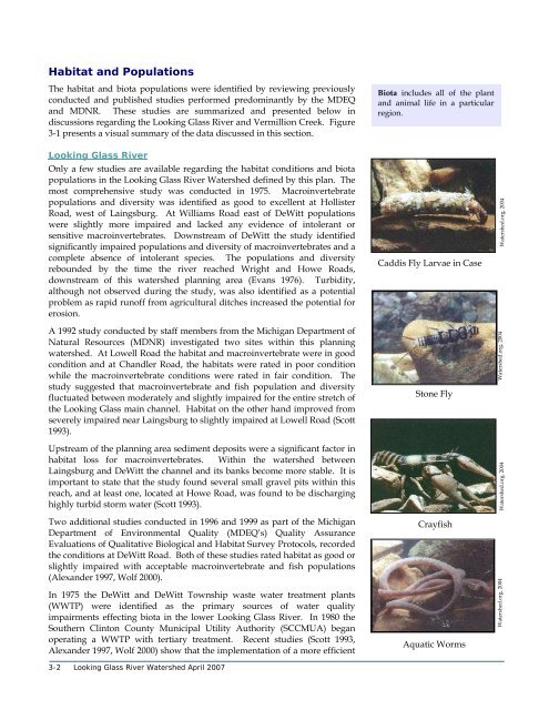
Habitat and Populations The habitat and biota populations were identified by reviewing previously conducted and published studies performed predominantly by the MDEQ and MDNR. These studies are summarized and presented below in discussions regarding the Looking Glass River and Vermillion Creek. Figure 3-1 presents a visual summary of the data discussed in this section. Looking Glass River Only a few studies are available regarding the habitat conditions and biota populations in the Looking Glass River Watershed defined by this plan. The most comprehensive study was conducted in 1975. Macroinvertebrate populations and diversity was identified as good to excellent at Hollister Road, west of Laingsburg. At Williams Road east of DeWitt populations were slightly more impaired and lacked any evidence of intolerant or sensitive macroinvertebrates. Downstream of DeWitt the study identified significantly impaired populations and diversity of macroinvertebrates and a complete absence of intolerant species. The populations and diversity rebounded by the time the river reached Wright and Howe Roads, downstream of this watershed planning area (Evans 1976). Turbidity, although not observed during the study, was also identified as a potential problem as rapid runoff from agricultural ditches increased the potential for erosion. Biota includes all of the plant and animal life in a particular region. Caddis Fly Larvae in Case Watershed.org, 2004 A 1992 study conducted by staff members from the Michigan Department of Natural Resources (MDNR) investigated two sites within this planning watershed. At Lowell Road the habitat and macroinvertebrate were in good condition and at Chandler Road, the habitats were rated in poor condition while the macroinvertebrate conditions were rated in fair condition. The study suggested that macroinvertebrate and fish population and diversity fluctuated between moderately and slightly impaired for the entire stretch of the Looking Glass main channel. Habitat on the other hand improved from severely impaired near Laingsburg to slightly impaired at Lowell Road (Scott 1993). Stone Fly Watershed.org, 2004 Upstream of the planning area sediment deposits were a significant factor in habitat loss for macroinvertebrates. Within the watershed between Laingsburg and DeWitt the channel and its banks become more stable. It is important to state that the study found several small gravel pits within this reach, and at least one, located at Howe Road, was found to be discharging highly turbid storm water (Scott 1993). Two additional studies conducted in 1996 and 1999 as part of the Michigan Department of Environmental Quality (MDEQ’s) Quality Assurance Evaluations of Qualitative Biological and Habitat Survey Protocols, recorded the conditions at DeWitt Road. Both of these studies rated habitat as good or slightly impaired with acceptable macroinvertebrate and fish populations (Alexander 1997, Wolf 2000). In 1975 the DeWitt and DeWitt Township waste water treatment plants (WWTP) were identified as the primary sources of water quality impairments effecting biota in the lower Looking Glass River. In 1980 the Southern Clinton County Municipal Utility Authority (SCCMUA) began operating a WWTP with tertiary treatment. Recent studies (Scott 1993, Alexander 1997, Wolf 2000) show that the implementation of a more efficient 3-2 Looking Glass River Watershed April 2007 Crayfish Aquatic Worms Watershed.org, 2004 Watershed.org, 2004
- Page 2 and 3: GLRC on Phase II Looking Glass Rive
- Page 4 and 5: P:\1666001\09 Looking Glass WMP\WMP
- Page 6 and 7: Table of Contents Organization of t
- Page 8 and 9: SECTION 10 - Plan Sustainability In
- Page 10 and 11: FIGURES Figure 1-1 Watershed Locati
- Page 12 and 13: Organization of the Plan This plan
- Page 14 and 15: 9. Evaluation and Revision Section
- Page 16 and 17: ! ! ! ! ! ! Forest Hill ! ! ! ! ! !
- Page 18 and 19: The goals and objectives were then
- Page 20 and 21: Looking Glass Watershed The Looking
- Page 22 and 23: • methods for evaluation of progr
- Page 24 and 25: References Center for Watershed Pro
- Page 26 and 27: ! ! ! ! ! ! ! ! ! ! ! ! ! ! ! ! ! !
- Page 28 and 29: ! ! ! ! ! ! ! ! ! ! ! ! ! ! ! ! ! !
- Page 30 and 31: ! ! ! ! ! ! ! ! ! ! ! ! ! ! ! ! ! !
- Page 32 and 33: The majority of wetlands in the wat
- Page 34 and 35: commonly classified as hydrologic s
- Page 36 and 37: ! ! ! ! ! ! ! ! ! ! ! ! ! ! ! ! ! !
- Page 38 and 39: Significant Natural Features to be
- Page 40 and 41: References Centers for Disease Cont
- Page 44 and 45: sanitary sewer treatment system has
- Page 46 and 47: Section 3: Water Quality Conditions
- Page 48 and 49: Data Analysis Tetra Tech summarized
- Page 50 and 51: ! ! ! ! ! ! Forest Hill ! ! ! ! ! !
- Page 52 and 53: ! ! ! ! ! ! Forest Hill ! ! ! ! ! !
- Page 54 and 55: Table 3-4 explains the problems fou
- Page 56 and 57: Vermillion Creek Assessment Vermill
- Page 58 and 59: Volunteers identify the species bas
- Page 60 and 61: Watershed Fish Consumption The Mich
- Page 62 and 63: The coldwater fishery use does not
- Page 64 and 65: ! ! ! ! ! ! ! ! ! ! ! ! ! ! ! ! ! !
- Page 66 and 67: Interpretation of Watershed Conditi
- Page 68 and 69: 4. Community Outreach A watershed p
- Page 70 and 71: Public Comment on Draft Plan A draf
- Page 72 and 73: Public Education Plan Public educat
- Page 74 and 75: determining goals and desires for t
- Page 76 and 77: Table 5-1 Status of Designated Uses
- Page 78 and 79: Sources The main sources of sedimen
- Page 80 and 81: the time for the specified month. (
- Page 82 and 83: Altered Hydrology Stream flows vary
- Page 84 and 85: day as it is at a USGS gauging stat
- Page 86 and 87: Figure 5-2 R-B Index at Eagle (USGS
- Page 88 and 89: It should also be noted that the su
- Page 90 and 91: Detergents are becoming a serious t
Habitat and Populations<br />
The habitat and biota populations were identified by reviewing previously<br />
conducted and published studies performed predominantly by the MDEQ<br />
and MDNR. These studies are summarized and presented below in<br />
discussions regarding the <strong>Looking</strong> <strong>Glass</strong> <strong>River</strong> and Vermillion Creek. Figure<br />
3-1 presents a visual summary of the data discussed in this section.<br />
<strong>Looking</strong> <strong>Glass</strong> <strong>River</strong><br />
Only a few studies are available regarding the habitat conditions and biota<br />
populations in the <strong>Looking</strong> <strong>Glass</strong> <strong>River</strong> <strong>Watershed</strong> defined by this plan. The<br />
most comprehensive study was conducted in 1975. Macroinvertebrate<br />
populations and diversity was identified as good to excellent at Hollister<br />
Road, west of Laingsburg. At Williams Road east of DeWitt populations<br />
were slightly more impaired and lacked any evidence of intolerant or<br />
sensitive macroinvertebrates. Downstream of DeWitt the study identified<br />
significantly impaired populations and diversity of macroinvertebrates and a<br />
complete absence of intolerant species. The populations and diversity<br />
rebounded by the time the river reached Wright and Howe Roads,<br />
downstream of this watershed planning area (Evans 1976). Turbidity,<br />
although not observed during the study, was also identified as a potential<br />
problem as rapid runoff from agricultural ditches increased the potential for<br />
erosion.<br />
Biota includes all of the plant<br />
and animal life in a particular<br />
region.<br />
Caddis Fly Larvae in Case<br />
<strong>Watershed</strong>.org, 2004<br />
A 1992 study conducted by staff members from the Michigan Department of<br />
Natural Resources (MDNR) investigated two sites within this planning<br />
watershed. At Lowell Road the habitat and macroinvertebrate were in good<br />
condition and at Chandler Road, the habitats were rated in poor condition<br />
while the macroinvertebrate conditions were rated in fair condition. The<br />
study suggested that macroinvertebrate and fish population and diversity<br />
fluctuated between moderately and slightly impaired for the entire stretch of<br />
the <strong>Looking</strong> <strong>Glass</strong> main channel. Habitat on the other hand improved from<br />
severely impaired near Laingsburg to slightly impaired at Lowell Road (Scott<br />
1993).<br />
Stone Fly<br />
<strong>Watershed</strong>.org, 2004<br />
Upstream of the planning area sediment deposits were a significant factor in<br />
habitat loss for macroinvertebrates. Within the watershed between<br />
Laingsburg and DeWitt the channel and its banks become more stable. It is<br />
important to state that the study found several small gravel pits within this<br />
reach, and at least one, located at Howe Road, was found to be discharging<br />
highly turbid storm water (Scott 1993).<br />
Two additional studies conducted in 1996 and 1999 as part of the Michigan<br />
Department of Environmental Quality (MDEQ’s) Quality Assurance<br />
Evaluations of Qualitative Biological and Habitat Survey Protocols, recorded<br />
the conditions at DeWitt Road. Both of these studies rated habitat as good or<br />
slightly impaired with acceptable macroinvertebrate and fish populations<br />
(Alexander 1997, Wolf 2000).<br />
In 1975 the DeWitt and DeWitt Township waste water treatment plants<br />
(WWTP) were identified as the primary sources of water quality<br />
impairments effecting biota in the lower <strong>Looking</strong> <strong>Glass</strong> <strong>River</strong>. In 1980 the<br />
Southern Clinton County Municipal Utility Authority (SCCMUA) began<br />
operating a WWTP with tertiary treatment. Recent studies (Scott 1993,<br />
Alexander 1997, Wolf 2000) show that the implementation of a more efficient<br />
3-2 <strong>Looking</strong> <strong>Glass</strong> <strong>River</strong> <strong>Watershed</strong> April 2007<br />
Crayfish<br />
Aquatic Worms<br />
<strong>Watershed</strong>.org, 2004<br />
<strong>Watershed</strong>.org, 2004


