Looking Glass River Watershed Management Plan - Greater ...
Looking Glass River Watershed Management Plan - Greater ... Looking Glass River Watershed Management Plan - Greater ...
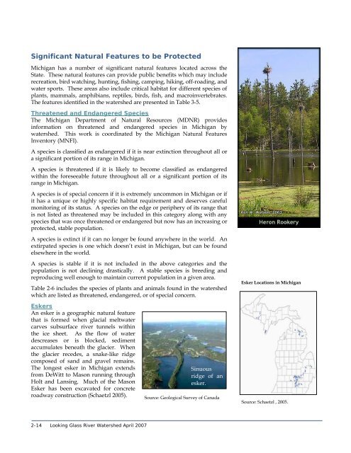
Significant Natural Features to be Protected Michigan has a number of significant natural features located across the State. These natural features can provide public benefits which may include recreation, bird watching, hunting, fishing, camping, hiking, off-roading, and water sports. These areas also include critical habitat for different species of plants, mammals, amphibians, reptiles, birds, fish, and macroinvertebrates. The features identified in the watershed are presented in Table 3-5. Threatened and Endangered Species The Michigan Department of Natural Resources (MDNR) provides information on threatened and endangered species in Michigan by watershed. This work is coordinated by the Michigan Natural Features Inventory (MNFI). A species is classified as endangered if it is near extinction throughout all or a significant portion of its range in Michigan. A species is threatened if it is likely to become classified as endangered within the foreseeable future throughout all or a significant portion of its range in Michigan. A species is of special concern if it is extremely uncommon in Michigan or if it has a unique or highly specific habitat requirement and deserves careful monitoring of its status. A species on the edge or periphery of its range that is not listed as threatened may be included in this category along with any species that was once threatened or endangered but now has an increasing or protected, stable population. A species is extinct if it can no longer be found anywhere in the world. An extirpated species is one which doesn’t exist in Michigan, but can be found elsewhere in the world. A species is stable if it is not included in the above categories and the population is not declining drastically. A stable species is breeding and reproducing well enough to maintain current population in a given area. Table 2-6 includes the species of plants and animals found in the watershed which are listed as threatened, endangered, or of special concern. Esker Locations in Michigan Eskers An esker is a geographic natural feature that is formed when glacial meltwater carves subsurface river tunnels within the ice sheet. As the flow of water descreases or is blocked, sediment accumulates beneath the glacier. When the glacier recedes, a snake-like ridge composed of sand and gravel remains. The longest esker in Michigan extends from DeWitt to Mason running through Holt and Lansing. Much of the Mason Esker has been excavated for concrete roadway construction (Schaetzl 2005). Sinuous ridge of an esker. Source: Geological Survey of Canada Source: Schaetzl , 2005. 2-14 Looking Glass River Watershed April 2007
Table 2-6 Threatened and Endangered Features in the Watershed Feature Type 1 Name Scientific Name H Great Blue Heron Rookery n/a X X X X X X O Barrens Buckmoth Hemileuca maia SC X X X O Beak Grass Diarrhena americana T X X X X X X X O Blanchard's Cricket Frog Acris crepitans blanchardi SC X X X O Blanding's Turtle Emys blandingii SC X X X X O Cat-tail Sedge Carex typhina T X X X O Cerulean Warbler Dendroica cerulea SC X X X X O Clinton's Bulrush Scirpus clintonii SC X X X X X X O Cooper's Hawk Accipiter cooperii SC X X X O Cooper's Milk-vetch Astragalus neglectus SC X X X O Culvers Root Borer Papaipema sciata SC X X X O Dwarf-bulrush Hemicarpha micrantha SC X X X X O Eastern Massasauga Sistrurus catenatus C SC X X X X X X X X X X O Elktoe Alasmidonta marginata SC X X X O False Hop Sedge Carex lupuliformis T X X X X X X X X X X O Hairy Angelica Angelica venenosa SC X X X O Indiana Bat or Indiana Myotis Myotis sodalis LE E X X X O King Rail Rallus elegans E X X X X X X X O Least Shrew Cryptotis parva T X X X X X X X O Prairie Fringed Orchid Platanthera leucophaea LT E X X X O Purple Milkweek Asclepias purpurascens SC X X X O Raven's-foot Sedge Carex crus-corvi T X X X O Regal Fern Borer Papaipema speciosissima SC X X X X X X X O Regal Fritillary Speyeria idalia E X X X X X X X X O Round Pigtoe Pleurobema coccineum SC X X X O Showy Orchis Galearis spectabilis T X X X X X X X X X X O Splendid Clubtail Gomphus lineatifrons SC X X X O Spotted Turtle Clemmys guttata T X X X O Swamp Metalmark Calephelis mutica SC X X X O Tamarack Tree Cricket Oecanthus laricis SC X X X O Torrey's Bulrush Scirpus torreyi SC X X X X X X X X X X X O White or Prairie False Indigo Baptisia lactea SC X X X X X X X X X X X O Virginia Spiderwort Tradescantia virginiana SC X X X X X X X O Virginia Waterhorehound Lycopus virginicus T X X X X X X X O Woodland Vole Microtus pinetorum SC X X X X X X X 1 – F = Forest, G = Geographical, H = Habitat, O = Organism 2 – LE = Listed as endangered, LT = Listed as threatened, SC = Special concern, T = Threatened, E = Endangered Source: MNFI, 2005. Federal Status 2 State Status 2 Clise Drain Faiver Drain Graneer Drain Upper Vermilion Creek Looking Glass A Looking Glass B Mud Creek Prairie & Gunderman Lower Remey Chandler Upper Remey Chandler Summer Drain Turkey Creek Lower Vermilion Creek Middle Vermilion Creek Section 2: Watershed Characteristics 2-15
- Page 2 and 3: GLRC on Phase II Looking Glass Rive
- Page 4 and 5: P:\1666001\09 Looking Glass WMP\WMP
- Page 6 and 7: Table of Contents Organization of t
- Page 8 and 9: SECTION 10 - Plan Sustainability In
- Page 10 and 11: FIGURES Figure 1-1 Watershed Locati
- Page 12 and 13: Organization of the Plan This plan
- Page 14 and 15: 9. Evaluation and Revision Section
- Page 16 and 17: ! ! ! ! ! ! Forest Hill ! ! ! ! ! !
- Page 18 and 19: The goals and objectives were then
- Page 20 and 21: Looking Glass Watershed The Looking
- Page 22 and 23: • methods for evaluation of progr
- Page 24 and 25: References Center for Watershed Pro
- Page 26 and 27: ! ! ! ! ! ! ! ! ! ! ! ! ! ! ! ! ! !
- Page 28 and 29: ! ! ! ! ! ! ! ! ! ! ! ! ! ! ! ! ! !
- Page 30 and 31: ! ! ! ! ! ! ! ! ! ! ! ! ! ! ! ! ! !
- Page 32 and 33: The majority of wetlands in the wat
- Page 34 and 35: commonly classified as hydrologic s
- Page 36 and 37: ! ! ! ! ! ! ! ! ! ! ! ! ! ! ! ! ! !
- Page 40 and 41: References Centers for Disease Cont
- Page 42 and 43: 3. Water Quality Conditions People
- Page 44 and 45: sanitary sewer treatment system has
- Page 46 and 47: Section 3: Water Quality Conditions
- Page 48 and 49: Data Analysis Tetra Tech summarized
- Page 50 and 51: ! ! ! ! ! ! Forest Hill ! ! ! ! ! !
- Page 52 and 53: ! ! ! ! ! ! Forest Hill ! ! ! ! ! !
- Page 54 and 55: Table 3-4 explains the problems fou
- Page 56 and 57: Vermillion Creek Assessment Vermill
- Page 58 and 59: Volunteers identify the species bas
- Page 60 and 61: Watershed Fish Consumption The Mich
- Page 62 and 63: The coldwater fishery use does not
- Page 64 and 65: ! ! ! ! ! ! ! ! ! ! ! ! ! ! ! ! ! !
- Page 66 and 67: Interpretation of Watershed Conditi
- Page 68 and 69: 4. Community Outreach A watershed p
- Page 70 and 71: Public Comment on Draft Plan A draf
- Page 72 and 73: Public Education Plan Public educat
- Page 74 and 75: determining goals and desires for t
- Page 76 and 77: Table 5-1 Status of Designated Uses
- Page 78 and 79: Sources The main sources of sedimen
- Page 80 and 81: the time for the specified month. (
- Page 82 and 83: Altered Hydrology Stream flows vary
- Page 84 and 85: day as it is at a USGS gauging stat
- Page 86 and 87: Figure 5-2 R-B Index at Eagle (USGS
Significant Natural Features to be Protected<br />
Michigan has a number of significant natural features located across the<br />
State. These natural features can provide public benefits which may include<br />
recreation, bird watching, hunting, fishing, camping, hiking, off-roading, and<br />
water sports. These areas also include critical habitat for different species of<br />
plants, mammals, amphibians, reptiles, birds, fish, and macroinvertebrates.<br />
The features identified in the watershed are presented in Table 3-5.<br />
Threatened and Endangered Species<br />
The Michigan Department of Natural Resources (MDNR) provides<br />
information on threatened and endangered species in Michigan by<br />
watershed. This work is coordinated by the Michigan Natural Features<br />
Inventory (MNFI).<br />
A species is classified as endangered if it is near extinction throughout all or<br />
a significant portion of its range in Michigan.<br />
A species is threatened if it is likely to become classified as endangered<br />
within the foreseeable future throughout all or a significant portion of its<br />
range in Michigan.<br />
A species is of special concern if it is extremely uncommon in Michigan or if<br />
it has a unique or highly specific habitat requirement and deserves careful<br />
monitoring of its status. A species on the edge or periphery of its range that<br />
is not listed as threatened may be included in this category along with any<br />
species that was once threatened or endangered but now has an increasing or<br />
protected, stable population.<br />
A species is extinct if it can no longer be found anywhere in the world. An<br />
extirpated species is one which doesn’t exist in Michigan, but can be found<br />
elsewhere in the world.<br />
A species is stable if it is not included in the above categories and the<br />
population is not declining drastically. A stable species is breeding and<br />
reproducing well enough to maintain current population in a given area.<br />
Table 2-6 includes the species of plants and animals found in the watershed<br />
which are listed as threatened, endangered, or of special concern.<br />
Esker Locations in Michigan<br />
Eskers<br />
An esker is a geographic natural feature<br />
that is formed when glacial meltwater<br />
carves subsurface river tunnels within<br />
the ice sheet. As the flow of water<br />
descreases or is blocked, sediment<br />
accumulates beneath the glacier. When<br />
the glacier recedes, a snake-like ridge<br />
composed of sand and gravel remains.<br />
The longest esker in Michigan extends<br />
from DeWitt to Mason running through<br />
Holt and Lansing. Much of the Mason<br />
Esker has been excavated for concrete<br />
roadway construction (Schaetzl 2005).<br />
Sinuous<br />
ridge of an<br />
esker.<br />
Source: Geological Survey of Canada<br />
Source: Schaetzl , 2005.<br />
2-14 <strong>Looking</strong> <strong>Glass</strong> <strong>River</strong> <strong>Watershed</strong> April 2007


