2011-pdf-egu-ciremai-02apr - ITB
2011-pdf-egu-ciremai-02apr - ITB
2011-pdf-egu-ciremai-02apr - ITB

Create successful ePaper yourself
Turn your PDF publications into a flip-book with our unique Google optimized e-Paper software.
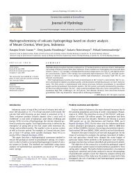
Characterization of Tropical Volcanic<br />
Hydrogeology based on Temperature and<br />
Electrical Conductivity Analysis:<br />
Mount Ciremai, West Java Province, Indonesia<br />
Irawan, DE., Puradimaja, DJ., Notosiswoyo, S., Sumintadireja, P.<br />
Presented in <strong>2011</strong> European Geosciences Union General Assembly,<br />
Vienna Austria, 3-8 April <strong>2011</strong><br />
APPLIED GEOLOGY RESEARCH DIVISION, FACULTY OF EARTH SCIENCES AND TECHNOLOGY<br />
INSTITUT TEKNOLOGI BANDUNG
Introduction (Mount Ciremai’s Profile)<br />
Applied Geology Research Division, Faculty of Earth Sciences and Technology, Institut Teknologi Bandung<br />
2
Introduction (Mount Ciremai’s Profile)<br />
Applied Geology Research Division, Faculty of Earth Sciences and Technology, Institut Teknologi Bandung<br />
3
The Hydrogeological Features<br />
(Geology, from Situmorang, 1995)<br />
• Consists of old and young volcanic products of<br />
pyroclastics flow and intruded lava underlied by<br />
Oligocene-Miocene clastics sediment.<br />
• Main geological structure:<br />
• NW-SE fault at south from the peak<br />
• E-W fault at easter slope, resulting Sangkanhurip and<br />
Pejambon geothermal prospect.<br />
Applied Geology Research Division, Faculty of Earth Sciences and Technology, Institut Teknologi Bandung<br />
4
The Hydrogeological Features<br />
(Groundwater System, from Irawan, 2009)<br />
Applied Geology Research Division, Faculty of Earth Sciences and Technology, Institut Teknologi Bandung<br />
5
Objectives<br />
• To measure groundwater response<br />
• To explain groundwater infiltration<br />
processes<br />
Applied Geology Research Division, Faculty of Earth Sciences and Technology, Institut Teknologi Bandung<br />
6
Methods (Field measurements)<br />
• Daily measurements at the same time (10.00 am)<br />
of:<br />
• Rainfall: using standard rain gauge, obtained at the nearest<br />
station:<br />
• The Susukan Station (309 masl)<br />
• The Mandirancan Station (293 masl)<br />
• Groundwater discharge at spring site: using channel<br />
measurement technique<br />
• Temperature (environment and groundwater) and<br />
• Electro Conductivity (EC) of groundwater<br />
Applied Geology Research Division, Faculty of Earth Sciences and Technology, Institut Teknologi Bandung<br />
7
Methods (Analysis)<br />
• Comparation of:<br />
• Rainfall and spring discharge hydrograph<br />
• Temperature (of environment and<br />
groundwater) and EC of groundwater<br />
Applied Geology Research Division, Faculty of Earth Sciences and Technology, Institut Teknologi Bandung<br />
8
Result (temperature profiles)<br />
Cibulan Spring<br />
Telaga Remis Spring<br />
Applied Geology Research Division, Faculty of Earth Sciences and Technology, Institut Teknologi Bandung<br />
9
Results (Cibulan Spring)<br />
Spring discharge hydrograph<br />
• Response:<br />
• Highest discharge:<br />
three to four months<br />
from the peak of rainy<br />
season.<br />
• Lowering discharge:<br />
two months since the<br />
dry season begins.<br />
• Lowest discharge: six<br />
months since the dry<br />
season begins.<br />
Applied Geology Research Division, Faculty of Earth Sciences and Technology, Institut Teknologi Bandung<br />
10
Results (Cibulan Spring)<br />
TDS-EC hydrograph<br />
• TDS dry = 3 x TDS rainy<br />
• EC dry = 2.5 x EC rainy<br />
• Cycle:<br />
• Dilution phase:<br />
December 2006-June<br />
2007<br />
• Recovery phase: July-<br />
September 2007<br />
• Dissolution phase:<br />
October-December<br />
2007, up until early<br />
months in 2008<br />
Applied Geology Research Division, Faculty of Earth Sciences and Technology, Institut Teknologi Bandung<br />
11
Results (Telaga Remis Spring)<br />
• Response:<br />
• Highest discharge:<br />
three to five<br />
months from the<br />
peak of rainy<br />
season.<br />
• Lowering<br />
discharge: four<br />
months since the<br />
dry season begins.<br />
• Lowest discharge:<br />
seven months<br />
since the dry<br />
season begins.<br />
Spring discharge hydrograph<br />
Applied Geology Research Division, Faculty of Earth Sciences and Technology, Institut Teknologi Bandung<br />
12
Results (Telaga Remis Spring)<br />
•TDS dry = 2 x TDS rainy<br />
•EC dry = 1.7 x EC rainy<br />
•1 st cycle:<br />
• Dilution: Jan-April 2006<br />
• Recovery: May 2006<br />
• Dissolution: Jun ‘06-Feb<br />
‘07<br />
•2 nd cycle:<br />
• Dilution: Mar-Aug ‘07<br />
• Recovery: Sep-Dec ‘07<br />
TDS-EC hydrograph<br />
Applied Geology Research Division, Faculty of Earth Sciences and Technology, Institut Teknologi Bandung<br />
13
Conclusion<br />
• Hydrograph model for volcanic springs (especially in<br />
tropical area) is still must be developed.<br />
• Most of the available models are for limestone karst aquifer<br />
system.<br />
• Combination of porous medium aquifer from weathered<br />
soil and fracture medium from fractured lava and breccias.<br />
Applied Geology Research Division, Faculty of Earth Sciences and Technology, Institut Teknologi Bandung<br />
14
Conclusion (Proposed type curve)<br />
Model A<br />
• Quick rising period in the<br />
baseflow recession curve.<br />
• Have better compliance to the<br />
dry season.<br />
• Relatively long storage period.<br />
• Combination porous-fractured<br />
medium.<br />
Model B<br />
• Slower period in the base flow<br />
recession curve.<br />
• More vulnerable to dry season.<br />
• Relatively short storage period.<br />
• More dominant fractured<br />
medium.<br />
Applied Geology Research Division, Faculty of Earth Sciences and Technology, Institut Teknologi Bandung 15
The authors would like to thank:<br />
1. Chevron Pacific Indonesia for funding sponsor<br />
2. Mr. Wouter Buytaert (Convener) for contacting to fill in the free oral<br />
session<br />
3. Ministry of National Education of Indonesia for funding the PhD research<br />
4. Department of Water Supply Kuningan Regency for data and permission to<br />
visit spring site<br />
5. Dr. Thom Bogaard (Delft University) for the discussion<br />
6. Undergraduate students for the assistance of field work<br />
Contact information:<br />
Email: erwin@fitb.itb.ac.id or d.erwin.irawan@gmail.com<br />
Website: blog.fitb.itb.ac.id/derwinirawan<br />
Tel: +62222514990, Fax: +62222514837<br />
Address: Faculty of Earth Sciences and Technology<br />
Jalan Ganesa No. 10, Bandung-40132<br />
West Java, Indonesia<br />
APPLIED GEOLOGY RESEARCH DIVISION, FACULTY OF EARTH SCIENCES AND TECHNOLOGY<br />
INSTITUT TEKNOLOGI BANDUNG