Jurnal Geoaplika (2010) Volume 5, Nomor 1, hal. 049 â 059 49 - ITB
Jurnal Geoaplika (2010) Volume 5, Nomor 1, hal. 049 â 059 49 - ITB
Jurnal Geoaplika (2010) Volume 5, Nomor 1, hal. 049 â 059 49 - ITB

You also want an ePaper? Increase the reach of your titles
YUMPU automatically turns print PDFs into web optimized ePapers that Google loves.
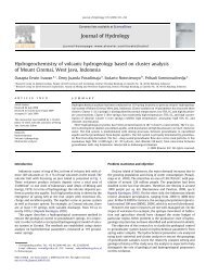
Figure 1. Map of West Java and Banten showing the location of the<br />
study area, i.e. at Cisolok, Sukabumi.<br />
Type and characteristic of its surface<br />
manifestation indicate that the geothermal<br />
system of Cisolok and Cisukarame has a<br />
s<strong>hal</strong>low reservoir having very high<br />
temperature. However, this geothermal potency<br />
has yet to be utilized, except for tourism. This<br />
is because, one of the reasons, the behavior of<br />
Cisolok and Cisukarame geothermal system is<br />
still unknown.<br />
A geothermal system including reservoir<br />
condition, type and sub surface flow pattern of<br />
thermal water can be understood by studying<br />
geothermal manifestations showing at the<br />
surface as hot spring, hot pool, steaming<br />
ground and hydrothermal surface alteration<br />
(Hochstein and Browne, 2000, and Browne,<br />
1978). By identification and correlation of an<br />
active and fossil geothermal system, the<br />
evolution of a geothermal system can be<br />
understood, including change in reservoir<br />
condition and sub surface flow pattern of<br />
thermal water.<br />
Geology<br />
Morphology of the study area can be divided<br />
into 3 parts, i.e. steep mountain, gentle<br />
mountain and plain. The steep mountain forms<br />
at northern and western parts of the study area.<br />
Its elevation is above 200 m with the slope of<br />
between 40 and 70. At the eastern part of the<br />
study area there is a zone of gentle mountain<br />
having elevation of less than 150 m and slope<br />
of less than 30. The last morphology zone is<br />
plain and occurs in south coastal area.<br />
Regional geology of the study area is shown by<br />
Sujatmiko and Santosa (1992). Cikotok<br />
formation is the oldest rock exposing in the<br />
western part of the study area. It has age of<br />
early Oligocene and consists of volcanic<br />
breccias, tuff and lava (Sujatmiko and Santosa,<br />
1992). It is overlain by early Miocene Citarete<br />
and Cimapag formations. The Citarete<br />
formation consists of limestone and tuff units,<br />
and the Cimapag formation is dominated by<br />
breccias and conglomerate (Sujatmiko and<br />
Santosa, 1992). Andesite and dacite then<br />
intrude the southern part of the study area<br />
during middle to late Miocene (Sujatmiko and<br />
Santosa, 1992). In the western part of the study<br />
area, igneous rock occurring is granodiorite to<br />
granite covered by dacitic lava and pyroclastic.<br />
Marine sediments and volcanic unit product of<br />
Citorek unconformably covered the Cikotok,<br />
Citarete and Cimapag formations during Plio-<br />
Pleistocene. Quaternary rocks of andesite and<br />
basaltic lavas product of Gunung Halimum and<br />
volcanic breccias and agglomerates product of<br />
Tapos then overlaid the area (Sujatmiko and<br />
50