Cyclone and Storm Surge - Iczmpwb.org
Cyclone and Storm Surge - Iczmpwb.org
Cyclone and Storm Surge - Iczmpwb.org
You also want an ePaper? Increase the reach of your titles
YUMPU automatically turns print PDFs into web optimized ePapers that Google loves.
2.49<br />
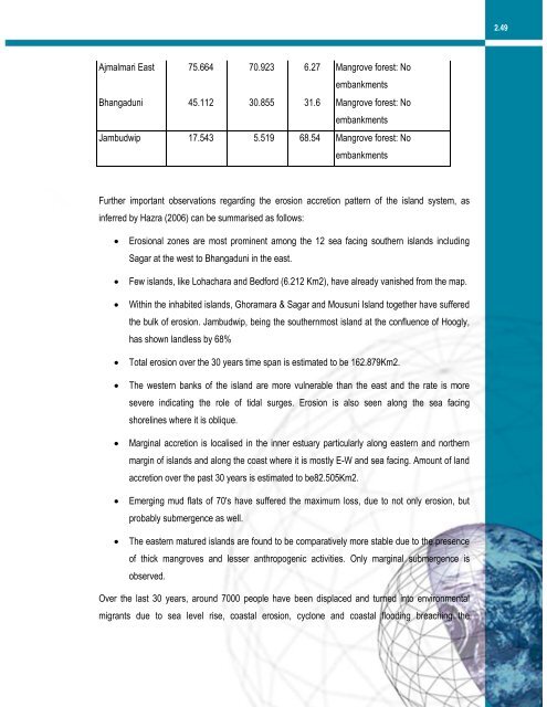
Ajmalmari East 75.664 70.923 6.27 Mangrove forest: No<br />
embankments<br />
Bhangaduni 45.112 30.855 31.6 Mangrove forest: No<br />
embankments<br />
Jambudwip 17.543 5.519 68.54 Mangrove forest: No<br />
embankments<br />
Further important observations regarding the erosion accretion pattern of the isl<strong>and</strong> system, as<br />
inferred by Hazra (2006) can be summarised as follows:<br />
• Erosional zones are most prominent among the 12 sea facing southern isl<strong>and</strong>s including<br />
Sagar at the west to Bhangaduni in the east.<br />
• Few isl<strong>and</strong>s, like Lohachara <strong>and</strong> Bedford (6.212 Km2), have already vanished from the map.<br />
• Within the inhabited isl<strong>and</strong>s, Ghoramara & Sagar <strong>and</strong> Mousuni Isl<strong>and</strong> together have suffered<br />
the bulk of erosion. Jambudwip, being the southernmost isl<strong>and</strong> at the confluence of Hoogly,<br />
has shown l<strong>and</strong>less by 68%<br />
• Total erosion over the 30 years time span is estimated to be 162.879Km2.<br />
• The western banks of the isl<strong>and</strong> are more vulnerable than the east <strong>and</strong> the rate is more<br />
severe indicating the role of tidal surges. Erosion is also seen along the sea facing<br />
shorelines where it is oblique.<br />
• Marginal accretion is localised in the inner estuary particularly along eastern <strong>and</strong> northern<br />
margin of isl<strong>and</strong>s <strong>and</strong> along the coast where it is mostly E-W <strong>and</strong> sea facing. Amount of l<strong>and</strong><br />
accretion over the past 30 years is estimated to be82.505Km2.<br />
• Emerging mud flats of 70's have suffered the maximum loss, due to not only erosion, but<br />
probably submergence as well.<br />
• The eastern matured isl<strong>and</strong>s are found to be comparatively more stable due to the presence<br />
of thick mangroves <strong>and</strong> lesser anthropogenic activities. Only marginal submergence is<br />
observed.<br />
Over the last 30 years, around 7000 people have been displaced <strong>and</strong> turned into environmental<br />
migrants due to sea level rise, coastal erosion, cyclone <strong>and</strong> coastal flooding breaching the


