Establishing a new C-130 Landing Zone - Kirtland Air Force Base
Establishing a new C-130 Landing Zone - Kirtland Air Force Base
Establishing a new C-130 Landing Zone - Kirtland Air Force Base

You also want an ePaper? Increase the reach of your titles
YUMPU automatically turns print PDFs into web optimized ePapers that Google loves.
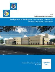
FINAL<br />
ENVIRONMENTAL ASSESSMENT<br />
FOR ESTABLISHMENT OF A<br />
NEW C-<strong>130</strong> LANDING ZONE FOR 58 SOW<br />
PREPARED FOR:<br />
Department of the <strong>Air</strong> <strong>Force</strong><br />
October 2013
This page is intentionally left blank.
This page is intentionally left blank.
FINAL ENVIRONMENTAL ASSESSMENT<br />
FOR ESTABLISHMENT OF A<br />
NEW C-<strong>130</strong> LANDING ZONE FOR 58 SOW<br />
PREPARED FOR:<br />
Department of the <strong>Air</strong> <strong>Force</strong><br />
October 2013<br />
Letters or other written comments provided may be published in the Final EA. As required by law,<br />
comments will be addressed in the Final EA and made available to the public. Any personal information<br />
provided will be kept confidential. Private addresses will be compiled to develop a mailing list for those<br />
requesting copies of the Final EA. However, only the names of the individuals making comments and their<br />
specific comments will be disclosed. Personal home addresses and phone numbers will not be published in<br />
the Final EA.
This page is intentionally left blank.
ERRATA SHEET<br />
ENVIRONMENTAL ASSESSMENT FOR ESTABLISHMENT OF A<br />
NEW C-<strong>130</strong> LANDING ZONE FOR 58 SOW<br />
PAGE SECTION REVISION<br />
1-1 1.1 Minor wording changes for clarity.<br />
1-3 1.4 Added a <strong>new</strong> sentence to the last paragraph, “However, currently the 58 SOW<br />
conducts C-<strong>130</strong> low approach flight operations on an existing Belen Alexander<br />
Municipal <strong>Air</strong>port (BAMA) runway without any landings and these activities are<br />
expected to continue even when a <strong>new</strong> local area runway is selected for the 58<br />
SOW take-off and landing training operations.”<br />
1-4 1.6.3 Added <strong>new</strong> section (1.6.3) on Public Involvement.<br />
2-1 2.1 Reworded to more clearly describe the proposed action. Changed to “The USAF<br />
Proposed Action is to determine the availability of a suitable local area runway<br />
to support and simulate real world C-<strong>130</strong> short-field takeoff and landing training<br />
requirements of the 58 SOW, located and operating at <strong>Kirtland</strong> AFB. The USAF<br />
intends to provide technical data to the FAA to facilitate the FAA’s approval of<br />
necessary <strong>Air</strong>port Layout Plan revisions and development of any necessary<br />
approaches and procedures pertaining to a <strong>new</strong> crosswind runway that can<br />
accommodate the 58 SOW’s training requirements.” Moved a sentence to<br />
Section 2.2.<br />
2-1 2.2 Added a sentence to the second paragraph, moved from Section 2.1, “Selection<br />
standards were developed to identify alternatives for meeting the purpose and<br />
need for the USAF action and to determine the range of alternatives analyzed.”<br />
2-2 2.3 Number 2 – Revised two sentences. “Use of a proposed Crosswind Runway<br />
10/28 (to be constructed by others) to be constructed by the USAF or the<br />
potential structural reinforcement by the USAF of the existing runway 17/35<br />
(with the addition of structural reinforcement) at Double Eagle II <strong>Air</strong>port.<br />
Double Eagle II is 18 nm from <strong>Kirtland</strong> AFB, but is in close proximity to the<br />
Petroglyphs National Monument administered by the National Park Service<br />
(NPS). These two alternatives were considered by the USAF during preliminary<br />
planning stages but were determined to be financially infeasible and further<br />
would result in increased noise levels over the Petroglyph National Monument,<br />
which is a noise-sensitive receptor.<br />
2-9 2.10 Revised two sentences. “The 58 SOW’s use of the runway proposed for<br />
construction by non-<strong>Air</strong> <strong>Force</strong> entities will eventually shift some training<br />
operations to the <strong>new</strong> runway, once constructed by the City of Belen. The<br />
incremental environmental consequences of the changed operations are<br />
evaluated within this EA.<br />
2-9 2.10 Table 2-6 – Changed third column heading from “Areas Considered in this EA”<br />
to “Additional Analysis in this EA.”<br />
4-11 &<br />
4-12<br />
Revised page references as appropriate.<br />
4.3.6.1 Multiple revisions to this section include:<br />
Revised sentence in the first paragraph to read “The Preferred<br />
Alternative/Proposed Action would not be expected to affect biological<br />
resources analyzed within this EA, Section 4.3.6 which also provides<br />
supplemental data to the City of Belen’s NEPA document BAMA EA (2005),<br />
Appendix A, which covers modifications to the BAMA <strong>Air</strong>port Layout Plan and<br />
Page 1 of 3
ERRATA SHEET<br />
ENVIRONMENTAL ASSESSMENT FOR ESTABLISHMENT OF A<br />
NEW C-<strong>130</strong> LANDING ZONE FOR 58 SOW<br />
PAGE SECTION REVISION<br />
any subsequent construction activities.”<br />
Minor wording changes for clarity in the “Noise Response for Wildlife”<br />
subsection.<br />
Numerous modifications to the “Threatened or Endangered Species and State<br />
Species of Concern” subsection:<br />
Added the following sentences to the first paragraph, “Additionally, while there<br />
is a potential for transient species within Valencia County, there is no known<br />
habitat present to support these transient species within the airport<br />
boundaries. The USFWS concurred with the determination that the USAF<br />
Preferred Alternative/Proposed Action “may affect, but is not likely to adversely<br />
affect” any Federally-listed species. The USFWS determination is in Appendix<br />
F.”<br />
Modified paragraph 4 to include the following sentences, “These noise levels<br />
have been determined to have no long-term, adverse impacts to burrowing<br />
owls that have been observed at similar airports and airfields. Therefore, the<br />
long-term, increased noise levels are not expected to have adverse impacts to<br />
burrowing owls and its habitat under the USAF’s Proposed Action. The USFWS<br />
has concurred with this analysis and its concurrence letter is in Appendix F.”<br />
Added paragraph to 5 and 6 as follows, “Though construction and related land<br />
disturbance activities are not associated with the USAF’s Proposed Action, but<br />
there could be potential incremental impacts to biota of constructing a<br />
strengthened runway vs. a general aviation runway, USAF analyzed those<br />
potential impacts. <strong>Base</strong>d on the analyses and the information available<br />
regarding the <strong>new</strong> runway, there would be no additional impacts expected<br />
beyond those already analyzed in the BAMA EA (2005).”<br />
4-12 &<br />
4-13<br />
“To further safeguard the burrowing owl, the USFWS requires that if there is a<br />
potential to impact this species, the entity constructing the runway shall<br />
conduct a biological survey within 2 weeks prior to any clearing, grading,<br />
excavation, or other associated ground-disturbing activities to identify prairie<br />
dog colonies and burrowing owls. Per the USFWS, the most suitable time to<br />
survey for burrowing owls in New Mexico is during the nest initiation and<br />
incubation phases (March to early June). If burrowing owls are present,<br />
construction activities would only commence after the owls have migrated from<br />
the area (October 15 to March 15).”<br />
4.3.7 Added the following <strong>new</strong> paragraph, “The BAMA EA (2005), prepared by the<br />
City of Belen for the proposed crosswind runway construction activities and<br />
general aviation operations, describes impacts to Cultural Resources in Section<br />
5.8 (page 25). That BAMA EA concluded that the Department of Transportation<br />
(DOT), Sec. 4(f)/6(f) restrictions (associated with the National Park System,<br />
public parks/recreations areas, historic/archeological properties, etc.) were not<br />
Page 2 of 3
ERRATA SHEET<br />
ENVIRONMENTAL ASSESSMENT FOR ESTABLISHMENT OF A<br />
NEW C-<strong>130</strong> LANDING ZONE FOR 58 SOW<br />
PAGE SECTION REVISION<br />
identified within, nor applicable to, their activities and operations.<br />
Consequently and similarly, the USAF concludes that these same restrictions are<br />
likely not applicable to the 58 SOW Preferred Alternative/Proposed Action<br />
involving flight training operations since there is no expectation that adverse<br />
impacts would result. The USAF also recommends that its proposed flight<br />
training operations would not result in any physical taking of applicable or<br />
identifiable DOT Section 4(f) properties (i.e., parks, recreation areas, historic<br />
sites or wildlife/waterfowl refuges, etc.), or, any constructive use of these<br />
properties that might be located within the DNL 65 threshold noise contour.<br />
The analysis and discussion within this section supports that there will not be<br />
any resulting adverse impacts or effects to historic properties from<br />
implementing the 58 SOW’s Preferred Alternative/Proposed Action. The State<br />
Historic Preservation Officer (SHPO) has concurred with the USAF finding of no<br />
adverse effects and supporting letters are in Appendix E."<br />
4-14 4.3.7.1 Modified the Tribal and Pueblo Communication subsection as follows. “In<br />
accordance with DoDI 4710.02 (DoD Interactions with Federally-Recognized<br />
Tribes), government to government consultation related to this action was<br />
initiated on December 17, 2012 with the tribes listed in Section 6.0 of this EA.<br />
Two tribes provided written responses (Appendix B) and follow-up phone calls<br />
were made and documented to the remaining tribes in March 2013. These<br />
tribes informed the USAF that they had no concerns or comments with the<br />
proposed project and actions. Updates continue to be provided to the tribes in<br />
the event issues arise as the EA is developed and finalized.<br />
In a letter from the Navajo Nation dated February 25, 2013 to Colonel Becklund,<br />
the USAF was notified that the Nation had no issues or concerns with the 58<br />
SOW Preferred Alternative/Proposed Action. However, the Nation did express<br />
interest in being notified of any inadvertent discovery of resources during<br />
construction related activities. The <strong>Air</strong> <strong>Force</strong> has attached this February 25,<br />
2013 letter from the Navajo Nation to this EA in Appendix B. This EA and<br />
Appendices will be provided to the City of Belen who prepared the BAMA EA<br />
(2005) and to the FAA.<br />
Appendix<br />
B<br />
Appendix<br />
F<br />
The Pueblos or other Tribes contacted did not express any concerns regarding<br />
the USAF Proposed Action for the 58 SOW’s flight training operations which will<br />
not involve construction activities (see Appendix B).”<br />
Added a table summarizing the public comments received during the public<br />
review period of the Draft EA.<br />
Added a copy of the New Mexico Environment Department (NMED) public<br />
comment letter to Appendix B.<br />
Added a copy of the New Mexico Department of Game and Fish (NMDGF) public<br />
comment letter to Appendix F.<br />
Page 3 of 3
This page is intentionally left blank.
Final Environmental Assessment<br />
Table of Contents<br />
Establishment of a New C-<strong>130</strong> <strong>Landing</strong> <strong>Zone</strong> for 58 SOW<br />
<strong>Kirtland</strong> AFB, NM<br />
TABLE OF CONTENTS<br />
Section<br />
Page<br />
1.0 PURPOSE OF AND NEED FOR ACTION ............................................................................. 1-1<br />
1.1 PURPOSE OF THE ACTION ......................................................................................... 1-1<br />
1.2 NEED FOR THE ACTION ............................................................................................. 1-1<br />
1.3 LOCATION OF EXISTING 58 SOW OPERATIONS ................................................... 1-1<br />
1.4 EXISTING 58 SOW C-<strong>130</strong> LANDING ZONES ............................................................ 1-1<br />
1.5 DECISION TO BE MADE .............................................................................................. 1-4<br />
1.6 COOPERATING AGENCY, INTERGOVERNMENTAL COORDINATION/<br />
CONSULTATIONS, AND PUBLIC INVOLVEMENT ................................................. 1-4<br />
1.6.1 Cooperating Agency (Federal Aviation Administration) .................................... 1-4<br />
1.6.2 Interagency and Intergovernmental Coordination and Consultations ................. 1-4<br />
1.6.3 Public Involvement ............................................................................................. 1-4<br />
2.0 DESCRIPTION OF THE PROPOSED ACTION AND ALTERNATIVES ......................... 2-1<br />
2.1 PROPOSED ACTION ..................................................................................................... 2-1<br />
2.2 SELECTION STANDARDS ........................................................................................... 2-1<br />
2.3 SCREENING OF ALTERNATIVES .............................................................................. 2-2<br />
2.4 ALTERNATIVES ELIMINATED FROM FURTHER CONSIDERATION ................. 2-3<br />
2.5 IDENTIFICATION OF THE PREFERRED ALTERNATIVE ...................................... 2-3<br />
2.6 DETAILED DESCRIPTION OF THE ALTERNATIVE(S) .......................................... 2-5<br />
2.6.1 Preferred Alternative (Proposed Action) ............................................................ 2-5<br />
2.6.2 No-Action Alternative ........................................................................................ 2-8<br />
2.7 OTHER ACTIONS ANNOUNCED FOR THE PROJECT AREA AND<br />
SURROUNDING COMMUNITY .................................................................................. 2-8<br />
2.8 COMPARISON OF ENVIRONMENTAL EFFECTS OF ALL<br />
ALTERNATIVES ........................................................................................................... 2-9<br />
2.9 MEASURES TO MINIMIZE IMPACTS ........................................................................ 2-9<br />
2.10 INCREMENTAL IMPACT ANALYSIS ........................................................................ 2-9<br />
3.0 AFFECTED ENVIRONMENT ................................................................................................. 3-1<br />
3.1 INTRODUCTION ........................................................................................................... 3-1<br />
3.2 INSTALLATION LOCATION, HISTORY, AND CURRENT MISSION .................... 3-1<br />
3.3 DESCRIPTION OF THE AFFECTED ENVIRONMENT ............................................. 3-1<br />
3.3.1 <strong>Air</strong>space Use and Management .......................................................................... 3-1<br />
3.3.2 Noise ................................................................................................................... 3-3<br />
3.3.3 Land Use ............................................................................................................. 3-7<br />
3.3.4 <strong>Air</strong> Quality .......................................................................................................... 3-7<br />
3.3.5 Earth Resources .................................................................................................. 3-8<br />
3.3.6 Biological Resources .......................................................................................... 3-8<br />
3.3.7 Cultural Resources ............................................................................................ 3-11<br />
3.3.8 Water Resources ............................................................................................... 3-14<br />
3.3.9 Hazardous Materials and Wastes ...................................................................... 3-14<br />
3.3.10 Ground and Flight Safety Resources ................................................................ 3-14<br />
3.3.11 Recreation and Visual Resources...................................................................... 3-16<br />
3.3.12 Socio-economic Resources ............................................................................... 3-16<br />
3.3.13 Environmental Justice ....................................................................................... 3-17<br />
4.0 ENVIRONMENTAL CONSEQUENCES ................................................................................ 4-1<br />
4.1 INTRODUCTION ........................................................................................................... 4-1<br />
4.2 CHANGE IN CURRENT MISSION ............................................................................... 4-1<br />
Page i October 2013
Final Environmental Assessment<br />
Table of Contents<br />
Establishment of a New C-<strong>130</strong> <strong>Landing</strong> <strong>Zone</strong> for 58 SOW<br />
<strong>Kirtland</strong> AFB, NM<br />
4.3 EFFECTS OF THE PREFERRED ALTERNATIVE ON THE AFFECTED<br />
ENVIRONMENT ............................................................................................................ 4-1<br />
4.3.1 <strong>Air</strong>space Use and Management .......................................................................... 4-1<br />
4.3.1.1 Preferred Alternative (Proposed Action) ............................................... 4-1<br />
4.3.1.2 No-Action Alternative ........................................................................... 4-2<br />
4.3.1.3 Measures to Reduce Impacts ................................................................. 4-2<br />
4.3.2 Noise ................................................................................................................... 4-2<br />
4.3.2.1 Preferred Alternative (Proposed Action) ............................................... 4-2<br />
4.3.2.2 No-Action Alternative ........................................................................... 4-5<br />
4.3.2.3 Measures to Reduce Impacts ................................................................. 4-8<br />
4.3.3 Land Use ............................................................................................................. 4-8<br />
4.3.3.1 Preferred Alternative (Proposed Action) ............................................... 4-8<br />
4.3.3.2 No-Action Alternative ........................................................................... 4-8<br />
4.3.3.3 Measures to Reduce Impacts ................................................................. 4-8<br />
4.3.4 <strong>Air</strong> Quality .......................................................................................................... 4-9<br />
4.3.4.1 Preferred Alternative (Proposed Action) ............................................... 4-9<br />
4.3.4.2 No-Action Alternative ......................................................................... 4-10<br />
4.3.4.3 Measures to Reduce Impacts ............................................................... 4-10<br />
4.3.5 Earth Resources ................................................................................................ 4-10<br />
4.3.5.1 Preferred Alternative (Proposed Action) ............................................. 4-10<br />
4.3.5.2 No-Action Alternative ......................................................................... 4-10<br />
4.3.5.3 Measures to Reduce Impacts ............................................................... 4-10<br />
4.3.6 Biological Resources ........................................................................................ 4-10<br />
4.3.6.1 Preferred Alternative (Proposed Action) ............................................. 4-11<br />
4.3.6.2 No-Action Alternative ......................................................................... 4-12<br />
4.3.6.3 Measures to Reduce Impacts ............................................................... 4-12<br />
4.3.7 Cultural Resources ............................................................................................ 4-12<br />
4.3.7.1 Preferred Alternative (Proposed Action) ............................................. 4-13<br />
4.3.7.2 No-Action Alternative ......................................................................... 4-16<br />
4.3.7.3 Measures to Reduce Impacts ............................................................... 4-16<br />
4.3.8 Water Resources ............................................................................................... 4-16<br />
4.3.8.1 Preferred Alternative (Proposed Action) ............................................. 4-16<br />
4.3.8.2 No-Action Alternative ......................................................................... 4-17<br />
4.3.8.3 Measures to Reduce Impacts ............................................................... 4-17<br />
4.3.9 Hazardous Materials and Wastes ...................................................................... 4-17<br />
4.3.9.1 Preferred Alternative (Proposed Action) ............................................. 4-17<br />
4.3.9.2 No-Action Alternative ......................................................................... 4-17<br />
4.3.9.3 Measures to Reduce Impacts ............................................................... 4-17<br />
4.3.10 Ground and Flight Safety Resources ................................................................ 4-18<br />
4.3.10.1 Preferred Alternative (Proposed Action) ............................................. 4-18<br />
4.3.10.2 No-Action Alternative ......................................................................... 4-18<br />
4.3.10.3 Measures to Reduce Impacts ............................................................... 4-18<br />
4.3.11 Recreation and Visual Resources...................................................................... 4-19<br />
4.3.11.1 Preferred Alternative (Proposed Action) ............................................. 4-19<br />
4.3.11.2 No-Action Alternative ......................................................................... 4-19<br />
4.3.11.3 Measures to Reduce Impacts ............................................................... 4-19<br />
4.3.12 Socio-economics Resources ............................................................................. 4-19<br />
4.3.12.1 Preferred Alternative (Proposed Action) ............................................. 4-19<br />
4.3.12.2 No-Action Alternative ......................................................................... 4-20<br />
4.3.12.3 Measures to Reduce Impacts ............................................................... 4-20<br />
Page ii October 2013
Final Environmental Assessment<br />
Table of Contents<br />
Establishment of a New C-<strong>130</strong> <strong>Landing</strong> <strong>Zone</strong> for 58 SOW<br />
<strong>Kirtland</strong> AFB, NM<br />
4.3.13 Environmental Justice ....................................................................................... 4-20<br />
4.3.13.1 Preferred Alternative (Proposed Action) ............................................. 4-20<br />
4.3.13.2 No-Action Alternative ......................................................................... 4-20<br />
4.3.13.3 Measures to Reduce Impacts ............................................................... 4-20<br />
4.3.14 Cumulative Effects ........................................................................................... 4-20<br />
5.0 LIST OF PREPARERS .............................................................................................................. 5-1<br />
6.0 PERSONS AND AGENCIES CONSULTED/COORDINATED ........................................... 6-1<br />
7.0 REFERENCES ............................................................................................................................ 7-1<br />
LIST OF TABLES<br />
Page<br />
Table 1-1. Current Inventory of 58 SOW Operational C-<strong>130</strong> <strong>Landing</strong> <strong>Zone</strong>s .......................................... 1-2<br />
Table 2-1. Comparison of the Proposed Action and Alternatives to Selection Standards ......................... 2-4<br />
Table 2-2. Proposed Annual Flight Operations at BAMA (E80) ............................................................... 2-6<br />
Table 2-3. Existing Annual Flight Operations at BAMA (E80) ................................................................ 2-8<br />
Table 2-4. Summary of Environmental Impacts ...................................................................................... 2-11<br />
Table 2-5. Summary of Environmental Protection Measures .................................................................. 2-12<br />
Table 2-6. Environmental Impact Analysis Categories ........................................................................... 2-13<br />
Table 3-1. Sound Exposure Levels dB(A) 1 ................................................................................................ 3-5<br />
Table 3-2. Federal- and State-Listed Species in Bernalillo and Valencia Counties, NM .......................... 3-9<br />
Table 3-3. Historic Properties Potentially Affected ................................................................................. 3-13<br />
Table 3-4. <strong>Air</strong>craft Mishap Rates ............................................................................................................. 3-15<br />
Table 3-5. <strong>Kirtland</strong> AFB Bird Strike Data ............................................................................................... 3-16<br />
Table 3-6. BAMA Vicinity Population Trends (1990-2010) ................................................................... 3-17<br />
Table 3-7. Minority and Low-Income Populations for BAMA ............................................................... 3-18<br />
Table 4-1. Proposed Annual Flight Operations ......................................................................................... 4-3<br />
Table 4-2. <strong>Base</strong>line and Proposed DNL at Representative Noise-Sensitive Receptors ............................. 4-5<br />
Table 4-3. No Action Annual Flight Operations ........................................................................................ 4-6<br />
Table 4-4. No Action DNL at Representative Noise-Sensitive Receptors ................................................ 4-8<br />
Table 4-5. Net Change in Operations due to Preferred Alternative Scenario ............................................ 4-9<br />
Table 4-6. Summary of Effects to Historic Properties ............................................................................. 4-14<br />
Table 5-1. List of Preparers ....................................................................................................................... 5-1<br />
Table 6-1. Persons and Agencies Consulted/Coordinated ......................................................................... 6-1<br />
LIST OF FIGURES<br />
Page<br />
Figure 1-1. Regional Map .......................................................................................................................... 1-3<br />
Figure 2-1. Crosswind Runway 13/31 Location ........................................................................................ 2-7<br />
Figure 3-1. Existing BAMA Runway Configuration ................................................................................. 3-2<br />
Figure 3-2. Single Noise Event Showing SEL and L max for a Hypothetical Overflight ............................. 3-3<br />
Figure 3-3. <strong>Air</strong>space Managed by <strong>Kirtland</strong> AFB ....................................................................................... 3-4<br />
Figure 3-4. Typical L dn Values and Criteria for Outdoor Environments ................................................... 3-6<br />
Figure 3-5. Belen Area of Potential Effect .............................................................................................. 3-12<br />
Figure 4-1. BAMA Noise Contours With Land Use (Proposed Action) ................................................... 4-4<br />
Figure 4-2. BAMA Noise Contours With Land Use (No Action) ............................................................. 4-7<br />
Page iii October 2013
Final Environmental Assessment<br />
Table of Contents<br />
Establishment of a New C-<strong>130</strong> <strong>Landing</strong> <strong>Zone</strong> for 58 SOW<br />
<strong>Kirtland</strong> AFB, NM<br />
Appendix A<br />
Appendix B<br />
Appendix C<br />
Appendix D<br />
Appendix E<br />
Appendix F<br />
LIST OF APPENDICES<br />
Environmental Assessment Document Proposed <strong>Air</strong>port Expansion Belen Alexander<br />
Municipal <strong>Air</strong>port (2005)<br />
Interagency/Intergovernmental Coordination and Public Participation<br />
Supplemental Noise Metrics for C-<strong>130</strong> <strong>Landing</strong> <strong>Zone</strong> Environmental Assessment<br />
<strong>Air</strong> Pollutant Emissions Calculations<br />
Section 106 Information/SHPO Consultation<br />
U.S. Fish and Wildlife Consultation<br />
Page iv October 2013
Final Environmental Assessment<br />
Acronyms and Abbreviations<br />
Establishment of a New C-<strong>130</strong> <strong>Landing</strong> <strong>Zone</strong> for 58 SOW<br />
<strong>Kirtland</strong> AFB, NM<br />
GLOSSARY OF ABBREVIATIONS AND ACRONYMS<br />
°C Degrees Celsius<br />
AAF<br />
Army <strong>Air</strong> Field<br />
AFB<br />
<strong>Air</strong> <strong>Force</strong> <strong>Base</strong><br />
AFCEC<br />
<strong>Air</strong> <strong>Force</strong> Civil Engineer Center<br />
AFI<br />
<strong>Air</strong> <strong>Force</strong> Instruction<br />
AFMC<br />
<strong>Air</strong> <strong>Force</strong> Material Command<br />
AFPD<br />
<strong>Air</strong> <strong>Force</strong> Policy Directive<br />
AGL<br />
Above Ground Level<br />
AICUZ<br />
<strong>Air</strong> Installation Compatible Use <strong>Zone</strong><br />
APE<br />
Area of Potential Effect<br />
AQCR<br />
<strong>Air</strong> Quality Control Region<br />
ARFF<br />
<strong>Air</strong>port Rescue and Fire Fighting<br />
ATC<br />
<strong>Air</strong> Traffic Control<br />
ATSF<br />
Atchison, Topeka, and Santa Fe (Railroad Depot)<br />
BAMA<br />
Belen Alexander Municipal <strong>Air</strong>port<br />
BAMA EA (2005) Environmental Assessment Document Proposed <strong>Air</strong>port Expansion Belen<br />
Alexander Municipal <strong>Air</strong>port (2005)<br />
BASH<br />
Bird/Wildlife <strong>Air</strong>craft Strike Hazard<br />
BISON-M<br />
Biota Information System of New Mexico<br />
BLM<br />
Bureau of Land Management<br />
BMP<br />
Best Management Practices<br />
CAAA<br />
Clean <strong>Air</strong> Act Amendments<br />
CEQ<br />
Council on Environmental Quality<br />
CFR<br />
Code of Federal Regulations<br />
dB<br />
Decibel<br />
dB(A)<br />
A-Weighted Decibel<br />
DNL<br />
Day-Night Average A-Weighted Sound Level<br />
DoD<br />
U.S. Department of Defense<br />
DOT<br />
U.S. Department of Transportation<br />
EA<br />
Environmental Assessment<br />
EIAP<br />
Environmental Impact Analysis Process<br />
EIS<br />
Environmental Impact Statement<br />
EMS<br />
Emergency Medical Service<br />
EO<br />
Executive Order<br />
ESA<br />
Endangered Species Act<br />
FAA<br />
Federal Aviation Administration<br />
FBO<br />
Fixed <strong>Base</strong> Operator<br />
FES<br />
Fire Emergency Services<br />
FICON<br />
Federal Interagency Committee on Noise<br />
FONSI<br />
Finding of No Significant Impact<br />
ft<br />
Feet<br />
FY<br />
Fiscal Year<br />
GASEPV<br />
General Aviation Single Engine Propeller Vehicle<br />
GHG<br />
Greenhouse Gas<br />
HAZMAT<br />
Hazardous Materials<br />
HUD<br />
U.S. Department of Housing and Urban Development<br />
IFR<br />
Instrument Flight Rules<br />
IR<br />
Infrared<br />
Ldn<br />
Day-Night Average A-weighted Sound Level<br />
Page v October 2013
Final Environmental Assessment<br />
Acronyms and Abbreviations<br />
Establishment of a New C-<strong>130</strong> <strong>Landing</strong> <strong>Zone</strong> for 58 SOW<br />
<strong>Kirtland</strong> AFB, NM<br />
Lmax<br />
LZ<br />
MBTA<br />
MOA<br />
MTR<br />
NAAQS<br />
NEPA<br />
NFPA<br />
nm<br />
NM<br />
NMDGF<br />
NMDOT<br />
NOA<br />
NPS<br />
NRHP<br />
NVG<br />
RPM<br />
SEL<br />
SHPO<br />
SOW<br />
SUA<br />
SWPPP<br />
TIT<br />
USACE<br />
USAF<br />
USCB<br />
USEPA<br />
USFWS<br />
VFR<br />
WSMR<br />
Maximum Sound Level<br />
<strong>Landing</strong> <strong>Zone</strong><br />
Migratory Bird Treaty Act<br />
Military Operations Area<br />
Military Training Route<br />
National Ambient <strong>Air</strong> Quality Standards<br />
National Environmental Policy Act<br />
National Fire Protection Association<br />
Nautical Miles<br />
New Mexico<br />
New Mexico Department of Game and Fish<br />
New Mexico Department of Transportation<br />
National Park Service<br />
National Register of Historic Places<br />
Night Vision Goggles<br />
Revolutions Per Minute<br />
Sound Exposure Level<br />
State Historic Preservation Office<br />
Special Operations Wing<br />
Special Use <strong>Air</strong>space<br />
Stormwater Pollution Prevention Plan<br />
Turbine Inlet Temperature<br />
United States Army Corps of Engineers<br />
United States <strong>Air</strong> <strong>Force</strong><br />
U.S. Census Bureau<br />
U.S. Environmental Protection Agency<br />
U.S. Fish and Wildlife Service<br />
Visual Flight Rules<br />
White Sands Missile Range<br />
Page vi October 2013
Final Environmental Assessment<br />
Purpose of and Need for Action<br />
Establishment of a New C-<strong>130</strong> <strong>Landing</strong> <strong>Zone</strong> for 58 SOW<br />
<strong>Kirtland</strong> AFB, NM<br />
1.0 PURPOSE OF AND NEED FOR ACTION<br />
The mission of the 58 th Special Operations Wing (SOW) at <strong>Kirtland</strong> <strong>Air</strong> <strong>Force</strong> <strong>Base</strong> (AFB) in<br />
Albuquerque, New Mexico (NM) is to train special operations, rescue, missile site support, and<br />
Distinguished Visitor airlift crews. Training is accomplished using a variety of airframes, including five<br />
versions of C-<strong>130</strong> aircraft.<br />
As part of the C-<strong>130</strong> training, the 58 SOW conducts short-runway (field) day and night takeoff, approach,<br />
and landing training at non-<strong>Air</strong> <strong>Force</strong> controlled airfields to simulate “real world” situations that pilots<br />
will encounter in conducting their mission. Short-field runways include runways up to 5,500 feet (ft) in<br />
length. To support this training, the 58 SOW requires access to runways near <strong>Kirtland</strong> AFB that are<br />
adequate to support realistic C-<strong>130</strong> short-field takeoff and landing training.<br />
1.1 PURPOSE OF THE ACTION<br />
The purpose of the action is to determine the availability of a<br />
suitable local area runway to support and simulate real world<br />
C-<strong>130</strong> training requirements of the 58 SOW, currently located at<br />
and operating from <strong>Kirtland</strong> AFB.<br />
1.2 NEED FOR THE ACTION<br />
The need for additional off-base runway access is to provide training locations with variable and differing<br />
attributes which allows the 58 SOW to better train and prepare for real world deployment airfields.<br />
1.3 LOCATION OF EXISTING 58 SOW OPERATIONS<br />
C-<strong>130</strong>J in flight<br />
The 58 SOW is a tenant organization at <strong>Kirtland</strong> AFB. <strong>Kirtland</strong> AFB is located in southeast Albuquerque<br />
between the Sandia and Manzano mountain ranges. Currently, two civilian airports, Roswell International<br />
<strong>Air</strong> Center and Pueblo Memorial <strong>Air</strong>port, as well as runways at the Albuquerque International Sunport,<br />
are used by the 58 SOW for short-field runway takeoff and landing training. The 58 SOW’s landing<br />
locations are shown in Figure 1-1.<br />
1.4 EXISTING 58 SOW C-<strong>130</strong> LANDING ZONES<br />
The 58 SOW uses the following runways at civilian airports for short-runway takeoff and landing<br />
training:<br />
♦ Roswell International <strong>Air</strong> Center (includes Cannondale Runway) near Roswell, NM<br />
♦ Pueblo Memorial <strong>Air</strong>port near Pueblo, CO<br />
♦ Albuquerque International Sunport in Albuquerque, NM, immediately adjacent to <strong>Kirtland</strong> AFB<br />
The characteristics of these landing zones are summarized in Table 1-1.<br />
Since access to less developed airfields is required, access to these runways is not sufficient to fully<br />
support the current training syllabus/needs. Additional access to suitable short-field runways at austere<br />
airfields is needed to assure that special operations aircrews can obtain training in the widest possible<br />
range of situations simulating those that could be encountered in real world missions.<br />
Page 1-1 October 2013
Final Environmental Assessment<br />
Purpose of and Need for Action<br />
Establishment of a New C-<strong>130</strong> <strong>Landing</strong> <strong>Zone</strong> for 58 SOW<br />
<strong>Kirtland</strong> AFB, NM<br />
Table 1-1. Current Inventory of 58 SOW Operational C-<strong>130</strong> <strong>Landing</strong> <strong>Zone</strong>s<br />
<strong>Landing</strong> <strong>Zone</strong><br />
Designation<br />
Roswell<br />
International<br />
<strong>Air</strong> Center<br />
Pueblo<br />
Memorial<br />
<strong>Air</strong>port<br />
Albuquerque<br />
International<br />
Sunport<br />
Accommodates Day<br />
and Night Training?<br />
Yes<br />
Partial: due to<br />
daytime use restricted<br />
for civilian/<br />
commercial traffic<br />
conflicts.<br />
Partial: runway is<br />
available for day and<br />
night training but<br />
excessive light from<br />
surrounding<br />
populated areas limits<br />
training effectiveness.<br />
Has Adequate<br />
Available Short-<br />
Field Runway(s)?<br />
Partial: Cannondale<br />
has been decertified<br />
due to proximity to<br />
parking area.<br />
Partial: available<br />
runway is too long<br />
and has severe<br />
scheduling<br />
restrictions.<br />
Partial: runway is<br />
too long/wide to<br />
furnish realistic<br />
short-field landing<br />
training.<br />
Minimal<br />
Transit Time<br />
Required?<br />
Use Could<br />
be Expanded<br />
at Site?<br />
Few<br />
Encroachments<br />
or Restrictions?<br />
No No No<br />
No No No<br />
Yes No No<br />
This requirement for the 58 SOW to train at less developed airfields currently cannot be fully met through<br />
use of the Roswell International <strong>Air</strong> Center, Pueblo Memorial <strong>Air</strong>port, and the Albuquerque International<br />
Sunport. The distances from <strong>Kirtland</strong> AFB to the airfields at Roswell International <strong>Air</strong> Center and Pueblo<br />
Memorial <strong>Air</strong>port are not ideal because valuable training time and fuel is consumed en route, and both<br />
have commercial as well as light civilian air traffic. At Albuquerque International Sunport, the runways<br />
are too long and too brightly-lit (including lighting from the large population centers surrounding the<br />
airfield) to realistically simulate short-runway training in an austere setting, and the Albuquerque<br />
International Sunport supports high volumes of commercial traffic. Sequencing military training flights<br />
into the commercial traffic pattern is problematic when there are high volumes of commercial traffic.<br />
Other civilian airports that might be available that do not experience commercial traffic at all, or do not<br />
support high volumes of commercial traffic, are not structurally constructed to be capable of supporting<br />
C-<strong>130</strong> landing operations. However, currently the 58 SOW conducts C-<strong>130</strong> low approach flight<br />
operations on an existing Belen Alexander Municipal <strong>Air</strong>port (BAMA) runway without any landings and<br />
these activities are expected to continue even when a <strong>new</strong> local area runway is selected for the 58 SOW<br />
take-off and landing training operations.<br />
Page 1-2 October 2013
Final Environmental Assessment<br />
Purpose of and Need for Action<br />
Establishment of a New C-<strong>130</strong> <strong>Landing</strong> <strong>Zone</strong> for 58 SOW<br />
<strong>Kirtland</strong> AFB, NM<br />
Figure 1-1. Regional Map<br />
Page 1-3 October 2013
Final Environmental Assessment<br />
Purpose of and Need for Action<br />
Establishment of a New C-<strong>130</strong> <strong>Landing</strong> <strong>Zone</strong> for 58 SOW<br />
<strong>Kirtland</strong> AFB, NM<br />
1.5 DECISION TO BE MADE<br />
The decision to be made is the selection of an alternative for 58 SOW aircraft operations to support shortfield<br />
training. The decision options are:<br />
1) To continue with current training (the No-Action Alternative);<br />
2) Selecting an alternative and preparing a Finding of No Significant Impact (FONSI); or<br />
3) Preparing an Environmental Impact Statement (EIS) if the alternatives would result in significant<br />
environmental impacts.<br />
1.6 COOPERATING AGENCY, INTERGOVERNMENTAL COORDINATION/<br />
CONSULTATIONS, AND PUBLIC INVOLVEMENT<br />
1.6.1 Cooperating Agency (Federal Aviation Administration)<br />
In March 2011, the Federal Aviation Administration (FAA) became a cooperating agency in the<br />
preparation of this Environmental Assessment (EA). The United States <strong>Air</strong> <strong>Force</strong> (USAF) has obtained<br />
technical input from the FAA to prepare this EA. The USAF works cooperatively with the FAA to ensure<br />
that adoption of the findings of this EA will enable continued airspace management that serves future<br />
military aviation training needs and also civil aviation needs.<br />
1.6.2 Interagency and Intergovernmental Coordination and Consultations<br />
Federal, state, and local agencies with jurisdiction that could be affected by the alternative actions were<br />
notified and consulted during the development of the Environmental Assessment Document Proposed<br />
<strong>Air</strong>port Expansion Belen Alexander Municipal <strong>Air</strong>port (2005), hereafter referred to as BAMA EA (2005)<br />
(see Appendix A).<br />
Chapter 6.0 contains the list of agencies consulted during this analysis. Copies of correspondence,<br />
responses, and (as applicable) concurrences are included in Appendices B, E, and F.<br />
1.6.3 Public Involvement<br />
A Notice of Availability (NOA) for the Draft EA and Draft FONSI was published in the Albuquerque<br />
Journal and Valencia County News-Bulletin (Belen, NM) on July 11, 2013 announcing that the Draft EA<br />
and Draft FONSI were available to the public for a 30-day review period. The notices appeared in both<br />
printed and on-line versions of the <strong>new</strong>spapers. Copies of the Draft EA and Draft FONSI were made<br />
available at the Belen Public Library, Albuquerque Public Library (Main Library), Central New Mexico<br />
Community College Montoya Campus Library, University of New Mexico Zimmerman Campus Library,<br />
San Pedro Library, Los Lunas Public Library, and the <strong>Kirtland</strong> AFB website. The comment period was<br />
subsequently extended until September 16, 2013 following public comments stating that insufficient time<br />
was provided to review the Draft EA and Draft FONSI.<br />
Copies of the NOAs and Extension of the Comment Period notices are included in Appendix B. A total of<br />
17 public comments and 2 agency comments were received. A summary of the comments received are<br />
included in Appendix B.<br />
The Pueblo and Tribal consultation process and any discussions are presented in Chapter 4, Sec. 4.3.7 of<br />
this EA.<br />
Page 1-4 October 2013
Final Environmental Assessment<br />
Description of the Proposed Action and Alternatives<br />
Establishment of a New C-<strong>130</strong> <strong>Landing</strong> <strong>Zone</strong> for 58 SOW<br />
<strong>Kirtland</strong> AFB, NM<br />
2.0 DESCRIPTION OF THE PROPOSED ACTION AND ALTERNATIVES<br />
The 58 SOW requires access to and use of short-field runways at austere airfields that simulate real-world<br />
situations that pilots are confronted with in carrying out their humanitarian, rescue, and similar special<br />
operations missions. Since the 58 SOW does not have the authority or capability of building short-field<br />
runways that meet selection standards, the 58 SOW must rely on access to and use of appropriate landing<br />
zones that are constructed, owned, and maintained by other (non-USAF) entities.<br />
2.1 PROPOSED ACTION<br />
The USAF Proposed Action is to determine the availability of a suitable local area runway to support and<br />
simulate real world C-<strong>130</strong> short-field takeoff and landing training requirements of the 58 SOW, located<br />
and operating at <strong>Kirtland</strong> AFB. The USAF intends to provide technical data to the FAA to facilitate the<br />
FAA’s approval of necessary <strong>Air</strong>port Layout Plan revisions and development of any necessary<br />
approaches and procedures pertaining to a <strong>new</strong> crosswind runway that can accommodate the 58 SOW’s<br />
training requirements.<br />
2.2 SELECTION STANDARDS<br />
The National Environmental Policy Act (NEPA) and the Council on Environmental Quality (CEQ)<br />
regulations mandate the consideration of reasonable alternatives to the proposed action. “Reasonable<br />
alternatives” are those that also could be utilized to meet the purpose of and need for the proposed action.<br />
Per the requirements of 32 Code of Federal Regulations (CFR) §989, the USAF Environmental Impact<br />
Analysis Process (EIAP) regulations, selection standards are used to identify alternatives for meeting the<br />
purpose and need for the USAF action. In addition, selection standards may be used to narrow the range<br />
of alternatives to focus analyses to meet the directive that environmental analyses be analytic rather than<br />
encyclopedic. Selection standards were developed to identify alternatives for meeting the purpose and<br />
need for the USAF action and to determine the range of alternatives analyzed.<br />
To fully and most efficiently support realistic C-<strong>130</strong> short-field training, runways used for 58 SOW<br />
training must meet the following standards:<br />
1) Be no more than 50 nautical miles (nm) (approximately 58 miles) from <strong>Kirtland</strong> AFB to reduce<br />
“transit” time between the <strong>Base</strong> and the runway. Excessive transit time is undesirable in flying<br />
training programs because other higher priority training events cannot be accomplished during<br />
that time. Flying training programs are developed to maximize the number of training events<br />
accomplished in the shortest period possible to conserve fuel and maximize the actual training<br />
time vs. “commuting time” for the air crews.<br />
2) Have a minimum load bearing strength (existing, or proposed for <strong>new</strong> construction) capable of<br />
supporting C-<strong>130</strong> aircraft (reference: C-<strong>130</strong> <strong>Air</strong>craft Flight Manual Technical Order 1C-<strong>130</strong>(H)<br />
H-1).<br />
3) Be located in an area with minimal city lights for effective night vision goggle training.<br />
4) Be located in an area with minimal potential for conflicts or operational restrictions to<br />
accommodate sensitive receptor concerns.<br />
5) Have suitable crash/fire/rescue personnel and equipment available on-site.<br />
6) Be available for day and night 58 SOW operations on weekdays as well as for infrequent use<br />
during weekends.<br />
7) Have a ramp/taxi area sufficient to support two or more C-<strong>130</strong>s on the ground at a time.<br />
Page 2-1 October 2013
Final Environmental Assessment<br />
Description of the Proposed Action and Alternatives<br />
Establishment of a New C-<strong>130</strong> <strong>Landing</strong> <strong>Zone</strong> for 58 SOW<br />
<strong>Kirtland</strong> AFB, NM<br />
8) Have sufficiently low commercial or other military air traffic volumes or operations such that<br />
scheduling conflicts for 58 SOW operations are minimized.<br />
9) Be located at an airfield/airport that is actively maintained and operated by a non-military entity<br />
willing and able to accommodate USAF operations in addition to civilian air traffic.<br />
2.3 SCREENING OF ALTERNATIVES<br />
The following potential alternatives that might meet the purpose and need for 58 SOW C-<strong>130</strong> landings in<br />
support of current training were considered.<br />
1) Use of proposed Crosswind Runway 13/31 at BAMA, Belen, NM (Proposed Action) that would<br />
be constructed and strengthened by the City of Belen with assistance from the State of New<br />
Mexico Aviation Division. BAMA is 26 nm from <strong>Kirtland</strong> AFB.<br />
2) Use of a proposed Crosswind Runway 10/28 to be constructed by the USAF or the potential<br />
structural reinforcement by the USAF of the existing runway 17/35 at Double Eagle II <strong>Air</strong>port.<br />
Double Eagle II is 18 nm from <strong>Kirtland</strong> AFB, but is in close proximity to the Petroglyphs<br />
National Monument administered by the National Park Service (NPS). These two alternatives<br />
were considered by the USAF during preliminary planning stages but were determined to be<br />
financially infeasible and further would result in increased noise levels over the Petroglyph<br />
National Monument, which is a noise-sensitive receptor.<br />
3) Utilize a runway at Roswell International <strong>Air</strong> Center for short-field training. Roswell is located<br />
approximately 172 nm from <strong>Kirtland</strong> AFB. None of the available runways have a surface less<br />
than 100 ft wide. Though the Roswell International <strong>Air</strong> Center is operational, the Cannondale<br />
landing area (short runway) at the airport has been decertified for use due to its proximity to<br />
aircraft parking areas.<br />
4) Utilize Pueblo Memorial <strong>Air</strong>port for short-field day and night training. A short runway at Pueblo<br />
Memorial <strong>Air</strong>port is currently used for night training. The 10,496-ft long runway at the Pueblo<br />
Memorial <strong>Air</strong>port (220 nm northeast of <strong>Kirtland</strong> AFB) is unavailable for daytime use due to<br />
increases in civilian and Initial Flight Screening aircraft traffic.<br />
5) Repair the runway at Stallion Army <strong>Air</strong>field (AAF). Stallion AAF on White Sands Missile Range<br />
(WSMR), 73 nm south of <strong>Kirtland</strong> AFB, previously had been used for short-field training. The<br />
runway was closed to C-<strong>130</strong>s in July 2009 due to significant deterioration of the runway. The<br />
runway could be repaired; however, scheduling of WSMR restricted airspace is problematic.<br />
When the runway was open for use by the 58 SOW C-<strong>130</strong> aircrews (2005-2009), the 58 SOW<br />
was often denied entry due to higher priority missions on WSMR. In addition, expanded<br />
Unmanned Aerial Systems use by the U.S. Army at Stallion AAF would create use and<br />
scheduling conflicts even if the runway were to be repaired.<br />
6) Increase usage of Albuquerque International Sunport Runway 12/30. This use is not ideal because<br />
light from the City of Albuquerque interferes with realistic night landing training. In addition,<br />
planned future residential development in southern Albuquerque will likely constrain use of the<br />
approach path to Runway 30. Runway 17/35 at Albuquerque International Sunport was formerly<br />
used by the 58 SOW, but was closed in mid-2012 and is no longer available.<br />
7) Strengthen a runway for C-<strong>130</strong> use at the Socorro Municipal <strong>Air</strong>port 63 nm south-southwest of<br />
<strong>Kirtland</strong> AFB. The City of Socorro has not been supportive, and the close proximity of the airport<br />
to the City of Socorro restricts the ability to conduct realistic night training due to background<br />
light.<br />
Page 2-2 October 2013
Final Environmental Assessment<br />
Description of the Proposed Action and Alternatives<br />
Establishment of a New C-<strong>130</strong> <strong>Landing</strong> <strong>Zone</strong> for 58 SOW<br />
<strong>Kirtland</strong> AFB, NM<br />
8) Construct and use a <strong>new</strong> runway or strengthen an existing runway at Truth or Consequences<br />
<strong>Air</strong>port for C-<strong>130</strong> landing training. Truth or Consequences is located over 110 nm south of<br />
<strong>Kirtland</strong> AFB. The current Truth or Consequences runway is too long (7,200 ft) for realistic<br />
short-field training. In addition, this airfield is heavily used by Cannon AFB, creating potential<br />
scheduling conflicts for use by 58 SOW aircrews.<br />
9) Utilize runways at Cannon AFB or Holloman AFB. Cannon AFB is approximately 168 nm from<br />
<strong>Kirtland</strong> AFB and Holloman AFB is approximately 134 nm from <strong>Kirtland</strong> AFB. Both bases are<br />
too far from <strong>Kirtland</strong> AFB, and neither has a short runway. In addition, Holloman AFB has<br />
missions that are incompatible with uses involving C-<strong>130</strong> landing training.<br />
10) Utilize a runway at the Santa Fe Municipal <strong>Air</strong>port, approximately 43 nm east-northeast of<br />
<strong>Kirtland</strong> AFB. The City of Santa Fe has not been supportive, and the close proximity to the City<br />
of Santa Fe restricts the ability to conduct realistic night training. In addition, the presence of<br />
sensitive receptors/resources near this airport would likely pose severe constraints on C-<strong>130</strong><br />
landing training.<br />
The selection standards described in Section 2.2 were applied to these alternatives to determine which<br />
alternative(s) could meet the 58 SOW training requirements and that would fulfill the purpose and need<br />
for the action. The comparison of the proposed action and alternatives to the selection standards are<br />
summarized in Table 2-1.<br />
2.4 ALTERNATIVES ELIMINATED FROM FURTHER CONSIDERATION<br />
As none of the other alternatives 2 through 10 that were considered would meet the purpose and need, the<br />
following alternatives have been eliminated from further consideration:<br />
♦ Utilize a <strong>new</strong> cross-wind or strengthened runway at Double Eagle II <strong>Air</strong>port<br />
♦ Utilize Cannondale or other runways at the Roswell International <strong>Air</strong> Center more heavily<br />
♦ Utilize short runway at Pueblo Memorial <strong>Air</strong>port more heavily<br />
♦ Repair and utilize Stallion AAF at WSMR<br />
♦ Utilize Albuquerque International Sunport Runway 12/30<br />
♦ Utilize a runway at the Socorro Municipal <strong>Air</strong>port<br />
♦ Utilize a <strong>new</strong> runway at Truth or Consequences <strong>Air</strong>port<br />
♦ Utilize runways at Cannon AFB or Holloman AFB<br />
♦ Utilize a runway at the Santa Fe Municipal <strong>Air</strong>port<br />
These alternatives are not carried forward for analysis in this EA.<br />
2.5 IDENTIFICATION OF THE PREFERRED ALTERNATIVE<br />
Application of the selection standards indicates that the only alternative that would meet the purpose and<br />
need is the Proposed Action to use the planned <strong>new</strong> Crosswind Runway at BAMA for C-<strong>130</strong> landing<br />
training if it is constructed by the City of Belen to accommodate C-<strong>130</strong> landings and associated activities.<br />
Therefore, the Preferred Alternative is to implement the Proposed Action.<br />
The only alternative that fulfills all of the selection standards and meets the purpose and need is the<br />
Proposed Action. Therefore, the Proposed Action is the Preferred Alternative and is the only “action<br />
alternative” carried forward for analysis.<br />
Page 2-3 October 2013
Final Environmental Assessment<br />
Description of the Proposed Action and Alternatives<br />
Establishment of a New C-<strong>130</strong> <strong>Landing</strong> <strong>Zone</strong> for 58 SOW<br />
<strong>Kirtland</strong> AFB, NM<br />
Table 2-1. Comparison of the Proposed Action and Alternatives to Selection Standards<br />
Selection Standards<br />
Proposed Action and<br />
Alternative Description<br />
Utilize proposed Crosswind<br />
Runway at BAMA (Proposed<br />
Action)<br />
Utilize proposed cross-wind or<br />
strengthened runway at Double<br />
Eagle II <strong>Air</strong>port<br />
Utilize Cannondale or other<br />
runways at the Roswell<br />
International <strong>Air</strong> Center more<br />
heavily<br />
Utilize short runway at Pueblo<br />
Memorial <strong>Air</strong>port more heavily<br />
Repair and utilize Stallion AAF at<br />
WSMR<br />
Utilize Albuquerque<br />
International Sunport Runway<br />
12/30<br />
Utilize a runway at the Socorro<br />
Municipal <strong>Air</strong>port<br />
Utilize a <strong>new</strong> runway at Truth or<br />
Consequences <strong>Air</strong>port<br />
Utilize runways at Cannon or<br />
Holloman AFBs<br />
Utilize a runway at the Santa Fe<br />
Municipal <strong>Air</strong>port<br />
Within 50 nm of <strong>Kirtland</strong><br />
AFB?<br />
Will (or does) have sufficient<br />
load-bearing strength?<br />
Minimal city lights?<br />
Minimal sensitive receptor<br />
constraints?<br />
Crash/fire/rescue personnel<br />
and equipment onsite:<br />
Available for day and night<br />
weekday ops (and infrequent<br />
weekend use)?<br />
Ramp/taxi area can support<br />
two or more C-<strong>130</strong>s on the<br />
ground at a time?<br />
Sufficiently low air traffic<br />
volumes to minimize<br />
scheduling conflicts?<br />
Non-military/austere airfield<br />
actively maintained/operated<br />
by others?<br />
(1) (2) (3) (4) (5) (6) (7) (8) (9)<br />
Yes Yes Yes Yes Yes Yes Yes Yes Yes<br />
Yes Yes Yes No Yes No Yes Yes Yes<br />
No No No Yes Yes Yes Yes No Yes<br />
No Yes No No Yes No Yes No Yes<br />
No Yes Yes No Yes Yes Yes No No<br />
Yes Yes No No Yes Yes Yes No Yes<br />
No Yes No No Yes No Yes No Yes<br />
No Yes No Yes Yes Yes Yes Yes Yes<br />
No Yes Yes No Yes Yes Yes No Yes<br />
Yes Yes No No Yes No Yes No Yes<br />
Page 2-4 October 2013
Final Environmental Assessment<br />
Description of the Proposed Action and Alternatives<br />
Establishment of a New C-<strong>130</strong> <strong>Landing</strong> <strong>Zone</strong> for 58 SOW<br />
<strong>Kirtland</strong> AFB, NM<br />
2.6 DETAILED DESCRIPTION OF THE ALTERNATIVE(S)<br />
Two alternatives, the Proposed Action and “No-Action” are analyzed in the detailed description of the<br />
alternatives.<br />
2.6.1 Preferred Alternative (Proposed Action)<br />
Under the Preferred Alternative (Proposed Action) – Construction of a Strengthened Crosswind Runway<br />
13/31 at BAMA by the City of Belen and Pursuit of Access/Use by 58 SOW for C-<strong>130</strong> Training, the<br />
planned Crosswind Runway 13/31 at BAMA would be constructed and strengthened by the State of New<br />
Mexico, Valencia County, and/or the City of Belen.<br />
Independent of the process of identifying and remedying training shortfalls for the 58 SOW, the airport<br />
manager at BAMA developed plans as part of the FAA’s <strong>Air</strong>port Improvement Program, a grant program<br />
financed through fuel and excise taxes. As part of routine discussions between the 58 SOW and the<br />
airport manager at BAMA, the USAF proposed the option of utilizing this airport for C-<strong>130</strong> landing<br />
training. The airport manager at BAMA was receptive to the proposal and discussions are continuing<br />
regarding eventual use of the planned Crosswind Runway for 58 SOW C-<strong>130</strong> landing training.<br />
The existing proposal is to increase the capabilities of the BAMA by constructing a Crosswind Runway to<br />
accommodate additional civilian air traffic. The environmental consequences of constructing and<br />
operating a <strong>new</strong> Crosswind Runway have been evaluated in the BAMA EA (2005), which was approved<br />
by the FAA with a FONSI issued on September 30, 2005. This proposal is currently unfunded.<br />
The <strong>new</strong> runway is projected to be 5,280-ft long by 75-ft wide<br />
and would meet USAF definition of a short-field runway.<br />
Strengthening to C-<strong>130</strong> load bearing capacity would be<br />
undertaken by the City of Belen with assistance from the State of<br />
New Mexico Aviation Division. Once the planned runway is<br />
constructed, the 58 SOW would utilize the runway pursuant to an<br />
access/use agreement. Additionally, the USAF would require<br />
appropriate crash/fire/rescue support in accordance with USAF<br />
standards. No fire protection and crash rescue infrastructure<br />
Cessna C-210<br />
would be constructed as part of this alternative.<br />
No net increase in overall USAF landing training operations is<br />
contemplated; implementation of this alternative would result in<br />
a decrease in ongoing operations at the other landing zones<br />
currently in use and an increase at the BAMA location. Other<br />
current training activities at BAMA would continue at the<br />
present rate where current operations are limited to low-level<br />
approaches with no actual landing. A summary of all training<br />
operations that would occur at BAMA if the Preferred<br />
Cessna C-182<br />
Alternative/Proposed Action were to be implemented are<br />
summarized in Table 2-2.<br />
The Cessna C-210 and C-182 aircraft shown above are typical representatives of general aviation aircraft<br />
currently using BAMA and used in Table 2-2 to indicate the general aviation (civilian) flight operations at<br />
the airport.<br />
Page 2-5 October 2013
Final Environmental Assessment<br />
Description of the Proposed Action and Alternatives<br />
Establishment of a New C-<strong>130</strong> <strong>Landing</strong> <strong>Zone</strong> for 58 SOW<br />
<strong>Kirtland</strong> AFB, NM<br />
Table 2-2. Proposed Annual Flight Operations at BAMA (E80)<br />
<strong>Air</strong>craft Type<br />
58 SOW C-<strong>130</strong><br />
58 SOW C-<strong>130</strong><br />
Cessna C-210 (2)<br />
or equivalent<br />
Cessna C-182 (2)<br />
or equivalent<br />
Description<br />
Military Low Approach<br />
(no landings)<br />
Military Tactical<br />
Approach (with<br />
landings)<br />
Civilian General<br />
Aviation<br />
Civilian General<br />
Aviation<br />
Annual Flying Days<br />
Notes: IFR = Instrument Flight Rules; VFR = Visual Flight Rules<br />
(1)<br />
Each circuit is counted as 2 operations<br />
(2)<br />
Used as a basis for analysis; actual aircraft will vary<br />
= Proposed Action<br />
Source: NM <strong>Air</strong>ports Authority, 58 SOW<br />
Departures<br />
Arrival VFR<br />
Arrival IFR<br />
Depart and Land<br />
BAMA (E80) on<br />
Opposite Runway (1)<br />
252 2,016 2,016 - - - 4,032 8,064<br />
252 1,764 1,764 - 4,536 1,008 1,764 10,836<br />
365 730 658 72 - - - 1,460<br />
365 1,929 1,929 - - 10,416 - 14,274<br />
Total 6,439 6,367 72 4,536 11,424 5,796 34,634<br />
The proposed location of Crosswind Runway 13/31 is shown in Figure 2-1. The planned flight tracks at<br />
BAMA are included in the noise report included in Appendix C, pages A-3 through A-14. Most straightin<br />
approaches would be flown at 500 feet above ground level (AGL) altitude (over unpopulated areas to<br />
the west of BAMA) beginning approximately 10 miles from the runway. Any approaches other than<br />
10-mile straight-in approaches would typically be flown at an altitude of 1,000 ft above the runway in a<br />
local pattern similar to those already flown at BAMA.<br />
To simulate real scenarios, C-<strong>130</strong>s would conduct a portion of the landings at night without the use of<br />
runway lighting to simulate austere landing zones in real world conditions. Crews regularly train for these<br />
scenarios using night vision goggles (NVG) aided by electro-optical and infrared (IR) detection<br />
equipment and have stringent procedures and safety protocols to mitigate the risks inherent with the<br />
maneuver.<br />
Initially, the runway would be built without any lighting according to the State of New Mexico Aviation<br />
Division. However, the 58 SOW hopes to install pilot-controlled IR lighting in the future to simulate<br />
semi-improved landing zones. These lights are invisible to the naked eye but are visible from great<br />
distance using NVGs. There would be five lights set up in a pattern to provide a "box," four lights<br />
marking the left, right, fore, and aft limits of the intended landing point and one light at the far end of the<br />
runway to mark its edge. The IR lights are similar to those used as the transmitter in television remote<br />
controls and are approximately the same intensity.<br />
C-<strong>130</strong> crews monitor the Belen Unicom frequency (122.8) while operating in the vicinity of the airport.<br />
Safety procedures would be incorporated into flight operations and would include things such as turning<br />
overt lights on, making de-confliction radio calls, and possibly breaking off the approach until the civilian<br />
aircraft has landed or departed the airspace when civilian traffic is present at night, which is rare.<br />
Environmental analysis for this alternative considers the additional civilian aviation traffic and the<br />
impacts related to the 58 SOW additional training aircraft operations at BAMA.<br />
Tower Pattern (1)<br />
Box Pattern (1)<br />
Total<br />
Page 2-6 October 2013
Final Environmental Assessment<br />
Description of the Proposed Action and Alternatives<br />
Establishment of a New C-<strong>130</strong> <strong>Landing</strong> <strong>Zone</strong> for 58 SOW<br />
<strong>Kirtland</strong> AFB, NM<br />
Figure 2-1. Crosswind Runway 13/31 Location<br />
Page 2-7 October 2013
Final Environmental Assessment<br />
Description of the Proposed Action and Alternatives<br />
Establishment of a New C-<strong>130</strong> <strong>Landing</strong> <strong>Zone</strong> for 58 SOW<br />
<strong>Kirtland</strong> AFB, NM<br />
2.6.2 No-Action Alternative<br />
For the No-Action Alternative, the existing C-<strong>130</strong> training consisting of low approaches, but no landings,<br />
would continue at BAMA. Current C-<strong>130</strong> landing/takeoff training would continue, with training flights<br />
distributed between Roswell International <strong>Air</strong> Center, NM; Pueblo Memorial <strong>Air</strong>port, CO; and<br />
Albuquerque International Sunport, NM. Student pilots/aircrews would continue to train on runways<br />
which are not fully representative of the “real world” conditions they will encounter in carrying out<br />
special operations missions subsequent to training. At BAMA, pilots would conduct low approach<br />
operations but would not descend below 50 ft AGL. The USAF would continue to spend extra funds in<br />
fuel costs and lose training time to travel to airports located well over 50 nm from <strong>Kirtland</strong> AFB.<br />
Albuquerque International Sunport Runway 12/30 would continue to be used for night training. Night<br />
training would continue at runways which have substantial lighting from nearby population centers.<br />
Ambient light limits the effectiveness of the training utilizing night vision enhancement technologies, and<br />
potentially causing safety concerns for pilots. The existing annual flight operations at BAMA are included<br />
in Table 2-3. The various flight patterns are represented in the Noise Report included as Appendix C.<br />
Table 2-3. Existing Annual Flight Operations at BAMA (E80)<br />
Annual Flying Days<br />
<strong>Air</strong>craft Type Description<br />
58 SOW C-<strong>130</strong> Military Low Approach<br />
training (no landings)<br />
252 2,016 2,016 - - 4,032 8,064<br />
Cessna C-210 (2)<br />
or equivalent<br />
Civilian General Aviation 365 730 658 72 - - 1,460<br />
Cessna C-182 (2)<br />
or equivalent<br />
Civilian General Aviation 365 1,929 1,929 - 10,416 - 14,274<br />
Total 4,675 4,603 72 10,416 4,032 23,798<br />
(1)<br />
Each circuit is counted as 2 operations<br />
IFR = Instrument Flight Rules<br />
(2)<br />
Used as a basis for analysis; actual aircraft will vary VFR = Visual Flight Rules<br />
Source: NM <strong>Air</strong>ports Authority, 58 SOW (operations data verified December 2012)<br />
2.7 OTHER ACTIONS ANNOUNCED FOR THE PROJECT AREA AND<br />
SURROUNDING COMMUNITY<br />
This EA also considers the effects of cumulative impacts as required in 40 CFR 1508.7 and concurrent<br />
actions as required in 40 CFR 1508.25[1]. A cumulative impact, as defined by the CEQ (40 CFR 1508.7)<br />
is the “…impact on the environment which results from the incremental impact of the action when added<br />
to other past, present, and reasonably foreseeable future actions regardless of which agency (Federal or<br />
non-Federal) or person undertakes such actions. Cumulative impacts can result from individually minor<br />
but collectively significant actions taking place over a period of time.”<br />
Actions announced for the region of influence for this project that could occur during the same time<br />
period as the alternative actions are:<br />
♦ The Camino del Llano road near BAMA is currently undergoing a major expansion. When<br />
completed, the two-lane road will have been widened to a five-lane road<br />
♦ Access road and taxiway improvements (2013)<br />
♦ Design and construct helipad (2015)<br />
Departures<br />
Arrival VFR<br />
Arrivals<br />
Tower Pattern (1)<br />
Box Pattern (1)<br />
Total<br />
Page 2-8 October 2013
Final Environmental Assessment<br />
Description of the Proposed Action and Alternatives<br />
Establishment of a New C-<strong>130</strong> <strong>Landing</strong> <strong>Zone</strong> for 58 SOW<br />
<strong>Kirtland</strong> AFB, NM<br />
♦ Phase I multi-use facility, taxiway A rehabilitation/reconstruction, wildlife hazard survey (2016)<br />
♦ Phase II construction of multi-use facility (2017)<br />
♦ Crosswind Runway 13/31 extension, hangar development area, parallel taxiway construction (2018)<br />
For this EA analysis, these announced actions are addressed from a cumulative perspective and are<br />
analyzed in Section 4.0. These announced actions would be evaluated under separate NEPA actions<br />
conducted by the appropriate Federal agency. <strong>Base</strong>d on the best available information for these proposals<br />
by others, the USAF cumulative impact analysis considers them.<br />
2.8 COMPARISON OF ENVIRONMENTAL EFFECTS OF ALL ALTERNATIVES<br />
The environmental impacts of the Preferred Alternative/Proposed Action and the No-Action Alternative<br />
are summarized in Table 2-4.<br />
2.9 MEASURES TO MINIMIZE IMPACTS<br />
Table 2-5 presents a summary of environmental protection measures that will be included in the Proposed<br />
Action to minimize or reduce impacts. Any measures that would be implemented to reduce potentially<br />
significant impacts to levels less than significant, and to achieve a FONSI as opposed to preparation of an<br />
EIS will be identified and discussed as necessary pursuant to 32 CFR 989.22-Mitigation.<br />
2.10 INCREMENTAL IMPACT ANALYSIS<br />
This analysis supplements the prior evaluation in the BAMA EA (2005) and includes the incremental<br />
environmental consequences from the Proposed Action. The 58 SOW’s use of the runway proposed for<br />
construction by non-<strong>Air</strong> <strong>Force</strong> entities will eventually shift some training operations to the <strong>new</strong> runway<br />
The incremental environmental consequences of the change in operations are evaluated within this EA.<br />
See Table 2-6 for a summary of the previously analyzed resource areas and those that are being<br />
updated/supplemented in this EA.<br />
<strong>Base</strong>d on FAA Order 1050.1E, Section 518h (FAA, 2006), the FAA may adopt, in whole or in part, draft<br />
or final EISs (or assessments) prepared by other agencies such as this EA (See 40 CFR 1506.3). The<br />
FAA’s funding of projects identified in the City of Belen’s <strong>Air</strong>port Layout Plan triggered compliance<br />
with the NEPA. When the FAA adopts another agency’s NEPA document in whole or in part, the<br />
responsible FAA official must independently evaluate the information contained in the document, take<br />
full responsibility for scope and content that addresses FAA actions, and issue its own FONSI or Record<br />
of Decision.<br />
Table 2-6 lists the FAA’s environmental impact analysis categories as well as the USAF’s categories, and<br />
identifies the subchapter of this EA that contains or augments the impact analysis for each category for<br />
the action evaluated in this EA.<br />
Page 2-9 October 2013
Final Environmental Assessment<br />
Description of the Proposed Action and Alternatives<br />
Establishment of a New C-<strong>130</strong> <strong>Landing</strong> <strong>Zone</strong> for 58 SOW<br />
<strong>Kirtland</strong> AFB, NM<br />
This page is intentionally left blank.<br />
Page 2-10 October 2013
Final Environmental Assessment<br />
Description of the Proposed Action and Alternatives<br />
Establishment of a New C-<strong>130</strong> <strong>Landing</strong> <strong>Zone</strong> for 58 SOW<br />
<strong>Kirtland</strong> AFB, NM<br />
Table 2-4. Summary of Environmental Impacts<br />
Resource Preferred Alternative/Proposed Action No-Action Alternative<br />
<strong>Air</strong>space Use and Management<br />
<strong>Air</strong>fields and <strong>Air</strong>ports – No change to maximum runway hourly throughput capacity at BAMA.<br />
<strong>Air</strong> Traffic Control <strong>Air</strong>space – No change to Class E <strong>Air</strong>space for BAMA. No undue restriction of movement of other air traffic in the area or need for<br />
establishment of additional or <strong>new</strong> controlled airspace.<br />
Special Use <strong>Air</strong>space (SUA) – No SUA or other military training airspace required.<br />
No change from baseline conditions.<br />
Noise <strong>Air</strong>craft Operations – Creation of a 65 dB(A) Day-Night Average A-Weighted Sound Level (DNL) contour at BAMA where one does not presently exist. No change from predicted noise exposure<br />
contours presented in the baseline conditions.<br />
Land Use No impacts to land use. No change from baseline conditions.<br />
<strong>Air</strong> Quality Minimal long-term change in emissions. No change to air quality attainment status for Valencia County. No change from baseline conditions.<br />
Earth Resources No change from baseline conditions. No change from baseline conditions.<br />
Biological Resources<br />
Vegetation – No change from baseline conditions.<br />
No change to baseline conditions.<br />
Wildlife – Potential incremental impacts of the usage for C-<strong>130</strong> training would occur mainly from noise and Bird/Wildlife <strong>Air</strong>craft Strike Hazard (BASH)-<br />
related issues. No long-term adverse impacts to populations of wildlife are anticipated.<br />
Threatened, Endangered, and Other Protected Species – No change from baseline conditions.<br />
Cultural Resources No change from baseline conditions. No change from baseline conditions.<br />
Water Resources No change from baseline conditions. No change from baseline conditions.<br />
Hazardous Materials and Waste No change from baseline conditions. No change from baseline conditions.<br />
Ground and Flight Safety<br />
No increase in airfield safety risks. Slightly increased accident potential due to increased risk exposure that arises from takeoffs and landings. No change in No change from baseline conditions.<br />
potential for bird-aircraft strikes. No obstacles to air navigation would be created.<br />
Recreation and Visual Resources No change from baseline conditions. No change from baseline conditions.<br />
Infrastructure and Utilities No change from baseline conditions. No change from baseline conditions.<br />
Transportation No change from baseline conditions. No change from baseline conditions.<br />
Socio-economics No change from baseline conditions. No change from baseline conditions.<br />
Environmental Justice No change from baseline conditions No change from baseline conditions.<br />
Page 2-11 October 2013
Final Environmental Assessment<br />
Description of the Proposed Action and Alternatives<br />
Establishment of a New C-<strong>130</strong> <strong>Landing</strong> <strong>Zone</strong> for 58 SOW<br />
<strong>Kirtland</strong> AFB, NM<br />
Table 2-5. Summary of Environmental Protection Measures<br />
Resource<br />
<strong>Air</strong>space Use and Management<br />
Noise<br />
Land Use<br />
<strong>Air</strong> Quality<br />
Earth Resources<br />
Biological Resources<br />
Cultural Resources<br />
Water Resources<br />
Hazardous Materials and Waste<br />
Ground and Flight Safety<br />
Recreation and Visual Resources<br />
Infrastructure and Utilities<br />
Transportation<br />
Socio-economics<br />
Environmental Justice<br />
a - City of Belen 2010a<br />
Measures to Minimize or Reduce Impacts and BMPs a<br />
No mitigation measures or Best Management Practices (BMPs) are necessary.<br />
No mitigation measures or BMPs are necessary. Personal protective equipment would be utilized by employees to minimize effects from noise associated with flight operations to acceptable levels.<br />
No mitigation measures or BMPs are necessary.<br />
No mitigation measures or BMPs are necessary.<br />
No mitigation measures or BMPs are necessary.<br />
Vegetation – No mitigation measures or BMPs are necessary.<br />
Wildlife – No mitigation measures or BMPs are necessary.<br />
Threatened, Endangered, and Other Protected Species – No mitigation measures or BMPs are necessary.<br />
No mitigation measures or BMPs are necessary.<br />
No mitigation measures are necessary. The use of hazardous materials at the runways would be managed in accordance with the airport’s Stormwater Pollution Prevention Plan (SWPPP), thereby minimizing the potential for<br />
groundwater contamination from spills or leaks.<br />
No mitigation measures are necessary. BMPs detailed in the airport SWPPPs should be utilized as necessary to minimize the impacts or effects from the accidental release of a pollutant.<br />
No mitigation measures are necessary. Crash/fire/rescue support would remain onsite during any <strong>Kirtland</strong> AFB training operations in which aircraft would conduct takeoffs and landings to provide immediate support in the event<br />
of an aircraft safety incident, thereby potentially lessening the severity of the incident.<br />
No mitigation measures or BMPs are necessary.<br />
No mitigation measures or BMPs are necessary.<br />
No mitigation measures or BMPs are necessary.<br />
No mitigation measures or BMPs are necessary.<br />
No mitigation measures or BMPs are necessary.<br />
Page 2-12 October 2013
Final Environmental Assessment<br />
Description of the Proposed Action and Alternatives<br />
Establishment of a New C-<strong>130</strong> <strong>Landing</strong> <strong>Zone</strong> for 58 SOW<br />
<strong>Kirtland</strong> AFB, NM<br />
Table 2-6. Environmental Impact Analysis Categories<br />
Impact Analysis Category BAMA EA (2005) Additional Analysis in this EA<br />
<strong>Air</strong> Quality Section 5.5 (page 24) Yes (page 4-8)<br />
Coastal Resources Section 5.12 (page 27) No<br />
Compatible Land Use Sections 5.2 & 6.1 (page 22 & 30) Yes (page 4-8)<br />
Construction Impacts Sections 3.2.5 & 5.4 (page 9 & 24) No<br />
Department of Transportation<br />
Section 5.7 (page 25)<br />
No<br />
(DOT) Act: Sec. 4(f)<br />
Civilian <strong>Air</strong>space Use and<br />
Section 2.1 (page 1)<br />
No<br />
Management<br />
Farmlands Section 5.14 (page 27) No<br />
Fish, Wildlife, and Plants<br />
Section 5.9 (page 26) Yes (page 4-10)<br />
(Biological Resources)<br />
Floodplains Section 5.11 (page 27) Yes (page 4-16)<br />
Ground and Flight Safety Section 3.2 (page 6) Yes (page 4-17)<br />
Hazardous Materials, Pollution Sections 3.2.5 & 5.17 (page 9 & 28) No (page 4-16)<br />
Prevention, and Solid Waste<br />
Historical, Architectural,<br />
Section 5.8 (page 25) Yes (page 4-12)<br />
Archaeological, and Cultural<br />
Resources<br />
Light Emissions and Visual Impacts Section 5.16 (page 28) No<br />
Natural Resources and Energy<br />
Section 5.15 (page 28)<br />
No<br />
Supply<br />
Noise Section 5.1 (page 21) Yes (page 4-2)<br />
Recreation and Visual Resources Sections 4.1.3, 4.2.2 & 5.7<br />
No<br />
(page 15, 19, & 25)<br />
Secondary (Induced) Impacts Section 5.3 (page 23) No<br />
Socio-economics Impacts,<br />
Sections 5.2 & 5.3<br />
Yes (page 4-19)<br />
Environmental Justice, and<br />
Children’s Environmental Health<br />
and Safety Risks<br />
(page 22 &23)<br />
Water Quality Section 5.6 (page 24) No (page 4-16)<br />
Wetlands Section 5.10 (page 27) No<br />
Wild and Scenic Rivers Section 5.13 (page 27) No<br />
Page 2-13 October 2013
This page is intentionally left blank.
Final Environmental Assessment<br />
Affected Environment<br />
Establishment of a New C-<strong>130</strong> <strong>Landing</strong> <strong>Zone</strong> for 58 SOW<br />
<strong>Kirtland</strong> AFB, NM<br />
3.1 INTRODUCTION<br />
3.0 AFFECTED ENVIRONMENT<br />
This chapter describes the current conditions of the environmental resources, either man-made or natural,<br />
that would be affected by implementing the Preferred Alternative/Proposed Action or the No-Action<br />
Alternative. Section 3.3 focuses on the conditions at BAMA as described by the City of Belen and the<br />
FAA in the BAMA EA (2005). The FAA issued a FONSI for this proposal on September 30, 2005. This<br />
EA presents <strong>new</strong> or revised information to the baseline conditions presented in Chapter 4 of the BAMA<br />
EA (2005).<br />
Where baseline conditions have changed for a resource, the current conditions are described in greater<br />
detail to provide support for analysis of potential impacts. Impact analyses are presented in Chapter 4.0,<br />
Environmental Consequences.<br />
3.2 INSTALLATION LOCATION, HISTORY, AND CURRENT MISSION<br />
<strong>Kirtland</strong> AFB is under the <strong>Air</strong> <strong>Force</strong> Material Command (AFMC), providing munitions maintenance,<br />
research and development, readiness, and base operating support for the USAF. <strong>Kirtland</strong> AFB hosts<br />
numerous tenants including the 58 SOW. The 58 SOW mission is to train mission-ready special<br />
operations, rescue, missile site support, and Distinguished Visitor airlift aircrews for the world’s best<br />
aerospace force. <strong>Kirtland</strong> AFB is located in Bernalillo County, within the city limits of Albuquerque, NM<br />
(see Figure 1-1) (USAF, 2002a).<br />
In 1929 Oxnard Field was constructed as Albuquerque’s first airport. In the mid-1930s the airport was<br />
expanded to support Army and Navy pilots by providing a transient refueling and maintenance stop. On<br />
February 25, 1942, <strong>Kirtland</strong> Field was established and then renamed <strong>Kirtland</strong> AFB in 1947. In the mid-<br />
1970s the Aerospace Rescue and Recovery Service moved its 1550th <strong>Air</strong>crew Training and Test Wing<br />
from Hill AFB to <strong>Kirtland</strong> AFB. This would later be renamed the 58 SOW. The 58 SOW brought<br />
helicopter and fixed-wing training operations to <strong>Kirtland</strong> AFB as a supplement to its traditional support<br />
for transient military aircraft. Their training syllabus currently includes operations at BAMA, which are<br />
the subject of this EA (USAF, 2002a).<br />
The BAMA is located in Belen, NM, and was opened in 1979. The airport includes one runway and is<br />
considered a Regional General Aviation <strong>Air</strong>port, which serves primarily general aviation activity with a<br />
focus on business activity (NMDOT, 2009a).<br />
3.3 DESCRIPTION OF THE AFFECTED ENVIRONMENT<br />
3.3.1 <strong>Air</strong>space Use and Management<br />
The FAA has primary jurisdiction over the management of airspace. The agency classifies airspace based<br />
on whether or not it provides <strong>Air</strong> Traffic Control (ATC) separation within the airspace; separation<br />
services are not provided within uncontrolled airspaces. In addition, the FAA designates SUA when it<br />
removes a volume of airspace from public domain, excluding other users and allowing it for the benefit of<br />
a particular category of user, such as the military.<br />
The airfield at BAMA currently consists of a single runway oriented on a northeast/southwest axis as<br />
shown in Figure 3-1. Runway 03/21 is 6,601-ft long and 60-ft wide. The surface for Runway 03/21 is<br />
constructed from asphalt and is in good condition. The airport provides services to general aviation<br />
aircraft up to 12,500 pounds. The City of Belen’s <strong>Air</strong>port Layout Plan reflects a <strong>new</strong> Crosswind Runway<br />
13/31 projected to be 5,280-ft long by 75-ft wide.<br />
Page 3-1 October 2013
Final Environmental Assessment<br />
Affected Environment<br />
Establishment of a New C-<strong>130</strong> <strong>Landing</strong> <strong>Zone</strong> for 58 SOW<br />
<strong>Kirtland</strong> AFB, NM<br />
Figure 3-1. Existing BAMA Runway Configuration<br />
Page 3-2 October 2013
Final Environmental Assessment<br />
Affected Environment<br />
Establishment of a New C-<strong>130</strong> <strong>Landing</strong> <strong>Zone</strong> for 58 SOW<br />
<strong>Kirtland</strong> AFB, NM<br />
BAMA is located 26 nm southwest of Albuquerque International Sunport. The airspace immediately<br />
surrounding the airport is Class E and Class G airspace. The Class E airspace begins at 700 ft AGL above<br />
the airport surface within a 6.6 nm radius from the center of the airport. An extension attaches to the<br />
6.6 nm radius northeast of the airport and extends outward to 7.8 nm along the Runway 03/21 extended<br />
centerline. The extension has a width of 1.6 nm each side of the extended centerline. The Class G airspace<br />
associated with the airport extends from the surface up to 700 ft AGL where it abuts the overlying Class E<br />
airspace.<br />
The 58 SOW uses the Military Training Route (MTR) Structure managed by <strong>Kirtland</strong> AFB (Figure 3-2).<br />
3.3.2 Noise<br />
Noise is generally defined as unwanted sound. Reaction to noise varies according to the duration, type,<br />
and characteristics of the source; distance between the source and receiver; receiver’s sensitivity;<br />
background noise level; and time of day. Additional noise information is included in Appendix C.<br />
Noise and Metric<br />
The Sound Exposure Level (SEL) is the cumulative exposure over the course of an event and compressed<br />
that energy into a 1-second period. The SEL calculation is represented graphically in Figure 3-3. For<br />
noise events whose duration is greater than a second, the SEL will be greater than the maximum sea level<br />
(L max ). Conversely, in events with durations shorter than a second, the SEL will be less than the L max . SEL<br />
is a very useful metric for predicting short-term activity interruption in humans or reaction by wildlife to a<br />
noise stimulus (Pater 2009). It is used to allow direct comparison of events having varying intensities and<br />
durations, such as an aircraft overflight, by calculating SELs of those events.<br />
Figure 3-2. Single Noise Event Showing SEL and L max for a Hypothetical Overflight<br />
SELs vary according to the aircraft and engine type, engine power setting, aircraft speed, and slant<br />
distance, that is, the distance between the aircraft and the observer (receptor). Use of SEL allows direct<br />
comparison between sounds with varying levels and durations by converting them to exposure levels.<br />
Table 3-1 contains SELs for aircraft at typical takeoff speeds and power settings at various altitudes<br />
directly above the listener.<br />
Page 3-3 October 2013
Final Environmental Assessment<br />
Affected Environment<br />
Establishment of a New C-<strong>130</strong> <strong>Landing</strong> <strong>Zone</strong> for 58 SOW<br />
<strong>Kirtland</strong> AFB, NM<br />
Figure 3-3. <strong>Air</strong>space Managed by <strong>Kirtland</strong> AFB<br />
Belen <strong>Air</strong>port<br />
Page 3-4 October 2013
Final Environmental Assessment<br />
Affected Environment<br />
Establishment of a New C-<strong>130</strong> <strong>Landing</strong> <strong>Zone</strong> for 58 SOW<br />
<strong>Kirtland</strong> AFB, NM<br />
Table 3-1. Sound Exposure Levels dB(A) 1<br />
<strong>Air</strong>craft<br />
Speed<br />
(knots)<br />
Power Setting<br />
100 ft AGL<br />
dB(A)<br />
500 ft AGL<br />
dB(A)<br />
1,000 ft AGL<br />
dB(A)<br />
5,000 ft AGL<br />
dB(A)<br />
C-<strong>130</strong>H/N/P 140 970 °C TIT 108.0 97.3 92.2 78.1<br />
Cessna 172 100 100% RPM 94.5 84.2 79.5 67.0<br />
Cessna C-500<br />
Citation Business Jet 160 1,550 LBS 102.7 92.1 87.0 72.6<br />
Notes:<br />
ft = Feet<br />
LBS = Pounds<br />
°C = degrees Celsius RPM = Revolutions Per Minute<br />
AGL = Above Ground Level<br />
TIT = Turbine Inlet Temperature<br />
1 Sound levels are calculated using Department of Defense (DoD) developed SELCALC software; speed and power settings<br />
(e.g., LBS, RPM, and TIT) used are typical for takeoff for each aircraft type.<br />
Source: USAF, 2000<br />
Per FAA guidelines (FAA, 2006), the cumulative noise exposure is described and presented in terms of<br />
DNL, a composite noise metric accounting for the sound energy of all noise events in a 24-hour period. In<br />
order to account for increased human sensitivity to noise at night, a 10 dB penalty is applied to nighttime<br />
events (10:00 p.m. to 7:00 a.m. time period). Noise-sensitive land uses, such as housing, schools, and<br />
medical facilities are considered as being compatible in areas where the DNL is less than 65 dB. Noisesensitive<br />
land uses are discouraged in areas where the DNL is between 65 and 69 dB, and strongly<br />
discouraged where the DNL is between 70 and 74 dB. At higher levels, i.e., greater than 75 dB, land use<br />
and related structures are not compatible and should be prohibited.<br />
Because of the logarithmic nature of the dB, this means that a single nighttime event creates the same<br />
DNL as 10 identical events during the day. The DNL is used in this assessment when describing noise<br />
from aircraft. For temporary, intermittent noise events the L max or SEL is a more useful metric, and they<br />
are used for assessing the effect to the noise environment from operation of construction equipment and<br />
similar activities.<br />
The use of these noise metrics is chosen based on Federal guidelines developed to be able to quantify<br />
noise and the reaction of those exposed to it in a community in a sound, objective, and scientifically valid<br />
fashion. The Federal Interagency Committee on Noise (FICON) reviewed the existing science on the<br />
subject of urban, industrial, and aircraft noise, land use compatibility, and health and human safety, and<br />
validated the use of DNL as the appropriate metric for describing noise from aircraft operations and<br />
assessing its effects (FICON, 1992). The DoD uses DNL as its common metric to describe noise exposure<br />
when describing and assessing noise from aircraft overflights, range operations, and other similar<br />
discontinuous but repetitive occurrences. Within the DoD, the <strong>Air</strong> Installation Compatible Use <strong>Zone</strong><br />
(AICUZ) program assesses (among other things) noise related specifically to aircraft and range<br />
operations; it is a land-use compatibility program, but noise from aircraft operations is a major influence<br />
on land-use compatibility. The DoD AICUZ program was developed and adopted by its services<br />
including the USAF and AICUZ studies assess predicted noise exposure in terms of DNL (DoD, 1977).<br />
The DNL metric has also been adopted by the U.S. Department of Housing and Urban Development<br />
(HUD), the FAA, and the U.S. Environmental Protection Agency (USEPA) as a common standard for<br />
assessing noise levels for compatibility with land uses, health and human safety, and effects on wildlife.<br />
Typical Day-Night Average A-weighted Sound Level (L dn ) values and goal criteria for outdoor<br />
environments is represented in Figure 3-4.<br />
Page 3-5 October 2013
Final Environmental Assessment<br />
Affected Environment<br />
Establishment of a New C-<strong>130</strong> <strong>Landing</strong> <strong>Zone</strong> for 58 SOW<br />
<strong>Kirtland</strong> AFB, NM<br />
Figure 3-4. Typical L dn Values and Criteria for Outdoor Environments<br />
FAA Noise Policy<br />
Because BAMA is under FAA jurisdiction and the FAA is a cooperating agency for this EA,<br />
determination of significant noise impacts follows FAA policy per FAA Order 1050.1E (FAA, 2006). The<br />
policy states that noise-sensitive receptors within the DNL 65 dB noise contour exposed to 1.5 dB or<br />
greater increase constitute a significant impact. Areas outside the DNL 65 dB noise contour are not<br />
considered for significance determination.<br />
Affected Environment<br />
The noise environment at BAMA primarily consists of noise created from aircraft operations. Other<br />
sources of noise include vehicle noise, routine operation of equipment and machinery (e.g., generators,<br />
heating, and air equipment). The effects associated with the presence of noise at an airport are typically<br />
examined in light of their effects on land-use compatibility and human health and safety.<br />
The area considered for a noise assessment is primarily the installation itself and areas extending<br />
quietness is a basis for use such as a residence, hospital, church, or park. At BAMA, there are an isolated<br />
approximately 5 to 10 miles into the surrounding jurisdictions. For BAMA the jurisdictions would be the<br />
City of Belen and Valencia County.<br />
Noise-Sensitive Receptors<br />
A noise-sensitive receptor is commonly defined as the occupants of any facility or area where a state of<br />
housing area located approximately 1.5 mile southeast of the project area and another isolated housing<br />
area located approximately 1 mile northwest that are considered noise-sensitive receptors.<br />
Page 3-6 October 2013
Final Environmental Assessment<br />
Affected Environment<br />
Establishment of a New C-<strong>130</strong> <strong>Landing</strong> <strong>Zone</strong> for 58 SOW<br />
<strong>Kirtland</strong> AFB, NM<br />
<strong>Air</strong>craft Noise from BAMA<br />
The majority of aircraft operations conducted at BAMA are conducted by civil aviators. The City of<br />
Belen operates the airport and hosts the Fixed <strong>Base</strong> Operator (FBO), providing basic services of fuel,<br />
tie-downs, and a passenger lounge. The 58 SOW currently operates C-<strong>130</strong> low-approach training to the<br />
existing runway. These operations do not land or touch-down. Other operators at the airport provide<br />
maintenance, aerial photography, and skydiving. Prior to the development of this EA, no noise modeling<br />
of flight operations had occurred at BAMA because annual operations were sufficiently small as to be<br />
exempted per FAA Order 1050.1E (FAA, 2006). Annual operations for civilian and existing military<br />
low-approaches were tallied by the airport’s ADS 3000 operations counting system and 58 SOW training<br />
logs. The operation counts are summarized in Table 4-1 and noise contours shown in Figure 4-1.<br />
3.3.3 Land Use<br />
The BAMA, zoned special use, is within the municipal boundary of the City of Belen. In 2008, the City<br />
of Belen annexed over 1,400 acres of land around the airport. Roughly half of the annexed land was<br />
allocated to be used for a future crosswind runway. The remainder of the land was zoned commercial to<br />
encourage business growth around the airport. Residences within this annexed land around the airport are<br />
zoned commercial and considered “non-conforming” (DiCamillo, 2011). The area beyond that annexed<br />
property is zoned as rural residential and is within the jurisdiction of Valencia County. The zoning<br />
regulations differ between the City and County policies. The City of Belen Strategic Growth Plan,<br />
adopted in 2010, recommended that the City and the County adopt a “Joint Powers Agreement” to more<br />
cohesively address development around the airport (Mid-Region Council of Governments 2010a).<br />
The land near BAMA is primarily open land, a large part of which is used for cattle grazing. This land is<br />
designated as Rangeland/Dry Agriculture in the Valencia County Comprehensive Land Use Plan<br />
(Valencia County, 2005). Other land use near the airport includes sparsely scattered, single family homes<br />
on half-acre to 5-acre lots and industrial properties (Figure 4-1) (MRCOG, 2013). A half mile to the east<br />
of the airport is the more densely populated Jardin de Belen subdivision.<br />
3.3.4 <strong>Air</strong> Quality<br />
<strong>Air</strong> Quality Standards and Regulations<br />
The USEPA has established primary and secondary National Ambient <strong>Air</strong> Quality Standards (NAAQS)<br />
under the Clean <strong>Air</strong> Act Amendments of 1990 (CAAA). The CAAA also set emission limits for certain<br />
air pollutants from specific sources, set <strong>new</strong> source performance standards based on best demonstrated<br />
technologies, and established national emission standards for hazardous air pollutants. The NAAQS and<br />
General Conformity are summarized in Appendix D.<br />
<strong>Air</strong> Quality Status<br />
<strong>Air</strong> quality in a region is a result of the types and quantities of atmospheric pollutants and pollutant<br />
sources in an area, surface topography, the size of the topological “air basin,” and the prevailing<br />
meteorological conditions. <strong>Kirtland</strong> AFB is located in southeast Albuquerque between the Sandia and<br />
Manzano mountain ranges in <strong>Air</strong> Quality Control Region (AQCR) 152. BAMA is in the City of Belen,<br />
NM in the Arizona-New Mexico Southern Border Interstate AQCR 012. Roswell International <strong>Air</strong> Center<br />
in New Mexico is located in the Pecos-Permian Basin Intrastate AQCR 155. Pueblo Memorial <strong>Air</strong>port in<br />
Colorado is located in AQCRs 07 and 11.<br />
The 58 SOW uses Roswell International <strong>Air</strong> Center, Pueblo Memorial <strong>Air</strong>port, and the Albuquerque<br />
International Sunport for landing training of C-<strong>130</strong>s. <strong>Kirtland</strong> AFB and Albuquerque International<br />
Sunport share the same runway complex and airfield.<br />
Page 3-7 October 2013
Final Environmental Assessment<br />
Affected Environment<br />
Establishment of a New C-<strong>130</strong> <strong>Landing</strong> <strong>Zone</strong> for 58 SOW<br />
<strong>Kirtland</strong> AFB, NM<br />
<strong>Kirtland</strong> AFB and Albuquerque International Sunport are both in the same county, Bernalillo County<br />
which is in maintenance status for carbon monoxide. BAMA is in Valencia County, Roswell International<br />
<strong>Air</strong> Center is in Chaves County (AQCR 155), and Pueblo Memorial <strong>Air</strong>port is in Pueblo County (AQCRs<br />
07 and 11). Each of the three counties are in attainment status for the criteria pollutants (40 CFR 81.344).<br />
Regional <strong>Air</strong> Quality<br />
<strong>Kirtland</strong> AFB and BAMA are located within the Albuquerque-Mid Rio Grande Intrastate AQCR 152.<br />
AQCR 152 consists of portions of Sandoval and Valencia Counties, and Bernalillo County in its entirety.<br />
Currently 58 SOW C-<strong>130</strong> flight training exercises occur at Pueblo Memorial <strong>Air</strong>port located in Pueblo<br />
County, CO and at Roswell International <strong>Air</strong> Center located in Chaves County, NM. AQCR 152, Pueblo<br />
County, and Chaves County are currently USEPA designated as attainment areas for all criteria<br />
pollutants. Therefore, this project is not subject to the General Conformity regulations (40 CFR Parts 6,<br />
51, and 93).<br />
3.3.5 Earth Resources<br />
Earth resources that would be affected by implementation of the Preferred Alternative/Proposed Action or<br />
the No-Action Alternative are described in Sections 4.1.1 and 4.1.5 (page 14 and 16 respectively) of the<br />
BAMA EA (2005).<br />
3.3.6 Biological Resources<br />
Biological resources that would be affected by implementation of the Preferred Alternative/Proposed<br />
Action or the No-action Alternative are described in Sections 4.1.7, and 4.1.8 (page 18 and 19<br />
respectively) of the BAMA EA (2005). Additional information follows.<br />
Wildlife<br />
The most common types of wildlife found at BAMA are small birds, small burrowing and non-burrowing<br />
mammals, carnivorous mammals, and reptiles as described in the BAMA EA (2005). Large ungulates are<br />
typically absent. The area surrounding BAMA is primarily open land used for cattle grazing, with sparse,<br />
single family homes and wildlife is anticipated to be limited to transient species traveling through these<br />
areas.<br />
Noise Response for Wildlife<br />
<strong>Air</strong>craft sound is broadband, containing sound energy over a wide frequency range, rather than a pure<br />
tone. Most researchers agree that noise can affect an animal’s physiology and behavior, and if the noise<br />
becomes a chronic stress it can become injurious to an animal’s energy budget, reproductive success, and<br />
long-term survival (NPS, 2011). In some cases, animals may develop an increased tolerance to frequent<br />
aircraft activity. This has been demonstrated by correlating changes in behavior with sequences of aircraft<br />
activity. Other studies have compared reactions of animals having a history of exposure to aircraft with<br />
those that were native. In many cases, experienced animals were more tolerant of aircraft, showing less<br />
extreme responses than native animals. For animals to become desensitized to sound there must be<br />
consistent stimuli. Decreased responsiveness after repeated noises is usually attributed to habituation.<br />
More predictable sources of disturbance can lead to a greater habituation than in animals than less<br />
predictable noise disturbances (Larkin, 1996). Frequent, predictable activities, such as those at major<br />
airports, are more likely to promote tolerance than occasional ones (NPS, 1994). For BAMA, noise levels<br />
for current flight operations are below 65 dB(A) DNL. There have been no noted effects on birds and<br />
wildlife for current operations at the airport location (Uecker, 2011).<br />
Page 3-8 October 2013
Final Environmental Assessment<br />
Affected Environment<br />
Establishment of a New C-<strong>130</strong> <strong>Landing</strong> <strong>Zone</strong> for 58 SOW<br />
<strong>Kirtland</strong> AFB, NM<br />
Threatened, Endangered and Other Protected Species<br />
Assessment of biological resources under NEPA involves consideration of the degree to which an action<br />
may impact, either adversely or favorably, a Federally-listed endangered or threatened species or the<br />
species’ critical habitat if designated. The Endangered Species Act (ESA) of 1973, as amended, protects<br />
endangered species and the ecosystems upon which they depend. Endangered species are defined as: “any<br />
species which is in danger of extinction throughout all or a significant portion of its range,” and is listed<br />
as endangered under the ESA. A threatened species is “any species which is likely to become endangered<br />
in the foreseeable future throughout all or a significant portion of its range” and is listed as threatened<br />
under the ESA. Candidate species are those that are eligible for listing as endangered or threatened.<br />
Candidate species have no protection under the ESA, but are often considered for planning purposes.<br />
Table 3-2 lists all Federally- and state-listed threatened, endangered, or candidate species which<br />
potentially occur in Valencia County as listed by the U.S. Fish and Wildlife Service (USFWS).<br />
The USFWS removed the bald eagle (Haliaeetus leucocephalus alascanus) from the list of species<br />
protected under the Federal ESA in July, 2007. However, the bald eagle continues to be protected under<br />
the Federal Bald and Golden Eagle Protection Act and the Migratory Bird Treaty Act (MBTA). The<br />
USFWS developed National Bald Eagle Management Guidelines to provide landowners, land managers,<br />
and others general recommendations for land management practices that uphold the provisions of the Act.<br />
In addition, Executive Order (EO) 13186 – Responsibilities of Federal Agencies to Protect Migratory<br />
Birds, was introduced in 2001 to ensure that Federal agencies implement policies and programs which<br />
support the conservation and protection of migratory birds. The USFWS has enforcement authority over<br />
these statutes as well.<br />
New Mexico lists species under the authority of the Wildlife Conservation Act (17-2-37 through 17-2-46<br />
NMSA 1978). The New Mexico Department of Game and Fish (NMDGF) Conservation Program Biota<br />
Information System of NM (BISON-M) identifies wildlife of concern to the NMDGF because their<br />
occurrence is, or may be, in jeopardy (NMDGF, 2012). State-listed species potentially occurring in<br />
Valencia County were based on this list and are provided in Table 3-2.<br />
Table 3-2. Federal- and State-Listed Species in Bernalillo and Valencia Counties, NM<br />
Common Name Scientific Name Status Habitat<br />
American Peregrine Falco peregrinus anatum SOC, ST Cliffs, outcrops, usually near water.<br />
Falcon<br />
Arctic Peregrine Falcon Falco peregrinus tundris SOC, ST Cliffs, outcrops, usually near water.<br />
Baird's Sparrow Ammodramus bairdii SOC, ST Desert grasslands (south), prairies<br />
(northeast).<br />
Bald Eagle<br />
Haliaeetus leucocephalus<br />
alascanus<br />
ST Near bodies of open water with an<br />
abundance of fish. Old-growth and mature<br />
stands of coniferous or hardwood trees with<br />
good visibility, an open structure,<br />
proximity to prey.<br />
Bell's Vireo Vireo bellii SOC, ST Scrubland or woodland (willows, mesquite,<br />
and seepwillows) along lowland stream<br />
courses, riparian forests, pastures, annual<br />
grasslands (migratory).<br />
Broad-billed<br />
Hummingbird<br />
Cynanthus latirostris<br />
magicus<br />
ST<br />
Riparian woodland and adjacent dryland<br />
habitats.<br />
Common Black-Hawk Buteogallus anthracinus ST Obligate riparian-breeding species<br />
associated with mature, streamside gallery<br />
forests.<br />
Page 3-9 October 2013
Final Environmental Assessment<br />
Affected Environment<br />
Establishment of a New C-<strong>130</strong> <strong>Landing</strong> <strong>Zone</strong> for 58 SOW<br />
<strong>Kirtland</strong> AFB, NM<br />
Common Name Scientific Name Status Habitat<br />
Common Ground Dove Columbina passerina SE Lowland riparian forests, Chihuahuan<br />
pallescens<br />
Desert grassland and desert scrub.<br />
Mexican Spotted Owl<br />
Critical Habitat<br />
Designated<br />
Strix occidentalislucida T Mixed conifer forests and narrow, shady,<br />
cool canyons at 4,400 to 6,800 feet.<br />
Neotropic Cormorant Phalacrocorax brasilianus ST Lakes, rivers, marine habitats.<br />
Southwestern Willow<br />
Flycatcher<br />
Western Burrowing Owl<br />
Empidonax traillii extimus E, SE Streamside thickets, brushy backwaters,<br />
riparian forests (spring and fall migratory).<br />
Athene cunicularia<br />
hypugaea<br />
SOC<br />
Grassland in existing prairie dog or other<br />
existing burrows.<br />
Whooping Crane Grus americana EXPN Salt flats, marshes, and wetlands.<br />
Yellow-billed Cuckoo Coccyzus americanus C Deciduous woods from Southern Canada to<br />
Mexico.<br />
Black-footed Ferret Mustela nigripes E Prairie dog towns or complexes consisting<br />
of 200 acres or more of Gunnison's prairie<br />
dog (Cynomys gunnisoni) and/or 80 acres<br />
or more of any subspecies of Black-tailed<br />
prairie dog (Cynomys ludovicianus).<br />
New Mexico Meadow Zapus hudsonius luteus C, SE Montane meadows, moist meadows.<br />
Jumping Mouse<br />
Spotted Bat Euderma maculatum ST Subalpine coniferous forest, pinyon-juniper<br />
woodlands, riparian, desert scrub, perennial<br />
water; roosts in cracks and crevices of<br />
canyons and cliffs.<br />
Rio Grande Silvery<br />
Minnow Critical Habitat<br />
Designated<br />
Hybognathus amarus E, SE Low-gradient, large streams with shifting<br />
sand or silty bottoms; Rio Grande.<br />
Pecos Sunflower Helianthus paradoxus T, SE Saturated saline soils of desert wetlands<br />
(1,000 – 2,000 m; 3,300 – 6,600 feet).<br />
Notes:<br />
C = Candidate Species (ready for Proposal) E = Federal Endangered<br />
EXPN = Non-essential experimental population SE = State Endangered<br />
SOC = Federal Species of Concern<br />
ST = State Threatened<br />
T = Federal Threatened<br />
Source: USFWS, 2012; NHNM, 2012; NMDGF 2012<br />
Portions of Valencia County are listed as critical habitat for both the Rio Grande silvery minnow and the<br />
Mexican spotted owl (USFWS, 2012). Formal field surveys for flora and fauna were conducted in the<br />
vicinity of the planned project site at BAMA in 2003 (City of Belen, 2005). These surveys, along with<br />
official maps of designated critical habitat, indicate that the project site is not located within designated<br />
critical habitat for either of these threatened or endangered species. No species listed as threatened or<br />
endangered either Federally or by the State are known to occur within the Proposed Action site nor is<br />
habitat available in the area to support any of the listed species.<br />
Although no State- or Federally-listed species have been identified at the planned project site, one species<br />
of concern, the Western burrowing owl (Athene cunicularia hypugae), is known to occur within the<br />
vicinity of BAMA. In the BAMA EA (2005), potential habitat for the burrowing owl was identified<br />
within the proposed project area, and one occupied burrowing owl burrow was identified adjacent to the<br />
proposed project area. However, evidence (scat, regurgitation pellets) of burrowing owl was not observed<br />
Page 3-10 October 2013
Final Environmental Assessment<br />
Affected Environment<br />
Establishment of a New C-<strong>130</strong> <strong>Landing</strong> <strong>Zone</strong> for 58 SOW<br />
<strong>Kirtland</strong> AFB, NM<br />
in or around the prairie dog burrows surveyed within the proposed project area. The burrowing owl is<br />
considered a species of concern by the USFWS and is protected by both the MBTA and by New Mexico<br />
statute 17-2-14. The category of species of concern, which applies to the burrowing owl, carries no legal<br />
requirement, but identifies those species that deserve special consideration in management and planning.<br />
New Mexico is within the range of the black-footed ferret as is Arizona and parts of Mexico for the<br />
southern range of the species. The species has been extirpated from most of its range and surveys are only<br />
required in areas where a project involves impacts to prairie dog towns or complexes of 200 acres or more<br />
for the Gunnison's prairie dog (Cynomys gunnisoni) and/or 80 acres or more for any subspecies of Blacktailed<br />
prairie dog (Cynomys ludovicianus). A complex consists of two or more neighboring prairie dog<br />
towns within 4.3 miles (7 kilometers) of each other (USFWS, 2012). No complexes are known to occur at<br />
the planned project sites.<br />
3.3.7 Cultural Resources<br />
Cultural resources that would be directly affected (e.g., by construction activities or other ground<br />
disturbing activities) by implementation of the Preferred Alternative/Proposed Action or the No-Action<br />
Alternative are described in Section 4.2.8 (page 20) of the BAMA EA (2005). A Phase I archeological<br />
survey was conducted by the City of Belen (Reynolds, Brisson, and Martinez, 2003). One archeological<br />
site was identified within the area that could be directly disturbed by construction of the runway. The site<br />
was determined to be ineligible for listing in the National Register of Historic Places (NRHP). No historic<br />
buildings/structures are present at the BAMA.<br />
The area of potential effect (APE) for this action encompasses areas where ground disturbing activities<br />
would occur and those areas underlying airspace where noise is generated by aircraft overflights. The<br />
APE includes areas within the boundaries of the BAMA (for proposed runway construction and<br />
strengthening) and currently approved and utilized airspace at, above, and in the vicinity of BAMA<br />
(Figure 3-5). The APE is three dimensional, and includes subsurface, surface, and airspace above the<br />
potentially affected surface.<br />
Consultation with the New Mexico State Historic Preservation Officer (SHPO) has been initiated (see<br />
Appendix E). Archaeological and historic architectural resources under airspace, which were unlikely to<br />
be affected by aircraft overflights, were identified using the records of the NRHP and National Historic<br />
Landmarks. There are no National Historic Landmarks within the APE, but a small portion of the El<br />
Camino Real de Tierra Adentro National Historic Trail (managed jointly by the NPS and the Bureau of<br />
Land Management [BLM]) does lay within the APE [NPS, 2013]).<br />
Though there are numerous historic properties within the APE, the properties identified in Table 3-3 were<br />
selected as the most representative based upon their location and character. These properties are listed in<br />
the NRHP, and there is sufficient publically available information to formulate findings regarding effects.<br />
See Appendix E for additional detail regarding these properties. Other properties in the APE that are<br />
similarly situated and with similar characteristics would experience similar effects from the Proposed<br />
Action, so identification of every property is not necessary.<br />
Page 3-11 October 2013
Final Environmental Assessment<br />
Affected Environment<br />
Establishment of a New C-<strong>130</strong> <strong>Landing</strong> <strong>Zone</strong> for 58 SOW<br />
<strong>Kirtland</strong> AFB, NM<br />
Figure 3-5. Belen Area of Potential Effect<br />
Page 3-12 October 2013
Final Environmental Assessment<br />
Affected Environment<br />
Establishment of a New C-<strong>130</strong> <strong>Landing</strong> <strong>Zone</strong> for 58 SOW<br />
<strong>Kirtland</strong> AFB, NM<br />
Table 3-3. Historic Properties Potentially Affected<br />
Property Name County Address Type<br />
National<br />
Register No.<br />
Properties Listed in the National Register of Historic Places<br />
Belen Hotel Valencia 200 Becker Avenue, Belen, NM Building/Structure 80002574<br />
Belen Harvey House Valencia 101 N First Str., Belen, NM Building/Structure 83004180<br />
Felipe Chaves House Valencia 325 Lala Str., Belen, NM Building/Structure 80002575<br />
Miguel E. Baca House Valencia Church Loop & Old NM 47 Building/Complex 78001835<br />
(approximate), Adelino, NM<br />
Los Ojuelos<br />
Valencia East of Tome (location/address Archaeological 87002080<br />
(Commanche Springs)<br />
near Tome<br />
(approximate)<br />
restricted)<br />
District<br />
Old Tome Jail Valencia Off Old Hwy 47, Tome Plaza,<br />
Tome-Adelino (Los Lunas), NM<br />
Building 77000932<br />
El Cerro Tome (also<br />
known as Tome Hill)<br />
Atchison, Topeka, and<br />
Santa Fe (ATSF)<br />
Railroad Depot<br />
Tranquilino Luna<br />
House (also known as<br />
the Luna Mansion)<br />
Valencia<br />
0.5 mi E of Junction of NM 47 and<br />
Tome Hill Road, Tome-Adelino<br />
(Los Lunas), NM<br />
Natural Landscape<br />
Feature; Archaeological<br />
Sites; Area<br />
of Traditional<br />
Cultural<br />
Importance<br />
96000739<br />
Valencia US 85, Los Lunas, NM Building 79001562<br />
Valencia<br />
Junction US 85/SH 6, Los Lunas,<br />
NM<br />
Building 75001175<br />
Otero's 66 Service Valencia 100 Main Str., Los Lunas, NM Building 03000051<br />
Dr. William Frederick Valencia 144 Main Str. NW, Los Lunas, NM Building/Structure 87000131<br />
Wittwer House<br />
La Capilla de San Valencia Los Lentes Road and Trujillo Road, Building/Structure 03001351<br />
Antonio de Los Lentes<br />
(also known as San<br />
Antonio Chapel)<br />
Los Lunas, NM (address is<br />
approximate)<br />
Other Sensitive Cultural Resources/Traditional Use Areas<br />
Laguna Pueblo<br />
Isleta Pueblo<br />
El Camino Real de<br />
Tierra de Adentro<br />
National Historic Trail<br />
Valencia,<br />
Cibola,<br />
Bernalillo<br />
Valencia,<br />
Bernalillo<br />
Valencia,<br />
Socorro,<br />
Bernalillo<br />
Multiple areas (address/locations<br />
restricted) including archaeological<br />
sites, historic structures, and features<br />
important to Native Americans<br />
Multiple areas (address/locations<br />
restricted) including archaeological<br />
sites, historic structures, and features<br />
important to Native Americans<br />
Parallels Rio Grande in New<br />
Mexico; linear corridor with specific<br />
natural and manmade features<br />
National Historic<br />
Trail<br />
Multiproperty<br />
Nomination<br />
Package<br />
Page 3-13 October 2013
Final Environmental Assessment<br />
Affected Environment<br />
Establishment of a New C-<strong>130</strong> <strong>Landing</strong> <strong>Zone</strong> for 58 SOW<br />
<strong>Kirtland</strong> AFB, NM<br />
3.3.8 Water Resources<br />
Water resources that would be affected by implementation of the Preferred Alternative/Proposed Action<br />
or the No-Action Alternative are described in Sections 4.1.6, 4.2.4, and 4.2.5 (page 17, 19, and 20<br />
respectively) of the BAMA EA (2005).<br />
3.3.9 Hazardous Materials and Wastes<br />
An Environmental Due Diligence Audit for Belen Alexander <strong>Air</strong>port Expansion 2007 was prepared for<br />
the DOT-FAA (FAA, 2007b). Since the Preferred Alternative/Proposed Action does not require the<br />
acquisition of additional right-of-way, the 2007 report would not need to be updated.<br />
3.3.10 Ground and Flight Safety Resources<br />
Ground and flight safety resources that would be affected by implementation of the Preferred<br />
Alternative/Proposed Action or the No-Action Alternative are described in Sections 3.0 and 3.2<br />
(page 4 and 6 respectively) of the BAMA EA (2005). Additional information follows.<br />
Emergency Response<br />
Emergency response is the capability of the airfield to provide firefighting and emergency medical<br />
services in the event of a mishap. Wildlife management encompasses animals on or near the airfield as<br />
well as bird activity in the airspace surrounding the airfield. However, wildlife management also<br />
encompasses bird activity outside the vicinity of the airfield. Obstacle evaluation determines whether tall<br />
natural or manmade structures are a risk to aircraft flight operations and thus obstruct navigable airspace.<br />
<strong>Air</strong> <strong>Force</strong> Instruction (AFI) 32-2001, Fire Emergency Services Program (USAF, 2008), implements <strong>Air</strong><br />
<strong>Force</strong> Policy Directive (AFPD) 32-20, Fire Emergency Services (FES), DoDI 6055.06, DoD Fire and<br />
Emergency Services Program, Occupational Safety and Health Administration, and National Fire<br />
Protection Association (NFPA) standards. Military and civilian <strong>Air</strong>port Rescue and Fire Fighting (ARFF)<br />
personnel provide fire prevention and protection, firefighting, rescue, and Hazardous Materials<br />
(HAZMAT) response capabilities to prevent or minimize injury, loss of life, and damage to property and<br />
equipment. Further, ARFF personnel assist primary Emergency Medical Service (EMS) providers, local<br />
civil and Federal agencies, as determined by local and mutual aid agreements. Currently, BAMA has no<br />
ARFF located on the airfield, but is currently served by the City of Belen Fire Department.<br />
The prescribed staffing and equipment for an USAF FES activity depends on the types of aircraft<br />
associated with the base’s flying mission and level of activity. <strong>Kirtland</strong> AFB is staffed and equipped in<br />
accordance with the above standards.<br />
The affected environments for emergency response are the airfield, maintenance facilities, and area within<br />
a 12-mile radius of each airfield.<br />
The minimum number and types of ARFF equipment and extinguishing agents that are required at a civil<br />
airfield are determined by the index rating of that airport (NFPA 403, 2008). This index rating is based on<br />
the type of aircraft using the airfield and the daily number of aircraft departures. The current type of<br />
aircraft and number of aircraft departures at BAMA do not necessitate the presence of ARFF equipment<br />
and extinguishing agents at the airport.<br />
Flight Safety<br />
The flight safety program is implemented through Federal and USAF regulations. For example,<br />
AFI 11-214 implements AFPD 11-2, <strong>Air</strong>craft Rules and Procedures, to ensure aircrews fly and train in a<br />
safe environment. All aircraft, both civil and military, must conduct flight operations in accordance with<br />
14 CFR Part 91 General Operating and Flight Rules. Further, each aircraft, or Mission Design Series has<br />
specific operating instructions for aircrew compliance.<br />
Page 3-14 October 2013
Final Environmental Assessment<br />
Affected Environment<br />
Establishment of a New C-<strong>130</strong> <strong>Landing</strong> <strong>Zone</strong> for 58 SOW<br />
<strong>Kirtland</strong> AFB, NM<br />
The affected environments for flight safety for this EA are aircraft ground movement and maintenance<br />
areas at each airfield, and in-flight operations within 20 nm of each airfield. Flight safety encompasses all<br />
areas discussed in the previous sections to include:<br />
♦ Flight Training<br />
♦ Flight Operations<br />
♦ Tactical Operations<br />
♦ Other areas as determined by the Operations Group Commander<br />
Currently, all flight operations conducted at <strong>Kirtland</strong> AFB comply with all Federal, USAF, and<br />
Operations Group Commander requirements.<br />
<strong>Air</strong>craft Mishaps<br />
Class A mishaps are one of the five categories of aircraft flight mishaps. They result in loss of life,<br />
permanent total disability, a total cost in excess of $2M, destruction of an aircraft, or damage to an<br />
aircraft beyond economical repair. The USAF does not keep separate safety data for aircraft model within<br />
a type, for example C-<strong>130</strong>E and C-<strong>130</strong>J data are aggregated in C-<strong>130</strong>. Safety data collected pertaining to<br />
aircraft mishaps applies to all variants of the type. Table 3-4 summarizes the overall USAF aircraft<br />
mishap rates and the USAF C-<strong>130</strong> rate in particular for Fiscal Year (FY) 06 through FY 09.<br />
Table 3-4. <strong>Air</strong>craft Mishap Rates<br />
Year Class A Mishap Class A Mishap Rate Fatalities (Pilots) Fatalities (All)<br />
USAF<br />
FY 06 19 0.90 0 0<br />
FY 07 28 1.37 2 0<br />
FY 08 26 1.34 9 0<br />
FY 09 17 0.90 3 0<br />
C-<strong>130</strong> <strong>Air</strong>craft<br />
FY 06 0 0 0 0<br />
FY 07 0 0 0 0<br />
FY 08 1 0.39 0 0<br />
FY 09 0 0 0 0<br />
Note: Mishap Rates are expressed in Mishaps per 100,000 flying hours<br />
Source: <strong>Air</strong> <strong>Force</strong> Safety Center 2010<br />
<strong>Air</strong>craft/Wildlife Collisions<br />
<strong>Air</strong>craft collisions with birds and other wildlife annually cause millions of dollars in aircraft damage and<br />
may result in loss of personnel and aircraft. Reduction of strike hazards may be divided into four<br />
categories: awareness, control, avoidance, and aircraft design. Wildlife strike hazards may be significantly<br />
reduced using a combination of these categories.<br />
The USAF BASH Program goal is the reduction of wildlife aircraft strike hazards. Each AFB has a<br />
BASH Program plan as required for USAF installations that support a flying mission. The Program<br />
analyzes potential wildlife strike hazards when developing or revising operational procedures, training<br />
routes, ranges, instrument approach and departure procedures, establishing Military Operations Areas<br />
(MOA) or low-altitude tactical navigation areas.<br />
Page 3-15 October 2013
Final Environmental Assessment<br />
Affected Environment<br />
Establishment of a New C-<strong>130</strong> <strong>Landing</strong> <strong>Zone</strong> for 58 SOW<br />
<strong>Kirtland</strong> AFB, NM<br />
<strong>Kirtland</strong> AFB, where 58 SOW operations are based, is located in Bernalillo County, nestled between the<br />
Sandia and Manzano mountain ranges. Bird activity in the vicinity of <strong>Kirtland</strong> AFB is relatively low<br />
when compared to other areas of the country. However, bird activity increases during the migratory<br />
season in the vicinity of the Rio Grande River (DoD, 2010). The <strong>Kirtland</strong> AFB BASH Program provides<br />
guidance for reducing potential hazards in and around areas where flying operations occur. Table 3-5<br />
reflects FY 06 through FY 09 bird strike data for aircraft operations from <strong>Kirtland</strong> AFB. Despite the<br />
number of bird strikes between FY 06 and FY 09, none of them resulted in a Class A or B mishap. Class<br />
A mishaps result in loss of life, permanent total disability, a total cost in excess of $2M, destruction of an<br />
aircraft, or damage to an aircraft beyond economical repair. Class B mishaps result in total costs ranging<br />
between $500K and $2M or result in permanent partial disability, but do not involve fatalities.<br />
Table 3-5. <strong>Kirtland</strong> AFB Bird Strike Data<br />
<strong>Kirtland</strong> AFB FY 06 FY 07 FY 08 FY 09<br />
Overall Bird Strikes 66 71 75 52<br />
Class A or Class B Mishap 0 0 0 0<br />
3.3.11 Recreation and Visual Resources<br />
Recreation and visual resources that would be affected by implementation of the Preferred<br />
Alternative/Proposed Action or the No-Action Alternative are described in Sections 4.1.3, 4.2.2, and 4.2.3<br />
(page 15, 19, and 19 respectively) of the BAMA EA (2005).<br />
3.3.12 Socio-economic Resources<br />
Socio-economic resources that would be affected by implementation of the Preferred Alternative/<br />
Proposed Action or the No-Action Alternative are described in Sections 4.2.1, 4.3, and 4.4 (page 19, 20,<br />
and 21 respectively) of the BAMA EA (2005). Additional information follows.<br />
Socio-economics is the relationship between economies and social elements such as population levels and<br />
economic activity. Factors that describe the socio-economic environment represent a composite of several<br />
interrelated and nonrelated attributes. The socio-economics status of the surrounding area for BAMA is<br />
addressed in this section. The scope of this section includes population and economic activity.<br />
Population<br />
According to the U.S. Census Bureau (USCB), the State of New Mexico was majority-minority (i.e., 59.5<br />
percent of the population was minority) in 2010 (USCB, 2011a). The Hispanic population in New Mexico<br />
is the largest by percentage in the U.S. (46 percent). The Native American population in New Mexico is<br />
nine percent and the non-Hispanic White population in New Mexico is 41 percent (USCB, 2010a). The<br />
Black or African American population in New Mexico is 2 percent, the Asian or Pacific Islander<br />
population is 1 percent, and the population claiming two or more races is one percent (USCB, 2011g),<br />
much less than the national averages of 12.6 percent and 4.8 percent, respectively (USCB, 2011a).<br />
BAMA is located in Valencia County, west of the City of Belen and is approximately 30 miles southwest<br />
of <strong>Kirtland</strong> AFB. Historic populations for the City of Belen, Valencia County, and the State of New<br />
Mexico for 1990, 2000, and 2010 are presented in Table 3-6. The population of the city, county, and state<br />
has increased since 1990.<br />
Page 3-16 October 2013
Final Environmental Assessment<br />
Affected Environment<br />
Establishment of a New C-<strong>130</strong> <strong>Landing</strong> <strong>Zone</strong> for 58 SOW<br />
<strong>Kirtland</strong> AFB, NM<br />
Table 3-6. BAMA Vicinity Population Trends (1990-2010)<br />
Year<br />
City of<br />
Belen<br />
Valencia<br />
County<br />
State of<br />
New Mexico<br />
1990 6,547 45,235 1,515,069<br />
2000 6,901 66,152 1,819,041<br />
2010 7,269 76,569 2,059,179<br />
Economy<br />
The U.S. and the State of New Mexico per capita income for 2010 were $26,059 and $22,150,<br />
respectively. In 2010, the unemployment rate in New Mexico was 9.5 percent, which is slightly lower<br />
than the U.S. average of 10.8 percent (USCB, 2010d). In New Mexico, the top three leading nongovernmental<br />
industries were educational services, healthcare, and social assistance; retail trade; and<br />
professional, scientific, management, administrative, and waste management services (USCB, 2010d).<br />
The per capita money income for the City of Belen (2009 dollars) was $16,084, as compared to $22,461<br />
for the State of New Mexico (USCB, 2011i). The unemployment rate for the City of Belen was<br />
4.6 percent, which is slightly higher than the state unemployment rate of 4.4 percent, and slightly below<br />
the U.S. average of 5.1 percent (USCB, 2011h). The top three leading non-governmental industries in the<br />
City of Belen are educational services, healthcare, and social assistance (29.8 percent); retail trade<br />
(12.3 percent); and public administration (9.3 percent) (USCB, 2011h).<br />
3.3.13 Environmental Justice<br />
Environmental Justice Resources that would be affected by implementation of the Preferred<br />
Alternative/Proposed Action or the No-Action Alternative are described in Sections 4.2.1, 4.3, and 4.4<br />
(page 19, 20, and 21 respectively) of the BAMA EA (2005). Additional information follows.<br />
EO 12898 – Federal Actions to Address Environmental Justice in Minority Populations and Low-Income<br />
Populations, provides that “…each Federal Agency shall make achieving environmental justice part of its<br />
mission by identifying and addressing, as appropriate, disproportionately high and adverse human health<br />
or environmental effects of its programs, policies, and activities on minority populations and low-income<br />
populations.” In an accompanying Presidential memorandum, the President specified that Federal<br />
agencies shall analyze the environmental effects of their actions on minority and low-income<br />
communities, including human health, economic, and social effects when such analysis is required by<br />
NEPA. Additionally, Federal actions must comply with EO <strong>130</strong>45 – Protection of Children from<br />
Environmental Health Risks and Safety Risks.<br />
To determine if minority and low-income populations are disproportionately impacted by the alternatives,<br />
the following two areas of comparison must first be determined:<br />
♦ The area potentially affected by impacts to resources (i.e., air quality, noise, land use)<br />
♦ The larger regional community that includes the affected area and serves as a basis for comparison<br />
Depending on the alternatives, each resource (i.e., air quality, noise, land use) can impact a different<br />
geographic area or population. Table 3-7 shows the percent minority and low-income populations that<br />
could potentially be affected.<br />
Page 3-17 October 2013
Final Environmental Assessment<br />
Affected Environment<br />
Establishment of a New C-<strong>130</strong> <strong>Landing</strong> <strong>Zone</strong> for 58 SOW<br />
<strong>Kirtland</strong> AFB, NM<br />
Table 3-7. Minority and Low-Income Populations for BAMA<br />
Demographic<br />
Area<br />
Total<br />
Population<br />
Total<br />
Hispanic/<br />
Latino<br />
Population<br />
Percent<br />
Hispanic/<br />
Latino<br />
Total<br />
Minority<br />
Race<br />
Population<br />
Percent<br />
Minority<br />
Race a<br />
Total Low-<br />
Income<br />
Population<br />
Percent<br />
Low<br />
Income<br />
City of Belen 6,901 4,735 68.6 1,963 28.6 1,643 24.8<br />
State of New 1,819,046 765,818 42.1 538,466 29.6 328,933 18.4<br />
Mexico<br />
United States 281,421,906 35,305,818 12.5 63,135,052 22.4 33,899,812 12.4<br />
Notes:<br />
a Minority Race includes Black or African American; American Indian and Alaska Native; Asian; Native Hawaiian and Other<br />
Pacific Islander; and some other race.<br />
Sources: USCB, 2011b –2011f<br />
Disadvantaged groups within the area, including low-income and minority communities, are specifically<br />
considered to assess the potential for disproportionate occurrence of impacts. For the purposes of this<br />
analysis, disadvantaged groups are defined as follows:<br />
♦ Minority Population: Black or African American; American Indian and Alaska Native; Asian; Native<br />
Hawaiian and Other Pacific Islander; and some other race. For the 2000 Census, race and Hispanic<br />
origin (ethnicity) were considered two separate concepts and were recorded separately. For the<br />
purposes of this analysis, the total minority race population will be separate from the total Hispanic<br />
population to determine total minority race population from the Hispanic total within the affected<br />
areas.<br />
♦ Low-Income Population: Persons living below the poverty level, according to income data collected<br />
in U.S. Census 2000.<br />
Page 3-18 October 2013
Final Environmental Assessment<br />
Environmental Consequences<br />
Establishment of a New C-<strong>130</strong> <strong>Landing</strong> <strong>Zone</strong> for 58 SOW<br />
<strong>Kirtland</strong> AFB, NM<br />
4.1 INTRODUCTION<br />
4.0 ENVIRONMENTAL CONSEQUENCES<br />
This chapter describes the potential environmental consequences that are likely to occur as a result of<br />
implementation of the Preferred Alternative/Proposed Action. Section 4.3 focuses on the potential<br />
environmental consequences at BAMA that would occur incremental to those environmental<br />
consequences described by the City of Belen and the FAA in the BAMA EA (2005). The BAMA EA<br />
(2005) provides a baseline against which the impacts of the Preferred Alternative/Proposed Action can be<br />
compared. This EA presents only <strong>new</strong> or revised environmental consequences to those impacts presented<br />
in Chapter 5 of the BAMA EA (2005). Where baseline conditions have changed for a resource, the<br />
current conditions are described to the level of detail necessary to support analysis of potential impacts<br />
and are presented in this section.<br />
Discussion of mitigation measures and BMPs are included as necessary. If the action results in<br />
irreversible or irretrievable results, it is noted in the following sections. Criteria and assumptions used to<br />
evaluate potential impacts are discussed at the beginning of each section.<br />
4.2 CHANGE IN CURRENT MISSION<br />
The activities associated with implementation of the Proposed Action would not change the current<br />
mission of the 58 SOW. Construction of the strengthened Crosswind Runway 13/31 at BAMA (by the<br />
City of Belen) would continue to support the current and future mission of the 58 SOW and the DoD.<br />
4.3 EFFECTS OF THE PREFERRED ALTERNATIVE ON THE AFFECTED<br />
ENVIRONMENT<br />
Analysis of potential impacts of implementing the Construction of a Strengthened Crosswind Runway<br />
13/31 at BAMA by the City of Belen and Pursuit of Access/Use by 58 SOW for C-<strong>130</strong> Training, are<br />
provided in the following sections. Each subsection in Section 4.0 addresses the potential for<br />
environmental and socio-economics effects from the Preferred Alternative/Proposed Action.<br />
4.3.1 <strong>Air</strong>space Use and Management<br />
The proximity of airports to one another, the relationship of runway alignments, and the nature of<br />
operations (IFR or VFR) are the principle inter-airport considerations that will affect ATC airspace.<br />
An action would have the potential to create a significant impact if it required extensive changes to airport<br />
traffic patterns, instrument flight procedures, ATC procedures, safety of persons and property on the<br />
ground, or change ATC airspace classification.<br />
4.3.1.1 Preferred Alternative (Proposed Action)<br />
The Preferred Alternative/Proposed Action would not create conflicts with ATC in the region, change<br />
operations within airspace that is already designated for other purposes, or unduly restrict the movement<br />
of other air traffic in the area. This area of New Mexico has a moderate population density; consequently,<br />
the level of civil aviation activity is fairly low compared to other regions of the country. The Preferred<br />
Alternative/Proposed Action would not create a need to establish additional or <strong>new</strong> controlled airspace,<br />
nor would its implementation require reclassification from one level (Class D) to another more restrictive<br />
level (Class C).<br />
Selection and implementation of the Preferred Alternative/Proposed Action would not require additional<br />
SUA or other military training airspace. The C-<strong>130</strong> aircraft assigned to <strong>Kirtland</strong> AFB would continue to<br />
use the MTRs currently established and at utilization levels similar to previous years.<br />
Page 4-1 October 2013
Final Environmental Assessment<br />
Environmental Consequences<br />
Establishment of a New C-<strong>130</strong> <strong>Landing</strong> <strong>Zone</strong> for 58 SOW<br />
<strong>Kirtland</strong> AFB, NM<br />
4.3.1.2 No-Action Alternative<br />
Under this alternative, Crosswind Runway 13/31 at BAMA would not be strengthened, and the C-<strong>130</strong><br />
training operations would continue on runways which are not designated or suitable for <strong>Landing</strong> <strong>Zone</strong><br />
(LZ) training. The NVG training would continue at runways which are impacted by excessive ambient<br />
light. Selection of the No-Action Alternative would mean that activities at BAMA would continue largely<br />
as they have in the past few years.<br />
4.3.1.3 Measures to Reduce Impacts<br />
Per existing FAA rules, regulations, and requirements, since the effects to airspace use and management<br />
that would arise from implementation of the Preferred Alternative/Proposed Action would be minor, no<br />
BMPs or mitigation are proposed. At BAMA, the level of activity, even when 58 SOW operations are<br />
included, is not sufficient to warrant development of BMPs. Existing procedures for operations under IFR<br />
and VFR including a Common Traffic Advisory Frequency, right-of-way rules, and the see-and-avoid<br />
system allow users to de-conflict access issues.<br />
4.3.2 Noise<br />
In this analysis, only noise impacts from aircraft operations are considered. FAA NEPA guidance for<br />
assessing significance considers 1.5 dB or greater increase within the DNL 65 dB noise contour to be<br />
significant, per FAA Order 1050.1E (FAA, 2006). Impacts outside the DNL 65 dB contour are not<br />
considered significant. The best available information at the time was used to calculate noise levels.<br />
4.3.2.1 Preferred Alternative (Proposed Action)<br />
The environmental consequences for the Preferred Alternative/Proposed Action are briefly described in<br />
this section and more detailed information is included in Appendix C.<br />
For the Proposed Action, total flight operations at BAMA would be approximately 34,634 as listed in<br />
Table 4-1. Approximately 31 percent of the total flight operations would be C-<strong>130</strong> aircraft with the<br />
remainder by civilian general aviation aircraft as described in Section 4.3.2.2. With the addition of the<br />
tactical flight operations, approximately 18 percent of the C-<strong>130</strong> operations would consist of the H/N/P<br />
variant while 82 percent would consist of the J variant. Consistent with the No-Action Alternative,<br />
approximately 22 percent of flight operations would continue to occur during the DNL nighttime period<br />
(10 p.m. to 7 a.m.).<br />
Types of operations by the tactical training flights would be identical to the types modeled for the<br />
baseline scenario with the addition of “Depart and Land on Opposite Runway.” The tactical training<br />
flights would also conduct tower patterns and box patterns unlike the existing low-approach training.<br />
Flight tracks for the Crosswind Runway were provided by the USAF (USAF, 2012) and are shown in<br />
Appendix C.<br />
Proposed C-<strong>130</strong> tactical approach and landing operations would only occur on the Crosswind Runway<br />
12/30. Existing C-<strong>130</strong> low approach training would continue to use the existing runway 03/21. Civilian<br />
traffic may use either the Crosswind Runway 12/30 or the existing runway 03/21.<br />
Consistent with the No-Action Alternative, the USAF would not conduct maintenance run-ups at BAMA<br />
(USAF, 2012) and civilian aircraft would not conduct run-ups, so no run-ups were modeled.<br />
The noise contour for the Proposed Action is shown in Figure 4-1. Noise levels of representative sensitive<br />
receptors are listed in Table 4-2. These points of interest are depicted on the noise contour map. Expanded<br />
details for runway utilization are included in Appendix C, Table 3-2.<br />
Page 4-2 October 2013
Final Environmental Assessment<br />
Environmental Consequences<br />
Establishment of a New C-<strong>130</strong> <strong>Landing</strong> <strong>Zone</strong> for 58 SOW<br />
<strong>Kirtland</strong> AFB, NM<br />
Table 4-1. Proposed Annual Flight Operations<br />
Group <strong>Air</strong>craft Type (1) <strong>Air</strong>craft Type<br />
Modeled<br />
Low<br />
Approach<br />
Training<br />
Tactical<br />
Approach<br />
Training<br />
Note<br />
Flying<br />
Days<br />
per<br />
Year<br />
Day<br />
(0700<br />
2200)<br />
Departure Arrival – VFR Arrival – IFR<br />
Night<br />
(2200-<br />
0700) Total<br />
Day<br />
(0700-<br />
2200)<br />
Night<br />
(2200-<br />
0700) Total<br />
Day<br />
(0700-<br />
2200)<br />
Night<br />
(2200-<br />
0700) Total<br />
Depart BAMA and Land<br />
BAMA on Opposite<br />
Runway (2) Tower Pattern (2) Box Pattern (2) TOTAL<br />
Day<br />
(0700-<br />
2200)<br />
Night<br />
(2200-<br />
0700) Total<br />
Day<br />
(0700-<br />
2200)<br />
Night<br />
(2200-<br />
0700) Total<br />
Day<br />
(0700-<br />
2200)<br />
Night<br />
(2200-<br />
0700) Total<br />
Day<br />
(0700-<br />
2200)<br />
Night<br />
(2200-<br />
0700) Total<br />
HC/MC-<br />
<strong>130</strong>H/P/N<br />
C-<strong>130</strong>H&N&P 252 576 864 1,440 576 864 1,440 - - - - - - - - - 1,152 1,728 2,880 2,304 3,456 5,760<br />
HC/MC-<strong>130</strong>J C-<strong>130</strong>J 1 252 144 360 504 144 360 504 - - - - - - - - - 288 720 1,008 576 1,440 2,016<br />
Transient C-<br />
<strong>130</strong>J<br />
C-<strong>130</strong>J 1 252 72 - 72 72 - 72 - - - - - - - - - 144 - 144 288 - 288<br />
HC/MC-<strong>130</strong>J C-<strong>130</strong>J 1 252 1,260 252 1,512 1,260 252 1,512 - 2,520 1,008 3,528 630 189 819 1,386 101 1,487 7,056 1,802 8,858<br />
MC-<strong>130</strong>H C-<strong>130</strong>H&N&P 252 126 126 252 126 126 252 - - - 882 126 1,008 126 63 189 252 25 277 1,512 466 1,978<br />
Civilian Cessna C-182 GASEPV 365 1,890 39 1,929 1,890 39 1,929 - - - - - - 10,208 208 10,416 - - - 13,988 286 14,274<br />
Cessna C-210 GASEPV 365 730 - 730 664 - 664 66 - 66 - - - - - - - - - 1,460 - 1,460<br />
Total 4,798 1,641 6,439 4,732 1,641 6,373 66 - 66 3,402 1,134 4,536 10,964 460 11,424 3,222 2,574 5,796 27,184 7,450 34,634<br />
Notes:<br />
(1)<br />
Static reference acoustic data for C-<strong>130</strong>H&N&P used as surrogate for static reference acoustic data for C-<strong>130</strong>J IFR = Instrument Flight Rules GASEPV = General Aviation Single Engine Propeller Vehicle VFR = Visual Flight Rules<br />
(2) Each circuit counted as 2 operations<br />
Page 4-3 October 2013
Final Environmental Assessment<br />
Environmental Consequences<br />
Establishment of a New C-<strong>130</strong> <strong>Landing</strong> <strong>Zone</strong> for 58 SOW<br />
<strong>Kirtland</strong> AFB, NM<br />
Figure 4-1. BAMA Noise Contours With Land Use (Proposed Action)<br />
Page 4-4 October 2013
Final Environmental Assessment<br />
Environmental Consequences<br />
Establishment of a New C-<strong>130</strong> <strong>Landing</strong> <strong>Zone</strong> for 58 SOW<br />
<strong>Kirtland</strong> AFB, NM<br />
No noise-sensitive receptors (residences) are within the DNL 65 dB noise contour for the Proposed<br />
Action. Therefore there is no significant noise impact.<br />
Table 4-2. <strong>Base</strong>line and Proposed DNL at Representative Noise-Sensitive Receptors<br />
Point of Interest <strong>Base</strong>line Proposed<br />
R01
Final Environmental Assessment<br />
Environmental Consequences<br />
Establishment of a New C-<strong>130</strong> <strong>Landing</strong> <strong>Zone</strong> for 58 SOW<br />
<strong>Kirtland</strong> AFB, NM<br />
Table 4-3. No Action Annual Flight Operations<br />
Group <strong>Air</strong>craft Type<br />
Flying<br />
Departure Arrival – VFR Arrival – IFR Tower Pattern (2) Box Pattern (2) TOTAL<br />
Days Day Night<br />
Day Night<br />
Day Night<br />
Day Night<br />
Day Night<br />
Day Night<br />
<strong>Air</strong>craft Type Note Year 2200) 0700) Total 2200) 0700) Total 2200) 0700) Total 2200) 0700) Total 2200) 0700) Total 2200) 0700) Total<br />
(1)<br />
Modeled<br />
per (0700- (2200-<br />
(0700- (2200-<br />
(0700- (2200-<br />
(0700- (2200-<br />
(0700- (2200-<br />
(0700- (2200-<br />
Low HC/MC-<strong>130</strong>H/P/N C-<strong>130</strong>H&N&P 252 576 864 1,440 576 864 1,440 1,152 1,728 2,880 2,304 3,456 5,760<br />
Approach<br />
HC/MC-<strong>130</strong>J C-<strong>130</strong>J 1 252 144 360 504 144 360 504 288 720 1,008 576 1,440 2,016<br />
Training<br />
Transient C-<strong>130</strong>J C-<strong>130</strong>J 1 252 72 - 72 72 - 72 144 - 144 288 - 288<br />
Civilian Cessna C-182 GASEPV 365 1,890 39 1,929 1,890 39 1,929 - - - 10,208 208 10,416 13,988 286 14,274<br />
Cessna C-210 GASEPV 365 730 - 730 658 - 658 72 - 72 - - - - - - 1,460 - 1,460<br />
Total 3,412 1,263 4,675 3,340 1,263 4,603 72 - 72 10,208 208 10,416 1,584 2,448 4,032 18,616 5,182 23,798<br />
Notes:<br />
Static reference acoustic data for C-<strong>130</strong>H&N&P used as surrogate for static reference acoustic data for C-<strong>130</strong>J IFR = Instrument Flight Rules GASEPV = General Aviation Single Engine Propeller Vehicle VFR = Visual Flight Rules<br />
(2) Each circuit counted as 2 operations<br />
Page 4-6 October 2013
Final Environmental Assessment<br />
Environmental Consequences<br />
Establishment of a New C-<strong>130</strong> <strong>Landing</strong> <strong>Zone</strong> for 58 SOW<br />
<strong>Kirtland</strong> AFB, NM<br />
Figure 4-2. BAMA Noise Contours With Land Use (No Action)<br />
Page 4-7 October 2013
Final Environmental Assessment<br />
Environmental Consequences<br />
Establishment of a New C-<strong>130</strong> <strong>Landing</strong> <strong>Zone</strong> for 58 SOW<br />
<strong>Kirtland</strong> AFB, NM<br />
Table 4-4. No Action DNL at Representative Noise-Sensitive Receptors<br />
Point of Interest<br />
4.3.2.3 Measures to Reduce Impacts<br />
DNL (dB)<br />
R01
Final Environmental Assessment<br />
Environmental Consequences<br />
Establishment of a New C-<strong>130</strong> <strong>Landing</strong> <strong>Zone</strong> for 58 SOW<br />
<strong>Kirtland</strong> AFB, NM<br />
4.3.4 <strong>Air</strong> Quality<br />
The following factors were considered in evaluating air quality:<br />
♦ The short- and long-term air emissions generated from asphalt pavement and aircraft flight operations<br />
♦ The type of emissions generated<br />
♦ The potential for emissions to result in ambient air concentrations that exceed one of the NAAQS or<br />
State Implementation Plan requirements<br />
For purposes of analysis, impacts to air quality would be considered significant if emissions from the<br />
alternatives would be considered regionally significant by the USEPA. The air emission calculations for<br />
the alternative actions included in the following sections are detailed in Appendix D.<br />
4.3.4.1 Preferred Alternative (Proposed Action)<br />
As briefly described here and in more detail in the Appendix D, no significant impacts to air quality or a<br />
violation of the NAAQS resulting from the Preferred Alternative/Proposed Action are anticipated.<br />
Valencia County is considered to be in attainment for the NAAQS; therefore a conformity determination<br />
is not required.<br />
This alternative would increase operations at BAMA while decreasing operations at Pueblo Memorial<br />
<strong>Air</strong>port but not at Roswell International <strong>Air</strong> Center and also decrease training operations at <strong>Kirtland</strong> AFB.<br />
Pueblo Memorial <strong>Air</strong>port would experience a decrease in training operations from 1,960 to 1,764 flights,<br />
the operations at Roswell International <strong>Air</strong> Center would remain constant at 1,450 flights, and there<br />
would be a net increase in training activity of 1,764 flights at BAMA. The changes in operations are<br />
indicated in Table 4-5.<br />
Table 4-5. Net Change in Operations due to Preferred Alternative Scenario<br />
Operation Type Number of Operations Increase/Decrease<br />
Belen arrivals from <strong>Kirtland</strong> 1,764 Increase<br />
Belen departures to <strong>Kirtland</strong> 1,764 Increase<br />
Belen Pattern – Dep/Land Opp Runway 4,536 Increase<br />
Belen Pattern – Tower 1,008 Increase<br />
Belen Pattern – Box 1,764 Increase<br />
Pueblo Arrivals 52 Decrease<br />
Pueblo Departures 96 Decrease<br />
Pueblo Pattern – IFR 44 Decrease<br />
<strong>Kirtland</strong> Pattern – Dep/Land Opp Runway 4,536 Decrease<br />
<strong>Kirtland</strong> Pattern – Tower 1,008 Decrease<br />
<strong>Kirtland</strong> Pattern – Box 1,764 Decrease<br />
In addition to the aforementioned changes in flights, BAMA would experience increased training<br />
operations (Dep/Land Opp Runway, Tower, and Box) as indicated by the patterns in Table 4-3. These are<br />
counter-balanced by the same number of decreases in training operations at <strong>Kirtland</strong> AFB and the<br />
decrease in training operations (IFR arrivals) at Pueblo Memorial <strong>Air</strong>port. No changes in training<br />
operations are expected to occur at Roswell International <strong>Air</strong> Center. Although these training operations<br />
at BAMA, Pueblo Memorial <strong>Air</strong>port, and <strong>Kirtland</strong> AFB are expected to change, no airport departure and<br />
arrival changes are expected at <strong>Kirtland</strong> AFB (i.e., no changes in origin-destination flights to/from<br />
<strong>Kirtland</strong> AFB).<br />
Page 4-9 October 2013
Final Environmental Assessment<br />
Environmental Consequences<br />
Establishment of a New C-<strong>130</strong> <strong>Landing</strong> <strong>Zone</strong> for 58 SOW<br />
<strong>Kirtland</strong> AFB, NM<br />
The total yearly direct and indirect emissions of an action is defined as the net emissions increase caused<br />
by the action considering all the emission increases and decreases that are projected to occur. This<br />
includes emissions of criteria pollutants and emissions of precursors of criteria pollutants. The total direct<br />
and indirect emissions are the net emissions considering all emissions increases and decreases. In this<br />
Proposed Action, the net emissions that will be taken into consideration are those resulting from the<br />
aircraft operational changes at the affected airports. As previously mentioned, Pueblo Memorial <strong>Air</strong>port,<br />
CO (Pueblo County) which currently supports 1,960 flights from <strong>Kirtland</strong> AFB will have a decrease in<br />
flights to 1,768; Roswell International <strong>Air</strong> Center, NM flights will remain constant at 1,450; and BAMA<br />
will have a net increase of 1,764 flights. The total yearly direct and indirect emissions will be considered<br />
in the air impact analysis.<br />
4.3.4.2 No-Action Alternative<br />
Under this alternative there would be no change in the baseline scenario, Crosswind Runway 13/31 at<br />
BAMA would not be strengthened, and the C-<strong>130</strong> training operations would continue at Roswell<br />
International <strong>Air</strong> Center and Pueblo Memorial <strong>Air</strong>port as well as the Albuquerque International Sunport.<br />
The short-runway day and night takeoff, approach, and landing training at these airports would continue<br />
under the non-favorable conditions where aircraft would have to travel relatively far distances (about<br />
200 nm) to conduct the training operations.<br />
4.3.4.3 Measures to Reduce Impacts<br />
Minimal impact to local air quality would be expected from the Proposed Action. Therefore, no<br />
mitigative actions or BMPs would be required.<br />
4.3.5 Earth Resources<br />
The BAMA EA (2005) describes some construction impacts, surface water, and soil erosion impacts to<br />
earth resources in Section 5.4 (page 23). No significant impacts to earth resources resulting from the<br />
Preferred Alternative/Proposed Action are anticipated.<br />
4.3.5.1 Preferred Alternative (Proposed Action)<br />
The Preferred Alternative/Proposed Action would not be expected to alter the lithology, stratigraphy, or<br />
geological structures; or change the soil composition, structure, or function analyzed in the NEPA<br />
document BAMA EA (2005) and no further environmental analysis of geological resources is included in<br />
this document.<br />
4.3.5.2 No-Action Alternative<br />
Under this alternative, Crosswind Runway 13/31 at BAMA would not be strengthened, and the C-<strong>130</strong><br />
training operations would continue on runways which are not designated or suitable for LZ training;<br />
therefore, there would be no impacts to earth resources.<br />
4.3.5.3 Measures to Reduce Impacts<br />
No mitigation measures or BMPs would be necessary under the alternative.<br />
4.3.6 Biological Resources<br />
The BAMA EA (2005) describes impacts to Biological Resources in Section 5.9 (page 26). No significant<br />
impacts to biological resources resulting from the Preferred Alternative/Proposed Action are anticipated.<br />
Additional information follows.<br />
Page 4-10 October 2013
Final Environmental Assessment<br />
Environmental Consequences<br />
Establishment of a New C-<strong>130</strong> <strong>Landing</strong> <strong>Zone</strong> for 58 SOW<br />
<strong>Kirtland</strong> AFB, NM<br />
Impacts to biological resources generally occur because of habitat modification, land disturbance,<br />
disturbance to or taking of rare, threatened, or endangered species, or exposure to environmental<br />
contaminants. Biological impacts would be considered significant if the Proposed Action would:<br />
♦ Affect priority species<br />
♦ Substantially diminish habitat for a plant or animal species<br />
♦ Substantially diminish a regionally or locally important plant or animal species<br />
♦ Interfere substantially with wildlife movement or reproductive behavior<br />
♦ Result in a substantial infusion of exotic plant or animal species<br />
Priority species, in this case, are any listed threatened or endangered species, as well as any species of<br />
concern known to occur within the region of influence.<br />
4.3.6.1 Preferred Alternative (Proposed Action)<br />
The Preferred Alternative/Proposed Action would not be expected to affect biological resources analyzed<br />
within this EA, Section 4.3.6 which also provides supplemental data to the City of Belen’s NEPA<br />
document BAMA EA (2005), Appendix A, which covers modifications to the BAMA <strong>Air</strong>port Layout<br />
Plan and any subsequent construction activities. Under the Preferred Alternative/Proposed Action,<br />
impacts to vegetation and wildlife from this activity would not occur. Potential incremental impacts of<br />
BAMA usage for C-<strong>130</strong> training would occur mainly from noise and BASH-related issues.<br />
Noise Response for Wildlife<br />
Hearing is critical to an animal’s ability to react, compete, reproduce, hunt, forage, and survive in its<br />
environment. High noise levels from aircraft could cause direct physiological damage to an animal’s<br />
auditory system or any other physiological system, or indirectly increase stress and cause behavioral<br />
modifications which could increase the species’ vulnerability to predation and/or interfere with mating<br />
and reproduction, or impair the ability of an animal to obtain food, cover, or water. Overall, the literature<br />
suggests that species differ in their response to various types, durations, and sources of noise (Manci et al.<br />
1988) and that response of unconfined wildlife and domestic animals to aircraft overflight under most<br />
circumstances has minimal biological significance.<br />
Current limited operations at BAMA include low-approach training sorties conducted by the 58 SOW as<br />
well as general aviation activities. When this Proposed Action is implemented then the 58 SOW would<br />
conduct both full-stop landings and touch and go (closed circuit patterns) military flight operations under<br />
an appropriate agreement. Under the Proposed Action, wildlife commonly observed at BAMA would be<br />
exposed to increased noise levels; however, as indicated in Section 3.3.6, animals may develop an<br />
increased tolerance to frequent aircraft activity.<br />
Operation of the <strong>new</strong> training could potentially increase the amount of traffic in the airport area (fire or<br />
emergency response) thus causing potential increase in wildlife-human conflicts. However species in the<br />
area are adapted to vehicular traffic, the surrounding habitat provides an expansive view, and most larger<br />
wildlife is transient in nature in the area. Therefore, impacts to wildlife from increased operation due to<br />
the Proposed Action are expected to be negligible.<br />
Threatened or Endangered Species and State Species of Concern<br />
No threatened or endangered species have been observed within the airport boundaries; therefore, there<br />
would be no impacts to any listed species under the Proposed Action. Additionally, while there is a<br />
potential for transient species within Valencia County, there is no known habitat present to support these<br />
transient species within the airport boundaries. The USFWS concurred with the determination that the<br />
USAF Preferred Alternative/Proposed Action “may affect, but is not likely to adversely affect” any<br />
Federally-listed species. The USFWS determination is in Appendix F.<br />
Page 4-11 October 2013
Final Environmental Assessment<br />
Environmental Consequences<br />
Establishment of a New C-<strong>130</strong> <strong>Landing</strong> <strong>Zone</strong> for 58 SOW<br />
<strong>Kirtland</strong> AFB, NM<br />
One Federal species of concern, the Western burrowing owl, is known to occur adjacent to the planned<br />
project areas at BAMA. The primary threat to the Western burrowing owl is habitat loss and<br />
fragmentation primarily due to intensive agricultural and urban development (Klute et al., 2003). Habitat<br />
loss has led many of the owls to seek refuge across vacant land at USAF installations and large areas,<br />
such as airfields, have become a favorite place of residence for the species (Schneider, 2011). Active<br />
Western burrowing owls have been reported at similar installations including <strong>Kirtland</strong>, Holloman, Davis-<br />
Monthan, and Stead AFBs (Klute et al., 2003).<br />
The presence of these individuals near BAMA and at other AFBs demonstrates an acclimation or<br />
tolerance of the Western burrowing owl to aircraft training activities regularly performed on AFBs,<br />
including sorties and flyovers. While there is no official documentation on the burrowing owls response<br />
to airport noise environments, the fact that they nest at airfields within close proximity to many different<br />
types of operating aircraft indicates that they are not sensitive to airport noise environments.<br />
Although noise levels generated from the Proposed Action at BAMA are anticipated to increase beyond<br />
the current noise environment, it is not expected that noise levels would increase beyond the 75 to 80 dB<br />
DNL. These noise levels have been determined to have no long-term, adverse impacts to burrowing owls<br />
that have been observed at similar airports and airfields. Therefore, the long-term, increased noise levels<br />
are not expected to have adverse impacts to Western burrowing owls and its habitat under the USAF’s<br />
Proposed Action. The USFWS has concurred with this analysis and its concurrence letter is in<br />
Appendix F.<br />
Though construction and related land disturbance activities are not associated with the USAF’s Proposed<br />
Action, but there could be potential incremental impacts to biota of constructing a strengthened runway<br />
vs. a general aviation runway, the USAF analyzed those potential impacts. <strong>Base</strong>d on the analyses and the<br />
information available regarding the <strong>new</strong> runway, there would be no additional impacts expected beyond<br />
those already analyzed in the BAMA EA (2005).<br />
To further safeguard the Western burrowing owl, the USFWS requires that if there is a potential to impact<br />
this species, the entity constructing the runway shall conduct a biological survey within 2 weeks prior to<br />
any clearing, grading, excavation, or other associated ground-disturbing activities to identify prairie dog<br />
colonies and burrowing owls. Per the USFWS, the most suitable time to survey for burrowing owls in<br />
New Mexico is during the nest initiation and incubation phases (March to early June). If burrowing owls<br />
are present, construction activities would only commence after the owls have migrated from the area<br />
(October 15 to March 15).<br />
4.3.6.2 No-Action Alternative<br />
Under this alternative, Crosswind Runway 13/31 at BAMA would not be strengthened, and the C-<strong>130</strong><br />
training operations would continue on runways which are not designated or suitable for LZ training;<br />
therefore, there would be no impacts to biological resources from the baseline conditions discussed in<br />
Section 3.3.6.<br />
4.3.6.3 Measures to Reduce Impacts<br />
There would be no impacts to biological resources under the Preferred Alternative/Proposed Action<br />
which would require mitigation measures or necessitate BMPs.<br />
4.3.7 Cultural Resources<br />
Significant impacts to cultural properties would occur only if the Preferred Alternative/Proposed Action<br />
would adversely affect historic properties. An adverse effect is an undertaking that diminishes the<br />
integrity of a property’s location, design, setting, materials, workmanship, feeling, or association, or in<br />
other words damages the qualities of the historic property that make it eligible for listing in the NRHP.<br />
A significant adverse effect can occur through the destruction or alteration of the property, isolation from<br />
Page 4-12 October 2013
Final Environmental Assessment<br />
Environmental Consequences<br />
Establishment of a New C-<strong>130</strong> <strong>Landing</strong> <strong>Zone</strong> for 58 SOW<br />
<strong>Kirtland</strong> AFB, NM<br />
or alteration of the environment, introduction of intrusive elements (visual, audible, or atmospheric),<br />
neglect, and the transfer, lease or sale of the property (Advisory Council on Historic Preservation and<br />
U.S. General Services Administration Interagency Training Center, 1995).<br />
The nature and potential significance of cultural resources in the potentially affected areas were identified<br />
by considering the following definition: historic properties, under 36 CFR Part 800, are defined as “any<br />
prehistoric or historic district, site, building, structure, or object included in, or eligible for inclusion in,<br />
the NRHP.” For the purpose of these regulations this term includes artifacts, records, and remains that are<br />
related to and located within such properties. The term “eligible for inclusion in the National Register”<br />
includes both properties formally determined as such by the Secretary of the Interior and all other<br />
properties that meet NRHP-listing criteria.<br />
The BAMA EA (2005), prepared by the City of Belen for the proposed crosswind runway construction<br />
activities and general aviation operations, describes impacts to Cultural Resources in Section 5.8<br />
(page 25). That BAMA EA concluded that the DOT, Sec. 4(f)/6(f) restrictions (associated with the<br />
National Park System, public parks/recreations areas, historic/archeological properties, etc.) were not<br />
identified within, nor applicable to, their activities and operations. Consequently and similarly, the USAF<br />
concludes that these same restrictions are likely not applicable to the 58 SOW Preferred<br />
Alternative/Proposed Action involving flight training operations since there is no expectation that adverse<br />
impacts would result. The USAF also recommends that its proposed flight training operations would not<br />
result in any physical taking of applicable or identifiable DOT Section 4(f) properties (i.e., parks,<br />
recreation areas, historic sites or wildlife/waterfowl refuges, etc.), or, any constructive use of these<br />
properties since none are located within the DNL 65 threshold noise contour. The analysis and discussion<br />
within this section supports that there will not be any resulting adverse impacts or effects to historic<br />
properties from implementing the 58 SOW’s Preferred Alternative/Proposed Action. The SHPO has<br />
concurred with the USAF finding of no adverse effects and supporting letters are in Appendix E."<br />
4.3.7.1 Preferred Alternative (Proposed Action)<br />
Descriptions of the environmental consequences for the following cultural resources under the Preferred<br />
Alternative/Proposed Action for Construction of a Strengthened Crosswind Runway 13/31 at BAMA by<br />
the City of Belen and Pursuit of Access/Use by 58 SOW for C-<strong>130</strong> Training follow.<br />
Archaeological Resources<br />
One archaeological site has been identified at BAMA, where construction and other ground-disturbing<br />
activities would occur. This site has been determined ineligible for inclusion in the NRHP. Consequently,<br />
no direct effects to archaeological sites are anticipated. Any effects upon other archaeological<br />
sites/historical properties (subsurface archaeological) would be indirect effects (related to noise and visual<br />
impacts from overflights). No indirect effects are anticipated as a result of implementation of the<br />
Preferred Alternative/Proposed Action (proposed action). See Appendix E for additional details regarding<br />
the analysis and findings of effects.<br />
Traditional Cultural Properties<br />
No traditional cultural properties are present within the BAMA APE; therefore, there would be no effect<br />
on traditional cultural properties.<br />
Historic Resources<br />
See Appendix E for additional details regarding the analysis of effects on other types of historic properties<br />
(e.g., structures, buildings, districts).<br />
Implementation of the Preferred Alternative/Proposed Action would have no adverse effect on historic<br />
properties. Any potential effects to historic properties through implementation of the Preferred<br />
Alternative/Proposed Action would be due to noise or visual effects generated from overflights.<br />
Page 4-13 October 2013
Final Environmental Assessment<br />
Environmental Consequences<br />
Establishment of a New C-<strong>130</strong> <strong>Landing</strong> <strong>Zone</strong> for 58 SOW<br />
<strong>Kirtland</strong> AFB, NM<br />
Preliminary analyses of the noise and other indirect effects of this undertaking indicate that if the<br />
Preferred Alternative/Proposed Action (use of the strengthened runway at BAMA by the 58 SOW) is<br />
implemented, there would be a very slight potential for additional noise impacts (including vibration and<br />
overpressure effects) to sensitive resources, including historic properties in the vicinity of BAMA, similar<br />
to the effects (if any) already occurring due to air traffic in the area. Similarly, there is a potential for<br />
visual effects, beyond those already occurring.<br />
Table 4-6 provides a summary of the specific resources analyzed and the effects upon those resources if<br />
the Preferred Alternative/Proposed Action were to be implemented.<br />
Tribal and Pueblo Communication<br />
In accordance with DoDI 4710.02 (DoD Interactions with Federally-Recognized Tribes), government to<br />
government consultation related to this action was initiated on December 17, 2012 with the tribes listed in<br />
Section 6.0 of this EA. Two tribes provided written responses (Appendix B) and follow-up phone calls<br />
were made and documented to the remaining tribes in March 2013. These tribes informed the USAF that<br />
they had no concerns or comments with the proposed project and actions. Updates continue to be<br />
provided to the tribes in the event issues arise as the EA is developed and finalized.<br />
In a letter from the Navajo Nation dated February 25, 2013 to Colonel Becklund, the USAF was notified<br />
that the Nation had no issues or concerns with the 58 SOW Preferred Alternative/Proposed Action.<br />
However, the Nation did express interest in being notified of any inadvertent discovery of resources<br />
during construction related activities. The <strong>Air</strong> <strong>Force</strong> has attached this February 25, 2013 letter from the<br />
Navajo Nation to this EA in Appendix B. This EA and Appendices will be provided to the City of Belen<br />
who prepared the BAMA EA (2005) and to the FAA.<br />
The Pueblos or other Tribes contacted did not express any concerns regarding the USAF Proposed Action<br />
for the 58 SOW’s flight training operations which will not involve construction activities (see<br />
Appendix B).<br />
Table 4-6. Summary of Effects to Historic Properties<br />
Property Name<br />
Belen Hotel<br />
Belen Harvey<br />
House<br />
Felipe Chaves<br />
House<br />
Address<br />
National<br />
Register No.<br />
Summary of Effects and Factors/<br />
Restrictions Minimizing Effects<br />
Properties Listed in the National Register of Historic Places<br />
200 Becker Avenue,<br />
Belen, NM<br />
101 N First Street,<br />
Belen, NM<br />
325 Lala Street,<br />
Belen, NM<br />
80002574 Currently, the 58 SOW is flying at min. 1,000 ft AGL<br />
consistent with FAA requirements, in this area. Others<br />
are using the same airspace at the same time; this is<br />
within the confines of the existing Belen Class E<br />
airspace. No adverse effects are anticipated.<br />
83004180 Currently, the 58 SOW is flying at min. 1,000 ft AGL<br />
consistent with FAA requirements, in this area. Others<br />
are using the same airspace at the same time; this is<br />
within the confines of the existing Belen Class E<br />
airspace. In addition, this feature is subject to much<br />
greater noise and vibration effects from the movement of<br />
trains in the adjacent railyard. No adverse effects are<br />
anticipated.<br />
80002575 Currently, the 58 SOW is flying at min. 1,000 ft AGL<br />
consistent with FAA requirements, in this area. Others<br />
are using the same airspace at the same time; this is<br />
within the confines of the existing Belen Class E<br />
airspace. No adverse effects are anticipated.<br />
Page 4-14 October 2013
Final Environmental Assessment<br />
Environmental Consequences<br />
Property Name<br />
Miguel E. Baca<br />
House<br />
Los Ojuelos<br />
(Commanche<br />
Springs) near<br />
Tome<br />
Address<br />
Church Loop & Old<br />
NM 47<br />
(approximate),<br />
Adelino, NM<br />
East of Tome<br />
(location/ address<br />
restricted)<br />
Old Tome Jail Off Old Hwy 47,<br />
Tome Plaza, Tome-<br />
Adelino (Los<br />
Lunas), NM<br />
El Cerro Tome<br />
(also known as<br />
Tome Hill)<br />
ATSF Railroad<br />
Depot<br />
Tranquilino<br />
Luna House<br />
(also known as<br />
the Luna<br />
Mansion)<br />
Otero's 66<br />
Service<br />
0.5 mi E of Junction<br />
of NM 47 and<br />
Tome Hill Road,<br />
Tome-Adelino (Los<br />
Lunas), NM<br />
US 85, Los Lunas,<br />
NM<br />
Junction US 85/SH<br />
6, Los Lunas, NM<br />
100 Main Street,<br />
Los Lunas, NM<br />
National<br />
Register No.<br />
Establishment of a New C-<strong>130</strong> <strong>Landing</strong> <strong>Zone</strong> for 58 SOW<br />
<strong>Kirtland</strong> AFB, NM<br />
Summary of Effects and Factors/<br />
Restrictions Minimizing Effects<br />
78001835 Currently, the 58 SOW is flying at min. 1,000 ft AGL<br />
consistent with FAA requirements. Others are using the<br />
same airspace at the same time; this is within the<br />
confines of the existing Belen Class E airspace. No<br />
change to existing flight patterns or restrictions is<br />
proposed, and no adverse effects are anticipated.<br />
87002080 This archaeological district will not be affected by the<br />
proposed action. No change to existing flight patterns or<br />
restrictions is proposed, and no effects are anticipated.<br />
77000932 Currently, the 58 SOW is flying at 1,000 ft AGL<br />
consistent with FAA requirements. Others are using the<br />
same airspace at the same time; this is within the<br />
confines of the existing Belen Class E airspace. This<br />
feature is near MidValley <strong>Air</strong>park and Valencia County<br />
<strong>Air</strong>field; most overflights perceptible in this area would<br />
be civilian/general aviation overflights. Because of<br />
location and civilian traffic, this area is generally<br />
avoided by 58 SOW and a minimum altitude of 1,000 ft<br />
AGL is maintained in this area. No change to existing<br />
flight patterns or restrictions is proposed, and no adverse<br />
effects are anticipated.<br />
96000739 Consistent with current practice, Tome Hill is not<br />
directly overflown and minimum 1,000 ft AGL is<br />
maintained for adjacent areas. In addition, a Notice To<br />
<strong>Air</strong>men prevents all overflights in the vicinity during<br />
Easter season, when the Christian pilgrimages occur. No<br />
change to existing flight patterns or restrictions is<br />
proposed, and no adverse effects are anticipated.<br />
79001562 Currently, the 58 SOW is flying at 1,000 ft AGL<br />
consistent with FAA requirements. Others are using the<br />
same airspace at the same time; this is within the<br />
confines of the existing Belen Class E airspace. No<br />
change in number of flights, duration, etc. is proposed.<br />
This feature is near MidValley <strong>Air</strong>park and Valencia<br />
County <strong>Air</strong>field; most overflights would be<br />
civilian/general aviation overflights. Because of location<br />
and civilian traffic, this area is generally avoided by 58<br />
SOW and a minimum altitude of 1,000 ft AGL is<br />
maintained in this area. No effects are anticipated.<br />
75001175 Currently, the 58 SOW is flying at min. 1,000 ft AGL<br />
consistent with FAA requirements. Others are using the<br />
same airspace at the same time. No change in number of<br />
flights, duration, etc., is proposed. No adverse effects are<br />
anticipated.<br />
03000051 Currently, the 58 SOW is flying at min. 1,000 ft AGL<br />
consistent with FAA requirements. Others are using the<br />
same airspace at the same time. No change in number of<br />
flights, duration, etc., is proposed. No adverse effects are<br />
anticipated.<br />
Page 4-15 October 2013
Final Environmental Assessment<br />
Environmental Consequences<br />
Establishment of a New C-<strong>130</strong> <strong>Landing</strong> <strong>Zone</strong> for 58 SOW<br />
<strong>Kirtland</strong> AFB, NM<br />
Property Name<br />
Dr. William<br />
Frederick<br />
Wittwer House<br />
La Capilla de<br />
San Antonio de<br />
Los Lentes (also<br />
known as San<br />
Antonio Chapel)<br />
Laguna Pueblo<br />
Isleta Pueblo<br />
El Camino Real<br />
de Tierra de<br />
Adentro<br />
National<br />
Historic Trail<br />
Address<br />
144 Main Street<br />
NW, Los Lunas,<br />
NM<br />
Los Lentes Road<br />
and Trujillo Road,<br />
Los Lunas, NM<br />
(address is<br />
approximate)<br />
National<br />
Register No.<br />
Summary of Effects and Factors/<br />
Restrictions Minimizing Effects<br />
87000131 Currently, the 58 SOW is flying at min. 1,000 ft AGL<br />
consistent with FAA requirements. Others are using the<br />
same airspace at the same time. No change in number of<br />
flights, duration, etc., is proposed. No adverse effects are<br />
anticipated.<br />
03001351 Currently, the 58 SOW is flying at min. 1,000 ft AGL<br />
consistent with FAA requirements. Others are using the<br />
same airspace at the same time. No change in number of<br />
flights, duration, etc., is proposed. No adverse effects are<br />
anticipated.<br />
Additional Properties/Sensitive Resources (Historic/Cultural)<br />
Address/ locations<br />
restricted<br />
Address/ locations<br />
restricted<br />
Parallels Rio<br />
Grande in New<br />
Mexico; linear<br />
corridor with<br />
specific natural and<br />
manmade features<br />
Multiple<br />
areas<br />
Multiple<br />
areas<br />
(address/<br />
locations<br />
restricted)<br />
National<br />
Historic Trail<br />
The portion of the pueblo lands lying within the APE is<br />
also within the existing already authorized Rio Puerco<br />
Low Altitude Tactical Navigation training area;<br />
continued overflights would occur per current<br />
authorizations. No adverse effects are anticipated.<br />
No increased activity over Pueblo lands is proposed.<br />
There are local restrictions in place for areas near the<br />
Rio Grande corridor and for portions of the Pueblo (as<br />
identified to the 58 SOW by the Pueblo). No adverse<br />
effects are anticipated.<br />
There are local restrictions in place for areas near the<br />
Rio Grande corridor, as well as for other sensitive areas<br />
as identified to the 58 SOW. No adverse effects are<br />
anticipated.<br />
4.3.7.2 No-Action Alternative<br />
Under this alternative, Crosswind Runway 13/31 at BAMA would not be strengthened, and the C-<strong>130</strong><br />
training operations (low approaches) would continue on runways which are not designated or suitable for<br />
LZ training. No archaeological resources, historical resources, or traditional cultural properties would be<br />
impacted and there would be no change to baseline conditions as described in Section 3.3.7.<br />
4.3.7.3 Measures to Reduce Impacts<br />
Under the Preferred Alternative/Proposed Action no archaeological resources, historic resources, or<br />
traditional cultural properties would be affected; therefore, no measures to reduce impacts would be<br />
necessary.<br />
4.3.8 Water Resources<br />
The BAMA EA (2005) describes impacts to Water Resources in Section 5.6, 5.10, and 5.11 (page 24, 27,<br />
and 27 respectively). No significant impacts to water resources resulting from the Preferred<br />
Alternative/Proposed Action are anticipated.<br />
4.3.8.1 Preferred Alternative (Proposed Action)<br />
Descriptions of the environmental consequences for the following water resources under the Preferred<br />
Alternative/Proposed Action for Construction of a Strengthened Crosswind Runway 13/31 at BAMA by<br />
the City of Belen and Pursuit of Access/Use by 58 SOW for C-<strong>130</strong> Training follow.<br />
Page 4-16 October 2013
Final Environmental Assessment<br />
Environmental Consequences<br />
Establishment of a New C-<strong>130</strong> <strong>Landing</strong> <strong>Zone</strong> for 58 SOW<br />
<strong>Kirtland</strong> AFB, NM<br />
Groundwater – The use of the planned Crosswind Runway 13/31 by 58 SOW would have no discernible<br />
impact on groundwater. No increase in runway surface area would occur as a result of the Preferred<br />
Alternative/Proposed Action.<br />
Surface Water – No increase in runway surface area would occur as a result of the Preferred<br />
Alternative/Proposed Action. The strengthening of Crosswind Runway 13/31 would have no discernible<br />
impact on surface water, and the nearest surface water resources are located 3 miles from Crosswind<br />
Runway 13/31.<br />
Floodplains/Wetlands – There are mapped floodplains on the BAMA property, however no impacts to<br />
floodplains should occur. The strengthening of Crosswind Runway 13/31 associated with the Preferred<br />
Alternative/Proposed Action should not occur in a floodplain, so impacts are not expected to floodplains<br />
or wetlands.<br />
4.3.8.2 No-Action Alternative<br />
Under this alternative, Crosswind Runway 13/31 at BAMA would not be strengthened, and the C-<strong>130</strong><br />
training operations would continue on runways which are not designated or suitable for LZ training.<br />
There would be no change from the baseline conditions discussed in Section 3.3.8.<br />
4.3.8.3 Measures to Reduce Impacts<br />
Descriptions of measures to reduce impacts to water resources follow.<br />
Groundwater – Under the Preferred Alternative/Proposed Action, impacts to groundwater would not be<br />
anticipated. Therefore, no mitigation measures would be required.<br />
Surface Water – Under the Preferred Alternative/Proposed Action, impacts to surface water would not be<br />
anticipated.<br />
Floodplains/Wetlands – The Preferred Alternative/Proposed Action would not directly impact any<br />
floodplains or wetlands. No mitigation measures or BMPs are available and none would be required.<br />
4.3.9 Hazardous Materials and Wastes<br />
An Environmental Due Diligence Audit Belen Alexander <strong>Air</strong>port Expansion (FAA, 2007b) was prepared<br />
for the DOT-FAA. Since the Preferred Alternative/Proposed Action does not require the acquisition of<br />
additional right-of-way, the report would not need to be updated. No significant impacts to hazardous<br />
materials and wastes resources resulting from the Preferred Alternative/Proposed Action are anticipated.<br />
4.3.9.1 Preferred Alternative (Proposed Action)<br />
Under the Preferred Alternative/Proposed Action, there would be no hazardous materials and wastes<br />
generated or disposed of at BAMA from C-<strong>130</strong> training activities.<br />
4.3.9.2 No-Action Alternative<br />
Under this alternative, Crosswind Runway 13/31 at BAMA would not be strengthened, and the C-<strong>130</strong><br />
training operations would continue on runways which are not designated or suitable for LZ training.<br />
There would be no change in the baseline conditions described in Section 3.3.9.<br />
4.3.9.3 Measures to Reduce Impacts<br />
BMPs detailed in the airport SWPPPs would be utilized as necessary to minimize the impacts or effects<br />
from the accidental release of a pollutant.<br />
Page 4-17 October 2013
Final Environmental Assessment<br />
Environmental Consequences<br />
Establishment of a New C-<strong>130</strong> <strong>Landing</strong> <strong>Zone</strong> for 58 SOW<br />
<strong>Kirtland</strong> AFB, NM<br />
4.3.10 Ground and Flight Safety Resources<br />
The BAMA EA (2005) includes information on Ground and Flight Safety in Section 2.1 and Chapter 3<br />
(page 1 and 4 respectively). Additional information is included in aeronautical study No. 98-ASW-3046-<br />
NRA, which analyzed the safe and efficient use of airspace by aircraft. No significant impacts to ground<br />
and flight safety resulting from the Preferred Alternative/Proposed Action are anticipated. The potential to<br />
increase or decrease safety risks to the public, the military, and property were analyzed in those<br />
documents. Additional information follows.<br />
Current operations at BAMA include low-approach training sorties and activities conducted by the 58<br />
SOW as well as general private aviation traffic. Under the Preferred Alternative/Proposed Action, a total<br />
of 4,536 landing training operations would occur yearly at BAMA. While the Preferred Alternative/<br />
Proposed Action would include additional landing and takeoffs, the overall frequency and location of<br />
activities occurring at lower altitudes would remain similar to existing baseline conditions, therefore the<br />
potential for impacts is minimal. The potential for bird-aircraft strikes would remain at previously defined<br />
baseline levels.<br />
4.3.10.1 Preferred Alternative (Proposed Action)<br />
Descriptions of the environmental consequences for the flight safety resources under the Preferred<br />
Alternative/Proposed Action for Construction of a Strengthened Crosswind Runway 13/31 at BAMA by<br />
the City of Belen and Pursuit of Access/Use by 58 SOW for C-<strong>130</strong> Training follow.<br />
Flight Safety<br />
Emergency Response – The flight activities at BAMA would not be appreciably different from current<br />
operations. Under the Preferred Alternative/Proposed Action, C-<strong>130</strong> aircraft would perform landing and<br />
takeoff operations at the runways, whereas under current conditions, the aircraft only performs lowapproach<br />
operations. This may slightly increase accident potential due to increased risk exposure that<br />
arises from the slight quantitative and qualitative differences in the manner in which the C-<strong>130</strong> would<br />
operate at BAMA; this change in risk exposure may result in an increase in emergency response actions.<br />
Under the Preferred Alternative/Proposed Action, the USAF would contract for appropriate<br />
crash/fire/rescue support to meet USAF standards. The crash/fire/rescue support would remain onsite<br />
during any 58 SOW training operations in which aircraft would conduct landings and takeoffs. This<br />
emergency response presence would serve to provide immediate support in the event of an aircraft safety<br />
incident, thereby potentially lessening the severity of the incident.<br />
Flight Safety – The Preferred Alternative/Proposed Action would not significantly change the type<br />
aircraft that utilize BAMA (i.e., general aviation, primarily single-engine, piston, propeller). However, the<br />
Crosswind Runway at BAMA that would be capable of accommodating a C-<strong>130</strong> would allow larger<br />
business type jet aircraft to use the runway. This could result in a slight increase in potential safety<br />
incidents with the introduction of C-<strong>130</strong> landing/takeoff.<br />
4.3.10.2 No-Action Alternative<br />
Under this alternative, Crosswind Runway 13/31 at BAMA would not be strengthened, and the C-<strong>130</strong><br />
training operations would continue on runways which are not designated or suitable for LZ training.<br />
There would be no change from the baseline conditions discussed in Section 3.3.10 for airport safety,<br />
emergency response, wildlife management, obstacle evaluation, or flight safety.<br />
4.3.10.3 Measures to Reduce Impacts<br />
Descriptions of measures to reduce impacts to ground and flight safety resources follow.<br />
Page 4-18 October 2013
Final Environmental Assessment<br />
Environmental Consequences<br />
Establishment of a New C-<strong>130</strong> <strong>Landing</strong> <strong>Zone</strong> for 58 SOW<br />
<strong>Kirtland</strong> AFB, NM<br />
Flight Safety<br />
Since the effects to flight safety that would arise from implementing the Preferred Alternative/Proposed<br />
Action would be minor, no mitigation is proposed. However, according to the AFI 11-202V3 Waiver<br />
Permitting Lights-Out Operations in MOAs (USAF, 2001), a Notice to <strong>Air</strong>men must be issued at least 48<br />
hours before NVG lights-out operations commence. BMPs include contracting for increased fire<br />
protection services at BAMA. For every flight operation undertaken, mitigation of risk is an inherent duty<br />
of the aircraft commander. To assist him or her in that, the USAF has for many years been engaged in<br />
what amounts to a continuous improvement process that rigorously examines flight safety. Examples or<br />
products of this ongoing effort include: updating its technology (on-board avionics, re-engineering<br />
programs for increased reliability, airframe design); refining and automating flight planning processes,<br />
allowing delivery of accurate, timely, and actionable information for use in making a go/no-go decision;<br />
researching human factors that while difficult to quantify are known to influence accident causality;<br />
improving its ability to observe, forecast, and disseminate in a timely manner meteorological conditions;<br />
and, enhancing its responses to accidents when they should occur. The C-<strong>130</strong> airframe has an excellent<br />
safety record, particularly considering its role in intra-theater tactical airlift, operating from austere<br />
settings with limited facilities and infrastructure. That record, apart from an excellent design, is a<br />
testament to the USAF’s commitment to flight safety.<br />
4.3.11 Recreation and Visual Resources<br />
The BAMA EA (2005) includes information on Recreation and Visual resources in Sections 4.2.2, 4.2.3,<br />
and 5.16 (page 19, 19, and 28 respectively). No significant impacts to recreation and visual resources<br />
resulting from the Preferred Alternative/Proposed Action are anticipated.<br />
4.3.11.1 Preferred Alternative (Proposed Action)<br />
There are no recreational facilities or visual resources, such as BLM-Designated Visual Resource<br />
Management Areas within the area surrounding BAMA. Some of the proposed C-<strong>130</strong> operations would<br />
be carried out under blackout conditions; therefore, the Preferred Alternative/Proposed Action would<br />
have no discernible impact on recreational facilities and/or visual resources. Currently, runway lighting is<br />
not proposed for the BAMA crosswind runway.<br />
4.3.11.2 No-Action Alternative<br />
Under this alternative, Crosswind Runway 13/31 at BAMA would not be strengthened, and the C-<strong>130</strong><br />
training operations would continue on runways which are not designated or suitable for LZ training.<br />
There would be no change from the baseline conditions discussed in Section 3.3.11 for recreation or<br />
visual resources.<br />
4.3.11.3 Measures to Reduce Impacts<br />
Under the Preferred Alternative/Proposed Action there would be no impacts to visual resources or<br />
recreation. Therefore, no mitigation measures or BMPs are necessary.<br />
4.3.12 Socio-economics Resources<br />
The BAMA EA (2005) includes information on Socio-economics Resources in Section 5.3 (page 23). No<br />
significant impacts to socio-economics resources resulting from the Preferred Alternative/Proposed<br />
Action are anticipated. Additional information follows.<br />
4.3.12.1 Preferred Alternative (Proposed Action)<br />
New USAF personnel would not be assigned to BAMA; therefore, there would be no change to the socioeconomics<br />
environment to the City of Belen or surrounding area and there would be no impact.<br />
Page 4-19 October 2013
Final Environmental Assessment<br />
Environmental Consequences<br />
Establishment of a New C-<strong>130</strong> <strong>Landing</strong> <strong>Zone</strong> for 58 SOW<br />
<strong>Kirtland</strong> AFB, NM<br />
4.3.12.2 No-Action Alternative<br />
There would be no change in the baseline conditions described in Section 3.3.12. Therefore, there would<br />
be no impact.<br />
4.3.12.3 Measures to Reduce Impacts<br />
There would be no mitigation measures required as a result of the Preferred Alternative. Additionally, no<br />
BMPs would be necessary.<br />
4.3.13 Environmental Justice<br />
To comply with EO 12898 – Federal Actions to Address Environmental Justice in Minority Populations<br />
and Low-Income Populations and EO <strong>130</strong>45 – Protection of Children from Environmental Health Risks<br />
and Safety Risks, ethnicity, poverty status, and environmental and health risks in the study area have been<br />
analyzed. Each resource area has been evaluated to identify the presence or absence of environmental<br />
justice populations. <strong>Base</strong>d on information obtained from the USCB there is an environmental justice<br />
community in the vicinity of BAMA. Impacts would be considered significant if the alternative resulted<br />
in disproportionate and adverse impacts to established environmental justice communities.<br />
4.3.13.1 Preferred Alternative (Proposed Action)<br />
There are no sensitive receptors (in particular, residences) within the 65 dB DNL noise contour.<br />
Therefore, there would be no adverse noise impacts to sensitive receptors as a result of the<br />
implementation of the Preferred Alternative/Proposed Action. Other impacts (e.g., air quality) would be<br />
distributed over all populations in the area. Therefore, there would be no disproportionate and adverse<br />
impacts to minority populations.<br />
4.3.13.2 No-Action Alternative<br />
Under this alternative, Runway 13/31 at BAMA would not be strengthened, and the C-<strong>130</strong> training<br />
operations would continue on other runways. There would be no change from the baseline conditions.<br />
4.3.13.3 Measures to Reduce Impacts<br />
There would be no disproportionate adverse impacts to any population as a result from the Preferred<br />
Alternative/Proposed Action; therefore, no measures to reduce impacts would be required.<br />
4.3.14 Cumulative Effects<br />
As previously shown in Section 2.7, other actions announced for the region of influence for this project<br />
that could occur during the same time period as the alternative actions are:<br />
The Camino del Llano road near BAMA is currently undergoing a major expansion. When completed, the<br />
two-lane road will have been widened to a five lane road. The following actions for BAMA are included<br />
in the New Mexico Department of Transportation – Aviation Division Capital Improvement Program:<br />
♦ Access road and taxiway improvements (2013)<br />
♦ Design and construct helipad (2015)<br />
♦ Phase I multi-use facility; taxiway A rehabilitation/reconstruction; wildlife hazard survey (2016)<br />
♦ Phase II construction of multi-use facility (2017)<br />
♦ Crosswind Runway 13/31 extension; hangar development area; parallel taxiway construction (2018)<br />
Descriptions of the cumulative effects for the resource areas follow.<br />
Page 4-20 October 2013
Final Environmental Assessment<br />
Environmental Consequences<br />
Establishment of a New C-<strong>130</strong> <strong>Landing</strong> <strong>Zone</strong> for 58 SOW<br />
<strong>Kirtland</strong> AFB, NM<br />
<strong>Air</strong>space Use and Management<br />
The effects from the Preferred Alternative/Proposed Action on airspace use and management would be<br />
minor. Considering the other ongoing actions, the cumulative effects would still remain minor. <strong>Air</strong>space<br />
use and management is essentially a capacity analysis determining whether the airfields and terminal<br />
airspace would have sufficient capacity to absorb the growth programmed for BAMA along with the<br />
additional operations generated by the Preferred Alternative/Proposed Action. The airfield improvements<br />
would add capacity to the airfield and the terminal area airspace would retain sufficient capacity such that<br />
a change in classification to a more restrictive level would not be required. Therefore, the inclusion of<br />
other foreseeable actions with the Preferred Alternative/Proposed Action would not be expected to change<br />
the anticipated consequences materially.<br />
Noise<br />
The nature of noise analysis as performed by the DoD and FAA takes into consideration cumulative<br />
effects by design. The noise metric used, DNL, is a cumulative metric that accounts for all known sources<br />
of aircraft noise at the time that the modeling is performed. The proposed airfield improvement project at<br />
BAMA would be or has been the subject of separate analysis under NEPA. It is anticipated, however, that<br />
in the absence of that detailed data collection and analysis, that their effect would be comparatively<br />
minor. The logarithmic nature of noise requires operations to double or flight profiles (tracks, airspeeds,<br />
power settings, elevation above the ground over a given receiver) to be markedly different from what is<br />
analyzed to cause contours to shift or expose sensitive receptors to noticeable increases in noise exposure.<br />
Certain projects, such as airfield improvement projects at BAMA would likely cause some changes to the<br />
shape or orientation of the contours. Despite that, the location of the airport in a relatively sparsely<br />
populated area serves to prevent or minimize incompatible land uses and thus adverse effects. Therefore,<br />
the inclusion of other foreseeable actions with the Preferred Alternative/Proposed Action would not be<br />
expected to change the anticipated consequences materially.<br />
Land Use<br />
There would be no change to land use and no resulting land use conflicts under the Preferred<br />
Alternative/Proposed Action or the No-Action Alternative; therefore, the Preferred Alternative/Proposed<br />
Action would not contribute to cumulative effects to land use. Any acquisition of additional land and<br />
construction for the concurrent project would require conformance with the Uniform Relocation<br />
Assistance and Real Property Acquisition Policies Act of 1970 (Pl 91-646, as amended [42 USC Chapter<br />
61]) and regulations of the DOT in 49 CFR Part 24.<br />
<strong>Air</strong> Quality<br />
There would be no change in long-term emissions as a result of the Preferred Alternative/Proposed<br />
Action; therefore, long-term impacts from the Preferred Alternative/Proposed Action would not<br />
contribute to cumulative effects.<br />
The emissions from the alternative actions are from mobile sources (equipment and vehicles) are shortterm<br />
in nature and occur off-base. These emissions quickly dissipate away from the activity source,<br />
thereby preventing contribution to cumulative impacts to future potential projects that may be conducted<br />
in the area or at <strong>Kirtland</strong> AFB.<br />
The cumulative impacts from the Preferred Alternative/Proposed Action, and other proposed projects are<br />
expected to have no significant impact when compared to the total criteria pollutant emissions for<br />
Bernalillo County. Though a limited amount of Greenhouse Gas (GHG) emissions would result from the<br />
implementation of the Preferred Alternative/Proposed Action, these would not contribute significantly to<br />
global warming.<br />
Page 4-21 October 2013
Final Environmental Assessment<br />
Environmental Consequences<br />
Establishment of a New C-<strong>130</strong> <strong>Landing</strong> <strong>Zone</strong> for 58 SOW<br />
<strong>Kirtland</strong> AFB, NM<br />
Earth Resources<br />
It is anticipated that the activities under the Preferred Alternative/Proposed Action would result in very<br />
little, if any, contribution to soil erosion within the airport project areas. Therefore, these actions would<br />
not contribute to impacts to geology and soils resulting from other projects described in Section 2.7.<br />
Biological Resources<br />
The Preferred Alternative/Proposed Action, along with other foreseeable future projects (e.g., airport<br />
improvements), would be implemented on airport property in relatively disturbed environments with little<br />
to no sensitive habitat and no known threatened or endangered species or rare plant species. Short-term,<br />
negligible cumulative impacts from noise may occur if the airport improvement projects involve<br />
construction in conjunction with the C-<strong>130</strong> landing exercises. Overall, cumulative impacts of<br />
implementation of the Preferred Alternative/Proposed Action and other past, present, and reasonably<br />
foreseeable actions at BAMA on the biological resources of the area would be negligible.<br />
Cultural Resources Impacts<br />
The lack of adverse effect to historic properties within the APE of BAMA precludes any significant<br />
cumulative impacts to historic properties under the Preferred Alternative/Proposed Action. Therefore, the<br />
Preferred Alternative/Proposed Action would not contribute to cumulative effects within the BAMA<br />
APE.<br />
Water Resources<br />
The Preferred Alternative/Proposed Action would not have an impact on any water resources at or around<br />
BAMA and therefore would not contribute to cumulative effects on this resource.<br />
Hazardous Materials and Wastes<br />
The Preferred Alternative/Proposed Action actions would require the management of hazardous materials<br />
and wastes. Management of these materials and waste streams would be handled, stored, and disposed of<br />
in accordance with applicable Federal, state, and local regulations and laws; therefore, the Preferred<br />
Alternative/Proposed Action would not contribute to cumulative effects to hazardous materials and wastes<br />
in or around BAMA.<br />
Ground and Flight Safety<br />
Ground Safety –The Preferred Alternative/Proposed Action would contribute slightly to the overall<br />
increase in potential ground safety incidents due to increased use of BAMA associated with other<br />
construction projects described in Section 2.7.<br />
Construction Safety – The Preferred Alternative/Proposed Action would not include any construction<br />
activities and would not contribute to construction-related incidents associated with concurrent or similar<br />
projects described in Section 2.7. However, there are strict regulations and operational practices that<br />
would be implemented during construction activities that would reduce the risk for mishaps, illness, and<br />
injuries to workers.<br />
Flight Safety – The nature of flight safety analysis as practiced by the DoD and FAA takes into<br />
consideration cumulative effects by its design. Flight safety employs risk management concepts that<br />
compare the likelihood of occurrence against severity of consequences for an overall risk assessment; this<br />
assessment process is undertaken in deciding whether the mission requires accepting the level of risk<br />
present at a particular time. It also takes a wide variety of factors into account during the mission planning<br />
process including weather, ATC delays, airfield suitability, aircraft loading, and numerous other factors.<br />
While the proposed airfield improvement projects at BAMA would be or have been the subject of<br />
separate analysis under NEPA and their effects on flight safety would be assessed separately, it is<br />
doubtful that in the absence of that detailed data collection and analysis, that their effect would<br />
appreciably alter the overall minor level of risk presented by the Preferred Alternative/Proposed Action.<br />
Page 4-22 October 2013
Final Environmental Assessment<br />
Environmental Consequences<br />
Establishment of a New C-<strong>130</strong> <strong>Landing</strong> <strong>Zone</strong> for 58 SOW<br />
<strong>Kirtland</strong> AFB, NM<br />
While flight operations entail a degree of risk compared to not flying, the USAF has an exemplary record<br />
of flight safety, the product of systems and processes designed to minimize risk. Other foreseeable actions<br />
and projects, including airfield improvements would tend to decrease accident potential by virtue of their<br />
increasing safety tolerances for takeoff and landing operations compared to baseline conditions. The<br />
inclusion of other foreseeable actions with the Preferred Alternative/Proposed Action therefore would not<br />
be expected to change the anticipated consequences materially.<br />
Recreation and Visual<br />
Since flight tracks proposed under the Preferred Alternative/Proposed Action are similar to those<br />
currently flown, aircraft visibility and noise levels would be similar to baseline conditions. Therefore, the<br />
Preferred Alternative/Proposed Action would not contribute to cumulative effects on this resource.<br />
Infrastructure and Utilities<br />
Potable Water – Since watering for all dust suppression activities would be temporary in nature, and the<br />
City of Belen has sufficient potable water capacity to support an increase in usage, there would be no<br />
impacts to potable water supply in the City of Belen.<br />
Solid Waste – Since the Preferred Alternative/Proposed Action would generate only de minimis quantities<br />
of solid waste, they would contribute a negligible amount to the overall solid waste generated from<br />
projects described in Section 2.7.<br />
Drainage – The Preferred Alternative/Proposed Action would not generate an increase in impervious<br />
cover; therefore, the Preferred Alternative/Proposed Action would not contribute to cumulative effects on<br />
drainage.<br />
Transportation<br />
Since the construction activities under the Preferred Alternative/Proposed Action would be limited in<br />
duration, any cumulative traffic impacts would be limited to the duration of concurrent construction.<br />
Therefore, the Preferred Alternative/Proposed Action would not contribute to cumulative effects on this<br />
resource.<br />
Socio-economics Resources<br />
The Preferred Alternative/Proposed Action would not contribute to a change in population, housing, or<br />
education and therefore would not contribute to cumulative effects on this resource.<br />
Environmental Justice<br />
There is an environmental justice population in the City of Belen; however, the minority population<br />
would not be adversely impacted due to the Preferred Alternative/Proposed Action actions. Therefore, the<br />
Preferred Alternative/Proposed Action would not contribute to cumulative effects on this resource<br />
Page 4-23 October 2013
Final Environmental Assessment<br />
Environmental Consequences<br />
Establishment of a New C-<strong>130</strong> <strong>Landing</strong> <strong>Zone</strong> for 58 SOW<br />
<strong>Kirtland</strong> AFB, NM<br />
This page is intentionally left blank.<br />
Page 4-24 October 2013
Final Environmental Assessment<br />
List of Preparers<br />
Establishment of a New C-<strong>130</strong> <strong>Landing</strong> <strong>Zone</strong> for 58 SOW<br />
<strong>Kirtland</strong> AFB, NM<br />
5.0 LIST OF PREPARERS<br />
This EA has been prepared under the direction of the <strong>Air</strong> <strong>Force</strong> Civil Engineer Center (AFCEC), USAF,<br />
58 SOW, and FAA.<br />
The major contributors to the preparation of this EA are listed below.<br />
Table 5-1. List of Preparers<br />
Name/Organization Degree Resource Area<br />
Toni Ristau, JD/DAF<br />
(AFCEC/CZN)<br />
Wendy Arjo, PhD/AGEISS<br />
JD, Emphasis in Natural Resource &<br />
Environmental Law;<br />
MS, Environmental Health Engineering<br />
(Water Pollution and Resources<br />
Emphasis);<br />
BA, Architecture (Historic Preservation,<br />
Cultural Resource Conservation<br />
Emphasis)<br />
PhD, Fish & Wildlife Biology;<br />
MS, Biology<br />
NEPA Compliance,<br />
USAF EIAP, Cultural<br />
Resources<br />
Years of<br />
Experience<br />
40<br />
Biological Resources 22<br />
Bill Jackson/AGEISS BS, Wildlife & Fisheries Science Document review and 19<br />
compilation<br />
Daniel Robinson, PE/Wyle MS & BS, Mechanical Engineering Noise 11<br />
Noreen Castellano/Wyle BS, Biology;<br />
<strong>Air</strong> Quality 1<br />
MS Environmental Management<br />
Brian Kim/Wyle PhD, Environmental Engineering <strong>Air</strong> Quality 15<br />
Eric Smith/Wyle<br />
MA, Geography;<br />
GIS 14<br />
BS, Environmental Science<br />
Patrick Kester/Wyle BS, Mechanical Engineering Noise 5<br />
Troy Schultz/Wyle MS & BS, Aerospace Engineering Noise 5<br />
Joe Demers, PE/Wyle BS, Structural Engineering Noise 3<br />
Joseph Czech, PE/Wyle BS, Aerospace Engineering Noise 25<br />
Page 5-1 October 2013
Final Environmental Assessment<br />
List of Preparers<br />
Establishment of a New C-<strong>130</strong> <strong>Landing</strong> <strong>Zone</strong> for 58 SOW<br />
<strong>Kirtland</strong> AFB, NM<br />
This page is intentionally left blank.<br />
Page 5-2 October 2013
Final Environmental Assessment<br />
Persons and Agencies Consulted<br />
Establishment of a New C-<strong>130</strong> <strong>Landing</strong> <strong>Zone</strong> for 58 SOW<br />
<strong>Kirtland</strong> AFB, NM<br />
6.0 PERSONS AND AGENCIES CONSULTED/COORDINATED<br />
The following Persons and Agencies were contacted in the preparation of this EA<br />
Table 6-1. Persons and Agencies Consulted/Coordinated<br />
Mr. Wally Murphy<br />
U.S. Fish and Wildlife Service<br />
New Mexico Ecological Services Field Office<br />
2105 Osuna Road NE<br />
Albuquerque, NM 87113<br />
U.S. Forest Service<br />
Southwestern Region NEPA Coordinator<br />
333 Broadway Boulevard SE<br />
Albuquerque, NM 87102<br />
U.S. Army Corps of Engineers<br />
Chief of Environmental Resources Section<br />
4101 Jefferson Plaza NE<br />
Albuquerque, NM 87109<br />
Mr. Ron Curry, Regional Administrator<br />
U.S. Environmental Protection Agency, Region 6<br />
Fountain Place 12th Floor, Suite 1200<br />
1445 Ross Avenue<br />
Dallas, TX 75202-2733<br />
Mr. Steve Kadas, District Conservationist<br />
National Resources Conservation Service<br />
Albuquerque Service Center<br />
6200 Jefferson NE, Room 125<br />
Albuquerque, NM 87109<br />
HQ AETC<br />
JBSA-Randolph AFB, Texas<br />
100 H Street<br />
Randolph AFB, TX 78150-4331<br />
Dr. Jeffery Pappas<br />
State Historic Preservation Office<br />
Office of Cultural Affairs<br />
Historic Preservation Division<br />
Bataan Memorial Building<br />
407 Galisteo Street, Suite 236<br />
Santa Fe, NM 87501<br />
New Mexico Environment Department<br />
P.O. Box 5469<br />
Santa Fe, NM 87502-5469<br />
Federal Agencies<br />
Senator Martin Heinrich<br />
U.S. Senate<br />
625 Silver Avenue, SW, Suite <strong>130</strong><br />
Albuquerque, NM 87102<br />
Senator Tom Udall<br />
U.S. Senate<br />
219 Central Avenue NW, Suite 210<br />
Albuquerque, NM 87102<br />
Mr. Ed Singleton, District Manager<br />
Bureau of Land Management<br />
Albuquerque District Office<br />
435 Montano Road, NE<br />
Albuquerque, NM 87107-4935<br />
Representative Steve Pearce<br />
U.S. House of Representatives, 2 nd Congressional<br />
District of New Mexico<br />
111 School of Mines Road<br />
Socorro, NM 87801<br />
Federal Aviation Administration<br />
Tim Tandy<br />
ASW-640<br />
2601 Meachum Boulevard<br />
Fort Worth, TX, 76137-4298<br />
State Agencies<br />
Ms. Jane Lucero<br />
New Mexico Department of Transportation<br />
<strong>Air</strong>port Development Administrator<br />
P.O. Box 9830<br />
Albuquerque, NM 87119-9830<br />
New Mexico Energy, Minerals and Natural Resources<br />
Department<br />
1220 South, St. Francis Drive<br />
Santa Fe, NM 87505<br />
Page 6-1 October 2013
Final Environmental Assessment<br />
Persons and Agencies Consulted<br />
New Mexico Game and Fish<br />
Conservation Services Division<br />
P.O. Box 25112<br />
Santa Fe, NM 87504<br />
Mr. Jeff Witte, Director/Secretary<br />
New Mexico Department of Agriculture<br />
MSC 3189, Box 30005<br />
Las Cruces, NM 88003-8005<br />
Commissioner Mary J. Anderson<br />
Valencia County Commission, District 1<br />
P.O. Box 1119 / 444 Luna Avenue<br />
Los Lunas, NM 87031<br />
Commissioner Lawrence R. Romero<br />
Valencia County Commission, District 3<br />
P.O. Box 1119 / 444 Luna Avenue<br />
Los Lunas, NM 87031<br />
Commissioner Donald E. Holliday<br />
Valencia County Commission, District 5<br />
P.O. Box 1119 / 444 Luna Avenue<br />
Los Lunas, NM 87031<br />
Mayor Rudy Jaramillo<br />
Belen City Council<br />
100 S. Main Street<br />
Belen, NM 87002<br />
Councilor Mary T. Aragon<br />
Belen City Council<br />
100 S. Main Street<br />
Belen, NM 87002<br />
Councilor Wayne Gallegos<br />
Belen City Council<br />
100 S. Main Street<br />
Belen, NM 87002<br />
Ms. Mary Lucy Baca<br />
Belen City Manager<br />
100 S. Main Street<br />
Belen, NM 87002<br />
Prairie Dog Pals<br />
P.O. Box 14235<br />
Albuquerque, NM 87191<br />
Local Agencies<br />
Establishment of a New C-<strong>130</strong> <strong>Landing</strong> <strong>Zone</strong> for 58 SOW<br />
<strong>Kirtland</strong> AFB, NM<br />
Mr. Ray Powell, Commissioner<br />
New Mexico State Land Office<br />
P.O. Box 1148<br />
Santa Fe, NM 87504-1148<br />
Senator Michael Sanchez<br />
New Mexico State Senate<br />
3 Bunton Road<br />
Belen, NM 87002<br />
Commissioner Alicia Aguilar<br />
Valencia County Commission, District 2<br />
P.O. Box 1119 / 444 Luna Avenue<br />
Los Lunas, NM 87031<br />
Commissioner Charles Eaton<br />
Valencia County Commission, District 4<br />
P.O. Box 1119 / 444 Luna Avenue<br />
Los Lunas, NM 87031<br />
Board of Directors<br />
Mid Region Council of Governments<br />
809 Copper Avenue, NW<br />
Albuquerque, NM 87102<br />
Councilor David Carter<br />
Belen City Council<br />
100 S. Main Street<br />
Belen, NM 87002<br />
Councilor Jerah R. Cordova<br />
Belen City Council<br />
100 S. Main Street<br />
Belen, NM 87002<br />
Mr. Robert Uecker, <strong>Air</strong>port Manager<br />
Belen Alexander Municipal <strong>Air</strong>port<br />
4900 Camino del Llano<br />
Belen, NM 87002<br />
Mr. Steven Tomita<br />
City of Belen, Planning and Economic Development<br />
100 S. Main Street<br />
Belen, NM 87002<br />
Other Stakeholders<br />
Page 6-2 October 2013
Final Environmental Assessment<br />
Persons and Agencies Consulted<br />
Establishment of a New C-<strong>130</strong> <strong>Landing</strong> <strong>Zone</strong> for 58 SOW<br />
<strong>Kirtland</strong> AFB, NM<br />
Pueblo of Laguna<br />
Governor Richard Luarkie<br />
P.O. Box 194<br />
Laguna Pueblo, NM 87026<br />
Navajo Nation<br />
President Ben Shelly<br />
P.O. Box 9000<br />
Window Rock, AZ 86515<br />
Chairman Leroy N. Shingoitwea<br />
Hopi<br />
P.O. Box 123<br />
Kykotsmovi, AZ 86039<br />
Ohkay Owingeh<br />
Governor Ron Lovato<br />
P.O. Box 1099<br />
San Juan Pueblo, NM 87566<br />
Pueblo of Acoma<br />
Governor Randall Vicente<br />
P.O. Box 309<br />
Acoma, NM 87034<br />
Pueblo of Cochiti<br />
Governor Phillip Quintana<br />
P.O. Box 70<br />
Cochiti Pueblo, NM 87072<br />
Pueblo of Isleta<br />
Governor Frank Lujan<br />
P.O. Box 1270<br />
Isleta Pueblo, NM 87022<br />
Tribal Agencies<br />
Pueblo of Nambe<br />
Governor Phillip A. Perez<br />
Route 1, Box 117-BB<br />
Santa Fe, NM 87506<br />
Pueblo of Picuris<br />
Governor Gerald Nailor<br />
P.O. Box 127<br />
Penasco, NM 87553<br />
Pueblo of Pojoaque<br />
Governor George Rivera<br />
78 Cities of Gold Road<br />
Santa Fe, NM 87506<br />
Pueblo of Sandia<br />
Governor Malcom Montoya<br />
481 Sandia Loop<br />
Bernalillo, NM 87004<br />
Pueblo of Santa Ana<br />
Governor Ernest J. Lujan<br />
2 Dove Road<br />
Santa Ana Pueblo, NM 87004<br />
Pueblo of Santa Clara<br />
Governor Walter Dasheno<br />
P.O. Box 580<br />
Espanola, NM 87532<br />
Pueblo of San Felipe<br />
Governor Anthony Ortiz<br />
P.O. Box 4339<br />
San Felipe Pueblo, NM 87001<br />
Pueblo of Taos<br />
Governor Laureano B. Romero<br />
P.O. Box 1846<br />
Taos, NM 87571<br />
Pueblo of Tesuque<br />
Governor Ramos Romero<br />
Route 42, Box 360-T<br />
Santa Fe, NM 87506<br />
Pueblo of Zia<br />
Governor Wilfred Shue<br />
135 Capitol Square Dr.<br />
Zia Pueblo, NM 87053-6013<br />
Pueblo of Zuni<br />
Governor Arlen P. Quetawki, Sr.<br />
P.O. Box 339<br />
Zuni, NM 87327<br />
Kewa Pueblo formerly Santo<br />
Domingo Pueblo<br />
Governor Sisto Quintana<br />
P.O. Box 99<br />
Santo Domingo Pueblo, NM 87052<br />
Pueblo of San Ildefonso<br />
Governor Perry Martinez<br />
Route 5, Box 315-A<br />
Santa Fe, NM 87506<br />
Pueblo of Jemez<br />
Governor Joshua Madalena<br />
P.O. Box 100<br />
Jemez Pueblo, NM 87024<br />
Page 6-3 October 2013
Final Environmental Assessment<br />
Persons and Agencies Consulted<br />
Establishment of a New C-<strong>130</strong> <strong>Landing</strong> <strong>Zone</strong> for 58 SOW<br />
<strong>Kirtland</strong> AFB, NM<br />
This page is intentionally left blank.<br />
Page 6-4 October 2013
Final Environmental Assessment<br />
Persons and Agencies Consulted<br />
Establishment of a New C-<strong>130</strong> <strong>Landing</strong> <strong>Zone</strong> for 58 SOW<br />
<strong>Kirtland</strong> AFB, NM<br />
7.0 REFERENCES<br />
Advisory Council on Historic Preservation and U.S. General Services Administration Interagency<br />
Training Center. 1995. Introduction to Federal Projects and Historic Preservation Law: Participant’s<br />
Course Book. Page II-55.<br />
<strong>Air</strong> <strong>Force</strong> Civil Engineer Center (AFCEC). 2012. <strong>Air</strong> Emissions Guide for <strong>Air</strong> <strong>Force</strong> Mobile Sources,<br />
Methods for Estimating Emissions of <strong>Air</strong> Pollutants for Mobile Sources at U.S. <strong>Air</strong> <strong>Force</strong> Installations.<br />
November 2012.<br />
AFCEC. 2010. U.S. <strong>Air</strong> <strong>Force</strong> <strong>Air</strong> Conformity Applicability Model (ACAM), Version 4.5, Technical<br />
Documentation. January 2010.<br />
<strong>Air</strong> <strong>Force</strong> Safety Center. 2010. United States <strong>Air</strong> <strong>Force</strong> Safety Center Aviation Statistics. Available at:<br />
http://www.afsc.af.mil/organizations/aviation/aircraftstatistics/index.asp. Accessed on 13 December 2011.<br />
Apodaca. 2011. Telephone conversation between Travis Apodaca, Operations Manager, Valencia<br />
Regional Landfill, Waste Management, and Tamara Carroll, Weston Solutions. 4 February 2011.<br />
Belen Alexander Municipal <strong>Air</strong>port. 2010. Draft <strong>Air</strong>port Emergency Plan.<br />
Bernalillo County. 2012. Advanced Data Viewer – Zoning and Planning, Land Use. Available at:<br />
http://ims.bernco.gov/website/ADV/viewer.htm. Accessed on 13 February 2012.<br />
City of Belen. 2010a. Stormwater Pollution Prevention Plan – Belen Alexander Municipal <strong>Air</strong>port.<br />
February 2010.<br />
City of Belen. 2005. Environmental Assessment Document, Proposed <strong>Air</strong>port Expansion, Belen<br />
Alexander Municipal <strong>Air</strong>port, City of Belen, New Mexico. Prepared by Zia Engineering and<br />
Environmental Consultants. Prepared for City of Belen, New Mexico. September 2005.<br />
DiCamillo. 2011. Email from Andrew DiCamillo to Ellie Dinneen, “Re: Planning near Alexander<br />
Municipal.” 27 January 2011.<br />
Dick-Peddie. 1993. New Mexico Vegetation: Past, Present, and Future. University of New Mexico Press,<br />
Albuquerque.<br />
DNWG 2009. Department of Defense Noise Working Group. Improving Aviation Noise Planning,<br />
Analysis and Public Communication with Supplemental Metrics: Guide to Using Supplemental Metrics.<br />
December 2009.<br />
DoD. 2010. Department of Defense. Flight Information Publication. Area Planning North and South<br />
America. August 2010.<br />
DoD. 1977. Department of Defense. Instruction 4165.57 <strong>Air</strong> Installation Compatible Use <strong>Zone</strong>s.<br />
Washington, D.C.: Department of Defense.<br />
FAA. 2012. Order 7400.2J, Procedures for Handling <strong>Air</strong>space Matters. February 2012 (with updates).<br />
FAA. 2007a. Environmental Desk Reference for <strong>Air</strong>port Actions. Chapter 13 Hazardous Materials. FAA<br />
Office of <strong>Air</strong>ports. October 2007.<br />
FAA. 2007b. Environmental Due Diligence Audit, Belen Alexander <strong>Air</strong>port Expansion, Belen, New<br />
Mexico. Prepared by Taschek Environmental Consulting. Prepared for United States Department of<br />
Transportation, Federal Aviation Administration. March 2007.<br />
FAA. 2006. Federal Aviation Administration. FAA Order 1050.1E (Change 1) Environmental Impacts:<br />
Policies and Procedures. March 2006.
Final Environmental Assessment<br />
Persons and Agencies Consulted<br />
Establishment of a New C-<strong>130</strong> <strong>Landing</strong> <strong>Zone</strong> for 58 SOW<br />
<strong>Kirtland</strong> AFB, NM<br />
FEMA. 2011b. Federal Emergency Management Agency. FEMA Map Service Center – Valencia County.<br />
Available at:<br />
http://www.msc.fema.gov/webapp/wcs/stores/servlet/MapSearchResult?storeId=10001&catalogId=10001<br />
&langId=-1&panelIDs=35061C0400E$&Type=pbp&nonprinted=&unmapped=. Accessed on 25 January<br />
2011.<br />
FICON. 1992. Federal Interagency Committee on Noise. Federal Agency Review of Selected <strong>Air</strong>port<br />
Noise Analysis Issues. August 1992.<br />
Klute, D.S., L.W. Ayers, M.T. Green, W.H. Howe, S.L. Jones, J.A. Shaffer, S.R. Sheffield, and T.S.<br />
Zimmerman. 2003. Status Assessment and Conservation Plan for the Western Burrowing Owl in the<br />
United States. U.S. Department of Interior, Fish and Wildlife Service, Biological Technical Publication<br />
FWS/BTP-R6001-2003, Washington, D.C.<br />
Larkin, R.P., Pater, L.L., and D.J. Tazik, D.J. 1996. Effects of military noise on wildlife: A literature<br />
review. USACERL Technical Report 96/21, January 1996.<br />
Manci, K.M., D.N. Gladwin, R. Villella, and M.G Cavendish. 1988. Effects of <strong>Air</strong>craft Noise and Sonic<br />
Booms on Domestic Animals and Wildlife: A Literature Synthesis. U.S. Fish and Wildlife Service<br />
National Ecology Research Center, Ft. Collins, CO, NERC-88/29. 88 pp. Available at :<br />
http://www.fs.fed.us/eng/techdev/IM/sound_measure/Manci_et_al_1988.pdf.<br />
Mid-Region Council of Governments (MRCOG). 2010a. City of Belen Strategic Growth Plan. Available:<br />
http://www.mrcog-nm.gov/images/stories/pdf/land/Strategic_Growth_Plan_Final_Adopted_02-08-<br />
2010_web_version.pdf. Accessed 28 January 2011.<br />
MRCOG. 2010b. 2010 Traffic Flow Map for Valencia County. Available at http://www.mrcognm.gov/images/stories/pdf/maps_and_data/traffic_flow/tfm10val.pdf.<br />
MRCOG. 2013. Mid Region Council of Governments. Land use data for the City of Belen and areas<br />
surrounding the Belen Alexander Municipal <strong>Air</strong>port. April 2013.<br />
National Register of Historic Places Multiple Property Documentation Form, “Camino Real in New<br />
Mexico, AD 1598-1881,” prepared by Thomas Merlan, Michael P. Marshall, and John Roney. May 1,<br />
2010.<br />
National Register of Historic Places (database). Available at http://www.nps.gov/nr/research/. website<br />
accessed multiple times May 8-10, 2013.<br />
National Register of Historic Places (NRHP). 2013. Summary of National Register of Historic Places<br />
listing in Valencia County, New Mexico. Available at<br />
http://www.nationalregisterofhistoricplaces.com/nm/Valencia/state.html. Accessed multiple times, May<br />
8-10, 2013.<br />
New Mexico Office of the State Historian (multiple online pages accessed multiple times). Available at<br />
http://www.<strong>new</strong>mexicohistory.org/. Accessed week of 8 May 2013.<br />
NFPA. 2008. National Fire Protection Association 403-2009 Standard for <strong>Air</strong>craft Rescue and Fire-<br />
Fighting Services at <strong>Air</strong>ports - Effective Date September 5, 2008<br />
NHNM. 2012. Natural Heritage species information. Available at:<br />
http://nhnm.unm.edu/query_bcd/bcd_county_query.php5. Accessed in December 5, 2012.<br />
NMDGF. 2012. Biota Information System of New Mexico. Available at: http://www.bisonm.org/databasequery.aspx.<br />
Accessed December 5, 2012.<br />
NMDGF. 2011. Biota Information System of New Mexico. Available at: http://www.bisonm.org/databasequery.aspx.<br />
Accessed in January 2011.
Final Environmental Assessment<br />
Persons and Agencies Consulted<br />
Establishment of a New C-<strong>130</strong> <strong>Landing</strong> <strong>Zone</strong> for 58 SOW<br />
<strong>Kirtland</strong> AFB, NM<br />
NMDGF. 2007. New Mexico Department of Game and Fish. Guidelines and Recommendations for<br />
Burrowing Owl Surveys and Mitigation. July 2007.<br />
NMDOT. 2009a. Alexander Municipal <strong>Air</strong>port: New Mexico <strong>Air</strong>port System Plan Update 2009.<br />
NMSA 1978. Wildlife Conservation Act, New Mexico Sections § 17-2-37 through 17-2-46 NMSA 1978.<br />
L. 1974, Ch. 83, § 1; L. 1995, Ch. 145, § 1.<br />
NPS. 2013. El Camino Real de Tierra Adentro: National Historic Trail. Available at<br />
http://www.nps.gov/elca/index.htm. Accessed 9 May 2013.<br />
NPS. 2011. Annotated Bibliography Impacts of Noise and Overflights on Wildlife. Available from<br />
http://www.nature.nps.gov/naturalsounds/pdf_docs/wildlifebiblio_Aug2011.pdf. Last accessed 27<br />
December 2011.<br />
NPS. 1994. Report on Effects of <strong>Air</strong>craft Overflights on the National Park System. Prepared pursuant to<br />
Public Law 100-91, The National Parks Overflights Act of 1987. National Park Service.<br />
Pater et. Al. 2009. Recommendations for Improved Assessment of Noise Impacts on Wildlife. Journal of<br />
Wildlife Management 73(5):788–795.<br />
Provine. 2011. Telephone conversation between Mike Provine, Molzen-Corbin & Associates, and Tamara<br />
Carroll, Weston Solutions. 20 January 2011.<br />
Rawling. 2003. Preliminary Geologic Map of the Belen 7.5 – minute Quadrangle, New Mexico Bureau of<br />
Geology and Mineral Resources (NMBGMR), Geoffrey C. Rawling, 2003, 1 sheet, scale 1:24,000.<br />
Reinhart. 1968. Late Archaic Cultures of the Middle Rio Grande Valley, New Mexico: a Study of the<br />
Process of Culture Change. University of New Mexico, Albuquerque, NM.<br />
Reynolds, Brisson, and Martinez. 2003. An Archaeological Survey for Proposed Belen <strong>Air</strong>port<br />
Expansion, Belen, Estancia County, New Mexico. Zia Engineering and Environmental Consultants<br />
Report No. Z03-006. Las Cruces, NM.<br />
Rocky Mountain Online Archive (RMOA), Inventory of the Felipe Chaves Family Papers, 1739-1937<br />
The University of New Mexico, University Libraries, Center for Southwest Research (accessed multiple<br />
times). Available at http://rmoa.unm.edu/docviewer.php?docId=nmu1mss10bc.xml#idm5362656.<br />
Accessed May 8 -10, 2013.<br />
Schneider. 2011. <strong>Base</strong>s protect mission, feathered inhabitants. Article by Jennifer Schneider, <strong>Air</strong> <strong>Force</strong><br />
Center for Engineering and Environment Public Affairs, in the Alamogordo Daily News. 29 September<br />
2011.<br />
Uecker. 2011. Personal Communication between Bob Uecker, Alexander Municipal <strong>Air</strong>port Manager,<br />
Belen, NM, and Tana Jones, Weston Solutions. 16 August 2011.<br />
USAF. 2012. United States <strong>Air</strong> <strong>Force</strong>. Electronic mail from Lt. Col Jeremy S. Vickers, AETC 58<br />
OSS/DO, to Daniel H. Robinson, CTR AFCEC/CZN, re: “Belen – Data Validation Package”, October 31,<br />
2012<br />
USAF. 2008. United States <strong>Air</strong> <strong>Force</strong>. <strong>Air</strong> <strong>Force</strong> Instruction (AFI) 32-2001, Fire Emergency Services<br />
Program. 9 September 2008.<br />
USAF. 2002a. United States <strong>Air</strong> <strong>Force</strong>. <strong>Kirtland</strong> AFB General Plan.<br />
USAF. 2002b. United States <strong>Air</strong> <strong>Force</strong>. IERA-RS-BR-SR-2001-0010, <strong>Air</strong> Emissions Inventory Guidance<br />
Document for Mobile Sources at <strong>Air</strong> <strong>Force</strong> Installations. January 2002.<br />
USAF 2012a. United States <strong>Air</strong> <strong>Force</strong>. <strong>Air</strong> <strong>Force</strong> Instruction (AFI) 13-201 <strong>Air</strong>space Management, 21<br />
August 2012.
Final Environmental Assessment<br />
Persons and Agencies Consulted<br />
Establishment of a New C-<strong>130</strong> <strong>Landing</strong> <strong>Zone</strong> for 58 SOW<br />
<strong>Kirtland</strong> AFB, NM<br />
USAF. 2001. AFI 11-202V3 Waiver Permitting Lights-Out Operations in MOAs. 9 February 2001.<br />
USAF. 2000. United States <strong>Air</strong> <strong>Force</strong>. Realistic Bombing Training Range Environmental Impact<br />
Statement (EIS).<br />
USAF. 1998. United States <strong>Air</strong> <strong>Force</strong>. <strong>Air</strong> <strong>Force</strong> Instruction 32-7063 <strong>Air</strong> Installation Compatible Use<br />
<strong>Zone</strong> Program. Washington, D.C.: United States <strong>Air</strong> <strong>Force</strong>.<br />
USAF. 1978. United States <strong>Air</strong> <strong>Force</strong>. Departments of the <strong>Air</strong> <strong>Force</strong>, the Army, and the Navy, AFM 19-<br />
10, TM 5-803-2, NAVFAC P-970, Environmental Protection, Planning in the Noise Environment.<br />
Washington, D.C.: United States <strong>Air</strong> <strong>Force</strong>.<br />
USCB. 2011a. United States Census Bureau. Overview of Race and Hispanic Origin: 2010. Available at<br />
http://www.census.gov/prod/cen2010/briefs/c2010br-02.pdf. Accessed 28 November 2011.<br />
USCB. 2011b. United States Census Bureau. American Factfinder Datasets: DP-1 Profile of General<br />
Population and Housing Characteristics : 2010. Available at: http://factfinder2.census.gov/<br />
faces/tableservices/jsf/pages/productview.xhtml?fpt=table. Accessed on 28 November 2011.<br />
USCB. 2011c. United States Census Bureau. American Factfinder Datasets: DP03 Selected Economic<br />
Characteristics, 2006-2010 American Community Survey 5-Year Estimates. Available at:<br />
http://factfinder2.census.gov/faces/tableservices/jsf/pages/productview.xhtml?fpt=table. Accessed 28<br />
November 2011.<br />
USCB. 2011d. United States Census Bureau. S1701 Poverty Status in the Past 12 Months, 2006-2010<br />
American Community Survey 5-Year Estimates. Available at: http://factfinder2.census.gov/<br />
faces/tableservices/jsf/pages/productview.xhtml?fpt=table. Accessed on 28 November 2011.<br />
USCB. 2011e. United States Census Bureau. American Factfinder Datasets: 2000 Unemployment Rate<br />
for United States, New Mexico, Bernalillo County, Valencia County, City of Albuquerque, and the City<br />
of Belen. Available at: http://factfinder.census.gov/servlet/QTTable?_bm=y&-context=qt&-<br />
qr_name=DEC_2000_SF3_U_QTP24&-ds_name=DEC_2000_SF3_U&-tree_id=403&-redoLog=false&-<br />
all_geo_types=N&-_caller=geoselect&-geo_id=01000US&-geo_id=04000US35&-<br />
geo_id=05000US35001&-geo_id=05000US35061&-geo_id=16000US3502000&-<br />
geo_id=16000US3506480&-search_results=05000US35061&-format=&-_lang=en. Accessed on 28<br />
November 2011.<br />
USCB. 2011f. United States Census Bureau. American Factfinder Datasets: 2000 Total Population and<br />
Race for United States, New Mexico, Bernalillo County, Valencia County, City of Albuquerque, and the<br />
City of Belen. Available at: http://factfinder.census.gov/servlet/DTTable?_bm=y&-context=dt&-<br />
ds_name=DEC_2000_SF1_U&-CONTEXT=dt&-mt_name=DEC_2000_SF1_U_P001&-<br />
mt_name=DEC_2000_SF1_U_P003&-mt_name=DEC_2000_SF1_U_P004&-tree_id=4001&-<br />
redoLog=true&-all_geo_types=N&-_caller=geoselect&-geo_id=01000US&-geo_id=04000US35&-<br />
geo_id=05000US35001&-geo_id=05000US35061&-geo_id=16000US3502000&-<br />
geo_id=16000US3506480&-search_results=16000US3506480&-format=&-_lang=en. Accessed 2<br />
February 2011<br />
USCB. 2011g. United States Census Bureau. ACS Demographic and Housing Estimates, 2010 American<br />
Community Survey 1-Year Estimates, City of Belen, New Mexico. Available at<br />
http://factfinder2.census.gov/faces/tableservices/jsf/pages/productview.xhtml?pid=ACS_10_1YR_DP05<br />
&prodType=table. Last accessed 11 January 2012.<br />
USCB. 2011h. United States Census Bureau. Selected Economic Characteristics, 2006-2010 American<br />
Community Survey 5-Year Estimates for the City of Belen, New Mexico, and the United States.<br />
Available from http://factfinder2.census.gov/faces/tableservices/jsf/pages/productview.xhtml?fpt=table.<br />
Last accessed 11 January 2012.
Final Environmental Assessment<br />
Persons and Agencies Consulted<br />
Establishment of a New C-<strong>130</strong> <strong>Landing</strong> <strong>Zone</strong> for 58 SOW<br />
<strong>Kirtland</strong> AFB, NM<br />
USCB. 2011i. United States Census Bureau. State and County QuickFacts: Belen (city), New Mexico.<br />
Available from http://quickfacts.census.gov/qfd/states/35/3506480.html. Last accessed 11 January 2012.<br />
USDA. 2011. United Stated Department of Agriculture – Natural Resources Conservation Service. NRCS<br />
Web Soil Survey for Valencia County, New Mexico, Eastern Part. Available at:<br />
http://websoilsurvey.nrcs.usda.gov/app.<br />
United States Environmental Protection Agency (USEPA) (2012). National Ambient <strong>Air</strong> Quality<br />
Standards. last updated July 2012. Accessed December 2012. http://www.epa.gov/air/criteria.html.<br />
USEPA. 2011a. United States Environmental Protection Agency. 2011, Inventory of U.S. Greenhouse<br />
Gas Emissions and Sinks: 1990-2009, EPA 430-R-11-005. Accessed on April 2011.<br />
USEPA. 2011b. United States Environmental Protection Agency. Summary of the Clean Water Act.<br />
Available at: http://www.epa.gov/lawsregs/laws/cwa.html. Accessed on 17 February 2011.<br />
USEPA. 2010. United States Environmental Protection Agency. Small Quantity Generators. Accessed<br />
from: http://www.epa.gov/waste/hazard/generation/sqg/index.htm. Accessed in January 2011.<br />
USEPA. 2009. United States Environmental Protection Agency. 2009 Section 303(d) List Fact Sheet for<br />
New Mexico. Available at: http://oaspub.epa.gov/tmdl/state_rept.control?p_state=NM&p_cycle=2009.<br />
Accessed on 25 January 2011.<br />
USEPA. 2005. United States Environmental Protection Agency. Climate Leaders Greenhouse Gas<br />
Inventory Protocol, Design Principles, EPA430-K-05-005. May 2005.<br />
USEPA. 2003a. United States Environmental Protection Agency. “Determining Conformity of General<br />
Federal Actions to State or Federal Implementation Plans.” Code of Federal Regulations, 40 (93, Subpart<br />
B: 93.150-93.160). U.S. Government Printing Office, Washington D.C.<br />
USEPA. 2003b. United States Environmental Protection Agency. “Determining Conformity of General<br />
Federal Actions to State or Federal Implementation Plans.” Code of Federal Regulations, 40 (51, Subpart<br />
W: 51.850-51.860). U.S. Government Printing Office, Washington D.C.<br />
USEPA. 2003c. United States Environmental Protection Agency. Mobile Source Emission Factor Model,<br />
MOBILE6.2, Version 24September2003.<br />
USEPA. 2002. United States Environmental Protection Agency. AIRData. Available at<br />
http://www.epa.gov/air/data/geosel.html.<br />
USEPA. 1993. United States Environmental Protection Agency. Guidance for 1994 Section 303(d) Lists.<br />
Available at: http://water.epa.gov/lawsregs/lawsguidance/cwa/tmdl/1994guid.cfm.<br />
USEPA. 1991. United States Environmental Protection Agency. Nonroad Engine and Vehicle Emission<br />
Study. November 1991.<br />
USFWS. 2012. Listed and sensitive species. Available at:<br />
http://www.fws.gov/southwest/es/NewMexico/SBC.cfm. Accessed in December 4, 2012.<br />
USFWS. 2009. United States Fish and Wildlife Service. National Wetlands Inventory – Wetlands Online<br />
Mapper. Available at: http://www.fws.gov/wetlands/Data/mapper.html. Accessed on 26 January 2011.<br />
USGS. 2010. United States Geological Survey. Ground Water Atlas of the United States Arizona,<br />
Colorado, New Mexico, Utah HA 730-C. Available at: http://pubs.usgs.gov/ha/ha730/ch_c/C-text4.html.<br />
Accessed on 25 January 2011.<br />
Wyle 2012. Wyle Laboratories Inc. Wyle Technical Note: TN 12-02 – Supplemental Noise Metrics for C-<br />
<strong>130</strong> <strong>Landing</strong> <strong>Zone</strong> Environmental Assessment. February 2012.
This page is intentionally left blank.
Final Environmental Assessment<br />
Appendices<br />
Establishment of a New C-<strong>130</strong> <strong>Landing</strong> <strong>Zone</strong> for 58 SOW<br />
<strong>Kirtland</strong> AFB, NM<br />
APPENDIX A<br />
Environmental Assessment Document Proposed <strong>Air</strong>port<br />
Expansion Belen Alexander Municipal <strong>Air</strong>port (2005)
Federal Aviation<br />
Administratioki<br />
Memorandum<br />
Date: September 30, 2005<br />
From:<br />
To:<br />
Subject:<br />
<strong>Air</strong>ports Environmental Specialist, ASW-640D<br />
Manager, Louisiana/New Mexico <strong>Air</strong>ports Development Office, ASW-<br />
640<br />
ACTION: Finding of No Significant Impact (FONSI) for Proposed<br />
Improvements to Belen Alexander Municipal <strong>Air</strong>port, Belen,<br />
New Mexico<br />
A. ISSUE ® PROPOSED FEDERAL ACTION.<br />
This paper is to request approval of this Finding of No Significant Impact (FONSI) for<br />
proposed improvements at Belen Alexander Municipal <strong>Air</strong>port, which serves the city of<br />
Belen, New Mexico. The proposed airport improvements consist of the following items:<br />
(1) approve changes to airport layout plan (ALP); (2) acquisition of approximately 545<br />
acres of land for <strong>new</strong> runway expansion; (3) construction of <strong>new</strong> Runway 12/30, 5,280 feet<br />
x 75 feet; (4) a parallel taxiway; (5) Runway Protection <strong>Zone</strong>s (RPZs) for each runway<br />
end; (6) visual runway markings, lighted wind cone for Runway 12/30; (7) upgrading of<br />
airport fencing; and (8) acquisition of 65 acres for RPZ to Runway 3/21.<br />
B. PROCEDURAL BACKGROUND AND FONSI FORMAT.<br />
Summary: An Environmental Assessment (EA) was prepared for this proposed project.<br />
The EA was prepared in compliance with the format and content of Federal Aviation<br />
Administration (FAA) environmental assessments prescribed in FAA Orders 1050.1 E,<br />
Environmental Impacts: Policies and Procedures and 5050.4A, <strong>Air</strong>port Environmental<br />
Handbook. Order 5050.4A is a self-contained document which includes the information<br />
essential to meeting procedural and substantive environmental requirements set forth by<br />
the Council on Environmental Quality (CEO) in its regulations implementing the National<br />
Environmental Policy Act (NEPA), specifically sections 1505.1 and 1507.3. Compliance<br />
with Order 5050.4A constitutes compliance with Order 1050.1 D, Policies and Procedures<br />
for Considering Environmental Impacts, for airport actions.<br />
According to CEQ regulations, should an EA indicate no impacts of significance<br />
associated with the proposed project, a FONSI should be prepared documenting such,<br />
approving the project for Federal action consideration.<br />
No thresholds of significance were found to be exceeded in the EA. After analysis of the<br />
EA, correspondence received from agencies during the intergovernmental coordination
process, and other supporting documentation, the FAA determined that a FONSI was<br />
justified for the proposed airport improvements.<br />
2<br />
The EA was circulated for review by appropriate Federal, state, and local agencies. Local<br />
citizens were also encouraged to provide comments. Notice of an opportunity for a public<br />
hearing was advertised in the local papers; however, no request for a hearing was<br />
received. No comments or concerns were received and all possible actions will be taken<br />
to minimize any potential impacts as a result of the proposed projects.<br />
C. PURPOSE AND NEED FOR THE PROPOSED AIRPORT IMPROVEMENTS,<br />
COMPARISON OF ALTERNATIVES, AND SELECTION OF PREFERRED<br />
ALTERNATIVE.<br />
The purpose and need for the proposed airport improvements are described in the EA on<br />
page 1. The principal airport improvements will serve the purposes of meeting current and<br />
future airport capacity needs, stimulating additional industry and business, and increasing<br />
the ability of the Belen Alexander Municipal <strong>Air</strong>port to provide safe, efficient, reliable, and<br />
environmentally compatible airport services.<br />
Comparison of Alternatives and Selection of Preferred Alternative: The<br />
following alternatives were considered in this EA (see pages 4 thru 14) and FONSI: (1) do<br />
nothing; (2) construction of a <strong>new</strong> runway (sponsor's preferred alternative); and (3)<br />
relocation and reconstruction of existing Runway 3/21.<br />
The alternatives were evaluated based on the following factors: environmental impacts;<br />
cost considerations; air traffic capacity/delay factors; and airspace utilization. After a<br />
complete consideration of all alternatives studied in the EA, and other available<br />
information, construction of a <strong>new</strong> runway, along with the no action alternative, was<br />
selected by the city of Belen, and the FAA concurs in this recommendation. This option<br />
was preferred because, among other factors, it was found to be the most beneficial, the<br />
least environmentally disruptive alternative, and it would best meet FAA's statutory mission<br />
of promoting a safe and efficient nationwide airport system by providing significant<br />
capacity enhancement.<br />
D. AFFECTED ENVIRONMENT AND AREA CHARACTERISTICS.<br />
1. Location: The Belen Alexander Municipal <strong>Air</strong>port is located in south central<br />
Valencia County, approximately 32 miles south of Albuquerque (see EA, page 14 and<br />
Appendix A), along Interstate Highway 25. It is 1.5 miles west of Belen, within the Llano<br />
de Albuquerque, a long narrow mesa that separates the Rio Puerco from the Rio Grande.<br />
2. Land Uses: There are residences located along the western boundary of the<br />
proposed project and the remainder of the land surrounding the proposed project is zoned<br />
by Valencia County for residential development (See Appendix A). There are no<br />
residences located within the proposed project area. The city has prepared a land use<br />
assurance letter located in Appendix G of this EA indicating its intention to adopt zoning<br />
and other reasonable planning efforts to ensure compatibility of the surrounding area with<br />
the proposed airport improvements.
E. SUMMARY OF ENVIRONMENTAL IMPACTS.<br />
3<br />
For the types of airport improvement actions described herein, an EA leading to a FONSI<br />
is normally appropriate; whereas, an EIS is required only if one of the thresholds of<br />
significance for the 20 environmental impact categories mentioned in Order 5050.4A is<br />
exceeded.<br />
The following categories were identified in the EA as suffering some sort of environmental<br />
impact due to the proposed project. These impacts either exceed the thresholds of<br />
significance, or while not exceeding the thresholds, were still worthy of some form of<br />
investigation and, where appropriate, mitigation. The following conditions apply:<br />
Noise: Condition: Temporary increased noise levels will be present during construction<br />
phases. The airport sponsor will ensure that the project conforms to the requirements of<br />
FAA Advisory Circular 150/5370-10, Standards for Specifying Construction of <strong>Air</strong>ports.<br />
No residential properties are located off runway ends; therefore, no noise impacts are<br />
anticipated due to the low number of operations at the airport. The airport sponsor has<br />
indicated that zoning will be instituted to prevent further incompatible development.<br />
Water Quality: Condition: The airport sponsor will prepare a Storm Water Pollution<br />
Prevention Plan (SWPPP) using Best Management Practices as a guide An NPDES<br />
General Construction Permit was required and issued for the project. The project will also<br />
require a Storm Water Multi-section General Permit which requires the SWPPP.<br />
Historical, Architectural, Archaeological, and Cultural Resources: Condition: If<br />
cultural resources are encountered during construction, work shall cease in the immediate<br />
area and Federal regulations pertaining to emergency discovery shall be followed. The<br />
FAA Southwest Regional <strong>Air</strong>ports Division Office and the State Historic Preservation<br />
Officer will be notified as soon as possible, along with the Native American tribe of<br />
concern. The New Mexico State Historic Preservation Officer concurred with the proposed<br />
project as having no effect provided the project construction conformed with Construction<br />
Protocols that are attached to this FONSI.<br />
Fish Wildlife and Plants: Condition: Because of the potential for the presence of the<br />
Burrowing Owl, if construction activities cannot be delayed until the end of nesting season,<br />
a field review shall be conducted prior to construction to ensure that no species of concern<br />
are present. If they are located within the project area, they should be relocated under the<br />
terms of the U.S. Fish and Wildlife Service Special Permit.<br />
On pages 30 and 31 of the EA, Section 7.0, recommended mitigation measures are listed,<br />
proposed to be implemented during the design and construction phases of the proposed<br />
project.<br />
In accordance with 40 CFR § 1505.3, the FAA shall take steps as appropriate to the<br />
action, such as through special conditions in grant agreements, property conveyance<br />
deeds, releases, airport layout plan approvals, and contract plans and specifications and<br />
shall monitor these as necessary to assure that representations made in the EA and<br />
FONSI, where applicable, with respect to mitigation of impacts will be carried out.
Mitigation plans to be developed, where applicable, will be coordinated with the<br />
appropriate jurisdictional agencies.<br />
4<br />
Specifically, conditions of approval associated with this project are listed above.<br />
F. DECISION CONSIDERATIONS.<br />
Throughout the development of the airport, including the proposed improvements<br />
described in Part A above, the FAA has made every effort to adhere to the policies and<br />
purposes of NEPA, as stated in CEQ Regulations for Implementing NEPA, 40 CFR §<br />
1500-1508. The FAA has concentrated on the truly significant issues related to the action<br />
in question. In its determination whether to prepare an EIS or process the EA as a FONSI,<br />
the FAA weighed the following considerations:<br />
In accordance with 40 CFR § 1507.3 and 1501.4, the Order 5050.4A represents the<br />
agency procedures to supplement the CEO Regulations for airport development projects.<br />
Order 5050.4A states:<br />
The following Federal actions will normally require an environmental impact<br />
statement: ... first time airport layout plan approval or airport location<br />
approval for a commercial service airport located in a standard metropolitan<br />
statistical area. Even though these actions normally require an EIS, the<br />
preparation of the EIS will usually be preceded by an EA. If the EA<br />
demonstrates that there are no significant impacts, the action shall be<br />
processed as a FONSI instead of an EIS.<br />
This proposed action will involve neither first-time airport layout plan approval nor airport<br />
location approval for a commercial service airport located in a standard metropolitan<br />
statistical area; thus an EA was prepared as specified by Order 1050.1E and 5050.4A.<br />
After examination of the EA, comments from Federal, state, and local agencies, as well as<br />
all other evidence available to the FAA, the FAA has determined the available record<br />
demonstrated that no thresholds indicating the potential for significant impact were<br />
exceeded and an EIS is not required. In addition, the FAA determined that existing<br />
evidence available to the agency clearly points to the proposed project as beneficial in<br />
fulfilling the FAA's statutory mission of promoting a safe and efficient nationwide airport<br />
system, and further study of the issues in an EIS will result only in "amassing needless<br />
detail."<br />
The documents under review have adequately provided the agency with the information it<br />
needs: (a) to make an informed, objective decision on the environmental effects, as well as<br />
other effects, of the proposed project; and (b) to take actions that protect, restore, and<br />
enhance the environment. The EA and subsequent correspondence provided the FAA<br />
with adequate information to determine where it needs to initiate mitigation plans that will<br />
be completed prior to construction, and to ensure that actions will be taken to protect,<br />
restore, and enhance the environment. The FAA weighed both the potential positive and<br />
negative consequences that this proposed action may have on the quality of the human<br />
environment. Further processing of this proposed action in an EIS would needlessly<br />
generate additional paperwork and a rehashing of issues, while simultaneously impeding
the FAA from carrying out its mission and blocking a primary goal of NEPA -- that of<br />
fostering excellent action.<br />
5<br />
In summary, the FAA opts to use a finding of no significant impact based on its<br />
conclusions that the proposed project will not have a significant effect on the human<br />
environment. While preparation of an EIS would generate more paperwork and would<br />
most likely delay the proposed project, it would not necessarily provide further benefits nor<br />
would it diminish the need for the proposed project. Any benefits that an EIS could provide<br />
will equally be provided in this proposed project by the satisfaction of the conditions in this<br />
FONSI.<br />
G. FEDERAL FINDING.<br />
After careful and thorough consideration of the facts contained herein, the undersigned<br />
finds that the proposed Federal action is consistent with existing national environmental<br />
policies and objectives as set forth in section 101(A) of the National Environmental Policy<br />
Act of 1969 (NEPA) and that it will not significantly affect the quality of the human<br />
environment or otherwise include any condition requiring consultation pursuant to section<br />
102(2)(C) of NEPA.<br />
H. RECOMMENDATION. I recommend that you approve the proposed development<br />
subject to conditions set forth herein.<br />
,(oy _d M. Porter<br />
Attachment<br />
(7/<br />
tvr<br />
APPROVED,:<br />
J<br />
anagr, LAMM <strong>Air</strong>p rt Develbpment Office, ASW-640D<br />
Date<br />
DISAPPROVED:<br />
Manager, LA/NM <strong>Air</strong>port Development Office, ASW-640 Date
STATE OF NEW MEXICO<br />
OFFICE OF CULTURAL AFFAIRS<br />
HISTORIC PRESERVATION DIVISION<br />
LA VILLA RIVERA BUILDING<br />
228 EAST PALACE AVENUE<br />
SANTA FE, NEW MEXICO 87501<br />
(505) 827-6320<br />
CONSTRUCTION PROTOCOLS<br />
"here remains a potential of uncovering cultural remains during the construction phase of this project. For this<br />
eason we feel the contractor should be instructed regarding protocols about what-to-do if there are any<br />
iscoveries of artifacts or other materials (pottery, glass, bone, metal) during construction: 1) work must cease;<br />
) they should notify this office immediately (505-827-6320); 3) all work in the vicinity of the discovery must<br />
top until an archaeologist can inspect the site; 4) work may continue in other parts of the project.
ENVIRONMENTAL ASSESSMENT DOCUMENT<br />
PROPOSED AIRPORT EXPANSION<br />
BELEN ALEXANDER MUNICIPAL AIRPORT<br />
CITY OF BELEN, NEW MEXICO<br />
Prepared for<br />
City of Belen<br />
100 South Main Street<br />
Belen, New Mexico 87002<br />
September 19, 2005<br />
This Environmental Assessment becomes a Federal document when<br />
evaluated and signed by the responsible FAA official.<br />
Responsible FAA Official/Date
Environmental Assessment Document<br />
Proposed <strong>Air</strong>port Expansion<br />
Belen Alexander Municipal <strong>Air</strong>port<br />
City of Belen, New Mexico<br />
TABLE OF CONTENTS<br />
1.0 PROPOSED ACTION .........................................................................................................................1<br />
2.0 PURPOSE AND NEED FOR ACTION................................................................................................1<br />
2.1 NEED FOR ACTION................................................................................................................................. 1<br />
2.1.1 PROPOSED FACILITIES IMPROVEMENTS AND CONSTRUCTION ACTIVITIES.................................................. 3<br />
2.1.2 LAND ACQUISITION REQUIREMENTS........................................................................................................ 3<br />
2.2 PURPOSE OF ACTION............................................................................................................................. 3<br />
2.3 FEDERAL ACTIONS................................................................................................................................. 4<br />
3.0 PROJECT ALTERNATIVES................................................................................................................4<br />
3.1 ALTERNATIVE A - NO ACTION ALTERNATIVE............................................................................................ 6<br />
3.1.1 RELATIONSHIP TO STATUTES, REGULATIONS OR OTHER PLANS............................................................... 6<br />
3.2 ALTERNATIVE B - B-II STANDARDS (PROPOSED ALTERNATIVE)................................................................ 6<br />
3.2.1 CONSTRUCTION OF RUNWAY 12/30 TO B-II STANDARDS ......................................................................... 7<br />
3.2.2 INSTALLATION OF NAVAIDS, MARKINGS AND LIGHTING SYSTEMS............................................................ 7<br />
3.2.3 CONSTRUCTION OF AIRPORT FENCING ................................................................................................... 9<br />
3.2.4 LAND ACQUISITION ................................................................................................................................9<br />
3.2.5 RELATIONSHIP TO STATUTES, REGULATIONS OR OTHER PLANS............................................................... 9<br />
3.3 ALTERNATIVE C - B-I STANDARDS........................................................................................................11<br />
3.3.1 CONSTRUCTION OF RUNWAY 12/30 TO B-I STANDARDS ........................................................................11<br />
3.3.2 INSTALLATION OF NAVAIDS, MARKINGS AND LIGHTING SYSTEMS..........................................................11<br />
3.3.3 CONSTRUCTION OF AIRPORT FENCING .................................................................................................11<br />
3.3.4 RELATIONSHIP TO STATUTES, REGULATIONS OR OTHER PLANS.............................................................11<br />
3.4 ALTERNATIVE D - RELOCATION AND RECONSTRUCTION OF RUNWAY 3/21..............................................12<br />
3.4.1 RELOCATION OF EXISTING RUNWAY 3/21 .............................................................................................13<br />
3.4.2 RELATIONSHIP TO STATUTES, REGULATIONS OR OTHER PLANS.............................................................13<br />
4.0 AFFECTED ENVIRONMENT............................................................................................................14<br />
4.1 GENERAL SETTING ..............................................................................................................................14<br />
4.1.1 TOPOGRAPHY......................................................................................................................................14<br />
4.1.2 CLIMATE .............................................................................................................................................15<br />
4.1.3 AIR QUALITY, VISUAL RESOURCES .......................................................................................................15<br />
4.1.5 SOILS..................................................................................................................................................16<br />
4.1.6 WATER RESOURCES............................................................................................................................17<br />
4.1.6.1 SURFACE WATER.........................................................................................................................17<br />
4.1.6.2 GROUNDWATER ...........................................................................................................................17<br />
4.1.7 VEGETATION .......................................................................................................................................17<br />
4.1.8 WILDLIFE ............................................................................................................................................18<br />
4.1.9 THREATENED AND ENDANGERED SPECIES............................................................................................19<br />
4.2 LAND USE IMPACTS .............................................................................................................................19<br />
4.2.1 EXISTING RESIDENTIAL AREAS .............................................................................................................19<br />
4.2.2 PUBLIC PARKS AND RECREATION AREAS ..............................................................................................19<br />
4.2.3 NATIONAL LANDMARKS, PARKS, FORESTS, AND REFUGES ....................................................................19<br />
4.2.4 WETLANDS..........................................................................................................................................19<br />
4.2.5 FLOODPLAINS......................................................................................................................................20<br />
4.2.6 FARMLANDS ........................................................................................................................................20<br />
4.2.7 COASTAL ZONE ...................................................................................................................................20<br />
4.2.8 ARCHAEOLOGICAL, CULTURAL AND HISTORICAL RESOURCES ................................................................20<br />
4.3 PUBLIC FACILITY IMPACTS....................................................................................................................20<br />
4.4 GROWTH CHARACTERISTICS ................................................................................................................21<br />
Zia Engineering and Environmental Consultants, LLC<br />
ii
Environmental Assessment Document<br />
Proposed <strong>Air</strong>port Expansion<br />
Belen Alexander Municipal <strong>Air</strong>port<br />
City of Belen, New Mexico<br />
4.5 ADDITIONAL ANTICIPATED FACILITY ACTIONS ........................................................................................21<br />
4.6 OTHER AFFECTED AREA ACTIVITIES .....................................................................................................21<br />
5.0 ENVIRONMENTAL CONSEQUENCES/ANALYSIS OF ALTERNATIVES........................................21<br />
5.1 NOISE .................................................................................................................................................21<br />
5.2 COMPATIBLE LAND USE .......................................................................................................................22<br />
5.3 SOCIOECONOMIC IMPACTS, ENVIRONMENTAL JUSTICE, AND CHILDREN’S ENVIRONMENTAL HEALTH AND<br />
SAFETY RISKS...............................................................................................................................................23<br />
5.4 CONSTRUCTION IMPACTS.....................................................................................................................23<br />
5.5 AIR QUALITY .......................................................................................................................................24<br />
5.6 WATER QUALITY..................................................................................................................................24<br />
5.7 DEPARTMENT OF TRANSPORTATION SECTION 4(F) AND 6(F) REQUIREMENTS .........................................25<br />
5.8 HISTORICAL, ARCHITECTURAL, ARCHAEOLOGICAL, AND CULTURAL RESOURCES ....................................25<br />
5.9 FISH, WILDLIFE, AND PLANTS...............................................................................................................26<br />
5.10 WETLANDS..........................................................................................................................................27<br />
5.11 FLOODPLAINS......................................................................................................................................27<br />
5.12 COASTAL RESOURCES.........................................................................................................................27<br />
5.13 WILD AND SCENIC RIVERS ...................................................................................................................27<br />
5.14 FARMLANDS ........................................................................................................................................27<br />
5.15 NATURAL RESOURCES AND ENERGY SUPPLY........................................................................................28<br />
5.16 LIGHT EMISSIONS AND VISUAL IMPACTS................................................................................................28<br />
5.17 HAZARDOUS MATERIALS, POLLUTION PREVENTION, AND SOLID WASTE .................................................28<br />
5.18 RESIDUAL AND CUMULATIVE IMPACTS...................................................................................................29<br />
6.0 CONSIDERATION OF OTHER ENVIRONMENTAL CONSEQUENCES..........................................30<br />
6.1 POSSIBLE CONFLICTS WITH AREA PLANS..............................................................................................30<br />
6.2 INCONSISTENCIES WITH FEDERAL, STATE AND LOCAL LAWS ..................................................................30<br />
6.3 DEGREE OF ENVIRONMENTAL CONTROVERSY .......................................................................................30<br />
7.0 MITIGATION .....................................................................................................................................30<br />
8.0 PREPARERS .....................................................................................................................................32<br />
Zia Engineering and Environmental Consultants, LLC<br />
iii
Environmental Assessment Document<br />
Proposed <strong>Air</strong>port Expansion<br />
Belen Alexander Municipal <strong>Air</strong>port<br />
City of Belen, New Mexico<br />
APPENDICES<br />
Appendix A<br />
Appendix B<br />
Appendix C<br />
Appendix D<br />
Appendix E<br />
Appendix F<br />
Appendix G<br />
Appendix H<br />
Appendix I<br />
Figures<br />
Results of Biological Survey<br />
Results of Cultural Resources Survey<br />
References<br />
<strong>Air</strong>port Layout Plan<br />
Agency Consultation and Coordination<br />
Land Use Assurance Letter<br />
Agencies and Public Correspondence (to be included in final environmental assessment)<br />
Public Involvement (to be included in final environmental assessment)<br />
Zia Engineering and Environmental Consultants, LLC<br />
iv
Environmental Assessment Document<br />
Proposed <strong>Air</strong>port Expansion<br />
Belen Alexander Municipal <strong>Air</strong>port<br />
City of Belen, New Mexico<br />
1.0 PROPOSED ACTION<br />
Belen Alexander Municipal <strong>Air</strong>port (BAMA) is estimated in the 2002 New Mexico <strong>Air</strong>port System Plan<br />
(NMASP) (1), to provide 44 jobs and a total economic impact of $2,312,000 per year to the Belen area.<br />
Because of this positive economic impact, the City of Belen is proposing renovation and improvement of<br />
BAMA and its operational areas. The improvements would consist of acquisition of approximately 545<br />
acres of land for expansion of airport facilities and construction of an additional runway (12/30, 5,280 feet<br />
long by 75 feet wide), parallel taxiway, and Runway Protection <strong>Zone</strong>s (RPZ) for 12/30. In addition, 65<br />
acres will need to be acquired for the existing Runway 3/21 RPZ for a total of 610 acres to be acquired.<br />
Additional improvements include application of visual runway markings, construction of a parallel taxiway,<br />
construction of a lighted wind cone for <strong>new</strong> Runway 12/30, and upgrading of airport fencing. The general<br />
project area is shown in Figure 1 in Appendix A. Topographic maps of the project site are provided in<br />
Figures 2a and 2b in Appendix A. Aerial photographs of the project site are included in Figures 3a and<br />
3b.<br />
2.0 PURPOSE AND NEED FOR ACTION<br />
2.1 Need for Action<br />
Existing Runway 3/21 and the parallel taxiway have been in service for approximately twenty-four years<br />
and were determined in the BAMA <strong>Air</strong>port Layout Plan (ALP) prepared by Molzen-Corbin & Associates<br />
(MCA), May 1996 (2), to require rehabilitation to extend the useful life of the asphalt. The paved surface<br />
of the runway had block cracks up to three inches wide at the time of the report preparation with some<br />
sub-grade damage, while the taxiway had no noted sub-grade failures. In 2002, Runway 3/21 was crack<br />
sealed and surface sealed. Additional rehabilitation is scheduled within the next five years.<br />
Under the 2003 NMASP, BAMA was categorized as a “Gateway” facility. These types of facilities provide<br />
access to business aircraft within 30 minutes drive of a population center. Gateway designated airports<br />
are general aviation airports capable of serving 100 percent of small airplanes (<strong>Air</strong>port Reference Code<br />
(ARC) B-II) and have a pavement strength of 30,000 pounds, a one mile instrument approach visibility<br />
minimum, automated weather reporting, visual glide slope indicators and a minimum of Low Intensity<br />
Runway Lighting (LIRL). With regard to runway lighting, the Federal Aviation Administration’s (FAA)<br />
current practice is to install Medium Intensity Runway Lighting (MIRL) rather than LIRL.<br />
The NMASP consists of a 5-year Capital Improvement Plan (CIP) to help bring the system airports to<br />
meet safety and operational standards. Under this designation, the City of Belen requested assistance<br />
and received approval from the FAA on November 30, 1998 for the airspace needed for improvements.<br />
This approval is based on aeronautical study No. 98-ASW-3046-NRA (3), which analyzed the safe and<br />
efficient use of airspace by aircraft.<br />
The need for improvements to BAMA is supported by the Total <strong>Air</strong>port Operations Forecast prepared by<br />
the City of Belen, which indicates a projected growth of 7.8 percent in total operations by 2020. FAA<br />
approved this forecast as indicated in a letter to the City of Belen dated May 12, 2005, which is included<br />
in Appendix F. A table with a summary of the airport operations forecast is listed below:<br />
Zia Engineering and Environmental Consultants, LLC 1
Environmental Assessment Document<br />
Proposed <strong>Air</strong>port Expansion<br />
Belen Alexander Municipal <strong>Air</strong>port<br />
City of Belen, New Mexico<br />
Type of<br />
Operation<br />
Table 1. Belen Alexander Municipal <strong>Air</strong>port Operations Forecast<br />
Commercial<br />
Itinerant General<br />
Aviation<br />
Military Aviation<br />
Local General<br />
Aviation<br />
Total<br />
Operations<br />
2005 150 5,000 200 7,923 13,273<br />
2006 150 5,000 200 7,923 13,273<br />
2010 152 5,065 203 8,026 13,446<br />
2015 157 5,229 209 8,286 13,881<br />
2020 162 5,388 216 8,538 14,304<br />
The approved ALP resulting from the aeronautical study recommends the construction of a <strong>new</strong> Runway<br />
12/30 to address crosswind problems with the existing runway. The construction activities for BAMA are<br />
divided into 2 phases: Stage I (proposed), and an Ultimate Stage (planned). Under the Stage I<br />
construction phase, <strong>new</strong> Runway 12/30 would be constructed. In addition, perimeter fencing would be<br />
constructed or upgraded, the primary wind cone and segmented circle would be relocated to improve<br />
their visibility, a supplemental wind cone would be added for the <strong>new</strong> runway and additional property<br />
would be acquired for RPZs. Zoning adjacent to the airport would also need to be updated to protect the<br />
airspace required for Runway 12/30.<br />
Runway 3/21 would maintain its classification as an ARC B-I. B-I runways are for use by aircraft with<br />
approach speeds of 91 knots but less than 121 knots and wingspans of less than 49 feet. Examples that<br />
fit these characteristics are Beech Baron 58 series; Cessna Citation I; and Gates Learjet 28/29 based on<br />
Appendix 13 of FAA Advisory Circular 150/5300-13 (4).<br />
Under Stage I, land would be acquired and the <strong>new</strong> Runway 12/30 is proposed to be constructed to B-II<br />
standards, which allow for use by aircraft with approach speeds of between 91 and 120 knots and<br />
wingspans of from 49 feet up to, but not including, 79 feet. Examples of aircraft that fit B-II characteristics<br />
aircraft are BAe Jetstream; Beech <strong>Air</strong>liner 1900-C; Cessna Citation II and III; and the Grumman<br />
Gulfstream I.<br />
The ALP also calls for a planned future expansion of airport Runway 12/30 to accommodate class B-III/C<br />
II operations under the Ultimate Stage construction phase. This future expansion would allow the<br />
operation of aircraft such as the BAe 146 series; Canadair CL-600; Convair; Grumman Gulfstream III; and<br />
the Lockheed JetStar. Specifically, planned improvements to Runway 12/30 would accommodate either<br />
aircraft (B-III) with approach speeds not exceeding 121 knots and wingspans up to, but not exceeding,<br />
118 feet or aircraft (C-II) with approach speeds of up to, but not including, 141 knots and wingspans up to,<br />
but not including, 79 feet. BAMA is planned to also receive installation of Runway End Identifier Lights<br />
(REIL) for Runway 12/30 and a Precision Approach Path Identifier (PAPI) on Runway 3 is planned in the<br />
Ultimate Stage. This would provide enhancements to the existing non-precision approaches to Runway<br />
3/21. The Ultimate Stage construction is not part of the proposed project, but a planned project that has<br />
not been scheduled at this time.<br />
Zia Engineering and Environmental Consultants, LLC 2
Environmental Assessment Document<br />
Proposed <strong>Air</strong>port Expansion<br />
Belen Alexander Municipal <strong>Air</strong>port<br />
City of Belen, New Mexico<br />
The specific proposed project items for which the City of Belen is presently seeking approval and funding<br />
are listed in the following section (2.1.1).<br />
2.1.1 Proposed Facilities Improvements and Construction Activities<br />
The following project (Alternative B) is proposed for FAA approval and funding for the Stage I<br />
construction. Proposed activities might have consequences on the human environment and resources<br />
surrounding the airport. The items requested for approval and funding are:<br />
• Acquisition of 610 acres of land for Runway 12/30, parallel taxiway, and RPZs for Runways 12/30<br />
and 3/21.<br />
• Construction of Runway 12/30 (5,280 feet long by 75 feet wide) and parallel taxiway.<br />
• Application of visual runway markings to Runways 12/30.<br />
• Installation of MIRL and Medium Intensity Taxiway Lighting (MITL) systems for Runway 12/30<br />
and parallel taxiway.<br />
• Upgrading of <strong>Air</strong>port Fencing.<br />
• Construction lighted wind cone for New Runway 12/30.<br />
2.1.2 Land Acquisition Requirements<br />
To accomplish the desired safety and expansion improvements, the airport boundaries would need to be<br />
expanded to accommodate the longer and wider runway. The present airport property has an area of 142<br />
acres, encompassing all current administrative and operational facilities necessary for aircraft and public<br />
service operations. The <strong>new</strong> runway and additional facilities would require an additional 610 acres of<br />
land to adequately encompass the proposed changes. Refer to the approved ALP included in Appendix<br />
E.<br />
The land adjacent to the existing airport property is currently owned by the G.W. Burris family, Buddy<br />
Majors and Rancho Rio Grande Unit One subdivision (Figure 5, Appendix A)<br />
2.2 Purpose of Action<br />
The current National Plan of Integrated <strong>Air</strong>port Systems (NPIAS) (4) report lists BAMA as a general<br />
aviation facility with no change in designation within the five year planning period. The NPIAS report also<br />
indicates that an estimated $5.9 million will be required for development costs at BAMA over the next five<br />
years. The need for expansion of the facility to meet future needs is due to the growth in population in the<br />
Belen/Los Lunas/Albuquerque area and the closure of the Coronado <strong>Air</strong>port in northern Albuquerque in<br />
November 2001. Therefore, the specific needs of this project are to, in general, expand the airport facility<br />
and increase the safety of operation.<br />
BAMA is currently listed as an ARC B-I facility with an approach speed of 91 knots but less than 121<br />
knots and an airplane design group with wingspans of less than 49 feet. The proposed project calls for<br />
construction of an additional runway, Runway 12/30, and parallel taxiway to be built to an ARC of B-II<br />
standard. This portion of the project would also include associated MIRL and MITL, construction of an<br />
Zia Engineering and Environmental Consultants, LLC 3
Environmental Assessment Document<br />
Proposed <strong>Air</strong>port Expansion<br />
Belen Alexander Municipal <strong>Air</strong>port<br />
City of Belen, New Mexico<br />
additional wind cone and relocation of the existing primary wind cone to provide better visibility. These<br />
improvements would allow for larger and faster aircraft to access BAMA, thus providing relief to<br />
surrounding airports and meeting demands for this type of service. Finally, the addition of fencing will<br />
delineate the boundaries of the property and further provide increased security to the facility from<br />
livestock that occasionally gain access to airport property, including runways.<br />
2.3 Proposed Federal Actions<br />
Relative to the proposed action and in addition to funding, the following Federal Actions would be<br />
necessary if the proposed action is approved:<br />
• ALP approval to indicate the proposed actions on the ALP - Conditionally approved ALP<br />
reflects proposed action.<br />
• Federal participation in the funding of the land acquisition for the proposed runway, RPZ,<br />
taxiway and associated airport improvements - Federal participation in the funding will be<br />
requested for the land acquisition, runway and taxiway construction and associated<br />
improvements included in the proposed action.<br />
The FAA will not be involved with the following actions:<br />
• Installation of navigational aids (NAVAIDs) to be maintained by FAA - FAA will not be<br />
involved in maintenance of NAVAIDs under the proposed action.<br />
• <strong>Air</strong> traffic procedures that must be developed by FAA under the proposed action - There<br />
are not any air traffic procedures that must be developed by FAA under the proposed<br />
action. The City plans to install a PAPI system on the proposed runway, but specific<br />
schedule or funding for that has not been determined.<br />
3.0 PROJECT ALTERNATIVES<br />
A total of four (4) alternatives were considered in this environmental assessment for the BAMA project<br />
(Figure 6, Appendix A). The alternatives are:<br />
● Alternative A: No Action Alternative.<br />
● Alternative B: The Proposed Action: Proposed construction of a <strong>new</strong> ARC B-II rated<br />
runway and parallel taxiway; proposed installation of NAVAIDs; acquisition of 610 acres<br />
of land for Runway 12/30, parallel taxiway, and RPZs for Runways 12/30 and 3/21; and<br />
construction/upgrading of airport fencing.<br />
● Alternative C: Construction of a <strong>new</strong> runway only to a B-I operational level; construction<br />
of parallel taxiway; installation of NAVAIDs; acquisition of 610 acres of land for Runway<br />
12/30, parallel taxiway, and RPZs for Runways 12/30 and 3/21; and<br />
construction/upgrading of airport fencing.<br />
● Alternative D: Relocation and reconstruction of existing Runway 3/21.<br />
Zia Engineering and Environmental Consultants, LLC 4
Environmental Assessment Document<br />
Proposed <strong>Air</strong>port Expansion<br />
Belen Alexander Municipal <strong>Air</strong>port<br />
City of Belen, New Mexico<br />
Acquisition of land under Alternatives B and C would be as follows:<br />
Description<br />
Proposed Runway 12/30 and<br />
Parallel Taxiway<br />
Acres<br />
415<br />
Proposed Runway 12 RPZ 65<br />
Proposed Runway 30 RPZ 65<br />
Existing Runway 3 RPZ 35<br />
Existing Runway 21 RPZ 30<br />
Total Land Acquisition 610<br />
Six runway alternatives were initially developed and analyzed during the preparation of the BAMA Master<br />
Plan, 1996 (5). In addition to the action alternatives listed above, the alternatives selected for analysis<br />
during the preparation of that document also included an 8/26 alignment along the north boundary of the<br />
airfield (Alternative E), an 8/26 alignment along the south boundary of the airfield (Alternative F), and use<br />
of another airport during crosswind periods (Alternative G).<br />
Alternatives E and F (Figure 6, Appendix A) would not accommodate the crosswinds that interviews with<br />
local pilots and the airport manager reported as predominately from the northwest. Local wind data is not<br />
available for BAMA and data from Double Eagle II <strong>Air</strong>port was used along with information gathered from<br />
local pilots and the airport manager to determine the crosswind directions.<br />
A primary consideration in evaluating the alternative runway alignments during the preparation of the<br />
Master Plan involved the land acquisition. Acquisition of the Burris Property, the large parcel surrounding<br />
the existing airfield, has been planned by the City of Belen to accommodate airport and aviation related<br />
development for over 10 years. Acquisition of the Burris parcel would accommodate Alternatives B<br />
(proposed action) and C to a crosswind length and a portion of the necessary RPZs. Additional property<br />
acquisition is required for the remainder of the necessary RPZs for these two alternatives. Alternates E<br />
and F would involve land acquisition from more individual property owners. A crosswind runway length of<br />
5,280 feet could not be constructed within the Burris Property (the large parcel that surrounds the existing<br />
airport property) for these alternatives.<br />
Alternatives E and F would encroach on existing development where Alternative B could be constructed<br />
and land acquired for the RPZs without impacting existing structures and houses. Relocation of existing<br />
structures and homes was determined by the City not to be practical. Alternatives E and F provide the<br />
least buffer between adjacent private property and the proposed runway. Additionally, Alternative F<br />
would fall within <strong>Zone</strong> A of the FEMA Floodplain and would require additional analysis and possible<br />
mitigation.<br />
Use of another airport during crosswind periods was an alternative (Alternative G) that was discussed<br />
during the preparation of the Master Plan. The closest public airports with a runway that could<br />
accommodate aircraft during periods of restrictive crosswind are Double Eagle II or Albuquerque Sunport.<br />
Zia Engineering and Environmental Consultants, LLC 5
Environmental Assessment Document<br />
Proposed <strong>Air</strong>port Expansion<br />
Belen Alexander Municipal <strong>Air</strong>port<br />
City of Belen, New Mexico<br />
These airports are approximately 40 miles from BAMA and have runways aligned in 4-22/17-35 or 8<br />
26/17-35/12-30 directions, respectively. Construction of the proposed second runway (Alternative B)<br />
provides BAMA with the capability to accommodate larger and faster aircraft.<br />
<strong>Base</strong>d on the above considerations, Alternatives E, F, and G are eliminated from further discussion in this<br />
environmental assessment.<br />
In evaluating the four alternatives further considered by the City of Belen, key screening criteria included<br />
costs, disruption to the airfield, future surrounding land use, and future ability to grow and support<br />
different classes of aircraft.<br />
3.1 Alternative A - No Action Alternative<br />
Alternative A, the no action alternative, would provide for no improvements to BAMA. The advantages of<br />
the no action alternative are savings of any proposed expenditures other than those already spent in<br />
engineering and environmental studies, no disruption to the airfield, and no additional impact to the<br />
surrounding area, either positively or negatively, relative to the action alternatives. The disadvantage of<br />
the no action alternative is the inability for the airport to grow in the future and accept different classes of<br />
aircraft.<br />
3.1.1 Relationship to Statutes, Regulations or Other Plans<br />
No special purpose laws, regulations or permits and licenses would be required by this alternative.<br />
3.2 Alternative B - B-II Standards (Proposed Alternative)<br />
Benefits of the proposed runway and facilities construction are centered on increasing the safety and<br />
operational capabilities of BAMA. Alternative B was recommended in the Master Plan document as the<br />
preferred alternative for the second runway at Belen Alexander. This recommendation was carried<br />
forward as the proposed action under this document. Alternative B fulfills required crosswind coverage<br />
with a runway length and strength able to meet the airport’s future needs of supporting aircraft. From an<br />
environmental standpoint, the construction activities would be divided into:<br />
1. Construction of Runway 12/30, parallel taxiway and all auxiliary surfaces to B-II standards.<br />
2. Installation of lighted windcone and segmented circle, markings, and MIRL/MITL.<br />
3. Construction of airport fencing.<br />
The construction activities that would affect the human environment and biological areas surrounding the<br />
airport are those increasing or modifying current land uses. The construction of the runway, taxiway and<br />
related auxiliary services substantially increase or modify land use and therefore must be considered in<br />
review of potential environmental impacts and identification of applicable mitigation measures. Table 2<br />
(Section 3.2.5) is a general summary of the anticipated actions related to construction of the runway and<br />
associated structures and anticipated permitting and coordination activities associated with those actions.<br />
Zia Engineering and Environmental Consultants, LLC 6
Environmental Assessment Document<br />
Proposed <strong>Air</strong>port Expansion<br />
Belen Alexander Municipal <strong>Air</strong>port<br />
City of Belen, New Mexico<br />
3.2.1 Construction of Runway 12/30 to B-II Standards<br />
Under Alternative B, the proposed <strong>new</strong> runway would be built to a length of 5,280 feet and a width of 75<br />
feet. The pavement section would consist of 2-inch P-401 bituminous surface course, a 6-inch P-209<br />
aggregate base course and a 12-inch P-152 crushed stone base. The base material will extend a<br />
minimum of 3 inches beyond the width of the surface course pavement. Runway 12/30 would be<br />
constructed to accommodate aircraft weight loads of up to 25,000 pounds. <strong>Base</strong>d on discussions with<br />
FAA, New Mexico Department of Transportation (NMDOT) Aviation Division, and the City of Belen during<br />
development of the Action Plan, MCA has indicated that the 5,280 feet runway length accommodates<br />
crosswind criteria. The five-year CIP contains numerous variables, including funding. The City’s desire to<br />
upgrade Runway 12/30 (as indicated in the five-year CIP) appeared more probable with a phased<br />
approach in discussions between MCA, the FAA and NMDOT Aviation Division.<br />
The proposed <strong>new</strong> parallel taxiway will be the full length of the proposed runway (approximately 5,280<br />
feet long) and will be 35 feet wide. The taxiway will be built to B-II standards and would include a MITL<br />
system. The taxiway safety area would be 79 feet wide.<br />
A RPZ on both ends of the runway is required by the FAA to be cleared to satisfy safety and operational<br />
requirements of the proposed upgraded airport. The function of the RPZ is to enhance the protection of<br />
people and property on the ground. The control of the RPZ is achieved preferably by acquisition of<br />
sufficient property surrounding the airport area to meet requirements of the RPZ.<br />
The RPZ is trapezoidal in shape and begins 200 feet beyond the area useful for takeoff or landing, and<br />
would be 1,700 feet long by 500 feet inner width and 1010 feet outer width. To further increase air traffic<br />
safety as well as reduce the potential for accidental wildlife deaths from airplane/wildlife collisions, the<br />
projected RPZ area must be cleared of objects that will attract wildlife, or that will interfere with NAVAIDs.<br />
The RPZ for Runway 12/30 would be cleared of any poles, lights that might attract wildlife, and any man<br />
made structures that might intrude on the approach path. All existing plant life that might be in the RPZ<br />
can be left undisturbed if their height is small enough to not cause interference. The FAA specifically<br />
prohibits the location of residences and places of public assembly within the RPZ. The mitigation steps<br />
for any wildlife present will be discussed in the appropriate sections.<br />
3.2.2 Installation of NAVAIDs, Markings and Lighting Systems<br />
Under Alternative B, the proposed project calls for the construction of a lighted wind cone and segmented<br />
circle at the side of Runway 12/30. The lighted wind cone, and segmented circle construction are<br />
NAVAIDs that would support pilots during both day and night operations, and would complement the<br />
MIRL system.<br />
The lighted wind cones consist of orange cones, installed on poles that are seen at airports and heliports<br />
throughout the world. The base (or wide) part of the cone aligns itself with the direction of the prevailing<br />
wind. The apex of the cone indicates the direction from which the aircraft must approach the runway.<br />
The lighted cone that would be installed beside the proposed runway would have a lighting system<br />
attached to its base, consisting of four 150-watt, 115-volt lamps in appropriate outdoor housing. In this<br />
manner, the cone would be visible after dark.<br />
Zia Engineering and Environmental Consultants, LLC 7
Environmental Assessment Document<br />
Proposed <strong>Air</strong>port Expansion<br />
Belen Alexander Municipal <strong>Air</strong>port<br />
City of Belen, New Mexico<br />
The segmented circle indicates the preferred traffic pattern determined for operations at the airport. This<br />
would allow pilots to determine visually if traffic would be making right or left hand turns into the approach<br />
end of the runway. The segmented circle would be a concrete circle 100 feet in diameter, with the lighted<br />
cone described previously placed in its center. The circle and wind cone would be placed near the<br />
runway and away from the traffic pattern.<br />
From an environmental standpoint, the NAVAIDs described above would not require additional use or<br />
modification of land and would therefore not have a noticeable impact on the surrounding environment.<br />
Light impacts are discussed separately in Section 5.16 of this document.<br />
Safety markings would be placed once the proposed paving and construction activities are completed for<br />
the runway and turnaround. The markings would consist of reflective paint and finishes that would<br />
increase the safety of aircraft operations. The runway would receive edge and centerline markings.<br />
These distinguishing markings would allow pilots a better visual perception of the surface of the runway<br />
during night and visual operations.<br />
The turnaround and apron areas would also receive edge markings, centerline, and turn-off markings.<br />
These features would help pilots maintain the aircraft centered on taxiways and in areas of aircraft<br />
maneuvers, especially during night operations. All paints and finishes will comply with local, state, and<br />
federal regulations regarding concentrations of volatile organic compound (VOC) emissions and paintbase<br />
materials use.<br />
The proposed option for this project calls for installation of a MIRL system that consists of frangible<br />
runway lights and guidance signs, as well as all lighting regulators and associated equipment on both<br />
Runway 3/21 and proposed Runway 12/30. The runway lights would be stake mounted and placed on<br />
the edge of the runway surface, parallel to the centerline. The guidance signs would also be stake<br />
mounted and would be placed on the runway access and exit ramps. The guidance signs allow the pilots<br />
to verify they are accessing the correct runway direction. The lighting regulators and associated<br />
equipment would be installed on control panels and within vaults near the administrative building.<br />
Threshold lights would be installed at the ends of Runway 12/30. The runway end lights would be located<br />
on a line perpendicular to the extended runway centerline not less than 2 feet and not more than 10 feet<br />
outboard from the designated runway threshold. The lights would be installed in two groups located<br />
symmetrically about the extended runway centerline. The outermost light in each group would be located<br />
in line with the runway edge lights. The other lights in each group would be located on 10 foot centers<br />
toward the extended runway centerline.<br />
The lighted cone that would be installed besides the proposed runway would have a lighting system<br />
attached to its base, consisting of four 150-watt, 115-volt lamp in appropriate outdoor housing. In this<br />
manner, the cone would be visible during evening hours. The cone would be installed on an 8-foot pole<br />
and relocated across Runway 3/21 from the terminal facilities.<br />
Zia Engineering and Environmental Consultants, LLC 8
Environmental Assessment Document<br />
Proposed <strong>Air</strong>port Expansion<br />
Belen Alexander Municipal <strong>Air</strong>port<br />
City of Belen, New Mexico<br />
3.2.3 Construction of <strong>Air</strong>port Fencing<br />
Under Alternative B, the construction of a fence would encompass the perimeter of both the existing and<br />
the proposed runways and both RPZs. This would include fencing around the support facilities area. The<br />
fences would enhance the safety and security of the airport facilities against accidental incursion onto<br />
runways and taxiways by passenger vehicles and wandering livestock. The area located south of the<br />
proposed runway, near the proposed administration building, would receive a chain link security fence.<br />
This would prevent passenger vehicles from being driven into the aircraft operations areas such as<br />
terminal hangers, taxiways and tie-down apron. The length of this fence would be 6,400 feet. The rest of<br />
the perimeter of the airport facilities would receive a 5 wire stock fence. This would prevent any loose<br />
livestock from wandering into aircraft operation areas. This cattle fence would be approximately 30,000<br />
feet in length.<br />
Any disturbances to the land would be in the form of digging fence postholes. These would contain the<br />
concrete bases, or footings, that will hold the poles in place. The removal of shrubs and other indigenous<br />
vegetation would be limited to those plants that coincided with the spacing of the poles and wire strands.<br />
The mitigation steps related to these construction activities will be discussed in the appropriate section.<br />
3.2.4 Land Acquisition<br />
Acquisition of land under Alternative B would be as follows:<br />
Description Acres<br />
Proposed Runway 12/30 and<br />
Parallel Taxiway<br />
415<br />
Proposed Runway 12 RPZ 65<br />
Proposed Runway 30 RPZ 65<br />
Existing Runway 3 RPZ 35<br />
Existing Runway 21 RPZ 30<br />
Total Land Acquisition 610<br />
From an environmental standpoint, the land acquisition above would involve land surrounding the airport<br />
that is currently being used for cattle grazing. See Section 4.2 for environmental consequences of this<br />
land acquisition relative to the proposed action.<br />
3.2.5 Relationship to Statutes, Regulations or Other Plans<br />
Anticipated permits and/or regulatory coordination through construction of Alternative B will likely include<br />
the agencies and efforts listed in Table 2 below. In addition to those items listed, the proposed<br />
improvements are in general compliance with existing plans of the City of Belen and County of Valencia<br />
in relation to promotion of economic growth, infrastructure development and long range planning.<br />
Zia Engineering and Environmental Consultants, LLC 9
Environmental Assessment Document<br />
Proposed <strong>Air</strong>port Expansion<br />
Belen Alexander Municipal <strong>Air</strong>port<br />
City of Belen, New Mexico<br />
Table 2. Summary of Anticipated Permitting and Coordination Requirements for<br />
Alternative B, Proposed Action - Construction of New Runway 12/30 to B-II Standards<br />
Organization Requirement Permit/Coordination<br />
City of Belen / Valencia County Authorization for land use Coordination<br />
City of Belen / Valencia County Authorization of construction<br />
Grading/Construction<br />
Permit<br />
Valencia County None reported by Valencia County Coordination<br />
NMDOT – Aviation Division Review for compliance with NMASP 2000 Coordination/ Approval<br />
FAA<br />
Review for compliance with federal <strong>Air</strong>port<br />
Improvement Program and grant funding<br />
Coordination/ Approval<br />
New Mexico Historic Preservation<br />
Division (HPD)<br />
United States Environmental<br />
Protection Agency (US EPA)<br />
Region VI<br />
United States Army Corps of<br />
Engineers (USACOE) –<br />
Albuquerque District<br />
United States Fish and Wildlife<br />
Service (USFWS)<br />
New Mexico Department of Game<br />
and Fish (NMDGF)<br />
New Mexico Environment<br />
Department (NMED)<br />
Coordination regarding locating and reporting<br />
of existing cultural resources sites identified Coordination/<br />
within boundaries of proposed expansion but Approval<br />
outside of construction boundaries<br />
National Pollution Discharge Elimination<br />
(NPDES) Stormwater Discharge Permit<br />
Permit /Approval<br />
Requirement for construction under the<br />
national general 404 permit has been waived Permit / Coordination<br />
by the USACOE (Section 4.2.4)<br />
Threatened and endangered species<br />
consultation<br />
Threatened and endangered species<br />
consultation<br />
Dust control measures should be taken<br />
during construction; contractors supplying<br />
asphalt for the project must have current air<br />
quality permits<br />
Coordination/<br />
Approval<br />
Coordination/<br />
Approval<br />
A NPDES Construction General Permit<br />
(CGP) coverage will be required. This permit<br />
will require that a Storm Water Pollution<br />
Prevention Plan (SWPPP) be prepared and<br />
that appropriate Best Management Practices<br />
(BMPs) be installed and maintained both<br />
Permit / Coordination<br />
during and after construction<br />
Zia Engineering and Environmental Consultants, LLC 10
Environmental Assessment Document<br />
Proposed <strong>Air</strong>port Expansion<br />
Belen Alexander Municipal <strong>Air</strong>port<br />
City of Belen, New Mexico<br />
3.3 Alternative C - B-I Standards<br />
The items proposed to be constructed in Alternative C would consist of:<br />
1. Construction of a <strong>new</strong> Runway 12/30, parallel taxiway and all auxiliary surfaces to B-I standards.<br />
2. Installation of frangible NAVAIDs, markings, and lighting systems in the vicinity of aircraft<br />
operations.<br />
3. Property acquisition and fencing.<br />
Alternative C includes constructing a crosswind runway in a 12/30 alignment to meet ARC B-I standards.<br />
In order for the airport to accommodate larger and faster aircraft, the existing Runway 3/21 or the<br />
Alternative C runway would need to be reconstructed or constructed to meet the runway-taxiway<br />
separation standards. The runway-taxiway is a limiting factor on the existing runway’s use. Land<br />
acquisition for Alternative C would be less slightly in acreage to Alternative B.<br />
3.3.1 Construction of Runway 12/30 to B-I Standards<br />
Alternative C would provide for construction of a <strong>new</strong> Runway 12/30 to address crosswind issues.<br />
Runway 12/30 would be constructed to B-I standards, which would reduce the strength and width of the<br />
runway and thereby reduce the cost of the project. The runway would be approximately 5,280 feet long<br />
and 60 feet wide with pavement strength of 12,500 pounds single wheel gear. For a B-I runway versus a<br />
B-II runway, the separation between the runway and proposed taxiway would be 225 feet versus 240 feet,<br />
the runway safety area would be 120 feet versus 150 feet and the object free area width would be 400<br />
feet versus 500 feet. The parallel taxiway would be constructed under Alternate C and would have a<br />
width of 25 feet.<br />
3.3.2 Installation of NAVAIDs, Markings and Lighting Systems<br />
Under Alternative C, these improvements would provide for a <strong>new</strong> lighted wind cone and segmented<br />
circle, runway markings, and MIRL and MITL lighting systems as funding allows for improvement of safety<br />
of aircraft operations. These improvements are discussed in detail in section 3.2.2 above. Relocation of<br />
existing NAVAIDs is not part of this alternative but a project the City is planning in the future.<br />
3.3.3 Construction of <strong>Air</strong>port Fencing<br />
Discussion under Section 3.2.3 also applies in this section.<br />
3.3.4 Relationship to Statutes, Regulations or Other Plans<br />
Anticipated permits and/or regulatory coordination through construction of Alternative C will likely include<br />
the agencies and efforts listed in Table 3 below. In addition to those items listed, the proposed<br />
improvements are in general compliance with existing plans of the City of Belen and County of Valencia<br />
in relation to promotion of economic growth, infrastructure development and long range planning.<br />
Zia Engineering and Environmental Consultants, LLC 11
Environmental Assessment Document<br />
Proposed <strong>Air</strong>port Expansion<br />
Belen Alexander Municipal <strong>Air</strong>port<br />
City of Belen, New Mexico<br />
Table 3. Summary of Anticipated Permitting and Coordination Requirements for<br />
Alternative C - Construction of New Runway 12/30 to B-I Standards<br />
Organization Requirement Permit/Coordination<br />
City of Belen / Valencia County Authorization for land use Coordination<br />
City of Belen / Valencia County Authorization of construction<br />
Grading/Construction<br />
Permit<br />
Valencia County None reported by Valencia County Coordination<br />
NMDOT – Aviation Division Review for compliance with NMASP 2000<br />
Coordination /<br />
Approval<br />
FAA<br />
Review for compliance with federal <strong>Air</strong>port<br />
Improvement Program and grant funding<br />
Coordination /<br />
Approval<br />
Coordination regarding locating and reporting<br />
NM HPD<br />
of existing cultural resources sites identified Coordination /<br />
within boundaries of proposed expansion but Approval<br />
outside of construction boundaries<br />
US EPA Region VI NPDES Stormwater Discharge Permit Permit /Approval<br />
Requirement for construction under the<br />
USACOE – Albuquerque District national general 404 permit has been waived Permit / Coordination<br />
by the Corps (Section 4.2.4)<br />
USFWS<br />
NMDGF<br />
NMED<br />
Threatened and endangered species<br />
consultation<br />
Threatened and endangered species<br />
consultation<br />
A NPDES (CGP) coverage will be required.<br />
This permit will require that a SWPPP be<br />
prepared and that appropriate BMPs be<br />
installed and maintained both during and<br />
after construction<br />
Dust control measures should be taken<br />
during construction; contractors supplying<br />
asphalt for the project must have current air<br />
quality permits<br />
Coordination/<br />
Approval<br />
Coordination/<br />
Approval<br />
Permit / Coordination<br />
3.4 Alternative D - Relocation and Reconstruction of Runway 3/21<br />
Alternative D would provide relocation and construction of existing Runway 3/21 to the northwest of its<br />
current location in order to accept larger aircraft. Land acquisition would be required, but it would be<br />
much less that the land acquisition needed for Alternatives B, C, E and F. Alternative D would cause<br />
major airport disruption as the airfield would not be operational during construction. Additionally,<br />
crosswind coverage problems would not be addressed under this alternative and, due to lack of other<br />
improvements proposed, the ARC of the airfield would continue to be B-I, limiting use of the operation by<br />
Zia Engineering and Environmental Consultants, LLC 12
Environmental Assessment Document<br />
Proposed <strong>Air</strong>port Expansion<br />
Belen Alexander Municipal <strong>Air</strong>port<br />
City of Belen, New Mexico<br />
regional and local air traffic. The cost of rebuilding the existing runway and taxiway with separation<br />
geometry to accommodate larger ARC was approximately the same cost as constructing the second<br />
runway. However, the crosswind issue and change in ARC status would not be addressed with this<br />
alternative and it was not considered further.<br />
3.4.1 Relocation of Existing Runway 3/21<br />
Alternative D would consist of relocation and construction of Runway 3/21 to the northwest of its current<br />
location to provide adequate separation from the existing taxiway. Land acquired under this alternative<br />
would be less than the other action alternatives. This alternative would also address the concerns of<br />
foreign object damage to aircraft equipment from the aged pavement condition. However, due to lack of<br />
other improvements proposed, the ARC of the airfield would continue to be B-I. Pilots take into<br />
consideration the ground facilities, hours of operation, and NAVAIDs available at an airfield when<br />
planning flight schedules and destinations. Therefore, continued listing as a B-I facility would limit use of<br />
the operation by regional and local air traffic.<br />
3.4.2 Relationship to Statutes, Regulations or Other Plans<br />
Anticipated permits and/or regulatory coordination through construction of Alternative D will likely include<br />
the agencies and efforts listed in Table 4 below. In addition to those items listed, the proposed<br />
improvements are in general compliance with existing plans of the City of Belen and County of Valencia<br />
in relation to promotion of economic growth, infrastructure development and long range planning.<br />
Table 4. Summary of Anticipated Permitting and Coordination Requirements for<br />
Alternative D - Relocation of Existing Runway 3/21<br />
Organization Requirement Permit/Coordination<br />
City of Belen / Valencia County Authorization for land use Coordination<br />
City of Belen / Valencia County Authorization of construction<br />
Grading/Construction<br />
Permit<br />
Valencia County None reported by Valencia County Coordination<br />
NMDOT – Aviation Division Review for compliance with NMASP 2000<br />
FAA<br />
Review for compliance with federal <strong>Air</strong>port<br />
Improvement Program and grant funding<br />
Coordination /<br />
Approval<br />
Coordination /<br />
Approval<br />
Coordination regarding locating and reporting<br />
NM HPD<br />
of existing cultural resources sites identified Coordination /<br />
within boundaries of proposed expansion but Approval<br />
outside of construction boundaries<br />
US EPA Region VI NPDES Stormwater Discharge Permit Permit /Approval<br />
Requirement for construction under the<br />
USACOE – Albuquerque District national general 404 permit has been waived Permit / Coordination<br />
by the Corps (Section 4.2.4)<br />
Zia Engineering and Environmental Consultants, LLC 13
Environmental Assessment Document<br />
Proposed <strong>Air</strong>port Expansion<br />
Belen Alexander Municipal <strong>Air</strong>port<br />
City of Belen, New Mexico<br />
Organization Requirement Permit/Coordination<br />
USFWS<br />
NMDGF<br />
NMED<br />
Threatened and endangered species<br />
consultation<br />
Threatened and endangered species<br />
consultation<br />
A NPDES (CGP) coverage will be required.<br />
This permit will require that a SWPPP be<br />
prepared and that appropriate BMPs be<br />
installed and maintained both during and<br />
after construction<br />
Dust control measures should be taken<br />
during construction; contractors supplying<br />
asphalt for the project must have current air<br />
quality permits<br />
Coordination/<br />
Approval<br />
Coordination/<br />
Approval<br />
Permit / Coordination<br />
4.0 AFFECTED ENVIRONMENT<br />
4.1 General Setting<br />
Belen, New Mexico is located in south central Valencia County, approximately 32 miles south of<br />
Albuquerque along Interstate Highway 25. Rail lines for the Burlington Northern and Santa Fe (BNSF)<br />
Railroad run through the community, which has been a hub of railroad activity for many years. The Rio<br />
Grande flows southward through Belen and lies approximately eight miles east of the proposed project<br />
site. BAMA can be reached by traveling approximately 1.5 miles west from Belen on Camino del Llano<br />
(Sosimo Padilla Boulevard). Appendix A includes a location map, vicinity map and the ALP.<br />
4.1.1 Topography<br />
BAMA lies within the Llano de Albuquerque, which is a long narrow mesa that separates the Rio Puerco<br />
from the Rio Grande. The southern end of this mesa lies at the confluence of these two rivers. The<br />
surface of the mesa is about 400 to 450 feet above the flood plain with the margins of the mesa cut by<br />
steep-walled arroyos.<br />
The valley area is surrounded by various geologic features, which include the Rio Grande Valley and the<br />
Manzano Mountains to the east and the Rio Puerco Valley, which slopes upward to the Sierra Lucero to<br />
the west.<br />
The proposed airport facilities site is located at an elevation of 5,194 feet above mean sea level (MSL).<br />
The airport is elevated above the floor of the Rio Grande Valley, as well as above the drainage basin of<br />
the Rio Puerco. The existing airport site grade minimizes the potential for inundation from flooding. The<br />
grading operations conducted during the proposed project construction would be limited to the surface<br />
Zia Engineering and Environmental Consultants, LLC 14
Environmental Assessment Document<br />
Proposed <strong>Air</strong>port Expansion<br />
Belen Alexander Municipal <strong>Air</strong>port<br />
City of Belen, New Mexico<br />
that will be used for the runway and taxiway. This will not result in substantial modifications to the general<br />
topography or drainage patterns of the area.<br />
4.1.2 Climate<br />
The City of Belen and BAMA are located in central New Mexico, an area of the state that is characterized<br />
as generally arid with some semi-arid areas at higher elevations. The Belen area of the Rio Grande<br />
Valley has a continental climate characterized by light and variable total precipitation, large diurnal and<br />
moderate annual temperature ranges, low relative humidity and plentiful sunshine. Fall, winter and spring<br />
are the dry seasons because much of the moisture in the eastward circulation from the Pacific Ocean is<br />
removed as the air passes over the mountains west of New Mexico. Summer is the rainy season, when<br />
southeasterly circulation of moisture-laden air from the Gulf of Mexico enters southern New Mexico and<br />
strong surface heating aided by upslope flow of the air brings brief, but often heavy, showers. The<br />
mountains of south-central New Mexico have a shielding effect on the southeasterly airflow, and the<br />
amount of warm-season precipitation received west of these mountains along the Rio Grande Valley is<br />
lower than to the east, especially in the spring.<br />
Average annual precipitation for Belen, New Mexico is approximately eight inches, mostly from seasonal<br />
rainfall between June and October. Snowfall averages approximately five inches per year, with snow<br />
rarely remaining on the ground longer than one day. The annual average daily high temperature is<br />
74°Fahrenheit (F) and the average daily low is 39° F. Minimum/maximum winter temperatures range from<br />
approximately 20° to 53°F. Minimum/maximum average summer temperatures range from approximately<br />
59° to 93°F during the summer. The elevated temperatures of the summer pose a problem to aircraft<br />
departing BAMA due to Density Altitude. The high summer temperatures will lower the density of the air.<br />
Instead of the actual 5,194 feet elevation of the airfield, aircraft will operate as if they are at a much higher<br />
altitude. To take off under these conditions, airplanes will require a longer take off roll and total distance<br />
to gain altitude.<br />
Sunshine averages 77 percent of the time annually. Annual evaporation (Class A Pan) averages 72<br />
inches, with approximately 80 percent of this from May to September. Relative humidity averages near<br />
50 percent, ranging from 60 percent in the early morning to near 40 percent in the afternoon. The<br />
growing season averages approximately 175 days per year.<br />
4.1.3 <strong>Air</strong> Quality, Visual Resources<br />
BAMA is located within New Mexico <strong>Air</strong> Quality Control Region 152. This region consists of Bernalillo and<br />
parts of Sandoval and Valencia Counties. Location of the proposed improved facilities is currently<br />
classified as in attainment for all criteria pollutants. The closest identified Class I air shed is the Bosque<br />
del Apache, located approximately 54 miles to the south of the proposed project site.<br />
<strong>Air</strong> quality in the Belen area can typically be described as “good” with very few stationary air emission<br />
sources within the area. The proposed upgrade to the airport facilities and related operations are not<br />
anticipated to result in emissions of sufficient quality to degrade general air quality in the surrounding<br />
area. Hence, it is not anticipated that air permitting will be required from the NMED.<br />
Zia Engineering and Environmental Consultants, LLC 15
Environmental Assessment Document<br />
Proposed <strong>Air</strong>port Expansion<br />
Belen Alexander Municipal <strong>Air</strong>port<br />
City of Belen, New Mexico<br />
The proposed action site also is not located within any Bureau of Land Management (BLM) Designated<br />
Visual Resource Management (VRM) Areas. Nearest VRM to the proposed project site is an area listed<br />
as a Class IV VRM located approximately 15 miles to the west.<br />
4.1.4 Geology<br />
BAMA is located within the Middle Rio Grande Basin, which is the area within the Rio Grande Valley<br />
extending from about Cochiti Lake downstream to about San Acacia. It covers approximately 3,060<br />
square miles in central New Mexico, encompassing parts of Santa Fe, Sandoval, Bernalillo, Valencia,<br />
Socorro, Torrance, and Cibola Counties, and includes a ground water basin composed of the Santa Fe<br />
Group aquifer system (also referred to as the Albuquerque Basin). Climate in the basin is semiarid. In<br />
2000, population of the Middle Rio Grande Basin was about 690,000 or about 38 percent of the<br />
population of New Mexico. As of 2002, water for municipal and domestic supply is exclusively from<br />
ground water.<br />
This area contains the largest of the sediment filled basins along the Rio Grande in New Mexico. The<br />
basin contains four terrace levels. Outside of the fertile floodplain of the Rio Grande, the terraces are<br />
characterized by poor gravelly soil. BAMA is situated on a triangular plateau west of Belen, New Mexico.<br />
The plateau is bordered on the west by the Rio Puerco and on the east by the Rio Grande valley. The<br />
project area lies within the Basin and Range Province and is characterized by gently sloping plains that<br />
are broken by mountain ranges, isolated mountain peaks, and the valleys of the Rio Grande and Rio<br />
Puerco. The immediate valley, or flood plain of the Rio Grande, which is one to two miles in width, is<br />
nearly level to very gently sloping. . Mountains in the Belen area range from 5,000 to over 9,000 feet in<br />
altitude and are both sedimentary and igneous in origin.<br />
4.1.5 Soils<br />
Soils in the project area are from the Wink-Madurez association, which are well-drained, nearly level to<br />
moderately sloping soils that are loamy throughout, over layers high in lime that are located on mesas.<br />
According to the Soil Survey of Valencia County (5), soil classifications that predominate within the facility<br />
planning area are Madurez-Wink association (MK) and Wink-Madurez association (WU). Within the<br />
proposed airport facilities, approximately two-thirds of the soil is type WU with the remainder MK.<br />
Summary descriptions of each of these soil types are provided below.<br />
MK – Madurez-Wink association, undulating. This association is located on piedmont fans throughout<br />
much of the survey area. It consists of about 65 percent Madurez loamy fine sand that has 1 to 5 percent<br />
slopes and 25 percent Wink loamy fine sand that has 3 to 5 percent slopes. Madurez series soils have a<br />
surface layer that is light-brown loamy fine sand about 10 inches thick. The subsoil is brown light sandy<br />
clay loam about 12 inches thick. The substratum is pink loam and sandy loam that has a high content of<br />
lime. The substratum extends to depths of 60 inches or more. Both the Wink and Madurez soils in this<br />
association are gently undulating. Runoff is slow and the hazard of soil blowing is severe.<br />
WU – Wink-Madurez association, gently sloping. Wink series soils consist of well-drained soils on<br />
piedmonts. These soils formed in old unconsolidated alluvium that has been modified by wind. In the<br />
Wink series representative profile the surface layer is brown loamy sand about 9 inches thick. The<br />
Zia Engineering and Environmental Consultants, LLC 16
Environmental Assessment Document<br />
Proposed <strong>Air</strong>port Expansion<br />
Belen Alexander Municipal <strong>Air</strong>port<br />
City of Belen, New Mexico<br />
subsoil is light-brown sandy loam about 12 inches thick. The substratum is light-brown and pinkish-white<br />
sandy loam that has a high content of lime. The substratum extends to a depth of 60 inches or more.<br />
The Wink-Madurez association consists of about 65 percent Wink fine sandy loam that has a 1 to 5<br />
percent slope, and 20 percent Madurez fine sandy loam that has 1 to 5 percent slopes. Runoff is medium<br />
and the hazard of soil blowing is moderate.<br />
4.1.6 Water Resources<br />
4.1.6.1 Surface Water<br />
Dominating surface hydrological features of the proposed project area are the Rio Grande to the east, the<br />
Rio Puerco to the west and the numerous irrigation ditches and drains within the valley floor throughout<br />
the area. Middle Rio Grande Conservancy District (MRGCD) regulates flows in irrigation ditches, and<br />
drains. MRGCD maintains a system of irrigation canals, ditches, and drains to supply and manage water<br />
for agricultural users in the valley. This irrigation service area includes the area around Belen but does<br />
not include the project site since the project area is elevated above the valley floor. No surface water<br />
features were noted within the immediate project area.<br />
4.1.6.2 Groundwater<br />
Groundwater table within the proposed project site is approximately 360 feet below the surface. The Rio<br />
Grande and the Rio Puerco bound the project area on the east and west respectively. As such these<br />
rivers serve as recharge sources for groundwater in the area. Surface and ground water are directly<br />
connected with surface water sources serving as aquifer recharge sources during low flow periods. The<br />
regional groundwater flow directions typically follow surface water flow patterns with flow directions being<br />
predominantly north to south within the project area.<br />
Water quality in this portion of the Rio Grande basin is relatively good with Total Dissolved Solids (TDS)<br />
contents ranging from as high as 2,500 milligrams per liter (mg/L) to as low as 300 mg/L. TDS levels<br />
generally improve with depth. Water hardness can vary from location to location and is generally<br />
moderately soft to hard. Minerals contained in the water include iron, manganese, phosphorous, calcium,<br />
and others.<br />
4.1.7 Vegetation<br />
On July 24, 2003, Zia Engineering and Environmental Consultants, LLC (Zia) completed a biological<br />
(threatened and endangered species [TES]) survey of the proposed airport expansion site (Appendix B).<br />
The proposed project area is located on private land, surrounding the current development of the Belen<br />
<strong>Air</strong>port. The proposed project area has had moderate to severe levels of disturbance, including cattle<br />
grazing, dirt and paved road development, fencing, and garbage dumping.<br />
Vegetation identified within the proposed project area during the survey was described and classified<br />
according to physiognomic classes and physical disturbance levels, as recommended by the USFWS.<br />
Zia conducted an evaluation of the state and federal threatened and endangered plant species that may<br />
occur in Valencia County and their habitat requirements. These habitat requirements were compared<br />
Zia Engineering and Environmental Consultants, LLC 17
Environmental Assessment Document<br />
Proposed <strong>Air</strong>port Expansion<br />
Belen Alexander Municipal <strong>Air</strong>port<br />
City of Belen, New Mexico<br />
with habitat available in the proposed project area. If potential habitat for state or federal threatened or<br />
endangered plant species occurred in the proposed project area, further evaluation of the potential<br />
impacts of the proposed project on the species was conducted and recommendations made for impact<br />
avoidance. The proposed project area was also surveyed for the presence or absence of New Mexico<br />
Department of Agriculture (NMDA) listed noxious weeds.<br />
The proposed project area vegetation type consists of disturbed Plains-Mesa Sand Scrub, dominated by<br />
sand sage (Artemisia filifolia) in the southern section of the site and broom snakeweed (Gutierrezia<br />
sarothrae) in the northern section of the site (Dick-Peddie 1993). Other plant species identified in the<br />
proposed project area during the survey include four-wing saltbush (Atriplex canescens), Russian thistle<br />
(Salsola tragus), rubber rabbitbrush (Ericameria nauseosa), soapweed yucca (Yucca glauca), honey<br />
mesquite (Prosopis glandulosa), blue grama (Bouteloua gracilis), fluffgrass (Dasyochloa pulchella), Indian<br />
ricegrass (Achnatherum hymenoides), brown-spined prickly pear (Opuntia phaeacantha), silverleaf<br />
nightshade (Solanum elaeagnifolium), puncture-vine (Tribulus terrestris), and wavy-leaf thistle (Cirsium<br />
undulatum).<br />
The habitat in the proposed project area did not appear suitable for state or federal listed threatened or<br />
endangered plant species that may occur in Valencia County, nor were TES plant species observed<br />
during the pedestrian survey.<br />
No New Mexico Class A, B, or C noxious weeds were identified in the proposed project area during the<br />
survey.<br />
4.1.8 Wildlife<br />
On July 24, 2003, Zia conducted a biological TES survey of the proposed airport expansion site<br />
(Appendix B). Zia conducted an evaluation of the state and federal threatened and endangered wildlife<br />
species that may occur in Valencia County and their habitat requirements. These habitat requirements<br />
were compared with habitat available in the proposed project area. If potential habitat for state or federal<br />
threatened or endangered wildlife species occurred in the proposed project area, further evaluation of the<br />
potential impacts of the proposed project on the species was conducted and recommendations made for<br />
impact avoidance.<br />
Migratory bird species are protected under numerous legislation, including the Migratory Bird Treaty Act,<br />
from harm or take without a valid permit. Many such bird species may migrate through the area in the<br />
spring and fall, stopping over if habitat is suitable, or may occur on or near the proposed project area<br />
during the breeding season from March through August or through the winter months. Therefore, the<br />
proposed project area was surveyed for potential nesting habitat for species protected under the<br />
Migratory Bird Treaty Act. If potential habitat for state or federal threatened or endangered wildlife<br />
species or potential nesting habitat for Migratory Bird Treaty Act protected species occurred in the<br />
proposed project area, further evaluation of the potential impacts of the proposed project on the species<br />
was conducted and recommendations made for impact avoidance.<br />
Wildlife observed in the proposed project area included whiptail lizard (Cnemidophorus sp.), lesser<br />
earless lizard (Holbrookia maculata), mourning dove (Zenaida macroura), common raven (Corvus corax),<br />
Zia Engineering and Environmental Consultants, LLC 18
Environmental Assessment Document<br />
Proposed <strong>Air</strong>port Expansion<br />
Belen Alexander Municipal <strong>Air</strong>port<br />
City of Belen, New Mexico<br />
harvester ants (Pogonomyrmex sp.), and black-tailed jackrabbit (Lepus californicus). Wildlife signs<br />
observed included rodent burrows, including Gunnison’s prairie dog (Cynomys gunnisoni) borrows, and<br />
reptile burrows; rodent, coyote (Canis latrans), and rabbit scats; and rodent, reptile, and bird tracks.<br />
Numerous Gunnison’s prairie dog burrows, which are potential habitat for burrowing owl (Athene<br />
cunicularia hypugaea), a species protected under the Migratory Bird Treaty Act, were identified within the<br />
proposed project area, and one occupied burrowing owl burrow was identified adjacent to the proposed<br />
project area. However, evidence (scat, regurgitation pellets) of burrowing owl was not observed in or<br />
around the prairie dog burrows surveyed within the proposed project area.<br />
4.1.9 Threatened and Endangered Species<br />
<strong>Base</strong>d on the Biological Survey (Appendix B), the habitat in the proposed project area did not appear<br />
suitable for state or federal listed threatened or endangered wildlife species that may occur in Valencia<br />
County, nor was visual evidence of TES wildlife species observed during the pedestrian survey.<br />
<strong>Base</strong>d on comparison of habitat available in the proposed project area and the habitat requirements for<br />
the listed state and federal threatened and endangered plant and wildlife species that may occur in<br />
Valencia County, Zia determined that potential suitable habitat does not occur within the proposed project<br />
area for listed TES plant or wildlife species.<br />
4.2 Land Use Impacts<br />
4.2.1 Existing Residential Areas<br />
There are residences located along the western boundary of the proposed project and the remainder of<br />
the land surrounding the proposed project site is zoned by Valencia County for residential development<br />
(Appendix A, Figure 7). There are, however, no residences located within the proposed project site and<br />
thus there will be no need to relocate any residences or businesses as a result of this project. The land to<br />
be purchased under the proposed action is currently being used for cattle grazing. The Uniform<br />
Relocation and Property Acquisition Policy Act is, therefore, not relevant in this case.<br />
4.2.2 Public Parks and Recreation Areas<br />
There are no public parks or recreation areas within the general vicinity of the proposed project site.<br />
4.2.3 National Landmarks, Parks, Forests, and Refuges<br />
There are no National Landmarks, Parks, Forests or Refuges within, or affected by the project area.<br />
4.2.4 Wetlands<br />
There are no wetlands areas within the proposed project boundaries as characterized in the USACOE<br />
Wetlands Delineation Manual (Environmental Laboratory, 1987). The USACOE has indicated in<br />
Zia Engineering and Environmental Consultants, LLC 19
Environmental Assessment Document<br />
Proposed <strong>Air</strong>port Expansion<br />
Belen Alexander Municipal <strong>Air</strong>port<br />
City of Belen, New Mexico<br />
correspondence that there are no waters of the United States on-site and Section 404 permitting is,<br />
therefore, not necessary (Appendix F).<br />
4.2.5 Floodplains<br />
BAMA is located on the Llano de Albuquerque between the floodplain of the Rio Grande and Rio Puerco<br />
approximately two miles west of Interstate 25 near Belen, New Mexico. A portion of the airport facility is<br />
within the 100-year floodplain (<strong>Zone</strong> A) as designated by the Federal Emergency Management Agency<br />
(FEMA). A portion of FEMA Map Panel 3500860300D is included in Figure 4 in Appendix A, which<br />
depicts the location of the project site with respect to areas of flood concerns.<br />
4.2.6 Farmlands<br />
Additional land proposed for purchase is currently being used for cattle grazing. This land is not currently<br />
farmed, nor is there indication from historical aerial photos that the land was used for any purpose other<br />
than grazing. The remainder of the land surrounding the project site, some of which will be required for<br />
RPZs, is currently platted as home sites within the Rancho Rio Grande Unit One subdivision.<br />
4.2.7 Coastal <strong>Zone</strong><br />
There are no coastal areas within the project area.<br />
4.2.8 Archaeological, Cultural and Historical Resources<br />
Between July 24 and August 24 of 2003, Zia completed a cultural resources survey of the proposed<br />
airport expansion site (Appendix C).<br />
Zia conducted a pre-field study including a review of the State Archaeological Records Management<br />
Systems, a review of the current published listings for the National Register of Historic Places, and a<br />
review of the State Register of Cultural Properties. No state or nationally registered properties are<br />
located within one mile (1.61 km) of the project area; however, five previously recorded archaeological<br />
sites are located within one mile of the project area. <strong>Base</strong>d on a 100 percent pedestrian (Class III)<br />
systematic survey of the proposed project area, no previously recorded sites are located within the project<br />
area. One <strong>new</strong> site and 25 isolated occurrences were located within the project area.<br />
Zia does not recommend any further cultural resources studies for the proposed project area. If previously<br />
unknown archaeological resources are uncovered during construction, work in the area should be halted<br />
and the New Mexico Historic Preservation Division should be notified. If human remains are uncovered,<br />
work in the area should cease and the Valencia County Sheriff’s Office should be notified.<br />
4.3 Public Facility Impacts<br />
There are no hospitals, shopping areas, schools or adjacent political jurisdictions affected by the<br />
boundaries of the project area.<br />
Zia Engineering and Environmental Consultants, LLC 20
Environmental Assessment Document<br />
Proposed <strong>Air</strong>port Expansion<br />
Belen Alexander Municipal <strong>Air</strong>port<br />
City of Belen, New Mexico<br />
4.4 Growth Characteristics<br />
The population of Belen increased 5.4 percent from 1990 to 2000 based on U.S. Census Bureau data.<br />
This is equivalent to an annual growth rate of approximately 0.5 percent. Within the Belen area,<br />
education, health and social services are the predominant industries followed by retail trade. The median<br />
family income for Belen in the 2000 census was $30,765. Unemployment for the Belen area was listed<br />
as 4.4 percent in the 2000 census.<br />
A majority of the population within Belen consists of individuals of Caucasian of Hispanic backgrounds<br />
with an approximately 75 percent of the total population listed as Hispanic or Latino in the 2000 census.<br />
Within Belen, approximately 72 percent of the population has a high school diploma or higher, while<br />
approximately 13 percent hold a bachelor’s degree or higher.<br />
The growth in Belen’s economy from 1990 to 2000 based on the dollar amount of gross receipts was 8.2<br />
percent per year. Belen’s location within commuting distance south of Albuquerque and along the Rio<br />
Grande and Interstate 25 should allow for continued economic expansion.<br />
4.5 Additional Anticipated Facility Actions<br />
There are no currently anticipated additional facility actions for the Belen Alexander <strong>Air</strong>port beyond those<br />
planned improvements addressed in the five-year CIP.<br />
4.6 Other Affected Area Activities<br />
There are no other activities anticipated within the affected area.<br />
5.0 ENVIRONMENTAL CONSEQUENCES/ANALYSIS OF ALTERNATIVES<br />
The following elements have been analyzed and would not be affected by the proposed construction or<br />
any of the alternative options for BAMA: water resources; cultural resources including Native American<br />
concerns; Threatened and Endangered (Sensitive) species; prime and unique farmlands; wetlands or<br />
riparian areas; wild and scenic rivers; coastal zones; National Landmarks, Parks, Forests and Refuges;<br />
existing wilderness areas; or environmental justice.<br />
Elements that could be impacted from the proposed construction for any of the options except the no<br />
action alternative, which were identified as part of this analysis, include: noise; existing residential areas;<br />
air quality; vegetation; and wildlife resources. Additional discussion of all elements analyzed and other<br />
related issues is provided below.<br />
5.1 Noise<br />
FAA does not require noise analysis for projects involving Design Group I and II airplanes on utility or<br />
transport type airports whose forecast operations do not exceed 90,000 annual adjusted propeller<br />
operations or 700 annual adjusted jet operations during the period covered by the environmental<br />
Zia Engineering and Environmental Consultants, LLC 21
Environmental Assessment Document<br />
Proposed <strong>Air</strong>port Expansion<br />
Belen Alexander Municipal <strong>Air</strong>port<br />
City of Belen, New Mexico<br />
assessment. MCA’s ALP includes <strong>new</strong> Runway 12/30, which is proposed to be constructed to B-II<br />
standards. B-II runways allow for use by aircraft with an approach speed of between 91 and 120 knots<br />
and wingspans of from 49 feet up to, but not including 79 feet.<br />
The Total <strong>Air</strong>craft Operations Forecast report, provided by the FAA (Appendix F), estimated 2005<br />
operations of 13,273 annually. This report projects total operations of 14,304 by the year 2020. This<br />
forecast is within 7.8 percent of the FAA Terminal Area Forecast (TAF) of 13,273. The number of<br />
projected annual adjusted operations is well below the FAA trigger for noise analysis of 90,000 annual<br />
adjusted operations or 700 annual adjusted jet operations. Thus no noise analysis would be required as<br />
per Chapter 5, Section 47e.(1) of FAA Order 5050.4A, <strong>Air</strong>port Environmental Handbook. Please see<br />
Section 7.0 for mitigation measures.<br />
Temporary increased noise levels will be present during construction in all cases except for the no action<br />
alternative. See Section 5.4 “Construction Impacts” for details of impacts due to noise during this time.<br />
5.2 Compatible Land Use<br />
The proposed action would affect approximately 610 total acres. The breakdown below indicates 545<br />
acres as the area necessary for the <strong>new</strong> runway, taxiway, and both RPZs as well as a buffer with the<br />
surrounding private and public land. The project also proposes purchase of an additional 65 acres to<br />
provide for future expansion and improvement of the airport and to further improve the buffer zone around<br />
the runways for a total affected area of 610 acres. There are no residences located within the proposed<br />
project site and thus there will be no need to relocate any residences or businesses as a result of this<br />
project.<br />
Description Acres<br />
Proposed Runway 12/30<br />
And Parallel Taxiway 415<br />
Proposed Runway 12 RPZ 65<br />
Proposed Runway 30 RPZ 65<br />
Existing Runway 3 RPZ 35<br />
Existing Runway 21 RPZ 30<br />
Total Land Acquisition 610<br />
Any additional lands necessary to provide space for a <strong>new</strong> runway, buffer and RPZs for this project would<br />
need to be obtained in conformance with the Uniform Relocation Assistance and Real Property<br />
Acquisition Policies Act of 1970 (Pl 91-646, as amended) and regulations of the Department of<br />
Transportation in 49 CFR Part 24. FAA Advisory Circular AC No. 150/5100-17 provides guidance for<br />
meeting the requirements in these documents. The lands necessary for this project (consisting of the 545<br />
acres) would need to be adjacent to existing airport property, since the project does not propose<br />
relocation of the entire airport or construction of a <strong>new</strong> airport. The lands adjacent to the existing airport<br />
property are owned by the G.W. Burris family, Buddy Majors or are part of the Rancho Rio Grande Unit<br />
One subdivision with individual ownership of 5-acre tracts of land. This purchase would eliminate cattle<br />
grazing on the land.<br />
Zia Engineering and Environmental Consultants, LLC 22
Environmental Assessment Document<br />
Proposed <strong>Air</strong>port Expansion<br />
Belen Alexander Municipal <strong>Air</strong>port<br />
City of Belen, New Mexico<br />
Analysis of various alternatives show that, while the no action and Alternative D would require less or no<br />
additional land, neither would meet the dual needs of meeting FAA safety guidelines and providing for<br />
future expansion. Therefore, the proposed action is the only option that meets the project objectives.<br />
The Valencia County planning department stated in their letter dated April 7, 2004 (included in Appendix<br />
F) that the county supports improvements to the City of Belen airport. This letter also recommended that<br />
the City of Belen annex and appropriately zone any lands necessary to provide for compatible land use.<br />
The City of Belen indicated (copy of land use assurance letter to FAA dated January 11, 2005 in<br />
Appendix G) its intention to adopt zoning and other reasonable planning efforts for lands purchased and<br />
annexed into the City of Belen to ensure compatibility of the surrounding area with the proposed airport<br />
improvements.<br />
5.3 Socioeconomic Impacts, Environmental Justice, and Children’s Environmental Health and<br />
Safety Risks<br />
There will be no relocations of residences or businesses or other community disruptions caused by the<br />
proposal under any of the options considered (including the proposed option). Therefore, all of the options<br />
are considered equivalent in terms of social impacts.<br />
It is anticipated that socioeconomic impacts from implementation of any of the options (other than the no<br />
action alternative) should be positive from the standpoint of greater opportunity for commercial operations<br />
within the community due to better airport facilities and leasing of terminal property. Another potential<br />
positive economic impact is the possibility of the City of Belen hosting a Fly-In to the proposed renovated<br />
facilities.<br />
Related to environmental justice issues, the City of Belen is considered to be both economically and<br />
socially disadvantaged. Therefore, any base infrastructure improvements would result in a general<br />
benefit to the area. This would be accomplished without substantial negative modifications to existing<br />
conditions. For this reason, implementation of any of the options should be viewed positively from the<br />
environmental justice standpoint. In addition, the proposed <strong>new</strong> runway displacement and construction<br />
was based solely on safety, operational, and technical issues without regard to social or political<br />
concerns. Therefore, environmental justice impacts are considered to be positive or at least neutral.<br />
Health and safety risks posed by each of the alternatives are minimal. None of these risks are expected<br />
to disproportionately affect children.<br />
5.4 Construction Impacts<br />
Temporary, minor impacts are possible or expected during the construction phase of each of the action<br />
options. Increased noise levels and dust will be present during construction and will be limited to those<br />
areas in the immediate proximity of construction. Therefore, from the standpoint of lesser or greater<br />
impacts from the various options, those options with less need for disturbance to land areas will result in<br />
the least amount of noise and dust impacts. No work at night or blasting is anticipated at this time. All<br />
efforts will be made to minimize and suppress dust creation.<br />
Zia Engineering and Environmental Consultants, LLC 23
Environmental Assessment Document<br />
Proposed <strong>Air</strong>port Expansion<br />
Belen Alexander Municipal <strong>Air</strong>port<br />
City of Belen, New Mexico<br />
During construction of any of the options except the no action alternative, there is potential for surface<br />
water impacts from sediment-laden runoff or from hazardous materials spills. The project specifications<br />
will require methods to minimize these impacts including secondary containment systems and<br />
implementation of erosion and sediment runoff controls. As a mitigation step, the EPA guidance manual<br />
on Storm Water Management for Construction Activities would be followed to address the concerns of<br />
surface and ground water resource disturbances. A Section 404 permit is not required for this site.<br />
5.5 <strong>Air</strong> Quality<br />
Under the no action alternative, there would be no construction at this time and air quality would remain<br />
unchanged from existing conditions except as modified by natural causes or otherwise impacted by other<br />
non-project related activities.<br />
The site is located in Valencia County, which is listed as being in attainment all of the priority pollutants<br />
regulated under the Clean <strong>Air</strong> Act. New Mexico does not have indirect source review (ISR) requirements<br />
for air quality issues and therefore, per FAA Order 5050.4A, Chapter 5 Section 47 e.(5)(c), the<br />
determination as to whether an air quality analysis is needed for a general aviation airport is based on<br />
FAA guidance that states that airports with less than 180,000 operations forecast annually are not<br />
required to conduct an air quality analysis. BAMA is forecast to have 14,304 operations by 2020<br />
according to the Total <strong>Air</strong>port Operations Forecast provided by the City of Belen. Therefore the proposed<br />
action or other action alternatives would not require air quality analysis. <strong>Base</strong>d on correspondence with<br />
the NMED dated March 4, 2004 (Appendix F), the proposed action is in conformance with the state’s air<br />
quality state implementation plan; however dust control measures should be taken during construction to<br />
minimize the release of particulates and asphalt contractors are required to have current air quality<br />
permits.<br />
All projects seeking funding from the FAA through the <strong>Air</strong>port Improvement Program must be developed<br />
in accordance with FAA Advisory Circular (AC) 150-5370-10A.<br />
5.6 Water Quality<br />
For any of the alternatives proposed (including the no action alternative), the ground and aircraft activities<br />
at the proposed airport facilities are not anticipated to have a direct alteration of the surface and ground<br />
water resources. This is conditioned to the implementation of a SWPPP for the airport. Surface and<br />
ground water resources degradation is tied to those industrial activities at the airport that are related to<br />
vehicle and aircraft maintenance, equipment cleaning, and airport deicing/anti-icing. None of these<br />
activities are expected to substantially increase above existing levels as a result of the proposed<br />
expansion. In addition, airport managers would be required to use BMPs in developing a SWPPP to<br />
identify and implement schedules of activities, and other practices to eliminate, reduce, or prevent<br />
pollutants in storm water run off. Since the activities of vehicle and aircraft maintenance are considered<br />
industrial activities, the best approach recommended both by the EPA and the FAA is that of source<br />
reduction and control of Significant Materials (14 CFR Part 139.325).<br />
A NPDES General Construction Permit (GCP) was issued for the project on July 1, 2003. The facility also<br />
needs a Storm Water Multi-sector General Permit (MSGP), which requires the implementation of a<br />
SWPPP and BMPs as discussed above.<br />
Zia Engineering and Environmental Consultants, LLC 24
Environmental Assessment Document<br />
Proposed <strong>Air</strong>port Expansion<br />
Belen Alexander Municipal <strong>Air</strong>port<br />
City of Belen, New Mexico<br />
The wastewater septic systems currently in service at BAMA are considered adequate for the current and<br />
future needs of airport activities according to MCA. Therefore, the septic system would not be improved<br />
as part of the airport upgrade program.<br />
Additional concerns, resulting from sediment-laden runoff or possible hazardous material spills, will be<br />
present during construction of any of the action alternatives and are addressed in Section 5.4. FAA<br />
Advisory Circular (AC) 150/5370-10A, Standards for Specifying Construction of <strong>Air</strong>ports, requires<br />
certification by NMED Surface Water Quality Bureau that the proposed project or any construction<br />
alternative is in conformance with New Mexico Water Quality Standards. See Section 7.0 for mitigation<br />
measures.<br />
The BAMA site contains no waters of the United States. USACOE Section 404 permitting is, therefore,<br />
not necessary.<br />
5.7 Department of Transportation Section 4(f) and 6(f) Requirements<br />
DOT Section 4(f) requirements prohibit approval of any program or project that requires the use of any<br />
publicly owned land from a public park, recreation area, wildlife and waterfowl refuge of national, state or<br />
local significance unless there is no feasible and prudent alternative and the proposed program includes<br />
all possible planning to minimize harm to these areas (49 USC 303(c)). There are no Section 4(f) lands<br />
within the project area as per David Husbands, former BAMA manager.<br />
Section 6(f) issues are related to the Land and Water Conservation Fund Act. This act states, in Section<br />
6(f)(3), “No property acquired or developed with assistance under this section shall, without the approval<br />
of the Secretary, be converted to other than public outdoor recreation uses. The Secretary shall approve<br />
such conversion only if he finds it to be in accord with the then existing comprehensive statewide outdoor<br />
recreation plan and only upon such conditions as he deems necessary to assure the substitution of other<br />
recreation properties of at least equal fair market value and of reasonably equivalent usefulness and<br />
location.” There are no lands identified as a Section 6(f) site within the project area as per David<br />
Husbands, former BAMA manager.<br />
<strong>Base</strong>d on the lack of Section 4(f) and 6(f) facilities within the project vicinity, no impacts are anticipated to<br />
these resources from any of the alternatives.<br />
5.8 Historical, Architectural, Archaeological, and Cultural Resources<br />
<strong>Base</strong>d on the findings of the archaeological survey conducted by Zia on the proposed project area<br />
(Appendix C), a finding of “no effect” was recommended to the New Mexico Historic Preservation Division<br />
(HPD). The New Mexico HPD issued a concurrence with this recommendation on January 31, 2005, with<br />
the stipulation that the construction contractor follow recommended construction protocols. The HPD<br />
consultation letter and construction protocols are included in Appendix F.<br />
Of the six consultation letters sent on December 10, 2003, by Zia to Native American tribes identified by<br />
HPD, one response was received from the Pueblo of Isleta. On January 12, 2004, the Pueblo of Isleta<br />
Zia Engineering and Environmental Consultants, LLC 25
Environmental Assessment Document<br />
Proposed <strong>Air</strong>port Expansion<br />
Belen Alexander Municipal <strong>Air</strong>port<br />
City of Belen, New Mexico<br />
stated in their consultation response letter that they do "not have any concerns to express on the<br />
proposed project." The Native American consultation letters and a list of the consulted tribes are included<br />
in Appendix F (only those sent letters for which responses were received are included).<br />
The FAA <strong>Air</strong>ports Development Office requested in a letter dated July 27, 2005, concurrence from the<br />
New Mexico State Historic Preservation Officer [SHPO] that National Historic Preservation Act of 1966<br />
Section 106 consultation with Native American tribes of concern has been appropriately addressed and<br />
completed. On August 11, 2005, New Mexico SHPO responded that no historic properties would be<br />
impacted as a result of this project. This documentation is included in Appendix H.<br />
5.9 Fish, Wildlife, and Plants<br />
Impacts to biological and botanical resources are directly proportional to the amount of land needed for<br />
the proposed construction activities. Therefore, options, which require less acreage of land, would be<br />
preferential. From this perspective, the no action alternative would have the least impact. The proposed<br />
project would impact approximately 610 acres of Plains-Mesa Sand Scrub with moderate to severe levels<br />
of landscape disturbance, including cattle grazing, dirt and paved road development, fencing, and<br />
garbage dumping.<br />
Under the No Action alternative, there would be no construction/surface disturbances at this time and<br />
impacts to wildlife populations would remain unchanged from their existing condition except as modified<br />
by natural causes or otherwise impacted by other non-project related activities.<br />
<strong>Base</strong>d on the findings of the TES survey, there is minimal potential for impact on plants or wildlife from<br />
the proposed alternative or other action alternatives. The proposed project area did not appear suitable<br />
for listed TES plant or wildlife species, nor were TES plants or wildlife species observed during the<br />
survey. However, potential nesting habitat for burrowing owl (Gunnison’s prairie dog burrows) was<br />
observed within the surveyed 610-acre area.<br />
Impacts to wildlife resources from project construction would generally be from temporary loss of habitat<br />
and short-term disruption during construction. Direct project impacts might include the direct mortality of<br />
wildlife caused by construction activities (e.g., ground nesting and burrowing species) and displacement<br />
of organisms within the immediate vicinity of construction sites. However, given the predominantly altered<br />
or disturbed condition of the areas that would experience a change in land use, wildlife use of the areas<br />
proposed for disturbance under any action alternative is expected to be low. Therefore, wildlife impacts<br />
are expected to be minimal.<br />
The USFWS may recommend carrying out construction activities outside the breeding season in order to<br />
avoid impacts to migratory birds and other avifauna. If construction must occur during the breeding<br />
season and nesting migratory birds or other avifauna are observed in the project area, Zia recommends<br />
that all active nests be located and avoided until young birds have successfully fledged. In the event that<br />
this is not possible, Zia recommends that individuals and their eggs be relocated under the terms of a<br />
USFWS special permit. Prior to construction, field review of the site should be conducted to insure that<br />
there is no plant or animal species that may require relocation or avoidance. This will further limit any<br />
impacts to biotic communities.<br />
Zia Engineering and Environmental Consultants, LLC 26
Environmental Assessment Document<br />
Proposed <strong>Air</strong>port Expansion<br />
Belen Alexander Municipal <strong>Air</strong>port<br />
City of Belen, New Mexico<br />
With regard to hazardous wildlife attractants as listed in FAA AC 150/5200-33A, Hazardous Wildlife<br />
Attractants on or Near <strong>Air</strong>ports, BAMA is located approximately five miles west of the Rio Grande. The<br />
Rio Grande is the nearest hazardous wildlife attractant to the airport, which is located on the mesa above<br />
the river in an arid area and, therefore, is not an attractive area to wildlife associated with the river. The<br />
Belen Wastewater Treatment Plant is located approximately three miles east of the airport in the valley.<br />
Therefore, no substantial impacts are anticipated with regard to AC 150/5200-33A issues.<br />
There is no impact from noxious weeds, since none were observed during the biological survey.<br />
A March 2004 letter from the NMDGF indicates that proposed airport improvements are not anticipated to<br />
pose any significant impacts to wildlife or sensitive habitats.<br />
5.10 Wetlands<br />
There are no wetlands in the project area and therefore no potential impacts from the proposed project or<br />
other alternatives considered. The USACOE has indicated that there are no waters of the United States<br />
on-site and Section 404 permitting is, therefore, not necessary (Appendix F).<br />
5.11 Floodplains<br />
As noted in Figure 4 in Appendix A, a portion of the airport facility is within the 100-year floodplain as<br />
designated by FEMA (Community Panel 350086 0300 D, February 9, 2000). Although a portion of the<br />
airport property boundary is within a floodplain, none of the proposed airfield improvements fall within a<br />
floodplain. If the existing and proposed facilities are overlaid onto the FEMA map, the proposed facilities<br />
do not fall within the <strong>Zone</strong> A floodplain. Additionally, none of the existing airport facilities are within <strong>Zone</strong><br />
A. Therefore, no further analysis is needed per FAA Order 1050.1E, Environmental Impacts: Policies and<br />
Procedures, Section 9, Floodplains.<br />
5.12 Coastal Resources<br />
There are no coastal resources or coastal barriers within the project area and thus no impact from the<br />
proposed project or the alternatives considered including the no action alternative.<br />
5.13 Wild and Scenic Rivers<br />
There are no wild and scenic rivers within the project area and therefore no impact from the proposed<br />
project or the other alternatives considered including the no action alternative.<br />
5.14 Farmlands<br />
Additional land to be purchased for the proposed project is privately owned and the majority is currently<br />
utilized for livestock grazing. The proposed project would be located on land that has no known history of<br />
having been farmed. Therefore, there are no anticipated impacts to farmlands from this project. In an<br />
email from Stephen Lacy, Natural Resources Conservation Service (NRCS), dated April 15, 2004, no<br />
prime farmland is located in the project area. Land for the proposed action is owned by the G.W. Burris<br />
Zia Engineering and Environmental Consultants, LLC 27
Environmental Assessment Document<br />
Proposed <strong>Air</strong>port Expansion<br />
Belen Alexander Municipal <strong>Air</strong>port<br />
City of Belen, New Mexico<br />
family and Buddy Majors, who use it for grazing and by the Rancho Rio Grande Unit One subdivision with<br />
individual ownership of 5-acre tracts of land. There is sufficient land surrounding the proposed project for<br />
grazing, therefore, any action alternative would minimally impact this activity. No impacts to farmland<br />
would occur from the no action alternative.<br />
5.15 Natural Resources and Energy Supply<br />
There will be no substantial impacts with regard to natural resources and energy use caused by the<br />
project as proposed. No upgrades to electric, natural gas, water, or wastewater facilities at BAMA are<br />
required as a result of the proposed improvements or other action alternatives. An increase in fuel usage<br />
corresponding to increased operations is anticipated with all action alternatives. No additional fuel<br />
handling facilities are anticipated to be constructed. No impacts to natural resources or energy supply<br />
would occur from the no action alternative.<br />
5.16 Light Emissions and Visual Impacts<br />
The proposed option for this project calls for installation of MIRL and MITL systems that consists of<br />
frangible runway lights and guidance signs, as well as all lighting regulators and associated equipment on<br />
both Runway 3/21 and proposed Runway 12/30. The nearest residences to the proposed project<br />
boundaries are within several thousand feet. For the proposed option, based on the wattages listed and<br />
height of placement, there will be no substantial impact from light emissions and the increased level of<br />
safety provided by such lighting would substantially outweigh such impacts. Other options, not<br />
implementing MIRL/MITL systems would have less impact than the proposed option. However, they<br />
would not meet the project requirements as outlined previously and could jeopardize safety. No impacts<br />
to light emissions would occur from the no action alternative.<br />
The proposed site does not lie within or near any BLM Designated Visual Resource Management (VRM)<br />
Areas. Therefore, proposed use of the site for the airport improvements, including any of the alternatives<br />
is deemed to pose no impacts to visual resources.<br />
5.17 Hazardous Materials, Pollution Prevention, and Solid Waste<br />
An Environmental Site Assessment (ESA) was performed by Zia in mid-2003 and early 2004. Reviews of<br />
State of New Mexico and Federal Environmental databases were reviewed for the ESA effort. Neither the<br />
subject site nor, adjoining properties were listed in the database, indicating that these agencies have no<br />
record of regulated facilities in the area. One unmapped site, Mountain Sun Aviation was identified as<br />
being located within the zip code area. This site was determined during the site visit to be a former fixed<br />
base operator (FBO) leaking underground storage tank (LUST) site at the BAMA<br />
Three LUST sites were identified as being located on the subject property. These were identified as the<br />
responsibility of Mountain Sun Aviation and were listed in the NMED LUST database as having no impact<br />
to water supply, vapor explosive potential or property damage with a report date of March 30, 1995 and a<br />
No Further Action designation. <strong>Base</strong>d on its regulatory status the LUST site constitutes a historical<br />
recognized environmental condition (REC) for the airport and is not an REC at this time. These three<br />
Zia Engineering and Environmental Consultants, LLC 28
Environmental Assessment Document<br />
Proposed <strong>Air</strong>port Expansion<br />
Belen Alexander Municipal <strong>Air</strong>port<br />
City of Belen, New Mexico<br />
LUST sites are located under asphalt off the southwest corner of the Fixed <strong>Base</strong> Operator building and<br />
will not be disturbed under the proposed action.<br />
The proposed action and action alternatives have the possibility of hazardous material spills during<br />
construction. This issue is addressed in Section 5.4. Actions prior to the construction phase are not<br />
expected to create additional or disturb possible existing hazardous wastes.<br />
Under all alternatives, the project will have no substantial impact on the production of solid waste and is<br />
not located near any active or planned solid waste disposal facilities. As per Butch Tongate of the NMED<br />
Solid Waste Bureau, the nearest active landfill to the Belen Alexander airport is the Waste Management<br />
Landfill located 15 miles west of Los Lunas. The distance to that landfill from the Belen Alexander <strong>Air</strong>port<br />
is approximately 17 miles. Solid waste generated in Belen, however is collected by Waste Management<br />
and hauled directly to their landfill near Rio Rancho, New Mexico, a distance of approximately 60 miles.<br />
Terry Nelson, District Manager for Waste Management stated that the Waste Management Landfill in Rio<br />
Rancho has a remaining useful life of approximately 10 years. There are currently no recycling<br />
opportunities at the facility.<br />
A convenience station for Belen residents does exist south of the proposed airport project site at the old<br />
Belen landfill, which has been closed. This facility is located approximately two miles southeast of the<br />
proposed project site and is also operated by Waste Management.<br />
5.18 Residual and Cumulative Impacts<br />
Shot-term negative impacts, due to construction are discussed in Section 5.4. All regulations set outlined<br />
in AC 150/5370-10A Standards for Specifying Construction of <strong>Air</strong>ports will be complied with for the<br />
project.<br />
In the ultimate phase, A REIL would be installed at the ends of Runway 12, as well as the ends of<br />
Runways 3, 21 and 30. The runway end lights would be located on a line perpendicular to the extended<br />
runway centerline not less than 2 feet and not more than 10 feet outboard from the designated runway<br />
threshold. The lights would be installed in two groups located symmetrically about the extended runway<br />
centerline. The outermost light in each group would be located in line with the runway edge lights. The<br />
other lights in each group would be located on 10 foot centers toward the extended runway centerline.<br />
The REIL and its control cabinet is typically installed on each side of the approach end and the lights are<br />
angled to be visible for several miles at angles over 60 degrees from the runway centerline. From an<br />
environmental standpoint, the REIL system would not require additional use or modification of land and<br />
would therefore not have a noticeable cumulative impact on the surrounding environment.<br />
A PAPI system, which is a navigational aid for landing, would be installed in the ultimate phase. The<br />
PAPI system relies on a set of four lights to indicate the correct approach angle upon landing. The<br />
inboard light unit would be no closer than 50 feet from the runway, each light having a lateral separation<br />
from each other of 30 feet. The wattage of the light bulbs used in the project is anticipated to be 45 watts<br />
for the runways and 100 watts for building lighting. It is also anticipated that non-precision approaches<br />
would be established for Runway 12/30 in the future. General airfield development is also expected in<br />
the future, including aircraft parking aprons and aircraft storage hangars. These structures would be<br />
Zia Engineering and Environmental Consultants, LLC 29
Environmental Assessment Document<br />
Proposed <strong>Air</strong>port Expansion<br />
Belen Alexander Municipal <strong>Air</strong>port<br />
City of Belen, New Mexico<br />
located adjacent to the existing hangar and taxiway. Although included in the Master Plan, these planned<br />
improvements are too speculative to be analyzed for cumulative impacts at this time.<br />
Long-term negative cumulative impacts of significance are not anticipated from implementation of any of<br />
the action alternatives considered. There will be no long-term impact from the no-action alternative.<br />
However, Alternative D and the no-action alternative would fail to address the existing crosswind problem<br />
at BAMA. This would leave air traffic vulnerable to adverse landing conditions. Potential long-term<br />
impacts considered insignificant in nature include intermittent noise and visual impacts due to aircraft<br />
operations. Positive cumulative impacts include potential increase in commercial viability of the area, and<br />
associated employment.<br />
No known federal, state or local projects in combination with the proposed action are anticipated to create<br />
cumulative impacts to the environment.<br />
6.0 CONSIDERATION OF OTHER ENVIRONMENTAL CONSEQUENCES<br />
6.1 Possible Conflicts with Area Plans<br />
There are no conflicts with the BLM Rio Puerco Resources Management Plan (7), the City of Belen<br />
<strong>Air</strong>port Master Plan or the NMASP by any of the alternatives.<br />
6.2 Inconsistencies with Federal, State and Local Laws<br />
Tables 2, 3 and 4 in Section 2.0 list the anticipated permitting and coordination requirements with federal,<br />
state, and local agencies for the alternatives considered. None of these indicate inconsistencies with<br />
federal, state, or local laws.<br />
6.3 Degree of Environmental Controversy<br />
According to the project engineer, MCA, the City has not had opposition on this airport improvement<br />
project from the public or any of the agencies or tribes with potential interests in the project. The project<br />
has been discussed by the City for over 10 years and the proposed action has been identified as resulting<br />
in no significant or long-term adverse impacts to natural resources or the human environment. In fact, the<br />
project is deemed a positive impact on the community. According to the <strong>Air</strong>port Manager, Mike Halpin,<br />
earlier this year when the City's Economic Development office held meetings with several groups about<br />
how to bring business into the City, the groups all mentioned the need to develop the airport for economic<br />
development purposes.<br />
7.0 MITIGATION<br />
Mitigation measures to be implemented during the design and construction of this project to reduce<br />
potential negative environmental impacts include the following actions:<br />
Zia Engineering and Environmental Consultants, LLC 30
Environmental Assessment Document<br />
Proposed <strong>Air</strong>port Expansion<br />
Belen Alexander Municipal <strong>Air</strong>port<br />
City of Belen, New Mexico<br />
● Follow requirements for land acquisition listed in Advisory Circular No. 150/5100-17.<br />
●<br />
●<br />
●<br />
●<br />
●<br />
●<br />
●<br />
●<br />
●<br />
●<br />
●<br />
●<br />
●<br />
●<br />
●<br />
Coordinate with Valencia County to adopt zoning and other reasonable planning efforts to ensure<br />
compatibility of the surrounding area with the proposed airport improvements.<br />
Immediately cease construction activities if historic or cultural resources artifacts are identified in<br />
excavations until such time that qualified archaeologists are contacted to identify, catalog and/or<br />
remove said artifacts; work may continue in other parts of the project.<br />
Contractor to notify New Mexico HPD at (505) 827-6320 if any artifacts or other materials (pottery,<br />
glass, bone, or metal) are discovered during work.<br />
Archaeologist on call to consult on prehistoric resource matters during construction.<br />
Conduct detailed biological review of final proposed construction site just prior to construction<br />
commencement to determine if potential TES animal species are within construction footprint and<br />
relocate said animals if necessary.<br />
Biological monitors familiar with plant and wildlife species of concern, including noxious weeds,<br />
should be available during construction phase.<br />
Schedule construction outside the nesting season (March-August), if possible. If this is not<br />
possible, monitor for the presence of sensitive species are to be avoided. If construction must<br />
occur during the breeding season and nesting migratory birds or other avifauna are observed in<br />
the project area, active nests should be located and avoided until young birds have successfully<br />
fledged. In the event that this is not possible, individuals and their eggs should be relocated<br />
under the terms of a USFWS special permit.<br />
Use of dust control measures during soil disturbing activities; contractors supplying asphalt for the<br />
project must have current air quality permits.<br />
No scheduled night work to avoid noise levels uncomfortable to humans.<br />
Erosion protection measures and run off minimization during construction.<br />
Compaction, grading, and re-vegetation as permanent erosion control. To reduce erosion<br />
following construction, all disturbed areas should be reclaimed using native grasses and forbs<br />
and care should be taken to prevent introduction of exotic weeds.<br />
A NPDES (CGP) coverage will be required. This permit will require that a SWPPP be prepared<br />
and implemented for the airport and that appropriate BMPs be installed and maintained both<br />
during and after construction.<br />
Implement US EPA guidance for Storm Water Management for Construction Activities.<br />
Maintaining adequate storm water and runoff controls during and upon completion of construction<br />
to minimize sediment runoff and hazardous materials releases from equipment.<br />
Concrete, asphalt and other such materials will be properly disposed of (i.e., not in, or adjacent to<br />
any watercourse, including dry arroyos).<br />
Zia Engineering and Environmental Consultants, LLC 31
Environmental Assessment Document<br />
Proposed <strong>Air</strong>port Expansion<br />
Belen Alexander Municipal <strong>Air</strong>port<br />
City of Belen, New Mexico<br />
8.0 PREPARERS<br />
A.K. Khera, P.E.<br />
Associate Engineer, Zia Engineering and Environmental Consultants, LLC<br />
Licenses/Certifications:<br />
Professional Registered Engineer: New Mexico (#6972), New York (#16-055427), Ohio (#38566)<br />
Certified Value Engineer<br />
Master of Science, Water Resources, 1970, University of Cincinnati<br />
Master of Science, Environmental Engineering, 1969, University of Roorkee, India<br />
Bachelor of Science, Civil Engineering, 1965, University of Jabalour, India<br />
Mr. Khera has over 30 years of experience in industry, consulting and public works. He has served as<br />
project manager, principal-in-charge and senior engineer on numerous highway department design and<br />
environmental investigations projects throughout New Mexico. In addition, Mr. Khera has completed<br />
water, wastewater, municipal solid waste and bio-solids management projects. In addition to his technical<br />
and management skills, he brings extensive experience in planning, organizing, facilitating and<br />
administering public participation on controversial environmental projects. He is knowledgeable in the<br />
requirements of NEPA, SDWA, NPDES and CWA and has served in the Senior Quality Assurance /<br />
Quality Control role on the majority of Zia’s recent NEPA related projects<br />
Anthony Martinez<br />
Senior Scientist, Zia Engineering and Environmental Consultants, LLC<br />
Master of Arts, Anthropology, 1993, University of New Mexico.<br />
Bachelor of Arts, Anthropology, 1991, University of New Mexico<br />
Philosophy & Liberal Arts Major, Math & Science Minor, 1986-1989, St. John’s College<br />
Licenses/Certifications/Affiliations<br />
New Mexico State Lands - Survey Permit #NM-05-155; Burial Permit #ABE-689<br />
Bureau of Land Management – Resource Areas: NE, NW, SE & SW New Mexico; Great Plains; SW<br />
Texas (#197-2920-05-C); California (CA-05-04); Arizona (AZ-000293)<br />
Bureau of Indian Affairs - Survey Permit - Southwest Regional Area: New Mexico, Colorado, and Utah<br />
#BIA-SWRO CRSA: 2004-005<br />
Navajo Nation – Cultural Resource Inventory Permit (S) #B04708<br />
Arizona State Lands - Antiquities Act Blanket Permit #2005-090bl<br />
Colorado State Lands – Statewide Survey (#2005-81)<br />
City of Santa Fe: Approved Archaeologist and Historian (All Districts)<br />
<strong>Air</strong> Quality Modeling and Analysis<br />
Section 106 in the New Regulatory Environment<br />
Consulting with Tribes and Other Traditional Communities<br />
How to Manage the NEPA Process and Write Effective NEPA Documents<br />
Archaeomagnetic Sampling and Lithic Analysis<br />
Mr. Martinez has over 19 years of experience in archaeology, tribal consultation, public involvement,<br />
environmental documentation and the mapping sciences. He has conducted and supervised numerous<br />
Zia Engineering and Environmental Consultants, LLC 32
Environmental Assessment Document<br />
Proposed <strong>Air</strong>port Expansion<br />
Belen Alexander Municipal <strong>Air</strong>port<br />
City of Belen, New Mexico<br />
investigations involving the survey, testing, and excavation of archaeological sites throughout the<br />
southwest and North-Central Europe. Mr. Martinez areas of expertise include tribal consultation,<br />
photogrammetry and photo interpretation, electronic image analysis, analysis of aerial photos,<br />
Geographic Information Systems (GIS) and mapping sciences. In addition, Mr. Martinez has also written<br />
numerous environmental assessments and environmental impact statements, and has prepared many<br />
NEPA-related documents over the past ten years. Mr. Martinez has many years experience in working<br />
with the environmental compliance issues and is very familiar with the regulations and requirements in<br />
conducting environmental documentation projects throughout the southwest. His project experience<br />
includes extensive work in the analysis of aerial photographs for the purposes of water-rights and<br />
environmental assessment and remediation litigation. In addition, Mr. Martinez has used his remote<br />
sensing skills for the purposes of modeling Willow Flycatcher habitat, the delineation of wetlands, the<br />
detection of erodible soil surfaces for surface water quality assessments, and the mapping of vacant<br />
disturbed lands for PM10 air quality control.<br />
William L. McKinney,<br />
Associate Scientist, Zia Engineering and Environmental Consultants, LLC<br />
Bachelor of Science, Biology, 1974, New Mexico State University<br />
Licenses/Certifications/Affiliations<br />
New Mexico Environment Department: Level IV Water and Wastewater Operations Certifications<br />
Mr. McKinney is a water resources specialist with 30 years of experience in the water, wastewater and<br />
regulatory field. He has managed wastewater, water, laboratory and Industrial Pretreatment programs for<br />
the City of Las Cruces. In addition, he has written wastewater reuse feasibility studies for both Las<br />
Cruces and in the private sector. As a consultant, Mr. McKinney has performed water rights inventories,<br />
developed 40-year water plans for submission to NMOSE and a Development Impact Fee feasibility<br />
study. Mr. McKinney has written and managed substantial NEPA-related environmental documentation<br />
including environmental assessments, social, economic and environmental evaluations and categorical<br />
exclusion reviews. Aspects of an environmental assessment scope Mr. McKinney supports include<br />
analysis of: land form and land use; air/climatology and water resources; plant life, animal/aquatic life,<br />
natural resources; environmental health; socio-economic impacts, impacts to disadvantaged populations;<br />
public service, population/economics, community reaction; and aesthetic resources.<br />
Franchesca D. Zenitsky,<br />
Senior Scientist, Zia Engineering and Environmental Consultants, LLC<br />
Master of Science, Biology / Applied Ecology, 1999, Eastern Kentucky University<br />
Bachelor of Science, Genetics with Chemistry Minor, 1990, Iowa State University<br />
Ms. Zenitsky is a biologist and environmental scientist with over 13 years experience in conducting<br />
technical studies including complex, contaminated and large multi-parcel properties. Ms. Zenitsky has<br />
extensive experience in NEPA investigations and documentation and has conducted and supervised<br />
numerous NEPA investigations for both government (USDA, EPA, DOE, BLM, COE, FCC) and private<br />
sectors in the Southwest, Southeast, and Midwest. Ms. Zenitsky is an active member of the ASTM<br />
Zia Engineering and Environmental Consultants, LLC 33
Environmental Assessment Document<br />
Proposed <strong>Air</strong>port Expansion<br />
Belen Alexander Municipal <strong>Air</strong>port<br />
City of Belen, New Mexico<br />
Subcommittee E50 on environmental assessment and has in-depth experience and knowledge in various<br />
levels of environmental assessments. She has administered and conducted over 1,000 Phase I and<br />
Phase II ESAs for a broad range of commercial, industrial and governmental clients nationwide. Her<br />
depth of experience also encompasses ecological and biological studies, compliance and risk<br />
assessments, and asbestos and lead consulting services. Her expertise in managing and performing<br />
environmental due diligence requirements includes development of appropriate research and<br />
documentation procedures; concise communication and analysis of technical information, and knowledge<br />
of pertinent environmental laws and regulations.<br />
Zia Engineering and Environmental Consultants, LLC 34
Environmental Assessment Document<br />
Proposed <strong>Air</strong>port Expansion<br />
Belen Alexander Municipal <strong>Air</strong>port<br />
City of Belen, New Mexico<br />
APPENDIX A<br />
FIGURES<br />
Zia Engineering and Environmental Consultants, LLC
Approximate <strong>Air</strong>port Location<br />
Rio Puerco<br />
Belen, NM<br />
Rio Grande Valley<br />
Zia Engineering & Environmental<br />
Consultants, Inc.<br />
755 S. Telshor Blvd., Suite F-201<br />
Las Cruces, New Mexico 88011<br />
phone: (505) 532 - 1526<br />
fax: (505) 532 - 1587<br />
Figure Name: Project Area Map<br />
Project Name: Belen Alexander Municipal <strong>Air</strong>port Environmental<br />
Assessment<br />
Project No.: Z03-006<br />
Date: July 14, 2003<br />
Figure No: 1
Approximate Proposed <strong>Air</strong>port Property Location<br />
Zia Engineering & Environmental<br />
Consultants, Inc.<br />
755 S. Telshor Blvd., Suite F-201<br />
Las Cruces, New Mexico 88011<br />
phone: (505) 532 - 1526<br />
fax: (505) 532 - 1587<br />
Figure Name: 1995 Topographic Map<br />
Project Name: Belen Alexander Municipal <strong>Air</strong>port Environmental<br />
Assessment<br />
Project No.: Z03-006<br />
Date: July 14, 2003<br />
Figure No: 2a
Approximate Proposed <strong>Air</strong>port Property Location<br />
Zia Engineering & Environmental<br />
Consultants, Inc.<br />
755 S. Telshor Blvd., Suite F-201<br />
Las Cruces, New Mexico 88011<br />
phone: (505) 532 - 1526<br />
fax: (505) 532 - 1587<br />
Figure Name: 1975 Topographic Map<br />
Project Name: Belen Alexander Municipal <strong>Air</strong>port Environmental<br />
Assessment<br />
Project No.: Z03-006<br />
Date: July 14, 2003<br />
Figure No: 2b
Approximate Project Location<br />
Scale 2.85” = 1 mile<br />
Zia Engineering & Environmental<br />
Consultants, Inc.<br />
755 S. Telshor Blvd., Suite F-201<br />
Las Cruces, New Mexico 88011<br />
phone: (505) 532 - 1526<br />
fax: (505) 532 - 1587<br />
Figure Name: Soils Map<br />
Project Name: Belen Alexander Municipal <strong>Air</strong>port Environmental<br />
Assessment<br />
Project No.: Z03-006<br />
Date: July 10, 2003<br />
Figure No: 3a
Approximate Proposed <strong>Air</strong>port Property Location<br />
Zia Engineering & Environmental<br />
Consultants, Inc.<br />
755 S. Telshor Blvd., Suite F-201<br />
Las Cruces, New Mexico 88011<br />
phone: (505) 532 - 1526<br />
fax: (505) 532 - 1587<br />
Figure Name: 1996 Aerial Photo<br />
Project Name: Belen Alexander Municipal <strong>Air</strong>port Environmental<br />
Assessment<br />
Project No.: Z03-006<br />
Date: July 14, 2003<br />
Figure No: 3b
Approximate Project Site<br />
Zia Engineering & Environmental<br />
Consultants, Inc.<br />
755 S. Telshor Blvd., Suite F-201<br />
Las Cruces, New Mexico 88011<br />
phone: (505) 532 - 1526<br />
fax: (505) 532 - 1587<br />
Figure Name: Flood <strong>Zone</strong> Map<br />
Project Name: Belen Alexander Municipal <strong>Air</strong>port Environmental<br />
Assessment<br />
Project No.: Z03-006<br />
Date: July 22, 2003<br />
Figure No: 4
N<br />
Zia Engineering & Environmental<br />
Consultants, Inc.<br />
755 S. Telshor Blvd., Suite F-201<br />
Las Cruces, New Mexico 88011<br />
phone: (505) 532 - 1526<br />
fax: (505) 532 - 1587<br />
Figure Name: Proposed Land Acquisition<br />
Project Name: Belen Alexander Municipal<br />
<strong>Air</strong>port Environmental Assessment<br />
Project No.: LC-04-078<br />
Date: July 25, 2005<br />
Figure No: 5
N<br />
Zia Engineering & Environmental<br />
Consultants, Inc.<br />
755 S. Telshor Blvd., Suite F-201<br />
Las Cruces, New Mexico 88011<br />
phone: (505) 532 - 1526<br />
fax: (505) 532 - 1587<br />
Figure Name: Alternatives Considered<br />
Project Name: Belen Alexander Municipal<br />
<strong>Air</strong>port Environmental Assessment<br />
Project No.: LC-04-078<br />
Date: July 25, 2005<br />
Figure No: 6
N<br />
Zia Engineering & Environmental<br />
Consultants, Inc.<br />
755 S. Telshor Blvd., Suite F-201<br />
Las Cruces, New Mexico 88011<br />
phone: (505) 532 - 1526<br />
fax: (505) 532 - 1587<br />
Figure Name: Existing Zoning – <strong>Air</strong>port Vicinity<br />
Project Name: Belen Alexander Municipal<br />
<strong>Air</strong>port Environmental Assessment<br />
Project No.: LC-04-078<br />
Date: July 25, 2005<br />
Figure No: 7
Alexander Municipal <strong>Air</strong>port with Fixed <strong>Base</strong> Operator Facility in the Background Right<br />
Blue Sky Aviation Facility Under Construction<br />
Zia Engineering & Environmental<br />
Consultants, Inc.<br />
755 S. Telshor Blvd., Suite F-201<br />
Las Cruces, New Mexico 88011<br />
phone: (505) 532 - 1526<br />
fax: (505) 532 - 1587<br />
Figure Name: Alexander Municipal <strong>Air</strong>port<br />
Photos<br />
Project Name: Belen Alexander Municipal<br />
<strong>Air</strong>port<br />
Project No.: Z03-006<br />
Date: July 8, 2005<br />
Figure No: Photos 1
View Toward West From Existing Runway/Taxiway<br />
View Towards Southwest of Proposed <strong>Air</strong>port Property<br />
Zia Engineering & Environmental<br />
Consultants, Inc.<br />
755 S. Telshor Blvd., Suite F-201<br />
Las Cruces, New Mexico 88011<br />
phone: (505) 532 - 1526<br />
fax: (505) 532 - 1587<br />
Figure Name: Alexander Municipal <strong>Air</strong>port<br />
Photos<br />
Project Name: Belen Alexander Municipal<br />
<strong>Air</strong>port<br />
Project No.: Z03-006<br />
Date: July 8, 2005<br />
Figure No: Photos 2
Traventine Landscape Stone Facility<br />
Residential Housing Located Along Northwestern Portion of Proposed <strong>Air</strong>port Property<br />
Zia Engineering & Environmental<br />
Consultants, Inc.<br />
755 S. Telshor Blvd., Suite F-201<br />
Las Cruces, New Mexico 88011<br />
phone: (505) 532 - 1526<br />
fax: (505) 532 - 1587<br />
Figure Name: Alexander Municipal <strong>Air</strong>port<br />
Photos<br />
Project Name: Belen Alexander Municipal<br />
<strong>Air</strong>port<br />
Project No.: Z03-006<br />
Date: July 8, 2005<br />
Figure No: Photos 3
Environmental Assessment Document<br />
Proposed <strong>Air</strong>port Expansion<br />
Belen Alexander Municipal <strong>Air</strong>port<br />
City of Belen, New Mexico<br />
APPENDIX B<br />
RESULTS OF BIOLOGICAL SURVEY<br />
Zia Engineering and Environmental Consultants, LLC
BIOLOGICAL SURVEY (REVISED)<br />
PROPOSED BELEN AIRPORT EXPANSION<br />
BELEN, VALENCIA COUNTY, NEW MEXICO<br />
PREPARED FOR<br />
The City of Belen<br />
100 South Main Street<br />
Belen, New Mexico 87002<br />
Project No. Z03-006<br />
PREPARED BY<br />
Megan E. Quenzer<br />
Anthony E. Martinez<br />
Anthony E. Martinez<br />
Senior Scientist<br />
May 18, 2005<br />
120 Madeira Drive NE, Suite 301<br />
Albuquerque, New Mexico 87108<br />
Phone (505) 260 – 2311 / Fax (505) 260 – 2338
Biological Survey (Revised)<br />
Proposed Belen <strong>Air</strong>port Expansion<br />
Belen, Valencia County, New Mexico<br />
TABLE OF CONTENTS<br />
Abstract........................................................................................................................................ iii<br />
Introduction .................................................................................................................................. 1<br />
Standard of Care.......................................................................................................................... 1<br />
Reliance ....................................................................................................................................... 1<br />
Methods ....................................................................................................................................... 2<br />
Affected Environment<br />
General Setting ................................................................................................................ 3<br />
Soils ................................................................................................................................. 4<br />
Plants ............................................................................................................................... 5<br />
Wildlife.............................................................................................................................. 6<br />
Threatened and Endangered<br />
Plants .......................................................................................................................... 7<br />
Wildlife........................................................................................................................ 7<br />
Migratory Birds ................................................................................................................. 8<br />
Jurisdictional Waters ........................................................................................................ 9<br />
Noxious Weeds .............................................................................................................. 10<br />
Conclusions and Recommendations ......................................................................................... 11<br />
References................................................................................................................................. 12<br />
Zia Engineering and Environmental Consultants, LLC<br />
i
Biological Survey (Revised)<br />
Proposed Belen <strong>Air</strong>port Expansion<br />
Belen, Valencia County, New Mexico<br />
LIST OF PHOTOGRAPHS<br />
Photographs 1 and 2. Proposed Project Area Vegetation ........................................................... 5<br />
APPENDIX A<br />
Proposed Project Area Map..........................................................................................................A<br />
APPENDIX B<br />
List of Threatened and Endangered Species of Plants and Wildlife that May Occur in Valencia<br />
County, New Mexico .....................................................................................................................B<br />
APPENDIX C<br />
Consultation Documentation........................................................................................................ C<br />
Zia Engineering and Environmental Consultants, LLC<br />
ii
Biological Survey (Revised)<br />
Proposed Belen <strong>Air</strong>port Expansion<br />
Belen, Valencia County, New Mexico<br />
ABSTRACT<br />
On July 24, 2003, Zia Engineering and Environmental Consultants, LLC (Zia) completed a<br />
biological (threatened and endangered species [TES]) survey of a site proposed for the<br />
expansion of the Belen <strong>Air</strong>port in Belen, Valencia County, New Mexico. The evaluation was for<br />
the purpose of determining if the proposed action would impact species protected by the<br />
Endangered Species Act of 1973 or New Mexico State regulations, or Clean Water Act Section<br />
404 jurisdictional waters of the United States. The study was requested by The City of Belen.<br />
The proposed development would impact approximately 610 acres (247 hectares) of<br />
significantly disturbed Plains-Mesa Sand Scrub. Listed TES plant or wildlife species were not<br />
observed in the proposed project area, nor did habitat in the proposed project area appear<br />
suitable for state or federal listed threatened or endangered plant or wildlife species that may<br />
occur in Valencia County.<br />
The United States Fish and Wildlife Service (USFWS) may recommend carrying out<br />
construction activities outside the breeding season (March – August) in order to avoid impacts<br />
to migratory birds and other avifauna. Numerous Gunnison’s prairie dog burrows, which are<br />
potential habitat for burrowing owls, a species protected under the Migratory Bird Treaty Act,<br />
were identified within the proposed project area during the pedestrian survey, and one occupied<br />
burrowing owl burrow was identified adjacent to the proposed project area. However, evidence<br />
of burrowing owl was not observed in or around any of the prairie dog burrows located within the<br />
proposed project area. If construction must occur during the breeding season and nesting<br />
migratory birds or other avifauna are observed in the project area, Zia recommends that all<br />
active nests be located and avoided until young birds have successfully fledged. In the event<br />
that this is not possible, Zia recommends that individuals and their eggs be relocated under the<br />
terms of a USFWS special permit.<br />
Potential jurisdictional waters, including drainages and wetlands, were not identified within the<br />
proposed project area, based on the definitions used by the United States Corps of Engineers<br />
(USCOE).<br />
Listed New Mexico Class A, B, and C noxious weeds were not identified in the proposed project<br />
area. If evidence of noxious weed species is found during development, the New Mexico<br />
Department of Agriculture (NMDA) will recommend measures to prevent proliferation.<br />
Zia Engineering and Environmental Consultants, LLC<br />
iii
Biological Survey (Revised)<br />
Proposed Belen <strong>Air</strong>port Expansion<br />
Belen, Valencia County, New Mexico<br />
INTRODUCTION<br />
On July 24, 2003, Zia completed a biological (TES) survey of a site proposed for the expansion<br />
of the Belen <strong>Air</strong>port in Belen, Valencia County, New Mexico.<br />
The evaluation was for the purpose of determining if the proposed action would impact species<br />
protected by the Endangered Species Act of 1973 or New Mexico State regulations, or Clean<br />
Water Act Section 404 jurisdictional waters of the United States. The study was requested by<br />
The City of Belen. Their point of contact was Audrey Torres. Zia’s Principal Investigator for the<br />
project was Anthony E. Martinez, and Megan E. Quenzer performed the fieldwork and<br />
completed the report.<br />
STANDARD OF CARE<br />
Biological surveys, such as the one performed for the proposed project, are of limited scope and<br />
cannot eliminate the potential that adverse impacts to avifauna, listed species, or other<br />
biological resources may result from the project. In conducting the limited scope of services<br />
described herein, certain sources of information were not reviewed. No biological assessment<br />
can wholly eliminate uncertainty regarding the potential for adverse impacts to wildlife in<br />
connection with an action. No warranties, express or implied, are intended or made. The<br />
limitations herein must be considered when the user of this report formulates opinions as to<br />
risks associated with the project or otherwise uses the report for any other purpose. These risks<br />
may be further evaluated, but not eliminated, through additional research or assessment. We<br />
will, upon request, advise you of additional research or assessment options that may be<br />
available and associated costs.<br />
RELIANCE<br />
This biological survey report has been prepared for the exclusive use and reliance of The City of<br />
Belen. Use or reliance by any other party is prohibited without the written authorization of The<br />
City of Belen and Zia.<br />
Reliance on this report by the client and all authorized parties will be subject to the terms,<br />
conditions, and limitations stated in the proposal, biological survey report, and Zia’s Terms and<br />
Conditions. The limitation of liability defined in the Terms and Conditions is the aggregate limit<br />
of Zia’s liability to The City of Belen.<br />
Zia Engineering and Environmental Consultants, LLC 1
Biological Survey (Revised)<br />
Proposed Belen <strong>Air</strong>port Expansion<br />
Belen, Valencia County, New Mexico<br />
METHODS<br />
On July 24, 2003, Zia performed a pedestrian survey and field assessment of the proposed<br />
project area. Survey conditions were good: temperatures were between 73.0 and 96.1 degrees<br />
Fahrenheit (22.8 and 35.6 degrees Celsius), skies were partly cloudy, wind direction was<br />
variable with speeds between 0 and 10.4 miles per hour (0 and 16.7 kilometers per hour), and<br />
visibility was 10.0 miles (16.1 kilometers).<br />
Vegetation identified within the proposed project area during the survey was described and<br />
classified according to physiognomic classes developed by Dick-Peddie (1993) and physical<br />
disturbance levels, as recommended by the USFWS (1980). Soils of the proposed project area<br />
were determined based on the Soil Conservation Service (SCS) soil survey for Valencia County<br />
(United States Department of Agriculture [USDA] 1975).<br />
Zia conducted an evaluation of the state and federal threatened and endangered species that<br />
may occur in Valencia County (Appendix B) (New Mexico Department of Game and Fish<br />
[NMDGF] 2003, USFWS 2003, New Mexico Rare Plant Technical Council [NMRPTC] 1999) and<br />
their habitat requirements. These habitat requirements were compared with habitat available in<br />
the proposed project area. In addition, the proposed project area was surveyed for potential<br />
nesting habitat for species protected under the Migratory Bird Treaty Act. If potential habitat for<br />
state or federal threatened or endangered species or potential nesting habitat for Migratory Bird<br />
Treaty Act protected species occurred in the proposed project area, further evaluation of the<br />
potential impacts of the proposed project on the species was conducted and recommendations<br />
made for impact avoidance.<br />
While a formal wetlands delineation was not performed, potential Clean Water Act Section 404<br />
jurisdictional waters were evaluated and potential wetlands were preliminarily defined in<br />
accordance with the USCOE Wetland Delineation Manual (Environmental Laboratory 1987).<br />
Zia examined the USFWS National Wetland Inventory (NWI) map for the area, Belen, New<br />
Mexico, for mapped wetlands (1980), reviewed the dominant vegetation observed in the<br />
proposed project area for inclusion on the USFWS National List Of Vascular Plants That Occur<br />
In Wetlands for Region 7 (Arizona and New Mexico) (1988), compared the mapped soils of the<br />
proposed project area to the USDA Natural Resources Conservation Service (NRCS) list of<br />
hydric soils of New Mexico (1995), reviewed the United States Geological Survey (USGS)<br />
topographic map and aerial photograph for the proposed project area, Belen, New Mexico<br />
(36106-F7 1977) (New Mexico Resource Geographic Information System Program [RGIS]<br />
2001), and surveyed the proposed project area for defined drainage channels greater than 3<br />
feet in width between ordinary high water marks and indicators of wetland hydrology and<br />
hydrologic conditions.<br />
The proposed project area was also surveyed for the presence or absence of NMDA listed<br />
noxious weeds (1999).<br />
Zia Engineering and Environmental Consultants, LLC 2
Biological Survey (Revised)<br />
Proposed Belen <strong>Air</strong>port Expansion<br />
Belen, Valencia County, New Mexico<br />
AFFECTED ENVIRONMENT<br />
GENERAL SETTING<br />
The proposed project area is located on private land, surrounding the current development of<br />
the Belen <strong>Air</strong>port. The proposed project area has had moderate to severe levels of disturbance,<br />
including cattle grazing, dirt and paved road development, fencing, and garbage dumping. The<br />
elevation within the proposed project area ranges between approximately 5,100 and 5,200 feet<br />
(1,555 and 1,585 meters) above mean sea level. The proposed project area totals<br />
approximately 610 acres (247 hectares) and falls within the following UTM zone coordinates<br />
(see Figure 1, Appendix A):<br />
Belen, New Mexico 7.5’ Quadrangle<br />
NAD 1983 UTM <strong>Zone</strong> 13<br />
North: 330721E 3836661N<br />
South: 332713E 3834113N<br />
East: 332955E 3836092N<br />
West: 330818E 3834366N<br />
Zia Engineering and Environmental Consultants, LLC 3
Biological Survey (Revised)<br />
Proposed Belen <strong>Air</strong>port Expansion<br />
Belen, Valencia County, New Mexico<br />
SOILS<br />
Soils of the proposed project area are of the Wink series, specifically the Wink-Madurez<br />
association, and the Madurez series, specifically the Madurez-Wink association (USDA 1975).<br />
The predominant soils of the proposed project area are of the Wink series Wink-Madurez<br />
association. Both the Wink and Madurez series consist of well-drained soils on piedmonts.<br />
These soils formed in old unconsolidated alluvium that has been modified by wind.<br />
Soils of the Wink series are associated with soils of the Bluepoint and Madurez series. The<br />
surface layer of Wink series soils is brown loamy sand about 9 inches thick, with a light brown<br />
sandy loam subsoil about 12 inches thick. The substratum of Wink series soils, which extends<br />
to a depth of 60 or more inches, is light brown and pinkish-white sandy loam with high lime<br />
content. The Wink-Madurez association consists of about 65 percent Wink fine sandy loam and<br />
20 percent Madurez fine sandy loam. The Wink soils of the Wink-Madurez association occur on<br />
slightly convex piedmont fans and have a surface layer that is fine sandy loam about 5 to 10<br />
inches thick. The Madurez soils of this association primarily occur on slightly concave piedmont<br />
fans and have a surface layer of fine sandy loam about 5 inches thick.<br />
Soils of the Madurez series are associated with soils of the Bluepoint, Tres Hermanos, and<br />
Wink Series. The surface layer of Madurez series soils is light brown loamy fine sand<br />
approximately 10 inches thick, with a brown light sandy clay loam subsoil about 12 inches thick.<br />
Madurez series soils substratum is pink loam and sandy loam that has high lime content and<br />
extends to a depth of 60 or more inches. The Madurez-Wink association is on piedmont fans<br />
and consists of about 65 percent Madurez loamy fine sand and 25 percent Wink loamy fine<br />
sand. The Madurez soils of the Madurez-Wink association are slightly undulating, occur on<br />
slightly convex piedmont fans, and have a surface layer of loamy fine sand about 5 inches thick.<br />
The Wink soils of this series are gently undulating, occur on the sides of low ridges, and have a<br />
surface layer of loamy fine sand about 6 inches thick.<br />
Zia Engineering and Environmental Consultants, LLC 4
Biological Survey (Revised)<br />
Proposed Belen <strong>Air</strong>port Expansion<br />
Belen, Valencia County, New Mexico<br />
PLANTS<br />
The proposed project area vegetation type consists of significantly disturbed Plains-Mesa Sand<br />
Scrub, dominated by sand sage (Artemisia filifolia) in the southern section of the site and broom<br />
snakeweed (Gutierrezia sarothrae) in the northern section of the site (Photographs 2 and 3)<br />
(Dick-Peddie 1993).<br />
Photographs 1 and 2. Characteristic Vegetation of the Proposed Project Area:<br />
Northern section of the site (left) – Southern section of the site (right).<br />
Other plant species identified in the proposed project area during the survey include four-wing<br />
saltbush (Atriplex canescens), Russian thistle (Salsola tragus), rubber rabbitbrush (Ericameria<br />
nauseosa), soapweed yucca (Yucca glauca), honey mesquite (Prosopis glandulosa), blue<br />
grama (Bouteloua gracilis), fluffgrass (Dasyochloa pulchella), Indian ricegrass (Achnatherum<br />
hymenoides), brown-spined prickly pear (Opuntia phaeacantha), silverleaf nightshade (Solanum<br />
elaeagnifolium), puncture-vine (Tribulus terrestris), and wavy-leaf thistle (Cirsium undulatum).<br />
Zia Engineering and Environmental Consultants, LLC 5
Biological Survey (Revised)<br />
Proposed Belen <strong>Air</strong>port Expansion<br />
Belen, Valencia County, New Mexico<br />
WILDLIFE<br />
Wildlife observed in the proposed project area included whiptail lizard (Cnemidophorus sp.),<br />
lesser earless lizard (Holbrookia maculata), mourning dove (Zenaida macroura), common raven<br />
(Corvus corax), harvester ants (Pogonomyrmex sp.), and black-tailed jackrabbit (Lepus<br />
californicus). Wildlife signs observed included rodent burrows, including Gunnison’s prairie dog<br />
(Cynomys gunnisoni) burrows, and reptile burrows; rodent, coyote (Canis latrans), and rabbit<br />
scats; and rodent, reptile, and bird tracks.<br />
Zia Engineering and Environmental Consultants, LLC 6
Biological Survey (Revised)<br />
Proposed Belen <strong>Air</strong>port Expansion<br />
Belen, Valencia County, New Mexico<br />
THREATENED AND ENDANGERED SPECIES<br />
Zia compared habitat available in the proposed project area with the habitat requirements for<br />
the listed state and federal threatened and endangered plant and wildlife species that may occur<br />
in Valencia County (NMDGF 2003, USFWS 2003, NMRPTC 1999) and determined that<br />
potential suitable habitat does not occur within the proposed project area for listed TES species.<br />
PLANTS<br />
The habitat in the proposed project area did not appear suitable for state or federal listed<br />
threatened or endangered plant species that may occur in Valencia County (NMRPTC 1999;<br />
USFWS 2003).<br />
WILDLIFE<br />
The habitat in the proposed project area did not appear suitable for state or federal listed<br />
threatened or endangered wildlife species that may occur in Valencia County (NMDGF 2003;<br />
USFWS 2003).<br />
Zia Engineering and Environmental Consultants, LLC 7
Biological Survey (Revised)<br />
Proposed Belen <strong>Air</strong>port Expansion<br />
Belen, Valencia County, New Mexico<br />
MIGRATORY BIRDS<br />
Migratory bird species are protected under numerous legislation, including the Migratory Bird<br />
Treaty Act, from harm or take without a valid permit. Many such bird species may migrate<br />
through the area in the spring and fall, stopping over if habitat is suitable, or may occur on or<br />
near the proposed project area during the breeding season from March through August or<br />
through the winter months. Numerous Gunnison’s prairie dog (Cynomys gunnisoni) burrows,<br />
which are potential habitat for burrowing owl (Athene cunicularia hypugaea), a species<br />
protected under the Migratory Bird Treaty Act, were identified within the proposed project area,<br />
and one occupied burrowing owl burrow was identified adjacent to the proposed project area.<br />
However, evidence (scat, regurgitation pellets) of burrowing owl was not observed in or around<br />
any of the prairie dog burrows surveyed within the proposed project area.<br />
Zia Engineering and Environmental Consultants, LLC 8
Biological Survey (Revised)<br />
Proposed Belen <strong>Air</strong>port Expansion<br />
Belen, Valencia County, New Mexico<br />
JURISDICTIONAL WATERS<br />
Zia reviewed the USGS topographic map and aerial photograph for the proposed project area<br />
and surveyed the site for indicators of hydrologic conditions. Evidence of water bodies<br />
(streams, rivers, lakes), ephemeral or permanent, was not observed within the proposed project<br />
area during review of the topographic map and aerial photograph or during the pedestrian<br />
survey.<br />
Potential wetlands were preliminarily defined in accordance with the USCOE Wetland<br />
Delineation Manual (Environmental Laboratory 1987). Zia examined the USFWS NWI map for<br />
the area for mapped wetlands, and reviewed vegetation, soils, and wetland hydrology indicators<br />
for the proposed project area for use in conducting a preliminary wetland determination.<br />
According to the Belen, New Mexico, NWI map, mapped wetlands do not occur within or<br />
adjacent to the proposed project area (1980).<br />
Dominant vegetation observed in or adjacent to the proposed project area was reviewed for<br />
inclusion on the USFWS National List Of Vascular Plants That Occur In Wetlands for Region 7<br />
(Arizona and New Mexico) (1988). Wetland plant species for Region 7 were not recorded<br />
during the survey. <strong>Base</strong>d on the indicator status of the vegetation observed, hydrophytic<br />
vegetation is not present within or adjacent to the proposed project area.<br />
The soils of the proposed project area, including Wink-Madurez association and Madurez-Wink<br />
association soils, are not included on the USDA NRCS list of hydric soils for New Mexico<br />
(1995).<br />
Zia reviewed the USGS topographic map (Figure 1, Appendix A) and aerial photograph for the<br />
proposed project area and surveyed the proposed project area for indicators of wetland<br />
hydrology. Inundation, soil saturation, and other indicators of wetland hydrology (e.g. drainage<br />
patterns, drift lines, watermarks, sediment deposition) were not observed during the pedestrian<br />
survey. Streams or other similar areas with a periodic or ephemeral water supply are not<br />
located within or adjacent to the proposed project area. Therefore, wetland hydrology does not<br />
occur in the proposed project area.<br />
As evidence of hydrologic or wetland conditions was not observed within the proposed project<br />
area, potential USCOE defined jurisdictional waters, including wetlands, were not identified<br />
within the proposed project area.<br />
Zia Engineering and Environmental Consultants, LLC 9
Biological Survey (Revised)<br />
Proposed Belen <strong>Air</strong>port Expansion<br />
Belen, Valencia County, New Mexico<br />
NOXIOUS WEEDS<br />
Plant species identified in the proposed project area were compared to the New Mexico Noxious<br />
Weed List (NMDA 1999). No New Mexico Class A, B, or C noxious weeds were identified in the<br />
proposed project area during the survey (NMDA 1999).<br />
Zia Engineering and Environmental Consultants, LLC 10
Biological Survey (Revised)<br />
Proposed Belen <strong>Air</strong>port Expansion<br />
Belen, Valencia County, New Mexico<br />
CONCLUSIONS AND RECOMMENDATIONS<br />
Listed TES plant or wildlife species were not observed in the proposed project area during the<br />
pedestrian survey, nor was visual evidence of TES wildlife species observed. The habitat in the<br />
proposed project area did not appear suitable for state or federal listed threatened or<br />
endangered plant or wildlife species that may occur in Valencia County.<br />
The USFWS may recommend carrying out construction activities outside the breeding season<br />
(March – August) in order to avoid impacts to migratory birds and other avifauna. While<br />
evidence of burrowing owl was not observed during the pedestrian survey, numerous<br />
Gunnison’s prairie dog burrows, which are potential habitat for burrowing owls, a species<br />
protected under the Migratory Bird Treaty Act, were identified throughout the proposed project<br />
area during the pedestrian survey, and one occupied burrowing owl burrow was identified<br />
adjacent to the proposed project area. If construction must occur during the breeding season<br />
and nesting migratory birds or other avifauna are observed in the project area, Zia recommends<br />
that all active nests be located and avoided until young birds have successfully fledged. In the<br />
event that this is not possible, Zia recommends that individuals and their eggs be relocated<br />
under the terms of a USFWS special permit.<br />
Potential jurisdictional waters, including drainages and wetlands, were not identified within the<br />
proposed project area, based on the definitions used by the USCOE.<br />
Listed New Mexico Class A, B, and C noxious weeds were not identified in the proposed project<br />
area. If evidence of noxious weed species is found during development, the NMDA will<br />
recommend measures to prevent proliferation.<br />
Zia Engineering and Environmental Consultants, LLC 11
Biological Survey (Revised)<br />
Proposed Belen <strong>Air</strong>port Expansion<br />
Belen, Valencia County, New Mexico<br />
REFERENCES<br />
Dick-Peddie, W. A.<br />
1993 New Mexico Vegetation: Past, Present and Future. University of New Mexico<br />
Press, Albuquerque.<br />
Environmental Laboratory<br />
1987 Corps of Engineers Wetlands Delineation Manual. Wetlands Research Program<br />
Technical Report Y-87-1. United States Army Corps of Engineers Waterways<br />
Experiment Station.<br />
New Mexico Department of Agriculture<br />
1999 Agency Memorandum, September 20, 1999, From: Frank A. DuBois, Subject:<br />
New Mexico Noxious Weed List.<br />
New Mexico Department of Game and Fish<br />
2003 New Mexico Species of Concern - Valencia County. NMGF No. 8726<br />
(Consultation), June 18, 2003<br />
New Mexico Rare Plant Technical Council<br />
1999 New Mexico Rare Plants. Albuquerque, NM: New Mexico Rare Plants Home<br />
Page. http://nmrareplants.unm.edu. (Version 15 March 2002). July 24, 2003.<br />
New Mexico Resource Geographic Information System Program<br />
2001 http://rgis.unm.edu/. Earth Data Analysis Center. July 24, 2003.<br />
United States Department of Agriculture<br />
1975 Soil Survey of Valencia County, New Mexico, Eastern Part. Soil Conservation<br />
Service.<br />
1995 Hydric Soils of New Mexico. (Rev. December 15, 1995).<br />
http://soils.usda.gov/use/hydric/lists/state.html. July 24, 2003.<br />
United States Fish and Wildlife Service<br />
1980 Habitat Evaluation Procedures. United States Fish and Wildlife Service Division<br />
of Ecological Services.<br />
1980 Belen, New Mexico 1:100,000 Scale Map of National Wetland Inventory.<br />
1988 National List of Vascular Plants that Occur in Wetlands. United States Fish and<br />
Wildlife Service Biological Report 88.<br />
Zia Engineering and Environmental Consultants, LLC 12
Biological Survey (Revised)<br />
Proposed Belen <strong>Air</strong>port Expansion<br />
Belen, Valencia County, New Mexico<br />
2003 Federal Endangered, Threatened, Proposed and Candidate Species and<br />
Species of Concern in Valencia County, New Mexico. Consultation No. 2-22-03-<br />
I-491, June 19, 2003.<br />
Zia Engineering and Environmental Consultants, LLC 13
Biological Survey (Revised)<br />
Proposed Belen <strong>Air</strong>port Expansion<br />
Belen, Valencia County, New Mexico<br />
APPENDIX A<br />
Figure 1. Project Area Map<br />
Zia Engineering and Environmental Consultants, LLC<br />
A
LA16315LA16315LA16315LA16315LA16315LA16315LA16315LA16315LA16315LA16315LA16315LA16315LA16315LA16315LA16315LA16315LA16315LA16315LA16315LA16315LA16315LA16315LA16315LA16315LA16315<br />
Biological Survey<br />
Proposed Belen <strong>Air</strong>port Expansion<br />
Belen, Valencia County, New Mexico<br />
330000 331000 332000 333000<br />
3834000<br />
3834000<br />
3835000<br />
3835000<br />
3836000<br />
3836000<br />
3837000<br />
3837000<br />
<strong>Base</strong>d on USGS 7.5' Quadrangle<br />
Belen, NM 36106-F7 1977<br />
New Mexico<br />
UTM zone 13<br />
NAD 1983<br />
1:24,000<br />
Proposed Project Area<br />
Existing Infrastructure<br />
Fence<br />
Roads<br />
Pipeline<br />
Kilometers<br />
0 0.5<br />
1<br />
Miles<br />
0 0.25 0.5<br />
Date: 05/18/05<br />
Project No.: Z03-006<br />
Figure No.: 1<br />
Zia Engineering and Environmental Consultants, LLC
Biological Survey (Revised)<br />
Proposed Belen <strong>Air</strong>port Expansion<br />
Belen, Valencia County, New Mexico<br />
APPENDIX B<br />
List of Threatened and Endangered Species of Plants and Wildlife that May Occur<br />
in Valencia County, New Mexico<br />
E = Endangered and T = Threatened (Listing Status from NMRPTC 1999, USFWS 2003, and NMDGF 2003).<br />
Zia Engineering and Environmental Consultants, LLC<br />
B
Biological Survey (Revised)<br />
Proposed Belen <strong>Air</strong>port Expansion<br />
Belen, Valencia County, New Mexico<br />
Common Name<br />
Status<br />
Scientific Name Federal State<br />
Plants<br />
General Habitat<br />
Project Impact<br />
Pecos Sunflower<br />
Helianthus paradoxus<br />
T<br />
E<br />
Birds<br />
Saturated saline soils<br />
of desert wetlands<br />
(1,000-2,000 m; 3,300-<br />
6,600 ft).<br />
None–no suitable<br />
habitat within<br />
proposed project area.<br />
American Peregrine Falcon<br />
Falco peregrinus anatum<br />
T<br />
Cliffs, outcrops,<br />
usually near water.<br />
None–no suitable<br />
habitat within<br />
proposed project area.<br />
Baird's Sparrow<br />
Ammodramus bairdii<br />
T<br />
Desert grasslands<br />
(south), prairies<br />
(northeast), mountain<br />
meadows in the San<br />
Juan and Sangre de<br />
Cristo mountains (late<br />
summer/fall migrant).<br />
None–no suitable<br />
habitat within<br />
proposed project area.<br />
Bald Eagle<br />
Haliaeetus leucocephalus<br />
T<br />
T<br />
Lakes, rivers,<br />
estuaries; requires<br />
large trees for roosts None–no suitable<br />
and hunting perches habitat within<br />
(winter and migratory). proposed project area.<br />
Bell's Vireo<br />
Vireo bellii<br />
T<br />
Scrubland or<br />
woodland (willows,<br />
mesquite, and<br />
seepwillows) along<br />
lowland stream<br />
courses, riparian<br />
forests, pastures,<br />
annual grasslands<br />
(migratory).<br />
None–no suitable<br />
habitat within<br />
proposed project area.<br />
Zia Engineering and Environmental Consultants, LLC
Biological Survey (Revised)<br />
Proposed Belen <strong>Air</strong>port Expansion<br />
Belen, Valencia County, New Mexico<br />
Common Name<br />
Status<br />
Scientific Name Federal State<br />
General Habitat<br />
Project Impact<br />
Common Black Hawk<br />
Buteogallus anthracinus<br />
T<br />
Riparian forests.<br />
None–no suitable<br />
habitat within<br />
proposed project area.<br />
Common Ground Dove<br />
Columbina passerina<br />
pallescens<br />
E<br />
Lowland riparian<br />
forests, Chihuahuan<br />
Desert grassland and<br />
desert scrub<br />
(population consists of<br />
a few birds in Hidalgo<br />
County plus stragglers<br />
elsewhere in the<br />
state.)<br />
None–no suitable<br />
habitat within<br />
proposed project area.<br />
Mexican Spotted Owl<br />
Strix occidentalis lucida<br />
T<br />
Forestland, wooded<br />
canyons. Critical<br />
habitat.<br />
None–no suitable<br />
habitat within<br />
proposed project area.<br />
Neotropic Cormorant<br />
Phalacrocorax brasilianus<br />
T<br />
Lakes, rivers, marines<br />
habitats.<br />
None–no suitable<br />
habitat within<br />
proposed project area.<br />
Southwestern Willow<br />
Flycatcher<br />
Empidonax traillii extimus<br />
E<br />
E<br />
Fish<br />
Streamside thickets,<br />
brushy backwaters,<br />
riparian forests (spring<br />
and fall migratory).<br />
Critical habitat.<br />
None–no suitable<br />
habitat within<br />
proposed project area.<br />
Rio Grande Silvery Minnow<br />
Hybognathus amarus<br />
E<br />
E<br />
Low-gradient, large<br />
streams with shifting<br />
sand or silty bottoms;<br />
Rio Grande. Critical<br />
habitat.<br />
None–no suitable<br />
habitat within<br />
proposed project area.<br />
Zia Engineering and Environmental Consultants, LLC
Biological Survey (Revised)<br />
Proposed Belen <strong>Air</strong>port Expansion<br />
Belen, Valencia County, New Mexico<br />
Common Name<br />
Status<br />
Scientific Name Federal State<br />
Mammals<br />
General Habitat<br />
Project Impact<br />
Black-Footed Ferret<br />
Mustela nigripes<br />
E<br />
Extirpated in New<br />
Mexico; however, a<br />
survey should be<br />
conducted if project<br />
will impact prairie dog<br />
complexes of 200-<br />
acres + for Cynomys<br />
gunnisoni &/or 80-<br />
acres + for any<br />
subspecies of<br />
Cynomys<br />
ludovicianus .<br />
None–extirpated in<br />
New Mexico; no<br />
suitable habitat within<br />
proposed project area.<br />
New Mexican Jumping Mouse<br />
Zapus hudsonius luteus<br />
Spotted Bat<br />
Euderma maculatum<br />
T<br />
T<br />
Montane meadows,<br />
moist meadows.<br />
Subalpine coniferous<br />
forest, pinyon-juniper<br />
woodlands, riparian,<br />
desert scrub,<br />
perennial water;<br />
roosts in cracks &<br />
crevices of canyons &<br />
cliffs.<br />
None–no suitable<br />
roosting habitat within<br />
proposed project area.<br />
None–no suitable<br />
roosting habitat within<br />
proposed project area,<br />
no perennial water<br />
source.<br />
Zia Engineering and Environmental Consultants, LLC
Biological Survey (Revised)<br />
Proposed Belen <strong>Air</strong>port Expansion<br />
Belen, Valencia County, New Mexico<br />
APPENDIX C<br />
Consultation Documentation<br />
Zia Engineering and Environmental Consultants, LLC<br />
C
See Appendix F of EA document
Environmental Assessment Document<br />
Proposed <strong>Air</strong>port Expansion<br />
Belen Alexander Municipal <strong>Air</strong>port<br />
City of Belen, New Mexico<br />
APPENDIX C<br />
RESULTS OF CULTURAL RESOURCES SURVEY<br />
Zia Engineering and Environmental Consultants, LLC
PUBLIC COPY<br />
AN ARCHAEOLOGICAL SURVEY<br />
PROPOSED BELEN AIRPORT EXPANSION<br />
BELEN, VALENCIA COUNTY, NEW MEXICO<br />
PREPARED FOR<br />
City of Belen<br />
100 South Main Street<br />
Belen, New Mexico 87002<br />
Project No. Z03-006<br />
NMCRIS Project/Activity No. 86525<br />
NM Survey Permit No. 03-155<br />
PREPARED BY<br />
David H. Reynolds<br />
Kristen Bisson<br />
Anthony E. Martinez<br />
Anthony E. Martinez<br />
Senior Scientist<br />
December 10, 2003<br />
Zia Engineering<br />
& Environmental<br />
Consultants, LLC<br />
120 Madeira Drive NE, Suite 301<br />
Albuquerque, New Mexico 87108<br />
Phone (505) 260 – 2311 / Fax (505) 260 - 2338
Archaeological Survey<br />
Proposed Belen <strong>Air</strong>port Expansion<br />
Belen, Valencia County, New Mexico<br />
TABLE OF CONTENTS<br />
Abstract........................................................................................................................................ iv<br />
Background................................................................................................................................... 1<br />
Heritage Resources Review ......................................................................................................... 2<br />
Culture History .............................................................................................................................. 3<br />
Methods ........................................................................................................................................ 6<br />
Results .......................................................................................................................................... 7<br />
Registered Properties, Previously Recorded Sites and Newly Recorded Sites................ 7<br />
Isolated Occurrences ..................................................................................................... 10<br />
Conclusions and Recommendations .......................................................................................... 13<br />
References.................................................................................................................................. 14<br />
Zia Engineering & Environmental Consultants, LLC i
Archaeological Survey<br />
Proposed Belen <strong>Air</strong>port Expansion<br />
Belen, Valencia County, New Mexico<br />
List of Tables<br />
Table 1. Previously Recorded Sites Within One Mile of Project Area........................................... 2<br />
Table 2. Newly Recorded Archaeological Site.............................................................................. 7<br />
Table 3. LA 142520 Glass Artifacts ..............................................................................................8<br />
Table 4. LA 142520 Can Artifacts ................................................................................................. 8<br />
Table 5. LA 142520 Miscellaneous Artifacts................................................................................. 8<br />
Table 6. Isolated Occurrences .................................................................................................... 10<br />
Table 7. Summary of Site and Recommendation ....................................................................... 13<br />
Zia Engineering & Environmental Consultants, LLC ii
Archaeological Survey<br />
Proposed Belen <strong>Air</strong>port Expansion<br />
Belen, Valencia County, New Mexico<br />
Appendix A-1<br />
Laboratory of Anthropology Investigation Record.........................................................................A<br />
Appendix B-1<br />
Laboratory of Anthropology Form .................................................................................................B<br />
Appendix C-1<br />
Figure ......................................................................................................................................... C<br />
Zia Engineering & Environmental Consultants, LLC iii
Archaeological Survey<br />
Proposed Belen <strong>Air</strong>port Expansion<br />
Belen, Valencia County, New Mexico<br />
ABSTRACT<br />
Between July 24 and August 24 of 2003, Zia Engineering and Environmental Consultants, LLC<br />
(Zia) completed a cultural resources survey of a site proposed for the expansion of the<br />
Alexander Municipal <strong>Air</strong>port in Belen, Valencia County, New Mexico. The survey was requested<br />
by the City of Belen.<br />
Zia conducted a pre-field review of the files of the New Mexico Cultural Resource Information<br />
System (NMCRIS) of the State Archeological Records Management Section (ARMS), the<br />
current published listings for the National Register of Historic Places (NRHP), and the New<br />
Mexico State Register of Cultural Properties (SRCP). According to the files check, no state<br />
and/or nationally registered properties and five previously recorded archaeological sites are<br />
located within one mile (1.61 km) of the proposed project area. <strong>Base</strong>d on a systematic 100<br />
percent pedestrian (Class III) survey, no previously recorded sites are located within the<br />
proposed project area. One <strong>new</strong> archaeological site, LA 142520, and 24 isolated occurrences<br />
were located and recorded within the project area. LA 142520, an historic artifact scatter, has<br />
limited subsurface potential and limited potential for yielding important information on local<br />
culture history. As such, LA 142520 is recommended not eligible to the NRHP.<br />
Zia does not recommend any further cultural resources studies for the proposed project area. If<br />
previously unknown archaeological resources are uncovered during construction, work in the<br />
area should be halted and the New Mexico Historic Preservation Division (HPD) should be<br />
notified. If human remains are uncovered, work in the area should cease and the Valencia<br />
County Sheriff’s Office should be notified.<br />
Zia Engineering & Environmental Consultants, LLC iv
Archaeological Survey<br />
Proposed Belen <strong>Air</strong>port Expansion<br />
Belen, Valencia County, New Mexico<br />
BACKGROUND<br />
Between July 24 and August 24 of 2003, Zia completed a cultural resources survey of a site<br />
proposed for the expansion of the Alexander Municipal <strong>Air</strong>port in Belen, Valencia County, New<br />
Mexico. The site survey area totaled approximately 610 acres (247 hectares), and fell within the<br />
following UTM <strong>Zone</strong> 13 NAD 1927 coordinates:<br />
Belen, New Mexico Quadrangle<br />
Point Easting Northing<br />
Northernmost 330721 3836661<br />
Southernmost 332713 3834113<br />
Easternmost 332955 3836092<br />
Westernmost 330818 3834366<br />
The project area is located on private land surrounding the current Belen <strong>Air</strong>port and was<br />
surveyed under permit number 03-155. The City of Belen requested the study. Their point of<br />
contact was Audrey Torres. Zia’s Principal Investigator and Field Supervisor was Anthony<br />
Martinez. The field crew included Anthony Martinez, David Reynolds, Peter Schivo, Brian Ross,<br />
Jeremy Murphy, and Cecil Harwell.<br />
The survey area has experienced moderate to severe levels of disturbance, including intense<br />
cattle grazing, littering, the construction of dirt and paved roads and fencing, and trash disposal.<br />
The survey area vegetation type is severely disturbed Plains-Mesa Sand Scrub (Dick-Peddie<br />
1993). The habitat is dominated by sand sage (Artemisia filifolia) in the southern section of the<br />
site, and broom snakeweed (Gutierrezia sarothrae) in the northern section of the site.<br />
Soils of the survey area are of the Wink and Madurez series, specifically the Wink-Madurez and<br />
Madurez-Wink associations. The predominant soils of the survey area are of the former<br />
association. Both the Wink and Madurez series consist of well-drained soils on piedmonts. Wink<br />
and Madurez series soils formed in unconsolidated alluvium that has been modified by wind.<br />
Zia Engineering & Environmental Consultants, LLC 1
Archaeological Survey<br />
Proposed Belen <strong>Air</strong>port Expansion<br />
Belen, Valencia County, New Mexico<br />
HERITAGE RESOURCES REVIEW<br />
Zia’s pre-field study included a review of the NMCRIS files of ARMS, and a review of the current<br />
published listings of the NRHP and SRCP (State of New Mexico Office of Cultural Affairs<br />
Historic Preservation Division 2003). The files check, conducted July 23, 2003, indicated that no<br />
state and/or nationally registered historic properties and five previously recorded archaeological<br />
sites (Table 1) are located within one mile (1.61 km) of the proposed project area.<br />
Table 1. Previously Recorded Archaeological Sites Within One Mile Of Project Area.<br />
LA No. Component Date Site Type<br />
38378 Pueblo III A.D. 1100 -<strong>130</strong>0 Artifact Scatter<br />
38379 Unknown 9500 B.C. - A.D.1993 Lithic Scatter<br />
38380 Pueblo III A.D. 1100 -<strong>130</strong>0 Artifact Scatter<br />
52003 Anasazi Unknown A.D. 1 - 1600 Artifact Scatter<br />
70128 Unknown 9500 B.C.-A.D.1993 Artifact Scatter<br />
According to the NMCRIS files of ARMS, two cultural resources surveys have been conducted<br />
near the project area. Following are brief descriptions of the projects:<br />
NMCRIS Activity No. 572<br />
Between August 1 and September 14, 1982, the University of New Mexico Office of Contract<br />
Archaeology conducted a systematic 100% pedestrian (Class III) survey of 880 acres in<br />
Valencia County. The survey was conducted for Commercial Investment Realty. Twenty-one<br />
<strong>new</strong> sites and 234 isolated occurrences were located and recorded (Wozniak 1982).<br />
NMCRIS Activity No. 26605<br />
Between February 28 and July 10 of 1989, Rio Abajo Archaeological Services conducted an<br />
archaeological survey on 102 acres in Belen. The survey was conducted for a private individual.<br />
Rio Abajo Archaeological Services performed data recovery on previously recorded site LA<br />
70128 (Gossett 1989).<br />
Zia Engineering & Environmental Consultants, LLC 2
Archaeological Survey<br />
Proposed Belen <strong>Air</strong>port Expansion<br />
Belen, Valencia County, New Mexico<br />
CULTURE HISTORY<br />
Paleoindians (9500 B.C. – 6000 B.C.) were the first human occupants of the Southwest. The<br />
Paleoindian culture was characterized by the hunting of now-extinct large fauna, including the<br />
mastodon and Bison antiquus. Generally, Paleoindian sites in the Southwest are located around<br />
ancient lakebeds due to the then availability of water and game. Paleoindian sites are generally<br />
open-air lithic scatters, characterized by projectile points (Cordell 1979).<br />
Belen is located within the Rio Abajo, a portion of the Rio Grande Valley stretching from the<br />
Espanola Valley in the north to Sabinal in the south. The prehistoric occupational sequence of<br />
the Rio Abajo region is problematic due to a lack of carefully studied and published sites. Within<br />
the Rio Abajo area, the Mockingbird Gap site (located east of the village of San Antonio) and<br />
the Ake site (situated on the plains of San Augustin) are the only extensively investigated sites<br />
of the Paleoindian period (Marshall and Walt 1984). Whether the lack of sites from other periods<br />
is a true indication of the culture sequence of the area, or merely reflects a lack of data, is<br />
unknown. Dynamic forces of gravity, erosion, aeolian deposition, and alluvial sedimentation, as<br />
well as subsequent human populations, may have damaged or covered remaining evidence of<br />
Paleoindian occupation (Marshall and Walt 1984).<br />
During the Archaic Period, the Southwest became a distinctive culture area (Cordell 1979). The<br />
Archaic groups of north-central New Mexico are encompassed within the Oshara Tradition,<br />
which dates from 5500 B.C. to A.D. 400 (Irwin-Williams 1973). The Archaic Period is<br />
characterized by mobile hunting-gatherers who seasonally exploited a diverse resource base of<br />
small to medium-sized game animals, seeds, and nuts (Schroeder 1976). Specialized grinding<br />
technologies developed during this period in order to process hard seeds and nuts. Archaic<br />
sites of the riverine Rio Abajo region suffer from the same preservation problems as do<br />
Paleoindian sites.<br />
Late Archaic sites contain high densities of lithics with trimming flakes, as well as shallow basin<br />
metates, slab metates, one-hand manos, cobble-clustered and simple hearths. Sand Mountain<br />
and San Pedro projectile points are associated with the Late Archaic sequence, which is the<br />
only one recognized in the immediate riverine Rio Abajo region (Marshall and Walt 1984).<br />
During the early Puebloan period (A.D. 400 – 900), formal pit houses were constructed on the<br />
lower branches of the Rio Grande. This era marked the introduction of pottery construction from<br />
Mexico, the bow-and-arrow, and exquisite basket making, thus the naming of these people<br />
“Basketmakers” by early archaeologists. During the Late Basketmaker – Pueblo I period (A.D.<br />
600 – 850) the local population began building houses aboveground in rows with common walls.<br />
Some villages featured semi-subterranean ceremonial rooms or “kivas” (Cordell 1979).<br />
The periods Pueblo II, Pueblo III and Basin Classic (A.D. 900 – 1150) witnessed large increases<br />
in population and technology. Though most villages were small, huge multi-storied apartment<br />
Zia Engineering & Environmental Consultants, LLC 3
Archaeological Survey<br />
Proposed Belen <strong>Air</strong>port Expansion<br />
Belen, Valencia County, New Mexico<br />
buildings were constructed around plazas in a few places like Chaco Canyon. Many <strong>new</strong> design<br />
styles in pottery appeared, and ancient trade routes with Central Mexico were reopened.<br />
Consequently, exotic goods such as macaws, Pacific shells, and cast copper bells were<br />
exchanged for turquoise from Cerrillos and other famous mines in New Mexico. Also during this<br />
period, farming reached its zenith, covering an area of approximately 50,000 acres (Cordell<br />
1979).<br />
From A.D. 1080 to A.D. 1100, the population began trickling out of the small villages, and by<br />
A.D. 1150 the San Juan Basin was vacant. Most of the population of New Mexico had deserted<br />
the low-lying areas, likely due to drought. Sites of this period reveal small immature cobs of<br />
corn, increases in skeletal remains of wild game, hamlets of six to 10 rooms, and pit houses at<br />
elevations of 7000 feet and higher.<br />
In the greater project area, only a few sites are known for the period Pueblo III (A.D. 1100 –<br />
<strong>130</strong>0). A severe drought occurred in the area between A.D. 1275 and A.D. 1299, during which<br />
time the largest towns ever seen were constructed along the Rio Grande, the Pecos and the<br />
Little Colorado rivers, leading into the periods Riverine or Pueblo IV (A.D. <strong>130</strong>0-1600). Trade<br />
routes were reopened, <strong>new</strong> pottery styles appeared, terracing and other <strong>new</strong> agricultural<br />
techniques were utilized, and the spiral-grooved axe of sillimanite was invented. Sites such as<br />
Alameda Pueblo and Santiago Pueblo featured large, multi-storied structures illustrating<br />
formalized architecture. Despite the frequent moving of entire towns, occupation along the rivers<br />
was constant (Marshall and Walt 1984).<br />
In A.D. 1540, Francisco Vasquez de Coronado arrived to find the occupation of big towns, such<br />
as Puaray and Kuaua near Bernalillo, along the rivers. In A.D. 1598, Don Juan de Oñate led the<br />
first band of colonists into the area from Mexico. El Camino Real, a route used by Puebloan<br />
people for hundreds of years before the arrival of Europeans, was utilized by the Spanish as the<br />
sole artery to the settlements of New Mexico. The El Camino Real ran from Mexico City,<br />
through present day Belen and Albuquerque, to Santa Fe and Taos (Marshall and Walt 1984).<br />
During the early years following Spanish contact, Puebloan populations were significantly<br />
reduced by disease and warfare. This continued through the Pueblo Revolt of 1680.<br />
Reconquest by the Spanish in 1692 resulted in the establishment of the settlements of Bernalillo<br />
and Albuquerque. Farming and ranching, supplemented by mining and textile production, were<br />
the principal economic drivers in the region (Cordell 1979).<br />
Belen was founded in 1741 by Spaniards Diego Torres and Antonio Salazar. Torres and<br />
Salazar petitioned Don Gaspar de Mendoza, the governor and captain general of New Mexico,<br />
for a grant of land east of the Rio Puerco and west of the Sandia Mountains. The grant was<br />
officially turned over to Torres by Nicholas de Chavez. The grant was titled Nuestra Senora de<br />
Belen or Our Lady of Belen (Valencia County Historical Society 1983).<br />
Zia Engineering & Environmental Consultants, LLC 4
Archaeological Survey<br />
Proposed Belen <strong>Air</strong>port Expansion<br />
Belen, Valencia County, New Mexico<br />
Mexican independence from Spain in 1821 resulted in the establishment of commercial trade<br />
between the United States and Mexico. New Mexico became a United States Territory in 1846<br />
as a result of the Mexican-American War. From 1846 to 1854, the American military presence in<br />
the Southwest involved establishing forts and securing the territory. A Civil War battle was<br />
fought at nearby Valverde on February 21, 1862. During the mining and stagecoaching periods,<br />
wagon roads and short-line stage routes ran through Belen, connecting the mining districts of<br />
Magdalena/Socorro Peak with those to the north.<br />
In 1880 the Atchison, Topeka and Santa Fe Railroad (Santa Fe Railroad) reached Belen. In<br />
1907, the Santa Fe Railroad completed the Belen Cut-Off from Amarillo and markets to the East<br />
resulting in a more direct route to Kansas. The cutoff was built in order to avoid the Raton Pass<br />
to the north. This cutoff provided the Atchison, Topeka and Santa Fe with a complete east-west<br />
axis across the state, and made Belen a central point of the railroad in New Mexico (Valencia<br />
County Historical Society 1983).<br />
Zia Engineering & Environmental Consultants, LLC 5
Archaeological Survey<br />
Proposed Belen <strong>Air</strong>port Expansion<br />
Belen, Valencia County, New Mexico<br />
METHODS<br />
Between July 24 and August 24 of 2003, Zia completed a cultural resources survey of the<br />
proposed project area in Belen. The purpose of the survey was to locate and record any cultural<br />
resources of a possible age of 50 or more years. Prior to the pedestrian survey, the survey area<br />
was mapped using ArcView/GIS project boundary data and 7.5 minute maps showing project<br />
boundaries.<br />
Before arriving in the project area, the field crew was equipped with custom field maps<br />
indicating survey limits and previously recorded archaeological sites accurately mapped on<br />
USGS topographic maps and digital aerial photographs. Field equipment included preprogrammed<br />
WAAS-enabled GPS units for navigation.<br />
In the field, Zia’s crew conducted a systematic, intensive inspection of the ground surface using<br />
GSP transects spaced no more than 15 meters apart. Survey conditions were clear and sunny.<br />
Surface visibility was between 75 percent and 99 percent.<br />
A Laboratory of Anthropology (LA) form was completed for the <strong>new</strong> site, and artifact tallies were<br />
collected using forms developed by Zia. When field crews located an isolated occurrence, it was<br />
accurately plotted on the appropriate 7.5 minute USGS map using GPS information. Using<br />
forms developed by Zia, field crews documented isolated occurrences in the field by recording<br />
the area of artifact distribution (when applicable), the artifact type, and frequency.<br />
Zia Engineering & Environmental Consultants, LLC 6
Archaeological Survey<br />
Proposed Belen <strong>Air</strong>port Expansion<br />
Belen, Valencia County, New Mexico<br />
RESULTS<br />
Registered Properties, Previously Recorded Sites and Newly Recorded Sites<br />
<strong>Base</strong>d on the heritage resources review, no properties on the SRCP and/or NRHP are located<br />
within one mile (1.61 km) of the project area. Five previously recorded archaeological sites are<br />
located within one mile (1.61 km) of the project area. During the current survey, no previously<br />
recorded sites were located within the boundaries of the proposed project area. One <strong>new</strong><br />
archaeological site (Table 2) was recorded within the boundaries of the proposed project area.<br />
Table 2: Newly Recorded Archaeological Site<br />
(Location information is not included in the Public Copy of this document)<br />
LA No. Easting Northing Site Type<br />
142520 XXXXXX XXXXXXX Artifact Scatter<br />
LA Number: 142520<br />
Cultural Affiliation and Age: U.S. Territorial/ Statehood--WWII (circa 1900-1929)<br />
Site Type: Artifact Scatter<br />
Size: 90 meters x 60 meters<br />
LA 142520 is an historic artifact scatter with no associated features situated along the crest of a<br />
low rise on a terrace of the Rio Grande. The landscape is generally flat with little topographic<br />
relief. Approximately 85 artifacts, distributed in two concentrations, were identified within the<br />
site. Outside the two concentrations, artifacts were widely dispersed. Artifacts located consisted<br />
of 80 fragments of broken glass (Table 3), including three bottle bases with maker’s marks.<br />
Maker’s marks on the three bottle bases suggest that LA 142520 was occupied between 1900<br />
and 1929 (Toulouse 1971). The artifact scatter also included four cans (Table 4), and one barrel<br />
strapping (Table 5). There were 76 temporally diagnostic glass artifacts, and two temporally<br />
diagnostic cans.<br />
Zia Engineering & Environmental Consultants, LLC 7
Archaeological Survey<br />
Proposed Belen <strong>Air</strong>port Expansion<br />
Belen, Valencia County, New Mexico<br />
Table 3. LA 142520 Glass Artifacts<br />
[x] 100% Count [ ] Estimate [ ] Arbitrary Tally, ca. % of total<br />
Color Container Window Unknown Decoration/Comments Count<br />
Aqua 40<br />
Light<br />
Green<br />
7<br />
One with maker’s mark “WF&_A_MIL”<br />
William Franzen & Son 1900-1929<br />
Two with maker’s marks<br />
“1425_3” and “AB”<br />
Adolphus Busch Glass Manufacturing 1904-1928<br />
Purple 17 17<br />
Brown 12 12<br />
Clear 4 4<br />
Total Artifacts 80<br />
40<br />
7<br />
Table 4. LA 142520 Can Artifacts<br />
[x] 100% Count [ ] Estimate [ ] Arbitrary Tally, ca. % of total<br />
Sinomis Type/Shape & Closure Opening/Comments Count<br />
Sanitary Can w/folded seam 3” dia. x 4” ht. 1<br />
Potted meat cans w/solder<br />
Large square can<br />
2” dia. x 1 5/8” ht.<br />
”Est-20-A” on base<br />
4” x 2” x ?, (ht. N/A.),<br />
1” opening; possible turpentine can<br />
2<br />
1<br />
Total Artifacts 4<br />
Table 5. LA 142520 Miscellaneous Artifacts<br />
[x] 100% Count [ ] Estimate [ ] Arbitrary Tally, ca. % of total<br />
Item (include hand-cut nails, wire nails, cartridge cases, construction materials, etc.)<br />
Count<br />
Barrel strapping with rough hewn rivets 1<br />
Total Artifacts 1<br />
Evaluation: LA 142520 is an historic artifact scatter with limited subsurface potential and no<br />
associated features. It is not likely to yield important information on local culture history. As<br />
such, the information potential of LA 142520 is considered to have been exhausted through<br />
Zia Engineering & Environmental Consultants, LLC 8
Archaeological Survey<br />
Proposed Belen <strong>Air</strong>port Expansion<br />
Belen, Valencia County, New Mexico<br />
recordation. LA 142520 is recommended not eligible to the NRHP under Criterion D: Information<br />
Potential.<br />
Recommendation: Zia recommends that the research potential of LA 142520 has been<br />
exhausted through recordation, and that no further cultural resource studies are necessary at<br />
LA 142520.<br />
Zia Engineering & Environmental Consultants, LLC 9
Archaeological Survey<br />
Proposed Belen <strong>Air</strong>port Expansion<br />
Belen, Valencia County, New Mexico<br />
ISOLATED OCCURRENCES<br />
A total of 24 isolated occurrences were located during the course of the survey (Table 6). Their<br />
information potential is considered to be exhausted through recordation.<br />
Table 6. Isolated Occurrences.<br />
(Location information is not included in the Public Copy of this document)<br />
IO No. Easting Northing Description Comments<br />
1 XXXXXX XXXXXXX One secondary flake<br />
Obsidian<br />
Visible bulb, 45% cortex<br />
2 XXXXXX XXXXXXX One can Crushed fruit can with folded seam<br />
3 XXXXXX XXXXXXX One sherd Historic terracotta<br />
4 XXXXXX XXXXXXX Two cans Crushed beer cans with lock side seams<br />
5 XXXXXX XXXXXXX One tertiary flake Tan chalcedony with brown striations<br />
6 XXXXXX XXXXXXX Two secondary flakes<br />
Both tan chalcedony<br />
One flake has edge-scarring and was<br />
utilized on one facet<br />
Located within a 5 meter x 5 meter area<br />
7 XXXXXX XXXXXXX One tertiary flake White chalcedony with gray inclusions<br />
8 XXXXXX XXXXXXX One primary flake Gray/white chalcedony<br />
9 XXXXXX XXXXXXX One secondary flake<br />
White/gray chalcedony<br />
Pressure flakes on proximal facet<br />
10 XXXXXX XXXXXXX Three sherds<br />
Grayware with brushed interior and exterior<br />
and a quartz temper<br />
Zia Engineering & Environmental Consultants, LLC 10
Archaeological Survey<br />
Proposed Belen <strong>Air</strong>port Expansion<br />
Belen, Valencia County, New Mexico<br />
IO No. Easting Northing Description Comments<br />
11 XXXXXX XXXXXXX One tertiary flake Brown petrified wood<br />
12 XXXXXX XXXXXXX One mano<br />
Sandstone, ground on one facet, oxidized,<br />
pecked on end<br />
13 XXXXXX XXXXXXX One tertiary flake Light tan chalcedony<br />
14 XXXXXX XXXXXXX Two cores One chalcedony, one obsidian<br />
15 XXXXXX XXXXXXX<br />
Five metamorphic rocks<br />
(manuports)<br />
Located within a 3 meter x 1 meter area,<br />
possible deflated hearth<br />
16 XXXXXX XXXXXXX One can<br />
Santiary with folded seam<br />
2 5/8” dia. x 4” ht.<br />
17 XXXXXX XXXXXXX One sherd Grayware<br />
18 XXXXXX XXXXXXX One primary flake White chalcedony<br />
19 XXXXXX XXXXXXX Eight cans<br />
Sanitary with folded seams<br />
2 5/8” dia. X 4” ht.<br />
20 XXXXXX XXXXXXX Tobacco tin Prince Albert<br />
21 XXXXXX XXXXXXX One primary flake Obsidian<br />
22 XXXXXX XXXXXXX<br />
23 XXXXXX XXXXXXX<br />
One primary flake,<br />
One flaked stone debris<br />
One primary flake,<br />
One flaked stone debris,<br />
One tertiary flake,<br />
Flake is clear quartzite with brown mottling<br />
Primary flake is clear quartzite with brown<br />
mottling; tertiary flake is obsidian<br />
sherd is grayware; artifacts are located within a<br />
Zia Engineering & Environmental Consultants, LLC 11
Archaeological Survey<br />
Proposed Belen <strong>Air</strong>port Expansion<br />
Belen, Valencia County, New Mexico<br />
IO No. Easting Northing Description Comments<br />
One sherd<br />
10 meter x 10 meter area<br />
24 XXXXXX XXXXXXX One secondary flake Clear quartzite with brown mottling<br />
Zia Engineering & Environmental Consultants, LLC 12
Archaeological Survey<br />
Proposed Belen <strong>Air</strong>port Expansion<br />
Belen, Valencia County, New Mexico<br />
CONCLUSIONS AND RECOMMENDATIONS<br />
<strong>Base</strong>d on a systematic 100 percent pedestrian (Class III) survey, there are no historic properties<br />
listed on the SRCP and/or NRHP or previously recorded archaeological sites located within the<br />
proposed project area. One <strong>new</strong> archaeological site, LA 142520, and a total of 24 isolated<br />
occurrences were identified in the project area. LA 142520, an historic artifact scatter, has<br />
limited subsurface potential and limited potential for yielding important information on local<br />
culture history. As such, LA 142520 is recommended not eligible to the NRHP (Table 7), given<br />
the exhaustion of its information potential.<br />
Table 7. Summary of Site and Recommendation<br />
LA No. Site Type Recommendation NRHP Eligibility<br />
142520 Artifact Scatter No Further Action Not Eligible<br />
Zia recommends that no further cultural resource studies are necessary within the area<br />
proposed for the expansion of the Alexander Municipal <strong>Air</strong>port in Belen. If previously unknown<br />
archaeological resources are uncovered during construction, work in the area should be halted<br />
and the New Mexico HPD should be notified. If human remains are uncovered, work in the area<br />
should cease and the Valencia County Sheriff’s Office should be notified.<br />
Zia Engineering & Environmental Consultants, LLC 13
Archaeological Survey<br />
Proposed Belen <strong>Air</strong>port Expansion<br />
Belen, Valencia County, New Mexico<br />
REFERENCES<br />
Cordell, L.<br />
1979 Cultural Resources Overview of the Middle Rio Grande Valley. University of New<br />
Mexico.<br />
Dick-Peddie, W. A.<br />
1993 New Mexico Vegetation: Past, Present and Future. University of New Mexico<br />
Press, Albuquerque.<br />
Gossett, C. W. a. W. J. G.<br />
1989 Cultural Resource Overview of 102 Acres and Data Recovery at LA 70128,<br />
Belen, Valencia County, New Mexico. Rio Abajo Archaeological Services.<br />
Irwin-Williams, C.<br />
1973 The Oshara Tradition: Origins of Anasazi Culture. Eastern New Mexico<br />
University Contributions in Anthropology 5(1).<br />
Marshall, M. P. and H. J. Walt<br />
1984 Rio Abajo : Prehistory and History of a Rio Grande Province. New Mexico<br />
Historic Preservation Program, Santa Fe, N.M.<br />
Schroeder, A. R.<br />
1976 The Archaic of the Northern Colorado Plateau. Ph.D. Dissertation, University of<br />
Utah.<br />
State of New Mexico Office of Cultural Affairs Historic Preservation Division<br />
2003 New Mexico Cultural Resource Information System. vol. 2003. New Mexico<br />
Office Cultural Affairs Historic Preservation Division Archeological Records<br />
Management Section.<br />
Toulouse, J. H.<br />
1971 Bottle Makers and Their Marks. Thomas Nelson Inc., New York.<br />
Valencia County Historical Society<br />
1983 Rio Abajo: A History of Valencia County. Valencia County Historical Society,<br />
Belen.<br />
Wozniak, F. E.<br />
1982 An Inventory of the Cultural Resources on 880 Acres Near Belen, New Mexico<br />
for Commercial Investment Realty. University of New Mexico Office of Contract<br />
Archaeology. Copies available from 185-159.<br />
Zia Engineering & Environmental Consultants, LLC 14
APPENDIX A-1<br />
LABORATORY OF ANTHROPOLOGY INVESTIGATION RECORD<br />
Zia Engineering & Environmental Consultants, LLC<br />
A
LABORATORY OF ANTHROPOLOGY INVESTIGATION RECORD<br />
1<br />
1. PROJECT AND ACTIVITY DATA<br />
NMCRIS Activity No.: 8 6 5 2 5 (NMCRIS Activity Nos. assigned by ARMS staff or NMCRIS registration page; see NMCRIS User’s Guide)<br />
Sponsoring Agency: City of Belen<br />
Project ID number: Z03-006<br />
Project Name: Archaeological Survey, Proposed Belen <strong>Air</strong>port Expansion, Belen, Valencia County, New Mexico<br />
Description of Undertaking (optional): Class III archaeological survey of proposed expansion of the Alexander<br />
Municipal <strong>Air</strong>port for the City of Belen.<br />
Other Permitting Agencies:<br />
Performing Agency: Zia Engineering & Environmental Consultants, LLC<br />
Activity ID number: Z03-006 Activity Name:<br />
Dates of Investigation: 2 4 J U L 2 0 0 3 to 2 4 A U G 2 0 0 3<br />
day month year day month year<br />
Investigation Type: research design excavations monitoring/damage assessment<br />
overview/lit. review survey/inventory ethnographic study<br />
test excavations<br />
collections/non-field studies<br />
other activities (specify):<br />
Description of Investigation (optional):<br />
2. SURVEY DATA<br />
Total Area Surveyed: 610 acres Total Activity Area (if < 100% coverage): acres<br />
Total Tribal Area Surveyed: 0 acres<br />
Intensity (choose one): intensive inventory (100% coverage) reconnaissance (100 m<br />
other source (describe):<br />
NMCRIS 2000 Vers. 1/00
NMCRIS Activity No.: 8 6 5 2 5<br />
2. SURVEY DATA (continued)<br />
Survey Results:<br />
sites discovered and registered:<br />
sites discovered and NOT registered:<br />
previously recorded sites revisited:<br />
total sites visited:<br />
1<br />
0<br />
0<br />
1<br />
2<br />
Total isolated occurrences recorded: 25<br />
Non-selective IO recording?<br />
Surveyed Land Ownership*<br />
Owner Name: State: Acres Surveyed:<br />
Private landowner NM 610<br />
*(Govt. agencies: enter agency name and administrative unit; Private owners and Land Grants: combine into one “Private” group)<br />
Counties Surveyed:<br />
Valencia County<br />
Surveyed USGS Quadrangles<br />
Quadrangle Name/ Date:<br />
USGS Code:<br />
Belen, New Mexico/1980 34106-F7<br />
NMCRIS 2000 Vers. 1/00
Archaeological Survey<br />
Proposed Belen <strong>Air</strong>port Expansion<br />
Belen, Valencia County, New Mexico<br />
APPENDIX B-1<br />
LABORATORY OF ANTHROPOLOGY SITE FORM<br />
(The site form and associated maps are not included in the Public Copy of this document)<br />
Zia Engineering & Environmental Consultants, LLC<br />
B
Archaeological Survey<br />
Proposed Belen <strong>Air</strong>port Expansion<br />
Belen, Valencia County, New Mexico<br />
APPENDIX C-1<br />
FIGURE<br />
(The location of <strong>new</strong>ly recorded sites, isolated occurrences, and previously recorded sites are<br />
not included in the Public Copy of this document)<br />
Zia Engineering & Environmental Consultants, LLC<br />
C
LA16315LA16315LA16315LA16315LA16315LA16315LA16315LA16315LA16315LA16315LA16315LA16315LA16315LA16315LA16315LA16315LA16315LA16315LA16315LA16315LA16315LA16315LA16315LA16315LA16315<br />
331000 332000 333000 334000<br />
18<br />
3833000<br />
3833000<br />
3834000<br />
3834000<br />
3835000<br />
3835000<br />
3836000<br />
3836000<br />
3837000<br />
3837000<br />
<strong>Base</strong>d on USGS 7.5' Quadrangle<br />
Belen NM 34106-F7 1980<br />
Miles<br />
0 0.25<br />
0.5<br />
Survey Area<br />
New Mexico<br />
UTM <strong>Zone</strong> 13<br />
NAD 1927<br />
1:24,000<br />
Existing Infrastructure<br />
Road<br />
Fence<br />
Date: 12/19/03<br />
Project No.: Z03-006<br />
Figure No.: 1
Environmental Assessment Document<br />
Proposed <strong>Air</strong>port Expansion<br />
Belen Alexander Municipal <strong>Air</strong>port<br />
City of Belen, New Mexico<br />
APPENDIX D<br />
REFERENCES<br />
Zia Engineering and Environmental Consultants, LLC
Environmental Assessment Document<br />
Proposed <strong>Air</strong>port Expansion<br />
Belen Alexander Municipal <strong>Air</strong>port<br />
City of Belen, New Mexico<br />
REFERENCES<br />
(1) New Mexico <strong>Air</strong>port System Plan 2003, New Mexico State Highway and Transportation<br />
Department, New Mexico Aviation Division, 2003<br />
(2) Belen Alexander <strong>Air</strong>port Layout Plan, Molzen-Corbin & Associates, September 1998<br />
(3) FAA Approval, United States Department of Transportation, Federal Aviation Administration,<br />
November 30, 1998<br />
(4) <strong>Air</strong>port Design, Federal Aviation Administration Advisory Circular 150/5300-13, September 29,<br />
1989.<br />
(5) <strong>Air</strong>port Master Plan, Molzen-Corbin & Associates, May 1996.<br />
(6) Soil Survey of Valencia County, New Mexico, Eastern Part, USDA Soil Conservation Service,<br />
April 1975<br />
(7) National Plan of Integrated <strong>Air</strong>port Systems (NPIAS), Federal Aviation Administration, 2005,<br />
page A-81.<br />
(8) Rio Puerco Resource Management Plan, United States Department of the Interior, Bureau of<br />
Land Management, October 1992<br />
Zia Engineering and Environmental Consultants, LLC
Environmental Assessment Document<br />
Proposed <strong>Air</strong>port Expansion<br />
Belen Alexander Municipal <strong>Air</strong>port<br />
City of Belen, New Mexico<br />
APPENDIX E<br />
AIRPORT LAYOUT PLAN<br />
Zia Engineering and Environmental Consultants, LLC
Environmental Assessment Document<br />
Proposed <strong>Air</strong>port Expansion<br />
Belen Alexander Municipal <strong>Air</strong>port<br />
City of Belen, New Mexico<br />
APPENDIX F<br />
AGENCY CONSULTATION AND COORDINATION<br />
Zia Engineering and Environmental Consultants, LLC
Environmental Assessment Document<br />
Proposed <strong>Air</strong>port Expansion<br />
Belen Alexander Municipal <strong>Air</strong>port<br />
City of Belen, New Mexico<br />
AGENCIES CONSULTED<br />
The following agencies will be provided copies of the environmental assessment for comments. All<br />
comments, adverse or otherwise, will be included as part of the final environmental assessment<br />
document along with sufficient response to insure mitigative measures are developed and addressed<br />
during design and construction. Copies of agencies correspondence have been included in this Appendix<br />
of the final environmental assessment.<br />
Federal Aviation Administration<br />
Federal Aviation Administration New Mexico Field Office<br />
New Mexico Department of Transportation-Aviation Division<br />
New Mexico Office of Cultural Affairs – Historic Preservation Division<br />
United States Fish and Wildlife Service- New Mexico Ecological Services Field Office<br />
New Mexico Department of Game and Fish – Conservation Services Division<br />
United States Army Corps of Engineers – Construction Operation Division, Regulatory Office<br />
New Mexico Environment Department – Surface Water Quality Bureau<br />
New Mexico Environment Department – <strong>Air</strong> Quality Bureau<br />
New Mexico Environment Department – Ground Water Quality Bureau<br />
Valencia County Planning Department<br />
NATIVE AMERICAN CONSULTATION<br />
As indicated by New Mexico Historic Preservation Division<br />
Zia Engineering and Environmental Consultants, LLC
zia<br />
consultants, Inc.<br />
February 16, 2004<br />
Ms. Joy Porter,<br />
Federal Aviation Administration Southwest Region<br />
2601 Meacham Blvd.<br />
Ft. Worth, Texas 76137-4298<br />
Re:<br />
Proposed <strong>Air</strong>port Improvements<br />
City of Belen, New Mexico<br />
Draft Environmental Assessment Document<br />
Zia Project No. Z03-006<br />
Dear Ms. Porter:<br />
Enclosed is a copy of the Belen Alexander Municipal <strong>Air</strong>port Draft Environmental<br />
Assessment. In addition, copies of this report have been submitted to solicit comments<br />
from appropriate agencies. Comments received from FAA and other concerned<br />
agencies will be incorporated into the report. Zia understands that FAA’s approval of<br />
the draft report is necessary to proceed with the notice of opportunity for public<br />
comment. The target date for completion of the comment period for agencies is March<br />
20, 2004. Zia Engineering & Environmental Consultants, Inc. appreciates the<br />
opportunity to prepare this report on behalf of Molzen-Corbin & Associates, Inc. Please<br />
let me know if you have any questions or comments.<br />
Sincerely,<br />
William L. McKinney<br />
Associate Scientist<br />
755 S. Telshor Blvd., Suite F-201 • Las Cruces, New Mexico 88011 • phone (505) 532 – 1526 • fax (505) 532 - 1587
zia<br />
February 16, 2004<br />
consultants, Inc.<br />
Joe Alexa<br />
Federal Aviation Administration New Mexico <strong>Air</strong>ports Field Unit<br />
1601 Randolph, SE Suite <strong>130</strong> S<br />
Albuquerque, NM 87106<br />
Re:<br />
Proposed <strong>Air</strong>port Improvements<br />
Alexander Municipal <strong>Air</strong>port, Belen, Valencia County, New Mexico<br />
Draft Environmental Assessment<br />
Zia Engineering and Environmental Project No. Z03-006<br />
Dear Mr. Alexa:<br />
Zia Engineering & Environmental Consultants, Inc. is gathering information for an environmental review of<br />
the above-referenced project. The project is located within and in the vicinity of the Alexander Municipal<br />
<strong>Air</strong>port in Belen, New Mexico. A more detailed description of the proposed airport improvements project<br />
and its location are described in the attached report.<br />
NM FAA <strong>Air</strong>ports Field Unit support and concurrence with the proposed project is a critical element in the<br />
overall review. Please review this report and provide comments by March 20, 2004.<br />
If you have any questions, would like to provide verbal comments or need additional information, please<br />
contact the undersigned at (505) 532-1526 or by email at bmckinney@ziaeec.com . Thank you very<br />
much for your response.<br />
Sincerely,<br />
ZIA ENGINEERING & ENVIRONMENTAL CONSULTANTS, INC.<br />
William L. McKinney<br />
Associate Scientist<br />
Attachment: Draft Environmental Assessment for Alexander Municipal <strong>Air</strong>port Improvements Project<br />
755 S. Telshor Blvd., Suite F-201 • Las Cruces, New Mexico 88011 • phone (505) 532 – 1526 • fax (505) 532 - 1587
zia<br />
February 16, 2004<br />
consultants, Inc.<br />
Terry Simcoe, Planner,<br />
New Mexico Department of Transportation-Aviation Division<br />
P.O. Box 1149<br />
Santa Fe, NM 87504-1149<br />
Re:<br />
Proposed <strong>Air</strong>port Improvements<br />
Alexander Municipal <strong>Air</strong>port, Belen, Valencia County, New Mexico<br />
Draft Environmental Assessment<br />
Zia Engineering and Environmental Project No. Z03-006<br />
Dear Mr. Simcoe:<br />
Zia Engineering & Environmental Consultants, Inc. is gathering information for an environmental review of<br />
the above-referenced project. The project is located within and in the vicinity of the Alexander Municipal<br />
<strong>Air</strong>port in Belen, New Mexico. A more detailed description of the proposed airport improvements project<br />
and its location are described in the attached report.<br />
NMED Aviation Division support and concurrence with the proposed project is a critical element in the<br />
overall review. Please review this report and provide comments by March 20, 2004.<br />
If you have any questions, would like to provide verbal comments or need additional information, please<br />
contact the undersigned at (505) 532-1526 or by email at bmckinney@ziaeec.com . Thank you very<br />
much for your response.<br />
Sincerely,<br />
ZIA ENGINEERING & ENVIRONMENTAL CONSULTANTS, INC.<br />
William L. McKinney<br />
Associate Scientist<br />
Attachment: Draft Environmental Assessment for Alexander Municipal <strong>Air</strong>port Improvements Project<br />
755 S. Telshor Blvd., Suite F-201 • Las Cruces, New Mexico 88011 • phone (505) 532 – 1526 • fax (505) 532 - 1587
zia<br />
consultants, Inc.<br />
February 16, 2004<br />
Ms. Joy Nicholopoulos,<br />
U.S. Department of the Interior<br />
Fish and Wildlife Service, New Mexico Ecological Services Field Office<br />
2105 Osuna, NE<br />
Albuquerque, New Mexico 87113<br />
Re:<br />
Proposed <strong>Air</strong>port Improvements<br />
City of Belen, New Mexico<br />
Draft Environmental Assessment Document<br />
Zia Project No. Z03-006<br />
Dear Ms. Nicholopoulos:<br />
Zia Engineering & Environmental Consultants, Inc. is gathering information for an<br />
environmental review of the above-referenced project. The project is generally located<br />
west of the City of Belen, New Mexico. A more detailed description of the proposed<br />
airport improvements project and its location are described in the attached report.<br />
The review process requires coordination with pertinent agencies and your review and<br />
comment on the proposed project is an important element in the overall review. Please<br />
provide comments by March 20, 2004. If no response is received, we will assume that<br />
you concur with our initial determination.<br />
If you have any questions, would like to provide verbal comments or need additional<br />
information, please contact the undersigned at (505) 532-1526 or by email at<br />
bmckinney@ziaeec.com . Thank you very much for your input.<br />
Sincerely,<br />
ZIA ENGINEERING & ENVIRONMENTAL CONSULTANTS, INC.<br />
William L. McKinney<br />
Associate Scientist<br />
755 S. Telshor Blvd., Suite F-201 • Las Cruces, New Mexico 88011 • phone (505) 532 – 1526 • fax (505) 532 - 1587
zia<br />
February 16, 2004<br />
consultants, Inc.<br />
Mr. Andrew V. Sandoval, Chief<br />
Conservation Services Division<br />
New Mexico Department of Game and Fish<br />
P.O. Box 25112<br />
Santa Fe, New Mexico 87504<br />
827-7882<br />
Re:<br />
Proposed <strong>Air</strong>port Improvements<br />
City of Belen, New Mexico<br />
Draft Environmental Assessment Document<br />
Zia Project No. Z03-006<br />
Dear Mr. Sandoval:<br />
Zia Engineering & Environmental Consultants, Inc. is gathering information for an<br />
environmental review of the above-referenced project. The project is generally located<br />
west of the City of Belen, New Mexico. A more detailed description of the proposed<br />
airport improvements project and its location are described in the attached report.<br />
The review process requires coordination with pertinent agencies and your review and<br />
comment on the proposed project is an important element in the overall review. Please<br />
provide comments by March 20, 2004. If no response is received, we will assume that<br />
you concur with our initial determination.<br />
If you have any questions, would like to provide verbal comments or need additional<br />
information, please contact the undersigned at (505) 532-1526 or by email at<br />
bmckinney@ziaeec.com . Thank you very much for your input.<br />
Sincerely,<br />
ZIA ENGINEERING & ENVIRONMENTAL CONSULTANTS, INC.<br />
William L. McKinney<br />
Associate Scientist<br />
Attachments<br />
755 S. Telshor Blvd., Suite F-201 • Las Cruces, New Mexico 88011 • phone (505) 532 – 1526 • fax (505) 532 - 1587
zia<br />
February 16, 2004<br />
consultants, Inc.<br />
Mr. Dan Malanchuk<br />
U.S. Army Corps of Engineers<br />
4101 Jefferson Plaza, NE<br />
Albuquerque, NM 87109<br />
Re:<br />
Proposed <strong>Air</strong>port Improvements<br />
City of Belen, New Mexico<br />
Draft Environmental Assessment Document<br />
Zia Project No. Z03-006<br />
Dear Mr. Malanchuk:<br />
Zia Engineering & Environmental Consultants, Inc. is gathering information for an<br />
environmental review of the above-referenced project. The project is generally located<br />
west of the City of Belen, New Mexico. A more detailed description of the proposed<br />
airport improvements project and its location are described in the attached report.<br />
The review process requires coordination with pertinent agencies and your review and<br />
comment on the proposed project is an important element in the overall review. Please<br />
provide comments by March 20, 2004. <strong>Base</strong>d on the absence of wetlands, the project<br />
is not anticipated to require Section 404 permitting. FAA, however, does require<br />
Section 401 certification. If no response is received, we will assume that you concur<br />
with our initial determination.<br />
If you have any questions, would like to provide verbal comments or need additional<br />
information, please contact the undersigned at (505) 532-1526 or by email at<br />
bmckinney@ziaeec.com . Thank you very much for your input.<br />
Sincerely,<br />
ZIA ENGINEERING & ENVIRONMENTAL CONSULTANTS, INC.<br />
William L. McKinney<br />
Associate Scientist<br />
Attachments<br />
755 S. Telshor Blvd., Suite F-201 • Las Cruces, New Mexico 88011 • phone (505) 532 – 1526 • fax (505) 532 - 1587
zia<br />
consultants, Inc.<br />
February 16, 2004<br />
Gedi Cibas, Ph.D.<br />
New Mexico Environment Department<br />
P.O. Box 26110<br />
Santa Fe, New Mexico 87502<br />
Re:<br />
Proposed <strong>Air</strong>port Improvements<br />
Alexander Municipal <strong>Air</strong>port, Belen, Valencia County, New Mexico<br />
Draft Environmental Information Document<br />
Zia Engineering and Environmental Project No. Z03-006<br />
Dear Dr. Cibas:<br />
Zia Engineering & Environmental Consultants, Inc. is gathering information for an environmental review of<br />
the above-referenced project. The project is located on the Llano de Albuquerque west of Belen, New<br />
Mexico. A more detailed description of the proposed airport improvements project and its location are<br />
described in the attached report.<br />
The Federal Aviation Administration (FAA) review process requires certification letters from the state<br />
environmental department that the project is in conformance with state water quality plans and air quality<br />
plans prior to release of funding. If the project meets the applicable criteria for water and air quality,<br />
please provide certification letters indicating NMED’s concurrence. Please provide any additional<br />
comments by March 20, 2004.<br />
If you have any questions or need additional information, please contact the undersigned at (505) 532<br />
1526 or by email at bmckinney@ziaeec.com . Thank you very much for your response.<br />
Sincerely,<br />
ZIA ENGINEERING & ENVIRONMENTAL CONSULTANTS, INC.<br />
William L. McKinney<br />
Associate Scientist<br />
Attachment: 3 copies of Draft Environmental Assessment for Belen Alexander <strong>Air</strong>port Improvements<br />
Project<br />
755 S. Telshor Blvd., Suite F-201 • Las Cruces, New Mexico 88011 • phone (505) 532 – 1526 • fax (505) 532 - 1587
zia<br />
February 16, 2004<br />
consultants, Inc.<br />
Steven Chavez, Director of Planning,<br />
Valencia County<br />
404 Courthouse Road<br />
Los Lunas, NM 87031<br />
Re:<br />
Proposed <strong>Air</strong>port Improvements<br />
Alexander Municipal <strong>Air</strong>port, Belen, Valencia County, New Mexico<br />
Draft Environmental Assessment<br />
Zia Engineering & Environmental Project No. Z03-006<br />
Dear Mr. Chavez:<br />
Zia Engineering & Environmental Consultants, Inc. is gathering information for an environmental review of<br />
the above-referenced project. The project is located within and in the vicinity of the Alexander Municipal<br />
<strong>Air</strong>port in Belen, New Mexico. A more detailed description of the proposed airport improvements project<br />
and its location are described in the attached report.<br />
Valencia County’s review and input is important for this project because the lands around the proposed<br />
project are under Valencia County jurisdiction and appropriate zoning and planning to adequately protect<br />
both residents around the facility and the airport functions need to be addressed. Please review this<br />
report and provide comments by March 20, 2004.<br />
If you have any questions or need additional information, please contact the undersigned at (505) 532<br />
1526 or by email at bmckinney@ziaeec.com . Thank you very much for your response.<br />
Sincerely,<br />
ZIA ENGINEERING & ENVIRONMENTAL CONSULTANTS, INC.<br />
William L. McKinney<br />
Associate Scientist<br />
Attachment: Draft Environmental Assessment for Alexander Municipal <strong>Air</strong>port Improvements Project<br />
755 S. Telshor Blvd., Suite F-201 • Las Cruces, New Mexico 88011 • phone (505) 532 – 1526 • fax (505) 532 - 1587
zia<br />
February 16, 2004<br />
consultants, Inc.<br />
Mr. Levi Sandoval<br />
U.S. Department of Agriculture<br />
Natural Resources Conservation Service, Field Office<br />
1911 5th Street<br />
Santa Fe, New Mexico 87505<br />
Re:<br />
Proposed <strong>Air</strong>port Improvements<br />
City of Belen, New Mexico<br />
Draft Environmental Assessment Document<br />
Zia Project No. Z03-006<br />
Dear Mr. Sandoval:<br />
Zia Engineering & Environmental Consultants, Inc. is gathering information for an<br />
environmental review of the above-referenced project. The project is generally located<br />
west of the City of Belen, New Mexico. A more detailed description of the proposed<br />
airport improvements project and its location are described in the attached report.<br />
The review process requires coordination with pertinent agencies and your review and<br />
comment on the proposed project is an important element in the overall review. Please<br />
provide comments by March 20, 2004. No conversion of farmland is anticipated as a<br />
result of this project. It would be advisable for the environmental document to include<br />
an AD1006 form prepared by NRCS regarding the proposed project. If no response is<br />
received, we will assume that you concur with our initial determination.<br />
If you have any questions, would like to provide verbal comments or need additional<br />
information, please contact the undersigned at (505) 532-1526 or by email at<br />
bmckinney@ziaeec.com . Thank you very much for your input.<br />
Sincerely,<br />
ZIA ENGINEERING & ENVIRONMENTAL CONSULTANTS, INC.<br />
William L. McKinney<br />
Associate Scientist<br />
755 S. Telshor Blvd., Suite F-201 • Las Cruces, New Mexico 88011 • phone (505) 532 – 1526 • fax (505) 532 - 1587
Environmental Assessment Document<br />
Proposed <strong>Air</strong>port Expansion<br />
Belen Alexander Municipal <strong>Air</strong>port<br />
City of Belen, New Mexico<br />
APPENDIX G<br />
LAND USE ASSURANCE LETTER<br />
Zia Engineering and Environmental Consultants, LLC
Environmental Assessment Document<br />
Proposed <strong>Air</strong>port Expansion<br />
Belen Alexander Municipal <strong>Air</strong>port<br />
City of Belen, New Mexico<br />
APPENDIX H<br />
AGENCIES AND PUBLIC CORRESPONDENCE<br />
(to be included in final environmental assessment)<br />
Zia Engineering and Environmental Consultants, LLC
Environmental Assessment Document<br />
Proposed <strong>Air</strong>port Expansion<br />
Belen Alexander Municipal <strong>Air</strong>port<br />
City of Belen, New Mexico<br />
SUMMARY OF RESPONSES FROM AGENCIES<br />
Valencia County<br />
• There is no Extraterritorial Zoning Agreement between Valencia County and the City of Belen at<br />
this time. RPZs will be required and the best method is acquisition of land for RPZs. Valencia<br />
County recommends that any land purchased for the airport including that for RPZs be annexed<br />
into the City of Belen and zoned appropriately for that use as Valencia County has no criteria for<br />
airport zoning.<br />
United States Fish and Wildlife Service<br />
• USFWS provided a list of federally endangered, threatened, proposed and candidate species,<br />
and species of concern that may be found in Valencia County. The response also indicated that<br />
the proposed project must be reviewed to determine whether it “may effect” these species or<br />
designated critical habitat. If suitable habitat for any of the listed species is found in the project<br />
area, a species specific study during the flowering season is to be performed to evaluate any<br />
possible project related impacts. FWS also indicated that consultation would need to be<br />
conducted with the USACE (Section 404) and NM Dept. of Game & Fish and that based on the<br />
Migratory Bird Treaty Act, construction is recommended to be conducted outside the general<br />
migratory bird nesting season of March through August or the impacted area surveyed for<br />
migratory bird nests and if found, avoided until nesting is complete.<br />
United States Army Corps of Engineers<br />
• Action No. 2004 00107 was assigned to this project. USACE concurred that no waters of the<br />
United States are located within the proposed project area and therefore the project is not<br />
regulated under the provisions of Section 404. This determination is valid for two years from the<br />
February 25, 2004 date of the response letter.<br />
New Mexico Department of Game & Fish<br />
• NMDGF indicated that it did not anticipate significant impacts to wildlife or sensitive habitats as a<br />
result of the proposed project. To reduce erosion, all disturbed areas should be reclaimed using<br />
native grasses and forbs and care should be taken to prevent introduction of exotic weeds during<br />
and after construction. A list of sensitive, threatened and endangered species which occur in<br />
Valencia County was included.<br />
New Mexico Environment Department<br />
• Surface Water Quality<br />
o A NPDES (CGP) coverage will be required. This permit will require that a SWPPP be<br />
prepared for the site and that appropriate BMPs be installed and maintained both during<br />
and after construction to prevent pollutants in runoff from entering waters of the US.<br />
Permanent stabilization measures and permanent storm water management measures<br />
must also be implemented post construction. In addition, permittees must ensure that<br />
there is no increase in sediment yield and flow velocity from the construction site<br />
compared to preconstruction, undisturbed conditions. Both the City of Belen and the<br />
general contractor constructing the proposed improvements must have permit coverage.<br />
Zia Engineering and Environmental Consultants, LLC
Environmental Assessment Document<br />
Proposed <strong>Air</strong>port Expansion<br />
Belen Alexander Municipal <strong>Air</strong>port<br />
City of Belen, New Mexico<br />
In addition, operation of airports requires Storm Water Multi-Sector General Permit<br />
coverage for both the airport authority (City of Belen) and all tenants.<br />
• <strong>Air</strong> Quality<br />
o The project is located in Valencia County, which is in attainment with all National Ambient<br />
<strong>Air</strong> Quality Standards (NAAQS). No long-term ambient air quality impacts are anticipated<br />
as a result of this project. Dust control measures should be taken during construction<br />
and contractors supplying asphalt for the project must have current air quality permits.<br />
Natural Resources Conservation Service<br />
• The proposed project does not encounter any Prime farmlands or wetlands and therefore NRCS<br />
determined that no negative effects on these resources would result from the project.<br />
New Mexico Historic Preservation Division<br />
• The proposed project should have “No Historic Properties Affected” on the condition that<br />
“Construction Protocols”, which were attached to their letter, are followed by the construction<br />
contractor. The protocols are included in Appendix F.<br />
Zia Engineering and Environmental Consultants, LLC
PAGE 01/02<br />
U.S. Deparlment<br />
cf Transpwtutlon<br />
Federd Aviden<br />
Admini-<br />
Fderal Aviation Admhktration<br />
southwest RegiOn<br />
LouisianalMew Wlexlm Alrporh<br />
Devabpment Onlw<br />
2601 AReaaham Blvd.<br />
Fort WciRh, Texas 76137498<br />
July 27,2005<br />
Ms, Katherine Slick<br />
State Historic Preservation Officer<br />
Villa Rivera Building<br />
228 East Palace Avenue<br />
Santa Fe, NM 87503<br />
Dear Ms. Slick:<br />
The city of Belen, New Mexico has requested that the Federal Aviation Administration (FAA)<br />
consider funding improvements at the Belen Alexander Munidpal <strong>Air</strong>port consisting of: (1)<br />
land acquisition for a <strong>new</strong> Runway 1Z30; (2) land acquisition for Runway Protection Zanes<br />
for the <strong>new</strong> Runway 12/30 and the existing Runway 3/21; (3) c~nstmction of the <strong>new</strong> Runway<br />
la30 (5,280 feet by 75 feet); (4) <strong>new</strong> and upgraded runway markings; (5) installation of<br />
Runway End Lighting System; (6) <strong>new</strong> and upgrade of airport fencing; and (7) lighted wind<br />
cone, segmented circle, and rotating beacon.<br />
An archaeological survey was conducted to address concerns for historical, archacolagicaI and<br />
cultural resources with the potential to bc impacted by the pmposed project. That survey was<br />
provided to you in January 2005, identifying one site, LA 142520, a historic can dump, as not<br />
being eligiblc for the National Register of Historic Places. By letter dated January 31,2005,<br />
your office concurred with that finding, stating that ". . .the pruposed project should have no<br />
historic properties affected.. . " providing 'Constructj on Protocols" were followcd during the<br />
consmcdon period.<br />
Because no historic properties eligible fox listing on the National Register of Historic Places<br />
were found in the project area, we have determined that a No Effect determination is<br />
appropriate under Section 80.4(d)(l) of the National Historic Preservation Act and your<br />
concurrence is requested. Standard practice for us is to condition our Federal determinations<br />
so that during project construction a11 work must cease in the event histiiric, archaeological, or<br />
cultural properties are discovered and immediateIy notifying your office and the FAA.<br />
Native American consultation letters wen sent to the Comanche. Hopi. and White Mountain<br />
Tribes, the lsleta and Laguna Pueblo, and the Navajo Nation, One reply was received from the<br />
Pueblo of Isleta, copy enclosed, expressing no concerns far the proposed pmject. Copies of the<br />
original consultation letters were faxed to your office in January 2005.<br />
-., -. -..-. - . ., -.-<br />
OPTIONAL FORM 88 i7-80)<br />
FAX TRANSMITTAL 9<br />
I<br />
NSN 754041 -317-7288 5098-101 BENEAAL SEIIMGES hOMlN1STRATION<br />
1, A",<br />
D EGEIIW<br />
2 9 2m9
PAGE 02/02<br />
Your concurrence is requested that consultation with Native American tribes of concern, under<br />
Section 106 of the National Historic Preservation Act of 1966, as amended, has been<br />
appropriately addressed and completed<br />
We look forward to receiving your reply at your earfiest opportunity. If you shodd have any<br />
questions, please contact Ms. Joyce M. Porter, of my staff, at (817) 222-5644.<br />
~ i sDcvclopmcnt s Office<br />
Enclosure<br />
cc:<br />
Mr. Mike Halpin, <strong>Air</strong>port Manager<br />
Bclcn Alexander Municipal <strong>Air</strong>port<br />
100 South Main Street<br />
Belen, NM 87002<br />
Mr. Bill McKinney<br />
Zia Engineering & Environmental<br />
755 S. Telshor Blvd, Suite E-12<br />
Las Cruces, NM 8801 1
U.S. Department<br />
of Transportaflon<br />
Federal Aviation<br />
Administration<br />
Federal Aviation Administration<br />
Southwest Region<br />
LouisianaINew Mexico <strong>Air</strong>ports<br />
Development Office<br />
2601 Meacham Blvd.<br />
Fort Worth, Texas 761 37-4298<br />
August 11,2005<br />
Mr. Mike Halpin<br />
<strong>Air</strong>port Manager<br />
Belen Alexander Municipal <strong>Air</strong>port<br />
100 South Main Street<br />
Belen, NM 87002<br />
Dear Mr. Halpin:<br />
We have completed our review of the preliminary draft Environmental Assessment (EA)<br />
dated July 28,2005 and have emailed our final comments to the consultant, Zia<br />
Environmental Consultants, and to you on August 9,2005.<br />
As stated in the email message, only when our comments have been fully and accurately<br />
addressed in the EA can it be made available for public review and comment for a 30-day<br />
period again. The consultant should provide this office with one hard copy of the Draft EA<br />
and ensure that a copy of the notice for an opportunity for a public hearing and availability of<br />
the Draft EA be placed in an appendix of the document by the time the final EA is ready.<br />
There should also be a copy of the affidavit from the <strong>new</strong>spaper ensuring its publication date.<br />
If even one request for a public hearing is received, then one must be held. However, if no<br />
request is forthcoming, then no hearing is required and the consultant can proceed with<br />
finalizing the EA. All comments received should be placed in an appendix of the final EA<br />
along with appropriate responses to those comments.<br />
If you should have any questions concerning our comments or the environmental process,<br />
please contact Ms. Joyce M. Porter, of my staff, at (817) 222-5644.<br />
Sincerely,<br />
ORIGINAL SIGNED BY:<br />
Lacey D. Spriggs<br />
Manager, LouisianafNew Mexico<br />
<strong>Air</strong>ports Development Office<br />
cc:<br />
&s.~ranchesca D. Zenitsky<br />
Zia Environmental Consultants<br />
755 S. Telshor Blvd, Ste F-201<br />
Las Cruces, NM 8801 1
Environmental Assessment Document<br />
Proposed <strong>Air</strong>port Expansion<br />
Belen Alexander Municipal <strong>Air</strong>port<br />
City of Belen, New Mexico<br />
APPENDIX I<br />
PUBLIC INVOLVEMENT<br />
(to be included in final environmental assessment)<br />
Zia Engineering and Environmental Consultants, LLC
Environmental Assessment Document<br />
Proposed <strong>Air</strong>port Expansion<br />
Belen Alexander Municipal <strong>Air</strong>port<br />
City of Belen, New Mexico<br />
PUBLIC INVOLVEMENT<br />
The requirements for public participation in an environmental assessment are identified in the <strong>Air</strong>port and<br />
<strong>Air</strong>way Improvement Act of 1982, recodified as Title 49, United States Code, Section 47106(c)(A)(i), as<br />
well as FAA Order 5050.4 A, <strong>Air</strong>port Environmental Handbook, page 7/8, paragraph 18. An opportunity<br />
for a public hearing will be advertised in the local <strong>new</strong>spaper in conjunction with a 30-day public review<br />
and comment period of the draft environmental assessment.<br />
Zia Engineering and Environmental Consultants, LLC
From: Michael Halpin [mgrbelenairport@yahoo.com]<br />
Sent: Monday, September 19, 2005 1:49 PM<br />
To: Bill McKinney; Joy Porter; Mike Saupp<br />
Cc: Mike Provine; Jane Lucero<br />
Subject: Belen EA Public Comments<br />
Joy<br />
We completed the 30 day public comment period on Friday and did not receive any comments or<br />
requests for a public hearing.<br />
Can we proceed with the final EA?<br />
Mike Halpin<br />
<strong>Air</strong>port Manager<br />
505-864-4302<br />
Yahoo! for Good<br />
Click here to donate to the Hurricane Katrina relief effort.
Final Environmental Assessment<br />
Appendices<br />
Establishment of a New C-<strong>130</strong> <strong>Landing</strong> <strong>Zone</strong> for 58 SOW<br />
<strong>Kirtland</strong> AFB, NM<br />
APPENDIX B<br />
Interagency/Intergovernmental Coordination<br />
and Public Participation
Tribal/Pueblo Letters
The following Tribes/Pueblos were sent letters:<br />
Pueblo of Laguna<br />
Pueblo of Nambe<br />
Pueblo of Taos<br />
Navajo Nation<br />
Pueblo of Picuris<br />
Pueblo of Tesuque<br />
Hopi<br />
Pueblo of Pojoaque<br />
Pueblo of Zia<br />
Ohkay Owingeh<br />
Pueblo of Sandia<br />
Pueblo of Zuni<br />
Pueblo of Acoma<br />
Pueblo of Santa Ana<br />
Kewa Pueblo (formerly Santo Domingo)<br />
Pueblo of Cochiti<br />
Pueblo of Santa Clara<br />
Pueblo of San Ildefonso<br />
Pueblo of Isleta<br />
Pueblo of San Felipe<br />
Pueblo of Jemez
Tribal/Pueblo Responses
Other Agency Letters
Public Involvement -<br />
Notifications and Public Comment Summary
Ad Proof / Order Confirmation<br />
Account Number<br />
1046910<br />
Ad Order Number<br />
0001092043<br />
AGEISS INC<br />
1202 BERGEN PARKWAY,STE 310<br />
EVERGREEN CO 80439<br />
Ordered By Customer Phone<br />
Pickup #<br />
Customer EMail<br />
PO Number<br />
Joint Ad #<br />
Ad Cost<br />
$75.60<br />
Sales Rep<br />
pnorman<br />
Tax Amount<br />
$5.29<br />
Order Taken by:<br />
pnorman<br />
Total Amount<br />
$80.89<br />
Payment Method<br />
Amount Due<br />
$80.89<br />
Payment Amount<br />
$0.00<br />
Product<br />
Albuquerque Journal<br />
Ad Number 0001092043-01<br />
Ad Type APC-Legals<br />
Ad Size : 1.0 X 120 Li<br />
Color <br />
Run Dates 8/29/2013<br />
Placement<br />
Classification<br />
Sort Text<br />
Legal Notices<br />
Government-0000<br />
PUBLICNOTICENOTICEOFAVAILABILIT<br />
YDRAFTENVIRONMENTALASSESSME<br />
Affidavits<br />
0<br />
8/27/201311:07:03AM 1
Ad Proof / Order Confirmation<br />
Account Number<br />
1046910<br />
Ad Order Number<br />
0001092043<br />
AGEISS INC<br />
8/27/201311:07:03AM 2
8/27/201311:07:03AM 3
Ad Proof / Order Confirmation<br />
Account Number<br />
1046910<br />
Ad Order Number<br />
0001079614<br />
KIRTLAND AFB NEPA PROGARM<br />
377 MSG/CEIE<br />
2050 WYOMING BLVD SE<br />
KIRTLAND AFB NM 87117<br />
Ordered By Customer Phone<br />
Pickup #<br />
Customer EMail<br />
PO Number<br />
Joint Ad #<br />
Ad Cost<br />
$72.45<br />
Sales Rep<br />
dnoel<br />
Tax Amount<br />
$5.07<br />
Order Taken by:<br />
dnoel<br />
Total Amount<br />
$77.52<br />
Payment Method<br />
Amount Due<br />
$77.52<br />
Payment Amount<br />
$0.00<br />
Product<br />
Albuquerque Journal<br />
Ad Number 0001079614-01<br />
Ad Type APC-Legals<br />
Ad Size : 1.0 X 115 Li<br />
Color <br />
Run Dates 7/11/2013<br />
Placement<br />
Classification<br />
Sort Text<br />
Legal Notices<br />
Government-0000<br />
PUBLICNOTICENOTICEOFAVAILABILIT<br />
YDRAFTENVIRONMENTALASSESSME<br />
Affidavits<br />
1<br />
7/3/2013 4:54:54PM 1
Ad Proof / Order Confirmation<br />
Account Number<br />
1046910<br />
Ad Order Number<br />
0001079614<br />
KIRTLAND AFB NEPA PROGARM<br />
7/3/2013 4:54:54PM 2
7/3/2013 4:54:54PM 3
Albuquerque Journal Legal Notices<br />
http://legals.abqjournal.com/<br />
Page 1 of 2<br />
7/12/2013<br />
Subscribe Login Register eJournal Archives Customer Service<br />
News Sports Business Entertainment Obituaries Opinion Politics Blogs Living Puzzles & Comics Classifieds Jobs Autos<br />
NEWEST LEGAL NOTICES<br />
PUBLIC NOTICE NOTICE OF AVAILABILITY DRAFT ENVIRONMENTAL ASSESSMENT AND PROPOSED FINDING OF NO SIGNIFICANT IMPACT<br />
FOR ESTABLISHMENT OF A NEW C-<strong>130</strong> LANDING ZONE FOR THE 58TH SPECIAL OPERATIONS WING AT KIRTLAND AIR FORCE BASE (AFB),<br />
NEW MEXICO An Environmental Assessment (EA) has been prepared to analyze the impacts of the establishment of a <strong>new</strong> C-<strong>130</strong> <strong>Landing</strong> <strong>Zone</strong> (LZ)<br />
near <strong>Kirtland</strong> AFB. The purpose of this project is to provide a realistic environment in which to train C-<strong>130</strong> crews in short-field landings and in the use of<br />
Night Vision Goggles (NVGs). The <strong>Air</strong> <strong>Force</strong> would utilize a strengthened runway, Crosswind Runway 13/31, proposed for construction at Alexander<br />
Municipal <strong>Air</strong>port, Belen, NM. The EA, prepared in accordance with the National Environmental Policy Act (NEPA), Council on Environmental Quality<br />
regulations, and <strong>Air</strong> <strong>Force</strong> instructions implementing NEPA; evaluates potential impacts of the alternative actions on the environment including the Noaction<br />
Alternative. <strong>Base</strong>d on this analysis, the <strong>Air</strong> <strong>Force</strong> has prepared a proposed Finding of No Significant Impact (FONSI). The Draft EA and proposed<br />
FONSI, dated June 2013, are available for review at the following locations: Belen Public Library 333 Becker Ave Belen, NM 87002 (505) 966-2600<br />
Albuquerque Public Library (Main Library) 501 Copper Ave NW Albuquerque, NM 87102 (505) 768-5141 Central New Mexico Community College<br />
Montoya Campus Library J Building, Room 123 4700 Morris NE Albuquerque, NM 87102 (505) 224-5721 University of New Mexico Zimmerman Campus<br />
Library Albuquerque, NM 87131 (505) 277-7180 San Pedro Library 5600 Trumbull Avenue, SE Albuquerque, NM 87108 (505) 256-2067 Los Lunas<br />
Public Library 460 Main St Los Lunas, NM 87031 (505) 839-3850 Electronic copies of the documents can also be found on the <strong>Kirtland</strong> <strong>Air</strong> <strong>Force</strong> <strong>Base</strong><br />
Website at http://www.kirtland.af.mil/environment.asp You are encouraged to submit comments through August 12, 2013. Comments should be provided<br />
to <strong>Kirtland</strong> AFB NEPA Program Manager, 377 MSG/CEIE, 2050 Wyoming Blvd. SE, Bldg. 20685, Ste. 126, <strong>Kirtland</strong> AFB, NM 87117-5270, or email<br />
NEPA@kirtland.af.mil. PRIVACY ADVISORY NOTICE Public comments on this Draft EA are requested pursuant to NEPA, 42 United States Code 4321,<br />
et seq. All written comments received during the comment period will be made available to the public and considered during the final EA preparation.<br />
Providing private address information with your comment is voluntary and such personal information will be kept confidential unless release is required<br />
by law. However, address information will be used to compile the project mailing list and failure to provide it will result in your name not being included on<br />
the mailing list. Journal: July 12, 2013<br />
PUBLISHED ON: FRI JULY 12, 2013<br />
Daily Legal Notices:<br />
? July, 2013<br />
« ‹ Today › »<br />
SunMonTueWedThuFriSat<br />
1 2 3 4 5 6<br />
7 8 9 10 11 1213<br />
14 15 16 17 18 1920<br />
21 22 23 24 25 2627<br />
28 29 30 31<br />
Select date<br />
Jan<br />
Feb<br />
Mar<br />
Apr<br />
May<br />
Jun<br />
Jul<br />
Aug<br />
Sep<br />
Oct<br />
Nov<br />
Dec<br />
Latest News:
legals.abqjournal.com/<br />
7/12/2013
Paid Advertisement<br />
Belen airport’s proposed <strong>new</strong> runway would benefit general aviation, <strong>Air</strong><br />
<strong>Force</strong> training<br />
The City of Belen’s proposal to add a <strong>new</strong> crosswind runway to the existing<br />
runway at the Belen Alexander Municipal <strong>Air</strong>port would have mutual benefits<br />
to the local community and the U.S. <strong>Air</strong> <strong>Force</strong>.<br />
The <strong>new</strong> runway would help the general aviation community currently operating<br />
out of Belen by providing the ability to land when crosswinds prevent use<br />
of the existing runway.<br />
If the <strong>new</strong> crosswind-runway were built to handle <strong>Air</strong> <strong>Force</strong> C-<strong>130</strong> aircraft<br />
landings, aircrews of the 58th Special Operations Wing at <strong>Kirtland</strong> <strong>Air</strong> <strong>Force</strong><br />
<strong>Base</strong> would be able to use the airfield for practice takeoff and landings.<br />
To train effectively for their wartime missions of combat rescue and special<br />
operations, 58th SOW aircrews need access to airfields that provide realistic<br />
experience, simulating conditions they will encounter during operational missions<br />
when they deploy to overseas areas. The unit’s aircraft will continue to<br />
be based at <strong>Kirtland</strong>, and aircrews would not stay overnight in the local area.<br />
After completing their training events, aircraft, equipment and <strong>Air</strong>men would<br />
return to <strong>Kirtland</strong> AFB, about 26 miles from Belen.<br />
The impact of takeoffs and landings would be similar to the low approaches<br />
already occurring with the existing runway at the Belen <strong>Air</strong>port. Agreements<br />
for the joint use of the Belen Alexander Municipal <strong>Air</strong>port would be negotiated<br />
as design and construction details become available.<br />
A joint-use arrangement with the <strong>Air</strong> <strong>Force</strong> would help the Belen airfield<br />
become self-sufficient and create a long-term positive economic impact for the<br />
local community.<br />
To ensure that the impact of the proposed <strong>Air</strong> <strong>Force</strong> use of the Belen airport on<br />
other users, the local community, and on sensitive resources in the Rio Grande<br />
Valley are fully evaluated, the <strong>Air</strong> <strong>Force</strong> has prepared an Environmental Assessment.<br />
The EA was published and distributed in mid-July, and the original<br />
30-day comment period, slated to close Aug. 12, 2013, has now been extended<br />
through Sept. 16, 2013. The EA and the Notice of Availability is available for<br />
review at six public libraries, including the Belen Public Library, and online at<br />
www.kirtland.af.mil/environment.asp.<br />
The <strong>Air</strong> <strong>Force</strong> welcomes public review and comments on the EA. Mail comments<br />
to the <strong>Kirtland</strong> AFB NEPA Program Manager at 377 MSG/CEIE, 2050<br />
Wyoming Blvd. SE, Bldg. 20685, Ste. 126, <strong>Kirtland</strong> AFB, N.M., 87117-5270,<br />
or email them to NEPA@kirtland.af.mil.
N B 11 · VALENCIA<br />
·ews-· u etm<br />
COUNTY<br />
pv 113/<br />
For Inquiries Please Call: (505) 864-4472<br />
Ad Proof I Order Confirmation<br />
Account Number<br />
1046901<br />
Ad Order Number<br />
0001079551<br />
AGEISS INC<br />
PO BOX 6126<br />
LONGMONT CO 80501-6126<br />
Ordered By Customer Phone Pickup #<br />
Customer EMail PO Number Joint Ad #<br />
Ad Cost $93.56 Sales Rep aesquibel<br />
Tax Amount $6.92 Order Taken by: aesquibel<br />
Total Amounl $100.48 Payment Method<br />
Amount Due $100.48 Payment Amount $0.00<br />
Product News Bulletin Placement Legal Notices<br />
Classification Non-government-0001<br />
Ad Number 0001079551-01 Sort Text PUBLICNOTICENOTICEOFJ<br />
Ad Type NNI\II Legals<br />
Ad Size : 1.0 X 123 Li<br />
Color <br />
Run Dates 7/11/2013<br />
Affidavits<br />
1<br />
7/12/20132:57:08PM 1
VALENCIAN .B- ews- -11 · w etm<br />
COUNTY<br />
Account<br />
PUBLIC NOTICEOr Inquiries Please Call: (505) 864-4472<br />
NOTICE OF<br />
AVAILABILITY<br />
DRAFT<br />
ENVIRONMENTAL<br />
ASSESSMENT AND<br />
PROPOSED FINDING OF<br />
NO SIGNIFICANT<br />
IMPACT<br />
FOR ESTABLISHMENT<br />
OF A NEW C-<strong>130</strong><br />
LANDING ZONE FOR THE<br />
58TH SPECIAL<br />
OPERATIONS WING AT<br />
KIRTLAND AIR FORCE<br />
BASE (AFB),<br />
NEW MEXICO<br />
An Environmental Assessment<br />
(EA) has been prepared to analyze<br />
the impacts of the establishment<br />
of a <strong>new</strong> C-<strong>130</strong> <strong>Landing</strong><br />
<strong>Zone</strong> (LZ) near <strong>Kirtland</strong><br />
AFB. The purpose of this<br />
project is to provide a realistic<br />
environment in which to train<br />
C-<strong>130</strong> crews in short-field<br />
landings and in the use of<br />
Night Vision Goggles (NVGs).<br />
The <strong>Air</strong> <strong>Force</strong> would utilize a<br />
strengthened runway,<br />
Crosswind Runway 13/31, proposed<br />
for construction at<br />
Alexander Municipal <strong>Air</strong>port,<br />
Belen, NM.<br />
The EA, prepared in accordance<br />
with the National Environmental<br />
Policy Act (NEPA),<br />
Council on Environmental<br />
Quality regulations, and <strong>Air</strong><br />
<strong>Force</strong> instructions implementing<br />
NEPA; evaluates potential<br />
impacts of the alternative actions<br />
on the environment including<br />
the No-action Alternative.<br />
<strong>Base</strong>d on this analysis,<br />
the <strong>Air</strong> <strong>Force</strong> has prepared a<br />
proposed Finding of No Significant<br />
Impact (FONSI).<br />
The Draft EA and proposed<br />
FONSI, dated June 2013, are<br />
available for review at the following<br />
locations:<br />
Belen Public Library<br />
333 Becker Ave<br />
Belen, NM 87002<br />
(505) 966-2600<br />
Albuquerque Public Library<br />
(Main Library)<br />
501 Copper Ave NW<br />
Albuquerque, NM 87102<br />
(505) 768-5141<br />
Central New Mexico Com<br />
munity College Montoya Cam<br />
pus Library<br />
J Building, Room 123<br />
4700 Morris NE<br />
Albuquerque,NM 87102<br />
(505) 224-5721<br />
University of New Mexico<br />
Zimmerman Campus Library<br />
7/12/20132:57:08PM<br />
Ad Proof I Order Confirmation<br />
Number<br />
1046901<br />
Ad Order Number<br />
0001079551<br />
AGEISS INC<br />
2
AFFIDAVIT OF PUBLICATION<br />
STATE OF NEW MEXICO<br />
COUNTY OF VALENCIA<br />
Dave Puddu being first duly sworn, upon his oath, does<br />
and says:<br />
1. That he is the Publisher of the Valencia County<br />
News-Bulletin of Valencia County, a weekly <strong>new</strong>spaper<br />
published in the English Language and having been regularly<br />
published, issued and in general circulation in the<br />
County of Valencia and State of New Mexico, for a period<br />
of more than six months next proceeding the first publication<br />
of the legal notice herein referred to, a printed<br />
copy of which is hereto attached, and is a <strong>new</strong>spaper duly<br />
qualified for that purpose within the meaning of Section<br />
10-2-4 of the New Mexico Statutes Annotated (1953).<br />
That the publication, aprinted copY,QL\!,hichjs hereto<br />
attached arid made a part hereof, was published in said<br />
<strong>new</strong>spaper in the regular and entire issue of every number<br />
of the <strong>new</strong>spaper during the period of time of publication,<br />
and in the <strong>new</strong>spaper proper and not in a supplement<br />
thereof, one consecutive issues; the first publication being<br />
in the 11th of July 2013, and the last publication being<br />
issued of the 11th day July of 2013. And deponent further<br />
says that the said notice published has been paid for or has<br />
been assessed as court costs in the case numbered.<br />
PUBLE''NOTI:CE<br />
L 'NOTIcE'OF '.<br />
AVAILABILITY<br />
. DRAFT'<br />
t~Q~~AL.,1<br />
...~p~::~.,. ...• ASSESSMENT AND '., .,.<br />
Belen Public Library<br />
.' 333 B~cketAve<br />
Belen, NM 87002<br />
(505) 966-2600 . .<br />
Albuquer9.u~ I';u~lic Library<br />
. (11~iiIl,iqrarY) .<br />
501C0J>Pm-Ave. NW .<br />
Albuquerque,~ 81102<br />
(505) 768~5141"<br />
€ell;tl"aINewMexico CommUiiitYCo~legf<br />
nibya Cam~"<br />
,,: ' ..plisp,· .." •.•.••..•.<br />
: ." J Buildiiig,oom'lZ]j' .<br />
l:,~ ,;"".;~~;. ··~~.·.".ic ·.,.,:"",ms"'~n;.~.-..lL.~=="";".>L.#S:.·<br />
.:",.;.. .. .• .•<br />
. ·tJU'1~vlqU"O nln' 01 IV"" . .<br />
NO SIGNIFICANT<br />
(50S) 224-5721 .' . .'<br />
'. , IMPACt<br />
University oiNeW Me~dco .'<br />
FOR ESTABLISHMENT¥:immerman CariipusLrbrary<br />
· . OF A:·NEWC~lj(f:.i . Alquqll.erQJle,NM87J3L<br />
'LANDING'~ONE'F()R'tH:E<br />
,·.·······(S05).277-7J80<br />
.' .'..'58THSPE"CIAL '>,,~~,Pedro LibI'lifY .<br />
5...6 ...0.· ..•..rJT.rumbll11 .• ' A..ve.nu.e,. BE.:.'<br />
j<br />
". ,.,A1pilq~~I;q#~,J,it« 87l'Q8<br />
OPFiRATl6NS-wJ.NGAT<br />
.KIRTLAND'iiR'FORtF;<br />
"~~~~b: .<br />
.r' . .<br />
v LVI;<br />
AnEnvltbwnen,tafA.,ssess#mt Lps ~lffi
Comment<br />
Number<br />
Date<br />
PUBLIC/AGENCY COMMENT MATRIX<br />
ESTABLISHMENT OF A NEW C-<strong>130</strong> LANDING ZONE FOR THE 58TH SPECIAL OPERATIONS WING AT<br />
KIRTLAND AIR FORCE BASE, NEW MEXICO<br />
Comment Commenter Affiliation Resource Summary of Comment Response to Comment<br />
Format Name<br />
Area<br />
(email,<br />
letter)<br />
1 Undated Letter Kenneth<br />
Cunningham<br />
New Mexico<br />
Department<br />
of Game &<br />
Fish<br />
2 Aug 12, 2013 Letter Morgan Nelson New Mexico<br />
Environment<br />
Department<br />
3 Aug 2, 2013 Letter Mildred and<br />
David Reid<br />
4 Aug 8, 2013 Email Carolyn<br />
Castillo-<br />
Ashford<br />
5 Aug 8, 2013 Email Catherine<br />
Romero<br />
6 Aug 8, 2013 Email Heather<br />
Sanchez<br />
7 Aug 8, 2013 Email Matthew S.<br />
Gustke<br />
8 Aug 8, 2013 Email Dr. Elizabeth<br />
von Toll<br />
9 Aug 8, 2013 Email Jim and Cris<br />
Kruz<br />
Public<br />
Public<br />
Public<br />
Public<br />
Public<br />
Public<br />
Public<br />
Biological<br />
Resources<br />
Water<br />
Quality<br />
(Ground,<br />
Surface,<br />
401/404)<br />
None<br />
specified<br />
None<br />
specified<br />
None<br />
specified<br />
None<br />
specified<br />
None<br />
specified<br />
None<br />
specified<br />
Noise and<br />
insufficient<br />
time to<br />
review<br />
document<br />
and<br />
provide<br />
comments<br />
Provided agreement with the<br />
findings of the document – “no<br />
anticipated adverse effects to<br />
wildlife or important habitats.”<br />
General comments regarding<br />
state and federal water quality<br />
control regulations and<br />
guidelines for construction<br />
projects.<br />
General opposition for the<br />
proposed action.<br />
General support for the proposed<br />
action.<br />
General support for the proposed<br />
action.<br />
General support for the proposed<br />
action.<br />
General support for the proposed<br />
action.<br />
General support for the proposed<br />
action.<br />
Concerned about noise<br />
associated with training<br />
operations, flight paths that are<br />
over their home, and concerned<br />
about having only two days to<br />
provide comments.<br />
Comment noted.<br />
Comments noted. However, the USAF<br />
action does not include any construction<br />
or ground disturbing activities.<br />
Construction would be by others, and<br />
those entities will be responsible for<br />
complying with the regulations and<br />
guidelines applicable to construction<br />
projects.<br />
Comment noted.<br />
Comment noted.<br />
Comment noted.<br />
Comment noted.<br />
Comment noted.<br />
Comment noted.<br />
A detailed noise analysis was conducted<br />
as a part of the proposed action. See<br />
Section 4.3.2 and Appendix C-<br />
Supplemental Noise Metrics.<br />
The public comment period was noticed<br />
in the Albuquerque Journal and the<br />
Valencia County News-Bulletin (local<br />
Belen area <strong>new</strong>spaper) on July 11, 2013.<br />
The public comment period was<br />
Page 1 of 6
Comment<br />
Number<br />
Date<br />
PUBLIC/AGENCY COMMENT MATRIX<br />
ESTABLISHMENT OF A NEW C-<strong>130</strong> LANDING ZONE FOR THE 58TH SPECIAL OPERATIONS WING AT<br />
KIRTLAND AIR FORCE BASE, NEW MEXICO<br />
Comment Commenter Affiliation Resource Summary of Comment Response to Comment<br />
Format Name<br />
Area<br />
(email,<br />
letter)<br />
10 Aug 9, 2013 Email J.L. Burnett Public Noise,<br />
flight path<br />
safety,<br />
safety, and<br />
insufficient<br />
time to<br />
review<br />
document<br />
and<br />
provide<br />
comments<br />
Concerned about noise<br />
associated with training<br />
operations, nighttime noise, flight<br />
paths that are over their home,<br />
and refueling tanker fire safety.<br />
Concerned about having only<br />
three days to provide comments.<br />
subsequently extended until September<br />
16, 2013 to allow additional time for<br />
public review and comment, and a paid<br />
advertisement providing a summary of<br />
the proposed action and notice of the<br />
extension of the public comment period<br />
through 16 September 2013 was<br />
published in the local <strong>new</strong>spaper<br />
(Valencia County News Bulletin) on<br />
August 29, 2013 (see appendix B).<br />
A detailed noise analysis was conducted<br />
as a part of the proposed action. See<br />
Section 4.3.2 and Appendix C-<br />
Supplemental Noise Metrics. The Sunrise<br />
Bluffs community lies under some of the<br />
pattern flight tracks for the proposed<br />
action and the current existing low<br />
approach (but no landing) operations at<br />
BAMA. To execute these training<br />
missions, a C-<strong>130</strong> is frequently assigned<br />
to fly low levels, drop supplies, and refuel<br />
helicopters, all the same mission.<br />
The 58 SOW C<strong>130</strong>s considered in the<br />
BAMA EA are multi-role aircraft, and<br />
training is provided on a number of<br />
missions ranging from Special Operations<br />
to Rescue.<br />
The 58 SOW's intent is to maintain a<br />
strong positive relationship with the local<br />
community. To facilitate this, 58 SOW<br />
aircraft practice a "fly friendly" concept<br />
in which houses are avoided to the<br />
maximum extent possible.<br />
Page 2 of 6
Comment<br />
Number<br />
Date<br />
PUBLIC/AGENCY COMMENT MATRIX<br />
ESTABLISHMENT OF A NEW C-<strong>130</strong> LANDING ZONE FOR THE 58TH SPECIAL OPERATIONS WING AT<br />
KIRTLAND AIR FORCE BASE, NEW MEXICO<br />
Comment Commenter Affiliation Resource Summary of Comment Response to Comment<br />
Format Name<br />
Area<br />
(email,<br />
letter)<br />
Also, when <strong>Air</strong> <strong>Force</strong> aircraft are<br />
transiting from one location to another<br />
over cities, towns, or settlements, they<br />
are restricted from flying any lower than<br />
1,000' above the highest obstacle within<br />
a 2,000' radius; and if they are transiting<br />
over non-congested areas, they are<br />
restricted from flying any lower than 500'<br />
to any person, vessel, vehicle, or<br />
structure. These <strong>Air</strong> <strong>Force</strong> regulations<br />
mirror civilian FAA regulations, which<br />
contain similar restrictions applicable to<br />
commercial and civilian flights as well as<br />
military flights.<br />
The proposed flight paths to the <strong>new</strong><br />
runway at Belen were specifically<br />
designed to cause minimal impact on the<br />
local populace. Note that the original<br />
location proposed by BAMA for<br />
Crosswind Runway 13/31 was modified<br />
to minimize noise impacts to residential<br />
areas to the greatest extent possible.<br />
While the C-<strong>130</strong> aircraft referenced in<br />
this statement are not solely "fueling<br />
tankers", they are the same C-<strong>130</strong>s noted<br />
in comments as having been seen<br />
refueling helicopters. C-<strong>130</strong>s are also<br />
proposed to conduct touch and go<br />
landings at Belen's <strong>new</strong> runway once it is<br />
built. The <strong>Air</strong> <strong>Force</strong> has regulations that<br />
govern the fire support required at a<br />
runway based on the type of aircraft.<br />
Page 3 of 6
Comment<br />
Number<br />
Date<br />
PUBLIC/AGENCY COMMENT MATRIX<br />
ESTABLISHMENT OF A NEW C-<strong>130</strong> LANDING ZONE FOR THE 58TH SPECIAL OPERATIONS WING AT<br />
KIRTLAND AIR FORCE BASE, NEW MEXICO<br />
Comment Commenter Affiliation Resource Summary of Comment Response to Comment<br />
Format Name<br />
Area<br />
(email,<br />
letter)<br />
Fire support will be addressed once the<br />
<strong>new</strong> runway is built and agreements are<br />
negotiated with BAMA. The <strong>Air</strong> <strong>Force</strong><br />
will only be able to operate at BAMA<br />
once adequate fire support is present,<br />
per <strong>Air</strong> <strong>Force</strong> regulations.<br />
<strong>Air</strong>craft flight safety is discussed in<br />
Section 3.3.10 and 4.3.10. The C-<strong>130</strong> is<br />
considered to have excellent flight safety<br />
(see Table 3-4).<br />
11 Aug 9, 2013 Email Adelyn Grudier Public Noise,<br />
insufficient<br />
time to<br />
provide<br />
comments<br />
12 Aug 9, 2013 Email F.W. (Rick)<br />
Schneck<br />
Public<br />
Noise,<br />
flight path<br />
safety,<br />
safety, and<br />
insufficient<br />
time to<br />
Concerned about noise<br />
associated with training<br />
operations, nighttime noise, flight<br />
paths that are over their home,<br />
and refueling tanker fire safety.<br />
Concerned about having only<br />
three days to provide comments.<br />
Concerned about noise<br />
associated with training<br />
operations, nighttime noise, flight<br />
paths that are over their home,<br />
and refueling tanker fire safety.<br />
Concerned about having only<br />
As noted in the above comment<br />
response, the public comment period<br />
was noticed on July 11, 2013. The<br />
project was further explained/ discussed<br />
in a paid advertisement published in the<br />
Valencia County News-Bulletin on August<br />
29, 2013, and the public comment period<br />
was extended until September 16, 2013<br />
to allow additional time for public review<br />
and comment.<br />
See response to Comment 10.<br />
See response to Comment 10.<br />
Page 4 of 6
Comment<br />
Number<br />
Date<br />
PUBLIC/AGENCY COMMENT MATRIX<br />
ESTABLISHMENT OF A NEW C-<strong>130</strong> LANDING ZONE FOR THE 58TH SPECIAL OPERATIONS WING AT<br />
KIRTLAND AIR FORCE BASE, NEW MEXICO<br />
Comment Commenter Affiliation Resource Summary of Comment Response to Comment<br />
Format Name<br />
Area<br />
(email,<br />
letter)<br />
13 Aug 9, 2013 Email Susan<br />
Lawrence<br />
14 Aug 9, 2013 Email Michael and<br />
Beverly Mikita<br />
Public<br />
Public<br />
provide<br />
comments<br />
Noise,<br />
flight path<br />
safety<br />
Noise,<br />
flight path<br />
safety,<br />
safety, and<br />
insufficient<br />
time to<br />
provide<br />
comments<br />
15 Aug 10, 2013 Email Paul Eddy Public Noise,<br />
flight path<br />
safety<br />
16 Aug 11, 2013 Email Chris Chavez Public Noise,<br />
flight path,<br />
light, and<br />
air<br />
pollution<br />
three days to provide comments.<br />
Concerned about noise<br />
associated with training<br />
operations and flight paths that<br />
are over their home.<br />
Concerned about noise<br />
associated with training<br />
operations, nighttime noise, flight<br />
paths that are over their home,<br />
and refueling tanker fire safety.<br />
Concerned about having only<br />
three days to provide comments.<br />
Concerned about noise<br />
associated with training<br />
operations and nighttime noise,<br />
and flight paths that are over<br />
their home in the Sunrise Bluffs<br />
community.<br />
Concerned about noise<br />
associated with training<br />
operations, nighttime noise, flight<br />
paths that are over their home,<br />
and light and air pollution.<br />
Additional comments regarding<br />
helicopters and other flight<br />
operations not associated with<br />
the proposed action.<br />
General support for the proposed<br />
action.<br />
General support for the proposed<br />
action.<br />
See response to Comment 10.<br />
See response to Comment 10.<br />
See response to Comment 10.<br />
In addition, night landings by C-<strong>130</strong>s are<br />
not currently being conducted by the 58<br />
SOW at BAMA, as the existing runway at<br />
BAMA is unable to support C-<strong>130</strong><br />
landings.<br />
See response to Comment 10.<br />
17 Aug 11, 2013 Email Don Gibson Public None<br />
specified<br />
Comment noted.<br />
18 Aug 12, 2013 Email Mariah Forde Public None<br />
Comment noted.<br />
specified<br />
19 Aug 12, 2013 Email Dee W. Friesen Public/The Night sky The TAAS observatory (General Runway 03/21 is the existing runway at<br />
Page 5 of 6
Comment<br />
Number<br />
Date<br />
PUBLIC/AGENCY COMMENT MATRIX<br />
ESTABLISHMENT OF A NEW C-<strong>130</strong> LANDING ZONE FOR THE 58TH SPECIAL OPERATIONS WING AT<br />
KIRTLAND AIR FORCE BASE, NEW MEXICO<br />
Comment Commenter Affiliation Resource Summary of Comment Response to Comment<br />
Format Name<br />
Area<br />
(email,<br />
letter)<br />
Albuquerque<br />
Astronomical<br />
Society<br />
(TAAS)<br />
concerns<br />
Nathan Twining Observatory) is<br />
located 7.2 nautical miles south<br />
of the approach end of existing<br />
runway 03. TAAS is concerned<br />
with flight paths over the<br />
observatory that could interrupt<br />
photographic imaging and the<br />
conduct of survey projects<br />
measuring the occultations of<br />
celestial objects.<br />
BAMA (generally a north-south runway,<br />
see Figure 2-1). The proposed action<br />
does not include <strong>new</strong>/ additional USAF<br />
flight operations on existing runway 03.<br />
The normal flight path should not take 58<br />
SOW aircraft over the observatory. As<br />
operations on runway 03 would be the<br />
most likely to cause discernible effects at<br />
GNTO, the USAF does not anticipate that<br />
flight paths will interrupt imaging or<br />
conduct of surveys.<br />
Should the flight path pose a problem,<br />
the 58 SOW will consider implementing a<br />
no-fly zone in the vicinity of the<br />
observatory during sensitive timeframes.<br />
Page 6 of 6
Final Environmental Assessment<br />
Appendices<br />
Establishment of a New C-<strong>130</strong> <strong>Landing</strong> <strong>Zone</strong> for 58 SOW<br />
<strong>Kirtland</strong> AFB, NM<br />
APPENDIX C<br />
Supplemental Noise Metrics for C-<strong>130</strong> <strong>Landing</strong> <strong>Zone</strong><br />
Environmental Assessment
FINAL REPORT<br />
<strong>Air</strong>craft Noise Study DRAFT for Proposed REPORT 58 th SOW Tactical<br />
Training at Alexander Municipal<br />
<strong>Air</strong>craft Noise Study for Proposed 58 th <strong>Air</strong>port<br />
SOW Tactical<br />
Belen, New Mexico<br />
Training at Alexander Municipal <strong>Air</strong>port<br />
Belen, New Mexico<br />
RIAC Contract Number: HC1047‐05‐D‐4005<br />
Task Order: TAT 0203<br />
5 November 2013
FINAL<br />
<strong>Air</strong>craft Noise Study<br />
58 th SOW Tactical Training at BAMA 5 November 2013<br />
Acknowledgements<br />
This document was prepared as:<br />
Wyle Technical Note TN 13-01<br />
Job Number: A10160.0203.0004<br />
Prepared by:<br />
Wyle Laboratories Inc.<br />
Environmental and Energy Research and Consulting<br />
128 Maryland Street<br />
El Segundo, CA 90245-4115<br />
Phone: 310-322-1763<br />
Fax: 310-322-9799<br />
Authors:<br />
Joseph J. Czech<br />
Patrick H. Kester<br />
Ai<br />
AFCEC▪ Technical Note<br />
i
FINAL<br />
<strong>Air</strong>craft Noise Study<br />
58 th SOW Tactical Training at BAMA 5 November 2013<br />
Table of Contents<br />
Sections<br />
Acknowledgements ............................................................................................................................................. i<br />
1.0 Introduction ......................................................................................................................................... 1<br />
2.0 Methodology ........................................................................................................................................ 1<br />
2.1 Noise Model, Primary Metric And Significance Threshold .............................................................................. 1<br />
2.2 Geospatial Data ............................................................................................................................................... 2<br />
3.0 No Action Alternative ........................................................................................................................... 2<br />
3.1 Modeling Data ................................................................................................................................................. 2<br />
3.2 Noise Exposure ................................................................................................................................................ 6<br />
4.0 Proposed Action ................................................................................................................................... 8<br />
4.1 Modeling Data ................................................................................................................................................. 8<br />
4.2 Noise Exposure .............................................................................................................................................. 11<br />
References ........................................................................................................................................................ 13<br />
Appendix A (Flight Tracks and Representative Flight Profiles) .......................................................................... A‐1<br />
Figures<br />
Figure 3‐1 DNL Contours for Average Flying Day Operations at E80 for <strong>Base</strong>line Scenario ......................................... 7<br />
Figure 4‐1 DNL Contours for Average Flying Day Operations at E80 for Proposed Scenario ..................................... 12<br />
Tables<br />
Table 3‐1 Annual Flight Operations at Bama for the No Action Alternative ................................................................. 4<br />
Table 3‐2 Runway and Flight Track Utilization at Bama for the No Action Alternative ................................................ 5<br />
Table 3‐3 DNL at Representative POI Near Bama for the No Action Alternative ......................................................... 6<br />
Table 4‐1 Annual Flight Operations at Bama for the Proposed Action ......................................................................... 9<br />
Table 4‐2 Runway and Flight Track Utilization at Bama for Tactical C‐<strong>130</strong> Operations In the Proposed Action ........ 10<br />
Table 4‐3 DNL At Representative POI Near Bama For The Proposed Action .............................................................. 11<br />
Ai<br />
AFCEC▪ Technical Note<br />
ii
FINAL<br />
<strong>Air</strong>craft Noise Study<br />
58 th SOW Tactical Training at BAMA 5 November 2013<br />
Intentionally left blank<br />
Ai<br />
AFCEC▪ Technical Note<br />
iii
FINAL<br />
<strong>Air</strong>craft Noise Study<br />
58 th SOW / Tactical Training at BAMA 5 November 2013<br />
1.0 Introduction<br />
The United States <strong>Air</strong> <strong>Force</strong> (USAF) is preparing an Environmental Assessment (EA) for proposed 58th<br />
Special Operations Wing (SOW) C-<strong>130</strong> Hercules <strong>Landing</strong> <strong>Zone</strong> (LZ) activity in New Mexico involving<br />
Belen Alexander Municipal <strong>Air</strong>port (BAMA) near Belen, NM. The FAA airport identifier for BAMA<br />
is E80.<br />
This Technical Note (TN) describes the noise analyses for the Proposed and No Action Alternatives for<br />
aircraft operations at BAMA. The Proposed Action considers Tactical Training operations by the C-<strong>130</strong><br />
aircraft on a future crosswind runway (designated Runway 13/31). The future crosswind runway was<br />
already analyzed in the 2005 City of Belen EA (City of Belen 2005).<br />
Section 2 describes the methodology used to perform the noise analysis. Sections 3 and 4 describe the<br />
modeled operations and noise exposure for the No Action Alternative and Proposed Action,<br />
respectively.<br />
2.0 Methodology<br />
2.1 Noise Model, Primary Metric and Significance Threshold<br />
This noise analysis was conducted according to established Department of Defense (DoD) guidelines<br />
and best practices and leveraged the DoD NOISEMAP suite of computer-based modeling tools (Czech<br />
and Plotkin 1998; Wasmer and Maunsell 2006a; Wasmer and Maunsell 2006b). The suite also includes<br />
<strong>Base</strong>Ops, OMEGA10, OMEGA11, and NMPlot as well as NOISEFILE database of noise data for<br />
various aircraft. The <strong>Base</strong>Ops program allows entry of runway coordinates, airfield information, flight<br />
tracks, flight profiles along each flight track for each aircraft, numbers of daily flight operations, run-up<br />
coordinates, run-up profiles, and run-up operations. The OMEGA10 program then calculates the SEL<br />
for each model of aircraft from the NOISEFILE database, taking into consideration the specified<br />
speeds, engine thrust settings, and environmental conditions appropriate to each type of flight operation.<br />
The OMEGA11 program calculates maximum A-weighted sound levels from the NOISEFILE database<br />
for each model of aircraft taking into consideration the engine thrust settings and environmental<br />
conditions appropriate to run-up operations. The core computational program of the NOISEMAP suite<br />
is called NMAP. The version of NMAP used for this TN was 7.2.<br />
Per Federal Aviation Administration (FAA) guidelines (FAA 2006), the cumulative noise exposure is<br />
described and presented in terms of Day-Night Average Sound Level (DNL). DNL is a composite noise<br />
metric accounting for the sound energy of all noise events in a 24-hour period. In order to account for<br />
increased human sensitivity to noise at night, a 10 dB penalty is applied to nighttime events (10:00 p.m.<br />
to 7:00 a.m. time period).<br />
Noise-sensitive land uses, such as housing, schools, and medical facilities are considered as being<br />
compatible in areas where the DNL is less than 65 dB. Noise sensitive land uses are discouraged in areas<br />
where the DNL is between 65 and 69 dB, and strongly discouraged where the DNL is between 70 and<br />
74 dB. At higher levels, i.e. greater than 75 dB, land use and related structures are not compatible and<br />
should be prohibited.<br />
Ai<br />
AFCEC ▪ Technical Note 1
FINAL<br />
<strong>Air</strong>craft Noise Study<br />
58 th SOW / Tactical Training at BAMA 5 November 2013<br />
NMAP can incorporate the number of day, evening, and night operations, flight paths, and profiles of<br />
the aircraft to calculate DNL at many points five feet above the surface around the facility. This process<br />
results in a “grid” file containing noise levels at different points of a user specified rectangular area. The<br />
spacing of the grid points for this study was 250 feet.<br />
The programs can also compute DNL for specific Points of Interest (POI), e.g., noise-sensitive<br />
receptors, and determine the primary contributors to the overall CNEL at each point. Five POIs were<br />
modeled in this study. See Sections 3 and 4 for further discussion of the POI.<br />
In calculating time-average sound levels for airfields, the reliability of the results varies at lower levels<br />
(below 55 dB). This arises from the increasing variability of individual aircraft sound levels at the longer<br />
distances due to atmospheric effects on sound propagation and to the presence of other sources of<br />
noise. Also, when flight activity is infrequent, the time-averaged sound levels are generated by only a few<br />
individual aircraft noise events, which may not be statistically representative of the given aircraft<br />
modeled. Time-averaged outdoor sound levels less than 45 dB are well below any currently accepted<br />
guidelines for aircraft noise compatibility. Most of the guidelines for the acceptability of aircraft noise<br />
are on the order of 65 dB and higher. Therefore, DNL less than 55 dB are presented herein as<br />
“
FINAL<br />
<strong>Air</strong>craft Noise Study<br />
58 th SOW / Tactical Training at BAMA 5 November 2013<br />
occur during the DNL nighttime period (10pm to 7am) most of which due to C-<strong>130</strong> low-approach<br />
training.<br />
Approximately 71 percent of the C-<strong>130</strong> operations consist of the H/N/P variant while 29 percent<br />
consist of the J variant. Modeled civilian aircraft operations at BAMA are best represented by the<br />
Cessna C-182 and Cessna C-210 aircraft which are small four to six seat aircraft with a single propeller<br />
and a normally aspirated engine. As indicated in Table 3-1, both types were modeled with<br />
NOISEMAP’s generic General Aviation Single Engine Piston with Variable-pitch propeller (abbreviated<br />
GASEPV) aircraft/acoustic data. NOISEMAP identifies and represents the H/N/P variants as<br />
“C-<strong>130</strong>H&N&P” while the J variant is identified simply as “C-<strong>130</strong>J”.<br />
The runway and flight track utilization percentages for the C-182, C-210 and the C-<strong>130</strong>s are listed in<br />
Table 3-2. The C-182 primarily uses Runway 03 with 65 percent of operations with most of the flights<br />
departing to the north to the Albuquerque navigational aide (ABQ). The C-210 primarily uses Runway<br />
21 with 80 percent of operations with most flight either departing to the west or to the east of BAMA.<br />
The civilian aircraft types have different DNL nighttime runway utilization than their DNL daytime<br />
utilization.<br />
All C-<strong>130</strong> variants (H/P/N and J) utilize the same runway and flight track utilization and the same<br />
utilization for DNL daytime and nighttime periods. The military C-<strong>130</strong>s are using BAMA for low<br />
approach training with 90 percent of operations occurring on Runway 03.<br />
The C-<strong>130</strong>s approach BAMA from the north, conduct one Box Pattern and depart to the training ranges<br />
to the southwest. The modeled flight tracks listed in Table 3-2 are presented in the appendix<br />
(USAF 2012a).<br />
As NOISEMAP requires events to be input on an average daily basis, the annual flight operations of<br />
Table 3-1 were divided by the number of flying days shown in Table 3-1. The C-<strong>130</strong> aircraft operate<br />
approximately 252 days per year (USAF 2012a) while the civilian aircraft operate nearly every day.<br />
Although acoustic data for static (run-up) operations for the C-<strong>130</strong>J does not currently exist in NMAP’s<br />
acoustic database (NOISEFILE), NMAP requires static data for the modeling of departures. As this<br />
kind of C-<strong>130</strong>J data is not available, static acoustic data from NMAP’s C-<strong>130</strong>H&N&P was used as a<br />
surrogate with C-<strong>130</strong>H&N&P power settings and units converted to horsepower (USAF 2012b). This is<br />
consistent with approved recommendations for improvements to the NOISEFILE database<br />
(Wyle 2012).<br />
The modeled representative flight profiles for each modeled aircraft type were approved by the USAF<br />
(USAF 2012a) and are presented in the appendix.<br />
Run-ups are events that take place with the aircraft parked on the ground and the engine running to<br />
conduct various tests or repairs. Sometimes the engine may be removed from the aircraft and placed on<br />
using an engine stand. The USAF does not conduct maintenance run-ups at BAMA (USAF 2012a) but<br />
the civil aircraft might occasionally conduct run-ups. For this analysis no static run-ups were modeled.<br />
Ai<br />
AFCEC ▪ Technical Note 3
FINAL<br />
<strong>Air</strong>craft Noise<br />
/<br />
Study<br />
58 th SOW Tactical Training at BAMA<br />
5 November 2013<br />
Table 3‐1. Annual Flight Operations at BAMA for the No Action Alternative<br />
Group<br />
Low<br />
Approach<br />
Training<br />
Tactical<br />
Approach<br />
Training<br />
<strong>Air</strong>craft Type<br />
Modeled<br />
<strong>Air</strong>craft<br />
Type<br />
Note<br />
Flying<br />
Days<br />
per<br />
Year<br />
Day<br />
(0700-<br />
2200)<br />
Departure<br />
Night<br />
(2200-<br />
0700)<br />
Total<br />
Day<br />
(0700-<br />
2200)<br />
Arrival - VFR Arrival - IFR Tower Pattern (2) Box Pattern (2)<br />
Night<br />
(2200-<br />
0700)<br />
Total<br />
Day Night<br />
(0700- (2200- Total<br />
2200) 0700)<br />
HC/MC-<strong>130</strong>H/P/N C-<strong>130</strong>H&N&P 252 576 864 1,440 576 864 1,440 1,152 1,728 2,880 2,304 3,456 5,760<br />
HC/MC-<strong>130</strong>J C-<strong>130</strong>J 1 252 144 360 504 144 360 504 288 720 1,008 576 1,440 2,016<br />
Transient C-<strong>130</strong>J C-<strong>130</strong>J 1 252 72 - 72 72 - 72 144 - 144 288 - 288<br />
Cessna C-182 GASEPV 365 1,890 39 1,929 1,890 39 1,929 - - - 10,208 208 10,416 13,988 286 14,274<br />
Civilian<br />
Cessna C-210 GASEPV 365 730 - 730 658 - 658 72 - 72 - - - - - - 1,460 - 1,460<br />
Total<br />
3,412 1,263 4,675 3,340 1,263 4,603 72 - 72 10,208 208 10,416 1,584 2,448 4,032 18,616 5,182 23,798<br />
Note:<br />
1) Each circuit counted as 2 operations.<br />
2) Static reference acoustic data for C‐<strong>130</strong>H&N&P used as surrogate for static reference acoustic data for C‐<strong>130</strong>J.<br />
3) GASEPV = General Aviation Single Engine Piston with a Variable‐pitch Propeller.<br />
Day<br />
(0700-<br />
2200)<br />
Night<br />
(2200-<br />
0700)<br />
Total<br />
Day<br />
(0700-<br />
2200)<br />
Night<br />
(2200-<br />
0700)<br />
Total<br />
Day<br />
(0700-<br />
2200)<br />
TOTAL<br />
Night<br />
(2200-<br />
0700)<br />
Total<br />
AFCEC ▪ Technical Note 4
FINAL<br />
<strong>Air</strong>craft Noise Study<br />
58 th SOW / Tactical Training at BAMA 5 November 2013<br />
Operation<br />
Type<br />
Departure<br />
Arrival ‐<br />
VFR<br />
Arrival IFR<br />
Tower<br />
Pattern<br />
Box<br />
Pattern<br />
Runway<br />
Table 3‐2. Runway and Flight Track Utilization at BAMA for the No Action Alternative<br />
Runway Utilization<br />
Flight Track Utilization<br />
Flight Track<br />
C‐182 C‐210 C‐<strong>130</strong> C‐182 C‐210 C‐<strong>130</strong><br />
Night Day Night Day Night<br />
Day Night Day Night Day<br />
(2200- (0700- (2200- (0700- (2200-<br />
(0700- (2200- (0700- (2200- (0700-<br />
0700) 2200) 0700) 2200) 0700) ID Description 2200) 0700) 2200) 0700) 2200)<br />
Day<br />
(0700-<br />
2200)<br />
03 65% 0%<br />
21 35% 100%<br />
03 65% 0%<br />
21 35% 100%<br />
03 0% 0%<br />
21 0% 0%<br />
03<br />
65% 0%<br />
21 35% 100%<br />
03<br />
21<br />
n/a<br />
20% 0%<br />
80% 100%<br />
20% 0%<br />
80% 100%<br />
18% 0%<br />
82% 0%<br />
20% 0%<br />
80% 100%<br />
n/a<br />
90% 90%<br />
10% 10%<br />
90% 90%<br />
10% 10%<br />
n/a<br />
n/a<br />
n/a<br />
n/a<br />
90% 90%<br />
10% 10%<br />
Night<br />
(2200-<br />
0700)<br />
03D01 West to ZUN 40% 0%<br />
03D02 North to ABQ 5% 0%<br />
03D03 East to OTO 5% 0%<br />
03D04 East to CNX 40% 0% 100% 100%<br />
03D05 South to ONM 10% 0%<br />
03D11 West to ZUN 5% 0%<br />
03D12 North to ABQ 70% 0%<br />
03D14 East to CNX 20% 0%<br />
03D15 South on 190 deg heading 5% 0%<br />
Subtotal 100% 0% 100% 0% 100% 100%<br />
21D01 West to ZUN 40% 0%<br />
21D02 North to ABQ 5% 0%<br />
21D03 East to OTO 5% 0%<br />
21D04 East to CNX 40% 0%<br />
21D05 South to ONM 10% 0%<br />
21D11 West to ZUN 5% 5%<br />
21D12 North to ABQ 70% 70%<br />
21D14 East to CNX 20% 20%<br />
21D15 South on 190 deg heading 5% 5% 100% 100%<br />
Subtotal 100% 100% 100% 0% 100% 100%<br />
03A01 From West 70% 0%<br />
03A02 From North 10% 0%<br />
03A04 From East 15% 0%<br />
03A05 From south 5% 0%<br />
03A11 From West 5% 0%<br />
03A12 From North 70% 0%<br />
03A14 From East 20% 0%<br />
03A15 From South 5% 0%<br />
03A16 C‐<strong>130</strong> Low Approach 5% 0% 100% 100%<br />
Subtotal 100% 0% 100% 0% 0% 0%<br />
21A01 From West 70% 0%<br />
21A02 From North 10% 0%<br />
21A04 From East 15% 0%<br />
21A05 From south 5% 0%<br />
21A11 From West 5% 5%<br />
21A12 From North 70% 70%<br />
21A14 From East 20% 20%<br />
21A15 From South 5% 5%<br />
21A16 C‐<strong>130</strong> Low Approach 5% 5% 100% 100%<br />
Subtotal 100% 100% 100% 0% 0% 0%<br />
03A03 From Northeast 100% 0%<br />
03A06 From ONM<br />
Subtotal 0% 0% 100% 0% 0% 0%<br />
21A03 From Northeast 90% 0%<br />
21A06 From ONM 10% 0%<br />
Subtotal 0% 0% 100% 0% 0% 0%<br />
03C01 Tower Pattern Rwy 03 100% 100%<br />
Subtotal 100% 100% 0% 0% 0% 0%<br />
21C01 Tower Pattern Rwy 21 100% 100%<br />
Subtotal 100% 100% 0% 0% 0% 0%<br />
03C02 C‐<strong>130</strong> Box Pattern 100% 100%<br />
Subtotal 0% 0% 0% 0% 100% 100%<br />
21C02 C‐<strong>130</strong> Box Pattern 100% 100%<br />
Subtotal 0% 0% 0% 0% 100% 100%<br />
Ai<br />
AFCEC ▪ Technical Note 5
FINAL<br />
<strong>Air</strong>craft Noise Study<br />
58 th SOW / Tactical Training at BAMA 5 November 2013<br />
3.2 Noise Exposure<br />
Using NOISEMAP Version 7.2, Figure 3-1 shows the resultant 65 dB to 85 dB DNL contours in 5 dB<br />
increments for the Average Busy Day. Operations are insufficient to generate an 80 or 85 dB DNL<br />
contour. The 65 dB contour would extend along the existing runway centerline approximately 4,800 ft.<br />
to the southwest and approximately 3900 ft. to the northeast beyond the airport property line.<br />
The modeled POIs are shown in Figure 3-1. They consist of residential structures near the northwest<br />
corner of the airport (labeled R01), a residential area southeast of the airport (R02, R03 and R04) and a<br />
residential area east of the airport (R05). Residential areas northeast of the airport were not selected<br />
because their noise exposure would not change relative to the No Action Alternative.<br />
Table 3-3 presents the No Action Alternative DNL computed for each of the POI. No POIs are<br />
exposed to DNL greater than or equal to 65 dB for the No Action Alternative condition. All POIs have<br />
DNL less than 55 dB.<br />
Table 3‐3. DNL at Representative POI Near BAMA for the No Action Alternative<br />
POI DNL (dB)<br />
R01
FINAL<br />
<strong>Air</strong>craft Noise Study<br />
58 th SOW / Tactical Training at BAMA 5 November 2013<br />
Figure 2‐1. DNL Contours for Average Flying Day Operations at E80 for <strong>Base</strong>line Scenario<br />
Ai<br />
AFCEC ▪ Technical Note 7
FINAL<br />
<strong>Air</strong>craft Noise Study<br />
58 th SOW / Tactical Training at BAMA 5 November 2013<br />
4.0 Proposed Action<br />
The Proposed Action considers the addition of tactical training flight operations to the future crosswind<br />
runway. The following two subsections review the details of the modeling for the Proposed Action and<br />
the resulting noise exposure.<br />
4.1 Modeling Data<br />
The future crosswind Runway 13/31 has the following runway end points (USAF 2012a) yielding a<br />
length of 5,280 ft:<br />
• Runway 13 = 34° 39’ 5.78” N Latitude, 106° 50’ 44.06” W Longitude; and<br />
• Runway 31 = 34° 38’ 28.87” N Latitude, 106° 49’ 59.39” W Longitude.<br />
For the Proposed Action, No Action operations would continue but would be supplemented with<br />
approximately 10,800 additional C-<strong>130</strong> tactical flight training operations (USAF 2012c). Total flight<br />
operations at BAMA would be nearly 34,600 as listed in Table 4-1. Approximately 31 percent of the<br />
total flight operations would be by C-<strong>130</strong> aircraft with the remainder by civilian general aviation aircraft<br />
as described in Section 3.1. With the addition of the tactical flight operations, approximately 18 percent<br />
of the C-<strong>130</strong> operations would consist of the H/N/P variant while 82 percent would consist of the J<br />
variant. Consistent with No Action Alternative, approximately 22 percent of flight operations would<br />
continue to occur during the DNL nighttime period (10pm to 7am).<br />
Types of operations by the tactical training flights would be identical to the types modeled for the No<br />
Action Alternative with the addition of “Depart and land on Opposite Runway”. The tactical training<br />
flights would also conduct tower patterns and box patterns unlike the No Action Alternative’s low<br />
approach training. Flight tracks for the crosswind runway were provided by the USAF (USAF 2012a)<br />
and are shown in the appendix.<br />
Only the additional C-<strong>130</strong> tactical training operations are expected to use the crosswind runway. All other<br />
operations would utilize Runway 03/21 and flight track utilizations from Table 3-2. The runway and<br />
flight track utilization for the proposed C-<strong>130</strong> operations are detailed in Table 4-2 with Runway 31<br />
serving as the primary use direction with 85 percent of the additional flight operations.<br />
Consistent with the No Action Alternative, the USAF would not conduct maintenance run-ups at<br />
BAMA (USAF 2012a) and civilian aircraft would not conduct run-ups, so no run-ups were modeled.<br />
Ai<br />
AFCEC ▪ Technical Note 8
FINAL<br />
<strong>Air</strong>craft Noise Study<br />
58 th SOW Tactical Training at BAMA<br />
5 November 2013<br />
Group<br />
Low<br />
Approach<br />
Training<br />
Tactical<br />
Approach<br />
Training<br />
Civilian<br />
Modeled<br />
<strong>Air</strong>craft<br />
Flying<br />
Days<br />
per<br />
Table 4‐1. Annual Flight Operations at BAMA for the Proposed Action<br />
Departure Arrival - VFR Arrival - IFR<br />
Day Night<br />
(0700- (2200-<br />
2200) 0700)<br />
Total<br />
Day Night<br />
(0700- (2200-<br />
2200) 0700)<br />
Total<br />
Day Night<br />
(0700- (2200-<br />
2200) 0700)<br />
Total<br />
Depart E80 and land<br />
E80 on Opposite<br />
Runway (2)<br />
Day Night<br />
(0700- (2200-<br />
2200) 0700)<br />
Total<br />
Tower Pattern (2)<br />
Day<br />
(0700-<br />
2200)<br />
Night<br />
(2200-<br />
0700)<br />
Total<br />
Box Pattern (2)<br />
Day Night<br />
(0700- (2200-<br />
2200) 0700)<br />
<strong>Air</strong>craft Type Type Note Year<br />
HC/MC-<strong>130</strong>H/P/N C-<strong>130</strong>H&N&P 252 576 864 1,440 576 864 1,440 - - - - - - - - - 1,152 1,728 2,880 2,304 3,456 5,760<br />
HC/MC-<strong>130</strong>J C-<strong>130</strong>J 1 252 144 360 504 144 360 504 - - - - - - - - - 288 720 1,008 576 1,440 2,016<br />
Transient C-<strong>130</strong>J C-<strong>130</strong>J 1 252 72 - 72 72 - 72 - - - - - - - - - 144 - 144 288 - 288<br />
HC/MC-<strong>130</strong>J C-<strong>130</strong>J 1 252 1,260 252 1,512 1,260 252 1,512 - 2,520 1,008 3,528 630 189 819 1,386 101 1,487 7,056 1,802 8,858<br />
MC-<strong>130</strong>H C-<strong>130</strong>H&N&P 252 126 126 252 126 126 252 - - - 882 126 1,008 126 63 189 252 25 277 1,512 466 1,978<br />
Cessna C-182 GASEPV 365 1,890 39 1,929 1,890 39 1,929 - - - - - - 10,208 208 10,416 - - - 13,988 286 14,274<br />
Cessna C-210 GASEPV 365 730 - 730 664 - 664 66 - 66 - - - - - - - - - 1,460 - 1,460<br />
Note:<br />
1) Each circuit counted as 2 operations.<br />
2) Static reference acoustic data for C‐<strong>130</strong>H&N&P used as surrogate for static reference acoustic data for C‐<strong>130</strong>J which was unavailable.<br />
3) GASEPV = General Aviation Single Engine Piston with a Variable‐pitch Propeller.<br />
Total<br />
Day<br />
(0700-<br />
2200)<br />
TOTAL<br />
Night<br />
(2200-<br />
0700)<br />
Total<br />
AFCEC ▪ Technical Note 9
FINAL<br />
<strong>Air</strong>craft Noise Study<br />
58 th SOW Tactical Training at BAMA<br />
5 November 2013<br />
Operation<br />
Type<br />
Departure<br />
Arrival<br />
Tower<br />
Pattern<br />
Box Pattern<br />
Depart and<br />
land on<br />
opposite Rwy<br />
Runway<br />
Table 4‐2. Runway and Flight Track Utilization at BAMA for<br />
Tactical C‐<strong>130</strong> Operations in the Proposed Action<br />
Runway Utilization<br />
Day (0700‐<br />
2200)<br />
Night<br />
(2200‐<br />
0700)<br />
Flight Track<br />
Description<br />
Flight Track Utilization<br />
Day<br />
(0700‐<br />
2200)<br />
Night<br />
(2200‐<br />
0700)<br />
13 15% 15% 12D120 Return to ABQ 100% 100%<br />
31 85% 85% 30D120 Return to ABQ 100% 100%<br />
Subtotal 100% 100%<br />
12A10 Turning SCA Arrival 46% 33%<br />
12A11 Straight in SCA Arrival 0% 0%<br />
13 15% 15% 12A13 Formation Overhead Arrival (1st Ship) 27% 33%<br />
12A14 Formation Overhead Arrival (2nd Ship) 27% 34%<br />
Subtotal 100% 100%<br />
30A10 Turning SCA Arrival 0% 0%<br />
30A11 Straight in SCA Arrival 46% 33%<br />
31 85% 85% 30A13 Formation Overhead Arrival (1st Ship) 27% 33%<br />
30A14 Formation Overhead Arrival (2nd Ship) 27% 34%<br />
Subtotal 100% 100%<br />
Subtotal 100% 100%<br />
12C14 C‐<strong>130</strong> Formation Closed (1st Ship) 50% 50%<br />
13 15% 15%<br />
12C15 C‐<strong>130</strong> Formation Closed (2nd Ship) 50% 50%<br />
12C18 Turning SCA Closed 0% 0%<br />
Subtotal 100% 100%<br />
30C14 C‐<strong>130</strong> Formation Closed (1st Ship) 50% 50%<br />
31 85% 85%<br />
30C15 C‐<strong>130</strong> Formation Closed (2nd Ship) 50% 50%<br />
30C18 Turning SCA Closed 0% 0%<br />
Subtotal 100% 100%<br />
Subtotal 100% 100%<br />
12C11 12 Rectangular Pattern 77% 0%<br />
13 15% 15% 12C17 12 Rectangular Pattern (Go‐ Around) 23% 100%<br />
Subtotal 100% 100%<br />
30C11 30 Rectangular Pattern 77% 0%<br />
31 85% 85% 30C17 30 Rectangular Pattern (Go‐ Around) 23% 100%<br />
Subtotal 100% 100%<br />
Subtotal 100% 100%<br />
13 15% 15%<br />
31 85% 85%<br />
Subtotal 100% 100%<br />
12C12 12 SCA closed Pattern 47% 47%<br />
12C16 12 SCA closed Pattern (5NM) 23% 23%<br />
12C19 12 SCA closed Pattern (Right Traffic) 20% 20%<br />
12C20 12 SCA closed Pattern (5NM Right Traffic) 10% 10%<br />
Subtotal 100% 100%<br />
30C12 30 SCA closed Pattern 47% 47%<br />
30C16 30 SCA closed Pattern (5NM) 23% 23%<br />
30C19 30 SCA closed Pattern (Right Traffic) 20% 20%<br />
30C20 30 SCA closed Pattern (5NM Right Traffic) 10% 10%<br />
Subtotal 100% 100%<br />
Note:<br />
1) Low Approach operations not included because they remain identical to No Action Alternative.<br />
2) SCA = Self‐Contained Approach.<br />
Ai<br />
AFCEC ▪ Technical Note 10
FINAL<br />
<strong>Air</strong>craft Noise Study<br />
58 th SOW Tactical Training at BAMA<br />
5 November 2013<br />
4.2 Noise Exposure<br />
Using NOISEMAP Version 7.2, Figure 4-1 shows the resultant 65 dB to 85 dB DNL contours in 5 dB<br />
increments for the Average Busy Day. Operations are insufficient to generate an 80 or 85 dB DNL<br />
contour. The 65 dB DNL contour would continue to extend along the existing runway, similar to the<br />
No Action Alternative. The additional operations on the crosswind runway would cause the 65 dB DNL<br />
contour to also extend beyond the airfield boundary to the southeast less than 500 ft. and to the<br />
northwest approximately 6,000 feet.<br />
Table 4-3 presents the DNL computed for each of the POI for the Proposed Action. No POI would be<br />
exposed to DNL greater than or equal to 65 dB. POI R03 would have the highest DNL at 63 dB.<br />
Table 4‐3. DNL at Representative POI Near BAMA for the Proposed Action<br />
DNL (dB)<br />
No Action<br />
Alternative<br />
Proposed<br />
Action<br />
POI<br />
R01
FINAL<br />
<strong>Air</strong>craft Noise Study<br />
58 th SOW Tactical Training at BAMA 5 November 2013<br />
Figure 4‐1. DNL Contours for Average Flying Day Operations at E80 for Proposed Scenario<br />
Ai<br />
AFCEC ▪ Technical Note 12
FINAL<br />
<strong>Air</strong>craft Noise Study<br />
58 th SOW Tactical Training at BAMA 5 November 2013<br />
References<br />
City of Belen 2005. Environmental Assessment, Proposed <strong>Air</strong>port Expansion, Belen Alexander<br />
Municipal <strong>Air</strong>port, City of Belen, New Mexico. Prepared by Zia Engineering and<br />
Environmental Consultants. Prepared for City of Belen, New Mexico. September 2005.<br />
Czech, Joseph J. and Plotkin, Kenneth J., 1998. NMAP 7.0 User’s Manual. Wyle Research<br />
Report WR 98-13. Wyle Laboratories Inc., November 1998.<br />
FAA 2006. Federal Aviation Administration, National Policy, Order 1050.1E Change 1,<br />
SUBJ: Environmental Impacts: Policies and Procedures, March 20, 2006.<br />
USAF 2012a. Electronic mail from LtCol. Jeremy S. Vickers, AETC 58 OSS/DO, to Daniel H.<br />
Robinson, CTR AETC AFCEC/CZN, re: “Belen – Data Validation Package”, October 31,<br />
2012.<br />
USAF 2012b. Electronic mail from Maj. Greg LeCrone, AETC 58 OSS/DO, to Joseph J. Czech,<br />
Wyle Laboratories, Inc., re: “Resolve Noise Constraints”, attachment: “HP to in lbs.xlsx”,<br />
December 27, 2012.<br />
USAF 2012c. Electronic mail from Daniel H. Robinson, CTR AETC AFCEC/CZN to Joseph<br />
Czech, et al, Wyle Laboratories, Inc., re: “FW: Belen Usage Data”, attachment:<br />
“BelenProposed(2012-12-19)_Operations.xlsx”, December 20, 2012.<br />
USGS 2012. U.S. Geological Survey. Internet site, http://seamless.usgs.gov. Retrieved October 2012.<br />
Wasmer, Fred and Maunsell, Fiona, 2006a. <strong>Base</strong>Ops 7.3 User’s Guide. Wasmer Consulting.<br />
2006.<br />
Wasmer, Fred and Maunsell, Fiona, 2006b. NMPlot 4.955 User’s Guide. Wasmer Consulting.<br />
2006.<br />
Wyle 2012. Draft Report, Noise Model Support Services: Task 1.4, NOISEFILE<br />
Recommendations, RIAC Contract No. HC1047‐05‐D‐4005, Task Order TAT 0203,<br />
September 26, 2012.<br />
Ai<br />
AFCEC ▪ Technical Note 13
FINAL<br />
<strong>Air</strong>craft Noise Study<br />
58 th SOW Tactical Training at BAMA 5 November 2013<br />
Intentionally left blank<br />
Ai<br />
AFCEC ▪ Technical Note 14
DRAFT<br />
<strong>Air</strong>craft Noise Study<br />
58 th SOW Tactical Training at BAMA<br />
11 January 2013<br />
1<br />
Appendix A<br />
2<br />
3<br />
4<br />
5<br />
6<br />
7<br />
8<br />
9<br />
10<br />
11<br />
Sections<br />
Modeled Flight Tracks ........................................................................................................................ A-3<br />
<strong>Base</strong>line Flight Tracks ............................................................................................................. A-5<br />
Proposed Flight Tracks ........................................................................................................... A-9<br />
Representative Modeled Flight Profiles .......................................................................................... A-15<br />
12<br />
Ai<br />
AFCEC ▪ Technical Note A-1
DRAFT<br />
<strong>Air</strong>craft Noise Study<br />
58 th SOW Tactical Training at BAMA<br />
11 January 2013<br />
1<br />
2<br />
Intentionally left blank<br />
3<br />
Ai<br />
AFCEC ▪ Technical Note A-2
DRAFT<br />
<strong>Air</strong>craft Noise Study<br />
58 th SOW Tactical Training at BAMA<br />
11 January 2013<br />
Modeled Flight Tracks<br />
Ai<br />
1<br />
2<br />
Modeled Average Daily Departure Flight Tracks for Runway 03<br />
AFCEC ▪ Technical Note A-3
DRAFT<br />
<strong>Air</strong>craft Noise Study<br />
58 th SOW Tactical Training at BAMA<br />
11 January 2013<br />
Ai<br />
1<br />
2<br />
Modeled Average Daily Departure Flight Tracks for Runway 21<br />
AFCEC ▪ Technical Note A-4
DRAFT<br />
<strong>Air</strong>craft Noise Study<br />
58 th SOW Tactical Training at BAMA<br />
11 January 2013<br />
<strong>Base</strong>line Flight Tracks<br />
Ai<br />
1<br />
2<br />
Modeled Average Daily VFR Arrival Flight Tracks for Runway 03<br />
AFCEC ▪ Technical Note A-5
DRAFT<br />
<strong>Air</strong>craft Noise Study<br />
58 th SOW Tactical Training at BAMA<br />
11 January 2013<br />
Ai<br />
1<br />
2<br />
Modeled Average Daily VFR Arrival Flight Tracks for Runway 21<br />
AFCEC ▪ Technical Note A-6
DRAFT<br />
<strong>Air</strong>craft Noise Study<br />
58 th SOW Tactical Training at BAMA<br />
11 January 2013<br />
Ai<br />
1<br />
2<br />
Modeled Average Daily IFR Arrival Flight Tracks for Runways 03/21<br />
AFCEC ▪ Technical Note A-7
DRAFT<br />
<strong>Air</strong>craft Noise Study<br />
58 th SOW Tactical Training at BAMA<br />
11 January 2013<br />
Ai<br />
1<br />
2<br />
Modeled Average Daily Tower and Box Pattern Flight Tracks for Runways 03/21<br />
AFCEC ▪ Technical Note A-8
DRAFT<br />
<strong>Air</strong>craft Noise Study<br />
58 th SOW Tactical Training at BAMA<br />
11 January 2013<br />
Proposed Flight Tracks<br />
Ai<br />
1<br />
2<br />
Modeled Average Daily Departure Flight Tracks for Runways 13/31<br />
AFCEC ▪ Technical Note A-9
DRAFT<br />
<strong>Air</strong>craft Noise Study<br />
58 th SOW Tactical Training at BAMA<br />
11 January 2013<br />
Ai<br />
1<br />
2<br />
Modeled Average Daily SCA Arrival Flight Tracks for Runways 13/31<br />
AFCEC ▪ Technical Note A-10
DRAFT<br />
<strong>Air</strong>craft Noise Study<br />
58 th SOW Tactical Training at BAMA<br />
11 January 2013<br />
Ai<br />
1<br />
2<br />
Modeled Average Daily Pitch-out Arrival Flight Tracks for Runways 13/31<br />
AFCEC ▪ Technical Note A-11
DRAFT<br />
<strong>Air</strong>craft Noise Study<br />
58 th SOW Tactical Training at BAMA<br />
11 January 2013<br />
Ai<br />
1<br />
2<br />
Modeled Average Daily Depart and Reenter Flight Tracks for Runways 13/31<br />
AFCEC ▪ Technical Note A-12
DRAFT<br />
<strong>Air</strong>craft Noise Study<br />
58 th SOW Tactical Training at BAMA<br />
11 January 2013<br />
Ai<br />
1<br />
2<br />
Modeled Average Daily Tower and Box Pattern Flight Tracks for Runway 13<br />
AFCEC ▪ Technical Note A-13
DRAFT<br />
<strong>Air</strong>craft Noise Study<br />
58 th SOW Tactical Training at BAMA<br />
11 January 2013<br />
Ai<br />
1<br />
2<br />
Modeled Average Daily Tower and Box Pattern Flight Tracks for Runway 31<br />
AFCEC ▪ Technical Note A-14
DRAFT<br />
<strong>Air</strong>craft Noise Study<br />
58 th SOW Tactical Training at BAMA<br />
11 January 2013<br />
1<br />
2<br />
3<br />
4<br />
5<br />
6<br />
7<br />
Representative Flight Profiles<br />
This section provides scaled plots of representative flight profiles for each modeled aircraft type on<br />
a representative flight track. The representative flight profile is also applied to the additional flight<br />
tracks. The background is a Compressed ARC (Arc-Second Raster Chart) Digitized Raster Graphic<br />
(CADRG).<br />
The flight profiles are shown in the following order:<br />
Profile Pages<br />
No Action Alternative<br />
Profiles<br />
A-16 - A-18 C-182<br />
A-19 - A-21 C-210<br />
A-22 - A-24 C-<strong>130</strong>H&N&&P<br />
A-25 - A-27 C-<strong>130</strong>J<br />
Profile Pages<br />
Proposed Action Profiles<br />
A-28 - A-34 C-<strong>130</strong>H&N&&P<br />
A-35 - A-41 C-<strong>130</strong>J<br />
8<br />
9<br />
10<br />
11<br />
Each figure includes a table describing the profile parameters of the associated flight track. The<br />
columns of the profile data tables are described below:<br />
Column Heading<br />
Point<br />
Distance (feet)<br />
Height (feet)<br />
Power<br />
(Appropriate Unit)*<br />
Speed (kts)<br />
Description<br />
Sequence letter along flight track denoting change in flight parameters<br />
Distance along flight track from runway threshold in feet<br />
Altitude of aircraft in feet Above Ground Level (AGL) or relative to Mean Sea<br />
Level (MSL)<br />
Engine power setting and Drag Configuration/Interpolation Code (defines sets of<br />
interpolation code in NOISEMAP (F for FIXED, P for PARALLEL, V for<br />
VARIABLE))<br />
Indicated airspeed of aircraft in knots<br />
12<br />
Ai<br />
AFCEC ▪ Technical Note A-15
DRAFT<br />
<strong>Air</strong>craft Noise Study<br />
58 th SOW Tactical Training at BAMA<br />
11 January 2013<br />
Ai<br />
1<br />
AFCEC ▪ Technical Note A-16
DRAFT<br />
<strong>Air</strong>craft Noise Study<br />
58 th SOW Tactical Training at BAMA<br />
11 January 2013<br />
Ai<br />
1<br />
AFCEC ▪ Technical Note A-17
DRAFT<br />
<strong>Air</strong>craft Noise Study<br />
58 th SOW Tactical Training at BAMA<br />
11 January 2013<br />
Ai<br />
1<br />
AFCEC ▪ Technical Note A-18
DRAFT<br />
<strong>Air</strong>craft Noise Study<br />
58 th SOW Tactical Training at BAMA<br />
11 January 2013<br />
Ai<br />
1<br />
AFCEC ▪ Technical Note A-19
DRAFT<br />
<strong>Air</strong>craft Noise Study<br />
58 th SOW Tactical Training at BAMA<br />
11 January 2013<br />
Ai<br />
1<br />
AFCEC ▪ Technical Note A-20
DRAFT<br />
<strong>Air</strong>craft Noise Study<br />
58 th SOW Tactical Training at BAMA<br />
11 January 2013<br />
Ai<br />
1<br />
AFCEC ▪ Technical Note A-21
DRAFT<br />
<strong>Air</strong>craft Noise Study<br />
58 th SOW Tactical Training at BAMA<br />
11 January 2013<br />
Ai<br />
1<br />
AFCEC ▪ Technical Note A-22
DRAFT<br />
<strong>Air</strong>craft Noise Study<br />
58 th SOW Tactical Training at BAMA<br />
11 January 2013<br />
Ai<br />
1<br />
AFCEC ▪ Technical Note A-23
DRAFT<br />
<strong>Air</strong>craft Noise Study<br />
58 th SOW Tactical Training at BAMA<br />
11 January 2013<br />
Ai<br />
1<br />
AFCEC ▪ Technical Note A-24
DRAFT<br />
<strong>Air</strong>craft Noise Study<br />
58 th SOW Tactical Training at BAMA<br />
11 January 2013<br />
Ai<br />
1<br />
AFCEC ▪ Technical Note A-25
DRAFT<br />
<strong>Air</strong>craft Noise Study<br />
58 th SOW Tactical Training at BAMA<br />
11 January 2013<br />
Ai<br />
1<br />
AFCEC ▪ Technical Note A-26
DRAFT<br />
<strong>Air</strong>craft Noise Study<br />
58 th SOW Tactical Training at BAMA<br />
11 January 2013<br />
Ai<br />
1<br />
AFCEC ▪ Technical Note A-27
DRAFT<br />
<strong>Air</strong>craft Noise Study<br />
58 th SOW Tactical Training at BAMA<br />
11 January 2013<br />
Ai<br />
1<br />
AFCEC ▪ Technical Note A-28
DRAFT<br />
<strong>Air</strong>craft Noise Study<br />
58 th SOW Tactical Training at BAMA<br />
11 January 2013<br />
Ai<br />
1<br />
AFCEC ▪ Technical Note A-29
DRAFT<br />
<strong>Air</strong>craft Noise Study<br />
58 th SOW Tactical Training at BAMA<br />
11 January 2013<br />
Ai<br />
1<br />
AFCEC ▪ Technical Note A-30
DRAFT<br />
<strong>Air</strong>craft Noise Study<br />
58 th SOW Tactical Training at BAMA<br />
11 January 2013<br />
Ai<br />
1<br />
AFCEC ▪ Technical Note A-31
DRAFT<br />
<strong>Air</strong>craft Noise Study<br />
58 th SOW Tactical Training at BAMA<br />
11 January 2013<br />
Ai<br />
1<br />
AFCEC ▪ Technical Note A-32
DRAFT<br />
<strong>Air</strong>craft Noise Study<br />
58 th SOW Tactical Training at BAMA<br />
11 January 2013<br />
Ai<br />
1<br />
AFCEC ▪ Technical Note A-33
DRAFT<br />
<strong>Air</strong>craft Noise Study<br />
58 th SOW Tactical Training at BAMA<br />
11 January 2013<br />
Ai<br />
1<br />
AFCEC ▪ Technical Note A-34
DRAFT<br />
<strong>Air</strong>craft Noise Study<br />
58 th SOW Tactical Training at BAMA<br />
11 January 2013<br />
Ai<br />
1<br />
AFCEC ▪ Technical Note A-35
DRAFT<br />
<strong>Air</strong>craft Noise Study<br />
58 th SOW Tactical Training at BAMA<br />
11 January 2013<br />
Ai<br />
1<br />
AFCEC ▪ Technical Note A-36
DRAFT<br />
<strong>Air</strong>craft Noise Study<br />
58 th SOW Tactical Training at BAMA<br />
11 January 2013<br />
Ai<br />
1<br />
AFCEC ▪ Technical Note A-37
DRAFT<br />
<strong>Air</strong>craft Noise Study<br />
58 th SOW Tactical Training at BAMA<br />
11 January 2013<br />
Ai<br />
1<br />
AFCEC ▪ Technical Note A-38
DRAFT<br />
<strong>Air</strong>craft Noise Study<br />
58 th SOW Tactical Training at BAMA<br />
11 January 2013<br />
Ai<br />
1<br />
AFCEC ▪ Technical Note A-39
DRAFT<br />
<strong>Air</strong>craft Noise Study<br />
58 th SOW Tactical Training at BAMA<br />
11 January 2013<br />
Ai<br />
1<br />
AFCEC ▪ Technical Note A-40
DRAFT<br />
<strong>Air</strong>craft Noise Study<br />
58 th SOW Tactical Training at BAMA<br />
11 January 2013<br />
Ai<br />
1<br />
AFCEC ▪ Technical Note A-41
DRAFT<br />
<strong>Air</strong>craft Noise Study<br />
58 th SOW Tactical Training at BAMA<br />
14 January 2013<br />
1<br />
AFCEC ▪ Technical Note A-42
Final Environmental Assessment<br />
Appendices<br />
Establishment of a New C-<strong>130</strong> <strong>Landing</strong> <strong>Zone</strong> for 58 SOW<br />
<strong>Kirtland</strong> AFB, NM<br />
APPENDIX D<br />
<strong>Air</strong> Pollutant Emissions Calculations
O3<br />
FINAL REPORT<br />
<strong>Air</strong>craft <strong>Air</strong> Quality Study for Proposed 58 th SOW Tactical<br />
DRAFT REPORT<br />
Training at Alexander Municipal <strong>Air</strong>port<br />
<strong>Air</strong>craft Noise Study Belen, for New Proposed Mexico 58 th SOW Tactical<br />
Training at Alexander Municipal <strong>Air</strong>port<br />
Belen, New Mexico<br />
RIAC Contract Number: HC1047‐05‐D‐4005<br />
Task Order: TAT 0203<br />
5 November 2013
FINAL<br />
<strong>Air</strong>craft <strong>Air</strong> Quality Study<br />
58 th SOW Tactical Training at BAMA 5 November 2013<br />
Acknowledgements<br />
This document was prepared as:<br />
Wyle Technical Note TN 13-02<br />
Job Number: A10160.0203.0004<br />
Prepared by:<br />
Wyle Laboratories Inc.<br />
Environmental and Energy Research and Consulting<br />
128 Maryland Street<br />
El Segundo, CA 90245-4115<br />
Phone: 310-322-1763<br />
Fax: 310-322-9799<br />
Authors:<br />
Dr. Brian Kim<br />
Daniel H. Robinson<br />
Noreen Castellano<br />
Ai<br />
AFCEC▪ Technical Note<br />
i
FINAL<br />
<strong>Air</strong>craft <strong>Air</strong> Quality Study<br />
58 th SOW Tactical Training at BAMA 5 November 2013<br />
Table of Contents<br />
Sections<br />
Acknowledgements ............................................................................................................................................. i<br />
1.0 Regulatory Background ........................................................................................................................ 1<br />
2.0 Analysis ................................................................................................................................................ 5<br />
2.1 Project Background ......................................................................................................................................... 5<br />
2.2 <strong>Air</strong> Quality Status ............................................................................................................................................ 6<br />
2.3 Regional Meteorology ..................................................................................................................................... 6<br />
3.0 No Action Alternative .......................................................................................................................... 7<br />
3.1 Proposed Action .............................................................................................................................................. 7<br />
4.0 Emissions Calculation Methods ............................................................................................................. 8<br />
5.0 Emissions Summary ............................................................................................................................. 11<br />
5.1 Cumulative Effects ......................................................................................................................................... 12<br />
References ........................................................................................................................................................ 13<br />
Appendix A‐1: <strong>Air</strong> Quality Calculations ............................................................................................................ A‐1<br />
Tables<br />
Table 1‐1. Primary and Secondary USEPA National Ambient <strong>Air</strong> Quality Standards ..................................................... 2<br />
Table 1‐2. General Conformity De Minimis Threshold Levels ........................................................................................ 4<br />
Table 1‐3. Greenhouse Gases, Common Sources and Global Warming Potentials ....................................................... 4<br />
Table 3‐1. Net Change in Operations due to Alternative Scenario ................................................................................ 8<br />
Table 4‐1. Default TIM Data for the C‐<strong>130</strong> using the T56‐A‐15 Engine ......................................................................... 9<br />
Table 4‐2. Default Fuel Flow and Emission Factor Data for the C‐<strong>130</strong> using the T56‐A‐15 Engine ............................... 9<br />
Table 4‐3. TIM Data based on <strong>Air</strong>port and Type of Operation .................................................................................... 10<br />
Table 5‐1. Yearly Net <strong>Air</strong>craft Emissions per <strong>Air</strong>port Operation Type ......................................................................... 11<br />
Table 5‐2. Yearly Net <strong>Air</strong>craft Emissions per <strong>Air</strong>port/<strong>Base</strong> .......................................................................................... 12<br />
Ai<br />
AFCEC▪ Technical Note<br />
ii
FINAL<br />
<strong>Air</strong>craft <strong>Air</strong> Quality Study<br />
58 th SOW Tactical Training at BAMA 5 November 2013<br />
Intentionally left blank<br />
1<br />
Ai<br />
AFCEC▪ Technical Note<br />
iii
FINAL<br />
<strong>Air</strong>craft <strong>Air</strong> Quality Study<br />
58 th SOW Tactical Training at BAMA 5 November 2013<br />
1.0 Regulatory Background<br />
The purpose of an air quality analysis it to demonstrate that pollutants emitted from a proposed action in<br />
conjunction with other applicable emissions increases or decreases from existing sources will not cause<br />
or contribute to a violation of any applicable National Ambient <strong>Air</strong> Quality Standard (NAAQS) or the<br />
Clean <strong>Air</strong> Act (CAA). In general, an air quality analyses involve the assessment of the existing air quality<br />
region of interest and predictions of ambient concentrations that will result from the proposed action.<br />
The Clean <strong>Air</strong> Act (CAA) CAA § 101: 42 U.S.C.A 7401 is the primary federal statute regulating the<br />
emission of air pollutants. The act’s intent is to protect and enhance the quality of the nation’s air, public<br />
health and welfare. The primary objection of the CAA is to regulate emissions of air pollutants in order<br />
to protect human health and the environment. In general, the CAA delegates responsibility to state and<br />
local governments to prevent and control air pollution. It does this by requesting states to submit state<br />
implementation plans (SIPs) to the Environmental Protection Agency (EPA) for program approval and<br />
delegation of implementation responsibilities. SIPs are written plans that states develop to provide<br />
attainment and maintenance status of National Ambient <strong>Air</strong> Quality Standards (NAAQS). This gives<br />
states the authority to regulate air pollution activities within their own boundaries. If a state fails to create<br />
and implement and adequate SIP, EPA must create and implement its own SIP for that state. The CAA<br />
was last amended in 1990, and requires the EPA to set National Ambient <strong>Air</strong> Quality Standards (40 CFR<br />
part 50) for pollutants, referred to as “criteria” pollutants which are considered harmful to the public<br />
health and the environment. The criteria pollutants consist of: carbon monoxide (CO), lead (Pb),<br />
nitrogen dioxide (NO 2 ), ozone (O 3 ), particulate matter (PM 2.5 ) which includes fine particles 2.5 microns<br />
or less in aerodynamic diameter, particulate matter (PM 10 ) which includes fine particles 10 microns or<br />
less in aerodynamic diameter and sulfur dioxide (SO 2 ). The criteria pollutants are measured in parts per<br />
million (ppm) or parts per billion (ppb) by volume, and in micrograms per cubic meter of air (ug/m 3 ).<br />
Ozone is a secondary pollutant formed in the atmosphere by photochemical reactions of previously<br />
emitted pollutants. Ozone is more readily formed on warm, sunny days when the air is stagnant. The<br />
ozone precursors are nitrogen oxides (NO X ) and volatile organic compounds (VOCs). The CAA<br />
identifies two types of national ambient air quality standards primary and secondary standards. Primary<br />
standards are intended to provide public health protection, including protecting the health of “sensitive”<br />
populations such as individuals with asthma, children or the elderly. Secondary standards provide<br />
protection of the public welfare, including protection against decreased visibility and damage to animals,<br />
crops, vegetation or buildings. Table 1-1 represents the primary and secondary USEPA NAAQS for the<br />
criteria pollutants.<br />
The National Environmental Policy Act of 1969 (NEPA) establishes a national environmental policy<br />
with goals for the protection, maintenance, and enhancement of the environment, and provides a<br />
process for implementing these goals within federal agencies. NEPA essentially encompasses sound<br />
planning practices designed to minimize damage to the environment. NEPA's purpose is to provide the<br />
environmental impacts of any Federal, or federally funded, action to public officials and citizens before<br />
decisions are made and before any actions are taken. NEPA provides environmental impact<br />
documentation which will assist in the evaluation of the action through an informed decision-making<br />
process. The Environmental Impact Analysis Process (EIAP) is the <strong>Air</strong> <strong>Force</strong>'s program for<br />
implementing the provisions of NEPA. NEPA's most significant effect was to set up procedural<br />
requirements for all federal government agencies to prepare Environmental Assessments (EAs) and<br />
Environmental Impact Statements (EISs).<br />
Ai<br />
AFCEC ▪ Technical Note 1
FINAL<br />
<strong>Air</strong>craft <strong>Air</strong> Quality Study<br />
58 th SOW Tactical Training at BAMA 5 November 2013<br />
Table 1‐1. Primary and Secondary USEPA National Ambient <strong>Air</strong> Quality Standards<br />
Pollutant Primary/Secondary Averaging Time Level Form<br />
CO<br />
Carbon<br />
Monoxide<br />
Pb<br />
Lead<br />
NO 2<br />
Nitrogen<br />
Dioxide<br />
O 3<br />
Ozone<br />
PM 2.5<br />
Particle<br />
Pollution<br />
PM 10<br />
Particle<br />
Pollution<br />
SO 2<br />
Sulfur<br />
Dioxide<br />
Primary 8 ‐ hour 9 ppm Not to be exceeded more<br />
1‐ hour 35 ppm<br />
than once per year<br />
Primary and Secondary Rolling<br />
3 month average<br />
0.15 ug/m 3 (1) Not to be exceeded<br />
Primary 1‐ hour 100 ppb 98 th percentile, averaged<br />
over 3 years<br />
Primary and Secondary Annual 53 ppb (2) Annual Mean<br />
Primary and Secondary 8 ‐ hour 0.075 ppm (3) Annual fourth‐highest daily<br />
maximum 8‐hr<br />
concentration, averaged<br />
over 3 years<br />
Primary and secondary Annual 15 ug/m 3 Annual mean, averaged over<br />
3 years<br />
24 ‐ hour 35 ug/m 3 98 th percentile, averaged<br />
over 3 years<br />
Primary and secondary 24 ‐ hour 150 ug/m 3 Not to be exceeded more<br />
than once per year on<br />
average over 3 years<br />
Primary 1 ‐ hour 75 ppb<br />
(4)<br />
99 th percentile of 1‐hour<br />
daily maximum<br />
concentrations, averaged<br />
over 3 years<br />
Secondary 3 ‐ hour 0.5 ppm Not to be exceeded more<br />
than once per year<br />
(1) Final rule signed October 15, 2008. The 1978 lead standard (1.5 µg/m3 as a quarterly average) remains in effect until one year after an area<br />
is designated for the 2008 standard, except that in areas designated nonattainment for the 1978, the 1978 standard remains in effect until<br />
implementation plans to attain or maintain the 2008 standard are approved.<br />
(2) The official level of the annual NO 2 standard is 0.053 ppm, equal to 53 ppb, which is shown here for the purpose of clearer comparison to<br />
the 1‐hour standard.<br />
(3) Final rule signed March 12, 2008. The 1997 ozone standard (0.08 ppm, annual fourth‐highest daily maximum 8‐hour concentration,<br />
averaged over 3 years) and related implementation rules remain in place. In 1997, EPA revoked the 1‐hour ozone standard (0.12 ppm, not to<br />
be exceeded more than once per year) in all areas, although some areas have continued obligations under that standard (“antibacksliding”).<br />
The 1‐hour ozone standard is attained when the expected number of days per calendar year with maximum hourly average<br />
concentrations above 0.12 ppm is less than or equal to 1.<br />
(4) Final rule signed June 2, 2010. The 1971 annual and 24‐hour SO 2 standards were revoked in that same rulemaking. However, these<br />
standards remain in effect until one year after an area is designated for the 2010 standard, except in areas designated nonattainment for the<br />
1971 standards, where the 1971 standards remain in effect until implementation plans to attain or maintain the 2010 standard are approved.<br />
Source: USEPA a 2012.<br />
EAs and EISs contain statements of the environmental effects of proposed federal agency actions.<br />
NEPA’s procedural requirements apply to all federal agencies in the executive branch. NEPA established<br />
the Council on Environmental Quality (CEQ), which is responsible for the development of<br />
implementing regulations and ensuring federal agency compliance with NEPA.<br />
Ai<br />
AFCEC ▪ Technical Note 2
FINAL<br />
<strong>Air</strong>craft <strong>Air</strong> Quality Study<br />
58 th SOW Tactical Training at BAMA 5 November 2013<br />
The USEPA classifies the air quality in an air quality control region (AQCR) according to whether the<br />
concentrations of the criteria pollutants in ambient air exceeds the NAAQS. The EPA classifies air<br />
quality in a region by four specific categories: “attainment”, “nonattainment”, “maintenance” or<br />
“unclassified”. An attainment area meets or is better than the NAAQS; a nonattainment area does not<br />
meet or exceeds the NAAQS. A maintenance area was previously assigned a nonattainment status but is<br />
now in attainment for the criteria pollutants. An unclassified area does not have enough information to<br />
appropriately classify the region, the area is considered attainment.<br />
The General Conformity Rule (40 CFR part 93, Subpart B) refers to the process of evaluating plans,<br />
programs, and projects to determine and demonstrate they meet the requirements of the CAA and an<br />
applicable implementation plan. It ensures that both direct and indirect emissions of air pollutants from<br />
planned federal activities would not affect the state’s or tribe’s ability to achieve the clean air goal of<br />
meeting the NAAQS. The General Conformity Rule only applies to an air quality area that is in<br />
nonattainment or maintenance status. It is an emission-based system that requires emissions to be<br />
evaluated and addressed. The two main components to the General Conformity Rule are applicability<br />
and determination. The applicability analysis process requires federal agencies to identify, analyze, and<br />
quantify emission impacts of a proposed action. The conformity determination process demonstrates<br />
how an action applies with the applicable SIP and must be completed before initiating the proposed<br />
action. Once it is demonstrated that the General Conformity Rule is applicable to an action, the agency<br />
must determine if the action conforms to an applicable implementation plan. Table 1-2 identifies the<br />
General Conformity de minimis Levels (Thresholds).<br />
Greenhouse gases and aerosols affect climate by altering incoming solar radiation and outgoing infrared<br />
(thermal) radiation that are part of earth’s energy balance. Changing the atmospheric abundance or<br />
properties of these gases and particles can lead to a warming or cooling of the climate system. Human<br />
activities such as electric production or transportation are responsible for the increase in carbon dioxide<br />
levels in the atmosphere which in turn cause warming temperatures due to increased levels of “heattrapping”<br />
gases known as greenhouse gases. The largest source of greenhouse gas emissions from human<br />
activity is from the burning of fossil fuels. The following greenhouse gases accumulate in the atmosphere<br />
causing concentrations to increase with time; carbon dioxide (CO 2 ), methane (CH 4 ), nitrous oxide<br />
(N 2 O), hydrofluorocarbons (HFCs), perfluorocarbons (PFCs), and sulfur hexafluoride (SF 6 ). Ozone and<br />
water vapor are also greenhouse gases. Ozone is continually produced and destroyed in the atmosphere<br />
by chemical reactions and water vapor is the most abundant greenhouse gas. Greenhouse gases have<br />
varying heat trapping abilities and atmospheric lifetimes. To facilitate comparisons among GHGs, a<br />
global warming potential (GWP) value is assigned to each GHG. GWP represents the heat-trapping<br />
impact of a GHG relative to carbon dioxide (CO 2 ), which has a GWP of 1.0, and functions as a warming<br />
“index.” Methane (CH 4 ) has a GWP of 21, each metric ton of CH 4 emissions has 21 times the impact of<br />
global warming (over a 100-year time horizon) as one metric ton of CO 2 emissions. To provide a single<br />
metric that embodies all GHGs emissions are reported in metric tons of carbon dioxide equivalent (MT<br />
CO 2e ). To calculate CO 2e , the mass of emissions of each GHG is multiplied by the appropriate GWP for<br />
that gas. Table 1-3 lists the GHGs their common sources and their associated GWPs.<br />
Ai<br />
AFCEC ▪ Technical Note 3
FINAL<br />
<strong>Air</strong>craft <strong>Air</strong> Quality Study<br />
58 th SOW Tactical Training at BAMA 5 November 2013<br />
Table 1‐2. General Conformity De Minimis Threshold Levels<br />
Criteria Pollutant Area Classification Pollutant Ozone<br />
Transport<br />
Region a<br />
De Minimis Level<br />
(short tons/yr)<br />
NA 100<br />
Ozone Extreme nonattainment VOC or NO X NA b 10<br />
Severe nonattainment VOC or NO X NA 25<br />
Serious nonattainment VOC or NO X NA 50<br />
Other VOC or NO X Outside 100<br />
VOC Inside 50<br />
NO X Inside 100<br />
Maintenance NO X NA 100<br />
VOC Inside 50<br />
VOC Outside 100<br />
CO, SO 2 , NO 2 Nonattainment CO, SO 2 , NO 2 NA 100<br />
Maintenance CO, SO 2 , NO 2 NA 100<br />
PM 10 Serious nonattainment PM 10 NA 70<br />
Moderate nonattainment PM 10 NA 100<br />
Maintenance PM 10 NA 100<br />
PM 2.5<br />
Nonattainment or PM 2.5 Direct NA 100<br />
Maintenance<br />
emissions<br />
SO 2 , NO c X , VOC<br />
or Ammonia d<br />
Pb Nonattainment Pb NA 25<br />
Maintenance Pb NA 25<br />
Source: 40 CFR 93.153(b)(1) and (2).<br />
a<br />
Section 184 of the CAA defines a single ozone transport region consisting of Connecticut, Delaware, Maine, Maryland, Massachusetts, New<br />
Hampshire, New Jersey, New York, Pennsylvania, Rhode Island, Vermont, and the Consolidated Metropolitan Statistical Area around the District<br />
of Columbia.<br />
b<br />
NA = not applicable<br />
c<br />
Unless determined not to be a significant precursor<br />
d<br />
If determined to be a significant precursor<br />
Ai<br />
AFCEC ▪ Technical Note 4
FINAL<br />
<strong>Air</strong>craft <strong>Air</strong> Quality Study<br />
58 th SOW Tactical Training at BAMA 5 November 2013<br />
Table 1‐3. Greenhouse Gases, Common Sources and Global Warming Potentials<br />
Greenhouse Gas Common Sources/Uses GWP a<br />
Carbon Dioxide<br />
Mobile and stationary combustion 1<br />
(CO 2 )<br />
Methane<br />
Coal mining, fuel combustion, landfills,<br />
21<br />
(CH 4 )<br />
wastewater treatment<br />
Nitrous Oxide<br />
Fuel combustion, fertilizers 310<br />
(N 2 O)<br />
Hydrofluorocarbon gases<br />
Refrigerants, fire suppressants, various<br />
12 – 11,700 b<br />
(HFCs)<br />
manufacturing processes<br />
Perfluorocarbon gases Electrical equipment, various manufacturing 6,500 – 17,700 b<br />
(PFCs)<br />
processes, refrigerants, medicine<br />
Sulfur Hexafluoride<br />
(SF 6 )<br />
Electrical equipment, various manufacturing<br />
processes, tracer in air modeling, medicine<br />
23,900<br />
a<br />
100‐year Global Warming Potential. Source: IPCC (1996) Climate Change 1995: The Science of Climate Change. Intergovernmental Panel on<br />
Climate Change, J.T. Houghton, L.G. Meira Filho, B.A. Callander, N. Harris, A. Kattenberg, and K. Maskell. (eds.) Cambridge University Press.<br />
Cambridge, United Kingdom.<br />
b<br />
Many different individual gases constitute HFCs and PFCs, so there is a range of GWP values associated with each.<br />
The Executive Order (E.O.) 13514, (74 Federal Register 52117) Federal Leadership in Environmental,<br />
Energy, and Economic Performance, was set to establish an integrated strategy toward sustainability in<br />
the Federal government and to make reduction of greenhouse gas (GHG) emissions a priority for<br />
Federal agencies. E.O. 13514 requires agencies to measure, report, and reduce their greenhouse gas<br />
emissions from direct and indirect activities. In addition Federal agencies must establish a timeline of<br />
GHG reduction targets and report inventories.<br />
The EPA Mandatory Reporting Rule (MRR), (40 CFR Part 98) applies towards large facilities that emit at<br />
least 25,000 metric tons of CO 2e from the operation of stationary fuel combustion equipment. It is<br />
intended to collect comprehensive and accurate data on CO 2 and other GHG emissions that can be used<br />
to inform future policy decisions.<br />
2.0 Analysis<br />
2.1 Project Background<br />
The mission of the 58 th Special Operations Wing (58 SOW) is to train special operations, rescue, missile<br />
site support, and Distinguished Visitor airlift crews. The 58 SOW is a tenant organization at <strong>Kirtland</strong><br />
AFB, New Mexico. As part of the C-<strong>130</strong> training, the 58 SOW conducts short-runway day and night<br />
takeoff, approach and landing training at non-<strong>Air</strong> <strong>Force</strong> controlled airfields. Currently the two civilian<br />
airports used for short-field runway takeoff and landing training are Roswell International <strong>Air</strong> Center in<br />
New Mexico and Pueblo Memorial <strong>Air</strong>port in Colorado in addition to the Albuquerque International<br />
Sunport <strong>Air</strong>port. The current training at the two civilian airports are not ideal since the distance to<br />
Roswell International <strong>Air</strong> Center is 172 nautical miles southeast from <strong>Kirtland</strong> AFB and Pueblo<br />
Memorial <strong>Air</strong>port is 220 nautical miles northeast from <strong>Kirtland</strong> AFB, the long distances to each location<br />
contributes to valuable training time and fuel consumed en route to each location. In addition the<br />
Ai<br />
AFCEC ▪ Technical Note 5
FINAL<br />
<strong>Air</strong>craft <strong>Air</strong> Quality Study<br />
58 th SOW Tactical Training at BAMA 5 November 2013<br />
Albuquerque Sunport airport runways are too long and too brightly-lit to realistically simulate short-field<br />
training. Light pollution from the City of Albuquerque limits the ability to conduct NVG training at the<br />
Albuquerque International Sunport <strong>Air</strong>port.<br />
An option for the 58 SOW is the use of the Alexander Municipal <strong>Air</strong>port near Belen in New Mexico<br />
(referred to as “Belen” for simplicity). The Alexander Municipal <strong>Air</strong>port is a civilian airport that may<br />
have the ability to support the 58 SOW special operations training of the C-<strong>130</strong>. The City of Belen and<br />
the Federal Aviation Administration issued a Finding of No Significant Impact for construction and<br />
operation of a <strong>new</strong> cross-wind runway, Runway 13/31 at Alexander Municipal <strong>Air</strong>port.<br />
The current activity of the 58 SOW involves the Albuquerque International Sunport airport and two<br />
civilian airports, Roswell International <strong>Air</strong> Center and Pueblo Memorial <strong>Air</strong>port. In the proposed action<br />
the 58 SOW will conduct special operations training of the C-<strong>130</strong> from <strong>Kirtland</strong> AFB to three distinct<br />
locations: Pueblo Memorial <strong>Air</strong>port, Roswell <strong>Air</strong> Center and Alexander Municipal <strong>Air</strong>port (Belen).<br />
2.2 <strong>Air</strong> Quality Status<br />
<strong>Air</strong> quality in a region is a result of the types and quantities of atmospheric pollutants and pollutant<br />
sources in an area, surface topography, the size of the topological “air basin”, and the prevailing<br />
meteorological conditions. <strong>Kirtland</strong> AFB is located in southeast Albuquerque between the Sandia and<br />
Manzano mountain ranges in <strong>Air</strong> Quality Control Region 152 (AQCR 152). Alexander Municipal <strong>Air</strong>port<br />
is in the City of Belen in New Mexico in the Arizona-New Mexico Southern Border Interstate <strong>Air</strong><br />
Quality Control Region 012 (AQCR 012). Roswell International <strong>Air</strong> Center in New Mexico is located in<br />
the Pecos-Permian Basin Intrastate <strong>Air</strong> Quality Control Region 155 (AQCR 155). Pueblo Memorial<br />
<strong>Air</strong>port in Colorado is located <strong>Air</strong> Quality Control Region 07 and 11.<br />
The 58 SOW at <strong>Kirtland</strong> AFB use Roswell International <strong>Air</strong> Center, Pueblo Memorial <strong>Air</strong>port and the<br />
Albuquerque International Sunport <strong>Air</strong>port for assault landing training of C-<strong>130</strong>s. <strong>Kirtland</strong> AFB and<br />
Albuquerque International Sunport <strong>Air</strong>port share the same runway complex and are the same airfield.<br />
<strong>Kirtland</strong> AFB and Albuquerque International Sunport <strong>Air</strong>port are both in the same county, Bernalillo<br />
County which is in maintenance status for carbon monoxide (CO). Roswell International <strong>Air</strong> Center is in<br />
Chaves County (AQCR 155) and Pueblo Memorial <strong>Air</strong>port is in Pueblo county (AQCR 07 and AQCR<br />
11) - both counties are considered in attainment status for the criteria pollutants (40 CFR 81.344).<br />
2.3 Regional Meteorology<br />
<strong>Kirtland</strong> AFB is located southeast of Albuquerque, Bernalillo County, NM. The elevation in the area is<br />
approximately 5,300 feet above MSL. This area of NM experiences a mild dry climate and distinct<br />
seasons with pleasant springs and autumns, cool winters and warm summers. Rainfall in the region is<br />
heaviest during the monsoon season of July and August (WRCC 2011).<br />
The average annual mean temperature for <strong>Kirtland</strong> AFB is 57 degrees Fahrenheit (F). The average<br />
mean temperature during the summer months is 76F, with record extremes of 37F and 107F. The<br />
average mean temperature during the winter months is 37F, with record extremes of -17F and 76F.<br />
<strong>Kirtland</strong> AFB averages 59 days per year with temperatures above 90F. Subfreezing temperatures occur<br />
an average of 112 days per year (WRCC 2011).<br />
Ai<br />
AFCEC ▪ Technical Note 6
FINAL<br />
<strong>Air</strong>craft <strong>Air</strong> Quality Study<br />
58 th SOW Tactical Training at BAMA 5 November 2013<br />
The average annual relative humidity is 43 percent. Mean precipitation is 8.7 inches per year, almost half<br />
of the annual average precipitation occurs during the monsoon season (July and August). September and<br />
October continue to be wet with approximately 0.9 inches of precipitation per month. The remaining<br />
months average 0.5 inches or less per month (WRCC 2011).<br />
The predominant wind direction in the region is from north to northwest. The average wind velocity is 9<br />
miles per hour (mph), with a maximum-recorded 5-second wind speed of 77 mph. Thunderstorms occur<br />
on an average of 41 days per year, with 52 percent of these occurring during July and August. <strong>Kirtland</strong><br />
AFB experiences on average 167 clear days and 87 cloudy days per year, with the remaining 111 days of<br />
the year being partly cloudy. Fog occurs on an average of 6 days per year (WRCC 2011).<br />
3.0 Scenarios<br />
3.1 No Action <strong>Base</strong>line<br />
Under this alternative, there would be no change in the baseline scenario, Runway 13/31 at Alexander<br />
Municipal <strong>Air</strong>port (Belen) would not be reinforced, and the C-<strong>130</strong> training operations would continue at<br />
Roswell International <strong>Air</strong> Center and Pueblo Memorial <strong>Air</strong>port as well as the Albuquerque International<br />
Sunport <strong>Air</strong>port. The short-runway day and night takeoff, approach, and landing training at these<br />
airports would continue under the non-favorable conditions where aircraft would have to travel relatively<br />
far distances (about 200 nautical miles) to conduct the training operations. The existing baseline<br />
emissions magnitude has not been quantified since the emissions of importance are the next emissions<br />
occurring from the difference between the <strong>Base</strong>line and the Alternative scenarios.<br />
3.2 Proposed Action Alternative<br />
The alternative scenario involves the use of Runway 13/31 at Alexander Municipal <strong>Air</strong>port to allow the<br />
support for C-<strong>130</strong> training operations. This would increase operations at Belen while decreasing<br />
operations at Pueblo but not at Roswell and also decreasing training operations at <strong>Kirtland</strong>. Pueblo<br />
Memorial <strong>Air</strong>port would experience a decrease in training operations from 1,960 to 1,768 flights, the<br />
operations at Roswell <strong>Air</strong> Center would remain constant at 1,450 flights, and there would be a net<br />
increase in training activity of 1,764 flights at Alexander Municipal <strong>Air</strong>port in Belen. The net changes in<br />
operations are indicated in Table 3-1.<br />
In addition to the aforementioned changes in flights, Belen (Alexander Municipal <strong>Air</strong>port) would<br />
experience increased in training operations (Dep/Land Opp Runway, Tower, and Box) as indicated by<br />
the patterns in Table 3-1. These are counter-balanced by the same number of decreases in training<br />
operations <strong>Kirtland</strong> and the decrease in training operations (IFR arrivals) at Pueblo. No changes in<br />
training operations are expected to occur at Roswell. Although these training operations at Belen,<br />
Pueblo, and <strong>Kirtland</strong> are expected to change, no airport departure and arrival changes are expected at<br />
<strong>Kirtland</strong> (i.e., no changes in origin-destination flights to/from <strong>Kirtland</strong>).<br />
Ai<br />
AFCEC ▪ Technical Note 7
FINAL<br />
<strong>Air</strong>craft <strong>Air</strong> Quality Study<br />
58 th SOW Tactical Training at BAMA 5 November 2013<br />
Table 3‐1. Net Change in Operations due to Alternative Scenario<br />
Operation Type<br />
Net Changed in Increase/Decrease<br />
Number of<br />
Operations<br />
Belen arrivals from <strong>Kirtland</strong> 1,764 Increase<br />
Belen departures to <strong>Kirtland</strong> 1,764 Increase<br />
Belen Pattern ‐ Dep/Land Opp Runwy 4,536 Increase<br />
Belen Pattern ‐ Tower 1,008 Increase<br />
Belen Pattern ‐ Box 1,764 Increase<br />
Pueblo Arrivals 52 Decrease<br />
Pueblo Departures 96 Decrease<br />
Pueblo Pattern ‐ IFR 44 Decrease<br />
<strong>Kirtland</strong> Pattern ‐ Dep/Land Opp Runwy 4,536 Decrease<br />
<strong>Kirtland</strong> Pattern ‐ Tower 1,008 Decrease<br />
<strong>Kirtland</strong> Pattern ‐ Box 1,764 Decrease<br />
There is a distinction between a NEPA <strong>Air</strong> Quality Impact Analysis and a General Conformity<br />
Applicability Analysis and Determination. A NEPA analysis evaluates all the ambient air impacts and any<br />
permit requirements involving any attainment criteria pollutant emissions, HAP emission and emissions<br />
of any other resulted pollutant under the CAA. The General Conformity Rule only applies to the<br />
evaluation of air quality in a region of nonattainment or maintenance status. The General Conformity<br />
Thresholds are used from the CAA to evaluate the nonattainment and maintenance areas of concern. In<br />
this EA, a General Conformity Applicability Analysis would normally only have been conducted for<br />
<strong>Kirtland</strong> since it is in a maintenance area for CO. However, because the decrease in operations would<br />
result in a decrease in emissions at <strong>Kirtland</strong>, no General Conformity analysis was deemed necessary. All<br />
of the other affected counties (Pueblo County, Chaves County and Valencia County) are all in attainment<br />
status for each criteria pollutant (USEPA b 2012).<br />
4.0 Emissions Calculation Methods<br />
Ai<br />
The total yearly direct and indirect emissions of an action is defined as the net emissions increase caused<br />
by the action considering all the emission increases and decreases that are projected to occur. This<br />
includes emissions of criteria pollutants and emissions of precursors of criteria pollutants. The total<br />
direct and indirect emissions are the net emissions considering all emissions increases and decreases. In<br />
this proposed action, the net emissions that will be taken into consideration are those resulting from the<br />
aircraft operational changes at the affected airports. As previously mentioned, Pueblo Memorial <strong>Air</strong>port,<br />
Colorado (Pueblo County) which currently supports 1,960 flights from <strong>Kirtland</strong> will have a decrease in<br />
flights to 1,768, Roswell International <strong>Air</strong> Center, New Mexico flights will remain constant at 1450 and<br />
Alexander Municipal <strong>Air</strong>port, New Mexico (Belen) will have a net increase of 1,764 flights. The total<br />
direct and indirect emissions will be considered in the air impact analysis.<br />
<strong>Air</strong>port emissions are normally calculated using the <strong>Landing</strong> and Takeoff (LTO) cycle as a unit of<br />
measure. This cycle includes 4 modes of operation including takeoff, climb-out, approach, and idle/taxi<br />
which correspond to military, intermediate, approach, and idle/taxi, respectively, as defined by the <strong>Air</strong><br />
AFCEC ▪ Technical Note 8
FINAL<br />
<strong>Air</strong>craft <strong>Air</strong> Quality Study<br />
58 th SOW Tactical Training at BAMA 5 November 2013<br />
<strong>Force</strong>. For the C-<strong>130</strong> aircraft using the T56-A-15 engine, the 4 modes are defined by the default Timesin-Mode<br />
(TIM), fuel flow, and emission factors presented in Tables 4-1 and 4-2<br />
Table 4‐1. Default TIM Data for the C‐<strong>130</strong> using the T56‐A‐15 Engine<br />
Mode<br />
Default TIM (sec)<br />
Idle/Taxi<br />
954 Total<br />
(9.2 min taxi‐out and 6.7 min taxi‐in)<br />
Approach 306<br />
Climb‐out/Intermediate 72<br />
Takeoff/Military 24<br />
Source: AFCEC 2010<br />
Table 4‐2. Default Fuel Flow and Emission Factor Data for the C‐<strong>130</strong> using the T56‐A‐15 Engine<br />
Power Setting<br />
Power<br />
Setting<br />
(%)<br />
Fuel<br />
Flow<br />
Rate<br />
(lb/hr)<br />
Emission Factors in lb/1000 lb fuel burned<br />
NOx SOx CO VOC HAPs PM10 PM2.5 CO 2<br />
Idle/Taxi 7 900 7.49 1.06 3.84 1.97 0.00 3.64 3.28<br />
Approach 30 1240 8.31 1.06 2.82 0.58 0.00 3.85 3.47<br />
Climbout/Intermediate 70 2180 9.69 1.06 1.65 0.42 0.00 1.46 1.31<br />
Takeoff/Military 90 2456 11.42 1.06 1.77 0.28 0.00 1.22 1.10<br />
En route 32 1287 8.38 1.06 2.76 0.57 0.00 3.73 3.36<br />
Source: AFCEC 2012 and see appendix for CO 2 emission factor derivation<br />
3,116<br />
3,116<br />
3,116<br />
3,116<br />
3,116<br />
Ai<br />
The data for the en route mode are also presented in these tables to account for the corresponding<br />
emissions during flights from <strong>Kirtland</strong> to Belen and vice versa that are projected to occur entirely below<br />
3,000 ft above ground level, the nominal mixing height threshold. As such, emissions from the full flight<br />
(LTO plus en route) needs to be taken into account. The en route fuel flow and emission factors were<br />
derived through interpolating on the % power setting derived from analyzing flight trajectories. In<br />
contrast, flights from <strong>Kirtland</strong> to Pueblo (and vice versa) all have en route (cruising) altitudes above<br />
3,000 ft. Therefore, the emissions increases at Pueblo were modeled using just the LTO modes.<br />
As presented in Table 4-3, the TIM data are mostly weighted averages representative of each operation<br />
(weighted from different flight profiles) – they were developed from analyzing the speed and distance<br />
data from the trajectories. This is true for all Belen-related operations while the Pueblo and Roswell data<br />
are mostly based on defaults. At Belen, Pueblo, and Roswell, both the taxi-in and taxi-out times were<br />
assumed to be a nominal (and somewhat conservative) 1 minute (60 seconds). However, for the fullflight<br />
coverage of Belen flights to/from <strong>Kirtland</strong>, each of the taxi-in and taxi-out activities at <strong>Kirtland</strong><br />
were assumed to be defaults in order to more conservatively account for the non-training<br />
movements/operations at <strong>Kirtland</strong>. For example, the total taxi time for a flight arriving at Belen from<br />
AFCEC ▪ Technical Note 9
FINAL<br />
<strong>Air</strong>craft <strong>Air</strong> Quality Study<br />
58 th SOW Tactical Training at BAMA 5 November 2013<br />
<strong>Kirtland</strong> would be based on 1 min of taxi-in at Belen and the default 9.2 min of taxi-out at <strong>Kirtland</strong> (a<br />
total of 10.2 min, equivalent to 612 sec). The en route TIM values for the Belen-related flights were<br />
estimated based on analysis of the aforementioned trajectory data.<br />
Since aircraft operations at Belen are not expected to make use of auxiliary power units (APUs) or<br />
ground support equipment (GSE), only emissions from aircraft main engines were modeled. This<br />
includes the understanding that refueling would not be conducted at Belen.<br />
Operation Type<br />
Table 4‐3. TIM Data based on <strong>Air</strong>port and Type of Operation<br />
Time in Mode (sec)<br />
Idle/Taxi Approach Intermediate/Cli<br />
mb‐out<br />
Military/T<br />
akeoff<br />
En route<br />
Belen arrivals from <strong>Kirtland</strong> 612 248 39 193 415<br />
Belen departures to <strong>Kirtland</strong> 462 248 39 193 415<br />
Belen Pattern ‐ Dep/Land Opp 38 32 315 118 N/A<br />
Runwy<br />
Belen Pattern ‐ Tower 25 55 380 140 N/A<br />
Belen Pattern ‐ Box 6 35 351 34 N/A<br />
Pueblo Arrivals 60 306 N/A<br />
Pueblo Departures 60 72 24 N/A<br />
Pueblo Pattern ‐ IFR 6 35 351 34 N/A<br />
<strong>Kirtland</strong> Pattern ‐ Dep/Land Opp 38 32 315 118 N/A<br />
Runwy<br />
<strong>Kirtland</strong> Pattern ‐ Tower 25 55 380 140 N/A<br />
<strong>Kirtland</strong> Pattern ‐ Box 6 35 351 34 N/A<br />
<strong>Air</strong>craft emissions are calculated for each mode using the following equation:<br />
E = FF x TIM x N x EF x Op<br />
where, E = Emissions (lbs)<br />
FF = Fuel flow (lbs/hr)<br />
TIM = Time in mode (hr)<br />
N = Number of engines (4 for C-<strong>130</strong>)<br />
EF = Emission factor (lbs/1000 lbs of fuel)<br />
Op = Number of operations<br />
Ai<br />
AFCEC ▪ Technical Note 10
FINAL<br />
<strong>Air</strong>craft <strong>Air</strong> Quality Study<br />
58 th SOW Tactical Training at BAMA 5 November 2013<br />
5.0 Emissions Summary<br />
Appendix A provides all of the calculation details for aircraft emissions. Table 5-1 provides the net<br />
emissions at each airport/base by the specific operation type. Emissions of both criteria pollutants and<br />
CO 2 (greenhouse gas) are presented. As shown, all of the Belen operations results in an increase in<br />
emissions while the Pueblo and <strong>Kirtland</strong> operations results in decreases in emissions. These increases<br />
and decreases are simply due to the operational changes at each airport/base.<br />
Table 5‐1. Yearly Net <strong>Air</strong>craft Emissions per <strong>Air</strong>port Operation Type<br />
Operation Type Net Emissions (Total Short Tons per Year) Increase/<br />
Decrease<br />
NO x SO x CO VOC PM 10 PM 2.5 CO 2<br />
Belen arrivals from<br />
<strong>Kirtland</strong><br />
17.05 2.03 5.33 1.70 5.77 5.20<br />
Belen departures to 16.05 1.89 4.82 1.44 5.28 4.76<br />
<strong>Kirtland</strong><br />
Belen Pattern ‐ Depart 26.59 2.81 4.76 1.16 4.12 3.70<br />
and Land Opposite<br />
Runway<br />
Belen Pattern ‐ Tower 7.11 0.75 1.26 0.30 1.11 0.99<br />
Belen Pattern ‐ Box 8.59 0.93 1.52 0.37 1.38 1.24<br />
5,959<br />
5,547<br />
8,248<br />
2,204<br />
2,741<br />
Increase<br />
Pueblo Arrivals 0.10 0.01 0.04 0.01 0.05 0.04<br />
Pueblo Departures 0.14 0.02 0.03 0.01 0.03 0.02<br />
Pueblo Pattern ‐ IFR 0.21 0.02 0.04 0.01 0.03 0.03<br />
<strong>Kirtland</strong> Pattern ‐<br />
Depart and Land<br />
Opposite Runway<br />
26.59 2.81 4.76 1.16 4.12 3.70<br />
<strong>Kirtland</strong> Pattern ‐ 7.11 0.75 1.26 0.30 1.11 0.99<br />
Tower<br />
<strong>Kirtland</strong> Pattern ‐ Box 8.59 0.93 1.52 0.37 1.38 1.24<br />
39.02<br />
44.85<br />
68.36<br />
8,248<br />
2,204<br />
2,741<br />
Decrease<br />
Table 5-2 presents the summarized emissions by airport/base. Since Belen is in an attainment area for all<br />
pollutants, a General Conformity evaluation is not necessary. However, a comparison of the Belen<br />
emissions to the General Conformity de minimis thresholds show increases in emissions that are generally<br />
far below the de minimis levels. Therefore, the increase in air emissions at Belen from the proposed action<br />
is not expected to have a significant effect on the region’s air quality. The reductions in emissions at<br />
Pueblo and <strong>Kirtland</strong> also help to noticeably lower the overall net emissions. Roswell experienced no<br />
changes in air emissions since the aircraft operations were projected to remain the same at Roswell.<br />
Ai<br />
AFCEC ▪ Technical Note 11
FINAL<br />
<strong>Air</strong>craft <strong>Air</strong> Quality Study<br />
58 th SOW Tactical Training at BAMA 5 November 2013<br />
Table 5‐2. Yearly Net <strong>Air</strong>craft Emissions per <strong>Air</strong>port/<strong>Base</strong><br />
<strong>Air</strong>port/<strong>Base</strong><br />
Net Emissions (Total Short Tons per Year)<br />
NO x SO x CO VOC PM 10 PM 2.5 CO 2<br />
Net Belen Increase 75.38 8.40 17.69 4.97 17.65 15.89<br />
24,698<br />
Net Pueblo Decrease 0.46 0.05 0.11 0.03 0.11 0.10 152.2<br />
Net <strong>Kirtland</strong> Decrease 42.28 4.49 7.55 1.83 6.60 5.93<br />
13,192<br />
Overall Net Increase 32.64 3.86 10.04 3.12 10.94 9.86<br />
11,354<br />
5.1 Cumulative Effects<br />
The CEQ regulations implementing NEPA requires agencies to consider the potential for cumulative<br />
impacts of proposed actions. Cumulative impacts can result from individually minor, but collectively<br />
significant actions taking place over time. Cumulative impacts are defined in this document as those that<br />
would result from the incremental impacts of the action when added to other past, present, and<br />
reasonably foreseeable future actions. The proposed actions air emissions would remain constant in<br />
Chaves County, and would decrease in Chaves, Bernalillo and Valencia County. There are no significant<br />
cumulative impacts anticipated as a result of the proposed action.<br />
Ai<br />
AFCEC ▪ Technical Note 12
FINAL<br />
<strong>Air</strong>craft <strong>Air</strong> Quality Study<br />
58 th SOW Tactical Training at BAMA 5 November 2013<br />
References<br />
<strong>Air</strong> <strong>Force</strong> Civil Engineer Center (AFCEC) (2010). U.S. <strong>Air</strong> <strong>Force</strong> <strong>Air</strong> Conformity Applicability Model (ACAM),<br />
Version 4.5, Technical Documentation. January 2010.<br />
<strong>Air</strong> <strong>Force</strong> Civil Engineer Center (AFCEC) (2012). <strong>Air</strong> Emissions Guide for <strong>Air</strong> <strong>Force</strong> Mobile Sources, Methods for<br />
Estimating Emissions of <strong>Air</strong> Pollutants for Mobile Sources at U.S. <strong>Air</strong> <strong>Force</strong> Installations. November 2012.<br />
ConocoPhillips (2012). JP-8 Aviation Turbine Fuel, Safety Data Sheet. March 5, 2012.<br />
United States Environmental Protection Agency (USEPA a ) (2012). National Ambient <strong>Air</strong> Quality Standards. Last<br />
updated July 2012. Accessed December 2012. http://www.epa.gov/air/criteria.html.<br />
United States Environmental Protection Agency (USEPA b ) (2012). The Green Book Nonattainment Areas<br />
for Criteria Pollutants. Last updated December 14, 2012. Accessed December 2012.<br />
http://www.epa.gov/oaqps001/greenbk.<br />
WRCC. 2011. Western Regional Climate Center Website. Available at http://www.wrcc.dri.edu/<br />
summary/climsmnm.html. Accessed on 13 November 2011.<br />
Ai<br />
AFCEC ▪ Technical Note 13
FINAL<br />
<strong>Air</strong>craft <strong>Air</strong> Quality Study<br />
58 th SOW Tactical Training at BAMA 5 November 2013<br />
Intentionally left blank<br />
Ai<br />
AFCEC ▪ Technical Note 14
FINAL<br />
<strong>Air</strong>craft <strong>Air</strong> Quality Study<br />
58 th SOW Tactical Training at BAMA 5 November 2013<br />
Appendix A‐1: <strong>Air</strong> Quality Calculations<br />
EF = 20.88 lbs CO2 /gal fuel<br />
Source: AFCEC 2012<br />
Bulk<br />
density = 6.7 lbs/gal<br />
Source: ConocoPhillips 2012<br />
EF = 3.116418 lbs CO2/lb fuel<br />
EF = 3116 lbs CO2/1,000 lb fuel<br />
Belen Arrivals from <strong>Kirtland</strong><br />
Power<br />
Setting<br />
Fuel<br />
Flow<br />
Rate<br />
(lb/hr)<br />
Time<br />
in<br />
Mode<br />
(hr)<br />
Number<br />
of<br />
Engines<br />
Emission Factor (lbs/1000 lbs fuel)<br />
Emissions per Pollutant (lbs/mode)<br />
NO x SO x CO VOC PM 10 PM 2.5 CO 2 NO x SO x CO VOC PM 10 PM 2.5 CO 2<br />
Idle 900 0.17 4 7.49 1.06 3.84 1.97 3.64 3.28 3116 4.584 0.649 2.35 1.206 2.228 2.0074 1907<br />
Approach 1240 0.0689 4 8.31 1.06 2.82 0.58 3.85 3.47 3116 2.839 0.362 0.96 0.198 1.316 1.1857 1065<br />
Intermediate 2180 0.0108 4 9.69 1.06 1.65 0.42 1.46 1.31 3116 0.915 0.1 0.16 0.04 0.138 0.1238 294.4<br />
Military 2456 0.0536 4 11.42 1.06 1.77 0.28 1.22 1.1 3116 6.015 0.558 0.93 0.147 0.643 0.5793 1641<br />
En route 1287 0.1153 4 8.379 1.06 2.76 0.572 3.7305 3.362 3116 4.973 0.629 1.64 0.339 2.214 1.9952 1849<br />
Operations: 1764<br />
Total Pounds per<br />
Operation: 19.33 2.298 6.04 1.93 6.538 5.8913 6756<br />
Total Short Tons per<br />
Year: 17.05 2.027 5.33 1.703 5.766 5.1961 5959<br />
Ai<br />
AFCEC ▪ Technical Note A‐1
FINAL<br />
<strong>Air</strong>craft <strong>Air</strong> Quality Study<br />
58 th SOW Tactical Training at BAMA 5 November 2013<br />
Belen Departures to <strong>Kirtland</strong><br />
Power<br />
Setting<br />
Fuel<br />
Flow<br />
Rate<br />
(lb/hr)<br />
Time<br />
in<br />
Mode<br />
(hr)<br />
Number<br />
of<br />
Engines<br />
Emission Factor (lbs/1000 lbs fuel)<br />
Emissions per Pollutant (lbs/mode)<br />
NO x SO x CO VOC PM 10 PM 2.5 CO 2 NO x SO x CO VOC PM 10 PM 2.5 CO 2<br />
Idle 900 0.1283 4 7.49 1.06 3.84 1.97 3.64 3.28 3116 3.46 0.49 1.77 0.91 1.682 1.5154 1440<br />
Approach 1240 0.0689 4 8.31 1.06 2.82 0.58 3.85 3.47 3116 2.839 0.362 0.96 0.198 1.316 1.1857 1065<br />
Intermediate 2180 0.0108 4 9.69 1.06 1.65 0.42 1.46 1.31 3116 0.915 0.1 0.16 0.04 0.138 0.1238 294.4<br />
Military 2456 0.0536 4 11.42 1.06 1.77 0.28 1.22 1.1 3116 6.015 0.558 0.93 0.147 0.643 0.5793 1641<br />
En route 1287 0.1153 4 8.379 1.06 2.76 0.572 3.7305 3.362 3116 4.973 0.629 1.64 0.339 2.214 1.9952 1849<br />
Operations: 1764<br />
Total Pounds per<br />
Operation: 18.2 2.139 5.46 1.635 5.992 5.3993 6289<br />
Total Short Tons per<br />
Year: 16.05 1.887 4.82 1.442 5.285 4.7622 5547<br />
Belen Pattern ‐ Depart and Land Opposite Runway<br />
Power<br />
Setting<br />
Fuel<br />
Flow<br />
Rate<br />
(lb/hr)<br />
Time<br />
in<br />
Mode<br />
(hr)<br />
Number<br />
of<br />
Engines<br />
Emission Factor (lbs/1000 lbs fuel)<br />
Emissions per Pollutant (lbs/mode)<br />
NO x SO x CO VOC PM 10 PM 2.5 CO 2 NO x SO x CO VOC PM 10 PM 2.5 CO 2<br />
Idle 900 0.0106 4 7.49 1.06 3.84 1.97 3.64 3.28 3116 0.285 0.04 0.15 0.075 0.138 0.1246 118.4<br />
Approach 1240 0.0089 4 8.31 1.06 2.82 0.58 3.85 3.47 3116 0.366 0.047 0.12 0.026 0.17 0.153 137.4<br />
Intermediate 2180 0.0875 4 9.69 1.06 1.65 0.42 1.46 1.31 3116 7.393 0.809 1.26 0.32 1.114 0.9995 2378<br />
Military 2456 0.0328 4 11.42 1.06 1.77 0.28 1.22 1.1 3116 3.677 0.341 0.57 0.09 0.393 0.3542 1003<br />
Operations: 4536<br />
Total Pounds per<br />
Operation: 11.72 1.237 2.1 0.511 1.815 1.6314 3637<br />
Total Short Tons per<br />
Year: 26.59 2.806 4.76 1.159 4.116 3.6999 8248<br />
Ai<br />
AFCEC ▪ Technical Note A‐2
FINAL<br />
<strong>Air</strong>craft <strong>Air</strong> Quality Study<br />
58 th SOW Tactical Training at BAMA 5 November 2013<br />
Belen Pattern ‐ Tower<br />
Power<br />
Setting<br />
Fuel<br />
Flow<br />
Rate<br />
(lb/hr)<br />
Time<br />
in<br />
Mode<br />
(hr)<br />
Number<br />
of<br />
Engines<br />
Emission Factor (lbs/1000 lbs fuel)<br />
Emissions per Pollutant (lbs/mode)<br />
NO x SO x CO VOC PM 10 PM 2.5 CO 2 NO x SO x CO VOC PM 10 PM 2.5 CO 2<br />
Idle 900 0.0069 4 7.49 1.06 3.84 1.97 3.64 3.28 3116 0.187 0.027 0.1 0.049 0.091 0.082 77.9<br />
Approach 1240 0.0153 4 8.31 1.06 2.82 0.58 3.85 3.47 3116 0.63 0.08 0.21 0.044 0.292 0.2629 236.1<br />
Intermediate 2180 0.1056 4 9.69 1.06 1.65 0.42 1.46 1.31 3116 8.919 0.976 1.52 0.387 1.344 1.2058 2868<br />
Military 2456 0.0389 4 11.42 1.06 1.77 0.28 1.22 1.1 3116 4.363 0.405 0.68 0.107 0.466 0.4202 1190<br />
Operations: 1008<br />
Total Pounds per<br />
Operation: 14.1 1.487 2.5 0.587 2.193 1.971 4373<br />
Total Short Tons per<br />
Year: 7.106 0.75 1.26 0.296 1.105 0.9934 2204<br />
Belen Pattern ‐ Box<br />
Power<br />
Setting<br />
Fuel<br />
Flow<br />
Rate<br />
(lb/hr)<br />
Time<br />
in<br />
Mode<br />
(hr)<br />
Number<br />
of<br />
Engines<br />
Emission Factor (lbs/1000 lbs fuel)<br />
Emissions per Pollutant (lbs/mode)<br />
NO x SO x CO VOC PM 10 PM 2.5 CO 2 NO x SO x CO VOC PM 10 PM 2.5 CO 2<br />
Idle 900 0.0017 4 7.49 1.06 3.84 1.97 3.64 3.28 3116 0.045 0.006 0.02 0.012 0.022 0.0197 18.7<br />
Approach 1240 0.0097 4 8.31 1.06 2.82 0.58 3.85 3.47 3116 0.401 0.051 0.14 0.028 0.186 0.1673 150.3<br />
Intermediate 2180 0.0975 4 9.69 1.06 1.65 0.42 1.46 1.31 3116 8.238 0.901 1.4 0.357 1.241 1.1138 2649<br />
Military 2456 0.0094 4 11.42 1.06 1.77 0.28 1.22 1.1 3116 1.06 0.098 0.16 0.026 0.113 0.1021 289.1<br />
Operations: 1764<br />
Total Pounds per<br />
Operation: 9.744 1.057 1.73 0.423 1.562 1.4028 3107<br />
Total Short Tons per<br />
Year: 8.594 0.932 1.52 0.373 1.378 1.2373 2741<br />
Ai<br />
AFCEC ▪ Technical Note A‐3
FINAL<br />
<strong>Air</strong>craft <strong>Air</strong> Quality Study<br />
58 th SOW Tactical Training at BAMA 5 November 2013<br />
Pueblo Arrivals<br />
Power<br />
Setting<br />
Fuel<br />
Flow<br />
Rate<br />
(lb/hr)<br />
Time<br />
in<br />
Mode<br />
(hr)<br />
Number<br />
of<br />
Engines<br />
Emission Factor (lbs/1000 lbs fuel)<br />
Emissions per Pollutant (lbs/mode)<br />
NO x SO x CO VOC PM 10 PM 2.5 CO 2 NO x SO x CO VOC PM 10 PM 2.5 CO 2<br />
Idle 900 0.0167 4 7.49 1.06 3.84 1.97 3.64 3.28 3116 0.449 0.064 0.23 0.118 0.218 0.1968 187<br />
Approach 1240 0.085 4 8.31 1.06 2.82 0.58 3.85 3.47 3116 3.503 0.447 1.19 0.245 1.623 1.463 1314<br />
Intermediate 2180 0 4 9.69 1.06 1.65 0.42 1.46 1.31 3116 0 0 0 0 0 0 0<br />
Military 2456 0 4 11.42 1.06 1.77 0.28 1.22 1.1 3116 0 0 0 0 0 0 0<br />
Operations: 52<br />
Total Pounds per<br />
Operation: 3.953 0.51 1.42 0.363 1.842 1.6598 1501<br />
Total Short Tons per<br />
Year: 0.103 0.013 0.04 0.009 0.048 0.0432 39.02<br />
Pueblo Departures<br />
Power<br />
Setting<br />
Fuel<br />
Flow<br />
Rate<br />
(lb/hr)<br />
Time<br />
in<br />
Mode<br />
(hr)<br />
Number<br />
of<br />
Engines<br />
Emission Factor (lbs/1000 lbs fuel)<br />
Emissions per Pollutant (lbs/mode)<br />
NO x SO x CO VOC PM 10 PM 2.5 CO 2 NO x SO x CO VOC PM 10 PM 2.5 CO 2<br />
Idle 900 0.0167 4 7.49 1.06 3.84 1.97 3.64 3.28 3116 0.449 0.064 0.23 0.118 0.218 0.1968 187<br />
Approach 1240 0 4 8.31 1.06 2.82 0.58 3.85 3.47 3116 0 0 0 0 0 0 0<br />
Intermediate 2180 0.02 4 9.69 1.06 1.65 0.42 1.46 1.31 3116 1.69 0.185 0.29 0.073 0.255 0.2285 543.4<br />
Military 2456 0.0067 4 11.42 1.06 1.77 0.28 1.22 1.1 3116 0.748 0.069 0.12 0.018 0.08 0.072 204.1<br />
Operations: 96<br />
Total Pounds per<br />
Operation: 2.887 0.318 0.63 0.21 0.553 0.4973 934.5<br />
Total Short Tons per<br />
Year: 0.139 0.015 0.03 0.01 0.027 0.0239 44.85<br />
Ai<br />
AFCEC ▪ Technical Note A‐4
FINAL<br />
<strong>Air</strong>craft <strong>Air</strong> Quality Study<br />
58 th SOW Tactical Training at BAMA 5 November 2013<br />
Pueblo Pattern ‐ IFR<br />
Power<br />
Setting<br />
Fuel<br />
Flow<br />
Rate<br />
(lb/hr)<br />
Time<br />
in<br />
Mode<br />
(hr)<br />
Number<br />
of<br />
Engines<br />
Emission Factor (lbs/1000 lbs fuel)<br />
Emissions per Pollutant (lbs/mode)<br />
NO x SO x CO VOC PM 10 PM 2.5 CO 2 NO x SO x CO VOC PM 10 PM 2.5 CO 2<br />
Idle 900 0.0017 4 7.49 1.06 3.84 1.97 3.64 3.28 3116 0.045 0.006 0.02 0.012 0.022 0.0197 18.7<br />
Approach 1240 0.0097 4 8.31 1.06 2.82 0.58 3.85 3.47 3116 0.401 0.051 0.14 0.028 0.186 0.1673 150.3<br />
Intermediate 2180 0.0975 4 9.69 1.06 1.65 0.42 1.46 1.31 3116 8.238 0.901 1.4 0.357 1.241 1.1138 2649<br />
Military 2456 0.0094 4 11.42 1.06 1.77 0.28 1.22 1.1 3116 1.06 0.098 0.16 0.026 0.113 0.1021 289.1<br />
Operations: 44<br />
Total Pounds per<br />
Operation: 9.744 1.057 1.73 0.423 1.562 1.4028 3107<br />
Total Short Tons per<br />
Year: 0.214 0.023 0.04 0.009 0.034 0.0309 68.36<br />
<strong>Kirtland</strong> Pattern ‐ Depart and Land Opposite Runway<br />
Power<br />
Setting<br />
Fuel<br />
Flow<br />
Rate<br />
(lb/hr)<br />
Time<br />
in<br />
Mode<br />
(hr)<br />
Number<br />
of<br />
Engines<br />
Emission Factor (lbs/1000 lbs fuel)<br />
Emissions per Pollutant (lbs/mode)<br />
NO x SO x CO VOC PM 10 PM 2.5 CO 2 NO x SO x CO VOC PM 10 PM 2.5 CO 2<br />
Idle 900 0.0106 4 7.49 1.06 3.84 1.97 3.64 3.28 3116 0.285 0.04 0.15 0.075 0.138 0.1246 118.4<br />
Approach 1240 0.0089 4 8.31 1.06 2.82 0.58 3.85 3.47 3116 0.366 0.047 0.12 0.026 0.17 0.153 137.4<br />
Intermediate 2180 0.0875 4 9.69 1.06 1.65 0.42 1.46 1.31 3116 7.393 0.809 1.26 0.32 1.114 0.9995 2378<br />
Military 2456 0.0328 4 11.42 1.06 1.77 0.28 1.22 1.1 3116 3.677 0.341 0.57 0.09 0.393 0.3542 1003<br />
Operations: 4536<br />
Total Pounds per<br />
Operation: 11.72 1.237 2.1 0.511 1.815 1.6314 3637<br />
Total Short Tons per<br />
Year: 26.59 2.806 4.76 1.159 4.116 3.6999 8248<br />
Ai<br />
AFCEC ▪ Technical Note A‐5
FINAL<br />
<strong>Air</strong>craft <strong>Air</strong> Quality Study<br />
58 th SOW Tactical Training at BAMA 5 November 2013<br />
<strong>Kirtland</strong> Pattern ‐ Tower<br />
Power<br />
Setting<br />
Fuel<br />
Flow<br />
Rate<br />
(lb/hr)<br />
Time<br />
in<br />
Mode<br />
(hr)<br />
Number<br />
of<br />
Engines<br />
Emission Factor (lbs/1000 lbs fuel)<br />
Emissions per Pollutant (lbs/mode)<br />
NO x SO x CO VOC PM 10 PM 2.5 CO 2 NO x SO x CO VOC PM 10 PM 2.5 CO 2<br />
Idle 900 0.0069 4 7.49 1.06 3.84 1.97 3.64 3.28 3116 0.187 0.027 0.1 0.049 0.091 0.082 77.9<br />
Approach 1240 0.0153 4 8.31 1.06 2.82 0.58 3.85 3.47 3116 0.63 0.08 0.21 0.044 0.292 0.2629 236.1<br />
Intermediate 2180 0.1056 4 9.69 1.06 1.65 0.42 1.46 1.31 3116 8.919 0.976 1.52 0.387 1.344 1.2058 2868<br />
Military 2456 0.0389 4 11.42 1.06 1.77 0.28 1.22 1.1 3116 4.363 0.405 0.68 0.107 0.466 0.4202 1190<br />
Operations: 1008<br />
Total Pounds per<br />
Operation: 14.1 1.487 2.5 0.587 2.193 1.971 4373<br />
Total Short Tons per<br />
Year: 7.106 0.75 1.26 0.296 1.105 0.9934 2204<br />
<strong>Kirtland</strong> Pattern ‐ Box<br />
Power<br />
Setting<br />
Fuel<br />
Flow<br />
Rate<br />
(lb/hr)<br />
Time<br />
in<br />
Mode<br />
(hr)<br />
Number<br />
of<br />
Engines<br />
Emission Factor (lbs/1000 lbs fuel)<br />
Emissions per Pollutant (lbs/mode)<br />
NO x SO x CO VOC PM 10 PM 2.5 CO 2 NO x SO x CO VOC PM 10 PM 2.5 CO 2<br />
Idle 900 0.0017 4 7.49 1.06 3.84 1.97 3.64 3.28 3116 0.045 0.006 0.02 0.012 0.022 0.0197 18.7<br />
Approach 1240 0.0097 4 8.31 1.06 2.82 0.58 3.85 3.47 3116 0.401 0.051 0.14 0.028 0.186 0.1673 150.3<br />
Intermediate 2180 0.0975 4 9.69 1.06 1.65 0.42 1.46 1.31 3116 8.238 0.901 1.4 0.357 1.241 1.1138 2649<br />
Military 2456 0.0094 4 11.42 1.06 1.77 0.28 1.22 1.1 3116 1.06 0.098 0.16 0.026 0.113 0.1021 289.1<br />
Operations: 1764<br />
Total Pounds per<br />
Operation: 9.744 1.057 1.73 0.423 1.562 1.4028 3107<br />
Total Short Tons per<br />
Year: 8.594 0.932 1.52 0.373 1.378 1.2373 2741<br />
Ai<br />
AFCEC ▪ Technical Note A‐6
DRAFT<br />
<strong>Air</strong>craft Noise Study<br />
58 th SOW Tactical Training at BAMA<br />
Ai<br />
AFCEC ▪ Technical Note
Final Environmental Assessment<br />
Appendices<br />
Establishment of a New C-<strong>130</strong> <strong>Landing</strong> <strong>Zone</strong> for 58 SOW<br />
<strong>Kirtland</strong> AFB, NM<br />
APPENDIX F<br />
U.S. Fish and Wildlife Consultation
U.S. Fish and Wildlife Letters
U.S. Fish and Wildlife Responses
From:<br />
To:<br />
Cc:<br />
Subject:<br />
Date:<br />
FORNOF, KIMBERLY J GS-13 USAF AETC AETC/A7NR<br />
Hein, Eric<br />
RE: Reinforcement of the Belen Alexander Municipal <strong>Air</strong>port<br />
Tuesday, January 22, 2013 11:59:42 AM<br />
Eric,<br />
Thank you for your concurrence.<br />
vr,<br />
Kim Fornof<br />
HQ AETC/A7NR<br />
Randolph AFB, TX<br />
-----Original Message-----<br />
From: Hein, Eric<br />
Sent: Tuesday, January 22, 2013 11:53 AM<br />
To: FORNOF, KIMBERLY J GS-13 USAF AETC AETC/A7NR<br />
Subject: Reinforcement of the Belen Alexander Municipal <strong>Air</strong>port<br />
Good morning Kim:<br />
Thank you for requesting our review of your proposed to reinforce the Belen<br />
Alexander Municipal <strong>Air</strong>port cross-field runway to C-<strong>130</strong> standards enabling<br />
short-field takeoff and landing training by the 58th SOW wing. Under the<br />
Endangered Species Act, as amended, it is the responsibility of the Federal<br />
action agency or its designated representative to determine if a proposed<br />
action "may affect" endangered, threatened, or proposed species, or<br />
designated critical habitat, and if so, to consult with the U. S. Fish and<br />
Wildlife Service further.<br />
You have determined that the proposed project "may affect, but is not likely<br />
to adversely affect" Federally-listed species. <strong>Base</strong>d on the information<br />
provided, we believe your conclusions are appropriate and concur.<br />
Thanks.<br />
Eric<br />
--<br />
Eric W. Hein<br />
U.S. Fish and Wildlife Service<br />
2105 Osuna NE<br />
Albuquerque, New Mexico 87113
Final Environmental Assessment<br />
Appendices<br />
Establishment of a New C-<strong>130</strong> <strong>Landing</strong> <strong>Zone</strong> for 58 SOW<br />
<strong>Kirtland</strong> AFB, NM<br />
APPENDIX E<br />
Section 106 Information/SHPO Consultation
SHPO Letters
ATTACHMENT A<br />
Description of Undertaking and Summary of Findings
ATTACHMENT A<br />
DESCRIPTION OF UNDERTAKING AND FINDINGS OF EFFECT<br />
SECTION I DESCRIPTION OF THE UNDERTAKING<br />
A. TITLE OF UNDERTAKING: Establishment of a New C-<strong>130</strong> <strong>Landing</strong> <strong>Zone</strong> for Use by the US <strong>Air</strong> <strong>Force</strong><br />
(USAF) 58 Special Operations Wing (58 SOW) at the Belen Alexander Municipal <strong>Air</strong>port (BAMA),<br />
Belen, New Mexico (NM).<br />
B. LOCATION: Belen Alexander Municipal <strong>Air</strong>port (BAMA) and Adjoining Areas (SEE AREA OF<br />
POTENTIAL EFFECT, ATTACHMENT B)<br />
C. DESCRIPTION OF PROPOSED UNDERTAKING:<br />
The 58 SOW is based at <strong>Kirtland</strong> <strong>Air</strong> <strong>Force</strong> <strong>Base</strong> (AFB), located on the southeast side of Albuquerque, in north<br />
central New Mexico (NM). The 58 SOW trains mission-ready aircrew utilizing seven unique aircraft (including C-<br />
<strong>130</strong>s) for personnel recovery and special operations for world-wide deployment to combat zones and disaster areas.<br />
This mission requires that aircrews be trained at locations with variable and differing attributes, in anticipation of<br />
conditions that will be encountered at real world deployment airfields.<br />
The 58 SOW currently uses the following runways at civilian airports for short-runway takeoff and landing training:<br />
Roswell International <strong>Air</strong> Center (includes Cannondale Runway) near Roswell, NM; Pueblo Memorial <strong>Air</strong>port near<br />
Pueblo, Colorado; and the Albuquerque International Sunport in Albuquerque, NM, immediately adjacent to<br />
<strong>Kirtland</strong> AFB. None of these existing locations provided optimum training experiences, due to runway<br />
characteristics, travel/commuting time, and other use constraints. As access to less developed airfields is required,<br />
access to these runways is not sufficient to fully support the current training syllabus/needs. Thus, additional access<br />
to suitable short-field runways at austere airfields is needed to assure that special operations aircrews can obtain<br />
training in the widest possible range of situations simulating those that could be encountered in real world missions.<br />
Independent of the process of identifying and remedying training shortfalls for the 58 SOW, the airport manager at<br />
BAMA developed plans as part of the FAA’s <strong>Air</strong>port Improvement Program (a grant program financed through fuel<br />
and excise taxes). As part of routine discussions between the 58 SOW and the airport manager at BAMA, the USAF<br />
proposed the option of utilizing this airport for C-<strong>130</strong> landing training. The airport manager at BAMA was receptive<br />
to the proposal and discussions are continuing regarding eventual use of the planned cross-wind runway for 58 SOW<br />
C-<strong>130</strong> landing training . The existing proposal is to increase the capabilities of the BAMA by constructing a crosswind<br />
runway to accommodate additional civilian air traffic (ATTACHMENT C). The environmental consequences<br />
of constructing and operating a <strong>new</strong> cross-wind runway have been evaluated in the BAMA EA (2005), which was<br />
approved by the FAA with a Finding of No Significant Impact (FONSI) issued on September 30, 2005.<br />
No net increase in overall landing training operations is contemplated; implementation of this alternative would<br />
result in a decrease in ongoing operations at the other landing zones currently in use and an increase at the BAMA<br />
location. Other current training activities at BAMA would continue at the present rate where current operations are<br />
limited to low-level approaches with no actual landing.<br />
Per the requirements of the National Environmental Policy Act (NEPA), several alternatives were analyzed, but only<br />
one location – use of the proposed cross-wind runway 13/31 at BAMA – will fulfill the near-term requirements of<br />
the 58 SOW. The proposed cross-wind runway would be constructed and strengthened by the City of Belen with<br />
assistance from the State of New Mexico Aviation Division. The full analysis of alternatives considered and the<br />
effects of the proposed action is ongoing (including an analysis of the effects on historic properties per the<br />
requirements of the National Historic Preservation Act).<br />
The other alternative analyzed is the “No Action” alternative. Under the No Action Alternative, the existing C-<strong>130</strong><br />
training consisting of low approaches, but no landings, would continue at BAMA. Current C-<strong>130</strong> landing/takeoff<br />
training would continue, with training flights distributed between Roswell International <strong>Air</strong> Center, NM; Pueblo<br />
Memorial <strong>Air</strong>port, Colorado; and Albuquerque International Sunport. Student pilots/aircrews would continue to<br />
train on runways which are not fully representative of the “real world” conditions they will encounter in carrying out<br />
special operations missions subsequent to training. At BAMA, pilots would conduct low approach operations but<br />
would not descend below 50 feet above ground level (AGL). The USAF would continue to spend extra funds in fuel<br />
Page 1 of 3
costs and lose training time to travel to airports located well over 50 nm from <strong>Kirtland</strong> AFB. Albuquerque<br />
International Sunport Runway 12/30 would continue to be used for night training. Night training would continue at<br />
runways which have substantial lighting from nearby population centers. Ambient light limits the effectiveness of<br />
the training utilizing night vision enhancement technologies, and potentially causing safety concerns for pilots.<br />
SECTION II: DESCRIPTION OF AREA OF POTENTIAL EFFECT (APE)<br />
The area of potential effect (APE) for cultural and traditional resources encompasses areas where ground disturbing<br />
activities would occur and those areas underlying airspace where noise is generated by aircraft overflights. The<br />
Area of Potential Effect (APE) includes areas within the boundaries of the BAMA (for proposed runway<br />
construction and strengthening) and currently approved and utilized airspace at, above, and in the vicinity of BAMA<br />
(Attachment B, C). The APE is three dimensional, and includes subsurface, surface, and airspace lying above the<br />
potentially affected surface.<br />
As all construction activities, if implemented, will occur within or as revisions to existing facilities or in previously<br />
surveyed areas, no direct effects are anticipated to subsurface areas or surface facilities. A Phase I archeological<br />
survey was conducted by the City of Belen (Reynolds, Brisson, and Martinez. 2003. An Archaeological Survey for<br />
Proposed Belen <strong>Air</strong>port Expansion, Belen, Valencia County, New Mexico). One archeological site was identified<br />
within the area that could be directly disturbed by construction of the runway (site determined ineligible for listing<br />
in the National Register of Historic Places). No historic buildings/structures are present at the BAMA.<br />
Similarly, as no subsurface areas underlying existing approved airspace will be affected, no effects to off-airport<br />
subsurface portions of listed or eligible properties are anticipated.<br />
SECTION III: IDENTIFICATION OF HISTORIC PROPERTIES AND TRADITIONAL RESOURCES IN<br />
THE AREA OF POTENTIAL EFFECT (APE)<br />
“Historic properties” include "… any prehistoric or historic district, site, building, structure, or object included in, or<br />
eligible for inclusion on the National Register (16 U.S.C. Section 470(w)(5)."<br />
Traditional resources are associated with specific Indian traditional resources, sacred sites, or areas. These resources<br />
are protected under the Archaeological Resource Protection Act (16 USC Sections 470aa-19 470mm, PL 96-95 and<br />
amendments), the Native American Graves Protection and Repatriation Act (PL 101-20 601; 25 USC Sections 3001-<br />
3013), and the American Indian Religious Freedom Act (PL 95-341, 42 USC 21 Sections 1996 and 1996a). The<br />
NHPA and associated Section 106 compliance also include guidance for American Indian consultation regarding<br />
cultural significance of potential religious and sacred artifacts (16 USC Sections 470a [a][6][A] and [B]).<br />
Per 36 CFR §800.4 (b) (1) and (2), the US <strong>Air</strong> <strong>Force</strong> has made a reasonable and good faith effort to carry out<br />
appropriate identification efforts, taking into account the magnitude and nature of the undertaking as well as the<br />
nature and extent of potential effects on historic properties. Though there are numerous historic properties within<br />
the Area of Potential Effect, the properties identified in the table entitled “Summary of Representative Historic<br />
Properties Potentially Affected” (ATTACHMENT D) were selected as the most representative based upon their<br />
location and character. These properties are listed in the National Register of Historic Properties (NRHP), and there<br />
is sufficient publically available information to formulate findings regarding effects. Other properties in the APE<br />
that are similarly situated and with similar characteristics would experience similar effects from the proposed action,<br />
so identification of every property is not necessary.<br />
A. HISTORIC PROPERTIES AND TRADITIONAL RESOURCES WITHIN THE APE SUBJECTED<br />
TO DIRECT EFFECTS FROM THIS UNDERTAKING:<br />
None. No construction or ground-disturbing activities are proposed. The areas within the airport<br />
boundaries have previously been surveyed, and no eligible sites or structures within the areas that will be<br />
disturbed due to construction activities were identified.<br />
B. HISTORIC PROPERTIES AND TRADITIONAL CULTURAL PROPERTIES WITHIN THE APE<br />
SUBJECTED TO INDIRECT EFFECTS FROM THIS UNDERTAKING:<br />
The portion of the APE where indirect effects could occur is the area underlying the airspace where<br />
continuing operations will take place, and that could be affected by noise and visual intrusion. See the<br />
attached Table (ATTACHMENT D) for a summary of NRHP listed sites within the APE.<br />
Page 2 of 3
There are likely other eligible properties within the APE, but those properties are not specifically identified<br />
herein, as the effects upon those properties is not expected to differ from effects upon similar properties<br />
already listed in the National Register of Historic Properties.<br />
No other traditional cultural properties or historic properties that could be adversely affected have been<br />
identified.<br />
C. HUMAN REMAINS:<br />
As there are no ground operations or ground-disturbing activities proposed in previously undisturbed or<br />
unsurveyed areas, it is not anticipated that human remains will be encountered. In the unlikely event that<br />
human remains are inadvertently discovered, activities or work in the vicinity of the discovery will stop and<br />
the <strong>Air</strong> <strong>Force</strong> will take measures to help secure the remains and any associated context.<br />
SECTION IV: DETERMINATION OF POTENTIAL EFFECT<br />
Pursuant to 36 CFR §800.4 (d) (1), we have determined that this undertaking will have no effect (no direct or<br />
indirect effect) on known or undiscovered/unevaluated archeological sites or districts.<br />
Rationale for finding: No ground-disturbing activities in previously undisturbed or unevaluated areas are<br />
contemplated as a part of this undertaking. In the unlikely event archeological deposits are discovered during the<br />
implementation of the proposed action (preferred alternative), as discussed above, activities or work in the vicinity<br />
of the discovery will stop and the area will be secured until appropriate measures can be taken. If either the<br />
Proposed Action (Preferred Alternative) or the “No Action” alternative is implemented, there will be no potential for<br />
effect.<br />
Regarding indirect effects, pursuant to 36 CFR §800.5 (b), we have determined that this undertaking will have no<br />
adverse effect on historic properties:<br />
Rationale for finding: Any potential effects to historic properties through implementation of the Proposed<br />
Action/Preferred Alternative would be due to noise or visual effects generated from overflights. Preliminary<br />
analyses of the noise and other indirect effects of this undertaking indicate that if the proposed action/preferred<br />
alternative (use of the strengthened runway at BAMA by the 58 SOW) is implemented, there would be a very slight<br />
potential for additional noise impacts (including vibration and overpressure effects) to sensitive resources, including<br />
historic properties in the vicinity of BAMA, similar to the effects (if any) already occurring due to air traffic in the<br />
area. Similarly, there is a slight potential for visual effects, beyond those already occurring. Implementation of the<br />
No Action alternative would result in the continuation of the current level of effects to historic properties.<br />
See Attachment E for a summary of potential effects, including existing restrictions/constraints that effectively<br />
reduce effects.<br />
Page 3 of 3
ATTACHMENT B<br />
Location Map Showing Area of Potential Effect (APE)
Area of Potential Effect for Planned Operations at the Belen Alexander Municipal <strong>Air</strong>port
ATTACHMENT C<br />
Location Map Showing Planned On-<strong>Air</strong>port Construction (Runway Configuration)
Proposed Cross-Wind Runway 13/31 Location at the Belen Alexander Municipal <strong>Air</strong>port
ATTACHMENT D<br />
Table – Summary of Historic Properties Potentially Affected
Summary of Representative Historic Properties Potentially Affected<br />
Property<br />
Name<br />
County Address Type<br />
Belen Hotel Valencia 200 Becker<br />
Avenue, Belen<br />
NM<br />
Building/<br />
Structure<br />
National<br />
Register<br />
Features<br />
No.<br />
80002574 Red brick building typical of<br />
the period (Territorial/Early<br />
Statehood); associated with<br />
the coming of the railroad to<br />
the Rio Grande Valley south<br />
of Albuquerque. Restored in<br />
the mid-90s by artist Judy<br />
Chicago as a residence,<br />
gallery, and studio. Privately<br />
owned.<br />
Photographs*<br />
Belen Harvey<br />
House<br />
Valencia<br />
101 N First<br />
Street, Belen,<br />
NM<br />
Building 83004180 Once part of the old Harvey<br />
House restaurant chain<br />
established along the Santa<br />
Fe Railway, the building now<br />
is a museum, with many<br />
items related to the Fred<br />
Harvey Organization and the<br />
Santa Fe Railway. The<br />
museum is located on the<br />
west side of the Belen<br />
Railyard, which sees nearly<br />
100 trains a day. Open to the<br />
public.<br />
Felipe Chaves<br />
House<br />
Valencia<br />
325 Lala<br />
Street, Belen,<br />
NM<br />
Building 80002575 José Felipe Chaves (known as<br />
Felipe) was the descendent of<br />
two of the most powerful and<br />
influential New Mexican<br />
families of the day. After a<br />
devastating flood in Los<br />
Padillas, Felipe and his wife,<br />
Josefa, moved to Belen and<br />
opened a very successful<br />
general merchandise store.<br />
They later expanded their<br />
business to include cattle and<br />
sheep ranching. Felipe's<br />
business extended up and<br />
down the Santa Fe Trail and<br />
eventually included<br />
Page 1 of 8
Summary of Representative Historic Properties Potentially Affected<br />
Property<br />
Name<br />
Miguel E. Baca<br />
House<br />
County Address Type<br />
Valencia<br />
Church Loop &<br />
Old NM 47<br />
(approximate),<br />
Adelino, NM<br />
Building/<br />
complex<br />
National<br />
Register<br />
Features<br />
No.<br />
commercial activities in New<br />
York City, mining investments<br />
in Mexico, and banking in<br />
Albuquerque and Santa Fe. As<br />
a stockholder in the A.T. & S.<br />
F. Railroad, Chaves was<br />
instrumental in getting the<br />
Santa Fe cut-off built through<br />
Belen. Privately owned.<br />
78001835 This complex, dating to the<br />
Territorial Period (1846 –<br />
1912), was an example of the<br />
hacienda style in the late<br />
1800s. The house compound,<br />
dating from 1898, included a<br />
store, saloon, and dance hall.<br />
Miguel E. Baca was a State<br />
Representative from Adelino<br />
in the early 1900s. He served<br />
in the first legislatures<br />
convened following New<br />
Mexico statehood (in 1912).<br />
Among other assignments, he<br />
served as chairman of the NM<br />
House Penitentiary<br />
Committee. Privately owned.<br />
Photographs*<br />
No photographs/drawings available.<br />
Los Ojuelos<br />
(Commanche<br />
Springs) near<br />
Tome<br />
(approximate)<br />
Valencia<br />
East of Tome<br />
(location/<br />
address<br />
restricted)<br />
District 87002080 Paleo-Indian, Prehistoric, and<br />
historic complex associated<br />
with a pair of natural springs<br />
east of Tome, near the<br />
foothills of the Manzano<br />
Mountains. Not open to the<br />
public.<br />
Location/characteristics restricted. No photographs/drawings<br />
available.<br />
Page 2 of 8
Summary of Representative Historic Properties Potentially Affected<br />
Property<br />
Name<br />
County Address Type<br />
Old Tome Jail Valencia Off Old Hwy<br />
47, Tome<br />
Plaza, Tome-<br />
Adelino (Los<br />
Lunas), NM<br />
National<br />
Register<br />
Features<br />
No.<br />
Building 77000932 The jail was constructed in<br />
1875 on the southwest corner<br />
of the historic 1739 Tome<br />
Plaza. It was one room in the<br />
50' x 25' two story adobe<br />
Valencia County Courthouse.<br />
The 15' x 25' one story<br />
portion is all that survives.<br />
The county seat was removed<br />
to Los Lunas in December<br />
1876, so this jail served the<br />
county for less than 2 years.<br />
The builder was Jesus<br />
Chavira, who was a deserter<br />
from the Mexican army. One<br />
of Jesus Chavira's jobs was to<br />
build the Tome Jail, in 1875.<br />
Unfortunately, Jesus Chavira<br />
succumbed to pneumonia a<br />
short time after the<br />
construction was finished.<br />
Photographs*<br />
Page 3 of 8
Summary of Representative Historic Properties Potentially Affected<br />
Property<br />
Name<br />
El Cerro Tome<br />
(also known as<br />
Tome Hill)<br />
County Address Type<br />
Valencia<br />
0.5 mi E of<br />
Junction of NM<br />
47 and Tome<br />
Hill Road,<br />
Tome-Adelino<br />
(Los Lunas),<br />
NM<br />
National<br />
Register<br />
Features<br />
No.<br />
Site 96000739 Tome Hill is in the ancient<br />
floodplain of the Rio Grande,<br />
and may have been used as<br />
an escape from flooding in<br />
prehistoric times. It was an<br />
important cosmological<br />
feature in prehistoric times.<br />
Nine anthropological sites<br />
have been documented. The<br />
pueblo Indian village is<br />
believed to be from the<br />
Anasazi. Over 1,800 petroglyphs<br />
in the Rio Grande style<br />
have been documented and<br />
catalogued; the oldest<br />
petroglyph is believed to be<br />
about 2,000 years old.<br />
Tome Hill is also sacred to<br />
many Christians in the area.<br />
Before 1947, there was an<br />
annual pilgrimage by the<br />
Penitentes, who carried<br />
crosses up the hill to the<br />
highest point, and then back<br />
down again. In 1947 Edwin<br />
Berry placed three permanent<br />
crosses and a shrine on the<br />
top of the hill, where they still<br />
stand today. Every year, on<br />
Good Friday, a similar<br />
pilgrimage is made to the<br />
shrine at the top of the hill.<br />
Photographs*<br />
Tome Hill Aerial View<br />
Easter Week Pilgrimage, Tome Hill<br />
Permanent Crosses/Shrine, Tome Hill<br />
Page 4 of 8
Summary of Representative Historic Properties Potentially Affected<br />
Property<br />
Name<br />
Atchison,<br />
Topeka, and<br />
Santa Fe (ATSF)<br />
Railroad Depot<br />
Tranquilino<br />
Luna House<br />
(also known as<br />
the Luna<br />
Mansion)<br />
Page 5 of 8<br />
County Address Type<br />
Valencia<br />
Valencia<br />
US 85, Los<br />
Lunas , NM<br />
Junction US<br />
85/ SH 6, Los<br />
Lunas, NM<br />
National<br />
Register<br />
Features<br />
No.<br />
Building 79001562 The ATSF was one of the<br />
largest railroad companies in<br />
the United States. Chartered<br />
in Kansas in 1859, it later<br />
exercised great influence on<br />
the settlement of the<br />
southwestern United States.<br />
The railroad was founded by<br />
Cyrus K. Holliday, a Topeka<br />
lawyer and business<br />
promoter, who sought to<br />
build a railroad along the<br />
Santa Fe Trail, a 19th-century<br />
trading route that ran from<br />
Independence, Mo., to Santa<br />
Fe, N.M. The ATSF Depot in<br />
Los Lunas is typical of smaller<br />
depots in the Southwest.<br />
Building 75001175 Associated with the Luna<br />
family of Los Lunas, NM.<br />
Tranquilino Luna (1849 –<br />
1892) was a Delegate to the<br />
United States House of<br />
Representatives from the<br />
Territory of New Mexico. The<br />
building is southern colonial<br />
in style, and is constructed of<br />
adobe. Don Antonio Jose<br />
Luna, who commissioned the<br />
house, died in 1881, so his<br />
oldest son, Tranquilino, was<br />
the first to occupy the home.<br />
After Don Tranquilino's death,<br />
Solomon Luna inherited the<br />
house, and it passed to his<br />
nephew, Eduardo Otero, in<br />
the early 1900's. During the<br />
1920s, the mansion was<br />
expanded and refined; the<br />
solarium was constructed, the<br />
front portico was added, and<br />
Photographs*
Summary of Representative Historic Properties Potentially Affected<br />
Property<br />
Name<br />
Otero's 66<br />
Service<br />
Dr. William<br />
Frederick<br />
Wittwer House<br />
Page 6 of 8<br />
County Address Type<br />
Valencia<br />
Valencia<br />
100 Main<br />
Street, Los<br />
Lunas, NM<br />
144 Main<br />
Street NW, Los<br />
Lunas, NM<br />
National<br />
Register<br />
Features<br />
No.<br />
the ironwork fencing was<br />
erected.<br />
The house, now known as the<br />
Luna Mansion, is a restaurant<br />
in the Village of Los Lunas,<br />
and is open to the public.<br />
Building 03000051 Otero’s Route 66 Service<br />
Station was opened in 1925,<br />
and was owned and operated<br />
by Frank and Mamie Otero<br />
for almost 30 years. (Route<br />
66 used to pass through Los<br />
Lunas, following the route of<br />
present day Highway 6<br />
through the Rio Puerco valley<br />
to the west of Los Lunas).<br />
The classic “filling station”<br />
design has changed little<br />
since it was built.<br />
Building 87000131 More than 90 years ago, the<br />
building, which now is home<br />
to Teofilo's Restaurant, was<br />
constructed and served as<br />
both the home and office of<br />
Dr. William Frederick<br />
Wittwer. In 1899, Wittwer<br />
stepped off the train in Los<br />
Lunas, on his way to El Paso,<br />
TX. He ended up staying on in<br />
Los Lunas. About 15 years<br />
later, the house was built for<br />
the doctor and his family on<br />
land purchased from the<br />
Solomon Luna estate. The<br />
home was also used as the<br />
doctor's office. The architectural<br />
design, supervised by<br />
the doctor's wife, Anna<br />
Nowlin, features terrone wall<br />
construction and a high,<br />
pitched, corrugated tin roof.<br />
Photographs*
Summary of Representative Historic Properties Potentially Affected<br />
Property<br />
Name<br />
La Capilla de<br />
San Antonio de<br />
Los Lentes<br />
(also known as<br />
San Antonio<br />
Chapel)<br />
County Address Type<br />
Valencia<br />
Los Lentes<br />
Road and<br />
Trujillo Road,<br />
Los Lunas, NM<br />
(address is<br />
approximate)<br />
National<br />
Register<br />
Features<br />
No.<br />
Building 03001351 La Capilla de San Antonio was<br />
built in the final decades of<br />
the 18th century to serve the<br />
residents of the village of Los<br />
Lentes, a community on the<br />
west bank of the Rio Grande<br />
south of Isleta Pueblo.<br />
The chapel was constructed<br />
over the ruins of Los Lentes<br />
Pueblo, a Tiwa Indian village<br />
that is thought to have been<br />
abandoned by 1630.<br />
San Antonio is cruciform in<br />
plan and retains the<br />
appearance of a folk gothic<br />
New Mexican church due to<br />
significant alterations made<br />
to the roof structure around<br />
1912. The chapel is<br />
constructed of terrones, or<br />
unfired, dried sod bricks.<br />
Photographs*<br />
San Antonio Chapel ca. 1912<br />
San Antonio Chapel ca. 2003<br />
Page 7 of 8
Property<br />
Name<br />
County Address Type<br />
Summary of Representative Historic Properties Potentially Affected<br />
National<br />
Register<br />
No.<br />
Features<br />
Additional Properties/Sensitive Resources (Historic/Cultural)<br />
Laguna Pueblo Valencia N/A Multiple structures,<br />
archeological features, and<br />
areas of cultural sensitivity/<br />
importance.<br />
Isleta Pueblo Valencia N/A Multiple structures,<br />
archeological features, and<br />
areas of cultural sensitivity/<br />
importance.<br />
El Camino Real<br />
de Tierra de<br />
Adentro<br />
National<br />
Historic Trail<br />
Valencia,<br />
Socorro<br />
N/A<br />
National<br />
Historic<br />
Trail<br />
Multiproperty<br />
Nomination<br />
Package<br />
Though the “Royal Road”<br />
undoubtedly was used as a<br />
thoroughfare through the<br />
region for centuries before<br />
the coming of the Spanish to<br />
New Mexico, its status as an<br />
important wagon road began<br />
with the passage of Oñate in<br />
1598. Originally, El Camino<br />
Real de Tierra de Adentro<br />
began in Mexico City and<br />
terminated in Santa Fe. The<br />
National Historic Trail is<br />
comprised of portions of the<br />
road lying along the Rio<br />
Grande in New Mexico and<br />
Texas.<br />
Photographs*<br />
Address/locations restricted; no photographs available<br />
Address/locations restricted; no photographs available<br />
For more detailed information, see the National Park Service link<br />
for El Camino Real de Tierra de Adentro National Historic Trail at:<br />
http://www.nps.gov/elca/index.htm<br />
* Photographs are either publically available and are not copyrighted, or are reproduced as “fair use” from Wikimedia Commons, a freely licensed media file repository. To the extent that photographs were<br />
prepared/ published by private individuals/entities, republication in this document does not constitute an endorsement by the photographer of the information presented herein.<br />
Page 8 of 8
ATTACHMENT E<br />
Table – Summary of Effects and Restrictions
Summary of Effects to Historic Properties<br />
Property<br />
Name<br />
County Address Type<br />
Belen Hotel Valencia 200 Becker<br />
Avenue, Belen<br />
NM<br />
Building/<br />
Structure<br />
National<br />
Register<br />
Features<br />
No.<br />
80002574 Red brick building typical of the period<br />
(Territorial/Early Statehood); associated<br />
with the coming of the railroad to the Rio<br />
Grande Valley south of Albuquerque.<br />
Restored in the mid-90s by artist Judy<br />
Chicago as a residence, gallery, and studio.<br />
Privately owned.<br />
Summary of Effects and Factors/ Restrictions<br />
Minimizing Effects<br />
Currently, the 58 SOW is flying at min. 1000 ft AGL<br />
consistent with FAA requirements, in this area.<br />
Others are using the same airspace at the same time;<br />
this is within the confines of the existing Belen Class E<br />
airspace. No adverse effects are anticipated.<br />
Belen Harvey<br />
House<br />
Valencia<br />
101 N First<br />
Street, Belen,<br />
NM<br />
Building/<br />
Structure<br />
83004180 Once part of the old Harvey House<br />
restaurant chain established along the<br />
Santa Fe Railway, the building now is a<br />
museum, with many items related to the<br />
Fred Harvey Organization and the Santa Fe<br />
Railway. The museum is located on the<br />
west side of the Belen Railyard, which sees<br />
nearly 100 trains a day. Open to the public.<br />
Currently, the 58 SOW is flying at min. 1000 ft AGL<br />
consistent with FAA requirements, in this area.<br />
Others are using the same airspace at the same time;<br />
this is within the confines of the existing Belen Class E<br />
airspace. In addition, this feature is subject to much<br />
greater noise and vibration effects from the<br />
movement of trains in the adjacent railyard. No<br />
adverse effects are anticipated.<br />
Felipe Chaves<br />
House<br />
Valencia<br />
325 Lala<br />
Street, Belen,<br />
NM<br />
Building/<br />
Structure<br />
80002575 José Felipe Chaves (known as Felipe) was<br />
the descendent of two of the most<br />
powerful and influential New Mexican<br />
families of the day. After a devastating<br />
flood in Los Padillas, Felipe and his wife,<br />
Josefa, moved to Belen and opened a very<br />
successful general merchandise store. They<br />
later expanded their business to include<br />
cattle and sheep ranching. Felipe's business<br />
extended up and down the Santa Fe Trail<br />
and eventually included commercial<br />
activities in New York City, mining<br />
investments in Mexico, and banking in<br />
Albuquerque and Santa Fe. As a<br />
stockholder in the A.T. & S. F. Railroad,<br />
Chaves was instrumental in getting the<br />
Santa Fe cut-off built through Belen.<br />
Privately owned.<br />
Currently, the 58 SOW is flying at min. 1000 ft AGL<br />
consistent with FAA requirements, in this area.<br />
Others are using the same airspace at the same time;<br />
this is within the confines of the existing Belen Class E<br />
airspace. No adverse effects are anticipated.<br />
Page 1 of 5
Summary of Effects to Historic Properties<br />
Property<br />
Name<br />
Miguel E. Baca<br />
House<br />
County Address Type<br />
Valencia<br />
Church Loop &<br />
Old NM 47<br />
(approximate),<br />
Adelino, NM<br />
Building/<br />
complex<br />
National<br />
Register<br />
Features<br />
No.<br />
78001835 This complex, dating to the Territorial<br />
Period (1846 – 1912), was an example of<br />
the hacienda style in the late 1800s. The<br />
house compound, dating from 1898,<br />
included a store, saloon, and dance hall.<br />
Miguel E. Baca was a State Representative<br />
from Adelino in the early 1900s. He served<br />
in the first legislatures convened following<br />
New Mexico statehood (in 1912). Among<br />
other assignments, he served as chairman<br />
of the NM House Penitentiary Committee.<br />
Privately owned.<br />
Summary of Effects and Factors/ Restrictions<br />
Minimizing Effects<br />
Currently, the 58 SOW is flying at min. 1000 ft AGL<br />
consistent with FAA requirements. Others are using<br />
the same airspace at the same time; this is within the<br />
confines of the existing Belen Class E airspace. No<br />
change to existing flight patterns or restrictions are<br />
proposed, and no adverse effects are anticipated.<br />
Los Ojuelos<br />
(Commanche<br />
Springs) near<br />
Tome<br />
(approximate)<br />
Valencia<br />
East of Tome<br />
(location/<br />
address<br />
restricted)<br />
Archaeological<br />
District<br />
87002080 Paleo-Indian, Prehistoric, and historic<br />
complex associated with a pair of natural<br />
springs east of Tome, near the foothills of<br />
the Manzano Mountains. Not open to the<br />
public.<br />
This archaeological district will not be affected by the<br />
proposed action. No change to existing flight<br />
patterns or restrictions are proposed, and no effects<br />
are anticipated.<br />
Old Tome Jail Valencia Off Old Hwy<br />
47, Tome<br />
Plaza, Tome-<br />
Adelino (Los<br />
Lunas), NM<br />
Building 77000932 The jail was constructed in 1875 on the<br />
southwest corner of the historic 1739<br />
Tome Plaza. It was one room in the 50' x<br />
25' two story adobe Valencia County<br />
Courthouse. The 15' x 25' one story portion<br />
is all that survives. The county seat was<br />
removed to Los Lunas in December 1876,<br />
so this jail served the county for less than 2<br />
years. The builder was Jesus Chavira, who<br />
was a deserter from the Mexican army.<br />
One of Jesus Chavira's jobs was to build the<br />
Tome Jail, in 1875. Unfortunately, Jesus<br />
Chavira succumbed to pneumonia a short<br />
time after the construction was finished.<br />
Currently, the 58 SOW is flying at 1000 ft AGL<br />
consistent with FAA requirements. Others are using<br />
the same airspace at the same time; this is within the<br />
confines of the existing Belen Class E airspace. This<br />
feature is near MidValley <strong>Air</strong>park and Valencia<br />
County <strong>Air</strong>field; most overflights perceptible in this<br />
area would be civilian/general aviation overflights.<br />
Because of location and civilian traffic, this area is<br />
generally avoided by 58 SOW and a minimum altitude<br />
of 1000 ft AGL is maintained in this area. No change<br />
to existing flight patterns or restrictions are<br />
proposed, and no adverse effects are anticipated.<br />
Page 2 of 5
Summary of Effects to Historic Properties<br />
Property<br />
Name<br />
El Cerro Tome<br />
(also known as<br />
Tome Hill)<br />
County Address Type<br />
Valencia<br />
0.5 mi E of<br />
Junction of NM<br />
47 and Tome<br />
Hill Road,<br />
Tome-Adelino<br />
(Los Lunas),<br />
NM<br />
Natural<br />
Landscape<br />
Feature;<br />
Archaeol<br />
ogical<br />
Sites;<br />
Area of<br />
Traditional<br />
Cultural<br />
Importance<br />
National<br />
Register<br />
Features<br />
No.<br />
96000739 Tome Hill is in the ancient floodplain of the<br />
Rio Grande, and may have been used as an<br />
escape from flooding in prehistoric times.<br />
It was an important cosmological feature in<br />
prehistoric times. Nine anthropological<br />
sites have been documented. The pueblo<br />
Indian village is believed to be from the<br />
Anasazi. Over 1,800 petro-glyphs in the Rio<br />
Grande style have been documented and<br />
catalogued; the oldest petroglyph is<br />
believed to be about 2,000 years old.<br />
Tome Hill is also sacred to many Christians<br />
in the area. Before 1947, there was an<br />
annual pilgrimage by the Penitentes, who<br />
carried crosses up the hill to the highest<br />
point, and then back down again. In 1947<br />
Edwin Berry placed three permanent<br />
crosses and a shrine on the top of the hill,<br />
where they still stand today. Every year, on<br />
Good Friday, a similar pilgrimage is made to<br />
the shrine at the top of the hill.<br />
Summary of Effects and Factors/ Restrictions<br />
Minimizing Effects<br />
Consistent with current practice, Tome Hill is not<br />
directly overflown and minimum 1000 ft AGL is<br />
maintained for adjacent areas. In addition, a NOTAM<br />
prevents all overflights in the vicinity during Easter<br />
season, when the Christian pilgrimages occur. No<br />
change to existing flight patterns or restrictions are<br />
proposed, and no adverse effects are anticipated.<br />
Atchison,<br />
Topeka, and<br />
Santa Fe (ATSF)<br />
Railroad Depot<br />
Valencia<br />
US 85, Los<br />
Lunas , NM<br />
Building 79001562 The ATSF was one of the largest railroad<br />
companies in the United States. Chartered<br />
in Kansas in 1859, it later exercised great<br />
influence on the settlement of the<br />
southwestern United States. The railroad<br />
was founded by Cyrus K. Holliday, a Topeka<br />
lawyer and business promoter, who sought<br />
to build a railroad along the Santa Fe Trail,<br />
a 19th-century trading route that ran from<br />
Independence, Mo., to Santa Fe, N.M. The<br />
ATSF Depot in Los Lunas is typical of<br />
smaller depots in the Southwest.<br />
Currently, the 58 SOW is flying at 1000 ft AGL<br />
consistent with FAA requirements. Others are using<br />
the same airspace at the same time; this is within the<br />
confines of the existing Belen Class E airspace. No<br />
change in number of flights, duration, etc. is<br />
proposed. This feature is near MidValley <strong>Air</strong>park and<br />
Valencia County <strong>Air</strong>field; most overflights would be<br />
civilian/general aviation overflights. Because of<br />
location and civilian traffic, this area is generally<br />
avoided by 58 SOW and a minimum altitude of 1000<br />
ft AGL is maintained in this area. No effects are<br />
anticipated.<br />
Tranquilino<br />
Luna House<br />
(also known as<br />
the Luna<br />
Mansion)<br />
Valencia<br />
Junction US<br />
85/ SH 6, Los<br />
Lunas, NM<br />
Building 75001175 Associated with the Luna family of Los<br />
Lunas, NM. Tranquilino Luna (1849 – 1892)<br />
was a Delegate to the United States House<br />
of Representatives from the Territory of<br />
New Mexico. The building is southern<br />
colonial in style, and is constructed of<br />
Currently, the 58 SOW is flying at min. 1000 ft AGL<br />
consistent with FAA requirements. Others are using<br />
the same airspace at the same time. No change in<br />
number of flights, duration, etc. is proposed. No<br />
adverse effects are anticipated.<br />
Page 3 of 5
Summary of Effects to Historic Properties<br />
Property<br />
Name<br />
Otero's 66<br />
Service<br />
Dr. William<br />
Frederick<br />
Wittwer House<br />
County Address Type<br />
Valencia<br />
Valencia<br />
100 Main<br />
Street, Los<br />
Lunas, NM<br />
144 Main<br />
Street NW, Los<br />
Lunas, NM<br />
National<br />
Register<br />
Features<br />
No.<br />
adobe. Don Antonio Jose Luna, who<br />
commissioned the house, died in 1881, so<br />
his oldest son, Tranquilino, was the first to<br />
occupy the home. After Don Tranquilino's<br />
death, Solomon Luna inherited the house,<br />
and it passed to his nephew, Eduardo<br />
Otero, in the early 1900's. During the<br />
1920s, the mansion was expanded and<br />
refined; the solarium was constructed, the<br />
front portico was added, and the ironwork<br />
fencing was erected. The house, now<br />
known as the Luna Mansion, is a restaurant<br />
in the Village of Los Lunas, and is open to<br />
the public.<br />
Building 03000051 Otero’s Route 66 Service Station was<br />
opened in 1925, and was owned and<br />
operated by Frank and Mamie Otero for<br />
almost 30 years. (Route 66 used to pass<br />
through Los Lunas, following the route of<br />
present day Highway 6 through the Rio<br />
Puerco valley to the west of Los Lunas).<br />
The classic “filling station” design has<br />
changed little since it was built.<br />
Building/<br />
Structure<br />
87000131 More than 90 years ago, the building,<br />
which now is home to Teofilo's Restaurant,<br />
was constructed and served as both the<br />
home and office of Dr. William Frederick<br />
Wittwer. In 1899, Wittwer stepped off the<br />
train in Los Lunas, on his way to El Paso, TX.<br />
He ended up staying on in Los Lunas.<br />
About 15 years later, the house was built<br />
for the doctor and his family on land<br />
purchased from the Solomon Luna estate.<br />
The home was also used as the doctor's<br />
office. The architectural design, supervised<br />
by the doctor's wife, Anna Nowlin, features<br />
terrone wall construction and a high,<br />
pitched, corrugated tin roof.<br />
Summary of Effects and Factors/ Restrictions<br />
Minimizing Effects<br />
Currently, the 58 SOW is flying at min. 1000 ft AGL<br />
consistent with FAA requirements. Others are using<br />
the same airspace at the same time. No change in<br />
number of flights, duration, etc. is proposed. No<br />
adverse effects are anticipated.<br />
Currently, the 58 SOW is flying at min. 1000 ft AGL<br />
consistent with FAA requirements. Others are using<br />
the same airspace at the same time. No change in<br />
number of flights, duration, etc. is proposed. No<br />
adverse effects are anticipated.<br />
Page 4 of 5
Property<br />
Name<br />
La Capilla de<br />
San Antonio de<br />
Los Lentes<br />
(also known as<br />
San Antonio<br />
Chapel)<br />
County Address Type<br />
Valencia<br />
Los Lentes<br />
Road and<br />
Trujillo Road,<br />
Los Lunas, NM<br />
(address is<br />
approximate)<br />
Building/<br />
Structure<br />
Summary of Effects to Historic Properties<br />
National<br />
Register<br />
Features<br />
No.<br />
03001351 La Capilla de San Antonio was built in the<br />
final decades of the 18th century to serve<br />
the residents of the village of Los Lentes, a<br />
community on the west bank of the Rio<br />
Grande south of Isleta Pueblo. The chapel<br />
was constructed over the ruins of Los<br />
Lentes Pueblo, a Tiwa Indian village that is<br />
thought to have been abandoned by 1630.<br />
San Antonio is cruciform in plan and retains<br />
the appearance of a folk gothic New<br />
Mexican church due to significant<br />
alterations made to the roof structure<br />
around 1912. The chapel is constructed of<br />
terrones, or unfired, dried sod bricks.<br />
Additional Properties/Sensitive Resources (Historic/Cultural)<br />
Laguna Pueblo Valencia Multiple structures, archeological features,<br />
and areas of cultural sensitivity/<br />
importance.<br />
Isleta Pueblo Valencia Multiple structures, archeological features,<br />
and areas of cultural sensitivity/<br />
importance.<br />
El Camino Real<br />
de Tierra de<br />
Adentro<br />
National<br />
Historic Trail<br />
Valencia,<br />
Socorro<br />
Parallels Rio<br />
Grande in New<br />
Mexico; linear<br />
corridor with<br />
specific natural<br />
and manmade<br />
features<br />
National<br />
Historic<br />
Trail<br />
Multiproperty<br />
Nomination<br />
Package<br />
Though the “Royal Road” undoubtedly was<br />
used as a thoroughfare through the region<br />
for centuries before the coming of the<br />
Spanish explorers to New Mexico, its status<br />
as an important wagon road began with<br />
the passage of Oñate in 1598. Originally, El<br />
Camino Real de Tierra de Adentro began in<br />
Mexico City and terminated in Santa Fe.<br />
The National Historic Trail is comprised of<br />
portions of the road lying along the Rio<br />
Grande in New Mexico and Texas.<br />
Summary of Effects and Factors/ Restrictions<br />
Minimizing Effects<br />
Currently, the 58 SOW is flying at min. 1000 ft AGL<br />
consistent with FAA requirements. Others are using<br />
the same airspace at the same time. No change in<br />
number of flights, duration, etc. is proposed. No<br />
adverse effects are anticipated.<br />
The portion of the pueblo lands lying within the APE<br />
is also within the existing already authorized Rio<br />
Puerco Low Altitude Tactical Navigation (LATN)<br />
training area; continued overflights would occur per<br />
current authorizations. No adverse effects are<br />
anticipated.<br />
No increased activity over Pueblo lands is proposed.<br />
There are local restrictions in place for areas near the<br />
Rio Grande corridor and for portions of the Pueblo<br />
(as identified to the 58 SOW by the Pueblo). No<br />
adverse effects are anticipated.<br />
There are local restrictions in place for areas near the<br />
Rio Grande corridor, as well as for other sensitive<br />
areas as identified to the 58 SOW. No adverse effects<br />
are anticipated.<br />
Page 5 of 5
SHPO Correspondence