Detailed analysis - Wyoming State Lands
Detailed analysis - Wyoming State Lands
Detailed analysis - Wyoming State Lands

Create successful ePaper yourself
Turn your PDF publications into a flip-book with our unique Google optimized e-Paper software.
<strong>Wyoming</strong> Office of <strong>State</strong> <strong>Lands</strong> and Investments<br />
122 West 25 th Street<br />
Cheyenne, WY 82002<br />
Phone: 307.777.7331<br />
Fax: 307.777.3524<br />
slfmail@wyo.gov<br />
MATTHEW H. MEAD<br />
Governor<br />
RYAN M. LANCE<br />
Director<br />
DETAILED ANALYSIS<br />
<strong>Wyoming</strong> Board of Land Commissioners<br />
Proposal for Sale of <strong>State</strong> Trust Land<br />
August 19, 2013<br />
Prepared by the<br />
Office of <strong>State</strong> <strong>Lands</strong> and Investments<br />
Herschler Building, 3W<br />
122 West 25th Street<br />
Cheyenne, WY 82002
TABLE OF CONTENTS<br />
AUTHORITY 3.<br />
PROPOSAL 3.<br />
SUBJECT PROPERTY DESCRIPTIONS 3.<br />
PROPERTY INFORMATION 4.<br />
IMPROVEMENTS 4.<br />
WATER RIGHTS 5.<br />
GRAZING AND AGRICUTURAL LEASES 5.<br />
MINERAL RIGHTS AND LEASES 6.<br />
ANNUAL TAX LOAD 6.<br />
EASEMENTS, ACCESS, HAZARDS 7.<br />
SPECIAL USE LEASES 8.<br />
TEMPORARY USE PERMITS 9.<br />
ZONING AND FLOOD ZONE DESIGNATIONS 9.<br />
FORREST PRODUCTS 9.<br />
WILDLIFE HABITAT AND WILDLIFE ORIENTED RECREATIONAL<br />
OPPORTUNITIES LOCATED ON PARCELS 10.<br />
CULTURAL RESOURCES AND PUBLIC RECREATIONAL OPPORTUNITIES<br />
LOCATED ON THE PARCELS 10.<br />
APPRAISED VALUE 11.<br />
INCOME GENERATING POTENTIAL 11.<br />
ANTICIPATED APPRECIATION OF THE PARCELS AS REALESTATE ASSETS 12.<br />
TRUST LAND MANAGEMENT OBJECTIVES 12.<br />
To better meet the Beneficiaries’ short and long term needs: 13.<br />
Revenue- 13.<br />
Investment- 13.<br />
To improve the manageability of <strong>State</strong> Land Assets and consolidate ownership<br />
patterns: 14.<br />
Meeting specific a specific school and/or community need: 14.<br />
Improve access/recreational activity: 14.<br />
CONCLUSION 15.<br />
LIST OF EXHIBITS 16.<br />
2
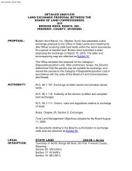
DETAILED ANALYSIS<br />
FOR SALE OF STATE TRUST LAND<br />
CAMPBELL COUNTY, WYOMING<br />
AUTHORITY:<br />
W.S. 36-9-101 through 36-9-120; Sale of <strong>State</strong> <strong>Lands</strong><br />
<strong>Wyoming</strong> Board of Land Commissioners’ Rules and Regulations, Chapter 26, Section 4<br />
Trust Land Management Objectives adopted by the <strong>Wyoming</strong> Board of Land Commissioners, August<br />
11, 2005.<br />
PROPOSAL:<br />
The Director of the Office of <strong>State</strong> <strong>Lands</strong> and Investments (OSLI) has determined the parcels of <strong>State</strong><br />
Trust Land described below may be suitable for disposal and, on October 31, 2012, moved the parcels<br />
to the Category II Disposal List in accordance with <strong>Wyoming</strong> Board of Land Commissioners’ Rules<br />
and Regulations (Board’s Rules).<br />
The application letter is attached as Exhibit “A”.<br />
SUBJECT PROPERTY DESCRIPTIONS:<br />
The parcels are located in Campbell County, <strong>Wyoming</strong>, more particularly the northeast edge of the<br />
City of Gillette’s city limits, north of Interstate 90 (I-90).<br />
Legal Description Acres Fund<br />
Parcel 1<br />
SW¼SW¼ 13-50-72 240.00 Common School<br />
SE¼SE¼ 14-50-72<br />
NE¼NE¼ 23-50-72<br />
W2½NW¼; SE¼NW¼ 24-50-72<br />
Parcel 2<br />
Pt. of E½SW¼ 24-50-72 45.40 Common School<br />
See Exhibit “B” for maps of the properties.<br />
3
PROPERTY INFORMATION:<br />
The properties as listed for sale by the <strong>Wyoming</strong> Board of Land Commissioners (Board) were<br />
patented to the <strong>State</strong> of <strong>Wyoming</strong> by the Federal Government in aliquot acreages. The appraiser<br />
appraised the lands using the Government Lots as resurveyed on January 3, 1995. The Board<br />
will convey the properties as originally surveyed and patented to the <strong>State</strong> of <strong>Wyoming</strong>.<br />
See Exhibit “C” for Federal Survey Plats of the properties.<br />
Parcel No. 1<br />
The acreage of Parcel No. 1 is 240.00± acres as patented by the Federal Government to the <strong>State</strong> of<br />
<strong>Wyoming</strong> on June 22, 1918. Approximately 22.76± acres of the total are right-of-way. Warlow Drive<br />
and Kluver Road (both paved) serve as access roads to the parcel. The surrounding area is primarily<br />
residential with some commercial holdings across Warlow Drive to the south. A natural wetland with<br />
open water and wetland vegetation dominated by grasses and foxtail barley is located in the center of<br />
the parcel. Storm water from the surrounding neighborhoods has affected these wetlands with<br />
continuous refilling. Residential development in the area ranges from new mid-range stick built homes<br />
to manufactured homes.<br />
Parcel No. 2<br />
Parcel No. 2 of land was originally patented by the Federal Government to the <strong>State</strong> of <strong>Wyoming</strong> on<br />
June 22, 1918, as an 80 acre tract. The <strong>State</strong> of <strong>Wyoming</strong> sold 34.60 acres to Arthur D. Boatright and<br />
Yvonne P. Boatright, on January 5, 1996 (Amortization Sales Contract 4245) and recorded in Book<br />
1365 at Page 202 (<strong>State</strong> Patent Number 2939). Presently <strong>State</strong> ownership of this parcel is 45.40± acres<br />
of which approximately 38 acres were appraised as usable. This parcel is of irregular shape and located<br />
directly south of Warlow Drive and directly north of I-90. The site has natural vegetation, is level to<br />
slightly sloped with no utilities developed. Warlow Drive serves as access for the property. Adjacent<br />
areas are primarily commercial and/or light industrial properties, further west and north include<br />
residential areas and the southern boundary is I-90. The property is encumbered by several easements<br />
(see full list below) issued by the Board including an easement to <strong>Wyoming</strong> <strong>State</strong> Highway<br />
Commission for the right-of-way of I-90.<br />
IMPROVEMENTS:<br />
Parcel No. 1<br />
There is two and a quarter (2 ¼) miles of fencing of 32” woven wire with four (4) strands of barbed<br />
wire, and the fence posts are a mixture of treated split posts, native cedar posts and metal posts placed<br />
approximately every rod. This fence received approval by the Board and was subsequently constructed<br />
in October 1961.<br />
Contributory Value:<br />
The successful bidder is required to compensate the surface lessee for the contributory value of the<br />
Board approved improvements per <strong>Wyoming</strong> Statutes 36-9-103 and 36-9-105. “Contributory value”<br />
means the increased value of the property after the surface lessee’s improvements are considered.<br />
OSLI, in consultation with the surface lessee, have deemed the following amounts to be the<br />
contributory value of these improvements and must be paid to the surface lessee prior to a patent being<br />
issued to the purchaser.<br />
4
Parcel No. 1<br />
Fence: Contributory value to be paid to John M. Kluver (Grazing Lease No. 2-3657) for the fencing<br />
improvements upon completion of sale shall be: Three Thousand Three hundred Seventy Dollars<br />
and 07/100 ($3,370.07)<br />
Parcel No. 2<br />
No fences or any other improvements have been approved by the Board on this parcel of land.<br />
Therefore, there is no contributory value to be paid for improvements on this parcel upon completion of<br />
the sale.<br />
WATER RIGHTS:<br />
A review of the records maintained by the <strong>Wyoming</strong> <strong>State</strong> Engineer’s Office reflect water rights<br />
appurtenant to specific <strong>State</strong> Trust Land parcels as described below. Specific parcel water right<br />
information is available for public review at OSLI, the <strong>Wyoming</strong> <strong>State</strong> Engineer’s Office or on the<br />
<strong>Wyoming</strong> <strong>State</strong> Engineer’s Office’s website.<br />
Parcel No. 1<br />
Section 13: Kluver No. I - Stock Reservoir. (Permit No. P2623.0S)<br />
Section 24: Fully adjudicated, City of Gillette Water Well. Permit No. CR UW16/086 (Associated<br />
with Special Use Lease SU-522)<br />
Parcel No. 2<br />
No adjudications for water rights are noted for this parcel.<br />
All water rights or permits on these parcels should be verified by the successful bidder with the<br />
<strong>Wyoming</strong> <strong>State</strong> Engineer’s Office for final verification of allowed use. Failure to exercise a water right,<br />
for 5 years, when water is available, may constitute grounds for forfeiture of said water right.<br />
GRAZING AND AGRICULTURAL LEASES:<br />
Parcel No. 1<br />
The current Grazing and Agricultural Lease is issued to John M. Kluver (No. 2-3657) and is set to<br />
expire 02/01/2022. Lease No. 2-3657 consists of 240 acres and a rated carrying capacity of seventy (70)<br />
Animal Unit Months (AUM’s). Based on the AUM fee formula established by the Board, the 2013<br />
rental income was $336.00 ($4.80/AUM x 70 AUMs = $336.00). See Exhibit “D” for lessee<br />
comments.<br />
Parcel No. 2<br />
The current Grazing and Agricultural Lease is issued to Kenneth J. Musser (No. 2-3765) and is set to<br />
expire 02/01/2016. Lease No. 2-3765 consists of 45.40 acres and a rated carrying capacity of seventeen<br />
(17) AUM’s. The lessee is paying a conflict rental rate of $101.01 set at the time of the original conflict<br />
for the duration of the lease term. Although Kenneth Musser has verbally informed OSLI of his<br />
disagreement with this sale proposal, Mr. Musser has not submitted any written comments as of the<br />
date of this <strong>analysis</strong>. See Exhibit “D” for lessee comments.<br />
These parcels will be sold subject to the current Grazing and Agricultural Leases, these leases<br />
shall be assigned to the successful bidder after completion of the sale.<br />
5
MINERAL RIGHTS/LEASES:<br />
Parcel No. 1<br />
The <strong>State</strong> of <strong>Wyoming</strong> owns the mineral rights as shown below, with the exception of the coal which is<br />
reserved by the United <strong>State</strong>s as provided in the act of Congress approved March 3, 1909 (35 Stat.,<br />
844).<br />
There are no producing wells or issued mineral leases at this time.<br />
All mineral rights will be retained by the <strong>State</strong> of <strong>Wyoming</strong>, except coal, which, is reserved by the<br />
United <strong>State</strong>s as provided in the act of Congress approved March 3, 1909 (35 Stat., 844)<br />
Parcel No. 2<br />
The <strong>State</strong> of <strong>Wyoming</strong> owns the mineral rights as shown below, with the exception of the coal, which,<br />
is reserved by the United <strong>State</strong>s as provided in the act of Congress approved March 3, 1909 (35 Stat.,<br />
844).<br />
There are no producing wells or issued mineral leases at this time.<br />
All mineral rights will be retained by the <strong>State</strong> of <strong>Wyoming</strong>, except coal, which, is reserved by the<br />
United <strong>State</strong>s as provided in the act of Congress approved March 3, 1909 (35 Stat., 844)<br />
ANNUAL TAX LOAD:<br />
Parcel No. 1<br />
According to the Campbell County Assessor, the subject properties are tax exempt. If the property<br />
were taxable, and if sold, the following information is provided by the Assessor’s office:<br />
Market Value $139,214<br />
Assessed Value $13,216 9.5% assessment value<br />
Estimated Tax $783.56 0.059512 mill levy<br />
Parcel No. 2<br />
According to the Campbell County Assessor, the subject property is tax exempt. If the property were<br />
taxable, and if sold, the following information is provided by the Assessor’s office:<br />
Market Value $76,000<br />
Assessed Value $7,220 9.5% assessment value<br />
Estimated Tax $429.68 0.059512 mill levy<br />
6
EASEMENTS, ACCESS, HAZARDS:<br />
Parcel No. 1<br />
This parcel is legally accessible via Warlow Drive and Kluver Road. There are several easements<br />
located on this parcel. This parcel will be sold subject to existing easements.<br />
List of Easements:<br />
Township 50 North Range 72 West<br />
Section 13<br />
SW¼SW¼, Easement-6268: 30’ wide for a Power Line granted to Powder River Energy Corporation.<br />
SW¼SW¼, Easement-1291N: 80’ wide for a Road R/W (Kluver Rd.) granted to Campbell County.<br />
SW¼SW¼, Easement-810N: 50’wide for a Power Line granted to Tri-County Electric Association.<br />
SW¼SW¼, Easement-1080N: 50’wide for a Power Line granted to Tri-County Electric Association.<br />
SW¼SW¼, Easement-1661: 30’ wide for a Power Line granted to Tri-County Electric Association.<br />
Section 14<br />
SE¼SE¼, Easement No. 7905: 140’ wide for a Road R/W granted to City of Gillette.<br />
(Spruce St./ Kluver Rd.)<br />
SE¼SE¼, Easement No. 1291N: 80’wide for a Road R/W (Kluver Rd.) granted to Campbell County.<br />
SE¼SE¼, Easement No. 1661: 30’ wide for a Power Line granted to Tri-County Electric Association.<br />
SE¼SE¼, Easement No.1080N: 50’wide for a Power Line granted to Tri-County Electric<br />
Association.<br />
Section 23<br />
NE¼NE¼, Easement No. 7905: 140’ wide for a Road R/W granted to City of Gillette. (Spruce St.)<br />
NE¼NE¼, Easement No. 1661: 30’ wide for a Power Line granted to Tri-County Electric<br />
Association.<br />
NE¼NE¼, Easement No. 2083: 20’wide for Drainage granted to Anderson Subdivision Homeowners<br />
Association.<br />
NE¼NE¼, Easement No.1296: 25’wide for a Power Line granted to Black Hills Power & Light Co.<br />
assigned to City of Gillette.<br />
Section 24<br />
SE¼NE¼, Easement No. 6432: 20’ wide for a Power Line and Water Pipeline granted to City of<br />
Gillette.<br />
S½NW¼, Easement No.5927: 25’ wide for Water Well (SU-522) and Water Pipeline granted to the<br />
City of Gillette.<br />
S½NW¼, Easement No.2918: 100’ wide for a Road R/W granted to Campbell County.<br />
NW¼NW¼, Easement No.1661: 30’wide for a Power Line granted to Tri-County Electric<br />
Association.<br />
NE¼SW¼, SE¼NE¼, Easement No. 6432: 40’ wide for a Power Line and Water Pipeline granted to<br />
the City of Gillette.<br />
7
No obvious hazards were noted during inspection by OSLI. This parcel has not been developed for any<br />
use that would subject the land to hazardous material or which would create concerns.<br />
There is a wetland area located in the center of Parcel No. 1. The natural wetland plant communities<br />
advance in periods of high moisture and retreat when the water levels are significantly reduced due to<br />
drought.<br />
Parcel No. 2<br />
This parcel is legally accessible via Warlow Drive. There are several easements located on this parcel.<br />
This parcel will be sold subject to existing easements.<br />
List of Easements:<br />
Township 50 North Range 72 West<br />
Section 24<br />
E½SW¼, Easement-2227: 400’ wide for a Road R/W Gillette East Road (I-90) <strong>Wyoming</strong> Highway<br />
Department.<br />
NE¼SW¼, Easement-1296: 25’ wide for a Power Line granted to Black Hills Power & Light Co,<br />
assigned to City of Gillette.<br />
NE¼SW¼, Easement-1296A: 30’wide for a Power Line granted to Black Hills Power & Light Co.<br />
NE¼SW¼, Easement-4318: 10’ wide for a Power Line granted to the City of Gillette.<br />
NE¼SW¼, Easement-1018: 50’wide for a Natural Gas Pipeline to McCulloch Gas Transmission Co.<br />
NE¼SW¼, SE¼NE¼, Easement-6432: 40’ wide for a Power Line and Water Pipeline granted to the<br />
City of Gillette.<br />
No obvious hazards were noted during inspection by OSLI. This parcel has not been developed for any<br />
use that would subject the land to hazardous material or which would create concerns.<br />
SPECIAL USE LEASES:<br />
Parcel No. 1<br />
There is a Special Use Lease (SUL-522) located on Parcel No. 1 within Section 24 containing 0.193±<br />
acres to the City of Gillette for a water supply system. The lease is on a twenty-five (25) year term<br />
beginning October 25, 2005 and terminating October 1, 2030. The lessee pays a base rental of<br />
$608.12/year, adjusted annually by the Consumer Price Index and $10/per acre foot for water metered<br />
from the well, payable at the end of each year, and subject to five (5) year rental reviews. Based on the<br />
meter reading for the period of September 1, 2011 through September 1, 2012, the usage fee amounted<br />
to $669.00. (66.9 acre feet)<br />
This parcel will be sold subject to the Special Use Lease, this lease shall be assigned to the successful<br />
bidder upon completion of the sale.<br />
Parcel No. 2<br />
No Special Use Leases.<br />
8
TEMPORARY USE PERMITS:<br />
Parcel No. 1<br />
There is a Temporary Use Permit (TUP-2391) located on Parcel No. 1 with an annual payment of<br />
$100.00 granted to the Karl M. Johnson Foundation, for construction activity that will expire May 1,<br />
2014. This Permit is not assignable. Should the Karl M. Johnson Foundation require the continued use<br />
of this permit, the Karl M. Johnson Foundation will re-negotiate with the successful bidder upon the<br />
completion of the sale.<br />
Parcel No. 2<br />
There is a Temporary Use Permit (TUP-737) located on Parcel No. 2 with an annual payment of<br />
$600.00 granted to the Ken Musser, for a Billboard Sign that will expire August 1, 2016. This Permit is<br />
not assignable. Should Ken Musser require the continued use of this permit, Mr. Musser will renegotiate<br />
with the successful bidder upon the completion of the sale.<br />
ZONING & FLOOD ZONE DESIGNATIONS:<br />
Parcel No. 1<br />
The zoning of this parcel is A-L Agricultural District. It is the intent of this zoning district to allow for<br />
and protect agricultural uses by controlling density and land coverage and providing for compatible<br />
land use.<br />
The flood zone designations are zones A & X according to the Campbell County Department of Public<br />
Works Engineering maps effective January 2, 2008. An “A zone” is designated for, “special flood<br />
hazard areas subject to inundation by the 1% annual chance flood.” This area is also known as the base<br />
flood area or 100-year flood area. An X zone is designated for, “areas outside of the 0.2% annual<br />
chance floodplain.” See attached map for locations of zones A & X as Exhibit “E”.<br />
Parcel No. 2<br />
The zoning of this parcel is A-L Agricultural District. It is the intent of this zoning district to allow for<br />
and protect agricultural uses by controlling density and land coverage and providing for compatible<br />
land use.<br />
Parcel No. 2 is located in an area that is zoned X which is an area to be outside the 0.2% annual chance<br />
flood plain. Water has been observed on the northeast corner of the subject parcel during several<br />
occasions of high water. Little Rawhide Creek crosses the adjoining property to the northwest.<br />
FOREST PRODUCTS:<br />
There are no forest products of commercial value on any parts of the parcels proposed for sale.<br />
9
EXISTENCE AND IMPORTANCE OF ANY WILDLIFE HABITAT AND<br />
WILDLIFE-ORIENTED RECREATIONAL OPPORTUNITIES LOCATED ON<br />
THE PARCELS:<br />
In letter dated December 14, 2012, the <strong>Wyoming</strong> Game and Fish Department (WDFD) stated it has no<br />
terrestrial wildlife or aquatic concerns pertaining to the proposed sale.<br />
The parcels are not located within a sage-grouse “Core Population Area” and, therefore, are not subject<br />
to the core area protection plan as outlined in the Governors Executive Order #2011-5 executed June 2,<br />
2011.<br />
The entire report from WGFD is attached as Exhibit “F”.<br />
EXISTENCE AND IMPORTANCE OF ANY PUBLIC RECREATIONAL<br />
OPPORTUNITIES OR CULTURAL RESOURCES LOCATED ON THE<br />
PARCELS:<br />
The <strong>Wyoming</strong> Department of <strong>State</strong> Parks and Cultural Resources (SPCR) evaluated the recreational<br />
and cultural resource aspects of the parcel as evidenced in letters dated, November 13, 2012 and<br />
November 18, 2012. At present, SPCR indicates no importance of public recreational opportunities or<br />
cultural resources with regard to the proposed sale.<br />
The reports from SPCR are attached as Exhibit “G”.<br />
10
APPRAISED MARKET VALUE:<br />
Robert L. Zabel of Zabel & Associates, has completed the appraisals for the <strong>State</strong> Trust <strong>Lands</strong> per<br />
instructions from OSLI. The effective date of the appraisal was March 11, 2013, for Parcel No. 1 and<br />
January 21, 2013, for Parcel No. 2. The appraiser was instructed to estimate the current fair market<br />
value of the fee simple interest of the parcels, excluding the mineral estate. The appraiser used the<br />
1995 resurvey government lots as basis for his calculations.<br />
OPINION OF VALUE<br />
The Board will use the appraised values below, with the acreages of the original survey, to set the<br />
minimum bid when these parcels are sold at public auction.<br />
Based on the inspection, available market data and analyses, assumptions, limiting conditions, and<br />
certifications, the appraiser’s opinion of the value of the defined property rights with an effective date<br />
of March 11, 2013, for Parcel No. 1, and the effective date of January 21, 2013 for Parcel No. 2 is:<br />
Parcel No. 1<br />
240.00 acres at $791.66 per acre<br />
$190,000.00<br />
One Hundred Ninety Thousand Dollars<br />
Parcel No. 2<br />
45.44 acres at $7533.03 per acre<br />
$342,000.00<br />
Three Hundred Forty-two Thousand Dollars<br />
The appraisal, including comparable sales information, maps, photographs and related information is<br />
available at OSLI for review.<br />
INCOME GENERATING POTENTIAL:<br />
Pursuant to Chapter 26 of the Board’s Rules, the <strong>Detailed</strong> Analysis shall include an estimate of the<br />
income generating potential of the parcels:<br />
Parcel No. 1<br />
Grazing Lease No. 2-3657 Special Use Lease Temporary Use Permit<br />
Total Income<br />
70 AUM<br />
SUL-522<br />
TUP-2391<br />
Base Rental Water Production<br />
$336.00 $608.12 $669.00 $100.00 $1713.12<br />
Parcel No. 2<br />
Grazing Lease No. 2-3765 Temporary Use Permit TUP-737 Total Income<br />
17 AUM<br />
$101.01 (Conflict Flat Lease) $600.00 $701.01<br />
11
ANTICIPATED APPRECIATION OF THE PARCELS AS A REAL ESTATE<br />
ASSETS:<br />
Many factors influence the value of a particular property. It is generally agreed that of them all, location<br />
is most important. Other factors are size and shape, utility, access and exposure. The subject properties<br />
have potential for development for residential purposes.<br />
Appreciation and depreciation rates are influenced by several factors including current market<br />
conditions, economy, interest rates, inventory levels (supply), and demand. Appreciation and<br />
depreciation rates are typically measured through the use of resale data of the same property.<br />
Assuming no significant physical change between the first and second sale, a rate of appreciation or<br />
depreciation in market value can be determined. After the credit crisis and recession of 2008, sales of<br />
vacant land near Gillette have been increasing in 2012. The city planning department reports two new<br />
residential subdivisions. New retail stores are also being planned. The population growth rate for the<br />
City of Gillette slowed in 2009, however, population growth does continue with low unemployment<br />
relative to the rest of the country.<br />
Appreciated land value is inherently speculative and would only be realized on a future sale; moreover,<br />
the sales proceeds could be reinvested in land with equal or greater appreciation potential.<br />
Parcel No. 1<br />
Better use of the parcel may include residential and limited commercial development sites. The creation<br />
of a pond with a walking and bike path, and open space for a park would enhance the value of the<br />
parcel and the surrounding area. The Maps 4.3, 4.3B and 5.3 of the “Gillette Comprehensive Plan”, a<br />
2006 plan for the City of Gillette, shows a proposed city park and walking path around the perimeter of<br />
the Little Rawhide Lake. See Exhibit “H ”. This information can also be found on the City of Gillette<br />
website. (ci.gillette.wy.us.)<br />
Parcel No. 2<br />
The best use for this parcel may include Industrial and Commercial uses. The <strong>Wyoming</strong> Department of<br />
Transportation owns the adjacent parcel to the east and other industrial lots share a boundary to the<br />
west.<br />
TRUST LAND MANAGEMENT OBJECTIVES:<br />
The <strong>Wyoming</strong> <strong>State</strong> Legislature has declared that trust land should remain a substantial component of<br />
the trust portfolio, managed under a total asset management policy, and with a focus on protecting the<br />
corpus for multiple generations. Accordingly, all <strong>State</strong> Trust Land sales, acquisitions, and exchange<br />
proposals are evaluated using the following objectives. A proposal need not meet all objectives, but all<br />
objectives are considered by the Board which has the sole discretion in determining how to best<br />
manage <strong>State</strong> Trust <strong>Lands</strong>.<br />
<br />
<br />
<br />
To better meet the beneficiaries short and/or long term needs<br />
Improve the manageability of land assets<br />
Meet a specific school and/or community need<br />
12
This <strong>Detailed</strong> Analysis has been completed as required by the Board’s Rules. The <strong>Detailed</strong> Analysis<br />
has determined that the proposed land sale meets the following Trust Land Management Objectives:<br />
TO BETTER MEET THE BENEFICIARIES’ SHORT AND LONG TERM NEEDS AND<br />
OBJECTIVES:<br />
Revenue:<br />
Parcel No. 1<br />
The combined annual revenue for this parcel is currently $1,713.12. In consideration of the inherent<br />
management issues noted below, to include OSLI staff administrative time and external contracts to<br />
mitigate these issues, this parcel is showing a net loss of funds to the state. It should be noted that the<br />
combined revenue received from this parcel and for the benefit of the Common School Income Fund is<br />
not directly affected by the referenced management issues. However, both the <strong>State</strong>’s General Fund<br />
and the long-term sustainability of current revenue generation are affected.<br />
Parcel No. 2<br />
The annual revenue brought in by Parcel No. 2 is currently $701.01.<br />
With the management difficulties of these parcels such as the cost of curbing weed problems combined<br />
with decreasing productive acreage as a result of the ever increasing ground and surface water levels,<br />
the two nominated parcels have been showing diminishing returns. As shown below, funds gathered<br />
from the sale of these two parcels would best serve the <strong>State</strong>’s Trust Beneficiaries either as a long term<br />
investment or to purchase more manageable, higher revenue producing lands.<br />
Investment:<br />
The Investment Performance Analysis for Quarter Ending September 30, 2013 indicates a Fiscal Year<br />
to Date, return of 4.46% for the Common School Permanent Land Fund. If the 240 acres were sold for<br />
the appraised price of $190,000.00 and the 45.4 acres were sold for the appraised price of $342,000.00<br />
and the proceeds were invested by the <strong>State</strong> Treasurer in the Common School Permanent Land Fund at<br />
the total return rate of 4.46%, the investment would generate $8,474.00 for Parcel No. 1 and<br />
$15,253.20 for Parcel No. 2, annually. These indicated investment revenue amounts far exceed the<br />
annual income presently generated from these two parcels.<br />
If these parcels sell at public auction for more than the appraised value, the anticipated returns from the<br />
sale would increase proportionately.<br />
If $532,000.00 (minimum amount received should both parcels sell at public auction) were to be<br />
invested, the total return over a 10, 20, and 30 year period would be:<br />
Year Common School Interest from Principal at 4.46%<br />
10 $237,272.00<br />
20 $470,280.00<br />
30 $705,420.00<br />
13
Sale of these parcels would significantly increase annual returns to the <strong>State</strong>’s Trust Beneficiaries by<br />
increasing investment income and by future allocation to the purchase of more manageable, higher<br />
revenue producing lands. As appreciation in land value is inherently speculative, and only realized<br />
upon sale of the property, a successful auction, whereby both parcels are sold for their appraised value,<br />
would allow the Board to capture the appreciation related to the parcels and reinvest that gain in value<br />
in equal or greater appreciating assets as well as invest in lands that are more manageable, higher<br />
revenue producing assets. Therefore, sale of these parcels meet the <strong>State</strong>’s Trust Beneficiaries’ short<br />
and long-term needs.<br />
The funds deposited in the Common School Permanent Land Fund shall be held on deposit until such<br />
time as the Board wishes to invest the funds or purchase land.<br />
IMPROVE THE MANAGEABILITY OF THE LAND ASSET AND<br />
CONSOLIDATE OWNERSHIP PATTERNS:<br />
In general, <strong>State</strong> Trust <strong>Lands</strong> adjacent to urbanized areas, such as the City of Gillette in this case, are<br />
more readily accessible to the public and tend to create management issues for OSLI.<br />
If sold, the proceeds could be used in accordance with W.S. 9-4-715(k) and the Board’s Rules, Chapter<br />
26, Section 3, to purchase land adjoining other <strong>State</strong> Trust Land thereby blocking up ownership and<br />
improving access, manageability, and income generating potential. OSLI resources can be more<br />
efficiently utilized in managing larger, consolidated blocks of land with high amenities, legal access,<br />
and multiple compatible uses as compared to small isolated parcels with single or limited uses,<br />
especially where these parcels are located near a city or town and create management issues.<br />
Parcel No. 1 and Parcel No. 2 are inefficient to manage due to their size, the location of these grazing<br />
parcels within an urban setting and problems associated with road and subdivision runoff and the lake<br />
(wetland) it creates. Sale proceeds would be better used to purchase land adjoining other legally<br />
accessible <strong>State</strong> Trust Land thereby blocking up ownership and improving access and recreational<br />
opportunities.<br />
TO MEET A SPECIFIC SCHOOL AND/OR COMMUNITY NEED<br />
PROVIDE GROWTH OPPORTUNITY AND IMPROVE STABILITY:<br />
The sale of Parcel No. 1 would provide land for a limited use subdivision, with possible recreational<br />
development within the community. The sale of Parcel No. 2 would provide an area of commercial<br />
development for the growth of commercial opportunity and industry for the City of Gillette and<br />
Campbell County.<br />
IMPROVE ACCESS/RECREATIONAL OPPORTUNITY:<br />
The proposed land sale would not improve public recreational use of the proposed parcels unless they<br />
were enhanced with fencing and signage and eventually managed as a greenway, park or natural area as<br />
proposed by the City of Gillette’s “Comprehensive Plan.” If the “Gillette Comprehensive Plan”, is<br />
approved for the creation of parkland with a pond and pedestrian walking/ bike path could enhance the<br />
value of the parcel and the subdivisions in the surrounding area. However, purchase of additional <strong>State</strong><br />
Trust <strong>Lands</strong> with the funds received from this sale would be guided by the Board approved Trust Land<br />
Management Objectives whereby consideration must be given to public accessibility.<br />
14
CONCLUSION:<br />
In the opinion of OSLI, the sale of Parcel No. 1, with its manageability issues associated with seasonal<br />
flooding, and the sale of Parcel No. 2, with its relatively small size and management concerns would<br />
generate more annual revenue than the current permitted uses provide. The sale of these two (2)<br />
parcels would better serve the Common School Fund of the <strong>State</strong> of <strong>Wyoming</strong> either as an investment<br />
opportunity or the funds could be used to purchase higher revenue yielding, more manageable lands<br />
that can potentially bring in stable long term income.<br />
This <strong>Detailed</strong> Analysis will be distributed to the public in accordance with the Board’s Rules. The<br />
<strong>Detailed</strong> Analysis will be available on OSLI’s website. It will also be available for public viewing at<br />
several locations in Campbell County, including the County Library, County and City Clerk’s Office,<br />
and the County Commissioner’s Office.<br />
A notification of sale will be published in a local and statewide newspaper. In addition, OSLI will<br />
market the sale of the parcels to the local real estate community, on OSLI’s website, and have<br />
information available for public viewing at several locations in Campbell County, including the County<br />
Library, City of Gillette Clerk’s Office, and the Campbell County Commissioner’s Office.<br />
As required in the Board’s Rules, a public hearing will be conducted in Campbell County. The date,<br />
time and location of the public hearing will be advertised in The Gillette News-Record, and the Casper<br />
Star-Tribune. It is the intent of OSLI to publicize the sale of these parcels to attract potential buyers.<br />
Once potential buyers are identified, OSLI will follow the disposal procedures as required by <strong>Wyoming</strong><br />
Statute, Title 36, Chapter 9, and the Board’s Rules, Chapter 26, Section 4.<br />
The parcels will be sold subject to the current grazing and agricultural leases, special use leases and<br />
easements.<br />
15
LIST OF EXHIBITS:<br />
“A”<br />
“B”<br />
“C”<br />
“D”<br />
“E”<br />
“F”<br />
“G”<br />
“H”<br />
Letter & Application from Office of <strong>State</strong> <strong>Lands</strong> and Investments<br />
Maps and Photographs of the Parcel<br />
Federal Survey Plats.<br />
Lessee Comments.<br />
Flood Zone Maps<br />
<strong>Wyoming</strong> Game and Fish Department Report<br />
<strong>State</strong> Parks and Cultural Resources Department Report<br />
Maps 4.3, 4.3B and 5.3 from Gillette “Comprehensive Plan.”<br />
16
WYOl\lING OFFICE OF ST.\TE L-\NDS .-\\lO IK\'ESnIENTS<br />
Exhibit "A"<br />
122 West 25 th Street<br />
Cheyenne, \XIY 82002<br />
Phone: 307.777.7331<br />
Fax: 307.7773524<br />
slfmail@wyo.gov<br />
MAITHE\X' H. MEAD<br />
Go,ernor<br />
RYAN M. LANCE<br />
Director<br />
October 26, 2012<br />
The <strong>State</strong> of <strong>Wyoming</strong> (Board of Land Commissioners) owns 281.621 acres located immedtately northeast of the<br />
City of Gillette, <strong>Wyoming</strong>. Legal descriptions and lease information are as follows:<br />
Gra~ing Lease NQ. Legl'!l Des~ril2tiQn<br />
Parcell<br />
~ Acres AUMs Expiration fJ.m.Q<br />
2-3657 SWSW 13-50-72 John Kluver 240 74 2-1-2012 Common School<br />
SESE 14-50-72<br />
NENE23 -S0-72<br />
W2NW;SENW<br />
24-50-72<br />
Parcel 2<br />
2-3765 Pt of E2SW 24 50-72 Kenneth 45.4 19 2-1 2016 Common School<br />
Musser<br />
Parcell:<br />
Little Rawhide Creek is a surface tributary that runs through the cenler of the parcel thus allowing the Corp. of<br />
Engineers jurisdiction over the wetland area. Run-off from surrounding residential and industrial development is<br />
also contributing to the drainage problem. Little Rawhide Lake is located in a low spot in the center of the parcel<br />
and has been experiencing fluctuating water levels over past years. Approximately 161 ± acres of this parcel lie<br />
within the FEMA Flood Zone limiting the de"elopment potential of the property. As the water rises, it drowns out<br />
the vegetation and when it recedes, Foxtail barley takes over. When the Foxtail barley matures, the seed heads blow<br />
off "in clouds" and cause problems with the neighbors in the Northland Village Subdivision located immediately<br />
north. In 2006, these neighbors asked for relief from the problem and the Office of <strong>State</strong> <strong>Lands</strong> and Investments<br />
(Office) has been spending approximately $2,000 per year since 2006 to have the Foxtail barley controlled by<br />
mechanical mowing.<br />
Parcel 2:<br />
This parcel is 44.86 acres and of irregular shape located directly south of Warlow Drive and north of Interstate 90<br />
(I -90). The site has natural vegetation, is level to sloped and with no utilities developed. Warlow Drive is the access<br />
for the property. Adjacent areas are primarily commercial and/ or light industrial properties, further west and north<br />
include residential areas and the southern boundary is I 90. The property is encumbered by Easement No. 2227<br />
issued by the <strong>Wyoming</strong> Board of Land Commissioners to the <strong>Wyoming</strong> <strong>State</strong> Highway Commission. The easement<br />
is for 1-90 is a strip ofland containing 14.3 acres, more or less.<br />
EFFECTIVELYMANAGING NATURAL RESOURCESAND FUNDS FOR CURRENTAND FUTURE GENERATIONS
Economic Analysis:<br />
This entire tract of 281.62 acres is rated at 87 AUMs which generates $417.60 per year based on the 2012 fee of<br />
$4.80/ AUM. Selling the land at appraised value will most likely generate income far in excess of that amount<br />
assuming the proceeds were invested by the <strong>State</strong> Treasurer with projected 10 year average total rate of return of<br />
6.28°0 per annum.<br />
Parcel No.1 is inefficient to manage due to its size and to the above referenced problems associated with runoff,<br />
and the Foxtail barley. It is rated at 70 A UMs which generated only $336.00 in 2012 but the management of the<br />
Foxtail Barley cost the Office $2,400 in 2012 and $11,200 since 2009. Therefore, the <strong>State</strong> actually loses money by<br />
owning the property. Management of this tract will continue to be a problem and expense for the Office.<br />
Parcel No. 2 is a small parcel located in a prime commercial location. It is rated at 17 A UM's which generated<br />
$81. 60 in 2012. Due to its proximity to the City of Gillette, I 90, and the Little Rawhide Lake, it would seem<br />
prudent to sale this parcel for commercial development along with Parcel No.1.<br />
Three, and perhaps more, of the Trust Land Management Objectives would be achieved by selling the parcels at<br />
public auction.<br />
1. The sale would improve income generating potential by disposing of a property that generates negative<br />
income a property with relatively low annual revenue but high development potential;<br />
2. The sale would improve the manageability of the land; and<br />
3. The sale may potentially meet a specific community need by providing growth opportunity for Gillette.<br />
Therefore, Pursuant to W.S. 36-9-101 and Board of Land Comrnissloners Rules Chapter 26, Section 4, the Director<br />
of the Office of <strong>State</strong> <strong>Lands</strong> and Investments proposes the state trust lands known as the Rawhide Lake Parcels 1 &<br />
2 be considered for disposal at public auction.<br />
'Common School Pennanent Land Fund 3 year projected rield (realized gains and losses only) for FY09, FY08, and FYl0 per<br />
the <strong>State</strong> Treasurer's Office<br />
2Common School Fund projected 10 rear average total rate of return (realized and unrealized gains and losses) per R. V. Kuhns<br />
as provided by the <strong>State</strong> Treasurer's Office<br />
EFFECTIVELYMANAGING NATURAL RESOURCES AND FUNDS FOR CURRENTANDFUTURE GENERATIONS
APPLICANT DATA: The full/egal name 0/the Applicant or the business entity name on file with<br />
the <strong>Wyoming</strong> Secretary of<strong>State</strong> Certificate ofGood Standing must be provided for all business<br />
entities.<br />
Applicant or Business Name: Ryan lance, Director of Office of <strong>State</strong> lands and Investments<br />
Contact Name: lisa Reinhart<br />
Street Address: 122 W. 25 th Street<br />
Mailing Address (if different from Street Address):<br />
Position or Title: land Transaction Specialist<br />
City: Cheyenne <strong>State</strong>: WY Zip: 82002<br />
- - -<br />
Email Address:lisa.reinhart@wyo.gov ._ - - -<br />
Work Phone: 307.777.6630<br />
- - - -- -<br />
Cell/Mobile: - - -<br />
Home Phone:<br />
I hereby propose the parcel described below to be considered for sale pursuant to Chapter 26,<br />
Section 5, of the Rules and Regulations of the Board of land Commissioners and <strong>Wyoming</strong> <strong>State</strong><br />
Statutes 36-9-101 through 36-9-120; Sale of <strong>State</strong> lands<br />
-<br />
County Township Range Section Subdivision Acres<br />
Campbell SON 72W 1 13 l13 (SWSW) 39.35<br />
114 l16 (SESE) 39.80<br />
23 L1 (NENE) 39.42<br />
24 L4, 5 & L6 (W2NW,SENW) 118.19<br />
24 III &Pt. L14 (E2SW North of 1-90) 44.86<br />
..<br />
281.62 Total<br />
The Applicant acknowledges by submission of this application that: (i) it will initiate a<br />
competitive sale process for the sale of the surface estate only; (ii) it provides no right of<br />
priority on the part of applicant in or to the subject trust lands; (iii) if a sale is approved by the<br />
Board of Land Commissioners, no sale will be made except at public auction and for no less<br />
than fair market value, as established by the Board of Land Commissioners; all <strong>State</strong> Trust land<br />
will be appraised as if it has legal access; (iv) the applicant acquires no vested rights in the<br />
subject trust lands prior to the execution of the certificat e of sale by the Director; (v) the<br />
submission of this application does not guarantee that the above-described state trust land will<br />
be sold; (vi) if the Boa rd of Land Commissioners or the Office of <strong>State</strong> <strong>Lands</strong> and Investments<br />
determine at any time during the evaluation process that the proposed sale will not be in the<br />
best interest 0 he <strong>State</strong> land Trus s application will be denied; and (vii) the Board of Land<br />
Commission s nd the Office of tate <strong>Lands</strong> and Investments reserve the right to reject this<br />
application<br />
Director's execution of a Patent or Warranty D ed.<br />
Signature: -.!~..!~~~!!!~~~~~~_L_ ___ ~~ Date: ...f-""'''''''~'-I''-''::::''''<br />
Signature:<br />
Date:__L-_ ---tl--_
• <br />
Little Rawhide Lake Proposed Sale<br />
Parcel No.1: Sec. 13 L.13, Sec.14 L.16, Sec.23 L.1, Sec.24, L. 4, 5, &6<br />
236.75 acres, MIL<br />
Parcel No.2: Sec. 24 L.11 & Pt.L.14,<br />
44.86 acres, MIL<br />
Townshi 50N., Ran 72W. 6th P.M. Cam<br />
Trust Land<br />
o Subject Properties o 0075 015 03<br />
__--===:=J. M<br />
i1es<br />
Date: 10122/2012<br />
Drawn By: Lisa Reinhart
• <br />
Little Rawhide Lake Proposed Sale<br />
Parcel No.1: Sec.13 L.13, Sec.14 L.16, Sec.23 L.1, Sec.24, L. 4,5, & 6<br />
236.75 acres, MIL <br />
Parcel No.2: Sec. 24 L.11 & Pt.L.14, <br />
44.86 acres, MIL<br />
Townshi SON., Ran e 72W. 6th P.M. Cam bell, WY<br />
-----w'lI:<br />
Trust Land<br />
o Subject Properties<br />
0:...w0.1 _ ..75_0E35==~O7 ,Mies<br />
Date: 10/2212012<br />
Drawn By: Lisa Reinhart
•<br />
Little Rawhide lake Proposed Sale<br />
T. 50 N. R. 72W.<br />
Exhibit "B"<br />
Parcel No.1: Sec. 13 SW!4SW~, Sec. 14 SE!4SEX. Sec. 23 NEXNE~, <br />
Sec. 24 WYatffl. SEXNWK 240 acres as patented to the <strong>State</strong> of <strong>Wyoming</strong> <br />
Parce' No.2: Sec 24 Pl of the EYaSWX (South of Warlow Drive and North of 1-90) <br />
45.40 acres as patented to the <strong>State</strong> of <strong>Wyoming</strong><br />
Legend<br />
Trust Land<br />
CJ Subject Properties<br />
FEMA Flood Zone<br />
o 00750.15 03<br />
__-==::::::'IMj 88<br />
Date: 1012212012
• <br />
CAMPBELL COUNTY <br />
Little Rawhide Lake Proposed Sale<br />
T. 50 N. R. 72W.<br />
Parcel No.1: Sec. 13 SW~SW~, Sec. 14 SEI:4SE~. Sec. 23 NE%NE%. <br />
Sec. 24 W'hNW. SE%NW~. 240 acres as patented to the <strong>State</strong> of <strong>Wyoming</strong> <br />
Parcel No.2: Sec 24 Pt. of the EYzSW% (South of Warlow Drive and North of 1-90) <br />
45.40 acres as patented to the <strong>State</strong> of <strong>Wyoming</strong>
•
•
Parcel 1: Looking north along the boundary between the <strong>State</strong> lands to the west<br />
and the Pinnacle Bank parcel to the east.
''-'~...<br />
~ - l. • ~ f<br />
Parcel 2: Looking south at the <strong>State</strong> property from Warlow Drive.
~<br />
~.r,...,...,....,,.,,.<br />
...,..-f4'Io;--.~<br />
.. ...,~<br />
.,,~ __.p_<br />
~t.."<br />
~<br />
....,..........~"'-<br />
• <br />
Exhibit "C" <br />
DEPENOE~ RESURIIEY OF PORTION OF<br />
TOWNSHIP Nll 50 NORTH. RANGE N!l72 WEST OF" THE SIXTH PRINCIPAL MERIDIAN. WYOMING<br />
:"h. ,.... .,,.., -,..,. .t II ,.,,_<br />
&lr_.., .... ~""'I\,......,.ATI~<br />
-~<br />
111_.-.-11"......"..,-...,. .. _<br />
:l ......-- .,.~-- ...<br />
'''- ,,..,~,<br />
t <br />
--n~<br />
_<br />
... ,~ <br />
~~AtJM.}. '"<br />
-., ...... ~~~ .. ,.." <br />
_. _ ........<br />
....,.,..,~:t#4d1f___ ....._<br />
......<br />
__<br />
""1·'-"rI,...,.,'IfNII'}"'~-~<br />
r;#~ .. _t"""""".",(Jo~-,..., ....... <br />
"_",......,.,Iw ..... ...,,,.~<br />
~""k_"""'''''f'iW'''''<br />
Id ,,. __ -......<br />
~ __~~C"_,.......... <br />
Jr·•.,.';(fIIIntI~~«U<br />
'Wrl ) ~ ...,.It 0--. ", <br />
~."... ~,.,."",. '-"..-n <br />
...._ r,.. '.~fI'<br />
.;~ ... A".-..;..~,-": <br />
,..-,-y<br />
lAl·'_~4·U"<br />
t.......... JtJ:I'I'" <br />
lINlTeD S71lt.J<br />
orAo~TKNr Of' 'Nt iN",IIIfIII<br />
"""'...... ~""KC<br />
~.c.....-- 1-I_ItHl,I#i1' ~,tc.. '" ~ .'CI; An<br />
r~ _1"-'M'~"".MJ4;M ...,.,.7',..·.,. ,,. ..........",. ,.,..-~. ,.. ,., Ju..o;<br />
$.J1It""-'fI'lI'~">-"'9, , " u"cr~.~ ,.,.'N _"",0«..11' ......_ ...--._..<br />
... __<br />
'::;::; ". --... ~ .- -r-. ~ ~ rI'«.- _/<br />
I~r..._ I "''' ,t'A'_ty 1'.'\'.......,m;·"I' '~"':I ........ U.1'l)&<br />
I I .......- I <br />
:MAQo......_. ~ ~ - -l 0ll1l - - ~&b "it--~./p<br />
... ?:X':..<br />
..:-"f<br />
50 - 72 ".
• <br />
TOWflSKIP 1\ 50 NORTH RAN5[ 72 ", EST.f t" e',' P,,"e'p.1 "ERIDIAN,<br />
k<br />
...... .'<br />
'<br />
.<br />
•<br />
.". ;. ..<br />
'" 4 'r, .....~ I II. 4. l' ' ," ~"<br />
~ .,....... ~....., I'/ .. A- /' '1' >" .. 'I ~ -< _"<br />
,..~-' ',4't.·7 .. ..c1o ....... ' ... 1 . • ~,... ~ .. • ,JA ...t <br />
• ' < ,:, ,4;,-4- _ c: . 'O';r~:7-; ,<br />
" , , .Lr.•.w Ilr _..y , .I ', ~I<br />
o'r,,' '" .."NoJ'
• <br />
,~.~<br />
ro'<br />
..... ....._._.....<br />
S' it)9<br />
~,r{:~.~ '"<br />
: ;'".<br />
, ,<br />
A . Gu.. t,~ ('0 , ::"<br />
L .. ~,"d..r,<br />
50 - 7~ <br />
~
,,~<br />
• <br />
TOWNSHIP 50 NORlH RANGE 72 WEST Of' THE 6th PRINCIPAl MERIDIAN. WYOMING<br />
C ..... PBUL COUNTY<br />
STATUS or P\I8lIC DIlWAII<br />
I..lND ANO _RAL mLES<br />
VI PlAT<br />
...... , . -<br />
"PO TO KOIElIAttlI lilAC"<br />
r au ,IT...<br />
e ...-trll"u-<br />
.<br />
..."._*-<br />
m..<br />
11<br />
~I: ~ nil ···.,-J~t·... .. '..... ~,,~ ...".....,;';;""3j,'"~i;_<br />
"..+..,..;1.T. .... .... "_I•<br />
.uJi1 I' ....~<br />
I••"-fu...-
8037<br />
ORIGINAL<br />
TOWNSHIP 50 NORTH. RANGE 72. WEST. OF THE: SIXTH PRINCIPAL MERIDIAN. WYOMING.<br />
DEPENDENT RESURVEY<br />
A<br />
1<br />
J<br />
-_ai'c<br />
~<br />
. Mo.,<br />
~ ! •,-""1<br />
......<br />
~<br />
1.... '*", 140IU""1I no, tt.p....., ,.:wru f 'II<br />
, ..I'M!.t II'tt rw.n G"'" MI"'" ",""I. '!'If ...,,,<br />
T.500 H4 tI..rllUI'I ft., n O\d n w.• r~. uti<br />
&0..".4"1 .......".-11 .' ' ............~, ..... <br />
.tt.....,., rID'<br />
''''''.~II-'''' ..........,... 10 ,.IIIY. I'" ~.,".."<br />
I/O now II,,, IW~ IM"'.II~<br />
If'll'<br />
bit" • .oa., __"',•. 1 -10 N a. 1'3 .~ Slo.u<br />
,..iooC......... ~~, "',.......,. <br />
e.rl.... _110.... "Ie ........ 1oM'." .....r."" <br />
..,-., 110 ID r~ct ....'.U'l ."1)1. DOlI,. (,IIC.1t1<br />
'" Ifl~~nl.f h....... 1M Iotll ..u od If'" ••<br />
It ,,,••,, ." til. ,I., ....,..... ~,~ 10. I'''''<br />
'lor ...,. ".u"''' I, J,,,,•• D. C'-"'III. Cg,..,N.t<br />
)wIll,." ...,..1111<br />
So. ,"I..... oe ........'.d<br />
...1,0" t2:, ... to, ,.-...., 10- $)uiul ,..,1'11511,,",<br />
4tou' "'-~ 10. "'$, t.. .f;....,. ..._ S!4.<br />
W/lf[ D n ..tu OlPAIH N(Nl Of l'Hl l~rtl"O"<br />
BUIrt.U CW lAM) ........ofMf..t<br />
tN••,.., ;. "t1~I I , l~f.'~I. n tM ••" ....11<br />
fi.", IUIIU . tnl""" ........,. ,,~--. "1" t ...... ut'f<br />
,~.c.1 ..' .....rc... ~~. 0'111"1111.<br />
r."'IJ .....'nh.1<br />
,.••~d~" r'"fU"'II'~1 111 r"r """,.. ar... "iII,.'b,<br />
CtU~."<br />
1274 C
'~9 6 1 40.14 :;::: I .... u."t'+ I ~U.OI .;;!;;;t,"t( I OO.~~<br />
39.60 3~082 < 37.93 1 37.85<br />
.8r I 50'W N890 149'W.<br />
N86oI03'W.<br />
39.39 39'1 96<br />
4 I 1 I 38. 103 38 0<br />
2 I l.,j<br />
42.96 I 43.09 4 1.07 140.78 ~<br />
'.61<br />
I 39.54 3 I 2 39.70 38 4 77 I 3634 I 2 '11 ~<br />
1 I
John M. Kluver<br />
2817 Kluver Road<br />
Gillette, <strong>Wyoming</strong> 82716<br />
(307) 682-9428<br />
Exhibit "D" <br />
July 10, 2013<br />
Kyle J. Shook<br />
<strong>Wyoming</strong> Office of <strong>State</strong> <strong>Lands</strong> and Investments<br />
122 West 25th Street<br />
Cheyenne, <strong>Wyoming</strong> 82002<br />
Dear Mr. Shook:<br />
RE: Proposed sale of <strong>State</strong> <strong>Lands</strong> currently leased under Grazing Lease 2-3657<br />
As per your request this letter contains my comments regarding the proposed sale of the<br />
<strong>State</strong> Land I currently lease.<br />
I do not like to sec any <strong>State</strong> Land sold. The sale would impact me after my lease expires. If<br />
a new lease cannot be negotiated [ would have to change my ranching operations at that<br />
time.<br />
Other than the improvements listed in your letter to me dated 5/30/13 there have been no<br />
improvements added to the property.<br />
If you need any further information, please let me know.<br />
Sincerely,<br />
John M. Kluver
Rn-iscd Janual)' IS ,2013<br />
STATE OF WYOMING<br />
BOARD OF LAND COMMISSIONERS<br />
SURFACE LESSEE NOTIFICATION AND COMMENT FORM<br />
?<br />
Applicant Name: ' Phone: <br />
Mailing Address:<br />
Email: '-------<br />
Le2al DescriDtion of<strong>State</strong> Trust Land: (Identify AliQuot, Section, TownshiD. Ran2e)<br />
-r5 {) All f( ;/;( tJ, S lcJySlt.'y / ;5{Y(L.. /3) 5 £
WYOMING OFFICE OF STATE LANDS AND INVESTMENTS <br />
122 West 25th Street MATTHEW H. MEAD <br />
Cheyenne, WY 82002<br />
Governor <br />
Phone: 307.777.7331 <br />
Fax: 307.777.3524<br />
RYAN M. LANCE <br />
slfmai1@WVo.gov<br />
Director <br />
May 30, 2013<br />
John Kluver<br />
2817 Kluver Road<br />
Gillette, WY 82716<br />
Re: Grazing Lease 2-3657<br />
T. soN., R.72 W., SW4SW4, Sec. 13, SE4SE4 Sec. 14, NENE, Sec. 23, W2NW4:SE4NW4<br />
As brought up in the letter sent by Lisa Reinhart dated, November 7 2012, the above captioned state<br />
trust land has been proposed for sale by the <strong>Wyoming</strong> Office of <strong>State</strong> <strong>Lands</strong> and Investments (OSLI)<br />
and you have grazing lease 2-3657 on the parcel. My name is Kyle Shook, and I have taken over Lisa's<br />
duties in the <strong>Wyoming</strong> Office of <strong>State</strong> <strong>Lands</strong> and Investments. As you recall in Lisa's letter, OSLI<br />
desires to sen this parcel ofland because it costs more to maintain the properties than the income we<br />
receive from the surface leases.<br />
OSU has a tentative date for a public hearing in the month of September of 2013. If the sale is<br />
approved by the at the following meeting of the Board of Land Commissioners it will be subject to<br />
your grazing lease which expires February 1, 2022. OSLI would then assign your lease to the buyer<br />
and you would lease it from them for the remaining term. You can re-negotiate the terms and<br />
conditions ofthe lease upon its expiration.<br />
Lisa Reinhart noted in the letter of November, 7 2012, of following improvements on the property: pit,<br />
windbreak, shed, and fence. Lisa also informed you that the only improvements approved by the<br />
Board of Land Commissioners are: 1 pit placed on the land in 1959 and 2 1/4 miles 32"woven wire<br />
fence place on the land in 1961. Enclosed a registration form so that you may have your additional<br />
improvements approved and on record prior to the sale ofthis land.<br />
The subject parcel of land has been placed on the Category II disposal list for a detailed <strong>analysis</strong>. We<br />
determined the sales price, by appraised value, and that information will only be released for public<br />
comment s soon as we complete and publish the detailed <strong>analysis</strong>. In order for this office to complete<br />
the detailed <strong>analysis</strong> we must receive and make public the comments several public offices and of the<br />
surface lease holders.<br />
EFFECTlVELYMANAGlNG NA rURAL RESOURCESAND FUNDS FOR CURRENTAND FUTURE GENERA TIONS
As the current grazing lessee, please provide our office with your written comments concerning the<br />
disposal of this land and any impact it may have on your ranching operation. I am providing a form<br />
and return envelopes for this purpose. (You may enclose this form with the improvement registration<br />
form we also require from you.) All improvements must be registered and approved by the Board of<br />
Land Commissioners before the sale, or you will not compensated for them, should a buyer other than<br />
yourself submits the highest bid at the auction. Please reply by August 1St 2013, so this information<br />
can be included in our detailed <strong>analysis</strong> that is made available to the public.<br />
Ifyou are interested in purchasing this property or if you have any questions or concerns please feel<br />
free to call me at 307-m-6630. Please note the property will be sold at public auction with the<br />
starting bid determined by appraised value.<br />
Sincerely,<br />
J&le9-~<br />
Kyle J. Shook<br />
Real Estate Transaction Specialist<br />
EFFECTIVELY1f,LANAGIN,G N A TURAL RESOURCESAND FUNDS FOR CURRENTAND FUTURE GENERA TIONS
No Written Comments from the Lessee of Parcel <br />
No.2 were received by the date of this <strong>analysis</strong>.
Little Rawhide Lake Proposed Sale <br />
Effective Flood Plain<br />
Exhibit "E" <br />
Legend<br />
Trust Land<br />
o Subject Properties<br />
FEMA Flood Zone<br />
s Date: 10/2212012
.....<br />
CJ ......... - ... <br />
&:J II[".F~<br />
"..,'...... Z_<br />
.~""-.CO"t'ft.~ ........<br />
• lil ...._'c.a.I'It.~ .......<br />
_......_"""-<br />
. ......... ~t........ ( ..... <br />
~19. a)C1<br />
CUT 01 {.Hlla<br />
lbtJ~1'iVM <br />
1'ClI t 'lII~ntr.'" ':'qt )00'<br />
.." (,.1L! HI w.::J"~811D'<br />
,~ItWod\P'~~· I'<br />
.,&NoV.., .......<br />
·,01, 660 *104<br />
...,l
WYOMING OFFICE OF STATE LANDS AND INVESTMENTS <br />
Exhibit "F" <br />
122 West 25th Street MAITHEW H. MEAD<br />
Cheyenne, WY 82002<br />
Governor <br />
Phone: 307.777.7331 <br />
Fax: 307.777.3524<br />
RYAN M.LANCE <br />
slfmail@wyo.lWv <br />
Director<br />
November 7,2012<br />
Scott Talbott, Director<br />
<strong>Wyoming</strong> Game & Fish Department<br />
5400 Bishop Blvd.<br />
Cheyenne. WY 82002<br />
RE: OSLI Proposed Sale ofLittle Rawhide Lake Parcels (<strong>State</strong> Trust Land)<br />
TOWNSHIP 50 NORTH. RANGE 72 WEST. 6TH P.M.• CAMPBELL COUNlY. WY<br />
SECTION 13= SW1/4SWl!4<br />
SECTION 14: SEll4SEI/ 4<br />
SECfION 23: NEll4NEl/4<br />
SECTION 24: Wl/2NWI/4; SEl/4NWI/4; pt.E2SW4<br />
TOTAL OF 28540± ACRES<br />
Dear Mr. Talbott,<br />
Pursuant to W.S. 36-9-101 and Board of Land Commissioners Rules Chapter 26, Section 4. the Director of the<br />
Office of <strong>State</strong> <strong>Lands</strong> and Investments proposed the subject lands be considered for disposal at public auction.<br />
In accordance with the rules of the Board of Land Commissioners, please provide our office with your agencies<br />
written assessment of the existence and importance of wildlife and fisheries habitats located on the deeded and<br />
state parcels. From our inquiry on your website, these locations are not within the sage-grouse core area.<br />
Please reply by December IS. 2012 so this information can be included in our detailed <strong>analysis</strong> and presented<br />
to the public.<br />
Should you have any questions or concerns please call me at 307-777-6630.<br />
Sincerely,<br />
~-+-~~\::-<br />
Lisa Reinhart<br />
Senior <strong>Lands</strong> Management Specialist<br />
E FFECTIVELJ'MANA GING NATURAL RESOURCESAND FUNDSFOR CURRENTAND FUTURE GENERA TJONS
WYOMING GAME AND FISH DEPARTMENT<br />
GOVERNOR<br />
MATniEWH MEAD<br />
DIRECTOR<br />
SCOTT TALBOTT<br />
COMMISSIONERS<br />
AARON ClARK - President<br />
5400 Bishop Blvd. Cheyenne, \fIJY 82006<br />
MIKE HEAlY - VICe PreSIdent<br />
Phone: (307) 777-4600 Fax: (3D7) 777-4699<br />
Web site: http://wgfd.wyo.gov<br />
RICHARD KLOUDA<br />
fREDUNDZEY<br />
T CARRIE LITTLE<br />
EDMIGNERY<br />
CHARlES PRICE<br />
December 14, 2012<br />
j<br />
John<br />
WER 13047 <br />
Office of <strong>State</strong> <strong>Lands</strong> and Investments <br />
Proposed Sale of <strong>State</strong> Trust Land <br />
Little Rawhide Lake Parcels <br />
Campbell County <br />
Lisa Reinhart <br />
Senior <strong>Lands</strong> Management Specialist <br />
Office of <strong>State</strong> <strong>Lands</strong> and Investments <br />
Real Estate & Fann Division <br />
Herschler Building 3 rd Floor West <br />
122 West 25 111 Street <br />
Cheyenne, WY 82002 <br />
Dear Ms. Reinhart:<br />
The staff of the <strong>Wyoming</strong> Game and Fish Department has reviewed the proposed sale of the<br />
Little Rawhide Lake Parcels (<strong>State</strong> Trust Land) in Campbell County. We have no terrestrial<br />
wildlife or aquatic concerns pertaining to the proposed sale of state trust lands.<br />
Thank you for the opportunity to comment. If you have any questions or concerns, please contact<br />
Amanda Withroder, Staff Biologist, at (307) 473-3436.<br />
Sine rely,<br />
,1<br />
Ii{/1<br />
/'" l~<br />
Emm ri l<br />
· ~uty Director<br />
JEfmf/gb<br />
r<br />
cc:<br />
USFWS <br />
Erika Peckham - WGFD, Sheridan Region <br />
Lynn Jahnke - WGFD, Sheridan Region <br />
Paul Mavrakis - WGFD, Sheridan Region <br />
"Conserving H'ildliji! - Serving People"
WYOMING OFFICE OF STATE LANDS AND INVESTMENTS <br />
Exhibit "G" <br />
122 West 25th Street MATTHEW H. MEAD<br />
Cheyenne, WY 82002<br />
Governor <br />
Phone: 307.777.7331 <br />
Fax: 307.777.3524<br />
RYAN M.LANCE<br />
~Ifmail@wyo.eoy<br />
Director<br />
November 7, 2012<br />
Milward Simpson, Director<br />
Department of <strong>State</strong> Parks and Cultural Resources<br />
2301 Central Ave.<br />
Barrett Building, 4th F100r<br />
Cheyenne, <strong>Wyoming</strong> 82002<br />
RE: OSU Proposed Sale ofLittle Rawhide Lake Parcels (<strong>State</strong> Trust Land)<br />
TOWNSHIP 50 NORTH. RANGE 72 WEST. 6TIf P.M.. CAMPBELL COUNlY. WY<br />
SECI10N 13: SWl/4SVh/4<br />
SECI10N 14: SEl/4SEl/4<br />
SECI10N 2$ NEl/4NEl/4<br />
SECTION 24: Wl/2NWI/4; SEl/4NWl/4; pt.E2SW4<br />
TOTAL OF 28S.4.0± ACRES<br />
Dear Mr. Simpson,<br />
Pursuant to W.S. 36-9-101 and Board of Land Commissioners Rules Chapter 26, Section 4, the Director of the<br />
Office of<strong>State</strong> <strong>Lands</strong> and Investments proposed the subject lands be considered for disposal at public auction.<br />
In accordance with the rules of the Board of Land Commissioners, please provide our office with your agencies<br />
written assessment of the existence and importance of public recreational opportunities and cultural resources<br />
located on this parcel of state trust land.<br />
Please reply by December 15, 2012 so this information can be included in our detailed <strong>analysis</strong> and presented<br />
to the public.<br />
Should you have any questions or concerns please call me at 307-m-6630.<br />
Sincerely,<br />
Lisa Reinhart<br />
Senior <strong>Lands</strong> Management Specialist<br />
EFFECTIVELYMANAGING NATURAL RESOURCES AND FUNDS FOR CURRENTAND FUTURE GENERATIONS
ARTS. PARKS.<br />
Offtce of the <strong>Wyoming</strong> <strong>State</strong> Archaeologist<br />
Department 3431,1000 East University Ave.<br />
HISTORY. laramie. Wi 82071<br />
<strong>Wyoming</strong> Slate Parts & rutlnl Resources (307)721-0882 FAX (307)745-8732<br />
November 13, 2012<br />
Lisa Reinhart <br />
Senior <strong>Lands</strong> Management Specialist <br />
Office of<strong>State</strong> <strong>Lands</strong> and Investments <br />
122 West 25 th Street <br />
Cheyenne, WY 82002 <br />
Re: OSLI Proposed Sale of Little Rawhide Lake ParceI~<strong>State</strong> Trust Land)<br />
TOWNSHIP SO NORTH. RANGE 72 WEST. 6 P,M .. CAMPBELL COUNTY. WY<br />
Section 13: SWII4SW1I4; Section 14: SEl/4SEJl4;<br />
Section 23: NE1I4NElI4; Section 24: W1I2NW1/4, SE1I4NW1I4, pt. E2SW4<br />
Total of285.4.0± Acres<br />
Dear Ms Reinhart:<br />
Thank you for your request for input dated November 7 regaroing the above listed land sale<br />
proposal that involves the Little Rawhide Lake parcels. Using the SHPO and <strong>State</strong><br />
Archaeologist process for comments on OSLI auction lists, we have no recommendations at this<br />
time. We understand that the standard stipulation in OSLI rules Chapter 18, Section 3h would<br />
apply to any development on the minerals that the <strong>State</strong> retains. Thank you for the opportunity<br />
to comment.<br />
If you have any questions or would like to meet, please feel free to contact Dr. Mark: E. Miller, <br />
<strong>State</strong> Archaeologist at (307) 766-5564. <br />
~;;~~ nvUr<br />
Mark E. Miller, Ph ..D. <br />
<strong>State</strong> Archaeologist <br />
Cc:<br />
Milward Simpson, Director, <strong>State</strong> Parks and Cultural Resources <br />
Sara Needles, Division Administrator, Cultural Resources <br />
Todd Thibodeau, Planning Coordinator, <strong>State</strong> Parks and Historic Sites <br />
Mary Hopkins, SHPO <br />
Steve Sutter, Cultural Resource Specialist <br />
MatthewH. Mead. Governor<br />
• r.ttward Simpson, Director
Field Support Ttam<br />
DivIsion of <strong>State</strong> Parks, Historic<br />
SItes & Trafls<br />
2301 Central Avenue<br />
Cheyenne,YVY 82002<br />
307·m.f337J<br />
3074 m-6005 (fax)<br />
November 18, 2012<br />
Ms. Lisa Reinhart <br />
Senior <strong>Lands</strong> Management Specialist <br />
Office of<strong>State</strong> <strong>Lands</strong> and Investments <br />
122 West 25 th Street <br />
Cheyenne, Wyoniln8 82002 <br />
RE:<br />
OSLI Proposed Sale ofLittle Rawhide Lake Parcels (<strong>State</strong> Trust Land)<br />
Dear Ms. Reinhart:<br />
I have reviewed the referenced letter and map and find no existence or importance of public<br />
recreational opporttmities located on this state land. Therefore, the Division of<strong>State</strong> Parks,<br />
Historic Sites and Trails has no concerns with the Office of<strong>State</strong> <strong>Lands</strong> and Investments moving<br />
forward with the proposed sale ofthe referenced parcels.<br />
Thank you for giving us the opportunity to comment. Please feel free to contact me should you<br />
have any questions or concerns.<br />
Sincerely,<br />
6"il ~;£<br />
Tracy J. ...:;i;:.;;lli.,......--.. <br />
Grant <br />
<strong>State</strong> istoric: Sites and Trails <br />
2301 Central Avenue, 4 111 Floor Barrett Bldg. <br />
Cheyenne, WY 82002 <br />
307-777-8681<br />
MaIIIIew H. Mead, GMmor<br />
• Mi/ward Simpson, Director
Exhibit "H" <br />
i<br />
•I<br />
-,.<br />
MAP 4.3<br />
------------<br />
Gillette Comprehensive Plan<br />
FUTURE LAND USE<br />
Gillette, ~Vyo1Jling<br />
t DO<br />
.<br />
..•,<br />
,<br />
.<br />
.. ..<br />
..<br />
tll'l<br />
.<br />
_<br />
RR<br />
l[)'<br />
co<br />
Rural Residential<br />
Low Density Residential<br />
Medium Density Residential<br />
High Density Residential<br />
Conservation Development<br />
Mobile Homes<br />
- Commercial<br />
Mixed Use 1: Mixed Density Residential,<br />
Office and Limited Commercial<br />
Mixed Use 2: High Density Residential,<br />
Office and Commercial<br />
"'" Mixed Use 3: Commercial/Industrial<br />
" Planned Mixed Use<br />
_ Urban Corridor<br />
_ Downtown Mixed Use<br />
INO I nd ustry<br />
" Business Park<br />
_ Civic<br />
, School<br />
_ Parks and Recreation<br />
Urban Reserve<br />
_., Proposed Planning District Boundary
LDR<br />
-----------. LOR<br />
RR<br />
MDR<br />
HDR _<br />
CD<br />
MH <br />
RR C <br />
MU 1<br />
LOR<br />
MU2 _<br />
MU3<br />
PLU _ <br />
UC _ <br />
CBD _ <br />
IND <br />
BP <br />
S <br />
_<br />
_<br />
MAP 4.38<br />
Gillette Comprehensive Plan<br />
FUTURE LAND USE<br />
NEQUADRANT<br />
Gillette, <strong>Wyoming</strong><br />
Rural Residential <br />
Low Density Residential <br />
Medium Density Residential <br />
High Density Residential <br />
Conservation Development <br />
Mobile Homes <br />
Commercial<br />
Mixed Use 1: Mixed Density Residential,<br />
Office and Limited Commercial<br />
Mixed Use 2: High Density Residential,<br />
Office and Commercial<br />
Mixed Use 3: Commercial/Industrial<br />
Planned Mixed Use<br />
Urban Corridor<br />
Downtown Mixed Use<br />
Industry<br />
Business Park<br />
School<br />
Civic<br />
Park and Recreation<br />
_ Urban Reserve
MAP 5.3<br />
Gillette Comprehensive Plan<br />
TRANSPORTATION<br />
DEVELOPMENT PROGRAM<br />
Gillette, lVyoming<br />
-<br />
Existi ng Propos ed<br />
Included in 2004 HKM Study and Gillette Plan<br />
..... Included in Gillette Plan<br />
-<br />
__I<br />
- ..... Development-Related Alignments<br />
-<br />
Existing Major Streets<br />
..... Pathways and Trails<br />
• •<br />
Study Corridor<br />
Project Keys<br />
................&. <br />
, .....<br />
I<br />
• ~ Iii i :<br />
..·"'..H .......... <br />
I<br />
I<br />
\<br />
: !<br />
I !<br />
"""rrD""""""""""""",,,,,,,,,,",,,,, .," '''.<br />
I ~ "<br />
......-~ . :, «1.. ..... -_ ...<br />
I<br />
...."!-\!11<br />
_~••" ..... i<br />
•<br />
.. !<br />
'\ GARNER LAKE RD<br />
~<br />
i<br />
: •<br />
• :<br />
i •