Wayfinding Blueprint - Bournemouth
Wayfinding Blueprint - Bournemouth
Wayfinding Blueprint - Bournemouth

Create successful ePaper yourself
Turn your PDF publications into a flip-book with our unique Google optimized e-Paper software.
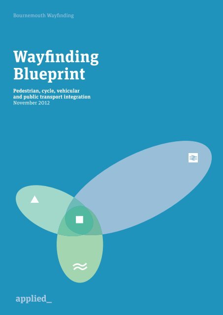
<strong>Bournemouth</strong> <strong>Wayfinding</strong><br />
<strong>Wayfinding</strong><br />
<strong>Blueprint</strong><br />
Pedestrian, cycle, vehicular<br />
and public transport integration<br />
November 2012
2<br />
A <strong>Wayfinding</strong> <strong>Blueprint</strong> for <strong>Bournemouth</strong><br />
November 2012
<strong>Bournemouth</strong> <strong>Wayfinding</strong><br />
<strong>Wayfinding</strong> <strong>Blueprint</strong><br />
Pedestrian, cycle, vehicular<br />
and public transport integration<br />
November 2012<br />
A <strong>Wayfinding</strong> <strong>Blueprint</strong> for <strong>Bournemouth</strong><br />
November 2012<br />
3
<strong>Bournemouth</strong> Town Centre<br />
Signing and Information<br />
Strategy<br />
Applied Information Group 2010<br />
This <strong>Wayfinding</strong> <strong>Blueprint</strong><br />
serves as an executive<br />
summary for Phase 2 of the<br />
<strong>Bournemouth</strong> <strong>Wayfinding</strong><br />
project.<br />
It should be read in<br />
conjunction with the suite<br />
of documents that comprise<br />
the complete system in<br />
terms of planning, content<br />
and design.<br />
2010 <strong>Wayfinding</strong> Strategy 2012 <strong>Wayfinding</strong> Delivery Plan<br />
Strategy Report<br />
draft 03<br />
May 2010<br />
Placement<br />
strategy<br />
Asset list<br />
3D Asset list<br />
Car park audit<br />
Vehicular<br />
directional<br />
signage<br />
recommendations<br />
Sign specific<br />
content guidance<br />
Master map<br />
design standard<br />
& production<br />
options<br />
Detailed design<br />
Product design<br />
Implementation<br />
& costing plan<br />
4<br />
A <strong>Wayfinding</strong> <strong>Blueprint</strong> for <strong>Bournemouth</strong><br />
November 2012
Introduction<br />
In May 2010, <strong>Bournemouth</strong><br />
Borough Council commissioned the<br />
<strong>Bournemouth</strong> <strong>Wayfinding</strong> Strategy.<br />
Initially starting in the Town<br />
Centre, the study was designed to<br />
examine how an integrated<br />
wayfinding system could be<br />
developed for the town and its<br />
environs.<br />
The strategy, undertaken by<br />
Applied, identified and assessed the<br />
main influencing factors that<br />
affected the legibility of<br />
<strong>Bournemouth</strong> and proposed a<br />
strategic framework for wayfinding<br />
projects that could be rolled out.<br />
The first projects focussed on<br />
wayfinding schemes for pedestrian,<br />
cycle, vehicular and public<br />
transport integration.<br />
Starting in March 2012, and<br />
working closely with <strong>Bournemouth</strong><br />
Council’s <strong>Wayfinding</strong> Steering<br />
Group, Applied has developed<br />
designs for an on-street pedestrian<br />
and cycle scheme with integrated<br />
public transport connections, and a<br />
vehicular signage scheme.<br />
At the heart of the system was the<br />
creation of a master map that can<br />
be used in all future applications<br />
for wayfinding, on-street, in print<br />
and digital applications, such as<br />
smartphone apps and website<br />
downloads.<br />
A <strong>Wayfinding</strong> <strong>Blueprint</strong> for <strong>Bournemouth</strong><br />
November 2012<br />
5
The benefits of<br />
good wayfinding<br />
<strong>Wayfinding</strong><br />
Greater<br />
knowledge and<br />
exploration<br />
Modal shift<br />
Increased<br />
efficiency of<br />
road network<br />
Reduced<br />
car use and<br />
congestion<br />
More livable<br />
neighbourhoods<br />
Repeat<br />
visits<br />
Longer<br />
visitor stays<br />
Increased<br />
walking<br />
Increased<br />
cycling<br />
Increased<br />
use of public<br />
transport<br />
Reduced<br />
car use and<br />
congestion<br />
Improved<br />
air quality<br />
Increased<br />
retail/ visitor<br />
spend<br />
Higher<br />
footfall<br />
Increased<br />
public transport<br />
revenues<br />
Improved<br />
air quality<br />
Greater<br />
social<br />
inclusion<br />
Increased<br />
real estate<br />
values<br />
Reduced<br />
household<br />
taxation<br />
Increased<br />
business<br />
Improved<br />
health<br />
Reduced<br />
greenhouse gas<br />
emmissions<br />
<strong>Wayfinding</strong> is not simply a system that helps tourists<br />
find landmarks. Beyond this, it offers a host of<br />
interconnected benefits to the life and economy of<br />
places. <strong>Wayfinding</strong> information encourages people to<br />
use more sustainable transport modes and empowers<br />
residents to explore their city.<br />
It boosts the local economy by increasing foot traffic in<br />
front of local businesses, improves public health and<br />
reduces vehicular congestion and air pollution.<br />
Meanwhile it enriches the tourist experience,<br />
encouraging visitors to return more frequently, stay<br />
longer and converting them to ambassadors for the<br />
town.<br />
How wayfinding helps the city<br />
<strong>Wayfinding</strong> can deliver significant economic benefits.<br />
Research has shown that people, even residents and<br />
commuters, do not know places as well as they think.<br />
By increasing people’s knowledge of <strong>Bournemouth</strong>,<br />
wayfinding can encourage residents to explore their<br />
town— revealing hidden shopping streets, local<br />
attractions, parks and walking routes. It helps to<br />
decode the town and gives residents and tourists the<br />
confidence to explore.<br />
Research shows a direct relationship between the way<br />
in which people travel around centres and the amount<br />
of money they spend. The weekly expenditure of<br />
consumers who walk is 42% higher than those who<br />
drive. Research in London shows that more attractive<br />
and walkable streets can add an average of 5.2% to<br />
residential prices and an average of 4.9% to retail rents.<br />
<strong>Wayfinding</strong> can make an important contribution to<br />
people’s health. Unchecked, <strong>Bournemouth</strong> currently<br />
faces an obesity crisis: in 2006, 24% of people in the<br />
town were classified as obese, a figure that is<br />
anticipated to rise to 32% by 2015 and 42% by 2025.<br />
6<br />
A <strong>Wayfinding</strong> <strong>Blueprint</strong> for <strong>Bournemouth</strong><br />
November 2012
Facts and figures<br />
Hotel beds in <strong>Bournemouth</strong><br />
19,600<br />
(<strong>Bournemouth</strong> Town Centre Area<br />
Action Plan 2010)<br />
Air Festival visitors<br />
2009 over 4 days<br />
1.25m<br />
(<strong>Bournemouth</strong> Tourism)<br />
<strong>Bournemouth</strong> has<br />
1.4m<br />
overnight<br />
visits per year<br />
3.8m day visits/year<br />
(<strong>Bournemouth</strong> Retail & Leisure Capacity Study 2007)<br />
Tourism adds<br />
£426m<br />
to the local economy<br />
( <strong>Bournemouth</strong> Town Centre<br />
Area Action Plan 2010)<br />
33%reduction in CO 2 by 2014<br />
£5.5m Council savings<br />
(<strong>Bournemouth</strong> Carbon Management Plan)<br />
People who walk<br />
to the Town Centre<br />
29%<br />
( <strong>Bournemouth</strong> Retail & Leisure<br />
Capacity Study 2007)<br />
Respondents coming from<br />
less than two miles away<br />
21%<br />
( <strong>Bournemouth</strong> Parking Capacity<br />
Study 2009)<br />
The Marmot Review (2010) estimates the cost of lost<br />
production through all health inequalities to employers<br />
in <strong>Bournemouth</strong> equates to £99m. The clear link<br />
between obesity and other health inequalities means<br />
that a substantial proportion of this will relate to obesity.<br />
Health practitioners recommend that adults conduct at<br />
least thirty minutes of moderate physical activity (such<br />
as walking) at least five days a week. Improving the<br />
walking environment by giving people the opportunity<br />
to walk,can help. Given that 21% of drivers parking in<br />
the town centre have travelled under two miles, the<br />
potential for modal shift is high.<br />
Tourism is a major industry in <strong>Bournemouth</strong>. The<br />
town’s 5.2 million annual tourist visitors account for<br />
£426m in direct spending. Even marginal<br />
improvements to such large numbers begin to yield<br />
significant benefits.<br />
Although research on direct returns on investment is<br />
limited, Legible London, which was conceived and<br />
designed by Applied, was subject to the Department of<br />
Transport’s New Approach to Transport Appraisal,<br />
conducted by economists at Colin Buchanan<br />
Consultants.<br />
Both the monetised and non-monetised outcomes were<br />
considered in the approval of the scheme and in purely<br />
monetised terms the assessment indicated a benefit:<br />
cost ratio of between 1.6:1 to 5.1:1.<br />
It is clear that the introduction of a wayfinding scheme<br />
in <strong>Bournemouth</strong> will provide tangible benefits for the<br />
Town, its residents, visitors and businesses.<br />
A <strong>Wayfinding</strong> <strong>Blueprint</strong> for <strong>Bournemouth</strong><br />
November 2012<br />
7
applied information group 2010 strategy report • draft 03 • may 2010<br />
page 37<br />
page 38 strategy report • draft 03 • may 2010<br />
e<br />
t<br />
w<br />
c<br />
e<br />
a<br />
d<br />
l i<br />
c<br />
f<br />
r<br />
f<br />
s om<br />
l<br />
r i<br />
r<br />
a d<br />
r o<br />
n<br />
e<br />
r<br />
h<br />
o<br />
o<br />
o a d<br />
e<br />
a d<br />
r o<br />
w<br />
i<br />
h<br />
c h<br />
w e s<br />
r<br />
d<br />
t c l i f f<br />
l<br />
r<br />
r o a<br />
n<br />
d<br />
e<br />
u n a v e<br />
c o<br />
n u<br />
e n u<br />
n<br />
m<br />
r o a<br />
d<br />
e<br />
x<br />
e<br />
w a y<br />
i<br />
c i<br />
d<br />
a<br />
n<br />
c r a n<br />
y<br />
l<br />
e<br />
b<br />
r o<br />
r i<br />
d<br />
e<br />
o r<br />
o<br />
r y<br />
s<br />
a<br />
o<br />
t<br />
d<br />
r d<br />
h<br />
e<br />
n ’<br />
w e s t<br />
r d<br />
R<br />
g<br />
e r<br />
O<br />
r<br />
c l i f f p<br />
s<br />
p l<br />
a<br />
C<br />
c<br />
t<br />
e<br />
a d e<br />
R<br />
r<br />
r<br />
o<br />
C<br />
t<br />
o<br />
O<br />
A<br />
r<br />
u<br />
a n<br />
p a<br />
d<br />
r k<br />
a<br />
w a<br />
s<br />
r<br />
y<br />
t<br />
o<br />
a<br />
p<br />
d<br />
e<br />
O<br />
t<br />
e<br />
r ’<br />
s<br />
C<br />
a d e<br />
H<br />
R<br />
r o<br />
m a<br />
I S<br />
d i<br />
a<br />
r o<br />
H<br />
a d<br />
R O<br />
A D<br />
e<br />
a<br />
l a<br />
s t o v<br />
e<br />
c h<br />
r c<br />
s<br />
g r<br />
a<br />
o<br />
o v<br />
e<br />
d<br />
s<br />
t<br />
i<br />
d<br />
a d<br />
bournemouth town centre signing & information strategy<br />
r<br />
Finding the<br />
right approach<br />
As one of the UK’s leading resorts, the beach is the<br />
town’s main attraction. Its reputation as one of the best<br />
quality beaches in Europe, guarantees that it will<br />
remain the town’s most important tourist draw.<br />
However, while it dominates the town, it is framed on<br />
either side by East Cliff and West Cliff, which limit<br />
access to a handful of zigzags and funiculars, and the<br />
Lower Gardens, none of which provide obvious or easy<br />
links between it and the rest of the town’s offer. The<br />
topography is only one of many barriers to movement<br />
that make the town harder to navigate and understand<br />
than would initially appear.<br />
The structure of the town, with the Gardens splitting<br />
the eastern and western sides, a long and linear retail<br />
centre with ill defined edges and the lack of clear links<br />
between the beach and retail areas also contribute to<br />
uncertainty about how the town connects.<br />
Furthermore, the remoteness of <strong>Bournemouth</strong> Station<br />
in relation to the town centre or seafront, coupled with<br />
the poor welcome it provides, create a negative first<br />
impression of the town. Also the impact of subways,<br />
major roads and retaining walls, create physical and<br />
psychological barriers to walking.<br />
These natural and infrastructural barriers could be<br />
decreased significantly by providing people with the<br />
right information in the right place. However, the<br />
existing wayfinding systems have been implemented<br />
piecemeal with little or no connectivity and have been<br />
allowed to fall into disrepair.<br />
The legibility map describes<br />
the fundamental readability of<br />
<strong>Bournemouth</strong>, i.e. how the area is<br />
understood by people. The map<br />
clearly shows the topography of the<br />
town with the high plateau of the<br />
East and West Cliffs , which dips<br />
down into a central valley, where<br />
the Bourne Stream runs through<br />
the Central and Lower Gardens. The<br />
Gardens, Wessex Way, cliffs and<br />
Bourne stream create natural manmade<br />
boundaries within the town<br />
and an east/west split.<br />
The Seafront hotels are separated<br />
from the retail zone by residential<br />
zones and poor character areas,<br />
which makes access to the Town<br />
Centre more difficult and less<br />
attractive.<br />
The station, whilst easily accessible<br />
by vehicle, is surrounded by difficult<br />
junctions and busy roads making<br />
linking the station to the town via<br />
walking a challenge.<br />
Parking can be found all over the<br />
Town Centre which provides an<br />
even distribution of arrival points.<br />
Their visual appearance often<br />
contributes to poor character areas,<br />
as they can be large open spaces<br />
or structures which disrupt active<br />
frontage.<br />
There are a number of striking<br />
landmarks spread across the town<br />
that could be used for wayfinding,<br />
including churches, theatres, the<br />
B.I.C. and prominent hotels.<br />
The gardens provide the largest<br />
green space within the Town Centre.<br />
They provide a pleasant walking<br />
connection between retail centre<br />
and the Seafront.<br />
n t<br />
e s t<br />
3.0 Analysis and Insights<br />
3.1 Urban structure<br />
Legibility<br />
f d r<br />
i v e<br />
i f f d r<br />
r o<br />
d u<br />
b r a n k<br />
a m b<br />
d g e<br />
e r v i l<br />
e y c h i<br />
r o a d<br />
s o m e w<br />
n o r w i c<br />
s u f f o l k r d<br />
p o o l e r o a d<br />
c h i n<br />
e r o a d<br />
d r o a d<br />
a v e n u e<br />
n o r<br />
d u r l e y<br />
a d<br />
r o a d<br />
u<br />
o b<br />
c h a v e<br />
n o r w i<br />
w e s t h i<br />
the<br />
triangle<br />
l r o a d<br />
west cliff<br />
w e s s e x<br />
a v<br />
t r e<br />
g o n w e l l r<br />
s t m i c h a e l ’ s r o a d<br />
m m e r<br />
r o a<br />
e x e t e r<br />
s t p r o m e e n a d e<br />
w<br />
3.0 Analysis and Insights<br />
3.1 Urban structure<br />
Train station to Town Centre – Signage<br />
The route between the station<br />
and the Town Centre involves<br />
negotiating a number of signage<br />
systems which direct you through<br />
some areas of poor character.<br />
The station is a confusing location<br />
for both arrival and departure.<br />
There are few clear signs for<br />
pedestrians highlighting the route<br />
out of the station to the town, and<br />
Start<br />
the walking signs are lost amongst<br />
the a wide variety of other signage<br />
systems.<br />
Pedestrians are directed to the<br />
Town Centre via Holdenhurst Road<br />
and onto Old Christchurch Road.<br />
There is no coherent signing along<br />
this route and therefore pedestrians<br />
must pick up on a variety of<br />
scattered pieces of information<br />
including blue and white pedestrian<br />
signs, road signage and cycle signs.<br />
The established fingerpost system<br />
for the Town Centre only supports<br />
this journey from the Horseshoe<br />
Common. However this system<br />
has many flaws including missing<br />
information.<br />
The route between the town and<br />
the station needs a variety of<br />
improvements. The current urban<br />
realm and lack of consistent signage<br />
makes the walk stressful, confusing<br />
and gives a poor image to the town.<br />
3.0 Analysis and Insights<br />
3.1 Urban structure<br />
Train station to Town Centre – Topography<br />
This is a cross section of a journey<br />
between the station and the<br />
Triangle showing how the land rises<br />
and falls. Between the Clocktower<br />
and The Square the slope is more<br />
gradual than between The Square<br />
and the Triangle.<br />
18 mins<br />
This topography will clearly have an<br />
impact on walking times. The walk<br />
from the Station to The Square is<br />
downhill and six minutes shorter<br />
than the return journey uphill.<br />
Therefore it is understandable that<br />
walking is not always the most<br />
attractive option for reaching a<br />
destination.<br />
This situation is exacerbated for<br />
12 mins<br />
people with mobility issues.<br />
a d<br />
a d<br />
o<br />
r<br />
o u r n e<br />
b e a c<br />
b r a i d l e y r<br />
s t e p<br />
y r o<br />
e p<br />
n r d<br />
a d<br />
s r<br />
R I C H M O N D<br />
D H I L L<br />
O L D<br />
r o m e n<br />
C H<br />
e x e t e<br />
R I S T C H<br />
w i m b o r n e r o a d<br />
the<br />
square<br />
to<br />
own<br />
centre<br />
e r v i<br />
r v i<br />
R<br />
U H<br />
w e s<br />
o a d<br />
C H<br />
R O<br />
d e<br />
A D<br />
p p e r<br />
r o a<br />
r h i n t<br />
o n<br />
e a s t c l i f f p r o m e n<br />
w e s s e<br />
O L D<br />
b a t h r o a d<br />
x w a y<br />
a d<br />
e r<br />
T C H U R C<br />
o w n e r o<br />
a d<br />
b a t h r o a d<br />
l a n s d o w n e r o a d<br />
a n s d o w n e r d<br />
s t p a u l<br />
do<br />
r o a d<br />
h o l d e n h u r s t r o a d<br />
h r i s t c h u r c h r o a d<br />
g e r v i s r o a dg e r v i s r o a<br />
l i f f d r i v<br />
u n d e r c l i f d r i v e<br />
bournemouth<br />
station<br />
e r o a d<br />
n r o a d<br />
h o l d e n h u r s t r o a<br />
east cliff<br />
f f d r i v e<br />
s w<br />
t h u n ’ s r o a<br />
s o u t h c o t e r o a d<br />
f r a n c i s r o a d<br />
k n y v e t<br />
e t o n r o a d<br />
a n n e r l e y r d<br />
c h r i s t c h u r c h r o a d<br />
Lift<br />
Parking<br />
Public space<br />
Bus interchange<br />
Poor character area<br />
Rail station<br />
Retail<br />
the<br />
Cliff<br />
pier<br />
Hotels<br />
Barrier<br />
Difficult junctions<br />
Steps/hidden routes<br />
Viewing point<br />
Key movements<br />
Landmark<br />
The Triangle<br />
Clocktower<br />
holdenhurst road<br />
commercial ro ad<br />
old christchurch road<br />
Horseshoe Common<br />
The Square<br />
1,100 metres<br />
Problems of navigation<br />
identified in the 2010<br />
<strong>Wayfinding</strong> Strategy<br />
8<br />
A <strong>Wayfinding</strong> <strong>Blueprint</strong> for <strong>Bournemouth</strong><br />
November 2012
Observations from the 2010<br />
<strong>Wayfinding</strong> Strategy<br />
From top: a variety<br />
of fingerpost wayfinding<br />
systems; a selection of maps<br />
available in the town;<br />
clutter caused by poor<br />
implementation; lack of<br />
maintenance of existing<br />
systems; barriers to<br />
movement in, and legibility<br />
of the town.<br />
A <strong>Wayfinding</strong> <strong>Blueprint</strong> for <strong>Bournemouth</strong><br />
November 2012<br />
9
Bus<br />
Walk<br />
Train<br />
Car<br />
Taxi<br />
By understanding how and why people journey<br />
through <strong>Bournemouth</strong>, what their perceptions are of<br />
the town and its wayfinding, and how their behaviour<br />
can be influenced by better information, we can<br />
develop a system that supports and informs their<br />
journeys and gives them a better understanding of the<br />
town and its offer.<br />
One technique used to gain an insight into these facts<br />
was to talk to people: ask them about their journey<br />
choices and draw their ‘mental map’ of the town. This<br />
revealed that people did not know the town as well as<br />
they thought they did. People struggled to relate to the<br />
different parts of the town which in turn, led to<br />
misjudgments about walking distances, times and<br />
directions.<br />
Another technique was to develop ‘user scenarios’,<br />
which describe real, but hypothetical journeys that<br />
people make. They provide an understanding of the<br />
needs of different users with different abilities visiting<br />
for a variety of reasons. They help define the scope of a<br />
wayfinding system pointing out what information is<br />
needed where to support journeys.<br />
The original strategy (2010) brought together an<br />
understanding of the town, its offer, its aspirations and<br />
its people coupled with an understanding of<br />
wayfinding, its principles, opportunities and<br />
effectiveness resulting in strategic recommendations<br />
for the way forward.<br />
“ I couldn’t tell<br />
you the way<br />
to the Town<br />
Centre. I’d take<br />
a taxi.<br />
Jack and Jill<br />
“ There is an overload of<br />
signs …so much clutter”<br />
Jack and Jill are a couple visiting<br />
<strong>Bournemouth</strong> for the weekend.<br />
Jill is in a wheelchair, therefore<br />
accessibility and the ability to plan their<br />
routes will play a key role in their<br />
activities in and around <strong>Bournemouth</strong>.<br />
They have visited <strong>Bournemouth</strong> before<br />
and like to explore new places.<br />
Jack and Jill arrive by car to their hotel in<br />
West Cliff.<br />
They have chosen this location to be close<br />
to the seafront and have also stayed here<br />
before.<br />
“What is this?”<br />
On their first trip out they find a footpath<br />
marker, signing down a route that they<br />
haven’t been before.<br />
“It shows this route is flat and doesnt<br />
have any steps, lets go down here, it<br />
comes out near the top of West cliff Zig-<br />
Zag”<br />
Another footpath marker at the top of the<br />
West Cliff zig zag shows that there are<br />
steps at the bottom.They use an area sign<br />
located at the top of West Cliff zig- zag to<br />
plan a route down the slope to the pier.<br />
“We can use the West Cliff lift to get back<br />
up when we are ready to come back”<br />
They are not planning on venturing too<br />
far, they are greeted by the arrival sign at<br />
the pier. This allows them to plan some<br />
activities for the next day.<br />
They spend some time at the seafront,<br />
they use the seafront miniliths to see<br />
where they are along the seafront, and<br />
what they can do along the route.<br />
Bearing in mind they didn’t want to go<br />
any further than the West Cliff lift.<br />
They see on the seafront minilith<br />
map that they can have lunch at the<br />
Westbeach.<br />
After an enjoyable afternoon, they head<br />
back to their hotel.<br />
They use the same route back to there,<br />
the footpath marker acts as confirmation<br />
that there are no accesibility issues, and<br />
it also points out that it is a lit route if it<br />
was to be dark when they next return to<br />
use this route.<br />
Applied©<br />
Detailed design Draft 01<br />
8<br />
Above, mental maps, user quotes<br />
and user scenario, from the 2010<br />
<strong>Wayfinding</strong> Strategy.<br />
10<br />
A <strong>Wayfinding</strong> <strong>Blueprint</strong> for <strong>Bournemouth</strong><br />
November 2012<br />
Left, diagram to illustrate one of the<br />
strategic recommendations –<br />
“<strong>Bournemouth</strong> must be more than a<br />
beach”. People come for the beach<br />
but whilst there, should be given<br />
information about what else the<br />
Town has to offer.
The integrated wayfinding system<br />
Leaflets<br />
A suite of information including<br />
mapping to accompany<br />
interpretive information<br />
Pedestrian signage<br />
On-street pedestrian maps and<br />
directional information<br />
Network diagram<br />
Public transport journey<br />
planning information<br />
Network<br />
diagrams<br />
Coordinated<br />
Street<br />
Furniture<br />
Mapping<br />
Walking map<br />
A suite of printed pedestrian<br />
maps tailored for specific uses<br />
such as shopping and tourism,<br />
events maps such as the Air<br />
Festival, tear off maps at hotels.<br />
Available free throughout the<br />
town.<br />
Online<br />
Downloadable suite of<br />
maps available from<br />
www.bournemouth.gov.uk<br />
and other websites<br />
Digital devices<br />
Sat Nav capabilities and<br />
downloadable applications for<br />
mobile devices such as iPhone<br />
Real-time information<br />
Digital screens containing event<br />
based information and temporary<br />
signage for events<br />
Digital<br />
information<br />
Users<br />
Directional<br />
information<br />
Schedules<br />
& timetables<br />
Intermodal<br />
connectivity<br />
Public transport information<br />
Integrated multi-modal<br />
information at bus stops, hubs<br />
and interchanges<br />
Timetables<br />
Public transport timetable<br />
information<br />
Directional signage<br />
Vehicular directional<br />
information for traffic signs<br />
Recommendations from the <strong>Wayfinding</strong> Strategy<br />
Project 1<br />
Detailed<br />
strategies<br />
Vehicular<br />
signage<br />
strategy<br />
Public<br />
transport<br />
signage<br />
strategy<br />
Pedestrian<br />
signage<br />
strategy<br />
Project 2<br />
Master<br />
map<br />
10 principles of good wayfinding<br />
1. Seamless<br />
Integrating information across modes<br />
reflects the real journeys that people<br />
make.<br />
2. Stepping Stones<br />
Stepping stones will assist people’s<br />
memory and provide connections for<br />
the traveller.<br />
3. System Naming<br />
The consistent naming of places and<br />
things in the environment allows<br />
people to communicate what and where<br />
places are.<br />
4. System Codes<br />
Codes are used as short-cuts for<br />
memory and for simplifying<br />
complicated systems and include<br />
colours, numbers, icons and names.<br />
5. Progressive Disclosure<br />
All things cannot be signed from all<br />
locations. Progressive disclosure<br />
provides a rationale for what<br />
information is needed where.<br />
6. Predictable<br />
Information consistency, integrity and<br />
most-of-all availability are crucial to<br />
achieving predictability.<br />
7. Don’t Make me Think<br />
Keep it simple. The simpler the<br />
information, the easier it will be to<br />
understand.<br />
8. Inclusive<br />
Information should be provided so that<br />
it does not exclude any group or<br />
individual, with particular focus on<br />
disability groups.<br />
9. Help Me to Learn<br />
Information that is easy to learn is<br />
more likely to be used. Teach people<br />
how easy route choices are and modal<br />
change is more likely.<br />
10. Tone of voice<br />
Provide information with the right tone<br />
of voice, in the right way and people are<br />
more likely to engage with it.<br />
A <strong>Wayfinding</strong> <strong>Blueprint</strong> for <strong>Bournemouth</strong><br />
November 2012<br />
11
Planning the system<br />
Core data<br />
Future developments<br />
Place naming<br />
Land use<br />
Arrival points<br />
Pedestrian movement<br />
Primary assets<br />
Route hierarchy<br />
Sign locations<br />
Placement<br />
Applied has developed an objective approach to<br />
understanding and optimising the placement of signs<br />
in the public realm. It facilitates the consistent,<br />
predictable placement of signs based on an assessment<br />
of the issues that affect the structure, transport,<br />
attractions, land-uses and walkability of the town. This<br />
strategy, when assessed alongside user scenarios<br />
provides answers to the types of questions that people<br />
ask themselves on their journeys – Where am I? How<br />
do I cycle to my destination? Which is better, bus, taxi<br />
or walking? What else can I do?<br />
A typology or family of signs is then developed to<br />
support people at appropriate points on their journey.<br />
Each sign functions slightly differently delivering the<br />
appropriate level of information needed at that point.<br />
For example, the major public spaces, identified in the<br />
information concept, are locations where people can<br />
plan journeys and learn what the town and wider<br />
region has to offer. Similar overview information needs<br />
to appear at all arrival points, such as car parks.<br />
A predominantly map-based system allows people to<br />
find places – buildings, shops, streets, attractions – and<br />
plan journeys. Specialised signs at the Seafront and in<br />
the Gardens provide an additional layer of mapping,<br />
more specific and relevant to those areas.<br />
Routing is then supported by a network of footpath<br />
markers, fingerposts, environmental graphics in<br />
subways and cycle patches that direct pedestrians and<br />
cyclists and provide reassurance that they are going in<br />
the right direction. Taxi ranks and coach stops are also<br />
integrated as part of the system and require their own<br />
marker.<br />
Above, Placement Strategy<br />
An analysis of the urban<br />
factors that influence and<br />
guide the placement of<br />
on-street signs.<br />
Right, Information concept<br />
Four key public spaces – the<br />
Station, Square, Triangle and<br />
Pier – which function as<br />
gateway nodes, connected by<br />
strong linear routes.<br />
12<br />
A <strong>Wayfinding</strong> <strong>Blueprint</strong> for <strong>Bournemouth</strong><br />
November 2012
Information Hubs 5<br />
Town Midiliths 45<br />
Fingerposts 75<br />
Seafront Midiliths 9<br />
Garden Midiliths 7<br />
Car Park poster cases 47<br />
Footpath Markers 45<br />
Environmental Graphics 7<br />
Taxi Totems 8<br />
Coach Totems 4<br />
Top, the typology showing<br />
the full range of signs.<br />
Left, the sign location plan<br />
showing where the signs<br />
would be located and the total<br />
number of signs by sign type.<br />
A <strong>Wayfinding</strong> <strong>Blueprint</strong> for <strong>Bournemouth</strong><br />
November 2012<br />
13
<strong>Bournemouth</strong>’s neighbour,<br />
boasts the UK’s most innovative<br />
seafront attraction. The<br />
Overstrand beach front complex,<br />
designed in 1958, has been<br />
System design<br />
Core elements of the system<br />
design are detailed in the<br />
Design Development Report.<br />
Left & below, graphic devices,<br />
colour palette, typography<br />
and icons.<br />
System identity<br />
Graphic devices<br />
locator icons<br />
Examples of some of the<br />
3D landmark buildings<br />
developed for use on the<br />
mapping are also shown<br />
opposite.<br />
<strong>Bournemouth</strong><br />
Station<br />
1<br />
<strong>Bournemouth</strong><br />
International<br />
Centre (BIC)<br />
Boscombe<br />
walking circle / you are here marker / north marker<br />
off map tabs<br />
5 minute walk<br />
You are here<br />
N<br />
<strong>Bournemouth</strong> Station<br />
Hengistbury Head<br />
2.5km<br />
pedestrian route markers<br />
18 mins downhill<br />
21 mins uphill<br />
17 mins downhill<br />
20 mins uphill<br />
10 mins downhill<br />
13 mins uphill<br />
4 mins downhill<br />
6 mins uphill<br />
cycle route marker<br />
BCN 2<br />
System identity<br />
Colour palette<br />
As part of the wayfinding project an<br />
overall system identity has been<br />
developed that encompasses a colour<br />
palette, graphic language, icons and<br />
typographic standards.<br />
It is intended that this language is used<br />
across all wayfinding elements detailed<br />
as part of this project whilst also being<br />
taken forward for use on related projects<br />
in order to create an easily recognisable,<br />
connected system for <strong>Bournemouth</strong>.<br />
core system colours<br />
C 72 M 16 Y 9 K 0<br />
C 100 M 75 Y 25 K 15<br />
C 0 M 43 Y 100 K 0<br />
Applied©<br />
Detailed design Draft 01<br />
16<br />
secondary colours<br />
C 5 M 88 Y 72 K 0<br />
C 0 M 10 Y 90 K 0 C 35 M 5 Y 5 K 0 C 41 M 0 Y 70 K 0 C 45 M 10 Y 65 K 0<br />
The design of the wayfinding scheme contains a<br />
number of core, system elements that form the<br />
identity, the language of wayfinding and information<br />
for the town. Therefore they need to capture and<br />
replay the essence of <strong>Bournemouth</strong>.<br />
The system design must also be functional in that<br />
colours, type, icons, graphic devices etc, must be<br />
legible, inclusive and accessible. The design must<br />
work across different media (digital, print, on-street),<br />
in different environments (inside, outside, seafront,<br />
gardens, streets), at different times of day and<br />
different times of the year.<br />
And it must be brand neutral so that it can work<br />
alongside the many brands and identities that<br />
presently exist in the town.<br />
Applied©<br />
Detailed design Draft 01<br />
System identity<br />
Typeface<br />
museo sans 500<br />
The typeface used<br />
throughout the system is a<br />
sturdy, geometric, sans<br />
serif typeface well suited<br />
for display and text use.<br />
It also has sufficient<br />
character to help create a<br />
strong identity for<br />
<strong>Bournemouth</strong> wayfinding<br />
that can be built upon for<br />
future system development<br />
and other related projects.<br />
It is highly legible when museo sans 700<br />
used both at small sizes on<br />
mapping and large sizes<br />
for environmental<br />
graphics.<br />
ABCDEFGHIJKLMNOPQRSTUVWXYZ<br />
abcdefghijklmnopqrstuvwxyz<br />
1234567890 £*&()?/:<br />
ABCDEFGHIJKLMNOPQRSTUVWXYZ<br />
abcdefghijklmnopqrstuvwxyz<br />
1234567890 £*&()?/:<br />
museo sans 900<br />
base colours<br />
C 0 M 0 Y 0 K 0 C 0 M 0 Y 0 K 10 C 0 M 0 Y 0 K 25<br />
ABCDEFGHIJKLMNOPQRSTUVWXYZ<br />
abcdefghijklmnopqrstuvwxyz<br />
1234567890 £*&()?/:<br />
15<br />
Applied©<br />
Detailed design Draft 01<br />
19<br />
14<br />
A <strong>Wayfinding</strong> <strong>Blueprint</strong> for <strong>Bournemouth</strong><br />
November 2012
The colours of <strong>Bournemouth</strong><br />
<strong>Bournemouth</strong> is a vibrant, festive,<br />
colourful town, which often appears<br />
near the very top of surveys when<br />
residents are asked where is the<br />
happiest place to live. The town<br />
provides people with many happy<br />
memories. The beach and gardens are<br />
natural havens, awash with both<br />
muted and vibrant colours.<br />
The festivals also bring their colour as<br />
do the millions of visitors who relax<br />
and enjoy the fun of <strong>Bournemouth</strong>.<br />
With such natural and applied colours,<br />
any multi-coloured wayfinding system<br />
would struggle to stand out.<br />
The colour palette needed to<br />
accommodate and work with the<br />
existing richness of colours rather than<br />
fight against them.<br />
White provides that blank canvas on<br />
which other colours can play. It stands<br />
out where there is a riot of colour and<br />
in the wayfinding system allows<br />
mapping, type and accent colours to<br />
come to life. White as a blank canvas<br />
also compliments <strong>Bournemouth</strong><br />
Tourism’s recently launched ‘Colour<br />
Your Life’ campaign.<br />
<strong>Bournemouth</strong><br />
International Centre<br />
System identity<br />
Icons<br />
modal icons<br />
bus rail taxi coach cycle<br />
walk<br />
utility icons<br />
footpath marker icons<br />
The Pier<br />
2% 4% 8%<br />
car park<br />
bicycle<br />
parking<br />
information<br />
point<br />
post office police station steps uphill<br />
steps downhill<br />
shallow<br />
incline<br />
incline<br />
steep incline<br />
distance of<br />
route<br />
female toilet<br />
male toilet<br />
toilet<br />
baby change<br />
disabled<br />
toilet<br />
lit route<br />
unlit route<br />
active frontage icons<br />
cliff lifts<br />
petrol station land train stop shower<br />
seafront only seafront only<br />
shops cafe bar bar/nightclub hotels restaurants<br />
Applied©<br />
Detailed design Draft 01<br />
17<br />
A <strong>Wayfinding</strong> <strong>Blueprint</strong> for <strong>Bournemouth</strong><br />
November 2012<br />
15
Weymouth<br />
Dorchester<br />
Wareham<br />
Swanage<br />
Wimborne<br />
Minster<br />
Oakley<br />
Broadstone<br />
This diagram shows the single<br />
journey public transport<br />
connections from <strong>Bournemouth</strong> Bus services can be picked up throughout the town<br />
centre, with Gervis Place at The Square and the<br />
Town Centre. It represents multiple rail station the two main interchanges. Detailed<br />
service providers for rail, bus and information about Yellow Bus services can be found<br />
coach and passengers should<br />
at the following website address or telephone<br />
number:<br />
contact the individual operators.<br />
bybus.co.uk<br />
01202 636000<br />
Merley<br />
Bearwood<br />
Newtown<br />
Upper<br />
Parkstone<br />
Poole<br />
Ashley<br />
Cross<br />
Sandbanks<br />
More Buses and Wilts&Dorset<br />
Canford<br />
Cliffs<br />
Alum<br />
Chine<br />
Kinson<br />
West<br />
Howe<br />
West Moors<br />
East<br />
Howe<br />
Ensbury<br />
Park<br />
Ferndown<br />
Northbourne<br />
<strong>Bournemouth</strong><br />
Wallisdown University<br />
Branksome<br />
Westbourne<br />
The<br />
Triangle<br />
West<br />
Cliff<br />
Yellow Buses<br />
Moordown<br />
Winton<br />
<strong>Bournemouth</strong><br />
Station<br />
National Rail<br />
National Express<br />
The<br />
Square<br />
Lansdowne<br />
Roundabout<br />
Pier<br />
Approach<br />
BOURNEMOUTH<br />
Verwood<br />
Charminster<br />
Castlepoint<br />
Shopping<br />
Centre<br />
Boscombe<br />
Boscombe<br />
Pier<br />
Pokesdown<br />
<strong>Bournemouth</strong><br />
International<br />
Airport<br />
<strong>Bournemouth</strong><br />
Hospital<br />
Iford<br />
Highcliffe<br />
Southbourne<br />
Yellow Buses Yellow More Buses and Wilts&Dorset<br />
Airport Buses<br />
National Express<br />
Yellow National Buses Rail<br />
Bus services can be picked up throughout the town<br />
centre, with Gervis Place at The Square and the<br />
rail station the two main interchanges. Detailed<br />
information about More Bus and Wilts&Dorset<br />
services can be found at the following website<br />
address or telephone number:<br />
wdbus.co.uk<br />
01983 257005<br />
Bus services can be picked up throughout the town<br />
centre, with Gervis Place at The Square and the<br />
rail station the two main interchanges. Detailed<br />
information about More Bus and Wilts&Dorset<br />
services can be found at the following website<br />
address:<br />
bournemouth-airport-shuttle.co.uk<br />
National Express provides regular coach services<br />
from the Travel Interchange to London, Heathrow<br />
and Gatwick Airports and many other destinations<br />
throughout the UK.<br />
nationalexpress.com<br />
Airport Buses<br />
Christchurch<br />
Salisbury<br />
New Milton<br />
Fordingbridge<br />
Ringwood<br />
NEW FOREST<br />
Southampton<br />
Brockenhurst<br />
Traveline<br />
For further transport information:<br />
www.travelinesw.com<br />
0871 200 22 33<br />
To Manchester<br />
Liverpool<br />
Birmingham<br />
Coventry<br />
THE NORTH<br />
Oxford<br />
Reading<br />
London<br />
Heathrow Airport<br />
Woking<br />
Basingstoke<br />
Winchester<br />
Lyndhurst<br />
Lymington<br />
LONDON<br />
Waverly House<br />
Ho land House<br />
<strong>Bournemouth</strong> Police Station<br />
Sony<br />
<strong>Bournemouth</strong> University Executive Busine s Centre<br />
A bey Life A surance<br />
<strong>Bournemouth</strong> University Crime Scene Investigation Training Facility<br />
Coroner's Court<br />
<strong>Bournemouth</strong> Magist<br />
Dusk Ti l Dawn Club<br />
The Eye Of The Tiger<br />
McCo l's<br />
Sherbet Lounge<br />
Asia Shop<br />
Beirut lounge Lansdowne Dental Centre O'neil's <strong>Bournemouth</strong> University Royal London House<br />
Betfred<br />
Amare to<br />
za Expre s<br />
Heroes<br />
Ask<br />
Ocean Dentalcare<br />
Gala Bingo<br />
Synagogue<br />
The Wave Restaurant & Bar<br />
The Roundhouse<br />
Ramada Encore Hotel<br />
Burley Court Hotel<br />
Mayfair Hotel<br />
Hotel Pi cadily<br />
<strong>Bournemouth</strong> Spiritualist National Church<br />
East Cliff Physiotherapy Centre<br />
The Belvedere Hotel<br />
The Brita nia<br />
The Qu ens Hotel & Spa Heathlands<br />
Hotel<br />
Brita nia Hotel<br />
Hotel Celebrity<br />
The Gr en House<br />
Flt Lt Jon E ging Memorial<br />
1<br />
2<br />
3<br />
4<br />
5<br />
6<br />
U N D E R C L I F D R I V E<br />
Westover Road 9mins<br />
Pier Approach 13mins<br />
Lower Gardens 13mins<br />
The Seafront 14mins<br />
BIC 15mins<br />
K<br />
G E R V IS R O A D<br />
Cliff<br />
A D<br />
E A S T OV E RCL I F D R IV E<br />
C H R I S T C H U R C H R O AD<br />
Old Christchurch Road<br />
13mins The Square<br />
East Cliff 6mins<br />
The Seafront via East Cliff Lifts<br />
16mins<br />
The College <strong>Bournemouth</strong><br />
YO R K R O A D<br />
G R O<br />
M E Y R I C K R O A D<br />
C O T L A N D S R O A D<br />
G R O V E R O A D<br />
A B C<br />
Steps<br />
G E R V I S RO A D<br />
Lansdowne<br />
Roundabout<br />
Steps<br />
Station<br />
Roundabout<br />
Steps Ramp<br />
Subway<br />
Steps<br />
H O L D E N H U R S T R O A D<br />
Subway<br />
B AT H R O AD<br />
You are here<br />
Ramp<br />
Steps<br />
S T P E T E R ’ S R O A D<br />
O X F O R D R O A D<br />
S T. P A U L’ S L A N E<br />
S T. PA U L’ S PL A C E<br />
P A R S O N A G E R O A D<br />
W O O T E N M O U N T<br />
S TA F O R D<br />
S T. P A U L’ S R O A D<br />
M A D I E R A R O A D<br />
Asda<br />
D<br />
W O T E N GA R D E N S<br />
Bournemou<br />
Na<br />
W O T E N<br />
C U M N O R R O A D<br />
T H E<br />
R N E PA R K<br />
A D<br />
T R I N I T<br />
O A D<br />
Weymouth<br />
This diagram shows the single<br />
journey public transport<br />
connections from <strong>Bournemouth</strong><br />
Town Centre. It represents multiple<br />
service providers for rail, bus and<br />
coach and passengers should<br />
contact the individual operators.<br />
Dorchester<br />
Wareham<br />
Swanage<br />
Oakley<br />
Merley<br />
Broadstone<br />
Poole<br />
Sandbanks<br />
Bearwood<br />
Newtown<br />
XX<br />
XX<br />
XX<br />
XX<br />
XX<br />
XX<br />
XX<br />
XX<br />
More Buses and Wilts&Dorset<br />
Steps<br />
Steps<br />
BEACON<br />
ROAD<br />
Cliff<br />
Beacon<br />
Steps<br />
EXETER<br />
ROAD<br />
Sixty Million<br />
Postcards<br />
Albert Road<br />
Bath Road<br />
Bath Road<br />
Beacon Road<br />
Beale Place<br />
Bourne Avenue<br />
Exeter Crescent<br />
Exeter Park Road<br />
Kinson<br />
BIC<br />
Roundabout<br />
West Moors<br />
Wallisdown<br />
Branksome<br />
Westbourne<br />
EDEN<br />
GLEN<br />
PARK<br />
ROA D<br />
Royal Exeter<br />
Hotel<br />
1812<br />
BIC<br />
<strong>Bournemouth</strong><br />
International<br />
Centre<br />
Cliff<br />
Happyland<br />
Amusements<br />
<strong>Bournemouth</strong><br />
Balloon<br />
Beau Monde<br />
Bistro & Bar<br />
Whitehall<br />
Hotel<br />
Steps<br />
Ferndown<br />
Northbourne<br />
Lampeter<br />
Hotel<br />
Park<br />
Central<br />
Hotel<br />
ABC Cinema <strong>Bournemouth</strong><br />
Arlington Hotel<br />
Beales<br />
<strong>Bournemouth</strong> International Cen-<br />
XX<br />
XX<br />
XX<br />
XX<br />
tre<br />
XX<br />
XX<br />
XX<br />
G E R V I<br />
<strong>Bournemouth</strong><br />
Tourist<br />
Arlington<br />
Hotel<br />
WestBeach<br />
National Rail<br />
National Express<br />
Information<br />
Hermitage<br />
Hotel<br />
Debenhams<br />
Harry Ramsden’s<br />
Hermitage Hotel<br />
Moordown<br />
Winton<br />
L<br />
Dalkeith Santander<br />
Steps<br />
<strong>Bournemouth</strong> Station<br />
Cornish<br />
Bakehouse<br />
Daisy<br />
<strong>Bournemouth</strong><br />
O'Briens<br />
Business School<br />
Fat<br />
International<br />
Face<br />
Boots<br />
Hot<br />
Rocks<br />
Steps<br />
Steps<br />
The Oceanarium<br />
Yellow Buses<br />
The Mary<br />
Shelley<br />
Westover<br />
Gallery<br />
St. Peter's Church<br />
MLS<br />
International<br />
College<br />
Russell &<br />
Bromley<br />
Steps<br />
Steps<br />
Steps<br />
Steps<br />
Lift<br />
Ramp<br />
Steps<br />
Charminster<br />
Chilli<br />
White<br />
Bliss Bar<br />
& Clubrooms<br />
ABC Cinema<br />
<strong>Bournemouth</strong><br />
Verwood<br />
Centre<br />
Boscombe<br />
The Pier<br />
Odeon<br />
Steps<br />
The Pavilion<br />
Theatre<br />
Pavilion Dance<br />
Pokesdown<br />
Bourne<br />
Chambers<br />
Lava Ignite<br />
Nightclub<br />
PAVILION<br />
THEATRE<br />
Norwegian<br />
Wood<br />
Coffee<br />
Lounge<br />
BATH ROAD<br />
NORTH<br />
CENTRAL<br />
Steps<br />
WESTOVER<br />
GARDENS<br />
GLEN FERN<br />
ROAD<br />
GLEN<br />
FERN<br />
Steps<br />
Wessex<br />
Christian<br />
Centre<br />
Premier<br />
Inn<br />
Prezzo<br />
Gala<br />
Casino<br />
Airport<br />
Bath Hill<br />
Roundabout<br />
BATH ROAD<br />
SOUTH<br />
Seafront Office<br />
Harry<br />
Ramsden's<br />
Iford<br />
Southbourne<br />
Christchurch<br />
Glen Fern<br />
Garage<br />
Steps<br />
Cliff<br />
Highcliffe<br />
Yellow Buses Yellow More Buses and Wilts&Dorset<br />
Airport rt Buses<br />
National Express<br />
Yellow National Buses Rail<br />
Bus services can be picked up throughout the town Bus services can be picked up throughout the town Bus services can be picked up throughout the town National Express provides regular coach services The main rail station is <strong>Bournemouth</strong> Station.<br />
centre, with Gervis Place at The Square and the centre, with Gervis Place at The Square and the centre, with Gervis Place at The Square and the from the Travel Interchange to London, Heathrow<br />
South West Trains provide services between<br />
rail station the two main interchanges. Detailed rail station the two main interchanges. Detailed rail station the two main interchanges. Detailed and Gatwick Airports and many other destinations<br />
London and Weymouth<br />
information about Yellow Bus services can be found information about More Bus and Wilts&Dorset<br />
information about More Bus and Wilts&Dorset<br />
throughout the UK.<br />
southwesttrains.co.uk<br />
at the following website address or telephone<br />
services can be found at the following website<br />
services can be found at the following website<br />
nationalexpress.com<br />
number:<br />
address or telephone number:<br />
address:<br />
Cross Country Trains provide services between<br />
<strong>Bournemouth</strong> and Manchester<br />
bybus.co.uk<br />
wdbus.co.uk<br />
bournemouth-airport-shuttle.co.uk<br />
ttle.co.uk<br />
crosscountrytrains.co.uk<br />
01202 636000<br />
01983 257005<br />
National Rail Enquiries for further information<br />
www.nationalrail.co.uk<br />
0845 748 4950<br />
Visitor<br />
Information<br />
<strong>Bournemouth</strong><br />
Tourist Information<br />
Centre<br />
Westover Road,<br />
<strong>Bournemouth</strong>,<br />
BH1 2BU<br />
Sign<br />
005<br />
Synagogue<br />
Royal Bath Hotel<br />
BERRY<br />
COURT<br />
The<br />
Belvedere<br />
Hotel<br />
Salisbury<br />
New Milton<br />
Fordingbridge<br />
Ringwood<br />
Traveline<br />
Southampton<br />
Brockenhurst<br />
For further transport information:<br />
www.travelinesw.com<br />
0871 200 22 33<br />
Oxford<br />
Basingstoke<br />
Winchester<br />
Lyndhurst<br />
Lymington<br />
Visitor<br />
Information<br />
<strong>Bournemouth</strong><br />
Tourist Information<br />
Centre<br />
Westover Road,<br />
<strong>Bournemouth</strong>,<br />
BH1 2BU<br />
Phone<br />
0845 051 1700<br />
Web<br />
www.<br />
bournemouth.<br />
co.uk<br />
Sign<br />
005<br />
Reading<br />
Woking<br />
London<br />
Heathrow Airport<br />
Detailed design<br />
Information hub<br />
Transport connections map<br />
The transport connections map is<br />
designed to give users the information<br />
they need to continue their journey into<br />
<strong>Bournemouth</strong> and beyond.<br />
Information hub<br />
Transport connections map<br />
Beacon<br />
The beacon creates a<br />
visual identity for the signs<br />
and helps users to home in<br />
on the signage elements<br />
from a distance. It helps to<br />
identify the mode the sign<br />
relates to.<br />
Addressing<br />
The address line confirms<br />
you current location. This<br />
may be a street name or an<br />
attraction name along with<br />
the name of the area you<br />
are currently in (i.e.<br />
Seafront or Town Centre)<br />
<strong>Bournemouth</strong><br />
Station<br />
It allows users to make an informed<br />
decision about the best mode of transport<br />
to use and helps connect <strong>Bournemouth</strong> to<br />
the wider Dorset area.<br />
The map shows alll routes served by<br />
the<br />
different operators, with contact details<br />
beneath so users can obtain detailed<br />
sercvice information for their specific<br />
journey needs.<br />
<strong>Bournemouth</strong> Transport Connections<br />
Wimborne<br />
Minster<br />
West<br />
Howe<br />
East<br />
Howe<br />
Ensbury<br />
Park<br />
Castlepoint<br />
Shopping<br />
<strong>Bournemouth</strong><br />
International<br />
Airport Buses<br />
<strong>Bournemouth</strong><br />
Hospital<br />
NEW FOREST<br />
To Manchester<br />
Liverpool<br />
Birmingham<br />
Coventry<br />
THE NORTH<br />
LONDON<br />
<strong>Bournemouth</strong> Transport Connections<br />
<strong>Bournemouth</strong><br />
University<br />
Applied©<br />
Detailed design Draft 01<br />
Town midilith<br />
Bus connections diagram<br />
The connections map is<br />
designed to give users the<br />
information they need to<br />
continue their journey into<br />
<strong>Bournemouth</strong> and beyond.<br />
It allows users to make an<br />
informed decision about<br />
the best mode of transport<br />
to use and helps connect<br />
<strong>Bournemouth</strong> to the wider<br />
Dorset.<br />
Index and key<br />
The index offers the user an<br />
alternative search method for<br />
finding items on the more<br />
comprehensive and<br />
subsequently more complex<br />
maps. These should include<br />
roads, landmarks and<br />
transport facilities amongst<br />
other things – rather than be<br />
limited to just streets.<br />
Town midilith signs offer site specific<br />
detailed heads-up mapping of the area<br />
around the sign along with directional<br />
information to key destinations. This<br />
allows users to understand their<br />
immediate surroundings at a walkers<br />
level of detail.<br />
Overall Dimensions:<br />
1200mm x 2400mm<br />
The main rail station is <strong>Bournemouth</strong> Station.<br />
South West Trains provide services between<br />
London and Weymouth<br />
southwesttrains.co.uk<br />
Cross Country Trains provide services between<br />
<strong>Bournemouth</strong> and Manchester<br />
crosscountrytrains.co.uk<br />
National Rail Enquiries for further information<br />
www.nationalrail.co.uk<br />
0845 748 4950<br />
Beacon<br />
The beacon creates a<br />
visual identity for the signs<br />
and helps users to home in<br />
on the signage elements<br />
from a distance. It helps to<br />
identify the mode the sign<br />
relates to.<br />
Directional information<br />
Part of the core navigation,<br />
directional information<br />
helps the user to orientate<br />
themselves in relation to<br />
nearby landmarks and<br />
attractions and directs<br />
them to their destination.<br />
Applied© Lansdowne Detailed design Draft 01<br />
Roundabout<br />
5 minute walk<br />
Gervis<br />
Roundabout<br />
St. Peter’s<br />
Roundabout<br />
BE RY<br />
COURT<br />
25<br />
Addressing<br />
The address line confirms<br />
you current location. This<br />
may be a street name or an<br />
attraction name along with<br />
the name of the area you<br />
are currently in (i.e.<br />
Seafront or Town Centre)<br />
<strong>Bournemouth</strong> Town Centre<br />
Upper<br />
Parkstone<br />
Ashley<br />
Cross<br />
Canford<br />
Cliffs<br />
Alum<br />
Chine<br />
The<br />
Triangle<br />
West<br />
Cliff<br />
Side panel information<br />
The side panel contains<br />
addressing information,<br />
contact information, a sign<br />
number and QR code.<br />
The<br />
Square<br />
<strong>Bournemouth</strong><br />
Station<br />
Lansdowne<br />
Roundabout<br />
BOURNEMOUTH<br />
Pier<br />
Approach<br />
Boscombe<br />
Pier<br />
Page 26<br />
The Co lege<br />
<strong>Bournemouth</strong> and P ole Lansdowne<br />
Index and key<br />
The index offers the user<br />
an alternative search<br />
method for finding items<br />
on the more<br />
comprehensive and<br />
subsequently more<br />
complex maps. These<br />
should include roads,<br />
landmarks and transport<br />
facilities amongst other<br />
things – rather than be<br />
limited to just streets.<br />
St. Swithun’s<br />
Roundabout<br />
Street finder<br />
XX Albert Road<br />
XX Bath Road<br />
XX Bath Road<br />
XX Beacon Road<br />
XX Beale Place<br />
XX Bourne Avenue<br />
XX Exeter Crescent<br />
XX Exeter Park Road<br />
XX Exeter Road<br />
XX Gervis Place<br />
XX Hinton Road<br />
XX Old Christchurch Road<br />
XX Parsonage Road<br />
XX Post Office Rd<br />
XX Richmond Hill<br />
XX St Peter’s Road<br />
XX Terrace Road<br />
XX Undercliff Drive<br />
XX Upper Hinton Road<br />
XX Westover Road<br />
COTLANDS<br />
ROAD<br />
S T. S W I T H U N ’ S R O A D S O U T H<br />
Job<br />
Centre<br />
Plus<br />
The Old Fire Station<br />
Empire<br />
Club<br />
Subway<br />
Subway<br />
Destination finder<br />
XX ABC Cinema <strong>Bournemouth</strong><br />
XX Arlington Hotel<br />
XX Beales<br />
XX <strong>Bournemouth</strong> International Centre<br />
XX Debenhams<br />
XX Harry Ramsden’s<br />
XX Hermitage Hotel<br />
XX House Of Fraser<br />
XX Lampeter Hotel<br />
XX Lloyds TSB<br />
XX Lower Gardens<br />
XX Methodist Church<br />
XX Natwest<br />
XX Odeon <strong>Bournemouth</strong><br />
XX Park Central Hotel<br />
XX Premier Inn<br />
XX Punshon Memorial<br />
XX Royal Bath Hotel<br />
XX Royal Exeter Hotel<br />
XX Sixty Million Postcards<br />
XX St. Peter’s Church<br />
XX Tesco Metro<br />
XX The Oceanarium<br />
XX The Pavilion Theatre<br />
XX The Seafront<br />
XX The Square<br />
XX Tourist Information Centre<br />
XX West Beach<br />
XX West Beach Ice Cream<br />
XX Whitehall Hotel<br />
Telecom<br />
House<br />
Tesco<br />
Expre s<br />
Madiera<br />
Roundabout<br />
Finder map<br />
The heads-up finder map<br />
locates the user by<br />
showing them their<br />
immediate surroundings at<br />
a walkers level of detail.<br />
They are scaled to include<br />
a 5 minute walk from the<br />
location of the sign and<br />
include labels for key<br />
buildings and amenities.<br />
Phone<br />
0845 051 1700<br />
Web<br />
www.<br />
bournemouth.<br />
co.uk<br />
Town midilith<br />
Applied©<br />
Detailed design Draft 01<br />
Overall Dimensions:<br />
450mm x 2650mm<br />
The on-street pedestrian scheme integrated with cycle<br />
signage where it is off the public highway, is described<br />
in detail in the Design Development report.<br />
The design of all different sign types, utilising the<br />
system design elements, are set out with all<br />
information elements proposed for inclusion on the<br />
signs explained.<br />
Side Panel<br />
The heads-up portrait finder map locates<br />
Overall Dimensions:<br />
the user by showing them their 130mm x 2650mm<br />
immediate surroundings at a walkers<br />
level of detail. They are scaled to include<br />
a 5 minute walk from the location of the<br />
sign and include labels for key buildings<br />
and amenities.<br />
Town Midilith<br />
map scale: 1:1550<br />
The side panel shown right contains the<br />
sign address, bar code, contact<br />
information for users and a QR code that<br />
could link to additional sign specific<br />
information or online content.<br />
In addition, the sign number is also<br />
included, and can be used for either<br />
public facing or operational purposes.<br />
This side panel is designed to be used on<br />
all monolith signs. Its use on info hubs<br />
will be determined by the arrangement of<br />
the component signs.<br />
Applied©<br />
Detailed design Draft 01<br />
3<br />
4<br />
5<br />
6<br />
The Triangle<br />
G E R V I S P L AC E<br />
BEA C O N R D<br />
EXE T E R O A D<br />
R R Y O A D<br />
Street finder<br />
E X E T E R<br />
E X E T E<br />
C R E S C E N T<br />
35<br />
E X E T E R O A D<br />
A B C<br />
Destination finder<br />
O L D<br />
B E A L E P L A C E<br />
I S T C H U R C H R O A D<br />
B ATH R O A D<br />
ST P E T E R ’ S R O A D<br />
5 minute walk<br />
W E S T O V E R R O A D<br />
H I N T O N R O A D<br />
You are here<br />
T P E T E ’ S R O A D<br />
U P P E R HIN T O N R O A D<br />
G L E N F E R N R O A D<br />
D<br />
PA R S O N A G E R O A D<br />
R U S S E L L- C O AT E S R D<br />
B AT H RO A D<br />
U N D E R CLIFF D R I V E<br />
<strong>Bournemouth</strong> Station Russell-Cotes Art Gallery & Museum<br />
<strong>Bournemouth</strong> Town Centre<br />
36<br />
Map scales and any supporting elements for all the<br />
different sign types are specified in order that the signs<br />
can be taken forward into the first stages of<br />
implementation.<br />
Above, pages showing the<br />
Information Hub (with<br />
<strong>Bournemouth</strong> Connections<br />
map) and the Town Midilith<br />
signs, explaining the function<br />
of all information included on<br />
the signs.<br />
16<br />
A <strong>Wayfinding</strong> <strong>Blueprint</strong> for <strong>Bournemouth</strong><br />
November 2012
A <strong>Wayfinding</strong> <strong>Blueprint</strong> for <strong>Bournemouth</strong><br />
November 2012<br />
17<br />
Vehicular & Cycle Signs<br />
The design and planning for<br />
vehicular and cycle direction<br />
signs is regulated and<br />
controlled by the Traffic<br />
Signs Regulations and<br />
General Directions and the<br />
Traffic Signs Manual, to<br />
ensure clarity of information<br />
and uniformity of design.<br />
Where cycle and vehicular<br />
signage is shown, it has been<br />
designed in accordance with<br />
the existing regulations and<br />
guidance including for<br />
placement and x-heights.<br />
The Traffic Signs<br />
Regulations & General<br />
Directions, 2002<br />
Traffic Signs Manual,<br />
Chapter 7, The Design of<br />
Traffic Signs, 2003<br />
Traffic Signs Manual,<br />
Chapter 2, 2009/10<br />
Traffic<br />
Signs<br />
Manual<br />
CHAPTER<br />
7<br />
The Design of Traffic Signs<br />
2003<br />
23<br />
Detailed design Draft 01<br />
Applied©<br />
Outstanding fossil localities and<br />
stunning rock and cliff formations<br />
including the famous arched Durdle<br />
Door.<br />
7 Cerne Abbas<br />
A charming village with abbey ruins<br />
and Tudor cottages and a particularly<br />
famous giant carved into the chalk<br />
hillside.<br />
8 Portsmouth<br />
Spend a naval day in the city and<br />
explore famous war ships in the<br />
historic Dockyard or shop ‘til you<br />
drop.<br />
9 Shaftesbury<br />
Quaint, cobbled and very steep, Gold<br />
Hill is the star of the old Hovis advert<br />
and can be found in this beautiful<br />
town. Wander around the traditional<br />
shops or enjoy a cream tea in one of<br />
the many cafes and restaurants.<br />
10 Christchurch<br />
A small Saxon town with castle ruins,<br />
a quaint Quay, boutiques, celebrity<br />
restaurants and an infamous food<br />
festival which takes place each year.<br />
Christchurch, rich in heritage and<br />
culture, boasts two rivers, a castle, a<br />
beautiful 11th Century Priory and a<br />
mill of Saxon origin.<br />
Christchurch Quay overlooks the<br />
pretty Harbour, great for riverside<br />
walks. Christchurch is uniquely<br />
situated on the shores of its own<br />
harbour, close to the magnificent<br />
Dorset World Heritage Coast and the<br />
tranquil New Forest National Park.<br />
<strong>Bournemouth</strong>’s neighbour, boasts<br />
the UK’s most innovative seafront<br />
attraction. The Overstrand beach<br />
front complex, designed in 1958, has<br />
been transformed into a year-round<br />
leisure facility offering watersports<br />
and a fantastic beach. In recent years,<br />
boutique hotels and restaurants have<br />
popped up in the area.<br />
Boscombe is a long walk or short<br />
bicycle ride away from <strong>Bournemouth</strong>.<br />
2 Poole<br />
<strong>Bournemouth</strong>’s stylish neighbour, is<br />
famous for the world’s second largest<br />
natural harbour and for the area of<br />
Sandbank, one of the most expensive<br />
places to live in the UK.<br />
Poole’s natural harbour, renowned<br />
for its watersports and bustling<br />
with yachts and boats. Poole Quay<br />
is lined with beautiful merchant<br />
houses that sit side-bys-side with<br />
modern architecture. The Quay<br />
has an abundance of ztop bistros<br />
and restaurants, many offering the<br />
catch of the day. Enjoy the cobbled<br />
streets and take the Cockle Trail Walk<br />
or enjoy a boat ride to the National<br />
Trust’s Brownsea Island. With so<br />
much going on in Poole, there’s<br />
diverse accommodation to suit all<br />
tastes and budgets.<br />
3 Corfe Castle<br />
One of Britain’s most majestic ruins.<br />
The National Trust castle controlled<br />
the gateway through the Purbeck<br />
Hills in the time of William the<br />
Conqueror.<br />
A favourite haunt for adults and<br />
children alike, you can’t fail to be<br />
captivated by these romantic castle<br />
ruins with breathtaking views.<br />
Discover 1,000 years of the castle’s<br />
history as a royal palace and fortress<br />
– with fallen walls and secret places,<br />
there are tales of treachery and<br />
treason around every corner. Spot<br />
the ‘murder holes’ and count the<br />
arrow loops. Feel history come to life<br />
and see the wildlife which has set up<br />
home in these fascinating castle ruins.<br />
Indulge in a homemade Dorset cream<br />
tea in our delightful 18th century tea<br />
rooms. Enjoy the summer garden<br />
with unrivalled castle views or the<br />
glowing open log fire in winter.<br />
The picturesque village which shares<br />
its name with the castle is well worth<br />
exploring.<br />
This small town surrounds a beautiful<br />
curved bay and has many attractions<br />
including the Purbeck coast path,<br />
heritage centre, gardens and beautiful<br />
Purbeck stone buildings.<br />
The Swanage Railway offers a more<br />
frequent heritage steam and diesel<br />
timetable train service than any other<br />
preserved railway. Steam and diesel<br />
galas, family fun events, plus regular<br />
evening and lunchtime Wessex Belle<br />
dining services complement themed<br />
events such as the popular Santa<br />
Special trains during the run up to<br />
Christmas. Stations at Norden, Corfe<br />
Castle, Harmans Cross, Herston<br />
and Swanage provide access to<br />
historic villages, country walks and<br />
the Jurassic Coast World Heritage<br />
Site, whilst also providing a valuable<br />
transport service for the local<br />
community.<br />
The heritage of the Southern<br />
Railway and stunning views of Corfe,<br />
combined with a trip to Swanage<br />
and its award- winning beach offers<br />
the perfect famiy day out. Take a trip<br />
behind a restored steam locomotive<br />
and enjoy the local history and nature<br />
during your journey. Swanage Railway<br />
is part of a great day out in beautiful<br />
Purbeck.<br />
5 The New Forest<br />
National Park<br />
A royal playground for William<br />
the Conqueror. It remains largely<br />
unchanged with miles and miles of<br />
unspoilt ancient landscapes, wild<br />
ponies and deer, disused railways and<br />
leafy lanes.<br />
The ancient New Forest is England’s<br />
newest National Park and is around<br />
30 minutes’ drive from <strong>Bournemouth</strong>.<br />
There are plenty of pretty towns<br />
and villages to discover and the<br />
beautiful open spaces, forest glades<br />
and tranquil walks remain largely<br />
unchanged from the days of William<br />
the Conqueror.<br />
Kings, queens and their courts came<br />
regularly to stay on the royal manor<br />
at Lyndhurst and it soon became the<br />
‘capital’ of the New Forest.<br />
The New Forest is a cyclist’s dream,<br />
with dedicated cycle-paths of various<br />
levels for all ages. Don’t miss the<br />
opportunity to experience New<br />
Forest produce all grown, reared,<br />
brewed, and caught in the area; easily<br />
identified by the New Forest Marque.<br />
10 places to explore near <strong>Bournemouth</strong><br />
8<br />
5<br />
7<br />
9<br />
10<br />
BCH 6<br />
NCN 2<br />
NCN 2<br />
NCN 2 NCN 2<br />
NCN 2<br />
NCN 25<br />
NCN 25<br />
NCN 25<br />
NCN 25<br />
BCH 5<br />
BCH 2<br />
BCH 2<br />
BCH 2<br />
BCH 2<br />
BCH 2<br />
BCH 2<br />
BCH 2<br />
BCH 3<br />
BCH 3<br />
BCH 6<br />
BCH 6 BCH 6<br />
BCH 6<br />
BCH 5<br />
H M O N D H I L L<br />
W I M B ORN E ROA D<br />
D E A N<br />
PARK CRE SCENT<br />
H I N T O N ROAD<br />
U P E R H I N T O N R O A D<br />
O L D CHRI S TC H U R C H R O A D<br />
P O S T O FFI C E R D<br />
V E R U L A M P L<br />
G R A N V I L E P L<br />
S T<br />
PETER’S R OA D<br />
.<br />
P H E N<br />
’ S<br />
R O A<br />
R I CH MO N D G D N S<br />
M O N D H I L D R<br />
H I N T O N R O A D<br />
B R A I D L E Y RO A D B R A IDLE Y ROA D<br />
S T. S T E P H E N<br />
’ S<br />
W AY<br />
S T. S T E P H E N ’ S R O A D<br />
B O U R N E AV E N U E<br />
B O U R N E AV E N U E<br />
Y E LV E R T O N R O A D<br />
A L B E R T R O A D<br />
LORNE PARK<br />
ROA D<br />
C U M N O R R O A D<br />
T R I N I T Y R O A D<br />
STA F O R D R OAD<br />
O L D C H R I S TC H U R C H R O A D<br />
W O O TON G A R D E N S<br />
G L E N F E R N R O A D<br />
AV E N U E R O A D<br />
C O M M E RCI A D<br />
ORC H A R D ST<br />
U P P E R T E R R A C E R O A D<br />
C R A N B O U R N E R OAD<br />
T R E G O N W E L R O A D<br />
K E R<br />
L<br />
E Y R O A D<br />
S T M I C H A E L’ S R O A D<br />
W E S T C L I F R O A D<br />
E X E T E R D<br />
E X E T ER R O A D<br />
B E ACO N R O A D<br />
B AT H R O A D<br />
TE R A C E R O A D<br />
E X E T ER PARK ROAD<br />
E X E T E R<br />
C R E S C E N T<br />
G ERV I S PL<br />
D U R A N T R O A D<br />
M AD E I R A<br />
ROA D<br />
PA R S O N A G E R D<br />
S T PET E R ’S R O A D<br />
W E S T O V E R R O A D<br />
E A S T OVER CLI F D R I V E<br />
M E Y RIC K R O A D<br />
M E YRI C K R O AD<br />
L A N S D O W N E R O A D<br />
M ADE I R A ROA D<br />
S<br />
C O T L A N D S R D<br />
C O T L A N DS R D<br />
YO R K R O A D<br />
S T. SWITHUN ’ S R O A D<br />
S T. SW I T H U N ’ S R O A D S OUT H<br />
W E L I N G T O N R O A D<br />
W E S S E X WAY<br />
S U F F O L K<br />
R O A D<br />
G R O V E R O A D<br />
B AT H R O A D<br />
B AT H R O A D<br />
G E R V I S R O A D<br />
G E R V I S R O AD<br />
G R O V E RO A D<br />
H O L D E N H U R S T R O AD<br />
C H R I S T C H U RCH R O A D<br />
G E RV I S ROAD<br />
T R E G O N W E L R O A D<br />
T R E G O N W E L C L<br />
D U R L E Y R O A D S O U T H<br />
AV E N UE L A<br />
D U R L E Y R OAD<br />
W E S T C L I F G A R D E N S<br />
D U R L E Y G ARD ENS<br />
W E S T C L I F G A R D E N S<br />
W O O T T O N M O U N T<br />
C O M M E R C I A L R O A D<br />
U P E R N O R W I C H R O A D<br />
B O U R N E AVEN U E<br />
C A M B R I DGE R OAD<br />
S U F O L K R O A D<br />
P O O L E H I L<br />
T H E F I R S<br />
S T. PA U L’ S L A N E<br />
OX F O R D R O A D<br />
S T. PA U L’ S P L<br />
U N D E R C L I F D R I V E<br />
U N D E R C L I F D R I V E<br />
W E S T H I L R O A D<br />
W E S T H I L R O A D<br />
S T. M I CHA E L S ’ S R O A D<br />
P U R B E C K R OAD<br />
S T. M I C H A E L’ S R D<br />
W E S T H I L P L<br />
S T. MIC H A E L’ S L ANE<br />
H A H N E M A N R O AD<br />
S O U T H V IEW P L<br />
C H I N E C R E S E NT<br />
W E S T C L I F F R O A D<br />
S O M E R V I L L E R O A D<br />
W E S T HI L RO A D<br />
N O R W I C H AV E N U E<br />
N O R W I C H AV E N U E<br />
NORWICH RD<br />
C R E S C E N T<br />
R O A D<br />
B R A D B U R NE R D<br />
W E S T H I L R O A D<br />
S T. PA U L’ S R D<br />
L A N S D O W N E R O A D<br />
C O A C H H O U S E P L A C E<br />
PA R K R O A D<br />
C AV E N D I SH ROAD<br />
P R I O RY R OAD<br />
RUSS E L L- CO A T E S<br />
R D<br />
The<br />
Triangle<br />
W E S S E X WAY<br />
W E S S E X WAY<br />
W E S S E X WAY<br />
18 mins downhi l<br />
17 mins downhi l<br />
21 mins uphi l<br />
13 mins uphi l<br />
10 mins downhi l<br />
4 mins downhill<br />
6 mins uphill<br />
20 mins uphi l<br />
RICHMOND<br />
HILL<br />
GLEN FERN<br />
ROAD<br />
GLEN<br />
FERN<br />
ST STEPHEN’S<br />
RICHMOND<br />
GARDEN’S<br />
MADEIRA<br />
ROAD<br />
LANSDOWNE<br />
ROAD<br />
BOURNEMOUTH<br />
STATION<br />
BOURNEMOUTH<br />
STATION PREMIUM<br />
COTLANDS<br />
ROAD<br />
TOWN HALL<br />
ANNEXE<br />
BRAIDLEY<br />
ROAD<br />
TOWN HALL<br />
EXTENSION<br />
AVENUE<br />
ROAD<br />
TERRACE<br />
ROAD<br />
EXETER<br />
ROAD<br />
EDEN<br />
GLEN<br />
WEST<br />
HILL<br />
DURLEY<br />
ROAD<br />
BEACON<br />
ROAD<br />
BIC<br />
WINTER<br />
GARDENS<br />
TERRACE<br />
MOUNT<br />
BATH ROAD<br />
SOUTH<br />
BATH ROAD<br />
NORTH<br />
PAVILION<br />
THEATRE<br />
WESTOVER<br />
GARDENS<br />
CENTRAL<br />
BERRY<br />
COURT<br />
THE<br />
SQUARE<br />
TOWN<br />
HALL<br />
Bath Hill<br />
Roundabout<br />
St. Peter’s<br />
Roundabout<br />
<strong>Bournemouth</strong><br />
West Roundabout<br />
Gervis<br />
Roundabout<br />
Lansdowne<br />
Roundabout<br />
Station<br />
Roundabout<br />
St. Paul’s<br />
Roundabout<br />
Madeira<br />
Roundabout<br />
St. Swithun’s<br />
Roundabout<br />
BIC<br />
Roundabout<br />
Durley<br />
Roundabout<br />
Horseshoe<br />
Common<br />
Roundabout<br />
Tourist<br />
Information<br />
Centre<br />
Seafront<br />
Office<br />
Homelife<br />
House<br />
Unisys<br />
Clock Tower<br />
(The College<br />
<strong>Bournemouth</strong><br />
and Poole)<br />
Russell-Cotes<br />
Art Gallery<br />
& Museum<br />
Marshall<br />
Point<br />
St. Peter’s<br />
Church<br />
<strong>Bournemouth</strong><br />
Balloon<br />
Catholic Church<br />
of The Sacred Heart<br />
St. Michael’s<br />
East Cliff<br />
United Reformed<br />
Church<br />
<strong>Bournemouth</strong><br />
Town Hall<br />
Richmond Hill<br />
St. Andrews<br />
United Reformed<br />
Church<br />
Obscura<br />
Café<br />
<strong>Bournemouth</strong><br />
Library<br />
The Pavilion<br />
Theatre<br />
BIC<br />
Oceanarium<br />
The Pier<br />
Cliff<br />
Cliff<br />
Cliff<br />
Cliff<br />
Cliff<br />
Cliff<br />
Cliff<br />
<strong>Bournemouth</strong><br />
Station<br />
Pier<br />
Approach<br />
The<br />
Square<br />
You are here<br />
5 minute walk<br />
2<br />
5<br />
3<br />
4<br />
6<br />
1<br />
2½<br />
Alum Chine<br />
2 km<br />
<strong>Bournemouth</strong> Town Centre<br />
<strong>Bournemouth</strong> International<br />
Centre (BIC)<br />
The BIC helps <strong>Bournemouth</strong> to<br />
maintain its reputation as a premier<br />
conference, leisure and hospitality<br />
destination. It hosts large rock<br />
and pop concerts, conferences,<br />
exhibitions, opera and comedy<br />
performance.<br />
Oceanarium<br />
The Oceanarium is the perfect all<br />
weather attraction. Discover the<br />
mysterious beauty of life under<br />
the sea in this spectacular aquatic<br />
journey. A guaranteed hit with the<br />
kids!<br />
<strong>Bournemouth</strong><br />
Balloon<br />
Take in the bigger picture and<br />
experience the town in a whole new<br />
way from the gondola of a giant<br />
helium balloon! Tethered by a steel<br />
cable, the Balloon gently floats<br />
500 feet above the beautiful Lower<br />
Gardens.<br />
The Pavilion<br />
The Pavilion Theatre and Ballroom is<br />
<strong>Bournemouth</strong>’s entertainment venue.<br />
Built in the 1920s, it retains its original<br />
elegant styling and is home to the<br />
best in West End shows, Opera, Ballet,<br />
Comedy and concerts.<br />
Pier<br />
Set in the middle of seven miles of<br />
golden sand, <strong>Bournemouth</strong> Pier<br />
has stunning views across the bay. It<br />
boasts a wide and varied selection of<br />
attractions, entertainment and retail<br />
outlets.<br />
The Gardens<br />
<strong>Bournemouth</strong>’s Gardens are split<br />
into three areas starting with the<br />
Lower Gardens, the Central Gardens<br />
and the Upper Gardens. The Lower<br />
Gardens play host to many events<br />
and attractions du ring the summer<br />
months.<br />
4<br />
2<br />
1 3 5<br />
6<br />
<strong>Bournemouth</strong> has it all – a diverse array of shops, restaurants and hotels<br />
as well as major attractions including its golden sandy beach<br />
The National Cycle Network<br />
has two routes that run through<br />
<strong>Bournemouth</strong>. Route 25 links<br />
Wiltshire to the Jurassic Coast.<br />
Route 2 is often referred to as<br />
the South Coast Cycle Route and<br />
connects Kent and Cornwall.<br />
The <strong>Bournemouth</strong> Cycle<br />
Highways are a selection of<br />
routes that connect different<br />
parts of <strong>Bournemouth</strong> town<br />
centre as well as the town centre<br />
with the greater area.<br />
Content to TBD<br />
Welcome to <strong>Bournemouth</strong><br />
Coaches<br />
Town centre planner<br />
The town centre planner shows the town<br />
centre area and the surrounding context,<br />
including the travel interchange in the<br />
north east.<br />
Its purpose is to give users an overview of<br />
the whole of <strong>Bournemouth</strong>, highlighting<br />
the key attractions and providing routing<br />
information for both walking and cycling<br />
as well as key transport hubs.<br />
As shown here it is supported by other<br />
elements that are exlained on the<br />
following pages.<br />
Town Centre Planner map scale: 1:2500<br />
Information hub<br />
Arrival sign<br />
Above, the Town Centre<br />
planner map included in the<br />
Information Hub.<br />
Right, the Footpath Marker<br />
signs, detailing the bespoke<br />
information developed to<br />
encourage the use of the<br />
hidden routes and official<br />
footpaths.<br />
23<br />
Christchurch<br />
Priory and Harbour<br />
Adventure Wonderland<br />
Moor Valley<br />
Railway<br />
Kingston Lacy House<br />
Tower Park<br />
Jurassic Coast<br />
Studland Bay<br />
Jurassic<br />
Coast<br />
Corfe Castle<br />
Durleston<br />
Country Park<br />
Monkey World<br />
Tank Museum<br />
Durdle Door<br />
Beaulieu<br />
Exbury Gardens<br />
The<br />
Lighthouse<br />
Poole<br />
M27<br />
M3<br />
M27<br />
A303<br />
A357<br />
A357<br />
37<br />
A35<br />
A354<br />
A354<br />
A350<br />
A350<br />
A352<br />
A351<br />
A31<br />
A354<br />
A30<br />
3<br />
A30<br />
A30<br />
A31<br />
A272<br />
A32<br />
A3<br />
A32<br />
A27<br />
A36<br />
A31<br />
A337<br />
A35<br />
A338<br />
A338<br />
A3090<br />
PORTSMOUTH<br />
SOUTHAMPTON<br />
EASTLEIGH<br />
ROMSEY<br />
WINCHESTER<br />
SALISBURY<br />
ISLE OF WIGHT<br />
RINGWOOD<br />
DORCHESTER<br />
WEYMOUTH<br />
Cerne Abbas<br />
SHAFTESBURY<br />
BLANDFORD FORUM<br />
WIMBORNE MINSTER<br />
SWANAGE<br />
Studland<br />
Isle of Purbeck<br />
Sandbanks<br />
Poole Harbour<br />
Poole Quay Compton Acres<br />
NEW FOREST<br />
POOLE<br />
CHRISTCHURCH<br />
BOURNEMOUTH<br />
LYMINGTON<br />
WAREHAM<br />
Salisbury Cathedral<br />
New Forest<br />
Wildlife Park<br />
Marwell Zoo<br />
Moor Valley<br />
Country Park<br />
2<br />
3<br />
1<br />
10 places to explore near <strong>Bournemouth</strong><br />
NCN 2<br />
NCN 2<br />
NCN 2 NCN 2<br />
NCN 2<br />
NCN 25<br />
NCN 25<br />
NCN 25<br />
BCH 5<br />
BCH 2<br />
BCH 2<br />
BCH 2<br />
BCH 2<br />
BCH 2<br />
BCH 2<br />
BCH 3<br />
BCH 3<br />
BCH 6<br />
BCH 6 BCH 6<br />
BCH 6<br />
BCH 5<br />
H I L L<br />
W I M B O R N E R O A D<br />
D E AN<br />
PA RK CRE SCENT<br />
U P E R H I N T O N RO<br />
O L D CH RI S TC H U R C H R O A D<br />
P O ST O F I C E R D<br />
V E R U L A M P L<br />
G R A N V I L L E P L<br />
T PETER’S R OA D<br />
E P H E N ’ S R O<br />
R I CH MO N D G D N S<br />
M O N D H I L D R<br />
H I N T O N R O A D<br />
B RAI D L E Y R OA D B R A I D L E Y R O A D<br />
S T. S T E P H E N<br />
’ S<br />
W AY<br />
S T.<br />
S T E P H E N ’ S R O A D<br />
B O U R N E AV E N U E<br />
O U R N E AV ENUE<br />
Y E LV E R T O N R O A D<br />
A LBE R T RO A D<br />
LORNE PARK<br />
ROA D<br />
C U M N O R R O A D<br />
T R I N I T Y R O A D<br />
S TA F O R D R O A D<br />
R I S TC H U R C H R O A D<br />
W O T O N G A R D E N S<br />
L E N F E R N R O A D<br />
AV E D<br />
O R C H A R D S T<br />
U P P E R T E R R A C E R O A D<br />
C R A N B O U R N E R OAD<br />
T R E GON W E L R O A D<br />
K E R<br />
L<br />
E Y R O A D<br />
S T M I C H A E L’ S RO<br />
W E S T C L I F R O A D<br />
E X E T E R D<br />
E X E T E R O A D<br />
B E A C O N R O A D<br />
B AT H R O A D<br />
T E R A C E R O A D<br />
E X E TER PARK ROAD<br />
E X E T E R<br />
C R E S C E N T<br />
G E RV I S P L<br />
D U R A N T R O A D<br />
M AD E I R A<br />
ROAD<br />
R S O N A G E R D<br />
S T P E T E R ’ S R O A D<br />
W E S T O V E R R O A D<br />
E A S T OVER C LIF<br />
D<br />
M E Y R I C K R O A D<br />
L A N S D O W N E R O A D<br />
M A D E I R A ROA D<br />
S O U T<br />
C O<br />
C O T L A N D S R D<br />
YO R K R O A D<br />
S T. SWITHUN ’ S R O A D<br />
S T. S W I T H U N ’ S R O A D S O U T H<br />
W E LIN GTO N R O A D<br />
W E S S E X WAY<br />
S U F F O L K<br />
R O A D<br />
G R O V E R O A D<br />
B AT H<br />
B AT H R O A D<br />
G E R V I S R OAD<br />
G E R V I S R O A D<br />
G R O VE R O A D<br />
O L D E N H U R ST R O A D<br />
C H R I S T C H U R C H R O A D<br />
G E RV I S ROAD<br />
T R E G O N W E L RO A D<br />
T R E G O N W E L C L<br />
D U R L E Y ROA D S O U T H<br />
D U R L E Y R O A D<br />
W E S T CL I F GA R D E N S<br />
D U R L E Y G A R D E N S<br />
W E S T C L I F F G A R D E N S<br />
W O O T T O N M O U N T<br />
M E R C I A L R O A D<br />
R N O R W I C H R O A D<br />
B O U R NE AV E NUE<br />
C A MBR IDG E R O A D<br />
S U F O L K R O A D<br />
T H E F I R S<br />
S T. PA U L’ S L A N E<br />
OX F O R D R O A D<br />
S T. PA U L’S P L<br />
U N D E R C L I F F D R I V E<br />
U N D E R CLI F D R I V E<br />
W E S T H I LL R OA D<br />
W E ST H I L R O A D<br />
S T. M I C H AEL S ’S RO A D<br />
P U R B E C K RO A D<br />
S T. M ICH A EL’ S R D<br />
W EST H I L P L<br />
S T. M I C H A E L’ S L A N E<br />
H A H N E M A N R O A D<br />
S O U T H V I E W P L<br />
C H I N E C R E S E NT<br />
W E S T C L I F F R O A D<br />
S O M E R V I L L E R O A D<br />
H I L RO AD<br />
N O R W I C H AV E N U E<br />
N O R W I C H AV E N U E<br />
NORWICH RD<br />
C R E S C E N T<br />
R O A D<br />
B R A D B U R N E R D<br />
W E S T H I L R O A D<br />
S T. PAUL’S RD<br />
L A N S D O W N E R O A D<br />
CO A C H H O U S E P L A C E<br />
PAR K R O A D<br />
C AV E N D I S H ROAD<br />
P R I O RY R O AD<br />
RUSS E L L- C O A T E S<br />
R D<br />
The<br />
Triangle<br />
W E S S E X WAY<br />
W E S E X WAY<br />
W E S S E X WAY<br />
18 mins downhi l<br />
17 mins downhi l<br />
21 mins uphill<br />
13 mins uphi l<br />
10 mins downhi l<br />
6 mins uphi l<br />
20 mins uphill<br />
RICHMOND<br />
HILL<br />
GLEN FERN<br />
ROAD<br />
GLEN<br />
FERN<br />
RICHMOND<br />
GARDEN’S<br />
MADEIRA<br />
ROAD<br />
LANSDOWNE<br />
ROAD<br />
BOURNEMOUTH<br />
STATION<br />
BOURNEMOUTH<br />
STATION PREMIUM<br />
COTLANDS<br />
ROAD<br />
TOWN HALL<br />
ANNEXE<br />
BRAIDLEY<br />
ROAD<br />
TOWN HALL<br />
EXTENSION<br />
AVENUE<br />
ROAD<br />
TERRACE<br />
ROAD<br />
EXETER<br />
ROAD<br />
EDEN<br />
GLEN<br />
WEST<br />
HILL<br />
DURLEY<br />
ROAD<br />
BEACON<br />
ROAD<br />
BIC<br />
WINTER<br />
GARDENS<br />
TERRACE<br />
MOUNT<br />
BATH ROAD<br />
SOUTH<br />
BATH ROAD<br />
NORTH<br />
PAVILION<br />
THEATRE<br />
WESTOVER<br />
GARDENS<br />
CENTRAL<br />
BERRY<br />
COURT<br />
THE<br />
SQUARE<br />
TOWN<br />
HALL<br />
Bath Hill<br />
Roundabout<br />
St. Peter’s<br />
Roundabout<br />
<strong>Bournemouth</strong><br />
West Roundabout<br />
Gervis<br />
Roundabout<br />
Lansdowne<br />
Roundabout<br />
Station<br />
Roundabout<br />
St. Paul’s<br />
Roundabout<br />
Madeira<br />
Roundabout<br />
St. Swithun’s<br />
Roundabout<br />
BIC<br />
Roundabout<br />
Durley<br />
Roundabout<br />
Horseshoe<br />
Common<br />
Roundabout<br />
Tourist<br />
Information<br />
Centre<br />
Seafront<br />
Office<br />
Homelife<br />
House<br />
Unisys<br />
Clock Tower<br />
(The College<br />
<strong>Bournemouth</strong><br />
and Poole)<br />
Russell-Cotes<br />
Art Gallery<br />
& Museum<br />
Marshall<br />
Point<br />
St. Peter’s<br />
Church<br />
<strong>Bournemouth</strong><br />
Balloon<br />
Catholic Church<br />
of The Sacred Heart<br />
St. Michael’s<br />
East Cliff<br />
United Reformed<br />
Church<br />
<strong>Bournemouth</strong><br />
St. Andrews<br />
Church<br />
Obscura<br />
Café<br />
<strong>Bournemouth</strong><br />
Library<br />
The Pavilion<br />
Theatre<br />
BIC<br />
Oceanarium<br />
Cliff<br />
Cliff<br />
Cliff<br />
Cliff<br />
Cliff<br />
Cliff<br />
Cliff<br />
<strong>Bournemouth</strong><br />
Station<br />
Pier<br />
Approach<br />
The<br />
Square<br />
You are here<br />
5 minute walk<br />
2<br />
5<br />
3<br />
4<br />
6<br />
1<br />
Boscombe<br />
2½ km<br />
Alum Chine<br />
2 km<br />
<strong>Bournemouth</strong> Town Centre<br />
<strong>Bournemouth</strong> International<br />
Centre (BIC)<br />
The BIC helps <strong>Bournemouth</strong> to<br />
maintain its reputation as a premier<br />
conference, leisure and hospitality<br />
destination. It hosts large rock<br />
and pop concerts, conferences,<br />
exhibitions, opera and comedy<br />
performance.<br />
Oceanarium<br />
The Oceanarium is the perfect all<br />
weather attraction. Discover the<br />
mysterious beauty of life under<br />
the sea in this spectacular aquatic<br />
journey. A guaranteed hit with the<br />
kids!<br />
<strong>Bournemouth</strong><br />
Balloon<br />
Take in the bigger picture and<br />
experience the town in a whole new<br />
way from the gondola of a giant<br />
helium balloon! Tethered by a steel<br />
cable, the Balloon gently floats<br />
500 feet above the beautiful Lower<br />
Gardens.<br />
The Pavilion<br />
The Pavilion Theatre and Ballroom is<br />
<strong>Bournemouth</strong>’s entertainment venue.<br />
Built in the 1920s, it retains its original<br />
elegant styling and is home to the<br />
best in West End shows, Opera, Ballet,<br />
Comedy and concerts.<br />
Pier<br />
Set in the middle of seven miles of<br />
golden sand, <strong>Bournemouth</strong> Pier<br />
has stunning views across the bay. It<br />
boasts a wide and varied selection of<br />
attractions, entertainment and retail<br />
outlets.<br />
The Gardens<br />
<strong>Bournemouth</strong>’s Gardens are split<br />
into three areas starting with the<br />
Lower Gardens, the Central Gardens<br />
and the Upper Gardens. The Lower<br />
Gardens play host to many events<br />
and attractions du ring the summer<br />
months.<br />
4<br />
2<br />
1 3 5<br />
6<br />
<strong>Bournemouth</strong> has it all – a diverse array of shops, restaurants and hotels<br />
as well as major attractions including its golden sandy beach<br />
The National Cycle Network<br />
has two routes that run through<br />
<strong>Bournemouth</strong>. Route 25 links<br />
Wiltshire to the Jurassic Coast.<br />
Route 2 is often referred to as<br />
the South Coast Cycle Route and<br />
connects Kent and Cornwall.<br />
The <strong>Bournemouth</strong> Cycle<br />
Highways are a selection of<br />
routes that connect different<br />
parts of <strong>Bournemouth</strong> town<br />
centre as well as the town centre<br />
with the greater area.<br />
Content to TBD<br />
Welcome to <strong>Bournemouth</strong><br />
<strong>Bournemouth</strong><br />
Station<br />
The Square 17mins<br />
The Seafront 18mins<br />
Taxis<br />
Buses<br />
Coaches<br />
Information hub<br />
Arrival sign<br />
Addressing<br />
The address line<br />
confirms you current<br />
location. This may be a<br />
street name or an<br />
attraction name along<br />
with the name of the area<br />
you are currently in (i.e.<br />
Seafront or Town Centre)<br />
Directional information<br />
Part of the core<br />
navigation, directional<br />
information helps the<br />
user to orientate<br />
themselves in relation to<br />
nearby landmarks and<br />
attractions and directs<br />
them to their destination.<br />
Town centre planner map<br />
The planner map is<br />
designed to reinforce the<br />
image of the town, build<br />
an understanding of its<br />
constituent areas and<br />
their relative<br />
geographical locations.<br />
The map also highlights<br />
key attractions.<br />
Regional map<br />
The regional map places<br />
<strong>Bournemouth</strong> in the<br />
conext of the wider<br />
Dorset area and<br />
demonstrates its<br />
connectivity to the wider<br />
area.<br />
Information<br />
Information about local<br />
attractions and places of<br />
interest raise awareness<br />
of what the town has to<br />
offer and allows users to<br />
plan what they may want<br />
to do on their visit.<br />
Beacon<br />
The beacon creates a<br />
visual identity for the<br />
signs and helps users to<br />
home in on the signage<br />
elements from a<br />
distance. It helps to<br />
identify the mode the<br />
sign relates to.<br />
Overall Dimensions:<br />
1200mm x 2400mm<br />
44<br />
Detailed design Draft 01<br />
Applied©<br />
<strong>Bournemouth</strong><br />
Town Centre<br />
The Square<br />
The Seafront<br />
Taxis<br />
Visitor Information<br />
<strong>Bournemouth</strong> Tourist Information Centre<br />
Westover Road,<br />
<strong>Bournemouth</strong>,<br />
BH1 2BU<br />
Phone<br />
0845 051 1700<br />
Web<br />
www.<br />
bournemouth.<br />
co.uk<br />
Sign<br />
005<br />
To<br />
Richmond<br />
Gardens<br />
and<br />
Richmond<br />
Gardens<br />
Car Park<br />
Alternative step<br />
free route via<br />
Richmond Gardens<br />
Shopping Centre<br />
Dalkeith<br />
Steps<br />
Footpath C04<br />
Lit route<br />
20 steps<br />
130<br />
metres<br />
uphill<br />
incline<br />
4%<br />
Richmond Gardens Car Park<br />
Richmond Gardens<br />
Footpath Dalkeith Steps FP C04<br />
4% Uphill<br />
incline<br />
20<br />
steps<br />
130<br />
metres<br />
Lit<br />
route<br />
Footpath marker<br />
Footpath markers focus on specific routes<br />
such as hidden public pathways and<br />
routes with steps or steep inclines. They<br />
deliver route details such as distance,<br />
gradient, number of steps, lighting<br />
conditions and end destination.<br />
The information provided will give users<br />
the confidence to use new routes, explore<br />
<strong>Bournemouth</strong> and help them to discover<br />
useful shortcuts.<br />
Depending on the location, footpaths can<br />
be marked with either footpath marker<br />
posts or finger posts containing the same<br />
information.<br />
Footpath information<br />
This includes:<br />
– Name of route and<br />
footpath reference<br />
number if relevant<br />
– Number of steps<br />
throughout the route<br />
– Lighting indicator to<br />
clarify if the route is<br />
well lit at night<br />
– Gradient to indicate the<br />
steepness of the route<br />
– Distance of the route<br />
Footpath information<br />
Address<br />
The address line confirms<br />
your current location. This<br />
may be a street name or an<br />
attraction name along with<br />
the name of the area you<br />
are currently in (i.e.<br />
Seafront or Town Centre)<br />
Beacon<br />
The beacon creates a<br />
visual identity for the signs<br />
and helps users to home in<br />
on the signage elements<br />
from a distance. It helps to<br />
identify the mode the sign<br />
relates to.<br />
Directional information<br />
Part of the core navigation,<br />
directional information<br />
helps the user to identify<br />
the end destination of the<br />
footpath.<br />
Onward journey<br />
directional information<br />
Top level directional<br />
information is provided<br />
when exiting the footpath<br />
so that users can pick up<br />
main routes and connect<br />
back into map based signs.<br />
Footpath<br />
information<br />
face<br />
Overall<br />
Dimensions:<br />
150mm<br />
x 2250mm<br />
Onward<br />
journey<br />
face<br />
Overall<br />
Dimensions:<br />
150mm<br />
x 2250mm<br />
Overall Dimensions:<br />
150mm x 2250mm<br />
Overall Dimensions:<br />
990mm x 3020mm
G E R V I<br />
The Triangle<br />
Steps<br />
Steps<br />
EXETER<br />
ROAD<br />
E X E T E R<br />
Sixty Million<br />
Postcards<br />
C R E S C E N T<br />
EDEN<br />
GLEN<br />
<strong>Bournemouth</strong><br />
Balloon<br />
Lowe<br />
ower<br />
Gardens<br />
Beau Monde<br />
Bistro & Bar<br />
Whitehall<br />
Hotel<br />
Lampeter<br />
Hotel<br />
<strong>Bournemouth</strong><br />
Tourist<br />
Information<br />
Arlington<br />
Hotel<br />
Wes<br />
estove<br />
ver<br />
Road<br />
Steps<br />
Steps<br />
Russell &<br />
Bromley<br />
EXETE R RO A D<br />
E X E T E R PARK<br />
ROA D<br />
Royal Exeter<br />
Hotel<br />
1812<br />
PRIORY ROAD<br />
BIC<br />
Roundabout<br />
E XETER ROAD<br />
Park<br />
Central<br />
Hotel<br />
Hermitage<br />
Hotel<br />
Steps<br />
Steps<br />
BIC<br />
BATH R<br />
BEACON<br />
ROAD<br />
<strong>Bournemouth</strong><br />
International<br />
Centre<br />
Hot<br />
Rocks<br />
B EACON RD<br />
The Oceanarium<br />
18<br />
A <strong>Wayfinding</strong> <strong>Blueprint</strong> for <strong>Bournemouth</strong><br />
November 2012<br />
Beacon<br />
Steps<br />
Cliff<br />
WestBeach
R HINTON R OAD<br />
W E S T O V E R R O A D<br />
OAD<br />
Steps<br />
ABC Cinema<br />
<strong>Bournemouth</strong><br />
Steps<br />
Steps<br />
Lift<br />
Ramp<br />
Steps<br />
H I N T O N R O A D<br />
Wagamama<br />
Steps<br />
Steps<br />
The Pavilion<br />
Theatre<br />
Pavilion Dance<br />
Odeon<br />
<strong>Bournemouth</strong><br />
Pier<br />
Approach<br />
You are here<br />
Steps<br />
PAVILION<br />
THEATRE<br />
The<br />
Seafront<br />
Gala<br />
Casino<br />
BATH ROAD<br />
NORTH<br />
Steps<br />
Premier<br />
Inn<br />
WESTOVER<br />
GARDENS<br />
Harry<br />
Ramsden's<br />
Wessex<br />
Christian<br />
Centre<br />
Prezzo<br />
Bath Hill<br />
Roundabout<br />
BATH ROAD<br />
SOUTH<br />
Seafront Office<br />
Steps<br />
Cliff<br />
R U S S E L L- C O AT E S R D<br />
B ATH ROAD<br />
Royal Bath Hotel<br />
UNDERCLIFF DRIVE<br />
The <strong>Bournemouth</strong> Map<br />
The <strong>Bournemouth</strong> Map has been created<br />
from non-Ordnance Survey data and is<br />
therefore available for the Council to use<br />
royalty-free, in perpetuity.<br />
This crop shows the application of the<br />
Master Map for on-street purposes, but as<br />
a digital, GIS database, it can be quickly<br />
and easily adapted for website,<br />
smartphone apps and printed material.<br />
<strong>Bournemouth</strong> Station Russell-Cotes Art Gallery & Museum<br />
A <strong>Wayfinding</strong> <strong>Blueprint</strong> for <strong>Bournemouth</strong><br />
November 2012<br />
19
A family of signs<br />
Pedestrian, cycle and<br />
integrated taxi and coach<br />
Information hub<br />
Arrival signs<br />
– Town Centre Planner/Transport Connections<br />
x5 signs<br />
Information hub<br />
Supporting signs<br />
– Finder/Events<br />
x5 signs<br />
Car Park Arrivals<br />
freestanding and wall<br />
mounted<br />
x47 signs<br />
Taxi totems<br />
x8 signs<br />
Coach totems<br />
x4 signs<br />
Cycle/ Town<br />
Midilith<br />
x4 signs<br />
Cycle/ Seafront<br />
Midilith<br />
x5 signs<br />
Cycle/ Garden<br />
Midilith<br />
x3 signs<br />
20<br />
A <strong>Wayfinding</strong> <strong>Blueprint</strong> for <strong>Bournemouth</strong><br />
November 2012
Wall-mounted<br />
or environmental<br />
graphics<br />
x7 signs<br />
Fingerposts<br />
x75 signs<br />
Town Midilith<br />
x41 signs<br />
Seafront<br />
Midilith<br />
x4 signs<br />
Garden<br />
Midilith<br />
x4 signs<br />
Footpath Markers<br />
– fingerposts and<br />
markers<br />
x45 signs<br />
Cycle/ Fingerposts<br />
x8 signs<br />
Cycle only fingerposts<br />
x2 signs<br />
Cycle only stacked<br />
x15 signs<br />
A <strong>Wayfinding</strong> <strong>Blueprint</strong> for <strong>Bournemouth</strong><br />
November 2012<br />
21
22<br />
A <strong>Wayfinding</strong> <strong>Blueprint</strong> for <strong>Bournemouth</strong><br />
November 2012
A <strong>Wayfinding</strong> <strong>Blueprint</strong> for <strong>Bournemouth</strong><br />
November 2012<br />
23
Delivery Plan<br />
It is common for comprehensive wayfinding projects to<br />
be delivered in phases, over a period of year to suit the<br />
available funding streams and mechanisms.<br />
The Implementation & Costing Plan details the full<br />
costs and provides recommendations for phasing over<br />
a four year cycle. It is important to deliver a<br />
meaningful first phase that impacts on as many people,<br />
visitors, interests and modes as possible. An early<br />
demonstration of the benefits of wayfinding engages<br />
with stakeholders and creates momentum for future<br />
phases.<br />
We strongly recommend a major first phase covering<br />
all modes – an on-street, integrated pedestrian, cycle<br />
and vehicular system, supported by printed and digital<br />
applications. Later phases would add to the initial<br />
scheme, filling in gaps and broadening its impact. It is<br />
envisaged that the scheme as described could be<br />
delivered in four years, although a number of<br />
supporting projects could be added over time.<br />
Phase 1 (2013/14)<br />
Projects 1c, 2a, 3 and 4<br />
A network of 124 integrated pedestrian and cycle signs<br />
along pedestrian routes linking the Station, The<br />
Square, The Triangle and Pier Approach through the<br />
Gardens and along the Seafront. It will provide arrival<br />
signage in every car park and taxi and coach totems at<br />
ranks and stops. Cost £776,880.<br />
The vehicular signage would raise the existing<br />
minimum standard, to replace 57 damaged, outdated<br />
and temporarily patched signs. Cost £287,400.<br />
The development and launch of an iPhone app with<br />
customisable data highlighting leisure, cultural, retail<br />
and tourist offer. Cost £50,000<br />
An A2 folded printed walking map highlighting the<br />
leisure, cultural, retail and tourist offer. Cost £25,000<br />
including a print run of 100,000 copies.<br />
Total cost of Phase 1 implementation: £1,139,280.<br />
Information hub<br />
Car park arrival<br />
Town centre midi<br />
Fingerpost<br />
Taxi totem<br />
Coach totem<br />
Seafront midi<br />
Garden midi<br />
Footpath marker<br />
Footpath marker<br />
Wall mounted/graphic<br />
24<br />
A <strong>Wayfinding</strong> <strong>Blueprint</strong> for <strong>Bournemouth</strong><br />
November 2012
Phase 2 (2014/15)<br />
Projects 1d and 2c.<br />
Fill the gaps on the pedestrian signage system and add<br />
cycle signage to existing cycle routes. 76 additional<br />
on-street signs. Cost £315,480.<br />
Upgrade the VMS system to include 24 full dot-matrix<br />
real-time count data for vehicular parking signs.<br />
Cost £280,920 (1 sign costed in Phase 1).<br />
Total cost of Phase 2: £596,400<br />
Phase 3 (2015/16)<br />
Projects 1e, 1f, 2b and 2d.<br />
Add footpath signage and environmental graphics or<br />
wall-mounted signs in the subways and grade<br />
separated routes. Complete the on-street, nonvehicular,<br />
cycle signage covering the future<br />
<strong>Bournemouth</strong> cycle network. 67 additional signs.<br />
Cost £193,320.<br />
Update vehicular signage to be consistent with naming<br />
and re-prioritisation of the Ring Road, and complete<br />
the on-street, integrated cycle/vehicular signage<br />
covering the future <strong>Bournemouth</strong> cycle network.<br />
Cost £320,880 (includes cost of 72 signs not updated<br />
in Projects 2a and 2c).<br />
Total cost of Phase 3: £514,200<br />
Phase 4 (2016/17)<br />
Project 2e.<br />
Complete a final review and upgrade the remaining<br />
120 vehicular signs to create a Gold Standard.<br />
Cost £494,280 (cost of remaining signs not updated in<br />
Projects 2a - 2d).<br />
Total cost of Phase 4: £494,280<br />
Future phases, not time specific<br />
Three additional projects should be incorporated into<br />
the <strong>Wayfinding</strong> <strong>Blueprint</strong>:<br />
Project 5: Public Transport Information<br />
The project has integrated public transport information<br />
as much as possible throughout its development,<br />
including the <strong>Bournemouth</strong> Connections Map, bus,<br />
coach and taxi totems and stops, and mapping insets<br />
for bus network diagrams.<br />
Two projects started during this <strong>Wayfinding</strong> Project<br />
– Local Sustainable Transport Fund and Better Bus<br />
Fund – will significantly affect the future of public<br />
transport information. These projects must form a<br />
central part of future wayfinding initiatives and be fully<br />
integrated into this system.<br />
Project 6: Public Arts<br />
Good and relevant public art acts as a mnemonic and<br />
helps create a sense of place. Once seen it is not easily<br />
forgotten. The <strong>Bournemouth</strong> wayfinding project should<br />
integrate with public arts. The use of an icon or<br />
character that can be repeated throughout the town<br />
would greatly aid wayfinding, create a sense of fun and<br />
put <strong>Bournemouth</strong> on the map.<br />
Project 7: Street Nameplates<br />
Street name plates in <strong>Bournemouth</strong> are inconsistent<br />
and in various states of disrepair. These should be<br />
overhauled across the Town Centre and the<br />
surrounding areas.<br />
A <strong>Wayfinding</strong> <strong>Blueprint</strong> for <strong>Bournemouth</strong><br />
November 2012<br />
25
<strong>Bournemouth</strong> <strong>Wayfinding</strong><br />
Project Team<br />
Steering Group<br />
Bob Askew, Richard Barnes,<br />
Charmaine Denny, Martin Dover,<br />
Andrew Emery, Debra Horlock,<br />
Sheena Leaman, John Newman,<br />
Roger Parker, Caroline Peach,<br />
Gary Powell, Teresa Salmon,<br />
Gabrielle Selson, Jon Weaver<br />
Applied<br />
Ben Acornley, Hayley Branston,<br />
Rob Coomber, Kendra Futcher,<br />
Josh Rego, George Sidaoui,<br />
Richard Simón, Natalie Wills<br />
26<br />
A <strong>Wayfinding</strong> <strong>Blueprint</strong> for <strong>Bournemouth</strong><br />
November 2012
A <strong>Wayfinding</strong> <strong>Blueprint</strong> for <strong>Bournemouth</strong><br />
November 2012<br />
27