Environmental Impact Assessment - Maasvlakte 2
Environmental Impact Assessment - Maasvlakte 2
Environmental Impact Assessment - Maasvlakte 2

Create successful ePaper yourself
Turn your PDF publications into a flip-book with our unique Google optimized e-Paper software.
PROJECTORGANIZATION<br />
MAASVLAKTE<br />
<strong>Environmental</strong> <strong>Impact</strong> <strong>Assessment</strong><br />
SUMMARY
Document title <strong>Environmental</strong> <strong>Impact</strong> <strong>Assessment</strong> for<br />
Construction of <strong>Maasvlakte</strong> 2<br />
Summary<br />
Date April 5, 2007<br />
Project number 9P7008.A1<br />
Reference 9P7008.A1/R012/MVZ/Rott1<br />
Client Port of Rotterdam Authority<br />
Project Organization <strong>Maasvlakte</strong> 2<br />
Mr R. Paul<br />
Director of Project Organization <strong>Maasvlakte</strong> 2<br />
Projectleader P.W. van der Zee MSc<br />
Author(s) R.J. Berkenbosch MSc<br />
<strong>Environmental</strong> <strong>Impact</strong> <strong>Assessment</strong><br />
SUMMARY<br />
Signature<br />
P.W. van der Zee MSc<br />
Peer review<br />
M. van Zanten MSc<br />
Projectleader<br />
Date/initials<br />
April 5, 2007<br />
Signature<br />
Mr. R. Paul<br />
Released by<br />
M. van Zanten MSc<br />
Director of Project Organization <strong>Maasvlakte</strong> 2<br />
Date/initials<br />
April 5, 2007<br />
PROJECTORGANIZATION<br />
MAASVLAKTE<br />
Port of Rotterdam Authority<br />
Project Organization <strong>Maasvlakte</strong> 2<br />
P.O. Box 6622<br />
3002 AP Rotterdam<br />
The Netherlands<br />
T +31 (0)10 252 1111<br />
F +31 (0)10 252 1100<br />
E infomv2@portofrotterdam.com<br />
W www.portofrotterdam.com<br />
W www.maasvlakte2.com<br />
Royal Haskoning Division Spatial Development<br />
Barbarossastraat 35<br />
Nijmegen<br />
P.O. Box 151<br />
6500 AD Nijmegen<br />
The Netherlands<br />
T +31 (0)24 328 42 84<br />
W www.royalhaskoning.com
environmental impact assessment | summary<br />
CONTeNTS<br />
PaGe<br />
1 INTRODUCTION 4<br />
1.1 <strong>Maasvlakte</strong> 2 at a glance 4<br />
1.2 From Key Planning Decision (PKB) to implementing decisions 5<br />
1.3 Nature conservation 5<br />
1.4 Characteristics of the area 7<br />
1.5 Structure of this summary 8<br />
2 LaND ReCLamaTION 8<br />
2.1 Result: the Cut-through Alternative 8<br />
2.2 Phased construction 9<br />
2.3 Variants for four building blocks of the plan 14<br />
2.4 Most Environment Friendly Alternative and Preferred Alternative 17<br />
3 SaND eXTRaCTION 17<br />
3.1 Method 17<br />
3.2 Sand extraction challenge: extracting the required volume at sea 18<br />
3.3 Location 19<br />
3.4 Arranging the sand extraction pits 20<br />
3.5 Performance of work 21<br />
3.6 Most Environment Friendly Alternative and Preferred Alternative 22<br />
4 eFFeCTS 23<br />
4.1 Working method 23<br />
4.2 Coast and sea 23<br />
4.3 <strong>Environmental</strong> quality 25<br />
4.4 Nature 26<br />
4.5 Nautical safety and accessibility 29<br />
4.6 Other effects 29<br />
4.7 Cumulation 30<br />
4.8 Knowledge gaps and monitoring 30<br />
5 STOCKTaKING 31<br />
5.1 Land reclamation 31<br />
5.2 Sand extraction 31<br />
5.3 Nature 32<br />
5.4 Conclusion 32<br />
6 NeXT STePS 32
environmental impact assessment | summary
environmental impact assessment | summary<br />
1 INTRODUCTION<br />
1.1 <strong>Maasvlakte</strong> 2 at a glance<br />
New port and industrial site in the Port of Rotterdam<br />
<strong>Maasvlakte</strong> 2 is a new port and industrial site that will be built alongside the existing <strong>Maasvlakte</strong>. <strong>Maasvlakte</strong> 2 consists of<br />
an inner area with ports and sites surrounded by sea walls. The sand for the sea walls and sites will be extracted largely<br />
from the North Sea.<br />
<strong>Maasvlakte</strong> 2 will provide space for companies that need large sites in the immediate vicinity of a deep sea port, particularly<br />
those whose business is large-scale storage and transhipment of containers, and certain sectors of the chemical industry.<br />
This kind of deep sea-related activity - one of the pillars of the Port of Rotterdam - has grown steadily in recent years and will<br />
continue to grow in the coming period. However, there will soon be a shortage of space for expansions and new business sites<br />
in the existing Rotterdam port area. If the Rotterdam port is to continue operating responsively in the years ahead, there will<br />
need to be sufficient new space for deep sea-related companies. <strong>Maasvlakte</strong> 2 will provide that space.<br />
Figure 1.1: artist’s impression of <strong>Maasvlakte</strong> 2<br />
Construction in two phases<br />
<strong>Maasvlakte</strong> 2 will be constructed in two phases. The objective is to start reclaiming land and extracting sand in 2008.<br />
The first phase, scheduled to be ready not later than in 2013, will be dominated by the construction of sea walls and the<br />
building of the first approximately 600 ha of sites of the inner area. The first companies can be operational on <strong>Maasvlakte</strong> 2<br />
from 2013 onwards. In the second phase, after 2013, the remaining sites will be constructed and will gradually go into service.<br />
In the final situation there will be 1000 ha of net allocable port and industry land on <strong>Maasvlakte</strong> 2. The sea walls, port basin,<br />
infrastructure and other facilities will also take up approximately 1000 ha. This means the gross size of <strong>Maasvlakte</strong> 2 will<br />
be approximately 2000 ha.
environmental impact assessment | summary<br />
<br />
1.2 From Key Planning Decision (PKB) to implementing decisions<br />
Key Planning Decision: outlines and constraints<br />
A large project like <strong>Maasvlakte</strong> 2 requires careful preparation that includes extensive research, consultation with stakeholders<br />
and various decision-making procedures. Much of the preparatory work has already been completed. It was carried out in the<br />
framework of the procedure of the Key Planning Decision (“PKB – Planologische Kernbeslissing”) for the Rotterdam Mainport<br />
Development Project (“PMR – Project Mainportontwikkeling Rotterdam”). The end result of the procedure is a document<br />
entitled PKB PMR (2006), referred to hereafter as “PKB”.<br />
In the PKB the Dutch government set down its decision to build <strong>Maasvlakte</strong> 2. The PKB validates the usefulness and necessity<br />
of building <strong>Maasvlakte</strong> 2. It also spells out different types of constraints for taking the plan forward. They include constraints<br />
for the maximum size of the land reclamation and the confines of the area within which sand may be extracted. The PKB<br />
also states that, in line with nature conservation laws, damage to protected nature must be avoided or mitigated to the<br />
fullest extent possible. Wherever a significant nature impact is found to be unavoidable, there will have to be compensatory<br />
measures. The PKB makes “spatial reservations” for this compensation for nature.<br />
Follow-up: environmental impact assessments for construction and zoning<br />
The PKB is the point of departure for two follow-up steps:<br />
• construction: detailed plans for land reclamation and sand extraction;<br />
• zoning: preparation of a zoning plan to serve as a spatial guideline for activities that will take place on <strong>Maasvlakte</strong> 2.<br />
An environmental impact assessment (EIA) was carried out for each of these steps. The results have been bundled into two<br />
separate EIAs, one for construction of <strong>Maasvlakte</strong> 2 and one for zoning of <strong>Maasvlakte</strong> 2.<br />
Decisions to proceed with construction of <strong>Maasvlakte</strong> 2<br />
This document is the summary of the EIA for Construction of <strong>Maasvlakte</strong> 2. The EIA was drawn up under the responsibility<br />
of the initiator of the project, Havenbedrijf Rotterdam N.V. (“Port of Rotterdam Authority”). The EIA contains the information<br />
that decision-making authorities need to be able to weigh up properly the environmental interests that need to be addressed<br />
in the decisions to go ahead with the construction of <strong>Maasvlakte</strong> 2:<br />
• land reclamation concession, earth removal licence and a licence under the Public Works (Management of<br />
Engineering Structures) Act (competent authority is the Ministry of Transport, Public Works and Water Management);<br />
• nature conservation licence and an exemption under the Flora and Fauna Act (competent authority is the Ministry<br />
of Agriculture, Nature and Food Quality).<br />
1.3 Nature conservation<br />
An important framework for <strong>Maasvlakte</strong> 2, besides the PKB, is the required protection of the area under the European Birds<br />
and Habitats Directives. This protection was incorporated in October 2005 in the amended Nature Conservation Act 1998.<br />
The objective is to establish a European network of nature areas called Natura 2000. EU member states must contribute<br />
to its establishment by designating Natura 2000 areas and by strictly protecting certain “habitat types” and species that<br />
occur within them. The following places are relevant to the construction of <strong>Maasvlakte</strong> 2:<br />
• the Voordelta: the land reclamation search area lies almost entirely within this Natura 2000 area. The search area for sand<br />
extraction is located outside. However, the extraction of sand may have consequences for the Voordelta, particularly as the<br />
fine silt will end up in the water during extraction of the sand. The tidal current will carry some of the fine silt to the Voordelta,<br />
which may temporarily cause the seawater to be cloudier. This may have consequences for protected species in this area;<br />
• the Natura 2000 areas of Voornes Duin and Duinen van Goeree are in the immediate vicinity. Nature in these areas could<br />
be adversely affected by circumstances like a reduction of salt spray, i.e. sea salt that the wind carries to the dunes, which is<br />
important for protected plant species that flourish on salt spray
environmental impact assessment | summary<br />
Figure 1.2: study area<br />
<br />
<br />
<br />
<br />
<br />
<br />
<br />
<br />
0<br />
15 km<br />
<br />
<br />
<br />
<br />
<br />
<br />
<br />
<br />
<br />
<br />
<br />
<br />
If a project potentially has significant consequences for a Natura 2000 area, the rule is no, unless... First it must be established<br />
that the project will serve a major public interest and that no alternatives exist. If this is the case, everything reasonably possible<br />
must be done to reduce or at least mitigate the significant negative effects. For the impairment still remaining – referred to as<br />
unavoidable “significant” effects – it is mandatory to take compensatory measures so as ensure the cohesion of Natura 2000.<br />
The public interest of <strong>Maasvlakte</strong> 2 and the lack of alternatives were demonstrated in the PKB and confirmed in a positive<br />
recommendation by the European Commission (in 2003). Consequently, the construction of <strong>Maasvlakte</strong> 2 is allowed in<br />
principle under nature conservation laws, provided that the mitigating and compensatory requirements are met. The PKB stipulates<br />
that the EIA for construction of <strong>Maasvlakte</strong> 2 must provide conclusive information about the possible mitigating measures.<br />
Additionally, the EIA must clearly state the exact nature and scale of the effects that will still remain. This will provide a basis for<br />
establishing whether compensatory measures are required and, if so, how, i.e. for which effects and on what scale. In anticipation<br />
of this the PKB has reserved spaces for the compensation that may be necessary:<br />
• to compensate for potential significant effects in the Voordelta, the PKB has reserved in the Voordelta an area with a maximum<br />
size of 31,250 ha, which will be managed as a marine reserve 1 ;<br />
• to compensate for potential significant effects in the dunes of Voorne and Goeree, space has been reserved for compensation<br />
of the beach-dune system (near Brouwersdam and dune compensation (Delfland).<br />
1<br />
The ‘marine reserve’ is now called the ‘sea bed protection area’. The name was changed because ‘marine reserve’ wrongly suggested that the area in question is one<br />
in which many restrictions are in place to limit human activities. The focus, however, is on protecting the sea bed and providing a haven for protected bird species. So<br />
in this report and its annexes you should read ‘sea bed protection area with havens for protected bird species’ wherever reference is made to ‘marine reserve’.
environmental impact assessment | summary<br />
<br />
Farther away from the land reclamation and sand extraction search areas there are the Natura 2000 areas of Solleveld<br />
& Kapitelduinen, the North Sea coastal zone and the Waddenzee. A study (“appropriate assessment”) has already<br />
provided certainty that the effects of the construction and presence of <strong>Maasvlakte</strong> 2 will be negligible for these Natura<br />
2000 areas. Consequently, the PKB makes no spatial reservations for compensatory measures for them.<br />
1.4 Characteristics of the area<br />
The search areas for land reclamation and sand extraction (and the surroundings) are characterised by their considerable<br />
natural dynamics, influenced by weather, tides and currents. There are also various types of human usage.<br />
Land reclamation search area and surroundings<br />
The land reclamation search area lies almost entirely in the Voordelta. This is a relatively shallow part of the North Sea. The water<br />
movement causes sand and fine silt(s) to be constantly in motion and part of the sand and silt is carried in a northerly direction<br />
along the coast. This influences shoreline retention and dredging in the fairway to the Port of Rotterdam: one of the world’s largest<br />
and most easily reachable ports. The maintenance requirement of the present <strong>Maasvlakte</strong> is approximately 0.8 million m3<br />
per year. Maintenance dredging (in the Eurogeul, Maasgeul and docks) averages 16 million m3 per year.<br />
The ecological processes in the area are determined in part by the movement of the water and the transport of fine silt and sand.<br />
The area acts as a reproduction area and nursery for fish and as migratory, rest and foraging area for birds. Thanks to the wealth<br />
of seabed life the area is also important to the trawling of crustaceans and testaceans and serves as a nursery for commercially<br />
attractive fish species.<br />
The combination of sand, sea and salty sea wind and the virtually undisturbed water regime has created on Voorne and<br />
Goeree a dune area with rare plants and animals. The area ranks among the best developed dune areas in Northwest Europe.<br />
Management measures in these dunes greatly influence the growth of dune vegetation. The natural growth of the dune<br />
vegetation into woods and brushes is currently being restricted by mowing and grazing. Consequently, open dry dunes and<br />
wet dune valleys can be retained. Management is expected to be intensified in the future and the acreage of these vegetation<br />
types will increase slightly.<br />
The sea, beach and dunes attract a lot of recreational visitors. Many people from the Rijnmond region and far beyond go<br />
to the traditional seaside towns of Oostvoorne, Rockanje and Hook of Holland for recreation. The number of beach visitors<br />
will increase because of the growth of the population. The level of amenities will be adapted accordingly. Water recreation<br />
is also growing, particularly water sports with large craft. In response to this situation, the number of berths in the marinas<br />
at Stellendam, Hellevoetsluis and Numansdorp will increase. Amenities at Oostvoornse Meer will also be expanded.<br />
Sand extraction area and surroundings<br />
In the sand extraction search area the seabed lies predominantly at a depth of -20 m to -25 m relative to the NAP water level standard.<br />
Besides sandbanks at the edges of the search area there are “sand waves” on the seabed. The tops of the sand waves,<br />
oriented in northwest-southeast direction, lie at an average distance from each other of 200 to 350 m. The height difference<br />
between the tops and bottoms of the sand waves is 2 m at a distance of 10 km from the coast and 6 m at 20 km.<br />
By nature the content of fine silt in the water of the North Sea varies considerably. Storms have a great impact because they<br />
cause a lot of fine silt to swirl up from the seabed. Generally speaking the fine silt content in the coastal zone is higher than at<br />
greater distances from the coast (more than 20 km). Higher fine silt contents mean less incidence of light in the water and by<br />
consequence the primary production (including algae) is lower.<br />
Due to the depth of the sea at the search area and the small translucency of the North Sea water, no plants grow on the seabed.<br />
However, small invertebrates do live on the seabed. They form a source of food for various fish species, which in turn are food<br />
for fish-eating birds and mammals (seals and porpoises). The sand extraction search area forms part of a habitat and foraging<br />
area for adult fish that extends across the entire North Sea.<br />
Eurogeul and Maasgeul, the deep entrance channels to the Port of Rotterdam, run straight across the search area. The area<br />
further includes a “traffic separation system” within which restrictions apply to the direction of navigation and changes of course.<br />
Anchorages are located at each side of Eurogeul and Maasgeul.
environmental impact assessment | summary<br />
Besides intensive shipping there are numerous other usage functions within the search area, like fishing operations,<br />
disposal of dredged material, operational and planned pipelines/cables, oil and gas extraction, military exercises and<br />
initiatives for future offshore wind turbine parks.<br />
Approximately 35 million m 3 of sand is currently being extracted each year in the Dutch part of the North Sea. Extraction in the<br />
search area - for maintenance dredging and sand replenishment for shoreline retention - comes to approximately 10<br />
million m3 per year at present. The national need for sand from the North Sea is expected to increase in the coming period. A<br />
larger volume of replenishment sand will be needed due to circumstances including a rise in the sea level and more<br />
severe storms. The extraction of embankment sand will also increase.<br />
1.5 Structure of this summary<br />
Specialists from various areas of expertise have been working for more than two years on the environmental impact<br />
assessment (EIA). Their research results have been bundled in the main report of the EIA for Construction of <strong>Maasvlakte</strong> 2<br />
and ten specialised annexes. All documents are downloadable from www.maasvlakte2.com.<br />
This summary of the EIA for Construction of <strong>Maasvlakte</strong> 2 sets out the essential points of the land reclamation and sand<br />
extraction and their environmental effects. The structure of the document is:<br />
• Land reclamation (chapter 2). Prior to the EIA there was an examination of the most functional and environment-friendly plan<br />
for land reclamation, i.e. the “cut-through” alternative”. The EIA showed that a few elements of the plan can be further refined<br />
to such an extent that less sand will be required and that, by consequence, less sand will need to be extracted from the sea.<br />
Ultimately, this resulted in adoption of a Most Environment Friendly Alternative and a Preferred Alternative for land reclamation.<br />
The differences between the alternatives are small. This is because the plan for reclaiming land must in any case meet stringent<br />
requirements on account of the constraints contained in the PKB and in legislation, particularly as regards nature conservation.<br />
• Sand extraction (chapter 3). The land reclamation plan determines how much sand will need to be extracted in the North<br />
Sea during construction of <strong>Maasvlakte</strong> 2. It comes to approximately 365 million m 3 in total. There are three main points in<br />
the determination of alternatives for sand extraction. They are (1) choice of a location where extraction will occur, (2) depth<br />
of the sand extraction pits, and (3) speed of extraction. The Most Environment Friendly Alternative and Preferred<br />
Alternative were determined based on these three points.<br />
• Effects (chapter 4). What effects will land reclamation and sand extraction (and the combination thereof) have during and after<br />
construction? The impact assessment focused on the themes of coast & sea, environmental quality (air and sound), nature,<br />
nautical safety/accessibility, usage functions, archaeology and recreation.<br />
• Stocktaking (chapter 5). Will the constraints in the PKB and legislation be met? What are the final conclusions of the<br />
EIA regarding construction of <strong>Maasvlakte</strong> 2?<br />
• Next steps (chapter 6). The EIA for Construction of <strong>Maasvlakte</strong> 2 will be made available for public inspection together with<br />
the requests submitted for the required implementing decisions. The final chapter describes how the decision-making<br />
procedure will unfold.<br />
2 LaND ReCLamaTION<br />
2.1 Result: the Cut-through alternative<br />
A port and industrial site for deep sea-related companies on reclaimed land in the sea requires:<br />
• shipping access;<br />
• sea walls that protect the inner area against flooding, and an adjacent infrastructure bundle (roads, railways, cables<br />
and pipelines);<br />
• sites located alongside docks (with turning basins) largely surrounded by quays that are sufficiently sized for large,<br />
deep draught seagoing vessels.<br />
These elements can be ranked in various ways in the land reclamation plan.
environmental impact assessment | summary<br />
<br />
From Reference Alternative (PKB) to Cut-through Alternative<br />
The PKB, which started in 1998, detailed two reference alternatives for the land reclamation plan (figure 2.1). Each of the<br />
two alternatives has a gross size of approximately 2500 ha. In one alternative <strong>Maasvlakte</strong> 2 has its own shipping access,<br />
while in the other alternative <strong>Maasvlakte</strong> 2 will be accessible via the existing port entrance and the cut-through to be built<br />
via the existing Yangtzehaven on the existing <strong>Maasvlakte</strong>.<br />
The reference alternatives were used in the PKB to take stock of the environmental effects of the land reclamation. Initiation of the<br />
PKB procedure was followed by extensive research for the purpose of the subsequent decision-making, with a view to optimising<br />
the land reclamation plan. The principal step was the choice of a shipping access via the Yangtzehaven cut-through, because this<br />
obviates the need to build long jetties extending far into the sea, which would cause greater effects. Moreover, it was established<br />
that it was possible to reduce the gross size of the land reclamation and subsequently also improve the orientation of the sea walls.<br />
This optimisation finally resulted in the cut-through alternative.<br />
Figure 2.1: the Reference Alternatives and the Cut-through Alternative<br />
<br />
<br />
<br />
<br />
<br />
<br />
<br />
<br />
<br />
<br />
<br />
<br />
<br />
<br />
<br />
<br />
<br />
<br />
<br />
<br />
<br />
<br />
<br />
<br />
<br />
<br />
<br />
<br />
<br />
<br />
<br />
<br />
<br />
<br />
<br />
<br />
<br />
<br />
<br />
<br />
<br />
<br />
<br />
<br />
<br />
<br />
<br />
<br />
<br />
<br />
<br />
<br />
<br />
<br />
<br />
<br />
<br />
<br />
<br />
<br />
<br />
<br />
<br />
Cut-through Alternative: minimal space utilisation, optimum orientation of sea walls.<br />
Figure 2.1 shows the main differences between the Reference Alternatives and the Cut-through Alternative:<br />
• Space utilisation. With some measuring and fitting it is possible to organise the land reclamation in such a way that all<br />
required elements fit into a well thought-out plan with a gross size of approximately 2000 ha. Compared with the<br />
Reference Alternatives, this will save 500 ha of space in the Voordelta, without impairing the functionality of <strong>Maasvlakte</strong> 2.<br />
This was achieved mainly by optimising the public areas, i.e. roads, railways, pipelines, docks, turning basins and so on;<br />
• Orientation of sea walls. Compared with the Reference Alternatives, the sea walls in the Cut-through Alternative are in<br />
a position far better suited to the direction of the water current along the Dutch coast. The effects on coast, sea and<br />
marine nature will consequently be smaller. Thanks to the curved shape of the sea walls, the flow pattern is also<br />
favourable for nautical safety and accessibility of the Port of Rotterdam to shipping. Moreover, the Cut-through<br />
Alternative will not have any adverse effects on the protected dunes of Voorne and Goeree.<br />
Nature conservation laws require minimisation of the effects on protected areas. The Cut-through Alternative meets this<br />
requirement because it is the most environment-friendly basic plan for land reclamation. After all, it is not possible to achieve<br />
anything more compact than a gross size of approximately 2000 ha, i.e. a further reduction of the space utilised in the Voordelta.<br />
The same applies to a different orientation of the sea walls with fewer effects on the coast, sea and nature in protected areas
10 environmental impact assessment | summary<br />
2.2 Phased construction<br />
Phasing as a strategy for controlling risks<br />
The PKB states that <strong>Maasvlakte</strong> 2 will be built in phases, step by step. Additionally, the PKB stipulates that the EIA must<br />
detail the phasing for the inner area and for the sea walls, respectively. The guiding principle is the purpose of phasing.<br />
The PKB says: “Phased construction is a strategy for consciously dealing with uncertainties. Keeping a watch on the<br />
actual development will avoid unoccupied sites, delay impairment of nature values for as long as possible and make<br />
adjustment possible.” In other words, phasing is not a goal in its own right, but a means for controlling risks concerning<br />
market developments and effects on protected nature.<br />
An important consideration for the detailing of the phasing options is that the uncertainties and ensuing risks have<br />
decreased significantly since the start of the PKB procedure in 1998:<br />
• Nature. Compared with the PKB Reference Alternatives, the Cut-through Alternative will have fewer effects on coast and<br />
marine nature. What’s more, the effects have been studied more extensively and in greater detail in the EIA and the<br />
“appropriate assessment” for the subsequent decisions. As the Cut-through Alternative will have fewer effects,<br />
fewer compensatory measures will be required;<br />
• Market. It has been established that a great demand exists for sites for deep sea-related activity in the Rotterdam port area.<br />
There is no longer a risk of unoccupied sites, i.e. constructed sites for which there is ultimately no demand. Consequently,<br />
it is realistic to base the ultimate land reclamation on the Cut-through Alternative, with 1000 ha of allocable land. Given market<br />
developments there is no need to make allowance for a final situation where <strong>Maasvlakte</strong> 2 would be smaller than the<br />
maximum allowed for allocable sites stated in the PKB.<br />
Phased construction of inner area<br />
The final situation, with 1000 ha of allocable land, does not automatically necessitate building the inner area in one go.<br />
The opposite is true. In line with the PKB it has been decided to construct the inner area in phases, based on current<br />
insights into market demand. The first approximately 600 ha of allocable sites will be built in the 2008-2013 period,<br />
the remaining approximately 400 ha in the period thereafter. This will stagger the investments over a longer period and temper<br />
the effects in the 2008-2013 period. The phasing of the inner area will for example delay some of the sand extraction<br />
(approximately 20%) in the North Sea - and the resulting effects on nature and the environment - until after 2013.<br />
Practical constraints for phasing of the sea walls<br />
Phased construction of the outer contour means there will be an interim step prior to expansion towards the final situation.<br />
The interim step is subject to three practical constraints:<br />
• The interim step must be independently usable as a port and industrial site and must therefore have a shipping access,<br />
sea walls with an adjacent infrastructure bundle and docks surrounded by quays with the necessary sites alongside;<br />
• The interim step must be a stepping-stone for expansion towards the final situation. This means the shipping access<br />
and quays must immediately be built at their final positions. The same applies to part of the hard sea walls that will be<br />
necessary in the first phase. The technical complexity, the adverse environmental effects, the use already being made<br />
of the sites and the high costs involved make it unfeasible to dismantle these elements a few years later and reconstruct<br />
them elsewhere in the immediate vicinity;<br />
• The interim step must lead to an acceptable flow pattern, i.e. with nautical safety and accessibility at least as good as<br />
in the present situation.<br />
Within these constraints, there will be, in addition to the sites, the following elements that can be varied in the phasing:<br />
• the soft sea walls and the infrastructure bundle: the phasing will provide for these elements first to be placed at temporary<br />
positions and for some of them to be moved to their final positions during expansion towards the final situation;<br />
• the western part of the hard sea walls: if there is phasing this element will not be constructed until the time of expansion<br />
towards the final situation.
environmental impact assessment | summary 11<br />
Three variants for phasing sea walls<br />
The environmental impact assessment (EIA) looked at three variants (figure 2.2). The names given to them indicate the<br />
gross space utilisation in hectares:<br />
• 1350 variant. With this variant, the gross space utilisation, after completion of the first phase, will be the smallest. The 1350<br />
variant suffices with one inlet port. The soft sea walls will be folded as tightly as possible to this port. In total there is more<br />
than 550 ha net allocable land. This is enough to absorb market demand for five to six years. But this also means that<br />
expansion towards the final situation will start almost immediately after completion of the first phase, namely around 2014,<br />
because otherwise the required extra sites will not be ready on time to keep in step effectively with market developments.<br />
Figure 2.2 shows that with this variant the sea walls will not be streamlined, so that there will be an abrupt transition<br />
between the hard and soft sea walls. This will cause a degree of irregular currents that will inconvenience shipping. The nautical<br />
safety and accessibility preconditions can only be satisfied by means of additional measures on the sea side of the sea walls.<br />
The most logical temporary solution is the construction of an underwater dam that will better guide the current. But the utilisation<br />
of space and its environmental effects will largely negate the benefit of phasing;<br />
• 1800 variant. With this variant, the second inlet port of the final situation will also be constructed, again with soft sea walls<br />
folded as tightly as possible against it. With 850 ha net allocable land, this variant will last longer as an interim step.<br />
Expansion towards the final situation will start around 2023, i.e. about 10 years after completion of the first phase;<br />
• 2000 variant. With this variant, the sea walls will immediately be placed at their final positions. They will not need to be<br />
moved to arrive later at 1000 ha net allocable land.<br />
Figure 2.2: variants for phasing of the sea walls
12 environmental impact assessment | summary<br />
Comparison of nature effects<br />
Space utilisation: postponement with the 1350 and 1800 variants<br />
<strong>Maasvlakte</strong> 2 will result in direct space utilisation through the covering of the seabed in the protected Voordelta. Due to the<br />
flow pattern along the sea walls, an erosion pit will gradually form on the seabed, resulting in indirect space utilisation. If the<br />
pit becomes deeper than 20 m below the water level standard (NAP), it will count as loss of protected nature under the Nature<br />
Conservation Act, because the acreage will be taken from the protected acreage above NAP –20 m.<br />
However, a difference is that where land reclamation occurs, the seabed will be lost permanently for nature purposes, while the<br />
erosion pit will have no adverse effects for the vast majority of protected species. There will be a disadvantage only for ducks<br />
(particularly the Black Sea Duck) because when gathering food they do not usually dive deeper than 20 m. A second difference is<br />
that it is possible to intervene technically in the erosion pit, for example by inserting gravel locally and thus delaying or stopping<br />
the erosion process.<br />
After <strong>Maasvlakte</strong> 2 has been completely built, the direct space utilisation will be equally large and the size of the ultimate<br />
erosion pit will be roughly the same. As regards direct space utilisation, the 1350 variant will initially yield a saving of<br />
approximately 650 ha. However, a large part of this will be lost due to the additional measures necessary to obtain a sufficiently<br />
acceptable flow pattern. For the remaining hectares, the postponement of space utilisation will be short, because after<br />
completion of the first phase a start will be made on further expansion almost immediately (around 2014). The temporary<br />
saving in the 1800 variant is smaller, approximately 200 ha, but those hectares will remain in use longer. After all, the expansion<br />
from the 1800 variant to the final situation will begin around 2023.<br />
Disturbance of marine nature: 5 years with the 2000 variant, 9 years with the other variants<br />
The 2000 variant will disturb the local marine nature because of construction work in the 2008-2013 period. The remaining<br />
work after 2013 to complete the inner area will take place within the sea walls and not at open sea. The two other variants will<br />
lead between 2008 and 2013 to the same degree of disturbance of the marine nature, but there will be a second disturbance<br />
period of roughly four years at the time of further expansion towards the final situation. The nature developed on the underwater<br />
bank of the reclaimed land will be covered with sand and with phased construction will have to develop twice.<br />
Sand extraction: almost no difference<br />
There is virtually no difference in the quantity of sand that must be extracted (or in its effects on nature), at least not in the<br />
period when sand extraction will be most intensive. For all variants it will be necessary between 2008 and 2013 to extract<br />
just as much sand at sea to construct the sea walls and sites.<br />
Possibilities for adjustments.<br />
One of the considerations for a phased approach is that it keeps open the possibility for making adjustments if the nature<br />
effects turn out to be greater or different than forecast in the study, or if the compensatory measures fail to produce the required<br />
improvement of quality. An important matter is the spatial reservations made in the PKB for compensatory measures.<br />
To compensate for utilised space, the PKB provides for creating a marine reserve of 31,250 ha (within a search area of<br />
approximately 40,000 ha) in the Voordelta. This matter has been set down in detail in the Designation Order pursuant to<br />
the Nature Conservation Act and the Voordelta Management Plan, based on the effects of the Preferred Alternative for the<br />
reclamation of land. The management plan will be updated once every six years. It states the measures that in the marine<br />
reserve will compensate for the negative effects on protected nature caused by <strong>Maasvlakte</strong> 2 so that on balance there is<br />
no loss of nature.<br />
An extensive monitoring programme will identify the actual effects of constructing <strong>Maasvlakte</strong> 2, while monitoring will also<br />
enable determination of the effectiveness of the measures in the marine reserve. If the effects of construction are found to<br />
be greater than forecast in the EIA, and/or if the effectiveness of the measures in the marine reserve fall short of expectations,<br />
there will be a possibility to intensify nature compensation by taking additional measures. The management plan for the<br />
marine reserve offers sufficient flexibility and legal assurances for the practicability of such adjustments. This creates a<br />
safety net, so to speak. The actual space utilisation for the Cut-through Alternative is smaller than in the PKB Reference<br />
Alternatives and will result in a compensatable marine reserve size of 25,000 ha (instead of 31,250 ha). This will not result in<br />
utilisation of the entire search area of approximately 40,000 ha that the PKB states as a search area for the marine reserve.<br />
Of this search area approximately 5,000 ha is unsuitable for compensation (for example because of different habitat type),<br />
but there will still be approximately 10,000 ha of potentially usable “residual space”. Therefore, quantitative adjustment of<br />
the marine reserve will also be possible.
environmental impact assessment | summary 13<br />
Another relevant matter is that the PKB reserves more space for dune compensation than is necessary according to the<br />
conducted research. The research established that the Cut-through Alternative will not have any effects on morphological<br />
developments in the mouth of Haringvliet. That means that there will be no adverse effect on the salt spray and consequently no<br />
adverse effect on the dunes at Voorne and Goeree. An important consideration for phasing was to delay the effects on the dunes.<br />
Now the construction and presence of <strong>Maasvlakte</strong> 2 do not appear to have any effects on the dunes, this reason for the space<br />
reserved in the PKB for the beach-dune system compensation and for dune compensation no longer exists.Compensation for the<br />
beach-dune system is no longer necessary and the dune compensation will take place only, and on a far smaller scale, because<br />
of the effects of use of <strong>Maasvlakte</strong> 2 (air pollution). This means possibilities will exist for dealing to some extent with unexpected<br />
disappointing effects of the construction and presence of the reclaimed land by intensifying the dune compensation.<br />
The relatively largest uncertainty concerns the development of the erosion pit (speed, ultimate size below NAP -20 m). But with<br />
the erosion pit it will be possible - in equal measure in all variants - to keep a close watch on its actual development and fill it<br />
with gravel to stop the erosion process if occasioned by the nature effects.<br />
None of the three examined variants will block the possibility to compensate later on for any disappointing effects on protected<br />
nature by making an additional effort. In that respect there is simply no difference, on the one hand because the effect will<br />
occur in all cases, on the other because in all cases there will be sufficient scope for enlarging the nature compensation.<br />
Perhaps even more important is the small likelihood of unexpected setbacks in each of the three variants. For example, there is<br />
hardly any uncertainty about the effects on nature of the direct space utilisation of the reclaimed land. The potential effects of<br />
disturbance caused by construction work have been identified as well as possible, based on a worst case scenario. The extent<br />
to which the worst case materialises remains to be seen. But on this point there is no difference in the 2008-2013 period<br />
between the three variants: in all cases work will take place in the same way and at the same intensity.<br />
Negligible effects for the North Sea coastal zone and Waddenzee<br />
The examination of the effects of <strong>Maasvlakte</strong> 2 on the North Sea coastal zone and the Waddenzee has already led to the<br />
conclusion that the effects on the protected habitats and species there will be negligible. This has eliminated the original<br />
uncertainty that was an important consideration regarding phasing.<br />
Taking stock of effects and nature risks<br />
There are no differences as regards sand extraction and its effects. The same applies to the possibilities for additional<br />
compensatory measures in the event of unexpected setbacks. There will be differences with the postponement of space<br />
utilisation and disturbance, but they will lead to other choices. Phased construction of the sea walls (1350 and 1800 variants)<br />
will postpone space utilisation, but there will then be two disturbance periods (with a longer total duration) instead of one.<br />
The picture is exactly opposite for the variant where the sea walls will immediately be placed in their final position (2000 variant).<br />
From the point of view of effects on protected nature there is no clearly preferable variant. Therefore, none of the variants<br />
automatically qualifies as a baseline for the Most Environment Friendly Alternative for land reclamation.<br />
Nautical and business aspects, and environmental effects<br />
During the step from the PKB Reference Alternatives to the Cut-through Alternative the orientation of the sea walls was adjusted<br />
so as to create an optimum flow pattern. The 1350 variant will disturb the flow pattern so much as to create an unacceptable<br />
situation for nautical safety and accessibility and will necessitate additional measures (temporary underwater dam). But if the sea<br />
walls are immediately placed in their final position, it will immediately create the optimum flow pattern of the final situation.<br />
Therefore, the 2000 variant is preferable from a nautical point of view.<br />
From a business point of view and environmentally a preference also exists for the 2000 variant (use of raw materials and energy,<br />
and emissions during construction), especially now market developments show that reclaimed land with 1000 ha of allocable sites<br />
is a realistic final situation. This will avoid disinvestments, extra environmental effects and practical limitations for using the port<br />
due to the need quickly to dismantle some of the soft sea walls and the infrastructure bundle if there is phasing.
14 environmental impact assessment | summary<br />
Conclusion<br />
Given the nature effects and controllability of risks, a phased construction of the sea walls will not produce any added value.<br />
For nautical, business and environmental reasons, however, it is clearly preferable not to phase the building of the sea walls.<br />
Therefore, the ultimate choice is to build the sea walls immediately at the final position. The inner area will be built in phases<br />
in step with the development of market demand. The timeline in figure 2.3 show this chosen method of phasing.<br />
Figure 2.3: timeline for constructing <strong>Maasvlakte</strong> 2<br />
<br />
<br />
<br />
<br />
<br />
<br />
<br />
<br />
<br />
<br />
<br />
<br />
<br />
2.3 Variants for four building blocks of the plan<br />
Sand savings as a guiding principle<br />
The final plan for the land reclamation must be compatible with the PKB and satisfy constraints embedded in legislation,<br />
i.e. minimal effects on nature and air quality, limit values for noise, recreational possibilities equivalent to those that currently<br />
exist, careful treatment of archaeological values, no inconvenience for shipping and no reduction of accessibility or safety.<br />
As a basic plan for the land reclamation the Cut-through Alternative meets these requirements optimally.<br />
The environmental impact assessment for construction of <strong>Maasvlakte</strong> 2 showed that supplementary optimisations are<br />
achievable only by detailing specific building blocks of the land reclamation in such a way that as little sand as possible needs<br />
to be extracted at sea. The benefits will then be twofold: the effects of sand extraction on nature and the environment will be<br />
as small as possible, while the costs of sand extraction - and thus the total costs for building <strong>Maasvlakte</strong> 2 - will be lower.<br />
No variants for construction work and equipment<br />
The environmental impact assessment examined the possibilities that exist to ensure that work on constructing the reclaimed<br />
land takes place as smoothly as possible, with as little environmental impact as possible. The contractor who will carry out the<br />
work will be required to do so using an approach and equipment that satisfy legal requirements. The research conducted<br />
established that no significant positive contribution can be expected from supplementary measures for these activities.<br />
Therefore, it is neither necessary nor meaningful to set down specific supplementary requirements for the actual performance<br />
of the work and the use of equipment.
environmental impact assessment | summary 15<br />
Figure 2.4 shows the Cut-through Alternative again, but now in greater detail. There are four building blocks of this plan where<br />
it is possible to make savings on the amount of sand required.<br />
Figure 2.4: the Cut-through Alternative<br />
<br />
<br />
<br />
<br />
<br />
<br />
<br />
<br />
<br />
<br />
<br />
<br />
1) The hard sea walls: ‘gull variant’<br />
The sections of the sea walls on the northern side of <strong>Maasvlakte</strong> 2 will be provided with a hard covering of quarry stone,<br />
concrete blocks or interlocking top layer elements. During construction the fullest possible use will be made of material<br />
freed up during the dismantling of the sea walls of the present <strong>Maasvlakte</strong>. The definitive implementation method will be<br />
chosen during the tendering procedure.<br />
Figure 2.4 shows that the hard sea walls connect with the sea walls of the present <strong>Maasvlakte</strong> via a twist. This is the “gull variant”,<br />
so-called because the line of the hard sea walls resembles a flying gull. In earlier plans, the hard sea walls ran in a straight line to<br />
the existing sea walls. In the gull variant, the hard sea walls are shorter, i.e. approximately 3 km instead of approximately 4 km.<br />
Consequently, less building materials will be necessary. In terms of the quantity of sand that must be obtained from the North Sea,<br />
the gull variant produces a saving of approximately 8 million m3. Compared with the original plan without a twist, the gull variant<br />
has no disadvantages for the flow pattern in the fairway.
16 environmental impact assessment | summary<br />
2) Soft sea walls: coarser sand<br />
<strong>Maasvlakte</strong> 2 will have dune-like soft sea walls - with a beach on the sea side - of approximately 8 km. In the plan it was<br />
originally assumed that for the construction of the soft sea walls sand would be used with an average grain diameter of 285<br />
micrometres. By using even coarser sand, the soft sea walls can be slimmed down and it will mean less sand has to be<br />
extracted at sea. This will produce a saving of up to 10 million m3 during construction.<br />
3) Height of sites: NAP +5.0 m as a basic site height<br />
The hard and soft sea walls will be sufficiently high and robust to rule out breaching of the sea walls if there is an extreme<br />
storm surge and the spilling over of an undesirably large amount of water. However, the inner area of <strong>Maasvlakte</strong> 2 may<br />
nevertheless flood - not via the sea walls, but via the ports. The height of the sites in the inner area will determine the scale<br />
of the flooding risk.<br />
The <strong>Maasvlakte</strong> 2 sites will be unembanked. If the defences around an embanked polder give way, the polder will flood.<br />
<strong>Maasvlakte</strong> 2 is not a polder, and the maximum effect of an extreme storm surge is that the sites will temporarily be under<br />
water via the port entrance and shipping access. It is of paramount importance to ensure the water never rises to a level that<br />
poses a threat to life, creates a risk of the spreading of hazardous substances or causes some other environmental damage.<br />
The plan provides (after the “settling” of the filled sand) for a basic site height of NAP +5.0 m for the part of the inner area<br />
of <strong>Maasvlakte</strong> 2 where container and distribution sites have been planned. With an extreme storm surge, a maximum of<br />
50 cm of water may come on to the site with an overshoot probability of 1/10,000 per year. For chemical sites the additional<br />
site height on top of the basic level will be determined by means of an analysis of the risk of the spreading of hazardous<br />
substances and environmental damage. The road that forms part of the infrastructure bundle will be free of high water in such<br />
situations, because the height of NAP +5.5 m will be applied for the entire infrastructure bundle. Until 2050 the overshoot<br />
probability of being flooded (by a maximum of 50 cm) will be limited to 1/10,000 per year. For the period of 50 years after 2050,<br />
additional measures will be taken, if necessary, to maintain the flooding overshoot probability of 1/10,000 per year and limit<br />
the environmental risk posed by chemical companies.<br />
All in all, it is responsible to base safety against flooding on the specific features and functions of <strong>Maasvlakte</strong> 2 and to<br />
determine the site height accordingly. Applying a basic site height of NAP +5.0 m will produce a saving of approximately<br />
12 million m3 of sand compared with the original plan where the integral height was NAP +6.0 m.<br />
4) Internal extraction: maximum deepening of the docks and turning basins<br />
A hard requirement is that the fairway must be at least 20 m deep. A smaller depth will make the inner area inaccessible to large,<br />
deep draught seagoing vessels.<br />
Sand will be freed up during construction of the ports and turning basins. The same applies to the Yangtzehaven cut-through.<br />
This sand will be used for construction of <strong>Maasvlakte</strong> 2. The yield of this “internal extraction” can be increased by deepening<br />
the ports and turning basins by more than the minimum required depth of 20 m. Technical preconditions for doing this,<br />
however, are that the manoeuvrability of vessels must not be reduced and that it must still be possible to build stable quays.<br />
Within these constrains the internal extraction yield may nevertheless be greater than originally assumed. In the best case<br />
scenario it will produce an extra saving of 9 million m3.<br />
Use of secondary building materials and raw materials<br />
A variety of work performed in the Rijnmond region --like land decontamination - results in materials becoming free for use.<br />
If there is no other efficient purpose for which such materials can be used, they are considered superfluous and may in<br />
principle be used for the construction of <strong>Maasvlakte</strong> 2. However, their use may be subject to legal or building requirements.<br />
This does not concern very large quantities compared with the total necessary for <strong>Maasvlakte</strong> 2. What makes the use of<br />
these “secondary building materials and raw materials” attractive is that surpluses that get in the way elsewhere can be<br />
used up. In the best case scenario it will be possible to achieve a saving of approximately 5 million m 3 , including the sand<br />
reclaimed from the dredged material for the Slufter.
environmental impact assessment | summary 17<br />
2.4 Most Environment Friendly Alternative and Preferred Alternative<br />
The Most Environment Friendly Alternative for land reclamation is based on the Cut-through Alternative. The Most Environment<br />
Friendly Alternative calls for the inner area to be built in phases and for the sea walls immediately to be placed in their final position.<br />
All savings variants examined in the environmental impact assessment form part of the Most Environment Friendly Alternative:<br />
• the gull variant for the hard sea walls;<br />
• use of coarser sand in the soft sea walls;<br />
• a basic site height of NAP +5.0 m;<br />
• maximum deepening of the docks and turning basins;<br />
• use of secondary building materials and raw materials from the Rijnmond region.<br />
The Preferred Alternative, on which applications for licences will be based, is almost identical to the Most Environment<br />
Friendly Alternative. To some extent this is simply a practical consequence of the small amount of latitude the constraints<br />
embedded in the PKB and the legislation leave for a Preferred Alternative that differs markedly from a Most Environment<br />
Friendly Alternative. The main reason for including the savings variants in the Preferred Alternative is that environmental<br />
and business benefits will also be attainable at the same time. The only exception is use of secondary building materials<br />
and raw materials freed up elsewhere in the region. This saving has been applied "passively" in the Preferred Alternative.<br />
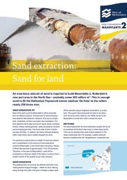
3 SAND EXTRACTION<br />
3.1 Method<br />
The environmental impact assessment determined the effects of different sand extraction scenarios. A sand extraction<br />
scenario was compiled for the Most Environment Friendly Alternative and for the Preferred Alternative on this basis.<br />
Three questions play a key role as regards sand extraction:<br />
1. Location: nearby or farther away?<br />
2. Arrangement of sand extraction pits: how deep?<br />
3. Execution: at what speed?<br />
The land reclamation plan will determine how much sand will be necessary to build <strong>Maasvlakte</strong> 2. A small proportion will be<br />
obtained through internal sand extraction, during deepening of the ports and turning basins and cutting through Yangtzehaven.<br />
Most of the sand extraction will take place in the North Sea.<br />
How do you extract sand at sea?<br />
Extracting. As with major land reclamation projects elsewhere in the world, the sand will be extracted at sea by means of<br />
Trailing Suction Hopper Dredgers. While slowly sailing, these large sand extraction vessels suck up a sand/water mixture<br />
from the seabed and store it in their hold. As a lot of water comes up with the sand, the hold quickly fills up, but initially with<br />
an insufficient load. By continuing to suction for a while and letting the superfluous water drain away via the “overflow” the hold<br />
slowly fills up with sand. The superfluous water also takes some of the suctioned fine sediment with it back into the sea.<br />
This is mainly small sand particles that immediately sink again in the immediate vicinity. Only the silt particles (smaller than<br />
63 micrometres) continue to float in the water and spread out across a larger area. On average the losses that occur during<br />
extraction on account of overflow come to approximately 15%.<br />
Dumping. Once the hold contains a sufficient load, the vessel sails to the dumping location where it will empty its load.<br />
Allowance is generally made for a loss of 7% during dumping. This is the percentage that was applied in the calculations<br />
for <strong>Maasvlakte</strong> 2, but in practice for this specific project the dumping losses will be considerably less. During dumping the<br />
larger part of the sand immediately goes to the targeted place. A fraction of the sand that will be placed on the inside of the<br />
sea walls will initially flow away and sink farther along, but will eventually end up in the right place.
18 environmental impact assessment | summary<br />
3.2 Sand extraction challenge: extracting the required volume at sea<br />
The table below shows how much sand will be necessary to construct the reclaimed land, maintain the coast and compensate<br />
for dunes at Delfland. The yield of internal extraction must be deducted from this volume. Rounded off the remaining volume<br />
comes to approximately 290 million m3.<br />
Required for <strong>Maasvlakte</strong> 2 project:<br />
- building of reclaimed land: 332 million m 3<br />
- sand for shoreline retention of <strong>Maasvlakte</strong> 2 for 10 years: 12 million m 3<br />
- sand for compensating for dunes at Delfland: 6 million m 3<br />
Total requirement: 350 million m 3<br />
Minus: yield from internal extraction (docks, cut-through) approx 60 million m 3<br />
Difference: total volume needed from the North Sea (rounded off): 290 million m 3<br />
The volume of sand extracted at sea that will ultimately be used effectively is smaller than the total volume of extracted sand.<br />
This is because losses occur during extraction (approximately 15% on average) and when tipping the sand (up to 7%).<br />
Also see the notes in the sidebar in section 3.1.<br />
The sand will be extracted in step with the phased construction of the reclaimed land. The sea walls will account for the<br />
largest proportion of the total volume of required sand (60%). The remaining 40% will be used to construct the sites of the<br />
inner area; the first part (20% of the total) will be used in phase 1, the remaining part (also 20%) in the following phase,<br />
i.e. the period after 2013. As construction of the sea walls and the first half of the sites will occur in the 2008-2013 period,<br />
the extraction of sand will be most intensive in this phase, i.e. 80% of the total.<br />
The figures stated above are summarised below in a table which has also been used as a basis for applying for the earth<br />
removal licence:<br />
Net volume required in phase 1 (2008-2013), including 10 years<br />
of maintenance and dune compensation<br />
230 million m 3<br />
Gross sand extraction requirement in phase 1 (2008-2013): net<br />
volume required + losses during extraction and dumping<br />
290 million m 3<br />
Net volume required in phase 2 (after 2013) 60 million m 3<br />
Gross sand extraction requirement in phase 2 (after 2013): net<br />
volume required + losses during extraction and dumping<br />
75 million m 3<br />
Total volume required in phases 1 and 2 290 million m 3<br />
Total gross sand extraction requirement in phases 1 and 2: net<br />
volume required + losses during extraction and dumping<br />
365 million m 3
environmental impact assessment | summary<br />
1<br />
3.3 Location<br />
Within the sand extraction search area (approximately 1,000 km2), there are a few distinct areas used for purposes incompatible<br />
with large-scale sand extraction, such as locations for mineral mining and dredged material disposal, oil and gas platforms, a military<br />
exercise area, cable and pipe lines and the Euro-Maasgeul. The remaining space, approximately 900 km2, is still considerably<br />
larger than the space needed for the sand extraction pits. This means choices may be made.<br />
The environmental impact assessment examined three alternative locations, in the form of “spots” (figure 3.1):<br />
• Spot 1: as close as possible to <strong>Maasvlakte</strong> 2. Extracting nearby will keep the overall environmental burden<br />
(energy consumption, emissions) as small as possible and is advantageous as regards transport costs.<br />
• Spot 2: far away from the Voordelta. This spot is located on the edge of the search area. It is situated in such a way<br />
that it is farthest away from the protected Voordelta.<br />
• Spot 3: concrete and masonry sand. At this sport there are likely to be locally at greater depths extractable layers<br />
of coarse sand. Removing the top covering layer through sand extraction for <strong>Maasvlakte</strong> 2 will loosen up the coarse<br />
sand. It could then be extracted in the future as a supply of concrete and masonry sand.<br />
Figure 3.1: the three spots<br />
<br />
<br />
<br />
<br />
<br />
<br />
<br />
<br />
<br />
<br />
<br />
<br />
These three spots are representative of the entire search area. Therefore, they are a good reflection of the possible choices,<br />
and of the bandwidth of the environmental effects of sand extraction, insofar as decisive for the choice of extraction location.
20 environmental impact assessment | summary<br />
3.4 Arranging the sand extraction pits<br />
Extraction depth: up to 20 m below the seabed<br />
The extraction depth is the most important variable for arranging the sand extraction pits. The present depth for extracting<br />
sand in the North Sea is 2 m below the seabed at most. The large volume required for <strong>Maasvlakte</strong> 2 makes it desirable to<br />
consider greater extraction depths, down to a maximum of 20 m below the seabed.<br />
In terms of environmental burden (energy consumption, emissions), the extraction depth is not a decisive factor, but it does<br />
determine the nature effects as regards the utilisation of space. Sand extraction will cause the disappearance of the locally<br />
present seabed life and complete recovery is likely to take two to four years.<br />
Figure 3.2: extraction depth (number of metres below the sea level) relative to the utilisation of space (acreage in km2)<br />
of sand extraction<br />
<br />
<br />
<br />
<br />
<br />
<br />
<br />
<br />
<br />
<br />
<br />
<br />
<br />
<br />
Figure 3.2 shows the relationship between the extraction depth and the size of the disturbed area of seabed. With extraction<br />
at 2 m below the seabed, the sand extraction would extend over a surface area of approximately 240 km2. Extraction 10 m<br />
below the seabed will reduce the surface area to 60 km2. Figure 3.2 shows that the greatest space utilisation saving will be<br />
achieved just with the step from 2 m to 10 m below the seabed. With extraction down to 20 m below the seabed, the utilisation<br />
of space would decrease still further, i.e. to 30 km2. At such an extraction depth, there will certainly be no ecological risks,<br />
such as unfavourable oxygen conditions in the pits that will remain in the seabed after sand extraction.<br />
The availability of equipment also plays a role as regards extraction depth, however. In the search area, the water is 20<br />
to 25 m deep. An extraction depth of, say, 20 m below the seabed would mean the pit would be 40 to 45 m below the water<br />
level. A distance of that kind is bridgeable only by Trailing Suction Hopper Dredgers, which, in addition to an on board pump,<br />
have an “underwater pump”. Trailing Suction Hopper Dredgers of that kind are scarce. At extraction depths of 10 to 15 m<br />
below the seabed, the availability of equipment (Trailing Suction Hopper Dredgers without an underwater pump) is not a<br />
limiting factor in principle.<br />
Shape, orientation and slope<br />
In terms of nature effects and environmental burden, it does not matter what shape the sand extraction pits have horizontally and<br />
how they are oriented in relation to the current. However, there are some constraints of a technical, morphological (erosion)<br />
and nautical (effects on the current) nature for shape and orientation. These constraints will be observed.<br />
The steepness of the pit slope has no environmental consequences, but nature effects do play a role. A workable situation<br />
is a pit slope not steeper than 1:7 and not milder than 1:10. A slope of 1:7 eliminates the risk of absence of oxygen along<br />
the edge of the pit. A pit slope milder than 1:10 is not an obvious choice because the space utilisation of the pits will increase,<br />
albeit to a limited extent.
environmental impact assessment | summary 21<br />
3.5 Performance of work<br />
Trailing Suction Hopper Dredgers<br />
Trailing Suction Hopper Dredgers (TSHDs) will be used between 2008 and 2013. The number of TSHDs in use will not exceed<br />
15 at any time. A smaller number will suffice for the extraction of the remaining 20% in the period after 2013. The definitive<br />
choice of vessels to be deployed will be made in the tendering procedure.<br />
Rate of extraction<br />
A variable for the performance of the work is the speed of extraction. The extraction speed depends on several factors:<br />
• amount of equipment used;<br />
• weather conditions: gales and also after-swells of the seawater;<br />
• progress of construction of the hard sea walls, which will provide protection for the sand to be put in elsewhere.<br />
The minimum extraction speed required to complete the first phase on time is an average of 60 million m3 per year. Based on a<br />
realistic assumption of the use of the fleet of dredgers, the maximum achievable extraction speed will be 150 million m3 per year.<br />
To obtain a complete picture of the effects of extraction speed, an interim variant with an extraction speed averaging<br />
100 million m3 per year was examined, in addition to the aforementioned extremes.<br />
The extraction speed is not a decisive factor in the total environmental burden, i.e. whether there is a shorter peak at a higher<br />
speed, or a more even distribution over a longer period at a lower speed. Calculated over the entire extraction period, however,<br />
the energy consumption and emissions will be the same.<br />
There are possibly differences as regards nature effects, but it is not possible to designate a clearly best choice. The extraction<br />
speed makes no difference to the total volume of fine silt that will end up in the sea through overflow during extraction.<br />
The current will carry some of this fine silt to the Voordelta. The fine silt concentration in the seawater in the Voordelta is<br />
an important consideration, because high fine silt concentrations can reduce the supply of food for locally foraging birds<br />
(see section 4.4).<br />
However, the weather conditions will be the dominating factor for the actual fine silt concentration at any one time. In a calm year,<br />
with few storms, the fine silt content is naturally low. In a stormy year, the fine silt content will be many times higher. Against the<br />
background of these natural fluctuations, the supply of fine silt as a result of sand extraction will make a relatively modest<br />
extra contribution - and not more than that, as the research has established. The extraction speed determines when and to<br />
what extent this extra contribution will occur:<br />
• at a higher speed there a peak in the increase of the fine silt concentration in the Voordelta will occur sooner, but the<br />
extra contribution the sand extraction makes to the fine silt concentration will also decrease faster;<br />
• a lower extraction speed will distribute the increase of the fine silt concentration caused by sand extraction more over<br />
time and the peaks in the supply will level out somewhat.<br />
At the maximum achievable extraction speed, the number of years with highly intensive extraction will be the smallest, so there<br />
will be the smallest likelihood of the peak coincidentally coinciding with a stormy year. With a low extraction speed, the extra<br />
supply of fine silt caused by sand extraction will make a smaller contribution to the total fine silt content in the Voordelta, but there<br />
will be an increased probability - because extraction takes longer – of the extra contribution occurring in an unfavourable year<br />
(with storms). In other words:<br />
• an extraction speed of 150 m3 per year produces a smaller probability of a greater effect;<br />
• an extraction speed of 60 million m3 per year produces a greater probability of a smaller effect;<br />
• an extraction speed of 100 million m3 per year falls in between the bandwidth extremes in terms of probability and effect.<br />
Alternative sand extraction methods not possible<br />
A large land reclamation project like <strong>Maasvlakte</strong> 2, whereby the sand has to be obtained relatively far out at sea, can only<br />
be carried out by using large trailing suction hopper dredgers. The ideal way of limiting the environmental effects of sand<br />
extraction with these vessels effectively is by making well- founded decisions regarding the location, extraction depth and<br />
extraction rate, in conjunction with technical measures designed to minimise the adverse effects of overflow. With the<br />
present state-of-the-art there are no practicable alternative sand extraction methods with less environmental impact for the<br />
volumes required for <strong>Maasvlakte</strong> 2.
22 environmental impact assessment | summary<br />
3.6 Most Environment Friendly Alternative and Preferred Alternative<br />
The table below sets against each other the Most Environment Friendly Alternative and the Preferred Alternative for<br />
sand extraction. The table focuses on the core matters of (1) location, (2) depth of the pits and (3) extraction speed.<br />
The choices in the Most Environment Friendly Alternative and Preferred Alternative are based on the results of the<br />
environmental impact survey, as set out in greater detail in chapter 4 of this summary. It is necessary in the notes<br />
beneath the table to deal with some matters ahead of that chapter.<br />
Most Environment Friendly Alternative<br />
Preferred Alternative<br />
Location Spot 1: close to <strong>Maasvlakte</strong> 2 Spot 1: close to <strong>Maasvlakte</strong> 2<br />
Pit depths 20 metres below the seabed On average at least 10 to at most 20 metres below<br />
the seabed<br />
Extraction rate At most 150 million m 3 per year At most 150 million m 3 per year<br />
Location<br />
An important observation in the study is that sand extraction for <strong>Maasvlakte</strong> 2 will not have any significant effects on protected<br />
nature values in and around the Voordelta, even if extraction occurs in spot 1, i.e. near <strong>Maasvlakte</strong> 2. The fine silt carried to<br />
the Voordelta - and the related nature effects - will be greater than in the case of extraction in the more distant spot 2, however.<br />
But even in the worst case scenario, the effects will be limited and of a temporary nature. On completion of the work there will<br />
be complete recovery and the potential fluctuations in the populations will be smaller than the natural fluctuations. This effect<br />
will not obstruct sustainable development of the natural populations.<br />
For the determination of the Most Environment Friendly Alternative, the potential limitations of the environmental burden<br />
(energy consumption, emissions) are important considerations, in addition to the effects on the protected nature values.<br />
A significant extra effort will be necessary to comply with legislation in this field, such as laws covering air quality and climate.<br />
The extra fuel consumption for extraction in spot 2 is estimated at 75 million litres in the first phase. Another relevant matter<br />
is that situating extraction in spot 1 is the only possibility for reducing the totality of energy consumption and emissions<br />
caused by sand extraction; it cannot be achieved through choices for the depth and speed of extraction.<br />
Based on the foregoing, extraction in spot 1 has been adopted as the point of departure for the Most Environment<br />
Friendly Alternative. In the Preferred Alternative, extraction at spot 1 is also preferable, for the same reasons as stated above and<br />
on account of a substantial saving on transport costs. The additional costs of extraction in spot 2 are estimated at €160 million.<br />
Concrete and masonry sand<br />
The effects of extraction in spot 3 on the Voordelta will be at least in the same order of magnitude as in spot 1, while emissions<br />
and costs will increase substantially because of the longer sailing distance. Therefore, there is no reason why the project initiator<br />
should choose this option. In spot 1 there are likely to be dispersed occurrences of concrete and masonry sand. These will not be<br />
“disturbed” during dredging, but they will be freed up so that they are available<br />
Depth of pits<br />
Space utilisation will be minimised at a maximum extraction depth of 20 m below the seabed. Therefore, the Most<br />
Environment Friendly Alternative assumes that for all pits the extraction depth will be 20 m below the seabed.<br />
The Preferred Alternative uses for the extraction depth a bandwidth averaging at least 10 m and at most 20 m below<br />
the seabed. An important consideration is that the sufficient availability of equipment poses a problem if there is an<br />
obligatory extraction depth of 20 m. Based on ecological considerations (limitation of space utilised for sand extraction),<br />
an average extraction depth of a least 10 m below the seabed has been chosen. The only exception is the occurrence<br />
of concrete and masonry sand at a few places in spot 1.<br />
Speed of extraction<br />
It has been established that speed will depend mainly on weather conditions:<br />
• whether the temporary carrying of fine silt to the Voordelta will cause nature effects due to the sand extraction;<br />
• and, if so, how large those effects will be.<br />
As mentioned earlier, a higher extraction speed means a smaller probability of a larger effect, while a lower extraction speed<br />
means a greater probability of a smaller effect. But regardless of how high or low the extraction speed is, the temporary extra<br />
supply of fine silt will not lead in any of the cases – at no time whatsoever or for any species - to a point being reached where<br />
the sand extraction can be considered a cause of significant effects on nature values in the Voordelta.
environmental impact assessment | summary 23<br />
With that in mind there is no added value to managing according to speed of extraction. This also means that, ecologically, there is<br />
no reason to include specific extraction speed conditions in the Most Environment Friendly Alternative. Therefore, the extraction<br />
speed will be determined by the possibilities the project offers during its implementation, i.e. the maximum deployable fleet<br />
of dredgers, weather conditions and progress in constructing the hard sea walls. The speed determined according to these<br />
factors will be at most 150 million m3 a year. This figure is the point of departure both in the Most Environment Friendly Alternative<br />
and in the Preferred Alternative.<br />
4 EFFECTS<br />
4.1 Working method<br />
The description of effects in this chapter shows mainly the differences between a situation where <strong>Maasvlakte</strong> 2 will not<br />
be constructed (autonomous development) and a situation where it will be constructed. Chapters 2 and 3 show that the<br />
differences between the Most Environment Friendly Alternative and the Preferred Alternative are so small that they<br />
cannot usually be expressed in differences in effects.<br />
The effects of the construction work, including sand extraction, will clearly be the greatest in the 2008-2013 period.<br />
Construction of the remaining part of the inner area and remaining 20% of sand extraction will take place after 2013.<br />
By then all effects of construction work will be significantly less.<br />
In the presence phase, only the reclaimed land itself will still cause effects. The use made of the reclaimed land<br />
(companies, traffic) will also have environmental consequences, but they are described in the EIA for the Zoning of<br />
<strong>Maasvlakte</strong> 2. Potential forms of a cumulation of effects – one on top of the other - of the construction and use of <strong>Maasvlakte</strong> 2<br />
are discussed at the end of this chapter.<br />
4.2 Coast and sea<br />
Construction and presence of <strong>Maasvlakte</strong> 2 will have various consequences for the physical characteristics of the coast<br />
and sea area (including the seabed) and for the processes that occur there, such as the current and the transport of sand<br />
and fine silt. Some of these effects are particularly relevant because they can affect nature. Additionally, there are effects that<br />
will have maintenance consequences, i.e. shoreline retention and dredging maintenance. Coast and sea aspects unaffected<br />
by <strong>Maasvlakte</strong> 2 have been disregarded, such as protection against flooding in the surrounding area, because neither land<br />
reclamation nor sand extraction will have any influence on these aspects.<br />
Effects of land reclamation in the presence phase that will have a knock-on effect on nature<br />
Various species and habitats in the Voordelta are protected under the Nature Conservation Act. The largest protected<br />
habitat type in the Voordelta is easily habitat type 1110, “Sandbanks slightly covered by sea water all the time”, with the<br />
seabed at a depth of NAP 0 to -20 m. <strong>Maasvlakte</strong> 2 will cause a loss of acreage of habitat type 1110:<br />
• direct space utilisation on 1110 acreage will be approximately 2000 ha, the gross size of the reclaimed land;<br />
• the presence of the reclaimed land means the speed of the current seawards from the reclaimed land will increase<br />
here and there. The current will carry with it sand from the seabed. To the west of the sea walls this will create an<br />
erosion pit. The number of hectares over which the pit will be deeper than NAP -20 m at a particular time will also count<br />
as a loss of 1110 acreage. After ten years the part of the erosion pit below NAP -20 m will have a maximum size of<br />
approximately 470 ha.
24 environmental impact assessment | summary<br />
The presence of the reclaimed land will not only change the current near <strong>Maasvlakte</strong> 2, but also farther away. This will have<br />
minor consequences for the carrying of fine silt along the coast. Along the Dutch coast the fine silt concentrations will<br />
decrease, while slightly farther out to sea they will increase.<br />
Since the closing off of Haringvliet in 1970, Haringvlietmond (the Haringvliet entrance) has gradually become shallower.<br />
This process will continue for many years yet. Consequently, the salt spray at Voorne and Goeree will decrease. Land<br />
reclamation will slow down the ongoing shallowing of Haringvlietmond. As a result, the salt spray at Voorne and Goeree<br />
will decrease less fast than in the situation without <strong>Maasvlakte</strong> 2.<br />
Present situation and autonomous<br />
development<br />
Situation with <strong>Maasvlakte</strong> 2<br />
Direct space utilisation Not applicable Approx. 2,000 ha<br />
Size of erosion pit below NAP -20<br />
metresAP<br />
Not applicable<br />
At most 470 ha after ten years<br />
Fine silt carried along the coast in the<br />
presence phase<br />
Haringvlietmond and salt spray at<br />
Voorne and Goeree<br />
No changes<br />
Ongoing shallowing of Haringvlietmond,<br />
ongoing reduction of salt spray<br />
Decreasing fine silt concentrations along<br />
the coast, slight increase farther out to<br />
sea.<br />
Slowing down of shallowing of<br />
Haringvlietmond, slowing down of<br />
reduction of salt spray<br />
Effects of sand extraction in the construction phase that will have a knock-on effect on nature<br />
The most important effect - in the light of the knock-on effect on nature - is that the extraction of sand will release fine silt.<br />
The fine silt will spread with the tidal current both to the south and north and will join the fine silt that is naturally present.<br />
In the Voordelta the concentration of fine silt will increase. At a higher fine silt concentration, the water will become cloudier.<br />
Section 4.4 explains the nature effects this might cause. The natural variation in fine silt concentration is exceptionally large<br />
anyway: after severe storms in the winter, the water is far cloudier than during a slightly longer period with very calm<br />
weather in summer, because of the fine silt swirled up from the seabed. Typical values for the annual average fine silt<br />
concentration in the Voordelta are 20-30 mg/litre near the coast and 5-10 mg/litre farther out to sea. The increase in the<br />
annual average fine silt concentration in the Voordelta caused by sand extraction will reach at most approximately 6 mg/litre<br />
in 2010. During stormy periods the fine silt concentration will rise to 100 mg/litre.<br />
Annual average fine silt concentration<br />
in Voordelta near coast<br />
Present situation and autonomous<br />
development<br />
Situation with <strong>Maasvlakte</strong> 2<br />
20-30 mg/l Temporary annual average increase of 6<br />
mg/litre in 2010 (maximum effect)<br />
Shoreline retention and maintenance dredging<br />
Along a large section of the Dutch coast it is necessary to replenish sand periodically to stop the coastline from receding.<br />
This is called shoreline retention. <strong>Maasvlakte</strong> 2 will have consequences for shoreline retention only at the location of the<br />
land reclamation and not for coastal sections in the vicinity (Delfland, Voorne, Goeree) or farther away. At the existing<br />
<strong>Maasvlakte</strong> and Slufter, an average of 0.8 million m3 of sand per year is currently being provided. As a result of <strong>Maasvlakte</strong><br />
2 this will increase to approximately 1.2 million m3 per year.<br />
Compared with present maintenance dredging, the maintenance dredging in the construction phase will increase. On<br />
account of the construction of the soft sea walls and the sand extraction, more fine sediment will temporarily enter coast<br />
and sea system. Some will sink in the Maasgeul and farther on in the Maas entrance and in the existing docks. In the<br />
present situation and in the autonomous development, the maintenance dredging here comes to 16 million m3 per year.<br />
This will increase by approximately 45% in the 2008-2013 period and then decrease again.<br />
The volume of maintenance dredging in the presence phase will remain virtually the same. In the period after 2013, the sea walls<br />
will shift the current outwards, so less fine sediment will sink in the Maas entrance and in the docks. Therefore, less dredging will<br />
be necessary there compared with the present situation. Against this, however, more sand than at present will enter the Maasgeul<br />
after 2013. This is because just in front of the reclaimed land sand from the soft sea walls and from the seabed will wash away to<br />
the Maasgeul through waves and currents. In the presence phase (after 2013) there will therefore be two opposing mechanisms<br />
that cancel each other out: less sedimentation in the Maas entrance and docks, more accretion in the Maasgeul.
environmental impact assessment | summary 25<br />
Present situation and autonomous<br />
development<br />
Situation with <strong>Maasvlakte</strong> 2<br />
Shoreline retention for<br />
<strong>Maasvlakte</strong>:<br />
Maintenance (replenishments) in<br />
million m 3 per year<br />
Maintenance dredging in<br />
construction phase (2008-2013)<br />
in million m 3 per year<br />
Maintenance dredging in<br />
presence phase in million m 3 per<br />
year<br />
0,8 1.2 (increase of 50%, with bandwidth of<br />
50%)<br />
16,0 23.4 (increase of 45%, with bandwidth of<br />
50%)<br />
16,0 14.8 – 16.5 (bandwidth -1.2 +0.5 million)<br />
4.3 <strong>Environmental</strong> quality<br />
Air quality<br />
Fuel consumed by equipment will cause emissions of substances that will affect air quality. For the air quality on land, the<br />
emissions near or on the reclaimed land will be the most significant. The Trailing Suction Hopper Dredgers (TSHDs) will<br />
make the greatest contribution when sailing near the coast and/or dumping sand at the land reclamation site, followed by<br />
suction-cutter dredgers that deepen the port basin and create the Yangtzehaven cut-through.<br />
The Air Quality Decree names relevant substances and specifies limit values for maximum permissible concentrations in<br />
the air. Particularly important in the Rijnmond region are the concentrations of NO2 (carbon dioxide), SO2 (sulphur dioxide)<br />
and PM10 (particulate matter). These concentrations are already high, particularly those of carbon dioxide and particulate<br />
matter. This prompts the question of what extra contribution the construction of <strong>Maasvlakte</strong> 2 will make in relation to the<br />
background concentrations. This matter was examined using model calculations for three reference points, i.e. Hook of<br />
Holland, existing <strong>Maasvlakte</strong> and Voornes Duin.<br />
The construction work will produce an increase of carbon dioxide and sulphur dioxide, but the standard will not be exceeded.<br />
The average annual concentration of particulate matter is satisfactory at present and will continue to meet the standard in<br />
the autonomous development and if <strong>Maasvlakte</strong> 2 is constructed. There is a second standard that applies to particulate<br />
matter, i.e. a concentration higher than 50 μg/m3 may occur not more than 35 days per calendar year. The most recent<br />
data and model calculations show that this 24-hour standard will come close to being reached – 33 days - in the specific<br />
case of Hook of Holland in the autonomous development (2010). At an extraction rate of 150 million m3 per year, there will<br />
for two to three years be an increase by one day (to 34 days) in the calculated number of overshoot days at this reference<br />
point. Even then, however, the standard will not be exceeded.
26 environmental impact assessment | summary<br />
The table below shows the calculated concentrations at Hook of Holland. It can be seen that construction of <strong>Maasvlakte</strong> 2<br />
will not cause violation of the relevant air quality standards. The same conclusions apply to the other two reference points.<br />
Hook of Holland Standard Situation in<br />
2010 without<br />
construction of<br />
<strong>Maasvlakte</strong> 2<br />
Situation in<br />
2010 with<br />
construction of<br />
<strong>Maasvlakte</strong> 2<br />
Increase<br />
Annual average NO 2<br />
concentration 40 μg/m 3 22,5 μg/m 3 24,3 μg/m 3 +1,8 μg/m 3<br />
(+8,0 %)<br />
Annual average SO 2<br />
concentration 20 μg/m 3 3,9 μg/m 3 4,7 μg/m 3 +0,8 μg/m 3<br />
(+20,5%)<br />
Annual average PM 10<br />
concentration 40 μg/m 3 28,80 μg/m 3 28,93 μg/m 3 +0,13 μg/m 3<br />
(+0.45%)<br />
Compliance<br />
with standard<br />
Yes<br />
Yes<br />
Yes<br />
Number of days with daily average 35 days 33 days 34 days +1 day Yes<br />
concentration higher than 50 μg/m 3<br />
Noise<br />
A distinction can be made between underwater noise and air noise (i.e. noise above the water). Dredgers are the main source<br />
of underwater noise, but it was found during the study that the noise level below water does not rise to disturbance level.<br />
The dredging fleet and above all the equipment used to reclaim land will be the determinants of air noise. The total noise<br />
load will not exceed the standards stipulated in the Noise Nuisance Act at any time during construction of <strong>Maasvlakte</strong> 2.<br />
The calculated noise contours will remain sufficiently far away from the residential areas situated closest to the reclaimed land<br />
(Hook of Holland) and from designated quiet areas in the region.<br />
4.4 Nature<br />
In the construction phase, the temporary increase of the fine silt concentration in the Voordelta will be particularly important,<br />
even though it will not cause any significant nature effects. In the presence phase, the space utilised by the reclaimed land<br />
will be the dominant factor. It will have significant effects for one protected habitat type and three protected bird species.<br />
These effects are unavoidable because it is not possible to achieve any further reduction of space utilisation. The marine<br />
reserve will compensate for these effects.<br />
Construction: disturbance and impairment of seabed life<br />
Sand extraction and construction work for land reclamation will cause disturbance because of noise (below and above water)<br />
and the use of equipment, which may frighten off shy species. This disturbance may temporarily cause them to avoid the<br />
area in the immediate vicinity of the source of the disturbance. Many protected species have a large action radius, however,<br />
and within the large Voordelta there are ample alternative locations. Therefore, the temporary effect on the living and foraging<br />
area of protected species (birds, mammals and fish) will be slight. Permanent effects will not occur.<br />
A local and temporary effect of sand extraction will be the impairment of seabed life. With an extraction depth up to 20 m<br />
below the seabed, there will be no obstructions for recolonisation. Complete recovery is likely to take two to four years.<br />
Construction: nature effects caused by increased fine silt concentration<br />
At an extraction speed not exceeding 150 million m3 per year, the fine silt concentration in the Voordelta will for a few years<br />
be higher than the normal annual average concentration. The study examined what effects this temporary increase may<br />
have for all protected nature values in the Voordelta. For the protected habitat types (seabed, flats and salt marshes) there will<br />
be no consequences: the same applies to by far most protected species. There is a chance that effects may occur for three<br />
species of shellfish-eating ducks (eider, Black Sea duck and scaup) and two species of fish-eating birds (common tern<br />
and sandwich tern).
environmental impact assessment | summary 27<br />
Chain from intervention to effect for shellfish-eating ducks and fish-eating birds<br />
The eider, scaup and Black Sea duck are present each winter in the Voordelta. The annual variations in numbers are<br />
large particularly in the case of the Black Sea duck. This is partly due to the major fluctuations in the availability of their food<br />
in the Voordelta and elsewhere along the Dutch and Belgian coast. Therefore, the Voordelta is an important potential<br />
foraging area for this species in the winter.The chain from intervention (temporary increase<br />
of fine silt concentration) to possible effect (probability of a temporary reduction of the population)<br />
consists of the following links for these shellfish-eating ducks. A higher fine silt concentration<br />
makes the water cloudier and reduces incidence of light. This slightly slows the growth of algae,<br />
food for shellfish and shellfish larvae. A particularly important matter in relation to shellfish is<br />
that the peak in algae growth, the “spring blossom”, can occur one or two weeks later than<br />
usual because of the reduced incidence. This can create a situation where at a certain time<br />
there are numerous shellfish larvae that have just come out floating in the water, while the spring blossom – on which the<br />
larvae rely for their nutrition – has not yet started. This produces a mismatch: the peak in the demand for food of the<br />
shellfish larvae will be out of sync with the supply of food. The shellfish larvae will then grow more slowly and by the time<br />
they settle on the seabed they will be smaller than in a situation without a mismatch. It is assumed that this delay in growth<br />
cannot be made good. Growth will further be restricted because with an increased fine silt concentration there will relatively<br />
speaking be more uneatable fine silt and fewer eatable algae in the water. The shellfish that live on the sea bed and filter<br />
some of their food out of the water will therefore grow less quickly. The potential consequence of this mechanism is that the<br />
meat weight of the shellfish in autumn will be lighter, and that by consequence there will be less food available for the eider,<br />
scaup and Black Sea duck.<br />
A reduction of the translucency because the water is cloudier when there are higher fine silt concentrations may also have<br />
temporary consequences for the common tern and the sandwich tern, especially in the breeding season. If the water<br />
close to the coast becomes so cloudy that they find it more difficult to see their prey fish, these birds<br />
that hunt by sight, may have to fly farther to get their food. In the breeding season, this may be<br />
at the expense of the success of breeding and thus the size of the population. This is based on<br />
a worst case scenario, however, because there are indications that prey fish come closer to<br />
the water surface if they believe they are less visible. This matter was not taken into account<br />
in calculating the maximum effect, however.<br />
It is expressible in a figure what the maximum potential effect will be for the eider, scaup and Black Sea duck if the concurrence of<br />
circumstances described in the sidebar produces the worst case scenario for each link in the chain. Given the multiplicity of<br />
relevant factors, however, there is an equally great chance that the effect of increased fine silt concentrations will ultimately be zero.<br />
The table below therefore explicitly shows for the eider, scaup and Black Sea duck a bandwidth between no effect and<br />
maximum effect. The table also shows the maximum potential effect (worst case) for the common tern and sandwich tern.<br />
The maximum percentages given also include the – relatively modest – impact of disturbance to the cormorant, Black Sea<br />
duck and sandwich tern caused by sand extraction vessels during construction.<br />
Potential effects on population in<br />
Voordelta<br />
Situation in 2009-2011 without sand<br />
extraction for <strong>Maasvlakte</strong> 2<br />
Situation in 2009-2011 with sand<br />
extraction for <strong>Maasvlakte</strong> 2<br />
Eider No effect. Reduction: 0% to at most 6.4 %<br />
Scaup No effect. Reduction: 0% to at most 5.0 %<br />
Black Sea duck No effect. Reduction: 0% to at most 7.1 %<br />
Common tern No effect. Reduction: at most 0.9 %<br />
Sandwich tern No effect. Reduction: at most 0.9 %<br />
The maximum potential effect was assessed as “not significant” for each of the five species. The most important consideration<br />
is that a temporary effect is concerned, one that will not cause a structural, permanent reduction of the population. The maximum<br />
reduction is also substantially less than the natural fluctuations that occur in the size of the populations.<br />
Presence: four significant effects caused by space utilisation<br />
The presence of the reclaimed land will have four significant effects for the protected nature values in the Voordelta for<br />
which compensatory measures are mandatory. In line with nature conservation laws allowance was made, when assessing<br />
“significance” and determining the compensatory requirement, for other developments and projects in the Voordelta and<br />
also for the environmental effects of use of <strong>Maasvlakte</strong> 2 (commercial activities, traffic).
28 environmental impact assessment | summary<br />
The first significant effect is the loss of acreage of protected habitat type 1110, “Sandbanks slightly covered by sea water<br />
all the time”, with the seabed at a depth of NAP 0 to -20 m. The reclaimed land will take up approximately 2,000 ha; the size of the<br />
part of the erosion pit below NAP -20 m will have increased after 10 years to approximately 470 ha. In total, almost 2,500 ha of 1110<br />
acreage will be lost. This represents a reduction of 2.8% of the total acreage of this habitat type in the Voordelta. Other projects<br />
and developments in the Voordelta and the use of <strong>Maasvlakte</strong> 2 will not increase this loss any further. The principal reason for<br />
considering a 2.8% reduction a “significant effect” is that the seabed covering will be permanent and irreversible because of the<br />
reclaimed land. It will be possible to take additional measures only at the erosion pit to slow or stop the erosion process.<br />
The maximum potential effect for the Black Sea duck is that 3.1% of the potential foraging area will be lost (in winter).<br />
This is due mainly to the presence of the reclaimed land. Use of <strong>Maasvlakte</strong> 2 will make a modest extra contribution (0.3%).<br />
Other developments and projects in the Voordelta will not play a role. This is a significant effect: although sea ducks are<br />
certainly not present in large numbers in the Voordelta every year, if it does occur it will be because they really need the<br />
Voordelta in the winter concerned as a foraging area. In such a situation there will be no fallback alternatives.<br />
<strong>Maasvlakte</strong> 2 will reduce the living and foraging area of the common tern, so the size of the population in the Voordelta will<br />
decrease by at most 5.9% in relation to the average population size in recent years. Other developments and projects in<br />
the Voordelta will not increase this effect. This is a permanent effect, so it is considered “significant”.<br />
For the sandwich tern, the total effect on population size was calculated as a reduction of 3.7% in the Voordelta. <strong>Maasvlakte</strong> 2,<br />
including its use, will make a 1.7% contribution to this figure. The sandwich tern forages at sea in summer. Recreation in<br />
the Voordelta is likely to become more intensive in summer, thus increasing the disturbance of sandwich terns (a contribution<br />
of 2% to the total). A cumulative reduction of the population by 3.7% can be considered a significant effect, because the<br />
sandwich tern is an endangered species in the Netherlands, the total European population is vulnerable, and the calculated<br />
effect is largely of a permanent nature.<br />
The presence of the reclaimed land will not have any significant effects on any other protected species in the Voordelta,<br />
and the same applies to the other protected habitat types like flats and salt marshes. The “significance limit” will not be<br />
exceeded for any of these protected nature values even when the effects of use of <strong>Maasvlakte</strong> 2 and other developments<br />
and projects in the Voordelta are added (cumulation) to the effects of the presence of <strong>Maasvlakte</strong> 2.<br />
Compensation<br />
The four significant effects described above require compensatory measures. The compensation will be provided by<br />
creating a marine reserve in the Voordelta, together with a management plan. The point of departure for sizing the marine<br />
reserve is that it must be at least 10 times as large as the ultimate loss of 1110 acreage. Ten times the maximum loss of<br />
2,500 ha of 1110 acreage works out to compensation of 25,000 ha. The PKB has made a spatial reservation for the marine<br />
reserve of 31,250 ha, within a search area of approximately 40,000 ha. Within the search area, approximately 5,000 ha is<br />
unsuitable for compensation (because of a different habitat type, for example), but there will still be approximately 10,000 ha<br />
of potentially usable “residual space”. Moreover, when the Voordelta management plan is next updated, there will be<br />
possibilities for intensifying nature-related management activities. It is unlikely that this will prove necessary, but it is<br />
important to note that it can be done if it must be done.<br />
<strong>Maasvlakte</strong> 2 will not have any adverse effects for the protected nature areas of Voornes Duin and Duinen van Goeree.<br />
The construction work will not cause any disturbance at these places. Optimising the plan (the step from the PKB Reference<br />
Alternatives to the Cut-through Alternative) means the presence of the reclaimed land will not have any adverse effects on<br />
nature in the two dune areas. This is worth noting because earlier - during stocktaking of the environmental effects of the<br />
PKB Reference Alternatives - an expectation existed that <strong>Maasvlakte</strong> 2 would accelerate the reduction of the salt spray at<br />
Voorne and Goeree. In point of fact, the Cut-through Alternative will actually slow down the reduction of salt spray.<br />
This means that compensatory measures for the beach-dune system and dunes, for which the PKB has also reserved space,<br />
will no longer be necessary on account of the effects of the construction and presence of <strong>Maasvlakte</strong> 2. The space reserved<br />
for the beach-dune system compensation will definitely not need to be used. Compensation for the dunes remains a requirement,<br />
but for an entirely different reason that at the time of the PKB procedure was not sufficiently recognised. Air pollution as a result<br />
of use of <strong>Maasvlakte</strong> 2 (particularly emissions by the increasing amount of shipping) may lead to significant effects on nature<br />
values in the dunes. The compensation requirement for this is less than the dune compensation estimated in the PKB,<br />
however, so there will still be “residual space” for the dune compensation.
environmental impact assessment | summary 29<br />
4.5 Nautical safety and accessibility<br />
Nautical safety for shipping to and from the Rotterdam port will be retained at its present high level:<br />
• In the construction phase there will be usage rules for dredgers and other vessels to ensure that safety is not jeopardised<br />
and that regular shipping will not be inconvenienced by the construction work.<br />
• As regards external (nautical) safety, there will be no effects in the construction phase, either at sea or in the port,<br />
on the localised risk and group risk. External (nautical) safety in the usage phase was factored into the EIA for the<br />
Zoning of <strong>Maasvlakte</strong> 2.<br />
• In the presence phase, the current in the Maasgeul will be better than it is at present. The maximum speed of the current<br />
across the Maasgeul and the change of the cross-current speed over a certain distance (“cross-current gradient”)<br />
will decrease. <strong>Maasvlakte</strong> 2 will be constructed in a way that at least retains the current characteristics of the current<br />
flow in the construction phase.<br />
• The Port of Rotterdam Authority is at present working on a set of measures to keep future accessibility and safety up<br />
to standard and improve it still further where possible. The consequences of extra shipping as soon as <strong>Maasvlakte</strong> 2<br />
goes into use will be incorporated into the set of measures. The set of measures cover such matters as optimisation<br />
of the control of shipping and adjustments to the port<br />
infrastructure, like alterations to a number of landing<br />
stages and an existing berth in Yangtzehaven, and<br />
the widening of the curve to Beerkanaal (excavation<br />
of part of Papegaaienbek or Kop van de Beer).<br />
• A nodal analysis was performed to identify the effects<br />
on hinterland links (inland shipping). In combination<br />
with the EIA for Zoning (traffic and transport), it has<br />
been concluded that the presence of <strong>Maasvlakte</strong> 2<br />
will have no effects on the hinterland links.<br />
• Research into the sailing times of shipping, by means<br />
of a simulation model, showed there will only be a<br />
slight increase in the turnaround time for vessels<br />
that have the present <strong>Maasvlakte</strong> as their destination.<br />
4.6 Other effects<br />
Usage functions<br />
The reclaimed land will take up a small area where fishing currently takes place. This concerns mainly fishing by means of<br />
smaller vessels, like cotters, which have Stellendam as their home port. During the extraction of sand there will be some<br />
fishing restrictions because it will not be possible to fish at the location of the sand extraction pits.<br />
In the construction phase separate measures will be taken to safeguard the cooling water function. The construction and<br />
presence of the reclaimed land and the extraction of sand will not have any consequences for any other usage functions.<br />
Archaeology<br />
At the place of the reclaimed land there are archaeological values from different eras at different depths in the seabed,<br />
varying from traces of hunting and fishing that occurred here when the area was a brackish water lagoon (from 8000 to<br />
6500 BC) to the wreck of the Danish steamship Cornelia Maersk that sunk in 1942.<br />
Possible archaeological values were identified using existing information and some additionally obtained information. The seabed<br />
study that will precede extraction will have to provide a greater insight into this matter. Known locations will be avoided,<br />
unless they occur in planned fairways or at the place of the hard sea walls. Special work procedures will be drawn up to<br />
avoid impairing archaeological values as far as possible.<br />
Shared used by recreational visitors<br />
A precondition is that recreational possibilities in the presence phase may not be less than they are at present. This precondition<br />
will be amply met, because there will be more beach, at least as many beach entrances and equivalent water sport possibilities.<br />
<strong>Maasvlakte</strong> 2 will not have any consequences for local beaches.<br />
Sand extraction in the construction phase will not affect the quality of swimming water or recreation. However, work on the<br />
land reclamation will clearly have consequences. The present beach along the existing <strong>Maasvlakte</strong> will be closed off and<br />
the new beach along the soft sea walls of <strong>Maasvlakte</strong> 2 will not be opened until permitted by the construction work on the<br />
outside of the soft sea walls.
30 environmental impact assessment | summary<br />
4.7 Cumulation<br />
When determining the cumulative effects between construction and use of <strong>Maasvlakte</strong> 2, the year 2015 was chosen as a<br />
calibration point, on the one hand because it ties in with the planning period of 10 years in the zoning plan, and on the other<br />
because in 2015 construction will be in progress while companies will already be operational. Traffic and transport streams<br />
will still be limited because only a small surface area will already be in use as port and industry sites in 2015. Additionally,<br />
a large part of the construction work will have been finished by 2015. Similarly, the contribution of road traffic resulting from<br />
construction work will have few effects and will remain within the bandwidth. Moreover, the cumulative effects for all other<br />
matters will not exceed the permissible effects within the environmental space determined in the EIA for the Zoning of<br />
<strong>Maasvlakte</strong> 2. The cumulative effects on nature will also remain within the prescribed constraints (see section 4.4).<br />
Another important matter is whether cumulation will occur with other projects. Other projects were identified and examined<br />
for that purpose. The conclusion is that none of the projects will produce a cumulative effect. So by consequence this also<br />
applies to eye-catching projects like a revised opening hours regime at the Haringvliet locks, sand extraction at sea for<br />
other projects and the strengthening of “Weak Links” in the coastal defences. Similarly, no work or projects are expected<br />
to occur that will cumulate locally on the effects of construction on air quality.<br />
4.8 Knowledge gaps and monitoring<br />
Following the research there are no knowledge gaps to prevent further decision-making. The alternatives have sufficiently<br />
crystallised out to serve as a good point of departure for forecasting effects. The land reclamation plan has been worked<br />
out in detail and there is sufficient clarity about how the construction work (including the sand extraction) will take place.<br />
The final choices for performing some work will be made later when contracting out the work to a contractor. Wherever the<br />
precise working method may influence the effects, an “upper limit” approach was adopted. This means the maximum<br />
effects were defined. The likelihood of the effects being greater in reality can be deemed nonexistent.<br />
The best available methods and techniques were used to forecast effects. Especially for the effects on the coast and sea<br />
and on nature, various workshops were held with experts to check the research results. Wherever model calculations identified<br />
a bandwidth in the forecast effects:<br />
• either the maximum effect (worst case) was taken as a baseline, also when defining the nature effects, mindful of the<br />
precautionary principle;<br />
• or the expected value was defined with explicit statement of the bandwidth in question.<br />
Applying an upper limit for the uncertainties means that any knowledge gaps do not stand in the way of further decision-making.<br />
At the same time, the use of an upper limit makes clear where there are gaps in knowledge, i.e. precisely at those<br />
places where the expectation is more favourable than the baseline, but the available knowledge is insufficient to validate<br />
this sufficiently. These knowledge gaps concern mainly the effects of construction work on coast and sea aspects<br />
and their translation into effects on nature.<br />
The actual effects of construction and presence of <strong>Maasvlakte</strong> 2 will be studied in an extensive monitoring and<br />
evaluation programme. This ties in partly with existing regular monitoring, but sub-studies specifically focused on<br />
<strong>Maasvlakte</strong> 2 will also be carried out. Field research and baseline measurements - which are necessary for systematic<br />
monitoring - were started in autumn 2004 and some will continue until the start of construction work, and also after<br />
completion of construction, so as to monitor and evaluate the effects of the presence of <strong>Maasvlakte</strong> 2. Monitoring includes<br />
the effectiveness of the measures in the marine reserve.
environmental impact assessment | summary 31<br />
5 STOCKTAKING<br />
Stocktaking is possible now there is a complete picture of the alternatives. For that purpose, we will return to the point that<br />
started this summary: the PKB. Is the plan for the <strong>Maasvlakte</strong> 2 construction project the best way of fulfilling the ambitions<br />
formulated in the PKB? And are the alternatives and effects compatible with the constraints stated in the PKB?<br />
The PKB contains 17 “fundamentally important decisions” that define the intended result and constraints. The “fundamentally<br />
important decisions” will not be dealt with individually below, but have been grouped into three clusters called land<br />
reclamation, sand extraction and nature.<br />
5.1 Land reclamation<br />
The intended result is reclaimed land that will be used by deep sea-related companies, with a maximum of 1,000 ha net<br />
allocable land, located within a search area with borders specified in the PKB. The land reclamation plan completely meets<br />
this requirement. The method ultimately chosen for phasing construction is also in line with the objective and planning of the<br />
phasing contained in the PKB. The inner area will be built in phases, the sea walls will immediately be placed in the final position:<br />
phased construction of the sea walls provides no added value ecologically, and is clearly more disadvantageous from the point of<br />
view of other relevant matters.<br />
A precondition is that the present high level of accessibility and safety for shipping must at least be maintained. The plan<br />
is geared to meeting this condition: the port infrastructure of the inner area meets the requirements, and through the shape<br />
of the sea walls there will be an improved current in the Maasgeul compared with the present situation. Regulations for<br />
performance of construction work and usage rules for dredgers and other vessels will ensure that accessibility and safety<br />
in the construction phase will at least match the current level.<br />
The negative environmental effects of the final plan may not exceed the environmental effects of the two PKB Reference Alternatives.<br />
In that respect, the Cut-through alternative is an important result: it is more compact than the Reference Alternatives and the<br />
sea walls are oriented more favourably. The effects on coast and sea and on nature will thus be smaller. Similarly, the final plan<br />
is in every respect better than the Reference Alternatives with regard to other environmental effects.<br />
Air quality<br />
“Air quality” has become a major item of attention in spatial projects in recent years, particularly in projects in areas where<br />
the limit values for maximum permissible concentrations are already close to being violated. Air quality is not mentioned as<br />
a separate subject in the Key Planning Decision (PKB), but a great effort was made in the environmental impact assessments<br />
for the construction and zoning of <strong>Maasvlakte</strong> 2 to keep or get the effects within the standards. It ultimately proved possible<br />
to carry out the construction work in such a way that there will be no violations of air quality standards.<br />
5.2 Sand extraction<br />
Sand will be extracted within the search area demarcated in the PKB for sand extraction. The possibilities mentioned in the<br />
PKB for the mitigating measures were examined and applied to a far-reaching extent. As regards examination of the remaining<br />
non-significant nature effects, the mitigation of effects for the grey environment also played a role. The final result is that the<br />
sand extraction can be carried out with limited non-significant temporary effects, without any permanent effect, on the strictly<br />
protected nature values, while the effects on air quality and other emissions by the dredgers will be limited.<br />
The PKB further mentions a number of implementation aspects that the EIA must address: choice of location, extraction depth,<br />
working methods and a possible combination with future extraction of concrete and masonry sand. All of these aspects have<br />
been addressed in the EIA for Construction of <strong>Maasvlakte</strong> 2. This has resulted in a Most Environment Friendly Alternative and<br />
a Preferred Alternative for the extraction of sand, with a validation of the choices for all relevant implementation aspects.
32 environmental impact assessment | summary<br />
5.3 Nature<br />
This summary makes clear that nature played a very important role in the EIA, both in the development of the alternatives and<br />
in the research into the effects. Perhaps the most illustrative of what this ultimately produced is the compensatory requirement.<br />
The PKB makes spatial reservations for three compensation projects, but it follows also from the PKB that there is a best-effort<br />
obligation actively to look for ways of limiting the effects on protected nature, so that ultimately there will be a compensation<br />
requirement that is as small as possible. The achieved result is that, based on the construction of <strong>Maasvlakte</strong> 2, there will be<br />
no need at all for compensatory measures for the dune-beach system or for dunes. The marine reserve will be necessary,<br />
however, to compensate for the unavoidable significant effects resulting from the utilisation of space for the land reclamation.<br />
The compensation requirement that the marine reserve must absorb is significantly less than the reservation made for it in the<br />
PKB, however. The reserved space left over thus provides a possibility to reverse any disappointing effects resulting from the<br />
land reclamation and/or the disappointing effectiveness of measures in the marine reserve.<br />
5.4 Conclusion<br />
The above justifies the conclusion that it has indeed proved possible to pursue the ambitions contained in the PKB in the best<br />
possible way. All constraints contained in the PKB and constraints embedded in important legal frameworks (nature, air)<br />
will be met. And as there are no knowledge gaps to obstruct decision-making - see the conclusion at the end of chapter 4 -<br />
it is now possible to move on to the implementing decisions.<br />
6 NEXT STEPS<br />
The course of the procedures<br />
Two EIAs were carried out under the responsibility of the Port of Rotterdam Authority, the initiator of the <strong>Maasvlakte</strong> 2 project.<br />
They are the EIA for Construction of <strong>Maasvlakte</strong> 2 and the EIA for the Zoning of <strong>Maasvlakte</strong> 2. Both environmental impact<br />
assessments will be made available for public inspection at the same time, together with various other documents, i.e. the<br />
requests for the required implementing decisions for land reclamation and sand extraction, a preliminary zoning plan for<br />
<strong>Maasvlakte</strong> 2 and the Appropriate <strong>Assessment</strong> of the effects of construction and use on the protected Natura 2000 areas.
environmental impact assessment | summary 33<br />
Figure 6.1: Diagrammatic representation of the project and the environmental impact assessments in relation to decisionmaking<br />
<br />
<br />
<br />
<br />
<br />
<br />
<br />
<br />
<br />
<br />
<br />
<br />
<br />
<br />
<br />
<br />
<br />
Figure 6.1 is a diagrammatic representation of the decision-making procedures that will be followed. The plan is to let<br />
decision-making on construction (land reclamation and sand extraction) run in synch with the decision-making on zoning<br />
(the zoning plan that will serve as a spatial guideline for activities on <strong>Maasvlakte</strong> 2). The various decision-making authorities<br />
will harmonise the decisions that are taken.<br />
There will first be a six-week consultative period. At the same time, there will be consultation at governmental level. During the<br />
consultative period, anybody may respond to the documents open for inspection. This may be done in writing or orally,<br />
at hearings that will be held towards the end of the consultative period at various places in the region. Advertisements and<br />
the website www.maasvlakte2.com provide practical information about the consultation round, such as where documents<br />
can be inspected, how to respond, where and when the hearings will be held and so on.<br />
All written responses of the consultation round and the minutes of the hearings will be forwarded to the <strong>Environmental</strong><br />
<strong>Impact</strong> <strong>Assessment</strong> Committee. The experts of this independent committee will examine whether the information in the<br />
EIAs is correct and complete: do the documents contain sufficient information to be able to weigh up environmental<br />
interests properly during decision-making? The EIA Committee will present its opinion in an “expert recommendation”<br />
submitted to the decision-making authorities.
34 environmental impact assessment | summary<br />
The decision-making authorities will then come into play. They will factor into their decision-making the information<br />
contained in the EIAs, the responses during the consultation round, outcomes of the governmental consultations and<br />
the expert recommendation of the EIA Committee. For decision-making on the construction of <strong>Maasvlakte</strong> 2, the Minister<br />
of Transport, Public Works and Water Management is the competent authority for the land reclamation concession,<br />
the licence under Public Works (Management) Act and the earth removal licence. The Minister of Agriculture, Nature and Food<br />
Quality is the competent authority for the licence under the Nature Conservation Act and the exemption under the Flora and<br />
Fauna Act. The draft decisions of the two ministers will be made available for public inspection. Afterwards, the definitive<br />
decision-making will take place. It will be possible to appeal against decisions to the Administrative Jurisdiction Division of the<br />
Council of State.<br />
Planning<br />
The objective is to complete all decision-making procedures definitively towards the end of 2007. During 2007 the tendering<br />
procedure will also be completed, resulting in a contract with the contractor who will carry out the work.<br />
The start of construction is planned for 2008. The planning of the work was explained earlier in this summary of the EIA<br />
for Construction of <strong>Maasvlakte</strong> 2: the first phase of construction will be dominated by building the sea walls and the first<br />
sites of the inner area. From 2013, the first companies can be operational on <strong>Maasvlakte</strong> 2. In the second phase, after 2013,<br />
the remaining sites will be built and gradually put into service.
Port of Rotterdam Authority<br />
Project Organization <strong>Maasvlakte</strong> 2<br />
P.O. Box 6622<br />
3002 AP Rotterdam<br />
The Netherlands<br />
T +31 (0)10 252 1111<br />
F +31 (0)10 252 1100<br />
E<br />
W<br />
W<br />
infomv2@portofrotterdam.com<br />
www.portofrotterdam.com<br />
www.maasvlakte2.com