Geography - St Joseph School, Blata l-Bajda
Geography - St Joseph School, Blata l-Bajda
Geography - St Joseph School, Blata l-Bajda

Create successful ePaper yourself
Turn your PDF publications into a flip-book with our unique Google optimized e-Paper software.
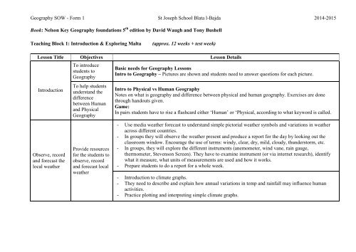
<strong>Geography</strong> SOW - Form 1 <strong>St</strong> <strong>Joseph</strong> <strong>School</strong> <strong>Blata</strong> l-<strong>Bajda</strong> 2014-2015<br />
Book: Nelson Key <strong>Geography</strong> foundations 5 th edition by David Waugh and Tony Bushell<br />
Teaching Block 1: Introduction & Exploring Malta<br />
(approx. 12 weeks + test week)<br />
Lesson Title Objectives Lesson Details<br />
Introduction<br />
Observe, record<br />
and forecast the<br />
local weather<br />
To introduce<br />
students to<br />
<strong>Geography</strong><br />
To help students<br />
understand the<br />
difference<br />
between Human<br />
and Physical<br />
<strong>Geography</strong><br />
Provide resources<br />
for the students to<br />
observe, record<br />
and forecast local<br />
weather<br />
Basic needs for <strong>Geography</strong> Lessons<br />
Intro to <strong>Geography</strong> – Pictures are shown and students need to answer questions for each picture.<br />
Intro to Physical vs Human <strong>Geography</strong><br />
Notes on what is geography and difference between physical and human geography. Exercises are done<br />
through handouts given.<br />
Game:<br />
In pairs students have to rise a flashcard either ‘Human’ or ‘Physical, according to what keyword is called.<br />
- Use media weather forecast to understand simple pictorial weather symbols and variations in weather<br />
across different countries.<br />
- In groups they will observe the weather present and produce a report for the day by looking out the<br />
classroom window. Encourage the use of terms: windy, clear, dry, mild, cloudy, thunderstorm, etc.<br />
- In groups, they will explore the different instruments (anemometer, wind vane, rain gauge,<br />
thermometer, <strong>St</strong>evenson Screen). They have to examine instrument (or via internet research), identify<br />
what it measure, what units of measurements are used and how it works.<br />
- Prepare students to do a report for a whole week.<br />
- Introduction to climate graphs.<br />
- They need to describe and explain how annual variations in temp and rainfall may influence human<br />
activities.<br />
- Practice plotting and interpreting simple climate graphs.
<strong>Geography</strong> SOW - Form 1 <strong>St</strong> <strong>Joseph</strong> <strong>School</strong> <strong>Blata</strong> l-<strong>Bajda</strong> 2014-2015<br />
Lesson Title Objectives Lesson Details<br />
- Watch the animation of Sea of Tethys, students comment on size of Mediterranean over span of time.<br />
- Exploring and learning more about the different five Maltese rock layers using different resources<br />
Sedimentary<br />
Rocks<br />
Karst Features<br />
created by water<br />
Help students<br />
discover the<br />
characteristics of<br />
the geological<br />
formation of the<br />
Maltese Islands<br />
Encourage students<br />
to explore the<br />
karstic features<br />
created by water as<br />
it flows through<br />
permeable rocks<br />
- The teacher explains the terms associated with sedimentary rock (strata; bedding planes, fossils,<br />
horizontal layers, youngest layer, oldest layer).<br />
- Through the use of flashcards or interactive whiteboard they find out the sequence of 5 layers and main<br />
characteristics.<br />
- Information through powerpoint presentation on the different rocks.<br />
- In groups students example general and geological maps of Malta to find out the surface rock at given<br />
locations. They will associate the type of soils which one can find at these given locations.<br />
- Information about Soil and its conservation locally.<br />
- Show Postojna Caves. Discuss how various features seeing in view might have been formed (erosion,<br />
deposition, length to form, made of).<br />
- They will be asked to draw their imaginary cave including stalactites, stalagmites, underground lakes,<br />
pillars and pot holes. They will then share with each other their cave, like giving a tour (in pairs).<br />
- Explanation of the difference between porous, permeable and impermeable rocks.<br />
- <strong>St</strong>udents are asked to research a famous cave using internet providing list (Lascaux caves, Castellana<br />
caves, Postojna Caves, Cheddar caves, Carlsbad Caverns) and appropriate websites. Each group will<br />
have to compile a fact file on cave in question and download images and write simple captions under<br />
each photo. Each group will share his findings with the rest of the class.<br />
- Summary: project images of features on interactive whiteboard and students have to identify features<br />
by dragging and inputting correct geo terms next to feature. Also can draw annotated diagrams and<br />
explain the process of how each feature was formed.
<strong>Geography</strong> SOW - Form 1 <strong>St</strong> <strong>Joseph</strong> <strong>School</strong> <strong>Blata</strong> l-<strong>Bajda</strong> 2014-2015<br />
OUTING Options 1st term:<br />
- Museum of Natural History in Mdina and/or Limestone Heritage<br />
Teaching Block 2: Exploring Malta (1)<br />
(approx. 14 weeks + 2 exam weeks)<br />
Topic: Settlements and Transport (Exploring Malta 2)<br />
Lesson Title Objectives Activities<br />
Towns and<br />
villages in Malta<br />
Help students<br />
identify the<br />
location and<br />
characteristics of<br />
large towns and<br />
villages in Malta<br />
- Provide different images of various settlements (Mdina, Sliema, Zurrieq, Marsaxlokk, Mgarr, Mellieha,<br />
Victoria, Xaghra). In pairs they have to name the localities and classify under rural, urban, hamlet,<br />
village, town, coastal, inland.<br />
- Flash cards/powerpoint with main characteristics and functions of settlements are provided, and<br />
students have to classify the photos according to rural or urban. Then they will locate these settlements<br />
on given outline map of Malta.<br />
- In groups they have to list as many localities as the can recall from Maltese Islands. Then each group<br />
with a Maltese map and they have to explore these places listed.<br />
- Then present to each group a task (e.g. devise a route for a group of tourist arriving at Malta with a<br />
cruise liner to visit Blue Grotto).<br />
- Google earth can be used to zoom on most important towns In Malta and Gozo. By their shape the<br />
students categorise the settlements under the different settlement patterns namely linear, nucleated,<br />
planned, unplanned shape. Simple sketch maps of these settlements to be done.<br />
- This can help in population and changes http://www.citypopulation.de/
<strong>Geography</strong> SOW - Form 1 <strong>St</strong> <strong>Joseph</strong> <strong>School</strong> <strong>Blata</strong> l-<strong>Bajda</strong> 2014-2015<br />
Traffic:<br />
problems and<br />
solutions<br />
Traffic (optional<br />
lesson)<br />
Present problems<br />
of traffic flow and<br />
congestion in urban<br />
areas so that<br />
students may<br />
suggest possible<br />
solutions<br />
Practice presenting<br />
information,<br />
plotting graphs and<br />
discussing on<br />
changes<br />
- Show a ‘spaghetti junction’ and then students discuss in pairs why roads and other transport routes are<br />
geographically important as means of communication. Also to realise that movement of people and<br />
goods has caused numerous problems.<br />
- Class is arranged in small teams. Present images of problems caused by traffic congestion in urban<br />
areas (traffic jams, accidents, exhaust fumes, lack of parking areas). <strong>St</strong>udents discuss the problems and<br />
encourage finding out the causes for such problems (narrow roads, too many cars, on-street parking,<br />
rush hour traffic, dirty fuels). Each group is to list some of the causes leading to traffic problems in<br />
towns and the problem these are creating (use images and captions to enhance chart).<br />
- This game can be of help to make sense http://www.its.umn.edu/GridlockBuster/<br />
- Let students discuss how such a new public transport system can help reduce congestion and pollution<br />
on roads. Present each group with two possible solutions how traffic problems can be solved (e.g. Cars<br />
will not be allowed to park in city centres; building an underground railway similar to that of London;<br />
introduce parking meters in city centres; drastically reduce bus fares; reduce parking spaces in city<br />
centres; easy wheelchair and pram access on buses). Ask students to discuss these solutions by seeing<br />
the advantages and disadvantages and then lead a class discussion. Finally students are to make a<br />
summary of discussion.<br />
- <strong>St</strong>udents in groups will do surveys about traffic and then in class they will produce simple report, enter<br />
date in table form, produce bar charts using ICT, construct traffic flow charts.<br />
- Images are shown of traffic features (bus lanes, bicycle lanes, car parks, park and ride schemes,<br />
flyovers, bypasses, tunnels, underground trains, traffic signs, CVA). <strong>St</strong>udents need to suggest why such<br />
measures are necessary to reduce traffic problems.
<strong>Geography</strong> SOW - Form 1 <strong>St</strong> <strong>Joseph</strong> <strong>School</strong> <strong>Blata</strong> l-<strong>Bajda</strong> 2014-2015<br />
Teaching Block 3: Exploring Malta (2)<br />
(approx. 7 weeks + 2 exam weeks)<br />
Topic: Plans and Maps (Map Detectives)<br />
Lesson Title Objectives Lesson Details<br />
To get oriented<br />
with Maltese<br />
Islands position in<br />
relation with<br />
Mediterranean and<br />
European<br />
Countries<br />
Location of<br />
countries,<br />
islands and<br />
capital cities<br />
To show location<br />
and component<br />
parts of the Maltese<br />
Islands, and others<br />
around<br />
- In groups students will go through this Quiz with maps and pictures of Europe and the Mediterranean<br />
(e.g. What country touches both Spain and Italy? Of which country is Athens the capital city?)<br />
OR<br />
- Locate places in Europe and/or Mediterranean. Either by:<br />
o Flash cards: placed on maps<br />
o Dragging on smart board<br />
o Recognising shape of countries either on computer game or else given an outline political map of<br />
Europe and Mediterranean and they have to colour<br />
- Handouts about Mediterranean Countries<br />
Drawing plans<br />
Learning to<br />
drawing vertical<br />
representations<br />
- Google Earth use to zoom on school or home<br />
- Draw simple objects found in class, outside, etc as seen from above (windows, chairs, stairs, corridor,<br />
trees, benches)<br />
- Explain the need of drawing symbols, adding labels and a key.<br />
- Handout with note on Plans and Maps<br />
- As HW, ask them to draw a plan of a room at home including all the features discussed in class.
<strong>Geography</strong> SOW - Form 1 <strong>St</strong> <strong>Joseph</strong> <strong>School</strong> <strong>Blata</strong> l-<strong>Bajda</strong> 2014-2015<br />
Measurement<br />
and Scale<br />
(Routes and<br />
Distances on<br />
Plans and Maps)<br />
Help students to<br />
draw simple routes<br />
and measure<br />
distances on plans<br />
and maps<br />
translating them to<br />
real distances<br />
- Provide students with atlases and wall maps to identify the various examples of scales used on various<br />
maps – ratio, representative fraction and linear scale are identified<br />
- Show how to represent the same scale in different ways and practice skill<br />
- Ask students to measure straight line distances.<br />
- Using the atlas, in groups, they measure straight and curved distances (roads and rivers) using linear<br />
scale and representative ratio (1cm =5km) on large maps<br />
Finding<br />
Directions<br />
Plans and maps are<br />
provided for<br />
students to find<br />
directions<br />
- Identify with the students from where does the sun rises and sets.<br />
- Learn about the eight main points of compass, in Maltese and English.<br />
- Use class to identify the different directions starting with the east. Then in groups or pair, use a map of<br />
Malta to show some places to ask students the compass direction of one place from another.<br />
- HW: work using directions & directions and distances<br />
OS map<br />
symbols and<br />
grid reference<br />
Help students to<br />
locate places or<br />
map symbols by<br />
the use of 4-figure<br />
grid reference<br />
- Working in groups, students are given different images of local physical and human features, and they<br />
will have to match the appropriate symbol.<br />
- Explain how grid squares are identified on OS Maps by using the maps themselves.<br />
- <strong>St</strong>udents will compile co-ordinates for a number of features and locate places using the 4-figure grid<br />
reference
<strong>Geography</strong> SOW - Form 1 <strong>St</strong> <strong>Joseph</strong> <strong>School</strong> <strong>Blata</strong> l-<strong>Bajda</strong> 2014-2015<br />
Lesson Title Objectives Activities<br />
- In groups. Each group will be supplied with times related to fishing (can of tuna, packet of fish fingers,<br />
and packet of smoke salmon, restaurant menu). They will write the story of the particular fish focusing<br />
as an introduction to the whole process of fishing including the types of fish, fishing grounds, fishing<br />
village, tools, methods employed. OR<br />
- Provide students with different fishing gears and have to see what they know about the fish they eat<br />
such as names, where and how they were caught any another information. Then share with class.<br />
Fishing<br />
Tourism<br />
Present various<br />
traditional and<br />
modern methods of<br />
fishing around the<br />
central<br />
Mediterranean<br />
Help students<br />
explore Malta’s<br />
main attractions as<br />
well as benefits and<br />
the negative<br />
impacts of tourism<br />
on the local<br />
economy and<br />
environment<br />
- <strong>St</strong>udents are provided and research different fishing methods. They share with the class and then as<br />
whole class discuss: which method is least harmful to the environment? To the non-targeted species?<br />
How to these fishing actions affect sustainability of the resource?<br />
- As HW, research a species of fish (lampuki, tuna, swordfish, and octopus) by answering a set of<br />
questions given and presenting final work on a poster.<br />
- Teacher provides an outline map of Malta and they need to mark the fishing villages and can include<br />
info such as no of fulltime/part time fisherman, number of fishing boats.<br />
- Show video of tuna over-fishing in Mediterranean and explore the causes, problems and possible<br />
solutions.<br />
- Class debate on being in favour and not in favour of fish-farming. They first watch a video clip on fish<br />
farming and take related points. Then they will discuss the benefits to the economy of aquaculture, the<br />
environmental impacts or conflicts that may result. At the end the students will present a written report<br />
giving both points of view.<br />
- Show video clips found on the official Tourism site. Class in groups and each group will be asked to<br />
list some physical and human attractions which appeal to tourists visiting Malta, including climate,<br />
culture, heritage, natural landscape, diving, nightlife, hotels, etc.<br />
- Provide groups of student with a set of resources, brochures, timetables and they have to plan a<br />
sightseeing tour of Malta and /or Gozo for a group for European visitors for a one week stay. Aim is to<br />
give a feel of some important places and offer various activities. Discuss with students what might be<br />
considered important and why. [Info from tourism site of Malta, Visit Malta, Heritage Malta, Din l-art<br />
helwa, Fondazzjoni wirt artna, nature trust]. Ask students to write up the itinerary, to show it in map<br />
form and to justify their choices. Presentations to share with class and be as competition as the most<br />
interesting tour.
<strong>Geography</strong> SOW - Form 1 <strong>St</strong> <strong>Joseph</strong> <strong>School</strong> <strong>Blata</strong> l-<strong>Bajda</strong> 2014-2015<br />
- <strong>St</strong>udents will be asked to list down as many jobs they can recall which are related to the tourist industry<br />
(fully related – hotels, restaurants; indirectly related – transport, souvenir, heritage; non-related). This<br />
will help them to conclude that tourism constitutes a large sector of Maltese economy.<br />
- Show different images of negative impacts of the tourist industry (hotel obscuring scenic view or<br />
breaking sky line, overcrowding on beach, rubbish bags opposite restaurant, large development project<br />
on garigue, traffic congestion, noise in tourist areas, strain on infrastructure, impact on biodiversity)<br />
and through role play students give their perspective from various points of view.