NC Register Volume 24 Issue 19 - Office of Administrative Hearings
NC Register Volume 24 Issue 19 - Office of Administrative Hearings
NC Register Volume 24 Issue 19 - Office of Administrative Hearings

You also want an ePaper? Increase the reach of your titles
YUMPU automatically turns print PDFs into web optimized ePapers that Google loves.
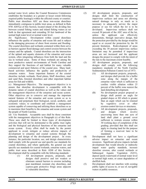
APPROVED RULES<br />
normal water level, unless the Coastal Resources Commission<br />
establishes the boundary at a greater or lesser extent following<br />
required public hearing(s) within the affected county or counties.<br />
Public trust shorelines AEC are those non-ocean shorelines<br />
immediately contiguous to public trust areas, as defined in Rule<br />
07H .0207(a) <strong>of</strong> this Section, located inland <strong>of</strong> the dividing line<br />
between coastal fishing waters and inland fishing waters as set<br />
forth in that agreement and extending 30 feet landward <strong>of</strong> the<br />
normal high water level or normal water level.<br />
(b) Significance. Development within coastal shorelines<br />
influences the quality <strong>of</strong> estuarine and ocean life and is subject<br />
to the damaging processes <strong>of</strong> shore front erosion and flooding.<br />
The coastal shorelines and wetlands contained within them serve<br />
as barriers against flood damage and control erosion between the<br />
estuary and the uplands. Coastal shorelines are the intersection<br />
<strong>of</strong> the upland and aquatic elements <strong>of</strong> the estuarine and ocean<br />
system, <strong>of</strong>ten integrating influences from both the land and the<br />
sea in wetland areas. Some <strong>of</strong> these wetlands are among the<br />
most productive natural environments <strong>of</strong> North Carolina and<br />
they support the functions <strong>of</strong> and habitat for many valuable<br />
commercial and sport fisheries <strong>of</strong> the coastal area. Many landbased<br />
activities influence the quality and productivity <strong>of</strong><br />
estuarine waters. Some important features <strong>of</strong> the coastal<br />
shoreline include wetlands, flood plains, bluff shorelines, mud<br />
and sand flats, forested shorelines and other important habitat<br />
areas for fish and wildlife.<br />
(c) Management Objective. The management objective is to<br />
ensure that shoreline development is compatible with the<br />
dynamic nature <strong>of</strong> coastal shorelines as well as the values and<br />
the management objectives <strong>of</strong> the estuarine and ocean system.<br />
Other objectives are to conserve and manage the important<br />
natural features <strong>of</strong> the estuarine and ocean system so as to<br />
safeguard and perpetuate their biological, social, aesthetic, and<br />
economic values; to coordinate and establish a management<br />
system capable <strong>of</strong> conserving and utilizing these shorelines so as<br />
to maximize their benefits to the estuarine and ocean system and<br />
the people <strong>of</strong> North Carolina.<br />
(d) Use Standards. Acceptable uses shall be those consistent<br />
with the management objectives in Paragraph (c) <strong>of</strong> this Rule.<br />
These uses shall be limited to those types <strong>of</strong> development<br />
activities that will not be detrimental to the public trust rights<br />
and the biological and physical functions <strong>of</strong> the estuarine and<br />
ocean system. Every effort shall be made by the permit<br />
applicant to avoid, mitigate or reduce adverse impacts <strong>of</strong><br />
development to estuarine and coastal systems through the<br />
planning and design <strong>of</strong> the development project. In every<br />
instance, the particular location, use, and design characteristics<br />
shall comply with the general use and specific use standards for<br />
coastal shorelines, and where applicable, the general use and<br />
specific use standards for coastal wetlands, estuarine waters, and<br />
public trust areas described in Rule .0208 <strong>of</strong> this Section.<br />
Development shall be compatible with the following standards:<br />
(1) All development projects, proposals, and<br />
designs shall preserve and not weaken or<br />
eliminate natural barriers to erosion including<br />
peat marshland, resistant clay shorelines, and<br />
cypress-gum protective fringe areas adjacent<br />
to vulnerable shorelines.<br />
(2) All development projects, proposals, and<br />
designs shall limit the construction <strong>of</strong><br />
impervious surfaces and areas not allowing<br />
natural drainage to only so much as is<br />
necessary to adequately service the major<br />
purpose or use for which the lot is to be<br />
developed. Impervious surfaces shall not<br />
exceed 30 percent <strong>of</strong> the AEC area <strong>of</strong> the lot,<br />
unless the applicant can effectively<br />
demonstrate, through innovative design, that<br />
the protection provided by the design would be<br />
equal to or exceed the protection by the 30<br />
percent limitation. Redevelopment <strong>of</strong> areas<br />
exceeding the 30 percent impervious surface<br />
limitation may be permitted if impervious<br />
areas are not increased and the applicant<br />
designs the project to comply with the intent <strong>of</strong><br />
the rule to the maximum extent feasible.<br />
(3) All development projects, proposals, and<br />
designs shall comply with the following<br />
mandatory standards <strong>of</strong> the North Carolina<br />
Sedimentation Pollution Control Act <strong>of</strong> <strong>19</strong>73:<br />
(A) All development projects, proposals,<br />
and designs shall provide for a buffer<br />
zone along the margin <strong>of</strong> the<br />
estuarine water which is sufficient to<br />
confine visible siltation within 25<br />
percent <strong>of</strong> the buffer zone nearest the<br />
land disturbing development.<br />
(B) No development project proposal or<br />
design shall permit an angle for<br />
graded slopes or fill which is greater<br />
than an angle which can be retained<br />
by vegetative cover or other<br />
erosion-control devices or structures.<br />
(C)<br />
All development projects, proposals,<br />
and designs which involve<br />
uncovering more than one acre <strong>of</strong><br />
land shall plant a ground cover<br />
sufficient to restrain erosion within<br />
30 working days <strong>of</strong> completion <strong>of</strong> the<br />
grading; provided that this shall not<br />
apply to clearing land for the purpose<br />
<strong>of</strong> forming a reservoir later to be<br />
inundated.<br />
(4) Development shall not have a significant<br />
adverse impact on estuarine and ocean<br />
resources. Significant adverse impacts include<br />
development that would directly or indirectly<br />
impair water quality standards, increase<br />
shoreline erosion, alter coastal wetlands or<br />
Submerged Aquatic Vegetation (SAV),<br />
deposit spoils waterward <strong>of</strong> normal water level<br />
or normal high water, or cause degradation <strong>of</strong><br />
shellfish beds.<br />
(5) Development shall not interfere with existing<br />
public rights <strong>of</strong> access to, or use <strong>of</strong>, navigable<br />
waters or public resources.<br />
<strong>24</strong>:<strong>19</strong> NORTH CAROLINA REGISTER APRIL 1, 2010<br />
1713