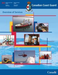
RADIO AIDS TO MARINE NAVIGATION - Canadian Coast Guard
RADIO AIDS TO MARINE NAVIGATION - Canadian Coast Guard
RADIO AIDS TO MARINE NAVIGATION - Canadian Coast Guard

Create successful ePaper yourself
Turn your PDF publications into a flip-book with our unique Google optimized e-Paper software.
NUMBER SEC<strong>TO</strong>R NAME<br />
3 1<br />
4 1<br />
5 1<br />
6 1<br />
7 1<br />
8 1<br />
9 1<br />
10 1<br />
11 1<br />
12 1<br />
Chup<br />
Point<br />
Ten Mile<br />
Point<br />
Dunsmuir<br />
Point<br />
Amphitrite<br />
Point<br />
Estevan<br />
Point<br />
Nootka<br />
Sound<br />
Esperanza<br />
Inlet<br />
Solander<br />
Island<br />
Kains<br />
Island<br />
(Quatsino<br />
Sound)<br />
Cape Scott<br />
Triangle<br />
Island<br />
13 1 Zone Limit<br />
CALLING-IN-POINTS<br />
GENERAL DESCRIPTION &<br />
CONDITIONS<br />
A line joining Chup Point with<br />
Mutine Point.<br />
A line extending 256° (True) from<br />
Ten Mile Point light to the opposite<br />
shore of Alberni Inlet.<br />
A line extending 090° (True) from<br />
Dunsmuir Point light to the opposite<br />
shore of Alberni Inlet.<br />
A line extending 220° (True) from<br />
Amphitrite Point light to the limit of<br />
the Territorial Sea.<br />
A line extending 220° (True) from<br />
Estevan Point light to the limit of the<br />
Territorial Sea.<br />
A line joining Estevan Point light and<br />
Bajo Point.<br />
A line joining Ferrer Point and<br />
Tatchu Point.<br />
A line extending 220° (True) from<br />
Solander Island light to the limit of<br />
the Territorial Sea.<br />
A line joining Kwakiutl Point and<br />
Cape Parkins.<br />
A line extending 281° (True) from<br />
Cape Scott light, passing through<br />
Cox and Lanz Islands to Triangle<br />
Island.<br />
A line extending 220° (True) from<br />
Triangle Island to the limit of the<br />
Territorial Sea.<br />
GEOGRAPHIC DESCRIPTION<br />
A line joining 48°57’20”N 125°01’37”W;<br />
to 48°56’33”N 125°01’06”W<br />
A line extending 256° (T) from<br />
49°03’34”N 124°50’22”W; to<br />
49°03’20.5”N 124°51’44”W<br />
A line extending 090° (T) from<br />
49°09’16”N 124°48’26”W; to<br />
49°09’16”N 124°47’42”W<br />
A line extending 220° (T) from<br />
48°55’17”N 125°32’23”W; to<br />
48°46’06”N 125°44’02”W<br />
A line extending 220° (T) from<br />
49°23’00”N 126°32‘32”W; to<br />
49°13’47”N 126°44’25.5”W<br />
A line joining 49°23’00”N 126°32’32”W;<br />
to 49°37’06”N 126°49’35”W<br />
A line joining 49°44’57”N 126°58’54”W;<br />
to 49°51’35”N 127°08’56”W<br />
A line extending 220° (T) from<br />
50°06’40.5”N 127°56’17”W; to<br />
49°57’26”N 128°08’16”W<br />
A line joining 50°21’09”N<br />
127°59’27.5”W; to 50°26’38”N<br />
128°02’43.5”W<br />
A line extending 281° (T) from<br />
50°46’57”N 128°25’32”W; to<br />
50°52’00”N 129°05’00”W<br />
A line extending 220° (T) from<br />
50°52’00”N 129°05’00”W; to<br />
50°42’11”N 129°18’00”W<br />
3-22