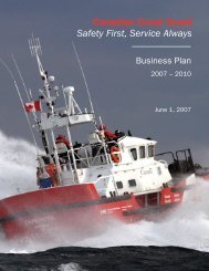
RADIO AIDS TO MARINE NAVIGATION - Canadian Coast Guard
RADIO AIDS TO MARINE NAVIGATION - Canadian Coast Guard
RADIO AIDS TO MARINE NAVIGATION - Canadian Coast Guard

You also want an ePaper? Increase the reach of your titles
YUMPU automatically turns print PDFs into web optimized ePapers that Google loves.
NUMBER SEC<strong>TO</strong>R NAME<br />
16 2 Lucy Islands<br />
17 2<br />
18 2<br />
Pillsbury<br />
Point<br />
Edye<br />
Passage<br />
19 2 Wales Point<br />
20A 2<br />
Butterworth<br />
Rocks<br />
20B Change Seal Rocks<br />
21 Change<br />
Rose Spit<br />
Seal Rocks<br />
22 2 Rose Spit<br />
23 2<br />
24 Change<br />
25 1<br />
International<br />
Boundary<br />
Dixon<br />
Entrance<br />
Langara<br />
Point / Point<br />
Cornwallis<br />
Langara<br />
Island<br />
26 1 Tasu Sound<br />
27 1<br />
28 1<br />
29 1<br />
30 1<br />
Cape St.<br />
James<br />
McInnes<br />
Island Cape<br />
St. James<br />
Cape Mark<br />
McInnes<br />
Island<br />
Bonilla<br />
Island<br />
Sandspit<br />
CALLING-IN-POINTS<br />
GENERAL DESCRIPTION &<br />
CONDITIONS<br />
A line from Lucy Islands light to<br />
Tugwell Island.<br />
A line joining Pillsbury Point and<br />
Tobey Point.<br />
A 3 NM arc centered on Table<br />
Point. Mariners are encouraged to call<br />
at Gull Rocks when entering or exiting<br />
Edye Passage.<br />
A line joining Wales Point to<br />
Maskelyne Point.<br />
A line from Jacinto Point light to<br />
Butterworth Rocks light thence to Seal<br />
Rocks light.<br />
Mariners shall report routing if not<br />
using Brown Passage.<br />
A line joining Seal Rocks light to Oval<br />
Point on Porcher Island.<br />
A line joining Rose Spit with Seal<br />
Rock light.<br />
A line extending 000° (True) from<br />
Rose Spit to the International<br />
Boundary.<br />
A line following the International<br />
Boundary between Alaska, USA and<br />
British Columbia, Canada between<br />
Cape Muzon light and Wales Island.<br />
Mariners shall report whether their<br />
route is through Holliday Passage,<br />
Oriflamme Passage or Main Passage<br />
when transiting Chatham Sound.<br />
A line joining Langara Point light and<br />
Point Cornwallis light.<br />
A line extending 220° (True) from<br />
Langara Point light to the limit of the<br />
Territorial Sea.<br />
A line extending 220° (True) from<br />
Davidson Point light to the limit of the<br />
Territorial Sea.<br />
Mariners shall report at Davidson<br />
Point entering or exiting Tasu Sound.<br />
A line extending 220° (True) from<br />
Cape St. James light to the limit of the<br />
Territorial Sea.<br />
A line joining McInnes Island light<br />
and Cape St. James light.<br />
A line from Cape Mark light to<br />
McInnes Island light.<br />
A line joining Bonilla Island sector<br />
light and Sandspit aeronautical beacon.<br />
GEOGRAPHIC DESCRIPTION<br />
A line running from 54°17’46”N<br />
130°36’25”W; to 54°19’10”N 130°30’54”W<br />
A line running from 54°17’58”N<br />
130°21’05”W; to 54°17’58”N 130°22’55”W<br />
An arc centered on 54°03’49”N<br />
130°31’55”W; Radius 3 nautical miles<br />
bearing from seaward 137° - 233° (T)<br />
A line running from 54°42’17”N<br />
130°28’33”W; to 54°38’55”N 130°26’42”W<br />
A line running from 54°34’47”N<br />
131°04’30”W; to 54°14’08”N<br />
130°58’30”W, thence 54°00’00”N<br />
130°47’26”W<br />
A line running from 54°00’00”N<br />
130°47’26”W; to 53°56’24”N 130°43’15”W<br />
A line running from 54°11’12.5”N<br />
131°38’43”W; to 54°00’00”N 130°47’26”W<br />
A line running 000° (T) from 54°11’12.5”N<br />
131°38’43”W; to the International Boundary<br />
A line running from 54°39’48”N<br />
132°41’30”W; to 54°42’06”N 130°31’47”W<br />
A line running from 54°15’23”N<br />
133°03’30”W; to 54°42’12”N 132°52’17”W<br />
A line running 220° (T) from 54°15’23”N<br />
133°03’30”W; to the limit of the Territorial<br />
Sea<br />
A line running 220° (T) from 52°44 32”N<br />
132°06 42”W; to the limit of the Territorial<br />
Sea<br />
A line running 220° (T) from 51°56’10”N<br />
131°00’52”W; to the limit of the Territorial<br />
Sea<br />
A line running from 52°15’42”N<br />
128°43’13”W; to 51°56’10”N 131°00’52”W<br />
A line running from 52°08’59”N<br />
128°32’18”W; to 52°15’42”N 128°43’13”W<br />
A line running from 53°29’34”N<br />
130°38’09”W; to 53°15’10”N 131°48’48”W<br />
3-17