Download - Delhi Heritage City
Download - Delhi Heritage City
Download - Delhi Heritage City

Create successful ePaper yourself
Turn your PDF publications into a flip-book with our unique Google optimized e-Paper software.
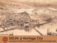
Nomination to UNESCO’s List of<br />
World <strong>Heritage</strong> Cities<br />
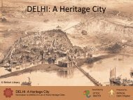
DELHI: A <strong>Heritage</strong> <strong>City</strong><br />
Submission for Tentative Listing<br />
January 2012<br />
Logo created from IGNCA and INTACH, <strong>Delhi</strong> Chapter for the exhibition, “<strong>Delhi</strong>: A Living <strong>Heritage</strong>.”
Contents<br />
Tentative List Submission<br />
Name of the Property 5<br />
Description of the Nominated Area<br />
- Mehrauli 12<br />
- Nizamuddin 18<br />
- Shahjahanabad 26<br />
- New <strong>Delhi</strong> 32<br />
Justification of Outstanding Universal Value<br />
Criteria met<br />
- (ii) 38<br />
- (v) 39<br />
- (vi) 40<br />
Statements of authenticity and integrity 42<br />
Comparison with other similar properties 45<br />
- Historic Centre of Rome, the Properties<br />
of the Holy See in that <strong>City</strong> Enjoying<br />
Extraterritorial Rights and San Paolo Fuori<br />
le Mura<br />
- Historic Cairo<br />
- Samarkand: Crossroads of Cultures<br />
- Lahore<br />
- Agra<br />
- Lucknow<br />
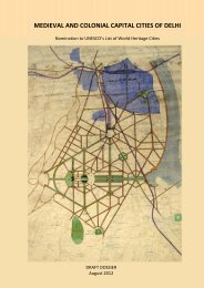
Map of Nominated Area<br />
<strong>Delhi</strong>’s historic eight capital cities<br />
INTACH- <strong>Delhi</strong> Chapter 3
Name of the<br />
Property<br />
<strong>Delhi</strong>: A <strong>Heritage</strong> <strong>City</strong><br />
State, Province or Region:<br />
Latitude and Longitude:<br />
New <strong>Delhi</strong><br />
Latitude:28°40’ N, Longitude:77°12’E<br />
State Party<br />
INDIA<br />
Nomination<br />
Submitted by<br />
<strong>Delhi</strong> Tourism and Transportation Development Corporation<br />
Government of the National Capital Territory of <strong>Delhi</strong><br />
Submission<br />
prepared by<br />
Name:<br />
E-mail:<br />
INTACH, <strong>Delhi</strong> Chapter<br />
delhiheritagecity@gmail.com<br />
Address: 71, Lodhi Estate, New <strong>Delhi</strong>, 110003<br />
Institution:<br />
Indian National Trust for Art and<br />
Cultural <strong>Heritage</strong><br />
Fax: + 91 11 2461 1290<br />
Telephone: + 91 11 2469 2774<br />
Date of Submission: January, 2012<br />
Authorised Signatory<br />
MD, DTTDC<br />
INTACH- <strong>Delhi</strong> Chapter 5
DELHI: A HERITAGE CITY Nomination to UNESCO’s List of World <strong>Heritage</strong> Cities Description of the Nominated Area<br />
Description<br />
<strong>Delhi</strong> known as Kalkaji. Nearby is the<br />
Kalkaji temple, the site of a temple to<br />
the goddess Kalka Devi and probably<br />
even in Ashoka’s time a temple stood<br />
here.<br />
a<br />
‘<strong>Delhi</strong>’, being nominated for listing with<br />
UNESCO as a World <strong>Heritage</strong> <strong>City</strong> is<br />
best described as a living city, in which<br />
the historical past and contemporary<br />
life coexist harmoniously .<br />
EVOLUTION OF DELHI – A<br />
Historical Reference<br />
The historic settlement that we know<br />
today as <strong>Delhi</strong>, took shape in a roughly<br />
triangular patch of land. One side of<br />
the triangle is made up by the Yamuna<br />
river, and the other two consist of hilly<br />
spurs at the northern extreme of the<br />
Aravalli range of mountains. At a local<br />
level these two natural features have<br />
provided a varied landscape – hills<br />
well covered with vegetation, as well<br />
as a fertile alluvial plain. The wider<br />
regional importance of <strong>Delhi</strong> has<br />
historically stemmed from its crucial<br />
geographical location within the<br />
Indian subcontinent. It is located at<br />
the northern end of the Gangetic plain;<br />
at a point where the plain narrows<br />
to a neck of land between the great<br />
rivers and Himalayas to the north,<br />
and the Aravallis and the Thar Desert<br />
to the south. It is therefore a gateway<br />
to the fertile Gangetic plain, which<br />
empire-builders from early times have<br />
sought to control, and to the Southern<br />
peninsula beyond.<br />
The <strong>Delhi</strong> region was inhabited by tool<br />
making hominids, followed by human<br />
beings, probably as far back as 100,000<br />
years ago. In this pre-historic period<br />
it was mainly the hilly regions to the<br />
south of <strong>Delhi</strong> that were occupied.<br />
The area was almost certainly covered<br />
with rich vegetation and ample wildlife<br />
– ideal for the hunting-gathering<br />
lifestyle of the Stone Age people. It<br />
is also clear that the River Yamuna at<br />
that time flowed through these hills.<br />
The river in fact has changed course<br />
several times and at least six old beds<br />
have been identified. Interestingly, the<br />
location of Stone Age sites and their<br />
sequence suggests that pre-historic<br />
people moved with the river.<br />
When agriculture became the primary<br />
source of food for ancient populations<br />
there was a shift in settlements –<br />
away from the ridge and towards the<br />
plains and more particularly along the<br />
Yamuna. There is evidence that <strong>Delhi</strong><br />
was settled during the Late Harappan<br />
period. This was a phase, sometime<br />
between 2000-1000 B.C., when<br />
the sophisticated urban Harappan<br />
civilization was past its heyday, and its<br />
cities had been replaced by scattered<br />
rural settlements.<br />
<strong>Delhi</strong>, as we know<br />
it today is an<br />
amalgamation of many<br />
cities, built at different<br />
times in its thousandyear<br />
history.<br />
a. The city of <strong>Delhi</strong> before the<br />
siege, from the Illustrated<br />
London News, Jan[1].16, 1858,<br />
British Library<br />
a<br />
b<br />
a. Archaeological findings at<br />
the Purana Qila site<br />
b. Ashokan Rock Edict<br />
c. Late Harappan Period<br />
Pottery<br />
c<br />
The Late Harappan phase was<br />
followed by the Vedic Age, when the<br />
ancient scriptures or the Vedas were<br />
first composed. In the early part of the<br />
first millennium B.C. certain events<br />
were taking place that are believed to<br />
have formed the basis of one of the<br />
great epics of India – the Mahabharata.<br />
This is the tale of a rivalry and great<br />
war between two sets of cousins –<br />
the Kauravas and the Pandavas. The<br />
capital city established by the latter,<br />
known as Indraprastha, has in the local<br />
tradition been identified with the site<br />
of the Purana Qila, beside the Yamuna<br />
in <strong>Delhi</strong>. Archaeological evidence from<br />
the site has been unable to point to<br />
anything definite.<br />
Around the 6th century B.C. an active<br />
phase of state formation began in<br />
North India, with the rise of several<br />
territorial states or Mahajanpadas.<br />
At this time <strong>Delhi</strong>, though not one of<br />
the major political centres, was an<br />
important point on the great north<br />
Indian trade route, known as the<br />
Uttarapatha. It was thus an ideal place<br />
for the emperor Ashoka, who ruled<br />
over the a large territory in the third<br />
century B.C., to put up an inscription<br />
containing what is known to us as his<br />
rock edict. The edict was inscribed<br />
on a large boulder on a hilly piece of<br />
ground, in an area in modern south<br />
In the subsequent centuries too, <strong>Delhi</strong><br />
probably formed a part of states<br />
which had their centres of power<br />
elsewhere, such as the Sungas, Shakas<br />
and Kushanas. During the Gupta<br />
period, sometime in the fourth century<br />
A.D. a remarkable commemorative<br />
pillar made out of a very high quality<br />
iron was set up, maybe somewhere<br />
in the neighbourhood of <strong>Delhi</strong>. The<br />
inscriptional evidence is not entirely<br />
clear but it is believed that this pillar<br />
was moved at least once during its<br />
history. Today it is located in the middle<br />
of the oldest mosque in the city, in the<br />
Qutb Minar complex.<br />
By the eight century <strong>Delhi</strong> had come<br />
under the sway of the Tomars, one of<br />
the several Rajput dynasties that had<br />
their origins in Rajasthan. The Tomars<br />
first established fortifications in the<br />
village of Anangpur, and around the<br />
large reservoir known as Surajkund,<br />
just south of <strong>Delhi</strong>. In the mid-eleventh<br />
century, Anangpal II of this dynasty<br />
built the fortified city of Lal Kot, located<br />
in present day Mehrauli.<br />
The Chauhans, headquartered in Ajmer,<br />
wrested control of <strong>Delhi</strong> from the<br />
Tomars in the twelfth century. Under<br />
Prithviraj Chauhan the fortifications<br />
of Lal Kot were extended to enclose a<br />
larger space, forming the fort known as<br />
Qila Rai Pithora. A rich material culture,<br />
including more than a score beautifully<br />
carved stone temples formed a part of<br />
this city. The temple pillars can still be<br />
seen on the site as they were re-used in<br />
the construction of the Quwwat ul Islam<br />
mosque – next to the Qutb Minar.<br />
6<br />
State Party - INDIA INTACH- <strong>Delhi</strong> Chapter 7
DELHI: A HERITAGE CITY Nomination to UNESCO’s List of World <strong>Heritage</strong> Cities Description of the Nominated Area<br />
a b c<br />
a<br />
b<br />
Then towards the end of the twelfth<br />
century, the Chauhans were overthrown<br />
by a new entrant on the scene. The<br />
forces of Mohammad Ghori, a Central<br />
Asian Turk with a base in Ghazni,<br />
defeated the armies of Prithviraj<br />
Chauhan at the battle of Tarain in 1192.<br />
In early 1193, his general Qutbuddin<br />
Aibak captured <strong>Delhi</strong> and established<br />
the capital of Ghori’s Indian territories<br />
in the fort of Qila Rai Pithora. The Turk<br />
conquest laid the groundwork for the<br />
establishment of the <strong>Delhi</strong> Sultanate,<br />
which was to last in some form or the<br />
other until the arrival of the Mughals in<br />
the sixteenth century. Under the Turks,<br />
from the early thirteenth century <strong>Delhi</strong><br />
acquired a new importance as the<br />
capital of a dynamic and expanding<br />
empire.<br />
The Turk conquerors were Muslims,<br />
and avowedly committed to the setting<br />
up of an Islamic state, with the name of<br />
the Caliph being included in the Friday<br />
sermon and on coinage. One of the<br />
early Sultans, Iltutmish (1211-36) even<br />
sought to give his position legitimacy in<br />
the eyes of the orthodox by obtaining<br />
a letter of investiture from the Caliph<br />
at Baghdad, confirming Iltutmish’s<br />
title as sultan of India. Simultaneously<br />
however great changes were occurring<br />
in the Islamic world. The Mongols<br />
under Chengiz Khan were wreaking<br />
havoc over Central and West Asia,<br />
and important centres of Islam like<br />
Bukhara and Baghdad were destroyed.<br />
Thus <strong>Delhi</strong> was looked upon as a last<br />
refuge for Islam in the East, and poets,<br />
scholars and men of letters fleeing<br />
the destruction of their homes found<br />
shelter in India, and particularly in<br />
<strong>Delhi</strong>.<br />
In its everyday practice however,<br />
the polity of the <strong>Delhi</strong> Sultanate was<br />
not based on orthodox Islam, which<br />
would have advocated a harsh line<br />
with non-believers. And here, the<br />
role and influence of the Sufis was<br />
probably a factor. The Sufi saints were<br />
among those who came to <strong>Delhi</strong> in<br />
the wake of the Turkish conquerors.<br />
Qutbuddin Bakhtiyar Kaki, the Chishti<br />
Sufi, was one of the several who made<br />
<strong>Delhi</strong> their base, and contributed to<br />
<strong>Delhi</strong>’s acquiring a leading position<br />
in the sacred geography of Islam in<br />
the Indian sub-continent. The city in<br />
fact came to be called Hazrat-e-Dehli,<br />
or ‘the venerable <strong>Delhi</strong>’. The saints,<br />
with their liberal religious practice<br />
attracted not only converts and<br />
devotees in large numbers, they also<br />
provided the political power with a<br />
model of governance that was based on<br />
a tolerance of non-Muslim populations.<br />
<strong>Delhi</strong>, even as it was the capital of an<br />
empire that purportedly derived its<br />
legitimacy from Islam, continued to<br />
have a large Hindu population.<br />
The saints’ hospices and shrines and<br />
their spheres of influence, were also the<br />
setting for a cultural interaction that<br />
In Alai Darwaza. the<br />
use of red sandstone<br />
and marble in<br />
combination, the<br />
hemispherical dome<br />
and its horseshoe<br />
arch mark a high<br />
point in Sultanate<br />
architecture.<br />
a. Surajkund: A reservoir in the<br />
village of Anangpur, south of<br />
<strong>Delhi</strong> © ASI.<br />
b. Built in the middle of the<br />
eleventh century by the Tomar<br />
ruler Anangpal II, the fort of Lal<br />
Kot (‘Red Fort’) © ASI.<br />
c. Sculptures in Mehrauli<br />
© ASI<br />
a. Fort Walls and bastion of<br />
Siri, the second city of <strong>Delhi</strong>.<br />
b.a. The massive bastions of<br />
Tughlaqabad tower over the<br />
rocky ground.<br />
was reflected in syncreticism outside<br />
the religious sphere. This included<br />
developments in architecture, music,<br />
literature and language, which brought<br />
together diverse traditions to create<br />
a composite style that soon gained<br />
influence in the entire sub-continent.<br />
In the first century of the <strong>Delhi</strong><br />
Sultanate, though the concentration<br />
of population continued to be highest<br />
in Mehrauli, in and around Qila Rai<br />
Pithora, some settlements were coming<br />
up closer to the river. One important<br />
reason for this was the need to provide<br />
access to a reliable source of water. In<br />
the mid-thirteenth century the Sufi<br />
saint Nizamuddin Auliya established<br />
his seat or khanqah at the suburb of<br />
Ghiaspur, today known as Nizamuddin.<br />
Around 1288 Sultan Kaiqubad built<br />
a walled palace at Kilokhari, about a<br />
kilometer from Ghiaspur. Kaiqubad’s<br />
successor Jalaluddin, who founded<br />
the Khilji Dynasty in 1290, was unsure<br />
of the loyalty of the people of the old<br />
city at Mehrauli, and therefore made<br />
Kilokhari his headquarters. Soon the<br />
wealthy and powerful nobles and<br />
merchants of <strong>Delhi</strong> built houses in<br />
Kilokhari, markets were established<br />
and it came to be known as the shahare-nau,<br />
or ‘new city’.<br />
The old town at Mehrauli continued<br />
to be important and was again the<br />
capital under Jalaluddin’s successor<br />
Alauddin. One factor that checked the<br />
move towards the river was strategic<br />
necessity, and the fortifications of<br />
Qila Rai Pithora on the ridge were<br />
important for defense, particularly<br />
when the Mongols threatened <strong>Delhi</strong> in<br />
the late thirteenth and early fourteenth<br />
centuries. The emperor Alauddin Khilji<br />
found himself repeatedly engaging<br />
them in battle on the plain of Siri,<br />
located north of Mehrauli. Alauddin<br />
decided to build a fortification, and this<br />
led to the founding of the new capital of<br />
Siri in the early fourteenth century.<br />
The founder of the Tughlaq dynasty,<br />
Ghiasuddin Tughlaq, was also very<br />
conscious of the threat of the Mongols.<br />
His fortified capital of Tughlaqabad<br />
was built around 1321-25, on the rocky<br />
scarps of the ridge in the south-eastern<br />
corner of the <strong>Delhi</strong> triangle. The rocks<br />
on the site provided ample building<br />
material, the heights reinforced the<br />
defenses of the fort, and the natural<br />
drainage line of the ridge could be<br />
dammed to provide a source of water.<br />
Ghiasuddin’s successor Mohammad<br />
Tughlaq moved back towards the old<br />
city at Mehrauli, but in the meantime<br />
the population of the city had been<br />
growing and spilling outside the walls.<br />
Conscious of the need for security,<br />
Mohammad Tughlaq decided to build a<br />
line of fortifications linking the forts of<br />
the Qila Rai Pithora and Siri. The space<br />
thus enclosed was named Jahanpanah,<br />
and Mohammad built an impressive<br />
8<br />
State Party - INDIA INTACH- <strong>Delhi</strong> Chapter 9
DELHI: A HERITAGE CITY Nomination to UNESCO’s List of World <strong>Heritage</strong> Cities Description of the Nominated Area<br />
a<br />
b<br />
c<br />
a<br />
b<br />
c<br />
palace complex (Bijai Mandal) and<br />
congregational mosque (Begampur<br />
Masjid) in it.<br />
By the mid-fourteenth century the<br />
Mongol threat had receded and from<br />
this point onwards there was a decided<br />
move closer to the river. Firoz Shah<br />
Tughlaq’s city of Firozabad, built in<br />
the 1350s, was towards the north,<br />
on the river. The end of the Tughlaq<br />
dynasty saw a sharp decline in the<br />
power and territories of the <strong>Delhi</strong><br />
Sultante, underlined by the invasion of<br />
the Timur (also known as Tamerlane)<br />
in 1398. The succeeding dynasties<br />
of the Syeds and the Lodis ruled over<br />
considerably shrunken territories and<br />
have not left behind any discernable<br />
cities. Mubarak Shah of the short-lived<br />
Syed dynasty is said to have established<br />
a city called Mubarakabad near the<br />
Yamuna, but no trace of it remains.<br />
The <strong>Delhi</strong> Sultanate came to an end<br />
in 1526, when Babur, a descendant of<br />
Timur, defeated the forces of the last<br />
Lodi Sultan, Ibrahim, and established<br />
the Mughal dynasty. His successor<br />
Humayun built the city of Dinpanah in<br />
the 1530s, just north of the shrine of<br />
Nizamuddin. Coincidentally the citadel<br />
was placed on the site of the village<br />
of Indarpat, popularly identified<br />
with the ancient city of Indraprastha.<br />
Humayun’s reign was interrupted<br />
by that of the Suri dynasty, and Sher<br />
Shah Suri made his own additions to<br />
Dinpanah, and established the city of<br />
Shergarh around it.<br />
Humayun’s successor Akbar moved the<br />
capital of the Mughal empire to Agra,<br />
but <strong>Delhi</strong> did not lose its importance<br />
as an important centre of trade and<br />
culture. In particular the Sufi shrines<br />
of the city gave it a premier position in<br />
the sacred geography of Islam in India.<br />
The choice of <strong>Delhi</strong> for the mausoleum<br />
of Humayun, located in the vicinity of<br />
Nizamuddin’s shrine, underlined this<br />
importance.<br />
In 1639, Akbar’s grandson Shahjahan<br />
decided to shift the capital out of Agra,<br />
and <strong>Delhi</strong> was chosen as the site for<br />
his grand imperial city. The new city,<br />
called Shahjahanabad, was by the<br />
river, north of all of <strong>Delhi</strong>’s previous<br />
cities. This continued to be the seat<br />
of the Mughal emperor even as the<br />
empire declined in the eighteenth<br />
century, and the British East India<br />
Company came to control most of its<br />
erstwhile territories. Shahjahanabad,<br />
as the seat of the Mughal court saw a<br />
flowering of architecture, crafts, visual<br />
and performing arts, language and<br />
literature, that persisted well beyond<br />
the heyday of the Mughal empire.<br />
Through the nineteenth century the<br />
British ruled their Indian territories<br />
from their capital at Calcutta. <strong>Delhi</strong><br />
saw the upheaval of the Revolt of 1857<br />
and was for a while relegated to an<br />
administrative backwater. But the aura<br />
a. Pyramid of cells with the<br />
Ashokan pillar, Firoz Shah Kotla.<br />
© British Library<br />
b. Dinpanah, the city built by<br />
Humanyun in 1530’s<br />
c. In building architecture,<br />
new plans and shapes became<br />
popular. Monumental structures<br />
were built like the octagonal<br />
tomb of Muhammad Shah<br />
Sayyid and the Bada Gumbad.<br />
© ASI<br />
a. Shahjahanabad, The walled<br />
city of the Mughals<br />
b. The Coronation Darbar<br />
of 1911, where <strong>Delhi</strong> was<br />
proposed as the new capital<br />
city.<br />
c. Rashtrapati Bhawan,<br />
designed as Viceroy House for<br />
the British Imperial capital<br />
city.<br />
of the city survived. Its long history as<br />
the capital of powerful kingdoms and<br />
empires had invested it with a mystique<br />
and prestige that not even the British<br />
could ignore. <strong>Delhi</strong> had long been<br />
associated with sovereignty over India,<br />
and the British government tapped<br />
into this legacy by holding imperial<br />
Durbars assemblages in <strong>Delhi</strong> - in 1877<br />
to proclaim Victoria Empress of India,<br />
in 1903 to celebrate the coronation<br />
of Edward VII as Emperor of India,<br />
and in 1911 to similarly proclaim the<br />
coronation of George V.<br />
It was during the last Durbar of<br />
1911 that the decision to shift the<br />
British Indian capital to <strong>Delhi</strong> was<br />
announced, and a year later <strong>Delhi</strong><br />
became the capital. Simultaneously<br />
work began on the construction of a<br />
new imperial capital city, which was<br />
finally inaugurated in 1931 as New<br />
<strong>Delhi</strong>. New <strong>Delhi</strong> was planned and<br />
built as a garden city laid out around a<br />
grand ceremonial vista. While it owed<br />
inspiration to Baron Haussmann’s<br />
Paris and L’Enfant’s Washington D.C., it<br />
drew on Indian traditions with respect<br />
to design elements, decorative details,<br />
materials, and colonial forms such<br />
as the bungalow. Above all it carried<br />
forward the aura of <strong>Delhi</strong> and the city’s<br />
tradition of learning from and adopting<br />
a wide range of cultural influences.<br />
AREA PROPOSED FOR<br />
NOMINATION<br />
<strong>Delhi</strong> has accommodated the various<br />
cities built at different times in its long<br />
history. The physical limits of present<br />
day <strong>Delhi</strong> have expanded to engulf all<br />
these historic areas and the legacy of<br />
many dynasties that ruled over <strong>Delhi</strong>,<br />
lives on in these historic precincts.<br />
Of the eight historic ‘capital cities’,<br />
some like Ferozabad and Dinpanah<br />
have disappeared completely<br />
leaving just a few monumental<br />
structures but no trace of either the<br />
urban morphology or character of<br />
the city; others like Tughlaqabad<br />
have been encroached upon but<br />
their urban characteristics are still<br />
identifiable; while the later cities like<br />
Shahjahanabad, have their urban form<br />
and streetscape almost intact with only<br />
the buildings having been replaced<br />
with newer constructions over the<br />
last few decades. And there are some<br />
precincts that are an intricate tapestry,<br />
with over a thousand years of culture<br />
woven into the living traditional<br />
settlements.<br />
It is <strong>Delhi</strong>’s surviving historic<br />
urbanscape of outstanding universal<br />
significance, comprising of four<br />
precincts of Mehrauli, Nizamuddin,<br />
Shahjahanabad and New <strong>Delhi</strong>, that<br />
is being proposed for nomination as<br />
<strong>Delhi</strong>, a <strong>Heritage</strong> <strong>City</strong>.<br />
10<br />
State Party - INDIA INTACH- <strong>Delhi</strong> Chapter 11
DELHI: A HERITAGE CITY<br />
Nomination to UNESCO’s List of World <strong>Heritage</strong> Cities<br />
1<br />
Mehrauli<br />
The heritage precinct of Mehrauli<br />
is the site of the first capital city<br />
of <strong>Delhi</strong> and has seen 900 years of<br />
continuous habitation, leading to a<br />
layering of history which has resulted<br />
in a complex socio cultural mosaic.<br />
Continuous habitation in Mehrauli can<br />
be attributed to its strategic location<br />
on a ridge, providing much needed<br />
security, efficient water supply and good<br />
drainage due to the sloping landform,<br />
which meant liberation from diseases<br />
like malaria etc.<br />
The arrival of several Sufi saints in the<br />
early thirteenth century, in particular,<br />
Qutbuddin Bakhtiyar Kaki, has had a<br />
long-lasting impact on Mehrauli. During<br />
his lifetime the saint attracted followers<br />
to his khanqah or hospice, and after his<br />
death, his shrine continued to attract<br />
devotees. The site is also associated with<br />
the tradition of the Phoolwalon ki sair,<br />
that symbolizes secular harmony.<br />
The area being nominated as part of the<br />
World <strong>Heritage</strong> <strong>City</strong> of <strong>Delhi</strong> comprises<br />
of the original walled cities of Lal Kot<br />
and Qila Rai Pithora, extending south<br />
to include the traditional settlement<br />
of Mehrauli Village and the area<br />
presently identified as the Mehrauli<br />
Archaeological Park.<br />
Evolution of the historic precinct of<br />
Mehrauli<br />
Located on the spur of the Aravallis,<br />
Mehrauli has undulating landform<br />
with seasonal ponds visible in the<br />
various depressions. The unusual<br />
development of the site and its<br />
continuous habitation over an almost<br />
thousand year period can be attributed<br />
to its unique geographic location and<br />
landform.<br />
a<br />
Hindu and Muslim capitals of<br />
Mehrauli<br />
The oldest surviving traces of an<br />
urban settlement in Mehrauli, belongs<br />
to a small fort known as Lal Kot on<br />
the rocky ground of the ridge, built<br />
during the reign of the Tomar ruler<br />
Anangpal II, in the mid-eleventh<br />
century. Excavations suggest that<br />
there was already a settlement at<br />
this location, and there are literary<br />
references to an older name for the city<br />
– Yoginipur. Yet the bulk of the wealth<br />
of antiquities unearthed date from the<br />
Tomar period and after. The Jogmaya<br />
temple that stands there today consists<br />
of relatively new buildings but is also<br />
believed to be ancient. Surviving<br />
Tomar-era constructions include part<br />
of the fortification wall and a large<br />
tank, Anangtal, paved with dressed<br />
stone.<br />
b<br />
a. Map showing the early<br />
development of the Hindu and<br />
Muslims dynasties in Mehrauli.<br />
b. Within the fortified city of Lal<br />
Kot/ Rai Pithora were a large<br />
number of Hindu, Buddhist and<br />
Jain temples. Their pillars were<br />
later reused in the building of<br />
the Quwwat-ul Islam mosque.<br />
© ASI<br />
12<br />
State Party - INDIA
DELHI: A HERITAGE CITY Nomination to UNESCO’s List of World <strong>Heritage</strong> Cities Description of the Nominated Area<br />
a<br />
b<br />
c<br />
a<br />
The Chauhans who wrested power<br />
from the Tomars in the mid-twelfth<br />
century raised a defensive wall around<br />
the city, which had expanded beyond<br />
the walls of the citadel of Lal Kot and<br />
the newly fortified area was known as<br />
Qila Rai Pithora.<br />
In 1193, the Turks under Qutbuddin<br />
Aibak occupied <strong>Delhi</strong>, and the few<br />
decades there after saw a flurry of<br />
building activity within the fort.<br />
The congregational mosque, the<br />
remarkable Qutb Minar, the tomb of<br />
the ruler, Iltutmish are all testimony<br />
to the monumental works of the<br />
early Sultanate. Literary sources also<br />
describe a flourishing settlement<br />
within the walls of the city – with<br />
markets, mosques, madrasas (colleges)<br />
in addition to grand residences.<br />
The Sufi Bakhtiyar Kaki, popularly<br />
known as Qutb Sahib, came here in the<br />
early 13th century and is associated<br />
with many important structures to<br />
the south of Lal Kot. The saint is said<br />
to have had a very close relationship<br />
with Iltutmish (reigned 1211-36) and<br />
according to popular belief, Prophet<br />
Mohammad appeared in the dreams<br />
of both the Sultan and the saint,<br />
indicating the best spot at which to<br />
dig a tank to supply water to the city.<br />
Hauz-e-Shamsi was thus constructed<br />
in 1229, at a location south of the<br />
walled enclosure. The saint is said to<br />
have also offered prayers beside the<br />
tank in the company of his spiritual<br />
master, Muinuddin Chishti of Ajmer.<br />
Auliya Masjid was built at the spot<br />
on the eastern bank of the tank. The<br />
area in the vicinity of the tank became<br />
popular not only as a meeting place<br />
for the spiritually inclined, but also a<br />
popular burial site.<br />
When he died in 1235, the saint was<br />
buried closer to the city, just outside<br />
the walled city at the south-western<br />
corner. His burial site became an active<br />
and popular shrine, or dargah, which it<br />
remains to this day. It also became a<br />
centre for devotional music, performed<br />
at special gatherings called sama,<br />
which the saint in his own lifetime<br />
enjoyed. The immediate vicinity of the<br />
dargah too is dense with graves. The<br />
emperor Balban (1266-87) was buried<br />
here, just outside the walls of the fort.<br />
In addition to numerous graves and<br />
tombs, mosques, gardens and other<br />
structures have been added. These<br />
include the pavilion on the western<br />
bank (c. 1311) said to mark the spot<br />
where the prophet, seated on a horse,<br />
appeared to Iltutmish in a dream.<br />
Water management was an important<br />
consideration in settlement planning.<br />
Mehrauli is a prime example of proper<br />
utilization of the landform for water<br />
storage and distribution. The location<br />
of Hauz-i-Shamsi and the construction<br />
of baolis like Gandhak-ki-baoli and<br />
Rajon-ki-baoli illustrate this point.<br />
d<br />
a. The Chauhan’s extended<br />
the old citadel and the newly<br />
fortified area was called Qila<br />
Rai Pithora.<br />
b. Rajon ki Baoli constructed for<br />
water supply and management.<br />
c. Entrance of the sculpturous<br />
Qutb Minar<br />
d. Allaudin Khilji’s extension to<br />
the Qutb Complex.<br />
b<br />
a. Imposing Tomb of Adham<br />
Khan, AD 1562.<br />
b. Jahaz Mahal on the western<br />
banks of Hauz-i-Shamsi.<br />
c. Map showing developments<br />
from the Khilji and Mughal<br />
Periods.<br />
Khilji Dynasty - Mughal era<br />
After the Slave Dynasty, although Qila<br />
Rai Pithora was no longer the capital as<br />
Allaudin Khilji founded his own capital<br />
at Siri, a little to the north of Mehrauli,<br />
Allaudin Khilji still made extensions<br />
to the Qutb Complex and people<br />
continued to inhabit this older city of<br />
Qila Rai Pithora. The area south of the<br />
Qutb complex saw the construction<br />
of many buildings, well into the 16th<br />
century and the arrival of the Mughals.<br />
Located at the highest altitude on<br />
this site is the Takiya of Kamli Shah, a<br />
saint who arrived in the 14th C. The<br />
saint Maulana Jamali built a grand<br />
mosque in 1528-29, and was buried in<br />
a small but beautiful tomb next door.<br />
Several Lodi period tombs are to be<br />
found in this area including residential<br />
clusters. The Hauz-i-Shamsi was<br />
the main recreational area. On its<br />
western bank is the Jahaz Mahal, an<br />
impressive Lodi period building, that<br />
exemplifies the mature Sultanate<br />
style, reflecting a harmonious mix<br />
c<br />
of materials – grey quartzite, red<br />
sandstone, and glazed tiles; and forms<br />
– arches, domes, chhatris (domed<br />
kiosks) and corbelled doorways, that<br />
drew from both western Islamicate and<br />
Indian traditions. Structures similar<br />
to mosques, but oriented north-south<br />
also exist, for example Sohan Burj. The<br />
Dargah of Bakhtiyar Kaki continued to<br />
gain importance and several buildings<br />
were added to this complex, viz: Naubat<br />
Khana, Majlis Khana.<br />
Mughal period structures are to be<br />
found in this area including residential<br />
clusters. These range from the<br />
imposing tomb of Adham Khan (1562),<br />
to the elegant nineteenth century<br />
enclosure containing the graves of the<br />
Loharu family. Quli Khan (died early<br />
seventeenth century), the son of the<br />
Mughal emperor Akbar’s wet nurse<br />
and Chaumachi Khan are also buried<br />
here. The continued building activity<br />
in the area, even in the absence of the<br />
patronage of the royal court can be<br />
attributed largely to the presence of the<br />
Dargah of Bakhtiyar Kaki.<br />
14<br />
State Party - INDIA INTACH- <strong>Delhi</strong> Chapter 15
DELHI: A HERITAGE CITY Nomination to UNESCO’s List of World <strong>Heritage</strong> Cities Description of the Nominated Area<br />
Colonial Mehrauli<br />
Post Independence<br />
In the 19th century, with the British<br />
having taken control of Shahjahanbad,<br />
Mehrauli was again popular with the<br />
Mughals and they spent a lot more<br />
time here. The nineteenth century saw<br />
the growth of a thriving settlement to<br />
the west and south of the palace and<br />
the shrine and some grand residences<br />
were built around the Jogmaya temple,<br />
which are still in existence. The Bazaar<br />
spine developed with houses being<br />
built on both sides of what was then<br />
the main road to the town of Gurgaon<br />
and is today the Mehrauli Bazaar.<br />
As Mehrauli was reputed to have a<br />
healthier climate than Shahjahanabad,<br />
many of the rich of <strong>Delhi</strong> built second<br />
homes here and serais, havelis and<br />
dalan houses came up in the area.<br />
The gardens around the Hauz-e-<br />
Shamsi to the south became important<br />
recreational areas for this population.<br />
Jharna, a waterfall was created from an<br />
overflow of the tank, around which a<br />
formal garden was laid out in the 18th<br />
century. Rich game in the surrounding<br />
wilderness was an added attraction.<br />
In time development took place on<br />
both sides of the road all the way down<br />
to the Hauz-e-Shamsi, forming what is<br />
today called Mehrauli village.<br />
Among the graves next to the saint’s<br />
shrine are those of the Mughal royal<br />
family, dating from the eighteenth and<br />
nineteenth centuries; and in the first<br />
half of the nineteenth century a royal<br />
palace came up close to these, built by<br />
the emperors Akbar II (1806-37) and<br />
Bahadur Shah II (1837-57).<br />
In the mid-nineteenth century,<br />
following the banishment of the<br />
Mughal monarch, Bahadur Shah Zafar<br />
to Rangoon (1858), Mehrauli became<br />
a tehsil headquarter and many offices<br />
and government buildings were<br />
set up here. The central spine was<br />
a<br />
developed during this period. Most<br />
of the development was within the<br />
settlement itself.<br />
There was some colonial intervention<br />
in the northern section by individuals<br />
like Thomas Metcalfe, the highest<br />
British administrative official in <strong>Delhi</strong>.<br />
He modified the tomb of Quli Khan to<br />
create a weekend home, Dilkusha, also<br />
adapting and adding other buildings,<br />
and laying out a garden. He also<br />
created some singular buildings, e.g.<br />
two stepped pyramid-like structures,<br />
and a couple of domed stone canopies<br />
in the tradition of the English folly.<br />
By the twentieth century the southern<br />
area had ceased to be populated and<br />
buildings lower in the valley had been<br />
partly buried in the silt brought down<br />
by the stream coming from the Hauze-Shamsi.<br />
Among these sprawling<br />
palaces of the Mughals many town<br />
houses, offices and other structures<br />
were built by the British in the colonial<br />
style, giving it a distinct colonial flavour.<br />
b<br />
a. Map showind Colonial interventions<br />
in Mehrauli<br />
b. British repairs and additions<br />
to the tower in the 1820s included<br />
a cupola and sandstone<br />
railings on the balconies.<br />
b<br />
a<br />
a. Map showing the postindependence<br />
development in<br />
Mehrauli.<br />
b. View of Jamali Kamali.<br />
While the capital city, its historic and<br />
iconic buildings are conserved and<br />
linked through trails and interpretative<br />
signage, Mehrauli village with the<br />
dargah as its focus, is still a living<br />
settlement that has survived for over<br />
900 years. The link between the Dargah<br />
of Qutb Sahib and the Hauz-e-Shamsi<br />
continues till today as the trail of the<br />
Phoolwalon ki sair or ‘festival of the<br />
flower sellers’. Arising out of avow<br />
taken by the wife of Akbar II, Mumtaz<br />
Mahal, that she would offer a coverlet of<br />
flowers at the dargarh of Qutb Sahib if<br />
her son returned from the exile imposed<br />
by the British government, it became a<br />
tradition that has survived to this day.<br />
Floral offerings, in particular pankhas<br />
or fans were assembled around the<br />
Jharna near the hauz, and then carried<br />
to the dargah to be offered at the saint’s<br />
grave. Pankhas were also offered at the<br />
Hindu temple of Jogmaya, believed to<br />
be a sacred site of great antiquity. This<br />
celebration of Hindu-Muslim amity<br />
is a tradition that has survived to the<br />
present time, and is an annual festival<br />
at Mehrauli.<br />
16<br />
State Party - INDIA INTACH- <strong>Delhi</strong> Chapter 17
DELHI: A HERITAGE CITY<br />
Nomination to UNESCO’s List of World <strong>Heritage</strong> Cities<br />
2<br />
Nizamuddin<br />
Nizamuddin has been associated with<br />
the presence of the renowned Sufi<br />
saint Sheikh Nizamuddin Auliya since<br />
c 1270 AD and has drawn various<br />
people to this area– a multitude of<br />
devout followers of Sufism, as well<br />
as, poets, noble men and even kings<br />
and emperors visited the saint when<br />
he was alive and even after his death.<br />
Even today, almost 700 years after his<br />
death, pilgrims visit the shrine of the<br />
saint Nizamuddin Auliya.<br />
Since it was considered auspicious to<br />
be buried near a saint’s grave, many<br />
of the saint’s ardent followers were<br />
finally laid to rest in the vicinity of the<br />
Sufi shrine. Seven centuries of tomb<br />
building can be seen in the Nizamuddin<br />
precinct.<br />
a<br />
The area being nominated as part<br />
of the World <strong>Heritage</strong> <strong>City</strong> of <strong>Delhi</strong><br />
consists of the traditional settlement<br />
that grew around the dargah of the<br />
saint, and the Nizamuddin precinct.<br />
The northern limit of the settlement<br />
is Lodi Road; while the Barahpullah<br />
nallah, a tributary of the Yamuna,<br />
marks the western and southern edge<br />
of the dargah settlement. To its east is<br />
Mathura Road.<br />
The Nizamuddin Precinct is the area<br />
which has as its southern limit, the<br />
dargah settlement and stretches right<br />
up to Purana Qila in the north, and in<br />
the other direction, from <strong>Delhi</strong> Golf<br />
Club to the west, right down to the<br />
banks of the river to the east.<br />
b<br />
a. View from the top of<br />
Humayuns Tomb showing the<br />
Nizamuddin Dargah in the<br />
background.<br />
b. Map of Nizamuddin showing<br />
extent of development in the<br />
precinct.<br />
18<br />
State Party - INDIA
DELHI: A HERITAGE CITY Nomination to UNESCO’s List of World <strong>Heritage</strong> Cities Description of the Nominated Area<br />
a<br />
b<br />
b<br />
Evolution of the Nizamuddin Dargah<br />
Settlement<br />
c<br />
It is believed that Ghiasuddin Balban<br />
built a palace, the Lal Mahal, at a site<br />
which was the suburb of the city of<br />
Hazrat <strong>Delhi</strong>, in the mid-13th century,<br />
following which the area came to be<br />
known as Ghiaspur. The site had the<br />
river flowing immediately to its east,<br />
agricultural land all the way up to<br />
the village of Indrapat located to its<br />
north and the city of Kilokhari to its<br />
southeast.<br />
Lal Mahal was a fine structure with<br />
a central dome and arches, and is<br />
the earliest surviving example of a<br />
Sultanate era palace. It can stake claim<br />
to be the first building where a true<br />
arch and dome were used.<br />
From 1265 AD, when Ghiasuddin<br />
Balban ascended the throne, there is<br />
evidence of a settlement, at Ghiaspur.<br />
Hazrat Nizamuddin Auliya, a much<br />
revered Sufi saint, chose this settlement<br />
to establish his khanqah.<br />
The wall that encircled the settlement<br />
was believed to have been built at the<br />
same time as the Lal Mahal (c 1265 AD).<br />
The enclosure was irregular in shape<br />
with circular bastions at intervals<br />
and topped with battlements. A grand<br />
mosque, the Jamaat Khana was built<br />
here during Alauddin Khilji’s reign(AD<br />
1295-1315). Saint Nizamuddin Auliya,<br />
meditated at a spot along the river and<br />
a chillagah was built at the site which is<br />
adjacent to the site where Humayun’s<br />
Tomb came up two centuries later.<br />
The presence of Nizamuddin Auliya<br />
resulted in many people choosing<br />
to live in this settlement or visit this<br />
area to pay homage to him. A baoli<br />
was added in AD 1320, to serve the<br />
needs (drinking water) of the local<br />
community and pilgrims and also for<br />
wuzu (ablutions) prior to prayers at<br />
the mosque, indicating that by this time<br />
there was already a large population in<br />
Ghiaspur and an even larger volume of<br />
pilgrims. After the death of Nizamuddin<br />
Auliya, he was buried in the courtyard<br />
of the Jamaat Khana mosque and the<br />
village of Ghiaspur came to be known<br />
as ‘Nizampur’. Within six months of the<br />
death of the saint, his favourite disciple,<br />
the great poet, Amir Khusro too died,<br />
unable to bear the grief of the loss of<br />
his spiritual master and was buried<br />
within the complex.<br />
d<br />
Later during the<br />
Mughal period, the<br />
area surrounding<br />
the baoli of Hazrat<br />
Nizamuddin Auliya<br />
was built up with the<br />
southern arcade dating<br />
from AD 1379-80.<br />
a. Lal Mahal, Nizamuddin<br />
Dargah Settlement<br />
b. The part facade of Jamaat<br />
Khana mosque in the<br />
Nizamuddin Dargah Settlement.<br />
c. Map showing early<br />
developments in the<br />
Nizamuddin Dargah settlement<br />
d. Baoli within the Nizamuddin<br />
Dargah Settlement<br />
a. Map showing Sultunate<br />
period developments in<br />
the Nizamuddin Dargah<br />
settlement.<br />
a<br />
b. Map showing Suri<br />
period developments in<br />
the Nizamuddin Dargah<br />
A Kot abutting the walled settlement to<br />
the south was constructed in the mid<br />
14th century. Two major structures<br />
that still survive here were built during<br />
the Tughlaq period, Kalan Masjid<br />
in AD 1370-1 and the tomb of Khan<br />
Jahan Junan Shah Tilangani, the Prime<br />
Minister of Firoz Shah Tughlaq, located<br />
within the Kot is the earliest octagonal<br />
tomb in India.<br />
The main spine or the major<br />
thoroughfares connect the main gates<br />
of the settlement to the main elements<br />
within the settlement identified as<br />
the dargah, the bazaar, the kot and<br />
Kalan Masjid. The earliest road in the<br />
settlement led from the north gate of<br />
the village enclosure connecting the<br />
dargah to the north eastern gate of the<br />
Kot through the bazaar street. A later<br />
development was the road intersecting<br />
it at right angles just outside the north<br />
eastern gateway to the Kot giving access<br />
to the Kalan Masjid and the Imambara<br />
and leading from the eastern gateway<br />
to the south western gateway of the<br />
village enclosure (perhaps the route of<br />
the Tazia procession) The main direct<br />
b<br />
access to the dargah was from the north<br />
western gateway but the dargah was<br />
also connected through the eastern<br />
gateway of Amir Khusro’s enclosure.<br />
Building activity in the area continued<br />
through the Lodi period and some<br />
surviving structures built during this<br />
period are the Barahkhambha, Gol<br />
Gumbad and Do Sirihya Gumbad.<br />
Urban morphology<br />
Within the walled enclosure was an<br />
intricate pattern of streets, galis and cul<br />
de sacs, all at a pedestrian, human scale.<br />
A network of narrow Mohalla streets<br />
or galis provides access and linkages<br />
to the main quarters and houses. These<br />
were used mainly by people of the<br />
mohalla. These narrow galis ended in<br />
cul-de-sacs, owned and shared by the<br />
users. The galis are characterised by<br />
varying widths and periodic changes<br />
in direction. The urban morphology<br />
is characterised by streets with<br />
changing levels and ramps or steps,<br />
varying building heights and entrance<br />
doorways.<br />
20<br />
State Party - INDIA INTACH- <strong>Delhi</strong> Chapter 21
DELHI: A HERITAGE CITY Nomination to UNESCO’s List of World <strong>Heritage</strong> Cities Description of the Nominated Area<br />
b<br />
a<br />
c<br />
a<br />
c<br />
d<br />
Later during the Mughal period, the<br />
area surrounding the baoli of Hazrat<br />
Nizamuddin Auliya was built up with<br />
the southern arcade dating from AD<br />
1379-80. In the 16th century, the Grand<br />
Trunk Road which stretched from the<br />
eastern end of India to Peshawar and<br />
beyond in the west, passed through<br />
the Nizamuddin area. Thus with the<br />
river along its eastern edge and the GT<br />
Road passing through it, Nizamuddin<br />
was located on major medieval<br />
transport arteries, which enhanced its<br />
importance.<br />
The tomb of Bai Kokaldai, standing<br />
on the western edge of Hazrat<br />
Nizamuddin Baoli was built later in AD<br />
1541. Atgah Khan, ‘who was present<br />
when Humayun was defeated by Sher<br />
Shah Sur and aided the emperor in<br />
his escape from the field of battle’ was<br />
buried in AD 1566-7, in close proximity<br />
to the tomb of Hazrat Nizamuddin<br />
Auliya. His jewel like tomb is covered<br />
with a unique inlay of tile work in<br />
marble. The emperor Shahjahan’s<br />
daughter Jahanara, who died in 1681<br />
was also buried here followed by the<br />
emperor Muhammad Shah who died in<br />
1748. In the 19th century prominent<br />
buildings such as the dalan of Mirdha<br />
Ikram (1801) and the grave enclosure<br />
of Mirza Jahangir (son of Akbar II)<br />
who died in 1832 were also added to<br />
the grave enclosure. The famous 19th<br />
century poet Mirza Ghalib was also<br />
buried in close proximity of Chausath<br />
Khamba.<br />
By this point other movement networks<br />
developed like Ghalib Road which led<br />
from an entrance in the north eastern<br />
enclosure wall of Chausath Khamba and<br />
Urs Mahal enclosure where qawwalis<br />
were held during Urs. Another road<br />
from the eastern enclosure walls to the<br />
dargah area past Chausath Khamba<br />
leads from Humayun’s Tomb and Arabki-serai<br />
complex.<br />
Bazaar Street<br />
A unique character of the main street<br />
leading from the main chowk to the<br />
dargah was that of a chatta street<br />
with flower sellers and items of<br />
worships. The 14th century structures<br />
had a high projecting stone plinth,<br />
a. Map showing Mughal<br />
period developments in the<br />
Nizamuddin Dargah settlement.<br />
b. Dargah of the Sufi saint<br />
Hazrat Nizamuddin Auliya<br />
c. Tomb of Khan Jahan Junan<br />
Shah Tilangani<br />
d. Barakhamba on the outskirts<br />
of the Nizamuddin settlement.<br />
b<br />
a. Marble Jalis inside Chausath<br />
Khamba.<br />
b. Randon rubble masonry core<br />
with red sandstone jalis.<br />
c. Chausath Khamba.<br />
pointed arched openings in rubble<br />
masonry walls plastered over and lime<br />
washed. Adjacent to the 14th century<br />
structures, the later Mughal structures<br />
followed the same building module but<br />
with different detailing.<br />
Building Materials and Construction<br />
Technology<br />
Different materials were used for<br />
different structures. The most<br />
commonly used building material<br />
was the <strong>Delhi</strong> quartzite; red, yellow<br />
and spotted sandstone and Lakhauri<br />
bricks. More elaborate buildings had<br />
marble, a variety of decorative stone<br />
and tiles. The load bearing walls were<br />
up to 50 cms in thickness and were<br />
built with an inner core of irregular<br />
stone with dressed quartzite or<br />
sandstone facing. Some walls were<br />
plastered with up to 5 cm of Lime<br />
Plaster. Examples are also found of dry<br />
dressed stone masonry, held together<br />
with iron clamps. The walls were<br />
spanned over with vaults, domes and<br />
arched systems. The most commonly<br />
seen vaults were the cloister and cradle<br />
and groin vaults spanning 1.5 - 4.0<br />
m widths. Domes were supported on<br />
squinches and pendentives. Often the<br />
roof was of sandstone slabs spanning<br />
the beams supported on sandstone<br />
brackets that projected from the wall.<br />
Over the roof, dry sand was compacted<br />
and finished over with lime plaster to<br />
give a flat, usable terrace. Side walls<br />
were projected to form a parapet for<br />
the terrace.<br />
Residential quarters<br />
Dwelling units varied from the havelis<br />
of prominent persons to single roomed<br />
units of the poor. The Mughal period<br />
havelis varied from two to three storeys<br />
in height, had several courtyards<br />
including one at the entrance, and<br />
incorporated jalis( screens) in windows<br />
and balconies. Elaborate arched<br />
entrance doorways gave access from<br />
the street outside into the courtyard.<br />
Enclosing the courtyards were single<br />
storied arched dalans. The havelis were<br />
often decorated with fine late Mughal<br />
moulded and incised plaster decoration.<br />
22<br />
State Party - INDIA INTACH- <strong>Delhi</strong> Chapter 23
DELHI: A HERITAGE CITY Nomination to UNESCO’s List of World <strong>Heritage</strong> Cities Description of the Nominated Area<br />
Nizamuddin Precinct<br />
During the Sayyoid and Lodi period in<br />
the 15th and 16th centuries, there was<br />
a spate of tomb building in the vicinity<br />
of the saint’s dargah, even though<br />
some of the significant royal tombs of<br />
these two dynasties were built almost<br />
a mile east of the Dargah of Hazrat<br />
Nizamuddin Auliya.<br />
The immediate precinct of the<br />
dargah settlement saw the maximum<br />
development with the coming of the<br />
Mughals in 1526, who built a number<br />
of garden tombs. The area boasts of<br />
some of the earliest buildings of the<br />
Mughal dynasty. Nila Gumbad (blue<br />
domed structure) is certainly the<br />
earliest building built by the Mughals<br />
in <strong>Delhi</strong>. Located a few yards south<br />
of Hazrat Nizamuddin’s chillagah, on<br />
a river island, the dome, its tile work<br />
and plasterwork are all reminiscent of<br />
Persian influence. Another tomb, the<br />
Sabz Burj, literally ‘green dome’, now<br />
standing in a traffic island on Mathura<br />
Road is contemporary to Nila Gumbad<br />
and pre-dates Humayun’s Tomb.<br />
Emperor Humayun chose to build his<br />
capital city, Dinpanah or ‘refuge of the<br />
faithful’, north of Hazrat Nizamuddin’s<br />
Dargah in 1533. The city walls had<br />
barely been built when Humayun was<br />
ousted in 1540, by Sher Shah Sur who<br />
continued to build the fortifications<br />
and the citadel, now known as Purana<br />
Qila or Old Fort. Sher Shah also built<br />
the striking Qila-i-Kohna Mosque<br />
within the citadel.<br />
Isa Khan Niyazi, a nobleman at the<br />
court of Sher Shah Sur, was buried in<br />
the immediate vicinity of the dargah<br />
settlement in an octagonal garden<br />
enclosure in AD 1547-8. Isa Khan<br />
Niyazi’s Tomb enclosure was the<br />
culmination of the octagonal style of<br />
tomb building. It also has the earliest<br />
sunken garden in India pre-dating<br />
Emperor Akbar’s tomb in Sikandra,<br />
Agra - the most famous existent<br />
example - by over a century.<br />
A small tomb, locally known as the<br />
Barber’s Tomb, now standing within<br />
the walled enclosure of Humayun’s<br />
Tomb, pre-dates Humayun’s Tomb, and<br />
displays local architectural traditions<br />
–red-white contrast using sandstone<br />
and marble - used earlier at Alai<br />
Darwaza and Ghiasuddin Tughlaq’s<br />
tomb. Humayun’s Tomb was built<br />
between the River Yamuna on its east<br />
and the Grand Trunk road to its west,<br />
in the 1560s by his son, the great<br />
Emperor Akbar. The tomb standing<br />
within a walled garden enclosure of 26<br />
acres, is the first of the grand dynastic<br />
mausoleums that were to become<br />
synonyms of Mughal architecture. This<br />
architectural style reached its zenith<br />
many decades later at the later Mughal<br />
tomb, the Taj Mahal.<br />
Humayun’s Tomb dwarfs any tomb<br />
built in <strong>Delhi</strong> during the three centuries<br />
of Muslim rule that preceded the<br />
Mughals. Never before in the Islamic<br />
world had a tomb been built on such<br />
scale, with red sandstone and white<br />
marble. The architect, Mirak Mirza<br />
Ghiyath, of Persian descent, who came<br />
from Herat in present day Afghanistan,<br />
used the red-white contrast to great<br />
effect with white ‘marble-like’ lime<br />
plaster covering portions of the façade<br />
that were not clad with stone such<br />
as the faces of lower niches and the<br />
domes of the four comer canopies.<br />
Humayun’s Tomb remained a place of<br />
pilgrimage for the Mughal emperors<br />
Akbar, Jahangir, Shahjahan who made<br />
frequent visits to pay their respects.<br />
Humayun’s garden-tomb is also called<br />
the ‘dormitory of the Mughals’ as in the<br />
cells are buried over 150 members of<br />
the Mughal family, all in un-inscribed<br />
graves in the lower cells.<br />
a<br />
b<br />
a. Khairpur Tomb now in Lodi<br />
Garden © ASI<br />
b. Rahim’s Tomb<br />
a b c<br />
d<br />
a. Arab ki Sarai<br />
b. Sunderwala Burj<br />
c. Humayuns Tomb with Barber’s<br />
Tomb in the foreground<br />
d. Facade of Nila Gumbad<br />
While Humayun’s Tomb was being built,<br />
just outside the western enclosure<br />
wall, two significant buildings - a tomb<br />
and a three bay wide mosque - known<br />
as Afsarwala Tomb and Mosque were<br />
also being constructed. It is not known<br />
who commissioned these or if they<br />
stood in an independent enclosure.<br />
Haji Begum brought with her three<br />
hundred Arabs from her pilgrimage to<br />
Mecca, and the ‘Arab Serai’ was built to<br />
house these families.<br />
It was during the early Mughal era<br />
and Emperor Akbar’s reign, following<br />
the building of Humayun’s Tomb, that<br />
several prominent structures were<br />
built in the Nizamuddin area. Important<br />
16th / early 17th century structures<br />
included the enclosed garden tombs of<br />
Bu Halima, ‘Batashewala’ Complex and<br />
the ‘Sunderwala’ complex.<br />
It is not known who ‘Bu Halima’ was<br />
but her tomb is entered through a<br />
lofty gateway standing opposite the<br />
western gateway of the Humayun’s<br />
Tomb complex, off-center to her own<br />
tomb , suggesting it dates from just<br />
after the building of Humayun’s Tomb.<br />
The tomb of Muzaffar Husain Mirza,<br />
grand-nephew of Emperor Humayun<br />
was built in AD 1603 and is today<br />
known as Bara Batashewala Mahal.<br />
Another tomb, now known as Chotta<br />
Batashewala stands alongside<br />
Muzaffar Husain Mirza’s tomb.<br />
The ‘Sunderwala complex’, another<br />
tomb- garden enclosure, includes the<br />
two tombs now known as Sunderwala<br />
Burj and Sunderwala Mahal and though<br />
it is today unknown who these were<br />
built for, the architectural style and the<br />
ornamentation contained within date<br />
these to the 16th/17th century, i.e., the<br />
early Mughal era. ‘Sunderwala Mahal’ is<br />
the only other example of a square tomb<br />
chamber surrounded by eight rooms<br />
with five half-domed openings on each<br />
façade. A few hundred yards north of<br />
the Arab Serai was another Mughal<br />
Serai, known as Azimganj, within the<br />
area today occupied by Government<br />
Sundar Nursery.<br />
Over half a century after the building<br />
of Humayun’s Tomb, the tomb of Khani-Khanan<br />
Abdur Rahim Khan, the son<br />
of Bairam Khan, who was the tutor of<br />
Emperor Akbar was built a few hundred<br />
yards south of Humayun’s Tomb.<br />
Through the 18th and 19th centuries,<br />
tomb building continued in the vicinity<br />
but large garden-tombs were followed<br />
by only smaller structures such as those<br />
dotting the <strong>Delhi</strong> Golf Club.<br />
24<br />
State Party - INDIA INTACH- <strong>Delhi</strong> Chapter 25
DELHI: A HERITAGE CITY Nomination to UNESCO’s List of World <strong>Heritage</strong> Cities Description of the Nominated Area<br />
3<br />
Shahjahanabad Zone<br />
(Mid seventeenth century)<br />
The walled Shahjahanabad is the<br />
capital city established by the Mughal<br />
Emperor Shahjahan, under whom<br />
Mughal architecture reached its<br />
apogee. An important part of the city<br />
was the palace fortress now called the<br />
Red Fort; Around this palace complex<br />
was built a grand walled city, named<br />
Shahjahanabad (literally ‘established<br />
by Shahjahan’) after its royal founder.<br />
The layout of Shahjahanabad was<br />
influenced by ancient Hindu texts as<br />
well as medieval Persian traditions.<br />
A salient feature of this walled city is<br />
that though the pattern of land use was<br />
totally urban, it was still essentially a<br />
pedestrian city retaining a human scale.<br />
The residential areas were developed<br />
as introvert spaces, as independent<br />
social and environmental entities, while<br />
commercial activities grew along the<br />
spines, closer to areas of administrative<br />
a<br />
or institutional importance.<br />
The original extent of the city as<br />
designed during the Mughal period<br />
forms part of the core area proposed for<br />
Nomination as the World <strong>Heritage</strong> <strong>City</strong><br />
of <strong>Delhi</strong>.<br />
Traditional <strong>City</strong> Planning<br />
The choice of site appears to have been<br />
dictated by the availability of high<br />
land on the western bank of the River<br />
Yamuna and the natural protection<br />
provided by triangle formed by the<br />
two arms of the Aravalli ranges known<br />
as the Jhojla and Bhojla Paharis and<br />
the River Yamuna. Geographically, the<br />
location was ideal, not only from the<br />
point of view of protection but also as a<br />
convergence of important land routes.<br />
The city of Shahjahanabd comprises<br />
of an encircling city wall, more than<br />
8 kilometers long, and pierced by a<br />
number of gates and wickets. Built<br />
in the late seventeenth century, the<br />
city form has survived with relatively<br />
a<br />
minor change to the present times.<br />
The Manasara, one of the Hindu texts<br />
on architecture collectively called<br />
the Vastu Shastra, prescribes a bowshaped<br />
form for a city on a river, and<br />
this is the plan that Shahjahanabad<br />
roughly followed. The eastern wall of<br />
the city, parallel to the river, could be<br />
viewed as the string of the bow, and<br />
parallel to this ran the main northsouth<br />
street, linking the Kashmir gate<br />
in the north with the <strong>Delhi</strong> gate in the<br />
south. The other main street of the city<br />
could be viewed as the arrow placed<br />
in the bow, running from the main<br />
entrance to the Red Fort (which was<br />
located approximately midway along<br />
the eastern wall of the city) westwards<br />
to the Fatehpuri mosque. The palace<br />
complex therefore stood at the junction<br />
of the main north-south and east-west<br />
axes, where in the Hindu text a temple<br />
would have been located.<br />
b<br />
c<br />
a. Map of Shahjahanabad showing<br />
the natural features and lie<br />
of the land.<br />
b. Turkman Gate<br />
c. Kashmiri Gate<br />
26<br />
State Party - INDIA INTACH- <strong>Delhi</strong> Chapter 27
DELHI: A HERITAGE CITY Nomination to UNESCO’s List of World <strong>Heritage</strong> Cities Description of the Nominated Area<br />
In this arrangement the main<br />
congregational mosque of the city, the<br />
Jama Masjid, was located on a height<br />
fairly close to the palace complex, but<br />
off-centre with regard to the main<br />
streets. In terms of Persian texts such<br />
as the Rasa’il-e-Ikhwan-us-Safa, which<br />
viewed ideal city plans as mirroring<br />
the anatomy of man, the Jama Masjid<br />
would be the heart in relation to the Red<br />
Fort which was the head, and the eastwest<br />
street which was the backbone.<br />
The plan of Shahjahanabad therefore<br />
clearly shows both Hindu and Persian<br />
Sufi influences, in keeping with the<br />
long <strong>Delhi</strong> tradition of synthesis, and<br />
the general Mughal polity of liberality<br />
and inclusion vis a vis Hindu subjects.<br />
Key Architectural Elements<br />
The foundation of Red Fort was laid<br />
in 1639, and the emperor entering<br />
it ceremonially in 1648. After the<br />
erection of the Red Fort, the first<br />
feature, Fatehpuri Masjid, was erected<br />
in 1650 by the begum of Shahjahan one<br />
mile due west of the palace’s Lahore<br />
gate.<br />
Soon thereafter, she began the second,<br />
private gardens some 54 acres to the<br />
north of the pathway leading from Lal<br />
Qila to Fatehpuri Masjid.<br />
This ceremonial pathway developed<br />
into the third element, Chandni Chowk,<br />
where bullion merchants and other<br />
important men took up residence and<br />
maintained retail outlets. Important<br />
public buildings were located along it<br />
among them the kotwali(main police<br />
station), Sunehri Masjid, a mosque<br />
built in 1721-22 by a nobleman and<br />
a caravanserai. The Emperor rode in<br />
state along it every Friday to pray at<br />
Fatehpuri Masjid and thus the path<br />
became a ceremonial mall. A branch of<br />
River Yamuna ran down the middle and<br />
with large canopied trees alongside<br />
and footbridges over the canal it<br />
became the favorite gathering place in<br />
evening and on festive occasions.<br />
a<br />
This ceremonial street was divided into<br />
three sections by two historic squares.<br />
The one nearest to the fort was<br />
originally called Kotwali Chowk, but is<br />
today known popularly as Phawwara<br />
chowk after the phawwara or fountain<br />
established here in the 1870s. The<br />
chowk is associated with important<br />
episodes in the history of the city and<br />
of the Mughal Empire. The Gurudwara<br />
Sisganj on this chowk marks the spot<br />
of the execution of Guru Teg Bahadur;<br />
the 9th Guru of the Sikhs who was<br />
put to death in 1675 on the orders of<br />
the Mughal Emperor Aurangzeb for<br />
his attempts to found an independent<br />
Sikh state. Also, it was on the steps of<br />
Sunehri Masjid that the Persian invader<br />
Nadir Shah sat in 1739 to witness the<br />
massacre of the populace of the city<br />
that he had ordered. The area north<br />
of Chandni Chowk remained as large<br />
private estates of the nobility, with<br />
the exclusion of the north-west sector,<br />
where a spatial pattern similar to that<br />
south of Chandni Chowk prevailed.<br />
b<br />
a. Map of Shahjahanabad showing<br />
the location of buildings<br />
before the walled city was built.<br />
b. Chandni Chowk was an<br />
important thoroughfare with<br />
shops lining the roads and<br />
residences above, interspersed<br />
with chowk (squares), gateways<br />
to mansions and lanes.<br />
© British Library<br />
a<br />
a<br />
b<br />
a. Map of Shahjahanabad<br />
showing the main axis and the<br />
key features.<br />
b. The Jama Masjid at <strong>Delhi</strong>.<br />
from the north-east.<br />
© British Library<br />
b<br />
Between 1644 and 1658 Shahjahan<br />
built a great mosque, Jama Masjid( the<br />
fourth landmark) about one-half mile<br />
southwest of the principal palace gate.<br />
It became the congregational mosque<br />
of the city, and continues today to orient<br />
visually because it lies upon a rocky<br />
outcrop above the general plain of the<br />
city. The emperor himself appointed its<br />
functionaries and paid for its upkeep<br />
out of the royal exchequer. A relatively<br />
short but important street connected<br />
the south gate of the palace fortress to<br />
this mosque. The function of the street<br />
as a route for ceremonial processions<br />
was continued into British colonial<br />
times. On occasions like the durbars,<br />
the state procession went from the Red<br />
Fort past the Jama Masjid into Chandni<br />
Chowk. At other times this street, all<br />
the way up to the steps of the mosque,<br />
was a lively social space thronging with<br />
purveyors of exotic goods, street foods,<br />
story tellers and street performers.<br />
The fifth feature is Faiz Bazaar, a<br />
leisure mall that developed between<br />
<strong>Delhi</strong> Gate of the palace and <strong>Delhi</strong><br />
Gate in the city wall. In later years, this<br />
became the principal north-south route<br />
through the city connecting Civil Lines<br />
and New <strong>Delhi</strong>. To the east of this street<br />
lies Daryaganj, literally ‘the mart by<br />
the river’, where grain and other goods<br />
were unloaded from boats plying on the<br />
River Yamuna.<br />
The last nodal element is Qasi Hauz,<br />
the main water reservoir, situated at<br />
the junction of four important bazaars.<br />
These six elements, in conjunction with<br />
the locations of the city gates, yield<br />
clues to the hierarchical structure of<br />
the existing street pattern and spatial<br />
distribution of the population<br />
Urban Morphology<br />
The formal geometry of the walled city<br />
governed by the strategic location of<br />
the six key architectural elements was<br />
not followed in the rest of the walled<br />
city. Nor was the formal hierarchy of<br />
space attempted in these areas. The<br />
city’s strategic location and defensive<br />
perimeter attracted residents from the<br />
older and less secure settlements to the<br />
south so that the quadrant bounded<br />
by Chandni Chowk, Faiz Bazaar, and<br />
the city wall was built up. Thus a basic<br />
network of five major arterials leading<br />
from the six key elements and other<br />
gates to different parts of the walled city<br />
were built as spines of major activity.<br />
Paths linking the gates in the city<br />
walls to Fatehpuri Masjid, Qasi Hauz,<br />
Jama Masjid and Kalan Masjid(built by<br />
emperor Firoz Shah in 1386) became<br />
definite streets and finally important<br />
bazaars.<br />
All the streets, apart from formally<br />
laid Chandni Chowk, twist and turn,<br />
providing visual enclosure as well as<br />
a sequence of experiences. The ‘street’<br />
was treated as an extension of activity<br />
spaces in addition to its function as a<br />
spaces in addition to its function as a<br />
corridor of movement. The junction of<br />
two streets automatically formed into a<br />
28<br />
State Party - INDIA INTACH- <strong>Delhi</strong> Chapter 29
DELHI: A HERITAGE CITY Nomination to UNESCO’s List of World <strong>Heritage</strong> Cities Description of the Nominated Area<br />
‘chowk’ often for a pause in movement<br />
and for better communication.<br />
terrace development, but maintaining<br />
distinctly separate identities.<br />
The other streets were of a significantly<br />
lower hierarchy and these were built<br />
mainly as access roads to the residential<br />
areas. In most cases, the access roads<br />
would not provide through routes,<br />
ensuring not only privacy and security<br />
but also controlling the volume and<br />
movement of traffic. The network<br />
also created social areas, known as<br />
mohallas, katras and kuchas. These<br />
were homogenous units for cultural as<br />
well as socio-economic activities.<br />
c<br />
The first floor of most of the houses<br />
projected over streets, providing<br />
balconies with delicate semitransparent<br />
balustrades. Sometimes<br />
the balconies of two opposing houses<br />
were connected to form enclosures of<br />
space along vertical plane. Considerable<br />
homogeneity in the moldings of<br />
brackets and balustrades existed in a<br />
e<br />
katra or kucha. It is possible that local<br />
craftsmanship ensured the continuity<br />
in tradition.<br />
The area beside the river just north of<br />
the palace fortress was a prime area<br />
where the highest nobility and princes<br />
built their mansions. These included<br />
prince Dara Shikoh, the favourite<br />
son of Shahjahan, and Shahjahan’s<br />
minister Ali Mardan Khan. Portions<br />
of the city near the walls remained<br />
afairly open providing space for fruit<br />
gardens, dairies and work space for<br />
people following low caste operations<br />
(sweepers, potters and leather<br />
workers).<br />
Markets and bazaars<br />
Rich entrepreneurs established<br />
bazaars and commercial streets, where<br />
shopkeepers and traders also often<br />
had their residences. Some specialist<br />
markets include Dariba Kalan, the gold<br />
and silver ware market; Kinari bazaar,<br />
the gilt and sequin market; Khari<br />
Baoli, the spice market; Katra Neel,<br />
the fabrics market and many more. In<br />
addition, a number of lesser bazaars<br />
developed, linking Chandni Chowk<br />
with the interior of the city, completing<br />
a network of streets and lanes.<br />
Zoning into katras and kuchas<br />
In the interstices of the main<br />
arteries and landmarks, the city<br />
grew organically. Some pre-existing<br />
settlements such as the area stretching<br />
from Turkman Gate to Khari Baoli<br />
had also been incorporated into the<br />
b<br />
a<br />
limits of the walled city. Adapting<br />
zoning (a long accepted principle of<br />
town planning, Shahjahanabad was<br />
divided into separate quarters for<br />
distinct occupations and not social<br />
or ethnic groups). This zoning was<br />
according to occupations, industries<br />
and commerce. Badiwara, Daiwara,<br />
Naiwara, Dhobiwara and Maliwara<br />
were the quarters of the doctors,<br />
midwives, barbers, washer men and<br />
gardeners respectively. There were<br />
separate wings called ‘katras’ for<br />
each class of tradesmen and guilds of<br />
craftsmen. According to a survey, there<br />
are 999 katras in the walled city. Each<br />
katra is a space enclosure created by<br />
buildings used both for residential<br />
and commercial use, entry is usually<br />
through a gate by a street from major<br />
spine, which was built wide enough<br />
for the pedestrian movement. Next<br />
in hierarchy is a lane of narrower<br />
width lateral to a street leading to a<br />
kucha which formed an enclosure of<br />
buildings used only for residential use.<br />
Thus these enclosures created a graded<br />
a. Map of Shahjahanabad showing<br />
the location of buildings,<br />
built between 1750 to 1850.<br />
a<br />
a. Map of Shahjahanabad<br />
showing the planned part of<br />
the city around 1850.<br />
transition from public, semi-public to<br />
private uses. Neither in katra nor in<br />
kucha, was vehicular traffic allowed.<br />
Residential Built form<br />
Many of the elite carved out large<br />
estates that housed their families, their<br />
dependants and employees, and even<br />
karkhanas – workshops. Many people<br />
of a lower socio-economic status –<br />
shopkeepers, artisans, workmen and<br />
service providers of all sorts built their<br />
homes between these estates.<br />
Due to social norms of a joint family<br />
system, large houses were built,<br />
introvert in character. These houses<br />
were built with high plinth and for<br />
entry, a short flight of steps. The height<br />
of the plinth increased as the width of<br />
the access lane narrowed down. The<br />
dictates of privacy were so strong that<br />
the roof lines of the buildings were<br />
invariably non-uniform in silhouette.<br />
The degree of richness in detail and<br />
ornamentation could set the house<br />
apart. The street picture was almost a<br />
The main entrance to the traditional<br />
house has always been treated as an<br />
important element of design. The<br />
emphasis of entrance was created by<br />
an arched opening and the door panels<br />
were treated with rich decoration<br />
in metal and wood. The entrance<br />
invariably led to a central courtyard<br />
which ensured domestic privacy and<br />
activity pattern within such a house<br />
was central to the courtyard.<br />
Approximately 25 percent of the area<br />
in the walled city was used for these<br />
internal courtyards. The courtyards and<br />
roofs terraces served as the recreational<br />
open space to the households, suitable<br />
for outdoor sleeping and for activities<br />
like kite flying and pigeon baiting, and<br />
for children to play within the enclosure<br />
of their own house in relative safety.<br />
By the early eighteen century, the<br />
city had three distinguishable sectors<br />
(excluding Lal Quila)<br />
o Area north of Chandni Chowk<br />
with its gardens, villas and palaces of<br />
aristocracy.<br />
o Daryaganj sector, east of Faiz<br />
Bazaar, where European merchants,<br />
clergy and native Christians had settled<br />
early, and<br />
o Quadrant south of Chandni<br />
Chowk, where the bulk of the<br />
inhabitants resided and worked.<br />
30<br />
State Party - INDIA INTACH- <strong>Delhi</strong> Chapter 31
DELHI: A HERITAGE CITY Nomination to UNESCO’s List of World <strong>Heritage</strong> Cities Description of the Nominated Area<br />
4<br />
New <strong>Delhi</strong><br />
(Early twenteenth century)<br />
a<br />
The design of the new imperial capital,<br />
popularly known as New <strong>Delhi</strong>,<br />
incorporated the priority of the colonial<br />
political class to provide an urbanscape<br />
in conformity with their imperial vision.<br />
The resultant design of the capital of<br />
the erstwhile British Empire, dominated<br />
by the central vista, redefined the<br />
architecture and urbanism of <strong>Delhi</strong> in<br />
the process of addressing contemporary<br />
imperatives. The layout and design<br />
reflects the fusion of the two dominant<br />
themes of early twentieth century city<br />
planning – the <strong>City</strong> Beautiful (vistas) and<br />
the Garden <strong>City</strong> (verdure), concepts that<br />
had world relevance in city planning<br />
of the early twentieth century. It owed<br />
inspiration to Baron Haussmann’s Paris<br />
and French engineer Pierre L’Enfant’s<br />
Washington D.C., created in 1789. The<br />
genius of the design therefore lies in its<br />
integration of vista and verdure.<br />
In the architecture of the buildings<br />
Indian elements and motifs were used,<br />
drawing inspiration from Buddhist<br />
religious complexes on the one hand,<br />
and Mughal buildings on the other. The<br />
overwhelming aesthetic within which<br />
these elements were deployed captured<br />
the spirit of syncretism evident in <strong>Delhi</strong><br />
for many centuries- a synthesis of<br />
Western classical geometry and Indian<br />
motifs.<br />
The area being nominated as part of the<br />
World <strong>Heritage</strong> <strong>City</strong> of <strong>Delhi</strong>, has as its<br />
core the original layout as was designed<br />
and built by the architects with the ridge<br />
forming a backdrop for the central vista<br />
and its iconic buildings.<br />
a. Washington and New <strong>Delhi</strong><br />
Compared<br />
32<br />
State Party - INDIA INTACH- <strong>Delhi</strong> Chapter 33
DELHI: A HERITAGE CITY Nomination to UNESCO’s List of World <strong>Heritage</strong> Cities Description of the Nominated Area<br />
a<br />
a<br />
b<br />
Location<br />
Several locations were considered,<br />
and rejected. Present day Coronation<br />
Park and the location of the durbar<br />
announcing the shift of the new capital<br />
to <strong>Delhi</strong> was declared uninteresting<br />
and unhealthy as also liable to flooding.<br />
Sabzi Mandi was better, but acquisition<br />
of the factory areas would annoy mill<br />
owners. Civil Lines, similarly, would<br />
antagonize the European population,<br />
which would have to be evicted. For<br />
reasons of health, for its undulating<br />
land, for the space it provided, and<br />
for its relationship with many historic<br />
sites, the Raisina village area and hill<br />
were finally selected. The site was in<br />
close physical and general association<br />
with the walled city of Shahjahanabad<br />
and the <strong>Delhi</strong>s of the past.<br />
From the top of Raisina hill there was a<br />
magnificent view embracing old <strong>Delhi</strong><br />
and all of the principal monuments<br />
situated outside the town, with River<br />
Yamuna at a little distance. The hill top<br />
was considered the ideal site for the<br />
Viceregal House.<br />
Layout and Planning<br />
British architects Edwin Lutyens<br />
(1869-1944) and Herbert Baker<br />
prepared the Master Plan for New<br />
<strong>Delhi</strong> in 1912-13, and Lutyens used a<br />
combination of two separate geometric<br />
systems. One of these was a hexagonal<br />
pattern which linked governmental,<br />
commercial and recreational activities<br />
with the residential areas. The other<br />
grid was a monumental one along<br />
Central Vista, which in turn, linked<br />
the capital complex marked by the<br />
a. New <strong>Delhi</strong> layout emphasizing<br />
its link to the historic cities.<br />
a. Garden <strong>City</strong>, a popular<br />
concept of the early twentieth<br />
century.<br />
b. Layout of New <strong>Delhi</strong> as conceptualized<br />
by the architects,<br />
avenues of the <strong>City</strong> Beautiful<br />
were combined with the<br />
Garden <strong>City</strong> Concept to create<br />
the finest fully designed and<br />
built capital city between the<br />
two walls.<br />
Viceregal House on Raisina hill with<br />
the War Memorial (now India Gate)<br />
serving as a kind of symbolic entry<br />
from the riverside.<br />
The plan is distinguished for the visual<br />
reference that it has with aspects<br />
of historic <strong>Delhi</strong>. One avenue, now<br />
Parliament Street, is linked to Jama<br />
Masjid, while the Central Vista unified,<br />
visually speaking, the Viceregal House<br />
with Purana Qila. The city of New <strong>Delhi</strong><br />
extended to the walls of Shahjahanabad<br />
in the north, was bounded on the east<br />
by the River Yamuna, the remains of<br />
Ferozshah Kotla and Purana Qila, and<br />
Humayun’s tomb and to the west by<br />
the ridge. The site had a width of about<br />
4.5 miles, narrowing as it approached<br />
Old <strong>Delhi</strong> to 2.5 miles. The focus point,<br />
the Viceregal house is sited on Raisina<br />
The most characteristic image of<br />
the Imperial Capital is the formal<br />
centrepiece, Rajpath (originally<br />
Kingsway) axis. The ‘Great Place’ (Vijay<br />
Chowk), which formed a cross axis at<br />
the foot of Raisina was conceived as<br />
a public forum, and from it Kingsway<br />
(now Rajpath) swept eastward to a<br />
hexagonal round-about, Princes Place/<br />
India Gate. A commemorative column,<br />
eventually the site of the canopy and<br />
statue of King George V, was the focal<br />
point of the roads and avenues on the<br />
parkway, at India Gate. The main cross<br />
axis, Queensway (now Janpath) runs<br />
south from the business district located<br />
at Connaught Place. A group of four<br />
important public buildings was to mark<br />
the crossing of the Rajpath and Janpath.<br />
34<br />
State Party - INDIA INTACH- <strong>Delhi</strong> Chapter 35
DELHI: A HERITAGE CITY Nomination to UNESCO’s List of World <strong>Heritage</strong> Cities Description of the Nominated Area<br />
a<br />
in New <strong>Delhi</strong> is such that up to twelve<br />
rows of trees are planted along them so<br />
as to provide sufficient shade.<br />
ten acres gross of land developed, truly<br />
made <strong>Delhi</strong>, a Garden <strong>City</strong> of spacious<br />
proportions.<br />
a<br />
West of Viceregal House is the<br />
Viceregal Estate, bounded by the<br />
curve of Willingdon Crescent, and the<br />
forested ridge beyond.<br />
An integral feature of the layout is<br />
the range of avenues, from a modest<br />
60 feet to 300 hundred feet, with the<br />
grand axis of 440 feet and planted<br />
parkways of several avenues of trees.<br />
A critical component of this plan is<br />
the road section - the avenue planting<br />
in relationship to the carriageways<br />
and footways and the impervious<br />
waterproof surfaces used for all the<br />
main avenues and roads. A secondary<br />
system of the angled avenues, which<br />
‘enclose the Imperial centre are the<br />
outer main sinews of the frame’. The<br />
main avenues were laid well in advance<br />
of the buildings.<br />
As much attention was devoted to<br />
the detail of the tree planting of<br />
the city as was to its city planning<br />
and architecture. The setting was<br />
considered as important as the<br />
buildings and there was close<br />
collaboration with the horticulturalist.<br />
Tree species were specially selected<br />
for all of the new city. The spacing of<br />
the trees along the avenues was also<br />
carefully decided. The planting along<br />
each road was devoted to a single<br />
species, creating a visual impression<br />
of spaciousness. In further pursuit<br />
of a design unity, although a list of<br />
approximately 120 trees was drawn up<br />
as suitable for planting in New <strong>Delhi</strong>,<br />
only approximately sixteen species<br />
were used in the roadside planting of<br />
the entire new city. The species chosen<br />
were Indian natives, thus giving to the<br />
city a decidedly Indian ambience. An<br />
overriding principle in considering<br />
roadside planting was the provision<br />
of shade. This is evident in New <strong>Delhi</strong><br />
in that the overwhelming majority of<br />
trees species chosen were evergreen<br />
or semi-evergreen for shade. In order<br />
that wider roads benefited from treeshade,<br />
up to six trees were planted<br />
along the cross section of the road.<br />
The width of the ceremonial avenues<br />
b<br />
a. Lutyens’ Master Plan for New<br />
<strong>Delhi</strong> combined the aesthetics<br />
of the <strong>City</strong> Beautiful Movement<br />
and the ecological benefits<br />
of the Garden <strong>City</strong> Movement<br />
through a network of diagonal<br />
street patterns which became<br />
emblamatic of the image of the<br />
city.<br />
© Imperial <strong>Delhi</strong>; Andreas<br />
Volwahsen<br />
b. Elevation of All India War<br />
Memorial Arch.<br />
© Imperial <strong>Delhi</strong>; Andreas<br />
Volwahsen<br />
b<br />
c<br />
a. Typical cross-sections of the<br />
avenues and roads proposed<br />
for New <strong>Delhi</strong>.<br />
b. Bungalows of the Colonial<br />
Period.<br />
c. The Bungalow Zone has a<br />
character of a Garden <strong>City</strong>.<br />
A further principle that appears to have<br />
been adhered to is the extension of the<br />
symmetry that characterised many of<br />
New <strong>Delhi</strong>’s principal buildings into<br />
the tree planting in the streets around<br />
them further integrating the principles<br />
of architectural and landscape design<br />
employed in the design of the new city.<br />
Matching tree species flank Rashtrapati<br />
Bhavan, the Secretariats and the Law<br />
Courts and so provide them with a<br />
disciplined frame.<br />
Parks had been provided for in the<br />
Viceregal Estate, the large parkway<br />
around the Lodi Tombs and Safdarjang’s<br />
Tomb, a park to the south of the club<br />
containing golf and race courses and a<br />
park between the new and old cities.<br />
Not only was the planting of the new<br />
city itself carefully planned, but also<br />
its background. The city is backed by<br />
a long, low ridge that was mostly bare<br />
of vegetation, but was afforested in<br />
order to give the new city a wooded<br />
background.<br />
Concern with amenity, preservation of<br />
natural features and creation of park<br />
systems was the obverse of the <strong>City</strong><br />
Beautiful, and a significant aspect of<br />
the Washington and Chicago plans<br />
which was skilfully adopted into the<br />
layout for New <strong>Delhi</strong>. The standard of<br />
local open spaces of one acre, to every<br />
Architectural Style<br />
Lutyens was an architect of synthesis,<br />
and the style which ultimately emerged<br />
at Rashtrapathi Bhavan is a synthesis of<br />
Western classical geometry and Indian<br />
motifs. Lutyens takes the Moghul loggia<br />
and fuses it with the western column,<br />
learning from Indian buildings how to<br />
create an ecologically-sensitive building,<br />
cooled by its own breezes and fountains.<br />
Chattris dominate the roofline of the<br />
Viceroy’s House. The Islamic chajjas or<br />
blade-like cornice, decorated with the<br />
pattern of the pipal leaf, wrap around<br />
the building, projecting deep shadows<br />
from the remorseless Indian sun. Red<br />
sandstone that was extensively used<br />
by the Moghuls, was used for jallis that<br />
were carved using Western geometry.<br />
In the Moghul garden, Lutyens fuses<br />
Mughal geometry with western<br />
planting of flowers (by contrast with<br />
Moghul fruit), adding curves in the<br />
circular butterfly garden with are alien<br />
to Mughal straight lines.<br />
The demonstrated integration of city<br />
planning incorporating both the Garden<br />
<strong>City</strong> and Beautiful <strong>City</strong> Concept, and the<br />
synthesis of architectural styles ensures<br />
that New <strong>Delhi</strong> is a unique expression of<br />
universal significance.<br />
36<br />
State Party - INDIA INTACH- <strong>Delhi</strong> Chapter 37
DELHI: A HERITAGE CITY<br />
Nomination to UNESCO’s List of World <strong>Heritage</strong> Cities<br />
Justification of Outstanding Universal value<br />
Justification of Outstanding Universal Value<br />
a b c d<br />
<strong>Delhi</strong> is today, without doubt, a<br />
city of international standing and<br />
significance. Diverse historical, cultural<br />
and environmental exigencies have<br />
created the city that is today recognized<br />
globally as the capital of an important<br />
developing nation. <strong>Delhi</strong>’s aura of a<br />
capital city goes back many centuries<br />
and its outstanding universal value<br />
stems from the fact that it was the<br />
capital of significant kingdoms<br />
and often sub-continental empires,<br />
which in many ways facilitated the<br />
development of a cultural synthesis<br />
that flowered into a sophisticated and<br />
mature form and in turn exerted an<br />
influence over a wide geographical<br />
area.<br />
<strong>Delhi</strong>’s unique cultural landscape<br />
evolved from the mingling of multiple<br />
streams of cultural impulses from the<br />
Islamic and European worlds. The<br />
extension of its integrated culture was<br />
the result of cross fertilisation in the<br />
process of continuous development as<br />
a major centre of power, culture and<br />
learning in the medieval world.<br />
(ii)The nominated site exhibits an<br />
important interchange of human<br />
values, over a span of time, within<br />
a cultural area of the world, on<br />
developments in architecture and<br />
town planning.<br />
The history of the city of <strong>Delhi</strong>, from<br />
ancient times has been characterized<br />
by the intermingling of peoples from<br />
diverse backgrounds and often far<br />
flung homelands, who all made <strong>Delhi</strong><br />
their home, and brought to it their own<br />
ritual, literary and artistic traditions.<br />
Two significant aspects that led to the<br />
syncretism of cultures are: successive<br />
dynasties of diverse ethnic and cultural<br />
background who made <strong>Delhi</strong> their<br />
capital and brought with them new<br />
ideas and technologies to build their<br />
forts, palaces and religious edifices,<br />
which resulted in the evolution of<br />
the hybrid architectural styles and<br />
secondly, the sustained interaction<br />
over a long period of time, between<br />
various cultural communities, which<br />
produced a syncretism of cultures<br />
that flowered from the roots in certain<br />
urban precincts of the city.<br />
The results of these two forces are the<br />
hybrid architectural styles and the<br />
syncretism of the intangible heritage,<br />
which are today closely identified with<br />
the city and define its outstanding<br />
universal value.<br />
e<br />
a,b,c,d,e. There was an exchnge<br />
of cultural meaning across<br />
sectarian lines seen in the use of<br />
the lotus ,kalash etc on Islamic<br />
buildings.<br />
a<br />
b<br />
a,b. In the design of New <strong>Delhi</strong>,<br />
Edwin Lutyens picked up motifs<br />
and forms from the Mughal<br />
past and thereby introduced<br />
another powerful tradition –<br />
that of India’s ancient Buddhist<br />
sites. Hence, the Sanchi Stupa<br />
inspired the dome of the Rashtrapati<br />
Bhawan and the stone<br />
railing around Vijay Chowk.<br />
At the end of the twelfth century the<br />
then prevalent Ra jput architecture<br />
of <strong>Delhi</strong> received a strong infusion<br />
of very new architectural styles and<br />
techniques, brought in by its new<br />
Turk rulers. Experiments that created<br />
a distinctive and influential style of<br />
architecture can be seen in Mehrauli<br />
where the striking red sandstone<br />
and white marble ornamentation of<br />
the Alai Darwaza presages centuries<br />
of Sultanate, Mughal and Colonial<br />
architecture, which used these<br />
materials in similar ways in <strong>Delhi</strong> and<br />
throughout the subcontinent. The<br />
use of trabeate techniques to create<br />
accurate forms such as the arches of<br />
the Qutb mosque, in time led to the<br />
evolution of a mingled form. The lintel<br />
and corbelled doorway set below the<br />
arch became a design feature of many<br />
Sultanate and Mughal buildings. They<br />
also point to an early stage in the<br />
development of a distinct <strong>Delhi</strong> style,<br />
characterized by an innovative mix of<br />
technologies, materials and motifs.<br />
There was also an exchange of cultural<br />
meaning across sectarian lines. The<br />
lotus and kalash, held sacred by the<br />
Hindu tradition, became a part of the<br />
mosques and tombs of the city and<br />
beyond. Equally, the Hindu and Jain<br />
temples of Shahjahanabad display<br />
the cusped arches and fluted domes<br />
of the mature Mughal style, often<br />
inaccurately designated ‘Islamic’. Over<br />
the centuries the builders of <strong>Delhi</strong><br />
built in a style that is neither ‘Hindu’<br />
nor ‘Muslim’, (irrespective of whether<br />
or not the function of a particular<br />
building was a religious one). They<br />
used styles that consciously sought to<br />
incorporate meaningful elements from<br />
different traditions.<br />
Syncretism can be seen in historic<br />
buildings throughout <strong>Delhi</strong>, in four<br />
areas being nominated as part of<br />
the WH <strong>City</strong> of <strong>Delhi</strong>-Mehrauli,<br />
Nizamuddin, Shahjahanabad and New<br />
<strong>Delhi</strong><br />
(v)The nominated site is an<br />
outstanding example of traditional<br />
human settlements and land use,<br />
which is representative of cultures,<br />
especially when it has become<br />
vulnerable under the impact of<br />
irreversible change.<br />
The various cities within <strong>Delhi</strong> were<br />
built as capitals of the ruling dynasty<br />
at different times in response to very<br />
specific social, political and cultural<br />
catalysts. Two of these, the walled city<br />
of Shajahanabad and New <strong>Delhi</strong> remain<br />
intact as traditional human settlements<br />
of outstanding universal significance.<br />
The town planning of Shahjahanabad<br />
was no doubt influenced by Iranian<br />
ideas – as expressed in texts like<br />
the Rasail Ikhwan al Safa, and the<br />
examples of West Asian cities, such as<br />
Isfahan. But scholars believe that the<br />
plan of Shahjahanabad was equally<br />
influenced by the ancient Indian texts<br />
on architecture – the Vastu Shastra.<br />
Moreover, the organic growth of<br />
the city in the centuries following<br />
its establishment has reflected the<br />
assimilative tendencies in Indian<br />
society – with various religious sects,<br />
occupational and ethnic groups finding<br />
space within the city without any one<br />
being privileged over the others.<br />
Shahjahanabad still retains most of its<br />
medieval street plan. Broad streets<br />
connect to major traffic arteries leading<br />
out of the city – such as the north south<br />
axis between Kashmiri Gate and <strong>Delhi</strong><br />
Gate. Secondary streets link major<br />
landmarks and gates of the city. Most<br />
of these are also important bazaars,<br />
many of which date to Shahjahan’s time<br />
and/or deal in commodities that have<br />
changed little, for instance Dariba Kalan<br />
specializes in jewellery, Kinari bazaar in<br />
gilt and laces, Khari Baoli in spices.<br />
The narrow lanes – galis and kuchas,<br />
leading from the main bazaars follow<br />
their own logic. The buildings closely<br />
38<br />
State Party - INDIA INTACH- <strong>Delhi</strong> Chapter 39
DELHI: A HERITAGE CITY Nomination to UNESCO’s List of World <strong>Heritage</strong> Cities Justification Description of Outstanding of the Universal Nominated value Area<br />
lining them shield the walker from the<br />
hot sun of the day. The density of the<br />
streets and buildings also make the<br />
city a compact space, which can be<br />
comfortably traversed on foot. Within<br />
numerous gated cul-de-sacs, are katras<br />
– commercial emporia specializing in<br />
specific commodities.<br />
Traditional housing (of which much<br />
remains in Shahjahanabad) follows<br />
the pattern of the courtyard house<br />
or haveli. Rooms are usually built<br />
around a central open space that can<br />
be used by the family in privacy from<br />
the street outside. Carved sandstone<br />
facades, chabutras (platforms beside<br />
the main entrance) and overhanging<br />
balconies mark the transition zone<br />
and mediate the interaction of the<br />
haveli with the street. The city and<br />
its structures thus represent a certain<br />
style of urban living, which though<br />
it still survives, is undergoing rapid<br />
change. With aspirations running to<br />
motorized vehicles and shopping in<br />
air conditioned malls, many erstwhile<br />
residents have moved out of the havelis<br />
which have become commercial<br />
establishments – mostly workshops<br />
and storage godowns.<br />
New <strong>Delhi</strong>, built between 1913<br />
and 1931, exhibits an interaction<br />
of a different sort. Two traditional<br />
Western trends – The American ‘<strong>City</strong><br />
Beautiful’ and the British ‘Garden <strong>City</strong>’<br />
movements, were blended with the<br />
peculiar needs of British colonialism<br />
in India.<br />
Its grand Central Vista, linking<br />
Rashtrapati Bhawan (originally<br />
Viceroy’s House) with India Gate (the<br />
War Memorial arch) the canopy, and<br />
the National Stadium just beyond, is<br />
on the one hand reminiscent of the<br />
Champs Elysees in Paris or the Mall<br />
at Washington. On the other hand it<br />
is not dissimilar to the broad Mughal<br />
ceremonial way in Shahjahanabad –<br />
leading from the Red Fort via Chandni<br />
Chowk to Fatehpuri Mosque.<br />
Unlike the medieval city however, New<br />
<strong>Delhi</strong>’s street plan was influenced by<br />
the Garden <strong>City</strong> movement, with treelined<br />
avenues and individual houses on<br />
large plots of land. At the same time<br />
it was different from say Canberra, a<br />
Garden <strong>City</strong> of a similar period, which<br />
had a significantly denser built up<br />
area. Here, New <strong>Delhi</strong> drew on the<br />
older tradition of the British Indian<br />
bungalow which was set back from<br />
the street and shielded from view as<br />
well as contact with much of the outer<br />
world.<br />
(vi) be directly or tangibly associated<br />
with events or living traditions, with<br />
ideas, or with beliefs, with artistic<br />
and literary works of outstanding<br />
universal significance.<br />
An important aspect of the composite<br />
culture that is characteristic of much of<br />
South Asia, can be seen in the realm of<br />
religious practice, i.e. in the seats of the<br />
Sufi saints; and here <strong>Delhi</strong> has had a<br />
wide-ranging influence. Sufism was an<br />
aspect of Islam that was born in West<br />
Asia, but developed along independent<br />
lines and gained immense popularity<br />
in South Asia even with non-Muslim<br />
populations. In the practices of the<br />
Sufis, who have been a cultural, and<br />
at times even political, force, there<br />
was common ground with the ideas of<br />
bhakti or personal devotion to God that<br />
existed in the Hindu tradition. This is<br />
no doubt one of the factors that have<br />
attracted so many people of different<br />
faiths to the Sufi shrines over the<br />
centuries. Many of the characteristics<br />
of the typically Indian variant of<br />
Sufism, which is even today a strong<br />
influence throughout South Asia, have<br />
a history of beginnings in <strong>Delhi</strong>. In fact,<br />
so strongly has <strong>Delhi</strong> been associated<br />
with the Sufi saints (there are believed<br />
to be 22 important shrines), that<br />
for much of its history the city was<br />
a<br />
b<br />
a.One of the greatest Urdu<br />
and Persian poets of the<br />
time, Asadullah Khan Ghalib<br />
©National Museum, <strong>Delhi</strong>.<br />
b. Saint Nizamuddin Auliya and<br />
his disciple Amir Khusro.<br />
a b<br />
c<br />
d<br />
a, b. The art of dastangoi is<br />
witnessing a revival<br />
c. Elaborately decorated<br />
pankhas or fans are offered at<br />
the temple of Yog Maya and the<br />
shrine of Qutbuddin Bakhtiyar<br />
Kaki during the festival of<br />
Phoolwalon ki Sair.<br />
d. Qawwali programme<br />
known as ‘Hazrat Dehli’; hazrat being<br />
the respectful title used for a saint.<br />
The saints, with their liberal religious<br />
practice attracted not only converts<br />
and devotees in large numbers; they<br />
also provided the political power<br />
with a model of governance that was<br />
based on a tolerance of non-Muslim<br />
populations. <strong>Delhi</strong>, even as it was the<br />
capital of an empire that purportedly<br />
derived its legitimacy from Islam,<br />
continued to have a large Hindu<br />
population.<br />
Some of the most important Sufi<br />
shrines of the sub-continent are to be<br />
found at Mehrauli, Nizamuddin, and<br />
Shahjahanabad among other locations.<br />
Mehrauli and Nizamuddin contain the<br />
shrines of two of the most influential<br />
saints of the Chishti order – Qutbuddin<br />
Bakhtiyar Kaki and Nizamuddin Auliya<br />
respectively; while Shahjahanabad has<br />
several shrines of only slightly less well<br />
known saints such as Shah Turkman,<br />
Sarmad Shaheed and Hare Bhare Shah.<br />
Nizamuddin has been associated with<br />
Hazrat Nizamuddin Auliya and Hazrat<br />
Amir Khusrau. In keeping with Sufi<br />
pluralistic traditions, they were without<br />
doubt, the most popular proponents of<br />
what has come to be called Hindustani<br />
culture, a fine synthesis of Hindu and<br />
Muslim elements into a synergetic<br />
whole. Amir Khusrau, a devout<br />
follower of the Chishtiya order while<br />
being associated with the courts of at<br />
least seven kings of <strong>Delhi</strong>, straddled the<br />
spiritual and materialistic worlds with<br />
ease.<br />
Sama, or qawwali is an important part<br />
of the legacy of the Sufis, particularly of<br />
the Chishti order, as is the evolution of<br />
forms which incorporated indigenous<br />
Indian musical traditions and the<br />
Hindavi language with Persian<br />
traditions.<br />
Language and literature were not<br />
unaffected by the cultural melting pot<br />
of <strong>Delhi</strong>. Farsi (Persian) became the<br />
language of the state and of high culture<br />
in the early days of the Sultanate when<br />
the capital was located at Mehrauli.<br />
But early attempts at blending it with<br />
the local dialect spoken around <strong>Delhi</strong><br />
were seen in the poetry of Amir Khusro,<br />
a devotee and friend of Nizamuddin<br />
Auliya who is buried next to the great<br />
saint. Slowly Urdu developed – blending<br />
a number of words from different<br />
sources including Persian and Turki,<br />
into the local language or Khari boli.<br />
The name that came to be applied to this<br />
language in Mughal times, i.e., zaban-e<br />
urdu-e mu’alla-e Shahjahanabad (the<br />
language of the exalted city/court of<br />
Shahjahanabad) underlined its close<br />
connection with the city. Urdu soon<br />
spread over much of the sub-continent,<br />
and its literature, (much of it produced<br />
in <strong>Delhi</strong>) is counted among the great<br />
literatures of the world.<br />
The link between the dargah of Qutb<br />
Sahib and the Hauz-e-Shamsi was<br />
further reinforced in the 1810s with the<br />
birth of a new tradition, the Phoolwalon<br />
ki sair or ‘festival of the flower sellers’.<br />
This celebration of Hindu-Muslim amity<br />
is a tradition that has survived to the<br />
present time, and is an annual festival at<br />
Mehrauli.<br />
40<br />
State Party - INDIA INTACH- <strong>Delhi</strong> Chapter 41
DELHI: A HERITAGE CITY<br />
Nomination to UNESCO’s List of World <strong>Heritage</strong> Cities<br />
Statements of authenticity and /or integrity<br />
Statements of authenticity and/or integrity<br />
<strong>Delhi</strong> is a living city. It accommodates<br />
the remains of over a thousand<br />
years of building in different states<br />
of preservation of their respective<br />
authenticity and integrity.<br />
The authenticity of the form and design<br />
of the nominated area varies in the<br />
four historic sites that are proposed<br />
for consideration. Use and function<br />
has remained authentic to a very high<br />
degree. Location and setting of all<br />
four sites has been largely retained.<br />
Language and other forms of intangible<br />
heritage have survived in the heritage<br />
precincts of Mehrauli and Nizamuddin<br />
and continue till today.<br />
The history of these sites has been<br />
captured in the accounts of ancient<br />
travellers, like Ibn Batuta, Francois<br />
Bernier, etc. Ancient texts like the<br />
Mahabharata records the origins of<br />
an ancient settlement in this area and<br />
other scribal texts and oral records<br />
have been used to gather data.<br />
Company Paintings from the late 18th<br />
century onwards are an excellent<br />
record of the built scapes and human<br />
scapes detailing cultural traditions,<br />
buildings, landforms, etc. Reputable<br />
scholars have researched and traced<br />
the evolution of Mehrauli and<br />
Nizamuddin from archival sources and<br />
photographic records from the middle<br />
of the nineteen century have been used<br />
to fill in details and make inferences.<br />
The descriptions and information of<br />
Shahjahanabad and New <strong>Delhi</strong> are on<br />
firmer footings<br />
Mehrauli<br />
Forming the nominated area in<br />
Mehrauli is 1)the original extent of Lal<br />
Kot, identified as the site of the first<br />
fortified city of <strong>Delhi</strong> and its subsequent<br />
extension known as Qila Rai Pithora, 2)<br />
Mehrauli village of which the Dargah of<br />
Bakhtiyar Kaki is an integral part and<br />
3)Mehrauli Archaeological Park in the<br />
vicinity of the dargah, where tombs and<br />
mosques were built up to the modern<br />
period of the city.<br />
While traces of the fortifications of the<br />
walled city remain, there is a substantial<br />
number of surviving monumental<br />
buildings that have retained their<br />
original form, design and materials.<br />
The nominated area is an integral<br />
whole and includes the original extent<br />
of the Rajput fortification. The clusters<br />
of buildings even in their residual<br />
state provide coherent evidence of<br />
the character of <strong>Delhi</strong>’s first urban<br />
settlement. The surviving ensemble of<br />
buildings which includes structures like<br />
the Qutb Minar and Quwwat-ul-Islam<br />
Mosque, is evidence of an early stage<br />
in the development of a distinct <strong>Delhi</strong><br />
style, characterized by an innovative<br />
mix of cultures, technologies, materials<br />
and decorative motifs. The ensemble<br />
of buildings from the fortified city<br />
that survives are looked after by the<br />
Archaeological Survey of India and<br />
all rules and regulations pertaining<br />
to development in the prohibited and<br />
protected zones of these buildings<br />
are enforced thereby ensuring that<br />
the integrity and authenticity of these<br />
structures will remain intact.<br />
Mehrauli village which houses the<br />
Dargah of Qutbuddin Baktiyar Kaki<br />
(early 13th C) is representative of the<br />
living Sufi traditions that originated<br />
here and the Mehrauli Archaeological<br />
Park. These developments took<br />
place because of the aura of the saint<br />
and together with the dargah are<br />
the attributes of the unique living<br />
tradition of the Phoolwalon-ki-sair,<br />
which is celebrated by both Hindus<br />
and Muslims as an extraordinary<br />
evidence of communal harmony. The<br />
dargah is also known for the practice of<br />
undisturbed meditation in seclusion, a<br />
necessary precondition for the next<br />
level of spiritual awareness.<br />
The Master Plan<br />
2021 recognises that<br />
the urban heritage<br />
of <strong>Delhi</strong> needs to<br />
be conserved and<br />
outlines policies and<br />
sets out directives<br />
which if followed<br />
would give the much<br />
needed impetus to the<br />
preservation of <strong>Delhi</strong>’s<br />
heritage.<br />
With a view to<br />
safeguard the built<br />
and natural heritage<br />
of <strong>Delhi</strong>, <strong>Delhi</strong><br />
<strong>Heritage</strong> Foundation<br />
(DUHF) was set up by<br />
DDA, under Sec.5-A<br />
of <strong>Delhi</strong> Development<br />
Act, under the<br />
chairmanship of the<br />
Hon’ble Lt. Governor<br />
of <strong>Delhi</strong>.<br />
Mehrauli continues to thrive as a<br />
traditional living settlement and is<br />
faced with the pressures of modern<br />
development with its original built<br />
stock having evolved over the years<br />
however the morphology of the city<br />
with their original function and use<br />
typical of traditional settlement<br />
remains unchanged and will continue<br />
to do so because of the high level of<br />
awareness and sense of reverence<br />
that prevails with regard to anything<br />
associated with the Sufi Saint.<br />
The structures in the Archaeological<br />
Park are now listed buildings and most<br />
of them have now been conserved and<br />
linked through trails and interpretive<br />
signage allowing them to be read as a<br />
cognitive whole.<br />
Nizamuddin<br />
The area nominated in Nizamuddin<br />
comprises of 1) the traditional<br />
settlement that developed around<br />
the dargah of the Sufi saint Hazrat<br />
Nizamuddin Auliya, covering<br />
exactly the same area as the ancient<br />
settlement, and 2) the Nizamuddin<br />
precinct which saw considerable<br />
building activity in the form of tombs<br />
and mosques that were built in this<br />
area because of the aura of the sufi<br />
saint. The two are coherent in an<br />
organic settlement morphology which<br />
forms an integral, cognitive whole.<br />
The scale and nature of development<br />
in Nizamuddin precinct (impressive<br />
complexes like Humayun’s Tomb) adds<br />
to its coherence demonstrating the<br />
level at which the saint was venerated<br />
and continues to be, till today.<br />
The Nizamuddin dargah settlement<br />
still has the practitioners of the cultural<br />
traditions like the maulvis living within<br />
the original settlement and continuing<br />
with their traditional roles. There is a<br />
high level of awareness about the value<br />
of their traditions. For most people<br />
living within the settlement, since<br />
their means of earning a livelihood are<br />
activities related to and connected with<br />
the dargah, there is a certain sensitivity<br />
and willingness to maintain the<br />
uniqueness of the area. The traditional<br />
settlement still retains it original urban<br />
morphology and street pattern, barring<br />
of course the normal pressures of<br />
development that the settlement has<br />
sometimes fallen prey to. Most palpable<br />
in this settlement is the spirit of religious<br />
fervour and feeling of reverence for the<br />
Sufi saint and all associated traditions<br />
The Nizamuddin precinct is protected<br />
by the rules and regulations of the<br />
ASI. Private initiatives like the Urban<br />
Renewal Initiative by the Aga Khan<br />
Trust for Culture which includes<br />
the conservation of individual<br />
monuments using traditional tools and<br />
building techniques, renewal of the<br />
surrounding spaces and environment,<br />
and sustainable socio-economic<br />
development to improve the quality<br />
of life of the local community will<br />
eventually restore the significance of<br />
this historic ensemble.<br />
Shahjahanabad<br />
The walled city of Shahjahanabad in<br />
its original form and design is being<br />
nominated as part of the World <strong>Heritage</strong><br />
<strong>City</strong>. The physical form of the walled city<br />
has survived as also four of the original<br />
gates of the city.<br />
The city has evolved with time, most<br />
significantly as a result of the aftermath<br />
of historical events like the Uprising<br />
of 1857, which changed the spatial<br />
character of parts of the walled city.<br />
In the 19th century, the northern part<br />
of the walled city saw changes when<br />
the British administration was located<br />
here, and western style buildings such<br />
as the Town Hall and St. James Church<br />
were introduced.<br />
42<br />
State Party - INDIA INTACH- <strong>Delhi</strong> Chapter 43
DELHI: A HERITAGE CITY<br />
Nomination to UNESCO’s List of World <strong>Heritage</strong> Cities<br />
Comparison with other similar properties<br />
Comparison with other similar properties<br />
The comparitive ananlysis aims to highlight the distinctiveness of <strong>Delhi</strong> as compared to the various historic cities in<br />
the geo-cultural region, by examining the influence on city planning, morphology, architecture and intangible heritage.<br />
<strong>Delhi</strong> has been compared globally to the cities of Rome and Cairo; regionally with the cities of Samarkand and Lahore<br />
and locally with the cities of Agra and Lucknow.<br />
<strong>Delhi</strong> had always been a capital city and the centre for seat of power over several centuries. Though several empires<br />
were formed and rulers changed, the city never stopped growing. <strong>City</strong> of <strong>Delhi</strong> can be compared to several other cities<br />
in the broader region of Asia and West Asia. The architectural style, planning principles which are the features of the<br />
above mentioned cities exhibits very rich heritage and are comparable to <strong>Delhi</strong>. However <strong>Delhi</strong> stands unique as a<br />
culmination of various architectural styles and amalgamation of various cultures.<br />
The plan of Rome developed in a radio<br />
centric fashion around functional<br />
nodes. Sight lines, axes, nodes<br />
and viewpoints became integral<br />
components of the design and planning<br />
of the city. Though <strong>Delhi</strong> shows this<br />
system of planning, the amalgamation<br />
of Hindu and European concept of city<br />
planning has been well synthesized<br />
unlike Rome.<br />
However, in most parts of the city, the<br />
urban morphology and monumental<br />
buildings of the Mughal period remains<br />
intact and the residential structures<br />
have been rebuilt on the original<br />
footprint - typical development in a<br />
living city of this antiquity. In certain<br />
areas commercial developments have<br />
replaced the residents in the original<br />
buildings, adding considerably to<br />
the load on its infrastructure. These<br />
issues are now being addressed by<br />
the newly created Shahjahanabad<br />
Redevelopment Corporation.<br />
New <strong>Delhi</strong> – The original form and<br />
design of New <strong>Delhi</strong> as designed by<br />
Edwin Lutyens is being nominated<br />
as part of the World <strong>Heritage</strong> <strong>City</strong> of<br />
<strong>Delhi</strong>. The entire planned city together<br />
with its location and setting, the ridge<br />
which forms a backdrop to the central<br />
vista and its monumental buildings<br />
and its radial tree lined avenues, is part<br />
of the area proposed for nomination.<br />
The design which is a synthesis of<br />
the Garden <strong>City</strong> Movement and <strong>City</strong><br />
Beautiful Movement, both very strong<br />
town planning concepts of the 19th<br />
century has been almost wholly<br />
preserved (with the exception of the<br />
commercial district of Connaught<br />
place which has seen some change in<br />
the building heights). All other parts of<br />
this planned city have remained largely<br />
unaffected by subsequent pressures of<br />
development. The area is now under<br />
strong conservation regulations.<br />
The cross section of the streets with the<br />
original avenue planting is still retained.<br />
Having completed their life span these<br />
trees now need to be replaced and<br />
a comprehensive proposal has been<br />
prepared for replanting of the avenues.<br />
Any maintenance work undertaken<br />
uses the traditions and techniques that<br />
were originally used to build the city.<br />
With such stringent<br />
rules and guidelines<br />
in place and initiative<br />
and with the effort of<br />
local citizens there<br />
is no doubt that the<br />
authenticity and<br />
integrity of <strong>Delhi</strong>’s<br />
historic past will be<br />
retained.<br />
a.<br />
Date of Inscription:<br />
1980 ,<br />
Extension: 1990<br />
Criteria: (i) (ii) (iii)<br />
(iv) (vi)<br />
Area of Property :<br />
1,485 ha<br />
a. Maps of nominated area of<br />
historical city of Rome.<br />
Historic Centre of Rome:<br />
the Properties of the Holy See in<br />
that <strong>City</strong> Enjoying Extraterritorial<br />
Rights and San Paolo Fuori le<br />
Mura<br />
Over several centuries Rome remained<br />
the capital city of many ruling Empires.<br />
The city of Rome was the centre of the<br />
Roman Republic around 500 BC and<br />
the Roman Empire from 44 BC to 3rd<br />
century AD. It reached its peak during<br />
the Roman Empire while being ruled by<br />
Emperor Trajan from 98 AD to 117 AD.<br />
The boundaries of the Roman Empire<br />
extended to a vast area influencing<br />
several regions in language, religion,<br />
architecture, philosophy and law.<br />
Rome became the capital centre of<br />
Christian world in 4th century AD.<br />
Christianity was profusely practiced<br />
and monuments of that period became<br />
directly and tangibly associated<br />
unlike in <strong>Delhi</strong> where not only such<br />
religious practices and traditions were<br />
associated with monuments but also<br />
exerted different intangible forms.<br />
The intangible aspects in <strong>Delhi</strong> were<br />
manifested through the development of<br />
music, art, craft, language, performing<br />
art and tradition. The intermingling of<br />
several cultures led to the development<br />
of Sufism in <strong>Delhi</strong> in its own unique and<br />
independent form. Urdu as a language<br />
and qawwali as a form of music are<br />
examples of unique rendition of<br />
language and art.<br />
Rome in the 4th century AD became<br />
the capital of Christian world and later<br />
accepted and practiced profusely by<br />
several other countries. In <strong>Delhi</strong>, Sufism<br />
was introduced which developed in<br />
its own independent lines and later<br />
accepted by other parts of the country.<br />
44<br />
State Party - INDIA INTACH- <strong>Delhi</strong> Chapter 45
DELHI: A HERITAGE CITY<br />
Nomination to UNESCO’s List of World <strong>Heritage</strong> Cities<br />
Comparison with other similar properties<br />
a.<br />
a.<br />
a.<br />
Historic Cairo<br />
The historic city of Cairo can be dated<br />
from the early 1641 AD following<br />
a Muslim conquest, though the city<br />
was founded in 10th century AD<br />
with the relocation of El-Qahirah<br />
by the Fatimids and the citadel was<br />
constructed which became the nucleus<br />
of Cairo in the medieval period.<br />
Cairo always remained a dominating<br />
political, cultural and religious centre<br />
of the Islamic world. Over a period of<br />
time the city was constantly enlarged<br />
by several rulers who conquered the<br />
city similar to <strong>Delhi</strong> which was made<br />
into the capital city of many empires.<br />
Cairo reached its peak of development<br />
in the 14th century AD. The city was<br />
conquered by the Ottomans and<br />
became a part of the Ottoman Empire<br />
in the early 16th century AD.<br />
The historic Islamic city of Cairo has<br />
attained the highest grade of human<br />
genius in its building monuments<br />
having unique architectural and<br />
artistic character. The urban planning<br />
or the morphological character of the<br />
city also describes the uniqueness and<br />
excellence of town planning in terms<br />
of its numerous streets, dwellings and<br />
human settlements.<br />
Both Cairo and <strong>Delhi</strong> became the<br />
capital cities for significant kingdoms<br />
that brought development in terms<br />
of monuments, ensembles of large<br />
complexes and a distinct town planning<br />
character for the city. Architecture and<br />
material technology also developed<br />
and attracted artists from a larger<br />
geographical area and likewise the<br />
vocabulary and the technique of<br />
construction also developed.<br />
Unlike the Islamic city of Cairo; which<br />
was planned on the town planning<br />
principles of the Fatimids, the historic<br />
city of <strong>Delhi</strong> was planned with an<br />
amalgamation of Persian system<br />
of city planning with Islamic ideas<br />
and ideals of the Indian text of Vastu<br />
Shastra. This concept of town can be<br />
distinctly seen within the walled city of<br />
Shahjahanabad.<br />
Date of Inscription:<br />
1979<br />
Criteria: (i) (v) (vi)<br />
Area of Property:<br />
524 ha<br />
a. Maps of nominated area of<br />
Cairo<br />
Date of Inscription:<br />
2001<br />
Criteria: (i) (ii) (iv)<br />
Area of Property:<br />
965 ha<br />
a. Map of nominated area of<br />
Samarkand.<br />
Samarkand: Crossroads of<br />
cultures<br />
The city of Samarkand which is more<br />
than 3000 years old was well known<br />
throughout history as a social, political,<br />
cultural and economic centre of Central<br />
Asia. Like the city of <strong>Delhi</strong>, Samarkand<br />
had been conquered and ruled by<br />
several rulers, each bringing with them<br />
art, architecture and culture which over<br />
several years became a component of<br />
the Samanid lifestyle. The first evidence<br />
of settlement of Afrosiabin Samarkand<br />
goes back to 1500BC almost similar to<br />
<strong>Delhi</strong>, with the inception of the city of<br />
Pandavas at Indrapastha.<br />
Both the cities during a certain<br />
period of time (Samarkand-13th C<br />
AD to 15th C AD and <strong>Delhi</strong> 15th C AD<br />
to 17th C AD) reached a highpoint<br />
in Islamic architectural creativity.<br />
Samarkand reached its economical and<br />
architectural pinnacle during the reign<br />
of Timur while <strong>Delhi</strong> during the reign of<br />
Shahjahan. Samarkand was later ruled<br />
by the Russians and <strong>Delhi</strong> by the British.<br />
Samarkand has been inscribed in the<br />
World <strong>Heritage</strong> list on the basis of<br />
its criteria (ii) and (iv) but the preeminence<br />
of <strong>Delhi</strong> is defined through<br />
the criteria (vi) where the intangible<br />
aspect also becomes an integral part for<br />
development and growth of the city.<br />
While Samarkand is a complete<br />
ensemble of an Islamic city, the city of<br />
<strong>Delhi</strong> (Shahjahanabad) was designed<br />
based on the Islamic ideas along with<br />
ideals drawn from the Persian city<br />
planning. The Indian text on Vastu<br />
Shastra was also referred for designing<br />
the urban fabric of the then city during<br />
the rule of Mughal king Shahjahan. The<br />
similar idiom of town planning was<br />
followed during the designing of New<br />
<strong>Delhi</strong> where not only Indian principles<br />
were followed but also the concept of<br />
“Garden <strong>City</strong>” was applied.<br />
In terms of its intangible heritage, <strong>Delhi</strong><br />
became the epicenter for the origination<br />
of Urdu as a language. Urdu itself was<br />
an amalgam of the Turkic, Persian and<br />
local language Sanskriti Prakrit. Though<br />
Sufi culture existed in other parts of<br />
West Asia, Sufism developed on its<br />
own independent lines in <strong>Delhi</strong> where<br />
influences from Hindu traditions were<br />
taken. The Qawwali tradition introduced<br />
by Amir Khusro also developed by fusing<br />
Persian and Indian music.<br />
While Samarkand stands testimony to<br />
the Islamic city planning, the distinctive<br />
character of <strong>Delhi</strong> lies in its unique<br />
morphology and amalgamation of both<br />
the Islamic planning principles and the<br />
garden city concepts much influenced<br />
by the intangible cultural aspects.<br />
46<br />
State Party - INDIA INTACH- <strong>Delhi</strong> Chapter 47
DELHI: A HERITAGE CITY<br />
Nomination to UNESCO’s List of World <strong>Heritage</strong> Cities<br />
Comparison with other similar properties<br />
a. b.<br />
Lahore<br />
c.<br />
a.<br />
Lahore, the second largest city in<br />
Pakistan is considered to be the<br />
cultural capital of the once Punjab<br />
province. The city dates back to almost<br />
2000 years, successively serving as<br />
the regional capital of several empires.<br />
Lahore like <strong>Delhi</strong> is situated along the<br />
crossing of the Silk Route which has led<br />
to an interchange of several cultures<br />
over many centuries. This interchange<br />
of ideas brought along new forms of<br />
art, craft, rituals, beliefs, architecture<br />
and technology.<br />
The ancient cities of Lahore and <strong>Delhi</strong><br />
had been ruled by several dynasties<br />
over many centuries. Similar to <strong>Delhi</strong>,<br />
Lahore had been the cultural capital<br />
of the north western sub-continent<br />
and poets from several countries such<br />
as Egypt, Persia, Samarkand, Bukhara<br />
impacted the culture of the city.<br />
During the Mughal Dynasty both in<br />
Lahore and <strong>Delhi</strong> art, architecture and<br />
music reached its pinnacle. A new<br />
architectural style which included the<br />
use of cusped arches and amalgamation<br />
of several architectural aesthetics<br />
developed. With the influences from<br />
several cultures, new architectural<br />
terminologies developed. Both the<br />
walled cities were an ensemble of<br />
several activities and architectural<br />
components like the havelis, residential<br />
quarters, markets, places of worship,<br />
mix of narrow and broad streets, though<br />
the layout differed. Unlike the layout of<br />
Lahore which was more of the Persian<br />
style, <strong>Delhi</strong> had influences taken from<br />
Persia, India and Islamic concepts of<br />
town planning.<br />
Even though Lahore was strategically<br />
located in terms of trade, unlike <strong>Delhi</strong><br />
it did not have any natural barrier<br />
which allowed invasions and plunder<br />
several times weakening the city and<br />
its growth. <strong>Delhi</strong> continued to be as a<br />
place more powerful and important<br />
throughout history. With the shifting of<br />
Mughal capital from Lahore to Agra and<br />
then to <strong>Delhi</strong> the historic city of Lahore<br />
lost its charm and started to dwindle<br />
until conquered by the Sikhs and later<br />
by the British.<br />
Lahore, which was the cultural capital<br />
once, started losing its historical and<br />
political importance whereas <strong>Delhi</strong><br />
till date continues to be of political<br />
importance and has developed its art,<br />
craft, music and language with the<br />
influence from several other cultures,<br />
over many centuries. Music like<br />
qawwali and the Urdu language both<br />
developed along its own independent<br />
lines in <strong>Delhi</strong> absorbing influences from<br />
Persian, Turkish and Sanskrit language.<br />
a. Marble pavalion and old<br />
entrance of the Lahore fort<br />
1860-1870 James Craddock @<br />
Victoria and Albert Museum..<br />
b. Lahore from Wazeer, 1850s to<br />
1870s, Frith, Francis, @Victoria<br />
and Albert Museum..<br />
c. Street seen in the walled city,<br />
Lahore, 1855-1856, Carpenter,<br />
William, @Victoria and Albert<br />
Museum<br />
a. . Panaromic view of the<br />
Fort, Agra, 1840 Painting,<br />
Source:Victoria and Albert<br />
Museum<br />
Agra<br />
The historic city of Agra first finds a<br />
mention in Mahabharat as Agraven and<br />
later came to be known as Akbarabad<br />
during the reign of the Mughals. As per<br />
the legends, the history of the city goes<br />
back 2500 years, and only in the reign<br />
of the Mughal rulers, Agra became a<br />
prosperous and provincial city. Located<br />
along the banks of River Yamuna, Agra<br />
has three remarkable world heritage<br />
sites- Taj Mahal, Fatehpur Sikri and<br />
Agra Fort.<br />
Both Agra and <strong>Delhi</strong> have been centres<br />
of the Mughal Empire from 16th to 17th<br />
century AD. Agra had been the capital<br />
city of Babur, Humayun and Akbar<br />
whose contributions in city planning<br />
defined the highest degree of creative<br />
genius of man. The architecture and<br />
city planning reflect influence of Indian,<br />
Persian and colonial architecture. The<br />
sensitive additions in the architectural<br />
vocabulary further accentuated the art,<br />
craft, architecture and technology of the<br />
buildings. Humayun’s Tomb in <strong>Delhi</strong><br />
further influenced the architecture of<br />
the Taj Mahal.<br />
Agra primarily exhibits the creativity<br />
of the unparalleled architectural<br />
vocabulary of the Mughal rulers; <strong>Delhi</strong><br />
on the other hand shows a distinct<br />
visible architectural character from the<br />
oldest city of Mehrauli to the Mughal<br />
Empire in Shahjahanabad and the new<br />
Indo-British architecture in the 20th<br />
century colonial city. Distinct influence<br />
of the British power in India defining<br />
a new vocabulary of architecture for<br />
administrative structures marks the<br />
city and influences its growth and<br />
morphology.<br />
Both <strong>Delhi</strong> and Agra had been influenced<br />
by Sufism. The dargah of saint Sheikh<br />
Salim Chisti (1478-1572 AD) lies in the<br />
city of Fathepur Sikri, Agra, while in<br />
<strong>Delhi</strong> lies the Dargah of Bakhtiyar Kaki<br />
(1173-1235 AD) and Nizamuddin Auliya<br />
(1238-1325 AD) of the Chistiya order.<br />
As a capital city of many ruling empires,<br />
the essence of <strong>Delhi</strong> as a political centre<br />
and seat of power never fizzled even<br />
after the decline of the Mughal Empire<br />
while in Agra after the capital was<br />
shifted by Shahjahan and later with<br />
the decline of Mughal power, the city<br />
became an administrative centre. Unlike<br />
the city of Agra which seized to be the<br />
capital centre once the Mughal Empire<br />
was shifted to <strong>Delhi</strong>, <strong>Delhi</strong> continued to<br />
play an important role in the nation.<br />
48<br />
State Party - INDIA 49
DELHI: A HERITAGE CITY<br />
Nomination to UNESCO’s List of World <strong>Heritage</strong> Cities<br />
b.<br />
b.<br />
a.<br />
Lucknow<br />
Lucknow is the present capital city of<br />
Uttar Pradesh located along the River<br />
Gomti. The city is known to have been<br />
built by Lakshman, the brother of<br />
Rama, from where the city derives its<br />
name as Lakhanpur. Though Lucknow<br />
had always been an important<br />
multicultural city with ever flourishing<br />
trade, it was never the capital city of<br />
any ruling empire until independent<br />
kingdoms like Awadh were established<br />
after the Mughal Empire disintegrated<br />
in this region around late 18th century.<br />
Later Lucknow became the capital city<br />
and an administrative region within<br />
the Awadh province after the court of<br />
the fourth Nawab Asaf-ud-Daula was<br />
shifted from Faizabad in 1775AD.<br />
The multi-cultural facet of the city is<br />
due to the influence of trade and the<br />
syncretic composite culture came to be<br />
known as the Ganga-Jamuni Tehzeeb.<br />
The exchange of several cultures also<br />
brought with it development and<br />
introduction of new forms of art, craft,<br />
architecture and technology. The art of<br />
kite making reached its pinnacle during<br />
the reign of Nawabs. <strong>Delhi</strong> reached its<br />
architectural pinnacle during the rule<br />
of Mughals while Lucknow during the<br />
Nawab reign. The architectural style<br />
that developed in both these cities was<br />
not an ensemble of any one culture but<br />
an amalgamation of several influences<br />
like Mughal, Rajput and Colonial.<br />
Lucknow became the capital city of<br />
a smaller region known as Awadh<br />
(Oudh). Lucknow was considered to<br />
be the cultural capital of the Northern<br />
Province after the advent of Nawabs<br />
while <strong>Delhi</strong> due to its status of a<br />
capital continued to be the place for<br />
the origination of several forms of art,<br />
craft, language, dance and music. The<br />
language Urdu, music as qawwali and<br />
rituals and customs of Sufism found its<br />
own definition in <strong>Delhi</strong>. These forms of<br />
intangible heritage were adopted and<br />
further refined in the courts of Nawabs<br />
in Lucknow at a much later period.<br />
c.<br />
a. View of Lucknow, Lucknow,<br />
1891, unknown, @ Victoria &<br />
Albert museum<br />
b. View in the Kaiser Bagh,<br />
1864-1865, Bourne & Shepherd,<br />
@ Victoria & Albert museum<br />
c. View of the Kaiser Bagh<br />
in Lucknow, 1864, Simpson,<br />
William ,@Victoria & Albert<br />
museum<br />
50<br />
State Party - INDIA