2014 Digital Yearbook of Homeland Security Awards

You also want an ePaper? Increase the reach of your titles
YUMPU automatically turns print PDFs into web optimized ePapers that Google loves.
GSN <strong>2014</strong> <strong>Digital</strong> <strong>Yearbook</strong> <strong>of</strong> <strong>Homeland</strong> <strong>Security</strong> <strong>Awards</strong> Recipients<br />
Government Agency <strong>Awards</strong><br />
Los Angeles International Airport<br />
(LAX) – <strong>2014</strong> Platinum Winner<br />
<strong>Awards</strong> Category:<br />
––––––––––––––––––––––––––––––––––––––––<br />
Most Notable Airport/Aviation <strong>Security</strong> Program<br />
Name <strong>of</strong> Nominated Product, Service,<br />
or Program:<br />
––––––––––––––––––––––––––––––––––––––––<br />
LAX Enterprise Geographical Information System<br />
(EGIS) Web application<br />
Reason this entry deserves to win:<br />
––––––––––––––––––––––––––––––––––––––––<br />
Los Angeles International Airport (LAX) is one <strong>of</strong> the<br />
busiest airports in the world. As such, it has invested<br />
heavily in technology, deploying new solutions to<br />
strengthen its safety, security, and operations. Keeping<br />
things running smoothly hinges on real-time collaboration<br />
and coordination, so LAX sought a faster and more<br />
efficient method for various stakeholders within the<br />
Airport Response Coordination Center (ARCC) and field<br />
operations to share information.<br />
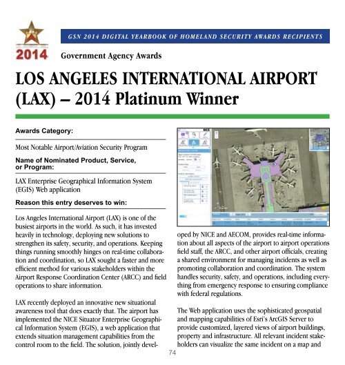
LAX recently deployed an innovative new situational<br />
awareness tool that does exactly that. The airport has<br />
implemented the NICE Situator Enterprise Geographical<br />
Information System (EGIS), a web application that<br />
extends situation management capabilities from the<br />
control room to the field. The solution, jointly devel-<br />
oped by NICE and AECOM, provides real-time information<br />
about all aspects <strong>of</strong> the airport to airport operations<br />
field staff, the ARCC, and other airport <strong>of</strong>ficials, creating<br />
a shared environment for managing incidents as well as<br />
promoting collaboration and coordination. The system<br />
handles security, safety, and operations, including everything<br />
from emergency response to ensuring compliance<br />
with federal regulations.<br />
The Web application uses the sophisticated geospatial<br />
and mapping capabilities <strong>of</strong> Esri’s ArcGIS Server to<br />
provide customized, layered views <strong>of</strong> airport buildings,<br />
property and infrastructure. All relevant incident stakeholders<br />
can visualize the same incident on a map and<br />
74