Improvements to Standard CALIPSO Products and ... - ceres - NASA
Improvements to Standard CALIPSO Products and ... - ceres - NASA
Improvements to Standard CALIPSO Products and ... - ceres - NASA

You also want an ePaper? Increase the reach of your titles
YUMPU automatically turns print PDFs into web optimized ePapers that Google loves.
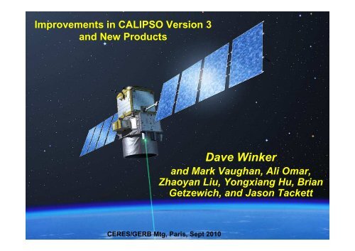
<strong>Improvements</strong> in <strong>CALIPSO</strong> Version 3<br />
<strong>and</strong> New <strong>Products</strong><br />
Dave Winker<br />
<strong>and</strong> Mark Vaughan, Ali Omar,<br />
Zhaoyan Liu, Yongxiang Hu, Brian<br />
Getzewich, <strong>and</strong> Jason Tackett<br />
CERES/GERB ECMWF, Reading, Mtg, Paris, UK, 12 Sept July 2010 2010<br />
1
Version 3 Highlights<br />
532 nm Attenuated Backscatter<br />
(particle amount)<br />
Version 2<br />
3-D D CAD<br />
(no depol!)<br />
Altitude +<br />
1064/532 Attenuated Backscatter Ratio<br />
(particle size)<br />
2
New CAD algorithm<br />
3D → 5D Classification<br />
532 nm Attenuated Backscatter<br />
(particle amount)<br />
Version 3<br />
5-D D CAD<br />
Altitude +<br />
1064/532 Attenuated Backscatter Ratio<br />
(particle size)<br />
Latitude +<br />
532 nm Volume Depolarization Ratio<br />
(particle shape)<br />
Liu et al., The <strong>CALIPSO</strong> Cloud <strong>and</strong> Aerosol Discrimination: Version 3 Algorithm <strong>and</strong> Test Results, ILRC 25<br />
3
New CAD algorithm<br />
3D → 5D Classification<br />
Separation between cloud <strong>and</strong> aerosol<br />
& dust classification improved in V3<br />
3D, V2.01<br />
Desert Dust<br />
2007-01<br />
01-01, 01, ~00:49 UTC<br />
Dense Dust<br />
Dense Dust<br />
“Continuum” due <strong>to</strong> cloud-clearing bug<br />
5D, v2.94<br />
V2.01, 3D CAD<br />
misclassification @ 5-km<br />
V3.01, 5D CAD<br />
correct classification @ 5-km<br />
depol<br />
backscatter<br />
4
CAD_score logic flaw corrected in V3<br />
Distribution of γ’ 532<br />
<strong>and</strong> χ’ for<br />
•0.15 < δ < 0.20<br />
•20° N < latitude < 30° N<br />
•0 km < Z mid<br />
< 1 km<br />
⎛<br />
( ) aerosol ( )<br />
( ) + ( )<br />
P layer - P layer<br />
cloud<br />
CAD score = 100 ⎜ P<br />
cloud layer P<br />
aerosol layer<br />
⎝<br />
⎞<br />
⎟<br />
⎠<br />
⎛<br />
CAD score = 100<br />
⎜<br />
⎝<br />
( Pcloud<br />
( layer ) + ∆Pcloud<br />
) -( Paerosol<br />
( layer ) + ∆Paero<br />
sol )<br />
( Pc<br />
loud ( layer ) + ∆Pcloud<br />
) + ( Pa erosol<br />
( layer<br />
) + ∆Paer<br />
osol<br />
)<br />
⎞<br />
⎟<br />
⎠<br />
5
Two Issues<br />
VERSION 2<br />
software bug in low-altitude cloud-clearing loop<br />
aerosol base detection not always good<br />
6
V2 Aerosol base detection sometimes <strong>to</strong>o high<br />
532 nm Attenuated Backscatter<br />
Vertical Feature Mask<br />
1064 nm Attenuated Backscatter<br />
7
Improved Aerosol Base Detection<br />
VERSION 3.01<br />
cloud-clearing bug fixed<br />
improved aerosol bases<br />
8
Result: single-layer low clouds<br />
Version 2.01<br />
When all 5-km clouds are counted, global<br />
mean cover of single-layer low cloud<br />
reduced from 26.1% <strong>to</strong> 21.8% in V3 – but<br />
5-km clouds are optically thin (τ
Version 2:<br />
Restructured Profile <strong>Products</strong><br />
Profiles of aerosol <strong>and</strong> cloud 532 <strong>and</strong> 1064 extinction <strong>and</strong> backscatter only<br />
Aerosol profiles reported at 40 km, clouds at 5 km<br />
Version 3:<br />
Both aerosol <strong>and</strong> cloud profile products now retrieved at 5-20-80 km <strong>and</strong><br />
reported at 5-km horizontal resolution<br />
Additional profiles:<br />
532 nm perpendicular backscatter <strong>and</strong> particle depolarization<br />
Atmospheric Volume Description (cloud/aerosol/clear etc.)<br />
Cloud fraction<br />
Backscatter <strong>and</strong> extinction uncertainties<br />
Added column parameters<br />
Column optical depth: cloud, aerosol, stra<strong>to</strong>sphere<br />
Column integrated attenuated backscatter (IAB)<br />
Data quality information<br />
CAD score, Ext_QC flag, Feature type QA flags<br />
10
New aerosol profile product<br />
Version 2.01: Aerosol Profile Product Resolution<br />
40 km Horizontal, 120 m Vertical<br />
11
Aerosol profiles now reported at 5-km<br />
Version 2.01: Aerosol Profile Product Resolution<br />
40 km Horizontal, 120 m Vertical<br />
Version 3.01: Aerosol Profile Product Resolution<br />
5 km Horizontal, 60 m Vertical<br />
also includes: depol, uncertainties, cloud flags, etc<br />
12
Uncertainties now included<br />
66.504° S, 52.585° W<br />
Altitude (km)<br />
13
Extinction Uncertainty Estimate<br />
Uncertainty in Particulate Backscatter Coefficients at Altitude n<br />
⎛<br />
2<br />
( ) ( X ) ⎛ 1 ⎞ σ ( βm,n<br />
)<br />
( S<br />
⎛<br />
) ( ) ( T<br />
−<br />
⎜<br />
)<br />
⎜ 2<br />
2<br />
( p,n−1<br />
)<br />
( − )<br />
2 2 2 2 2<br />
2 2<br />
2<br />
σ βp,n ⎛<br />
⎞<br />
2<br />
σ ⎞ ⎛ ⎞<br />
n<br />
2 ⎛ σ σ η ⎞ σ<br />
⎛<br />
p,n 1<br />
σ β ⎞⎞<br />
2 p,n 1<br />
= A ⎜<br />
2 n ⎜ 2 ⎟+ 2 ( 2<br />
p,n )<br />
⎟<br />
⎜ ⎟ + ητ ⎜ + ⎟<br />
2 2 ⎟ + + Bn<br />
2<br />
βp,n ⎜<br />
⎝ X<br />
n ⎠ ⎝ Rn ⎠ ⎜ βm,n ⎟<br />
⎝ S η ⎠ T ⎜ βp,n−<br />
1 ⎟⎟⎟<br />
⎝<br />
⎝ ⎠ ⎝<br />
⎝ ⎠⎠⎠<br />
Measurement<br />
Uncertainty<br />
Molecular Number<br />
Density Uncertainty<br />
Lidar Ratio Uncertainty<br />
Accumulated Aerosol<br />
Attenuation Uncertainty<br />
Multiple Scattering Uncertainty<br />
Includes errors due <strong>to</strong><br />
Calibration<br />
<br />
<br />
<br />
<br />
<br />
<br />
SNR<br />
molecular density (again)<br />
offset calculations<br />
polarization gain ratio<br />
polarization cross-talk<br />
ranging<br />
LEGEND<br />
S = lidar ratio β = backscatter coefficient<br />
R = scattering ratio σ 2 (x) = variance of x<br />
T = transmittance τ = optical depth<br />
m = molecular p = particulate (e.g., aerosol)<br />
P = measured data C = calibration constant<br />
η = multiple scattering fac<strong>to</strong>r<br />
( n)<br />
( )<br />
2<br />
rn<br />
⋅P r ⎛ Rn<br />
⎞ ⎛ 1 ⎞<br />
Xn = X ( rn ) =<br />
2 n = ⎜ ⎟⋅⎜ C ⋅ Tm<br />
rn<br />
Rn 1 ⎜ 1 Rn m,n S r ⎟<br />
⎝ − ⎠ ⎝ − ⋅β ⋅ ⋅η⋅∆ n ⎠<br />
= S⋅η⋅∆r ⋅β −<br />
A n n p,n 1<br />
B<br />
14
Version 3: New Cloud Phase Algorithm<br />
ROI<br />
Water<br />
HOI<br />
“High Confidence” ROI<br />
Jan 2007 (0.3 o )<br />
“Low Confidence” Water<br />
New algorithm (Hu et al, JTech, 2009) identifies<br />
both r<strong>and</strong>om<br />
“High<br />
<strong>and</strong><br />
Confidence”<br />
oriented ice<br />
HOI<br />
Based on IAB-depolarization relation<br />
But: augmented with a variety of additional tests<br />
Classification based on temperature only<br />
as a last resort (0.1% of cases)<br />
15
Reduced artifacts in cloud ice-water phase<br />
Oriented ice now properly classified (HOI water in V2)<br />
Improved CAD reduces mis-classification of dust as cloud<br />
Version 2.01 Version 3<br />
Number of ‘ice’ clouds with <strong>to</strong>ps below 3.25 km<br />
16
New V3 product: IWC<br />
Ice-Water Phase: 5 August 2007<br />
Cirrus (ROI)<br />
Cirrus (HOI)<br />
Water Cloud<br />
Unknown<br />
N/A<br />
Ice Water Content<br />
σ<br />
C<br />
⎛ ⎞<br />
= ⎜ ⎟<br />
⎝ ⎠<br />
IWC C0<br />
1000<br />
C 0 = 119 g/m 3<br />
C 1 = 1.22<br />
1<br />
IWC parameterization from Heymsfield et al (2005)<br />
17
IWC Comparison<br />
Ice Water Content (mg/m 3 )<br />
Z > 8.25 km<br />
CALIOP August 2007<br />
MLS<br />
CALIOP V3.01 Cloud Ice:<br />
18
Preliminary Comparison: TC4<br />
CloudSat<br />
<strong>CALIPSO</strong><br />
in situ<br />
IWC: <strong>CALIPSO</strong> vs. CloudSat<br />
– CALIOP doesn’t capture<br />
the higher IWC<br />
– CALIOP retrieves thin<br />
cloud ice between 10-15 km,<br />
comparable <strong>to</strong> in situ<br />
– CloudSat IWC appears <strong>to</strong><br />
be overestimated<br />
19
• Level 3 Cloud product<br />
– Based on Version 3 Level 2<br />
<strong>Products</strong> in development<br />
– Builds on experience from products recently developed (using Version 2)<br />
for CMIP5/GOCCP comparison <strong>and</strong> GEWEX Cloud Assessment<br />
• Level 3 aerosol product<br />
– Primarily: time-averaged gridded profiles of aerosol extinction, type<br />
– Based on Version 3 Level 2, with additional quality control<br />
• Near-realtime Level 1-like aerosol product for operational<br />
forecast centers<br />
20
Level 3 Aerosol Extinction - preliminary<br />
All clear-air + above-cloud<br />
uncertainty<br />
# samples<br />
Screening: ExtUnc, ExtQC, CADscore,<br />
cloud artifacts<br />
QC applied<br />
uncertainty<br />
# samples<br />
21
NRT aerosol product<br />
Aerosol product for model verification/assimilation by operational VFM centers<br />
- ECMWF, NRL, GMAO, …<br />
Level 1 profiles (1/3 km x 30-60 m) are cloud-cleared using VFM,<br />
then averaged <strong>to</strong> 20 km x 60 m<br />
Nominal delivery within 5-6 hours “semi-global”<br />
Operational in early 2011<br />
Level 1 - 532 nm<br />
“Level 1.5” attenuated<br />
backscatter<br />
Along track distance (km)<br />
22
Summary<br />
<br />
<br />
<br />
<br />
Have now acquired 4+ years of data<br />
<br />
<br />
Validation continuing<br />
Level 3 products in development<br />
Version 3 products recently released<br />
<br />
new parameters<br />
significant improvements over Version 2<br />
<br />
<br />
New Level 2 IIR product by end of 2010: D eff<br />
<strong>and</strong> IWC from lidar+IR<br />
Further improvements <strong>to</strong> AOD <strong>and</strong> aerosol extinction underway<br />
Payload still healthy<br />
Likely mission life: 2014-16<br />
Continuity of cloud/aerosol profiling:<br />
• ADM (ESA): 2011 (??)<br />
• EarthCare (ESA/JAXA): 2014<br />
• ACE (<strong>NASA</strong>): post-2020 (??)<br />
23