summer 07 / 20:2 - Grand Canyon River Guides
summer 07 / 20:2 - Grand Canyon River Guides
summer 07 / 20:2 - Grand Canyon River Guides

You also want an ePaper? Increase the reach of your titles
YUMPU automatically turns print PDFs into web optimized ePapers that Google loves.
the journal of <strong>Grand</strong> <strong>Canyon</strong> <strong>River</strong> <strong>Guides</strong>, Inc volume <strong>20</strong> number 2 <strong>summer</strong> <strong>20</strong><strong>07</strong><br />
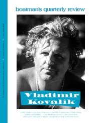
Julie<br />
Munger<br />
Prez Blurb • Dear Eddy • Farewell • AAB Update • Guide Profiles<br />
Sky Walk • Campsite Atlas Project • Powell Journal • GTS • Hopi Perspective<br />
Celestial Friends • Books • Back of the Boat • Evolving Landscapes
oatman’s quarterly review<br />
…is published more or less quarterly<br />
by and for <strong>Grand</strong> <strong>Canyon</strong> <strong>River</strong> <strong>Guides</strong>.<br />
<strong>Grand</strong> <strong>Canyon</strong> <strong>River</strong> <strong>Guides</strong><br />
is a nonprofit organization dedicated to<br />
Protecting <strong>Grand</strong> <strong>Canyon</strong><br />
Setting the highest standards for the river profession<br />
Celebrating the unique spirit of the river community<br />
Providing the best possible river experience<br />
General Meetings are held each Spring and Fall. Our<br />
Board of Directors Meetings are generally held the first<br />
Wednesday of each month. All innocent bystanders are<br />
urged to attend. Call for details.<br />
Staff<br />
Executive Director<br />
Board of Directors<br />
President<br />
Vice President<br />
Treasurer<br />
Directors<br />
Gcrg’s amwg<br />
Representative<br />
Gcrg’s twg<br />
Representative<br />
Bqr Editors<br />
Lynn Hamilton<br />
Marieke Taney<br />
Sam Jansen<br />
Lynn Hamilton<br />
Emily Perry<br />
Matt Herrman<br />
Andy Hutchinson<br />
Mark Piller<br />
Kate Thompson<br />
Emma Wharton<br />
Andre Potochnik<br />
John O’Brien<br />
Katherine Spillman<br />
Mary Williams<br />
Our editorial policy, such as it is: provide an open forum.<br />
We need articles, poetry, stories, drawings, photos, opinions,<br />
suggestions, gripes, comics, etc. Opinions expressed<br />
are not necessarily those of <strong>Grand</strong> <strong>Canyon</strong> <strong>River</strong><br />
<strong>Guides</strong>, Inc.<br />
Written submissions should be less than 1500 words<br />
and, if possible, be sent on a cd or emailed to gcrg;<br />
Microsoft Word files are best but we can translate most<br />
programs. Include postpaid return envelope if you want<br />
your disk or submission returned.<br />
Deadlines for submissions are the 1st of February,<br />
May, August and November. Thanks.<br />
Our office location: 515 West Birch, Flagstaff, az 86001<br />
Office Hours: 10:30–5:00 Monday through Friday<br />
Phone 928/773-1<strong>07</strong>5<br />
Fax 928/773-8523<br />
E-mail gcrg@infomagic.net<br />
Website www.gcrg.org<br />
Prez Blurb<br />
Greetings all you lucky bqr readers! First of<br />
all, thanks to all of you who attended the gts<br />
land and river sessions! As a participant, I can<br />
say that the land session was one of the best I have<br />
attended, and I hear that the river trip was incredible.<br />
Our total attendance was the highest it has been since<br />
<strong>20</strong>02! So, spread the word and let’s keep the<br />
momentum going in the years to come! In order to do<br />
that we need your help… Membership is the crucial<br />
element to the survival of gcrg and the bqr (what<br />
would we do without the bqr)! Please talk with<br />
passengers and guides about gcrg, what we do and<br />
how to become a member. With all the changes<br />
happening in <strong>Grand</strong> <strong>Canyon</strong> National Park and the<br />
management of the Colorado <strong>River</strong> now is a crucial<br />
time and gcrg is a strong voice that is needed for the<br />
protection of this place we all love. Please don’t just<br />
be an armchair enthusiast, encourage folks to join and<br />
be a part of the greater whole!<br />
I just returned from my first trip of the year. I didn’t<br />
notice many changes in the amount of interactions<br />
with other trips—really pretty quiet. However we did<br />
see differences in some of the side canyons… A rock<br />
fall at one of the scrambles in Hakatai <strong>Canyon</strong> along<br />
with quite a bit of sediment deposition and pool<br />
formation from a recent flood (making the hike a bit<br />
more friendly and wet), and the disappearance of the<br />
big chalkstone boulder at the top of the first narrows<br />
in Matkat! It’s always great to see the dynamic forces<br />
of nature at work.<br />
As we are propelled into the heart of <strong>summer</strong> along<br />
the Colorado <strong>River</strong> in <strong>Grand</strong> <strong>Canyon</strong> I urge you to<br />
keep in mind the changes we will see—keep interactions<br />
positive and the lines of communication open,<br />
use the courtesy flyer and above all… Remember how<br />
lucky we are to be where we are doing the things we<br />
do!<br />
Here are some words from the mind and hand of<br />
Edward Abbey: “Night and day the river flows. If time<br />
is the mind of space, the Colorado is the soul of the<br />
desert. Brave boatman come, they go, they die; the<br />
voyage flows on forever. We are all canyoneers. We are<br />
all passengers on this little living mossy ship, this delicate<br />
dory sailing around the sun that humans call<br />
earth… Joy shipmates, joy.”<br />
Marieke Taney<br />
page 2<br />
grand canyon river guides
Day 21, Mile 225<br />
Strung on a cable overhead<br />
the orange balls<br />
say it all<br />
“You're back.<br />
Too bad, buddy.<br />
Get ready to suck it up.”<br />
Suck up all the unbelievable shit<br />
this absurd life requires<br />
We’ve been free<br />
and free of it<br />
for three weeks<br />
like interplanetary travel<br />
but still on earth<br />
in the <strong>Grand</strong> <strong>Canyon</strong><br />
It’s post-partum depression<br />
but not for the mother<br />
or the new-born<br />
It’s for those who have been re-born<br />
in the <strong>Canyon</strong><br />
our sins washed away<br />
by the Colorado’s waters<br />
Like Adam and Eve, then<br />
we are cast out of paradise<br />
We can’t say why<br />
why we cannot continue<br />
this most innocent of occupations<br />
Why can I not<br />
go back to the Ferry<br />
and start all over again<br />
They are coming for me<br />
They will drag me<br />
kicking and screaming<br />
back to the city<br />
back to “civilization”<br />
back to the grind<br />
that grinds you down<br />
as surely do debris flows<br />
to the riverbed<br />
It is a jail sentence<br />
this exile from the <strong>Canyon</strong><br />
But knowing that escape is possible<br />
in every idle moment<br />
we pace our cells<br />
scheming<br />
What will it take<br />
to get a permit<br />
What will the Gatekeepers require<br />
to let us back in<br />
We must agree<br />
to shorter stays<br />
to less time<br />
to spend amongst our friends<br />
the rocks and canyon wrens<br />
to give up the mouths<br />
of Tapeats and Kanab Creeks<br />
and then, the ultimate question<br />
—how to draw the lucky number<br />
Must I sacrifice my first-born<br />
to appease the gods of the lottery<br />
I am torn<br />
or must I take the name of a deceased<br />
to go again this year<br />
risking fines and maybe jail time<br />
Desperate need calls forth desperate means<br />
It is now two weeks<br />
since we trekked our Trail of Tears<br />
up the Diamond Creek road<br />
and I suffer still<br />
Steve Miller<br />
boatman’s quarterly review page 3
Dear Eddy<br />
From a letter to gcrg, dated April <strong>20</strong>, <strong>20</strong><strong>07</strong><br />
Iam really sorry that I missed out on the chance to<br />
fund Lew’s interview. Thinking about Lew reminded<br />
me that at this year’s gts, the <strong>Grand</strong> <strong>Canyon</strong> Courtesy<br />
Guide was not only mentioned, but the audience<br />
was asked to get a copy and to use it on the river. Lew<br />
and I had a heavy hand in its production, and I want to<br />
review that with you, hoping that perhaps we will one<br />
day collect a bit of credit for our role.<br />
It all started with the Colorado <strong>River</strong> Constituency<br />
Panel, which was formed in December, 1990 under<br />
superintendent John Davis, and of which I was a<br />
charter member. The first meeting of this panel was<br />
held on January 10, 1991, and at that meeting I<br />
proposed that a “Courtesy Guide” be developed with<br />
the idea that it might alleviate some of the friction<br />
that I had experienced on the river between trips. In<br />
April, 1991, I sent an outline of a proposed document<br />
to Jerry Mitchell, who was the nps Resource Management<br />
Specialist. My suggestions led to me being<br />
appointed head of a committee to develop the Courtesy<br />
Guide. The committee consisted of me, Lew<br />
Steiger, and Jim and Bev Heumann. I was the chairperson,<br />
and we reported to nps ranger Mark Law.<br />
The going was tough, as Lew will certainly testify,<br />
and the finished document was not completed until<br />
1994. Approximately three years of hard work,<br />
research, and negotiation were required to put it<br />
together, and it had in it our hearts and souls, as well<br />
as numerous trips to the <strong>Canyon</strong> meetings, correspondence<br />
with Coast Guard attorneys, and many letters<br />
and phone calls between Lew and myself. When<br />
finished, it was published by nps, with attribution to<br />
the Constituent Panel.<br />
You may recall that in <strong>20</strong>04 I saw a new version of<br />
this Guide that was attributed to the gcrg, and that I<br />
wrote to Mike Ghiglieri mildly protesting that attribution<br />
of the origins of the Courtesy Guide had been left<br />
out. It turned out, of course, that this was not intentional,<br />
but that time had simply erased any memory of<br />
how the Courtesy Guide came about. I think, in light<br />
of the Guide being mentioned at the gts, that it<br />
would be appropriate for a mention in the bqr of its<br />
origins. Lew, acting for the guides, certainly had a large<br />
input.<br />
Bill Mooz<br />
A response from gcrg<br />
You’re absolutely right—we do owe a debt of<br />
gratitude to the hard work of the Constituency<br />
Panel members over a decade ago. Although the<br />
latest version of our <strong>River</strong> Courtesy Flyer has morphed<br />
significantly, similarities remain which are a testament to<br />
the longevity of the original document’s content.<br />
The Constituency Panel’s arduous and lengthy process<br />
is well documented in a very dusty file of ours entitled<br />
“Courtesy Flyer Debate.” As you mention, <strong>Grand</strong><br />
<strong>Canyon</strong> <strong>River</strong> <strong>Guides</strong> was heavily involved in developing<br />
page 4<br />
grand canyon river guides
the original brochure through Lew Steiger’s participation.<br />
In fact, an initial version did have <strong>Grand</strong> <strong>Canyon</strong> <strong>River</strong><br />
<strong>Guides</strong>’ name on it, but subsequent revisions credited the<br />
Constituency Panel to avoid politicization.<br />
Echoing the original flyer’s intent, the latest iteration<br />
is an educational tool for all boaters. When the<br />
Colorado <strong>River</strong> Management Plan (crmp) was heating<br />
up in <strong>20</strong>02 and tensions between private and commercial<br />
sectors were on the rise, reviving (and updating) a<br />
courtesy flyer seemed prudent, especially since the document<br />
had languished unused for so many years. And<br />
most certainly, the availability of our newest version is<br />
timely as <strong>Grand</strong> <strong>Canyon</strong> National Park commences the<br />
implementation phase of the crmp this river season.<br />
Through both of these latest revisions, gcrg’s highly<br />
successful collaboration with the <strong>Grand</strong> <strong>Canyon</strong> Private<br />
Boaters Association is indicative of our mutual desire to<br />
promote positive river encounters between all river<br />
users. Our path has been made much easier through your<br />
worthy efforts, those of Lew Steiger, the National Park<br />
Service, and all other Constituency Panel members, in<br />
proactively addressing a need that continues today—<br />
preserving the river experience for all to enjoy.<br />
Lynn Hamilton<br />
Executive Director<br />
Note: The new <strong>River</strong> Courtesy Flyer is being distributed widely to<br />
all sectors. We are very appreciative that the nps will be including<br />
the brochure in all private permit packets as well as making them<br />
available at Lees Ferry. The flyers are also being sent to commercial<br />
river outfitters, to <strong>Grand</strong> <strong>Canyon</strong> Monitoring and Research Center,<br />
and to outfitting/equipment rental companies like pro, <strong>Canyon</strong><br />
reo, Ceiba, etc... If you’re interested in seeing the brochure yourself,<br />
you can find it on gcrg’s website, www.gcrg.org and that of<br />
the <strong>Grand</strong> <strong>Canyon</strong> Private Boaters Association, www.gcpba.org.<br />
From an email to gcrg dated April <strong>20</strong>, <strong>20</strong><strong>07</strong><br />
On Friday, March 30, eight volunteers showed<br />
up to help pull Sahara mustard from the Lees<br />
Ferry area. In just a few short hours, the group<br />
removed 6,024 of the invasive plants from the Paria<br />
Bridge downriver along the roadside. This was a great<br />
effort and will truly help with the long-term control of<br />
this highly invasive plant species.<br />
On the gts river trip, the crew removed 2,300<br />
camelthorn plants from Unkar and 1,575 from Crystal.<br />
Unkar and Crystal are the two test sites to see whether<br />
long-term manual removal of the spiny bugger’s top<br />
growth will dimish its extensive reserves and ultimately<br />
kill the population. The group reported that<br />
both of those sites look much better than last year,<br />
which is great news.<br />
If anyone is interested in continuing this work<br />
throughout the year, that would certainly help and<br />
would be greatly appreciated. There are very simple<br />
postcards that folks can track their numbers on and<br />
send them directly to Lori Makarick—please contact<br />
Lori at (928) 226-0165 if you are interested in helping<br />
with this project and don’t forget, we have to get the<br />
data to answer the question. The gts group couldn’t be<br />
stopped as they pulled about 3,000 tamarisk seedlings<br />
up Mohawk <strong>Canyon</strong>!<br />
Lori J. Makarick<br />
Backcountry Vegetation Program Manager<br />
GTS trip pulling camelthorn at Unkar.<br />
Photo: Greg Woodall<br />
boatman’s quarterly review page 5
Farewell<br />
Joseph Lewis Tonsmeire<br />
January 22, 1948 –March 7, <strong>20</strong><strong>07</strong><br />
A passion for life and adventure, an inspiration to all.<br />
Joe Tonsmeire, longtime <strong>Grand</strong> <strong>Canyon</strong> boatman,<br />
died March 9, <strong>20</strong><strong>07</strong> of multiple myeloma. Joe came<br />
from an adventurous lower<br />
Alabama family with eight<br />
boys. He headed west in 1969,<br />
finding work with Hatch up in<br />
Vernal and doing his first<br />
training trip in <strong>Grand</strong> <strong>Canyon</strong><br />
late in the year. He worked<br />
long seasons in the <strong>Grand</strong> the<br />
next three years with such<br />
luminaries as Steve Bledsoe,<br />
Tom Moody, Pat Conley, Tim<br />
Means, Dave Leesburg, and<br />
Whale. Joe once told me the<br />
story of how he and Whale<br />
decided to hike in and see the<br />
wonders of Thunder <strong>River</strong>.<br />
They had a short break<br />
between trips in the middle of<br />
<strong>summer</strong>, and it was to be the<br />
first “backpacking experience”<br />
for both of them. By the time<br />
they got to the trailhead with their brand new hiking<br />
boots and packs it was already the heat of the day and by<br />
the time they got down to the Esplanade they were out<br />
of water and suffering considerably. Finally Whale laid<br />
down under the meager shade of a small bush and<br />
uttered the classic lines “you go on, it’s all right, just<br />
leave me here to die.” Joe couldn’t get him to move and<br />
promised he’d return as soon as he could with water,<br />
“just please don’t die!” Joe made it down to Thunder,<br />
and after filling his gullet and canteens was about to<br />
head back up when he saw a cloud of dust heading down<br />
the slope. He thought it was a rock fall but soon realized<br />
it was Whale. Whale had decided not to give up on life<br />
just yet, and upon catching sight of the falls had barreled<br />
straight down the slope, ignoring both trail and switchbacks.<br />
The two hikers were reunited, spent the night in<br />
cool watery bliss, and hiked out early the next morning<br />
to go rig another river trip.<br />
In the Fall of ’71, Joe married his high school sweetheart<br />
Fran Bender, in Upper Elves Chasm on a private<br />
trip with his brothers. The two were to remain sweethearts<br />
the rest of their lives. They took a month long<br />
honeymoon trip in December of ’73, two people rowing<br />
two seven man rafts during which Fran dislocated her<br />
shoulder on the way back from Thunder <strong>River</strong>. They put<br />
the shoulder back in by guess and by golly and rowed a<br />
double-rig until Fran was healed up enough to row with<br />
both arms again.<br />
During a short break in the epic <strong>summer</strong> of ’72, Joe<br />
and Fran managed to squeeze in a Middle Fork private<br />
and fell in love with Idaho. They moved up to Lemhi<br />
and began building Wilderness <strong>River</strong><br />
Outfitters (wro), a truly adventurous<br />
company running river trips and<br />
other expeditions all over the Northwest<br />
and up into Alaska. It was about<br />
as far from industrial <strong>Grand</strong> <strong>Canyon</strong><br />
boating as you could get and still call<br />
it a river business. Yet they couldn’t<br />
stay away from the <strong>Grand</strong>, running<br />
private family trips with their children<br />
Amy and Seth, and sharing<br />
Charter trips with their many loyal<br />
customers and friends. Joe remained a<br />
<strong>Grand</strong> <strong>Canyon</strong> guide to the end,<br />
captaining a paddle boat all the way<br />
on his last trip in September of <strong>20</strong>06.<br />
Fran, Amy, and Seth are keeping<br />
wro alive with the help of Joe’s<br />
brothers Skipper, Dan, Pepper, and<br />
Mike.<br />
Matt Herrman<br />
With the pace of a mountain goat and the heart of<br />
Lion, he never stopped living—he’d rather die trying;<br />
From the top of McKinley or thru raging falls,<br />
he’s riding the range and shooting the stars;<br />
The <strong>River</strong> it called and the trail it began,<br />
and the wind always whispered to this special man;<br />
A figure of love, and passion and grace,<br />
blue dancing eyes and a smile on his face;<br />
I wonder now what we should do or should say;<br />
I’ll follow his tracks and cherish each day;<br />
Well the <strong>River</strong> it called and the trail it began,<br />
and the wind always whispered to this special man.<br />
~ a poem by Joe’s daughter Amy<br />
page 6<br />
grand canyon river guides
Adopt-a-Boatman Update<br />
How are we coming along on our Adopt-a-<br />
Boatman oral history project The proverbial<br />
ball is rolling along, lickety-split! Here’s the<br />
scoop:<br />
• Lew Steiger will conduct the interview with Howie<br />
Usher in late May.<br />
• We’ve been in contact with Allen Wilson and Tim<br />
Whitney to schedule their interviews.<br />
• The Adopt-a-Boatman sponsorship of an interview<br />
with Lew Steiger is now fully funded with Katie Lee<br />
putting up the last $250 (Richard Quartaroli had<br />
taken the initial plunge). Quite a number of you<br />
were itching to help with that sponsorship and<br />
we’re sorry, but Katie beat you to it! But it’s great to<br />
know that there is such interest in “interviewing<br />
the interviewer.” We’ve already talked to Richard<br />
Quartaroli and Brad Dimock about cornering Lew<br />
sometime this <strong>summer</strong>. As Katie urges, “If push<br />
comes to shove, sit on his oars!”<br />
• We have a brand new fully funded “adoption” for an<br />
interview with George Billingsley (geologist, river<br />
runner in the 1970s), courtesy of gcrg member,<br />
Guy Blynn. We’re thrilled to add George to the list!<br />
Thank you, Guy.<br />
• We have two new partially funded adoptions! The<br />
first is to sponsor an interview with Richard Quartaroli<br />
(gcrg past president, river historian, and river<br />
guide), courtesy of gcrg general member Elizabeth<br />
Stewart. Richard’s adoption needs $500 to<br />
complete. The second partial adoption will help<br />
sponsor an interview with John Blaustein (former<br />
dory guide under Martin Litton, noted river photographer),<br />
needing another $350 to be fully funded.<br />
Gcrg members John Downing and Betsy Barker<br />
have stepped up to the plate as sponsors for this<br />
adoption of “J.B.” Thanks to all!<br />
• Our existing partially funded Adopt-a-Boatman<br />
sponsorship is for interviewing Dick McCallum<br />
(Expeditions) with another $400 needed to take up<br />
where his previous interview left off…Thank you<br />
Bill Bishop for helping to get that adoption started.<br />
Please help us fully fund any of these partial adoptions<br />
by sending a check to gcrg today! You need not cover<br />
the entire remaining balance as any adoption can have<br />
numerous sponsors.<br />
For more information about this fundraising program,<br />
including the current spreadsheet detailing Adopt-a-<br />
Boatman sponsorships and their status, check out the<br />
gcrg website: www.gcrg.org/adoptaboatman. Considering<br />
the flurry of activity in this program, checking out<br />
the current status is advisable, or you can give Lynn a<br />
call at (928) 773-1<strong>07</strong>5, or email to gcrg@infomagic.net.<br />
We are so encouraged by the widespread interest in<br />
this fledgling program. Thanks so much to the<br />
generous sponsors, and to those willing interviewees!<br />
Capturing their stories for posterity will be an honor.<br />
Announcements<br />
JOB<br />
Toucanet Coffee in Flagstff is looking for<br />
someone to help label coffee bags, grind coffee and<br />
perhaps do some delivering—therefore must drive and<br />
have a vehicle. This person will need to work at least<br />
two days a week, minimum four hours each day<br />
(Monday and Thursday) through August this <strong>summer</strong>.<br />
The pay will depend on how responsible, etc. the<br />
person is. Please let me know if you know of—or<br />
are—a person I can trust to help with this. Contact<br />
Helen at (928) 779-1856.<br />
ARTIST OF THE ISSUE<br />
The art in the center of this issue is by Erica Fareio,<br />
who guides for Arizona <strong>River</strong> Runners. You can see<br />
more of her work at ericafareio.com.<br />
boatman’s quarterly review page 7
Guide Profiles<br />
Beverly Caifa, Age 46<br />
Where were you born and where did you grow up I<br />
was born, and raised in Austin ,Texas.<br />
Who do you work for currently (and in the past)<br />
I currently work for azra, and worked with Sleight<br />
Expeditions/High Desert Adventures until it was<br />
purchased by azra.<br />
How long have you been guiding I started training<br />
in ’88, and got my guides<br />
license in ’90.<br />
What kind of boat(s) do<br />
you run Oar and Motor<br />
What other rivers have<br />
you worked on The San<br />
Juan.<br />
What are your<br />
hobbies/passions/dreams<br />
Scuba Diving, creatingcrafts,<br />
I love to travel! My<br />
goal…to introduce as many<br />
people to my passions as<br />
possible.<br />
Married/family/pets<br />
Fortunately, I still have my entire family, and my<br />
wonderful…and understanding husband Michael.<br />
School/area of study/degrees Living abroad and<br />
being around thousands of talented, and interesting<br />
people.<br />
What made you start guiding The fact that we are<br />
such a small speck in time will always keep me in awe of<br />
the <strong>Grand</strong>. Nowhere else do you lose the sense of time,<br />
routines, and what society expects. I love to see people<br />
unwind and become kids again. I think having to experience<br />
Mother Nature in all her many facets builds a bond<br />
that can’t be experienced in many other ways.<br />
What brought you here Destiny, I missed my flight to<br />
Hawaii and ended up camping at Lees Ferry. Next thing<br />
I knew I had begged my way on a river trip with<br />
Diamond <strong>River</strong> Expditions.<br />
Who have been your mentors and/or role models<br />
Wow!…too many to mention. Peter Weiss, Rusty<br />
page 8<br />
Dassing, Don Bacco for taking me under their wings in<br />
those early low water days. Now it’s all the wonderful<br />
people that work for azra like Drifter and Brad, that<br />
just seem to have endless amounts of knowledge about<br />
the place we work in. And of course all those people out<br />
there who strive for what they believe in.<br />
What do you do in the winter Scuba Diving<br />
Instructor.<br />
Is this your primary way of earning a living or do<br />
you combine it with something<br />
else I combine it<br />
with my earnings from<br />
teaching diving.<br />
What’s the most memorable<br />
moment in your<br />
guiding career Probably<br />
this one—being nominated<br />
when their are so many<br />
talented and educated people<br />
working on the <strong>Grand</strong><br />
<strong>Canyon</strong>!<br />
What’s the craziest question<br />
you’ve ever been<br />
asked about the<br />
canyon/river Does that<br />
rock reach the bottom Are<br />
we going to go under that<br />
bridge What color is my underwear…just kidding.<br />
What do you think your future holds Keep traveling<br />
until I find that special spot. Maybe I will always<br />
have “Puppy Feet” as my Belizean friends call it. I<br />
imagine I will always try to squeeze in a trip or two a<br />
year down the <strong>Grand</strong> as long as my body will allow it. I,<br />
like so many others, will always be drawn back to the<br />
<strong>Canyon</strong>.<br />
What keeps you here Mostly the freedom I still feel in<br />
the <strong>Grand</strong> <strong>Canyon</strong>. Waking up each morning and<br />
getting to choose what we would like to do with the<br />
folks that day. I think that’s how we guides are so<br />
successful at sharing or knowledge of the <strong>Grand</strong><br />
<strong>Canyon</strong>. Not too many jobs out there allow that sort of<br />
freedom. And of course my <strong>Grand</strong> <strong>Canyon</strong> family, the<br />
chance to reunite with them all somewere down there.<br />
If I had one word of advice it would be simplify.<br />
grand canyon river guides
Rachael Rankin; Age 29<br />
Where were you born and where<br />
did you grow up I was born and<br />
grew up in West Jordan, ut until I<br />
was fourteen. In ‘92, my family<br />
moved to Big Water, ut just outside<br />
of Page, az. I graduated from Big<br />
Water School in 1995 in a class of<br />
four—fairly large for our little<br />
school.<br />
Who do you work for currently<br />
(and in the past) I began working<br />
for Diamond <strong>River</strong> Adventures after<br />
I fell in love with the canyon on a<br />
private trip. I started in June of <strong>20</strong>01 and I still work for<br />
Diamond. I have done a trip with Wilderness <strong>River</strong><br />
Adventures and I rowed my first boat with High Desert<br />
in October of <strong>20</strong>01. Also, I have done a few gts trips<br />
and a tamarisk removal trip.<br />
What kind of boat(s) do you run I run 18-foot oar<br />
boats and 35-foot motor boats. I benefit from working<br />
for Diamond because we get to play in both types of<br />
boats fairly equally.<br />
What other rivers have you worked on I have not<br />
worked on any other rivers; I hadn’t done a river trip<br />
until I went on my private in the <strong>Grand</strong> in May of <strong>20</strong>01.<br />
I never knew it was such an amazing place and I was<br />
determined to spend as much time in the big ditch as<br />
possible. I grew to love sharing the experience with<br />
passengers; seeing the canyon through their eyes over<br />
and over again, every trip! I have run the Salt <strong>River</strong> in<br />
southern Arizona as well.<br />
What are your hobbies/passions/dreams I fancy doing<br />
anything outdoors. I hike, road bike, cross-country ski and<br />
snowboard. I love to spend time on Lake Powell kayaking<br />
and water skiing. My passion for the last six years has definitely<br />
been the <strong>Grand</strong> <strong>Canyon</strong>; however, my dream has<br />
always been to be in the medical profession.<br />
Married/family/pets My better half is Dave Panu,<br />
another guide for Diamond. We live in a lovely little<br />
house in Page and have a cat named Kitty.<br />
School/area of study/degrees After high school I<br />
attended college at Southern Utah University in Cedar<br />
City. I obtained a b.s. in Biology in May of <strong>20</strong>00. I am<br />
going back to school to work on a nursing degree.<br />
What made you start guiding I started guiding because<br />
I became enamored with the <strong>Grand</strong> <strong>Canyon</strong> and the<br />
simple life on the river. It became<br />
a place of sanctuary for me and a<br />
place to challenge myself. I enjoy<br />
working with people and it all fit<br />
together nicely.<br />
What do you do in the<br />
winter In the winter time I<br />
have done a variety of things. I<br />
worked in Brian Head, ut for<br />
several seasons as a cocktail waitress/<br />
bartender. In <strong>20</strong>04 I began<br />
working as a teacher in Big<br />
Water, covering all the Math and<br />
Science for the secondary grades.<br />
This winter I have gone back to<br />
nursing school to pursue my dream.<br />
What’s the most memorable moment in your<br />
guiding career I have had many memorable<br />
moments—moments that involve unimaginable beauty<br />
that takes your breath away; waterfalls, flashfloods,<br />
helping save a life on an October trip. I’ve listened to<br />
live string quartets and bluegrass in side canyons. I’ve<br />
laughed so hard that my stomach hurt on countless<br />
occasions. I’ve had the feeling of triumph after rowing<br />
26 miles on a windy day, and low water trips on the<br />
same prop from put-in to take-out. I’ve had great runs,<br />
and not so great runs (Bedrock, yikes!). It is difficult to<br />
pick out the most memorable moment—they are all<br />
memorable moments.<br />
What do you think your future holds My future<br />
holds more school and hopefully a few children. As sad<br />
as I am to realize that my <strong>Grand</strong> <strong>Canyon</strong> rafting as a<br />
career is coming to a close, I am grateful for the incredible<br />
experience. I plan on starting back to school at nau<br />
in May of <strong>20</strong><strong>07</strong>. I will receive my bsn in December of<br />
<strong>20</strong>08 and go to work as a nurse in preparation for graduate<br />
school. Although my program will not allow me to<br />
run as a full-time guide any more, I will be squeezing in<br />
as many trips as possible. It is something that will be a<br />
part of my life as long as I live.<br />
What keeps you here I began running river and I keep<br />
running river for the same reasons: the beauty of the<br />
canyon, the song of the river, the friends I meet, the<br />
challenges I greet, and the simplicity of life. My feelings<br />
are best expressed in a quote by Henry David Thoreau:<br />
I went to the woods [canyon] because I wished to<br />
live deliberately, to front only the essential facts<br />
of life, and see if I could not learn what it had to<br />
teach, and not, when I came to die, discover that<br />
I had not lived.<br />
—Henry David Thoreau, Walden (1854)<br />
boatman’s quarterly review page 9
The Sky Walk<br />
News of the newly opened Sky Walk out on the<br />
Hualapai Plateau seemed to be flooding over me<br />
for the past couple of months. First it was<br />
releases on the audacity of the plan, then it was news<br />
that the main structure had been placed, and lately that<br />
it was open.<br />
Much of the reaction from the people in my circles<br />
and the press I read has been tut-tut and judgmental.<br />
The take from these commentators is that the whole<br />
scene smacks of carnival and crass commercialism.<br />
Where is the appreciation of nature and quiet<br />
But, I’m innately a curious guy—a guy who likes to<br />
probe the edge, even to be shocked or startled. Guess I<br />
am just another of life’s voyeurs.<br />
Saturday, April 22 found me driving to <strong>Grand</strong> <strong>Canyon</strong><br />
West from my environmentally correct life in prosaic<br />
Boulder City, Nevada. I was on the road to Meadview—so<br />
familiar from so many takeouts—sneaking in alone under<br />
the radar of my politically correct friends and my critical<br />
significant other, headed for my Sky Walk adventure. I<br />
figured this was going to cost me $40 plus gas. I was wrong.<br />
About five miles toward Meadview from the turnoff<br />
from us 93, I became aware that there was a lot more<br />
traffic than I remembered out there. I was thinking that<br />
the Dolan Springs and Meadview developments were<br />
really starting to get a bit congested. Then I found<br />
myself behind one of those big white luxury buses, and<br />
upon passing it noticed that it was labeled <strong>Grand</strong><br />
<strong>Canyon</strong> West Express.<br />
The light dawned, these folks weren’t locals. I started<br />
to notice that the cars I was passing had California<br />
plates, and there were too many from Nevada for this<br />
road. For crying out loud, all these people were heading<br />
for the Sky Walk! I sped up, passed the bus, got as far<br />
ahead of the traffic as possible; because I didn’t want to<br />
eat their dust on the old Clay Springs road on the climb<br />
up to the Hualapai Plateau.<br />
The turn onto the Clay Springs road delivered two<br />
surprises. First, it was a well graded dirt road, where<br />
before it had been a two track decades ago. Dotted<br />
before me was a chain of dust clouds. The road was<br />
congested with more luxury tour buses, pink and yellow<br />
Las Vegas tour company vans, white minivans from all<br />
the other tour companies in the surrounding three<br />
states, and numerous private cars and suvs, many of the<br />
latter driven tepidly by tourists from Kansas testing their<br />
mettle against the washboards, curves and terrain of this<br />
mountainous desert road. Some were going just too slow<br />
at ten miles per hour on that 25-mile leg of the journey.<br />
At that speed the washboard was beating me to death.<br />
We snaked our way up the flank of the plateau. After<br />
fifteen miles of dirt and upon reaching the Hualapai<br />
reservation boundary, we found ourselves on a nice<br />
paved road that took us directly to the <strong>Grand</strong> <strong>Canyon</strong><br />
West airport terminal. The terminal serves as the<br />
jumping off point for tourists. We were all now funneled<br />
into the great white way, with no escape. My wallet<br />
immediately felt insecure.<br />
A greeter on the road directed me to a large parking<br />
lot already crowded with cars and suvs, and I joined the<br />
flow of people moving toward the air terminal which<br />
serves as the visitor center and hub for transportation<br />
out to the attractions that dot <strong>Grand</strong> <strong>Canyon</strong> West. The<br />
road fronting the terminal was lined with huge white<br />
luxury buses and vans, all parked herringbone style to<br />
optimize the space just waiting to be summoned. As I<br />
walked toward the terminal, I merged with a bus load of<br />
Chinese who had just disembarked from one of the<br />
white behemoths from Las Vegas, their giddy excitement<br />
being quite infectious.<br />
Inside were three windows at a bank-like counter,<br />
two open, the other closed because the operation is<br />
desperately understaffed. They have a large menu of<br />
tours to select from including helicopter lifts down to<br />
the river where you can join the part day float trips on<br />
Lake Mead. A helpful Hualapai greeter read out the<br />
choices as we waited in line. I chose the stripped down,<br />
minimal tour with the Sky Walk as its centerpiece. This<br />
package is called the Spirit Package—price $49.95 after<br />
the 25 percent local resident discount which the greeter<br />
lady advised me I should request, plus $25 for the Sky<br />
Walk.<br />
No discount for the Sky Walk. You want the walk,<br />
it’s $25 no matter what package you buy! But you can’t<br />
just pay that $25 fee and get on. The Sky Walk has to<br />
be bundled with one of the tours.<br />
My Spirit Package included trips to Eagle Point<br />
where the Sky Walk is located, Guano Point farther out<br />
on the plateau to the west, Hualapai Ranch to the east<br />
of the airport, a Wagonwheel Ride from the ranch,<br />
lunch at either Guano Point or the ranch, and a free<br />
certificate of accomplishment at the gift shop.<br />
The fellow in front of me was buying tours for three<br />
or four people, his tab over $380! Out came a fan of<br />
$100 bills.<br />
There was activity and new construction in every<br />
direction from the airport. They are elongating the<br />
runway to accommodate Boeing 737s. The existing<br />
runway is crowded with tour planes representing every<br />
operator who is anyone in the region. You’ve seen them<br />
all. The whomp whomp of helicopters taking off and<br />
landing is omnipresent, from a heliport across the road<br />
from the terminal. Aircraft and helicopters were parked<br />
all over the place.<br />
page 10<br />
grand canyon river guides
Eager staffers were pointing out that at least one<br />
major hotel is planned, so posh overnight stays will be<br />
possible soon. Another staffer revealed that all the water<br />
to supply the place—10,000 gallons per day—is hauled<br />
by tanker truck from Peach Springs, seventy miles to the<br />
east on the Buck and Doe Road. Hardly any of it is used<br />
for toilets because there are rows of porta potties everywhere.<br />
The pace of things, the provisional look of most of<br />
the buildings, the torn up ground for all the new and<br />
ongoing construction added to the urgency of the<br />
moment. Voices filled the air, people surged this way and<br />
that. The ambiance was similar to Las Vegas.<br />
Shortly I found myself in another queue in front of<br />
the terminal, boarding a luxury white tour bus heading<br />
out to the Sky Walk. I was in the company of the same<br />
Chinese who had arrived along with me. A greeter<br />
counted us as we climbed in, and cut the line off when<br />
all the seats were taken. The<br />
line just kept forming for the<br />
next bus in five minutes.<br />
I sat in front of a couple<br />
from Lawrence, Kansas, who<br />
had braved the Buck and Doe<br />
Road from Peach Springs. We<br />
quickly compared notes. That<br />
road was virtually deserted. I<br />
was going home that way—to<br />
Peach Springs, then back to<br />
Kingman, even though it<br />
added 150 mile to my return.<br />
Enough of the Clay Springs<br />
road with all that traffic!<br />
The Kansans were excited.<br />
They had just survived a truly<br />
memorable driving experience<br />
to the ends of the earth on a<br />
road the likes of which they<br />
had never driven. They failed<br />
to fill up with gas in either Seligman or Peach Springs, so<br />
had done it on fumes, arriving at <strong>Grand</strong> <strong>Canyon</strong> West on<br />
empty. Helpful staffers found them some gas at $3.50 per<br />
gallon, and now they were on this bus off to see the<br />
fabled <strong>Grand</strong> <strong>Canyon</strong>! Their excited anticipation,<br />
coupled with that of the Chinese, was palpable. I found<br />
myself being swept further along by the anticipatory<br />
mood of these folks. We were driving across the flat<br />
Hualapai Plateau, less than a mile from the canyon rim,<br />
but no one could see it.<br />
The Native American woman driver was a most<br />
congenial sort, so I struck up a conversation. I wanted to<br />
get a Hualapai perspective on all of this. The first thing<br />
she revealed was that they are hiring anyone who will<br />
come out there. Anyone! I already had noticed that<br />
most of the employees are not Hualapai. She then<br />
offered that she commutes from Meadview, a place she<br />
considers heaven.<br />
Then she laughed, and advised that she was not<br />
Hualapai at all, but rather a transplant from the San<br />
Juan Pueblo in New Mexico. This was a great opportunity<br />
for her, especially because she already had all the<br />
necessary drivers licenses and certifications being a<br />
former Greyhound bus driver. We were moving smoothly<br />
down a fine, narrow paved road, one bus every five<br />
minutes, all day long.<br />
After a few turns, there it was off to the right, the<br />
canyon rim, the Sky Walk! Even from a distance you<br />
could see all sorts of people crowding all over it.<br />
A temporary reception building serves as entrance to<br />
it. You disembark the bus, take a dozen steps and enter.<br />
They immediately advise that you can’t take photos, and<br />
that you must surrender all cell phones and cameras<br />
which are stored for you in bins until you leave. Next<br />
you pass through a standard airport security gate in order<br />
for a security officer to in fact<br />
determine that no cameras or cell<br />
phones are slipping in.<br />
Then you queue in yet<br />
another line where an attendant<br />
affixes a bar coded time-date<br />
stamped wrist band on your left<br />
wrist. Unfortunately it does not<br />
contain a running serial number<br />
so that you see exactly how many<br />
have gone before. However, one<br />
of the guides enthusiastically told<br />
us they just recently had passed<br />
the 10,000 mark.<br />
It was 11:03 a.m. based on my<br />
wrist band, as I walked out into<br />
what was a beautiful clear, bright<br />
April day, with widely scattered<br />
clouds. Stretching out ahead was<br />
a U-shaped sidewalk maybe six<br />
feet wide with five-foot high<br />
walls composed of panels of thick glass, and a floor<br />
comprised of composite glass panels separated by gaps of<br />
two inches. The walkway had no roof. The composite<br />
floor panels form a three- or four-foot wide clear glass<br />
view to the depths, but the foot wide edges over the<br />
support beams have some type of opaque metalized<br />
coating or layer so you can’t see the top of the beams.<br />
This structure is moored to the plateau surface back<br />
from the edge of the precipitous cliff. The Sky Walk juts<br />
out <strong>20</strong>0 feet beyond the sheer drop. The upper cliff is<br />
the full section of Esplanade Sandstone.<br />
Some tens of feet back from the rim, attendants<br />
provide you with cloth booties to cover your footwear so<br />
you won’t scratch the glass. They will help put these on,<br />
should you need help.<br />
I felt vertigo as I walked past the edge of the cliff,<br />
surprised at being somewhat disoriented. Looking out at<br />
boatman’s quarterly review page 11
the horizon cleared that up instantly, but having the<br />
confidence to walk the center of the clear glass floor<br />
required logic. People were excitedly chattering, hesitantly<br />
stepping forward. Most clutched the rail, a few<br />
would not venture off the metalized coating covering<br />
that they knew covered a support beam.<br />
One man was having great difficulty taking the first<br />
step beyond the edge of the cliff, and it took him many<br />
very uncomfortable minutes to negotiate the first ten<br />
feet or so. Beyond that he struggled around the circuit<br />
grasping the railing as if there was no floor under him.<br />
Finally, with a look of great relief, he disembarked.<br />
There were two cameras set up at the outermost<br />
point, each designed to take optimal advantage of<br />
different sun angles. Snap shots were $15 for an 8 x 10<br />
photo, and there were plenty of willing visitors. By the<br />
time the folks reached the cameras, they generally were<br />
more at ease with the experience, so they became more<br />
talkative and effusive. Those cameras were pure good<br />
marketing.<br />
If you weren’t totally distracted having your photo<br />
taken, you could opt to drink in the scene at the outermost<br />
point of the walk between the two camera stations.<br />
Although the U-shaped sidewall sticks out <strong>20</strong>0 feet, it<br />
does not clear the edge of the Redwall cliff below. If you<br />
look straight down, it is about 600 or so feet to the slope<br />
that occurs between base of the Supai Group and the<br />
edge of the Redwall cliff.<br />
Outward, you have a direct view of Lake Mead some<br />
4,000 feet below. These details are really lost on most<br />
people during the walk because the adrenalin is simply<br />
too concentrated in the blood stream to allow for such<br />
analysis. A disclaimer is warranted. I lingered on the Sky<br />
Walk for over half an hour just so such details would<br />
fully register.<br />
A Hualapai man in his twenties was fully employed<br />
out there, continually wiping the fingerprints from the<br />
class and dusting the glass floor. I struck up a conversation<br />
with him, and he shared many insights. He advised<br />
that since the Sky Walk opened, visitation has just<br />
about quadrupled, up from about 500 a day to between<br />
1500 and <strong>20</strong>00. People arrive in every mode—plane,<br />
helicopter, bus, tour van, private car. Clearly the<br />
Chinese businessman from Las Vegas who conceived and<br />
funded the Sky Walk has a winner on his hands.<br />
Visitation is so great, it is overwhelming the operation.<br />
They were continually hiring, unable to fill all the<br />
jobs. And they hire anyone, not just Hualapai. In fact,<br />
the Hualapai were having difficulty taking the jobs,<br />
because it requires a daily 150-mile round-trip over the<br />
tedious Buck and Doe Road from Peach Springs. As a<br />
result, many of them find the jobs untenable.<br />
Employees commonly work twelve-hour shifts, and<br />
some had been working seven days a week for lengthy<br />
periods since the Sky Walk opened. Another Hualapai I<br />
collared delighted in correcting me that he was in fact a<br />
page 12<br />
Filipino-Hawaiian who baled from Las Vegas to take<br />
advantage of the opportunity afforded by employment at<br />
<strong>Grand</strong> <strong>Canyon</strong> West.<br />
The fellow I was talking to on the Sky Walk<br />
continued. Construction of a two-story building hosting a<br />
restaurant on the second floor was going to commence<br />
shortly in place of the temporary trailer-like structure that<br />
now serves as the gateway to the Sky Walk. The building<br />
will be built on top of the beams that support the Sky<br />
Walk; consequently, it will be perched right on the edge<br />
of the plateau with spectacular panoramic views.<br />
A technical problem has arisen. Condensation forms<br />
within the composite sandwich that makes up the glass<br />
floor of the Sky Walk, creating bands that sully the view<br />
and diminish the full psychological impact. This<br />
problem will have to be resolved soon.<br />
Hotels and restaurants are in planning nearby, the<br />
idea of course to encourage overnight stays, generate<br />
even more revenue, and to make the place a plausible<br />
destination for commercial jet traffic. What I was seeing<br />
as torn up ground was just the beginning of construction<br />
of this infrastructure. The place is going to look differently<br />
even in a year or two.<br />
I left the Sky Walk, and boarded a bus out to Guano<br />
Point. You river runners know this as the location of the<br />
headframe for the old cableway to the guano cave-mine<br />
on the north side of the river. The cave is in the<br />
Rampart Cave Member of the Muav Limestone, some<br />
3,700 feet below the point.<br />
Guano Point is spectacular, having a hill of<br />
Esplanade with a trail to the summit out at its very end.<br />
The summit provides an unimpeded 270 degree view of<br />
the canyon.<br />
The canyon here is far more imposing than in the<br />
eastern <strong>Grand</strong> <strong>Canyon</strong> owing to the sheerness of the<br />
cliffs and minimal sloping benches between. The<br />
Esplanade Sandstone forms the rim of the Hualapai<br />
Plateau here, and is much more resistant to erosion than<br />
the Kaibab and Toroweap formations in the eastern<br />
<strong>Grand</strong> <strong>Canyon</strong>.<br />
Two women were seated on the rocks at the top of<br />
the little hill. They looked quite representative of the<br />
crowd, so I struck up a conversation with them. They<br />
were reveling in the beauty of the scene, their only<br />
complaint being that they were having difficulty judging<br />
the scale of the things they were seeing. This turns out<br />
to be a common refrain out there, because the canyon is<br />
so deep, walls so sheer, and the scene so stark, there is<br />
little with which to scale things to mortal senses.<br />
Think of it. At the Bright Angel Lodge you look<br />
over the edge and see the switchbacks of the Bright<br />
Angel Trail below, there are trees, there are buildings—<br />
all objects that can provide yardsticks. <strong>Grand</strong> <strong>Canyon</strong><br />
West is devoid of these things, so it is as if the visitors<br />
are dropped into an alien world. They simply can’t scale<br />
it. Thus the scene almost takes on the appearance of<br />
grand canyon river guides
some huge billboard.<br />
The women were a mother-daughter pair from<br />
Toronto. They were in Las Vegas for a few days taking in<br />
a horse show—not the gambling type. The tour packages<br />
to <strong>Grand</strong> <strong>Canyon</strong> West afforded a reasonably low cost<br />
means to see the <strong>Grand</strong> <strong>Canyon</strong>; and not only that,<br />
conveniently within one day, just the amount of free<br />
time available to them. They were picked up at their<br />
hotel, and will be deposited there at the end of the day.<br />
This was just the ticket. Who could resist The Sky<br />
Walk was not the primary draw for them, but what the<br />
heck, it was a kick, icing on the cake.<br />
I thought of the bus load of Chinese whom I was<br />
accompanying most of the time. Theirs was virtually an<br />
identical story. This <strong>Grand</strong> <strong>Canyon</strong> West operation was<br />
making one of the premier world attractions accessible<br />
to them. They weren’t going to get to see it, let alone<br />
enjoy it in any other way. I couldn’t help but to discern<br />
parallels between their packaged experience at the rim<br />
of <strong>Grand</strong> <strong>Canyon</strong> West, and the packaged raft trips<br />
taken by many dozens of people I have talked to on the<br />
river, particularly those on the 36-foot pontoon rafts run<br />
by sophisticated guides.<br />
The headframe of the old guano cableway is open to<br />
unhindered visitation now, a situation that will have to<br />
change in time. Much of it, and the machinery that<br />
drove the cableway, is still there. It is situated on the<br />
canyon side of the scenic hill where I found the two<br />
affable women from Toronto.<br />
On the plateau side of the hill is a modest sized cafeteria<br />
in what appears to be a provisional building that<br />
serves up a pretty good lunch of barbeque. You are free<br />
to take your lunch out to picnic tables on either side of<br />
the building, both with fabulous views, or you can even<br />
wander over to the edge and dangle your legs over the<br />
side while you balance your food on your lap. There is a<br />
swarm of ravens awaiting your every mistake.<br />
There are no fences. The Hualapai have been operating<br />
<strong>Grand</strong> <strong>Canyon</strong> West for sixteen years without a<br />
fatality.<br />
Every square inch of ground is worn in the immediate<br />
vicinity of the cafeteria, but the traffic is confined<br />
to a small area that extends only a few hundreds of feet<br />
from the building. The class of visitor who makes it out<br />
here is not inclined to venture further. There are no<br />
hikers heading into the wilderness. There are no trails.<br />
I boarded the bus back to the airport. My ticket was<br />
still good for a trip to the Hualapai Ranch, so at the<br />
airport, I climbed into a van for the two mile ride to the<br />
ranch. One leaves every fifteen minutes. This is the<br />
alternate lunch facility, where they have a food bar with<br />
home cooked meatloaf type meals.<br />
The ranch is such an obvious made-for-tourist-trap,<br />
you have to laugh. It consists of a bunch of small clapboard<br />
buildings lining a wide bridle path that looks like<br />
a grade b road side attraction along Route 66. Aside<br />
from the lunch room, it has the jail, the curio shop, the<br />
fake mine with headframe situated on a pile of dirt,<br />
corals, and yet another gas or diesel powered generator.<br />
This piece of work needs more work and more imagination,<br />
but with the bucks flowing into this operation, that<br />
will not be long in coming.<br />
The ranch is where I could board my wagonwheel<br />
ride on a horse drawn rubber tired wagon lined with<br />
benches—I didn’t bother, or I could have hired a guided<br />
horse ride of any duration which would follow a well<br />
graded dirt road toward the northeast and back.<br />
I recall the abject destitution of Peach Springs when<br />
I first visited the place in 1961. After contact with<br />
whites, the Hualapai were routed from their vast homeland<br />
on the southwestern corner of the Colorado<br />
Plateau, and herded down to Las Paz just north of Yuma<br />
at the beginning of the last century. Out of their environment,<br />
and exposed to European diseases, they died<br />
off in unconscionable numbers while crammed into what<br />
amounted to nothing more than a concentration camp.<br />
After about a year, they were allowed to return to the<br />
plateau, their diminished numbers being confined to a<br />
fraction of their former domain at Peach Springs. They<br />
were set up as agrarians stuck in a landscape with<br />
minimal natural resources and no meaningful infrastructure.<br />
The place could hardly support coyotes let alone<br />
any semblance of human civilization without external<br />
aid. One legacy is that the leading killer of Hualapai<br />
men is drunk driving.<br />
They tried a casino, but that didn’t wash with Las<br />
Vegas just over the horizon. They slowly have been<br />
building <strong>Grand</strong> <strong>Canyon</strong> West as a tourist destination,<br />
along with their conjoined boating operations on the<br />
river below Diamond <strong>Canyon</strong> and upper Lake Mead.<br />
Growth of this enterprise has been incremental and<br />
fitful, but now they have this Sky Walk. Their operation<br />
is emerging with a true draw, and obviously reaching a<br />
critical mass.<br />
Some sharp business acumen coupled with improved<br />
marketing is bearing fruit out there. They are turning a<br />
small piece of their <strong>Grand</strong> <strong>Canyon</strong> into an asset that has<br />
the potential to spread the bounty. Maybe their ship is<br />
finally coming in.<br />
We are seeing a defacto zoning of the <strong>Grand</strong> <strong>Canyon</strong>.<br />
Operations such as this are engaging an entirely different<br />
clientele than many of us normally associate with the<br />
<strong>Canyon</strong>. I observed first hand that these folks were thoroughly<br />
engrossed in and enjoying their experience. For<br />
half a day I allowed myself to be carried along on their<br />
excitement and enthusiasm as they too experienced the<br />
<strong>Grand</strong> <strong>Canyon</strong>, most for the first, and probably only,<br />
time in their lives.<br />
Peter Huntoon<br />
boatman’s quarterly review page 13
The Campsite Atlas Project:<br />
Mapping the Human Habitat of Yesterday, Today and<br />
Tomorrow along the Colorado <strong>River</strong> in <strong>Grand</strong> <strong>Canyon</strong><br />
Baseline inventories provide the foundation for<br />
long-term monitoring programs and research<br />
studies. Campsite inventories along the Colorado<br />
<strong>River</strong>—the area that <strong>Grand</strong> <strong>Canyon</strong> Monitoring and<br />
Research Center (gcmrc) scientists refer to as the<br />
Colorado <strong>River</strong> ecosystem (cre)—were first conducted<br />
in 1973 (Weeden and others, 1975) and were repeated<br />
in 1984 (Brian and Thomas, 1984). The last comprehensive<br />
campsite inventory was completed fifteen years<br />
ago in 1991 (Kearsley and Warren, 1993). The 1991<br />
inventory showed a significant decline in number and<br />
size of campsites compared with previous inventories<br />
(Kaplinski and others, <strong>20</strong>03). Since that time, many of<br />
the camps identified during the 1991 survey have fallen<br />
into disuse or disappeared entirely because of sandbar<br />
changes and vegetation encroachment, while some new<br />
ones have emerged. A new inventory is needed to evaluate<br />
changes in the cre during the past two decades, to<br />
document the current number, size, and distribution of<br />
campsites throughout the cre, and to provide an up-todate<br />
baseline inventory for designing future studies.<br />
In fall <strong>20</strong>06, gcmrc staff and nps recreation staff<br />
began the process of updating the cre campsite inventory<br />
with the eventual aim of developing an electronic,<br />
gis-based atlas of all previously used and currently available<br />
campsites in the cre. In addition to documenting<br />
the spatial extent of areas that nps would like to manage<br />
as campsites in the future, the atlas will eventually<br />
include a wide array of information on campsite characteristics<br />
and attributes that are known to be important<br />
to visitors and commercial guides (e.g., physical size,<br />
estimated size of group that can be reasonably accommodated,<br />
amount of open sand versus vegetation, availability<br />
of shade, mooring attributes, etc.).<br />
The atlas database will serve as both a current baseline<br />
and a historical repository of information related to<br />
individual camps. It will define the population of campsites<br />
from which samples can be drawn to characterize<br />
system-wide changes, and it will serve as a basis for evaluating<br />
recreation impacts on other cre resources of<br />
concern such as archaeological sites. This atlas will also<br />
serve as the central repository for all campsite data<br />
collected during future inventory and monitoring<br />
projects, and will include links to Adopt-a-Beach<br />
photos, the sand bar survey data collected by Northern<br />
Arizona University geologists (Hazel and others, 1999,<br />
<strong>20</strong>06; Kaplinksi and others, <strong>20</strong>05), and related projects.<br />
This project is being undertaken by gcmrc in close<br />
cooperation with the recreation planning staff from<br />
<strong>Grand</strong> <strong>Canyon</strong> National Park. In addition to meeting<br />
needs of the Glen <strong>Canyon</strong> Dam Adaptive Management<br />
Program, data from this project will be helpful to the<br />
National Park Service as they develop implementation<br />
plans and resource monitoring projects tied to the<br />
Colorado <strong>River</strong> Management Plan. Because the nps has<br />
immediate need for some campsite data, we are focusing<br />
initially on documenting the <strong>20</strong>0 plus most commonly<br />
used camps, but in the next phase, we will be documenting<br />
the less frequently used sites, as well as former<br />
sites that are no longer campable.<br />
So what does this mean for the river guide community<br />
Why should you care<br />
In the near future:<br />
• We may be requesting some of you (particularly those<br />
with silver hair) to help us identify camps that once<br />
were but are no longer used.<br />
• As we ground truth the atlas data, you may be<br />
approached on occasion by someone asking to walk<br />
around the area where you are already happily<br />
encamped. We just wanted to let you know what we<br />
are up to in advance, and let you know that you<br />
always have the option to “just say no”.<br />
In the far future (but hopefully not much beyond<br />
the end of <strong>20</strong>08):<br />
• We plan to make the atlas available to the public<br />
through the gcmrc website. We will let you know of<br />
its availability through the Boatman’s Quarterly Review<br />
and other outlets.<br />
In the meantime, if you have photos or other types of<br />
data that are specific to particular camps that you think<br />
would be valuable to add to the atlas, please let us know.<br />
If you have questions, comments or would like additional<br />
information about this project, please feel free to<br />
contact me at the following address, or contact Linda<br />
Jalbert, Outdoor Recreation Planner and Wilderness<br />
Coordinator, at <strong>Grand</strong> <strong>Canyon</strong> National Park. Thank<br />
you for your interest!<br />
Helen Fairley<br />
Helen Fairley, Sociocultural Program Manager<br />
<strong>Grand</strong> <strong>Canyon</strong> Monitoring and Research Center<br />
page 14<br />
grand canyon river guides
U. S. Geological Survey<br />
2255 N Gemini Dr. MS 9394<br />
Flagstaff, AZ 86001<br />
voice: 928-556-7285<br />
email: hfairley@usgs.gov<br />
Linda Jalbert, Planner/Wilderness Coordinator<br />
<strong>Grand</strong> <strong>Canyon</strong> National Park<br />
PO Box 129<br />
<strong>Grand</strong> <strong>Canyon</strong>, AZ 86023<br />
928-638-7909<br />
Linda_Jalbert@nps.gov<br />
References:<br />
Brian, N. J. and Thomas, J. R., 1984. 1983 Colorado <strong>River</strong><br />
Sandbar Campsite Inventory. Division of Resources<br />
Management, National Park Service, <strong>Grand</strong> <strong>Canyon</strong><br />
National Park, az.<br />
Hazel, J.E., Jr., Kaplinski, M., Parnell, R., Manone, M.,<br />
and Dale, A., 1999, Topogrpahic and bathymetric<br />
changes at thirty-three long-term study sites, in Webb,<br />
R.H., Schmidt, J.C., Marzolf, G.R., and Valdez, R.A.,<br />
eds., The 1996 controlled flood in <strong>Grand</strong> <strong>Canyon</strong>: Washington,<br />
D.C., American Geophysical Union, Geophysical<br />
Monograph 110, p. 161-183.<br />
Hazel, J., Jr., Topping, D.J., Schmidt, J.C., and Kaplinski,<br />
M., <strong>20</strong>06, Influence of a dam on fine-sediment storage in<br />
a canyon river: Journal of Geophysical Research, v. 111,<br />
F01025, 16 p.<br />
Kaplinski, M., J. Behan, J. Hazel, R. M. Manone, R.A.<br />
Parnell, <strong>20</strong>03, Evaluation of Campsite Studies in the<br />
Colorado <strong>River</strong> Ecosystem: Analysis and Recommendations<br />
for Long Term Monitoring, Report to <strong>Grand</strong> <strong>Canyon</strong><br />
Monitoring and Research Center, Northern Arizona<br />
University, Flagstaff, az.<br />
Kaplinski, M., J. Behan, J. Hazel, R.A. Parnell, and H. C<br />
Fairly, <strong>20</strong>05, Recreational Values and Campsites in the<br />
Colorado <strong>River</strong> Ecosystem, in Gloss, S. P, J. E. Lovich,<br />
and T,M. Melis, The State of the Colorado <strong>River</strong> Ecosystem<br />
in <strong>Grand</strong> <strong>Canyon</strong>: A Report of the <strong>Grand</strong> <strong>Canyon</strong> Monitoring<br />
and Research Center, 1991-<strong>20</strong>04. Usgs Circular<br />
1282, pp. 193-<strong>20</strong>5.<br />
Kearsley, L.H., and K. Warren, 1993, <strong>River</strong> campsites in<br />
<strong>Grand</strong> <strong>Canyon</strong> National Park: Inventories and effects of<br />
discharge on campsite size and availability (final report),<br />
National Park Service, Division of Resources Management,<br />
<strong>Grand</strong> <strong>Canyon</strong> National Park.<br />
Weeden, H., F. Borden, B. Turner, D. Thompson, C.<br />
Strauss, and R. Johnson, 1975, <strong>Grand</strong> <strong>Canyon</strong> National<br />
Park campsite inventory, Contract Number CX 001-3-<br />
0061 with the National Park Service, Pennsylvania State<br />
University, University Park, pa.<br />
Stanton Finds the Original Powell Journal<br />
In an attempt to rectify the discrepancies<br />
reported in 1875 by John Wesley Powell in The<br />
Exploration of the Colorado <strong>River</strong> of the West and Its<br />
Tributaries with personal observations upon the Green<br />
and Colorado rivers in 1889 and 1890, Robert Brewster<br />
Stanton continued his search for Major Powell’s<br />
original journal. Fortunately for historians and<br />
archivists, Stanton persevered and prevailed. The<br />
following is from Colorado <strong>River</strong> Controversies (116-<br />
119), published posthumously in 1932 (New York:<br />
Dodd, Mead & Company; reprinted, Boulder City,<br />
Nev.: Westwater Books, 1982).<br />
“It has always been supposed by some of us that<br />
naturally Major Powell had kept in the field a detailed<br />
record of his memorable journey down the Green and<br />
Colorado rivers in 1869.” Stanton had followed many<br />
dead end leads; William Henry Holmes, Chief of the<br />
Bureau of American Ethnology, introduced Stanton to<br />
Mary C. Clark, Powell’s former secretary. “She had<br />
never seen or heard of any diary or journal or notes<br />
kept by Major Powell in 1869,” but promised “to make<br />
a thorough search through all the papers in his<br />
office”… “Finally Miss Clark informed me that she<br />
had searched everywhere, through the Major’s desk,<br />
book shelves, in every safe, closet, and cubbyhole in<br />
the office, that she had found nothing, and that she<br />
did not believe any such records existed”… “On April<br />
18th [19<strong>07</strong>], Miss Clark remarked: ‘By the way, over<br />
there in the corner under that old desk, which has not<br />
been used for years, are two or three bundles of old<br />
papers’” … “The dust and cobwebs of years did not<br />
stop me. I took off my coat, rolled up my sleeves, and<br />
got to work with a feather duster. I opened the bundles<br />
and spread out their contents on the floor of Major<br />
Powell’s old office. Almost the first thing I laid my eyes<br />
upon was the long-lost, long-sought-for Journal of the<br />
Exploration of 1869, in Major Powell’s own hand<br />
writing—the original itself!”<br />
Richard Quartaroli<br />
boatman’s quarterly review page 15
Perspectives on the GTS<br />
Everyone takes something different away from<br />
the <strong>Guides</strong> Training Seminar (gts) Land<br />
Session—fascinating information, funny stories,<br />
new friends, and special moments. We offer you just a<br />
smattering of these perspectives from some of this year’s<br />
attendees that represent the wonderfully diverse crowd<br />
that joined us in Marble <strong>Canyon</strong>. We are especially<br />
proud to say that the crowd topped out at around 175<br />
people, with an incredibly high percentage of working<br />
guides. In fact, those numbers were the highest in the<br />
last eight years! Great speakers, attentive audience, fabulous<br />
food, totally rockin’ band, and gorgeous spring<br />
weather…what more could you ask for!<br />
This year’s gts was the best yet. Most dynamic speakers<br />
that had the most pertinent info. Well attended by both<br />
old guides and new guides and a great party to boot.<br />
And you can quote me on that.<br />
Glenn Rink<br />
* * *<br />
Congratulations on another successful gts land session. I<br />
have participated in over a dozen sessions in the past<br />
several years, and find this an excellent opportunity to<br />
interact with the guiding community on a personal and<br />
professional level. I enjoy the blend of management,<br />
science, history, and general interest topics. The nps<br />
folks appreciate the gcrg’s support and input on the<br />
development and implementation of the new Colorado<br />
<strong>River</strong> Management Plan as well as the contributions to<br />
the Adaptive Management Program.<br />
Linda Jalbert<br />
(Planner/Wilderness Coordinator gcnp)<br />
* * *<br />
This was my second gts and it was every bit as informative<br />
as the first. Hard to believe that the <strong>Canyon</strong> attracts<br />
such a wide variety of experts, from hydrology to geology<br />
to h-i-s-t-o-r-y<br />
I was not a huge fan of history when I was in school,<br />
but if the history teachers had been Brad Dimock and<br />
Tom Myers I would have made it my major! We all<br />
know a bit of the James White story, but Brad and Tom<br />
took that story, dissected it, turned it inside out, exposed<br />
the flaws and brought it to life. Then they made it funny<br />
and entertaining to boot. If there had been an admission<br />
fee for this presentation I would have gladly paid double.<br />
Geoff Carpenter says each lizard species has a distinctive<br />
push-up/display pattern. Who knew Not only that,<br />
but he’s got me primed to hunt for lizard tracks and<br />
chuckwalla poop on my next river trip. Can there be a<br />
loftier goal in <strong>Grand</strong> <strong>Canyon</strong> than to photograph lizard<br />
tracks and reptilian feces<br />
Finally, the plant ladies. Two years in a row at the gts<br />
I was brought back in time to high school pep rallies with<br />
the band and cheerleaders and pom-poms. That’s what<br />
the plant ladies are like when they talk about their<br />
<strong>Canyon</strong> plants, and they make me want to stand up and<br />
cheer when it is all over! Their enthusiasm is contagious.<br />
Mari Carlos<br />
* * *<br />
Ya’at’eeh,<br />
This was my first attendance at the gts land session<br />
at the Hatch warehouse. I was impressed with the range<br />
of topics that were covered throughout the first day. I<br />
enjoyed the booths that had books and information<br />
about their respective organizations available to the<br />
attendees. I met people that I otherwise would’ve just<br />
waved at in passing while on the river, and was able to<br />
get to know them. It was a great time to socialize and<br />
network while getting valuable information. I enjoyed<br />
all the presentations but I was thoroughly impressed and<br />
happy to hear Shana Watahomogie and Charley Bullets<br />
speak about their culture and how they hold the river<br />
and canyon culturally significant. I believe it’s important<br />
to hear about the local tribal cultures first hand and offer<br />
them the opportunity to speak to an audience that is<br />
sincerely interested and respectful of the river and<br />
canyon so they can pass it on to their colleagues and<br />
passengers. This is something that should be included<br />
and emphasized in every gts land session. Next year, I<br />
would advise including the Navajo, Hualapai, the San<br />
Juan Paiute, and other tribes.<br />
Additionally, I appreciated the opportunity to advertise<br />
and give out information about the Native American<br />
Guide Training Program as I presented it to the<br />
audience and discussed it with numerous folks who came<br />
up to me afterwards. After that day, the number of<br />
participants interested doubled due to the help of<br />
numerous folks who spread the word through word of<br />
mouth, by flyers, and the internet. Thank you!<br />
Nikki Cooley<br />
page 16<br />
grand canyon river guides
Special thanks for this year’s gts goes to:<br />
• Hatch <strong>River</strong> Expeditions—thanks Ted, Steve, and<br />
Sarah for giving the gts a home once again!<br />
• Our wonderful funders—the <strong>Grand</strong> <strong>Canyon</strong> Conservation<br />
Fund (a non-profit, grant making organization<br />
created and managed by the <strong>Grand</strong> <strong>Canyon</strong> river<br />
outfitters), The <strong>Grand</strong> <strong>Canyon</strong> Association, The<br />
Arizona Humanities Council, and Teva.<br />
• The fabulous speakers—we’re not just saying that,<br />
because they really were exceptional. The audience<br />
was so focused that not even the beautiful weather<br />
could pry them from their seats!<br />
• All the <strong>Grand</strong> <strong>Canyon</strong> commercial river outfitters—<br />
thanks for urging your guides to come. What a superb<br />
learning experience it was for everyone.<br />
• <strong>Grand</strong> <strong>Canyon</strong> National Park and Superintendent<br />
Steve Martin—we are so appreciative that the new<br />
superintendent took the time to come and introduce<br />
himself to the guide community. Welcome Superintendent<br />
Martin!<br />
• The Whale Foundation Health Fair—for providing<br />
such an important service to the guide community.<br />
• Simone Sellin and her fabulous cook crew—thank<br />
you for all the scrumptious eats!<br />
• Mogollon Brewery, Cork N’ Bottle, and Toucanet<br />
Coffee—necessary beverages!<br />
• The vendors—from pro-deals, to book deals, to information<br />
on a variety of organizations, there was something<br />
for everyone.<br />
• Jared Weaver and Geoff Carpenter—these guys handcrafted<br />
the most beautiful and functional fire boxes<br />
imaginable, with one each for gcrg, the Whale Foundation<br />
and <strong>Grand</strong> <strong>Canyon</strong> Youth. Our spontaneous<br />
raffle gained us $500!<br />
• All super gts volunteers—you know who you are and<br />
we couldn’t have done it without you.<br />
• All attendees—come again next year and bring along<br />
your fellow guides for the <strong>20</strong>th anniversary of gcrg<br />
and the 25th anniversary of the 1983 flood! It may be<br />
the best yet!<br />
Photos: Dan Dierker<br />
boatman’s quarterly review page 17
Hopi Perspectives and the GTS <strong>River</strong> Trip<br />
Receiving an offer to be a speaker on the <strong>20</strong><strong>07</strong><br />
Guide Training Seminar river trip was great news<br />
for me. As a Hopi archaeologist (but by no means<br />
an expert), I was invited on the trip to provide insight<br />
about Hopi culture and our history and ties to the <strong>Grand</strong><br />
<strong>Canyon</strong>. I spent the few weeks prior to the trip getting<br />
my thoughts of the canyon into what I hoped would be<br />
“organized” presentations for those on the trip, 24 of us<br />
in all.<br />
However, getting my thoughts in order proved harder<br />
than I thought. To begin with, how does one condense<br />
thousands of years of Hopi history and traditions within<br />
the canyon into twenty-minute presentations For Hopi<br />
people, our physical and spiritual connections to the<br />
canyon (and the greater Southwest for that matter)<br />
encompasses countless generations of ancestry, each one<br />
passing their survival skills and cultural knowledge to<br />
succeeding generations. In this manner, Hopi ancestors<br />
(Hisat’sinom or People of Long Ago) were able to sustain<br />
themselves and thrive in the sometimes harsh landscape<br />
of the canyon.<br />
As one of the first indigenous groups to occupy the<br />
Colorado Plateau, Hopi connections to the <strong>Canyon</strong> are<br />
long and complex. The science of archaeology states<br />
that human presence in the canyon stretches back five-,<br />
ten-, fifteen-thousand years. Yet to most Hopi people<br />
these numbers, while impressive, are arbitrary. For us, it<br />
is enough to know that our ancestors were the first to<br />
call the canyon home. They were the first to explore and<br />
experience the uniqueness of the river, the plants, the<br />
animals, indeed the spirit of this place.<br />
Hopi tradition states that it was in the <strong>Canyon</strong> that<br />
our prehistoric ancestors emerged into this, the fourth<br />
world, after leaving behind three previous worlds in<br />
search of a better way of life. After emerging into this<br />
world, we were greeted by Masaaw, the original caretaker<br />
of this world. He instructed Hopi ancestors to embark<br />
on a series of migrations to the four corners of the earth.<br />
Through these migrations, Hopi ancestors would earn<br />
the knowledge necessary to survive and prosper in this<br />
new world.<br />
As a part of these migrations, Hopi ancestors were<br />
also instructed to leave their “footprints” upon the landscape.<br />
These “footprints” would show that the various<br />
Hopi clans had faithfully followed their instructions to<br />
travel the landscape, learning the values of stewardship<br />
and the ethics of hard work. Today, these “footprints”<br />
are what archaeologists refer to as artifacts; ceramics,<br />
lithics, textiles, rock art, ruins and the burials of Hopi<br />
ancestors. In essence, the remnants of Hopi ancestors<br />
became our history, written so to speak upon the landscape<br />
that we have called home since time immemorial.<br />
They are tangible reminders to our ancestor’s prehistoric<br />
occupation within the canyon and the Southwest.<br />
But this of course is the ultra-condensed version of<br />
Hopi perspectives concerning our ancestral history. So<br />
imagine my struggle when I had to give my first real<br />
presentation to the group. Up until then I had been<br />
getting to know the others on the trip, which included<br />
scientists, boatmen, cowboys, indians, musicians, a few<br />
modern day savages, and people from all walks of life.<br />
When the time came to be “formal” about it, my mind<br />
raced through a checklist of “what I should say, what I<br />
shouldn’t say.” At that moment, I decided to indulge in<br />
the first rule of the river: go with the flow. So I ditched<br />
my mental checklist and decided to do this on the spot,<br />
off the top of my head, with no preconceived expectations.<br />
Such would be the rule for the rest of the trip. In the<br />
days that followed, I talked to whoever would listen,<br />
sometimes a little about the cultural, somewhat<br />
“touristy” information, but also about the modern Hopi<br />
perspectives towards the scientific and ecological<br />
management of the canyon and river. In those moments,<br />
on the beach or in a boat, I tried my best to convey<br />
what the canyon means to Hopi people and the values<br />
learned there. During our stop at the lcr, one of the<br />
boatmen asked me a question that helped me get to the<br />
gist of what I was trying to say. He asked about a<br />
suggested “limits of behavior” by commercial and private<br />
passengers at such a sacred Hopi place.<br />
In Hopi culture, the lcr and the surrounding landscape<br />
are considered to be especially sensitive and sacred<br />
areas of the canyon. That is because the point of Hopi<br />
emergence into the fourth world is located along the lcr<br />
and the Hopi Salt Mines are located a few miles downriver.<br />
These locations hold central places within Hopi<br />
traditions and are integral to Hopi religious societies<br />
that are still carrying out their ceremonial responsibilities.<br />
Historical pilgrimages to these places required much<br />
spiritual and physical preparation and prayer, things not<br />
taken lightly in Hopi culture.<br />
My dilemma was figuring out how to convey that<br />
kind of information so that those I spoke to could understand<br />
the importance of these places to Hopi people. I<br />
struggled with the boatman’s question but responded<br />
that Hopi people, like all those who venture into the<br />
canyon, view those experiences through their own<br />
beliefs and values. For Hopi people, this means understanding<br />
that these places remain viable, living parts of<br />
our cultural traditions. They are as real as a church, a<br />
synagogue, or temple and are given that same level of<br />
respect by Hopi culture.<br />
At a general level, what I was trying to convey to the<br />
page 18<br />
grand canyon river guides
group was that the Hopi “mission” wasn’t to impose our<br />
beliefs and values on others, but merely to impart our<br />
experiences of these places in the spirit of respectful<br />
learning. That, I figured, was my real purpose of being<br />
on the trip. It wasn’t so much to “educate,” but to share<br />
what I knew, in the hopes that the group could come to<br />
their own conclusions about the information I gave, and<br />
decide how they in turn share that with others.<br />
Throughout human history, the <strong>Canyon</strong> and the<br />
<strong>River</strong> have often been viewed as obstacles to get<br />
through, over and around; a divider. But more often<br />
than not, the opposite occurs on the river, which is to<br />
bring seemingly different people together in unexpected<br />
ways. In the beginning of the trip, we each represented<br />
some “group,” maybe it was a company, a profession, an<br />
ethnicity, or way of life. Yet though our time on the<br />
river, we became one group, learning and sharing from<br />
one another. Such was the lesson.<br />
At Phantom Ranch, it was the end of the ride for<br />
me. Bittersweet as it was, I left with 23 new friends with<br />
whom I will forever have this experience in common. I<br />
would like to thank all those who facilitated and made<br />
this trip possible, from the organizers and companies, to<br />
those I traveled with. In the end, I hope that I gave as<br />
much to them, as they were able to give to me.<br />
Kwah-Kway (Thank You).<br />
GTS <strong>River</strong> Trip Snapshots<br />
Lyle Balenquah<br />
Lyle Balenquah has been a professional archaeologist<br />
working in the Southwest for over ten years. He is a<br />
member of the Third Mesa Greasewood Clan from the<br />
Village of Paaqavi (Reed Springs) on the Hopi Reservation.<br />
Photos: Greg Woodall<br />
boatman’s quarterly review page 19
Your Celestial Friends<br />
As a <strong>Grand</strong> <strong>Canyon</strong> enthusiast, you are most<br />
likely a frequent admirer of the night sky.<br />
Perhaps you wish to better understand the<br />
heavens above, and the relationships different celestial<br />
bodies have to one another. We covered the basics of<br />
these “celestial mechanics” in the winter article (bqr<br />
19:4), and today we will go a step further, exploring the<br />
wonders of our solar system’s planets.<br />
The word planet is Greek for “wanderer,” and indeed<br />
these reflective bodies move about the celestial map,<br />
holding no fixed positions. But their movement is<br />
precise and predictable, and can be charted along a<br />
specific plane of (or circle<br />
around) the celestial sphere.<br />
This plane is called the ecliptic.<br />
The ecliptic can perhaps<br />
best be visualized from an<br />
“above” perspective, using the<br />
attached diagram. The planets<br />
revolve around the sun on an<br />
almost flat plane, so that, as<br />
seen from Earth in the night<br />
sky, all the planets lie within a<br />
straight line. Project this plane<br />
outward onto the celestial<br />
sphere, and it aligns with the<br />
constellations forming the band<br />
of the zodiac, (which, for<br />
purposes of clarity, are the only<br />
ones represented on this<br />
diagram.)<br />
Place yourself now on planet<br />
Earth in this diagram, and<br />
imagine yourself looking<br />
outward toward the other<br />
planets. Each of them is either<br />
blocked by the sun or falling in<br />
line with a zodiacal constellation.<br />
This is a constant of the<br />
night sky: the planets will only<br />
be seen within the constellations<br />
of the zodiac.<br />
As we revolve around the<br />
sun in a year’s time, the sun’s<br />
position also falls along the<br />
ecliptic, spending approximately<br />
one month “in” each of the<br />
zodiacal constellations. Because<br />
Earth is tilted 23 degrees to the<br />
axis of its orbit, the celestial<br />
equator is offset 23 degrees from<br />
the ecliptic. There are, then,<br />
GEMINI<br />
TAURUS<br />
CANCER<br />
North<br />
Celestial<br />
Pole<br />
ARTES<br />
celestial equator<br />
two points on the celestial sphere at which these circles<br />
converge, above which the ecliptic is in the northern<br />
celestial hemisphere, and below, the southern. (As an<br />
interesting side note to our planetary lesson, these two<br />
points of convergence are the vernal and autumnal<br />
equinoxes. Which is to say, on March 21, the sun lies<br />
directly between Earth and the point of convergence in<br />
line with the constellation Pisces, and on September 23,<br />
the same is true for the point in Virgo.) The offset of<br />
these two planes governs where the ecliptical constellations<br />
rise and set on our horizon, and the band they<br />
trace across the celestial sphere.<br />
LEO<br />
Mars<br />
Saturn<br />
23 o<br />
PISCES<br />
Earth<br />
VIRGO<br />
vertical line<br />
to the plane<br />
of the eclipse<br />
Venus<br />
Mercury<br />
AQUARIUS<br />
LIBRA<br />
celestial equator<br />
Jupiter<br />
CAPRICORN<br />
SCORPIO<br />
This drawing illustrates the relationships between the celestial equator, the ecliptic, the<br />
zodiacal constellations, the planets' orbits around the sun, and how we chart them along<br />
the larger circle—the celestial sphere. (Adapted from Rey, p.119 & p.131.)<br />
SAGITARIUS<br />
page <strong>20</strong><br />
grand canyon river guides
The planets fall into two categories: inner and outer.<br />
The inner planets are Mercury and Venus, which orbit<br />
the sun in 58 and 243 Earth-days, respectively. The<br />
outer planets are Mars, Jupiter and Saturn, whose orbital<br />
periods are 1.9, 11.9, and 29.5 Earth-years, respectively.<br />
This information is important in understanding the relative<br />
speed at which they move across our night sky.<br />
(Uranus and Neptune are not visible to the naked eye,<br />
nor is Pluto, which recently lost its planetary designation.)<br />
An inner planet will only be seen close to the sun,<br />
meaning: for a short while after sunset, chasing the sun<br />
below the horizon; or, rising shortly before dawn, the sun<br />
chasing it, along the ecliptic, above the horizon. We will<br />
explain this using the hypothetical positioning of the<br />
planets on our model diagram, in which Earth is in late<br />
fall season, its southern axis not yet pointing directly at<br />
the sun.<br />
As shown in the diagram, Mercury is positioned<br />
behind the sun and therefore not visible. Venus would<br />
be the “evening star,” (since Earth is rotating daily on its<br />
axis from east to west,) visible just after sunset in the<br />
constellation Sagittarius. Because Venus moves more<br />
quickly around the sun than does Earth, in short time it<br />
would move lower and lower on the western horizon,<br />
until it moved between the Earth and sun and was<br />
visible no more. This, of course, until it moved far<br />
enough around the sun (in about three months time,)<br />
ahead of Earth, to become visible in the eastern sky<br />
before dawn, the “morning star.” Mercury follows the<br />
same pattern, though on a much faster time scale<br />
because of its shorter year.<br />
Outer planets can be seen away from the horizon,<br />
throughout the night, as they do not travel between<br />
Earth and the sun. In our drawing Mars falls in line with<br />
Taurus, visible high in the ecliptic throughout the night.<br />
Orbiting at about half the speed of Earth, it would<br />
slowly move east along the zodiac in the weeks to come,<br />
until Earth “overtook” it in its orbit. At the point of<br />
overtaking, Mars would be said to be in “opposition,”<br />
meaning directly opposite the sun from Earth. After this<br />
point its “retrograde motion” would begin, a term which<br />
refers to an outer planet’s apparent reversal in direction<br />
across the sky once it is overtaken. Finally in our model,<br />
Jupiter would be obscured by the sun, and Saturn would<br />
rise late at night in Leo.<br />
These are the basics to understanding why we see the<br />
planets, when and where we do. In fairness, you could<br />
forego the above information, and still easily identify<br />
planets in the night sky with a few simple tools, particularly<br />
if you are well acquainted with the stars. A<br />
monthly sky chart can help you with this acquaintance,<br />
and I prefer to use the excellent book The National<br />
Audubon Society Field Guide to the Night Sky, which<br />
presents this information clearly. For planetary identification<br />
two additional tools (also found in this and other<br />
guide books,) are essential: a map of the zodiac and a<br />
current planetary chart.<br />
A map of the zodiac is simply a sky chart which<br />
shows only the zodiacal constellations, (and those in<br />
their immediate surroundings,) and their corresponding<br />
longitudes. The celestial latitude of the ecliptic varies by<br />
only 23 degrees above and below the celestial equator,<br />
but along that latitudinal path the planets move through<br />
every degree of longitude, from zero degrees to 360<br />
degrees. Every constellation has a fixed coordinate on<br />
the celestial sphere; it is only their longitudes which we<br />
use in conjunction with a planetary chart.<br />
A planetary chart is simple. It is arranged in a grid<br />
with the left-side column listing dates throughout a<br />
given year, in two week increments. The planets are<br />
listed individually across the top row, and the columns<br />
descending from them list their longitudes at each given<br />
date. So, you might see that on July 1st, <strong>20</strong><strong>07</strong>, Jupiter<br />
will be at 255 degree longitude. Turn to your zodiac<br />
chart to find that 255 degree longitude lies within the<br />
constellation Scorpio, as indeed it does. And indeed, we<br />
will be delighted with its appearance there for much of<br />
this <strong>summer</strong>!<br />
It is difficult to assimilate all this information, but<br />
with years of intimate acquaintance the heavens above<br />
can become our familiar companion. It is much like<br />
learning <strong>Grand</strong> <strong>Canyon</strong> geology—overwhelming at firstbut<br />
in time the “layer-cake” Paleozoic rocks become so<br />
familiar that the fault lines, travertine, lava dams,<br />
slumps, and countless other variants begin to come alive.<br />
The sky, however, holds the distinct advantage of being<br />
always with us. We spend our entire lives under the<br />
watchful eyes of these constant, luminous orbiting<br />
bodies. Whether we know them or not is up to us!<br />
Next issue: meteor showers, comets, galaxies, and<br />
more!<br />
Teddy Anderson<br />
References:<br />
Rey, H. A., The Stars, A New Way to See Them. Houghton<br />
Mifflin Company, Boston, 1952.<br />
boatman’s quarterly review page 21
<strong>Grand</strong> Wash Guardians<br />
Erica Fareio<br />
page 22<br />
grand canyon river guides
Books and Music<br />
Glen <strong>Canyon</strong> Betrayed, A Sensuous Elegy<br />
by Katie Lee<br />
Opening this book is like dropping into the<br />
Havasu boat harbor and joining friends and<br />
plu’s (People Like Us) for a round of river<br />
yarning. You might also turn back the calendar a few<br />
years, tie the boat a few miles away, shift a few rock<br />
layers up or down the stratigraphic sequence, but the<br />
effect would be roughly the same. The conversation<br />
meanders through rapids, side canyons, clients, crew,<br />
practical jokes, politics, food, drink, cliff hangers, flash<br />
floods, historic events, and more. Reputations are<br />
polished, tarnished, sometimes corroded.<br />
“At Redbud, I’m filling my canteen at the falls<br />
when a canyon wren lights on my head and gives<br />
me the whole verse, bridge, and chorus, with a<br />
coda. Gawdamighty How many people know<br />
what it’s like to have a canyon wren (or any wild<br />
bird) light on their head and sing an aria for<br />
them”<br />
Condors in <strong>Canyon</strong> Country: The Return of the California<br />
Condor to the <strong>Grand</strong> <strong>Canyon</strong> Region<br />
by Sophie A. H. Osborn<br />
Sophie A. H. Osborn’s groundbreaking book,<br />
Condors in <strong>Canyon</strong> Country, tells the tragic but<br />
ultimately triumphant story of the condors of the<br />
<strong>Grand</strong> <strong>Canyon</strong> region. The book’s kaleidoscopic<br />
photographs of these huge birds flying free over the<br />
Southwest are nearly as breathtaking as seeing California<br />
condors live. Condors in <strong>Canyon</strong> Country is a must-read<br />
for anyone passionate about endangered species and<br />
what humankind can do to save them.<br />
You can purchase the book from the <strong>Grand</strong> <strong>Canyon</strong><br />
Association at www.grandcanyon.org.<br />
• Hardcover: isbn-10: 0-938216-87-2; isbn-13: 978-0-<br />
038216-87-2; 160 pages $29.95; 9 1⁄2 x 9 inches.<br />
• Softcover: isbn-10: 0-938216-98-8; isbn-13: 978-0-<br />
038216-98-8; 160 pages $18.95; 9 1⁄2 x 9 inches.<br />
Katie’s experiences with songwriting and the performing<br />
arts shine through her well organized and palatable<br />
writing. In the first part she chronicles her introduction<br />
to river running and describes her performing life. Alternating<br />
between journals, commentary, and conversations,<br />
the second part explains her growing attachment<br />
to the river and especially Glen <strong>Canyon</strong>. “The Wild<br />
Secret Heart” is the section devoted to descriptions of<br />
three autumn “We Three” trips down the Glen with<br />
just Katie, Frank Wright, and Tad Nichols. “Yet, it has<br />
taken only three days with friends who can sense when<br />
and where not to talk to know that the quiet communion,<br />
the intimacy this canyon is offering me, will be<br />
lost if I go on letting strangers interfere with my<br />
purpose for coming here: To learn what nature has to<br />
say.” The last few chapters are devoted to the events,<br />
disbelief, and outrage associated with the fluid burial<br />
of Glen <strong>Canyon</strong> by “Lake Foul.”<br />
Sprinkled throughout the book are encounters<br />
with well known historic river runners, Katie’s song<br />
lyrics, naughty language, strong opinions, black and<br />
white photos. Her sense of outrage is persistent and<br />
infectious; get out your checkbook and some paper and<br />
do some writing of your own to bring the Glen back.<br />
You can order this gem of a book from Fretwater Press at<br />
www.fretwater.com.<br />
Katie Lee, at 87,<br />
is not slowing<br />
down. She just<br />
published the 296-<br />
page book “Glen<br />
<strong>Canyon</strong> Betrayed, A<br />
Sensuous Elegy, and<br />
Love Song to Glen<br />
<strong>Canyon</strong>,” and a halfhour<br />
DVD of her<br />
magnificent photographs<br />
of Glen <strong>Canyon</strong> with<br />
commentary and song.<br />
To purchase Katie Lee's<br />
music and DVDs contact<br />
Katydid Books & Music,<br />
Box 395, Jerome, AZ<br />
86331; (928) 634-<br />
8<strong>07</strong>5.<br />
Liz Hymans<br />
boatman’s quarterly review page 23
Match Made in Moonlight<br />
Erica Fareio<br />
page 24<br />
grand canyon river guides
The Crystal Ball<br />
Erica Fareio<br />
boatman’s quarterly review page 25
Back of the Boat—<br />
The Whale Foundation News Bulletin<br />
Health Fair at the GTS<br />
On March 31, more than 65 brave souls took<br />
advantage of their lunch break at the gts. They<br />
ran the gauntlet at our 4th annual Whale Foundation<br />
Health Fair. Originally conceived by Dr. Tom<br />
Myers, the Health Fair offers free screening for various<br />
potential problems including; cardiovascular issues, skin<br />
cancer, colon cancer, breast cancer, prostate cancer, oral<br />
and dental health, diabetes, depression issues and physical<br />
therapy advice. Vouchers for blood tests and<br />
mammograms were given out and the results will be<br />
forwarded to the guides that participated.<br />
This year’s Health Fair was located in two EZ-Ups<br />
poised outside the Hatchland’s warehouse. Special<br />
thanks go to Wyatt Woodard, fnp and Alan Motter, fnp<br />
for organizing this year’s Fair and a special round of<br />
applause to all the health care providers who volunteered<br />
their time and expertise: Dr. Rich Haag; Susan<br />
Hamilton-Gourley, rn; Dr. Karl Bigler; Kelly Rowell, pt;<br />
Jessica Pope; as well as Terri Merz, mft. We also thank<br />
Hatch <strong>River</strong> Expeditions, Sonora Quests Medical Lab,<br />
Northern Arizona Radiology, Optimists International of<br />
Flagstaff, and the Sedona Cancer Center for their<br />
various contributions to this worthwhile effort. We’ll be<br />
back next year!<br />
Scholarship Application Update<br />
For those guides interested in applying for a Whale<br />
Foundation scholarship, we will include two grant cycles<br />
in <strong>20</strong><strong>07</strong>. Our deadlines are June 1, <strong>20</strong><strong>07</strong> for fall and<br />
December 1, <strong>20</strong><strong>07</strong> for spring scholarships. Please download<br />
the application from our website (www.whalefoundation.org).<br />
Our grantees are selected in a “blind”<br />
application process.<br />
Leadership Skills for Your Toolbox Workshop<br />
This workshop with our Health Services Committee,<br />
Betsy Kerr and George Breed has been rescheduled for<br />
Saturday, November 3. Mark your calendars and stay<br />
tuned.<br />
Whale Foundation Board of Director<br />
The Whale Foundation welcomed Lisa Lamberson and<br />
Dan Dierker to our Board of Directors recently; we want<br />
to thank them for donating their time and talents in<br />
support of our river family. If you are interested in volunteering<br />
for the Board or in other capacities, please give<br />
us a call at 928-774-9440. We look forward to hearing<br />
from you!<br />
The Whale Foundation<br />
P.O. Box 855<br />
Flagstaff, az 86002-0855<br />
Toll Free Help Line: 1-866-773-<strong>07</strong>73<br />
Business: 928-774-9440<br />
Web: www.whalefoundation.org<br />
Email: info@whalefoundation.org<br />
Photo: Dan Dierker<br />
page 26<br />
grand canyon river guides
Holes to Heaven<br />
Erica Fareio<br />
boatman’s quarterly review page 27
Julie Munger<br />
I’m one of the…how many of us are there There are<br />
so many of us who had our first river trip in the<br />
<strong>Grand</strong> <strong>Canyon</strong> with our parents, I think, who eventually<br />
became <strong>Grand</strong> <strong>Canyon</strong> guides. At least I know so<br />
many guides I’ve worked with where that’s the case. So,<br />
my first river trip was a Sanderson motor trip in 1977<br />
and Schmedley…do you remember Schmedley He’s the<br />
boatman I remember most vividly because he had such a<br />
dynamic personality. But no, it was just one of those<br />
magic motor trips where it was all families and kids and<br />
all the kids would hang out and cause trouble and all the<br />
adults would hang out with Schmedley at night and get<br />
drunk and have no idea what their kids were doing.<br />
(laughter) [Steiger: Didn’t care!] Didn’t care. So you<br />
know, we hiked a lot and that definitely…we hiked<br />
during the day and slept on the boats at night. The<br />
motor boatmen let all the kids sleep on one boat and<br />
they slept on the other boat. So that definitely started<br />
us…<br />
Steiger: The boatmen let the kids sleep on the<br />
motor boat!!<br />
Munger: Can you believe it They were really<br />
young, the other boatmen. Must’ve been. Yeah, there<br />
were at least two nights where all of us—we were all<br />
between thirteen and seventeen—we all slept on the<br />
motor boats for a couple nights.<br />
Steiger: Oh man. That must have been so cool!<br />
Munger: It was really cool. So it was a great introduction,<br />
and it was a very adventurous trip because we<br />
had a guy on there who went psycho and was chasing<br />
the boatmen with a knife and ended up getting tranquilized<br />
and flown out at Nankoweap. So that was an interesting<br />
juncture in the trip. But dealing with that brought<br />
everybody closer, especially as a group, so it was a very<br />
impactful first river trip. I was fifteen.<br />
And then from there, the next couple of <strong>summer</strong>s my<br />
dad started to teach me to row and I learned how to<br />
kayak right after that trip. I mean it definitely instilled a<br />
passion. Although I have to tell you I was terrified of the<br />
water. I probably took longer to learn how to kayak and<br />
river guide than anybody I’ve ever known. Because I was<br />
absolutely terrified of the water. It took me a very long<br />
time to do anything more than Class Two, especially in a<br />
kayak…You know my mom had almost drowned when<br />
she was pregnant with me ’cause my dad had taken her<br />
canoeing on some crazy Class Two section. So I don’t<br />
know if there’s anything true to that—imprinting. But I<br />
was terrified, especially in a kayak. I was always much<br />
better in a raft. I liked being in a raft. And learning how<br />
to row I felt like I had a lot more control.<br />
Steiger: Was your mom scared of the water<br />
Munger: Uh-huh. She was terrified of the water too.<br />
Because of that experience, yeah. ’Cause my dad tried to<br />
drown her.<br />
Steiger: Maybe that factored into their divorce!!<br />
(laughter)<br />
Munger: Maybe. It probably wasn’t a very good<br />
start. Yeah. So…so we did the Middle Fork of the<br />
Salmon. I mean we did a ten-day family trip with my<br />
dad and his new wife and one of her kids and my brother<br />
and I. And then we did the Tuolomne <strong>River</strong> in California<br />
a bunch before I got to college. Then when I got<br />
to college I needed a <strong>summer</strong> job. I started river guiding.<br />
But my attraction to whitewater was actually more<br />
where rivers go than whitewater itself in the beginning.<br />
It was like, I loved being outside. I loved camping. I<br />
loved being in the woods. And “rivers” were the most…<br />
rivers go to beautiful places, incredible places. So that<br />
was my incentive in the beginning, was just being transported<br />
to wild places. And then over the next years I<br />
definitely developed a passion for whitewater too, but<br />
that took a long time.<br />
* * *<br />
A passion indeed. Julie Munger has run rivers professionally<br />
all over the world—from Borneo to Russia to the Futaleafu<br />
in Chile…and got the job done using all manner of cockamamie<br />
watercraft (ask her someday about that trip in Russia<br />
where they had cataraft tubes that were rubber bladders sewn<br />
into outer shells made from old car convertible tops, held<br />
together by frames of fresh-cut saplings lashed with ropes—<br />
the trip where the thirty dollar an hour military helicopter<br />
dropped them off two tributaries away from the river they<br />
were supposed to be on…). She’s been working in the <strong>Grand</strong><br />
<strong>Canyon</strong> since the early ’90s with azra and CanEx, among<br />
others.<br />
This interview took place at the CanEx warehouse April<br />
7, <strong>20</strong><strong>07</strong>. In it, we ended up focussing our attention on a<br />
particular trip she did, on one of the most remarkable crafts<br />
ever.<br />
* * *<br />
I grew up outside pretty much my whole life, and my<br />
first passion outdoors was horses. Did a lot of competitive<br />
trail riding and cross country endurance riding. But<br />
all the way through growing up as a kid I saw pictures of<br />
my dad kayaking, and some of my first memories were of<br />
being pushed out in an eddy—at the end of a long throw<br />
bag in a kayak—out into an eddy. So even though my<br />
first river trip wasn’t until I was fifteen, I was always very<br />
aware of the river and kayaking. But very much a land<br />
based person as a kid.<br />
page 28<br />
grand canyon river guides
Maynard Munger running Cottonwood Rapid on the Arkansas <strong>River</strong> on his way to third place in the International Kayak Slalom and<br />
Downriver Race, June 1960. Start to finish—26 miles.<br />
Steiger: What was up with your dad and rivers<br />
Munger: He learned how to kayak in the service<br />
over in Germany in the ’50s and then they actually saw<br />
how they were building kayaks in Germany and came<br />
back and made their own molds and started building<br />
kayaks in California in the early ’50s. You know he was<br />
on a trip with Georgie White before they filled Glen<br />
<strong>Canyon</strong> that went from Green <strong>River</strong> all the way<br />
through Glen <strong>Canyon</strong> and <strong>Grand</strong> <strong>Canyon</strong>. So he—you<br />
know especially before he got married and had kids—<br />
was an avid river runner. Maynard Munger.<br />
Steiger: What did he do for a living<br />
Munger: The funny part…he was actually Lou<br />
Elliott’s first safety kayaker, when he did his first<br />
commercial trip ever, on the Columbia <strong>River</strong> in Canada,<br />
I think. At that point they were just starting getting<br />
commercial river running going. But he decided, since<br />
he’d got married and his wife got pregnant relatively<br />
soon after, that a more responsible route would be to go<br />
into real estate. So he had actually—he and Bryce<br />
Whitmore, who started Wilderness Waterways, were<br />
best friends; and when Bryce Whitmore started Wilderness<br />
Waterways, my dad almost went that way, and then<br />
went the other way, and got into real estate. So he was a<br />
real estate broker for his whole life. [Steiger: And just<br />
boated for fun.] And boated for fun. [Steiger: Lucky for<br />
him!…and how old were you in the kayak, at the end of<br />
the throw bag] Oh, like one, two, three. ’Cause he was<br />
competitive racing. He went to the Kayak Slalom World<br />
Chamionships in ’62, which was the year I was born. So<br />
he was still racing slalom when I was a baby…I spent a<br />
lot of time with him and then a lot of time with my<br />
mom on horses. I actually never got in the water on a<br />
river until I was fifteen…there was a long section of<br />
time I’d say, from the time I was like five until I was<br />
fifteen, that I wasn’t around rivers at all.<br />
* * *<br />
Steiger: You started out rowing on the Tuolomne<br />
Munger: Yeah. You know, I got into boating, in my<br />
opinion, in the magical time—in that time frame before<br />
boatman’s quarterly review page 29
Photo: Julie Munger collection<br />
self-bailing rafts. So I was comfortable in Class Four,<br />
which was a kind of a bigger deal then because the rafts<br />
weren’t self-bailing. I started working on the Tuolomne<br />
for Sierra Mac right in the transition time. I was running<br />
little fourteen-foot Adventurers down the Tuolomne and<br />
then Sierra Mac was also the only company that was<br />
running Cherry Creek, which was Class Five at that<br />
time. We were running it on pontoon rafts—those big<br />
old Huck Finn type pontoon rafts—and I was a highsider.<br />
So I was becoming comfortable with bigger water<br />
and then self-bailing rafts came. It was just a great time<br />
to be a paddle guide.<br />
Steiger: A pontoon raft is like an early cataraft<br />
Munger: Uh-huh. But instead of just having two<br />
tubes it had four tubes lashed together. [Steiger: Just to<br />
get around the bailing thing] Yeah, and that’s how<br />
Marty Mac and Wilderness Waterways, Bryce Whitmore<br />
Rowing for Sierra Mac on the Tuolumne, 1986.<br />
and Marty, those were the boats they designed. And<br />
they were incredible boats—just tubes strapped right to<br />
each other and then the gear fits in between the tubes<br />
and is strapped down and the people sit in front, so the<br />
boatman is in the back in the middle and then all the<br />
gear right in front of the boatman and then the people<br />
are in the front of that.<br />
Steiger: And are the tubes unbroken You’re sitting<br />
on top of the tubes Munger: They’re laced together. So<br />
they’re four individual cataraft tubes with grommets all<br />
the way around and all laced together. Yeah, with a big,<br />
kind of steel frame and you had to make your own seat<br />
out of some kind of box that you’d rig, as a guide, that<br />
you had to figure out how to strap down on the back of<br />
the cataraft to row from. …Yeah, you’re right on top,<br />
just like an old Huck Finn raft… They’re incredible.<br />
They’re really manueverable and fast. And if somebody’s<br />
on top of there that can high-side you can take them<br />
just about anywhere. They track really well. And that<br />
was another thing that was helpful in my boating career<br />
was learning how to row those boats, because you always<br />
had to use your load to push you where you wanted to<br />
go. So it was all downstream ferries. Which is often a<br />
hard time that low water boaters have switching to high<br />
water, is learning how to do downstream ferries. Well<br />
that’s all you could do with those Huck Finns. Everything<br />
was downstream ferries. You had to get the load to<br />
push you where you wanted to go. You can never do an<br />
upstream ferry because the load would be tracking you<br />
downstream. So it was a great way to learn how to row,<br />
from the very beginning.<br />
Steiger: And your load…I guess your load was<br />
mainly the people up there That’s where all your weight<br />
was<br />
Munger: Uh-huh. Right off the front. Their feet<br />
would almost be hanging in the water. They’d be sitting<br />
in the front and the boxes would kind of be laying on<br />
their sides on the tube and then their personal gear<br />
would go in these big long black bags that you basically<br />
tie off like you were tying off a goat’s foot, with clove<br />
hitches. You just lash them together and tighten them<br />
and then rig that over the top of your coolers and boxes,<br />
and that would be the padding and it would be their<br />
backrest. So it was like being on a couch, and so much<br />
fun for people because all four people are sitting right in<br />
the front looking at the whitewater, and the whitewater<br />
is coming right in their face the whole time. So those<br />
boats were really ingenious.<br />
Steiger: How would you describe the Tuolomne to<br />
somebody who just grew up on the <strong>Grand</strong> <strong>Canyon</strong> It’s<br />
markedly different, isn’t it<br />
Munger: It is. It’s a much smaller river bed. A low<br />
flow on the Tuolumne is a thousand cfs [cubic feet per<br />
second ]. Three or four thousand is medium, and then<br />
anything above four thousand started to get high… so a<br />
lot lower, tighter, narrower, just quicker. Lot of maneuvering.<br />
Million rocks. Bigger drops. I think the gradient<br />
on the lower Tuolomne is about 65 or seventy feet a<br />
mile. So, just continuous rapids. Really a lot of fun. Not<br />
a whole lot of slow water. Pool-drop, but the pools<br />
weren’t very long before the next drop. And of course<br />
every river has to have its, you know, Lava Falls…and<br />
Clavey Falls was always the big rapid cause it was a rapid<br />
where you’d go over a really steep fifteen-foot ramped<br />
drop, with all the current racing towards a wall and you<br />
had to make a move to miss a big hole. So it was always<br />
an exciting part of the trip. But just really beautiful, all<br />
granite, very safe river, beautiful side creeks to swim in<br />
and just…short…eighteen miles was the run on the<br />
Tuolomne. One, two and mostly three days. Working for<br />
page 30<br />
grand canyon river guides
“<strong>River</strong> Runner” July, 1986.<br />
Sierra Mac at that time we did mostly three-day trips. So<br />
that was great.<br />
Steiger: So where’d it go from there<br />
Munger: Well, I was in college during that time and<br />
I was studying international relations and so, of course I<br />
wanted to be an international river guide. So right when<br />
self-bailers came out, some friends of mine and I started<br />
an all women’s exploratory team. ’Cause there were a lot<br />
of rivers that had been kayaked in California at that<br />
time but hadn’t been rafted. So we just started running<br />
these rivers just for fun in the middle of nowhere. It was<br />
really a great time. There were six of us and we’d just<br />
take one boat, which of course isn’t, you know, the<br />
safest, now that I teach Swiftwater Rescue. But it was<br />
adventurous, it was going into remote beautiful canyons,<br />
it was right up my alley and a<br />
way to get there and explore<br />
them. So we started doing that.<br />
At that time we were figuring<br />
out how to run paddle-boats<br />
anyway on Class Five on the<br />
upper Tuolomne and so I was<br />
getting a lot of experience in<br />
steeper water. And what really<br />
changed my career was, we took<br />
our raft over a 22- foot waterfall<br />
and there happened to be a<br />
photographer there and we got<br />
on the cover of <strong>River</strong> Runner<br />
magazine and then we got to go<br />
do an exploratory in Borneo with<br />
Richard Bangs for Sobek with<br />
the Dayaks, and that’s what kind<br />
of launched my international…<br />
viability, to be able to do international<br />
trips, was that whole<br />
thing. Just kind of a freak—one<br />
thing leads to another. And then<br />
I just, I mean I worked as a river<br />
guide for 25 years so that’s a lot<br />
of years of playing around, but<br />
after that I started to work for<br />
Steve Curry Expeditions. I got a<br />
lot of opportunities because there<br />
weren’t a lot of people who were<br />
paddle guiding at that time.<br />
Steiger: So, why an all<br />
women’s paddle team Also, for<br />
the humanities angle, just, what<br />
has it been like to be a woman in<br />
this river running world<br />
Munger: I think the “being a<br />
woman” question was easy to<br />
overlook. While I am a<br />
“woman,” when I am boating, I<br />
am a “river runner.” I feel as if I have always been<br />
treated as a part of the crew and judged by my abilty to<br />
do the job. I was never hired because I was someone’s<br />
girlfriend. I have always taken my boating and guiding<br />
skills seriously and considered myself a professional. I<br />
boated a lot of really scary rivers and the important<br />
thing was who you could rely on. I worked with very few<br />
other women in the early days and never thought much<br />
about it. There just weren’t as many women around that<br />
were passionate about working in the places I worked.<br />
Beth Rypins and I started this “All Women’s<br />
Exploratory” team in 1986 to start running rivers that<br />
had not been run by rafts because we thought it would<br />
be fun, that we could get more sponsorship with the<br />
novelty of all women, and because we were both<br />
boatman’s quarterly review page 31
working with all men in our respective companies at<br />
that time. We grabbed as many women as we could and<br />
started going off on these one boat exploratories. I was<br />
doing a lot of guiding on the Upper Tuolomne (Cherry<br />
Creek) at the time and we had developed really good<br />
paddle boat techniques, including fast portaging and<br />
scouting, that made our attempts possible. It was good<br />
fun for us and a novelty at the same time.<br />
Steiger: Where’d you work for Steve Curry<br />
Munger: I started on the Bio-Bio in Chile and<br />
worked about six seasons there and then, you know, we’d<br />
do the circuit: the Bio-Bio and then…Tibet or Nepal in<br />
the fall. Well, the Bio-Bio in the winter and then I’d<br />
work either the <strong>Grand</strong> <strong>Canyon</strong> or Alaska in the <strong>summer</strong><br />
for awhile. So my career kind of went all over the place.<br />
I worked in Idaho for awhile.<br />
Steiger: So <strong>Grand</strong> <strong>Canyon</strong> would be just like a<br />
couple trips a year kind of thing<br />
Munger: Well I started in <strong>Grand</strong> <strong>Canyon</strong> I think in<br />
’94 or ’95, right at the end of the Bio-Bio heyday…so I<br />
worked for azra full-time for seven or eight years.<br />
Steiger: But you were a full-time guide That’s how<br />
you made a living<br />
Munger: That’s how I made a living. Yep. For a lot<br />
of years.<br />
Steiger: And did you take a degree in international<br />
relations<br />
Munger: Uh-huh. I did.<br />
Steiger:What’s that all about<br />
Munger: It’s about being an international raft guide,<br />
of course. (both laugh)<br />
Steiger: Yeah, but I mean, what did the university<br />
think it was about I mean, what does somebody who<br />
has a degree…<br />
Munger: It’s political science and economics and…<br />
you can take it anywhere you want. Geography. So, you<br />
know, I was headed towards the State Department or<br />
international law.<br />
Steiger: Do you keep in touch with your classmates<br />
Munger: Only my boating classmates. That was definitely<br />
where my focus was, even when I came out of<br />
school. Because I worked an internship for awhile for an<br />
environmental lobbyist in Sacramento and learned very<br />
quickly that I did not want to live in the city. So I<br />
bought a little place up in the foothills of the Sierras,<br />
and basically made it work for me there. I mean I’ve<br />
done every different kind of job, probably…I was a<br />
hotshot fire fighter for a season. I was a waitress and a<br />
school bus driver and a carpenter and a laborer. I dug<br />
ditches one year, and I cleared brush one year. Because<br />
when I was a hotshot we learned how to use a chainsaw.<br />
Steiger: This is after you had your degree in international<br />
relations<br />
Munger: Yeah, exactly, but you know I couldn’t<br />
work doing that in the foothills of the Sierras at that<br />
time. (laughter) And I didn’t have any other…you don’t<br />
really have any employable skills when you graduate<br />
from college. So I developed them very quickly by pretty<br />
much going… “I can do that!” [Steiger: (laughs) “That<br />
sounds like fun! That’s oudoors!”] Yeah. So I was a<br />
laborer. Basically a laborer. In between guiding seasons<br />
or when there was a drought. Because there were six<br />
years that I was a river guide before I ever got into any<br />
international stuff, or really got out of California. So I<br />
spent a lot of time building up a base of skills before I<br />
did anything else.<br />
* * *<br />
Steiger: So what about your <strong>Grand</strong> <strong>Canyon</strong> swim<br />
When did that first…<br />
Munger: The swim materialized on a training trip<br />
where we were doing Wilderness First Responder stuff,<br />
but also Swiftwater Rescue stuff. I was teaching Swiftwater<br />
and whenever I do I always have river-boards with<br />
me, ’cause they’re the most incredible teaching tool, I<br />
think, for anybody wanting to learn how the river works.<br />
So I had three or four river-boards on an azra training<br />
trip, and Connie Tibbitts and I pretty much spent almost<br />
the whole river trip on those river-boards. It was actually<br />
her idea, originally, to do a self-supported river-board<br />
trip. Of course, I thought that was the greatest idea ever.<br />
’Cause we’d talk about it. Just, “This is so much fun.” It’s<br />
so intimate with the water being on a river-board<br />
because you’re at water level. You’re still floating. you’re<br />
still on top of the river, but you’re just right there and<br />
the waves are all around you. It’s a really intimate experience<br />
with the river. And so, we loved it. And she<br />
loved it. So it was her idea, and we spent three or four<br />
years trying to get a private permit.<br />
Steiger: To swim the river.<br />
Munger: Not swimming, we were floating. [Steiger:<br />
What’s the difference] Well, there’s a big difference,<br />
actually, if you’re trying to get permission to go.<br />
[Steiger: Oh, you’re not supposed to be swimming. You<br />
had a craft…] Exactly [Steiger: …which was your<br />
boogie-board. And what are the dimensions of that<br />
thing] Oh, five-feet by three-feet by about five inches,<br />
165-pounds of flotation. So you’re actually floating.<br />
You’re not swimming. [Steiger: Up out of the water!]<br />
Exactly. (laughter) Well you can say swimming, but it<br />
was definitely a big issue in the getting-permission-to-go<br />
process. But we aren’t really there yet…Connie, you<br />
know, she was working full seasons down there at that<br />
time and I was too. And you know, you spend so much<br />
time around people. What a great adventure to just have<br />
two people on river-boards doing a self-supported trip!<br />
So we individually tried for about three years to get a<br />
private trip cancellation, because we were both on the<br />
waiting list. And tried. And I finally got a cancellation<br />
page 32<br />
grand canyon river guides
Photos: Top - Lava South on the Bio Bio <strong>River</strong>,<br />
Chile, 1994. Photo by David Kissinger.<br />
Middle Right - On the Alsek <strong>River</strong>, Alaska.<br />
Photo by Kelley Kalafatich.<br />
Lower Left - US Women’s Rafting team competing<br />
on the Zambezi <strong>River</strong>, 1997. Photo courtesy<br />
Kelley Kalafatich.<br />
boatman’s quarterly review page 33
in the fall, like a November 24th put in. But Connie’s<br />
idea of the time of year to have a fun river-board trip<br />
(laughter) was not November. She decided that<br />
November or December would not be any fun but that I<br />
should go do it anyway. ’Cause you know, we tried for<br />
like three or four years. It was like, “We’re never going<br />
to get a cancellation in the <strong>summer</strong>. We’re both working<br />
in the <strong>summer</strong>. Let’s go in the fall.” So it looked like,<br />
you know, “take it or it might never happen.” So at that<br />
point I’d been talking to Teresa Yates quite a bit about<br />
it, and she was really excited about the idea. I’d<br />
approached Connie anyway, ’cause three seemed like a<br />
better number to me than two, just safer if something<br />
goes wrong or somebody needs help—you’ve got one<br />
person to stay and the other to set up camp or whatever,<br />
just three seemed like a really safe number. And Teresa<br />
was fine with doing it in the winter. So Connie was<br />
pretty…she was always supportive, like, “ You guys have<br />
a great time, but: I don’t want to go in the winter.” So<br />
we started planning for the trip and I got another friend<br />
of mine, Kelley Kalafatich, who I’ve boated with for 25<br />
years. She’s like a sister. I know her really well, I trust<br />
her. We did a lot of cataraft boating together in California,<br />
paddled on the u.s. Women’s rafting team…so a<br />
big history of paddling together. Somebody I really trust,<br />
had been in a lot of situations all over the place with.<br />
You know, a bud. So the three of us started to plan for<br />
the trip. And there were all sorts of things to figure out,<br />
namely, one, “How do you river-board and carry enough<br />
gear to make it for fourteen or fifteen days down the<br />
river” And really when I got a November cancellation…<br />
I think I got that cancellation in the beginning<br />
of October, so I didn’t have a lot of time to plan and<br />
figure out all the logistics. So we had some interesting,<br />
creative ideas about how to deal with our food situation,<br />
one of which involved burying a few cans and having a<br />
little treasure map to find the cans on our way down<br />
there…but the only way that we could really figure out<br />
to carry our gear was in small daypacks and then a little<br />
drybag that was rigged to the front of the board. So we<br />
had it pretty much figured out, and we had a good<br />
enough plan that I think we would have made it.<br />
But we went to Lees Ferry on our put-in day, we had<br />
all of our required equipment with us, and this was in<br />
1999, fall of ’99. I had actually called and asked one of<br />
the rangers a question about fire-pans, so I didn’t think it<br />
was going to be a surprise to anybody that we were<br />
showing up with river-boards, because even on the<br />
permit I had written river-boards as our craft, but<br />
evidently it was a surprise. We were paddling around in<br />
the eddy waiting for our checkout…and I can’t<br />
remember who was the ranger at that time…but there<br />
was also a body recovery search going on, so there were<br />
a bunch of Glen <strong>Canyon</strong> rangers around too, and, you<br />
know, someone came walking over—“What are<br />
you…what are you guys doing” It was like, “Well we’re<br />
putting-in for a private trip.” “Well where’s your boat” I<br />
go, “We don’t have a boat. These are our boats.” And<br />
they just were laughing at us, basically. So somebody<br />
made a call to the <strong>River</strong> District ranger, who didn’t<br />
think that that was an appropriate way to go down the<br />
river, and he alerted the Lees Ferry ranger that he was<br />
not allowed to let us go. So he came down to us and<br />
basically said, “You can’t go. Without a boat.” We said,<br />
“Why not” and—that’s why I was making jokes about<br />
the whole swimming thing. It’s like, “’Cause you’re<br />
swimming in the river, and it’s illegal to swim the river.”<br />
“Well we’re not swimming the river. We’re riverboarding<br />
the river. We’re not swimming.” “Well are you<br />
using a swimming motion to propel your craft You’re<br />
swimming.” [Steiger: “Says so right here in the book!”]<br />
Yeah. Basically it became…it was very clear that we<br />
were not going to be allowed to go, and that if we tried<br />
to go… [Steiger: They were gonna get ya.] They were<br />
going to arrest us. Yeah. But he said, “You can go get a<br />
boat and come back to the put-in and go. With a boat.”<br />
And to me that didn’t make any sense. “What, we go<br />
with a boat, with these river-boards We’re not allowed<br />
to get in the water with the river-boards, so we have to<br />
go with them on a boat” It was just not a good thing.<br />
So we contested the decision. I contested the decision,<br />
as the permit holder, and said—and that was Teresa<br />
Yates and Kelley Kalafatich and I that were there, and<br />
just said, “I believe that we’re being denied to a public<br />
resource without an adequate reason. We’re not swimming.<br />
These are watercraft. We should be allowed to go.<br />
So…respecting you, we’re going home, we’re not coming<br />
back with a boat, but we’re contesting the decision.”<br />
And so that’s when we started to develop a document as<br />
to why we believed we should be allowed to go. Ruth<br />
Stoner was actually a key part of that whole process. We<br />
basically went back to Teresa Yates’ house and for about<br />
a week, five days, just did research. We put together a<br />
document that—there’s a section in the document that<br />
explains the historical evolution of watercraft in the<br />
<strong>Canyon</strong>—all the different crafts that have been used<br />
through the <strong>Grand</strong> <strong>Canyon</strong>—we documented our experience,<br />
we documented our expense and all the things<br />
that we’d gone through, all the equipment we had to<br />
show that was in our permit requirements, and we documented<br />
that by the definition of the Coast Guard, a<br />
river-board is a watercraft. ’Cause there are a few places<br />
in Coast Guard literature that said, “a watercraft is<br />
anything that transports people on water.” So we showed<br />
that we were floating and not only were we floating but<br />
we had more flotation than a kayaker has. A plastic<br />
kayak has a lot less than 165 pounds. of flotation. So we<br />
basically wrote up a legal document without being<br />
lawyers, in a way, and put it into sections and made an<br />
appoiment with Mr. Hattaway, who was the <strong>River</strong><br />
page 34<br />
grand canyon river guides
District ranger at that time, and took all our equipment<br />
to his office, (laughs) the poor guy, in the parking lot<br />
there, and showed him our document and just said “We<br />
believe that we should be able to go.” And he didn’t<br />
disagree with us, he didn’t agree with us. He said he’d<br />
have to, you know, “look into the matter.” So I called<br />
him about every month—“Have you looked into the<br />
matter” And that went on for about a year and then,<br />
when Mike McGinnis got that job, he was one of the<br />
rangers who had been at Glen <strong>Canyon</strong> when we first<br />
were there and so he actually looked into it and actually<br />
took it further than our document, than just…<br />
Steiger: So…so when Patrick Hattaway said he was<br />
going to look into it, did that really just mean “I’m not<br />
going to make a decision…(but it’s not going to happen<br />
on my watch.)”<br />
Munger: No, I don’t think he was stalling, I think<br />
he was just involved in other things. I don’t think it was<br />
ever at the top of his list of things that he needed to do.<br />
No. I never felt like…I mean I felt like all the rangers<br />
were exceptionally respectful of us. I just really felt like<br />
it was a misunderstanding. I mean, a river-board is not a<br />
craft that people are really familiar with. It’s a relatively<br />
new watercraft that people aren’t using a lot. And, you<br />
know, I think their concerns were legitimate and that…<br />
and also, Patrick Hattaway at that time,was interpreting<br />
a law that was really, in my opinion…which eventually—Rob<br />
Elliott and I…Rob did most of the work but I<br />
was definitely…I ended up quitting being a river guide<br />
in <strong>Grand</strong> <strong>Canyon</strong> over it: over the whole swimming<br />
interpretation. Because the law that they were basing<br />
our denial on was the same law that was affecting a lot<br />
of river guides for awhile…it was like “no swimming or<br />
bathing in any pool or riffle or eddy or any rapid.”<br />
[Steiger: ’Cause they’d heard that people were swimming<br />
the bigger rapids and that didn’t sound too good]<br />
Right. They were worried about the liability of it. But<br />
when you look at that law in context of the actual document…it<br />
doesn’t have anything to do with river<br />
running. It’s in the section of law that wasn’t about river<br />
running. It’s about hiking. So it’s a great law. The law<br />
wasn’t the problem. It was just at that point he had<br />
decided to interpret that law to apply to river runners.<br />
And me being the Swiftwater Rescue instructor…well<br />
he had made a comment to the outfitters, like, “Your<br />
passengers are not allowed to float in the rapids or float<br />
in the river at all,” and some companies didn’t take it<br />
extremely seriously, but some companies did. I mean<br />
here’s the <strong>River</strong> District ranger saying “You can not float<br />
your clients in the water anymore,” and for me as a<br />
Swiftwater Rescue instructor (and a paddle guide), to me<br />
that…me following that law would be negligence.<br />
Because I know that people who are afraid of the water,<br />
who are uncomfortable in the water, need to get in their<br />
lifejackets and float around a little bit, so they understand<br />
that they can float, in order to survive a big swim<br />
at Lava or Granite. I mean some people are going to be<br />
fine and some people are going to panic. And so for<br />
me—I didn’t feel like I could obey that law. And that’s<br />
ultimately why I quit working for azra.<br />
Steiger: So when you’re orienting your people, if<br />
somebody’s nervous you have them go ahead and get in<br />
and…<br />
Munger: I do. I float them all the time. If I’m<br />
guiding a paddle-boat I do a lot of flip drills in the flat<br />
water so that they’re used to…you know the big deal is<br />
people going underwater and having to come up and<br />
deal with the boat being upside down or being under the<br />
boat. So I do a lot of practice like that. I always have as<br />
a paddle guide. And getting them to float…expecially if<br />
somebody’s scared or old…you know, on one of the trips<br />
I did for azra we had seventy-year-olds in the paddleboats.<br />
We actually waited at Lava for the water and<br />
that’s what really made the decison for me—because I<br />
wasn’t allowed to put them in the water before Lava. It<br />
made me feel like, “If one of these guys falls out and<br />
hasn’t had the experience of being in the water—I’m<br />
negligent.” Whether anybody sees me that way legally,<br />
I’m negligent. Because I know better. And I know that<br />
people need to float in rapids…if they’re older, they<br />
don’t…yeah. Anyway, that was quite a tangent, but it all<br />
ties in.<br />
Steiger: So you quit over that principle<br />
Munger: I quit over that principle. Because it was<br />
either: lie to the company and say. “Oh I’m not going to<br />
swim my people.” And then swim them. Or just, realizing,<br />
you know, “I can’t honestly work under these<br />
circumstances.” And I couldn’t. So Rob Elliott and I had<br />
long conversations about it and eventually he got a<br />
lawyer to look into it and that’s one of the reasons that<br />
the interpretation of that law has been re-evaluated.<br />
Steiger: So did Rob and those guys decide to change<br />
the company policy on that<br />
Munger: I believe that they have. I‘m not positive,<br />
but I know they’re at least not as concerned or worried<br />
or strict with their own policies about it anymore. I<br />
mean I think that’s really something of the past. And all<br />
my conversations with Mike McGinnis are, “As long as<br />
it’s training related and related to people’s survivability”<br />
they’re very supportive of that kind of training. But it’s<br />
at the river guide’s discretion. It doesn’t mean you drop<br />
your people off at the top of Hermit and let them float<br />
through, but…(well at least not anymore!) But…that’s<br />
definitely a thing of the past. I mean, I wouldn’t swim<br />
Hermit in a life jacket, personally. I’m not brave enough.<br />
[Steiger: Not the way it is now. Back in the eighties<br />
maybe…on a training trip…] Still. I like to be on top of<br />
the water. I don’t like to be under the water.<br />
Steiger: So a year went by. Mike McGinnis got in<br />
and you approached him…<br />
boatman’s quarterly review page 35
Munger: No. I didn’t have to approach him because<br />
one of the first things that fell on his desk was our document.<br />
And I think because, at least…you know he had<br />
been there that day we tried to put in, so he had seen us<br />
there. I think he just felt “Look, I owe it to these guys to<br />
at least look into it.” And the way I understand it is, the<br />
solicitor for the Park Service looked at the document<br />
and it was basically McGinnis’s call. They just said, “It’s<br />
your call, whether or not you let them go.” And he<br />
made a decision, mostly based on our experience level,<br />
that we could go.<br />
Steiger: Was that when Rob Arnberger was the<br />
superintendent still Or was it Joe Alston<br />
Munger: I don’t remember who it was. Because my<br />
only interaction was with McGinnis—when he called<br />
me and said he was going to let us go, that it was a onetime<br />
thing and—it was really brave of him, I think. To<br />
just make a decison like that, that no one had made<br />
before.<br />
Steiger: I think it speaks well of him and whoever<br />
was the superintendent too. Just to say “Alright. Well,<br />
that’s your job. So you go ahead and figure it out then.”<br />
I’m sure there’ve been people in there who would just<br />
say, “What do I gain from this” Like if something went<br />
wrong you lose, but otherwise what do you win Probably<br />
a lot of people in that position would just automatically<br />
say, “Nah. Not worth it for me.”<br />
Munger: Right. A big hassle is what’s in it for me if<br />
something goes wrong. You know, they have to be able<br />
to defend their decision. And you couldn’t blame them,<br />
really.<br />
Steiger: I guess depending on how you view that<br />
job.<br />
Munger: Yeah. But I think because he is more of a<br />
river-type person, he had a better understanding of what<br />
we were trying to do and realized that it was a fine thing<br />
to do. That there wasn’t anything inherently dangerous<br />
or crazy about it.<br />
* * *<br />
Steiger: So…Oh shit! Now you had to go do it.<br />
Munger: Yeah! How great is that! So, I think he let<br />
us know that we could go in like September or October<br />
and we got a permit for November of the following year.<br />
I got really attached to the idea of doing it in the winter,<br />
because nobody would be down there. It would just be<br />
the three of us and it would be an adventure. You know<br />
And that was one of the great things about it, was<br />
figuring out everything. How to make it work. The backpack/little<br />
bag on the front might’ve worked but<br />
certainly there had to be a better way and it was a<br />
matter of trying to figure that out… At least one of us<br />
needed to have a complete board free of gear, for just<br />
maneuverability and speed and…you know going over<br />
drops and having a twenty-pound weight right in front<br />
of your head is different than not. So it was a matter of<br />
trying to figure out something else. I tried abalone floats<br />
that divers use—maybe we could tow those behind us.<br />
“What can we use to tow our gear” Kelley just had an<br />
epiphany one day, like, “Well, duh, what are we<br />
thinking We can just use another river-board to put our<br />
gear on.” That was really brilliant. But we came up with<br />
it relatively closely to our launch date so the first time<br />
we actually tried it was on our trip. But we knew it<br />
would work.<br />
Steiger: You just had the stuff tied down really good<br />
on this other board<br />
Munger: Right. It was great. From dragging stuff<br />
around it made it really obvious that it would need to be<br />
floating, and that would float it. And so we designed a<br />
system with a—basically a floating water-ski handle that<br />
would attach to the board and we modified a throw-bag.<br />
So we all had quick-release Live-Bait lifejackets and a<br />
ten-foot tether where we would tow the boards in the<br />
flat water and then any sign, any little riffle, just because<br />
a rope in water, as my friend Mike Mather likes to say,<br />
“is an evil serpent looking to do nothing but harm, at<br />
any time.” So I was adamant, ’cause I know how many<br />
people have drowned entangled in ropes…so every time<br />
a little riffle would come up we’d stuff the rope all the<br />
way in the bag, seal the bag off, and we’d just ride side<br />
by side with the gear board.<br />
Steiger: And just kind of let it go if you had to, or…<br />
Munger: If we’d needed to but we were trying to<br />
hold onto it, realizing that just letting it float the whole<br />
way was going to use a lot more energy than was necessary.<br />
So just by floating right next to it we kind of<br />
became like a cataraft. Because we’d just grab on the<br />
side of the gear…and it was really stable, actually. More<br />
flotation, stability, everything. If we went up on a wave<br />
and it kind of flipped over you just push it back down.<br />
So that worked great. So we floated side by side through<br />
a lot of the rapids that way. Every rapid was different. It<br />
was like, “Well what…ok now we’re at Hance. That’s<br />
not going to really work at Hance. It was still relatively<br />
low water when we got to Hance, it was like 12,000<br />
[cfs] I think, so we had to run the left side and there’s a<br />
lot of exposed rocks, so the idea of kind of maneuvering<br />
that through…we wanted to be able to run the pourovers<br />
and not worry about the gear board.<br />
Steiger: You ran the left side Wow. Instead of down<br />
the middle you were like far-left<br />
Munger: Just kind of the normal boat run. The left<br />
boating run.<br />
Steiger: Did you go to the left of the square rock or<br />
to the right of it<br />
Munger: The left. [Steiger: You did And caught<br />
that eddy and came across] And caught that eddy.<br />
What we did is we caught that eddy and then ferried out<br />
page 36<br />
grand canyon river guides
with our board and then at that point let go of the gear<br />
board, because at that point, once you made that move,<br />
the gear board wasn’t in danger of getting caught in the<br />
rocks on the left. So we couldn’t just let the gear board<br />
go, and that was a horrible rapid to do that—in<br />
Hance—but that worked out perfectly, I mean we caught<br />
the eddy, made the move out a little bit and then let go<br />
of it so we could run the pour-overs just with us and our<br />
board. Got into the tail waves, looked around for the<br />
board, paddled over to it and grabbed it and did the<br />
lower part with the board.<br />
Steiger: Did you go to the right or the left of the<br />
Whale rock<br />
the big wave, and then reconnected. So places…and I<br />
think Sockdolager it wasn’t even…I can’t remember if<br />
we actually held onto the board the whole time, or, or<br />
not. But the rest of the rapids in there were fine. Then<br />
the water came up to about 18,000 [cfs] after we passed<br />
Phantom Ranch.<br />
Steiger: Boy I was thinking…because man, that<br />
11,000–12,000 [cfs] is right in there, that’s an exciting<br />
stage for swimming Sapphire.<br />
Munger: Yeah I’ll have to look in my notes.<br />
Steiger: Of course, 18,000 [cfs] at Granite or<br />
Crystal…what would you do<br />
Munger: Just ran the right. Easy. Piece of Cake.<br />
Photo: Rebecca Rusch<br />
Kelley Kalafatich and Julie Munger enjoying a river campsite on their river-board trip.<br />
Munger: To the right. Everything went to the right.<br />
So we didn’t let go of our boards until we were clear of<br />
the rocks. [Steiger: Wow.] Yeah. And then we caught<br />
them in the tail-waves, and that worked out great. And<br />
then Sockdolager we just let go of the—you know at<br />
kind of the entrance waves, let go of it, went through<br />
Crystal. Just the right run. It might have been 8,000<br />
[cfs] and came up to 13,000 [cfs]. I should remember<br />
that. It was only five years ago. …Really every different<br />
rapid had its challenges.<br />
Steiger: How many days was the whole thing<br />
Munger: Nineteen. Because we actually got a ride<br />
boatman’s quarterly review page 37
Photo: courtesy Rebecca Rusch<br />
Rebecca Rusch and Julie Munger preparing to get underway from Glen <strong>Canyon</strong> Dam.<br />
right up to the base of Glen <strong>Canyon</strong> Dam…that was a<br />
kind of a dramatic thing for me because I went up there<br />
with my dad. He came down for our launch and he<br />
hadn’t been above Lees Ferry since the dam was built.<br />
The last time he’d come down that part was on that<br />
Georgie White trip. So we went all the way up to the<br />
base of the dam and started our trip there.<br />
Steiger: And he came down to see you off That’s<br />
pretty cool.<br />
Munger: Yeah, It was really cool. It was great. So we<br />
went all the way from the base of Glen <strong>Canyon</strong> Dam to<br />
Pearce Ferry.<br />
* * *<br />
What stands out for me now Well I’ve always definitely<br />
been bummed that Teresa Yates couldn’t make it,<br />
because her life really changed in those years. She was<br />
there with us at the put-in and there with us through all<br />
the stuff…with all the documentation…and then got<br />
married and her husband was having some heart difficulties<br />
at that time and so she ultimately wasn’t able to join<br />
us. So that’s always been a…I’ve always wished that she<br />
was able to go, because it was definitely a passion of hers<br />
and she was really instrumental in making it happen.<br />
And it also would have great if Ruthie Stoner could<br />
have come with us. Because she still…and Connie! So,<br />
even though I know that they were all there with us in<br />
spirit, it would have been great to actually physically<br />
have been on the water with them. So looking back on<br />
it, I mean even though Rebecca Rusch is the third<br />
woman who ended up joining us, you know she was also<br />
part of Kelley and my paddling team…and it’s incredible<br />
that the three of us were there—but I’ve always felt that,<br />
you know, there really were more of us involved, not just<br />
the three of us who actually did it. And there’s Carr<br />
Clifton and Abigail Polsby who were our incredible<br />
support crew. We couldn’t have done it without them. I<br />
think it’s like any kind of adventure that takes a long<br />
time to put together. The people who actually do it<br />
aren’t the only people… you know they are really just a<br />
small part of the whole picture: which is everybody who<br />
page 38<br />
grand canyon river guides
put energy into making it happen. So, I look back on it<br />
as more of a whole, encompassing event. There were just<br />
so many pieces that went into it. And that’s as valuable<br />
as the actual trip.<br />
Steiger: Yeah…I guess Ruthie helped because<br />
having worked so long for the Park she knew how…was<br />
her contribution like: “Look if you file these papers,<br />
there’ll be such and such a process…” and da-da-da<br />
Munger: No, not so much that as she did all the<br />
internet research. Because none of us were internet<br />
compliant then.<br />
Steiger: So she looked up the laws themselves<br />
Munger: Exactly. And it was like, you know: “We<br />
need to get the definition of a water-craft.” And she<br />
would go and she’d find it. “Well we need all the historical<br />
information about how river-boards are used.” You<br />
know, commercially, recreationally…and she would find<br />
that information on the internet for us. So she built the<br />
base of our document.<br />
Steiger: So how about actually running…how’d that<br />
go Just in terms of the evolution of your own techniques<br />
for getting down there.<br />
Munger: Oh, it was great and that was part of the<br />
adventure too… We pulled out of the eddy at Lees Ferry<br />
and our gear boards instantly just tipped over. So part of<br />
it was figuring out how to rig the gear low and wide, so<br />
they’d be more stable, and that helped a lot just in our<br />
maneuverability. But, you know, river-boards are kind<br />
of—they’re a misunderstood part of boating in that<br />
they’re incredibly maneuverable. Your visibility is<br />
different because you’re water level but if you scout and<br />
you can read the river or you know the river…It’s great<br />
because everybody says the <strong>Grand</strong> <strong>Canyon</strong> is 85 percent<br />
flat water—well not when you’re on a river-board! It’s<br />
pretty much continuous. All those little riffles that you<br />
just float over in a boat are so much fun. They’re just—<br />
you know you’re going all the time. Everywhere. But we<br />
were very precise in the lines that we picked and how<br />
we ran. We got to House Rock, it was low water and we<br />
scouted it and we picked our route. In House Rock and<br />
in Granite and in Lava we portaged our gear boards to<br />
the eddy at the bottom and just tied them off there and<br />
then we’d run the rapid and catch the eddy and pick up<br />
the gear boards then. So, no, we were very precise. It<br />
took awhile to get in shape. And relax. A lot of it is just<br />
learning how to relax and use your fins to steer and…<br />
one of the reasons I love river-boards in teaching rescue<br />
stuff is they’re very responsive to ferry angles and very<br />
unresponsive if you’re at the wrong angle. So once you<br />
learn… if you’ve got a good ferry angle the board will do<br />
all the work for you. Just like any boat. So it’s just a lot<br />
of learning. Getting intimate with running.<br />
Steiger: What was the most exciting run you did<br />
Munger: Well, Lava, I would say. The interesting<br />
thing is just that not having been in big water very<br />
much at that time on a river-board, just not knowing<br />
how it would handle. And being concerned about, “Well<br />
if you go over a big pour-over, what exactly is the board<br />
going to do” But uh, you know, it’s much safer to go<br />
down the Colorado on a river-board than it is in a raft. I<br />
can definitely say that. Because when you think about it:<br />
you’re prepared for a swim. You’ve got a helmet on,<br />
you’ve got a dry-suit on, you’ve got thermal protection,<br />
you’ve got gloves, you’ve got fins. If you flip over you just<br />
flip right back up. If you fall off you have a 165 pounds<br />
of flotation floating with you. So a lot of it was just<br />
discovering how…what a great craft it is. Especially for<br />
the <strong>Grand</strong> <strong>Canyon</strong>. It’s perfect…<br />
Steiger: Can’t fall out of bed if you’re laying on the<br />
floor! (laughter)<br />
Munger: Well I guess that’s another way of looking<br />
at it. But it’s just the perfect craft for the <strong>Grand</strong> <strong>Canyon</strong>.<br />
So a lot of it was just figuring out the capacity of the<br />
board itself. Lava Falls…we got to Lava…I think it was<br />
right around 12,000 cfs—right at the cutoff for the right<br />
or the left run. Any time it gets down there a little bit<br />
like that, you know the black rock and some of those<br />
lava sieves on the right are really concerning to me…<br />
We looked at it and talked about it and said, “Yeah, let’s<br />
go left.” But the pour-overs were pretty bitey at that<br />
level and I got a little bit too far right in the big pourover.<br />
Not anywhere near the ledge hole, but…<br />
Steiger: Sent you over to the domer.<br />
Munger: Yeah. So I went off that thing and just<br />
went completely underwater. I mean I gained a new<br />
respect for the board because I went over and just<br />
ducked and went under and got tumbled over once but<br />
came right out, just right with the board and everything.<br />
Jumped back on and it really wasn’t a problem. But Lava<br />
was definitely the biggest hit, at that level.<br />
Steiger: Was it hard to see where you were going<br />
floating into that<br />
Munger: Oh yeah. It’s really funny in the dvd<br />
because I had run it once and…had some things going<br />
on that day…didn’t really want to run it again. So<br />
Rebecca went out to run it herself and did the classic,<br />
kicked way too far out to the middle and was heading<br />
right for the ledge-hole. I was standing there watching<br />
her and I thought, “you know I’m just going to try.” I<br />
just started to point over and she saw me out of the<br />
corner of her eye and got it right away and turned at<br />
ninety degrees and kicked to the left, and she had a<br />
great run. She had a really good run. Then Kelley, who<br />
was at the bottom filming it, and then hiked back up to<br />
run it...she barely even got her hair wet. She just slicked<br />
it. She’s really good—she’s an amazing river runner.<br />
Anyway, she just duck-dove all the waves. Didn’t get her<br />
hair wet.<br />
The most catastrophic thing that happened on the trip<br />
was an msr stove that blew up at South <strong>Canyon</strong>. That’s<br />
boatman’s quarterly review page 39
Photo: Rebecca Rusch<br />
Julie Munger shows how it’s done in the whitewater.<br />
the closest we came to not completing the trip. Had<br />
nothing to do with the river. Had to do with a stove…<br />
We were having trouble, we had two msr stoves and we<br />
were having trouble with them from the very beginning.<br />
Well now I think we just had some bad fuel. We’d been<br />
priming it and having trouble and Rebecca went to turn it<br />
off and it just exploded with this huge fire-flame, and it<br />
caught her arm on fire and her hand on fire, she had a<br />
down jacket; so her hand and her arm jacket were on fire.<br />
All our gear was on fire. There was white gas flame everywhere.<br />
It just shot out. I mean the pictures I have of it.<br />
The whole stove, the fuel bottle, everything just melted.<br />
’Cause it just went. So she doused her hand in the sand<br />
and we ran to the river and she put her hand right in the<br />
river. Kelley just basically took her straight to the river.<br />
And that was a pretty tense moment-slash-night…I don’t<br />
think I’ve ever been so happy to see somebody start blistering.<br />
Because that was the thing, “Was it going to be<br />
second degree or third degree Because third degree<br />
would’ve ended her trip for sure, right there. She would’ve<br />
been hiking out at South <strong>Canyon</strong>. But they blistered, she<br />
had blisters all over her hand and we just were there with<br />
a needle and we were popping them as fast as they started<br />
to fill up, so that her skin loss would be minimal, on the<br />
top of her hand. She probably lost, oh I’d say at least a<br />
third of the skin on the top of her hand.<br />
Steiger: I never heard that. Is that a wfr thing<br />
Munger: Well it is for me. It’s kind of a field experience<br />
thing. If you’re getting a blister and you’re not<br />
going to do anything with that then you can let it keep<br />
filling with fluid and then the body will re-absorb the<br />
fluid and it will go back down. But if you actually want<br />
to lose it, you know the longer you let it start filling up<br />
with fluid the more skin is going to de-laminate, the<br />
bigger the wound you’re going to have to deal with. So<br />
we were just popping the blisters as quick as they came<br />
up. Just trying to keep the wound small… Right there<br />
on the spot, yeah, as soon as her hand came out of the<br />
water, and it was blistering. So, we got the whiskey<br />
bottle out. Little pain medication. She woke up in the<br />
morning and had some more blisters that we popped and<br />
just, you know put some aloe vera and gauze and taped<br />
them up and put her hand in a glove and kept going. By<br />
the end of the trip her hand was almost healed.<br />
page 40<br />
grand canyon river guides
Photo: Rebecca Rusch<br />
Julie Munger gearing up for another day of boarding.<br />
Steiger: Wow. What an adventure.<br />
Munger: It was a great adventure. It was a great time.<br />
* * *<br />
Steiger: I remember you said when you first got into<br />
river running, the rivers were fun but it was more like<br />
where they were taking you. What’s that all about<br />
Being in those places, what was the attraction there<br />
Munger: Well I think it’s the way that we can best<br />
survive as a group away from mechanized society together.<br />
So it’s about exploring people in places…and even in<br />
international relations, I mean when you think about it,<br />
as someone who is really passionate about systems and<br />
politics and places and how people get along and interrelate<br />
with each other…A river goes everywhere. It starts<br />
in the mountains and it goes to a major city…so being on<br />
a river in the mountains you get a glimpse as to how<br />
people in the mountains are living in that country, and<br />
you interact with them. You end up buying food from<br />
them and figuring out how to do logistics and transport.<br />
So, you know, as far as international relations, there’s no<br />
better way to understand the world than a river. And<br />
then, just sharing experiences with people and figuring<br />
out what’s important to you in your life. I mean you still<br />
have to make the transition when you get back to your<br />
normal life about…well what are you going to do with it<br />
But it’s such a great place to reflect on yourself, and make<br />
decisions about your life. And it is that unique experience,<br />
it’s that two week experience that transports you<br />
somewhere else. To me the big challenge is actually taking<br />
that and transferring it back to your life, but it is an<br />
opportuity to just be in a place that’s honest. I mean it’s a<br />
hundred percent honest. You can’t lie, you can’t cheat.<br />
You can either run the line or you can’t. You can either<br />
deal with yourself, or you can’t. And once you get people<br />
away from mechanized society, it strips you down. So, I’ve<br />
always liked that honesty that the wilderness brings.<br />
Besides just,of course, the selfishness of just being in a<br />
beautiful, spiritual, wonderful place.<br />
There’s a great dvd about this adventure, well worth<br />
watching. If you are interested in seeing it contact Julie at<br />
julie@sierrarescue.com.<br />
This program was made possible<br />
in part by a grant from the<br />
Arizona Humanities Council.<br />
Ahc has designated the <strong>Grand</strong><br />
<strong>Canyon</strong> <strong>River</strong> Runners Oral<br />
History Project as a “We the<br />
People” initiative of the National<br />
Endowment for the Humanities. Any views, findings,<br />
conclusions, or recommendations expressed in this publication<br />
do not necessarily reflect those of the Arizona Humanities<br />
Council or the National Endowment for the Humanities.<br />
boatman’s quarterly review page 41
Evolving Landscapes, Stream Wars, and the<br />
Darwinian Survival of the Fittest<br />
In previous “Letters From the <strong>Grand</strong> <strong>Canyon</strong>,” I<br />
have attempted to outline the various ideas on how<br />
and when the <strong>Grand</strong> <strong>Canyon</strong> came to be, together<br />
with the facts that have a bearing on the problem and<br />
must be taken into account (but often are not) by any<br />
theory that aspires to respectability. Whatever the theories,<br />
the <strong>Grand</strong> <strong>Canyon</strong> is there, vast and mysterious. So,<br />
it not only can exist, it does exist, no matter how much<br />
we may argue about how this happened. This now gives<br />
us leave to start having fun by looking at the happenings<br />
within the <strong>Canyon</strong> once it had developed into something<br />
much like what we see today—roughly the past<br />
one to one-and-a-half million years. It is within this<br />
interval that we can delineate with some degree of confidence<br />
the events that have led to what is there now, and<br />
the processes by which this has happened. And it is also<br />
near the very end of this interval that we start seeing the<br />
<strong>Canyon</strong> interact with that strange and self-important<br />
bipedal primate, Homo, which is so pleased to call itself<br />
sapiens.<br />
We would be remiss, however, if we were to do these<br />
things without first exploring several interesting lessons<br />
that issue from the observations that have been made<br />
and the intellectual turmoil that has occurred in<br />
attempting to solve the great dilemma. This is the<br />
subject of this “Letter.”<br />
Evolving Landscapes<br />
We humans know that the landscape<br />
around us generally changes little, if<br />
at all, within the time we are there<br />
to observe it. It is natural, then, for<br />
us to project this immutability to<br />
intervals of time much longer than<br />
our admittedly short life span: what<br />
is there now must have been there<br />
thousands, hundreds of thousands,<br />
even millions of years ago. “The<br />
eternal hills,” and so on. This may be<br />
perfectly acceptable in the domain of<br />
poetry, but it is not acceptable in the<br />
field of science, where not taking<br />
into account the rapid evolution of<br />
landscape can lead to mistakes such<br />
as using the present-day landscape to<br />
develop theories on the origin of the<br />
<strong>Grand</strong> <strong>Canyon</strong> several millions of<br />
years ago. It is useful, then, to see<br />
how this landscape has changed in<br />
the past several million years during<br />
which the <strong>Grand</strong> <strong>Canyon</strong> was born.<br />
Today, the region surrounding the <strong>Grand</strong> <strong>Canyon</strong> is<br />
underlain principally by the Permian Kaibab Limestone,<br />
the cream-colored rimrock of the <strong>Canyon</strong>. The Kaibab is<br />
tough and hard to erode in a dry climate, so erosion<br />
slows down greatly when it has worked its way down to<br />
the top of that unit. Meanwhile, rocks above the<br />
Kaibab, which are much softer, get swept away. The end<br />
result is that today’s topographic surface coincides with<br />
the top of the Kaibab over wide areas, resulting in a<br />
subdued landscape that slopes gently northeast because<br />
that is the regional dip, or slope, of the Paleozoic strata<br />
of which the Kaibab is part. This landscape is interrupted<br />
only where some geologic feature such as a fold<br />
disturbs the otherwise simple arrangement of the strata.<br />
But even there the topographic surface mostly follows<br />
the top of the Kaibab Limestone. For example, a topographic<br />
feature—the Kaibab Plateau—follows exactly a<br />
geologic one—the Kaibab Anticline (or dome), an uparching<br />
of the strata.<br />
Has this always been so Not at all. To begin with,<br />
we know that even a short time ago, geologically, the<br />
region where now the Kaibab Limestone forms the<br />
surface rock was underlain instead by the Triassic<br />
Moenkopi Formation, the brick-red sandstone that crops<br />
out near the Lees Ferry boat ramp. We know this<br />
because lavas that have been dated and are not very old<br />
Figure 1. Schematic representation of a butte typical of many in the <strong>Grand</strong> <strong>Canyon</strong><br />
country. The basalt capping the butte flowed over the land surface as it existed at<br />
the time. In most cases, the land surface was then underlain by the Triassic<br />
Moenkopi Formation. Afterwards, the area under the tough lava was protected by<br />
erosion, but surrounding areas were not. These were eroded down to the present<br />
level, generally on top of the resistant Kaibab Formation of Permian age. Today, the<br />
old land surface preserved under the lava caps is hundreds and, in some cases, more<br />
than one thousand feet above the present-day topographic surface. This represents<br />
the erosional lowering of the land since lava time. If one knows the age of the<br />
lava, one can then calculate the rate at which the land has been lowered.<br />
page 42<br />
grand canyon river guides
lie over the Moenkopi in<br />
many erosional remnants<br />
throughout the region (Figure<br />
1). Since lavas flow over the<br />
topographic surface, whatever<br />
material is directly under the<br />
lavas formed the surface when<br />
the lavas hissed over the<br />
land. This ancient surface was<br />
hundreds, if not thousands, of<br />
feet above the present one.<br />
As a rule, older surfaces are<br />
higher than younger ones.<br />
Ancient lava-capped surfaces<br />
can readily be seen at places<br />
such as Red Butte, near Valle<br />
(Page 44), and at Black Point<br />
in the valley of the Little<br />
Colorado <strong>River</strong> upstream from<br />
Cameron.<br />
Was the ancient topography similar to the present<br />
open and subdued one No. Since the region was underlain<br />
by Mesozoic rocks, it looked rather like areas where<br />
these rocks crop out today, upstream of Lees Ferry, or in<br />
the <strong>Grand</strong> Staircase near Kanab. The Mesozoic section is<br />
composed of harder sandstone layers interspersed with<br />
weaker shale units. The sandstones form cliffs—the risers<br />
of the staircase; and the shales form benches—the treads.<br />
So the old landscape was composed of cliffs and benches.<br />
Some of the latter were extensive, as is the case today<br />
with the bench on top of the Navajo Sandstone, formed<br />
by the stripping away of the weak Carmel Formation.<br />
Were present topographic highs such as the Kaibab<br />
Plateau also high in the past Again, no. The strata that<br />
today form the Vermilion Cliffs, and in fact higher<br />
Mesozoic strata as well, once extended completely across<br />
the Kaibab Plateau, from which they have been since<br />
stripped. The stripping occurred through retreat of cliffs<br />
to the east and west off the axis of the Plateau. As the<br />
cliffs started on their journey, the axis was a low point, a<br />
valley, between opposing cliffs.<br />
Was the pattern of streams and washes similar to that<br />
of today Mostly not. The cliffs of the staircases regionally<br />
erode back in a northeast direction, down the dip<br />
(slope) of the strata. The cliff bands themselves trend<br />
northwest, parallel to what geologists call strike (by definition<br />
at right angles to the dip). Valleys form at the<br />
foot of the cliff bands. These strike valleys generally are<br />
occupied by streams. The Little Colorado <strong>River</strong><br />
upstream from Cameron is a good example of such<br />
valleys. The overall drainage pattern in the past<br />
consisted of longer northwest-trending strike valleys and<br />
shorter northeast-trending segments. This is a “trellis”<br />
pattern, quite different from today’s pattern controlled<br />
by incision of the <strong>Grand</strong> <strong>Canyon</strong>.<br />
Figure 2. Mesozoic strata exposed near the Shivwits Plateau. This is the lower part of<br />
the <strong>Grand</strong> Staircase<br />
Were the cliff bands where they are today Again,<br />
no. As detailed in a previous Letter, lavas of different<br />
ages on the Shivwits Plateau show us that the scarps<br />
(and indeed the <strong>Grand</strong> Staircase itself) have moved<br />
northeast, or down-dip, with time at a rate of at least<br />
two and a half miles per million years. We know this<br />
because all these lavas, whatever their age, flowed down<br />
broad strike valleys whose bottom was where the feather<br />
edge of the Moenkopi Formation against the Kaibab was<br />
at the time (Figure 2). About eight million years ago,<br />
the feather edge was near Mt. Dellenbaugh, in the<br />
southern Shivwits Plateau. Today, it is to the northeast,<br />
near Colorado City, where several rungs of the Great<br />
Staircase are also visible. The most conspicuous of these<br />
is the great cliff formed by the Navajo sandstone. This<br />
cliff is about twenty miles northeast of the feather edge.<br />
If we apply the modern separation between feather edge<br />
and Navajo cliff to the ancient feather edge of eight<br />
million years ago near Mt. Dellenbaugh, we conclude<br />
that eight million years ago the Navajo Cliff (and the<br />
<strong>Grand</strong> Staircase) would have been somewhere between<br />
the present Parashant and Whitmore <strong>Canyon</strong>s, a far cry<br />
from the topography we see today in that area. Clearly,<br />
it is dangerous to use modern topography as a good<br />
representation of an older situation without first<br />
mentally playing backwards the movie of cliff bands<br />
being eroded down dip and the general lowering of the<br />
land surface with time.<br />
Stream Wars, and the Darwinian<br />
Survival of the Fittest<br />
Streams fascinate us because of their many aesthetic<br />
qualities, which have been celebrated by poets and<br />
painters for thousands of years. Now, we are becoming<br />
aware of another interesting property, which is this: of<br />
all inanimate things, streams come closest to being alive.<br />
Streams have the ability to react—you do something to<br />
boatman’s quarterly review page 43
Red Butte<br />
a stream here, and it will react there, sometimes in ways<br />
that seem almost capricious. This is well illustrated by<br />
the Colorado <strong>River</strong> and Glen <strong>Canyon</strong> Dam. The<br />
upstream disturbance was obvious even to the dam<br />
builders: all sediment carried by the river is dumped into<br />
Lake Powell, and the river creates a rapidly-expanding<br />
underwater delta. The reaction downstream was less<br />
obvious: here, the river is starved of sediment, so tries to<br />
acquire a load by attacking anything it can sink its teeth<br />
into, notably beaches and other deposits near the river<br />
level. The environmental consequences in the <strong>Grand</strong><br />
<strong>Canyon</strong> are severe.<br />
The river’s behavior is controlled fundamentally by<br />
two properties: sediment load, and the energy of the<br />
moving river water. The energy is strongly influenced by<br />
the velocity of the water, and that in turn is controlled<br />
by the gradient. A river that is in equilibrium has just<br />
the right amount of energy—and gradient—anywhere<br />
along its course to just carry its sediment load, no more,<br />
no less. It acquires a characteristic concave-upward<br />
longitudinal equilibrium profile between source and<br />
mouth. Now lets build Glen <strong>Canyon</strong> Dam across its<br />
path. Suddenly, the sediment load is removed while the<br />
energy remains the same. The river needs to use its<br />
excess energy and does so by eroding and lowering its<br />
bed. A new equilibrium profile is established below the<br />
original one. This profile is longer, so the average<br />
gradient is less, and a new equilibrium is established at a<br />
lower energy level. The opposite happens if the river is<br />
overloaded or base level (the elevation of the mouth) is<br />
raised. <strong>River</strong>s are self-regulating systems and we, who<br />
like tampering with them, are often dismayed by this<br />
characteristic.<br />
Even more interesting for me is an aspect of streams<br />
that is seldom thought of but that depends on the same<br />
characteristics: gradient, energy, and erosive power. I am<br />
talking here about the ceaseless struggle between<br />
competing drainage networks and the constant evolution<br />
of these networks, a network being all the streams<br />
and washes within a drainage basin. Many people are<br />
surprised to learn that seemingly-tranquil systems of<br />
streams are locked in endless battles for territory and<br />
survival, yet that is precisely what is going on beneath<br />
the placid appearance.<br />
Each network is trying to expand its territory at the<br />
expense of neighboring networks. The strongest and<br />
fittest networks are those with the steepest gradients and<br />
the greatest erosive power. These networks acquire<br />
bigger drainage basins by tapping into and capturing the<br />
water of weaker neighbors, a process we call stream<br />
piracy. Weaker networks disappear as independent entities,<br />
and their territory is absorbed into that of more<br />
successful neighbors. A common result is that the direction<br />
of flow of captured streams can change drastically,<br />
even to the point of reversal.<br />
The external or independent events that promote<br />
the struggle and give some networks an advantage and<br />
others a disadvantage are such things as uplift, tilting,<br />
and the incursion of the sea in areas that were previously<br />
dry land. The weapons used in the battles are downcutting<br />
and headward erosion. If all this sounds familiar, it<br />
should be, because it is precisely the kind of mechanism<br />
Darwin advanced for evolution, which comes about<br />
because external events such as mutation cause certain<br />
organisms to be favored over others in the struggle for<br />
survival.<br />
Let us now give substance to these theoretical<br />
concepts by envisioning a region occupied by drainage<br />
networks flowing in random directions, and let us introduce<br />
an external disturbance by tilting the region. The<br />
gradient of streams that originally flowed in the direction<br />
of tilt is now increased, whereas that of streams<br />
originally flowing away from the tilt is decreased, and<br />
that of streams originally flowing parallel to the axis of<br />
page 44<br />
grand canyon river guides
tilting is unchanged. The consequences are that the first<br />
group of streams is invigorated, the second weakened,<br />
and the third remains the same. The invigorated streams<br />
cut down rapidly and extend themselves by headward<br />
erosion. In due course, they reach the other streams,<br />
which have cut down little or not at all, and capture<br />
their flow. When this happens, the streams flowing<br />
parallel to the axis of tilt are deflected ninety degrees,<br />
and those flowing away from the tilt experience flow<br />
reversal. When the dust settles, one or several streams<br />
flowing with the tilt will have conquered the whole<br />
region, and the drainage configuration of the region will<br />
have changed drastically. This is an important point:<br />
drainage networks are not static, but constantly reconfigure<br />
themselves and evolve in response to external<br />
stimuli such as deformation, uplift, or glaciation. There<br />
is no such things as a beginning of a drainage network,<br />
only evolution. The analogy with living things is<br />
obvious.<br />
We now have the tools for envisioning the mechanism<br />
proposed by McKee’s group long ago and then by<br />
me for the carving of the <strong>Grand</strong> <strong>Canyon</strong>: the capture of<br />
a sluggish ancestral Colorado <strong>River</strong> by a brash upstart at<br />
the southwest edge of the Colorado Plateau. This was<br />
made possible by uplift of the Plateau combined with<br />
encroachment of the sea to very near the Plateau’s edge.<br />
The result was that streams developing on the southwest<br />
edge of the Plateau had a great fall over a short distance,<br />
meaning, a steep gradient, so were able to cut down and<br />
expand rapidly. Eventually, one of the streams became<br />
dominant. Meanwhile, the ancestral river continued to<br />
be sluggish because it flowed to a far-away sea: its<br />
gradient remained low and it did not cut down appreciably.<br />
The penalty for such laziness was capture and rerouting<br />
into the present course.<br />
As an interesting side issue, geologists working on<br />
the Nile <strong>River</strong> of Africa were inspired by our mechanism<br />
for the history of the <strong>Grand</strong> <strong>Canyon</strong> to came up with a<br />
similar one that explains certain remarkable features of<br />
the Nile. Briefly: the modern river flows northward into<br />
the Mediterranean Sea, but much evidence shows that<br />
the ancestral Nile flowed instead into central Africa,<br />
and specifically toward what is now Lake Chad, for<br />
millions of years. Then, a remarkable thing happened:<br />
worldwide sea levels dropped so much that the shallow<br />
bedrock “sill” at the Straits of Gibraltar became exposed.<br />
The Mediterranean Sea became isolated from the<br />
Atlantic and nearly dried up, with the consequence that<br />
its level dropped many thousands of feet. We now had a<br />
high and steep north-facing scarp along the Mediterranean<br />
coast of Africa, a fine place for new and energetic<br />
streams to develop. This situation was similar to<br />
that along the southwest edge of the Colorado Plateau<br />
when uplift combined with an incursion of the sea gave<br />
steep gradients to the streams of the region. In both<br />
cases, the result was the same—the capture of an old,<br />
low-gradient stream by a new, high-gradient one. In<br />
case of the Nile, a new and energetic stream developed<br />
along the present course of the lower (or northern)<br />
Nile. This new river flowed northward into the<br />
Mediterranean and extended its head southward, in<br />
the process carving an enormous canyon comparable to<br />
that of the Colorado. Eventually, the new river tapped<br />
the sluggish upper Nile and diverted it into a northerly<br />
course. And then another astonishing thing happened:<br />
the level of the Atlantic rose so much that it overtopped<br />
the sill at the Straits of Gibraltar again, causing<br />
enormous amounts of water to cascade into the<br />
Mediterranean, whose level rose to where it is now. As<br />
sea level rose, the Nile <strong>River</strong> was forced to build up its<br />
bed. This caused the great canyon to be entirely filled<br />
up with river sediments; today it is buried by the<br />
classic Nile <strong>River</strong> delta. Nevertheless, the canyon can<br />
still be seen very clearly in the subsurface by means of<br />
geophysical techniques.<br />
Ivo Lucchitta<br />
boatman’s quarterly review page 45
Grasping for <strong>Grand</strong>ness<br />
Erica Fareio<br />
Businesses Offering Support<br />
Thanks to the businesses that like to show their support for gcrg by offering varying discounts to members.<br />
Humphreys Summit—boating & skiing supplies 928/779-1308<br />
The Summit—Boating equipment 928/774-<strong>07</strong>24<br />
Mountain Sports—928/779-5156<br />
Aspen Sports—Outdoor gear 928/779-1935<br />
Teva—928/779-5938<br />
Chaco Sandals—Pro deals 970/527-4990<br />
Sunrise Leather—Birkenstock sandals 800/999-2575<br />
<strong>River</strong> Rat Raft and Bike—Bikes and boats 916/966-6777<br />
Professional <strong>River</strong> Outfitters—Equip. rentals 928/779-1512<br />
Ceiba Adventures—Equipment and boat rentals 928/527-0171<br />
<strong>Canyon</strong> R.E.O.—<strong>River</strong> equipment rental 928/774-3377<br />
Winter Sun—Indian art & herbal medicine 928/774-2884<br />
Mountain Angels Trading Co.—<strong>River</strong> jewelry 800/808-9787<br />
Terri Merz, MFT—Counselling 702/892-0511<br />
Dr. Jim Marzolf, DDS—Dentist 928/779-2393<br />
Fran Sarena, NCMT—Body work 928/773-1<strong>07</strong>2<br />
Five Quail Books—<strong>Canyon</strong> and <strong>River</strong> books 928/776-9955<br />
<strong>Canyon</strong> Books—<strong>Canyon</strong> and <strong>River</strong> books 928/779-0105<br />
<strong>River</strong> Gardens Rare Books—First editions 435/648-2688<br />
Patrick Conley—Realtor 928/779-4596<br />
Design and Sales Publishing Company—5<strong>20</strong>/774-2147<br />
<strong>River</strong> Art & Mud Gallery—<strong>River</strong> folk art 435/648-2688<br />
Fretwater Press—Holmstrom and Hyde books 928/774-8853<br />
Marble <strong>Canyon</strong> Lodge—928/355-2225<br />
Cliff Dwellers Lodge, AZ—928/355-2228<br />
Laughing Bird Adventures—Sea kayak tours 503/621-1167<br />
Rescue Specialists—Rescue & 1st Aid 509/548-7875<br />
Wilderness Medical Associates—888/945-3633<br />
Rubicon Adventures—Mobile cpr & 1st Aid 7<strong>07</strong>/887-2452<br />
Vertical Relief Climbing Center—928/556-9909<br />
Randy Rohrig—Rocky Point Casitas rentals 928/522-9064<br />
Dr. Mark Falcon—Chiropractor 928/779-2742<br />
Willow Creek Books—Coffee & Outdoor gear 435/644-8884<br />
KC Publications—Books on National Parks 800/626-9673<br />
Roberta Motter, CPA—928/774-8<strong>07</strong>8<br />
Flagstaff Native Plant & Seed—928/773-9406<br />
High Desert Boatworks—Dories & Repairs 970/882-3440<br />
Hell’s Backbone Grill—Restaurant & catering 435/335-7464<br />
Boulder Mountain Lodge—800/556-3446<br />
Marble <strong>Canyon</strong> Metal Works—928/355-2253<br />
Tele Choice—Phone rates 877/548-3413<br />
Kristen Tinning, NCMT—Rolfing & massage 928/525-3958<br />
Inner Gorge Trail <strong>Guides</strong>—Backpacking 877/787-4453<br />
Sam Walton—Rare Earth Images, screen savers 928/214-0687<br />
Plateau Restoration/Conservation Adventures—435/259-7733<br />
EPF Classic & European Motorcycles—928/778-7910<br />
Asolo Productions—Film and Video Productions 801/705-7033<br />
Funhog Press—AZ Hiking <strong>Guides</strong> 928/779-9788<br />
Man of Rubber, Inc.—800/437-9224<br />
Capitol Hill Neighborhood Acupuncture—<strong>20</strong>6/323-3277<br />
CC Lockwood—Photography books 225/769-4766<br />
<strong>Canyon</strong> Arts—<strong>Canyon</strong> art by David Haskell 928/567-9873<br />
The Kirk House B&B—Friday Harbor, wa 800/639-2762<br />
Sanderson Carpet Cleaning—Page, az 928/645-3239<br />
Entrance Mountain Natural Health—Dr. Mische 3<strong>07</strong>/376-5454<br />
page 46<br />
grand canyon river guides
<strong>20</strong><strong>07</strong> GCRG T-Shirts Available<br />
The <strong>20</strong><strong>07</strong> gcrg t-shirts are out and they look<br />
fabulous! Credit goes to Bronze Black for the<br />
design. Call Lynn at gcrg at (928) 773-1<strong>07</strong>5<br />
to get your order in! Or simply stop by and pick one<br />
up when you are in town.<br />
front<br />
back<br />
Care To Join Us<br />
If you’re not a member yet and would like to be, or if your membership has lapsed, get with the program! Your<br />
membership dues help fund many of the worthwhile projects we are pursuing. And you get this fine journal to<br />
boot. Do it today. We are a 501(c)(3) tax deductible non-profit organization, so send lots of money!<br />
General Member<br />
Must love the <strong>Grand</strong> <strong>Canyon</strong><br />
Been on a trip______________________________<br />
With whom________________________________<br />
Guide Member<br />
Must have worked in the <strong>River</strong> Industry<br />
Company__________________________________<br />
Year Began_________________________________<br />
Number of trips_____________________________<br />
Name______________________________________<br />
Address____________________________________<br />
City_____________________ State___ Zip_______<br />
Phone_____________________________________<br />
$30 1-year membership<br />
$125 5-year membership<br />
$277 Life membership (A buck a mile)<br />
$500 Benefactor*<br />
$1000 Patron (A grand, get it)*<br />
*benefactors and patrons get a life membership, a silver<br />
split twig figurine pendant, and our undying gratitude.<br />
$100 Adopt your very own Beach:_________________<br />
$______donation, for all the stuff you do.<br />
$24 Henley long sleeved shirt Size____<br />
$16 Short sleeved T-shirt Size____<br />
$18 Long sleeved T-shirt Size____<br />
$12 Baseball Cap<br />
$10 Kent Frost Poster (Dugald Bremner photo)<br />
$13 Paul Winter CD<br />
Total enclosed _________________<br />
boatman’s quarterly review page 47
Before Throw Bags<br />
From "Engineering with a Camera in the Cañons of the Colorado" by<br />
Robert Brewster Stanton, in Cosmopolitan Magazine, 1893.<br />
Thanks to all you poets, photographers, writers, artists, and to all of you who send us stuff. Don’t ever stop.<br />
Special thanks to the Walton Family Foundation, the Arizona Humanities Council, “Circle of Friends” contributors,<br />
and innumerable gcrg members for their generous and much appreciated support of this publication.<br />
Box 1934<br />
Flagstaff, AZ 86002<br />
ADDRESS SERVICE REQUESTED<br />
NON-PROFIT<br />
ORGANIZATION<br />
U.S. POSTAGE<br />
PAID<br />
FLAGSTAFF, AZ<br />
PERMIT NO. 10