shoreline inventory and characterization report - San Juan County
shoreline inventory and characterization report - San Juan County
shoreline inventory and characterization report - San Juan County

You also want an ePaper? Increase the reach of your titles
YUMPU automatically turns print PDFs into web optimized ePapers that Google loves.
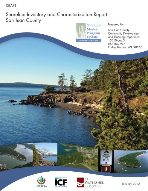
DRAFT<br />
Shoreline Inventory <strong>and</strong> Characterization Report:<br />
<strong>San</strong> <strong>Juan</strong> <strong>County</strong><br />
Prepared for:<br />
<strong>San</strong> <strong>Juan</strong> <strong>County</strong><br />
Community Development<br />
<strong>and</strong> Planning Department<br />
135 Rhone St.<br />
P.O. Box 947<br />
Friday Harbor, WA 98250<br />
January 2012
SHORELINE INVENTORY AND<br />
CHARACTERIZATION REPORT<br />
<strong>San</strong> <strong>Juan</strong> <strong>County</strong><br />
Prepared for<br />
<strong>San</strong> <strong>Juan</strong> <strong>County</strong> Community Development <strong>and</strong> Planning Department<br />
January 2012 Draft
SHORELINE INVENTORY AND<br />
CHARACTERIZATION REPORT<br />
<strong>San</strong> <strong>Juan</strong> <strong>County</strong><br />
Prepared for<br />
<strong>San</strong> <strong>Juan</strong> <strong>County</strong><br />
Community Development <strong>and</strong> Planning Department<br />
Courthouse Annex<br />
135 Rhone Street<br />
P.O. Box 947<br />
Friday Harbor, Washington 98250<br />
Prepared by<br />
Herrera Environmental Consultants<br />
2200 Sixth Avenue, Suite 1100<br />
Seattle, Washington 98121<br />
Telephone: 206.441.9080<br />
ICF International<br />
710 Second Avenue, Suite 550<br />
Seattle, Washington 98104<br />
<strong>and</strong><br />
The Watershed Company<br />
750 Sixth Street South<br />
Kirkl<strong>and</strong>, Washington 98033<br />
January 30, 2012 Draft Final
Contents<br />
Glossary ......................................................................................................................................... xi<br />
Executive Summary .......................................................................................................................xv<br />
1.0 Introduction ..........................................................................................................................1<br />
1.1 Purpose .....................................................................................................................1<br />
1.2 Scope ........................................................................................................................1<br />
2.0 Methods................................................................................................................................3<br />
2.1 Inventory Data <strong>and</strong> Information Sources .................................................................3<br />
2.2 Delineating Management Areas <strong>and</strong> Reaches..........................................................4<br />
2.2.1 Management Area Delineation ...............................................................5<br />
2.2.2 Reach Delineation ...................................................................................5<br />
2.3 Method for Characterizing Ecosystem-Wide Processes <strong>and</strong> Shoreline<br />
Functions ..................................................................................................................8<br />
2.4 Method Used to Inventory <strong>and</strong> Characterize Management Areas ...........................8<br />
2.5 GIS Methods ..........................................................................................................18<br />
3.0 Ecosystem Profile ..............................................................................................................21<br />
3.1 Regional Overview ................................................................................................21<br />
3.1.1 Major Shoreline Description .................................................................21<br />
3.2 Key Physical Controls............................................................................................22<br />
3.2.1 Climate ..................................................................................................22<br />
3.2.2 Topography <strong>and</strong> Bathymetry.................................................................23<br />
3.2.3 Geology .................................................................................................23<br />
3.2.4 Soils .......................................................................................................25<br />
3.3 Key Processes Related To Shoreline Ecosystem Functions ..................................27<br />
3.3.1 Processes Affecting Marine Shorelines ................................................27<br />
3.3.2 Processes Affecting Lacustrine Shorelines ...........................................32<br />
3.4 L<strong>and</strong> Use <strong>and</strong> L<strong>and</strong> Cover .....................................................................................33<br />
3.4.1 L<strong>and</strong> Use Patterns <strong>and</strong> SMA Use Preferences ......................................33<br />
3.4.2 Current L<strong>and</strong> Use Patterns ....................................................................33<br />
3.4.3 Comprehensive Plan L<strong>and</strong> Use Patterns ...............................................35<br />
3.5 Historic <strong>and</strong> Cultural Resources ............................................................................48<br />
3.6 Existing <strong>and</strong> Potential Public Access .....................................................................50<br />
3.7 Marine Shoreline Alterations .................................................................................55<br />
3.7.1 Overwater Structures .............................................................................55<br />
3.7.2 Shoreline Armoring ...............................................................................56<br />
3.7.3 Flow-Control Structures ........................................................................59<br />
3.7.4 Stormwater Outfalls ..............................................................................60<br />
3.7.5 Other Shoreline Modifications ..............................................................60<br />
3.8 Lacustrine Shoreline Alterations............................................................................61<br />
3.9 Nearshore Key Habitats <strong>and</strong> Species Usage ..........................................................61<br />
i
3.9.1 Estuaries <strong>and</strong> Intertidal Wetl<strong>and</strong>s .........................................................62<br />
3.9.2 Streams <strong>and</strong> Nearshore Riparian Areas.................................................63<br />
3.9.3 Eelgrass <strong>and</strong> Kelp ..................................................................................64<br />
3.9.4 Shellfish Resources ...............................................................................65<br />
3.9.5 Fish <strong>and</strong> Fish Habitat ............................................................................67<br />
3.9.6 Priority Habitats <strong>and</strong> Species ................................................................71<br />
3.9.7 Marine Mammals ..................................................................................72<br />
3.9.8 Birds ......................................................................................................74<br />
3.9.9 Federally Listed Species .......................................................................76<br />
3.10 Lakes ......................................................................................................................76<br />
4.0 Discussion of <strong>San</strong> <strong>Juan</strong> <strong>County</strong> Management Areas .........................................................79<br />
4.1 Blakely Isl<strong>and</strong> Management Area ..........................................................................83<br />
4.1.1 Physical <strong>and</strong> Biological Characterization .............................................84<br />
4.1.2 Shoreline Use Patterns ..........................................................................86<br />
4.1.3 Reach Assessment .................................................................................88<br />
4.1.4 Restoration Opportunities .....................................................................93<br />
4.2 Decatur Isl<strong>and</strong> Management Area .........................................................................93<br />
4.2.1 Physical <strong>and</strong> Biological Characterization .............................................94<br />
4.2.2 Shoreline Use Patterns ..........................................................................95<br />
4.2.3 Reach Assessment .................................................................................97<br />
4.2.4 Restoration Opportunities .....................................................................98<br />
4.3 Doe Bay Management Area .................................................................................101<br />
4.3.1 Physical <strong>and</strong> Biological Characterization ...........................................102<br />
4.3.2 Shoreline Use Patterns ........................................................................103<br />
4.3.3 Reach Assessment ...............................................................................106<br />
4.3.4 Restoration Opportunities ...................................................................109<br />
4.4 East Sound Management Area .............................................................................109<br />
4.4.1 Physical <strong>and</strong> Biological Characterization ...........................................110<br />
4.4.2 Reach Assessment ...............................................................................113<br />
4.4.3 Restoration Opportunities ...................................................................117<br />
4.5 Fisherman Bay Management Area .......................................................................117<br />
4.5.1 Physical <strong>and</strong> Biological Characterization ...........................................118<br />
4.5.2 Shoreline Use Patterns ........................................................................119<br />
4.5.3 Reach Assessment ...............................................................................122<br />
4.5.4 Restoration Opportunities ...................................................................125<br />
4.6 Friday Harbor Management Area ........................................................................125<br />
4.6.1 Physical <strong>and</strong> Biological Characterization ...........................................126<br />
4.6.2 Shoreline Use Patterns ........................................................................127<br />
4.6.3 Reach Assessment ...............................................................................130<br />
4.6.4 Restoration Opportunities ...................................................................131<br />
4.7 Mud Bay Management Area ................................................................................131<br />
4.7.1 Physical <strong>and</strong> Biological Characterization ...........................................135<br />
4.7.2 Shoreline Use Patterns ........................................................................136<br />
4.7.3 Reach Assessment ...............................................................................139<br />
ii
4.7.4 Restoration Opportunities ...................................................................143<br />
4.8 North Coast Eastsound Management Area ..........................................................143<br />
4.8.1 Physical <strong>and</strong> Biological Characterization ...........................................143<br />
4.8.2 Shoreline Use Patterns ........................................................................145<br />
4.8.3 Reach Assessment ...............................................................................147<br />
4.8.4 Restoration Opportunities ...................................................................151<br />
4.9 Olga Management Area .......................................................................................151<br />
4.9.1 Physical <strong>and</strong> Biological Characterization ...........................................151<br />
4.9.2 Shoreline Use Patterns ........................................................................154<br />
4.9.3 Reach Assessment ...............................................................................156<br />
4.9.4 Restoration Opportunities ...................................................................161<br />
4.10 Roche Harbor Management Area ........................................................................161<br />
4.10.1 Physical <strong>and</strong> Biological Characterization ...........................................161<br />
4.10.2 Shoreline Use Patterns ........................................................................164<br />
4.10.3 Reach Assessment ...............................................................................166<br />
4.10.4 Restoration Opportunities ...................................................................166<br />
4.11 <strong>San</strong> <strong>Juan</strong> Channel Management Area ..................................................................171<br />
4.11.1 Physical <strong>and</strong> Biological Characterization ...........................................171<br />
4.11.2 Shoreline Use Patterns ........................................................................173<br />
4.11.3 Reach Assessment ...............................................................................175<br />
4.11.4 Restoration Opportunities ...................................................................175<br />
4.12 Shaw Isl<strong>and</strong> Management Area ...........................................................................179<br />
4.12.1 Physical <strong>and</strong> Biological Characterization ...........................................179<br />
4.12.2 Shoreline Use Patterns ........................................................................181<br />
4.12.3 Reach Assessment ...............................................................................184<br />
4.12.4 Restoration Opportunities ...................................................................184<br />
4.13 Spencer Spit Management Area...........................................................................189<br />
4.13.1 Physical <strong>and</strong> Biological Characterization ...........................................189<br />
4.13.2 Shoreline Use Patterns ........................................................................191<br />
4.13.3 Reach Assessment ...............................................................................193<br />
4.13.4 Restoration Opportunities ...................................................................193<br />
4.14 Strait of <strong>Juan</strong> De Fuca Management Area ...........................................................197<br />
4.14.1 Physical <strong>and</strong> Biological Characterization ...........................................197<br />
4.14.2 Shoreline Use Patterns ........................................................................200<br />
4.14.3 Reach Assessment ...............................................................................205<br />
4.14.4 Restoration Opportunities ...................................................................206<br />
4.15 Stuart Isl<strong>and</strong> Management Area...........................................................................209<br />
4.15.1 Physical <strong>and</strong> Biological Characterization ...........................................209<br />
4.15.2 Shoreline Use Patterns ........................................................................211<br />
4.15.3 Reach Assessment ...............................................................................213<br />
4.15.4 Restoration Opportunities ...................................................................213<br />
4.16 Turtleback Management Area ..............................................................................217<br />
4.16.1 Physical <strong>and</strong> Biological Characterization ...........................................217<br />
4.16.2 Reach Assessment ...............................................................................221<br />
iii
4.16.3 Restoration Opportunities ...................................................................221<br />
4.17 Waldron Isl<strong>and</strong> Management Area ......................................................................225<br />
4.17.1 Physical <strong>and</strong> Biological Characterization ...........................................225<br />
4.17.2 Shoreline Use Patterns ........................................................................227<br />
4.17.3 Reach Assessment ...............................................................................230<br />
4.17.4 Restoration Opportunities ...................................................................230<br />
4.18 West Sound Management Area ...........................................................................233<br />
4.18.1 Physical <strong>and</strong> Biological Characterization ...........................................233<br />
4.18.2 Shoreline Use Patterns ........................................................................235<br />
4.18.3 Reach Assessment ...............................................................................238<br />
4.18.4 Restoration Opportunities ...................................................................239<br />
4.19 Private Lakes Management Area .........................................................................243<br />
4.19.1 Physical <strong>and</strong> Biological Characterization ...........................................243<br />
4.19.2 Shoreline Use Patterns ........................................................................244<br />
4.19.3 Reach Assessment ...............................................................................246<br />
4.19.4 Restoration Opportunities ...................................................................247<br />
4.20 Public Lakes Management Area ..........................................................................247<br />
4.20.1 Physical <strong>and</strong> Biological Characterization ...........................................248<br />
4.20.2 Shoreline Use Patterns ........................................................................248<br />
4.20.3 Reach Assessment ...............................................................................249<br />
4.20.4 Restoration Opportunities ...................................................................249<br />
5.0 Use Analysis ....................................................................................................................251<br />
5.1 Shoreline L<strong>and</strong> Capacity Analysis – Methods .....................................................251<br />
5.2 Shoreline L<strong>and</strong> Capacity Analysis – Results By Management area ....................252<br />
5.2.1 Blakely Isl<strong>and</strong>......................................................................................255<br />
5.2.2 Decatur Isl<strong>and</strong> .....................................................................................256<br />
5.2.3 Doe Bay ...............................................................................................256<br />
5.2.4 East Sound ...........................................................................................257<br />
5.2.5 Fisherman Bay ....................................................................................258<br />
5.2.6 Friday Harbor ......................................................................................258<br />
5.2.7 Mud Bay ..............................................................................................259<br />
5.2.8 North Coast Eastsound ........................................................................260<br />
5.2.9 Olga .....................................................................................................260<br />
5.2.10 Private Lakes .......................................................................................261<br />
5.2.11 Public Lakes ........................................................................................262<br />
5.2.12 Roche Harbor ......................................................................................262<br />
5.2.13 <strong>San</strong> <strong>Juan</strong> Channel ................................................................................263<br />
5.2.14 Shaw Isl<strong>and</strong> .........................................................................................263<br />
5.2.15 Spencer Spit ........................................................................................264<br />
5.2.16 Strait of <strong>Juan</strong> de Fuca ..........................................................................265<br />
5.2.17 Stuart Isl<strong>and</strong> ........................................................................................265<br />
5.2.18 Turtleback ...........................................................................................266<br />
5.2.19 Waldron Isl<strong>and</strong> ....................................................................................266<br />
5.2.20 West Sound .........................................................................................267<br />
iv
6.0 Public Access Analysis ....................................................................................................269<br />
6.1 Parks <strong>and</strong> Recreation Plans ..................................................................................269<br />
6.2 Potential Gaps <strong>and</strong> Opportunities ........................................................................270<br />
6.2.1 Management Areas..............................................................................271<br />
7.0 Data Gaps .........................................................................................................................277<br />
7.1 Development of 1:24,000 Geologic Maps For Entire <strong>County</strong> .............................277<br />
7.2 Lakeshore Modifications .....................................................................................277<br />
7.3 Tidal Flow Data ...................................................................................................277<br />
7.4 Climate Change ....................................................................................................277<br />
7.4.1 Weather ...............................................................................................277<br />
7.4.2 Sea Level Rise <strong>and</strong> Ocean Acidification .............................................278<br />
7.5 Water Quality Data For Certain Isl<strong>and</strong>s...............................................................278<br />
7.6 Data of Nearshore Wrack .....................................................................................278<br />
8.0 Shoreline Management Recommendations......................................................................279<br />
8.1 Environment Designations ...................................................................................279<br />
8.1.1 Background .........................................................................................279<br />
8.1.2 Existing <strong>County</strong> Shoreline Designations ............................................282<br />
8.1.3 Methodology .......................................................................................289<br />
8.1.4 Recommendations ...............................................................................290<br />
8.2 General Policies <strong>and</strong> Regulations ........................................................................291<br />
8.2.1 Critical Areas ......................................................................................291<br />
8.2.2 Flood Hazard Reduction .....................................................................291<br />
8.2.3 Public Access ......................................................................................291<br />
8.2.4 Shoreline Vegetation Conservation ....................................................291<br />
8.2.5 Water Quality, Stormwater, <strong>and</strong> Nonpoint Pollution ..........................292<br />
8.3 Shoreline Modification Provisions ......................................................................292<br />
8.3.1 Shoreline Stabilization ........................................................................292<br />
8.3.2 Piers <strong>and</strong> Docks ...................................................................................293<br />
8.3.3 Fill .......................................................................................................293<br />
8.3.4 Breakwaters, Jetties, Groins <strong>and</strong> Weirs...............................................294<br />
8.3.5 Dredging <strong>and</strong> Dredge Material Disposal.............................................294<br />
8.3.6 Shoreline Habitat <strong>and</strong> Natural Systems Enhancement Projects ..........294<br />
8.4 Shoreline Uses .....................................................................................................294<br />
8.4.1 Agriculture ..........................................................................................294<br />
8.4.2 Aquaculture .........................................................................................294<br />
8.4.3 Boating Facilities ................................................................................294<br />
8.4.4 Commercial Development ..................................................................295<br />
8.4.5 Forest Practices ...................................................................................295<br />
8.4.6 Industry ...............................................................................................295<br />
8.4.7 Mining .................................................................................................295<br />
8.4.8 Recreational Development ..................................................................295<br />
8.4.9 Residential Development ....................................................................295<br />
8.4.10 Transportation <strong>and</strong> Parking .................................................................296<br />
v
8.4.11 Utilities ................................................................................................296<br />
8.5 Restoration Plan ...................................................................................................296<br />
9.0 References ........................................................................................................................299<br />
Appendix A Map Folio<br />
Map 1: Context, Map Extents Key <strong>and</strong> Table of Contents<br />
Map 2: Proposed Shoreline Jurisdiction<br />
Map 3: L<strong>and</strong> Ownership<br />
Map 4: Existing L<strong>and</strong> Use Districts <strong>and</strong> Environment Designations<br />
Map 5: Current L<strong>and</strong> Use<br />
Map 6: Marine Shoreline Public Access<br />
Map 7: Priority Trail Corridors<br />
Map 8: Surface Water System<br />
Map 9: Shoreline Modifications<br />
Map 10: Septic Systems<br />
Map 11: Water Quality<br />
Map 12: Floodplains <strong>and</strong> Wetl<strong>and</strong>s<br />
Map 13: Marine Net Shore Drift <strong>and</strong> Feeder Bluffs<br />
Map 14: Current Marine Shoreform Types<br />
Map 15: Geologic Units<br />
Map 16: Soils<br />
Map 17: Geologic Hazards<br />
Map 18: Liquefaction Susceptibility<br />
Map 19: L<strong>and</strong> Cover<br />
Map 20: Impervious Surfaces<br />
Map 21: Ecology Permitted Sites<br />
Map 22: Priority Habitat <strong>and</strong> Species – Regions<br />
Map 23: Priority Habitat <strong>and</strong> Species – Aquatic Vegetation<br />
Map 24: Priority Habitat <strong>and</strong> Species – Birds <strong>and</strong> Mammals<br />
Map 25: Priority Habitat <strong>and</strong> Species – Fish<br />
Map 26: Priority Habitat <strong>and</strong> Species – Shellfish<br />
Map 27: Fish Presence Probability – Juvenile Chinook Salmon<br />
Map 28: Fish Presence Probability – Juvenile Chum Salmon<br />
Map 29: Fish Presence Probability – Juvenile Pink Salmon<br />
Map 30: Fish Presence Probability – Juvenile Lingcod <strong>and</strong> Greenling<br />
Map 31: Fish Presence Probability – Juvenile Surf Smelt<br />
Map 32: Fish Presence Probability – Juvenile S<strong>and</strong> Lance<br />
Map 33: Fish Presence Probability – Juvenile Pacific Herring<br />
Map 34: Vacant Parcels<br />
Map 35: Parcels with Potential Non-Conforming Structures<br />
Map 36: Management Areas<br />
Map 37: Shoreline Reaches<br />
Map 38: Ecological Functions Physical<br />
Map 39: Ecological Functions Habitat<br />
vi
Appendix B<br />
Appendix C<br />
Appendix D<br />
Priority Habitats <strong>and</strong> Species<br />
<strong>San</strong> <strong>Juan</strong> <strong>County</strong> L<strong>and</strong> Capacity Analysis Methodology<br />
Listing of GIS data sources for Shoreline Inventory<br />
Tables<br />
Table 1. Required Shoreline Inventory Elements <strong>and</strong> Data Sources. ..................................... 3<br />
Table 2. List of Management Areas ........................................................................................ 6<br />
Table 3. Shoreline Processes <strong>and</strong> Stressors. .......................................................................... 10<br />
Table 4. Shoreline Functions. ................................................................................................ 10<br />
Table 5A. Ecological Function Scoring Criteria for Marine Shorelines. ................................. 13<br />
Table 5B. Ecological Function Scoring Criteria for Lacustrine Shorelines. ........................... 16<br />
Table 6. L<strong>and</strong>slide Activity Area Acreage Within Each Management Area. ....................... 29<br />
Table 7. Water-Oriented Uses Definitions <strong>and</strong> Examples. ................................................... 34<br />
Table 8. Sites <strong>and</strong> Structures on the Washington State Heritage Register. ........................... 49<br />
Table 9: Shoreline Parks, Open Space, <strong>and</strong> Trails. ............................................................... 51<br />
Table 10. Public Access Facilities. .......................................................................................... 52<br />
Table 11. Parks <strong>and</strong> Open Space Ownership Within the Shoreline Jurisdiction..................... 54<br />
Table 12. Summary of Overwater Structures Within Each Management Area. ..................... 56<br />
Table 13. Armored Shoreline Totals Within Each Management Area. .................................. 57<br />
Table 14. Other Shoreline Modification Totals Within Each Management Area. .................. 60<br />
Table 15.<br />
State <strong>and</strong> Federal Listing Status of Priority Salmonid Species Occurring in<br />
<strong>San</strong> <strong>Juan</strong> <strong>County</strong>. ..................................................................................................... 67<br />
Table 16. Lake Sizes <strong>and</strong> Their Shoreline Management Areas. ............................................. 77<br />
Table 17. Summary Table for Each Management Area. ......................................................... 80<br />
Table 18A. Blakely Isl<strong>and</strong> Management Area Reach Assessment – Physical Conditions. ....... 89<br />
Table 18B. Blakely Isl<strong>and</strong> Management Area Reach Assessment – Habitat Conditions. ......... 91<br />
Table 19A. Decatur Isl<strong>and</strong> Management Area Reach Assessment – Physical Conditions. ....... 98<br />
Table 19B. Decatur Isl<strong>and</strong> Management Area Reach Assessment – Habitat Conditions. ......... 99<br />
Table 20A. Doe Bay Management Area Reach Assessment – Physical Conditions. .............. 106<br />
Table 20B. Doe Bay Management Area Reach Assessment – Habitat Conditions. ................ 107<br />
Table 21A. East Sound Management Area Reach Assessment – Physical Conditions. .......... 114<br />
Table 21B. East Sound Management Area Reach Assessment – Habitat Conditions. ............ 115<br />
vii
Table 22A.<br />
Fisherman Bay Management Area Reach Assessment – Physical<br />
Conditions. ............................................................................................................ 122<br />
Table 22B. Fisherman Bay Management Area Reach Assessment – Habitat Conditions. ...... 123<br />
Table 23A. Friday Harbor Management Area Reach Assessment – Physical Conditions....... 131<br />
Table 23B. Friday Harbor Management Area Reach Assessment – Habitat Conditions. ....... 133<br />
Table 24A. Mud Bay Area Reach Assessment – Physical Conditions. ................................... 139<br />
Table 24B. Mud Bay Area Reach Assessment – Habitat Conditions. ..................................... 141<br />
Table 25A.<br />
Table 25B.<br />
North Coast Eastsound management area Reach Assessment – Physical<br />
Conditions. ............................................................................................................ 147<br />
North Coast Eastsound Management Area Reach Assessment – Habitat<br />
Conditions. ............................................................................................................ 149<br />
Table 26A. Olga Management Area Reach Assessment – Physical Conditions. .................... 157<br />
Table 26B. Olga Management Area Reach Assessment – Habitat Conditions. ...................... 159<br />
Table 27A. Roche Harbor Management Area Reach Assessment – Physical Conditions. ...... 167<br />
Table 27B. Roche Harbor Management Area Reach Assessment – Habitat Conditions. ....... 169<br />
Table 28A.<br />
Table 28B.<br />
<strong>San</strong> <strong>Juan</strong> Channel Management Area Reach Assessment – Physical<br />
Conditions. ............................................................................................................ 175<br />
<strong>San</strong> <strong>Juan</strong> Channel Management Area Reach Assessment – Habitat<br />
Conditions. ............................................................................................................ 177<br />
Table 29A. Shaw Isl<strong>and</strong> Management Area Reach Assessment – Physical Conditions. ......... 185<br />
Table 29B. Shaw Isl<strong>and</strong> Management Area Reach Assessment – Habitat Conditions. .......... 187<br />
Table 30A. Spencer Spit Management Area Reach Assessment – Physical Conditions. ........ 194<br />
Table 30B. Spencer Spit Management Area Reach Assessment – Habitat Conditions. .......... 195<br />
Table 31A.<br />
Table 31B.<br />
Strait of <strong>Juan</strong> de Fuca Management Area Reach Assessment – Physical<br />
Conditions. ............................................................................................................ 205<br />
Strait of <strong>Juan</strong> de Fuca Management Area Reach Assessment – Habitat<br />
Conditions. ............................................................................................................ 207<br />
Table 32A. Stuart Isl<strong>and</strong> Management Area Reach Assessment – Physical Conditions. ........ 214<br />
Table 32B. Stuart Isl<strong>and</strong> Management Area Reach Assessment – Habitat Conditions. .......... 215<br />
Table 33A. Turtleback Management Area Reach Assessment – Physical Conditions. ........... 221<br />
Table 33B. Turtleback Management Area Reach Assessment – Habitat Conditions. ............. 223<br />
Table 34A.<br />
Waldron Isl<strong>and</strong> Management Area Reach Assessment – Physical<br />
Conditions. ............................................................................................................ 230<br />
Table 34B. Waldron Isl<strong>and</strong> Management Area Reach Assessment – Habitat Conditions. ..... 231<br />
Table 35A. West Sound Management Area Reach Assessment – Physical Conditions. ......... 239<br />
viii
Table 35B. West Sound Management Area Reach Assessment – Habitat Conditions. ........... 241<br />
Table 36A. Private Lakes Management Area Reach Assessment – Physical Conditions. ...... 246<br />
Table 36B. Private Lakes Management Area Reach Assessment – Habitat Conditions. ........ 247<br />
Table 37A. Public Lakes Management Area Reach Assessment – Physical Conditions. ....... 250<br />
Table 37B. Public Lakes Management Area Reach Assessment – Habitat Conditions. ......... 250<br />
Table 38.<br />
Table 39.<br />
Table 40.<br />
Estimated Residential L<strong>and</strong> Capacity – Parcels Within or Touching<br />
Shoreline Jurisdiction. ........................................................................................... 253<br />
Comparison of Existing <strong>County</strong> Shoreline Designations <strong>and</strong> Ecology‘s<br />
Recommended Classification System. .................................................................. 283<br />
Relationship of Existing <strong>County</strong> Subarea Plan Shoreline Designations to<br />
Ecology‘s Recommended Classification System. ................................................. 289<br />
Figures<br />
Figure 1.<br />
Marine <strong>and</strong> Lake Management Area Boundaries, <strong>San</strong> <strong>Juan</strong> <strong>County</strong>,<br />
Washington. ............................................................................................................... 6<br />
Figure 2. Examples of Overwater Structures in <strong>San</strong> <strong>Juan</strong> <strong>County</strong>. ........................................ 55<br />
Figure 3. Comparison of Beach Transects from Whidbey Isl<strong>and</strong> (Herrera 2009c). ............... 58<br />
Figure 4.<br />
Summary of Physical <strong>and</strong> Habitat Conditions Found Within Each<br />
Management Area (percent of possible score). ....................................................... 82<br />
Figure 5. Blakely Isl<strong>and</strong> Management Area. .......................................................................... 84<br />
Figure 6. Decatur Isl<strong>and</strong> Management Area. .......................................................................... 93<br />
Figure 7. Doe Bay Management Area. ................................................................................. 101<br />
Figure 8. East Sound Management Area. ............................................................................. 109<br />
Figure 9. Fisherman Bay Management Area. ....................................................................... 117<br />
Figure 10. Friday Harbor Management Area.......................................................................... 125<br />
Figure 11. Mud Bay Management Area. ................................................................................ 132<br />
Figure 12. North Coast Eastsound Management Area. .......................................................... 143<br />
Figure 13. Olga Management Area. ....................................................................................... 152<br />
Figure 14. Roche Harbor Management Area. ......................................................................... 162<br />
Figure 15. <strong>San</strong> <strong>Juan</strong> Channel Management Area. ................................................................... 171<br />
Figure 16. Shaw Isl<strong>and</strong> Management Area. ............................................................................ 179<br />
Figure 17. Spencer Spit Management Area. ........................................................................... 189<br />
ix
Figure 18. Strait of <strong>Juan</strong> de Fuca Management Area. ............................................................ 197<br />
Figure 19. Stuart Isl<strong>and</strong> Management Area. ........................................................................... 209<br />
Figure 20. Turtleback Management Area. .............................................................................. 217<br />
Figure 21. Waldron Isl<strong>and</strong> Management Area........................................................................ 225<br />
Figure 22. West Sound Management Area. ............................................................................ 233<br />
Figure 23. Example of Urban-Designated Shoreline – <strong>San</strong> <strong>Juan</strong> Isl<strong>and</strong>. ................................ 286<br />
Figure 24. Example of Rural-Designated Shoreline – Orcas Isl<strong>and</strong>. ...................................... 286<br />
Figure 25. Example of Rural Residential-Designated Shoreline – <strong>San</strong> <strong>Juan</strong> Isl<strong>and</strong>. .............. 287<br />
Figure 26. Example of Rural Farm-Forest Designated Shoreline – Shaw Isl<strong>and</strong>. .................. 287<br />
Figure 27. Example of Conservancy-Designated Shoreline – Lopez Isl<strong>and</strong>. ......................... 288<br />
Figure 28. Example of Natural-Designated Shoreline – Blakely Isl<strong>and</strong>................................. 288<br />
x
Glossary<br />
Accretionary shoreform – Low-lying areas along the <strong>shoreline</strong> that consist of accumulated<br />
drift.<br />
Anthropogenic – Caused either directly or indirectly by human activity.<br />
Archipelago – A group or cluster of isl<strong>and</strong>s. <strong>San</strong> <strong>Juan</strong> <strong>County</strong> is an archipelago.<br />
Beach transect – A profile of elevations perpendicular to the <strong>shoreline</strong>.<br />
Bedrock – Bedrock is a general term that includes any of the generally indurated or crystalline<br />
materials that make up the earth‘s crust.<br />
Breakwater – A fixed structure placed within or below intertidal areas to reduce the amount of<br />
wave energy reaching the <strong>shoreline</strong>.<br />
Ditch – An artificial channel that is designed to convey water <strong>and</strong> drain perennially or seasonally<br />
wet areas.<br />
Downdrift – In the direction of dominant along shore sediment transport.<br />
(Glacial) Drift – Sediment deposited under (often marine) water during periods where the<br />
isl<strong>and</strong>s were close the glacial front. Sediment can be highly variable in grain size, ranging from<br />
muddy sediments to gravel.<br />
(Glacial) Drift terrace – A prism of sediment emplaced when sea level was locally much higher<br />
than it is now. These terraces are often flat <strong>and</strong> s<strong>and</strong>wiched between bedrock outcroppings. This<br />
material from these terraces serves as the primary source for nearshore sediment in many areas in<br />
the <strong>County</strong>.<br />
Drumlin – A positive (elevated) glacial feature produced by glaciers that is aligned with the<br />
direction of glacial motion.<br />
Estuarine – Those areas that are partially protected from marine circulation <strong>and</strong> waves <strong>and</strong><br />
possess some of amount of freshwater input.<br />
Everson Interstade – The time period immediately after the collapse of the Puget Lobe when<br />
the terminus of the Cordilleran ice sheet was at or near the modern-day town of Coupeville<br />
(approximately 10,000 to 13,000 years before present). The exact position of the ice front near<br />
the <strong>County</strong> is largely unknown, but thought to be quite complicated.<br />
Fetch – The distance over which the wind blows to generate a given wave field.<br />
Foreshore – The steep part of the beach that is generally composed of gravel, although it can<br />
contain s<strong>and</strong> or even boulders. The foreshore on the <strong>shoreline</strong> of the <strong>County</strong> typically extends<br />
xi
from approximately 1 to 3 feet above MLLW to MHHW. It is the most sedimentologically active<br />
portion of the nearshore (Finlayson 2006).<br />
Isthmus – A narrow strip of l<strong>and</strong> connecting two larger l<strong>and</strong> areas bounded by water. In the<br />
<strong>County</strong>, isthmuses are often associated with tombolos.<br />
Low-tide terrace – A broad, flat portion of the nearshore that extends from a few feet above to a<br />
few feet below MLLW. The low-tide terrace is finer grained that the foreshore above it, although<br />
there are places in the <strong>County</strong> where is the low-tide terrace is bedrock or glacial hardpay with a<br />
very thin veneer of sediment.<br />
Management Area – A management area is an area of <strong>shoreline</strong> typically distinguished by<br />
similar characteristics relating to the relative intensity of l<strong>and</strong> use, the physical l<strong>and</strong>scape <strong>and</strong>/or<br />
critical hydrogeomorphic or biological processes. Management areas are comprised of smaller<br />
units called reaches.<br />
Mean higher-high water (MHHW) – The average elevation of the two high tides in each day<br />
over a tidal epoch (19 years).<br />
Mean lower-low water (MLLW) – The average elevation of the two low tides in each day over<br />
a tidal epoch (19 years).<br />
Nearshore – The nearshore generally extends from the top of <strong>shoreline</strong> bank or bluff to the<br />
depth offshore where light penetrating the water falls below a level supporting plant growth, <strong>and</strong><br />
upstream in estuaries to the head of tidal influence. It includes bluffs, beaches, mudflats, kelp<br />
<strong>and</strong> eelgrass beds, salt marshes, gravel spits, <strong>and</strong> estuaries.<br />
Ophiolite – Rock from oceanic crust. Ophiolites originate far below the surface of the earth,<br />
sometimes in the mantle. They are often rich in minerals rarely found elsewhere on the earth‘s<br />
surface. While often being crystalline (hard), they are susceptible to chemical weathering.<br />
Ordinary high water mark – On all lakes, streams, <strong>and</strong> tidal water is that mark that will be<br />
found by examining the bed <strong>and</strong> banks <strong>and</strong> ascertaining where the presence <strong>and</strong> action of waters<br />
are so common <strong>and</strong> usual, <strong>and</strong> so long continued in all ordinary years, as to mark upon the soil a<br />
character distinct from that of the abutting upl<strong>and</strong>, in respect to vegetation as that condition<br />
exists on June 1, 1971, as it may naturally change thereafter, or as it may change thereafter in<br />
accordance with permits issued by a local government or the department: provided, that in any<br />
area where the ordinary high water mark cannot be found, the ordinary high water mark<br />
adjoining salt water shall be the line of mean higher high tide <strong>and</strong> the ordinary high water mark<br />
adjoining fresh water shall be the line of mean high water.<br />
Pocket beach – A small beach that is contained between two bedrock headl<strong>and</strong>s that exhibits<br />
little to no net longshore transport (Shipman 2008). Transport can be significant in a cross-shore<br />
sense.<br />
Pocket estuary – Small estuaries within the Puget Sound that form behind spit or barrier beach<br />
l<strong>and</strong>forms at submerged, tectonically- or glacially-derived valleys or at small creek deltas.<br />
xii
Priority Fish Spawning Areas – priority fish spawning areas are large geographic regions<br />
composed of numerous forage fish spawning sites.<br />
Progradation rate – The rate at which a delta grows from sediment deposition into the sea.<br />
Puget Lobe – The southernmost finger of the Cordilleran Ice Sheet that advanced into <strong>and</strong> fills<br />
the Puget Lowl<strong>and</strong>.<br />
Puget Lowl<strong>and</strong> – The low area between the Olympic <strong>and</strong> Cascade mountain ranges.<br />
Reach – A segment of <strong>shoreline</strong> that has a similar geomorphic context used for assessment of<br />
ecological conditions. Reaches are smaller units that comprise the management areas.<br />
Salish Sea – All of the inl<strong>and</strong> waters surrounding the isl<strong>and</strong>s, including Puget Sound, the Strait<br />
of Georgia <strong>and</strong> the Strait of <strong>Juan</strong> de Fuca.<br />
Shoreline Armoring – Placing a fixed, immobile structure along the <strong>shoreline</strong> to protect upl<strong>and</strong>s<br />
from current- <strong>and</strong> wave-induced erosion by marine circulation <strong>and</strong> waves. Armoring can include,<br />
but is not limited to seawalls, bulkheads, <strong>and</strong> placed rock.<br />
Southern Whidbey Isl<strong>and</strong> Fault Zone – A large fault complex that extends from Victoria,<br />
British Columbia to Woodinville, Washington. It passes just south of <strong>San</strong> <strong>Juan</strong> <strong>County</strong>.<br />
Surf – The area of the nearshore where waves have broken (collapsed). The surf zone is very<br />
sedimentologically active area, often devoid of vegetation.<br />
Swash – The up-<strong>and</strong>-back movement of the water surface on the beach. Considerable sediment<br />
transport occurs in the swash zone. Swash also leads to the formation of the foreshore on mixedsediment<br />
<strong>and</strong> pocket beaches.<br />
Swell – Long-period (10-second) waves originating in the open ocean. Swell is typically much<br />
larger in amplitude <strong>and</strong> period than locally generated wind-waves.<br />
Tombolo – A depositional l<strong>and</strong>form in which an isl<strong>and</strong>, usually bedrock is attached to the<br />
mainl<strong>and</strong> by a narrow piece of l<strong>and</strong> comprised primarily of beach sediments.<br />
Updrift – In the direction opposite of dominant along shore sediment transport.<br />
Vashon Stade – The time period between 20,000 <strong>and</strong> 13,000 years before present of<br />
glacialinundation of the Puget Lowl<strong>and</strong> at the end of the last ice age.<br />
xiii
Limitations<br />
As with any <strong>report</strong>, there are limitations (inherent or otherwise) that must be acknowledged. This<br />
<strong>report</strong> is limited to the subjects covered, materials reviewed, <strong>and</strong> data available at the time the<br />
<strong>report</strong> was prepared. The authors <strong>and</strong> reviewers have made a sincere attempt to provide accurate<br />
<strong>and</strong> thorough information using the most current <strong>and</strong> complete information available <strong>and</strong> their<br />
own best professional judgment. Any questions regarding the content of this <strong>report</strong> should be<br />
referred to <strong>San</strong> <strong>Juan</strong> <strong>County</strong> staff.<br />
xiv
Executive Summary<br />
This Inventory <strong>and</strong> Characterization Report was prepared for the <strong>San</strong> <strong>Juan</strong> <strong>County</strong> (<strong>County</strong>)<br />
Community Development <strong>and</strong> Planning Department under a Washington State Department of<br />
Ecology (Ecology) grant to help update the <strong>County</strong>‘s Shoreline Master Program (SMP).<br />
Washington‘s Shoreline Management Act of 1971 <strong>and</strong> its implementing State Guidelines<br />
adopted in 2003 require an update to the <strong>County</strong>‘s SMP, which was last approved in 1998.<br />
Under these Guidelines, the <strong>County</strong> must base the master program provisions on an analysis of<br />
the most relevant <strong>and</strong> accurate scientific <strong>and</strong> technical information (WAC 173-26-<br />
201(3)(c)<strong>and</strong>(d)). This includes meeting the m<strong>and</strong>ate of ―no net loss‖ of <strong>shoreline</strong> ecological<br />
functions as well as providing mechanisms for restoration of impaired <strong>shoreline</strong> functions. The<br />
Inventory <strong>and</strong> Characterization Report is not a binding regulatory document but rather provides<br />
guidance for potential future updates to the SMP.<br />
The <strong>County</strong>‘s SMP update is a multi-year process which begins with an <strong>inventory</strong> <strong>and</strong><br />
<strong>characterization</strong> of existing environmental <strong>and</strong> l<strong>and</strong> use conditions, otherwise known as a<br />
―baseline condition.‖ As part of developing a ―baseline‖ condition, this Inventory <strong>and</strong><br />
Characterization Report contains an <strong>inventory</strong> of a variety of elements, including l<strong>and</strong> use,<br />
l<strong>and</strong>scape processes, <strong>and</strong> ecological functions. These elements are spatially catalogued using a<br />
Geographic Information System (GIS), where possible, <strong>and</strong> are presented as a <strong>County</strong>-wide Map<br />
Folio. Together, these elements define what is understood to be the existing present day<br />
condition <strong>and</strong> helps inform the review of current <strong>shoreline</strong> regulations <strong>and</strong> highlight areas where<br />
changes may be necessary to meet <strong>shoreline</strong> management goals to provide for water dependent<br />
uses, public access <strong>and</strong> the protection of natural resources.<br />
Key information provided in this <strong>report</strong> include: <strong>characterization</strong> of existing ecological functions<br />
through an analysis of both physical <strong>and</strong> biological processes; an analysis of existing l<strong>and</strong> uses,<br />
<strong>shoreline</strong> modifications, l<strong>and</strong> capacity, public access, <strong>and</strong> areas under public ownership or<br />
preservation holdings; preliminary identification of restoration opportunities; evaluation of<br />
current <strong>shoreline</strong> environment designations, their purpose <strong>and</strong> criteria; <strong>and</strong> recommendations for<br />
the SMP to help meet the Guidelines.<br />
xv
Shoreline Inventory <strong>and</strong> Characterization––<strong>San</strong> <strong>Juan</strong> <strong>County</strong><br />
1.0 Introduction<br />
<strong>San</strong> <strong>Juan</strong> <strong>County</strong>‘s Shoreline Master Program (SMP) Update requires preparation of a <strong>shoreline</strong><br />
<strong>inventory</strong> <strong>and</strong> <strong>characterization</strong> <strong>report</strong> to be used as a foundation for the SMP update process<br />
(WAC 173-26-201(3)(c)<strong>and</strong>(d)). This document was prepared to fulfill that requirement <strong>and</strong><br />
serves to:<br />
• Inform the review of current <strong>shoreline</strong> regulations required by the update<br />
process<br />
• Highlight areas where <strong>shoreline</strong> resources protection measures <strong>and</strong><br />
<strong>shoreline</strong> use designations could be improved to meet <strong>shoreline</strong><br />
management goals<br />
Information provided includes existing physical conditions as well as data <strong>and</strong> descriptions of<br />
watershed <strong>and</strong> <strong>shoreline</strong> attributes that pertain to the <strong>shoreline</strong> jurisdiction of <strong>San</strong> <strong>Juan</strong> <strong>County</strong>.<br />
In addition, existing ecosystem <strong>shoreline</strong> processes, l<strong>and</strong> uses <strong>and</strong> development patterns are<br />
characterized. Descriptions of, <strong>shoreline</strong> functions <strong>and</strong> opportunities for restoration, public<br />
access <strong>and</strong> <strong>shoreline</strong> use are also provided.<br />
1.1 Purpose<br />
The <strong>San</strong> <strong>Juan</strong> <strong>County</strong> Shoreline Inventory <strong>and</strong> Characterization <strong>report</strong> accomplishes the<br />
following:<br />
• Provides supporting information for determining updated environmental<br />
designations<br />
• Establishes the baseline for ―no net loss‖ of ecological conditions <strong>and</strong><br />
thereby informs current <strong>and</strong> future policy development, l<strong>and</strong> use planning,<br />
<strong>and</strong> regulatory effectiveness<br />
• Identifies opportunities for protection, improving public access, <strong>and</strong><br />
supporting water dependent uses<br />
• Identifies degraded areas <strong>and</strong> restoration opportunities for incorporation<br />
into a separate comprehensive restoration plan.<br />
1.2 Scope<br />
The scope of this <strong>inventory</strong> <strong>and</strong> <strong>characterization</strong> includes all Shorelines of the State as defined by<br />
RCW 90.58.30. For <strong>San</strong> <strong>Juan</strong> <strong>County</strong> (<strong>County</strong>), this includes all marine areas <strong>and</strong> freshwater<br />
January 30, 2012 1 Herrera Environmental Consultants
Shoreline Inventory <strong>and</strong> Characterization––<strong>San</strong> <strong>Juan</strong> <strong>County</strong><br />
lakes greater than 20 acres (TWC 2011), excluding the shores of incorporated Town of Friday<br />
Harbor.<br />
The marine <strong>shoreline</strong> areas included in this <strong>report</strong> are defined as all waters waterward of the<br />
ordinary high water mark <strong>and</strong> l<strong>and</strong>s 200 feet upl<strong>and</strong> of the edge of the <strong>shoreline</strong>, as defined by<br />
the ordinary high-water mark (OHWM) or mean higher high water (MHHW) if the OHWM<br />
cannot be determined, <strong>and</strong> associated tidel<strong>and</strong>s <strong>and</strong> wetl<strong>and</strong>s. All marine waters waterward of<br />
the line of extreme low tide in the Strait of <strong>Juan</strong> de Fuca north to the Canadian line are also<br />
designated as Shorelines of Statewide Significance. For Shorelines of Statewide Significance, the<br />
Shoreline Management Act (SMA) sets specific preferences for uses <strong>and</strong> calls for a higher level<br />
of effort in implementing its objectives.<br />
Freshwater <strong>shoreline</strong> areas include the waterbody <strong>and</strong> all upl<strong>and</strong>s within 200 feet from the<br />
ordinary high water mark of lakes greater than 20 acres <strong>and</strong> associated wetl<strong>and</strong>s. <strong>San</strong> <strong>Juan</strong><br />
<strong>County</strong> does not have any lakes that meet the 1,000-acre size threshold for classification as a<br />
<strong>shoreline</strong> of statewide significance. There are no rivers or streams with mean annual flow over<br />
20 cubic feet per second (cfs) mean annual flow in <strong>San</strong> <strong>Juan</strong> <strong>County</strong>, so streams are not included<br />
in this <strong>report</strong>.<br />
In total, the <strong>County</strong> has approximately 481 miles of <strong>shoreline</strong> in unincorporated parts of the<br />
<strong>County</strong> (i.e. excludes the Town of Friday Harbor). Marine <strong>shoreline</strong>s constitute approximately<br />
455 miles while freshwater <strong>shoreline</strong>s add another 26 miles, Freshwater resources included in<br />
this <strong>characterization</strong> comprise portions of 12 lakes that were identified during the determination<br />
of <strong>shoreline</strong> jurisdiction (TWC 2011). For the purposes of the analysis of <strong>shoreline</strong> functions<br />
(see Chapter 3), islets of 0.5 acres or less (both marine <strong>and</strong> freshwater) were excluded.<br />
Therefore, the amount of <strong>shoreline</strong> analyzed in this <strong>report</strong> <strong>and</strong> discussed from here forward totals<br />
approximately 464 miles (439 miles of marine <strong>and</strong> 25 miles or freshwater).<br />
This <strong>report</strong> provides information on the <strong>County</strong>‘s ecosystems, specific discussions on individual<br />
<strong>shoreline</strong> management areas, including marine <strong>and</strong> lake <strong>shoreline</strong>s, a use analysis identifying<br />
existing uses <strong>and</strong> potential future uses, recommendations for <strong>shoreline</strong> management, <strong>and</strong> data<br />
gaps that would be helpful to close for future planning. First a general overview profiles larger<br />
scale ecosystem processes observed in the <strong>County</strong> including physical constraints such as climate,<br />
topography, geology, key processes related to <strong>shoreline</strong> ecosystem functions, <strong>and</strong> the types of<br />
habitats <strong>and</strong> species present. The general overview section is followed by detailed sections for<br />
each planning area (called management areas) that characterize physical <strong>and</strong> biological<br />
conditions in nearshore reaches, existing l<strong>and</strong> uses, future uses based on the <strong>San</strong> <strong>Juan</strong> <strong>County</strong><br />
Comprehensive L<strong>and</strong> Use Plan, <strong>shoreline</strong> modifications, historic <strong>and</strong> cultural resources, <strong>and</strong><br />
fishing <strong>and</strong> public access potential. Included within these sections are tabular data used for<br />
analysis of <strong>shoreline</strong> reaches <strong>and</strong> identification of potential restoration opportunities. Finally,<br />
<strong>shoreline</strong> management recommendations are provided at the end of this <strong>report</strong> to guide future<br />
changes or additions to the <strong>County</strong>‘s existing Shoreline Master Program (SMP).<br />
Herrera Environmental Consultants 2 January 30, 2012
Shoreline Inventory <strong>and</strong> Characterization––<strong>San</strong> <strong>Juan</strong> <strong>County</strong><br />
2.0 Methods<br />
2.1 Inventory Data <strong>and</strong> Information Sources<br />
Analysis <strong>and</strong> conclusions presented in this <strong>report</strong> were based on a review of existing information<br />
including published studies, private <strong>and</strong> agency authored technical <strong>report</strong>s <strong>and</strong> databases, GISbased<br />
information <strong>and</strong> mapping, aerial <strong>and</strong> oblique photography of the <strong>County</strong>‘s <strong>shoreline</strong>s, as<br />
well as the recently published Best Available Science for Marine Fish <strong>and</strong> Wildlife Habitat<br />
Conservation Areas for <strong>San</strong> <strong>Juan</strong> <strong>County</strong> (Herrera <strong>and</strong> The Watershed Company 2011).<br />
Development of a <strong>shoreline</strong> <strong>inventory</strong> is intended to record the existing or baseline conditions<br />
upon which the development of <strong>shoreline</strong> master program provisions will be examined to ensure<br />
the adopted regulations provide no net loss of <strong>shoreline</strong> ecological functions. Table 1 lists those<br />
<strong>inventory</strong> elements, as required by Ecology Guidelines, for which data is available <strong>and</strong> used for<br />
mapping purposes for the <strong>County</strong>‘s <strong>shoreline</strong>s. A complete listing of data <strong>and</strong> their sources is<br />
available in Appendix D. The table also describes the information collected for each of the<br />
required <strong>inventory</strong> elements. Maps depicting many of the <strong>inventory</strong> elements listed in Table 1<br />
are provided in Appendix A: Map Folio.<br />
Table 1.<br />
Required Shoreline Inventory Elements <strong>and</strong> Data Sources.<br />
Inventory Element Information Used Data Sources Map Location<br />
L<strong>and</strong> use patterns L<strong>and</strong> use districts <strong>County</strong> Maps 4A, B & C<br />
Surface water systems<br />
Current l<strong>and</strong> use <strong>County</strong> Maps 5A, B & C<br />
L<strong>and</strong> Ownership <strong>County</strong> Maps 3A, B & C<br />
Water bodies, discharge<br />
points, creeks<br />
<strong>County</strong>, Ecology, Puget Sound<br />
Nearshore Ecosystem Restoration<br />
Project<br />
Maps 8A, B & C<br />
Sewage sources Septic Systems <strong>County</strong> Maps 10A, B & C<br />
Soils Soils, wetl<strong>and</strong> hydric soils Natural Resources Conservation<br />
Service<br />
Maps 16A, B & C<br />
Geologic hazards Bluff <strong>and</strong> slide stability <strong>County</strong>, Ecology Maps 17A, B & C<br />
Vegetation<br />
Liquefaction susceptibility DNR Map 18<br />
Tsunami inundation Scientific literature analysis No map available<br />
Terrestrial vegetation type<br />
<strong>and</strong> l<strong>and</strong> cover<br />
NOAA<br />
Maps 19A, B & C<br />
PHS Aquatic vegetation Friends of the <strong>San</strong> <strong>Juan</strong>s, Maps 23A, B & C<br />
Impervious surfaces Percent impervious categories NOAA Maps 20A, B & C<br />
Floodplain & wetl<strong>and</strong>s Wetl<strong>and</strong>s <strong>County</strong> Maps 12A, B & C<br />
Floodplains<br />
FEMA<br />
Priority Habitats & Priority fish, priority wildlife, WDFW, Friends of the <strong>San</strong> <strong>Juan</strong>s Maps 22A, B & C;<br />
January 30, 2012 3 Herrera Environmental Consultants
Shoreline Inventory <strong>and</strong> Characterization––<strong>San</strong> <strong>Juan</strong> <strong>County</strong><br />
Species priority habitats Maps 24A, B & C;<br />
Maps 25A, B & C;<br />
Maps 26A, B & C<br />
Fish Usage Probability of Fish Presence <strong>County</strong> (Beamer et al. 2011) Maps 27A, B & C<br />
Maps 28A, B & C<br />
Maps 29A, B & C<br />
Maps 30A, B & C<br />
Maps 31A, B & C<br />
Maps 32A, B & C<br />
Maps 33A, B & C<br />
Shoreform Shoreline <strong>and</strong> beach types Puget Sound Nearshore<br />
Ecosystem Restoration Project<br />
Shoreline<br />
modifications & drift<br />
cells<br />
Water quality<br />
impairment sites<br />
Water Availability<br />
Public access<br />
Restoration<br />
opportunities<br />
Historical <strong>and</strong> Cultural<br />
Resources<br />
Ecology permitted<br />
sites<br />
Shoreline modifications<br />
DNR, Friends of the <strong>San</strong> <strong>Juan</strong>s,<br />
Puget Sound Nearshore<br />
Ecosystem Restoration Project<br />
Maps 14A, B & C<br />
Maps 9A, B & C<br />
Drift cells <strong>and</strong> feeder bluffs Coastal Geologic Services Maps 13A, B & C<br />
303(d) Category 4 <strong>and</strong> 5<br />
waters<br />
Critical aquifer recharge<br />
areas (CARAs)<br />
Parks, L<strong>and</strong> Bank preserves,<br />
public l<strong>and</strong>s, <strong>and</strong> trails<br />
Ecology<br />
<strong>County</strong><br />
<strong>County</strong><br />
Maps 11A, B & C<br />
No map available<br />
Maps 6A, B & C<br />
Maps 7A, B, & C<br />
Potential restoration actions Scientific literature analysis No map available<br />
Sites <strong>and</strong> Structures on the<br />
Washington State Heritage<br />
Register<br />
Facilities <strong>and</strong> locations<br />
regulated by Ecology<br />
Washington State Department of<br />
Archaeology <strong>and</strong> Historic<br />
Preservation<br />
Ecology<br />
No map available<br />
Maps 21A, B & C<br />
2.2 Delineating Management Areas <strong>and</strong> Reaches<br />
Shorelines in the <strong>County</strong> were characterized using a nested system of reaches <strong>and</strong> management<br />
areas, following Ecology guidance (Ecology 2011c). A management area is an area of <strong>shoreline</strong><br />
typically distinguished by similar characteristics relating to the relative intensity of l<strong>and</strong> use, the<br />
physical l<strong>and</strong>scape <strong>and</strong>/or critical hydrogeomorphic or biological processes. The use of<br />
management areas take the place of ―hydrologic units‖ used in more typical Puget Sound<br />
<strong>shoreline</strong> inventories <strong>and</strong> serve to divide the <strong>County</strong> into large units that can be discussed in<br />
general narrative form. The management areas are also used to organize a restoration strategy.<br />
Reaches are smaller units that comprise the management areas. A reach is a segment of <strong>shoreline</strong><br />
that has a similar geomorphic context that can be used for assessment of ecological conditions.<br />
Reaches were evaluated using a GIS-based scoring system for various physical <strong>and</strong> ecological<br />
metrics. The scoring for each reach is summarized in a table found within each management area<br />
Herrera Environmental Consultants 4 January 30, 2012
Shoreline Inventory <strong>and</strong> Characterization––<strong>San</strong> <strong>Juan</strong> <strong>County</strong><br />
discussion. The specifics of how management areas <strong>and</strong> reaches were delineated are described<br />
below.<br />
2.2.1 Management Area Delineation<br />
Following Ecology guidance (Ecology 2011c), the <strong>County</strong> was divided into a total of<br />
20 management areas that were used to <strong>inventory</strong>, analyze, <strong>and</strong> characterize <strong>San</strong> <strong>Juan</strong> <strong>County</strong><br />
<strong>shoreline</strong>s. These management areas are mapped in Figure 1 <strong>and</strong> listed in Table 2. The<br />
management areas are also shown in more detail at the beginning of each area description in<br />
Chapter 4 <strong>and</strong> boundaries depicted on the Map Folio (Appendix A)Although a <strong>shoreline</strong><br />
<strong>inventory</strong> would typically be characterized at a watershed scale (called a hydrologic unit),<br />
because there are no streams in the <strong>County</strong> that fall under <strong>shoreline</strong> jurisdiction (used to define a<br />
hydrologic unit), management areas were defined based on boundaries of l<strong>and</strong> use, the physical<br />
l<strong>and</strong>scape <strong>and</strong>/or critical hydrogeomorphic or biological processes.<br />
Overall, management areas were subdivided by isl<strong>and</strong> however, the three largest isl<strong>and</strong>s, <strong>San</strong><br />
<strong>Juan</strong>, Orcas, <strong>and</strong> Lopez, were further delineated to better characterize the wide range of<br />
ecological <strong>and</strong> physical conditions found there. Where intra-isl<strong>and</strong> divisions were made,<br />
management area boundary extents sought to lump those <strong>shoreline</strong>s with similar development<br />
patterns, <strong>and</strong> geological <strong>and</strong> physical environments. Small developed isl<strong>and</strong>s with a uniform<br />
parcel distribution were typically combined in a single isl<strong>and</strong> reach even though environments<br />
within the management area could be diverse. Lakes were h<strong>and</strong>led separately in two broad<br />
categories based upon ownership <strong>and</strong> use, <strong>and</strong> were classified as public or private lakes.<br />
2.2.2 Reach Delineation<br />
The specifications for reach delineation by Ecology are more explicit than for management area<br />
delineation. Here the guidance (Ecology 2011c) suggests the use of drift cells as a way to<br />
delineate marine <strong>shoreline</strong>s throughout Puget Sound where (glacial) sediment-rich soils are<br />
common. However, a considerable portion of the <strong>County</strong> marine <strong>shoreline</strong> is bedrock, <strong>and</strong> cannot<br />
be mapped into drift cells (MacLennan et al. 2010). Even where littoral sediment exists it<br />
exhibits different characteristics than in Puget Sound. In addition, there are several features that<br />
are found in the <strong>San</strong> <strong>Juan</strong>s (such as tombolos <strong>and</strong> pocket beaches) that do not readily fall within<br />
the drift cell model. These features <strong>and</strong> many others common in the <strong>County</strong> often cross drift<br />
cells. Therefore, the <strong>shoreline</strong> was classified into geomorphic units described by Shipman<br />
(2008), which allowed for a broader scope that better addressed the range of <strong>shoreline</strong> conditions<br />
found in <strong>San</strong> <strong>Juan</strong> <strong>County</strong> than a traditional drift cell-based reach delineation. In addition to these<br />
physical characteristics, other aspects of l<strong>and</strong> use were used to further specify the location of<br />
reach boundaries including: zoning, parcel density, <strong>and</strong> existing riparian cover <strong>and</strong> structures<br />
along the <strong>shoreline</strong>, as recommended by Ecology (2011c).<br />
January 30, 2012 5 Herrera Environmental Consultants
Shoreline Inventory <strong>and</strong> Characterization––<strong>San</strong> <strong>Juan</strong> <strong>County</strong><br />
Figure 1. Marine <strong>and</strong> Lake Management Area Boundaries, <strong>San</strong> <strong>Juan</strong> <strong>County</strong>,<br />
Washington.<br />
Management Area<br />
Table 2.<br />
List of Management Areas<br />
Isl<strong>and</strong> or Portions of Isl<strong>and</strong> Found in Management Area<br />
Herrera Environmental Consultants 6 January 30, 2012
Shoreline Inventory <strong>and</strong> Characterization––<strong>San</strong> <strong>Juan</strong> <strong>County</strong><br />
Blakely Isl<strong>and</strong><br />
Decatur Isl<strong>and</strong><br />
Doe Bay<br />
East Sound<br />
Fisherman‘s Bay<br />
Friday Harbor<br />
Mud Bay<br />
North Coast Eastsound<br />
Olga<br />
Roche Harbor<br />
<strong>San</strong> <strong>Juan</strong> Channel<br />
Shaw Isl<strong>and</strong><br />
Spencer Spit<br />
Strait of <strong>Juan</strong> de Fuca<br />
Stuart Isl<strong>and</strong><br />
Turtleback<br />
Waldron Isl<strong>and</strong><br />
West Sound<br />
Private Lakes<br />
Public Lakes<br />
Blakely Isl<strong>and</strong><br />
Decatur Isl<strong>and</strong><br />
Orcas Isl<strong>and</strong><br />
Orcas Isl<strong>and</strong><br />
Lopez Isl<strong>and</strong><br />
<strong>San</strong> <strong>Juan</strong> Isl<strong>and</strong><br />
Lopez Isl<strong>and</strong><br />
Orcas Isl<strong>and</strong><br />
Orcas Isl<strong>and</strong><br />
<strong>San</strong> <strong>Juan</strong> Isl<strong>and</strong><br />
<strong>San</strong> <strong>Juan</strong> Isl<strong>and</strong><br />
Shaw Isl<strong>and</strong><br />
Lopez Isl<strong>and</strong><br />
<strong>San</strong> <strong>Juan</strong> Isl<strong>and</strong> <strong>and</strong> Lopez Isl<strong>and</strong><br />
Stuart Isl<strong>and</strong><br />
Orcas Isl<strong>and</strong><br />
Waldron Isl<strong>and</strong><br />
Orcas Isl<strong>and</strong><br />
<strong>San</strong> <strong>Juan</strong>, Orcas, Blakely <strong>and</strong> Lopez isl<strong>and</strong>s<br />
Orcas Isl<strong>and</strong><br />
Finally several rules were made to st<strong>and</strong>ardize the delineation of reaches that are unusual, if not<br />
unique, to the <strong>County</strong>. They include:<br />
• Tombolos, a common geomorphic feature in the <strong>County</strong>, were grouped<br />
into rocky headl<strong>and</strong> <strong>and</strong> beach connectors, which sometimes span both<br />
<strong>shoreline</strong>s.<br />
• Marsh complexes were typically kept in a single reach, even though this<br />
often spanned drift cells.<br />
• Large pocket beaches were typically kept in a single reach, even if this<br />
spanned drift cells.<br />
• Small pocket beaches were often grouped into larger reaches where they<br />
occurred frequently. These areas are typically mapped in the available<br />
databases as bedrock despite the presence of sediment (s<strong>and</strong>, gravel,<br />
<strong>and</strong>/or cobble).<br />
• Bedrock <strong>shoreline</strong>s were grouped into those with small pocket beaches<br />
(i.e., smaller than typical parcel size) <strong>and</strong> those with ―plunging‖ (no<br />
sediment whatsoever) <strong>shoreline</strong>s, per Shipman (2008).<br />
• Nearshore small undeveloped islets were grouped with protected or public<br />
counterparts of similar geology <strong>and</strong> physical environment.<br />
January 30, 2012 7 Herrera Environmental Consultants
Shoreline Inventory <strong>and</strong> Characterization––<strong>San</strong> <strong>Juan</strong> <strong>County</strong><br />
• Small developed isl<strong>and</strong>s with a relatively uniform parcel distribution were<br />
typically grouped as a single isl<strong>and</strong> reach even though environments on<br />
the isl<strong>and</strong> could be diverse.<br />
• Islets, when grouped with a larger isl<strong>and</strong>, in all cases were physically<br />
reflective of the larger isl<strong>and</strong> (i.e., they are always bedrock of the same<br />
type of rock as the larger isl<strong>and</strong>, <strong>and</strong> the oceanographic conditions were<br />
similar).<br />
• Nearly all reaches were delineated by parcel boundary. There were only a<br />
h<strong>and</strong>ful of exceptions where <strong>shoreline</strong> types varied significantly within a<br />
single large parcel (such as changing from marsh to bedrock).<br />
2.3 Method for Characterizing Ecosystem-Wide Processes <strong>and</strong><br />
Shoreline Functions<br />
The approach to the <strong>shoreline</strong> <strong>characterization</strong> was primarily process-based, involving an<br />
examination of existing conditions as well as an assessment of human modifications. Physical<br />
processes lead to the formation of recognizable <strong>and</strong> classifiable geomorphic features that are then<br />
colonized by biota. Therefore scientific literature involving all aspects of <strong>shoreline</strong> processes <strong>and</strong><br />
ecology relevant to the <strong>San</strong> <strong>Juan</strong> Archipelago was identified <strong>and</strong> examined. This literature was<br />
placed within the context of human modifications identified in earlier investigations by<br />
comparing recent aerial photographs with three pre-European-settlement topographic sheets<br />
(T-sheets, or <strong>shoreline</strong> map) dating from the late nineteenth century (U.S. Coast <strong>and</strong> Geodetic<br />
Survey 1888a,b; 1889a,b,c,d; 1894a,b,c; 1895a,b,c). Finally, the effects on nearshore conditions<br />
from human modifications were based on impacts from similar l<strong>and</strong>-use practices found<br />
elsewhere in western Washington (Herrera 2007a-b, 2008, Herrera <strong>and</strong> The Watershed Company<br />
2011).<br />
Nearshore habitat conditions were characterized based on a review of existing information <strong>and</strong><br />
observations. The <strong>characterization</strong> of the nearshore included an assessment of the marine <strong>and</strong><br />
stream-mouth habitats within the <strong>shoreline</strong> jurisdiction. Fish use along the <strong>shoreline</strong> was<br />
characterized through a review of existing data <strong>and</strong> information (see Table 1 in the Inventory<br />
Data <strong>and</strong> Information Sources section).<br />
2.4 Method Used to Inventory <strong>and</strong> Characterize Management<br />
Areas<br />
Analysis <strong>and</strong> conclusions presented in this <strong>report</strong> for each management area were based on a<br />
review of existing information detailed in the Inventory Data <strong>and</strong> Information Sources section<br />
<strong>and</strong> a review of GIS data covering a wide variety of environmental data describing the <strong>County</strong>.<br />
These materials were synthesized for each management area <strong>and</strong> are displayed in a Map Folio<br />
found in Appendix A. The reach assessment of ecological functions <strong>and</strong> <strong>shoreline</strong> use patterns<br />
Herrera Environmental Consultants 8 January 30, 2012
Shoreline Inventory <strong>and</strong> Characterization––<strong>San</strong> <strong>Juan</strong> <strong>County</strong><br />
provide the context for management area <strong>characterization</strong> of the <strong>County</strong>‘s marine <strong>shoreline</strong>. The<br />
assessment method follows Ecology‘s Shoreline Master Program Guidelines (173-26 WAC).<br />
Conceptually, ecosystem functions are those aspects of the ecosystem that are beneficial<br />
biologically, either economically, or aesthetically. Ecosystem functions are dependent on the<br />
range of ecosystem processes present in a reach. Ecosystem processes are defined as ―…the suite<br />
of naturally occurring physical <strong>and</strong> geological processes of erosion, transport, <strong>and</strong> deposition;<br />
<strong>and</strong> specific chemical processes that shape l<strong>and</strong>forms within a specific <strong>shoreline</strong> ecosystem <strong>and</strong><br />
determine both the types of habitat <strong>and</strong> the associated ecological functions‖ (WAC<br />
173-26-020-12). Ecosystem processes are interrelated, with each process interacting with the<br />
others.<br />
Ecosystem processes are also dependent on natural <strong>and</strong> anthropogenic controlling factors or<br />
ecosystem stressors. Ecosystem stressors refer to the physical, chemical, <strong>and</strong> biological<br />
constraints on the productivity of species <strong>and</strong> habitats. In a properly functioning ecosystem, the<br />
stressors are within a naturally occurring range under which the ecosystem evolved, <strong>and</strong> the<br />
ecosystem in turn provides the suite of naturally occurring associated functions. Effectively<br />
managing ecosystem stressors is necessary to maintain ecosystem processes that allow nature to<br />
sustain a suite of beneficial functions.<br />
Table 3 summarizes the primary ecosystem processes <strong>and</strong> stressors considered to be relevant to<br />
management of both marine <strong>and</strong> lacustrine <strong>shoreline</strong>s in the <strong>County</strong>. Ecological functions of the<br />
<strong>County</strong>‘s marine <strong>and</strong> lacustrine <strong>shoreline</strong> are summarized in Table 4. Tables 3 <strong>and</strong> 4 are<br />
organized based upon the functions of marine systems described in Ecology‘s Comprehensive<br />
Process to Prepare or Amend Shoreline Master Programs (WAC 173-26-201). Note that the<br />
ecological functions of the <strong>County</strong>‘s lacustrine <strong>shoreline</strong>s are identical to those of the marine<br />
<strong>shoreline</strong>s with the exception of attenuating tidal energy.<br />
The information provided in Table 4 includes a list of two major categories of functions:<br />
1) physical; <strong>and</strong> 2) habitat. These are further broken down into more discrete functions, which<br />
were in turn used as the criteria to score reach functional performance. Tables 5A <strong>and</strong> 5B<br />
provide the physical <strong>and</strong> ecological function scoring criteria for marine <strong>and</strong> lacustrine <strong>shoreline</strong>s<br />
respectively. Where no criteria for scoring are provided in Tables 5A <strong>and</strong> 5B, the score was not<br />
needed or used.<br />
January 30, 2012 9 Herrera Environmental Consultants
Shoreline Inventory <strong>and</strong> Characterization––<strong>San</strong> <strong>Juan</strong> <strong>County</strong><br />
Table 3.<br />
Shoreline Processes <strong>and</strong> Stressors.<br />
1. Physical Processes Physical Stressors<br />
• Bluff erosion<br />
• Beach erosion<br />
• Sediment transport<br />
• Sediment deposition<br />
• Sediment stabilization<br />
• Flow <strong>and</strong> movement of water including wave energy <strong>and</strong> tidal<br />
currents<br />
• Recruitment, redistribution <strong>and</strong> reduction of woody debris <strong>and</strong> other<br />
organic material<br />
• Nutrient cycling<br />
• Energy cycling<br />
• Toxic substance removal<br />
2. Habitat Processes Habitat Stressors<br />
• Physical space <strong>and</strong> conditions for naturally occurring species <strong>and</strong> their<br />
various life history stages<br />
• Access to spawning, rearing, <strong>and</strong> migration habitat for naturally<br />
occurring species<br />
• Temperature maintenance<br />
• Food production <strong>and</strong> delivery<br />
• Ground clearing<br />
• Excavation<br />
• Bank alteration<br />
• Bank hardening<br />
• Impervious surfaces<br />
• In-water structures<br />
• Shoreline filling<br />
• Point source pollution<br />
• Non-point source pollution<br />
• Riparian vegetation removal<br />
• Freshwater inputs<br />
• In-water structures<br />
• Overwater structures<br />
• Riparian vegetation removal<br />
• Shoreline alterations<br />
• Seafood harvesting<br />
• Invasive species<br />
Table 4.<br />
Shoreline Functions.<br />
1. Physical Functions<br />
• Transporting <strong>and</strong> stabilizing sediment<br />
• Attenuating wave (<strong>and</strong> tidal) energy<br />
• Removing excess nutrients <strong>and</strong> toxic compounds<br />
• Recruitment, redistribution, <strong>and</strong> reduction of woody debris <strong>and</strong> other organic material<br />
• Maintaining temperature<br />
2. Habitat Functions<br />
• Physical space <strong>and</strong> conditions for species <strong>and</strong> their various life history stages<br />
• Food production <strong>and</strong> delivery<br />
Scoring of each function was based on both quantitative data results derived from the GIS<br />
<strong>inventory</strong> information listed in Table 1, <strong>and</strong> a qualitative assessment from aerial photography. As<br />
described previously, the <strong>shoreline</strong> was divided into reaches based on sediment transport drift<br />
cells, geomorphic units, <strong>and</strong> l<strong>and</strong> use/<strong>shoreline</strong> condition factors. Each reach or group of reaches<br />
was scored an overall ―rating‖ for ecological functions based on the available <strong>and</strong> relevant GIS<br />
information <strong>and</strong> the corresponding quantitative <strong>and</strong> qualitative evaluation. Depending on the type<br />
of data available, priority species were scored based on actual presence or on presence of suitable<br />
habitat. For example, bats, birds, eelgrass, kelp, <strong>and</strong> shellfish were scored based on observed<br />
presence while fish species were scored based on the probability of their presence given<br />
geomorphic <strong>shoreline</strong> types within the reach (see discussion below on Beamer et al. 2011).<br />
Herrera Environmental Consultants 10 January 30, 2012
Shoreline Inventory <strong>and</strong> Characterization––<strong>San</strong> <strong>Juan</strong> <strong>County</strong><br />
Ratings ranged from ―absent‖ or ―low‖ to ―high‖ function where:<br />
• 0 = Absent<br />
• 1 = Low<br />
• 2 = Low/Moderate<br />
• 3 = Moderate<br />
• 4 = Moderate/High<br />
• 5 = High<br />
When data were available, but <strong>report</strong>ed that a given parameter was not present, then a<br />
score of ―0‖ was used. However, some of the data sets used are based upon very few<br />
observations such that absence could be an artifact of the number of observations. In a<br />
few cases, this could mean that the habitat is so degraded that the species is no longer<br />
present or has not been observed in the past, but in most cases it simply means that the<br />
species of interest has not been documented in the reach. Also, because many of the<br />
reaches throughout the <strong>County</strong> are in remote locations, the remoteness of the site could<br />
have an influence on whether the species was observed there. For example, the WDFW<br />
database documenting priority bat species shows presence only in the Spencer Spit <strong>and</strong><br />
Private Lakes management areas so in all other management areas, bat presence was<br />
assigned a score of ―0‖ in the reach analysis. More than likely, however, there are priority<br />
bat species <strong>and</strong> suitable habitat present in other <strong>shoreline</strong> reaches but they have just not<br />
been observed. While unfortunate, this issue is problematic for all <strong>shoreline</strong> inventories<br />
<strong>and</strong> likely means that presence <strong>and</strong> habitat for some species is under<strong>report</strong>ed.<br />
For all non-fish priority species in the habitat conditions table, documented presence was<br />
taken as an additional function following Ecology guidance on reach evaluation methods.<br />
Priority species were grouped into categories based on species types (for example, all<br />
bird <strong>and</strong> bat species were grouped rather than assessed individually).<br />
Fish species probability of presence for Chinook salmon, chum salmon, pink salmon,<br />
herring, s<strong>and</strong> lance, surf smelt, <strong>and</strong> lingcod/greenling (see Table 5A) was based on the<br />
results of a statistical model developed for <strong>San</strong> <strong>Juan</strong> <strong>County</strong> by Beamer et al. (2011) to<br />
predict fish presence based on geomorphic <strong>shoreline</strong> types. 1 Model results were linearly<br />
averaged for each reach when fish presence probability overlapped within reaches. The<br />
scoring range varies for each fish species <strong>and</strong> was determined in order to maximize the<br />
1 The Beamer <strong>and</strong> Fresh fish presence probability model for <strong>San</strong> <strong>Juan</strong> <strong>County</strong> <strong>shoreline</strong>s was developed based on<br />
results of 1,375 beach seine sets made at 82 different sites throughout the <strong>San</strong> <strong>Juan</strong> Isl<strong>and</strong>s over a two-year period<br />
in 2008 <strong>and</strong> 2009. The beach seine sites were selected to represent different regions within the <strong>San</strong> <strong>Juan</strong>s <strong>and</strong><br />
different geomorphic <strong>shoreline</strong> types. The model results predict fish presence based on geomorphic conditions,<br />
which predict preferred habitat. The juvenile fish species included in the model are unmarked (assumed wild)<br />
Chinook salmon, chum salmon, pink salmon, herring, s<strong>and</strong> lance, surf smelt, <strong>and</strong> lingcod/greenling (Hexigramids).<br />
The study found the probability of fish presence was positively correlated with fish abundance, meaning sites with<br />
higher values of fish presence probability also have higher values of fish abundance. The strength <strong>and</strong> type (e.g.,<br />
linear, exponential) of correlated relationships varied by fish species.<br />
January 30, 2012 11 Herrera Environmental Consultants
Shoreline Inventory <strong>and</strong> Characterization––<strong>San</strong> <strong>Juan</strong> <strong>County</strong><br />
spread in the scores (see Table 5a). There were no ―0‖ scores assigned for fish presence<br />
probability, only a low to high score of 1 to 5.<br />
Herrera Environmental Consultants 12 January 30, 2012
Shoreline Inventory <strong>and</strong> Characterization––<strong>San</strong> <strong>Juan</strong> <strong>County</strong><br />
Table 5A.<br />
Ecological Function Scoring Criteria for Marine Shorelines.<br />
Functions<br />
Natural sediment<br />
transport patterns<br />
Natural current<br />
patterns<br />
Wave/current<br />
attenuation<br />
Nutrient <strong>and</strong><br />
toxics removal<br />
Score Criteria<br />
0 1 2 3 4 5<br />
Physical Conditions<br />
>2 jetties or groins 2 jetties or groins 1 jetty or groin No impediment<br />
to sediment<br />
transport<br />
(no jetties or<br />
groins)<br />
>3 outfalls 3 outfalls 2 outfalls 1 outfall No alteration of<br />
current patterns<br />
(no outfalls)<br />
100% armored<br />
<strong>shoreline</strong><br />
303d Category 5 -<br />
Impaired, requires<br />
TMDL<br />
>75% armored<br />
<strong>shoreline</strong><br />
50-75% armored<br />
<strong>shoreline</strong><br />
303d Category 4 -<br />
Impaired, does not<br />
require TMDL<br />
25-50% armored<br />
<strong>shoreline</strong><br />
303d Category 2,<br />
waters of concern<br />
OR suspected<br />
sources of water<br />
quality concern<br />
Shoreline Inventory <strong>and</strong> Characterization––<strong>San</strong> <strong>Juan</strong> <strong>County</strong><br />
Functions<br />
Score Criteria<br />
0 1 2 3 4 5<br />
Habitat Conditions<br />
Estuary habitat No estuary habitat 5 acres<br />
Total vegetative<br />
cover<br />
Shoreline<br />
alterations<br />
Shoreline<br />
sediment input<br />
alterations<br />
Bats<br />
Birds<br />
No vegetative<br />
cover<br />
0-10% 10-25% 25-50% 50-75% 75-100% Aquatic vegetation types excluded.<br />
Measurements include entire <strong>shoreline</strong><br />
management area.<br />
100% armored >75% armored 50% - 75%<br />
armored<br />
Sediment input<br />
severely altered<br />
No priority species<br />
present<br />
No priority species<br />
present<br />
Documented<br />
presence by a single<br />
priority species<br />
Habitat Conditions (continued)<br />
Documented<br />
presence by a two<br />
priority species<br />
25% - 50%<br />
armored<br />
Documented<br />
presence by a<br />
single priority<br />
species<br />
Documented<br />
presence by three<br />
priority species<br />
Shoreline Inventory <strong>and</strong> Characterization––<strong>San</strong> <strong>Juan</strong> <strong>County</strong><br />
Functions<br />
Score Criteria<br />
0 1 2 3 4 5<br />
Smelt 20%<br />
probability<br />
Notes<br />
Presence probability from<br />
statistical model of Beamer et al.<br />
(2011)<br />
Presence probability from<br />
statistical model of Beamer et al.<br />
(2011)<br />
Presence probability from<br />
statistical model of Beamer et al.<br />
(2011)<br />
Presence probability from<br />
statistical model of Beamer et al.<br />
(2011)<br />
Presence probability from<br />
statistical model of Beamer et al.<br />
(2011)<br />
Presence probability from<br />
statistical model of Beamer et al.<br />
(2011)<br />
Presence probability from<br />
statistical model of Beamer et al.<br />
(2011)<br />
January 30, 2012 15 Herrera Environmental Consultants
Shoreline Inventory <strong>and</strong> Characterization––<strong>San</strong> <strong>Juan</strong> <strong>County</strong><br />
Table 5B.<br />
Ecological Function Scoring Criteria for Lacustrine Shorelines.<br />
Functions<br />
Score Criteria<br />
0 1 2 3 4 5<br />
Notes<br />
Natural sediment<br />
transport patterns<br />
Natural current<br />
patterns<br />
Wave attenuation<br />
Nutrient <strong>and</strong> toxics<br />
removal<br />
Significant<br />
alteration of<br />
natural sediment<br />
transport patterns<br />
Physical Conditions<br />
No alteration of<br />
sediment<br />
transport<br />
patterns<br />
>3 outfalls 3 outfalls 2 outfalls 1 outfall No alteration of<br />
current patterns<br />
(no outfalls)<br />
100% armored<br />
<strong>shoreline</strong><br />
303d Category 5 -<br />
Impaired, requires<br />
TMDL<br />
>75% armored<br />
<strong>shoreline</strong><br />
50-75% armored<br />
<strong>shoreline</strong><br />
303d Category 4 -<br />
Impaired, does not<br />
require TMDL<br />
25-50% armored<br />
<strong>shoreline</strong><br />
303d Category 2,<br />
waters of concern<br />
OR suspected<br />
sources of water<br />
quality concern<br />
Shoreline Inventory <strong>and</strong> Characterization––<strong>San</strong> <strong>Juan</strong> <strong>County</strong><br />
Functions<br />
Score Criteria<br />
0 1 2 3 4 5<br />
cover cover Measurements include entire <strong>shoreline</strong><br />
management area.<br />
Shoreline<br />
alterations<br />
100% armored >75% armored 50% - 75%<br />
armored<br />
25% - 50%<br />
armored<br />
Shoreline Inventory <strong>and</strong> Characterization––<strong>San</strong> <strong>Juan</strong> <strong>County</strong><br />
Stressors that influence the processes listed in Table 3 were also evaluated <strong>and</strong> scored for each<br />
reach. Note that the function elements in Tables 5A <strong>and</strong> 5B do not always translate directly to the<br />
scoring categories in Table 3 because there are certain limitations imposed by the data available.<br />
For instance, accumulation of wrack, while providing real habitat <strong>and</strong> physical benefits to the<br />
<strong>shoreline</strong>, could not be quantified with the data available. As such, the proxy, total vegetation,<br />
was used to provide a related measure to assess the ecological contribution of plant species. For<br />
example, more vegetation in an area would likely mean larger volumes of accumulated wrack.<br />
Note also that, the percentages <strong>and</strong> quantities associated with the criteria for each score are<br />
different <strong>and</strong> were categorized to maximize the spread in the scores.<br />
Existing l<strong>and</strong> uses are described within each management area discussion based on the <strong>County</strong>‘s<br />
Assessor‘s data. The <strong>County</strong>‘s future l<strong>and</strong> use plans are contained in the <strong>County</strong>‘s<br />
Comprehensive Plan <strong>and</strong> give a specific picture of likely future activities on the <strong>shoreline</strong>s. The<br />
<strong>inventory</strong> of existing l<strong>and</strong> uses <strong>and</strong> the underst<strong>and</strong>ing of potential future uses <strong>and</strong> development<br />
lead to the evaluation of the <strong>shoreline</strong>‘s l<strong>and</strong> capacity. The evaluation of l<strong>and</strong> capacity is a gauge<br />
of the potential level of development that may occur in the future along <strong>shoreline</strong>s given adopted<br />
Comprehensive Plan l<strong>and</strong> use designations <strong>and</strong> is intended to provide an underst<strong>and</strong>ing of the<br />
future level of intensity that may occur given current plans <strong>and</strong> regulations. Detailed<br />
methodology for l<strong>and</strong> use analysis is provided in Chapter 5.<br />
Restoration opportunities are described within each management area section. Restoration<br />
opportunities were assembled from previous databases <strong>and</strong> grant efforts by the <strong>County</strong>, from<br />
conversations with <strong>County</strong> staff <strong>and</strong> local residents, <strong>and</strong> from analysis of current aerial<br />
photographs in light of predevelopment conditions seen in historic maps provided in the<br />
T-sheets. However, the restoration sections are not comprehensive as a separate detailed<br />
restoration plan will be prepared in addition to this <strong>report</strong>.<br />
2.5 GIS Methods<br />
In developing this <strong>report</strong>, GIS was employed for two primary purposes. The first purpose was to<br />
develop a map <strong>inventory</strong> of a wide range of <strong>shoreline</strong> features. The complete map <strong>inventory</strong> can<br />
be seen in Appendix A: Map Folio. The key datasets used to develop the <strong>inventory</strong> maps can be<br />
seen in Appendix D: Listing of GIS data sources for Shoreline Inventory.<br />
The second purpose was to assist with the analysis of <strong>shoreline</strong> function. GIS was used to<br />
analyze <strong>shoreline</strong> function at the management area <strong>and</strong> reach scales. An important first step in<br />
the analysis process was to develop GIS files for both management areas <strong>and</strong> reaches. This was<br />
done according to the delineation process discussed above.<br />
Once management area <strong>and</strong> reach files were developed, these files were used to identify <strong>and</strong><br />
quantify features of interest occurring within them (this was typically done by the Intersect tool).<br />
For example, the lineal feet of <strong>shoreline</strong> armoring in individual management areas <strong>and</strong> reaches<br />
was calculated using this approach.<br />
Herrera Environmental Consultants 18 January 30, 2012
Shoreline Inventory <strong>and</strong> Characterization––<strong>San</strong> <strong>Juan</strong> <strong>County</strong><br />
January 30, 2012 19 Herrera Environmental Consultants
Shoreline Inventory <strong>and</strong> Characterization––<strong>San</strong> <strong>Juan</strong> <strong>County</strong><br />
3.1 Regional Overview<br />
3.0 Ecosystem Profile<br />
The <strong>County</strong> is 621 square miles in size, but only 175 square miles (or about 112,000 acres) of<br />
that is l<strong>and</strong> (U.S. Census Bureau 2011). There are approximately 464 miles of marine <strong>and</strong><br />
lacustrine <strong>shoreline</strong> 2 . It is bounded to the south by the Strait of <strong>Juan</strong> de Fuca, to the west by Haro<br />
Strait, to the north by the Strait of Georgia, <strong>and</strong> to the east by Rosario Strait. There are many<br />
freshwater lakes in the <strong>County</strong>, but with only 12 larger than 20 acres: Spencer, Horseshoe,<br />
Hummel, Mountain, Cascade, Martin, Briggs (aka Roche Harbor), Sportsman, Zylstra, Dream,<br />
Woods, <strong>and</strong> Trout. There are no large streams.<br />
3.1.1 Major Shoreline Description<br />
The marine <strong>shoreline</strong> within the <strong>County</strong> is extremely diverse. The <strong>County</strong> is an archipelago, as<br />
defined by the U.S. Geological Survey (U.S. Geological Survey 2011a). Shorelines vary from<br />
low-bank, s<strong>and</strong>y to gravelly <strong>shoreline</strong>s common in areas of thick glacial sediment to nearly<br />
vertical bedrock cliffs (such as on Blakely Isl<strong>and</strong> <strong>and</strong> portions of Orcas <strong>and</strong> <strong>San</strong> <strong>Juan</strong> Isl<strong>and</strong>).<br />
Due to the presence of bedrock on many of the <strong>shoreline</strong>s, riparian vegetation is stunted along<br />
<strong>shoreline</strong>s with large amounts of deep crustal rocks. However, along <strong>shoreline</strong>s with marine<br />
sedimentary bedrock, vegetation can be lush. Where sediment is rich, vegetation is thick <strong>and</strong><br />
typical of Puget Sound (dense with coniferous vegetation completely down to the ordinary high<br />
water mark), except where it has been cleared.<br />
Development along the <strong>shoreline</strong> is also diverse, with portions of the <strong>shoreline</strong> intensely<br />
developed <strong>and</strong> armored (such as in Eastsound or Friday Harbor) <strong>and</strong> other portions entirely<br />
undeveloped (as found in many <strong>County</strong> Parks, <strong>San</strong> <strong>Juan</strong> <strong>County</strong> L<strong>and</strong> Bank Preserves (L<strong>and</strong><br />
Bank) or areas set aside in conservation easements). However, most development is low-density<br />
<strong>and</strong> rural in character. A common development pattern along the <strong>County</strong>‘s marine <strong>shoreline</strong>s is<br />
development on a pocket beach that is inset into a larger bedrock bowl.<br />
There are limited areas of lacustrine <strong>shoreline</strong>s in the <strong>County</strong>, along twelve lakes. Like the<br />
marine <strong>shoreline</strong>s, the lakes in the <strong>County</strong> are extremely diverse from a physical perspective.<br />
Some are set in bedrock (such as Mountain Lake on Orcas), while others are features remaining<br />
from deglaciation (like Hummel Lake on Lopez). Development is similar to the marine<br />
<strong>shoreline</strong>s – low-density <strong>and</strong> primarily rural in character, particularly in comparison to other<br />
lakes typical of the Puget Lowl<strong>and</strong>.<br />
2 As noted in Section 1.2, the <strong>County</strong> has a total of approximately 481 miles of <strong>shoreline</strong> in unincorporated parts of<br />
the <strong>County</strong> (i.e. excludes the Town of Friday Harbor). However, for the purposes of the analysis of <strong>shoreline</strong><br />
functions (see Chapter 3), islets of 0.5 acres or less (both marine <strong>and</strong> freshwater) were excluded. Therefore, the<br />
amount of <strong>shoreline</strong> analyzed in this <strong>report</strong> totals approximately 464 miles (439 miles of marine <strong>and</strong> 25 miles or<br />
freshwater).<br />
January 30, 2012 21 Herrera Environmental Consultants
Shoreline Inventory <strong>and</strong> Characterization––<strong>San</strong> <strong>Juan</strong> <strong>County</strong><br />
3.2 Key Physical Controls<br />
3.2.1 Climate<br />
The climate of the <strong>County</strong> is maritime <strong>and</strong> characterized by cool dry summers <strong>and</strong> moderately<br />
wet winters (Orr et al. 2002, Klinger et al. 2006). From nearly 120 years of observations, the<br />
National Weather Service gage at Olga <strong>report</strong>s that temperature has averaged 57.1°F over that<br />
time period, with an all-time record high of 93°F measured in July 2009 <strong>and</strong> a record low of -8°F<br />
in January 1950 (Western Regional Climate Center 2010). Annual precipitation at Olga has<br />
varied between 15 <strong>and</strong> 38 inches, with an average of 29 inches. Only 6.7 inches of snow falls on<br />
average each year at Olga, one of the snowier places in the <strong>County</strong> (Western Regional Climate<br />
Center 2010). Spatially, precipitation varies significantly throughout the <strong>County</strong>, with Mount<br />
Constitution being by far the wettest area, receiving more than 48 inches of rain on average per<br />
year (Orr et al. 2002). Southern areas on <strong>San</strong> <strong>Juan</strong> Isl<strong>and</strong> <strong>and</strong> Lopez Isl<strong>and</strong> are the driest areas,<br />
averaging less than 20 inches per year in the vicinity of American Camp (Klinger et al . 2006,<br />
<strong>San</strong> <strong>Juan</strong> <strong>County</strong> 2000). The variation in rainfall is indicative of geographic differences, which<br />
can create micro-climates of more or less precipitation depending on position in the l<strong>and</strong>scape –<br />
commonly referred to as the ―rain shadow‖ effect.<br />
Climate Change<br />
There are a number of recent <strong>report</strong>s in the scientific literature concerning climate change <strong>and</strong> its<br />
impact on the Pacific Northwest. Climate change has been shown to increase stream<br />
temperatures (particularly in the summertime: Mantua et al. 2010), compromise habitat<br />
restoration success (Battin et al. 2007), change the hydrology of stream basins (Elsner et al.<br />
2010), increase wave energy (Allan <strong>and</strong> Komar 2006) <strong>and</strong> increase sea level (Canning 2005;<br />
Mote et al. 2008). While some of the climatic responses discussed in these works are expected to<br />
be negligible in <strong>San</strong> <strong>Juan</strong> <strong>County</strong> (i.e., the reduction in snowmelt: Elsner et al. 2010), others,<br />
such as increased stream temperatures are likely to have significant effects (Mantua et al. 2010).<br />
Alterations to basin hydrology cited by most of these works are dependent on changes to the<br />
gradual transition from spring snowmelt to fall runoff typical of Cascadian rivers (Elsner et al.<br />
2010). However, snowmelt is a small contributor to seasonal stream flow in <strong>San</strong> <strong>Juan</strong> <strong>County</strong><br />
(Western Regional Climate Center 2010), so these effects are likely to be inconsequential.<br />
It is uncertain what influence climate change will have on local precipitation patterns, as this is a<br />
current data gap. However, there are several oceanographic changes, which will affect some<br />
areas of the <strong>County</strong> significantly. Changes in wave action are discussed in the next section on<br />
waves <strong>and</strong> currents <strong>and</strong> sea level rise is discussed separately below.<br />
Sea level rise is produced by the combined effects of global sea level rise <strong>and</strong> local factors, such<br />
as vertical l<strong>and</strong> deformation (e.g., tectonic movements) as well as seasonal water surface<br />
elevation changes due to atmospheric circulation effects (Mote et al. 2008). In the case of <strong>San</strong><br />
<strong>Juan</strong> <strong>County</strong>, there is net tectonic uplift (Verdonck 2006), which reduces the overall effect of<br />
global sea level (Canning 2005; Mote et al. 2008), which should be factored into any assessment<br />
of sea level rise (U.S. Army Corps of Engineers 2009). This explains the relatively modest sea<br />
level rise observed at Friday Harbor in the twentieth century (1.13 mm/year: NOAA 2011). It is<br />
important also to couch these changes in terms of interannual sea level variability associated with<br />
Herrera Environmental Consultants 22 January 30, 2012
Shoreline Inventory <strong>and</strong> Characterization––<strong>San</strong> <strong>Juan</strong> <strong>County</strong><br />
El Niño. Mojfeld (1992) has shown that during El Niño years the average water level can be up<br />
to 1 foot higher than in ordinary winters. It is unclear whether <strong>and</strong> if so, how this particular effect<br />
will change in the future.<br />
Locally other effects may play a role. For instance, heightened wave setup, a physical process by<br />
which wave energy raises the mean level of the sea, can over time increase extreme wave heights<br />
<strong>and</strong> thus average sea level during storm events in areas where swell is present (swell is the result<br />
of large waves produced in the open ocean). Because these effects are dependent on large openocean-derived<br />
waves, sea levels would only likely increase where swell is typically present (such<br />
as in the Strait of <strong>Juan</strong> de Fuca management area.<br />
3.2.2 Topography <strong>and</strong> Bathymetry<br />
The <strong>County</strong> is defined by the <strong>San</strong> <strong>Juan</strong> Archipelago. Topography is complex <strong>and</strong> diverse, <strong>and</strong><br />
about every kind of l<strong>and</strong>form is found somewhere in the <strong>County</strong>. Steep bedrock <strong>shoreline</strong>s are<br />
common on portions of nearly every isl<strong>and</strong>. The bedrock is also diverse, varying from ultramafic<br />
igneous rock, to marine sedimentary rocks <strong>and</strong> glacial hardpan. The diversity in the lithology of<br />
the l<strong>and</strong> creates innumerable l<strong>and</strong>forms, including rare features such as tombolos <strong>and</strong> a large<br />
number of pocket beaches, which are rare elsewhere on Puget Sound shores. L<strong>and</strong>slides, as<br />
compared to similar areas in western Washington, are rare. Where recent glacially-derived<br />
sediment is abundant (such as Lopez), beaches often take the form of mixed (coarse, poorly<br />
sorted) sediment beaches typical of Puget Sound (Finlayson 2006). Even a classic wave-cut<br />
continental shelf exists on the southwest <strong>shoreline</strong> of Lopez because of the high wave energy in<br />
this locale.<br />
The bathymetry surrounding the <strong>County</strong> is also diverse. The defining channels of the archipelago<br />
(Haro Strait, Strait of <strong>Juan</strong> de Fuca, <strong>and</strong> Rosario Strait) are quite deep, often exceeding 300 feet<br />
in places. Despite the depths along the boundaries of the <strong>County</strong>, there are numerous shoals <strong>and</strong><br />
hundreds of islets scattered within the <strong>County</strong> limits. There are also broad flats, like Lopez<br />
Sound, that are only a few tens of feet deep. The <strong>shoreline</strong> itself exhibits this variability, with<br />
shallow marshes <strong>and</strong> mudflats occurring in areas of relative protection from waves <strong>and</strong> currents<br />
(such as Mud Bay on Lopez) to nearly vertical precipices on the north side of Orcas.<br />
3.2.3 Geology<br />
The geology of the <strong>County</strong> can be separated into bedrock <strong>and</strong> surficial (sedimentary)<br />
components, as has been common practice in geologic mapping (Pessl et al. 1989, Whetten et al.<br />
1988). Consequently, the geology discussion provided below is organized by bedrock geology<br />
<strong>and</strong> sedimentary geology.<br />
Bedrock Geology<br />
The rocks of the <strong>San</strong> <strong>Juan</strong> Isl<strong>and</strong>s are structurally related to rocks found in the northwest<br />
Cascades, west of the Straight Creek fault (Brown et al. 2007) but have been given their own<br />
stratigraphic names such as the Fidalgo Complex, Constitution Formation, Turtleback Complex,<br />
<strong>and</strong> Orcas Chert, to name a few. The <strong>San</strong> <strong>Juan</strong> Isl<strong>and</strong>s consist of a series of terranes that were<br />
accreted to the North American continent approximately 150 million years ago during the late<br />
January 30, 2012 23 Herrera Environmental Consultants
Shoreline Inventory <strong>and</strong> Characterization––<strong>San</strong> <strong>Juan</strong> <strong>County</strong><br />
Jurassic Period <strong>and</strong> then assembled into a series of overlapping thrust sheets 84 to 100 million<br />
years ago during the late Cretaceous Period (Br<strong>and</strong>on et al. 1988). These thrust sheets include<br />
early Paleozoic granites <strong>and</strong> volcanic rocks, late Paleozoic to Jurassic chert <strong>and</strong> limestone, a<br />
clastic sequence of Jurassic s<strong>and</strong>stone, mudstone <strong>and</strong> pillow basalts, <strong>and</strong> early Cretaceous marine<br />
sediments (Br<strong>and</strong>on et al. 1988). Most units in the <strong>San</strong> <strong>Juan</strong> Isl<strong>and</strong> sequence show evidence of<br />
high-pressure, low-temperature metamorphism that occurred during the late Cretaceous thrusting<br />
(Brown et al. 2007).<br />
Repeated glaciations during the last ice age shaped the bedrock <strong>and</strong> developed the rugged<br />
l<strong>and</strong>scape of the isl<strong>and</strong>s. During the early to middle Pleistocene Epoch, climatic changes caused<br />
the continental ice sheet to move south from British Columbia <strong>and</strong> over the <strong>San</strong> <strong>Juan</strong> archipelago<br />
(Russell 1975). The region was scoured by a blanket of ice as much as one mile thick that carved<br />
out marine channels. As the glaciers advanced from north to south they created numerous bays<br />
<strong>and</strong> waterways including <strong>San</strong> <strong>Juan</strong> Channel, West Sound, East Sound, <strong>and</strong> Lopez Sound. Higher<br />
elevations of bedrock were carved, scraped, <strong>and</strong> rounded. When the glaciers began melting, the<br />
resulting sediment was left behind, blanketing low-lying areas with unconsolidated glacial<br />
deposits of clay, silt, s<strong>and</strong>, gravel, <strong>and</strong> boulders.<br />
Paleo-sea level record is also much more complicated in <strong>San</strong> <strong>Juan</strong> <strong>County</strong> than elsewhere in<br />
Puget Sound (Dethier et al. 1996). Following the collapse of the Puget Lobe, there was a period<br />
of time when the ice sheet was near or covered the <strong>County</strong>, but marine exchange had been<br />
restored to most of Puget Sound. This period is called the Everson Interstade. The proximity of<br />
the ice sheet to the <strong>County</strong> suppressed the l<strong>and</strong> surface, yielding local sea levels as much as<br />
300 feet higher than today (Dethier et al. 1996). During this time, some of the isl<strong>and</strong>s of <strong>San</strong><br />
<strong>Juan</strong> <strong>County</strong> consisted of two or more isl<strong>and</strong>s, which were bridged together with glacial till<br />
deposited by the advancing ice that filled inter-isl<strong>and</strong> waterways (e.g., the bridging of Orcas<br />
Isl<strong>and</strong> at Eastsound [Russell 1975]).<br />
The bedrock geology of the <strong>San</strong> <strong>Juan</strong> Isl<strong>and</strong>s described above is important for underst<strong>and</strong>ing the<br />
physical controls on the occurrence <strong>and</strong> distribution of the <strong>County</strong>‘s sensitive habitats <strong>and</strong><br />
priority species. The nature of the underlying bedrock geology is also important for<br />
underst<strong>and</strong>ing the spatial variability in groundwater yield from the bedrock aquifers used by the<br />
majority of private wells.<br />
Sedimentary Geology<br />
In the <strong>County</strong>, glacial <strong>and</strong> interglacial deposits are relatively thin compared to other areas in<br />
Puget Sound, where this type of deposition may be several thous<strong>and</strong> feet thick. Contour maps of<br />
sediment thickness generated from county well logs show most of the <strong>San</strong> <strong>Juan</strong>s to have less than<br />
20 feet of sediment cover, with some areas thicker than 300 feet on Lopez, Waldron, <strong>and</strong> Decatur<br />
isl<strong>and</strong>s (Dethier et al. 1996; USGS 2002). This thickness, compared to the Quaternary sediment<br />
layers in other parts of the Puget Lowl<strong>and</strong>, is miniscule, <strong>and</strong> reflects the role that the bedrock<br />
elevations played in the glacial history of the isl<strong>and</strong>s. Glacial sediment distribution in the <strong>County</strong><br />
varies greatly, with large pockets scattered throughout low-lying areas <strong>and</strong> little or no sediment<br />
found elsewhere. The two largest accumulations of sediment are located on Lopez <strong>and</strong> Orcas<br />
isl<strong>and</strong>s, where some sections extend below sea level.<br />
Herrera Environmental Consultants 24 January 30, 2012
Shoreline Inventory <strong>and</strong> Characterization––<strong>San</strong> <strong>Juan</strong> <strong>County</strong><br />
Another aspect to the sedimentary geology of the <strong>County</strong> are those <strong>shoreline</strong> features generated<br />
since sea level stabilized approximately 6,000 years ago (Finlayson 2006). The shore types found<br />
in the <strong>County</strong> include spits <strong>and</strong> barriers, tombolos, sub-estuaries, bluffs, rocky platforms,<br />
plunging rocky shores, pocket beaches, <strong>and</strong> eroding bluffs (MacLennan et al. 2010). Many of<br />
these <strong>shoreline</strong> features are also expressed above modern sea level, owing to features placed<br />
during the Everson Interstade, as they are in other portions of northern Puget Sound (Kovanen<br />
<strong>and</strong> Slaymaker 2004).<br />
Relative to much of Puget Sound, most of the <strong>San</strong> <strong>Juan</strong> <strong>County</strong> coastline is composed of exposed<br />
bedrock; however, a considerable portion of the coast is also composed of unconsolidated<br />
sediment <strong>and</strong> functions as feeder bluffs for beach substrate. Regardless, bluff recession rates are<br />
fairly low at most sites, <strong>and</strong> episodic l<strong>and</strong>slides have been noted as rare in <strong>San</strong> <strong>Juan</strong> <strong>County</strong><br />
(MacLennan et al. 2010). Most of the beaches throughout the <strong>County</strong> are composed of s<strong>and</strong> <strong>and</strong><br />
gravel derived from the erosion of coastal ―feeder‖ bluffs (MacLennan et al. 2010). Sediment<br />
size is a function of both the type of sediment eroding from coastal bluffs <strong>and</strong> the wave energy at<br />
the given area. The morphology <strong>and</strong> composition of these beaches are influenced by sediment<br />
input, wave climate, <strong>and</strong> shore orientation (MacLennan et al. 2010).<br />
Wave climate is dictated by the open water distance over which winds blow unobstructed (fetch)<br />
<strong>and</strong> the orientation of the <strong>shoreline</strong> relative to the incoming waves. Low wave energy beaches<br />
are composed of poorly sorted sediment with a relatively narrow backshore <strong>and</strong> intermittent<br />
vegetation. Higher wave energy beaches contain areas with well-sorted sediment, often<br />
dominated by cobbles (MacLennan et al. 2010). Beaches serve to partially buffer against further<br />
bluff erosion, particularly if they include nearshore vegetation or woody debris to attenuate wave<br />
energy (Herrera 2007a). The integrity of a coastal bluff is directly linked to the relative ―health‖<br />
of its beach below as well as the beaches located down-drift within a given drift cell. Drift cells<br />
<strong>and</strong> important feeder bluffs in the <strong>County</strong> have recently been delineated by MacLennan et al.<br />
(2010).<br />
In general, the sedimentary geology of the <strong>San</strong> <strong>Juan</strong> Isl<strong>and</strong>s described above is important for<br />
underst<strong>and</strong>ing the formation <strong>and</strong> characteristics of the <strong>County</strong>‘s physical controls on nearshore<br />
habitat.<br />
3.2.4 Soils<br />
The soil types present in <strong>San</strong> <strong>Juan</strong> <strong>County</strong> reflect the diversity in the climate, geology <strong>and</strong><br />
topography of the <strong>County</strong>. In fact, there are more than 50 soil series mapped in the county. In<br />
light of diversity, it is worthwhile to characterize general trends in soil types as they relate to the<br />
topographic <strong>and</strong> geologic setting of the region. All of the soil types present in <strong>San</strong> <strong>Juan</strong> <strong>County</strong><br />
can be aggregated into five generalized map units; soils in the valleys of glacial drift plains; soils<br />
on glacial drift plains; soils on hills of glacial drift plains; soils on glacial drift plains <strong>and</strong> hills;<br />
<strong>and</strong> soils formed on hills <strong>and</strong> mountains (NRCS 2006). The following paragraphs summarizing<br />
the soil characteristics of these five map units are condensed descriptions of those provided in<br />
NRCS (2006).<br />
January 30, 2012 25 Herrera Environmental Consultants
Shoreline Inventory <strong>and</strong> Characterization––<strong>San</strong> <strong>Juan</strong> <strong>County</strong><br />
Soils in the valleys of glacial drift plains comprise slightly less than 20 percent of the l<strong>and</strong> area in<br />
<strong>San</strong> <strong>Juan</strong> <strong>County</strong>. The dominant soil series in these areas are Covel<strong>and</strong>, Deadmanbay, <strong>and</strong> Bazal.<br />
All three of these soils are formed from a parent material of glacial drift over dense glaciomarine<br />
deposits. Covel<strong>and</strong> <strong>and</strong> Deadmanbay share similar depth <strong>and</strong> drainage characteristics; both being<br />
somewhat poorly drained with a dense, restrictive layer at 40 to 60 inches below the surface. The<br />
Bazal soil series is poorly drained <strong>and</strong> has a shallower restrictive layer between 20 to 40 inches<br />
below the surface. All three of these soils have very shallow, seasonal high water tables ranging<br />
between 0 <strong>and</strong> 9 inches below the surface.<br />
Soils on glacial drift plains comprise about 20 percent of the l<strong>and</strong> area in <strong>San</strong> <strong>Juan</strong> <strong>County</strong>. The<br />
dominant series in these areas are Mitchellbay, Whidbey, <strong>and</strong> Roche. The parent material of<br />
these soils is glacial drift, glacial outwash <strong>and</strong> dense glaciomarine deposits. These soils are<br />
slightly better drained than those formed in the valleys with drainage classes of somewhat poorly<br />
drained, <strong>and</strong> moderately well drained, <strong>and</strong> moderately well drained, for Michellbay Whidbey <strong>and</strong><br />
Roche respectively. All three series have a depth to a restrictive layer between 20 <strong>and</strong> 40 inches<br />
below the surface. The Mitchellbay series has the shallowest seasonal high water table of the<br />
three series at 6 to 15 inches. Whidbey <strong>and</strong> Roche are substantially deeper with seasonal high<br />
water depths of 34 to 39 inches <strong>and</strong> 15 to 23 inches respectively.<br />
Soils on hills of glacial drift plains comprise about 7 percent of the l<strong>and</strong> area in <strong>San</strong> <strong>Juan</strong> county.<br />
The dominant series in these areas are, Everett Taxadjunct, Indianaola <strong>and</strong> <strong>San</strong> <strong>Juan</strong>. The parent<br />
material for these soils is somewhat varied. Everett Taxadjunct <strong>and</strong> Indianola are formed on<br />
glacial outwash, whereas <strong>San</strong> <strong>Juan</strong> is formed on eolian s<strong>and</strong> over glacial outwash. The s<strong>and</strong>y<br />
texture of these soils causes them to be somewhat excessively drained. These soils are the<br />
deepest in the county with no restrictive features within 60 inches from the surface. All three<br />
soils, Everett, Taxadjunct, <strong>and</strong> Indianola have a depth to seasonal high water table of greater than<br />
72 inches.<br />
Soils on glacial drift plains <strong>and</strong> hills represent about 9 percent of the l<strong>and</strong> area in <strong>San</strong> <strong>Juan</strong><br />
<strong>County</strong>. The dominant series in these areas are Roche, Rock Outcrop <strong>and</strong> Killebrew. Roche <strong>and</strong><br />
Killebrew series are formed on glacial drift over glaciomarine sediment deposits. The Rock<br />
outcrop is metasedimentary. Roche series is moderately well drained <strong>and</strong> Killebrew is somewhat<br />
poorly drained. Both soils are somewhat shallow with a depth of 20-40 inches to a restrictive<br />
layer. Depth to the seasonal high water table for Roche <strong>and</strong> Killebrew series are 15 to 23 inches<br />
<strong>and</strong> 5 to 9 inches, respectively.<br />
Soils on Hills <strong>and</strong> mountains comprise about 45 percent of the l<strong>and</strong> area of <strong>San</strong> <strong>Juan</strong> <strong>County</strong>. The<br />
dominant soil types in these areas are Cady, Rock Outcrop, <strong>and</strong> Doebay. Both Cady <strong>and</strong> Doebay<br />
series are formed on glacial drift material mixed with colluvium derived from metasedimentary<br />
rock. Cady <strong>and</strong> Doebay soils are well drained. Cady is a very shallow soil with a depth of only<br />
10 to 20 inches to lithic bedrock. Doebay is a slightly deeper soil with a depth of 20 to 40 inches<br />
to lithic bedrock. The seasonal high water table for both Cady <strong>and</strong> Doebay soils is more than<br />
72 inches from the surface.<br />
The native vegetation supported by these soils is typical of the northwestern Puget Sound region<br />
<strong>and</strong> consists of Western red cedar (Thuja plicata), Douglas-fir (Pseudotsuga menziesii), gr<strong>and</strong> fir<br />
Herrera Environmental Consultants 26 January 30, 2012
Shoreline Inventory <strong>and</strong> Characterization––<strong>San</strong> <strong>Juan</strong> <strong>County</strong><br />
(Abies gr<strong>and</strong>is), lodgepole pine (Pinus contorta), red alder (Alnus rubra), common snowberry<br />
(Symphoricarpos albus), trailing blackberry (Rubus ursinus), red elderberry (Sambucus<br />
racemosa), salmonberry (Rubus parviflorus), stinging nettle (Urtica dioica), salal (Gaultheria<br />
shallon), swordfern (Polystichum munitum), <strong>and</strong> licorice fern (Polypodium glycyrrhiza).<br />
Limiting factors for vegetation growth are soil depth, excessive drainage or excessive wetness.<br />
As described above, many of the soils have a lithic contact within 10 to 40 inches of the soil<br />
surface. This restrictive layer can pose problems for deeply rooting plants, <strong>and</strong> also perch water<br />
potentially resulting in saturated conditions for extended time periods. The deeper soils,<br />
particularly those formed from glacial outwash, such as the Everett Taxadjunct or Indianola, are<br />
somewhat excessively drained potentially resulting in limited water availability during<br />
precipitation free periods. Lastly, many of the soils present in <strong>San</strong> <strong>Juan</strong> county have seasonally<br />
high water tables; in particular, soils in the valleys of glacial drift plains <strong>and</strong> soils on drift plains<br />
<strong>and</strong> hills (0 to 9 inches <strong>and</strong> 5 to 23 inches respectively). Seasonally high water extending into the<br />
root zone can limit or prohibit the growth of terrestrial plants.<br />
3.3 Key Processes Related To Shoreline Ecosystem Functions<br />
3.3.1 Processes Affecting Marine Shorelines<br />
General Circulation Patterns<br />
Oceanographic circulation in the <strong>County</strong> is diverse. The <strong>County</strong> exists within the larger<br />
oceanographic setting of the eastern Strait of <strong>Juan</strong> de Fuca <strong>and</strong> the southern Strait of Georgia.<br />
The overall l<strong>and</strong>scape was defined by earlier glaciation <strong>and</strong> subglacial erosion (see Geology<br />
section for details). Boulder moraines deposited by glaciers formed sills that divide the region<br />
into three submarine basins: the western Strait of <strong>Juan</strong> de Fuca, stretching from the Pacific Ocean<br />
in the west to the Victoria-Green Point Sill in the east; the eastern Strait of <strong>Juan</strong> de Fuca <strong>and</strong><br />
Haro Strait, reaching from the Victoria-Green Point Sill to the Boundary Pass Sill; <strong>and</strong> the Strait<br />
of Georgia, extending northward from the Boundary Pass Sill. The Victoria-Green-Point Sill has<br />
a minimum depth of about 55 meters; the Boundary Pass Sill is somewhat deeper, with a<br />
minimum depth of about 150 meters (Masson <strong>and</strong> Cummings 2000; Klinger et al. 2006). The<br />
sills influence circulation within <strong>and</strong> between the three basins through hydraulic control on the<br />
flows over the sills. The interior waters are connected to the coastal ocean via the western Strait<br />
of <strong>Juan</strong> de Fuca.<br />
Flow throughout the <strong>County</strong>‘s <strong>shoreline</strong>s is characterized by estuarine circulation driven<br />
primarily by discharge from the Fraser River <strong>and</strong> the Strait of Georgia through Rosario Strait,<br />
Haro Strait <strong>and</strong> a series of smaller passages to the Strait of <strong>Juan</strong> de Fuca (Masson <strong>and</strong> Cummings<br />
2000). Discharge from the Skagit River drainage <strong>and</strong> Puget Sound provide secondary influences<br />
to the system. The period of maximum discharge from the Fraser River occurs in May <strong>and</strong> June,<br />
with minimal discharge from December through March (Klinger et al. 2006). The long-term<br />
average near-surface flow through the region is seaward, with an estimated speed of 0.12 knots<br />
through <strong>Juan</strong> de Fuca Strait (Pashinski <strong>and</strong> Charnell 1979; Klinger et al. 2006), producing about<br />
8.8 million cubic feet per second of flow on average (Labrecque et al. 1994; Thomson et al.<br />
2007). The seaward flow of surface water is opposed by a l<strong>and</strong>ward flow of oceanic water at<br />
January 30, 2012 27 Herrera Environmental Consultants
Shoreline Inventory <strong>and</strong> Characterization––<strong>San</strong> <strong>Juan</strong> <strong>County</strong><br />
depth, some of which is mixed with surface water as it passes over the relatively shallow sills<br />
that separate the basins.<br />
Locally, flow is strongly modulated by mixed semi-diurnal tides that create swift tidal currents<br />
that reach speeds of several knots. Intense tidal flows cause vigorous vertical mixing, especially<br />
at constrictions, both lateral <strong>and</strong> vertical. Tidal motions tend to dominate circulation over periods<br />
of less than 10 hours; other large-scale estuarine processes dominate on longer time scales<br />
(Masson <strong>and</strong> Cummings 2000).<br />
Wind Waves<br />
Waves are the dominant mode of sediment transport alongshore for most of the <strong>County</strong>‘s marine<br />
<strong>shoreline</strong>s (Finlayson 2006). It is likely that in areas where tidal currents are in excess of one<br />
knot, tides may play a secondary role, if those areas are also protected from swell (Curtiss et al.<br />
2009), which is true for all management areas except the Strait of <strong>Juan</strong> de Fuca management<br />
area. The <strong>County</strong> is unusual in that the source of the waves changes depending on the geographic<br />
position <strong>and</strong> aspect of the <strong>shoreline</strong> in question. For most of the <strong>County</strong> (all management areas<br />
except the Strait of <strong>Juan</strong> de Fuca management area), waves are generated exclusively by local<br />
winds, just as they generally are within the confines of Puget Sound (Finlayson 2006). As<br />
discussed before, locally wind-generated waves are limited by fetch, the distance over which the<br />
wind blows unobstructed. For most <strong>shoreline</strong>s, particularly those within the center of the <strong>County</strong>,<br />
fetch is very restricted, meaning that the waves that sculpt the <strong>shoreline</strong> are small (generally less<br />
than 3 feet). Short-fetch waves also have short periods (the time interval between wave heights).<br />
The short-period waves are steep <strong>and</strong> can generate significant local shear stress (the physical<br />
process that strongly influences sediment transport), but these waves do not penetrate far down<br />
into the water column. This is important, because any human-induced alteration of a <strong>shoreline</strong>‘s<br />
wave characteristics could potentially affect the way sediment is transported along the <strong>shoreline</strong>.<br />
The Strait of <strong>Juan</strong> de Fuca management area is dominated by swell, which as previously stated,<br />
is the result of large waves produced in the open ocean. Because these waves form in the largest<br />
storms <strong>and</strong> fetch is effectively unlimited, the height <strong>and</strong> the period of these waves are large.<br />
Observed evidence of waves on the southwest side of Lopez Isl<strong>and</strong> at Agate Beach indicates that<br />
waves in excess of 6 feet are common during storms (Herrera 2009a). Swell has numerous<br />
impacts to the physical processes relevant to the <strong>shoreline</strong>; the most pronounced being the<br />
development of a surf zone. When wave height is large <strong>and</strong> the wave period is long, waves come<br />
under the influence of the seabed far from the <strong>shoreline</strong> (typically hundreds of feet from where<br />
the water surface meets the <strong>shoreline</strong>). This causes them to break far from the <strong>shoreline</strong>. Shortperiod,<br />
fetch-limited waves generally do not break until within a few feet from the beach,<br />
making the beaches dominated by swash (the rushing back <strong>and</strong> forth of water at the point where<br />
the water surface meets the beach: Finlayson 2006). The presence of a surf zone changes the<br />
overall geomorphology of the beach <strong>and</strong> the associated ecological communities. For example,<br />
surf typically precludes the presence of most aquatic vegetation (while favoring energy tolerant<br />
species such as Fucus) because of the energetic environment within the surf zone. Sediment<br />
transport is also very intense within the surf zone, providing another natural stressor on the life<br />
that can inhabit that zone as it is a highly abrasive environment.<br />
Herrera Environmental Consultants 28 January 30, 2012
Shoreline Inventory <strong>and</strong> Characterization––<strong>San</strong> <strong>Juan</strong> <strong>County</strong><br />
Bluff Erosion <strong>and</strong> L<strong>and</strong>slides<br />
Steep slopes exist throughout the <strong>County</strong>, overlain with varying types <strong>and</strong> depths of sediment<br />
<strong>and</strong> soils. Bedrock outcrops are also common (Maps 17A-C, Appendix A). When water<br />
accumulates in shallow surficial soils underlain by impermeable bedrock, the steep slopes<br />
become vulnerable to l<strong>and</strong>slides (as described above). The number <strong>and</strong> state of l<strong>and</strong>slide activity<br />
areas within the <strong>County</strong> are shown in Table 6. More unusual block failures are possible in the<br />
bedrock areas of the <strong>County</strong>, but these events are extremely rare.<br />
Table 6.<br />
L<strong>and</strong>slide Activity Area Acreage Within Each Management Area.<br />
Location<br />
L<strong>and</strong>slide Activity Areas (Number) a<br />
Steep Slope Unstable Slopes Documented Slide Areas<br />
Blakely 87 34 0<br />
Decatur 67 19 12<br />
Doe Bay 99 0 0<br />
Eastsound 21 5 1<br />
Fisherman's Bay 2 54 0<br />
Friday Harbor 3 6 0<br />
Mud Bay 45 3 1<br />
North Coast Eastsound 5 0 0<br />
Olga 58 10 0<br />
Roche Harbor 31 0 0<br />
<strong>San</strong> <strong>Juan</strong> Channel 16 1 0<br />
Shaw 21 0 0<br />
Spencer Spit 23 32 2<br />
Strait of <strong>Juan</strong> de Fuca 23 18 0<br />
Stuart 58 6 0<br />
Turtleback 70 2 0<br />
Waldron 173 25 0<br />
Westsound 15 0 0<br />
Private Lakes 0 0 0<br />
Public Lakes 0 0 0<br />
Total 817 214 16<br />
a Derived from <strong>shoreline</strong> slope stability data from the Washington Department of Ecology (2004).<br />
L<strong>and</strong>slides are an important part of the nearshore ecosystem in locations where glacial sediment<br />
is thick (such as at northern Lopez Isl<strong>and</strong>). This sediment provides the substrate necessary for<br />
forage fish spawning, macroalgae, <strong>and</strong> eelgrass. Where <strong>shoreline</strong> infrastructure prevents<br />
sediment from being recruited (such as in areas where there are bulkheads or other slopeprotection<br />
structures), there is not sufficient sediment to compensate for the loss of sediment<br />
offshore to maintain the historical <strong>shoreline</strong>. Consequently, the downdrift beaches coarsen <strong>and</strong><br />
denude (Herrera 2005).<br />
January 30, 2012 29 Herrera Environmental Consultants
Shoreline Inventory <strong>and</strong> Characterization––<strong>San</strong> <strong>Juan</strong> <strong>County</strong><br />
Marine Floods<br />
Like any coastal area, the <strong>County</strong> is prone to anomalous marine flood (high water) events. These<br />
events generally occur as a result of local <strong>and</strong>/or regional low atmospheric pressure (Mojfeld<br />
1992). As described in Mojfeld (1992) <strong>and</strong> as occurred most recently in January 2010, these<br />
events typically occur during spring tides near the winter solstice when El Niño conditions in the<br />
Pacific Ocean are strong. The nearest source of long-term reliable marine water level is the<br />
111-year record from Friday Harbor (NOAA 2011). The highest water level ever recorded in<br />
Friday Harbor on December 16, 1982, was approximately 11 feet above mean lower-low water<br />
(MLLW). Importantly, though these extreme events are being influenced by sea level rise, the<br />
variability associated with atmospheric pressure is much larger than the magnitude of sea level<br />
rise. For instance, 6 of the 10 highest water levels observed in Friday Harbor occurred before<br />
1990 (NOAA 2011).<br />
Marine floods provide an important mechanism for delivery of sediment <strong>and</strong> marine detritus to<br />
backshore areas, where they are present <strong>and</strong> still intact. Where the <strong>shoreline</strong> is bulkheaded or<br />
otherwise artificially armored, these backshore communities cannot exist through exclusion (for<br />
example if the backshore has been filled) <strong>and</strong>/or through water, sediment <strong>and</strong> detritus being<br />
prevented from entering these areas.<br />
Earthquakes <strong>and</strong> Liquefaction<br />
Three primary types of earthquakes could affect the <strong>County</strong>: 1) the Cascadia subduction zone,<br />
2) deep crustal, <strong>and</strong> 3) upper (or shallow) crustal earthquakes (Williams et al. 2005). A small<br />
deep crustal earthquake event even occurred during the course of this study (Seattle Times<br />
2011). All three types of earthquakes have the potential to produce strong ground motions in the<br />
<strong>County</strong>. The Cascadia subduction zone <strong>and</strong> upper crustal earthquakes can also produce tsunamis,<br />
although only tsunamis originating from shallow crustal earthquakes have the potential to inflict<br />
serious damage to the <strong>County</strong>. For a complete discussion of tsunamis, see the next section.<br />
DNR has developed a map of liquefaction in the <strong>County</strong> (DNR 2011) that is provided in<br />
Appendix A, Map 18. Consistent with other areas in the state, liquefaction is generally most<br />
pronounced in unconsolidated s<strong>and</strong>y to silty areas. Because these areas are somewhat more rare<br />
in the <strong>County</strong> than in the Puget Lowl<strong>and</strong>, liquefaction is generally less of a threat in <strong>San</strong> <strong>Juan</strong><br />
<strong>County</strong>.<br />
Tsunamis<br />
One of the most significant natural hazards to the <strong>County</strong> <strong>shoreline</strong> areas is tsunamis. Tsunami<br />
deposits have been found throughout the Salish Sea, including Discovery Bay (Williams et al.<br />
2005). The most well documented upper-crustal-sourced tsunami in western Washington was<br />
from a well-known slip in the Seattle Fault approximately 1,100 years ago (Hagstrum et al. 2004;<br />
Bourgeois <strong>and</strong> Johnson 2001). While it is unlikely that event affected the <strong>County</strong> in a significant<br />
way, tsunamis from other upper-crustal-earthquake sources are possible. The threat from a slip<br />
along the Cascadia Subduction Zone is also significant <strong>and</strong> has been documented to produce<br />
large tsunamis in shallow embayments within the Strait of <strong>Juan</strong> de Fuca (Williams et al. 2005).<br />
Despite the lack of information about the size of these events in the <strong>County</strong>, it is known that a<br />
Herrera Environmental Consultants 30 January 30, 2012
Shoreline Inventory <strong>and</strong> Characterization––<strong>San</strong> <strong>Juan</strong> <strong>County</strong><br />
tsunami generated by a slip along the Cascadia Subduction Zone would inflict the most damage<br />
to areas currently under the influence of swell, such as the Strait of <strong>Juan</strong> de Fuca management<br />
area, <strong>and</strong> less so in other protected areas. The threat of Pacific-basin-wide tsunamis from large<br />
earthquakes around the Pacific Rim to the <strong>County</strong> is small, owing to small sills in the Strait of<br />
<strong>Juan</strong> de Fuca. These sills break long period waves like tsunamis resulting in inundation less than<br />
that of the more common marine flooding described above.<br />
As described by Williams et al. (2005), a tsunami produced by a slip on the Southern Whidbey<br />
Isl<strong>and</strong> Fault is the greatest threat to the <strong>County</strong>‘s <strong>shoreline</strong>s, in particular to the Strait of <strong>Juan</strong> de<br />
Fuca management area which is extremely close (within a few miles of) the fault. Very little is<br />
known about the recurrence interval of slips on the Southern Whidbey Isl<strong>and</strong> Fault (Johnson<br />
et al. 1996, Williams et al. 2005), so quantitative assessments of the probability of damage from<br />
these events is not possible without further research. However, it is suspected that since there has<br />
been no recorded slip on the fault system in historical times, there is a possibility that significant<br />
stress has accumulated there (Johnson et al. 1996).<br />
Large l<strong>and</strong>slides within the <strong>County</strong> could also produce a tsunami hazard. While even more<br />
unpredictable than seismic-induced tsunamis, l<strong>and</strong>slides have been known to cause tsunamis in<br />
the past within Puget Sound (e.g., the 1894 Tacoma tsunami: Pierce <strong>County</strong> 2004; Shipman<br />
2001). This mode of tsunami production has also been associated with the Fraser River delta<br />
(Mosher 2009), which would affect the north side of the <strong>County</strong>. In addition to delta-frontl<strong>and</strong>slide<br />
tsunamis, like the 1894 Tacoma tsunami, large-scale (bedrock) block l<strong>and</strong>slides are<br />
possible in the <strong>County</strong>. They have produced the largest tsunamis ever observed (such as the<br />
Lituya Bay slide in Alaska), although their effects are usually highly localized (Mader 1999;<br />
Parsons <strong>and</strong> Nittrouer 2004). While a probability of an event like this is extremely small, the<br />
threat to <strong>shoreline</strong>s would be vast, if such event were to occur.<br />
Water Quality<br />
Over the past 15 years, three major ambient water quality monitoring efforts have been<br />
conducted in <strong>San</strong> <strong>Juan</strong> <strong>County</strong>. In addition Ecology has conducted water quality, marine<br />
sediment <strong>and</strong> aquatic species tissue sampling within the <strong>County</strong> (Ecology 2011d). Pertinent<br />
discussions of water quality are provided within individual management area sections later in<br />
this <strong>report</strong>. In general, the primary water quality issues in the <strong>County</strong> appear to be related to low<br />
dissolved oxygen, high fecal coliform bacteria counts, <strong>and</strong> to a lesser degree elevated turbidity<br />
<strong>and</strong> nutrients. Sources of these constituents of concern are likely derived primarily from<br />
agricultural practices, residential development, <strong>and</strong> natural upwelling of nutrients in the<br />
nearshore.<br />
A water quality study completed by Western Washington Universities Huxley College of the<br />
Environment identified several areas with impaired or marginal water quality when compared to<br />
State st<strong>and</strong>ards (Wiseman et al. 2000). The study consisted of monthly sampling during 1999 in<br />
fresh <strong>and</strong> marine waters. Samples were analyzed for temperature dissolved oxygen (DO),<br />
conductivity, pH, turbidity, total phosphorus, ammonia, nitrate/nitrite, <strong>and</strong> fecal coliform<br />
bacteria.<br />
January 30, 2012 31 Herrera Environmental Consultants
Shoreline Inventory <strong>and</strong> Characterization––<strong>San</strong> <strong>Juan</strong> <strong>County</strong><br />
The <strong>San</strong> <strong>Juan</strong> <strong>County</strong> Watershed Management Action Plan <strong>and</strong> Characterization Report (SJC<br />
2000) summarized water quality data collected from 1997 to 1998 on a bimonthly basis. Samples<br />
were analyzed for fecal coliform bacteria, pH, temperature, <strong>and</strong> total suspended solids (TSS).<br />
Typical water quality issues found from this study were high fecal coliform <strong>and</strong> high TSS.<br />
More recently, the <strong>San</strong> <strong>Juan</strong> <strong>County</strong> Conservation District with a grant from Ecology conducted<br />
a volunteer-based monitoring program from March 2002 to December 2005 (SJCD 2005). The<br />
study consisted of data collection on an approximate 4- to 6-week interval from 24 sampling<br />
locations (marine <strong>and</strong> freshwater). Samples were analyzed for temperature, pH, dissolved<br />
oxygen, turbidity, <strong>and</strong> fecal coliform. Some waters test samples were found to have low DO,<br />
high turbidity, <strong>and</strong> high fecal coliforms.<br />
It should be noted that none of these sampling programs included targeted sampling during storm<br />
events. Due to the fact that the majority of surface water constituents of concern are elevated in<br />
storm flow relative to base flow (Ahearn et al 2004; Herrera 2009b), it is likely that the<br />
monitoring that has been conducted in <strong>San</strong> <strong>Juan</strong> <strong>County</strong> to date has underestimated average<br />
annual pollutant concentrations.<br />
Analyses <strong>and</strong> maps delineating how groundwater <strong>and</strong> surface waters flow from the l<strong>and</strong> to<br />
various <strong>shoreline</strong> segments in <strong>San</strong> <strong>Juan</strong> <strong>County</strong> prepared by Pacific Groundwater Group (2011)<br />
provide a useful tool for evaluating freshwater resources <strong>and</strong> contaminant pathways in the<br />
county. In addition, they provide an increased underst<strong>and</strong>ing of the linkages between upl<strong>and</strong><br />
areas <strong>and</strong> <strong>shoreline</strong> processes.<br />
3.3.2 Processes Affecting Lacustrine Shorelines<br />
As mentioned earlier in this document, lakes in the <strong>County</strong> are extremely diverse. Some of the<br />
lakes are natural features formed due to the collection of runoff <strong>and</strong> groundwater in natural<br />
depressions (e.g., Horseshoe Lake <strong>and</strong> Hummel Lake). Other lakes are formed by small dams<br />
(e.g., Trout Lake <strong>and</strong> Roche Harbor Lake), while still others are natural lakes that have been<br />
controlled by dams at their outlet (e.g., Cascade Lake, Mountain Lake, <strong>and</strong> Spencer Lake). With<br />
the possible exception of Mountain Lake, most of the lakes are small enough that a true littoral<br />
zone does not exist. The result is that overhanging riparian vegetation plays a key role in<br />
maintaining the habitat quality of these lakes. Many of the lakes are quite deep given their size<br />
<strong>and</strong> therefore could be stratified during portions of the year.<br />
None of the lakes are intensely developed when compared to typical lakes in western<br />
Washington, although there is recreational development adjacent to a number of lakes such as<br />
Cascade Lake. However, most have some rural development around them <strong>and</strong> a few (such as<br />
Hummel Lake) have roads around their periphery, which has a detrimental impact on the quality<br />
<strong>and</strong> quantity of riparian vegetation, a key control on <strong>shoreline</strong> habitat. Two of the lake basins are<br />
protected permanently as a part of Moran State Park, while still others are protected because they<br />
are drinking water reservoirs.<br />
Herrera Environmental Consultants 32 January 30, 2012
Shoreline Inventory <strong>and</strong> Characterization––<strong>San</strong> <strong>Juan</strong> <strong>County</strong><br />
3.4 L<strong>and</strong> Use <strong>and</strong> L<strong>and</strong> Cover<br />
3.4.1 L<strong>and</strong> Use Patterns <strong>and</strong> SMA Use Preferences<br />
This section reviews current <strong>and</strong> planned l<strong>and</strong> use in <strong>shoreline</strong> jurisdiction to provide a basis to<br />
establish a compatible use pattern over the 20-year planning period of the SMP <strong>and</strong> to identify<br />
current or planned preferred uses in <strong>shoreline</strong> jurisdiction that should be protected or promoted to<br />
meet SMA goals for water-oriented uses, <strong>shoreline</strong> access, <strong>and</strong> ecological protection. The SMA<br />
promotes the following use preferences (RCW 90.58.020) for <strong>shoreline</strong>s of statewide<br />
significance in the stated order, which in <strong>San</strong> <strong>Juan</strong> <strong>County</strong> include marine waters, including<br />
―those areas of Puget Sound <strong>and</strong> the Strait of <strong>Juan</strong> de Fuca <strong>and</strong> adjacent salt waters north to the<br />
Canadian line <strong>and</strong> lying seaward from the line of extreme low tide‖ (RCW 90.58.030):<br />
1. Recognize <strong>and</strong> protect the statewide interest over local interest<br />
2. Preserve the natural character of the <strong>shoreline</strong><br />
3. Result in long term over short term benefit<br />
4. Protect the resources <strong>and</strong> ecology of the <strong>shoreline</strong><br />
5. Increase public access to publicly owned areas of the <strong>shoreline</strong>s<br />
6. Increase recreational opportunities for the public in the <strong>shoreline</strong><br />
7. Provide for any other element as defined in RCW 90.58.100 deemed appropriate<br />
or necessary<br />
3.4.2 Current L<strong>and</strong> Use Patterns<br />
Existing l<strong>and</strong> use provides a baseline for types of l<strong>and</strong> use <strong>and</strong> l<strong>and</strong> cover found within <strong>shoreline</strong><br />
jurisdiction. Existing l<strong>and</strong> use data for the area covered by <strong>San</strong> <strong>Juan</strong> <strong>County</strong> <strong>shoreline</strong><br />
jurisdiction was obtained from the <strong>San</strong> <strong>Juan</strong> <strong>County</strong> Assessor‘s data 3 , which was overlaid on the<br />
GIS <strong>inventory</strong> maps for current l<strong>and</strong> use (Map 5, Appendix A), l<strong>and</strong> ownership patterns, <strong>and</strong><br />
aerial images on GoogleEarth.<br />
The predominant <strong>shoreline</strong> l<strong>and</strong> use pattern across all <strong>shoreline</strong> jurisdictions in <strong>San</strong> <strong>Juan</strong> <strong>County</strong><br />
is low density residential <strong>and</strong> natural preserves (including parks <strong>and</strong> various types of<br />
conservation areas or other protected l<strong>and</strong>s). Relatively more urban <strong>and</strong> intense development is<br />
found in the <strong>County</strong>‘s Urban Growth Areas (UGAs) (Friday Harbor, Eastsound, <strong>and</strong> Lopez<br />
Village), <strong>and</strong> various smaller Activity Centers where areas of more intensive rural development<br />
3 As noted in subsequent sections of the <strong>report</strong>, the Assessor’s data was used to initially describe existing l<strong>and</strong> uses.<br />
However, the percentages for the “Undeveloped L<strong>and</strong>” category listed in this <strong>and</strong> in other subsequent sections<br />
include l<strong>and</strong>s that are in protective holdings such as the Nature Conservancy <strong>and</strong> the <strong>San</strong> <strong>Juan</strong> Preservation Trust.<br />
Therefore, not all of the l<strong>and</strong> in the Assessor’s “Undeveloped L<strong>and</strong>” category should be considered developable.<br />
Please see Chapter 5 of this <strong>report</strong> for a detailed assessment of the development potential along <strong>San</strong> <strong>Juan</strong> <strong>County</strong>’s<br />
<strong>shoreline</strong>s.<br />
January 30, 2012 33 Herrera Environmental Consultants
Shoreline Inventory <strong>and</strong> Characterization––<strong>San</strong> <strong>Juan</strong> <strong>County</strong><br />
occur. These more intensive uses are found on the larger isl<strong>and</strong>s that are served by the State ferry<br />
system.<br />
According to Ecology‘s SMP Guidelines (173-26-020 WAC), ―water-oriented use means a use<br />
that is water-dependent, water-related, or water-enjoyment, or a combination of such uses.‖ The<br />
Shoreline Management Act promotes uses that are ―unique to or dependent upon use of the<br />
state's <strong>shoreline</strong>‖ as well as ―ports, <strong>shoreline</strong> recreational uses including but not limited to parks,<br />
marinas, piers, <strong>and</strong> other improvements facilitating public access to <strong>shoreline</strong>s of the state,<br />
industrial <strong>and</strong> commercial developments which are particularly dependent on their location on or<br />
use of the <strong>shoreline</strong>s of the state <strong>and</strong> other development that will provide an opportunity for<br />
substantial numbers of the people to enjoy the <strong>shoreline</strong>s of the state.‖ (RCW 90.58.020)<br />
Definitions <strong>and</strong> examples of water-oriented uses are included in Table 7 below.<br />
Table 7.<br />
Water-Oriented Uses Definitions <strong>and</strong> Examples.<br />
Water-Oriented Use Definitions<br />
"Water-dependent use" means a use or portion of a use<br />
which cannot exist in a location that is not adjacent to<br />
the water <strong>and</strong> which is dependent on the water by reason<br />
of the intrinsic nature of its operations. (WAC 173-26-<br />
020(36))<br />
"Water-related use" means a use or portion of a use<br />
which is not intrinsically dependent on a waterfront<br />
location but whose economic viability is dependent upon<br />
a waterfront location because:<br />
(a) The use has a functional requirement for a<br />
waterfront location such as the arrival or shipment<br />
of materials by water or the need for large quantities<br />
of water; or<br />
(b) The use provides a necessary service supportive of<br />
the water-dependent uses <strong>and</strong> the proximity of the<br />
use to its customers makes its services less<br />
expensive <strong>and</strong>/or more convenient. (WAC<br />
173-26-020 (40))<br />
"Water-enjoyment use" means a recreational use or<br />
other use that facilitates public access to the <strong>shoreline</strong> as<br />
a primary characteristic of the use; or a use that provides<br />
for recreational use or aesthetic enjoyment of the<br />
<strong>shoreline</strong> for a substantial number of people as a general<br />
characteristic of the use <strong>and</strong> which through location,<br />
design, <strong>and</strong> operation ensures the public's ability to<br />
enjoy the physical <strong>and</strong> aesthetic qualities of the<br />
<strong>shoreline</strong>. In order to qualify as a water-enjoyment use,<br />
the use must be open to the general public <strong>and</strong> the<br />
<strong>shoreline</strong>-oriented space within the project must be<br />
devoted to the specific aspects of the use that fosters<br />
<strong>shoreline</strong> enjoyment. (WAC 173-26-020 (37))<br />
Water-Oriented Use Examples<br />
Examples of water-dependent uses may include ship<br />
cargo terminal loading areas, ferry <strong>and</strong> passenger<br />
terminals, barge loading facilities, ship building <strong>and</strong> dry<br />
docking, marinas, aquaculture, float plane facilities <strong>and</strong><br />
sewer outfalls.<br />
Examples of water-related uses may include<br />
warehousing of goods transported by water, seafood<br />
processing plants, hydroelectric generating plants, gravel<br />
storage when transported by barge, oil refineries where<br />
transport is by tanker, log storage, <strong>and</strong> potentially<br />
agriculture.<br />
Primary water-enjoyment uses may include, but are not<br />
limited to, parks, piers <strong>and</strong> other improvements<br />
facilitating public access to the <strong>shoreline</strong>s of the state;<br />
<strong>and</strong> general water-enjoyment uses may include, but are<br />
not limited to restaurants, museums, aquariums,<br />
scientific/ecological reserves, <strong>and</strong> resorts/hotels.<br />
Herrera Environmental Consultants 34 January 30, 2012
Shoreline Inventory <strong>and</strong> Characterization––<strong>San</strong> <strong>Juan</strong> <strong>County</strong><br />
Based on a review of <strong>County</strong> Assessor records, the current use categories that were considered<br />
most likely to meet the definition of water-oriented uses were selected as follows:<br />
• Hotels/Motels<br />
• Marine Craft Transportation<br />
• Open Space<br />
• Parks<br />
• Cultural, Entertainment, <strong>and</strong> Recreational Activities<br />
• Resorts <strong>and</strong> Camps<br />
• Retail Trade-Eating/Drinking<br />
• Aquaculture<br />
In the rural portions of the <strong>County</strong>, much of the potential water-oriented uses are parks, open<br />
space, <strong>and</strong> cultural, entertainment, <strong>and</strong> recreational activities. Marine Craft Transportation, such<br />
as Deer Harbor Boatworks <strong>and</strong> Isl<strong>and</strong>s Marine Center, also appears as a common water-oriented<br />
use including marine cargo <strong>and</strong> passenger transportation facilities, barge l<strong>and</strong>ing, marine<br />
railways, <strong>and</strong> marinas.<br />
More urban examples of water-oriented uses, including hotels/motels <strong>and</strong> eating/drinking<br />
establishments, are found in the urban growth areas, activity centers, <strong>and</strong> master plan resorts.<br />
3.4.3 Comprehensive Plan L<strong>and</strong> Use Patterns<br />
<strong>San</strong> <strong>Juan</strong> <strong>County</strong> adopted its current Comprehensive Plan on December 20, 1998, <strong>and</strong><br />
periodically updated it through April 2010. The Comprehensive Plan is guided by a vision <strong>and</strong><br />
l<strong>and</strong> use concept for arrangement of existing <strong>and</strong> Comprehensive Plan l<strong>and</strong> uses that protects<br />
critical areas <strong>and</strong> property rights while accommodating future growth.<br />
The l<strong>and</strong> use concept of the <strong>San</strong> <strong>Juan</strong> <strong>County</strong> Comprehensive Plan shows how the <strong>County</strong> should<br />
grow <strong>and</strong> develop while protecting its quality of life <strong>and</strong> natural environment <strong>and</strong> equitably<br />
sharing the public <strong>and</strong> private costs <strong>and</strong> benefits of growth. The l<strong>and</strong> use concept establishes the<br />
overall direction <strong>and</strong> guidance for the location of future growth including residential,<br />
commercial, <strong>and</strong> industrial growth in the <strong>County</strong> while protecting public health <strong>and</strong> safety <strong>and</strong><br />
private property rights, <strong>and</strong> preserving the rural character <strong>and</strong> unique isl<strong>and</strong> atmosphere of the<br />
<strong>County</strong>. The l<strong>and</strong> use concept further identifies the location of Comprehensive Plan l<strong>and</strong> uses<br />
<strong>and</strong> intensities, distinguishing between growth areas for urban levels of development, activity<br />
centers, <strong>and</strong> other area of more intensive rural development, rural areas, <strong>and</strong> resource l<strong>and</strong>s.<br />
Emphasis for future growth is placed in areas where adequate public facilities can be provided in<br />
an efficient manner. There are specific use environment overlays that apply in <strong>shoreline</strong><br />
jurisdiction. <strong>San</strong> <strong>Juan</strong> <strong>County</strong> includes its <strong>shoreline</strong> designations on the same map as its<br />
Comprehensive Plan l<strong>and</strong> use designations. This facilitates a review of use environment overlays<br />
in the <strong>County</strong>‘s <strong>shoreline</strong> jurisdiction, as well as applicable zoning districts.<br />
The Comprehensive Plan does this, in part, through establishing l<strong>and</strong> use designations which are<br />
applied to property throughout the <strong>County</strong> that describe the types of uses that can occur on these<br />
January 30, 2012 35 Herrera Environmental Consultants
Shoreline Inventory <strong>and</strong> Characterization––<strong>San</strong> <strong>Juan</strong> <strong>County</strong><br />
properties. The various l<strong>and</strong> use districts <strong>and</strong> a general description of their purpose are outlined<br />
below to provide context for future l<strong>and</strong> discussion by management area.<br />
Urban Growth Areas<br />
<strong>San</strong> <strong>Juan</strong> <strong>County</strong> has three unincorporated Urban Growth Areas where urban level residential,<br />
general commercial <strong>and</strong> general industrial uses, facilities, <strong>and</strong> services should be located. These<br />
include:<br />
• Friday Harbor Urban Growth Area (Friday Harbor management area)<br />
• Eastsound Urban Growth Area (Eastsound <strong>and</strong> North Coast Eastsound<br />
management areas)<br />
• Lopez Village Urban Growth Area (Fisherman‘s Bay management area)<br />
Each of these urban growth areas is located in part within <strong>shoreline</strong> jurisdiction.<br />
Activity Centers<br />
The Comprehensive Plan also recognizes existing centers of activity which offer diverse<br />
employment opportunities, a variety of residential densities <strong>and</strong> housing types, general<br />
commercial, general industrial, institutional, recreational, <strong>and</strong> community uses in a concentrated<br />
development pattern. The following activity centers are found within <strong>shoreline</strong> jurisdiction:<br />
• Lopez Marine Center LAMIRD provides a limited variety of residential<br />
options, <strong>and</strong> some intensive uses <strong>and</strong> services. It is expected to become<br />
part of the Lopez Village UGA over time.<br />
• Village Activity Centers: These provide a limited variety of residential<br />
densities, <strong>and</strong> are pedestrian-oriented with a compact village core. They<br />
provide some intensive uses <strong>and</strong> services (including community sewage<br />
treatment facilities <strong>and</strong> community water systems), but are not capable of<br />
an appropriate urban-level development or expansion at this time. They<br />
are only appropriate for infill.<br />
<br />
Orcas Village is a Village Activity Center found in the West Sound<br />
management area.<br />
• Hamlet Activity Centers: These are residential areas that have some nonrural<br />
densities, <strong>and</strong> have small commercial centers which provide goods<br />
<strong>and</strong> services to surrounding rural <strong>and</strong> resource l<strong>and</strong> uses. Hamlets are<br />
served by community water systems <strong>and</strong> may have community sewage<br />
treatment facilities, but have only rural governmental services. Hamlet<br />
Activity Centers include the following (listed with associated <strong>shoreline</strong><br />
management area):<br />
Herrera Environmental Consultants 36 January 30, 2012
Shoreline Inventory <strong>and</strong> Characterization––<strong>San</strong> <strong>Juan</strong> <strong>County</strong><br />
<br />
<br />
<br />
<br />
Olga – Olga<br />
Deer Harbor – West Sound<br />
Doe Bay – Doe Bay<br />
West Sound – West Sound<br />
• Residential Activity Centers are residential areas that have existing<br />
development patterns more dense than one unit per 5 acres, some portion<br />
of which is served by non-rural levels of capital facilities or services.<br />
Residential Activity Centers include the following (listed with associated<br />
<strong>shoreline</strong> management area):<br />
<br />
<br />
North Roche Harbor – Roche Harbor<br />
North Rosario Area – Olga<br />
• Master Planned Resorts are self-contained <strong>and</strong> fully integrated planned<br />
unit developments, in a setting of significant natural amenities, with a<br />
primary focus on destination resort facilities consisting of short-term<br />
visitor accommodations associated with a range of developed on-site<br />
indoor or outdoor recreational facilities. They may contain other<br />
residential uses <strong>and</strong> commercial activities within their boundaries, but only<br />
if these uses are integrated into <strong>and</strong> support the on-site recreation nature of<br />
the resort. Master Planned Resorts may be within other activity centers.<br />
Master Planned Resorts include the following (listed with associated<br />
<strong>shoreline</strong> management area):<br />
<br />
<br />
<br />
Roche Harbor Resort – Roche Harbor<br />
Rosario Resort – Olga<br />
West Beach Resort – Turtleback<br />
Note: Isl<strong>and</strong> Centers are another type of existing center of activity. However, there are currently<br />
no Isl<strong>and</strong> Centers in <strong>shoreline</strong> jurisdiction.<br />
Rural L<strong>and</strong>s<br />
Rural l<strong>and</strong>s are intended to retain the agricultural, pastoral, forested, <strong>and</strong> natural l<strong>and</strong>scape<br />
qualities of the isl<strong>and</strong>s while providing people with choices of living environments at lower<br />
densities or use intensities than those in Activity Centers. Rural l<strong>and</strong>s also include the Special<br />
Districts, which are discussed further below. The goal for each rural l<strong>and</strong> designation is listed<br />
below:<br />
Rural General Use: To provide flexibility for a variety of small-scale, low-impact uses to locate<br />
on rural l<strong>and</strong>s.<br />
Rural General designations are applied in areas where there is an existing mix of residential<br />
development, scattered single-family residences, small farms, forestry activities, resource-based<br />
commercial <strong>and</strong> industrial uses, cottage enterprises, rural commercial <strong>and</strong> rural industrial uses.<br />
January 30, 2012 37 Herrera Environmental Consultants
Shoreline Inventory <strong>and</strong> Characterization––<strong>San</strong> <strong>Juan</strong> <strong>County</strong><br />
This designation is not common in <strong>shoreline</strong> jurisdiction. However, there are small areas found<br />
in multiple management areas where this designation is applied. One example is at the Lopez<br />
Isl<strong>and</strong> State Ferry Terminal in the Spencer Spit management area.<br />
Rural Farm-Forest: To provide for rural living opportunities which are compatible with smallscale<br />
farming <strong>and</strong> forestry activities.<br />
The Rural Farm-Forest designation is applied to areas where predominant l<strong>and</strong> use is farming<br />
<strong>and</strong> forestry mixed with residential development, <strong>and</strong> parcels are generally 5 or more acres in<br />
size. This l<strong>and</strong> use designation is applied many places within <strong>shoreline</strong> jurisdiction across<br />
multiple management areas.<br />
Rural Residential: To protect the predominantly residential character of some rural areas <strong>and</strong><br />
provide for a variety of residential living opportunities at rural densities.<br />
The Rural Residential designation is applied to areas where there are existing small acreage<br />
platted areas generally with private covenants <strong>and</strong> restrictions, <strong>and</strong> some exclusively residential<br />
developments are expected to continue to occur. Parcels in this designation are generally 2-5<br />
acres in size, <strong>and</strong> may also include areas with lots less than two acres in size. This l<strong>and</strong> use<br />
designation is applied many places within <strong>shoreline</strong> jurisdiction across multiple management<br />
areas.<br />
Rural Industrial: To provide areas for rural oriented industrial uses which are not generally<br />
compatible with activity center l<strong>and</strong> uses, which compliment rural character <strong>and</strong> development,<br />
<strong>and</strong> which can be served by rural governmental services.<br />
The Rural Industrial designation is applied to l<strong>and</strong> with existing or historical commitment to<br />
rural industrial uses <strong>and</strong> with direct access to public roadways classified as minor or major<br />
arterials. This l<strong>and</strong> use designation is applied to few parcels within <strong>shoreline</strong> jurisdiction, but<br />
occurs in multiple management areas.<br />
Rural Commercial: To provide areas for rural oriented commercial uses which compliment<br />
rural character <strong>and</strong> development, <strong>and</strong> which can be served by rural governmental services.<br />
The Rural Commercial designation is applied to l<strong>and</strong> with existing or historical commitment to<br />
rural commercial uses <strong>and</strong> with direct access to public roadways classified as minor or major<br />
arterials. This l<strong>and</strong> use designation is applied to few parcels within <strong>shoreline</strong> jurisdiction, but<br />
occurs in multiple management areas.<br />
Resource L<strong>and</strong>s: To recognize <strong>and</strong> protect the physical conditions <strong>and</strong> characteristics of<br />
agricultural <strong>and</strong> forest resource l<strong>and</strong>s which are conducive to the use of such l<strong>and</strong>s for long-term<br />
commercial production. Resource l<strong>and</strong>s are further subdivided into:<br />
Agricultural Resource L<strong>and</strong>s: To ensure the conservation of agricultural resource l<strong>and</strong>s<br />
of long-term commercial significance for existing <strong>and</strong> future generations, <strong>and</strong> protect<br />
these l<strong>and</strong>s from interference by adjacent uses which may affect the continued use of<br />
these l<strong>and</strong>s for production of food <strong>and</strong> agricultural products.<br />
Herrera Environmental Consultants 38 January 30, 2012
Shoreline Inventory <strong>and</strong> Characterization––<strong>San</strong> <strong>Juan</strong> <strong>County</strong><br />
Agricultural Resource L<strong>and</strong>s are found mostly on the larger, State-ferry served isl<strong>and</strong>s in<br />
the <strong>County</strong>. This designation is found in the Strait of <strong>Juan</strong> de Fuca management area on<br />
<strong>San</strong> <strong>Juan</strong> <strong>and</strong> Lopez isl<strong>and</strong>s, <strong>and</strong> small portions of the Friday Harbor, Mud Bay, Private<br />
Lakes, <strong>and</strong> West Sound management areas.<br />
Forest Resource L<strong>and</strong>s: To protect <strong>and</strong> conserve forest l<strong>and</strong>s of long-term commercial<br />
significance for sustainable forest productivity <strong>and</strong> provide for uses which are compatible<br />
with forestry activities while maintaining water quality, water quantity, <strong>and</strong> fish <strong>and</strong><br />
wildlife habitat.<br />
Forest Resource L<strong>and</strong>s are found mostly on the larger isl<strong>and</strong>s in the <strong>County</strong>. This<br />
designation is found in large areas of the Blakely Isl<strong>and</strong>, Turtleback, Olga, <strong>and</strong> Doe Bay<br />
management areas, as well as smaller portions of Private Lakes, Mud Bay, <strong>and</strong> Shaw<br />
Isl<strong>and</strong> management areas.<br />
Special Districts<br />
The following special districts are Comprehensive Plan l<strong>and</strong> use designations applied for<br />
conservation of areas with unique or valuable natural features which warrant specific recognition<br />
<strong>and</strong> protective measures to ensure their existing character is maintained. Although these districts<br />
have the same name as <strong>shoreline</strong> use environments, they are Comprehensive Plan l<strong>and</strong> use<br />
districts applied to both areas within the <strong>County</strong>‘s <strong>shoreline</strong> jurisdiction, as well as upl<strong>and</strong> areas<br />
outside of the <strong>County</strong>‘s <strong>shoreline</strong> jurisdiction.<br />
Conservancy: To protect, conserve, <strong>and</strong> manage existing natural conditions, resources, <strong>and</strong><br />
valuable historic, scenic, educational, or scientific research areas for the benefit of existing <strong>and</strong><br />
future generations without precluding compatible human uses.<br />
Conservancy l<strong>and</strong>s are applied to areas possessing valuable natural features or resources which<br />
will tolerate only minimal disturbance of the existing terrestrial or freshwater environments; or to<br />
areas possessing scenic, historical, or recreational qualities of considerable local, regional, state,<br />
or national significance which would be adversely affected by extensive modification or<br />
intensive use. This designation is applied to significant portions of all management areas.<br />
Uninhabited smaller isl<strong>and</strong>s within <strong>San</strong> <strong>Juan</strong> <strong>County</strong> commonly carry a Conservancy or a<br />
Natural l<strong>and</strong> use designation.<br />
Natural: To preserve indigenous plant <strong>and</strong> animal species <strong>and</strong> ecosystems in a natural state for<br />
the benefit of existing <strong>and</strong> future generations.<br />
Natural l<strong>and</strong>s are applied to only to those areas which are characterized by the presence of intact<br />
indigenous ecosystems or rare or unusual indigenous plant or animal species which are relatively<br />
intolerant of human use. This designation is applied to significant portions of all management<br />
areas. Uninhabited smaller isl<strong>and</strong>s within <strong>San</strong> <strong>Juan</strong> <strong>County</strong> commonly carry a Conservancy or a<br />
Natural l<strong>and</strong> use designation.<br />
January 30, 2012 39 Herrera Environmental Consultants
Shoreline Inventory <strong>and</strong> Characterization––<strong>San</strong> <strong>Juan</strong> <strong>County</strong><br />
Shoreline Use Environments<br />
<strong>San</strong> <strong>Juan</strong> <strong>County</strong> applies existing <strong>shoreline</strong> use environments to areas covered by the <strong>County</strong>‘s<br />
current SMP. Environment designations sometimes have similar names as the l<strong>and</strong> use<br />
designations, but they refer to separate regulations. For example, natural <strong>and</strong> conservancy<br />
designations have been used for both l<strong>and</strong> use <strong>and</strong> <strong>shoreline</strong> designations. Notably, they do not<br />
have same regulatory implications even though the same names for designations have been used.<br />
As described above, the <strong>County</strong> applies <strong>shoreline</strong> jurisdictions on a combined l<strong>and</strong> use district<br />
<strong>and</strong> Shoreline Master Program map. Existing use designations are classified as follows per the<br />
current SMP:<br />
Urban Environment<br />
Purpose: The purpose of the Urban Environment is to ensure optimum use of <strong>shoreline</strong>s within<br />
areas characterized by medium <strong>and</strong> high density residential, commercial, industrial, <strong>and</strong><br />
institutional uses by permitting continued intensive activities <strong>and</strong> managing development so that<br />
it enhances <strong>and</strong> maintains <strong>shoreline</strong>s for a multiplicity of urban types of uses. The Urban<br />
environment is particularly suitable for those areas already developed intensively with mixed<br />
uses. These areas may or may not be adjacent to an activity center.<br />
Designation Criteria: Shoreline areas to be designated "Urban" should meet one or more of the<br />
following criteria:<br />
1. Areas characterized by intense l<strong>and</strong> use, including recreational, residential,<br />
commercial, industrial, <strong>and</strong> institutional development, <strong>and</strong> port activities;<br />
2. Areas designated for the expansion of urban uses in the L<strong>and</strong> Use Element;<br />
3. Areas which do not fall under a. or b., above, but which do not present major<br />
biological or physical limitations for urban development <strong>and</strong> which can provide<br />
the necessary capital facilities, utilities, <strong>and</strong> access required to accommodate such<br />
development; or<br />
4. Areas which are suitable for non-residential uses or that can be made compatible<br />
with residential areas.<br />
Rural Environment<br />
Purpose: The Rural Environment is intended for residential development <strong>and</strong> other mixed use<br />
forms of development such as marinas, restaurants, resorts, <strong>and</strong> rural commercial <strong>and</strong> industrial<br />
activities. The Rural Environment should be used where roads, utilities, <strong>and</strong> public services can<br />
be or are provided to serve a mix of uses on the <strong>shoreline</strong>. The Rural Environment is an area<br />
capable of accommodating residential <strong>and</strong> mixed use development, but which is not suitable or<br />
desirable for a more restrictive rural designation.<br />
Designation Criteria: Shoreline areas to be designated Rural should meet one or more of the<br />
following criteria:<br />
Herrera Environmental Consultants 40 January 30, 2012
Shoreline Inventory <strong>and</strong> Characterization––<strong>San</strong> <strong>Juan</strong> <strong>County</strong><br />
1. Areas presently containing medium density residential development mixed with<br />
nonresidential uses;<br />
2. Areas designated for rural residential or non-residential uses in the L<strong>and</strong> Use<br />
Element;<br />
3. Areas which do not fall under criteria a. or b., above, but which do not present<br />
major biological or physical limitations for medium density residential<br />
development <strong>and</strong> which can provide the necessary capital facilities, utilities, <strong>and</strong><br />
access required to accommodate such development;<br />
4. Areas which are suitable for non-residential uses or that can be made compatible<br />
with residential areas; or<br />
5. Areas which would make desirable transition zones between Urban <strong>and</strong> Rural<br />
Farm-Forest, or between Urban <strong>and</strong> Conservancy environments.<br />
Rural Residential Environment<br />
Purpose: The Rural Residential Environment is intended primarily for residential <strong>shoreline</strong><br />
development only. This designation should be used where residential covenants <strong>and</strong> restrictions<br />
are in effect <strong>and</strong> where roads, utilities, <strong>and</strong> public services can be or are provided. The Rural<br />
Residential Environment is an area where extensive medium density residential development<br />
already exists, but which is not suitable or desirable for mixed use development.<br />
Designation Criteria: Shoreline areas to be designated Rural Residential should meet one or<br />
more of the following criteria:<br />
1. Areas presently containing considerable medium density residential development<br />
with few, if any, non-residential uses;<br />
2. Areas designated for the continuation of residential development on existing<br />
parcels of medium residential density in the L<strong>and</strong> Use Element; or<br />
3. Areas which do not fall under criteria a. or b., above, but which do not present<br />
major biological or physical limitations for residential development <strong>and</strong> which<br />
can provide the necessary rural services (capital facilities, utilities, <strong>and</strong> access)<br />
required to accommodate such development.<br />
Rural Farm-Forest Environment<br />
Purpose: The purpose of the Rural Farm-Forest Environment is to protect agricultural <strong>and</strong><br />
timber l<strong>and</strong>s <strong>and</strong> to maintain <strong>and</strong> enhance the rural low density character of the <strong>County</strong>'s<br />
<strong>shoreline</strong> while providing protection from expansion of mixed use <strong>and</strong> urban types of l<strong>and</strong> uses.<br />
Open spaces <strong>and</strong> opportunities for recreational <strong>and</strong> other uses compatible with agricultural <strong>and</strong><br />
forestry activities should be maintained. Development related to the commercial fishing industry<br />
January 30, 2012 41 Herrera Environmental Consultants
Shoreline Inventory <strong>and</strong> Characterization––<strong>San</strong> <strong>Juan</strong> <strong>County</strong><br />
<strong>and</strong> aquaculture would be permitted. Other forms of development which are not contrary to the<br />
purpose of the Rural Farm-Forest Environment would be permitted only under certain<br />
circumstances.<br />
Designation Criteria: Areas to be designated Rural Farm-Forest should meet one or more of the<br />
following criteria:<br />
1. Areas dominated by agricultural, forestry, or recreational uses;<br />
2. Areas possessing a high capacity to support agricultural <strong>and</strong> forestry uses <strong>and</strong><br />
compatible forms of development;<br />
3. Areas modified from their natural vegetative cover <strong>and</strong> surface drainage patterns<br />
but generally possessing low density development;<br />
4. Areas where residential development is or should be low density because of<br />
biological or physical limitations, utility capabilities, access problems, <strong>and</strong>/or<br />
potential incompatibility with other uses;<br />
5. Areas of undeveloped l<strong>and</strong> not appropriate for Natural or Conservancy<br />
Environment designations <strong>and</strong> not planned for significant mixed-use<br />
development;<br />
6. Areas which form buffer zones between Urban, Rural, or Rural Residential areas<br />
<strong>and</strong> Natural or Conservancy areas; or<br />
7. Areas possessing valuable s<strong>and</strong>, gravel, <strong>and</strong> mineral deposits.<br />
Conservancy Environment<br />
Purpose: The purpose of the Conservancy designation is to protect, conserve, <strong>and</strong> manage<br />
existing natural resources <strong>and</strong> systems <strong>and</strong>/or valuable historic, educational, or scientific research<br />
areas without precluding compatible human uses. It is the most suitable designation for <strong>shoreline</strong><br />
areas which possess a specific resource or value which can be protected without excluding or<br />
severely restricting all other uses, <strong>and</strong> for areas where primarily non-consumptive uses of the<br />
physical <strong>and</strong> biological resources are preferred. It should be applied to those areas which would<br />
most benefit the public if their existing character is maintained, but which are also able to<br />
tolerate limited or carefully planned development or resource use.<br />
Designation Criteria: Areas to be designated Conservancy should meet one or more of the<br />
following criteria:<br />
1. Areas possessing valuable natural resources or features, the use of which<br />
precludes activities or uses except those which would not degrade the area to be<br />
conserved;<br />
Herrera Environmental Consultants 42 January 30, 2012
Shoreline Inventory <strong>and</strong> Characterization––<strong>San</strong> <strong>Juan</strong> <strong>County</strong><br />
2. Areas possessing valuable natural resources which will tolerate only minimal<br />
disturbance of the existing terrestrial or marine/freshwater environments;<br />
3. Areas containing resources which lend themselves to management on a sustainedyield<br />
basis;<br />
4. Areas possessing scenic or recreational qualities of considerable local, regional, or<br />
statewide significance which would be adversely affected by extensive<br />
modification or use; or<br />
5. Areas which are free of extensive development <strong>and</strong> can serve as needed open<br />
space if their present character is maintained.<br />
Natural Environment<br />
Purpose: The purpose of the Natural Environment is to preserve rare or valuable natural<br />
resource systems by regulating uses which are likely to degrade or alter such resources. The<br />
primary determinant for designating an area as a Natural Environment is the presence of some<br />
rare natural resource considered valuable in its natural or original condition <strong>and</strong> which is<br />
relatively intolerant to human use.<br />
Designation Criteria: Areas to be designated Natural should meet one or more of the following<br />
criteria:<br />
1. General:<br />
(1) Areas where human influence <strong>and</strong> development are minimal;<br />
(2) Areas which have been degraded but which are capable of easily<br />
being restored to a natural condition or are capable of natural<br />
regeneration if left undisturbed;<br />
(3) Areas having a high scenic value in their natural states;<br />
(4) Areas having a high value in their natural states for low intensity<br />
recreational use;<br />
(5) Class I accretion beaches;<br />
(6) Salt marshes, bogs, <strong>and</strong> swamps;<br />
2. Wildlife Habitats:<br />
(1) Areas used by rare, diminished, or endangered species (as<br />
identified in the federal/state list of threatened <strong>and</strong> endangered<br />
January 30, 2012 43 Herrera Environmental Consultants
Shoreline Inventory <strong>and</strong> Characterization––<strong>San</strong> <strong>Juan</strong> <strong>County</strong><br />
species) from which they obtain food, water, cover, <strong>and</strong>/or<br />
protection;<br />
(2) Areas providing a seasonal haven for concentrations of aquatic or<br />
terrestrial animals; e.g., migration routes, breeding or spawning<br />
sites, etc.;<br />
(3) Unusual <strong>and</strong>/or residual wildlife habitats remaining within<br />
developed areas;<br />
3. Areas of Scientific Value:<br />
(1) Areas regarded as representing the county's basic ecosystem or<br />
geologic types <strong>and</strong> valuable for scientific research <strong>and</strong>/or<br />
monitoring, including established research <strong>and</strong>/or collection areas,<br />
or areas identified by the Director of the University of Washington<br />
Friday Harbor Laboratories;<br />
(2) Areas which deviate from the ecological or geological norms, but<br />
which are of particular scientific interest;<br />
(3) Areas which best represent undisturbed natural conditions;<br />
(4) Areas which contain rare <strong>and</strong>/or scientifically important features;<br />
or<br />
4. Areas which Serve to Maintain Ecological Balances.<br />
Aquatic Environment<br />
Purpose: The purpose of the Aquatic Environment is to protect the quality <strong>and</strong> quantity of the<br />
water, to preserve the water surfaces <strong>and</strong> foreshores for <strong>shoreline</strong> dependent uses, such as<br />
navigation, commercial fishing, recreation, water-dependent industry, marinas <strong>and</strong> aquaculture,<br />
<strong>and</strong> to preserve the Aquatic area's natural features <strong>and</strong> resources. The Aquatic Environment<br />
consists of all water bodies under the jurisdiction of the SMA <strong>and</strong> within the boundaries of <strong>San</strong><br />
<strong>Juan</strong> <strong>County</strong>. It includes the water surface together with the underlying l<strong>and</strong>s <strong>and</strong> the water<br />
column, including but not limited to bays, straits, harbors, coves, estuaries, tidel<strong>and</strong>s, <strong>and</strong> lakes.<br />
Designation Criteria: Areas to be designated Aquatic are as follows:<br />
1. All marine waters, including estuarine channels <strong>and</strong> wetl<strong>and</strong>s, seaward of the line<br />
of ordinary high tide except where those waters between the ordinary high water<br />
mark <strong>and</strong> extreme low tide have been assigned a different environmental<br />
designation;<br />
2. All lakes subject to this Master Program, below the ordinary high water mark;<br />
Herrera Environmental Consultants 44 January 30, 2012
Shoreline Inventory <strong>and</strong> Characterization––<strong>San</strong> <strong>Juan</strong> <strong>County</strong><br />
3. All wetl<strong>and</strong>s (as defined in WAC 173–22) associated with waters described in<br />
criteria a. <strong>and</strong> b., above.<br />
Subarea Environments<br />
The following subarea <strong>shoreline</strong> environments are in addition to the applicable subarea plans:<br />
Eastsound Environments<br />
Purpose: The purpose of the Eastsound Shoreline Environments is to ensure use <strong>and</strong><br />
development of Eastsound <strong>shoreline</strong>s in a manner consistent with the goals, general policies,<br />
l<strong>and</strong> use districts <strong>and</strong> regulations of the Eastsound Subarea Plan <strong>and</strong> with the specific character<br />
<strong>and</strong> resources of the <strong>shoreline</strong>s within its boundaries.<br />
Designation Criteria: The following environment designations apply as described below:<br />
Eastsound Urban: that portion of the <strong>shoreline</strong> located on East Sound <strong>and</strong> within the<br />
Village Commercial District boundaries established in the Eastsound Subarea Plan. Uses<br />
in the Eastsound Urban <strong>shoreline</strong> should be consistent with management policies for the<br />
Urban Environment. However, because few water-dependent or water-related uses are<br />
appropriate in this location, to be consistent with the policy of the Act the <strong>shoreline</strong><br />
adjoining the commercial center of Eastsound should be used in ways which enhance<br />
opportunities for the public use <strong>and</strong> enjoyment of this <strong>shoreline</strong>.<br />
Eastsound Marina District: that portion of the <strong>shoreline</strong> located on Georgia Strait <strong>and</strong><br />
the marina waterway located within the Marina District boundaries established in the<br />
Eastsound Subarea Plan.<br />
1. Uses in the Eastsound Marina District <strong>shoreline</strong> should be consistent with the<br />
management policies for the Urban Environment.<br />
2. Public physical <strong>and</strong> visual access to the <strong>shoreline</strong> should be planned for <strong>and</strong><br />
provided wherever appropriate. Uses which are not water-dependent or waterrelated,<br />
except single-family residential, should include appropriate public access<br />
to the <strong>shoreline</strong>. Otherwise allowable uses shall not be required to grant public<br />
access as a condition of any permit approval.<br />
Eastsound Conservancy District: that portion of the <strong>shoreline</strong> located along Crescent<br />
Beach at Ship Bay <strong>and</strong> that portion of the <strong>shoreline</strong> located along the northwest corner of<br />
Fishing Bay, as these boundaries are established in, the Eastsound Subarea Plan.<br />
1. Uses in the Eastsound Conservancy District <strong>shoreline</strong> should be consistent with<br />
the management policies for the Conservancy Environment.<br />
2. Public physical <strong>and</strong> visual access to the <strong>shoreline</strong> should be planned for <strong>and</strong><br />
provided wherever appropriate. Uses which are not water-dependent or water-<br />
January 30, 2012 45 Herrera Environmental Consultants
Shoreline Inventory <strong>and</strong> Characterization––<strong>San</strong> <strong>Juan</strong> <strong>County</strong><br />
related, except single-family residential uses, should include appropriate public<br />
access to the <strong>shoreline</strong>.<br />
Eastsound Natural District: that portion of the <strong>shoreline</strong> located at Madrona Point <strong>and</strong><br />
within the Eastsound Natural District boundaries established in the Eastsound Subarea<br />
Plan.<br />
Uses in the Eastsound Natural District <strong>shoreline</strong> should be consistent with the<br />
management policies for the Natural Environment.<br />
Eastsound Residential: that portion of the <strong>shoreline</strong> located on East Sound (Fishing <strong>and</strong><br />
Fish Bays), North Beach, <strong>and</strong> Terrill Beach within the boundaries established in the<br />
Eastsound Subarea Plan, <strong>and</strong> not included within any of the above <strong>shoreline</strong><br />
environments.<br />
Uses in the Eastsound Residential <strong>shoreline</strong> should be consistent with the management<br />
policies for the adjoining upl<strong>and</strong> l<strong>and</strong> use districts.<br />
Shaw Environments<br />
Purpose: The purpose of Shaw Shoreline Environments is to ensure use <strong>and</strong> development of the<br />
Shaw Isl<strong>and</strong> <strong>shoreline</strong>s in a manner consistent with the goals, general policies, l<strong>and</strong> use districts<br />
<strong>and</strong> regulations of the Shaw Isl<strong>and</strong> Subarea Plan.<br />
Designation Criteria <strong>and</strong> Management Policies: The following environment designation<br />
criteria <strong>and</strong> management policies apply as described below. See the Unified Development Code<br />
for regulations specific to Shaw environments.<br />
1. Shaw Rural: Same as Rural<br />
2. Shaw Rural Farm Forest: Same as Rural Farm Forest<br />
3. Shaw Conservancy: Same as Conservancy<br />
4. Shaw Natural: Same as Natural<br />
Waldron Subarea<br />
While there are no <strong>shoreline</strong> environments specific to the Waldron Isl<strong>and</strong> subarea planning area,<br />
the Waldron Isl<strong>and</strong> Limited Development District Subarea Plan does include policies <strong>and</strong><br />
regulations that apply to l<strong>and</strong> use <strong>and</strong> development on the <strong>shoreline</strong>s.<br />
Marine Habitat Management Area Environment<br />
Purpose: The purpose of the Marine Habitat management area environment is to preserve <strong>and</strong><br />
restore critical marine habitat areas <strong>and</strong> may be applied as an overlay to another <strong>shoreline</strong><br />
environment designation. It is designed to be applied to specific water bodies only in concert<br />
Herrera Environmental Consultants 46 January 30, 2012
Shoreline Inventory <strong>and</strong> Characterization––<strong>San</strong> <strong>Juan</strong> <strong>County</strong><br />
with designation of the associated watershed as provided for in the L<strong>and</strong> Use Element of the<br />
Comprehensive Plan.<br />
Designation Criteria: Areas to be designated a Marine Habitat management area should meet at<br />
least three of the following criteria:<br />
1. Areas currently designated Aquatic, Conservancy or Natural by this Master<br />
Program;<br />
2. Areas supporting recreational <strong>and</strong>/or commercial shellfish growing;<br />
3. Areas representing enclosed embayments or having limited tidal flushing <strong>and</strong><br />
therefore more sensitive to sedimentation <strong>and</strong> nonpoint pollution sources than<br />
open waters;<br />
4. Marine spawning <strong>and</strong> nursery areas; <strong>and</strong><br />
5. Areas particularly vulnerable to probable, cumulative adverse impacts of the<br />
forms of human use <strong>and</strong> development along <strong>and</strong> in the water that may otherwise<br />
occur in accordance with this Master Program.<br />
Marine Protected Area Environment<br />
Purpose: The purpose of the Marine Protected Area environment is to preserve <strong>and</strong> restore<br />
critical marine habitat areas <strong>and</strong> may be applied as an overlay to another <strong>shoreline</strong> environment<br />
designation. It is designed to be applied to specific aquatic, intertidal <strong>and</strong>/or terrestrial <strong>shoreline</strong><br />
areas.<br />
Designation Criteria: Areas to be designated a Marine Protected Area should meet at least two<br />
of the following criteria:<br />
1. Areas currently designated Aquatic, Conservancy or Natural by this Master<br />
Program;<br />
2. Spawning <strong>and</strong> nursery areas for invertebrates, fish, marine mammals, <strong>and</strong>/or<br />
seabirds;<br />
3. Areas that have been identified as capable of contributing significantly to the<br />
long-term health of the marine ecosystem if appropriately managed to sustain or<br />
restore living marine resources;<br />
4. Areas particularly vulnerable to probable, cumulative adverse impacts of the<br />
forms of human use <strong>and</strong> development along <strong>and</strong> in the water that may otherwise<br />
occur in accordance with this Master Program; <strong>and</strong><br />
January 30, 2012 47 Herrera Environmental Consultants
Shoreline Inventory <strong>and</strong> Characterization––<strong>San</strong> <strong>Juan</strong> <strong>County</strong><br />
5. Areas supporting recreational <strong>and</strong>/or commercial shellfish growing where they<br />
clearly support ecosystem health.<br />
3.5 Historic <strong>and</strong> Cultural Resources<br />
The isl<strong>and</strong>s of <strong>San</strong> <strong>Juan</strong> <strong>County</strong> have been inhabited for more than 9,000 years, first by Northern<br />
Straits Salish including the Lummi, Samish, Saanich, <strong>and</strong> Songhees. The Northern Straits Salish<br />
created cedar plank longhouses for shelter during winter periods, <strong>and</strong> during warmer periods<br />
fished, hunted, <strong>and</strong> maintained shellfish beds as well as upl<strong>and</strong> gardens. They also created<br />
artificial reefs <strong>and</strong> stretched nets across them to capture salmon, a unique form of reef netting,<br />
not used elsewhere in the world. (Oldham 2005)<br />
In the 1700s, Spanish <strong>and</strong> British expeditions explored the isl<strong>and</strong>s. Spanish Captain Francisco<br />
Eliza mapped the <strong>San</strong> <strong>Juan</strong> Isl<strong>and</strong>s in 1791 <strong>and</strong> 1792 naming channels <strong>and</strong> isl<strong>and</strong>s, <strong>and</strong> many<br />
names are still in use today. British Captain George Vancouver also briefly explored the isl<strong>and</strong>s<br />
in 1792 (Oldham 2005).<br />
Eventually, the British <strong>and</strong> the United States agreed to joint occupation in 1818, <strong>and</strong> Spain laid<br />
no claim. However, neither the Spanish, English, or Americans who staked claims showed<br />
interest in settling the isl<strong>and</strong>s, <strong>and</strong> the 1846 Treaty of Oregon between the United States <strong>and</strong><br />
Great Britain did not address the <strong>San</strong> <strong>Juan</strong> Isl<strong>and</strong>s when it otherwise resolved the countries'<br />
competing boundary claims. The Hudson Bay Company, in 1850, established the first non-Indian<br />
presence on the <strong>San</strong> <strong>Juan</strong> Isl<strong>and</strong>s at Eagle Cove. By 1853, the isl<strong>and</strong>s were claimed as U.S.<br />
possessions in the newly created Washington Territory. The lack of clarity over which country<br />
owned the isl<strong>and</strong>s led to the Pig War (Oldham 2005; National Park Service 2011).<br />
In the mid-1800s Great Britain <strong>and</strong> the United States settled ownership of the isl<strong>and</strong> through<br />
arbitration, <strong>and</strong> this accord is recognized in the <strong>San</strong> <strong>Juan</strong> Isl<strong>and</strong> National Historical Park, which<br />
has preserved American <strong>and</strong> British Camps (National Park Service 2011).<br />
In 1870, the population of the <strong>County</strong> was 554 persons (<strong>San</strong> <strong>Juan</strong> <strong>County</strong> 2010). Friday Harbor<br />
was incorporated in 1909; it is the only incorporated town in <strong>San</strong> <strong>Juan</strong> <strong>County</strong>. The port at Friday<br />
Harbor as well as ports at Roche Harbor (also located on <strong>San</strong> <strong>Juan</strong> Isl<strong>and</strong>) <strong>and</strong> Richardson on the<br />
southern end of Lopez grew rapidly in the late 1800s <strong>and</strong> early 1900s as isl<strong>and</strong> industry <strong>and</strong><br />
commerce exp<strong>and</strong>ed. Due to the abundant salmon catches, large canneries developed at Friday<br />
Harbor <strong>and</strong> Richardson, <strong>and</strong> smaller ones elsewhere. Ship building businesses also flourished.<br />
Forest practices supplied wood for ship building <strong>and</strong> produce crates, <strong>and</strong> sawmills also were<br />
established at ports <strong>and</strong> elsewhere. The Mosquito Fleet transported citizens <strong>and</strong> goods back <strong>and</strong><br />
forth to the mainl<strong>and</strong>; the first car ferry was established in the 1920s (Oldham 2005).<br />
Another flourishing business revolved around tourism <strong>and</strong> travel, particularly on Orcas Isl<strong>and</strong>.<br />
The first hotels opened in the 1880s. Also established were youth summer camps <strong>and</strong> beach<br />
cabin resorts in the 1920s <strong>and</strong> 1930s (Oldham 2005). In addition to tourism <strong>and</strong> travel, the<br />
isl<strong>and</strong>s have become popular to build second homes.<br />
Herrera Environmental Consultants 48 January 30, 2012
Shoreline Inventory <strong>and</strong> Characterization––<strong>San</strong> <strong>Juan</strong> <strong>County</strong><br />
The 2005-2009 American Community Survey shows a current population of 15,295 <strong>and</strong><br />
11,228 housing units, 7,357 or 65.5 percent which are occupied, reflecting a large number of<br />
second homes. Most homes were built between 1970 <strong>and</strong> 2000 (American Community Survey<br />
2005-2009). While much growth has occurred, historic properties have been recognized on the<br />
Washington State Register, <strong>and</strong> many are located along the <strong>shoreline</strong> given the <strong>County</strong>‘s<br />
maritime heritage (see Table 8).A <strong>County</strong> Comprehensive Plan Goal states the <strong>County</strong>‘s<br />
aspirations to protect cultural resources: ―To protect, preserve, <strong>and</strong> enhance the rich history <strong>and</strong><br />
cultural resources of <strong>San</strong> <strong>Juan</strong> <strong>County</strong>; more particularly its significant places, traditions,<br />
artifacts, stories, family histories, <strong>and</strong> other important historical <strong>and</strong> archaeological items‖ (<strong>San</strong><br />
<strong>Juan</strong> <strong>County</strong> 2010).<br />
Due to the wealth of cultural resources, the State of Washington Department of Archaeology <strong>and</strong><br />
Historic Preservation require cultural resources assessments when development or activities are<br />
proposed that may affect archaeological or historic resources.<br />
Table 8.<br />
Sites <strong>and</strong> Structures on the Washington State Heritage Register.<br />
Register<br />
Status<br />
Location <strong>and</strong> Site (Year Established on Register)<br />
WHR Deer Harbor; Deer Harbor Community Club; 4319 Deer Harbor Road (1/26/2001)<br />
WHR/NR Doe Bay; Doe Bay General Store <strong>and</strong> Post Office; End of <strong>County</strong> Road (5/8/1986)<br />
WHR/NR Eastsound; Emmanuel Episcopal Church; 242 Main Street (12/12/1994)<br />
WHR<br />
Eastsound; West Sound Community Hall; Deer Harbor Road, 1/8 Mile East from Intersection With<br />
Crow Valley Road (9/24/1999)<br />
WHR/NR Eastsound VICINITY; Crow Valley School; Crow Valley Road (8/27/1987)<br />
WH-BARN Eastsound VICINITY; Jorgensen, James, Barn; 343 Buckhorn Road (11/2/2007)<br />
WH-BARN Eastsound VICINITY; Nordstrom Barn; 285 Nordstrom's L<strong>and</strong> (11/2/2007)<br />
WHR/NR Eastsound VICINITY; Patos Isl<strong>and</strong> Light Station; North of Eastsound on Patos Isl<strong>and</strong> (10/21/1977)<br />
WHR Friday Harbor; Odd Fellows Hall; 62 First Street North (8/22/1980)<br />
WHR/NR Friday Harbor; <strong>San</strong> <strong>Juan</strong> <strong>County</strong> Courthouse; 350 Court Street West (4/12/1984)<br />
WH-BARN Friday Harbor VICINITY; Barn; 326 Barnswallow Way (1/25/2008)<br />
WHR Friday Harbor VICINITY; Brann Cabin; 50 <strong>San</strong> <strong>Juan</strong> Park Drive, <strong>San</strong> <strong>Juan</strong> <strong>County</strong> Park (6/15/2007)<br />
WHR Friday Harbor VICINITY; Emmanuel Church; 311 Madden Lane (7/30/1971)<br />
WH-BARN Friday Harbor VICINITY; Lawson Barn; 2097 West Valley Road (1/25/2008)<br />
NHL<br />
Friday Harbor VICINITY; <strong>San</strong> <strong>Juan</strong> Isl<strong>and</strong> National Historic Site; Between Haro Strait <strong>and</strong> <strong>San</strong> <strong>Juan</strong><br />
Channel (10/15/1966)<br />
WHR/NR Friday Harbor VICINITY; <strong>San</strong> <strong>Juan</strong> Isl<strong>and</strong>, Lime Kiln Light Station; West of Friday Harbor on Cr 1<br />
(12/15/1978)<br />
WHR/NR<br />
Friday Harbor VICINITY; <strong>San</strong> <strong>Juan</strong> Lime Company / Cowell's; 1567 West Side Road North<br />
(3/6/2007)<br />
WH-BARN Friday Harbor VICINITY; Sweeney, John, Barn; 2602 <strong>San</strong> <strong>Juan</strong> Valley Road (1/25/2008)<br />
January 30, 2012 49 Herrera Environmental Consultants
Shoreline Inventory <strong>and</strong> Characterization––<strong>San</strong> <strong>Juan</strong> <strong>County</strong><br />
Register<br />
Status<br />
Location <strong>and</strong> Site (Year Established on Register)<br />
WH-BARN Friday Harbor VICINITY; Valley View Barn; 3006 <strong>San</strong> <strong>Juan</strong> Valley Road (1/25/2008)<br />
WH-BARN Lopez Isl<strong>and</strong>; Barn; 1005 Richardson Road (1/25/2008)<br />
WH-BARN Lopez Isl<strong>and</strong>; Higgins, Owen, Barn; 294 Vista Road (11/2/2007)<br />
WHR Lopez Isl<strong>and</strong>; Oscar Weeks Water Tower; 35 Tower Road (10/14/2003)<br />
WHR/NR Lopez Isl<strong>and</strong>; Port Stanley School; Port Stanley Road (12/9/1994)<br />
WHR Olga; Strawberry Barreling Plant; 11 Point Lawrence Road (10/8/2004)<br />
WHR/NR Orcas Isl<strong>and</strong>; Alderbrook Farmhouse; Point Lawrence Road, Doe Bay Vicinity (11/21/1985)<br />
WHR/NR Orcas Isl<strong>and</strong>; Orcas Hotel; Orcas (8/24/1982)<br />
WHR/NR Orcas Isl<strong>and</strong>; Rosario; South of Eastsound on Orcas Isl<strong>and</strong> (11/2/1978)<br />
WHR Orcas Isl<strong>and</strong>; Stone Tower on Mt. Constitution; Moran State Park, SE of Eastsound (5/31/1974)<br />
REMOVED Richardson; Richardson General Store <strong>and</strong> Warehouse; Richardson Road (11/9/1990)<br />
WHR Richardson VICINITY; Graham, Thomas <strong>and</strong> Hattie, House; 1790 Mud Bay Road (1/28/2005)<br />
WHR/NR <strong>San</strong> <strong>Juan</strong> Isl<strong>and</strong>; Roche Harbor; Northern <strong>San</strong> <strong>Juan</strong> Isl<strong>and</strong> (8/29/1977)<br />
WH-BARN Shaw Isl<strong>and</strong>; Biendl, John, Barn; Ben Nevis Road (11/2/2007)<br />
WHR/NR<br />
Shaw Isl<strong>and</strong>; Little Red Schoolhouse; Corner of Hoffman Cove <strong>and</strong> Neck Point Cove Road<br />
(6/19/1973)<br />
WHR/NR Shaw Isl<strong>and</strong>; Tharald Homestead; Hoffman Cove Road (1/17/2002)<br />
WHR/DOE Stuart Isl<strong>and</strong>; Turn Point Lighthouse Keepers' Quarters; Western end of Lighthouse Rd (8/22/1978)<br />
WHR/NR<br />
Waldron Isl<strong>and</strong>; Krumdiack Homestead; North Coast, Between Fishery Point <strong>and</strong> Point Hammond<br />
(4/29/1993)<br />
Legend:<br />
DOE = Determination of Eligibility-National Register<br />
NHL = National Historic L<strong>and</strong>mark<br />
REMOVED = Removed from Listing<br />
WH-BARN = WA Heritage Barn Register<br />
WH-BARN/WHR = WA Heritage Barn Register <strong>and</strong> WHR<br />
WH-BARN/WHR/NR = WA Heritage Barn Register, WHR, <strong>and</strong> NR<br />
WHR = Washington Heritage Register<br />
WHR/DOE = WHR <strong>and</strong> Det of Eligibility to NR<br />
WHR/NR = WHR <strong>and</strong> National Register<br />
Source: Washington State Department of Archaeology <strong>and</strong> Historic Preservation 2009<br />
3.6 Existing <strong>and</strong> Potential Public Access<br />
Public access means ―the ability of the general public to reach, touch, <strong>and</strong> enjoy the water's edge,<br />
to travel on the waters of the state, <strong>and</strong> to view the water <strong>and</strong> the <strong>shoreline</strong> from adjacent<br />
locations‖ (WAC 173-26-221(4)(a)). Public access may be provided on public properties or<br />
along with development that creates a dem<strong>and</strong> for public access. Providing public access helps<br />
fulfill the public trust doctrine which holds ―that the waters of the state are a public resource<br />
owned by <strong>and</strong> available to all citizens equally for the purposes of navigation, conducting<br />
Herrera Environmental Consultants 50 January 30, 2012
Shoreline Inventory <strong>and</strong> Characterization––<strong>San</strong> <strong>Juan</strong> <strong>County</strong><br />
commerce, fishing, recreation <strong>and</strong> similar uses.‖ At the same time the public trust doctrine ―does<br />
not allow the public to trespass over privately owned upl<strong>and</strong>s to access the tidel<strong>and</strong>s.‖ This<br />
section addresses existing public access opportunities as well as future public access<br />
opportunities.<br />
Information about <strong>San</strong> <strong>Juan</strong> <strong>County</strong> public access was obtained from <strong>County</strong> GIS data, the <strong>San</strong><br />
<strong>Juan</strong> <strong>County</strong> Comprehensive Plan, the current <strong>San</strong> <strong>Juan</strong> <strong>County</strong> Parks, Trails, <strong>and</strong> Natural Areas<br />
Plan: 2011-2016 (The Trust for Public L<strong>and</strong> et al.2010) <strong>and</strong> other sources.<br />
<strong>San</strong> <strong>Juan</strong> <strong>County</strong> owns <strong>and</strong> maintains a variety of parks, trails <strong>and</strong> natural areas, most of<br />
which are concentrated on <strong>San</strong> <strong>Juan</strong>, Orcas, Lopez, <strong>and</strong> Shaw isl<strong>and</strong>s<br />
(Table 9).Table 9: Shoreline Parks, Open Space, <strong>and</strong> Trails.<br />
Management Area<br />
Shoreline Jurisdiction<br />
(acres)<br />
Length<br />
(miles)<br />
Dedicated<br />
Parks <strong>and</strong><br />
Open Space<br />
(acres)<br />
Blakely 312.42 13.87 74.51<br />
Decatur 413.17 19.63 58.66<br />
Doe Bay 449.19 23.44 105.74<br />
Marine<br />
Access<br />
Parks<br />
(acres)<br />
Trails <strong>and</strong><br />
Paths<br />
(linear feet)<br />
Eastsound 400.53 17.53 29.34 2.38 2490<br />
Fisherman's Bay 338.63 13.96 58.80 50.39 6424<br />
Friday Harbor 493.64 24.21 82.79 51.23 4777<br />
Mud Bay 596.70 28.39 59.35 26.70 4390<br />
North Coast Eastsound 153.02 4.40 0.99<br />
Olga 328.28 15.04 20.81 18.93 2324<br />
Public Lakes 179.04 7.61 169.19 30781<br />
Roche Harbor 850.37 33.74 75.93 41.26 5612<br />
Private Lakes 728.58 17.76 242.99 8050<br />
<strong>San</strong> <strong>Juan</strong> Channel 298.16 13.16 68.33 2.01 496<br />
Shaw 758.59 38.17 168.63 39.40<br />
Spencer Spit 345.46 12.74 40.75 20.93 1640<br />
Strait of <strong>Juan</strong> de Fuca 1067.39 57.70 230.89 181.40 19952<br />
Stuart 748.00 35.99 92.87 8349<br />
Turtleback 338.27 15.52 96.95 8385<br />
Waldron 852.22 45.64 534.56 83883<br />
Westsound 526.66 25.48 51.66 1.92 1255<br />
January 30, 2012 51 Herrera Environmental Consultants
Shoreline Inventory <strong>and</strong> Characterization––<strong>San</strong> <strong>Juan</strong> <strong>County</strong><br />
In addition to parks <strong>and</strong> trails, <strong>San</strong> <strong>Juan</strong> <strong>County</strong> has a variety of marine access facilities such as<br />
docks, boat ramps, camp grounds <strong>and</strong> road ends (Table 10).<br />
Table 10.<br />
Public Access Facilities.<br />
Management Area<br />
Total<br />
Facilities Campgrounds Docks<br />
Boat<br />
Launch<br />
Leased<br />
Float Ramp Road Ends<br />
Blakely<br />
Decatur 1 1<br />
Doe Bay 2<br />
Eastsound 1 1 0<br />
Fisherman's Bay 4 1 1 1 1 2<br />
Friday Harbor 2 1 1 5<br />
Mud Bay 4 2 2 3<br />
North Coast Eastsound 4<br />
Olga 4 1 2 1 5<br />
Public Lakes 1 1 2<br />
Roche Harbor 2 1 1 2<br />
Private Lakes<br />
<strong>San</strong> <strong>Juan</strong> Channel<br />
Shaw 2 1 1 3<br />
Spencer Spit 1 1 2<br />
Strait of <strong>Juan</strong> de Fuca 4 1 1 2 3<br />
Stuart 2 1 1 2 1<br />
Turtleback 1 1 2<br />
Waldron 1 2 1 2<br />
West Sound 4 3 1<br />
The State Department of Parks website indicates additional campgrounds are located at the<br />
following:<br />
• Matia Isl<strong>and</strong><br />
• Clark Isl<strong>and</strong><br />
• Blind Isl<strong>and</strong><br />
• James Isl<strong>and</strong><br />
• Griffin Bay State Park<br />
The <strong>San</strong> <strong>Juan</strong> <strong>County</strong> Comprehensive Plan does not contain a separate parks <strong>and</strong> recreation<br />
element. Instead, policies related to parks <strong>and</strong> open spaces are incorporated in the L<strong>and</strong> Use<br />
Element. The following goals <strong>and</strong> policies from the L<strong>and</strong> Use Element of the Comprehensive<br />
Plan are most relevant to the Shoreline Master Program update:<br />
Herrera Environmental Consultants 52 January 30, 2012
Shoreline Inventory <strong>and</strong> Characterization––<strong>San</strong> <strong>Juan</strong> <strong>County</strong><br />
Goals:<br />
Policies:<br />
• To provide for recreational opportunities to meet the needs <strong>and</strong> interests of<br />
<strong>County</strong> residents while ensuring that recreational uses are compatible with<br />
the natural limitations of each specific site <strong>and</strong> surrounding uses (Goal<br />
2.2.E)<br />
• To protect <strong>and</strong> conserve open space <strong>and</strong> scenic resources (Goal 2.2.I)<br />
• To provide safe <strong>and</strong> convenient access to public l<strong>and</strong>s <strong>and</strong> facilities<br />
without causing significant negative impacts on the quality of life or<br />
property of isl<strong>and</strong> residents, or adversely affecting fragile natural features<br />
(Goal 2.2.J)<br />
• To protect those significant open spaces <strong>and</strong> vistas which substantially<br />
contribute to the rural character of the <strong>County</strong> (Goal 2.5.C)<br />
• Public agencies should acquire or otherwise assure access to publicly<br />
owned l<strong>and</strong>s <strong>and</strong> facilities. Such access should not adversely affect the<br />
public resource or adjacent properties.<br />
• Public access areas should be clearly <strong>and</strong> appropriately marked.<br />
• Greenways or buffer zones should be provided within public access areas<br />
to protect adjacent private property.<br />
A variety of departments <strong>and</strong> entities provide parks, trails, <strong>and</strong> natural areas throughout <strong>San</strong> <strong>Juan</strong><br />
<strong>County</strong>. Those providers include: <strong>San</strong> <strong>Juan</strong> <strong>County</strong> Parks Department, <strong>San</strong> <strong>Juan</strong> <strong>County</strong> L<strong>and</strong><br />
Bank (l<strong>and</strong> bank), <strong>and</strong> the Town of Friday Harbor as well as a mix of other providers such as<br />
school districts, local recreation districts, Chambers of Commerce, etc. In addition to <strong>County</strong><br />
providers, State <strong>and</strong> Federal agencies also own <strong>and</strong> maintain parks <strong>and</strong> natural spaces in <strong>San</strong><br />
<strong>Juan</strong> <strong>County</strong> (Table 11).<br />
In 2010, the Trust for Public L<strong>and</strong>s, <strong>San</strong> <strong>Juan</strong> <strong>County</strong> L<strong>and</strong> Trust <strong>and</strong> <strong>San</strong> <strong>Juan</strong> <strong>County</strong> Parks<br />
Department collaborated on a Parks, Trails <strong>and</strong> Natural Areas Plan: 2011-2016 (abbreviated<br />
―Parks Plan‖ for the purposes of this <strong>report</strong>) which established a shared vision, goals, strategies,<br />
<strong>and</strong> a 6-year action plan for acquiring, developing, <strong>and</strong> renovating parks, trails, <strong>and</strong> natural areas<br />
in the county. Findings <strong>and</strong> recommendations from the Parks Plan are referenced throughout this<br />
document where relevant to the discussion of existing <strong>and</strong> potential public access. The most<br />
relevant over-arching goals of the Parks Plan related to public access include:<br />
• Provide a quality, diversified parks, trails <strong>and</strong> natural areas system that<br />
offers a wide range of active <strong>and</strong> passive recreation experiences <strong>and</strong><br />
conserves <strong>and</strong> respects natural resources <strong>and</strong> isl<strong>and</strong> character<br />
January 30, 2012 53 Herrera Environmental Consultants
Shoreline Inventory <strong>and</strong> Characterization––<strong>San</strong> <strong>Juan</strong> <strong>County</strong><br />
• Acquire high-priority l<strong>and</strong>s that preserve open spaces, improve access to<br />
water, conserve natural resources, maintain isl<strong>and</strong> character, <strong>and</strong> improve<br />
<strong>and</strong> exp<strong>and</strong> recreational opportunities for the public to enjoy<br />
Large government l<strong>and</strong> holdings <strong>and</strong> the quantity of <strong>shoreline</strong>s make opportunities for public<br />
access to parks, trails <strong>and</strong> natural areas are relatively abundant in <strong>San</strong> <strong>Juan</strong> <strong>County</strong>. However,<br />
existing public access sites fall short of dem<strong>and</strong>. During the peak tourist season, the <strong>County</strong>‘s<br />
population increases by approximately 60 percent <strong>and</strong> can overwhelm the capacity of existing<br />
facilities. Fewer than 25 percent of community survey respondents from Lopez, Orcas, <strong>and</strong> Shaw<br />
isl<strong>and</strong>s described current conditions as providing ―enough‖ access (The Trust for Public L<strong>and</strong><br />
et al. 2010). Respondents to a community survey identified the need for more trails, more<br />
<strong>shoreline</strong> access <strong>and</strong> better maintenance of existing facilities.<br />
Table 11.<br />
Parks <strong>and</strong> Open Space Ownership Within the Shoreline Jurisdiction.<br />
Agency<br />
Parks, Recreation <strong>and</strong><br />
Open Space Ownership<br />
(acres)<br />
Facility Examples<br />
Federal<br />
Bureau of L<strong>and</strong> Management 130.75 <strong>San</strong> <strong>Juan</strong> Isl<strong>and</strong>s National Historic Park <strong>and</strong> other l<strong>and</strong><br />
holdings<br />
National Parks 147.94 <strong>San</strong> <strong>Juan</strong> Isl<strong>and</strong>s National Historic Park <strong>and</strong> other l<strong>and</strong><br />
holdings<br />
Other Federal 258.11<br />
State<br />
Department of Natural<br />
472.23 Upright Head Reserve <strong>and</strong> others<br />
Resources<br />
Department of Fish <strong>and</strong><br />
2.50<br />
Wildlife<br />
Parks Department 384.89 Lime Kiln Point State Park, Moran State Park, Spencer<br />
Spit State Park <strong>and</strong> others<br />
<strong>County</strong>/Local<br />
L<strong>and</strong> Bank 240.89 Dead Man Bay Preserve, Hummel Lake Preserve, Judd<br />
Cove Preserve, Lime Kiln Preserve, The Spit,<br />
Tombolo, Waterfront Park <strong>and</strong> others<br />
Parks Department 78.39 Agate Beach <strong>County</strong> Park, Channel Vista Shore<br />
Access, Blackie Brady Park, East Olga Park Shore<br />
Access, Mud May Beach Odlin Park, Shark Reef<br />
<strong>San</strong>ctuary, <strong>and</strong> others<br />
Other <strong>County</strong> 14.24 Access off Port Stanley Road, Fish Creek Shore<br />
Access, Gravel Pit property, Obstruction Pass Marine<br />
Facility, Viewpoint Park, <strong>and</strong> others<br />
Town of Friday Harbor 61.57<br />
Other<br />
Seattle Pacific University 101.56<br />
University of Washington 190.44<br />
The Nature Conservancy 84.69<br />
Herrera Environmental Consultants 54 January 30, 2012
Shoreline Inventory <strong>and</strong> Characterization––<strong>San</strong> <strong>Juan</strong> <strong>County</strong><br />
3.7 Marine Shoreline Alterations<br />
Marine <strong>shoreline</strong> alterations typically include overwater structures such as piers <strong>and</strong> boathouses,<br />
<strong>shoreline</strong> armoring, flow control structures such as dams <strong>and</strong> tide gates <strong>and</strong> stormwater outfalls.<br />
Other types of <strong>shoreline</strong> modifications found in <strong>San</strong> <strong>Juan</strong> <strong>County</strong> include groins, marine<br />
railways, boat ramps, <strong>and</strong> residential development that affects nearshore <strong>and</strong> riparian vegetation.<br />
These alterations <strong>and</strong> their common impacts are discussed in the following sections. Additional<br />
information on common threats to priority habitats <strong>and</strong> species that are related to <strong>shoreline</strong><br />
development can be found in the literature review document Best Available Science for Marine<br />
Fish <strong>and</strong> Wildlife Habitat Conservation Areas (Herrera <strong>and</strong> The Watershed Company 2011).<br />
3.7.1 Overwater Structures<br />
Overwater structures in the <strong>County</strong> include bridges, buildings, large floats, piers or docks (see<br />
Figure 2) <strong>and</strong> an assortment of unusual features such as fill placed on a dock. There are a total of<br />
655 structures per the available GIS <strong>inventory</strong>. Of the 655 structures, there are 6 bridges,<br />
10 buildings, 51 floats, 544 piers/docks, <strong>and</strong> 44 unusual structures (Table 12).<br />
Friends of the <strong>San</strong> <strong>Juan</strong>s (2009)<br />
Figure 2. Examples of Overwater Structures in <strong>San</strong> <strong>Juan</strong> <strong>County</strong>.<br />
These structures have an impact on the nearshore environment <strong>and</strong> the habitat <strong>and</strong> the species<br />
that use these habitats. Their impacts to the nearshore are detailed in Herrera <strong>and</strong> The Watershed<br />
Company (2011), but some examples are discussed here.<br />
Estuarine <strong>and</strong> shallow marine nearshore habitats provide passage for fish <strong>and</strong> shellfish, larvae,<br />
<strong>and</strong> are important sources of prey resource production, refugia, <strong>and</strong> spawning substrates for the<br />
region's Pacific salmon, groundfish, <strong>and</strong> forage fish. Overwater structures can pose alterations to<br />
key controlling factors, such as light, wave energy <strong>and</strong> substrate regimes, that determine the<br />
habitat characteristics that support these critical functions (Nightingale <strong>and</strong> Simenstad 2001).<br />
The literature also reflects that fish migrating along the <strong>shoreline</strong> have consistently shown<br />
behavioral responses upon encountering docks. These responses include pausing, school<br />
dispersal, <strong>and</strong> migration directional changes (Nightingale <strong>and</strong> Simenstad 2001). Alarming<br />
January 30, 2012 55 Herrera Environmental Consultants
Shoreline Inventory <strong>and</strong> Characterization––<strong>San</strong> <strong>Juan</strong> <strong>County</strong><br />
declines in plant <strong>and</strong> animal populations in Washington's inl<strong>and</strong> marine waters highlight the need<br />
to identify <strong>and</strong> avoid stressors to the region's marine resources (West 1997). Fish populations<br />
suffering from significant anthropogenic stresses include Pacific salmon, Pacific herring, Pacific<br />
cod, walleye pollock, Pacific hake, <strong>and</strong> three species of demersal rockfish (West 1997) many of<br />
which use the rich nearshore/estuarine habitat along the <strong>County</strong>. At some point in their juvenile<br />
rearing stage, each of the above-named species, <strong>and</strong> the forage fish that support them, rely on<br />
nearshore vegetated, gravel, or mudflat habitats to meet critical rearing needs. This reliance upon<br />
nearshore habitat for important rearing needs combined with the natural geomorphologic<br />
limitations in habitat extent <strong>and</strong> the proximity of these habitats to human transportation corridors<br />
magnifies the importance of protecting these habitats from further loss <strong>and</strong> degradation (Norris<br />
1991).<br />
Table 12.<br />
Summary of Overwater Structures Within Each Management Area.<br />
Management Area Bridges Buildings Floats Pier/Dock Other Total<br />
Blakely 0 0 1 7 2 10<br />
Decatur 0 0 1 33 3 37<br />
Doe Bay 0 0 0 5 1 6<br />
Eastsound 0 1 2 19 0 22<br />
Fisherman's Bay 0 2 2 20 7 31<br />
Friday Harbor 0 2 8 69 3 82<br />
Mud Bay 1 1 0 17 6 25<br />
North Coast Eastsound 0 0 0 4 0 4<br />
Olga 1 0 2 22 1 26<br />
Roche Harbor 0 0 3 150 4 157<br />
<strong>San</strong> <strong>Juan</strong> Channel 0 0 1 13 0 14<br />
Shaw 0 1 7 45 2 55<br />
Spencer Spit 0 1 1 17 6 25<br />
Strait of <strong>Juan</strong> de Fuca 2 0 0 12 3 17<br />
Stuart 0 0 10 20 1 31<br />
Turtleback 0 0 0 10 0 10<br />
Waldron 0 0 0 5 0 5<br />
Westsound 2 2 13 76 5 98<br />
Private Lakes NDA NDA NDA NDA NDA 14*<br />
Public Lakes NDA NDA NDA NDA NDA 9*<br />
Total 6 10 51 544 44 678<br />
NDA = No data available.<br />
*Total number of overwater structures determined from an examination of recent aerial photographs.<br />
3.7.2 Shoreline Armoring<br />
Shoreline armoring occurs throughout the <strong>shoreline</strong>s of the <strong>County</strong> (Table 13), even in some<br />
areas that are mapped as bedrock. In total, just under 4 percent of the marine <strong>shoreline</strong> in the<br />
<strong>County</strong> is armored in some way. Numerous documents have suggested a link between armoring<br />
(particularly by bulkheads) accelerated beach erosion <strong>and</strong> the loss of nearshore habitat of<br />
adjacent <strong>shoreline</strong>s (Mulvihill et al. 1980; Thom <strong>and</strong> Shreffler 1994; MacDonald et al. 1994;<br />
Sobocinski 2003; Williams <strong>and</strong> Thom 2001; Brennan <strong>and</strong> Culverwell 2004; Herrera <strong>and</strong> The<br />
Herrera Environmental Consultants 56 January 30, 2012
Shoreline Inventory <strong>and</strong> Characterization––<strong>San</strong> <strong>Juan</strong> <strong>County</strong><br />
Watershed Company 2011). Of these documents, Thom <strong>and</strong> Shreffler (1994) summarize<br />
biological impacts due to armoring; MacDonald et al. (1994) discuss impacts of <strong>shoreline</strong><br />
armoring on geological processes <strong>and</strong> physical features, <strong>and</strong> Williams <strong>and</strong> Thom (2001)<br />
compiles <strong>and</strong> describes direct impacts, indirect permanent effects, <strong>and</strong> cumulative effects<br />
resulting from <strong>shoreline</strong> armoring. The possible direct effects of <strong>shoreline</strong> armoring include the<br />
following:<br />
• Encroachment. Encroachment involves the placement of armoring or<br />
other structures on the upper or lower beach. If armoring is originally<br />
constructed seaward of the upper limit of the beach below extreme high<br />
water, it immediately narrows the beach causing a habitat loss. Fill <strong>and</strong><br />
encroachment can sometimes be identified from current or historical<br />
photographs, or by the lack of wrack in front of it. Active encroachment<br />
<strong>and</strong> placement of fill in intertidal l<strong>and</strong>s is primarily historical in nature<br />
because fill of intertidal l<strong>and</strong>s is now prohibited by a series of local, state<br />
<strong>and</strong> federal regulations.<br />
• Active erosion. Active erosion is a mechanism by which armoring,<br />
particularly bulkheading, accelerates beach erosion by reflecting wave<br />
energy <strong>and</strong> amplifying edge waves. This in turn increases sediment<br />
suspension <strong>and</strong> subsequently the rate of sediment transport offshore. When<br />
active erosion is present, the beach loss in front of armoring is greater than<br />
background or the natural erosion rate <strong>and</strong> therefore the beach is lowered,<br />
as in Figure 3.<br />
Table 13.<br />
Armored Shoreline Totals Within Each Management Area.<br />
Management Area<br />
Total Shoreline Length<br />
(feet)<br />
Total Armored Shoreline Length<br />
(feet)<br />
Percentage<br />
Armored<br />
Blakely 73,215 878 1.20<br />
Decatur 103,625 2,946 2.84<br />
Doe Bay 123,772 1,740 1.41<br />
Eastsound 92,573 3,147 3.40<br />
Fisherman's Bay 73,685 14,440 19.60<br />
Friday Harbor 127,845 8,434 6.60<br />
Mud Bay 149,919 6,277 4.19<br />
North Coast Eastsound 23,249 5,818 25.02<br />
Olga 79,431 3,892 4.90<br />
Roche Harbor 178,174 10,257 5.76<br />
<strong>San</strong> <strong>Juan</strong> Channel 69,498 1,594 2.29<br />
Shaw 201,546 8,872 4.40<br />
Spencer Spit 67,270 5,592 8.31<br />
Strait of <strong>Juan</strong> de Fuca 304,647 6,014 1.97<br />
Stuart 190,029 1,459 0.77<br />
January 30, 2012 57 Herrera Environmental Consultants
Shoreline Inventory <strong>and</strong> Characterization––<strong>San</strong> <strong>Juan</strong> <strong>County</strong><br />
Management Area<br />
Total Shoreline Length<br />
(feet)<br />
Total Armored Shoreline Length<br />
(feet)<br />
Percentage<br />
Armored<br />
Turtleback 81,953 3,014 3.68<br />
Waldron 240,977 1,899 0.79<br />
Westsound 134,521 8,969 6.67<br />
Private Lakes 93,772 NDA NDA<br />
Public Lakes 40,181 NDA NDA<br />
Total 2,449,887 95,242 3.89<br />
NDA = No data available<br />
Figure 3. Comparison of Beach Transects from Whidbey Isl<strong>and</strong> (Herrera 2009c).<br />
In addition to these direct effects of bulkheads, there are several indirect effects that often occur.<br />
They are:<br />
• Passive erosion. Passive erosion describes the fact that, if armoring is<br />
constructed <strong>and</strong> stabilizes a <strong>shoreline</strong> undergoing natural retreat (erosion),<br />
the armoring precludes the formation of new upper beach habitat. Initial<br />
construction of armoring structure leaves the upper beach intact, but over<br />
time natural erosion removes beach substrate in front of the structure <strong>and</strong><br />
Herrera Environmental Consultants 58 January 30, 2012
Shoreline Inventory <strong>and</strong> Characterization––<strong>San</strong> <strong>Juan</strong> <strong>County</strong><br />
eventually the upper beach is lost. The loss of sediment causes the loss of<br />
the upper beach, as shown in Figure 3.<br />
• Sediment impoundment. Sediment impoundment describes the<br />
possibility that armoring cuts off the upl<strong>and</strong> supply of sediment to a beach,<br />
leading to beach loss. As a bluff erodes, it feeds sediment into the littoral<br />
cell. If armoring stops this erosion from occurring, a corresponding<br />
quantity of sediment would be missing from the littoral cell. This normally<br />
impacts the down-drift beaches, by affecting the overall littoral supply,<br />
rather than the beach directly in front of the bulkhead.<br />
• Shoreline simplification. Armoring, particularly a bulkhead, can reduce<br />
the physical complexity of the upper beach, such as the loss of wood<br />
debris accumulations in the upper beach. The <strong>shoreline</strong> is effectively<br />
shortened with considerable edge habitat lost. Armoring can also be<br />
associated with a significant loss of overhanging <strong>shoreline</strong> vegetation <strong>and</strong><br />
wood debris accumulations, thereby reducing shade <strong>and</strong> the physical<br />
complexity of the upper beach.<br />
Not all of the bulkheads in the <strong>County</strong> are placed low enough to incur all of the effects described<br />
above, particularly if the bulkheads are placed on exclusively bedrock <strong>shoreline</strong>s. However, there<br />
are many bulkheads that have been constructed well seaward of MHHW. For those bulkheads,<br />
the net result of these effects is to eliminate the upper beach <strong>and</strong> the wrack commonly associated<br />
with it. Because upper beach areas are critical for forage fish spawning, the loss of these areas<br />
represents a significant impact to the productivity of the <strong>County</strong>‘s nearshore. Also lost is the<br />
quality of the migratory pathway for juvenile salmon, which is crucial to the recovery of both<br />
Puget Sound <strong>and</strong> Strait of Georgia (Fraser) salmonid stocks. There are also numerous effects that<br />
occur in association with bulkhead construction, such as deforestation, invasive species<br />
infestation, <strong>and</strong> fill. These effects again have numerous compounding impacts on nearshore<br />
wildlife including: the loss of riparian cover, loss of macroinvertebrates, loss of large woody<br />
debris to adjacent <strong>shoreline</strong>s, concentration of runoff, etc.<br />
3.7.3 Flow-Control Structures<br />
Flow-control structures that affect <strong>shoreline</strong>s in the <strong>County</strong> take two broad forms: dams <strong>and</strong> tide<br />
gates. There are many dams throughout the county <strong>and</strong> several of the lakes are formed by small<br />
dams, as discussed in detail in the Processes Affecting Lacustrine Shorelines section of this<br />
<strong>report</strong>. Dams have numerous physical impacts, not the least of which is that they often serve as<br />
fish barriers. In addition to fish passage, they alter the hydrology of the streams that they are<br />
placed, depending on how they are managed. They also inhibit the transport of sediment<br />
(particularly coarse sediment), which can cause erosion to downstream areas. Upstream they<br />
impound water <strong>and</strong> cause the deposition of fine sediments, which may adversely affect habitat.<br />
Tide gates are placed to allow for agriculture (the growing of salt intolerant vegetation) <strong>and</strong><br />
reduce marine flooding in salt marshes adjacent to marine waters. There are three tide gates in<br />
the <strong>County</strong>, all of which are on Lopez (Maps 8C, Appendix A). Like dams, they often serve as<br />
January 30, 2012 59 Herrera Environmental Consultants
Shoreline Inventory <strong>and</strong> Characterization––<strong>San</strong> <strong>Juan</strong> <strong>County</strong><br />
fish barriers, although new designs, such as side-hinged gates <strong>and</strong> self-regulating gates that<br />
remain open a greater amount of time (<strong>and</strong> lessen velocities when open) can reduce or eliminate<br />
fish passage issues. Regardless of whether of whether they are fish barriers, tide gates disrupt<br />
natural geomorphic <strong>and</strong> hydrographic processes <strong>and</strong> can lead to water quality problems due to<br />
the restriction of tidal exchange.<br />
3.7.4 Stormwater Outfalls<br />
There are at least 84 stormwater outfalls that discharge untreated stormwater from the <strong>County</strong><br />
into nearshore waters. Nearly all of the outfalls are on the ferried isl<strong>and</strong>s (Orcas, Lopez, <strong>San</strong><br />
<strong>Juan</strong>, <strong>and</strong> Shaw). Stormwater from developed environments typically contain heavy metals (zinc<br />
<strong>and</strong> copper), nutrients (nitrogen), <strong>and</strong> bacterial contamination (fecal coliform bacteria) (Herrera<br />
<strong>and</strong> The Watershed Company 2011b). These constituents of concern can have detrimental effects<br />
on aquatic species such as forage fish <strong>and</strong> salmonids, can result in the closure of shellfish beds,<br />
<strong>and</strong> can affect the health of people that consume food harvested from these waters.<br />
3.7.5 Other Shoreline Modifications<br />
The physical diversity of the <strong>County</strong> does not end with natural features. Numerous structures that<br />
do not fit neatly into common modification types are common. These modifications include<br />
groins, jetties, marine railways (i.e., boat rails), boat ramps, marinas, <strong>and</strong> even a nearshore hot<br />
tub (Whitman 2011). The impacts of these modifications are highly site- <strong>and</strong> modificationspecific.<br />
The impacts can vary from having very little impact on the surrounding l<strong>and</strong>scape to<br />
extremely detrimental, in the case of large, dredged marinas. Table 14 provides the number of<br />
these modifications in each management area.<br />
Table 14.<br />
Other Shoreline Modification Totals Within Each Management Area.<br />
Reach Name<br />
Groins<br />
Marine<br />
Railways<br />
Boat<br />
Ramps<br />
Breakwaters<br />
Jetties Marinas Buoys Floats Pilings<br />
Blakely 0 1 3 0 0 1 25 0 28<br />
Decatur 1 1 3 0 1 3 165 2 92<br />
Doe Bay 0 1 3 1 0 0 59 0 2<br />
Eastsound 1 3 1 0 0 0 59 1 6<br />
Fisherman's Bay 5 1 3 0 0 5 164 6 40<br />
Friday Harbor 3 1 6 0 0 4 75 2 19<br />
Mud Bay 4 5 5 1 1 0 96 1 12<br />
North Coast Eastsound 1 1 2 1 0 1 30 1 0<br />
Olga 1 1 4 0 0 2 126 2 21<br />
Roche Harbor 5 20 8 0 0 4 207 3 41<br />
<strong>San</strong> <strong>Juan</strong> Channel 0 0 2 0 0 0 40 0 0<br />
Shaw 4 6 8 0 0 3 127 16 33<br />
Spencer Spit 3 3 3 0 0 1 93 2 10<br />
Strait of <strong>Juan</strong> de Fuca 1 2 4 1 0 2 59 1 38<br />
Stuart 1 2 5 0 0 2 132 15 23<br />
Turtleback 0 4 1 1 0 0 59 3 36<br />
Herrera Environmental Consultants 60 January 30, 2012
Shoreline Inventory <strong>and</strong> Characterization––<strong>San</strong> <strong>Juan</strong> <strong>County</strong><br />
Reach Name<br />
Groins<br />
Marine<br />
Railways<br />
Boat<br />
Ramps<br />
Breakwaters<br />
Jetties Marinas Buoys Floats Pilings<br />
Waldron 0 1 2 0 0 0 151 0 17<br />
West Sound 0 1 7 1 0 8 122 15 7<br />
Private Lakes NDA NDA NDA NDA NDA NDA NDA NDA NDA<br />
Public Lakes NDA NDA NDA NDA NDA NDA NDA NDA NDA<br />
Total 30 54 70 6 2 36 1789 70 425<br />
NDA = No data available.<br />
3.8 Lacustrine Shoreline Alterations<br />
The lakes in the <strong>County</strong> are relatively unaltered compared to similar lakes in the Puget Lowl<strong>and</strong>.<br />
A few of the lakes have small marina infrastructure on them, but these are not recorded in the<br />
<strong>County</strong>‘s GIS database. However, the most common alteration is the placement of roads,<br />
sometimes with armoring, next to the lakeshore. This occurs on Hummel Lake, Dream Lake,<br />
Sportsman Lake, Cascade Lake, <strong>and</strong> Martins Lake. In addition to the geomorphic disruption a<br />
road can cause, the road can also preclude <strong>shoreline</strong> vegetation. It can also affect hydrologic<br />
flows as they are concentrated through a culvert rather a natural channel. As mentioned before,<br />
several of the lakes are reservoirs (e.g., Briggs Lake, Trout Lake), meaning that they are a result<br />
(or partially a result) of the dams that made them. Most of these are used for drinking water<br />
supply <strong>and</strong> are therefore relatively undeveloped, despite their constructed origin.<br />
3.9 Nearshore Key Habitats <strong>and</strong> Species Usage<br />
The supratidal, intertidal, <strong>and</strong> subtidal zones of the nearshore that extend throughout the county‘s<br />
marine <strong>shoreline</strong> areas provide unique conditions to support many species that are dependent on<br />
the nearshore environment. Nearshore habitat is important to numerous sensitive, threatened <strong>and</strong><br />
endangered species, many with cultural <strong>and</strong> commercial importance. Supporting habitat for<br />
salmon <strong>and</strong> other species includes kelp forests <strong>and</strong> eelgrass beds that extend throughout the<br />
<strong>County</strong>, <strong>and</strong> vegetated nearshore riparian areas. The diverse <strong>shoreline</strong> types present throughout<br />
the <strong>County</strong> are often suitable habitat for a variety of birds, forage fish, invertebrates, <strong>and</strong><br />
vegetation; many are key sensitive species, but also form the habitat structure <strong>and</strong> food base to<br />
support upper trophic level species of birds, salmon, <strong>and</strong> marine mammals. Other <strong>San</strong> <strong>Juan</strong><br />
<strong>County</strong> wildlife dependent on <strong>shoreline</strong> habitat include river otter, mink, deer, fox, <strong>and</strong> raccoon.<br />
Freshwater nearshore areas including many streams <strong>and</strong> 12 significant lakes provide additional<br />
structure <strong>and</strong> function to support foraging, breeding, <strong>and</strong> refuge opportunities for key species.<br />
Additional information regarding key nearshore species, <strong>and</strong> their occurrence <strong>and</strong> use of habitats<br />
in <strong>San</strong> <strong>Juan</strong> <strong>County</strong>, can be found in the literature review document Best Available Science for<br />
Marine Fish <strong>and</strong> Wildlife Habitat Conservation Areas (Herrera <strong>and</strong> The Watershed Company<br />
2011).<br />
January 30, 2012 61 Herrera Environmental Consultants
Shoreline Inventory <strong>and</strong> Characterization––<strong>San</strong> <strong>Juan</strong> <strong>County</strong><br />
3.9.1 Estuaries <strong>and</strong> Intertidal Wetl<strong>and</strong>s<br />
Most of the estuaries in Washington have been altered by changes including channelization,<br />
dredging, diking, filling of wetl<strong>and</strong>s <strong>and</strong> tidal areas, <strong>and</strong> degraded water quality. The alteration<br />
<strong>and</strong>/or loss of estuarine habitat by factors such as urbanization, agriculture, forestry <strong>and</strong> water<br />
resource development has been extensive throughout the Puget Sound region. In 2000, it was<br />
estimated that 39 percent of the coastal wetl<strong>and</strong>s <strong>and</strong> 70 percent of the Puget Sound emergent<br />
wetl<strong>and</strong>s have been lost (Ecology 2000). In <strong>San</strong> <strong>Juan</strong> <strong>County</strong>, nearshore habitats including<br />
pocket estuaries offer juvenile salmon refuge from predation <strong>and</strong> increased food resources. In the<br />
<strong>County</strong>, many of these pocket estuaries are protected by barrier beaches. These pocket estuaries<br />
have the potential to be impacted by loss of sediment supply, which causes erosion of the barrier<br />
beach <strong>and</strong> ultimately compromise their ability to function properly (Megan Dethier, personal<br />
communication, October 2011). Surveys also suggest considerable nearshore use of pocket<br />
beaches <strong>and</strong> pocket estuaries by Chinook, coho <strong>and</strong> chum salmon (Beamer et al. 2008; Beamer et<br />
al. 2011).<br />
Habitat modifications resulting from development tend to reduce the overall amount of habitat,<br />
<strong>and</strong> reduces the general productivity of estuaries (<strong>and</strong> food production), which limits overall<br />
utility of these areas for birds <strong>and</strong> aquatic organisms rearing, cover, foraging, <strong>and</strong> migration.<br />
Estuaries provide important functions (Adamus 2006) including:<br />
• Habitat: Estuaries create a rich nursery environment for salmon <strong>and</strong> other<br />
species. Tens of thous<strong>and</strong>s of birds, mammals, fish, <strong>and</strong> other wildlife rely<br />
on estuarine habitats to live, feed, <strong>and</strong> reproduce.<br />
• Primary Production: Acre for acre, estuaries are among the most<br />
biologically productive ecosystems on earth.<br />
• Erosion <strong>and</strong> Flood Control: Estuaries serve as buffers, protecting<br />
<strong>shoreline</strong>s from erosion <strong>and</strong> flooding.<br />
• Pollutant Filter: Estuaries filter pollutants, improving water quality.<br />
Estuaries <strong>and</strong> estuarine-like wetl<strong>and</strong> habitat occurs throughout the county, primarily in the Roche<br />
Harbor management area, West Sound management area, Doe Bay management area,<br />
Fisherman‘s Bay management area, Mud Bay management area, <strong>and</strong> in the embayments of the<br />
Strait of <strong>Juan</strong> de Fuca management area.<br />
Wetl<strong>and</strong>s are protected <strong>and</strong> their development is regulated on federal, state, <strong>and</strong> local levels.<br />
However, wetl<strong>and</strong> habitat may be threatened by historic <strong>and</strong> continued development if<br />
protection, mitigation, <strong>and</strong> restoration do not adequately ensure no-net-loss of important<br />
functions. Even development of non-regulated adjacent l<strong>and</strong>s can adversely affect wetl<strong>and</strong>s <strong>and</strong><br />
influence their functional quality. For example, in embayments with little circulation, where the<br />
less-dense fresh water floats on top of the seawater, increasing stormwater flows increase the<br />
thickness of the freshwater layer, enhances stratification, <strong>and</strong> potentially reduces the oxygen in<br />
deeper areas. Estuaries <strong>and</strong> wetl<strong>and</strong>s are particularly sensitive to changes in the timing <strong>and</strong><br />
Herrera Environmental Consultants 62 January 30, 2012
Shoreline Inventory <strong>and</strong> Characterization––<strong>San</strong> <strong>Juan</strong> <strong>County</strong><br />
volume of freshwater discharges since plant community composition is determined by<br />
sedimentation, water level, flood tolerance, <strong>and</strong> salinity gradients. Where <strong>shoreline</strong> wetl<strong>and</strong>s<br />
filter incoming runoff, increased <strong>and</strong> more frequent flows may not allow water to infiltrate, <strong>and</strong><br />
may cause wetl<strong>and</strong>s to export rather than trap nutrients (Lee et al. 2006). Also, ground <strong>and</strong><br />
vegetation disturbance that may occur during the development of adjacent l<strong>and</strong> areas, typically<br />
create conditions for invasive non-native plant growth that can spread into wetl<strong>and</strong>s <strong>and</strong> their<br />
buffers.<br />
3.9.2 Streams <strong>and</strong> Nearshore Riparian Areas<br />
Most streams in <strong>San</strong> <strong>Juan</strong> <strong>County</strong> are small <strong>and</strong> many do not support anadromous or resident<br />
salmonids (presence <strong>and</strong> habitat use in streams is described further in the section on Fish <strong>and</strong><br />
Fish Habitat in this <strong>report</strong>). Many streams in the <strong>San</strong> <strong>Juan</strong>s no longer support anadromous fish<br />
spawning, rearing, or migration because of extensive anthropogenic modification of stream<br />
hydrology <strong>and</strong> geomorphology (dams, perched culverts, water withdrawal, channelization, <strong>and</strong><br />
sedimentation as examples). In many cases, withdrawals for potable water <strong>and</strong> irrigation exceed<br />
the minimum instream flows needed to support anadromous fish. In addition to improving<br />
hydrologic <strong>and</strong> geomorphologic stream conditions, the restoration of anadromous fish use of <strong>San</strong><br />
<strong>Juan</strong> Isl<strong>and</strong> streams would likely require establishing minimum instream flow reservations in<br />
suitable habitat.<br />
Often streams in <strong>San</strong> <strong>Juan</strong> <strong>County</strong> are also impacted by heavy sediment loading resulting from<br />
unpaved roads, lack of buffers, <strong>and</strong> poor riparian management, including unrestricted livestock<br />
access to stream corridors. During summer, some streams dry out <strong>and</strong> become choked with<br />
invasive vegetation including reed canarygrass, particularly in agricultural areas. The numerous<br />
dams <strong>and</strong> ponds inhibit instream flow, particularly during May to December.<br />
Stream mouths are important habitat within the marine <strong>shoreline</strong>, bringing fresh water, food<br />
sources, <strong>and</strong> nutrients to the marine environment. Anadromous fish feed <strong>and</strong> take cover at these<br />
locations; areas that also allow fish to make the physiological transition from freshwater to<br />
saltwater.<br />
The value of the <strong>San</strong> <strong>Juan</strong> Isl<strong>and</strong>s for salmon lies mainly in the diverse nearshore habitats. All<br />
twenty-two populations of Puget Sound Chinook salmon (as well as chum, pink, sockeye <strong>and</strong><br />
coho salmon, use <strong>San</strong> <strong>Juan</strong> <strong>County</strong>‘s nearshore waters for feeding <strong>and</strong> migration as they move<br />
from inl<strong>and</strong> freshwaters to the Ocean (SSPS 2007; Wyllie-Echeverria 2008; Wyllie-Echeverria<br />
<strong>and</strong> Barsh 2007). Typically cited nearshore habitat requirements of juvenile salmonids include<br />
(Simenstad 2000):<br />
• Shallow-water, typically low-gradient habitats with fine, unconsolidated<br />
substrates<br />
• The presence of aquatic vegetation, emergent marsh vegetation, <strong>and</strong><br />
shrub/scrub or forested riparian vegetation<br />
• Areas of low current <strong>and</strong> wave energy<br />
January 30, 2012 63 Herrera Environmental Consultants
Shoreline Inventory <strong>and</strong> Characterization––<strong>San</strong> <strong>Juan</strong> <strong>County</strong><br />
• Concentrations of small, non-evasive invertebrates<br />
Muddy deltas at stream mouths are one of several important nearshore habitats used by juvenile<br />
salmon in <strong>San</strong> <strong>Juan</strong> <strong>County</strong> (Wyllie-Echeverria <strong>and</strong> Barsh 2007). Nearshore riparian vegetation<br />
is also important to salmon <strong>and</strong> forage fish. For example, juvenile chum <strong>and</strong> coho salmon<br />
abundance is associated with terrestrial vegetation dominated by western red cedar <strong>and</strong> mosses<br />
characteristic of mature coastal forests (Romanuk <strong>and</strong> Levings 2006). Also, terrestrial insects<br />
using riparian vegetation have recently been shown to be a large component of the diet of<br />
juvenile salmonids (Romanuk <strong>and</strong> Levings 2010). Sobocinski (2003) documented the importance<br />
of insect communities <strong>and</strong> benthic organisms that are either directly or indirectly associated with<br />
riparian vegetation. These lower trophic organisms serve as the basis of the food web for<br />
sensitive fish species that use the upper nearshore environment (Romanuk <strong>and</strong> Levings 2010;<br />
Williams <strong>and</strong> Thom 2001). In addition, some fish <strong>and</strong> invertebrates feed directly on vegetative<br />
detritus (Brennan <strong>and</strong> Fresh 2004).<br />
Although not consistently occurring across all <strong>shoreline</strong>s, <strong>San</strong> <strong>Juan</strong> <strong>County</strong> includes areas that<br />
contain each of the habitat requirements listed above. For example, <strong>San</strong> <strong>Juan</strong> <strong>County</strong> beaches are<br />
mainly comprised of unconsolidated gravel <strong>and</strong> s<strong>and</strong> with variable compositions depending on<br />
position <strong>and</strong> wave energy. While parts of the county are exposed to high energy waves from the<br />
Strait of Georgia <strong>and</strong> the Strait of <strong>Juan</strong> de Fuca, other portions are more sheltered <strong>and</strong> are<br />
characteristic of low wave energy conditions.<br />
Nearshore riparian areas provide functions <strong>and</strong> important habitat for forage fish, birds, <strong>and</strong> other<br />
species in addition to salmon. Nearshore riparian areas provide functions that can affect the<br />
suitability of habitat for species including shellfish <strong>and</strong> marine mammals due to influences on<br />
water quality <strong>and</strong> food availability. Fish, birds, shellfish, <strong>and</strong> marine mammals are each<br />
discussed in corresponding sections of this <strong>report</strong>.<br />
3.9.3 Eelgrass <strong>and</strong> Kelp<br />
Intertidal <strong>and</strong> subtidal substrates along the <strong>shoreline</strong> support eelgrass including native (Zostera<br />
marina) <strong>and</strong> introduced (Zosteria japonica) species, <strong>and</strong> at least 17 species of kelp. Native<br />
eelgrass <strong>and</strong> kelp beds are a critical element of the nearshore zone because they form an<br />
important habitat for many sensitive species including salmon, forage fish, crab, <strong>and</strong> shrimp.<br />
Eelgrass provides both physical structure <strong>and</strong> trophic support for the biological community; it<br />
forms habitat that provides shelter <strong>and</strong> food. Eelgrass is nursery habitat for many sensitive<br />
species including salmon, <strong>and</strong> is an important spawning substrate for Pacific herring (Bostrom<br />
et al. 2006; Murphy et al. 2000; Mumford 2007; Penttila 2007).<br />
Eelgrass <strong>and</strong> kelp are also carbon fixers, making them important to nearshore primary<br />
production. They provide a direct source of food for other species, contribute nutrients as they<br />
break down during senescence, <strong>and</strong> provide a substrate that provides the base of the food chain<br />
for other culturally <strong>and</strong> economically important species. The meadows provide refuge from<br />
current <strong>and</strong> wave energy, protect juvenile salmon from predation, <strong>and</strong> attract organisms that<br />
are important food sources for many species of fish, shellfish, <strong>and</strong> nearshore birds.<br />
Herrera Environmental Consultants 64 January 30, 2012
Shoreline Inventory <strong>and</strong> Characterization––<strong>San</strong> <strong>Juan</strong> <strong>County</strong><br />
Eelgrass<br />
Eelgrass commonly grows in low to moderately high‐energy intertidal <strong>and</strong> shallow subtidal areas<br />
having a muddy or s<strong>and</strong>y substrate. Typically, eelgrass beds form near MLLW <strong>and</strong> extend to<br />
depths from about 6.5 feet (2 meters) above MLLW to 30 feet (9 meters) below MLLW. Eelgrass<br />
beds occur throughout the nearshore zone of <strong>San</strong> <strong>Juan</strong> <strong>County</strong>‘s <strong>shoreline</strong>s (Washington Coastal<br />
Atlas 2010), usually as patches or narrow b<strong>and</strong>s near the shore, or as solid meadows in the<br />
subtidal zone (Nelson <strong>and</strong> Waal<strong>and</strong> 1997). Eelgrass is found along roughly 20 percent of <strong>San</strong><br />
<strong>Juan</strong> <strong>County</strong> Shoreline (SSPS 2007). However, the <strong>San</strong> <strong>Juan</strong> Archipelago has been experiencing<br />
declines in native eelgrass. Significant losses occurred in Westcott-Garrison Bays between 2000<br />
<strong>and</strong> 2004 (Pentilla 2007; SSPS 2007), <strong>and</strong> between 1995 <strong>and</strong> 2004 there has been a steady decline<br />
in the abundance of eelgrass in the <strong>San</strong> <strong>Juan</strong> Archipelago. During this time, approximately<br />
82 acres of eelgrass were lost from within 11 small embayments (Dowty et al. 2005; PSAT 2007).<br />
Kelp<br />
Kelps prefer high-energy environments with rocky substrate in lower intertidal or subtidal zones<br />
where currents renew available nutrients <strong>and</strong> prevent sediment from covering the plants. Most<br />
kelps occur in the shallow subtidal zone from MLLW to about 65 feet (20 meters) below MLLW<br />
(Mumford 2007). Kelp forests are comprised of both floating <strong>and</strong> non-floating species <strong>and</strong> both<br />
types occur in a patchy distribution throughout the subtidal zone of <strong>San</strong> <strong>Juan</strong> <strong>County</strong>‘s <strong>shoreline</strong>s<br />
(Washington Coastal Atlas 2010). Floating kelp species occur along approximately 31 percent of<br />
the county‘s <strong>shoreline</strong>, while non-floating kelps occur along 63 percent (Mumford 2007). Of the<br />
23 kelp species known to occur in Puget Sound (Mumford 2007), at least 17 have been observed<br />
in <strong>San</strong> <strong>Juan</strong> <strong>County</strong>, <strong>and</strong> were collected from subtidal sites at Cantilever Point, Reed Rock,<br />
Friday Harbor, Point George, Shady Cove, McConnell Isl<strong>and</strong>, <strong>and</strong> Burrows Bay (Garbary et al.<br />
1999).<br />
3.9.4 Shellfish Resources<br />
<strong>San</strong> <strong>Juan</strong> <strong>County</strong> marine <strong>shoreline</strong>s <strong>and</strong> waters provide habitat for numerous shellfish species<br />
including Pinto (or Northern) abalone (Haliotis kamtschatkana), sea urchins (Strongylocentrotus<br />
spp.), crab, shrimp, <strong>and</strong> various clam species. In general, shellfish depend on specific sediment<br />
compositions (such as grain size, amount of different grain <strong>and</strong> gravel sizes, <strong>and</strong> organic<br />
content). For example, shellfish such as littleneck clam (Protothaca staminea) <strong>and</strong> butter clam<br />
(Saxidomus gigantea) prefer sediment mixed with gravel <strong>and</strong> cobble (Dethier 2006).<br />
Pinto Abalone<br />
Pinto abalone occur in <strong>San</strong> <strong>Juan</strong> <strong>County</strong>, although they are critically rare. Current population<br />
abundance of the species is not well known, <strong>and</strong> overharvest is thought to be a significant<br />
problem for this species (NMFS 2007; West 1997. Populations along the west coast of the<br />
United States <strong>and</strong> Canada have experienced dramatic declines in the last few decades (NMFS<br />
2007; PSRF 2010). The only part of the inside waters of Washington where they are currently<br />
found is the <strong>San</strong> <strong>Juan</strong> Isl<strong>and</strong>s <strong>and</strong> the Strait of <strong>Juan</strong> de Fuca (Dethier 2006). Pinto abalone live in<br />
shallow subtidal rocky areas with moderate to high wave energies. They typically occur in the<br />
low intertidal zone in kelp beds along well-exposed coasts, <strong>and</strong> in depths up to 35 feet<br />
(10.7 meters) (PSAT 2007).<br />
January 30, 2012 65 Herrera Environmental Consultants
Shoreline Inventory <strong>and</strong> Characterization––<strong>San</strong> <strong>Juan</strong> <strong>County</strong><br />
Sea Urchin<br />
WDFW data indicate sea urchin distribution throughout much of <strong>San</strong> <strong>Juan</strong> <strong>County</strong>‘s <strong>shoreline</strong>,<br />
<strong>and</strong> their distribution is likely associated with the availability of rocky substrates (Dethier 2006).<br />
Sea urchins are herbivores that live in shallow to deep waters on rocky substrates, especially in<br />
the northern inside waters <strong>and</strong> the more exposed waters of the state (Dethier 2006). Sea urchins<br />
are critical agents of subtidal community structure in rocky areas due to their intensive grazing of<br />
young <strong>and</strong> adult seaweeds. They also support an important roe fishery in <strong>San</strong> <strong>Juan</strong> <strong>County</strong>.<br />
Dungeness Crab<br />
There is limited published information on the distribution <strong>and</strong> habitat use of Dungeness crab<br />
(Cancer magister) in <strong>San</strong> <strong>Juan</strong> <strong>County</strong> relative to other areas in the region. However, presence is<br />
well documented throughout the <strong>County</strong>, <strong>and</strong> intertidal <strong>and</strong> shallow subtidal areas along the<br />
<strong>shoreline</strong> provide suitable habitat for Dungeness crab. Dungeness crab distribution has been<br />
documented in Lopez Sound, Roche Harbor, False Bay, most of West Sound, East Sound (Buck<br />
Bay <strong>and</strong> Ship Bay), Reid Harbor, Cowlitz Bay, <strong>and</strong> surrounding Sucia Isl<strong>and</strong>. Juveniles are<br />
closely associated with cover in the intertidal that can consist of bivalve shells, eelgrass (Zostera<br />
spp.), gravel-s<strong>and</strong> substrates, <strong>and</strong>/or macroalgae (Thayer <strong>and</strong> Phillips 1977; Dinnel et al. 1986a;<br />
Dinnel et al. 1986b; as cited in Fisher <strong>and</strong> Velasquez 2008). These forms of cover provide<br />
juveniles a refuge from birds, fish, <strong>and</strong> many other predators (Eggleston <strong>and</strong> Armstrong 1995).<br />
Juveniles eventually settle to the bottom, <strong>and</strong> progressively move to deeper water as they grow<br />
(Fisher <strong>and</strong> Velasquez 2008). Intertidal habitats are critical for juvenile feeding as those areas<br />
can have prey densities higher than subtidal habitats (Fisher <strong>and</strong> Velasquez 2008).<br />
P<strong>and</strong>alid Shrimp<br />
P<strong>and</strong>alid shrimp (p<strong>and</strong>alidae), including several species such as humpy shrimp (P<strong>and</strong>alus<br />
goniurus), are an arthropod that is considered a state priority species for recreational,<br />
commercial, <strong>and</strong> tribal importance, <strong>and</strong> for having vulnerable aggregations that are susceptible to<br />
population decline (WDFW 2008). P<strong>and</strong>alid shrimp live mostly in the subtidal zone as adults<br />
(NMFS 2010a), but can occupy depths ranging from intertidal tide pools to more than<br />
1,300 meters (Cadrin et al. 2004). They are usually over muddy substrate (ADFG 2010), but can<br />
occupy a range of habitats <strong>and</strong> substrates ranging from rocky to s<strong>and</strong> or mud (Cadrin et al. 2004).<br />
Clams <strong>and</strong> Oysters<br />
<strong>San</strong> <strong>Juan</strong> <strong>County</strong> <strong>shoreline</strong>s provide relatively isolated patches of habitat for numerous oyster<br />
<strong>and</strong> clam species. This includes non-native Pacific oyster (Crassostrea gigas); various clams<br />
including native littleneck clam (Protothaca staminea), introduced manila clam (Venerupis<br />
philippinarum), varnish clam (Nuttalia obscurata), butter clam (Saxidomus gigantea), <strong>and</strong><br />
geoduck clams, <strong>and</strong> mussels. Clams <strong>and</strong> oyster beds are documented in Westcott Bay <strong>and</strong> Ship<br />
Bay. Clam distribution also includes Griffin Bay, Mud Bay, <strong>and</strong> Lopez Sound in the general<br />
vicinity of Spencer Spit, <strong>and</strong> subtidal populations in isolated patches throughout the county‘s<br />
<strong>shoreline</strong>s.<br />
Shellfish growing areas in <strong>San</strong> <strong>Juan</strong> <strong>County</strong> include those at Buck Bay, East Sound, Hunter Bay,<br />
MacKaye Harbor, Mud Bay, Shoal Bay, Upright Channel, <strong>and</strong> Westcott Bay. Recreational<br />
Herrera Environmental Consultants 66 January 30, 2012
Shoreline Inventory <strong>and</strong> Characterization––<strong>San</strong> <strong>Juan</strong> <strong>County</strong><br />
shellfishing opportunities occur throughout much of <strong>San</strong> <strong>Juan</strong> <strong>County</strong> <strong>shoreline</strong>s along public<br />
clam <strong>and</strong> oyster beaches (WDFW 2010e).<br />
Commercial geoduck clam (Panopea abrupta) fisheries are not designated in <strong>San</strong> <strong>Juan</strong> <strong>County</strong><br />
(WDFW 2010d). However, geoduck distribution is patchy throughout the Salish Sea. Commonly<br />
found in subtidal areas, geoduck can also occur in low intertidal zones. In <strong>San</strong> <strong>Juan</strong> <strong>County</strong>, it is<br />
likely precluded from most intertidal areas due to unsuitable habitat conditions, however small<br />
isolated patches of suitable habitat have been documented by WDFW.<br />
3.9.5 Fish <strong>and</strong> Fish Habitat<br />
Salmonid<br />
All species of salmonids that occur in the northwest occur in the nearshore <strong>and</strong> adjacent waters<br />
of <strong>San</strong> <strong>Juan</strong> <strong>County</strong>. <strong>San</strong> <strong>Juan</strong> <strong>County</strong> <strong>shoreline</strong>s <strong>and</strong> marine waters are an important habitat to<br />
Chinook salmon (Oncorhynchous tshawytscha) but large numbers of chum (O. keta), pink<br />
(O. gorbuscha), sockeye (O. nerka) <strong>and</strong> coho salmon (O. kisutch) are also found in the nearshore<br />
from early spring through late summer (Kerwin 2002; Beamer et al. 2008). Steelhead (O. mykiss)<br />
<strong>and</strong> coastal cutthroat trout (O. clarki clarki) are also known to occur in the marine waters around<br />
the <strong>San</strong> <strong>Juan</strong> Isl<strong>and</strong>s (Kerwin 2002), <strong>and</strong> bull trout (Salvelinus confluentus) may also be present<br />
in the nearshore waters of the <strong>County</strong>. Anadromous fish distribution in freshwater systems<br />
includes chum, coho, <strong>and</strong> kokanee salmon, <strong>and</strong> rainbow <strong>and</strong> coastal cutthroat trout. Table 15<br />
summarizes the ESA listing status of each salmonid species <strong>and</strong> associated critical habitat<br />
designations.<br />
Table 15.<br />
State <strong>and</strong> Federal Listing Status of Priority Salmonid Species Occurring in<br />
<strong>San</strong> <strong>Juan</strong> <strong>County</strong>.<br />
Species Washington State Status Federal Status<br />
Bull Trout/ Dolly Varden C<strong>and</strong>idate Threatened<br />
Chinook Salmon C<strong>and</strong>idate Threatened<br />
Chum Salmon C<strong>and</strong>idate Threatened<br />
Coastal Res./ Searun Cutthroat Not listed Species of Concern<br />
Coho C<strong>and</strong>idate Species of Concern<br />
Kokanee Not listed Not listed<br />
Pink Salmon Not listed Not listed<br />
Rainbow Trout Not listed Not listed<br />
Sockeye Salmon C<strong>and</strong>idate Not listed<br />
Steelhead C<strong>and</strong>idate Threatened<br />
All salmonid species are important based on WDFW listing status as priority species. Although<br />
there are no known natural Chinook spawning areas in the isl<strong>and</strong>s, all 22 populations of Puget<br />
Sound Chinook salmon use <strong>San</strong> <strong>Juan</strong> <strong>County</strong>‘s nearshore <strong>and</strong> marine waters for feeding <strong>and</strong><br />
migration, making these areas an essential part of salmon recovery in Puget Sound (SSPS 2007).<br />
The nearshore zone also provides valuable direct or indirect habitat functions for other salmon<br />
January 30, 2012 67 Herrera Environmental Consultants
Shoreline Inventory <strong>and</strong> Characterization––<strong>San</strong> <strong>Juan</strong> <strong>County</strong><br />
species known to move through the marine waters during their outmigration from the many<br />
rivers <strong>and</strong> streams that enter the Strait of Georgia <strong>and</strong> Puget Sound.<br />
In <strong>San</strong> <strong>Juan</strong> <strong>County</strong>, nearshore habitats important to salmonid species include kelp forests <strong>and</strong><br />
eelgrass meadows, forage fish spawning areas, estuaries <strong>and</strong> intertidal wetl<strong>and</strong>s (SSPS 2007) <strong>and</strong><br />
nearshore riparian areas including stream mouths (Wyllie-Echeverria <strong>and</strong> Barsh 2007). Each of<br />
these key habitats is discussed in corresponding sections of this <strong>report</strong>.<br />
Juvenile salmon move along the shallows of nearshore habitat <strong>and</strong> may be found throughout the<br />
year depending on species, stock, <strong>and</strong> life history stage. During their ocean phase, steelhead are<br />
generally found within 10 <strong>and</strong> 25 miles of the shore (Wydoski <strong>and</strong> Whitney 2003). Chinook<br />
salmon are highly dependent on estuarine habitats to complete their life history, <strong>and</strong> the timing of<br />
migration to saltwater is highly variable for this species. Juvenile chum salmon migrate quickly<br />
to saltwater as small fry <strong>and</strong> are therefore highly dependent on the nearshore environment.<br />
While quantitative studies remain limited, recent surveys (Wyllie-Echeverria <strong>and</strong> Barsh 2007;<br />
Beamer et al. 2008) in combination with historical <strong>and</strong> anecdotal <strong>report</strong>s (Barsh <strong>and</strong> Murphy<br />
2007; Wyllie-Echeverria 2008, 2008b) describe salmonid use of multiple estuarine <strong>and</strong><br />
freshwater habitats in <strong>San</strong> <strong>Juan</strong> <strong>County</strong>. Surveys verified the presence of Chinook, chum, pink,<br />
<strong>and</strong> coho salmon at different times of the year utilizing the intertidal beaches in <strong>San</strong> <strong>Juan</strong><br />
<strong>County</strong>, including those over course sediment (Barsh <strong>and</strong> Wyllie-Echeverria 2006; Wyllie-<br />
Echeverria <strong>and</strong> Barsh 2007). The largest numbers of salmon in 2006 were found along the<br />
beaches of Waldron Isl<strong>and</strong> <strong>and</strong> President Channel, the beaches of south Lopez, <strong>and</strong> the rocky<br />
<strong>shoreline</strong>s of north <strong>San</strong> <strong>Juan</strong> (Barsh <strong>and</strong> Murphy 2007).<br />
Surveys suggest considerable nearshore use of pocket beaches <strong>and</strong> bluff backed beaches by<br />
Chinook, coho <strong>and</strong> chum salmon (Beamer et al. 2008). Recent statistical modeling has shown<br />
that every mile of nearshore habitat could be used by juvenile salmonids (Beamer et al. 2011).<br />
In nearshore waters of Puget Sound (Brennan et al. 2009), terrestrial insects have been shown to<br />
be a large component of the diet of juvenile salmonids (Romanuk <strong>and</strong> Levings 2010) <strong>and</strong><br />
typically include insects such as midges <strong>and</strong> ants that swarm in late summer (personal<br />
communication with Russel Barsh, Kwiáht, December 29, 2010); comprising part of the coastal<br />
food web of particular importance to Chinook <strong>and</strong> coho (Johnson <strong>and</strong> Schindler 2009). Juvenile<br />
chum <strong>and</strong> coho salmon abundance is also associated with marine waters having <strong>shoreline</strong>s with<br />
terrestrial vegetation dominated by western red ceder (Thuja plicata) <strong>and</strong> mosses characteristic<br />
of mature coastal forests (Romanuk <strong>and</strong> Levings 2006). In addition, juvenile use of coarser,<br />
higher energy beaches distinguishes the <strong>San</strong> <strong>Juan</strong> Isl<strong>and</strong>s from most of Puget Sound, where<br />
smolts tend to congregate in much more protected delta environments <strong>and</strong> pocket estuaries<br />
(Barsh <strong>and</strong> Murphy 2007). Coastal cutthroat trout have also been shown to extensively use<br />
nearshore areas in the <strong>County</strong> (Beamer et al. 2011).<br />
Southern Pacific Eulachon<br />
Southern DPS Pacific eulachon (Thaleichthys pacificus) are a small anadromous fish that use<br />
estuarine, marine, <strong>and</strong> stream habitat in the Salish Sea. On March 18, 2010, NMFS announced<br />
Herrera Environmental Consultants 68 January 30, 2012
Shoreline Inventory <strong>and</strong> Characterization––<strong>San</strong> <strong>Juan</strong> <strong>County</strong><br />
the listing of Pacific eulachon as a threatened species effective on May 17, 2010 (75 FR 13012).<br />
The southern DPS includes populations spawning in rivers south of the Nass River in British<br />
Columbia, Canada, to the Mad River in California including the major production area or core<br />
population of eulachon associated with the Fraser River (74 FR 10857). Critical habitat has not<br />
yet been designated but will be considered by NMFS in the future (75 FR 13012).<br />
Details of their movement <strong>and</strong> habitat requirements in saltwater are largely unknown but surveys<br />
have shown concentrations off Vancouver Isl<strong>and</strong> (Willson et al. 2006) <strong>and</strong> occurrences in the<br />
Strait of Georgia (personal communication with Dan Penttila, WDFW biologist, May 7, 2010).<br />
Migrations from saltwater to streams for spawning typically peaks between April <strong>and</strong> May in the<br />
Fraser River (NMFS 2010b).<br />
Available information indicates that eulachon may occur in along <strong>San</strong> <strong>Juan</strong> <strong>County</strong> <strong>shoreline</strong>s<br />
<strong>and</strong> marine waters because larvae <strong>and</strong> juveniles become widely distributed by marine currents<br />
(74 FR 10857) The <strong>County</strong> <strong>shoreline</strong> is within an area that would be considered a migration<br />
route for eulachon juvenile out-migrants <strong>and</strong> adults returning to natal streams such as the Fraser<br />
River to spawn.<br />
Forage Fish<br />
Forage fish species play a critical role in the functioning of nearshore marine ecosystems in<br />
Washington State. The <strong>San</strong> <strong>Juan</strong> <strong>County</strong> <strong>shoreline</strong> provides known spawning <strong>and</strong> rearing habitat<br />
for important forage fish including Pacific herring (Clupea pallasi), Pacific s<strong>and</strong> lance<br />
(Ammodytes hexapterus), <strong>and</strong> surf smelt (Hypomesus pretiosus). In general, forage fish require<br />
specific substrate types (Pentilla 2007), clean water with low suspended sediment levels<br />
(Levings <strong>and</strong> Jamieson 2001; Morgan <strong>and</strong> Levings 1989), <strong>and</strong> suitable spawning <strong>and</strong> refuge<br />
habitat such as eelgrass beds.<br />
Several studies in the <strong>San</strong> <strong>Juan</strong> Isl<strong>and</strong>s have documented the potential <strong>and</strong> actual use of<br />
nearshore marine habitats by forage fish (Penttila 1999, 2001; Wyllie-Echeverria <strong>and</strong> Barsh<br />
2007; Friends of the <strong>San</strong> <strong>Juan</strong>s 2004a,b,c). In <strong>San</strong> <strong>Juan</strong> <strong>County</strong>, roughly 80 miles of potential<br />
forage fish spawning beaches, <strong>and</strong> approximately 13 miles of documented spawning beaches,<br />
have been identified by WDFW <strong>and</strong> Friends of the <strong>San</strong> <strong>Juan</strong>s (Friends of the <strong>San</strong> <strong>Juan</strong>s 2004a;<br />
SSPS 2007).<br />
Priority forage fish spawning regions were identified by Friends of the <strong>San</strong> <strong>Juan</strong>s (2004b) in<br />
consultation with WDFW. The regions share the following characteristics:<br />
• Spawn activity of multiple species of forage fish documented in region<br />
• Multiple spawning sites documented in close proximity<br />
• Spawn activity documented in multiple seasons<br />
• Spawn activity documented in region by historic WDFW surveys (1989-<br />
1999) <strong>and</strong> by the <strong>San</strong> <strong>Juan</strong> <strong>County</strong> Forage Fish Spawning Habitat<br />
Assessment Project (2000-2003)<br />
The four priority forage fish nearshore habitat regions identified for <strong>San</strong> <strong>Juan</strong> <strong>County</strong> include:<br />
January 30, 2012 69 Herrera Environmental Consultants
Shoreline Inventory <strong>and</strong> Characterization––<strong>San</strong> <strong>Juan</strong> <strong>County</strong><br />
• Mud/Hunter Bay Region, Lopez Isl<strong>and</strong><br />
• West Sound <strong>and</strong> Blind Bay Region, Orcas <strong>and</strong> Shaw isl<strong>and</strong>s<br />
• MacKaye Harbor Region, Lopez Isl<strong>and</strong><br />
• Greater Westcott Bay Region, <strong>San</strong> <strong>Juan</strong> Isl<strong>and</strong><br />
Pacific Herring<br />
Two spawning stocks of Pacific herring are identified in <strong>San</strong> <strong>Juan</strong> <strong>County</strong>. One occurs in the<br />
Westcott Bay/Roche Harbor region (Northwest <strong>San</strong> <strong>Juan</strong> Isl<strong>and</strong> stock), <strong>and</strong> the second occurs in<br />
the eastern region of the county including Mud <strong>and</strong> Hunter bays on Lopez Isl<strong>and</strong>, West Sound<br />
<strong>and</strong> East Sound on Orcas Isl<strong>and</strong>, <strong>and</strong> Blind Bay on Shaw Isl<strong>and</strong> (Interior <strong>San</strong> <strong>Juan</strong> Isl<strong>and</strong> stock)<br />
(Penttila 1999; Stick <strong>and</strong> Lindquist 2009).<br />
WDFW describes the Northwest <strong>San</strong> <strong>Juan</strong> Isl<strong>and</strong> stock as ―disappearance‖, meaning it can no<br />
longer be found in its formerly consistently utilized spawning ground (Stick <strong>and</strong> Lindquist 2009).<br />
The Interior <strong>San</strong> <strong>Juan</strong> Isl<strong>and</strong> stock is considered ―depressed‖, meaning recent abundance is well<br />
below the long term mean, but not so low to expect recruitment failure (Stick <strong>and</strong> Lindquist<br />
2009). The presence of Pacific herring has also been documented around stream mouths <strong>and</strong><br />
marine beaches on Orcas, Shaw, <strong>and</strong> Waldron isl<strong>and</strong>s (Barsh <strong>and</strong> Wyllie-Echeverria 2006;<br />
Wyllie-Echeverria <strong>and</strong> Barsh 2007).<br />
Pacific herring use the nearshore environment for all of their life-history stages. Herring<br />
primarily use eelgrass <strong>and</strong> marine algal turf as a spawning substrate but may also use middle<br />
intertidal boulder/cobble rock surfaces with little or no macroalgae (Penttila 2007). In <strong>San</strong> <strong>Juan</strong><br />
<strong>County</strong>, spawning generally occurs on eelgrass or a fibrous red alga known as Gracilariopsis<br />
(Penttila 1999).<br />
Surf Smelt <strong>and</strong> S<strong>and</strong> Lance<br />
Like Pacific herring, surf smelt use nearshore habitat for all of their life-history stages. The<br />
spawning habitat of this species resembles that of surf smelt; they typically spawn in the upper<br />
third of the intertidal zone, in s<strong>and</strong>-sized substrate (Penttila 2007). As a result, these two species<br />
often use the same beaches <strong>and</strong> co-occurrence of eggs is common during winter when spawning<br />
seasons overlap. Depositional shore forms such as beaches at the far ends of drift cells <strong>and</strong> s<strong>and</strong>y<br />
spits support s<strong>and</strong> lance spawning.<br />
Moulton (2000) identified potential spawning habitat for surf smelt <strong>and</strong> s<strong>and</strong> lance on 24 isl<strong>and</strong>s<br />
in the area, with Lopez Isl<strong>and</strong> having the greatest potential habitat areas, followed by <strong>San</strong> <strong>Juan</strong><br />
<strong>and</strong> Orcas Isl<strong>and</strong>. The presence of Pacific herring, surf smelt, <strong>and</strong> Pacific s<strong>and</strong> lance have also<br />
been documented around stream mouths <strong>and</strong> marine beaches on Orcas, Shaw, <strong>and</strong> Waldron<br />
isl<strong>and</strong>s (Barsh <strong>and</strong> Wyllie-Echeverria 2006; Wyllie-Echeverria <strong>and</strong> Barsh 2007). Currently, surf<br />
smelt spawning has been documented at 59 sites in <strong>San</strong> <strong>Juan</strong> <strong>County</strong>, while Pacific s<strong>and</strong> lance<br />
spawning has been documented at eight beaches (Friends of the <strong>San</strong> <strong>Juan</strong>s 2004a; SSPS 2007).<br />
Eelgrass is also important habitat for surf smelt <strong>and</strong> other forage fish species as it provides refuge<br />
(Penttila 2007). The protection <strong>and</strong> enhancement of physical processes <strong>and</strong> conditions that<br />
support <strong>and</strong> maintain this habitat are important considerations for <strong>shoreline</strong> management. As<br />
Herrera Environmental Consultants 70 January 30, 2012
Shoreline Inventory <strong>and</strong> Characterization––<strong>San</strong> <strong>Juan</strong> <strong>County</strong><br />
with other species that depend on specific substrate types in the nearshore environment, the<br />
recruitment <strong>and</strong> transport of substrate along the <strong>shoreline</strong> strongly influence the quality <strong>and</strong><br />
quantity of available spawning habitat. These processes influence the distribution of spawning<br />
substrate, as well as submerged aquatic vegetation used by herring <strong>and</strong> other species.<br />
Other Fish<br />
The presence of habitat features such as eelgrass beds <strong>and</strong> suitable substrates that support prey<br />
resources is indicative of the importance of the <strong>shoreline</strong> for salmon as well as groundfish <strong>and</strong><br />
other species. Along with anadromous salmon that depend on the nearshore environment for<br />
rearing <strong>and</strong> migration, over 200 species of fish have been identified in the Puget Sound region<br />
(Gelfenbaum et al. 2006). Commercial marine fish species include Pacific hake (Merluccius<br />
productus), Pacific cod (Gadus macrocephalus), walleye pollock (Theragra chalcogramma),<br />
spiny dogfish (Squalus acanthias), lingcod (Ophiodon elongatus), English sole (Pleuronectes<br />
vetulus), Rock sole (Lepidopsetta bilineata), <strong>and</strong> various rockfish species (Sebastes spp.).<br />
Nineteen species of rockfish have been observed in the <strong>San</strong> <strong>Juan</strong> Archipelago (Wyllie-Echeverria<br />
<strong>and</strong> Sato 2005). Of these, three species are federally listed under the ESA; including Boccacio<br />
(Sebastis paucispinis), canary rockfish (S. pinniger), <strong>and</strong> yelloweye rockfish (S. ruberrimus)<br />
(75 FR 22276).<br />
Habitat features within the nearshore zone likely provide direct or indirect benefit to numerous<br />
marine species. For example, although typically occurring at depths (more than 40 meters) that<br />
are greater than the nearshore environment, Pacific hake depend on species including Pacific<br />
herring, smelt, crabs, <strong>and</strong> shrimp for food. Areas containing kelp <strong>and</strong> eelgrass beds, <strong>and</strong><br />
providing adequate substrate <strong>and</strong> habitat structure for species in the nearshore, contribute to the<br />
long term success <strong>and</strong> viability of other species such as Pacific hake. Similarly, kelp <strong>and</strong> eelgrass<br />
habitats support rockfish species, particularly during their larval <strong>and</strong> juvenile stages. Hence, kelp<br />
<strong>and</strong> eelgrass habitats are essential for the survival of these species. In general, rockfish species<br />
rely on shallow surface waters (including those containing kelp <strong>and</strong> eelgrass) <strong>and</strong> distribution by<br />
currents; <strong>and</strong> then are associated with deeper rocky habitats as they mature (Wyllie-Echeverria<br />
<strong>and</strong> Sato 2005).<br />
3.9.6 Priority Habitats <strong>and</strong> Species<br />
The priority habitats <strong>and</strong> species (PHS) (WDFW 2010c) within the <strong>County</strong> occur along forested<br />
bluffs, beaches, intertidal, subtidal, <strong>and</strong> marine waters, <strong>and</strong> throughout the nearshore waters.<br />
Inl<strong>and</strong> lakes <strong>and</strong> freshwater streams, <strong>and</strong> associated wetl<strong>and</strong>s <strong>and</strong> upl<strong>and</strong>s, also contain priority<br />
habitats for wildlife <strong>and</strong> provide water quality maintenance, <strong>and</strong> flood control functions. These<br />
habitats are crucial for a variety of mammals (including marine mammals), birds, <strong>and</strong> fish. <strong>San</strong><br />
<strong>Juan</strong> <strong>County</strong> has significant tracts of undeveloped <strong>shoreline</strong> with cliffs, mature second-growth<br />
forest, shrub, <strong>and</strong> prairie habitats that, if protected, will continue to provide significant <strong>and</strong><br />
unique habitats that are now rare in the Puget Sound. The Best Available Science for Marine Fish<br />
<strong>and</strong> Wildlife Habitat Conservation Areas (Chapter 3) (Herrera <strong>and</strong> The Watershed Company<br />
2011) provides detailed information on the <strong>County</strong>‘s priority habitats <strong>and</strong> species, both upl<strong>and</strong><br />
<strong>and</strong> marine. In addition, management recommendations <strong>and</strong> limiting factors for priority habitats<br />
<strong>and</strong> species can be found on WDFW‘s web site:<br />
http://wdfw.wa.gov/conservation/phs/mgmt_recommendations/.<br />
January 30, 2012 71 Herrera Environmental Consultants
Shoreline Inventory <strong>and</strong> Characterization––<strong>San</strong> <strong>Juan</strong> <strong>County</strong><br />
Appendix B summarizes the priority species <strong>and</strong> habitats known to occur in <strong>San</strong> <strong>Juan</strong> <strong>County</strong>.<br />
These include species that are also protected at the state <strong>and</strong> federal level <strong>and</strong> is not an<br />
exhaustive list of species that may occur within the study area. Fish <strong>and</strong> shellfish species are<br />
discussed under the Fish <strong>and</strong> Fish Habitat <strong>and</strong> Shellfish Resources sections of this <strong>report</strong>. The<br />
remaining species on the list: mammals, birds, amphibians, <strong>and</strong> insects are briefly discussed<br />
below if they are highly reliant on <strong>shoreline</strong> areas or have a significant presence in the <strong>shoreline</strong><br />
areas of <strong>San</strong> <strong>Juan</strong> <strong>County</strong>. Species that do not occur in the <strong>shoreline</strong> habitat are not discussed<br />
further.<br />
3.9.7 Marine Mammals<br />
Priority marine mammals that are likely to occur in, or rely on, <strong>shoreline</strong> habitats in <strong>San</strong> <strong>Juan</strong><br />
<strong>County</strong> include the Southern Resident population of killer whale, grey whale, humpback whale,<br />
Stellar sea lion, sea otter, <strong>and</strong> harbor seal. Each is described in the following sections.<br />
Southern Resident Killer Whale<br />
The Southern Resident DPS of killer whales (Orcinus orca) was listed as endangered on<br />
February 16, 2005 (70 FR 69903). Critical habitat was designated for this species on<br />
November 29, 2006 (71 FR 69054). The Southern Resident population consists of three pods that<br />
numbered 87 whales in 2007 (NMFS 2008a).<br />
The Whale Museum in Friday Harbor keeps a database of verified sightings by location<br />
quadrants or ―quads.‖ Sightings may be of individual or multiple whales. Frequent sightings<br />
occur in the <strong>San</strong> <strong>Juan</strong> Isl<strong>and</strong>s (Orca Network 2010a), <strong>and</strong> in 2009 the population using Puget<br />
Sound <strong>and</strong> the waters of the <strong>San</strong> <strong>Juan</strong> Isl<strong>and</strong>s included 85 individual whales (PSP 2010).<br />
The <strong>San</strong> <strong>Juan</strong> <strong>County</strong> <strong>shoreline</strong> lies within ESA-designated critical habitat for the Southern<br />
Resident killer whale. There are three specific areas designated as critical habitat. In addition to<br />
Haro Straight <strong>and</strong> the waters around <strong>San</strong> <strong>Juan</strong> Isl<strong>and</strong>, the other Summer Core Areas are in the<br />
Strait of <strong>Juan</strong> de Fuca <strong>and</strong> Puget Sound. Areas with water less than 20 feet deep relative to the<br />
extreme high water mark are not included in the critical habitat designation (71 FR 69054), a<br />
demarcation that excludes some of the nearshore elements of the county‘s <strong>shoreline</strong>s.<br />
Gray Whale<br />
The Eastern North Pacific population of gray whales was delisted from endangered status under<br />
the ESA in 1994 but are still considered ―sensitive‖. National Marine Fisheries Service (NMFS)<br />
completed a status review in 1999 (Rugh et al. 1999) <strong>and</strong> retained the unlisted status of the<br />
population based on population trends (NMFS 2010c). In October 2010, NMFS was petitioned to<br />
conduct a status review of the Eastern North Pacific population to determine whether to list the<br />
population as ―depleted‖ under the Marine Mammal Protection Act (75 FR 68756). This petition<br />
is currently under review.<br />
Gray whales travel annually between feeding grounds in Alaska <strong>and</strong> breeding grounds in<br />
Mexico. They migrate north along the Pacific coast typically between mid-February <strong>and</strong> May,<br />
<strong>and</strong> return to their breeding grounds in the fall (NMFS 2010c). Summer feeding grounds are<br />
Herrera Environmental Consultants 72 January 30, 2012
Shoreline Inventory <strong>and</strong> Characterization––<strong>San</strong> <strong>Juan</strong> <strong>County</strong><br />
primarily located offshore of Northern Alaska <strong>and</strong> the Bering Sea but there are indications that<br />
the gray whale population may be exp<strong>and</strong>ing its summer range in search of alternative feeding<br />
grounds. Gray whales are increasingly sighted in the inl<strong>and</strong> waters of Washington <strong>and</strong> British<br />
Columbia, usually during their migration north in the spring (Orca Network 2010b). Although<br />
gray whale occurrences may be rare, they pass through <strong>San</strong> <strong>Juan</strong> <strong>County</strong> marine waters during<br />
their migration <strong>and</strong> foraging forays into the inl<strong>and</strong> waters.<br />
Humpback Whale<br />
Humpback whales were listed as endangered on June 2, 1970 (35 FR 8491). Critical habitat has<br />
not been designated for this species. Humpback whales migrate to Alaska during the summer to<br />
feed. The Washington coast is a corridor for their annual migration north to feeding grounds <strong>and</strong><br />
south to breeding grounds (Osborne et al. 1988).<br />
Although rare in the inside waters of Washington <strong>and</strong> British Columbia, humpback whales have<br />
been sighted with increasing frequency in recent years (Falcone et al. 2005). Since 2001,<br />
sightings of humpback whales <strong>report</strong>ed through the Orca Network have increased annually.<br />
Thirteen unique individuals were identified in inside waters of Washington <strong>and</strong> British Columbia<br />
in 2003 <strong>and</strong> 2004, of which one was a juvenile identified in the <strong>San</strong> <strong>Juan</strong> Isl<strong>and</strong>s (Falcone et al.<br />
2005). Due to their migration pattern, humpback whales are most likely to occur in <strong>San</strong> <strong>Juan</strong><br />
<strong>County</strong> waters in late spring <strong>and</strong> early summer but have also been sighted in other seasons.<br />
Steller Sea Lion<br />
Steller sea lion (Eumetopias jubatus) was listed as threatened on April 10, 1990 (62 FR 30772).<br />
Critical habitat was designated for Steller sea lions on March 23, 1999 (64 FR 14051); however,<br />
all designated critical habitat lies outside Washington State. Although federally designated<br />
critical habitat areas are all located outside <strong>San</strong> <strong>Juan</strong> <strong>County</strong>, habitat that is considered ―essential<br />
to the conservation of the Stellar sea lion‖ includes the ―physical <strong>and</strong> biological habitat features<br />
that support reproduction, foraging, rest, <strong>and</strong> refuge‖ (58 FR 45269).<br />
In the fall, winter, <strong>and</strong> spring months an estimated 800 to 1,000 Stellar sea lions move through<br />
the Strait of <strong>Juan</strong> de Fuca <strong>and</strong> Strait of Georgia to feed on Pacific hake <strong>and</strong> dense herring stocks<br />
that spawn in British Columbia (PSAT 2007). Haul-outs <strong>and</strong> rookeries tend to be preferentially<br />
located on exposed rocky <strong>shoreline</strong>, wave-cut platforms, ledges, or rocky reefs (NMFS 2010b).<br />
In <strong>San</strong> <strong>Juan</strong> <strong>County</strong> Whale Rock, Bird Rocks, Peapod Rocks, Spieden Isl<strong>and</strong>, <strong>and</strong> Sucia Isl<strong>and</strong><br />
provide haul-out sites for relatively small numbers (PSAT 2007). Steller sea lions have also been<br />
observed hauled out on rock reefs associated with outer isl<strong>and</strong>s, for example, the reefs at the<br />
east-northeast end of Patos Isl<strong>and</strong>. Although these sites are not considered ―major haul-outs‖<br />
which have been designated as critical habitat, these haul-out sites provide Stellar sea lions with<br />
opportunities for rest, foraging, <strong>and</strong> refuge.<br />
Sea Otter<br />
Abundance of sea otters (Enhydra lutris) has increased overall since 1989, with an estimated<br />
population of over 800 sea otters (PSAT 2007) that occur in large groups (50 to 100 individuals)<br />
along the Olympic Peninsula coastline <strong>and</strong> western Strait of <strong>Juan</strong> de Fuca. The population range<br />
January 30, 2012 73 Herrera Environmental Consultants
Shoreline Inventory <strong>and</strong> Characterization––<strong>San</strong> <strong>Juan</strong> <strong>County</strong><br />
is thought to extend from Kalaloch to the western Strait of <strong>Juan</strong> de Fuca. Although dispersion<br />
from this ―core range‖ is rare, distribution shifts have been noted (Lance et al. 2004), <strong>and</strong> sea<br />
otters have been sighted in the eastern Strait of <strong>Juan</strong> de Fuca, <strong>San</strong> <strong>Juan</strong> Isl<strong>and</strong>s near Cattle Point,<br />
<strong>and</strong> within southern Puget Sound (Lance et al. 2004). Systematic surveys have not been<br />
conducted in the inl<strong>and</strong> waters of Washington.<br />
Throughout their range, sea otters use a variety of shallow coastal habitats. Sea otters are mostly<br />
associated with rocky substrates supporting kelp beds, but they also frequent soft-sediment areas<br />
where kelp is absent (Lance et al. 2004). Although sea otter occurrences in <strong>San</strong> <strong>Juan</strong> <strong>County</strong> are<br />
rare, the presence of suitable habitat <strong>and</strong> foraging opportunities indicate that the county‘s<br />
<strong>shoreline</strong>s may be an important area for sea otters.<br />
Harbor Seals<br />
Harbor seals (Phoca vitulina richardsi) are the most abundant marine mammal in Puget Sound.<br />
Although curious, they are shy animals <strong>and</strong> prefer quiet, unpopulated areas.<br />
Seals haul-out on protected beaches, spits, bars, rocks <strong>and</strong> log rafts to bask in the sun <strong>and</strong> sleep.<br />
Harbor seals often haul-out at low tide to digest food, rest, give birth, or nurse young. Pupping<br />
occurs in June <strong>and</strong> July along the Strait of <strong>Juan</strong> de Fuca <strong>and</strong> the <strong>San</strong> <strong>Juan</strong> Isl<strong>and</strong>s. Documented<br />
haul-out sites are located throughout <strong>San</strong> <strong>Juan</strong> <strong>County</strong>, generally on small isl<strong>and</strong>s <strong>and</strong> rocks in<br />
the vicinity of Stuart <strong>and</strong> Spieden isl<strong>and</strong>s, Henry Isl<strong>and</strong>, along the <strong>San</strong> <strong>Juan</strong> Channel, the Sucia<br />
archipelago, <strong>and</strong> the exposed southern <strong>shoreline</strong> of Lopez Isl<strong>and</strong>.<br />
3.9.8 Birds<br />
Many species of sea birds, raptors, <strong>and</strong> waterfowl use the forested bluffs, beach, nearshore,<br />
intertidal, estuarine wetl<strong>and</strong>s, freshwater streams <strong>and</strong> lakes, <strong>and</strong> deeper marine waters within <strong>and</strong><br />
surrounding the <strong>County</strong>. Birds use these habitats for cover, perching, foraging, feeding, <strong>and</strong><br />
nesting.<br />
Many shorebirds travel thous<strong>and</strong>s of miles a year, flying between South America <strong>and</strong> Alaska or<br />
Canada. During the spring <strong>and</strong> late summer, migrating shorebirds are usually seen resting <strong>and</strong><br />
feeding on Salish Sea beaches. The Puget Sound Nearshore Partnership (PSNP) has identified<br />
three signature nearshore shorebird species: surf scoter (Melanitta perspicillata), black<br />
oystercatcher (Haematopus bachmani), <strong>and</strong> dunlin (Calidris alpina). Surf scoters <strong>and</strong> dunlins<br />
spend much of the nonbreeding period in the Salish Sea region <strong>and</strong> migrate to boreal or Arctic<br />
areas to breed; the black oystercatcher is essentially a permanent resident. All of these species<br />
use the nearshore habitat along the <strong>County</strong> <strong>shoreline</strong>s. Other than use of agricultural fields by<br />
dunlins, all three species are associated with the marine environment.<br />
Bald eagles, great blue herons, or peregrine falcons may perch on trees on <strong>shoreline</strong> bluffs or<br />
large woody debris in estuaries <strong>and</strong> feed in the marine waters along the <strong>County</strong> <strong>shoreline</strong>. Bird<br />
species commonly associated with <strong>shoreline</strong>s <strong>and</strong> listed by federal or state agencies as<br />
endangered, threatened, or sensitive <strong>and</strong> which occur regularly in <strong>San</strong> <strong>Juan</strong> <strong>County</strong> include<br />
marbled murrelet, bald eagle, <strong>and</strong> peregrine falcon. Each of these species is discussed in the<br />
following sections.<br />
Herrera Environmental Consultants 74 January 30, 2012
Shoreline Inventory <strong>and</strong> Characterization––<strong>San</strong> <strong>Juan</strong> <strong>County</strong><br />
Other bird species, <strong>and</strong> breeding or non-breeding concentrations, are also considered priority<br />
species. Although they are not listed as endangered, threatened, or sensitive, these important<br />
species are considered protected under state <strong>and</strong> local regulations. Common loon, for example, is<br />
frequently observed in <strong>San</strong> <strong>Juan</strong> county marine waters where they feed on forage fish, an<br />
important food source. Other protected species of birds that use the <strong>shoreline</strong> include great blue<br />
heron, purple martin, concentrations of cormorants <strong>and</strong> terns, waterfowl, <strong>and</strong> cavity nesting<br />
ducks.<br />
Marbled Murrelet<br />
The marbled murrelet was Federally listed as threatened under the Endangered Species Act in<br />
Washington, Oregon <strong>and</strong> California on September 28, 1992 (57 FR 45328). Critical habitat was<br />
established for these birds on September 12, 2006, <strong>and</strong> covers the entire marine <strong>shoreline</strong> along<br />
the Tulalip <strong>County</strong> <strong>and</strong> the other marine <strong>shoreline</strong>s throughout Puget Sound. Critical habitat was<br />
proposed to be revised in 2008, but no ruling has yet occurred. A recovery plan for Washington,<br />
Oregon <strong>and</strong> California populations is in effect (USFWS 1997).<br />
Adults commonly fly between the nest <strong>and</strong> sheltered marine waters where they feed on forage<br />
fish <strong>and</strong> small marine invertebrates. No nests are confirmed in the <strong>County</strong>. However survey<br />
efforts have been limited, <strong>and</strong> suitable habitat conditions (including mature forests <strong>and</strong> food<br />
availability) suggest potential nesting. Also, marbled murrelet adults <strong>and</strong> young have been<br />
observed along the <strong>shoreline</strong> during the breeding season.<br />
The habitat along the <strong>County</strong> <strong>shoreline</strong> is excellent for providing prey species for marbled<br />
murrelet <strong>and</strong> other seabirds. Marbled murrelets feed on herring, Pacific s<strong>and</strong> lance, <strong>and</strong> smelts,<br />
all of which occur within the intertidal <strong>and</strong> nearshore habitat along the <strong>County</strong> <strong>shoreline</strong>. The<br />
Seattle Audubon Society indicates areas of concentration along the south shore of Lopez Isl<strong>and</strong><br />
<strong>and</strong> Obstruction <strong>and</strong> Peavine Passes between Orcas <strong>and</strong> Blakely isl<strong>and</strong>s.<br />
Bald Eagle<br />
Bald eagles are commonly associated with marine or lake <strong>shoreline</strong>s where they often attracted<br />
by the presence of live or dead fish <strong>and</strong> other prey items. They nest in tall trees (generally greater<br />
than 85 feet in height) usually within 0.25 miles of <strong>shoreline</strong>s. While the bald eagle was delisted<br />
from a federal ESA status of Threatened in 2008, it is still protected under the Bald Eagle<br />
Management Act, <strong>and</strong> is a state Sensitive species that requires protection. Nest sites were<br />
identified throughout <strong>San</strong> <strong>Juan</strong> <strong>County</strong> <strong>shoreline</strong>s.<br />
Peregrine Falcon<br />
Similarly, peregrine falcon is a state listed sensitive species. At least 20 pairs of birds are known<br />
to regularly nest in the <strong>County</strong>. Individuals from other areas commonly forage along the county‘s<br />
<strong>shoreline</strong>s. Although they use a wide variety of open habitats, peregrine falcons are similar to<br />
bald eagles in that they are associated with marine <strong>and</strong> lake <strong>shoreline</strong>s where waterfowl<br />
concentrate or nesting seabird colonies are present <strong>and</strong> provide foraging opportunities.<br />
January 30, 2012 75 Herrera Environmental Consultants
Shoreline Inventory <strong>and</strong> Characterization––<strong>San</strong> <strong>Juan</strong> <strong>County</strong><br />
3.9.9 Federally Listed Species<br />
The <strong>San</strong> <strong>Juan</strong> <strong>County</strong> <strong>shoreline</strong> <strong>and</strong> associated estuaries <strong>and</strong> wetl<strong>and</strong>s provide excellent habitat<br />
for marine mammals, shorebirds, seabirds, raptors, <strong>and</strong> other waterfowl. Endangered <strong>and</strong><br />
threatened mammals <strong>and</strong> bird species are addressed under the Marine Mammals <strong>and</strong> Birds<br />
sections of this <strong>report</strong>. Listed fish species are addressed under the Fish <strong>and</strong> Fish Habitat section.<br />
3.10 Lakes<br />
The <strong>County</strong> contains 12 lakes (Table 16) that were identified by the <strong>County</strong> in their<br />
Comprehensive L<strong>and</strong> Use Plan (<strong>San</strong> <strong>Juan</strong> <strong>County</strong> 2011), <strong>and</strong> that meet the acreage criteria for<br />
<strong>shoreline</strong> management. These lakes are important for wildlife habitat but also provide functions<br />
for water quality management. The lakes range in size from nearly 200 acres (Mountain Lake) to<br />
those that just meet the 20-acre requirement (e.g., Dream Lake). Some of these lakes, such as<br />
Sportsman Lake <strong>and</strong> Hummel Lake also have potential associated wetl<strong>and</strong>s. Lakes in <strong>San</strong> <strong>Juan</strong><br />
<strong>County</strong> include those designated as protected (Mountain Lake <strong>and</strong> Cascade Lake), <strong>and</strong><br />
10 additional lakes that are designated as rural residential (Table 16).<br />
The largest lakes in the county, Mountain <strong>and</strong> Cascade Lakes, are on Orcas Isl<strong>and</strong>. In addition to<br />
providing habitat for wildlife, many of the county‘s lakes are used for domestic water supplies<br />
irrigation, fishing, <strong>and</strong> recreation. Due to their large size <strong>and</strong> connection to streams, Mountain<br />
<strong>and</strong> Cascade Lakes support fish species including coastal cutthroat trout, rainbow trout (in<br />
Cascade Lake), <strong>and</strong> kokanee populations. Sportsman Lake <strong>and</strong> Zylstra Lake on <strong>San</strong> <strong>Juan</strong> Isl<strong>and</strong><br />
also have rainbow trout populations, as do Horseshoe <strong>and</strong> Spencer Lakes (Blakely Isl<strong>and</strong>) <strong>and</strong><br />
Hummel Lake (Lopez Isl<strong>and</strong>). Zylstra Lake, including waters originating from Trout Lake, feeds<br />
into False Bay Creek which supports coho salmon (WDFW 2010b).<br />
Trout, Briggs, Cascade, <strong>and</strong> Mountain Lakes supply domestic water for many of the residential<br />
areas in the county including the towns of Friday Harbor <strong>and</strong> Roche Harbor, Rosario, Olga, <strong>and</strong><br />
Doe Bay. Therefore, protection of water quality is important in these lakes. Due to the high<br />
quality condition of these lakes <strong>and</strong> their associated wetl<strong>and</strong>s, these lakes provide important<br />
functions within the watershed. They are located near the top of the watershed <strong>and</strong> can provide<br />
important flood control <strong>and</strong> water quality maintenance functions to their surrounding <strong>and</strong><br />
downstream waters. These areas, including their streams, wetl<strong>and</strong>s, <strong>and</strong> upl<strong>and</strong>s also provide<br />
diverse <strong>and</strong> unique habitat conditions not found in other regions of the state, thus protection of<br />
these areas is important.<br />
Herrera Environmental Consultants 76 January 30, 2012
Shoreline Inventory <strong>and</strong> Characterization––<strong>San</strong> <strong>Juan</strong> <strong>County</strong><br />
Table 16.<br />
Lake Sizes <strong>and</strong> Their Shoreline Management Areas.<br />
Isl<strong>and</strong>/Lake<br />
Acreage<br />
Shoreline Management<br />
Area a<br />
Blakely Isl<strong>and</strong><br />
Horseshoe Lake 84 PR<br />
Spencer Lake 64 PR<br />
Lopez Isl<strong>and</strong><br />
Hummel Lake 36 PR<br />
Orcas Isl<strong>and</strong><br />
Cascade Lake 172 P<br />
Martins Lake (Diamond Lake) 22 PR<br />
Mountain Lake 198 P<br />
<strong>San</strong> <strong>Juan</strong> Isl<strong>and</strong><br />
Briggs Lake (Roche Harbor Lake) 29 PR<br />
Dream Lake 23 PR<br />
Sportsman Lake 66 PR<br />
Trout Lake 54 PR b<br />
Woods Reservoir 29 PR<br />
Zylstra Lake 48 PR<br />
a<br />
b<br />
P = Public Lakes Shoreline Management Area,<br />
PR = Private Lakes Shoreline Management Area<br />
Although Trout Lake is publicly owned, it has been included in the Private Lakes Shoreline<br />
Management Area because the lake is functionally private (public access is controlled).<br />
January 30, 2012 77 Herrera Environmental Consultants
Shoreline Inventory <strong>and</strong> Characterization––<strong>San</strong> <strong>Juan</strong> <strong>County</strong><br />
4.0 Discussion of <strong>San</strong> <strong>Juan</strong> <strong>County</strong> Management<br />
Areas<br />
The following sections discuss conditions <strong>and</strong> characteristics of each <strong>shoreline</strong> area with respect<br />
to nearshore physical processes, the presence of streams <strong>and</strong> wetl<strong>and</strong>s, geologic hazards, priority<br />
habitats <strong>and</strong> species use, marine riparian habitat, nearshore <strong>and</strong> estuarine habitats, water quality,<br />
marine sediments <strong>and</strong> fish tissue samples if available, <strong>and</strong> <strong>shoreline</strong> use patterns including l<strong>and</strong><br />
use, <strong>shoreline</strong> modifications <strong>and</strong> existing <strong>and</strong> potential public access. A reach assessment for<br />
each management area is provided, <strong>and</strong> identification of general restoration opportunities. A<br />
more comprehensive restoration plan for the <strong>County</strong> will be prepared as a separate document.<br />
Table 17 provides a summary of conditions found within each management area. It shows the<br />
<strong>shoreline</strong> length, percent of <strong>shoreline</strong> armoring, vegetation types, l<strong>and</strong> use, number of overwater<br />
structures, types of geologic hazards present <strong>and</strong> number of mapped streams found within each<br />
management area. The table indicates there is a wide range of conditions reflecting development<br />
types such as armoring <strong>and</strong> overwater structures as well as differences in types of geologic<br />
hazards present <strong>and</strong> mapped streams. All of the management areas have priority species present.<br />
The list of species provided in Table 17 is from existing <strong>County</strong> databases at the time of the<br />
preparation of this document (winter 2011/2012). Ongoing data collection efforts are continuing<br />
<strong>and</strong> have documented use of many areas within the <strong>County</strong> by protected species. For instance,<br />
while WDFW databases do not show Chinook salmon, a federally listed species, as present<br />
within <strong>San</strong> <strong>Juan</strong> <strong>County</strong>, it is known that juvenile Chinook, could be present in any of the<br />
management areas in the <strong>County</strong> although they are predicted to favor pocket beaches <strong>and</strong> bluffback<br />
beaches (Beamer et al. 2011).<br />
The discussions of critical <strong>and</strong> priority habitat <strong>and</strong> species, including salmonids rely primarily on<br />
available (WDFW 2010c) data on species presence that are included in the map folio (Appendix<br />
A). To avoid cumbersome redundancy throughout the sections, these are not cited in each case.<br />
However, where other sources are referenced, citations are provided.<br />
The reach assessment for each management area used the <strong>shoreline</strong> <strong>inventory</strong> to specifically<br />
evaluate the physical <strong>and</strong> biological conditions of individual <strong>shoreline</strong> segments. These data<br />
were then analyzed <strong>and</strong> summarized for each management area in terms of the percent of the<br />
highest score possible for physical functions <strong>and</strong> habitat functions (see Figure 4). The percent of<br />
possible score was used to compare management area conditions because the possible score<br />
depends on the number of reaches which vary by management area. While a fully functioning<br />
<strong>shoreline</strong> from a physical perspective is possible <strong>and</strong> even likely for an ecologically rich reach,<br />
owing to the diverse needs of the different priority species it is not possible for a reach to be<br />
scored perfectly for habitat conditions <strong>and</strong> Figure 4 reflects this as scores for physical conditions,<br />
with the exception of the Mud Bay management area, are much higher relative to scores for<br />
habitat conditions.<br />
January 30, 2012 79 Herrera Environmental Consultants
Shoreline Inventory <strong>and</strong> Characterization––<strong>San</strong> <strong>Juan</strong> <strong>County</strong><br />
Table 17.<br />
Summary Table for Each Management Area.<br />
Management Area<br />
Length<br />
(miles)<br />
Shoreline<br />
Armoring<br />
(%)<br />
Total<br />
Overwater<br />
Structures Geologic hazards Priority Species Documented Present Streams a<br />
Blakely 13.9 1.2 10 L<strong>and</strong>slides, L<strong>and</strong>slide tsunamis Surf smelt spawning, eelgrass, kelp, seal<br />
haul-outs, numerous birds <strong>and</strong> shellfish<br />
Decatur 19.6 2.8 37 L<strong>and</strong>slides, Liquefaction, L<strong>and</strong>slide Tsunamis Surf smelt spawning, eelgrass, kelp, seal<br />
haul-outs, numerous birds <strong>and</strong> shellfish<br />
Doe Bay 23.4 1.4 6 Tsunamis Surf smelt spawning, eelgrass, kelp, seal<br />
haul-outs, raptors <strong>and</strong> shellfish<br />
East Sound 17.5 3.4 22 L<strong>and</strong>slides, L<strong>and</strong>slide Tsunamis S<strong>and</strong> lance spawning, eelgrass, seal haulouts,<br />
cutthroat trout, several birds <strong>and</strong><br />
shellfish<br />
Fisherman Bay 14.0 19.6 31 Liquefaction, L<strong>and</strong>slides, L<strong>and</strong>slide Tsunamis Eelgrass, kelp, numerous birds <strong>and</strong> shellfish 0<br />
Friday Harbor 24.2 6.6 82 Liquefaction, L<strong>and</strong>slides, L<strong>and</strong>slide Tsunamis Surf smelt <strong>and</strong> s<strong>and</strong> lance spawning,<br />
eelgrass, kelp, seal haul-outs, raptors <strong>and</strong><br />
shellfish<br />
Mud Bay 28.4 4.2 25 Liquefaction, L<strong>and</strong>slides, L<strong>and</strong>slide Tsunamis Surf smelt spawning, eelgrass, kelp, seal<br />
haul-outs, numerous birds <strong>and</strong> shellfish<br />
North Coast Eastsound 4.4 25.0 4 Liquefaction, Tsunamis, L<strong>and</strong>slides Eelgrass, kelp, bald eagle <strong>and</strong> shellfish 4<br />
Olga 15.0 4.9 26 L<strong>and</strong>slides, L<strong>and</strong>slide Tsunamis Surf smelt spawning, eelgrass, kelp, seal<br />
haul-outs, various salmonids, numerous birds<br />
<strong>and</strong> shellfish<br />
Roche Harbor 33.7 5.8 157 Tsunamis, Liquefaction Surf smelt spawning, eelgrass, kelp, seal<br />
haul-outs, numerous birds <strong>and</strong> shellfish<br />
<strong>San</strong> <strong>Juan</strong> Channel 13.2 2.3 14 Tsunamis, L<strong>and</strong>slides Eelgrass, kelp, seal haul-outs, various<br />
salmonids, bald eagle <strong>and</strong> numerous species<br />
of shellfish<br />
Shaw 38.2 4.4 55 Liquefaction, L<strong>and</strong>slide Tsunamis Surf smelt spawning, eelgrass, kelp, seal<br />
haul-outs, numerous birds <strong>and</strong> shellfish<br />
1<br />
0<br />
14<br />
16<br />
10<br />
1<br />
9<br />
11<br />
11<br />
3<br />
Herrera Environmental Consultants 80 January 30, 2012
Shoreline Inventory <strong>and</strong> Characterization––<strong>San</strong> <strong>Juan</strong> <strong>County</strong><br />
Management Area<br />
Length<br />
(miles)<br />
Shoreline<br />
Armoring<br />
(%)<br />
Total<br />
Overwater<br />
Structures Geologic hazards Priority Species Documented Present Streams a<br />
Spencer Spit 12.7 8.3 25 L<strong>and</strong>slides, Liquefaction, L<strong>and</strong>slide Tsunamis S<strong>and</strong> lance <strong>and</strong> surf smelt spawning,<br />
eelgrass, kelp, big brown bats, numerous<br />
birds <strong>and</strong> shellfish<br />
Strait of <strong>Juan</strong> de Fuca 57.7 2.0 17 Liquefaction, Tsunamis, L<strong>and</strong>slides S<strong>and</strong> lance, surf smelt, <strong>and</strong> rocksole<br />
spawning, eelgrass, kelp, seal haul-outs, coho<br />
Stuart 36.0 0.8 31 L<strong>and</strong>slides, Tsunamis, Liquefaction Surf smelt spawning, eelgrass, kelp, seal<br />
haul-outs, numerous birds <strong>and</strong> shellfish<br />
Turtleback 15.5 3.7 10 L<strong>and</strong>slides, Tsunamis Surf smelt spawning, eelgrass, kelp, seal<br />
haul-outs, raptors, <strong>and</strong> shellfish<br />
Waldron 45.6 0.8 5 Tsunamis, L<strong>and</strong>slides, Liquefaction Surf smelt spawning, eelgrass, kelp, seal<br />
haul-outs, numerous birds <strong>and</strong> shellfish<br />
Westsound 25.5 6.7 98 L<strong>and</strong>slide Tsunamis S<strong>and</strong> lance <strong>and</strong> surf smelt spawning,<br />
eelgrass, kelp, various salmonids, numerous<br />
birds <strong>and</strong> shellfish<br />
Public Lakes 7.6 NDA NDE None Various salmonids <strong>and</strong> bald eagle NDE<br />
Private Lakes 17.8 NDA NDE None Various salmonids, numerous species of<br />
birds, <strong>and</strong> California myotis<br />
NDA = No data available<br />
a<br />
Only Orcas <strong>and</strong> <strong>San</strong> <strong>Juan</strong> isl<strong>and</strong>s have detailed mapping for streams. There are likely more streams on other isl<strong>and</strong>s that are not officially mapped yet.<br />
3<br />
13<br />
0<br />
7<br />
0<br />
9<br />
NDE<br />
January 30, 2012 81 Herrera Environmental Consultants
Shoreline Inventory <strong>and</strong> Characterization––<strong>San</strong> <strong>Juan</strong> <strong>County</strong><br />
Figure 4 shows the highest scoring marine management areas, ranking greater than 90 percent of<br />
the possible score for physical conditions, are Blakely Isl<strong>and</strong>, Doe Bay, <strong>San</strong> <strong>Juan</strong> Channel <strong>and</strong><br />
Turtleback. The lowest ranking management areas for physical conditions are East Sound <strong>and</strong><br />
Fisherman Bay. Overall, physical conditions in all management areas score above 70 percent <strong>and</strong><br />
only four out of the 20 scored less than 80 percent of the possible score. This suggests that,<br />
although there are reaches with substantial <strong>shoreline</strong> modifications, the <strong>County</strong> as a whole<br />
provides important intact physical conditions to support nearshore <strong>and</strong> marine functions.<br />
1<br />
0.9<br />
0.8<br />
Physical<br />
Habitat<br />
0.7<br />
0.6<br />
0.5<br />
0.4<br />
0.3<br />
0.2<br />
0.1<br />
0<br />
Figure 4. Summary of Physical <strong>and</strong> Habitat Conditions Found Within Each Management<br />
Area (percent of possible score).<br />
By far, the highest scoring marine habitat conditions were found in the Mud Bay management<br />
area with a score of 78 percent followed by the Turtleback <strong>and</strong> Waldron Isl<strong>and</strong> management<br />
areas with 63 percent each. It is important to note that some of the WDFW PHS data sets used<br />
are based upon very few observations. Consequently, low species presence or habitat scores<br />
could be an artifact of the number of observations. This likely means that presence <strong>and</strong> habitat<br />
for some species is under<strong>report</strong>ed <strong>and</strong> habitat functions for many management areas may, in<br />
reality be higher than shown in the assessment. See Section 2.4 Method Used to Inventory <strong>and</strong><br />
Characterize Management Areas for additional information on this important data limitation.<br />
Herrera Environmental Consultants 82 January 30, 2012
Shoreline Inventory <strong>and</strong> Characterization––<strong>San</strong> <strong>Juan</strong> <strong>County</strong><br />
The figure also indicates that more intensively developed management areas (such as East Sound<br />
<strong>and</strong> parts of the Olga management areas) generally have lower reach scores for habitat conditions<br />
than less well developed areas (such as Waldron Isl<strong>and</strong> <strong>and</strong> Turtleback management areas).<br />
For lacustrine <strong>shoreline</strong>s, Private Lakes scored slightly higher than Public Lakes for physical<br />
conditions <strong>and</strong> 11 percent higher for habitat conditions. Lower scores were associated with the<br />
lack of associated wetl<strong>and</strong>s, <strong>and</strong> absence of PHS bat <strong>and</strong> bird species. Here again, WDFW data<br />
set limitations for PHS species may have resulted in lower habitat scores for the lake<br />
management areas.<br />
There is a moderate statistical correlation between scores for physical conditions <strong>and</strong> habitat<br />
conditions (r = 0.57). This is likely because certain habitat condition features such as presence of<br />
associated wetl<strong>and</strong>s, haul-out habitat, <strong>and</strong> presence of some WDFW PHS species are not<br />
directly related to the criteria used to score <strong>shoreline</strong> physical conditions.<br />
Individual reach scores that comprise the summarized rankings in Figure 4 are found in the<br />
Reach Analysis sections of the management areas discussions below. Within each individual<br />
marine reach, 30 is the highest possible score for physical conditions, <strong>and</strong> 90 is the highest for<br />
habitat functions. For lacustrine reaches, 30 is the highest score for physical conditions <strong>and</strong> 35 is<br />
the highest score for habitat functions because fewer criteria are included in the assessment. For<br />
both marine <strong>and</strong> lacustrine <strong>shoreline</strong>s, a score for physical conditions that is close to 30 indicates<br />
the reach is functioning well, while a score less than 20 means that there are significant<br />
impairments to the reach.<br />
For marine habitat conditions, reach scores nearing 90 are virtually impossible because of the<br />
wide variation in priority species requirements therefore a score above 60 for habitat functions in<br />
a reach is high (found primarily in the Turtleback <strong>and</strong> Waldron Isl<strong>and</strong> management areas) <strong>and</strong><br />
scores between 40 <strong>and</strong> 50 are more common. Habitat scores for lacustrine reaches were generally<br />
much lower for Public Lakes than for Private Lakes.<br />
It should also be noted that data on conditions in the more remote <strong>and</strong> uninhabited isl<strong>and</strong>s of the<br />
<strong>County</strong> is sparse <strong>and</strong> as a consequence some discussions of these areas lack substantive data.<br />
Habitat conditions evaluated in the reach analysis sections may score lower in remote areas<br />
because of the lack of data as a result.<br />
For the individual discussions, marine management areas are organized alphabetically followed<br />
by the lake management areas (locations are shown in Figure 1).<br />
4.1 Blakely Isl<strong>and</strong> Management Area<br />
The Blakely Isl<strong>and</strong> management area consists primarily of Blakely Isl<strong>and</strong>. Two small named, but<br />
uninhabited, isl<strong>and</strong>s also occur in the management area. Blakely Isl<strong>and</strong> itself is largely<br />
uninhabited with concentrated development at the north <strong>and</strong> south end of the isl<strong>and</strong>. There is an<br />
airport at the north end of the isl<strong>and</strong>, which extends into the <strong>shoreline</strong> management zone at its<br />
south end. There are no major ferry terminals in the management area.<br />
January 30, 2012 83 Herrera Environmental Consultants
Shoreline Inventory <strong>and</strong> Characterization––<strong>San</strong> <strong>Juan</strong> <strong>County</strong><br />
Figure 5. Blakely Isl<strong>and</strong> Management Area.<br />
4.1.1 Physical <strong>and</strong> Biological Characterization<br />
Nearshore Physical Processes<br />
The geology of Blakely Isl<strong>and</strong> is relatively simple by comparison to the rest of the <strong>County</strong>. Most<br />
of the isl<strong>and</strong> is comprised of a large ophiolite (the Fidalgo ophiolite). This mineral-rich unit<br />
severely limits the production of soil <strong>and</strong> vegetation. The <strong>shoreline</strong> in these areas is also<br />
extremely steep, with limited portions of the <strong>shoreline</strong> being nearly vertical. However, the<br />
composition of the rock (i.e., an ophiolite) restricts the formation of pocket beaches, even in<br />
natural embayments like Thatcher Bay. At the north end of the isl<strong>and</strong> there is a relatively high,<br />
inclined glacial drift terrace that is developed with an airport (the primary means of access to the<br />
isl<strong>and</strong>). The glacial drift has been eroded over time <strong>and</strong> produced modest beaches that surround<br />
the terrace. A geological map of the isl<strong>and</strong> is provided in Map 15C in Appendix A.<br />
There are several drift cells on Blakely Isl<strong>and</strong>. Most (four) of Blakely Isl<strong>and</strong>‘s drift cells are<br />
located adjacent to the glacial drift terrace on the north side of the isl<strong>and</strong> (Map 13C,<br />
Appendix A). Two of these converge at an accretionary shoreform at the west end of the terrace.<br />
The other two form a tombolo at the northern tip of the isl<strong>and</strong>. There are also two small,<br />
convergent drift cells within Thatcher Bay <strong>and</strong> a divergence zone on the southeast side of the<br />
isl<strong>and</strong>.<br />
Herrera Environmental Consultants 84 January 30, 2012
Shoreline Inventory <strong>and</strong> Characterization––<strong>San</strong> <strong>Juan</strong> <strong>County</strong><br />
Wave energy is low to moderate along the management area <strong>shoreline</strong>s due to protection of<br />
adjacent isl<strong>and</strong>s in nearly direction. Tidal currents are significant (in excess of 2 knots) near<br />
Peavine Pass in the north <strong>and</strong> Thatcher Pass in the south <strong>and</strong> along the east side of the isl<strong>and</strong>.<br />
The west side of the isl<strong>and</strong> is much more quiescent (Canadian Hydrographic Service 2010).<br />
Thatcher Pass is also the main ferry route into the <strong>County</strong> <strong>and</strong> therefore sees significant vessel<br />
activity <strong>and</strong> wakes.<br />
Geologic Hazards<br />
Much of the <strong>shoreline</strong> in the management area is extremely steep. As such, there is a potential<br />
for l<strong>and</strong>sliding around the entire isl<strong>and</strong>, but documented l<strong>and</strong>slides are rare. The nature of the<br />
l<strong>and</strong>sliding on much of Blakely Isl<strong>and</strong> is quite different due to the composition of the bedrock.<br />
L<strong>and</strong>sliding, where it occurs, is associated with chemical weathering <strong>and</strong> faulting of the rock.<br />
This mode of l<strong>and</strong>sliding results in toppling <strong>and</strong> small rockslides. The drift terrace at the north<br />
end of the isl<strong>and</strong> is also susceptible to more traditional slumping, particularly at the southwest<br />
end.<br />
Because of the presence of bedrock, most of the management area is not susceptible to<br />
liquefaction. There is active faulting on the northwest end of the isl<strong>and</strong>, but this area is<br />
uninhabited. There is a moderate liquefaction threat to the drift terrace, particularly to marsh<br />
areas that surround it. The only significant tsunami risk is from l<strong>and</strong>slide-induced tsunamis<br />
originating from surrounding isl<strong>and</strong>s (primarily from heavily-faulted portions of Orcas Isl<strong>and</strong>).<br />
Streams <strong>and</strong> Associated Wetl<strong>and</strong>s<br />
There is a single unnamed stream on Blakely Isl<strong>and</strong>. The stream drains from Horseshoe Lake<br />
into Spencer Lake. From Spencer Lake, the stream discharges into Thatcher Bay at a former mill<br />
site. Small potential associated wetl<strong>and</strong>s are present around Horseshoe Lake.<br />
Critical or Priority Habitat <strong>and</strong> Species Use<br />
The Blakely Isl<strong>and</strong> management area does not generally provide suitable habitat for clams or<br />
crabs with some exceptions, due to the steep <strong>shoreline</strong>s. However, except for the waters<br />
southwest of the isl<strong>and</strong>, the area likely provides suitable habitat for p<strong>and</strong>alid shrimp. Marine<br />
mammals <strong>and</strong> seabirds may use the small isl<strong>and</strong>s <strong>and</strong> rocks in the southern portion of the<br />
management area. Bald eagles have also been observed along the forested <strong>shoreline</strong> of Blakely<br />
Isl<strong>and</strong>, where significant trees likely provide nesting opportunities. Habitat with a high potential<br />
for marbled murrelet nesting has been identified along the western <strong>shoreline</strong> from Peavine Pass<br />
to the southern <strong>shoreline</strong> of Thatcher Bay (SJC 2009). Most of the isl<strong>and</strong> contains habitat<br />
suitable for rockfish, with the possible exception of adjacent to the glacial drift terrace in the<br />
north <strong>and</strong> Thatcher Bay.<br />
Marine Riparian, Nearshore, <strong>and</strong> Estuarine Habitats<br />
Blakely Isl<strong>and</strong> nearshore areas differ substantially in that the western, northern, <strong>and</strong> southern<br />
<strong>shoreline</strong>s are characterized by narrow strips of eelgrass, while the eastern <strong>shoreline</strong> habitat is<br />
more conducive to kelp species including bull kelp. Thatcher Bay on the western <strong>shoreline</strong><br />
provides estuarine like habitat, <strong>and</strong> may be an important rearing area for salmonids due to the<br />
January 30, 2012 85 Herrera Environmental Consultants
Shoreline Inventory <strong>and</strong> Characterization––<strong>San</strong> <strong>Juan</strong> <strong>County</strong><br />
influence of freshwater from upstream Horseshoe <strong>and</strong> Spencer Lakes, <strong>and</strong> the presence of pocket<br />
beaches. Thatcher Bay also contains known surf smelt spawning habitat. The forested riparian<br />
zone is intact overall.<br />
Water Quality, Sediment, <strong>and</strong>/or Tissue Sample Results<br />
Although data have been collected northwest of Blakely Isl<strong>and</strong> near Obstruction Isl<strong>and</strong> (Ecology<br />
2011d), no systematic analysis has been done with these data. As such, water quality is largely<br />
unknown in this management area.<br />
4.1.2 Shoreline Use Patterns 4<br />
Existing L<strong>and</strong> <strong>and</strong> Shoreline Use<br />
L<strong>and</strong> Use<br />
The Blakely Isl<strong>and</strong> management area consists of marine <strong>shoreline</strong>s on Blakely Isl<strong>and</strong> (excluding<br />
Blakely Isl<strong>and</strong>‘s lakes large enough qualify as <strong>shoreline</strong>s, which are treated under Private Lakes<br />
below) <strong>and</strong> the smaller Armitage <strong>and</strong> Willow isl<strong>and</strong>s.<br />
Current l<strong>and</strong> uses in the Blakely Isl<strong>and</strong> management area are as follows:<br />
• Residential – 26 percent<br />
• Trade – 1 percent<br />
• Services – 10 percent<br />
• Cultural, Entertainment, Recreation – 4 percent<br />
• Undeveloped L<strong>and</strong> 5 – 60 percent<br />
Blakely Isl<strong>and</strong> has a mixture of resource, residential <strong>and</strong> vacant l<strong>and</strong> uses with some smaller<br />
areas of government, undeveloped – conservation easements, trade, <strong>and</strong> unclassified existing<br />
l<strong>and</strong> uses. The northwestern portion of Blakely Isl<strong>and</strong>, along Peavine Pass, is the most developed<br />
portion of the isl<strong>and</strong> <strong>and</strong> is mostly characterized by existing residential uses. There is one parcel<br />
classified as trade, which consists of a general store at the isl<strong>and</strong>‘s marina. The eastern portion of<br />
Blakely Isl<strong>and</strong> is mostly resource l<strong>and</strong> uses with some small areas of vacant l<strong>and</strong> separating the<br />
resource l<strong>and</strong> from the residential l<strong>and</strong> described above, <strong>and</strong> government l<strong>and</strong> in the central east<br />
portion of the isl<strong>and</strong> where Washington State Department of Natural Resources owns property.<br />
The southeastern portion of Blakely Isl<strong>and</strong> is mostly vacant with some interspersed residential<br />
uses. The southern tip of Blakely Isl<strong>and</strong>, along Thatcher Pass, is vacant, while the pattern of<br />
vacant with some residential interspersed continues on the southwestern side of the isl<strong>and</strong> to<br />
Thatcher Bay. Thatcher Bay consists of a mixture of cultural/recreation, unclassified, resource,<br />
<strong>and</strong> vacant l<strong>and</strong>s – conservation easement uses. North of Thatcher Bay the western side of<br />
4 Note: Folio maps call out an existing l<strong>and</strong> use category called “cultural, entertainment, <strong>and</strong> recreational.” For<br />
purposes of this narrative, this category is described as cultural/recreation since most of these properties are parks<br />
<strong>and</strong> similar recreation uses.<br />
5 The percentages for the “Undeveloped L<strong>and</strong>” category listed here <strong>and</strong> in other subsequent sections describing<br />
l<strong>and</strong> use in the various management areas were derived from <strong>County</strong> assessor’s data. Not all of the l<strong>and</strong> in the<br />
“Undeveloped L<strong>and</strong>” category should be considered developable. Please see Chapter 5 of this <strong>report</strong> for a detailed<br />
assessment of the development potential along <strong>San</strong> <strong>Juan</strong> <strong>County</strong>’s <strong>shoreline</strong>s.<br />
Herrera Environmental Consultants 86 January 30, 2012
Shoreline Inventory <strong>and</strong> Characterization––<strong>San</strong> <strong>Juan</strong> <strong>County</strong><br />
Blakely Isl<strong>and</strong> is predominantly resource with a small area of vacant l<strong>and</strong> separating the resource<br />
from the residential l<strong>and</strong> first described in this section on the north. The smaller Armitage Isl<strong>and</strong><br />
is entirely cultural/recreation, while Willow Isl<strong>and</strong> is entirely undeveloped Federal l<strong>and</strong>.<br />
Water-dependent uses in the Blakely Isl<strong>and</strong> management area include the Blakely Isl<strong>and</strong> Marina<br />
at the northern end of Blakely Isl<strong>and</strong>, a marine railway on the southern side of Blakely Isl<strong>and</strong>,<br />
<strong>and</strong> private <strong>and</strong> community docks <strong>and</strong> piers along areas with existing residential development on<br />
the northern <strong>and</strong> southern ends of Blakely Isl<strong>and</strong>, <strong>and</strong> one pier on Armitage Isl<strong>and</strong>.<br />
L<strong>and</strong> Use Designations<br />
Comprehensive Plan l<strong>and</strong> use designations on Blakely Isl<strong>and</strong> are largely Forest Resource,<br />
corresponding to the <strong>shoreline</strong> jurisdiction classified as resource <strong>and</strong> conservation uses. The<br />
northern portion of the isl<strong>and</strong> characterized by residential uses is largely designated Rural<br />
Residential, while a small number of <strong>shoreline</strong> parcels near the marina, including the general<br />
store, are designated Rural General. The Washington State Department of Natural Resources<br />
(DNR) parcel on the central east portion of Blakely Isl<strong>and</strong> is designated Conservancy, while the<br />
areas of Blakely Isl<strong>and</strong> south of the Forest Resource designation are designated as Rural Farm<br />
Forest with a small area of Conservancy located on the south portion of the Thatcher Bay in the<br />
area with the existing cultural/recreation use. The smaller Armitage Isl<strong>and</strong> is designated<br />
Conservancy, <strong>and</strong> Willow Isl<strong>and</strong> is designated Natural.<br />
Shoreline Environment Designations<br />
The majority of Blakely Isl<strong>and</strong>, including all of the Forest Resource designated <strong>shoreline</strong><br />
described above is designated with a Conservancy <strong>shoreline</strong> environment. The developed<br />
northern portion of Blakely Isl<strong>and</strong> is in Rural Residential <strong>shoreline</strong> environment except for the<br />
portion surrounding the Blakely Isl<strong>and</strong> Marina which is designated with a rural <strong>shoreline</strong><br />
environment. The other exceptions to the largely Conservancy-designated Blakely Isl<strong>and</strong>,<br />
include small areas of Rural Residential at the north end of Thatcher Bay <strong>and</strong> on portions of the<br />
south end of Blakely Isl<strong>and</strong> characterized by low-density development, <strong>and</strong> a Natural<br />
environment designation covering the Washington DNR parcel on the east-central part of the<br />
isl<strong>and</strong>. Armitage Isl<strong>and</strong> is designated with a Conservancy environment, <strong>and</strong> Willow Isl<strong>and</strong> is<br />
designated with a Natural <strong>shoreline</strong> environment designation.<br />
Shoreline Modifications<br />
Only slightly over 1 percent of <strong>shoreline</strong>s in the Blakely Isl<strong>and</strong> management area are armored.<br />
The armoring is interspersed throughout the isl<strong>and</strong> on several pocket beaches, some of which<br />
have been previously mapped as being bedrock.<br />
There are only seven docks <strong>and</strong> piers in the management area, one of lowest number in the<br />
<strong>County</strong>‘s management areas. However, there is a single large marina at the north end of Blakely<br />
Isl<strong>and</strong>. There is also a minor amount of fill associated with former mill site <strong>and</strong> hydropower<br />
plant in Thatcher Bay. The management area has fewer mooring buoys (25) than any other<br />
management area in the <strong>County</strong>. They are primarily clustered at the north <strong>and</strong> south ends of<br />
Blakely Isl<strong>and</strong>.<br />
January 30, 2012 87 Herrera Environmental Consultants
Shoreline Inventory <strong>and</strong> Characterization––<strong>San</strong> <strong>Juan</strong> <strong>County</strong><br />
Existing <strong>and</strong> Potential Public Access Areas<br />
The Blakely Isl<strong>and</strong> management area contains approximately 900 acres of l<strong>and</strong> owned by Seattle<br />
Pacific University <strong>and</strong> used as a wilderness environmental research campus. This management<br />
area has approximately 312 acres within <strong>shoreline</strong> jurisdiction. However, there are no public<br />
access opportunities on Blakely Isl<strong>and</strong> <strong>and</strong> the isl<strong>and</strong> is not served by ferry. The isl<strong>and</strong> is<br />
accessed from outside via private ferry <strong>and</strong> boats at the private marina at the northern tip of the<br />
isl<strong>and</strong>.<br />
Neither the Parks Plan nor the L<strong>and</strong> Use Element of the Comprehensive Plan include<br />
recommended actions specific to exp<strong>and</strong>ing or enhancing public access in the Blakely Isl<strong>and</strong><br />
management area.<br />
4.1.3 Reach Assessment<br />
Table 18 is a summary of the reach assessment for the Blakely Isl<strong>and</strong> management area. The<br />
table is split into two parts, one covering general physical conditions, the other addressing those<br />
conditions directly related to habitat. In the Blakely Isl<strong>and</strong> management area, there is not a large<br />
difference between the physical <strong>and</strong> ecological health of the reaches. This is largely because all<br />
of the <strong>shoreline</strong>s are relatively high functioning. Habitat conditions are slightly depressed, as<br />
compared to physical conditions, because the <strong>shoreline</strong>s are generally steep <strong>and</strong> rocky <strong>and</strong> are<br />
therefore naturally depressed in terms of ecological function.<br />
Herrera Environmental Consultants 88 January 30, 2012
Shoreline Inventory <strong>and</strong> Characterization––<strong>San</strong> <strong>Juan</strong> <strong>County</strong><br />
Table 18A. Blakely Isl<strong>and</strong> Management Area Reach Assessment – Physical Conditions.<br />
Reach<br />
Natural Sediment<br />
Transport Patterns<br />
Natural Current<br />
Patterns<br />
Wave/Current<br />
Attenuation<br />
Nutrient <strong>and</strong><br />
Toxics Removal Shade Total Vegetation Total<br />
88 5 5 4 5 4 5 28<br />
89 5 5 5 5 4 5 29<br />
90 5 5 4 5 3 5 27<br />
91 5 5 4 5 4 5 28<br />
92 5 5 4 5 3 5 27<br />
94 5 5 4 5 3 5 27<br />
Percent of Highest<br />
Possible Score<br />
Median 5.0 5.0 4.0 5.0 3.5 5.0 27.5<br />
Average 5.00 5.00 4.17 5.00 3.50 5.00 27.67<br />
100% 100% 83% 100% 70% 100% 92%<br />
January 30, 2012 89 Herrera Environmental Consultants
Shoreline Inventory <strong>and</strong> Characterization––<strong>San</strong> <strong>Juan</strong> <strong>County</strong><br />
Table 18B. Blakely Isl<strong>and</strong> Management Area Reach Assessment – Habitat Conditions.<br />
Reach<br />
Estuary/<br />
Wetl<strong>and</strong><br />
Habitat<br />
Total<br />
Vegetative<br />
Cover<br />
Shoreline<br />
Alterations<br />
Shoreline<br />
Sediment<br />
Input<br />
Alterations<br />
Bat<br />
Presence<br />
Bird<br />
Presence<br />
Haul-out<br />
Habitat<br />
Eelgrass<br />
Habitat<br />
Kelp<br />
Habitat<br />
Forage Fish<br />
Priority<br />
Spawning<br />
Habitat<br />
Shellfish<br />
Habitat<br />
Smelt<br />
Presence<br />
Probability<br />
Herring<br />
Presence<br />
probability<br />
S<strong>and</strong>lance<br />
Presence<br />
probability<br />
Lingcod<br />
Presence<br />
probability<br />
Pink<br />
Salmon<br />
Presence<br />
probability<br />
Chum<br />
Salmon<br />
Presence<br />
probability<br />
Chinook<br />
Salmon<br />
Presence<br />
probability<br />
Total<br />
89 1 5 5 5 0 1 0 5 5 0 3 5 3 4 3 4 3 4 56<br />
90 5 5 4 4 0 1 0 5 5 0 3 5 2 2 2 2 1 2 48<br />
91 1 5 4 4 0 0 5 5 5 3 2 4 3 2 2 2 1 2 50<br />
92 1 5 4 4 0 4 0 5 0 3 2 4 4 4 3 4 3 5 55<br />
94 3 5 4 4 0 0 0 5 5 0 2 4 5 5 5 5 5 5 62<br />
Median 1 5 4 4 0 1 0 5 5 0 2 4 3 4 3 4 3 4 55<br />
Average 2.20 5.00 4.20 4.20 0.00 1.20 1.00 5.00 4.00 1.20 2.40 4.40 3.40 3.40 3.00 3.40 2.60 3.60 54.20<br />
Percent of<br />
Highest<br />
Possible Score<br />
44% 100% 84% 84% 0% 24% 20% 100% 80% 24% 48% 88% 68% 68% 60% 68% 52% 72% 60%<br />
January 30, 2012 91 Herrera Environmental Consultants
Shoreline Inventory <strong>and</strong> Characterization––<strong>San</strong> <strong>Juan</strong> <strong>County</strong><br />
4.1.4 Restoration Opportunities<br />
Figure 6. Decatur Isl<strong>and</strong> Management Area.<br />
A former mill site in Thatcher Bay has been the subject of active restoration for several years.<br />
The primary aspect of this work is to remove thick deposits of fine-grained wood waste. This<br />
work is currently underway. However, there is other infrastructure associated with the mill site<br />
<strong>and</strong> past industrial activities that could be removed <strong>and</strong> build upon the restoration actions already<br />
been undertaken.<br />
In addition to the work at Thatcher Bay, it may be possible to restore the tombolo that defines the<br />
northern tip of Blakely Isl<strong>and</strong>. Currently there is a marina adjacent to a large open meadow, with<br />
associated <strong>shoreline</strong> that is armored (bulkheaded). It is clear from an analysis of historical maps<br />
that there has been significant l<strong>and</strong> alteration <strong>and</strong> fill, even though this does not appear in the<br />
<strong>County</strong> database. Prior to development there was a marsh complex (U.S. Coast <strong>and</strong> Geodetic<br />
Survey 1889a) in this area. Restoring marsh conditions to this area would have significant<br />
benefits to fish <strong>and</strong> shorebird species.<br />
4.2 Decatur Isl<strong>and</strong> Management Area<br />
The Decatur Isl<strong>and</strong> management area includes all of Decatur Isl<strong>and</strong> <strong>and</strong> a collection of smaller<br />
isl<strong>and</strong>s that form a mini-archipelago bounded by Rosario Strait to the east, Thatcher Pass to the<br />
north <strong>and</strong> Lopez Sound to the south <strong>and</strong> west. The Decatur Isl<strong>and</strong> management area has three<br />
large secondary isl<strong>and</strong>s: James Isl<strong>and</strong>, which is a Washington State Park; Center Isl<strong>and</strong> <strong>and</strong><br />
Trump Isl<strong>and</strong>, both of which are in private ownership <strong>and</strong> inhabited. The isl<strong>and</strong> does not have<br />
major (WSDOT) ferry terminal, but does many smaller industrial marine terminals.<br />
January 30, 2012 93 Herrera Environmental Consultants
Shoreline Inventory <strong>and</strong> Characterization––<strong>San</strong> <strong>Juan</strong> <strong>County</strong><br />
4.2.1 Physical <strong>and</strong> Biological Characterization<br />
Nearshore Physical Processes<br />
The Decatur Isl<strong>and</strong> management area is extremely diverse from a geologic perspective, even by<br />
<strong>County</strong> st<strong>and</strong>ards. At the south end of the isl<strong>and</strong>, including Rim Isl<strong>and</strong>, metal-rich bedrock is<br />
common <strong>and</strong> sediment is rare. The central portion of Decatur Isl<strong>and</strong>, where most development<br />
has occurred, consists of glacial sediments. Here beaches are common, with the glacial sediment<br />
spread by waves to more rocky areas in the north <strong>and</strong> south. The northern portion of the isl<strong>and</strong> is<br />
bedrock, but primarily different in composition (less mineral-rich) than the bedrock in the south.<br />
Drift on Decatur is dominated by the two large tombolos that define Decatur Head <strong>and</strong> the<br />
isthmus at Reads Bay. At Reads Bay, drift is convergent at the head of the bay. North of the bay<br />
there is area of divergence (with significant feeder bluffs) that feed the bay <strong>and</strong> areas further<br />
north. Likewise there is a large feeder bluff complex at White Cliffs that feed both of the large<br />
tombolos. Some of these feeder bluffs have been armored. A small drift cell occurs in Davis Bay<br />
<strong>and</strong> feeds the other side of the tombolo at Decatur Head. There is also a short unidirectional drift<br />
cell on the southeast side of Center Isl<strong>and</strong>.<br />
Most of the management area is relatively protected from waves. Only the White Cliffs portion<br />
of Decatur Isl<strong>and</strong> (<strong>and</strong> the south end of James Isl<strong>and</strong>) is exposed, <strong>and</strong> then only to locally<br />
produced waves in Rosario Strait. Tidal currents are generally modest on the west side of<br />
management area (e.g., less than 1 knot: Canadian Hydrographic Service 2010), with the<br />
exception of near Lopez Pass <strong>and</strong> Thatcher Pass. The east side of the isl<strong>and</strong> is regularly exposed<br />
to significant tidal currents in excess of 2 knots (Canadian Hydrographic Service 2010). These<br />
areas also have increased vessel traffic (particularly Thatcher Pass, which has significant ferry<br />
traffic).<br />
Geologic Hazards<br />
The most significant geologic hazard in the management area is l<strong>and</strong>sliding along White Cliffs.<br />
In aggregate, this area has the most unstable <strong>shoreline</strong> in the <strong>County</strong>. These bluffs, comprised<br />
primarily of a glacial-sediment sequence common in Puget Sound, have been mapped as active<br />
l<strong>and</strong>slide areas. These bluffs offer one of the best examples of ―feeder bluffs‖ in the <strong>County</strong>.<br />
These l<strong>and</strong>slide areas serve an important function of maintain sediment supply to the tombolos at<br />
either side of the isl<strong>and</strong>.<br />
Other geologic hazards are minor in comparison. Liquefaction susceptibility is low to moderate<br />
in areas where sediment exists. The tsunami threat is also low to moderate because of the<br />
protection provided by Lopez Isl<strong>and</strong> from the Strait of <strong>Juan</strong> de Fuca, where most of the tsunamis<br />
would arrive from. Like most of the rest of the <strong>County</strong>, there is a risk from l<strong>and</strong>slide-induced<br />
tsunamis generated from surrounding isl<strong>and</strong>s.<br />
Streams <strong>and</strong> Associated Wetl<strong>and</strong>s<br />
There are no mapped streams or lakes in this management area. The two primary <strong>shoreline</strong>associated<br />
wetl<strong>and</strong>s are formed in the tombolos that define Decatur Head <strong>and</strong> the isthmus on<br />
Herrera Environmental Consultants 94 January 30, 2012
Shoreline Inventory <strong>and</strong> Characterization––<strong>San</strong> <strong>Juan</strong> <strong>County</strong><br />
Reads Bay. The wetl<strong>and</strong> complex adjacent to Reads Bay has been extensively ditched, though it<br />
is not currently in the <strong>County</strong> ditch database.<br />
Critical or Priority Habitat <strong>and</strong> Species Use<br />
There is one documented forage fish spawning beach in the management area along a pocket<br />
beach at the southern end of Reads Bay. The area of Reads Bay, <strong>and</strong> waters extending from the<br />
southern end of Decatur Isl<strong>and</strong> to Center Isl<strong>and</strong> <strong>and</strong> Trump Isl<strong>and</strong> contains documented crab <strong>and</strong><br />
shrimp habitat. P<strong>and</strong>alid shrimp habitat extends throughout Lopez Sound. Bald eagles <strong>and</strong> other<br />
important bird species are known to use forested habitat throughout the management area,<br />
including forested <strong>shoreline</strong>s of Decatur Isl<strong>and</strong> <strong>and</strong> James Isl<strong>and</strong>. Although marbeled murrelet<br />
nesting has not been documented in <strong>San</strong> <strong>Juan</strong> <strong>County</strong>, potential nesting habitat has been<br />
identified along the northern <strong>shoreline</strong>s of Decatur Isl<strong>and</strong> (SJC 2009). The rocky north <strong>shoreline</strong><br />
contains habitat suitable for rockfish, in addition to areas around James <strong>and</strong> Center Isl<strong>and</strong>.<br />
Marine Riparian, Nearshore, & Estuarine Habitats<br />
Estuarine habitat occurs in Davis Bay <strong>and</strong> Sylvan Cove. Eelgrass extends primarily along the<br />
eastern <strong>and</strong> southern <strong>shoreline</strong>s of Decatur Isl<strong>and</strong>, but is also present in isolated location along<br />
the northern <strong>shoreline</strong>, Brigantine Bay <strong>and</strong> small coves of James Isl<strong>and</strong>. Kelp is also documented<br />
around James Isl<strong>and</strong> <strong>and</strong> few isolated areas of Decatur Isl<strong>and</strong> (such as Fauntleroy Point), but is<br />
generally limited in the management area.<br />
Water Quality, Sediment, <strong>and</strong>/or Tissue Sample Results<br />
Ambient water quality monitoring has been conducted in Lopez Sound by the Department of<br />
Ecology that showed periodic exceedances of temperature <strong>and</strong> dissolved oxygen water quality<br />
criteria; these exceedances were attributed to natural upwelling of low dissolved oxygen marine<br />
water <strong>and</strong> were not influenced by anthropogenic activities (Ecology 2011e). One sediment<br />
sample was also collected between Center Isl<strong>and</strong> <strong>and</strong> Lopez Isl<strong>and</strong> that exceeded the Sediment<br />
Management St<strong>and</strong>ards SQS bioassay criterion; sediment in this area is classified as Category 2<br />
―Sediments of Concern‖ (Ecology 2011e).<br />
4.2.2 Shoreline Use Patterns<br />
Existing L<strong>and</strong> <strong>and</strong> Shoreline Use<br />
L<strong>and</strong> Use<br />
The Decatur Isl<strong>and</strong> management area includes Decatur Isl<strong>and</strong> along with the smaller Center,<br />
James, Rim, <strong>and</strong> Trump isl<strong>and</strong>s. The <strong>shoreline</strong> jurisdiction on Decatur Isl<strong>and</strong> is primarily<br />
characterized by vacant <strong>and</strong> residential existing l<strong>and</strong> uses, with some smaller areas classified in<br />
the cultural/recreation existing l<strong>and</strong> use. Overall existing l<strong>and</strong> uses in the Decatur Isl<strong>and</strong><br />
management area include:<br />
• Residential – 37 percent<br />
• Cultural, Entertainment, Recreation – 28 percent<br />
• Undeveloped L<strong>and</strong> – 35 percent<br />
January 30, 2012 95 Herrera Environmental Consultants
Shoreline Inventory <strong>and</strong> Characterization––<strong>San</strong> <strong>Juan</strong> <strong>County</strong><br />
The north <strong>and</strong> western side of Decatur, from Brigantine Bay to Thatcher Pass is mostly vacant.<br />
Residential <strong>and</strong> vacant parcels are interspersed between Thatcher Pass <strong>and</strong> Fauntleroy Point. The<br />
eastern side of Decatur Isl<strong>and</strong> is largely developed in large lot residential development with a<br />
small amount of vacant l<strong>and</strong> interspersed. Decatur Head, an eastern promontory at the south side<br />
of Davis Bay on the central eastern portion of Decatur Isl<strong>and</strong> is classified as a cultural,<br />
entertainment <strong>and</strong> recreation l<strong>and</strong> use. South of Decatur Head, existing l<strong>and</strong> uses continue in a<br />
pattern of mostly residential with some vacant l<strong>and</strong> uses until the southern promontory of<br />
Decatur Isl<strong>and</strong> which is classified in the cultural/recreation l<strong>and</strong> use category. Existing l<strong>and</strong> use<br />
on the west side of Decatur Isl<strong>and</strong>, along Reads Bay to Brigantine Bay, is mostly residential with<br />
some areas of vacant interspersed, particularly near Brigantine Bay.<br />
Of the other isl<strong>and</strong>s in this management area, Center Isl<strong>and</strong>‘s <strong>shoreline</strong> jurisdiction is largely<br />
developed as residential with small areas of undeveloped open space tracts (classified under the<br />
Open Space Taxation Act) <strong>and</strong> in cultural/recreation use. James Isl<strong>and</strong> is a state park with some<br />
campsites <strong>and</strong> trails predominantly in the center part of the isl<strong>and</strong>. The remainder of James Isl<strong>and</strong><br />
is undeveloped natural area. Trump Isl<strong>and</strong> is undeveloped l<strong>and</strong> classified under the Open Space<br />
Taxation Act.<br />
Water-dependent uses in the Decatur Isl<strong>and</strong> management area include the Decatur Head public<br />
marine facility, the pier at James Isl<strong>and</strong> State Park, as well as private <strong>and</strong> community piers <strong>and</strong><br />
docks found on Decatur, Center, <strong>and</strong> Trump isl<strong>and</strong>s, <strong>and</strong> a marine railway on Center Isl<strong>and</strong>.<br />
Water-enjoyment uses include James Isl<strong>and</strong> State Park.<br />
L<strong>and</strong> Use Designations<br />
Comprehensive Plan l<strong>and</strong> use designations in the Decatur Isl<strong>and</strong> management area offer a range<br />
of uses, most of which correspond to existing l<strong>and</strong> uses described above. The majority of the<br />
Decatur Isl<strong>and</strong> <strong>shoreline</strong> jurisdiction is designated Rural General. The exceptions to this rule are<br />
that the southern promontory of Decatur Isl<strong>and</strong> is designated Natural, a small area on the<br />
southwestern <strong>shoreline</strong> jurisdiction along Reads Bay is designated Rural Industrial, <strong>and</strong> there are<br />
two areas designated Rural Residential: one of which is on the northern side of Reads Bay, <strong>and</strong><br />
the other surrounds a peninsula on the western side of Decatur Isl<strong>and</strong> between Brigantine Bay<br />
<strong>and</strong> Sylvan Cove. The Rural Industrial designated parcel contains a boat dock <strong>and</strong> storage for<br />
multiple boats.<br />
Shoreline Environment Designations<br />
In terms of the other isl<strong>and</strong>s in this management area, Center Isl<strong>and</strong>‘s <strong>shoreline</strong> jurisdiction is<br />
almost entirely designated Rural Residential, with the exception of the cultural/recreation parcel<br />
on the west side of the isl<strong>and</strong> which is designated Conservancy. James Isl<strong>and</strong>, as a state park, is<br />
designated Conservancy <strong>and</strong> Trump Isl<strong>and</strong> is designated Natural.<br />
The majority of Decatur Isl<strong>and</strong> is in the Conservancy <strong>shoreline</strong> environment designation, with<br />
Rural Farm-Forest environment applied along most of Reads Bay <strong>and</strong> the southern portion of<br />
Davis Bay. A very small part of the Decatur <strong>shoreline</strong> at the south end of Reads Bay is<br />
designated in the Urban environment (parcel mentioned above with Rural Industrial l<strong>and</strong> use<br />
designation). Of the smaller isl<strong>and</strong>s in this management area, Center Isl<strong>and</strong> has Rural Farm-<br />
Herrera Environmental Consultants 96 January 30, 2012
Shoreline Inventory <strong>and</strong> Characterization––<strong>San</strong> <strong>Juan</strong> <strong>County</strong><br />
Forest <strong>shoreline</strong> environment, James Isl<strong>and</strong> has a Conservancy <strong>shoreline</strong> environment<br />
designation, <strong>and</strong> Trump Isl<strong>and</strong> is mostly Natural with a small area of Conservancy.<br />
Shoreline Modifications<br />
The Decatur Isl<strong>and</strong> management area has armoring along 2.8 percent of its <strong>shoreline</strong>s. Most of<br />
the armoring occurs on <strong>shoreline</strong> that possesses glacial sediment, with the exception of armoring<br />
of Center Isl<strong>and</strong>, which is mapped as being entirely bedrock. If the percentage of armoring<br />
would be expressed in terms of the glacial sediment areas only, the percentage of armoring<br />
would be larger.<br />
There are more mooring buoys (165) in the Decatur Isl<strong>and</strong> management area than any other<br />
management area in the <strong>County</strong>. Nearly all of the moorings are located in Davis Bay <strong>and</strong> Reads<br />
Bay. The management area also has more pilings (92) than any other management area. There<br />
are also 37 overwater structures, which are mostly docks <strong>and</strong> piers. In addition to the docks <strong>and</strong><br />
piers there are three boat ramps, a groin, a jetty <strong>and</strong> two marinas. There is a minor amount of fill<br />
associated with residences on the tombolo of Decatur Head.<br />
Existing <strong>and</strong> Potential Public Access Areas<br />
Decatur Head boat ramp, located on Decatur Isl<strong>and</strong> provides public <strong>shoreline</strong> access. The<br />
Decatur Isl<strong>and</strong> management area also includes James Isl<strong>and</strong>, a 113-acre marine camping <strong>and</strong><br />
moorage park owned by Washington State Parks Department. The moorage park is open year<br />
round for camping <strong>and</strong> day use <strong>and</strong> includes over 12,000 feet of saltwater <strong>shoreline</strong> on Rosario<br />
Strait. Portions of the isl<strong>and</strong> are closed to public access due to their designation as a natural<br />
Forest Area; however, the isl<strong>and</strong> does contain approximately 1.5 miles of hiking trails. James<br />
Isl<strong>and</strong> State Park offers western views of the <strong>San</strong> <strong>Juan</strong> Isl<strong>and</strong>s from a high bluff along the loop<br />
trail (Washington State Parks <strong>and</strong> Recreation Commission, 2010 James Isl<strong>and</strong>).<br />
Neither the Parks Plan nor the L<strong>and</strong> Use Element of the Comprehensive Plan include<br />
recommended actions specific to exp<strong>and</strong>ing or enhancing public access in the Decatur Isl<strong>and</strong><br />
management area. GIS data indicates that this management area lacks trails within its <strong>shoreline</strong>.<br />
Shoreline public access opportunities for trails, boat launches or docks exist on preserve l<strong>and</strong>s<br />
<strong>and</strong> l<strong>and</strong> owned by community or homeowners groups (e.g., Decatur Community Association).<br />
4.2.3 Reach Assessment<br />
Table 19 is a summary of the reach assessment for the Decatur Isl<strong>and</strong> management area. The<br />
table is split into two parts, one covering general physical conditions, the other addressing those<br />
conditions directly related to habitat.. The White Cliffs reach (103) <strong>and</strong> those reaches bordering<br />
on Reads Bay (107 <strong>and</strong> 108) are by far the most impaired. This is primarily a result of<br />
devegetation <strong>and</strong> <strong>shoreline</strong> armoring. In contrast the largely undeveloped north end of the isl<strong>and</strong><br />
(reach 97) is quite healthy <strong>and</strong> scores high for both physical <strong>and</strong> habitat conditions.<br />
January 30, 2012 97 Herrera Environmental Consultants
Shoreline Inventory <strong>and</strong> Characterization––<strong>San</strong> <strong>Juan</strong> <strong>County</strong><br />
Table 19A. Decatur Isl<strong>and</strong> Management Area Reach Assessment – Physical Conditions.<br />
Reach<br />
Natural Sediment<br />
Transport<br />
Patterns<br />
Natural<br />
Current<br />
Patterns<br />
Wave/Current<br />
Attenuation<br />
Nutrient<br />
<strong>and</strong> Toxics<br />
Removal<br />
Shade<br />
Total<br />
Vegetation<br />
Total<br />
97 5 5 5 5 4 5 29<br />
98 5 5 4 5 3 5 27<br />
99 5 5 5 5 0 5 25<br />
100 5 5 5 5 2 5 27<br />
101 5 5 5 5 4 5 29<br />
102 5 5 5 5 2 5 27<br />
103 5 5 4 5 2 5 26<br />
104 5 5 4 5 3 5 27<br />
105 5 5 5 3 3 5 26<br />
106 5 5 4 3 2 5 24<br />
107 5 5 3 3 1 5 22<br />
108 5 5 4 3 2 4 23<br />
109 5 5 4 3 3 5 25<br />
110 5 5 5 5 3 5 28<br />
111 5 5 5 5 3 5 28<br />
112 5 5 5 5 4 5 29<br />
113 5 5 5 5 3 5 28<br />
114 1 5 4 3 4 5 22<br />
115 5 5 5 5 0 5 25<br />
Median 5 5 5 5 3 5 27<br />
Average 4.79 5.00 4.53 4.37 2.53 4.95 26.16<br />
Percent of Highest<br />
Possible Score<br />
96% 100% 91% 87% 51% 99% 87%<br />
4.2.4 Restoration Opportunities<br />
The wetl<strong>and</strong> complex along Reads Bay is an excellent opportunity for restoration. Wetl<strong>and</strong><br />
complexes of its size <strong>and</strong> connection to marine waters are rare in the <strong>County</strong>, despite their<br />
ecological value (see Beamer et al. [2003, 2005] for discussion on ecological value of similar<br />
wetl<strong>and</strong> complexes). The wetl<strong>and</strong> complex is large <strong>and</strong> undeveloped, but it has been extensively<br />
ditched (though it is not currently recorded in <strong>County</strong> data). Ditches can simplify the l<strong>and</strong>scape<br />
<strong>and</strong> can lead to trapping of ESA-protected fish species. The<br />
Herrera Environmental Consultants 98 January 30, 2012
Shoreline Inventory <strong>and</strong> Characterization––<strong>San</strong> <strong>Juan</strong> <strong>County</strong><br />
Reach<br />
Estuary/<br />
Wetl<strong>and</strong><br />
Habitat<br />
Total<br />
Vegetative<br />
Cover<br />
Shoreline<br />
Alterations<br />
Shoreline<br />
Sediment<br />
Input<br />
Alterations<br />
Table 19B. Decatur Isl<strong>and</strong> Management Area Reach Assessment – Habitat Conditions.<br />
Bat<br />
Presence<br />
Bird<br />
Presence<br />
Haul-out<br />
Habitat<br />
Eelgrass<br />
Presence<br />
Kelp<br />
Presence<br />
97 1 5 5 5 0 0 0 5 5 0 2 3 4 5 4 4 4 5 57<br />
98 4 5 4 4 0 1 0 5 0 0 1 5 5 5 4 4 4 5 56<br />
99 1 4 5 5 0 1 0 5 0 0 2 5 3 4 2 2 3 5 47<br />
100 1 4 5 5 0 2 0 5 0 0 2 5 4 5 4 4 4 5 55<br />
101 1 5 5 5 0 0 0 5 5 0 2 3 5 5 5 5 5 5 61<br />
102 1 4 5 5 0 0 0 0 0 0 2 5 5 5 4 4 4 5 49<br />
103 1 3 4 4 0 2 0 0 0 0 2 5 5 5 4 5 5 5 50<br />
104 2 5 4 4 0 2 0 5 0 3 4 5 4 4 3 4 3 5 57<br />
105 1 5 5 5 0 0 0 5 5 0 4 2 3 4 3 3 3 3 51<br />
106 0 4 4 4 0 0 0 0 0 3 4 3 2 2 2 2 1 2 33<br />
107 2 4 3 3 0 0 0 0 0 0 3 5 2 1 1 1 1 2 28<br />
108 0 4 4 4 0 0 0 0 0 0 3 4 3 2 2 2 1 2 31<br />
109 0 4 4 4 0 1 0 5 0 0 3 4 3 2 2 2 1 2 37<br />
110 1 4 5 5 0 0 0 5 0 0 3 5 3 2 2 2 1 3 41<br />
111 1 5 5 5 0 0 0 0 5 0 2 2 3 3 2 2 1 2 38<br />
112 0 5 5 5 0 1 0 0 5 0 2 2 3 3 2 2 1 2 38<br />
113 1 5 5 5 0 1 0 0 5 0 3 2 3 3 2 2 1 2 40<br />
114 3 5 4 4 0 0 0 5 5 0 4 3 3 3 2 2 1 2 46<br />
Percent of Highest<br />
Possible Score<br />
Median 1 4.5 5 5 0 0 0 5 0 0 2.5 4 3 3.5 2 2 2 3 46.5<br />
Average 1.2 4.4 4.5 4.5 0.0 0.6 0.0 2.8 1.9 0.3 2.7 3.8 3.5 3.5 2.8 2.9 2.4 3.4 45.3<br />
Forage Fish<br />
Priority<br />
Spawning<br />
Habitat<br />
23% 89% 90% 90% 0% 12% 0% 56% 39% 7% 53% 76% 70% 70% 56% 58% 49% 69% 50%<br />
Shellfish<br />
Habitat<br />
Smelt<br />
Presence<br />
Probability<br />
Herring<br />
Presence<br />
probability<br />
S<strong>and</strong>lance<br />
Presence<br />
probability<br />
Lingcod<br />
Presence<br />
probability<br />
Pink<br />
Salmon<br />
Presence<br />
probability<br />
Chum<br />
Salmon<br />
Presence<br />
probability<br />
Chinook<br />
Salmon<br />
Presence<br />
probability<br />
Total<br />
January 30, 2012 99 Herrera Environmental Consultants
Shoreline Inventory <strong>and</strong> Characterization––<strong>San</strong> <strong>Juan</strong> <strong>County</strong><br />
ditches could be removed <strong>and</strong> natural connection to marine waters restored. There may also be<br />
the opportunity to remove some of the unused mooring buoys <strong>and</strong> pilings from Reads Bay <strong>and</strong><br />
consolidate the use of the remaining ones.<br />
4.3 Doe Bay Management Area<br />
The Doe Bay management area covers over 2 miles of <strong>shoreline</strong> along the sparsely populated<br />
east end of Orcas Isl<strong>and</strong>. The management area has two distinct geographic areas; the northern<br />
shore that is extremely steep <strong>and</strong> largely uninhabited <strong>and</strong> the southern <strong>shoreline</strong> that is less steep<br />
(though steeper than most places) <strong>and</strong> sparsely populated. The management area includes an<br />
uninhabited mini-archipelago of isl<strong>and</strong>s northeast of Orcas Isl<strong>and</strong> including Barnes Isl<strong>and</strong>, Clark<br />
Isl<strong>and</strong>, Lone Tree Isl<strong>and</strong>, <strong>and</strong> the Sisters. The Peapod Rocks <strong>and</strong> Doe Isl<strong>and</strong> southeast of Orcas<br />
Isl<strong>and</strong> are also included in this management area. There are no major transportation facilities in<br />
this management area.<br />
Figure 7. Doe Bay Management Area.<br />
January 30, 2012 101 Herrera Environmental Consultants
Shoreline Inventory <strong>and</strong> Characterization––<strong>San</strong> <strong>Juan</strong> <strong>County</strong><br />
4.3.1 Physical <strong>and</strong> Biological Characterization<br />
Nearshore Physical Processes<br />
The geology of the Doe Bay management area is both complex <strong>and</strong> simple. With the exception<br />
of thin layers of glacial drift its southern <strong>shoreline</strong>; nearly the entire management area is<br />
comprised of extremely old (greater than 200 million years old) oceanic bedrock. Because this<br />
bedrock has been uplifted several miles, the area has a number of mapped faults (Lapen 2000),<br />
many of which are likely relict from the uplift. As a result, locally there can be large variations of<br />
the strength <strong>and</strong> make-up of the bedrock, but the presence of near-surface bedrock dominates the<br />
geomorphology of the <strong>shoreline</strong> everywhere. There are no mapped drift cells in this management<br />
area.<br />
Wave energy is fairly large, but locally sourced. The exposure of the north shore is significant as<br />
there is open exposure to the Strait of Georgia, while the southern shore has exposure to the<br />
south via Rosario Strait. Tidal currents are intense offshore (often exceeding 2.5 knots: Canadian<br />
Hydrographic Service 2010), particularly near Point Lawrence, where Rosario Strait makes a<br />
sharp turn from the Puget Lowl<strong>and</strong> to the Strait of Georgia.<br />
Geologic Hazards<br />
Despite having some of the steepest <strong>shoreline</strong>s in the <strong>County</strong>, there are no mapped recent slides<br />
or unstable slopes in the Doe Bay management area. This has to do with the significant age of<br />
the rocks that comprise the management area. The old age of the rocks <strong>and</strong> the lack of sediment<br />
draping those rocks mean that only deep bedrock failures would occur on the isl<strong>and</strong>, which are<br />
generally rare to non-existent. If a l<strong>and</strong>slide or earthquake were to occur in the management area<br />
it would occur catastrophically <strong>and</strong> would likely be very large. The presence of competent<br />
bedrock also precludes liquefaction (DNR 2011).<br />
The tsunami risk is moderate in this management area. Most of the risk is a result of tsunamis<br />
generated in the Strait of Georgia, such as the Fraser delta (Mosher 2009), but there is some level<br />
of protection afforded by the Sucia mini-archipelago <strong>and</strong> other nearby l<strong>and</strong> masses. These<br />
tsunamis would primarily affect the north shore only. Tsunamis from the Strait of <strong>Juan</strong> de Fuca<br />
are also a threat, but they would also likely be attenuated owing to the complexity of the isl<strong>and</strong>s<br />
in between the management area <strong>and</strong> the probable sources. These tsunamis would most likely<br />
affect only the south shore. Habitat with a high potential for marbled murrelet nesting has been<br />
identified along the northern <strong>shoreline</strong> Orcas Isl<strong>and</strong> within the Doe Bay management area (SJC<br />
2009).<br />
Streams <strong>and</strong> Associated Wetl<strong>and</strong>s<br />
There are 12 mapped, non-fish-bearing small streams in the management area (Wild Fish<br />
Conservancy 2011). In addition there are two fish-bearing streams. One drains to Doe Bay, with<br />
an extensive ditch network in its headwaters. The other is less altered <strong>and</strong> drains to embayment<br />
between Point Lawrence <strong>and</strong> Kangaroo Point. Nearshore wetl<strong>and</strong>s are rare, particularly on the<br />
steep north shore of the management area.<br />
Herrera Environmental Consultants 102 January 30, 2012
Shoreline Inventory <strong>and</strong> Characterization––<strong>San</strong> <strong>Juan</strong> <strong>County</strong><br />
Critical or Priority Habitat <strong>and</strong> Species Use<br />
The rocky north <strong>shoreline</strong> contains habitat suitable for rockfish. An area long this <strong>shoreline</strong> near<br />
Point Lawrence has been designated as a voluntary no-take bottom fish recovery area. P<strong>and</strong>alid<br />
shrimp likely use subtidal habitat off the northern <strong>shoreline</strong> of Orcas Isl<strong>and</strong>. The southern<br />
<strong>shoreline</strong> <strong>and</strong> smaller isl<strong>and</strong>s within this management area provide suitable habitat for sea<br />
urchins, Seabird <strong>and</strong> marine mammal haul-outs are common among the small isl<strong>and</strong>s.<br />
Marine Riparian, Nearshore, <strong>and</strong> Estuarine Habitats<br />
Estuarine habitat is rare in the Management area, limited to Doe Bay <strong>and</strong> the coves between<br />
Kangaroo Point <strong>and</strong> Point Lawrence. Eelgrass has a patchy distribution along a narrow b<strong>and</strong> that<br />
is close to the southern <strong>shoreline</strong>. The northern <strong>shoreline</strong> has a similar patchy distribution of kelp<br />
species. Both kelp <strong>and</strong> eelgrass also occur around the smaller isl<strong>and</strong> in the management area.<br />
Relatively undisturbed forest cover along the <strong>shoreline</strong> provides habitat for bald eagles, which<br />
occur frequently near Deer point, between Doe Bay <strong>and</strong> Point Lawrence, <strong>and</strong> along the northern<br />
<strong>shoreline</strong> of Orcas Isl<strong>and</strong>. A narrow b<strong>and</strong> of aspen dominated forest community, commonly<br />
associated with areas further inl<strong>and</strong>, extends along some portions of the northern <strong>shoreline</strong> (north<br />
of Eagle Lake to Point Lawrence) <strong>and</strong> contributes to habitat diversity in the marine riparian zone.<br />
Water Quality, Sediment, <strong>and</strong>/or Tissue Sample Results<br />
In general, water quality is largely unknown in this management area. However, water quality<br />
data have been collected from a stream that discharges to Doe Bay. On these data sets elevated<br />
levels of fecal coliform bacteria, low dissolved oxygen concentrations, <strong>and</strong> elevated nutrient<br />
levels were observed (Wiseman et al. 2000; SJCD 2005).<br />
4.3.2 Shoreline Use Patterns<br />
Existing L<strong>and</strong> <strong>and</strong> Shoreline Use<br />
L<strong>and</strong> Use<br />
The Doe Bay management area extends from the north side of Obstruction Pass on Orcas Isl<strong>and</strong>,<br />
up the southeast side of Orcas Isl<strong>and</strong> to Point Lawrence, <strong>and</strong> then northwest on the north side of<br />
the isl<strong>and</strong> to a point east of Point Thompson east of the community of Eastsound. The Doe Bay<br />
management area also includes smaller isl<strong>and</strong>s on the east side of Orcas Isl<strong>and</strong>, including Barnes,<br />
Clark, Lone Tree, The Sisters, Little Sister, <strong>and</strong> Doe isl<strong>and</strong>s, as well as the Peapod Rocks.<br />
Overall existing l<strong>and</strong> use in the Doe Bay management area includes:<br />
• Residential – 54 percent<br />
• Cultural, Entertainment, Recreation – 28 percent<br />
• Undeveloped L<strong>and</strong> – 18 percent<br />
From Obstruction Pass north to Point Lawrence, the majority of existing l<strong>and</strong> uses are residential<br />
with vacant l<strong>and</strong> interspersed along with small amounts of cultural/recreation, the latter of which<br />
is located at Doe Bay. Doe Isl<strong>and</strong> itself is cultural/recreation. Point Lawrence itself, <strong>and</strong> the l<strong>and</strong><br />
to the southwest, is cultural/recreation. The northeastern side of Orcas Isl<strong>and</strong> is predominantly<br />
January 30, 2012 103 Herrera Environmental Consultants
Shoreline Inventory <strong>and</strong> Characterization––<strong>San</strong> <strong>Juan</strong> <strong>County</strong><br />
characterized by residential l<strong>and</strong> uses, with vacant l<strong>and</strong> interspersed. Traveling northwest from<br />
Point Lawrence, the existing l<strong>and</strong> use pattern begins with cultural/recreation <strong>and</strong> vacant uses<br />
with a small amount of residential. Moran State Park <strong>and</strong> other nearby recreational l<strong>and</strong>s provide<br />
an area entirely within the cultural/recreation l<strong>and</strong> use category. Further northwest, the existing<br />
l<strong>and</strong> use pattern changes to largely residential l<strong>and</strong> uses with vacant l<strong>and</strong> uses interspersed to the<br />
eastern end of North Coast Eastsound management area. The Peapods consist of conservation<br />
areas. Barnes Isl<strong>and</strong> is residential, Clark Isl<strong>and</strong> is cultural/recreation use, <strong>and</strong> Lone Tree Isl<strong>and</strong><br />
<strong>and</strong> the Sisters are undeveloped Federal l<strong>and</strong>.<br />
Water-dependent uses in this management area consist of private <strong>and</strong> community docks, piers,<br />
<strong>and</strong> a marine railway. Most of these facilities are found on the southern part of the management<br />
area between Obstruction Pass <strong>and</strong> Point Lawrence, <strong>and</strong> on the smaller isl<strong>and</strong>s of Doe <strong>and</strong><br />
Barnes. Doe Isl<strong>and</strong> is one of the Washington State Parks‘ Marine Parks, providing water<br />
enjoyment use as well. Clark Isl<strong>and</strong>, another Washington State Marine Park, also provides water<br />
enjoyment use. Doe Bay Resort provides a restaurant, boat rental, <strong>and</strong> lodging; <strong>and</strong> Moran State<br />
Park‘s freshwater <strong>shoreline</strong>s also provide additional water enjoyment uses in this management<br />
area.<br />
L<strong>and</strong> Use Designations<br />
The Comprehensive Plan l<strong>and</strong> use designations applied in the Doe Bay management area begin<br />
with Rural Farm Forest in the northwestern end of the management area. Further southeast, l<strong>and</strong><br />
designation transitions to Rural Residential, followed by Conservancy <strong>and</strong> Forest Resource. The<br />
portion of Moran State Park within this management area is designated Conservancy. L<strong>and</strong><br />
southeast of Moran State Park to Point Lawrence is mostly Forest Resource with some Natural<br />
l<strong>and</strong> mixed in. Point Lawrence itself is Natural <strong>and</strong> l<strong>and</strong> to the southwest is Conservancy <strong>and</strong><br />
Rural Farm Forest. The area around Kangaroo Point is designated Rural Residential, <strong>and</strong> then<br />
Forest Resource further to the southwest. The Doe Bay area is designated an Activity Center<br />
with Rural Farm Forest on either side of the bay. Further to the southwest, l<strong>and</strong> is designated<br />
Rural Residential to Buoy Bay, where designations change briefly to Forest Resource <strong>and</strong> then to<br />
Rural Farm Forest to Obstruction Pass. Doe Isl<strong>and</strong> <strong>and</strong> two of the three Peapods are designated<br />
Conservancy, while the North Peapod is designated Natural. Barnes <strong>and</strong> Clark isl<strong>and</strong>s are<br />
designated Conservancy <strong>and</strong> the remaining smaller isl<strong>and</strong>s are designated Natural.<br />
Shoreline Environment Designations<br />
Shoreline environment designations in this management area are predominantly Rural Farm-<br />
Forest with Conservancy making up the second largest <strong>shoreline</strong> environment, followed by small<br />
areas of Rural, Rural Residential, <strong>and</strong> Natural environments. Rural Farm-Forest environment<br />
designation characterizes the <strong>shoreline</strong> jurisdiction from Obstruction Pass to Doe Bay Resort.<br />
Doe Bay Resort, in Doe Bay, has a <strong>shoreline</strong> environment of Rural. Northeast of Doe Bay<br />
Resort, the <strong>shoreline</strong> environment designation changes to Rural Farm-Forest environment to an<br />
area southwest of Kangaroo Point. Here the <strong>shoreline</strong> environment is Rural Residential, changing<br />
to Conservancy north of Kangaroo Point. Point Lawrence itself is designated a Natural <strong>shoreline</strong><br />
environment designation. Northwest of Point Lawrence, the <strong>shoreline</strong> designation is Rural Farm-<br />
Forest until Moran State Park, at which point the <strong>shoreline</strong> environment changes to Conservancy<br />
Herrera Environmental Consultants 104 January 30, 2012
Shoreline Inventory <strong>and</strong> Characterization––<strong>San</strong> <strong>Juan</strong> <strong>County</strong><br />
for the remainder of this management area‘s Orcas Isl<strong>and</strong> jurisdiction. The smaller isl<strong>and</strong>s in the<br />
management area included Clark Isl<strong>and</strong> <strong>and</strong> Doe Isl<strong>and</strong> are Conservancy. Barnes Isl<strong>and</strong> is a mix<br />
of Natural <strong>and</strong> Conservancy. The remainder of the smaller isl<strong>and</strong>s in this management area have<br />
Natural environment designations.<br />
Shoreline Modifications<br />
Approximately 1.4 percent of the management area is armored. Most of the armoring occurs on<br />
the pocket beaches that are common on the south shore. The bedrock that dominates the north<br />
shore of the management area is not armored anywhere. If the percentage of armoring was<br />
evaluated based on pocket beach area only, the percentage of armoring would be significantly<br />
higher. There are only six docks <strong>and</strong> piers, a small number for the relatively long <strong>shoreline</strong> in<br />
this management area, but these are also concentrated along small pocket beaches on the south<br />
shore. In addition to the docks <strong>and</strong> piers there are three boat ramps <strong>and</strong> marine railway, all on the<br />
south shore. Moorings are scattered throughout the small embayments along the south shore.<br />
There is also a breakwater that protects a beach on private islet in one of these areas.<br />
Existing <strong>and</strong> Potential Public Access Areas<br />
The Doe Bay management area, along the east end of Orcas Isl<strong>and</strong> has over 23 miles of<br />
<strong>shoreline</strong>s. The Doe Bay management area also contains the Bluebells Springs conservation<br />
easement. This 66-acre property <strong>and</strong> conservation easement protects a stretch of approximately<br />
1,800 feet of scenic <strong>shoreline</strong> by reducing the total development potential of the property from<br />
13 lots to 5 lots <strong>and</strong> reducing the number of potential <strong>shoreline</strong> lots from 8 to 2.<br />
Existing Facilities<br />
• Doe Bay Road End. Located on the southeast shore of Orcas Isl<strong>and</strong>, this<br />
road end provides public access to the <strong>shoreline</strong> near Doe Bay Resort. The<br />
area is high bank, but access to the beach is possible. There are picnic<br />
tables, a viewing bench <strong>and</strong> a parking area shared by resort visitors <strong>and</strong> the<br />
public.<br />
• Sea Acres Road: This road end, on the eastern edge of Orcas <strong>and</strong> North of<br />
Kangaroo Point, terminates on the side of private property with a steep<br />
cliff to rocks <strong>and</strong> the water.<br />
Existing Facilities with Potential for Improvement<br />
Currently no trails or pathways exist in this management area to provide <strong>shoreline</strong> public access.<br />
In addition to general goals related to acquiring high-priority l<strong>and</strong>s that enhance public access;<br />
providing a quality parks system; developing trails that meet the recreation <strong>and</strong> transportation<br />
needs of the community; securing funding for the development <strong>and</strong> maintenance of facilities; <strong>and</strong><br />
engaging the communities in planning <strong>and</strong> stewardship of the parks system, the Parks Plan<br />
6-year action plan specifically calls for:<br />
January 30, 2012 105 Herrera Environmental Consultants
Shoreline Inventory <strong>and</strong> Characterization––<strong>San</strong> <strong>Juan</strong> <strong>County</strong><br />
• Refining <strong>and</strong> pursuing opportunities to improve public <strong>shoreline</strong> access on<br />
Orcas Isl<strong>and</strong><br />
• Holding a biennial forum of park <strong>and</strong> recreation service providers on<br />
Orcas <strong>and</strong> <strong>San</strong> <strong>Juan</strong> isl<strong>and</strong>s to foster partnerships <strong>and</strong> collaboration to<br />
improve the provision of services <strong>and</strong> programs<br />
GIS data indicates no campgrounds, docks, ramps or floats in this management area. Limited<br />
physical access exists on the north side of the management area due to steep slopes.<br />
4.3.3 Reach Assessment<br />
Table 20 is a summary of the reach assessment for the Doe Bay management area. The table is<br />
split into two parts, one covering general physical conditions, the other addressing those<br />
conditions directly related to habitat. The periphery of the management area (reaches 7, 70, 71) is<br />
much more impaired than the undeveloped heart of the management area near Point Lawrence.<br />
Reaches 1 through 7, <strong>and</strong> 73 score high for physical conditions <strong>and</strong> 1, 3 <strong>and</strong> 73 score very high<br />
for both physical <strong>and</strong> habitat conditions.<br />
Table 20A. Doe Bay Management Area Reach Assessment – Physical Conditions.<br />
Reach<br />
Natural Sediment<br />
Transport<br />
Patterns<br />
Natural<br />
Current<br />
Patterns<br />
Wave/Current<br />
Attenuation<br />
Nutrient<br />
<strong>and</strong> Toxics<br />
Removal<br />
Shade<br />
Total<br />
Vegetation<br />
1 5 5 5 5 4 5 29<br />
2 5 5 4 5 5 5 29<br />
3 5 5 4 5 4 5 28<br />
4 5 5 5 5 4 5 29<br />
5 5 5 5 5 4 5 29<br />
6 5 5 5 5 4 5 29<br />
7 5 5 4 5 4 5 28<br />
70 5 3 4 5 3 5 25<br />
71 5 5 4 5 2 5 26<br />
72 5 5 4 5 3 5 27<br />
73 5 5 5 5 3 5 28<br />
74 5 5 4 5 3 5 27<br />
Median 5 5 4 5 4 5 28<br />
Average 5.00 4.83 4.42 5.00 3.58 5.00 27.83<br />
Percent of Highest<br />
Possible Score<br />
100% 97% 88% 100% 72% 100% 93%<br />
Total<br />
Herrera Environmental Consultants 106 January 30, 2012
Shoreline Inventory <strong>and</strong> Characterization––<strong>San</strong> <strong>Juan</strong> <strong>County</strong><br />
Reach<br />
Estuary/<br />
Wetl<strong>and</strong><br />
Habitat<br />
Total<br />
Vegetative<br />
Cover<br />
Shoreline<br />
Alterations<br />
Shoreline<br />
Sediment<br />
Input<br />
Alterations<br />
Table 20B. Doe Bay Management Area Reach Assessment – Habitat Conditions.<br />
Bat<br />
Presence<br />
Bird<br />
Presence<br />
Haul-out<br />
Habitat<br />
Eelgrass<br />
Presence<br />
Kelp<br />
Presence<br />
49 1 5 4 4 0 1 0 5 0 0 2 2 2 3 4 4 3 2 42<br />
50 5 5 4 4 0 2 5 5 0 0 2 1 2 2 3 2 2 4 48<br />
51 2 5 5 5 0 0 0 5 0 0 1 2 2 1 3 2 2 4 39<br />
52 0 4 4 4 0 0 0 5 0 0 1 2 2 1 3 2 2 4 34<br />
53 1 3 4 4 0 2 0 5 0 0 1 1 2 2 3 2 2 4 36<br />
54 1 2 2 2 0 0 0 0 0 0 1 2 3 2 3 2 3 5 28<br />
55 2 4 4 4 0 0 0 5 0 3 3 1 2 2 3 2 2 4 41<br />
56 0 5 3 3 0 0 0 0 0 3 3 4 1 1 2 1 1 3 30<br />
57 1 4 4 4 0 0 0 0 0 3 3 2 2 1 3 2 2 4 35<br />
Median 1.5 5 4 4 0 0 0 5 5 0 2 1 5 5 5 4 5 4 53.5<br />
Average 1.6 4.7 4.4 4.4 0.0 0.3 0.8 2.9 4.6 0.0 1.6 1.3 5.0 4.8 4.9 3.8 5.0 4.0 54.2<br />
Percent of<br />
Highest<br />
Possible Score<br />
Spawning<br />
Presence<br />
32% 93% 88% 88% 0% 7% 17% 58% 92% 0% 32% 25% 100% 97% 98% 77% 100% 80% 60%<br />
Shellfish<br />
Habitat<br />
Smelt<br />
Presence<br />
Probability<br />
Herring<br />
Presence<br />
probability<br />
S<strong>and</strong>lance<br />
Presence<br />
probability<br />
Lingcod<br />
Presence<br />
probability<br />
Pink<br />
Salmon<br />
Presence<br />
probability<br />
Chum<br />
Salmon<br />
Presence<br />
probability<br />
Chinook<br />
Salmon<br />
Presence<br />
probability<br />
Total<br />
January 30, 2012 107 Herrera Environmental Consultants
Shoreline Inventory <strong>and</strong> Characterization––<strong>San</strong> <strong>Juan</strong> <strong>County</strong><br />
4.3.4 Restoration Opportunities<br />
They are relatively limited restoration opportunities because most of the <strong>shoreline</strong> in its<br />
predevelopment state. The north shore (half of the management area) has essentially no<br />
development that interferes with natural <strong>shoreline</strong> processes. Development is sparse on the south<br />
shore <strong>and</strong> rarely is close to the <strong>shoreline</strong>. Despite the lack of nearshore development,<br />
bulkheading is quite intense given that most of the <strong>shoreline</strong> is bedrock. Bulkheading to protect<br />
infrastructure is not necessary in most cases where it has been used. In many instances the<br />
bulkhead merely protects a large lawn. In these instances there is an opportunity to remove these<br />
bulkheads <strong>and</strong> restore predevelopment nearshore processes.<br />
4.4 East Sound Management Area<br />
The East Sound management area extends from Grindstone Harbor to the east end of Ship Bay.<br />
This management area includes the main waterfront of the town of Eastsound. It also includes<br />
Indian Isl<strong>and</strong> <strong>and</strong> number of similar small uninhabited rocky islets less than a few hundred feet<br />
offshore of the mainl<strong>and</strong> throughout East Sound. There are no major transportation facilities in<br />
this management area.<br />
Figure 8. East Sound Management Area.<br />
January 30, 2012 109 Herrera Environmental Consultants
Shoreline Inventory <strong>and</strong> Characterization––<strong>San</strong> <strong>Juan</strong> <strong>County</strong><br />
4.4.1 Physical <strong>and</strong> Biological Characterization<br />
Nearshore Physical Processes<br />
The geology is reasonably complex <strong>and</strong> similar to other areas on the south side of Orcas Isl<strong>and</strong>.<br />
Bedrock, generally of marine origin, is at or near the surface for much of the management area,<br />
particularly in southern portions. The glacial sediments deposited in the vicinity of the town of<br />
Eastsound are similar to the North Coast Eastsound management area, although bedrock is much<br />
closer to the surface <strong>and</strong> exposed in places.<br />
There are three drift cells in this management. The largest <strong>and</strong> most active is the drift cell (<strong>and</strong><br />
feeder bluffs) that feed Crescent Beach. There are also drift cells that feed barrier beaches in<br />
Judd Cove <strong>and</strong> in the Eastsound Shores area.<br />
Wave energy is generally modest <strong>and</strong> derived entirely from local wind-waves, though these can<br />
be significant near the village of Eastsound owing to the significant southern fetch there. Tidal<br />
currents are also modest (generally less than 1 knot).<br />
Geologic Hazards<br />
The risk of geologic hazards is low in the management area. While there are faults that dissect<br />
East Sound, they are largely relic from the uplift of Orcas Isl<strong>and</strong>. The only unstable bluff in the<br />
management area is the bluff on the east side of Ship Bay. This area, comprised primarily of<br />
glacial drift, has documented recent slides. Tsunami risk is insignificant (aside from local<br />
l<strong>and</strong>slide-generated tsunamis), as is liquefaction (except the Crescent Beach marsh).<br />
Streams <strong>and</strong> Associated Wetl<strong>and</strong>s<br />
Similar to the West Sound management area, there are a number of small streams within the<br />
management area. These include a stream in Grindstone Harbor (in addition to the stream that<br />
divides the West Sound <strong>and</strong> East Sound management areas), the stream outlet of Martins Lake<br />
<strong>and</strong> a stream in Gutherie Cove, <strong>and</strong> stream that drains to Judd Cove. The large stream that feeds<br />
Grindstone Harbor <strong>and</strong> the stream that drains to Judd Cove both have been documented to<br />
sustain fish.<br />
In addition to the stream mouths there are two lagoon/wetl<strong>and</strong> systems at the head of East Sound<br />
on the Eastsound waterfront. One of these areas has been largely filled <strong>and</strong> highly modified (the<br />
wetl<strong>and</strong> called the Eastsound Swale) associated with Fishing Bay <strong>and</strong> the heart of the Eastsound<br />
commercial district: U.S. Coast <strong>and</strong> Geodetic Survey 1889c), while the other wetl<strong>and</strong> complex<br />
associated with Crescent Beach is largely intact, although this complex is also affected by the<br />
construct of Crescent Beach Road.<br />
Critical or Priority Habitat <strong>and</strong> Species Use<br />
Ship Bay contains suitable habitat for various clam <strong>and</strong> crab species. The small stream entering<br />
East Sound from Martin Lake supports coastal cutthroat trout. Crescent Beach is a known forage<br />
fish spawning beach. Nearshore waters at this beach <strong>and</strong> along the <strong>shoreline</strong> from Judd Cove to<br />
Coon Hollow are also critical habitat for Pacific herring spawning. The rocky western <strong>shoreline</strong><br />
of East Sound contains habitat suitable for rockfish.<br />
Herrera Environmental Consultants 110 January 30, 2012
Shoreline Inventory <strong>and</strong> Characterization––<strong>San</strong> <strong>Juan</strong> <strong>County</strong><br />
Marine Riparian, Nearshore, <strong>and</strong> Estuarine Habitats<br />
Estuarine habitat is limited to Guthrie Cove. However, nearshore wetl<strong>and</strong> habitats <strong>and</strong> freshwater<br />
influences contribute to riparian habitat diversity. These areas could provide suitable rearing<br />
areas for salmon smolt potentially entering the area. Documented eelgrass presence is limited to<br />
Guthrie Cove, the north end of East Sound <strong>and</strong> two small isolated pocket beaches along the<br />
western <strong>shoreline</strong> of East Sound. The management area does not contain habitat that would be<br />
suitable for kelp species such as bull kelp that require well circulated water <strong>and</strong> rock substrates.<br />
Water Quality, Sediment, <strong>and</strong>/or Tissue Sample Results<br />
Several water quality problems have been documented in the East Sound management area. The<br />
primary water quality problem is low dissolved oxygen concentrations; the East Sound was<br />
303(d) listed for dissolved oxygen in 2008 (Ecology 2011e). Although the East Sound is located<br />
in an area with physical characteristics or circulation patterns that may increase its susceptibility<br />
to anthropogenic effects relative to other parts of the Puget Sound, the Department of Ecology‘s<br />
staff determined that the dissolved oxygen concentrations observed at this location may reflect<br />
human influences <strong>and</strong> warrants further examination (Ecology 2011e). The East Sound is listed as<br />
Category 2 ―Waters of Concern‖ due to a small fraction of the pH samples that did not meet<br />
water quality criteria (Ecology 2011e). The East Sound, however, did meet water quality criteria<br />
for temperature <strong>and</strong> ammonia-nitrogen (Ecology 2011e).<br />
Streams discharging to the East Sound have also been documented with water quality problems,<br />
including high fecal coliform bacteria concentrations, low dissolved oxygen concentrations, <strong>and</strong><br />
high conductivity (Wiseman et al. 2000; SJCD 2005).<br />
One sediment sample collected from East Sound exceeded the Sediment Management St<strong>and</strong>ards<br />
SQS bioassay criterion; sediment in this area is listed as a Category 2 ―Sediments of Concern‖<br />
(Ecology 2011e).<br />
Existing L<strong>and</strong> <strong>and</strong> Shoreline Use<br />
L<strong>and</strong> Use<br />
The East Sound management area extends from Grindstone Harbor to the eastern edge of Ship<br />
Bay. Shoreline jurisdiction in this management area is predominantly residential.<br />
Overall existing l<strong>and</strong> use in the East Sound management area includes:<br />
• Residential – 62 percent<br />
• Trade – 1 percent<br />
• Cultural, Entertainment, Recreation – 10 percent<br />
• Undeveloped L<strong>and</strong> – 26 percent<br />
The area between Grindstone Harbor <strong>and</strong> Guthrie Cove is mostly residential with some<br />
unclassified, cultural/recreation, <strong>and</strong> vacant l<strong>and</strong> interspersed. The area east of Guthrie Cove is<br />
developed with rural residential uses. Beyond this development, existing l<strong>and</strong> uses include a mix<br />
of larger lot residential, conservation, vacant, resource, unclassified, <strong>and</strong> cultural/recreation uses.<br />
January 30, 2012 111 Herrera Environmental Consultants
Shoreline Inventory <strong>and</strong> Characterization––<strong>San</strong> <strong>Juan</strong> <strong>County</strong><br />
Residential becomes a more predominant use, particularly north of Dolphin Bay. A large parcel<br />
of cultural/recreation l<strong>and</strong> use (Indralaya, a retreat center) exists south of Judd Cove. <strong>San</strong> <strong>Juan</strong><br />
<strong>County</strong> L<strong>and</strong> Bank‘s preservation l<strong>and</strong> is located to the north of this recreational use. Judd Cove<br />
itself is largely residential, but with one manufacturing use located among the existing<br />
residences. More dense residential uses exist further north <strong>and</strong> east in the Eastsound UGA,<br />
particularly between Fishing Bay <strong>and</strong> Madrona Point. The area just west of Madrona Point also<br />
includes a mix of existing uses consisting of service, trade, <strong>and</strong> cultural/recreation uses. Madrona<br />
Point itself is a cultural/recreation use owned by the Lummi Nation. East of Madrona Point, in<br />
Ship Bay, the existing uses along the marine <strong>shoreline</strong> consist of a small amount of residential,<br />
cultural/recreation uses, <strong>and</strong> Crescent Beach area where a wetl<strong>and</strong> extends <strong>shoreline</strong> jurisdiction<br />
inl<strong>and</strong>. The east side of Ship Bay is characterized by suburban intensity residential development<br />
<strong>and</strong> a single trade l<strong>and</strong> use.<br />
Water-dependent uses in this management area include docks, piers <strong>and</strong> marine railways, most of<br />
which are private or community-owned. A public marine facility is located in the Eastsound area<br />
on Madrona Point. Water enjoyment uses consist of several hotel/lodging facilities, particularly<br />
close to <strong>and</strong> within Eastsound, <strong>and</strong> other retail trade-eating/drinking establishments in Eastsound<br />
UGA. Another water enjoyment use is the Eastsound Waterfront <strong>County</strong> Park, located west of<br />
Madrona Point.<br />
L<strong>and</strong> Use Designations<br />
Comprehensive Plan l<strong>and</strong> use designations in this management area consist of Rural Farm Forest<br />
from Grindstone Harbor to Guthrie Cove. The east side of Guthrie Cove provides a small area of<br />
Rural Residential where an existing residential development exists. From Guthrie Cove to the<br />
north side of Fishing Bay on the west side of Eastsound UGA, l<strong>and</strong> in <strong>shoreline</strong> jurisdiction is<br />
designated Rural Farm Forest.<br />
Eastsound is the largest community on Orcas Isl<strong>and</strong>, serving as the focal point of existing <strong>and</strong><br />
future growth on Orcas Isl<strong>and</strong>. Between Fishing Bay <strong>and</strong> the east end of Ship Bay, a number of<br />
different future l<strong>and</strong> designations exist reflecting the more urban <strong>and</strong> suburban character of<br />
Eastsound. These designations include Eastsound Rural Residential, a variety of Eastsound<br />
Residential districts ranging from 2 dwelling units per acre to 12 dwelling units per acre, Rural<br />
Commercial, Eastsound Natural (Madrona Point <strong>and</strong> Indian Isl<strong>and</strong>), <strong>and</strong> Eastsound Rural.<br />
Shoreline Environment Designations<br />
Shoreline environment designations are Rural Farm-Forest from Grindstone Harbor to a point<br />
south of Dolphin Bay. From there the <strong>shoreline</strong> use environment designations alternate between<br />
Conservancy <strong>and</strong> Rural Farm-Forest until the Eastsound UGA. The Eastsound UGA has a<br />
variety of specific <strong>shoreline</strong> use designations for this more intensely developed area. Eastsound<br />
Residential is applied from the western part of the UGA to the east side of Eastsound Waterfront<br />
<strong>County</strong> Park. From there to the western edge of Madrona Point, the designation is Eastsound<br />
Urban, reflecting the urban character of this segment of <strong>shoreline</strong> jurisdiction in the heart of<br />
Eastsound. The northern part of Madrona Point is Eastsound Residential on both sides of the<br />
point, with a Natural designation applied to both Indian Isl<strong>and</strong> <strong>and</strong> the south side of Madrona<br />
Herrera Environmental Consultants 112 January 30, 2012
Shoreline Inventory <strong>and</strong> Characterization––<strong>San</strong> <strong>Juan</strong> <strong>County</strong><br />
Point. East of Madrona Point is a Conservancy designation followed by additional Eastsound<br />
Residential to the eastern edge of the management area.<br />
Shoreline Modifications<br />
Approximately 3.3 percent of the management area is armored, near the average percentage for<br />
the <strong>County</strong>. The armoring is strongly correlated to pocket beaches <strong>and</strong> areas of glacial sediment.<br />
Considering much of the management area is bedrock, if the percentage of armoring would be<br />
expressed in terms of pocket beach area only, the percentage of armoring would be significantly<br />
larger. There is modest number of overwater structures (22) in the management area, most of<br />
which are docks <strong>and</strong> piers <strong>and</strong> are concentrated in the village of Eastsound, <strong>and</strong> other protected<br />
embayments near the village. There is only one boat ramp <strong>and</strong> three marine railways. There are<br />
no marinas. Most of the mooring buoys are clustered in the small protective embayments in the<br />
southwestern corner of the management area.<br />
Existing <strong>and</strong> Potential Public Access Areas<br />
Existing Facilities<br />
The Eastsound management area contains over 17.5 miles of <strong>shoreline</strong> <strong>and</strong> has several<br />
opportunities for public access, including the Eastsound Waterfront Park <strong>and</strong> Madrona Dock in<br />
South Sound, Crescent Beach, <strong>and</strong> Judd Cove Natural Area Preserves, <strong>and</strong> nearly 2,500 feet of<br />
trails <strong>and</strong> paths.<br />
Crescent Beach Drive runs parallel to the <strong>shoreline</strong> offering public access to Crescent Beach.<br />
Crescent Beach is a Natural Area Preserve of over 100 acres <strong>and</strong> more than 2,000 feet of<br />
waterfront, together with space for walking trails <strong>and</strong> off-road parking. Judd Cove Preserve is<br />
located in a secluded, well-protected inlet with scenic value <strong>and</strong> habitat for shorebirds, waterfowl<br />
<strong>and</strong> marine life. Public access has been enhanced by improved trailhead parking.<br />
Existing Facilities with Potential for Improvement<br />
Eastsound Madrona Dock, a 150-foot fixed dock with a 40-foot seasonal floating dock, offers<br />
opportunities for improved public access to the adjacent beach as well as parking <strong>and</strong> signage<br />
improvements. The Parks Plan recommends installation of an interpretive panel/kiosk <strong>and</strong> bench.<br />
Madrona Point is owned by the Lummi Nation where public access is prohibited. This<br />
management area lacks campgrounds or boat launching facilities.<br />
4.4.2 Reach Assessment<br />
Table 21 is a summary of the reach assessment for the East Sound management area. The table is<br />
split into two parts, one covering general physical conditions, the other addressing those<br />
conditions directly related to habitat. Not surprisingly, the lowest scoring reach (54) is associated<br />
with the oldest waterfront of the village of Eastsound. The other reaches within the village also<br />
score lower than the remainder of the management area (<strong>and</strong> the <strong>County</strong> as a whole). The<br />
remainder of the management area is typical of undeveloped portions of the <strong>County</strong>.<br />
January 30, 2012 113 Herrera Environmental Consultants
Shoreline Inventory <strong>and</strong> Characterization––<strong>San</strong> <strong>Juan</strong> <strong>County</strong><br />
Table 21A. East Sound Management Area Reach Assessment – Physical Conditions.<br />
Reach<br />
Natural<br />
Sediment<br />
Transport<br />
Patterns<br />
Natural<br />
Current<br />
Patterns<br />
Wave/<br />
Current<br />
Attenuation<br />
Nutrient <strong>and</strong><br />
Toxics<br />
Removal<br />
Shade<br />
Total<br />
Vegetation<br />
Total<br />
49 5 5 4 5 3 5 27<br />
50 3 5 4 2 4 5 23<br />
51 5 5 5 2 4 5 26<br />
52 5 5 4 2 4 5 25<br />
53 5 3 4 2 3 4 21<br />
54 5 0 2 2 2 3 14<br />
55 5 3 4 2 3 5 22<br />
56 5 3 3 2 0 5 18<br />
57 5 3 4 2 2 4 20<br />
Percent of Highest<br />
Possible Score<br />
Median 5 3 4 2 3 5 22<br />
Average 4.78 3.56 3.78 2.33 2.78 4.56 21.78<br />
96% 71% 76% 47% 56% 91% 73%<br />
Herrera Environmental Consultants 114 January 30, 2012
Shoreline Inventory <strong>and</strong> Characterization––<strong>San</strong> <strong>Juan</strong> <strong>County</strong><br />
Reach<br />
Estuary/<br />
Wetl<strong>and</strong><br />
Habitat<br />
Total<br />
Vegetative<br />
Cover<br />
Shoreline<br />
Alterations<br />
Shoreline<br />
Sediment<br />
Input<br />
Alterations<br />
Bat<br />
Presence<br />
Table 21B. East Sound Management Area Reach Assessment – Habitat Conditions.<br />
Bird<br />
Presence<br />
Haul-out<br />
Habitat<br />
Eelgrass<br />
Presence<br />
Kelp<br />
Presence<br />
49 1 5 4 4 0 1 0 5 0 0 2 2 2 3 4 4 3 2 42<br />
50 5 5 4 4 0 2 5 5 0 0 2 1 2 2 3 2 2 4 48<br />
51 2 5 5 5 0 0 0 5 0 0 1 2 2 1 3 2 2 4 39<br />
52 0 4 4 4 0 0 0 5 0 0 1 2 2 1 3 2 2 4 34<br />
53 1 3 4 4 0 2 0 5 0 0 1 1 2 2 3 2 2 4 36<br />
54 1 2 2 2 0 0 0 0 0 0 1 2 3 2 3 2 3 5 28<br />
55 2 4 4 4 0 0 0 5 0 3 3 1 2 2 3 2 2 4 41<br />
56 0 5 3 3 0 0 0 0 0 3 3 4 1 1 2 1 1 3 30<br />
57 1 4 4 4 0 0 0 0 0 3 3 2 2 1 3 2 2 4 35<br />
Median 1 4 4 4 0 0 0 5 0 0 2 2 2 2 3 2 2 4 36<br />
Average 1.4 4.1 3.8 3.8 0.0 0.6 0.6 3.3 0.0 1.0 1.9 1.9 2.0 1.7 3.0 2.1 2.1 3.8 37.0<br />
Percent of<br />
Highest Possible<br />
Score<br />
Forage<br />
Fish<br />
Priority<br />
Spawning<br />
Habitat<br />
29% 82% 76% 76% 0% 11% 11% 67% 0% 20% 38% 38% 40% 33% 60% 42% 42% 76% 41%<br />
Shellfish<br />
Habitat<br />
Smelt<br />
Presence<br />
Probability<br />
Herring<br />
Presence<br />
probability<br />
S<strong>and</strong>lance<br />
Presence<br />
probability<br />
Lingcod<br />
Presence<br />
probability<br />
Pink<br />
Salmon<br />
Presence<br />
probability<br />
Chum<br />
Salmon<br />
Presence<br />
probability<br />
Chinook<br />
Salmon<br />
Presence<br />
probability<br />
Total<br />
January 30, 2012 115 Herrera Environmental Consultants
Shoreline Inventory <strong>and</strong> Characterization––<strong>San</strong> <strong>Juan</strong> <strong>County</strong><br />
4.4.3 Restoration Opportunities<br />
The village of Eastsound was one of the first places in the <strong>County</strong> to be settled. Because early<br />
development was often made without regard to environmental consequences, most of the<br />
restoration opportunities lie close to the village. Crescent Beach just east of the village center is<br />
backed by a largely intact <strong>and</strong> protected wetl<strong>and</strong> complex. However, there are a couple of<br />
residential structures <strong>and</strong> Crescent Beach Drive that separate <strong>and</strong> disconnect this wetl<strong>and</strong><br />
complex from East Sound. Restoring predevelopment-level nearshore processes to this area by<br />
reconnecting the wetl<strong>and</strong> to East Sound in a more natural way would provide enormous habitat<br />
improvements <strong>and</strong> would restore the wetl<strong>and</strong>‘s historical estuarine features.<br />
4.5 Fisherman Bay Management Area<br />
Fisherman Bay management area extends from the transition of sediment to bedrock at Kings<br />
Point in the south to Odlin <strong>County</strong> Park in the north. It includes Fisherman Bay, which borders<br />
Lopez Village. There are no major transportation facilities in this management area.<br />
Figure 9. Fisherman Bay Management Area.<br />
January 30, 2012 117 Herrera Environmental Consultants
Shoreline Inventory <strong>and</strong> Characterization––<strong>San</strong> <strong>Juan</strong> <strong>County</strong><br />
4.5.1 Physical <strong>and</strong> Biological Characterization<br />
Nearshore Physical Processes<br />
The management area is comprised entirely of glacial sediment rather than bedrock, <strong>and</strong> is<br />
therefore more similar to Puget Sound than the rest of the <strong>County</strong> from a physical process<br />
perspective. The glacial sediments that comprise the management area also possess the same<br />
sequence of bedding as in Puget Sound, with the possible exception that glacial drift is much<br />
more common in the management area. The result is a series of drift cells. The largest drift cell<br />
extends from the southern limit of the management area to the tip of the spit that protects<br />
Fisherman Bay. The drift cell on the outer beach of the spit is an important salmon migration<br />
corridor. A set of divergent drift cells define the <strong>shoreline</strong> between Fisherman Bay <strong>and</strong> Flat<br />
Point. Another set of divergent drift cells are present between Flat Point <strong>and</strong> Odlin <strong>County</strong> Park.<br />
Sediment transport within Fisherman Bay is minimal, but complex.<br />
Wave energy is also typical of Puget Sound. Significant fetch is present to the south for the<br />
southern half of the management area, but the <strong>shoreline</strong> is oriented nearly parallel to southerly<br />
winds giving rise to significant alongshore transport. Tidal currents are significant, but not large<br />
(i.e., generally less than 1 knot), increasing to the south (Canadian Hydrographic Service 2010).<br />
Geologic Hazards<br />
The most significant geologic hazard in the management area is l<strong>and</strong>sliding from two feeder<br />
bluff complexes north <strong>and</strong> south of Fisherman Bay. There is also a feeder bluff complex in<br />
between Flat Point <strong>and</strong> Odlin <strong>County</strong> Park that could be unstable. Liquefaction risk is variable.<br />
Liquefaction risk is moderate to high around the fringes of the Fisherman Bay <strong>and</strong> the wetl<strong>and</strong><br />
complex at Flat Point. It is also moderate along the <strong>shoreline</strong> at the southern end of the<br />
management area, but low to non-existent elsewhere. The management area lacks the surficial,<br />
relict (<strong>and</strong> active) tectonism common in the rest of the <strong>County</strong>. There is also a minimal tsunami<br />
risk, coming only from local l<strong>and</strong>slide-generated tsunamis.<br />
Streams <strong>and</strong> Associated Wetl<strong>and</strong>s<br />
Wetl<strong>and</strong>s <strong>and</strong> fringing salt marshes are extensive along the margins of Fisherman Bay. The<br />
northern portion of the stream network that drains to the bay is ditched. There is also a wetl<strong>and</strong><br />
complex at Flat Point. There may have been also been a wetl<strong>and</strong> complex in present-day Odlin<br />
<strong>County</strong> Park, which is now ditched. There are no mapped streams in the management area.<br />
Critical or Priority Habitat <strong>and</strong> Species Use<br />
Clam habitat is somewhat limited. Conditions are most suitable for sea urchin along the<br />
<strong>shoreline</strong>s south of Fisherman Bay, <strong>and</strong> potentially suitable for geoduck clams off the outer<br />
<strong>shoreline</strong> of the peninsula that forms Fisherman Bay. Pacific herring <strong>and</strong> other forage fish<br />
spawning has not been documented in the management area, but a large portion of the<br />
management area has suitable habitat for forage fish spawning, <strong>and</strong> two sites (near Fisherman<br />
Bay Spit <strong>and</strong> Odlin Park) may have potential indicated by one-egg counts during surveys<br />
(Friends of the <strong>San</strong> <strong>Juan</strong>s 2004b). Two eggs must be counted for protection under the<br />
Washington Administrative Code. Bald eagles have been observed along the <strong>shoreline</strong> from the<br />
Herrera Environmental Consultants 118 January 30, 2012
Shoreline Inventory <strong>and</strong> Characterization––<strong>San</strong> <strong>Juan</strong> <strong>County</strong><br />
Fisherman Bay Spit to White Cliffs at the southern extent of the management area, likely in part<br />
due to significant trees on high bluffs that provide perching <strong>and</strong> nesting opportunities.<br />
Marine Riparian, Nearshore, <strong>and</strong> Estuarine Habitats<br />
Fisherman Bay contains estuarine habitat. The <strong>shoreline</strong> vegetation is comprised partly by a<br />
narrow b<strong>and</strong> of eelgrass that appears continuous from the northern extent of the management<br />
area near Odlin Park to White Cliffs at the southern extent. With the exception of the prominent<br />
Fisherman Bay, the <strong>shoreline</strong> generally lacks significant pocket beaches or estuarine like habitat<br />
that would support fish rearing <strong>and</strong> migration. However, eelgrass, beach wrack, <strong>and</strong> a relatively<br />
unbroken forested riparian buffer likely contribute to suitable habitat conditions for important<br />
species <strong>and</strong> their prey items.<br />
Water Quality, Sediment, <strong>and</strong>/or Tissue Sample Results<br />
Water quality samples collected from the south end of Fisherman Bay lagoon exhibited low fecal<br />
coliform bacteria concentrations (SJC 2000). Fisherman Bay is also classified as Category 2<br />
―Waters of Concern‖ due to periodic low dissolved oxygen concentrations (Ecology 2011e). The<br />
water quality of several ditches <strong>and</strong> outfalls that discharge to Fisherman Bay have also been<br />
monitored; elevated fecal coliform bacteria <strong>and</strong> low dissolved oxygen concentrations were<br />
documented in several studies (SJC 2000; Wiseman et al. 2000; SJCD 2005).<br />
Sediment samples have also been collected from Fisherman Bay that exceeded Sediment<br />
Management St<strong>and</strong>ards CSL chemistry criteria for 1,2,4-Trichlorobenzene, 1,2-Dichlorobenzene,<br />
<strong>and</strong> Hexachlorobenzene; sediment in this area is classified as Category 2 ―Sediments of<br />
Concern‖ (Ecology 2011e).<br />
4.5.2 Shoreline Use Patterns<br />
Existing L<strong>and</strong> <strong>and</strong> Shoreline Use<br />
L<strong>and</strong> Use<br />
The Fisherman Bay management area extends from Kings Point on the southwest side of Lopez<br />
Isl<strong>and</strong> to the northern tip of Lopez Isl<strong>and</strong>. Overall existing l<strong>and</strong> use in the Fisherman Bay<br />
management area includes:<br />
• Residential – 74 percent<br />
• Trade – 1 percent<br />
• Services – 1 percent<br />
• Cultural, Entertainment, Recreation – 8 percent<br />
• Undeveloped L<strong>and</strong> – 16 percent<br />
Existing l<strong>and</strong> uses between King Point <strong>and</strong> Rock Point consist largely of large lot residential<br />
uses. From Rock Point to the north side of Lopez Village, including both sides of Fisherman<br />
Bay, the area is characterized by smaller lot residential development with a wider mix of existing<br />
l<strong>and</strong> uses located near Lopez Village. The east side of Fisherman Bay south of Lopez Village<br />
includes three trade, one government/education, <strong>and</strong> one manufacturing l<strong>and</strong> use. There is a large<br />
conservation parcel at the entrance to Fisherman Bay at the south end of Lopez Village. Lopez<br />
January 30, 2012 119 Herrera Environmental Consultants
Shoreline Inventory <strong>and</strong> Characterization––<strong>San</strong> <strong>Juan</strong> <strong>County</strong><br />
Village itself includes a small number of trade l<strong>and</strong> uses, such as restaurants <strong>and</strong> retail<br />
establishments in amongst the small lot residential development that characterizes this part of<br />
Lopez Isl<strong>and</strong>. The remainder of this management area, north to Flat Point, is characterized by<br />
residential development with one large resource parcel located near Flat Point. Between Flat<br />
Point <strong>and</strong> the end of the management area at the northern tip of Lopez Isl<strong>and</strong> the area is<br />
predominantly residential with two large cultural/recreation parcels interspersed. Fisherman Bay<br />
is an important transportation hub for Lopez Isl<strong>and</strong> residents, visitors, <strong>and</strong> commercial business.<br />
In addition to private boats, it is served by seaplanes.<br />
Water-dependent uses in this management area include marinas in <strong>and</strong> near Lopez Village, <strong>and</strong><br />
docks, piers, <strong>and</strong> marine railways, most of which are private. Among these, a public marine<br />
facility exists at Odlin Park in the northern part of the management area. Water enjoyment uses<br />
include eating <strong>and</strong> retail establishments in Lopez Village, hotel/lodging in <strong>and</strong> near Lopez<br />
Village, <strong>and</strong> Odlin Park. The Fisherman Bay spit supports annual reef netting operations.<br />
L<strong>and</strong> Use Designations<br />
The Comprehensive Plan l<strong>and</strong> use designation from Kings Point north to Fisherman Bay is Rural<br />
Farm Forest. A small area in the southeast portion of Fisherman Bay is designated Rural<br />
Residential where an existing small lot residential development exists. At the northern entrance<br />
to Fisherman Bay, Lopez Village Urban Growth Area <strong>and</strong> Lopez Village Growth Reserve Area<br />
are found on the eastern shore. These areas are characterized by more intense urban/suburban<br />
development patterns with smaller lots than found in most other places in the <strong>County</strong>, with the<br />
exception of Eastsound <strong>and</strong> Friday Harbor. They also have a wider mix of uses concentrated in a<br />
small area. North of Lopez Village to the end of the management area at the northern tip of<br />
Lopez Isl<strong>and</strong>, the majority of <strong>shoreline</strong> jurisdiction area is designated Rural Farm Forest<br />
reflecting generally larger lot residential development. There are two exceptions which are<br />
designated Conservancy where Washington State DNR <strong>and</strong> <strong>San</strong> <strong>Juan</strong> <strong>County</strong> Park property exist.<br />
Shoreline Environment Designations<br />
The southern part of the management area to the entrance to Fisherman Bay is characterized by a<br />
Conservancy use environment. The west side of Fisherman Bay is in the Residential Rural-Farm<br />
<strong>shoreline</strong> environment, with the southern portion in Rural Residential. The eastern side of<br />
Fisherman Bay is characterized by alternating areas of Rural <strong>and</strong> Urban <strong>shoreline</strong> environments,<br />
with Conservancy applied on the eastern entrance to Fisherman Bay. Further north, a Rural<br />
Residential/Conservancy split environment is applied to the area near Lopez Village north of the<br />
entrance to Fisherman Bay. Conservancy is applied to the <strong>shoreline</strong> environment further north to<br />
the east side of Flat Point, with an area of Rural Farm-Forest east of that. Odlin Park at the<br />
northern end of the management area is designated Conservancy.<br />
Shoreline Modifications<br />
Nearly 20 percent of the management area is armored, much higher than the average percentage<br />
for the <strong>County</strong> <strong>and</strong> more than many rural areas of Puget Sound (USGS 2010). Because this<br />
management area is comprised entirely of glacial sediments, the true percentage of armoring is<br />
Herrera Environmental Consultants 120 January 30, 2012
Shoreline Inventory <strong>and</strong> Characterization––<strong>San</strong> <strong>Juan</strong> <strong>County</strong><br />
reflected appropriately here. This percentage is probably comparable to the actual percentage of<br />
armoring of pocket beach <strong>shoreline</strong>s elsewhere in the <strong>County</strong>.<br />
Fisherman Bay is a great natural harbor <strong>and</strong>, as a result, the management area has the largest<br />
number of mooring buoys (164) anywhere in the <strong>County</strong>, aside from the Decatur Isl<strong>and</strong><br />
management area which has only one more. Nearly all of these mooring buoys are in the bay.<br />
There are also four marinas in the bay. Fill is also common along the fringes of the bay. The<br />
remainder of the management area is less developed <strong>and</strong> reflects conditions typical of rural<br />
portions of the <strong>County</strong>. However, there are five groins in this management area, more than<br />
anywhere else in the <strong>County</strong>. It is likely that this is because the sediment-rich <strong>shoreline</strong>s <strong>and</strong><br />
large drift cells make groin placement much more effective than elsewhere in the <strong>County</strong> where<br />
sediment supply <strong>and</strong> transport is much more confined.<br />
Existing <strong>and</strong> Potential Public Access Areas<br />
Fisherman Bay management area has nearly 14 miles of <strong>shoreline</strong>s <strong>and</strong> over 6,400 feet of trails<br />
<strong>and</strong> paths.<br />
Existing Facilities<br />
• Fisherman Bay Preserve. This preserve area has three unique features: the<br />
spit, the tombolo <strong>and</strong> Weeks Wetl<strong>and</strong>. The s<strong>and</strong>y spit marks the entrance<br />
to Fisherman Bay. The tombolo is a connection between the isl<strong>and</strong>s <strong>and</strong><br />
acts as a buffer between <strong>San</strong> <strong>Juan</strong> Channel <strong>and</strong> Fisherman Bay. The<br />
24-acre Weeks Wetl<strong>and</strong> is a unique saltwater wetl<strong>and</strong> with a trail <strong>and</strong><br />
observation deck. All of the property in the Fisherman Bay preserves<br />
provides habitat for wildlife.<br />
• Lopez Village Road end provides a public staircase to the beach <strong>and</strong> has<br />
associated parking.<br />
• Weeks Point Road end is located in Lopez Village <strong>and</strong> provides access to<br />
the water <strong>and</strong> views of the entrance to Fisherman Bay. Amenities at this<br />
developed road end include: parking for six cars, a picnic table, a<br />
launching area for h<strong>and</strong>-carried boats, <strong>and</strong> appropriate signage<br />
differentiating between the public access <strong>and</strong> adjacent private properties.<br />
• The <strong>shoreline</strong> has 6,424 feet of trails, primarily located at the tombolo <strong>and</strong><br />
the spit area.<br />
Existing Facilities with Potential for Improvement<br />
This management area contains public access opportunities in the form of parks, trails, natural<br />
area preserves, <strong>and</strong> road ends including, but not limited to:<br />
• Odlin <strong>County</strong> Park is a roughly 80-acre regional park that includes a<br />
campground, picnic areas, boat launch, dock, ball fields, <strong>and</strong> a s<strong>and</strong>y<br />
January 30, 2012 121 Herrera Environmental Consultants
Shoreline Inventory <strong>and</strong> Characterization––<strong>San</strong> <strong>Juan</strong> <strong>County</strong><br />
beach. The Parks Plan recommends exploring expansion opportunities,<br />
renovating the park in accordance with the 2006 Master Plan, <strong>and</strong><br />
installing directional <strong>and</strong> way finding signage.<br />
• Otis Perkins Day Park provides views of Griffin Bay as well as bird <strong>and</strong><br />
wildlife viewing opportunities. The park contains approximately 220 feet<br />
of gravel beach <strong>and</strong> an unpaved parking area that can accommodate ten<br />
cars. The park also has one picnic table <strong>and</strong> a portable toilet. The Park<br />
Plan recommendations include updating the park sign <strong>and</strong> installing a<br />
portable toilet with an enclosure or concrete pad.<br />
4.5.3 Reach Assessment<br />
Table 22 is a summary of the reach assessment for the Fisherman Bay management area. The<br />
table is split into two parts, one covering general physical conditions, the other addressing those<br />
conditions directly related to habitat. The reach assessment reflects the intermittently intense<br />
development around Fisherman Bay, with the lowest scoring reaches occurring where<br />
development is most intense. All of the reaches within bay are lower than the rest of the<br />
management area (<strong>and</strong> lower than much of the rest of the <strong>County</strong>).<br />
Table 22A. Fisherman Bay Management Area Reach Assessment – Physical Conditions.<br />
Reach<br />
Natural Sediment<br />
Transport<br />
Patterns<br />
Natural<br />
Current<br />
Patterns<br />
Wave/<br />
Current<br />
Attenuation<br />
Nutrient<br />
<strong>and</strong> Toxics<br />
Removal<br />
Shade<br />
Total<br />
Vegetation Total<br />
135 3 2 4 5 4 5 23<br />
136 5 5 4 5 4 5 28<br />
137 5 5 4 5 3 5 27<br />
138 5 5 2 5 3 4 24<br />
139 5 2 2 3 1 4 17<br />
140 5 5 4 3 1 5 23<br />
141 5 0 2 3 2 4 16<br />
142 5 5 2 3 4 4 23<br />
143 3 0 3 3 2 5 16<br />
144 5 1 4 3 3 5 21<br />
145 5 3 3 3 1 5 20<br />
146 1 3 3 3 1 4 15<br />
147 5 5 4 3 1 5 23<br />
148 5 5 5 5 3 5 28<br />
149 5 5 4 5 0 5 24<br />
150 3 5 4 5 3 5 25<br />
Median 5.0 5.0 4.0 3.0 2.5 5.0 23.0<br />
Average 4.38 3.50 3.38 3.88 2.25 4.69 22.06<br />
Percent of Highest<br />
Possible Score<br />
88% 70% 68% 78% 45% 94% 74%<br />
Herrera Environmental Consultants 122 January 30, 2012
Shoreline Inventory <strong>and</strong> Characterization––<strong>San</strong> <strong>Juan</strong> <strong>County</strong><br />
Table 22B. Fisherman Bay Management Area Reach Assessment – Habitat Conditions.<br />
Reach<br />
Estuary/<br />
Wetl<strong>and</strong><br />
Habitat<br />
Total<br />
Vegetative<br />
Cover<br />
Shoreline<br />
Alterations<br />
Shoreline<br />
Sediment<br />
Input<br />
Alterations<br />
Bat<br />
Presence<br />
Bird<br />
Presence<br />
Haul-out<br />
Habitat<br />
Eelgrass<br />
Presence<br />
Kelp<br />
Presence<br />
Forage<br />
Fish<br />
Priority<br />
Spawning<br />
Habitat<br />
Shellfish<br />
Habitat<br />
Smelt<br />
Presence<br />
Probability<br />
Herring<br />
Presence<br />
probability<br />
S<strong>and</strong>lance<br />
Presence<br />
probability<br />
Lingcod<br />
Presence<br />
probability<br />
Pink<br />
Salmon<br />
Presence<br />
probability<br />
Chum<br />
Salmon<br />
Presence<br />
probability<br />
Chinook<br />
Salmon<br />
Presence<br />
probability<br />
Total<br />
135 1 5 4 4 0 1 0 5 0 0 2 3 2 3 3 4 3 2 42<br />
136 1 5 4 4 0 0 0 5 0 0 1 5 1 2 3 3 1 2 37<br />
137 3 5 4 4 0 0 0 5 0 0 1 4 2 3 3 3 2 2 41<br />
138 1 3 2 2 0 1 0 0 0 0 1 5 2 4 4 3 2 2 32<br />
139 1 2 1 1 0 0 0 5 0 0 1 5 2 4 4 2 1 2 31<br />
140 5 5 4 4 0 1 0 5 0 0 1 5 1 3 3 2 1 1 41<br />
141 0 2 2 2 0 0 0 5 0 0 1 5 2 4 4 3 2 2 34<br />
142 1 4 1 1 0 0 0 5 0 0 1 5 2 4 4 3 2 2 35<br />
143 3 4 3 3 0 0 0 5 0 0 1 5 1 4 4 2 1 2 38<br />
144 2 4 4 4 0 0 0 0 0 0 1 5 1 1 1 1 1 1 26<br />
145 5 5 3 3 0 1 0 5 0 0 3 5 1 2 2 1 1 1 38<br />
146 1 2 3 3 0 0 0 5 0 0 1 5 1 4 4 2 1 2 34<br />
147 5 3 4 4 0 0 0 5 0 0 2 5 1 3 3 1 1 1 38<br />
148 1 5 5 5 0 0 0 5 5 0 2 5 2 4 4 3 2 2 50<br />
149 0 3 4 4 0 0 0 5 0 0 2 5 2 4 4 3 2 2 40<br />
150 3 5 4 4 0 2 0 5 5 0 2 5 2 4 4 3 2 2 52<br />
Median 1 4 4 4 0 0 0 5 0 0 1 5 2 4 4 3 1.5 2 38<br />
Average 2.1 3.9 3.3 3.3 0.0 0.4 0.0 4.4 0.6 0.0 1.4 4.8 1.6 3.3 3.4 2.4 1.6 1.8 38.1<br />
Percent of<br />
Highest Possible<br />
Score<br />
41% 78% 65% 65% 0% 8% 0% 88% 13% 0% 29% 96% 31% 66% 68% 49% 31% 35% 42%<br />
January 30, 2012 123 Herrera Environmental Consultants
Shoreline Inventory <strong>and</strong> Characterization––<strong>San</strong> <strong>Juan</strong> <strong>County</strong><br />
4.5.4 Restoration Opportunities<br />
Fisherman Bay has numerous impairments to nearshore functions. These include ditched<br />
(concentrated) upl<strong>and</strong> freshwater sources to the bay, fill, armoring <strong>and</strong> bulkheading, overwater<br />
structures <strong>and</strong> a very large number of mooring buoys <strong>and</strong> pilings, some of which are likely not in<br />
current use. Because this all occurs within a confined area <strong>and</strong> a considerable amount of l<strong>and</strong> is<br />
collectively held, a feasibility study could be undertaken to identify opportunities to improve this<br />
potentially great natural resource.<br />
In addition to work at Fisherman Bay, Odlin <strong>County</strong> Park could also be a target for restoration.<br />
Historic maps indicate that the meadow area <strong>and</strong> parking lot in the center of the park were once a<br />
sloping marsh (U.S. Coast <strong>and</strong> Geodetic Survey 1889d). Restoration of this area would increase<br />
shorebird populations in the area <strong>and</strong> provide rearing habitat for migrating salmonids.<br />
4.6 Friday Harbor Management Area<br />
The Friday Harbor management area includes unincorporated portions of Friday Harbor <strong>and</strong><br />
Griffin Bay on <strong>San</strong> <strong>Juan</strong> Isl<strong>and</strong>, extending southwards to Cattle Point. The management area<br />
includes Brown Isl<strong>and</strong>, Turn Isl<strong>and</strong>, <strong>and</strong> Dinner Isl<strong>and</strong>, as well as several small uninhabited<br />
islets, primarily around Reef Point. There are no major transportation facilities in this<br />
management area.<br />
Figure 10. Friday Harbor Management Area.<br />
January 30, 2012 125 Herrera Environmental Consultants
Shoreline Inventory <strong>and</strong> Characterization––<strong>San</strong> <strong>Juan</strong> <strong>County</strong><br />
4.6.1 Physical <strong>and</strong> Biological Characterization<br />
Nearshore Physical Processes<br />
The geology of the Friday Harbor management area is diverse. While metal-rich bedrock is<br />
common in some areas (i.e., the two primary promontories: Cattle Point <strong>and</strong> Reef Point), there<br />
are thick layers of glacial outwash <strong>and</strong> drift in the isthmuses that connect these points of l<strong>and</strong> to<br />
the rest of <strong>San</strong> <strong>Juan</strong> Isl<strong>and</strong>. The presence of glacial sediments provides the nearshore with<br />
sediment in places <strong>and</strong> gives rise to lagoons <strong>and</strong> tombolos, which are common in this<br />
management area, particularly on the isthmuses.<br />
Several drift cells have been mapped in this management area. The largest drift cell provides<br />
sediment to a series of barrier lagoons on the isthmus associated with Cattle Point. Drift is from<br />
east to west. There is a second smaller drift cell that originates from the same short, but<br />
significant, feeder bluff that terminates in the bedrock of Cattle Point. In addition Cattle Point<br />
also has a drift cell near Goose Isl<strong>and</strong>. There are a series of small drift cells associated with<br />
pocket beaches between Turn Point <strong>and</strong> Argyle Lagoon. Brown <strong>and</strong> Turn Isl<strong>and</strong> also have small<br />
drift cells on the southern <strong>shoreline</strong>.<br />
Some of the largest tidal currents in the <strong>County</strong> are encountered through the <strong>San</strong> <strong>Juan</strong> Channel as<br />
it passes between Lopez <strong>and</strong> <strong>San</strong> <strong>Juan</strong> isl<strong>and</strong>s. Currents in excess of 2.5 knots are common in<br />
this area (Canadian Hydrographic Service 2010). The remainder of the management area has<br />
lesser currents <strong>and</strong> the two primary embayments are relatively quiescent. Wave energy is modest<br />
as most of the area has limited fetch due to the proximity of other isl<strong>and</strong>s.<br />
Geologic Hazards<br />
The geologic hazards are relatively modest in comparison to other portions of the <strong>County</strong>.<br />
Liquefaction is possible near the lagoons in glacial outwash within the <strong>San</strong> <strong>Juan</strong> Isl<strong>and</strong> National<br />
Historic Park, but is unlikely elsewhere in the management area due to the presence of competent<br />
bedrock. The glacial outwash in the Park is also subject to l<strong>and</strong>sliding, <strong>and</strong> represents the only<br />
significant l<strong>and</strong>slide threat in the management area. Tsunamis are unlikely <strong>and</strong> would likely only<br />
be a result of l<strong>and</strong>slide-generated tsunamis generated on other adjacent isl<strong>and</strong>s.<br />
Streams <strong>and</strong> Associated Wetl<strong>and</strong>s<br />
There are 10 very small streams in this management area. None of them are currently fish<br />
bearing. These streams have numerous culverts in the <strong>shoreline</strong> management zone, particularly in<br />
the northern portion of the management area, indicating significant modifications have occurred.<br />
There are several natural lagoons at the south end of Griffin Bay. These are largely intact<br />
features. Also included in this management area is Argyle Lagoon, which is adjacent to a large<br />
gravel pit. It is uncertain to what extent it is a natural feature since the T-sheet for this area shows<br />
existing development (U.S. Coast <strong>and</strong> Geodetic Survey 1897b).<br />
Critical or Priority Habitat <strong>and</strong> Species Use<br />
Griffin Bay contains p<strong>and</strong>alid shrimp habitat, as well as some nearshore areas suitable for clam<br />
species (in the vicinity of barrier beaches at Jakles Lagoon <strong>and</strong> Fish Creek) including geoduck<br />
(North Bay). Beaches in the vicinity of Argyle Lagoon, Jackson Beach, <strong>and</strong> Jensen Bay provide<br />
Herrera Environmental Consultants 126 January 30, 2012
Shoreline Inventory <strong>and</strong> Characterization––<strong>San</strong> <strong>Juan</strong> <strong>County</strong><br />
spawning habitat for forage fish including s<strong>and</strong> lance <strong>and</strong> surf smelt. Juvenile Chinook, chum,<br />
<strong>and</strong> pink salmon have been documented in Griffin Bay nearshore areas (Wyllie-Echeverria <strong>and</strong><br />
Barsh 2007). Small isl<strong>and</strong>s including Dinner Isl<strong>and</strong> <strong>and</strong> Harbor Rock provide habitat for<br />
seabirds. The <strong>shoreline</strong> also provides habitat for bald eagles, although use by this species may be<br />
limited compared to other management areas due to current development or relative lack of<br />
suitable trees. The rocky headl<strong>and</strong>s <strong>and</strong> islets common throughout the management area contain<br />
habitat suitable for rockfish.<br />
Marine Riparian, Nearshore, <strong>and</strong> Estuarine Habitats<br />
Eelgrass is documented along much of the Griffin Bay <strong>shoreline</strong> off the <strong>San</strong> <strong>Juan</strong> Channel. The<br />
northern portions of the management area including North Bay, Merrifield Cove, <strong>and</strong> Mulno<br />
Cove <strong>shoreline</strong>s are relatively developed compared to other locations, resulting in relatively<br />
disturbed terrestrial riparian vegetation. Thus significant forested areas are generally lacking<br />
from these areas, but are prominent along the <strong>San</strong> <strong>Juan</strong> Isl<strong>and</strong> National Historic Park <strong>shoreline</strong>.<br />
Water Quality, Sediment, <strong>and</strong>/or Tissue Sample Results<br />
Several water quality problems have been documented in the Friday Harbor management area.<br />
The primary water quality problems include low dissolved oxygen <strong>and</strong> elevated fecal coliform<br />
bacteria concentrations; Friday Harbor was 303(d) listed for dissolved oxygen in 2008 <strong>and</strong> was<br />
also 303(d) listed for fecal coliform bacteria in 1996 <strong>and</strong> 1998 (Ecology 2011e). Friday Harbor is<br />
currently classified as a Category 2 ―Waters of Concern‖ for fecal coliform bacteria (Ecology<br />
2011e). In contrast, water quality results from two sample locations at Friday Harbor exhibited<br />
low levels of fecal coliform bacteria concentrations (Wiseman et al. 2000). Several other water<br />
quality studies have evaluated the water quality of streams discharging to Friday Harbor with<br />
mixed results; Wiseman et al. (2000) <strong>and</strong> SJCD (2000) showed elevated levels of fecal coliform<br />
bacteria concentrations while no water quality problems were <strong>report</strong>ed in SJCD (2005).<br />
Sediment in Friday Harbor exceeded Sediment Management St<strong>and</strong>ards CSL chemistry<br />
criteria for 1,2,4-Trichlorobenzene, 1,2-Dichlorobenzene, 1,4-Dichlorobenzene, <strong>and</strong><br />
Hexachlorobutadiene; sediment in this area is classified as Category 2 ―Sediments of Concern‖<br />
(Ecology 2011e).<br />
4.6.2 Shoreline Use Patterns<br />
Existing L<strong>and</strong> <strong>and</strong> Shoreline Use<br />
L<strong>and</strong> Use<br />
The Friday Harbor management area extends from north of Cattle Point to the southern limits of<br />
the Town of Friday Harbor on <strong>San</strong> <strong>Juan</strong> Isl<strong>and</strong>. It also includes the nearby smaller isl<strong>and</strong>s of<br />
Dinner, Brown, <strong>and</strong> Turn isl<strong>and</strong>s. Overall existing l<strong>and</strong> use in the Friday Harbor management<br />
area includes:<br />
• Residential – 70 percent<br />
• Services – 2 percent<br />
• Cultural, Entertainment, Recreation – 18 percent<br />
• Undeveloped L<strong>and</strong> – 10 percent<br />
January 30, 2012 127 Herrera Environmental Consultants
Shoreline Inventory <strong>and</strong> Characterization––<strong>San</strong> <strong>Juan</strong> <strong>County</strong><br />
Existing l<strong>and</strong> uses are almost entirely small lot residential between the southern end of the<br />
management area near Cattle Point, to Fish Creek east of the American Camp, the exceptions<br />
being two vacant lots <strong>and</strong> an undeveloped conservation easement. The area between Fish Creek<br />
<strong>and</strong> Fourth of July Beach is in cultural/recreation use (National Park Service – American Camp).<br />
Between Fourth of July Beach <strong>and</strong> approximately Merrifield Cove existing l<strong>and</strong> use patterns in<br />
<strong>shoreline</strong> jurisdiction consist of larger lot residential, vacant, cultural/recreation, <strong>and</strong> small<br />
amounts of unclassified l<strong>and</strong> uses. Between Merrifield Cove <strong>and</strong> Argyle Lagoon, the area<br />
becomes more intensely residential with smaller lot development. Two government/education<br />
l<strong>and</strong> uses exist in between Argyle Lagoon <strong>and</strong> Pear Point, along with some cultural/recreation<br />
l<strong>and</strong> uses. Jackson Beach to the southern Friday Harbor town limits consists mostly of residential<br />
l<strong>and</strong> uses with a small amount of conservation, vacant, <strong>and</strong> cultural/recreation uses mixed in.<br />
Brown <strong>and</strong> Dinner isl<strong>and</strong>s are residential, <strong>and</strong> Turn Isl<strong>and</strong> is a cultural/recreation use.<br />
Water-dependent uses include docks, piers, <strong>and</strong> marine railways, most of which are private or<br />
community facilities. Water enjoyment uses in this management area include the American<br />
Camp National Park, Jackson Beach Park, <strong>and</strong> the marine state park campground at Turn Isl<strong>and</strong>.<br />
L<strong>and</strong> Use Designations<br />
The Comprehensive Plan l<strong>and</strong> use designation from the beginning of the management area north<br />
of Cattle Point to the eastern edge of American Camp, west of Fish Creek, is designated Rural<br />
Residential. American Camp itself is largely designated Conservancy to reflect the national park<br />
status of this area; however, there are also small areas designated as Natural in places, such as<br />
Jackles Lagoon. North of American Camp‘s Fourth of July Beach to Mulno Cove, <strong>shoreline</strong><br />
jurisdiction is mostly in Rural Farm Forest with a small area of Agricultural Resource <strong>and</strong><br />
Conservancy in the south part. The existing residential area between the north end of Mulno<br />
Cove <strong>and</strong> the south side of North Bay is designated Rural Residential. Further north, l<strong>and</strong> use<br />
designations transition to Rural Farm Forest until Argyle Lagoon, where it changes to Rural<br />
Residential to the south Friday Harbor town limits in the town‘s UGA. The area within the Town<br />
of Friday Harbor‘s UGA <strong>and</strong> just south of it provide for more intensity of development than<br />
found in most of the remainder of the <strong>County</strong>, with the exception of Eastsound <strong>and</strong> Lopez<br />
Village. There is one Rural Industrial parcel south of the town limits separated by two larger lot<br />
residential parcels designated Rural Residential. Of the smaller isl<strong>and</strong>s, Brown Isl<strong>and</strong>, near<br />
Friday Harbor, is entirely designated Rural Residential, while Dinner <strong>and</strong> Turn isl<strong>and</strong>s are<br />
designated Natural.<br />
Shoreline Environment Designations<br />
The southern part of this management area is in Rural Residential <strong>shoreline</strong> environment,<br />
reflecting the developed state of the management area east of American Camp. The American<br />
Camp portion of the <strong>San</strong> <strong>Juan</strong> Isl<strong>and</strong> National Park includes both Conservancy <strong>and</strong> Natural<br />
environments along its <strong>shoreline</strong> jurisdiction in this management area. The <strong>shoreline</strong><br />
environment designation is mostly Rural Farm-Forest north to the south side of Merrifield Cove,<br />
with the exception of a small area of Natural environment designation at Low Point, <strong>and</strong> a Rural<br />
Residential environment designation at Jensen Bay. Further north, Merrifield Cove is Rural<br />
Residential, <strong>and</strong> a split designation of Natural <strong>and</strong> Rural Residential occurs further to the north<br />
followed by more Rural Residential. Beyond that, the <strong>shoreline</strong> environment is Rural Farm-<br />
Herrera Environmental Consultants 128 January 30, 2012
Shoreline Inventory <strong>and</strong> Characterization––<strong>San</strong> <strong>Juan</strong> <strong>County</strong><br />
Forest until approximately Argyle Avenue. Shoreline designations at the Argyle Lagoon <strong>and</strong><br />
Jackson Beach areas are a mix of Rural Residential, Conservancy, Natural, <strong>and</strong> Rural Farm-<br />
Forest. From the east end of Jackson Beach to the outskirts of Friday Harbor, <strong>shoreline</strong><br />
environment designations alternate between Conservancy <strong>and</strong> Rural Residential. The <strong>shoreline</strong><br />
environment designation becomes Urban at the south end of Friday Harbor near Black Street to<br />
the end of the management area. Brown Isl<strong>and</strong> is Rural Residential, Dinner Isl<strong>and</strong> is a<br />
combination of Conservancy <strong>and</strong> Natural, <strong>and</strong> Turn Isl<strong>and</strong> is Natural. Remaining smaller isl<strong>and</strong>s<br />
are either Conservancy, Natural or a combination of the two.<br />
Shoreline Modifications<br />
Approximately 6.6 percent of the management area is armored, much higher than the average<br />
percentage for the <strong>County</strong>. Armoring is primarily located in areas of glacial sediment. For<br />
example, the entire <strong>shoreline</strong> of a pocket beach near Reef Point is armored. While bedrock<br />
outcrops are not as common in this management area as others, if the percentage of armoring<br />
would be expressed in terms of pocket beach area only, the percentage of armoring would be<br />
significantly larger. There are relatively large number of dock <strong>and</strong> piers (69) <strong>and</strong> other overwater<br />
structures (13). These features increase in prevalence as the Town of Friday Harbor is<br />
approached. There are also six boat ramps <strong>and</strong> four marinas. Mooring buoys are the only<br />
structure relatively rare in the management area, but there are 75 of them, mostly located in <strong>and</strong><br />
around Friday Harbor.<br />
Existing <strong>and</strong> Potential Public Access Areas<br />
Existing Facilities<br />
The Friday Harbor management area has approximately 24.2 miles of <strong>shoreline</strong>s, roughly<br />
3,500 feet of trails, <strong>and</strong> the following public access opportunities:<br />
• Carter Beach Road end leads to a grassy area with low bank that provides<br />
a good launching point for kayaks headed to Turn Isl<strong>and</strong>.<br />
• Mill Street ends at <strong>shoreline</strong> a little south of the Jackson Beach boat ramp.<br />
It offers <strong>shoreline</strong> public access before it turns to connect with Wilks Way.<br />
• Third Lagoon Preserve is adjacent to American Camp National Historic<br />
Park <strong>and</strong> Cattle Point Natural Resources Conservation Area. The site<br />
contains a rare saltwater lagoon.<br />
• Jackson Beach boat ramp provides public access <strong>and</strong> launching facilities.<br />
• People are allowed to l<strong>and</strong>, hike, <strong>and</strong> camp on parts of Turn Isl<strong>and</strong><br />
(Washington State Parks <strong>and</strong> Recreation Commission 2011).<br />
January 30, 2012 129 Herrera Environmental Consultants
Shoreline Inventory <strong>and</strong> Characterization––<strong>San</strong> <strong>Juan</strong> <strong>County</strong><br />
Existing Facilities with Potential for Improvement<br />
• Halsey Road end stops 150 feet from high bank waterfront. The area has<br />
potential for development as a view point looking across Griffin Bay to<br />
<strong>San</strong> <strong>Juan</strong> Channel.<br />
• Jensen Bay Road end provides a beautiful view of Griffin Bay <strong>and</strong> a trail<br />
down the medium bank waterfront to the beach. However, once at the<br />
beach, public access is limited by signs on both sides of the road end<br />
identifying the adjoining beach <strong>and</strong> tidel<strong>and</strong>s as private <strong>and</strong> prohibit<br />
trespassing.<br />
• Cameron Bay Road stops short of the water but the site provides a nice<br />
view of bird nesting on one of the small outer isl<strong>and</strong>s. There is also a<br />
picnic site accessible on foot.<br />
• Turn Point <strong>County</strong> Park – also identified as a road end in public works<br />
documents – is located at the end of Turn Point Road, before it turns into<br />
Pear Point Road. The park includes parking, a walking trail <strong>and</strong> benches at<br />
a low-bank viewpoint. Beach access is available for launching h<strong>and</strong>-carry<br />
boats. The Parks Plan identifies future improvements such as Americans<br />
with Disability Act (ADA) accessibility, entry <strong>and</strong> way finding signage,<br />
<strong>and</strong> installation of a portable toilet.<br />
• Mulno Cove Farm Conservation Easement contains 500 feet of Griffin<br />
Bay <strong>shoreline</strong> <strong>and</strong> reduces development potential from 16 lots to 5 lots <strong>and</strong><br />
precludes development along the <strong>shoreline</strong>.<br />
Public access <strong>and</strong> trail facilities are recommended in the Parks Plan. Generally, this management<br />
area provides significant public access opportunities. The expansion, maintenance, <strong>and</strong> further<br />
development of these opportunities will achieve the goals of the Comprehensive Plan <strong>and</strong> the<br />
Parks Plan.<br />
4.6.3 Reach Assessment<br />
Table 23 is a summary of the reach assessment for the Friday Harbor management area. The<br />
table is split into two parts, one covering general physical conditions, the other addressing those<br />
conditions directly related to habitat. There is a general trend in the reach assessment, with those<br />
reaches closest to the Town of Friday Harbor (in particular, reach 266) scoring lowest. Those<br />
reaches closer to Cattle Point score much higher <strong>and</strong> are typical of other sparsely developed<br />
areas of the <strong>County</strong>.<br />
Herrera Environmental Consultants 130 January 30, 2012
Shoreline Inventory <strong>and</strong> Characterization––<strong>San</strong> <strong>Juan</strong> <strong>County</strong><br />
Table 23A. Friday Harbor Management Area Reach Assessment – Physical Conditions<br />
Reach<br />
Natural<br />
Sediment<br />
Transport<br />
Patterns<br />
Natural<br />
Current<br />
Patterns<br />
Wave/<br />
Current<br />
Attenuation<br />
Nutrient<br />
<strong>and</strong> Toxics<br />
Removal<br />
Shade<br />
Total<br />
Vegetation<br />
251 5 5 4 5 3 5 27<br />
252 5 5 4 5 3 5 27<br />
253 5 5 4 5 3 5 27<br />
254 5 5 4 5 2 3 24<br />
255 3 0 4 5 3 3 18<br />
256 5 3 4 5 1 2 20<br />
257 5 3 4 5 2 3 22<br />
258 5 5 5 5 2 5 27<br />
259 5 3 4 5 3 4 24<br />
260 5 5 5 5 2 5 27<br />
261 5 5 5 5 3 5 28<br />
262 5 5 2 5 2 4 23<br />
263 5 3 4 5 4 5 26<br />
264 3 5 4 5 4 5 26<br />
265 3 5 4 5 4 4 25<br />
266 5 5 4 5 1 3 23<br />
Median 5 5 4 5 3 5 26<br />
Average 4.63 4.19 4.06 5.00 2.63 4.13 24.63<br />
Percent of Highest<br />
Possible Score<br />
93% 84% 81% 100% 53% 83% 82%<br />
Total<br />
4.6.4 Restoration Opportunities<br />
The largest <strong>and</strong> most obvious restoration opportunity in the Friday Harbor management area is<br />
the restoration of Argyle Lagoon, which is owned by the University of Washington <strong>and</strong> is set<br />
aside as marine preserve administered by WDFW, along with the adjacent LaFarge gravel pit.<br />
The lagoon is a natural feature, as it is present in historic maps predating most development<br />
(U.S. Coast <strong>and</strong> Geodetic Survey 1897b). However, there has been significant alteration to the<br />
area near the gravel pit <strong>and</strong> associated marina. Restoration of the marsh shown in the T-sheet<br />
should exp<strong>and</strong> fish <strong>and</strong> bird use of the site <strong>and</strong> provide a good opportunity to showcase the<br />
nearshore environment to residents <strong>and</strong> visitors of Friday Harbor.<br />
4.7 Mud Bay Management Area<br />
The Mud Bay management area is defined by the southeastern end of Lopez Isl<strong>and</strong> that is<br />
comprised of bedrock (Figure 11). It extends from the transition from sediment bedrock at the<br />
south end of Lopez Sound around numerous promontories <strong>and</strong> Mud Bay to Aleck Bay on the<br />
south end of the isl<strong>and</strong>. The management area includes Boulder Isl<strong>and</strong> <strong>and</strong> Castle Isl<strong>and</strong> <strong>and</strong><br />
January 30, 2012 131 Herrera Environmental Consultants
Shoreline Inventory <strong>and</strong> Characterization––<strong>San</strong> <strong>Juan</strong> <strong>County</strong><br />
numerous small bedrock islets in Mud Bay. There are no major transportation facilities in this<br />
management area.<br />
Figure 11. Mud Bay Management Area.<br />
Herrera Environmental Consultants 132 January 30, 2012
Shoreline Inventory <strong>and</strong> Characterization––<strong>San</strong> <strong>Juan</strong> <strong>County</strong><br />
Reach<br />
Estuary/<br />
Wetl<strong>and</strong><br />
Habitat<br />
Total<br />
Vegetative<br />
Cover<br />
Shoreline<br />
Alterations<br />
Shoreline<br />
Sediment<br />
Input<br />
Alterations<br />
Table 23B. Friday Harbor Management Area Reach Assessment – Habitat Conditions.<br />
Bat<br />
Presence<br />
Bird<br />
Presence<br />
Haul-out<br />
Habitat<br />
Eelgrass<br />
Presence<br />
Kelp<br />
Presence<br />
251 1 4 4 4 0 0 0 5 5 0 3 2 2 4 4 3 3 2 46<br />
252 2 5 4 4 0 0 0 5 0 0 3 2 2 5 5 3 2 1 43<br />
253 5 5 4 4 0 0 0 5 0 0 3 5 1 4 4 2 1 2 45<br />
254 4 3 4 4 0 2 5 5 0 3 2 5 2 4 5 3 2 2 55<br />
255 3 3 4 4 0 0 0 5 0 0 3 4 2 4 5 3 2 2 44<br />
256 1 2 4 4 0 0 0 5 0 5 2 5 1 3 3 2 1 1 39<br />
257 1 2 4 4 0 0 5 5 5 3 2 2 2 5 5 3 2 1 51<br />
258 1 3 5 5 0 1 0 5 0 0 2 2 2 5 5 3 2 1 42<br />
259 2 4 4 4 0 0 5 5 5 0 2 3 2 5 5 3 3 2 54<br />
260 3 5 5 5 0 0 5 5 5 0 2 2 2 5 5 3 2 2 56<br />
261 2 5 5 5 0 1 0 5 5 0 2 4 2 4 5 3 2 2 52<br />
262 2 3 2 2 0 0 0 5 5 0 2 3 2 5 5 3 3 2 44<br />
263 2 5 4 4 0 0 0 5 5 0 2 2 1 4 5 4 4 3 50<br />
264 1 5 4 4 0 0 0 5 0 0 1 2 1 3 5 4 4 3 42<br />
265 1 4 4 4 0 1 0 5 0 0 1 1 1 2 4 4 4 3 39<br />
266 1 3 4 4 0 0 0 0 0 0 1 1 1 1 1 1 1 1 20<br />
Median 2 4 4 4 0 0 0 5 0 0 2 2 2 4 5 3 2 2 44.5<br />
Average 2.0 3.8 4.1 4.1 0.0 0.3 1.3 4.7 2.2 0.7 2.1 2.8 1.6 3.9 4.4 2.9 2.4 1.9 45.1<br />
Percent of<br />
Highest Possible<br />
Score<br />
Forage Fish<br />
Priority<br />
Spawning<br />
Habitat<br />
40% 76% 81% 81% 0% 6% 25% 94% 44% 14% 41% 56% 33% 79% 89% 59% 48% 38% 50%<br />
Shellfish<br />
Habitat<br />
Smelt<br />
Presence<br />
Probability<br />
Herring<br />
Presence<br />
probability<br />
S<strong>and</strong>lance<br />
Presence<br />
probability<br />
Lingcod<br />
Presence<br />
probability<br />
Pink<br />
Salmon<br />
Presence<br />
probability<br />
Chum<br />
Salmon<br />
Presence<br />
probability<br />
Chinook<br />
Salmon<br />
Presence<br />
probability<br />
Total<br />
January 30, 2012 133 Herrera Environmental Consultants
Shoreline Inventory <strong>and</strong> Characterization––<strong>San</strong> <strong>Juan</strong> <strong>County</strong><br />
4.7.1 Physical <strong>and</strong> Biological Characterization<br />
Nearshore Physical Processes<br />
The Mud Bay management area is extremely diverse, even by <strong>County</strong> st<strong>and</strong>ards. The <strong>shoreline</strong><br />
varies from sediment-rich <strong>shoreline</strong>s, similar to Puget Sound (such as at the southeast end of<br />
Mud Bay) to steep, plunging bedrock <strong>shoreline</strong>s comprised entirely of basalt. Much of the<br />
<strong>shoreline</strong> is a mix of these <strong>shoreline</strong> types, where pocket beaches are common. Where sediment<br />
exists, primarily in Mud Bay, there are several drift cells, two of which converge at the head of<br />
Mud Bay <strong>and</strong> the large tombolo that connects Skull Isl<strong>and</strong> <strong>and</strong> Sperry Point to Lopez Isl<strong>and</strong>.<br />
The physical forcing on the <strong>shoreline</strong>s of the Mud Bay management area varies dramatically.<br />
Promontories along the southern <strong>shoreline</strong> of Lopez Isl<strong>and</strong> (Point Colville, Castle Isl<strong>and</strong>) are<br />
extremely exposed to high wave <strong>and</strong> tidal energy <strong>and</strong> are more similar to the Strait of <strong>Juan</strong> de<br />
Fuca management area than any other area in the <strong>County</strong>. The embayments along the southern<br />
<strong>and</strong> southeastern <strong>shoreline</strong> (Aleck Bay, Hughes Bay, <strong>and</strong> McArdle Bay, Watmough Bay <strong>and</strong><br />
Shoal Bight) are also extremely diverse with respect to wave energy depending on the aspect of<br />
the <strong>shoreline</strong> of interest, with those <strong>shoreline</strong>s facing south <strong>and</strong> west having the most energy.<br />
Tidal energy is much lower than near promontories. Mud Bay itself is one of the quiescent areas<br />
within the <strong>County</strong>, both with respect to waves <strong>and</strong> tides.<br />
Geologic Hazards<br />
There is also a large diversity of geologic hazards. The southern <strong>shoreline</strong> is exposed to some of<br />
the same kind of tsunami risks as the Strait of <strong>Juan</strong> de Fuca management area (i.e., tsunamis<br />
from the Northeast Pacific <strong>and</strong> from the Strait of <strong>Juan</strong> de Fuca). However, protected areas in the<br />
northern portion of the management area are mostly sheltered from them. L<strong>and</strong>sliding could<br />
occur across the management area everywhere glacial sediments are found on the <strong>shoreline</strong>, but<br />
the only area that sees consistent bluff retreat <strong>and</strong> failure is along the south <strong>shoreline</strong> of Mud<br />
Bay. Even here, erosion <strong>and</strong> bluff retreat is slow because of relatively quiescent wave <strong>and</strong> tidal<br />
conditions. Liquefaction risk is relatively high in the marshes, but low to non-existent elsewhere.<br />
Streams <strong>and</strong> Associated Wetl<strong>and</strong>s<br />
There are several large marsh complexes in this management area. The two largest are associated<br />
the head of Mud Bay <strong>and</strong> the large tombolo associated with Skull Isl<strong>and</strong> <strong>and</strong> Sperry Point. Other<br />
smaller marsh complexes occur at the head of Watmough Bay <strong>and</strong> Aleck Bay, <strong>and</strong> Hunter Bay,<br />
<strong>and</strong> a small inlet on Skull Isl<strong>and</strong>. The smaller marsh complexes are relatively intact, while the<br />
two larger marshes are developed at their periphery with a relatively small amount of hydrologic<br />
alteration. There is only one mapped stream in the management area. It is unnamed <strong>and</strong><br />
discharges to Jasper Bay.<br />
Critical or Priority Habitat <strong>and</strong> Species Use<br />
Documented forage fish spawning extends along the bluff backed beaches of Hunter Bay <strong>and</strong><br />
Mud Bay, an area identified as one of four priority forage fish spawning habitats in the <strong>County</strong><br />
January 30, 2012 135 Herrera Environmental Consultants
Shoreline Inventory <strong>and</strong> Characterization––<strong>San</strong> <strong>Juan</strong> <strong>County</strong><br />
(Friends of the <strong>San</strong> <strong>Juan</strong>s 2004a), that also supports Pacific herring spawning. Mud Bay<br />
<strong>shoreline</strong> provides habitat for clams <strong>and</strong> crab, while suitable crab habitat extends north to Jasper<br />
Bay <strong>and</strong> the general area of Hunter Bay. The Mud-Hunter Bay area also supports seabirds <strong>and</strong><br />
shorebirds, which are also common in the vicinity of Boulder Isl<strong>and</strong> <strong>and</strong> Castle Isl<strong>and</strong> off the<br />
outer <strong>shoreline</strong> of Lopez Isl<strong>and</strong>. The rocky promontories <strong>and</strong> islets throughout the management<br />
area contains habitat suitable for rockfish.<br />
Marine Riparian, Nearshore, <strong>and</strong> Estuarine Habitats<br />
Estuarine habitats occur in Aleck, Hughes, Watmough, <strong>and</strong> Mud Bays. These areas also support<br />
eelgrass colonies. The outer <strong>shoreline</strong> is forested but steep <strong>and</strong> rocky. This provides suitable<br />
habitat for a variety of birds, but potentially likely limits the suitability for many juvenile fish<br />
that rely on shallow nearshore areas. Kelps are distributed around the nearshore areas of the<br />
small isl<strong>and</strong>s off the southern <strong>shoreline</strong> of Lopez Isl<strong>and</strong> <strong>and</strong> in a patches extending north to Cape<br />
Saint Mary.<br />
Water Quality, Sediment, <strong>and</strong>/or Tissue Sample Results<br />
Elevated fecal coliform bacteria concentrations were observed in water quality samples collected<br />
from tidal areas of Mud Bay (SJCD 2005). Water quality samples collected from a stream that<br />
discharges to Jasper Bay exhibited elevated fecal coliform bacteria concentrations, occasionally<br />
low dissolved oxygen concentrations, <strong>and</strong> occasionally high nutrient concentrations (Wiseman<br />
et al. 2000). High fecal coliform bacteria concentrations were also observed in a streams<br />
discharging to Mud <strong>and</strong> Hunter Bays (SJC 2000; SJCD 2005).<br />
One sediment sample was also collected between Center Isl<strong>and</strong> <strong>and</strong> Lopez Isl<strong>and</strong> that exceeded<br />
the Sediment Management St<strong>and</strong>ards SQS bioassay criterion; sediment in this area is classified<br />
as Category 2 ―Sediments of Concern‖ (Ecology 2011e).<br />
4.7.2 Shoreline Use Patterns<br />
Existing L<strong>and</strong> <strong>and</strong> Shoreline Use<br />
L<strong>and</strong> Use<br />
The Mud Bay management area extends from the mid-point of the east side of Lopez Isl<strong>and</strong><br />
south to Aleck Bay, <strong>and</strong> includes the smaller Ram, Fortress, Boulder, <strong>and</strong> Castle isl<strong>and</strong>s. Overall<br />
existing l<strong>and</strong> use in the Spencer Spit management area includes:<br />
• Residential – 63 percent<br />
• Services – 2 percent<br />
• Undeveloped L<strong>and</strong> – 34 percent<br />
Existing l<strong>and</strong> uses from the mid-point of the eastern side of Lopez Isl<strong>and</strong> south to Hunter Bay<br />
consist predominantly of large-lot residential development interspersed with large parcels of<br />
unclassified <strong>and</strong> conservation uses. From the south side of Hunter Bay to the east side of Mud<br />
Bay, this management area is characterized by more intense, smaller lot residential development.<br />
The northeastern corner of Mud Bay to the peninsula to Sperry Point consists of large lot<br />
residential uses with some vacant interspersed. The peninsula with Sperry Point is mostly held in<br />
Herrera Environmental Consultants 136 January 30, 2012
Shoreline Inventory <strong>and</strong> Characterization––<strong>San</strong> <strong>Juan</strong> <strong>County</strong><br />
conservation easement, with some large lot residential development on the western side. South<br />
on Shoal Bight to Cape Saint Mary, existing l<strong>and</strong> uses include a mix of small <strong>and</strong> large lot<br />
residential <strong>and</strong> vacant parcels, with a government/education l<strong>and</strong> use on Cape Saint Mary itself.<br />
South of Cape Saint Mary, most of the <strong>shoreline</strong> jurisdiction to Point Colville is vacant with<br />
smaller amounts of residential, conservation, <strong>and</strong> unclassified uses. Point Colville to the east side<br />
of McArdle Bay consists of government/education <strong>and</strong> conservation uses on large lots. The<br />
<strong>shoreline</strong> jurisdiction between McArdle Bay <strong>and</strong> the end of the management area at Aleck Bay is<br />
predominantly residential, with a mix of large <strong>and</strong> small lots, <strong>and</strong> includes areas in conservation,<br />
<strong>and</strong> vacant l<strong>and</strong> uses. Boulder, Castle, <strong>and</strong> Fortress isl<strong>and</strong>s are all undeveloped or vacant Federal<br />
l<strong>and</strong>s. Ram Isl<strong>and</strong> is an unclassified existing l<strong>and</strong> use.<br />
Water-dependent uses in this management area consist of a number of piers, docks, <strong>and</strong> marine<br />
railways, many of which are privately owned. One public marine facility is identified at Hunter<br />
Bay.<br />
L<strong>and</strong> Use Designations<br />
The northern portion of this management area has a small area designated Rural Residential<br />
reflecting an area currently developed in small lot residential. South of this area, the management<br />
area‘s <strong>shoreline</strong> jurisdiction is designated Rural Farm Forest south through Mud Bay. This area<br />
includes areas with both large lot <strong>and</strong> small lot residential development. The Sperry Point<br />
peninsula is designated Forest Resource. South of this location, from Shoal Bight to Cape Saint<br />
Mary is a mix of Rural Farm Forest <strong>and</strong> Rural Residential. Cape Saint Mary to the north side of<br />
Watmough Bay is designated Forest Resource. The south side of Watmough Bay to the south<br />
side of McArdle Bay is designated a combination of Rural Farm Forest, Conservancy, <strong>and</strong><br />
Natural designations. The remainder of the management area between McArdle Bay <strong>and</strong> Aleck<br />
Bay is predominantly Rural Farm Forest with smaller area of Agricultural Resource <strong>and</strong> Forest<br />
Resource.<br />
Crab, Fortress, <strong>and</strong> Castle isl<strong>and</strong>s are designated Natural. Ram Isl<strong>and</strong> is designated Conservancy.<br />
Shoreline Environment Designations<br />
Shoreline environment designations are predominantly Rural Farm-Forest south to Hunter Bay,<br />
with the exception of one small area designated Conservancy. From Hunter Bay to the east side<br />
of Mud Bay, existing <strong>shoreline</strong> designations alternate from Rural Residential to Conservancy,<br />
back to Rural Residential, <strong>and</strong> then to Rural Farm-Forest. Both sides of the neck of the peninsula<br />
leading to Sperry Point are designated Conservancy, while the peninsula itself is designated<br />
Rural Farm-Forest. A Rural Farm-Forest <strong>shoreline</strong> designation continues south from Shoal Bight<br />
to Telegraph Bay. The <strong>shoreline</strong> environment from this point to the end of this management area<br />
is mostly Conservancy with small area of Natural at Point Colville.<br />
Shoreline Modifications<br />
Approximately 4.1 percent of the management area is armored, higher than the average<br />
percentage for the <strong>County</strong>. This management area has a significant amount of glacial sediments,<br />
so this likely explains the greater than average amount of armoring, since most of the armoring is<br />
January 30, 2012 137 Herrera Environmental Consultants
Shoreline Inventory <strong>and</strong> Characterization––<strong>San</strong> <strong>Juan</strong> <strong>County</strong><br />
correlated with sediment-rich regions. In particular, the tombolo associated with Skull Isl<strong>and</strong> <strong>and</strong><br />
Sperry Point has significant length of armoring <strong>and</strong> fill associated with the access roadway. Fill<br />
occurs in other areas as well. Like Spencer Spit management area, there are a moderate number<br />
of overwater structures (25), but here they are scattered throughout the management area. There<br />
are four groins, a significant number for the <strong>County</strong>. There are also a relatively moderate number<br />
of mooring bouys (96) <strong>and</strong> pilings (12). Mooring buoys are clustered in Hunter Bay near Crab<br />
Isl<strong>and</strong>, Shoal Bay <strong>and</strong> in the middle of Mud Bay.<br />
Existing <strong>and</strong> Potential Public Access Areas<br />
The Mud Bay management area has over 28 miles of <strong>shoreline</strong>s <strong>and</strong> 4,300 feet of trails <strong>and</strong><br />
paths.<br />
Existing Facilities with Potential for Improvement<br />
• Cole Conservation Easement is a 245-acre property with 52 acres of<br />
woodl<strong>and</strong> waterfront on Aleck Bay, including more than 1,500 feet of<br />
rocky <strong>shoreline</strong> <strong>and</strong> a protected beach.<br />
• Helwig Conservation Easement is a 10.7-acre property that also provides<br />
protected <strong>shoreline</strong> on Aleck Bay. The easement provides guidance <strong>and</strong><br />
restrictions to minimize scenic impacts of development on this site.<br />
• Watmough Bay Preserve, together with past <strong>and</strong> planned donations <strong>and</strong><br />
easements property in the vicinity, protects the character of the bay <strong>and</strong><br />
the significant ecological features of the area while maintaining public<br />
access.<br />
• Hunter Bay Dock <strong>and</strong> one dock near Roslyn Road end. The facility is the<br />
primary dock used by residents of Decatur <strong>and</strong> Center Isl<strong>and</strong>s. A<br />
reinforced concrete ramp is located to the east of the dock. The ramp<br />
serves both recreational <strong>and</strong> light commercial needs.<br />
• Sperry Street Road end is a short walk from Sperry Road <strong>and</strong> provides<br />
view of the mud flats <strong>and</strong> Lopez Isl<strong>and</strong>.<br />
Public access opportunities in this management area include the following parks, easements,<br />
preserves, <strong>and</strong> road ends:<br />
• Blackie Brady Park is a pocket park on a cove with a secluded beach. The<br />
park has a picnic table, a wooden staircase <strong>and</strong> a gravel turnaround.<br />
Opportunities for improvement include directional signage <strong>and</strong> repair of<br />
storm damage on wooden steps.<br />
Herrera Environmental Consultants 138 January 30, 2012
Shoreline Inventory <strong>and</strong> Characterization––<strong>San</strong> <strong>Juan</strong> <strong>County</strong><br />
• Mud Bay Beach is a day use park primarily used for clam digging,<br />
crabbing <strong>and</strong> dinghy access. Opportunities for improvement include the<br />
development of amenities, parking, signage <strong>and</strong> a turnaround.<br />
• Roslyn Road end is an undeveloped easement to Mud Bay. The site is<br />
currently unmarked <strong>and</strong> has limited area for turnaround.<br />
The management area has 4,390 feet of trails in parks <strong>and</strong> conservation areas. To enhance public<br />
access in this management area, the <strong>County</strong> should explore the recommendations in the Parks<br />
Plan for improvements to Blackie Brady Park <strong>and</strong> conduct general review <strong>and</strong> analysis of<br />
feasible improvements to undeveloped road ends.<br />
4.7.3 Reach Assessment<br />
Table 24 is a summary of the reach assessment for the Mud Bay management area. The table is<br />
split into two parts, one covering general physical conditions, the other addressing those<br />
conditions directly related to habitat. The reaches in the Mud Bay management area score quite<br />
well as compared to other portions of the <strong>County</strong>. There is very little variation in the reaches<br />
throughout the management area.<br />
Reach<br />
Table 24A. Mud Bay Area Reach Assessment – Physical Conditions.<br />
Natural Sediment<br />
Transport<br />
Patterns<br />
Natural<br />
Current<br />
Patterns<br />
Wave/<br />
Current<br />
Attenuation<br />
Nutrient<br />
<strong>and</strong> Toxics<br />
Removal<br />
Shade<br />
Total<br />
Vegetation<br />
115 5 5 5 5 0 5 25<br />
116 5 5 5 3 3 5 26<br />
117 5 5 3 3 1 5 22<br />
118 0 5 4 3 4 5 21<br />
119 5 3 4 3 4 5 24<br />
120 5 5 4 3 2 5 24<br />
121 5 5 4 3 3 5 25<br />
122 5 5 4 3 3 5 25<br />
123 3 5 4 3 4 5 24<br />
124 5 5 4 3 4 5 26<br />
125 3 5 4 3 4 5 24<br />
166 5 5 4 5 2 5 26<br />
167 5 5 4 5 3 5 27<br />
168 5 3 4 5 3 4 24<br />
169 5 3 4 5 3 5 25<br />
170 5 5 4 5 4 5 28<br />
Median 5 5 4 3 3 5 25<br />
Average 4.44 4.63 4.06 3.75 2.94 4.94 24.75<br />
Percent of Highest<br />
Possible Score<br />
89% 93% 81% 75% 59% 99% 83%<br />
Total<br />
January 30, 2012 139 Herrera Environmental Consultants
Shoreline Inventory <strong>and</strong> Characterization––<strong>San</strong> <strong>Juan</strong> <strong>County</strong><br />
Reach<br />
Estuary/<br />
Wetl<strong>and</strong><br />
Habitat<br />
Total<br />
Vegetative<br />
Cover<br />
Shoreline<br />
Alterations<br />
Shoreline<br />
Sediment<br />
Input<br />
Alterations<br />
Bat<br />
Habitat<br />
Table 24B. Mud Bay Area Reach Assessment – Habitat Conditions.<br />
Bird<br />
Habitat<br />
Haul-out<br />
Habitat<br />
Eelgrass<br />
Habitat<br />
Kelp<br />
Habitat<br />
115 0 5 5 5 0 0 5 0 5 0 2 NA NA NA NA NA NA NA 27<br />
116 2 5 5 5 0 0 5 5 5 0 4 3 4 4 3 4 3 4 61<br />
117 5 4 3 3 0 1 0 5 0 0 4 5 2 2 1 2 1 3 41<br />
118 1 5 4 4 0 2 0 5 0 3 3 5 2 2 2 2 1 2 43<br />
119 1 5 4 4 0 0 0 5 0 3 3 4 3 2 2 2 1 2 41<br />
120 5 5 4 4 0 3 0 5 0 3 3 5 1 1 1 1 1 2 44<br />
121 4 5 4 4 0 0 0 0 0 0 2 5 1 1 1 1 1 1 30<br />
122 1 4 4 4 0 0 0 5 0 0 3 3 3 2 2 2 1 2 36<br />
123 1 5 4 4 0 0 5 5 0 3 2 4 3 2 2 2 1 3 46<br />
124 2 5 4 4 0 0 0 5 5 3 3 2 3 3 2 2 1 2 46<br />
125 2 5 4 4 0 3 0 5 0 0 3 3 3 2 2 2 1 2 41<br />
166 0 5 4 4 0 0 0 5 0 0 2 4 4 2 2 5 5 3 45<br />
167 1 4 4 4 0 0 0 0 5 0 2 2 3 2 2 5 4 2 40<br />
168 0 3 4 4 0 1 0 5 0 0 2 3 3 2 2 5 4 3 41<br />
169 1 4 4 4 0 0 5 5 5 0 2 3 3 2 2 5 4 2 51<br />
170 2 5 4 4 0 1 0 0 0 0 3 5 5 5 4 5 5 5 53<br />
Median 1 5 4 4 0 0 0 5 0 0 3 4 3 2 2 2 1 2 42<br />
Average 1.8 4.6 4.1 4.1 0.0 0.7 1.3 3.8 1.6 0.9 2.7 3.7 2.9 2.3 2.0 3.0 2.3 2.5 42.9<br />
Percent of<br />
Highest Possible<br />
Score<br />
Spawning<br />
Habitat<br />
35% 93% 81% 81% 0% 14% 25% 75% 31% 19% 54% 75% 57% 45% 40% 60% 45% 51% 78%<br />
Shellfish<br />
Habitat<br />
Smelt<br />
Presence<br />
Probability<br />
Herring<br />
Presence<br />
probability<br />
S<strong>and</strong>lance<br />
Presence<br />
probability<br />
Lingcod<br />
Presence<br />
probability<br />
Pink<br />
Salmon<br />
Presence<br />
probability<br />
Chum<br />
Salmon<br />
Presence<br />
probability<br />
Chinook<br />
Salmon<br />
Presence<br />
probability<br />
Total<br />
January 30, 2012 141 Herrera Environmental Consultants
Shoreline Inventory <strong>and</strong> Characterization––<strong>San</strong> <strong>Juan</strong> <strong>County</strong><br />
4.7.4 Restoration Opportunities<br />
The tombolo associated with Skull <strong>and</strong> Sperry Point is an excellent target for restoration.<br />
Development is relatively sparse, but sizeable areas have been armored <strong>and</strong> filled. An<br />
investigation could be undertaken to maintain access to Skull Isl<strong>and</strong>, while restoring<br />
predevelopment-level natural processes <strong>and</strong> improving existing habitat. The Mud Bay Dock<br />
Road could also be relocated away from the <strong>shoreline</strong>.<br />
4.8 North Coast Eastsound Management Area<br />
The North Coast Eastsound Management Area is the smallest management area in the <strong>County</strong>. It<br />
is a little more than 4 miles of highly developed <strong>shoreline</strong> in between the two other large,<br />
sparsely developed management areas on the north shore of Orcas Isl<strong>and</strong> <strong>and</strong> within <strong>and</strong> adjacent<br />
to the town of Eastsound.<br />
Figure 12. North Coast Eastsound Management Area.<br />
4.8.1 Physical <strong>and</strong> Biological Characterization<br />
Nearshore Physical Processes<br />
The geology of the management area is dominated by glacial outwash, with small bedrock<br />
outcrops near some of the promontories (e.g., Point Thompson). In this sense, this management<br />
area is much more like Puget Sound than the rest of the <strong>County</strong> (<strong>and</strong> especially neighboring<br />
management areas). The presence of outwash provides sediment for several beaches, including<br />
North Beach <strong>and</strong> Terrill Beach. The presence of sediment gives rise to barrier beach that defines<br />
January 30, 2012 143 Herrera Environmental Consultants
Shoreline Inventory <strong>and</strong> Characterization––<strong>San</strong> <strong>Juan</strong> <strong>County</strong><br />
several estuarine wetl<strong>and</strong>s <strong>and</strong> lagoons, which were common prior to development (U.S. Coast<br />
<strong>and</strong> Geodetic Survey 1888b).<br />
Three relatively long drift cells have been delineated in this management area. Two of these<br />
converge near the center of the management area, while the third begins at the east end of the<br />
management area <strong>and</strong> transports sediment to near Point Thompson.<br />
Wave energy is significant, but locally sourced, primarily from winds associated with the<br />
outflow of the Fraser River valley <strong>and</strong> the Strait of <strong>Juan</strong> de Fuca (Finlayson 2006). Tidal currents<br />
can be significant (on the order of 1 knot), but not as large those associated with other areas of<br />
the <strong>County</strong>. Generally the management area is a place of convergence <strong>and</strong> divergence of flow<br />
around Orcas Isl<strong>and</strong> (Canadian Hydrographic Service 2010).<br />
Geologic Hazards<br />
The geologic hazards to this management area are numerous. In fact, this is probably the most<br />
geologically hazardous intensely developed area in the <strong>County</strong>. The presence of sediment, <strong>and</strong><br />
potentially fill, near the airport is one of the few populated areas in the <strong>County</strong> that has been<br />
mapped as highly susceptible to liquefaction. Areas on the periphery of the management area (at<br />
the east <strong>and</strong> west ends) have a much lower risk of liquefaction. Increasing the risk <strong>and</strong> wholesale<br />
instability of the glacial sediment is a fault that has been mapped through the outwash prism that<br />
defines the management area (Lapen 2000). This fault may be relict from the uplift of the entire<br />
isl<strong>and</strong>, but a risk remains that it could be reactivated, particularly if it is stressed by other<br />
seismicity in the area.<br />
Tsunami risk is similar to the north shore of the Doe Bay management area. The primary risk is<br />
from tsunamis originating on the Fraser delta <strong>and</strong> other upper crustal faults that dissect the Strait<br />
of Georgia. As everywhere in the <strong>County</strong>, there is a risk of l<strong>and</strong>slide-generated tsunamis from<br />
adjacent l<strong>and</strong> masses (e.g., Gulf Isl<strong>and</strong>s, etc.).<br />
Small l<strong>and</strong>sliding is possible just east of the airport <strong>and</strong> near Rossel Lane at the east end of the<br />
management area. In addition to this continuous, but minor slumping <strong>and</strong> erosion, large portions<br />
of the outwash prism could also be mobilized catastrophically.<br />
Streams <strong>and</strong> Associated Wetl<strong>and</strong>s<br />
There are four mapped streams in the management area. None of these streams are fish bearing.<br />
These streams are often associated with ditches <strong>and</strong> culverts, indicating that they may be a result<br />
of human activities. The nearshore freshwater runoff network is disturbed in many areas <strong>and</strong><br />
sometimes piped <strong>and</strong> thus concentrated.<br />
There are several nearshore marshes in the management area, which are unusual in the <strong>County</strong>.<br />
In particular a large marsh complex exists at the southeast end of Terrill Beach. This area meets<br />
the definition of pocket estuary (Beamer et al. 2003, 2005), a key habitat type for juvenile<br />
salmonids. There may have been a similar, but smaller <strong>and</strong> more subtle, feature just west of the<br />
airport <strong>and</strong> Br<strong>and</strong>t‘s L<strong>and</strong>ing. This area is now extensively ditched <strong>and</strong> developed, with the<br />
exception of the large wetl<strong>and</strong> just west of the airport.<br />
Herrera Environmental Consultants 144 January 30, 2012
Shoreline Inventory <strong>and</strong> Characterization––<strong>San</strong> <strong>Juan</strong> <strong>County</strong><br />
Critical or Priority Habitat <strong>and</strong> Species Use<br />
The <strong>shoreline</strong> habitat supports clams, shrimp, <strong>and</strong> urchins, <strong>and</strong> eelgrass found along much of the<br />
<strong>shoreline</strong> may support the success of these species in juvenile stages. Pocket beaches, including<br />
those along North Beach <strong>and</strong> those occurring intermittently from Terrill Beach to the eastern<br />
extent of the management area, provide an important habitat type commonly used by juvenile<br />
Chinook salmon. Chinook, as well as other salmonid species are likely to occur in this area that<br />
is along an important migration route into President Channel. The rocky headl<strong>and</strong>s common in<br />
the management area are suitable habitat for rockfish.<br />
Marine Riparian, Nearshore, <strong>and</strong> Estuarine Habitats<br />
Based on aerial imagery the <strong>shoreline</strong> vegetation in general has experienced a higher level of<br />
disturbance relative to other management areas. Eelgrass is documented in the vicinity of Point<br />
Thompson <strong>and</strong> along North Beach. Wetl<strong>and</strong>s in close proximity to the marine <strong>shoreline</strong><br />
contribute to habitat diversity in the Marine riparian zone <strong>and</strong> may be important areas for water<br />
quality management. However, their use by bird species may be impacted by current human<br />
disturbances in the general vicinity. Estuarine habitat exists primarily in association with Terrill<br />
Beach marsh.<br />
Water Quality, Sediment, <strong>and</strong>/or Tissue Sample Results<br />
Although data have been collected near the area (Ecology 2011e), the water quality is largely<br />
unknown in this management area.<br />
4.8.2 Shoreline Use Patterns<br />
Existing L<strong>and</strong> <strong>and</strong> Shoreline Use<br />
L<strong>and</strong> Use<br />
From the eastern edge of the North Coast Eastsound management area to the Br<strong>and</strong>t‘s L<strong>and</strong>ing<br />
private marina, existing l<strong>and</strong> uses consist entirely of residential uses on small lots. The Br<strong>and</strong>t‘s<br />
L<strong>and</strong>ing Marina is a cultural/recreation use. The associated wetl<strong>and</strong> <strong>and</strong> inlet in this management<br />
area is in an area largely made up of transportation/utility use with some residential, vacant, <strong>and</strong><br />
cultural/recreation uses. This includes the Orcas Isl<strong>and</strong> airport. West of the Br<strong>and</strong>t‘s L<strong>and</strong>ing<br />
Marina, the marine <strong>shoreline</strong> is characterized as mostly small lot residential with some smaller<br />
areas of cultural/recreation uses interspersed.<br />
Overall existing l<strong>and</strong> use in the North Coast Eastsound management area includes:<br />
• Residential – 80 percent<br />
• Transportation, Communication, Utility – 3 percent<br />
• Cultural, Entertainment, Recreation – 14 percent<br />
• Undeveloped L<strong>and</strong> – 3 percent<br />
Water-dependent uses in this management area consist of the Br<strong>and</strong>t‘s L<strong>and</strong>ing Marina <strong>and</strong> a few<br />
private or community docks <strong>and</strong> piers located east of the Br<strong>and</strong>t‘s L<strong>and</strong>ing. Boat charter<br />
businesses at the Br<strong>and</strong>t‘s L<strong>and</strong>ing Marina are also water-dependent uses. Water enjoyment uses<br />
January 30, 2012 145 Herrera Environmental Consultants
Shoreline Inventory <strong>and</strong> Characterization––<strong>San</strong> <strong>Juan</strong> <strong>County</strong><br />
in <strong>shoreline</strong> jurisdiction in this management area consist of various lodging accommodations,<br />
such as bed <strong>and</strong> breakfasts <strong>and</strong> cottage rentals.<br />
L<strong>and</strong> Use Designations<br />
East of Terrill Beach Road, the l<strong>and</strong> designation is Rural Residential reflecting the larger lot<br />
residential development in this area on the edge of the Eastsound urban area. Comprehensive<br />
Plan l<strong>and</strong> use designations between Terrill Beach Road <strong>and</strong> North Beach consist of Eastsound<br />
Rural Residential, <strong>and</strong> a variety of Eastsound Residential l<strong>and</strong> use districts reflecting the more<br />
dense residential development that exists in this area. The inlet in which the Br<strong>and</strong>t‘s L<strong>and</strong>ing<br />
Marina is located in this area is designated Natural with some small areas of Rural Commercial<br />
mixed in. The associated wetl<strong>and</strong> to the south is mostly contained on property that is designated<br />
for Eastsound Airport District, along with portions on some of the surrounding Service Park <strong>and</strong><br />
Eastsound Residential districts.<br />
Shoreline Environment Designations<br />
The <strong>shoreline</strong> environment designation on the eastern part of the management area to Terrill<br />
Beach Road is Rural Residential. Between Terrill Beach Road <strong>and</strong> the western end of the<br />
management area, the <strong>shoreline</strong> environment designation is Eastsound Residential, with one<br />
exception. The <strong>shoreline</strong> designation surrounding the Br<strong>and</strong>t‘s L<strong>and</strong>ing Marina is Eastsound<br />
Marina.<br />
Shoreline Modifications<br />
The North Coast Eastsound management area is the most heavily armored management area in<br />
the <strong>County</strong>. Over 25 percent of the <strong>shoreline</strong> is armored. This is nearly the overall Puget Sound<br />
average of 27 percent (USGS 2010). The high degree of armoring is likely reflective of the<br />
relatively high energy <strong>and</strong> easily erodible glacial drift that is common in this management area.<br />
However, even areas that are mapped as bedrock possess armoring. The high energy deters the<br />
placement of docks, piers, <strong>and</strong> mooring buoys. Only four docks <strong>and</strong> piers are present in this<br />
heavily developed area. Thirty moorings are scattered throughout the management area, but there<br />
are less them here than anywhere else in the <strong>County</strong>, except in Blakely Isl<strong>and</strong>. There is also a<br />
pair of jetties that protect the inlet to Br<strong>and</strong>t‘s L<strong>and</strong>ing.<br />
Existing <strong>and</strong> Potential Public Access Areas<br />
The North Coast Eastsound management area has roughly 4.4 miles of <strong>shoreline</strong>. There are four<br />
road ends that provide public access opportunities in this management area:<br />
• North Beach Road end offers a view to Sucia Isl<strong>and</strong> <strong>and</strong> is adjacent to<br />
public tidel<strong>and</strong>s. The road end is currently developed with paved parking<br />
for ten cars <strong>and</strong> a bench. However, there are no other amenities.<br />
• Blanchard Road end extends to the water, but steep topography currently<br />
precludes public access to the <strong>shoreline</strong>.<br />
Herrera Environmental Consultants 146 January 30, 2012
Shoreline Inventory <strong>and</strong> Characterization––<strong>San</strong> <strong>Juan</strong> <strong>County</strong><br />
• Buckhorn Road end provides a view of the water <strong>and</strong> has potential access<br />
to medium bank <strong>shoreline</strong>.<br />
• Terrill Beach Road end is a narrow, undeveloped access that has the<br />
potential for medium bank water access to a beautiful beach area.<br />
Currently no trails or pathways exist in this management area to provide <strong>shoreline</strong> public access.<br />
Formalizing access opportunities at the road ends discussed above would be in keeping with the<br />
Parks Plan goals.<br />
4.8.3 Reach Assessment<br />
Table 25 is a summary of the reach assessment for the North Coast Eastsound management area.<br />
The table is split into two parts, one covering general physical conditions, the other addressing<br />
those conditions directly related to habitat. As could be expected given the relatively intense<br />
development in the area, the reaches in this management area score lower than most of the rest of<br />
the <strong>County</strong>. Specifically, reaches 8 <strong>and</strong> 10 are particularly low scoring <strong>and</strong> impaired.<br />
Table 25A. North Coast Eastsound management area Reach Assessment – Physical<br />
Conditions.<br />
Reach<br />
Natural Sediment<br />
Transport<br />
Patterns<br />
Natural<br />
Current<br />
Patterns<br />
Wave/<br />
Current<br />
Attenuation<br />
Nutrient<br />
<strong>and</strong> Toxics<br />
Removal<br />
Shade<br />
Total<br />
Vegetation<br />
Total<br />
8 5 5 4 5 3 5 27<br />
9 3 5 4 5 3 5 25<br />
10 5 2 2 5 4 5 23<br />
11 5 2 4 5 1 3 20<br />
12 5 5 5 5 3 5 28<br />
Median 5 5 4 5 3 5 25<br />
Average 4.60 3.80 3.80 5.00 2.80 4.60 24.60<br />
Percent of Highest<br />
Possible Score<br />
92% 76% 76% 100% 56% 92% 82%<br />
January 30, 2012 147 Herrera Environmental Consultants
Shoreline Inventory <strong>and</strong> Characterization––<strong>San</strong> <strong>Juan</strong> <strong>County</strong><br />
Reach<br />
Estuary/<br />
Wetl<strong>and</strong><br />
Habitat<br />
Total<br />
Vegetative<br />
Cover<br />
Shoreline<br />
Alterations<br />
Shoreline<br />
Sediment<br />
Input<br />
Alterations<br />
Table 25B. North Coast Eastsound Management Area Reach Assessment – Habitat Conditions.<br />
Bat<br />
Presence<br />
Bird<br />
Presence<br />
Haul-out<br />
Habitat<br />
Eelgrass<br />
Presence<br />
Kelp<br />
Presence<br />
8 5 4 4 4 0 0 0 0 5 0 1 2 5 4 4 3 5 4 50<br />
9 5 4 4 4 0 1 0 5 5 0 2 2 5 4 4 4 4 4 57<br />
10 3 5 1 1 0 0 0 0 5 0 3 5 5 5 4 4 4 5 50<br />
11 3 3 4 4 0 0 0 5 0 0 2 3 3 4 1 2 1 4 39<br />
12 4 5 5 5 0 1 0 5 0 0 2 4 5 5 4 5 5 5 60<br />
Median 4 4 4 4 0 0 0 5 5 0 2 3 5 4 4 4 4 4 50<br />
Average 4.0 4.2 3.6 3.6 0.0 0.4 0.0 3.0 3.0 0.0 2.0 3.2 4.6 4.4 3.4 3.6 3.8 4.4 51.2<br />
Percent of<br />
Highest Possible<br />
Score<br />
Forage Fish<br />
Priority<br />
Spawning<br />
Habitat<br />
80% 84% 72% 72% 0% 8% 0% 60% 60% 0% 40% 64% 92% 88% 68% 72% 76% 88% 57%<br />
Shellfish<br />
Habitat<br />
Smelt<br />
Presence<br />
Probability<br />
Herring<br />
Presence<br />
probability<br />
S<strong>and</strong>lance<br />
Presence<br />
probability<br />
Lingcod<br />
Presence<br />
probability<br />
Pink<br />
Salmon<br />
Presence<br />
probability<br />
Chum<br />
Salmon<br />
Presence<br />
probability<br />
Chinook<br />
Salmon<br />
Presence<br />
probability<br />
Total<br />
January 30, 2012 149 Herrera Environmental Consultants
Shoreline Inventory <strong>and</strong> Characterization––<strong>San</strong> <strong>Juan</strong> <strong>County</strong><br />
4.8.4 Restoration Opportunities<br />
The Terrill Beach marsh pocket estuary should be a focal point of restoration in this management<br />
area. Pocket estuaries are key habitat elements in the life history of (threatened) Chinook salmon<br />
(Beamer et al. 2003, 2005) <strong>and</strong> they are extremely rare in the <strong>County</strong>, mostly because of the<br />
unusual geology of the isl<strong>and</strong>s. Therefore, protection <strong>and</strong> restoration of these marshes should be<br />
a high priority <strong>County</strong>-wide. While the lowermost portions of the marsh is largely intact, riparian<br />
vegetation <strong>and</strong> the transition to the upl<strong>and</strong> vegetation is largely missing. The uppermost portions<br />
of the stream channels that feed the marsh have also been heavily altered by human activities.<br />
Anecdotal accounts also suggest that there are opportunistic alterations to the connection of the<br />
marsh with the Strait (such as restoring beach dunes after large storm events to re-disconnect the<br />
pocket estuary). There are also hydrologic disruptions to the upl<strong>and</strong> hydrologic connection<br />
extending to Mt Baker Road <strong>and</strong> beyond.<br />
In addition to the Terrill Beach marsh, the large wetl<strong>and</strong> west of the airport could also be<br />
improved. Removal of ditches in the contiguous wetl<strong>and</strong> west of the airport could improve the<br />
hydrology, <strong>and</strong> thereby the ecological functions of the wetl<strong>and</strong>.<br />
4.9 Olga Management Area<br />
The Olga management area covers most all of the east shore of East Sound from Ship Bay to<br />
Obstruction Pass. The management area includes the town of Olga <strong>and</strong> Rosario <strong>and</strong> is dominated<br />
by low-density residential development. The management area also includes Obstruction Isl<strong>and</strong>,<br />
which is sparsely developed. There are no major transportation facilities in this management<br />
area, but the Rosario marina is often used by Kenmore Air as seaplane terminal.<br />
4.9.1 Physical <strong>and</strong> Biological Characterization<br />
Nearshore Physical Processes<br />
The geology of the Olga management area is similar to the rest of the southern <strong>shoreline</strong> of<br />
Orcas Isl<strong>and</strong>, with portions comprised of metal-rich oceanic crust <strong>and</strong> basalt (such as near<br />
Entrance Mountain) interspersed with more s<strong>and</strong>stone <strong>and</strong> a thin veneer of glacial sediments in<br />
topographic troughs (such as found near the town of Olga). The geologic diversity leads to a<br />
number of different shoreforms depending on the local lithology. Sediments are generally<br />
confined to local pockets.<br />
The Olga management area has three drift cells on the Orcas Isl<strong>and</strong> mainl<strong>and</strong>. These are<br />
relatively long drift cells, all of which terminate in Rosario Bay, Buck Bay <strong>and</strong> the center of<br />
Obstruction Pass. Obstruction Isl<strong>and</strong> also has a divergence with two short drift cells emanating<br />
from it on the northwest side of the isl<strong>and</strong>. There is another small drift cell on the northeast side<br />
of the isl<strong>and</strong>.<br />
January 30, 2012 151 Herrera Environmental Consultants
Shoreline Inventory <strong>and</strong> Characterization––<strong>San</strong> <strong>Juan</strong> <strong>County</strong><br />
Figure 13. Olga Management Area.<br />
Wave energy is relatively modest, <strong>and</strong> entirely locally sourced. Wave energy increases towards<br />
the head of East Sound due to the long southern fetch. Tidal currents are generally slow by<br />
<strong>County</strong> st<strong>and</strong>ards, with the exception of the flows through Obstruction Pass <strong>and</strong> Peavine Pass.<br />
Glenwood Springs Chinook salmon hatchery is located within this management area. It uses<br />
freshwater springs <strong>and</strong> ponds <strong>and</strong> nearshore stream habitat support Chinook salmon releases <strong>and</strong><br />
returns.<br />
Geologic Hazards<br />
Like the rest of southern Orcas Isl<strong>and</strong>, the Olga management area is riddled with faults, which<br />
are likely not active. The relatively competent bedrock means that very few areas are potentially<br />
unstable, even though slopes can be incredibly steep. The only area of documented bluff<br />
instability is just south of Buck Bay, where a thin veneer of glacial drift covers a steep bedrock<br />
slope. Instability occurs at the contact between the drift <strong>and</strong> the bedrock. Tsunami risk is minor<br />
due only to l<strong>and</strong>slide-induced tsunamis <strong>and</strong> liquefaction is also insignificant.<br />
Streams <strong>and</strong> Associated Wetl<strong>and</strong>s<br />
The Olga management area is home to Cascade Creek, the largest (by volumetric flow rate)<br />
stream in the <strong>County</strong>. Cascade Creek outlets in two locations; one is at Cascade Lake, a large,<br />
jurisdictional lake within Moran State Park that is controlled by a dam <strong>and</strong> discharges to Cascade<br />
Herrera Environmental Consultants 152 January 30, 2012
Shoreline Inventory <strong>and</strong> Characterization––<strong>San</strong> <strong>Juan</strong> <strong>County</strong><br />
Bay in Rosario. The mainstem of Cascade Creek discharges just east of the town of Olga into<br />
Buck Bay. The stream is habitat for many species of anadromous fish.<br />
In addition to Cascade Creek, there are eight other small streams (Wild Fish Conservancy 2011).<br />
One of the largest of these streams drains the northeast side of Olga to East Sound. Two of the<br />
other streams are partially ditched. One is located near Griffin Rocks <strong>and</strong> the other drains to<br />
Obstruction Pass.<br />
The largest wetl<strong>and</strong>s (both historic <strong>and</strong> existing) are located surrounding Buck Bay, associated<br />
with Cascade Creek <strong>and</strong> the large stream that drains northeast Olga mentioned above. Wetl<strong>and</strong><br />
complexes also exist in association with the ditched streams mentioned above.<br />
Critical or Priority Habitat <strong>and</strong> Species Use<br />
Shorelines in the vicinity of Coon Hollow <strong>and</strong> Griffin Rocks provide important crab habitat.<br />
Coho <strong>and</strong> chum salmon have also been documented in the lower reach of the stream entering<br />
East Sound near Griffin Rocks, <strong>and</strong> in Cascade Creek entering Buck Bay from Cascade Lake.<br />
Cascade Creek also supports coastal cutthroat trout. Documented forage fish spawning is limited<br />
to a small pocket beach adjacent to the town of Olga. Bald eagles have been observed using<br />
<strong>shoreline</strong> habitat between the Town of Olga <strong>and</strong> Obstruction Pass. The rocky headl<strong>and</strong>s common<br />
in the management area are suitable habitat for rockfish.<br />
Marine Riparian, Nearshore, <strong>and</strong> Estuarine Habitats<br />
Eelgrass presence is limited in the management area with documented presence only in the<br />
vicinity of Coon Hollow, Buck Bay, <strong>and</strong> in a patchy distribution along the Obstruction Pass<br />
<strong>shoreline</strong>. Riparian vegetation is limited in the vicinity of potential forage fish spawning beaches<br />
near Buck Bay. In general riparian vegetation cover is good <strong>and</strong> relatively continuous, but breaks<br />
occur in the vicinity of developed areas that are concentrated near pocket beaches.<br />
Water Quality, Sediment, <strong>and</strong>/or Tissue Sample Results<br />
In general, the water quality in the Olga management area is good with the exception of elevated<br />
fecal coliform bacteria concentrations. Water quality monitoring conducted at Cascade Bay<br />
exhibited high concentrations of fecal coliform bacteria (Wiseman et al. 2000). Wiseman et al.<br />
(2000), however, noted that there were unusually low levels of nutrients (i.e., nitrate/nitrite <strong>and</strong><br />
soluble reactive phosphorus). Elevated fecal coliform bacteria concentrations were also observed<br />
at the mouth of Cascade Creek, which discharges into Buck Bay (Wiseman et al. 2000). Other<br />
streams that discharge to the Olga management area also exhibited elevated fecal coliform<br />
bacteria <strong>and</strong> total suspended solids concentrations (SJC 2000).<br />
One sediment sample collected from Cascade Bay exceeded the Sediment Management<br />
St<strong>and</strong>ards SQS bioassay criterion; sediment in this area is listed as Category 2 ―Sediments of<br />
Concern‖ (Ecology 2011e).<br />
January 30, 2012 153 Herrera Environmental Consultants
Shoreline Inventory <strong>and</strong> Characterization––<strong>San</strong> <strong>Juan</strong> <strong>County</strong><br />
4.9.2 Shoreline Use Patterns<br />
Existing L<strong>and</strong> <strong>and</strong> Shoreline Use<br />
L<strong>and</strong> Use<br />
The Olga management area extends from the east side of Ship Bay to the north side of<br />
Obstruction Pass. Overall existing l<strong>and</strong> use in the Olga management area includes:<br />
• Residential – 75 percent<br />
• Cultural, Entertainment, Recreation – 10 percent<br />
• Undeveloped L<strong>and</strong> – 14 percent<br />
Existing l<strong>and</strong> uses in the Olga management area south to Rosario Point consists of large lot<br />
residential development with a few unclassified <strong>and</strong> vacant lots. The l<strong>and</strong> around Rosario Point<br />
is characterized by more intense residential development along with the cultural/recreation use of<br />
the Rosario Resort itself, a water-oriented use located at Rosario Point <strong>and</strong> along Cascade Bay.<br />
Continuing south to Olga, residential lots become larger, <strong>and</strong> residential uses are interspersed<br />
with conservation l<strong>and</strong> uses. Some large conservation parcels are located west of Olga Hamlet.<br />
Olga itself provides more intense residential development on both sides of Buck Bay, with one<br />
trade l<strong>and</strong> use, <strong>and</strong> an undeveloped lot in the Open Space Taxation program in this area. Between<br />
Buck Bay <strong>and</strong> Obstruction Pass, the remainder of the <strong>shoreline</strong> jurisdiction in this management<br />
area is largely large lot residential with the notable exception of a Washington State Park<br />
property (cultural/recreation use), <strong>and</strong> a small number of vacant, unclassified, <strong>and</strong><br />
cultural/recreation lots in the area.<br />
Water-dependent uses in this management area include marinas, docks, piers, <strong>and</strong> marine<br />
railways, including the public marine facility at Obstruction Pass on the eastern edge of the<br />
management area. Also included in this category is the marina at Rosario Resort. Water<br />
enjoyment uses include Rosario Resort, other hotel/lodging uses in the management area, <strong>and</strong> the<br />
state park property at the southeast corner of East Sound.<br />
L<strong>and</strong> Use Designations<br />
In terms of future l<strong>and</strong> use designation, the area immediately south <strong>and</strong> east of Ship Bay is<br />
designated Rural Farm Forest. Traveling south, approaching Rosario Point l<strong>and</strong> designations<br />
change to a pattern of Master Planned Resort at Rosario Point with small amounts of Rural<br />
Residential on both sides of the Master Planned Resort area. Beyond that, l<strong>and</strong> designations<br />
become Forest Resource <strong>and</strong> Rural Farm Forest before reaching Olga, which is designated Olga<br />
Hamlet on the west side of Buck Bay. Buck Bay itself is designated Rural Farm Forest. Further<br />
to the south, l<strong>and</strong> designation becomes Forest Resource, Conservancy at Lime Kiln Point State<br />
Park, <strong>and</strong> Rural Farm Forest beyond that to the edge of the management area at Obstruction Pass.<br />
Shoreline Environment Designations<br />
Shoreline environment designations consist of Rural Residential south to Coon Hollow, where<br />
the designation changes to Rural Farm-Forest south to Rosario Resort. The northern <strong>and</strong> southern<br />
edges of Rosario Resort are designated Rural Residential, while the most developed portion of<br />
Rosario Resort along the north side of Cascade Bay is designated Rural. South of Rosario<br />
Herrera Environmental Consultants 154 January 30, 2012
Shoreline Inventory <strong>and</strong> Characterization––<strong>San</strong> <strong>Juan</strong> <strong>County</strong><br />
Resort‘s Rural Residential environment, the <strong>shoreline</strong> environment changes to Conservancy until<br />
the western edge of the Olga Activity Center. Most of Olga itself is designated Rural, except for<br />
that which borders Buck Bay, which is designated Conservancy. South of Buck Bay, the<br />
<strong>shoreline</strong> environment changes to Rural Farm Forest south to the state park. The East Sound side<br />
of the state park is designated with a Conservancy environment, while the Obstruction Pass side<br />
is designated Rural Farm-Forest. Beyond that <strong>shoreline</strong> use designation changes to Rural on the<br />
north side of Obstruction Pass east to the end of the management area.<br />
Shoreline Modifications<br />
Approximately 4.9 percent of the management area is armored, much higher than the average<br />
percentage for the <strong>County</strong>. While the armoring is preferentially located in areas of glacial<br />
sediment, there are many revetments along <strong>shoreline</strong>s mapped as containing bedrock. There are a<br />
relatively large number of mooring buoys (126), which are clustered near the villages of Rosario<br />
<strong>and</strong> Olga, <strong>and</strong> in Obstruction Pass. In addition to four boat ramps scattered throughout the<br />
management area, there is also a large marina <strong>and</strong> seaport at Rosario.<br />
Existing <strong>and</strong> Potential Public Access Areas<br />
Existing Facilities<br />
The Olga management area has over 15 miles of <strong>shoreline</strong>s with a variety of public access<br />
opportunities, including approximately 2,300 feet of trails <strong>and</strong> paths <strong>and</strong> the following<br />
conservation easements, docks <strong>and</strong> road ends:<br />
• Obstruction Pass campground was transferred from DNR to Washington<br />
State Parks in 2002. The campground offers 11 primitive, walk-in<br />
campsites as well as parking <strong>and</strong> 3 boat moorings. The area also offers<br />
trails in <strong>shoreline</strong> jurisdiction.<br />
• Buck Bay Conservation Easement is a relatively small site but has a<br />
significant impact on the aesthetics of Buck Bay <strong>and</strong> the views from<br />
Pt. Lawrence Road in Olga. The site has 343 feet of high bank waterfront.<br />
• Golithan Preserve Conservation Easement preserves 143 feet of forested<br />
<strong>shoreline</strong> on the east side of Buck Bay. This preserve maintains the view<br />
of the forested point from Pt. Lawrence Road in Olga.<br />
• Obstruction Pass Dock is adjacent to Lieber Haven Resort <strong>and</strong> provides<br />
parking for 5 trailers <strong>and</strong> 11 cars, a 130-foot pier, 45-foot floating dock,<br />
<strong>and</strong> a boat ramp. The drive-on pier is connected to the concrete float via a<br />
36‟ gangway. West of the dock <strong>and</strong> float is the ramp. The ramp is<br />
constructed of concrete logs. The facility provides primary commercial<br />
<strong>and</strong> community linkage to Blakely <strong>and</strong> Obstruction Isl<strong>and</strong>s. All gasoline<br />
<strong>and</strong> propane currently delivered to Orcas is offloaded at this ramp.<br />
• First Street Road end extends to the water; the site contains a public<br />
stairway <strong>and</strong> trail to a small pocket beach.<br />
January 30, 2012 155 Herrera Environmental Consultants
Shoreline Inventory <strong>and</strong> Characterization––<strong>San</strong> <strong>Juan</strong> <strong>County</strong><br />
• East Olga Park shore access <strong>and</strong> the unopened Grays Avenue right-of-way<br />
provide additional public access opportunities.<br />
Existing Facilities with Potential for Improvement<br />
• Barnacle Lane Road end stops 100 feet before the water‘s edge. The site<br />
provides a good view of Obstruction Isl<strong>and</strong> but does not have a turnaround<br />
or parking.<br />
• Mukosa Lane road end is a 10-foot public access easement to the rocky<br />
beach. Opportunities for exp<strong>and</strong>ing this access are limited due to the width<br />
of the easement <strong>and</strong> the proximity to the neighboring house.<br />
There is approximately 2,324 feet of trail in this management area, predominantly located in the<br />
Obstruction Pass campground area. Potential opportunities exist to exp<strong>and</strong> or formalize some of<br />
the public access points in this management area. However, physical conditions at some of the<br />
sites may limit the potential for exp<strong>and</strong>ing access.<br />
4.9.3 Reach Assessment<br />
Table 26 is a summary of the reach assessment for the Olga management area. The table is split<br />
into two parts, one covering general physical conditions, the other addressing those conditions<br />
directly related to habitat. The reaches are in the moderate range compared to the rest of the<br />
<strong>County</strong>, which is expected given the moderate level of development in the management area.<br />
The Obstruction Pass reach (69) is by far the most impaired reach.<br />
Herrera Environmental Consultants 156 January 30, 2012
Shoreline Inventory <strong>and</strong> Characterization––<strong>San</strong> <strong>Juan</strong> <strong>County</strong><br />
Table 26A. Olga Management Area Reach Assessment – Physical Conditions.<br />
Reach<br />
Natural Sediment<br />
Transport<br />
Patterns<br />
Natural<br />
Current<br />
Patterns<br />
Wave/<br />
Current<br />
Attenuation<br />
Nutrient<br />
<strong>and</strong> Toxics<br />
Removal<br />
Shade<br />
Total<br />
Vegetation<br />
58 5 0 4 2 4 5 20<br />
59 5 5 5 2 3 4 24<br />
60 5 5 5 3 1 3 22<br />
61 3 5 4 3 4 5 24<br />
62 5 5 4 2 3 5 24<br />
63 5 2 4 2 3 4 20<br />
64 5 0 4 2 2 4 17<br />
65 5 3 4 2 4 5 23<br />
66 5 5 4 0 4 5 23<br />
67 5 5 5 2 5 5 27<br />
68 5 5 4 5 3 5 27<br />
69 5 1 3 5 1 3 18<br />
88 5 5 4 5 4 5 28<br />
Median 5 5 4 2 3 5 23<br />
Average 4.85 3.54 4.15 2.69 3.15 4.46 22.85<br />
Percent of Highest<br />
Possible Score<br />
97% 71% 83% 54% 63% 89% 76%<br />
Total<br />
January 30, 2012 157 Herrera Environmental Consultants
Shoreline Inventory <strong>and</strong> Characterization––<strong>San</strong> <strong>Juan</strong> <strong>County</strong><br />
Reach<br />
Estuary/<br />
Wetl<strong>and</strong><br />
Habitat<br />
Total<br />
Vegetative<br />
Cover<br />
Shoreline<br />
Alterations<br />
Shoreline<br />
Sediment<br />
Input<br />
Alterations<br />
Bat<br />
Presence<br />
Table 26B. Olga Management Area Reach Assessment – Habitat Conditions.<br />
Bird<br />
Presence<br />
Haul-out<br />
Habitat<br />
Eelgrass<br />
Presence<br />
Kelp<br />
Presence<br />
58 1 5 4 4 0 1 0 5 0 0 3 1 2 2 3 2 2 4 39<br />
59 0 4 5 5 0 0 5 0 0 0 1 1 2 2 3 2 2 3 35<br />
60 0 2 5 5 0 0 0 0 0 0 1 2 2 1 3 2 2 4 29<br />
61 0 5 4 4 0 1 0 0 0 0 1 2 2 1 3 2 2 4 31<br />
62 0 5 4 4 0 0 0 0 0 0 3 1 2 2 3 2 2 4 32<br />
63 2 4 4 4 0 3 0 5 0 3 3 1 2 1 3 2 2 4 43<br />
64 0 3 4 4 0 0 0 0 0 0 2 3 3 1 3 2 3 5 33<br />
65 0 3 4 4 0 1 0 5 0 0 2 2 2 1 3 2 2 4 35<br />
66 1 4 4 4 0 0 0 5 0 0 2 3 2 1 2 2 1 4 35<br />
67 0 5 5 5 0 0 0 5 0 0 3 2 2 1 3 2 2 4 39<br />
68 0 4 4 4 0 1 0 5 5 0 3 1 2 2 3 2 2 4 42<br />
69 1 2 3 3 0 0 0 5 0 0 2 2 2 1 3 2 2 4 32<br />
88 1 5 4 4 0 0 0 5 5 0 3 2 4 4 4 4 4 4 53<br />
Median 0 4 4 4 0 0 0 5 0 0 2 2 2 1 3 2 2 4 35<br />
Average 0.5 3.9 4.2 4.2 0.0 0.5 0.4 3.1 0.8 0.2 2.2 1.8 2.2 1.5 3.0 2.2 2.2 4.0 36.8<br />
Percent of<br />
Highest Possible<br />
Score<br />
Forage Fish<br />
Priority<br />
Spawning<br />
Habitat<br />
9% 78% 83% 83% 0% 11% 8% 62% 15% 5% 45% 35% 45% 31% 60% 43% 43% 80% 41%<br />
Shellfish<br />
Habitat<br />
Smelt<br />
Presence<br />
Probability<br />
Herring<br />
Presence<br />
probability<br />
S<strong>and</strong>lance<br />
Presence<br />
probability<br />
Lingcod<br />
Presence<br />
probability<br />
Pink<br />
Salmon<br />
Presence<br />
probability<br />
Chum<br />
Salmon<br />
Presence<br />
probability<br />
Chinook<br />
Salmon<br />
Presence<br />
probability<br />
Total<br />
January 30, 2012 159 Herrera Environmental Consultants
Shoreline Inventory <strong>and</strong> Characterization––<strong>San</strong> <strong>Juan</strong> <strong>County</strong><br />
4.9.4 Restoration Opportunities<br />
Cascade Creek is one of the only creeks in the <strong>County</strong> with documented salmonid use, yet it has<br />
numerous physical impairments. Until recently, Point Lawrence Road constricted the channel<br />
significantly at the mouth <strong>and</strong> the road prism blocked what were likely deltaic marshes prior to<br />
development (significant development was apparent even in the historic T-sheet: U.S. Coast <strong>and</strong><br />
Geodetic Survey 1889a). The <strong>County</strong> has replaced this road section with a bridge, which should<br />
substantially improve habitat conditions at the mouth of Cascade Creek. There are also<br />
opportunities at the mouth of the two unnamed, unmapped streams (i.e., the ditch on Barnacle<br />
Lane <strong>and</strong> the stream near Griffin Rocks) to restore the mouths of these streams to more closely<br />
simulate predevelopment conditions.<br />
4.10 Roche Harbor Management Area<br />
The Roche Harbor management area includes the <strong>shoreline</strong> between Davison Head (including<br />
the point) <strong>and</strong> Mitchell Bay. While the total spatial extent of the management area is somewhat<br />
limited, the <strong>shoreline</strong> is extremely convoluted, including many large bays (Westcott, Mitchell,<br />
Garrison, Open, etc.) <strong>and</strong> promontories (Bell Point, White Point, Bazalgette Point, etc.), making<br />
the total <strong>shoreline</strong> length longer than most other management areas. The management area also<br />
includes many isl<strong>and</strong>s (Henry Isl<strong>and</strong>, Posey Isl<strong>and</strong>, Guss Isl<strong>and</strong>, Pearl Isl<strong>and</strong>, Pole Isl<strong>and</strong>, Barren<br />
Isl<strong>and</strong>, etc.) that are separated from the <strong>San</strong> <strong>Juan</strong> Isl<strong>and</strong> mainl<strong>and</strong> <strong>and</strong> other isl<strong>and</strong>s by narrow<br />
passages. There are no major transportation facilities in this management area, although Roche<br />
Harbor marina is used by seaplanes <strong>and</strong> vessels.<br />
4.10.1 Physical <strong>and</strong> Biological Characterization<br />
Nearshore Physical Processes<br />
The geology of the management area is essentially a mix of bedrock blocks separated by small<br />
passages filled with glacial sediments. The bedrock lithology varies from oceanic crust (i.e.,<br />
iron-rich basalt) to marine sedimentary rock. The interspersed glacial sediments create numerous<br />
pocket beaches <strong>and</strong> harbors that are sedimentologically distinct from one another. Tombolos are<br />
also common.<br />
There are 28 mapped drift cells in this management area. Many are only a few hundred feet long.<br />
They are most prevalent in the bays at the isthmuses associated the various tombolos in the<br />
management area.<br />
Tidal flows are extremely large (in excess of 2.5 knots) on the western periphery of the<br />
management area for areas that abut Haro Strait (Canadian Hydrographic Service 2010).<br />
However, within the confines of Roche Harbor, tidal energy is much smaller. Wave energy<br />
follows a similar pattern, with significant wave energy occurring on Kellett Bluff on Henry<br />
Isl<strong>and</strong> (with lesser amounts of swell), but protected areas (such as Roche Harbor) see almost no<br />
wave energy. Wave energy can also be significant for exposed north aspect <strong>shoreline</strong>s in the<br />
northern reaches of the management area (although much less than Kellett Bluff).<br />
January 30, 2012 161 Herrera Environmental Consultants
Shoreline Inventory <strong>and</strong> Characterization––<strong>San</strong> <strong>Juan</strong> <strong>County</strong><br />
Geologic Hazards<br />
Figure 14. Roche Harbor Management Area.<br />
The southern end of the management is bounded by the Rosario Thrust Fault, a fault associated<br />
with the uplift of the entire isl<strong>and</strong>. While is possible that this fault, as well as splays of it, could<br />
be reactivated at any time, it is more likely that they are relict features. The liquefaction threat is<br />
non-existent with the exception of a moderate threat in the salt marshes <strong>and</strong> other fine-grained<br />
embayments. L<strong>and</strong>sliding has also not been noted in this management area.<br />
The tsunami threat is highly variable throughout the management area. The southern side of<br />
Henry Isl<strong>and</strong> is susceptible to all tsunamis originating in or passing through the Strait of <strong>Juan</strong> de<br />
Fuca, including a tsunami triggered by a slip of the Southern Whidbey Isl<strong>and</strong> Fault; however,<br />
this area is largely unpopulated.<br />
Streams <strong>and</strong> Associated Wetl<strong>and</strong>s<br />
Salt marshes are common in the management area. Significant intact salt marshes occur between<br />
Nelson Bay <strong>and</strong> Open Bay on Henry Isl<strong>and</strong>, between Mitchell <strong>and</strong> Garrison Bay on <strong>San</strong> <strong>Juan</strong><br />
Isl<strong>and</strong>, the head of Garrison Bay <strong>and</strong> the base of Davison Head. The marsh between the bays on<br />
Henry Isl<strong>and</strong> is one of the largest intact marsh complexes in the <strong>County</strong>. There are also<br />
numerous other smaller salt marshes that fringe the larger bays, but these are often altered.<br />
Herrera Environmental Consultants 162 January 30, 2012
Shoreline Inventory <strong>and</strong> Characterization––<strong>San</strong> <strong>Juan</strong> <strong>County</strong><br />
There are fish bearing streams in the management area. One, Doe Creek, drains Roche Harbor<br />
Lake, <strong>and</strong> discharges to Westcott Bay while the other stream, Garrison Creek, drains to the head<br />
of Garrison Bay. There are seven other streams that are very small <strong>and</strong> not fish bearing, although<br />
one (that drains to Westcott Bay) could be if a barrier was removed.<br />
Critical or Priority Habitat <strong>and</strong> Species Use<br />
The Roche Harbor Management area provides important spawning habitat for Pacific herring.<br />
Westcott <strong>and</strong> Garrison Bays are priority fish spawning areas (Friends of the <strong>San</strong> <strong>Juan</strong>s 2004a).<br />
The area between Westcott <strong>and</strong> Garrison Bay around bell point, Horseshoe Bay, <strong>and</strong> small<br />
pocket beaches to the south are documented forage fish spawning beaches. This area is also<br />
important clam <strong>and</strong> Dungeness crab habitat. Crab habitat extends into Roche harbor as well; <strong>and</strong><br />
deeper waters surrounding the western <strong>and</strong> northern <strong>shoreline</strong>s within the management area<br />
provide suitable habitat for sea urchins. Westcott Bay also contains oyster beds, distinguishing<br />
this area from many of the nearshore areas throughout the <strong>County</strong>.<br />
The <strong>shoreline</strong>s <strong>and</strong> associated waters between Roche Harbor <strong>and</strong> Mosquito Pass provide seal<br />
haul-outs, <strong>and</strong> likely provide foraging opportunities for this <strong>and</strong> other mammals as well as sea<br />
birds. The western coast of Henry Isl<strong>and</strong> <strong>and</strong> other forested areas provide suitable habitat for<br />
bald eagles, peregrine falcons <strong>and</strong> other important species. In combination, the complexity of<br />
<strong>shoreline</strong> habitats within the management area provide opportunities for a diverse range of<br />
priority species, <strong>and</strong> likely provide unique rearing <strong>and</strong> foraging opportunities for many important<br />
species. The rocky headl<strong>and</strong>s common in the management area are suitable habitat for rockfish.<br />
Marine Riparian, Nearshore, <strong>and</strong> Estuarine Habitats<br />
The inside waters between Henry Isl<strong>and</strong> <strong>and</strong> <strong>San</strong> <strong>Juan</strong> Isl<strong>and</strong>, including Open Bay, <strong>and</strong> extending<br />
from Davison Head, south to Mosquito Bay contain important estuarine habitats. Eelgrass<br />
distribution is relatively extensive throughout these nearshore areas. However, significant losses<br />
have occurred in recent years, specifically in Westcott <strong>and</strong> Garrison Bays. Development<br />
activities including logging, agriculture, <strong>and</strong> residential development have been noted as<br />
potential or likely sources of impacts to water quality. This is due to altered filtration capacity,<br />
altered stormwater runoff, <strong>and</strong> elevated nutrients <strong>and</strong> biocides (Klinger et al. 2006). These water<br />
quality impacts may indirectly affect the growth <strong>and</strong> distribution eelgrass. Although the precise<br />
relationships are uncertain, the disappearing Pacific herring stock in this region (Stick <strong>and</strong><br />
Lindquist 2009) may be related to the reduction of eelgrass beds or changing water quality<br />
conditions.<br />
Water Quality, Sediment, <strong>and</strong>/or Tissue Sample Results<br />
Water quality samples have been collected from Garrison Bay that exhibited low fecal coliform<br />
bacteria <strong>and</strong> nutrient concentrations (Wiseman et al. 2000). In addition, Wiseman et al. (2000)<br />
also collected water quality samples from two streams that discharge to Roche Harbor; both of<br />
which were identified as possessing good water quality. However, water quality samples were<br />
also collected from a stream that discharges to Garrison Bay where elevated fecal coliform<br />
bacteria, low dissolved oxygen concentrations, <strong>and</strong> high temperatures were observed (Wiseman<br />
January 30, 2012 163 Herrera Environmental Consultants
Shoreline Inventory <strong>and</strong> Characterization––<strong>San</strong> <strong>Juan</strong> <strong>County</strong><br />
et al. 2000). High fecal coliform bacteria <strong>and</strong> TSS concentrations have also been documented in<br />
several streams <strong>and</strong> ditches discharging to Westcott Bay (SJC 2000; SJCD 2005).<br />
Sediment sampled from the Roche Harbor exceeded the Sediment Management St<strong>and</strong>ards SQS<br />
bioassay criterion <strong>and</strong> the Sediment Management St<strong>and</strong>ards CSL chemistry criterion for<br />
1,2,4-Trichlorobenzene; sediment in this area was classified as Category 2 ―Sediments of<br />
Concern‖ (Ecology 2011e).<br />
4.10.2 Shoreline Use Patterns<br />
Existing L<strong>and</strong> <strong>and</strong> Shoreline Use<br />
L<strong>and</strong> Use<br />
The Roche Harbor management area extends from the south side of Spieden Channel east of<br />
Davison Head to the south side of Mosquito Bay on <strong>San</strong> <strong>Juan</strong> Isl<strong>and</strong> <strong>and</strong> includes the smaller<br />
Henry, Pole (a very small, rocky isl<strong>and</strong> located in Mosquito Pass), Pearl, Posey, Barren, <strong>and</strong><br />
Battleship isl<strong>and</strong>s.<br />
Overall existing l<strong>and</strong> use in the Roche Harbor management area includes:<br />
• Residential – 69 percent<br />
• Cultural, Entertainment, Recreation – 11 percent<br />
• Undeveloped L<strong>and</strong> – 19 percent<br />
The area around Davison Head <strong>and</strong> Roche Harbor is characterized by more intense, smaller lot<br />
residential development. The cultural/recreation l<strong>and</strong> uses associated with Roche Harbor exist on<br />
the east side of Roche Harbor, surrounded by residential development. Farther south, White<br />
Point <strong>and</strong> Westcott Bay are mostly residential with small amounts of vacant, conservation, <strong>and</strong><br />
commonly held vacant property located at the north end of Westcott Bay. The southern part of<br />
Westcott Bay, including Bell Point <strong>and</strong> the east side of Garrison Bay consists of a small amount<br />
of resource <strong>and</strong> a larger cultural/recreation property. The south side of Garrison Bay to the south<br />
side of Mosquito Bay is almost completely residential with small areas of cultural/recreation<br />
uses. The <strong>San</strong> <strong>Juan</strong> Preservation Trust holds the 21 acre Mosquito Pass Preserve <strong>and</strong> a joint<br />
conservation easement between the L<strong>and</strong> Bank <strong>and</strong> the <strong>San</strong> <strong>Juan</strong> Preservation Trust holds<br />
another 21 acres along Henry Isthmus.<br />
Battleship, Barren, Posey, <strong>and</strong> Pole isl<strong>and</strong>s are cultural/recreational uses. Pearl Isl<strong>and</strong> is<br />
completely residential. The north end of the western portion of Henry Isl<strong>and</strong>, <strong>and</strong> most of the<br />
eastern portion, are characterized by residential development. The south end of the western<br />
portion of Henry Isl<strong>and</strong> is largely vacant, with some cultural/recreational, resource, <strong>and</strong><br />
conservation l<strong>and</strong> uses. The eastern portion of Henry Isl<strong>and</strong>, in addition to residential<br />
development, also includes some conservation <strong>and</strong> cultural/recreational uses, <strong>and</strong> a few vacant<br />
parcels.<br />
Water-dependent uses in this management area consist mostly of marinas, piers, docks, <strong>and</strong><br />
marine railways. The major water-dependent use is the public marine facility at Roche Harbor.<br />
Herrera Environmental Consultants 164 January 30, 2012
Shoreline Inventory <strong>and</strong> Characterization––<strong>San</strong> <strong>Juan</strong> <strong>County</strong><br />
Water enjoyment uses consist of the Roche Harbor Resort, <strong>and</strong> the English Camp part of the <strong>San</strong><br />
<strong>Juan</strong> National Park among others.<br />
L<strong>and</strong> Use Designations<br />
Comprehensive Plan l<strong>and</strong> uses from the beginning of the management area near Davison Head to<br />
the north side of Roche Harbor is Rural Residential. Roche Harbor itself is designated Master<br />
Planned Resort Comprehensive Plan l<strong>and</strong> designation, a water-oriented use. The peninsula<br />
containing Bazalgette <strong>and</strong> White Points is predominantly designated Rural Residential reflecting<br />
the small lot residential development occurring near Roche Harbor. This designation continues<br />
on the west side of Westcott Bay, but changes to Master Planned Resort where the Roche Harbor<br />
resort abuts the northern end of Westcott Bay. The east side of Westcott Bay is Rural Farm<br />
Residential to the National Park property at English Camp near Bell Point, where the<br />
Comprehensive Plan l<strong>and</strong> use designation changes to Conservancy. From there, the majority of<br />
the <strong>shoreline</strong> to the north side of Mitchell Bay is Rural Residential with a small area of Rural<br />
Farm Forest designation interspersed. The east <strong>and</strong> south side of Mitchell Bay is designated<br />
Rural Farm Forest reflecting larger lot residential development.<br />
Battleship, Barren, Posey, <strong>and</strong> Pole isl<strong>and</strong>s are designated Natural. Pearl Isl<strong>and</strong> is designated<br />
Rural Residential reflecting the existing residential development there. The majority of the<br />
western portion of Henry Isl<strong>and</strong> is designated Rural Farm Forest, except for the federal property<br />
at the south end, which is designated Natural. The eastern portion of Henry Isl<strong>and</strong> is mostly<br />
designated Rural Residential, with a small amount of Rural Farm Forest.<br />
Shoreline Environment Designations<br />
This management area starts with a predominantly Rural Residential <strong>shoreline</strong> designated area<br />
on either side of Roche Harbor. The inner portion of Roche Harbor itself is designated with an<br />
Urban <strong>shoreline</strong> environment. From Bazalgette Point to both sides of White Point <strong>shoreline</strong><br />
environment designation is mostly Conservancy with smaller areas of Natural. The majority of<br />
Westcott Bay is in a split <strong>shoreline</strong> environment of Rural Residential/Conservancy, except at the<br />
northern end of the Bay, which is split between Conservancy/Natural. The English Camp unit of<br />
the <strong>San</strong> <strong>Juan</strong> National Park provides a Conservancy environment to the south side of Garrison<br />
Bay. From there to the end of the management area, <strong>shoreline</strong> environment designations alternate<br />
between Rural Residential <strong>and</strong> Rural Residential/Conservancy, with small amounts of<br />
Conservancy applied to the southeast corner of Mitchell Bay.<br />
Shoreline Modifications<br />
Approximately 5.7 percent of the management area is armored, much higher than the average<br />
percentage for the <strong>County</strong>, especially since this includes the large amount of undeveloped<br />
bedrock <strong>shoreline</strong> on Henry Isl<strong>and</strong>. Armoring is preferentially located in areas of glacial<br />
sediment <strong>and</strong> highly concentrated in a few embayments, but there are also revetments on<br />
<strong>shoreline</strong>s mapped as bedrock.<br />
The convoluted <strong>shoreline</strong>s of this management area make ideal harboring space. As a result, the<br />
Roche Harbor management area has by far the largest number of overwater structures (157,<br />
January 30, 2012 165 Herrera Environmental Consultants
Shoreline Inventory <strong>and</strong> Characterization––<strong>San</strong> <strong>Juan</strong> <strong>County</strong><br />
including 150 docks <strong>and</strong> piers) anywhere in the <strong>County</strong> (in excess of 50 percent more than the<br />
second management area, West Sound). This is compounded by Roche Harbor marina, which is<br />
one of the largest marinas in the <strong>County</strong> <strong>and</strong> comparable in overwater area to Friday Harbor<br />
Marina. In terms of overwater area, about one-third of overwater area in the <strong>County</strong> outside of<br />
the Town of Friday Harbor limits is located here. There are also more mooring buoys (207) <strong>and</strong><br />
boat ramps (eight) than anywhere else in the <strong>County</strong>. Exacerbating this development is its<br />
concentration in the embayments on the <strong>San</strong> <strong>Juan</strong> Isl<strong>and</strong> mainl<strong>and</strong>. The south <strong>and</strong> west side of<br />
Henry Isl<strong>and</strong> is largely absent of overwater structures <strong>and</strong> other <strong>shoreline</strong> modifications. In<br />
addition, Westcott Bay Sea Farms is located within this management area <strong>and</strong> extensively uses<br />
<strong>shoreline</strong> <strong>and</strong> marine areas for growing oysters, clams, <strong>and</strong> mussels.<br />
Existing <strong>and</strong> Potential Public Access Areas<br />
Roche Harbor management area has approximately 33.75 miles of <strong>shoreline</strong>s <strong>and</strong> over 5,600 feet<br />
trails <strong>and</strong> paths. There are two road ends that provide public access in this management area.<br />
Armadale Road ends A <strong>and</strong> B both end several hundred yards before the water‘s edge. While<br />
currently undeveloped, both road ends have the potential for two parking spaces <strong>and</strong> a walking<br />
path to the water.<br />
In addition to the road ends discussed above, the English Camp portion of <strong>San</strong> <strong>Juan</strong> Isl<strong>and</strong><br />
National Historic Park is also located within the Roche Harbor management area. There is one<br />
campground on Posey Isl<strong>and</strong>. No other camping facilities or docks exist in this management<br />
area.<br />
The <strong>County</strong> currently leases float space from Roche Harbor Resort, namely the first two finger<br />
piers, A1 <strong>and</strong> A2 on dock A. It is a short-term lease renewed at the first of each year <strong>and</strong> includes<br />
parking for vehicles permitted annually by Public Works.<br />
4.10.3 Reach Assessment<br />
Table 27 is a summary of the reach assessment for the Roche Harbor management area. The<br />
table is split into two parts, one covering general physical conditions, the other addressing those<br />
conditions directly related to habitat. The Roche Harbor management area generally scores lower<br />
than the rest of the <strong>County</strong>, with the exception of a few high scoring reaches on Henry Isl<strong>and</strong>.<br />
This is likely due to the intense <strong>shoreline</strong> development throughout the <strong>San</strong> <strong>Juan</strong> Isl<strong>and</strong> portion of<br />
the management area. However, by far the worst performing reach for habitat (210) is not the<br />
center of Roche Harbor, but a moderately developed reach outside of the village center. This<br />
reach, located in Westcott Bay, is one of the worst performing reaches in the <strong>County</strong>. The reason<br />
that Westcott Bay does not score lower for habitat given the <strong>shoreline</strong> physical condition, is<br />
because it is a natural hot spot for ecological activity. While it is impaired from a natural<br />
physical baseline, it still retains enough of this ecological activity to elevate it above more poorly<br />
performing adjacent reaches.<br />
4.10.4 Restoration Opportunities<br />
Nearshore habitat such as protected areas that maintain the conditions suitable for eelgrass<br />
growth <strong>and</strong> forage fish spawning are becoming impaired throughout the management area. These<br />
Herrera Environmental Consultants 166 January 30, 2012
Shoreline Inventory <strong>and</strong> Characterization––<strong>San</strong> <strong>Juan</strong> <strong>County</strong><br />
habitats have a high potential for adverse impacts from development. Identifying the specific<br />
sources of elevated TSS in Westcott Bay, <strong>and</strong> implementation of actions to reduce TSS,<br />
represent potential restoration opportunities due to the ecological significance of Westcott Bay as<br />
a historically prominent forage fish spawning area.<br />
Table 27A. Roche Harbor Management Area Reach Assessment – Physical Conditions.<br />
Reach<br />
Natural Sediment<br />
Transport<br />
Patterns<br />
Natural<br />
Current<br />
Patterns<br />
Wave/<br />
Current<br />
Attenuation<br />
Nutrient<br />
<strong>and</strong> Toxics<br />
Removal<br />
Shade<br />
Total<br />
Vegetation<br />
207 5 5 4 5 5 5 29<br />
208 5 5 5 3 3 5 26<br />
209 5 5 4 3 4 5 26<br />
210 5 5 2 3 4 5 24<br />
211 5 5 4 3 4 4 25<br />
212 5 5 4 3 3 5 25<br />
213 5 5 5 3 0 5 23<br />
214 5 5 5 3 2 4 24<br />
215 5 5 5 3 2 4 24<br />
216 5 5 4 3 2 5 24<br />
217 5 5 4 3 4 5 26<br />
218 5 3 4 3 4 5 24<br />
219 0 2 4 3 3 3 15<br />
220 5 5 4 3 3 4 24<br />
221 5 5 5 3 2 4 24<br />
222 5 3 4 3 3 4 22<br />
223 5 5 4 3 1 4 22<br />
224 5 3 3 0 3 5 19<br />
225 5 5 4 3 4 5 26<br />
226 5 2 4 3 4 5 23<br />
227 5 5 4 3 4 5 26<br />
228 5 5 5 3 3 5 26<br />
229 5 5 5 3 2 5 25<br />
230 5 5 4 3 4 5 26<br />
231 5 5 5 3 1 5 24<br />
232 5 5 4 3 3 5 25<br />
233 5 5 5 5 4 5 29<br />
234 5 5 5 3 4 5 27<br />
235 3 3 4 3 3 5 21<br />
236 5 5 5 3 3 5 26<br />
237 5 5 4 3 5 5 27<br />
238 5 5 4 3 4 5 26<br />
Median 5 5 4 3 3 5 25<br />
Average 4.78 4.56 4.25 3.03 3.13 4.72 24.47<br />
Percent of Highest<br />
Possible Score<br />
96% 91% 85% 61% 63% 94% 82%<br />
Garrison Creek is also a target for restoration. A significant impediment to restoration of<br />
anadromous fish habitat in Garrison Creek is lack of instream flow, caused by upstream<br />
Total<br />
January 30, 2012 167 Herrera Environmental Consultants
Shoreline Inventory <strong>and</strong> Characterization––<strong>San</strong> <strong>Juan</strong> <strong>County</strong><br />
impoundments <strong>and</strong> water withdrawal. The stream has also been deforested <strong>and</strong> ditched along its<br />
periphery. A restoration feasibility analysis is underway. Ideally restoration will address instream<br />
flow limitations <strong>and</strong> support spawning <strong>and</strong> rearing habitat for all life stages of cutthroat,<br />
coho, <strong>and</strong> chum. Juvenile <strong>and</strong> sub-adult Chinook would also benefit from improved water quality<br />
in the nearshore (Habitat Work Schedule 2011).<br />
In addition to improvement of water quality, improvements can be made in the large number of<br />
overwater structures <strong>and</strong> <strong>shoreline</strong> armoring present in this management area. The large number<br />
of private l<strong>and</strong>owners in a relatively small area provides the opportunity for outreach education<br />
about the best available science with regards to the maintenance of docks, piers, bulkheads <strong>and</strong><br />
other <strong>shoreline</strong> infrastructure.<br />
Herrera Environmental Consultants 168 January 30, 2012
Shoreline Inventory <strong>and</strong> Characterization––<strong>San</strong> <strong>Juan</strong> <strong>County</strong><br />
Reach<br />
Estuary/<br />
Wetl<strong>and</strong><br />
Habitat<br />
Total<br />
Vegetative<br />
Cover<br />
Shoreline<br />
Alterations<br />
Shoreline<br />
Sediment<br />
Input<br />
Alterations<br />
Table 27B. Roche Harbor Management Area Reach Assessment – Habitat Conditions.<br />
Bat<br />
Presence<br />
Bird<br />
Presence<br />
Haul-out<br />
Habitat<br />
Eelgrass<br />
Presence<br />
Kelp<br />
Presence<br />
207 1 5 4 4 0 3 0 5 0 0 2 2 1 2 5 4 4 3 45<br />
208 0 5 5 5 0 0 0 0 0 0 2 4 1 1 2 1 2 3 31<br />
209 1 5 4 4 0 0 0 5 5 0 2 2 2 2 3 2 4 3 44<br />
210 1 4 1 1 0 0 0 0 0 0 2 4 3 2 2 1 3 4 28<br />
211 1 3 4 4 0 0 0 5 0 0 2 4 4 3 3 1 3 5 42<br />
212 2 5 4 4 0 2 0 5 0 0 3 3 3 3 2 1 3 4 44<br />
213 2 5 5 5 0 0 5 5 5 0 2 2 3 3 2 1 3 3 51<br />
214 1 4 5 5 0 0 0 5 0 0 1 3 4 3 3 1 3 4 42<br />
215 1 4 5 5 0 0 0 0 0 0 1 1 1 1 1 1 1 1 23<br />
216 1 3 4 4 0 0 0 0 0 0 1 3 1 1 1 1 1 2 23<br />
217 1 5 4 4 0 0 0 5 0 0 3 2 3 3 2 1 3 3 39<br />
218 0 5 4 4 0 0 0 5 0 0 3 2 4 3 3 1 3 4 41<br />
219 0 3 4 4 0 0 0 5 0 0 4 4 3 2 2 1 2 4 38<br />
220 2 4 4 4 0 3 5 5 5 0 3 3 3 2 2 1 3 4 53<br />
221 0 3 5 5 0 0 0 0 0 0 4 2 3 3 2 1 3 3 34<br />
222 1 4 4 4 0 1 0 0 0 0 3 4 3 2 2 1 2 4 35<br />
223 4 4 4 4 0 0 0 0 0 0 2 4 2 1 1 1 1 3 31<br />
224 2 5 3 3 0 0 0 0 0 0 4 4 3 1 1 1 2 3 32<br />
225 1 5 4 4 0 0 0 5 0 3 4 3 3 2 2 1 2 3 42<br />
226 5 5 4 4 0 0 0 5 0 3 3 3 2 1 1 1 2 3 42<br />
227 1 5 4 4 0 0 5 5 5 3 3 3 4 3 2 1 3 4 55<br />
228 3 5 5 5 0 0 5 5 5 0 4 3 3 2 2 1 3 3 54<br />
229 2 5 5 5 0 0 0 0 0 0 2 5 2 2 2 1 1 3 35<br />
230 3 5 4 4 0 0 0 5 5 0 3 4 3 2 2 1 2 4 47<br />
231 5 5 5 5 0 0 0 5 0 0 1 4 3 1 1 1 2 4 42<br />
232 5 5 4 4 0 1 5 5 5 0 3 3 3 2 2 1 3 4 55<br />
233 1 5 5 5 0 0 0 5 5 0 2 2 3 3 2 1 3 3 45<br />
234 1 5 5 5 0 0 0 5 5 0 2 2 3 3 2 1 3 3 45<br />
235 3 4 4 4 0 0 0 0 0 0 1 4 3 2 2 1 2 4 34<br />
236 2 5 5 5 0 0 0 0 0 0 1 4 2 1 1 1 1 3 31<br />
237 1 5 4 4 0 0 0 0 0 0 1 4 3 2 2 1 3 4 34<br />
238 2 5 4 4 0 0 0 5 0 3 1 4 3 2 2 1 3 4 43<br />
Percent of Highest<br />
Possible Score<br />
Median 1 5 4 4 0 0 0 5 0 0 2 3 3 2 2 1 3 3 42<br />
Average 1.8 4.5 4.2 4.2 0.0 0.3 0.8 3.1 1.4 0.4 2.3 3.2 2.7 2.1 2.0 1.1 2.5 3.4 40.0<br />
Forage Fish<br />
Priority<br />
Spawning<br />
Habitat<br />
35% 91% 84% 84% 0% 6% 16% 63% 28% 8% 47% 63% 54% 41% 40% 23% 49% 68% 44%<br />
Shellfish<br />
Habitat<br />
Smelt<br />
Presence<br />
Probability<br />
Herring<br />
Presence<br />
probability<br />
S<strong>and</strong>lance<br />
Presence<br />
probability<br />
Lingcod<br />
Presence<br />
probability<br />
Pink<br />
Salmon<br />
Presence<br />
probability<br />
Chum<br />
Salmon<br />
Presence<br />
probability<br />
Chinook<br />
Salmon<br />
Presence<br />
probability<br />
Total<br />
January 30, 2012 169 Herrera Environmental Consultants
Shoreline Inventory <strong>and</strong> Characterization––<strong>San</strong> <strong>Juan</strong> <strong>County</strong><br />
4.11 <strong>San</strong> <strong>Juan</strong> Channel Management Area<br />
The <strong>San</strong> <strong>Juan</strong> Channel management area extends from Friday Harbor in the south to just east of<br />
Davison Head on northeast side of <strong>San</strong> <strong>Juan</strong> Isl<strong>and</strong>, along the south edge of <strong>San</strong> <strong>Juan</strong> Channel.<br />
The management area also includes O‘Neal Isl<strong>and</strong>. There are no major transportation facilities in<br />
this management area.<br />
Figure 15. <strong>San</strong> <strong>Juan</strong> Channel Management Area.<br />
4.11.1 Physical <strong>and</strong> Biological Characterization<br />
Nearshore Physical Processes<br />
The geology of this management is relatively uniform <strong>and</strong> consists of altered marine sedimentary<br />
bedrock. Most of the <strong>shoreline</strong> is steep with very little sediment in transport alongshore. The<br />
presence of sediment does increase to the north where thin deposits do intersect the <strong>shoreline</strong> in a<br />
few places. There are no mapped drift cells in this management area.<br />
January 30, 2012 171 Herrera Environmental Consultants
Shoreline Inventory <strong>and</strong> Characterization––<strong>San</strong> <strong>Juan</strong> <strong>County</strong><br />
Tidal currents in the middle of <strong>San</strong> <strong>Juan</strong> Channel are well in excess of 1 knot at times. Tidal<br />
flows in the embayments of the management area are much less. Wave energy is very small<br />
inside Friday Harbor <strong>and</strong> generally increases as one moves north in the management area. The<br />
north shore of <strong>San</strong> <strong>Juan</strong> has fairly significant waves as there is indirect exposure to the Strait of<br />
Georgia.<br />
Geologic Hazards<br />
L<strong>and</strong>sliding is possible in many locations throughout the management area due to the large<br />
slopes present, but the resistant nature of the bedrock dictates that failures are rare <strong>and</strong> local. The<br />
tsunami threat is small for the most of the <strong>shoreline</strong> that has an easterly aspect, while the<br />
northern end of the management (that faces north) could experience some effects from a tsunami<br />
generated anywhere in the Strait of Georgia, including tsunamis generated from a Fraser River<br />
delta collapse. Liquefaction is non-existent.<br />
Streams <strong>and</strong> Associated Wetl<strong>and</strong>s<br />
There are many mapped streams in this management area. Salmon Creek drains Beaverton<br />
Valley north <strong>and</strong> west of the Town of Friday Harbor. It empties into Friday Harbor at the Friday<br />
Harbor Laboratories owned by the University of Washington. Another stream serves as an outlet<br />
for Sportsman Lake, a jurisdictional lake in the middle of the management. Neva Lake also has<br />
an outlet that drains to the southern side of Rocky Bay. There is a small mapped, unnamed<br />
stream that drains to the head of Rocky Bay. There are five other small ephemeral streams in the<br />
management area. There are very few <strong>shoreline</strong> wetl<strong>and</strong>s in the management area. Only one is<br />
mapped at the head of Rocky Bay.<br />
Critical or Priority Habitat And Species Use<br />
The <strong>shoreline</strong> generally lacks shallow nearshore habitat <strong>and</strong> beach formations that would support<br />
a variety of clam <strong>and</strong> forage fish species. However, Chinook salmon, as well as high densities of<br />
chum <strong>and</strong> pink salmon are known to use the Lonesome Cove <strong>shoreline</strong> off of Spieden Channel<br />
(Wyllie-Echeverria <strong>and</strong> Barsh 2007), <strong>and</strong> are likely present along other reaches in the<br />
management area as well. This general area, at the convergence of Spieden, President, <strong>and</strong> <strong>San</strong><br />
<strong>Juan</strong> Channels, is known to have relatively high juvenile salmon densities in the nearshore areas<br />
compared to other nearshore locations sampled in the <strong>County</strong> (Wyllie-Echeverria <strong>and</strong> Barsh<br />
2007). Higher densities indicate that it is a key migration route for juvenile salmon or that<br />
nearshore areas are more heavily used due to a variety of potential geographic <strong>and</strong> environmental<br />
conditions. While the entire <strong>County</strong> is likely very important for salmonids, nearshore areas in<br />
this region may therefore have even more significance for juvenile salmon migration <strong>and</strong> success<br />
compared to other regions in <strong>County</strong>.<br />
With regard to shellfish, the nearshore habitat is suitable for urchins along the entire <strong>shoreline</strong>,<br />
<strong>and</strong> for p<strong>and</strong>alid shrimp in the vicinity of Rocky Bay <strong>and</strong> O‘Neal Isl<strong>and</strong>, an area that also<br />
provides potential resting opportunities for marine mammals <strong>and</strong> sea birds. Otherwise significant<br />
small isl<strong>and</strong> habitats used by mammals <strong>and</strong> sea bird colonies are generally lacking from the<br />
management area. Bald eagle perches <strong>and</strong> potential nesting areas are present along the majority<br />
Herrera Environmental Consultants 172 January 30, 2012
Shoreline Inventory <strong>and</strong> Characterization––<strong>San</strong> <strong>Juan</strong> <strong>County</strong><br />
of the <strong>shoreline</strong>. Nearly the entire <strong>shoreline</strong> in this management area is suitable habitat for<br />
rockfish.<br />
Marine Riparian, Nearshore, <strong>and</strong> Estuarine Habitats<br />
The <strong>shoreline</strong> is primarily forested, but steep <strong>and</strong> rocky. The <strong>shoreline</strong> lacks estuarine habitat<br />
with the exception of a small pocket area in Rocky Bay. Eelgrass distribution is limited with a<br />
patchy distribution close to the <strong>shoreline</strong>, but kelp is documented to be present throughout the<br />
management area.<br />
Water Quality, Sediment, <strong>and</strong>/or Tissue Sample Results<br />
Although data have been collected near the management area (Ecology 2011e), the water quality<br />
within this management area is unknown.<br />
4.11.2 Shoreline Use Patterns<br />
Existing L<strong>and</strong> <strong>and</strong> Shoreline Use<br />
L<strong>and</strong> Use<br />
The <strong>San</strong> <strong>Juan</strong> Channel management area extends from the northern Friday Harbor city limits to<br />
the south side of Spieden Channel on <strong>San</strong> <strong>Juan</strong> Isl<strong>and</strong>, <strong>and</strong> also includes the smaller O‘Neal<br />
Isl<strong>and</strong>.<br />
Overall existing l<strong>and</strong> use in the <strong>San</strong> <strong>Juan</strong> Channel management area includes:<br />
• Residential – 61 percent<br />
• Services – 25 percent<br />
• Cultural, Entertainment, Recreation – 2 percent<br />
• Undeveloped L<strong>and</strong> – 12 percent<br />
North of Friday Harbor is a large government/education property, called Friday Harbor<br />
Laboratories, owned by the University of Washington that extends to the north side of Point<br />
Caution. Existing l<strong>and</strong> uses in the remainder of the management area are mostly residential with<br />
smaller lots <strong>and</strong> more intense residential development located at the southern <strong>and</strong> northern edges<br />
of the management area. A small number of conservation, vacant, cultural/recreation, <strong>and</strong> trade<br />
l<strong>and</strong> uses are interspersed along the remainder of the management area. O‘Neal Isl<strong>and</strong> is also<br />
residential.<br />
Water-dependent uses in this management area include docks, piers, <strong>and</strong> marine railways, many<br />
of which are private. Another water-dependent use is the University of Washington‘s Friday<br />
Harbor Laboratories Biological Preserve marine research located north of Friday Harbor city<br />
limits. Hotel/lodging such as bed <strong>and</strong> breakfast establishments mixed in with existing residential<br />
development provides for water enjoyment uses.<br />
January 30, 2012 173 Herrera Environmental Consultants
Shoreline Inventory <strong>and</strong> Characterization––<strong>San</strong> <strong>Juan</strong> <strong>County</strong><br />
L<strong>and</strong> Use Designations<br />
The University of Washington Laboratories property is designated Natural <strong>and</strong> Conservancy<br />
(Conservancy at the developed portion of the site). West of the University of Washington<br />
property at Point Caution is an area designated Rural Residential characterized by small lot<br />
residential development. Further west <strong>and</strong> north, Comprehensive Plan l<strong>and</strong> use designations<br />
change to Rural Farm Forest to Rocky Bay with the exception of a small area of Residential<br />
Rural southeast of Rocky Bay. Future l<strong>and</strong> designations change to Rural Residential between<br />
north side of Rocky Bay <strong>and</strong> Limestone Point. West of Limestone Point to the end of the<br />
management area, Comprehensive Plan l<strong>and</strong> use designation is Rural Farm Forest, reflecting the<br />
larger lot residential development in this area. O‘Neal Isl<strong>and</strong> is designated Natural <strong>and</strong><br />
Conservancy.<br />
Shoreline Environment Designations<br />
The University of Washington Laboratories property north of Friday Harbor carries Natural <strong>and</strong><br />
Conservancy <strong>shoreline</strong> environment designations. Conservancy is applied at the developed<br />
portion of the University of Washington Laboratories property. North <strong>and</strong> west of the University<br />
of Washington Laboratories property to Rocky Bay, this management area is predominantly in<br />
Conservancy <strong>shoreline</strong> environment, with small areas of Rural Residential or Rural<br />
Residential/Conservancy split designations found in areas characterized by more intense existing<br />
residential development. North of Rocky Bay, Rural Residential becomes the common <strong>shoreline</strong><br />
environment, with small areas of Conservancy applied in places, such as Reuben Tarte <strong>County</strong><br />
Park. This pattern continues to the end of the management area.<br />
Shoreline Modifications<br />
<strong>San</strong> <strong>Juan</strong> Channel is only 2.2 percent armored; one of the lowest values of armoring on the major<br />
isl<strong>and</strong>s. This is largely attributable to the steep bedrock <strong>shoreline</strong>s, which preclude nearshore<br />
development <strong>and</strong> eliminate the need for erosion protection. The lack of nearshore development<br />
limits the number of dock <strong>and</strong> piers (13). There are only 2 boat ramps <strong>and</strong> 40 mooring buoys,<br />
some of the lowest values anywhere on the three major isl<strong>and</strong>s. There are also no unusual<br />
modifications, such as groins <strong>and</strong> jetties.<br />
Existing <strong>and</strong> Potential Public Access Areas<br />
Existing Facilities<br />
The <strong>San</strong> <strong>Juan</strong> Channel management area has just over 13 miles of <strong>shoreline</strong>s <strong>and</strong> just under<br />
500 feet of trails <strong>and</strong> paths mainly in the Rueben Park area. Reuben Tarte Day Park is located in<br />
this management area <strong>and</strong> features two small beaches on either side of a rocky peninsula <strong>and</strong><br />
views across Rocky Bay to Jones, Yellow <strong>and</strong> Orcas isl<strong>and</strong>s.<br />
Existing Facilities with Potential for Improvement<br />
University of Washington owns approximately 475 acres area north of Friday Harbor. Although<br />
the University Road has access to <strong>shoreline</strong>, it may not be publicly accessible.<br />
Herrera Environmental Consultants 174 January 30, 2012
Shoreline Inventory <strong>and</strong> Characterization––<strong>San</strong> <strong>Juan</strong> <strong>County</strong><br />
The Parks Plan includes the following recommendations for improving public access at Rueben<br />
Tarte Day Park:<br />
• Upgrade (gravel or pave) lower parking area <strong>and</strong> turn around<br />
• Upgrade/pave ADA parking stall <strong>and</strong> connection to portable toilet<br />
• Replace existing portable toilet with ADA accessible unit<br />
• Install interpretive signage<br />
• Replace deteriorating benches<br />
4.11.3 Reach Assessment<br />
Table 28 is a summary of the reach assessment for the <strong>San</strong> <strong>Juan</strong> Channel management area. The<br />
table is split into two parts, one covering general physical conditions, the other addressing those<br />
conditions directly related to habitat. This management area generally scores high for physical<br />
conditions due to a lack of <strong>shoreline</strong> alterations, however it is lacking in wetl<strong>and</strong>s <strong>and</strong><br />
documented occurrences of bat, bird, haul-out, spawning <strong>and</strong> salmonid habitat conditions.<br />
Table 28A. <strong>San</strong> <strong>Juan</strong> Channel Management Area Reach Assessment – Physical<br />
Conditions.<br />
Reach<br />
Natural<br />
sediment<br />
transport<br />
patterns<br />
Natural<br />
current<br />
patterns<br />
Wave/current<br />
attenuation<br />
Nutrient<br />
<strong>and</strong><br />
toxics<br />
removal Shade<br />
Total<br />
vegetation Total<br />
198 5 5 4 0 4 5 23<br />
199 5 5 5 5 5 5 30<br />
200 5 5 4 5 5 5 29<br />
201 5 5 4 5 4 5 28<br />
202 5 5 5 5 5 5 30<br />
203 5 5 4 5 4 5 28<br />
204 5 5 5 5 3 4 27<br />
205 5 3 4 5 4 5 26<br />
206 5 5 4 5 4 5 28<br />
Median 5 5 4 5 4 5 28<br />
Average 5 4.78 4.33 4.44 4.22 4.89 27.67<br />
Percent of Highest Possible Score 100% 96% 87% 89% 84% 98% 92%<br />
4.11.4 Restoration Opportunities<br />
The relatively small amount of <strong>shoreline</strong> development in the management area, both past <strong>and</strong><br />
present, limits restoration opportunities because most of the <strong>shoreline</strong> in its predevelopment<br />
state. However, conservation can be a focus here since the development pressure in this<br />
management area is more intense than elsewhere because of its proximity to Friday Harbor.<br />
January 30, 2012 175 Herrera Environmental Consultants
Shoreline Inventory <strong>and</strong> Characterization––<strong>San</strong> <strong>Juan</strong> <strong>County</strong><br />
Table 28B. <strong>San</strong> <strong>Juan</strong> Channel Management Area Reach Assessment – Habitat Conditions.<br />
Reach<br />
Estuary/<br />
Wetl<strong>and</strong><br />
Habitat<br />
Total<br />
Vegetative<br />
Cover<br />
Shoreline<br />
Alterations<br />
Shoreline<br />
Sediment<br />
Input<br />
Alterations<br />
Bat<br />
Presence<br />
Bird<br />
Presence<br />
Haul-out<br />
Habitat<br />
Eelgrass<br />
Presence<br />
Kelp<br />
Presence<br />
Forage<br />
Fish<br />
Priority<br />
Spawning<br />
Habitat<br />
Shellfish<br />
Habitat<br />
Smelt<br />
Presence<br />
Probability<br />
Herring<br />
Presence<br />
probability<br />
S<strong>and</strong>lance<br />
Presence<br />
probability<br />
Lingcod<br />
Presence<br />
probability<br />
Pink<br />
Salmon<br />
Presence<br />
probability<br />
Chum<br />
Salmon<br />
Presence<br />
probability<br />
Chinook<br />
Salmon<br />
Presence<br />
probability<br />
Total<br />
198 1 4 4 4 0 0 0 5 5 0 2 1 1 2 5 4 4 3 45<br />
199 0 5 5 5 0 0 0 5 5 0 2 1 1 3 5 5 4 2 48<br />
200 1 5 4 4 0 1 0 5 0 0 2 1 1 3 5 4 4 3 43<br />
201 1 5 4 4 0 0 0 5 0 0 3 1 1 3 5 4 5 3 44<br />
202 1 5 5 5 0 0 0 5 0 0 3 1 1 2 5 4 4 3 44<br />
203 2 5 4 4 0 0 0 5 0 0 3 2 1 3 5 4 5 3 46<br />
204 0 4 5 5 0 0 5 0 0 0 2 NA NA NA NA NA NA NA 21<br />
205 1 4 4 4 0 0 0 5 5 0 2 2 1 3 5 4 5 4 49<br />
206 2 5 4 4 0 0 0 5 5 0 2 2 1 3 5 4 5 3 50<br />
Percent of Highest<br />
Possible Score<br />
Median 1 5 4 4 0 0 0 5 0 0 2 1 1 3 5 4 4.5 3 45<br />
Average 1.0 4.7 4.3 4.3 0.0 0.1 0.6 4.4 2.2 0.0 2.3 1.4 1.0 2.8 5.0 4.1 4.5 3.0 43.3<br />
20% 93% 87% 87% 0% 2% 11% 89% 44% 0% 47% 28% 20% 55% 100% 83% 90% 60% 48%<br />
January 30, 2012 177 Herrera Environmental Consultants
Shoreline Inventory <strong>and</strong> Characterization––<strong>San</strong> <strong>Juan</strong> <strong>County</strong><br />
4.12 Shaw Isl<strong>and</strong> Management Area<br />
The Shaw Isl<strong>and</strong> management area includes all of Shaw Isl<strong>and</strong> <strong>and</strong> a collection of smaller isl<strong>and</strong>s<br />
that form a mini-archipelago bounded by <strong>San</strong> <strong>Juan</strong>, Upright <strong>and</strong> Harney Channels, West Sound<br />
<strong>and</strong> Deer Harbor. The largest of the secondary isl<strong>and</strong>s is Crane Isl<strong>and</strong>, which is inhabited. Other<br />
inhabited isl<strong>and</strong>s include: Coon Isl<strong>and</strong>, Bell Isl<strong>and</strong>, Cliff Isl<strong>and</strong>, <strong>and</strong> McConnell Isl<strong>and</strong>. The<br />
primary (WSDOT) ferry terminal for Shaw Isl<strong>and</strong> is at the east end of the mouth of Blind Bay.<br />
Figure 16. Shaw Isl<strong>and</strong> Management Area.<br />
4.12.1 Physical <strong>and</strong> Biological Characterization<br />
Nearshore Physical Processes<br />
Shaw Isl<strong>and</strong> is comprised primarily marine sedimentary rock. While still bedrock, the marine<br />
sedimentary rock that comprises Shaw Isl<strong>and</strong> is much more erodible than its igneous<br />
counterparts on the major isl<strong>and</strong>s in the <strong>County</strong>. The marine sedimentary rock is also interbedded<br />
with layers of varying strength causing the <strong>shoreline</strong> to have numerous small pockets due to past<br />
erosion of the <strong>shoreline</strong>. As a result, pocket beaches <strong>and</strong> tombolos are extremely common on<br />
Shaw Isl<strong>and</strong>. The pocket beaches are primarily derived from eroded bedrock. This<br />
compartmentalization of the <strong>shoreline</strong> means that sediment supply impacts to the <strong>shoreline</strong> are<br />
localized, but pronounced.<br />
January 30, 2012 179 Herrera Environmental Consultants
Shoreline Inventory <strong>and</strong> Characterization––<strong>San</strong> <strong>Juan</strong> <strong>County</strong><br />
There are five small drift cells mapped in this management area. Two are isolated drift cells,<br />
which essentially are associated with large pocket beaches. One occurs along South Beach with<br />
significant feeder bluffs at the west end, while the other small drift cell is associated with the<br />
west side isthmus that connects Broken Point to the Shaw Isl<strong>and</strong> mainl<strong>and</strong>. The other three drift<br />
cells occur in Blind Bay. One isolated cell occurs in the northwest end of the bay <strong>and</strong> terminates<br />
at a bedrock outcropping. The other two converge, as occurs in a classic pocket beach, at the<br />
head of Blind Bay.<br />
Most of the isl<strong>and</strong> is relatively protected from wave energy by other isl<strong>and</strong>s (because the wave<br />
energy is reduced by short fetches), with the possible exception of the south end of Shaw Isl<strong>and</strong><br />
from Hoffman Cove to Picnic Point. Tidal flows are significant near local topographic<br />
constrictions (i.e., passes), such as Pole Pass, <strong>and</strong> in <strong>San</strong> <strong>Juan</strong> Channel, but tidal flows are<br />
generally less than flows within the major channels that ring the other isl<strong>and</strong>s. Even in <strong>San</strong> <strong>Juan</strong><br />
Channel, currents rarely exceed 2 knots (Canadian Hydrographic Service 2010). It is likely that<br />
vessel wakes play a secondary role in sediment transport on the beaches near the ferry terminal<br />
<strong>and</strong> heavily used narrow passes.<br />
Geologic Hazards<br />
The sedimentary rock on Shaw Isl<strong>and</strong> has the potential to be unstable due to sliding along<br />
bedding contacts or where it is mantled with a thin veneer of glacial drift (such as at the west end<br />
of Indian Cover), particularly in the wet season. Despite these areas of potential instability, most<br />
l<strong>and</strong>sliding on Shaw Isl<strong>and</strong> <strong>shoreline</strong>s is muted <strong>and</strong> slow by comparison to other Western<br />
Washington <strong>shoreline</strong>s. Because of the proximity of bedrock throughout much of the isl<strong>and</strong><br />
liquefaction is insignificant with the exception of low lying area of glacial between Indian Cove<br />
<strong>and</strong> Blind Bay. The Shaw Isl<strong>and</strong> management area is relatively protected from tsunamis<br />
generated outside of the <strong>San</strong> <strong>Juan</strong> archipelago. The primary risk of tsunami in this management<br />
area comes from large l<strong>and</strong>slides on the other major <strong>San</strong> <strong>Juan</strong> Isl<strong>and</strong>s.<br />
Streams <strong>and</strong> Associated Wetl<strong>and</strong>s<br />
Due to their lithology, Shaw Isl<strong>and</strong> <strong>and</strong> surrounding isl<strong>and</strong>s in the management area are<br />
relatively permeable <strong>and</strong> therefore lack significant perennial streams. Wetl<strong>and</strong>s are also rare.<br />
There are three small unnamed drainage basins on Shaw Isl<strong>and</strong>. The largest is an unnamed<br />
ephemeral stream that drains to Squaw Bay, while the other two discharge to Blind Bay <strong>and</strong> to<br />
the embayment on the west side of Broken Point. One small (unmapped) stream on Neck Point is<br />
dammed near the limits of the <strong>shoreline</strong> management area (close to within 200 feet of the marine<br />
ordinary high water mark). There are no jurisdictional lakes on Shaw Isl<strong>and</strong>.<br />
Critical or Priority Habitat <strong>and</strong> Species Use<br />
Although there are no salmon bearing streams on Shaw Isl<strong>and</strong>, nearshore areas provide suitable<br />
habitat for juvenile salmon <strong>and</strong> forage fish. Eelgrass beds occur in a patchy distribution<br />
throughout most of the <strong>shoreline</strong>s, <strong>and</strong> provide habitat for fish, including suitable spawning<br />
habitat for Pacific herring in Blind Bay. Blind Bay is a high priority fish spawning habitat area<br />
for forage fish (Friends of the <strong>San</strong> <strong>Juan</strong>s 2004a). Surf smelt spawning habitat is present along the<br />
bluff backed beach of Blind Bay <strong>and</strong> in a patchy distribution along Shaw Isl<strong>and</strong>‘s northern<br />
Herrera Environmental Consultants 180 January 30, 2012
Shoreline Inventory <strong>and</strong> Characterization––<strong>San</strong> <strong>Juan</strong> <strong>County</strong><br />
<strong>shoreline</strong> between Broken Point <strong>and</strong> Point Hudson. Juvenile Chinook, chum, <strong>and</strong> pink salmon<br />
presence have been documented in nearshore areas of Parks Bay <strong>and</strong> Hicks Cove (Wyllie-<br />
Echeverria <strong>and</strong> Barsh 2007), <strong>and</strong> are likely present throughout other nearshore areas. The rocky<br />
headl<strong>and</strong>s common in the management area are suitable habitat for rockfish.<br />
Blind Bay, Indian Cove, <strong>and</strong> Squaw Bay are important habitat for Dungeness crab. Small isl<strong>and</strong>s<br />
in the <strong>San</strong> <strong>Juan</strong> Channel, such as Yellow Isl<strong>and</strong>, Cliff Isl<strong>and</strong>, Low Isl<strong>and</strong>, <strong>and</strong> others along the<br />
western <strong>shoreline</strong> of Shaw Isl<strong>and</strong> are known harbor seal haul-out sites. These areas, as well as<br />
McConnell Isl<strong>and</strong> also provide suitable habitat for seabird colonies, <strong>and</strong> other birds commonly<br />
associated with <strong>shoreline</strong>s.<br />
Marine Riparian, Nearshore, <strong>and</strong> Estuarine Habitats<br />
Estuarine habitats occur in several embayments characterized by bluff backed <strong>and</strong> pocket beach<br />
shoreforms. These habitats are present in areas such as Blind Bay, Parks Bay, <strong>and</strong> Indian Cove,<br />
as well as smaller pocket estuaries along the <strong>San</strong> <strong>Juan</strong> Channel <strong>shoreline</strong>. Forested areas,<br />
primarily along the eastern <strong>and</strong> southern <strong>shoreline</strong>s of Shaw Isl<strong>and</strong> provide suitable habitat for<br />
bald eagles, <strong>and</strong> are used by bald eagles for nesting <strong>and</strong> perching. Where present, forested habitat<br />
may also help maintain water quality conditions through the removal of pollutants <strong>and</strong><br />
temperature regulation. These factors are important to forage fish spawning. Rocky areas, where<br />
they occur, contain large amounts of non-floating kelp.<br />
Water Quality, Sediment, <strong>and</strong>/or Tissue Sample Results<br />
Although data have been collected in the area (Ecology 2011d), no systematic analysis has been<br />
done with this data. As such, water quality is largely unknown in this management area.<br />
4.12.2 Shoreline Use Patterns<br />
Existing L<strong>and</strong> <strong>and</strong> Shoreline Use<br />
L<strong>and</strong> Use<br />
The Shaw management area mostly contains residential l<strong>and</strong> uses, with areas of government <strong>and</strong><br />
educational, vacant, <strong>and</strong> conservation parcels also found within <strong>shoreline</strong> jurisdiction. Current<br />
l<strong>and</strong> uses in the Shaw Isl<strong>and</strong> management area are as follows:<br />
• Residential – 52 percent<br />
• Services – 16 percent<br />
• Cultural, Entertainment, Recreation – 3 percent<br />
• Undeveloped L<strong>and</strong> – 29 percent<br />
Shaw Isl<strong>and</strong>, the largest isl<strong>and</strong> within the Shaw management area, has its western <strong>and</strong> northern<br />
<strong>shoreline</strong> dominated by existing residential uses, with small amounts of conservation, resource,<br />
<strong>and</strong> vacant l<strong>and</strong>. The Shaw Isl<strong>and</strong> Ferry Terminal at the northeast corner of Blind Bay includes<br />
the existing marine facility use of the ferry terminal, as well as the Shaw General Store, the only<br />
trade use in <strong>shoreline</strong> jurisdiction. The southwestern <strong>shoreline</strong> between Parks Bay <strong>and</strong> Squaw<br />
Bay is largely in conservation, including properties owned by the University of Washington for<br />
conservation purposes, along with some vacant <strong>and</strong> residential enclaves near Hicks Bay. East of<br />
January 30, 2012 181 Herrera Environmental Consultants
Shoreline Inventory <strong>and</strong> Characterization––<strong>San</strong> <strong>Juan</strong> <strong>County</strong><br />
Squaw Bay, the Shaw Isl<strong>and</strong> <strong>shoreline</strong> jurisdiction includes a mix of <strong>County</strong> parks, residential<br />
development, conservation l<strong>and</strong>, <strong>and</strong> small amounts of vacant l<strong>and</strong>. The most intense residential<br />
development in this area occurs along South Beach <strong>and</strong> Picnic Cove. Between Picnic Cove <strong>and</strong><br />
Point Hudson, the <strong>shoreline</strong> jurisdiction is largely undeveloped (vacant <strong>and</strong> conservation) with<br />
very little residential development. The point west of Squaw Bay supports an annual reef net<br />
fishery.<br />
Other isl<strong>and</strong>s within the Shaw management area include Canoe, Crane, Bell, Cliff, Reef,<br />
McConnell, <strong>and</strong> Yellow isl<strong>and</strong>s, along with a number of smaller isl<strong>and</strong>s interspersed among<br />
them. Most of these isl<strong>and</strong>s are either characterized by residential development or are vacant.<br />
The largest of these isl<strong>and</strong>s, Crane Isl<strong>and</strong>, has a <strong>shoreline</strong> entirely in residential l<strong>and</strong> use.<br />
Similarly, Cliff, Bell, <strong>and</strong> Coon isl<strong>and</strong>s are also characterized by residential uses. Canoe Isl<strong>and</strong> is<br />
a private isl<strong>and</strong> owned by an educational institution with an on-site camp facility <strong>and</strong> limited<br />
<strong>shoreline</strong> development. McConnell Isl<strong>and</strong> has a mix of residential <strong>and</strong> vacant l<strong>and</strong> uses, while<br />
Yellow, Reef, <strong>and</strong> the smaller isl<strong>and</strong>s are vacant or have low levels of residential development<br />
on them.<br />
Primary water-dependent uses in the Shaw management area consist of the Washington State<br />
Ferry Terminal at the northeast corner of Blind Bay <strong>and</strong> the associated Shaw General Store, <strong>and</strong><br />
the public marine facility Shaw Isl<strong>and</strong> Park at Indian Cove in the southeastern portion of Shaw<br />
Isl<strong>and</strong>. Other water dependent uses consist of barge l<strong>and</strong>ing locations <strong>and</strong> community <strong>and</strong> private<br />
docks located along developed <strong>shoreline</strong>s on Shaw <strong>and</strong> as well as private marine railways, <strong>and</strong><br />
community <strong>and</strong> private docks on Shaw, Crane, Bell, Cliff, Coon, Canoe, <strong>and</strong> smaller inhabited<br />
isl<strong>and</strong>s. Water enjoyment uses include Shaw Isl<strong>and</strong> <strong>County</strong> Park on Indian Cove, <strong>and</strong> an<br />
education camp on Canoe Isl<strong>and</strong>.<br />
L<strong>and</strong> Use Designations<br />
The <strong>County</strong>‘s Comprehensive Plan l<strong>and</strong> use designations (Comprehensive Plan designations) in<br />
this management area generally corresponds with existing l<strong>and</strong> use patterns. Rural Residential<br />
designations dominate the <strong>shoreline</strong> between the western side of Blind Bay on the northern side<br />
of Shaw Isl<strong>and</strong> <strong>and</strong> Parks Bay <strong>and</strong> western side of Shaw Isl<strong>and</strong>. Rural Residential is also applied<br />
on the Crane Isl<strong>and</strong> <strong>shoreline</strong> jurisdiction. Natural, Conservancy, <strong>and</strong> Rural Farm Forest<br />
designations predominate on the southern side of Shaw Isl<strong>and</strong> with a small enclave of Rural<br />
Residential along South Beach to Picnic Cove. Rural Farm Forest <strong>and</strong> Forest Resource<br />
designations dominate the eastern side of the Shaw Isl<strong>and</strong>. Canoe, Cliff, McConnell, <strong>and</strong> Reef<br />
isl<strong>and</strong>s are all designated as Conservancy, while Yellow Isl<strong>and</strong> is designated Natural.<br />
Shoreline Environment Designations<br />
The Rural Farm-Forest <strong>shoreline</strong> environment is the predominant <strong>shoreline</strong> environment applied<br />
to Shaw Isl<strong>and</strong>. Rural Farm-Forest is applied to all but a few areas between Blind Bay on the<br />
north side <strong>and</strong> Parks Bay on the west side of Shaw Isl<strong>and</strong>. Exceptions include four short areas of<br />
Conservancy on Neck Point. The peninsula that includes Point George, one of the University of<br />
Washington conservation properties, is designated with the Natural environment. A small area<br />
between Hicks Bay <strong>and</strong> Hoffman Cove is in the Rural Farm-Forest environment, while another<br />
University of Washington conservation property located between Hoffman Cove <strong>and</strong> Squaw Bay<br />
Herrera Environmental Consultants 182 January 30, 2012
Shoreline Inventory <strong>and</strong> Characterization––<strong>San</strong> <strong>Juan</strong> <strong>County</strong><br />
is mostly designated Natural with areas of Rural Farm-Forest <strong>and</strong> Conservancy environment<br />
mixed in on the west side of Squaw Bay. A split designation of Conservancy <strong>and</strong> Natural<br />
environments is applied to the north side of Squaw Bay, while the <strong>San</strong> <strong>Juan</strong> <strong>County</strong> Park<br />
property between the east side of Squaw Bay <strong>and</strong> South Beach is designated Conservancy. The<br />
residential development east of the <strong>County</strong> Park <strong>and</strong> the remainder of the less developed east<br />
side of Shaw Isl<strong>and</strong> to Point Hudson is designated Rural Farm-Forest environment. The area<br />
between Point Hudson <strong>and</strong> the State Ferry Terminal on the northeast corner of Blind Bay<br />
includes both Rural <strong>and</strong> Rural Farm-Forest environments. Of the smaller isl<strong>and</strong>s in this<br />
management area, Crane Isl<strong>and</strong>‘s <strong>shoreline</strong> carries a Rural Farm-Forest environment designation,<br />
while the remainder of the smaller isl<strong>and</strong>s are either Conservancy, Natural, or a combination of<br />
the two environments.<br />
Shoreline Modifications<br />
Approximately 4.4 percent of the management area is armored. Most of the armoring occurs on<br />
the pocket beaches that fringe Shaw Isl<strong>and</strong>. The bedrock outcrops are rarely armored, although<br />
this does occur near the transition to s<strong>and</strong>ier areas. If the percentage of armoring would be<br />
expressed in terms of pocket beach area only, the percentage of armoring would be significantly<br />
higher. There are 55 overwater structures, a vast majority of which are docks <strong>and</strong> piers. In<br />
addition to the docks <strong>and</strong> piers, there are four groins <strong>and</strong> eight boat ramps, more than any other<br />
management area except the Roche Harbor management area (which also has eight). Most of the<br />
moorings are located in Blind Bay. There is also some amount of fill at the Ferry Terminal.<br />
Existing <strong>and</strong> Potential Public Access Areas<br />
The Shaw Isl<strong>and</strong> management area has approximately 759 acres of <strong>shoreline</strong> jurisdiction. Shaw<br />
Isl<strong>and</strong> <strong>County</strong> Park is the most significant public access facility in this management area. The<br />
park is approximately 60 acres <strong>and</strong> includes a campground with 11 primitive campsites, the<br />
Indian Cove boat ramp for small vessels, <strong>and</strong> a day use area. The <strong>San</strong> <strong>Juan</strong> <strong>County</strong> Parks Plan<br />
recommends renovating the park per the 2008 Master Plan (The Trust for Public L<strong>and</strong> et al.<br />
2010).<br />
In addition to the developed county/regional park, there are a few road ends managed by the<br />
Public Works Department that provide <strong>shoreline</strong> access or the potential for access:<br />
Existing Facilities<br />
• Blind Bay Road: This road end is located on the north side of the isl<strong>and</strong><br />
<strong>and</strong> provides 20 feet of right-of-way on the rocks south of the Washington<br />
State Ferries dock.<br />
• Indian Cove Ramp: The ramp is located within Indian Cove <strong>County</strong> Park<br />
at the end of Shaw Park Road. Since it is located on a very flat, shallow<br />
beach, the wooden ramp can only be used at high tide to launch small<br />
recreational boats. Commercial l<strong>and</strong>ing craft can often only access it 2 or<br />
3 times per year.<br />
January 30, 2012 183 Herrera Environmental Consultants
Shoreline Inventory <strong>and</strong> Characterization––<strong>San</strong> <strong>Juan</strong> <strong>County</strong><br />
• Shaw L<strong>and</strong>ing Dock: The small dock <strong>and</strong> stairway is located adjacent <strong>and</strong><br />
to the southwest of the state ferry loading area. There is currently no float<br />
<strong>and</strong> no beach access from the facility<br />
Existing Facilities with Potential for Improvement<br />
• Hoffman Cove Road: This road end is located at the entrance to the<br />
University of Washington property on the south end of Shaw Isl<strong>and</strong>. This<br />
is a popular spot for local residents to enjoy bird watching, beach combing<br />
<strong>and</strong> hiking but there are no provisions for parking.<br />
• Neck Point Cove Road: this undeveloped road end on the northwestern<br />
end of the isl<strong>and</strong> provides access to a beach area <strong>and</strong> tidel<strong>and</strong>s in a small<br />
bay that is used for small boat launching <strong>and</strong> l<strong>and</strong>ings. No parking is<br />
available.<br />
Currently there are only a limited amount of trails or pathways in this management area,<br />
specifically located within the <strong>County</strong> Park. The University of Washington is a large l<strong>and</strong> owner<br />
in the Shaw Isl<strong>and</strong> management area. The Parks Plan calls for working with the University of<br />
Washington to explore public access opportunities on Shaw Isl<strong>and</strong>.<br />
4.12.3 Reach Assessment<br />
Table 29 is a summary of the reach assessment for the Shaw Isl<strong>and</strong> management area. The table<br />
is split into two parts, one covering general physical conditions, the other addressing those<br />
conditions directly related to habitat. The reaches within the Shaw Isl<strong>and</strong> management area are<br />
diverse. Some are lower than the rest of the <strong>County</strong> (generally those with development), while<br />
others are highly functioning. Blind Bay (179) is the most physically impaired; reach 174 is one<br />
of the highest scoring reaches in the county for habitat conditions.<br />
4.12.4 Restoration Opportunities<br />
Localized development including road construction <strong>and</strong> deforestation may have historical <strong>and</strong><br />
ongoing (current) impacts on water quality <strong>and</strong> beach formation. Where development like this<br />
has occurred in close proximity to Blind Bay, impacts likely affect forage fish habitat. Because<br />
Blind Bay is an important forage fish spawning area, re-establishment of vegetative <strong>and</strong> beach<br />
structure along the <strong>shoreline</strong> via the removal or relocation of roadways may be a restoration<br />
opportunity to improve forage fish habitat.<br />
Bordering the Washington State Ferry l<strong>and</strong>ing on Shaw Isl<strong>and</strong> is a cove with a<br />
private/community dock. This privately owned cove is populated by a thick eelgrass bed, feeding<br />
great blue herons, mergansers, <strong>and</strong> river otters. The beach is flanked by rocky outcrops with a<br />
steep (10-foot high) backshore. A creosote-timber bulkhead was installed on the adjacent<br />
property to prevent erosion from ferry wakes <strong>and</strong> storm waves (Habitat Work Schedule 2011).<br />
Because there are no structures protected by the bulkhead <strong>and</strong> the creosote continues to pollute<br />
the cove, removing the bulkhead is a restoration opportunity.<br />
Herrera Environmental Consultants 184 January 30, 2012
Shoreline Inventory <strong>and</strong> Characterization––<strong>San</strong> <strong>Juan</strong> <strong>County</strong><br />
Table 29A. Shaw Isl<strong>and</strong> Management Area Reach Assessment – Physical Conditions.<br />
Reach<br />
Natural sediment<br />
transport patterns<br />
Natural current<br />
patterns<br />
Wave/current<br />
attenuation<br />
Nutrient <strong>and</strong><br />
toxics removal<br />
Shade<br />
Total<br />
vegetation<br />
Total<br />
173 5 5 4 5 4 5 28<br />
174 5 5 4 5 4 5 28<br />
175 5 5 4 5 4 5 28<br />
176 5 3 5 5 3 5 26<br />
177 5 3 5 5 4 5 27<br />
178 5 3 3 5 3 5 24<br />
179 1 0 2 5 2 5 15<br />
180 5 3 4 5 2 4 23<br />
181 5 5 4 5 5 5 29<br />
182 5 3 2 5 3 5 23<br />
183 5 5 4 5 4 5 28<br />
184 1 5 4 5 4 5 24<br />
185 5 5 5 5 3 5 28<br />
186 5 5 4 5 4 5 28<br />
187 5 5 4 5 3 5 27<br />
188 5 5 4 5 4 5 28<br />
189 5 2 4 5 4 5 25<br />
190 5 5 5 5 3 5 28<br />
191 5 5 4 5 4 5 28<br />
192 5 5 4 5 4 5 28<br />
193 5 5 4 5 2 5 26<br />
194 5 5 4 5 2 5 26<br />
195 5 1 4 5 1 5 21<br />
196 5 3 5 5 3 5 26<br />
197 5 5 4 5 0 4 23<br />
Percent of Highest<br />
Possible Score<br />
Median 5 5 4 5 3 5 27<br />
Average 4.68 4.04 4 5 3.16 4.92 25.8<br />
94% 81% 80% 100% 63% 98% 86%<br />
January 30, 2012 185 Herrera Environmental Consultants
Shoreline Inventory <strong>and</strong> Characterization––<strong>San</strong> <strong>Juan</strong> <strong>County</strong><br />
Reach<br />
Estuary/<br />
Wetl<strong>and</strong><br />
Habitat<br />
Total<br />
Vegetative<br />
Cover<br />
Shoreline<br />
Alterations<br />
Shoreline<br />
Sediment<br />
Input<br />
Alterations<br />
Table 29B. Shaw Isl<strong>and</strong> Management Area Reach Assessment – Habitat Conditions.<br />
Bat<br />
Presence<br />
Bird<br />
Presence<br />
Haul-out<br />
Habitat<br />
Eelgrass<br />
Presence<br />
Kelp<br />
Presence<br />
173 1 5 4 4 0 1 0 5 5 0 3 2 2 3 3 4 3 2 46<br />
174 1 5 4 4 0 0 5 5 5 3 3 2 2 3 4 4 3 2 54<br />
175 1 5 4 4 0 0 0 5 0 3 0 3 1 1 2 2 2 2 34<br />
176 0 5 5 5 0 0 0 0 0 0 0 2 1 1 1 2 1 2 25<br />
177 0 5 5 5 0 0 0 5 0 0 1 2 2 3 4 4 3 2 41<br />
178 1 4 3 3 0 0 0 5 0 0 2 3 2 3 4 4 3 2 38<br />
179 4 4 2 2 0 1 0 5 0 3 2 4 2 3 3 4 3 2 40<br />
180 5 4 4 4 0 1 0 5 0 3 2 3 2 2 3 4 3 2 42<br />
181 1 5 4 4 0 1 0 5 5 3 3 2 2 3 4 4 3 2 50<br />
182 1 4 2 2 0 2 0 5 0 0 1 5 3 1 2 3 3 2 35<br />
183 1 5 4 4 0 0 0 5 0 0 2 3 2 2 2 4 3 2 38<br />
184 1 5 4 4 0 2 0 5 5 0 2 3 3 1 2 4 3 1 44<br />
185 0 5 5 5 0 1 5 0 5 0 2 2 3 1 2 4 3 1 44<br />
186 3 5 4 4 0 0 0 5 5 0 2 3 3 1 2 4 3 1 42<br />
187 1 5 4 4 0 3 5 5 5 0 4 2 1 2 4 4 4 2 54<br />
188 1 5 4 4 0 0 5 5 5 0 3 1 1 3 5 4 4 3 52<br />
189 3 5 4 4 0 0 5 5 5 3 2 2 1 2 4 4 4 3 53<br />
190 1 5 5 5 0 0 0 0 0 0 1 2 1 3 5 4 5 5 41<br />
191 1 5 4 4 0 1 5 5 5 0 1 1 1 3 5 4 4 3 51<br />
192 1 5 4 4 0 0 5 5 5 0 2 1 1 3 5 4 4 3 51<br />
193 0 4 4 4 0 5 5 5 5 0 2 1 1 3 5 4 4 3 55<br />
194 2 4 4 4 0 0 0 5 5 0 3 2 1 2 4 4 4 3 45<br />
195 4 4 4 4 0 0 0 0 0 0 2 4 1 1 1 1 1 1 24<br />
196 1 5 5 5 0 1 0 5 0 0 3 3 2 2 3 4 3 2 43<br />
197 0 3 4 4 0 0 0 0 0 0 2 5 1 2 2 2 1 2 28<br />
Percent of Highest<br />
Possible Score<br />
Median 1 5 4 4 0 0 0 5 5 0 2 2 1 2 4 4 4 3 43<br />
Average 1.4 4.4 4.2 4.2 0.0 0.8 2.2 3.3 2.8 0.3 2.0 2.3 1.1 2.3 3.8 3.4 3.3 2.8 42.8<br />
Forage Fish<br />
Priority<br />
Spawning<br />
Habitat<br />
29% 89% 84% 84% 0% 16% 44% 67% 56% 7% 40% 47% 22% 47% 76% 69% 67% 56% 48%<br />
Shellfish<br />
Habitat<br />
Smelt<br />
Presence<br />
Probability<br />
Herring<br />
Presence<br />
probability<br />
S<strong>and</strong>lance<br />
Presence<br />
probability<br />
Lingcod<br />
Presence<br />
probability<br />
Pink<br />
Salmon<br />
Presence<br />
probability<br />
Chum<br />
Salmon<br />
Presence<br />
probability<br />
Chinook<br />
Salmon<br />
Presence<br />
probability<br />
Total<br />
January 30, 2012 187 Herrera Environmental Consultants
Shoreline Inventory <strong>and</strong> Characterization––<strong>San</strong> <strong>Juan</strong> <strong>County</strong><br />
4.13 Spencer Spit Management Area<br />
Spencer Spit management area includes all of Upright Head, Humphrey Head, Frost Isl<strong>and</strong>,<br />
Flower Isl<strong>and</strong>, <strong>and</strong> the <strong>shoreline</strong>s in between. It also includes the entire drift cell that supplies the<br />
south side of Spencer Spit. The southern extent of the management area is defined by the<br />
transition from sediment to bedrock in Lopez Sound. The primary ferry terminal for Lopez<br />
Isl<strong>and</strong> is near the tip of Upright Head.<br />
Figure 17. Spencer Spit Management Area.<br />
4.13.1 Physical <strong>and</strong> Biological Characterization<br />
Nearshore Physical Processes<br />
The geology of the Spencer Spit management area is typified by sediment-rich <strong>shoreline</strong>s<br />
interspersed with bedrock outcroppings. Upright Head, Humphrey Head, Frost Isl<strong>and</strong>, <strong>and</strong><br />
Flower Isl<strong>and</strong> are all bedrock outcrops. There is a tombolo associated with Humphrey Head <strong>and</strong><br />
January 30, 2012 189 Herrera Environmental Consultants
Shoreline Inventory <strong>and</strong> Characterization––<strong>San</strong> <strong>Juan</strong> <strong>County</strong><br />
an incomplete tombolo associated with Frost Isl<strong>and</strong> (Spencer Spit). Like all tombolos, sediment<br />
transport is convergent at the base of these features.<br />
Tidal currents are generally weaker than in any other management area (much less than 1 knot:<br />
Canadian Hydrographic Service 2010). Wave energy is also weaker than most other management<br />
areas. Both tidal <strong>and</strong> wave energy increases from south to north.<br />
Geologic Hazards<br />
Much of the <strong>shoreline</strong> that is comprised of sediment in this management is to some degree<br />
unstable. Extensive feeder bluffs exist to the south of Spencer Spit, though there is generally a<br />
lack of active sliding, probably a result of the relatively lack of wave energy. The other major<br />
feeder bluff, located at the promontory that separates Swift Bay from Spencer Spit is more<br />
active, but still less active than White Cliffs on Decatur Isl<strong>and</strong>. Liquefaction risk is generally low<br />
to non-existent, except in the marshes where it is moderate to high. Like the Fisherman Bay<br />
management area, the surficial, relict (<strong>and</strong> active) tectonism common in the rest of the <strong>County</strong> is<br />
not present in the Spencer Spit management area. Tsunami risk is limited to l<strong>and</strong>slide-induced<br />
tsunamis generated from the west side of Blakely <strong>and</strong> Decatur isl<strong>and</strong>s.<br />
Streams <strong>and</strong> Associated Wetl<strong>and</strong>s<br />
There are several large salt marsh complexes in this management area. There are marshes<br />
associated with the two tombolos (the tombolo at Humphrey Head <strong>and</strong> Spencer Spit) <strong>and</strong> also a<br />
large marsh complex at Port Stanley. These marshes vary in terms of alteration with Spencer Spit<br />
being largely intact, while the marsh at Port Stanley is ditched <strong>and</strong> ringed by road fill. There are<br />
three mapped streams in the management area, the largest of which drains to the marsh <strong>and</strong> tide<br />
gate at Port Stanley. This stream also serves as the outlet for jurisdictional Hummel Lake. The<br />
other two streams are much smaller <strong>and</strong> have both been altered to some extent.<br />
Critical or Priority Habitat <strong>and</strong> Species Use<br />
Spencer Spit management area contains a relatively continuous habitat important for Dungeness<br />
crabs, <strong>and</strong> for a variety of clam species from Spencer Spit <strong>and</strong> south along bluff backed beaches.<br />
The entire area is also likely important for p<strong>and</strong>alid shrimp. The unique habitat at Spencer Spit<br />
provides beach <strong>and</strong> intertidal habitat for forage fish spawning. Surf smelt <strong>and</strong> Pacific herring<br />
spawning habitat is also present in Shoal Bay, along with extensive habitat for a variety of clams.<br />
Outside of Shoal Bay, a large area that includes portions of this <strong>and</strong> three management areas<br />
(Blakely Isl<strong>and</strong>, Olga, <strong>and</strong> Eastsound) is documented as an important Pacific herring adult<br />
holding area, the only such area identified within <strong>San</strong> <strong>Juan</strong> <strong>County</strong>. The two rocky headl<strong>and</strong>s that<br />
form Shoal Bay are also suitable habitat for rockfish.<br />
Habitat in this management area is likely important for numerous priority species including<br />
salmon <strong>and</strong> birds that rely on crab <strong>and</strong> clams as prey species. Bald eagles, peregrine falcons <strong>and</strong><br />
seabird colonies have all been observed in the northern areas surrounding Shoal Bay <strong>and</strong> Spencer<br />
Spit.<br />
Herrera Environmental Consultants 190 January 30, 2012
Shoreline Inventory <strong>and</strong> Characterization––<strong>San</strong> <strong>Juan</strong> <strong>County</strong><br />
Marine Riparian, Nearshore, <strong>and</strong> Estuarine Habitats<br />
Shoal Bay <strong>and</strong> Swifts Bay contain estuarine like habitat, <strong>and</strong> eelgrass that is important to<br />
numerous priority species. Eelgrass is documented throughout most of the management area<br />
<strong>shoreline</strong>s with the most evident exception in waters adjacent to Humphrey Head <strong>and</strong> in Upright<br />
Channel. Lagoons at Spencer Spit, <strong>and</strong> in Shoal Bay <strong>and</strong> Swifts Bay, have valuable riparian<br />
habitat that provides transitional areas between upl<strong>and</strong> <strong>and</strong> marine areas that benefits numerous<br />
birds, fish, <strong>and</strong> other species. Aerial photos indicate that riparian vegetation has been<br />
substantially disturbed along segments of <strong>shoreline</strong> in Swifts <strong>and</strong> Shoal Bays, however, forest<br />
cover remains moderately intact throughout much of the management area <strong>shoreline</strong>s. Preserved<br />
conditions are most evident around Spencer Spit State Park.<br />
Water Quality, Sediment, <strong>and</strong>/or Tissue Sample Results<br />
Ambient water quality monitoring conducted by the Department of Ecology showed periodic<br />
exceedances of temperature <strong>and</strong> dissolved oxygen criteria in Lopez Sound; these exceedances<br />
were attributed to natural upwelling of low dissolved oxygen marine water <strong>and</strong> were not<br />
determined to be influenced by anthropogenic activities (Ecology 2011e). Water quality<br />
monitoring has also been conducted on streams that discharge to Shoal <strong>and</strong> Swifts Bays; elevated<br />
fecal coliform bacteria concentrations, low dissolved oxygen concentrations, <strong>and</strong> high nutrient<br />
levels were observed (SJC 2000; Wiseman et al. 2000; SJCD 2005).<br />
4.13.2 Shoreline Use Patterns<br />
Existing L<strong>and</strong> <strong>and</strong> Shoreline Use<br />
L<strong>and</strong> Use<br />
The Spencer Spit management area extends from the northern peninsula on Lopez Isl<strong>and</strong> to<br />
approximately the mid-point on the east side of the isl<strong>and</strong>, <strong>and</strong> includes the smaller Frost Isl<strong>and</strong>.<br />
Overall existing l<strong>and</strong> use in the Spencer Spit management area includes:<br />
• Residential – 72 percent<br />
• Transportation, Communications – 1 percent<br />
• Trade – 2 percent<br />
• Cultural, Entertainment, Recreation – 10 percent<br />
• Undeveloped L<strong>and</strong> – 14 percent<br />
The northern peninsula is largely residential with a small amount of vacant property. The<br />
<strong>shoreline</strong> jurisdiction in Shoal Bay is characterized by small lot residential development with<br />
several small cultural/recreation uses, <strong>and</strong> a large trade parcel located on the southwest side of<br />
Humphrey Head. From Humphrey Head to Spencer Spit is a largely residential area with small<br />
lot residential development characterizing this area. Spencer Spit, a state park, is classified as a<br />
cultural/recreation use. Between Spencer Spit <strong>and</strong> the south end of the management area is a<br />
largely large lot residential area with some vacant <strong>and</strong> unclassified parcels interspersed. Frost<br />
Isl<strong>and</strong> is characterized by residential development.<br />
January 30, 2012 191 Herrera Environmental Consultants
Shoreline Inventory <strong>and</strong> Characterization––<strong>San</strong> <strong>Juan</strong> <strong>County</strong><br />
Frost Isl<strong>and</strong> is residential, while Flower Isl<strong>and</strong> is undeveloped Federal l<strong>and</strong> that is part of the <strong>San</strong><br />
<strong>Juan</strong> National Wilderness Area.<br />
Water-dependent uses in this management area include the State Ferry Terminal at the northern<br />
tip of Lopez Isl<strong>and</strong>, Spencer Marina, as well as several piers, docks, <strong>and</strong> marine railways, many<br />
of which are private. Water enjoyment uses include Spencer Spit State Park.<br />
L<strong>and</strong> Use Designations<br />
Comprehensive Plan l<strong>and</strong> use on the northern peninsula of Lopez Isl<strong>and</strong> is generally Rural Farm<br />
Forest with the exception of the area surrounding the state ferry dock which is designated Rural<br />
General. Rural Farm Forest designation extends down the western side of Shoal Bay south of the<br />
ferry terminal. The south side of Shoal Bay is designated Rural Residential reflecting smaller lot<br />
residential development in this area. Both sides of the peninsula to Humphrey Head are<br />
designated Rural Farm Forest while the majority of Humphrey Head is designated Rural<br />
Residential. Swifts Bay, south of Humphrey Head to Spencer Spit State Park is designated Rural<br />
Farm Forest. The state park itself is designated Conservancy. The remainder of the management<br />
area south of Spencer Spit State Park is designated Rural Farm Forest.<br />
Frost Isl<strong>and</strong> is designated Rural Residential <strong>and</strong> Flower Isl<strong>and</strong> is designated Natural.<br />
Shoreline Environment Designations<br />
The northern part of this management area is predominantly Rural Residential with a small area<br />
of Conservancy applied around the State Ferry Terminal. Shorelines on both sides of the neck to<br />
Humphrey Head are designated Conservancy, while Humphrey Head itself is mostly Rural<br />
Residential with a small area of Rural. South of Humphrey Head, <strong>shoreline</strong> environment is<br />
designated as Rural Residential to the north side of Spencer Spit, where the designation changes<br />
to Conservancy for the remainder of the Lopez Isl<strong>and</strong> part of this management area. The smaller<br />
Frost Isl<strong>and</strong> is designated Conservancy, while Flower Isl<strong>and</strong> is designated Natural.<br />
Shoreline Modifications<br />
About 8.3 percent of the management area is armored, much higher than the average percentage<br />
for the <strong>County</strong>. This management area is comprised predominantly of glacial sediments, so this<br />
alone likely explains the relative prevalence of armoring, despite the reduced wave energy here.<br />
There are a moderate number of overwater structures (25), but many of these are located at<br />
Spencer‘s L<strong>and</strong>ing in Shoal Bay, which also has series of breakwaters associated with it. This<br />
makes the rest of the <strong>shoreline</strong> relatively undisturbed for a major isl<strong>and</strong> (aside from the Ferry<br />
Terminal at the northern tip of Upright Head). There are also a relatively moderate number of<br />
mooring buoys (93) <strong>and</strong> pilings (10). Like the overwater structures, these are concentrated in<br />
Shoal Bay. Port Stanley <strong>and</strong> the mouth of the stream that drains Hummel Lake are significantly<br />
altered <strong>and</strong> likely possess fill in places.<br />
Herrera Environmental Consultants 192 January 30, 2012
Shoreline Inventory <strong>and</strong> Characterization––<strong>San</strong> <strong>Juan</strong> <strong>County</strong><br />
Existing <strong>and</strong> Potential Public Access Areas<br />
The Spencer Spit management area has roughly 12.75 miles of <strong>shoreline</strong>s with a variety of public<br />
access opportunities, including approximately 1,600 feet of trails <strong>and</strong> paths <strong>and</strong> the following<br />
parks, preserves, <strong>and</strong> road ends:<br />
• Spencer Spit State Park is a 138-acre marine <strong>and</strong> camping park with a<br />
reputation for excellent crabbing <strong>and</strong> clamming. It is one of the few state<br />
parks in the <strong>San</strong> <strong>Juan</strong> Isl<strong>and</strong>s that is accessible by automobile.<br />
• Upright Head Preserve is a 26-acre property adjacent to the Lopez ferry<br />
l<strong>and</strong>ing. The preserve protects this property – which is highly visible from<br />
the water – from development of the 13-lot subdivision for which<br />
infrastructure has already been developed.<br />
• Shipley Shores Road ends (A <strong>and</strong> B) are located on Swifts Bay,<br />
approximately 1/4 mile apart. Road end B has public access signs but no<br />
parking. Road end A needs public access signs as well as other amenities.<br />
• Port Stanley Road end is also located on Swifts Bay. This site provides<br />
access to the water <strong>and</strong> has public access signs maintained by the <strong>County</strong>.<br />
4.13.3 Reach Assessment<br />
Table 30 is a summary of the reach assessment for the Spencer Spit management area. The table<br />
is split into two parts, one covering general physical conditions, the other addressing those<br />
conditions directly related to habitat. The most impaired reaches (129 <strong>and</strong> 13) are in Port<br />
Stanley, mostly associated with the high-impact development there. Upright Head (134) is by far<br />
the best performing reach for providing habitat, despite containing the isl<strong>and</strong>‘s main ferry<br />
terminal.<br />
4.13.4 Restoration Opportunities<br />
One of the largest opportunities for habitat improvement in the <strong>County</strong> is the restoration of the<br />
stream <strong>and</strong> wetl<strong>and</strong> complex at Port Stanley. The recently removed tide gate on this stream had<br />
restricted fish access to remaining portions of the salt marsh in this area 6 . Roads also confine <strong>and</strong><br />
divide the habitat in this area. Restoration of this stream, similar to what has already occurred at<br />
Shoal Bay, would improve water quality <strong>and</strong> provide rearing habitat for migrating salmonid that<br />
currently does not exist.<br />
6 Current mapping provided on map 7 still depicts a tide gate at this location.<br />
January 30, 2012 193 Herrera Environmental Consultants
Shoreline Inventory <strong>and</strong> Characterization––<strong>San</strong> <strong>Juan</strong> <strong>County</strong><br />
Table 30A. Spencer Spit Management Area Reach Assessment – Physical Conditions.<br />
Reach<br />
Natural Sediment<br />
Transport<br />
Patterns<br />
Natural<br />
Current<br />
Patterns<br />
Wave/<br />
Current<br />
Attenuation<br />
Nutrient<br />
<strong>and</strong> Toxics<br />
Removal<br />
Shade<br />
Total<br />
Vegetation<br />
126 3 5 4 0 3 5 20<br />
127 5 5 5 5 1 5 26<br />
128 5 5 5 5 4 5 29<br />
129 3 0 4 3 2 5 17<br />
130 5 3 2 5 4 5 24<br />
131 5 5 2 5 2 4 23<br />
132 3 5 4 5 3 5 25<br />
133 5 1 3 5 3 3 20<br />
134 5 3 4 5 4 5 26<br />
Median 5 5 4 5 3 5 24<br />
Average 4.33 3.56 3.67 4.22 2.89 4.67 23.33<br />
Percent of Highest<br />
Possible Score<br />
87% 71% 73% 84% 58% 93% 78%<br />
Total<br />
Herrera Environmental Consultants 194 January 30, 2012
Shoreline Inventory <strong>and</strong> Characterization––<strong>San</strong> <strong>Juan</strong> <strong>County</strong><br />
Reach<br />
Estuary/<br />
Wetl<strong>and</strong><br />
Habitat<br />
Total<br />
Vegetative<br />
Cover<br />
Shoreline<br />
Alterations<br />
Shoreline<br />
Sediment<br />
Input<br />
Alterations<br />
Table 30B. Spencer Spit Management Area Reach Assessment – Habitat Conditions.<br />
Bat<br />
Presence<br />
Bird<br />
Presence<br />
Haul-out<br />
Habitat<br />
Eelgrass<br />
Presence<br />
Kelp<br />
Presence<br />
93 1 4 5 5 0 1 5 5 0 0 4 2 3 3 2 2 1 2 45<br />
126 2 4 4 4 0 1 0 5 0 0 4 4 3 2 2 2 1 2 40<br />
127 3 4 5 5 0 0 0 5 0 3 4 5 2 1 1 1 1 2 42<br />
128 1 5 5 5 0 0 0 0 0 0 4 4 3 2 2 2 1 2 36<br />
129 2 4 4 4 0 1 0 5 0 0 2 5 2 2 2 1 1 2 37<br />
130 1 4 2 2 0 1 0 5 0 0 3 4 3 2 2 2 1 2 34<br />
131 0 4 2 2 0 0 0 5 0 0 3 5 1 1 1 1 1 2 28<br />
132 1 4 4 4 0 0 0 5 0 0 3 3 3 2 2 2 1 2 36<br />
133 1 3 3 3 0 0 0 5 0 3 1 5 3 2 2 2 1 2 36<br />
134 3 5 4 4 5 0 0 5 5 3 3 2 2 3 3 3 2 2 54<br />
Percent of Highest<br />
Possible Score<br />
Median 1 4 4 4 0 0 0 5 0 0 3 4 3 2 2 2 1 2 37<br />
Average 1.5 4.1 3.8 3.8 0.5 0.4 0.5 4.5 0.5 0.8 3.1 3.9 2.5 2.0 1.9 1.8 1.1 2.0 38.1<br />
Forage Fish<br />
Priority<br />
Spawning<br />
Habitat<br />
30% 82% 76% 76% 10% 8% 10% 90% 10% 18% 62% 78% 50% 40% 38% 36% 22% 40% 43%<br />
Shellfish<br />
Habitat<br />
Smelt<br />
Presence<br />
Probability<br />
Herring<br />
Presence<br />
probability<br />
S<strong>and</strong>lance<br />
Presence<br />
probability<br />
Lingcod<br />
Presence<br />
probability<br />
Pink<br />
Salmon<br />
Presence<br />
probability<br />
Chum<br />
Salmon<br />
Presence<br />
probability<br />
Chinook<br />
Salmon<br />
Presence<br />
probability<br />
Total<br />
January 30, 2012 195 Herrera Environmental Consultants
Shoreline Inventory <strong>and</strong> Characterization––<strong>San</strong> <strong>Juan</strong> <strong>County</strong><br />
4.14 Strait of <strong>Juan</strong> De Fuca Management Area<br />
The Strait of <strong>Juan</strong> de Fuca management area is by far the largest management area in the <strong>County</strong>.<br />
It has over 57 miles of <strong>shoreline</strong> along the Strait of <strong>Juan</strong> de Fuca, primarily on southwest portion<br />
of Lopez Isl<strong>and</strong> <strong>and</strong> the southern shore of <strong>San</strong> <strong>Juan</strong> Isl<strong>and</strong>. It includes many rocky islets close to<br />
the <strong>San</strong> <strong>Juan</strong> <strong>and</strong> Lopez Isl<strong>and</strong> mainl<strong>and</strong>, the largest of which are Charles Isl<strong>and</strong> <strong>and</strong> Long<br />
Isl<strong>and</strong>. It is bounded in the northwest by those <strong>shoreline</strong>s that are protected by the Saanich<br />
Peninsula. To the southeast it is roughly divided where the <strong>shoreline</strong>s become relatively<br />
protected by swell at the southeast end of Lopez Isl<strong>and</strong>. The management area is truncated on the<br />
southeast end of <strong>San</strong> <strong>Juan</strong> Isl<strong>and</strong> at Cattle Point, <strong>and</strong> it ends at the limit of bedrock on Lopez‘s<br />
western shore. There are no major transportation facilities in this management area, although<br />
MacKaye Harbor Road does run adjacent to the <strong>shoreline</strong> for more than a mile on southwestern<br />
Lopez Isl<strong>and</strong>.<br />
Figure 18. Strait of <strong>Juan</strong> de Fuca Management Area.<br />
4.14.1 Physical <strong>and</strong> Biological Characterization<br />
Nearshore Physical Processes<br />
The geology of the west shore of <strong>San</strong> <strong>Juan</strong> Isl<strong>and</strong> is dominated by bedrock, with numerous<br />
pocket beaches, where the bedrock is capable of producing beach sediment or where glacial<br />
sediments are present. The management area is heavily faulted, but unlike southern Orcas Isl<strong>and</strong>,<br />
January 30, 2012 197 Herrera Environmental Consultants
Shoreline Inventory <strong>and</strong> Characterization––<strong>San</strong> <strong>Juan</strong> <strong>County</strong><br />
where most faulting is likely relict from past geologic activity, it is unclear whether or not the<br />
faults along the Strait of <strong>Juan</strong> de Fuca management area are active. The southwestern end of<br />
Lopez Isl<strong>and</strong> is also heavily faulted, but possesses much more glacial drift than on <strong>San</strong> <strong>Juan</strong><br />
Isl<strong>and</strong>. The glacial drift forms several large pocket beaches (e.g., Agate Beach) that are isolated<br />
from one another <strong>and</strong> which have formed tombolos in many places throughout the management<br />
area. Because of the relatively high energy <strong>and</strong> isolated sediment sources, the beaches in the<br />
management area do not fit neatly to st<strong>and</strong>ard conceptions of drift cells. Transport is influenced<br />
much more by cross-shore processes, nearshore circulation <strong>and</strong> the interaction of surf with swash<br />
typical of exposed coastal settings (Komar 1996). As a result, these <strong>shoreline</strong>s have a tendency to<br />
be s<strong>and</strong>ier <strong>and</strong> shallowly sloped than <strong>shoreline</strong>s elsewhere in Puget Sound (Finlayson 2006).<br />
Given the size of the management area, there are only three mapped drift cells. Two of these<br />
cells converge at the head of False Bay, along another separate long drift cell in the National<br />
Park near Cattle Point on <strong>San</strong> <strong>Juan</strong> Isl<strong>and</strong>. There are no mapped drift cells in this management<br />
area on Lopez Isl<strong>and</strong>.<br />
The wave environment in this management area is fundamentally different than in the rest of the<br />
<strong>County</strong>. This management area is exposed to swell (waves originating from the Northeast Pacific<br />
Ocean, which makes it much more like the outer coast of Washington than Puget Sound <strong>and</strong> the<br />
rest of the <strong>County</strong>, which is relatively protected from these waves. Because swell has much a<br />
larger height <strong>and</strong> period than locally sourced wind-waves, a surf zone, albeit small, can be<br />
formed in places (e.g., Agate Beach: Herrera [2009a]). Tidal currents are extremely intense<br />
(greater than 2.5 knots) in places in the management area, but they are particularly strong along<br />
the southern shore of <strong>San</strong> <strong>Juan</strong> Isl<strong>and</strong> <strong>and</strong> the promontories of southern Lopez Isl<strong>and</strong>.<br />
Geologic Hazards<br />
The Strait of <strong>Juan</strong> de Fuca management area is by far the most geologically hazardous area in the<br />
<strong>County</strong>. The risk is so significant (<strong>and</strong> unique) to this management area, it is recommended that<br />
the <strong>County</strong> assemble a plan to address these risks. The principal risk is that the management area<br />
is only a few miles from the Southern Whidbey Isl<strong>and</strong> Fault, which has been documented to have<br />
generated large earthquakes in the recent geologic past (Johnson et al. 1996; Williams et al.<br />
2005). In addition to the destruction possible from the earthquake, a slip of this fault would likely<br />
produce a large tsunami (many feet in height) <strong>and</strong> destroy of much of the infrastructure that sits<br />
only slightly above MHHW in the management area. A slip of the Devils Mountain Fault would<br />
induce similar damage to the south shore of Lopez Isl<strong>and</strong>, but its effects would likely be much<br />
more localized. There are several smaller faults that have also been mapped throughout the<br />
management area (Whetten et al. 1988; Schasse 2003) that could slip along with the Southern<br />
Whidbey Isl<strong>and</strong> or Devils Mountain Fault, or move independently due to loading from other<br />
ambient seismicity.<br />
In addition to tsunamis generated locally, there is a significant risk of a large tsunami generated<br />
by a slip of the Cascadia Subduction Zone. While most of the rest of the <strong>County</strong> would see<br />
moderate-sized waves that would be scattered by the rest of the archipelago, the Strait of <strong>Juan</strong> de<br />
Fuca management area would likely see significant wave heights (again, on the order of many<br />
feet). It is nearly certain that the tsunamis that generated s<strong>and</strong> deposits observed in Discovery<br />
Herrera Environmental Consultants 198 January 30, 2012
Shoreline Inventory <strong>and</strong> Characterization––<strong>San</strong> <strong>Juan</strong> <strong>County</strong><br />
Bay from the slips of the Cascadia Subduction Zone (Williams et al. 2005), similarly affected<br />
this management area, which has many regions that are generally less protected from tsunamis<br />
than Discovery Bay. In fact, water level variability, experienced in some places in this<br />
management area from the 2011 Japan tsunami, was likely similar to what was observed in Neah<br />
Bay (i.e., in excess of 2 feet: NOAA 2011). And, as everywhere in the <strong>County</strong>, there is a slight<br />
risk of l<strong>and</strong>slide-generated tsunami. In this case, this l<strong>and</strong>slide could originate anywhere on the<br />
northern shore of the Olympia Peninsula between the Elwha River delta to Admiralty Inlet, or<br />
from the Saanich Peninsula on Vancouver isl<strong>and</strong>.<br />
In addition to seismic <strong>and</strong> tsunami risks, there are also l<strong>and</strong>slide <strong>and</strong> liquefaction risks, but these<br />
are minor in comparison. Liquefaction is possible in the marshes associated with False Bay <strong>and</strong><br />
MacKaye Harbor <strong>and</strong> in the glacial sediments near Cattle Point. L<strong>and</strong>slides are possible in many<br />
of the pocket beach settings throughout the management area. L<strong>and</strong>slides have been documented<br />
in the glacial sediments near Cattle Point.<br />
Streams <strong>and</strong> Associated Wetl<strong>and</strong>s<br />
There are many large streams in this management area. Two of the largest streams discharge to<br />
False Bay. The largest stream, False Bay Creek, is extensively ditched in its lowest reaches. In<br />
addition, instream flows in False Bay Creek are affected by water withdrawals from Trout Lake,<br />
<strong>and</strong> by impoundments <strong>and</strong> water withdrawals by adjacent l<strong>and</strong>owners. Impaired instream flows<br />
exacerbate water quality issues in False Bay Creek. Aside from these two large streams, there are<br />
seven other small streams that drain from <strong>San</strong> <strong>Juan</strong> Isl<strong>and</strong> in this management area. There are<br />
also three small ditched streams that discharge to MacKaye Harbor <strong>and</strong> Barlow Bay. All of these<br />
streams are controlled with tide gates.<br />
In addition to the streams, there are two large, heavily altered, marsh complexes. False Bay is<br />
fringed by l<strong>and</strong> that has been ditched <strong>and</strong> drained. While some wetl<strong>and</strong> areas remain, it was<br />
likely a much larger marsh prior to development. At MacKaye Harbor, a large interconnected<br />
marsh in glacial drift that connected Aleck Bay, Outer Bay, <strong>and</strong> MacKaye Harbor has been<br />
ditched, drained, <strong>and</strong> filled. Intact marsh sections remain, but the system is largely fragmented<br />
<strong>and</strong> much smaller than what was present prior to development.<br />
Critical or Priority Habitat <strong>and</strong> Species Use<br />
Documented forage fish spawning areas in this management area are in False Bay near the<br />
mouth of False Bay Creek, where s<strong>and</strong> lance spawning has been documented, <strong>and</strong> north of Cattle<br />
Point at the entrance of the <strong>San</strong> <strong>Juan</strong> Channel. There are also several documented forage fish<br />
spawning beaches in MacKaye Harbor <strong>and</strong> Outer Bay on Lopez Isl<strong>and</strong>. MacKaye Harbor also<br />
contains the only documented rock sole spawning beach in <strong>San</strong> <strong>Juan</strong> <strong>County</strong>, making this a<br />
unique area (although not yet documented, rock sole spawning likely occur also at other <strong>County</strong><br />
beaches). The rocky headl<strong>and</strong>s common in this management area are also suitable habitat for<br />
rockfish.<br />
Shellfish habitat is limited, although False Bay provides conditions suitable for Dungeness crab.<br />
The small isl<strong>and</strong>s <strong>and</strong> rocks along the southern <strong>shoreline</strong> of Lopez Isl<strong>and</strong> provide significant<br />
habitat for seabirds, likely due in part to the presence of fish <strong>and</strong> the foraging opportunities they<br />
January 30, 2012 199 Herrera Environmental Consultants
Shoreline Inventory <strong>and</strong> Characterization––<strong>San</strong> <strong>Juan</strong> <strong>County</strong><br />
provide for birds <strong>and</strong> other species. Seabirds are common among the small isl<strong>and</strong>s <strong>and</strong> rocks in<br />
the vicinity of David Bay <strong>and</strong> MacKaye Harbor off Lopez Isl<strong>and</strong>, as well as isolated locations<br />
along the western <strong>shoreline</strong> of <strong>San</strong> <strong>Juan</strong> Isl<strong>and</strong>. Bald eagles are also attracted to these areas.<br />
Along the <strong>San</strong> <strong>Juan</strong> Isl<strong>and</strong> <strong>shoreline</strong>, bald eagles are likely to use habitat associated with<br />
plunging rock <strong>shoreline</strong>s near Dead Man Bay <strong>and</strong> pocket beaches around False Bay.<br />
Marine Riparian, Nearshore, <strong>and</strong> Estuarine Habitats<br />
The outer (western) coast of <strong>San</strong> <strong>Juan</strong> Isl<strong>and</strong> is mostly characterized by kelp forests. Eelgrass<br />
distribution is mostly limited to areas at the entrance of False Bay (a documented priority<br />
wetl<strong>and</strong>), the <strong>shoreline</strong> from Eagle Cove to Cattle Point, <strong>and</strong> the vicinity of Sunset Point <strong>and</strong><br />
Andrews Bay. Small isolated patches occur in areas along the <strong>shoreline</strong> between Andrews Bay<br />
<strong>and</strong> False Bay, <strong>and</strong> in small embayments of Lopez Isl<strong>and</strong>. Estuarine-like habitat is present in<br />
Davis Bay, MacKaye Harbor, <strong>and</strong> Outer Bay of Lopez Isl<strong>and</strong>.<br />
Water Quality, Sediment, <strong>and</strong>/or Tissue Sample Results<br />
Ambient water quality monitoring conducted by the Department of Ecology (2011e) showed<br />
regular exceedences of dissolved oxygen criteria in the Strait of <strong>Juan</strong> de Fuca management area.<br />
These exceedences were attributed to natural upwelling of low dissolved oxygen marine water<br />
<strong>and</strong> to anthropogenic activities. One water sample was collected from False Bay lagoon, which<br />
exhibited elevated fecal coliform bacteria concentrations <strong>and</strong> elevated water temperatures (SJC<br />
2000). In addition, water quality data have been collected at False Bay Creek near its confluence<br />
with False Bay; chronically high fecal coliform bacteria concentrations, high temperatures,<br />
chronically low dissolved oxygen concentrations, high nutrients, <strong>and</strong> high turbidity were<br />
observed (Wiseman et al. 2000). Additional water quality studies have shown elevated fecal<br />
coliform bacteria concentrations, high temperatures, <strong>and</strong> high turbidity in False Bay Creek (SJC<br />
2000; SJCD 2005). Water quality samples were also collected from two streams at Lopez Isl<strong>and</strong><br />
that discharge to Davis Bay <strong>and</strong> Mya Cove, both of which contained high fecal coliform bacteria<br />
<strong>and</strong> low dissolved oxygen concentrations (Wiseman et al. 2000).<br />
One sediment sample was also collected from MacKaye Harbor that exceeded the Sediment<br />
Management St<strong>and</strong>ards SQS bioassay criterion; sediment in this area is classified as Category 2<br />
―Sediments of Concern‖ (Ecology 2011e).<br />
4.14.2 Shoreline Use Patterns<br />
Existing L<strong>and</strong> <strong>and</strong> Shoreline Use<br />
L<strong>and</strong> Use<br />
The Strait of <strong>Juan</strong> de Fuca management area extends from the south side of Mitchell Bay to<br />
Cattle Point on <strong>San</strong> <strong>Juan</strong> Isl<strong>and</strong>, <strong>and</strong> then extends from Kings Point to Aleck Bay on Lopez<br />
Isl<strong>and</strong>. This management area also includes the smaller isl<strong>and</strong>s of Goose, Deadman, Buick,<br />
Long, Charles, Hall, <strong>and</strong> Iceberg.<br />
Overall existing l<strong>and</strong> use in the Strait of <strong>Juan</strong> de Fuca management area includes:<br />
• Residential – 58 percent<br />
Herrera Environmental Consultants 200 January 30, 2012
Shoreline Inventory <strong>and</strong> Characterization––<strong>San</strong> <strong>Juan</strong> <strong>County</strong><br />
• Services – 8 percent<br />
• Cultural, Entertainment, Recreation – 13 percent<br />
• Undeveloped L<strong>and</strong> – 22 percent<br />
Existing l<strong>and</strong> uses on the <strong>San</strong> <strong>Juan</strong> Isl<strong>and</strong> portion of the management area are predominantly<br />
residential to Deadman Bay, with the exceptions of cultural/recreation l<strong>and</strong> uses at Smallpox <strong>and</strong><br />
Deadman Bay (<strong>County</strong> <strong>and</strong> State parks), <strong>and</strong> a resource use at Deadman Bay as well. Between<br />
Deadman Bay <strong>and</strong> Pile Point is another predominantly residential area with some large vacant<br />
lots mixed in. The area around Pile Point <strong>and</strong> the west side of False Bay includes some large<br />
conservation properties with a small residential area located on the southwest corner of False<br />
Bay. The remainder of False Bay includes residential, resource, government/education, <strong>and</strong><br />
vacant l<strong>and</strong> uses. Approximately 200 acres of tidel<strong>and</strong>s <strong>and</strong> upl<strong>and</strong>s within False Bay are owned<br />
by the University of Washington Friday Harbor Laboratories <strong>and</strong> managed as part of the False<br />
Bay Marine Preserve. The southeast side of False Bay is owned by the Mar Vista Resort.<br />
Between False Bay <strong>and</strong> Point Joe is an area with a large amount of cultural/recreation, resource,<br />
<strong>and</strong> conservation uses. Between Point Joe <strong>and</strong> Eagle Cover is a largely residential area with some<br />
conservation <strong>and</strong> cultural/recreation uses mixed in. Residential lots are larger near Point Joe, <strong>and</strong><br />
relatively smaller for the designated Residential Rural Farm l<strong>and</strong> use district near Eagle Cove.<br />
East of Eagle Cover to Cattle Point, the majority of the <strong>shoreline</strong> jurisdiction is<br />
cultural/recreation, with a government/education l<strong>and</strong> use at Cattle Point.<br />
Kings Point south to Davis Point on Lopez Isl<strong>and</strong> consists of residential, government/education,<br />
<strong>and</strong> conservation l<strong>and</strong> uses. Most of the area between David Bay <strong>and</strong> Jones Bay consists of<br />
smaller lot residential development, with some large vacant <strong>and</strong> resource parcels mixed in.<br />
MacKaye Harbor to Outer Bay continues a pattern of largely residential l<strong>and</strong> uses with small<br />
amount of vacant, conservation, <strong>and</strong> cultural/recreation uses mixed in. A wetl<strong>and</strong> at the east side<br />
of MacKaye Harbor that could extend the <strong>shoreline</strong> jurisdiction in this location exists in a largely<br />
developed residential area. A large government/education l<strong>and</strong> use extends from the south side of<br />
Outer Bay to the west side of Fint Beach. Existing uses between Fint Beach <strong>and</strong> Aleck Bay<br />
consist of conservation <strong>and</strong> unclassified uses, while the south side of Aleck Bay is residential.<br />
Goose, Long, <strong>and</strong> Charles isl<strong>and</strong>s are residential. Buck, Hall, Iceberg, <strong>and</strong> Deadman isl<strong>and</strong>s are<br />
undeveloped Federal l<strong>and</strong>.<br />
Water-dependent uses in this management area consist of marinas, docks, piers, <strong>and</strong> marine<br />
railways, many of which are private. Two public marine facilities exist in this management area:<br />
one at Smallpox Bay on <strong>San</strong> <strong>Juan</strong> Isl<strong>and</strong>, <strong>and</strong> one at MacKaye Harbor on Lopez Isl<strong>and</strong>. Another<br />
water-dependent use is lighthouses. In this management area, these are located at Lime Kiln<br />
State Park <strong>and</strong> Cattle Point on <strong>San</strong> <strong>Juan</strong> Isl<strong>and</strong>. Water enjoyment uses consist of Lime Kiln State<br />
Park, American Camp unit of the <strong>San</strong> <strong>Juan</strong> National Park (south side), <strong>and</strong> <strong>County</strong> Parks, <strong>and</strong><br />
several hotel/lodging facilities, such as bed <strong>and</strong> breakfasts that are mixed in with existing<br />
residential development in places along this management area.<br />
January 30, 2012 201 Herrera Environmental Consultants
Shoreline Inventory <strong>and</strong> Characterization––<strong>San</strong> <strong>Juan</strong> <strong>County</strong><br />
L<strong>and</strong> Use Designations<br />
Comprehensive Plan l<strong>and</strong> use designations from the beginning of this management area on the<br />
south side of Mosquito Bay to Smallpox Bay are Rural Residential. Smallpox Bay itself is<br />
designated Conservancy (<strong>County</strong> Park). Between Smallpox Bay <strong>and</strong> Kanaka Bay, l<strong>and</strong> use<br />
designations include a mix of Rural Residential in areas with smaller lot residential development,<br />
Rural Farm Forest <strong>and</strong> Conservancy (including Lime Kiln State Park) in areas with larger lot<br />
residential <strong>and</strong>/or state park, conservation, or resource l<strong>and</strong>s. There is a small area between<br />
Kanaka Bay <strong>and</strong> the west side of False Bay designated Rural Residential with small lot<br />
residential development. The remaining <strong>shoreline</strong> jurisdiction in False Bay is mostly Rural Farm<br />
Forest with some Natural <strong>and</strong> Agricultural Resource on the north side of the bay. Between False<br />
Bay <strong>and</strong> American Camp National Park l<strong>and</strong>, Comprehensive Plan l<strong>and</strong> use designations include<br />
a mix of Rural Farm Forest, Agricultural Resource, <strong>and</strong> Residential Rural (at Eagle Cove). The<br />
American Camp National Park <strong>shoreline</strong> jurisdiction is designated Conservancy <strong>and</strong> this<br />
designation extends to the end of this management area on <strong>San</strong> <strong>Juan</strong> Isl<strong>and</strong>.<br />
Comprehensive Plan l<strong>and</strong> use designations from Kings Point to Davis Bay are Rural Farm Forest<br />
with one large lot designated Natural where a <strong>San</strong> <strong>Juan</strong> <strong>County</strong> Park exists. Davis Bay from<br />
Davis Point to Mya Cover is made up of Rural Farm Forest <strong>and</strong> Agricultural Resource<br />
Comprehensive Plan l<strong>and</strong> use designations. The south side of Mya Cove is designated Rural<br />
Residential which extends part way to Jones Bay before changing to Rural Farm Forest. The<br />
north side of Jones Bay also includes a small area of Agricultural Resource designation. Jones<br />
Bay to the north side of MacKaye Harbor is Rural Farm Forest. The smaller lot residential areas<br />
on the north <strong>and</strong> east sides of MacKaye Harbor are Rural Residential, as is the Johns Point<br />
peninsula on the south. The remainder of MacKaye Harbor is designated Rural Farm Forest. The<br />
remainder of this management area between south side of Jones Point peninsula <strong>and</strong> Aleck Bay<br />
includes a mixture of Rural Farm Forest, Conservation, <strong>and</strong> Natural designations. The Federal<br />
property at Iceberg Point is designated Natural.<br />
Goose, Deadman, Buck, Iceberg, <strong>and</strong> some of the smaller islets near Long Isl<strong>and</strong> are designated<br />
Natural, while Long <strong>and</strong> Charles isl<strong>and</strong>s are designated Conservancy.<br />
Shoreline Environment Designations<br />
This management area starts on the south side of Mosquito Bay on <strong>San</strong> <strong>Juan</strong> Isl<strong>and</strong> where a<br />
small area of Conservancy/Natural environment is applied. The <strong>shoreline</strong> south of here to<br />
Smallpox Bay is Rural Residential. Smallpox Bay itself is designated Rural, <strong>and</strong> south of it, the<br />
<strong>shoreline</strong> environment designation changes to Conservancy until Lime Kiln State Park. Lime<br />
Kiln is characterized by Conservancy/Natural, Conservancy, <strong>and</strong> Natural <strong>shoreline</strong><br />
environments. South of the park to about Pile Point, <strong>shoreline</strong> environment designations alternate<br />
between Conservancy/Natural, Conservancy, Residential Rural, <strong>and</strong> Conservancy again.<br />
Shoreline environment designations from Pile Point to Point Joe are generally Rural Farm-Forest<br />
or Rural Farm-Forest/Natural. Exceptions to this rule include Rural Residential in a small<br />
developed area between Kanaka Bay <strong>and</strong> False Bay, <strong>and</strong> a Natural-designated area on the north<br />
side of False Bay. Point Joe to Eagle Point is designated Conservancy/Natural, <strong>and</strong> Eagle Cove is<br />
designated Rural Residential. The remainder of the management area on <strong>San</strong> <strong>Juan</strong> Isl<strong>and</strong> consists<br />
of Conservancy <strong>and</strong> Natural designated areas along government-owned <strong>shoreline</strong>. The Lopez<br />
Herrera Environmental Consultants 202 January 30, 2012
Shoreline Inventory <strong>and</strong> Characterization––<strong>San</strong> <strong>Juan</strong> <strong>County</strong><br />
Isl<strong>and</strong> portion of this management area is predominantly designated with a Conservancy<br />
environment designation with the following exceptions. The Shark Reef <strong>San</strong>ctuary <strong>County</strong> Park<br />
<strong>and</strong> the area around Iceberg Point area designated Natural, a small area on the north side of<br />
Davis Bay is designated Rural Residential, areas on both sides of Jones Bay are designated Rural<br />
Residential with two very small areas designated Urban <strong>and</strong> Rural west of Jones Bay, <strong>and</strong> areas<br />
of Residential Farm-Forest at MacKaye Harbor <strong>and</strong> Outer Bay.<br />
Shoreline Modifications<br />
Only 1.9 percent of the Strait of <strong>Juan</strong> de Fuca management area has been armored. Armoring is<br />
heavily concentrated in a few locales: False Bay, Outer Bay (Agate Beach), <strong>and</strong> MacKaye<br />
Harbor. The armoring in MacKaye Harbor <strong>and</strong> Agate Beach is primarily associated with<br />
roadways. There are also relatively few overwater structures (17) given the size of the<br />
management area. It is likely that this is because of the large expense of engineering structures<br />
capable (structurally) of sustaining large forces, in light of the more energetic wave environment.<br />
Mooring buoys are also rare (only 59), considering the size of the management area. However,<br />
there are two marine railways, four boat ramps, a marina, a groin <strong>and</strong> two breakwater/jetties.<br />
Existing <strong>and</strong> Potential Public Access Areas<br />
The Strait of <strong>Juan</strong> de Fuca management area has over 57 miles of <strong>shoreline</strong>s.<br />
Existing Facilities<br />
• Deadman Bay Preserve provides access to 1,600 feet of <strong>shoreline</strong> south of<br />
Limekiln Point State Park as well as views across Puget Sound to<br />
Vancouver Isl<strong>and</strong> <strong>and</strong> the Olympic Mountains.<br />
• Hunt Conservation Easement protects <strong>shoreline</strong> at Cattle Pass, which is<br />
visible from griffin Bay <strong>and</strong> the south shore of Lopez Isl<strong>and</strong>. This property<br />
has many unique characteristics that make it suitable for unique plants <strong>and</strong><br />
a variety of animals.<br />
• Johnson Conservation Easement property abuts Iceberg Point <strong>and</strong> protects<br />
660 feet of <strong>shoreline</strong> on Outer Bay.<br />
• Limekiln Preserve <strong>and</strong> Westside Preserve property abuts Deadman Bay<br />
<strong>and</strong> Limekiln Point State Park. This property has ecological, scenic <strong>and</strong><br />
public access values.<br />
• MacKaye Harbor dock includes a boat ramp, small dock head, <strong>and</strong> 60-foot<br />
floating dinghy dock as well as the associated parking areas for the<br />
facilities.<br />
• Richardson Street ends at an old fuel dock with storage tanks. The road<br />
end provides a view of MacKay Harbor.<br />
January 30, 2012 203 Herrera Environmental Consultants
Shoreline Inventory <strong>and</strong> Characterization––<strong>San</strong> <strong>Juan</strong> <strong>County</strong><br />
Existing Facilities with Potential for Improvement<br />
A wide variety of public access opportunities, including nearly 20,000 feet of trails <strong>and</strong> paths <strong>and</strong><br />
the following parks, preserves, <strong>and</strong> road ends:<br />
• <strong>San</strong> <strong>Juan</strong> <strong>County</strong> Park is a 12-acre park on Smallpox Bay. The park <strong>and</strong><br />
campground are popular with kayakers <strong>and</strong> other boaters. There is a<br />
concrete ramp, parking, flush toilets <strong>and</strong> day use picnic amenities. Parks<br />
Plan contains several recommendations related to opportunities for<br />
improvement at this park, including: development of a master plan;<br />
preservation activities for the historic cabin on site; installation of<br />
dumpster; renovation of shelter; acquisition of adjacent l<strong>and</strong>; <strong>and</strong><br />
renovation of office <strong>and</strong> residence. The Plan also recommends<br />
implementing an environmental education program to take advantage of<br />
high visitor use.<br />
• Agate Beach <strong>County</strong> Park is a 4-acre day use park with nearly 600 feet of<br />
wide, gravely beach. The Parks Plan recommends the following<br />
improvements for this park: develop site master plan; add culvert or bridge<br />
over southern trail entrance; replace toilet; upgrade parking; replace<br />
staircase <strong>and</strong> signs; install ADA accessible picnic tables <strong>and</strong> associated<br />
pathway.<br />
• Eagle Cove <strong>County</strong> Park is another day use park that provides water<br />
access via a 250-yard walking trail as well as parking for 6 cars. The Parks<br />
Plan includes the following recommendations for this park: install entry<br />
<strong>and</strong> way finding signage; install stairs leading to beach; improve beach<br />
access.<br />
• Shark Reef <strong>San</strong>ctuary is a 40-acre site previously owned by DNR, but<br />
transferred to the <strong>County</strong> in 2005. The site contains a trail through the<br />
forest to a bluff with views of a large seal rookery. Currently, the site does<br />
not provide ADA access. The Parks Plan recommends the following:<br />
replace toilets for ADA compliance; conduct trail <strong>and</strong> <strong>shoreline</strong><br />
restoration; <strong>and</strong> install interpretive signs.<br />
• False Bay Road end provides access via an unimproved path to the<br />
University of Washington Biological Preserve <strong>and</strong> False Bay Tidel<strong>and</strong>s.<br />
This management area has a diverse supply of public access options. Continued investment in<br />
the maintenance <strong>and</strong> enhancement of the existing access sites will implement the goals <strong>and</strong><br />
policies of the Comprehensive Plan as well as the goals, strategies <strong>and</strong> action items in the Parks<br />
Plan.<br />
Herrera Environmental Consultants 204 January 30, 2012
Shoreline Inventory <strong>and</strong> Characterization––<strong>San</strong> <strong>Juan</strong> <strong>County</strong><br />
4.14.3 Reach Assessment<br />
Table 31 is a summary of reach assessment for the Strait of <strong>Juan</strong> de Fuca management area. The<br />
table is split into two parts, one covering general physical conditions, the other addressing those<br />
conditions directly related to habitat. This management area is generally high functioning. The<br />
intense physical environment (frequent high wave energy) may preclude the kinds of activities<br />
that impair <strong>shoreline</strong>s elsewhere in the <strong>County</strong>.<br />
Table 31A. Strait of <strong>Juan</strong> de Fuca Management Area Reach Assessment – Physical<br />
Conditions.<br />
Reach<br />
Natural Sediment<br />
Transport<br />
Patterns<br />
Natural<br />
Current<br />
Patterns<br />
Wave/<br />
Current<br />
Attenuation<br />
Nutrient<br />
<strong>and</strong> Toxics<br />
Removal<br />
Shade<br />
Total<br />
Vegetation<br />
151 5 5 5 5 4 5 29<br />
152 5 5 5 5 1 5 26<br />
153 5 5 4 5 2 5 26<br />
154 5 5 4 5 3 5 27<br />
155 5 5 5 5 3 5 28<br />
156 5 5 4 5 2 4 25<br />
157 5 5 5 5 0 5 25<br />
158 3 3 4 3 3 5 21<br />
159 5 1 4 3 1 4 18<br />
160 5 5 4 3 4 4 25<br />
161 5 0 2 3 1 4 15<br />
162 5 5 4 3 3 5 25<br />
163 5 3 3 5 0 5 21<br />
164 5 2 3 5 3 5 23<br />
165 5 5 4 5 2 5 26<br />
239 5 5 4 5 4 5 28<br />
240 5 3 4 5 3 4 24<br />
241 5 5 4 5 2 4 25<br />
242 5 5 5 5 4 5 29<br />
243 5 2 4 5 4 4 24<br />
244 5 5 5 5 4 5 29<br />
245 5 2 5 5 3 4 24<br />
246 5 5 4 5 2 5 26<br />
247 5 2 4 0 2 4 17<br />
248 5 5 5 5 1 3 24<br />
249 5 5 5 5 0 1 21<br />
250 5 3 5 5 1 3 22<br />
Median 5 5 4 5 2 5 25<br />
Average 4.93 3.93 4.22 4.44 2.30 4.37 24.19<br />
Percent of Highest<br />
Possible Score<br />
99% 79% 84% 89% 46% 87% 81%<br />
Total<br />
January 30, 2012 205 Herrera Environmental Consultants
Shoreline Inventory <strong>and</strong> Characterization––<strong>San</strong> <strong>Juan</strong> <strong>County</strong><br />
4.14.4 Restoration Opportunities<br />
Because of the intensity of physical processes along the <strong>shoreline</strong>, there are not many restoration<br />
opportunities. However, most of the <strong>shoreline</strong> modifications are concentrated in a few places <strong>and</strong><br />
these can be improved. Conceptual engineering design has been completed to replace the large<br />
riprap bulkhead at Agate Beach Road with nourishment <strong>and</strong> engineered large wood debris. In<br />
addition, restoration of the marsh complex at the head of False Bay <strong>and</strong> the mouth of False Bay<br />
Creek would have significant habitat benefits. Currently False Bay Creek is ditched <strong>and</strong> the<br />
water quality of the bay is severely impaired providing additional restoration opportunities that<br />
would benefit habitat conditions. A series of interrelated restoration actions have also been<br />
proposed <strong>and</strong> analyzed for MacKaye Harbor (Coastal Geologic Services 2009).<br />
Herrera Environmental Consultants 206 January 30, 2012
Shoreline Inventory <strong>and</strong> Characterization––<strong>San</strong> <strong>Juan</strong> <strong>County</strong><br />
Reach<br />
Estuary/<br />
Wetl<strong>and</strong><br />
Habitat<br />
Total<br />
Vegetativ<br />
e Cover<br />
Shoreline<br />
Alterations<br />
Shoreline<br />
Sediment<br />
Input<br />
Alterations<br />
Table 31B. Strait of <strong>Juan</strong> de Fuca Management Area Reach Assessment – Habitat Conditions.<br />
Bat<br />
Presence<br />
Bird<br />
Presence<br />
Haul-out<br />
Habitat<br />
Eelgrass<br />
Presence<br />
Kelp<br />
Presence<br />
151 0 5 5 5 0 2 0 5 5 0 2 3 2 4 4 4 3 2 51<br />
152 1 4 5 5 0 0 5 5 5 0 2 3 3 2 2 5 4 2 53<br />
153 2 3 4 4 0 0 0 5 5 0 2 4 4 2 2 5 5 3 50<br />
154 3 5 4 4 0 1 0 5 0 0 2 4 2 1 1 4 4 2 42<br />
155 0 4 5 5 0 0 0 5 5 0 2 3 3 2 1 5 4 2 46<br />
156 0 2 4 4 0 0 0 5 0 0 2 4 4 2 2 5 5 3 42<br />
157 0 5 5 5 0 1 0 5 0 0 2 2 3 2 2 5 4 2 43<br />
158 0 4 4 4 0 1 0 5 5 3 2 3 3 2 2 5 4 2 49<br />
159 0 4 4 4 0 0 0 0 0 5 2 5 5 2 2 5 5 4 47<br />
160 1 4 4 4 0 2 0 5 0 5 2 3 3 2 2 5 4 2 48<br />
161 0 3 2 2 0 1 0 5 0 5 2 5 5 2 2 5 5 4 48<br />
162 1 4 4 4 0 0 0 5 5 3 2 2 3 2 2 5 4 2 48<br />
163 0 2 3 3 0 0 0 0 0 3 2 5 5 2 2 5 5 4 41<br />
164 2 4 3 3 0 0 0 0 0 3 2 4 4 2 2 5 5 3 42<br />
165 5 3 4 4 0 0 5 5 5 0 3 2 3 2 2 5 4 2 54<br />
239 1 5 4 4 0 3 0 5 5 0 2 2 3 3 2 1 3 3 46<br />
240 0 4 4 4 0 0 0 5 5 0 3 3 4 3 3 1 3 4 46<br />
241 0 4 4 4 0 1 0 5 5 0 2 3 2 1 1 1 1 3 37<br />
242 0 5 5 5 0 1 0 5 5 0 2 2 3 2 2 1 3 3 44<br />
243 0 4 4 4 0 1 0 5 5 0 2 3 4 3 3 1 3 4 46<br />
244 0 5 5 5 0 0 0 5 5 0 2 2 3 3 2 1 3 3 44<br />
245 0 4 5 5 0 3 0 5 5 0 2 2 3 2 2 1 3 3 45<br />
246 2 3 4 4 0 0 5 5 5 0 4 1 1 4 1 2 3 3 47<br />
247 3 4 4 4 0 0 0 5 0 3 3 2 1 4 1 2 3 4 43<br />
248 3 2 5 5 0 0 5 5 5 0 3 1 1 4 1 2 4 3 49<br />
249 0 1 5 5 0 0 0 5 5 0 2 1 1 4 1 2 3 3 38<br />
250 1 3 5 5 0 0 5 5 5 5 2 1 1 4 1 2 4 4 53<br />
Percent of Highest<br />
Possible Score<br />
Median 0 4 4 4 0 0 0 5 5 0 2 3 3 2 2 4 4 3 46<br />
Average 0.9 3.7 4.2 4.2 0.0 0.6 0.9 4.4 3.3 1.3 2.2 2.8 2.9 2.5 1.9 3.3 3.7 2.9 46.0<br />
Forage Fish<br />
Priority<br />
Spawning<br />
Habitat<br />
19% 74% 84% 84% 0% 13% 19% 89% 67% 26% 44% 56% 59% 50% 37% 67% 75% 59% 51%<br />
Shellfish<br />
Habitat<br />
Smelt<br />
Presence<br />
Probability<br />
Herring<br />
Presence<br />
probability<br />
S<strong>and</strong>lance<br />
Presence<br />
probability<br />
Lingcod<br />
Presence<br />
probability<br />
Pink<br />
Salmon<br />
Presence<br />
probability<br />
Chum<br />
Salmon<br />
Presence<br />
probability<br />
Chinook<br />
Salmon<br />
Presence<br />
probability<br />
Total<br />
January 30, 2012 207 Herrera Environmental Consultants
Shoreline Inventory <strong>and</strong> Characterization––<strong>San</strong> <strong>Juan</strong> <strong>County</strong><br />
4.15 Stuart Isl<strong>and</strong> Management Area<br />
The Stuart Isl<strong>and</strong> management area includes all of Stuart Isl<strong>and</strong> <strong>and</strong> a collection of smaller<br />
isl<strong>and</strong>s that form a mini-archipelago bounded by Haro Strait to the west <strong>and</strong> north <strong>and</strong> Spieden<br />
Isl<strong>and</strong> to the south. The Stuart Isl<strong>and</strong> management area could be thought of as extension of the<br />
Gulf Isl<strong>and</strong>s, as they have more similarity to them in terms of lithology, climate <strong>and</strong> physical<br />
environment. Spieden Isl<strong>and</strong>, Johns Isl<strong>and</strong>, <strong>and</strong> Satellite Isl<strong>and</strong> are the three largest isl<strong>and</strong>s aside<br />
from Stuart Isl<strong>and</strong> in this management area. Only Johns Isl<strong>and</strong> has permanent year-round<br />
residents. There are numerous smaller, named isl<strong>and</strong>s in this management area, but they are<br />
largely uninhabited. The airport on Stuart isl<strong>and</strong> is on former marshl<strong>and</strong> that encroaches on the<br />
<strong>shoreline</strong> both in Prevost Harbor <strong>and</strong> Johns Pass.<br />
Figure 19. Stuart Isl<strong>and</strong> Management Area.<br />
4.15.1 Physical <strong>and</strong> Biological Characterization<br />
Nearshore Physical Processes<br />
Stuart Isl<strong>and</strong> <strong>and</strong> the small isl<strong>and</strong>s are comprised primarily of marine sedimentary rock. This<br />
rock is somewhat more lithified (hard, resistant to erosion) than elsewhere (such as found on<br />
Shaw Isl<strong>and</strong>). As result the <strong>shoreline</strong> can be bare <strong>and</strong> steep in places. Bedrock walls dominate the<br />
western end of Stuart Isl<strong>and</strong> near a sharp turn in Haro Strait. Beaches, where they occur, are<br />
largely pocket beaches on the north sides of the isl<strong>and</strong>s, where wave energy is less than on the<br />
more exposed, less developed southern side of the isl<strong>and</strong>. The beach material is eroded bedrock.<br />
January 30, 2012 209 Herrera Environmental Consultants
Shoreline Inventory <strong>and</strong> Characterization––<strong>San</strong> <strong>Juan</strong> <strong>County</strong><br />
The mapped drift cells in the Stuart Isl<strong>and</strong> management area are mostly converging drift cells<br />
associated with the heads of the major embayments (including Reid Harbor, Prevost Harbor, <strong>and</strong><br />
Johns Pass). There is also a drift along the south shore of Johns Isl<strong>and</strong>.<br />
Wave energy is relatively significant throughout the management area owing to the presence of<br />
Haro Strait. However, the management area is largely protected from swell (by the Saanich<br />
Peninsula in British Columbia <strong>and</strong> by <strong>San</strong> <strong>Juan</strong> Isl<strong>and</strong> to the southeast), so the waves are<br />
primarily locally sourced. The management area is exposed to significant tidal energy <strong>and</strong> it is<br />
not uncommon for currents in excess of 2.5 knots to occur along any one of the more exposed<br />
<strong>shoreline</strong>s in the management area (Canadian Hydrographic Service 2010). Vessel wakes are<br />
also significant because Haro Strait surrounds the management area <strong>and</strong> is the main shipping<br />
channel for Vancouver <strong>and</strong> the Strait of Georgia.<br />
Geologic Hazards<br />
While steep slopes are common, there are no mapped l<strong>and</strong>slides in this management area,<br />
principally because the bedrock that defines these steep slopes is very competent. Liquefaction is<br />
only an issue in flat wetl<strong>and</strong> areas where sediment has accumulated, particularly near the airport.<br />
While it is possible that tsunamis originating from the Strait of <strong>Juan</strong> de Fuca <strong>and</strong> the open ocean<br />
could reach Stuart Isl<strong>and</strong>, it is likely that they would be greatly diminished owing to the<br />
protection of surrounding l<strong>and</strong>. Even tsunamis from the Strait of Georgia would be diminished<br />
from protection by the Gulf Isl<strong>and</strong>s. The most significant tsunami threat is from large failures on<br />
the large isl<strong>and</strong>s that surround the management area.<br />
Streams <strong>and</strong> Associated Wetl<strong>and</strong>s<br />
There are no mapped streams or lakes in this management area. Wetl<strong>and</strong>s, where they exist are<br />
confined to steep valleys in the bedrock that define the isl<strong>and</strong>s. They are generally not associated<br />
with marine <strong>shoreline</strong>s, except for where they are separated from marine waters by a pocket<br />
beach. The tombolo on the Stuart Isl<strong>and</strong> mainl<strong>and</strong> at Johns Pass appears to have an associated<br />
marsh complex that has been extensively ditched (based on aerial photographic interpretation,<br />
although neither the wetl<strong>and</strong> nor the ditch appears in <strong>County</strong> data.<br />
Critical or Priority Habitat <strong>and</strong> Species Use<br />
Bedrock walls that form the cliffs <strong>and</strong> bluffs are a priority habitat in this management area.<br />
These habitats in combination with diverse habitats nearby provide opportunities for nesting <strong>and</strong><br />
foraging by bald eagles, peregrine falcons, black oystercatchers, <strong>and</strong> seabird colonies that are<br />
common throughout the area. These species also use the smaller isl<strong>and</strong>s in the southeast portion<br />
of the management area, such as Sentinel Isl<strong>and</strong>, Cactus Isl<strong>and</strong>s, <strong>and</strong> Flattop Isl<strong>and</strong>, where<br />
harbor seal haul-outs are also common. Relatively small patches of substrate throughout the area<br />
provide suitable habitat for subtidal clams, while the larger estuarine-like habitat in Reid Harbor<br />
likely supports Dungeness crab <strong>and</strong> clams. Most of this management area has suitable habitat for<br />
rockfish, with exception of some of the marshy embayments.<br />
Herrera Environmental Consultants 210 January 30, 2012
Shoreline Inventory <strong>and</strong> Characterization––<strong>San</strong> <strong>Juan</strong> <strong>County</strong><br />
Marine Riparian, Nearshore, <strong>and</strong> Estuarine Habitats<br />
In addition to Reid Harbor, estuarine-like habitats occur in Prevost Harbor <strong>and</strong> small pockets in<br />
the vicinity of Johns Pass <strong>and</strong> the northern <strong>shoreline</strong> of Johns Isl<strong>and</strong>. Diverse conditions allow<br />
for a mixture of eelgrass habitat (throughout Prevost Harbor, parts of Reid Harbor, <strong>and</strong> across<br />
<strong>shoreline</strong>s of Stuart <strong>and</strong> Johns isl<strong>and</strong>s), as well as bull kelp that occur around Spieden, Sentinel,<br />
<strong>and</strong> Cactus isl<strong>and</strong>s, <strong>and</strong> intermittently around all of the main isl<strong>and</strong>s. Although the isl<strong>and</strong>s are<br />
generally well-vegetated <strong>and</strong> largely undisturbed, the <strong>shoreline</strong> on Johns Isl<strong>and</strong> along the pocket<br />
estuary in Johns Pass has been cleared of significant vegetation. This area may be important as it<br />
contains the only documented forage fish spawning habitat in this management area.<br />
Water Quality, Sediment, <strong>and</strong>/or Tissue Sample Results<br />
In general, water quality is largely unknown in this management area. One sediment sample was<br />
collected in Prevost Harbor that exceeded the Sediment Management St<strong>and</strong>ards SQS bioassay<br />
criterion; sediment in this area is listed as a Category 2 ―Sediments of Concern‖ (Ecology<br />
2011e).<br />
4.15.2 Shoreline Use Patterns<br />
Existing L<strong>and</strong> <strong>and</strong> Shoreline Use<br />
L<strong>and</strong> Use<br />
The Stuart Isl<strong>and</strong> management area includes Stuart, Spieden, Satellite, Johns, Cactus, <strong>and</strong> Flattop<br />
isl<strong>and</strong>s with several smaller isl<strong>and</strong>s interspersed. Stuart Isl<strong>and</strong>, the largest in this management<br />
area, is characterized by a mix of resource, residential, vacant, <strong>and</strong> cultural/recreation l<strong>and</strong> uses.<br />
The northwestern portion of Stuart Isl<strong>and</strong> is dominated by a mix of resource, cultural/recreation,<br />
<strong>and</strong> vacant l<strong>and</strong> uses, while residential l<strong>and</strong> uses dominate the remainder of the isl<strong>and</strong>‘s <strong>shoreline</strong><br />
jurisdiction. Stuart Isl<strong>and</strong> State Park with locations on Prevost/Reid Harbors, <strong>and</strong> at Turn Point<br />
makes up the cultural/recreation existing l<strong>and</strong> use on Stuart Isl<strong>and</strong>. There are also two airstrips<br />
on Stuart Isl<strong>and</strong>. Of the other isl<strong>and</strong>s in this management area, only Johns <strong>and</strong> the westernmost<br />
of the two Cactus Isl<strong>and</strong>s also have residential l<strong>and</strong> uses in <strong>shoreline</strong> jurisdiction. The remainder<br />
of the isl<strong>and</strong>s in this management area are in recreation or conservation l<strong>and</strong> uses.<br />
Overall, current l<strong>and</strong> uses in the Stuart Isl<strong>and</strong> management area are as follows:<br />
• Residential – 28 percent<br />
• Cultural, Entertainment, Recreation – 24 percent<br />
• Undeveloped L<strong>and</strong> – 48 percent<br />
Water-oriented uses in this management area consist of water-dependent marine facilities,<br />
including public marine facilities at Prevost <strong>and</strong> Reid harbors associated with Stuart Isl<strong>and</strong> State<br />
Park, private <strong>and</strong> community docks on the east side of Stuart Isl<strong>and</strong>, Johns Isl<strong>and</strong>, the Cactus<br />
Isl<strong>and</strong>s, <strong>and</strong> Spieden Isl<strong>and</strong>. Another water-dependent use is the lighthouse facility at Turn Point<br />
on Stuart Isl<strong>and</strong>. Water enjoyment uses consist of Stuart Isl<strong>and</strong> State Park, <strong>and</strong> Satellite Isl<strong>and</strong><br />
which is used by a YMCA camp organization. The point southwest of Reid Harbor annually<br />
supports a reef net fishery.<br />
January 30, 2012 211 Herrera Environmental Consultants
Shoreline Inventory <strong>and</strong> Characterization––<strong>San</strong> <strong>Juan</strong> <strong>County</strong><br />
L<strong>and</strong> Use Designations<br />
Similar to other management areas, Comprehensive Plan l<strong>and</strong> use districts generally reflect<br />
existing l<strong>and</strong> use patterns. The eastern portion of Stuart Isl<strong>and</strong> is designated Rural Residential,<br />
while the middle portion of Stuart Isl<strong>and</strong>, including nearby Satellite Isl<strong>and</strong>, is designated<br />
Conservancy, <strong>and</strong> the western portion of the isl<strong>and</strong> is designated Rural Farm Forest (with the<br />
exception of the western edge of Stuart Isl<strong>and</strong>, which is designated Natural). The small isl<strong>and</strong>s to<br />
the southeast of Stuart Isl<strong>and</strong>, such as Gossip Isl<strong>and</strong>, are designated Natural. The western portion<br />
of Johns Isl<strong>and</strong> is designated Rural Farm Forest, reflecting the larger lot residential <strong>and</strong><br />
conservation l<strong>and</strong> uses that exist in that part of the isl<strong>and</strong>, <strong>and</strong> the eastern portion of Johns Isl<strong>and</strong><br />
is designated Rural Residential, reflecting its existing developed residential character. Of the<br />
remaining isl<strong>and</strong>s in the Stuart Isl<strong>and</strong> management area, Spieden Isl<strong>and</strong> is designated<br />
Conservancy, while the remainder of the smaller isl<strong>and</strong>s are designated Natural.<br />
Shoreline Environment Designations<br />
The majority of Stuart Isl<strong>and</strong> is in the Conservancy environment with smaller amounts of Rural<br />
Farm-Forest <strong>and</strong> Natural <strong>shoreline</strong> environment designations. The Natural environment<br />
designation is applied to Turn Point, part of the Stuart Isl<strong>and</strong> State Park owned by the Bureau of<br />
L<strong>and</strong> Management (BLM). Rural Farm-Forest environment designation is applied on both sides<br />
of Reid Harbor outside of the Stuart Isl<strong>and</strong> State Park l<strong>and</strong>, <strong>and</strong> in a small are on the western side<br />
of Prevost Harbor. Johns Isl<strong>and</strong> also has multiple <strong>shoreline</strong> environments applied to it. The<br />
western portion of Johns Isl<strong>and</strong> is designated Conservancy, A small portion of the <strong>shoreline</strong> on<br />
the north side of the isl<strong>and</strong> west of Reef Bay is designated Natural, the mostly developed middle<br />
portion of Johns Isl<strong>and</strong> is designated Rural Farm-Forest, <strong>and</strong> the east side of the isl<strong>and</strong> is in<br />
Conservancy. Of the smaller isl<strong>and</strong>, Satellite <strong>and</strong> Spieden isl<strong>and</strong>s are designated Conservancy<br />
environment, <strong>and</strong> the remainder are designated Natural.<br />
Shoreline Modifications<br />
The Stuart Isl<strong>and</strong> management area is the least armored management area in the <strong>County</strong> when<br />
expressed as a percentage total <strong>shoreline</strong>. Less than 1 percent of the management area is<br />
armored. However, most of the armoring occurs on the pocket beaches that fringe Stuart Isl<strong>and</strong>.<br />
The bedrock outcrops are extremely common <strong>and</strong> rarely armored, although this does<br />
occasionally occur near the transition to s<strong>and</strong>ier areas. If the percentage of armoring would be<br />
expressed in terms of pocket beach area only, the percentage of armoring would be significantly<br />
larger.<br />
There are 31 overwater structures, which are mostly docks, piers <strong>and</strong> floats. In addition to the<br />
docks <strong>and</strong> piers, there are five boat ramps, a groin <strong>and</strong> two marinas. The average footprint of<br />
these overwater structures is larger than most other management areas. Most of the moorings are<br />
in Reid Harbor <strong>and</strong> in between Satellite Isl<strong>and</strong> <strong>and</strong> Stuart Isl<strong>and</strong> at the southeast end of Prevost<br />
Harbor.<br />
Existing <strong>and</strong> Potential Public Access Areas<br />
Stuart Isl<strong>and</strong> management area has approximately 748 acres of <strong>shoreline</strong> jurisdiction. Public<br />
access in the Stuart Isl<strong>and</strong> management area is limited to the boat ramp at the west end of Reid<br />
Herrera Environmental Consultants 212 January 30, 2012
Shoreline Inventory <strong>and</strong> Characterization––<strong>San</strong> <strong>Juan</strong> <strong>County</strong><br />
Harbor <strong>and</strong> Stuart Dock located in Prevost Harbor. Stuart Isl<strong>and</strong> State Park is part of the<br />
Cascadia Marine Trail <strong>and</strong> offers camping <strong>and</strong> moorage at Reed <strong>and</strong> Prevost harbors<br />
(Washington State Parks <strong>and</strong> Recreation Commission 2010). Turnpoint lighthouse is located on<br />
federally owned l<strong>and</strong> at the northwest edge of the management area. Portions of Stuart Isl<strong>and</strong><br />
<strong>shoreline</strong> are owned by the Washington State Parks Parks <strong>and</strong> Recreation Commision <strong>and</strong> some<br />
of the smaller isl<strong>and</strong>s (such as Flattop <strong>and</strong> Sentinel) are USFWS National Wildlife Preserves <strong>and</strong><br />
contribute to <strong>shoreline</strong> views <strong>and</strong> aesthetics for the area. Currently trail boat launch <strong>and</strong><br />
campground facilities exist in <strong>shoreline</strong> jurisdiction.<br />
Neither the <strong>San</strong> <strong>Juan</strong> <strong>County</strong> Parks, Trails, <strong>and</strong> Natural Areas Plan nor the L<strong>and</strong> Use Element of<br />
the Comprehensive Plan include recommended actions specific to exp<strong>and</strong>ing or enhancing public<br />
access in the Stuart Isl<strong>and</strong> management area.<br />
4.15.3 Reach Assessment<br />
Table 32 is a summary of reach assessment for the Stuart Isl<strong>and</strong> management area. The table is<br />
split into two parts, one covering general physical conditions, the other addressing those<br />
conditions directly related to habitat. The reaches within the Stuart Isl<strong>and</strong> management area score<br />
well compared to the rest of the <strong>County</strong>. Many reaches are undeveloped <strong>and</strong> these are generally<br />
high functioning both physically <strong>and</strong> for providing habitat. Not surprisingly, Prevost Harbor<br />
(290) is the lowest scoring reach in the management area.<br />
4.15.4 Restoration Opportunities<br />
The management area has large undeveloped areas, making restoration opportunities sparse.<br />
However, the tombolo at Johns Pass on the Stuart Isl<strong>and</strong> mainl<strong>and</strong> has a former marsh complex<br />
that has been heavily disturbed by ditch installation <strong>and</strong> possibly fill. Because development is<br />
sparse <strong>and</strong> is not constraining this area, it should be possible to restore natural function to these<br />
marshes.<br />
January 30, 2012 213 Herrera Environmental Consultants
Shoreline Inventory <strong>and</strong> Characterization––<strong>San</strong> <strong>Juan</strong> <strong>County</strong><br />
Table 32A. Stuart Isl<strong>and</strong> Management Area Reach Assessment – Physical Conditions.<br />
Reach<br />
Natural Sediment<br />
Transport<br />
Patterns<br />
Natural<br />
Current<br />
Patterns<br />
Wave/<br />
Current<br />
Attenuation<br />
Nutrient<br />
<strong>and</strong> Toxics<br />
Removal<br />
Shade<br />
Total<br />
Vegetation<br />
Total<br />
278 5 5 5 5 3 5 28<br />
280 5 5 5 5 2 5 27<br />
281 5 5 4 5 3 5 27<br />
282 5 5 5 5 3 5 28<br />
283 3 5 4 5 2 4 23<br />
284 5 5 4 5 3 5 27<br />
285 5 5 3 5 2 5 25<br />
286 5 5 5 3 4 5 27<br />
287 5 5 4 3 3 5 25<br />
288 5 5 5 3 5 5 28<br />
289 5 5 5 3 3 5 26<br />
290 5 5 4 3 2 5 24<br />
291 5 5 5 3 5 5 28<br />
292 5 5 4 3 3 5 25<br />
293 5 5 4 3 3 5 25<br />
294 5 5 5 5 2 4 26<br />
295 5 5 5 5 5 5 30<br />
296 5 5 5 5 4 5 29<br />
297 5 5 5 5 2 5 27<br />
298 5 5 4 5 1 5 25<br />
299 5 5 4 5 3 5 27<br />
300 5 5 5 5 0 5 25<br />
301 5 5 4 5 1 5 25<br />
Median 5 5 5 5 3 5 27<br />
Average 4.91 5.00 4.48 4.30 2.78 4.91 26.39<br />
Percent of Highest<br />
Possible Score<br />
98% 100% 90% 86% 56% 98% 88%<br />
Herrera Environmental Consultants 214 January 30, 2012
Shoreline Inventory <strong>and</strong> Characterization––<strong>San</strong> <strong>Juan</strong> <strong>County</strong><br />
Reach<br />
Estuary/<br />
Wetl<strong>and</strong><br />
Habitat<br />
Total<br />
Vegetative<br />
Cover<br />
Shoreline<br />
Alterations<br />
Shoreline<br />
Sediment<br />
Input<br />
Alterations<br />
Table 32B. Stuart Isl<strong>and</strong> Management Area Reach Assessment – Habitat Conditions.<br />
Bat<br />
Presence<br />
Bird<br />
Presence<br />
Haul-out<br />
Habitat<br />
Eelgrass<br />
Presence<br />
Kelp<br />
Presence<br />
278 4 3 5 5 0 0 5 5 5 0 3 2 4 4 3 3 4 3 58<br />
280 0 4 5 5 0 0 0 5 5 0 3 3 4 4 3 3 4 5 53<br />
281 1 5 4 4 0 1 0 5 5 0 1 2 4 4 3 3 4 4 50<br />
282 3 5 5 5 0 1 0 5 5 0 2 2 4 4 3 3 4 4 55<br />
283 0 4 4 4 0 1 0 5 5 0 3 3 4 4 3 3 4 4 51<br />
284 1 5 4 4 0 0 0 5 5 0 2 2 4 4 3 3 4 4 50<br />
285 1 4 3 3 0 0 0 0 0 0 1 4 5 4 4 3 5 5 42<br />
286 2 5 5 5 0 1 0 5 5 0 1 2 4 4 3 3 4 4 53<br />
287 1 5 4 4 0 0 0 0 0 0 1 4 4 4 3 3 4 5 42<br />
288 2 5 5 5 0 0 0 5 5 0 1 4 4 4 3 3 4 5 55<br />
289 3 5 5 5 0 0 5 5 5 0 2 2 4 4 3 3 4 4 59<br />
290 2 5 4 4 0 0 0 0 0 0 1 4 4 4 3 3 4 5 43<br />
291 1 5 5 5 0 0 0 5 5 0 1 4 4 4 3 3 4 5 54<br />
292 1 4 4 4 0 0 0 5 5 0 1 4 3 3 2 2 4 4 46<br />
293 1 4 4 4 0 0 0 5 5 0 3 2 4 4 3 3 4 4 50<br />
294 0 3 5 5 0 0 0 5 5 0 2 2 4 4 3 3 4 3 48<br />
295 1 5 5 5 0 0 0 5 5 0 3 2 4 4 3 3 4 4 53<br />
296 1 5 5 5 0 0 0 0 0 0 3 3 3 4 2 2 4 4 41<br />
297 0 5 5 5 0 3 0 0 5 0 2 2 3 4 3 3 4 3 47<br />
298 0 4 4 4 0 0 0 5 5 0 2 2 4 4 3 3 4 4 48<br />
299 2 5 4 4 0 0 5 5 5 3 3 2 4 4 3 3 4 4 60<br />
300 1 4 5 5 0 1 0 5 0 0 4 2 3 4 3 3 4 3 47<br />
301 1 4 4 4 0 0 0 0 0 3 2 5 2 4 2 1 1 4 37<br />
Percent of Highest<br />
Possible Score<br />
Median 1 5 5 5 0 0 0 5 5 0 2 2 4 4 3 3 4 4 50<br />
Average 1.3 4.5 4.5 4.5 0.0 0.3 0.7 3.7 3.7 0.3 2.0 2.8 3.8 4.0 2.9 2.8 3.9 4.1 49.7<br />
Forage Fish<br />
Priority<br />
Spawning<br />
Habitat<br />
25% 90% 90% 90% 0% 7% 13% 74% 74% 5% 41% 56% 76% 79% 58% 57% 78% 82% 55%<br />
Shellfish<br />
Habitat<br />
Smelt<br />
Presence<br />
Probability<br />
Herring<br />
Presence<br />
probability<br />
S<strong>and</strong>lance<br />
Presence<br />
probability<br />
Lingcod<br />
Presence<br />
probability<br />
Pink<br />
Salmon<br />
Presence<br />
probability<br />
Chum<br />
Salmon<br />
Presence<br />
probability<br />
Chinook<br />
Salmon<br />
Presence<br />
probability<br />
Total<br />
January 30, 2012 215 Herrera Environmental Consultants
Shoreline Inventory <strong>and</strong> Characterization––<strong>San</strong> <strong>Juan</strong> <strong>County</strong><br />
4.16 Turtleback Management Area<br />
The Turtleback management area covers over 15 miles of <strong>shoreline</strong> along the sparsely populated<br />
northwest end of Orcas Isl<strong>and</strong>. The management area extends from the northeastern outskirts of<br />
Eastsound to just north of Steep Point. The management area includes Jones Isl<strong>and</strong> <strong>and</strong> Freeman<br />
Isl<strong>and</strong>, which are uninhabited state parks. It is bounded to the west by President Channel. There<br />
are no major transportation facilities in this management area.<br />
Figure 20. Turtleback Management Area.<br />
4.16.1 Physical <strong>and</strong> Biological Characterization<br />
Nearshore Physical Processes<br />
The management area exhibits a transition from glacial outwash sediments typical of Eastsound<br />
area to purely bedrock <strong>shoreline</strong> on the west side of Turtleback Mountain. The transition in the<br />
north begins as a series of pocket beaches which diminish in size until they disappear into the<br />
west slope of Turtleback Mountain at West Beach. Turtleback Mountain, including Orcas Knob,<br />
January 30, 2012 217 Herrera Environmental Consultants
Shoreline Inventory <strong>and</strong> Characterization––<strong>San</strong> <strong>Juan</strong> <strong>County</strong><br />
is comprised of extremely ancient (more than 500 million years old) oceanic crust, with some<br />
minor components of gabbro (rocks from the mantle). The mineralogy of these rocks is complex,<br />
unusual <strong>and</strong> metallic, limiting vegetative growth to the point where natural rocky areas persist in<br />
some areas.<br />
There are three long drift cells in the northern portion of the management area. One is the<br />
remnant of the drift cell also included in the North Coast Eastsound management area. The other<br />
two have opposite orientation <strong>and</strong> constitute West Beach (in the south, with northward drift) <strong>and</strong><br />
another embayment to the north (with southward drift).<br />
Wave energy also varies from north to south. Northern areas, particularly those east of Point<br />
Doughty, have significant wave energy from the Strait of Georgia. Areas further south are in the<br />
lee of the rest of the Orcas Isl<strong>and</strong> <strong>and</strong> have much more modest waves. Tidal currents are<br />
variable, but significant (in excess of 2 knots at times), in President Channel.<br />
Geologic Hazards<br />
The Turtleback management area is riddled with faults (Lapen 2000). Most of these are likely<br />
relict faults from the uplift of Turtleback Mountain <strong>and</strong> surrounding areas, but they could be<br />
reactivated as zones of weakness in the presence of other ambient seismicity. L<strong>and</strong>sliding does<br />
occur near the west end of West Beach <strong>and</strong> just east of Point Doughty. The tsunami risk in the<br />
management area decays similar to the wave energy from north to south. The principal source of<br />
tsunamis in the management area would be those originating from the Strait of Georgia <strong>and</strong> the<br />
Fraser River delta (Mosher 2009). Liquefaction is negligible, particularly the further from<br />
Eastsound.<br />
Streams <strong>and</strong> Associated Wetl<strong>and</strong>s<br />
There are seven small streams <strong>and</strong> very few wetl<strong>and</strong>s in this management area. Ditches are<br />
extensive in the pocket beach areas of the north, where the few nearshore wetl<strong>and</strong>s in the<br />
management area exist currently <strong>and</strong> historically. The largest stream discharges at West Beach,<br />
through a culvert. Further south, wetl<strong>and</strong>s are extremely local <strong>and</strong> small <strong>and</strong> runoff is more or<br />
less unconfined due to the lack of upl<strong>and</strong> development.<br />
Critical or Priority Habitat <strong>and</strong> Species Use<br />
The mostly rocky <strong>shoreline</strong> does not contain significant shellfish habitat, but provides suitable<br />
conditions for sea urchin throughout the management area. This management area is, however,<br />
along an important migration route for juvenile salmon as indicated by high densities in<br />
nearshore areas around President Channel (Beamer et al. 2008, Wyllie-Echeverria <strong>and</strong> Barsh<br />
2007). Steep forested habitat suitable for bald eagles <strong>and</strong> having a high potential to be suitable<br />
for marbled murrelet nesting occurs along the <strong>shoreline</strong> in the general vicinity of Lovers Cove<br />
(SJC 2009). Most of this management area is also suitable habitat for rockfish.<br />
Herrera Environmental Consultants 218 January 30, 2012
Shoreline Inventory <strong>and</strong> Characterization––<strong>San</strong> <strong>Juan</strong> <strong>County</strong><br />
Marine Riparian, Nearshore, <strong>and</strong> Estuarine Habitats<br />
The management area does not contain estuarine like habitats. However, pocket beach<br />
formations <strong>and</strong> associated nearshore wetl<strong>and</strong>s, primarily along the northern half of the<br />
management area‘s <strong>shoreline</strong>, provide a key habitat type for Chinook <strong>and</strong> other salmon during<br />
their outmigration. Unique forest communities comprised of aspen st<strong>and</strong>s occur along much of<br />
the rocky southern portion of the <strong>shoreline</strong>, an area that also contains significant rocky cliffs, <strong>and</strong><br />
is commonly used by bald eagles. Eelgrass is common in the vicinity of North Beach at the<br />
eastern end of the management area <strong>and</strong> from Point Doughty south along pocket beaches. Kelp<br />
habitat is present near the outer extents of Points Doughty <strong>and</strong> Kimple <strong>and</strong> occurs sporadically<br />
along the rocky portion of <strong>shoreline</strong> farther south.<br />
Water Quality, Sediment, <strong>and</strong>/or Tissue Sample Results<br />
Although data have been collected near the area (Ecology 2011e), the water quality is largely<br />
unknown in this management area.<br />
Existing L<strong>and</strong> <strong>and</strong> Shoreline Use<br />
L<strong>and</strong> Use<br />
The Turtleback management area includes the area along the north <strong>and</strong> west side of Orcas Isl<strong>and</strong><br />
from North Beach to Point Doughty <strong>and</strong> follows along President Channel to approximately Fritz<br />
Point. This management area also includes Freeman <strong>and</strong> Jones isl<strong>and</strong>s.<br />
Overall existing l<strong>and</strong> use in the Turtleback management area includes:<br />
• Residential – 46 percent<br />
• Cultural, Entertainment, Recreation – 13 percent<br />
• Undeveloped L<strong>and</strong> – 42 percent<br />
Existing l<strong>and</strong> uses between North Beach <strong>and</strong> Point Doughty include cultural/recreation,<br />
residential, <strong>and</strong> vacant l<strong>and</strong> uses. This pattern of existing l<strong>and</strong> uses continues south to Point<br />
Kimple with the addition of a small number of parcels in conservation easement in that area.<br />
South of Point Kimple is a largely residential area with some cultural/recreation uses. Further<br />
south, residential, unclassified, vacant, <strong>and</strong> conservation easement areas are located within<br />
<strong>shoreline</strong> jurisdiction. The southernmost portion of this management area is a largely residential<br />
area with few other existing use types extending to Fritz Point. Jones Isl<strong>and</strong> is natural marine<br />
state park l<strong>and</strong> use.<br />
Water-dependent uses in this management area consist of a small number of private docks <strong>and</strong><br />
piers, including those associated with Camp Orkila <strong>and</strong> West Beach Resort. A public dock on<br />
Jones Isl<strong>and</strong> State Park is also a water-dependent use. Water enjoyment uses include Camp<br />
Orkila, West Beach Resort, Jones Isl<strong>and</strong> State Park, <strong>and</strong> a small number of other lodging<br />
establishments such as bed <strong>and</strong> breakfasts along developed portions of the Orcas Isl<strong>and</strong> portion<br />
of this management area.<br />
January 30, 2012 219 Herrera Environmental Consultants
Shoreline Inventory <strong>and</strong> Characterization––<strong>San</strong> <strong>Juan</strong> <strong>County</strong><br />
L<strong>and</strong> Use Designations<br />
In terms of Comprehensive Plan l<strong>and</strong> uses, from North Beach to Kimple Beach most of the<br />
<strong>shoreline</strong> jurisdiction in this management area is designated Rural Farm Forest. Exceptions<br />
include the Washington State DNR-owned parcel at Point Doughty which is designated Natural,<br />
<strong>and</strong> a small area of Activity Center at Kimple Beach. Further south, the l<strong>and</strong> designation<br />
transitions to Forest Resource. One large parcel is designated Conservancy, providing a<br />
transition to an area exclusively designated Rural Farm Forest extending south to Fitz Point.<br />
Jones Isl<strong>and</strong> is designated Natural.<br />
Shoreline Environment Designations<br />
Shoreline environment designations in this management area are a mix of Rural, Conservancy,<br />
Rural Farm-Forest, <strong>and</strong> Natural. The North Beach portion of this management area is designated<br />
Rural with one large parcel designated Conservancy east of the Washington DNR property at<br />
Point Doughty. Point Doughty itself is designated with a Natural <strong>shoreline</strong> environment. A few<br />
properties south of Point Doughty are Conservancy, followed by another Rural-designated area<br />
that extends to Conservancy-designated Point Kimple. The Kimple Beach area south of Kimple<br />
Point, including the West Beach Resort is designated Rural. South of there, the <strong>shoreline</strong><br />
environment changes to Conservancy following the Forest Resource <strong>and</strong> Conservancy l<strong>and</strong> use<br />
designated l<strong>and</strong>s in this area. The remainder of this management area to Fitz Point is designated<br />
with Rural Farm-Forest <strong>shoreline</strong> environment. Jones Isl<strong>and</strong> is designated with a Natural<br />
Shoreline environment.<br />
Shoreline Modifications<br />
The Turtleback management area has 3.7 percent of its <strong>shoreline</strong> armored. Nearly all of the<br />
armoring occurs on the large pocket beaches that are present in the northern portion of the<br />
management area. The bedrock outcrops that abut Turtleback Mountain are not armored, <strong>and</strong><br />
only a few small pocket beaches are armored in the southern portion of the management area. If<br />
the percentage of armoring would be expressed in terms of pocket beach area only, the<br />
percentage of armoring would be significantly larger. There are only 10 docks <strong>and</strong> piers, but they<br />
are on average quite large in comparison to others in the <strong>County</strong>. Moorings are scattered<br />
throughout the management area, but are concentrated near West Beach. There are also a large<br />
number of pilings (36 in total in the management area) concentrated at West Beach.<br />
Existing <strong>and</strong> Potential Public Access Areas<br />
Existing Facilities<br />
Public access opportunities in the 15.5 miles of <strong>shoreline</strong> within the Turtleback management area<br />
includes a campground on Jones Isl<strong>and</strong> <strong>and</strong> the following road ends:<br />
• Cormorant Bay Road End is accessed by an unpaved road. The road end<br />
has a steep bank that makes beach access difficult. However, there is a<br />
small turn-around <strong>and</strong> enough space to park three cars.<br />
Herrera Environmental Consultants 220 January 30, 2012
Shoreline Inventory <strong>and</strong> Characterization––<strong>San</strong> <strong>Juan</strong> <strong>County</strong><br />
• Enchanted Forest Road end overlooks the President Channel. The road<br />
ends at beach level <strong>and</strong> currently serves as a viewpoint <strong>and</strong> a good<br />
location for launching kayaks. Additional development potential – for<br />
parking, turn-around, etc. – is low due to space limitations <strong>and</strong><br />
environmental constraints from a nearby creek.<br />
Existing Facilities with Potential for Improvement<br />
Currently minimal trails or pathways exist in this management area to provide <strong>shoreline</strong> public<br />
access. Due to topography <strong>and</strong> other physical restrictions, exp<strong>and</strong>ing access opportunities at the<br />
road ends discussed above would likely prove difficult.<br />
4.16.2 Reach Assessment<br />
Table 33 is a summary of the reach assessment for the Turtleback management area. The table is<br />
split into two parts, one covering general physical conditions, the other addressing those<br />
conditions directly related to habitat. There is little variability between the reaches in the<br />
Turtleback management area. All score well score compared to the rest of the <strong>County</strong>, with the<br />
possible exception of the West Beach reach (16) which scores low for both physical <strong>and</strong> habitat<br />
conditions.<br />
Table 33A. Turtleback Management Area Reach Assessment – Physical Conditions.<br />
Reach<br />
Natural Sediment<br />
Transport<br />
Patterns<br />
Natural<br />
Current<br />
Patterns<br />
Wave/<br />
Current<br />
Attenuation<br />
Nutrient<br />
<strong>and</strong> Toxics<br />
Removal<br />
Shade<br />
Total<br />
Vegetation<br />
Total<br />
13 5 5 5 5 3 5 28<br />
14 5 5 4 5 4 5 28<br />
15 5 5 5 5 4 5 29<br />
16 5 3 4 5 4 5 26<br />
17 5 5 5 5 4 5 29<br />
18 5 5 5 5 4 5 29<br />
19 5 5 4 5 4 5 28<br />
20 5 3 4 5 5 5 27<br />
21 5 3 4 5 5 5 27<br />
22 5 5 5 5 4 5 29<br />
Median 5 5 4.5 5 4 5 28<br />
Average 5.00 4.40 4.50 5.00 4.10 5.00 28.00<br />
Percent of Highest<br />
Possible Score<br />
100% 88% 90% 100% 82% 100% 93%<br />
4.16.3 Restoration Opportunities<br />
There is a relatively small amount of <strong>shoreline</strong> development due to the steep slopes common in<br />
the central <strong>and</strong> southern portions of the management area. Despite the lack of nearshore<br />
January 30, 2012 221 Herrera Environmental Consultants
Shoreline Inventory <strong>and</strong> Characterization––<strong>San</strong> <strong>Juan</strong> <strong>County</strong><br />
development, bulkheading is quite intense given that most of the <strong>shoreline</strong> is bedrock. In some<br />
cases, though not all, the bulkheads merely protect a large lawn.<br />
Also the stream mouth on West Beach has a culvert extremely near the <strong>shoreline</strong>. This has<br />
locally modified transport of freshwater <strong>and</strong> sediment <strong>and</strong> potentially restricted fish use further<br />
upstream. Because these resources are rare in the <strong>County</strong>, particularly on Orcas Isl<strong>and</strong>, removal<br />
or replacement is an opportunity for restoration.<br />
Herrera Environmental Consultants 222 January 30, 2012
Shoreline Inventory <strong>and</strong> Characterization––<strong>San</strong> <strong>Juan</strong> <strong>County</strong><br />
Reach<br />
Estuary/<br />
Wetl<strong>and</strong><br />
Habitat<br />
Total<br />
Vegetative<br />
Cover<br />
Shoreline<br />
Alterations<br />
Shoreline<br />
Sediment<br />
Input<br />
Alterations<br />
Table 33B. Turtleback Management Area Reach Assessment – Habitat Conditions.<br />
Bat<br />
Presence<br />
Bird<br />
Presence<br />
Haul-out<br />
Habitat<br />
Eelgrass<br />
Presence<br />
Kelp<br />
Presence<br />
13 1 5 5 5 0 0 5 5 5 0 2 3 5 5 5 5 5 5 66<br />
14 2 5 4 4 0 1 0 5 0 3 2 4 5 5 4 5 5 5 59<br />
15 1 5 5 5 0 0 0 5 5 0 2 4 5 5 5 5 5 5 62<br />
16 0 5 4 4 0 2 0 0 0 0 2 4 5 5 4 4 4 5 48<br />
17 0 5 5 5 0 0 0 5 5 0 2 3 5 5 5 5 5 5 60<br />
18 1 5 5 5 0 0 0 5 5 0 2 3 5 5 5 5 5 5 61<br />
19 2 5 4 4 0 0 0 5 5 0 2 2 5 5 5 5 5 5 59<br />
20 0 5 4 4 0 0 0 5 0 0 2 2 5 5 5 5 5 5 52<br />
21 0 5 4 4 0 0 0 5 5 0 3 1 1 3 5 4 4 3 47<br />
22 1 5 5 5 0 0 5 5 5 0 3 1 1 3 5 4 4 3 55<br />
Percent of Highest<br />
Possible Score<br />
Median 1 5 4.5 4.5 0 0 0 5 5 0 2 3 5 5 5 5 5 5 59<br />
Average 0.8 5.0 4.5 4.5 0.0 0.3 1.0 4.5 3.5 0.3 2.2 2.7 4.2 4.6 4.8 4.7 4.7 4.6 56.9<br />
Forage Fish<br />
Priority<br />
Spawning<br />
Habitat<br />
16% 100% 90% 90% 0% 6% 20% 90% 70% 6% 44% 54% 84% 92% 96% 94% 94% 92% 63%<br />
Shellfish<br />
Habitat<br />
Smelt<br />
Presence<br />
Probability<br />
Herring<br />
Presence<br />
probability<br />
S<strong>and</strong>lance<br />
Presence<br />
probability<br />
Lingcod<br />
Presence<br />
probability<br />
Pink<br />
Salmon<br />
Presence<br />
probability<br />
Chum<br />
Salmon<br />
Presence<br />
probability<br />
Chinook<br />
Salmon<br />
Presence<br />
probability<br />
Total<br />
January 30, 2012 223 Herrera Environmental Consultants
Shoreline Inventory <strong>and</strong> Characterization––<strong>San</strong> <strong>Juan</strong> <strong>County</strong><br />
4.17 Waldron Isl<strong>and</strong> Management Area<br />
The Waldron Isl<strong>and</strong> management area includes Waldron Isl<strong>and</strong>, the Sucia archipelago (as<br />
defined by the Sucia Isl<strong>and</strong>s, Patos Isl<strong>and</strong>, Matia Isl<strong>and</strong>, <strong>and</strong> Puffin Isl<strong>and</strong>) <strong>and</strong> assorted small<br />
outcroppings north of Orcas Isl<strong>and</strong>. Like the Stuart Isl<strong>and</strong> management area, the physical<br />
environment of the Waldron Isl<strong>and</strong> management area has more in common with the Gulf Isl<strong>and</strong>s<br />
than the rest of the <strong>County</strong>. With the exception of a few (typically isolated <strong>and</strong> seasonal)<br />
residences scattered on the outer isl<strong>and</strong>s, the only development in the management area is on<br />
Waldron Isl<strong>and</strong>. There are no major transportation facilities in this management area. There is a<br />
community dock at the south end of Cowlitz Bay which serves local vessel traffic.<br />
Figure 21. Waldron Isl<strong>and</strong> Management Area.<br />
4.17.1 Physical <strong>and</strong> Biological Characterization<br />
Nearshore Physical Processes<br />
Like the Gulf Isl<strong>and</strong>s, the Waldron Isl<strong>and</strong> management area is comprised primarily of a mix of<br />
deformed marine <strong>and</strong> continental sedimentary bedrock. This makes for steep, but stable,<br />
<strong>shoreline</strong>s in the many places where this is found. In addition to the bedrock outcroppings, a<br />
large glacial drift terrace defines the northern two-thirds of Waldron Isl<strong>and</strong>. In this area, the<br />
<strong>shoreline</strong> has sufficient sediment to form a bluffs <strong>and</strong> beaches, typical of Puget Sound.<br />
January 30, 2012 225 Herrera Environmental Consultants
Shoreline Inventory <strong>and</strong> Characterization––<strong>San</strong> <strong>Juan</strong> <strong>County</strong><br />
There are four major drift cells in this management area. Two of these converge at S<strong>and</strong>y Point.<br />
The other two diverge at feeder bluff just south of Point Hammond.<br />
Wave energy in the management area is higher than normal in the <strong>County</strong> at large, although the<br />
area is protected from swell. This is a result of large fetches in nearly all directions. Tidal energy<br />
is also large. It is not uncommon for currents to exceed 2.5 knots at various locations at various<br />
times (Canadian Hydrographic Service 2010). Wave energy from vessel traffic is insignificant<br />
because of the high ambient energy <strong>and</strong> open marine waters around the isl<strong>and</strong>s.<br />
Geologic Hazards<br />
The tsunami threat in the Waldron management area is likely greater than any management area<br />
in the <strong>County</strong>, with the exception of the Strait of <strong>Juan</strong> de Fuca management area. The threat is<br />
somewhat different from most of the rest of the <strong>County</strong>, in that the tsunamis of interest would<br />
originate in the Strait of Georgia. In particular, considerable work has been done in Canada to<br />
address the threat of delta-front-l<strong>and</strong>slide tsunamis on the Fraser River delta (Mosher 2009).<br />
However, there are numerous large faults that transverse the basin that could also generate a<br />
tsunami. Finally, the management area is susceptible to l<strong>and</strong>slide-generated tsunamis from the<br />
surrounding Gulf Isl<strong>and</strong>s, the British Columbia mainl<strong>and</strong>, <strong>and</strong> the heavily faulted northern<br />
<strong>shoreline</strong> of Orcas Isl<strong>and</strong>.<br />
Because of the presence of bedrock throughout much of the management area, liquefaction is<br />
only an issue on the drift terrace. L<strong>and</strong>slides are thought to occur along the bluffs at the edge of<br />
the drift terrace that defines the northern two-thirds of Waldron Isl<strong>and</strong>; however, these bluffs are<br />
mature <strong>and</strong> the slopes are only marginally unstable; no active sliding has been <strong>report</strong>ed.<br />
Streams <strong>and</strong> Associated Wetl<strong>and</strong>s<br />
There are no mapped streams or lakes in this management area. There are several large wetl<strong>and</strong><br />
complexes adjacent to the <strong>shoreline</strong> in Cowlitz Bay (Appendix A). They are typically (naturally)<br />
separated from marine waters by a beach berm, <strong>and</strong> are therefore classified as lagoons, which are<br />
relatively rare in the Salish Sea. These types of lagoons are used extensively by shorebirds.<br />
Because of the high ecological value of these wetl<strong>and</strong>s, they have been largely protected from<br />
future development by The Nature Conservancy.<br />
Critical or Priority Habitat <strong>and</strong> Species Use<br />
Nearshore areas in Cowlitz Bay <strong>and</strong> Mail Bay of Waldron Isl<strong>and</strong>, as well as the bays <strong>and</strong> coves<br />
surrounding the Sucia archipelago contain important habitats for Dungeness crab <strong>and</strong> sea<br />
urchins. Other waters surrounding the isl<strong>and</strong>s provide habitat for sea urchins <strong>and</strong> p<strong>and</strong>alid<br />
shrimp. Subtidal clam habitat is documented near Point Hammond along Waldron Isl<strong>and</strong>‘s<br />
northern <strong>shoreline</strong>. Juvenile salmonids use many of the nearshore areas surrounding Waldron<br />
Isl<strong>and</strong> including Cowlitz Bay <strong>and</strong> Severson Bay where Chinook, coho, <strong>and</strong> high densities of pink<br />
<strong>and</strong> chum salmon have been recorded (Wyllie-Echeverria <strong>and</strong> Barsh 2007). This management<br />
area is along an important migration route for juvenile salmon as indicated by high densities in<br />
nearshore areas around President Channel (Beamer et al. 2008; Wyllie-Echeverria <strong>and</strong> Barsh<br />
2007). Bald eagles are common along the <strong>shoreline</strong>s of Waldron <strong>and</strong> Sucia isl<strong>and</strong>s. Smaller<br />
Herrera Environmental Consultants 226 January 30, 2012
Shoreline Inventory <strong>and</strong> Characterization––<strong>San</strong> <strong>Juan</strong> <strong>County</strong><br />
isl<strong>and</strong> including SkipJack Isl<strong>and</strong> <strong>and</strong> the Sucia archipelago provide suitable habitat for seabirds,<br />
<strong>and</strong> marine mammals <strong>and</strong> are used by harbor seals <strong>and</strong> sea lions as haul-out sites. Black<br />
oystercatchers are commonly observed. Most of this management area is also suitable habitat for<br />
rockfish, with the possible exception of the west end of Waldron Isl<strong>and</strong>.<br />
Marine Riparian, Nearshore, <strong>and</strong> Estuarine Habitats<br />
Estuarine habitats are present in Cowlitz Bay <strong>and</strong> Mail Bay of Waldron Isl<strong>and</strong>, as well as the<br />
bays <strong>and</strong> coves surrounding the Sucia archipelago. These bays, as well as North Bay, contain<br />
eelgrass habitat that likely provides foraging <strong>and</strong> refuge opportunities for salmon <strong>and</strong> other<br />
species. The rocky <strong>shoreline</strong> along President Channel generally lacks eelgrass <strong>and</strong> is<br />
characterized by kelp. Marine riparian vegetation on the bluffs <strong>and</strong> back beaches is relatively<br />
intact overall on Waldron Isl<strong>and</strong> <strong>and</strong> throughout this management area, <strong>and</strong> provides habitat for<br />
bald eagles <strong>and</strong> peregrine falcons. A unique characteristic of the southern <strong>shoreline</strong> of Waldron<br />
Isl<strong>and</strong> is the presence of aspen st<strong>and</strong>s from Point Disney to Mail Bay.<br />
Water Quality, Sediment, <strong>and</strong>/or Tissue Sample Results<br />
Ambient water quality monitoring has been conducted by the Department of Ecology north of<br />
Patos Isl<strong>and</strong>; fecal coliform bacteria, dissolved oxygen, <strong>and</strong> ammonia-nitrogen all met water<br />
quality criteria (Ecology 2011e). This location is currently classified as Category 2 ―Waters of<br />
Concern‖ due to a small fraction of pH samples that did not meet water quality criteria (Ecology<br />
2011e).<br />
One sediment sample was collected at Cowlitz Bay that exceeded the Sediment Management<br />
St<strong>and</strong>ards SQS bioassay criterion (Ecology 2011e). One sediment sample was collected next to<br />
North Finger Isl<strong>and</strong> that also exceeded the Sediment Management St<strong>and</strong>ards SQS bioassay<br />
criterion (Ecology 2011e). Sediment in both areas is classified as Category 2 ―Sediments of<br />
Concern‖.<br />
4.17.2 Shoreline Use Patterns<br />
Existing L<strong>and</strong> <strong>and</strong> Shoreline Use<br />
L<strong>and</strong> Use<br />
The Waldron management area consists of Waldron Isl<strong>and</strong> with the smaller Bare <strong>and</strong> Skipjack<br />
isl<strong>and</strong>s associated nearby. This management area also includes Patos, Sucia, Little Sucia, Ewing,<br />
North Finger, South Finger, Matia, <strong>and</strong> Puffin isl<strong>and</strong>s further to the northeast.<br />
Overall existing l<strong>and</strong> use in the Waldron management area includes:<br />
• Residential – 20 percent<br />
• Cultural, Entertainment, Recreation – 35 percent<br />
• Undeveloped L<strong>and</strong> – 45 percent<br />
Waldron Isl<strong>and</strong>‘s <strong>shoreline</strong> jurisdiction is a mixture of residential <strong>and</strong> undeveloped (vacant <strong>and</strong><br />
conservation) l<strong>and</strong> uses. Existing l<strong>and</strong> uses on the northern side of Waldron Isl<strong>and</strong> from Fishery<br />
Point east consist of residential, with some smaller areas classified as conservation (Open Space<br />
January 30, 2012 227 Herrera Environmental Consultants
Shoreline Inventory <strong>and</strong> Characterization––<strong>San</strong> <strong>Juan</strong> <strong>County</strong><br />
Taxation Act or conservation easement), <strong>and</strong> one resource parcel along Seversons Bay. East of<br />
Severson Bay is a large unclassified parcel. Point Hammond on Waldron Isl<strong>and</strong>‘s northeast<br />
corner is surrounded by vacant conservation easement l<strong>and</strong> use. South of the conservation<br />
parcels, the eastern side of Waldron Isl<strong>and</strong> is developed in residential uses until Limberry Point<br />
which is vacant. From Mail Bay south, the eastern side of Waldron is characterized by a mix of<br />
residential <strong>and</strong> vacant l<strong>and</strong>. The southern portion of Waldron Isl<strong>and</strong> surrounding Point Disney is<br />
vacant l<strong>and</strong> owned by the Nature Conservancy <strong>and</strong> by the <strong>San</strong> <strong>Juan</strong> Preservation Trust 7 . Cowlitz<br />
Bay on the southwestern portion of Waldron Isl<strong>and</strong> to S<strong>and</strong>y Point contains residential uses to<br />
the west, but also contains several large parcels owned by the Nature Conservancy. S<strong>and</strong>y Point<br />
itself is a resource l<strong>and</strong> use. From S<strong>and</strong>y Point to Fishery Point along North Bay, is a largely<br />
residential area with some small amounts of vacant l<strong>and</strong>, including a large undeveloped parcel in<br />
the Open Space Taxation program. Skipjack <strong>and</strong> Bare isl<strong>and</strong>s to the north of Waldron are both<br />
undeveloped Federal isl<strong>and</strong>s that are part of the Federal <strong>San</strong> <strong>Juan</strong> Wilderness managed by U.S.<br />
Fish <strong>and</strong> Wildlife Service.<br />
In the isl<strong>and</strong> group farther north, also included in this management area, Patos, Matia, <strong>and</strong> Puffin<br />
isl<strong>and</strong>s are undeveloped Federal isl<strong>and</strong>s. Matia <strong>and</strong> Puffin isl<strong>and</strong>s are part of the Federal <strong>San</strong><br />
<strong>Juan</strong> Wilderness. However, Matia has a small marine campground administered through<br />
Washington State Parks. Patos, owned by BLM, also has a lighthouse <strong>and</strong> a small Washington<br />
State Park-administered marine campground. Sucia, Little Sucia, <strong>and</strong> Ewing isl<strong>and</strong>s are a<br />
Washington State Park property, one of the park system‘s marine parks only accessible by<br />
private boat (cultural/recreation use). South Finger Isl<strong>and</strong> <strong>and</strong> another small isl<strong>and</strong> south of Sucia<br />
Isl<strong>and</strong> are both residential, while North Finger Isl<strong>and</strong> is vacant.<br />
Water-dependent uses in this management area consist of two docks on Waldron Isl<strong>and</strong> (a public<br />
access dock on Cowlitz Bay, <strong>and</strong> a private dock on Mail Bay), a public dock in Fossil Bay on<br />
Sucia Isl<strong>and</strong>, public access l<strong>and</strong>ing areas on Patos <strong>and</strong> Matia isl<strong>and</strong>s, <strong>and</strong> private docks on North<br />
<strong>and</strong> South Finger isl<strong>and</strong>s. Another important water-dependent use is the Patos Isl<strong>and</strong> lighthouse<br />
on Alden Point. Water enjoyment uses include state park facilities at Matia, Patos, <strong>and</strong> Sucia<br />
isl<strong>and</strong>s.<br />
L<strong>and</strong> Use Designations<br />
In terms of Comprehensive Plan l<strong>and</strong> use designations, the <strong>shoreline</strong> jurisdiction on Waldron<br />
Isl<strong>and</strong> are largely designated Rural Farm Forest. A small area near Point Hammond, <strong>and</strong> a larger<br />
area on the south side of Waldron Isl<strong>and</strong> near Point Disney are designated Conservancy <strong>and</strong><br />
Natural. The central portion of Cowlitz Bay on the western side of Waldron Isl<strong>and</strong> is designated<br />
Natural as well. Skipjack <strong>and</strong> Bare isl<strong>and</strong>s are both designated Natural.<br />
Patos Isl<strong>and</strong> is designated a combination of Conservancy <strong>and</strong> Natural. Sucia, Ewing, North<br />
Finger, South Finger, <strong>and</strong> Matia isl<strong>and</strong>s are all mostly designated Conservancy with small<br />
amounts of Natural on their <strong>shoreline</strong>s. Little Sucia <strong>and</strong> Puffin isl<strong>and</strong>s are both designated<br />
Natural.<br />
7 L<strong>and</strong> ownership data provided by <strong>San</strong> <strong>Juan</strong> <strong>County</strong> identifies ownership east of Point Disney as the <strong>San</strong> <strong>Juan</strong><br />
<strong>County</strong> L<strong>and</strong> Bank. However, this information was noted to be inaccurate by a local resident <strong>and</strong> subsequently<br />
altered above.<br />
Herrera Environmental Consultants 228 January 30, 2012
Shoreline Inventory <strong>and</strong> Characterization––<strong>San</strong> <strong>Juan</strong> <strong>County</strong><br />
Shoreline Environment Designations<br />
Shoreline use environments on Waldron Isl<strong>and</strong> are a mix of Conservancy <strong>and</strong> Natural with<br />
smaller areas of Rural Farm-Forest mixed in. A Natural environment designation is applied from<br />
the east side of Seversons Bay to south of Point Hammond. A split Conservancy <strong>and</strong> Natural<br />
environment designation is applied to the <strong>shoreline</strong> jurisdiction further south side of Mail Bay,<br />
with the exception of a smaller area of Rural Farm-Forest located in this area north of Limberry<br />
Point. South from Mail Bay to the southern tip of Waldron Isl<strong>and</strong> at Point Disney <strong>and</strong> further<br />
north to the south side of Cowlitz Bay is Natural environment <strong>shoreline</strong> designation. The portion<br />
of Cowlitz Bay characterized by low-density development <strong>and</strong> including the public access dock<br />
is designated Rural Farm-Forest. The remainder of the west side of Waldron Isl<strong>and</strong> is in Natural<br />
environment designation to the west side of Seversons Bay with the exception of a small area<br />
with a split designation of Conservancy/Natural on the north side of Cowlitz Bay, <strong>and</strong> a small<br />
area of Rural Farm-Forest on North Bay. The south side of Seversons Bay itself is designated<br />
Rural Farm-Forest <strong>shoreline</strong> environment. Of the remaining smaller isl<strong>and</strong>s in this management<br />
area, Northern <strong>and</strong> Southern Finger isl<strong>and</strong>s are designated with the Conservancy environment.<br />
Sucia Isl<strong>and</strong> has a mix of Conservancy <strong>and</strong> Natural <strong>shoreline</strong> environments along this state<br />
park‘s <strong>shoreline</strong>. The remaining small isl<strong>and</strong>s are designated with a Natural <strong>shoreline</strong><br />
environment.<br />
Shoreline Modifications<br />
The Waldron Isl<strong>and</strong> management area is less armored per <strong>shoreline</strong> mile than any other<br />
management area in the <strong>County</strong>. Less than 1 percent of its <strong>shoreline</strong>s are armored. This is biased<br />
somewhat by the large amount of undeveloped <strong>shoreline</strong> in the Sucia Archipelago. Most of the<br />
armoring that does exist occurs at the primary boat l<strong>and</strong>ings on Waldron Isl<strong>and</strong> <strong>and</strong> Sucia Isl<strong>and</strong>.<br />
There are only five docks <strong>and</strong> piers, two boat ramps, <strong>and</strong> one marine railway. These are<br />
concentrated near the primary boat l<strong>and</strong>ings. There are a large number of moorings (151), almost<br />
as many as much more developed areas in the <strong>County</strong> (such as North Coast Eastsound <strong>and</strong><br />
Fisherman Bay on Lopez). They are scattered throughout the isl<strong>and</strong>s, but they are also clustered<br />
next to the primary boat l<strong>and</strong>ings. There are also 17 pilings – a considerable number given the<br />
general lack of development in the management area.<br />
Existing <strong>and</strong> Potential Public Access Areas<br />
The Waldron Isl<strong>and</strong> management area has approximately 45 miles of <strong>shoreline</strong>s, <strong>and</strong><br />
approximately 852 acres of area. The Waldron Dock on west side of Waldron Isl<strong>and</strong> in Cowlitz<br />
Bay offers public <strong>shoreline</strong> access opportunity. The facility consists of a pier with a turning<br />
apron leading to a gangway down to a float, also described as a hammerhead dock. There is no<br />
parking on the road. The area south of the dock has road access <strong>and</strong> is popularly used as a ramp<br />
for boat launching <strong>and</strong> small launch l<strong>and</strong>ing. While there is no structure formally built as a boat<br />
ramp, the site is hard packed <strong>and</strong> serves the needs of the isl<strong>and</strong> for delivery of essential supplies<br />
<strong>and</strong> materials. Approximately 184 acres of l<strong>and</strong> in this management area is under conservation<br />
easement (The Trust for Public L<strong>and</strong> et al. 2010. Table 3.6). This management area contains<br />
campground <strong>and</strong> boat launches. Approximately 535 acres of total shore l<strong>and</strong> is dedicated for<br />
open space <strong>and</strong> preservation. This includes most of Sucia Isl<strong>and</strong> <strong>and</strong> Patos Isl<strong>and</strong> <strong>and</strong> portion of<br />
Waldron Isl<strong>and</strong>. Neither the Parks Plan nor the L<strong>and</strong> Use Element of the Comprehensive Plan<br />
January 30, 2012 229 Herrera Environmental Consultants
Shoreline Inventory <strong>and</strong> Characterization––<strong>San</strong> <strong>Juan</strong> <strong>County</strong><br />
recommended specific actions to exp<strong>and</strong> or enhance public access in the Waldron Isl<strong>and</strong><br />
management area.<br />
4.17.3 Reach Assessment<br />
Table 34 is a summary of the reach assessment for the Waldron Isl<strong>and</strong> management area. The<br />
table is split into two parts, one covering general physical conditions, the other addressing those<br />
conditions directly related to habitat. Overall, the Waldron Isl<strong>and</strong> management area scores high<br />
for both physical <strong>and</strong> habitat conditions <strong>and</strong> there is minimal variability between the reaches. All<br />
score well score when compared to the rest of the <strong>County</strong>.<br />
Table 34A. Waldron Isl<strong>and</strong> Management Area Reach Assessment – Physical Conditions.<br />
Reach<br />
Natural Sediment<br />
Transport Patterns<br />
Natural<br />
Current<br />
Patterns<br />
Wave/<br />
Current<br />
Attenuation<br />
Nutrient<br />
<strong>and</strong> Toxics<br />
Removal<br />
Shade<br />
Total<br />
Vegetation<br />
Total<br />
81 5 5 4 3 3 5 25<br />
82 5 5 5 5 3 5 28<br />
83 5 5 4 5 3 5 27<br />
84 5 5 4 3 2 5 24<br />
85 5 5 5 3 2 5 25<br />
86 5 5 4 5 3 5 27<br />
87 5 5 5 5 3 5 28<br />
279 5 5 5 5 0 4 24<br />
Median 5 5 4 5 3 5 27<br />
Average 5.00 5.00 4.43 4.14 2.71 5.00 26.29<br />
Percent of Highest<br />
Possible Score<br />
100% 100% 89% 83% 54% 100% 88%<br />
4.17.4 Restoration Opportunities<br />
The small amount of development in the management area, both past <strong>and</strong> present, limits<br />
restoration opportunities because most of the <strong>shoreline</strong> is already in a relatively pristine state.<br />
What little development there is often is properly set back from the <strong>shoreline</strong>. However,<br />
conservation could be used to add to the large reserves that already exist. Also there may be<br />
opportunities to remove some of the large number of mooring buoys <strong>and</strong> pilings that are no<br />
longer being used.<br />
Herrera Environmental Consultants 230 January 30, 2012
Shoreline Inventory <strong>and</strong> Characterization––<strong>San</strong> <strong>Juan</strong> <strong>County</strong><br />
Reach<br />
Estuary/<br />
Wetl<strong>and</strong><br />
Habitat<br />
Total<br />
Vegetative<br />
Cover<br />
Shoreline<br />
Alterations<br />
Shoreline<br />
Sediment<br />
Input<br />
Alterations<br />
Table 34B. Waldron Isl<strong>and</strong> Management Area Reach Assessment – Habitat Conditions.<br />
Bat<br />
Presence<br />
Bird<br />
Presence<br />
Haul-out<br />
Habitat<br />
Eelgrass<br />
Presence<br />
Kelp<br />
Presence<br />
81 5 5 4 4 0 0 5 5 5 0 4 2 5 5 5 5 5 5 69<br />
82 1 5 5 5 0 0 0 5 5 0 3 4 5 5 4 5 5 5 62<br />
83 5 5 4 4 0 0 0 5 0 0 2 4 5 5 4 5 5 5 58<br />
84 1 4 4 4 0 1 0 5 5 3 4 5 5 5 4 4 4 5 63<br />
85 0 3 5 5 0 2 0 5 5 3 3 2 5 5 5 5 5 5 63<br />
86 2 5 4 4 0 0 0 5 5 0 2 3 5 5 5 5 5 5 60<br />
87 1 5 5 5 0 0 0 5 0 0 2 4 5 5 4 5 5 5 56<br />
279 0 4 5 5 0 0 5 0 5 0 1 NA NA NA NA NA NA NA 25<br />
Percent of Highest<br />
Possible Score<br />
Median 1 5 4.5 4.5 0 0 0 5 5 0 2.5 4 5 5 4 5 5 5 61<br />
Average 1.9 4.5 4.5 4.5 0.0 0.4 1.3 4.4 3.8 0.8 2.6 3.4 5.0 5.0 4.4 4.9 4.9 5.0 57.0<br />
Forage Fish<br />
Priority<br />
Spawning<br />
Habitat<br />
38% 90% 90% 90% 0% 8% 25% 88% 75% 15% 53% 69% 100% 100% 89% 97% 97% 100% 63%<br />
Shellfish<br />
Habitat<br />
Smelt<br />
Presence<br />
Probability<br />
Herring<br />
Presence<br />
probability<br />
S<strong>and</strong>lance<br />
Presence<br />
probability<br />
Lingcod<br />
Presence<br />
probability<br />
Pink<br />
Salmon<br />
Presence<br />
probability<br />
Chum<br />
Salmon<br />
Presence<br />
probability<br />
Chinook<br />
Salmon<br />
Presence<br />
probability<br />
Total<br />
January 30, 2012 231 Herrera Environmental Consultants
Shoreline Inventory <strong>and</strong> Characterization––<strong>San</strong> <strong>Juan</strong> <strong>County</strong><br />
Herrera Environmental Consultants 232 January 30, 2012
Shoreline Inventory <strong>and</strong> Characterization––<strong>San</strong> <strong>Juan</strong> <strong>County</strong><br />
4.18 West Sound Management Area<br />
The West Sound management area extends from just west of Steep Point to Grindstone Harbor.<br />
The <strong>shoreline</strong> is extremely complex <strong>and</strong> long (more than 25 miles in extent) <strong>and</strong> includes all of<br />
West Sound <strong>and</strong> Deer Harbor. The management area also includes numerous islets within West<br />
Sound <strong>and</strong> Deer Harbor, including Fawn Isl<strong>and</strong>, Big Double Isl<strong>and</strong>, Little Double Isl<strong>and</strong>, Picnic<br />
Isl<strong>and</strong>, Skull Rock, Victim Isl<strong>and</strong>, <strong>and</strong> Oak Isl<strong>and</strong>. Some of these isl<strong>and</strong>s are inhabited. The area<br />
is bordered to the south by a network of passages, dominated by Harney Channel in the east. The<br />
primary (WSDOT) ferry terminal for Orcas Isl<strong>and</strong> is located in Orcas Village. There is also a<br />
large bridge across the mouth of the Deer Harbor estuary near the village of Deer Harbor.<br />
Figure 22. West Sound Management Area.<br />
4.18.1 Physical <strong>and</strong> Biological Characterization<br />
Nearshore Physical Processes<br />
The West Sound management area is geologically complex, even by <strong>County</strong> st<strong>and</strong>ards. It reflects<br />
the transition of deep crustal rocks typical of Turtleback Mountain to the marine sedimentary<br />
rocks of Shaw Isl<strong>and</strong>. It also has geologically recent glacial sediments scattered throughout the<br />
management area in topographic depressions (such as Deer Harbor). The complexity results in a<br />
wide variety of shore types from steep bedrock <strong>shoreline</strong>s in the west to low-gradient estuarine<br />
embayments, like Deer Harbor.<br />
January 30, 2012 233 Herrera Environmental Consultants
Shoreline Inventory <strong>and</strong> Characterization––<strong>San</strong> <strong>Juan</strong> <strong>County</strong><br />
There are several mapped drift cells in the management area, most of which are associated with<br />
converging drift cells within embayments <strong>and</strong> at tombolos. Converging drift cells occur at a<br />
tombolo in Harney Channel <strong>and</strong> in White Fish Bay. There are also isolated drift cells on the east<br />
side of Deer Harbor, in Massacre Bay, <strong>and</strong> just east of Orcas Village.<br />
The wave energy in the West Sound management area is relatively low. Waves are derived<br />
exclusively from local winds blowing through the embayments that define the management area.<br />
Currents are also generally small by comparison to the rest of the <strong>County</strong>, with the strongest<br />
currents found near topographic constrictions, such as Harney Channel <strong>and</strong> Pole Pass.<br />
Geologic Hazards<br />
West Sound is probably the least geologically hazardous management area in the <strong>County</strong>. While<br />
there are several east-west-oriented faults that dissect the management area, they are likely relict<br />
from earlier tectonic activity. Slopes are highly variable, but where steep slopes occur, the<br />
lithology is such that slope stability is generally not an issue. Areas with glacial sediment have<br />
slopes that are generally mild by <strong>County</strong> st<strong>and</strong>ards. There are no areas of active l<strong>and</strong>sliding.<br />
Tsunami risk is insignificant (aside from local l<strong>and</strong>slide-generated tsunamis), as is liquefaction.<br />
Streams <strong>and</strong> Associated Wetl<strong>and</strong>s<br />
There are nine small, mostly ephemeral, streams that drain to the east side of West Sound. In<br />
addition to these streams, there are number of other smaller ephemeral streams that generally<br />
drain to embayments throughout the management area. The most notable of these smaller<br />
tributary streams drains to Deer Harbor <strong>and</strong> forms a somewhat large pocket estuary there.<br />
Similar but smaller features occur near the community of West Sound, an embayment about twothirds<br />
of mile north of Pole Pass, just west of Orcas Isl<strong>and</strong>, <strong>and</strong> in Grindstone Harbor. An<br />
incomplete tombolo at Double Cove also has a marsh associated with it, but this is the extent of<br />
estuarine marshes in this management area.<br />
Critical or Priority Habitat <strong>and</strong> Species Use<br />
West Sound is a high priority fish spawning habitat area for forage fish (Friends of the <strong>San</strong> <strong>Juan</strong>s<br />
2004a). Forage fish spawning beach habitat occurs is documented in six small pocket beaches<br />
throughout West Sound, from Evans Cover to white Beach Bay. Much of the nearshore area,<br />
primarily in Massacre Bay <strong>and</strong> White Beach Bay in the north, <strong>and</strong> from Pole Pass to Victim<br />
Isl<strong>and</strong> in the southern portion of the management area, is also critical Pacific herring spawning<br />
habitat. Crow Valley Creek, the stream entering White Beach Bay, is used by coho <strong>and</strong> chum<br />
salmon, <strong>and</strong> coastal cutthroat trout. Sea birds may feed on forage fish <strong>and</strong> are commonly<br />
observed among the many small isl<strong>and</strong>s near the <strong>shoreline</strong>s of West Sound <strong>and</strong> Deer Harbor.<br />
These areas also provide important habitat for crab. Waters within Deer Harbor are likely used<br />
by sea urchins. Bald eagles have been observed along the forested rocky cliffs along the western<br />
<strong>shoreline</strong> of West Sound. The rocky headl<strong>and</strong>s common in this management area are also<br />
suitable habitat for rockfish.<br />
Herrera Environmental Consultants 234 January 30, 2012
Shoreline Inventory <strong>and</strong> Characterization––<strong>San</strong> <strong>Juan</strong> <strong>County</strong><br />
Marine Riparian, Nearshore, <strong>and</strong> Estuarine Habitats<br />
Estuarine habitats include all of West Sound, Deer Harbor, <strong>and</strong> Grindstone Harbor. Eelgrass is<br />
generally limited to small pocket beaches <strong>and</strong> along the eastern <strong>shoreline</strong> of Deer Harbor<br />
extending to Pole Pass. Kelp communities occur in only a few locations, namely Caldwell Point<br />
<strong>and</strong> in the vicinity of Fawn Isl<strong>and</strong> in Deer Harbor. There is considerable variation in the level of<br />
disturbance to marine riparian vegetation throughout the management area. Conditions range<br />
from undisturbed forest with overhanging vegetation, to l<strong>and</strong>scaped lawns abutting many of the<br />
pocket beaches. Nearshore habitat in the vicinity of White Beach may be important transitional<br />
areas for coho <strong>and</strong> chum salmon.<br />
Water Quality, Sediment, <strong>and</strong>/or Tissue Sample Results<br />
Water quality samples collected from Deer Harbor <strong>and</strong> West Sound exhibited low levels of fecal<br />
coliform bacteria in addition to dissolved oxygen <strong>and</strong> pH levels that met water quality criteria<br />
(Wiseman et al. 2000). Water quality data were also collected from several streams that<br />
discharge to the West Sound management area. Elevated levels of fecal coliform bacteria, low<br />
dissolved oxygen, <strong>and</strong> high TSS concentrations were observed in a stream that drains Crow<br />
Valley (Wiseman et al. 2000). Similar results were observed in other water quality studies that<br />
studied locations in the West Sound management area (SJC 2000; SJCD 2005).<br />
Sediment samples have also been collected in Deer Harbor <strong>and</strong> West Sound that exceeded the<br />
Sediment Management St<strong>and</strong>ards SQS bioassay criterion (Ecology 2011e). In addition, sediment<br />
samples from West Sound also exceeded Sediment Management St<strong>and</strong>ards CSL chemistry<br />
criteria for 1,2,4-Trichlorobenzene, 1,2-Dichlorobenzene, 1,4-Dichlorobenzene,<br />
Hexachlorobenzene, <strong>and</strong> Hexachlorobutadiene. Sediment in these areas is classified as Category 2<br />
―Sediments of Concern‖ (Ecology 2011e).<br />
4.18.2 Shoreline Use Patterns<br />
Existing L<strong>and</strong> <strong>and</strong> Shoreline Use<br />
L<strong>and</strong> Use<br />
West Sound management area extends from Fritz Point to Grindstone Harbor on Orcas Isl<strong>and</strong>. It<br />
also includes the small isl<strong>and</strong>s near the Orcas Isl<strong>and</strong> shore: Fawn, Little Double, Big Double,<br />
Victim, Skull, Picnic, <strong>and</strong> Oak isl<strong>and</strong>s.<br />
Overall existing l<strong>and</strong> use in the West Sound management area includes:<br />
• Residential – 78 percent<br />
• Cultural, Entertainment, Recreation – 6 percent<br />
• Undeveloped L<strong>and</strong> – 16 percent<br />
Existing l<strong>and</strong> uses adjacent in <strong>shoreline</strong> jurisdiction from Fritz Point to Deer Harbor are<br />
predominantly residential with a small amount of vacant l<strong>and</strong> interspersed. The inner portion of<br />
Deer Harbor is characterized by resource use but is in a l<strong>and</strong> bank conservation easement, while<br />
the southern part of Deer Harbor is mostly residential with a service (boatworks) <strong>and</strong> two<br />
cultural/ recreation uses (boat marinas). The marina on the east side of Deer Harbor has a shop<br />
January 30, 2012 235 Herrera Environmental Consultants
Shoreline Inventory <strong>and</strong> Characterization––<strong>San</strong> <strong>Juan</strong> <strong>County</strong><br />
on it, <strong>and</strong> the U.S. Post Office is located in the upl<strong>and</strong> portion of the <strong>shoreline</strong> jurisdiction. The<br />
predominantly residential existing l<strong>and</strong> use continues south to Evans Cove. From there, the<br />
existing l<strong>and</strong> use pattern changes to include an even mix of conservation, residential, vacant,<br />
cultural/recreation, <strong>and</strong> unclassified uses north to Indian Point. From Indian Point to Haida Point,<br />
the shores of Massacre Bay are characterized by large lot residential, with some small amounts<br />
of resource, vacant, <strong>and</strong> cultural/recreation uses. South <strong>and</strong> east of Haida Point to Orcas Village,<br />
the <strong>shoreline</strong> jurisdiction is predominantly residential with two cultural/recreation uses (marinas)<br />
<strong>and</strong> small areas of vacant uses. There is one existing trade l<strong>and</strong> use (an inn) on the north side of<br />
White Beach Bay, east of Haida Point in the West Sound Activity Center. At Orcas Village, the<br />
<strong>shoreline</strong> jurisdiction includes a h<strong>and</strong>ful of trade (a store <strong>and</strong> hotel), cultural/recreation uses<br />
(State Ferry Terminal <strong>and</strong> associated facilities), <strong>and</strong> one government use (U.S. Post Office). The<br />
area between Orcas Village <strong>and</strong> Grindstone Harbor is predominantly residential with small<br />
amounts of vacant <strong>and</strong> cultural/recreation uses.<br />
Of the small isl<strong>and</strong>s within this management area, Fawn, Big Double, Little Double, <strong>and</strong> Picnic<br />
isl<strong>and</strong>s are residential, <strong>and</strong> Oak, Skull, <strong>and</strong> Victim isl<strong>and</strong>s are undeveloped Federal l<strong>and</strong>s.<br />
Water-dependent uses in this management area consist of several public marine facilities,<br />
including Deer Harbor, Westsound (Boddington), <strong>and</strong> Orcas L<strong>and</strong>ing (including the Washington<br />
State Ferry terminal). This category also includes a large number of private <strong>and</strong> community<br />
docks, piers, <strong>and</strong> marine railways, <strong>and</strong> the boatworks at Deer Harbor. Water enjoyment uses<br />
include several hotels/inns <strong>and</strong> bed <strong>and</strong> breakfast establishments, particularly in <strong>and</strong> near Deer<br />
Harbor, West Sound, <strong>and</strong> Orcas Village. Other water enjoyment areas include Washington State<br />
marine parks at Skull <strong>and</strong> Victim isl<strong>and</strong>s.<br />
L<strong>and</strong> Use Designations<br />
In terms of Comprehensive Plan l<strong>and</strong> use designations, most of the area between Fritz Point <strong>and</strong><br />
Deer Harbor is designated Rural Farm Forest, with a Rural Residential designation<br />
corresponding to a predominantly developed area on both side of Steep Point. Most of Deer<br />
Harbor is designated Deer Harbor Hamlet Residential, with smaller areas of the <strong>shoreline</strong><br />
jurisdiction here designated Deer Harbor Hamlet Commercial, Deer Harbor Hamlet Industrial,<br />
<strong>and</strong> Deer Harbor Hamlet Park. The variety of Comprehensive Plan l<strong>and</strong> use designations here<br />
represents the higher intensity activity center of the Deer Harbor Hamlet. Between Deer Harbor<br />
<strong>and</strong> Orcas Village, the majority of the <strong>shoreline</strong> jurisdiction is designated Rural Farm Forest,<br />
with large parts of this area, particularly on the west side of West Sound being designated Forest<br />
Resource. The <strong>shoreline</strong> jurisdiction in Orcas Village itself is designated Activity Center. East of<br />
Orcas Village to Grindstone Harbor, the <strong>shoreline</strong> jurisdiction is designated Rural Farm Forest.<br />
Fawn, Big Double, <strong>and</strong> Little Double isl<strong>and</strong>s are designated Conservancy, <strong>and</strong> Oak, Skull, <strong>and</strong><br />
Victim isl<strong>and</strong>s are designated Natural.<br />
Shoreline Environment Designations<br />
This management area has a mix of <strong>shoreline</strong> environments applied, reflecting more varied l<strong>and</strong><br />
uses than most of the other management areas. From south of Fritz Point to the southwest corner<br />
of Deer Harbor, Rural Residential <strong>shoreline</strong> environment is applied. Further north, to the edge of<br />
Herrera Environmental Consultants 236 January 30, 2012
Shoreline Inventory <strong>and</strong> Characterization––<strong>San</strong> <strong>Juan</strong> <strong>County</strong><br />
the Deer Harbor Activity Center, the <strong>shoreline</strong> environment designation is Conservancy. With<br />
some exceptions the Deer Harbor Activity Center‘s <strong>shoreline</strong> environment is Rural. Exceptions<br />
include Conservancy applied to the northern or inner Deer Harbor area which is surrounded by<br />
l<strong>and</strong> bank property, <strong>and</strong> the Deer Harbor Marina on the eastern shore with its store <strong>and</strong> upl<strong>and</strong><br />
Post Office, which is designated Urban. Rural Residential is applied to the next several parcels<br />
south of the Deer Harbor Activity Center. Beyond that, the <strong>shoreline</strong> is designated Rural Farm-<br />
Forest until the West Sound Activity Center. The West Sound Activity Center south to White<br />
Beach Bay is designated Rural. Beyond that is an area designated Rural Farm-Forest until<br />
reaching Orcas Village. Orcas Village Activity Center is designated Rural except around the<br />
Washington State Ferry Terminal <strong>and</strong> the nearby marina which are designated Urban, reflecting<br />
the more developed <strong>and</strong> built-up character of Orcas Village. The remainder of the management<br />
area to Grindstone Harbor is predominately Rural Farm-Forest with small areas of Rural<br />
Residential <strong>and</strong> Conservancy applied in this area.<br />
Fawn, Big Double, <strong>and</strong> Little Double isl<strong>and</strong>s are designated Conservancy, <strong>and</strong> Oak, Skull, <strong>and</strong><br />
Victim isl<strong>and</strong>s are designated Natural.<br />
Shoreline Modifications<br />
Approximately 6.7 percent of the management area is armored, a relatively high percentage for<br />
the <strong>County</strong>, particularly given the amount of bedrock <strong>shoreline</strong> in the area. While the armoring is<br />
preferentially located in areas of glacial sediment, there are many revetments along <strong>shoreline</strong>s<br />
mapped as containing bedrock. There are 98 overwater structures in the management area, which<br />
is second only to Fisherman‘s Bay in terms of number. Most of these structures are docks <strong>and</strong><br />
piers (76), but there are a large number of overwater buildings <strong>and</strong> bridges. In addition to the<br />
docks <strong>and</strong> piers, there are seven boat ramps <strong>and</strong> five marinas, more than any other management<br />
area except the Fisherman‘s Bay (which also has five). There are also a large number of buoys<br />
(122), which are clustered near the villages of Deer Harbor, West Sound, <strong>and</strong> Orcas Village.<br />
Existing <strong>and</strong> Potential Public Access Areas<br />
The Westsound management area contains over 25 miles of <strong>shoreline</strong> <strong>and</strong> several active <strong>and</strong><br />
passive <strong>shoreline</strong> access opportunities, including:<br />
Existing Facilities<br />
• Westsound Dock – also referred to as Boddington‘s Dock. This facility<br />
includes a 165-foot pier attached to two 45-foot floating docks <strong>and</strong> is<br />
available for day use.<br />
• Orcas Village Tidel<strong>and</strong>s is a conservation easement that protects eelgrass<br />
beds <strong>and</strong> marine habitat adjacent to the Orcas ferry l<strong>and</strong>ing.<br />
• Orcas L<strong>and</strong>ing is a relatively recent acquisition by the Public Works<br />
department. This public marine facility contains a drive-on pier with a<br />
small building. To the east, a small float is reserved for the Sheriff‘s boat.<br />
To the east, three floats provide mooring for up to 4 hours. A gangway on<br />
January 30, 2012 237 Herrera Environmental Consultants
Shoreline Inventory <strong>and</strong> Characterization––<strong>San</strong> <strong>Juan</strong> <strong>County</strong><br />
each side of the pier provides access to the floats. There is little public<br />
parking available at the site. Adjacent to the pier are four spaces – 2 ADA,<br />
one for the sheriff <strong>and</strong> one for the <strong>County</strong>. On the northern elevated<br />
boundary are seven reserved parking spaces..<br />
• Deer Harbor Preserve is a 2-acre l<strong>and</strong> bank property with 650 feet of lowbank<br />
<strong>shoreline</strong>, associated tidel<strong>and</strong>s, a walking path, <strong>and</strong> views to the<br />
Wasp isl<strong>and</strong>s. Dear Harbor road provides access to <strong>shoreline</strong>.<br />
• The L<strong>and</strong> Bank owns <strong>shoreline</strong> public access in Massacre Bay linking<br />
West Sound <strong>and</strong> the Turtleback Mt. Preserve.<br />
Existing Facilities with Potential for Improvement<br />
• Clapp Conservation Easement is a 160-acre property on which the<br />
development potential has been reduced from 58 to 16 units; the number<br />
of <strong>shoreline</strong> lots cannot exceed 5. This protects the visual access <strong>and</strong><br />
aesthetics of an important stretch of <strong>shoreline</strong> in the Westsound<br />
management area. The easement currently does not allow <strong>shoreline</strong> public<br />
access. Opportunity can be explored to provide <strong>shoreline</strong> public access.<br />
• Deer Harbor Marina Float: Public Works leases float space from Deer<br />
Harbor Marina in a 25 year lease. Mooring is by permit only. The facility<br />
serves the private <strong>and</strong> commercial needs of outer isl<strong>and</strong> residents,<br />
primarily those from Waldron Isl<strong>and</strong>. There is a 1000 lb. capacity loading<br />
crane, owned <strong>and</strong> maintained by Public Works. Currently, there is no<br />
dedicated parking that goes with the public mooring. Generally, parking at<br />
Deer Harbor is a problem, especially during the summer months.<br />
Acquisition of a suitable parking facility is an on-going challenge that has<br />
not been resolved.<br />
A trail in this management area connects with the Deer Harbor Loop Trail. The public access<br />
opportunities available in the Westsound management area are generally consistent with the<br />
goals <strong>and</strong> policies of the Comprehensive Plan <strong>and</strong> Parks Plan.<br />
4.18.3 Reach Assessment<br />
Table 35 is a summary of the reach assessment for the West Sound management area. The table<br />
is split into two parts, one covering general physical conditions, the other addressing those<br />
conditions directly related to habitat. There is a fairly wide variability among both physical <strong>and</strong><br />
habitat conditions within the reaches in this management area, although the average is typical of<br />
the rest of the <strong>County</strong>. Habitat scores are low generally because of a lack of documented<br />
occurrences of wetl<strong>and</strong>, bat, bird, spawning, <strong>and</strong> salmonid habitat.<br />
Herrera Environmental Consultants 238 January 30, 2012
Shoreline Inventory <strong>and</strong> Characterization––<strong>San</strong> <strong>Juan</strong> <strong>County</strong><br />
4.18.4 Restoration Opportunities<br />
There are numerous opportunities to restore freshwater streams discharging to the nearshore<br />
environment throughout the management area; however, probably the most significant<br />
opportunity is related to the artificial constriction at the Channel Road Bridge in Deer Harbor.<br />
Deer Harbor is a large, classic pocket estuary, which is relatively rare in the <strong>County</strong>. The bridge<br />
also clearly restricts tidal <strong>and</strong> freshwater exchange. Opening the constriction will reinitiate<br />
predevelopment-level physical processes exp<strong>and</strong>ing habitat opportunities for both fish <strong>and</strong><br />
shorebirds. Because of this opportunity, engineering plans have been prepared by others to<br />
perform this restoration activity, but funding has not yet been secured to complete the project.<br />
Table 35A. West Sound Management Area Reach Assessment – Physical Conditions.<br />
Reach<br />
Natural Sediment<br />
Transport<br />
Patterns<br />
Natural<br />
Current<br />
Patterns<br />
Wave/<br />
Current<br />
Attenuation<br />
Nutrient<br />
<strong>and</strong> Toxics<br />
Removal<br />
Shade<br />
Total<br />
Vegetation<br />
Total<br />
23 5 5 4 5 4 5 28<br />
24 5 5 5 3 4 5 27<br />
25 5 3 4 3 3 5 23<br />
26 5 5 4 3 1 5 23<br />
27 5 2 4 3 1 4 19<br />
28 5 3 3 3 5 4 23<br />
29 5 3 4 3 3 4 22<br />
30 5 3 4 5 4 5 26<br />
31 5 5 5 3 5 5 28<br />
32 5 5 5 3 4 5 27<br />
33 5 5 5 3 3 5 26<br />
34 5 3 4 3 4 5 24<br />
35 5 5 5 3 0 5 23<br />
36 5 1 4 3 3 4 20<br />
37 5 0 4 3 3 4 19<br />
38 5 0 4 3 2 4 18<br />
39 5 2 3 3 3 5 21<br />
40 5 5 5 3 0 5 23<br />
41 5 5 2 3 3 4 22<br />
42 5 3 4 3 5 5 25<br />
43 5 5 5 5 3 4 27<br />
44 5 0 4 5 3 3 20<br />
45 5 5 5 5 3 5 28<br />
46 5 5 4 5 4 5 28<br />
47 5 5 5 5 3 5 28<br />
48 5 5 4 5 4 5 28<br />
Median 5 5 4 3 3 5 23.5<br />
Average 5.00 3.58 4.19 3.62 3.08 4.62 24.08<br />
Percent of Highest<br />
Possible Score<br />
100% 72% 84% 72% 62% 92% 80%<br />
January 30, 2012 239 Herrera Environmental Consultants
Shoreline Inventory <strong>and</strong> Characterization––<strong>San</strong> <strong>Juan</strong> <strong>County</strong><br />
Herrera Environmental Consultants 240 January 30, 2012
Shoreline Inventory <strong>and</strong> Characterization––<strong>San</strong> <strong>Juan</strong> <strong>County</strong><br />
Reach<br />
Estuary/<br />
Wetl<strong>and</strong><br />
Habitat<br />
Total<br />
Vegetative<br />
Cover<br />
Shoreline<br />
Alterations<br />
Shoreline<br />
Sediment<br />
Input<br />
Alterations<br />
Table 35B. West Sound Management Area Reach Assessment – Habitat Conditions.<br />
Bat<br />
Presence<br />
Bird<br />
Presence<br />
Haul-out<br />
Habitat<br />
Eelgrass<br />
Presence<br />
Kelp<br />
Presence<br />
23 0 4 4 4 0 0 0 5 0 0 4 2 1 1 3 4 4 2 38<br />
24 0 5 5 5 0 1 0 5 5 0 3 2 3 1 1 4 3 1 44<br />
25 2 3 4 4 0 0 0 5 0 0 2 3 2 1 1 2 1 1 31<br />
26 3 4 4 4 0 0 0 5 0 0 2 5 1 1 1 1 1 1 33<br />
27 2 3 4 4 0 0 0 5 0 0 2 5 3 1 1 4 3 2 39<br />
28 0 4 3 3 0 0 0 5 0 0 2 5 3 1 1 4 3 2 36<br />
29 0 4 4 4 0 0 0 5 0 0 2 5 2 1 1 2 2 1 33<br />
30 0 5 4 4 0 0 0 5 5 3 3 3 3 1 2 4 3 1 46<br />
31 1 5 5 5 0 0 0 5 0 0 1 2 3 1 2 4 3 1 38<br />
32 1 5 5 5 0 1 0 5 5 0 2 2 3 1 2 4 3 1 45<br />
33 0 4 5 5 0 1 0 0 0 0 1 2 3 1 2 4 3 1 32<br />
34 4 5 4 4 0 0 0 5 5 3 1 3 3 1 2 4 3 1 48<br />
35 0 2 5 5 0 5 0 0 0 0 1 2 3 1 2 4 3 1 34<br />
36 0 3 4 4 0 0 0 5 0 0 1 4 3 1 1 4 3 2 35<br />
37 1 4 4 4 0 0 0 5 0 0 1 4 3 1 1 4 3 2 37<br />
38 1 3 4 4 0 1 0 0 0 3 1 5 3 1 1 3 2 2 34<br />
39 1 4 3 3 0 0 0 5 0 0 1 5 4 1 2 4 3 2 38<br />
40 1 4 5 5 0 0 0 5 0 0 1 2 3 1 2 4 3 1 37<br />
41 1 4 2 2 0 0 0 5 0 0 1 3 3 1 2 4 3 2 33<br />
42 1 5 4 4 0 0 0 5 5 0 2 3 3 1 1 4 3 1 42<br />
43 0 4 5 5 0 0 0 5 5 3 1 2 2 3 3 4 3 2 47<br />
44 0 3 4 4 0 0 0 5 0 3 1 4 1 1 2 2 1 2 33<br />
45 0 5 5 5 0 1 0 5 5 0 1 3 2 3 3 4 3 2 47<br />
46 0 5 4 4 0 0 0 5 5 0 1 3 1 2 3 3 2 2 40<br />
47 1 5 5 5 0 0 0 5 5 0 1 2 2 3 4 4 3 2 47<br />
48 0 5 4 4 0 0 0 5 0 0 0 3 2 2 3 3 3 2 36<br />
Percent of Highest<br />
Possible Score<br />
Median 0.5 4 4 4 0 0 0 5 0 0 1 3 3 1 2 4 3 2 37.5<br />
Average 0.8 4.1 4.2 4.2 0.0 0.4 0.0 4.4 1.7 0.6 1.5 3.2 2.5 1.3 1.9 3.5 2.7 1.5 38.6<br />
Forage Fish<br />
Priority<br />
Spawning<br />
Habitat<br />
15% 82% 84% 84% 0% 8% 0% 88% 35% 12% 30% 65% 50% 26% 38% 71% 54% 31% 43%<br />
Shellfish<br />
Habitat<br />
Smelt<br />
Presence<br />
Probability<br />
Herring<br />
Presence<br />
probability<br />
S<strong>and</strong>lance<br />
Presence<br />
probability<br />
Lingcod<br />
Presence<br />
probability<br />
Pink<br />
Salmon<br />
Presence<br />
probability<br />
Chum<br />
Salmon<br />
Presence<br />
probability<br />
Chinook<br />
Salmon<br />
Presence<br />
probability<br />
Total<br />
January 30, 2012 241 Herrera Environmental Consultants
Shoreline Inventory <strong>and</strong> Characterization––<strong>San</strong> <strong>Juan</strong> <strong>County</strong><br />
4.19 Private Lakes Management Area<br />
The Private Lakes management area includes all of the privately held lakes in the <strong>County</strong> that are<br />
greater than 20 acres in size. This includes: Sportsman Lake, Horseshoe Lake, Spencer Lake,<br />
Zylstra Lake, Roche Harbor Lake (aka Briggs Pond), Hummel Lake, Martins Lake, Woods Lake,<br />
<strong>and</strong> Dream Lake. The Private Lakes management area also includes Trout Lake, even though it<br />
is publicly owned by the Town of Friday Harbor (for use as a water-supply reservoir), because<br />
the lake is functionally private (public access is controlled). There are no major transportation<br />
facilities in this management area, although several lakes have adjacent roads.<br />
4.19.1 Physical <strong>and</strong> Biological Characterization<br />
Geologic Hazards<br />
There are no known geologic hazards to the Private Lakes.<br />
Drainage Basins, Tributary Streams, <strong>and</strong> Associated Wetl<strong>and</strong>s<br />
The drainage basins are diverse among the Private Lakes. Some of the lakes have stream<br />
tributaries (such as Spencer Lake <strong>and</strong> Trout Lake), while others have none (like Horseshoe<br />
Lake). There are several reservoirs (Trout Lake, Roche Harbor Lake, Dream Lake, Woods Lake<br />
<strong>and</strong> Martins Lake). These lakes are natural; however, the dams that regulate their discharge also<br />
effect sediment transport processes within the lakes. Many of the lakes have associated wetl<strong>and</strong>s.<br />
Most have no or a relatively low level of adjacent development. The Trout Lake drainage basin<br />
is protected from future development to protect this water-supply reservoir for the Town of<br />
Friday Harbor.<br />
Critical or Priority Habitat <strong>and</strong> Species Use<br />
Many Private Lakes provide habitat to support planted rainbow trout populations. These include<br />
Sportsman Lake <strong>and</strong> Zylstra Lake on <strong>San</strong> <strong>Juan</strong> Isl<strong>and</strong>, Horseshoe, <strong>and</strong> Spencer lakes (Blakely<br />
Isl<strong>and</strong>) <strong>and</strong> Hummel Lake (Lopez Isl<strong>and</strong>). WDFW also plants triploid trout in Hummel Lake.<br />
Fish occurrence in Trout Lake is unknown. However, the water from this lake eventually drains<br />
into False Bay Creek, which has high potential to provide habitat for native populations of<br />
salmon.<br />
Zylstra Lake contributes water to False Bay Creek, <strong>and</strong> is an important source of minimum flows<br />
during drier seasons to support habitat conditions for coho fry that may be present at times.<br />
Private lakes, which in general are not heavily developed, also provide suitable habitat for bird<br />
species that are associated with freshwater habitats. This includes bald eagles, which have been<br />
observed near Zylstra, Spencer, <strong>and</strong> Horseshoe Lakes <strong>and</strong> likely use habitat along the forested<br />
<strong>shoreline</strong>s of other lakes.<br />
Water Quality, Sediment, <strong>and</strong>/or Tissue Sample Results<br />
There is no known publically available water quality data for the private lakes with the exception<br />
of Trout Lake, which is a water supply source for the Town of Friday Harbor. Trout Lake water<br />
January 30, 2012 243 Herrera Environmental Consultants
Shoreline Inventory <strong>and</strong> Characterization––<strong>San</strong> <strong>Juan</strong> <strong>County</strong><br />
has routinely met drinking water st<strong>and</strong>ards with the exception of total Trihalomethanes (THMs)<br />
which are a byproduct of the chlorination process (Town of Friday Harbor 2011). No fish tissue<br />
data are available for Trout Lake.<br />
4.19.2 Shoreline Use Patterns<br />
Existing L<strong>and</strong> <strong>and</strong> Shoreline Use<br />
L<strong>and</strong> Use<br />
Overall existing l<strong>and</strong> use in the Private Lakes management area includes:<br />
• Residential – 18 percent<br />
• Services – 17 percent<br />
• Cultural, Entertainment, Recreation – 4 percent<br />
• Undeveloped L<strong>and</strong> – 61 percent<br />
Roche Harbor Lake‘s <strong>shoreline</strong> jurisdiction on <strong>San</strong> <strong>Juan</strong> Isl<strong>and</strong> is entirely resource l<strong>and</strong> uses.<br />
Neva Lake has a mix of l<strong>and</strong> uses, including residential, cultural/recreation, trade, <strong>and</strong> vacant.<br />
There is a private resort (Lakedale) on the shores of this lake, providing for a wider mix of<br />
existing l<strong>and</strong> uses. Sportsman Lake is largely residential with small amounts of vacant <strong>and</strong><br />
cultural/recreation l<strong>and</strong> uses. Egg Lake, a wetl<strong>and</strong> area associated with Sportsman Lake, is<br />
largely vacant with some large lot residential l<strong>and</strong> uses on the edges of the lake‘s <strong>shoreline</strong><br />
jurisdiction. Other wetl<strong>and</strong>s associated with Sportsman Lake, found south <strong>and</strong> southeast of the<br />
lake are in areas with vacant l<strong>and</strong>s predominating, as well as some large lot residential<br />
development. Zylstra Lake <strong>shoreline</strong> is almost entirely in resource l<strong>and</strong> use. Associated wetl<strong>and</strong>s<br />
to the north, including Margos Lake, include a mix of residential, vacant, <strong>and</strong> conservation l<strong>and</strong><br />
uses. While Zylstra Lake‘s southern associated wetl<strong>and</strong>s are mostly in resource l<strong>and</strong>, Woods<br />
Lake is in an area with large lot residential development <strong>and</strong> a small amount of resource <strong>and</strong><br />
vacant l<strong>and</strong> uses interspersed. Trout Lake is completely surrounded by government/education<br />
l<strong>and</strong> use as the Town of Friday Harbor‘s municipal water supply.<br />
Martins Lake on Orcas Isl<strong>and</strong> is completely surrounded by resource l<strong>and</strong> uses.<br />
Lopez Isl<strong>and</strong>‘s Hummel Lake <strong>shoreline</strong> jurisdiction is predominantly in resource use with<br />
cultural/recreation <strong>and</strong> vacant parcels making up the second largest amount of existing l<strong>and</strong> use.<br />
There are also a h<strong>and</strong>ful of residential l<strong>and</strong> uses on this lake‘s <strong>shoreline</strong>. The stream <strong>and</strong><br />
associated wetl<strong>and</strong> that travel north from Hummel Lake are flanked with existing resource l<strong>and</strong><br />
use near the lake with large lot residential uses more predominant at the northern end of this<br />
<strong>shoreline</strong> jurisdiction.<br />
Blakely Isl<strong>and</strong>‘s Horseshoe Lake is entirely surrounded by existing resource l<strong>and</strong> uses. While<br />
Spencer Lake is largely made up of resource l<strong>and</strong> use, it also includes a large lot residential use<br />
on its northern shore, <strong>and</strong> a government/education use on the southern shore.<br />
Some of the larger lakes, such as Horseshoe Lake on Blakely Isl<strong>and</strong>, have water-dependent uses,<br />
such as private piers or docks. In terms of water-related uses, dams exist at Briggs, Neva, Dream,<br />
<strong>and</strong> Trout lakes on <strong>San</strong> <strong>Juan</strong> Isl<strong>and</strong>. Dams also exist on Martin Lake on Orcas Isl<strong>and</strong> <strong>and</strong> Spencer<br />
Herrera Environmental Consultants 244 January 30, 2012
Shoreline Inventory <strong>and</strong> Characterization––<strong>San</strong> <strong>Juan</strong> <strong>County</strong><br />
Lake on Blakely Isl<strong>and</strong>. Water enjoyment uses, such as hotels/lodging <strong>and</strong> associated eating<br />
establishments are found adjacent to Neva <strong>and</strong> Dream Lakes, which are in a more developed area<br />
than other <strong>San</strong> <strong>Juan</strong> Isl<strong>and</strong> lakes with <strong>shoreline</strong> jurisdiction.<br />
L<strong>and</strong> Use Designations<br />
Roche Harbor Lake‘s <strong>shoreline</strong> jurisdiction is designated Rural Farm Forest. Comprehensive<br />
Plan l<strong>and</strong> uses in Neva Lake‘s <strong>shoreline</strong> include Rural General on the south side, <strong>and</strong> Rural Farm<br />
Forest on the remaining <strong>shoreline</strong>s. Dream Lake, Egg Lake, <strong>and</strong> Sportsman Lake are surrounded<br />
by Rural Farm Forest designations. Zylstra Lake‘s <strong>shoreline</strong> is designated Agricultural Resource,<br />
while associated wetl<strong>and</strong>s extending to Margos Lake include both Agricultural Resource <strong>and</strong><br />
Rural Farm Forest designations. Woods Lake is completely surrounded by Rural Farm Forest<br />
designation. Trout Lake‘s <strong>shoreline</strong>s are designated Town of Friday Harbor as it is the Town‘s<br />
municipal water supply source.<br />
Martins Lake‘s <strong>shoreline</strong>s on Orcas Isl<strong>and</strong> are designated Forest Resource. Comprehensive Plan<br />
l<strong>and</strong> use designations on Hummel Lake are predominantly Rural Farm Forest with the exception<br />
of the northeast side <strong>and</strong> the associated wetl<strong>and</strong> extending to the north which are both in the<br />
Agricultural Resource designation. Both Horseshoe Lake <strong>and</strong> Spencer Lake on Blakely Isl<strong>and</strong><br />
are designated Forest Resource.<br />
Shoreline Environment Designations<br />
Of the lakes with <strong>shoreline</strong> jurisdiction on <strong>San</strong> <strong>Juan</strong> Isl<strong>and</strong>, Roche Harbor Lake, Zylstra Lake,<br />
<strong>and</strong> the Sportsman Lake group that includes Neva, Dream, <strong>and</strong> Egg lakes are in the Rural Farm-<br />
Forest <strong>shoreline</strong> environment. Trout Lake is in the Natural <strong>shoreline</strong> environment.<br />
Martins Lake on Orcas Isl<strong>and</strong> <strong>and</strong> Hummel Lake on Lopez Isl<strong>and</strong> are designated Rural Farm<br />
Forest <strong>shoreline</strong> designation. Spencer Lake on Blakely Isl<strong>and</strong> is also in the Rural Farm Forest<br />
<strong>shoreline</strong> designation, <strong>and</strong> Horseshoe Lake, also on Blakely Isl<strong>and</strong>, is in the Conservancy<br />
<strong>shoreline</strong> designation.<br />
Shoreline Modifications<br />
No official <strong>County</strong> database exists for the <strong>shoreline</strong> modifications to lakes. Several of the Private<br />
Lakes (Sportsman, Hummel, Dream, Martin‘s, <strong>and</strong> Spencer lakes) have roads along their<br />
<strong>shoreline</strong>s. All of the lakes have at least one overwater structure within them, with the exception<br />
of Martins Lake, Woods Lake <strong>and</strong> Zylstra Lake. Spencer Lake has four overwater structures.<br />
Trout Lake is a reservoir <strong>and</strong> therefore has a dam at its outlet.<br />
Existing <strong>and</strong> Potential Public Access Areas<br />
The Private Lakes management area has roughly 17.7 miles of freshwater <strong>shoreline</strong>s. There are<br />
over 8,000 feet of trails in this management area. On <strong>San</strong> <strong>Juan</strong> Isl<strong>and</strong>, Roche Harbor Lake has<br />
trails within the <strong>shoreline</strong>. Trout Lake also has trails, but public access to Trout Lake is<br />
controlled. There is a locked gate on the road to the lake. There are no sanctioned recreational<br />
opportunities allowed in the Trout Lake watershed (Town of Friday Harbor Water System Plan<br />
2003). On Lopez Isl<strong>and</strong>, Hummel Lake Preserve offers public access <strong>and</strong> trails within the<br />
<strong>shoreline</strong>.<br />
January 30, 2012 245 Herrera Environmental Consultants
Shoreline Inventory <strong>and</strong> Characterization––<strong>San</strong> <strong>Juan</strong> <strong>County</strong><br />
4.19.3 Reach Assessment<br />
Table 36 is a summary of the reach assessment for the Private Lakes management area. The table<br />
is split into two parts, one covering general physical conditions, the other addressing those<br />
conditions directly related to habitat. Thirty is a perfect score for lacustrine physical <strong>and</strong> habitat<br />
conditions. In general, the private lakes score higher than their public counterparts. The highest<br />
scoring reaches are undeveloped lake reaches. Reaches with a road generally score lower<br />
because of significant alterations to the physical environment from road construction <strong>and</strong><br />
maintenance (for example, the placement of rock, disconnection of <strong>shoreline</strong> sediment sources)<br />
<strong>and</strong> lack of riparian vegetation. Other lakes (such as Zylstra Lake <strong>and</strong> Woods Lake) have been<br />
affected primarily by logging <strong>and</strong> recreational development.<br />
Table 36A. Private Lakes Management Area Reach Assessment – Physical Conditions.<br />
Reach<br />
Natural Sediment<br />
Transport<br />
Patterns<br />
Natural<br />
Current<br />
Patterns<br />
Wave<br />
Attenuation<br />
Nutrient<br />
<strong>and</strong> Toxics<br />
Removal<br />
Shade<br />
Total<br />
Vegetation<br />
79 5 3 5 5 4 5 27<br />
80 5 5 5 5 5 5 30<br />
95 5 5 5 0 5 5 25<br />
96 5 5 5 5 5 5 30<br />
171 3 1 2 5 2 5 18<br />
172 5 5 5 5 5 5 30<br />
268 5 5 5 3 5 5 28<br />
269 4 5 4 5 5 5 28<br />
270 3 1 1 5 4 4 18<br />
271 5 5 5 5 N/A 4 24<br />
272 4 3 3 5 N/A 5 20<br />
273 3 1 3 5 3 4 19<br />
274 5 0 5 5 4 5 24<br />
275 3 5 5 5 5 5 28<br />
276 5 1 5 0 3 4 18<br />
277 3 5 5 5 5 5 28<br />
Median 5 5 5 5 5 5 26<br />
Average 4.25 3.44 4.25 4.25 4.29 4.75 24.69<br />
Percent of Highest<br />
Possible Score<br />
85% 69% 85% 85% 86% 95% 82%<br />
Total<br />
Herrera Environmental Consultants 246 January 30, 2012
Shoreline Inventory <strong>and</strong> Characterization––<strong>San</strong> <strong>Juan</strong> <strong>County</strong><br />
Table 36B. Private Lakes Management Area Reach Assessment – Habitat Conditions.<br />
Reach<br />
Wetl<strong>and</strong><br />
Habitat<br />
Total<br />
Vegetative<br />
Cover<br />
Shoreline<br />
Alterations<br />
Shoreline<br />
Sediment Input<br />
Alterations<br />
Bat<br />
Presence<br />
Bird<br />
Presence<br />
79 0 4 4 2 0 0 10<br />
80 1 5 5 2 0 1 14<br />
95 4 5 5 5 0 0 19<br />
96 0 5 4 3 0 0 12<br />
171 5 5 3 3 0 0 16<br />
172 5 5 5 5 0 5 25<br />
268 1 5 5 3 0 0 14<br />
269 1 5 5 3 0 0 14<br />
270 4 4 3 3 3 2 19<br />
271 5 4 5 3 0 5 22<br />
272 5 5 4 3 0 1 18<br />
273 5 4 3 4 0 0 16<br />
274 5 5 5 4 0 0 19<br />
275 1 5 5 3 0 0 14<br />
276 5 4 5 5 0 1 20<br />
277 2 4 5 3 0 0 14<br />
Percent of Highest<br />
Possible Score<br />
Median 4 5 5 3 0 0 16<br />
Average 3.1 4.6 4.4 3.4 0.2 0.9 16.6<br />
Total<br />
54% 82% 79% 60% 3% 17% 55%<br />
4.19.4 Restoration Opportunities<br />
Several of the private lakes (Sportsman, Hummel, Dream, Martin‘s, <strong>and</strong> Spencer lakes) have<br />
roads along their <strong>shoreline</strong>s. In most cases, areas adjacent to the roadway have been cleared,<br />
eliminating all riparian woody vegetation. In a few locations (e.g., Hummel <strong>and</strong> Dream lakes),<br />
fill has also been placed, altering the <strong>shoreline</strong> geomorphology. Removing the fill would have<br />
the largest habitat benefits, replacing lost <strong>shoreline</strong> habitat, but it would require costly relocation<br />
of the roadway. Revegetation, while not as beneficial as fill removal, would restore lost riparian<br />
habitat <strong>and</strong> would be relatively straightforward to implement considering that it could be done in<br />
the road right of way, which is typically under <strong>County</strong> control.<br />
4.20 Public Lakes Management Area<br />
The Public Lakes management area includes Cascade Lake <strong>and</strong> Mountain Lake on Orcas Isl<strong>and</strong>.<br />
Cascade Lake <strong>and</strong> Mountain Lake are a part of Moran State Park (a small portion of Cascade<br />
Lake is in private ownership). There are no major transportation facilities in this management<br />
area, although Cascade Lake has a road adjacent to a significant length of its <strong>shoreline</strong>.<br />
January 30, 2012 247 Herrera Environmental Consultants
Shoreline Inventory <strong>and</strong> Characterization––<strong>San</strong> <strong>Juan</strong> <strong>County</strong><br />
4.20.1 Physical <strong>and</strong> Biological Characterization<br />
Geologic Hazards<br />
There are no known geologic hazards to the Public Lakes.<br />
Drainage Basins, Tributary Streams <strong>and</strong> Associated Wetl<strong>and</strong>s<br />
Mountain Lake does not have a mapped stream source but does have seasonal tributary streams.<br />
At least two small streams (one a tributary from Cascade Creek) drain to Cascade Lake. The<br />
public lakes drainage basins are mostly protected from future development because they are in<br />
parks. There are no documented wetl<strong>and</strong>s surrounding Cascade Lake; however, Cascade Lake<br />
has an associated lagoon. Small fringing wetl<strong>and</strong>s do occur around Mountain Lake. The public<br />
lakes have dams <strong>and</strong>, for each, the dam construction <strong>and</strong> operation largely determines sediment<br />
input <strong>and</strong> discharge.<br />
Critical or Priority Habitat <strong>and</strong> Species Use<br />
Mountain Lake <strong>and</strong> Cascade Lake each support cutthroat trout <strong>and</strong> kokanee populations. Cascade<br />
Lake contains rainbow trout, <strong>and</strong> both lakes are also planted with sterile triploid trout to increase<br />
recreational fishing opportunities. These lakes are generally undeveloped <strong>and</strong> likely provide<br />
suitable habitat for numerous bird species that are associated with freshwater environments. For<br />
example, the common loon, a state sensitive species may be attracted to relatively undisturbed<br />
forest lakes that are greater than 50 acres in size, <strong>and</strong> that have deep inlets or bays, good water<br />
quality, food sources, <strong>and</strong> nesting sites. Mountain <strong>and</strong> Cascade lakes may provide adequate<br />
conditions to support this species.<br />
Water Quality, Sediment, <strong>and</strong>/or Tissue Sample Results<br />
Fish tissue data have been collected from Mountain <strong>and</strong> Cascade Lakes. Mountain Lake was<br />
303(d) listed in 2008 for elevated levels of PCBs in fish tissue samples (kokanee salmon)<br />
(Ecology 2011e). In contrast, fish tissue samples (including largemouth bass, rainbow trout, <strong>and</strong><br />
kokanee salmon) collected from Cascade Lake met all associated fish tissue criteria (Ecology<br />
2011e).<br />
4.20.2 Shoreline Use Patterns<br />
Existing L<strong>and</strong> <strong>and</strong> Shoreline Use<br />
L<strong>and</strong> Use<br />
Both Cascade <strong>and</strong> Mountain lakes are completely within Moran State Park. Existing l<strong>and</strong> uses<br />
around Mountain Lake consist of the cultural/recreation use of the state park, including<br />
campsites near the lake. Cascade Lake has similar l<strong>and</strong> uses along most of its <strong>shoreline</strong><br />
jurisdiction as Mountain Lake, but also includes a boat rental facility not present at Mountain<br />
Lake. In addition, the Cascade Lake lagoon includes some large vacant parcels <strong>and</strong> a h<strong>and</strong>ful of<br />
cultural/recreation uses on the far western end of the lake.<br />
Overall existing l<strong>and</strong> use in the Public Lakes management area includes:<br />
• Cultural, Entertainment, Recreation – 90 percent<br />
Herrera Environmental Consultants 248 January 30, 2012
Shoreline Inventory <strong>and</strong> Characterization––<strong>San</strong> <strong>Juan</strong> <strong>County</strong><br />
• Undeveloped L<strong>and</strong> – 10 percent<br />
The boat rental facility <strong>and</strong> docks at Cascade Lake are considered a water-dependent use. Moran<br />
State Park <strong>and</strong> the campground <strong>and</strong> hiking trails surrounding both lakes in this management area<br />
are considered water enjoyment uses.<br />
L<strong>and</strong> Use Designations<br />
The portions of the two lakes found within Moran State Park are designated Conservancy,<br />
reflecting their status within a state park. The Cascade Lake Lagoon is surrounded by Rural<br />
Residential l<strong>and</strong> designation on the north <strong>and</strong> south, <strong>and</strong> by Master Plan Resort on the far west<br />
where it touches Rosario Resort.<br />
Shoreline Environment Designations<br />
Both Public Lakes are in the Conservancy <strong>shoreline</strong> environment.<br />
Shoreline Modifications<br />
No official <strong>County</strong> database exists for <strong>shoreline</strong> modifications to lakes. However, an analysis of<br />
aerial photographs indicates that there are four overwater structures in Cascade Lake <strong>and</strong> a boat<br />
ramp <strong>and</strong> dock at Mountain Lake. Cascade Lake has a road along its <strong>shoreline</strong> for more than onethird<br />
of a mile. Mountain Lake also has road beside it, but only for a limited distance. Cascade<br />
<strong>and</strong> Mountain Lakes (both natural lakes) are dammed.<br />
Existing <strong>and</strong> Potential Public Access Areas<br />
This management area has over 30,000 feet of trails <strong>and</strong> paths; the Moran State Park<br />
campground has a dock <strong>and</strong> boating facilities. Both Cascade <strong>and</strong> Mountain Lakes have trails<br />
around the <strong>shoreline</strong>. Mountain <strong>and</strong> Cascade Lakes each have a boat launch. Cascade Lake has<br />
some campsites in <strong>shoreline</strong> jurisdiction.<br />
4.20.3 Reach Assessment<br />
Table 37 is a summary of the reach assessment for the Public Lakes management area. The table<br />
is split into two parts, one covering general physical conditions, the other addressing those<br />
conditions directly related to habitat. In general, the public lakes score lower than the private<br />
lakes. The lower scores are principally a result of the recreational infrastructure associated with<br />
the public lakes. Cascade Lake scores particularly low because the <strong>shoreline</strong> is heavily modified<br />
to provide recreational uses <strong>and</strong> public access to the shore in Moran State Park. By comparison,<br />
Mountain Lake scores much higher as there is much less development-related infrastructure.<br />
4.20.4 Restoration Opportunities<br />
Because these lakes are relatively undeveloped <strong>and</strong> high quality in both human <strong>and</strong> ecological<br />
perspectives, restoration opportunities are limited. However, Cascade Lake, like some of the<br />
Private Lakes, does have a road along a portion of its <strong>shoreline</strong>, some of which is on fill. The<br />
riparian zone in this area is sparsely vegetated. Moving the road would be difficult due to the<br />
adjacent steep slopes, but improving vegetation cover in the riparian corridor may be possible.<br />
January 30, 2012 249 Herrera Environmental Consultants
Shoreline Inventory <strong>and</strong> Characterization––<strong>San</strong> <strong>Juan</strong> <strong>County</strong><br />
For the undisturbed portions of these lakes it is likely that protection <strong>and</strong> conservation measures<br />
that sustain continuity across terrestrial <strong>and</strong> aquatic habitats will be important for species <strong>and</strong> for<br />
protecting the long term water quality. Conservation of vegetated buffers <strong>and</strong> corridors between<br />
the lakes <strong>and</strong> other habitats should be a priority for future management. Further investigation<br />
should be undertaken to determine the origin of PCBs to Mountain Lake kokanee salmon.<br />
Table 37A. Public Lakes Management Area Reach Assessment – Physical Conditions.<br />
Reach<br />
Natural Sediment<br />
Transport<br />
Patterns<br />
Natural<br />
Current<br />
Patterns<br />
Wave<br />
Attenuation<br />
Nutrient<br />
<strong>and</strong> Toxics<br />
Removal<br />
Shade<br />
Total<br />
Vegetation<br />
Total<br />
75 5 5 5 0 5 5 25<br />
76 4 5 4 0 5 5 23<br />
77 3 0 3 5 4 4 19<br />
78 4 3 5 5 5 5 27<br />
Median 4 4 4.5 2.5 4.5 5 21<br />
Average 4 3.25 4.25 2.5 4.75 4.75 23.5<br />
Percent of Highest<br />
Possible Score<br />
80% 65% 85% 50% 95% 95% 78%<br />
Table 37B. Public Lakes Management Area Reach Assessment – Habitat Conditions.<br />
Reach<br />
Wetl<strong>and</strong><br />
Habitat<br />
Total<br />
Vegetative<br />
Cover<br />
Shoreline<br />
Alterations<br />
Shoreline<br />
Sediment Input<br />
Alterations<br />
Bat<br />
Presence<br />
Bird<br />
Presence<br />
Total<br />
75 1 5 5 5 0 0 16<br />
76 0 5 4 4 0 0 13<br />
77 0 4 3 3 0 1 11<br />
78 1 5 5 4 0 0 15<br />
Median .5 5 4.5 4 0 .5 14<br />
Average 0.5 4.75 4.25 4.0 0.0 0.25 13.75<br />
Percent of Highest<br />
Possible Score<br />
10% 95% 85% 80% 0% 5% 46%<br />
Herrera Environmental Consultants 250 January 30, 2012
Shoreline Inventory <strong>and</strong> Characterization––<strong>San</strong> <strong>Juan</strong> <strong>County</strong><br />
5.0 Use Analysis<br />
This section presents a use analysis, identifying current <strong>and</strong> projected <strong>shoreline</strong> use patterns, as<br />
well as estimating future dem<strong>and</strong> for <strong>shoreline</strong> space, consistent with SMP guidelines. The use<br />
analysis includes a <strong>shoreline</strong> l<strong>and</strong> capacity analysis that estimates total amount of potential future<br />
residential, commercial, <strong>and</strong> industrial development in the <strong>shoreline</strong> jurisdiction based upon an<br />
assessment of buildable l<strong>and</strong>s <strong>and</strong> zoning designations applied to the <strong>shoreline</strong> jurisdiction. In<br />
addition, use analysis also includes an assessment, based in part on an assessment of existing <strong>and</strong><br />
planned l<strong>and</strong> uses, of potential future l<strong>and</strong> use conflicts, projected <strong>shoreline</strong> preferred uses, <strong>and</strong><br />
potential uses needed based upon economic needs of the community.<br />
5.1 Shoreline L<strong>and</strong> Capacity Analysis – Methods<br />
The purpose of the <strong>shoreline</strong> l<strong>and</strong> capacity analysis is to gauge the potential level of development<br />
that may occur in the future along <strong>shoreline</strong>s given adopted Comprehensive Plan l<strong>and</strong> use<br />
designations. The information is intended to provide an underst<strong>and</strong>ing of the future level of<br />
intensity that may occur given current plans <strong>and</strong> regulations.<br />
<strong>San</strong> <strong>Juan</strong> <strong>County</strong>‘s l<strong>and</strong> use plans contained in the <strong>County</strong>‘s Comprehensive Plan give a more<br />
specific picture of likely future activities on the <strong>shoreline</strong>s than the present SMP which allows<br />
more uses/activities in each of the <strong>shoreline</strong> environments compared to the <strong>County</strong>‘s<br />
Comprehensive Plan l<strong>and</strong> use designations.<br />
The method to determine <strong>shoreline</strong> l<strong>and</strong> capacity is summarized below. A more detailed matrix<br />
of assumptions is included in Appendix C.<br />
• Determine <strong>shoreline</strong> boundaries. The analysis includes parcels within or<br />
intersecting the <strong>shoreline</strong> jurisdiction, which is 200 feet, measured<br />
horizontally from the ordinary high water mark. The parcel was included<br />
whether the entire parcel was within <strong>shoreline</strong> jurisdiction, or just a part of<br />
the parcel was included in <strong>shoreline</strong> jurisdiction. However, if a parcel was<br />
only within an associated wetl<strong>and</strong>, then it was not included in the l<strong>and</strong><br />
capacity analysis.<br />
• Determine Development Potential. The analysis estimates developable<br />
acres by future l<strong>and</strong> use category. Developable acres include: 1) vacant<br />
l<strong>and</strong> that can be subdivided (vacant l<strong>and</strong> includes those l<strong>and</strong>s with no<br />
buildings but also includes l<strong>and</strong> with buildings that have little to no value<br />
per the assessor‘s record); 2) vacant l<strong>and</strong> on parcels too small to be<br />
subdivided but with a potential legal right to develop; 3) partially used<br />
(e.g., single-family properties containing one home but the l<strong>and</strong> can be<br />
further subdivided; or 4) underutilized (l<strong>and</strong> value exceeds building value<br />
on multifamily, commercial, or industrial properties). Constraints such as<br />
wetl<strong>and</strong>s, streams, <strong>and</strong> their buffers, as well as any l<strong>and</strong> preserved for<br />
January 30, 2012 251 Herrera Environmental Consultants
Shoreline Inventory <strong>and</strong> Characterization––<strong>San</strong> <strong>Juan</strong> <strong>County</strong><br />
habitat protection or l<strong>and</strong> conservation were deducted from gross acres.<br />
Other deductions were made for government or public ownership<br />
properties, <strong>and</strong> private <strong>and</strong> public access roads <strong>and</strong> development<br />
infrastructure. Market factor reductions, which account for l<strong>and</strong> that may<br />
not be available (e.g., owners does not wish to develop), are also included.<br />
Densities are applied to the net buildable acres for residential development<br />
to estimate total future dwellings.<br />
• Due to specific residential development patterns in <strong>San</strong> <strong>Juan</strong> <strong>County</strong>, a<br />
factor based upon the U.S. Census data <strong>and</strong> the <strong>San</strong> <strong>Juan</strong> <strong>County</strong> Housing<br />
Needs Assessment (Personal communication with Colin Maycock, Senior<br />
Planner, <strong>San</strong> <strong>Juan</strong> <strong>County</strong> on April 2011) was applied to estimate the<br />
number of the dwellings calculated above which are second homes <strong>and</strong>/or<br />
guest lodging.<br />
• Because the vast majority of undeveloped <strong>and</strong>/or partially developed<br />
<strong>shoreline</strong> is residential, the <strong>County</strong> Planning staff was able to provide an<br />
assessment of potential commercial <strong>and</strong> industrial development <strong>and</strong><br />
redevelopment in <strong>shoreline</strong> jurisdiction by reviewing parcel-specific data.<br />
The statistical results exclude the following l<strong>and</strong>s:<br />
• L<strong>and</strong>s specifically identified as ―public‖ on the <strong>San</strong> <strong>Juan</strong> <strong>County</strong><br />
Comprehensive Plan. L<strong>and</strong>s identified as ―public‖ or ―government‖ on<br />
existing l<strong>and</strong> use maps were excluded from statistical analysis of<br />
additional residences <strong>and</strong> commercial/industrial development potential.<br />
However, since public uses may result in <strong>shoreline</strong> development of<br />
structures or facilities, designated public acres are described in each<br />
subsection where applicable.<br />
• L<strong>and</strong>s designated for conservation whether publicly or privately owned<br />
were excluded from the statistics since the likelihood is that these<br />
conservation easements or ownership (e.g., Nature Conservancy) mean<br />
that future development or redevelopment on these l<strong>and</strong>s is unlikely.<br />
It is important to note that this analysis is intended to give an overall picture of the potential for<br />
development along <strong>shoreline</strong>s, but is not an exact predictor of which parcels may develop or<br />
redevelop. In addition, the analysis does not provide a ―rate‖ of development.<br />
5.2 Shoreline L<strong>and</strong> Capacity Analysis – Results By Management<br />
area<br />
The results of the <strong>shoreline</strong> jurisdiction l<strong>and</strong> capacity analysis divided by management area are<br />
summarized in Table 38 below. A summary discussion of the l<strong>and</strong> capacity results by<br />
management area follows Table 38.<br />
Herrera Environmental Consultants 252 January 30, 2012
Shoreline Inventory <strong>and</strong> Characterization––<strong>San</strong> <strong>Juan</strong> <strong>County</strong><br />
Table 38.<br />
Estimated Residential L<strong>and</strong> Capacity – Parcels Within or Touching Shoreline Jurisdiction.<br />
Management Area<br />
Shoreline<br />
Length<br />
(Miles)<br />
Number of<br />
Parcels<br />
Within<br />
Shoreline<br />
Jurisdiction<br />
Vacant<br />
Parcels 1<br />
#<br />
% of<br />
Total<br />
# #<br />
Protected<br />
L<strong>and</strong>s Parcels<br />
(approximate)<br />
% of<br />
Total<br />
# #<br />
Parcels with<br />
Nonconforming<br />
Structures 2<br />
Potential<br />
New<br />
SFRs 3 in<br />
Vacant<br />
<strong>and</strong><br />
Partially<br />
Used<br />
L<strong>and</strong><br />
Potential<br />
New<br />
SFRs in<br />
Lots<br />
Unable to<br />
Subdivide<br />
Potential<br />
New<br />
Multi-<br />
Family<br />
Dwelling<br />
Units<br />
Blakely 13.9 138 59 43% 9 7% 8 6% 62 38 0 100<br />
Decatur 19.6 265 78 29% 5 2% 38 14% 128 66 0 194<br />
Doe Bay 23.4 265 115 43% 8 3% 22 8% 31 90 0 121<br />
East Sound 17.5 279 121 43% 20 7% 37 13% 120 67 66 253<br />
Fisherman Bay 14.0 350 112 32% 14 4% 30 9% 42 86 0 128<br />
Friday Harbor 24.2 450 122 27% 15 3% 109 24% 48 101 0 149<br />
Mud Bay 28.4 323 145 45% 20 6% 25 8% 46 111 0 157<br />
North Coast Eastsound 4.4 162 47 29% 0 0% 17 10% 3 43 0 46<br />
Olga 15.0 328 116 35% 5 2% 34 10% 54 96 0 150<br />
Private Lakes 17.8 103 64 62% 21 20% 4 4% 56 35 0 91<br />
Public Lakes 7.6 12 6 50% 4 33% 1 8% 10 0 0 10<br />
Roche Harbor 33.7 719 222 31% 11 2% 137 19% 121 198 0 319<br />
<strong>San</strong> <strong>Juan</strong> Channel 13.2 228 62 27% 3 1% 54 24% 39 54 0 93<br />
Shaw 38.2 323 129 40% 21 7% 67 21% 151 87 0 238<br />
Spencer Spit 12.7 291 88 30% 16 5% 28 10% 3 74 0 77<br />
Strait of <strong>Juan</strong> de Fuca 57.7 547 209 38% 34 6% 25 5% 73 154 0 227<br />
Stuart 36.0 260 134 52% 9 3% 29 11% 158 99 0 257<br />
Turtleback 15.5 122 43 35% 5 4% 30 25% 105 34 0 139<br />
Waldron 45.6 149 68 46% 15 10% 12 8% 61 48 0 109<br />
West Sound 25.5 383 119 31% 18 5% 65 17% 108 41 84 233<br />
% of<br />
Total<br />
#<br />
Total<br />
Dwelling<br />
Units<br />
TOTAL 464.0 5,697 2,059 36% 253 4% 772 14% 1,419 1,522 150 3,091<br />
January 30, 2012 253 Herrera Environmental Consultants
Shoreline Inventory <strong>and</strong> Characterization––<strong>San</strong> <strong>Juan</strong> <strong>County</strong><br />
1<br />
Assessed building value of less than $10,000.<br />
2 Presence of building within 50 feet of <strong>shoreline</strong> which are non-conforming under the existing SMP.<br />
3 Single-family residence.<br />
Herrera Environmental Consultants 254 January 30, 2012
Shoreline Inventory <strong>and</strong> Characterization––<strong>San</strong> <strong>Juan</strong> <strong>County</strong><br />
Overall, the l<strong>and</strong> capacity analysis shows that the vast majority of development capacity within<br />
the <strong>County</strong>‘s <strong>shoreline</strong> jurisdiction is residential development. Another large portion of the<br />
<strong>County</strong>‘s <strong>shoreline</strong>s were excluded from the l<strong>and</strong> capacity analysis because it is held in public<br />
ownership <strong>and</strong>/or protected through conservation easements or other measures. A small fraction<br />
of the <strong>County</strong>‘s <strong>shoreline</strong> capacity is available for commercial development that could include<br />
water-enjoyment uses such as restaurants. Although a small amount of the <strong>County</strong>‘s <strong>shoreline</strong><br />
jurisdiction is in industrial uses, there is no measureable industrial l<strong>and</strong> capacity in the <strong>County</strong><br />
<strong>shoreline</strong> jurisdiction. Much of the existing potential industrial capacity is taken up by essential<br />
industrial uses, such as boat repair facilities, which in some cases represent the only location for<br />
this type of development on the isl<strong>and</strong> on which the use is located. Because there is so little<br />
commercial <strong>and</strong> industrial l<strong>and</strong> capacity in the <strong>County</strong>, <strong>County</strong> staff assisted in providing a<br />
qualitative assessment of parcels that have commercial or industrial development potential.<br />
A review of Table 38 shows the disproportionate amount of residential development in <strong>shoreline</strong><br />
jurisdiction that can be attributed to development of existing lots too small to subdivide under the<br />
<strong>San</strong> <strong>Juan</strong> <strong>County</strong> Code (SJCC). Almost half of the single-family residential development<br />
capacity occurs on these lots. In addition, Table 38 also shows the very low capacity for<br />
multifamily development in the <strong>San</strong> <strong>Juan</strong> <strong>County</strong> <strong>shoreline</strong> jurisdiction.<br />
Although Table 38 indicates a potential residential l<strong>and</strong> capacity of 3,091 dwelling units, <strong>County</strong><br />
permit data for waterfront residential development in the years 2000-2009 indicates that permit<br />
activity averaged approximately 57 per year during this period. Applying this average permit<br />
data indicates that the residential l<strong>and</strong> capacity could last 50 years or more into the future. Based<br />
upon 2010 U.S. Census data <strong>and</strong> the <strong>San</strong> <strong>Juan</strong> <strong>County</strong> Planning Department‘s analysis of housing<br />
needs, approximately 40 percent of the overall housing capacity, or approximately<br />
1,236 dwelling units of the 3,091 dwelling unit total would be second homes or guest housing.<br />
5.2.1 Blakely Isl<strong>and</strong><br />
The Blakely Isl<strong>and</strong> management area includes 138 parcels. Of these parcels, 43 percent are<br />
vacant <strong>and</strong> approximately 7 percent are protected from development by public or conservation<br />
group ownership, conservation easements, or similar reasons. Six percent of parcels include at<br />
least one non-conforming structure.<br />
The Blakely Isl<strong>and</strong> management area‘s <strong>shoreline</strong> is designated for rural uses with a combination<br />
of residential, resource, <strong>and</strong> conservation uses. <strong>County</strong> l<strong>and</strong> use districts in this management area<br />
include Forest Resource, Residential Rural, Rural Farm Forest, <strong>and</strong> Conservancy. The most<br />
intense uses of property would come from Rural Residential l<strong>and</strong> uses at the northern portion of<br />
the management area. Approximately 62 percent of the approximately 100 new dwelling units<br />
that could occur in this management area would result from plat activity. Although large portions<br />
of Blakely Isl<strong>and</strong> are in Forest Resource l<strong>and</strong> use that could allow nonresidential resource-based<br />
uses, much of the isl<strong>and</strong> is also owned by institutions <strong>and</strong>/or held in conservation easements.<br />
Therefore, there is no measurable commercial or industrial development capacity in this<br />
management area.<br />
January 30, 2012 255 Herrera Environmental Consultants
Shoreline Inventory <strong>and</strong> Characterization––<strong>San</strong> <strong>Juan</strong> <strong>County</strong><br />
Although existing zoning allows some limited opportunity for non-priority uses in the <strong>shoreline</strong><br />
jurisdiction, future use conflicts in this management area are highly unlikely. Use conflicts are<br />
particularly unlikely when accounting for the <strong>County</strong>‘s existing <strong>shoreline</strong> regulations which<br />
would inhibit non-priority <strong>shoreline</strong> uses. This management area includes area for <strong>shoreline</strong><br />
residential <strong>and</strong> associated water-dependent uses of associated docks <strong>and</strong> piers. Residential use of<br />
<strong>shoreline</strong>s is a preferred use. However, the associated water-dependent uses such as piers <strong>and</strong><br />
docks are not necessarily a preferred use but rather an allowed use. There is little or no area in<br />
the management area dedicated to water-oriented or <strong>shoreline</strong> preferred commercial <strong>and</strong><br />
industrial uses in this management area.<br />
5.2.2 Decatur Isl<strong>and</strong><br />
The Decatur Isl<strong>and</strong> management area includes 265 parcels. Of these parcels, 29 percent are<br />
vacant <strong>and</strong> approximately 2 percent are protected from development by public or conservation<br />
group ownership, conservation easements, or similar reasons. Fourteen percent of parcels include<br />
at least one non-conforming structure.<br />
The Decatur Isl<strong>and</strong> <strong>shoreline</strong> is entirely designated for rural l<strong>and</strong> uses. <strong>San</strong> <strong>Juan</strong> <strong>County</strong> l<strong>and</strong> use<br />
districts along the <strong>shoreline</strong> in this management area include Rural Residential, Rural General,<br />
Rural Industrial, Conservancy, <strong>and</strong> Natural. Based on these designations, the most intense use of<br />
property appears to be with Rural General <strong>and</strong> Rural Residential designated l<strong>and</strong>s found on most<br />
of the Decatur Isl<strong>and</strong> <strong>and</strong> Center Isl<strong>and</strong> <strong>shoreline</strong>s. The majority of new residential development<br />
capacity in <strong>shoreline</strong> jurisdiction exists in these two designations. Although approximately onethird<br />
of the residential development capacity in this management area occurs on lots too small to<br />
be subdivided under the SJCC, some larger subdivision opportunities exist in this management<br />
area, particularly on Decatur Isl<strong>and</strong>. Although a small amount of Rural Industrial l<strong>and</strong> exists in<br />
<strong>shoreline</strong> jurisdiction on Decatur Isl<strong>and</strong>, there is no measurable additional commercial or<br />
industrial development capacity in this management area.<br />
Existing zoning allows some opportunity for non-priority uses in the <strong>shoreline</strong> jurisdiction,<br />
particularly in the Rural General <strong>and</strong> Rural Industrial l<strong>and</strong> use designations found on Decatur<br />
Isl<strong>and</strong> in this management area. These zones allow a wide variety of uses, providing potential<br />
for future use conflicts. However, when considering existing <strong>shoreline</strong> regulations that the<br />
<strong>County</strong> applies in this management area, it appears that future use conflicts would be unlikely.<br />
This management area includes area for <strong>shoreline</strong> uses of residential <strong>and</strong> associated waterdependent<br />
uses, such as associated docks <strong>and</strong> piers <strong>and</strong> water-enjoyment uses associated with<br />
recreation at state parks <strong>and</strong> other public l<strong>and</strong>s within this management area. A small amount of<br />
Rural Industrial l<strong>and</strong> on the south side of Decatur Isl<strong>and</strong> allows industrial priority uses within the<br />
<strong>shoreline</strong> jurisdiction, though the area is currently developed with little or no additional<br />
development capacity.<br />
5.2.3 Doe Bay<br />
The Doe Bay management area includes 265 parcels. Of these parcels, 43 percent are vacant <strong>and</strong><br />
approximately 3 percent are protected from development by public or conservation group<br />
Herrera Environmental Consultants 256 January 30, 2012
Shoreline Inventory <strong>and</strong> Characterization––<strong>San</strong> <strong>Juan</strong> <strong>County</strong><br />
ownership, conservation easements, or similar reasons. Eight percent of parcels include at least<br />
one non-conforming structure.<br />
The Doe Bay management area is designated for rural uses <strong>and</strong> has one rural Activity Center,<br />
Doe Bay, in its boundaries. <strong>County</strong> l<strong>and</strong> use districts in this management area include Rural<br />
Residential, Rural Farm Forest, Forest Resources, Activity Center, Conservancy, <strong>and</strong> Natural.<br />
Although the Doe Bay Activity Center allows for higher intensity l<strong>and</strong> uses than the other l<strong>and</strong><br />
use districts, there is little residential development capacity in that part of <strong>shoreline</strong> jurisdiction<br />
since much of that area is built out. Most of the residential development capacity in this<br />
management area comes from pre-existing lots that are too small for subdivision in the Rural<br />
Residential <strong>and</strong> Rural Farm Forest l<strong>and</strong> use districts. There is no measureable commercial or<br />
industrial development capacity in this management area.<br />
Although existing zoning allows some limited opportunity for non-priority uses in the <strong>shoreline</strong><br />
jurisdiction, particularly in the small area designated as Activity Center, where a wider variety of<br />
uses are allowed, future use conflicts in this management area are unlikely. Use conflicts are<br />
particularly unlikely when accounting for the <strong>County</strong>‘s existing <strong>shoreline</strong> regulations which<br />
would inhibit non-priority <strong>shoreline</strong> uses. This management area includes area for <strong>shoreline</strong> uses<br />
of residential <strong>and</strong> associated water-dependent uses of associated docks <strong>and</strong> piers. There is also<br />
area dedicated to water enjoyment recreation uses. There is little or no area in the management<br />
area dedicated to water-oriented or <strong>shoreline</strong> preferred commercial <strong>and</strong> industrial uses in this<br />
management area.<br />
5.2.4 East Sound<br />
The East Sound management area includes 279 parcels. Of these parcels, 43 percent are vacant<br />
<strong>and</strong> approximately 7 percent are protected from development by public or conservation group<br />
ownership, conservation easements, or similar reasons. Thirteen percent of parcels include at<br />
least one non-conforming structure.<br />
The East Sound management area includes the south side of the Eastsound Urban Growth Area<br />
as well as significant rural areas on the west side of East Sound. <strong>County</strong> l<strong>and</strong> use districts in this<br />
management area consist of Rural Farm Forest, Rural Residential, Eastsound Rural Residential,<br />
Eastsound Residential 2/acre, Eastsound Natural, Village Commercial, Village Residential, <strong>and</strong><br />
Eastsound Rural. Approximately half of the residential development capacity in this management<br />
area comes from development <strong>and</strong> redevelopment of single-family l<strong>and</strong> that can be subdivided,<br />
approximately one-quarter of residential capacity comes from development of single-family<br />
housing on pre-existing lots too small to subdivide, <strong>and</strong> one-quarter comes from multifamily<br />
development on vacant <strong>and</strong> partially used l<strong>and</strong>. This management area is only one of two in the<br />
<strong>County</strong> with multifamily development capacity in <strong>shoreline</strong> jurisdiction. According to <strong>County</strong><br />
Planning staff estimates, there are four partially developed parcels zoned Village Commercial in<br />
this management area that present the possibility for commercial redevelopment (Maycock,<br />
Colin. Personal communication, April 29, 2011). The area for potential commercial<br />
redevelopment in this management area amounts to approximately 0.89 acres. According to<br />
<strong>County</strong> Planning staff, there are no active l<strong>and</strong> use applications for commercial development in<br />
January 30, 2012 257 Herrera Environmental Consultants
Shoreline Inventory <strong>and</strong> Characterization––<strong>San</strong> <strong>Juan</strong> <strong>County</strong><br />
this management area. However, potential commercial redevelopment could include a wide<br />
variety of l<strong>and</strong> uses based upon uses allowed in the Village Commercial l<strong>and</strong> use designation.<br />
Although the wide variety of l<strong>and</strong> uses allowed in the Village Commercial zone provides a<br />
greater potential for future use conflicts, the existing <strong>shoreline</strong> use designations applied within<br />
the management area would minimize the likelihood of use conflicts. This management area<br />
includes area for <strong>shoreline</strong> uses of residential <strong>and</strong> associated water-dependent uses of associated<br />
docks, piers, <strong>and</strong> marina. Although a portion of this management area would allow for wateroriented<br />
commercial uses – such as water-enjoyment restaurants or lodging, much of this area is<br />
already developed <strong>and</strong> there is little opportunity for redevelopment. There is no area in the<br />
management area dedicated to <strong>shoreline</strong> preferred industrial uses.<br />
5.2.5 Fisherman Bay<br />
The Fisherman Bay management area includes 350 parcels. Of these parcels, 32 percent are<br />
vacant <strong>and</strong> approximately 4 percent are protected from development by public or conservation<br />
group ownership, conservation easements, or similar reasons. Nine percent of parcels include at<br />
least one non-conforming structure.<br />
The Fisherman Bay management area includes the Lopez Village Urban Growth Area, but is<br />
predominantly made up of rural l<strong>and</strong> use districts. L<strong>and</strong> use districts in this management area<br />
include Rural Farm Forest, Rural Residential, Lopez Village Urban Growth Area, Lopez Village<br />
Urban Growth Reserve, Marine Center LAMIRD, <strong>and</strong> Conservancy. The most intense l<strong>and</strong> use<br />
development in this management area would come from the Lopez Village Urban Growth Area.<br />
However, the portion of the management area in this l<strong>and</strong> use district is mostly built-out, <strong>and</strong><br />
only a small percentage of residential l<strong>and</strong> capacity is estimated to result from development<br />
there. Approximately 67 percent of residential l<strong>and</strong> capacity in this management area is<br />
estimated to come from vacant pre-existing lots too small to be subdivided, most of which are<br />
located within the Rural Farm Forest l<strong>and</strong> use district in this management area. In addition, the<br />
Marine Center LAMIRD, which contains the Lopez Isl<strong>and</strong>er Resort property <strong>and</strong> marina, is<br />
identified as partially used/redevelopable. According to <strong>County</strong> Planning staff, the approximately<br />
13 acres of this designation in the Fisherman Bay management area could redevelop with<br />
commercial uses <strong>and</strong>/or a combination of residential <strong>and</strong> commercial uses (Maycock, Colin.<br />
Personal communication, April 29, 2011).<br />
Although the wide variety of l<strong>and</strong> uses allowed in the Lopez Village Urban Center <strong>and</strong> the<br />
Marine Center LAMIRD l<strong>and</strong> use designations provides a greater potential for future use<br />
conflicts, the existing <strong>shoreline</strong> use designations applied within the management area would<br />
minimize the likelihood of use conflicts.<br />
5.2.6 Friday Harbor<br />
The Friday Harbor management area includes 450 parcels. Of these parcels, 27 percent are<br />
vacant <strong>and</strong> approximately 3 percent are protected from development by public or conservation<br />
group ownership, conservation easements, or similar reasons. Twenty-four percent of parcels<br />
include at least one non-conforming structure.<br />
Herrera Environmental Consultants 258 January 30, 2012
Shoreline Inventory <strong>and</strong> Characterization––<strong>San</strong> <strong>Juan</strong> <strong>County</strong><br />
The Friday Harbor management area includes rural uses, including rural uses on the outskirts of<br />
the Town of Friday Harbor. L<strong>and</strong> use districts in this management area include Rural Farm<br />
Forest, Rural Residential, Rural Industrial, <strong>and</strong> Conservancy. The most intense l<strong>and</strong> use<br />
development in this management area would come from the Rural Residential l<strong>and</strong> use district<br />
<strong>and</strong> the small amount of Rural Industrial. Approximately 68 percent of the residential<br />
development capacity in this management area is estimated to come from pre-existing lots too<br />
small to be subdivided, most of which are located within the Rural Residential l<strong>and</strong> use district.<br />
Although this management area is on the outskirts of the Town of Friday Harbor, there is no<br />
urban growth area within <strong>shoreline</strong> jurisdiction, <strong>and</strong> there is no measureable commercial or<br />
industrial l<strong>and</strong> development capacity estimated in the management area.<br />
Although existing zoning allows some limited opportunity for non-priority uses in the <strong>shoreline</strong><br />
jurisdiction, future use conflicts in this management area are unlikely, particularly when<br />
accounting for the <strong>County</strong>‘s existing <strong>shoreline</strong> regulations which would inhibit non-priority<br />
<strong>shoreline</strong> uses. The zoning designation with the highest likelihood of allowing a non-priority use<br />
would be the Rural Industrial zone. However, the small amount of Rural Industrial zone in this<br />
management area is occupied by an essential boat repair yard which is unlikely to redevelop<br />
(Maycock, Colin. Personal communication, April 29, 2011). This management area includes<br />
area for <strong>shoreline</strong> uses of residential <strong>and</strong> associated water-dependent uses of associated docks,<br />
piers, <strong>and</strong> marina. In addition, space is dedicated to water-enjoyment public recreation uses in<br />
this area as well. There is little or no area in the management area dedicated to water-oriented or<br />
<strong>shoreline</strong> preferred commercial uses in this management area.<br />
5.2.7 Mud Bay<br />
The Mud Bay management area includes 323 parcels. Of these parcels, 45 percent are vacant <strong>and</strong><br />
approximately 6 percent are protected from development by public or conservation group<br />
ownership, conservation easements, or similar reasons. Eight percent of parcels include at least<br />
one non-conforming structure.<br />
The Mud Bay management area is entirely made up of rural uses. L<strong>and</strong> use districts in this<br />
management area include Rural Farm Forest, Rural Residential, Forest Resource, Conservancy,<br />
<strong>and</strong> Natural. The most intense l<strong>and</strong> use development in this management area would come from<br />
the Rural Residential l<strong>and</strong> use district. However, the portion of the management area in this<br />
designation is largely built out. The majority of residential development capacity in this<br />
management area comes from the Rural Farm Forest l<strong>and</strong> use district. Approximately 71 percent<br />
of the residential development capacity would occur on pre-existing lots too small to subdivide.<br />
There is no measureable commercial or industrial l<strong>and</strong> development capacity estimated in this<br />
management area.<br />
Although existing zoning allows some limited opportunity for non-priority uses in the <strong>shoreline</strong><br />
jurisdiction, future use conflicts in this management area are unlikely, particularly when<br />
accounting for the <strong>County</strong>‘s existing <strong>shoreline</strong> regulations which would inhibit non-priority<br />
<strong>shoreline</strong> uses. This management area includes large areas for <strong>shoreline</strong> uses of residential <strong>and</strong><br />
associated water-dependent uses of associated docks, piers, <strong>and</strong> marina. In addition, space is<br />
dedicated to water-enjoyment public recreation uses in this management area as well. There is<br />
January 30, 2012 259 Herrera Environmental Consultants
Shoreline Inventory <strong>and</strong> Characterization––<strong>San</strong> <strong>Juan</strong> <strong>County</strong><br />
little or no area in the management area dedicated to water-oriented or <strong>shoreline</strong> preferred<br />
commercial or industrial uses.<br />
5.2.8 North Coast Eastsound<br />
The North Coast Eastsound management area includes 162 parcels. Of these parcels, 29 percent<br />
are vacant <strong>and</strong> none are protected from development by public or conservation group ownership,<br />
conservation easements, or similar reasons. Ten percent of parcels include at least one nonconforming<br />
structure.<br />
The North Coast Eastsound management area includes portions of the <strong>County</strong>‘s Eastsound Urban<br />
Growth Area as well as some rural areas on the fringe of that urban growth area located on Orcas<br />
Isl<strong>and</strong>. This management area includes Rural Residential, Eastsound Rural Residential,<br />
Eastsound Residential 1/acre, Eastsound 4/acre P, Eastsound Marina, <strong>and</strong> Service <strong>and</strong> Light<br />
Industrial l<strong>and</strong> use districts, Although this management area is largely urban with higher<br />
intensity l<strong>and</strong> use districts than most of the other management areas, much of the existing<br />
<strong>shoreline</strong> is already developed. Most of the residential development capacity in this management<br />
area comes from development on pre-existing lots that are too small for subdivision<br />
(approximately 43 of 46 potential dwelling units). Although there is l<strong>and</strong> in this management<br />
area dedicated to commercial development, there is little or no redevelopment potential in this<br />
management area (Maycock, Colin. Personal communication, April 29, 2011).<br />
Although existing zoning allows some limited opportunity for non-priority uses in the <strong>shoreline</strong><br />
jurisdiction, future use conflicts in this management area are unlikely, particularly when<br />
accounting for the <strong>County</strong>‘s existing <strong>shoreline</strong> regulations which would inhibit non-priority<br />
<strong>shoreline</strong> uses. When not considering <strong>County</strong> <strong>shoreline</strong> regulations, the zones within this<br />
management area allow a wider variety of l<strong>and</strong> uses <strong>and</strong> intensities than found in other<br />
management areas. This management area includes large areas for <strong>shoreline</strong> uses of residential<br />
<strong>and</strong> associated water-dependent uses of associated docks, piers, <strong>and</strong> marina. As described above,<br />
although there is area dedicated to commercial uses in this management area that could allow<br />
<strong>shoreline</strong> preferred non-residential uses, there is little or no commercial l<strong>and</strong> capacity in this<br />
area.<br />
5.2.9 Olga<br />
The Olga management area includes 328 parcels. Of these parcels, 35 percent are vacant <strong>and</strong><br />
approximately 2 percent are protected from development by public or conservation group<br />
ownership, conservation easements, or similar reasons. Ten percent of parcels include at least<br />
one non-conforming structure.<br />
The Olga management area is in rural uses with one Hamlet (Olga) <strong>and</strong> one Master Planned<br />
Resort (Rosario) providing areas with more intense rural development. Other l<strong>and</strong> use districts in<br />
this management area include Rural Farm Forest, Rural Residential, Forest Resource, <strong>and</strong><br />
Conservancy. The majority of residential development capacity in this management area comes<br />
from development on pre-existing lots too small to be subdivided. Several Master Plan Resort<br />
parcels at Rosario Resort were identified as partially used/redevelopable in the l<strong>and</strong> capacity<br />
Herrera Environmental Consultants 260 January 30, 2012
Shoreline Inventory <strong>and</strong> Characterization––<strong>San</strong> <strong>Juan</strong> <strong>County</strong><br />
analysis. <strong>County</strong> Planning Staff indicated that although some commercial redevelopment could<br />
occur as a result of the future redevelopment in the Master Planned Resort l<strong>and</strong> use designation,<br />
it would require a new Planned Unit Development (PUD) or an amendment to the existing PUD.<br />
The Olga Store also is identified as a potential commercial redevelopment site. However, based<br />
on <strong>County</strong> staff input this parcel is also unlikely to redevelop (Maycock, Colin. Personal<br />
communication, April 29, 2011).<br />
Although existing zoning allows some limited opportunity for non-priority uses in the <strong>shoreline</strong><br />
jurisdiction, future use conflicts in this management area are unlikely, particularly when<br />
accounting for the <strong>County</strong>‘s existing <strong>shoreline</strong> regulations which would inhibit non-priority<br />
<strong>shoreline</strong> uses. The Master Planned Resort <strong>and</strong> the Olga Hamlet l<strong>and</strong> use designations provide<br />
the greatest opportunity for future use conflicts based upon variety of uses allowed when not<br />
accounting for the <strong>County</strong>‘s <strong>shoreline</strong> jurisdiction. This management area includes large areas<br />
for <strong>shoreline</strong> uses of residential <strong>and</strong> associated water-dependent uses of associated docks, piers,<br />
<strong>and</strong> marina. In addition, space is dedicated to water-enjoyment public recreation uses in this<br />
management area as well. There is limited area dedicated to water-oriented or <strong>shoreline</strong> preferred<br />
commercial uses, <strong>and</strong> no area dedicated to industrial uses in this management area.<br />
5.2.10 Private Lakes<br />
The Private Lakes management area includes 103 parcels. Of these parcels, 62 percent are vacant<br />
<strong>and</strong> approximately 20 percent are protected from development by public or conservation group<br />
ownership, conservation easements, or similar reasons. Four percent of parcels include at least<br />
one non-conforming structure.<br />
The Private Lakes management area is completely in rural l<strong>and</strong> use districts on four of the<br />
<strong>County</strong>‘s isl<strong>and</strong>s. L<strong>and</strong> use districts in this management area include Rural Farm Forest,<br />
Agricultural Resource, <strong>and</strong> Forest Resources. The most intense l<strong>and</strong> use development in this<br />
management area would come from the Rural Farm Forest l<strong>and</strong> use district located on the shores<br />
of Sportsman, <strong>and</strong> Dream Lakes on <strong>San</strong> <strong>Juan</strong> Isl<strong>and</strong>, <strong>and</strong> Hummel Lake on Lopez Isl<strong>and</strong>. The<br />
majority of residential development capacity in this management area comes from development<br />
<strong>and</strong> redevelopment occurring in the Rural Farm Forest l<strong>and</strong> use district. About 38 percent of this<br />
development occurs on pre-existing lots too small to subdivide. There is no measureable<br />
commercial or industrial l<strong>and</strong> development capacity estimated in this management area.<br />
Although existing zoning allows some limited opportunity for non-priority uses in the <strong>shoreline</strong><br />
jurisdiction, future use conflicts in this management area are unlikely, particularly when<br />
accounting for the <strong>County</strong>‘s existing <strong>shoreline</strong> regulations which would inhibit non-priority<br />
<strong>shoreline</strong> uses. This management area includes large areas for <strong>shoreline</strong> uses of residential <strong>and</strong><br />
associated water-dependent uses of associated docks <strong>and</strong> piers. There is little or no area in the<br />
management area dedicated to water-oriented or <strong>shoreline</strong> preferred commercial or industrial<br />
uses.<br />
January 30, 2012 261 Herrera Environmental Consultants
Shoreline Inventory <strong>and</strong> Characterization––<strong>San</strong> <strong>Juan</strong> <strong>County</strong><br />
5.2.11 Public Lakes<br />
The Public Lakes management area includes 12 parcels. Of these parcels, 50 percent are vacant<br />
<strong>and</strong> approximately 33 percent are protected from development by public or conservation group<br />
ownership, conservation easements, or similar reasons. Eight percent of parcels include at least<br />
one non-conforming structure.<br />
The Public Lakes management area is almost entirely within Moran State Park, which is within<br />
the <strong>County</strong>‘s Conservancy l<strong>and</strong> use district. However, a small portion of the management area<br />
includes Rural Residential <strong>and</strong> Master Planned Resort (Rosario Resort) l<strong>and</strong> use districts.<br />
Because of the amount of area already protected in state park, this management area has the<br />
lowest residential development capacity of all management areas in the <strong>County</strong>. Approximately<br />
10 dwelling units are estimated to occur through redevelopment of underutilized parcels on the<br />
west side of Cascade Lake.<br />
There is little or no opportunity for future use conflicts in this management area. The <strong>shoreline</strong><br />
jurisdiction in Moran State Park offers water enjoyment recreation use opportunities. There is a<br />
limited area available for preferred residential use in this management area <strong>and</strong> no opportunity<br />
for industrial preferred uses in this management area.<br />
5.2.12 Roche Harbor<br />
The Roche Harbor management area includes 719 parcels. Of these parcels, 31 percent are<br />
vacant <strong>and</strong> approximately 2 percent are protected from development by public or conservation<br />
group ownership, conservation easements, or similar reasons. Nineteen percent of parcels include<br />
at least one non-conforming structure.<br />
The Roche Harbor management area is predominantly made up of rural uses, as well as the<br />
Roche Harbor Master Planned Resort. Other l<strong>and</strong> use districts in this management area include<br />
Rural Farm Forest, Rural Residential, <strong>and</strong> Conservancy, <strong>and</strong> Natural. The most intense l<strong>and</strong> use<br />
development in this management area would come from the Master Planned Resort l<strong>and</strong> use<br />
district. However, the portion of the management area in Master Planned Resort is mostly builtout,<br />
<strong>and</strong> only a small percentage of residential l<strong>and</strong> capacity is estimated to result from<br />
development in that l<strong>and</strong> use district. As with many other management areas, the majority (more<br />
than 60 percent) of residential l<strong>and</strong> capacity in this management area is estimated to come from<br />
vacant pre-existing lots too small to be subdivided, most of which are located within the Rural<br />
Residential l<strong>and</strong> use district. There is no measureable commercial or industrial l<strong>and</strong> development<br />
capacity estimated in the management area.<br />
Although existing zoning allows some limited opportunity for non-priority uses in the <strong>shoreline</strong><br />
jurisdiction, future use conflicts in this management area are unlikely, particularly when<br />
accounting for the <strong>County</strong>‘s existing <strong>shoreline</strong> regulations which would inhibit non-priority<br />
<strong>shoreline</strong> uses. The l<strong>and</strong> use designation offering the greatest opportunity for potential future use<br />
conflicts is the Master Planned Resort at Roche Harbor. This l<strong>and</strong> use designation allows a wider<br />
variety of l<strong>and</strong> uses than others within this management area. This management area includes<br />
large areas for <strong>shoreline</strong> uses of residential <strong>and</strong> associated water-dependent uses of associated<br />
Herrera Environmental Consultants 262 January 30, 2012
Shoreline Inventory <strong>and</strong> Characterization––<strong>San</strong> <strong>Juan</strong> <strong>County</strong><br />
docks, piers, <strong>and</strong> marina. In addition, space is dedicated to water-enjoyment public recreation<br />
uses in this management area as well. There is little or no area in the management area dedicated<br />
to water-oriented or <strong>shoreline</strong> preferred commercial or industrial uses.<br />
5.2.13 <strong>San</strong> <strong>Juan</strong> Channel<br />
The <strong>San</strong> <strong>Juan</strong> Channel management area includes 228 parcels. Of these parcels, 27 percent are<br />
vacant <strong>and</strong> approximately 1 percent are protected from development by public or conservation<br />
group ownership, conservation easements, or similar reasons. Twenty-four percent of parcels<br />
include at least one non-conforming structure.<br />
The <strong>San</strong> <strong>Juan</strong> Channel management area is made up of rural uses <strong>and</strong> a large government/<br />
institutional use on the northern outskirts of the Town of Friday Harbor. L<strong>and</strong> use districts in this<br />
management area include Rural Farm Forest, Rural Residential, <strong>and</strong> Conservancy, <strong>and</strong> Natural.<br />
The most intense l<strong>and</strong> use development in this management area would come from the Rural<br />
Residential l<strong>and</strong> use district. Although there is little vacant l<strong>and</strong> available for subdivision, more<br />
than half of residential l<strong>and</strong> capacity in this management area is estimated to come from vacant<br />
pre-existing lots too small to be subdivided, most of which are located within the Rural<br />
Residential <strong>and</strong> Rural Farm Forest l<strong>and</strong> use districts. Most of the remainder of residential<br />
development capacity comes from redevelopment on underutilized parcels. The outskirts of the<br />
Town of Friday Harbor in this management area are made up of a government facility<br />
(University of Washington research facility), which could result in some non-residential<br />
<strong>shoreline</strong> development. However, there is otherwise no measureable commercial or industrial<br />
l<strong>and</strong> development capacity estimated in the management area.<br />
Although existing zoning allows some limited opportunity for non-priority uses in the <strong>shoreline</strong><br />
jurisdiction, future use conflicts in this management area are unlikely, particularly when<br />
accounting for the <strong>County</strong>‘s existing <strong>shoreline</strong> regulations which would inhibit non-priority<br />
<strong>shoreline</strong> uses. This management area includes large areas for <strong>shoreline</strong> uses of residential <strong>and</strong><br />
associated water-dependent uses of associated docks, piers, <strong>and</strong> marina. In addition, space is<br />
dedicated to water-enjoyment public recreation uses in this management area as well. There is<br />
little or no area in the management area dedicated to water-oriented or <strong>shoreline</strong> preferred<br />
commercial or industrial uses.<br />
5.2.14 Shaw Isl<strong>and</strong><br />
The Shaw Isl<strong>and</strong> management area includes 323 parcels. Of these parcels, 40 percent are vacant<br />
<strong>and</strong> approximately 7 percent are protected from development by public or conservation group<br />
ownership, conservation easements, or similar reasons. Twenty-one percent of parcels include at<br />
least one non-conforming structure.<br />
The Shaw Isl<strong>and</strong> management area is entirely designated for rural l<strong>and</strong> uses. <strong>San</strong> <strong>Juan</strong> <strong>County</strong><br />
l<strong>and</strong> use districts along the <strong>shoreline</strong> include Rural Residential, Rural Farm Forest, Forest<br />
Resource, Conservancy, <strong>and</strong> Natural. Based on these designations, the most intense use of<br />
property appears to be within Rural Residential-designated l<strong>and</strong>s found mostly on the north <strong>and</strong><br />
west <strong>shoreline</strong>s of Shaw Isl<strong>and</strong> <strong>and</strong> throughout Crane Isl<strong>and</strong>. The majority of new residential<br />
January 30, 2012 263 Herrera Environmental Consultants
Shoreline Inventory <strong>and</strong> Characterization––<strong>San</strong> <strong>Juan</strong> <strong>County</strong><br />
development capacity in <strong>shoreline</strong> jurisdiction exists in Rural Residential areas on Shaw <strong>and</strong><br />
Crane isl<strong>and</strong>s, with the Rural Farm Forest l<strong>and</strong> use district on Shaw Isl<strong>and</strong> accommodating the<br />
second largest amount of residential development capacity. Approximately 36 percent of the<br />
residential development capacity in this management area occurs on lots too small to be<br />
subdivided under the SJCC. Most of these lots are found in the Rural Residential l<strong>and</strong> use<br />
district. There is no measurable commercial or industrial development capacity in this<br />
management area. There are small amounts of existing commercial development, <strong>and</strong><br />
government or other institutional owned properties in <strong>shoreline</strong> jurisdiction could result in some<br />
non-residential development. However, there is little potential for non-residential development in<br />
this management area.<br />
Although existing zoning allows some limited opportunity for non-priority uses in the <strong>shoreline</strong><br />
jurisdiction, future use conflicts in this management area are unlikely, particularly when<br />
accounting for the <strong>County</strong>‘s existing <strong>shoreline</strong> regulations which would inhibit non-priority<br />
<strong>shoreline</strong> uses. This management area includes large areas for <strong>shoreline</strong> uses of residential <strong>and</strong><br />
associated water-dependent uses of associated docks, piers, <strong>and</strong> marina. The management area<br />
also includes an area for the priority use of a ferry terminal at the north end of Shaw Isl<strong>and</strong>. In<br />
addition, space is dedicated to water-enjoyment public recreation uses in this management area<br />
as well. There is little or no area in the management area dedicated to water-oriented or <strong>shoreline</strong><br />
preferred commercial or industrial uses.<br />
5.2.15 Spencer Spit<br />
The Spencer Spit management area includes 291 parcels. Of these parcels, 30 percent are vacant<br />
<strong>and</strong> approximately 5 percent are protected from development by public or conservation group<br />
ownership, conservation easements, or similar reasons. Ten percent of parcels include at least<br />
one non-conforming structure.<br />
The Spencer Spit management area is entirely made up of rural uses. L<strong>and</strong> use districts in this<br />
management area include Rural Farm Forest, Rural Residential, Rural General, <strong>and</strong><br />
Conservancy, <strong>and</strong> Natural. The most intense l<strong>and</strong> use development in this management area<br />
would come from the Rural General l<strong>and</strong> use district applied near the State ferry terminal.<br />
However, the portion of the management area in Rural General is largely built-out with only a<br />
fraction of residential l<strong>and</strong> capacity estimated to result from development in that l<strong>and</strong> use district.<br />
This management area has the largest percentage of its residential development capacity<br />
resulting from development on vacant pre-existing lots too small to be subdivided.<br />
Approximately 96 percent residential development capacity comes from this category of l<strong>and</strong>.<br />
Although non-residential uses could occur in the Rural General l<strong>and</strong> use district, there is no<br />
measureable commercial or industrial l<strong>and</strong> development capacity estimated in the management<br />
area.<br />
Although existing zoning allows some limited opportunity for non-priority uses in the <strong>shoreline</strong><br />
jurisdiction, future use conflicts in this management area are unlikely, particularly when<br />
accounting for the <strong>County</strong>‘s existing <strong>shoreline</strong> regulations which would inhibit non-priority<br />
<strong>shoreline</strong> uses. This management area includes large areas for <strong>shoreline</strong> uses of residential <strong>and</strong><br />
associated water-dependent uses of associated docks, piers, <strong>and</strong> marina. The management area<br />
Herrera Environmental Consultants 264 January 30, 2012
Shoreline Inventory <strong>and</strong> Characterization––<strong>San</strong> <strong>Juan</strong> <strong>County</strong><br />
also includes an area for the priority use of a ferry terminal at the north end of Lopez Isl<strong>and</strong>. In<br />
addition, space is dedicated to water-enjoyment public recreation uses in this management area<br />
as well. There is little or no area in the management area dedicated to water-oriented or <strong>shoreline</strong><br />
preferred commercial or industrial uses.<br />
5.2.16 Strait of <strong>Juan</strong> de Fuca<br />
The Strait of <strong>Juan</strong> de Fuca management area includes 547 parcels. Of these parcels, 38 percent<br />
are vacant <strong>and</strong> approximately 6 percent are protected from development by public or<br />
conservation group ownership, conservation easements, or similar reasons. Five percent of<br />
parcels include at least one non-conforming structure.<br />
The Strait of <strong>Juan</strong> de Fuca management area is completely in rural l<strong>and</strong> use districts. L<strong>and</strong> use<br />
districts in this management area include Rural Farm Forest, Rural Residential, Agricultural<br />
Resource, Conservancy, <strong>and</strong> Natural. The most intense l<strong>and</strong> use development in this<br />
management area would come from the Rural Residential. The majority of residential<br />
development capacity in this management area comes from Rural Residential <strong>and</strong> Rural Farm<br />
Forest l<strong>and</strong> use districts, <strong>and</strong> approximately 68 percent of the overall residential development<br />
capacity in this management area would occur on pre-existing lots too small to subdivide. There<br />
is no measureable commercial or industrial l<strong>and</strong> development capacity estimated in this<br />
management area.<br />
Although existing zoning allows some limited opportunity for non-priority uses in the <strong>shoreline</strong><br />
jurisdiction, future use conflicts in this management area are unlikely, particularly when<br />
accounting for the <strong>County</strong>‘s existing <strong>shoreline</strong> regulations which would inhibit non-priority<br />
<strong>shoreline</strong> uses. This management area includes large areas for <strong>shoreline</strong> uses of residential <strong>and</strong><br />
associated water-dependent uses of associated docks, piers, <strong>and</strong> marina. In addition, space is<br />
dedicated to water-enjoyment public recreation uses in this management area as well. There is<br />
little or no area in the management area dedicated to water-oriented or <strong>shoreline</strong> preferred<br />
commercial or industrial uses.<br />
5.2.17 Stuart Isl<strong>and</strong><br />
The Stuart Isl<strong>and</strong> management area includes 260 parcels. Of these parcels, 52 percent are vacant<br />
<strong>and</strong> approximately 3 percent are protected from development by public or conservation group<br />
ownership, conservation easements, or similar reasons. Eleven percent of parcels include at least<br />
one non-conforming structure.<br />
The Stuart Isl<strong>and</strong> management area is entirely designated for rural l<strong>and</strong> uses. <strong>San</strong> <strong>Juan</strong> <strong>County</strong><br />
l<strong>and</strong> use districts along the <strong>shoreline</strong> in this management area include Rural Residential, Rural<br />
Farm Forest, Conservancy, <strong>and</strong> Natural. Based on these designations, the most intense use of<br />
property appears to be with Rural Residential-designated l<strong>and</strong>s found mostly on the eastern<br />
portion of Stuart Isl<strong>and</strong> <strong>and</strong> the eastern portion of Johns Isl<strong>and</strong>. The majority of new residential<br />
development capacity in <strong>shoreline</strong> jurisdiction exists in Rural Residential areas on Stuart <strong>and</strong><br />
Johns Isl<strong>and</strong>s, with Rural Farm Forest on Stuart <strong>and</strong> Johns isl<strong>and</strong>s making up the second largest<br />
amount of residential development capacity. Although subdivision development opportunities<br />
January 30, 2012 265 Herrera Environmental Consultants
Shoreline Inventory <strong>and</strong> Characterization––<strong>San</strong> <strong>Juan</strong> <strong>County</strong><br />
exist in this management area, approximately 39percent of the residential development capacity<br />
in this management area occurs on lots too small to be subdivided under the SJCC, most of<br />
which are found in the Rural Residential <strong>and</strong> Rural Farm Forest l<strong>and</strong> use districts. There is no<br />
measurable commercial or industrial development capacity in this management area.<br />
Although existing zoning allows some limited opportunity for non-priority uses in the <strong>shoreline</strong><br />
jurisdiction, future use conflicts in this management area are unlikely, particularly when<br />
accounting for the <strong>County</strong>‘s existing <strong>shoreline</strong> regulations which would inhibit non-priority<br />
<strong>shoreline</strong> uses. This management area includes large areas for <strong>shoreline</strong> uses of residential <strong>and</strong><br />
associated water-dependent uses of associated docks, piers, <strong>and</strong> marina. In addition, space is<br />
dedicated to water-enjoyment public recreation uses in this management area. There is little or<br />
no area in the management area dedicated to water-oriented or <strong>shoreline</strong> preferred commercial or<br />
industrial uses.<br />
5.2.18 Turtleback<br />
The Turtleback management area includes 122 parcels. Of these parcels, 25 percent are vacant<br />
<strong>and</strong> approximately 4 percent are protected from development by public or conservation group<br />
ownership, conservation easements, or similar reasons. Twenty-five percent of parcels include at<br />
least one non-conforming structure.<br />
The Turtleback management area is designated for rural uses with one master planned resort at<br />
West Beach. The master planned resort provides the most intensive development pattern in this<br />
management area but is considered fully developed in <strong>shoreline</strong> jurisdiction. Other l<strong>and</strong> use<br />
districts in this management area include Rural Farm Forest, Forest Resource, Conservancy, <strong>and</strong><br />
Natural. There is relatively little vacant l<strong>and</strong> that can be subdivided in this management area‘s<br />
<strong>shoreline</strong> jurisdiction. However, redevelopment on Rural Farm Forest-designated l<strong>and</strong> provides<br />
the greatest amount of residential development capacity in this management area. There is no<br />
measureable commercial or industrial development capacity in this management area.<br />
Although existing zoning allows some limited opportunity for non-priority uses in the <strong>shoreline</strong><br />
jurisdiction, future use conflicts in this management area are unlikely, particularly when<br />
accounting for the <strong>County</strong>‘s existing <strong>shoreline</strong> regulations which would inhibit non-priority<br />
<strong>shoreline</strong> uses. The l<strong>and</strong> use designation allowing the greatest variety of l<strong>and</strong> uses <strong>and</strong> holding<br />
the greatest potential for future use conflicts is the Master Planned Resort. This management area<br />
includes large areas for <strong>shoreline</strong> uses of residential <strong>and</strong> associated water-dependent uses of<br />
associated docks, piers, <strong>and</strong> marina. In addition, space is dedicated to water-enjoyment public<br />
recreation uses in this management area. There is little or no area in the management area<br />
dedicated to water-oriented or <strong>shoreline</strong> preferred commercial or industrial uses.<br />
5.2.19 Waldron Isl<strong>and</strong><br />
The Waldron Isl<strong>and</strong> management area includes 149 parcels. Of these parcels, 46 percent are<br />
vacant <strong>and</strong> approximately 10 percent are protected from development by public or conservation<br />
group ownership, conservation easements, or similar reasons. Eight percent of parcels include at<br />
least one non-conforming structure.<br />
Herrera Environmental Consultants 266 January 30, 2012
Shoreline Inventory <strong>and</strong> Characterization––<strong>San</strong> <strong>Juan</strong> <strong>County</strong><br />
The Waldron Isl<strong>and</strong> management area is designated for rural uses, with l<strong>and</strong> held in conservation<br />
or other park designations making up a large portion of the vacant property in this management<br />
area. L<strong>and</strong> use districts in this management area consist of Rural Farm Forest, Conservancy, <strong>and</strong><br />
Natural. Most residential development capacity in this management area is located in the<br />
Residential Farm Forest l<strong>and</strong> use district. Almost 50 percent of potential residential development<br />
capacity comes from pre-existing lots too small for subdivision. There is very little development<br />
capacity on isl<strong>and</strong>s other than Waldron Isl<strong>and</strong> in this management area. Most of the northern<br />
management area in <strong>and</strong> around Patos, Sucia, <strong>and</strong> Matos isl<strong>and</strong>s is owned by the government or<br />
otherwise held for conservation purposes. There is no measureable commercial or industrial<br />
development capacity in this management area.<br />
Although existing zoning allows some limited opportunity for non-priority uses in the <strong>shoreline</strong><br />
jurisdiction, future use conflicts in this management area are unlikely, particularly when<br />
accounting for the <strong>County</strong>‘s existing <strong>shoreline</strong> regulations which would inhibit non-priority<br />
<strong>shoreline</strong> uses. This management area includes large areas for <strong>shoreline</strong> uses of residential <strong>and</strong><br />
associated water-dependent uses of associated docks, piers, <strong>and</strong> marina, particularly on Waldron<br />
Isl<strong>and</strong>. In addition, the smaller isl<strong>and</strong>s in this management area provide large areas dedicated to<br />
water-enjoyment public recreation uses in this management area. There is little or no area in the<br />
management area dedicated to water-oriented or <strong>shoreline</strong> preferred commercial or industrial<br />
uses.<br />
5.2.20 West Sound<br />
The West Sound management area includes 383 parcels. Of these parcels, 31 percent are vacant<br />
<strong>and</strong> approximately 5 percent are protected from development by public or conservation group<br />
ownership, conservation easements, or similar reasons. Seventeen percent of parcels include at<br />
least one non-conforming structure.<br />
The West Sound management area includes the Hamlet of Deer Harbor <strong>and</strong> two activity centers:<br />
Westsound, <strong>and</strong> Orcas Village. L<strong>and</strong> use districts in this management area include Rural<br />
Residential, Rural Farm Forest, Forest Resource, Conservancy, Natural, Deer Harbor Hamlet<br />
Residential, Deer Harbor Hamlet Commercial, <strong>and</strong> Activity Center. The most intense<br />
development in this management area could occur in the Deer Harbor Hamlet Residential <strong>and</strong><br />
Activity Center l<strong>and</strong> use districts. Most of the residential development capacity in this<br />
management area comes from vacant <strong>and</strong> partially used lots that can be developed in the Deer<br />
Harbor Hamlet Residential l<strong>and</strong> use district, including the largest amount of multifamily<br />
development capacity in the <strong>County</strong>‘s <strong>shoreline</strong> jurisdiction. The only vacant commercial parcel<br />
in the <strong>County</strong> is found within the Orcas Village Activity Center in this management area. This<br />
vacant parcel, located east of the state ferry terminal, would only provide a small amount of<br />
commercial development due to the size of the parcel <strong>and</strong> the built-up environment surrounding<br />
it (Maycok, Colin. Personal communication, April 29, 2011).<br />
Although existing zoning allows some limited opportunity for non-priority uses in the <strong>shoreline</strong><br />
jurisdiction, future use conflicts in this management area are unlikely, particularly when<br />
accounting for the <strong>County</strong>‘s existing <strong>shoreline</strong> regulations which would inhibit non-priority<br />
<strong>shoreline</strong> uses. The l<strong>and</strong> use designations allowing the widest variety of uses, <strong>and</strong> thus providing<br />
January 30, 2012 267 Herrera Environmental Consultants
Shoreline Inventory <strong>and</strong> Characterization––<strong>San</strong> <strong>Juan</strong> <strong>County</strong><br />
the greatest opportunity for future use conflicts includes various Deer Harbor Hamlet l<strong>and</strong> use<br />
designations <strong>and</strong> the Activity Center l<strong>and</strong> use designation. This management area includes large<br />
areas for <strong>shoreline</strong> uses of residential <strong>and</strong> associated water-dependent uses of associated docks,<br />
piers, <strong>and</strong> marina. The management area also includes an area for the priority use of a ferry<br />
terminal at the Orcas Village Activity Center. In addition, space is dedicated to water-enjoyment<br />
public recreation uses in this management area as well. There are small areas dedicated to<br />
commercial <strong>and</strong> industrial development in this management area. The management area includes<br />
the only identified vacant commercial parcel in the <strong>County</strong>‘s <strong>shoreline</strong> jurisdiction in the Orcas<br />
Village Activity Center. However, there is little additional capacity for commercial development<br />
<strong>and</strong> none identified for preferred industrial uses in this management area.<br />
Herrera Environmental Consultants 268 January 30, 2012
Shoreline Inventory <strong>and</strong> Characterization––<strong>San</strong> <strong>Juan</strong> <strong>County</strong><br />
6.1 Parks <strong>and</strong> Recreation Plans<br />
6.0 Public Access Analysis<br />
Existing <strong>and</strong> potential public <strong>shoreline</strong> access has been discussed in the context of management<br />
areas throughout this document. However, several of the goals, strategies <strong>and</strong> actions identified<br />
in the Parks Plan are broader in scope than a particular management area.<br />
The following action items <strong>and</strong> strategies have the most potential for improving <strong>shoreline</strong> public<br />
access in <strong>San</strong> <strong>Juan</strong> <strong>County</strong>:<br />
• Protect l<strong>and</strong>s valuable for <strong>shoreline</strong> access, views, <strong>and</strong> habitat. Protect<br />
high-priority l<strong>and</strong>s – including high-habitat-value l<strong>and</strong>s – using a variety<br />
of methods such as purchase of development rights or donation.<br />
• Develop new <strong>and</strong> improve existing water access opportunities. Develop<br />
road ends as water access points where feasible. Enhance water access<br />
opportunities on existing public l<strong>and</strong>s. Invest in signage <strong>and</strong> basic<br />
infrastructure at public access sites.<br />
• Provide for all users. Plan for meeting disability access st<strong>and</strong>ards in<br />
upgrades <strong>and</strong> future development.<br />
• Provide connectivity between sites <strong>and</strong> facilities. Identify <strong>and</strong> prioritize<br />
priority trail projects. Acquire the l<strong>and</strong> <strong>and</strong> provide the resources required<br />
to implement those projects.<br />
• Coordinate to maximize impact of resources. Improve coordination<br />
between federal, state <strong>and</strong> local agencies <strong>and</strong> organizations with l<strong>and</strong><br />
protection <strong>and</strong> park open/space interests to identify common opportunities<br />
<strong>and</strong> leverage resources. Identify resource-sharing opportunities to improve<br />
service <strong>and</strong> delivery.<br />
• Adequately fund development <strong>and</strong> maintenance efforts. Provide adequate<br />
funding for acquisitions <strong>and</strong> maintenance by passing real estate excise tax,<br />
maintaining current levels of county funding, <strong>and</strong> regularly assessing fee<br />
structures to ensure revenue generation.<br />
• Educate <strong>and</strong> inform public of access opportunities. Develop trail map.<br />
Implement environmental education programs at high use parks. Inform<br />
pubic of project progress updates, events, <strong>and</strong> volunteer opportunities.<br />
January 30, 2012 269 Herrera Environmental Consultants
Shoreline Inventory <strong>and</strong> Characterization––<strong>San</strong> <strong>Juan</strong> <strong>County</strong><br />
• Public Private Partnership. Work with private <strong>and</strong> public l<strong>and</strong>owners to<br />
protect high-priority l<strong>and</strong>s using a variety of tools such as l<strong>and</strong> or<br />
development right purchase, exchange, <strong>and</strong> private donation.<br />
6.2 Potential Gaps <strong>and</strong> Opportunities<br />
The public access analysis relies on GIS data, existing technical <strong>report</strong>s such as the current <strong>San</strong><br />
<strong>Juan</strong> <strong>County</strong> Comprehensive Plan, Parks Plan (The Trust for Public L<strong>and</strong> et al. 2010), <strong>and</strong> other<br />
available information from existing community organizations.<br />
<strong>San</strong> <strong>Juan</strong> <strong>County</strong>‘s 2030 vision for parks, trails <strong>and</strong> natural areas is to have an ―interconnected<br />
integrated system of paths, trails, <strong>and</strong> natural areas that provides easy access to the water <strong>and</strong><br />
natural areas.‖ The Parks Plan identifies <strong>shoreline</strong> access as one of the highest priority needs.<br />
Key community needs are: trails, l<strong>and</strong> protection, water access <strong>and</strong> stewardship <strong>and</strong><br />
maintenance.<br />
The <strong>San</strong> <strong>Juan</strong> <strong>County</strong> L<strong>and</strong> Bank <strong>and</strong> other local preservation groups such as <strong>San</strong> <strong>Juan</strong><br />
Preservation Trust are actively working towards l<strong>and</strong> conservation for protecting sensitive<br />
habitat.<br />
Several citizen-driven trail groups have been active on the ferry-served isl<strong>and</strong>s (<strong>San</strong> <strong>Juan</strong>, Shaw,<br />
Lopez, <strong>and</strong> Orcas). The Parks Plan maps (Maps 7A-C, Appendix A) propose priority corridors<br />
providing connections to popular sites within the isl<strong>and</strong>s. Most of these will offer <strong>shoreline</strong><br />
access. The proposed trails properties are owned by public <strong>and</strong> private entities. Implementation<br />
of these trails would largely depend on how public properties such as utility corridors are utilized<br />
in coordination with existing <strong>shoreline</strong> public access. Working with private property owners has<br />
been identified in the Parks Plan as a key to implementing the proposed trails (The Trust for<br />
Public L<strong>and</strong> et al. 2010, pg xiv).<br />
A survey conducted for the Parks Plan reveals that residents feel there is a greater need of<br />
improvement for water or marine access opportunities. Fewer than 25 percent of survey<br />
respondents from Lopez, Orcas, <strong>and</strong> Shaw believe there is ―enough‖ access. Beach <strong>and</strong> tidel<strong>and</strong><br />
access was identified as the most desired among other types of water access. Orcas Isl<strong>and</strong> has the<br />
lowest percentage of publicly accessible <strong>shoreline</strong> with only 1.5 miles (2 percent) of the isl<strong>and</strong>‘s<br />
70 total miles of <strong>shoreline</strong> defined as publicly accessible; these areas are concentrated around<br />
Eastsound, Obstruction Pass, <strong>and</strong> Deer Harbor. Orcas <strong>and</strong> Lopez have the most boat ramps <strong>and</strong><br />
docks; however, Orcas Isl<strong>and</strong> has only one public boat ramp while Shaw Isl<strong>and</strong> has no public<br />
docks <strong>and</strong> <strong>San</strong> <strong>Juan</strong> Isl<strong>and</strong> only has public docks within the Town of Friday Harbor, although<br />
several private docks within Roche Harbor do provide semi-public access. While <strong>shoreline</strong><br />
access road ends currently provide some level of public access to the water, half of them need to<br />
be surveyed to delineate ownership boundaries, <strong>and</strong> many need to be enhanced to accommodate<br />
parking <strong>and</strong> provide more controlled public access.<br />
The Parks Plan assesses water access needs in terms of distribution of public access in residential<br />
concentrations. Approximately 30 percent of residents live within 1 mile of a <strong>shoreline</strong> access<br />
Herrera Environmental Consultants 270 January 30, 2012
Shoreline Inventory <strong>and</strong> Characterization––<strong>San</strong> <strong>Juan</strong> <strong>County</strong><br />
road end, while 24 percent live within a mile of publicly accessible <strong>shoreline</strong>. Water access on<br />
Orcas Isl<strong>and</strong> is most limited, with only 17 percent of residential dwellings located within one<br />
mile of publicly accessible <strong>shoreline</strong>. Access to public boat ramps <strong>and</strong> docks is most limited,<br />
with no public docks on <strong>San</strong> <strong>Juan</strong> (outside of the Port of Friday Harbor facilities <strong>and</strong> the semipublic<br />
facility in Roche Harbor) or Shaw <strong>and</strong> 66 percent of residents living more than 3 miles<br />
from public boat ramps on all of the isl<strong>and</strong>s (with more than 90 percent of residents on Orcas<br />
Isl<strong>and</strong>) (The Trust for Public L<strong>and</strong> et al. 2010, pg 45). This clearly identifies a strong need for<br />
public access in the <strong>County</strong>‘s <strong>shoreline</strong>. Shoreline public access opportunities vary depending on<br />
l<strong>and</strong> ownership, topography <strong>and</strong> l<strong>and</strong> development patterns. Based on these factors, the Parks<br />
Plan Map maps (Maps 7A-C, Appendix A) show opportunity areas for <strong>shoreline</strong> public access.<br />
Most of the opportunity areas for water access are in Eastsound, Westsound, <strong>San</strong> <strong>Juan</strong> Channel,<br />
North Coast Eastsound, <strong>and</strong> Mud Bay management areas. Opportunities to improve <strong>shoreline</strong><br />
access also include interisl<strong>and</strong> transport of goods.<br />
From exp<strong>and</strong>ing <strong>shoreline</strong> access through road ends <strong>and</strong> <strong>shoreline</strong> parks to acquiring new<br />
waterfront l<strong>and</strong>s, <strong>County</strong> Parks, L<strong>and</strong> Bank <strong>and</strong> Public Works can all play a role in improving<br />
access to the <strong>shoreline</strong>. There is also opportunity to work with other public agencies such as the<br />
Bureau of L<strong>and</strong> Management <strong>and</strong> Washington Department of Natural Resources to improve<br />
access to existing public l<strong>and</strong>s on the shore (The Trust for Public L<strong>and</strong> et al. 2010, pg 51).<br />
Exp<strong>and</strong>ing funding options for parks, trails, <strong>and</strong> natural areas <strong>and</strong> continuing to improve<br />
stewardship <strong>and</strong> maintenance of existing facilities also need to be explored.<br />
6.2.1 Management Areas<br />
Based on <strong>shoreline</strong> public access need <strong>and</strong> existing <strong>shoreline</strong> public access, this section describes<br />
opportunities for improving public access in each management area. Opportunities include<br />
marine <strong>and</strong> lake access in terms of trails, road ends, docks, floats, visual access, potential<br />
acquisition of easements, <strong>and</strong> l<strong>and</strong> trust activities.<br />
Blakely Isl<strong>and</strong> Management Area<br />
The Parks Plan <strong>and</strong> the <strong>County</strong>‘s Comprehensive Plan do not indicate any expansion of public<br />
access in this area. Although most of the isl<strong>and</strong> contains protected l<strong>and</strong>s, there is no <strong>shoreline</strong><br />
public access such as public docks, marina or trails. There is need for marine access <strong>and</strong> trail<br />
connection within <strong>shoreline</strong>. Physical <strong>shoreline</strong> access opportunity exists at lower elevations on<br />
the northern <strong>and</strong> southern sides. Protected l<strong>and</strong>s can offer trail connection <strong>and</strong> <strong>shoreline</strong> vistas<br />
from higher elevations.<br />
Decatur Isl<strong>and</strong> Management Area<br />
The Parks Plan <strong>and</strong> the <strong>County</strong>‘s Comprehensive Plan do not indicate any expansion of public<br />
access in this area. The management area contains natural forest. James Isl<strong>and</strong> offers views of<br />
the <strong>San</strong> <strong>Juan</strong> Isl<strong>and</strong>s from the high bluff along the loop trail that should be protected. Limited<br />
physical <strong>shoreline</strong> public access opportunity exists on the north side of Decatur Isl<strong>and</strong> <strong>and</strong> the<br />
southern tip of the Isl<strong>and</strong> under the <strong>San</strong> <strong>Juan</strong> Preservation Trust ownership due to topography.<br />
Opportunity exists for visual <strong>shoreline</strong> access on the preserve l<strong>and</strong>s at higher elevations <strong>and</strong><br />
physical <strong>shoreline</strong> access on l<strong>and</strong> owned by community or homeowners groups <strong>and</strong> via road ends<br />
January 30, 2012 271 Herrera Environmental Consultants
Shoreline Inventory <strong>and</strong> Characterization––<strong>San</strong> <strong>Juan</strong> <strong>County</strong><br />
<strong>and</strong> easements. Limited parking is available within the <strong>County</strong> ROW that provides potential<br />
access to the concrete log ramp located at the end of Decatur Head Drive North.<br />
Doe Bay Management Area<br />
Views from the high bank viewpoint areas near Doe Bay Resort should continue to be protected.<br />
Access easements or other opportunities could be considered to improve public <strong>shoreline</strong> access,<br />
especially on the low bank areas. Opportunity to provide facilities such as campgrounds, docks,<br />
ramps or floats can be explored on the eastern side of the management area in the preserve l<strong>and</strong><br />
near Point Lawrence. Due to steep slopes, visual access will be more appropriate on the northern<br />
part of the management area. The road ends on the southeast side of the Orcas Isl<strong>and</strong> can be<br />
further explored to provide trail connections, docks, ramps or floats facilities.<br />
Eastsound Management Area<br />
Opportunities exist for public access improvements through expansion of open space protection<br />
<strong>and</strong> road ends. The Parks Plan suggests development of more trails at Judd Cove. Opportunities<br />
exist near road ends that need detailed survey. This can also offer other facilities such as ramps.<br />
Fisherman’s Bay Management Area<br />
Opportunities for improving public <strong>shoreline</strong> access in this management area are generally<br />
addressed by the recommendations in the Parks Plan. Most opportunities consist of park<br />
improvements such as expansion <strong>and</strong> renovation opportunities in Odlin <strong>County</strong> Park with<br />
additional directional <strong>and</strong> wayfinding signage. There is no parking specifically dedicated to the<br />
marine facilities. All parking is a part of the <strong>County</strong> Park complex. Opportunities also exist in<br />
the improvement of the Otis Perkins Day Park with signage <strong>and</strong> additional park facilities.<br />
All of the property in the Fisherman Bay Preserve provides habitat for wildlife. This offers<br />
opportunities to preserve <strong>and</strong> maintain the character <strong>and</strong> ecological functions in this area.<br />
Direct physical <strong>shoreline</strong> access may be difficult in many <strong>shoreline</strong> areas in the management area<br />
because of the high bank. However, opportunities exist for visual access <strong>and</strong> some physical<br />
access through road ends.<br />
Friday Harbor Management Area<br />
Generally, this management area provides significant public access opportunities.<br />
• Halsey Road end stops 150 feet from high bank waterfront. The area has<br />
potential for development as a view point looking across Griffin Bay to<br />
<strong>San</strong> <strong>Juan</strong> Channel.<br />
• Jensen Bay Road end provides view of Griffin Bay <strong>and</strong> a trail down the<br />
medium bank waterfront to the beach. Public access can be improved in<br />
this area by working with adjacent property owners as currently there are<br />
Herrera Environmental Consultants 272 January 30, 2012
Shoreline Inventory <strong>and</strong> Characterization––<strong>San</strong> <strong>Juan</strong> <strong>County</strong><br />
signs on both sides of the road end identify the adjoining beach <strong>and</strong><br />
tidel<strong>and</strong>s as private <strong>and</strong> prohibit trespassing.<br />
• Cameron Bay Road stops short of the water but the site provides view of<br />
bird nesting on one of the small outer isl<strong>and</strong>s. Opportunity exists to<br />
improve this road end with picnic site accessible on foot <strong>and</strong> connection<br />
with water.<br />
• The Parks Plan identifies improvements for Turn Point <strong>County</strong> Park. This<br />
includes American with Disability Act (ADA) accessibility, entry <strong>and</strong> way<br />
finding signage, <strong>and</strong> installation of a portable toilet.<br />
The expansion, maintenance, <strong>and</strong> further development of these opportunities will achieve the<br />
goals of the Comprehensive Plan <strong>and</strong> the Parks Plan.<br />
Mud Bay Management Area<br />
Opportunities exist to improve Blackie Brady Park <strong>and</strong> Roslyn Road end, an undeveloped<br />
easement to Mud Bay. These are:<br />
• Improvement in Blackie Brady with directional signage <strong>and</strong> repair of<br />
storm damage on wooden steps.<br />
• Mud Bay Beach is a day use park primarily used for clam digging,<br />
crabbing <strong>and</strong> dinghy access. Opportunities for improvement include the<br />
development of amenities, parking, signage <strong>and</strong> a turnaround.<br />
• Roslyn Road end is an undeveloped easement to Mud Bay. The site is<br />
currently unmarked <strong>and</strong> has limited area for turnaround. These can be<br />
improved with proper way finding signage <strong>and</strong> turnaround area.<br />
Limited opportunities exist for physical access due to high banks. Watmough Bay Preserve‘s<br />
public access could be maintained while preserving the significant ecological features.<br />
North Coast Eastsound Management Area<br />
Access can be improved in existing road ends at North Beach Road by adding public amenities,<br />
such as benches <strong>and</strong> picnicking facilities. Buckhorn Road end provides a view of the water <strong>and</strong><br />
has opportunity to improve the <strong>shoreline</strong> access by signage, benches, <strong>and</strong> site amenities. Terrill<br />
Beach Road end is a narrow, undeveloped access that has the potential for medium bank water<br />
access to a beautiful beach area. New public access opportunities can be created via access<br />
easements <strong>and</strong> connection with trails.<br />
January 30, 2012 273 Herrera Environmental Consultants
Shoreline Inventory <strong>and</strong> Characterization––<strong>San</strong> <strong>Juan</strong> <strong>County</strong><br />
Olga Management Area<br />
Potential opportunities exist to exp<strong>and</strong> or formalize some of the public access points in this<br />
management area. However, physical conditions at some of the sites may limit the potential for<br />
exp<strong>and</strong>ing access. For example, Mukosa Lane road end offers public access to the rocky beach.<br />
However, opportunities for exp<strong>and</strong>ing this access are limited due to the width of the easement<br />
<strong>and</strong> the proximity to the neighboring house. Barnacle Lane road end provides a good view of<br />
Obstruction Isl<strong>and</strong>. Opportunities exist to preserve this view <strong>and</strong> add turnaround or parking. The<br />
Parks Plan recommends adding wayfinding signage <strong>and</strong> renovation of the beach staircase at East<br />
Olga Park.<br />
Private Lakes Management Area<br />
Opportunities exist to improve access to lakes on <strong>San</strong> <strong>Juan</strong> Isl<strong>and</strong>. In particular, <strong>shoreline</strong> public<br />
access <strong>and</strong> recreational uses at Trout Lake, where public access is currently restricted by the<br />
Town of Friday Harbor, could be explored. On Lopez Isl<strong>and</strong>, Hummel Lake Preserve should be<br />
maintained to preserve its character. On Blakely Isl<strong>and</strong>, physical access to Horseshoe <strong>and</strong><br />
Spencer Lakes <strong>shoreline</strong>s is difficult due to high banks. The Parks Plan‘s priority trails corridor<br />
maps (Maps 7C, Appendix A) suggest connecting the lakes with trails.<br />
Public Lakes Management Area<br />
This management area is well preserved under Moran State Park boundaries. Adequate trail<br />
connections exist in Mountain Lake <strong>and</strong> Cascade Lake <strong>shoreline</strong>s. Opportunities exists for<br />
additional water-access amenities such as ramps, floats, docks, as well as campground facilities.<br />
Roche Harbor Management Area<br />
The <strong>San</strong> <strong>Juan</strong> Isl<strong>and</strong> Trails Committee has been successfully working with private property<br />
owners in opening up trail facilities for public access, such as trails in Roche Harbor.<br />
Opportunities exist for road end improvements <strong>and</strong> additional public access in l<strong>and</strong> conservation<br />
areas. For example, Henry Isl<strong>and</strong> has preserved l<strong>and</strong> on the west <strong>and</strong> south sides. The high bluff<br />
area can offer viewing opportunities with lookout improvements. Armadale Road ends A <strong>and</strong> B<br />
both end several hundred yards before the water‘s edge. While currently undeveloped, both road<br />
ends have the potential for <strong>shoreline</strong> public access improvement <strong>and</strong> two parking spaces <strong>and</strong> a<br />
walking path to the water.<br />
<strong>San</strong> <strong>Juan</strong> Channel Management Area<br />
Opportunities exist to improve public access at Rueben Tarte Day Park as follows:<br />
• Upgrade (gravel or pave) lower parking area <strong>and</strong> turn around<br />
• Upgrade/pave ADA parking stall <strong>and</strong> connection to portable toilet<br />
• Replace existing portable toilet with ADA accessible unit, install<br />
interpretive signage <strong>and</strong> replace deteriorating benches<br />
Herrera Environmental Consultants 274 January 30, 2012
Shoreline Inventory <strong>and</strong> Characterization––<strong>San</strong> <strong>Juan</strong> <strong>County</strong><br />
Shaw Isl<strong>and</strong> Management Area<br />
Currently there are only a limited amount of trails or pathways in this management area,<br />
specifically located within the <strong>County</strong> Park. This management area is 36 percent in public<br />
ownership, but only 5 percent is actually accessible since the University of Washington provides<br />
very limited public access. Opportunities need to be explored to offer more public access in the<br />
University of Washington‘s property. Other opportunities include:<br />
• Improvement of Hoffman Cove Road <strong>and</strong> with Neck Point Cove Road<br />
ends with parking facilities<br />
• Add trails <strong>and</strong> pathways in <strong>shoreline</strong> jurisdiction<br />
• At the Shaw L<strong>and</strong>ing dock, there is currently no float <strong>and</strong> no beach access<br />
from the facility.<br />
Spencer Spit Management Area<br />
Limited new opportunities exist for physical access due to high banks. Opportunities consist of<br />
view protection on high-bank areas <strong>and</strong> trails connecting Hummel Lake to Spencer Spit State<br />
Park. Other improvement opportunities include:<br />
• Shipley Shores Road ends (A <strong>and</strong> B) improvement near Swifts Bay.<br />
Improve parking on Road end B <strong>and</strong> public access signs on Road end A.<br />
Both can be improved with other amenities such as benches.<br />
Strait of <strong>Juan</strong> de Fuca Management Area<br />
This area has a diverse supply of public access options. These should be maintained <strong>and</strong><br />
adequately funded for further improvement. Improvement opportunities in this management area<br />
are as follows:<br />
• <strong>San</strong> <strong>Juan</strong> <strong>County</strong> Park improvement. Parks Plan contains several<br />
recommendations related to opportunities for improvement at this park,<br />
including: development of a master plan; preservation activities for the<br />
historic cabin on site; installation of dumpster; renovation of shelter;<br />
acquisition of adjacent l<strong>and</strong>; <strong>and</strong> renovation of office <strong>and</strong> residence. The<br />
Plan also recommends implementing an environmental education program<br />
to take advantage of high visitor use.<br />
• Agate Beach <strong>County</strong> Park improvement. The Parks Plan recommends the<br />
following improvements for this park: develop site master plan; add<br />
culvert or bridge over southern trail entrance; replace toilet; upgrade<br />
parking; replace staircase <strong>and</strong> signs; install ADA accessible picnic tables<br />
<strong>and</strong> associated pathway.<br />
January 30, 2012 275 Herrera Environmental Consultants
Shoreline Inventory <strong>and</strong> Characterization––<strong>San</strong> <strong>Juan</strong> <strong>County</strong><br />
• Eagle Cove <strong>County</strong> Park. The Parks Plan recommends installing entry <strong>and</strong><br />
way finding signage; installing stairs leading to beach; improving beach<br />
access.<br />
• Shark Reef <strong>San</strong>ctuary improvement. The Parks Plan recommends the<br />
following: replace toilets for ADA compliance; conduct trail <strong>and</strong> <strong>shoreline</strong><br />
restoration; <strong>and</strong> install interpretive signs.<br />
• False Bay Road end improvement at University of Washington Biological<br />
Preserve <strong>and</strong> False Bay Tidel<strong>and</strong>s.<br />
Stuart Isl<strong>and</strong> Management Area<br />
The Parks Plan <strong>and</strong> the <strong>County</strong>‘s Comprehensive Plan do not indicate any expansion of public<br />
access in this area. Limited opportunity exists for trail improvement in this management area.<br />
Turtleback Management Area<br />
Shoreline public access is difficult in this management area due to steep banks <strong>and</strong> other physical<br />
restrictions. Viewpoints should be protected at the Enchanted Forest Road end that overlooks<br />
President Channel. The area provides a good location for launching kayaks, but additional<br />
development potential is low in this area due to space limitations <strong>and</strong> environmental constraints<br />
from a nearby creek.<br />
Waldron Isl<strong>and</strong> Management Area<br />
The Parks Plan <strong>and</strong> the <strong>County</strong>‘s Comprehensive Plan do not indicate any expansion of public<br />
access in this area. There may be opportunities to exp<strong>and</strong> trail access through conservation<br />
easements. The preserved l<strong>and</strong> on the western low bank near Cowlitz Bay can offer additional<br />
<strong>shoreline</strong> access with amenities. The high bluff area on the south owned by the Nature<br />
Conservancy has opportunity to be improved with viewpoints.<br />
West Sound Management Area<br />
The Parks Plan indicates this management area as one of the Water Access Opportunity Areas<br />
(The Trust for Public L<strong>and</strong> et al. 2010. Map 4.6). Opportunities exist for continued efforts of the<br />
L<strong>and</strong> Bank to restore habitat functions in the Deer Harbor Preserve area.<br />
Clapp Conservation Easement has opportunity to provide <strong>shoreline</strong> public access.<br />
Currently, there is no dedicated parking that goes with the public mooring for the Deer Harbor<br />
Marina Float. The facility serves the private <strong>and</strong> commercial needs of outer isl<strong>and</strong> residents,<br />
primarily those from Waldron Isl<strong>and</strong>. Generally, parking at Deer Harbor is a problem, especially<br />
during the summer months. Acquisition of a suitable parking facility is an on-going challenge<br />
that needs resolved.<br />
Herrera Environmental Consultants 276 January 30, 2012
Shoreline Inventory <strong>and</strong> Characterization––<strong>San</strong> <strong>Juan</strong> <strong>County</strong><br />
7.0 Data Gaps<br />
7.1 Development of 1:24,000 Geologic Maps For Entire <strong>County</strong><br />
The <strong>County</strong> has generally poorly mapped geology. While there have been numerous geologic<br />
maps created covering parts of the <strong>County</strong> (Whetten et al. 1988; Pessl et al. 1989; Dethier et al.<br />
1996; Lapen 2000; Schasse 2003), these have only focused on small portions of the <strong>County</strong>, <strong>and</strong><br />
most of these were done several years ago. Updated geologic maps based on recent lidar data<br />
would assist in identifying areas of past modifications as well as future restoration opportunities.<br />
7.2 Lakeshore Modifications<br />
The lakes in the <strong>County</strong> are large, vegetatively diverse, <strong>and</strong> nearly all are in high quality<br />
condition <strong>and</strong> their protection is important. Therefore, the detailed information collected for<br />
marine <strong>shoreline</strong>s, including armoring <strong>and</strong> docks/piers, could be collected <strong>and</strong> added to the<br />
<strong>shoreline</strong> database for the lakes. This information can then be used to make informed decisions<br />
on protection <strong>and</strong> restoration opportunities along lacustrine <strong>shoreline</strong>s.<br />
7.3 Tidal Flow Data<br />
The only reliable information for tidal current magnitude <strong>and</strong> direction within the <strong>County</strong> is<br />
provided by the Canadian government (Canadian Hydrographic Service 2010). The information<br />
is based upon numerical modeling of tidal flows. While this information was extremely useful in<br />
the production of this <strong>characterization</strong>, the purposes of modeling were to inform Canadian<br />
citizens <strong>and</strong> municipalities of flow in Canadian waters. The inclusion of the <strong>County</strong> in this effort<br />
is incidental. As the body of knowledge grows on the ecological processes, it will be imperative<br />
to underst<strong>and</strong> the dynamics of the nearshore waters in greater detail than is resolved in the<br />
Canadian work <strong>and</strong> previous investigations made by others. Therefore it is recommended that<br />
observation data be sought that broadly characterizes tidal flow around the isl<strong>and</strong>s.<br />
7.4 Climate Change<br />
7.4.1 Weather<br />
There has been an extensive amount written about expected weather related precipitation <strong>and</strong><br />
hydrologic changes in the Olympic <strong>and</strong> Cascade mountains, <strong>and</strong> the Puget Lowl<strong>and</strong> due to<br />
climate change. However, it is unclear the extent to which these predicted climate changes apply<br />
to the <strong>County</strong>. There is also no information addressing potential changes associated with the<br />
location <strong>and</strong> timing of the Olympic Mountain rain shadow, which dominates much of the<br />
<strong>County</strong>‘s weather.<br />
January 30, 2012 277 Herrera Environmental Consultants
Shoreline Inventory <strong>and</strong> Characterization––<strong>San</strong> <strong>Juan</strong> <strong>County</strong><br />
7.4.2 Sea Level Rise <strong>and</strong> Ocean Acidification<br />
Mote et al. (2008) completed a study that provided predictions of sea-level rise for Washington‘s<br />
Northwest Coast, Southern <strong>and</strong> Central Coasts, <strong>and</strong> Puget Sound. Predictions varied considerably<br />
between those three regions due to varying rates of vertical l<strong>and</strong> movement (VLM). VLM is<br />
considered a basis for sea level rise predictions in Washington State. In the case of <strong>San</strong> <strong>Juan</strong><br />
<strong>County</strong>, there is net tectonic uplift (Verdonck 2006), which reduces the overall effect of global<br />
sea level rise (Canning 2005, Mote et al. 2008). However, the rate <strong>and</strong> extent of VLM in the<br />
future is uncertain. Identification of sea level rise impacts on <strong>San</strong> <strong>Juan</strong> <strong>County</strong> needs continued<br />
study <strong>and</strong> remains a serious <strong>and</strong> significant data gap. In addition, significant <strong>and</strong> pressing effects<br />
may be from changes in wave energy, storm surge potential, <strong>and</strong> threats to marine species from<br />
ocean acidification.<br />
7.5 Water Quality Data For Certain Isl<strong>and</strong>s<br />
Some of the isl<strong>and</strong>s, for instance Shaw Isl<strong>and</strong>, have little to no water quality data available for<br />
them. Considering these hard to reach places are likely to have certain amount of development<br />
associated with them in the coming years, it would be prudent to develop baseline conditions<br />
upon which no net loss can be maintained.<br />
7.6 Data of Nearshore Wrack<br />
In the <strong>County</strong>, there is significant diversity in terms of the <strong>shoreline</strong> to store <strong>and</strong> generate wrack<br />
(i.e., driftwood <strong>and</strong> other sea-borne organic detritus). Wrack has been shown to have an<br />
important ecological role in the health of nearshore ecosystems (Herrera <strong>and</strong> The Watershed<br />
Company 2011). However, there is no <strong>County</strong> database of the presence <strong>and</strong> amount of wrack on<br />
<strong>County</strong> <strong>shoreline</strong>s. Being able to quantify this aspect of nearshore health would improve the<br />
<strong>shoreline</strong> <strong>characterization</strong> <strong>and</strong> nearshore <strong>inventory</strong>.<br />
Herrera Environmental Consultants 278 January 30, 2012
Shoreline Inventory <strong>and</strong> Characterization––<strong>San</strong> <strong>Juan</strong> <strong>County</strong><br />
8.0 Shoreline Management Recommendations<br />
The following are recommended actions for translating the <strong>inventory</strong> <strong>and</strong> <strong>characterization</strong><br />
findings into draft SMP policies, regulations, environment designations, <strong>and</strong> restoration<br />
strategies for areas within <strong>shoreline</strong> jurisdiction. In addition to the following analysis-specific<br />
recommendations, the updated SMP should incorporate all other requirements of the Shoreline<br />
Management Act (RCW 90.58) <strong>and</strong> the Shoreline Master Program Guidelines (WAC 173-26).<br />
8.1 Environment Designations<br />
8.1.1 Background<br />
As outlined in WAC 173-26-191(1)(d), ―Shoreline management must address a wide range of<br />
physical conditions <strong>and</strong> development settings along <strong>shoreline</strong> areas. Effective <strong>shoreline</strong><br />
management requires that the <strong>shoreline</strong> master program prescribe different sets of environmental<br />
protection measures, allowable use provisions, <strong>and</strong> development st<strong>and</strong>ards for each of these<br />
<strong>shoreline</strong> segments.‖ In WAC 173-26-211(2)(a), the Guidelines further direct development <strong>and</strong><br />
assignment of environment designations based on ―existing use pattern, the biological <strong>and</strong><br />
physical character of the <strong>shoreline</strong>, <strong>and</strong> the goals <strong>and</strong> aspirations of the community as expressed<br />
through comprehensive plans…‖ (Note: The methodology discussion in Section 8.1.3 below<br />
describes how the function analysis scores presented earlier may be considered in assigning<br />
preliminary designations).<br />
Ecology Recommended Classification System<br />
The Guidelines recommend the use of six basic environments: Natural, Rural Conservancy,<br />
Aquatic, High-intensity, Urban Conservancy, <strong>and</strong> Shoreline Residential. The purpose <strong>and</strong><br />
designation criteria of these six environments are as follows:<br />
Natural Environment<br />
Purpose: The purpose of the "natural" environment is to protect those <strong>shoreline</strong> areas that are<br />
relatively free of human influence or that include intact or minimally degraded <strong>shoreline</strong><br />
functions intolerant of human use. These systems require that only very low intensity uses be<br />
allowed in order to maintain the ecological functions <strong>and</strong> ecosystem-wide processes. Consistent<br />
with the policies of the designation, local government should include planning for restoration of<br />
degraded <strong>shoreline</strong>s within this environment.<br />
Designation Criteria: A "natural" environment designation should be assigned to <strong>shoreline</strong><br />
areas if any of the following characteristics apply:<br />
1. The <strong>shoreline</strong> is ecologically intact <strong>and</strong> therefore currently performing an<br />
important, irreplaceable function or ecosystem-wide process that would be<br />
damaged by human activity;<br />
January 30, 2012 279 Herrera Environmental Consultants
Shoreline Inventory <strong>and</strong> Characterization––<strong>San</strong> <strong>Juan</strong> <strong>County</strong><br />
2. The <strong>shoreline</strong> is considered to represent ecosystems <strong>and</strong> geologic types that are of<br />
particular scientific <strong>and</strong> educational interest; or<br />
3. The <strong>shoreline</strong> is unable to support new development or uses without significant<br />
adverse impacts to ecological functions or risk to human safety.<br />
Rural Conservancy Environment<br />
Purpose: The purpose of the "rural conservancy" environment is to protect ecological functions,<br />
conserve existing natural resources <strong>and</strong> valuable historic <strong>and</strong> cultural areas in order to provide<br />
for sustained resource use, achieve natural flood plain processes, <strong>and</strong> provide recreational<br />
opportunities. Examples of uses that are appropriate in a "rural conservancy" environment<br />
include low-impact outdoor recreation uses, timber harvesting on a sustained-yield basis,<br />
agricultural uses, aquaculture, low-intensity residential development <strong>and</strong> other natural resourcebased<br />
low-intensity uses.<br />
Designation Criteria: Assign a "rural conservancy" environment designation to <strong>shoreline</strong> areas<br />
outside incorporated municipalities <strong>and</strong> outside urban growth areas, as defined by RCW<br />
36.70A.110, if any of the following characteristics apply:<br />
1. The <strong>shoreline</strong> is currently supporting lesser-intensity resource-based uses, such as<br />
agriculture, forestry, or recreational uses, or is designated agricultural or forest<br />
l<strong>and</strong>s pursuant to RCW 36.70A.170;<br />
2. The <strong>shoreline</strong> is currently accommodating residential uses outside urban growth<br />
areas <strong>and</strong> incorporated cities or towns;<br />
3. The <strong>shoreline</strong> is supporting human uses but subject to environmental limitations,<br />
such as properties that include or are adjacent to steep banks, feeder bluffs, or<br />
flood plains or other flood-prone areas;<br />
4. The <strong>shoreline</strong> is of high recreational value or with unique historic or cultural<br />
resources; or<br />
5. The <strong>shoreline</strong> has low-intensity water-dependent uses.<br />
Aquatic Environment<br />
Purpose: The purpose of the "aquatic" environment is to protect, restore, <strong>and</strong> manage the unique<br />
characteristics <strong>and</strong> resources of the areas waterward of the ordinary high-water mark.<br />
Designation Criteria: Assign an "aquatic" environment designation to l<strong>and</strong>s waterward of the<br />
ordinary high-water mark. Local governments may designate submerged <strong>and</strong> intertidal l<strong>and</strong>s<br />
with shorel<strong>and</strong> designations (e.g., "high-intensity" or "rural conservancy") if the management<br />
policies <strong>and</strong> objectives for aquatic areas are met. In this case, the designation system used must<br />
provide regulations for managing submerged <strong>and</strong> intertidal l<strong>and</strong>s that are clear <strong>and</strong> consistent<br />
Herrera Environmental Consultants 280 January 30, 2012
Shoreline Inventory <strong>and</strong> Characterization––<strong>San</strong> <strong>Juan</strong> <strong>County</strong><br />
with the "aquatic" environment management policies in this chapter. Additionally, local<br />
governments may assign an "aquatic" environment designation to wetl<strong>and</strong>s.<br />
High-intensity Environment<br />
Purpose: The purpose of the "high-intensity" environment is to provide for high-intensity wateroriented<br />
commercial, transportation, <strong>and</strong> industrial uses while protecting existing ecological<br />
functions <strong>and</strong> restoring ecological functions in areas that have been previously degraded.<br />
Designation Criteria: Assign a "high-intensity" environment designation to <strong>shoreline</strong> areas<br />
within incorporated municipalities, urban growth areas, <strong>and</strong> industrial or commercial "limited<br />
areas of more intensive rural development," as described by RCW 36.70A.070, if they currently<br />
support high-intensity uses related to commerce, transportation or navigation; or are suitable <strong>and</strong><br />
planned for high-intensity water-oriented uses.<br />
Urban Conservancy Environment<br />
Purpose: The purpose of the "urban conservancy" environment is to protect <strong>and</strong> restore<br />
ecological functions of open space, flood plain <strong>and</strong> other sensitive l<strong>and</strong>s where they exist in<br />
urban <strong>and</strong> developed settings, while allowing a variety of compatible uses.<br />
Designation Criteria: Assign an "urban conservancy" environment designation to <strong>shoreline</strong><br />
areas appropriate <strong>and</strong> planned for development that is compatible with maintaining or restoring<br />
of the ecological functions of the area, that are not generally suitable for water-dependent uses<br />
<strong>and</strong> that lie in incorporated municipalities, urban growth areas, or commercial or industrial<br />
"limited areas of more intensive rural development" if any of the following characteristics apply:<br />
1. They are suitable for water-related or water-enjoyment uses;<br />
2. They are open space, flood plain or other sensitive areas that should not be more<br />
intensively developed;<br />
3. They have potential for ecological restoration;<br />
4. They retain important ecological functions, even though partially developed; or<br />
5. They have the potential for development that is compatible with ecological<br />
restoration.<br />
Shoreline Residential Environment<br />
Purpose: The purpose of the "<strong>shoreline</strong> residential" environment is to accommodate residential<br />
development <strong>and</strong> appurtenant structures that are consistent with this chapter. An additional<br />
purpose is to provide appropriate public access <strong>and</strong> recreational uses.<br />
Designation Criteria: Assign a "<strong>shoreline</strong> residential" environment designation to <strong>shoreline</strong><br />
areas inside urban growth areas, as defined in RCW 36.70A.110, incorporated municipalities,<br />
January 30, 2012 281 Herrera Environmental Consultants
Shoreline Inventory <strong>and</strong> Characterization––<strong>San</strong> <strong>Juan</strong> <strong>County</strong><br />
"rural areas of more intense development," or "master planned resorts," as described in RCW<br />
36.70A.360, if they are predominantly single-family or multifamily residential development or<br />
are planned <strong>and</strong> platted for residential development.<br />
8.1.2 Existing <strong>County</strong> Shoreline Designations<br />
As discussed previously in Chapter 2, the current <strong>County</strong> SMP utilizes a system of seven primary<br />
environment designations: Urban, Rural, Rural Residential, Rural Farm-Forest, Conservancy,<br />
Natural, <strong>and</strong> Aquatic (note that these environment designations are generally listed in order of<br />
decreasing level of intensity <strong>and</strong> allowed uses). Photos illustrating <strong>County</strong> <strong>shoreline</strong>s with these<br />
designations are shown in Figures 23 through 28 below. The <strong>County</strong> <strong>shoreline</strong> environment<br />
designations also include several designations specific to the Eastsound <strong>and</strong> Shaw subarea plans.<br />
Finally, the <strong>County</strong> has two <strong>shoreline</strong> environment designation overlays (Marine Habitat<br />
management area Environment, Marine Protected Area Environment) intended to ―preserve <strong>and</strong><br />
restore critical marine habitat areas.‖<br />
Table 39 below illustrates how the <strong>County</strong>‘s existing seven primary <strong>shoreline</strong> designations relate<br />
to Ecology‘s recommended classification system. Each of the <strong>County</strong>‘s existing primary<br />
<strong>shoreline</strong> designations is paired with the most comparable Ecology designation. A brief<br />
comparison of the two designations is then provided. This comparison is intended to help<br />
illustrate whether the <strong>County</strong>‘s guidelines currently or could potentially comply with the<br />
Guidelines. Note that the Guidelines stipulate that ―local governments may establish a different<br />
designation system or may retain their current environment designations, provided it is consistent<br />
with the purposes <strong>and</strong> policies‖ of WAC 173-26-211.<br />
The <strong>shoreline</strong> environment designations for the Eastsound <strong>and</strong> Shaw subarea plans generally<br />
relate to one of the <strong>County</strong>‘s primary <strong>shoreline</strong> environment designations (though several of the<br />
subarea designations include their own unique provisions). Table 40, for each existing subarea<br />
<strong>shoreline</strong> designation, shows the related <strong>County</strong> <strong>shoreline</strong> designation <strong>and</strong> the comparable<br />
Ecology designation.<br />
Herrera Environmental Consultants 282 January 30, 2012
Shoreline Inventory <strong>and</strong> Characterization––<strong>San</strong> <strong>Juan</strong> <strong>County</strong><br />
Table 39.<br />
Comparison of Existing <strong>County</strong> Shoreline Designations <strong>and</strong> Ecology’s Recommended Classification System.<br />
Existing <strong>County</strong><br />
Shoreline<br />
Designation<br />
Urban<br />
Rural<br />
Rural Residential<br />
Summary of <strong>County</strong> Shoreline Designation Purpose<br />
<strong>and</strong> Criteria<br />
Purpose: ―…to ensure optimum use of <strong>shoreline</strong>s within<br />
areas characterized by medium <strong>and</strong> high density<br />
residential, commercial, industrial, <strong>and</strong> institutional uses<br />
by permitting continued intensive activities <strong>and</strong> managing<br />
development so that it enhances <strong>and</strong> maintains <strong>shoreline</strong>s<br />
for a multiplicity of urban types of uses.‖<br />
Criteria: ―one or more of the following criteria…areas<br />
characterized by intense l<strong>and</strong> use, including recreational,<br />
residential, commercial, industrial, <strong>and</strong> institutional<br />
development, <strong>and</strong> port activities; …areas designated for<br />
the expansion of urban uses...‖<br />
Purpose: ―…intended for residential development <strong>and</strong><br />
other mixed use forms of development such as marinas,<br />
restaurants, resorts, <strong>and</strong> rural commercial <strong>and</strong> industrial<br />
activities.‖<br />
Criteria: ―one or more of the following…areas presently<br />
containing medium density residential development<br />
mixed with nonresidential uses; …areas designated for<br />
rural residential or non-residential uses...‖<br />
Purpose: ―…primarily for residential <strong>shoreline</strong><br />
development only…but which is not suitable or desirable<br />
for mixed use development.‖<br />
Criteria: ―…one or more of the following…areas<br />
presently containing considerable medium density<br />
residential development with few, if any, non-residential<br />
uses; …areas designated for the continuation of<br />
residential development on existing parcels of medium<br />
residential density…‖<br />
Comparable<br />
Ecology<br />
Designation<br />
Summary of Ecology Shoreline Designation Purpose <strong>and</strong><br />
Criteria<br />
(WAC 173-26-211)<br />
High Intensity Purpose: ―to provide for high-intensity water-oriented<br />
commercial, transportation, <strong>and</strong> industrial uses…‖<br />
Criteria: ―<strong>shoreline</strong> areas within incorporated municipalities,<br />
urban growth areas, <strong>and</strong> industrial or commercial ‗limited<br />
areas of more intense rural development‘…if they currently<br />
support high-intensity uses related to commerce,<br />
transportation or navigation; or are suitable <strong>and</strong> planned for<br />
high-intensity water-oriented uses.‖<br />
Rural<br />
Conservancy<br />
Purpose: ―…to protect ecological functions, conserve<br />
existing natural resources <strong>and</strong> valuable historic <strong>and</strong> cultural<br />
areas in order to provide for sustained resource use…<strong>and</strong><br />
provide recreational opportunities. Examples of uses that are<br />
appropriate…include low-impact outdoor recreation uses,<br />
timber harvesting on a sustained-yield basis, agricultural<br />
uses, aquaculture, low-intensity residential development <strong>and</strong><br />
other natural resource-based low-intensity uses.‖<br />
Criteria: ―…if any of the following characteristics<br />
apply…currently supporting lesser-intensity resource-based<br />
uses, such as agriculture, forestry, or recreational uses, or is<br />
designated agricultural or forest l<strong>and</strong>s…; …currently<br />
accommodating residential uses outside urban growth areas<br />
<strong>and</strong> incorporated cities or towns; …supporting human uses<br />
but subject to environmental limitations, such as properties<br />
that include or are adjacent to steep banks, feeder bluffs, or<br />
flood plains or other flood-prone areas; …high recreational<br />
value or with unique historic or cultural resources…; …has<br />
low-intensity water-dependent uses.‖<br />
Comparison<br />
Compared to Ecology‘s High Intensity<br />
designation, the <strong>County</strong>‘s Urban<br />
designation includes a broader scope of uses<br />
(e.g. residential <strong>and</strong> institutional). The<br />
<strong>County</strong>‘s Urban designation also includes<br />
less-intense uses (e.g. medium density<br />
residential).<br />
Compared to Ecology‘s High Intensity<br />
designation, the <strong>County</strong>‘s Rural designation<br />
includes a broader scope of uses (e.g.<br />
restaurants <strong>and</strong> resorts). The <strong>County</strong>‘s Rural<br />
designation also includes less-intense uses<br />
(e.g. medium density residential).<br />
Compared to Ecology‘s Rural Conservancy<br />
designation, the <strong>County</strong>‘s Rural Residential<br />
designation has a narrower focus.<br />
Specifically, the <strong>County</strong>‘s Rural designation<br />
particularly fits with the Ecology Rural<br />
Conservancy criterion that the <strong>shoreline</strong> is<br />
―currently accommodating residential uses<br />
outside urban growth areas <strong>and</strong> incorporated<br />
cities or towns.‖<br />
Note that the <strong>County</strong>‘s Rural Residential<br />
designation also shares some commonalities<br />
with Ecology‘s Shoreline Residential<br />
designation. In short, both designations are<br />
primarily intended to accommodate<br />
residential development. However, because<br />
Ecology‘s Shoreline Residential designation<br />
is generally not intended for unincorporated<br />
areas, it was not used as the comparable<br />
Ecology designation in this table.<br />
January 30, 2012 283 Herrera Environmental Consultants
Shoreline Inventory <strong>and</strong> Characterization––<strong>San</strong> <strong>Juan</strong> <strong>County</strong><br />
Table 39 (continued).<br />
Comparison of Existing <strong>County</strong> Shoreline Designations <strong>and</strong> Ecology’s Recommended Classification System.<br />
Existing <strong>County</strong><br />
Shoreline<br />
Designation<br />
Summary of <strong>County</strong> Shoreline Designation Purpose<br />
<strong>and</strong> Criteria<br />
Comparable<br />
Ecology<br />
Designation<br />
Summary of Ecology Shoreline Designation Purpose <strong>and</strong><br />
Criteria<br />
(WAC 173-26-211)<br />
Comparison<br />
Rural Farm-Forest<br />
Conservancy<br />
Purpose: ―…to protect agricultural <strong>and</strong> timber l<strong>and</strong>s <strong>and</strong><br />
to maintain <strong>and</strong> enhance the rural low density<br />
character…while providing protection from expansion of<br />
mixed use <strong>and</strong> urban types of l<strong>and</strong> uses…Development<br />
related to the commercial fishing industry <strong>and</strong> aquaculture<br />
would be permitted.‖<br />
Criteria: ―…one or more of the following…areas<br />
dominated by agricultural, forestry, or recreational uses;<br />
…areas possessing a high capacity to support agricultural<br />
<strong>and</strong> forestry uses…; …areas modified from their natural<br />
vegetative cover <strong>and</strong> surface drainage patterns but<br />
generally possessing low density development; …areas<br />
where residential development is or should be low density<br />
because of biological or physical limitations, utility<br />
capabilities, access problems, <strong>and</strong>/or potential<br />
incompatibility with other uses; …areas possessing<br />
valuable s<strong>and</strong>, gravel, <strong>and</strong> mineral deposits.‖<br />
Purpose: ―…to protect, conserve, <strong>and</strong> manage existing<br />
natural resources <strong>and</strong> systems <strong>and</strong>/or valuable historic,<br />
educational, or scientific research areas without<br />
precluding compatible human uses. It is the most suitable<br />
designation for <strong>shoreline</strong> areas which possess a specific<br />
resource or value which can be protected without<br />
excluding or severely restricting all other uses, <strong>and</strong> for<br />
areas where primarily non-consumptive uses of the<br />
physical <strong>and</strong> biological resources are preferred.‖<br />
Criteria: ―…one or more of the following…areas<br />
possessing valuable natural resources or features, the use<br />
of which precludes activities or uses except those which<br />
would not degrade the area to be conserved; …areas<br />
possessing valuable natural resources which will tolerate<br />
only minimal disturbance…; …areas containing resources<br />
which lend themselves to management on a sustainedyield<br />
basis; …areas possessing scenic or recreational<br />
qualities of considerable local, regional, or statewide<br />
significance which would be adversely affected by<br />
extensive modification or use.‖<br />
Rural<br />
Conservancy<br />
Rural<br />
Conservancy<br />
Purpose: ―…to protect ecological functions, conserve<br />
existing natural resources <strong>and</strong> valuable historic <strong>and</strong> cultural<br />
areas in order to provide for sustained resource use…<strong>and</strong><br />
provide recreational opportunities. Examples of uses that are<br />
appropriate…include low-impact outdoor recreation uses,<br />
timber harvesting on a sustained-yield basis, agricultural<br />
uses, aquaculture, low-intensity residential development <strong>and</strong><br />
other natural resource-based low-intensity uses.‖<br />
Criteria: ―…if any of the following characteristics<br />
apply…currently supporting lesser-intensity resource-based<br />
uses, such as agriculture, forestry, or recreational uses, or is<br />
designated agricultural or forest l<strong>and</strong>s…; …currently<br />
accommodating residential uses outside urban growth areas<br />
<strong>and</strong> incorporated cities or towns; …supporting human uses<br />
but subject to environmental limitations, such as properties<br />
that include or are adjacent to steep banks, feeder bluffs, or<br />
flood plains or other flood-prone areas; …high recreational<br />
value or with unique historic or cultural resources…; …has<br />
low-intensity water-dependent uses.‖<br />
Compared to Ecology‘s Rural Conservancy<br />
designation, the <strong>County</strong>‘s Rural Farm-<br />
Forest designation has a narrower focus.<br />
Specifically, the <strong>County</strong>‘s Rural Farm-<br />
Forest designation particularly fits with the<br />
Ecology Rural Conservancy criterion that<br />
the <strong>shoreline</strong> is ―currently supporting lesserintensity<br />
resource-based uses, such as<br />
agriculture, forestry, or recreational uses, or<br />
is designated agricultural or forest l<strong>and</strong>s.‖<br />
Compared to Ecology‘s Rural Conservancy<br />
designation, the <strong>County</strong>‘s Conservancy<br />
designation has a narrower focus.<br />
Specifically, the <strong>County</strong>‘s Rural designation<br />
particularly fits with the Ecology Rural<br />
Conservancy criterion that the <strong>shoreline</strong> is<br />
―supporting human uses but subject to<br />
environmental limitations, such as<br />
properties that include or are adjacent to<br />
steep banks, feeder bluffs, or flood plains or<br />
other flood-prone areas.‖<br />
Herrera Environmental Consultants 284 January 30, 2012
Shoreline Inventory <strong>and</strong> Characterization––<strong>San</strong> <strong>Juan</strong> <strong>County</strong><br />
Table 39 (continued).<br />
Comparison of Existing <strong>County</strong> Shoreline Designations <strong>and</strong> Ecology’s Recommended Classification System.<br />
Existing <strong>County</strong><br />
Shoreline<br />
Designation<br />
Natural<br />
Aquatic<br />
Summary of <strong>County</strong> Shoreline Designation Purpose<br />
<strong>and</strong> Criteria<br />
Purpose: ―…to preserve rare or valuable natural resource<br />
systems by regulating uses which are likely to degrade or<br />
alter such resources. The primary determinant…is the<br />
presence of some rare natural resource considered<br />
valuable in its natural or original condition <strong>and</strong> which is<br />
relatively intolerant to human use.‖<br />
Criteria: ―One or more of the following…areas where<br />
human influence <strong>and</strong> development are minimal; …areas<br />
which have been degraded but which are capable of easily<br />
being restored to a natural condition or are capable of<br />
natural regeneration if left undisturbed; …areas used by<br />
rare, diminished, or endangered species…; areas<br />
providing a seasonal haven for concentrations of aquatic<br />
or terrestrial animals…; …Areas of Scientific<br />
Value…Areas which Serve to Maintain Ecological<br />
Balances …‖<br />
Purpose: ―…to protect the quality <strong>and</strong> quantity of the<br />
water, to preserve the water surfaces <strong>and</strong> foreshores for<br />
<strong>shoreline</strong> dependent uses…<strong>and</strong> to preserve the Aquatic<br />
area‘s natural features <strong>and</strong> resources.‖<br />
Criteria: ―…all marine waters…seaward of the line of<br />
ordinary high tide…; …all lakes subject to this Master<br />
Program, below the ordinary high water mark; …all<br />
wetl<strong>and</strong>s associated with waters described…above.‖<br />
Comparable<br />
Ecology<br />
Designation<br />
Natural<br />
Aquatic<br />
Summary of Ecology Shoreline Designation Purpose <strong>and</strong><br />
Criteria<br />
(WAC 173-26-211)<br />
Purpose: "…to protect those <strong>shoreline</strong> areas that are<br />
relatively free of human influence or that include intact or<br />
minimally degraded <strong>shoreline</strong> functions intolerant of human<br />
use. These systems require that only very low intensity uses<br />
be allowed...‖<br />
Criteria: ―…if any of the following characteristics<br />
apply…<strong>shoreline</strong> is ecologically intact <strong>and</strong> therefore<br />
currently performing an important, irreplaceable function or<br />
ecosystem-wide process that would be damaged by human<br />
activity; …considered to represent ecosystems <strong>and</strong> geologic<br />
types that are of particular scientific <strong>and</strong> educational interest;<br />
…unable to support new development or uses without<br />
significant adverse impacts to ecological functions or risk to<br />
human safety.‖<br />
Purpose: ―…to protect, restore, <strong>and</strong> manage the unique<br />
characteristics <strong>and</strong> resources of the areas waterward of the<br />
ordinary high-water mark.‖<br />
Criteria: ―…l<strong>and</strong>s waterward of the ordinary high-water<br />
mark…may assign…to wetl<strong>and</strong>s.‖<br />
Comparison<br />
The <strong>County</strong>‘s <strong>and</strong> Ecology‘s Natural<br />
designations are extremely similar.<br />
The <strong>County</strong>‘s <strong>and</strong> Ecology‘s Aquatic<br />
designations are extremely similar.<br />
January 30, 2012 285 Herrera Environmental Consultants
Shoreline Inventory <strong>and</strong> Characterization––<strong>San</strong> <strong>Juan</strong> <strong>County</strong><br />
Photo courtesy Department of Ecology<br />
Figure 23. Example of Urban-Designated Shoreline – <strong>San</strong> <strong>Juan</strong> Isl<strong>and</strong>.<br />
Photo courtesy Department of Ecology<br />
Figure 24. Example of Rural-Designated Shoreline – Orcas Isl<strong>and</strong>.<br />
Herrera Environmental Consultants 286 January 30, 2012
Shoreline Inventory <strong>and</strong> Characterization––<strong>San</strong> <strong>Juan</strong> <strong>County</strong><br />
Photo courtesy Department of Ecology<br />
Figure 25. Example of Rural Residential-Designated Shoreline – <strong>San</strong> <strong>Juan</strong> Isl<strong>and</strong>.<br />
Photo courtesy Department of Ecology<br />
Figure 26. Example of Rural Farm-Forest Designated Shoreline – Shaw Isl<strong>and</strong>.<br />
January 30, 2012 287 Herrera Environmental Consultants
Shoreline Inventory <strong>and</strong> Characterization––<strong>San</strong> <strong>Juan</strong> <strong>County</strong><br />
Photo courtesy Department of Ecology<br />
Figure 27. Example of Conservancy-Designated Shoreline – Lopez Isl<strong>and</strong>.<br />
Photo courtesy Department of Ecology<br />
Figure 28. Example of Natural-Designated Shoreline – Blakely Isl<strong>and</strong>.<br />
Herrera Environmental Consultants 288 January 30, 2012
Shoreline Inventory <strong>and</strong> Characterization––<strong>San</strong> <strong>Juan</strong> <strong>County</strong><br />
Table 40.<br />
Relationship of Existing <strong>County</strong> Subarea Plan Shoreline Designations to<br />
Ecology’s Recommended Classification System.<br />
Subarea Shoreline Designation<br />
Related <strong>County</strong> Shoreline<br />
Designation<br />
Comparable Ecology Designation<br />
Eastsound Urban Urban High Intensity<br />
Eastsound Marina District: Urban High Intensity<br />
Eastsound Conservancy District Conservancy Rural Conservancy<br />
Eastsound Natural District Natural Natural<br />
Eastsound Residential See note* Shoreline Residential<br />
Shaw Rural Rural High Intensity<br />
Shaw Rural Farm Forest Rural Farm Forest Rural Conservancy<br />
Shaw Conservancy Conservancy Rural Conservancy<br />
Shaw Natural Natural Natural<br />
*Existing SMP states that ―uses in the Eastsound Residential <strong>shoreline</strong> should be consistent with the management policies for the<br />
adjoining upl<strong>and</strong> use districts.‖<br />
The Guidelines do not contain explicit provisions related to environment designation overlays,<br />
such as the <strong>County</strong>‘s current Marine Habitat Management <strong>and</strong> Marine Habitat Protected Area<br />
Environments. However, as stated above, the Guidelines state that ―local governments may<br />
establish a different designation system or may retain their current environment designations,<br />
provided it is consistent with the purposes <strong>and</strong> policies‖ of WAC 173-26-211.<br />
8.1.3 Methodology<br />
It is difficult to describe a methodology for environment designation recommendations as there<br />
are very few firm ―rules.‖ In general, the Ecology Guidelines criteria will be used <strong>and</strong> further<br />
informed by the following GIS data:<br />
• Current l<strong>and</strong> use<br />
• Planned l<strong>and</strong> use<br />
• Ownership<br />
• Wetl<strong>and</strong>s<br />
• Floodplains<br />
• Vegetation<br />
• Impervious surface<br />
• Ecological function scores (provided in Chapter 3 of this <strong>report</strong>)<br />
While current <strong>and</strong> future l<strong>and</strong> use <strong>and</strong> ownership provide basic context for a given segment of<br />
l<strong>and</strong>, recommended environment designations do not always correlate strongly with those<br />
parameters. <strong>County</strong> parcels are often quite large <strong>and</strong> extend well beyond <strong>shoreline</strong> jurisdiction.<br />
For example, while the current l<strong>and</strong> use may indicate a single-family residential use, the actual<br />
development may not be in <strong>shoreline</strong> jurisdiction <strong>and</strong> would therefore not have necessarily<br />
resulted in adverse impacts to <strong>shoreline</strong> condition. The vegetation <strong>and</strong> impervious surface data<br />
are better gauges of alteration in <strong>shoreline</strong> jurisdiction, as well as the ecological function scores.<br />
January 30, 2012 289 Herrera Environmental Consultants
Shoreline Inventory <strong>and</strong> Characterization––<strong>San</strong> <strong>Juan</strong> <strong>County</strong><br />
For this reason, parcels that have a current or planned l<strong>and</strong> use of residential (or other<br />
designation allowing alteration) may ultimately have a Conservancy or even Natural<br />
environment designation within <strong>shoreline</strong> jurisdiction. The parcel can still accommodate the use,<br />
perhaps even in <strong>shoreline</strong> jurisdiction, <strong>and</strong> satisfy the WAC requirements for consistency<br />
between the environment designations <strong>and</strong> the Comprehensive Plan (see WAC 173-26-211(3)<br />
for additional detail about consistency requirements). In areas with smaller parcel sizes, current<br />
l<strong>and</strong> use will be more strongly correlated with level of alteration <strong>and</strong> the resulting environment<br />
designation because more often the entire parcel or a large portion of the parcel is in <strong>shoreline</strong><br />
jurisdiction.<br />
In general, Natural will be the recommended designation when impervious surface percentages<br />
are very low; when wetl<strong>and</strong>s <strong>and</strong>/or floodplain percentages are high; when vegetation is<br />
primarily forest, scrub-shrub or various types of wetl<strong>and</strong>s; <strong>and</strong> when the function score is high.<br />
Rural Conservancy may generally be applied to <strong>County</strong> l<strong>and</strong>s consistent with the Ecology<br />
criteria <strong>and</strong> when impervious surface percentages are low (often less than 10); when wetl<strong>and</strong>s<br />
<strong>and</strong> floodplain percentages are low to moderate (absence of these does not indicate alteration or<br />
poor function); when vegetation is primarily forest, scrub-shrub or various types of wetl<strong>and</strong>s; <strong>and</strong><br />
when function scores are typically above average.<br />
High-intensity will be limited to some areas of more intensive rural development <strong>and</strong> master<br />
planned resorts. Current l<strong>and</strong> use, particularly in areas of more intensive rural development <strong>and</strong><br />
master planned resorts, <strong>and</strong> a low function score correlate strongly with appropriate assignment<br />
of this designation.<br />
The Shoreline Residential designation might be applied in portions of <strong>County</strong> areas of more<br />
intensive rural development <strong>and</strong> master planned resorts that are designated for residential use<br />
only. This designation is primarily driven by existing <strong>and</strong> planned l<strong>and</strong> use, as outlined in the<br />
Ecology criteria above.<br />
Similar to Shoreline Residential, Urban Conservancy might be applied in portions of areas of<br />
more intensive rural development <strong>and</strong> master planned resorts that are consistent with the Ecology<br />
criteria <strong>and</strong> when impervious surface percentages are low (often less than 10); when wetl<strong>and</strong>s<br />
<strong>and</strong> floodplain percentages are low to moderate (absence of these does not indicate alteration or<br />
poor function); when vegetation is primarily forest, scrub-shrub or various types of wetl<strong>and</strong>s; <strong>and</strong><br />
when function scores are typically above average. For example, this designation might be<br />
applied to a park in the Eastsound subarea.<br />
8.1.4 Recommendations<br />
Based on the Background <strong>and</strong> Methodology outlined above, the following specific<br />
recommendations are provided for future development <strong>and</strong> assignment of environment<br />
designations in the <strong>County</strong> <strong>and</strong> its subareas:<br />
Herrera Environmental Consultants 290 January 30, 2012
Shoreline Inventory <strong>and</strong> Characterization––<strong>San</strong> <strong>Juan</strong> <strong>County</strong><br />
• Consider utilizing the basic six-category environment designation scheme<br />
in the SMP Guidelines, applying designations appropriately to <strong>County</strong><br />
l<strong>and</strong>s.<br />
• Consider whether additional environment designations would be<br />
appropriate to further delineate unique areas that might warrant<br />
designation-specific use or modification regulations, such as waterfront<br />
parks.<br />
• Substantively utilize <strong>inventory</strong> <strong>and</strong> <strong>characterization</strong> findings, such as GIS<br />
information <strong>and</strong>/or function scores, in this <strong>report</strong> to inform assignment of<br />
environment designations, as outlined in Methodology.<br />
8.2 General Policies <strong>and</strong> Regulations<br />
8.2.1 Critical Areas<br />
• Consider whether the <strong>County</strong>‘s critical areas regulations should be<br />
incorporated into the SMP by reference or through direct inclusion. Either<br />
method of inclusion may require modification of the <strong>County</strong>‘s critical<br />
areas regulations to meet SMA criteria (e.g. exceptions <strong>and</strong> exemptions).<br />
• Consider the application of site-specific variable buffer widths along<br />
marine <strong>shoreline</strong>s within environment designations as needed to ensure no<br />
net loss of ecological functions.<br />
8.2.2 Flood Hazard Reduction<br />
• Consistent with the WAC provisions in the Guidelines, provide maximum<br />
flexibility for developing <strong>and</strong> maintaining flood hazard reduction<br />
measures as needed to continue protection of existing developed areas.<br />
8.2.3 Public Access<br />
• Recognize <strong>San</strong> <strong>Juan</strong> <strong>County</strong>‘s 2030 vision for parks, trails <strong>and</strong> natural<br />
areas as a <strong>shoreline</strong> public access plan.<br />
• Recognize future planning efforts by the <strong>San</strong> <strong>Juan</strong> <strong>County</strong> L<strong>and</strong> Bank to<br />
acquire additional shorel<strong>and</strong>s which may provide future public access.<br />
8.2.4 Shoreline Vegetation Conservation<br />
• Build on the existing protections provided in the <strong>County</strong>‘s critical areas<br />
regulations <strong>and</strong> current SMP, paying special attention to measures that<br />
will promote retention of <strong>shoreline</strong> vegetation <strong>and</strong> development of a wellfunctioning<br />
<strong>shoreline</strong> which provides both physical <strong>and</strong> habitat processes.<br />
January 30, 2012 291 Herrera Environmental Consultants
Shoreline Inventory <strong>and</strong> Characterization––<strong>San</strong> <strong>Juan</strong> <strong>County</strong><br />
• Ensure clear regulations for selective pruning of trees for safety <strong>and</strong> view<br />
protection as may be allowed per WAC 173-26-221(5)(c).<br />
8.2.5 Water Quality, Stormwater, <strong>and</strong> Nonpoint Pollution<br />
• Include policies <strong>and</strong> regulations that appropriately incorporate<br />
recommendations of the <strong>County</strong>‘s water quality-related studies,<br />
particularly as related to impaired parameters listed by Ecology.<br />
• Ensure that regulations allow for placement of any structures or facilities<br />
in <strong>shoreline</strong> jurisdiction for the purpose of improving water quality, as<br />
long as impacts are identified <strong>and</strong> mitigated, if necessary.<br />
• Consider adding clarifying statements noting that the policies of the SMP<br />
are also policies of the <strong>County</strong>‘s comprehensive plan <strong>and</strong> that the policies<br />
also apply to activities outside <strong>shoreline</strong> jurisdiction that affect water<br />
quality within <strong>shoreline</strong> jurisdiction. However, the regulations apply only<br />
within <strong>shoreline</strong> jurisdiction.<br />
• Consider policies which seek to improve water quality, quantity (the<br />
amount of water in a given system, with the objective of providing for<br />
ecological functions <strong>and</strong> human use), <strong>and</strong> flow characteristics in order to<br />
protect <strong>and</strong> restore ecological functions <strong>and</strong> ecosystem-wide processes of<br />
<strong>shoreline</strong>s within Shoreline Management Act jurisdiction. Statements<br />
may refer to the implement Ecology‘s 2005 Storm Water Management<br />
Manual, for Western Washington.<br />
8.3 Shoreline Modification Provisions<br />
8.3.1 Shoreline Stabilization<br />
• Ensure ―replacement‖ <strong>and</strong> ―repair‖ definitions <strong>and</strong> st<strong>and</strong>ards are consistent<br />
with WAC 173-26-231(3)(a). Repair activities should be defined to<br />
include a replacement threshold so that applicants <strong>and</strong> staff will know<br />
when ―replacement‖ requirements need to be met.<br />
• Otherwise, fully implement the intent <strong>and</strong> principles of the WAC<br />
Guidelines. Reference appropriate exemptions found in the WAC related<br />
to ―normal maintenance <strong>and</strong> repair‖ <strong>and</strong> ―construction of the normal<br />
bulkhead common to single-family residences.‖ These are not exemptions<br />
from the regulations, however; they are exemptions from a Shoreline<br />
Substantial Development Permit.<br />
• Give preference to those types of <strong>shoreline</strong> modifications that have a<br />
lesser impact on ecological functions. Policies should promote "soft" over<br />
Herrera Environmental Consultants 292 January 30, 2012
Shoreline Inventory <strong>and</strong> Characterization––<strong>San</strong> <strong>Juan</strong> <strong>County</strong><br />
"hard" <strong>shoreline</strong> modification measures. Preference should also be given<br />
to those structures that exist <strong>and</strong> can be constructed entirely above<br />
MHHW.<br />
• Policies should also incorporate U.S. Army Corps of Engineers guidance<br />
regarding sea level rise (U.S. Army Corps of Engineers 2009).<br />
• Incentives should be included in the SMP that would encourage<br />
modification of existing armoring, where feasible, to improve habitat<br />
while still maintaining any necessary site use <strong>and</strong> protection.<br />
8.3.2 Piers <strong>and</strong> Docks<br />
8.3.3 Fill<br />
• Consider not allowing new docks in areas with eelgrass, except for public<br />
docks <strong>and</strong> docks on non-ferry served isl<strong>and</strong>s when there is no alternate<br />
form of moorage.<br />
• Provide clear ―replacement‖ <strong>and</strong> ―repair‖ definitions <strong>and</strong> st<strong>and</strong>ards.<br />
Repair activities should be defined to include a replacement threshold so<br />
that applicants <strong>and</strong> staff will know when ―replacement‖ requirements need<br />
to be met.<br />
• Assess dimensional <strong>and</strong> other st<strong>and</strong>ards for new piers <strong>and</strong><br />
replacement/modified piers contained in the existing SMP <strong>and</strong> update as<br />
needed to provide clarity.<br />
• Consider st<strong>and</strong>ards that address materials such as grated decking for dock<br />
<strong>and</strong> pier replacements/modifications that may be proposed in the future<br />
along the <strong>shoreline</strong>.<br />
• Be consistent with Washington Department of Fish <strong>and</strong> Wildlife <strong>and</strong><br />
U.S. Army Corps of Engineers design st<strong>and</strong>ards, <strong>and</strong> recognize special<br />
local issues or circumstances.<br />
• Restoration fills should be encouraged, including improvements to<br />
<strong>shoreline</strong> habitats, material to anchor LWD placements, <strong>and</strong> as needed to<br />
implement <strong>shoreline</strong> restoration. Recommend not requiring Conditional<br />
Use Permit for restoration-related fills.<br />
• Fills waterward of the OHWM to create developable l<strong>and</strong> should be<br />
prohibited, <strong>and</strong> should only be allowed l<strong>and</strong>ward of OHWM if not<br />
inconsistent with the requirement to protect <strong>shoreline</strong> ecological functions<br />
<strong>and</strong> ecosystem-wide processes.<br />
January 30, 2012 293 Herrera Environmental Consultants
Shoreline Inventory <strong>and</strong> Characterization––<strong>San</strong> <strong>Juan</strong> <strong>County</strong><br />
• The potential for upl<strong>and</strong> fill proposals, rather than aquatic, may increase in<br />
the future if the sea level rise expectations are realized. Detailed<br />
regulations governing upl<strong>and</strong> fills should be developed.<br />
8.3.4 Breakwaters, Jetties, Groins <strong>and</strong> Weirs<br />
• Consider prohibiting new breakwaters, jetties, groins, or weirs in the SMP<br />
except where they are essential to restoration or maintenance of existing<br />
water-dependent uses.<br />
8.3.5 Dredging <strong>and</strong> Dredge Material Disposal<br />
Except for purposes of <strong>shoreline</strong> restoration, flood hazard reduction, <strong>and</strong> maintenance of existing<br />
legal moorage <strong>and</strong> navigation, consider prohibiting these modifications.<br />
8.3.6 Shoreline Habitat <strong>and</strong> Natural Systems Enhancement Projects<br />
• The SMP should include incentives to encourage restoration projects,<br />
particularly in areas identified as having lower function. For example,<br />
allow modification of impervious surface coverage, density, height, or<br />
setback requirements when paired with significant restoration. Emphasize<br />
that certain fills, such as nearshore gravels or material to anchor logs, can<br />
be an important component of some restoration projects.<br />
8.4 Shoreline Uses<br />
8.4.1 Agriculture<br />
• The <strong>County</strong> allows some agricultural uses in certain areas, <strong>and</strong> there may<br />
be some agricultural activities in the <strong>shoreline</strong> jurisdiction. Ensure<br />
appropriate provisions for agricultural uses continue while also protecting<br />
critical areas from new agricultural development.<br />
8.4.2 Aquaculture<br />
• The <strong>County</strong> allows some aquaculture uses in certain <strong>shoreline</strong> areas.<br />
Ensure appropriate provisions for aquaculture uses continue.<br />
8.4.3 Boating Facilities<br />
• Public <strong>and</strong> private, commercial boating facilities are prevalent <strong>and</strong> an<br />
important part of the <strong>County</strong>‘s economy <strong>and</strong> culture. Regulations should<br />
be crafted that are consistent with the WAC, as well as accommodate any<br />
known plans for modifications of any of these facilities. Incentives should<br />
be used where appropriate to encourage site restoration.<br />
Herrera Environmental Consultants 294 January 30, 2012
Shoreline Inventory <strong>and</strong> Characterization––<strong>San</strong> <strong>Juan</strong> <strong>County</strong><br />
8.4.4 Commercial Development<br />
• Recognize commercial uses <strong>and</strong> consider incentives to attract wateroriented<br />
uses in appropriate locations along the <strong>shoreline</strong>.<br />
8.4.5 Forest Practices<br />
• Provide general policies <strong>and</strong> regulations for forest practices according to<br />
the WAC Guidelines.<br />
8.4.6 Industry<br />
• Include provisions for industrial uses while ensuring no net loss of<br />
<strong>shoreline</strong> ecological functions.<br />
8.4.7 Mining<br />
• Provide general policies <strong>and</strong> regulations for mining according to the WAC<br />
Guidelines.<br />
8.4.8 Recreational Development<br />
• Policies <strong>and</strong> regulations related to parks management should provide clear<br />
preferences for <strong>shoreline</strong> restoration consistent with public access needs<br />
<strong>and</strong> uses. Existing natural parks should be protected <strong>and</strong> enhanced.<br />
• Include provisions for existing <strong>and</strong> potential recreational uses, including<br />
boating, scuba diving, kayaking, swimming, <strong>and</strong> fishing.<br />
8.4.9 Residential Development<br />
• Recognize current <strong>and</strong> planned <strong>shoreline</strong> residential uses with adequate<br />
provision of services <strong>and</strong> utilities as appropriate to allow for <strong>shoreline</strong><br />
recreation <strong>and</strong> ecological protection.<br />
• Include a policy to continue education of waterfront homeowners about<br />
the use of fertilizers <strong>and</strong> chemicals <strong>and</strong> encourage natural lawn care <strong>and</strong><br />
l<strong>and</strong>scaping methods to reduce chemical output into surrounding<br />
<strong>shoreline</strong>s.<br />
• Continue to encourage low impact development techniques that reduce<br />
impervious surface areas <strong>and</strong> increase use of eco-friendly stormwater<br />
detention/transmission.<br />
January 30, 2012 295 Herrera Environmental Consultants
Shoreline Inventory <strong>and</strong> Characterization––<strong>San</strong> <strong>Juan</strong> <strong>County</strong><br />
8.4.10 Transportation <strong>and</strong> Parking<br />
• Allow for maintenance <strong>and</strong> improvements to existing roads <strong>and</strong> parking<br />
areas <strong>and</strong> for necessary new roads <strong>and</strong> parking areas where other locations<br />
outside of <strong>shoreline</strong> jurisdiction are not feasible.<br />
• Opportunities for armoring reduction may be available by removal or<br />
relocating some roads in <strong>shoreline</strong> jurisdiction.<br />
8.4.11 Utilities<br />
• Allow for utility maintenance <strong>and</strong> extension with criteria for location <strong>and</strong><br />
vegetation restoration as appropriate.<br />
8.5 Restoration Plan<br />
A Restoration Plan document will be prepared as a later phase of the Shoreline Master Program<br />
update process, consistent with WAC 173-26-201(2)(f). The Shoreline Restoration Plan must<br />
address the following six subjects (WAC 173-26-201(2)(f)(i-vi)) <strong>and</strong> incorporated findings from<br />
this analysis <strong>report</strong>:<br />
(i)<br />
(ii)<br />
Identify degraded areas, impaired ecological functions, <strong>and</strong> sites with potential for<br />
ecological restoration;<br />
Establish overall goals <strong>and</strong> priorities for restoration of degraded areas <strong>and</strong> impaired<br />
ecological functions;<br />
(iii) Identify existing <strong>and</strong> ongoing projects <strong>and</strong> programs that are currently being implemented,<br />
or are reasonably assured of being implemented (based on an evaluation of funding likely in<br />
the foreseeable future), which are designed to contribute to local restoration goals;<br />
(iv)<br />
(v)<br />
(vi)<br />
Identify additional projects <strong>and</strong> programs needed to achieve local restoration goals, <strong>and</strong><br />
implementation strategies including identifying prospective funding sources for those<br />
projects <strong>and</strong> programs;<br />
Identify timelines <strong>and</strong> benchmarks for implementing restoration projects <strong>and</strong> programs <strong>and</strong><br />
achieving local restoration goals; <strong>and</strong><br />
Provide for mechanisms or strategies to ensure that restoration projects <strong>and</strong> programs will<br />
be implemented according to plans <strong>and</strong> to appropriately review the effectiveness of the<br />
projects <strong>and</strong> programs in meeting the overall restoration goals.<br />
Herrera Environmental Consultants 296 January 30, 2012
Shoreline Inventory <strong>and</strong> Characterization––<strong>San</strong> <strong>Juan</strong> <strong>County</strong><br />
The Restoration Plan will ―include goals, policies <strong>and</strong> actions for restoration of impaired<br />
<strong>shoreline</strong> ecological functions. These master program provisions should be designed to achieve<br />
overall improvements in <strong>shoreline</strong> ecological functions over time, when compared to the status<br />
upon adoption of the master program.‖ The Restoration Plan will mesh potential projects<br />
identified in this <strong>report</strong> with additional projects, regional or local efforts, <strong>and</strong> programs of each<br />
jurisdiction, watershed groups, <strong>and</strong> environmental organizations that contribute or could<br />
potentially contribute to improved ecological functions of the <strong>shoreline</strong>.<br />
January 30, 2012 297 Herrera Environmental Consultants
Shoreline Inventory <strong>and</strong> Characterization––<strong>San</strong> <strong>Juan</strong> <strong>County</strong><br />
9.0 References<br />
Adamus, P. 2006. Wetl<strong>and</strong>s of Isl<strong>and</strong> <strong>County</strong>, Washington Profile of characteristics, Functions,<br />
<strong>and</strong> Health. College of Oceanic <strong>and</strong> Atmospheric Sciences, Oregon State University. August<br />
2006.<br />
ADFG. 2010. Shrimp Fact Sheet. Alaska Department of Fish <strong>and</strong> Game.<br />
http://www.adfg.state.ak.us/pubs/notebook/shellfsh/shrimp.php (accessed November 17, 2010).<br />
Ahearn, D.S., R.W. Sheibley, R.A. Dahlgren, <strong>and</strong> K.E. Keller. 2004. Temporal Dynamics of<br />
Stream Water Chemistry in the Last Free-Flowing River Draining the Western Sierra Nevada,<br />
California. Journal of Hydrology 295(1-4):47-63.<br />
Allan, J. <strong>and</strong> P.D. Komar. 2006. Climate controls on U.S. West Coast erosion processes. Journal<br />
of Coastal Research 22(3):511-529.<br />
American Community Survey. 2005-2009. <strong>San</strong> <strong>Juan</strong> <strong>County</strong>, Washington, Selected Social<br />
Characteristics in the United States: 2005-2009. 5-Year Estimates. Available:<br />
http://factfinder.census.gov/. Accessed: April 18, 2011.<br />
Barsh, R. <strong>and</strong> M. Murphy. 2007. Origins of juvenile Chinook in <strong>San</strong> <strong>Juan</strong> <strong>County</strong>. KWIAHT<br />
Report to the <strong>San</strong> <strong>Juan</strong> <strong>County</strong> Marine Resources Committee. September 2007 (Revised).<br />
Barsh, R. <strong>and</strong> T. Wyllie-Echeverria. 2006. Habitat <strong>and</strong> Fish Use of Stream Mouths <strong>and</strong> Beaches<br />
on Orcas, Shaw, <strong>and</strong> Waldron Isl<strong>and</strong>s, 2003-2004, Part I.<br />
Battin, J., M.W. Wiley, M.H. Ruckelshaus, R.N. Palmer, E. Korb, K.K. Bartz, <strong>and</strong> H. Imaki.<br />
2007. Projected impacts of climate change on salmon habitat restoration. Proceedings of the<br />
National Academy of Sciences of the United States of America 104(16):6720-6725.<br />
Beamer, E., K. Fresh, <strong>and</strong> D. Teel in prep. 2011. Fish utilization of nearshore marine habitats in<br />
the <strong>San</strong> <strong>Juan</strong> Archipelago. Skagit River Systems Cooperative <strong>and</strong> NOAA Fisheries for the<br />
Washington State Salmon Recovery Funding Board.<br />
Beamer, E., A. McBride, C. Greene, R. Henderson, G. Hood, K. Wolf, K. Larsen, C. Rice, <strong>and</strong><br />
K. Fresh. 2005. Delta <strong>and</strong> Nearshore Restoration for the Recovery of Wild Skagit River Chinook<br />
Salmon: Linking Estuary Restoration to Wild Chinook Salmon Populations. Skagit Chinook<br />
Recovery Plan. LaConner, Washington, Skagit River System Cooperative: 93.<br />
Beamer, E., A. McBride, R. Henderson, <strong>and</strong> K. Wolf. 2003. The importance of non-natal pocket<br />
estuaries in Skagit Bay to wild Chinook salmon: an emerging priority for restoration. Skagit<br />
River System Cooperative, La Conner, Washington. Available at: www.skagitcoop.org/.<br />
January 30, 2012 299 Herrera Environmental Consultants
Shoreline Inventory <strong>and</strong> Characterization––<strong>San</strong> <strong>Juan</strong> <strong>County</strong><br />
Beamer, E., K.L. Fresh, R. Henderson, T. Wyllie-Echeverria. 2008. WRIA 2 Shoreline:<br />
Preliminary Habitat <strong>and</strong> Beach Seining Results.<br />
Bostrom C, Jackson E, Simenstad C. 2006. Seagrass l<strong>and</strong>scapes <strong>and</strong> their effects on associated<br />
fauna: a review. Estuar Coast Shelf Sci 68(3-4):383-403.<br />
Bourgeois, J. <strong>and</strong> S.Y. Johnson. 2001. Geologic evidence of earthquakes at the Snohomish delta,<br />
Washington, in the past 1,200 years. GSA Bulletin 113:482-494.<br />
Br<strong>and</strong>on, M.T., D.S. Cowan, <strong>and</strong> J.A. Vance. 1988. The Late Cretaceous <strong>San</strong> <strong>Juan</strong> thrust system,<br />
<strong>San</strong> <strong>Juan</strong> Isl<strong>and</strong>s, Washington. Geological Society of America Special Paper Number 221.<br />
Brennan, J. <strong>and</strong> H. Culverwell. 2004. Marine Riparian: An Assessment of Riparian Functions in<br />
Marine Ecosystems. Unpublished draft.<br />
Brown, E.H., B.A. Housen, <strong>and</strong> E.R. Schermer. 2007. Tectonic evolution of the <strong>San</strong> <strong>Juan</strong> Isl<strong>and</strong>s<br />
thrust system, Washington. Geological Society of America Field Guide Number 9.<br />
Cadrin, S.X., J.A. Boutillier, <strong>and</strong> J.S. Idoine. 2004. A Hierarchal Approach to Determining<br />
Reference Points for P<strong>and</strong>alid Shrimp. Can. J. Fish. Aquat. Sci. 61:1373-1391.<br />
Canadian Hydrographic Service. 2010. Current Atlas <strong>Juan</strong> de Fuca to Strait of Georgia. Canadian<br />
Hydrographic Service, Pacific Region, Department of Fisheries <strong>and</strong> Oceans, Institute of Ocean<br />
Sciences, Sidney, British Columbia.<br />
Canning, D.J. 2005. Sea Level Rise <strong>and</strong> Coastal Hazards in Washington State. Washington State<br />
Department of Ecology. Presented at: The Future Ain‘t What it Used to Be: Planning for Climate<br />
Disruption, 2005 Regional Climate Change Conference, Seattle, Washington. October 27, 2005.<br />
Coastal Geologic Services. 2009. MacKaye Harbor Community Shoreline Restoration Project—<br />
Restoration Plan: Final Report. Prepared for: Friends of the <strong>San</strong> <strong>Juan</strong>s. March 2009.<br />
Curtiss, G.M., P.D. Osborne, <strong>and</strong> A.R. Horner-Devine. 2009. Seasonal patterns of coarse<br />
sediment transport on a mixed s<strong>and</strong> <strong>and</strong> gravel beach due to vessel wakes, wind waves, <strong>and</strong> tidal<br />
currents. Marine Geology 259(1-4):73-85.<br />
Dethier, D.P., D.P. White, <strong>and</strong> C.M. Brookfield. 1996. Maps of the surficial geology <strong>and</strong> depth<br />
to bedrock of False Bay, Friday Harbor, Richardson, <strong>and</strong> Shaw Isl<strong>and</strong> 7.5-minute quadrangles,<br />
<strong>San</strong> <strong>Juan</strong> <strong>County</strong>, Washington. Washington Division of Geology <strong>and</strong> Earth Resources. Open File<br />
Report 96-7.<br />
Dethier, M. 2006. Native Shellfish in Nearshore Ecosystems of Puget Sound. Puget Sound<br />
Nearshore Partnership Report No. 2006-04. Seattle District, U.S. Army Corps of Engineers,<br />
Seattle, Washington.<br />
Herrera Environmental Consultants 300 January 30, 2012
Shoreline Inventory <strong>and</strong> Characterization––<strong>San</strong> <strong>Juan</strong> <strong>County</strong><br />
Dinnel, P.A., D.A. Armstrong, <strong>and</strong> R.O. McMillan. 1986a. Dungeness Crab, Cancer magister,<br />
distribution, recruitment, growth <strong>and</strong> habitat use in Lummi Bay, Washington. University of<br />
Washington, School of Fisheries Report Number FRI-UW-8612.<br />
Dinnel, P.A., R.O. McMillan, D.A. Armstrong, T.C. Wainwright, A.J. Whiley, R. Burge, <strong>and</strong><br />
R. Bumgarner. 1986b. Padilla Bay Dungeness Crab, Cancer magister, habitat study. National<br />
Estuarine Research Reserve Reprint Series Number 3.<br />
DNR. 2011. Liquefaction map website. Obtained on website on March 15, 2011:<br />
ftp://ww4.dnr.wa.gov/geology/pubs/ofr04-20/ofr04-20_sanjuan_liq.pdf.<br />
Dowty, P., Reeves, B., Berry, H., Wyllie-Echeverria, S., Mumford, T., Sewell, A., Milos, P., <strong>and</strong><br />
R. Wright. 2005. Puget Sound submerged vegetation monitoring program 2003-2004 Monitoring<br />
Report. Washington Department of Natural Resources, Puget Sound Ambient Monitoring<br />
Program. Olympia, Washington.<br />
Ecology 2011d. Environmental Information Management (EIM) Database. Obtained on website<br />
on April 4, 2011: http://apps.ecy.wa.gov/eim<strong>report</strong>ing/Downloads.htm.<br />
Ecology 2011e. Water Quality Assessment for Washington (WQA). Obtained on website on<br />
April 18, 2011: http://apps.ecy.wa.gov/wqawa2008/viewer.htm.<br />
Ecology. 2000. Washington State Department of Ecology Alternative Bank Protection Methods<br />
for Puget Sound Shorelines. Publication # 00-06-012.<br />
Ecology. 2011a. Washington State Department of Ecology, Coastal Zone Atlas. Obtained on<br />
website on March 15, 2011: https://fortress.wa.gov/ecy/coastalatlas/viewer.htm.<br />
Ecology. 2011b. Washington State Department of Ecology, WRIA 2 documents.<br />
Ecology. 2011c. Washington State Department of Ecology, Shoreline Management Plan<br />
H<strong>and</strong>book: Chapter 7: Shoreline Inventory <strong>and</strong> Characterization. Obtained on website on<br />
March 15, 2011: http://www.ecy.wa.gov/programs/sea/<strong>shoreline</strong>s/smp/h<strong>and</strong>book/Chapter7.pdf.<br />
Eggleston, D. <strong>and</strong> D.A. Armstrong. 1995. Larval supply, active substrate selection, <strong>and</strong> postsettlement<br />
survival as determinants of estuarine Dungeness crab recruitment. Ecological<br />
Monographs 65:193-216.<br />
Elsner, M.M., L. Cuo, N. Voisin, J.S. Deems, A.F. Hamlet, J.A. Vano, K.E.B. Mickelson, S-Y.<br />
Lee, D.P. Lettenmaier. 2010. Implications of 21st century climate change for the hydrology of<br />
Washington State. Climate Change doi:10.1007/s10584-010-9855-0.<br />
Falcone, E., J. Calambokidis, G. Steiger, M. Malleson, J. Ford. 2005. Humpback whales in the<br />
Puget Sound/Georgia Strait Region.<br />
http://www.cascadiaresearch.org/Falconeetal2005humpbacks.pdf (accessed November 21,<br />
2010).<br />
January 30, 2012 301 Herrera Environmental Consultants
Shoreline Inventory <strong>and</strong> Characterization––<strong>San</strong> <strong>Juan</strong> <strong>County</strong><br />
Finlayson, D. 2006. The Geomorphology of Puget Sound Beaches. Oceanography. University of<br />
Washington, Seattle, Washington. PhD thesis.<br />
Fisher, W., <strong>and</strong> D. Velasquez. 2008. Management Recommendations for Washington‘s Priority<br />
Habitat <strong>and</strong> Species: Dungeness Crab. Washington Department of Fish <strong>and</strong> Wildlife. Olympia,<br />
Washington. December, 2008.<br />
Friends of the <strong>San</strong> <strong>Juan</strong>s. 2004a. Documented Surf Smelt <strong>and</strong> Pacific S<strong>and</strong> Lance Spawning<br />
Beaches In <strong>San</strong> <strong>Juan</strong> <strong>County</strong> With a Summary of Protection <strong>and</strong> Restoration Priorities for Forage<br />
Fish Habitat. Friends of the <strong>San</strong> <strong>Juan</strong>s, Friday Harbor, Washington.<br />
Friends of the <strong>San</strong> <strong>Juan</strong>s. 2004b. Forage fish spawning habitat assessment <strong>and</strong> a summary of<br />
protection <strong>and</strong> restoration priorities for <strong>San</strong> <strong>Juan</strong> <strong>County</strong> Washington. Final Project Report.<br />
Friends of the <strong>San</strong> <strong>Juan</strong>s, Friday Harbor, Washington.<br />
Friends of the <strong>San</strong> <strong>Juan</strong>s. 2004c. Exploratory Pacific herring spawning habitat surveys for <strong>San</strong><br />
<strong>Juan</strong> <strong>County</strong>, Washington. Friends of the <strong>San</strong> <strong>Juan</strong>s, Friday Harbor, Washington.<br />
Friends of the <strong>San</strong> <strong>Juan</strong>s. 2009. <strong>San</strong> <strong>Juan</strong> <strong>County</strong> Shoreline Modification Inventory, GIS Georeferenced<br />
Database. Friends of the <strong>San</strong> <strong>Juan</strong>s, Friday Harbor, Washington.<br />
Garbary D.J., Kim K.Y., Klinger T. 1999. Red algae as hosts for endophytic kelp gametophytes.<br />
Source: Marine Biology 135(1):35-40. October 1999.<br />
Gelfenbaum, G., T. Mumford, J. Brennan, H. Case, M. Dethier, K. Fresh, F. Goetz, M. van<br />
Heeswijk, T.M. Leschine, M. Logsdon, D. Myers, J. Newton, H. Shipman, C.A. Simenstad, C.<br />
Tanner, <strong>and</strong> D. Woodson. 2006. Coastal Habitats in Puget Sound: A research plan in support of<br />
the Puget Sound Nearshore Partnership. Puget Sound Nearshore Partnership Report No. 2006-1.<br />
Published by the U.S. Geological Survey, Seattle, Washington.<br />
Habitat Work Schedule. 2011. Habitat Work Schedule. Obtained April 1, 2011, from website:<br />
http://hws.ekosystem.us.<br />
Hagstrum, J.T., B.F. Atwater, <strong>and</strong> B.L. Sherrod. 2004. Paleomagnetic correlation of late<br />
Holocene earthquakes among estuaries in Washington <strong>and</strong> Oregon. Geochemistry Geophysics<br />
Geosystems 5(10):10.1029/2004GC000736.<br />
Herrera <strong>and</strong> The Watershed Company. 2011a. Best Available Science for Marine Fish <strong>and</strong><br />
Wildlife Habitat Conservation Areas. Chapter 3. Prepared for <strong>San</strong> <strong>Juan</strong> <strong>County</strong> Community<br />
Development <strong>and</strong> Planning Department. January 2011.<br />
Herrera <strong>and</strong> The Watershed Company. 2011b. Best Available Science Stormwater Management<br />
Alternatives. Chapter 7. Prepared for <strong>San</strong> <strong>Juan</strong> <strong>County</strong> Community Development <strong>and</strong> Planning<br />
Department. January 2011.<br />
Herrera Environmental Consultants 302 January 30, 2012
Shoreline Inventory <strong>and</strong> Characterization––<strong>San</strong> <strong>Juan</strong> <strong>County</strong><br />
Herrera. 2005. Marine <strong>shoreline</strong> sediment survey <strong>and</strong> assessment, Thurston <strong>County</strong>, Washington.<br />
Thurston Regional Planning Council, Olympia, Washington. Prepared by Herrera Environmental<br />
Consultants, Inc., Seattle, Washington.<br />
Herrera. 2007a. Marinas <strong>and</strong> Shipping/Ferry Terminals White Paper. Washington Department of<br />
Fish & Wildlife, Olympia, Washington. Prepared by Herrera Environmental Consultants, Inc.,<br />
Seattle, Washington.<br />
Herrera. 2007b. Shoreline Modification White Paper. Washington Department of Fish &<br />
Wildlife, Olympia, Washington. Prepared by Herrera Environmental Consultants, Inc., Seattle,<br />
Washington.<br />
Herrera. 2008. Mooring Buoys White Paper. Washington Department of Fish & Wildlife,<br />
Olympia, Washington. Prepared by Herrera Environmental Consultants, Inc., Seattle,<br />
Washington.<br />
Herrera. 2009a. Conceptual <strong>shoreline</strong> armoring design: MacKaye Harbor Road MP 1.5 to 1.7.<br />
Prepared for: <strong>San</strong> <strong>Juan</strong> <strong>County</strong> Public Works Department.<br />
Herrera. 2009b. Data Report: Portage Bay Shellfish Protection District Bacteria Monitoring<br />
Study. Prepared for Whatcom <strong>County</strong> Department of Public Works, by Herrera, Inc., Seattle,<br />
Washington.<br />
Herrera. 2009c. Assessment <strong>and</strong> recommendations for habitat protection: Strawberry Point,<br />
Whidbey Isl<strong>and</strong>. Prepared for Isl<strong>and</strong> <strong>County</strong> Planning <strong>and</strong> Community Development<br />
Department. January 30, 2009.<br />
Johnson, S.P. <strong>and</strong> D.E. Schindler. 2009. Trophic Ecology of Pacific Salmon (Oncorhynchus<br />
spp.) in the Ocean: A synthesis of stable isotope research. Ecol. Res. 24:855-863.<br />
Johnson, S.Y., C.J. Potter, J.M. Armentrout, J.J. Miller, C. Finn, <strong>and</strong> C.S. Weaver. 1996. The<br />
Southern Whidbey Isl<strong>and</strong> Fault: An Active Structure in the Puget Lowl<strong>and</strong>, Washington.<br />
Geological Society of America Bulletin 108(3):334-354.<br />
Kelsey, H.M., B. Sherrod, S.Y. Johnson, <strong>and</strong> S.V. Dadisman. 2004. L<strong>and</strong>-level changes from a<br />
late Holocene earthquake in the northern Puget Lowl<strong>and</strong>, Washington. Geology 32:469-472.<br />
Kerwin, J. 2002. Salmon <strong>and</strong> Steelhead Habitat Limiting Factors Report for the <strong>San</strong> <strong>Juan</strong> Isl<strong>and</strong>s<br />
(Water Resource Inventory Area 2). Washington Conservation Commission.<br />
Klinger, T., D. Fluharty, K. Evans <strong>and</strong> C. Byron. 2006. Assessment of Coastal <strong>and</strong> Water<br />
Resources <strong>and</strong> Watershed Conditions at <strong>San</strong> <strong>Juan</strong> Isl<strong>and</strong> National Historical Park. U.S.<br />
Department of the Interior, Water Resources Division, Natural Resource Program Center.<br />
Technical Report NPS/NRWRD/NRTR-2006/360.<br />
January 30, 2012 303 Herrera Environmental Consultants
Shoreline Inventory <strong>and</strong> Characterization––<strong>San</strong> <strong>Juan</strong> <strong>County</strong><br />
Kovanen, D.J. <strong>and</strong> O. Slaymaker. 2004. Relict Shorelines <strong>and</strong> Ice Flow Patterns of the Northern<br />
Puget Lowl<strong>and</strong> from Lidar Data <strong>and</strong> Digital Terrain Modelling. Geografiska Annaler Series a-.<br />
Physical Geography 86A(4):385-400.<br />
Labrecque, A.J.M., R.E. Thomson, M.W. Stacey, <strong>and</strong> J.R. Buckley. 1994. Residual currents in<br />
<strong>Juan</strong> de Fuca Strait. Atmosphere-Ocean 32(2):375-394.<br />
Lance, M.M., S.A. Richardson <strong>and</strong> H.L. Allen. 2004. Washington state recovery plan for the sea<br />
otter. Washington Department of Fish <strong>and</strong> Wildlife, Olympia. December, 2004. 91 pp.<br />
Lapen, T.J. 2000. Geologic Map of the Bellingham 1:100,000 Quadrangle, Washington.<br />
Prepared by Washington State Department of Natural Resources.<br />
Lee, S.Y., R.J.K. Dunn, <strong>and</strong> R.A. Young. 2006. ―Impact of Urbanization on Coastal Wetl<strong>and</strong><br />
Structure <strong>and</strong> Function,‖ Austral Ecology 31.<br />
Leschine, T.M. <strong>and</strong> A.W. Petersen. 2007. Valuing Puget Sound‘s Valued Ecosystem<br />
Components. Puget Sound Nearshore Partnership Report No. 2007-07. Published by Seattle<br />
District, U.S. Army Corps of Engineers, Seattle, Washington.<br />
Levings, C.D. <strong>and</strong> G. Jamieson. 2001. Marine <strong>and</strong> estuarine riparian habitats <strong>and</strong> their role in<br />
coastal ecosystems, Pacific Region. Canadian Science Advisory Secretariat Research document<br />
2001/109.<br />
MacDonald, K., D. Simpson, B. Paulsen, J. Cox, <strong>and</strong> J. Gendron. 1994. Shoreline Armoring<br />
Effects on Physical Coastal Processes in Puget Sound, Washington. Coastal Erosion<br />
Management Studies, Volume 5. Washington Department of Ecology, Shorel<strong>and</strong>s <strong>and</strong> Water<br />
Resources Program, Olympia, Washington.<br />
MacLennan, A, J. Johannessen, <strong>and</strong> S. Williams. 2010. Draft Current Geomorphic Shoretype<br />
(Feeder Bluff) Mapping of <strong>San</strong> <strong>Juan</strong> <strong>County</strong>, WA – Phase 2. Prepared for: <strong>San</strong> <strong>Juan</strong> <strong>County</strong><br />
Marine Resources Committee <strong>and</strong> the Northwest Straits Commission. Prepared by Coastal<br />
Geological Services, Bellingham, Washington. March 31, 2010.<br />
Mader, C.L. 1999. Modeling the 1958 Lituya Bay mega-tsunami. Science of Tsunami Hazards<br />
17:57-67.<br />
Mantua, N., I. Tohver <strong>and</strong> A. Hamlet. 2010. Climate change impacts on streamflow extremes<br />
<strong>and</strong> summertime stream temperature <strong>and</strong> their possible consequences for freshwater salmon<br />
habitat in Washington State. Climatic Change 102:187–223.<br />
Masson, D. <strong>and</strong> P.F. Cummings. 2000. Fortnightly modulation of the estuarine circulation in<br />
<strong>Juan</strong> de Fuca Strait. Journal of Marine Research 58(3):439-463.<br />
Mojfeld, H.O. 1992. Subtidal sea level fluctuations in a large fjord system. Journal of<br />
Geophysical Research 97(C12):20,191-20,199.<br />
Herrera Environmental Consultants 304 January 30, 2012
Shoreline Inventory <strong>and</strong> Characterization––<strong>San</strong> <strong>Juan</strong> <strong>County</strong><br />
Morgan, J.D. <strong>and</strong> C.D. Levings, 1989. Effects of Suspended Sediment on Eggs <strong>and</strong> Larvae of<br />
Lingcod, Pacific Herring, <strong>and</strong> Surf Smelt. Canada Technical Report Fisheries Aquatic Science<br />
1729: 31 p., 1989.<br />
Mosher, 2009. Submarine l<strong>and</strong>slides <strong>and</strong> consequent tsunamis in Canada. Geoscience Canada<br />
36(4):179-190.<br />
Mote, P., A. Petersen, S. Reeder, H. Shipman, <strong>and</strong> L.W. Binder. 2008. Sea Level Rise in the<br />
Coastal Waters of Washington State. UW Climate Impacts Group <strong>and</strong> Washington State<br />
Department of Ecology. January 2008.<br />
Moulton, L.L. 2000. Distribution of Potential Surf Smelt <strong>and</strong> Pacific S<strong>and</strong> Lance Spawning<br />
Habitat in <strong>San</strong> <strong>Juan</strong> <strong>County</strong>, <strong>San</strong> <strong>Juan</strong> <strong>County</strong> Forage Fish Project. Prepared by MJM Research,<br />
Lopez Isl<strong>and</strong>, Washington. July 2000.<br />
Mulvihill, E.L., C.A. Francisco, J.B. Glad, K.B. Kaster, <strong>and</strong> R.E. Wilson. 1980. Biological<br />
Impacts of Minor Shoreline Structures on the Coastal Environment: State of the Art Review.<br />
FWS/OBS- 77/51, 2 vol. U.S. Fish <strong>and</strong> Wildlife Service, Biological Services Program.<br />
Mumford, T.F. 2007. Kelp <strong>and</strong> Eelgrass in Puget Sound. Puget Sound Nearshore Partnership<br />
Report No. 2007-05. Published by Seattle District, U.S. Army Corps of Engineers, Seattle,<br />
Washington.<br />
Murphy, M.L., S.W. Johnson, <strong>and</strong> D.J. Csepp. 2000. A comparison of fish assemblages in<br />
eelgrass <strong>and</strong> adjacent subtidal habitats near Craig, Alaska. Alaska Fishery Research Bulletin<br />
7:11-21<br />
National Park Service. 2011. <strong>San</strong> <strong>Juan</strong> Isl<strong>and</strong> National Historical Park: The Pig War. Available:<br />
http://www.nps.gov/sajh/historyculture/the-pig-war.htm. Accessed: April 18, 2011.<br />
National Wildlife Federation. 2007. Sea-level Rise <strong>and</strong> Coastal Habitats in the Pacific<br />
Northwest: An Analysis for Puget Sound, Southwestern Washington, <strong>and</strong> Northwestern Oregon.<br />
Nelson T.A. <strong>and</strong> J.R. Waal<strong>and</strong>. 1997. Seasonality of eelgrass, epiphyte, <strong>and</strong> grazer biomass <strong>and</strong><br />
productivity in subtidal eelgrass meadows subjected to moderate tidal amplitude. Aquatic Botany<br />
56(1):51-74. February 1997.<br />
Nightingale, B. <strong>and</strong> C. Simenstad. 2001. Overwater structures: marine issues. White Paper<br />
submitted to Washington State Department of Fish <strong>and</strong> Wildlife, Washington State Department<br />
of Ecology, <strong>and</strong> Washington State Department of Transportation. University of Washington,<br />
Wetl<strong>and</strong> Ecosystem Team, School of Aquatic <strong>and</strong> Fishery Sciences, Seattle, Washington.<br />
NMFS. 2007. Pinto abalone (Haliotis kamtschatkana) fact sheet. National Marine Fisheries<br />
Service November 1, 2007. http://www.nmfs.noaa.gov/pr/pdfs/species/pintoabalone_detailed.pdf<br />
(accessed November 17, 2010).<br />
January 30, 2012 305 Herrera Environmental Consultants
Shoreline Inventory <strong>and</strong> Characterization––<strong>San</strong> <strong>Juan</strong> <strong>County</strong><br />
NMFS. 2008a. National Marine Fisheries Service. 2008. Recovery Plan for Southern Resident<br />
Killer Whales (Orcinus orca). National Marine Fisheries Service, Northwest Region, Seattle,<br />
Washington.<br />
NMFS. 2010a. P<strong>and</strong>alid Shrimp Species, P<strong>and</strong>alidae. National Marine Fisheries Service, Alaska<br />
Fisheries Science Center. http://www.afsc.noaa.gov/kodiak/photo/misshrimp.htm (accessed<br />
November 17, 2010).<br />
NMFS. 2010b. Status Review Update for Eulachon in Washington, Oregon, <strong>and</strong> California.<br />
Prepared by the Eulachon Status Review Team. National Marine Fisheries Service. January 20,<br />
2010.<br />
NMFS. 2010c. Gray Whale (Eschrichtius robustus). National Marine Fisheries Service, Alaska<br />
Fisheries Science Center. http://www.nmfs.noaa.gov/pr/species/mammals/cetaceans/<br />
graywhale.htm (accessed November 17, 2010).NOAA. 2011. NOAA Tides <strong>and</strong> Currents<br />
website. http://tides<strong>and</strong>currents.noaa.gov/<br />
geo.shtmllocation=9449880 (accessed April 1, 2011).<br />
Norris, J.E. 1991. Habitat Associations of Juvenile Rockfishes from Inl<strong>and</strong> Marine Waters of<br />
Washington State: An Annotated Bibliography <strong>and</strong> Review. Number 117, State of Washington<br />
Department of Fisheries, Seattle, Washington.<br />
NRCS. 2006. Soil Survey of <strong>San</strong> <strong>Juan</strong> <strong>County</strong> Washington. U.S. Department of Agriculture<br />
Natural Resource Conservation Service. Obtained on website on March 25, 2010:<br />
http://soildatamart.nrcs.usda.gov/manuscripts/wa055/0/<strong>San</strong><strong>Juan</strong>WA.pdf.<br />
Oldham, Kit. 2005. <strong>San</strong> <strong>Juan</strong> <strong>County</strong> -- Thumbnail History HistoryLink.org Essay 7505.<br />
Available: Historylink.org. Accessed: April 18, 2010. October 04, 2005.<br />
Orca Network. 2010a. Orca Network sightings map. http://www.orcanetwork.org/<br />
sightings/map.html (accessed November 27, 2010).<br />
Orca Network. 2010b. Gray Whales Eschrichtius robustus. http://www.orcanetwork.org/<br />
nathist/graywhales.html (accessed November 27, 2010).<br />
Orr, L.A., H.H. Bauer, <strong>and</strong> J.A. Wayenberg. 2002. Estimates of ground-water recharge from<br />
precipitation to glacial-deposit <strong>and</strong> bedrock aquifers on Lopez, <strong>San</strong> <strong>Juan</strong>, Orcas, <strong>and</strong> Shaw<br />
Isl<strong>and</strong>s, <strong>San</strong> <strong>Juan</strong> <strong>County</strong>, Washington. U.S. Geological Survey Water Resources Investigation<br />
Report 02-4114. Accessed at: http://pubs.usgs.gov/wri/wri024114/.<br />
Osborne, R., J. Calambokidis & E.M. Dorsey, 1988, A guide to marine mammals of Greater<br />
Puget Sound. Isl<strong>and</strong> Publishers, Anacortes, Washington. 191pp.<br />
Pacific Groundwater Group. 2011. <strong>San</strong> <strong>Juan</strong> <strong>County</strong> Annual Groundwater Monitoring Report.<br />
Prepared for: <strong>San</strong> <strong>Juan</strong> <strong>County</strong> Department of Health <strong>and</strong> Community Services. June 2011.<br />
Herrera Environmental Consultants 306 January 30, 2012
Shoreline Inventory <strong>and</strong> Characterization––<strong>San</strong> <strong>Juan</strong> <strong>County</strong><br />
Parsons, J.D. <strong>and</strong> C.A. Nittrouer. 2004. Extreme events transporting sediment across continental<br />
margins: The relative influence of climate <strong>and</strong> tectonics. In: The Sea, Vol. 13. eds.<br />
A.R. Robinson, J. McCarthy, <strong>and</strong> B.J. Rothschild.<br />
Pashinski, D.J. <strong>and</strong> R.L. Charnell. 1979. Recovery record for surface drift cards released in the<br />
Puget Sound-Strait of <strong>Juan</strong> de Fuca system during calendar years 1976-1977. NOAA Technical<br />
Memor<strong>and</strong>um ERL PMEL-14.<br />
Penttila, D. 2007. Marine Forage Fishes in Puget Sound. Puget Sound Nearshore Partnership<br />
Report No. 2007-03. Published by Seattle District, U.S. Army Corps of Engineers, Seattle,<br />
Washington.<br />
Penttila, D.E. 1999. Documented spawning areas of the Pacific herring (Clupea), surf smelt<br />
(Hypomesus), <strong>and</strong> Pacific s<strong>and</strong> lance (Ammodytes) in <strong>San</strong> <strong>Juan</strong> <strong>County</strong>, Washington.<br />
Washington Dept. of Fish <strong>and</strong> Wildlife, Marine Resources Division. Manuscript Report.<br />
LaConner, Washington. 27p.<br />
Penttila, D.E. 2001. Effects of Shading Upl<strong>and</strong> Vegetation on Egg Survival for Summer-<br />
Spawning Surf Smelt on Upper Intertidal Beaches in Puget Sound. Washington Department of<br />
Fish <strong>and</strong> Wildlife, Marine Resources Division.<br />
Pessl, F., D.P. Dethier, D.B. Booth, <strong>and</strong> J.P. Minard. 1989. Surficial Geologic Map of the Port<br />
Townsend 30- by 60-Minute Quadrangle, Puget Sound Region, Washington. Scale 1:100,000.<br />
Prepared by U.S. Geologic Survey.<br />
Pierce <strong>County</strong>. 2004. Pierce <strong>County</strong> Natural Hazard Mitigation Plan. Obtained on August 4,<br />
2010 from: http://www.co.pierce.wa.us/xml/abtus/ourorg/dem/EMDiv/MP/PC%20Cover-<br />
Table%20of%20Contents.pdf.<br />
PSAT. 2007. 2007 Puget Sound Update: Ninth Report of the Puget Sound Assessment <strong>and</strong><br />
Monitoring Program. Puget Sound Action Team, Office of the Governor Olympia, Washington.<br />
PSP. 2010. 2009 State of the Sound Report. Puget Sound Partnership, Olympia, Washington.<br />
January 2010.<br />
PSRF. Puget Sound Restoration Fund. http://www.restorationfund.org/projects-abalone.php<br />
(accessed November 17, 2010).<br />
Rice, C.A. 2006. Effects of <strong>shoreline</strong> modification on a northern Puget Sound beach:<br />
microclimate <strong>and</strong> embryo mortality in surf smelt. Estuaries <strong>and</strong> Coasts 29(1):63-71.<br />
Romanuk T.N. <strong>and</strong> C.D. Levings. 2010. Reciprocal Subsidies <strong>and</strong> Food Web Pathways Leading<br />
to Chum Salmon Fry in a Temperate Marine-Terrestrial Ecotone. PLoS ONE 5(4): e10073.<br />
doi:10.1371/journal.pone.0010073<br />
January 30, 2012 307 Herrera Environmental Consultants
Shoreline Inventory <strong>and</strong> Characterization––<strong>San</strong> <strong>Juan</strong> <strong>County</strong><br />
Romanuk, T.N. <strong>and</strong> C.D. Levings. 2006. Relationships between fish <strong>and</strong> supralittoral vegetation<br />
in nearshore marine habitats. Aquatic Conserv: Mar. Freshw. Ecosyst. 16:115–132.<br />
Rugh, D. J., M. M. Muto, S. E. Moore, <strong>and</strong> D. P. DeMaster. 1999. Status Review of the Eastern<br />
North Pacific Stock of Gray Whales. National Oceanographic <strong>and</strong> Atmospheric Administration,<br />
National Marine Fisheries Service, Alaska Fisheries Science Center. Memor<strong>and</strong>um NMFS-<br />
AFSC-103. August 1999.<br />
Russell, R.H. 1975. Geology <strong>and</strong> water resources of the <strong>San</strong> <strong>Juan</strong> Isl<strong>and</strong>s, <strong>San</strong> <strong>Juan</strong> <strong>County</strong>,<br />
Washington. Washington Department of Ecology Water Supply Bulletin No. 46.<br />
<strong>San</strong> <strong>Juan</strong> <strong>County</strong>. 2010. <strong>San</strong> <strong>Juan</strong> <strong>County</strong> Comprehensive Plan. Last amended by Ordinance<br />
18-2010. April 27, 2010.<br />
<strong>San</strong> <strong>Juan</strong> <strong>County</strong>. 2011. <strong>San</strong> <strong>Juan</strong> <strong>County</strong> Community Development <strong>and</strong> Planning Department –<br />
Comprehensive Plan. Available at: http://www.co.san-juan.wa.us/planning/compplan.aspx.<br />
Schasse, H.W. 2003. Geologic Map of the Washington Portion of the Port Angeles 1:100,000<br />
Quadrangle. Prepared by Washington State Department of Natural Resources.<br />
Seattle Times. 2011. 3.2 magnitude quake under <strong>San</strong> <strong>Juan</strong> Isl<strong>and</strong>s.<br />
http://seattletimes.nwsource.com/html/localnews/2014162531_apwasanjuanisl<strong>and</strong>squake.html<br />
(accessed February 9, 2011).<br />
Sherrod, B.L., R.J. Blakely, C.S. Weaver, H.M. Kelsey, E. Barnett, L. Liberty, K.L. Meagher,<br />
<strong>and</strong> K. Pape. 2008. Finding concealed active faults: Extending the southern Whidbey Isl<strong>and</strong> fault<br />
across the Puget Lowl<strong>and</strong>, Washington. Journal of Geophysical Research 112:B05313.<br />
Shipman, H. 2001. The fall of Camano Head: A Snohomish account of a large l<strong>and</strong>slide <strong>and</strong><br />
tsunami in Possession Sound during the early 1800s. TsuInfo Alert 3(6):13-14.<br />
Shipman, H. 2008. A Geomorphic Classification of Puget Sound Nearshore L<strong>and</strong>forms. Puget<br />
Sound Nearshore Partnership Report No. 2008-01. Published by the U.S. Army Corps of<br />
Engineers.<br />
Simenstad, C.A. 2000. Commencement Bay aquatic ecosystem assessment: Ecosystem-scale<br />
restoration for juvenile salmon recovery. Prepared for City of Tacoma, Washington State<br />
Department of Natural Resources <strong>and</strong> the U.S. Environmental Protection Agency.<br />
SJC. 2000. <strong>San</strong> <strong>Juan</strong> <strong>County</strong> Watershed Management Action Plan <strong>and</strong> Characterization Report.<br />
<strong>San</strong> <strong>Juan</strong> <strong>County</strong> Watershed Management Committee. August 24, 2000. < http://www.co.sanjuan.wa.us/health/wtrshdpln/part2toc.html<br />
>.<br />
SJC. 2009. Marbled Murrelet Habitat Map. June, 2009. http://www.sanjuanco.com/cdp/<br />
docs/CAO/MarbledMurrelet_v1.pdf (accessed May 3, 2011).<br />
Herrera Environmental Consultants 308 January 30, 2012
Shoreline Inventory <strong>and</strong> Characterization––<strong>San</strong> <strong>Juan</strong> <strong>County</strong><br />
SJCD. 2005. <strong>San</strong> <strong>Juan</strong> Conservation District Monitoring: Final Report. Grant No: G020022, <strong>San</strong><br />
<strong>Juan</strong> Conservation District, Friday Harbor, Washington.<br />
Sobocinski, K.L. 2003. The Impact of Shoreline Armoring on Supratidal Beach Fauna of Central<br />
Puget Sound. M.S. thesis. University of Washington, Seattle, Washington. 83 pp.<br />
SSPS. 2007. Puget Sound Salmon Recovery Plan. Shared Strategy for Puget Sound, Shared<br />
Strategy Development Committee. Plan adopted by the National Marine Fisheries Service<br />
January 19, 2007.<br />
Stick, K.C. <strong>and</strong> A. Lindquist. 2009. 2008 Washington State Herring Stock Status Report.<br />
Washington Department of Fish <strong>and</strong> Wildlife. November 2009.<br />
Thayer, G. W., <strong>and</strong> R. C. Phillips. 1977. Importance of eelgrass beds in Puget Sound. Marine<br />
Fisheries Review 39:18-22.<br />
The Trust for Public L<strong>and</strong>, CORE GIS, Conservation Technix, Inc. 2010. <strong>San</strong> <strong>Juan</strong> <strong>County</strong><br />
Parks, Trails, <strong>and</strong> Natural Areas Plan 2011 – 2016. Prepared for <strong>San</strong> <strong>Juan</strong> <strong>County</strong>. December<br />
2010.<br />
The Watershed Company (TWC). 2011. Letter to Colin Maycock, <strong>San</strong> <strong>Juan</strong> <strong>County</strong> Community<br />
Planning <strong>and</strong> Development. January 3, 2011.<br />
Thom, R.M. <strong>and</strong> D.K. Shreffler. 1994. Shoreline Armoring Effects on Coastal Ecology <strong>and</strong><br />
Biological Resources in Puget Sound, Washington. Coastal Erosion Management Studies,<br />
Volume 7. Washington Department of Ecology, Shorel<strong>and</strong>s <strong>and</strong> Environmental Assistance<br />
Program, Olympia, Washington.<br />
Thomson, R.E., S.F. Mihaly, <strong>and</strong> E.A. Kulikov. 2007. Estuarine versus transient flow regimes in<br />
<strong>Juan</strong> de Fuca Strait. Journal of Geophysical Research 112(C09022):doi:10.1029/2006JC003925.<br />
Town of Friday Harbor. 2011. Web site accessed December 28, 2011.<br />
http://www.fridayharbor.org/town%20documents/CCR/ccr2011b.pdf<br />
U.S. Army Corps of Engineers. 2006. Coastal Engineering Manual. Document Number EM<br />
1110-2-1100. U.S. Army Corps of Engineers.<br />
U.S. Army Corps of Engineers. 2009. Water Resource Policies <strong>and</strong> Authorities Incorporating<br />
Sea-Level Change Considerations in Civil Works Programs. Circular Number EC 1165-2-211.<br />
U.S. Army Corps of Engineers.<br />
U.S. Census Bureau. 2011. Factfinder website. .http://factfinder.census.gov/home/<br />
saff/main.html_lang=en (accessed April 1, 2011).<br />
January 30, 2012 309 Herrera Environmental Consultants
Shoreline Inventory <strong>and</strong> Characterization––<strong>San</strong> <strong>Juan</strong> <strong>County</strong><br />
U.S. Coast <strong>and</strong> Geodetic Survey. 1888a. Topography of, Gulf of Georgia, Washington Territory,<br />
North East Part of Orcas Isl<strong>and</strong>. Register No. 1869.<br />
U.S. Coast <strong>and</strong> Geodetic Survey. 1888b. Topography of, Gulf of Georgia, Washington Territory,<br />
Patos, Sucia <strong>and</strong> Matia Isl<strong>and</strong>s. Register No. 1870.<br />
U.S. Coast <strong>and</strong> Geodetic Survey. 1889a. Topography of Washington Sound, Washington,<br />
Thatcher Pass to Watmough Bight. Register No. 1952.<br />
U.S. Coast <strong>and</strong> Geodetic Survey. 1889b. Topography of Washington Sound, Washington,<br />
Thatcher Pass to Watmough Bight. Register No. 1953.<br />
U.S. Coast <strong>and</strong> Geodetic Survey. 1889c. Topography of Washington Sound, Part of Orcas Isl<strong>and</strong>.<br />
Register No. 1954.<br />
U.S. Coast <strong>and</strong> Geodetic Survey. 1889d. Topography of Washington Sound, Washington, North<br />
End of Lopez Isl<strong>and</strong>. Register No. 1955.<br />
U.S. Coast <strong>and</strong> Geodetic Survey. 1894a. Topography of Washington Sound, Washington, Orcas<br />
<strong>and</strong> Waldron Isl<strong>and</strong>s. Register No. 2192.<br />
U.S. Coast <strong>and</strong> Geodetic Survey. 1894b. Topography of Washington Sound, Washington, Stuart,<br />
Spieden <strong>and</strong> Other Isl<strong>and</strong>s. Register No. 2193.<br />
U.S. Coast <strong>and</strong> Geodetic Survey. 1894c. Topography of Washington Sound, Washington, <strong>San</strong><br />
<strong>Juan</strong> <strong>and</strong> Henry Isl<strong>and</strong>s. Register No. 2194.<br />
U.S. Coast <strong>and</strong> Geodetic Survey. 1895a. Topography of Washington Sound, Washington, Orcas,<br />
Shaw <strong>and</strong> Other Isl<strong>and</strong>s. Register No. 2229.<br />
U.S. Coast <strong>and</strong> Geodetic Survey. 1895b. Topography of Washington Sound, Washington, Orcas,<br />
Shaw <strong>and</strong> <strong>San</strong> <strong>Juan</strong> Isl<strong>and</strong>s. Register No. 2230.<br />
U.S. Coast <strong>and</strong> Geodetic Survey. 1895c. Topography of Washington Sound, Washington, Part of<br />
<strong>San</strong> <strong>Juan</strong> Isl<strong>and</strong>. Register No. 2231.<br />
U.S. Coast <strong>and</strong> Geodetic Survey. 1897a. Topography of Washington Sound, Washington, Part of<br />
<strong>San</strong> <strong>Juan</strong> Isl<strong>and</strong>, Dead Mans Bay to Eagle Point. Register No. 2300.<br />
U.S. Coast <strong>and</strong> Geodetic Survey. 1897b. Topography of Washington Sound, Washington, Part of<br />
<strong>San</strong> <strong>Juan</strong> Isl<strong>and</strong>, Dead Mans Bay to Eagle Point. Register No. 2301.<br />
U.S. Coast <strong>and</strong> Geodetic Survey. 1897c. Topography of Washington Sound, Washington, Part of<br />
Lopez Isl<strong>and</strong>, Big Rock to Point Colville. Register No. 2302.<br />
Herrera Environmental Consultants 310 January 30, 2012
Shoreline Inventory <strong>and</strong> Characterization––<strong>San</strong> <strong>Juan</strong> <strong>County</strong><br />
USFWS. 1997. Recovery Plan for the Marbled Murrelet (Brachyramphus marmoratus) in<br />
Washington, Oregon <strong>and</strong> California populations. Region 1, U.S. Fish <strong>and</strong> Wildlife Service,<br />
Portl<strong>and</strong>, OR. 1997.<br />
USGS. 2002. Estimates of Ground-Water Recharge from Precipitation to Glacial-Deposit <strong>and</strong><br />
Bedrock Aquifers on Lopez, <strong>San</strong> <strong>Juan</strong>, Orcas, <strong>and</strong> Shaw Isl<strong>and</strong>s, <strong>San</strong> <strong>Juan</strong> <strong>County</strong>, Washington.<br />
U.S. Geological Survey (USGS) Water-Resources Investigations Report 02-4114.<br />
USGS. 2010. Puget Sound Shorelines <strong>and</strong> the Impacts of Armoring: Proceedings of a State of the<br />
Science Workshop, May 2009. Scientific Investigations Report 2010–5254.<br />
USGS. 2011a. Geographic Names Information System (GNIS). U.S. Geological Survey.<br />
Obtained from website on August 11, 2010: http://geonames.usgs.gov/pls/gnispublic/fp=gnispq:<br />
3:8457832217162589::NO::P3_FID:151068.<br />
USGS. 2011b. Microsoft Research Maps. U.S. Geological Survey. Obtained from website on<br />
April 4, 2011: http://msrmaps.com/.<br />
Verdonck, D. 2006. Contemporary vertical crustal deformation in Cascadia. Tectonophysics<br />
417:221-230.<br />
Washington Coastal Atlas. 2010. https://fortress.wa.gov/ecy/coastalatlas/viewer.htm (accessed<br />
November 12, 2010).<br />
Washington State Department of Archaeology <strong>and</strong> Historic Preservation. 2009. Listed Historic<br />
Places in Washington. Olympia, Washington. December 17, 2009. Available:<br />
http://www.dahp.wa.gov. Accessed: April 18, 2011.<br />
Washington State Parks <strong>and</strong> Recreation Commission. 2010. James Isl<strong>and</strong>. Available:<br />
http://www.parks.wa.gov/parks/selectedpark=James%20Isl<strong>and</strong>. Accessed April 18, 2011.<br />
Washington State Parks <strong>and</strong> Recreation Commission. 2010. Stuart Isl<strong>and</strong>. Available:<br />
http://www.parks.wa.gov/parks/selectedpark=Stuart%20Isl<strong>and</strong>. Accessed April 18, 2011.<br />
Washington State Parks <strong>and</strong> Recreation Commission. 2011. Turn Isl<strong>and</strong>. Available:<br />
http://www.parks.wa.gov/parks/selectedpark=Turn%20Isl<strong>and</strong>&subject=all. Accessed April 18,<br />
2011).<br />
WDFW. 2008. Priority habitat <strong>and</strong> species list summary sheet for Crustaceans (Crustacea).<br />
August 2008. http://www.wdfw.wa.gov/conservation/phs/list/2008/2008-sept_crustaceans.pdf<br />
(accessed November 20, 2010).<br />
WDFW. 2010a. Washington Department of Fish <strong>and</strong> Wildlife, Aquatic Nuisance Species<br />
website. Obtained from website on August 11, 2010: http://wdfw.wa.gov/fish/ans/identify/html/<br />
index.phpspecies=nuttalia_obscurata#humanhealth.<br />
January 30, 2012 311 Herrera Environmental Consultants
Shoreline Inventory <strong>and</strong> Characterization––<strong>San</strong> <strong>Juan</strong> <strong>County</strong><br />
WDFW. 2010b. Washington Department of Fish <strong>and</strong> Wildlife, Salmonscape digital maps of fish<br />
distribution. Obtained from website on August 11, 2010: http://wdfw.wa.gov/mapping/<br />
salmonscape/index.html.<br />
WDFW. 2010c. Washington Department of Fish <strong>and</strong> Wildlife, Priority Habitats <strong>and</strong> Species<br />
Map.<br />
WDFW. 2010d. Washington Department of Fish <strong>and</strong> Wildlife Commercial geoduck tracts map.<br />
Obtained from website on August 10, 2010: http://wdfw.wa.gov/fishing/shellfish/geoduck/<br />
WDFW. 2010e. Recreational Shellfishing Public Clam <strong>and</strong> Oyster Beaches, Beach Map Area:<br />
<strong>San</strong> <strong>Juan</strong> Isl<strong>and</strong>s. http://wdfw.wa.gov/fishing/shellfish/beaches/search.phpsearchby=<br />
MapArea&search=02&orderby=BeachName ASC (accessed November 17, 2010).<br />
West, J.E. 1997. Protection <strong>and</strong> restoration of marine life in the inl<strong>and</strong> waters of Washington<br />
State. Puget Sound/Georgia Basin Environmental Report Series: Number 6. Puget Sound Water<br />
Quality Action Team, Olympia, Washington. May 1997.<br />
Western Regional Climate Center. 2010. Olga 2 SE, Washington (456096).<br />
http://www.wrcc.dri.edu/cgi-bin/cliMAIN.plwa6096.<br />
Whetten, J.T., P.I. Carroll, H.D. Grower, E.H. Brown, <strong>and</strong> F. Pessl. 1988. Bedrock Geologic<br />
Map of the Port Townsend 30- by 60-Minute Quadrangle, Puget Sound Region, Washington.<br />
Scale 1:100,000. Prepared by U.S. Geologic Survey.<br />
Whitman, T. 2011. Shoreline Modification Results. From data to decision making: Using local<br />
inventories <strong>and</strong> natural resource data effectively workshop. Friday Harbor. April 18, 2011.<br />
Wild Fish Conservancy. 2011. Puget Sound Water Type Assessment: 2005-2007.<br />
http://wildfishconservancy.org/maps (accessed April 20, 2011).<br />
Williams, G. <strong>and</strong> R. Thom. 2001. Marine <strong>and</strong> Estuarine Shoreline Modification Issues. Prepared<br />
for Washington Department of Fish <strong>and</strong> Wildlife, Washington Department of Ecology, <strong>and</strong><br />
Washington Department of Transportation, by Battelle Marine Sciences Laboratory, Pacific<br />
Northwest National Laboratory, Sequim, Washington.<br />
Williams, H.F.L., I. Hutchinson, <strong>and</strong> A.R. Nelson. 2005. Multiple sources for late-Holocene<br />
tsunamis at Discovery Bay, Washington State, USA. The Holocene 15(1):60-73.<br />
Willson, M.F., R.H. Armstrong, M.C. Hermans, <strong>and</strong> K. Koski. 2006. Eulachon: a review of<br />
biology <strong>and</strong> an annotated bibliography. Alaska Fisheries Science Center Processed Report<br />
2006-12. Auke Bay Laboratory, Alaska Fish. Sci. Cent., NOAA, Natl. Mar, Fish. Serv., Juneau,<br />
Alaska.<br />
Herrera Environmental Consultants 312 January 30, 2012
Shoreline Inventory <strong>and</strong> Characterization––<strong>San</strong> <strong>Juan</strong> <strong>County</strong><br />
Wisseman, C., R. Matthews, <strong>and</strong> J. V<strong>and</strong>ersypen. 2000. <strong>San</strong> <strong>Juan</strong> <strong>County</strong> Monitoring Project:<br />
Final Report, Institute for Watershed Studies, Huxley College of Environmental Studies,<br />
Western Washington University, Bellingham. Washington.<br />
Wydoski, R.S., <strong>and</strong> R.R. Whitney. 2003. Inl<strong>and</strong> Fishes of Washington, Second Edition.<br />
American Fisheries Society <strong>and</strong> University of Washington Press.<br />
Wyllie-Echeverria, T. <strong>and</strong> M. Sato. 2005. Rockfish in <strong>San</strong> <strong>Juan</strong> <strong>County</strong>-Recommendations for<br />
Management <strong>and</strong> Research. Proceedings of the 2005 Puget Sound Georgia Basin Research<br />
Conference.<br />
Wyllie-Echeverria, T. <strong>and</strong> R. Barsh. 2007. Fish Use of Nearshore Habitat in <strong>San</strong> <strong>Juan</strong> <strong>County</strong>,<br />
2005-2006 Final Report. Report to Salmon Recovery Funding Board. July 2, 2007.<br />
Wyllie-Echeverria. 2008. Best Available Science for Salmon <strong>and</strong> Salmon Habitat in <strong>San</strong> <strong>Juan</strong><br />
<strong>County</strong> – November 2008. Wyllie-Echeverria Associates. Report to <strong>San</strong> <strong>Juan</strong> <strong>County</strong> under<br />
agreement 08-CD.022. 2008.<br />
Wyllie-Echeverria. 2008b. Map of salmon sampled from <strong>San</strong> <strong>Juan</strong> <strong>County</strong> (unpublished).<br />
Wyllie-Echeverria Associates.<br />
January 30, 2012 313 Herrera Environmental Consultants
APPENDIX A<br />
Map Folio
APPENDIX B<br />
Priority Habitats <strong>and</strong> Species
APPENDIX C<br />
<strong>San</strong> <strong>Juan</strong> <strong>County</strong> L<strong>and</strong> Capacity Analysis<br />
Methodology
APPENDIX D<br />
Listing of GIS data sources for Shoreline<br />
Inventory