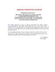
REQUEST FOR PROPOSAL - Municipal Corporation Jalandhar
REQUEST FOR PROPOSAL - Municipal Corporation Jalandhar
REQUEST FOR PROPOSAL - Municipal Corporation Jalandhar

Create successful ePaper yourself
Turn your PDF publications into a flip-book with our unique Google optimized e-Paper software.
5.0 Terms of Reference<br />
Consultancy Services for Implementation of Property Based Database on Geographical<br />
Information System Technology for <strong>Municipal</strong> <strong>Corporation</strong> of <strong>Jalandhar</strong><br />
5.1 Objectives<br />
The objective of the project is to develop a an updated property and services database using GIS<br />
technology, to enhance revenue and management functions of water supply and sewerage<br />
department and House Tax Department of MCJ and in planning and management of these services.<br />
The system proposed to be developed should provide GIS viewing and query facilities from the<br />
database, based on a networked desktop system. Specific objectives of the consultancy are:<br />
5.1.2 Strategic Objectives:<br />
To facilitate creation of a GIS based property database with various attributes as described<br />
later;<br />
5.1.2 Operational objectives:<br />
To facilitate:<br />
1. Development of location wise customer and property data base with attributes as defined<br />
separately<br />
2. Query of various attributes – property wise and customer wise<br />
3. Monitoring and management of introduction of reforms<br />
4. Tracking customer information and status on payments of water and sewerage charges,<br />
municipal taxes etc.<br />
5.2 Scope of Work<br />
The scope of work can be divided into three broad activities.<br />
5.2.1 Activity- I:<br />
The first activity shall be generation of detailed large scale property layer maps consisting of the<br />
planimetric details, administrative/ward boundaries, using the state-of-the-art technology of<br />
GIS/GPS, Image processing and property layer capture using very high resolution satellite images<br />
having better than 1m spatial resolution Pan Sharpened color imagery supplemented by the ground<br />
truth collection, and conducting household surveys for collection of attributes.<br />
- 21 -