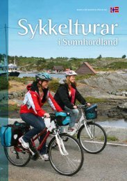
Browse the brochure - Visit Sunnhordland
Browse the brochure - Visit Sunnhordland
Browse the brochure - Visit Sunnhordland

You also want an ePaper? Increase the reach of your titles
YUMPU automatically turns print PDFs into web optimized ePapers that Google loves.
22 Trip suggestions - Sveio<br />
At Nesheim, Sveio<br />
Mølstrevåg<br />
200m<br />
Vikse<br />
0m<br />
The coastal trip in Sveio (49 km) (Sveio – Rød – Auklandshamn – Bua – Vikse – Sveio)<br />
Buavåg<br />
Auklandshamn<br />
Tjernangel<br />
Sveio<br />
Tveit<br />
0m 10km 20km 30km 40km<br />
Difficulty level: Medium<br />
Length: 49 km<br />
Surface: Tarmac and gravel road<br />
Rød<br />
The route varies from cycle path along <strong>the</strong> main road,<br />
country road through beautiful farmland and roads along<br />
<strong>the</strong> coast. There is several opportunities to take detours if<br />
you like, or possible short cuts.<br />
Where <strong>the</strong> road from <strong>the</strong> Golf-park meets <strong>the</strong> road to <strong>the</strong> village, turn left and ride on<br />
<strong>the</strong> pedestrian-/cycle-track, signposted “Bergen”, i.e. northwards alongside <strong>the</strong> main<br />
road Route 47. When <strong>the</strong> cycle-track stops, you have to cross <strong>the</strong> road; <strong>the</strong> cycle-track<br />
resumes on <strong>the</strong> right-hand side. It continues through an underpass at <strong>the</strong> intersection<br />
with <strong>the</strong> highway E39, and you ride on, past a service-station on <strong>the</strong> east side, Haukås,<br />
until you get to Rød.<br />
At <strong>the</strong> sign to “Auklandshamn”, turn left, leaving <strong>the</strong> cycle-track. This road is narrow<br />
and winding, with local traffic. On <strong>the</strong> right-hand side is Langevatnet with places for<br />
swimming and for fishing if you buy a fishing-permit. You come to a road junction with<br />
a sign to “Tjernagel”. You can make a detour here by taking <strong>the</strong> road to <strong>the</strong> right, <strong>the</strong>n<br />
walk to <strong>the</strong> recreation area Slettene, where you can swim or picnic, and <strong>the</strong>re’s a public<br />
toilet. O<strong>the</strong>rwise go to <strong>the</strong> left at that junction. There is a store at Auklandshamn.<br />
You ride south along <strong>the</strong> coast with its inlets, towards Tjernagel. There is a riding<br />
school, and a little fur<strong>the</strong>r on down a hill to <strong>the</strong> right an old harbour and fishing-port.<br />
The road goes to Bua. On <strong>the</strong> left is Storevatnet where you can swim. Just past a<br />
kindergarten (previously school) on <strong>the</strong> left, you come to a crossroads. (Straight ahead<br />
is <strong>the</strong> shortest way back to Sveio village, a hilly road with traffic to and from <strong>the</strong> ferry.)<br />
The road to <strong>the</strong> right from <strong>the</strong> crossroads, with a sign to “Bømlo”, brings you to Buavåg<br />
where a car-ferry goes from. There is a public toilet in <strong>the</strong> waiting-room.<br />
From here <strong>the</strong> road southwards, Route 541, is part of <strong>the</strong> North Sea Cycle Route, in <strong>the</strong><br />
direction of Haugesund. Just south of Buavåg you can swim in <strong>the</strong> sea at Grunnavåg, 5<br />
minutes’ walk from <strong>the</strong> road. Fur<strong>the</strong>r on at Hovda <strong>the</strong>re is a place to stop with a view<br />
over Bømlafjord running out into <strong>the</strong> North Sea passage Sletto. Continuing southwards<br />
you pass Eltravåg and come to Lyngholmsvegen. Here is ano<strong>the</strong>r possible detour, to<br />
<strong>the</strong> right out to <strong>the</strong> monument in memory of <strong>the</strong> shipwreck “D S Thor” in 1906. Route<br />
541 goes past Vandaskog and on <strong>the</strong> left is <strong>the</strong> gravel road Paddevegen, with a small<br />
red house from 1800. This is <strong>the</strong> way back, but ano<strong>the</strong>r possible detour is to ride 1/2<br />
km fur<strong>the</strong>r on to Mølstre crossroads, and turn right at <strong>the</strong> sign. “Ryvarden Kulturfyr”, a<br />
lighthouse well worth visiting. About 7 kilometres <strong>the</strong>re and back (4 km gravel).<br />
From Mølstre crossroads you turn left and ride 1/2 km back to Paddevegen. There is<br />
little traffic on this gravel road but beware, because of <strong>the</strong> forest and <strong>the</strong> hills, you<br />
don’t always see or hear it until <strong>the</strong> last minute. When you get to <strong>the</strong> asphalt, turn right<br />
and shortly left on to <strong>the</strong> cycle-track back to <strong>the</strong> shops and on to <strong>the</strong> Golf-park.