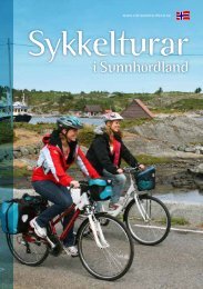
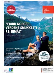
Browse the brochure - Visit Sunnhordland
Browse the brochure - Visit Sunnhordland
Browse the brochure - Visit Sunnhordland

Create successful ePaper yourself
Turn your PDF publications into a flip-book with our unique Google optimized e-Paper software.
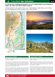
Trip suggestions - Kvinnherad<br />
13<br />
The view from <strong>the</strong><br />
main road towards Uskedalen.<br />
Cycling route – Uskedalen (18,1 km)<br />
Cycling around Uskedalen is a trip through a changing<br />
landscape. From <strong>the</strong> flat, gentle landscape down by<br />
<strong>the</strong> fjord, <strong>the</strong> valley changes as you get higher up to<br />
lush agricultural communities and on to more dramatic<br />
landscape with <strong>the</strong> sheer mountainsides of Ulvanosa<br />
towering over <strong>the</strong> valley.<br />
Uskedalen<br />
Haugland<br />
There are two roads at <strong>the</strong> bottom of Uskedalen valley, one on each side.<br />
They meet at Haugland and continue as one road all <strong>the</strong> way up to Friheim and<br />
Fjellandsbø vatnet lake.<br />
Start at <strong>the</strong> car park in <strong>the</strong> centre of Uskedalen and cycle up to Kjærlandssida and<br />
on to Haugland where <strong>the</strong> roads meet. The road <strong>the</strong>n continues past Haugland old<br />
school, which is now a museum. Guided tours by appointment; contact <strong>the</strong> cultural<br />
office of Kvinnherad municipality (tel.: +47 53 48 31 00).<br />
The valley narrows and <strong>the</strong> road passes Friheim, which is <strong>the</strong> uppermost farm<br />
in Uskedalen. This is <strong>the</strong> home of Friheim Gardsmat. This company makes meat<br />
products and has a sales outlet on <strong>the</strong> farm.<br />
Friheim<br />
Fjellandsbøvatnet<br />
200m<br />
If you cycle past Friheim, you come to Fjellandsbøvatnet lake, which is a lovely<br />
area. Please note that cattle may be grazing in <strong>the</strong> area!<br />
Return to <strong>the</strong> centre by <strong>the</strong> same route via Haugland and <strong>the</strong>n follow <strong>the</strong> left side<br />
of <strong>the</strong> valley back down to <strong>the</strong> main road.<br />
0m<br />
4km 8km 12km 16km<br />
Difficulty level: Demanding<br />
Length: 18,1 km<br />
Surface: Tarmac and gravel road<br />
Max. altitude: 210 m<br />
0m<br />
Fjellandsbøvatnet lake with<br />
<strong>the</strong> Ulvanosa mountain in <strong>the</strong> background.